Agenda
Ordinary
Meeting
 Thursday,
10 December 2015
Thursday,
10 December 2015
held
at Council Chambers, Station Street, Mullumbimby
commencing
at 9.00am
 Public Access relating to items on this Agenda can be made between 9.00am and
10.30am on the day of the Meeting. Requests for public access should be
made to the General Manager or Mayor no later than 12.00 midday on the day
prior to the Meeting.
Public Access relating to items on this Agenda can be made between 9.00am and
10.30am on the day of the Meeting. Requests for public access should be
made to the General Manager or Mayor no later than 12.00 midday on the day
prior to the Meeting.
Ken
Gainger
General
Manager
What is a “Conflict of Interests” - A conflict of
interests can be of two types:
Pecuniary - an interest that a person has in a matter because of a reasonable
likelihood or expectation of appreciable financial gain or loss to the person
or another person with whom the person is associated.
Non-pecuniary – a private or personal interest that a Council
official has that does not amount to a pecuniary interest as defined in the
Local Government Act (eg. A friendship, membership of an association, society
or trade union or involvement or interest in an activity and may include an
interest of a financial nature).
Remoteness – a person does not have a pecuniary interest in a matter
if the interest is so remote or insignificant that it could not reasonably be
regarded as likely to influence any decision the person might make in relation
to a matter or if the interest is of a kind specified in Section 448 of the
Local Government Act.
Who has a Pecuniary Interest? - a person has a pecuniary interest in a
matter if the pecuniary interest is the interest of the person, or another
person with whom the person is associated (see below).
Relatives, Partners - a person is taken to have a pecuniary interest in a
matter if:
§ The person’s
spouse or de facto partner or a relative of the person has a pecuniary interest
in the matter, or
§ The person, or a
nominee, partners or employer of the person, is a member of a company or other
body that has a pecuniary interest in the matter.
N.B. “Relative”, in relation to a person means any of the
following:
(a) the
parent, grandparent, brother, sister, uncle, aunt, nephew, niece, lineal
descends or adopted child of the person or of the person’s spouse;
(b) the
spouse or de facto partners of the person or of a person referred to in
paragraph (a)
No Interest in the Matter - however, a person is not taken to have a
pecuniary interest in a matter:
§ If the person is
unaware of the relevant pecuniary interest of the spouse, de facto partner,
relative or company or other body, or
§ Just because the
person is a member of, or is employed by, the Council.
§ Just because the
person is a member of, or a delegate of the Council to, a company or other body
that has a pecuniary interest in the matter provided that the person has no
beneficial interest in any shares of the company or body.
Disclosure and participation in meetings
§ A Councillor or a member
of a Council Committee who has a pecuniary interest in any matter with which
the Council is concerned and who is present at a meeting of the Council or
Committee at which the matter is being considered must disclose the nature of
the interest to the meeting as soon as practicable.
§ The Councillor or
member must not be present at, or in sight of, the meeting of the Council or
Committee:
(a) at any
time during which the matter is being considered or discussed by the Council or
Committee, or
(b) at any
time during which the Council or Committee is voting on any question in
relation to the matter.
No Knowledge - a person does not breach this Clause if the person did
not know and could not reasonably be expected to have known that the matter
under consideration at the meeting was a matter in which he or she had a
pecuniary interest.
Participation in Meetings Despite Pecuniary Interest (S 452 Act)
A Councillor is not prevented from taking part in the consideration or
discussion of, or from voting on, any of the matters/questions detailed in
Section 452 of the Local Government Act.
Non-pecuniary Interests - Must be disclosed in meetings.
There are a broad range of options available for managing conflicts &
the option chosen will depend on an assessment of the circumstances of the
matter, the nature of the interest and the significance of the issue being
dealt with. Non-pecuniary conflicts of interests must be dealt with in at
least one of the following ways:
§ It may be appropriate
that no action be taken where the potential for conflict is minimal.
However, Councillors should consider providing an explanation of why they
consider a conflict does not exist.
§ Limit involvement if
practical (eg. Participate in discussion but not in decision making or
vice-versa). Care needs to be taken when exercising this option.
§ Remove the source of
the conflict (eg. Relinquishing or divesting the personal interest that creates
the conflict)
§ Have no involvement by
absenting yourself from and not taking part in any debate or voting on the
issue as if the provisions in S451 of the Local Government Act apply
(particularly if you have a significant non-pecuniary interest)
RECORDING OF VOTING ON PLANNING MATTERS
Clause 375A of the Local Government Act 1993
– Recording of voting on planning matters
(1) In this section, planning
decision means a decision made in the exercise of a function of a council
under the Environmental Planning and Assessment Act 1979:
(a) including a decision
relating to a development application, an environmental planning instrument, a
development control plan or a development contribution plan under that Act, but
(b) not including the making of
an order under Division 2A of Part 6 of that Act.
(2) The general manager is
required to keep a register containing, for each planning decision made at a
meeting of the council or a council committee, the names of the councillors who
supported the decision and the names of any councillors who opposed (or are
taken to have opposed) the decision.
(3) For the purpose of maintaining
the register, a division is required to be called whenever a motion for a
planning decision is put at a meeting of the council or a council committee.
(4) Each decision recorded in
the register is to be described in the register or identified in a manner that
enables the description to be obtained from another publicly available
document, and is to include the information required by the regulations.
(5) This section extends to a
meeting that is closed to the public.
Ordinary Meeting
BUSINESS OF Ordinary Meeting
1. Public Access
2. Apologies
3. Requests for Leave of
Absence
4. Declarations of Interest
– Pecuniary and Non-Pecuniary
5. Tabling of Pecuniary
Interest Returns (s450A Local Government Act 1993)
6. Adoption of Minutes from
Previous Meetings
6.1 Ordinary
Meeting held on 19 November 2015
7. Reservation of Items for
Debate and Order of Business
8. Mayoral Minute
9. Notices of Motion and Rescission
9.1 Coastal
Hazard Management Study Byron Bay Embayment (Resolution 15-593)......... 6
9.2 Coastal
Hazard Management Study Byron Bay Embayment (Resolution 15-595)......... 8
9.3 Byron
Central Hospital Staffing and Services.................................................................. 9
10. Petitions
11. Submissions and Grants
12. Delegates' Reports
12.1 NSW
Coastal Conference (Forster 11-13 November 2015).......................................... 12
13. Staff Reports
Corporate and Community Services
13.1 Section
355 Management Committee - Appointment.................................................... 18
13.2 Report
of the Public Art Assessment Panel meeting 5 November 2015........................ 20
13.3 Meeting
Dates for Finance Advisory Committee for 2016............................................. 24
13.4 Financial
Sustainability Plan 2015/16.............................................................................. 26
13.5 Report
of the Safe Summer in the Bay PRG meeting 12 November 2015................... 29
13.6 Appointment
to the Code of Conduct panel of Conduct Reviewers .............................. 31
13.7 Crown
Lands White Paper - Summary of Issues and Government Response.............. 36
13.8 Council
Investments November 2015............................................................................. 43
13.9 Byron
Bay Paid Parking Scheme - Fee for Swipe Card................................................ 51
Sustainable Environment and Economy
13.10 PLANNING
- Outcome of meeting (res 15-110) - 10.2014.417.1 - Demolition of
existing residential flat building & construction of a new residential flat
building and associated works at 43 Lawson Street Byron Bay........................................................................................................................ 53
13.11 Compliance
Priorities Program - 2016............................................................................ 61
13.12 PLANNING
- S96 10.2013.559.3 - To permit access for light vehicles on Saturdays, Sundays
and Public Holidays between the hours of 7.00am to 6.00pm.............................................. 71
13.13 Freedom
Camping Trial - Byron Bay ............................................................................. 80
13.14 Report
of the Planning Review Committee Meeting held on 12 November, 2015........ 86
13.15 PLANNING
- Rural Land Use Strategy – Site Suitability Criteria & Mapping
Methodology and related mapping........................................................................................................................... 88
13.16 Bay
Lane - Temporary Closure....................................................................................... 93
13.17 Byron
Bay Town Centre Placemaking Seed Fund (PSF).............................................. 97
13.18 Update
on s68 applications for Approval to Operate - Brunswick Heads Holiday Parks 105
13.19 PLANNING
- Tyagarah Airstrip Planning Proposal...................................................... 109
13.20 PLANNING
- Development Application 10.2015.505.1 - Alteration and additions to existing
backpackers accommodation, including demolition of an existing dwelling and
construction of a new three level building with basement carpark to increase
capacity to 200 beds.............. 114
13.21 PLANNING
- Submissions Report - Planning Proposal for Secondary Dwellings in RU5 Village
Zone....................................................................................................................................... 135
13.22 PLANNING
- Submissions Report - Planning Proposal to rezone land at Granuaille
Crescent, Bangalow, to R2 Low Density Residential.................................................................... 137
Infrastructure Services
13.23 Infrastructure
Works in the North of the Council Area.................................................. 143
13.24 Extending
Recycled Waste Water from West Byron STP to the Byron Foreshore .... 151
13.25 Options
for Extending Exeloo Toilets at Apex Park, Byron Bay.................................. 153
13.26 Proposed
Meeting Dates for Community Infrastructure Advisory Committee Meetings 2016 161
13.27 Proposed
Meeting Dates for Water, Waste and Sewer Advisory Committee Meetings 2016 163
13.28 Proposed
Meeting Dates for Transport Advisory Committee Meetings 2016.............. 165
13.29 Federal
Drive, Goonengerry - Project Status Report................................................... 167
13.30 Belongil
Catchment Advisory Committee - Nominations for Community Representatives 172
13.31 10.2013.562.1
North Byron Beach Resort Central Facilities ET Assessment.............. 174
13.32 Tender
2015-0035 Station St Subdivision Works......................................................... 178
13.33 Byron
Bay Sewage Treatment Plant Capacity and the Belongil Fate of the Effluent.. 181
14. Reports of Committees
Corporate and Community Services
14.1 Report
of the Internal Audit Advisory Committee Meeting held on 12 November 2015 185
14.2 Report
of the Arakwal Memorandum of Understanding Advisory Committee Meeting held on
19 August 2015................................................................................................................... 188
Infrastructure Services
14.3 Report
of the North Byron Coastal Creeks Flood Risk Management Committee Meeting held
on 28 October 2015................................................................................................................. 191
14.4 Report
of the Local Traffic Committee Meeting held on 25 November 2015.............. 194
6.1 Pay
Parking and Resident Parking Permit Schemes, Byron Bay. 194
6.2 Request
for changes to. 195
6.3 Gilmore
Crescent - Restricted Parking Area. 195
6.4 Road
Closures Byron Bay Triathlon. 196
6.5 Road
Closures Byron Bay Blues Festival 197
6.6 Road
Closures Falls Festival 2015/16 Traffic Management Plan. 198
6.7 Road
Closures New Years Eve Byron Bay. 198
6.8 Road
Closures Bangalow Christmas Eve Carnival 199
6.9 Request
for Give Way, Dandaloo Way and Reka Way, Ocean Shores. 199
6.10 Request
for restrictive parking and exemptions, RFS Station, Alcorn St, Suffolk Park. 200
6.11 Approval
of two mobility permit spaces, Middleton Street car park, Byron Bay. 200
6.12 Proposed
No Parking and time limits to Loading Zones, Bay Lane, Byron Bay. 200
6.13 Request
for speed humps, Seven Mile Beach Road, Byron Bay. 200
6.14 Proposed
Massinger Street and Lawson Street roundabout, Byron Bay. 201
6.15 Proposed
Restricted Parking Area, Byron Bay Library. 201
6.16 Request
for No Stopping, Authorised Vehicles Excepted, rear of Australia Post, Deacon
Street, Bangalow 201
15. Questions
With Notice
Nil
Councillors are
encouraged to ask questions regarding any item on the business paper to the
appropriate Executive Manager prior to the meeting. Any suggested amendments to
the recommendations should be provided to the Administration section prior to
the meeting to allow the changes to be typed and presented on the overhead
projector at the meeting.
Notices of Motion and Rescission 9.1
Notices of Motion
Notice of Rescission Motion No. 9.1 Coastal
Hazard Management Study Byron Bay Embayment (Resolution 15-593)
File
No: I2015/1469
|
We move that Council rescind Resolution Nos. 15-593
from its Ordinary meeting held on 19 November 2015 which reads as
follows:
15-593 Resolved:
1. That Council
notes:
a) version 5 "Coastal
Hazard Management Study Byron Bay Embayment" submitted in November 2015
by Council's consultants at the Water Research Laboratory of the University
of NSW and the incompleteness of Stage 3 investigations for Sand Nourishment.
b) Office of Environment
and Heritage comments in its letter of 18/8/15 (E2015/53385; page 458 of
today's Agenda) including the need for further investigations if an
"adaptive management approach" is adopted, especially the need to
investigate the Dedication of an appropriate long-term sand nourishment source.
c) Office of Environment
and Heritage comments in its letter of 28/10/15 (E2015/72885; page 463 of
today's Agenda) on the Cost Benefit Analysis where OEH found after correcting
errors and assumptions that the ranking of options changed and that Planned
Retreat has become the top performing option.
d) DPI Crown Lands comments
of 16/10/15 (E2015/72888; page 468 of today's Agenda).
e) Rob Stokes Minister of
Planning letter of 19/10/15 on the Draft Coastal Zone Management Plan
(S2015/13004; page 476 of today's Agenda) including that Council cannot
expend state grant funds for this CZMP after December 2015.
2. That Council also
notes that as a result of Office of Environment and Heritage comments on
28/10/15 about the Cost Benefit Analysis (CBA; Appendix N of WRL's "Coastal
Hazard Management Study Byron Bay Embayment") a workshop will be
convened with the objective of reviewing and revising the CBA in a
collaborative fashion and that a further Council report will detail the
outcome of that workshop, which will include the WRL consultants and their
sub-consultants Griffith Centre for Coastal Management plus OEH, Council
staff and Councillors. (Cameron/Richardson)
|
If successful we intend to move:
1. That
Council notes the Coastal Hazard Management Study Byron Bay Embayment November
2015, as prepared by the consultants at the Water Research Laboratory,
University of NSW.
2. That
Council notes that as a result of the Office of Environment and Heritage (OEH)
comments on the Cost Benefit Analysis (CBA) at Appendix N of the Coastal Hazard
Management Study Byron Bay Embayment, November 2015, a workshop will be
convened with the consultants, Water Research Laboratory and Griffith Centre
for Coastal Management (sub consultant), OEH and Council staff, with the
objective of reviewing and revising the CBA, where necessary, in a
collaborative fashion, and that a further Council report will detail the
outcome of this workshop.
Signed: Cr
Diane Woods
Cr Sol Ibrahim
Cr Alan Hunter
Notices of Motion and Rescission 9.2
Notice of
Rescission Motion No. 9.2 Coastal
Hazard Management Study Byron Bay Embayment (Resolution 15-595)
File
No: I2015/1470
|
We move that Council rescind Resolution Nos. 15-595
from its Ordinary meeting held on 19 November 2015 which reads as
follows:
15-595 Resolved:
1. That
Council commission an independent report from a qualified practitioner with
experience in coastal morphology that provides a review and explanation of
Planned Retreat methodology and options that may be considered in a Coastal
Zone Management Plan (CZMP) specifically written to assist community
understanding of Planned Retreat options and methodology prior to and during
consultation for and consideration of a CZMP and associated documents.
2. That
Council undertake appropriate analysis of sand transfer/nourishment
methodology, including source of sand, frequency of transfer and costs prior
to exhibition of the draft CZMP.
3. That
funding for points 1 and 2 above be drawn from the Risk Management Reserve
(5013.209) up to $40,000. (Cameron/Richardson)
|
Signed: Cr
Diane Woods
Cr Sol Ibrahim
Cr Alan Hunter
Notices of Motion 9.3
Notice of Motion No. 9.3 Byron
Central Hospital Staffing and Services
File No: I2015/1478
|
I move:
1. That
Council Lobby both the Hon. Jillian Skinner, NSW Health Minister and
Hon. Walt Secord, NSW Shadow Minister for Health to express Council’s
concerns regarding a number of key issues surrounding the opening of the Byron
Central Hospital in 2016.
2. That
Council’s concerns include:
a) The
proposed reduction in local health jobs with the opening of the Byron Central
Hospital.
b) The
potential loss of local health services including:
- Surgical
services
- Allied
Health Services
- Speech
and Occupational Therapies
- Rehabilitation
Services
c) Express
concern over the lack of planning to provide:
- Transportation
services to and from the hospital
- Support
for local community organisations to deal with an increased number of people
living with mental health issues in our community.
|
Attachments:
1 BCH
Consultation Paper Final, E2015/77041
Councillor’s Background Notes:
Guarantees
provided by the NSW State Government and NSW Health that the opening of the Byron
Central Hospital would deliver the same level of health services or better are
now known to be false.
Hospital staff
being told they would not have to reapply for existing positions is, also, now
known to be false.
Potential job
losses include:
- 3
administration staff
- 1
maintenance staff
- 8
nursing staff
- 1
Allied Health Assistant
Loosing these
positions means that long term residents of our Shire (some with over 25 years
at the hospital) will be forced to leave the area to find employment elsewhere.
It is not only the hospital jobs we loose it is the families that go with these
positions e.g. a local school teacher, a paramedic, community volunteers and
school children.
While frontline
services will be cut there will be an increase in middle management positions
due to the size of the facility (e.g. a new Finance Management position).
The information
provided by NSW Health at a recent community forum regarding the facilities to be
offered at the Byron Central Hospital included:
- 14
Emergency Department spaces;
- 43
overnight inpatient beds;
- 2
Maternity beds and 1 birthing suite; and
- 20 bed
non-acute inpatient mental health unit
It now appears
from the recently distributed workforce plan (Attachment: BCH Consultation
Paper) that the hospital will open with only enough staff to cover 21 overnight
inpatient beds. The total number of beds offered through both Byron Bay and
Mullumbimby Hospitals is 32.
It is worth
noting that the Byron Central Hospital will be the only Level 3 hospital in NSW
that does not have a functioning operating theatre.
Recommended priority relative to other Delivery Plan
tasks:
SC1: Support
communities to achieve equitable access to an appropriate range and level of
whole of life services such as healthcare, education and housing.
Definition of the project/task:
Lobby both the Hon. Jillian Skinner, NSW Health Minister and
Hon. Walt Secord, NSW Shadow Minister for Health to express concerns regarding
a number of key issues surrounding the opening of the Byron Central Hospital in
2016.
Signed: Cr
Paul Spooner
Management Comments by Mark Arnold, Director Corporate and
Community Services:
(Management Comments must not include formatted
recommendations – resolution 11-979)
Clarification of project/task:
The Notice of Motion authorises the lobbying by Council of
the NSW Health Minister and the NSW Shadow Minister for Health, by means of
verbal or written submissions on the concerns listed in Part 2 (a), 2 (b) and 2
(c) of the Notice of Motion. The concerns relate to a number of issues that
could impact on the delivery of health services to the Byron Shire Community
following the opening of the Byron Central Hospital in 2016.
Director responsible for task implementation:
The Notice of Motion is authorising Council or its delegated
representatives, to lobby the NSW Health Minister and the NSW Shadow Minister
for Health, in relation to the listed concerns.
Relationship to, priority of, and impact on other
projects/tasks:
There would be minimal impact on other adopted projects or
tasks.
Financial and Resource Implications:
The action authorised would be undertaken within existing
allocated budgets.
Legal and Policy
Implications:
The delegated representatives
would include, unless otherwise determined, the Mayor and the General Manager.
The adopted Resolution would both authorise the making of verbal
or written submissions to the NSW Health Minister and the NSW Shadow Minister
for Health, by or on behalf of Council, and would list the concerns of the
Council to be included in those submissions.
Delegates' Reports 12.1
Delegates' Reports
Delegate's Report No. 12.1 NSW
Coastal Conference (Forster 11-13 November 2015)
File
No: I2015/1479
|
It‘s a
great honour to be sent to such a great cauldron of learning by Council and
therefore my community. I thank you.
The Conference offers such great learning because the
presenters (academics, consultants and Council staffers) truly share what
they know and what they don’t know. Even the private company
people aren’t standing up to say come buy my wares. It’s a
wonderful gathering.
Three streams operated for much of the Conference.
One page synopses appear in the Program & Abstract Book, that
I’m sure would appear on the conference website.
The following reports are on the talks I attended, under
the name of the lead author only (see the actual Abstracts for details, also
printed in order of lead author). My notes augment the Abstracts by the
presenter:
Session 1 – plenary
1. Glenn
Handford, GM Great Lakes Council:
· Water quality Objectives are written into the LEP.
· Council has a program to buy and restore coastal
wetlands.
· The sequence is planning then on-ground action and
followed up by monitoring.
2. Tim
Foresman, QUT:
· Oceans are finite - he showed the volume of the
earth’s H2O as a sphere against the size of the planet
itself. The ratio was a marble to a soccer ball.
· Atmosphere is likewise finite, maybe an apricot to a
soccer ball.
· Pivotal Principles include open data.
3. Mike
Daniels, The Behavioural Architects:
· Behavioural Economics. Don’t ask people about
their behaviour, just observe it.
· Example of effective advertising for compliance “9
out 10 pay their bill on time”.
Session 2
4. Verity
Rollason of BMTWBM on beach fluctuations:
· A wall was built at Merewether Beach after the 1974
event. The beach then accreted but the wall has recently been exposed,
with no large events just persistent east and south weather.
· She challenges the widely accepted rule-of-thumb for 225m3/m
sand loss in events.
· Examples include Kingscliff; and Tathra where the river
entrance was washed out and then replaced with 265m3/m from along
the same beach.
· Official Hazard Lines should recognise all erosive processes,
not just sea swell.
5. Peter
Horton of Royal Haskoning DHV on setbacks based on acceptable risk:
· Design life 60 years adopted. (Duncan: this is
way too short)
· Probabilistic hazard lines instead of
deterministic.
· Use the Australian Geomechanics Society procedures for
landslip risk management.
· Examine the consequences for properties: e.g.
“minor” damage = up to 10% repair cost. Buildings on pile
foundations for example then suffer less damage.
· Because DAs never lapse, access to the buildings also has
to be maintained.
· This approach overcomes the scenario where a conservative
CZMP is then rejected by a pro-development Council. (Duncan: sound
familiar?)
· Does NSW need to time-limit DA approvals on the
coast?
6. Chris
Sharples of Uni of Tasmania on whether SLR is causing stuff already:
· There is variability in responses to erosive
forces.
· Roches Beach was stable 1946 to 1974 then eroded until
2011, without major events.
· In contrast, North Roches Beach has not eroded.
· The variability may be due to other factors, like
on-going recovery from sand mining.
· There are also one-way erodible shores, e.g. soft rock
such as the Twelve Apostles.
· Roches Beach is inside a bay that may have net sand loss
in the long term.
· Other factors of climate change may be at work, e.g.
increased wind speed (and wind waves).
7. James
Carley of WRL (UNSW) on probabilistic hazard lines:
· “Legacy sites” like Belongil versus
Greenfield sites, where development may gain approval.
· A climate scenario isn’t a prediction with a
likelihood, it is just has feasibility.
· A Monte Carlo analysis estimates 26m inland movement in
100 years at Avoca Beach. Similarly 24m for Cabarita Beach.
· The NSW Flood Manual derives annual average damage, on
the basis of a full rebuild. Coastal management needs to consider
triggers that lead to retreat instead. (Duncan: I fully agree)
Session 3
8. Alexandra
Macvean of Great Lakes Council on Coastal Risk maps in their LEP:
· Introducing an Integrated Coastal Management (ICM)
program.
· The info should be ion the LEP.
9. Gary
Blumberg of Royal Haskoning DHV on Wooli Beach:
· Recession measures 0.3 to 0.5m per year, and 0.4m/year in
the village.
· There are 44 houses now threatened. This will rise
to 159 at 2100.
10. Michael
Kinsela of OEH on complex geomorphology:
· Sediment sharing systems (sources, sinks and pathways).
· Managing systems, not just beaches.
· The Bruun Rule doesn’t consider SLR.
11. Jane
Lofthouse of Tweed Council on Kingscliff:
· A seawall was completed in August 2010 and exposed in
October 2010.
· May relate to El Nino and La Nina cycles.
· Their sand source is the Tweed River. Cost is $10/m3
placed.
· The area has 3 precincts, central one with protection but
no investment allowed.
12. Symon
Walpole of Lake Macquarie Council on the Lake’s CZMP:
· CZMP has four parts: A coastline, B estuary, C channel,
and then D = 4-year Action Plan.
· 10,000 houses in the inundation hazard area (estuary and
channel).
Session 4
13. Amy
Dougherty of Uni of Wollongong on beach morphodynamics:
· Understanding beach morphodynamics by examining paleo-beachfaces.
· Ground penetrating radar (GPR) to map the old beach faces
– shape due to storm-cut.
· Optically Stimulated Luminescence (OSL) to date beach
sediments.
· Extends knowledge in beach behaviour back into times of
higher and lower sea levels.
· The Moruya study shows that beach filling since 7,000
years ago, at 0.28m/year.
14. Luke
Jeffrey of Southern Cross Uni on acid and CO2 inputs from
groundwater into Cudgen Lake:
· At low flows, acidity is located in the creek of the
floodplain.
· Clothiers Creek floodplain is remediated, Reserve Creek
is not.
15. Daniel
Glove of Greater Taree Council on acid sulphate rehabilitation of Big
Swamp:
· The swamp had Pipeclay Creek as inflow and Cattai Creek
as outflow then they were joined by Pipeclay Canal in 1905. By 1912 the
water was crystal clear but undrinkable.
16. Alexa
Troedson of Geological Survey on their new products:
· Coastal Quaternary maps cost $19.80 each.
· The Seamless Geological data package (our area is in zone
56).
17. Elaine
Pearce of Old Bar Beach Sand Replenishment Group on the group’s
history.
Session 5
18. Emma
Johnston of Uni of NSW on Bio-invasion:
· Contaminants reduce biodiversity. Other drivers
include loss of habitat.
· Copper as antifouling (TBT also used briefly) and
shipping are wiping out native species and introducing replacement
species.
· There are great arguments for cleaning up legacy
contamination, such as in boat harbours.
· The sediment-water interface is important for nitrogen
recycling. DNA testing at $5/sample can give a current
“fingerprint” for an estuary.
19. Panel
discussion on the Forster/Tuncurry Embayment:
19.1 Bruce Thom:
· Peter Rays classified estuaries in the 1980s. Then
added off-shore sediments.
· The Embayment became a sink for sediment and none travels
north of it.
19.2 Peter Cowell:
· The biggest uncertainty is how the seabed will respond to
SLR.
· Forster/Tuncurry has preserved its answers for past
SLR. The model was able to post-dict that most of its deposition is off
the sea floor.
· Sea level has been stable for 6,000 years but the coast
is still busy responding to sea level changes of the preceding 20,000
years.
· In some places the seabed will be source and in other
sink for sand. Current models are too simplistic in applying one rate
for all beaches.
19.3 Michael Kinsela:
· Active shore-face will respond quickly to SLR but
off-shore profile needs longer.
· Response speed decreases with water depth so change in
coastal seabed shape will take way longer than the century or two of
SLR.
19.4 Marc Daley:
· Forster/Tuncurry barrier may continue to pro-grade in
on-going response to former sea level changes.
· The continental shelf gets wider towards north of
NSW.
· Other locations may change from pro-grade to static or
from static to degrade.
Session 6
20. David
Rissik of NCCARF on developing a web-based Tool for coastal management.
21. Jane
Smith of Community Environment Network on citizen science:
· Monitoring by locals, e.g. Waterwatch, Bugwatch,
etc.
· Funding and coordination through Local Land
Services.
22. Andrew
Staniland of Great Lakes Council on Jimmys Beach at Hawkes Nest:
· The bay faces south-east and headlands focus wave energy
on Jimmys.
· 48 houses on beachfront separated by The Boulevard.
· First sand source was sand captured as beach inside the
eastern headland. Sand was carried along the beach by scrapers but the
source ran out. Second source was an abandoned sand mine with transport
by truck; 389 truckloads in one 4-day event; also ran out. Now looking
at a new source to the west at the river mouth. This will need sand
pumping.
· Big problems are no source identified; definition of
“event”; ongoing monitoring; funding.
23. Mark
Kulmar of NSW Public Works on Wave Toolbox:
· The toolbox will give wave climate at 100m spacing along
the coast at 10m water depth and at 1km spacing for 30m depth.
24. Patrick
Lawless of Royal Haskoning DHV on Old Bar sand tracing study:
· 3 houses destroyed in 2008, STP and other assets at risk.
· Reefs offshore affect sand transfer and wave
deflection.
· The tracer has SG 2.65 like sand, and similar grain size
125-500μm.
25. Angus
Gordon of Coastal Zone Management and Planning on beach scraping:
· Nature Assisted Beach Scraping (NABE) won’t stop
long term recession. Slows it down.
· Dunes are nature’s seawalls.
· NABE-ing from the swash zone accelerates on-shore drift
and supports earlier vegetation.
· Machine size and type depends on conditions, e.g.
excavator in swash zone, dozer from there.
· It ruins the machine so contractors will want large areas
at once.
· Needs to be out of beach season and out of nesting
seasons.
· $140 to $250 per metre along beach.
Session 7
26. Field trip to Boomerang
and Blueys Beaches.
Session 8
27. Rob
Stokes Minister for Planning on 2016 coastal legislation:
· NSW coast has 755 beaches.
· Legacy issues around past mistakes at beaches.
Avoid them in the future.
· The coast is ambulatory. Enshrining free access to
beach.
· There will be a Bill not an Act. The draft is
online now via <haveyoursay.nsw.gov.au> until 29 February. There
will be consultation and participation.
· Coastal zone will be mapped as four areas: coastal
wetlands and rainforests; vulnerable areas; environmental areas; coastal use
areas.
· New SEPP replacing SEPP14 coastal wetlands; SEPP26
littoral rainforests; SEPP71 coastal protection; the Infrastructure SEPP
where it relates to coast; and the SEPP on canal estates.
· New Coastal Management Manual with Part A mandatory, Part
b guidance, Part C toolkit.
· Includes a schedule of coastal compartments - Councils
will consult each other.
· Councils will develop Coastal Management Programs, in
lieu of CZMPs.
· Councils currently engaged in preparing a CZMP should
continue. (Duncan: this applies to us)
· By 2021 all CZMPs will cease and CMPs must be in place to
replace them.
· Coastal Management will be locked into Integrated
Reporting.
· The state will establish a new Coastal Council, external
to Government.
· Councils now preparing a CZMP should not stop, they are
not expected to start again.
28. Panel
and Q&A:
· Clause 5.5 of “standard instrument” is also
going across.
· The new system will identify values and aspirations of
local community.
Session 9
29. Mingzhu
Wang of Macquarie Uni on seawater inundation:
· A powerful GIS tool showing assets and damage due to SLR
and storms.
· Mapping layers for 0.5m and 1m inundation, not by
“bathtub” approach. It uses knowledge gained from tidal
gauge network.
· The tool shows infrastructure and quantifies exposure to risks.
30. William
Glamore of WRL (UNSW) on the Hunter River estuary:
· Settled from 1801 then dredging, filling, levees,
Kooragang Island 1990, RAMSAR wetlands.
· Good governance and data storage so that each project
doesn’t have to start from scratch.
31. Michelle
Fletcher of BMTWBM on Estuary Management Plan reviews:
· To date most expenditure has been on end of pipe
hardware, especially for metro Councils.
· GPTs can do more harm than good if they are not
maintained.
· Changes to planning controls are more challenging.
32. J
Dela-Cruz but presented by Tim Pritchard of OEH on effect based assessment
(EBA):
· Waterway health rather than just reducing inputs to
waterways, i.e. determine the impacts.
· Risk analysis per ISO3100 examines likelihood and then
consequences on health.
Signed: Cr
Duncan Dey
|
Staff Reports - Corporate and Community Services 13.1
Staff Reports - Corporate and Community
Services
Report No. 13.1 Section
355 Management Committee - Appointment
Directorate: Corporate
and Community Services
Report
Author: Gayle
McCallum, Governance Officer
File No: I2015/1385
Theme: Corporate Management
Governance Services
Summary:
Council has received a request for new membership to the
Byron Library Exhibition Space (managing the Lone Goat Gallery) Section 355
Management Committee. An Expression of Interest for Membership has been
received.
This report aims to appoint a new member to the Committee.
|
RECOMMENDATION:
That Council appoint Maureen Lightfoot to the
Byron Library Exhibition Space (managing the Lone Goat Gallery) Section 355
Management Committee for this term of Council ending September 2016.
|
Attachments:
1 Confidential
- Expression of Interest from Maureen Lightfoot to Byron Library Exhibition
Space (managing the Lone Goat Gallery ) Section 355 Management Committee, E2015/73335
Report
Byron
Library Exhibition Space (managing the Lone Goat Gallery) Section 355 Management
Committee
Council has received a request from the Byron Library
Exhibition Space (managing the Lone Goat Gallery) for further members to be
appointed to the committee to assist with specific duties such as a public
relations officer and assistant Treasurer. Advertisements were placed
seeking a Public Relations Officer and the Committee also had a stall at a
Byron Community Centre Volunteer Open Day recently held.
Current members on this Committee are:
Cr
Alan Hunter
Margaret
White (Chairperson)
Jay
Pearse (Vice Chairperson)
Helene Sheean (Curator)
Turiya Bruce (Curator)
Prue Regan (Secretary)
Howard Sedgmen (Treasurer)
Through the Volunteer open day, the committee invited Maureen
Lightfoot to observe meetings of the Committee to ascertain her
interests. She has since lodged an Expression of Interest with Council
for formal membership to assist the Treasurer on the Committee.
Management Recommendation: The Committee is
very conscientious with exhibitions booked solidly throughout 2016. The
Committee meets monthly and are presently working on a Strategic Plan for the
gallery. It has been recommended that Maureen Lightfoot be appointed to
the Committee.
Financial Implications
Community Members of Section 355 Management Committees are
volunteer positions unless otherwise resolved by Council.
Statutory and Policy Compliance Implications
Section 355 Committees operate under Committee Guidelines in
which Committee membership it states
3.2 Committee Membership
The
Committee membership will number not less than four (4) and not more than
twelve (12) members as appointed by Council including office bearers unless
otherwise decided by Council. Council reserves the right to appoint a
Councillor to each Committee.
Further information on the operations and meeting minutes
for these Committees can be found on Council’s web site at http://www.byron.nsw.gov.au/section-355-committees.
Staff Reports - Corporate and Community Services 13.2
Report No. 13.2 Report
of the Public Art Assessment Panel meeting 5 November 2015
Directorate: Corporate
and Community Services
Report
Author: Joanne
McMurtry, Community Policy Officer
File No: I2015/1390
Theme: Society and Culture
Community Development
Summary:
A Public Art Assessment Panel meeting was held on 5 November
2015. This report provides the minutes of the meeting. A number of public art
items were discussed and the recommendations presented in this report are
supported by staff. Some of the items require additional information to be
provided to Councillors as part of this report.
|
RECOMMENDATION:
1. That
Council amend the DCP Chapter D8 ‘Public Art’ to include under
‘Prescriptive Measures’ point 2 “In lieu of providing Public
Art, the applicant could enter into a Voluntary Planning Agreement with
Council to provide an equivalent financial contribution for the installation
of Public Art in a suitable location.”
2. That
Council to commission public artwork as per the ‘Briefs’ provided
on the following water and sewer infrastructure in the Byron Shire, to
be funded from water and sewer budgets:
a) Brief
1: Water Infrastructure
· Paterson’s
Hill Water Tank
· Wategos
Water Tank
b) Brief
2: Sewer Infrastructure
· Several
sewerage pump stations (selected locations listed in the report, limited by
budget allocation for the 2015/16 financial year)
3. That
Council accept the temporary loan of ‘The Beast Within’ by Allan
Horstmanhoff and allow the sculpture to remain in situ following the
Brunswick Nature Sculpture Walk event in October 2015 for up to twelve
months.
4. That
Council accept the temporary loan of ‘Beautiful Nature’ by Jules
Hunt and allow the sculpture to remain in situ following the Brunswick Nature
Sculpture Walk event in October 2015 for up to twelve months.
5. A.
That the Public Art Assessment Panel note the presentation provided by
‘Creative Road’ and recommend to Council to support the concept
of the beautification proposal for Lawson Lane as one of the initial projects
arising from the Byron Bay Town Centre Masterplan for reasons listed below:
a) It
meets many of the objectives of the Public Art Policy and will have excellent
outcomes to further public art in the Shire
b) Is
has the potential to be the ‘lighthouse’ project that will
provide a benchmark for future public art projects
c) There
are opportunities to provide mentorship for young local artists
B.
The Public Art Assessment Panel recommend that Council be a key stakeholder
in the development and implementation of this proposal.
6. That
Council support the Brunswick Heads Ten Seat Project by making a donation of
$2,000 to the Tweed Street Taskforce being $1,000 for the ‘Youth
Seat’ and $1,000 for the ‘Fishing Seat’ pending full and
final concept designs for both seats.
|
Attachments:
1 Minutes of
Public Art Assessment Panel meeting held 5 November 2015, E2015/72538
2 byron_shire_development_control_plan_dcp_2014-part_d_chapter_d8_-_public_art,
E2015/73892
3 Brief -
call for Expressions of interest from Arakwal artists for indigenous artwork on
Byron Shire Water Infrastructure, E2015/70665
4 Call for
Expressions of Interest for artistic treatment of Byron Shire Water
Infrastructure (Sewer Pump Stations), E2015/70712
Report
A Public Art Assessment Panel meeting was held on 5 November
2015. The minutes of the meeting are provided in attachment one.
A number of public art items were discussed and the
recommendations presented in this report are supported by staff. Some of the
items require additional information to be provided to Councillors, as follows:
Public Art in new development
The Panel have been involved in discussions with a new
developer regarding the public art contribution of the new development
according to the DCP 2014 Chapter D8 “Public Art”. The Panel have
made the following recommendation to Council. The DCP 2014 Chapter for Public
Art is included at attachment two for Councillors information.
RECOMMENDATION 5.1:
That the Public Art Assessment
Panel recommend to Council to amend the DCP Chapter D8 ‘Public Art’
to include under ‘Prescriptive Measures’ point 2 “or make an
equivalent contribution to Councils public art budget.”
Staff advice is that the wording of such a change would need
to include the developer entering into a Voluntary Planning Agreement with
Council, which would legally be clearer and satisfy the objectives of D8.2.1
which states ”to facilitate the provision of public art through the
development process”.
Therefore the staff recommendation is:
“In lieu of providing Public Art, the applicant could
enter into a Voluntary Planning Agreement with Council to provide an equivalent
financial contribution for the installation of Public Art in a suitable
location.”
Public Art on Byron Shire Water Infrastructure
The Panel discussed the ‘briefs’ to be used to
advertise for Expressions of Interest in this project and the
‘briefs’ are included in attachments 3 and 4. The Panel made the
following recommendation to Council.
RECOMMENDATION 6.1:
That the Public Art Assessment Panel recommend to Council
to commission public artwork as per the ‘Briefs’ provided on the
following water infrastructure in the Byron Shire, to be funded from water and
sewer budgets:
Brief 1: Water Infrastructure
· Paterson’s
Hill Water Tank
· Wategos
Water Tank
Brief 2: Sewer Infrastructure
· Several
sewerage pump stations (selected locations listed in the report, limited by
budget allocation for the 2015/16 financial year)
Financial Implications
Most recommendations are loans to Council, with the
exception of recommendation 6.1 for public art to be installed on Council water
and sewer infrastructure. Funds have been identified within water and sewer
budgets for 2015/16 as follows:
Paterson Street
Reservoir $75,000
Wategos
Reservoir
$25,000
Warrumbool Rd Reservoir $25,000
Pump
Stations $20,000
Statutory and Policy
Compliance Implications
Public Art Policy
Public Art Guidelines and Criteria
Staff Reports - Corporate and Community Services 13.3
Report No. 13.3 Meeting
Dates for Finance Advisory Committee for 2016
Directorate: Corporate
and Community Services
Report
Author: Mark
Arnold, Director Corporate and Community Services
File No: I2015/1397
Theme: Corporate Management
Financial Services
Summary:
The purpose of this report is to schedule meeting dates for
the Finance Advisory Committee for 2016 and to determine the preferred time to
commence the meetings.
|
RECOMMENDATION:
That the following dates be adopted for the Finance
Advisory Committee's meetings for 2016 and that the meetings commence at
2.00pm.
· Thursday,
18 February 2016
· Thursday,
12 May 2016
· Thursday,
18 August 2016
· Thursday,
10 November 2016
|
Report
Proposed Meeting Schedule and Meeting Time
The Constitution for the Finance Advisory Committee's states
that the Committee will meet as required.
The Constitution under Section 2 – Objectives states
the purpose of the Committee as being to:
a) assist in the development of draft budgets
b) assist in the format of the annual report,
and
c) consider other financial information and matters as they
arise”
In relation to part c) Council has determined that the
Finance Advisory Committee should receive progress reports on the
implementation of the Financial Sustainability Project Plan (refer Resolution 13-148)
and the Committee has also requested that the Quarterly Budget Review, be
presented to the Committee for its consideration, prior to it being presented
to Council.
To facilitate the presentation of both these reports to the
Committee on a quarterly basis, and to allow for the scheduling of other
reports, it is recommended that the Council determine the dates for the required
quarterly meetings.
Other meetings may need to scheduled, from time to time,
during the year to consider the other matters, such as the development of
budgets, along with the development of other plans and policies, required by
the Integrated Planning and Reporting Framework.
The following dates have been proposed, based on the Finance
Advisory Committee meetings, being one week prior to the Ordinary Meetings, at
which Council's quarterly budget review will be reported.
· Thursday, 18 February
2016
· Thursday, 12 May
2016
· Thursday, 18
August 2016
· Thursday, 10
November 2016
The recommendation also provides for a preferred time to
commence the meetings. The recommended time of 2.00pm has been proposed on the
basis that all of the proposed dates are the same, as dates proposed for the
Internal Audit Committee which commences at 11.00am.
Financial Implications
Nil.
Statutory and Policy Compliance Implications
The Finance Advisory Committee's Constitution states:
· at section
11 that "Meetings [are] to be held as required."
Staff Reports - Corporate and Community Services 13.4
Report No. 13.4 Financial
Sustainability Plan 2015/16
Directorate: Corporate
and Community Services
Report
Author: Mark
Arnold, Director Corporate and Community Services
File No: I2015/1398
Theme: Corporate Management
Financial Services
Summary:
Council at its Ordinary meeting held on 9 May
2013 adopted a Financial Sustainability Plan (“FSP”) for the
2013/2014 financial period (refer Resolution 13-238).
This was the initial FSP developed and adopted
by Council, and was prepared in accordance with part 3 of Council Resolution
13-148, to provide a strategic approach to the management of the Financial
Sustainability of Council.
Resolution 13-148, adopted by the
Strategic Planning Committee, at its meeting held on 28 March 2013, provided
the framework for the development the FSP.
The FSP provides a means for Council to
communicate on the actions and strategies proposed to
manage the financial sustainability of the organisation in the short, medium
and long term.
This report has been prepared to allow Council to consider
the third version of the Financial Sustainability Plan
for the 2015/2016 financial period.
|
RECOMMENDATION:
That Council adopt the Draft Financial Sustainability
Plan 2015/2016 (#E2015/71097).
|
Attachments:
1 Draft
2015-2016 Financial Sustainability Plan, E2015/71097
Report
This report has been prepared to allow Council to consider
the draft “Financial Sustainability Plan 2015/2016”
(FSP 2015/2016).
The FSP 2015/16 is the third version of the
FSP prepared for consideration by Council.
The first version of the FSP, FSP 2013/2014
was adopted by Council on 9 May 2013 via Resolution 13-238.
The second version of the FSP, FSP 2014/15
was adopted by Council on 7 August 2014 via Resolution 14-326.
During the course of the 2014/15 financial
year, work on the implementation of the actions detailed in the individual
chapters of the 2014/15 FSP was undertaken, with the outcomes progressively
reported to the Finance Advisory Committee on a quarterly basis on 22 August
2013, 13 November 2014, 19 February 2015 and 14 May 2015 with the final report
for the 2014/15 financial year submitted to the FAC meeting scheduled for 20
August 2015.
The FSP 2015/2016 has been developed using
a similar format to that of FSP 2014/2015 but has been amended to reflect the
actions undertaken and the impact of the outcomes from these actions on the
future strategic management of Council’s financial sustainability.
The relevant chapters in the FSP 2015/2016
have been prepared to detail what is proposed for the 2015/16 financial year.
The Action Plan is a summary of the actions
detailed in the FSPP for the following chapter areas:
· Expenditure
Review
· Revenue
Review
· Land Review
and Property Development
· Strategic
Procurement
· Policy and
Decision Making
· Potential
Commercial Opportunities
· Volunteerism
· Collaborations
and Partnerships
· Asset
Management
· Long Term
Financial Planning
The Action Plan will be completed and included in the
2015/16 FSP when adopted by Council and will be developed from the Actions
included in each Chapter. The Action Plan will then be reported to the FAC each
quarter starting with the December quarter.
A copy of the draft “Financial
Sustainability Plan 2015/2016” has been included at Attachment
1 to this report.
Financial Implications
The draft “Financial
Sustainability Plan 2015/2016” forms part of the strategic approach
adopted by Council in managing the short, medium long term sustainability of
Council. The Plan needs to be considered in context with the adopted annual
Operational Plan, the Quarterly Budget Reviews and the Long Term Financial Plan
when Council is considering the financial impacts of specific activities,
projects and Services. The FSP also includes and considers the strategies set
out in the Council’s adopted Council Improvement Plan (“CIP”)
submitted in June 2015 to the Office of Local Government.
Part 2 of Resolution 13-148 requires
the General Manager to prepare reports on specific elements of sustainability reform package detailed in the FSP, including any rationalisation
of Council's property portfolio and the associated establishment of an
Infrastructure Renewal Fund. The Infrastructure Renewal Fund was established by
Council by Resolution 13-170 and the terms of operation for this Reserve
were adopted by Council on 9 May 2013 via Resolution 13-239.
In accordance with Part 4 of Resolution 13-148
the General Manager will continue to prepare and submit progress reports on the
implementation of the draft “Financial Sustainability
Plan 2015/2016” to the Council's Finance Committee on a quarterly
basis.
Statutory and Policy Compliance Implications
The FSP has been developed as a tool to assist Council in
its ongoing obligations as defined in Section 9 (The Council’s charter),
Section 8 of the Local Government Act 1993.
Section 8 of the Local Government 1993 provides (in part)
that Council as part of its Charter consider the following principles:
· to exercise
community leadership
· to have regard to
the long term and cumulative effects of its decisions
· to bear in mind
that it is the custodian and trustee of public assets and to effectively plan
for, account for and manage the assets for which it is responsible
· to engage in
long-term strategic planning on behalf of the local community.
Staff Reports - Corporate and Community Services 13.5
Report No. 13.5 Report
of the Safe Summer in the Bay PRG meeting 12 November 2015
Directorate: Corporate
and Community Services
Report
Author: Joanne
McMurtry, Community Policy Officer
File No: I2015/1399
Theme: Society and Culture
Community Development
Summary:
A Safe Summer in the Bay PRG meeting was held on 12 November
2015 and this report provides the minutes of that meeting.
|
RECOMMENDATION:
That Council note the Safe Summer in the Bay PRG
minutes from 12 November 2015 meeting.
|
Attachments:
1 Minutes of
the Safe Summer in the Bay PRG 12 November 2015, E2015/74280
Report
A Safe Summer in the Bay PRG meeting was held on 12 November
2015. The minutes of the meeting are provided in Attachment 1.
Progress against the objectives of the Plan for New Year in
Byron Bay 2015 was discussed.
The committee made no recommendations to Council.
Financial Implications
Council has allocated a budget of $112,100 for New
Year’s Eve 2015/16.
Statutory and Policy
Compliance Implications
Plan for New Year in Byron Bay 2015
Staff Reports - Corporate and Community Services 13.6
Report No. 13.6 Appointment
to the Code of Conduct panel of Conduct Reviewers
Directorate: Corporate
and Community Services
Report
Author: Ralph
James, Legal Services Coordinator
File No: I2015/1402
Theme: Corporate Management
Governance Services
Summary:
Since the adoption of the Code
of Conduct in 2013, there has been a move away from a mediation emphasis to
more of an investigation approach. Many, if not most, of Council’s
present Conduct Review Panel appointments have strengths in the area of
mediation but less so in respect of the area of investigation and assessment
and evaluation of evidence.
The General Manager and the Code of Conduct Coordinator must
consider the nature of alleged breach when selecting a Conduct Reviewer.
If the alleged breach involves issues of law or issues of fact these will be
factors which will go to the selection of the appropriate Conduct
Reviewer.
Council currently has only one
local panel member, and only one with legal qualifications who is Sydney
based. Geographical considerations must also be taken into account
not just because of convenience, but also because of cost. If the nature of the
alleged breach is likely to involve face-to-face interviews with the
complainant and/or Councillor or Council Official, who is the subject of the
complaint or any other relevant person geography will be key to selecting the
Conduct Reviewer.
This report recommends the
appointment of an additional panel member, who is both local and who holds the
relevant legal qualifications and experience.
|
RECOMMENDATION:
That Nicolas Harrison be appointed to the Code
of Conduct panel of Conduct Reviewers.
|
Attachments:
1 Confidential
- Curriculum Vitae from Nicolas Antony Preston Harrison, E2015/75344
Report
In February 2013, Council
adopted via Resolution 13-16, the Model
Code of Conduct and Model Code of Procedures in accordance with Sections 440
and 440AA of the Local Government Act. These came into effect on the 1 March
2013.
“13-16 Resolved that
Council:
2. Adopt Policy “Code of
Conduct” (#E2013/4326) to commence 1 March 2013, in compliance with s440
of the Local Government Act 1993.
3. Adopt policy “Procedures for
Administration of the Code of Conduct” (E2013/4582) to commence 1 March
2013, in compliance with s440AA of the Local Government 1993 as amended.”
Appointment Procedure
Council’s Procedures for the Administration of the
Council’s Code of Conduct sets out the following process for the
appointment of a panel of conduct reviewers:
“The establishment of a panel of conduct
reviewers
3.1 The council must by
resolution establish a panel of conduct reviewers.
3.2 The
council may by resolution enter into an arrangement with one or more other
councils to share a panel of conduct reviewers.
3.3. The
panel of conduct reviewers is to be established following a public expression
of interest process.
3.4 An
expression of interest for members of the council’s panel of conduct
reviewers must, at a minimum, be advertised locally and in the Sydney metropolitan
area.
3.5 To
be eligible to be a member of a panel of conduct reviewers, a person must, at a
minimum, meet the following requirements:
a) an
understanding of local government, and
b) knowledge
of investigative processes including but not limited to procedural fairness
requirements and the requirements of the Public Interest Disclosures Act 1994,
and
c) knowledge
and experience of one or more of the following:
i) investigations,
or
ii) law,
or
iii) public
administration, or
iv) public
sector ethics, or
v) alternative
dispute resolution, and
d) meet
the eligibility requirements for membership of a panel of conduct reviewers
under clause 3.6.
3.6 A person is not eligible to
be a member of the panel of conduct reviewers if they are:
a) a
councillor, or
b) a
nominee for election as a councillor, or
c) an
administrator, or
d) an
employee of a council, or
e) a
member of the Commonwealth Parliament or any State Parliament or Territory
Assembly, or
f) a
nominee for election as a member of the Commonwealth Parliament or any State
Parliament or Territory Assembly, or
g) a
person who has a conviction for an indictable offence that is not an expired
conviction.
3.7 A
person is not precluded from being a member of the council’s panel of
conduct reviewers if they are a member of another council’s panel of
conduct reviewers.
3.8 A
panel of conduct reviewers established under this Part is to have a term of up
to four years.
3.9 The council may terminate the
panel of conduct reviewers at any time by resolution.
3.10 When
the term of the conduct reviewers concludes or is terminated, the council must
establish a new panel of conduct reviewers in accordance with the requirements
of this Part.
3.11 A
person who was a member of a previous panel of conduct reviewers established by
the council may be a member of subsequent panels of conduct reviewers
established by the council.”
Expression of Interest
The Expression of Interest process was coordinated through
NOROC and followed the requirements established within the Procedure with
Byron, Richmond Valley, Rous and Tweed Councils participating.
Council adopted the NOROC recommended
Code of Conduct Panel. The term of appointment of the Panel was 4 years
commencing 30 August 2013.
13-417 resolved that
Council enter into an arrangement with other NOROC member councils to share a
Code of Conduct Review Panel consisting of following Reviewers:
|
Nominee
Nominee
Organisation (if applicable)
Location
|
|
Michael L Enders
Woolgoolga
|
|
Peter Brown
Baulkham Hills
|
|
Bruce Clarke Allygroup
Consulting
Sydney
|
|
Emma Broomfield Locale
Consulting
Woolgoolga
|
|
Sharon
Lee
Complete Community Consulting P/L
Toombul Qld
|
|
Mitchell Morley In
Consult
Sydney
|
|
Shane White Pinnacle
Integrity
Copacabana
|
|
Belinda Nolan Pinnacle
Integrity
Copacabana
|
|
Alison Cripps Cripps
Consulting
Lane Cove
|
|
Brent James Stephens Consult
HR
Mooloolaba Qld
|
|
Kathy Thane Train
Reaction P/L
Balmain
|
|
Peter Mulhall Investigation
Associations Aust
Liverpool
|
|
Gary Faulks
Ballina
|
|
Lloyd Graham
French’s
Forest
|
|
Peta Tumpey Tress
Cox Lawyers Sydney
|
|
Kath
Roach
SINC
Solutions
Glebe
|
|
Joanne
Browne
Wavell Heights
|
|
Greg
Wright
Wright
Associates
Picton
|
Joanne Browne has since resigned
from the NOROC panel.
It should be noted that Mr
Harrison responded to the NOROC invitation. However Council resolved to only
appoint those on the NOROC panel.
Council’s approach
differed from that of Lismore City Council (LCC) which resolved to include Mr
Harrison in addition to resolving to appoint the NOROC panel.
LCC were guided by their past
experience with Mr Harrison in performance of the services of conduct reviewer
and by the fact that he was local.
In a public Report LCC stated
that Mr Harrison’s “performance has been of a high
standard.”
Since 14 April 2009 Mr Harrison has conducted five
investigations for Lismore CC. Three related to staff members, one related to a
staff member at Executive Level, and one related to a Councillor.
The latter matter took over 12 months, involving some 25
complaints.
Mr Harrison possesses
investigation skills and experience of the highest order.
His understanding of local government has been enlarged by
his work with community based organisations such as sporting clubs, and has
been sharpened by his Code of Conduct work with LCC since May 2009 and by his
legal work on instructions from Byron Shire Council since January 2011.
His forty plus years of experience as a lawyer working with
and against the Public Prosecutions Office has given him a sound knowledge of
investigative processes, particularly his work with the Police Internal
Security Unit investigating crime and corruption within the Police service.
His knowledge of procedural fairness would have been
heightened in his work as a RAAF Legal Officer (2008-12) in the Administrative
Law area, and subsequently with LCC on matters involving Public Interest
Disclosures.
He has been a member of the Institutes of Public
Administration (1976-1984) and Judicial Administration (1982-2004).
In practical terms, since the
adoption of the Code of Conduct in 2013 there has been a move away from a
mediation emphasis to more of an investigation approach. Many, if not most, of
Council’s present appointments have strengths in the area of mediation
but less so in respect of the area of investigation.
The Local
Government Amendment (Councillor Misconduct and Poor Performance) Act 2015 commenced
on 13 November 2015, introducing a host of changes to the Local Government Act 1993.
The definition of
‘misconduct’ of a Councillor in
s440F of the Act has been expanded to include ‘an
act or omission of the Councillor intended by the Councillor to prevent the proper or effective functioning of the
council or a committee of the council’.
Following amendments to s440H, the Chief Executive can now dispense
with the requirement to undertake an investigation as a prerequisite to taking disciplinary action against a Councillor
for engaging in misconduct if:
§ the matter has been referred by the Council and the Chief Executive is of the opinion that a departmental
report may be based on the findings of an investigation carried out by or on
behalf of the council, or
§ the Chief Executive is of the
opinion that the alleged misconduct, if proven, would be minor in nature
and any disciplinary action would be comprised only of counseling or
reprimanding, or
§ the Chief Executive otherwise
considers it appropriate to do so.
The investigation by or on
behalf of a Council will be crucial to a determination made by the Chief
Executive.
The quality of that
investigation and of the investigation report assumes greater importance in the
light of the recent amendments.
Whilst investigations can be
undertaken as a single conduct reviewer or a panel of three members it is
prudent to have a panel of persons who meet the eligibility criteria thus
giving Council the ability to choose members from a cross section and to make
that choice on a case-by-case basis fitting the members skills to the issues
presented.
The General Manager and the Code of Conduct Coordinator must
consider the nature of alleged breach when selecting a Conduct Reviewer.
If the alleged breach involves legal issues of law or issues
of fact these will be factors which will go to the selection of the appropriate
Conduct Reviewer.
Thus the nature of the alleged breach raises a series of
considerations when determining the suitability of a particular Conduct
Reviewer.
Geographical considerations must also be taken into account
not just because of convenience, but also because of cost. If the nature of the
alleged breach is likely to involve face-to-face interviews with the
complainant and/or Councillor or Council Official, who is the subject of the
complaint or any other relevant person geography will be key to selecting the
Conduct Reviewer.
At present there is only one local Conduct Reviewer on the
panel. If Mr Harrison was appointed to the panel it would double the local
representation.
Financial Implications
As previously stated cost/geographical considerations are
relevant in selecting a Conduct Reviewer. The availability of greater access to
local Conduct Reviewers will have positive financial impacts.
Statutory and Policy Compliance Implications
In March 2013 Ballina Shire
Council advised that it had received written advice from the OLG that it could
renew the appointment of its existing panel members as it had previously been
through a formal advertising and selection process.
Taking that advice further,
there would be no impediment to appointing Mr Harrison to Byron Shire Council’s
panel given that he responded to the same advertised expression of interest
process as did those who were ultimately appointed. It would be different if
Council was considering the appointment of a person who was not part of the
original advertised process.
Staff Reports - Corporate and Community Services 13.7
Report No. 13.7 Crown
Lands White Paper - Summary of Issues and Government Response
Directorate: Corporate
and Community Services
Report
Author: Trish
Kirkland, Manager Governance Services
File No: I2015/1468
Theme: Community Infrastructure
Asset Management
Summary:
In October 2015, the NSW
Department of Industry, Skills and Regional Development published the NSW
Government’s summary of issues and their responses to submission received
on the Crown Lands Legislation White Paper. This report provides a
summary of their responses and recommends that Council note the report.
|
RECOMMENDATION:
That Council note this report.
|
Report
As
part of the NSW Government’s red tape reduction initiative and updating
legislation to improve outcomes, a comprehensive review into the management of
Crown land began in June 2012.
‘The
review had the aim of ensuring the best use is made of the State’s Crown
land assets by improving community outcomes, engaging with the private sector,
and revitalising the regions.
The
review examined the overall management of Crown land including legislation,
financial management, governance, and business structures.’
The
Crown Lands Management Review was published by NSW Trades and Investment in
2013 and can be found at:
http://www.lpma.nsw.gov.au/__data/assets/pdf_file/0008/196433/Crown_lands_Management_Review_accessible.pdf
In
March 2014, NSW Trade and Investment published the Crown Lands Legislation
White Paper which called for submission and set out recommendations to:
· ‘create simpler legislation to support Crown land
management in the 21st century
· help grow the NSW economy through the more effective
management of Crown land
· continue the key objective of managing Crown land for the
benefit for the people of NSW
· reduce red tape for the community and stakeholders
· streamline and speed up administration
· cement the role of local communities in the management of
Crown land.’
A copy of the Crown Lands
Legislation White Paper can be found at:
http://www.lpma.nsw.gov.au/__data/assets/pdf_file/0009/196434/Crown_Lands_White_paper_accessible.pdf
In October 2015, the NSW
Department of Industry, Skills and Regional Development published the NSW
Government’s summary of issues and their response to submissions received
on the Crown Lands Legislation White Paper, refer: http://www.lpma.nsw.gov.au/__data/assets/pdf_file/0004/206680/response-to-crown-lands-legislation-white-paper.pdf
A summary of the NSW
Government’s response is set out below.
A. New Legislation
Commons Trusts
Commons Land will become Crown Reserves.
School of Arts
School of Arts (managed under the School of Arts Enabling
Act) will become Crown Reserves.
Values based assessments of Crown Land
The new legislation will explicitly recognise the need to
integrate the environmental, social, cultural heritage, and economic
considerations for decision making about Crown Land.
State significant land
State significant land – identified via the State Land
Stocktake currently underway – will be retained by the State for the
people of NSW.
Draft criteria for establishing State significant land will
be applied and tested via the State Land Stocktake process as part of this
Review.
Where land has State significance, the Minister will retain
a degree of oversight and the land will retain its reserve purpose and
council’s will need to manage it, under the new legislation, having
regards to that purpose.
B. Improved management arrangements
Cutting red tape
Where ever possible the new legislation will remove red
tape.
Local value Crown Land can be transferred to councils
Councils may take control of some land that has local
significance, rather than State significance, where councils feel this may
benefit their communities.
Land of primarily local value can be made available to
councils as ‘community land’ under the Local Government Act.
This means councils are restricted in how they deal with it under the Local
Government Act requirements around ‘community land’. Crown reserves managed under the local
government legislation will retain their reserve purpose unless the use of
those reserves changes through processes under the local government
legislation.
Where councils can demonstrate land is used for operational
or local utility purposes, such as reserves used for depots or waste sites, can
be transferred to councils as ‘operational land.’
Transfer of land to a council will not be compulsory, but
done in consultation and with agreement of councils.
The Paper notes that the NSW Government is driving a program
to improve the sustainability, capacity and integrity of local
government. This will increase the ability of councils to manage crown
land transferred to councils, and communities will be in a position to
influence decisions about how this land is managed through the processes under
the Local Government Act (refer Legislative and Policy Compliance section of
this report for information about proposed changes to Local Government Act in
relation to public land management).
Proposed new management structure
The proposal to replace the three-tier management structure consisting of Crown reserves,
reserve trusts, and reserve trust managers with one-tier system - one Corporate
Land Manager - is being progressed.
Existing community trusts will become new Corporate Land
Managers, and the community trust board members will continue to be board
members. It is not proposed to transfer these reserves away from
community based management to councils.
Where land has State significance, and therefore retained by
the State, Crown Lands will continue to work with communities and it is
anticipated that community managed Crown Land will continue.
C. Improved governance standards
Funding
It is proposed to retain the provisions of the Public
Reserves Management Fund (PRMF) to provide funding to State significant Crown
reserves.
Approval requirements
Local councils will not be
required to seek the Crown Land Minister’s approval for dealings on
reserves transferred to councils because they will be subject to the
requirements for managing land contained in the Local Government Act. It
is noted in the Paper that this will require the approval of the Minister for
Local Government in certain circumstances – as set out in the Local
Government Act.
There will be two approval categories for Corporate Land
Managers:
1. Councils
and Crown Land Managers, and
2. Everyone
else as Corporate Land Managers.
Each category
will have different approval requirements that are yet to be detailed.
Reporting requirements
In order not to duplicate requirements under the Local
Government Act, the only reporting obligations in the Crown Lands legislation
for councils managing Crown Reserves will be to provide the information when
requested by the Minister Crown Lands. Council’s will still be
required to comply with their reporting requirements under the Local Government
Act.
All other Corporate Land Managers are required to review
their operations annually and submit a report to Crown Lands, which will be
made publically available.
Plans of Management
Plans of Management may not always be appropriate for small
reserves and it may be better to develop other plans, such as strategic plans.
Otherwise Plans of Management will be required for many
reserves – particularly those reserves that provide a number of
facilities and are used by different community sectors.
Reserves used for specific purposes
The role of peak bodies in managing Crown Land – e.g.
caravan parks and racing NSW remain under consideration.
Where councils manage showgrounds, caravan parks, and
racecourses, this will continue. In other cases, Crown lands will
continue to work with Corporate Land Managers in much the same way as it does with
current reserve trusts.
D. Other streamlining measures
Land assessment
The existing land assessment provisions are not practical or
aligned with planning processes and will not be retained. To ensure the
land use considerations are aligned with a strategic process and to encourage a
“whole of government’ approach to Crown Land, it is proposed that
land use is governed by a combination of the planning framework and the
reserve purpose.
Landowner’s consent
It is proposed to develop a “low impact” provision
(based on the list of activities received in submissions) that will provide for
councils managing Crown land to make development applications without seeking
Ministerial consent.
All non-“low impact” activities requiring
development consent will require landowner’s consent from the Minister
Crown Lands.
Notification requirements
The current notification
provisions are inadequate, and a new community engagement strategy for dealing
with Crown lands will form part of the Review process. The strategy will
be a requirement of the new legislation and will include both traditional and
contemporary methods for consulting.
E. Other streamlining measures
Market rent with rebates and waivers
It is proposed that rebates, waivers and concessions will
continue to be available for community groups and not-for-profit
organisations. Crown Lands will develop a publically available policy to
ensure that there is transparency and consistency in the application of
rebates, waivers and concessions across the State. Under these
provisions, councils will not be charge for the rent for reserves they manage.
Consistent provisions for tenures
It is proposed that the new legislation will not require
Ministerial consent for minor changes to tenancy agreements. Minor changes
are not defined.
Sale of Crown Land to Lessees
Only lessees who currently have rights to purchase the
freehold of their leases without going through a public tender process will
continue to have those rights.
F. Stronger enforcement provisions
The Paper acknowledges the submissions received and
generally discusses the content but does not provide a response.
G. Travelling stock reserves
The Paper provides responses but they are not included in
this summary.
H. Western Land Leases
The Paper provides responses but they are not included in
this summary.
I. New business model for Department of
Primary Industry – Lands
The proposal to transition the Department into a Public
Trading Enterprise (PTE) is being progressed with a focus on transparency and
accountability for the Government and people of NSW.
J. General submission comments
State and local land
Where Crown land does not have State or local values it may
make sense to dispose of it – the new legislation will allow the current
Review processes to continue but will not force disposal of land or councils to
take land established not to be of local value.
The criteria for establishing local and State significant
land are still under development and drafts are being tested and refined
through the Land Pilot program.
It is proposed that the criteria be used as a
decisions-making tool to guide councils in determining the benefits to local
community from councils owning (local value) or managing the land (State
significant).
Determining the best manager for the (State significant)
land will be site specific and on a case by case basis.
Aboriginal interest will be consulted prior to the
implementation of the criteria, and Crown Lands will be working in partnership
with Aboriginal interests and councils in the implementing the criteria.
Financial implications for councils
There maybe an additional expense resulting from the
legislation requirements under the LG Act for Plans of Management over
community land.
The Government is investigating options, including phase in
periods for Plans of Management to address this.
There will be no forced transfer of reserves to
councils. Councils will be able to properly consider resourcing issues
before accepting local land and will not be required to take on land with
significant liabilities.
Crown Roads
Consideration of transferring Crown roads to local councils
and reducing the backlog of road closure applications will continue.
It is proposed that councils will be given the power to
close roads for which they are the roads authority, to enable Crown lands to
focus on reducing the backlog of closure applications.
K. What next
Legislation
The new Crown lands legislation is being developed for
implementation in stages once complete.
Local land pilot program
NSW Government has given in-principal support the transfer
of ownership or management of land identified as having primary local
significance to the relevant council.
The principal of ‘primary local significant’
land has been tested as part of a pilot program with:
· Tweed Shire
Council
· Tamworth Regional
Council
· Corowa Shire
Council
· Warringah Council.
The Pilot was conducted to help define and test the state
and local land criteria and to develop an implementation plan for the transfer
of local land where feasible and appropriate. The pilot was completed and
a report provided to the NSW government in June 2015.
State land stocktake
A stocktake of the Crown land estate is underway. The
aim is to refine State significant criteria and to identify State significant
land. This will identify land for State retention and management
options for that land.
Reserves governance project
Policy development work is underway in 2015-16 with
implementation to follow thereafter. The project is to identify
ways to improve governance and oversight of reserve managers and to ensure the
right Corporate Land Manager is in place.
Financial Implications
There are no financial implications relating to this report.
Statutory and Policy
Compliance Implications
The Local Government Act Taskforce made the following
recommendations about land management legislative changes for the new Local
Government Act (3.3.14):
1) councils
be required to strategically manage council-owned public land as assets through
the Asset Management Plan as part of the Integrated Planning and Reporting
framework
2) balancing
reasonable protections for public land use and disposal by retaining the
classification regime of public land as either community or operational land
and require a council resolution at the time of acquiring or purchasing land to
specify the classification, category and proposed use or uses
3) a
proposed change in the use or disposal of community land be addressed through
the council's Asset Management Planning and Delivery Program
4) a
public hearing be held by an independent person where it is proposed to change
the existing dominant use or to dispose of community land, with the results of
the public hearing to be reported to and considered by the council before a
decision is made
5) any
use of a public hearing or other consultation process under the Local
Government Act be specified in the council’s Community Engagement
Strategy
6) recognising
the LEP zoning processes and restrictions applying to council owned public land
7) simplifying
and reducing the categories and sub-categories of use to which community land
may be applied through the Asset Management Planning process so as to identify
and accommodate other ancillary or compatible uses appropriate to the current
and future needs of the community
8) ceasing
the need for separate plans of management for community land to be prepared and
maintained, and in lieu, utilise the Asset Management Planning and Delivery
Program of the Integrated Planning and Reporting process
9) ceasing
the need for a separate report to be obtained from the Department of Planning
and the need for ministerial approval where council proposes to grant a lease,
licence or other estate over community land in excess of the current 5 years,
where an objection has been received by the council
10) proposed
leases and licences be addressed as part of the council’s Asset
Management Plan and adopted Community Engagement Strategy with the 30 year
maximum term to remain unchanged.
The NSW Government’s response to the Local Government
Acts Taskforce recommendations for management of land under the new Local
Government Act has been general:
“there is an opportunity to streamline the Act
and therefore the effectiveness of councils through … streamlining public
land management…..”.
Staff Reports - Corporate and Community Services 13.8
Report No. 13.8 Council
Investments November 2015
Directorate: Corporate
and Community Services
Report
Author: James
Brickley, Manager Finance
File No: I2015/1474
Theme: Corporate Management
Financial Services
Summary:
This report includes a list of investments and identifies
Council’s overall cash position for the month of November 2015 for
Council’s information. Given the timeframes for preparation of the
Agenda for the 10 December 2015 Ordinary Council Meeting, the report has been
compiled to 24 November 2015.
This report is prepared to comply with Regulation 212 of the
Local Government (General) Regulation 2005.
|
RECOMMENDATION:
That the report listing Council’s
investments and overall cash position as at 24 November 2015 be noted.
|
Report
In relation to the investment portfolio for November 2015,
Council has continued to maintain a diversified portfolio of investments. As
this report was completed prior to 30 November 2015, the average 90 day bank
bill rate (BBSW) for the month had not been received. It is estimated
this will remain approximately 2.10%. Council’s performance for the
month of November is estimated to be approximately 2.86%. Councils’
estimated performance is again higher than the benchmark. This is largely
due to the active ongoing management of the investment portfolio, maximising
investment returns through secure term deposits
The table below identifies the investments held by Council
as at 24 November 2015:
Schedule of
Investments held as at 24 November 2015
|
Purch Date
|
Principal ($)
|
Description
|
CP*
|
Rating
|
Maturity Date
|
Type
|
Interest Rate Per
Annum
|
Current Value
|
|
20/06/12
|
500,000
|
HERITAGE BANK LTD BONDS
|
N
|
BBB+
|
20/06/17
|
B
|
7.25%
|
536,250.00
|
|
08/07/15
|
2,200,000
|
POLICE CREDIT UNION
|
P
|
NR
|
30/11/15
|
TD
|
2.95%
|
2,200,000.00
|
|
06/10/15
|
1,000,000
|
AUSWIDE BANK LTD (Previously Wide Bay)
|
P
|
BBB
|
04/01/16
|
TD
|
2.75%
|
1,000,000.00
|
|
09/09/15
|
2,000,000
|
NAB
|
P
|
AA-
|
09/12/15
|
TD
|
2.90%
|
2,000,000.00
|
|
04/09/15
|
2,000,000
|
NAB
|
N
|
AA-
|
04/12/15
|
TD
|
2.93%
|
2,000,000.00
|
|
03/09/15
|
2,000,000
|
NAB
|
N
|
AA-
|
04/01/16
|
TD
|
2.88%
|
2,000,000.00
|
|
08/10/15
|
2,000,000
|
BANKWEST
|
P
|
A1+
|
08/01/16
|
TD
|
2.85%
|
2,000,000.00
|
|
04/11/15
|
1,000,000
|
BANKWEST
|
N
|
A1+
|
02/02/16
|
TD
|
2.90%
|
1,000,000.00
|
|
12/11/15
|
2,000,000
|
NAB
|
N
|
AA-
|
12/02/16
|
TD
|
2.86%
|
2,000,000.00
|
|
25/05/15
|
2,000,000
|
NAB
|
N
|
AA-
|
23/11/15
|
TD
|
2.97%
|
2,000,000.00
|
|
08/09/15
|
2,000,000
|
SUNCORP
|
P
|
A+
|
07/12/15
|
TD
|
2.85%
|
2,000,000.00
|
|
02/10/15
|
2,000,000
|
BANKWEST
|
N
|
A1+
|
31/12/15
|
TD
|
2.85%
|
2,000,000.00
|
|
06/10/15
|
2,000,000
|
AUSWIDE BANK LTD (Previously Wide Bay)
|
N
|
BBB
|
04/01/16
|
TD
|
2.97%
|
2,000,000.00
|
|
29/09/15
|
2,000,000
|
BANK OF QUEENSLAND
|
P
|
A2
|
24/02/16
|
TD
|
2.95%
|
2,000,000.00
|
|
02/10/15
|
2,000,000
|
NAB
|
N
|
AA-
|
02/02/16
|
TD
|
2.98%
|
2,000,000.00
|
|
02/11/15
|
2,000,000
|
NAB
|
N
|
AA-
|
01/02/16
|
TD
|
2.85%
|
2,000,000.00
|
|
16/10/15
|
1,000,000
|
NAB
|
N
|
AA-
|
14/01/16
|
TD
|
2.95%
|
1,000,000.00
|
|
07/09/15
|
1,000,000
|
NAB
|
N
|
AA-
|
07/03/16
|
TD
|
2.93%
|
1,000,000.00
|
|
11/08/15
|
2,000,000
|
BANKWEST
|
N
|
A1+
|
09/12/15
|
TD
|
2.80%
|
2,000,000.00
|
|
09/11/15
|
1,000,000
|
NAB
|
N
|
AA-
|
08/02/16
|
TD
|
2.85%
|
1,000,000.00
|
|
13/05/15
|
1,000,000
|
MACQUARIE BANK
|
P
|
A1
|
08/02/16
|
TD
|
3.00%
|
1,000,000.00
|
|
14/09/15
|
3,000,000
|
BANKWEST
|
N
|
A1+
|
14/12/15
|
TD
|
2.85%
|
3,000,000.00
|
|
24/09/15
|
2,000,000
|
NAB
|
N
|
AA-
|
24/12/15
|
TD
|
2.97%
|
2,000,000.00
|
|
02/11/15
|
2,000,000
|
ME BANK
|
N
|
BBB
|
01/02/16
|
TD
|
2.85%
|
2,000,000.00
|
|
02/11/15
|
2,000,000
|
ME BANK
|
N
|
BBB
|
01/02/16
|
TD
|
2.85%
|
2,000,000.00
|
|
09/11/15
|
2,000,000
|
NAB
|
N
|
AA-
|
08/02/16
|
TD
|
2.85%
|
2,000,000.00
|
|
04/11/15
|
3,000,000
|
ME BANK
|
N
|
BBB
|
02/02/16
|
TD
|
2.85%
|
3,000,000.00
|
|
05/11/15
|
2,000,000
|
NAB
|
N
|
AA-
|
05/02/16
|
TD
|
2.85%
|
2,000,000.00
|
|
14/08/15
|
2,000,000
|
ME BANK
|
N
|
BBB
|
14/12/15
|
TD
|
2.80%
|
2,000,000.00
|
|
20/11/15
|
2,000,000
|
NAB
|
N
|
AA-
|
19/02/16
|
TD
|
2.88%
|
2,000,000.00
|
|
28/08/15
|
3,000,000
|
NAB
|
N
|
AA-
|
26/11/15
|
TD
|
2.87%
|
3,000,000.00
|
|
31/08/15
|
2,000,000
|
AMP BANK
|
N
|
A
|
29/02/16
|
TD
|
2.90%
|
2,000,000.00
|
|
03/09/15
|
2,000,000
|
NAB
|
N
|
AA-
|
01/02/16
|
TD
|
2.88%
|
2,000,000.00
|
|
07/09/15
|
2,000,000
|
NAB
|
N
|
AA-
|
06/01/16
|
TD
|
2.90%
|
2,000,000.00
|
|
08/09/15
|
2,000,000
|
SUNCORP
|
N
|
A+
|
05/02/16
|
TD
|
2.90%
|
2,000,000.00
|
|
08/10/15
|
2,000,000
|
BANK OF QUEENSLAND
|
P
|
A2
|
07/04/16
|
TD
|
3.00%
|
2,000,000.00
|
|
29/10/15
|
2,000,000
|
ME BANK
|
N
|
BBB
|
27/01/16
|
TD
|
2.85%
|
2,000,000.00
|
|
09/11/15
|
2,000,000
|
ME BANK
|
N
|
BBB
|
08/02/16
|
TD
|
2.85%
|
2,000,000.00
|
|
10/11/15
|
2,000,000
|
ING BANK (Australia)
|
N
|
A2
|
10/05/16
|
TD
|
2.90%
|
2,000,000.00
|
|
10/11/15
|
2,000,000
|
BANK OF QUEENSLAND
|
N
|
A2
|
10/05/16
|
TD
|
2.90%
|
2,000,000.00
|
|
12/11/15
|
2,000,000
|
ING BANK (Australia)
|
N
|
A2
|
12/05/16
|
TD
|
2.90%
|
2,000,000.00
|
|
N/A
|
2,736,883
|
CBA BUSINESS ONLINE SAVER
|
N
|
A
|
N/A
|
CALL
|
1.80%
|
2,736,883.79
|
|
Total
|
80,436,883
|
|
|
|
|
AVG
|
2.86%
|
80,473,133.79
|
|
Note 1.
|
CP = Capital protection on maturity
|
|
|
N = No Capital Protection
|
|
|
Y = Fully covered by Government Guarantee
|
|
|
P = Partial Government Guarantee of $250,000 (Financial
Claims Scheme)
|
|
Note 2.
|
Type
|
Description
|
|
|
|
TD
|
Term Deposit
|
Principal does not vary during investment term. Interest
payable is fixed at the rate invested for the investment term.
|
|
|
CALL
|
Call Account
|
Principal varies due to cash flow demands from
deposits/withdrawals, interest is payable on the daily balance.
|
Note 3. Term
Deposits can be traded on a day-to-day basis, and therefore Council is not
obliged to hold the investments to the maturity dates.
For the month of November 2015, as indicated in the table
below, there is a dissection of the investment portfolio by investment type. It
illustrates the current value of investments has remained the same as October
2015, demonstrating a cumulative unrealised gain of $36,250.00.
Dissection of
Council Investment Portfolio as at 24 November 2015
|
Principal Value
($)
|
Investment Linked
to:-
|
Current Market
Value ($)
|
Cumulative
Unrealised Gain/(Loss) ($)
|
|
77,200,000.00
|
Term Deposits
|
77,200,000.00
|
0.00
|
|
2,736,883.79
|
Business On-Line
Saver (At Call)
|
2,736,883.79
|
0.00
|
|
500,000.00
|
Bonds
|
536,250.00
|
36,250.00
|
|
80,436,883.79
|
|
80,473,133.79
|
36,250.00
|
The current value of an investment compared to the principal
value (face value or original purchase price) provides an indication of the
performance of the investment without reference to the coupon (interest) rate. The
current value represents the value received if an investment was sold or traded
in the current market, in addition to the interest received.
The table below provides a reconciliation of investment
purchases and maturities for the period 31 October 2015 to 24 November 2015 on
a current market value basis.
Movement in
Investment Portfolio – 31 October 2015 to 24 November 2015
|
Item
|
Current
Market Value (at end of month) $
|
|
Closing Balance at
31 October 2015
|
76,473,133.79
|
|
Add: New
Investments Purchased
|
29,000,000.00
|
|
Add: Call Account Additions
|
0.00
|
|
Add: Interest from
Call Account
|
0.00
|
|
Less: Investments
Matured
|
25,000,000.00
|
|
Less: Call Account
Redemption
|
0.00
|
|
Add: Fair Value
Movement for period
|
0.00
|
|
Closing Balance at
24 November 2015
|
80,473,133.79
|
Investments
Maturities and Returns – 31 October 2015 to 24 November 2015
|
Principal Value
($)
|
Description
|
Type
|
Maturity Date
|
Number of Days
Invested
|
Interest Rate Per
Annum
|
Interest Paid on
Maturity $
|
|
2,000,000.00
|
ME Bank
|
TD
|
02/11/15
|
61
|
2.55%
|
8,523.29
|
|
2,000,000.00
|
ME Bank
|
TD
|
02/11/15
|
60
|
2.55%
|
8,383.56
|
|
2,000,000.00
|
NAB
|
TD
|
02/11/15
|
90
|
2.92%
|
14,400.00
|
|
1,000,000.00
|
Bankwest
|
TD
|
04/11/15
|
120
|
2.80%
|
9,205.48
|
|
3,000,000.00
|
Me Bank
|
TD
|
04/11/15
|
124
|
2.95%
|
30,065.75
|
|
2,000,000.00
|
NAB
|
TD
|
05/11/15
|
92
|
2.92%
|
14,720.00
|
|
2,000,000.00
|
NAB
|
TD
|
06/11/15
|
92
|
2.92%
|
14,720.00
|
|
1,000,000.00
|
NAB
|
TD
|
09/11/15
|
90
|
2.91%
|
7,175.34
|
|
2,000,000.00
|
NAB
|
TD
|
09/11/15
|
153
|
2.95%
|
24,731.51
|
|
2,000,000.00
|
AMP Bank
|
TD
|
12/11/15
|
92
|
2.75%
|
13,863.01
|
|
2,000,000.00
|
NAB
|
TD
|
12/11/15
|
90
|
2.91%
|
14,350.68
|
|
2,000,000.00
|
NAB
|
TD
|
20/11/15
|
92
|
2.90%
|
14,619.18
|
|
2,000,000.00
|
NAB
|
TD
|
23/11/15
|
182
|
2.97%
|
29,618.63
|
|
25,000,000.00
|
|
|
|
|
|
204,376.43
|
The overall ‘cash position’ of Council is not
only measured by what funds Council has invested but also by what funds Council
has retained in its consolidated fund or bank account as well for operational
purposes. In this regard, for the month of November 2015 the table below
identifies the overall cash position of Council as follows:
Dissection of
Council Cash Position as at 24 November 2015
|
Item
|
Principal Value
($)
|
Current Market
Value ($)
|
Cumulative
Unrealised Gain/(Loss) ($)
|
|
Investments
Portfolio
|
|
|
|
|
Term Deposits
|
77,200,000.00
|
77,200,000.00
|
0.00
|
|
Business On-Line
Saver (At Call)
|
2,736,883.79
|
2,736,883.79
|
0.00
|
|
Bonds
|
500,000.00
|
536,250.00
|
36,250.00
|
|
Total Investment
Portfolio
|
80,436,883.79
|
80,473,133.79
|
36,250.00
|
|
|
|
|
|
|
Cash at Bank
|
|
|
|
|
Consolidated Fund
|
1,545,634.46
|
1,545,634.46
|
0.00
|
|
Total Cash at Bank
|
1,545,634.46
|
1,545,634.46
|
0.00
|
|
|
|
|
|
|
Total Cash
Position
|
81,982,518.25
|
82,018,768.25
|
36,250.00
|
Financial Implications
Council uses a diversified mix of investments to achieve
short, medium and long-term results.
Statutory and Policy
Compliance Implications
In accordance with Regulation 212 of the Local Government
(General) Regulation 2005, the Responsible Accounting Officer of Council must
provide Council with a monthly report detailing all monies Council has invested
under section 625 of the Local Government Act 1993.
The Report must be presented at the next Ordinary Meeting of
Council after the end of the month being reported. In this regard, the
current Council Meeting cycle does not always allow this to occur, especially
when investment valuations required for the preparation of the report, are
often received after the deadline for the submission of reports for the
meeting. Endeavours will be made to ensure the required report will be
provided to Council and this will for some months require reporting for one or
more months.
Council’s investments are carried out in accordance
with section 625(2) of the Local Government Act 1993 and Council’s
Investment Policy. The Local Government Act 1993 allows Council to invest money
as per the Ministers Order – Forms of Investment, last published in the
Government Gazette on 11 February 2011.
Council’s Investment Policy includes the objective of
maximising earnings from authorised investments and ensuring the security of
Council Funds.
Council at its Ordinary Meeting held 8 October 2015 resolved
through resolution 15-515 to insert a new objective into its adopted
Investment Policy, which gives a third tier consideration by Council to
Environmental and Socially Responsible Investments, when making investment
decisions.
Specifically, resolution 15-515 required the
following new objective to be inserted in Council’s Investment Policy:
“1.3 Environmentally and Socially Responsible
Investments
Council gives preference to finance institutions that
invest in or finance Environmentally and
Socially Responsible Investments (SRI) where:
i) The investment is
compliant with legislation and investment policy objectives and
parameters; and
ii) The rate of return is
favourable relative to comparable investments on offer to Council
at the time of investment
SRI status may be in respect of the individual
investment, the issuer of the investment, or
both and should be endorsed by an accredited environmentally
and socially responsible
industry body or institution.
Environmentally and Socially Responsible Investments will
be assessed on the same basis
as other investment opportunities and the Council will
select the investment that best meets
its overall investment selection criteria.
The Council’s criteria relating to an SRI are those
which:
• direct
investment towards the socially and environmentally productive activities
listed
below
• avoid
investment in the socially and environmentally harmful activities listed below.
The criteria for SRI are all desirable and not mandatory
requirements.
Environmentally productive activities are considered to
be:
• resource
efficiency-especially water and energy
• renewable
energy
• production
of environmentally friendly products
• recycling,
and waste and emissions reduction
Socially productive activities are considered to be:
• fair trade
and provision of a living wage
• human health
and aged care
• equal
opportunity employers, and those that support the values of communities,
indigenous peoples and
minorities
• provision of
housing, especially affordable housing
Environmentally harmful activities are considered to be:
• production
of pollutants, toxins and greenhouse gases
• habitat
destruction, especially destruction of forests and marine eco-systems.
• nuclear
power
• uranium
mining
• coal seam
gas mining
• production
or supply of armaments
Socially harmful activities are considered to be:
• abuse of
Human Rights and Labour Rights
• involvement
in bribery/corruption
• production
or supply of armaments
• manufacture
of alcohol, tobacco or gambling products”
A review of Council’s
current investment portfolio has been undertaken to assess, in the absence of
an Industry register of authorised deposit taking institutions that are
committed to Environmentally and Socially Responsible lending and investing,
the current extent that Council’s Investment Portfolio meets the objectives,
as amended by resolution 15-515, noting that the number of the investments held
were made prior to 8 October 2015. Staff have assessed that the investment
funds held as at 24 November 2015, complied with Part 1 of Resolution 15-515
and the amended Policy Objectives, at the time the investment was made.
Part 1 of Resolution 15-515
being that
“That Council give
preference to finance institutions that invest in or finance Environmentally
and Socially Responsible Investments where:
i) The investment is compliant with legislation and
investment policy objectives and parameters; and
ii) The rate of return is favourable relative to
comparable investments on offer to Council at the time of investment.”
Staff have undertaken also
undertaken further Research via the Responsible Investment Association
Australasia (RIAA). The RIAA have released the Responsible Investment
Benchmark Report 2015 Australia and in that report at Appendix A and Appendix B
have outlined responsible investment funds, asset owners, super funds impact
investors and community finance organisations considered responsible investment
opportunities.
As indicated in Appendix A, there are twenty nine
organisations offering different fund products that range across the SRI criteria
indicated in resolution 15-515. Unfortunately the Ministerial
Investment Order that Council must comply with prohibits investment in any of
these organisations/institutions or funds.
Contained in Appendix B are Asset Owners and Super Funds
along with Impact Investors and Community Finance Organisations benchmarked in
the RIAA report. The National Australia Bank is reported as an Impact
investor and community finance organisation, which is defined in the report as
‘includes targeted investments aimed at solving social or
environmental problems whilst also delivering financial returns. Impact
investing includes community investing, where capital is specifically directed
to traditionally underserved individuals or communities, or financing that is
provided to businesses with a clear social purpose’. At 24
November 2015, Council has $32 million invested with National Australia
Bank. This is a significant amount with one institution but it is also a
major bank and has been offering better financial returns relative to other
financial institutions.
Council is not able to invest directly into Superannuation
funds, however the superannuation fund were the majority of Council staff have
their superannuation and Council’s contributes its employer contribution to
staff superannuation is Local Government Superannuation. Local Government
Superannuation has $4.8billion allocated to core responsible investment that
includes sustainability themed investing and impact/community investing.
With this type of investing it is the largest superannuation fund doing so in
Australia.
The extent of the Environmentally and Socially Responsible
Investment disclosure for Council may vary from month to month pending new
investment opportunities and changes in legislation regarding Council
investments or financial institutions with which Council can invest.
For the information of Councillors, Council does not utilise
investment advisors and could do so to determine Environmental and Socially
Responsible Investments but currently has not allocated any budget for the fees
such and advisory service may charge.
Staff Reports - Corporate and Community Services 13.9
Report No. 13.9 Byron
Bay Paid Parking Scheme - Fee for Swipe Card
Directorate: Corporate
and Community Services
Report
Author: James
Brickley, Manager Finance
File No: I2015/1483
Theme: Corporate Management
Financial Services
Summary:
This report is submitted to allow Council to consider and
approve a fee (subject to public exhibition and consideration of submissions,
if any), to be incorporated into Council’s 2015/2016 Revenue Policy for
the provision of a swipe card for users of the Byron Bay Paid Parking Scheme.
|
RECOMMENDATION:
1. That
Council advertise the fee for the provision and or replacement of a swipe
card at $27.50 (GST inclusive) per card for use with the Byron Bay Paid
Parking Scheme for a period of twenty eight days allowing for public
submissions.
2. That should
there be no public submissions received by the close of the public exhibition
period then Council adopt the proposed fee subject of this report.
|
Report
This report is submitted to allow Council to consider and
approve a fee (subject to public exhibition and consideration of submissions,
if any), to be incorporated into Council’s 2015/2016 Revenue Policy for
the provision of a swipe card for users of the Byron Bay Paid Parking Scheme.
The swipe card will enable users of the Byron Bay Paid
Parking Scheme to interact in a more convenient manner with the parking
meter. Using the swipe card will alert the meter to the user of the card
and allow the meter to automatically recognise the associated vehicle
registration of the card holder. This will reduce the number of steps to
complete the transaction at the parking meter.
The use of a swipe card is not a compulsory requirement but
is available as an option for users should they choose.
It is proposed that a fee of $27.50 inclusive of Goods and
Services Tax (GST) per swipe card be endorsed by Council for the provision of
the swipe card. This would also be the fee payable per card should a card
need to be replaced due to loss or damage. The fee is not an annual fee
for the card but a one off fee to obtain or replace a card.
Financial Implications
There are no financial implications associated with this
report as the report is following the legislative steps required to adopt
proposed fees and charges allowing for a public exhibition period of twenty
eight days. It is expected the advertising cost of the proposed fees and
charges will be met from existing budgets.
Statutory and Policy Compliance Implications
Section 610F of the Local Government Act 1993 stipulates the
requirements of Council in regard to the adoption of new or amended fees and
charges as follows:
610F Public
notice of fees
(1) A council must not determine the amount of a
fee until it has given public notice of the fee in accordance with this section
and has considered any submissions duly made to it during the period of public
notice.
(2) Public notice of the amount of a proposed fee
must be given (in accordance with section 405) in the draft operational plan
for the year in which the fee is to be made.
(3) However, if, after the date on which the
operational plan commences:
(a) a new service is provided, or the nature
or extent of an existing service is changed, or
(b) the regulations in accordance with which
the fee is determined are amended,
the council must give public notice (in accordance with
section 705) for at least 28 days of the fee proposed for the new or changed
service or the fee determined in accordance with the amended regulations.
(4) This section does not apply to a fee determined
by a council for an application made in a filming proposal, if that fee is consistent
with a scale or structure of fees set out in an applicable filming protocol.
Staff Reports - Sustainable Environment and Economy 13.10
Staff Reports - Sustainable Environment and
Economy
Report No. 13.10 PLANNING
- Outcome of meeting (res 15-110) - 10.2014.417.1 - Demolition of
existing residential flat building & construction of a new residential flat
building and associated works at 43 Lawson Street Byron Bay
Directorate: Sustainable
Environment and Economy
Report
Author: Joe
Davidson, Planning Team Leader
File No: I2015/267
Theme: Ecology
Development and Approvals
Summary:
This report relates to
a Development Application that was previously reported to the Council meeting
of the 19 March 2015. The original report recommended that the application be
determined by refusal due to non-compliances with Byron Local Environmental
Plan 1988 and Development Control Plan 2010. After considering the proposal,
Council did not make a determination of the Development Application and instead
resolved:
1. That consideration of DA
10.2014.417.1 be deferred to enable discussions between the Developer and
Director of Sustainable Environment and Economy to address areas of non
compliance through redesign.
2. That a report be
provided to Council on these discussions at the next available meeting to
enable determination of the DA. (Wanchap/Woods)
After an initial
meeting with the applicant for the development, a new Planning Consultant was
appointed by the property owners and subsequent additional meeting was held
with the new Planning Consultant. As a result of this meeting, changes were
made to the design of the development which was primarily to the height of the
building and setbacks of the development to the side boundaries. Additional
information was also submitted to support the amended proposal, including a Phase 1 Contamination Assessment which concludes
that the site is suitable for the proposed residential redevelopment.
An assessment of the
amended plans has been carried out having regards to the reasons for refusal
that were originally reported to Council. This assessment concludes that the
proposal still includes non-compliances with Council’s development
controls. However, if conditions of consent are applied to slightly alter the
design of the building, an acceptable planning solution for the site can be
achieved. Based on the revised assessment, it is now recommended that the
Development Application be granted consent, subject to conditions contained in
Attachment 3.
NOTE TO COUNCILLORS:
In accordance with the provisions of S375A of the Local
Government Act 1993, a Division is to be called whenever a motion for a
planning decision is put to the meeting, for the purpose of recording voting on
planning matters. Pursuant to clause 2(a) under the heading Matters to be
Included in Minutes of Council Meetings of Council's adopted Code of Meeting
Practice (as amended) a Division will be deemed to have been called by the
mover and seconder of all motions relating to this report.
|
RECOMMENDATION:
That pursuant
to Section 80 of the Environmental Planning & Assessment Act 1979,
Development Application No. 10.2012.474.1 for the demolition of an existing building and construction of a
residential flat building, be
granted consent subject to the conditions contained in Attachment 3 (E2015/76157).
|
Attachments:
1 Original
Assessment Report, A2014/19344
2 Plans of
proposed development received 17/11/2015, E2015/75183
3 Draft
Conditions of Consent - 43 Lawson Street, Byron Bay, E2015/76157
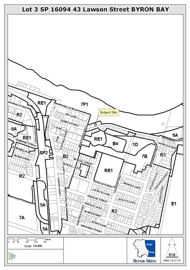
Assessment
Development Application No. 10.2014.417.1 was considered by
Council at its Ordinary Meeting on 19 March 2015. The staff report recommended
that the Development Application be refused for a number of reasons relating to
non-compliances with Council’s development control requirements. These
included:
· Breaches
of the maximum 9.0 metre height limit under Clause 40 of Byron Local
Environmental Plan 1988.
· Multiple
encroachments into the maximum building height plane as prescribed within
Chapter 1 Part C2.5 of Development Control Plan 2010.
· Excessive
density resulting from insufficient site area as set out within Chapter 1 Part
C7.1 of Development Control Plan 2010.
· Inadequate
provision of landscaping as set out within Chapter 1 Part C7.5 of Development
Control Plan 2010.
· Likely
impacts on the built environment and likely impacts on amenity resulting from
the proposed development.
· The
site being assessed as unsuitable for the development proposed.
· Lack
of information to demonstrate that the development has sufficient design
quality having regards to the principles and code requirements of State
Environmental Planning Policy No. 65 – Design Quality of Residential Flat
Development.
· Lack
of information in relation to State Environmental Planning Policy No. 55
– Remediation of Land.
Following consideration of the staff report, Council resolved:
|
15-110 - Resolved:
1. That consideration of DA 10.2014.417.1 be deferred
to enable discussions between the Developer and Director of Sustainable
Environment and Economy to address areas of non compliance through redesign.
2. That a report be provided to Council on these
discussions at the next available meeting to enable determination of the DA. (Wanchap/Woods)
|
Council’s Director of Sustainable Environment and
Economy and Manager Sustainable Development met with the applicant on 24 March
2015 to discuss the areas of non compliance. Subsequently, the Applicant
submitted amended plans on 14 April 2015. A summary of the changes within the
amended plans are listed below:
a) A 150mm increase in the
setback of the building from the eastern boundary of the property from 1500mm
to 1650mm as measured to the external wall.
b) Removal of a step within
the roof design and provision of a flat roof that has a height at RL15050,
which is 50mm higher than the plans assessed as part of the Development
Application previously reported to Council.
c) Slight alterations to
the gross floor area of the 7 residential units, the most significant of which
reduces the gross floor are of the penthouse unit by 3.6 square metres.
The applicant was provided with feedback that the amended
plans did not satisfy the reasons for refusal nominated within the original
Council report. A new planning consultant was appointed to the project and
Council staff advised in writing the remaining issues of non-compliance. The
new planning consultant met with Council staff on 23 June 2015 to discuss the
outstanding issues.
On 22 August 2015, a revised plan set was received,
accompanied by additional information to address State Environmental Planning
Policy No. 55 (Remediation of Land), Byron Local Environmental Plans and
Development Control Plans. A summary of the changes within the amended plans
(as compared to the plans reported to Council on 19 March 2015) are listed
below:
a) Increasing the setback
of the building on the side boundaries from 1500mm to 1600mm on the western
boundary and from 1500mm to 1650mm on the eastern boundary (this has been
achieved by reducing the width of the building by 250mm).
b) Lowering the height and
removing the step within the main roof such that it is no greater than 9.05
metres above existing ground level (but retaining the lift overrun that extends
an additional 1.0 metre above the roof height).
The amended proposal was again assessed as being
unsatisfactory by Council staff. As a result, a further meeting with the
planning consultant was held on 5 November 2015 to discuss the issues of
non-compliance. Amended plans and additional information was submitted on 17
November 2015, incorporating the following changes:
a) A reduction in the
overall height of the development to meet the 9.0 metre maximum (with the
exception of the lift overrun).
b) Increasing the setbacks
of the building on the two upper floors to 2.6m to the western boundary and
2.65m to the eastern boundary.
c) The removal of one of
the residential units from the first floor of the building and redesigning the
remaining two residential units on that floor with the provision additional
balcony areas on the northern elevation. The total number of residential units
proposed is now 6.
d) Reducing the gross floor
area of the uppermost floor by 29.8 square metres.
e) Reducing the size of the
basement car parking area to provide 14 spaces plus plant and garbage store
rooms.
f) Increasing the
land available within the site for deep soil landscape plantings.
An assessment is provided below of the amended plans and
additional information provided having regards to the reasons of refusal listed
in the original Council report:
1. Pursuant
to Section 79C(1)(a)(i) of the Environmental Planning & Assessment Act
1979, the proposal fails to meet the development standard for maximum height of
buildings as set out within Clause 40 of Byron Local Environmental Plan 1988.
An objection under State Environmental Planning Policy No. 1 to vary this
development standard is not supported.
Clause 40 of Byron
Local Environmental Plan 1988 has two development standards, a maximum 9.0
metre overall height limit, and a maximum 4.5 metre uppermost floor level. An
assessment of the original proposal conceded that the 4.5 metre uppermost floor
level was a standard that could be varied in the circumstances of the case. The
amended plans submitted in November 2015 now achieve almost complete compliance
with the 9.0 metre overall height limit, the lift overrun being the exception.
This is discussed below.
The amended proposal
now includes only a small departure to the 9.0 metre height control, namely a
1.0 metre encroachment for a small (7 square metre) lift overrun. The lift
overrun is located near the centre of the roof and will largely be obscured
from view from Lawson Street and the adjacent public reserve to the north. A
variation under State Environmental Planning Policy No. 1 is supported for this
aspect of the proposal. Similarly, an objection under State Environmental
Planning Policy No. 1 is supported for the 4.5 metre upper most floor level
standard given that no such standard applies under the Local Environmental Plan
2014.
2. Pursuant
to Section 79C(1)(a)(iii) of the Environmental Planning & Assessment Act
1979, the proposal breaches a number of requirements within Development Control
Plan 2010 including the maximum building height plane, maximum density
provisions, minimum landscaping requirements, provision of clothes drying
areas, maximum cut and fill and maximum fence heights.
The amended plans
provide significant changes to the building height plane encroachments compared
to those originally proposed. The amended plans provide increased side boundary
setbacks on both the first and second floors of the development. A setback of
2.6 metres is proposed to the upper two floors from the western boundary, and a
setback of 2.65 metres is proposed to these floors from the eastern boundary.
Shadow diagrams have
been submitted which still show significant overshadowing on the adjoining
property to the west. However, this overshadowing can be reduced with a slight
change to the roof design of the development. A condition is recommended that
requires the roof over the western pool deck area to be reduced to no more than
a 600mm eave. This will result in an acceptable proposal having regards to
overshadowing. However, to reduce privacy impacts on the adjoining properties,
it is recommended that landscaping bays be extended for the full lengths of the
upper floor decks on both the eastern and western sides of the building.
Details have also been
submitted to justify the proposed density of the development on the site and
the landscaping provided. The amended proposal includes a total of 6
residential units. This is consistent with the number of units within the
existing building on the site (that is to be demolished). It is a reasonable
planning outcome that the existing 6 units be replaced with the same number of
units, albeit in a contemporary design.
It is noted that the
site currently has approximately 175 square metres of landscaped area
(landscaped area means area of ground available for planting and/or management
of vegetation). The proposed development will reduce this area to 124 square
metres, which is well below the 520 square metres that the Development Control
Plan requires for the proposed number and size of residential units on the
site. Given that the site is 711 square metres in area and already contains 6
residential units, it is assessed as unreasonable to require compliance with
the prescriptive measures in this instance. The proposal includes landscaping
bays within the deck areas of each floor, as well as ground floor patio areas. The
site is also located adjacent to a public reserve which has a positive
contribution to the site. It is satisfied that with a condition requiring
additional planting bays on the uppermost deck areas, the proposed landscaped
area for the site is acceptable.
The additional
information received provides justification for the proposed extent of
earthworks associated with the development (refer to attachments to this
report). The size of the proposed basement has been reduced to accommodate 14
car parking spaces, which is the minimum required for the 6 unit development.
This reduced basement also provides an increase in deep soil landscaped area on
the site. A basement arrangement is logical for this site and is consistent
with surrounding development. A variation to the maximum 1.0 metre earthworks
requirement is supported.
The amended design
includes a landscape bay along the street frontage with fencing setback 800mm
from the front boundary. This reduces visual impacts associated with high
fencing in the front setback and is an acceptable planning outcome for the
site.
3. Pursuant
to Section 79C(1)(b) of the Environmental Planning & Assessment Act 1979,
the proposal is likely to have a significant impact on the surrounding built
environment and the occupants of that environment.
The amended design has
resolved the issues relating to this reason for refusal.
4. Pursuant
to Section 79C(1)(a)(i) of the Environmental Planning & Assessment Act
1979, the proposal fails to demonstrate that the development has sufficient
design quality having regards to the principles and code requirements of State
Environmental Planning Policy No. 65 – Design Quality of Residential Flat
Development.
The attachments to this
planning report include additional information submitted by the applicant to
address State Environmental Planning Policy No. 65 – Design Quality of
Residential Flat Development.
5. Pursuant
to Section 79C(1)(a)(ii) of the Environmental Planning & Assessment Act
1979, the proposal is inconsistent with the future planning direction for the
site as set out within Clauses 4.1E, 4.3 and 4.4 Byron Local Environmental Plan
2014, which is an instrument that has been the subject of public consultation
under the Environmental Planning and Assessment Act 1979.
Clause 4.1E of Byron
Local Environmental Plan 2014 relates to minimum allotment sizes for
residential flat buildings. The 711 square metre site is below the 600 square
metre minimum required under the clause. The amended information supplied to
Council justifies this shortcoming on the basis that the site already contains
an apartment building, it adjoins public open space and that the proposal
comprises infill development. It is agreed that the existing 6 unit residential
flat development on the site provides a pathway for redevelopment of a
contemporary design. As the amended proposal has been reduced to 6 residential
units, the proposal’s non-compliance with Clause 4.1E has little
consequence.
Clause 4.3 of Byron
Local Environmental Plan 2014 relates to the maximum height of buildings. As
discussed under item 1 above, the development has been redesigned to achieve
compliance with the 9.0 metre overall height control with the exception of the
lift overrun. This is acceptable for this proposal.
Clause 4.4 of Byron
Local Environmental Plan 2014 relates to the maximum floor space ratio of
development within the site. The amended proposal continues to exceed these
maximum requirements. However, as discussed above, it is satisfied that the
amended building adequately meets building height, setbacks and landscaping
requirements, and the proposed number of units (6) is suitable given the
existing 6 unit development.
6. Pursuant
to Section 79C(1)(e) of the Environmental Planning & Assessment Act 1979,
the it is not in the public interest to support the proposal as it breaches a
number of development control requirements and has an adverse impact on the
surrounding built environment.
Given that the amended
proposal presents an acceptable planning outcome for the site having regard to
Council’s development controls, the proposal is now considered to be
in the public interest.
7. Pursuant
to Section 79C(1)(c) of the Environmental Planning & Assessment Act 1979,
the site is assessed as being unsuitable for the development proposed.
The site contains a residential flat building comprising 6
units over three stories, with an attached vehicle garage at ground level. The
existing development has generous building setbacks and is satisfactorily
accommodated within the site in the context of the historic approval that it
was constructed under. It is acknowledged that the proposed development
introduces an increase in bulk and scale to the site, but the building
setbacks, height and provision of landscaped area have been assessed as
satisfactory. The amended proposal has significantly reduced the
non-compliances arising from a large development on a relatively small site. In
the context that the site already contains a 6 unit residential flat
development, it is assessed as being suitable for the amended proposal.
8. Pursuant
to Section 79C(1)(d) of the Environmental Planning & Assessment Act 1979,
consideration of public submissions received with respect of the proposal raise
valid planning reasons to refuse the Development Application.
Two public submissions
were received with respect to the proposed development, one of which was
prepared by a planning consultant on behalf of a local resident. The
submissions raised valid planning reasons to refuse the original development
application. It is considered that the amended proposal has achieved a level of
compliance that is acceptable for the development to proceed.
9. Pursuant
to Section 79C(1)(a)(i) of the Environmental Planning & Assessment Act
1979, the proposal fails to demonstrate that the site is suitable for use
having regards to the assessment requirements of State Environmental Planning
Policy No. 55 – Remediation of Land.
Additional information submitted to Council on 26 August
2015 includes a Phase 1 Contamination Assessment which concludes that the
potential for contamination of the subsurface of the site is very low, and that
the site is suitable for the proposed residential redevelopment. Subsequently,
this reason of refusal is no longer required.
Conclusion
The amended Development Application provides an acceptable
design for the site. The reduction of the proposed development from 7 units to
6 units and the additional side boundary setbacks on the upper two floors
provides a more compliant development with Council’s development
controls. The height of the building largely complies with the 9.0 metre
overall height limit, and encroachments into the building height plane have
been significantly reduced.
The proposed development is recommended for approval subject
to conditions of consent as specified in attachment 3 of this report.
Staff Reports - Sustainable Environment and Economy 13.11
Report No. 13.11 Compliance
Priorities Program - 2016
Directorate: Sustainable
Environment and Economy
Report
Author: Wayne
Bertram, Manager Sustainable Development
File No: I2015/1225
Theme: Ecology
Development and Approvals
Summary:
This report
details compliance with the adopted 2015 Compliance Priorities Program, and
seeks adoption of a Compliance Priorities Program for 2016.
It is
recommended that Council continues to focus on those priorities listed as Very
High and High and as resources allow, on priorities listed as Medium, with the
aim that all matters will ultimately be addressed in a timely manner.
|
RECOMMENDATION:
1. That Council
note the report.
2. That
Council adopt the proposed Compliance Priorities Program for 2016 as provided
in attachment 1 (E2015/76485).
|
Attachments:
1 2016
Compliance Priorities Program , E2015/76485
2 Compliance
Guidelines - Private Functions in Rural Zones, E2015/48122
Report
The Compliance, Ranger/Parking Officer and Environmental
Health Teams have been transferred to the Sustainable Environment and Economy
Directorate into a Regulatory Service Team as part of implementation of the
Organisational Structure adopted by Council. This report covers the
operations of this team for the 2015 reporting period.
2015 COMPLIANCE PRIORITIES PROGRAM
Compliance activities and statistics addressing the 2015
Compliance Priorities Program and the Byron Shire Council Management Plan
(Compliance, Public Order and Safety) have been addressed in the half yearly
and annual report.
For the half year (ending June 2015), all Compliance
performance indicators were met. The second half year performance is on track
for a similar outcome.
In 2014/2015 the Compliance Team received 2,560 Customer Request Management (CRM’s) which are tabulated
as follows:
|
|
Received
2014/2015
|
Completed 2014/2015
|
|
Illegal Works (Building; Land Clearing; Places of
short term accommodation; Land Use)
|
508
|
452
|
|
Animals (Nuisance; Barking; Attack; Restricted; Livestock;
Poultry)
|
865
|
843
|
|
Fire Hazard
|
3
|
3
|
|
Vehicle (Abandoned, Street Camping; For Sale; Parking)
|
928
|
878
|
|
Noise disturbances, public nuisance from premises, non
compliance with AFZ
|
166
|
159
|
|
Overgrown properties
|
90
|
79
|
|
TOTAL
|
2560
|
2414
|
Note: *Some CRMs have been
carried over from the previous financial year but completed in the 2014/15
financial period. There were also 137 CRM’s carried over into the next
financial year. These included CRM’s under investigation, being dealt
with or those that were in the system and being followed up in the next 30 day
period.
The following information is provided on the implementation
and actions taken in relation to the adopted 2015 Compliance Priorities Program.
Very High Priorities:
1.1 Developments,
actions, works, activities or uses that places people’s lives at
immediate risk or that cause or are likely to cause a significant risk of
environmental harm or pollution;
In the calendar year to 1 October 2015, Compliance has
received 508 CRMs relating to unauthorised development and has concluded 452 (see
notes in Table above). Not all of those CRMs fell into this priority although
the percentage concluded is accurate for this priority.
1.2 Significant
environmental, health and public health incidents.
On 19
February 2015 Council officers
attended a building site in Orana Road in relation to a complaint that three
loads of crusher dust had been dumped at the front of the property. The builder had been advised previously in relation
to his responsibilities in relation to sediment control.
The
builder and PCA were both contacted and advised that the crusher dust had to be
removed and the silt fence which was in disrepair had to be rectified. At the
time the Northern Rivers was on alert for a severe weather warning associated
with an East Coast Low
The
site was inspected the following morning and although some of the crusher dust
had been moved no repairs had been made to the sediment fence and it had been
breached at a number of locations. Large amounts of sediment laden water had
left the site and entered local waterways via Council’s drainage system.
Council
staff attended the site and sand bagged the area to contain the runoff.
Infringements were issued for “Pollute waters” and
“Development not in Accordance with Development Consent.” The
defendant was also invoiced for the cost of the sand bagging.
On
30 April 2015 Council staff again received a complaint in relation to the site.
Staff attended and found that the sediment fence had again failed in many areas
and that the sand bags Council had installed previously were still in place but
had been run over and was split and ineffectual. Again large quantities of
sediment laden water were entering Council’s drainage system.
Council prosecuted the defendant, who pleaded guilty to two
counts of pollute waters in breach of the Protection of the Environment
Operations Act 1997. The defendant was fined a combined total of $9,000 for
the two offences and also agreed to pay Council’s costs in the sum of
$3,500.
Most matters falling within this priority have been dealt
with by way of Penalty Notices and Formal Warning Notices to Prevent
Environmental Harm (POEO), Improvement Notices (Food Act) and Orders (LG and
EP&A Acts).
In a recent incident a Jonson St business owner washed a
large amount of tile adhesive/cement residue into Council’s storm water
system without sediment control. This work was undertaken on a Saturday
evening. The sediment / residue was also sprayed onto Council street furniture,
adjacent businesses and vehicles parked in the street. The owner was not
present when compliance staff attended and sediment control and clean up was
completed by Council. A $4,000 infringement for pollute waters and a cost recovery
order were issued.
1.3 Dangerous and/or menacing dogs.
On 24 July 2015, NSW Police referred a serious dog attack to
Council. The victim a 30 year old woman was employed by the dog’s owner
at the Roadhouse Café in Bangalow Rd Byron Bay.
The dog was a male Cane Corso weighing about 50kg and had
previously been declared “Menacing” by Council for an attack on
another dog.
The victim felt uncomfortable with the dog as she had met it
previously at the owners home where it had growled at her. As she was leaving
work she observed the dog on the back of the owner’s utility. The owner
called her over to meet the dog.
She extended her arm and was rubbing the dog on its neck and
shoulder. The dog then swung around and grabbed the victim on the face. As a
result of the attack the victim’s nose was torn off and only held on by a
small area of skin above her top lip. She also sustained puncture wounds under
her chin. The injuries amounted to grievous bodily harm due to their
seriousness.
At the time of the attack the dog was not muzzled and
evidence suggests it was not wearing a dangerous dog collar as per its control
requirements.
The dog was subsequently euthanized.
Council investigated the matter and a number of court
attendance notices were issued.
The owner pleaded guilty to a number of offences in the
Local Byron Court and was sentenced to 6 months imprisonment. This is the first
instance in NSW where a person has been imprisoned in relation to a dog attack.
|
Customer Request Management Received
|
1/1/15 – 1/10/15
|
|
Dogs Attacks
|
28
|
|
Dogs Barking
|
118
|
|
Dogs Found
|
176
|
|
Dogs Nuisance
|
225
|
|
Dogs Restricted
|
6
|
|
TOTAL
|
553
|
· There are presently 18 dogs in the Shire under a Nuisance Dog order.
· There is presently 1 dog in the Shire declared dangerous.
· There are presently 10 dogs in the Shire declared menacing.
· There are presently 7 restricted breed dogs in the
Shire.
1.4 Traffic, parking and unapproved
camping activity enforcement.
Parking enforcement saw 6955 Penalty Notices issued from 1
January to 1 October 2015. The gross face value of the Penalty Notices was
$958,000. In the period 1 January 2015 to 1 October 2015 Council Rangers
issued 477 camping related infringements.
The State Debt Recovery Office has provided the following
benchmarking statistics for Byron Shire Council and its neighbours for
2014-2015.
|
COUNCIL
|
ISSUED
|
FACE VALUE
|
RECOVERED
|
|
|
|
|
|
|
Byron Shire
|
10862
|
$1,526,071
|
70%
|
|
Coffs Harbour City
|
3168
|
$468,198
|
74%
|
|
Lismore City
|
937
|
$184,183
|
59%
|
|
Ballina Shire
|
1520
|
$304,390
|
64%
|
|
Clarence Valley
|
606
|
$110,771
|
51%
|
In respect of those Penalty Notices court elected Council
incurred no adverse costs orders and was successful and obtained costs orders
in all which proceeded to a hearing.
On going operations including Council Compliance Officers/
Rangers and Police have been conducting operations to safely remove illegal
campers and rubbish from the Cavanbah Reserve and from Main Beach to Belongil
and Main Beach to Clarkes Beach. Compliance staff issued infringements for
camping and littering where appropriate. Additionally “Move on directions”
have been given by Police.
These operations are ongoing and staff have been liaising
with staff at the community centre to help educate the local homeless of the
environmental damage that is occurring. All related agencies have reported that
the number of homeless is increasing and they are having difficulties providing
accommodation due to funding cuts.
Media releases where provided for Illegal camping issues and
delegated staff have also been involved in media interviews.
1.5
Asbestos containing material (ACM) being illegally dumped on public land.
Compliance staff recently investigated an incident at Myocum
landfill where a local builder dumped a quantity of asbestos mixed within a
load of other waste. The builder was identified and admitted the asbestos was
from his private residence. He was issued a penalty infringement noticed for
$8,000 and a costs order for $594.00. Landfill staff dealt with the disposal of
the asbestos in an appropriate manner
Media releases where provided for the correct handling and
disposal of asbestos and delegated staff have also been involved in media
interviews.
High Priorities:
2.1(a) Short-term
holiday accommodation
Penalty Notices were issued to four
premises in relation to the use of the premises for short-term holiday
accommodation in a manner that caused substantial negative impacts on
neighbourhood amenity in a residential zone.
The Police were called to both premises due to noise and
disturbance.
The investigation of each brought staff to the conclusion
that the use of the subject premises over the identified period and the
resulting impacts on neighbourhood amenity were sufficiently significant so as
to warrant enforcement action.
Staff issued each land owner with a $750 penalty
infringement notice for development without consent.
2.1(b) Swimming Pool
Safety including legislative requirements
A swimming pool register was
established in November 2011 and now has 2,208 pools registered. Of this number
665 premises were added in 2015.
A total of 469 swimming pools have
been inspected. Of these at least 90% did not meet the required standard and
required rectification. There have been 433 reinspections conducted.
The major non-compliant issues
were pool gates that will not self close, footholds provided on the pool
barrier and vegetation growing close to the barriers providing access to the
pool areas. Letters are being sent to all pool owners with the results of the
inspection. Non-compliant items are required to be repaired by set dates and
follow up inspections occur where major repair works are required.
Penalty Notices have been issued
to seven pool owners for non-compliance. This is an ongoing program of pool
barrier inspections which will eventually see all pools within the Shire
entered onto the register. A media release has been was issued: “Is your pool registered and ready
to be inspected? 95% are not passing”
2.1(d) Onsite Sewage
Management Systems
Council adopted the Community
Engagement and Risk Communication (CERC) Program for Onsite sewage management
systems (OSMS) in March 2013. The primary role of the CERC program is to
empower current and prospective owners and operators of OSMS via reviewing existing
and developing new communication media to ensure that it is positive,
engaging, transparent, easy to understand and pre-emptive. The CERC
also supports Councils regulatory obligations under the relevant acts. The OSMS
inspection program is implemented via complaints, enquiries and Council adopted
OSMS risk categories i.e. OSMS that have a higher potential for negative
impacts on human health and the environment are inspected as the higher
priority.
Stage one of CERC was completed in July 2014 when 1563
requests to submit an application to operate (ATO) an OSMS were mailed to OSMS
owners that did not have approval or whose approval had lapsed. The
request includes redesigned material (including cover letters and application
forms) designed to engage and educate.
The number of complaints pertaining to OSMS continues at
very low levels, most compliance issues are discovered via development control
compliance inspections.
Information about the CERC program is being regularly
reported to Council’s Water, Waste and Sewer Advisory Committee.
2.1(e) Food safety
Council reported to the NSW Food Authority in the annual
report (2014/15) that high-risk and medium-risk retail food businesses within
Byron Shire had been inspected as required by the NSW Food enforcement agency.
The report favourably compared Byron Shire Councils’ results with all
other local government authority food activities.
Byron Shire is somewhat unique in that the number of fixed
food premises may vary around the total number of 320, but there is a growing
and significant number of temporary retail food businesses (markets, farmers
markets, shows, events and festival food businesses) of similar proportion that
need to be effectively inspected and regulated to ensure community health and
safety standards are being maintained. A total of 631 primary food premise
inspections (including re-inspections) were conducted during 2013/14.
As part of the educational support for retail food
businesses, two information ‘mail-outs’ were provided in January
and July 2014 to inform food business operators about changes in regulations,
food safety content and staff access information on the specific topic of food
safety.
The number of complaints and food-borne illness reports
continues at very low levels. Considering the small number of staff hours
allocated to this function, Byron Shire is achieving an improving standard of
food safety under growing demands from food businesses in Byron Shire. The
following table summarises the activities performed by staff as regulators of
the NSW Food Act 2003.
Table 1: Food business inspection program –
comparison between 2013/14 and 2014/15
|
|
2013/14
|
2014/15
|
|
Fixed premises categorised as ‘high’ risk
inspected
|
293
|
316
|
|
Fixed premises categorised as ‘medium’ risk
inspected
|
27
|
51
|
|
Fixed premises categorised as ‘low’ risk
inspected
|
31
|
37
|
|
Temporary food businesses operating in Byron Shire
inspected
|
355
|
351
|
|
Mobile food businesses operating in Byron Shire inspected
|
5
|
11
|
|
Number of food-related complaints received / investigated
|
11
|
27
|
|
Number of warning letters issued to address minor defects
|
191
|
256
|
|
Number of Improvement Notices issued to address food
safety defects
|
38
|
29
|
|
Number of penalty notices issued
|
7
|
6
|
|
Number of prosecutions / successful result
|
0
|
0
|
|
Number of seizure notices issued
|
1
|
0
|
|
Number of Prohibition Orders issued
|
0
|
1
|
|
Full time equivalent staff resources dedicated in
maintaining food safety program
|
1.5
|
1.0
|
|
Total number of inspections conducted – Primary
Reinspections
|
698
195
|
762
256
|
2.1(f) Public health premises
Council noted the gradual introduction of a number of
statutory requirements under the Public Health Act 2010 and Public Health
Regulation 2012. As the NSW Ministry of Health are the primary regulator of
public health standards across NSW under this legislation, Council has limited
activity in regulating public health premises.
2.1(g) Companion Animals
Rangers again attended community events at Federal Park and the
Brunswick Heads Primary School, providing information on pet welfare,
restraints and requirements for companion animals.
Council’s Rangers have provided continued support to
NPWS and community conservation groups and carried out patrols in the bird
breeding area at Belongil Spit to enforce restriction on dogs being under
effective control.
A letterbox drop has been undertaken to owners/occupiers in
cat and dog free estates.
In addition, the Acting Team Leader Compliance commented on
companion animal issues on numerous occasions on local radio and newspaper.
2.2 Noise
disturbance, public nuisance from premises, maintenance of alcohol free zones;
Matters falling within this priority have been dealt with by
way of advice both to the complainant and the occupant of the noise source and
in extreme cases Noise Abatement Orders have been issued.
Alcohol prohibition zones were heavily patrolled on New
Years Eve which removed considerable amounts of alcohol from the streets and
reserves.
2.3
Unauthorised events, including unapproved dwellings, wedding receptions, parties.
‘doof’ and ‘rave’ parties.
Action in the NSW Land and Environment Court was taken
against the previous owner of the premises in relation to the unauthorised use
of the premises for weddings and other functions.
A proposed unapproved rave party proposed in the Byron
hinterland was investigated with the NSW Police and the event was subsequently
cancelled before the event was held.
Medium Priorities:
3.1 Development or activities without
consent, or non-compliance with consent, permit or licence conditions where
these appear to pose no immediate threat to life, property, public health or
the environment.
In the calendar year to 1 October 2015, Compliance has
received 508 CRMs relating to unauthorised development and has concluded 452.
Not all those CRMs fell into very high priority and a percentage of these where
deal with as medium level priorities as time permitted.
3.2 Livestock on public roads.
The table produced earlier detailed that 805 CRMs had been
received in respect of Animals (Nuisance; Barking; Attack; Restricted;
Livestock; Poultry).
Of those 133 related to livestock on roads. All matters were
generally assessed and dealt with within hours of receipt of notification.
3.3 Non-compliant signage (07-550,
06-204).
2015 saw an influx of electronic signage. It was dealt with
by way of advice and warnings.
Rangers have been out actively impounding unapproved signage
throughout the Shire and have noted that there has been a significant drop in unapproved
signage numbers in most areas.
Discussions with Council’s Economic Development and
Tourism Officer has resulted in Compliance staff reviewing resolution 626/2012
and investigating placing poles at the entrances to each town so that
markets and community events can be advertised in a more visually
friendly matter. This is still ongoing with the business community and the
Economic Development Team
3.4 Uncontrolled dogs and/or cats including
those kept on land where Policy or Development consent prohibits
it.
A letterbox drop has been undertaken to owners/occupiers in
cat and dog free estates to inform the residents of their obligations when
residing in these areas.
Legal advice and formal notice provisions have been prepared
for the enforcement of the dog and/or cat free areas. A press release has
been issued advising that cat and dog free areas are to be
enforced and a program is being developed to ensure that the Council
can complete the review and enforcement of the requirements.
Routine Priorities:
4.1 All
other matters.
In the calendar year to 1 October 2015, Compliance has
received 508 CRMs relating to unauthorised development and has concluded 452. Not
all those CRMs fell into very high priority and a percentage of these where
deal with as time permitted. Additionally the Environmental Services Team
responded to community enquiries and where the customer wants a council
response the requests are recorded into the Authority database. The following
is a comparison of customer request activity for 2014/15.
Table 2
– Environmental Services summary of customer action requests
|
Category
|
2014/15
|
|
Noise complaints
|
97
|
|
Pollution of land
|
17
|
|
Air pollution
|
15
|
|
Water pollution
|
36
|
|
Odour pollution
|
11
|
|
Stormwater impacts
|
12
|
|
Asbestos
|
11
|
|
TOTAL
|
199
|
2016 COMPLIANCE
PRIORITIES PROGRAM
Very High Priorities:
1.1 Developments,
actions, works, activities or uses that places people’s lives at
immediate risk or that cause or are likely to cause a significant risk of
environmental harm or pollution;
1.2 Significant
environmental and public health incidents;
1.3 Dangerous
and/or menacing dogs;
1.4 Traffic,
parking and unapproved camping activity. Camping enforcement with an emphasis
on environmentally sensitive areas.
1.5 Asbestos
containing material (ACM) being illegally dumped on public land
2. High Priorities
2.1 Provide
education or workshops and undertake compliance enforcement programs for;
(a) Places
of shared accommodation (commercial and non commercial)
(b) Swimming
pool safety including legislative requirements
(c) Improving
compliance standards for unapproved dwellings
(d) Onsite
sewage management systems (including CERC project)
(e) Food
Safety Inspections
(f) Awareness
of current public health requirements
(g) Companion
Animals with a high emphasis on high visibility enforcement and public
education. (15-465)
(h) Safe
procedures for handling and disposal of Asbestos Containing Materials
(i) Seasonal
public health issues and community preparedness including issuing a minimum of
two media releases.
2.2 Responses
to complaints about recurring noise disturbance, public nuisance from premises,
maintenance of alcohol free zones;
2.3 Unauthorised
events, including unapproved dwellings, wedding receptions, parties, 'doof and
'rave' parties;
3. Medium
Priorities
3.1 Development or activities without
consent, or non-compliance with consent, permit or licence conditions where
these appear to pose no immediate threat to life, property, public health or
the environment;
3.2 Livestock
on public roads;
3.3 Non-compliant
signage (07-550, 06-204).
3.4
Uncontrolled dogs and/or cats including those kept on land where Policy or
Development consent prohibits it. (14-544)
4. Routine Priorities
1.1 All
other matters.
A final version of the proposed 2016 Compliance Priorities
Program has been provided in Attachment 1.
In addition to the 2015 Compliance Priorities Program
Council also resolved 14-655(3)
That Council develops compliance guidelines for the
conduct of large private parties in rural settings and advertises the guidelines
to the community.
Such compliance guidelines have been developed and have been
used for providing advice regarding large private parties and events in rural
areas. A copy of the guidelines that were developed has been provided in Attachment
2.
Financial Implications
The 2016 Compliance Priorities Program will be addressed
within existing budget allocations.
Statutory and Policy Compliance Implications
There a number of Acts
which give local government regulatory powers.
They include the:
§ Companion Animals Act 1998
§ Environmental Planning and Assessment Act 1979
§ Food Act 2003
§ Impounding Act
1993
§ Local Government Act
1993
§ Protection of the Environment Operations Act 1997
§ Public Health Act
2010
§ Roads Act 1993
§ Swimming Pools Act
1992
Compliance action is considered
and managed through Council’s adopted Enforcement Policy (DM 1103173).
Enforcement Guidelines (E2013/21238) have been formulated to supplement the
Enforcement Policy. They give guidance in putting the Enforcement Policy into
practice.
As per the Internal Auditors report and recommendations into
the Regulatory Services functions of Council, a review of the Enforcement Policy and the Enforcement Guidelines is
currently underway in association with Council’s Legal Services Team.
Staff Reports - Sustainable Environment and Economy 13.12
Report No. 13.12 PLANNING
- S96 10.2013.559.3 - To permit access for light vehicles on Saturdays, Sundays
and Public Holidays between the hours of 7.00am to 6.00pm
Directorate: Sustainable
Environment and Economy
Report
Author: Shannon
Burt, Director Sustainable Environment and Economy
File No: I2015/1312
Theme: Ecology
Development Certification
Proposal:
|
S.96 No:
|
10.2013.559.3
|
|
Proposed modification:
|
Section 96 Modification to permit access for light
vehicles on Saturdays, Sundays and Public Holidays between the hours of
7.00am to 6.00pm.
|
|
Original Development:
|
Change of use from Farm Building to Road Transport
Terminal
|
|
Type of S.96 sought:
|
S96(2) Other Modification
|
|
Property description:
|
LOT: 15 DP: 1030574
|
|
31 Pinegroves Road MYOCUM
|
|
Parcel No/s:
|
237962
|
|
Applicant:
|
Mr A Hunter & Mrs J P Hunter
|
|
Owner:
|
Mr W A & Mrs J P Hunter
|
|
Zoning:
|
Zone No. R5 Large Lot Residential / PART RU1 Primary
Production / PART DM Deferred Matter / PART RU2 Rural Landscape
|
|
S96 date received:
|
14 August 2015
|
|
Original DA determination date:
|
1 May 2014
|
|
Integrated Development:
|
No
|
|
Public notification or exhibition:
|
- Level
1 advertising under DCP 2014 Part A14 – Public Notification and
Exhibition of Development Applications
- Exhibition period:
11/9/15 to 24/9/15
- Submissions: For 0 Against
9 (including 4 after the close of the submission period)
|
|
Planning Review Committee:
|
Yes 1/10/15
|
|
Delegation to determination:
|
Council
|
|
Issues:
|
Validity of the consent condition.
Impacts on surrounding rural residents in terms of
amenity.
Opportunity to gauge the impact of the development as
approved.
|
Summary:
A S96 application has been received to modify a development
consent that was previously modified by Council at the Ordinary Meeting held 20
November, 2014.
The current S96 application lodged seeks to modify condition
16 of the development consent by altering the consent condition that relates to
operating hours to permit light vehicles to access the site on all days of the
week (including public holidays) from 7am to 6pm.
In the interests of probity, Council has a procedure that
development applications lodged by councillors are to be independently assessed
by an external planner to ensure that the applicant and the assessor remain at
arms length. This application has been assessed by an external planner.
The assessment and recommendation of the Independent
Consultant is contained in this report.
NOTE TO COUNCILLORS:
In accordance with the
provisions of S375A of the Local Government Act 1993, a Division is to be called
whenever a motion for a planning decision is put to the meeting, for the
purpose of recording voting on planning matters. Pursuant to clause 2(a)
under the heading Matters to be Included in Minutes of Council Meetings of
Council's adopted Code of Meeting Practice (as amended) a Division will be
deemed to have been called by the mover and seconder of all motions relating to
this report.
|
RECOMMENDATION:
That pursuant to
Section 96 of the Environmental Planning & Assessment Act 1979,
development application 10.2013.559.3 to amend condition 16 to alter the
operating hours, be refused for the following reasons:
1. The existing
condition is a valid condition that has been imposed for a planning purpose,
relates to the development and is reasonable.
2. Amending the
condition as requested may exacerbate impacts to the amenity of the residents
of Pinegroves Road.
3. There is a
public interest benefit in maintaining this condition for the remainder of
the two year time limited approval so that its effectiveness can be
evaluated.
|
Attachments:
1 Confidential
- Submissions - 10.2013.559.3, E2015/76345
2 Confidential
- Log of Vehicles Accessing the Transport Terminal , E2015/76329
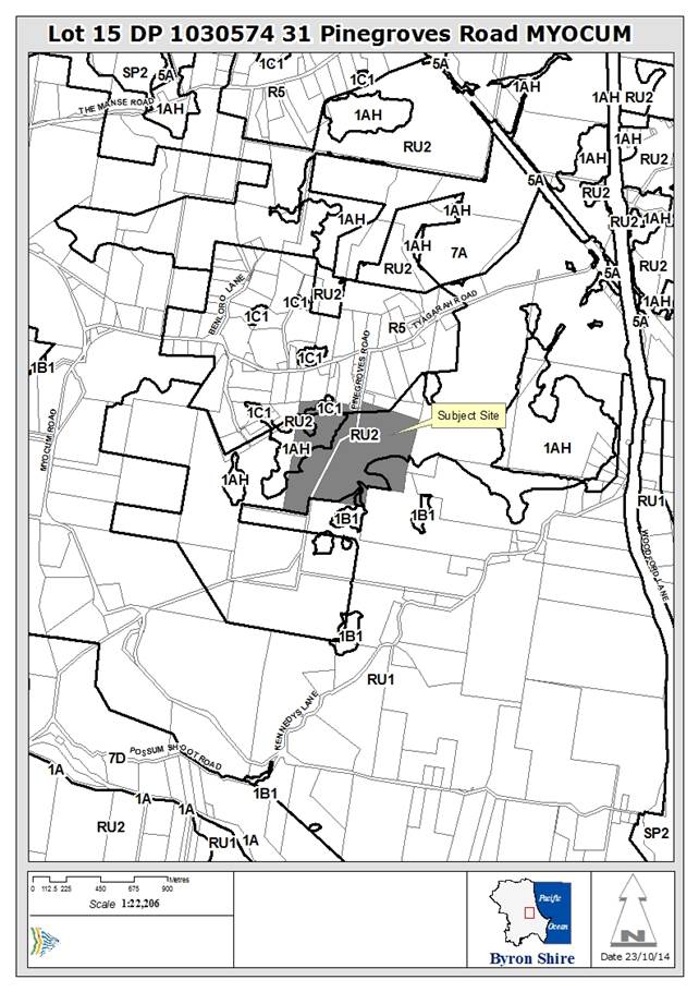
Assessment:
1. INTRODUCTION
1.1 Details
of approved development and any subsequent modifications
DA 10.2013.559.1 was determined by Council Resolution at the
Ordinary Meeting held on 1
May 2014.
14-194 Resolved that
pursuant to Section 80 of the Environmental Planning & Assessment
Act 1979, development application
10.2013.559.1 for Change of use for a farm building to
road transport terminal, be
granted consent subject to appropriate mitigation measures and
standard conditions listed in
Annexure 4(b) #E2014/23019 with the following changes:
a) Date
Consent Ceases - this consent ceases two (2) years after the commencement of
operations and
b) Replace
condition 13 with “a maximum number of 10 non -articulated vehicle
movements per week with a maximum unladen weight of 4 tonnes”
c) Vary
condition 16 – Hours of operation to 7:00am to 6:00pm Monday to Friday
only.
(Woods/Cubis)
DA 10.2013.559.1 was amended by a S96 application in
November 2014. Council agreed to amend condition 13 and to replace it
with an improved version as follows:
13) Frequency of Truck Movements
A maximum number of 10 truck
movements per week associated with this development. Trucks shall be limited to
non-articulated trucks with a maximum 4 Heavy Rigid Vehicle (HRV) movements
with the balance of the truck movements limited up to a Medium Rigid Vehicle
(MRV).
NB: Medium Rigid Truck (MRV)
represents the common service truck having a load capacity of 8 tonne typically
having a single rear axle with dual tyres.
Heavy Rigid Vehicle (HRV)
represents the maximum dimensions of a single unit truck typically has a
load capacity of 12 tonne. This class also includes 4-axle twin steer vehicles
with a typical load capacity of 16 tonne.
1.2 Section
96 modifications sought
An application has now been received to modify the
development consent for DA 10.2013.559.1 by altering the consent condition that
relates to operating hours to permit light vehicles to access the site on all
days of the week (including public holidays) from 7am to 6pm (Condition 16).
Existing Condition
16) Hours of Operation
Hours of operation are from 7.00am to 6.00pm Monday to
Friday only. No operations to take place on Saturdays, Sundays or Public
Holidays.
Proposed Condition
16) Hours of Operation
Hours of operation are from 7.00am to 6.00pm Monday to
Friday. Only light vehicles are permitted to access the site on Saturdays,
Sundays or Public Holidays from 7.00am to 6.00pm.
In completing the S.96 application form the applicant
described the modification as both a S96(1) modification involving a minor
error, misdescription or miscalculation and a S96 (1A) modification involving
minimal environmental impact.
There are number of different types of modifications allowed
under Section 96 of the Act.
Section 96 (1) – Modifications involving minor errors,
misdescription, or miscalculation.
There would be no change to the form of the development approved, and
notification would not be required. For example:
· Wrong
plan numbers
Section 96 (1A) – Modifications involving minimal
environmental impact.
These are used for minor amendments. There is no impact on privacy, height,
overshadowing, etc, and notification is generally not required. These might be:
· Internal
design changes
· Amended
landscape plans
· Drainage
design amendment
Section 96 (2) – Other modifications.
These are all other modifications where environmental impact is possible. They
generally require notification. Typical changes include:
· Windows
· Floor
levels
· Heights
· Car
parking generation
· Roof
design
· Operating
hours
In my opinion the application is a S96 (2) modification and
it will be assessed accordingly.
1.3 Is
the modification substantially the same as the development granted
Yes. The only modification is for the hours of
operation. This will not result is a substantially different development
to that granted pursuant to DA 10.2013.559.1.
2. SUMMARY
OF REFERRALS
|
|
Summary of Issues
|
|
Development Engineer
|
No issues raised.
|
|
Environmental Health Officer
|
N/A
|
|
Water & Waste Services
|
N/A
|
|
Building Surveyor
|
N/A
|
|
Fire Control Officer
|
N/A
|
|
Tree Preservation Officer
|
N/A
|
|
Government Authorities
|
N/A
|
3. SECTION
79C – MATTERS FOR CONSIDERATION – DISCUSSION OF ISSUES
Having regard for the matters for consideration detailed in
Section 79C(1) of the Environmental Planning & Assessment Act 1979, the
following is a summary of the evaluation of the issues.
3.1. STATE/REGIONAL
PLANNING POLICIES AND INSTRUMENTS
N/A
3.2. BYRON
LOCAL ENVIRONMENTAL PLAN 2014
Byron Local Environmental Plan
2014- Issues
N/A. The approval that is the subject of this S96
application was determined by Council on 1 May 2014 pursuant to Byron LEP
1988. Byron LEP 2014 was gazetted on 30 May 2014 to commence on 21 July
2014.
Draft EPI that is or has been
placed on public exhibition and details of which have been notified to the
consent authority - Issues
N/A. None of the draft EPI’s that have been
placed on public exhibition are relevant to this S96 application.
3.3 DEVELOPMENT
CONTROL PLANS
Development Control Plan 2014
- Issues
N/A. This S96 application was assessed under Byron DCP
2010.
Other Development Control
Plan/s - Issues
N/A.
3.4 The likely impacts of that
development, including environmental impacts on both the natural and built
environments, and social and economic impacts in the locality
The approval for a road transport terminal was issued
subject to a schedule of conditions. One of these conditions was that hours of
operation be limited to Monday to Friday (7am to 6pm) with no operation on
Saturdays, Sundays or Public Holidays. The original application was that
vehicles should be able to access the site 7 days per week during daylight
hours.
Council carefully considered this application and agreed to
allow it to proceed for a period of two years. It also limited the hours
of operation in response to concerns from neighbouring landowners. The site
access (Pinegroves Road) is a narrow rural road in a small rural residential
neighbourhood. Pinegroves Road is currently zoned R5 Large Lot
Residential. The land on which the road transport terminal was approved
is also partly in the R5 zone.
Limiting the hours or days of operation of a development is
one way to limit the impact of that development on surrounding land and
neighbours. Development that generates traffic will impact on most heavily on
those closest to it and on roads with an existing low traffic volume. In this
case that is the residents of Pinegroves Road.
The applicant has suggested in supporting information that
vehicle access over the weekend and public holidays would be limited to light
vehicles only and is required in order that clients can attend to their
belongings without the need for assistance in loading or unloading. No other
reasons are given. No information about the projected traffic volume is
provided. No information is provided as to how the condition has impacted
on the road transport terminal since May 2014.
The condition to limit trading hours will assist in
retaining the rural residential amenity of the Pinegroves Road locality. In a
Victorian court case the observation was that “Amenity is an elusive
concept. It has its usual meaning of pleasantness, but also has a wider ambit.
It has a physical (or tangible) component, which could include character and
appearance of building and works, proximity to shopping facilities, quality
infrastructure and absence of noise, unsightliness or offensive odours. It has
been said to embrace all the features, benefits and advantages inherent in the
environment in question. It also has a psychological or social
component.” The Macquarie Dictionary states that amenity
means “the agreeable features and circumstances of the locality”.
The submissions received indicate that a quiet cul de sac that is used largely
by local traffic (less than 10 dwellings) is important to local residents and
is a positive feature or circumstance of their locality. They place a
high value on retaining that amenity.
This condition is aimed at limiting the impacts on the
amenity of neighbouring landowners to 11 hours per day on the normal days of
business (Monday to Friday) with the weekends returning to local traffic
generated by the residents. This is not an onerous restriction for a road
transport terminal in this location.
There is no new information that has been provided to
substantiate a change in the hours of operation. The concerns of
neighbouring landowners about impacts on their rural residential lifestyle and
the amenity of their neighbourhood remain. It is a reasonable condition
and should not be altered for the life of this consent.
Additional Information
Additional information was submitted by the applicant on 16
November 2015 (post the drafting of this report), and forwarded to the external
planner for review and comment.
The external planner has advised: “I have looked at
the information supplied by the applicant. My report and recommendation remain
the same.”
3.5 Engineering
referral
Council’s Consultant Engineer has provided the
following comments: “The estimated design capacity of Pinegrove
Road is in the order of 150 VPD. The estimated traffic on Pinegroves Road,
using the traffic estimated from this development in the DA and traffic from
the existing development along Pinegroves Road is 80 VPD. Increasing the
number of days that vehicles can access the development will reduce the traffic
load on other days of the week. The road has the capacity to
cater for the traffic generated by the development. The timing of the vehicles
using the road is not an engineering issue. The development application is
supported from engineering grounds.”
It is important to note that the condition to limit the
operating hours was not imposed as result of engineering related concerns. It
is acknowledged that Pinegroves Road has the capacity to deal with the number
of vehicles generated by the development. In assessing this S96
application it is not appropriate to revisit the original approval or other
conditions.
3.6 Submissions
made in accordance with this Act or the Regulations
A number of submissions to this S96 application raised
issues that refer to previous approvals and other matters that don’t
relate to the limitations on hours of operation. These will not be
addressed in detail as they do not relate to the decision as to whether the
hours of operation condition should be amended.
|
Issue
|
Comment
|
|
Traffic speeds are increased which endangers wildlife
|
Traffic speeds are controlled by signage (reflecting legal
speed limits), driver behaviour and enforcement. Operating hours are unlikely
to be linked to traffic speed.
|
|
Compliance history of the site
|
Notwithstanding the compliance history of the site the
applicant is entitled to request a variation to their consent. Council
must consider any such request.
|
|
Due process is not being followed
|
Council has received a S96 application. It has advertised
it and assessed it in accordance with “Council’s Procedure No:
63. “Development Applications – Conflict Of Interests”.
This requires that development applications submitted by a Councillor of
Byron Shire Council will be assessed by an independent consultant and be
determined by Council. That is how this application is being dealt with and
this is a valid and transparent process.
|
|
Business reasons only are motivating this change of
conditions
|
The applicant provides only limited reasons for the change
in condition. Increased client accessibility is the reason provided by the
applicant. Council has to deal with the information is it is given.
|
|
What is the definition of light vehicle?
|
RMS defines a light vehicle as “any vehicle with a
Gross Vehicle Mass that does not exceed 4.5 tonnes.”
|
|
Amenity of the neighbourhood will be adversely affected
|
The purpose of this condition was to limit the impacts on
the amenity of the rural residential neighbourhood that the access road
passes through to get to the subject land. Permitting road transport terminal
related traffic along Pinegroves Road on weekends and public holidays may
detrimentally affect the peaceful enjoyment of this rural neighbourhood. This
concern is valid.
|
|
The land is being used illegally.
|
This has been referred to Councils compliance section.
|
|
Safety on Pinegroves Road and Tyagarah Road for car users.
|
Council’s Consultant Development Engineer has not
raised any issues about the safety of users of these roads as a result of
this condition being amended. If there are safety issues that can be
specifically identified (the objector is not specific) then these would be
useful to know should a fresh application be received once the current
application has expired.
|
|
Precedent of allowing businesses on farm land
|
This application is to amend a condition on an existing
approval. It is not valid to revisit the precedent effects of the approval in
May 2014 for a road transport terminal.
|
|
Repeated S96 applications are unfair.
|
The EPA Act, 1979 does not limit the number of times a
consent can be amended. Each application is to be assessed on its merits.
|
|
Who is monitoring the trial consent that applies to this
property and how will it be considered?
|
Council has records of complaints made in relation to the
subject land. This issue will be relevant if a further application is made
under Byron LEP 2014.
|
|
Line marking needed in Pinegroves Road.
|
Pinegroves Road has a 4 metre wide pavement which the
consultant engineer has indicated is sufficient for the level of traffic that
use it. No line marking is anticipated.
|
|
Development is now a self storage business and Council should
take compliance action
|
This has been referred to Council’s compliance
section.
|
|
Site has a steep driveway and is not suitable for 7 day
access to storage. Safety issues for exiting vehicles and children on bikes.
|
The steep driveway was known to Council when the consent
was issued in May 2014. Council is conscious of the rural residential
neighbourhood with children playing in the street more likely on a weekend.
This safety issue has not been raised by Council’s Consultant
Development Engineer.
|
3.7 Public
interest
The public interest is generally associated with furthering
the welfare and wellbeing of the public. The proposed consent modification may
benefit the clients of the road transport terminal, but will have little impact
on the wider community. It may have an impact on the immediate rural
residential community in the vicinity of Pinegroves Road and this has already
been considered.
In terms of process and transparency, there is some public
interest value in maintaining the conditions that were imposed on the
development for the two year life of the consent. Continuity in conditions may
assist evaluating the effectiveness of those conditions.
4. DEVELOPER
CONTRIBUTIONS
4.1 Water
& Sewer Levies
N/A
4.2 Section
94 Contributions
N/A
5. CONCLUSION
The NSW Land and Environment Court has used the following
three principles to assist in determining if a condition if consent is valid:
1. It
must be imposed for a planning purpose – in this case the limitation
of operating hours does relate to planning concerns about impacts on the
locality and the amenity of the residents.
2. It
must fairly and reasonably relate to the development for which permission is
given – it does relate to the consent granted to this development for
a road transport terminal.
3. It
must be reasonable – in the circumstances it is a reasonable
condition. The applicant has not been able to demonstrate that it is
unreasonable or onerous.
The applicant provides minimal information to justify the
proposed change of operating hours. They have not shown that the condition is
unreasonable or unfair.
The concerns of neighbouring landowners about impacts on
their rural residential lifestyle and amenity remain. This condition is aimed
at limiting the impacts on neighbouring landowners to 11 hours per day on the
normal days of business. It is a reasonable condition and should not be
altered for the remaining life of this consent.
Staff Reports - Sustainable Environment and Economy 13.13
Report No. 13.13 Freedom
Camping Trial - Byron Bay
Directorate: Sustainable
Environment and Economy
Report
Author: Sarah
Workman, Tourism Officer
File No: I2015/1389
Theme: Economy
Economic Development
Summary:
This report responds to Council Resolution 14-579, which
aims to reduce the associated impacts and antisocial behaviour associated with
freedom camping in Byron Shire’s streets and reserves.
Following stakeholder engagement, research and assessment of
the Shire’s challenges with van packers and the global Freedom Camping
phenomenon, the Economic Development and Tourism team provided a presentation
as the basis of a workshop for Councillors on 28 May 2015.
The 28 May Councillor workshop explored the current
situational analysis of freedom camping in the Shire, the Byron Bay town centre
hotpots for illegal camping and the behavioural change challenges embedded in
any initiative undertaken. A strategy framework was proposed, however due to
time constraints the details of a 12-month trial were not finalised.
A
second Councillor workshop was held on 24 September 2015 to discuss and reach
consensus on the intricacies of a 12 month Freedom Camping project trial. At
this workshop Councillors proposed that staff explore two potential sites for
investigation of a 12 month Freedom Camping project, one in town (Main Beach
Carpark) and the second on the outskirts of town (The Cavanbah Centre). This
report provides a review of suitability, viability and a cost analysis of each
site and provides a recommended path forward.
|
RECOMMENDATION:
1. That
Council do not proceed with the Freedom Camping Site Trials at Main Beach
Carpark and the Cavanbah Centre, due to prohibitive infrastructure costs,
legal constraints and incompatibility with the current land use guidelines at
each site.
2. That
Council undertake the following actions:
a) Invest
$30,000 (to be considered as part of the 31 December quarterly budget review)
to undertake a stakeholder engagement program and marketing campaign to
educate and work with intermediaries, influencers and end consumers to change
behaviour and encourage Freedom Campers to stay in low-cost, approved camping
sites/accommodation in Byron Bay.
b) Authorise
staff to continue discussions with the private sector to progress proposals
and expressions of interest from operators to explore capacity for the Freedom
Camping market on appropriate sites.
c) Continue
to work with the North Coast Destination Network Freedom Camping Taskforce on
a regional solution.
d) Staff
provide a report advising the outcomes and effectiveness of the stakeholder
engagement program and marketing campaign.
e) Staff
prepare a report, separate to Freedom Camping, that investigates potential
sites for the RV market, which is considered as a separate issue to the
anti-social behaviour associated with Freedom Camping in Byron Bay’s streets.
|
Attachments:
1 Freedom
Camping Trial Site Selection Matrix - Presented at the Strategic Planning
Workshop on 28 May 2015, E2015/33175
2 Budget for
the Freedom Camping Trial at The Cavanbah Centre, E2015/75128
3 Freedom
Camping Trial - Freedom Camping Trial Presentation to the Strategic Planning
Workshop on 28 May 2015, E2015/78859
Report
Freedom
Camping, by definition, is spending the night in the wilderness, not on a site
you have to pay for: you have the freedom to stop wherever you want and
it’s free.
This
report responds to Council Resolution 14-579, which aims to reduce the
associated impacts and antisocial behaviour associated with Freedom camping in
Byron Shire’s streets and reserves. The Council Resolution states
(14-579):
1. Commence work on establishing
the viability and regulations required to conduct a 12 month trial of a Freedom
Camping site or sites within the Shire with an initial Councillor workshop.
2. Identifies an appropriate
partner or partners to undertake such a trial through an Expression of Interest
process.
3. Include in the proposed trial
(after the initial workshop) the following elements:
a. Statistical collection and
analysis of demand and usage;
b. Monitoring and evaluation of
the trial;
c. Identification of the
positive benefits and / or challenges in operating a Freedom Camping site; and
d. Recommendations regarding the
continuation or future operation of Freedom Camping sites within the Shire.
Councillor Workshops
On May 28 2015, the Economic Development and Tourism team
provided a presentation to Councillors outlining the current situational
analysis of Freedom Camping in Byron Shire, the Byron Bay town centre hotpots
for illegal camping and the behavioural change challenges embedded in any
initiative undertaken. A strategy framework was proposed, however due to time
constraints the details of a 12-month trial were not finalised. Annexure 1
outlines the presentation that was provided at the 28 May workshop (and the 24
September 2015 workshop). The presentation covered the following information:
1. Review
the current situational analysis of illegal camping and vanpacker challenges in
Byron Bay
2. Understand the broader Freedom Camping phenomenon
and Destination Network approach
3. Define the target audience, intermediaries and
partners
4. Review additional site options and barriers/constraints
5. Review the trial framework – sites,
marketing, evaluation and stakeholder management
6. Agree on the 12 month trial sites, pricing model
and any specific council site works/partnering assistance
7. Develop a 12 month trial project budget options/proposal
A
second Councillor workshop was held on 24 September 2015, to discuss and reach
consensus on the intricacies of a 12 month Freedom Camping project trial. The
following points guided discussion at the workshop:
1. What is the challenge we are
trying to address? Does everyone agree?
2. Who are the people this project
is targeting?
3. What are the current mechanisms
or strategies in place to meet the challenge?
4. What else do you think Council
could / or should be doing to meet the challenge?
5. What does a 12 month Freedom
Camping trial look like to you?
6. What is Council prepared to
invest to meet the challenge?
At
this workshop Councillors proposed that staff explore two potential sites for a
12 month Freedom Camping Trial, one in town (Main Beach Carpark) and the second
on the outskirts of town (The Cavanbah Centre). Councillors have asked staff to
provide a review of suitability, viability and a cost analysis of each site.
Proposed
site 1 - Main Beach Carpark
Staff in Council’s Governance team have advised that
Council cannot legally use part of the Main Beach car park (or Clarkes Beach
car park) for camping as both car parks are part of Crown Reserve 82000. The
reserve is gazetted for public recreation. It is arguable a camping area is not
consistent with the use of the reserve for public recreation. This is because
existing Crown camping areas have a different gazetted purpose compared with
public recreation areas. It is well established that where land has been
reserved for a particular purpose, the use of the land for some other purpose
is not authorised.
It is noted that, within the overall context of the above
principle, there are two options under the Crown Lands Act for using a
reserve for a purpose that is not consistent with its gazetted use. However,
neither of these options can be pursued by Council in the absence of
Ministerial consent.
The first is for the Minister to approve a reserve Plan of
Management that includes additional uses beyond the reserved purpose. However,
there is currently no Plan of Management for Crown Reserve 82000.
The second option is for the Crown to issue a section 34A licence
‘relevant interest’ to the reserve trust that would allow camping
to take place at Main Beach. However, the staff view is that it is highly
unlikely such an interest would be granted by the Minister. This is chiefly
because of the potential implications for the financial viability of
established Crown camping areas if de facto camping areas were permitted.
Proposed site 2 - The Cavanbah Centre
This Council owned and managed site has a car park capacity
in excess of 200 spaces. However, the current Plan of Management does not allow
for camping of this nature, zoning is for public recreation purposes only.
Similarly, the site is zoned RE1 (for Public recreation) in the Byron Local
Environment Plan 2014. Therefore, utilising The Cavanbah Centre for a Freedom
Camping trial is inconsistent with the current Plan of Management and is
incompatible with the Cavanbah Centre’s primary use of sport and
recreation.
In the future it may be possible to explore opportunities
for onsite camping related to sports tourism (as an ancillary use to the
recreation use) and explore potential to provide a service for the low impact
self contained traveller/RV market (Grey Nomads).
Staff have also prepared a budget (see annexure 3), which
outlines the cost of infrastructure and support mechanisms required to conduct
a best-practice Freedom Camping Trial at the Cavanbah Centre. Revenue is
estimated at $54,600, while the total estimated cost for 12 months is $278,677,
which includes waiving an additional $293,400 in Section 64 fees for Water and
Sewer contributions. This demonstrates a shortfall of $224,077, which needs to
be sourced from operating or reserve funds. Based on a cost-benefit analysis of
the site it is not recommended that Council proceed with a 12 month trial.
Section 64 and Section 94 contributions
Section 64 Contributions are considered under
Council’s Water and Sewer equivalent tenement policy 13-005, which
advises that for a Camping Site (temporary) in a caravan park - 0.50 of an
equivalent tenement (ET) for Water and 0.63 of an ET for Sewer should be
charged for each Camping Site.
The Local
Government (Manufactured Home Estates, Caravan Parks, Camping Grounds and
Moveable Dwellings) Regulation 2005 advised there can be up to
12 persons per campsite. Depending on the camp site arrangements (parking
areas) this would change the calculation. Four vans per “camp site”
is recommended. Therefore, the cost would be $6387.5 per Water ET (including
Rous Bulk Water) and $8282.61 per Sewer ET being a total of $14670.11 per site.
If this was a 12 month trial and 4 vans per camp site was considered the true
cost per space per night would be $10.05 per van. These section 64 fees could
be waived for the trial period, however, Council would have to discuss the
waiving of bulk water charges with Rous Water as these are not Council fees.
The Byron Shire Developer Contributions Plan 2012 (amendment
3) is split into two parts, Part A being the Byron Section 94 plan that applies
to all residential development and Part B being the Byron Section 94A plan that
applies to all non residential development. Freedom camping would be considered
under the Section 94A where the proposed cost of carrying out the development
is greater than $100,000. Which is unlikely in this case, so there would be no
S94 charges for this development.
Based on the above, it is recommend that sport and
recreation remain the focus of the Centre and that staff continue investigating
ways to grow its recreational use, including sports tourism and
recreational/community programs.
Stakeholder engagement and marketing campaign
In conjunction with the marketing and educations campaign,
staff propose the delivery of a series of key stakeholder and intermediary
workshops, which will work with low-cost accommodation providers to pool
together and provide marketing collateral outlining budget camping/
accommodation options in Byron Bay. The engagement process would also work
through some of the barriers for Freedom Campers, for example accessing sites
late at night, price points and generating awareness of these sites prior to
arrival in Byron Bay.
This consultation would also include engagement with
collaborators (for example, tourism bodies, industry, private/commercial
operators, community) and intermediaries (for example, van hire companies,
on-line networks, forums, Facebook, camping guides, visitor centres, hostels,
media).Consultation would encourage local, regional and coastal partnerships
and the formation of a local task force aimed at working together to encourage
freedom campers into low-cost accommodation options. The engagement process
will also include working with private enterprise and commercial operators to
invite proposals to explore capacity and capability to cater for the Freedom
Camping market.
A marketing and education campaign will run in conjunction
with consultation. The campaign will provide up-to-date and accurate
information on low-cost accommodation options in Byron Bay. Education will be
predominately through digital mediums, social media sites and key forums that
van packers review or engage with prior to arrival. Sites such as, wiki camps
and free camps Australia will be targeted and Council will work with a social
media expert to interact with visitors in a fun and engaging way. This will
enable and encourage behavioural change over time and raise awareness of
affordable camping and accommodation providers in Byron Bay.
The campaign will also include digital marketing, print
advertising, radio, editorial and features in key camping guides. Direct
marketing material will also be developed for van packers, holiday parks,
hostels and visitor centres. We will also look for ambassadors to spread the
word amongst their social media channels and on key forums and websites.
North Coast Destination Network Freedom Camping Taskforce
In 2014, North Coast Destination Network formed the North
Coast Destination Network (NCDN) Freedom Camping Taskforce to collaborate
regionally and work through the issues associated with Freedom Camping. To
date, work has not commenced on this project due to resourcing and budget
constraints. However, if budget becomes available from NCDN it is proposed that
Council participate to address the issues within Byron Bay and work on a
regional solution.
Financial Implications
If Council wishes to progress the recommendation to invest
$30,000 to enable the stakeholder engagement and marketing campaign program,
funding could be considered as part of the 31 December quarterly budget review.
Statutory and Policy
Compliance Implications
Local Government Act
Byron Shire Council Local Environment Plan 2014
The Cavanbah Centre Plan of Management
Byron Shire 2008 – 2018 Tourism Management Plan
Crown Lands Act
Staff Reports - Sustainable Environment and Economy 13.14
Report No. 13.14 Report
of the Planning Review Committee Meeting held on 12 November, 2015
Directorate: Sustainable
Environment and Economy
Report
Author: Wayne
Bertram, Manager Sustainable Development
File No: I2015/1393
Theme: Ecology
Development and Approvals
Summary:
This report provides the outcome of the Planning Review
Committee Meeting held on
12 November, 2015.
|
RECOMMENDATION:
That the report be noted.
|
Report:
The meeting commenced at
1.00pm and concluded at 1.40pm.
Present: Crs Woods,
Wanchap, Cameron, Spooner
Apologies: Cr Richardson
As Council has determined the
original development applications, the Section 96 applications to modify the following
development consents have been referred to the Planning Review Committee to
decide if the modification applications can be determined under delegated
authority.
The following Section 96
applications were reviewed with the outcome shown in the final column.
|
DA No.
|
Applicant
|
Property Address
|
Proposal
|
Exhibition
Submissions
|
Reason/s
Outcome
|
|
10.2013.549.4
|
Bayview Land Development
Pty Ltd
|
Tuckeroo Ave
Mullumbimby
|
S96 to alter concept plan
|
Level 1
18/8/15 to 31/8/15
No submission received
|
Delegated Authority
|
|
10.2013.600.2
|
Planners North
|
951 Broken Head Rd
Broken Head
|
S96 for the reconfiguration
of a private education facility
|
Level 0
|
Delegated Authority
|
|
10.2011.524.2
|
Mr PJ Defina
|
384 Coopers Shoot Rd
Coopers Shoot
|
S96 to amend conditions
20(d) and 30
|
Level 0
|
Delegated Authority
|
|
10.2011.413.5
|
Geolink Consulting Pty Ltd
|
59 Lismore Rd
Bangalow
|
S96 variation of lot sizes
and one (1) additional lot
|
Level 2
15/10/15 to 28/10/15
1 submission
|
Delegated Authority
|
|
10.2012.407.3
|
Planners North
|
45-47 Lawson St
Byron Bay
|
S96 to modify design of
building
|
Level 2
24/9/15 to 7/10/15
1 submission
|
Delegated Authority
|
|
10.2012.173.3
|
Ardill Payne
|
17 Ballina Road Bangalow
|
S96 to modify conditions to
change staging of lot releases. No change to subdivision plans.
|
Level 0
|
Delegated Authority
|
|
10.2015.208.2
|
Mr DW Beattie
|
60B Kingsvale Rd
Myocum
|
S96 to recalculate S94
contributions
|
Level 0
|
Delegated Authority
|
Staff Reports - Sustainable Environment and Economy 13.15
Report No. 13.15 PLANNING
- Rural Land Use Strategy – Site Suitability Criteria & Mapping
Methodology and related mapping
Directorate: Sustainable
Environment and Economy
Report
Author: Alex
Caras, Senior Planner
File No: I2015/1400
Theme: Ecology
Planning
Policy and Natural Environment
Summary:
Council resolved to prepare a
Rural Land Use Strategy to provide a strategic
framework for the future management and use of rural land. The Strategy is being prepared in five stages. This
report presents the revised Stage 2 – ‘Site Suitability Criteria
and Mapping Methodology’ and related mapping for Council’s
adoption. Once adopted, this will become a key companion document together with
Stage 3 – ‘Policy Directions Paper’ to inform preparation of
the draft Rural Land Use Strategy.
This report notes that both the ‘HCV’ and ‘Extreme
Bushfire’ mapping are currently under review and are awaiting completion
of the updated shire wide vegetation mapping. In the meantime the report recommends that Council adopt the Stage 2 material
in Attachment 1 on the understanding that the updated ‘HCV’ and
‘Extreme Bushfire’ mapping will be presented in conjunction with
the draft Strategy to Council in February 2016. This will ensure the RLUS milestone deadlines remain on track for a final draft
strategy to be considered by Council by the 31 July 2016.
NOTE TO COUNCILLORS:
In accordance with the
provisions of S375A of the Local Government Act 1993, a Division is to be
called whenever a motion for a planning decision is put to the meeting, for the
purpose of recording voting on planning matters. Pursuant to clause 2(a)
under the heading Matters to be Included in Minutes of Council Meetings of
Council's adopted Code of Meeting Practice (as amended) a Division will be
deemed to have been called by the mover and seconder of all motions relating to
this report.
|
RECOMMENDATION:
1. That Council adopt the Site Suitability Criteria and Mapping
Methodology (as revised) and corresponding mapping contained in Attachment 1
to this report, as a key document to inform
preparation of the draft Rural Land
Use Strategy.
2. That Council note
that updated ‘HCV’ and
‘Extreme Bushfire’ mapping will be presented in conjunction with the draft Strategy to Council in
February 2016 for adoption.
|
Attachments:
1 Draft
Rural Land Use Strategy - Site Suitability Criteria and Mapping Methodology (as
revised), including related maps, E2015/70996
2 Form of
Special Disclosure of Pecuniary Interest, E2012/2815
Background
Council
resolved to commit to having a new Rural Land Use Strategy adopted by 31 July
2016.
Preparation of
a new Rural Land Use Strategy is being undertaken in the following stages:
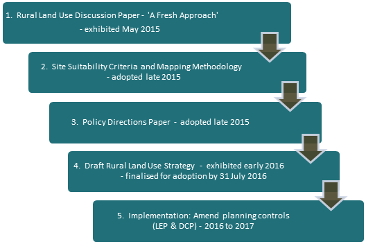
To ensure a 31
July 2016 adoption date is achieved, Council at its 29 October 2015 Ordinary
Meeting resolved to commit to the following milestone deadlines:
|
Remaining Strategy stages
|
Date to enable exhibition by March 2016
|
|
Stage 2 - Site Suitability Criteria and Mapping Methodology
(SSCMM)
endorsed by Council (to inform related mapping and Policy
Directions Paper)
|
29 October 2015 Council Meeting
|
|
Stage 2 - SSCMM and related mapping
and
Stage 3 – Draft Policy Directions Paper
adopted for exhibition in March 2016 (with draft Strategy)
|
10 December 2015 Council Meeting
19 November 2015 Council Meeting
|
|
Stage 4 – Draft Rural Land Use Strategy adopted for
exhibition
– public exhibition
– final adoption by Council
|
February 2016 Council Meeting
March – April 2016
July 2016
|
Council at its 29 October 2015
Ordinary Meeting also endorsed the Stage 2 – ‘Site
Suitability Criteria and Mapping Methodology’, followed by adoption of
Stage 3 – ‘Policy Directions Paper’ at the 19 November 2015
Ordinary Meeting. Together these documents will inform preparation of the
draft Rural Land Use Strategy.
This report presents the revised
Stage 2 – ‘Site Suitability Criteria and Mapping Methodology’
and related mapping for Council’s adoption, as contained in Attachment
‘1’.
Report
The Site Suitability Criteria and
Mapping Methodology (SSCMM) provides a framework for determining future rural
development potential based on a range of
natural resource management, risk avoidance and social/economic servicing
criteria. It also identifies the need to
consider future rural development priorities within the context of service
catchment and road infrastructure criteria.
In preparing the criteria and
mapping methodology, staff liaised with the Department to ensure that the Rural
Land Use Strategy mapping methodology direction is consistent with the policy
principles of the working draft North Coast Regional Strategy. The
criteria were also informed by:
· other relevant state, regional and/or local planning
documents and best practice planning principles;
· government agency feedback;
· feedback arising from Council’s Strategic Planning
Committee (SPC) workshops; and
· consequential changes resulting from Council resolution 15-569
(29/10/15) in relation to the draft Policy Directions Paper.
In relation to the last bullet
point, consequential changes made within the SSCMM document (Attachment 1) have
been highlighted in yellow for ease of
reference.
For purposes of the SSCMM, the
term ‘future rural development’
includes tourism, conventional rural residential, multiple occupancies,
community title or other non-agricultural land uses.
The SSCMM has been used to map the
following categories of land:
1. Constrained Land
This
identifies areas where any of the criteria listed in Table 1 are present.
Constrained land will not be considered for future rural development as
it includes important environmental and
resource values and/or presents unacceptable risks. Examples include
extreme bushfire risk, steep slopes and certain acid sulphate soils.
2. Assessable Land
This
identifies areas not encumbered by any of the Constrained Land criteria in
Table 1 but potentially affected by one or more of the criteria listed in Table
2. Assessable Land encompass environmental, economic and risk avoidance
criteria which may not necessarily preclude future rural development on
the land but rather indicate a need for a more detailed site specific
investigations to determine the site’s full development potential.
Examples
include biophysical strategic agricultural lands, flood liable land and scenic
landscape features.
The
Assessable Land criteria are not comprehensive and there may be other matters
which need to be taken into consideration to determine a site’s
development potential.
3. Unconstrained Land
This
identifies areas that are neither encumbered by Constrained Land criteria
(Table 1) nor affected by Assessable Land criteria (Table 2).
4. Future Rural Development
Priorities
This
considers priorities for future rural development of Unconstrained Land
and Assessable Land using the ‘Service Catchment and Road Infrastructure
Criteria’ in Table 3. This reflects the premise that future rural
development should be within a reasonable distance of village and town
services and be provided with a standard of road access that does not place a
financial burden on the wider community. From a service catchment
standpoint, priority generally will be given to ‘assessable’ and
‘unconstrained’ land within:
(i) 5 km radius from the general post office
in a town containing a high school; or
(ii) 2 km radius from a primary school or general store in villages and rural
settlements.
For
all unconstrained and assessable land, whether within or outside a service
catchment area, the following also must be considered:
· capacity / condition of relevant road network; and
· costs to wider community of proceeding with potential rural
lifestyle living precincts.
More
detailed evaluation of these and other matters will occur at the draft Rural
Land Use Strategy stage. A rural land release program also will be
developed as part of the Rural Land Use Strategy that identifies areas to be
released in the short, medium and long term, when / what services are required,
process for rezoning, etc.
Mapping highlights
Some points to note from the SSCMM
mapping (contained in Attachment ‘1’) are as follows:
· The area of unconstrained and assessable land
totals approximately 4,400 hectares (see Map 19 in Attachment 1)
· There is a considerable amount of unconstrained land
(340 hectares) and assessable land (1,635 hectares) within the 2km/5km
service catchments (see Map 19A in Attachment 1);
· Much of this occurs within the 5km service catchments of
Mullumbimby and Byron Bay, followed by the 2km Village catchments of Main Arm
and The Pocket;
· Some of the existing rural residential zoned land within
the 5km town service catchments may have further subdivision potential;
· The assessable land criteria (in Table 2) are not
comprehensive and there may be other matters which need to be taken into
consideration to determine a site’s development potential (eg.
capacity/condition of relevant road network); and
· It will be necessary to investigate the suitability of unconstrained
and assessable land for future urban purposes (short and long term)
during the draft Strategy stage.
High Conservation Value
Vegetation (HCV) and ‘Extreme Bushfire’ mapping
Both the
‘HCV’ and ‘Extreme Bushfire’ mapping are currently
under review and are awaiting completion of the updated shire wide vegetation
mapping, which is expected prior to Council’s consideration of the draft
Strategy in February 2016. At that time a more up to date version of
these maps will be presented along with the draft Strategy to be adopted for
public exhibition.
In order for the RLUS to remain on
track to meet the milestone deadlines adopted on 29 October 2015, it is
requested that Council adopt the SSCMM and related mapping (as contained in Attachment
‘1’). This is on the
understanding that the updated ‘HCV’
and ‘Extreme Bushfire’ maps will be presented to Council in
February 2016 in conjunction with the draft Strategy.
Conclusion
It is recommended
that Council adopt the Site Suitability Criteria & Mapping Methodology (as
revised) and corresponding mapping contained in Attachment
‘1’ as a key document to inform
preparation of the draft Rural Land Use Strategy.
Updated ‘HCV’ and ‘Extreme Bushfire’
mapping will be presented to Council in February 2016 in conjunction with the
draft Strategy. There may be subsequent refinements to
the SSCMM language and format to improve legibility prior to being
exhibited. Such changes would not affect the criteria and mapping
methodology adopted by Council.
Financial
Implications
This is a component of a Council
initiated strategy and therefore the administration cost has been met by
Council.
Statutory
and Policy Compliance Implications
The Site Suitability Criteria and Mapping Methodology have been
informed by the relevant state, regional and/or local planning framework and
best practice planning principles.
Staff Reports - Sustainable Environment and Economy 13.16
Report No. 13.16 Bay
Lane - Temporary Closure
Directorate: Sustainable
Environment and Economy
Report
Author: Sarah
Workman, Tourism Officer
File No: I2015/1401
Theme: Economy
Economic Development
Summary:
Following the report to Council
on 11 December 2014 regarding the outcomes of the Bay Lane Activation event,
Council have requested that staff prepare a report to consider the temporary
closure of Bay Lane and the cost of infrastructure to improve pedestrian safety
and enable future laneway activations (14-652).
This report considers the
infrastructure options available, suitable timing for implementation and
synergies with the outcomes of the Byron Bay Town Centre Masterplan.
|
RECOMMENDATION:
1. That
Council place the temporary closure of Bay Lane on hold until construction of
the Main Beach Backpackers is complete late 2016, due to restricted access at
the Fletcher Street end of Bay Lane.
2. That
Council recommend that investigation commence to transform Bay Lane into a
shared zone to align with the preliminary recommendations of the Byron Bay
Town Centre Masterplan.
3. That
Council allocate a budget up to $20,000 from Section 94A funds (Civic
Improvements in Byron Bay town centre) to prepare a pavement treatment to the
laneway, which increases pedestrian safety and beautifies the space.
4. That
Council investigate the feasibility and stakeholder support to increase the
footpath widths in Bay Lane to allow for Footpath Dining and increase
pedestrian safety.
|
Report
In October 2014, the Bay Lane Activation event provided a
diverse cross art-form program that drew more than 3000 people into the
laneway. The event engaged a multi-generational audience and confirmed strong
community sentiment for activation of public spaces. Stakeholders and the
general public were overwhelmingly positive and reinforced a strong desire for
more site specific events that engage with public space and community, with
particular reference to Bay Lane and the potential for enabling a shared zone
laneway.
At its meeting on 11 December 2014, Council resolved
(14-652):
1. That
Council note the overview of Bay Lane Activation and feedback from stakeholders
presented in this report.
2. That
Councillors receive an update clarifying the costs, revenues and budget
outcomes of the project.
3. That
Council receive a report that:
a) explores
the cost of basic infrastructure that would contribute to pedestrian safety and
enable future laneway activations, e.g. removable bollards.
b) explores
the development of an Event Management Package that could be presented to third
parties to produce future laneway activations.
This report responds to part 3.a) of the resolution, as
parts 2 and 3b) were reported to Council at its Ordinary Meeting on 19 March
2015.
Bay Lane is a well known
eat-street destination with seven cafes and restaurants accessible from the
laneway. On Friday and Saturday evenings this is a particularly busy area
for pedestrians as they move around the town centre. The pedestrian safety
issues arise predominantly from the Jonson street end as large trucks and
deliveries are constantly arriving in bay Lane. In addition, cars move through
the laneway at high speed causing concern for pedestrian safety.
Staff have explored the
investment of a temporary removable bollard system to be installed at the
Jonson Street end of Bay Lane and to the driveway at the Bay Lane Apartments to
allow for resident and visitor vehicle access. The proposed closure would be in
place on Friday and Saturday nights from 4pm to 6am. A temporary bollard system
proves functional, aesthetically pleasing and is a relatively cost-effective
solution. The total cost of a bollard system including installation is $7,758.
Staff met with
stakeholders on 21 October 2015 to discuss the proposed closure and infrastructure
requirements, which includes a vehicle turning circle and 2-way vehicle access from
the Bay Lane Apartments Bay to the Fletcher Street entrance of Bay Lane (please
see the diagrams below).
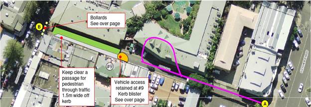
Stakeholders that attended were very positive and supported
activations within the laneway, increased pedestrian safety initiatives and
improvements in the attractiveness of the site. However, issues such as
delivery provisions, the ability to create a functional turning circle and
issues associated with general access to the laneway requires further investigation
by staff. There was a greater level of support for a shared zone. Stakeholders
present also favoured increasing the footpath space to accommodate additional
footpath dining and increase safety for pedestrians. It was also proposed that
additional revenue generated from footpath dining could be reinvested in
beautification and activation projects for the laneway.
Due to construction works at Main Beach Backpackers, the
Fletcher Street end of the laneway is reduced to single lane access until December
2016. Staff recommend that Council place the temporary activation of Bay Lane
on hold until December 2016, when construction is anticipated to finish.
As an alternative, and possibly a more effective solution,
staff propose investigating the steps and engagement required to transform Bay
Lane into a shared zone, to increase pedestrian safety and slow vehicle speeds.
These actions align with the preliminary outcomes of the Byron Bay Town Centre
Masterplan and provide the opportunity for beautification through pavement
treatments and additional signage, which create interest and increased
pedestrian safety. Below is an example of a shared zone in Bunda Street,
Canberra and Central Street, Sydney, which demonstrates pedestrian prioritised
areas.

In addition to transforming Bay Lane into a Shared Zone,
staff will begin consultation and investigation into the steps required to
increase the width of the footpath to allow for footpath dining in the laneway.
This will create a revenue stream for Bay Lane, which could be reinvested into
beautification and activation initiatives. This also allows restaurants and
cafes to invest in furniture and infrastructure required to attract additional
patronage and ensure they receive a return on investment.
Whilst the above work is being undertaken, Bay Lane will be
included as part of the Byron Bay Town Centre Placemaking Seed Fund, where
separate activations and beautification initiatives are proposed to showcase
the use of public space. The Byron Bay Town Centre Placemaking Seed Fund report
is also being considered as part of the Council meeting agenda for 10 December
2015.
Financial Implications
A budget allocation
of up to $30,000 from Section 94A funds (Civic Improvements in Byron Bay
town centre) is
required to prepare a pavement treatment to the laneway, which would increase
pedestrian
safety and beautify the space.
Statutory and Policy Compliance Implications
Byron Shire 2008 – 2018 Tourism Management Plan
Draft Byron Bay Town Centre Masterplan (stage 3 and stage 4
reports)
Local Government Act
Staff Reports - Sustainable Environment and Economy 13.17
Report No. 13.17 Byron
Bay Town Centre Placemaking Seed Fund (PSF)
Directorate: Sustainable
Environment and Economy
Report
Author: Sarah
Workman, Tourism Officer
File No: I2015/1405
Theme: Economy
Economic Development
Summary:
The Byron Bay Town Centre Placemaking Seed Fund
is proposed as a collaborative platform to initiate the revitalisation,
beautification and activation of the Town Centre. The fund seeks to
attract the creative talents of the Shire who have the capacity to transform
underutilised spaces, public places and laneways to showcase the unique and
innovative nature of this much loved and iconic town and achieve an authentic
sense of place.
The program of consultation and development of
the Byron Bay Town Centre Masterplan has focused on placemaking as a key driver
of outcomes and strategies. The intent of establishing this fund is to be
ready for implementation of the plan, specifically related to actions for
revitalisation, beautification and activation.
The creation of the Placemaking Seed Fund allows
Council to leverage dollars through community collaboration, grants and sponsorships
to receive a high return on investment, strengthen community relationships and
harness the creative capability within the Shire, while maximising the impact of the Masterplan’s implementation.
This report details the objectives, timing and
outcomes of the proposed Byron Bay Town Centre Placemaking Seed Fund with the
intent to run the first project alongside the Byron Bay Town Centre Masterplan
Exhibition period in February/March 2016.
|
RECOMMENDATION:
1. That
Council endorse the creation of the Byron Bay Town Centre Placemaking Seed
Fund as a collaborative platform to initiate the
revitalisation, beatification and activation of the Town Centre as a
component of the Byron Bay Town Centre Masterplan exhibition and
implementation program.
2. That
Council allocate a budget for the Byron Bay Town Centre Placemaking Seed Fund
being:
a) $30,000
from the Footpath Dining Reserve.
b) $30,000
from the Civic Improvements in the Byron Bay Town Centre / Public Art (Section
94A funds).
3. That
Council resolve that the final decision regarding successful applicants be
made by the General Manager under delegated authority.
|
Report
Byron Shire Council has embarked on a
significant and groundbreaking project over the past 12 months in the
development of the Byron Bay Town Centre Masterplan. Extensive
consultation has been undertaken to appreciate the current and future needs of
the community, including the understanding of what’s working,
what’s not and what are the unique qualities of the town centre and
determining how each one of these can shape the future of the town, its
livability and economy.
The Byron Bay Town Centre (BBTC) Placemaking
Seed Fund is a launchpad initiative to quickly progress key strategies of the
Masterplan relating to revitalisation, beautification and activation that will
result in a higher level of connectedness for locals, opportunities for
homegrown enterprise and inspiring visitor product.
The creation of a Placemaking Seed Fund (PSF)
allows Council to leverage dollars through community collaboration, grants and
sponsorships in order to receive a high return on investment, strengthen
community relationships and harness the creative capability within our Shire,
all while maximising the impact of the Masterplan’s implementation.
What is a Placemaking Strategy?
The term placemaking has been used in many discussions about
the Byron Bay Town Centre in recent times. Placemaking is the process through which we collectively activate
and beautify our public spaces to maximise shared value. With the community
being at the heart of placemaking, community participation is critical with
placemaking involving the planning, design, management and programming of
public spaces. More than just creating better design of public spaces,
placemaking facilitates creative patterns of activities and connections
(cultural, economic, social, ecological) that define a place and support its
ongoing evolution.
Objectives of the Byron Bay Town Centre Placemaking Seed
Fund (PSF)
Community
participation and engagement forms part of the thinking behind developing the
BBTC Placemaking Seed Fund. This fund will encourage event organisers,
entrepreneurs and creatives to pitch their ideas for an activated, beautified
and rejuvenated Byron Bay Town Centre. These ideas will provide the opportunity
to deliver the outcomes of the Masterplan and showcase Byron’s
identity to the wider community and visitor economy. The Key objectives of the
BBTC Placemaking Seed Fund are as follows:
1. Inspire
the use of underutilised and inactive spaces, such as laneways, shared zones,
streets, parks and reserves.
2. Beautify
the town centre, which could include; public art installations, laneway
beautification, pavement treatments, plantings, street furniture etc.
3. Provide
inspiring activation in the town centre, which could include; pop-up bars and
restaurants, shipping containers for business incubation, festivals, events,
markets etc.
4. Activate
town places with creative influences that cater for young and co-generational activations and spaces
5. Show
connectivity for the community between spaces.
6. Create
usable, inviting, productive and safe spaces.
7. Provide
a platform for creatives to share and contribute their expertise and innovative
ideas
8. Provide
a platform to showcase the Byron identity
9. Foster
investment and collaboration within the business and wider community of the
Shire.
10. Leverage
seed funds through grant, sponsorship or in-kind funds
11. Strengthen
community relationships through engagement and partnering opportunities
12. Harness
the creative capability within the Shire and ensure local artists, event
organisers, musicians, etc. are provided with the opportunity to get involved
in these projects, and provide mentoring opportunities to youth where possible
Placemaking Seed Fund Mechanics
The Placemaking Seed Fund will provide $60,000 towards
activation and beautification projects in the Byron Bay Town Centre. Applicants
can apply for funding through one of the following categories:
1. Activation
2. Beautification
It is anticipated that up to five projects will be funded,
with a mix of activation and beautification projects. These projects will also
be a mix of temporary interventions and permanent beautification, which will
start to reshape and redefine the town centre.
Activation
An activation includes creative concepts that inspire the
use of underutilised and inactive spaces, such as laneways, shared zones,
streets, parks and reserves. We are seeking innovative proposals for events,
temporary interventions and artistic interventions. These proposals must create
animation, vitality, and a real ‘buzz’ within the
town centre.
Examples of an activation may include:
1. Events
such as: Bay Lane Activation held in 2014, local product showcases, parades and
celebrations, eat streets, music etc.
2. A
temporary intervention such as: pop-up shops, shipping containers, edible
gardens, community library etc.
3. Artistic
intervention such as: sculpture, a mobile art gallery, etc.
The images below showcase
successful activations within Australia and overseas that could be applied to
the Byron Bay town centre. These include small and large scale examples.


A
temporary pop-up restaurant in Montreal, Canada and shipping container at
Brisbane’s Eat Street.
A
temporary intervention – community library and community garden.


Mobile art gallery and St
Jerome’s laneway music event.

Events at Eat Street Brisbane
Beautification
Beautification includes creative concepts and ideas that
engage the community and inspire the public domain. Beautification will create
vibrancy within the town centre and provide the opportunity to improve the
aesthetic of the town centre. All beautification projects must be permanent, so
a new legacy can be created for the town centre.
Examples of beautification may include:
1. public
art installations
2. lighting
installations
3. laneway
beautification
4. pavement
treatments
5. plantings
6. street
furniture and improved public domain
The images below showcase successful beautification projects
within Australia and overseas that could be applied to the Byron Bay town centre.


Transforming and
beautifying underutilised spaces. An example of Lawson Lane, artwork inspired
by Maya Hayuk, Aakash Nihalani, Brooke Andrew, Jim Bachor, Sabina Lang and
Daniel Baumann.


Small scale beautification
treatments


Landscaping and lighting
installations
Outcomes
The BBTC Placemaking Seed Fund will provide the following
outcomes for the town centre, Council and the wider community:
1. Provide
a minimum of two innovative activation projects which will incubate local
business, reflect the culture of the community and create a buzz in the town
centre.
2. Provide
a minimum of two beautification projects that inspire the use of underutilised
and inactive spaces.
3. Increase
project capability by leveraging Council’s seed funding through grants,
sponsorship and in-kind support.
4. Attract
new visitor markets through innovative and interesting activations and improved
town amenity.
5. Successfully
implement short-term deliverables and strategies within the BBTC.
Partnerships and
Collaboration
Council’s Economic
Development and Tourism team has taken a lead role in facilitating partnerships
and collaboration for community outcomes across a number of initiatives.
The BBTC Placemaking Seed Fund provides another opportunity for Council to
facilitate community, environment and economic opportunities and take a role in
ensuring activities are undertaken with a best practice principles
approach.
To enable placemaking activities and be effective partners
in this initiative, ED&T staff will work closely with successful projects
to address any regulatory requirements, event enablers such as licencing for
crown lands/public reserves and laneway/road closures etc.
Application Process
Council will prepare a call for expressions of interest
which will include detailed information on the criteria and requirements of
successful proposals.
In addition to meeting the objectives and outcomes outlined
above, applicants must detail their capability regarding insurance,
occupational health and safety, risk management, sustainability and financial
competency.
Each applicant must also demonstrate a proven track record
and show the ability to secure additional funding and collaborate and engage
with the community.
A project plan must accompany the expression of interest
submission and detail consultation/engagement, requirements for licenses, road
closures or regulatory requirements.
Council will also hold two information sessions for
potential applicants, which provides an opportunity for questions and answers
and to explore the Expression of Interest document in more detail and provide
additional background information on the Byron Bay Town Centre Masterplan.
The fund will be promoted through local media channels and
on the Byron Shire Council website.
Assessment process
An assessment panel made up of selected members of the Byron
Bay Town Centre Internal Working Group and Council’s Public Art Committee
will be established.
An evaluation model reflecting the PSF criteria/outcomes
will be provided to panel members to undertake an assessment of all
submissions.
Submissions will be recorded as received, with all
submissions provided to the assessment panel members for evaluation. The
Panel will be convened to verify the evaluation scoring and recommendations for
successful funding. This will be provided in a report to the General
Manager for PSF approval.
All applicants will then be notified of their success or
otherwise and any feedback provided.
Timing
14 Dec 15 Expressions
of Interest open
Dec 15/Jan 16 Information sessions held
for potential applicants
12 Feb 16 Expressions
of interest close
24 Feb 16 Successful
applicants notified
March 16 First
activation/beautification project commences
Byron Bay Town Centre Masterplan Exhibition showcase
initiative
It is expected that the Masterplan will go on exhibition for
6 weeks in February/March 2016. To provide the community with an insight
into the placemaking aspects of the plan and create an exciting and innovative
engagement platform it is proposed that the first activation and/or
beautification project be launched in conjunction with the Public Exhibition
phase of the BBTCM.
Links with the Tourism Management Plan and Vibrant Byron
Strategy
The Placemaking Seed Fund outcomes provides the opportunity
to attract new visitor markets that align with Council’s destination
brand and ethos to attract high-yield, low-impact visitor markets from Sydney
and Melbourne. The Placemaking Seed Fund aligns with the following objectives
and broader strategies of the Tourism Management Plan:
1. Strategy
8.1 – Investigate the development and promotion of additional tourism
product and visitor experiences to complement the brand and image of the Shire.
2. Strategy
10.2 – Investigate ways to attract high yield/low-impact visitor markets
to the Shire’s destinations.
3. Strategy
10.4 – Ensure that visitor experiences offered in Byron Shire are
world’s best practice.
The BBTC Placemaking Seed Fund also has strong links and
synergies with the Vibrant Byron Project Reference Group (PRG). This Vibrant
Byron PRG’s objective is to promote a vibrant and safe nightlife
atmosphere and economy in Byron Bay for both residents and visitors. The PRG is
also in the process of developing a draft strategy and many of the strategy
themes have been included in the BBTCM. These themes will also be delivered as
part of the BBTC Placemaking Seed Fund and include:
1. Activities
and products that embrace our strengths
- Embrace
our natural environment, creative people, innovative ideas
2. People,
partnerships and collaboration
- Work
together to achieve consensus and buy-in from all stakeholders
3. Safety
enablers
- Reduce
congestion in key places, improve/increase lighting, safer laneways (traffic
and lighting), combat anti-social behaviour
4. Vibrancy
enablers
- Strategically
place creative lighting, music, seating, event infrastructure (power, busker
pads), energise with activities and people, encourage co-generational
activity/places (whilst maintaining a sense of freedom)
5. Young
people
- Recognise
young people are attracted to key places, create spaces that cater to young
people for example, climbing, wifi, music, table tennis tables, events, group
seating, meeting places, Friday and Saturday night focus.
6. Significant
places/Bookends – Railway Park and Apex Park
- Address
safety issues/perceptions at Railway Park. Do more with both sites
7. Pedestrian
thoroughfares
- Broaden
pedestrian spaces, consider shared use zones, close streets, create movement
through town
8. Amenities
- Improve
toilets, beautify common areas, encourage participation, for example garden
beds.
9. Business/commercial
- Acknowledge
that the town centre is differentiated positively by an eclectic retail mix of
predominately small boutique businesses, encourage national chains / landlords
/ smaller boutique night-time business to be participants in improving the town
10. Promote
- Showcase
our strengths and talk about the creative people, eclectic mix of businesses
and vibrant nightlife. Promote our love of the town and expectations of
residents and visitors to respect our identity and town assets.
Financial Implications
The following budget
allocation is required for the creation of the Byron Bay Town Centre
Placemaking Seed Fund:
1. $30,000 from the Footpath Dining Reserve.
2. $30,000 from the Civic Improvements in Byron Bay Town
Centre / Public Art (Section 94A funds).
Statutory and Policy
Compliance Implications
Draft Byron Bay Town Centre Masterplan (stage 3 and stage 4
reports)
Local Government Act 1993
Byron Shire Council Procurement Guidelines and Toolbox
2008 – 2018 Byron Shire Council Tourism Management
Plan
Staff Reports - Sustainable Environment and Economy 13.18
Report No. 13.18 Update
on s68 applications for Approval to Operate - Brunswick Heads Holiday Parks
Directorate: Sustainable
Environment and Economy
Report
Author: Shannon
Burt, Director Sustainable Environment and Economy
File No: I2015/1406
Theme: Ecology
Development Certification
Summary:
At the Ordinary meeting of 26
November 2015, Council resolved:
15-591
Resolved that Council receive a report at the 10 December 2015
meeting on the S68 licences for Brunswick Heads Caravan Parks. (Dey/Richardson)
Council currently has three
applications for ‘Approval to Operate’ under section 68 (Part F2)
of the Local Government Act 1993 for Holiday Parks at The Terrace Reserve,
Massey Green and Ferry Reserve, Brunswick Heads.
The purpose of this report is to
provide an update on the status of these applications as per resolution 15-591.
|
RECOMMENDATION:
That Council:
1. Note
the report.
2. Continue
to progress the development of a draft Memorandum of Understanding with NSW
Crown Holiday Parks Trust to guide and improve the future interaction and
relationship between the parties, to allow both the Trust and Council to
perform their respective roles in regard to the care, control and management
of the Crown Reserves in Brunswick Heads.
3. Advise
the applicant for the Crown Reserve Holiday Parks Trust that an approval for
the renewal of the ‘Approvals to Operate’ for The Terrace
Reserve, Massey Greene and Ferry Reserve Holiday Parks cannot be approved, as
requested because:
a) The
applications have significant variances found during the independent
assessments, which would require changing the terms of the original approval
to operate.
b) That
the three months period, as specified in Section 107 of the Local Government
Act 1993, to allow Council to approve the applications has lapsed.
|
Attachments:
1 Draft MoU
between NSW Crown Holiday Parks Trust and Byron Shire Council, E2015/78088
Report
Section 68 Applications
– Approval to operate a caravan park
Council considered a report on
separate applications to renew caravan park ‘Approvals to Operate’
for The Terrace Reserve and Massey Green Holiday Parks at the Ordinary Meeting
16 July 2015. To assist Council in the determination of these applications an independent
assessment of the applications for renewal was undertaken. The independent
assessment advised that the renewal applications and the existing operation of
both Crown Reserve Holiday Parks would require changes to the terms of the
original approvals to operate. This would prevent Council from approving the
applications lodged seeking to renew the existing ‘Approvals to
Operate’.
At this meeting Council resolved the following:-
15-323 Resolved:
1. That
Council advise the applicant for the Crown Reserve Holiday Parks of Massey
Greene and The Terrace, Brunswick Heads that the application for renewal or
extension of the Approval to Operate cannot be approved, as the requested
Approval to Operate has significant variances found during the independent
assessments, that would require changing the terms of the original approval to
operate
.
2. That
the applicant be invited to submit new applications for approval to operate
which reflects the site layout which are consistent with the respective adopted
Plans of Management for the Massey Greene and The Terrace Crown Reserve caravan
parks and the boundaries as defined in Council's previous Resolutions 13-25,
12-995 and 12-627. (Richardson/Ibrahim)
Link to full report 13.9 Renewal of Caravan Park Approvals to Operate for the
Terrace Reserve Holiday
A teleconference/meeting with representatives from NSW Crown
Holiday Parks Trust and North Coast Holiday Parks occurred on 7 August 2015, to
discuss the above resolution with regard to The Terrace and Massey Greene
Holiday Parks. Council concerns about the applications made in the report were
reiterated including park boundary alignments and the plans of management, as
was the invitation to submit new applications for the Crown Reserve Holiday
Parks consistent with the terms of the original approvals.
In relation to the Ferry Reserve Holiday Park, a new
application for ‘Approval to Operate’ was lodged with Council on 1
June 2015. An independent assessment of this application is current but
subject to a request for further information made to the NSW Crown Holiday
Parks Trust on 9 October 2015. No formal response to this request has been
received to date.
Circumstances in which approval is taken to have been
refused
As Council has not determined the Section 68 Applications
within the period specified in section 105 of the Local Government Act 1993,
Council is taken to have refused the applications and the applicant may refer
the applications to the Minister for determination.
Extending or renewing approvals
Section 107 of the Local Government Act 1993, advises
that Council may extend or renew an approval, without changing its terms, if it
is satisfied there is good cause for doing so. The renewal of an approval
operates as if it were an approval granted on the date of the renewal. The
extension or renewal may be granted before the approval lapses, or at any time
within three months of the approval lapsing.
Having regard to the above, the current status of the
Section 68 applications with Council are:
· Council has
resolved that the applications for renewal of the ‘Approval to
Operate’ applications under section 68 (Part F2) of the Local
Government Act 1993 of The Terrace and Massey Green Holiday Parks cannot be
approved due to variances that would require changing the terms to the original
approval and that new applications are required to be submitted for assessment.
Since this resolution the timeframe to determine the renewal of the
‘Approval to Operate’ applications has also extended beyond a three
month period as specified in Section 107 of the Local Government Act 1993,
to allow Council to approve the applications.
· Council has not
determined the application for the Ferry Reserve Holiday Park within the
statutory time frame, as such Council is taken to have refused the application,
and the applicant may refer the application to the Minister for determination.
Current
discussions – Memorandum of Understanding
On
Thursday, 8 October 2015, Council Representatives met with Representatives of
the NSW Crown Holiday Parks Trust to discuss both the concerns of the community
and Council in relation to works on the Brunswick Heads Foreshore Reserves and
the applications submitted for the renewal of the S68 Approvals to Operate the
Crown Holiday Parks in Brunswick Heads.
The
meeting was held on a “without prejudice” basis and as such the
meeting and the Minutes are regarded as confidential, due to the “commercial
in confidence” nature of the matters being discussed.
A
further meeting was held on Thursday, 26 November 2015, with representatives of
the NSW Crown Holiday Parks Trust to discuss the development of a Memorandum of
Understanding between the Trust and Council. The purpose of the
Memorandum of Understanding being to guide and improve the future interaction
and relationship between the parties, to allow both the Trust and Council
perform their respective roles in regard to the care, control and management of
the Crown Reserves in Brunswick Heads.
A
copy of the draft Memorandum of Understanding was forwarded to Council on 27
November 2015, and has been referred to the Legal Services Team for review and
comment. This advice is currently being prepared. A copy of the draft
Memorandum of Understanding has been included as Attachment 1 to this Report.
In
the covering email the NSW Crown Holiday Parks Trust stated that it “..is keen to progress negotiations with
Council in relation to the holiday park boundaries and public access through
the reserves, however it is imperative that interim approvals are in place..”
The Trust
further stated that:-
“Any
amendments to the Plans of Management to facilitate transition to a negotiated
outcome are likely to take 18 months to 2 years. The Trust suggests
a similar term for the interim approvals would be appropriate.”
Finally
the Trust requested that draft Memorandum of Understanding and the Trusts
request for Council to renew the S68 Approval to Operate for the Ferry Reserve,
Massey Greene and The Terrace Reserve Holiday Parks for a period of 2
years be reported to this meeting of Council, as part of the update sought by
Council in Resolution 15-591.
The renewal of the S68
Approvals to Operate would be on the same terms and conditions as the most
recent Approval for each of the Holiday Parks, and would enable the Trust to
work through the statutory process to amend the Plans of Management for each of
the Reserves listed in the draft Memorandum of Understanding, and for the
Parties to reach agreement on the objectives listed in the draft Memorandum of
Understanding in section 1.2 – Objectives. This includes agreement
between the parties on the operational boundaries of the Holiday Parks.
This
would also allow the Trust to submit, within the requested renewal period, new
applications for Approvals to Operate for each of the Brunswick Heads Crown
Holiday Parks, based on the amended Plans of Management.
A
further update with regards to the MOU will be provided to Council in the New
Year.
Financial Implications
N/A
Statutory and Policy
Compliance Implications
The operation of caravan parks
and camping grounds require Approval to Operate (ATO) under Section 68 (Part
F2) of the Local Government Act 1993. Applications are lodged by the land owner
to continue the operation of caravan park and camping ground activities and
application fees are paid in accordance with Councils’ adopted fees and
charges.
The process of assessing and
determining ATO applications is regulated under Chapter 7 Part 1 of the Local
Government Act 1993. Part of the consideration of such applications involves
the auditing of compliance with the Local Government (Manufactured Home
Estates, Caravan Parks, Camping Grounds and Moveable Dwellings) Regulation 2005
(“the Regulation”).
Once it has been determined that
the application represents the actual site activities, and satisfies the requirements
of the Regulation, then an ATO approval is granted. Once an approval has been
issued Council may determine to extend or renew an approval (but without
changing the terms of the approval) if satisfied there is good cause for doing
so.
Staff Reports - Sustainable Environment and Economy 13.19
Report No. 13.19 PLANNING
- Tyagarah Airstrip Planning Proposal
Directorate: Sustainable
Environment and Economy
Report
Author: Chris
Larkin, Senior Planner
File No: I2015/1435
Theme: Ecology
Planning Policy and Natural Environment
Summary:
The attached planning proposal seeks to amend Byron Local
Environmental Plan (LEP) 2014 to enable a range of aviation related land uses
to occur with development consent at the Tyagarah Airstrip. It is intended an
enabling clause be inserted into Schedule 1 of the LEP which would enable
subdivision, commercial, tourist, recreational, industrial and residential
related aviation uses to be approved by Council through a development
assessment process.
This report recommends that the LEP amendment in the attached
Planning Proposal be supported and sent to the Department of Planning and
Environment for a Gateway Determination.
NOTE TO COUNCILLORS:
In accordance with the
provisions of S375A of the Local Government Act 1993, a Division is to be
called whenever a motion for a planning decision is put to the meeting, for the
purpose of recording voting on planning matters. Pursuant to clause 2(a)
under the heading Matters to be Included in Minutes of Council Meetings of
Council's adopted Code of Meeting Practice (as amended) a Division will be
deemed to have been called by the mover and seconder of all motions relating to
this report.
|
RECOMMENDATION:
1. That
Council proceed with the planning proposal in Attachment 1 and send it
to the Department of Planning and Environment for a Gateway determination.
2. That
Council request the Department of Planning and Environment to delegate
to Council the preparation and making of the LEP Amendment.
|
Attachments:
1 Tyagarah
Airstrip Planning Proposal, E2015/76550
Report
Council resolved on the 11 December 2014 the
following:
14-657 Resolved:
1. That
Council reaffirm its commitment to the continued operation of Tyagarah
Airfield.
2. That
Council consider funding additional costs, to the value of $105,000, required
to complete the identified assessments and investigations as part of the 31
December 2014 quarter budget review.
3. That
on completion of the required assessments and investigations, The Airport Group
provide Council with a final report containing the preferred strategic future
option and management model with a cost/benefit analysis or business case
supporting the recommendations for Tyagarah Airfield.
4. That
funding allocation for the capital works identified to date be considered in
the 2015/16 financial year budget.
5. That
Council consent, as the land owner, to the lodgement of the subdivision
development application at Tyagarah Airfield.”
Part 3 of that resolution has led to Council investigating
opportunities for the site, resulting in the attached planning proposal being
prepared for the subject lands at and immediately surrounding the Tyagarah
Airstrip. The planning proposal seeks to facilitate the development of the site
further for aviation related land uses. Activities at the site are
predominantly tourist and recreational orientated including joy flights,
parachuting, and gliding. A pistol and clay shooting club also exists to the
north of the Airstrip and the Byron bay Lapidary Club also leases land at the
Airstrip as detailed below.
The site as defined is located on the eastern side of the
Pacific Highway, north of Grays Lane at Tyagarah, and is accessed from Yarun
Road which runs parallel with the Pacific Highway. The site contains the
following properties.
|
Council
Land
|
|
|
Lot
2 DP 749851
|
1,460m2
|
Leased
to Callinan Holdings Pty Ltd. Contains an existing industrial shed/ hangar
operated by Sky Limit Sports Aviation.
|
|
|
Lot
1 DP 713023
|
1.525ha
|
Subdivided
for lease purposes under DP 805678 – see below:
|
|
|
Lot
4 DP 805678
|
5,136m2
|
Created
for lease purposes. Leased to private individual. Contains the base and
business premise of Skydive Byron Bay.
|
|
|
Lot
5 DP 805678
|
1.011ha
|
Created
for lease purposes. Currently vacant.
|
|
|
Lot
6 DP 836887
|
867.9m2
|
Leased
to private individual. Contains two existing hangars used by Tiger Moth
Joy Flights.
|
|
|
Lot
8 DP 856832
|
385.7m2
|
Leased
to Byron Lapidary Society. Contains an existing building owned by the
Lapidary Society.
|
|
|
Lot
9 DP 856832
|
747.8m2
|
Leased
to Tiger Moth Aerial Services. Contains an existing building servicing as
administration for Tiger Moth Joy Flights.
|
|
|
Lot 49 DP 881232
|
13.21ha
|
Residual of the Council-owned land. Contains the western end of
runway and, in the north-eastern sector, the Tyagarah Public Hall and
associated amenities building.
The land leased and used by the Tyagarah Clay Shooting Club is partially
on this land, and partially on the adjoining Crown Land (Lot 181). Part of
the land is also leased to the Tyagarah Recreation and Flying Club as the
site for their hanger.
|
|
Crown Land
|
|
Lot 181 DP 755692
|
36.7ha
|
Contains the eastern section of the runway. Also contains areas
leased by Byron Power Gliding, Tyagarah Clay Target Club and Cape Byron
Pistol Club
|
|
|
|
|
|
|
To achieve the intended outcomes, the Planning Proposal will
amend Schedule 1 of Byron LEP 2014 to include a range of aviation-related uses
as additional permitted uses for the property. It will also override the Lot
Size Map in terms of subdivision which presently requires a 40 ha minimum for
subdivision.
The amendment proposed for Schedule 1 of the LEP, is to add
the following words:
6. Use of certain lands at
Yarun Road, Tyagarah
This clause applies to land at
Yarun Road, Tyagarah, being Lot 2 DP 749851, Lot1 DP 713023, Lot 6 DP 836887,
Lots 8 & 9 DP 856832, Lot 49 DP 881232 and Lot 181 DP 75569.
Development for the purposes
of subdivision, commercial, tourist, residential, industrial, and recreational
land uses including a heliport that are related to the use of the Tyagarah
Airstrip is permitted with consent.
The permitted land uses generally reflect the existing
aviation-related industrial, tourism and recreational uses being carried out at
the site. This will enable those uses to develop without needing to rely upon
complicated existing use right provisions and where appropriate the airstrip to
be developed with development consent. Allowing residential use will permit
accommodation such as a manager’s residence or the like. Given the flood
constraints at the site, any accommodation will need to be elevated and likely
to be at a first floor or mezzanine level.
Development listed in Schedule 1 are nominated as additional
permitted uses for particular land under Clause 2.5 of the LEP. They are not
governed by the land use table or other contrary clauses in the LEP.
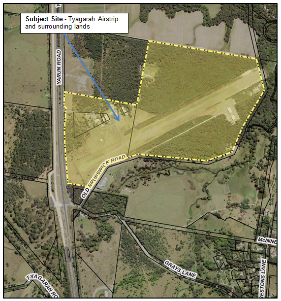
Further detail on the Planning Proposal including
justification and compliance with the Section 117 Directions and State
Environmental Planning Policies are attached at Appendix 1.
Conclusion
It is considered the amendments proposed within Planning
Proposal (Attachment 1) are relatively minor and will assist with formalising
existing and proposed activities at the airfield with development consent. It
is recommended that Council submit the Planning Proposal to the NSW Department
of Planning and Environment for a Gateway Determination.
Financial Implications
The costs for proceeding with the planning proposal as it
affects Council owned and managed land will be borne by Council.
Statutory and Policy
Compliance Implications
The relevant policy considerations are addressed in the
attached planning proposal, which has been prepared in accordance with the DPE
Guide to Preparing Local Environmental Plans dated April 2013.
Staff Reports - Sustainable Environment and Economy 13.20
Report No. 13.20 PLANNING
- Development Application 10.2015.505.1 - Alteration and additions to existing
backpackers accommodation, including demolition of an existing dwelling and
construction of a new three level building with basement carpark to increase
capacity to 200 beds
Directorate: Sustainable
Environment and Economy
Report
Author: Paul
Mills, Senior Assessment Officer - Planning
File No: I2015/1440
Theme: Ecology
Development and Approvals
Proposal:
|
DA No:
|
10.2015.505.1
|
|
Proposal:
|
Alteration and additions to existing backpackers
accommodation, including demolition of an existing dwelling and construction
of a new three level building with basement carpark to increase capacity to
200 beds.
|
|
Property description:
|
LOT: 1 DP: 1208452
7 Carlyle Street BYRON BAY
|
|
Parcel No/s:
|
267757
|
|
Applicant:
|
YHA Ltd
|
|
Owner:
|
YHA Ltd
|
|
Zoning:
|
B2 Local Centre
|
|
Date received:
|
21 August 2015
|
|
Integrated Development:
|
No
|
|
Public notification or exhibition:
|
- Level
2 advertising under DCP 2014 Part A14 – Public Notification and
Exhibition of Development Applications
- Exhibition
period: 10/9/15 to 23/9/15
- Submissions: One (1)
|
|
Other approvals (S68/138):
|
Not applicable
|
|
Planning Review Committee:
|
Not applicable
|
|
Delegation to determination:
|
Meeting of full Council (Estimated cost of works $5.72
million specified on the application form)
|
|
Issues:
|
· Height, bulk and
scale of the proposed development and its compatibility with the existing
streetscape.
· Noise,
disturbance and waste management.
· Basement car
park proposed on flood liable land.
|
Summary:
Council is in receipt of an
application seeking development consent for alterations and substantial
additions to the existing hostel to increase the maximum capacity to a total of
200 guests. The development specifically involves:
· Demolition
of the existing timber and fibro house located at No.3 Carlyle Street;
· Construction
of an underground carpark with vehicular access via a ramp from Marvel Lane.
· Construction
of a three level building above the basement carpark which will contain 36 new
bedrooms with provision for 103 additional beds.
Subject to conditions the proposal is considered to be able
to satisfy relevant environmental planning instruments including Byron Local
Environmental Plan 2014 (LEP 2014). The proposal is also considered to satisfy
the provisions of Development Control Plan 2014 (DCP 2014) subject to
conditions.
The height of the proposed building significantly exceeds
that of existing two-storey buildings in close proximity of the site, however
the proposal is below the 11.5m height limit and maximum Floor Space Ratio of
1.3:1 prescribed by LEP 2014. LEP 2014 establishes the maximum height and
desired future character for development in the locality.
Council’s Development Engineer has raised no objection
to the proposed basement parking level being situated below the Flood Planning
Level for the subject site. It is proposed to use a flood gate/barrier to
achieve the 2050 FPL1 of 3.44m AHD. A condition has also been included to
require a vehicle turn around area be provided within the basement car park and
two (2) accessible parking spaces be provided on the subject site.
The development application was publicly notified in
accordance with the Level 2 provisions of Council’s DCP 2014, with one
(1) submission being received. The concerns raised in the submission relate to
noise and disturbance for neighbouring residents, waste management and litter.
The matters raised have been addressed in this report in part by including
conditions aimed at reducing noise, disturbance and litter.
Overall the application is considered to have sufficient
planning merit to warrant approval subject to conditions.
NOTE TO COUNCILLORS:
In accordance with the
provisions of S375A of the Local Government Act 1993, a Division is to be
called whenever a motion for a planning decision is put to the meeting, for the
purpose of recording voting on planning matters. Pursuant to clause 2(a)
under the heading Matters to be Included in Minutes of Council Meetings of Council's
adopted Code of Meeting Practice (as amended) a Division will be deemed to have
been called by the mover and seconder of all motions relating to this report.
|
RECOMMENDATION:
That pursuant
to Section 80 of the Environmental Planning & Assessment Act 1979,
development application no. 10.2015.505.1 for Alteration and additions to existing
backpackers accommodation including demolition of an existing dwelling and
construction of a new three level building with basement carpark to increase
accommodation to 200 beds, be granted consent subject to the conditions
contained in Attachment 1 (E2015/75911).
|
Attachments:
1 Conditions
of consent 10.2015.505.1, E2015/75911
2 Proposed
development plans 10.2015.505.1, E2015/75901
3 Confidential
- Submission 10.2015.505.1, E2015/78059
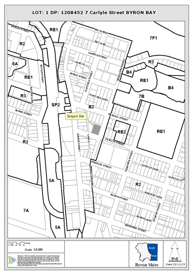
Assessment:
1. INTRODUCTION
1.1 History/Background
The subject allotment Lot 1 DP 1208452 was
created/registered on 25 June 2015 following a consolidation of Lot 1 DP
849230, 5-7 Carlyle Street and Lot 3 DP 936898, 3 Carlyle Street. The following
are past major development applications over the historical allotments are
noted:
Historical Lot 1 DP 849230, 5-7 Carlyle Street
5.1995.5.1
Development
Application for a two storey building containing a backpackers hostel, granted
approval on 11 May 1995. The development included 25 bedrooms for backpacker travellers,
1 manager’s flat and office, male and female amenities, common recreation
areas, kitchen, barbecue and outdoor dining areas, landscaping and thirteen
on-site car parking spaces. Development Consent No. 5.1995.5.1 specifically
limited the number of beds within the 25 bedroom hostel to a maximum of 60.
10.2005.747.1 Development Application for
alterations and additions to an existing hostel to increase the number of guest
beds from 60 to 107. Consent granted 23 August 2006.
A number of other smaller scale Development and Building
Applications are recorded within Council’s computer records system for
this historical allotment.
Historical Lot 3 DP 936898, 3 Carlyle Street
10.2010.402.1 Development application for a Change of use and
relevant building works to create educational facility. Development consent
granted 7 October 2010. Assessment report notes “To accommodate
the development additional car parking and bike parking is to be provided on
the adjoining property at 3 Carlyle Street, Byron Bay. A dwelling house exists
on this property and the applicant has advised that it will continue being used
as a dwelling and accommodate four students associated with the school.”
1.2 Description
of the site
The subject site is legally described as Lot 1 DP 120845
street address 3-7 Carlyle Street, Byron Bay. The subject allotment was formed
by the consolidation of two former allotments at No.3 Carlyle Street (640.7m2)
and No.5-7 Carlyle Street (1388.3m2). The site is located
within the Byron Bay commercial centre and has frontages to Carlisle Street
(south), Middleton Street (east) and Marvel Lane (north). The only
adjoining neighbour is to the west at No.1 Carlisle Street, this adjoining site
contains an existing English Language School.
The site has a total area of 2029m2 and contains
a two-storey YHA backpackers hostel (5-7 Carlisle Street) and a freestanding
single-storey timber and fibro dwelling (3 Carlisle Street). The existing
hostel site has two courtyard areas one containing an in-ground swimming
pool.
The land is generally flat with the level ranging around
2.7m to 2.8m AHD. The lowest point on the site is 2.51m AHD in the north-east
corner and the highest point is 2.85m AHD along the western boundary. The
ground floor of the existing hostel is approximately 3.2m AHD.
The existing hostel is predominantly landscaped with palms,
the site of the old house is has only grass yard
area.
1.3 Description
of the proposed development
The applicant has described the proposed development as
follows:
“Alterations and
additions to the existing Hostel to cater for a total of 200 guests. The
consent sought in relation to the new structure at 3 Carlisle Street comprises
the following:
Demolition of the existing timber and fibro house.
Construction of an
underground carpark for 12 cars with vehicular access via a ramp from Marvel
Lane. Two stairwells are proposed; one adjacent to car space 1 and the other
adjacent to car space 8.
Construction of a three level
building above the basement carpark which will contain 36 new bedrooms with
provision for 103 additional beds.
This new building will
contain a new reception area facing onto Carlyle Street, adjacent to the
English Language School.
Ground floor:
A. The
existing Multifunction Space is to be refurbished;
B. The
existing reception is to be converted into a 6 person shared dormitory;
C. Room
5 is to be demolished to provide additional open space (loss of 4 beds);
D. Room
6 is to be reduced in size to accommodate a new walkway (loss of 2 beds);
E. The existing recreation room in the south
west corner will become an office, staffroom and store;
F. The BBQ shelter/ accessible kitchen in the
southern courtyard will be demolished to provide additional open space;
G. A
timber screen will be erected to screen the garbage area from Middleton Street;
and
H. Alterations will be made to accommodate
the two new stairwells that will allow access to the new basement carpark.
First floor:
I. The
guest kitchen is to be expanded by removing approved rooms 20 and
21. This
will result in the loss of 10 beds.
J. Dining
room located in the rear of the building will be extended by removal
of an
existing staff bedroom,
The alterations will result
in the reduction of beds in the existing Hostel from 107 to 97 beds.”
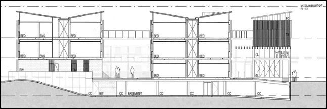
Figure 1 – Section drawing of proposed development
(showing basement car park and three storeys above)
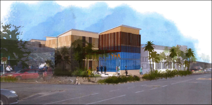
Figure 2 – Perspective drawing of the development (as
viewed from Carlisle Street)
Following are extracts from the Architects Design Statement:
“Design approach” – “the
predictable design response of the linear block on the linear available site,
which could functionally house the accommodation required of the Brief but
could be seen as a poor built form outcome”
“A pavilion solution” – “Housing
the accommodation within two pavilions we achieve much more open and private
views to north and south, creation a central shared landscaped court that can
be experienced as an extension to the existing court, and deeper penetration of
sunlight to the core of this site. We also retain privacy of view to an from
the windows of the language school adjacent.”
“Buildings set within landscape” –
“shared communal experience for guests as a guiding aspiration of the YHA
organisation has resulted in the burying of all new parking below ground, thus
leaving the ground plane almost totally available for guest use.”
“A new entrance” – “We have
designed the facility to be managed from a new entrance at the Carlisle Street
western corner, moving the entry and associated noise away from the residential
properties around Middleton Street.
“A tactile and subtle material palette”
– “We proposed a colour palette of light brown/sandy colours,
intended to reflect naturally occurring that are associated with this area of
New South Wales and that would under strong sunlight, a softer wall colouring
that as a base canvas to the greener landscape elements”
“Secure and safe” – “The location
of the main entrance and reception is selected to have direct line of sight to
both Carlisle Street, the front area of the adjacent language school and also
to within the hostel looking directly at the main circulation corridor and the
principle vertical circulation route, both the stairs and the lift.”
2. SUMMARY
OF GOVERNMENT/EXTERNAL REFERRALS
|
|
Summary of Issues
|
|
Development Engineer
|
Car parking (including accessible parking spaces), flood
liable land, access, and stormwater management. No objection to the proposal
subject to conditions. See Doc No. A2015/25326.
|
|
Environmental Officer
|
Acid sulfate soils, contaminated land assessment (SEPP
No.55), noise impacts during construction and operation phases of the
development, waste management and dewatering. No objection to the proposal
subject to conditions See Doc No. A2015/25325.
|
|
ET Engineer
|
Bulk water and sewerage services available subject to
payment of applicable fees and charges. No objection to the proposal subject
to conditions. See Doc No. A2015/28792.
|
|
NSW Office of Water
|
Comments were received from the NSW Office of Water (NOW)
in a letter dated 19 October 2015. See Doc No. E2015/13216. The comments
received from NOW include the following:
“The Statement of Environmental Effects indicates
the likely need for dewatering. Any take of water as a result of minor
temporary dewatering activities that is estimated to be less than 3
megalitres per year (3ML/yr) will generally not require a licence or approval
from DPI Water.
It is the applicant's responsibility to assess and
monitor water take and impacts, and to advise DPI Water if they exceed these
conditions, at which time a licence must be obtained. The applicant must also
meet all requirements of other agencies and consent authorities as per usual.
If it is the applicant's estimation that water take
will exceed 3ML/yr then they must apply for a licence under Part 5 of the
Water Act 1912 prior to commencing the activity.”
The above information is recommended to be included as a
note on the development consent.
|
|
|
No other referrals.
|
3. SECTION
79C – MATTERS FOR CONSIDERATION – DISCUSSION OF ISSUES
Having regard for the matters for consideration detailed in
Section 79C(1) of the Environmental Planning & Assessment Act 1979, the
following is a summary of the evaluation of the issues.
3.1. STATE/REGIONAL
PLANNING POLICIES AND INSTRUMENTS
|
Requirement
|
Proposed
|
Complies
|
|
State Environmental Planning Policy No. 71 - Coastal
Protection
Matters for consideration for development within the
coastal zone include:
- retention of existing
public access to the coastal foreshore
- impact of effluent
disposal on water quality
- development must
not discharge untreated stormwater into a coastal water body.
- A master plan is to be
in place prior to subdivision of a sensitive coastal location (or for the
creation of 25 or more lots)
|
The proposal is consistent with the provisions of SEPP 71
and does not seek consent for subdivision.
Stormwater and effluent disposal will be directed to
existing infrastructure. Access to the foreshore will not be impeded.
|
Yes
|
|
State Environmental Planning Policy No. 64 - Advertising
and Signage
Clause 8 Granting
of consent to signage
A consent
authority must not grant development consent to an application to display
signage unless the consent authority is satisfied:
(a) that
the signage is consistent with the objectives of this Policy as set out in
clause 3 (1) (a), and
(b) that
the signage the subject of the application satisfies the assessment criteria
specified in Schedule 1.
|
The proposed YHA signage is considered to be compatible
with the character of the area and satisfies the matters identified within
Schedule 1 of SEPP No.64.
|
Yes
|
|
State Environmental Planning Policy No 55 - Remediation
of Land (SEPP No.55)
Clause 7 of SEPP No.55 sets out Council’s
obligations in the assessment of land contamination and remediation. Clause
7(1)(a) specifies:
“(1) A
consent authority must not consent to the carrying out of any development on
land unless:
(a) it
has considered whether the land is contaminated, and
(b) if
the land is contaminated, it is satisfied that the land is suitable in its
contaminated state (or will be suitable, after remediation) for the purpose
for which the development is proposed to be carried out, and
(c) if
the land requires remediation to be made suitable for the purpose for which
the development is proposed to be carried out, it is satisfied that the land
will be remediated before the land is used for that purpose.”
|
Council’s Environmental
Officer has advised that a Contaminated Land Assessment prepared by
Environmental Analysis Laboratory dated October 2008 confirms that
contaminant levels in surface soils are below health based investigation
levels.
Notwithstanding the above,
given the development includes excavations for a basement car park a consent
condition has been imposed requiring an Unexpected Findings Protocol (UFP)
must be prepared and submitted to Council for approval prior to the issue of
Construction Certificate.
|
Yes
|
State Environmental Planning Policy Building
Sustainability Index 2004 (BASIX)
Applies to new residential dwellings and alterations and
additions with a value greater than $50 000. Development is to accord with a
completed BASIX Certificate.
|
The proposed development does not include a dwelling
(separate domicile) and is not considered to be a BASIX Affected building.
|
Yes
|
|
North Coast Design Guidelines
Standards for building design on the North Coast of NSW.
|
The height of the proposed building significantly exceeds
the height of existing two-storey buildings in close proximity of the site,
however the proposal is below the 11.5m height limit for the site specified
within BLEP 2014.
The design is considered to be generally consistent with
the guidelines and reflects the desired future outcome for building heights
in this area.
|
Yes
|
|
Building Code of Australia
|
The proposed development is
considered to be capable of satisfying the Building Code of Australia.
|
Satisfactory
|
|
Demolition
|
Conditions have been included
to require compliance with the relevant Australian Standard for demolition.
|
Yes
|
|
Disability Access (DDA)
Access for persons with
disabilities and integration into surrounding streetscapes without creating
barriers. (Council Res.10-1118)
|
The proposal seeks to provide
a lift stationed at ground level of Carlisle Street to provide
accessibility. The proposed elevator would provide internal accessibility to
the basement carpark.
|
Satisfactory
|
3.2. BYRON
LOCAL ENVIRONMENTAL PLAN 1988
Zone: B2 Local Centre
Definition: Backpackers accommodation
|
LEP Summary of Requirement
|
Proposed
|
Complies
|
|
Zone B2 Local Centre
1 Objectives
of zone
•
To provide a range of retail, business, entertainment and community uses that
serve the needs of people who live in, work in and visit the local area.
•
To encourage employment opportunities in accessible locations.
•
To maximise public transport patronage and encourage walking and cycling.
•
To encourage vibrant centres by allowing residential and tourist and visitor
accommodation above commercial premises.
|
The proposed development is considered to be generally
consistent with the objectives of the B2 Local Centre Zone.
|
Yes
|
|
Permissibility
backpackers’ accommodation means a
building or place that:
(a) provides temporary or short-term
accommodation on a commercial basis, and
(b) has shared facilities, such as a communal
bathroom, kitchen or laundry, and
(c) provides accommodation on a bed or
dormitory-style basis (rather than by room).
Note.
Backpackers’ accommodation is a type of tourist
and visitor accommodation—see the definition of that term in
this Dictionary.
|
The proposed development seeks to provide short term
accommodation, has shared facilities and provides predominantly bed or
dormitory-style basis (rather than by room).
The proposed additional backpackers’ accommodation
is permissible with the consent of Council within the B2 Local Centre Zone.
|
Yes
|
|
2.7 Demolition
requires development consent
The demolition of a building or work may be carried out
only with development consent.
|
This application seeks consent for the demolition of the
existing dwelling house at No.3 Carlisle Street.
|
Yes
|
|
4.3 Height
of buildings
(1) The objectives of this clause are as follows:
(a) to achieve building design that does not
exceed a specified maximum height from its existing ground level to finished
roof or parapet,
(b) to ensure the height of buildings
complements the streetscape and character of the area in which the buildings
are located,
(c) to minimise visual impact, disruption of
views, loss of privacy and loss of solar access to existing development.
(2) The height of a building on any land is not to
exceed the maximum height shown for the land on the Height of Buildings Map. The Height of
Buildings Map provides the maximum height limit of 9.0 metres for the
subject site.
|
Maximum roof height (excluding lift tower) 13.58 AHD
lowest level below 2.70m AHD. Maximum height calculated to be 10.88m.
|
Yes
|
|
4.4 Floor
space ratio
(2) The maximum floor space ratio for a building on
any land is not to exceed the floor space ratio shown for the land on the Floor Space Ratio Map. The FSR Map identifies
the site to have a maximum FSR of 1.3:1.
|
Gross floor area calculations by level (excluding basement
area):
Ground level 792m2
First Floor 938m2
Second Floor 330m2
Total GFA
2166m2
Site area 2029m2/ GFA 2166m2.
Proposed FSR is 1.068:1
|
Yes
|
5.5 Development
within the coastal zone
Development consent must not be granted to development on
land that is wholly or partly within the coastal zone unless the consent
authority has considered the matters within Clause 5.5 and is satisfied with
regard to the matters in Clause 5.5.
|
The proposed development is considered to be acceptable
with regard to the matters for consideration within the coastal zone.
|
Yes
|
|
5.9
Preservation of trees and other vegetation
Development
consent required for the removal of certain trees.
|
The proposal seeks consent for the removal palms located
on the northern side of the swimming pool to facilitate the construction of
new stairs.
|
Yes
|
|
6.1 Acid
sulfate soils
(1) The objective of this clause is to ensure that
development does not disturb, expose or drain acid sulfate soils and cause
environmental damage.
(2) Development consent is required for the carrying
out of works described in the table to this subclause on land shown on the Acid Sulfate Soils Map as being of the class
specified for those works.
|
Class of land
|
Works
|
|
3
|
Works more than 1 metre below
the natural ground surface.
Works by which the watertable
is likely to be lowered more than 1 metre below the natural ground surface.
|
(3) Development consent must not be granted under
this clause for the carrying out of works unless an acid sulfate soils
management plan has been prepared for the proposed works in accordance with
the Acid Sulfate Soils Manual and has been provided to the consent authority.
(4) Despite subclause (2), development consent is
not required under this clause for the carrying out of works if:
(a) a preliminary assessment of the proposed
works prepared in accordance with the Acid Sulfate Soils Manual indicates
that an acid sulfate soils management plan is not required for the works, and
(b) the preliminary assessment has been
provided to the consent authority and the consent authority has confirmed the
assessment by notice in writing to the person proposing to carry out the
works.
…….
(6) Despite subclause (2), development consent is
not required under this clause to carry out any works if:
(a) the works involve the disturbance of less
than 1 tonne of soil, and
(b) the works are not likely to lower the
watertable.
|
The subject site is identified as containing Class 3 acid
sulphate soils by Council’s LEP 2014 mapping. The proposal involves
excavation for a basement level.
The application was accompanied by an Acid Sulfate Soils
Contingency Plan prepared by Ardil Payne & Partners dated October 2015.
The applicant has submitted a preliminary investigation
indicating the proposed works should not encounter acid sulfate soils. An
Acid Sulphate Soil Contingency Plan has been submitted and included as a
condition of consent. As such consent is able to be granted under Clause 6.1.
|
Yes*
(*subject to
conditions)
|
|
6.2 Earthworks
(1) The objective of this clause is to ensure that
earthworks for which development consent is required will not have a
detrimental impact on environmental functions and processes, neighbouring
uses, cultural or heritage items or features of the surrounding land.
(2) Development consent is required for earthworks
unless the earthworks are exempt development under this Plan or another
applicable environmental planning instrument.
(3) In deciding whether to grant development consent
for earthworks (or for development involving ancillary earthworks), the
consent authority must consider the following matters:
(a) the likely disruption of, or any detrimental
effect on, drainage patterns and soil stability in the locality of the
development,
(b) the effect of the development on the likely
future use or redevelopment of the land,
(c) the quality of the fill or the soil to be
excavated, or both,
(d) the effect of the development on the
existing and likely amenity of adjoining properties,
(e) the source of any fill material and the
destination of any excavated material,
(f) the likelihood of disturbing relics,
(g) the proximity to, and potential for adverse
impacts on, any waterway, drinking water catchment or environmentally
sensitive area,
(h) any appropriate measures proposed to avoid,
minimise or mitigate the impacts of the development.
|
A large amount of excavation is associated with the
construction of the proposed basement. The proposed maximum depth of
excavation is approximately 2.5 metres below existing ground level.
The environmental impacts of the proposed excavation have
been assessed in the submitted acid sulphate soils investigation,
contaminated land report and soil and water management plan. Conditions have
also been included with regard to managing groundwater and dewatering.
|
Yes
|
|
6.3 Flood
planning
(1) The objectives of this clause are as follows:
(a) to minimise the flood risk to life and
property associated with the use of land,
(b) to allow development on land that is
compatible with the land’s flood hazard, taking into account projected
changes as a result of climate change,
(c) to avoid significant adverse impacts on
flood behaviour and the environment.
(2) This clause applies to land at or below the
flood planning level.
(3) Development consent must not be granted to
development on land to which this clause applies unless the consent authority
is satisfied that the development:
(a) is compatible with the flood hazard of the
land, and
(b) will not significantly adversely affect
flood behaviour resulting in detrimental increases in the potential flood affectation
of other development or properties, and
(c) incorporates appropriate measures to manage
risk to life from flood, and
(d) will not significantly adversely affect the
environment or cause avoidable erosion, siltation, destruction of riparian vegetation
or a reduction in the stability of river banks or watercourses, and
(e) is not likely to result in unsustainable
social and economic costs to the community as a consequence of flooding.
(4) In determining a development application for
development at or below the future flood planning level, the consent
authority must, in addition to the matters referred to in subclause (3), also
consider the following matters:
(a) the proximity of the development to the
current flood planning area,
(b) the intended design life and scale of the
development,
(c) the sensitivity of the development in
relation to managing the risk to life from any flood,
(d) the potential to modify, relocate or remove
the development.
(5) A word or expression used in this clause has the
same meaning as it has in the Floodplain Development Manual (ISBN 0
7347 5476 0) published by the NSW Government in April 2005, unless it
is otherwise defined in this clause.
.
|
The proposed development is capable of complying with the
flood planning controls in Clause 6.3.
Council’s Development Engineer has advised the
driveway ramp crest is to be constructed at 2.95m AHD. The 1% AEP Flood level
is 2.95m AHD. It is proposed to use a flood gate/barrier board to raise this
level by 500mm to achieve the 2050 FPL 1 of 3.44m AHD.
|
Yes
|
|
6.6 Essential
services
Development consent must not be granted to development
unless the consent authority is satisfied that any of the following services
that are essential for the development are available or that adequate
arrangements have been made to make them available when required:
(a) the supply of water,
(b) the supply of electricity,
(c) the disposal and management of sewage,
(d) stormwater drainage or on-site
conservation,
(e) suitable vehicular access.
|
The essential services identified in Clause 6.2 are
available for the subject site.
|
Yes
|
* Non-complying issues
discussed below
Draft EPI that is or has been
placed on public exhibition and details of which have been notified to the
consent authority
No relevant draft Environmental Planning Instrument/s have
been identified for this proposal.
3.3 DEVELOPMENT
CONTROL PLANS
|
Byron
Development Control Plan 2014
|
|
Control
|
Assessment
|
Compliance
|
|
Chapter B11 Planning for Crime
Prevention
|
|
B11.2.1 Development that Requires a Formal Crime Risk
Assessment
1. Council will expect
a formal Crime Risk Assessment for the following types of development:
other developments that, in the
Council’s opinion, are likely to create a risk of crime.
2. Development
Applications for the proposals listed in 1. above must be accompanied by a
formal Crime Risk Assessment prepared by or on behalf of the applicant in
accordance with NSW Police Force guidelines. The Crime Risk Assessment shall:
a) assess the
crime risk characteristics of the area;
b) make
provision in the design process to minimise crime risk; and
c) address the
CPTED principles as they apply to the proposed development.
|
The design of the proposed
basement car park with long sight lines and lighting should not provide an
increased crime risk area. The applicant has submitted a statement addressing
Planning for Crime Prevention criteria within the Social Impact Statement.
Surveillance
Ground and first floor
windows and artificial lighting have been proposed to provide natural
surveillance.
Access Control
The proposed new main
entrance has long sight lines. All other entry points will have gates with
security key/card access.
Territorial
re-enforcement
The internal courtyard
design provides clear territorial delineation for the hostel grounds.
Space/Activity Management
The proposed design is
intended to discourage the use of Middleton Street as an area of activity.
|
Yes
|
|
Chapter B12 Social Impact Assessment
|
|
B12.1.3 Application of
this Chapter
A Social Impact Assessment (SIA) is required for
tourist and visitor accommodation for 50 or more persons.
A Social Impact Assessment must be conducted and certified by a
suitably qualified person and in manner prescribed in Chapter B12.
|
A Social Impact Assessment
(SIA) prepared by Planning Resolutions was submitted with the application.
Detrimental impacts identified for the proposed development in the SIA were:
- The proposed development will
increase the activity and noise in the laneway in terms of traffic and
garbage disposal; and
- The proposed development
increases the number of guests coming and going from the facility. This
increases the chance of some of those guest disturbing neighbours.
The SIA recommended that
the owners of the development adopt the following response to support the
overall positive impact of the proposal,
1) That the design retains
the relocation of the reception to Carlyle Street adjacent to the English
Language School as a key part of the
redevelopment,
2) That the Byron YHA
Management continues to implement and adjust the following new management
measures:
· No glass recycling to be emptied between 8pm and 8am
any day;
· An external walk around to be performed by night
staff every hour between 9pm and 4am to reduce noise;
· 9pm, kitchen cleaner to close all louvers in both
male bathrooms to
control
noise;
· Night staff to try and encourage staggered
departures by enforcing
no
alcohol from 10pm and quiet time from 11pm in outdoor common areas; and
· Morning cleaner to do a walk around building after
sweeping and
collect
rubbish from gardens and across the road on the Council reserve,
3) The Byron YHA Management
continues to have regular discussions with the immediate neighbours to
monitor any adverse impacts that the operation of the Hostel is having on
them.
|
Yes*
(*Condition of consent)
|
|
Chapter D3 – Tourist Accommodation
|
|
D3.2.1 Location and Siting
The siting, design and operation of tourist accommodation and
associated development must not adversely affect important conservation
values, ecological systems or characteristics of the site or the Shire.
Development must respect and contribute to the natural environmental systems
and values of its location and surrounds.
|
The
proposed design of the development involves two levels of basement parking.
It has been demonstrated that the proposed development will not
adversely affect conservation values and respect the natural
environment.
|
Yes
|
|
Development applications for proposals located in or near
ecologically sensitive areas, areas of high conservation values and/ or
important natural features or sites must include a full description of those
ecological, conservation and natural values and systems, together with a
comprehensive, professional assessment of the impact of the proposed
development thereon. The impact assessment must include an evaluation of the
effectiveness and sustainability of any proposed amelioration and management
measures.
|
The
site is located in an ecologically sensitive area in terms of acid sulphate
soils and groundwater. Appropriate technical reports have been submitted
subject to conditions
|
Yes*
(Subject to conditions)
|
|
D3.2.4 Character and Design in Business and Mixed Use
Zones
Tourist accommodation in Zones B1, B2 and B4 must be compatible in character and
amenity with development in the locality. The provisions of the following
Sections in Chapter D4 Commercial and Retail Development apply to all tourist
accommodation development in Zones B1, B2 and B4 in the same way they apply
to commercial and retail development in Business and Mixed Use zones:
Section D4.2.1 – Design Character of Retail and Business
Areas.
Section D4.2.2 – Design Detail and Appearance.
|
Noted.
|
Yes
|
|
D3.3.1 Backpackers’ Accommodation
Objectives
1. To ensure that backpackers’
accommodation development is compatible with the character and amenity of
development in the locality.
2. To ensure that
establishment and operation of backpackers’ accommodation development
does not adversely affect the social and economic robustness, diversity and
vitality of retail, business and community areas.
Performance Criteria
1. The design and operation
of backpackers’ accommodation must be compatible with the streetscape
and character of development in the locality.
2. Development applications
must demonstrate that the proposed development will be consistent with the
requirements of Chapter B11 Planning for Crime Prevention.
3. Development applications
may need to be accompanied by a Social Impact Assessment prepared pursuant to
Chapter B12 Social Impact Assessment, where applicable. The Social Impact
Assessment must identify and take into account cumulative impacts of the
proposed development, having regard to the scale, location and operation of
other development, including other backpackers’ accommodation.
4. Accommodation areas must
have access to an outdoor sitting area adequate for the proposed number of
occupants, which must be adjacent to the general living or kitchen area and
which must provide adequate access to winter sun and summer shade. The
outdoor area may comprise part of a common access balcony.
|
The
proposed height and bulk of the proposed building is less than the relevant
requirements for Height and FSR permissible within BLEP 2014. The proposed
development is considered to be compatible with the desired future
streetscape on the western side of Middleton Street.
The
applicant has adequately demonstrated compliance with Chapters B11 Planning
for crime prevention.
The
applicant has submitted as Social Impact Assessment and generally satisfied the
requirements for Social Impact Assessment detailed in Chapter B12.
Internal
access is provided for two outdoor sitting areas including a swimming pool
area (Courtyards).
|
Yes
|
|
D4.2.2 Design Detail and Appearance
The design of new buildings must reflect and enhance the
existing character of the precinct. The design, scale, bulk, design and
operation of business, commercial and retail
development must be compatible with the streetscape and with the aesthetics,
function and amenity of development in the locality.
Building
design, roof profile, detailing, colours, materials and the like that are
visible from the street and from adjoining properties must be compatible with
any dominant design themes in the surrounding locality.
The
pattern of windows in retail areas must provide visual interest and variation
and must relate to those of adjacent buildings. Building materials must
relate to the context of buildings within the area to achieve continuity and
harmony. Contrasting materials may be used to provide diversity, however
materials and colour must not be used so that they dominate the streetscape.
|
The
design, bulk and scale of the
development
is considered to be compatible with the desired future character for the
western side of Middleton Street. The site forms part of the Byron Bay
commercial centre, in an area where the height limit is increased to 11.5m
and the maximum floor space ratio is 1.3:1.
|
Yes
|
|
Chapter D8 - Public Art
|
|
D8.2.1 Provision of Public Art
1. Development
to which this Section applies must include the provision of public art to the
value of at least 2% of the total development cost (calculated in accordance
with the Environmental Planning & Assessment Regulation) up to a
maximum of $25,000, as an integral part of the development.
2. The
public art must be permanent and durable, and must be provided in a location
on the development site that is freely accessible to members of the public or
clearly visible from the public domain.
3. Details
of the proposed public art must be submitted as part of the Development
Application documentation. The documentation must include details of the
nature and form of the proposed public art; and must define and illustrate
its intended location and approximate size.
4. The
documentation must also demonstrate how the proposed public art meets the
following Design Selection Criteria:
a) relevance
and appropriateness of the work in relation to its site;
b) relevance
and appropriateness of the work to Byron Shire, including the Shire’s
Aboriginal heritage, its particular natural environment and its diverse
culture;
c) consistency
with the Byron Shire Cultural Plan and Public Art Policy;
d) consideration
of public safety, including public use of and access to the public art and
associated space;
e) consideration
of maintenance and durability, including potential for vandalism;
f) evidence
of funding sources and satisfactory budget, including provision for ongoing
maintenance; and
g) evidence
of Public Liability Insurance to cover construction and installation of the
work.
|
The proposed development
triggers the need to provide public art in accordance with Chapter D8.
A condition has been
imposed to require public art be provided in accordance with Chapter D8.
Public art work is required to be provided to the value of $25,000.
Public art was not
considered in the applicant’s submitted documentation.
|
Yes* (*subject to condition)
|
|
Section B8 Waste Minimisation and Management
|
|
A Site Waste Minimisation
and Management Plan (SWMMP) is to be submitted with a Development
Application and must show all matters specified within Section B8.4.
|
The applicant has submitted
a Draft SWMMP generally in accordance with Section B8.4.3. A condition
has been included to require the proposed development accord with the
submitted SWMMP.
|
Yes*
(subject to condition)
|
|
Chapter B4 Traffic Planning, vehicle parking,
circulation and access
|
|
B4.2.5 Car Parking
Requirements
1. Unless
otherwise specified elsewhere in this DCP, car parking is to be provided in
accordance with the schedule contained in Table B4.1
Food and drink premises require one (1) parking space required per 20m2
of GFA in Business Zone.
|
The proposed number of
parking spaces and the access arrangements have been assessed as satisfactory
by Council’s Consultant Development Engineer subject to condition
included in the recommendation of this report.
|
Yes
|
|
Chapter B9 Landscaping
|
|
B9.6.1 Landscaping of
Tourist and Visitor Accommodation (excluding bed and breakfast and farmstay
accommodation)
Prescriptive Measures
1. A minimum 10%
of the site area must be dedicated to landscaping of tourist and visitor
accommodation developments (excluding farmstay and bed and breakfast). Landscaped
areas can be used for pedestrian access provided porous paving is utilised.
2. Screen and
shade planting to car parking and driveway areas as required under B9.8.1
Screening is also required to visually obtrusive facades of the building. For
effective landscaping a minimum garden bed width of 2 metres may be required
for the front boundary (this will not be appropriate for all design layouts).
|
The applicant has submitted
Planning Diagrams (Drawing No.1000) which depict the total landscape area for
the subject exceeds 10% of the overall site area (267m2).
All existing and proposed
parking on the subject site is undercover.
|
Yes
|
|
Chapter B10 - Signage
|
|
B10.3.3 Signage in Business and Industrial
Zones and on Commercial or Industrial Development in other Zones
|
The proposed wall sign
(business identification signage) is considered to satisfy the provisions
Section B10.3.3 and the other relevant requirements of Chapter B10.
|
Yes
|
3.4 The likely impacts of that
development, including environmental impacts on both the natural and built
environments, and social and economic impacts in the locality
The height of the proposed building significantly exceeds
the height of existing two-storey buildings in close proximity of the site,
however the proposal is below the 11.5m height limit for the site specified
within LEP 2014. The proposal is also below the maximum floor space
requirements of LEP 2014. In the context of LEP 2014 provisions the proposal is
considered to be consistent with the desired future character for the site.
The proposed development is considered to be acceptable in
the context of the built form of existing development within the immediate
area. The proposal is compatible with the natural environment and unlikely to
result in any unacceptable impacts.
The proposal is likely to have a net social benefit and
contribute to positive economic impacts in the locality. The applicant has
submitted a Social Impact Assessment prepared by Chris Pratt (Planning
Resolutions) which has recommended that the owners of the development adopt the
following measures to support an overall positive impact of the proposal:
1) That
the design retains the relocation of the reception to Carlyle Street adjacent
to the English Language School as a key part of the redevelopment,
2) That
the Byron YHA Management continues to implement and adjust the following new
management measures:
· No
glass recycling to be emptied between 8pm and 8am any day;
· An external
walk around to be performed by night staff every hour between 9pm and 4am to
stay on top of any noise;
· 9pm,
kitchen cleaner to close all louvers in both male bathrooms to control noise;
· Night
staff to try an d encourage staggered departures by enforcing no alcohol from
10pm and quiet time from 11pm in outdoor common areas; and
· Morning
cleaner to do a walk around building after sweeping and collect rubbish from
gardens and across the road on the Council reserve,
3) The
Byron YHA Management continues to have regular discussions with the immediate
neighbours to monitor any adverse impacts that the operation of the Hostel is
having on them.
The matters recommended in No.2 above form conditions of
consent.
3.5 The
suitability of the site for the development
Subject site is located within the Byron Bay commercial
centre and the proposed additional tourist and visitor accommodation is a
permissible on the subject site. The subject site is identified as flood liable
land and conditions have been recommended by Council’s Consultant
Development Engineer to provide flood mitigation measures.
Noise implications
The applicant submitted an Environmental Noise Impact Report
(ENIR) prepared by CRG Acoustics dated 6 August 2015. The recommendations of
the ENIR have been included as conditions of consent. A condition has also been
included to require the implementation of the noise mitigation measures
recommended in the Social Impact Assessment.
3.6 Submissions
made in accordance with this Act or the regulations
The application was notified in accordance with the Level 2
notification provisions of DCP 2014. A total of one (1) submission was received
in response to the development application. Following is a summary of the
matters raised in the submissions.
|
Issue summary
|
Comment
|
|
There are already too many Hostel/ Backpacker beds in
Byron Bay and that it is has resulted in a detrimental
Demographic imbalance. This further imbalance only feeds
the adverse outcome of the "Party image" of Byron Bay and the
associated problems with alcohol.
|
The proposed alterations and additions to the existing
backpackers accommodation are permissible with consent within the B2 Local
Centre Zone. The applicant has submitted both a Social Impact Assessment and
Environmental Noise Impact Report which make recommendations aimed at
ensuring that noise from the proposed development is at acceptable level.
These recommendations have been included as conditions of consent.
|
|
The existing issues with the YHA relate primarily to
noise, disturbance and rubbish. This problem will increase with more beds
opposite residential land.
This issue also relates to the following matters:
· Middleton
Street is the interface of commercial zoning with residential zoning.
· The
YHA is on the western side of Middleton Street. Residential Homes are on the
east side of Middleton Street.
This has often been a source of noise disturbance, waking
up a nearby resident. Especially in the warmer months, when loud, drunk
backpackers return from a night out and congregate at the Reception/Entrance
before going inside.
|
The applicant has submitted an “Environmental Noise
Impact Report” (ENIR) prepared by CRG Acoustics. Council’s
Environmental Officer has reviewed the Report and raised no objection to the
proposed development in terms of noise subject to condition/s which require
compliance with the acoustic treatments recommended in Section 6.0 of the
ENIR.
|
|
Please soundproof the upstairs bathrooms on the corner of
Middleton Street and Marvel Lane.
The bathroom has permanently open louvered windows. The
noise is amplified by the echo of the hard tiled bathroom surfaces.
Please relocate the bins from the residential Middleton
Street as we are disturbed by the early morning noisy emptying of:
§ the dumpster.
§ The now 10 yellow lidded
Recycling Bins full of noisy glass, which will double with twice the bed
numbers.
Also, it is noisy when the yellow bins are being filled,
by the cleaners of the Hostel. Please ensure this occurs during day business
hours not at night.
|
As
recommended in the submitted Social Impact Assessment the following measures
have been included as conditions of consent:
· No
glass recycling to be emptied between 8pm and 8am any day;
· An
external walk around to be performed by night staff every hour between 9pm
and 4am to stay on top of any noise, and
· kitchen
cleaner to close all louvers in both male bathrooms to control noise at
9:00pm each night of the week.
A condition has also been included to require signs to be
placed in the existing ablution rooms reminding guests to not create
excessive noise.
|
|
Suggestion that the Hostel be more involved and caring of
its Environment and daily collect rubbish from their Immediate footpaths
front and rear and beyond.
|
A condition has been included to require a final Site
Waste Minimisation and Management Plan to accord with the requirements of
Council’s DCP 2014.
In addition
as recommended in the SIA the following measures have been included as
conditions of consent:
· Morning cleaner to do
a walk around building after sweeping and collect rubbish from gardens and
across the road on the Council reserve.
|
|
The Hostel has a "Quiet after 10pm"
policy. Unfortunately, this means that at 10 pm they "Tip
out "the noisy backpackers from the hostel onto Middleton Street,
and subject the neighbourhood to their noisy 'guests'. Hopefully this will
improve with Relocation of reception.
|
As
recommended in the SIA the following measure has been included as a condition
of consent:
· Night staff to
encourage staggered departures by enforcing no alcohol from 10pm and quiet
time from 11pm in outdoor common areas.
|
3.7 Public
interest
Overall the proposed development is considered to be
consistent with the public interest.
4. DEVELOPER
CONTRIBUTIONS
4.1 Water
& Sewer Levies
The application seeks development consent for increasing
the number of beds to 200. The proposed development will generate the
following load:
Table 2 - Calculation of
Proposed Development Water & Sewer ETs
|
Ref
|
Development Type
|
Standard
Unit
|
Quantity
|
ET Rate (ET/unit)
|
ET Load
|
|
Water
|
Sewer
|
Water
|
Sewer
|
|
6.5
|
Backpackers / Hostel
|
Bed
|
200
|
0.15
|
0.23
|
30
|
46
|
|
3.10
|
Managers Residence
1 bedroom unit
|
Dwelling
|
1
|
0.40
|
0.50
|
0.40
|
0.50
|
|
11.7
|
Swimming Pool – Outdoor
(10m x 5m x 1.5m)
|
Using Swimming Pool calculator
|
0.81
|
0.51
|
|
TOTAL
|
31.21
|
47.01
|
Table 3 - Calculation of Additional Water & Sewer ET
Load
|
|
Water
|
Sewer
|
|
Existing ET Entitlements
(Table 1)
|
17.25
|
25.62
|
|
Proposed Development ET loading
(Table 2)
|
31.21
|
47.01
|
|
Additional ET loading
|
13.96
|
21.39
|
Therefore, this development generates an additional load
onto Councils Water, Bulk Water and Sewer System.
Council requires Payment of Developer Servicing Charges
(prior to issue of a construction certificate) of:
· 13.95 ET
for Water & Bulk Water; and
· 21.39 ET
for Sewer.
4.2 Section
94 Contributions
Council’s Section 94 Officer
has advised the proposed development requires the payment of the Section 94A
levy. The proposal comprises non-residential development with an estimated cost
of works exceeding $100,000.00 and as such the proposed development requires
payment of the Section 94A levy.
5. CONCLUSION
Subject to conditions the proposal is considered to be able
to satisfy relevant environmental planning instruments including Byron Local
Environmental Plan 2014 (LEP 2014). The proposal is also considered to satisfy
the provisions of Development Control Plan 2014 (DCP 2014) subject to the
conditions proposed in Attachment 1.
Staff Reports - Sustainable Environment and Economy 13.21
Report No. 13.21 PLANNING
- Submissions Report - Planning Proposal for Secondary Dwellings in RU5 Village
Zone
Directorate: Sustainable
Environment and Economy
Report
Author: Julie
Francombe, Strategic Planner
File No: I2015/1441
Theme: Ecology
Planning Policy and Natural Environment
Summary:
This report presents the public
exhibition outcomes on a planning proposal to amend Byron Local Environmental
Plan (LEP) 2014 to permit secondary dwellings with Council consent in Zone RU5
Village.
The planning proposal (at
Attachment 1) received a Gateway determination to proceed to public exhibition
from the Department of Planning and Environment and was placed on public
exhibition for a period of 28 days from 22 October 2015 until 20 November
2015. No public submissions have been received. The Gateway
determination required Council to consult with NSW Rural Fire Service (RFS). The
RFS have advised they have no objection to the planning proposal proceeding.
The Minister for Planning and
Environment has issued an authorisation for Council to exercise delegation to
make this LEP amendment should Council decide to proceed with it. This
report recommends that Council proceed with the planning proposal without amendment.
NOTE TO COUNCILLORS:
In accordance with the
provisions of S375A of the Local Government Act 1993, a Division is to be
called whenever a motion for a planning decision is put to the meeting, for the
purpose of recording voting on planning matters. Pursuant to clause 2(a)
under the heading Matters to be Included in Minutes of Council Meetings of
Council's adopted Code of Meeting Practice (as amended) a Division will be
deemed to have been called by the mover and seconder of all motions relating to
this report.
|
RECOMMENDATION:
1. That
Council forward the planning proposal to amend Byron LEP 2014, as exhibited
and included in Attachment 1 of this report, to NSW Parliamentary
Counsel’s Office requesting that a draft LEP instrument be prepared.
2. That
Council liaise with Parliamentary Counsel’s Office (PCO) as necessary
to finalise the content of the draft LEP and to enable PCO to issue an
Opinion that the plan can be made.
3. That
Council make the draft LEP under delegated authority and forward the plan to
the NSW Department of Planning and Environment for notification on the NSW
Government legislation website.
|
Attachments:
1 Planning
Proposal to permit secondary dwellings in the RU5 zone , E2015/13874
2 Submission
from NSW Rural Fire Service - Planning Proposal to permit secondary dwellings
in RU5, S2015/14154
3 Form of
Special Disclosure of Pecuniary Interest, E2012/2815
Report
Council at its meeting of 20
November 2014 resolved:
14-596
Resolved:
1. That
Byron LEP 2014 be amended to permit secondary dwellings with Council consent as
an additional use in the RU5 Village zone.
2. That
Staff prepare a planning proposal to achieve this and forward it to the
Department of Planning and Environment for Gateway Determination.
The planning proposal to amend
Byron Local Environmental Plan 2014 to permit secondary dwellings with Council
consent in the RU5 Village zone is at Attachment 1. The planning proposal
affects land at Billinudgel, Federal
and Main Arm villages zoned RU5 Village.
The planning proposal received a Gateway determination to
proceed to public exhibition from the Department of Planning and Environment
and was placed on public exhibition for a period of 28 days between 22 October
2015 and 20 November 2015. No public submissions have been
received. A condition of the Gateway determination required Council
to consult with NSW Rural Fire Service (RFS). Consultation feedback from the
RFS has been received and is included at Attachment 2.
The Minister for Planning and
Environment has issued an authorisation for Council to exercise delegation to
make this LEP amendment should Council decide to proceed with it.
Comment from NSW Rural Fire Service
The RFS has no objection to
the planning proposal proceeding. RFS advise that if a secondary dwelling
is proposed on bushfire prone land then an assessment is required under Section
79BA of the Environmental Planning and Assessment Act 1979.
Comment: The advice is
noted. Council will require this assessment to occur if the land on which
development is proposed is bushfire prone. Otherwise this can be a reason
for refusal if the matter has not been properly dealt with or may result in
conditions of approval that relate to bushfire buffers and building
construction.
Recommendation
It is recommended that Council proceed with this planning
proposal without amendment.
Financial Implications
As a Council initiated planning proposal the administration
cost has been met by Council.
Statutory and Policy Compliance Implications
Council has followed the
statutory process to amend Byron LEP 2014 through this planning proposal. Council
should now decide whether to proceed to finalise the planning proposal (either
with or without amendments).
Staff Reports - Sustainable Environment and Economy 13.22
Report No. 13.22 PLANNING
- Submissions Report - Planning Proposal to rezone land at Granuaille
Crescent, Bangalow, to R2 Low Density Residential.
Directorate: Sustainable
Environment and Economy
Report
Author: Julie
Francombe, Strategic Planner
File No: I2015/1471
Theme: Ecology
Planning Policy and Natural Environment
Summary:
This report presents the public
exhibition outcomes on a planning proposal to amend Byron Local Environmental
Plan (LEP) 2014 to rezone part of Lots 231, 232 and 233 DP 1194657 from RU1 Primary
Production to R2 Low Density Residential, and apply a floor space ratio of
0.5:1 and a minimum lot size of 600 square metres.
The planning proposal (at
Attachment 1) received a Gateway determination to proceed to public exhibition
from the Department of Planning and Environment and was placed on public
exhibition for a period of 14 days from 12 November 2015 until 26 November 2015.
Four submissions have been received that oppose the proposed rezoning. Two
submissions have been received that raise concerns.
The Minister for Planning and
Environment has issued an authorisation for Council to exercise delegation to
make this LEP amendment should Council decide to proceed with it. This
report recommends that Council proceed with the planning proposal without
amendment.
NOTE TO COUNCILLORS:
In accordance with the
provisions of S375A of the Local Government Act 1993, a Division is to be
called whenever a motion for a planning decision is put to the meeting, for the
purpose of recording voting on planning matters. Pursuant to clause 2(a)
under the heading Matters to be Included in Minutes of Council Meetings of
Council's adopted Code of Meeting Practice (as amended) a Division will be
deemed to have been called by the mover and seconder of all motions relating to
this report.
|
RECOMMENDATION:
1. That
Council forward the planning proposal to amend Byron LEP 2014, as exhibited and
included in Attachment 1 of this report, to NSW Parliamentary Counsel’s
Office requesting that a draft LEP instrument be prepared.
2. That
Council liaise with Parliamentary Counsel’s Office (PCO) as necessary
to finalise the content of the draft LEP and to enable PCO to issue an
Opinion that the plan can be made.
3. That
Council make the draft LEP under delegated authority and forward the plan to
the NSW Department of Planning and Environment for notification on the NSW
Government legislation website.
|
Attachments:
1 Planning
Proposal for rezoning land at Granuaille Crescent to R2 , E2015/73577
2 Site ID
Map for rezoning of Lots 233, 232, 231 DP 1194657, Granuaille Crescent,
Bangalow to R2 , E2015/73229
3 Land
Zoning Map for rezoning of Lots 233, 232, 231 DP 1194657, Granuaille Crescent,
Bangalow to R2, E2015/73226
4 Floor
Space Ratio Map for rezoning of Lots 233, 232, 231 DP 1194657, Granuaille
Crescent, Bangalow to R2, E2015/73230
5 Lot Size
Map for rezoning of Lots 233, 232, 231 DP 1194657, Granuaille Crescent,
Bangalow to R2 , E2015/73232
6 Form of
Special Disclosure of Pecuniary Interest, E2012/2815
7 Confidential
- Confidential PDF for Submissions Planning Proposal for Granuaille Crescent
Bangalow, E2015/77512
Report
Council
at its Meeting of 27 August 2015 considered a planning proposal and resolved:
15- 389 Resolved
1. That
Council proceed with the planning proposal to rezone part of Lot 232 DP
1194657, Bangalow (as identified in Map 1 of this report), to R2; and apply FSR
of 0.5;1 and MLS of 600 sq metres.
2. That
Council amend the planning proposal to include the rezoning of part of Lot 231
and part of Lot 233 of DP 1194657, Bangalow, (as identified in Map 1 of this
report), to R2; and apply FSR of 0.5;1 and MLS of 600 sq metres.
3. That
Council ensure that the planning proposal is consistent with Gateway
determination and/or Council requirements prior to public exhibition.
The
planning proposal was initially prepared by Planners North on behalf of Instant
Steel Pty Ltd for land at Lot 232 DP 1194657, Granuaille Crescent, Bangalow.
In accordance with the above Council resolution the planning proposal was
amended to include additional land, this being part Lots 231 and 233 DP
1194657.
The revised planning proposal
(at Attachment 1) is to amend Byron Local Environmental Plan 2014 to rezone
part of Lots 231, 232 and 233 DP 1194657 from RU1 Primary Production to R2 Low
Density Residential, and apply a floor space ratio of 0.5:1 and a minimum lot
size of 600 square metres.
The planning proposal received a
Gateway determination to proceed to public exhibition from the Department of
Planning and Environment and was placed on public exhibition for a period of 14
days from 12 November 2015 until 26 November 2015
The Minister for Planning and Environment has issued an
authorisation for Council to exercise delegation to make this LEP amendment should
Council decide to proceed with it. This report recommends that Council
proceed with the planning proposal without amendment
Summary of submissions
A total of six submissions have
been received. Four submissions oppose the proposed rezoning while two
submissions raise concerns regarding possible construction on the subject land.
There were four key issues raised these being:
· the
steepness of the land,
· visual
amenity (including open space),
· the
need for a future walking track to the water reservoir site, and
· consistency
with the Bangalow Settlement Strategy.
Each
submission is summarised as follows:
1. The
land is very steep and was considered unsuitable for building when Council drew
up the Bangalow Settlement Strategy. Once the land is rezoned there will be a
future application to build leading to the loss of a valuable green space. The
Bangalow community values its rural setting and green space, please respect
Bangalow’s heritage and the community’s wishes.
2. Rezoning
will encourage dwellings which will create a visual eyesore on the ridgeline as
viewed from the village. This area was earmarked 10 years ago to be set aside
as free space. To clutter this area with small lots is unhealthy. The area is
too steep for building on and should be left as open space.
3. The
rezoning and creation of a dense residential area is not suitable and was not
what we were led to believe when purchasing our property in area.
4. This
land was not rezoned residential in the Bangalow Settlement Strategy to provide
a vegetation buffer. This land was also to provide a walking path to the
water reservoir and should be rezoned as open space. The Settlement Strategy
excludes development on this land and the proposed rezoning is unnecessary and
incorrect. This proposal should be deferred as a process to update the
Settlement Strategy and Main Street Plan has just begun.
5. We
would have a strong objection to a building being erected on lot 231 above our
house. Construction on the slope above us raises concerns regarding stormwater
runoff. Why has the ‘pathway” to the water tank been included? It
is important to maintain this access so the community can enjoy the view.
6. We
would like to raise the issue of steepness of the land to be rezoned and the
potential for development to exacerbate excessive stormwater flows towards our
property. Any development resulting from the rezoning should be conditioned to
require appropriate stormwater management such as stormwater cut-off and
redirection drains. We consider this issue to be an appropriate consideration
prior to the rezoning of this land.
Staff Response to Key Issues
Steepness and visual amenity
A 5-lot residential subdivision of
Lot 232 DP 1194657 has been approved. The subdivision includes dwelling
envelopes for four additional dwellings located on the area of Lot 232 which is
already zoned R2 Low Density Residential. A condition of the subdivision
consent requires that the final plan of subdivision (plan shown at rear of
Attachment 1) and accompanying Section 88B Instrument provide restrictions to
limit the erection of dwellings to the nominated dwelling envelopes.
Parts of the subject land are steep being greater than 30%
slopes. Much of the surrounding developed residential land is also steep.
As mentioned above, the approved plan of subdivision of Lot 232 DP1194657 shows
no dwelling envelopes on the area of that lot that is currently zoned RU1 and
is subject to this rezoning proposal.
In accordance with the provisions of Byron LEP 2014 and the
Environmental Planning and Assessment Act 1979 Council must assess any future development
application for potential detrimental impacts on drainage patterns, soil
stability and visual amenity. Where needed Council is able to apply conditions
of consent to ensure appropriate stormwater management measures are
implemented. Through this process Council is also able to ensure that potential
adverse impacts on visual amenity are avoided or mitigated. The land steepness
itself should not be a reason to maintain its rural zone given its urban
location.
Need for a future walking track
to the water reservoir site
The proposed rezoning of the narrow strip of Lot 233 to R2
will not prevent the future use of that land for the purposes of a public
walkway. It is noted that the approved plan of subdivision (see at rear of Attachment 1) shows a 3 metre wide
drainage easement over this narrow strip of Lot 233 and, given the lands’
steepness and proximity to adjoining properties, it is unlikely to be built
upon. It is noted that the walking track from the end of Ferguson Court
joining to the narrow strip of Lot 233 is already zoned R2.
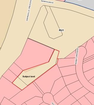
Map 1 - Current
LEP 2014 Zoning
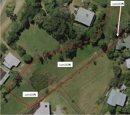
Map 2 – Subject
land outlined in red
Consistency with the Bangalow Settlement Strategy 2003
Although this strategy is outdated it remains the current
residential strategy approved by Council for Bangalow. It does not identify the
subject land as a future urban area.
The subject land is currently zoned RU1 Primary Production
under LEP 2014. The RU1 zone is meant to identify rural land that is capable of
sustainable primary industries. The zone permits a wide range of uses that
would not be appropriate within close proximity to existing residential
neighbourhoods including intensive livestock and plant agriculture and rural
industries.
The subject land is surrounded on three sides by land zoned
R2 Low Density Residential, which also includes the balance of Lots 232 and
231. The balance of Lot 233 (see Maps 1 and 2) is zoned RU1. The
objectives and permitted uses of the R2 zone are appropriate for serviced land
in a residential neighbourhood on the edge of Bangalow
The inconsistency is justified in this case because the
subject land is surrounded by residential zoned land on three sides, is not
used for agriculture due to its limited size, and has no significant
environmental values. The zoning of this land for residential purposes is
a minor zone boundary adjustment and is justifiably inconsistent with the
Bangalow Settlement Strategy.
.
Recommendation
It is recommended that Council proceed with this planning
proposal without amendment.
Financial Implications
As an applicant initiated planning proposal the
administration cost has been met by the applicant.
Statutory and Policy Compliance Implications
Council has followed the
statutory process to amend Byron LEP 2014 through this planning proposal. Council
should now decide whether to proceed to finalise the planning proposal (either
with or without amendments).
Staff Reports - Infrastructure Services 13.23
Staff Reports - Infrastructure Services
Report No. 13.23 Infrastructure
Works in the North of the Council Area
Directorate: Infrastructure
Services
Report
Author: James
Flockton, Drainage Flood Engineer
Tony Nash, Manager Works
Phil Warner, Manager Assets and
Major Projects
Michael Matthews, Manager Open
Space and Resource Recovery
James Brickley, Manager Finance
File No: I2015/1117
Theme: Community Infrastructure
Local Roads and Drainage
Summary:
To advise Council of changed priorities for the South Golden
Beach Drainage Works and the proposed infrastructure works in the north of the
Council area utilising the funds generated by the sale of the Roundhouse
Subdivision.
|
RECOMMENDATION:
1. That
in relation to the proposed projects to be funded from proceeds of the
Roundhouse Subdivision, Council:-
a)
Refer the list of projects to a Councillor workshop
to allow Councillors to fully review the proposed projects, with the view to
determine a short list of 10 to 15 projects.
b) That the preferred short list of
projects be consulted with the Community in early 2016 seeking feed back.
c)
That following consultation, a further report is
tabled, on preferred projects for approval.
2. That
Council confirm the reconstruction of Kolora Way, Ocean Shores (from Shara
Boulevard) to occur in the 2015/16 Financial Year, with the works being
funded from the Roundhouse Sales Proceeds to the value of $466,700.
|
Attachments:
1 South
Golden Beach Street Drainage Works Program and road renewal / reconstruction 10
year program 24.2014.10.1, e2015/75835
Report
Sale of the Roundhouse Subdivision land
The sale of these properties has realised to Council a net
income of $3.8M.
Council should note that it has been able to otherwise fund
the cost of the subdivision, repay all internal loans from reserves and provide
for payment of the substantial developer contributions from the financial
outcomes of the 2015/2016 financial year. Therefore, Council is now in
the fortunate position to be able to allocate all net sale proceeds to
infrastructure works without the need to fund costs associated with the
subdivision and developer contributions from the sale proceeds. It
otherwise would have had significantly less funds to allocate to works subject
of this report and further consideration by Council if the recommendation of
this report is adopted.
The Fit for the Future (FFF) submission indicated that $3.0M
of the proceeds of these sales would be used for infrastructure renewal
projects in the north of the Council area.
This leaves an extra $0.8M to be allocated by Council to
works in the north of the Council area to either:
· infrastructure
renewal projects; or
· enhancement
projects; or
· new works.
South Golden Beach Drainage Works
Council have previously adopted a works program for
resolution of drainage issues in South Golden Beach. It is proposed to
slightly modify the program following various changes to legislation, resident
comments and funding options.
19 October 2014 Council resolved (Res 14-497):
1. That
Council endorse the use of street drainage option A and driveway treatment
option A, with driveway option B being used in locations where the grass swale
becomes deeper, making option A too steep, as detailed in Annexure 6(a)
(E2014/44543).
2. That
Council implement the South Golden Beach Street Drainage 12 year plan as
detailed in Annexure 6(b) (E2014/57386), subject to approval via Council's
annual budget process.
3. That
Council fund the South Golden Beach Street Drainage 12 year plan (subject to
approval via the annual budget process) using a combination of Council revenue,
Stormwater Levy funds and a charge to land owners of half the cost of driveway
construction where a driveway to Council's standards has not already been
provided by the property owner.
4. That
Council’s position regarding the rear easements in South Golden Beach, as
shown by the plan at Annexure 6(c) (E2014/56911) is that:
a) all boundary fences
are to be placed on the private property side of the easements, rather than the
centre or within the easements
b) no small
to medium size vegetation that may impede stormwater flows is to exist within
the easements
c) no structures are allowed
within the easements
d) easements are to maintain a
shape that supports conveyance of stormwater to the main open drains in South
Golden Beach
e) all
easements are to be kept clear to allow easy and regular inspection by Council
staff
5. That
Council completes a survey of the South Golden Beach levy and repair as
necessary using funds from the North Byron Flood Study Project.
6. That
on completion of each street’s drainage solution, Council add repairing
and resealing of the bitumen road surface to Council’s reseal
program. (Dey/Richardson)
Staff have been working towards completing stage one and two
of the 12 year plan and works were planned to start in September 2015, however,
some Environmental Protection Agency (EPA) implications have been identified
which have delayed the planned works. Additionally, comments from
residents during the planning process raised concerns about the proposed
program and Council’s recent sale of the Round House site has changed the
funding options available for the project.
Environmental Protection Agency (EPA):
Staff recently received training regarding 2014 changes to
the EPA regulations. This has made significant changes to the planned
easement clearing works.
Staff had planned to store removed vegetation on site, mulch
the material in one process and leave the mulch for residents to use.
This option was relatively cheap, a good outcome for residents and
environmentally conscious. However, staff are now aware that this option
is not in accordance with the new EPA rules, orders and exemptions.
Therefore, all the vegetation would now need to be removed from site and
transported to Landfill. This would be more expensive due to haulage
costs and a $60/ton tipping fee. These changes add significant costs to a
project budget that was already very tight and are not an ideal outcome for the
project.
Staff are researching alternative options, which until
resolved has delayed proceeding with the works.
Resident comments:
During the planning phase staff received a number of verbal
and written comments from residents expressing a desire to have the street
drainage resolved before the easements are cleared. Obviously some residents
would prefer the opposite so Council cannot please all residents, however, the
reasoning has been that residents deal with the street drainage issues on a
daily basis and for this reason resolution of the street drainage first was
their preference.
Additional funding:
Following the recent sale of the Roundhouse sub-division,
Council now has $3.8M available to fund infrastructure works in the north of
the shire. Residents of South Golden Beach have been experienced very
poor drainage for some time, but also roads in a very poor condition, which are
beyond a re-seal and need to be renewed / reconstructed.
The proposed street drainage program was never designed to
resolve the failing roads, however, it was always a desire to reconstruct the
roads in tandem with the street drainage works, if funding became
available. Funding for this work is now potentially available from the
income created by the Roundhouse sub-division sale.
Conclusion
Staff had originally planned
to complete the easement works up front because it was thought to be a smaller
and simpler task that could be resolved quickly. Changes to EPA rules,
comments from residents and the additional funding option from the roundhouse
property sales have created a need to reassess the program.
Following this assessment a new program is now proposed.
The proposed revised program has been prepared with the aim
to complete the same tasks in a different order with a better outcome for local
residents.
Its is proposed that the street drainage works program,
along with a road reconstruction works program occur first in tandem, followed
by the easement clearing works. The proposed program is detailed at
Annexure 1.
The additional timing also allows staff to find a solution
to the disposal of green waste from the easement clearing works.
Council Resolution 15- 553
Council at its meeting on 29 October 2015, considered a
Notice of Motion regarding the costs associated with road repairs on the East
and West Sides of South Golden Beach and resolved as follows:
Res 15-553
That Council receive a
report on the costs associated with road repairs East and West Sides of South
Golden Beach.
The roads in South Golden Beach have been inspected and a
concept estimate prepared for their renewal / reconstruction. It is noted
that this is a high level estimate based on global unit rates and has not been
prepared with any specific design, geotechnical or other information relevant
to any one or all of these streets.
Table 1
|
Road
|
Section
|
Existing Pavement Total
Estimated Cost
|
Proposed Pavement Total
Estimated Cost
|
Priority for Renewal /
Reconstruction
|
|
Pacific Esplanade
|
Full length
|
$206,520
|
$273,600
|
High
|
|
Beach Avenue
|
Full length
|
$286,800
|
$307,200
|
Very High
|
|
Royal Street
|
Full length
|
$213,600
|
$259,200
|
High
|
|
Helen Street east of canal
|
Full length
|
$395,820
|
$396,000
|
High
|
|
Peter Street east of canal
|
Full length
|
$248,520
|
$396,000
|
High
|
|
Robin Street east of canal
|
Full length
|
$301,080
|
$396,000
|
High
|
|
Gloria Street east of canal
|
Full length
|
$249,960
|
$396,000
|
High
|
|
Redgate Road
|
Full length
|
$879,240
|
$883,200
|
Medium
|
|
Elizabeth Avenue
|
Full length
|
$250,920
|
$262,800
|
High
|
|
Helen Street west of canal
|
Full length
|
$360,600
|
$388,800
|
Medium High
|
|
Phillip Street
|
Full length
|
$154,920
|
$187,200
|
High
|
|
Clifford Street
|
Full length
|
$113,760
|
$144,000
|
Medium High
|
|
Gloria Street west of canal
|
Full length
|
$71,160
|
$64,800
|
Medium High
|
|
Total Cost
|
|
$3,732,900
|
$4,354,800
|
|
The existing pavement costs are based upon a like for like replacement
of the same road width whilst the proposed pavement costs are based upon a
wider road pavement to suit today’s standards, e.g., existing road width
in Peter Street East of the canal is 3.8 metres whilst the proposed road width
is 6 metres.
Infrastructure Renewal Works
There has been a recent inspection of the more heavily
trafficked roads in Oceans Shores, South Golden Beach and New Brighton to
determine a list of works for infrastructure renewal funded from the proceeds
of the roundhouse subdivision sales. These inspections have included:
Table 2
|
Road
|
Renewal Priority
|
Estimated Costs
|
|
Coomburra Cres, Ocean Shores
|
Very High
|
$714,000
|
|
Yamble Dr, Ocean Shores
|
Medium High
|
$92,400
|
|
Wahlooga Way, Ocean Shores
|
High
|
$133,800
|
|
Orana Rd, Ocean Shores
|
Medium High
|
$1,044,024
|
|
Balemo Dr, Ocean Shores
|
Medium
|
$1,497,648
|
|
Warrambool Rd, Ocean Shores
|
Low
|
$777,360
|
|
Rajah Rd, Ocean Shores
|
Medium
|
$1,210,320
|
|
Kolora Way, Ocean
Shores
|
Very High
|
$900,000
|
|
Kallaroo Circuit, Ocean
Shores
|
Low
|
$638,400
|
|
Rangal Rd, Ocean Shores
|
Low
|
$524,414
|
|
River St, New Brighton
|
Medium High
|
$466,800
|
|
The Esplanade, New Brighton
|
Medium High
|
$216,000
|
|
The Strand, New Brighton
|
Medium
|
$298,440
|
|
Shara Boulevarde, Ocean
Shores (Kolora Way to Kallaroo Circuit)
|
Medium Low
|
$298,440
|
|
Total
|
|
$8,812,046
|
There have been numerous letters from residents in Ocean
Shores to have the roads reconstructed on the Coomburra Crescent, Yamble Drive
and Wahlooga Way traffic route due to their poor condition.
There are also stormwater issues in the Ocean Shores area
due to failing infrastructure due to soil conditions, poor initial construction
and other factors that will necessitate detailed investigation before any of
these roads are renewed / reconstructed.
Enhancement Projects or
New Works
The enhancement projects or
new works in the north of the Council area that could be funded from the
proceeds from the roundhouse subdivision are listed in below in Table 3.
Tenders have closed for the Lot 5 Shara Boulevard Sports
Field and associated infrastructure. If Council is unsuccessful in its
Better Regions grant application, it is likely the available $800,000 from the
Roundhouse proceeds for new works will be required to complete the project.
If Council was to reduce elements in the scope and if the
small contingency provision is not required, then it is possible there would be
surplus funds available for an alternative project.
It is important to wait for the grant application outcome,
complete the tender assessment and then Council will be better informed as to
what are the options for the available funds.
Council as part of its forward budget had also adopted the
construction of a pedestrian bridge in Kolora Way. The current budget is $300,000
for the new Kolora Way pedestrian/ Cycle Bridge.
Based on current investigation if this project were to
proceed the budget will need to be increased to $600,000 to fund the pathway
approaches to the new bridge. This is due to the extent of work required
to construct approaches through the water course/wetland area.
Table 3
|
Project
|
Detail
|
Estimated Cost
|
|
Shara Boulevard Sports field
|
Potential shortfall in contract cost due to requested
project enhancements
|
$800,000
|
|
Waterlilly Park
|
Pond rejuvenation
|
$300,000
|
|
Waterlilly Park
|
Master plan Development
|
$100,000
|
|
Waterlilly park
|
Play space Development
|
$300,000
|
|
New Brighton Sports field
|
Additional Funding required to provide improved amenities
|
$200,000
|
|
Ocean Shores Lookout
|
Raised walkway and lookout enhancements
|
$100,000
|
|
Kayak Ramp
|
Proposed between Brunswick Heads Scout hall and pedestrian
bridge over
|
$40,000
|
|
South Golden Beach Flood Levy Enhancements
|
|
$100,000
|
|
Kolora Way Bridge
|
Construction of pedestrian bridge including approaches
|
$600,000
|
|
Total
|
|
$2,490,000
|
Proposed Infrastructure Works
Potential infrastructure renewal / reconstruction works to
be funded from the sales of the Roundhouse subdivision are detailed in Table 4
below:
Table 4
|
Road
|
Section
|
Renewal Priority
|
Total Estimated Costs
|
2015/16
|
2016/17
|
|
Beach Avenue
|
full length
|
Very High
|
$310,000
|
$30,000
|
$280,000
|
|
Peter Street east of canal
|
full length
|
High + Drainage Works
|
$410,000
|
$40,000
|
$370,000
|
|
Robin Street east of canal
|
full length
|
High + Drainage Works
|
$410,000
|
$40,000
|
$370,000
|
|
Coomburra Cres, Ocean Shores
|
full length
|
Very High
|
$720,000
|
$70,000
|
$650,000
|
|
Yamble Dr, Ocean Shores
|
full length
|
Medium High
|
$100,000
|
$10,000
|
$90,000
|
|
Wahlooga Way, Ocean Shores
|
full length
|
High
|
$150,000
|
$15,000
|
$135,000
|
|
Kolora Way, Ocean
Shores
|
full length
|
Very High
|
$900,000
|
$900,000
|
$0
|
|
|
|
TOTAL
|
$3,000,000
|
$1,105,000
|
$1,895,000
|
Kolora Way road renewal / reconstruction has been proposed
previously and part funding provided in 2014/15 & 2015/16, subject to the
sales of the roundhouse proceeding. This project can be completed in
2015/16 as the planning, investigation and design has already been completed.
The proposal is to provide additional funding for the
project to a combined total of $900,000 to enable all the works in this street
to be done in the one financial year. Works are scheduled to commence in
mid February 2016 and only the extent will change dependent upon whether part
or all of the works are funded.
All other proposed works are planned for construction in
2016/17 with some funding (approximately 10%) provided in 2015/16 for planning,
investigation and design
The enhancement projects or new works in the north of the
Council area that could be funded from the sales of the Roundhouse subdivision
are detailed in Table 5 below:
Table 5
|
Project
|
Total Estimated Costs
|
2015/16
|
2016/17
|
|
Water Lily Park lake and park enhancements and plan of
management review
|
$400,000
|
$30,000
|
$370,000
|
|
Kayak ramp between Brunswick Heads Scout hall and
pedestrian bridge over Simpsons Creek
|
$40,000
|
Nil
|
$40,000
|
|
South Golden Beach Flood Levy Enhancements
|
$100,000
|
Nil
|
$100,000
|
|
Shara Boulevard Sports Fields stage 2
|
$260,000
|
Nil
|
$260,000
|
|
|
|
TOTAL
|
$800,000
|
Conclusion
Staff have prepared the list attached based on inspections,
current projects and submissions received from the community.
The total value of projects listed is significantly greater
than the available funds and it understood that there will be varying views on
which projects should be given preference over others, therefore on this basis
staff would recommend that the list be referred to a Councillor workshop to
allow Councillors to full review the proposed projects in this report with the
view to determine a short list of 10 to 15 projects that can be consulted with
the Community in early 2016 seeking feed back.
In relation to the reconstruction of Kolora Way staff will
require confirmation as to whether this project proceeds as it is currently
approved with the 2015/16 program with the works scheduled to commence in March
2016. The approved budget is $466,700 and the proposed works are to
undertake reconstruction works commencing at the Shara Boulevard intersection.
Financial Implications
Council previously adopted to fund the South Golden Beach
Street Drainage 12 year plan (subject to approval via the annual budget
process) using a combination of Council revenue, Stormwater Levy funds and a
charge to land owners of half the cost of driveway construction where a
driveway to Council's standards has not already been provided by the property
owner. This funding option will remain unchanged and therefore has no
implications.
Council has $3.8M from the sale of the round house
sub-division.
The proceeds of this sale have been previously recommended
for expenditure on infrastructure works in the north of the shire.
Reconstructing the roads in South Golden Beach at the same time as the
on-street drainage works are undertaken fulfils this ideal and resolves a long
standing problem of failed infrastructure in the area.
Combining the two works programs in tandem provides Council
with much better value for money and therefore more infrastructure works will
be completed with the money available.
Statutory and Policy Compliance Implications
Council does not have a statutory requirement to provide
driveways to dwellings, however, it does have a responsibility to provide
adequate street drainage. As noted before, it is not possible to provide
adequate street drainage without upgrading of all the driveways in the areas
affected in SGB. Therefore driveways will need to be included in the
works program.
The Roads Act 1993 states:
142 Maintenance of works and
structures
(1) A person who has a right to the control, use or
benefit of a structure or work in, on or over a public road:
(a) must
maintain the structure or work in a satisfactory state of repair, and
(b) in
the case of a structure (such as a grating or inspection cover) located on the
surface of the road, must ensure that the structure is kept flush with the
surrounding road surface and that the structure and surrounding road surface
are so maintained as to facilitate the smooth passage of traffic along the
road,
and the
person is, by this section, empowered to do so accordingly.
Therefore, once the driveway has been constructed it will
the responsibility of the land owner to maintain their driveway access.
Staff Reports - Infrastructure Services 13.24
Report No. 13.24 Extending
Recycled Waste Water from West Byron STP to the Byron Foreshore
Directorate: Infrastructure
Services
Report
Author: Peter
Rees, Manager Utilities
File No: I2015/1364
Theme: Community Infrastructure
Waste and Recycling Services
Summary:
The Byron Bay Urban Recycled Water Scheme produces recycled
water of sufficient quality and quantity to extend the pipeline system to
supply water to both public infrastructure and businesses in the CBD and along
the foreshore of Byron Bay. To proceed with the project, Council would
need to submit a Section 60 application for the project to the DPI Water for
approval. The supply of recycled water to the crown reserve from Main
Beach to Clarkes Beach is an identified project in the adopted Byron Bay
Effluent Management Strategy (BBEMS).
The total cost of the project excluding any public toilet
upgrades, is estimated to be $1,350,000. The project satisfies key
objectives of the BBEMS of removing effluent discharge from the Belongil Creek
and maximising the creation of useful products by supplanting drinking water
from high volume toilet flushing and irrigation of the crown reserve park
areas.
|
RECOMMENDATION:
That Council approve the Byron Bay Urban
Recycled Water Scheme Expansion project with a budget of $1,350,000 allocated
equally from the water and sewer funds to commence in 2016 calendar year.
|
Attachments:
1 Technical
Review Use of Byron Urban Reuse Scheme Recycled Water for Dual Reticulation, E2015/76122
2 Figure 1
Schematic Byron Bay Urban Recycled Water Proposed Extension, E2015/76121
Report
To supply recycled water to the Railway Park; Clarkes Beach
and Apex Park toilets; irrigation services along the crown reserve; and
installation of various water points for use by the Better Byron crew it will
be necessary to design and construct a pipeline 2300 metres in length, with
connections to the existing Byron Bay Urban Recycled Water Scheme at the
recreation ground in Tennyson Street and Railway Park. Refer to Figure 1
Schematic for the proposed pipeline extension.
Initially, it is expected the scheme will use approximately
20 megalitres of recycled water per annum. This quantity can be increased
incrementally in future to > 30 megalitres per annum if connections to First
Sun Caravan Park; Swimming Pool toilets; Clarkes Beach Caravan Park and
possibly the Beach Hotel toilets are undertaken.
The project cannot be justified on a commercial basis.
The justification is based on the Byron Bay Effluent Management Strategy
objectives, in particular:
· Eliminate
surface discharge to Belongil Creek from the West Byron STP – this
project will reduce effluent discharge to the Belongil Creek.
· Maximise the
creation of useful products from effluent reuse projects – this
project will supplant the use of potable water for toilet flushing and will
contribute to the enhancement of the crown reserve through irrigation.
Also, the supply of recycled water to the crown reserve from
Main beach to Clarkes Beach is an identified project in the adopted Byron Bay
Effluent Management Plan. The project satisfies key objectives of the BBEMS of
removing effluent discharge from the Belongil Creek and maximising the creation
of useful products by supplanting drinking water from high volume toilet
flushing and irrigation of the crown reserve park areas.
The cost of the project, excluding upgrades to toilet
blocks, is estimated to be $1,350,000. It is recommended this amount be
funded equally from the water and sewer funds. Nominal funding of
approximately $60,000 from the Rous Water Business Blue Green programme may
also be available.
Upgrades to the toilet blocks could be funded from the
Special Rates Capital Works Programme. Currently there is $154,700 in the
2015-16 capital programme that is unallocated to a project (account number
4195.011).
The Byron Bay Urban Recycled Water Scheme produces recycled
water of sufficient quality and quantity to supply water to dual reticulation
schemes such as public toilets in Byron Bay (refer attachment “Technical
Review – Use of Byron Urban Reuse Scheme Recycled Water for Public
Toilets). To proceed with the project, Council would need to submit a
Section 60 application for the project to the DPI Water for approval.
Financial Implications
The funding for the pipeline construction will be via
section 64 funds from the water and sewer funds.
Statutory and Policy Compliance Implications
It will be necessary to submit Local Government Act Section
60 application to the NSW Department of Primary Industries Water for project
approval to expand the Byron Bay Urban Recycled Water Scheme.
Staff Reports - Infrastructure Services 13.25
Report No. 13.25 Options
for Extending Exeloo Toilets at Apex Park, Byron Bay
Directorate: Infrastructure
Services
Report
Author: Michael
Matthews, Manager Open Space and Resource Recovery
File No: I2015/1365
Theme: Community Infrastructure
Open Space and Recreation
Summary:
Notice of Motion No. 9.3 15-554 part 4. Resolved that a
presentation or report be provided outlining possibilities of providing other
relocatable public toilets, including locally designed.
A review of options of additional relocatable public toilet
facilities at Apex Park, Byron Bay has been undertaken.
Facility types reviewed broadly fall into four categories,
namely, bespoke designed solutions, pre-fabricated products, pre-engineered non
automated facilities and high end pre-engineered automated facilities such as
the Exeloo and Moodie products.
The review has considered public toilet amenity regulated
design requirements, relocation ability, customisation, operational
functionality, costs, benefits of fully automated data collection, remote
control functionality, location aesthetics and longer term need for a permanent
facility to be sized to best meet forecasted demand.
It is clear from existing data captured by the current
facilities at Apex Park that there is insufficient capacity to meet peak
demands experienced at times, in particular during holiday periods coinciding
with fine weather.
Based on the review undertaken (refer to report), it is
believed that the installation of another interim Jupiter Triple Automated
Exeloo or a Jupiter Automated Model
24AAAA is the best medium term (2-5 yrs.) option for Apex Park.
Benefits of a second block include, but not limited to, are
· An additional
Exeloo block is fully relocatable and provides stand alone compliance with all
regulatory and best practice design requirements
· A second block
will provide valuable additional data to the existing 12 months of data
captured providing for sound design input information of future permanent
facilities
· All technical
issues initially experienced with the facilities at Railway Park and Apex Park
have been permanently resolved.
· Sound design of
future facilities with captured usage data will greatly assist community
engagement and consultation on future facility proposals and options.
· Exeloo products
can be easily adapted to accept recycled water through dual plumbing.
· The management of
these facilities will move across to the Utilities team within infrastructure
services. The utilities team has strong mechanical, electrical and scada
skills through management experience of STPs. It is believed that these skills
will enable further improvement to the operational management of these
facilities.
· Robustness of the
facilities against vandalism as a majority of fixtures and fittings are
concealed.
· Design is highly
corrosion resistant, an important design feature at this location.
· Maintaining visual
amenity of the area by providing style consistency
· Interim additional
facilities, like existing, would be a fully relocatable stand alone amenities
that meets all necessary standards including Disability (Access to
Premises — Buildings) Standards 2010 in any future adopted
location. The remote monitoring will allow full control of opening and
closing addressing and reducing anti social behaviour risk.
|
RECOMMENDATION:
1. That
Council approve the purchase of a second Exeloo toilet block for Apex
Park (Byron Bay), as a Reserve Trust Asset up to the value of $300,000.
2. That
the purchase be funded from the Crown Paid Parking Reserve.
|
Report
The current toilet provisions within Apex Park, at Main
Beach Byron Bay is a Jupiter Triple Automated Exeloo (Model 23AAD) and a
separate urinal room at the adjacent Surf Club.
There have been a number of minor modifications to the
Exeloo under warranty due to intermittent faults that have occurred. It
is believed all faults and technical issues have been resolved.
The existing Exeloo amenities comply with all Australian
public amenity regulations and best practice requirements, including, Disability
(Access to Premises — Buildings) Standards 2010, Building Code of
Australia, AS1428.1(2009), Crime Prevention Through Environmental Design (CPTED
and are highly vandalism proof, an important non- mandatory design aspect.
The below table provides usage data for the Apex Park
Amenities
|
Data
1st April to 31st October
|
Total
Occupancy
|
Average
Occupancy Time (min)
|
|
Apex 1
|
46840
|
1.73
|
|
Apex 2
|
51033
|
1.9
|
|
Apex 3
|
50584
|
1.72
|
|
TOTAL ( 7 months)
|
148457
|
|
|
Estimated
number of customers that have had to wait in line for this period
|
24,627
|
|
The units have estimated, for the above mentioned period,
24,627 customers have had to queue for these facilities. This represents
16.6% of customers (1 in 6 customers) have had to wait.
Data capture from the existing facility highlights that
there is insufficient capacity to meet peak demands experienced at times, in
particular during holiday periods coinciding with fine weather.
Below are typical usage profile summaries for the Apex
amenities
|
Thursday
|
Friday
|
|
|
|
|
Saturday
|
Sunday
|
|
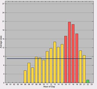
|
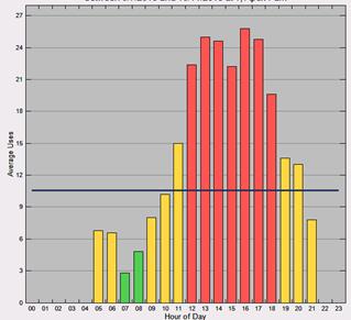
|
A review of temporary toilet facilities has been
undertaken. This review has looked at bespoke, pre-fabricated, pre-engineered
and pre-engineered automated products.
Key considerations in the review include;
· Australian public
amenity regulations and best practice requirements, including, Disability
(Access to Premises — Buildings) Standards 2010, Building Code of
Australia, AS1428.1(2009), Crime Prevention Through Environmental Design
(CPTED)
· Data capture for
future facility design
· Robustness in this
location (corrosion resistance, vandalism resistance)
· Visual amenity
Bespoke Custom Ablution Blocks
Customised bespoke
solutions are considered to be costly due to the need to meet the following but
not limited requirements and the upfront design costs for ‘one off’
amenities:
· Disability (Access
to Premises — Buildings) Standards 2010
· Building Code of
Australia, AS1428.1(2009)
· Crime Prevention
Through Environmental Design (CPTED)
· Vandalism proof
functionality
· Maintenance and
ease of cleaning design considerations
Anecdotally, for a
two closet product, costs have been stated to typically exceed pre-engineered
and automated solutions. This type of solution is generally not
relocatable without adding considerable costs and will have considerable design
certification and construction lead times. Consideration of bespoke
solutions for these reasons should be adopted for permanent solutions
only. Advantage of bespoke solution is the ability for local design and
build.
Pre-fabricated Solutions
These are generally the cheapest of all solutions. Two
pre-fabrication solutions reviewed include Modus and Landmark.
|
Supplier
|
Local
Context
|
Indicative
Costs
|
Procurement
Options
|
Lead
Time
|
Comment
|
|
Modus
|
AU
construction & supply
|
Start
at 30k basic design (M/F & accessible)Plus site establishment &
infrastructure
|
Gov
contract RFQ
|
6
to 8 weeks off the plan
|
Customisation
of fixtures, fittings and cladding materials will greatly increase costs. The
basic models are only suitable for short term use without customisation.
|
|
Landmark
|
AU
construction & supply
|
Start
at approx. 40K basic design
|
RFQ-
RFT
|
6
to 8 weeks off the plan
|
As
above
|
It is considered that a low construction build would be
offset with significantly higher ongoing maintenance, cleaning and vandalism
repair costs. Fixtures and fittings selected should be highly corrosion
resistant, significantly adding to the build cost. In addition there is
limited ability to capture usage data for future facility design.
Aesthetically, additional architectural designed cladding is suggested if this
style was to be considered, adding to the whole of life cost. These
products are typically not easily relocatable.
Pre-engineered Solutions
These solutions are
customisable. Two pre-engineered solutions reviewed from major suppliers
in the market include Ausco and Atco.
|
Supplier
|
Local
Context
|
Indicative
Costs
|
Procurement
Options
|
Lead
Time
|
Comment
|
|
Ausco
|
AU
construction & supply
|
Start
at 30k basic design, plus site establishment and infrastructure
|
RFQ-RFT
|
8
to 12 weeks
|
The
Pre- Engineered buildings can be customised to achieve vandal resistance and
aesthetically pleasing designs however this will greatly increase costs.
|
|
Atco
|
AU
construction & supply
|
Start
at 30k basic design
|
RFQ-RFT
|
8
to 12 weeks
|
|
It is considered
that a considerable amount of customisation would be required to achieve an
acceptable temporary solution for Apex Park. This style of facility is
generally not relocatable with relocatable designs would add considerably to
the costs.
There is also limited
ability to capture usage data for future facility design.
Pre-engineered and Automated
|
Supplier
|
Local
Context
|
Indicative
Costs
|
Procurement
mechanism options
|
Lead
Time
|
Comment
|
|
Exeloo
|
NZ
|
Refer
below – for quoted models
|
Gov
contract RFQ
|
12
weeks
|
Aesthetically
consistent with existing
Possible
to decrease costs by deleting some of the automated features such as
automatic toilet paper dispensers, self-cleaning and automated hand basin
features.
|
|
Pureablue
|
AU
|
200k
plus
|
RFQ-
RFT
|
12
to 16 weeks
|
At
time of writing report, budgets for 2 ,3 and 4 facilities had not been
recieved
|
|
Moodie
|
AU
|
200k
plus
|
Gov
contract RFQ
|
12
to 16 weeks
|
Are
simular in features and price to that of Exeloo. At time of writing this
report, complete budget prices had not been received for cost and feature
comparison.
|
The Exeloo products are a pre-engineered fully customised
facility that complies with all public amenity regulations and best practice
requirements, including, Disability (Access to Premises — Buildings)
Standards 2010, Building Code of Australia, AS1428.1(2009), Crime Prevention
Through Environmental Design (CPTED) and are highly robust against vandalism as
a majority of fixtures and fittings are concealed and are built for harsh
coastal environments.
Below is quoted Exeloo prices for various
arrangements. There are additional civil and electrical costs with
installation which is dependant on final location.
Jupiter Automated Model
22AA (2 x Ambulant Cubicles) $186,440
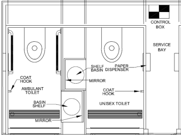
Jupiter Automated Model
23AAA (3 x Ambulant Cubicles with Storage Room) $244,000

Jupiter Automated Model
23AAD (2 x Ambulant 1 x Fully Accessible Cubicle) – (Exact Floor Plan as
Apex & Railway Park) $249,500

Jupiter Automated
Model 24AAAA (4 x Ambulant Cubicles) $286,300

The Moodie Novaloos automated toilets are
of similar price to Exeloo with like functionality and features.
Under the LGP, Prices for the triple 5 star
facility start from $220,000. At the time of writing this report a full
budget price list had not been received, however expected by December.
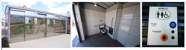
Locally designed options have been reviewed
for bespoke, pre-fabricated, pre-engineered and automated pre-engineered
facilities. At the time of writing this report, it is considered that
locally, there are no re-locatable public amenity providers for pre-fabricated,
pre-engineered or automated pre-engineered suppliers.
Options for local design and build are
currently believed to be limited to
· Off grid facilities and;
· Bespoke toilet facilities.
Off grid facilities, such as batch style
composting toilets are not recommended at this location due to the batching
volumes requiring removal (estimated twice daily truck movements through
town). Where onsite composting is considered, the risk of contamination
of the natural compost process is expected to be high due to the high tourist
use of this site.
For the reason discussed earlier with
bespoke facilities, pricing would be subject to detailed specification and
design. The final end product cost is likely to far exceed the price of an
‘off the shelf’ pre-engineered automated re-locatable option with
equivalent features.
Financial Implications
Sufficient funds are available from paid parking in the
Foreshore Crown Reserves to provide for the further needed public toilet
facilities in Apex Park.
Statutory and Policy Compliance Implications
Toilet facilities are listed under the State Environmental
Planning Policy(Infrastructure) 2007 as exempt development.
Staff Reports - Infrastructure Services 13.26
Report No. 13.26 Proposed
Meeting Dates for Community Infrastructure Advisory Committee Meetings 2016
Directorate: Infrastructure
Services
Report
Author: Susan
Sulcs, Administration Officer
File No: I2015/1372
Theme: Community Infrastructure
Local Roads and Drainage
Summary:
This report is prepared to allow Council to determine the
schedule of meetings for the 2016 calendar year for the Community
Infrastructure Advisory Committee.
The proposed schedule for 2016 is recommended for adoption.
|
RECOMMENDATION:
That the following dates be adopted for the Community
Infrastructure Advisory Committee’s meetings for 2016 and that the
meetings commence at 2.00pm.
· Thursday,
3 March 2016
· Thursday,
2 June 2016
· Thursday,
20 October 2016
· Thursday,
1 December 2016
|
Report
This report is prepared to allow Council to determine the
schedule of meetings for the 2016 calendar year for the Community
Infrastructure Advisory Committee.
Staff will be confirming with members of the Committee their
availability for the proposed dates prior to the tabling of this report to
Council.
Financial Implications
Nil
Statutory and Policy Compliance Implications
The Community Infrastructure Advisory Committee’s
Constitution states:
· At section 8 that
“Meetings will be held at least quarterly.”
Staff Reports - Infrastructure Services 13.27
Report No. 13.27 Proposed
Meeting Dates for Water, Waste and Sewer Advisory Committee Meetings 2016
Directorate: Infrastructure
Services
Report
Author: Susan
Sulcs, Administration Officer
File No: I2015/1373
Theme: Community Infrastructure
Waste and Recycling Services
Summary:
This report is prepared to allow Council to determine the
schedule of meetings for the 2016 calendar year for the Water, Waste and Sewer
Advisory Committee.
The proposed schedule for 2016 is recommended for adoption.
|
RECOMMENDATION:
That the following dates be adopted for the Water,
Waste and Sewer Advisory Committee’s meetings for 2016 and that the
meetings commence at 9.00am.
· Thursday,
3 March 2016
· Thursday,
2 June 2016
· Thursday,
20 October 2016
· Thursday,
1 December 2016
|
Report
This report is prepared to allow Council to determine the
schedule of meetings for the 2016 calendar year for the Water, Waste and Sewer
Advisory Committee.
The proposed schedule for 2016 is recommended for adoption.
Staff will be confirming with members of the Committee their
availability for the proposed dates prior to the tabling of this report to
Council.
Financial Implications
Nil
Statutory and Policy Compliance Implications
The Water, Waste and Sewer Advisory Committee’s Constitution
states:
· At section 8 that
“At least quarterly meetings will be held.”
Staff Reports - Infrastructure Services 13.28
Report No. 13.28 Proposed
Meeting Dates for Transport Advisory Committee Meetings 2016
Directorate: Infrastructure
Services
Report
Author: Susan
Sulcs, Administration Officer
File No: I2015/1374
Theme: Community Infrastructure
Local Roads and Drainage
Summary:
This report is prepared to allow Council to determine the
schedule of meetings for the 2016 calendar year for the Transport Advisory
Committee.
The proposed schedule for 2016 is recommended for adoption.
|
RECOMMENDATION:
That the following dates be adopted for the Transport
Advisory Committee’s meetings for 2016 and that the meetings commence
at 9.00am.
· Thursday,
10 March 2016
· Tuesday,
14 June 2016
· Tuesday,
16 August 2016
· Thursday,
3 November 2016
|
Report
This report is prepared to allow Council to determine the
schedule of meetings for the 2016 calendar year for the Transport Advisory
Committee.
The proposed schedule for 2016 is recommended for adoption.
Staff will be confirming with members of the Committee their
availability for the proposed dates prior to the tabling of this report to
Council.
Financial Implications
Nil
Statutory and Policy Compliance Implications
The Transport Advisory Committee’s Constitution
states:
· At section 10 that
“At least quarterly meetings will be held.”
Staff Reports - Infrastructure Services 13.29
Report No. 13.29 Federal
Drive, Goonengerry - Project Status Report
Directorate: Infrastructure
Services
Report
Author: Rob
Serventi, Graduate Works Engineer
File No: I2015/1391
Theme: Community Infrastructure
Local Roads and Drainage
Summary:
The purpose of this report is to provide an update on the
Federal Drive, Goonengerry road reconstruction project including the detailed
design, ecological assessments, statutory environmental planning approvals, the
funding and construction timing and to seek Council endorsement to proceed with
property acquisition and/or boundary realignments.
|
RECOMMENDATION:
1.
That Council notes the status of the planning
and preconstruction activities for the Federal Drive, Goonengerry Road
reconstruction project.
2. That Council authorises:
a) The land acquisition and/or boundary
adjustments through negotiation with adjoining property owners.
b) Affixing the Council seal by the
General Manager to all necessary documents that affect the acquisitions
and/or boundary adjustments.
3.
That a status report on this project be
presented to the Community Infrastructure Advisory Committee meeting proposed
to be held on 3 March 2016.
|
Report
Background
The section of Federal Drive, Goonegerry to be reconstructed
starts 250m south of the Mafeking / Federal Drive intersection, and extends
southward along Federal Drive for 440m. The sections of Federal Drive
north and south of this section have been reconstructed previously.
The deteriorated state of the road is due to land subsidence
and lack of suitable surface and subsurface drainage. The existing road
departs from an acceptable level of conformance with the minimum Austroads
design standards in alignment, design speed and stopping sight distance.
The original design plans for the upgrade
of this section of Federal Drive were completed in 1995/96, however, funding
for this project had never been provided by Council as part of its annual
capital works program.
The Roads and Asset Management Project
Reference Group (PRG) first raised the Federal Drive, Goonengerry and Bangalow
Road, Hayters Hill projects in 2012 with the aim to review the engineering
design and construction standards for each section of road to achieve an
upgrade of the road at a reduced cost but still with applicable and comparable
road conditions and design standards. To achieve this objective Council
engaged a local engineering consultant to undertake a review of both projects.
The reviews were completed and submitted to
the Roads and Asset Management PRG in May 2012 with the advice that both
projects could be redesigned without the need to undertake land acquisition and
with reduced earthworks and scope of works for the overall reconstruction
project.
Following this review, Council engaged the
same consultant to undertake the detailed design for both projects. The
draft final designs were completed in February 2015 and were reported to the
Community Infrastructure Advisory Committee (CIAC) meeting on 7 May 2015.
The recommendations from the CIAC meeting
on 7 May 2015 were:
Report No. 5.2 Rural Road
Designs at Federal Drive and Bangalow Road
File No:I2015/348
Committee Recommendation:
1. That the information
provided about rural road designs at Federal Drive and Bangalow Road be noted.
2. That Council now move ahead
with investigating land acquisition options for the designs.
3. That the design elements be
progressed for consideration of project approval by Council.
The CIAC recommendations were reported to
Council at the meeting on 11 June 2015 and the resolution of Council was:
Res 15-270
Resolved that Council adopt the
following Committee Recommendation:
Report No. 5.2 Rural Road Designs at
Federal Drive and Bangalow Road File No: I2015/348
Committee Recommendation 5.2.1
1. That
the information provided about rural road designs at Federal Drive and Bangalow
Road be
noted.
2. That Council now move ahead with
investigating land acquisition options for the designs.
3. That the design elements be
progressed for consideration of project approval by Council.
The Bangalow Road, Hayters Hill project has
been able to be redesigned to avoid land acquisition as per the original advice
in the review undertaken by the consultant. A further redesign of the cut
and fill batters is being undertaken as a result of threatened species identified
during ecological assessment and required by the initial review of
environmental factors (REF). Discussions and site meetings have been
occurring with the designer, ecologist and the property owner. It is
anticipated that a favorable, compromise result and design plans will be
achieved that will allow construction to proceed on this project.
The Federal Drive, Goonengerry project has
not been able to be redesigned to avoid land acquisition as per the original
advice in the review undertaken by the consultant. Land acquisition is
required to undertake the road reconstruction, however, land no longer needed
for road reserve can be provided back to the property owner with an anticipated
nil land acquisition for the project. It is envisaged that adjustments to
property boundaries will be required on all properties adjacent to this section
of Federal Drive. Council will be required to undertake all the
surveying, legal work and costs associated with the property boundary
adjustments.
These property boundary adjustments can be
achieved by negotiation with property owners and could be completed at best in
about four (4) months. If the boundary adjustments have to be undertaken
by compulsory acquisition the time frame is much longer and typically may take
several years.
The draft design plans have been reviewed
in detail and at a recent meeting with the consultant, they have been requested
to investigate some options to reduce the extent of work on the cut and fill
batters, minimise or remove the impact on the threatened species adjacent to
the road, minimise the adjustments to property boundaries and reduce the
overall scale, scope and cost of the overall project.
It is anticipated that this work will be
completed early in 2016, hopefully in February, although this is yet to be
confirmed by the consultant.
Discussions with property owners have
commenced to advise them of the project, the adjustments required to the
property boundaries and the desired no net loss of their property and no net
land acquisition required by Council.
If all property boundary adjustments can be
undertaken by negotiation and not compulsory acquisition, then the completion
of the revised design plans and reduced extent of overall works could be
completed by approximately June/July 2016 with construction to start soon
after, subject to approval of funding by Council as part of the local roads
capital works program.
Proposed Boundary Adjustments at Federal Drive
Chainages 0 to 410 constitute the length of road to be
reconstructed.
Table 1
|
Lot & DP
Address
|
Design
Chainage
|
Effect on Property
|
Expected Time frame
|
Effect of Boundary Move
|
Comments / Justification
|
|
Lot 7 DP 629234
34 Bayview Drive
|
135-185
|
Boundary Adjustment
|
4 months
Negotiated with owner
|
No net land loss
|
Realignment of road reserve and private title will align
road reserve back to existing fence line
|
|
Lot 4 DP 608723
871 Federal Drive
|
130-190
|
Boundary Adjustment
|
4 months
Negotiated with owner
|
No net land loss
|
Realignment of road reserve will align road reserve back
to existing fence line.
|
|
Lot 6 DP 599812
931 Federal Dr
|
250-290
|
Boundary Adjustment
|
4 months
Negotiated with owner
|
No net land loss
|
Truck stopping distances drive the resumption
Energy dissipater can be accommodated in Council Land
|
|
Lot 5 DP 629234
953 Federal Dr
|
300-380
|
Boundary Adjustment
|
4 months
Negotiated with owner
|
No net land loss
|
Adjusts road reserve to planned road alignment
|
|
Lot 6 DP 629234
30 Bayview Dr
|
250-290
|
Boundary Adjustment
|
4 months
Negotiated with owner
|
No net land loss
|
Adjusts road reserve to planned road alignment
|
|
Lot 52 DP 867837
26 Bayview Dr
|
340-400
|
Boundary Adjustment
|
4 months
Negotiated with owner
|
No net land loss
|
Adjusts road reserve to planned road alignment
|
Table 1 shows each property requiring boundary adjustment
and the expected timeframe.
At the time of writing this report, initial discussions with
the property owners are planned for late November 2015.
Future Actions & Timeline to implement the
construction of works at Federal Drive.
Table 2
|
Task Name
|
Duration
|
Start
|
Finish
|
|
Design Phase
|
27 days
|
Thu 12/11/15
|
Mon 28/12/15
|
|
Draft REF
|
2 days
|
Thu 12/11/15
|
Fri 13/11/15
|
|
BSC
Planning advice / Subdivision Process
|
2 days
|
Mon 16/11/15
|
Tue 17/11/15
|
|
CONSULTANT
Design Review Meeting
|
0 days
|
Tue 17/11/15
|
Tue 17/11/15
|
|
CONSULTANT
Design Issues Identification & review
|
6 days
|
Wed 18/11/15
|
Thu 26/11/15
|
|
CONSULTANT
Price on revised Scope
|
5 days
|
Mon 30/11/15
|
Mon 7/12/15
|
|
CONSULTANT
Cut Fill Retaining Options
|
2 days
|
Tue 8/12/15
|
Wed 9/12/15
|
|
CONSULTANT
Revised Bill of Quantities
|
1 day
|
Tue 8/12/15
|
Tue 8/12/15
|
|
CONSULTANT
Confirm Boundary realignment
|
2 days
|
Tue 8/12/15
|
Wed 9/12/15
|
|
Ecological Assessment / Review of Environmental Factors
|
2 wks
|
Thu 10/12/15
|
Mon 28/12/15
|
|
Land
Acquisition / Final Design
|
30 days
|
Thu 10/12/15
|
Wed 3/02/16
|
|
Land Survey
RFQ / Title Plan Preparation
|
30 days
|
Wed 6/01/16
|
Tue 1/03/16
|
|
Owner /
Statutory Approvals
|
80 days
|
Thu 4/02/16
|
Wed 22/06/16
|
|
Obtain Owners Consent
|
3 months
|
Wed 2/03/16
|
Tue 14/06/16
|
|
Revised Estimate
|
1 day
|
Thu 4/02/16
|
Thu 4/02/16
|
|
Lands Dept. Consent Crown Road Dedication
|
3 months
|
Wed 2/03/16
|
Tue 14/06/16
|
|
Lodge Subdivision Application
|
0 days
|
Tue 14/06/16
|
Tue 14/06/16
|
|
Approval Subdivision Application
|
1 week
|
Wed 15/06/16
|
Wed 22/06/16
|
|
Report to Council
|
0 days
|
Wed 22/06/16
|
Wed 22/06/16
|
|
Prepare Job
Package (Orders, Community Notification)
|
5 days
|
Thu 23/06/16
|
Thu 30/06/16
|
|
Start Construction
|
|
Mon 4/07/16
|
|
Based on owner’s consent being obtained within 4
months, it is expected the works will be able to start construction in mid
2016, the proviso that budgets are provided for the project in 2016/17.
Financial Implications
There are sufficient funds in the 2015/2016 budget to
arrange and finalise the necessary design development, survey, property
boundary adjustments, revised ecological assessment, revised REF and all other
required preconstruction activities.
The estimated construction costs for the project in will be
available in January 2015 and will be able used to inform any necessary changes
to the 2015/16 and 2016/17 budgets for the project.
Statutory and Policy Compliance Implications
Statutory
State Environmental Planning Policy (Exempt and Complying
Development Codes) 2008, part 2 Division 1 Subdivision 38, provide that
subdivision of the land, for the purpose only of any one or more of the
following, is exempt development:
(a) Widening
of a public road
(b) Realignment
of boundaries
Staff Reports - Infrastructure Services 13.30
Report No. 13.30 Belongil
Catchment Advisory Committee - Nominations for Community Representatives
Directorate: Infrastructure
Services
Report
Author: Peter
Rees, Manager Utilities
File No: I2015/1420
Theme: Community Infrastructure
Sewerage Services
Summary:
A Belongil Catchment Advisory Committee is being formed in
accordance with Council Resolution 15-236 Item 6. This report provides the
nominations received from the community for Council’s consideration.
|
RECOMMENDATION:
1. That
Council appoint up to 6 community representatives to the Committee in
accordance with the Belongil Advisory Committee constitution.
2. That
Council nominate 3 Councillors to the Committee in accordance with the
Belongil Advisory Committee constitution.
|
Attachments:
1 Confidential
- Committee Nomination A, E2015/75691
2 Confidential
- Committee Nomination B, E2015/75694
3 Confidential
- Committee Nomination C, E2015/75695
4 Confidential
- Committee Nomination D, E2015/75696
5 Confidential
- Committee Nomination E, E2015/75697
6 Confidential
- Committee Nomination F, E2015/75698
Report
Council is creating the Belongil Catchment Advisory
Committee in accordance with Council Resolution 15-236 Item 6 which states:
That Council create a new Advisory Committee to advise on
priorities and on integration of the various Plans & Strategies listed in
today's Report 13.17 plus Agreements that may be reached as above, and on other
catchment issues within Belongil catchment.
Nominations for the committee were advertised in the Council
Notices of 22 October 2015 and on Council’s web site.
Applications were open for 3 weeks and closed on the 12
November 2015.
In addition Council wrote to the affected landowners and the
Drainage Union inviting them to apply for representation on the Committee.
In total six (6) community applications were received.
Four (4) of these applications are from affected landowners
and one (1) application is from a person affiliated with the Belongil Swamp
Drainage Union.
The approved Belongil Catchment Advisory Committee
constitution permits up to six (6) community representatives.
Financial Implications
There are no financial implications.
Statutory and Policy Compliance Implications
There are no statutory or policy implications.
Staff Reports - Infrastructure Services 13.31
Report No. 13.31 10.2013.562.1
North Byron Beach Resort Central Facilities ET Assessment
Directorate: Infrastructure
Services
Report
Author: Peter
Rees, Manager Utilities
File No: I2015/1423
Theme: Community Infrastructure
Sewerage Services
Summary:
DA 10.2013.562.1 for the North Byron Central Facilities
buildings has been assessed for water and sewer equivalent tenements (ET) by
Council. There is also an approved DA with Council for the guest cabins
located adjacent to central facilities which has also been assessed for water
and sewer ET’s which have been accepted by the developer in accordance
with Council’s assessment. Council has assessed the ET loading for these
developments in accordance with Council’s current ET Policy 13/005. ET
values listed in ET Policy 13/005 are based on the “Section 64 Determinations
of Equivalent Tenements Guidelines” as developed by the NSW Water
Directorate.
The developers are asking for a 75% reduction in the s64
fees calculated for the Facilities buildings. This equates to a reduction of
$300,390 for the developers. The basis of the request is the developer’s
estimate that the 65-70% of the people utilising the central facilities will be
guests of the resort.
This is contrary to the calculation methodology of
Council’s Water and Sewer ET Assessment Policy 13/005 and has not been
applied to similar developments around the Shire. If applied shire wide
to developments of this nature in the future, it will reduce the recoverable ET
pool which necessarily causes upward pressure on the calculated ET unit rate.
The $300,390 reduction includes $98,007 in Bulk Water
ETs. As the ETs have been calculated by Council in accordance with
Council’s ET policy, there is a potential liability for Council to pay
Rous this sum if not collected.
|
RECOMMENDATION:
That a s306 Water Management Act order be issued
to the developers based on Council’s current ET assessment.
|
Attachments:
1 Planners
North Letter Requesting Referral to Council, E2015/75777
2 Planners
North Letter Rationale for ET Reduction, E2015/75778
3 Planners
North Letter Submission to Byron Shire Council regarding ETs 10 April 2014 -
Redmapped, E2015/75779
Report
The approved Development is described as follows:
“The establishment of
the North Byron Beach Resort Central Facilities. The proposed buildings will be
single storey and will consist of the resort’s reception, Lobby, porte
cochere and administration, restaurant and bar, central kitchen and food
service area, conference and function facilities, multi-purpose room,
gymnasium, lagoon swimming pool, poolside café, day spa, kids play area
and loading dock and waste management.”
The development predominantly sits over the site of the
administration buildings and restaurant that have served the tourist
development in its various forms since the late 1980’s.
The developers and their representatives (Planners North) of
the North Beach Byron Resort located at the end of Bayshore Drive Byron Bay
(also known as the old Club Med site and now badged as Elements of Byron, http://www.elementsofbyron.com.au)
have made several representations to staff regarding the Water & Sewer ET
assessments for the abovementioned DA.
DA 10.2013.562.1 for the North Byron Central Facilities
buildings has been assessed for water and sewer equivalent tenements (ET) by
Council. There is also an approved DA with Council for the guest cabins
located adjacent to central facilities which has also been assessed for water
and sewer ET’s. The guest cabins were assessed as Accommodation
(Short Term) under ET Policy 13/005 and have been accepted by the
developer. ET values listed in ET Policy 13/005 are based on the
“Section 64 Determinations of Equivalent Tenements Guidelines” as
developed by the NSW Water Directorate.
Section 5.2.2 of the NSW Water Directorate guidelines (page
14) states the following for Accommodation (Short Term):
This category includes
accommodation dwellings or rooms that are occupied temporarily, and are
generally developed on land zoned for commercial purposes. Subcategories
include Caravan Park, Motel, Backpackers, B&B and Serviced Tourist
Apartment.
Irrigation and additional
entertainment and sporting facilities such as restaurants, bars, swimming
pools, gyms, and golf courses should be considered separately.
Permanent accommodation should
also be considered separately.
Timeline of events:
1. Development
application received by Council on 21 November 2013.
2. Meeting
held on 19 March 2014 to discuss calculation of ET’s and existing
credits. Present were Council Staff from Planning and Infrastructure;
Councillor Hunter; staff representing the owner, Ganra Pty.Ltd; and staff from
Planners North also representing the owner.
3. Initial
ET Assessment completed on 22 April 2014.
4. Council
meeting 12 June 2014 considering the application. One of the resolutions
for the DA included 14-290 "That Council hold a further meeting with the
applicant of development application No 10.2013.562.1 to discuss their concerns
regarding the calculation of Equivalent Tenement charges and that Councillors
be advised of the meeting date and time
5. Meeting
held on 27 June 2014 between Council, Ganra and Planners North.
6. Re-assessment
of ETs based on more detailed information supplied by the developer completed
24 April 2015.
7. Meeting
held on 09 July 2015 between Council, Ganra and Planners North.
8. Letter
on 03 August from Planners North formally requesting that ET calculations be referred
and considered by elected Council.
The basis for the applicant’s argument surrounds the
conference centre. Planners North argue that as a large portion of the
guests staying at the North Byron Beach Resort (NBBR) will be using the Central
Facilities, they should not be required to pay water/sewer developer charges
for the central facilities (i.e. gym, restaurant, function rooms, spa, etc) as
they have already paid contributions for the cabin accommodation. The
developers have provided a report which estimates that the 65-70% of the people
utilising the central facilities will be guests of the NBBR. They therefore
want a 65-70% reduction on their ET charges for the central facilities.
This is contrary to Council’s ET Policy 13/005 and the
Water Directorate Guidelines. In addition, Council staff do not agree
with Planners North proposed ET assessment based on the following:
• This
external versus internal patron usage assessment is not in accordance with
Council’s ET Policy 13/005;
• Assessing
a development in this manner has not been previously performed and will create
a precedent. The internal / external assessment is essentially arbitrary and
cannot be confirmed;
• Facilities
such as the gym and restaurant are more water intensive than commercial
accommodation and attract higher water and sewer contributions (hence it states
in the ET policy that each of these areas be assessed separately).
The argument that these facilities are ancillary to the
tourist accommodation is flawed. These facilities are optional extras for
those patrons staying within the accommodation. The development proposal
also allows access to people who are not staying at the resort and it will be
in the operator’s commercial interests to maximise external patronage of
the facility.
A conference room in a holiday complex is not ancillary and
will attract ET loading. It is an additional feature of the holiday
complex which is essentially approved for short term accommodation.
A bathroom or toilet servicing a number of offices/retail
stores in the same building can be considered as ancillary – the bathroom
is subordinate to the office in that it is a requirement for people working in
the office/retail store. The offices/retail stores attract the ET load
already.
Council has been conciliatory in assessing the ET
requirements for this development. The latest ET assessment was very detailed
and based on additional details provided by the developer at the request of
Council. The final ET assessment reduced the initial assessment by close to
half a million dollars (approximately 40%).
North Byron Beach Resort is not unique to the Shire in terms
of the accommodation and facilities provided. There are a number of these
resorts including the Byron at Byron Resort, Belongil by the Sea (East on
Byron), Lord Byron Resort and Ocean Shores Country Club. All of these
premises have had the Policy 13/005 applied to them in recent years.
The developers, North Byron Beach Resort, have cited an
example to support its case not to charge s64 contributions on the conference
room/facilities:
“We refer specifically
to the example of the Byron at Byron Resort which had a modification
application 10.1999.898.8, approved by Council on 10 August 2006. This
modification permitted the use of the restaurant facilities by the general
public. It is evident from a review of that modification that the quantum of
Section 27 levies applied did not treat the restaurant as a stand-alone
independent use.”
The above information is incomplete. The Planning
directorate of the day (2006) did not refer the s96 modification to
Council’s Water directorate for assessment and gave approval without
conditions that would have applied the s64 payment for water. Water was
the only infrastructure applicable at the time as the resort had its own sewer
treatment plant. In December 2013 the Byron at Byron Resort did connect
to Council’s sewer infrastructure and it was assessed in September 2013,
prior to connection, for 59.04 sewer ETs. This sewer ET assessment was in
accordance with Council’s Water and Sewer ET Assessment Policy 13/005.
What the North Byron Beach Resort developers are now seeking
has no precedent in Byron Shire and is not in accordance with Council’s
current policy. It is akin to a restaurant in Byron Bay who claims to
serve only locals to have no ET charges applied as they are already applied at
the local residence. Acceding to this request would create a precedent
that would impact on the quantum of s64 funds available for future works.
If applied globally to developments of this nature, it will most likely lead to
an increase in the ET unit rate across the Shire.
The Developer Servicing Plan (Adopted 21 Nov 13 Res No.
13-595) has only one clause that allows for varying the s64 contributions:
Byron Shire Council may waive
developer contributions where the proponent demonstrates to Council’s
satisfaction that it is a non-profit and charitable organisation, which by
virtue of carrying out such development, is considered to be making a
significant and positive contribution to the community and is unable to recover
the charge from the end user.
North Beach Byron Resort does not fit into any of those
categories and has opportunity to recover the cost through its commercial
activities.
Financial Implications
The developers are asking for a 75% reduction in the s64
fees calculated in accordance with Council’s Water and Sewer ET
Assessment Policy 13/005. This equates to a reduction of $300,390 for the
developers. If applied shire wide to developments of this nature, it will
reduce the recoverable ET pool which necessarily causes upward pressure on the
calculated ET unit rate across the Shire.
In addition, the ET assessment includes bulk water ETs
payable to Rous Water. This amount is $98,007 and is included in the
$300,390 requested reduction. As the final assessment is in accordance
with Council’s policy, any dilution of this amount may well become a
liability for Council to pay to Rous Water.
Statutory and Policy
Compliance Implications
Section 306 Water Management Act 2000:
Authority may impose certain
requirements before granting certificate of compliance
(1) This section applies to
such kinds of development as are prescribed by the regulations for the purposes
of this section.
(2) As a precondition to
granting a certificate of compliance for development, a water supply authority
may, by notice in writing served on the applicant, require the applicant to do
either or both of the following:
(a) to pay a specified amount
to the water supply authority by way of contribution towards the cost of such
water management works as are specified in the notice, being existing works or
projected works, or both,
(b) to construct water
management works to serve the development….
Byron Shire Council - Water and Sewer Equivalent Tenements
Policy 13/005 - Adopted by Res No. 13-632
Byron Shire Council - Developer Servicing Plan for Sewerage
Services and Water Supply – Adopted by Res No. 13-595.
Staff Reports - Infrastructure Services 13.32
Report No. 13.32 Tender
2015-0035 Station St Subdivision Works
Directorate: Infrastructure
Services
Report Author: Phil
Warner, Manager Assets and Major Projects
File No: I2015/1475
Theme: Community Infrastructure
Projects and Commercial Opportunities
Summary:
On 8 October 2015 the General
Manager provided authorisation to prepare and advertise tenders for the residential
subdivision construction works at 70 – 90 Station Street, Mullumbimby.
Tenders have been assessed in accordance with the provisions
of the Local Government (General) Regulation 2005.
|
RECOMMENDATION:
1. That Council decline to
accept any of the tenders in accordance with the provisions of Local
Government (General) Regulation 2005 - Reg 178 (1) (b)
2. That Council cancel the
proposal for the contract in accordance with the provisions of Local
Government (General) Regulation 2005 - Reg 178 (3) (a)
3. That Council notify tenderers
and make public its decision in accordance with the provisions of Local
Government (General) Regulation 2005 - Reg 179 (a) & (b).
|
Attachments:
1 Confidential
- Tender 2015-0035 signed Confidential Evaluation Panel Recommendation Report, E2015/76717
Report
On 8 October 2015 the General Manager provided authorisation
to prepare and advertise tenders for the residential subdivision construction
works at 70 – 90 Station Street, Mullumbimby.
Tenders were advertised on 27 October 2015 and closed on 12
November 2015.
27 of the tender documents were issued. 2 tenders were
received. The tenderers are listed below.
1. Valley
Earthworks Pty Ltd
2. Geiger
Civil Pty Ltd
Financial Implications
The cost of the tenders is listed below in order.
1. Valley
Earthworks Pty Ltd $
243,725.90
2. Geiger
Civil Pty Ltd $
251,756.42
There is sufficient funding for the service in the 2015-16
budget.
Statutory and Policy Compliance Implications
The tendering process has been undertaken in accordance with
Council’s procurement policy, and the provisions of the Local Government
(General) Regulation 2005.
The Local Government (General) Regulations 2005 define the
options available to Council. An extract is provided below.
LOCAL GOVERNMENT (GENERAL)
REGULATION 2005 - REG 178 & 179
Acceptance of tenders
178 Acceptance
of tenders
(1) After considering
the tenders submitted for a proposed contract, the council must either:
(a) accept the tender
that, having regard to all the circumstances, appears to it to be the most
advantageous, or
(b) decline to accept
any of the tenders.
(2) A council must
ensure that every contract it enters into as a result of a tender accepted by
the council is with the successful tenderer and in accordance with the tender
(modified by any variation under clause 176). However, if the successful tender
was made by the council (as provided for in section
55 (2A) of the Act),
the council is not required to enter into any contract in order to carry out
the requirements of the proposed contract.
(3) A council that
decides not to accept any of the tenders for a proposed contract or receives no
tenders for the proposed contract must, by resolution, do one of the following:
(a) postpone or cancel
the proposal for the contract,
(b) invite, in accordance
with clause 167, 168 or 169, fresh tenders based on the same or different
details,
(c) invite, in
accordance with clause 168, fresh applications from persons interested in
tendering for the proposed contract,
(d) invite, in
accordance with clause 169, fresh applications from persons interested in
tendering for contracts of the same kind as the proposed contract,
(e) enter into
negotiations with any person (whether or not the person was a tenderer) with a
view to entering into a contract in relation to the subject matter of the
tender,
(f) carry out the
requirements of the proposed contract itself.
(4) If a council
resolves to enter into negotiations as referred to in subclause (3) (e), the
resolution must state the following:
(a) the council’s
reasons for declining to invite fresh tenders or applications as referred to in
subclause (3) (b)–(d),
(b) the
council’s reasons for determining to enter into negotiations with the
person or persons referred to in subclause (3) (e).
179 Notification of acceptance of successful
tender
As soon as practicable after entering into a contract in
accordance with clause 178 or deciding not to accept any of the tenders for a
proposed contract, a council must:
(a) send
to all tenderers whose tenders were not accepted notices to the effect that
their tenders were unsuccessful or, as the case may be, that none of the
tenders for the proposed contract was accepted, and
(b) display in a
conspicuous place that is accessible to members of the public a notice specifying
the name of the tenderer whose tender was accepted and the amount of the
successful tender or, if none of the tenders was accepted, a notice to that
effect.
Tender Evaluation
The tender evaluation panel comprised Byron Shire
Council’s Manager Assets and Major Projects (Phil Warner), Development
Contributions Officer (Chris Soulsby) & Ardill Payne and Partners
development consultant (Evan Elford). Tenders were assessed for conformity and
both tenders received were considered to be non-conforming with the
“Conditions of Tendering” as detailed in the Confidential
Evaluation Panel Recommendation Report (signed copy – E2015/76717)
It is recommended that Council:
1. Decline
to accept any of the tenders in accordance with the provisions of Local Government
(General) Regulation 2005 - Reg 178 (1) (b)
2. Cancel
the proposal for the contract in accordance with the provisions of Local
Government (General) Regulation 2005 - Reg 178 (3) (a)
3. Notify
tenderers and make public its decision in accordance with the provisions of
Local Government (General) Regulation 2005 - Reg 179 (a) & (b)
Staff Reports - Infrastructure Services 13.33
Report No. 13.33 Byron
Bay Sewage Treatment Plant Capacity and the Belongil Fate of the Effluent
Directorate: Infrastructure
Services
Report
Author: Peter
Rees, Manager Utilities
File No: I2015/1477
Theme: Community Infrastructure
Sewerage Services
Summary:
Council has been negotiating with adjoining landowners and
implementing a data collection programme in accordance with Council resolution
15 - 236 since March 2015. Negotiations and the data collection programme
have reached a point where it is necessary to implement a detailed study to
identify and implement alternative and possibly complementary alternative flow
paths for the STP effluent.
Council has completed a study that shows that the STP is
currently operating at 72% capacity and is projected to reach design capacity
(in terms of average dry weather flow) indicatively by 2025.
A necessary precursor to considering sewage treatment
capacity beyond 2025 will be the identification and implementation of
alternative effluent flow paths both inside and outside the Belongil catchment
that ensures the environmental aspects of the catchment as a whole continue to
improve.
|
RECOMMENDATION:
1. That
Council approve the Belongil Fate of the Effluent Flow Path project.
2. That
Council allocate three hundred and fifty thousand dollars from the
Sewer Fund section 64 reserves to undertake the Belongil Fate of the Effluent
Flow Path project.
|
Attachments:
1 3 - Union
Drain WL Assessment - Oct 2015, E2015/74808
2 Byron STP
Capacity Review - Final Report August 2015 - GHD, E2015/51427
Report
Council has been negotiating
with adjoining landowners and implementing a data collection programme in
accordance with Council resolution 15 - 236 since March 2015. The
programme has been undertaken in agreement with the three (3) landowners and
periodic reports have been distributed and discussed. There have been 3
meetings with the landowners this year regarding this issue.
Negotiations with the three adjoining Landowners are proving
to be problematic given the divergent positions of the parties. The
Landowners’ position is the current effluent flow path is water logging
their land and they require Council to implement an alternative flow path in a
very short time frame.
Council has stated it is not averse to implementing an
alternative flow path for the effluent however, has been consistent in saying
any identified flow path will require significant environmental study;
data collection and consultation with both the community and government
departments.
The data collected to date is clear in proving the water is
removed from the STP through the Belongil drainage system in an efficient
manner. The groundwater bores located on the Landowners’ and
Council land shows ground water is highly variable and dependent on rainfall.
The subject Landowners’ area is reclaimed wetland and the natural ground
water level in this area is high. The issue at the root of the dispute is
the variability of the ground water level through the wet and dry seasons.
In approving the Byron Bay Sewage Augmentation project,
Council created consent condition 44 which required
“A suitably qualified and experienced consultant
shall be engaged to provide advice on the inherent uncertainties associated
with the results generated by the computer simulation model(s) used in the
environmental assessment. Relevant information regarding this uncertainty shall
be addressed in preparation of the Operational Environmental Management Plan
(OEMP). The findings of the investigation shall be made publicly
available”.
Council undertook this study in 2010. A key finding of
the report was:-
“Analysis revealed that
operations at the BBIWMR are not having an impact on the water table throughout
the BBIWMR and lower Belongil Catchment. Aquifer standing water level
(SWL) recorded every ten minutes across the BBIWMR between 1999 and 2009
indicates that effluent application or increased effluent discharge from the
WBSTP cannot be seen to be raising aquifer levels”.
It should also be noted, the Environmental Impact Statement
(EIS) prepared for the Byron Bay Sewage Augmentation project states “It
can be seen that West Byron STP both in its current form and augmented form has
a negligible effect on the total volume of floodwaters at a catchment
level. This is due to the relatively large flood plain surface area of
the Belongil catchment and the very small contribution of effluent from West
Byron STP to flood waters”
The current average dry weather flow received at the STP is
approximately 5 megalitres per day. The measured average dry weather discharge
from the site has been recorded as (of the order of) 3 megalitres per day with
one megalitre reused in the urban reuse scheme and another megalitre taken up
in the wetlands through evapotranspiration.
The landowners claim Council gave a binding agreement prior
to the upgrade project that no more than 1 megalitre per day would be
discharged as it would be expected the remainder would be reused elsewhere
– most notably in a Tyagarah reuse scheme. This scheme was put on
hold with Council Resolution 06-13 due to there being no significant users of
the recycled water in the Tyagarah corridor.
Both Council and the Landowners have discussed the
water table issue with the EPA. The EPA has confirmed Council is managing
the discharge and irrigation of effluent from the Sewage Treatment Plant in
accordance with EPA requirements. The EPA has also discussed the issue
with the NSW Office of Water (now DPI Water) who confirmed that provided the
effluent flowing through the drainage network is unimpeded (i.e. not ponding)
there should be little impact on the height of water below the properties.
The EPA has further advised that modifying the effluent discharge arrangements for the STP requires
a significant investigation of options along with a comprehensive environmental assessment. This is consistent with
Council’s view.
It is also worth noting the Byron Bay Sewage Augmentation
scheme commissioned in 2006 has delivered environmental benefits which have
significantly contributed to the environmental enhancement of the Belongil
catchment. These are:-
· Mitigation of acid
runoff from the catchment
· The planting of
over 500,000 trees in the catchment
· The establishment
of a significant bird watching environment in the re engineered wetlands
including the construction of a bird hide and a Community Interpretive
centre. These facilities are freely available to the community for bird
watching activities and are regularly used by schools for environmental and
water cycle education
· The removal of the
threat of peat fires in the catchment
· The establishment
of protected areas for the wallum frog, froglet; and the jacana bird which are
all threatened species.
· The potential
significant carbon offset of the managed 24 hectare area in accordance with
Council’s Low Carbon Strategy 2014 (actions IDs 61 & 62).
These benefits have been reflected in both the national and
international awards conveyed on the project. Any investigation of
alternative flow paths will need to consider these benefits in its analysis.
The evidence to date is the
current flow path is not causing damage to the broader Belongil catchment and
it can be argued has enhanced the environmental aspects of the catchment. Since
the commencement of the operation of the augmented STP, the frequency of the
Belongil mouth opening has increased which indicates the increased water flow
in the catchment is being removed through the drainage system.
The formation of the Belongil
Catchment Advisory Committee is in part a response to bring the environmental
implementation expertise developed in the management of the STP and associated
wetlands; 24 hectare melaleuca plantation and environmental habitats to the
broader Belongil Catchment. It is expected the Committee will bring a
whole of Council approach to the management of the Belongil Catchment.
In discussions with the Landowners
to date, several alternative flow paths have been identified. A formal project
would need to be implemented to take the assessment of these alternatives
further. Council’s
experience in delivering other projects in the Shire is an assessment of this
nature could take up to one year and cost several hundred thousand dollars.
Related to this
issue is the capacity of the Byron Bay STP. Council has recently completed a
review of the capacity of the STP. The STP is currently operating at
approximately 72% of the design average dry weather flow. Projections based on
population projections indicate the plant will reach its design capacity in
terms of dry weather flow in approximately 2025 including allowance for peak
season loading. An augmented STP therefore, would need to be brought on line in
10 years time by 2025 to cater for development beyond 2025.
Given the efficacy of the effluent flow path through the
upper reaches of the catchment is disputed by the 3 landowners adjacent to
Council’s Integrated Water Management Reserve, it is recommended that
prior to considering the Byron Bay STP capacity beyond 2025, Council initiate a
project to finalise alternative effluent flow paths. This project could
be commenced in the first quarter of 2016 with initial project duration of 12
months and a budget of $350,000.
The project will undertake the detailed environmental and
engineering studies to identify the most feasible alternative/s and allow a
detailed project proposal to be taken back to Council for consideration.
Financial Implications
The project is to be funded from the sewer fund, section 64
contributions allocated from the funds identified for the STP capacity upgrade.
Statutory and Policy
Compliance Implications
Council is currently fully compliant with its statutory
compliance obligations under the Protection of the Environment Operations Act
(POEO) Act 1997 and system licence 3404 for the operation of the Byron Bay
Sewage Treatment System.
If the project does not proceed, it could impact on
Council’s compliance obligations under the POEO Act beyond 2025.
Reports of Committees - Corporate and Community Services 14.1
Reports of Committees - Corporate and Community
Services
Report No. 14.1 Report of the Internal Audit Advisory Committee Meeting held on 12 November 2015
Directorate: Corporate and Community Services
Report
Author: Mark
Arnold, Director Corporate and Community Services
File No: I2015/1396
Theme: Corporate Management
Financial Services
Summary:
This report provides the minutes and recommendations of the
Internal Audit Advisory Committee Meeting held on 12 November 2015 for
determination by Council.
|
RECOMMENDATION:
1. That
Council note the minutes of the Internal Audit Advisory Committee Meeting
held on 12 November 2015.
|
|
2. That Council
adopt the following Committee Recommendation:
Report No. 5.1 Internal Audit Report November
2015
File No:
I2015/1248
Committee Recommendation 5.1.1
That Council receive and note
the Internal Audit Report – Audit Committee (November 2015)
(#E2015/71201) prepared by the Internal Auditor, Grant Thornton.
|
|
3. That Council
adopt the following Committee Recommendation:
Report No. 5.2 Meeting Dates for Internal
Audit Committee for 2016
File No:
I2015/1301
Committee Recommendation 5.2.1
That the following dates for
the Internal Audit Committee meetings for 2016 be adopted, with all meetings
commencing at 11.00am:
· Thursday, 18
February 2016
· Thursday, 12 May
2016
· Thursday, 18
August 2016
· Thursday, 20
October 2016
· Thursday, 10 November 2016
|
|
4. That Council
adopt the following Committee Recommendation:
Report No. 5.3 Internal Audit Report -
Inventory Control Review
File No:
I2015/1356
Committee Recommendation 5.3.1
1. That
Management review the comments for Actions 3 and 5 and prepare a further
report for the next meeting of the Internal Audit Advisory Committee on these
Actions from the Inventory Control Review.
2. That,
subject to point 1 above, the Internal Audit Report – Inventory Control
Review - September 2015, along with responses and actions detailed by
Management be noted by Council.
|
Attachments:
1 Minutes of
the Internal Audit Advisory Committee Meeting held on 12 November 2015, I2015/1371
Report
The attachment to this report provides the minutes of the Internal
Audit Advisory Committee Meeting of 12 November 2015 for determination by
Council.
A copy of the Agenda for the Internal Audit Committee
meeting held on 12 November can be read at http://byron.infocouncil.biz/Open/2015/11/IAAC_12112015_AGN_400.PDF.
Management Comments
The Committee Recommendations are supported by Management,
with the Committee Recommendations being amended to read as Council
Resolutions.
Financial Implications
As per the Reports listed within the Internal Audit Advisory
Committee Meeting of 12 November 2015.
Statutory and Policy
Compliance Implications
As per the Reports listed within the Internal Audit Advisory
Committee Meeting of 12 November 2015.
Reports of Committees - Corporate and Community Services 14.2
Report No. 14.2 Report of the Arakwal Memorandum of Understanding Advisory Committee
Meeting held on 19 August 2015
Directorate: Corporate and Community Services
Report
Author: Belle
Arnold, Aboriginal Projects Officer
File No: I2015/1421
Theme: Society and Culture
Community Development
Summary:
The Arakwal MoU Committee met on 19 August 2015 to discuss
the implementation plan for the Memorandum of Understanding for 2015/16, the Ti
Tree Lake Plan of Management, establishing an Arakwal plot at the Byron Bay
cemetery, NAIDOC Week 2015 and other business.
This report presents the minutes and recommendations from
this meeting.
|
RECOMMENDATION:
1. That
Council note the minutes of the Arakwal Memorandum of Understanding Advisory
Committee Meeting held on 19 August 2015.
|
|
2. That Council
adopt the following Committee Recommendation:
Report No. 5.1 Arakwal MoU Implementation
Plan 2015 -16
File No:
I2015/373
Committee Recommendation 5.1
That the Arakwal MoU Advisory
Committee endorse the 2015/16 Arakwal MoU Implementation Plan (E2015/50307).
|
|
3. That Council
adopt the following Committee Recommendation:
Report No. 5.2 Ti Tree Lake Plan of
Management
File No:
I2015/816
Committee Recommendation 5.2
1. That
the Arakwal MoU Advisory Committee note the progress report on the Ti
Tree Lake Plan of Management.
2. That
Council write to the Office of Environment and Heritage and National Parks
and Wildlife Service providing a copy of the progress report (E2015/50137).
|
|
4. That Council
adopt the following Committee Recommendation:
Report No. 5.3 Bundjalung of Byron Bay,
Arakwal People Cemetery Provisions
File No:
I2015/817
Committee Recommendation 5.3
That the Arakwal MoU
Committee seek information from Council staff on the processes required and
the scope of works for the Bundjalung of Byron Bay, Arakwal People to have an
identified area in the Byron Bay Cemetery for further consideration.
|
|
5. That Council
adopt the following Committee Recommendation:
Report No. 5.4 NAIDOC Week Byron Shire 2015
File No:
I2015/819
Committee Recommendation 5.4
That the committee note the
success of the Byron Shire NAIDOC Week 2015 Program and the increase in the
community partnerships involved in the delivery of the program of events.
|
Attachments:
1 Minutes of
the Arakwal MoU Advisory Committee Meeting held on 19 August 2015, I2015/858
Report
The attachment to this report provides the minutes of the
Arakwal Memorandum of Understanding Advisory Committee Meeting of 19 August
2015 for determination by Council.
Financial Implications
As per the Reports listed within the Arakwal Memorandum of
Understanding Advisory Committee Meeting of 19 August 2015.
Statutory and Policy Compliance Implications
As per the Reports listed within the Arakwal Memorandum of
Understanding Advisory Committee Meeting of 19 August 2015.
Reports of Committees - Infrastructure Services 14.3
Reports of Committees - Infrastructure Services
Report No. 14.3 Report of the North Byron Coastal Creeks Flood Risk Management
Committee Meeting held on 28 October 2015
Directorate: Infrastructure Services
Report
Author: James
Flockton, Drainage Flood Engineer
File No: I2015/1350
Theme: Community Infrastructure
Emergency Services and Floods
Summary:
The attachment to this report provides the minutes of the
North Byron Coastal Creeks Flood Risk Management Committee Meeting of 28
October 2015 for determination by Council.
The DRAFT North Byron Flood Study is also provided for
public exhibition.
|
RECOMMENDATION:
1. That
Council note the minutes of the North Byron Coastal Creeks Flood Risk
Management Committee Meeting held on 28 October 2015. (Attachment 1)
|
|
2. That Council
adopt the following Committee and Management Recommendation(s):
Report No. 5.1 North Byron Coastal Creeks
Flood Study - Calibration Report
File No:
I2015/1214
RECOMMENDATION:
1. That
the name of the Project be changed to North Byron Shire, and that this
document be named North Byron Shire Flood Study.
2. That
Council accept as satisfactory the calibration report provided by BMT WBM
(Attachment 2) and ask BMT WBM to proceed with preparation of design flood
event modelling.
3. That
BMT WBM finalise the DRAFT North Byron Coastal Creeks Flood Study and staff
present this to Council for review and placement on public exhibition as per
Council policy.
3. That
the DRAFT North Byron Flood Study as detailed at the website provided within
this report (http://it.bmtwbm.com.au/nbsfs/)
be placed on public exhibition for 42 days, in early 2016.
|
Attachments:
1 Minutes
28/10/2015 North Byron Coastal Creeks Flood Risk Management Committee, I2015/1309
2 North
Coastal Creeks Draft Flood Study - Calibration Report - Low Res, E2015/66564
Report
Attachment 1 to this report provides the minutes of the
North Byron Coastal Creeks Flood Risk Management Committee Meeting of 28
October 2015 for determination by Council.
Committee Recommendation 5.1.1
1. That
the name of the Project be changed to North Byron Shire, and that this document
be named North Byron Shire Flood Study.
2. That
Council accept as satisfactory the calibration report provided by BMT WBM
(Attachment 2) and ask BMT WBM to proceed with preparation of design flood
event modelling.
3. That
BMT WBM finalise the DRAFT North Byron Coastal Creeks Flood Study and staff
present this to Council for review and placement on public exhibition as per
Council policy.
Management Comments
In accordance with the Committee Recommendation, Management
provide the following additional information:
BMT
WBM has now completed further calibration work on the flood model. This
work has further improved the calibration results. BMT WBM have advised
that they cannot improve the calibration, any further without making inappropriate
changes to the model to just make it fit, an approach that staff would never
support.
Council
and Office of Environment and Heritage (OEH)
staff have met with BMT WBM and understand that they have now completed the
best calibration possible using the data available whilst working with the data
gaps that exist.
Whilst the flood model calibration process for this project
has been long and difficult, staff believe a robust flood model is now
available for development of design event modelling and finalisation of the
DRAFT North Byron Flood Study document. Therefore acceptance of the calibration
report is recommended.
To reduce further delays to this project staff requested BMT
WBM finalise the design event modelling and the DRAFT North Byron Flood Study
document following the recent committee recommendation.
The committee also requested the DRAFT North Byron Flood
Study document allow readers to zoom into areas of interest, within the flood
mapping, at high resolution. This has created two very high resolution
documents, both of which have file sizes too large to be attached to this
report. Therefore both volumes have been uploaded to a website to allow Council
review.
The DRAFT North Byron Flood Study documents are available at
http://it.bmtwbm.com.au/nbsfs/
With Councils support it is recommended that the DRAFT North
Byron Flood Study be presented to the community for consultation and comment,
prior to being considered for adoption. It is proposed that the document
be exhibited for 42 days from the middle of January 2016.
The committee recommendations are supported by management
and are provided in the attachment to this report.
Management Recommendation
That the DRAFT North Byron Flood Study as detailed at the
website provided within this report (http://it.bmtwbm.com.au/nbsfs/)
be placed on public exhibition for 42 days, in early 2016.
Financial Implications
As per the Reports listed within the North Byron Coastal Creeks
Flood Risk Management Committee Meeting of 28 October 2015.
Public exhibition of the DRAFT North Byron Flood Study does
not carry any financial implications for Council.
Statutory and Policy Compliance Implications
As per the Reports listed within the North Byron Coastal
Creeks Flood Risk Management Committee Meeting of 28 October 2015.
Floodplain Management Plans must be prepared in accordance
with State Government Policy. The NSW Floodplain Development Manual 2005
is the current policy used by State Government for the preparation of such
documents. Office of Environment and Heritage is the State Government
Department responsible for ensuring all flood related documents are prepared in
accordance with the manual.
The DRAFT North Byron Flood Study has been prepared in
accordance with the NSW Floodplain Development Manual 2005 and fulfils part of
the process towards a Floodplain Management Plan.
Reports of Committees - Infrastructure Services 14.4
Report No. 14.4 Report of the Local Traffic Committee Meeting held on 25 November 2015
Directorate: Infrastructure Services
Report
Author: Mary
Kerr, Traffic and Transport Assistant
File No: I2015/1486
Theme: Community Infrastructure
Roads and Maritime Services
Summary:
The attachment to this report
provides the minutes of the Local Traffic Committee Meeting of 25 November 2015
for determination by Council.
|
RECOMMENDATION:
1. That
Council note the minutes of the Local Traffic Committee Meeting held on 25
November 2015.
|
|
2. That Council
adopt the following Committee and Management Recommendation(s):
Report No. 6.1 Pay Parking and Resident
Parking Permit Schemes, Byron Bay
File No:
I2015/1394
RECOMMENDATION:
1. That
Council note the Roads and Maritime Services (RMS) concurrence for both the
Pay Parking and Resident Parking Permit Schemes, including the type of
parking meter, type of scheme (being a Metered Registration Pay Parking
Scheme) and its installation on roads parts of the classified regional road
network.
2. That
Council notes that the Local Traffic Committee endorses Council’s 8
October 2015 Resolution 15-519 for the time limits to apply in both Pay
Parking and the Resident Parking Permit Schemes.
3. That
the sign-posting as proposed in this report (I2015/1394) be endorsed and
implemented in accordance with relevant standards and requirements.
4. That the physical
Resident Parking Permit and the Resident Visitor Permit must contain the
details as stipulated in the RMS Permit Parking guidelines, however the
matter of colour, design, cost and distribution is a matter for Council.
5. That the pay by
plate Metered Registration pay parking scheme as adopted by Council will
require the input of the vehicle licence plate each and every time a vehicle
is parked and that:
a) those
with an electronic
permit (known as the pay parking exemption) will not be required to print and
display a parking ticket; and
b) those
without such exemption will each time they park be required to print
and display a parking ticket.
|
|
3. That Council
adopt the following Committee and Management (where
Recommendation(s):
Report No. 6.2 Request for changes to
"No Stopping" Market Street, Bangalow
File No: I2015/576
RECOMMENDATION:
1. That
Council endorses No Parking on the west side of Market Street, Bangalow
between Byron Street and its northern end, and that it be effective all days
between 8am and 6pm.
2. That
in support of the Bangalow Public School and Showground Trust proposal
Council endorses and sign the parking and traffic arrangements upon the
Bangalow Showground as depicted in this report (I2015/576) which are as
follows:
a) as
per pink and blue lines, install “One Way – School Days
Only” signage;
b) as
per orange box, sign area as “School Staff Parking - School Days
Only”; and
c) also
along the blue line, sign as “No Parking – School Days
Only” and that it be supplemented with “Kiss and Ride”
signage.
3. That
the use of the “Kiss and Ride” be subject to the:
a) confirmation
of the School support for the initiative, which may include a brief
communication strategy for promotion of efficient use (i.e. distribution of
Roads and Maritime Services (RMS) educational material available from the
Centre for Road Safety Website; Parent/carer letters; School Newsletter etc);
b) identification
of volunteers and/or teachers approved by the School community, including
demonstrated understanding of liability in respect to volunteers and
students. Please note that the School must also develop policies and
procedures to administer the initiative); and
c) details
of proposed operation times and roster of volunteers and/or teachers.
|
|
4. That Council
adopt the following Committee and Management Recommendation(s):
Report No. 6.3 Gilmore Crescent - Restricted
Parking Area
File No:
I2015/1407
RECOMMENDATION:
1. That
the start and end of the ‘Restricted Parking Area – Permits
Excepted’ be implemented respectively via installation of RMS signs
R5-541 and R5-542 at the car park entry and egress at the frontage of the
Sandhill’s Child Care Centre, Gilmore Crescent, Byron Bay.
2. That
adjacent to the signage erected according to Part 1, a supplementary sign
indicating how permits are obtained be installed.
3. That
Council note the Local Traffic Committee advice that the signage within Part
1 can be enforced under NSW Road Rule 168-1.
4. That
the grassed turning-circle located north-east of the Child Care Centre be
signed as “No Parking” and it extend south along the western kerb
line and eastern edge of the road as depicted at Figure 1 of this report
(file I2015/1407).
5. That
the use of bollards to reinforce the “No Parking” recommended is
a matter for Council and their use does not need Local Traffic Committee
endorsement.
|
|
5. That Council
adopt the following Committee and Management Recommendation(s):
Report No. 6.4 Road Closures Byron Bay
Triathlon
File No:
I2015/1408
RECOMMENDATION:
1. That
approval of the temporary road closures within Byron Bay for undertaking the
7 May 2016 Byron Bay Triathlon apply to the following, subject to each being
implemented no earlier than 12 noon and removed no later than 4pm:
a) Bay
Street, between Fletcher Street and Middleton Street
b) Middleton
Street, between Bay Street and Marvell Street
c) Marvell
Street, between Middleton Street and Tennyson Street
d) Tennyson
Street, between Marvell Street and Browning Street
e) Bangalow
Road, between Browning Street and Broken Head Road
f) Broken
Head Road, from Bangalow Road to the Ballina LGA boundary
g) Lawson
Street, between Middleton Street and Massinger Street
2. That
the approval provided in Part 1 is subject to:
a) NSW
Police approval being obtained;
b) Local
Traffic Committee advice is sought for the event Traffic Management Plan
(including Risk Management Plan and Traffic Control Plan/s) prior to
implementation of traffic control devices including road closures, noting
that:
i) conformance
with approved Traffic Management Plan and associated Traffic Control Plans
which shall be implemented and controlled by Roads & Maritime Services
accredited persons;
ii) all
signage erected for the event to not cause a hazard for motorists or
pedestrians and be removed immediately following the completion of the event;
and
iii) temporary
Speed Zone Authorisation is obtained from the roads authority for any reduced
speed limit/s required as part of the traffic control for the event; and that
where local Council is the roads authority, notification of any reduced speed
limit should be forwarded to Roads and Maritime Service and NSW Police.
iv) approval
of Roads and Maritime Services is obtained by way of a Road Occupancy License
where event is on a state road or where the event may impact the state road
network.
c) That
the event organiser:
i) advertise
the impact of the event via a notice in the local weekly paper a minimum of
one week prior to the operational impacts taking effect, noting it must
include the event name, specifics of any traffic impacts or road closures and
times, alternative route arrangements, event organiser, a personal contact
name and a telephone number for all event related enquiries or complaints;
ii) providing
copy of the advert for Council's web page
iii) informing
community and business that are directly impacted (eg adjacent to the event)
via written information which is delivered to the property in a timely manner
so as to document, consider and respond to any concerns raised
iv) arranging
for private property access and egress affected by the event
v) liaising
with bus and taxi operators and ensuring arrangements are made for provision
of services during conduct of the event
vi) consulting
with emergency services and any identified issues be addressed
vii) holding
$20 million public liability insurance cover which is valid for the event
viii) payment
of Council’s Road Event application fee prior to the event
d) That
for any event involving on-road cycling, the event organiser must:
i) obtain
the endorsement of Bicycle NSW or the relevant peak-body that is representative
of the approved activity ; and
ii) ensure
it is conducted and sign-posted in accordance with the Roads & Maritime
Services Guidelines for Bicycle Road Races
|
|
6. That Council
adopt the following Committee and Management Recommendations:
Report No. 6.5 Road Closures Byron Bay Blues
Festival
File No:
I2015/1409
RECOMMENDATION:
1. That
the 2016 Blues Festival organisers submit a Traffic Impact Assessment and
Traffic Control Plan prior to the February 2016 Local Traffic Committee
meeting.
2. That
in regard to other proposed events at the Tyagarah Blues Festival site, the
proponent undertakes a Traffic Impact Assessment report in regard to events
with 1,000 people or more and provides it and the corresponding Traffic
Management Plan(s) to the Local Traffic Committee for review.
3. That
event proposals are submitted to Council with supporting and relevant detail
so as to provide sufficient time for assessment, amendments and meeting of
approval conditions imposed, including those by and of other authorities,
such as Roads and Maritime Services and Police.
|
|
7. That Council
adopt the following Committee and Management Recommendation(s):
Report No. 6.6 Road Closures Falls Festival
2015/16 Traffic Management Plan
File No:
I2015/1410
RECOMMENDATION:
That the temporary traffic management and regulatory
changes within the series of Traffic Control Plans as related to the Falls
Festival as to be held at the North Byron Parklands site Yelgun between 31
December 2015 and 2 January 2016 inclusive be accepted subject to:
a) their
design and implementation being undertaken as specified on each plan and by
those with appropriate RMS accreditation and the holding of current and appropriate
levels of insurance and liability cover
b) meeting
of the advertising requirements of the Roads Act 1993
c) event
being notified on Council's website
d) consideration
of any submissions received
e) the
approved event size being sufficient (20,000 patrons) to trigger use of the south
carpark as per the DA Condition for its use;
f) the
temporary “No Stopping” where applied, including on Brunswick
Valley Way (between Shara Boulevard and Tweed Valley Way) and on Tweed Valley
Way (between Brunswick Valley Way and Wooyong Road), is implemented prior to
the event and in accordance with relevant state requirements and Australian Standards;
g) a
communications protocol developed and maintained by those involved in the implementation
of traffic management including monitoring and ability to implement
contingency plans as and when directed;
h) monitoring
of vehicle volumes that arrive and depart the festival site and on the local
road network;
i) inclusion
in the brief for the 2015/16 event's Traffic Evaluation Report of consideration
that the 2106/17 event will not have Sunday as its departure day, as was the
case in 2015/16;
j) the
holding of an event debrief within the month following the festival which includes
but not limited to Council, RMS and Police; and
k) written
approval of both the RMS and Police separate to Byron Shire Local Traffic
Committee, including approval of Roads and Maritime Services is obtained
including a Road Occupancy Licence where an event is on a state road or where
the event may impact the state road network
|
|
8. That Council
adopt the following Committee and Management Recommendation(s):
That
Council does not adopt Committee Recommendation(s) 6.7 as shown in the
Report No. 6.7 Road Closures New Years Eve
Byron Bay
File No:
I2015/1411
RECOMMENDATION:
1. That
Council notes the Local Traffic Committee supports Council's temporary
traffic management initiatives for Byron Bay New Year's Eve and endorses the
road closure of Jonson Street, Byron Bay between Lawson Street through to the
car park entry at Railway Park (north of Marvell Street) from 12 noon on 31
December 2015 and its removal by no later than 7am on the 1 January 2016.
2. That
the above approval remain subject to Council endorsement of the event prior
to implementation and is subject to the following requirements:
a) traffic
control plans are designed and implemented by those with the appropriate NSW
(RMS) accreditation;
b) advertising
is undertaken as required by the Roads Act plus the publication of a map and
explanatory notes in a local newspaper and on Council's website;
c) the
letterbox drop of properties adjacent and prior to the Jonson Street closure
and Bay Street, Marvell Street and Byron Street parking changes; and
d) that
all parties involved in Council's NYE events hold or least covered by,
appropriate and relevant levels of insurance and public liability cover as
required by Council.
|
|
9. That Council
adopt the following Committee and Management Recommendation(s):
Report No. 6.8 Road Closures Bangalow
Christmas Eve Carnival
File No:
I2015/1412
RECOMMENDATION:
1. That
the temporary traffic arrangements for the Bangalow Christmas Eve Carnival,
scheduled for 24 December 2015 and includes the temporary closure of Byron
Street between Granuaille Road and Market Street between the hours of 5.00pm
and 10.00pm, be endorsed.
2. That
the organisers be responsible for implementing a Traffic Control Plan,
including the use of signed detours, as designed and implemented by those
with appropriate accreditation and be advised Council’s fee for holding
an on-road event will apply.
3. That
public liability insurance be in place for the sum of at least $20 million.
4. That
the concurrence of the Police and RMS be sought by the organisers,
independent of the Local Traffic Committee endorsement, including, approval
of Roads and Maritime Services is obtained by way of a Road Occupancy License
as event is on a state road or may impact the state road network.
5. That
the event be advertised in accordance with the NSW Roads Act and charged at
cost to the organisers.
6. That
the event be notified on Council's website.
7. That
it be noted Council does not provide traffic control services for such events
and that RMS accredited persons can only do so.
|
|
10. That Council adopt the
following Committee and Management Recommendation(s):
Report No. 6.9 Request for Give Way, Dandaloo
Way and Reka Way, Ocean Shores
File No:
I2015/1414
RECOMMENDATION:
That a Give Way
treatment be signed and marked on Reka Way, Ocean Shores at the intersection
with Dandaloo Way.
|
|
11. That Council adopt the
following Committee and Management Recommendation(s):
Report No. 6.10 Request for restrictive parking and
exemptions, RFS Station, Alcorn St, Suffolk Park
File No:
I2015/1415
RECOMMENDATION:
1. That
‘No Parking – Byron Shire Council Authorised Vehicles
Excepted’ be signed on Alcorn Street, Suffolk Park commencing from 5
metres north of the RFS station driveway and continuing south to the speed
hump.
2. That
recognising which vehicles are an exception to the rule is a matter for
Council and RFS, noting a visual permit displayed on the vehicle dashboard
will assist with enforcement and is recommended.
|
|
12. That Council adopt the
following Committee and Management Recommendation(s):
Report No. 6.11 Approval of two mobility permit spaces,
Middleton Street car park, Byron Bay
File No:
I2015/1416
RECOMMENDATION:
That Council endorses the
installation and signage of two mobility permit parking spaces in the
Middleton Street car park, Byron Bay at spaces as marked on Council’s
design plan 1641 numbered 15 and 30, subject to compliance with relevant
standards.
|
|
13. That Council adopt the
following Committee and Management Recommendation(s):
Report No. 6.12 Proposed No Parking and time limits to
Loading Zones, Bay Lane, Byron Bay
File No:
I2015/1417
RECOMMENDATION:
That subject to concurrence
of adjacent shops, including the Beach Hotel opposite, Council endorses
restricting 15m of the western end of the Loading Zone to being operational
between 6am-10am only with 15-minute time limit to apply during such times
and that No Parking applies at all other times within the same 15 metre
length.
|
|
14. That Council adopt the
following Committee and Management Recommendation(s):
Report No. 6.13 Request for speed humps, Seven Mile Beach
Road, Byron Bay
File No:
I2015/1418
RECOMMENDATION:
That Council notes that the
Local Traffic Committee does not endorse the use of speed humps on the
proposed sealed section of Seven Mile Beach Road, Broken Head in a default
rural speed limit area, and that a reduced speed limit is not appropriate.
|
|
15. That Council adopt the
following Committee and Management Recommendation(s):
Report No. 6.14 Proposed Massinger Street and Lawson
Street roundabout, Byron Bay
File No:
I2015/1419
RECOMMENDATION:
That Council endorses the
traffic and parking regulatory aspects of Council design plan no. 2211
for the construction of a roundabout at the intersection of Massinger Street,
Lawson Street and Lighthouse Road, Byron Bay.
|
|
16. That Council adopt the
following Committee and Management Recommendation(s):
Report No. 6.15 Proposed Restricted Parking Area, Byron
Bay Library
File No:
I2015/1424
RECOMMENDATION:
1. That
the start and end of the ‘Restricted Parking Area – Permits
Excepted’ be implemented
respectively via installation of RMS signs R5-541 and R5-542 at the Byron
Bay Library car park entry and egress located on Lawson Street, Byron Bay.
2. That
adjacent to the signage erected according to Part 1, a supplementary sign indicating
how permits are obtained be installed, ie ‘Permits issued at
Library’.
3. That
Council note the Local Traffic Committee advice that the signage within Part 1
can be enforced under NSW Road Rule 168-1.
|
|
17. That Council adopt the
following Committee and Management Recommendation(s):
Report No. 6.16 Request for No Stopping, Authorised
Vehicles Excepted, rear of Australia Post, Deacon Street, Bangalow
File No:
I2015/1431
RECOMMENDATION:
1. That
Council endorses the installation of ‘No Stopping – Council
Authorised Vehicles Excepted’, signage at the rear of the Australia
Post property in Deacon Street, Bangalow and the same restriction continue
westward to also cover Council land which provides pedestrian access through
to the main street.
2. This
exception applies to Australia Post delivery vehicles only.
|
Attachments:
1 Minutes
25/11/2015 Local Traffic Committee, I2015/1485
Report
The attachment to this report provides the minutes of the
Local Traffic Committee Meeting of
25 November 2015 for determination by Council.
Committee Recommendation
The Committee recommendations, along with Committee and
Management comments, are contained within the minutes.
Financial Implications
As per the Reports listed within the Local Traffic Committee
Meeting of 25 November 2015.
Items that cannot be funded from available budget will be
reported back to Council for further consideration.
Statutory and Policy Compliance Implications
As per the Reports listed within the Local Traffic Committee
Meeting of 25 November 2015.