Agenda
Ordinary
Meeting
Thursday,
26 October 2017
held
at Council Chambers, Station Street, Mullumbimby
commencing
at 9.00am
Public Access relating to items
on this Agenda can be made between 9.00am and 10.30am on the day of the
Meeting. Requests for public access should be made to the General Manager
or Mayor no later than 12.00 midday on the day prior to the Meeting.

Mark
Arnold
Acting
General Manager
What is a “Conflict of Interests” - A conflict of
interests can be of two types:
Pecuniary - an interest that a person has in a matter because of a reasonable
likelihood or expectation of appreciable financial gain or loss to the person
or another person with whom the person is associated.
Non-pecuniary – a private or personal interest that a Council
official has that does not amount to a pecuniary interest as defined in the
Local Government Act (eg. A friendship, membership of an association, society
or trade union or involvement or interest in an activity and may include an
interest of a financial nature).
Remoteness – a person does not have a pecuniary interest in a matter
if the interest is so remote or insignificant that it could not reasonably be
regarded as likely to influence any decision the person might make in relation
to a matter or if the interest is of a kind specified in Section 448 of the
Local Government Act.
Who has a Pecuniary Interest? - a person has a pecuniary interest in a
matter if the pecuniary interest is the interest of the person, or another
person with whom the person is associated (see below).
Relatives, Partners - a person is taken to have a pecuniary interest in a
matter if:
§ The person’s
spouse or de facto partner or a relative of the person has a pecuniary interest
in the matter, or
§ The person, or a
nominee, partners or employer of the person, is a member of a company or other
body that has a pecuniary interest in the matter.
N.B. “Relative”, in relation to a person means any of the
following:
(a) the
parent, grandparent, brother, sister, uncle, aunt, nephew, niece, lineal
descends or adopted child of the person or of the person’s spouse;
(b) the
spouse or de facto partners of the person or of a person referred to in
paragraph (a)
No Interest in the Matter - however, a person is not taken to have a
pecuniary interest in a matter:
§ If the person is
unaware of the relevant pecuniary interest of the spouse, de facto partner,
relative or company or other body, or
§ Just because the
person is a member of, or is employed by, the Council.
§ Just because the
person is a member of, or a delegate of the Council to, a company or other body
that has a pecuniary interest in the matter provided that the person has no
beneficial interest in any shares of the company or body.
Disclosure and participation in meetings
§ A Councillor or a
member of a Council Committee who has a pecuniary interest in any matter with
which the Council is concerned and who is present at a meeting of the Council
or Committee at which the matter is being considered must disclose the nature
of the interest to the meeting as soon as practicable.
§ The Councillor or
member must not be present at, or in sight of, the meeting of the Council or
Committee:
(a) at any
time during which the matter is being considered or discussed by the Council or
Committee, or
(b) at any
time during which the Council or Committee is voting on any question in
relation to the matter.
No Knowledge - a person does not breach this Clause if the person did
not know and could not reasonably be expected to have known that the matter
under consideration at the meeting was a matter in which he or she had a
pecuniary interest.
Participation in Meetings Despite Pecuniary Interest (S 452 Act)
A Councillor is not prevented from taking part in the consideration or
discussion of, or from voting on, any of the matters/questions detailed in
Section 452 of the Local Government Act.
Non-pecuniary Interests - Must be disclosed in meetings.
There are a broad range of options available for managing conflicts &
the option chosen will depend on an assessment of the circumstances of the
matter, the nature of the interest and the significance of the issue being
dealt with. Non-pecuniary conflicts of interests must be dealt with in at
least one of the following ways:
§ It may be appropriate
that no action be taken where the potential for conflict is minimal.
However, Councillors should consider providing an explanation of why they
consider a conflict does not exist.
§ Limit involvement if
practical (eg. Participate in discussion but not in decision making or
vice-versa). Care needs to be taken when exercising this option.
§ Remove the source of
the conflict (eg. Relinquishing or divesting the personal interest that creates
the conflict)
§ Have no involvement by
absenting yourself from and not taking part in any debate or voting on the
issue as if the provisions in S451 of the Local Government Act apply
(particularly if you have a significant non-pecuniary interest)
RECORDING OF VOTING ON PLANNING MATTERS
Clause 375A of the Local Government Act 1993
– Recording of voting on planning matters
(1) In this section, planning
decision means a decision made in the exercise of a function of a council
under the Environmental Planning and Assessment Act 1979:
(a) including a decision
relating to a development application, an environmental planning instrument, a
development control plan or a development contribution plan under that Act, but
(b) not including the making of
an order under Division 2A of Part 6 of that Act.
(2) The general manager is
required to keep a register containing, for each planning decision made at a
meeting of the council or a council committee, the names of the councillors who
supported the decision and the names of any councillors who opposed (or are
taken to have opposed) the decision.
(3) For the purpose of
maintaining the register, a division is required to be called whenever a motion
for a planning decision is put at a meeting of the council or a council
committee.
(4) Each decision recorded in
the register is to be described in the register or identified in a manner that
enables the description to be obtained from another publicly available
document, and is to include the information required by the regulations.
(5) This section extends to a
meeting that is closed to the public.
Ordinary Meeting
BUSINESS OF Ordinary Meeting
1. Public Access
1.1. Presentation on the Draft 2016/17 Financial Statements
2. Apologies
3. Requests for Leave of
Absence
4. Declarations of Interest
– Pecuniary and Non-Pecuniary
5. Tabling of Pecuniary
Interest Returns (s450A Local Government Act 1993)
6. Adoption of Minutes from
Previous Meetings
6.1 Byron
Shire Reserve Trust Committee held on 21 September 2017
6.2 Ordinary
Meeting held on 21 September 2017
7. Reservation of Items for
Debate and Order of Business
8. Mayoral Minute
9. Notices of Motion
9.1 Mayor's
Discretionary Allowance...................................................................................... 6
9.2 Clothes
Optional Tyagarah Beach.................................................................................... 8
9.3 Refunding
Council’s Feral Animal Management Program............................................. 14
9.4 Commitment
to the Community Charter for Good Planning.......................................... 16
9.5 Affordable
Housing.......................................................................................................... 19
9.6 Current
and future capacity of Bangalow STP - Assessment of capacity of the Bangalow
sewerage system to handle sewage from DA No:10.2016.283.1 'Rural Industries
Food Precinct 201 Lismore Rd Bangalow 2479................................................................................................................ 21
9.7 Supporting
community resilience in flood planning......................................................... 24
9.8 Effluent
Pathway as per Bayley Report.......................................................................... 27
9.9 Drainage
Union Contributions......................................................................................... 29
10. Petitions
11. Submissions and Grants
11.1 Byron
Shire Council Submissions and Grants as at 27 September 2017...................... 31
12. Delegates' Reports
13. Staff Reports
Corporate and Community Services
13.1 Local
Government NSW Annual Conference 2017....................................................... 34
13.2 Public
Exhibition of Draft Policy - Supporting Partnerships Policy................................. 36
13.3 Appointment
of new alternate Councillor representative to Richmond Tweed Regional Library
Committee....................................................................................................................... 42
13.4 Review
of Mullumbimby Outside of School Hours Care Services................................ 44
13.5 Section
355 Management Committee matters............................................................... 48
13.6 Council
Investments September 2017............................................................................ 53
13.7 Public
Art Panel - minutes of meeting 28 September 2017............................................ 60
13.8 2017-2018
Financial Assistance Grant........................................................................... 62
13.9 Draft
2016/2017 Financial Statements ........................................................................... 65
13.10 Draft
2016-2017 Annual Report...................................................................................... 73
13.11 Selection
of Councillors for Mullumbimby Hospital Site Project Reference Group....... 76
Sustainable Environment and Economy
13.12 PLANNING
- S96 10.2009.314.11 Tallowwood ............................................................. 78
13.13 PLANNING
- Review of further subdivision potential in the Ewingsdale and Mullumbimby 'R5
Large Lot Residential Zone'....................................................................................................... 91
13.14 Local
Heritage Places Grants 2017--18.......................................................................... 94
13.15 Submissions
Report on the Draft Byron Shire Flying-fox Camp Management Plan..... 96
13.16 Mobile
Food Venders ................................................................................................... 104
13.17 PLANNING
- Rural Land Use Strategy - Submissions Report and Finalisation........... 112
13.18 PLANNING
- 26.2016.6.1 - Existing Land Uses at The Farm, Ewingsdale Road, Ewingsdale 120
13.19 PLANNING
- 10.2017.198.1 Mixed Use Development for Three (3) Commercial Tenancies (for
use as Shop, Restaurant or Cafe or Office Premises) and Six (6) Shop Top
Housing Dwellings at 9 Station Street Bangalow................................................................................................ 132
13.20 Response
to DPE Short Term Holiday Letting Options Paper .................................... 156
13.21 Update
Council Resolution 17-191 Secondary Dwelling Conditions............................ 161
13.22 Update
on Resolution 17-263 Short Term Rental Accommodation Enforcement Options 166
13.23 Update
Draft Coastal Zone Management Plan - Byron Bay Embayment .................. 171
13.24 Report
of the Planning Review Committee Meeting held on 28 September, 2017...... 176
13.25 Heritage
and Environmental Assessment Reports - Coastal Cypress Pines at Terrace Reserve
Brunswick Heads.......................................................................................................... 178
13.26 Manfred
Street - Update Reclassification Planning Proposal ...................................... 181
13.27 Proposed
Strategic Business Panel.............................................................................. 187
13.28 Update
on Resolution 17-283 Innovative Business Incubation Program...................... 190
Infrastructure Services
13.29 Status
Report on Road Safety Funding Applications 2014-2017 (Black Spot)............ 199
13.30 Settlement
Road Proposed Actions.............................................................................. 203
13.31 Draft
Plan Of Management - Byron Bay Recreation Grounds.................................... 205
13.32 Proposed
Installation of Telecommunications Equipment for Telstra Corporation Limited
Bangalow Sportsground Lot 5 DP 1039596.................................................................. 208
13.33 Vallances
Road Management Plan............................................................................... 212
14. Reports of Committees
Corporate and Community Services
14.1 Report
of the Audit, Risk and Improvement Committee Meeting held on 12 October 2017 215
14.2 Report
of the Arakwal Memorandum of Understanding Advisory Committee Meeting held on 22
September 2017............................................................................................................ 218
Infrastructure Services
14.3 Report
of the Local Traffic Committee Meeting held on 19 September 2017............. 222
6.1.... Event
Road Closures - Mullum2Bruns Paddle 2018. 222
6.2.... Event
Road Closures - Falls Festival 2017/18. 223
6.3.... Capital
Works - Coolamon Scenic Drive (South Mullumbimby) - Regulatory Signage and Line
Marking 224
6.4.... Event
Road Closures - 50th Anniversary NSW National Parks and Wildlife Service. 224
6.5.... Event
Road Closures - Bangalow Christmas Eve Carnival 2017. 225
6.6.... Event
Road Closures - Brunswick Woodchop Twilight Markets 2017. 226
6.7.... Event
Road Closures - Byron Lighthouse Run 2017. 227
6.8.... Event
Road Closures - Mullumbimby Music Festival 2017. 229
6.9.... Event
Road Closures - Chincogan Charge 2017 (out of session) 230
7.1.... Shared
Zone - Seven Mile Beach Road, Broken Head. 230
7.2.... Event
Road Closures - Byron Bay Triathlon 2018 (for comment only) 230
8.1.... DA
10.2016.632.1 - Subdivision of One Lot into Two Lots - 103 Paterson Street,
Byron Bay. 231
14.4 Report
of the Water, Waste and Sewer Advisory Committee Meeting held on 14 September
2017....................................................................................................................................... 233
14.5 Report
of the Water, Waste and Sewer Advisory Committee Meeting held on 10 October
2017....................................................................................................................................... 236
15. Questions
With Notice
15.1 Works
in Protected Areas............................................................................................. 239
15.2 Expert
Witnesses for Myocum Property Appeal.......................................................... 243
15.3 Butler
Street Bypass Development Application............................................................ 245
15.4 Community
input into expenditure of section 94 monies.............................................. 246
16. Confidential Reports
Corporate and Community Services
16.1 Confidential - Grant 6-year
sub-licences for Surf Schools, Personalised Surf Schools, Sea Kayaks and Stand
Up Paddleboards as Preferred Tenderers..................................... 247
Infrastructure Services
16.2 Confidential - Council Tender for the
Multi Use of Byron Shire Rail Corridor...... 249
Councillors are
encouraged to ask questions regarding any item on the business paper to the
appropriate Director prior to the meeting. Any suggested amendments to the
recommendations should be provided to Councillor Support prior to the meeting
to allow the changes to be typed and presented on the overhead projector at the
meeting.
Notices of Motion 9.1
Notices of Motion
Notice of Motion No. 9.1 Mayor's
Discretionary Allowance
File No: I2017/1292
|
I move:
1. That
Council confirm the following donation from the Mayor’s
Discretionary Allowance 2017/18:
Mullum
Cares - $250
2. That Council
advertise the donations in accordance with Section 356 of the Local Government
Act 1993.
|
Councillor’s Background Notes:
$250.00 Mullum Cares
Funds were provided to Mullum Cares for the payment of
advertising War on Waste Day in the Byron Shire Echo.
The War on Waste Day event was co-sponsored with Byron Shire
Council’s Waste Team and held on Saturday 26th August 2017 in
the grounds surrounding the Council Chambers.
This free community event provided demonstrations and
interactive waste saving activities. Talks and demonstrations also
provided information on how to keep backyard chickens, making compost and
compost tea, and making your own beeswax strips.
Recommended priority relative to other Delivery Plan
tasks:
Minimal Impact.
Definition of the project/task:
That Council note and advertise the donations from the
Mayor’s Discretionary Allowance for 2017/18.
Source of Funds (if applicable):
Mayor’s Discretionary Allowance (2153.13)
Signed: Cr
Simon Richardson
Management Comments by Mark Arnold, Director Corporate and
Community Services:
(Management Comments must not include formatted recommendations
– resolution 11-979)
Clarification of project/task:
Confirm and advertise the making of donation from the
Mayor’s Discretionary Allowance for 2017/18 being:
Mullum Cares - $250
Director responsible for task implementation:
Director Corporate and Community Services
Relationship to, priority of, and impact on other
projects/tasks:
This will have minimal impact on other projects/tasks.
Financial and Resource Implications:
The 2017/18 Budget adopted by Council included an allocation
of $2,000.00 for budget item Mayor – Discretionary Allowance. Sufficient
funds are available for making the nominated donation of $250.00.
Legal and Policy Implications:
In relation to the making of Section 356 Donations from the
Mayor – Discretionary Allowance, Council at its Ordinary meeting held on
14 May 2009 resolved as follows: -
“09-349 Resolved that Council confirm that
all s356 donations, to be made from the budget allocation “Mayor –
Discretionary Allowance”, must be the subject of a resolution of the
Council at Ordinary or Extraordinary meeting.”
This Notice of Motion is to confirm the making of the listed
Section 356 Donation.
The Section 356 Donation will be advertised and public
notice of financial assistance provided in accordance with Section 356 of the
Local Government Act 1993.
Notices of Motion 9.2
Notice of Motion No. 9.2 Clothes
Optional Tyagarah Beach
File No: I2017/1448
|
I move that Council:
1. Revoke
its declaration of 27 October 1998 declaring a part of the Tyagarah Beach as
clothes optional (Resolution 8147);
2. Advise
relevant state agencies, including National Parks and Wildlife Service and
NSW Police, of its Resolution; and
3. Distribute
a media release advising the general public of the Resolution.
|
Attachments:
1 Clothes
Optional Beach Map, E2017/94140 ⇨

Signed: Cr
Paul Spooner
Councillor’s
supporting information:
I have become very concerned
regarding the escalation of reported sexual assaults and continuing social
problems happening at Tyagarah Beach.
Local residents
have been increasingly making complaints about the inappropriate sexual
behaviors of visitors to the area. Many no longer feel it is safe to frequent
this coastal location.
I believe it is the
responsibility of Council to revoke its clothes optional declaration made in
1998. The area this declaration applies to is outlined in the attached map.
A number of serious sexual
assaults have been reported to police in recent months. This has resulted in
charges such as detaining a person with the intent to commit a serious offence,
committing an act of indecency and indecent assault being laid against the perpetrators.
The National Parks and
Wildlife Service do not see it as their responsibility to manage negative
social behaviour at this location due to Council’s declaration.
By revoking this declaration
there will exist no confusion over the appropriate use of this location. This
will enable it to be easier for NSW Police to manage any negative behaviour and
illegal actions.
While I am not
against clothes optional bathing on our beaches it seems blatantly clear to me
that the isolated location at Tyagarah has unfortunately encouraged negative
social behavior and has made the location undesirable for many people to now
use as a public beach.
The safety of
our residents should be the prime concern for council. By removing the clothes
optional declaration it will send a strong signal to those utilizing Tyagarah
as a location for inappropriate sexual activities to move on.
Everyone has a
right to feel safe in public places and should not have to be confronted by
intimidating or sexually aggressive behavior.
Let’s make Tyagarah Beach safe again.
Staff comments by Ralph
James Coordinator Legal Services:
(Management Comments must not include formatted
recommendations – resolution 11-979)
Background
Gold Coast Bulletin August
21, 2017
POLICE are targeting
nudists on a "clothes-optional" strip of beach at Byron Bay after a spate of
lurid sexual behaviour.
But the local council
and National Parks and Wildlife
Service (NPWS) are passing the buck over who
should take responsibility for alerting
the public about the nude beach at Tyagarah.
Police say the Tyagarah Lakes and beach area is a well-known meeting place for hanky panky. This year, they launched a crackdown on offenders after reports of nefarious behaviour
in the paradise-like locale.
Byron Shire Council
also confirmed they had received
complaints from residents
about sleazy goings on.
"Members of the public have made complaints, particularly about the Gray's Lane area," Tweed Byron Local Area Command
Detective Superintendent Wayne Starling said.
"It's well known to us as a haunt for particular members of the community," he said.
In past month alone several
people have been sexually propositioned in the middle of the day, including a 28-year-old tourist who had to run for help after
being indecently assaulted
by a partially
clothed man in his 50s.
The man was later charged
with several offences,
including detaining a person with the intent to
commit a serious offence, committing an act of indecency and indecent assault.
Another woman in her 20s was walking
through a bush track nearby Tyagarah beach about 1.30pm two weeks ago when a 54-year-old naked man with an erection
came up behind her.
He is accused of aggressively sexually
propositioning her before
grabbing her breasts.
The man was charged with
assault and committing an act of indecency….
Police are targeting
nudists on a "clothes-optional" strip of beach at Byron Bay after a spate of lurid sexual behaviour.
On other occasions
men have been seen masturbating naked on the beach in the middle of the day and police have arrested nude beachgoers for possessing drugs.
Det Supt Starling
said police had previously given
people move-on directions if caught acting inappropriately, but were now ramping up their approach.
"People need to know if they are committing offences
in that area they will be charged,
brought before
the courts and prosecuted," he said.
"We have extra patrols in the area, which is a well-known
to us, because when members
of the public are at risk we take it very, very seriously."
"We have extra patrols in the area, which is a well-known
to us, because when members
of the public are at risk we take it very, very seriously," Det Supt Starling
said of Tyagarah Beach
A NPWS spokeswoman said while the Tyagarah Nature
Reserve was managed
by the agency, the clothes-optional strip
of coastline was the council's domain.
"NPWS is aware of
complaints and alleged
assaults in the area and undertakes daily patrols of Tyagarah Nature Reserve. NPWS
works closely with police," she said.
"NPWS has approved
Byron Shire Council
to place signs on
the nature reserve
approach to the council-managed beach advising that clothing is optional."
The council
denied the beach was
their responsibility, pushing it back on the NPWS.
"The beach to the north of Belongil at Tyagarah is a clothes-optional beach. The beach at Tyagarah
is part of the Tyagarah
Nature Reserve which is managed
by the (NPWS)," a council
spokeswoman said.
"Council has asked NPWS to consider erecting
signs at the beach to inform people it is a clothes optional area."
Statutory context
LOCAL GOVERNMENT ACT 1993
- SECT 633
633 BATHING
(INCLUDING NUDE BATHING)
AND OTHER WATER-BASED RECREATIONAL ACTIVITIES
(2) A person who is in public
view in the nude in any place (other than a designated beach) referred to in subsection (1) is guilty
of an offence unless a notice erected by the council at the place allows the use of
the place (or part of the place)
for the purposes
of nude bathing.
Maximum penalty:
10 penalty units.
A "designated beach" means any of the following beaches, or any part of the following
beaches (including the sea adjacent to any such beach):
Lady Bay (Lady Jane) Beach Cobblers Beach
Obelik Beach
Werrong Beach
Samurai Beach
In the present
context this section
permits a person to be nude, without committing an offence,
provided that the nudity takes place on a designated beach or one which has a notice
erected by the Council
allowing the use of the place for the purpose
of nude bathing.
As Tyagarah is not a designated beach in order to permit
nude bathing it must be the subject
of a notice erected
by Council allowing
the use of the beach for the purpose of no bathing.
(3) A council may erect a notice:
(a) on land vested
in or under the control
of a council, or
(b) on any other land, with the consent
of the person who owns or controls
the land.
(4) The terms of a notice referred to in this section may relate to one or more of the following:
(a) the conduct and costume of the bathers in the place,
(b) the use of the place (or any part of the place open to public
view) for the purposes of nude
bathing,
(c) the use of water-based recreational equipment in the place.
In order for Council to erect a notice it must be on land vested in under the control of Council or on
other land with the consent
of the person who owns or controls
the land.
SUMMARY OFFENCES ACT 1988- SECT 4
4 OFFENSIVE CONDUCT
(1) A person must not conduct himself
or herself in an offensive
manner in or near, or within view or
hearing from, a public place or a school.
Maximum penalty: 6 penalty units or
imprisonment for 3 months.
(2) A person does not conduct
himself or herself
in an offensive manner as referred to in subsection
(1) merely by using offensive language.
(3) It is a sufficient defence to a prosecution for an offence
under this section
if the defendant satisfies the court that the defendant had a reasonable
excuse for conducting
"himself or herself
in the manner alleged
in the information for the offence.
In this context a person who is nude on a designated beach or on one which is the subject of a notice erected
by Council would have the benefit
of the defence in (3). This would be to the nudity only and would not extend
to any other form of offensive conduct committed whilst nude.
SUMMARY OFFENCES ACT 1988- SECT 5
5 OBSCENE
EXPOSURE
A person shall not, in or within view from a public place or a school, wilfully
and obscenely expose his or her person.
Maximum penalty:
10 penalty units or imprisonment for six months.
Generally speaking, something
is obscene if it is offensive, based on the contemporary standards
of society.
It is arguable
therefore that if a particular area has been designated by a Council
as a place where nude bathing is permitted, such an activity
at that place would not offend the contemporary standards of society-as have been dictated by the Council with responsibility for the area.
Again this would be to the nudity only and would not extend to any other
form of offensive conduct
committed
whilst nude.
The location
The area of land encompassing Tyagarah Beach is owned by
National Parks and Wildlife Service, The land is not registered and has no Lot
or Deposited Plan.

Previous resolution
Council resolved (8147) at its Ordinary Meeting
of 27 October 1998 to declare part of the beach at Tyagarah as clothes optional.
History
It appears that this issue was raised
via a Notice of Motion from then Cr. Ian Hosken dated
12 October 1998.
Staff have been unable to locate
a staff report (or any documents at all) prepared
for this matter.
No information is available as to the reasoning, rationale
and basis for Council's
decision to consider and adopt this NOM. No document
evidencing the existence of
consent to the erection of signage has been located.
Council advertised the 'Clothes Optional'
beach in the Byron Shire News on 15, 22 and 29
December 1998.
A memo dated 3 November 1998 from the Health & Environment Manager to Council's Ranger gives directions about site location
maps and placement
of signs.
Council has the clothes
optional beach listed on its website at
http://www.byron .nsw.gov.au/beaches
In the recent
past, Council has at the request of state government
agencies erected
signage
in the car park at the end of Grays Lane, and has replaced this following vandalism
or theft and at the request of NPWS.
On 8 August 2013 Council resolved
(13-381) as follows:
1. That Council investigate suitable
locations within the Shire where Clothes Optional Bathing may be declared
.
2. That Council consult
with close optional
bathers, relevant community groups and state agencies regarding the issue of managing anti-social behaviour in regards to Clothes Optional Bathing
within the Shire.
3. That a report be prepared for Council is to inform determinations regarding
current Clothes Optional Bathing
declarations and any proposed future
declarations.
It appears
that this resolution has not been actioned.
It is open to
resolve that Council revoke
its declaration of 27 October
1998 declaring a part of the Tyagarah
Beach as clothes
optional (Resolution 8147).
As previously advised, Council had the power to erect signage. Section
633 (3) (b) of the Local Government Act provides that Council
could erect a notice on land it did not control provided
that it had the consent
of the person who owned or controlled the land.
As Council does not have jurisdiction over this land any notice erected to prohibit clothes
optional activity in this area would not be enforceable by Council. The Police may be able to
take enforcement action under the Summary Offences Act – as referred to earlier.
Council does not benefit in any way from declaring part of the beach to be clothes
optional. In fact, the opposite applies. If the situation
with anti social behaviour continues
or deteriorates Council
will continue to receive
complaints, will be requested to install and replace signage,
and to become involved with regulatory and enforcement operations.
Should any of the state government agencies
feel the need for this part of the beach to remain
as clothes optional then those agencies
are at liberty to pursue,
implement and regulate
this.
Resolving as moved would
not be adopting either an anti or pro clothes
optional beach position, but would instead be simply recognising that Council has no jurisdiction to declare this part of the
beach as clothes
optional, or the means to enforce
or regulate this. If people continue
to use this area as clothes
optional that is not a matter over which Council
has any regulatory control.
Financial/Resource/Legal Implications:
As set out in the body of the staff comments.
Is the proposal consistent with any Delivery Program
tasks?
N/A.
Notices of Motion 9.3
Notice of Motion No. 9.3 Refunding
Council’s Feral Animal Management Program
File No: I2017/1460
|
I move that Council reinstates the Feral Animal
Management Programme by allocating $10,000 to assist meeting the costs of a
trapper from January to June 2018 and a further $20,000 be allocated in the
18/19 and subsequent financial years.
|
Attachments:
1 Feral
Animal Wild Dog, Fox and Cat Management Plan 2013-15 , E2017/94456 ⇨
Signed: Cr
Alan Hunter
Councillor’s supporting information:
Feral animals, including wild dogs, foxes and
feral cats can have a significant impact on livestock and wildlife. In
Australia, feral animals typically have few natural predators or fatal diseases
and high reproductive rates. As a result, they have a high survival rate and
can form large populations, often to the detriment of native species.
Feral animals impact on native species by predation, competition for food
and shelter, destroying habitat, and by spreading diseases. Feral animals
impact on a range of livestock, mainly through predation and transmission of
disease.
Council commenced a trapping program
in late 2011, mainly targeting wild dogs but also foxes and cats. Significant
trapping effort was carried out between March and September 2012 resulting in
removal of 63 dogs, 21 foxes and 5 cats. The trapping program was successfully
carried out on private land and involved financial support from both Council
and landholders. Following this initial trapping program Council resolved to
provide additional funding and an ongoing commitment to feral animal
management.
Residents in the Byron
hinterland have seen an increase in wild dog numbers, and have had repeated
sightings of dogs chasing native fauna and constant reports of packs roaming
the country side. Bush regenerators have been bailed up by these dogs in the
bush. Dogs don't observe property boundaries and the problem is for all
residents and Council shire wide.
The
North Coast Local Land Services (LLS) assists landholders to manage wild dogs
through advice, supply of baits, assistance with coordinating baiting programs
and developing wild dog management plans. The effectiveness of this sort of
assistance is difficult to measure because rarely evidence is found
of carcasses in the target species. The LLS doesn’t assist at all
with trapping, other than provide advice in management plans.
For the past few years, funds for the pest animal control
were allocated from the Byron Council environmental levy and external funded
projects including Koala Connections and Bush Connect. These projects
effectively finished 30 June 2017 and the levy reallocated, therefore funds for
the pest animal control program are no longer available, effectively putting
the whole program on hold.
Staff comments by Shannon Burt, Director Sustainable
Environment and Economy:
(Management Comments must not include formatted recommendations
– resolution 11-979)
Council previously allocated $12,000 as a one off amount to
provide an alternate to baiting wild dogs on private property. These funds were
extended through the Koala Connections grant for a further two years. The monies
allocated were used to retain a trapper who undertook live trapping on private
property. If dogs were caught the landowners also paid a fee to the trapper. It
was a generous program that supported a limited number of private property
owners.
Council has again been receiving enquiries about funding
this program again. Staff have been advising landowners that there are no
Council monies to support trapping on private land and that this previous offer
from Council was an extremely generous offer only for a limited time.
Notwithstanding the above, it is acknowledged that unabated,
feral animals like wild dogs, cats and foxes present a serious and long term
threat to farm livestock and native animals.
Under legislation all landowners are expected to control feral
animals. At present Council has no clear understanding of the feral
animal issue on Council owned/managed lands or that on private lands in the
Shire.
Council has recently received a $40,000 grant from Office Environment
and Heritage under the Saving our Species for education and threat abatement
activities as per the Byron Comprehensive Koala Plan of Management. It is
intended that part of these funds be used for this analysis of threats such as
feral animals so that Council can gain an understanding of the extent of the
issue and allocate resources accordingly.
What is proposed, is the collection of data on wild dog
‘hotspots’ mapped against Council owned/managed land, koala habitat
and baiting programs run by Local Land Services and National Parks and Wildlife
Services.
This work is expected to occur over the next 12 months. It
would be preferable therefore that before any further funding allocations are
made by Council to private landowners for trapping on their land that the
hotspot work be completed to ensure the maximum benefit is derived from any
trapping program.
Financial/Resource/Legal Implications:
All the Environment Levy finds for 2017-18 are committed to
other priority Council projects. A funding source will therefore need to be
identified from the 2017/18 operational budget and forward 2018/19 budget.
Is the proposal consistent with any Delivery Program
tasks?
Yes En 1.1.1 Protect and enhance our natural environment and
biodiversity - Continue to develop partnerships with NSW Local Lands Services,
State and Federal Government to facilitate investment in Biodiversity Programs.
Notices of Motion 9.4
Notice of Motion No. 9.4 Commitment
to the Community Charter for Good Planning
File No: I2017/1461
|
I move:
1. That
Council reaffirm its commitment to the Community Charter for Good Planning.
2. That
Councillors work with staff to integrate the principles of the Charter into
planning decisions.
|
Attachments:
1 Planning
for People Charter Companion document, E2017/94460
⇨

Signed: Cr
Cate Coorey
Councillor’s supporting information:
Planning for People: A Community Charter for Good
Planning in NSW (the Charter) is a 2 page document that sets a community
vision, key principles and desired outcomes for good planning in NSW.
The Charter and its Companion were prepared by a working
group of community organisations in consultation with the Better Planning
Network, Community Councillors Network, Inner Sydney Regional Council for
Social Development, National Parks Association of NSW, National Trust of
Australia (NSW), Nature Conservation Council of NSW, NSW Heritage Network,
Shelter NSW and the Total Environment Centre.
The Charter is accompanied by a Companion document that
details these principles and outcomes, as well as some of the mechanisms
through which the Charter could be implemented.
Staff comments by Shannon Burt, Director Sustainable Environment
and Economy:
(Management Comments must not include formatted
recommendations – resolution 11-979)
Planning for People: A Community Charter for Good Planning
in NSW (the Charter) is a 2 page document that sets a community vision, key
principles and desired outcomes for good planning in NSW.
The Charter is accompanied by a Companion document that
details these principles and outcomes, as well as some of the mechanisms
through which the Charter could be implemented.
The Charter was developed for use by a wide range of groups
and individuals in the lead-up to the NSW Elections in March 2015, to put the
need for good planning on the agenda of voters and candidates.
The Charter and its Companion were prepared by a working
group of community organisations in consultation with the Better Planning
Network, Community Councillors Network, Inner Sydney Regional Council for
Social Development, National Parks Association of NSW, National Trust of
Australia (NSW), Nature Conservation Council of NSW, NSW Heritage Network,
Shelter NSW and the Total Environment Centre.
The Mayor introduced support of the Community Charter for
Good Planning in NSW to Council as a Mayoral Minute at the Ordinary
meeting held on 11 December 2014. Council resolved in favour of my Mayoral
Minute (Res 14-624) as follows:
Res
14-624 that Council:
a) support the Community Charter for Good Planning
in NSW by signing the Charter, which appears as an Attachment to this Mayoral
Minute and on: www.thecommunitycharter.org.
b) endorse its five key principles as they appear on
the Charter;
c) recognise that Council’s name will be added
to that of many other individuals and organisations that have signed, will
appear publicly and will be sent to the following state politicians:
· the Hon.
Pru Goward, MP, Minister for Planning;
· the Hon.
Luke Foley, MLC, Shadow Minister for Planning;
· Mr David
Shoebridge, MLC, The Greens NSW Spokesperson for Planning;
· the Hon.
Robert Borsak, MLC, Shooters and Fishers Party;
· Reverend
the Hon. Fred Nile, MLC, Christian Democratic Party; and
· the Hon.
Rob Stokes, MP, Assistant Minister for Planning and Minister for the
Environment and Heritage.
d) endeavour to make planning decisions consistent
with those principles;
e) operate an open, transparent and accountable
public consultation system;
f) engage with members of the public about
positive and negative impacts on the local community before decisions are made
and make minutes from such meetings public;
g) ask the Mayor to also write to the state
politicians listed in point c) above, advising them of this resolution.
(Richardson/Spooner)
Endorsing the Charter means that Council agrees with and
supports its contents. Endorsement of the Charter acknowledges the issues
raised in its Companion document.
The Companion document to Planning for People: A Community
Charter for Good Planning in NSW (the Charter) details the principles and
expected outcomes of a good planning system, as well as mechanisms through
which the Charter could be implemented. These are presented below:
Section 1 Principles governing good planning
The well-being of the whole community, the environment and
future generations across regional, rural and urban NSW
Effective and genuine public participation in strategic
planning and development decisions
An open, accessible, transparent and accountable,
corruption-free planning system
The integration of land use planning with the provision of
infrastructure and the conservation of our natural, built and cultural
environment
Objective, evidence-based assessment of strategic planning
and development proposals
Section 2 Expected outcomes of a good planning system
Respects, values and conserves our natural environment and
the services it provides.
Facilitates world-class urban environments with
well-designed, resource-efficient housing, public spaces and solar access that
meet the needs of residents, workers and pedestrians.
Provides housing choice, including affordable housing and
sufficient housing for the disadvantaged, in a diversity of locations.
Celebrates, respects and conserves our cultural (including
Aboriginal) and built heritage.
Protects and sustainably manages our natural resources,
including our water resources, fragile coastlines and irreplaceable
agricultural land for the benefit of present and future generations while
maintaining or enhancing ecological processes and biological diversity.
Retains and protects our Crown lands, natural areas,
landscapes and flora and fauna for the benefit of the people of NSW.
Gives local and regional communities a genuine and
meaningful voice in shaping their local area and region, its character and the
location, height and density of housing. Provides certainty and fairness to
communities.
Section 3 Possible mechanisms for implementation
Establishment of a Strategic Planning and Policy Unit
Establishment of an independent Spatial Data Authority
Establishment of a Development Assessment Unit
Establishment of a Statutory Development Assessment
Commission
Establishment of a Statutory Community Board
Access to Information
The above principles, outcomes and mechanisms underpin the
planning and development policy and decision making of the current Council
already. A review of these if deemed necessary could be undertaken.
Financial/Resource/Legal Implications:
N/A
Is the proposal consistent with any Delivery Program
tasks?
Yes CM 2.2.2 Facilitate meaningful and inclusive community
participation.
Notices of Motion 9.5
Notice of Motion No. 9.5 Affordable
Housing
File No: I2017/1491
|
I move that Council:
1. Tables an
affordable housing addendum to its Supporting Partnerships Policy, focused on
providing a clear framework to support partnerships based on providing affordable
housing outcomes.
2. Identify
the preferred coordinating entity, structure and delivery arrangements which
can deliver on Councils intent in a coordinated way, harnessing a range of
community, private and Government resources and ensuring that benefits are
retained for the community and that the principles of public accountability,
community partnership and sustainability are embedded in the arrangement.
|
Signed: Cr
Sarah Ndiaye
Councillor’s
supporting information:
The problem of housing
affordability has grown and deepened in the Shire over recent times and the
problem is having a negative impact on social and economic inclusion.
Council has
acknowledged, that though it cannot solve the problem alone and much of
the deliverance of affordable housing is beyond its control, it can
play a constructive role in mitigating this problem and is working through its
options to maximise positive community benefits.
There are a wide range of
Government, Community and Private agencies that share an interest in addressing
this problem.
Currently there are a number of
affordable housing projects are being proposed to help address the problem,
however a ‘project by project’ approach, without an overarching
strategic plan, supported by effective policy, will not deliver maximum
benefits to the community. A co-ordinated approach that can harness a wide
range of external resources can provide the basis for maximising the outcomes
for the community and leveraging Council assets and recourses.
For Council to move forward in
this area we needs to ensure that the actions and interventions to improve
housing affordability are strategic, policy driven, effectively targeted and
sustainable, providing short, medium and long-term benefits for the Community.
Staff comments by Christopher
Soulsby, Developer Contributions Officer, Assets and Major Projects and
Shannon Burt, Director Sustainable Environment and Economy:
(Management Comments must not include formatted
recommendations – resolution 11-979)
The Supporting Partnerships Policy is being presented to
Council with a recommendation to adopt the policy in a separate report to this
meeting – Public Exhibition of Draft Policy –Supporting
Partnerships Policy (#I2017/1148). Part 2 of the recommendation in this
report notes that further guidelines will need to be prepared.
A guideline on affordable housing partnerships would be used
to prepare the requirements for expressions of interest (EOI) requests where
Council solicits proposals and to provide the criteria to assess unsolicited
proposals. The guideline would provide an additional level of detail to
compliment the policy. In addition to the items covered in Part 2 of the
NOM, the guidelines may include:
· Options
for value capture of the increase in land value resulting from land rezoning;
· Use of
voluntary planning agreements;
· Recoupment
of foregone developer contributions;
· Specifications
for the financial data to be presented to enable Council to model the proposal;
· Types
of affordable housing management model.
Upon completion of the guideline it will be presented to a
Strategic Planning Workshop and then reported to Council for adoption.
Financial/Resource/Legal Implications:
Preparation of the guideline will be undertaken within
existing resources.
Is the proposal consistent with any Delivery Program
tasks?
Yes EN 2.1.2 Establish planning for and provision of
inclusive and accessible housing that can meet the needs of our community.
Notices of Motion 9.6
Notice of Motion No. 9.6 Current
and future capacity of Bangalow STP - Assessment of capacity of the Bangalow
sewerage system to handle sewage from DA No:10.2016.283.1 'Rural Industries
Food Precinct 201 Lismore Rd Bangalow 2479.
File No: I2017/1496
|
I move:
That Council receive as a matter of urgency a report that
independently assesses the various capacities of the Bangalow sewerage system
in the longer term and provides a basis to consider the feasibility or
otherwise of connecting the proposed 'Rural Industries Food Precinct'
(DA No:10.2016.283.1; 201 Lismore Rd Bangalow) as an alternative to its
current proposal for on-site wastewater management. Assessments to include:
1. Flow
and composition of sewage that could be generated as proposed in DA No:10.2016.283.1 or as
expanded over the years by its tenants.
2. Current loading and treatment capacity of
the Bangalow STP in both dry and wet weather, and in terms of both flow and
pollutant loads.
3. Projected utilisation of the Bangalow STP
taking into consideration the following:
· Previous
assessments of allocations to the Bangalow sewerage system
· Byron Shire Council LEP (2014)
· Byron Shire Council Preliminary Draft Residential Strategy (Aug
2016)
· Bangalow Settlement Strategy (2003)
4. Upgrade and augmentation works which would
be required to accommodate treatment of the wastewater loads generated by
both the above mentioned Development Application and other projected sewage
loads through to a 20 year horizon, including but
not limited to:
· Sewerage network infrastructure
· Dry weather flow balancing
· Inlet works
· Secondary treatment
· Disinfection
· Biosolids processing and management
· Odour control works (both network and STP)
· Whole-of-life costs associated with
development, operation, and maintenance.
5. Impact on the receiving environment (Byron
Creek and Wilsons River) of additional flow and its content as would come to
the system from the proposal.
6. Not approve any application to
connect the proposal to Bangalow's sewerage system, including any additional
flow or load (sewage content) that would be sent to the receiving environment
unless the report shows conclusively that the STP has the capacity to handle
the extra load from this development without compromising existing standards
and expectations of future use.
|
Signed: Cr
Basil Cameron
Councillor’s supporting information:
If successful, this
motion will provide a timely assessment of the Bangalow STP capacity as we
develop a new residential strategy. More immediately, the potential for a
proposed ‘rural industries food precinct’ (DA No:10.2016.283.1) has called into question the
current capacities of the Bangalow STP. Byron Shire Council planning staff are currently
assessing the above mentioned Development Application. This
DA has been on public exhibition twice and is before the Northern Joint Review
Planning Panel. The DA has proposed an on-site waste
management system that has been identified by both Council planning staff and
independent experts as inadequate.
The developers are
currently working with Council waste water staff to have the development use
the Bangalow STP rather than an onsite treatment system.
The
community of Bangalow does not believe that this development, with the
manufacturing and processing activities described in the DA, is capable of
satisfactorily connecting to the Bangalow STP and are concerned about potential
augmentation of the STP/sewerage system and increasing loads on Byron Creek and
Wilsons River.
Flow
and pollutant loads.
It
is important to distinguish between flow and pollutant loads. The Bangalow STP currently has sufficient flow capacity
to meet current needs and may be able to handle additional flows generated
by the development though it is unclear whether an upgrade would be required
and at what cost. A further question regarding increased flows
is to what extent this would limit capacity for Bangalow including residential
expansion already in the pipeline.
Pollutant
loads represent a more significant issue. It has been estimated that the
organic pollutant load generated by the development would be 350% higher than
the total pollutant load from all of Bangalow currently. Whether the Bangalow STP is capable of handling such an
increase in pollutant loads is unknown as is what level of upgrade of the STP
might be required and at what cost.
Receiving
environment
Whether
such pollutant loads can be treated sufficiently either by the STP or onsite
before entering Byron Creek and Willson’s River is unknown and needs to
be carefully considered particularly as the Wilson’s River is part of the
drinking water catchment.
Recommended priority relative to other
Delivery Plan tasks:
High as the issue is currently live and the
information is needed to inform current decision making.
Definition of the project/task:
Obtain independent assessments of the Bangalow
STP, sewerage system and receiving environments as detailed in the motion.
Source of Funds (if applicable):
Risk management reserve (subject to further
advice on alternative sources)
Staff comments by Peter Rees, Manager Utilities, Infrastructure
Services:
(Management Comments must not include formatted recommendations
– resolution 11-979)
To undertake an independent assessment of all components of
the sewerage system will take several months and cost of the order of $30,000
(Ex GST).
However staff’s assessment is that the current average
dry weather flow (ADWF) for the treatment plant is approximately 330 kilolitres
per day. The plant is designed for an ultimate average dry weather flow
of 850 kilolitres per day.
The information provided for this DA indicates a Trade Waste
facility classification C requiring concurrence approval from DPI Water and
approval by Council. This requires pre treatment of the effluent on the
proponent’s site complete with ongoing monitoring and testing of the
effluent from the site to ensure the pollutant loads are within tolerance of
the plant influent design.
The design influent characteristics for the plant are
|
Flow Characteristics
|
Units
|
Influent
|
|
ADWF
|
m3/d
|
850
|
|
Max Month Flow (assumed)
|
m3/d
|
1,062
|
|
Max Day Flow
|
m3/d
|
2,550
|
|
Influent Wastewater Characteristics
|
Units
|
Influent
|
|
BOD5
|
mg/L
|
275
|
|
TSS
|
mg/L
|
250
|
|
VSS
|
mg/L
|
200
|
|
NH3-N
|
mg/L
|
40
|
|
TKN
|
mg/L
|
60
|
|
TP
|
mg/L
|
11.0
|
|
Alkalinity
|
mg/L as CaCO3
|
220
|
|
Minimum Wastewater Temperature
|
ºC
|
14
|
|
Maximum Wastewater Temperature
|
ºC
|
28
|
|
Minimum Ambient Air
Temperature
|
ºC
|
5
|
|
Maximum Ambient Air
Temperature
|
ºC
|
30
|
|
Site Elevation
|
m
|
46
|
Staff’s preliminary assessment of the sewage transfer
system indicates an upgrade of pump station 1004 will be required to
accommodate this development. This upgrade will be at the
proponent’s cost to Council’s specifications.
Financial/Resource/Legal Implications:
To undertake an independent assessment of
the Bangalow STP, sewerage system and receiving environments will cost of the
order of $30,000 and take several months. These funds are available in
Council’s Sewer Reserve fund.
Is the proposal consistent with any Delivery Program
tasks?
Not applicable
Notices of Motion 9.7
Notice of Motion No. 9.7 Supporting
community resilience in flood planning
File No: I2017/1498
|
I move that Council:
1. Note Res 17-130
2. Invite the State Emergency
Service (SES) to provide a briefing to Council on current efforts to
establish ‘Community Action Teams’ (CATs) as part of forward
planning and responsiveness to flood events in local communities.
3. Determine and provide support to
potential CAT formation within the Byron Shire in conjunction with the SES
and local communities.
4. Develop a response plan as to
how Council will respond to flood events with particular focus on the
coordination of information and resources required by the community during
and in the immediate aftermath of a flood.
5. Implement a communications
strategy to ensure widespread community understanding of Council’s role
during and in response to a flood event.
6. Consider funding and resources
necessary to support these initiatives and provide a report to Council by the
end of 2017.
|
Signed: Cr
Basil Cameron
Councillor’s supporting information:
I recently
attended a series of community meetings conducted by the SES in Mullumbimby,
Ocean Shores and Billinudgel. The purpose was to explore the preparedness of
local communities to prepare for flood events by forming Community Action Teams
(CATs) with the support of the SES. CATs have been established elsewhere in NSW
successfully and the SES is now promoting their establishment following the
March floods. In principle they are the same as the proposed ‘mud
army’ referred to in Res 17-130.
The basic idea
is that where there are willing volunteers, the SES will provide a local store
(maybe a shipping container) of resources for the community to access during
and immediately after a flood. CATs would then have the resources necessary to
take responsibility for community safety during events. Volunteers determine the
needs for their community - torches, first aid, hi viz wear, blankets, witches
hats etc. CATs are also covered by the SES insurance.
This initiative from the SES is timely and
provides Council with the opportunity to follow up on many of the actions referred
to in Res 17-130. Most notably the possibility to dovetailing with the
SES on the establishment of a ‘mud army’ as local first responders.
One of the lessons of the March event was that Council is seen as an immediate
responder as waters subside. While the SES have expertise and resources during
the emergency phase, Council may be able to provide additional resources to
CAT’s for the immediate aftermath that would help local communities. For
example road/flood signs, protocols and instructions for starting pumps etc.
Attendees at all the meetings were positive
about the establishment of CATs and the SES is undertaking further work with
those who registered an interest.
Part 4 and 5 of the motion are a response to
other items referred to in Res 17-130, particularly the need for Council to
have a clear response plan that includes contingencies for coordination of
information and resources sought by the community in the immediate aftermath.
While in many cases the action will be referral to other agencies (eg housing),
it is important that Council is prepared with a plan for the who and how these
services can be delivered. Clearly communicating Council’s role
prior to an event will also assist the community.
Obtaining a briefing from the SES is the first
step to identifying the steps necessary to implement the objectives of the
motion.
No significant additional funding is anticipated
at this stage and it is suggested that the tasks be undertaken as part of
ongoing operations.
Recommended priority relative to other
Delivery Plan tasks:
High.
Definition of the project/task:
Arrange meeting with SES. Determine and provide
support to potential CAT’s. Develop a coordination action plan for
responses to floods. Implement a communications strategy.
Source of Funds (if applicable):
Existing operational
Staff comments by Anna Vinfield, Manager Governance
Services, Community Corporate Services and Tony Nash, Manager Works,
Infrastructure Services:
(Management Comments must not include formatted recommendations
– resolution 11-979)
The State Emergency Service (SES) have been invited to
present to Councillors at the 9 November Strategic Planning Workshop.
This presentation will outline community preparedness for future natural
disasters including the potential formation of ‘Community Action
Teams’ as part of forward planning and responsiveness to flood events in
local communities.
Staff are preparing a detailed report on proposed Natural
Disaster Response following a Mayoral Minute (RES 17-130) for presentation to
the 23 November 2017 Ordinary Council Meeting. The report will detail:
· Extreme weather
and disaster communication protocols;
· Review of Council
infrastructure performance during flood events; and
· Community support
and protocols.
It will also outline the implementation of ‘community
action teams’ and consider required funding and resources.
Communication protocols
A draft emergency management communications plan has been
developed and endorsed by Council’s communication committee. This plan is a guideline for Byron Shire Council in
the event of an emergency and supports the Tweed Byron Local Emergency
Management Plan. Communications from the Tweed Byron Local Emergency
Management Committee (TBLEMC) when it is operational can be done a number of
ways, such as from the TBLEMC, the Regional Emergency Management Committee, at
a State level or referred back to the local committee and done by local
government, such as was the case for Upper Coopers Creek landslip in
2013. It depends upon the size, extent and severity of the event.
It should be noted that Byron Shire Council does not play a
lead role other than when the emergency relates to infrastructure failure of
water, sewerage, roads and other transport assets. During an emergency event,
Council’s media and communication priority focus will be to residents,
visitors and staff; local media; and national media. The plan also
articulates processes for the stages of preparation; response; and recovery.
Provision of resources to CAT’s
The resources required by each CAT will vary, as will the
storage options and who provides these resources and controls access. They
will be developed in the formation of each individual CAT. Funding for Council
to provide our share of the resources will become clearer as the discussions
and formations of CATS in our area progresses.
Community support
A regional learning from the March flood event was the need
for strong coordination of community volunteers in order to maximise the impact
of community good will and avoid duplication to ensure residents affected by
natural disaster receive clear messaging in relation to assistance.
Council is working with key service providers to develop a community response
protocol which will include the development of a mechanism to effectively
harness community volunteers in relation to provision of support for disaster
affected residents.
The ‘community action teams’ proposed by the SES
could be the appropriate mechanism for this.
Council will continue to play a lead role in advocating for
community payments and grants in the wake of natural disasters and will, where
appropriate, submit grant funding applications, or support key organisations to
do so.
Financial/Resource/Legal Implications:
Implications will be determined in the report to be
submitted to the November meeting.
Is the proposal consistent with any Delivery Program
tasks?
Yes
CI2.4.1 Provide and facilitate local emergency management - Enhance
communication to community during Natural Disasters
Notices of Motion 9.8
Notice of Motion No. 9.8 Effluent
Pathway as per Bayley Report
File No: I2017/1502
|
I move that Council
consider the “Bayley Report” as amended after the Panel meeting
28 September complete, and use it as the basis for application for
permissions from various authorities (including BSD Union) to introduce a
second drainage path as described by Option 2 of the Report.
|
Signed: Crs
Michael Lyon and Jan Hackett
Councillor’s supporting information:
The Byron Bay
Sewage Treatment Plant (BBSTP) currently discharges up to 4 ML per
day of dry weather flow into the Belongil catchment, which has led to
significant concerns from adjoining landholders in recent years,
particularly during wet weather where the low-lying areas remain
inundated due to flow introduced by the town's sewerage system.
Additionally
anticipating increased development in Byron Bay, effluent flowrates are
expected to further increase over the next 5-10 years, which led Byron Shire
Council to engage Australian Wetlands Consulting to prepare a capacity
assessment of the Belongil Creek Drainage System, investigating both current
BBSTP flows and projected 5ML/day and 8ML/day flows (the “Bayley
Report”)in December 2016. This report was discussed at the last Coastal
Estuary Catchment Panel meeting on 28 September and after minor amendments
is now recommended for adoption. The report undertook a comprehensive review of
ecological factors, rainfall and water-related events, geology and soil
composition, water quality monitoring, hydraulic impacts and more, and included
the development and modeling of two alternative effluent release pathways.
Ultimately, the study recommended that an alternative pathway be provided
via release into the Industrial Estate drainage system.
Furthermore,
the Belongil Swamp Drainage Union has recently been reinstated, for the purpose
of managing the Belongil Union Drain and ensuring it is in good
operational condition. Under the Water Management Act 2000,
drainage unions have the ability to collect rates within their gazetted areas
for their purpose of maintaining their management and functionality. The
Union's jurisdiction includes the current flow path, which is to be retained
for sharing effluent flows. it may also include the alternative flow
path.
Staff comments by Peter Rees, Manager Utilities, Infrastructure
Services:
(Management Comments must not include formatted
recommendations – resolution 11-979)
At the 25 May 2017 Council resolution 17-163 adopted the
Coastal Estuary Catchment Panel meeting recommendation 4.1.1
That the
Coastal Estuary Catchment Panel recommends to Council that:
1. feasibility
plans be developed, including negotiations with State Government agencies and
regulators to make the primary effluent release point through the Industrial
Estate drain (Option 2 in the Capacity Assessment of the Belongil Creek
Drainage System Report) as a modification to the current licence as soon as possible.
2. the
parameters, triggers and limits of reuse at the current licence point (EPA 4)
for the purpose of ensuring that acidic runoff events and / or peat fires are
limited within the upper drainage catchment be determined.
3. Council
acknowledge its commitment at the commissioning of Byron Bay STP to relying on
reuse to match increases in sewer load and either find a strategy to achieve
that level of reuse, or consider calling a moratorium.
4. within
development of the strategy, both reuse for human activities, as well as within
the environment, be considered.
5. feasibility
studies be commenced for the recommended Byron Bay Sewage Treatment Plant 2025
augmentation to 10 ML/day.
6. Council
include an easement over Lot 12 Bayshore Drive to ensure the feasibility of
Option 2 effluent flow path through the industrial drain into the future.
The cost of the easement, including opportunity cost, to be reimbursed to the
General Fund from the Sewer Fund.
7. further
information be provided on both the historical and future reuse regime and
moratorium implications.
8. upon Council
endorsement, this be sent to the Drainage Union.
Submissions have been sought from a relevant consultant to
undertake the planning for items 1 and 2.
A draft Effluent Management Strategy has been developed for
the Byron Shire. This has been been reported to the Water Waste and Sewer
Advisory Committee and is subject to ongoing consultation. The strategy address
items 4 and 7.
Item 6 has been actioned.
Data is being collated and a report will be prepared to
address item 3.
A tender document is being prepared for item 5.
Financial/Resource/Legal Implications:
The costs associated for this work are included in the
Sewerage 30 year capital works programme and operational plan.
Is the proposal consistent with any Delivery Program
tasks?
Yes
Notices of Motion 9.9
Notice of Motion No. 9.9 Drainage
Union Contributions
File No: I2017/1504
I move that Council estimate a contribution rate it is
likely to pay to the reformed S D Union for use of the Drain as part of the
effluent path from BBSTP, and pay that amount in advance to assist the Union
cover its expenses such as preparing a Management Plan.
|
Attachments:
1 Revised
Agreement Belongil Swamp Drainage Union, E2017/97400
⇨

Signed: Crs
Michael Lyon and Jan Hackett
Councillor’s supporting information:
The Byron Bay Sewage
Treatment Plant (BBSTP) currently discharges up to 4 ML per day of
dry weather flow into the Belongil catchment, which has led to
significant concerns from adjoining landholders in recent years,
particularly during wet weather where the low-lying areas remain
inundated due to flow introduced by the town's sewerage system.
Additionally
anticipating increased development in Byron Bay, effluent flowrates are
expected to further increase over the next 5-10 years, which led Byron Shire
Council to engage Australian Wetlands Consulting to prepare a capacity
assessment of the Belongil Creek Drainage System, investigating both current
BBSTP flows and projected 5ML/day and 8ML/day flows (the “Bayley
Report”)in December 2016. This report was discussed at the last Coastal
Estuary Catchment Panel meeting on 28 September and after minor amendments
is now recommended for adoption. The report undertook a comprehensive review of
ecological factors, rainfall and water-related events, geology and soil composition,
water quality monitoring, hydraulic impacts and more, and included the
development and modeling of two alternative effluent release pathways.
Ultimately, the study recommended that an alternative pathway be provided
via release into the Industrial Estate drainage system.
Furthermore, the
Belongil Swamp Drainage Union has recently been reinstated, for the purpose
of managing the Belongil Union Drain and ensuring it is in good
operational condition. Under the Water Management Act 2000,
drainage unions have the ability to collect rates within their gazetted areas
for their purpose of maintaining their management and functionality. The
Union's jurisdiction includes the current flow path, which is to be retained
for sharing effluent flows. it may also include the alternative flow
path.
Staff comments by Peter Rees, Manager Utilities, Infrastructure
Services:
(Management Comments must not include formatted
recommendations – resolution 11-979)
As a landholder in the Belongil, Council should be levied
drainage charges on the same basis as other landholders. However, in
addition to normal run off volumes, Council discharges varying volumes of
highly treated effluent into the drainage system.
Council had prepared a draft memorandum of Understanding for
an agreement between the Belongil Swamp Drainage Union (BSDU) and Council to
both reflect this increased flow in the system define a mechanism for increased
contributions by Council to the BDSU. Please find attached a copy of this
agreement.
However due to the lack of governance in the management of
the BDSU, the revised agreement appears to have not been executed and payments
in accordance with the agreement were suspended in 2007.
In accordance with the agreement a fixed fee of $10,000 per
annum for existing flows up to 900 Megalitre/year plus $10 per megalitre for
flows above 900 megalitres /year. Based on the generally accepted of
current flows of 3 megalitres/day currently discharged, the annual amount
payable for 2017 would be $11,950.
It could be argued that had the BDSU undertaken governance
in accordance with its legislative requirements, Council would have been liable
to pay $10,000 a year for the past 10 years of operation - $100,000 in total.
It is proposed therefore that this $100,000 be allocated
from Sewer Fund reserve to allow the BDSU to prepare and implement a Drainage
Management Plan in accordance with its legislative requirements on the
following conditions
The BDSU enters into a Memorandum of Understanding with
Council generally in accordance with the attached MOU.
The BDSU give an undertaking to supply Council with
appropriate governance documents as required under the legislation. In
particular:-
· Minutes of Drainage
Union meetings
· Annual Statements
· Independent audit of financial
statements
The BDSU Drainage Management Plan reflect:-
· Best practice drain
maintenance guidelines
· Council’s adopted
Belongil Catchment Management Plan
· Water Sensitive Urban
Design Principles
Financial/Resource/Legal Implications:
The $100,000 payment to be sourced from Council’s
Sewer Reserve fund.
Is the proposal consistent with any Delivery Program
tasks?
Yes
EN1.1.2 Restore
degraded areas and habitats that have or provide significant or high
environmental and or community value
EN1.4.1
Implement Estuary Management Program
CI1.51.
Ensure stormwater infrastructure to improve flood management, social and
environmental outcomes
CI1.5.2 Implement the Sewerage Strategic Business Plan
Submissions and Grants 11.1
Submissions and Grants
Report No. 11.1 Byron
Shire Council Submissions and Grants as at 27 September 2017
Directorate: Corporate
and Community Services
Report
Author: Jodi
Frawley, Grants Co-ordinator
File No: I2017/1362
Theme: Corporate Management
Governance Services
Summary:
Council have submitted applications for a number of grant
programs which, if successful, would provide significant funding to enable the
delivery of identified projects. This report provides an update on these
grant submissions.
|
RECOMMENDATION:
That Council note the report
|
Attachments:
1 Byron
Shire Council Current Submissions and Grants as at 27 September 2017, E2017/97401 ⇨

Report
This report provides an update on grant submissions
including funding applications submitted, potential funding opportunities and
those awaiting notification.
Funding Applications – Successful
· Building capacity
in Byron’s Community Halls, Building Better Regions Fund Community
Investments, (Australian Government) - $20,000
· Blindmouth Creek
Crossing replacement Bridges Renewal Programme, (Australian Government) -
$570,275
· Bridges for the
Bangalow Agricultural Area, Bridges Renewal Programme, (Australian
Government) - $2,588,908
· North Byron
Coastline Management Plan, Coastal and Estuary Grants Program (NSW Government)
- $75,000
Funding Applications - Unsuccessful
· Fishing Platform
Brunswick River, Recreational Fishing Trust, (NSW Government)
Funding opportunities identified for consideration by
staff
· Byron Shire
Bike Plan, Active Transport (Roads and Maritime Services, NSW Government)
· Cycle/walking
paths, Broken Head road (Suffolk Park to Byron Bay), Active Transport (Roads
and Maritime Services, NSW Government)
· Cycle/walking
paths, Lismore Road, Active Transport (Roads and Maritime Services, NSW
Government)
· Cycle/walking
paths, Ewingsdale Road, Active Transport (Roads and Maritime Services, NSW
Government)
· Cycle/walking
paths, Balemo Road, Active Transport (Roads and Maritime Services, NSW
Government)
· Shared Zones
for Lateen and Bay Lanes, Byron Bay Active Transport (Roads and Maritime
Services, NSW Government)
· Clarks Beach
Amenities, Stronger Country Communities Fund (Regional Growth Fund, NSW
Government)
· Ocean Shore
Community Centre upgrade, Stronger Country Communities Fund (Regional Growth
Fund, NSW Government)
· Active
Recreation Waterlily Park, Ocean Shores, Stronger Country Communities Fund
(Regional Growth Fund, NSW Government)
· Refurbishment
of Sandhills Childcare Centre, Stronger Country Communities Fund (Regional
Growth Fund, NSW Government)
· International
Busking Festival, Festivals Australia (Australian Government)
Funding submissions submitted and awaiting notification
· 3D Mapping
Tool, Smart Cities and Suburbs, (Australian Government)
· Byron Bay
Bypass, Regional Jobs and Investment Package for North Coast NSW (Australian
Government)
· Shark Smart
Alert and Advice System, Shark Management Strategy Program (NSW Government)
· 622 Bangalow
Road Safety Treatments, Safer Roads including Black Spot Funding (Roads and
Maritime Services, NSW Government)
· Brunswick
Harbour Boat Ramp, NSW Boating Now (RMS, NSW Government)
· Bridges for
the Bangalow Agricultural Area, Fixing Country Roads (NSW Government Restart
NSW)
· Brunswick
Library renovation and extension, Regional Cultural Fund (Regional Growth Fund,
NSW Government)
· Byron
Trails, Northern Rivers Business Recovery Program (Commonwealth-NSW National
Disaster Relief and Recovery)
· Emergency
Relief Information, Northern Rivers Business Recovery Program (Commonwealth-NSW
National Disaster Relief and Recovery)
· Billi’s
Back, Northern Rivers Business Recovery Program (Commonwealth-NSW National
Disaster Relief and Recovery)
· Northern
Rivers Resilience Masterclasses, Northern Rivers Business Recovery Program
(Commonwealth-NSW National Disaster Relief and Recovery)
· Byron Bay
Town Centre Bypass, Growing Local Economies, (NSW Government)
· McGettigans
Lane to Pacific Highway, Growing Local Economies, (NSW Government)
· Clifford
Street Roundabout, Growing Local Economies, (NSW Government)
· Byron Bay
Town Centre Bypass, Growing Local Economies, (NSW Government)
· The Cavanbah
Extension, Regional Sports Infrastructure, (NSW Government)
Additional information on the grant submissions made and or
pending is provided in Attachment 1 – Grants report as at 27 September
2017
Financial Implications
If Council is successful in obtaining the identified grants
more than $12 million would be achieved which would provide significant funding
for Council projects. Some of the grants require a contribution from
Council (either cash or in-kind) and others do not. Council’s
contribution is funded. The potential funding and allocation is noted below:
Requested funds from funding bodies $12,620,784
Council cash contribution
$7,670,525
Council in-kind contribution
$151,470
Other contributions $10,526,060
Funding applications submitted and awaiting notification
(total project value) $30,968,839
Statutory and Policy Compliance Implications
Council is required under Section 409 3(c) of the Local
Government Act 1993 to ensure that ‘money that has been received from
the Government or from a public authority by way of a specific purpose advance
or grant, may not, except with the consent of the Government or public
authority, be used otherwise than for that specific purpose’. This
legislative requirement governs Council’s administration of grants.
Staff Reports - Corporate and Community Services 13.1
Staff Reports - Corporate and Community
Services
Report No. 13.1 Local
Government NSW Annual Conference 2017
Directorate: Corporate
and Community Services
Report
Author: David
Royston-Jennings, Corporate Governance and Strategic Planning Officer
File No: I2017/641
Theme: Corporate Management
Councillor Services
Summary:
In accordance with Council’s Mayor and Councillors
Payment of Expenses and Provision of Facilities Policy, “A resolution
of Council is required to authorise attendance of Councillors at Local
Government and Shires Association Conference(s) as a voting delegate.”
The Local Government NSW Annual Conference 2017 will be held
from 4 to 6 December 2017 at the Hyatt Regency, Sydney, NSW.
|
RECOMMENDATION:
That Council:
1. Note
the authorisation for Councillor Ndiaye to attend
the Local Government NSW Annual Conference as a voting delegate, as per
Council Resolution 17-439, adopted at its Ordinary meeting held on 21
September 2017.
2. Authorise
the following additional Councillors to attend the Local Government NSW
Annual Conference 2017 to be held at the Hyatt Regency, Sydney, NSW from 4 to
6 December 2017:
Cr (A) _______________ and
Cr (B) _______________ to attend as the voting delegates.
|
Attachments:
1 Letter
from Local Government NSW - Invitation to the Local Government NSW Annual
Conference 2017, S2017/12042 ⇨
2 Voting
entitlements_LGNSW Conference 2017, E2017/96176
⇨
Report
The Local Government NSW Annual Conference 2017 will be held
at the Hyatt Regency NSW, from 4 - 6 December.
In accordance with Council’s Mayor and Councillors
Payment of Expenses and Provision of Facilities Policy, “A resolution
of Council is required to authorise attendance of Councillors at (a) Local
Government and Shires Association Conference(s) as a voting delegate.”
Council is entitled to three voting delegates in the
debating session. This number is determined by population (see attachment
2 – E2017/96176).
Additional information and updates can be found on the Local
Government Associations website at the address below.
http://www.lgsa.org.au/events-training/local-government-nsw-annual-conference
Council is to notify LGNSW of its voting delegates by
Wednesday 1 November 2017 and may notify LGNSW of any changes to its voting
delegates by giving notice in writing, signed by either the Mayor or the
General Manager, no later than 5pm AEDT Monday 4 December 2017.
Council previously resolved (17-439) at its Ordinary Meeting
held 21 September 2017 to delegate authority to Councillor Ndiaye to attend the
LGNSW Annual Conference.
The purpose of this report is to enable Council to authorise
the attendance of no more than three (3) Councillor delegates to the Local
Government Association of NSW Annual Conference 2017.
Financial Implications
Council has an allocation for Conferences (2145.004) of
$19,400 within the 2017/18 budget. As at 4 October 2017, the remaining
allocated budget for Councillors to attend Conferences in the 17/18 Financial
Year is $13,765.85.
Council is therefore able to fund the cost of three
delegates from this budget.
Where: Hyatt
Regency NSW
Dates: Monday
4 December – Wednesday 6 December 2017
Costs
per person: Registration Fee (early bird due 23 October) $900.00
Flights
(approx) $300.00
Conference
Functions (approx) $300.00
Accommodation (approx) $1,020.00
Total $2,520.00
Statutory and Policy
Compliance Implications
In accordance with Council’s Mayor and Councillors
Payment of Expenses and Provision of Facilities Policy, “A resolution
of Council is required to authorise attendance of Councillors at Local
Government and Shires Association Conference(s) as a voting delegate.”
Staff Reports - Corporate and Community Services 13.2
Report No. 13.2 Public
Exhibition of Draft Policy - Supporting Partnerships Policy
Directorate: Corporate
and Community Services
Report
Author: Anna
Vinfield, Manager Governance Services
File No: I2017/1148
Theme: Corporate Management
Financial Services
Summary:
Delivering better services
and results for the community is a priority and it is recognised that Council
is not able to solve problems alone. There is an opportunity to harness
the innovation and capital of the non-government sectors to deliver better
outcomes for the community.
Council at its 22 June 2017 Ordinary Meeting considered the
draft Supporting Partnerships Policy and resolved (17-278)
to place the draft policy on public exhibition.
This report is provided to Council to consider the
submissions received during the consultation period and outline the next steps
in implementing this policy.
|
RECOMMENDATION:
That Council:
1.
Adopt the Supporting Partnerships Policy as detailed in Attachment 1.
2.
Note that supporting guidelines and assessment frameworks are being
developed.
|
Attachments:
1 Draft
Supporting Partnerships Policy, E2017/62241
⇨
2 Confidential
- Supporting Partnerships Policy Submission 1, E2017/83966
3 Confidential
- Supporting Partnerships Policy Submission 2, E2017/83963
4 Confidential
- Supporting Partnerships Policy Submission 3, E2017/95448
5 Confidential
- Supporting Partnerships Policy Submission 4, E2017/83965
Report
Council at its Ordinary Meeting held on 22 June 2017
considered Report 13.31 – Supporting Partnerships Policy.
Council resolved (Resolution: 17-278):
1.
That the Draft Supporting Partnerships Policy be placed on public
exhibition for a period of 28 days.
2. That
in the event:
a) that
any submissions are received on the Supporting Partnerships Policy, they
be reported back to Council prior to adoption of the policy; or
b) that
no submissions are received on the Supporting Partnerships Policy, the policy
be adopted and incorporated into Council’s Policy Register.
Council placed the draft policy on public exhibition for a
period of 28 days, which closed on 10 August 2017.
The draft policy was promoted through media release (http://www.byron.nsw.gov.au/media-releases/2017/08/04/byron-shire-council-looking-at-innovative-ways-to-deliver-community-outcom,
40 subscribers), social media, e-news (7200 subscribers) and public
advertisements in the Byron Shire News and Sydney Morning Herald, impact
investors’ networks and discussed with State Government agencies.
Submissions received
During the public exhibition period one submission was
received. Three were received after the deadline, however have been
included below for completeness. The submissions are contained at Attachment 2 (names have been removed).
The submissions are summarised below with management
comments noted.
|
Comment received
|
Management response
|
|
Submission 1 (E2017/83966):
|
|
|
· Draft Policy is broad and lack of detail means it
may not meet the stated purpose of “establishing a framework to assess
if a partnership approach is the best project delivery mechanism”
|
· The framework is set by the Policy detailing the
scope, objectives, principles and strategic context in which partnerships
might be considered in future.
· Policies need to set the policy direction of Council
and be broad enough to accommodate future innovations that are rapidly
occurring in this space.
|
|
· Policy makes no mention of:
1) Mechanisms
for identifying and prioritising service and infrastructure needs that may be
opportunities for PPPs
2) Meaningful
public consultation and comment
3) Identification
of responsibilities for decision making (eg committees, councils or staff)
4) Making
those responsible take account of community concerns identified in public
consultation
5) The
sourcing of sufficient expertise to make assessment of potential social and
economic impact
|
· These procedural matters are addressed through other
processes and Council delegations eg the forward works program and annual
budget process, Council resolved delegations and engagement strategies
etc.
· It is not practical to restate procedural matters in
policies eg if when a change is made holistically to Council processes, each
policy would have to be updated.
· Those making decisions do have responsibility to
take into account community submissions before making final decisions.
· The degree of expertise required to assess
environmental, social, economic and governance outcomes will vary with each
potential partnership project. Resourcing will be assessed and adequate
arrangements put in place during the project planning phase for each project.
|
|
· The Policy may give authority for major decisions to
staff who are not “electorally accountable to the public”.
|
· A Policy cannot do this.
· The allocation of responsibilities between the
Council and staff is governed by the Local Government Act, the delegations
Council resolves to grant to the General Manager and any delegations issued
by State Government.
|
|
· Policy may be seen by elected officials to negate
the need for wide public information and consultation on individual projects.
|
· The Policy embeds a requirement for open competitive
processes on each project, which involves wide consultation, but as always,
elected Councillors retain discretion to make decisions on a case by case
basis.
· Supporting tools are currently under development
including a register of unsolicited proposals (ie those proposals that get
sent to Council outside of a public consultation process) so members of the
public will be able to see them and what Council’s responses to them
have been. While it will need to be a simpler version, the intention is to
provide information similar to what the State Government does – see https://www.nsw.gov.au/contact-us/unsolicited-proposals/#currentcompleted-proposals .
|
|
· There is great potential for both benefits and
problems from PPPs in any level of government or size of community so the
implications for a small community like Byron Shire, with so much attraction
for potential profit making, should not be underestimated.
|
· Agreed. PPP’s are governed by a strict
legislative framework that includes independent oversight.
|
|
· There will inevitably be tensions in any potential
project between elements of policy eg between achieving 'the financial
sustainability of the Council' with and within the 'quadruple bottom line
outcomes'. What mechanisms will be used to fairly and democratically resolve
these tensions?
|
· Council has been using quadruple bottom line
sustainability ie assessment of environmental, social, community economic and
governance (including Council finances) outcomes, to guide services and
projects for a long time and the same approach will be taken for partnership
proposals.
· For partnerships, additional guidance is also set
out in the Principles section of the Policy.
|
|
· The policy should bind all decision makers to
rigorous processes of a proposal by proposal nature. I do not believe it does
this in its current form.
|
· Policies guide elected council decisions (only
legislative requirements bind the elected Council) but Policies do bind
staff. The Policy requires “an open, market-based process, where
everyone is given the opportunity to compete for the partnership
opportunity”.
· The Policy makes it clear that Council is bound by
and required to follow the rigorous legislative requirements that apply to
PPP’s.
|
|
Submission 2 (E2017/83963) (received after deadline):
|
|
|
1) PUBLIC SECTOR
CHAMPION:
· There needs to be public champions for the project.
People of influence in the community and BSC that support and understand the
benefits of the project to the community. In the case of BSC this is an
important resource not necessarily achieved purely through committee
processes and also speaks to three below.
|
· Noted
|
|
2) STATUTORY
ENVIRONMENT:
· “There should be a statutory foundation for
the implementation of each partnership. Transparency and a competitive
proposal process should be delineated in this statute. However, unsolicited
proposals can be a positive catalyst for initiating creative, innovative
approaches to addressing specific public sector needs.”
· There must be room to encourage innovative thinking,
not discouraged by a difficult to negotiate point of access to the public
sector.
|
· Agreed unsolicited proposals can be a positive and
the Policy encourages them. Any potential partnership opportunity that is
identified as a result of an unsolicited proposal, will then be subject to a
competitive process.
· The Policy encourages and invites innovation from
the market and at the same time maintains openness and transparency, around
all proposals including unsolicited proposals.
|
|
3) PUBLIC
SECTOR’S ORGANISED STRUCTURE:
· P3’s may become an important process for BSC
to ensure advancement of public objectives. The organised structure must
allow access as stated above. It must also allow for retention of knowledge
and experience.
· “The public sector should have a dedicated
team for P3 projects or programs. This unit should be involved from
conceptualisation to negotiation, through final monitoring of the execution
of the partnership. This unit should develop Requests For Proposals (RFPs)
that include performance goals, not design specifications. Consideration of
proposals should be based on best value, not lowest prices. Thorough,
inclusive value for money (VFM) calculations provide a powerful tool for
evaluating overall economic value.”
· Taking time to create these tools for each project
is an essential part of successful 3P’s.
|
· Agreed. PPP’s are governed by a strict
legislative framework that includes independent oversight.
· The Office of Local Government does have staff
charged with oversight of Public Private Partnerships (called P3’s in
the submission). At Council an internal working group has been formed to
initially develop the policy and supporting guidelines, and to assess
proposals.
· Council has recently engaged a Business Analyst who
will be central to this process.
|
|
4) DETAILED CONTRACT
(BUSINESS PLAN):
· “A P3 is a contractual relationship between
the public and private sectors for the execution of a project or service.
This contract should include a detailed description of the responsibilities,
risks and benefits of both the public and private partners. Such an agreement
will increase the probability of success of the partnership. Realising that
all contingencies cannot be foreseen, a good contract will include a clearly
defined method of dispute resolution.”
|
· Agreed. PPP’s are governed by a strict
legislative framework that includes independent oversight.
|
|
5) CLEARLY DEFINED
REVENUE STREAM:
· “While the private partner may provide a
portion or all of the funding for capital improvements, there must be an
identifiable revenue stream sufficient to retire this investment and provide
an acceptable rate of return over the term of the partnership. The income
stream can be generated by a variety and combination of sources (fees, tolls,
availability payments, shadow tolls, tax increment financing, commercial use
of underutilised assets or a wide range of additional options), but must be
reasonably assured for the length of the partnership’s investment
period.”
· Unfortunately in Australia at the moment the
techniques for financing these projects and incentives through the tax system
are nascent.
· However, it is broadly fair to say that in Australia
land is in most instances the largest cost item in a 3P. As a result one of
the most impactful actions available to the public sector is the contribution
of land for a rent style payment and not a capital sum.
· This is recognised in the Draft Policy but deserves
considerable thought in determining the mechanisms that are acceptable to the
public sector. The sustainable mechanism for pricing the return to the public
sector has a range of options with a range of risks and it would be wise for
BSC to commission a paper providing insights prior to undertaking the first
EOI for a 3P.
|
· Cost benefit analyses will be undertaken for all
proposals and pricing mechanisms will be reviewed on a project basis. Council
has recently engaged a Business Analyst who will be central to this
process.
|
|
6) STAKEHOLDER SUPPORT:
· “More people will be affected by a partnership
than just the public officials and the private sector partner. Affected
employees, the portions of the public receiving the service, the press,
appropriate labor unions and relevant interest groups will all have opinions,
and may have misconceptions about a partnership and its value to all the
public. It is important to communicate openly and candidly with these
stakeholders to minimise potential resistance to establishing a
partnership.”
· This speaks to the accumulation and creation of a
knowledge base that builds on successes and has flexibility to address
inevitable challenges that we merge in the processes.
|
· Noted
|
|
7) PICK YOUR PARTNER
CAREFULLY:
· “The “best value” (not always
lowest price) in a partnership is critical in maintaining the long-term
relationship that is central to a successful partnership. A candidate’s
experience in the specific area of partnerships being considered is an
important factor in identifying the right partner. Equally, the financial
capacity of the private partner should be considered in the final selection
process.”
· If external finance instruments are to be used it is
also crucial that the financier has confidence in the ability of the
commercial partner to deliver a project.
|
· Noted
|
|
Submission 3
(E2017/95448) (received after deadline):
|
|
|
· It’s a great signal of intent from Council and
captures the intention of the potential partnerships nicely.
|
· Noted.
|
|
· Council’s alignment with SDG’s and
incorporation of GNH into its operations is such a wonderful evolution of
local governance.
|
· Noted.
|
|
Submission 4 (E2017/83965) (received after deadline):
|
|
|
· I really like the document.
|
· Noted.
|
|
· I would just add some comments about certifications
that align with the values of council and a preference to procure from
companies with that certification. Business certification would be B Corp.
Product certifications would be Fair-trade, FSC, etc.
|
· Council’s procurement policy outlines
principles for sustainable and ethical procurement and captures these
values.
· Reference can be made in the supporting guidelines
that are currently under development.
· Council will conduct relevant due diligence on
investments, including individual private companies, managers and funds for
SRI, PRI, Impact and ESG investments and portfolios
|
Next steps
Officers are developing the supporting guidelines and
framework to assess both solicited and unsolicited proposals. This is likely to
include a flow chart with decision points, criteria and publication
requirements. Stakeholder engagement and transparency will be key and an
on-line register, for both solicited and unsolicited proposals, is also
currently under development.
Financial Implications
None from adoption of the Policy. The Policy requires that
each partnership Council enters should return positive dividends for community
and Council.
Statutory and Policy
Compliance Implications
The draft Supporting Partnership Policy has been prepared
having regard to the statutory requirements of the Local Government Act and
Regulations, as well as the Independent Commission Against Corruption
Guidelines on Direct Negotiations.
Staff Reports - Corporate and Community Services 13.3
Report No. 13.3 Appointment
of new alternate Councillor representative to Richmond Tweed Regional Library
Committee
Directorate: Corporate
and Community Services
Report
Author: David
Royston-Jennings, Corporate Governance and Strategic Planning Officer
File No: I2016/3
Theme: Corporate Management
Councillor Services
Summary:
Council’s appointed representatives to the Richmond
Tweed Regional Library (“RTRL”) are Cr Coorey and Cr Ndiaye,
with Cr Hackett as the current alternate representative. Council appointed its
representatives at its Extraordinary Meeting held on 29 September 2016.
Councillors are appointed for a 4 year term in line with the
Local Government Ordinary Elections unless otherwise resolved by Council.
The purpose of this report is to seek a replacement
alternate representative for Cr Hackett, who has recently resigned as the
alternate representative for this Committee.
|
RECOMMENDATION:
That Council appoint Cr ______________ as the
alternate representative to the Richmond Tweed Regional Library Committee.
|
Report
The RTRL Committee has two Councillor Representatives
appointed from each member local government area. The local government members
of the RTRL are Ballina Shire, Byron Shire, Tweed Shire and Lismore City
Councils. Each of the member Councils may also appoint an alternate delegate,
if one of the appointed Councillor Representatives cannot attend.
Cr Hackett is currently the alternate member to the RTRL
Committee, but has recently resigned due to conflicts which impact on her
availability to attend RTRL meetings.
Background
The Richmond Tweed Regional Library was established in
January 1971, when Lismore City Council and Ballina Shire Council signed an
agreement to develop a joint free public library service. They were quickly
joined by Byron Shire Council and Tweed Shire Council, and the Richmond Tweed
Regional Library Service was created. Since then, with the strong support of
these four councils, the library has grown and now offers a broad range of
services including books, magazines, DVDs, community information talks and
author visits. An extensive range of eResources can also be accessed online via
this website. All service points offer a comprehensive free public library
service, including the mobile library.
The RTRL Vision is:
We will support our communities to achieve.
The RTRL Mission is:
To create an environment where people can discover,
connect and escape with knowledge, skills, ideas and stories.
The RTRL Values are:
Show mutual respect, strive to do our best, love doing
what we do, communicate connect, listen learn.
Meetings are held quarterly at alternate Local Government
locations. Meetings commence at 10.00am and run to approximately 1.00pm,
depending on agenda items. Morning tea and lunch is provided.
Please see the Richmond Tweed Regional Library web site for
past business papers of this committee http://rtrl.nsw.gov.au
Financial Implications
Councillors travel to and from
Regional Committee meetings is reimbursed by Council and budgeted for in the
Councillors Budget.
Statutory and Policy
Compliance Implications
The RTRL requires the appointment of two Councillor
representatives and an alternate representative.
Staff Reports - Corporate and Community Services 13.4
Report No. 13.4 Review
of Mullumbimby Outside of School Hours Care Services
Directorate: Corporate
and Community Services
Report
Author: Sarah
Ford, Manager Community Development
File No: I2017/1351
Theme: Society and Culture
Children's Services
Summary:
A review of Council’s Outside School Hours Care (OSHC)
services in Mullumbimby has identified a lack of quality classroom or facility
to provide services, low enrolments since 2015, and increased staffing costs to
ensure the child protection risk to Council is managed. Council’s licence
with Department of Education to provide OSHC services in Mullumbimby expires on
23rd December 2017.
|
RECOMMENDATION:
1. That
Council note the current facility constraints, low enrolment numbers, child
protection provisions and requirements to meet National Quality Standards at
the Mullumbimby OSHC service.
2. That
Council note the commitment and support from the Principal of Mullumbimby
Public School and the Parents and Citizens Association of Mullumbimby Public
School to overcome the current facility constraints and low enrolment
numbers.
3. That
Council renew its Department of Education Licence for a period of 12 months
from 23rd December 2017, and work intensively with Mullumbimby
Public School to grow enrolments in an improved facility.
|
Attachments:
1 Photographs
of Mullumbimby OOSH service, E2017/91611
⇨
Report
Council is licenced by NSW Department of Education to
provide three Outside School Hours Care (OSHC) services within the Shire. These
services are delivered at:
· Byron Bay Public School
– licenced 25 places OSHC & 50 Vacation Care
· Brunswick Heads Public
School – licenced 25 places OSHC & 50 Vacation Care
· Mullumbimby Public
School – licenced 20 OSHC & 40 Vacation Care
Services operate from 2:30pm-6pm during school term.
Vacation care services are provided during the school holiday periods and
operate from 8am-6pm.
Licences for the three services expire on 23rd
December 2017 and Council will be required to submit a tender for ongoing
services.
Mullumbimby OSHC & Vacation Care
The Mullumbimby service is located under an elevated building
with no dedicated classroom or enclosed space for the children.
The critical issues with the current space include:
· The area is concrete
with no fixed walls. During rain events, there is water ingress and in winter
there is no heating and the space is very dark
· Furniture was purchased
second hand from a thrift shop and the condition is poor
· The kitchen is
unhygienic and out of supervision view for educators
· Children must access
bathrooms unsupervised
The National Quality Standard (NQS) is a key aspect of the
National Quality Framework (NQF) and sets a high national benchmark for early
childhood education and care, and outside school hours
care services in Australia. The Mullumbimby service is due to go through
Assessment and Rating under the NQS.
Given the constraints of the existing site, the service is
potentially in breach of the Regulations, as it will not successfully meet a
number of Assessment and Rating criteria in Quality Areas 2 and 3.
Enrolments at the Mullumbimby Service have been low for a number
years, with the enrolment statistics being detailed in the table below.
Table 1 – Enrolment Statistics
|
Mullumbimby OSHC
|
Average Children per day
|
|
|
2015
|
4.2
|
On 25 occasions there were between 0-2 children at the
service occasions
|
|
2016
|
4.3
|
On 19 occasions there were between 0-2 children at the
service
|
|
2017
|
4.85
|
Regular days with one or two children only
|
Low numbers at the Mullumbimby service were thought to be a result
of the national “no jab, no pay” legislation introduced in January
2016, reflecting the low immunisation rates for the Shire and the impact on
families of no longer being eligible for the child care rebate. An analysis of
the data however shows that prior to the change in legislation, numbers were on
average around 4.7 per day.
All Children’s services must be compliant with the
1998 Child Protection Act. Having two educators is best quality practice
although not currently required under the NSW Regulations. Given the low
numbers at Mullumbimby, there had been a practice of employing one staff member.
After reviewing the Child Protection risk to Council, it was agreed that two
staff members should be rostered on at all times.
As a result of the review, Council staff have been working
with the Principal of Mullumbimby Public School to address concerns in relation
to the viability of the service. The Principal acknowledges the importance of
the service to families and the school community and has offered to support the
continuation of the service in the following ways:
· Provision of a dedicated
classroom to 31 December 2018
· Development and
distribution of a survey to gauge enrolment interest in a new classroom space.
The survey will be distributed to all primary schools within the catchment
area.
· Dedicated full page
promotional space in the school newsletter twice per term in addition to the
current weekly advertisement
· Waive the annual lease
fee of $3,000 for the use of the classroom space
· Support grant
applications for a demountable building onsite to house OSHC services
Consultation:
Further consultation with the Mullumbimby Public School
P&C Association has seen a high level of support for the continuation of
services at the school. The P&C have offered support to grow the service
by:
· Promoting the service
via P&C social media and word of mouth
· Assisting the service to
transition to the new classroom location via a P&C and family working bee
· Providing support for
fit out of the new space through fund raising activities
An initial parent survey was advertised via the school
newsletter in September. Twenty responses were received with ten respondents
identifying they use or would use the service. Comments from families using the
service praise the professionalism of staff as well as highlight the poor
facilities as a barrier to the service.
Results from the new parent survey developed in conjunction
with the Principal and distributed in hard copy to all families, as well as
schools within the catchment area, will be collated and provided at the 26
October Council meeting.
Financial Implications
Fee per day per child - $25.
One off annual grant of $10,500 for Rural Community Support
from DEC.
Occupancy needs to be at 43% on daily basis to break even
with two staff members.
Table 2 - Budget Analysis for 2017 – 2018
|
2018 to September
|
2017
|
|
Income
|
1214.1
|
DEEWR Grant
|
1,743.33
|
10,857.00
|
|
1214.2
|
Special Needs Grant
|
|
2,068.88
|
|
1214.3
|
Fee Relief Grant
|
1,695.87
|
9,582.85
|
|
1231.3
|
Fees and Charges
|
1,233.08
|
13,132.32
|
|
Total Income
|
4,672.28
|
35,641.05
|
|
Expenditure
|
2388.1
|
Salaries & Oncosts
|
6585.47
|
34,738.95
|
|
2388.2
|
SNSS Salaries & Oncosts
|
0
|
-
|
|
2388.3
|
Rent
|
618.55
|
1,957.06
|
|
2388.4
|
Other Operating Expenses
|
232.42
|
4,696.18
|
|
|
Oncosts
|
1,730.56
|
10,216.67
|
|
Total Expenditure
|
9,167.00
|
51,608.86
|
|
Surplus/(Deficit)
|
-
4,494.71
|
- 15,967.81
|
The cost to Council in 2017 for provision of the service was
$15,968. Since the decision to have two staff at all times in services, the
cost to Council for the first two months of 2017/18 financial year is $4,495.
Based on this figure, the projected loss for 2017/18 will be approximately
$22,475.
The service would need to increase enrolments from and
average of 4.85 students per day, to 9 students per day to break even.
Statutory and Policy Compliance Implications
Children and Young Persons (Care and Protection) Act 1998
Education and Care Services National Law Act 2010
Education and Care Services National Regulations &
National Quality Standards
Children’s Services Policy 2017
Staff Reports - Corporate and Community Services 13.5
Report No. 13.5 Section
355 Management Committee matters
Directorate: Corporate
and Community Services
Report
Author: Joanne
McMurtry, Community Project Officer
File No: I2017/1353
Theme: Society and Culture
Community Development
Summary:
This report updates Council on recent resignations and
proposed appointments to various committees. There is also an update on a
number of capacity building projects, including the ‘Love Byron
Halls’ project, currently underway and working towards community halls
being the central hub of a locality, by providing opportunities for community
connections and strengthening social cohesion.
|
RECOMMENDATION:
1. That in regards
to the Brunswick Heads Memorial Hall:
a) the
resignation from Linda Hibbard be accepted and a letter of thanks be
provided.
b) staff
work with the Committee on alternative solutions to managing the Hall considering
the difficulty in recruiting active members on the management committee.
2. That the
resignation from Richard Willan from the South Golden Beach Community Centre
Management Committee be accepted and that a letter of thanks be provided.
3. That the
resignation from Heika Braha be accepted from the Lone Goat Gallery Board of
Management and that a letter of thanks be provided.
4. That Denise
Curran and Wendy Smith be appointed to the Ocean Shores Community Centre
Management Committee.
5. Council note the
Capacity Building Projects and ‘Love Byron Halls’ project
currently underway
with a view to community halls being the central hub of a locality, by providing
opportunities for community connections and strengthening social cohesion.
|
Attachments:
1 Confidential
- Confidential annexure to Council report 26 October 2017 addition community
representatives for Section 355 committees, E2017/97402
2 New Visual
Identity for Lone Goat Gallery - examples, E2017/94219
⇨
Resignations and Committee appointments
This report details new appointments for Section 355
committees where nominations have been received; a resignation; and a change in
Councillor representative request for Senior Citizen’s Hall Byron Bay.
Brunswick
Heads Memorial Hall
A resignation has been received from Linda Hibbard from the
Brunswick Heads Memorial Hall Management Committee.
Current members of this Management Committee are:
Councillors
Cr Simon Richardson
Community Representatives
Stephen Bond (on extended leave of absence)
Marj Trimble (Treasurer)
Beverley Rahill
Ann Burnett
Leah Schinagl
Melinda Bennett (Bookings)
The remaining members of this committee have struggled to
reach a quorum at the last three meetings and an advertisement has been placed
in local media, including social media, calling for new member nominations. No
new nominations have been received and staff are now considering alternative
options for the management of this hall.
Management Recommendation
That the resignation from Linda Hibbard be accepted and a
letter of thanks be provided.
That staff work with the Committee on alternative solutions
to managing the Brunswick Heads Memorial Hall considering the difficulty in
recruiting active members on the management committee.
South
Golden Beach Community Centre
A resignation has been received from Richard Willan from the
South Golden Beach Management Committee. Current members on this Management
Committee are:
Councillors
Cr Basil Cameron
Sarah Ndiaye (alternate)
Community Representatives
Lotte Boer
Zerina Millard (Chair)
Jennifer Parenteau
Gabrielle Ranaldi (Secretary)
Maureen Lightfoot (Treasurer)
Tony Horrigan (bookings)
Ana Mantuaneli
Melissa Tonnet
Management Recommendation
That the resignation from Richard Willan from the South
Golden Beach Community Centre Management Committee be accepted and that a
letter of thanks be provided.
Lone
Goat Gallery Board of Management
A resignation has been received from Heika Braha from the
Lone Goat Gallery Board of Management.
Current members on this Board of Management are:
Councillors
Cr Jan Hackett
Cr Sarah Ndiaye (alternate)
Community Representatives
Maureen Lightfoot (Treasurer)
Denise Napier
Faye Dorczak (Secretary)
Margaret White (Chair)
Shanti Des Fours
Management Recommendation
That the resignation from Heika Braha be accepted from the
Lone Goat Gallery Board of Management and that a letter of thanks be provided.
Ocean
Shores Community Centre Management Committee
Advertising for new members for this committee was
conducted. Two new nominations have been received from Denise Curran and Wendy
Smith. Details of nominees can be found in the confidential attachment.
Current members on this Management Committee are:
Councillors
Cr Jeannette Martin
Cr Cate Coorey (alternate)
Community Representatives:
Gail Fuller (Chair and Treasurer)
Leah Kapral (Bookings Officer)
Robyn Bolden
Susan Cubis
Management Recommendation:
That Denise Curran and Wendy Smith be appointed to the Ocean
Shores Community Centre Management Committee.
Capacity Building Projects
Council staff continue to support Section 355 volunteer
committees to develop capacity and respond to community need. The projects
outlined below will all contribute towards bringing community halls into a
place of being a central hub of a locality providing a role in improving
community connections and strengthening social cohesion. Current projects
include:
1. Lone
Goat Gallery Board have been progressing actions in the Lone Goat Gallery
Strategic Plan and soon will launch a new website and application process for
artists to exhibit at the Gallery. There is a whole new look and feel with the
development of a new visual identity for the Gallery. This new visual identity
will be carried through all of the Lone Goat Gallery promotion material and
documents for consistency. Attachment two provides examples of the new visual
identity.
2. Ocean
Shores Community Centre Management Committee are working with staff towards
attracting support services to outreach to local Ocean Shores residents,
including play group and other activities supporting families.
3. Senior
Citizen’s Hall Byron Bay Management Committee have been working with
staff to upgrade and freshen up the building with a view to a promotional
launch of this facility to the community – “now open for
bookings”. One of the committee members has written a play and the plan
is to stage the play along with other activities on a launch day – date
to be announced, probably in the new year. This committee are also soon to
trial ‘senior’s afternoons’ which will be held as a
fundraiser for the hall and will provide an opportunity for seniors to partake
in card games, Ma Jong and other activities, or to just pop in for a cuppa and
a chat.
4. South
Golden Beach Management Committee have been trialling some community get
togethers in the form of a movie night. The movie nights have been so
successful in attracting local families, the committee have decided to set up a
Film Society and show regular movies on a monthly basis. The committee are
working with local businesses and other supporters and are using these nights
as fundraisers for the hall.
Love Byron Halls Project
Council was recently successful in obtaining Building Better
Regions – Community Investment Stream funding of $20,000 to improve the
management, accessible information and promotion of Byron Shire cultural and
community facilities. The project will improve the information about each facility,
identify opportunities for enhanced use, and at the same time build the
capacity of the volunteer committees managing the facilities. This project will
roll out over the next 12 months.
Financial Implications
Community Members of Section 355 Management Committees are
volunteer positions unless otherwise resolved by Council.
Statutory and Policy
Compliance Implications
Management Committees and Boards of Management operate under
Guidelines which states:
3.2 Committee Membership
Committee
membership will number not less than four and not more than nine and each
committee will state the actual number in their Terms of Reference unless
otherwise decided by Council. The exception will be the Bangalow Parks
(Showground) committee which numbers twelve. Council reserves the right to
appoint up to two Councillors to each Committee. The total number of members
includes office bearer committee members and Councillor members which are
appointed by Council.
Whilst
no particular qualifications are necessary (not withstanding 3.1.a), a
commitment to the activities of the Committee and a willingness to be actively
involved in Committee issues is essential. Committees work best when the
workload is shared amongst committee members and there is evident goodwill and
cooperation amongst members.
Further information on the operations and meeting minutes
for these Committees and Boards can be found on Council’s web site at http://www.byron.nsw.gov.au/section-355-committees.
Staff Reports - Corporate and Community Services 13.6
Report No. 13.6 Council
Investments September 2017
Directorate: Corporate
and Community Services
Report
Author: James
Brickley, Manager Finance
File No: I2017/1355
Theme: Corporate Management
Financial Services
Summary:
This report includes a list of investments and identifies
Council’s overall cash position for the month of September 2017 for
Council’s information.
This report is prepared to comply with Regulation 212 of the
Local Government (General) Regulation 2005.
|
RECOMMENDATION:
That the report listing Council’s
investments and overall cash position as at 30 September 2017 be noted.
|
Report
In relation to the investment portfolio for the month of
September 2017, Council has continued to maintain a diversified portfolio of
investments. At 30 September 2017, the average 90 day bank bill rate
(BBSW) for the month was 1.72%. Council’s performance to 30
September 2017 is 2.51%. Council’s performance is again higher than
the benchmark. This is largely due to the active ongoing management of
the investment portfolio, maximising investment returns through secure term
deposits and purchasing floating rate notes with attractive interest rates.
The table below identifies the investments held by Council
as at 30 September 2017:
Schedule of
Investments held as at 30 September 2017
|
Purch Date
|
Principal ($)
|
Description
|
CP*
|
Rating
|
Maturity Date
|
Ethical ADI
|
Type
|
Interest Rate Per
Annum
|
Current Value
|
|
24/03/17
|
1,000,000
|
NAB Social Bond (Gender Equality)
|
N
|
AA-
|
24/03/22
|
N
|
B
|
3.44%
|
1,011,100.17
|
|
28/10/16
|
650,000
|
Teachers Mutual Bank
|
P
|
BBB+
|
28/10/19
|
Y
|
FRN
|
3.17%
|
653,642.89
|
|
31/03/17
|
1,000,000
|
CBA Climate Bond
|
N
|
AA-
|
31/3/22
|
N
|
FRN
|
3.25%
|
1,000,000.00
|
|
23/08/17
|
2,000,000
|
NAB
|
P
|
AA-
|
23/11/17
|
N
|
TD
|
2.47%
|
2,000,000.00
|
|
08/08/17
|
2,000,000
|
NAB
|
N
|
AA-
|
06/11/17
|
N
|
TD
|
2.45%
|
2,000,000.00
|
|
03/07/17
|
1,000,000
|
NAB
|
N
|
AA-
|
09/10/17
|
N
|
TD
|
2.44%
|
1,000,000.00
|
|
30/08/17
|
2,000,000
|
NAB
|
N
|
AA-
|
30/11/17
|
N
|
TD
|
2.23%
|
2,000,000.00
|
|
08/08/17
|
2,000,000
|
Bank of Queensland
|
P
|
BBB+
|
05/02/18
|
Y
|
TD
|
2.60%
|
2,000,000.00
|
|
02/08/17
|
2,000,000
|
Police Credit Union
|
P
|
NR
|
02/11/17
|
U
|
TD
|
2.55%
|
2,000,000.00
|
|
15/08/17
|
2,000,000
|
ME Bank
|
N
|
BBB
|
15/11/17
|
Y
|
TD
|
2.45%
|
2,000,000.00
|
|
01/06/17
|
2,000,000
|
Beyond Bank
|
P
|
BBB
|
03/10/17
|
Y
|
TD
|
2.65%
|
2,000,000.00
|
|
07/07/17
|
2,000,000
|
ME Bank
|
P
|
BBB
|
07/10/17
|
Y
|
TD
|
2.55%
|
2,000,000.00
|
|
08/08/17
|
2,000,000
|
ME Bank
|
N
|
BBB
|
08/11/17
|
Y
|
TD
|
2.45%
|
2,000,000.00
|
|
04/07/17
|
1,000,000
|
Bananacoast Credit Union
|
P
|
NR
|
04/01/18
|
Y
|
TD
|
2.70%
|
1,000,000.00
|
|
18/09/17
|
2,000,000
|
AMP Bank
|
P
|
A
|
18/12/17
|
N
|
TD
|
2.40%
|
2,000,000.00
|
|
08/09/17
|
2,000,000
|
NAB
|
N
|
AA-
|
08/12/17
|
N
|
TD
|
2.52%
|
2,000,000.00
|
|
30/08/17
|
2,000,000
|
ME Bank
|
N
|
BBB
|
30/11/17
|
Y
|
TD
|
2.45%
|
2,000,000.00
|
|
27/09/17
|
1,000,000
|
Bank of Queensland
|
N
|
BBB+
|
27/03/18
|
Y
|
TD
|
2.50%
|
1,000,000.00
|
|
04/07/17
|
2,000,000
|
Beyond Bank
|
N
|
BBB
|
04/10/17
|
Y
|
TD
|
2.65%
|
2,000,000.00
|
|
13/06/17
|
1,000,000
|
Auswide Bank Ltd
|
N
|
BBB-
|
13/10/17
|
Y
|
TD
|
2.60%
|
1,000,000.00
|
|
05/07/17
|
1,000,000
|
Police Credit Union
|
N
|
NR
|
05/10/17
|
U
|
TD
|
2.60%
|
1,000,000.00
|
|
15/08/17
|
1,000,000
|
Bank of Queensland
|
N
|
BBB+
|
12/01/18
|
Y
|
TD
|
2.55%
|
1,000,000.00
|
|
06/09/17
|
1,000,000
|
Bananacoast Credit Union
|
N
|
NR
|
07/03/18
|
Y
|
TD
|
2.60%
|
1,000,000.00
|
|
23/08/17
|
1,000,000
|
The Capricornian Credit Union
|
P
|
NR
|
23/11/17
|
Y
|
TD
|
2.50%
|
1,000,000.00
|
|
19/07/17
|
2,000,000
|
Beyond Bank
|
N
|
BBB
|
30/10/17
|
Y
|
TD
|
2.65%
|
2,000,000.00
|
|
03/04/17
|
2,000,000
|
Police Credit Union
|
N
|
NR
|
04/10/17
|
U
|
TD
|
2.80%
|
2,000,000.00
|
|
03/05/17
|
1,500,000
|
Auswide Bank Ltd
|
P
|
BBB-
|
08/11/17
|
Y
|
TD
|
2.68%
|
1,500,000.00
|
|
10/05/17
|
1,000,000
|
Auswide Bank Ltd
|
N
|
BBB-
|
15/11/17
|
Y
|
TD
|
2.70%
|
1,000,000.00
|
|
02/06/17
|
1,500,000
|
ME Bank
|
N
|
BBB
|
04/12/17
|
Y
|
TD
|
2.67%
|
1,500,000.00
|
|
05/06/17
|
1,000,000
|
Intech Bank Ltd
|
P
|
NR
|
05/12/17
|
Y
|
TD
|
2.80%
|
1,000,000.00
|
|
08/06/17
|
2,000,000
|
ME Bank
|
N
|
BBB
|
08/12/17
|
Y
|
TD
|
2.65%
|
2,000,000.00
|
|
13/06/17
|
1,000,000
|
Bananacoast Credit Union
|
N
|
NR
|
13/10/17
|
Y
|
TD
|
2.60%
|
1,000,000.00
|
|
05/07/17
|
1,500,000
|
Hunter United Employees Credit Union
|
P
|
NR
|
06/11/17
|
U
|
TD
|
2.85%
|
1,500,000.00
|
|
05/07/17
|
1,000,000
|
Police Credit Union
|
N
|
NR
|
17/10/17
|
U
|
TD
|
2.60%
|
1,000,000.00
|
|
10/07/17
|
1,000,000
|
Hunter United Employees Credit Union
|
N
|
NR
|
10/10/17
|
U
|
TD
|
2.65%
|
1,000,000.00
|
|
17/07/17
|
1,000,000
|
Police Credit Union
|
N
|
NR
|
17/11/17
|
U
|
TD
|
2.65%
|
1,000,000.00
|
|
28/07/17
|
2,000,000
|
ME Bank
|
N
|
BBB
|
30/10/17
|
Y
|
TD
|
2.45%
|
2,000,000.00
|
|
03/08/17
|
1,000,000
|
Maitland Mutual Building Society
|
P
|
NR
|
03/11/17
|
Y
|
TD
|
2.50%
|
1,000,000.00
|
|
15/08/17
|
1,000,000
|
ME Bank
|
N
|
BBB
|
15/11/17
|
Y
|
TD
|
2.45%
|
1,000,000.00
|
|
17/08/17
|
1,000,000
|
AMP Bank
|
N
|
A
|
17/11/17
|
N
|
TD
|
2.45%
|
1,000,000.00
|
|
17/08/17
|
1,000,000
|
ME Bank
|
N
|
BBB
|
17/11/17
|
Y
|
TD
|
2.45%
|
1,000,000.00
|
|
17/08/17
|
1,000,000
|
Bank of Queensland
|
N
|
BBB+
|
19/02/18
|
Y
|
TD
|
2.55%
|
1,000,000.00
|
|
23/08/17
|
1,000,000
|
ME Bank
|
N
|
BBB
|
23/11/17
|
Y
|
TD
|
2.45%
|
1,000,000.00
|
|
24/08/17
|
1,000,000
|
ME Bank
|
N
|
BBB
|
24/11/17
|
Y
|
TD
|
2.45%
|
1,000,000.00
|
|
30/08/17
|
1,000,000
|
ME Bank
|
N
|
BBB
|
28/11/17
|
Y
|
TD
|
2.45%
|
1,000,000.00
|
|
31/08/17
|
2,000,000
|
NAB
|
N
|
AA-
|
12/12/17
|
N
|
TD
|
2.50%
|
2,000,000.00
|
|
31/08/17
|
2,000,000
|
NAB
|
N
|
AA-
|
18/12/17
|
N
|
TD
|
2.50%
|
2,000,000.00
|
|
01/09/17
|
1,000,000
|
NAB
|
N
|
AA-
|
02/01/18
|
N
|
TD
|
2.52%
|
1,000,000.00
|
|
05/09/17
|
1,000,000
|
Bananacoast Credit Union
|
N
|
NR
|
06/03/18
|
Y
|
TD
|
2.60%
|
1,000,000.00
|
|
15/09/17
|
1,000,000
|
Auswide Bank Ltd
|
N
|
BBB-
|
15/12/17
|
Y
|
TD
|
2.40%
|
1,000,000.00
|
|
15/09/17
|
1,000,000
|
Peoples Choice Credit Union
|
N
|
NR
|
15/03/18
|
Y
|
TD
|
2.55%
|
1,000,000.00
|
|
28/09/17
|
2,000,000
|
Rural Bank
|
N
|
BBB+
|
29/01/18
|
Y
|
TD
|
2.50%
|
2,000,000.00
|
|
28/09/17
|
1,000,000
|
NAB
|
N
|
AA-
|
29/12/17
|
N
|
TD
|
2.51%
|
1,000,000.00
|
|
N/A
|
2,065,297
|
CBA Business Online Saver
|
N
|
A
|
N/A
|
N
|
CALL
|
1.40%
|
2,065,296.85
|
|
Total
|
76,215,297
|
|
|
|
|
|
AVG
|
2.51%
|
76,230,039.91
|
|
Note 1.
|
CP = Capital protection on maturity
|
|
|
N = No Capital Protection
|
|
|
Y = Fully covered by Government Guarantee
|
|
|
P = Partial Government Guarantee of $250,000 (Financial
Claims Scheme)
|
|
|
|
|
Note 2.
|
Ethical ADI
|
|
|
Y = No investment in Fossil Fuels
|
|
|
N = Investment in Fossil Fuels
|
|
|
U = Unknown Status
|
|
Note 3.
|
Type
|
Description
|
|
|
|
B
|
Bonds
|
Principal can vary based on
valuation, interest payable via a fixed interest, payable usually each
quarter.
|
|
|
FRN
|
Floating Rate Note
|
Principal can vary based on
valuation, interest payable via a floating interest rate that varies each
quarter.
|
|
|
TD
|
Term Deposit
|
Principal does not vary during investment term. Interest
payable is fixed at the rate invested for the investment term.
|
|
|
CALL
|
Call Account
|
Principal varies due to cash flow demands from
deposits/withdrawals, interest is payable on the daily balance.
|
Environmental and Socially
Responsible Investing
An additional column has been
added to the schedule of Investments above, to identify if the financial
institution holding the Council investment, has been assessed as an
“Ethical” institution. This information has been sourced
through www.marketforces.org.au
and identifies financial institutions that either invest in fossil fuel related
industries or do not. The graph below highlights the percentage of each
classification across Councils total investment portfolio.
For the month of September 2017, as indicated in the table
below, there is a dissection of the investment portfolio by investment type:
Dissection
of Council Investment Portfolio as at 30 September 2017
|
Principal Value ($)
|
Investment Linked to:-
|
Current Market Value ($)
|
Cumulative Unrealised Gain/(Loss) ($)
|
|
71,500,000.00
|
Term
Deposits
|
71,500,000.00
|
0.00
|
|
1,650,000.00
|
Floating
Rate Note
|
1,653,642.89
|
3,642.89
|
|
2,065,296.85
|
Business
On-Line Saver (At Call)
|
2,065,296.85
|
0.00
|
|
1,000,000.00
|
Bonds
|
1,011,100.17
|
11,100.17
|
|
76,215,296.85
|
|
76,230,039.91
|
14,743.06
|
The current value of an investment compared to the principal
value (face value or original purchase price) provides an indication of the
performance of the investment without reference to the coupon (interest) rate. The
current value represents the value received if an investment was sold or traded
in the current market, in addition to the interest received.
The table below provides a reconciliation of investment
purchases and maturities for month of September 2017 on a current market value
basis.
Movement in
Investment Portfolio – 1 to 30 September 2017
|
Item
|
Current
Market Value (at end of month) $
|
|
Opening Balance at
31 August 2017
|
79,227,666.14
|
|
Add: New
Investments Purchased
|
13,000,000.00
|
|
Add: Call Account
Additions
|
0.00
|
|
Add: Interest from
Call Account
|
2,373.77
|
|
Less: Investments
Matured
|
16,000,000.00
|
|
Less: Call Account
Redemption
|
0.00
|
|
Less: Fair Value
Movement for period
|
0.00
|
|
Closing Balance at
30 September 2017
|
76,230,039.91
|
Investments
Maturities and Returns – 1 to 30 September 2017
|
Principal Value
($)
|
Description
|
Type
|
Maturity Date
|
Number of Days
Invested
|
Interest Rate Per
Annum
|
Interest Paid on
Maturity $
|
|
1,000,000.00
|
Bananacoast Credit
Union
|
TD
|
06/09/17
|
187
|
2.75%
|
14,089.04
|
|
1,000,000.00
|
Bank of Queensland
|
TD
|
27/09/17
|
176
|
2.60%
|
12,536.99
|
|
2,000,000.00
|
ME Bank
|
TD
|
20/09/17
|
126
|
2.55%
|
17,605.48
|
|
1,000,000.00
|
Bananacoast Credit
Union
|
TD
|
06/09/17
|
189
|
2.75%
|
14,239.73
|
|
2,000,000.00
|
NAB
|
TD
|
08/09/17
|
91
|
2.50%
|
12,465.76
|
|
2,000,000.00
|
AMP Bank
|
TD
|
18/09/17
|
186
|
2.75%
|
28,027.40
|
|
2,000,000.00
|
Beyond Bank
Australia
|
TD
|
13/09/17
|
126
|
2.65%
|
18,295.90
|
|
1,000,000.00
|
Police Credit Union
|
TD
|
27/09/17
|
188
|
2.80%
|
14,421.92
|
|
1,000,000.00
|
Beyond Bank
Australia
|
TD
|
13/09/17
|
163
|
2.70%
|
12,057.53
|
|
1,000,000.00
|
Maitland Mutual
Building Society
|
TD
|
27/09/17
|
133
|
2.60%
|
9,473.97
|
|
2,000,000.00
|
Community Alliance
Credit Union
|
TD
|
29/09/17
|
92
|
2.65%
|
13,213.70
|
|
16,000,000.00
|
|
|
|
|
|
166,427.42
|
The overall ‘cash position’ of Council is not
only measured by what funds Council has invested but also by what funds Council
has retained in its consolidated fund or bank account as well for operational
purposes. In this regard, for the month of September 2017 the table below
identifies the overall cash position of Council as follows:
Dissection
of Council Cash Position as at 30 September 2017
|
Item
|
Principal Value ($)
|
Current Market Value ($)
|
Cumulative Unrealised Gain/(Loss) ($)
|
|
Investments
Portfolio
|
|
|
|
|
Term Deposits
|
71,500,000.00
|
71,500,000.00
|
0.00
|
|
Floating Rate Note
|
1,650,000.00
|
1,653,642.89
|
3,642.89
|
|
Business On-Line
Saver (At Call)
|
2,065,296.85
|
2,065,296.85
|
0.00
|
|
Bonds
|
1,000,000.00
|
1,011,100.17
|
11,100.17
|
|
Total Investment
Portfolio
|
76,215,296.85
|
76,230,039.91
|
14,743.06
|
|
|
|
|
|
|
Cash at Bank
|
|
|
|
|
Consolidated Fund
|
2,250,076.67
|
2,250,076.67
|
0.00
|
|
Total Cash at Bank
|
2,250,076.67
|
2,250,076.67
|
0.00
|
|
|
|
|
|
|
Total Cash
Position
|
78,465,373.52
|
78,480,116.58
|
14,743.06
|
Financial Implications
Council uses a diversified mix of investments to achieve
short, medium and long-term results.
Statutory and Policy
Compliance Implications
In accordance with Regulation 212 of the Local Government
(General) Regulation 2005, the Responsible Accounting Officer of Council must
provide Council with a monthly report detailing all monies Council has invested
under section 625 of the Local Government Act 1993.
The Report must be presented at the next Ordinary Meeting of
Council after the end of the month being reported. In this regard, the
current Council Meeting cycle does not always allow this to occur, especially
when investment valuations required for the preparation of the report, are
often received after the deadline for the submission of reports for the
meeting. Endeavours will be made to ensure the required report will be
provided to Council and this will for some months require reporting for one or
more months.
Council’s investments are carried out in accordance
with section 625(2) of the Local Government Act 1993 and Council’s
Investment Policy. The Local Government Act 1993 allows Council to invest money
as per the Ministers Order – Forms of Investment, last published in the
Government Gazette on 11 February 2011.
Council’s Investment Policy includes the objective of
maximising earnings from authorised investments and ensuring the security of
Council Funds.
Council at its Ordinary Meeting held 8 October 2015 resolved
through resolution 15-515 to insert a new objective into its adopted
Investment Policy, which gives a third tier consideration by Council to
Environmental and Socially Responsible Investments, when making investment
decisions.
Staff Reports - Corporate and Community Services 13.7
Report No. 13.7 Public
Art Panel - minutes of meeting 28 September 2017
Directorate: Corporate
and Community Services
Report
Author: Joanne
McMurtry, Community Project Officer
File No: I2017/1451
Theme: Society and Culture
Community Development
Summary:
A Public Art Panel meeting was held on 28 September 2017.
This report provides the minutes of the meeting.
The meeting received presentations on key art projects in
the Shire and further developed the draft Public Art Strategy.
|
RECOMMENDATION:
1. That
Council note that in principal support is provided to the Brunswick Nature
Sculpture Walk event proposed for October long weekend in 2018, and request a
formal application from BNSW to developing a partnership.
2. That
Council:
a) Note
the resignation from Rebecca Townsend and provide a letter of thanks for her
participation in the Public Art Panel;
b) Seek
a youth representative for the Panel via advertising and social media;
c) Note
the change of nominee for the Public Art Panel from the Bundjalung of Byron
Bay (Arakwal) Corporation Pty Ltd, being Sharon Sloane, Acting General
Manager.
|
Attachments:
1 Minutes 28
09 2017 Public Art Panel, E2017/97403
⇨
Report
A Public Art Panel meeting was held on 28 September 2017.
This report provides the minutes of the meeting. The meeting received
presentations on key art projects in the Shire and further developed the draft
Public Art Strategy.
The Panel made several recommendations to Council as
provided on the first page of this report, and these recommendations are
supported by staff.
A copy of the Agenda for the Public Art Panel meeting of 28
September 2017 can be found at the following link:- http://byron.infocouncil.biz/Open/2017/09/PAP_28092017_AGN_645_AT_WEB.htm
Financial Implications
The Public Art budget year-to-date balance for 2017/18
financial year is approximately $39,700.
Statutory and Policy
Compliance Implications
Public Art Policy
Public Art Guidelines and Criteria
Staff Reports - Corporate and Community Services 13.8
Report No. 13.8 2017-2018
Financial Assistance Grant
Directorate: Corporate
and Community Services
Report
Author: James
Brickley, Manager Finance
File No: I2017/1463
Theme: Corporate Management
Financial Services
Summary:
The NSW Local Government Grants Commission has advised
Council of its 2017-2018 Financial Assistance Grant entitlement via Grants
Commission Circular GC146, which has been included at Attachment 1, with the
Payments Schedule at Attachment 2.
The Payments Schedule at Attachment 2 not only outlines the
Financial Assistance Grant entitlement to Byron Shire Council but also to all
other Councils in NSW for the information of Councillors.
This report is provided to Council
to advise the Financial Assistance Grant entitlement for the 2017-2018
financial year.
|
RECOMMENDATION:
That the report be received and noted.
|
Attachments:
1 Circular
from NSW Grants Commission 2017-2018 Financial Assistance Grant Allocations, E2017/94573 ⇨

2 Schedule
of 2017-2018 Financial Assistance Grant Entitlements, E2017/95743 ⇨
Report
The NSW Local Government Grants Commission has advised
Council of its 2017-2018 Financial Assistance Grant entitlement via Grants
Commission Circular GC146, which has been included at Attachment 1, with the
Payments Schedule at Attachment 2. The Payments Schedule at Attachment 2
not only outlines the Financial Assistance Grant entitlement to Byron Shire
Council but also to all other Councils in NSW for the information of
Councillors.
The monetary value of the Council’s 2017-2018
Financial Assistance Grant is provided in the table below:
|
Grant Component
|
Value $
|
|
General Purpose
|
1,857,706
|
|
Roads Component
|
1,109,098
|
|
Less CPI Adjustment from 2016-2017 General
|
(3,637)
|
|
Add CPI Adjustment from 2016-2017 Roads
|
381
|
|
Total Financial Assistance Grant 2017-2018
|
2,963,548
|
|
|
|
The total General Purpose component of the Financial
Assistance Grant for 2017-2018 is $1,854,069 and the total Roads component is
$1,109,479.
The Commonwealth Government as part of the May 2017 Federal
Budget determined to pay an instalment of the 2017-2018 Financial Assistance
Grant in advance. In this regard, Council received a total advance payment
of $1,478,664 on 8 June 2017. Grant payments received during the course
of the 2017-2018 financial year will be reduced by the amount of the advance
payment.
The Financial Assistance Grant to Council is a general
purpose grant. That is whilst it has defined components that make up the
grant ie General and Roads, there are no conditions attached to the grant in
terms of how Council expends it. Council recognises this grant in the
General Purpose Revenues Program along with rate revenue which by virtue of the
budget is distributed to other programs of Council.
Incorporating the advance payment received at the end of the
2016-2017 financial year, that Council has carried forward to expend in the
2017-2018 financial year, Council’s estimated budget is approximately
$24,300 below the proposed 2017-2018 Financial Assistance Grant. This
will represent an additional $24,300 in revenue that will be included in the 30
September 2017 Budget Review to be presented to Council for consideration at
the November 2017 Ordinary Meeting.
The NSW Local Government Grants Commission usually provides
details of how the Financial Assistance Grant has been calculated for Council
in October each year. At the time of preparing this report, this
information is yet to be received.
Financial Implications
There are no financial implications associated with this
report as it is informing Council of its Financial Assistance Grant entitlement
for 2017-2018.
Statutory and Policy Compliance Implications
Funding of the Financial Assistance Grant is provided by the
Commonwealth Government via the NSW Local Government Grants Commission.
The NSW Local Government Grants Commission determines the distribution of the
Financial Assistance Grant to each Council in NSW from the pool of funds
allocated to the State of NSW by the Commonwealth Government. Each State
in Australia is required to have a Local Government Grants Commission to
determine distributions to Councils in their respective State.
The Financial Assistance Grant is governed by the Local
Government (Financial Assistance) Act 1995 Cth.
Staff Reports - Corporate and Community Services 13.9
Report No. 13.9 Draft
2016/2017 Financial Statements
Directorate: Corporate
and Community Services
Report
Author: James
Brickley, Manager Finance
File No: I2017/1464
Theme: Corporate Management
Financial Services
Summary:
The Draft 2016/2017 Financial Statements have been prepared
and been subjected to external audit. This report recommends to Council
the adoption of the Draft 2016/2017 Financial Statements and the completion of
the statutory steps outlined in Section 418 to 420 of the Local Government Act
1993.
The Draft 2016/2017 Financial Statements have also been
submitted to the Audit, Risk and Improvement Committee and considered at an
Extraordinary Meeting of the Committee held on 12 October 2017.
The External Auditor, being the NSW Auditor General
(represented by a Director of Financial Audit from the NSW Audit Office) and
their representative firm Thomas Noble and Russell have been invited to this
Ordinary Council Meeting, to present on the Draft 2016/2017 Financial Statements,
and answer any questions from Councillors on the Financial Statements.
|
RECOMMENDATION:
1. That
Council suspend standing orders to allow for a presentation from
Council’s External Auditor.
2. That
Council adopt the Draft 2016/2017 Financial Statements incorporating the
General Purpose Financial Statements, Special Purpose Financial Statements
and Special Schedules.
3. That
Council approve the signing of the “Statement by Councillors and
Management” in accordance with Section 413(2)(c) of the Local
Government Act 1993 and Clause 215 of the Local Government (General)
Regulation 2005 in relation to the 2016/2017 Draft Financial Statements.
4. That
Council exhibit the Financial Statements and Auditor’s Report and call
for public submissions on those documents with submissions closing on 30
November 2017 in accordance with Section 420 of the Local Government Act
1993.
5. That
the Audited Financial Statements and Auditors Report be presented to the
public at the Ordinary Meeting of Council scheduled for 23 November 2017 in
accordance with Section 418(1) of the Local Government Act 1993.
|
Attachments:
1 Draft
2016/2017 General Purpose Financial Statements, E2017/96022 ⇨
2 Draft
2016/2017 Special Purpose Financial Reports, E2017/96025
⇨
3 Draft
2016/2017 Special Schedules, E2017/96026
⇨
4 Draft
Conduct of the Audit Report recieved from NSW Audit Office, E2017/96021 ⇨
Report
The purpose of this report is to recommend the adoption and
exhibition of the Financial Statements for the year ended 30 June 2017. The
Financial Statements presented to Council for the financial year ended 30 June
2017 (refer to Attachments 1 to 4) are the final audited results and includes
the Auditors Report. Council has received an unmodified audit opinion for
the 2016/2017 financial year.
The Draft 2016/2017 Financial Statements were also
considered by the Audit, Risk and Improvement Committee at an Extraordinary
Meeting held on 12 October 2017. This report was been completed prior to that
meeting being held and Council will be advised by way of Memo of the Audit,
Risk and Improvement Committee recommendations concerning the Draft 2016/2017
Financial Statements prior to this Ordinary Meeting.
The External Auditor, being the NSW Auditor General
(represented by a Director of Financial Audit from the NSW Audit Office) and
their representative firm Thomas Noble and Russell have been invited to this
Ordinary Council Meeting, to present on the Draft 2016/2017 Financial
Statements, and answer any questions from Councillors on the Financial
Statements.
The Financial Statements and Auditor’s Reports are a
statutory requirement and provide information on the financial performance of
Council over the previous twelve-month period.
Council should place emphasis on the Auditors Report
contained at Attachment 4 relating to the attached Draft 2016/2017 Financial
Statements, as this Report provides some analysis of Council’s financial
operations overall, and highlight the trends of major items within the
Financial Statements.
The Draft 2016/2017 Financial Statements provided in the
attachments are broken down into three sections being;
- General
Purpose Financial Statements – Attachment 1
- Special
Purpose Financial Statements – Attachment 2
- Special
Schedules – Attachment 3
Brief explanations for each of these items are as follows.
General Purpose Financial
Statements
These Statements provide an overview of the operating result, financial
position, changes in equity and cash flow movement of Council as at 30 June
2017 on a consolidated basis with internal transactions between Council’s
General, Water and Sewerage Funds eliminated. The notes included within these
reports provide details of major items of income and expenditure with
comparisons to the previous financial year. The notes also highlight the cash
position of Council and indicate which funds are externally restricted (i.e.
may be used for a specific purpose only), and those that may be used at
Council’s discretion.
Special Purpose Financial Statements
These Statements are a result of the implementation of the National
Competition Policy and relate to those aspects of Council’s operations
that are business orientated and compete with other businesses with similar
operations outside the Council. Mandatory disclosures in the Special Purpose
Financial Reports are Water and Sewerage. Additional disclosure relates
to Council business units that Council deems ‘commercial’. In
this regard Council has traditionally reported its Caravan Park Operations
being Suffolk Beachfront Holiday Park and First Sun Holiday Park on a combined
basis. These financial reports must also classify business units in the
following categories:
· Category 1 –
operating turnover is greater than $2million
· Category 2 –
operating turnover is less than $2million
All of Council’s business units are classed as
Category 1 with all having operating turnover greater than $2million.
Another feature of the Special Purpose Financial Reports is
to build in taxes and charges where not physically incurred into the financial
results to measure the results in the sense of a level playing field with other
organisations operating similar businesses, who are required to pay these
additional taxes and charges. These taxes and charges include:
· Land tax – Council
is normally exempt from this tax so notional land tax is applied.
· Income tax –
Council is exempt from income tax and in regard to these reports, company
tax. Any surplus generated has a notional company tax applied to it.
· Debt guarantee fees
– Generally due to the low credit risk associated with Councils, Councils
can often borrow loan funds at lower interest rates then the private
sector. A debt guarantee fee inflates the borrowing costs by
incorporating a notional cost between interest payable on loans at the interest
rate borrowed by Council and one that would apply commercially.
In regard to the Special Purpose Financial Reports, these
are prepared on a non consolidated basis or in other words grossed up to
include any internal transactions with the General Fund.
Special Schedules
These schedules are prepared essentially for use by the Australian Bureau
of Statistics, the NSW Grants Commission, the Office of Local Government, and
are primarily used to gather information for comparative purposes. Special
Schedules 3 to 6 are also used by the Department of Primary Industries (NSW
Office of Water) in analysing the performance of the Water and Sewer Funds and
are also non consolidated and grossed up including internal transactions.
Special Schedule 7 provides an approximate value of what funds are needed for
the maintenance and renewal of Council assets in comparison to what is
currently allocated in the budget. Special Schedule 8 is also included, which
is a disclosure regarding Council’s compliance with General Rate revenue
raising and rate pegging. Special Schedule 8 is also subject to separate
external audit aside from the financial statements.
Auditors Report on the
Financial Statements
Council’s auditors, The Auditor General of NSW (NSW Audit Office) and
their representative firm Thomas Noble and Russell, have completed their audit
of the Draft 2016/2017 Financial Statements. All matters identified during the
audit have been adjusted and included in the Draft 2016/2017 Financial Statements
(if required) included at Attachments 1, 2 and 3. The Auditors Report contained
at Attachment 4 is to report on the following:
· A report on the
conduct of the audit. This report states the financial statements have been
audited with an opinion. For the year ended 30 June 2017 the opinion is
unmodified. In addition, this report outlines significant audit issues
and observations, and a analysis of the major aspects of the financial
statements.
Specific Items relating to 2016/2017 Draft Financial
Statements
The Draft 2016/2017 Financial Statement results have been
impacted by the following items that require explanation to Council:
· Operating
Result from Continuing Operations
The 2016/2017 financial year has seen a further significant
improvement in the operating financial results of Council. Overall
Council recorded a $21.174million surplus compared to a $15.974million surplus
in 2015/2016. This represents a positive change of $5.200million between
financial years. This result incorporates the recognition of capital
revenues such as capital grants and contributions for specific purposes and
asset dedications including part of the Old Pacific Highway that amounted to
$18.767million in 2016/2017 compared to $12.707million in 2015/2016.
A more important indicator is the operating result before
capital grants and contributions. This result for Council was a surplus
of $2.407million in 2016/2017 compared to a surplus of $3.267million in
2015/2016 representing a decrease of $0.860million between financial
years. Whilst this was a decline, it is still a surplus.
If reference is made to the Income Statement to the General
Purpose Financial Reports included at Attachment 1, the following table
indicates the major changes between 2016/2017 and 2015/2016 by line item:
|
Item
|
Change between 2016/2017 and 2015/2016 $’000
|
Change
Outcome
|
Comment
|
|
Income
|
|
|
|
|
Rates & Annual Charges
|
+$1,280
|
Increase
|
Reflects imposition of rate
peg increase for 2016/2017 of 1.80% and changes in annual charges from
Council’s adopted 2016/2017 Revenue Policy
|
|
User Charges and Fees
|
+$3,553
|
Increase
|
Major changes include
additional $371k revenue for holiday parks, $356k for planning and
development fees, $1,484k increase in parking fees (first full year of
expanded pay parking), 1,236k increase in water and sewerage user charges.
Further information is available in Note 3(b) in Attachment 1.
|
|
Interest and Investment
Revenue
|
-$88
|
Decrease
|
Decrease in revenues due to
further decline in interest rates reflective of economic conditions.
Council’s cash position though did not decrease as expected which
enabled more funds to be invested which minimised the extent of the decline.
|
|
Other Revenues
|
-$58
|
Decrease
|
Decline mainly due to less
fine revenue.
|
|
Grants & Contributions
– Operating
|
-$939
|
Decrease
|
Increase in financial
assistance grant $1,573 including 50% advance payment of 2017/2018 grant and
additional $940k recognition of Roads to Recovery grant. There was a
decline of $3.643million in funding for natural disaster restoration works.
|
|
Grants & Contributions
– Capital
|
+$6,060
|
Increase
|
Increased transport grants
$2,071k, decrease in developer contributions $2,460k, additional $6,399k in
contributed or dedicated assets including approx. $4,000k for the former
Pacific Highway gazetted to Council.
|
|
Net gain from disposal of
assets
|
-$1,270
|
Decrease
|
Specific details are
contained in Note 5 to Attachment 1 but in 2016/2017 there was no profit on
disposal of assets.
|
|
Total Income Change
|
+$8,538
|
Increase
|
|
|
|
|
|
|
|
Expenditure
|
|
|
|
|
Employee Benefits and
Oncosts
|
+$698
|
Increase
|
Increased salary and wages
$914k including Award increase of 2.8% and additional staffing. Increased
superannuation of $261k. There was a further $440k of employee costs
capitalised given increased emphasis on capital works in 2016/2017 that
reduced overall gross amount of employee costs charged as an operating
expense.
|
|
Borrowing Costs
|
-$311
|
Decrease
|
Results from Council
gradually repaying loans and not borrowing new loans, however that may change
in 2017/2018.
|
|
Materials & Contracts
|
-$867
|
Decrease
|
Shifting emphasis onto
capital works has contributed in part to the reduction in raw materials and
contracts of $1,015k. There were decrease in agency temporary staff of 165$k,
decreases in legal expenses $192k, operating lease expenses increased $293k
relating to parking meters, and waste contract $67k
|
|
Depreciation
|
+802
|
Increase
|
Major change is due to
roads 96k increase, buildings $101k increase and provision for quarry/tip
asset reinstatement $536k increase due to reassessment of costs and remaining
useful life in 2015/2016.
|
|
Other Expenses
|
+599
|
Increase
|
Overall increase but there
were variations in line items as disclosed at Note 4(e) in Attachment 1. Most
significant item was cost of Council election $187k.
|
|
Net Losses from Disposal of
Assets
|
+2,417
|
Increase
|
Reflection of the written
down value of assets disposed at the end of financial year and is contingent
upon the extent of assets disposed and their written down value at the time
of disposal which can vary. For 2016/2017, Council has more disposals than
gains including the disposal of Periwinkle Pre-School $580k and
Infrastructure $1,743k
|
|
Total Expenditure Change
|
+$3,338
|
Increase
|
|
|
|
|
|
|
|
Change in Result
|
+5,200
|
Increase
|
|
Following on from the operating results, there are
performance ratios disclosed at note 13 to the General Purpose Financial
Statements and in Special Schedule 7. These ratios have been derived
following the financial assessments undertaken by NSW Treasury Corporation on
all NSW Councils in 2012, and are now continued to be incorporated into the
latest update to the Code of Accounting Practice and Financial Reporting that
determines the content of Council’s Financial Statements. These
ratios also have trend graphs and all look to be presenting either a stable or
improving result for Council in Note 13. Council though in relation to
the ratios for Special Schedule 7 in terms of Asset Management, whilst showing
some improvement generally, still has a ways to go to meet the required
benchmarks.
It is also important to note that the ratios and benchmarks
outlined in Note 13 to the General Purpose Financial Statements and Special
Schedule 7 are on an annual basis. Whilst some of these ratios were also
benchmarks in Council’s ‘Fit for the Future’ response, these
were reported as a three year average as required. Therefore direct
comparison cannot be made based on these reported benchmarks.
· Asset
Revaluations
During 2016/2017, there was a revaluation conducted for the
following asset categorie(s):
· Water and
Sewerage – revaluation done by an external valuer.
· Community
Land – revaluation done by the Valuer General.
The impact of the revaluation process realised an overall
decrease in asset values of $4.162million. Increases in asset revaluations
related to Community Land increasing $6.081million and Water Infrastructure
$8.456million. The revaluation of Sewerage assets has indicated a decrease in
Sewerage Infrastructure valuations of $18.699million.
In respect of Community Land, Council has undertaken a comprehensive
review. The revaluation process identified 60 parcels of land controlled
by Council not previously included in Council’s financial Statements in
previous years. The majority of these assets relate to Crown Reserves
where Council is appointed as the Reserve Trust Manager. The work
conducted included a reconciliation of information from the Department of
Primary Industries – Crown Lands and Council’s records. This
has resulted in the recognition at Note 20 to the Financial Statements of a Prior
Period Error of $27.593million to increase the Equity of Council in respect of
recognising these assets. The residual revaluation amount of
$6.081million relates to other Community Land assets not previously recognised
(ie land dedicated to Council from Developers).
· Cash and
Investments
As at 30 June 2017, Council has maintained $1.145million in
unrestricted cash and investments being the same level as 2016. This is
an ongoing pleasing result and Council has been able to maintain another one of
its short term financial goals of reaching unrestricted cash balance of
$1million. All other cash and investments totalling $77.694million are
restricted for specific purposes. Overall the cash and investment
position of Council decreased by $0.650million during the year.
· Receivables
As at 30 June 2017, Council was due $10.363million in
receivables. Of this amount $2.120million was due from Roads and Maritime
Services for expenditure claims and $1.051million from the Commonwealth
Government for Goods and Services Tax and $0.611million in Government grants
and subsidies. Overall receivables increased by $1.109million compared to the
2015/2016 financial year.
· Payables and
Provisions
At 30 June 2017, total payables by Council were
$11.403million including $4.270million held in security bonds, deposits,
retentions, payments received in advance, $0.773million in accrued expenses and
$6.413million payable to suppliers. In addition at 30 June 2017, Council
has accrued employee leave entitlements valued at $5.567million. Specific
employee leave entitlements include $1.888million for annual leave,
$3.527million for long service leave and $0.152million for gratuities. In
comparison to 2015/2016, total payables increased $0.699million whereas total
provisions for employee leave entitlements increased $0.285million.
· Loan
Borrowings
During 2016/2017 Council did
not borrow any new loans but continued to make normal loan repayments.
This has been the fifth year that Council has not borrowed any new loans and as
a consequence has continued to reduce its level of debt. Council though
for 2017/2018 financial year is currently proposing to borrow up to $6million
for bridge replacement program.
Council’s outstanding loans as at 30 June 2017 are
$62.720million. Total loan expenditure for 2016/2017 included interest of
$4.493million and principal payments of $2.592million. Total expenditure
of Council in 2016/2017 related to loan repayments was $7.085million or 10.25%
of Councils revenue excluding all grants and contributions.
Outstanding loans by Fund totalling $60.128million are as
follows:
· General Fund
$13.957million
· Water Fund $0 –
Water Fund is debt free
· Sewerage Fund
$46.171million
Liquidity
Council’s balance sheet indicates net current assets
of $69.640million. It is on this basis in the opinion of the Responsible
Accounting Officer that the short term financial position of Council remains in
a satisfactory position and that Council can be confident it can meet its
payment obligations as and when they fall due. That is, there is no uncertainty
as to Council being considered as a ‘going concern’. In
addition, Council’s cash expense cover ratio is out to 14.32 months
whereas the minimum benchmark is 3 months. Council exceeds this benchmark
by nearly four times.
Council’s Unrestricted Current Ratio has improved to
3.20 demonstrating Council has $3.20 in unrestricted current assets compared to
every $1.00 of unrestricted current liabilities.
However, on a longer term basis Council will need to consider
its financial position carefully but in isolation the financial results for
2016/2017 continue to be an ongoing improvement for Council and demonstrate the
ongoing gains through the implementation of the Financial Sustainability Plan
(FSP), the Council Improvement Plan (CIP) and the efforts of Council.
Financial Implications
There are no direct financial implications associated with
this report as the report does not involve any future expenditure of Council
funds but it is a report advising the financial outcomes of Council during the
2016/2017 financial year which are identified in this report, Attachments 1 to
3 and the Auditors report in Attachments 4.
Statutory and Policy
Compliance Implications
Section 413(2)(c) of the Local Government Act 1993 and
Regulation 215 of the Local Government (General) Regulation 2005 requires
Council to specifically form an opinion on the financial statements.
Specifically Council needs to sign off an opinion on the Financial Statements
regarding their preparation and content as follows:
In this regard the Financial Statements have been prepared
in accordance with:
· The Local Government Act
1993 (as amended) and the Regulations made thereunder.
· The Australian
Accounting Standards and professional pronouncements.
· The Local Government
Code of Accounting Practice and Financial Reporting.
And the content to the best of knowledge and belief:
· Present fairly the
Council’s operating result and financial position for the year.
· Accord with
Council’s accounting and other records.
· Management is not aware
of any matter that would render the Financial Statements false or misleading in
any way.
Section 416(1) of the Local Government Act 1993, requires a
Council’s annual Financial Statements to be prepared and audited within
four (4) months of the end of that financial year ie on or before 31 October
2017.
Section 417(4) of the Local
Government Act 1993 requires, as soon as practicable after completing the
audit, the Auditor must send a copy of the Auditor’s Reports to the
Departmental Chief Executive and to the Council.
Section 417(5) of the Local
Government Act 1993 requires Council, as soon as practicable after receiving
the Auditor’s Reports, to send a copy of the Auditor’s Reports on
the Council’s Financial Statements, together with a copy of the
Council’s audited Financial Statements, to the Departmental Chief
Executive before 7 November 2017.
Section 418(1) of the Local Government Act 1993 requires
Council to fix a date for the Meeting at which it proposes to present its
audited Financial Statements, together with the Auditor’s Reports, to the
public, and must give public notice of the date so fixed. This
requirement must be completed within five weeks after Council has received the
Auditors Reports ie prior to 5 December 2017.
Section 420 of the Local Government Act 1993 requires
Council to provide the opportunity for the public to submit submissions on the
Financial Statements. Submissions are to be submitted within seven days
of the Financial Statements being presented to the public. In the case of
the 2016/2017 Financial Statements, closing date for submissions will be 30
November 2017.
Staff Reports - Corporate and Community Services 13.10
Report No. 13.10 Draft
2016-2017 Annual Report
Directorate: Corporate
and Community Services
Report
Author: Anna
Vinfield, Manager Governance Services
File No: I2017/1472
Theme: Corporate Management
Governance Services
Summary:
Each NSW Local Government Authority is required under S428
of the Local Government Act 1993 to prepare and submit to the Minister of Local
Government an Annual Report. The preparation of an Annual Report is an
opportunity for Council to celebrate its achievements and to provide feedback
back to the community on how the Council has implemented its operational plan
and delivered outcomes for the community.
This report seeks for Council
to note the draft 2016/17 Annual Report and the submission of the Annual Report
to the Minister for Local Government.
A separate Report on the
Draft 2016/17 Financial Statements has been prepared for and will be considered
at this meeting of Council.
|
RECOMMENDATION:
That Council note the draft 2016/2017 Annual Report
(#E2017/97181), included as Attachment 1 to this report, and its submission
to the Minister for Local Government.
|
Attachments:
1 Draft
Annual Report 2016-17, E2017/97181
⇨
Report
Each Council in NSW has an obligation to prepare and submit
an Annual Report. It is an opportunity to celebrate Council’s
achievements and report back to the community on these.
It is one of the key points of accountability between a Council
and its community, acting as a report card against Council’s operational
plan and financials.
The report has been designed in an effort to improve its
readability, celebrate Council’s achievements, and includes the
following:
· Message from Mayor and
General Manager
· Profile of our community
· Snapshot (infographics)
of statistics
· Profile of management
team and organisational structure
· Summary of achievements
· Progress against
operational plan
· Statutory information
– human resources, freedom of information, compliance, business
activities, legal services, financial management
· Appendices –
linkages to community strategic plan, GIPA report, mayor and councillors
entitlements policy, financial statements
Achievements
Notable achievements (grouped by Community Strategic Plan
theme) for the financial year include:
· Corporate
management – customer service focus, procurement roadmap, commercial
activities, Mullumbimby Hospital site acquisition, records management, Special
Rate Variation for infrastructure investment
· Economy –
affordable housing summit, social enterprise, Byron young innovators
· Society and
Culture – Arawkal Memorandum of Understanding, Children’s services
sector analysis, Ex-Tropical Cyclone Debbie flood recovery, Disability Access
and Inclusion Plan, Development Assessment assistance, Love Byron Halls
project, village and town masterplans, lifeguard services
· Environment
– Rural land use strategy, electric vehicle charge station, illegal
dumping study, organics diversion, Community Recycling Centre, increased public
place recycling, recycling campaign, waste-wise schools program, land for
wildlife, vegetation mapping, Byron Bay Graminoid Clay Heath restoration,
commitment to 100% zero emissions by 2025, low carbon strategy
· Community
infrastructure – New North Ocean Shores sportsfield, Byron Bay Town
Centre Bypass, new reservoirs at Banaglow and Coopers Shoot, ten major
infrastructure works, Waterlily Park Ocean Shores, Bangalow Weir, Cavanbah
Centre, South Golden Beach Community Hall, timber bridge replacement program,
South Byron sewerage treatment plant site, partnership for affordable housing,
transport infrastructure investment proposal, land acquisition in Suffolk Park,
Tom Kendall change facility, Better Byron Crew, 25 major water and sewer
upgrades
Regarding the operational plan, 53% activities were
completed, 44% substantially completed, 3% not achieved.
Key statistics for the financial year include:
· $24.9M capital
expenditure on new assets
· $12.71M capital
expenditure on asset renewal
· 10 major road
reconstruction projects delivered
· 13.49km of roads
resealed
· 3.94km of roads
reconstructed
· 599 food
inspections completed
· $587,746 of
section 356 donation or contributions to community groups
· $185M of approved
developments
· 607 certificates
for building construction, occupation and subdivision approved
· 10 strategic
partnerships entered into
· 200kg of phones,
batteries and lightbulbs collected in speciality recycling stations
· 14 Council
meetings held
· 18 major contracts
(greater than $150,000) entered into
· 162 citizenships
granted
Financial Implications
The preparation of the document was funded within existing
budget allocations
Statutory and Policy Compliance Implications
Section 428 requires Council to
prepare an annual report within 5 months after the end of each year and detail its
achievements in implementing its delivery program and the effectiveness of the
principal activities undertaken in achieving the objectives at which those
principal activities are directed.
The report much include a copy of
the council's audited financial reports prepared in accordance with the Local
Government Code of Accounting Practice and Financial Reporting published
by the Department, as in force from time to time, and such other information or
material as the regulations or the guidelines under section 406 may require. A
copy of the council's annual report must be posted on the council's website and
provided to the Minister.
Staff Reports - Corporate and Community Services 13.11
Report No. 13.11 Selection
of Councillors for Mullumbimby Hospital Site Project Reference Group
Directorate: Corporate
and Community Services
Report
Author: Joanne
McMurtry, Community Project Officer
File No: I2017/1484
Theme: Society and Culture
Community Development
Summary:
Council resolved the membership of the newly established
Mullumbimby Hospital Site Project Reference Group at its meeting held on 21
September 2017. However, Council have not yet selected which three Councillors
will make up the final members of this PRG.
|
RECOMMENDATION:
That Council select three Councillors to make up
the members for the Mullumbimby Hospital Project Reference Group, being:
1. ________________
2. ________________
3. ________________
|
Report
Council resolved (17-432) at the 21 September 2017 ordinary
meeting:
1. That Council
increase the number of representatives the Mullumbimby Hospital Site Project
reference Group from 15 to 16 as a result of strong applications and interest
in the Project Reference Group as outlined below
a) That
Council select 12 representatives for appointment to the Mullumbimby Hospital
Site Project Reference Group from the Community Organisation nominees, noting
the Project Guidance Group have recommended the appointment of representatives
of the following groups:
· Mullumbimby
Hospital Action Group
· North Coast
Community Housing
· Third Sector
Australia (formerly On Track Community Programs)
· Mullumbimby
& District Neighbourhood Centre
· Mullumbimby
Chamber of Commerce
· Byron Youth
Service
· Mullumbimby
Residents Association
· Brunswick
Heads Progress Association
· Ocean Shores
Community Association
· Arts
Northern Rivers
· Creative
Mullumbimby
· Aboriginal
Services Coalition
b) That
Council appoint the following 5 individual community representatives to the
Mullumbimby Hospital Site Project Reference Group from the individual community
nominees:
- Mandy
Hallinan
- Jeremiah
O’Toole
- Simone
O’Brien
- Gill
Lomath
- Louise
Earnshaw
3. That
Council thank all other nominees for their interest and time in submitting an
Expression of Interest and invite them to participate in future broader
consultation activities;
4. That
Council adopt the Draft Constitution for the Mullumbimby Hospital Site Project
Reference Group including the purpose, objectives, membership and timeframe for
the group to operate, and amend the number of community representatives from 4
to 5.
However, Council have not yet selected which three
Councillors will make up the final members of the Project Reference Group.
Financial Implications
Nil
Statutory and Policy Compliance Implications
Guide to
Operations – Advisory Committees and Panels
Staff Reports - Sustainable Environment and Economy 13.12
Staff Reports - Sustainable Environment and
Economy
Report No. 13.12 PLANNING
- S96 10.2009.314.11 Tallowwood
Directorate: Sustainable
Environment and Economy
Report
Author: Rob Van
Iersel, Major Projects Planner
File No: I2017/971
Theme: Ecology
Development and Approvals
Proposal:
|
Section 96 Application No:
|
10.2009.314.11
|
|
Proposed modification:
|
S96 to amend approved Land Use Plan to increase areas
designated for Conservation and clarify areas for Managed Conservation
|
|
Original Development:
|
Staged Subdivision development with first stage to create
29 residential lots, public roads and open space
|
|
Type of s96 sought:
|
|
|
|
|
|
Property description:
|
LOT: 105 DP: 1232439
|
|
Tuckeroo Avenue MULLUMBIMBY, Coral Avenue MULLUMBIMBY
|
|
Parcel No/s:
|
268751
|
|
Applicant:
|
Bayview Land Development Pty Ltd
|
|
Owner:
|
Gainsplay Pty Ltd
|
|
Zoning:
|
R2 Low Density Residential / PART RU1 Primary Production /
PART DM Deferred Matter / PART RU2 Rural Landscape
|
|
S96 Date received:
|
9 February 2017
|
|
Original DA determination date:
|
14/09/2010
|
|
Integrated Development:
|
Yes
|
|
Public notification or exhibition:
|
Level 0 advertising under DCP 2014 Part A14 – Public
Notification and Exhibition of Development Applications
|
|
Issues:
|
· Conservation of
forest remnants
|
Summary:
The application proposes minor adjustments to approved Plan
2.1, being the Land Use plan approved in September 2010 as part of the original
Court-approved Concept Plan. The Plan outlines proposed land use
categories across the Tallowood development site.
Since approval of the Concept Plan, five stages of
subdivision have been approved. Four stages have been completed and
construction of Stage 5 is nearing completion.
The proposed modification relates to existing vegetated
areas in the south of the site, on the ridge adjacent to approved Stage 5 and
proposed Stage 6, and in the south-west of the land within the residual land,
which was subject to a recent rezoning proposal. As originally approved,
the forested area behind Stages 5 & 6 was designated “Low Density/
Conservation”, which provided the potential for future development.
The forested areas in the site residue were designated “Managed
Conservation”, which provided for thinning of the vegetation. A
single large paddock tree was identified as “Low Density/
Conservation” and was proposed to be incorporated into a future public
park.
The most recent modification to the approval altered the
designation of the southern forested area and the single paddock tree from
“Low Density/ Conservation” to “Conservation”.
The “Managed Conservation” land in the site residue to the west
remained unchanged.
The land use designations form part of the approved Concept
Plan. Protection of the vegetated areas is not, however, included in the
LEP, with the land zoned R2 Low Density Residential and RU2 Rural Landscape.
The current application proposes to:
· Retain the
“Conservation” designation for the forest area behind Stages 5
& 6, with “Managed Conservation” (MC) designation applied to
the outer 10m edge of this vegetation, to provide for some flexibility in the
management of bush fire risk;
· Modify the
“Conservation” designation on the existing single paddock tree to
“Managed Conservation” (MC), as this is proposed (in Stage 6) to be
included with a larger residential lot; and
· Modify the
“Managed Conservation” designation for two larger forested areas in
the south-west of the site to “Conservation”, retaining the
“Managed Conservation” for the 10m outer edge of these stands.
Overall, the increased protection for the two forest
remnants in the south-west corner will provide an improved biodiversity
outcome, whilst the small amendments to Managed Conservation designation around
the edges of the Conservation Designation to Stages 5 and 6 are supported in
terms of managing bushfire whilst also enabling trees of significance in this
area to be suitable identified and retained. The Section 96 Application is
recommended for approval.
NOTE TO COUNCILLORS:
In accordance with the
provisions of S375A of the Local Government Act 1993, a Division is to be
called whenever a motion for a planning decision is put to the meeting, for the
purpose of recording voting on planning matters. Pursuant to clause 2(a)
under the heading Matters to be Included in Minutes of Council Meetings of
Council's adopted Code of Meeting Practice (as amended) a Division will be
deemed to have been called by the mover and seconder of all motions relating to
this report.
|
RECOMMENDATION:
That, pursuant to Section 96 of the Environmental Planning
& Assessment Act 1979, Application No. 10.2009.314.11, to amend
approved Land Use Plan 2.1B to increase areas designated for Conservation and
clarify areas for Managed Conservation, be approved by modifying Development
Consent number 10.2009.314.1 as indicated in Attachment 1.
|
Attachments:
1 Attachment
1 Modification of Conditions, E2017/84647
⇨
Report
1. INTRODUCTION
1.1. History/Background
|
10.2009.314.1
|
DA was refused by Council on 12 November 2009. Prior
to the determination of the Development Application, an appeal was lodged
with the NSW Land & Environment Court against the deemed refusal of the
proposal. Consent orders were made granting Staged Development Consent
for the subdivision of the site, with development consent for the first stage,
comprising 29 residential allotments.
|
Court approval 23.12.2010
|
|
10.2009.314.2
|
Delete the sewer levies that were inadvertently issued in
the court consent, and to reword Condition No. 51 with respect to Developer
Contributions.
|
Approved 30.03.2011
|
|
10.2009.314.3
|
Incorporate a bikeway/access path within the public road
reserve adjacent to the southern boundary of the site and within Lot 2
|
Withdrawn 04.05.2011
|
|
10.2009.314.4
|
Make further amendments to the development consent. Only
an amendment with respect to Condition No. 51 (Developer Contributions) was
endorsed.
|
Approved 02.06.2011
|
|
10.2009.314.5
|
Enable the approved subdivision to connect to the Council
sewerage system as part of Stage 1 of the proposal, rather than wait until
the completion of Stage 2.
|
Approved 12.08.2011
|
|
10.2009.314.6
|
Alter a condition regarding the Biodiversity Conservation
Management Plan.
|
Withdrawn 15.12.2011
|
|
10.2009.314.7
|
Adjust the staging of the subdivision development by swapping
the residential lots from Stage 3 with the residential lots from Stage 4. In
addition, it proposed to slightly enlarge Stage 1 so that it aligns with the
boundary adjustment proposed within Development Application No.
10.2012.197.1.
|
Approved 08.08.2012
|
|
10.2009.314.8
|
Modify the existing development consent (concept plan) to
revert the numerical order of the development stages back to the order within
the original court approved Stages Plan. In effect, the proposed
modification sought to reverse the order between existing Stages 3 and 4 as
approved by Section 96 approval reference 10.2009.314.7.
|
Approved 17.10.2013
|
|
10.2009.314.9
|
Modifications to sports and recreation fields/facilities
and phasing of development.
|
Approved 09.06.2015
|
|
10.2009.314.10
|
Modifications to open space, staging, roads, bikeways,
rehabilitation areas, residential density and relocation of a potential
commercial site.
|
Approved 13.04.2016
|
|
10.2015.686.1
|
Subdivision to create twenty-four (24) residential
allotments, a public reserve, a residual allotment, associated roads and
infrastructure (Stage 5).
|
Approved 25.08.2016
|
1.2. Description of the
proposed development
The application proposes minor adjustments to approved Plan
2.1, being the Land Use designation plan. This Land Use Plan was approved
as part of the Concept Approval for the development, requiring applications for
all stages after Stage 1 to be consistent with the designations shown on the
plan.
The proposed modification relates to existing vegetated
areas in the south of the site, adjacent to approved Stage 5 and proposed Stage
6, and in the south-west of the land within the residual land, which was subject
to a recent rezoning proposal.
As originally approved, the forested area south of Stages 5
& 6 was designated “LD/C” being “Low Density/
Conservation”, with larger forested areas in the site residue designated
“MC”, being “Managed Conservation”. A single
large Tallowood tree was identified as “LD/C” and was proposed to
be incorporated into a future public park.
Figure 1: Extract from
Plan 2.1 as originally approved
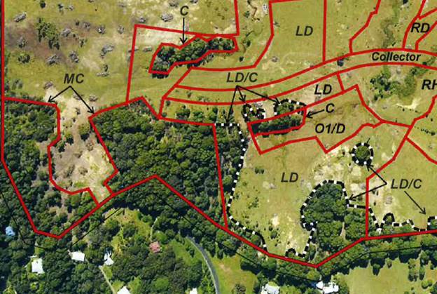
The most recent modification to the approval altered the
designation of the southern forested area and the single Tallowood Tree from
“LD/C” to “C”, being “Conservation” (see
Figure 2).
Figure 2: Most recent
amendment to Plan 2.1
The land use definitions approved in association with the
concept plan are:
LD/C – Low Density/
Conservation
Within this precinct dwelling houses are intended to be
sited in a manner which provides an appropriate dwelling house envelope but
also provides for the preservation of trees within private residential lots.
MC – Managed
Conservation
The managed conservation precincts are locations where
larger tracts of trees are intended to be retained but the ground fuels are to
be kept at a level appropriate for bush fire mitigation purposes.
C – Conservation
The “C” conservation land use applies to pockets
of existing vegetation which are intended to be retained in so far as is
reasonably practicable.
While forming part of the ‘Concept Approval’,
these land use designations are not reflected in the zoning of the land under
the LEP. The vegetated land within the Stage 5 & 6 areas in zoned R2
Low Density Residential, with the areas in the south-west of the land are zoned
RU2 Rural Landscape and DM (Deferred Matter – 1(a) under BLEP 1988).
The current application proposes to:
· Retain the
“Conservation” designation for the forest area behind Stages 5
& 6, but apply the “Managed Conservation” (MC) designation to
the outer 10m edge of this vegetation, to provide for some flexibility in the
management of bush fire risk;
· Modify the
“Conservation” designation on the existing Tallowood tree to
“Managed Conservation” (MC), as this is proposed (in Stage 6) to be
included with a larger residential lot; and
· Modify the
“Managed Conservation” designation for two larger forested areas in
the south-west of the site to “Conservation”, retaining the
“Managed Conservation” for the 10m outer edge of these stands.
Figure 3: Current proposed
amendment to Plan 2.1
The tallowood tree is located within the part of the site
that is subject to the current stage 6 development application (DA
10.2017.402.1). That application proposes that the tree be incorporated
into a large urban lot. Assessment of that application is underway with
the long term preservation of the tree being an issue of importance. The
remaining vegetation is within the residue land, which will be subject to
future applications.
Figure 4: Plan 2.1 in
relation to current Stage 6 subdivision plan (blue line denotes
proposed APZ)
Approval for Stage 5 (DA 10.2015.686.1) includes a
requirement for a 21m wide Asset Protection Zone (APZ) in the south-west corner
of that Stage. The majority of that APZ will be provided in the
constructed road reserve, but there will be requirement to reduce ground fuels
and tree canopy density within a minor (3-5m wide) section of vegetation.
Pursuant to the currently approved Plan 2.1, that vegetation area is
designated C – Conservation. The current application proposes that
it would be modified to MC – Managed Conservation.
Figure 5: Extract from approved
Stage 5 subdivision plan
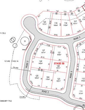
Figure 6:
Recommended amendment to MC area
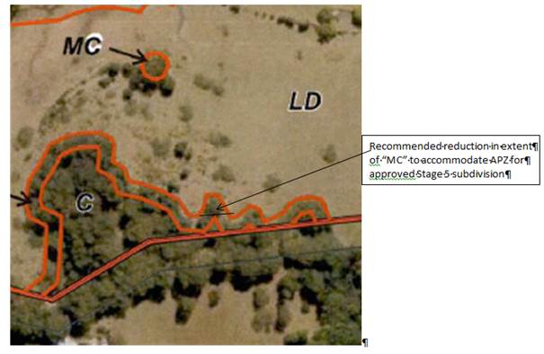
Bush fire hazard reduction, consistent with the requirements
for an ‘inner protect area’ APZ, is incompatible with both C and MC
designations. It is recommended, therefore, that Plan 2.1 be amended in
this small area, immediately south of the approved Stage 5 to reduce the width
of the MC area, and therefore provide for the approved APZ to be within a LD
area. The change will only impact on a very small portion of the site, as
shown in Figure 6 in relation to one tree. .
1.3. Description of the site
|
Land is legally described as:
|
LOT: 105 DP: 1232439
|
|
Property address is:
|
77 Tuckeroo Ave MULLUMBIMBY
|
|
Land is zoned:
|
R2 Low Density Residential / PART RU1 Primary Production /
PART DM Deferred Matter / PART RU2 Rural Landscape
|
|
Land area is:
|
44.9ha
|
|
Property is constrained by:
|
Bush Fire Prone Land
|
|
|
Flood Prone Land
|
|
|
High Environmental Value Vegetation (including areas
subject to proposed modification)
|
|
|
Koala habitat
|
The vegetated areas subject to the proposed designation of
“C” and “MC” are located on land zoned RU2 Rural
Landscape. The stand-alone Tallowood tree, proposed to be designated
“MC” is on land zoned R2 Low Density Residential. The site is the
residual allotment created following the completion and registration of
existing residential subdivisions of the Tallowwood Ridge Estate.
The approved residential subdivision is south of Tuckeroo
Avenue, adjoining Cockatoo Crescent, Lorikeet Lane and Quail Way. The approved
development area of Stage 5 comprises generally cleared land with sloping
topography, the site level falling towards the north and Tallowwood Creek.
Staging Plan
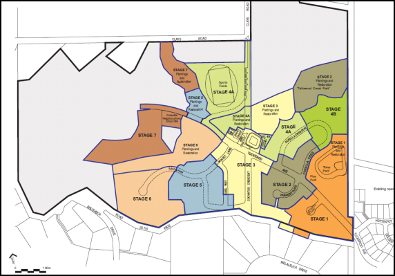
Zoning Plan
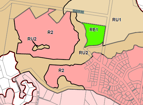
2. SECTION 96(1A) ASSESSMENT
Section 96(1A)
Comment: The proposed modification is of minimal
environmental impact. The development as modified is substantially the
same as that originally approved. The application is not required to be
notified.
Section 96(3)
Comment: Section 79C(1) matters are considered below.
3. ENVIRONMENTAL PLANNING AND ASSESSMENT REGULATION
2000
Clause 115(1)
Comment: The appropriate information has been
provided.
Clause 117(2)
Comment: Adjoining owner or public notification of
this application is not required.
Clause 120(1)
Comment: The application was referred to NSW Rural
Fire Service. See comments below.
4. REFERRAL TO NSW RURAL FIRE SERVICE
The site is bush fire prone land and the NSW Rural Fire
Service (RFS) has previously issued a Bush Fire Safety Authority relating to
the approved subdivision. In relation to the current modification application,
the RFS have provided further advice, given that the modification relates to an
overarching Concept Plan rather than a specific DA for subdivision approval.
That advice highlighted the potential discrepancy between
the inner protection area APZ approved as part of Stage 5 and the MC
designation in the small area affected by that APZ. As discussed above, a very
minor adjustment in the MC ‘edge’ as required by the RFS will
adequately address any potential for inconsistency.
5. SECTION 79C – MATTERS FOR CONSIDERATION
– DISCUSSION OF ISSUES
5.1. State Environmental
Planning Instruments
SEPP 44 Koala Habitat Protection
Previous site assessments have
indicated that potential koala habitat exists on the site. However the site is
not considered as Core Koala Habitat in terms of SEPP 44 and a specific Koala
Plan of Management is not required. The increased protection provided in the
south-west vegetated area, by the Conservation Designation as proposed,
recognises this potential habitat values of the site, and provides a strong
layer of protection. The vegetation in this area also connects to
forested areas outside of the site, and therefore the Conservation designation
will assist in maintaining opportunities for koala movement in the future.
The proposed modifications raise no issues in regard to any
other applicable State Environmental Planning Policies.
5.2. Byron
Local Environmental Plan 2014 (LEP 2014)
In accordance with LEP 2014 clauses 1.4 and 2.1 – 2.3:
(a) The
approved development is not defined in the LEP 2014 Dictionary, but is defined
in the Environmental Planning and Assessment Act 1979 as subdivision
of land;
(b) The
land is within R2 Low Density Residential / PART RU1 Primary Production / PART
DM Deferred Matter / PART RU2 Rural Landscape, according to the Land Zoning Map,
with the subject areas of vegetation predominantly within the RU2 zone;
(c) The
proposal is permitted with consent; and
(d) The
proposed modifications raise no issues in regard to the Zone Objectives or any
provisions of the LEP.
5.3. Any
proposed Instrument that has been the subject of public consultation and has
been notified to the consent authority
Draft SEPP (Coastal
Management) 2016
The Draft Coastal Management State Environmental Planning
Policy (SEPP) proposes to establish a new, strategic land use planning
framework for coastal management. It is intended to support the
implementation of the management objectives set out in the Coastal Management
Act 2016.
Once adopted, the Coastal Management SEPP will be the single
land use planning policy for coastal development and will bring together and
modernise provisions from SEPP 14 (Coastal Wetlands), SEPP 26 (Littoral
Rainforests) and SEPP 71 (Coastal Protection).
The aim of the Draft SEPP is to promote an integrated and
co-ordinated approach to planning in the ‘Coastal Zone’,
identifying four coastal management areas:
· coastal wetlands
and littoral rainforests area
· coastal
environment area;
· coastal use area;
and
· coastal
vulnerability area.
The whole of the subject site will be mapped within the coastal
use area. The proposed modifications raise no issues in regard to the
matters contained in the draft SEPP.
5.4. Byron
Shire Development Control Plan 2014 (DCP 2014)
The proposed modifications raise no issues in relation to
any applicable DCP provision.
5.5. The likely impacts of that
development, including environmental impacts on both the natural and built
environments, and social and economic impacts in the locality
|
Impact on:
|
Likely significant impact/s?
|
|
Natural environment
|
No. The proposal will not have a significantly adverse
impact on the natural environment of the locality. Overall, the
modifications as proposed will result in the conservation of an increased
area of native vegetation.
|
|
Built environment
|
No. The proposal will not have a significantly adverse
impact on the built environment of the locality.
|
|
Social Environment
|
No. The proposal will not have a significant social impact
on the locality.
|
|
Economic impact
|
No. The proposal will not have a significant economic
impact on the locality.
|
5.6. The suitability of the
site for the development
Subdivision has been approved over part of the land,
demonstrating that it is suitable for urban development. The land use
designations, as proposed within that part of the site, do not alter any
considerations of suitability.
The vegetated land in the south-west corner of the site,
proposed to be protected by way of “Conservation” land use
designation, is not suitable for urban development, and the modification as
proposed will assist in clarifying that for future applications.
The “Managed Conservation” designation of the
outer 10m of these vegetated areas will assist in managing the bush fire risk
on adjoining urban land.
5.7. Public interest
The proposed modification of the development approval is
unlikely to prejudice or compromise the public interest or create an
undesirable precedent.
6. DEVELOPER CONTRIBUTIONS
The modifications have no implications in relation to
developer contributions.
7. CONCLUSION
The application proposes to:
· Retain the
“Conservation” designation for the southern forest area, but apply
the “Managed Conservation” (MC) designation to the outer 10m edge
of this vegetation, to provide for some flexibility in the management of bush fire
risk;
· Modify the
“Conservation” designation on the existing single Tallowood tree to
“Managed Conservation” (MC), as this is proposed (in Stage 6) to be
included with a larger residential lot; and
· Modify the
“Managed Conservation” designation for two larger forested areas in
the south-west of the site to “Conservation”, retaining the
“Managed Conservation” for the 10m outer edge of these stands.
It is considered that the modifications will provide an
improved outcome, both in terms of managing bush fire risk for approved
development and in increasing the extend of vegetation designated
“Conservation” on the approved land use plan, to ensure its
protection within future stages of subdivision.
8. DISCLOSURE OF POLITICAL DONATIONS AND GIFTS
|
Has a Disclosure Statement been received in relation
to this application
|
No
|
|
Have staff received a ‘gift’ from anyone
involved in this application that needs to be disclosed. Where the answer is
yes, the application is to be determined by the Director or Manager of the
Planning, Development and Environment Division.
|
No
|
Provide Disclosure Statement register details here: Not
applicable
Staff Reports - Sustainable Environment and Economy 13.13
Report No. 13.13 PLANNING
- Review of further subdivision potential in the Ewingsdale and Mullumbimby 'R5
Large Lot Residential Zone'
Directorate: Sustainable
Environment and Economy
Report
Author: Alex
Caras, Team Leader Land Use Strategy
File No: I2017/1253
Theme: Ecology
Planning Policy and Natural Environment
Summary:
Council at its 23 March 2017 Ordinary
Meeting resolved that staff “examine a
change of lot size in the R5 zones at Ewingsdale and Left Bank Road to increase
available residential land in the short term”, as one of a number of actions to
progress ahead of Council’s adoption of the draft Rural Land Use
Strategy. This report presents the results of a range of minimum lot size
(MLS) scenarios considered within the above estates, as well as preliminary
findings arising from the Ewingsdale Road /
McGettigans Lane intersection review (currently underway). The report
recommends that further investigations to determine re-subdivision potential of
the R5 zone at Ewingsdale be deferred until Council has considered the findings
of the Ewingsdale Road / McGettigans Lane intersection review in a future
report. Consultation with affected residents
would be the next step in the process of examining further subdivision
potential in the R5 zone at Left Bank Road (Mullumbimby), should Council wish
to proceed down this path.
NOTE TO COUNCILLORS:
In accordance with the
provisions of S375A of the Local Government Act 1993, a Division is to be
called whenever a motion for a planning decision is put to the meeting, for the
purpose of recording voting on planning matters. Pursuant to clause 2(a)
under the heading Matters to be Included in Minutes of Council Meetings of
Council's adopted Code of Meeting Practice (as amended) a Division will be
deemed to have been called by the mover and seconder of all motions relating to
this report.
|
RECOMMENDATION:
1. That
Council note the results of the preliminary subdivision analysis for the R5
zones at Ewingsdale and Left Bank Road, as contained in this report;
2. That
further investigations to determine re-subdivision potential of the R5 zone
at Ewingsdale be deferred until Council has considered the findings of the
Ewingsdale Road / McGettigans Lane intersection review in a further report;
and
3. That
staff consult with affected residents in the R5 zone at Left Bank Road
(Mullumbimby) to determine key issues associated with, and whether there is a
sufficient level of support for, amending Byron LEP 2014 to allow smaller lot
subdivision within this estate.
|
Attachments:
1 Template -
Form of Special Disclosure of Pecuniary Interest , E2017/97406 ⇨
Report
Council resolved the following at
its 23 March 2017 Ordinary Meeting:
Res
17-094:
1. That Council staff
examine a change of lot size in the R5 zones at Ewingsdale and Left Bank Road
to increase available residential land in the short term; and,
2. That Council report
the possible lot yield result in the two zones within 3 months.
This resolution relates to Action 22 of the recently
exhibited draft Rural Land Use Strategy (RLUS), being: “Investigate
capacity for re-subdivision within existing Large Lot Residential
estates.”
This is one of a number of actions being progressed ahead of
Council’s adoption of the draft Rural Land Use Strategy.
Preliminary Subdivision Analysis Results
Current minimum lot size requirements for
subdivision in the R5 Large Lot Residential Zone of these estates are:
· Ewingsdale: 8,000
m2 (except 10,000m2 for certain land fronting Citriadora
Drive)
· Left Bank Road
(Mullumbimby): 8,000 m2
The following site attributes were considered in
examining their further subdivision potential:
· Slope
· Vegetation
· Flood / Riparian
· Bushfire
· Existing development
A range of minimum lot size (MLS) scenarios were explored in
both estates, with the results of the preliminary analysis presented below:
|
LOCALITY
|
Additional Lot Yield Scenarios
|
|
4000m2 MLS
|
6000m2 MLS
|
8000m2 MLS (additional yield if current potential
realised)
|
|
Ewingsdale
|
91
|
52
|
34
|
|
Mullumbimby
|
39
|
17
|
11
|
It is noted that actual lot yields may vary from those shown
above pending a more detailed land capability assessment, including capacity
for onsite waste management.
The above scenarios, if realised, may not have any
measureable influence on the overall supply and price of available residential
land in the short term. This is because rural residential land in these
estates generally has a higher purchase price than in the urban (non-coastal)
residential areas of the Shire, mainly due to the perceived lifestyle
attributes associated with larger lot sizes. Therefore additional lot
releases within these estates are likely to exceed the price-point of most
first-time home buyers and working families seeking housing in the Shire.
Traffic Capacity at Ewingsdale
Road / McGettigans Lane intersection
The Ewingsdale Road / McGettigans Lane intersection has
been identified in a number of recent studies along the Ewingsdale Road
corridor to reach full capacity by 2019, notwithstanding any additional (new)
development within this corridor. Preliminary review findings suggest that this
intersection will most likely require upgrading prior to any additional
development occurring in this locality. However Council is unlikely have
sufficient S94 funds to upgrade this roundabout until 2023. On this
basis, it is recommended that further investigations to determine
re-subdivision potential of the R5 zone at Ewingsdale be deferred until Council
has considered the findings of the Ewingsdale Road / McGettigans Lane intersection
review (currently underway) in a further report expected before the end of the
year.
Next steps
Draft RLUS section
‘4.3
- Process for enabling re-subdivision within existing Large Lot Residential estates’ states: “Council will need to undertake
further investigations to determine re-subdivision potential of existing rural
residential estates.
Following those investigations, Council
will consult with affected residents
within the relevant estates to determine key issues and gauge whether
there is sufficient level of
support to amend Byron LEP 2014 for this purpose.”
Consultation with affected residents would be
the next step in progressing RLUS Action 22 (ie. the process of examining
further subdivision potential) in the R5 zone at Left Bank Road (Mullumbimby),
should Council wish to proceed down this path. In this regard a
number of the submissions to the recently exhibited draft Rural Land Use
Strategy raised the need to also consult with surrounding rural landowners about the potential impacts of re-subdivision on their
amenity and/or ability to continue or expand farming operations.
As recommended above, further investigations
in the Ewingsdale R5 zone should be deferred
until Council has considered the findings of the Ewingsdale Road / McGettigans
Lane intersection review (currently underway) in a further report.
Financial Implications
The administration costs of progressing RLUS Action 22 for the above estates can be
accommodated within existing Council budgets.
Statutory and Policy Compliance Implications
Progression
of draft RLUS Action 22 (in part) is consistent with the relevant Delivery
Program Actions 2017-2021 and Operational Plan Activities 2017-2018 for the
‘Environment’ category (EN1.2.1).
Staff Reports - Sustainable Environment and Economy 13.14
Report No. 13.14 Local
Heritage Places Grants 2017--18
Directorate: Sustainable
Environment and Economy
Report
Author: Luke
Munro , Planner
File No: I2017/1320
Theme: Ecology
Development and Approvals
Summary:
The Byron Local Heritage Places Grants have been established
by Council to assist property owners to carry out restoration works to listed
heritage properties throughout the Shire.
There is a total of $12,000.00 in the fund made up of a
grant from the Heritage Division of the NSW Office of Environment of $6,000.00
and $6,000.00 from the Council.
The Local Heritage Places Grants 2017-18 is jointly funded
by Council and the NSW Heritage Division as part of the commitments to heritage
management and tourism within Byron Shire. The purpose of the fund is to
provide a small grant to support owners of heritage items or draft heritage
items in maintaining their heritage property.
The focus for the 2017-2018 Local Heritage Places Grants is
conservation works that enhance individual places, buildings and historic
streetscapes including buildings in conservation areas that will promote and
foster community appreciation of the history of the Shire.
Five applications were received this year for projects with
a total value of over $85,000. After consideration by the Heritage Adviser and
staff, all five projects were each awarded a share of the available $12,000.
|
RECOMMENDATION:
That Council receive the information
in the report on Local Heritage Places Grants 2017-18 and endorse the funding
recommendations made by the Heritage Advisor and staff.
|
Attachments:
1 Confidential
- Project Application Local Heritage Places Fund - 39 Leslie Street, Bangalow ,
S2017/17059
2 Confidential
- Assessment Criteria 39 Leslie Street Bangalow, E2017/93142
3 Confidential
- Project Application Local HEritage Places Fund - 26 Carlyle Street Byron Bay,
S2017/17077
4 Confidential
- Assessment Criteria 26 Carlyle Street Byron Bay, E2017/93151
5 Confidential
- Projection Application Local Heritage Places Funding 5 Lismore Road Bangalow,
E2017/91286
6 Confidential
- Assessment Criteria 5 Lismore Road Bangalow, E2017/93153
7 Confidential
- Project Application Local Heritage Places Fund Deacon & Ashton Streets
Bangalow , E2017/91289
8 Confidential
- Assessment Criteria Deacon & Ashton Streets Bangalow, E2017/93156
9 Confidential
- Project Application Local Heritage Places Fund 31 Byron Street Bangalow, E2017/91298
10 Confidential -
Assessment Criteria 31 Byron Street Bangalow, E2017/93158
Report
The Byron Local Heritage Places Grants have been established
with the aid of a grant from the Heritage Division of the NSW Office of
Environment and Heritage with Council providing $6,000 to qualify for $6,000
from the Heritage Division.
The purpose of the Byron Local Heritage Places Grants is to
help property owners carry out restoration works on listed heritage properties.
As well as encouraging restorative work, the program raises awareness of the
benefits of heritage conservation and in doing so, promotes and preserves the
rich local history of the Byron Shire.
Up to $3,000 was available for each project from a total
funding pool of $12,000. The main conditions are that property owners need to
provide one dollar for every dollar contributed jointly by Council and the
Heritage Division and that the work must be completed before or by April 2017.
Five applications were received this year. Each
proposal was assessed by
Council’s Heritage Advisor against Heritage Division
criteria.
http://www.byron.nsw.gov.au/byron-local-heritage-places-grants-2016-2017
Ordinarily a report by the Heritage Advisor would be
considered by the Heritage Advisory Panel, but given the need to allocate the
fund now; this report has been submitted directly to Council for endorsement.
The five successful projects and the grant assistance provided are listed in
the attachments.
The funding of these five projects enables over $85,000
worth of work to be carried out in this financial year which will increase
community participation and pro-active conservation works to heritage assets in
the local area. The fund will also contribute to the business and tourism
industry by ensuring the recognition and quality of Byron’s heritage
attractions.
Financial Implications
Council has delivered the Local Heritage Places Grants with
the aid of a grant from the Heritage Division of the NSW Office of Environment
and Heritage with Council providing $6,000 to qualify for $6,000 from the
Heritage Division.
Statutory and Policy
Compliance Implications
The operation of the Local Heritage Places Grants program is
a task of the Byron Shire Heritage Strategy 2016-2019.
Staff Reports - Sustainable Environment and Economy 13.15
Report No. 13.15 Submissions
Report on the Draft Byron Shire Flying-fox Camp Management Plan
Directorate: Sustainable
Environment and Economy
Report
Author: Clare
Manning, Natural Environment Projects and Policy Officer
File No: I2017/1332
Theme: Ecology
Planning Policy and Natural Environment
Summary:
This report presents the public exhibition
outcomes of the draft Byron Shire Flying-fox Camp Management Plan (Plan).
Specifically it is proposed to adopt the Plan with changes to minimise the
impacts of flying-foxes to the community, while ensuring long-term conservation
of flying-foxes and their habitat within Byron Shire. Under a Council
adopted Plan Council is eligible to take advantage of the Flying-foxes Grants
Program that has been established to assist councils to manage flying-fox camps
in their area, consistent with the Office of Environment and Heritage (OEH)
Flying-Fox Camp Management Policy 2015 (Policy).
The Plan is consistent with the
OEH Camp Management Plan Template and Policy to facilitate licensing of camp
management actions over the next five years. The Plan is consistent with the
Biodiversity Conservation Strategy 2004 (currently under review) and
Operational Plan 2017-18.
|
RECOMMENDATION:
That Council note this
report with the following recommendations:
1. adopt
the Byron Shire Flying-fox Camp Management Plan (Attachment 1) that includes
changes following public exhibition as outlined in Table 1 of this report.
2. consider
an allocation of:
a) $20,000
in the 2018-19 annual budget to leverage 1:1 funding from the Flying-foxes
Grants Program to fund specific management actions
b) $35,000
in the 2018-19 budget to appoint a part time Flying-fox Project Officer, to
organise and facilitate the initial stages of the Plan implementation where a
high level community engagement and development of protocols and procedure will
be required.
3. note
that funding commitment is required annually and long term beyond the five
year life of the Plan.
4. seek
the Office of Environment & Heritage endorsement of the Byron Shire
Flying-fox Camp
Management Plan.
|
Attachments:
1 Byron
Shire Flying-fox Camp Mgt Plan Version 5, E2017/93262
⇨
2 Confidential
- OEH Office Environment and Heritage Response Submission - Byron Bay LGA
Flying-fox Camp Management Plan Signed D Young, E2017/79375
3 Confidential
- Submission - Byron Shire Flying Fox Camp Plan - OEH Additional
Information Consultation, E2017/91978
4 Confidential
- Submission - Byron Shire Flying Fox Camp Plan - All, E2017/91500
Report
Flying-foxes are protected under State legislation and some
species are listed as threatened. Grey-headed Flying-fox are also listed as a
vulnerable species under Commonwealth legislation. Flying-foxes play a crucial
role in pollinating native forests and spreading seeds to ensure longevity of
native bushland. Like all urban wildlife, they bring benefits and challenges to
the way we live.
The draft Plan (Attachment 1) identifies 16 known
flying-fox camps within Byron Shire but specifically how to manage flying-fox
camps in Mullumbimby, Bangalow, Byron Bay (including camps located at Butler Street
and Middleton Street) and Suffolk Park.
Consultation
On 4 August 2017, Council 17-290 resolved to publicity
exhibit the draft Byron Shire Flying-fox Camp Management Plan for 4 weeks.
The draft Plan was on exhibited from 4 August to 1 September
2017.
Over the exhibition period, 7 submissions were received
including a submission from OEH.
Submissions
Office of Environment and Heritage Submission
OEH provided extensive feedback and recommendations on the
draft Plan (Attachment 2 & 3). Key recommendations included
actions to develop a process for responding to unlawful activities in
consultation with OEH and make such a process publically available via
Council’s website updated (refer Table 1 Compliance), and the need to
improve more information on Federal, State and local government legislation and
policy and their role in the delivery of the Plan (refer Table 1 Legislation
and Policy).
Additionally, OEH recommended actions to improve
Council’s preparedness by recommending that Council develop response
procedures for new and/or emerging camps with an influx of flying-foxes;
adverse weather events e.g. bushfire threat, flood or storm, extreme heat
events that lead to flying-foxes changing their behaviour and/or dying. An
action to develop a procedure for scheduled and/or unanticipated works to
infrastructure maintenance associated near to or within a flying-fox camp was
also recommended (refer Table 1 Planned management approach).
Public Submissions
Over the exhibition period, Council recorded 3,583 total
visits in response to the draft Plan via facebook. A total of 221 facebook
postings of mixed response recorded. Postings advocated dispersal
as the only and preferred management option or supporting flying-fox-human
co-existence. Additionally, Council was shown support for a planned
approach to managing camps but our ability to implement the Plan in a timely
manner was questioned. Six written submissions were received (Attachment 4),
including one submission that was published in the Byron Echo dated 6 September
2017:16.
These matters have been addressed within the Plan, and
Council staff has applied the following changes to the draft Plan.
Table 1. Summary of all submissions and Council staff
response.
|
No.
|
Issues Raised
|
Staff Comment
|
Staff Recommendation
|
|
|
Context
|
|
|
1.
|
To simplify implementation and reporting, reduce and tailor
the objectives of the plan to consolidate similar community, ecological and
statutory dot points.
|
Accepted
|
Merge objectives 1, 7 & 8 to read minimise impacts to
the community while ensuring long-term conservation of flying-foxes and their
habitat within Byron Shire. Plan's implementation and reporting simplified.
|
|
2.
|
Clarify the status of flying-foxes.
|
Noted
|
The Plan addresses flying-fox ecology and behaviours
including threats and trends via Appendix D
|
|
3.
|
Include a section on all known camps in the LGA. The Plan
should outline all camps including the historic, seasonal, and temporary
camps throughout the LGA
|
Accepted
|
Section 1 Illustration 1.1 shows all known Flying-fox
Camps in Byron Shire. A total of 16 flying-fox are known in Byron Shire.
|
|
4.
|
Include the Aboriginal Cultural Heritage values of the
subject camps. Review the management actions in consultation with the
Local Aboriginal Lands Council (LALC) and local Aboriginal knowledge holders
within the community.
|
Accepted
|
Council staff contacted LALCs and the Awakwal MOU Advisory
Committee for input and involvement.
Section 2 notes that 16 camps are located on Bundjalung
Country of the Arakwal people, and each camp is located upon land covered by
the respective Local Aboriginal Land Council (LALC). Section 8 notes that relevant
LALC will be consulted and involved in any associated works on camps. This
will ensure respectful consideration of the cultural values.
|
|
5.
|
Clarify the impact on other
fauna, businesses and water pollution in section 2.6
|
Accepted
|
Section 2.6 reports issue relating to the camps including
impacts on businesses: for example, residences working from homes e.g.
accountancy or therapists and/or direct businesses e.g. accommodation.
Impacts on other fauna species: for example, reported temporary dispersal of
native birds. Impacts on water pollution: for example, faecal droppings
have impacted on water quality and alleged cause a decline in fish and mud
crab stocks.
|
|
|
Community engagement
|
|
|
6.
|
Include a section describing the agencies, stakeholders
and community organisations directly involved in the implementation of the
Plan to provide a clear scope for council's regulatory and support
structure.
|
Accepted
|
Section 1 acknowledges that GeoLink and Byron Shire
Council have prepared this flying-fox management plan in consultation with
the OEH and Department of Primary Industries - Crown, community groups and
broader community etc.
Section 3 tabulates stakeholders that have been consulted
in the Plan and those that will need to be involved in the implementation of
the Plan.
|
|
|
Legislation and policy
|
|
|
7.
|
Include a list any of the documents or plans held by Council
or Trusts for the reserves containing the subject camps, e.g. Plans of
Management or restoration plans. A summary of how these documents will
interact, support or influence the outcomes of the Plan should be provided
|
Accepted
|
Table 4.1 provides LGA & Trusts documents and their
relevance to the Plan
|
|
8.
|
Include more information on the Biodiversity Conservation
Act 2016 and its role in the delivery of the Plan
|
Accepted
|
Section 4 provides more information on the Biodiversity
Conservation Act 2016 and its role in the delivery of the Plan.
The purpose of the Biodiversity Conservation Act 2016 (BC
Act) is to maintain a healthy, productive and resilient environment for the
greatest well-being of the community, now and into the future, consistent
with the principles of ecologically sustainable development including
conserving biodiversity, maintaining the diversity and quality of ecosystems,
regulating human interactions with wildlife, and supporting conservation and
threat abatement action to slow the rate of biodiversity loss and conserve
threatened species and ecological communities in nature.
|
|
9.
|
Consider the statutory
functions of the Biodiversity Conservation Act 2016.
|
Accepted
|
Section 4 states It should be noted that this Plan does
not constitute a licence to undertake works. Land owners seeking to undertake
works on private property will need to acquire the relevant approvals via
Council and/ or OEH.
|
|
10.
|
Include reference to the new
license requirement will be a Biodiversity Conservation License, under the
Biodiversity Conservation Act 2016
|
Accepted
|
Section 4 notes that Part 2 Division 3 of the BC Act
provides for the issuing of Biodiversity Conservation Licences to authorise
the doing of an act likely to result in one or more of the following:
a) harm
or attempted harm to any animal that is of a threatened species or is part of
threatened ecological community
b) harm
or attempted harm, dealing in, or liberating a protected animal
c)
the picking of any plant that is of a threatened species or is part of
threatened ecological community
d) picking
or dealing in protected plants
e) damage
to declared areas of outstanding biodiversity value
f) damage
to any habitat of a threatened species or threatened ecological community.
|
|
|
Compliance
|
|
|
11.
|
Include a section on
compliance processes and the roles of the agencies involved. Management
should be proactive in nature, but a compliance response is sometimes
warranted. Information on what constitutes a breach of the respective
legislation that applies to the reserves, ecological communities and species
present should be included.
|
Accepted
|
Section 7 states that culling is addressed here as it
is often raised by community members as a preferred management method;
however, culling is contrary to the objects of the BC Act and will not be
permitted as a method to manage flying-fox camps.
Action Table 8.1 states that Council will develop a
process for responding to unlawful activities in consultation with OEH and
make such a process publically available via Council’s website updated.
Information on what constitutes a breach of the respective
legislation that applies to the reserves, ecological communities and species
present and triggers for informing OEH will be included.
|
|
|
Other ecological values
|
|
|
12.
|
Include, more detail on the referenced "coastal sand
plain", which is noted in the discussion for the lack of endangered
ecological community status applied to the Swamp Sclerophyll Forests found at
Beech Drive, Butler Street and Middleton Street Camps. Advise presenting
evidence (a soil analysis) that the sites have been assessed appropriately
and lack the presence of alluvial soils and/or association with the coastal
floodplain
|
Partly Accepted
|
Section 5 outlines desktop assessment of ecological values
of each flying-fox camp including threatened species, ecological communities,
critical habitat, SEPP 14 Coastal Wetlands and SEPP 26 Littoral Rainforest
& criteria for High Environmental Values. Appendix C & D provides
Results of ecological desktop assessment & Flying-fox ecology and
behaviour.
A soil analysis is not warranted as Council have completed
extensive vegetation mapping including ground truthing (2017)
|
|
|
Site specific analysis of camp management options
|
|
13.
|
Clarify how dispersal has the
potential to impact on aircraft safety
|
Accepted
|
The full range of options available for management of the
five subject flying-fox camps were identified and reviewed throughout
community consultation and Plan preparation.
Table 7.1 supporting references include Parson et al 2008
conclude the majority of flying-foxes fly at elevations of approx. 150m, with
few records of flights of up to 1,500m. Aircraft in Australia spend a
relatively small proportion of their total flight time at 150m. With
the exception of ultra-light aircraft, even aircraft forced to circuit an
airport while waiting to land are required to do so above 300m.
|
|
14.
|
Supportive of Level 3 active dispersal
is the only viable option for the future.
|
Noted
|
Section 7 outlines site-specific analysis of camp
management options. Section 8 outlines consideration of active dispersal
including cost analysis.
Section 8 outlines that Council must demonstrate Level 1
& 2 actions prior to Level 3 actions e.g. dispersal, as per OEH Policy.
|
|
|
Planned management approach
|
|
|
15.
|
Include a section that
recognises new and emerging camps, and how this will form part of the Plan's
adaptive management process
|
Accepted
|
Action Table 8.1 states that Council will develop a
response procedure for new and/ or emerging camps with an influx of
flying-foxes; for adverse weather events e.g. bushfire threat, flood or
storm, extreme heat events (leading to flying-foxes changing their behaviour
and/ or dying) and;
develop a procedure for scheduled and/or unanticipated
works to infrastructure maintenance associated near to or within a flying-fox
camp.
|
|
16.
|
Include a section on emergency
or arising camp issues, with supporting contingency planning. The contingency
planning should include the council's response, consultation, administrative
process, and consent requirements to deliver on the escalating management
responses. These issues may include:
a) bushfire threat and
fire protection
b) serious flood or storm
mitigation works
c) heat event
d) service location
relative to the camp, such as water or sewer
e) arrival of Little Red
Flying-foxes in large numbers or a seasonal influx of Grey-headed or Black
Flying-foxes.
|
Accepted
|
|
17.
|
Include a point that all
restoration activities must remain consistent with an ‘Council’
approved vegetation management plan
|
Accepted
|
Section 8 action tables states that a Council approved
integrated VMP is required at all sites to complement the Plan. The VMP would
encompass site specific bush regeneration or habitat creation actions, as
well as the management of vegetation removal sites with the objective of
minimising adverse vegetative or habitat impacts
|
|
18.
|
Include a process to review
the plan's actions, consultation requirements and level of approval required
|
Accepted
|
Action Table 8.1 states that Council will develop a
procedure (a series of actions or steps taken) in order to review the
Plan’s actions, consultation requirements and level of approval
requirements.
|
|
19.
|
Pro-active action on emerging
camps is supported for its cost effectiveness. Notwithstanding, supportive of
dispersal at Mullumbimby is the only viable option for the future.
|
Noted
|
Section 8 outlines that Council must demonstrate Level 1
& 2 actions prior to Level 3 actions as per OEH Policy.
|
|
20.
|
Assessing the impacts of
droppings on natural waterways should be included as an action
|
Noted
|
Since the early days of European settlement, people have
observed that flying-foxes roost and fly along rivers and creek lines. This
is a consistent behaviour developed over evolutionary time – not a
response to recent environmental change. It would be hard to argue that a
causal relationship with alleged recent declines in local fish and crab
stocks, and therefore action within the Plan.
|
|
|
Human and animal health
|
|
|
21.
|
Submission is made with reference
to health related matters specifically to the individual’s
circumstances.
|
Noted
|
Section 6 outlines disease and flying-fox management.
Additionally, Council sought professional heath advice and
response from NSW Primary Industries regards health matters specifically to
the individual’s circumstances. NSW Primary Industries have since
responded to the individual specific health enquiries.
|
|
|
Assessment of impacts to flying foxes
|
|
|
22.
|
Outline habitat loss, at each
camp and the supplementary information provided, to provide an explanation
and an appropriate assessment of actual habitat present.
|
Accepted
|
Section 9 Assessment of impacts to flying-foxes tabulates
% habitat loss
|
|
23.
|
Include more information on
the assessment of impacts, offset requirements and the role of vegetation
management plans.
|
Accepted
|
Section 9 outlines that the Development Control Plan
Chapter B2 prevails in regards to offsetting. However, should the total
area of clearing be greater than 0.25ha at any of the sites, then the BAM
method (plots and transects) under the Biodiversity Conservation Act 2016
will be used by Council staff and a credit requirement generated.
|
Financial Implications
Council received a $15,000 NSW Government grant to help
prepare the Plan.
As part of the Funding Agreement, Council committed funds and
in-kind contributions on a 1:1 basis. The Plan will address the impact of
flying fox colonies located in Mullumbimby, Bangalow, Byron Bay and Suffolk
Park.
Under a Council adopted Plan, Council is eligible to take
advantage of the Flying-foxes Grants Program. This $1 million program is
funded through the OEH and is administered by Local Government NSW to address
identified flying-fox management issues facing NSW councils. A combination of
competitive and non-competitive funding is available up to $50,000.
Council will be required to commit matching funds or in-kind contributions for
any proposal on a 1:1 basis.
The Flying-fox Grant will not however fund works that
primarily target noxious weeds. Such weeds are the core responsibility of
landowners and are enforceable by the Biosecurity Act 2016 and local control
authorities e.g. Rous County Council. Nor will the Flying-fox Grant fund a
project officer.
Flying-fox camp management actions such as creating a buffer
between camps and residents often entail trimming, removal and/or control of
woody weeds such as Camphor Laurel and Lantana (e.g. Paddy’s Creek,
Bangalow). Under the flying-fox grant, actions proposing to remove and/or
control noxious weeds may be funded, where the applicant’s matching
contribution focuses on weed management and the flying-fox grants funding
caters for other elements of the action such as community engagement, community
support, erosion control and revegetation.
Statutory and Policy Compliance Implications
In responding to recommendation by OEH, the Plan complies
with the OEH Policy, guidelines and management plan template. The Plan is
consistent with the Biodiversity Conservation Strategy 2004 (currently under
review) and Operational Plan 2017-18.
Staff Reports - Sustainable Environment and Economy 13.16
Report No. 13.16 Mobile
Food Venders
Directorate: Sustainable
Environment and Economy
Report
Author: Sarah
Nagel, Community Enforcement Officer
File No: I2017/1341
Theme: Ecology
Development and Approvals
Summary:
On 2 February 2017, Council
resolved (17-031):
1. That the petition regarding objection to “Designer
Collective Markets and Food Truck Street Party” be noted.
2. That the petition be referred to the Director Sustainable
Environment and Economy.
3. That a report be brought to Council concerning DA and or
other approval requirements for designer collective markets and food truck
street parties.
The purpose of this report is to
provide Council with a discussion paper / report on the options for Mobile
Vendors (food and products) and commercial users of road reserves within the
Byron Shire.
|
RECOMMENDATION:
1. That one Council policy incorporates the commercial use
of road reserves authorised under the Roads Act;
2. That the policy incorporates all
licenced/approved activities on those areas as authorised under the Roads Act
i.e. mobile food vendors, mobile product vendors, footpath dining and goods
and chattels;
3. That the policy works in conjunction with
Council’s policy “Road Airspace”; and
4. That
the policy works in conjunction with Council’s policy 5.52
“Commercial Activities on Coastal and Riparian Crown Reserves”.
|
Attachments:
1 Draft
Policy - Commerical use of Road Reserve, E2017/95798
⇨
Report
The objective of the revision of
Council’s current ‘Itinerant Food Vendor’ Policy No. 5.4 is
to facilitate the establishment of a burgeoning street food/food truck/product
truck industry and to take advantage of the economic, cultural and social
benefits within the Shire. This is balanced against the protection of the
Shire’s current retail sector and the maintenance of public health.
Research has been undertaken of
policies (relating to food trucks) that have been implemented by Gold Coast
City Council, Lismore City Council and Sydney City Council. Relevant to
this discussion:
a. Gold Coast City Council undertook a test period of mobile
food vendors within their area before introducing relevant licencing.
This Council now allows at least 26 operators in permitted zones (with a
restriction on what number may operate in each permitted zone at any one time)
on a first in/first served basis. They also allow two (2) permanent food
stalls in two (2) locations with exclusive use of those locations.
b. Sydney City Council also undertook a test period before
introducing relevant licencing. This Council now has two categories
– food vans (food/drinks not requiring a kitchen, max stopping time of
15min [not permitted to “set-up stand”], trade only in restricted
areas) and food trucks (requires kitchen, max stopping time 5hrs, trade in all
zones)
c. Lismore City Council allows mobile vendors on an ad-hoc
application basis and appears to have limited policies in place in that regard.
Research was also undertaken of
Eurobodalla Shire Council’s approach to implementing a comprehensive
policy relating to activities on road reserves, activities on Council
managed/owned lands and activities on air space.
On 31 May 2017, the Executive
Team noted report No. 4.4 ‘Commercial Activities on Road Reserve’
File No: I2017/693 and that a draft policy will be prepared and reported back
to the Executive Team by the end of July 2017.
On 2 August 2017, the Executive
Team considered and endorsed recommendations in Report No. 52 File No:
I2017/767:
1. That one Council
policy incorporates use of road reserves, air spaces and Council owned land;
2. That the policy also
incorporates all licenced/approved activities on those areas i.e. busking,
mobile food vendors, mobile product vendors, events etc;
3. The report No. 4.4 of
ET 31/05/2017 File No: I2017/693 draft policy be used as a starting point to
incorporate the other activities into; and
4. That the policy works in conjunction with Council’s policy
5.52 “Commercial Activities on Coastal and Riparian Crown
Reserves”.
As Council's Road Airspace Policy
has recently been amended and has been to public exhibition, following a
council resolution in December last year, it is no longer recommended to
include use of airspace in this policy.
As busking and events
approvals/licences do not fall within the scope of the Roads Act, it is no
longer recommended to include busking or events within this policy.
In order to reduce confusion from
members of the public and also different areas of Council, it is suggested that
Council implement one comprehensive policy that:
1. Incorporates commercial use of road reserves
under the Roads Act;
2. Incorporates all activities i.e. mobile food
vendors, mobile product vendors, footpath dining and goods and chattels;
3. Amends the current processes and policies
relating to mobile food vendors and mobile product vendors;
4. Endorses the current processes and policies
relating to footpath dining and goods and chattels;
5. Works in conjunction with Council’s policy
“Road Airspace”; and
6. Works in conjunction with Council’s policy
5.52 “Commercial Activities on Coastal and Riparian Crown
Reserves”.
In relation to mobile vendors, it
is suggested that three (3) categories be considered that may be
authorised/licensed within the Byron Shire under the Roads Act 1993 and
the Local Government Act 1993 (where relevant):
1. Mobile vendor – class 1: selling
food/drinks/products that do not require a kitchen with a maximum stopping time
to trade of 15min. i.e. a Mr Whippy Van. These vendors would
require a class 1 licence from Council to permit them to trade on road reserves
but would not be permitted to trade on/in the ‘permitted zones’,
on/in Council-owned land, on/in Crown-owned Council-managed land or on/in Crown
owned/managed land. These vendors would be required to display a red
Council compliance sticker on their vehicles, carts, stalls, etc.
2. Mobile vendor – class 2: selling food/drinks/products
that may require a kitchen with allowance to trade within permitted trading
hours. i.e. a taco van. These vendors would require a class 2
licence from Council to permit them to trade on/in one (1) specified permitted
zone each. These vendors would be required to display a green Council
compliance sticker on their vehicles, carts, stalls, etc.
3. Mobile vendor – class 3: selling
food/drinks that may require a kitchen on private land. i.e. the Design
Collective Markets. These vendors would require a DA so are not covered
by the draft “Commercial Use of Road Reserves” Policy.
Class 1 and class
2 licences
Whilst councils vary upon the
period of their licences, the recommendation is for licences to be for a period
of two (2) years, with a possible renewal up to two (2) years for class 1
vendors and class 2 vendors. The suggested time period of the class 1 and
class 2 licences is likely to result in less administrative work for Council
and more business security/continuity for licensees. However, it also
allows for variation and ongoing consideration of the suitability of vendors
and/or their products within the Shire over the first licence period.
Whilst class 1 licensees would
operate within the Shire on road reserves, it is recommended that class 2
licensees only operate on/in certain “permitted zones” indicated by
an Expression of Interest process (see discussion below of possible
locations). These permitted zones have been identified to create the
least impact on paid parking/parking restrictions within the Shire, ensure
pedestrian/road safety, ensure minimal impact on similar retail premises and
create non-disruption to other services/public activities. For less
complexity all identified areas are not located on Council-owned land, Crown-owned
Council-managed land, licenced Crown land or Crown owned/managed land due to
their restrictive nature of use.
Each class 2 licensee would only
be permitted to operate in one ‘permitted zone’ each (akin to
exclusive possession). Whilst other councils have taken the approach of
allowing licensees to operate on a first-in, first-served basis within their
identified permitted zones, the limited number of suitable areas within the
Byron Shire (and the likelihood that only one class 2 licensee could reasonably
operate in each permitted zone) resulted in the draft policy being termed to
allow each class 2 licensee a permitted zone each. This would result in
less conflict between licensees, more stability of business for licensees and a
rationale for a higher licensing fee to be charged to each licensee. It
would also allow for more protection and consideration of current retail
operators within the Shire.
Once the number of permitted
zones is determined, it is recommended that Council offer an Expression of
Interest for the number of permitted zones (i.e. the number of permitted zones
shall determine the number of licences offered by Council).
Consideration of how many class 1
licences would be sustainable within the Shire should also be undertaken.
As a result of the rights
conferred by the licences (particularly the class 2 licences) and the limited
number of licences that are reasonably sustainable within the Byron Shire, it
is recommended that Council undertake an Expression of Interest in relation to
the issuing of class 1 and class 2 licences. Both Sydney City Council and
Gold Coast City Council undertook a tender process. Lismore City Council
allows operators to simply apply as they see fit.
Possible permitted
zones for Class 2 licences
Some possible locations that have
been identified for consideration as follows:
· Wategos
Beach (one road reserve location);
· Denning
Park road reserve (two locations);
· Brunswick
Heads road reserve (three locations);
· Middleton
Street car-park, Byron Bay;
· The
current location of Sunrise Cycles (Lot 7 Jonson Street, Byron Bay);
· The
Byron Bay Library (where a previous coffee cart operated from);
· Coolamon
Scenic Lookout;
· Devine’s
Hill road reserve;
· The
corner of the sports-field at Shara Boulevard, Ocean Shores;
· Suffolk
Park community land (Suffolk Park sporting fields);
· The
Myocum tip;
· The
Bangalow Weir park;
· The
laneway next to Bangalow Fire Station (28 Byron Road, Bangalow);
· The
operational land located opposite Bangalow School (behind the bakery);
· The
park in Federal;
· At
cemeteries (i.e. flower sales);
· The
Byron Bay rail corridor (once Council takes over management of the area).
· OR
· Ask
for EOI from members of the public as to identified locations within the Shire.
Considerations for
inclusion of mobile vendors in the daft Commercial Use of Road Reserves Policy
- All approvals/licences to be issued in
accordance with the Food Act 2003, the Roads Act 1993 and the Local
Government Act 1993
- Licensing requirements:
o Applicable
application fees and licence fees:
§ to be
paid prior to application being processed/licence or approval issued.
o Requirements
of licences:
§ one per
vehicle, cart, stall, etc;
§ non-transferable;
§ vendor’s
details to match ABN, licensee and licensed vehicle, cart, stall etc;
§ employees
of vendors to be nominated;
o Operating
requirements
§ All
relevant insurances (noting Council) and licences to be in place;
§ Vehicles,
carts, stalls etc to have health clearance certificate;
§ All
vehicles, carts, stalls etc to be registered as required by the Road
Transport Act 2013;
§ All
vehicles, carts, stalls, etc to be kept clean and in a good state;
§ Not to
operate outside of permitted zones or in/on parks, reserves or beaches;
§ Class 1
licensees not to operate directly outside of residential properties;
§ Restricted
distance between class 1 licensees operating near similar retail premises (when
open to trade);
§ Compliance
with all legislative requirements including, but not restricted to, the Food
Act 2003, the Local Government Act 2003, the Road Transport Act
2013, the Roads Act 1993, the Protection of the Environment
Operations Act 1997 and the Factories, Shops and Industries Act 1962.
o Inspections
and penalties
§ Comply
with restrictions relating to pollution;
§ Comply
with regular inspections (and pay relevant inspection fee) and display relevant
approvals/certificates;
§ Council
reserves right to decide legal remedy of breaches of policy;
§ Authorised
officers may take enforcement action for non-compliance with policy and related
legislation.
o Garbage
and litter
§ All to
be disposed in manner acceptable to Council’s Health Officers;
§ Licensees
to be responsible for management and disposal of all waste (i.e. not in public
bins);
§ Suitable
garbage disposal units to be contained in vehicles, carts, stalls, etc;
§ Trading
areas to be left clean and tidy;
§ No
liquid waste to be discharged to ground or stormwater drains;
§ Licensees
encouraged to recycle.
o General requirements
§ Approval/licence
may be cancelled at Council’s discretion due to non-compliance or if
reasonable complaint received;
§ Approval/licence
may be cancelled by Council if class 1 of class 2 vendor ceases trading or does
not operate for a period longer than six (6) months;
§ Product/food/drink
sold not to be altered without Council approval;
§ Potable
water, hot water and waste water requirements;
§ No
animals, flashing lights, banners/signs/bunting, alcohol sales,
dangerous/illegal/offensive goods sales, advertising/direct soliciting/donation
collecting or amplified sound;
§ No
obstruction of traffic, pedestrians, entrance ways or shops;
§ No
disruption normal business activities or unduly disturb ambience of
residents/passers-by.
Class 3 licences
Class 3 vendors will each be required to submit a
development application and will be restricted by the applicable LEP to their
proposed location. The Byron Local Environmental Plan 2014 shall
apply.
Zone RE2 Private Recreation
Permitted
without consent:
Environmental protection
works; Home-based child care; Home occupations
Permitted
with consent:
Boat launching ramps; Boat
sheds; Car parks; Child care centres; Community facilities; Emergency services
facilities; Environmental facilities; Flood mitigation works; Function centres;
Helipads; Information and education facilities; Jetties; Kiosks; Markets;
Recreation areas; Recreation facilities (indoor); Recreation facilities
(major); Recreation facilities (outdoor); Registered clubs; Respite day care
centres; Restaurants or cafes; Roads; Signage
Prohibited:
Any
development not specified in item 2 or 3
Retail premises means a building or
place used for the purpose of selling items by retail, or hiring or displaying
items for the purpose of selling them or hiring them out, whether the items are
goods or materials (or whether also sold by wholesale), and includes any of the
following:
(a) bulky goods premises,
(b) cellar door premises,
(c) food and drink premises,
(d) garden centres,
(e) hardware and building
supplies,
(f) kiosks,
(g) landscaping material
supplies,
(h) markets,
(i) plant nurseries,
(j) roadside stalls,
(k) rural supplies,
(l) shops,
(m) timber yards,
(n) vehicle sales or hire
premises,
but does not include highway service centres, service
stations, industrial retail outlets or restricted premises.
Note.
Retail premises are a type of commercial
premises—see the definition of that term in this Dictionary.
Market means an open-air area, or an
existing building, that is used for the purpose of selling, exposing or
offering goods, merchandise or materials for sale by independent stall holders,
and includes temporary structures and existing permanent structures used for
that purpose on an intermittent or occasional basis.
Note.
Markets are a type of retail premises—see the
definition of that term in this Dictionary.
Zone RU1 Primary Production
Permitted
without consent:
Environmental protection
works; Extensive agriculture; Home-based child care; Home occupations
Permitted
with consent:
Airstrips; Animal boarding or
training establishments; Business identification signs; Camping grounds;
Community facilities; Dual occupancies; Dwelling houses; Environmental
facilities; Extractive industries; Farm buildings; Flood mitigation works;
Forestry; Helipads; Home businesses; Home industries; Industrial retail
outlets; Industrial training facilities; Intensive livestock agriculture;
Intensive plant agriculture; Landscaping material supplies; Open cut mining;
Places of public worship; Plant nurseries; Recreation areas; Restaurants or
cafes; Roads; Roadside stalls; Rural industries; Rural supplies; Rural
workers’ dwellings; Secondary dwellings; Tourist and visitor
accommodation; Veterinary hospitals
Prohibited:
Backpackers’
accommodation; Hotel or motel accommodation; Serviced apartments; Any other
development not specified in item 2 or 3
Zone No 1 (a) (General Rural Zone)
Without
development consent:
Agriculture (other than animal
establishments); bushfire hazard reduction; forestry.
Only
with development consent:
Any purpose other than a
purpose specified in item 2 or 4.
Prohibited:
Brothels; bulk stores; caravan
parks; commercial premises (other than veterinary establishments); drive-in
banks; drive-in take-away food shops; educational establishments; industries
(other than light industries using less than 100 square metres of floor area,
or home, extractive or rural industries); hostels; hotels; motels; motor
showrooms; recreation vehicle areas; residential flat buildings; restricted
premises; shops (other than general stores); service stations; surf life saving
facilities; tourist facilities; units for aged persons; warehouses.
Zone No 7 (b) (Coastal Habitat Zone)
Without
development consent:
Nil.
Only
with development consent:
Agriculture (other than animal
establishments); building of levees; bushfire hazard reduction; clearing of
land; environmental facilities; drains; home industries; oyster farming; primitive
camping grounds; roads; utility installations.
Prohibited:
Any purpose other than a
purpose specified in item 2 or 3.
Market means a fair or any other event
which involves more than six stalls offering goods, arts, crafts or services
which:
(a) is
operated on a temporary basis at a frequency of not more than fifteen days per
year in total, and
(b) does
not involve the erection of any permanent structure, and
(c) is
managed by a community or charity based organisation, in accordance with a management
plan for that fair or other event.
Food shop means premises used for the
purpose of selling, exposing or offering for sale by retail, food or beverages
(or both) for consumption other than on the premises (not including food or
beverages (or both) which has or have been pre-packaged on another premises),
but (in the Table to clause 9) does not include:
(a) a building or
place elsewhere specifically defined in this Dictionary, or
(b) a
building or place used for a purpose elsewhere specifically defined in this
Dictionary.
Footpath dining
and goods and chattels
It is recommended that the
current requirements/approvals/licences for footpath dining and goods and
chattels be endorsed in their current form by the draft Commercial Use of Road Reserves
Policy.
Depending on the nature of the
proposed land and the applicable LEP section, an application may or may not be
successful in obtaining a mobile vendor licence – class 3.
If the above policy is
progressed, a new application form for mobile vendor licences will need to be
drafted.
Financial Implications
Provides a methodology for
Council to approve and collect revenue for the use of Council’s road
reserves for commercial benefit.
Statutory and Policy
Compliance Implications
1. Building Code of Australia
2. Byron Local Environmental
Plan 2014
3. Byron Shire Development
Control Plan 2014
4. Environmental Planning and
Assessment Act 1979
5. Factories, Shops and
Industries Act 1962
6. Food Act 2003
7. Local Government Act 1993
8. Local Government (General)
Regulation 2005
9. Protection of the
Environment Operations Act 1997
10. Retail Leases Act 1994
11. Road Transport Act 2013
12. Roads Act 1993
13. Work Health and Safety Act 2011
14. NSW Food Authority – Guidelines
for Mobile Food Vending Vehicles
15. Council’s Road Airspace Policy
16. Council’s Footpath Dining
Policy
17. Council’s Itinerant Food Vendor
Policy
Staff Reports - Sustainable Environment and Economy 13.17
Report No. 13.17 PLANNING
- Rural Land Use Strategy - Submissions Report and Finalisation
Directorate: Sustainable
Environment and Economy
Report
Author: Natalie
Hancock, Senior Planner
Alex Caras, Team Leader Land Use
Strategy
File No: I2017/1344
Theme: Ecology
Planning Policy and Natural Environment
Summary:
Council has prepared a draft
Rural Land Use Strategy (RLUS) to guide the future zoning and use, protection and/or
development of our rural lands over the next 20 years. At the
Ordinary Meeting of 20 April
2017 Council
resolved (Res 17-126) to exhibit for further community
feedback and discussion the draft Rural Land Use Strategy and supporting
documents and commence actioning priorities. This report:
· provides an update on a number of actions being progressed
ahead of Council’s adoption of the draft Rural Land Use Strategy
· summarises
government agency and community responses received during exhibition of the
revised Rural Land Use Strategy (RLUS)
· proposes a number of amendments to the draft Rural Land Use
Strategy (RLUS) and supporting documents to enable final endorsement by
Department of Planning & Environment
As the final stage in the
preparation of the Rural Land Use Strategy, the exhibition for just over six weeks from 7 June to 24 July 2017 was designed to complement the earlier 2016 exhibition and
encouraged discussion around how best to implement the actions of the
strategy. These actions identify how Council can act, inform, guide and
lead over the strategy life to build upon the strength of existing communities
and ensure a balance between the rural environment, economy, living
arrangements and infrastructure services.
NOTE TO COUNCILLORS:
In accordance with the
provisions of S375A of the Local Government Act 1993, a Division is to be
called whenever a motion for a planning decision is put to the meeting, for the
purpose of recording voting on planning matters. Pursuant to clause 2(a)
under the heading Matters to be Included in Minutes of Council Meetings of
Council's adopted Code of Meeting Practice (as amended) a Division will be
deemed to have been called by the mover and seconder of all motions relating to
this report.
|
RECOMMENDATION:
That Council:
1. Note
the update on priority actions progressed to date as contained in Table 1 of
this report;
2. Adopt
the proposed amendments to the draft Rural Land Use Strategy (RLUS) and
supporting documents, as contained in Table 2 and Table 3 of this report, to
enable submission to Department of Planning & Environment;
3. Delegate
authority to the Director Sustainable Environment & Economy to amend the
draft Rural Land Use Strategy in relation to any consequential (non-policy)
and/or other minor editorial amendments required for clarity or accuracy,
prior to submitting to Department of Planning & Environment for final endorsement;
and
4. Resolve not to proceed with the Planning Proposal (ref # 26.2014.10) to
allow multiple occupancy development with consent at 74 Charltons Road,
Federal, as it does not satisfy the draft RLUS criteria for future rural
lifestyle living opportunities and the State/regional policy framework
(namely the North Coast Regional Plan and s117 Ministerial Direction 5.3).
|
Attachments:
1 Submissions
summary report for revised draft Rural Land Use Strategy April 2017 exhibition,
E2017/97411 ⇨
2 Department
of Planning and Environment response letter to the 2017 version of the Draft
Rural Land Use Strategy , S2017/16741
⇨
3 Department
of Primary Industries response letter to the 2017 version of the Draft Rural
Land Use Strategy, E2017/97412 ⇨

4 Department
of Planning and Environment Resources and Geoscience response letter to the
2017 version of the Draft Rural Land Use Strategy, E2017/97417 ⇨
5 Consistency
with State Policy Framework Rural Land Use Strategy 2017, E2017/97423 ⇨
6 Template -
Form of Special Disclosure of Pecuniary Interest, E2017/97406 ⇨
Report
Overview
The draft Rural Land Use Strategy (RLUS) has been prepared
as part of a staged process that commenced in early 2015. The draft RLUS
will guide the future zoning and use, protection and/or
development of our rural lands over the next 20 years.
At the Ordinary Meeting of
20 April 2017
Meeting
Council resolved (Resolution 17-126) to:
1. Exhibit for further community feedback and discussion the draft
Rural Land Use Strategy, supporting 'Policy Directions Paper', 'Site
Suitability Criteria and Mapping Methodology' and the draft 'Rural Land Use
Strategy Implementation Plan' for 28 days.
2. As part of the exhibition process encourage guidance from the
community on priorities for the 'Rural, Land Use Strategy Implementation Plan'.
3. That Council commence actioning priorities confirmed following the
exhibition process prior to the winter recess.
4. That a public communication and engagement strategy be created in
consultation with the Communications Panel to guide the exhibition process.
The resolution has been actioned
by Council staff and this report:
· provides an
update on a number of actions being progressed ahead of Council’s
adoption of the draft Rural Land Use Strategy,
· summaries government agency and community responses
received during exhibition of the revised Rural Land Use Strategy (RLUS), and
· makes
recommendations for amendments to the draft Rural Land Use Strategy (RLUS) and
supporting documents.
Item 3 of Res 17-126
– Progress on actioning priorities
The following is an update on a
number of actions being progressed ahead of Council’s adoption of the
draft Rural Land Use Strategy. This is in line with Item 3 of Resolution 17-126
and other Council resolutions, as referenced in Table 1.
Table 1: Priority actions already progressed
|
Action
(related Council resolution/s, if relevant)
|
Related RLUS action/s
|
Status
|
|
E Zones review
(Res 16-576)
Council resolved at the 17
November 2016 Ordinary Meeting to endorse a process for amending Byron Local
Environmental Plan (LEP) 2014 in order to implement the Northern Councils E
Zone Review Final Recommendations Report.
|
9
|
The final stage of the
Shire wide Vegetation Mapping has been completed, together with mapping of
potential E3/E3 zones. Letters have been issued to
affected landowners regarding the process going forward.
Where required and in
response to the submissions received from affected landowners, Council
officers will conduct any necessary ground-truthing over the coming months to
verify accuracy of land use and/or vegetation mapping.
|
|
Support for
agribusiness; rural enterprise and innovation
|
13, 14
|
Research is continuing,
including consultation with industry groups and individual farmers to enable preparation
of a draft
Discussion Paper.
|
|
Rural wedding venues
|
16
|
A Discussion Paper on ‘Rural Events’ (i.e.
weddings) is in preparation, following consultation with rural land owners
and industry representatives. This includes a preliminary draft LEP provision,
should Council wish to proceed in the direction of allowing events in rural
zones, subject to appropriate controls.
|
|
Rural lifestyle living
opportunities
- Site
‘1’: McAuley’s Lane Myocum
- Site
‘2’: Alidenes Road Wilson Creek.
|
17/20/25
|
Site ‘1’: landowners
have submitted a road condition /capacity and intersection assessment for
Council’s consideration.
Site ‘2’: a detailed
site inspection was undertaken with the landowner in August. Staff
subsequently provided the landowner with guidelines for a ‘road
condition /capacity and intersection assessment’.
Landowners of both sites will be
able to progress with a planning proposal upon endorsement of the Strategy by
DPE.
|
|
R5 Land – lot size review
(Res 17-094)
Council resolved the following at
its 23 March 2017 Ordinary Meeting:
1. That Council staff examine a change
of lot size in the R5 zones at Ewingsdale and Left Bank Road to increase
available residential land in the short term; and,
2. That Council report the possible lot
yield result in the two zones within 3 months.
|
22
|
A separate report has been prepared for consideration at
the 26 October council meeting, which found that:
· Ewingsdale R5
investigation be deferred until Council has considered the findings of the Ewingsdale
Road / McGettigans Lane intersection review in a future report
· Left Bank Road
(Mullumbimby) R5 would be appropriate for staff consult with affected
residents to determine key issues and level of support for amending Byron LEP
2014 to allow smaller lot subdivision within this estate.
|
Consultation on the RLUS
As
required by Res 17-126 Item 4, a public
communication and engagement strategy was created in consultation with the
Communications Panel to guide the exhibition process. The draft
RLUS and supporting documents were exhibited for just over six weeks from 7
June to 24 July 2017. Community engagement during this period included
stakeholder notification, advertisements, interactive website survey,
information stalls at Mullumbimby Farmers Markets, community briefings at
Durrumbul, Federal and Bangalow and responding to phone/email enquiries.
Relevant government agencies were also notified and staff held follow-up
discussions with DPE.
Some 120 submissions were received raising a range of issues
around the implementation of the Rural Land Use Strategy actions but generally
focused on the rural economy, in particular working towards a prosperous
agricultural sector and settlement aspects of the draft RLUS.
A Submission Summary Report has been prepared for
Council’s consideration in Attachment 1. The report presents
key matters raised along with a corresponding planning response to these,
including any recommended changes to the draft RLUS.
Copies of government agency submissions are contained in
Attachments 2-4, while copies of all submissions have been provided to
councillors electronically on the Councillors dashboard.
Submissions to the Draft Rural Land Use Strategy were the
subject of a presentation to councillors at the 5 October 2017 Strategic
Planning Workshop.
Key Amendments Arising from Submissions
The engagement program asked
respondents to identify their priorities in regard implementation of certain
actions. The following five actions received the strongest interest
overall:
|
Action
13
|
Identify
opportunities in our local planning framework to support agribusiness, rural
enterprise and innovation
|
|
Action 14
|
Reviewing
guidelines for agricultural and non agricultural uses to better manage
potential impacts
|
|
Action 16
|
Investigate the
potential for allowing ‘wedding venues’ (a type of function
centre) in rural zones and, where appropriate, planning provisions to ensure
their location, scale and operation are compatible with the rural setting.
|
|
Action 22
|
Investigate capacity for re- subdivision within
existing Large Lot Residential estates.
|
|
Action 18
|
Develop a policy
framework for unauthorised rural dwellings
|
The interest in these actions
was generally based on a view that finalising the Draft Rural Land Use Strategy
may be premature in the absence of further analysis/resolution of specific
issues (such as those above). On the other hand, there was general support for
the Strategy’s approach of identifying an ‘action’ that would
be followed with an implementation measure involving focused discussion papers,
further consultation and recommended outcomes. Submissions on a range of
actions indicated the need for such consultation to consider:
· appropriateness
of the land use to a rural area
· best ways to
mix land use and avoid conflicts
· alternative
ways to meet infrastructure demands
· capacity to
improve environmental outcomes
· greater attention to
protecting the rural amenity and landscape – with one submitter stating
‘this is a strong reason people come to live and work and visit the
Shire’
· the views of
landowners, surrounding landowners, local communities and industry sectors
associated with the land use or activity when implementing the given action.
Rural Economy actions
attracted the highest number of responses with priority given to strengthening
actions that support the right to farm and businesses connected to agriculture,
agricultural produce and related farming services. Actions to reduce
existing and emerging rural land use conflicts and clarify the role of rural
tourism were also given a high priority.
Rural Community actions
also attracted a high number of responses, particularly in relation to: policy
framework for unauthorised rural dwellings; affordable and sustainable rural
housing; and capacity of existing village plans to manage change, accommodate
growth, encourage housing choice and diversity. There was also support for
encouraging community title in rural lifestyle and village locations, in order
to provide opportunities for clustered housing, locally grown food, farmland
access and environmental repair.
Submissions on both Rural
Environment and Rural Infrastructure actions indicated a need to
integrate these two aspects of our rural land into delivery of the above
actions.
Table 2 details all proposed amendments to the RLUS
and supporting documents in response to the submissions received. Further
details supporting the recommendations are contained in the Submissions
Summary Report (Attachment 1).
Table 2:
Proposed amendments to the RLUS
|
No.
|
Recommendation
|
|
1.
|
That the Rural Land Use Strategy include an additional
appendix titled ‘Consistency with State Policy Framework’, as
contained in Attachment 5 of this report.
|
|
2.
|
That the following RLUS sections be updated to improve
clarity:
(a) Section
3.3.3 criteria for rural lifestyle living opportunities: include in a Table
for ease of reference;
(b) Section
4.2 Process for implementing Land Release Program enabling future rural
lifestyle living opportunities: illustrate using a flowchart.
|
|
3.
|
Amend RLUS Action 13 and Table 2 (Rural economy actions)
by:
(a) adding
the words ‘and strengthen’ to the end of the first
sentence;
(b)
combining bullet points 5 and 8 to read:
· ‘Low
scale rural tourism opportunities, particularly those directly associated
with primary production and/or improved conservation outcomes’
|
|
4.
|
Remove the green dashed circles shown on RLUS Maps 4, 4a
and 4b, to avoid confusion about spatial extent of priority areas.
|
|
5.
|
Amend RLUS Action 14 and Table 2 (Rural economy actions)
to include a new dot point under ‘Review guidelines for agricultural
and non agricultural uses to better manage potential impacts relating
to:’
· ‘rural
amenity and visual impacts’
|
|
6.
|
Amend RLUS Action 16 and Table 2 (Rural economy actions)
to delete the words “(a type of function centre)” and replace
with “other types of function centres”’.
|
|
7.
|
Amend second dot point in
RLUS Action 10’ and Table 1 (Rural environment actions: ‘Planning
Improvements’) by replacing the word “allowing” with
“providing scope for”.
|
|
8.
|
Insert the following new action in Table 3 (Rural
community actions):
· “review
capacity of existing village plans to manage change, accommodate growth, encourage
housing choice and diversity (including seniors housing) and better protect
valued environments at a local level”
|
|
9.
|
Amend second sentence in RLUS
Section 4.3 (Process for enabling re-subdivision within existing Large
Lot Residential estates) to read: “ …. Council
will consult with affected residents within the relevant estates and
surrounding landowners to determine …’’
|
|
10.
|
For Site 3 in RLUS Maps 4 and 4b (Coopers Shoot Road,
Coopers Shoot), reduce the extent of ‘Potential R5 Large Lot
Residential’ expansion area to reflect the approved lot yield and
clustered subdivision layout (DA 10.2009.94.1).
|
Additional edits not associated with submissions
In addition to the changes recommended above, the following
amendments relating to road intersection capacity and function assessment are
recommended in Table 3. These amendments provide greater clarity about the
relevant intersections and nature of assessment required.
Table 3: Recommended
changes to clarify intersection capacity and function assessment
|
No.
|
Recommendation
|
|
11.
|
Insert in RLUS ‘Table 9: Priority Sites for Rural
Lifestyle Living Opportunities’ an additional column identifying the
intersection to be assessed as follows:
|
Map 4 Reference Site number:
|
Intersection requiring assessment
|
|
1
|
Intersection of McAuleys Lane and Mullumbimby Road
|
|
2
|
Intersection of Alidenes Road and Wilsons Creek Road
|
|
3
|
Not applicable
|
|
4
|
Not applicable
|
|
|
12.
|
In the RLUS ‘Key Terms’ section,
rename ‘Road Condition and Capacity Assessment’ to
“Intersection capacity and function assessment”
|
|
13.
|
In the RLUS ‘Key Terms’ section, amend
the last sentence in the term ‘Road Condition and Capacity
Assessment’ to read “…An intersection road asset
may include road, stormwater drainage, bridge and culverts as well as
signage dependant on the location.”
|
Outstanding Planning Proposal
to allow multiple occupancy development with consent at
74 Charltons Road, Federal
Council
is yet to consider the planning proposal for the above land and this matter is
being reported now as it was considered in the development of the RLUS.
This
land was one of a number of sites that council resolved (Res 13-388) to include
in the draft LEP 2014 ‘Multiple Occupancy and Community Title’
map. The site was subsequently removed by the Department of Planning
& Environment when the Byron LEP 2014 was finalised, mainly because it had
not been exhibited in the draft LEP 2012 and hence was not subject to any
community consultation (ie. a statutory requirement of the LEP process).
In response to the Department’s decision Council encouraged the affected
landowner to submit a planning proposal ahead of completing a new rural
strategy. The landowner subsequently lodged a planning proposal in 2014 (ref #
26.2014.10).
This land was excluded
from the draft Rural Land Use Strategy
(RLUS), as originally exhibited in 2016. At the time it did not satisfy the decision criteria for future rural
lifestyle living opportunities of the draft Strategy,
nor did the site attributes accord with the State
government’s policy
position articulated in the Far North
Coast Regional Strategy,
draft North Coast Regional
Plan and s117 Direction 5.3.
Since then, the Far North Coast
Regional Strategy and draft North Coast Regional Plan have
been replaced by the North
Coast Regional Plan 2036 (NCRP). The State government’s policy
position regarding
state/regionally significant farmland, as articulated in the NCRP,
remains the same in relation to future rural settlement (ie. regionally
significant farmland is to be retained for existing or future agricultural
production).
The location of this land also does not meet the current
infrastructure servicing criteria and related policy directions in the recently
exhibited draft RLUS.
In light of the above information the inclusion of this land
in the revised draft RLUS cannot be supported in the context of the criteria
identified for future rural lifestyle living opportunities and the
State/regional policy framework (namely the North Coast Regional Plan and s117
Ministerial Direction 5.3). It is therefore recommended that Council not
proceed any further with this planning proposal.
Financial Implications
The cost of preparing the draft RLUS has been met by
Council.
Statutory and Policy
Compliance Implications
The Rural Land Use Strategy is consistent with the relevant
Commonwealth, State and Regional policy frameworks.
Staff Reports - Sustainable Environment and Economy 13.18
Report No. 13.18 PLANNING
- 26.2016.6.1 - Existing Land Uses at The Farm, Ewingsdale Road, Ewingsdale
Directorate: Sustainable
Environment and Economy
Report
Author: Rob Van
Iersel, Major Projects Planner
File No: I2017/1431
Theme: Ecology
Planning Policy and Natural Environment
Summary:
At the meeting of 21 September 2017, Council considered a
report relating to ongoing planning and compliance issues at The Farm. A
previous resolution of Council (16-465, dated 25 August 2016)
invited The Farm to lodge a Planning Proposal “to regularise
unauthorised activities and uses on the land”.
A Planning Proposal application was submitted in late 2016,
seeking an amendment to LEP 2014 by way of an additional permitted uses clause
relating to a number of nominated uses at the site.
Following discussions with representatives of The Farm, and
with NSW Roads and Maritime Services (RMS) regarding significant traffic issues
in the locality, the applicants were advised that Council could not consider a
Planning Proposal that included land uses additional to those currently
operating at the site.
The proponents were therefore invited to amend the Planning
Proposal application accordingly. The amended application was submitted
on 23 August 2017.
This report outlines the land uses currently operating at
The Farm, summarises the development consents previously issued, and presents
the Planning Proposal application (as amended).
The purpose of this report is to determine whether Council
will support continued assessment of Planning Proposal application, as an
appropriate mechanism to regularise unauthorised activities and uses on the
land.
If supported, the amended Planning Proposal application
would provide for an amendment to Byron LEP to identify the nature and scale of
land uses that could be approved at The Farm, in addition to those that are
currently permissible in the RU1 zone. The LEP amendment would not alter
the RU1 zoning of the land, but would specify additional uses that would be
permissible with consent within a precinct around the existing cluster of
buildings. The amendment would outline clear definitions of the nature
and scale of those uses, to provide controls and limits for the future development
and use of the site.
Those controls have not yet been drafted, and would be
reported back to Council if there is support for the Planning Proposal process.
Two development consents have been issued for The
Farm. The first – 10.2013.626.1 – approved a cheese making
facility, a restaurant/ café (90 seats and 10 staff), a gelato/ coffee
bar (6 seats), a roadside stall, plus sealed access and car parking (45 car
spaces, 2 buses, 1 loading bay and 13 bicycles spaces). A Construction
Certificate and Interim Occupation Certificate were issued by a private
certifier for this development. The cheese making facility was not
constructed.
The second consent – 10.2015.151.1 – approved
use of a dwelling as an industrial training facility; a plant nursery, an
extension to the “farm produce kitchen”, plus additional parking to
create 199 car spaces, 2 bus bays, 20 bicycle spaces, and 1 loading bay.
A Construction Certificate was issued by a private certifier for this
development, but no Occupation Certificate has yet been issued. As such,
this approval has not yet been formally commenced.
In addition to these development consents, there have been a
number of farm sheds erected on the site as exempt development.
Other existing uses, such as the bakery and administration
use of an existing dwelling, have been commenced on the land without approval,
and the nature of the existing plant nursery and roadside stall uses are not in
accordance with the development approvals.
The proponents have previously been advised that Council
staff are of the view that the current operation of The Farm falls within the
definition of tourism development for the purposes of clause 6.8 of
Byron LEP 2014, which specifies that rural tourism must be small scale (i.e.
small enough to be managed and operated by the owner of the land).
Staff are of the view that the current operation cannot meet
this small scale definition, and clause 6.8 would therefore prevent
Council granting development consent to unauthorised uses at the site.
The Planning Proposal has therefore been submitted to
provide a mechanism through which Council could approve the unauthorised land
uses on the site.
If the LEP were amended as outlined above, the proponents
could then seek development approval for the uses as nominated in the Schedule.
If the Planning Proposal were not supported, Council could
take action to ensure that activities at the site are undertaken only in
accordance with the approvals in place.
NOTE TO COUNCILLORS:
In accordance with the
provisions of S375A of the Local Government Act 1993, a Division is to be
called whenever a motion for a planning decision is put to the meeting, for the
purpose of recording voting on planning matters. Pursuant to clause 2(a)
under the heading Matters to be Included in Minutes of Council Meetings of
Council's adopted Code of Meeting Practice (as amended) a Division will be
deemed to have been called by the mover and seconder of all motions relating to
this report.
|
RECOMMENDATION:
1. That
Council support the application for a Planning Proposal and authorise
the Director Sustainable Environment and Economy to negotiate with the
applicant to facilitate the preparation of a Planning Proposal at the
applicants cost.
2. That
the Planning Proposal deal only with existing uses on the site, and that it
be reported back to Council at the meeting of December 2017 for further
deliberation prior to it being forwarded to the NSW Department of Planning
and Environment for a Gateway Determination.
|
Attachments:
1 Attachment
1 Economic Impact Assessment, E2017/83364
⇨
2 Attachment
2 Social Impact Assessment, E2017/83362
⇨
3 Confidential
- Attachment 3 - Submissions - Support, E2017/93889
4 Confidential
- Attachment 4 The Farm submission from Ewingsdale Progress Association, E2017/94335
Report
Activities at The Farm have been subject to a number of
previous Council resolutions.
On 25 August 2016, Council resolved (in part):
(16-465)
· That Council
staff undertake a Compliance Audit of the existing operation, particularly in
relation to compliance with conditions of approval for DA 10.2013.626.1, and,
as a result of the audit, prepare a detailed Audit Action Plan.
· That Council
invites The Farm to lodge a joint Planning Proposal, Master Plan and
Development Application, within 60 days of the date of this resolution, to
regularise unauthorised activities and uses on the land
In accordance with this resolution, The Farm’s
planning consultants lodged a Development Application (10.2016.698.1) and a
Planning Proposal (26.2016.6.1) in late October 2016.
DA 10.2016.698.1 proposed:
· Change of Use of
the approved “cheese making facility” to agricultural produce
industry and industrial retail outlet (bakers); and
· Change in use of
the existing approved dwelling house for use as ancillary offices for the
existing approved restaurant and farm.
The Planning Proposal (26.2016.6.1) sought “a
site-specific amendment to Byron Local Environmental Plan 2014 (BLEP14) to
update Schedule 1 to permit certain additional land uses on the subject land,
including:
· retail premises -
shop/ food and drink premises;
· information and
education facility;
· recreation
facility (indoor); and
· business
premises”.
Both applications were placed on hold, pending discussions
between Council and NSW Roads and Maritime Services (RMS), to clarify
significant traffic issues associated with the roundabout to the east of the
Pacific Motorway. It was acknowledged that traffic from The Farm is not
the key cause of existing traffic queuing issues at this roundabout, but is a
significant contributor.
These applications, and progress on other parts of the
August resolution, were reported to Council’s meeting of 15 December
2016, where Council resolved (in part):
(16-662)
· That Council
continue to work collaboratively and as expeditiously as possible to either
regularise or cease unauthorised activities and uses on the land to bring all
activities into compliance
RMS advised that they would not object to
the traffic generation associated with the existing land uses at the Farm, but
that they would oppose any proposal for additional or increased land use.
Council staff also advised The Farm that the
whole of the existing operation is considered to be tourism development
as defined in Clause 6.8 of Byron LEP 2014, which operates to ensure that
tourism development on agricultural land remains small scale.
Staff further advised that the existing
operation at The Farm is considered to be inconsistent with this definition of small
scale and that it would therefore be difficult to support the development
application.
Following discussions with The Farm,
development application 10.2016.698.1 was withdrawn on 19 April 2017. The
applicants also agreed to amend the Planning Proposal application such that it
deals only with existing land uses at the site. The updated Planning
Proposal application was submitted on 23 August 2017.
The amended Planning Proposal application
seeks an amendment to Byron LEP 2014, to add provisions into Schedule 1
to permit the existing land uses at The Farm, subject to future development
consent(s). This would be additional to the existing approved uses, which
are summarised below:
Previous Development Approvals:
DA 10.2013.626.1 – Cheese Making Facility and
Farm Café; Approved 22 May 2014
|
Approved uses:
|
Restaurant / café located in main building.
Condition #47 specifies a limit of “90 patrons and 10 staff at any one
time”.
|
|
|
Roadside stall located in main building [definition of
roadside stall allows for retail sale of agricultural produce or hand
crafted goods (or both) produced from the property on which the stall is
situated or from an adjacent property.]
|
|
|
Gelato/ coffee bar, located in ‘bales’
adjacent to main building. Approved with seating for 6 people.
|
|
|
Cheese making facility located in main building.
[this use was never commenced].
|
|
|
Car parking for 45 cars, 2 buses, 1 loading bay and 13
bicycles spaces, with new access from Woodford Lane. Access and parking
areas required to be sealed.
|
|
|
On-site waste water system.
|
|
|
Hours of Operation (Condition #55):
The Gelato/coffee bar to operate between the hours:
7.00am – 4.00pm daily
The Café to operate between the hours:
7.00am to 4.00pm Monday to Thursday inclusive
7.00am to 10.00pm Friday, Saturday & Sunday
|
A Construction Certificate was issued by an external
certifier on 19 December 2014.
An Interim Occupation Certificate
was issued by an external certifier on 25 March 2015.
DA 10.2015.151.1 –
Agricultural Training Facility, Plant Nursery and Farm Produce Kitchen.
|
Approved uses:
|
Change of use of previously approved Rural Workers’
Dwelling to “agricultural training facility”.
The LEP definition is a building or place used in
connection with vocational training in an activity (such as forklift or truck
driving, welding or carpentry) that is associated with an industry, rural
industry, extractive industry or mining, but does not include an educational
establishment, business premises or retail premises.
Condition #2 specifies that “any training associated
with the use of this facility must be related to vocational training in
activities that are associated with a rural industry, and no other
type of industry”
|
|
|
Change of use of a small existing shed and its curtilage
to a plant nursery.
The LEP definition of plant nursery is a building or
place the principal purpose of which is the retail sale of plants that are
grown or propagated on site or on an adjacent site. It may include the
on-site sale of any such plants by wholesale and, if ancillary to the
principal purpose for which the building or place is used, the sale of
landscape and gardening supplies and equipment and the storage of these
items.
|
|
|
An extension of the existing food preparation / kitchen
area associated with the café/ restaurant partly into the area
previously approved for cheese making.
|
|
|
Car parking to provide for a total of 199 cars, 2 buses, 1
loading bay and 20 bicycles spaces, with new access from Woodford Lane.
Access and parking areas required to be sealed.
|
|
|
Upgrade to on-site wastewater system.
|
|
|
Condition #31:
Approval is limited to no more than 100 persons
(including patrons and staff) on the property (i.e. on Lot 1 DP 780234 and
Lot 5 DP 848222) at any one time.
|
|
|
Hours of operation (Condition #39)
The Gelato/coffee bar to
operate between the hours:
7.00am – 4.00pm daily
The Café/ restaurant
to operate between the hours:
7.00am to 10.00pm Monday to
Sunday
The nursery to operate
between the hours:
7.00am to 6.00pm Monday to
Sunday
The industrial training
facility to operate between the hours:
7.00am to 10.00pm Monday to
Sunday
|
A Construction Certificate was issued by an external
certifier on 10 May 2016. There are a number of discrepancies between the
approved CC plans and the DA plans approved by Council. Notably, the
internal configuration of the agricultural training facility shown on the CC
plans, nominates the majority of the internal space as “Dining
Seating”, with “Deck Seating” noted on the southern verandah,
as well as an additional “Dining Deck” that was not on the DA
plans;
As yet, Council has no record of an Occupation Certificate
having been issued. As such, the approved use has not been formally
commenced [Note: some works completed and uses commenced].
Existing Uses:
The plan below is an extract from the Planning Proposal
application, showing the existing cluster of buildings/ uses associated with
The Farm. The existing uses are described in the table below, with
comments regarding permissibility and approval status.
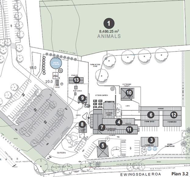
|
Area
|
Description
|
Definitions/ Use
|
Comments/ Approvals
|
|
1
|
Animals (grazing)
|
Extensive agriculture (the grazing of livestock
for commercial purposes) or
Intensive livestock agriculture (the keeping or
breeding, for commercial purposes, of cattle, poultry, pigs, goats, horses,
or other livestock that are fed wholly or substantially on externally-sourced
feed)
|
No previous approvals
Permissibility depends on the applicable definition (i.e.
do animals rely ‘wholly or substantially on external feed’).
Intensive livestock agriculture – permissible
with consent.
Extensive agriculture – can be done without
consent.
Alternately, if primary purpose of animals are as an
‘attraction’ for farm visits, there is no applicable LEP
definition, and the use would be prohibited in RU1 zone.
|
|
2
|
Organic crops
|
Extensive agriculture (the production of crops or
fodder for commercial purposes) or
Horticulture (the cultivation of fruits, vegetables,
mushroom, nuts, cut flowers and foliage and nursery products for commercial
purposes) – a type of intensive plant agriculture
|
No previous approvals
Extensive agriculture – can be done without
consent.
Intensive plant agriculture – permissible
with consent.
Horticulture – exempt (Sch 2 of LEP) unless within 20m
of watercourse.
|
|
Question: primary purpose of agriculture – for
commercial purposes or as tourism?
|
|
3
|
Farm Shed
|
Farm building (a structure the use of which is
ancillary to an agricultural use of the landholding on which it is situated
and includes a hay shed, stock holding yard, machinery shed, shearing shed,
silo, storage tank, outbuilding or the like, but does not include a dwelling)
|
No previous approvals
Erected as exempt development – cl.2.31 of SEPP
(Exempt and Complying Development) 2008
The construction or installation of a farm building
used for the purpose of an agricultural activity
Proposed to be retained as ancillary to on-site
agriculture.
|
|
4
|
Bakery
|
Shop (premises
that sell merchandise such as groceries, personal care products, clothing,
music, homewares, stationery, electrical goods or the like or that hire any
such merchandise, and includes a neighbourhood shop, but does not include
food and drink premises or restricted premises
or
Agricultural produce industry
(a building or place used
for the handling, treating, processing or packing, for commercial purposes,
of produce from agriculture (including dairy products, seeds, fruit,
vegetables or other plant material), and includes wineries, flour mills,
cotton seed oil plants, cotton gins, feed mills, cheese and butter factories,
and juicing or canning plants, but does not include a livestock processing
industry. (a type of rural industry) & industrial
retail outlet (a building
or place that:
(a) is used in conjunction
with an industry or rural industry, and
(b) is situated on the land
on which the industry or rural industry is located, and
(c) is used for the display
or sale (whether by retail or wholesale) of only those goods that have been
manufactured on the land on which the industry or rural industry is located)
|
No previous approvals.
Shop is prohibited in RU1 zone, whereas Rural
Industry (and therefore agricultural produce industry) is
permissible with consent.
Previously refused – 10.2015.634.1
Legal advice previously submitted arguing that agricultural
produce industry is appropriate definition in the circumstances.
|
|
5
|
Administration Building
|
Office premises
|
Previous approval as dwelling-house (original farm house).
Change of use for administration previously refused
– 10.2015.634.1
Office premises would only be permissible as ancillary to
operation of The Farm.
|
|
6
|
Farm Shed
|
Farm building (a structure the use of which is
ancillary to an agricultural use of the landholding on which it is situated
and includes a hay shed, stock holding yard, machinery shed, shearing shed,
silo, storage tank, outbuilding or the like, but does not include a dwelling)
|
No previous approvals
Erected as exempt development – cl.2.31 of SEPP
(Exempt and Complying Development) 2008
The construction or installation of a farm building
used for the purpose of an agricultural activity
Proposed to be retained as ancillary to on-site
agriculture.
|
|
7
|
Main Building - Restaurant
|
Restaurant or café (a building or place
the principal purpose of which is the preparation and serving, on a retail
basis, of food and drink to people for consumption on the premises, whether
or not liquor, take away meals and drinks or entertainment are also provided).
|
Approved – 10.2013.626.1
Condition #47 – Approval is for 90 patrons and 10
staff at any one time
|
|
7
|
Main Building - Produce store
|
Shop (premises that sell merchandise such as
groceries, personal care products, clothing, music, homewares, stationery,
electrical goods or the like)
|
Originally approved under 10.2013.626.1 as roadside
stall (a place or temporary structure used for the retail sale of
agricultural produce or hand crafted goods (or both) produced from the
property on which the stall is situated or from an adjacent property).
Currently sells produce from on-site and from the wider
region. No longer consistent with roadside stall definition
|
|
8
|
Flower shop
|
Shop (premises that sell merchandise such as
groceries, personal care products, clothing, music, homewares, stationery,
electrical goods or the like)
|
Approval under DA 10.2015.151.1 as plant nursery (a
building or place the principal purpose of which is the retail sale of plants
that are grown or propagated on site or on an adjacent site. It may include
the on-site sale of any such plants by wholesale and, if ancillary to the
principal purpose for which the building or place is used, the sale of
landscape and gardening supplies and equipment and the storage of these
items)
DA 10.2015.151.1 not formally ‘commenced’.
Current use not consistent with plant nursery
definition.
|
|
9
|
Bales
|
Restaurant or café
|
Approved under DA 10.2013.626.1 as gelato/ coffee bar.
Approved for 6 seats.
Not currently used for approved purpose.
Proposed to re-establish gelato/ coffee bar use and also
use as ‘information booth’ for farm tours.
|
|
10
|
Farm Cottage
|
Approved as rural workers dwelling (DA
5.1992.525.1).
Approved under DA 10.2015.151.1 as industrial training
facility (a building or place used in connection with vocational training
in an activity (such as forklift or truck driving, welding or carpentry) that
is associated with an industry, rural industry, extractive industry or
mining, but does not include an educational establishment, business premises
or retail premises)
|
DA 10.2015.151.1 not formally ‘commenced’.
Use of the building has commenced; not clear that all use
has been consistent with industrial training facility definition
|
|
11
|
Production kitchen
|
Approved under 10.2013.626.1 as rural industry
(cheese making facility).
|
Cheese making facility never commenced.
Space not currently used.
Proposed to be expansion of kitchen for restaurant and
bakery, and as a space for cooking classes.
|
|
12
|
Farm shed
|
Farm building (a structure the use of which is
ancillary to an agricultural use of the landholding on which it is situated
and includes a hay shed, stock holding yard, machinery shed, shearing shed,
silo, storage tank, outbuilding or the like, but does not include a dwelling)
|
No previous approvals
Erected as exempt development – cl.2.31 of SEPP
(Exempt and Complying Development) 2008
The construction or installation of a farm building
used for the purpose of an agricultural activity
Proposed to be retained as ancillary to on-site
agriculture.
|
|
20
|
Stables
|
Farm building (a structure the use of which is ancillary
to an agricultural use of the landholding on which it is situated and
includes a hay shed, stock holding yard, machinery shed, shearing shed, silo,
storage tank, outbuilding or the like, but does not include a dwelling)
Not currently used.
|
No previous approvals
Part of original farm.
Proposed to be used as shade structure for
children’s playground
|
As part of the current use, farm
tours, either accompanied or unaccompanied, are undertaken at The Farm.
This has not been authorised under either of the two existing development
consents. Also, the table above doesn’t address the overall use of
the site as a tourist destination. There is no relevant definition in
BLEP 2014 relating to a tourist facility. The closest definition is:
recreation facility (outdoor) means a building or place (other
than a recreation area) used predominantly for outdoor recreation, whether or
not operated for the purposes of gain, including a golf course, golf driving
range, mini-golf centre, tennis court, paint-ball centre, lawn bowling green,
outdoor swimming pool, equestrian centre, skate board ramp, go-kart track,
rifle range, water-ski centre or any other building or place of a like
character used for outdoor recreation (including any ancillary buildings), but
does not include an entertainment facility or a recreation facility (major).
It could be argued that the whole of The Farm, or at least
the component that is available for the public to walk through, constitutes a recreation
facility (outdoor). This use is prohibited in the RU1 zone, and
neither of the current approvals recognises this use.
Planning Proposal Application:
The application proposes to amend Schedule 1 of BLEP14, to
provide for additional land uses on the part of the site currently occupied by
The Farm buildings. It does not propose to alter the existing zoning of
any part of the site. The property would continue to be zoned RU1 Primary
Production.
The clause to be added in to
Schedule 1 would apply primarily to the part of the site shown hatched
below. It will also, however, need to address the permissibility of
‘farm tours’ on parts of the site outside of the hatched area.
The clause to be added to Schedule 1 has not yet been
drafted. The purpose of this report is to determine whether Council will
support this as a mechanism to move forward.
If there is support for this process, the clause will be
drafted to identify the specific land uses that would be permitted on this part
of the land, additional to the uses permitted with consent in the RU1 zone and
additional to those previously approved. It will also contain clear
criteria and parameters that control the nature and scale of those uses.
It would also be drafted to avoid broad definitions that would allow expansion
of non-rural uses in the future.
An assessment of the proposal against relevant State and
Local Strategies has also not yet been undertaken.
In accordance with the recommendation of this report, that
work would be undertaken following support for the Planning Proposal as the
appropriate mechanism to address existing land uses, and would be reported to
the December meeting of Council.
Support:
There has not been any public exhibition or notification
regarding a Planning Proposal for the property.
Nonetheless, Council has received 10 letters of support for
The Farm, from community groups and individuals. The letters express
support for the existing operations at The Farm and express the view that those
operations provide both social and economic benefit to the wider community.
A number of the submissions also express the view that the
activities at The Farm make agriculture accessible to the community,
particularly to children, and are of the view that this is a very important
community benefit.
The application is also supported by an Economic Assessment
Report and a Social Impact Assessment report.
The economic assessment concludes:
· Visitors
to The Farm have an annual direct expenditure of $11.9m, with $7.74M directed
to Byron Shire businesses and individuals; and
· Taking
into account direct employment, supply chain and household consumption, The
Farm generates 181.9 FTE with an associated value of wages and salaries of
$7.9m.
The Social Impact assessment
concludes:
Overall, the
benefits associated with the use of the land for farming, food production,
restaurant, education, retail and a bakery appear to far outweigh issues or
concerns associated with this subject to addressing the mitigating measures.
Objections:
There have been ongoing
discussions with adjoining and other land owners and the Ewingsdale Progress
Association regarding land uses at The Farm.
These land owners and the
Ewingsdale Progress Association all advise that they support the continuation
of activities at The Farm that are consistent with and permissible in the RU1
zone. Significant concern has been expressed, however, for the expansion
of uses outside of those consistent with the RU1 zone objectives.
An over-riding concern is that,
notwithstanding the agricultural activities undertaken, the commercial
activities at The Farm significantly erode the value and usefulness of prime
agricultural land in the Shire.
Neighbours remain concerned that
The Farm creates land use conflicts that impact on their continued farming
practices, associated with potential complaints from visitors at The Farm
regarding noise, spray drift and the like. They also note ongoing issues
of trespass onto their property, and concern that effluent from The
Farm’s on-site disposal area might impact on their land.
There is a strong view that it
is not appropriate for Council to amend its planning controls to legitimise
development that has been commenced without approval and that this would set an
undesirable and dangerous precedent in the Shire. Further concern is that
this will be a first step in a number of future LEP amendments that would
continue the expansion of no-agricultural uses at The Farm.
Other concerns include:
· A fear
that amending the LEP would allow significant non-rural expansion of activities
at the site; and
· Continued
traffic impacts;
There is support for the
‘small-scale’ provisions within the LEP relating to rural tourist
uses and concern that support for the Planning Proposal application effectively
‘by-passes’ that provision.
Options:
In relation to The Farm, the
options for Council are:
1. Support the continued operation of existing land uses at
The Farm and progress a Planning Proposal as a mechanism by which approval for
currently unauthorised uses can be considered.
As outlined
above, the Planning Proposal application has been submitted. However,
further work is required to assess the proposal against relevant State and
Local Strategies, leading to the drafting of a clause to be added to Schedule 1
of Byron LEP, to clearly define the nature and scale of uses that are
potentially suitable at The Farm.
If this
option were chosen, the intention would be to report to the December 2017
meeting of Council with details of this further assessment.
2. Not support the Planning Proposal; require compliance with
existing approvals and undertake enforcement action to ensure such compliance
is attained within a specified timeframe.
Enforcement
action would include the serving of appropriate notices requiring specified
actions to cease unauthorised uses. There would likely be significant
resources required of Council’s enforcement team to monitor actions
undertaken at the Farm in compliance with those notices.
Ongoing
compliance actions would also potentially require significant resources,
particularly in relation to conditions restricting the number of people on-site
at any one time.
Recommendation:
The LEP amendment can provide a mechanism to authorise
existing land use at The farm in a way that addresses potential land use
conflicts and community concerns.
It should be possible to craft an Additional Permitted Uses
clause in such as way as to clearly define the nature and scale of acceptable
land uses, particularly to ensure that the future scope of those land uses is
limited.
This mechanism can also be used to ensure that appropriate
buffers are put in place to protect adjoining farming practices.
It is recommended that Council support the Planning
Proposal, allowing staff to move forward to craft an Additional Permitted Uses
clause that will achieve positive outcomes for The Farm and for the community.
Financial Implications
Should Council resolve to
progress the Planning Proposal application, the preparation and assessment of
that Proposal would be at the cost of the developer.
Statutory and Policy
Compliance Implications
The relevant policy considerations are addressed above and
would be further assessed in consideration of the Planning Proposal should
Council resolve to proceed with that option.
Staff Reports - Sustainable Environment and Economy 13.19
Report No. 13.19 PLANNING
- 10.2017.198.1 Mixed Use Development for Three (3) Commercial Tenancies (for
use as Shop, Restaurant or Cafe or Office Premises) and Six (6) Shop Top
Housing Dwellings at 9 Station Street Bangalow
Directorate: Sustainable
Environment and Economy
Report
Author: Luke
Munro , Planner
File No: I2017/1437
Theme: Ecology
Development and Approvals
Proposal:
|
Proposal description:
|
Mixed Use Development for Three (3) Commercial Tenancies
(for use as Shop, Restaurant or Cafe or Office Premises) and Six (6) Shop Top
Housing Dwellings
|
|
Property description:
|
LOT: 334 DP: 755695, LOT: 1 DP: 123326, LOT: B DP: 327228
|
|
9 Station Street BANGALOW
|
|
Parcel No/s:
|
193400, 85390, 178620
|
|
Applicant:
|
Northern Rivers Land Solutions Pty Ltd
|
|
Owner:
|
Gordon Highlands Pty Ltd
|
|
Zoning:
|
B2 Local Centre
|
|
Date received:
|
10 May 2017
|
|
Integrated Development:
|
No
|
|
Public notification or exhibition:
|
- Level
2 advertising under DCP 2014 Part A14 – Public Notification and
Exhibition of Development Applications
- Exhibition
period: 1/6/17 to 21/6/17 (3 weeks per Chris Larkin)
- Submissions received: 22
|
|
Planning Review Committee:
|
20/06/2017
|
|
Delegation to determination:
|
Council
|
|
Issues:
|
· Located in
Bangalow Conservation Area
· Located adjacent
to Heritage Items (A&I Hall and Bangalow Showground)
· Voluntary Planning
Agreement for Car Parking
|
Summary:
In summary the application seeks development consent for
erection of a three (3) storey mixed-use residential and commercial development
including six (6) Shop Top Housing dwellings, three (3) commercial premises and
car parking for fifteen (15) vehicles (inclusive of one (1) disabled parking
bay) over 9 Station Street, Bangalow
The proposal is considered to satisfy the relevant
provisions of Byron LEP 2014. The subject site falls within the boundaries of
the Bangalow Conservation Area. The applicant has submitted a ‘Statement
of Heritage Impact’ demonstrating the proposal will be contributory to
the surrounding conservation area. The proposed building is considered to be
compatible with the Bangalow Conservation Area and consistent with Council’s
DCP 2014 Part C Non-Indigenous Heritage. In addition, the proposed development
is consistent with all relevant state planning instruments and with the
provisions of the Byron Local Environmental Plan 2014 & Development Control
Plan 2014.
In terms of a previous development that was refused by
Council, the proposal represents a significant reduction in building footprint,
bulk and scale. Having regards to the Commercial Zoning of the land (B2 Local
Centre) the proposal is considered to be a suitable response to the site, is
articulated and setback from the front boundary with small garden courtyard
areas facing Station Street. The application is recommended for approval
subject to Conditions of Consent.
NOTE TO COUNCILLORS:
In accordance with the
provisions of S375A of the Local Government Act 1993, a Division is to be
called whenever a motion for a planning decision is put to the meeting, for the
purpose of recording voting on planning matters. Pursuant to clause 2(a)
under the heading Matters to be Included in Minutes of Council Meetings of
Council's adopted Code of Meeting Practice (as amended) a Division will be
deemed to have been called by the mover and seconder of all motions relating to
this report.
|
RECOMMENDATION:
That pursuant to
Section 80 of the Environmental Planning & Assessment Act 1979,
development application 10.2017.198.1 for mixed use development for three (3) commercial tenancies (for use
as shop, restaurant or cafe or office premises) and six (6) shop top housing
dwellings, be granted consent subject to conditions listed in Attachment 3
(#E2017/94032).
|
Attachments:
1 Refusal
photos(DA 10.2013.270.1) v current proposal redesign (DA 10.2017.198.1) 9
Station Street, Bangalow, E2017/93540
⇨
2 Proposed
Plans 10.2017.198.1 9 Station Street, Bangalow, E2017/93558 ⇨
3 Conditions
of consent 10.2017.198.1 9 Station Street Bangalow, E2017/94032 ⇨
4 Confidential
- submissions 10.2017.198.1 - 9 Station Street Bangalow , E2017/94077
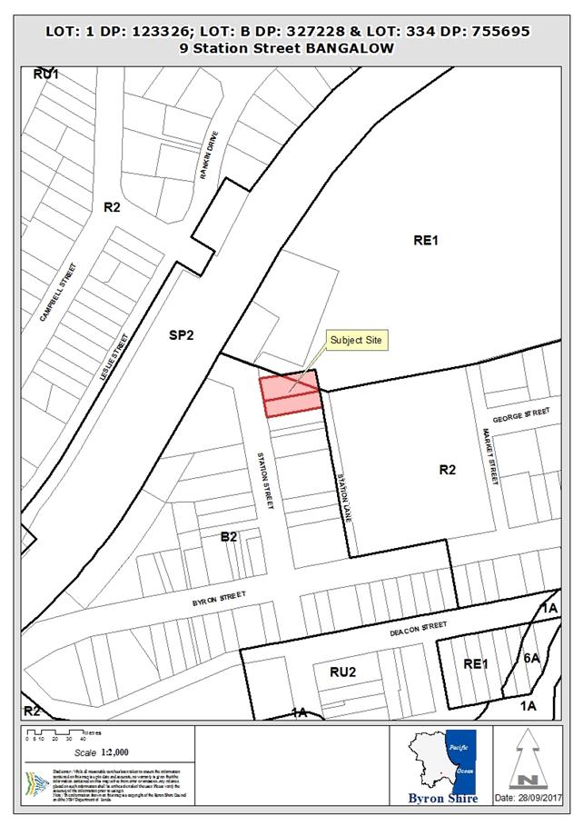
Assessment:
1. INTRODUCTION
1.1. History/Background
The site has been subject to a number of development
applications as shown below.
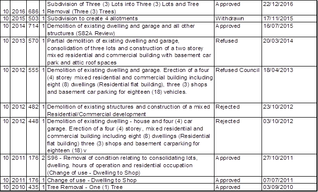
10.2012.555.1 Development
application seeking consent for Demolition of existing dwelling and
garage. Erection of a four (4) storey mixed use residential and commercial
building including eight (8) dwellings (Residential flat building), three (3)
Shops and basement car parking for eighteen (18) vehicles. Council at its
Ordinary Meeting held 18 April 2013 resolved to refuse the application. Refusal
upheld by the Land And Environment Court on appeal.
10.2013.570.1 Removal
of existing dwelling, demolition of existing garage. Erection of a two-storey
mixed residential and commercial building including eight (8) dwellings
(residential flat building), three (3) shops with basement car park and attic.
1.2. Description
of the proposed development
This application seeks approval for Mixed Use Development
for Three (3) Commercial Tenancies (for use as Shop, Restaurant or Cafe or
Office Premises) and Six (6) Shop Top Housing Dwellings.
The site has been previously cleared in accordance with
development consent 10.2014.714.1 and has been further approved for a three (3)
into three (3) subdivision in accordance with development consent 10.2016.686.1
setting up the lot layout for the current proposal.
The proposal will be comprise three (3) individual buildings
constructed over each of the approved allotments under 10.2016.686.1 and will
consists of the following:
|
Building
|
Tenancies/Dwellings
|
|
Building 1
|
1 Shop at Ground Level
|
|
1 x 1 bedroom unit on first floor
|
|
1 x 1 bedroom unit on second floor
|
|
Building 2
|
1 Shop at Ground Level
|
|
1 x 3 bedroom unit on first floor
|
|
1 x 2 bedroom unit on second floor
|
|
Building 3
|
1 Shop at Ground Level
|
|
1 x 2 bedroom unit on first floor
|
|
1 x 1 bedroom unit on second floor
|
The application specifically involves:
· Erection
of three (3) storey mixed-use residential and commercial buildings (consisting
of 3 individual buildings) which include:
- six
(6) dwellings (Shop Top Housing) comprising 3 x 1 bedroom dwellings, 2 x 2
bedroom dwelling and 1 x 3 bedroom dwelling;
- three
(3) ground floor shops comprising Shop 1 (floor area 78.5m²), Shop 2
(floor area 112m²) and Shop 3 (floor area 80.5m²), each tenancy
will provide individual toilet facilities;
- rear
at grade car parking for fifteen (15) vehicles inclusive one (1) disabled
parking bay plus a single loading bay. Individual storage rooms for each of the
dwelling units will be located at the rear of the commercial premises, with bin
enclosures over each lot to service each building.
- Vehicular
access to the site will be solely via Station Lane with footpaths adjacent to
the side boundaries providing pedestrian access to Station Street.
- The
development will consist of three (3) independent buildings over each of the
existing allotments, but will present as a single structure when viewed from
the street. The development will present as a two (2) storey structure from
Station Street with the third storey stepped back from the street frontage by
9.5m and located 5m behind the parapet of the shops and first floor dwellings.
- a
high-set pitched roof design for each building/site has been used to break up
the bulk of the proposed development when viewed from the street. Balconies
have also been incorporated at the front and rear of the development to further
break up the bulk and scale of the development when viewed from the street.
The proposal is rendered masonry to the ground level with
predominantly weatherboard to the first and second floors with colorbond metal
roof sheeting. The building design incorporates balconies of varying width to
the eastern and western elevations providing awnings to the commercial
tenancies below.
For comparisons of the proposed development against the
refused application DA10.2012.555.1, please refer to Attachment 1.
1.3. Description
of the site
Land is legally described as
LOT: 334 DP: 755695, LOT: 1 DP: 123326, LOT: B DP: 327228
Property address is 9 Station
Street BANGALOW
Land is zoned: B2 Local
Centre
Land area is: 1,112.9m2
Property is constrained
by:
· Bangalow
Conservation Area
· Drinking
Water catchment
The total area of the site is 1123m². The site has a
length of 40.55m with a frontage of 27.93m to Station Street. To the rear the
site also has a frontage of approximately 15m to an unformed portion of Station
Lane.
The level of the site generally falls from its north-western
corner on the Station Street frontage (RL 50.17 highest point) to the south and
east (RL 47.63 lowest point).
The site is located at the northern end of Station Street
within the Bangalow Conservation Area. The Bangalow Showgrounds adjoin the
property to the north and north-west, with an entry gate (and associated
building) for the Showgrounds and Scout Hall located immediately to the north.
The A & I Hall is located to the north-east of the site at the end of Station Street. To the rear of the site on the opposite side of Station Lane is the Bangalow Public School, the western side of the School grounds nearest the subject site are
the location of a School Hall and a staff parking area. To the south the site
is adjoining by an existing residential property containing a single storey
dwelling of timber construction with iron roofing.
2. SUMMARY OF
REFERRALS
The following comments are a summary of issues raised during
the internal referral process by Staff and the Heritage Advisor.
Environmental
Preliminary
Contaminated Land Assessment prepared by Melaleuca Group Pty Ltd dated 2nd
August 2016 reports that lead levels in the soil profile that are above the
Health Investigation Limits (HIL) for residential and commercial land uses
recommended by NSW EPA (2011) Guidelines for Consultants Reporting on
Contaminated Sites. Conditions of consent recommended requiring that a remedial
action plan be submitted to Council for approval prior to the issue of a
construction certificate for building works. It is further noted that the site
contains an asbestos clad shed. Removal and disposal works must be
undertaken in accordance with WorkCover Authority. Conditions to apply.
Engineering
Station Lane Upgrade
Plans have been submitted showing lane upgrade works. The
laneway upgrade proposes a width of 5.9m. Given the natural constraints
of the laneway and corresponding low speed environment the proposed
upgrade is considered acceptable. A speed bump just north of the pedestrian
gate into the school is recommended in the SEE and is to be conditioned. The
laneway will need to be upgraded back to Byron Street
Carparking
The applicant has stated they are willing to enter into a
voluntary planning agreement with council in regards to car parking short fall
of eight spaces. Appropriate conditions to apply.
S94 Officer
Planning Agreement
Council had adopted the Byron Developer Contributions
Plan 2012 in December 2012. This plan levies contributions for
residential development under the terms of Section 94 of the Environmental
Planning and Assessment Act 1979. Contributions for all other types of
non residential development such as commercial and industrial are levied under
section 94A of the Act. Section 94A levies are calculated at 1% of the
cost of construction of the development. Section 94A (2) states: “A
consent authority cannot impose as a condition of the same development consent
a condition under this section as well as a condition under section 94.”
As S94 contributions for parking cannot be levied on development for which a
94A levy is charged Council will accept a contribution for a shortfall in car
parking in the form a planning agreement.
Under the terms of DCP 2014 contributions for car
parking are only available for commercial development in town centres where
Council has provided or will provide public car parking.
At the Meeting of 16 July 2015 Council resolved to grant
delegation to the General Manager to exhibit and enter into planning agreements
where the value per parking space is set as per the following table:
|
Proposed Contributions Rate
Per Car Space for a VPA
|
|
Locality
|
Per Space
|
|
Byron
Bay CBD
|
38,000
|
|
Brunswick
Heads CBD
|
61,690
|
|
Bangalow
|
5,600
|
|
Mullumbimby
CBD
|
7,525
|
The cost per space in Bangalow
indexed to July 2017 is now $5775.81 per car space.
A planning agreement is made under the terms of section 93F
of the Environmental Planning and Assessment Act 1979. The public purpose of
this planning agreement is to pay for the provision of a public amenity being
car parking.
Section 93I applies to the
imposition of conditions of consent with respect to planning
agreements. Section 93I (3) allows a consent authority to require a
planning agreement to be entered into as a condition of a development consent,
but only if it requires a planning agreement that is in the terms of an offer
made by the developer in connection with a development application. It is
reasonable to impose a condition on the consent to require the developer to
enter into a planning agreement.
Eight (8) spaces are required
for a total value of $44,800.00.
Heritage
The application was referred to Councils Heritage Advisor
who has endorsed the current proposal and concluded the following:
“I consider that the
proposed development, through its scale, bulk, form, aesthetic character,
detailing, external finishes and colours is a well-designed, infill development
which is respectful of the heritage conservation area and the setting of heritage
items within this streetscape. I consider that it would not have an adverse
impact upon the historic and aesthetic significance of the Bangalow
Conservation Area or the setting of heritage items in the vicinity of the site.
I concur with the findings of the SOHI in Appendix A submitted by Everick
Heritage Consultants Pty Ltd dated 31.08.16.
I also endorse the
recommendations of the SOHI in relation to the detailed design phase of the
future development and the archaeological excavation permit requirements.”
3. SECTION 79C
– MATTERS FOR CONSIDERATION – DISCUSSION OF ISSUES
Having regard to the matters for consideration detailed in
Section 79C(1) of the Environmental Planning & Assessment Act 1979
(EP&A Act), the following is a summary of the evaluation of the issues.
3.1 State Environmental
Planning Instruments
|
|
Satisfactory
|
Unsatisfactory
|
|
State
Environmental Planning Policy No 55—Remediation of Land
|
☒
|
☐
|
|
Consideration:
Preliminary
Contaminated Land Assessment prepared by Melaleuca Group Pty Ltd dated 2nd
August 2016 reports that lead levels in the soil profile that are above the
Health Investigation Limits (HIL) for residential and commercial land uses
recommended by NSW EPA (2011) Guidelines for Consultants Reporting on
Contaminated Sites.
Therefore
conditions have been imposed requiring that a detailed contaminated land
assessment and remedial action plan be submitted to Council for approval
prior to the issue of a construction certificate for subdivision works.
|
|
State Environmental Planning Policy No 65—Design
Quality of Residential Apartment Development
|
☒
|
☐
|
|
Comment: SEPP No.65 applies
to ‘residential flat building’ development. Residential
flat building means a building that comprises or includes:
(a) 3 or more storeys (not including
levels below ground level provided for car parking or storage, or both, that
protrude less than 1.2 metres above ground level), and
(b) 4 or more self-contained dwellings
(whether or not the building includes uses for other purposes, such as
shops), but does not include a Class 1a building or a Class 1b building under
the Building Code of Australia.
The proposed development
comprises three (3) storeys and six (6) dwellings and therefore SEPP No.65 is
applicable to the proposed development.
The development has
responded appropriately to the Design Principles contained within the
Apartment Design Guide and the SEPP where relevant to a small rural town
centre. The development has been designed by an Architect as required under
the SEPP.
|
|
State
Environmental Planning Policy (Building Sustainability Index: BASIX) 2004
|
☒
|
☐
|
|
Consideration: A valid BASIX certificate has been
supplied. All relevant energy commitments have been shown on the plans.
|
3.2 Byron Local Environmental Plan
2014 (LEP 2014)
LEP 2014 is an applicable matter for consideration in the
assessment of the subject development application in accordance with subsection
79C(1) of the EP&A Act because it applies to the subject land and the
proposed development. The LEP 2014 clauses that are checked below are of
relevance to the proposed development:
|
Part 1
|
☐1.1|
☒1.1AA| ☒1.2| ☒1.3| ☒1.4| ☒Dictionary| ☐1.5| ☒1.6| ☒1.7| ☒1.8| ☐1.8A| ☒1.9|
☐1.9A
|
|
Part 2
|
☒2.1|
☒2.2 | ☒2.3 |☒Land Use Table | ☐2.4 | ☐2.5 | ☐2.6 | ☐2.7 | ☐2.8
|
|
Part 3
|
☐3.1|
☐3.2| ☐3.3
|
|
Part 4
|
☐4.1|
☐4.1A| ☐4.1AA| ☐4.1B |☐4.1C| ☐4.1D| ☐4.1E| ☐4.2| ☐4.2A| ☐4.2B| ☐4.2C| ☐4.2|☒4.3|☒4.4 |☒4.5 |☐4.6
|
|
Part 5
|
☐5.1|
☐5.2| ☐5.3| ☐5.4| ☐5.5| ☐5.6| ☐5.7| ☐5.8| ☐5.9| ☐5.9AA| ☒5.10| ☐5.11| ☐5.12|
☐5.13
|
|
Part 6
|
☐6.1|
☐6.2| ☐6.3| ☐6.4| ☒6.5| ☒6.6| ☐ 6.7| ☐6.8| ☐6.9
|
In accordance with LEP 2014 clauses 1.4 and 2.1 – 2.3:
(a) The
proposed development is defined in the LEP 2014 Dictionary as Commercial
Premises (Shop, Restaurant or Café and Office Premises), Shop Top
Housing;
(b) The
land is within the B2 Local Centre according to the Land Zoning Map;
(c) The
proposed development is permitted with consent; and
(d) Regard
is had for the Zone Objectives as follows:
|
Zone Objective
|
Consideration
|
|
To provide a range of
retail, business, entertainment and community uses that serve the needs of
people who live in, work in and visit the local area.
|
The proposed development incorporates three (3) individual
commercial tenancies which will enable a greater range of businesses to
locate within the Bangalow Town Centre.
|
|
To encourage employment
opportunities in accessible locations.
|
The development through the provision of three (3)
commercial tenancies will provide for future employment opportunities within
the centre of Bangalow. The site is considered to be in a highly accessible
location within the town centre.
|
|
To maximise public
transport patronage and encourage walking and cycling.
|
The development is located within the Bangalow town centre
and will be easily accessible by both walking and cycling.
|
|
To encourage vibrant
centres by allowing residential and tourist and visitor accommodation above
commercial premises.
|
The development incorporates six (6) Shop Top Housing
dwellings which will provide permanent accommodation above the ground floor
commercial premises to encourage a vibrant centre after normal business hours.
|
The following comments are provided on specific LEP clauses.
|
LEP Requirements
|
Comment
|
|
4.3 Height
of Buildings
|
The proposed mixed use commercial and residential
development will have a maximum height of 9.0m above natural ground level.
The maximum allowable height limit for the site is 9.0m.
The development will incorporate 3 separate buildings
over with one (1) over each of the lots.
Building 1 (incorporating Shop 1, Unit 1 and Unit 4) 9.30m
Building 2 (incorporating Shop 2, Unit 2 and Unit 5) 9.50m
Building 3 (incorporating Shop 3, Unit 3 and Unit 6) 9.40m
The site will incorporate an excavation of up to 1.5m
to ensure the buildings are below the 9m height limit. The development
complies with the 9m height limitation.
|
|
4.4 Floor
Space Ratio
|
The development will result in a total FSR of 0.72:1
which is below the allowable FSR of 1:1 based on the total site area of
1,112.9m2. Therefore the development complies with the
allowable FSR for the site.
The proposed floor area of the proposed tenancies are
listed below:
|
Tenancy/Unit
|
Area (m2)
|
|
Shop 1
|
78.5
|
|
Shop 2
|
112
|
|
Shop 3
|
80.5
|
|
Unit 1
|
75
|
|
Unit 2
|
118
|
|
Unit 3
|
91.5
|
|
Unit 4
|
65
|
|
Unit 5
|
111
|
|
Unit 6
|
65
|
|
Total
|
796.5
|
|
|
5.10 Heritage conservation
|
The applicant has submitted a ‘Statement of Heritage
Impact’ (SoHI) for the proposed development prepared by Everick
Heritage Consultants dated 31 August 2016 which addresses Clause 5.10 of the
Byron LEP 2014. Following a review of the submitted SoHI it is considered
that the proposal adequately addresses the above matters specified within
Clause 5.10 of the Byron LEP 2014.
The SoHI concludes:
“The proposal complies
with planning controls and meets the performance criteria for infill
development as set out in the Byron Shire Development Control Plan 2014.
Whilst there are considered to be minor impacts on historical subdivision
patterning as a result of the reconfiguration f a two-lot street frontage
into three, this may also be considered effectively the ‘next
phase’ in a succession of historical boundary adjustments.
The Proposal will sit across
the three-lot street frontage but respect is paid to its heritage context in
terms of scale, sympathetic form, fabric, setbacks. Design considerations
such as adherence to the historical street frontage setback, 3m+ side
setbacks, retention of street trees, retention of view lines within Station
Street and between buildings are addressed by the Proposal. The Proposal will
not visually dominate or compete with the A&I Hall. Specific mitigation
measures have been implemented to ensure that the bulk and massing along the
street frontage is restrained through the introduction of a single storey
element on the southwest corner. The Proposal will not visually dominate or
compete with the &I Hall. Overall, the Proposal sits swill within the
site and green screening is conserved which goes some ways to minimise any
detrimental impacts to the streetscape and visual amenity.”
The application and SoHI was assessed by Councils Heritage
Advisor who provided the following assessment of the proposal:
“The proposed
development, through its scale, bulk, form, aesthetic character, detailing,
external finishes and colours is a well-designed, infill development which is
respectful of the heritage conservation area and the setting of heritage
items within this streetscape. I consider that it would not have an adverse
impact upon the historic and aesthetic significance of the Bangalow
Conservation Area or the setting of heritage items in the vicinity of the
site. I concur with the findings of the SOHI in Appendix A submitted by
Everick Heritage Consultants Pty Ltd dated 31.08.16.
I also endorse the
recommendations of the SOHI in relation to the detailed design phase of the
future development and the archaeological excavation permit
requirements.”
Height/Bulk
The proposed development is
two story with a third floor of accommodation within the roof space, which is
set back approximately half way back along the roof line. The 9m apex height
of the building is considered acceptable in principle and appears lower than
the historic landmark buildings, however accurate comparative heights would
be useful to assess this matter with details submitted at the formal stage.
The previous court judgement outlined common agreement that a two storey form
of development is anticipated by the planning controls for this site and is
considered acceptable. The overall bulk of the building is broken up with two
stepped levels of verandahs and a multi gabled roof.
|
|
6.6 Essential Services
|
The site has access to reticulated Sewage & Water,
road network, electricity: The development is able to connect to Council
services subject to payment of contributions.
A conceptual stormwater management plan has been submitted
with the proposal.
|
Bangalow Settlement Strategy 2003
“The
Bangalow Settlement Strategy provides a plan to conserve the identity and
heritage of Bangalow. The Strategy outlines the constraints to development of
the village. It proposes strategies to manage the village’s growth over
the next ten to twenty years so as to maintain the character, image, built
form, heritage values, and to maximise the use of available land, infrastructure
and natural resources to achieve the community’s vision.”
Section 6 of
the Strategy specifies how the Strategy is to be implemented. Section 6.1
specifies:
“6.1
New Planning Controls
The Bangalow
Settlement Strategy will be implemented through new planning controls. Council
has resolved to prepare a new shire-wide place-based instrument that will
address the outcomes of a number of Settlement Strategies and other matters. It
will contain a specific section for the village of Bangalow.
The outcomes
envisioned in this Strategy require immediate implementation through amendments
to planning controls such as the Local Environmental Plan and Development
Control Plans.”
Assessment: Council has adopted new planning controls in Bangalow under Byron
LEP 2014. The DCP is yet to be amended to any extent for Bangalow, however new
DCP provisions have been drafted under DCP 2014 Part C Non-Indigenous
Heritage. Council is working with the Bangalow Community on a
Masterplan and should this plan be adopted by Council then further amendments
to the planning controls for Bangalow may eventuate. Not-with-standing this
Council is required to assess and determine the application based on current
applicable planning controls, not on controls yet to be drafted let alone formerly
exhibited.
3.2 Any proposed Instrument
that has been the subject of public consultation and has been notified to the
consent authority
No draft EPI’s affect the proposal
3.3 Byron Shire Development
Control Plan 2014 (DCP 2014)
DCP 2014 is an applicable matter for consideration in the
assessment of the subject development application in accordance with subsection
79C(1) of the EP& A Act because it applies to the land to which LEP 2014
applies. The DCP 2014 Parts/Chapters that are checked below are of relevance to
the proposed development:
|
Part A
|
|
|
Part B Chapters:
|
☐B2|
☒B3| ☒B4| ☒B5| ☐B6| ☐B7| ☒B8| ☒B9| ☒B10| ☐B11| ☐B12| ☒B13|
☒B14
|
|
Part C Chapters:
|
☒C1|
☐C2| ☐C3| ☒C4
|
|
Part D Chapters
|
☒D1|
☐D2| ☐D3| ☒D4| ☐D5| ☐D6| ☐D7| ☐D8
|
|
Part E Chapters
|
☐
E1| ☒E2| ☐E3| ☐E4| ☐E5| ☐E6| ☐ E7
|
These following comments are provided on specific DCP
provisions
|
What Section and prescriptive measure does the
development not comply with?
|
Does the proposed development comply with the
Objectives of this Section? Address.
|
Does the proposed development comply with the
Performance Criteria of this Section? Address.
|
|
B4 Car Parking
|
Yes –
Given the site has a total of 15 parking spaces available
there is a shortfall of 8 spaces which will be provided under a Voluntary
Planning Agreement with Council or provided on an alternative land parcel to
benefit Council and the development.
|
Yes –
The development will generate a car parking requirement
of:
· 8 spaces for
residents plus 2 visitor spaces. Total required 9 spaces, these spaces are to
be for the exclusive use of the resident’s onsite.
· The Commercial
Tenancies generate a requirement for 14 parking spaces.
A total of 15 spaces are provided onsite with a shortfall
of 8 spaces.
The applicant has agreed to enter into a Voluntary
Planning Agreement for the provision of additional car parking off site. Or
provided on an alternative land parcel to benefit Council and the
development.
|
|
B4.2.9 Loading Bays
|
Yes –
The development provides one (1) Small Rigid Vehicle
Loading Bay in accordance with Table B4.2 – Loading Bays
|
Yes –
The development provides one (1) Small Rigid Vehicle
Loading Bay in accordance with Table B4.2 – Loading Bays
|
|
B4.2.10 Monetary Contributions
|
Yes –
The applicant has proposed a Voluntary Planning Agreement
to provide a monetary contribution for the shortfall of 8 parking spaces.
|
Yes –
The applicant has proposed a Voluntary Planning Agreement
to provide a monetary contribution for the shortfall of 8 parking spaces.
Council may consider accepting a monetary contribution in
lieu of on-site car parking on land predominantly zoned B2 where there is a
nexus between the development and the area in which public parking is or will
be provided.
In this instance the VPA has been accepted by Councils s94
contributions officer.
|
|
B14.2 Excavation and Fill in all Zones
|
Yes –
The
development will maintain landscaping along the Station Street frontage which
will make a positive contribution to the existing and desired future
character of the locality and the surrounding area.
The
additional 0.5m of cut (above 1.0m) will not detrimentally impact on the
streetscape as the development maintains landscaping along the full street
frontage.
|
Yes –
Earthworks are proposed across
the development site to create a relatively flat building pad for each lot.
The maximum depth of excavation for the development is approximately 1.5m for
a small area near the north-west corner of the site to ensure the building
has a maximum height of 9m from natural ground level.
The proposed non-compliance with
the maximum depth of excavation Prescriptive Measure is considered to satisfy
the Element Objectives in this instance in view of the following:
· The
level of the subject site generally descends from the Station Street frontage
towards the rear of the site and the proposed cut adjacent to Station Street
will allow the building to have a maximum height of 9m from natural ground
level. As the land descends to the rear the depth of excavation decreases;
· The
subject site is located within Bangalow B2 Local Centre Zone;
· Council’s
Development Engineer has raised no objection to the proposed earthworks; and
· despite
the numeric non-compliance the proposal should not have any unacceptable
environmental impacts.
|
|
C1.3.3 Gardens and Landscape
|
Yes –
Landscaping is shown to all site boundaries as part of the
development, which will retain a green edge to the site in keeping with the
‘garden’ character of this streetscape precinct.
|
Yes –
Landscaping is shown to all site boundaries as part of the
development. Conditions to apply.
|
|
C1.4.1 Roof Form and Chimneys
|
Yes –
The proposed roof retain the characteristic scale and
massing of roof forms within the Conservation Area.
|
Yes -
The development provides a roof form that is compatible
with the surrounding Conservation area through the use of appropriate pitch,
materials, size and form. The roof form has been broken up through the use of
multiple gables and valleys to reduce the bulk and scale of the
proposal.
|
|
C1.4.2 Verandahs
|
Yes
The proposal incorporates verandahs and balconies to
compliment the existing character of commercial buildings within Bangalow.
|
Yes –
The
proposal incorporates verandahs and balconies to compliment the existing
character of commercial buildings within Bangalow. The verandahs are formed
through the use of simple skillion verandahs on the site frontage above the
commercial tenancies.
|
|
C1.5.1 New Development in the Vicinity of a Heritage
Item
|
Yes
–
The
proposed development would not have an adverse impact upon the historic and
aesthetic significance of the Bangalow Conservation Area or the setting of
heritage items in the vicinity of the site.
|
Yes
–
The
proposed development has been located so as to not overshadow, or impede
existing views of the A&I Hall and will not visually dominate, or be
incompatible with the heritage item.
(Refer to Section 4.2A)
|
|
C1.6.9 New Development in Heritage Conservation Areas
|
Yes
The proposed development, through its scale, bulk, form,
aesthetic character, detailing, external finishes and colours is a
well-designed, infill development which is respectful of the heritage
conservation area and the setting of heritage items within this streetscape.
The development is complimentary to the existing streetscape character of
Station Street and further to the Bangalow Conservation Area.
|
Yes
A SoHI has been provided with the development which
demonstrates that the development will be complementary to the Bangalow
Conservation Area. The SoHI has been assessed by Councils Heritage Advisor
who has supported the proposal in terms of bulk and scale, character and
impact on the streetscape.
|
|
D1.10.1 Density Control
|
Yes
The dwelling density complies with both the FSR and the
Density Control for the site (7 dwellings allowable) with only 6 dwellings
proposed.
|
Yes –
The
site has a compliant FSR of 0.72:1.
The
Shop Top Housing dwelling density does not exceed one (1) dwelling per 150
square metres of site area. The allowable density for the site would equate
to a maximum of 7 dwellings, only 6 dwellings are proposed.
Further
the development consists of 34% commercial floor space and 66% residential
floor space which complies with the minimum 25% commercial floor space
requirement.
|
|
D1.10.5 Clothes Drying Area
|
Yes –
There is adequate area on the proposed balconies to
provide external covered cloths drying facilities, further the laundries are
large enough to accommodate a cloths dryer.
|
Yes –
Adequate balcony areas are proposed provided for clothes
drying.
|
|
E2.3.2 Development within B2 Local Centre Zone
|
Yes
–
The
proposed development with its recessed and articulated facades will
appears as a two storey commercial development when viewed from Station
Street with the 3rd floor being well setback from the street
frontage.
The height and bulk of the development is discussed in
further detail below, but is a suitable response to the site (See Heritage
Character and Built Form).
|
|
Building Height
|
Yes
–
The
proposed development is generally compatible with adjacent development
and complies with the maximum building height of 9.0m which applies to all
land in Bangalow.
|
|
Verandahs
|
Yes
–
The
development has incorporated verandahs to the Station Street frontage and
provided smaller balconies at the rear of the dwellings. The verandahs do not
encroach into the street or across the footpath enable existing street
vegetation to remain and embellished at a later time by Council.
|
|
Fencing and landscaping
|
Yes -
The development has incorporated landscaping to all
boundary setbacks and the development has been setback from the front
boundary.
The existing street trees will remain.
|

The proposed development is demonstrated to meet the
relevant Objectives of DCP 2014.
3.4 Any
Planning Agreement or Draft Planning Agreement?
|
|
Yes
|
No
|
|
Is there any applicable planning agreement or draft
planning agreement?
|
☐
|
☒
|
|
|
3.5 Environmental Planning & Assessment Regulation 2000
Considerations
|
Clause
|
This control is applicable to the proposal:
|
I have considered this control as it relates to the
proposal:
|
If this control is applicable, does the proposal
comply?
|
|
92
|
No
|
N/A
|
N/A
|
|
93
|
No
|
N/A
|
N/A
|
|
94
|
No
|
N/A
|
N/A
|
|
94A
|
No
|
N/A
|
N/A
|
* Non-compliances and any other significant issues
discussed below
3.6 Any coastal zone management plan?
|
|
Satisfactory
|
Unsatisfactory
|
Not applicable
|
|
Is there any applicable coastal zone management plan?
|
☐
|
☐
|
☒
|
|
|
3.7 The likely impacts of that development, including environmental
impacts on both the natural and built environments, and social and economic
impacts in the locality
|
Impact on:
|
Likely significant impact/s?
|
|
Natural environment
|
No. The proposal will not have a significantly adverse
impact on the natural environment of the locality.
|
|
Built environment
|
No. The proposal will not have a significantly adverse
impact on the built environment of the locality.
It is acknowledged that when viewed from the south the
proposed building will be a comparatively larger scale building when compared
with a number of older established residential buildings within Station
Street (excluding the A&I Hall). Notwithstanding, it is considered the
proposed design is acceptable in this instance in view of the following:
· the
form of the building adjacent to Station Street incorporates what should
appear as sympathetic two-storey design, with a first floor balcony and
street level awning which are features compatible with existing development
in Byron Street and the desired future streetscape for Station Street;
· the
pitched roof design is encourage by Council’s DCP 2014;
· the
commercial zoning of the site does not require front, rear or side setbacks;
· the
proposed development complies with the current maximum height control of 9
metres contained within Clause 4.3 of Byron LEP;
|
|
Social Environment
|
The proposed development is not considered likely to have
any unacceptable social of economic impacts in the locality.
|
|
Economic impact
|
The proposal will have an overall positive economic impact
on the locality, and will enable job creating businesses to locate within the
three (3) commercial tenancies.
|
Are there any Council Policies that are applicable to the
proposed development? None
3.8 The suitability of the site for the
development
The site is considered to be
suitable for the proposed development. As detailed above of this report the
design and form of the proposed development is considered to be acceptable. The
proposed development incorporates, at street level, three new commercial
tenancies to contribute the commercial floor space within the existing town
centre. In principle the development provides for a mixed-use development which
includes an alternative form of residential accommodation located conveniently
for access to the services of the commercial centre.
3.9 Submissions made in accordance with this Act or the regulations
The development application was publicly exhibited. There
were a total of 22 submissions (21 individual submissions and 1 petition
with 69 signatures) made on the development application:
|
Submission
|
Consideration
|
|
Height, Bulk and Scale
The proposed building would be detrimental to the
streetscape and would set a precedent of large bulk developments within
Station Street, which does not comply with the DCP or LEP which describe
“Station Street is very different from Byron Street being largely low
key residential with houses of historic design and plenty of green
space”.
|
The proposed development is considered to be of a design
which is not incompatible with the heritage characteristics of the Bangalow
Heritage Precinct, satisfying the height controls for the area under Byron
LEP 2014, as discussed above in the body of the report. .
|
|
Building Design
The buildings design is not compatible with the character
of the street or Bangalow CBD and has 3 lot frontage which no other building
in this area has.
The building gives the impression of a modern structure
that makes a token effort to address heritage requirements. The proposed
cladding, colours, verandahs and roofline just dress up the building which is
a modern shopping centre.
|
The Bangalow Local Centre is typified by 2 storey
commercial buildings with a number of heritage items located in Byron Street
(eg The Strand Shops) being constructed across the full frontage of lots and
built to boundaries.
The proposed development is considered to be of a design
which is not incompatible with the heritage characteristics of the Bangalow
Conservation Area, is articulated, setback from the street boundary and side
boundaries, maintain a garden setting and provides a suitable response
to the sites constraints and planning controls.
|
|
Exceeding the Height Limits
The proposed third storey is not in keeping with the DCP
2014, previous Land and Environment Court judgements over previous 3 storey
proposals. Station Street – all other commercial buildings are
low-rise.
In addition the height of the building is above the 9m
height restriction in the Byron LEP 2014 as identified in the consultant
report:
· Building 1
– 9.3m
· Building 2
– 9.5m
· Building 3
– 9.4m
|
There is no limit to the number of storeys however the
site is restricted to a 9m height in accordance with the LEP 2014. The
development complies with Byron LEP 2014. ”
The site is not limited to a single storey. The Byron DCP 2014 under Chapter C1 Section 1.6.1 –
General Policy states:
Development in all areas must remain single storey (apart
from land zoned B2 in Bangalow Heritage Conservation Area) in height to
maintain the visual character and unity of the streetscape.
Further
DCP controls cannot override planning controls and development standards as
established in an LEP.
|
|
Proposed 3rd Storey
The development of a third storey is not in keeping with
the DCP 2014 or in keeping with the streetscape character of Station Street.
In addition the 3rd storey will be dominate within the streetscape
and will detract from the A&I Hall and will impact on the vistas and look
over adjoining cottages.
By excavating the building down it is a slight of hand by
complying with the height limit but not the number of storeys.
|
Councils heritage advisor has provided an assessment of
the proposal in Section 2 and has concluded that the proposed development
being two storey with a third floor of accommodation within the roof space,
is considered acceptable in this instance.
The proposed development is expected to take the
appearance of a two-storey building when viewed from the Station Street
frontage. The development is considered to be consistent with the future
character for the Bangalow commercial centre as currently envisaged under the
applicable planning controls.
|
|
Heritage
The design is not in keeping with the heritage feel of
Bangalow. And will have an undesirable impact on the Conservation Area
including four (4) heritage items in close proximity to the site.
The building set from boundary to boundary over 3 lots
will have a bulk and scale that will detract from the visual impact of the
A&I Hall and would diminish its primacy within the streetscape.
|
A SoHI has been provided with the development which
demonstrates that the development will be complementary to the Bangalow
Conservation Area. The SoHI has been assessed by Councils Heritage Advisor
who has supported the proposal in terms of bulk and scale, character and
impact on the streetscape concluding that:
“The proposed development would not
have an adverse impact upon the historic and aesthetic significance of the
Bangalow Conservation Area or the setting of heritage items in the vicinity
of the site.”
|
|
Residential Amenity
The location the A&I Hall in relation to proposed
residential dwellings will negatively impact on the amenity of future
residents due to the events conducted in the areas surrounding the site.
|
The subject site is located within the B2 Local Centre
Zone, a Zone in which commercial activities are encouraged. It is considered
that residents living within the Local Centre Zone should not have the same
expectations for residential amenity as those living within the R2 Low
Density Residential Zone.
|
|
Shop Top Housing
The concept of Shop Top Housing has been stretched beyond
the original definition as understood by the committee members of the
original Settlement Strategy.
The term Shop Top Housing was intended to reflect 1
residence above 1 shop as typified in Byron Street.
|
The term Shop Top Housing is defined under
the Byron LEP 2014 as:
‘shop
top housing means one or more dwellings
located above ground floor retail premises or business premises.’
The proposed development complies with the
definition as the proposal consists of one or more dwellings located above a
ground floor of Commercial Premises.
|
|
Lack of green space
The lack of green space does not conform with the existing
streetscape, and the DCP recommends trees on both sides of the street.
The building is built from boundary to boundary and does
not conform with the existing heritage items and interesting buildings in
Station Street which have attractive landscaping surrounding them.
Further the site should incorporate street trees in
accordance with the conservation area.
|
Landscaping is shown to all site boundaries as part of the
development concept, which will retain a green edge to the site in keeping
with the ‘garden’ character of this streetscape precinct.
|
|
Inadequate car parking provided
The proposal only provides 71% of the parking generated by
this development and is short by at least 6 spaces. Given parking is already
at a premium in Station Street this is not appropriate.
Station Street is currently heavily used for parking and
deliveries and to development should provide adequate parking onsite.
|
The applicant has provided a total of 15 parking spaces
onsite (inclusive of a single disabled parking bay) with a shortfall of 8
spaces. The developer has agreed to enter into a Voluntary Planning Agreement
to make up for the shortfall of parking spaces onsite. This has been assessed
by Councils Engineers and s94 Officer who have concluded that the VPA is
appropriate for the provision of the 8 spaces in this instance.
|
|
Access to Station Lane
School children need to be able to safely access Station
Lane from Station Street and the development will result in heavy traffic
making walking along Station Lane dangerous for school children.
Station Lane is the main entry and exit point for all
children who live to the west and north of the school. Station Lane is narrow
and not wide enough to accommodate 2 way traffic. The lane is to narrow for
vehicles to turn around and trucks and larger vehicles will be forced to
reverse down the laneway. This has created a potential for a major safety
concern for conflict between school children and vehicles.
|
There is currently no access at the northern end of
Station Lane for children to walk along/through to link up to Station Street.
The development does not incorporate a dedicated pedestrian link other than
to the rear car park area.
The use of Station Lane and the interaction of school
children using the lane leaving and entering Bangalow Public School. The
concern was that children may be in danger due to vehicles using the rear
lane.
Children do cross the Laneway and walk down the Laneway
towards Byron Street. The laneways are important in commercial areas to allow
for unloading rather than on Streets, for access to parking and for
servicing. The lane is used by school children however, the predominant use
for the lane should for vehicles.
It is noted that Station Lane at the rear of the site is
required to be upgraded to a full width sealed pavement construction with
kerb & gutter and controlled drainage along the site’s frontage to
the Lane, south of the site through to the existing fully constructed
pavement. The lane is not a high speed environment and vehicles will be able
to enter and leave in a forward direction.
|
|
Public Thoroughfare
The development needs to provide a gazetted public
thoroughfare from Station Street to Station Lane – not controlled by
gates.
|
The development is not required to provide a dedicated
public thoroughfare. Access from the car parking area at the rear of the site
to Station Street is provided but this will not be dedicated to Council.
|
|
Loading and Unloading
Large vehicles will be required to load and unload to
service the shops creating an unacceptable risk to children walking along
Station Lane.
|
The development will provide a suitable loading bay for
the proposed tenancies.
|
|
Bangalow Master Plan
The development will prejudice the future planning of the
area currently being undertaken.
|
The applicant has applied under the Byron LEP 2014 and
Byron DCP 2014 which are the applicable statutory instruments governing
development of the site.
The development of the Bangalow Master Plan is ongoing and
is yet to be finalised. Council is required to consider the application
against current planning controls, not future controls which are yet to be
drafted or exhibited.
|
|
Contrary to Public Interest
Pursuant to Section 79C(1)(e) of the Environmental
Planning and Assessment Act 1979 the built form and environmental impacts of
the proposed development are considered to be contrary to the public
interest.
|
The proposal has been assessed and is not contrary to the
public interest.
|
|
High Density Precedent
The development is creating a precedent for high density
development.
The development is totally out of character with the town
and we are opposed to any development that could create a precedent for
greater density that is inconsistent with the towns character and
specifically so close to the school.
|
The development complies with the outcomes sought for the
Bangalow Conservation Area and further is significantly below the allowable
FSR. The allowable FSR is 1:1 and the proposal seeks a FSR of 0.72:1.
The application also complies with the Dwelling Density of
1 dwelling per 150m2 of site area for Shop Top Housing.
|
|
Similar to Previously Refused Proposal
The development is insufficiently different to previous
proposals previously refused over the site.
The Commissioner in the Land & Environment Court said
NO to building in the street should dominate our recognised historic
buildings.
|
The proposal has significantly reduced the overall bulk
and scale of the development (as shown in Attachment 1 and is in no way
similar to the development that was refused.
The proposal has incorporated appropriate setbacks to
ensure the development does not dominate the A&I Hall.
|
|
Privacy of Adjoining Dwellings
Lack of privacy to the rear yards of adjoining residence.
Balconies on the eastern elevation and windows on the
southern elevation should incorporate screening.
|
The design of the dwellings and rear balconies incorporate
solid balustrading and in addition the roof line falls significantly adjacent
to 11 Station Street restricting views to the south of the site and acting as
a ‘screen’ to neighbouring dwellings. .
|
|
Security
Loss of security from pathway adjacent to neighbouring
dwellings
|
The application states there will be a fence along the
side and rear boundaries of the site with gates restricting access to the
rear of the site after hours.
|
|
Overshadowing
Shadowing of adjoining dwellings
|
The subject land is within the commercial precinct of
Bangalow, development within this commercial precinct is not required to
provide side or front setbacks and in this context it is considered the
proposed development should not result in any unacceptable overshadowing.
|
|
Soil Contamination
Testing of soils has shown elevated levels of lead near
the proposed landscaped garden areas.
|
A
Preliminary Contaminated Land Assessment prepared by Melaleuca Group Pty Ltd
dated 2nd August 2016 was submitted with the application. This was
assessed by Councils EHO, refer to Section 2 of this report.
Conditions
have been imposed requiring that the site be remediated. Should the
application be refused the site will remain in its limited contaminated
state.
|
|
Fireplaces
Existing dwellings and use of seasonal fireplaces
impacting on the amenity of future residents.
|
The use of fireplaces on adjoining sites will not preclude
the development of parcels of land.
|
|
Bangalow Settlement Strategy 2003
The proposal is inconsistent with the Bangalow Settlement
Strategy 2003 – ‘to maintain the character, image, built form,
heritage values…to achieve the communities vision’
|
The development is considered to comply with the intent of
the Bangalow Settlement Strategy, please refer to discussion above. .
|
|
Impact on Learning
During the construction of the development this will
create significant noise and dust during construction and will impede the
learning for the school children.
|
Potential for noise impacts on occupants of adjoining /
nearby buildings given the large scale of this development (ie. demolition,
excavation and construction). Conditions will be attached requiring
preparation of a Noise Management Plan to identify noise sources during
construction and to nominate mitigation measures (to be submitted prior to issuing of the Construction Certificate).
|
|
Noise Complaints
The school is concerned that given the proximity of
residential dwellings, to the school which is inherently a noisy environment
That there will likely be ongoing complaints about noise.
|
The SEE has indicated “Sound proofing of each of
the Units would be required in accordance with the Building Condes of
Australia, to ensure an adequate acoustic environment. The units have been
designed to have their living areas open onto the Station Street frontage of
the site, whilst bedrooms have been located towards the Station Lane frontage
of the site”. The school will not be operating during the evening
when residents are likely to be sleeping.
Councils Environmental Health Officer has assessed the
proposal and recommended relevant conditions.
Further, night time events operated in the Showgrounds,
A&I Hall and other venues are covered by the POEO Noise Control
Regulation.
|
|
Privacy
Any highset apartments looking onto the school grounds is
highly inappropriate and a major concern as a child protection issue.
|
The school hall is located in the north western corner
with additional landscape buffer between the hall and Station Lane. The hall
and existing landscaping will block out any potential view of the school from
the proposed units.
|
3.10 Public interest
The proposed development is unlikely to prejudice or
compromise the public interest or create a dangerous precedent
3.11 Section 5A of the EP&A Act – Significant
effect on threatened species
Having regard to sections 5A, 5C and 5D of the EP&A Act, there is unlikely to be a significant effect on threatened species,
populations or ecological communities, or their habitats as a result of the
proposed development.
3.12 Section 5B of the EP&A Act – Have regard
to register of critical habitat
The
NSW Critical Habitat Register does not identify any critical habitat on or
adjacent to the site.
4 DEVELOPER CONTRIBUTIONS
5.1 Water & Sewer Levies
Section 64 levies will be payable.
Council requires Payment of Developer Servicing Charges
(prior to issue of a construction certificate) of:
· 1.01 ET for
Water &
· 1.01 ET Bulk
Water; and
· 1.81 ET for
Sewer.
5.2 Section 94 Contributions
Section 94 Contributions will be
payable.
The section 94 plan and the
S94A plan applies to mixed use developments. The plan states that Council
will impose whichever condition generates the greater contribution. 1% of
the estimated construction cost of $1,000,000 is a contribution of
$10,000. It is extremely doubtful that this development could be
constructed for $1,000,000. Regardless of the validity of the applicants
cost estimate the S94 charge will be the greater amount. It is
appropriate to levy the S94 charge on the consent.
It should be noted that whilst
Council is waiving the S94A charge and imposing the S94 charge Council will
still require a VPA for the shortfall in parking as there is no other available
mechanism to levy a parking contribution.
5 CONCLUSION
The proposal is considered to satisfy the relevant
provisions of Byron LEP 2014. The subject site falls within the boundaries of
the Bangalow Conservation Area. The applicant has submitted a ‘Statement
of Heritage Impact’ demonstrating the proposal will be contributory to the
surrounding conservation area. The proposed building is considered to be
compatible with the Bangalow Conservation Area and consistent with
Council’s DCP 2014 Part C Non-Indigenous Heritage.
The proposal raises no significant issues in terms of
environmental impacts or impacts on the Bangalow Heritage Conservation Area and
surrounding Heritage Items which cannot be managed and the site is considered
suitable for the development.
In addition, the proposed development is consistent with all
relevant state planning instruments and with the provisions of the Byron Local
Environmental Plan 2014 & Development Control Plan 2014. The application is
recommended for approval and subject to conditions of consent.
6 DISCLOSURE OF POLITICAL DONATIONS AND GIFTS
|
Has a Disclosure Statement been received in relation
to this application
|
No
|
|
Have staff received a ‘gift’ from anyone
involved in this application that needs to be disclosed. Where the answer is
yes, the application is to be determined by the Director or Manager of the
Planning, Development and Environment Division.
|
No
|
Provide Disclosure Statement register details here: Not
applicable
Staff Reports - Sustainable Environment and Economy 13.20
Report No. 13.20 Response
to DPE Short Term Holiday Letting Options Paper
Directorate: Sustainable
Environment and Economy
Report
Author: Shannon
Burt, Director Sustainable Environment and Economy
File No: I2017/1440
Theme: Ecology
Planning Policy and Natural Environment
Summary:
The Short Term Holiday Letting (STHL) industry in NSW has
expanded significantly in recent years and in response to this, in 2016, the
NSW Government conducted a public inquiry on the Adequacy of Regulation of
Short Term Holiday Letting in NSW (the Inquiry). The Options Paper now released
by the NSW Department of Planning and Environment responds to the 12
recommendations made in the Inquiry’s final report (published on 19
October 2016).
The Options Paper includes options on greater industry
self-regulation, registration or licensing of STHL operators, changes to strata
laws and regulation through the planning system. These options may be
considered individually or in combination.
Submissions on the Options Paper will be received by the NSW
Department of Planning and Environment up until 31 October 2017.
The purpose of this report is to seek Council support for
the preparation of a submission to the Options Paper. This submission
will advise the NSW State Government that Council does not accept a standard
State wide approach to this issue, given our circumstances to that of other
local government areas in NSW in relation to short term holiday letting. That
as such, a multi faceted regulatory framework response as detailed in the
report is sought by Council to address this issue locally.
To achieve this, legislative change and industry reform is
required. As such, Council should also seek an undertaking from the NSW
State Government that further engagement with Byron Shire Council and its
community will occur subsequent to this consultation, to ensure that the above
changes needed to deliver a Byron Shire specific regulation framework can be
progressed expeditiously.
|
RECOMMENDATION:
1. That
Council support the preparation of a submission to the ‘Options
Paper for Short Term Holiday Letting in NSW’ by staff that recommends a
multi faceted framework response including greater industry self-regulation,
registration / licensing of operators, changes to strata laws and regulation
through the planning system, acceptable and appropriate to the Byron Shire
for the purposes of regulating short term holiday letting.
2. That
Council seek an undertaking by the NSW State Government that further
engagement with local government will occur subsequent to this consultation,
to ensure that the legislative changes and industry reform needed to deliver
the preferred local regulation framework sought by Council and the Byron
community can be progressed expeditiously.
|
Attachments:
1 Short Term
Holiday Letting Powerpoint, E2017/95552
⇨
Report
Short-term Holiday Letting (STHL) is no longer confined to
holiday making, but is now commonly used throughout NSW for corporate and business
trips, annual community events, family reunions, temporary accommodation while
looking for long-term rental, and emergency accommodation.
STHL generally takes four forms in NSW:
· rental of one or more
rooms (including room sharing) with the host present;
· rental of a whole
dwelling (principal residence) with the host away;
· rental of a holiday
dwelling (non-principal residence) with the host away; and
· rental of a dwelling
solely reserved for STHL.
Currently STHL in NSW is regulated through the NSW planning
system in an inconsistent manner. Some councils have controls and some do not.
Thrown into the mix also are recent Land and Environment
Court decisions like: Dobrohotoff v Bennic [2013] NSWLEC 61. Details of this case
are provided below.
In response to growing concerns about STHL the State
Government launched the NSW Government a public inquiry on the Adequacy of
Regulation of Short Term Holiday Letting in NSW (the Inquiry) in 2016.
Some of the issues the Inquiry identified with the current
regulation of STHL through the planning system were that:
· few Local Environmental
Plans (LEPs) specifically refer to STHL;
· there is no standardised
definition of STHL in the LEPs that do refer to it; and
· those LEPs that do refer
to STHL have different thresholds for when STHL requires development consent.
For these reasons, the Inquiry concluded that there would be
value in creating a standardised regulatory approach throughout NSW whilst also
providing enough flexibility to have variations in an area’s specific
circumstances taken into account.
The NSW Government has now invited feedback on the
‘Options Paper for Short Term Holiday Letting in NSW’. This paper
is in response to the Inquiry. There are a number of options outlined in the
Options Paper including greater industry self-regulation, registration or
licensing of STHL operators, changes to strata laws and regulation through the
planning system. These options may be considered individually or in
combination. See table below.
Submissions on the Options Paper will be received by the NSW
Department of Planning and Environment up until 31 October 2017.
It is proposed that Council’s submission will advise
the NSW State Government that Council does not accept a standard State wide
approach to this issue, given our circumstances to that of other local
government areas in NSW in relation to short term holiday letting. That as
such, a multi faceted regulation framework as detailed below is sought by
Council to address this issue locally.
The Byron regulation framework supports and enhances the
planning, registration and self regulation themes in the options paper. By way
of general comment Council supports the changes proposed to the Strata Laws, as
such no further comment on these have been made.
Attachment 1 contains further information about Byron Shire
in terms of its profile, the current impact that STHL is having on the area,
and the recommendations below.
These recommendations were presented to Councillors at a
Strategic Planning Workshop on 5 October 2017, and will form the basis of the
staff submission to the DPE.
Planning
· Opt in /out option for
councils in certain zones or defined precincts (overlay in LEP) to protect
local character and amenity
An example of this is to include host only accommodation
in the residential zones. This could take the form of a bed and breakfast or
home stay.
Accommodation offer without a host would need to
comply with the definition of short term holiday let or other tourist and
visitor accommodation in the standard LEP instrument and could be excluded from
zones or locations.
· New definitions of
‘home stay’, ‘short term holiday let’ in standard LEP
instrument
It is important to include clear definitions of the above;
and also differentiate these from a house swap, house sitting arrangement where
no money is exchanged for the period of stay. These arrangements have
been traditional for families where friends or other family members stay at a
home when the permanent/residing family are away on holiday to look after the
property and or pets.
· New Development controls
/ model provisions to address: numbers of rooms/people, number of nights, presence
of a host, compliance with fire safety requirements, noise, waste management
and carparking
These controls would assist the above.
Using the planning system to manage STHL will enable
investigation, compliance and enforcement powers which presently exist under
the Environmental Planning and Assessment Act 1979 to be utilised to manage the
impacts of STHL.
Registration
· Mandatory registration
scheme rolled out and administrated by councils via e portal for operators viz.
Western Australia
· Initial registration and
annual renewal fee collected by council to regulate operators
· Council to have the
ability to refuse to register non compliant operators
A registration
process will provide greater information for potential users, help manage
safety and amenity issues and also help monitor the management of the industry.
Licensing will be
used to address issues that would not be addressed through the planning
framework (such as by limiting the number of STHL properties run by a single
operator) and could work within the existing planning system as other licensing
schemes work (such as child care and liquor licensing).
Incentives for
improved industry self-regulation could also be explored via licensing
exemptions.
Self Regulation
· Code of Conduct to be
mandatory for operators
· ‘Scores on
Rooms’ program – rating to be included on registration list and
council and operator web pages
· Education –
‘be a local and respect the locals’ this should be linked to
‘Scores on Rooms’ program
· Good will to community -
% of local host fee where collected by booking service could be returned to the
local council and invested back into local community projects necessary due to
tourist demands – council could develop a tourist levy plan
To achieve this, legislative change and industry reform is
required. As such, Council should seek an undertaking from the NSW State
Government that further engagement with Byron Shire Council and its community will
occur subsequent to this consultation, to ensure that the above changes needed
to deliver a Byron specific regulation framework can be progressed
expeditiously.
Other
· Introduction of a
Tourism Accommodation Levy (Bed Tax)
State government legislation does not currently enable
Council to impose a tourism accommodation levy (bed tax).
Council resolution 17-363 – sees Byron Council support
for a tourism accommodation levy (bed tax) to form part of the submission on
STHL to DPE.
· Rating – levy a
business rate on properties used as holiday lets
Will be dependent on how STHL is defined and then any
consequential changes to rating categories that may result to provide a
differential rating category
Financial Implications
N/A
Statutory and Policy Compliance Implications
N/A
Staff Reports - Sustainable Environment and Economy 13.21
Report No. 13.21 Update
Council Resolution 17-191 Secondary Dwelling Conditions
Directorate: Sustainable
Environment and Economy
Report
Author: Kylie
Grainey, Project Officer
Christopher Soulsby, Development
Planning Officer S94 & S64
File No: I2017/1444
Theme: Ecology
Development and Approvals
Summary:
Council considered Notice of
Motion No. 9.5 Secondary dwelling conditions at the
Ordinary Meeting 25 May 2017 and resolved as follows:
17-191 Resolved:
1. That Council recognises community
concerns regarding the lack of affordable housing in Byron Shire and concerns
that secondary dwellings, as defined and facilitated by the NSW State
Environmental Planning Policy (Affordable Rental Housing) 2009, are being used
for tourism purposes via short term letting, holiday letting Air Bnb and
similar online platforms.
2.
That Council responds to concerns and compliance issues by:
a) contacting all property owners with a secondary
dwelling (granny flat) approved since the
passage of Council Resolution 11-268 and seek property
owners’ confirmation that they
are complying with their approval and/or conditions of
consent with the regard to the
Environmental Planning Assessment Act and to Byron
Shire Council Resolution 11-268.
b) developing a form that seeks the owners signature
regarding compliance with consent
and Resolution 11-268 for inclusion with the
correspondence to be returned to council
within 30 days.
3. That a report be received from
staff informing Council as to the outcome of 2(a) and (b).
4. Request staff to commence the
process to amend clause 2.14 in the 2012 Byron Developer Contributions Plan to
provide that the clause does not apply to secondary dwellings used for tourism
purposes.
5. Request staff to commence an
evaluation of Council’s policy of waiving Council S64 and S94 contributions
for secondary dwellings as a means to support affordable housing and provide recommendations
to strengthen affordability outcomes of secondary dwellings.
6. Request staff to identify how
the Affordability Housing SEPP 2009 could be applied to establish an exception
from Council S64 and S94 for ‘affordable rental accommodation’.
7. That a further report be furnished to Council on
points 5 and 6 above.
This report provides an update
on actions undertaken by staff following that resolution.
|
RECOMMENDATION:
That Council note the
report.
|
Attachments:
1 Form
letter sent re secondary dwelling approval, E2017/95666
⇨
Report
Council considered Notice of
Motion No. 9.5 Secondary dwelling conditions at the
Ordinary Meeting 25 May 2017.
This report presents an update on actions undertaken following that resolution,
as discussed below:
1. That Council recognises community concerns regarding the lack of
affordable housing in Byron Shire and concerns that secondary dwellings, as
defined and facilitated by the NSW State Environmental Planning Policy
(Affordable Rental Housing) 2009, are being used for tourism purposes via short
term letting, holiday letting Air Bnb and similar online platforms.
Staff note this concern of
Council. No further action has been necessary at this time.
2. That Council responds to
concerns and compliance issues by:
a) contacting all property owners with a secondary dwelling
(granny flat) approved since the passage of Council Resolution 11-268 and seek
property owners’ confirmation that they are complying with their approval
and/or conditions of consent with the regard to the Environmental Planning
Assessment Act and to Byron Shire Council Resolution 11-268.
b) developing a form that seeks the owners signature
regarding compliance with consent and Resolution 11-268 for inclusion with the
correspondence to be returned to council within 30 days.
Letters and form sent to 598
property owners on 13 September 2017. Only 105 have been returned as of 9
October 2017. Copy of letter and form attached.
3. That a report be received
from staff informing Council as to the outcome of 2(a) and (b).
A further update on 2(a) and (b)
will presented to Council before the end of year.
4. Request staff to commence the process to amend clause 2.14 in the 2012
Byron Developer Contributions Plan to provide that the clause does not apply to
secondary dwellings used for tourism purposes.
Clause 2.14 is set out as
follows:
2.14 Secondary
Dwellings
Development
for the purposes of a secondary dwelling as defined in State Environmental
Planning Policy will be exempted from the obligation to pay a contribution
under this Contributions Plan where the secondary dwelling is integral and
subordinate to the primary dwelling. Where the secondary dwelling is subject to
the following requirements
a. That the maximum size of the
secondary dwelling does not exceed 60m2.
b. That the floor space ratio for the
whole development of the site does not extend beyond 0.5:1 and that 25% of the
site must be covered by absorbent surfaces such as lawn or landscaping.
c. That the secondary dwelling
does not increase the overall number of bedrooms on the site to greater than 5.
d. That the applicant has an approval
for a secondary dwelling subject to a condition of consent that the development
is not to be used for tourism purposes.
Note: There
are strict criteria for secondary dwellings to distinguish them from dual
occupancies
The SEPP and the standard
instrument define a secondary dwelling as follows:
secondary
dwelling means a self-contained dwelling that:
(a) is
established in conjunction with another dwelling (the principal dwelling), and
(b) is on the same lot of land (not being an
individual lot in a strata plan or community title scheme) as the principal
dwelling, and
(c) is
located within, or is attached to, or is separate from, the principal dwelling.
The LEP 2014 defines tourist and
visitor accommodation as follows:
tourist
and visitor accommodation means a building or place that provides
temporary or short-term accommodation on a commercial basis, and includes any
of the following:
(a) backpackers’
accommodation,
(b) bed
and breakfast accommodation,
(c) farm
stay accommodation,
(d) hotel
or motel accommodation,
(e) serviced
apartments,
but does
not include:
(f) camping
grounds, or
(g) caravan
parks, or
(h) eco-tourist
facilities.
Secondary dwellings are a
distinct and separate use from tourist and visitor accommodation. To
lawfully convert a secondary dwelling to tourist and visitor accommodation
requires development consent (where it is a permissible use).
The Byron Developer
Contributions Plan 2012 is split into two parts, Part A being the Byron Section
94 plan that applies to all residential development and Part B being the Bryon
Section 94A plan that applies to all non residential development. Part A
is based on the provision of public services and facilities for the permanent
residential population of the LGA. All the growth projections in the plan
are based on the ABS place of usual residence data. The ABS defines place
of usual residence as follows:
This is the
place where a person usually lives. It may, or may not be the place where the
person was counted on Census night. Each person is required to state his/her
address of usual residence in a question on the Census form (e.g. Question 8 on
the paper Census Household Form).
A tourist does not meet this
definition. All development that does not generate a residential
population is caught by part B of the plan and is subject to the S94A
levy. Clause 2.14 by definition already does not apply to tourist
accommodation. If a development application were made to convert a
secondary dwelling to tourist accommodation then the S94A levy would be imposed
(if applicable).
5. Request staff to commence an
evaluation of Council’s policy of waiving Council S64 and S94
contributions for secondary dwellings as a means to support affordable housing
and provide recommendations to strengthen affordability outcomes of secondary
dwellings.
This is being undertaken as part
of the preparation of a new contributions plan. The areas identified for
population growth and the facilities required are dependent on the outcomes of
the Urban Housing Strategy.
6. Request staff to identify how
the Affordability Housing SEPP 2009 could be applied to establish an exception
from Council S64 and S94 for ‘affordable rental accommodation’.
All of the development as
defined in the SEPP Affordable Rental Housing is covered by clause 2.14 or 2.15
of the contributions plan. Clause 2.15 is set out as follows:
2.15 Exemptions
for Private Boarding Houses, Group Homes and Affordable Housing
Unless
superseded by legislation or direction, in the case of private developments
such as hostels, group homes and boarding houses, this type of development may
be able to justify a case for an exemption so long as it meets State Government
criteria for a tax exemption for low-cost residential accommodation.
An
applicant may as part of their development application make application for the
suspension of contributions. An applicant must comprehensively argue the
case for suspension including the specific circumstances that would distinguish
the subject proposal’s merit case from others.
Applications
for merit suspension will be referred to Council for formal determination and
accompanying submissions will be made public as part of that process.
Applicants
should liaise with Byron Shire Council in relation to Development Applications
of this nature.
There may be other uses that
contain a residential component associated with their primary use that warrant
an exemption from contributions. These uses are covered by clause
2.16.
2.16 Other
Public Benefit Exemptions from the Contributions Plan
It is not
always possible to identify in advance all developments which may be able to
make a meritorious case for an exemption from the obligation to pay some or all
of the applicable contributions. On the principle of ensuring public
accountability, transparency and equity between all developers, this section
specifies the limited opportunity for making a merit-based case for exemption.
Council may
formally consider, on the individual merits, a case for exempting the following
types of development from the levying of contributions:
· Developments
which provide a distinct community benefit on a not-for-profit basis including
but not necessarily limited to: accommodation associated with fire stations,
police stations or police shop fronts, ambulance stations, rescue services,
State Emergency Service (SES) and Rural Fire Services (RFS) operational bases
and the like. This provision is not intended to include corporate
headquarters of any type; and
· Development
by or for non-profit or cooperative organisations which provide a distinct
community benefit including but not limited to: the provision of childcare
services (especially for under-2s and/or special needs children) including
kindergartens and pre-schools; outreach services, community services or the
like, on a cooperative or not-for-profit basis.
Full
details of any case for exemption must be included as part of the Development
Application to enable the Council to make a merit-based assessment of the
unique circumstances of the specific case in question concurrent with the
consideration of the Development Application as a whole.
It is considered that these
existing clauses adequately address point 6.
7. That a further report be furnished to Council on points 5
and 6 above.
Covered above.
Financial Implications
As discussed in the report.
Statutory and Policy Compliance Implications
As discussed in the report.
Staff Reports - Sustainable Environment and Economy 13.22
Report No. 13.22 Update
on Resolution 17-263 Short Term Rental Accommodation Enforcement Options
Directorate: Sustainable
Environment and Economy
Report
Author: Shannon
Burt, Director Sustainable Environment and Economy
Ralph James, Legal Services
Coordinator
File No: I2017/1445
Theme: Ecology
Development and Approvals
Summary:
Council considered Report No.
13.17 Short Term Rental Accommodation - Enforcement Options at the Ordinary
Meeting 22 June 2017 and resolved as follows:
17-263 Resolved that
Council:
1. Note the report.
2. Authorise the General
Manager, in cases where a reasonable suspicion of unauthorised short term
rental accommodation and unauthorised tourist and visitor accommodation is
taking place, to issue Notices to the following to provide information and
answer questions about property use:
· Real Estate agents
· Letting Agents
· Website Hosts
· Tenants
3. That Council confirms
that:
a) in order to
preserve the availability of long-term letting in the shire for long-term
residents that the moratorium on prosecutions has been lifted.
b) it now intends to
prosecute in the most effective manner where merit exists any and all instances
of unauthorised short term rental accommodation occurring in the shire.
4. That a media release be
shared on this resolution.
5. Compile a confidential
list of properties against which it may commence legal proceedings based on the
establishment of a prima-facie case of unauthorised short term rental accommodation
and unauthorised tourist and visitor accommodation, and that this list is compiled
as soon as possible.
This report provides an update on actions undertaken by
staff following that resolution.
|
RECOMMENDATION:
That Council note the report.
|
Report
Council considered Report No.
13.17 Short Term Rental Accommodation - Enforcement Options at the Ordinary
Meeting 22 June 2017. This report presents an update on actions undertaken
following that resolution, as discussed below:
1. Note the report.
Staff noted the report.
2. Authorise the General Manager, in cases where a reasonable suspicion
of unauthorised short
term rental accommodation and unauthorised tourist and visitor
accommodation is taking
place, to issue Notices to the following to provide information and
answer questions about
property use:
Real Estate agents
Letting
Agents
Website Hosts
Tenants
The minimum statutory trigger for the use of councils’
coercive information-gathering powers for monitoring should be that the powers
can be used only to gather information for the purposes of the relevant
legislation. If a coercive information-gathering power is used in connection
with a specific investigation, the minimum statutory trigger for using the
power should be that the person exercising it has ‘reasonable
grounds’ for the belief or suspicion that is required before the power
can be exercised.
Council’s resolution and Council’s Enforcement
Policy recognise the statutory trigger.
An accepted definition of "reasonably suspects" is
“a person reasonably suspects something at a relevant time if he or she
personally has grounds at the time for suspecting the thing and those grounds (even
if they are subsequently found to be false or non-existent), when judged
objectively, are reasonable".
There are two elements to be considered:
First is suspicion, the Macquarie Dictionary defines
suspicion as "imagination of the existence of guilt, fault, falsity,
defect or the like on slight evidence or without evidence"
In Hussein (1970) the court described suspicion as
being "a state of conjecture or surmise where proof is lacking,
"It must be remembered that whilst suspicion falls
short of actual proof, there must still be some factual basis upon which the
suspicion is grounded" George v Rockett (1990)
In Dumbrell v Roberts (1971) it was stated,
“the… officer must satisfy himself that there are in fact,
reasonable grounds to suspect guilt but this does not have to amount to
evidence of a prima facie case".
A suspicion that something exists
is more than a mere idle wondering whether it exists or not; it is a positive
feeling of actual apprehension or mistrust, amounting to a "slight
opinion", but without sufficient evidence...Consequently, a reason to
suspect that a fact exists is more than a reason to consider or look into the
possibility of its existence.' Queensland Bacon Pty Ltd v Rees (1966)
Second is what amounts to a suspicion being reasonable?
"Reasonable" means not immoderate, not excessive, not unjust,
tolerable".
There is no standard or fixed rule as to what are reasonable
grounds for suspicion which can be laid down as applicable to all cases.
The test is "What would a reasonable person acting
without passion or prejudice fairly suspect from the circumstances?"
Hughes v Dempsey, held that: "Reasonable
suspicion means that there must be something more than imagination or
conjecture.
It must be the suspicion of a reasonable man warranted by
facts from which inference can be drawn, but it is something which falls short
of legal proof. "
The
officer need not have a concluded belief nor must there be sufficient evidence
to prove a prima facie case.
Section 119J of the Environmental Planning and Assessment Act 1979 (EPA Act) gives council
investigation officers powerful tools to obtain information and or records in
respect of matters they are investigating.
Section 119J of the EPA Act provides
that:
‘(1) An
investigation officer may, by notice in writing given to a person, require the
person to furnish to the officer such information or records (or both) as the
notice requires in connection with an investigation purpose.’
Section 119J Notices must be issued in ‘connection with
an investigation purpose’, which includes a council
investigation officer exercising its functions under the EPA Act, such as:
§ gathering information which may lead to the issuing of
orders under Division 2A of Part 6 of the EPA Act; or
§ investigating potential breaches of the EPA Act which may
lead to civil or criminal enforcement action being taken.
"investigation
purpose" means
a purpose for which a power may be exercised under Division 1C of the EPA Act.
Section 119J Notices can be given to any
person, including individuals or corporations and can be given to any person
who the officer suspects of committing an breach of the EPA Act, as well
as an innocent third parties including contractors, suppliers or transporters
who may hold relevant information or records.
A natural person must be warned that
they can object to the provision of information on the basis that it will
incriminate them. If the person objects, they are still required to
provide the information but it is not admissible in evidence against them
in criminal proceedings (s119S(3)). Any records provided are admissible in
evidence.
Corporate entities do not have this same protection
as they are not entitled to the privilege against self-incrimination (Environment Protection
Authority v Caltex Refining Co Pty Ltd (1993) 118 ALR 392).
It is an offence for a person to fail to
comply, without reasonable excuse, with a s119J Notice (s119M) and a notice
must include that warning
To ensure that a s119J Notice is valid it must
also sufficiently specify the ‘investigation purpose’ for which it is issued.
This matter arose in D’Anastasi v the Environment
Protection Authority and anor 2011 which considered the validity of a notice issued by the
EPA under s193J of the POEO Act.
This provision empowered the EPA to require a
person to provide information and/or records in ‘connection with any matter
within the responsibilities and functions of the regulatory authority that
appointed the officer’.
The Court found that the EPA notice was invalid as it did
not properly define the ‘matter’ for which it was issued. In making this
finding it followed a long-applied standard for statutory notices
that the notice must make it clear that the information or documents
sought were information or documents “relating” to one or more
“matters” of a kind described in the legislation about which the
giver was entitled to serve the notice.
This principle will apply to a s119J Notice, and to
ensure it is valid it must clearly state the ‘investigation purpose‘
for which it is issued. This primarily should include a description of
the acts or omissions that are being investigated, as well as the
location and period in which the acts or omissions occurred.
The information and records that are sought must
properly relate to the investigation purpose that is stated in the notice
(D’Anastasi ).
Any fishing expeditions or general requests for information and records that do
not relate to a function under the EPA Act may be challenged on the basis that
the notice that is issued is beyond power.
A claim that a Notice to
a "fishing" expedition is found in the analogous imagery of a
fisherman who casts his fishing line into the wide-open sea in the hope of
catching fish, ie. something that is relevant.
Fishing is the use of pre-trial
investigation discovery in an unfocused attempt to uncover damaging evidence to
be used against an adversary.
Council could not engage in a scattergun approach
by forwarding Notices to all Real Estate agents,
Letting Agents, Website Hosts or Tenants. A reasonable
suspicion relating to a specific matter must exist.
To date no Notices have been sent to the entities named in
the resolution.
3. That Council confirms that:
a) in order to preserve the availability of long-term letting in the
shire for long-term residents
that the moratorium on prosecutions has been lifted.
b) it now intends to prosecute in the most effective manner where merit
exists any and all
instances of unauthorised short term rental accommodation occurring in
the shire.
4. That a media release be shared on this resolution.
In response to 3 and 4, a media release was issued by
Council 31 July 2017.
Byron
Shire Council responds to unauthorised holiday letting
Byron Shire Council estimates there are more than 1000
dwellings available for short-term holiday rental across tourist and visitor
accommodation websites.
Byron Shire Council’s Director Sustainable
Environment and Economy, Shannon Burt, said that while short term rental
accommodation is an important part of Byron’s tourism industry,
unauthorised holiday letting has a negative impact on many people living in
residential areas.
5. Compile a confidential list of properties against which it may
commence legal proceedings
based on the establishment of a prima-facie case of unauthorised short
term rental
accommodation and unauthorised tourist and visitor accommodation, and
that this list is
compiled as soon as
possible.
Council enforcement staff are presently collecting and
collating evidence to support legal proceedings against unauthorised short term
rental accommodation and unauthorised tourist and visitor accommodation in the
Shire.
So as not to prejudice any proceedings, further information
will be only be reported to Council once an investigation has established the
existence of a prima facie case.
All such reports will be confidential pursuant to the
provisions of Section 10A(2)(g) of the Local Government Act being advice concerning litigation, or advice
that would otherwise be privileged from production in legal proceedings on the
ground of legal professional privilege.
Financial Implications
As discussed in the report.
Statutory and Policy Compliance Implications
As discussed in the report.
Staff Reports - Sustainable Environment and Economy 13.23
Report No. 13.23 Update
Draft Coastal Zone Management Plan - Byron Bay Embayment
Directorate: Sustainable
Environment and Economy
Report
Author: Shannon
Burt, Director Sustainable Environment and Economy
Ralph James, Legal Services
Coordinator
File No: I2017/1446
Theme: Ecology
Planning Policy and Natural Environment
Summary:
This report provides an update on the status of the Coastal
Zone Management Plan for the Byron Bay Embayment through the Ministerial
certification process, and outlines the potential options for consideration by
Council to move forward with the plan.
|
RECOMMENDATION:
1. That
Council note the report.
2. That
any response from the Minister be reported to the Ordinary Meeting
immediately after the response is received.
3. That
Council receive an updated report on the Draft Coastal Zone Management Plan
for the Byron Bay Embayment should the Coastal Management Act and related
instruments commence before the receipt of the Minister’s response.
|
Attachments:
1 Letter of
response from Minister Hon G Upton, E2017/86112
⇨
Report
The draft CZMP BBE was submitted to the former Minister for
Planning, the Hon Rob Stokes MP on 30 June 2016 for certification under the Coastal
Protection Act 1979 (the Act).
On 20 April 2017 Council
resolved 17-133:
1. That
Council acknowledges the draft CZMP does not have the endorsement or backing of
the Byron Shire community and council does not have the financial capability to
implement the plan as currently proposed.
2. That Council immediately ask
the current Minister to: a) Stop considering the current draft CZMP for
certification; and b) Return it to Council for further consideration under either
previous or current legislation
On 26 April 2017, the Mayor wrote to the Hon Gabrielle Upton
MP (the Minister) in accordance with resolution 17-133.
Council received a response (addressed to the Mayor) from the
Minister on 28 August 2017, along with advice from the NSW Coastal Panel (the
letter).
The letter acknowledges the complexity and range of issues
associated with preparing a CZMP for this coastal hazard hotspot and urges
Council to consider the NSW Coastal Panel’s most recent advice (E2017/86114)
in amending the draft CZMP BBE.
The main detail of the letter includes:
· The plan in its
present state does not meet the requirements for certification under the Coastal
Protection Act 1979.
· The plan does not
adequately address the impact that the seawall structure will have on the
adjacent and adjoining coastline.
· The plan does not
account for the numerous issues raised by the Department of Industry –
Lands which are pivotal to implementing the preferred seawall option.
· The plan proposes
actions or activities to be carried out by public authorities, or on land
managed by a public authority without the agreement of these authorities.
The statutory context.
Section 55 (3) of the Act is in the following terms:
(3) Before
certifying the draft coastal zone management plan submitted to the
Minister under subsection (1), the Minister may refer the plan to
the Coastal Panel for advice.
It is clear from the opening sentence of paragraph 2 of the
letter that this occurred.
Section 55 (4)(b) of the Act is in the following terms:
(4) The Minister
may:
(b) if the Minister
has referred the plan to the Coastal Panel for advice under
subsection (3) and the Coastal Panel has recommended changes to the
plan--return the plan to the council and direct
the council to amend and resubmit the plan with the recommended
changes.
Section 55 (5) of the Act is in the following terms:
(5)
A council required to amend and resubmit a plan with recommended
changes must do so:
(a) within 90 days
after being directed to do so by the Minister, or
(b) within such
longer period as may be agreed to by the Minister.
The directions/recommendations
The Minister has returned the plan to Council in accordance with
the subsection. However, Council is uncertain of any direction which the
Minister has made or, if so, the nature and extent of that direction.
The ultimate sentence of paragraph 4 of the letter is cast in
the nature of a recommendation that Council consider advice in amending the
draft CZMP.
The third full paragraph on page 2 of the letter refers to key
issues which “must be resolved”.
The use of the words “must be resolved” equates to a
direction. Council treat the two dot point appearing on page 2 of the letter as
such.
It remains unclear as to whether the dot points on page 2 are
the only matters which are subject to a subsection (4) (b) direction.
By the penultimate paragraph on page 2 of the letter is it a
safe assumption that if Council took the action referred to, the subsection (4)
(b) directions would fall away insofar as the present CZMP with the Belongil
Spit excluded is concerned?
There remains confusion as to what is meant by “as long as
all other parts of the Coastal Panel’s advice is considered and
recommended changes incorporated into the draft CZMP”. This is because pages
4 and 5 of the Coastal Panel’s advice is titled
“Recommendations” and “Next Steps”. The recommendations
to which the Minister refers are those included under that heading on page 4 of
the Coastal Panel’s advice. The “Next Steps” are advice
merely to the Minister.
It appears that, in interpreting the Minister’s invitation
to resubmit the CZMP if the Belongil Spit is excised requires Council to
address dot points 1, 2 and 5 of the Coastal Panel’s recommendations
given that dot points 3 and 4 appear to relate to the Belongil Spit.
Options for later consideration
Exclude Belongil Spit Precinct from the plan and resubmit
(for certification of the CZMP under the existing legislation)
The Minister’s recommendation is to effectively
exclude the Belongil Spit Precinct area from the plan. This would entail
“splitting” the plan into two precincts by the making of two new
plans, such as one plan for the Cape Byron to Main Beach (includes JSPW)
section (‘Eastern Precinct CZMP’), and one plan for the Cavvanbah
to Tyagarah section (‘Western Precinct CZMP’).
The merit in the Minister’s recommendation of
resubmitting the plan, “excluding” any proposed actions for the
Belongil Spit Precinct may allow Council to move forward with projects such as
the upgrade of Jonson St Protection Works (JSPW) once the amended plan (for the
‘Eastern Precinct CZMP’) is certified. The Coastal Panel has
provided comments that as a matter of urgency discussions should be made with
the Department of Industry – Lands on improvements to the JSPW.
An amended plan will need to be resubmitted and
(potentially) certified within 6 months of the repeal date of the legislation
(in up to 7 months time). As per Schedule 3 of the Coastal Management Act
2016, Section 6 – Certification of Pending Coastal Zone Management
Plans:
1) If,
before the repeal date, a draft coastal zone management
plan has been submitted to the Minister for certification under section 55G of
the former Act, but has not by that date been certified, the Minister and
council may continue to deal with that plan as if Division 1 of Part 4A of that
Act had not been repealed.
(2)
Subclause (1) ceases to have effect 6 months after the repeal date.
The letter requests clarification on the timeframe for
resubmission of the amended plan, and also confirmation that the Minister may
continue to deal with the plan for as long as required/necessary to gain a
satisfactory outcome. Hence, asking that the 6 month time limit in section 55 (5) be extended.
Seek to address all comments of the entire plan and
resubmit (for certification of the CZMP under the existing legislation)
Council would need to address the impact of the seawall and
all comments provided by the Coastal Panel for the entirety of the plan. In
general, this includes finding a potential sand source for mitigating impacts
of the seawall, and refining landowner jurisdiction at the Belongil Spit
Precinct as per Department of Industry - Lands submission.
Again section 55(5) timeframes apply. This option may
only be achievable if Council is given an extended timeframe to complete the
work and resubmit the plan and that the Minister guarantees that she will deal
will the plan under the existing legislation as a CZMP for as long as
required/necessary.
Embark on a Coastal Management Program under the new
legislation – as a whole or exclude Belongil Spit Precinct until a later
date (Eastern/Western Precinct CMPs)
This would effectively entail embarking on preparation of a
whole new plan (either including the Belongil Spit Precinct or excluding) under
the new legislation. The existing studies would compliment the preparation of a
CMP/s, however, the process is likely to involve more technical studies, higher
costs and a longer timeframe.
Primary differences between a CZMP and a CMP:
· CMP will require
more consultation as there are new implications for Council to include
consulting with other Councils in the same sediment compartment. For Cape Byron
to Point Danger, consultation will be with Tweed Shire Council.
· The ‘Western
Precinct’ CMP (which includes the Belongil beach area) will most likely
need to include the Belongil Estuary, i.e not just based on coastal hazards
affecting the ‘Open Coast’ area as the present CZMP BBE is. This
will require a more comprehensive detailed analysis of the big picture and
commission of further studies.
· Councils must give
effect to their CMPs through their local environmental plans and
development control plans, and in preparation of their plans under Chapter 13
of the Local Government Act 1993. Council is required to integrate the
CMP with its integrated planning and reporting framework obligations under the
LG Act.
· Council is to
prepare a realistic and well-costed CMP for implementation and will be held
accountable for implementing the actions i.e. will have to evaluate and report
on why the actions were not implemented and outcome of actions that were
implemented.
· Minister for
Planning be given the power to report a failure to implement the CMP to
the Minister for Local Government who may consider the report in determining
whether to take performance management action against the Council.
This is a new process and not many councils have embarked on
this planning pathway yet, therefore, there are likely to be challenges along
the way. Council is already committed to preparing a CMP for the Northern Shire
Coastline (New Brighton and South Golden Beach) this FY2017/18.
This process is a lot more involved and comprehensive, and
may 2 years or more to complete.
Financial Implications
Unknown until a response from the Minister is received, but
likely to be substantial. Grant funding may be available to Council.
Statutory and Policy Compliance Implication
As set out in the body of
the report.
Staff Reports - Sustainable Environment and Economy 13.24
Report No. 13.24 Report
of the Planning Review Committee Meeting held on 28 September, 2017
Directorate: Sustainable
Environment and Economy
Report
Author: Chris
Larkin, Manager Sustainable Development
File No: I2017/1459
Theme: Ecology
Development and Approvals
Summary:
This report provides the outcome of the Planning Review
Committee Meeting held on 28 September, 2017.
|
RECOMMENDATION:
That Council note the report.
|
Report:
The meeting commenced at 4:00pm
and concluded at 5:00pm.
Present: Crs, Cameron,
Martin, Ndiaye, Hunter, Lyon
Staff: Chris Larkin
(Manager Sustainable Development).
Apologies: Crs Spooner,
Hackett
The following development
applications were reviewed with the outcome shown in the final column.
|
DA No.
|
Applicant
|
Property Address
|
Proposal
|
Exhibition
Submission/s
|
Reason/s
Outcome
|
|
10.2017.360.1
|
Balanced Systems Planning
Consultants
|
75 Rifle Range Road
Bangalow
|
Rural Tourist Accommodation
Comprising Four (4) Cabins
|
Level 2
Exhibition 27/7/17 to
9/8/17
19 submissions
|
The
number of public submissions
Council
to determine
|
|
10.2017.367.1
|
Mrs E L Bartz
|
29 Station Street
Mullumbimby
|
Secondary dwelling
|
Level 1
Exhibition 27/7/17 to
9/8/17
1 submission
|
Staff
Delegated Authority
|
|
10.2017.512.1
|
Mr P Johnstone
|
10 Acacia Street Byron
Bay
|
Boundary Adjustment: Two
(2) Lots
|
Level 0
|
Staff
Delegated Authority
|
|
10.2017.270.1
|
Ardill Payne & Partners
|
6-6A Canowindra Court
South Golden Beach
|
Multi Dwelling housing
comprising 8 Dwellings and Strata Title Subdivision
|
Level 2
Exhibition 15/6/17 to
28/6/17
11 submissions
|
The
extent of variation to Council policies proposed
Council
to determine
|
Council determined the
following original development applications. The Section 96 applications
to modify these development consents are referred to the Planning Review
Committee to decide if the modification applications can be determined under
delegated authority. The outcome shown in the final column.
|
DA No.
|
Applicant
|
Property Address
|
Proposal
|
Exhibition
Submissions
|
Reason/s
Outcome
|
|
10.2012.360.3
|
Chris Lonergan
|
126 Goremans Road
Eureka
|
S96 to Provide Alternate
Dwelling Site for Approved Lot 2
|
Level 1
Exhibition 27/7/17 to
9/8/17
No submissions
|
Delegated
Authority
|
|
10.2015.686.5
|
Bayview Land Development
Pty Ltd
|
77 Tuckeroo Avenue
Mullumbimby
|
S96 to Provide Temporary
Turnaround Area for Future Extension of Lorikeet Lane to Service Stage 6
|
Level 0
|
Delegated
Authority
|
Staff Reports - Sustainable Environment and Economy 13.25
Report No. 13.25 Heritage
and Environmental Assessment Reports - Coastal Cypress Pines at Terrace Reserve
Brunswick Heads
Directorate: Sustainable
Environment and Economy
Report
Author: Shannon
Burt, Director Sustainable Environment and Economy
File No: I2017/1474
Theme: Ecology
Development and Approvals
Summary:
The purpose of this report is to update Council on the
recommendations of heritage and environmental assessment reports of the Coastal
Cypress Pines at The Terrace Reserve, Brunswick Heads.
|
RECOMMENDATION:
1. That
Council note the report.
2. That
Council staff formally discuss the recommendations (1-6) of the Heritage
Assessment report with NSW Crown Holiday Parks Trust as land manager with a
view to achieving their agreement to implement them.
|
Attachments:
1 Heritage
Assessment prepared August 2017, E2017/95599
⇨
2 Ecologist
Report dated 3 Aug 2017, E2017/95604
⇨
Report
At the Ordinary Council meeting 11 December 2014, Council
considered an urgency motion regarding Coastal Cypress Pines situated on The
Terrace Reserve Caravan Park at Brunswick Heads.
Council resolved as follows:
14-658
Resolved:
1. That
Council make urgent submissions to the Minister for Heritage, the Hon Rob
Stokes
requesting
that he makes an Interim Heritage Order over the Coastal Cypress Trees that
were planted
by the local Community in what was known at that time as “ Brunswick
Heads
World War 1
Memorial Park” and is now The Terrace Caravan Park.
2. That
Council staff work with community members to identify and map these trees which
were originally planted in rows in order to assist the Minister in making the
IHO.
At the time Council and the community expressed concern
about the operation of the Caravan Park and camping area by North Coast Holiday
Parks as not respecting the significance of the Coastal Cypress Pines on site.
The then Executive Manager of Environment and Planning wrote
to the then Minister for Heritage and Environment, Rob Stokes, requesting the
making of an Interim Heritage Order for the protection of the Coastal Cypress
Pines.
The Minister wrote back to Council 5 March 2015, “…
I have determined not to grant an IHO at this time. In my view, there is no
imminent threat to the stand of trees but it is desirable that the heritage
value be managed…”
As a result of the above, staff undertook to include the
assessment of the heritage significance of the Coastal Cypress Pines into the
forward works programme of the Council’s Heritage Advisor.
A heritage assessment of the Coastal Cypress Pines, Terrace
Reserve, Brunswick Heads has now been completed by Council’s Heritage
Advisor. Also completed to inform the above, is an environmental
assessment of the extent and condition of the Coastal Cypress Pine community by
an independent ecologist/botanist. Both reports are attached in full.
The heritage assessment acknowledges that the subject trees
have community recognition in non-statutory heritage lists of the National
Trust, NSW War Memorial Register and the Australian Garden History Society list
of memorial plantings.
However, from an extensive review of available material, the
heritage assessment on page 27 finds in summary:
The Coastal Cypress Pines within the reserve may be
associated with a WW1 Memorial, however there is currently insufficient
historical evidence to verify creation of a planted memorial within the
Reserve. However the natural forest and glades created within the reserve
may have been recognised as a place of remembrance.
The environmental assessment in summary finds:
The Coastal Cypress Pines form part of a naturally occurring
Endangered Ecological Community (Coastal Cypress Pine Forest in the NSW North
Coast Bioregion under the NSW Threatened Species Conservation Act 1995 (now NSW
Biodiversity Conservation Act 2016).
Further, an estimate of the age of the largest Pines on the
Terrace Reserve indicates an age of circa 400 years; and those in the suggested
rows of circa 200 years. This suggests the Pines were not planted as
their age exceeds that of European settlement. This is further supported
in the report by a review of relevant historical photos and information in the
archives.
Notwithstanding the above, the following recommendations are
made based on the findings of the heritage assessment report:
1. The
Coastal Cypress Pines demonstrate historical, aesthetic and social significance
and should be included on Schedule 5 of the Byron Shire LEP 2014 as an item of
environmental heritage.
2. The
subject trees should be carefully conserved in accordance with the advice of a
professional ecologist and arborist.
3. The
subject trees should be given thorough assessment and due protection in the
management of current and any planned future land uses on the site.
4. Any
trees which are substantially damaged, or dying should be replaced with the
same species in the same locations.
5. That
the community is encouraged to carry out further research in relation to WWI
memorial plantings in Brunswick Heads.
6. That
interpretation of the significance of the trees is encouraged through signage,
a heritage trail, and other mediums such as digital platforms.
It is recommended that Council now formally engage with the
NSW Crown Holiday Parks Trust as land manager about the heritage assessment
report with a view to achieving their agreement to implement the six
recommendations made about the Coastal Cypress Pines on The Terrace Reserve.
Financial Implications
N/A
Statutory and Policy Compliance Implications
Heritage Listings on a Local Environmental Plan are made
under the provisions of the Environmental Planning and Assessment Act 1979.
The Coastal Cypress Pines form part of a naturally occurring
Endangered Ecological Community (Coastal Cypress Pine Forest in the NSW North
Coast Bioregion. This endangered ecological community is protected under the
provisions of the under the NSW Biodiversity Conservation Act 2016. The NSW
Office of Environment and Heritage is responsible for the protection of this
endangered ecological community.
Staff Reports - Sustainable Environment and Economy 13.26
Report No. 13.26 Manfred
Street - Update Reclassification Planning Proposal
Directorate: Sustainable
Environment and Economy
Report
Author: Shannon
Burt, Director Sustainable Environment and Economy
Ralph James, Legal Services
Coordinator
File No: I2017/1443
Theme: Ecology
Planning Policy and Natural Environment
Summary:
Council resolved at its Ordinary Meeting 22 June 2017 as
follows:
17-271 Resolved that this item be deferred
until Councillors have received a workshop on the matters, which will include
legal advice.
The workshop took place on 7 September 2017.
The purpose of this report is to present options arising out
of the planning proposal discussed at the workshop for Council consideration
and determination on whether to continue to progress the planning proposal or
not.
In regularising the existing building encroachment over Lot
6 Section 3 DP 1623 by way of a boundary adjustment, it is anticipated that the
extent of the boundary adjustment will accommodate the building encroachment
and the minimum required setback.
Reclassification of the land from ‘community’ to
‘operational’ will bring about the option for Council to either
dispose of the land or pursue commercial realisation of the land. It is
open to Council to pursue either commercial realisation or disposal of the
residual of Lot 6 Section 3 DP 1623 following a boundary adjustment to rectify
the current building encroachment.
Reclassification of Lot 2 Section 3 DP 1623 to
‘operational’ is to appropriately reflect the current service
function of the lot as an access easement for properties to the north of
Manfred Street.
The outcome described above for Lot 2 differs slightly from
Council Resolution 15-230 which seeks reclassification of Lot 2 for the
purposes of creating a public road. Creation of a public road is no
longer supported due to liability risks associated with the lot’s
proximity to Belongil Creek. This difference is reflected in the first
recommendation below.
|
RECOMMENDATION:
1. That
Council proceed with preparing an amended Planning Proposal to reclassify the
land identified in:
a) Part Lot 6 Section 3 DP 1623 for the purposes of regularising
the existing building encroachment over Lot 6 Section 3 DP 1623.
b) Lot
2 Section 3 DP 1623 to appropriately reflect the current function of the lot
as an access easement
from
Community Land to Operational Land.
2. That
it be noted that it is the intent of Council that this resolution is to
replace resolution 15-230.
OR,
IN THE ALTERNATIVE
1. That
Council NOT proceed with preparing any Planning Proposal to reclassify any of
the land identified referred to in resolution 15-230.
2. That
it be noted that it is the intent of Council that this resolution is to
replace resolution 15-230.
|
Attachments:
1 26.2016.3.1
- Locality Plans, E2016/96922 ⇨
2 Email from
DPE re. partial lot reclassification Manfred Street Planning Proposal, E2017/97459 ⇨
3 26.2016.3.1
- Court Orders (Manfred St Building Encroachment Lot 6), E2016/108364 ⇨
4 Confidential
- Manfred Street Planning Proposal - Suite of Options, E2017/97427
5 26.2016.3.1
Court Orders - Lot 2 Easement, E2017/28508
⇨
Report
Council at its Ordinary Meeting held on 21 May 2015, adopted
Resolution 15-230 which read as follows:
15-230 Resolved:
That Council authorise the General
Manager to proceed with the next stage of the statutory process to consider the
re-classification of the parcels of land identified below from Community to
Operational Land, by preparing a Planning Proposal for the Minister of
Planning’s determination through the Gateway process, for the reasons
identified for each parcel of land:
a) Lot B DP 371044, Lot 7 Section 3 DP 1623 and Lot 6 Section
3 DP 1623 for the purposes of regularising the existing building encroachment
over Lot 6 Section 3 DP 1623.
b) Lot
2 Section 3 DP 1623 for the purposes of creating a public road.
In accordance with Resolution 15-230, a
planning proposal was prepared and, on 7 November 2016 submitted to the
Department of Planning for a Gateway determination.
Figure 1 below shows the subject lots to which this planning
proposal applies, while detailed locality plans and a survey plan prepared
following Resolution 15-230 are appended to this report as
Attachment 1.
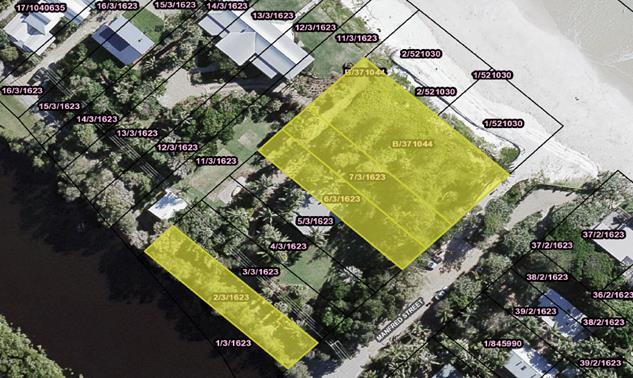
Figure 1 – Plan showing subject lots affected by
Resolution 15-230
In their assessment of the planning proposal, the Department
recommended that Council consider pursuing a partial lot reclassification to
that portion of land necessary to regularise the existing building encroachment
and to create a public road. Attachment 2.
The advice received from the Department of Planning and
Environment was in anticipation of public feedback that Council and the
Department may receive during the Planning Proposal process based on the
previous attempt to reclassify this land, and to determine whether Council has
considered all options to regularise the encroachment. Therefore, it was
recommended that Council pursue a partial reclassification of Lot 6 Section 3
DP 1623 for the purpose of regularising the existing building encroachment over
Lot 6 Section 3 DP 1623.
Figure 2 below provides an indicative plan showing the area
of land proposed to be reclassified in this report (in accordance with the
Department’s recommendation):
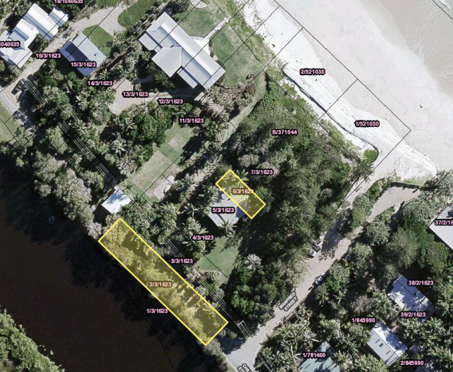
The matter was again reported to Council on 22 June 2017.
Council resolved as follows:
17-271 Resolved
that this item be deferred until Councillors have received a
workshop on the matters, which will include legal advice.
The workshop took place on 7 September 2017.
Partial Reclassification of Lot 6 Section 3 DP 1623
Following Court Orders impacting on Lot 6 Section 3 DP 1623,
Council is precluded from asserting any claim pursuant to the Encroachment
of Buildings Act 1922 in relation to any existing building encroachment
over Lot 6 (building encroachment). Court Orders impacting on Lot 6 are
appended to this report as Attachment 3.
It was therefore proposed that a boundary adjustment between
Lot 5 and Lot 6 Section 3 DP 1623 would provide an appropriate means for
Council to regularise the building encroachment. The extent of the
proposed boundary adjustment would accommodate only the building footprint and
the minimum required setback.
The current community land classification of Lot 6 Section 3
DP 1623 places restrictions on how the land can be used, including the ability
to regularise the building encroachment by way of a boundary adjustment.
Operational land, by contrast, has no special restrictions other than those
that may apply to any piece of land. A partial lot reclassification,
encompassing only the portion of land necessary to regularise the building
encroachment, would allow for the proposed boundary adjustment to be made
possible.
Resolution 15-230 sought the reclassification
of Lot B DP 371044, Lot 7 Section 3 DP 1623 and Lot 6 Section
3 DP 1623 for the purposes of regularising the existing building encroachment
over Lot 6 Section 3 DP 1623. The partial lot reclassification suggested
by the Department of Planning and Environment would
leave the remainder of the above land still classified as Community Land and
provide certainty that another dwelling would not be built on this land.
It should be noted that much of the land in resolution 15-230 is compromised by
its proximity to the Belongil erosion
escarpment, which runs through Lot B DP 371044.
For completeness, options available should
Council determine that a reclassification of Lot B DP
371044, Lot 7 Section 3 DP 1623 and Lot 6 Section 3 DP 1623 be proposed are
canvassed in confidential annexure 4.
Reclassification of Lot 2 Section 3 DP 1623
Lot 2 Section 3 DP
1623 contains a sealed road which provides access to a number of properties to
the north of Manfred Street. These properties lost their original
access many years ago due to the loss of ‘The Esplanade’, a road
that had frontage to the ocean.
A right of carriageway over Lot 2 was granted in 1999 under Court Order,
allowing an alternative access to properties situated north of Manfred
Street. Court Orders impacting on Lot 2 are appended to this report as
Attachment 5.
Following Resolution 15-230, Council staff
identified that creation of a public road over Lot 2 Section 3 DP 1623 may
introduce liability risks associated with the lot’s proximity to Belongil
Creek. The view taken was that Lot 2 Section 3 DP 1623 be reclassified to
Operational Land to appropriately reflect the current function of the lot as an
access easement for properties north of Manfred Street.
Legal and Policy implications
In the event that Council determined that it should not
proceed with progressing any Planning Proposal there is no need to formally
rescind resolution 15-230.
Councils are able to change their decisions by way of a
later decision. A motion to rescind or alter a resolution is the usual means of
changing a Council resolution.
However, the courts have held that it is not always
essential that a Council expressly alter or rescind a resolution prior to
passing a later resolution which is inconsistent or is in conflict with the
earlier resolution. In other words, alterations or rescission can be implied.
See Everall V Ku-ring-gai Municipal Council (1991) 72 LGRA 369.
To make sure that Council’s intention is clear, it is
considered best practice to expressly state that a later resolution is to
replace an earlier one. In this way, the public, Council staff and subsequent
councillors can understand and act with certainty on Council decisions.
Any proposed development of the land, should a planning
proposal proceed, would be required to comply with Byron DCP 2010 Chapter 1, Part J2.1
Financial Implications
With regard to the appropriation of funds, Council in its
adopted Financial Sustainability Plan has identified that any proceeds from
land disposal or commercial realisation will be transferred to the
Infrastructure Renewal Reserve and used to fund Infrastructure renewal works to
reduce the infrastructure backlog. The renewal works are funded based on the
priority placed on the works and assessed according to risk and community
benefit.
Financial implications associated with the full planning
proposal are discussed in the body of the confidential annexure.
Statutory and Policy Compliance Implications
As discussed in the report.
Staff Reports - Sustainable Environment and Economy 13.27
Report No. 13.27 Proposed
Strategic Business Panel
Directorate: Sustainable
Environment and Economy
Report
Author: Shannon
Burt, Director Sustainable Environment and Economy
Tania Crosbie , Economy and
Sustainability Coordinator
File No: I2017/1486
Theme: Economy
Economic Development
Summary:
Council received a Notice
of Motion Notice No. 9.2 Business Advisory Group at the Ordinary Meeting 3
August 2017, and resolved as follows:
Resolved that Council
receive a report from staff within three months regarding the establishment of
a Business Advisory Group comprising of distinguished local business leaders
from various fields of endeavour, including commerce, agriculture, creative
enterprises and others as appropriate, to work with Council in identifying
business growth opportunities for the Byron region, including those potentially
developed on Council owned properties. The staff report needs to also recommend
the structure, cost and management support for the group.
In response to this resolution staff have prepared a report
for Council’s consideration on the establishment of a new ‘Strategic
Business Panel’ having regard to the existing Business Roundtable and
Sustainable Economy Panel memberships and structure.
|
RECOMMENDATION:
1. That
Council agree to retain the Business Roundtable in its current format.
2. That
Council merge the Sustainable Economy Panel into a new Strategic Business
Panel (name to be confirmed).
3. That
Council agree to the overarching concept of a new Strategic Business
Panel, so that the model and terms of reference and membership can be
finalised with the existing nominated Councillors Richardson, Spooner, Hunter.
4. That
the first meeting of the new Strategic Business Panel be scheduled for
February 2018 if not able to meet beforehand.
|
Report
Byron Shire currently has two business engagement groups
1. The Sustainable
Economy Panel – currently all positions are vacant.
2. Business
Roundtable – comprised of Councillors, Business Chambers and Destination
Byron.
The Sustainable Economy Panel (Panel) purpose is to
work with Council and Economic Development & Tourism unit to generate and
sustain employment and business investment in the Byron Shire that will
strengthen the Byron Shire local economy in a sustainable manner. Four
key areas are:
1. Emerging
industries
2. Public
Private Partnerships
3. Enabling
infrastructure
4. Planning
and Design.
This Panel has recently called for new members and these are
yet to be appointed. The review of this Panel and its membership, is the
result of a need to reinvigorate interest in this space to ensure strategic
direction and input is received from key stakeholders in the business
community.
The Business Advisory Roundtable (Roundtable) on the
other hand provides a place for strategic discussion between Council and the
Business Chambers and Destination Byron, around issues impacting on
business. This Roundtable has just had in influx of new Chamber
Presidents and has dealt with such issues as flood recovery, employment land
use strategy and engagement. The roundtable presents as an organic quarterly
meeting of benefit for updates and networking for those attending.
Resolution 17-300 has requested the establishment of
a new Business Advisory Group comprising of distinguished local business
leaders from various fields of endeavour, including commerce, agriculture,
tourism, creative enterprises and so on to work with Council in identifying
business growth opportunities for the Byron region, including those potentially
developed on Council owned properties.
The establishment of a new Business Advisory Group and how
this group is differentiated or not from the existing Sustainable Economy Panel
is provided below.
New Strategic Business Panel concept
To respond to the above, a meeting was held on the 31 August
2017 between key staff and the nominated Councillors to the Sustainable Economy
Panel being Mayor Simon Richardson, Cr. Paul Spooner and Cr. Alan Hunter.
The purpose of this meeting was to discuss the opportunities
of establishing a group that best meets the emerging, and future strategic
needs of the business community and Council.
It was agreed that the current Sustainable Economy Panel is
not being challenged with strategic issues and therefore has lost momentum and
members interest. To address this, the opportunity to design a strategically
focussed business group, set the terms of reference and select those who would
add value to Council and business now exists. This new group could be a
combination of the Sustainable Economy Panel and the proposed Business Advisory
Group concept to minimise duplication of groups and to maximise leverage off
any membership.
It was also discussed that the group could meet quarterly
and discuss various themes or strategic topics relevant the business community
in the Byron Shire Council. Examples of themes discussed included:
· Ensuring
the Future of Agriculture in BSC
· Pitching
your Start Up – Byron Incubator ‘Shark Tank’ (refer paper on
Business Incubator program in Byron Bay)
· Connectivity,
IT and Tech Hub in Byron
· Publishing
Leaders in the Hinterland – support, growth and expansion
· Attracting
the next breed of entrepreneur to Byron Bay
· Tourism
- Ensuing the long-term viability of tourism in Byron Shire
· Sports
Tourism – Does the Business Case Stack Up?
· Education–
Attraction and Niche Opportunities
· Turning
our Arts Culture into Global Brands
· Investment
Opportunities – Pitchfest to Funding Angels
· Business
Opportunities on BSC Land – aims, options and ROI
· Health
and Well- Being Industry – Be the Leader
· Mentoring
and Coaching – Transferring the Knowledge and Sharing in the Success.
To do this, different formats could be used such as field
days, workshops with guest speakers, industry leaders, experts from outside of
Byron for perspective or comment, pitching competitions and so on.
It was proposed that a small core
group of Councillors and Council staff set the theme and invite the leading
business people, relevant speakers, experts and attendees. This Group
would be supported by the Economy and Sustainability Coordinator.
To move this new Panel proposal forward, staff recommend
that Council agree to the overarching concept of a new Strategic
Business Panel (being a combination of the Sustainable Economy
Panel and the proposed Business Advisory Group concept), so that the model and
terms of reference and membership can be finalised with the existing nominated
Councillors Richardson, Spooner, Hunter by years end.
Financial Implications
Costs associated with the new Panel would need to be met
within the existing operational budget and staff resources.
Statutory and Policy Compliance Implications
Delivery Program - EC1.1.1 Support innovative pathways to
social enterprise and sustainable business development
Staff Reports - Sustainable Environment and Economy 13.28
Report No. 13.28 Update
on Resolution 17-283 Innovative Business Incubation Program
Directorate: Sustainable
Environment and Economy
Report
Author: Shannon
Burt, Director Sustainable Environment and Economy
Tania Crosbie , Economy and
Sustainability Coordinator
File No: I2017/1487
Theme: Economy
Economic Development
Summary:
Council considered a matter
of urgency No. 18.2 Matter of Urgency - Innovative Business Incubation Program
at its Ordinary Meeting 22 June 2017 and resolved as follows:
17-283 Resolved:
1. That
council prepare a report to outline the establishment of an Innovative Business
Incubation Program.
2. That
this report consider the following:
i. Providing
set term leases for start ups, with no capacity to extend or double up or
repeat
ii. The
business required to front up all establishment and infrastructure costs that
need to be relocatable, or possibly Council purchasing a temporary space charge
a low rate to pay back purchase costs
iii. The
advertising for expressions of interest on a cyclical basis for projects and
businesses to utilise council spaces to develop their innovative businesses
iv. Creation
of a criteria to adjudicate on applications, possibly including sustainability,
innovation, potential for scalability or employment growth
v. Identification
of possible sites for incubation spaces
vi. Possible
mentoring and incubation support
vii. Liaisons
and relationships with permanent businesses
viii. Levels
of subsidisation
3. That
the current business utilising the Council space at First Sun Holiday park
continue its operation until the program commences and the next recipient of
support takes its place and that the General Manager receives delegated
authority to negotiate a temporary lease.
4. That
the report authors consult mentoring and business incubation groups and
chambers to assist the formulation of the program.
The purpose of this report is to update Council on progress
against item 1, having regard to the specifics of items 2 & 4 Resolution
17-283. Item 3 is under separate staff review to this report.
|
RECOMMENDATION:
1. That Council
support the progression of a Byron Innovation Incubation Program including
the models and list of potential sites identified in the report for further
investigation.
2. That Council
agree to the Byron Innovation Incubation Program proposal being shaped,
guided and progressed by the new Strategic Business Panel (or equivalent) in
consultation with the local business community.
3. That Council
agree that as part of their work the Strategic Business Panel (or equivalent)
further:
i. scope
the ‘types’ of businesses that would fit this model and research
their needs
ii. Develop the
financial business case for the models.
iii. Develop project
plan and budget to deliver the BIIP.
4. That staff
present a further report to Council on 2 & 3 above early 2018.
|
Attachments:
1 Renew
Australia , E2017/95887 ⇨
Report
Background
This report provides a number of options to Council to
establish a Byron Innovative Incubation Program (BIIP) in response to item 1 of
Resolution 17-283. In particular:
1. Best-practice models
2. Pop up logistics and options
3. Program design
4. Engagement
Once a program model is adopted by Council, the program
specifics including objectives can be finalised around funding, locations and
business selection preferences. Otherwise the scope and options are limitless
for reporting purposes.
It is proposed that BIIP proposal be shaped and guided by
the new Strategic Business Panel (or equivalent) discussed in a separate
report to this meeting – Proposed Strategic Business
Panel (#I2017/1486). This will ensure Council and
business stakeholder buy in and support.
For the purposes of this report the following terms as used:
· Business
incubators are organisations that provide support to start-up and
early stage businesses through the provision of facilities, mentoring and
coaching, training, networking and seed capital financing.
· Start-up
accelerators focus on moving technology-based firms rapidly from
establishment to early stage venture funding and growth. They are an education
and mentoring centric model with start-up teams working through as a cohort
over several months against a structured training program. The program
typically takes an equity stake in the venture and uses experienced
entrepreneurs as mentors and coaches.
· Co-working
facilities offer physical space where nascent and novice
entrepreneurs or individual freelancers can operate in a supportive environment
and where they may potentially expand their networks.
· A maker
space or hacker space offers a similar environment but is focused on
specific technologies such as software or online digital.
1. Best
Practice Incubator Programs
Much has been written about incubator programs and
‘best-practice’ examples are highlighted all over the world.
The Council as the incubator owner is common in large metro
Councils such as Darebin in Victoria, with its creative, general business and
creative co-working space. This program has a General Manager, and staff
to manage and run the business support model.
http://www.businessincubatormelbourne.com/
These are the services they offer under the program:

Most successful incubators run industry specific programs
i.e.: IT and creative arts, where the owners of the program are imparting
their knowledge on the newer businesses such as York Butter Factory in
Melbourne http://yorkbutterfactory.com/.
Key to their success is the link between focusing on IT
start ups, links into big business (partners include banks, EY, Qantas etc.),
links into Silicon Valley, co-working space and full-time hands on
support. However most incubators have a services focus rather than a
retail focus – this will require clear guidelines to be established.
Other examples include:
· https://www.nviflinders.com.au/
· http://www.slingshotters.com/
· http://www.thestudio.org.au/
There is government funding for incubator programs and the
guidelines have been re-written to be more sensitive to regional needs https://www.business.gov.au/assistance/incubator-support
.
Funding opportunities present at different times of the
year.
So what is the best formula for an innovation
incubator?
Based on research, for the best chance of success an
incubator will contain:
1. A concise program with clear policies
and procedures
2. On-site learning and leveraging of
resources
3. Access to financing and capitalisation
4. Tie/links to a university
5. Transparent selection process for
tenants
6. Perception of success – ie:
robust publicity campaign
7. Entrepreneurial Education
8. In-kind professional support from
staff, other small businesses and professionals
9. Community support and buy-in
10. Entrepreneurial networks within the region,
Australia and internationally.
Of interest, poor performing incubators had the following in
common:
1. Low-motivating environmental that does
not stimulate the start up
2. Government funded
3. Based on providing space with very
little other support
4. Lacked a ‘rapid to
commercialisation’ process
5. Not protected from commercial forces
6. Did not have strong network of mentors
and university embedded
7. Avoid the ‘real estate’
model if a virtual incubator can be just as effective
8. Did not have public support
As such the above 10 points of success should be
included for consideration where relevant as criteria for the BIIP.
2. Pop up logistics and options
There are a number of ways in which business incubators can
be physically accommodated.
a. Containers – locally
sourced
i. The
container build group in Lismore is the national supply for most pop up
container retailers. https://www.containerbuildgroup.com.au/. This provider is doing the Commonwealth Games,
Airport, BCC and also sent some to Christchurch.
ii. 20ft
conversion approx. $25,000 (high-end) includes toilet and basin
iii. Solar off-grid
system approx. $15,000
iv. To have initial
drawings developed the cost is $5,500


Above: Christchurch pop up mall examples
b. Timber pre-fab pop ups – bought
in space
i. Arkit
develop and build tiny timber homes and are used to doing installations in
public spaces – refer the Nano house built in Circular Quay in 2015 https://vimeo.com/134168000
ii. They just built a
tiny house and it cost $39,600 plus trailer plus PV. This
price included the fit-out of the kitchenette and small bathroom, and would be
cheaper without it.
iii. They have
not built pop up shops but are keen to look at this as an option.
Example of a pre-fab style of pop up house - portable and
sustainable.
c. Recycled Plastic Pop Ups –
locally sourced
Encounter Byron is
developing a recycled plastic tiny house and is interested in developing a
pop-up design that may be suitable as part of the incubator program.
d. Include
tiny pop ups shops as part of the sustainable house day competition in 2018.
(Locally designed and constructed)
i. This
would allow for local designers to develop a location specific design.
ii. The
winning design could then be built and be part of the pop up incubator program.
e. Use
of local space (unused shop-fronts in and around Byron Shire) so that start
up business can be supported across all Shire locations. There are a number of
options in Byron Bay and Mullumbimby. This allows for example local creative
producers to try a business idea to help develop it to take on a commercial
lease, helps landlords find permanent tenants, and brings vibrancy back to our
towns.

It is recommended that Council trial both options –
use of vacant business premises and pop ups on Council land. Costing estimates
of both options follow.
3 Incubator
Management Options
1. Basic
– innovation start-up accommodation
· Council provided
container office on Council approved land
· Establish an
incubator selection committee, establish guidelines and consult with relevant
groups like Byron Bay Town Centre Leadership Team
· Call for
‘EOI’ and select tenants
· Council acts as
landlord
· Mentoring from
business association such as Chamber of Commerce – at the expense of the
Chamber
· Potential costs to
Council:
· Pop up retail space
· Fit out
· Subsidising rents
· Establishing selection committee
· Engaging with community
· Coordination of selection criteria
and advertising for tenants
· Managing the tenancy and any
conflict resolutions
· Publicising program.
|
Pros
|
Cons
|
|
Able to control the program and select the right type of
tenant
|
Based on ‘real estate’ model
|
|
Able to manage any issues as they arise with the program
or tenant
|
Lack of Council expertise to establish and run the
incubator
|
|
Be ‘seen’ by community as supporting new
businesses and innovation
|
Backlash from existing local incubator operators and those
paying commercial rates
|
|
Great relationship with new businesses
|
Core business for the Council
|
|
Enthusiasm for the project
|
Cost
|
|
Innovative business community
|
Financial and reputational risks
|
|
Capable business chambers and successful businesses
|
Need to establish from the ground up
|
|
Access to education – Community College, SAE and SCU
|
Isolated model with limited benefits for those to
collaborate
|
|
Green field sites and model design
|
Is there experience to mentor the tenants
|
|
Opportunity to develop a self-funding model
|
|
|
Collaborative model
|
|
Costs – approximately:
· $25,000 - $30,000 per pop up – depending on
whether it needs a bathroom, off-grid, air conditioning etc.
· Land
· Energy
· Toilet facilities
· Cost of employing staff to run the program or to
re-direct staff
· Leasing
· Publicising program.
2. Partnering
with existing incubator programs
There are a number of options available to Council here
including Renew Australia (Attachment 1).
Renew Australia works with local communities by leveraging
underutilised spaces and transforming them into creative hubs. They provide
support, project management and have a suite of tools to do this.
Renew Australia has offered to work with Byron Shire for a membership
fee of around $3,000 to kick start a Renew model with local framework for
creative space activities in Byron Shire.
Above: Renew Australia in
Melbourne
The
program could provide:
· Council provided
container office on Council approved land
· Competitive EOI
process through the incubator partner that links to clear program guidelines
and links program to period of time in the incubator space
· Experienced
incubator management and in-kind support
· Existing
entrepreneurship education
· Experienced
mentors in existing programs
· Access to finance
and ‘investment angels’
· Entrepreneurial
networks
· Recognition from
local industry on ‘graduation’ from program
· Connection with
Business Chamber, national and international incubator organisation and alumni
· Potential costs to
Council:
· Pop up space
· Fit out
· Coordination of MOU and tenancy
arrangements
· Partner management and overseeing
the program – renew Australia $30K to $60K annually
· Publicising program
|
Pros
|
Cons
|
|
More reflective of successful models nationally
|
Loss of control
|
|
Less day-to-day running of program
|
Do those running current programs require more space
– that we want to provide
|
|
Supportive of current incubators from within the region or
use existing start up professionals
|
Space led solution rather than needs based
|
|
Plugs into existing models
|
|
|
Existing relationships with mentors and business
|
|
|
Existing relationships with education providers
|
|
Locations
Options exist for incubators
on either Council land and or vacant business premises (Renew Model).
Some possible Council
locations that have been identified for ‘pop ups’ follow:
-Wategos Beach (one road
reserve location);
-Denning Park road reserve
(two locations);
-Brunswick Heads road reserve
(three locations);
-Various car-parks, Byron
Bay;
-The current location of
Sunrise Cycles (Lot 7 Jonson Street, Byron Bay);
-The Byron Bay Library (where
a previous coffee cart operated from);
--Suffolk Park community land
(Suffolk Park sporting fields);
-The Myocum tip;
-The Bangalow Weir park;
-The park in Federal;
-The Byron Bay rail corridor
(once Council takes over management of the area).
An expression of interest
process for use of the Council locations for incubators needs to occur next. It
can include specific criteria relating to sustainability, scale, innovation,
employment potential and length of tenancy. Details of this to be scoped out as
part of the BIIP.
Engagement
It is proposed that the BIIP proposal be shaped and guided
by the new Strategic Business Panel (or equivalent) discussed in separate
report.
Financial Implications
As discussed in the report
Statutory and Policy
Compliance Implications
Local Government Act
Environmental Planning and Assessment Act
Related legislation
Staff Reports - Infrastructure Services 13.29
Staff Reports - Infrastructure Services
Report No. 13.29 Status
Report on Road Safety Funding Applications 2014-2017 (Black Spot)
Directorate: Infrastructure
Services
Report
Author: Evan
Elford, Team Leader Infrastructure Planning
File No: I2017/1283
Theme: Community Infrastructure
Roads and Maritime Services
Summary:
This report provides an update on road safety funding
applications that have been submitted to the Roads and Maritime Services (RMS)
between 2014 and 2017 (inclusive).
|
RECOMMENDATION:
That Council note the report in relation to the
road safety funding applications made to the NSW Roads and Maritime Services
(RMS), between 2014 and 2017 (inclusive).
|
Report
Each
year Councils can seek funding for treatment of black spots and other targeted
treatments from either the Australian Government’s Black Spot Programme
or the NSW Government’s Safer Roads Program.
The RMS
administers (on behalf of the Australian Government) the Australian Government
Black Spot Programme in NSW. This programme targets road locations where
crashes are occurring by funding traffic facilities and other measures such as
traffic signals, roundabouts, signage, line marking and road pavement
improvements at dangerous locations to reduce the risk of crashes occurring. The
Black Spot Programme makes an important contribution in reducing the national
road toll under the National Road Safety Strategy and Action Plan.
The NSW
Government’s Safer Roads Program is a key initiative of the NSW Road
Safety Strategy, which aims to make state roads safer and reduce crashes on the
road network. This program provides treatments where there are clusters
of casualty crashes on local and regional roads. This is achieved by
implementing low cost engineering treatments and countermeasures. The program
is split into several sub-programs, all targeting high severity crash types,
locations and/or vulnerable road users. Nominations for the Black Spot
Programme will be automatically considered for the Safer Roads Program.
When a
funding application submission is being reviewed a key consideration is the
Benefit-Cost Ratio (BCR) of the treatment that has been proposed. Typically
a BCR of at least 2 is required before a submission will be considered further
by the funding body. A BCR is improved by aligning proposed treatments
that address a crash trend, noting that the funding body assigns a greater
weighting to a fatality or injury crash than a non-casualty/tow-away incident.
Council
has been successful with funding applications (either with a first or second
submission) for the following projects:
· Coolamon Scenic Drive 1344 (Skyfarm) - For delivery in
2017/18 (further detail below)
· Ewingsdale Road and Sunrise Boulevard roundabout -
Delivered 2016/17
· Tweed Valley Way & Brunswick Valley Way roundabout - Completed
2015/16
· Tyagarah Road and Benloro Lane – Delivered in 2016/17
· Wilsons Creek Road – Completed 2015/16
Coolamon
Scenic 1344 (Skyfarm) - the most recent funding offer is for the provision of a
sealed shoulder and guard rail on a 900m length between 1390 and 1431 Coolamon
Scenic Drive to address the main problem of vehicles leaving the road. The
subject site was identified as the priority site along Coolamon Scenic Drive
following a broader review between Mullumbimby and Hinterland Way (ex- Pacific
Highway) at St Helena that identified five (5) subject sites in total.
Council
has been active, yet unsuccessful, in seeking funding under the road safety
funding programmes for roundabouts at the intersections of:
· Clifford Street and Broken Head Road, Suffolk Park
· Bayshore Drive and Ewingsdale Road, Byron Bay Arts &
Industrial Estate
· Kendall Street and Ewingsdale Road, Byron Bay
· McGettigans Lane and Ewingsdale Road, Ewingsdale
While a
roundabout is Council’s preferred treatment at these locations, the cost
of such a treatment is not resulting in an eligible BCR.
Table 1: road
safety funding applications made to RMS (2014-2017 inclusive)
|
2014
|
2015
|
2016
|
2017
|
Comments
|
|
Bayshore
Drive and Ewingsdale Road
|
|
Proposal
|
2-lane RAB
|
2-lane RAB
|
Does not meet grant application criteria
|
Does not meet funding criteria
|
The est. cost of the preferred solution
of a roundabout (RAB) does not meet the min. BCR..
|
|
Est $
|
$3M
|
$3M
|
|
BCR
|
0.3
|
0.62
|
|
Crashes
|
5
|
7
|
|
Broken Head
Road and Clifford Street
|
|
Proposal
|
1-lane RAB
|
1-lane RAB
|
Islands/lights
|
Does not meet funding criteria
|
Vehicles making RH turns from Clifford St
factor in majority of crashes. Given preferred treatment of RAB does not meet
min. BCR alt. options have/are to be considered.
|
|
Est $
|
$1.2M
|
$1.545M
|
$316,000
|
|
BCR
|
1.36
|
0.81
|
3.76
|
|
Crashes
|
11
|
11
|
12
|
|
Coolamon
Scenic Drive 1390-1431 (Skyfarm)
|
|
Proposal
|
N/A
|
N/A
|
clear zone
|
|
2016 bid is to provide sealed shoulder
& guard rail to address main problem (namely vehicles leaving road). Will
be delivered in 2017/18.
|
|
Est $
|
$217,000
|
|
BCR
|
9.83
|
|
Crashes
|
4
|
|
Ewingsdale
Road and Sunrise Boulevard
|
|
Proposal
|
1-lane RAB
|
1-lane RAB
|
|
Application successful and was finished in 2017/18
|
2015 bid successful, incl. reducing speed
limit by 20kph,traffic islands, guideposts & lane separation.
|
|
Est $
|
$2M
|
$2M
|
|
BCR
|
1.14
|
6.72
|
|
Crashes
|
14
|
7
|
|
Jonson Street
95 (Ped Xing)
|
|
Proposal
|
N/A
|
N/A
|
Rehab 80m
|
Raised Xing
|
2016 bid incl. new lighting & full
rehabilitation for 40m on approaches to the ped. crossing. Current bid
(2017, for 2018/19 funds) is for a 'wombat' (raised) crossing.
|
|
Est $
|
$312,000
|
$85,000
|
|
BCR
|
2.7
|
15.28
|
|
Crashes
|
3
|
3
|
|
Kendall
Street and Ewingsdale Road
|
|
Proposal
|
1-lane RAB
|
1-lane RAB
|
1-lane RAB
|
Does not meet funding criteria
|
2016 bid reduced cost est. based on
design, method of delivery & construction as used at other similar
intersections.
|
|
Est $
|
$1.5M
|
$1.5M
|
$610,00
|
|
BCR
|
1.24
|
0.8
|
2.12
|
|
Crashes
|
15
|
9
|
9
|
|
McGettigans Lane
& Ewingsdale Road
|
|
Proposal
|
1-lane RAB
|
Does not meet funding criteria
|
Does not meet funding criteria
|
Does not meet funding criteria
|
The preferred treatment does not meet
min. BCR requirements. Cost est. requires reviewing before it is considered further.
|
|
Est $
|
$1M
|
|
BCR
|
1.09
|
|
Crashes
|
4
|
|
Tweed Valley
Way & Brunswick Valley Way Intersection
|
|
Proposal
|
1-lane RAB
|
|
Application successful and
was finished in 2015/16
|
|
Cost of project was more than estimated.
However the design and method of delivery & construction does offer cost
savings to other projects.
|
|
Est $
|
$300,000
|
|
BCR
|
7.46
|
|
Crashes
|
7
|
|
Tyagarah Road
and Benloro Lane
|
|
Proposal
|
N/A
|
Shoulder seal
|
|
Application successful and was finished in 2016/17
|
$175,000 received to provide sealed
shoulder, a wet (non skid) seal & improved delineation, CAMS for corners
and Reflective Raised Pavement Markers for night driving
|
|
Est $
|
$150,000
|
|
BCR
|
10.59
|
|
Crashes
|
5
|
|
Wilsons Creek
Road
|
|
Proposal
|
Delineation
|
|
Application successful and was finished in 2015/16
|
|
Large benefit for cost. Delineation
improvements made include advanced signs & CAMS (curve advisory/alignment
markers) and guideposts and edge lines.
|
|
Est $
|
$50,000
|
|
BCR
|
43.66
|
|
Crashes
|
7
|
|
Bangalow Road
622 (CH 5450 - CH 6150) - Guardrail
|
|
Proposal
|
N/A
|
N/A
|
N/A
|
Guardrail
|
Two private driveways flank the railway crossing
bridge. Vehicles approach the bridge at high speed and run off the road. Consideration
of application is still underway by RMS.
|
|
Est $
|
<$100,000
|
|
BCR
|
>2
|
|
Crashes
|
unknown
|
|
Coolamon
Scenic Drive (South Mullumbimby) - safety improvements
|
|
Proposal
|
N/A
|
N/A
|
N/A
|
Lines / signs
|
This proposal covers 16km of Coolamon Scenic Drive
South of Mullumbimby with safety improvements including line marking, signs
and guardrails. Consideration of application is still underway by RMS.
|
|
Est $
|
<$100,000
|
|
BCR
|
<2
|
|
Crashes
|
unknown
|
Key Points:
1. The Benefit-Cost Ratio of the treatment must
be of a minimum level before a project will be considered for funding.
2. The process of preparing and submit funding
applications via the RMS online is very time consuming, especially as the full
process must be followed before the project’s BCR becomes known. This
does not take into consideration the weeks of engineering investigation
required to develop the treatments.
3. Not all projects are suited to this type of
funding stream.
4. All Councils within NSW are competing for the same limit
funding streams.
Financial Implications
No implications as this report is for information purposes
only.
Statutory and Policy Compliance Implications
No implications as this report is for information purposes
only.
Staff Reports - Infrastructure Services 13.30
Report No. 13.30 Settlement
Road Proposed Actions
Directorate: Infrastructure
Services
Report
Author: Joshua
Winter, Civil Engineer
File No: I2017/1316
Theme: Community Infrastructure
Local Roads and Drainage
Summary:
Staff presented to the
Councillors at the Strategic Planning Workshop on 7 September 2017 regarding
Settlement Road and the actions undertaken to date and yet to be undertaken
(presentation attached). The presentation addressed the location of
Settlement Road, background to date including history on the Settlement Road
Action Group, project constraints, design standard for consideration and the
implications of the design standard adopted.
Councillors requested that
further information be provided at the next Council meeting including traffic
count data, number of properties and an estimate of costs if the RFS standard
was utilised along the full length of Settlement Road.
|
RECOMMENDATION:
1. That
the Rural Fire Service standard be adopted for the design of
Settlement Road.
2. That
the remainder of the 2017/18 budget for Settlement Road (approximately
$9,000) be used to complete the design works.
3. That
a report be prepared for the first appropriate 2018 Council meeting with more
accurate costing information after the design work is completed.
|
Attachments:
1 24.2016.38.1
- Settlement Road SPW Presentation, E2017/94174
⇨
2 24.2016.38.1
- Settlement Road - Traffic Counts, E2017/94164
⇨

3 24.2016.38.1
- Settlement Road Property Export, E2017/94175
⇨
Summary
Staff presented to the
Councillors at the Strategic Planning Workshop on 7 September 2017 regarding
Settlement Road and the actions undertaken to date and yet to be undertaken
(presentation attached). The presentation addressed the location of
Settlement Road, background to date including history on the Settlement Road
Action Group, project constraints, design standard for consideration and the
implications of the design standard adopted.
Councillors requested that
further information be provided at the next Council meeting including traffic
count data, number of properties and an estimate of costs if the RFS standard
was utilised along the full length of Settlement Road.
Traffic Count
A traffic counter was installed
70 metres from the intersection of Main Arm Road, to collect data from Thursday
14th September 2017 to 1:30PM Wednesday 20th September
2017. This report is attached and found the following traffic counts,
shown as total traffic movements each day (including both directions);
· Thursday
14th September – 111
· Friday 15th
September – 156
· Saturday
16th September – 142
· Sunday 17th
September – 124
· Monday 18th
September – 139
· Tuesday
19th September – 151
· Wednesday
20th September – 172
Average 142
Number of Properties
There are 21 land parcels located
on Settlement Road, however, this does not account for the multiple occupancies
located on this length of road. The number of visible buildings from an
aerial image desktop inspection totalled approximately 50 properties.
Preliminary Estimate
Design staff used the Rural Fire
Service (RFS) design standard as presented in the SPW workshop to estimate the
amount of work to be done to bring the full length of Settlement Road up to RFS
standard. This preliminary estimate has indicated that it would be in the
order of $1.2M. It is noted that this estimate is based purely on
preliminary quantities and may change as the design progresses.
Staff Reports - Infrastructure Services 13.31
Report No. 13.31 Draft
Plan Of Management - Byron Bay Recreation Grounds
Directorate: Infrastructure
Services
Report
Author: Nikki
Bourke, Project Officer
File No: I2017/1330
Theme: Community Infrastructure
Open Space and Recreation
Summary:
The purpose of this report is
to gain Council approval to advertise the draft Plan of Management for the
Byron Bay Recreation Ground for a period of no less than 28 days to enable
Community submissions.
|
RECOMMENDATION:
That in relation to the draft Plan of Management
for Byron Bay Recreation Ground:
a) It
be advertised for 28 days and if any submissions are received be brought back
to Council for further consideration
b) That
if no submissions are received, that the Plan of Management be adopted as exhibited.
|
Attachments:
1 PDF Draft
Plan of Management Byron Bay Recreation Grounds V5, E2017/80412 ⇨
Report
A draft Plan of Management has been prepared for the Byron
Bay Recreation Ground. If adopted, this plan would supersede the Plan of
Management for Byron Bay Recreation Ground that was adopted on 20 May 2003 (DM403354).
The draft Plan of Management was reported to Council on 24
August 2017 and the resolution is as follows:
“That this matter
be deferred so that information be shared at the next available Strategic
Planning Workshop and at this workshop other Plans of Management in the Byron
Shire areas and examples of other shire’s plans are shared. (Ndiaye/Richardson)”
The material requested in the resolution, in addition to
records of consultation activities, were presented to Council in the Strategic
Planning Workshop on 7 September 2017.
The purpose of this report is
to gain Council approval to advertise the draft Plan of Management for the
Byron Bay Recreation Ground to enable Community submissions.
Financial Implications
There are no financial implications from the development and
adoption of the Byron Bay Recreation Ground Plan of Management.
Proposed actions consistent with an adopted plan of
management may generate income and expenditure opportunities that Council will
have to consider when they are presented.
Statutory and Policy Compliance Implications
Local Government Act 1993
38 Public
notice of draft plans of management
(1) A
council must give public notice of a draft plan of management.
(2) The
period of public exhibition of the draft plan must be not less than 28 days.
(3) The
public notice must also specify a period of not less than 42 days after the
date on which the draft plan is placed on public exhibition during which
submissions may be made to the council.
(4) The
council must, in accordance with its notice, publicly exhibit the draft plan
together with any other matter which it considers appropriate or necessary to
better enable the draft plan and its implications to be understood
40 Adoption of plans of management
(1)
After considering all submissions received by it concerning the draft plan of
management, the council may decide to amend the draft plan or to adopt it
without amendment as the plan of management for the community land concerned.
(2) If the council decides to amend the draft plan it
must either:
(a) publicly exhibit
the amended draft plan in accordance with the provisions of this Division
relating to the public exhibition of draft plans, or
(b) if it is of the
opinion that the amendments are not substantial, adopt the amended draft plan
without public exhibition as the plan of management for the community land
concerned.
(2A) If
a council adopts an amended plan without public exhibition of the amended draft
plan, it must give public notice of that adoption, and of the terms of the
amended plan of management, as soon as practicable after the adoption.
(3) The
council may not, however, proceed to adopt the plan until any public hearing
required under section 40A has been held in accordance with section 40A.
40A Public
hearing in relation to proposed plans of management
(1) The
council must hold a public hearing in respect of a proposed plan of management
(including a plan of management that amends another plan of management) if the
proposed plan would have the effect of categorising, or altering the
categorisation of, community land under section 36 (4).
(2)
However, a public hearing is not required if the proposed plan would merely
have the effect of altering the categorisation of the land under section 36
(5).
(3) A
council must hold a further public hearing in respect of the proposed plan of
management if:
(a) the council decides
to amend the proposed plan after a public hearing has been held in accordance
with this section, and
(b) the amendment of
the plan would have the effect of altering the categorisation of community land
under section 36 (4) from the categorisation of that land in the proposed plan
that was considered at the previous public hearing.
41 Amendment
of plans of management
A council may amend a plan of management adopted under this
Division by means only of a plan of management so adopted.
42 Revocation
and cessation of plans of management
(1) A plan of management for community land may be
revoked by a plan of management adopted under this Division by the council.
(2) A plan of management ceases to apply to land if:
(a) the land is
reclassified as operational land, or
(b) in the case of land
that is not owned by the council—the land ceases to be controlled by the
council.
Staff Reports - Infrastructure Services 13.32
Report No. 13.32 Proposed
Installation of Telecommunications Equipment for Telstra Corporation Limited
Bangalow Sportsground Lot 5 DP 1039596
Directorate: Infrastructure
Services
Report
Author: Darren
McAllister, Acting Open Space and Facilities Coordinator
File No: I2017/1429
Theme: Community Infrastructure
Open Space and Recreation
Summary:
This report has been withdrawn at Telstra’s
request.
Report
This report has been withdrawn at Telstra’s
request.
This report has been withdrawn at Telstra’s
request.
This report has been withdrawn at Telstra’s request.
.
Staff Reports - Infrastructure Services 13.33
Report No. 13.33 Vallances
Road Management Plan
Directorate: Infrastructure
Services
Report
Author: Peter
Rees, Manager Utilities
File No: I2017/1473
Theme: Community Infrastructure
Sewerage Services
Summary:
At the 23 February 2017 Ordinary Meeting Council resolved to
prepare a Plan of Management (POM) for the 108 hectare Vallances Road site
encompassing a suite of sustainability initiatives that demonstrate a virtuous
cycle that would be a showcase for the area and our community’s values.
The attached draft document presents the proposed Plan of
Management for the site. It should be noted, as discussed at the February
2017 Strategic Planning Workshop, it is proposed to undertake extensive
community consultation to identify activities to be undertaken on the
Affordable Housing and Community Initiatives project area.
The document was reported to the 14 September 2017 meeting
of the Water Sewer and Waste Advisory Committee meeting. The meeting did
not discuss the plan and an extraordinary meeting has been scheduled for the 10
October 2017.
The document was also presented to the 5 October 2017
Councillor Strategic Planning Workshop.
|
RECOMMENDATION:
1. That
the Draft Vallances Road Plan of Management be adopted subject to:
a) Being
renamed “Brunswick Valley Sustainability Centre Management Plan”;
and
b) References
in the document referring to “POM” or “Plan of
Management” be modified to “MP” or “Management
Plan” respectively.
2. That
Council approve the initiation of a Community consultation programme for the
area identified for possible Affordable Housing / Community Gardens / Eco
tourism / Educational.
3. That
Council endorse the commencement of the procurement process for the
designated solar farms on the site.
|
Attachments:
1 Vallances
Road Plan of Management - Rev 1, E2017/86476
⇨
Report
At the 23 February 2017 meeting, Council resolution 17-054
resolved:
1. That
Council note the report.
2. That
the proposed POM be prepared in conjunction with the Waste Water and Sewerage
Committee.
3. That
the terms of reference for the POM include the following:
a) Estimated
costing for the initiatives and their budgetary feasibility in light of related
projects in water and sewerage.
b) Possible
timeframes for their implementation.
c) Financial
viability of the potentially positive fiscal options.
d) Environmental
advantages and costs.
e) The
implications of not including the replacement of the Mullumbimby sewer system.
f) The
marginal utility of improving the quality of current treatment (without wetland
polishing) and utilising it in an effective reuse system.
g) considers
options for agricultural enterprises that utilises effluent reuse on the
property.
4. The
POM should clearly examine and advise on all and each of the initiatives in the
staff report in a holistic manner as they are part of a much bigger system with
increasing demands.
5. That
the Vallances Road Agistment contract review include eligibility criteria which
seeks to ensure that appointed contractors are of good character and have acted
lawfully and appropriately in previous contract activities
The attached document is the draft Plan of Management (POM)
for the Vallances Road site as per item 4 of Res 17-054. This document
has essentially added more detail to the original proposal presented to Council
in February this year. The draft document also complies with the State
Government requirements for development of a Plan of Management for Community
Land.
The draft Plan has divided the area into 7 key activity
areas as follows
1. Brunswick
Valley STP Project areas – this includes the process plant and proposed
wetlands and effluent storage areas
2. Solar
Farms – this is actually 2 areas with one for the BVSTP solar farm and
the other for a community solar farm
3. Biomass
project areas – for growing of biomass crops utilising biosolids and
recycled water and using the crops for power generation
4. Environmental
land use project areas – this will be a combination of revegetation
areas; rehabilitation of mangroves and billabongs; river bank stabilisation
works
5. Affordable
Housing and Community Initiatives project area – it is recommended this
area be put out for public consultation to determine the best use alternatives.
Some immediate land use options that are available are eco tourism; educational/interpretative
centres; and community gardens. It has not as yet been determined if the
existing structures on the site including the 2 existing dwellings are a
benefit or a hindrance at this stage.
6. Community
access – possibly somewhat controversially, the POM has identified the
main access thoroughfare to the site as being via the existing rail line and
bridge that connects to an inactive road reserve into the western boundary.
This would require significant will on the part of Council to bring to
fruition. Parking would be at Lot 4 at the end of Station Street with
access along the rail / road corridor by foot / bicycle / electric cars.
7. Throughout
the site would be a network of walkways and information portals explaining the
“virtuous cycle” of waste conversion to energy; solar power; carbon
sequestration; environmental habitat; mangroves and riparian protection.
The site has real potential to be both a showcase for the
area and our community’s values.
A catalyst to bringing the project alive is the proposed
closing of the Ocean Shores STP and transferring the effluent to the Brunswick
Valley site. The will initiate a $10 million plus spend that, given the
healthy financial position of the Sewer Fund, can be expanded to include many
of the ancillary projects identified in the draft POM.
In relation to Item 3(e) it should also be noted the issue
of reducing stormwater entering the gravity sewer system in Mullumbimby is a
separate project and has no impact on this proposed Plan of Management.
In relation to Item 3(f) there is considered to be no
marginal utility in removing wetlands and in lieu upgrading the BVSTP recycled
water system to include dual reticulation standard. These effluent streams can
happen in parallel as occurs at the Byron Bay STP.
Financial Implications
The implementation of the draft Plan of Management for
Vallances Road could occur under the umbrella of the OSSTP transfer project
with little material impact on the sewer reserve funds. Depending on the
final configuration of the Affordable Housing and Community Initiatives project
area; and the power generation projects, the site could in effect generate
income that would be beneficial to the sewer reserve funds.
Statutory and Policy Compliance Implications
The draft Vallances Road Plan of Management document has
attempted to embody Council’s strategic objectives embodied in
· Biodiversity
Conservation Strategy
· Sustainable
Agriculture Strategy
· Low Carbon
Strategy 2014
· Climate Change
Strategic Planning Policy
· Community Gardens
Policy
· Corporate Sustainability
Policy
Reports of Committees - Corporate and Community Services 14.1
Reports of Committees - Corporate and Community
Services
Report No. 14.1 Report of the Audit, Risk and Improvement Committee Meeting held on 12 October 2017
Directorate: Corporate and Community Services
Report
Author: Jessica
Orr, Strategic Risk and Improvement Coordinator
File No: I2017/1509
Theme: Corporate Management
Governance Services
Summary:
This report provides the minutes and recommendations of the
Extraordinary Audit, Risk and Improvement Committee Meeting held on 12 October
2017 for determination by Council.
|
RECOMMENDATION:
1. That
Council note the minutes of the Audit, Risk and Improvement Committee Meeting
held on 12 October 2017.
2. That
Council resolve to move the next meeting of the Audit, Risk and Improvement
Committee from 16 November 2017 to 30 November 2017.
|
|
3. That Council
adopt the following Committee Recommendation(s):
Report No. Draft
2016/2017 Financial Statements
File No:
I2017/1475
Committee Recommendation .1
That the Audit, Risk and Improvement Committee
recommend to Council:
1. That
Council approve the signing of the “Statement by Councillors and
Management” in accordance with Section 413(2)(c) of the Local
Government Act 1993 and Regulation 215 of the Local Government (General)
Regulation 2005 in relation to the 2016/2017 Draft Financial Statements.
2. That
Council exhibit the Financial Statements and Auditor’s Report and call
for public submissions on those documents with submissions closing on 30
November 2017 in accordance with Section 420 of the Local Government Act
1993.
3. That
the Audited Financial Statements and Auditors Report be presented to the
public at the Ordinary Meeting of Council scheduled for 23 November 2017 in
accordance with Section 418(1) of the Local Government Act 1993.
|
|
4. That Council
adopt the following Committee Recommendation(s):
Report No. Audit,
Risk & Improvement Delivery Program and Strategy for 2017 - 2021
File No:
I2017/1345
Committee Recommendation .1
That the Audit, Risk
and Improvement Committee:
1. Endorse
the 2017-2021 Internal Audit Plan with minor amendments to the terms of
reference for the Buildings and Property Management audit review and Fraud
and Corruption Control audit review, noting that the reviews for year two
onwards will be presented to the Audit, Risk and Improvement Committee at the
commencement of each audit year.
2. Note
the 2017/18 audit program will include:
a) Corporate
Compliance and Policy Management
b) Buildings
and Property Management
c) Fraud
and Corruption Control
d) IT
User Access
|
Attachments:
1 Audit,
Risk and Improvement Committee Minutes 12 October 2017, E2017/96937 ⇨
Report
The attachment to this report provides the minutes of the Audit,
Risk and Improvement Committee Meeting of 12 October 2017 for determination by
Council – they are available on Council’s website at:
http://byron.infocouncil.biz/RedirectToDoc.aspx?URL=Open/2017/10/ARIC_12102017_MIN_624_EXTRA_WEB.htm
Management Comments
In addition to the Committee Recommendations above,
Management request that Council resolve to move the next meeting of the Audit,
Risk and Improvement Committee from 16 November 2017 to 30 November 2017 at
9.00am to allow sufficient time for a thorough audit to be undertaken and
presented to the Committee following Council endorsement of the Audit Plan.
Financial Implications
As per the Reports listed within the Audit, Risk and
Improvement Committee Meeting of 12 October 2017.
Statutory and Policy
Compliance Implications
As per the Reports listed within the Audit, Risk and
Improvement Committee Meeting of 12 October 2017.
Reports of Committees - Corporate and Community Services 14.2
Report No. 14.2 Report of the Arakwal Memorandum of Understanding Advisory Committee
Meeting held on 22 September 2017
Directorate: Corporate and Community Services
Report
Author: Belle Arnold,
Community Project Officer
File No: I2017/1436
Theme: Society and Culture
Community Development
Summary:
This report presents the minutes of the Arakwal Memorandum
of Understanding Advisory Committee held at the Byron Bay Library on 22
September 2017.
This meeting discussed the Byron Shire Aboriginal
Stakeholder Consultation Document, the Ti Tree Lake Plan of Management, Signage
at Broken Heads Caravan Park, Ironbark Housing Revegetation, Australia Day,
Brunswick Heads Foreshore Midden Protection and other matters.
|
RECOMMENDATION:
1. That
Council note the minutes of the Arakwal Memorandum of Understanding Advisory
Committee Meeting held on 22 September 2017.
|
|
2. That Council
adopt the following Committee Recommendation :
Report No. 4.1 Byron Shire Aboriginal
Stakeholder Consultation Document
File No:
I2017/1251
Committee Recommendation 4.1.1
That the Arakwal
Memorandum of Understanding Advisory Committee reviews the “Byron Shire
Council and Indigenous Stakeholders” document (E2016/98166) and that
Council seek feedback from the Bundjalung of Byron Bay, Arakwal Corporation.
|
|
3. That Council
adopt the following Committee Recommendation:
Report No. 4.2 Ti Tree Lake PoM
File No:
I2017/1233
Committee Recommendation 4.2.1
1. That
the Arakwal Memorandum of Understanding Advisory Committee note the progress
of this project.
2. That
the Arakwal Memorandum of Understanding Advisory Committee seek
comment on the closure of a section of Taylors Lake Road and the
establishment of an easement, to protect the Aboriginal Cultural Principles
of the Aboriginal Area and Aboriginal Place of the lake precinct, from the
National Parks and Wildlife Service.
3. That
the Arakwal Memorandum of Understanding Advisory Committee refer the schedule
of water quality testing and the erection of signage to the National Parks
and Wildlife Service for their recommendation under the terms of the Ti Tree
Lake PoM.
|
|
4. That Council
adopt the following Committee Recommendation:
Report No. 4.3 Broken Head Beach Caravan Park
signage
File No:
I2017/1256
Committee Recommendation 4.3.1
1. That the Broken
Head Beach Caravan Park sign be replaced with option A as outlined in the
report and that Council fund the first $2,000, with the balance being funded
by the Broken Head Caravan Park.
2. That the erection
of new Welcome to Country signage be taken back to the board of the Arakwal
Corporation and reported to the next meeting of the Arakwal MoU.
|
|
5. That Council
adopt the following Committee Recommendation:
Report No. 4.4 Ironbark Housing Revegetation
File No:
I2017/1241
Committee Recommendation 4.4.1
1. That
the Arakwal Memorandum of Understanding Advisory Committee consider the
request from the Bundjalung of Byron Bay, Arakwal Corporation regarding
revegetation and works to restrict public access at the Ironbark Avenue
Housing Development.
2. That
Council’s Infrastructure Planning Staff and Manager Open Space and
Resource Recovery liaise with relevant Arakwal members to investigate and
cost options for consideration.
|
|
6. That Council
adopt the following Committee Recommendation:
Report No. 4.5 Australia Day Report
File No:
I2017/1223
Committee Recommendation 4.5.1
1. That
the Arakwal Memorandum of Understanding Advisory Committee support further discussion about the possible change of
date for 2019 Australia Day events and seek further consultation on changing
the date with the Arakwal Corporation.
2. That the Arakwal Memorandum of Understanding Advisory
Committee invite input from the Sisters for Reconciliation Group and the
Cavanbah Reconciliation Group.
|
|
7. That Council
adopt the following Committee Recommendation:
Report No. 4.6 Brunswick River Foreshore
Midden System Protection
File No:
I2017/1255
Committee Recommendation 4.6.1
That Council write to Crown
Lands as a matter of urgency with regards to requesting that a barrier be
erected to protect the aboriginal cultural heritage site in the precinct
(maps to be provided) with letters of support sought from Brunswick Valley
Landcare, Tweed-Byron Land Council and the Arakwal Corporation.
|
|
8. That Council
adopt the following Committee Recommendation:
Report No. 4.7 Bangalow and Mullumbimby
Master Plan Guidance Group Cultural Heritage
File No:
I2017/1224
Committee Recommendation 4.7.1
1. That
the Arakwal Memorandum of Understanding Advisory Committee note the
Bangalow and Mullumbimby Master Plan guidance presentation and provide
feedback on the consultation process to Council.
2. That the Arakwal Memorandum
of Understanding Advisory Committee demand that Council projects engage
consultation with aboriginal stakeholders from the commencement of the
project.
|
|
9. That Council
adopt the following Committee Recommendation:
Report No. 4.8 Byron Shire Aboriginal
Cultural Heritage Study - Stage 1 Progress Report
File No:
I2017/1239
Committee Recommendation 4.8.1
That the
representatives of the Bundajung of Byron Bay Aboriginal Corporation
(Arakwal) note that the Draft Study is being reviewed in consultation with
Aboriginal Stakeholders.
|
|
10. That Council adopt the
following Committee Recommendation:
Report No. 4.9 Aboriginal Services in the
Byron Shire
File No:
I2017/1240
Committee Recommendation 4.9.1
1. That
the Arakwal Memorandum of Understanding Advisory Committee note the
development of this project and employment of a worker to continue to develop
this project.
2. That
Council commend the work in progress on this project.
|
Attachments:
1 Minutes 22
09 2017 Arakwal Memorandum of Understanding Advisory Committee, E2017/97439 ⇨
Report
The attachment to this report provides the minutes of the
Arakwal Memorandum of Understanding Advisory Committee Meeting of 22 September
2017 for determination by Council. The agenda for this meeting can be
located on Council’s website at:
http://byron.infocouncil.biz/Open/2017/09/AMUAC_22092017_AGN_616_AT.PDF
The committee recommendations are supported by management
and are provided in the attachment to this report.
Financial Implications
As per the Reports listed within the Arakwal Memorandum of
Understanding Advisory Committee Meeting of 22 September 2017.
Statutory and Policy
Compliance Implications
As per the Reports listed within the Arakwal Memorandum of
Understanding Advisory Committee Meeting of 22 September 2017.
Reports of Committees - Infrastructure Services 14.3
Reports of Committees - Infrastructure Services
Report No. 14.3 Report of the Local Traffic Committee Meeting held on 19 September 2017
Directorate: Infrastructure Services
Report
Author: Stephanie
Tucker, Traffic and Transport Assistant
File No: I2017/1434
Theme: Community Infrastructure
Local Roads and Drainage
Summary:
This report contains the recommendations of the Local
Traffic Committee from the meeting as held on 19 September 2017.
|
RECOMMENDATION:
1. That
Council note the minutes of the Local Traffic Committee Meeting held on 19
September 2017.
|
|
2. That Council
adopt the following Committee Recommendation(s):
Report No. 6.1 Event Road Closures -
Mullum2Bruns Paddle 2018
File No:
I2017/1036
Committee Recommendation 6.1.1
1. That
Council approve the Traffic Management Plan and Traffic Control Plans for the
Mullum2Bruns Paddle 2018 to be held Sunday 27 May 2018, that includes the
temporary road closure below:
a) Brunswick
Terrace, Mullumbimby, between Tincogan Street and Tyagarah Street (to become
one-way traffic), between 06:00am and 10:00am on Sunday 27 May 2018.
2. That
the approval provided in Part 1 is subject to:
a) separate
approvals by NSW Police and RMS being obtained;
b) implementation
of the approved Traffic Management Plan and Traffic Control Plan, including
the use of signed detours, as designed and implemented by those with
appropriate accreditation;
c) that
the impact of the event be advertised via a notice in the local weekly paper
a minimum of one week prior to the operational impacts taking effect, noting
it must include the event name, specifics of any traffic impacts or road
closures and times, alternative route arrangements, event organiser, a
personal contact name and a telephone number for all event related enquiries
or complaints;
d) the
event be notified on Council’s webpage;
e) the
event organiser:
i) undertake
consultation with community and affected businesses including adequate
response/action to any raised concerns;
ii) undertake
consultation with emergency services and any identified issues addressed;
iii) holding
$20m public liability insurance cover which is valid for the event;
iv) paying
Council’s Road Event Application Fee prior to the event.
3. That
a debrief be held within two weeks of the event involving staff, Police (if
they had incidents), and traffic controllers.
|
|
3. That Council
adopt the following Committee Recommendation(s):
Report No. 6.2 Event Road Closures - Falls
Festival 2017/18
File No:
I2017/1146
Committee
Recommendation 6.2.1
That Council
approve the Traffic Management Plan, which includes Traffic Control Plans,
for the Falls Festival 2017/18 to be held at the North Byron Parklands site,
Yelgun Sunday 31 December 2017 to Tuesday 2 January 2018 inclusive, subject
to the following conditions:
a) Separate
approvals by NSW Police and RMS being obtained;
b) Implementation
of the approved Traffic Management Plan and Traffic Control Plan by those
with appropriate RMS accreditation and the holding of current and appropriate
levels of insurance and liability cover;
c) The
approved event size being sufficient (20,000 patrons) to trigger use of the
south car park as per the DA Condition for its use;
d) The
temporary ‘No Stopping’ where applied, including on Brunswick
Valley Way (between Shara Boulevard and Tweed Valley Way) and on Tweed Valley
Way (between Brunswick Valley Way and the Shire boundary), is implemented
prior to the event and in accordance with relevant state requirements and
Australian Standards;
e) A
communications protocol be developed and maintained by those involved in the
implementation of traffic management including monitoring and ability to
implement contingency plans as and when directed;
f) Monitoring
of vehicle volumes that arrive and depart the festival site and on the local
road network;
g) The
holding of an event debrief within the month following the festival which
includes but not limited to Council, RMS and Police;
h) As
a committee, request council to consider additional rangers patrol the Yelgun
Rest Area during the Falls Event.
i) The
event organiser:
i) advertising
the impact of the event via a notice in the local weekly paper a minimum of
one week prior to the operational impacts taking effect, noting it must
include the event name, specifics of any traffic impacts or road closures and
times, alternative route arrangements, event organiser, a personal contact
name and a telephone number for all event related enquiries or complaints;
ii) providing
a copy of the advert for Council's web page;
iii) give
consideration of any submissions received;
iv) informing
community and businesses that are directly impacted (e.g. adjacent to the
event) via written information which is delivered to the property in a timely
manner so as to document, consider and respond to any concerns raised;
v) arranging
for private property access and egress affected by the event;
vi) liaising
with bus and taxi operators and ensuring arrangements are made for provision
of services during conduct of the event;
vii) consulting
with emergency services and any identified issues be addressed;
viii) holding
$20m public liability insurance cover which is valid for the event.
ix) paying
of Council’s Road Event Application Fee prior to the event.
x) That
the event organiser be required to install a VMS board at the Yelgun Rest
Area with appropriate message restricting or prohibiting parking in the rest
area, such as “No Special Event Parking”.
|
|
4. That Council
adopt the following Committee Recommendation(s):
Report No. 6.3 Capital Works - Coolamon
Scenic Drive (South Mullumbimby) - Regulatory Signage and Line Marking
File No:
I2017/1236
Committee Recommendation 6.3.1
That Council approve the use
of curve and advisory speed signs, chevron alignment markers, unidirectional
hazard markers and a white double barrier line marking along Coolamon Scenic
Drive from Azalea Street to Hinterland Way as required.
|
|
5. Note that
Council adopted the following Committee Recommendation(s)
at Council meeting 21 September 2017:
Report No. 6.4 Event Road Closures - 50th
Anniversary NSW National Parks and Wildlife Service
File No:
I2017/1244
Committee Recommendation 6.4.1
1. That
Council endorse the Traffic Management Plan for the 50th
Anniversary of the NSW National Parks and Wildlife Service to be held on
Sunday 8 October 2017 that includes:
a) the
temporary road closure of Lighthouse Road (between Palm Valley Drive and the
Cape Byron Lighthouse) between 5:00am and 4:00pm;
b) the
use of the Clarkes Beach bus stop for the operation of the free shuttle bus
service.
2. That
the approval provided in Part 1 is subject to:
a) separate
approvals by NSW Police and RMS being obtained;
b) implementation
of the approved Traffic Management Plan and Traffic Control Plan, including
the use of signed detours, as designed and implemented by those with
appropriate accreditation;
c) that
the impact of the event be advertised via a notice in the local weekly paper
a minimum of one week prior to the operational impacts taking effect, noting
it must include the event name, specifics of any traffic impacts or road
closures and times, alternative route arrangements, event organiser, a
personal contact name and a telephone number for all event related enquiries
or complaints;
d) Due
to the event being held at the end of the school holidays, the applicant be
required to supply a VMS board notifying of the road closures for the event
on Sunday 8 October. VMS board to be placed on the corner Tallows Beach Drive
from 9am Friday the 6th October advising of the road closure;
e) the
event be notified on Council’s webpage;
f) the
event organiser:
i) undertake
consultation with community and affected businesses including adequate
response/action to any raised concerns;
ii) undertake
consultation with emergency services and any identified issues addressed;
iii) hold
$20m public liability insurance cover which is valid for the event;
iv) paying
Council’s Road Event Application Fee prior to the event.
|
|
6. That Council
adopt the following Committee Recommendation(s):
Report No. 6.5 Event Road Closures - Bangalow
Christmas Eve Carnival 2017
File No:
I2017/1245
Committee Recommendation 6.5.1
1. That
Council approve the Traffic Management Plan (TMP) and Traffic Control Plan
(TCP) for the Bangalow Christmas Eve Carnival 2017 to be held Sunday 24
December 2017, that includes the temporary road closure below:
a) Byron
Street, Bangalow between Ashton Street and Granuaille, between 3:30pm and
10:00pm.
2. That
the approval provided in Part 1 is subject to:
a) separate
approvals by NSW Police and RMS being obtained, noting that the event is on a
state road or may impact the state road network;
b) implementation
of the approved Traffic Management Plan and Traffic Control Plan, including
the use of signed detours, as designed and implemented by those with
appropriate accreditation;
c) that
the impact of the event be advertised via a notice in the local weekly paper
a minimum of one week prior to the operational impacts taking effect, noting
it must include the event name, specifics of any traffic impacts or road
closures and times, alternative route arrangements, event organiser, a
personal contact name and a telephone number for all event related enquiries
or complaints;
d) the
event be notified on Council’s webpage;
e) the
event organiser:
i) undertake
consultation with community and affected businesses including adequate
response/action to any raised concerns;
ii) undertake
consultation with emergency services and address any identified issues;
iii) holding
$20m public liability insurance cover which is valid for the event;
iv) paying
Council’s Road Event Application Fee prior to the event.
|
|
7. That Council
adopt the following Committee Recommendations:
Report No. 6.6 Event Road Closures -
Brunswick Woodchop Twilight Markets 2017
File No:
I2017/1246
Committee Recommendation 6.6.1
1. That
the Twilight Markets to be held on Wednesday 13 December 2017, which includes
the temporary road closure/s below, be endorsed between these times:
a) Mullumbimbi
Street Brunswick Heads, between The Terrace and Park Street on Wednesday 13
December 2017, as per the following:
i) Closure
of the area bounded by the nose-in parking and centre parking bay from 7:00am
until 11:00pm. This is the u-shaped provision for parking that is adjacent
Banner Park in the vicinity of the children's play area;
ii) Two
(2) temporary designated ‘Disability Parking’ spaces be created outside
of the hotel during the morning, with signage to be installed by
appropriately accredited persons in conjunction with the implementation of
the TCP. The existing 2 spots will have been closed off;
iii) Closure
of the remaining section of ‘through road’ between The Terrace
and Park Street from 12:00noon until 11:00pm.
b) Opening
of Memorial Park for parking on Wednesday, 13 December 2017 from 12:00noon to
allow stallholders to get their vehicles off the street before the markets
start at 3:00pm.
c) The
event organisers ensure clear access to the river is maintained at all times
for Emergency Services through the temporary parking areas.
2. That
the Fireworks Night to be held on Saturday 13 January 2018, which includes
the opening of Memorial Park for parking from 6:00pm be endorsed.
3. That
the approval provided in Part 1 and Part 2 is subject to:
a) separate
approvals by NSW Police and RMS being obtained;
b) implementation
of the approved Traffic Management Plan and Traffic Control Plan by those
with appropriate RMS accreditation and the holding of current and appropriate
levels of insurance and liability cover;
c) the
impact of the event be advertised, and charged at cost to the organisers, via
a notice in the local weekly paper a minimum of one week prior to the
operational impacts taking effect, noting it must include the event name,
specifics of any traffic impacts or road closures and times, alternative
route arrangements, event organiser, a personal contact name and a telephone
number for all event related enquiries or complaints;
d) the
event organisers ensure clear access to the river is maintained at all times
for Emergency Services through the temporary parking areas.
e) the
event be notified on Council’s web page;
f) the
event organiser:
i) informing
community and businesses that are directly impacted (eg adjacent to the
event) via written information which is delivered to the property in a timely
manner so as to document, consider and respond to any concerns raised;
ii) arranging
for private property access and egress affected by the event;
iii) liaising
with bus and taxi operators and ensuring arrangements are made for provision
of services during conduct of the event;
iv) consulting
with emergency services and any identified issues be addressed;
v) holding
$20m public liability insurance cover which is valid for the event;
vi) paying
of Council’s Road Event Application Fee prior to the event.
|
|
8. Note that
Council adopted the following Committee Recommendation(s) at Council meeting 21 September 2017:
Report No. 6.7 Event Road Closures - Byron
Lighthouse Run 2017
File No:
I2017/1250
Committee Recommendation 6.7.1
1. That
the Traffic Management Plan and Traffic Control Plan/s that relate to the
Byron Lighthouse Run 2017, to be held Sunday 22 October 2017, which includes
the temporary road closures below, be endorsed between these times:
a) Lawson
Street, between Massinger Street and Lighthouse Road, between 6:30am and
10:00am;
b) Tallow
Beach Road, between Lighthouse Road and Tallow Beach Car Park, between 6:30am
and 10:00am;
c) Lighthouse
Road, between Lawson Street and the Cape Byron Lighthouse, between 6:30am and
10:00am; and
d) Brooke
Drive, between Lighthouse Road and the Pass, between 6:30am and 10:00am.
2. That
the approval provided in Part 1 is subject to:
a) separate
approvals by NSW Police, RMS and Cape Byron Headland Trust being obtained;
b) implementation
of the approved Traffic Management Plan and Traffic Control Plan/s by those
with appropriate RMS accreditation and the holding of current and appropriate
levels of insurance and liability cover; and
c) The
event organiser:
i) advertising
the impact of the event via a notice in the local weekly paper a minimum of
one week prior to the operational impacts taking effect, noting it must
include the event name, specifics of any traffic impacts or road closures and
times, alternative route arrangements, event organiser, a personal contact
name and a telephone number for all event related enquiries or complaints;
ii) providing
copy of the advert for Council's web page;
iii) informing
community and businesses that are directly impacted (e.g. adjacent to the
event), including the Beach Byron Bay Café and North Coast Holiday
Park Clarkes Beach, via written information which is delivered to the
property in a timely manner so as to document, consider and respond to any
concerns raised;
iv) arranging
for private property access and egress affected by the event;
v) liaising
with bus and taxi operators and ensuring arrangements are made for provision
of services during conduct of the event;
vi) consulting
with emergency services with any identified issues being addressed;
vii) holding
$20m public liability insurance cover which is valid for the event; and
viii) payment
of Council’s Road Event application fee prior to the event.
|
|
9. That Council
adopt the following Committee Recommendation(s):
Report No. 6.8 Event Road Closures -
Mullumbimby Music Festival 2017
File No:
I2017/1267
Committee Recommendation 6.8.1
1. That
the Traffic Management Plan and Traffic Control Plan/s as relates to the
Mullumbimby Music Festival 2017, to be held between Thursday 16 November 2017
and Monday 20 November 2017, which includes the temporary road closures
below, be endorsed between these times:
a) Dalley
Street, between Tincogan Street and Burringbar Street, between 11:00am and
12:00noon on Sunday 19 November 2017 - Street Parade;
b) Burringbar
Street, between Station Street and Dalley Street, effective between 10:45am
and 11:15am on Sunday 19 November 2017 - Street Parade;
c) Cenotaph
Lane, between Dalley Street and east of the fire station driveway and Murphys
Lane, effective from 4:00pm Thursday 16 November 2017 through to 8am Monday
20 November 2017; and
d) Murphys
Lane, between Cenotaph Lane and Tincogan Street, effective from 4:00pm
Thursday 16 November 2017 through to 8am Monday 20 November 2017.
2. That
the approval provided in Part 1 is subject to:
a) separate
approvals by NSW Police and RMS being obtained;
b) implementation
of the approved Traffic Management Plan and Traffic Control Plan/s by those
with appropriate RMS accreditation and the holding of current and appropriate
levels of insurance and liability cover;
c) that
each temporary bus stop, as required by the event, be established in
accordance with the accredited Traffic Control Plan/s;
d) the
event organiser:
i) advertising
the impact of the event via a notice in the local weekly paper a minimum of
one week prior to the operational impacts taking effect, noting it must
include the event name, specifics of any traffic impacts or road closures and
times, alternative route arrangements, event organiser, a personal contact
name and a telephone number for all event related enquiries or complaints;
ii) providing
a copy of the advert for Council's web page;
iii) the
written concurrence of the Fire Stations on both Gordon Street and Dalley
Street, be obtained and copies provided to Council;
iv) informing
community and businesses that are directly impacted (eg adjacent to the
event) via written information which is delivered to the property in a timely
manner so as to document, consider and respond to any concerns raised;
v) arranging
for private property access and egress affected by the event;
vi) liaising
with bus and taxi operators and ensuring arrangements are made for provision
of services during conduct of the event;
vii) consulting
with emergency services and any identified issues be addressed;
viii) holding
$20m public liability insurance cover which is valid for the event;
ix) paying
of Council’s Road Event Application Fee prior to the event.
|
|
10. That Council adopt the
following Committee Recommendation(s):
Report No. 6.9 Event Road Closures -
Chincogan Charge 2017 (out of session)
File No:
I2017/794
Committee Recommendation 6.9.1
1. That
Council note that the Local Traffic Committee reviewed the Traffic Management
Plan and Traffic Control Plan for the Chincogan Charge 2017 out of session
and concur with the event road closures.
2. That
Council note the Committee comments regarding the timelines for submission of
applications for on-road events, and provides advice (including on
Council’s website) to event organisers that submissions of applications
with less than four months notice cannot guarantee approval.
|
|
11. That Council adopt the
following Committee Recommendation:
Report No. 7.1 Shared Zone - Seven Mile Beach
Road, Broken Head
File No:
I2017/1079
Committee Recommendation 7.1.1
1. That
the concerns of the local residents and their request for a shared zone
within Seven Mile Beach Road, Broken Head be noted.
2. That
Council does not support any further consideration or review into the request
for a shared zone within Seven Mile Beach Road, Broken Head.
|
|
12. That Council adopt the
following Committee Recommendation:
Report No. 7.2 Event Road Closures - Byron
Bay Triathlon 2018 (for comment only)
File No: I2017/1248
Committee Recommendation 7.2.1
That the comments from the
Local Traffic Committee, as relates to the proposed options for the Byron Bay
Triathlon 2018, be provided to the event organisers.
|
|
13. That Council adopt the
following Committee Recommendation:
Report No. 8.1 DA 10.2016.632.1 - Subdivision
of One Lot into Two Lots - 103 Paterson Street, Byron Bay
File No:
I2017/1147
Committee Recommendation 8.1.1
That the Local Traffic
Committee’s comments relating to DA 10.2016.632.1 be provided to the
Council Planning Team.
|
Report
The attachment to this report provides the minutes of the
Local Traffic Committee Meeting of 19 September 2017 for determination by
Council. The agenda for this meeting can be located on Council’s
website at:
http://byron.infocouncil.biz/RedirectToDoc.aspx?URL=Open/2017/09/LTC_19092017_AGN_712_AT_SUP.PDF
Committee Recommendation
That Council note the Committee comments regarding
the timelines for submission of applications for on-road events, and provides
advice (including on Council’s website) to event organisers that
submissions of applications with less than four months notice cannot guarantee
approval.
Management Comments
Management supports the committee recommendations.
Financial Implications
As per the Reports listed within the Local Traffic Committee
Meeting of 19 September 2017.
Statutory and Policy
Compliance Implications
As per the Reports listed within the Local Traffic Committee
Meeting of 19 September 2017.
Reports of Committees - Infrastructure Services 14.4
Report No. 14.4 Report of the Water, Waste and Sewer Advisory Committee Meeting held
on 14 September 2017
Directorate: Infrastructure Services
Report
Author: Dominika
Tomanek, Executive Assistant Infrastructure Services
Peter Rees, Manager Utilities
File No: I2017/1456
Theme: Community Infrastructure
Water Supplies
Summary:
The attachment to this report provides the minutes of Water,
Waste and Sewer Advisory Committee Meeting of 14 September for determination by
Council.
|
RECOMMENDATION:
1. That
Council note the minutes of the Water, Waste and Sewer Advisory Committee
Meeting held on 14 September 2017.
|
|
2. That Council
adopt the following Committee Recommendation(s):
Report No. 4.1 Water and Sewer Strategic
Business Plan
File No:
I2017/679
Committee Recommendation 4.1.1
1. That
Council note:
a) the
report on the Water and Sewer Strategic Business Plan;
b) that
while the original design for Brunswick Valley Sewerage Treatment Plant
included effluent storage to enable reuse, it did not include storage of
untreated sewerage.
2. That
the business plan be amended so that construction of a storage for untreated
sewerage at Brunswick Valley Sewerage Treatment Plant not
proceed until inflow/infiltration options have been considered.
3. That
Council map its sewer pump station catchments in Mullumbimby and list the
number of connections versus dry weather flow and then peak daily wet weather
flow, so that worst areas can be identified for inflow/infiltration.
|
|
3. That Council
adopt the following Committee Recommendation(s):
Report No. 4.2 Urban Recycled Water
Commercial Connections Policy
File No:
I2017/841
Committee Recommendation 4.2.1
That Council note the Water,
Waste and Sewer Advisory Committee considered the draft Urban Recycled Water
Commercial Connections Policy.
|
|
4. That Council
adopt the following Committee Recommendation(s):
Report No. 4.3 Water and Sewer Equivalent
Tenement Policy Review
File No:
I2017/1232
Committee Recommendation 4.3.1
1. That
Council note the report on the Water
and Sewer Equivalent Tenement Policy Review.
2. That
the reduction amount for waterless composting toilets, in the table under
section 4.4 of Attachment 1 to the Water and Sewer Equivalent Tenement Policy
Review report, be changed from 16% to 25%.
3. That
the Draft Water and Sewer Equivalent Policy 2017 be placed on public
exhibition.
4. That
Council receive a report investigating whether local effects give water and
sewer Equivalent Tenement rates different from those listed under
sections 6 and 9 in Appendix A of Attachment 1 to the Water and Sewer Equivalent Tenement Policy Review report.
|
|
5. That Council
adopt the following Committee Recommendation(s):
Report No. 4.6 Update on the Container
Deposit Legislation
File No:
I2017/1254
Committee Recommendation 4.6.1
1. That
Council note the report on the update of the Container Deposit
Legislation and the legislative limitations for Council to nominate the
number and location of collection points.
2. That
Council receive a report with options for the allocation of revenue received
from the Materials Recycling Facility for eligible containers collected
within the kerbside recycling stream, including options for litter reduction
or other resource recovery programs.
|
Attachments:
1 Water,
Waste and Sewer Advisory Committee 10 October 2017 Minutes, E2017/96920 ⇨
Report
The attachment to this report provides the minutes of the
Water, Waste and Sewer Advisory Committee Meeting of 14 September 2017 for
determination by Council. The agenda for this meeting can be located on
Council’s website at:
http://byron.infocouncil.biz/Open/2017/09/WWSAC_14092017_AGN_632_AT.PDF
The committee recommendations are supported by management
and are provided in the attachment to this report.
Financial Implications
As per the Reports listed within the Water, Waste and Sewer
Advisory Committee Meeting of 14 September 2017.
Statutory and Policy
Compliance Implications
As per the Reports listed within the Water, Waste and Sewer
Advisory Committee Meeting of 14 September 2017.
Reports of Committees - Infrastructure Services 14.5
Report No. 14.5 Report of the Water, Waste and Sewer Advisory Committee Meeting held
on 10 October 2017
Directorate: Infrastructure Services
Report
Author: Dominika
Tomanek, Executive Assistant Infrastructure Services
Peter Rees, Manager Utilities
File No: I2017/1500
Theme: Community Infrastructure
Water Supplies
Summary:
The attachment to this report provides the minutes of Water,
Waste and Sewer Advisory Committee Meeting of 10 October for determination by
Council.
|
RECOMMENDATION:
1. That
Council note the minutes of the Water, Waste and Sewer Advisory Committee
Meeting held on 10 October 2017.
|
|
2. That Council
adopt the following Committee Recommendation(s):
Report No. 4.1 State Government Water and
Sewerage Performance Reports
File No:
I2017/1234
Committee Recommendation 4.1.1
1. The
Water Waste and Sewer Advisory Committee recommends that Council notes
the continuing improving performance in both cost and service delivery for
the Water and Sewer services.
2. That
a report comes to one of the next committee meetings on options to reduce
odour sewage Pump Station number 3001 and 3023.
|
|
3. That Council
adopt the following Committee Recommendation(s):
Report No. 4.2 Byron Shire Effluent
Management Strategy (Draft)
File No: I2017/1235
Committee Recommendation 4.2.1
1. The
Water Waste and Sewer Advisory Committee notes the draft of the Byron
Shire Effluent Management Strategy.
2. That
Committee members provide feedback within 2 weeks including questions and
information concerning the effectiveness and performance of the current reuse
practices at Byron Bay Golf Course.
3. That
the earlier report on Urban and Rural Water Reuse (circa 2003) prepared by
John Murtagh be distributed to committee members.
|
|
4. That Council
adopt the following Committee Recommendation(s):
Report No. 4.3 Vallances Road Plan of
Management
File No:
I2017/1259
Committee Recommendation 4.3.1
The Water Waste and Sewer
Advisory Committee recommends that Council notes the Vallances Road Plan of
Management.
|
|
5. That Council
adopt the following Committee Recommendation(s):
Report No. 4.4 Update on the review of
Council's Integrated Waste Management and Resource Recovery Strategy
File No:
I2017/1262
Committee Recommendation 4.4.1
That the update of the
review of Council’s Integrated Waste Management and Resource Recovery
Strategy be noted.
|
|
6. That Council
adopt the following Committee Recommendation(s):
Report No. 4.5 Response to Alan Dickens
Questions
File No:
I2017/1268
Committee Recommendation 4.5.1
That the Water Waste and
Sewer Advisory Committee notes the report.
|
|
7. That Council
adopt the following Recommendation(s):
Report No. 4.6 Items For the Committee
Requested by Duncan Dey
File No:
I2017/1269
Committee Recommendation 4.6.1
That Council notes that
report number 4.6 Items For the Committee Requested by Duncan Dey, was
not discussed and has been referred to the next committee meeting.
|
Report
The attachment to this report provides the minutes of the
Water, Waste and Sewer Advisory Committee Meeting of 10 October 2017 for
determination by Council. The agenda for this meeting can be located on
Council’s website at:
http://byron.infocouncil.biz/Open/2017/10/WWSAC_10102017_AGN_742_AT.PDF
Committee Recommendation
The committee recommendations are supported by management
and are provided in the attachment to this report.
Financial Implications
As per the Reports listed within the Water, Waste and Sewer
Advisory Committee Meeting of 10 October 2017.
Statutory and Policy
Compliance Implications
As per the Reports listed within the Water, Waste and Sewer
Advisory Committee Meeting of 10 October 2017.
Questions With Notice 15.1
Questions With Notice
Question with Notice No. 15.1 Works
in Protected Areas
File No: I2017/1164
|
At Council’s Ordinary Meeting held on 24 August
2017, Matthew O’Reilly asked the following question which was taken on
notice:
Is Byron Council still implementing motion 12-560
“works in protected areas” and is it still being complied with?
Response Manager Works:
Works in Protected Areas
Res
12-560
1. That where
Council proposes to utilise the provisions of the State Government
Infrastructure SEPP for works located in environmental protection zones,
Council require a report for these matters to Council prior to any approval
with consideration and assessment of Council's geographical information
system High Conservation Value data layers and consultation with Natural
Resource Management staff.
2. That Council
develop a policy/procedure that clearly defines the appropriate measures for
the disposal of vegetation in relation to the works and the awarding of
contracts and that this be reported to Council and to consider:
a) contracts
for tree removal not including ownership of logs; and
b) trees/logs
or other infrastructure eg timber bridges, removed for infrastructure works
on public land be assessed for appropriate use to determine the value of
leaving on site for habitat or to be used for the provision of public
purposes eg outdoor furniture, public art, fencing or for sale with proceeds
returned to Council.
3. That the PRG
consideration of road management be deemed a priority.
Staff do not have an option to utilise or not utilise the
provisions of the SEPP Infrastructure as it applies to works under the
SEPP. The SEPP applies to all types of development listed in the SEPP
and the SEPP will prevail over the provisions of the LEP. The
provisions of the Infrastructure SEPP must be applied to all works unless an
alternate environmental planning instrument (SEPP 14 for example)
prevails.
The SEPP Infrastructure has three categories of
development. Development is defined in the Environmental Planning and
Assessment Act 1979 as follows:
development means:
(a) the use of land, and
(b) the subdivision of land,
and
(c) the erection of a building,
and
(d) the carrying out of a work,
and
(e) the demolition of a
building or work, and
(f) any
other act, matter or thing referred to in section 26 that is controlled by an
environmental planning instrument,
This means that all works are development including road
work.
The three categories of development in the SEPP are:
1 Exempt
development does not require a Review of Environmental Factors (REF) or a
Development Application (DA);
2 Development
without consent ( requires a REF);
3 Development
with consent ( requires a DA);
The current resolution refers to all environmental
protection zones. Clause 8 of LEP 1988 lists the following zones as
environmental protection:
Environmental Protection
Zone No 7
(a)—(Wetlands Zone)—black edging, lettered “7 (a)”
and coloured orange.
Zone No 7
(b)—(Coastal Habitat Zone—black edging, lettered “7
(b)” and coloured orange.
Zone No 7
(c)—(Water Catchment Zone)—black edging, lettered “7
(c)” and coloured orange.
Zone No 7
(d)—(Scenic/Escarpment Zone)—black edging, lettered “7
(d)” and coloured orange.
Zone No 7
(f1)—(Coastal Lands (f1) Zone)—black edging, lettered “7
(f1)” and coloured orange.
Zone No 7
(f2)—(Urban Coastal Lands (f2) Zone)—black edging, lettered
“7 (f2)” and coloured orange.
Zone No 7
(j)—(Scientific Zone)—black edging, lettered “7 (j)”
and coloured orange.
Zone No 7
(k)—(Habitat Zone)—black edging, lettered “7 (k)” and
coloured orange.
Zone No 8
(a)—(National Parks and Nature Reserve Zone)—black edging,
lettered “8 (a)” and uncoloured with dark green edging.
As an example relating only to road maintenance activities
for the Works Section, this resolution as it relates to Clause 97 of the SEPP
is that works such as, pothole patching, bitumen resealing, asphalt resheets,
line marking, replacement of signs and emergency works that do not need a REF
should be reported to Council. This resolution does in fact prevent the
Works Section from undertaking these activities without investigation of
Council’s GIS to assess High Conservation
Value data layers, consultation with Natural Resource Management staff
and reporting to Council.
The following is an example of how this resolution
restricts the operations of the Works Section of the Infrastructure Services
Directorate:
1 Council’s Works Section would not be able to patch
potholes in this section of Coolamon Scenic Drive that is mapped as Zoned 7D
without an REF and report to Council.
This activity is currently exempt development under the
SEPP and does not require an REF and is currently not reported to Council.
Clause 94 of the SEPP relates to road infrastructure
facilities that are permissible without consent. Development without
consent requires a REF. An REF is required by Section 111 of the
Environmental Planning and Assessment Act 1979. Section 111 required an
authority (Council) proposing to carry out an activity to examine and take into account to the
fullest extent possible all matters affecting or likely to affect the environment
by reason of that activity. Road work and work is considered to be an
activity under the terms of the Act. Clause 94 relates to activities
that may have an impact on the environment.
REFs are already required for development without consent.
The section 111A of the act and clause 228 of the regulations set out the
factors to be taken into account concerning the impact of an activity on the
environment. These factors, where relevant, must be incorporated into
the REF.
In 2014 Council engaged an experienced environmental
planning consultant to:
· Investigate and review
the current approvals processes used by Council Infrastructure Services staff
(including document the review and interview staff)
· Provide a report of findings
and detail where and how Council can improve and streamline processes.
· Meet with staff and
train staff on the use of the SEPP Infrastructure, Roads Act, Local
Government Act, Environmental planning and Assessment Act, 1979 and Byron LEP
2014. Help staff to understand when a work is subject to Part 4
of the EPA Act 1979 (a DA is required) and when it is subject to Part 5 of
the EPA Act 1979 (an REF is required) or when it is exempt development (no
assessment is required).
· Prepare draft templates
to enable staff to prepare a Conservation Risk Assessment (CRA) for small
scale projects (that are otherwise exempt development) ; or a Review of
Environmental Factors (REF) for small to medium scale projects that are
assessable pursuant to Part 5 of the EPA Act 1979.
Staff have been implementing this training since this
time. New staff have also been given training and existing staff have had
refresher training.
When preparing an REF staff generally use a consultant
ecologist to assess any vegetation or habitat that will be impacted.
This ensures that threatened species and EEC’s are not impacted without
proper assessment. It is Councils goal to avoid any impacts on
threatened species, EEC’s and native vegetation generally. Where
vegetation impacts are unavoidable then Council applies its Byron
Biodiversity Conservation Strategy (2004) and compensation plantings are
required.
The Aboriginal heritage due diligence approach is applied
to Council works and staff have been trained in accessing the AHIMs web site
to check for sites and places of cultural significance. It is Councils goal
to avoid any impacts on Aboriginal heritage. Council uses its
Aboriginal Project Officer as a point of contact for the Bundjalung of Byron
Bay Aboriginal Corporation (Arakwal ) and Tweed Byron LALC.
Staff are aware of the socio-economic impacts of works in
certain locations and undertake early liaison with affected parties ( e.g.
shop owners, residents or neighbours to a work area) to ensure that works
cause minimal disruption. Works are timed to avoid peak periods (where
possible) such as Easter and Christmas. Where works involve Crown land
or National Park / Nature Reserve / Marine Park then the relevant government
authority is involved. In some projects they become a Determining Authority
as well. In others they are required to issue a licence for the work to take
place.
Staff have the option of using an external consultant to
either prepare or review REFs (budget permitting). All REFs are
internally checked by Sustainable Environment and Economy (SEE) staff as
well. All REFs and CRAs are signed off by a senior staff person as a
final check. The package for roads projects, including approval of the
REF or CRA, is considered and approved by the Director of Infrastructure
Services before any works proceed.
The above comments are provided from a roads perspective
in relation to RES 12-560. Some of the areas impacted will be,
stormwater works and maintenance, water and sewer works, parks and reserves
works and maintenance. There may be other types of work not addressed
above that are caught by this resolution.
|
Questions With Notice 15.2
Question with Notice No. 15.2 Expert
Witnesses for Myocum Property Appeal
File No: I2017/1426
|
At Council’s Ordinary Meeting held on 21 September
2017, John Anderson submitted the following question:
Why did Council spend $31,000 on expert witnesses in the
Butler Street Bypass appeal, but offer no expert witnesses in Cr
Hunter’s appeal over his Myocum property?
Response Director Corporate and Community
Services:
Council engaged experts in three fields, namely:
1. traffic
and safety;
2. drainage,
flooding and effluent disposal; and
3. zone
objectives.
As the judgement shows agreement was reached between the
expert witnesses on many of the points.
The role of the expert witness is to assist the Court.
Their overriding duty is to the Court and not to his or her client. Expert
witnesses must advise their client (or the party engaging them) that their
views may change depending on the information provided to them. Importantly,
the expert witness is not to be an advocate for a party. The expert
witness’ duty is to work cooperatively with other experts and to
endeavour to reach agreement with other experts.
Notwithstanding that there were agreements between the
experts on a number of matters there remained a number of conditions which
were in dispute between the parties. They are summarised below, with the
Court’s findings below in italics:
Transport Terminal
· 12 month operation
period sought to be imposed by Council in condition 1A
The Court imposed 12 month
restriction on operation of the transport terminal (as sought by Council),
unless Roads Act approval is obtained.
· Requirement for
consent of Council in capacity as roads authority to be obtained within 6
months of approval of modification application
The Applicant’s
conditions were rejected.
Council’s wording of
conditions 1B and 1C were generally accepted (minor change to timing to be
within 6 months of roads act approval being granted, rather than within 6
months of approval to modification application as sought by Council)
Storage Premises
· Wording of
condition 9b which relates to vegetation clearing
Council’s wording
accepted
· Inclusion of
condition 28 which requires the Applicant to keep a weekly record of the trucks
using the facility
Condition 28 imposed, with
additional wording prepared by Court.
Throughout the history of the matter it was reported
monthly to Councillors through the Legal Services Status Reports.
In addition the matter was reported to Council by way of a
confidential report on 3 August 2017. Council resolved as follows:
Resolved:
1.
That the General Manager be authorised to enter into consent
orders or a s34 Conciliation Agreement approving development application
10.2016.486.1, subject to appropriate conditions to be finalised under
delegation.
2.
That the General Manager be authorised to enter into consent orders or a s34
Conciliation Agreement modifying development application 10.2013.559.1,
subject to appropriate conditions to be finalised under
delegation.
Notwithstanding that delegation, the General Manager did
not “settle” the matter as appropriate conditions could not be
agreed upon.
As such, the matter proceeded to a hearing.
|
Questions With Notice 15.3
Question with Notice No.
15.3 Butler Street Bypass Development Application
File No: I2017/1427
|
At Council’s Ordinary Meeting held on 21 September
2017, John Anderson submitted the following question:
How much did Council pay GHD Pty Ltd for its work in
preparing Council’s DA for the Butler Street Bypass and did Council
seek substantial discounts for the fact that GHD stuffed up its initial DA
and had to redo it, and for the fact that the DA turned out to be 70%
irrelevant and unnecessary as it applied to the Butler Street Road part of
the bypass in terms that Council did not need to lodge a DA for the
modification of an existing road, as later successfully argued by Council in
the Land and Environment Court?
Response Director Infrastructure Services:
The cost for GHD completing investigations, assessments,
EIS and DA is $354,000 (GST exclusive). The work has proved relevant in
all aspects of the project delivery process including the Joint Regional
Planning Panel assessment and approval and the NSW Land Environment Court
(LEC) proceedings.
|
Questions With Notice 15.4
Question with Notice No.
15.4 Community input into expenditure of section 94
monies
File No: I2017/1428
|
At Council’s Ordinary Meeting held on 21 September
2017, Matthew O’Reilly submitted the following question:
Can Council please advise on the process by which local
communities can establish a mechanism to provide recommendations to Council
on the expenditure of section 94 monies in their community; similar to the
existing process with Suffolk park community?
Response Developer Contributions Officer:
The Byron Developer Contributions Plan 2012 was adopted by
Council after 3 rounds of community consultation. Staff conducted
surveys, public meetings, presentations to Chambers of Commerce and various
ratepayer organisations to gain feedback on the draft plan. The
community was consulted on the type of works and the priorities for
expenditure. The contributions plan has been amended 3 times and some
of the priorities for expenditure and the type of work proposed have been
amended after further community consultation.
A contributions plan should generally require review and
updating every 5 years to match up with the release of the census data.
A review of the contributions plan is scheduled and will be undertaken upon
completion of the Urban Strategy. Community consultation will be
undertaken as part of this process. Consultation during the preparation
of the associated plans that underpin the preparation of a new contributions
plan also afford the community input into the priorities in the plan.
An example of this is the recreation needs study that will form the basis for
an updated open space works schedule in the next iteration of the
contributions plan.
The reason that Suffolk Park has had separate consultation
outside of the scope regular community consultation for plan preparation is
that there was a significant amount of Open Space funds collected under the
terms of previous contributions plans in the Suffolk Park catchment that was
not allocated to a particular project. The plan reserved these funds
for expenditure on open space works in that catchment by creating a specific
line item in the works program under the heading:
“Open Space Embellishment Works in Suffolk Park
Further works to be determined after community consultation.
Expenditure from old plan.”
As a result of line item staff have engaged with the
Suffolk Park community to determine how best to spend these funds held over
from previous contributions plans.
The regulations and the departmental guidelines do not
allow such flexibility when collecting funds for new projects. New
collections must be in accordance with identified projects and cost of works
specified in the contributions plan. Council cannot simply state that
it will collect funds for open space in a given catchment and then leave it
up to the community to determine what it will be spent on. The items
for expenditure need to be identified in the plan.
The appropriate mechanism is for the community to be
consulted on the proposed works schedules for inclusion in the preparation of
the next iteration of the contributions plan as required by the
regulations.
|
Confidential Reports - Corporate and Community Services 16.1
Confidential Reports - Corporate and Community
Services
Report No. 16.1 Confidential - Grant 6-year
sub-licences for Surf Schools, Personalised Surf Schools, Sea Kayaks and Stand
Up Paddleboards as Preferred Tenderers
Directorate: Corporate
and Community Services
Report
Author: Paula
Telford, Leasing and Licensing Coordinator
File No: I2017/1312
Theme: Corporate Management
Governance Services
Summary:
Policy 5.52 Commercial Activities on Coastal & Riparian
Crown Reserves, (‘Policy 5.52’) requires that all Class 2
commercial sub-licences must be awarded by an open and competitive tender
process.
Council issued a Tender (2017-0002) to grant six (6) year
sub-licences for the following low impact commercial activities:
1. Surf
schools four (4) sub-licences;
2. Personalised
surf schools two (2) sub-licences;
3. Sea
Kayak two (2) sub-licences;
4. Stand
Up Paddleboards two (2) sub-licences.
Tender 2017-0002 was publically advertised between 11 July
and 7 August 2017, with tenders closing at 2pm on 8 August 2017.
Tender submissions were assessed by an independent
evaluation panel between 14 August and 22 September 2017 in accordance with the
Tender 2017-0002 Evaluation Plan. This report recommends that the
panel’s preferred tender respondents are granted new 6-year commercial
activities sub-licences.
RECOMMENDATION:
1. That
pursuant to Section 10A(2)(d)i of the Local Government Act, 1993, Council
resolve into Confidential Session to discuss the report Grant 6-year
sub-licences for Surf Schools, Personalised Surf Schools, Sea Kayaks and Stand
Up Paddleboards as Preferred Tenderers.
2. That
the reasons for closing the meeting to the public to consider this item be that
the report contains:
a) commercial
information of a confidential nature that would, if disclosed prejudice the
commercial position of the person who supplied it
3. That
on balance it is considered that receipt and discussion of the matter in open
Council would be contrary to the public interest, as:
(a) disclosure could prejudice
the Council's position in litigation; and (b) disclosure could adversely impact
Council's position in the upcoming negotiations.
Attachments:
1 Confidential
- BSC Commercial Acitities Sublicences - Probity Report, E2017/96654
2 Confidential
- Surf School Tender Evaluation Recommendation Report , E2017/96652
Confidential Reports - Infrastructure Services 16.2
Confidential Reports - Infrastructure Services
Report No. 16.2 Confidential - Council Tender for the
Multi Use of Byron Shire Rail Corridor
Directorate: Infrastructure
Services
Report
Author: Joshua
Winter, Civil Engineer
File No: I2017/1264
Theme: Community Infrastructure
Local Roads and Drainage
Summary:
At the Ordinary meeting on 20
April 2017, Council resolved 17-142 to endorse proceeding to tender and
to allocate a budget to complete the works identified in the Request for Tender
document presented at the meeting. The Request for Tender document was later
refined as per the resolution, in consultation with the Mayor and Deputy
Mayor. An extract from the RFT document containing the final consultant
requirements is attached to this report (E2017/95905). The memo approving
proceeding to invite Tenders is E2017/85995.
Tenders have since been assessed
in accordance with the provisions of the Local Government (General) Regulation
2005 and this report seeks Council acceptance to award the Contract to the
recommended tenderer.
RECOMMENDATION:
1. That
pursuant to Section 10A(2)(c) and (d)i of the Local Government Act, 1993,
Council resolve into Confidential Session to discuss the report Council Tender
for the Multi Use of Byron Shire Rail Corridor.
2. That
the reasons for closing the meeting to the public to consider this item be that
the report contains:
a) information
that would, if disclosed, confer a commercial advantage on a person with whom
the Council is conducting (or proposes to conduct) business
b) commercial
information of a confidential nature that would, if disclosed prejudice the
commercial position of the person who supplied it
3. That
on balance it is considered that receipt and discussion of the matter in open
Council would be contrary to the public interest, as:
Disclosure would reveal
commerical information supplied by potential Consultants which could prejudice
Council entering into a Contract.
OR, ALTERNATIVELY WHERE
THE MEETING IS NOT PROPOSED TO BE CLOSED:
RECOMMENDATION:
1. That
pursuant to Section 11(3) of the Local Government Act, 1993, resolve that the
Annexures to the report, Council Tender for the Multi Use of Byron Shire Rail
Corridor are to be treated as confidential as they relate to matters specified
in s10A(2)(c) and s10A(2)(d)i of the Local Government Act 1993.
2. That
Council adopt the recommendation set out on the final page of the Report.
Attachments:
1 Confidential
- 2017-0037 - RFT Request for Tender - Multi Use Byron Shire Rail - Panel
Recommendation Report SIGNED, E2017/95814
2 2017-0037
- Multi Use Byron Shire Rail Corridor – RFT – Extract Part A4, E2017/95905