|
The Committee considered a report on this matter at the
meeting of 31 October 2017 and provided the following comments:
The Committee does not have a concept drawing to refer
to and does not have enough information to assess the impacts on the
surrounding road network with particular regard to links with the Byron Bay
bypass and planning for cycleway and pedestrian access linkages in the
Bangalow Rd corridor. The committee also requires documentation for
trucks swept paths, and where the drop off for the preschool area will be
located.
The LTC requests a briefing by both planning and the
proponent to provide more documentation in early December 2017.
Council staff and the proponent’s traffic consultant
will attend the LTC meeting to provide the required briefing.
The report from the meeting of 31 October is reproduced
below.
SUMMARY
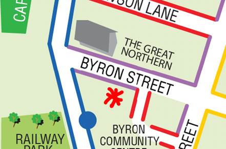
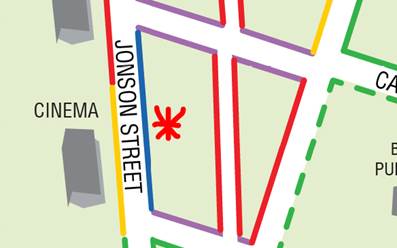
Council has received a Development Application (DA
10.2017.510.1) from Mr M Scott, on behalf of JGD Developments Pty Ltd for a
mixed use development comprising commercial premises, café, child care
centre, shop top housing and serviced apartments. The development is
located on the south-west corner of the Jonson Street/ Browning Street
intersection in Byron Bay.
OFFICER RECOMMENDATION
That the LTC review the proposed
changes to Ruskin Lane and potential Byron Bay Bypass conflicts and provided
comments for the consideration of the Planning Team.
BACKGROUND
Ruskin Lane
The site which is subject to
development application 10.2017.510.1 is located at the corner of Jonson and
Browning Streets, Byron Bay, adjacent to the proposed Byron Bypass
roundabout. Ruskin Lane, which is currently a sealed two-way lane, adjoins
the eastern boundary of the site.
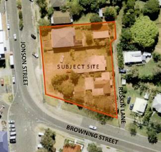
Fig.
1 - Proposed Site Pre Byron Bay Bypass Roundabout
The application proposes to
construct a mixed use development involving:
· Two shops and a café at ground level, fronting
Jonson Street;
· A child care centre at ground level fronting Browning
Street;
· 24 residential apartments in three levels above the shops
and café;
· 26 serviced apartments (tourist accommodation) in three
levels above the child care centre; and
· Two basement levels of car parking containing a total of
122 car parking spaces as well as bicycle and motorcycle parking, with access
off Ruskin Lane.
The Traffic Impact Study that accompanies the Development
Application (see Attachment 1) estimates total traffic generation to be
approximately 349.7 – 375.7 DVT’s and 86.54 – 89.04
PHT’s and proposes the following changes to Ruskin Lane:
· Widen Ruskin
Lane and Browning St intersection for approximately 35m from Browning Street
to cater for two-way traffic and MRV manoeuvring (see Fig. 2);
· MRV loading bay
off Ruskin Lane adjacent to basement ramp;
· The remainder of
Ruskin Lane (approximately 135m) is proposed to be converted to one-way with
entry only from Tennyson Street;
· Ruskin Lane to
be restricted to left in / out movements only;
· A convex mirror
installed at the Ruskin Lane / Browning St intersection to provide
pedestrians with improved sight lines.
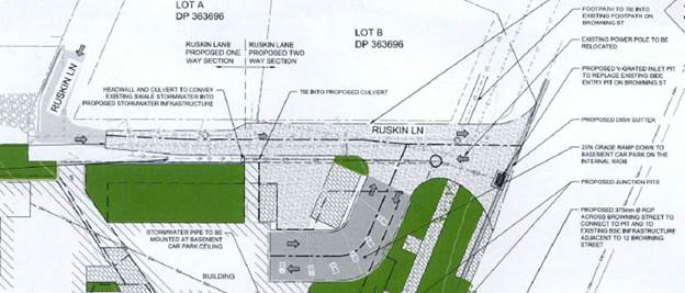
Fig. 2 - Works proposed at
Ruskin Lane / Browning St intersection
|
|
|
|
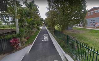
West from Tennyson
Intersection
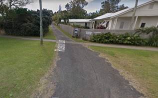
|
North
from Browning St Intersection
|
Fig 3 – Ruskin Lane
Bypass Roundabout
The development has absolute frontage onto the proposed
Bypass Roundabout at the intersection of Jonson St / Browning St.
Council is in the process of acquiring the SW portion of the subject site for
road widening for the roundabout. To compensate a strip of land will be
added to the subject property along Browning St (see Fig. 4).
The proposed development introduces challenges relating to
construction timing and sequencing. The first plan within Attachment 2
illustrates the current roundabout design that assumes the subject site
remains unchanged. The second plan illustrates the proposed ground
floor and landscape design. The third plan illustrates the extent of
road and drainage works proposed in the road reserve. Together these plans
illustrate driveway access to Lots 5 and 6 and footpath alignment are
redundant post construction of the development. The third plan
illustrates works across the width and length of Browning St.
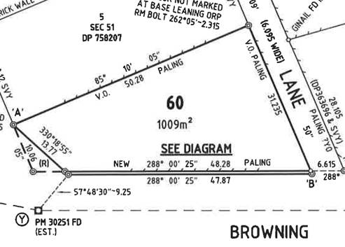
Fig 4. – Boundary changes
KEY ISSUES
Ruskin Lane
1. The
Council must refer all traffic related matters to the Local Traffic Committee
(LTC) prior to exercising its delegated functions for the Regulation of
Traffic.
Byron Bay Bypass
2. How
to manage the sequence of construction if:
(i) the
proposed DA is constructed first , or
(ii) the
Bypass Roundabout is constructed first.
3. How
the proposed development may impact the Bypass Roundabout design.
COUNCIL IMPLICATIONS
· Budget/Financial
Unknown
· Asset
Management
Council will need to maintain
signage for Ruskin Lane and maintain road and drainage assets within both
Ruskin Lane and Browning St.
· Policy
or Regulation
Delegated to council for
authorisation in conjunction with prescribed traffic control devices -
division 1 of Part 4 (Sections 50 to 55) of the Road Transport (Safety and
Traffic Management) Act, 1999.
· Consultation
The application has been
referred to the RMS for comment.
· Legal
and Risk Management
The development will result in
increased pedestrian and vehicular activity at the Ruskin Lane / Browning St
intersection and the Bypass Roundabout.
|