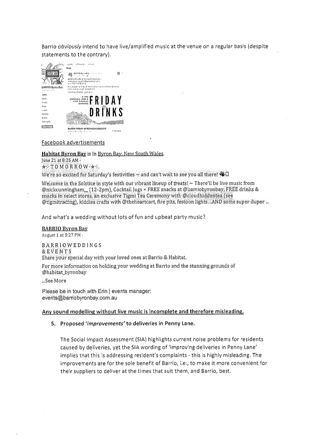
Ordinary (Planning) Meeting
Public ATTACHMENTS
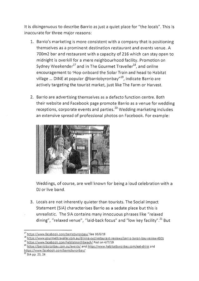
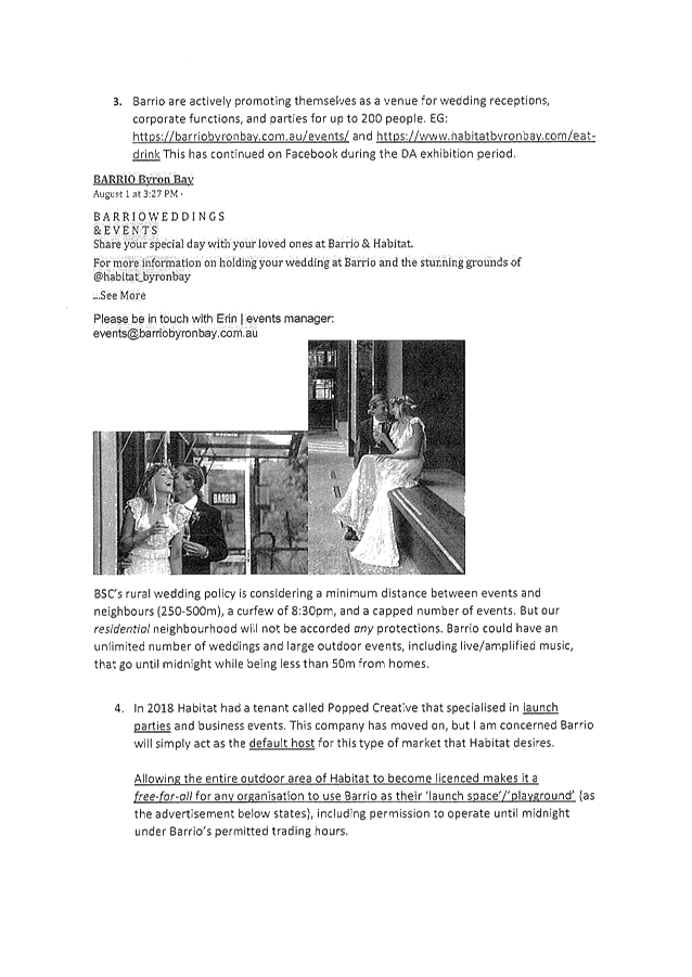
EXCLUDED FROM THE
Ordinary
(Planning) Meeting AGENDA
OF 17 October 2019
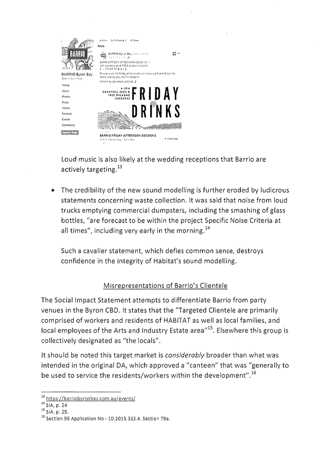
9. Notices of Motion and Rescission
9.1 Integrated
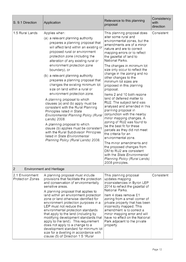
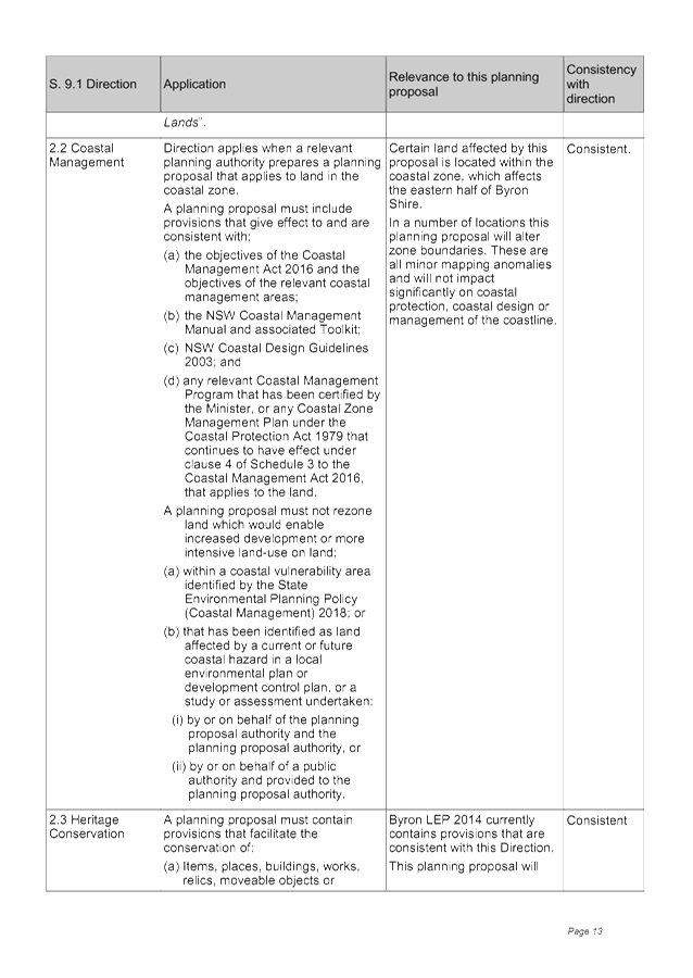
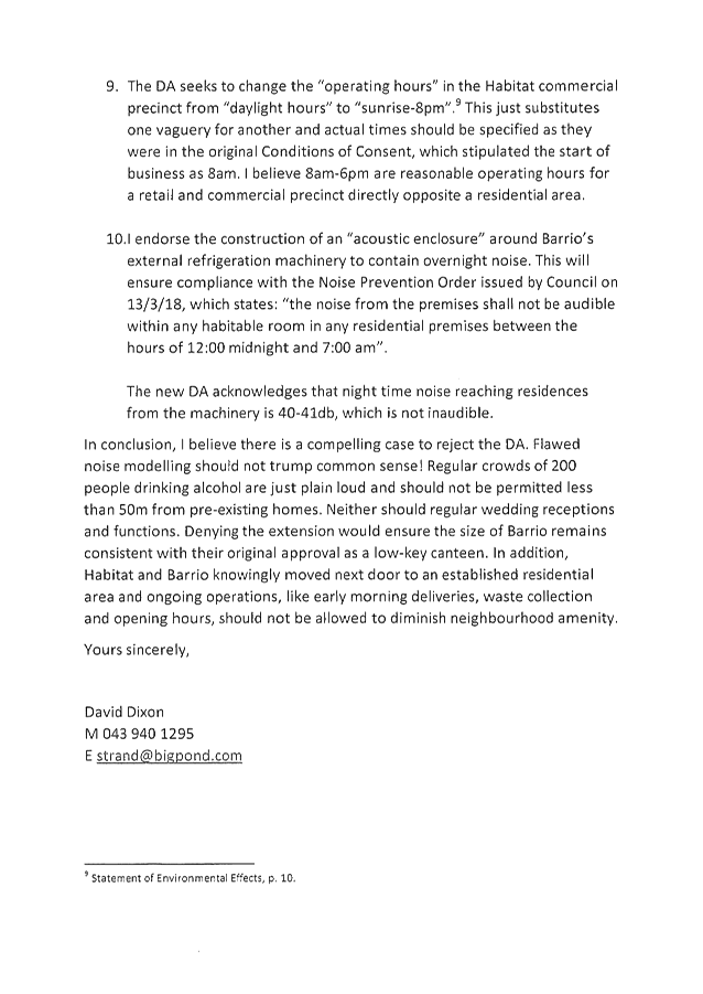
Pest Management Strategy 2019-2029
Attachment
1... Integrated Pest Management Strategy - IPMS - Roadside Vegetation
Management – Discussion Paper.................................................................................... 3
Attachment
2... Integrated Pest Management Strategy - IPMS - Notice of Motion May 2019 -
Small Steps.......................................................................................................... 6
Attachment
3... Presentation - Integrated Pest Management Strategy - IPMS - Small Steps 3 9
13. Staff Reports
Sustainable Environment and Economy
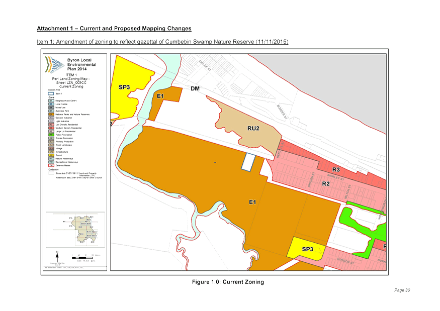
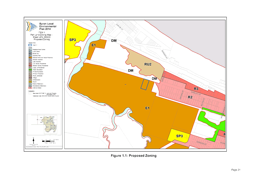
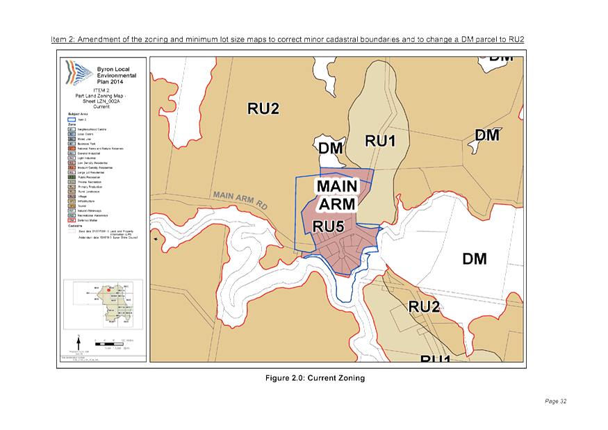
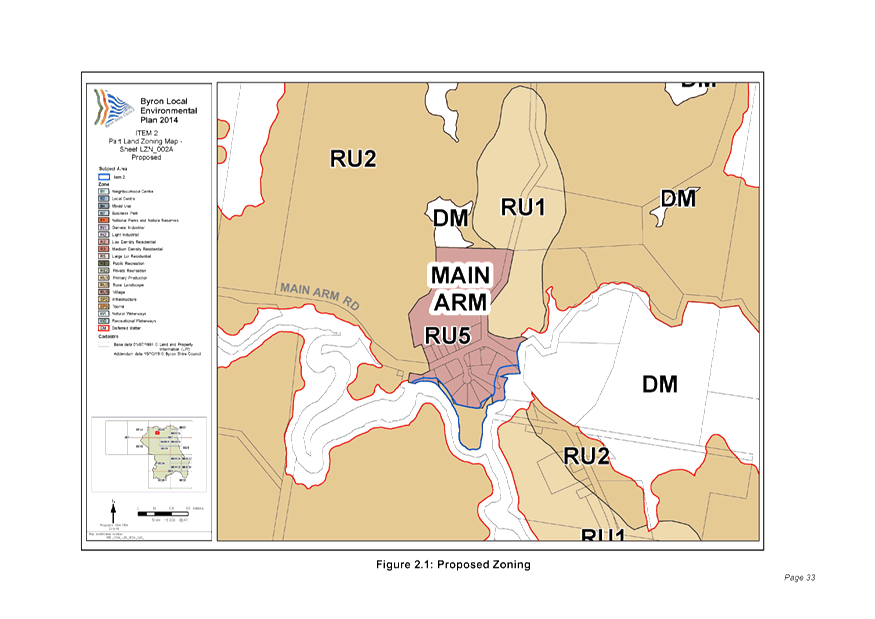
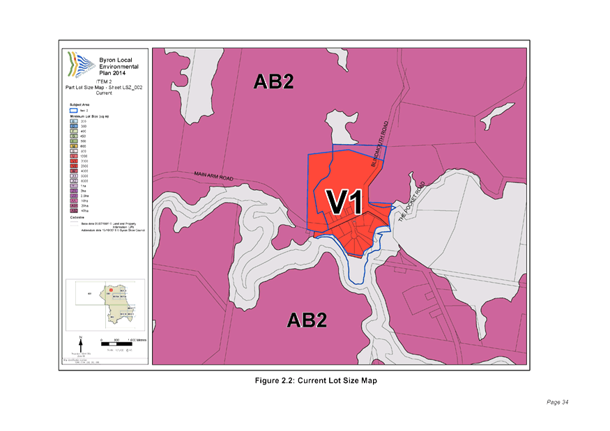
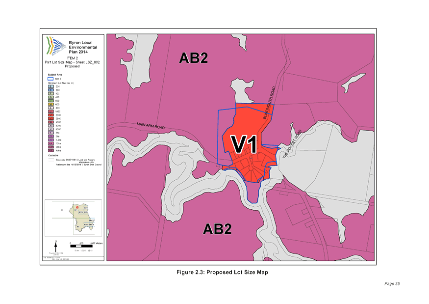
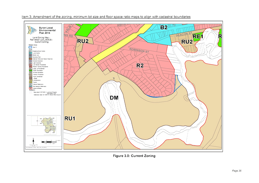
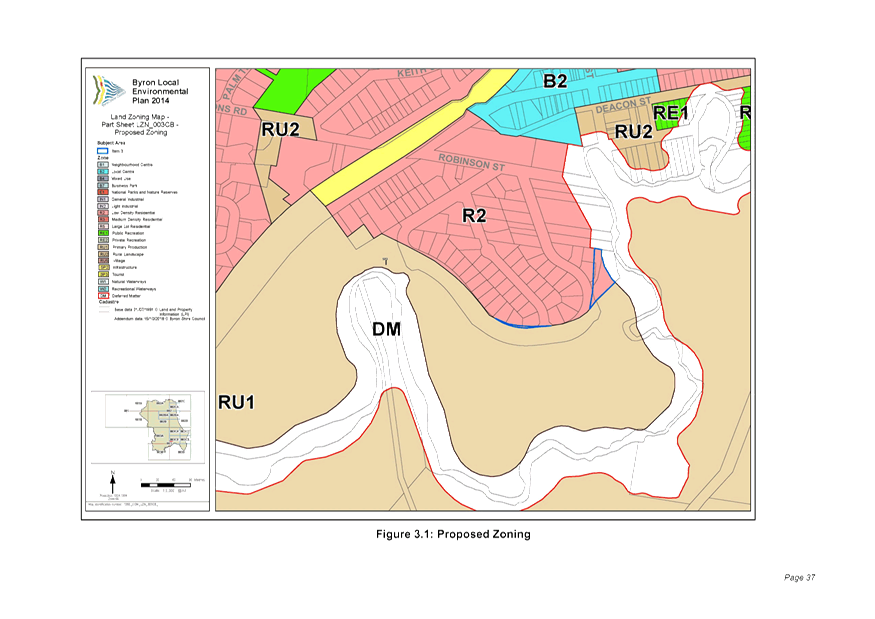
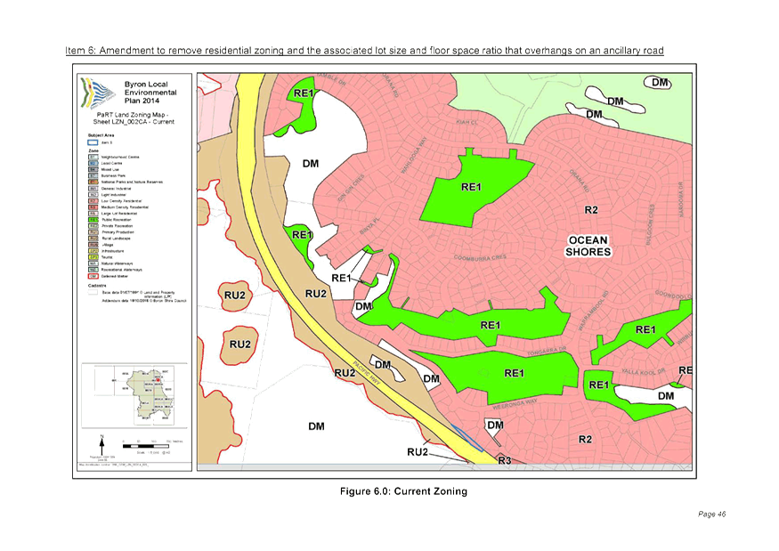
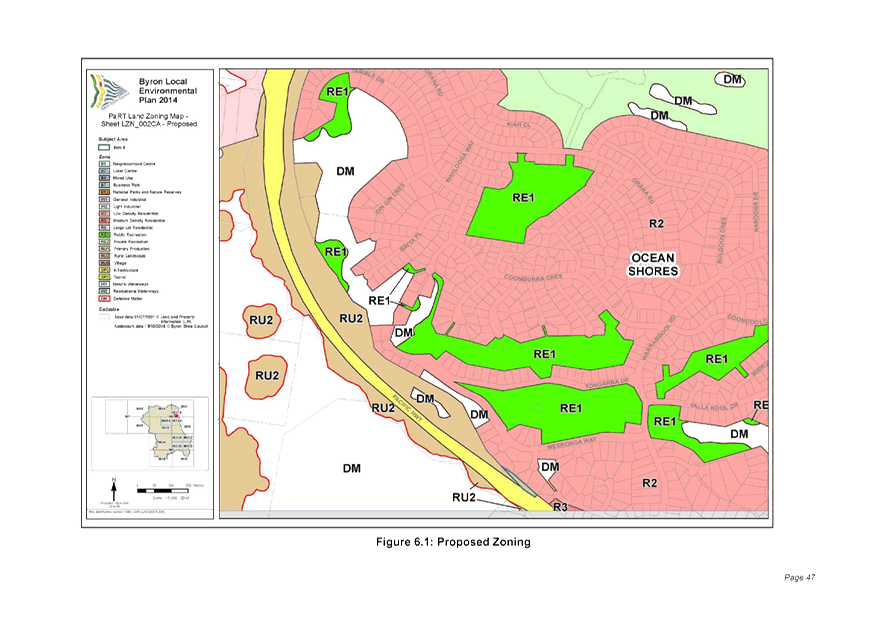
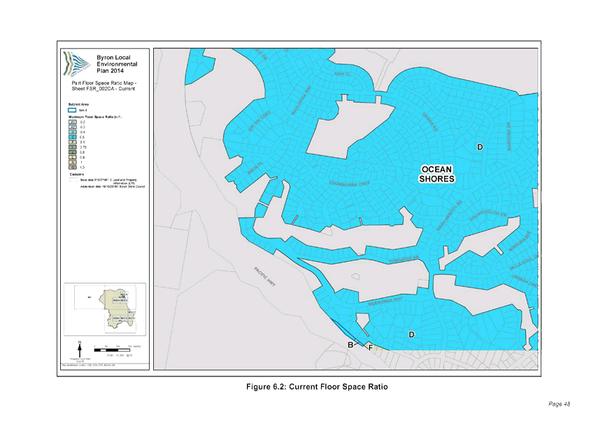
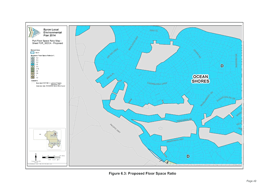
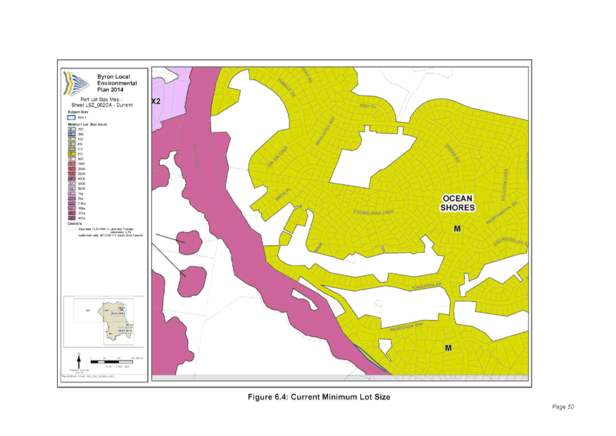
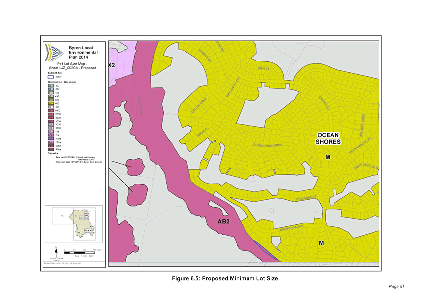
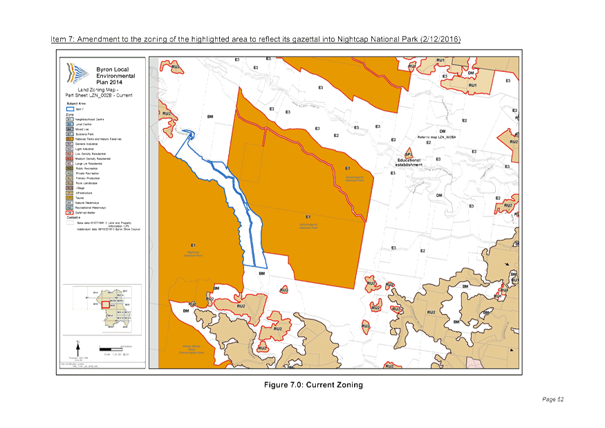
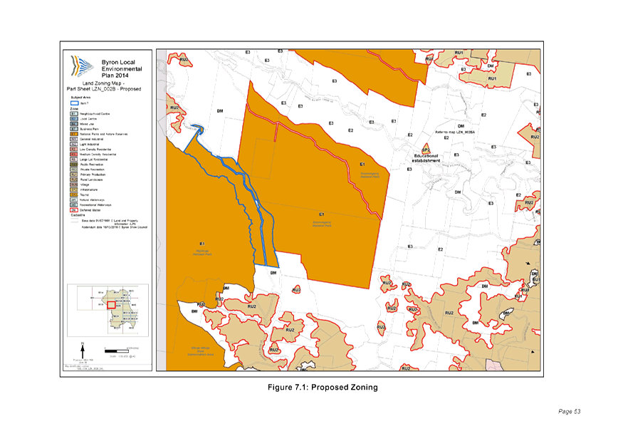
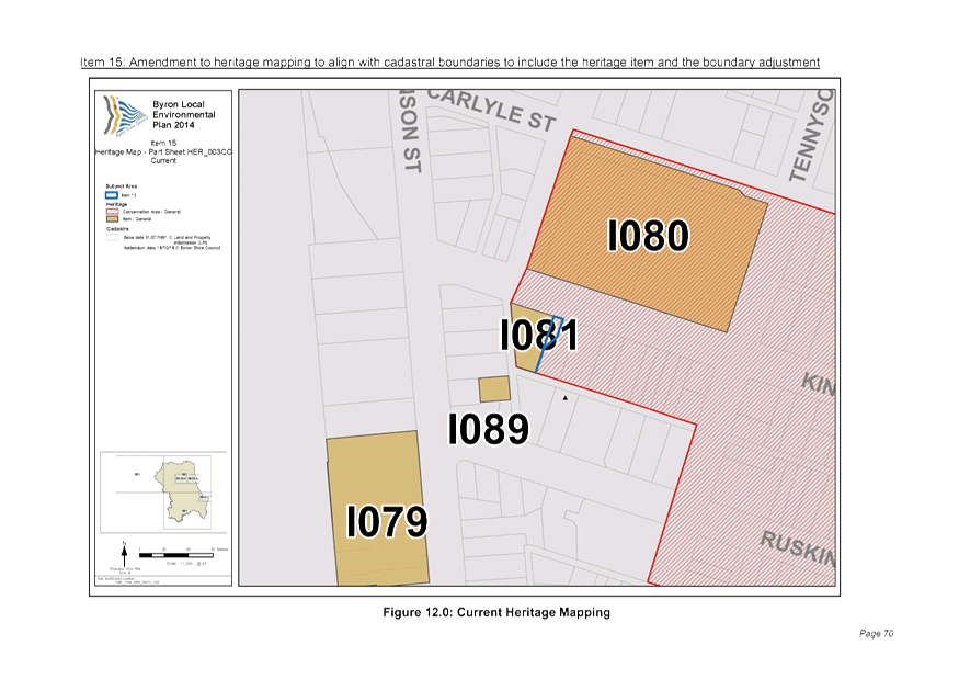
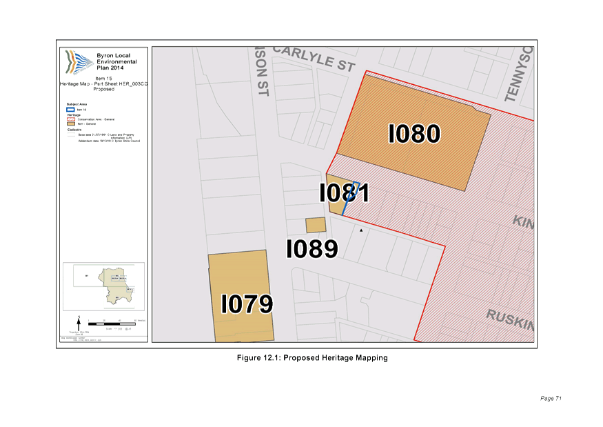
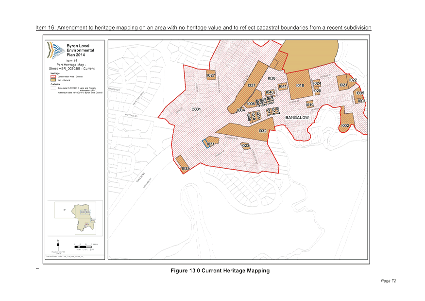
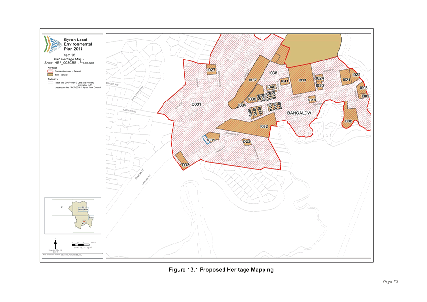
13.1 PLANNING - Minor
Local Environmental Plan Amendments Housekeeping Planning Proposal -
Submissions Report 26.2017.1.1
Attachment
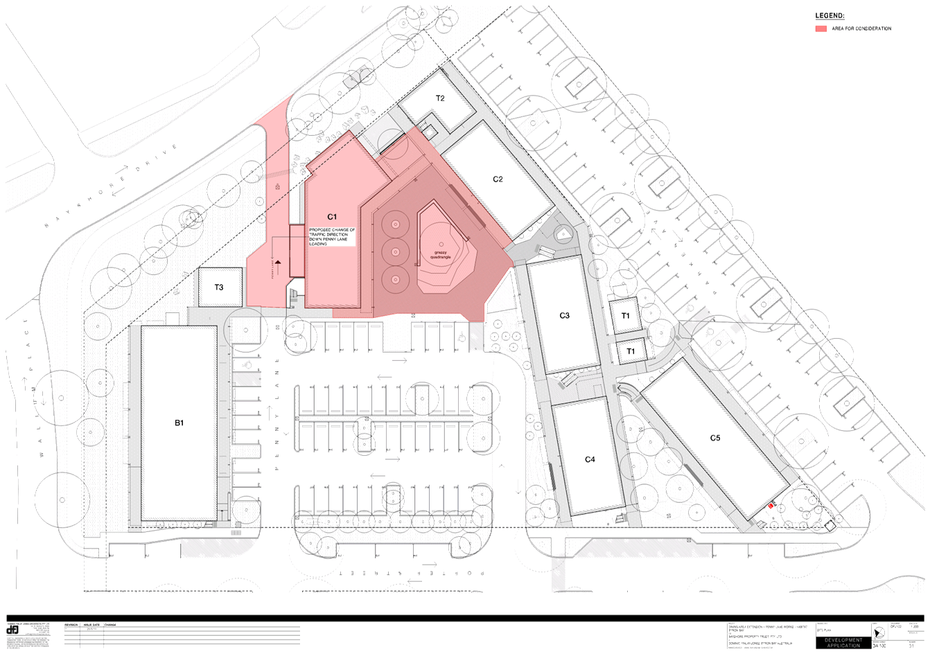
1... LEP Minor Housekeeping Planning Proposal - Exhibition Version 26.2017.1.1 15
Attachment
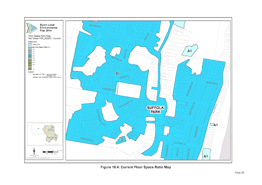
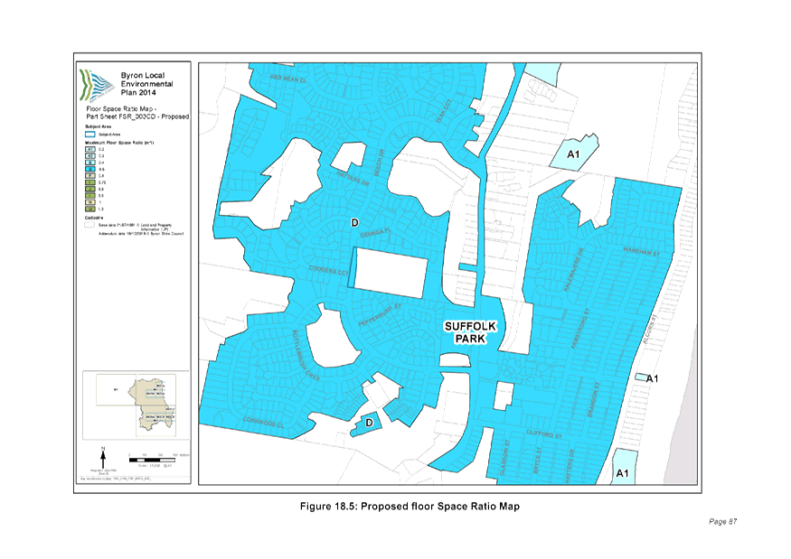
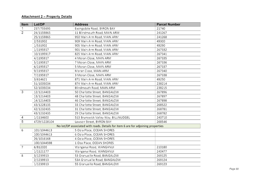
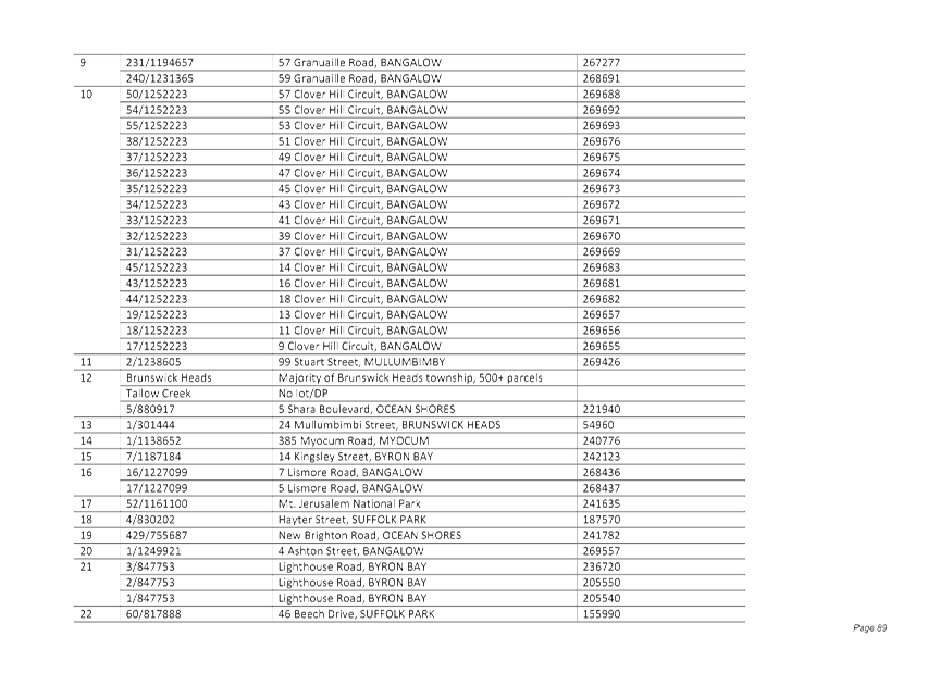
2... Table of property details affected by the planning proposal 26.2017.1.1 105
Attachment
3... Submission from OEH........................................................................... 107
Attachment
4... Submission from Rural Fire Services.................................................... 109
Attachment
5... Form of Special Disclosure of Pecuniary Interest................................. 110
13.2 PLANNING -
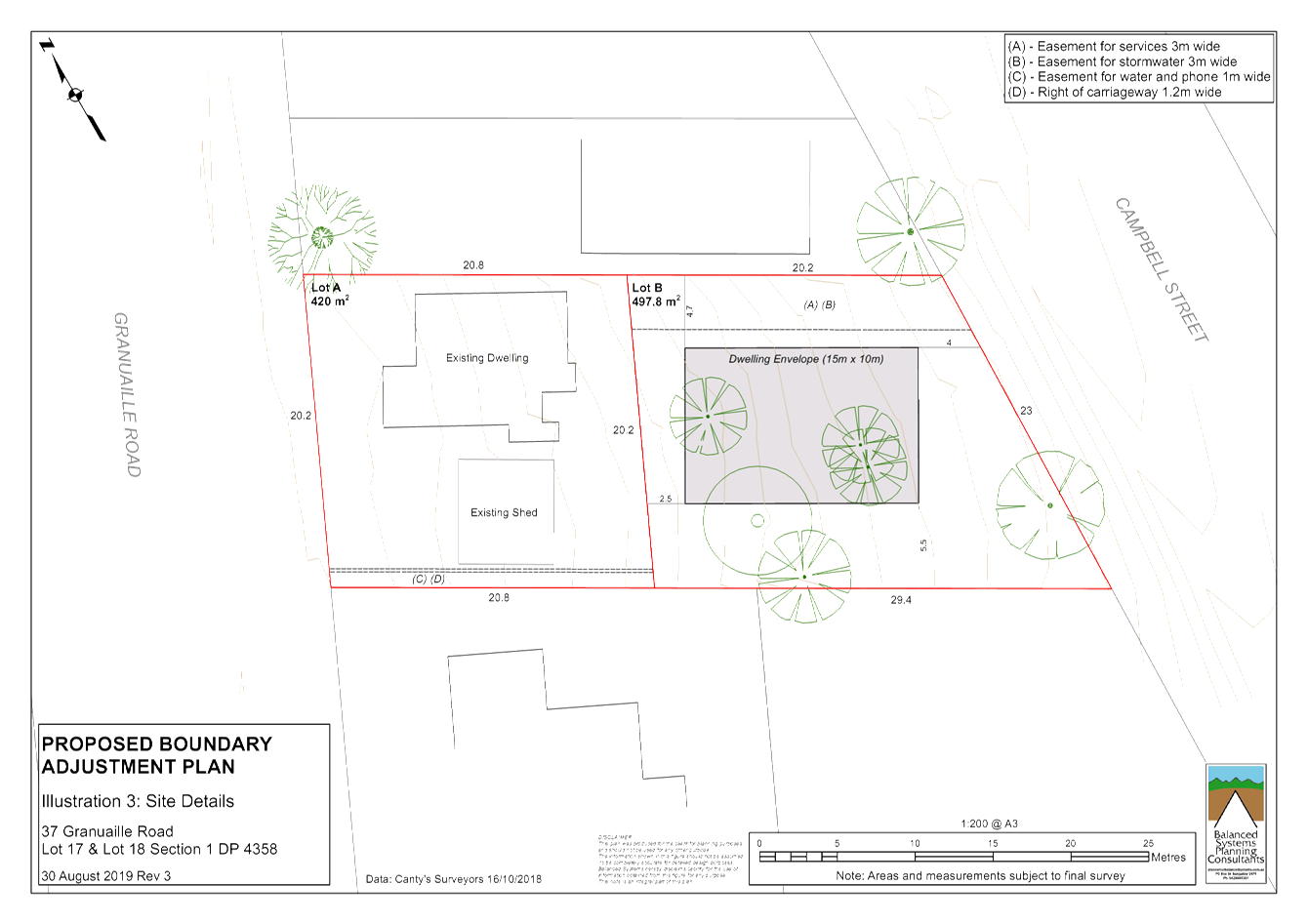
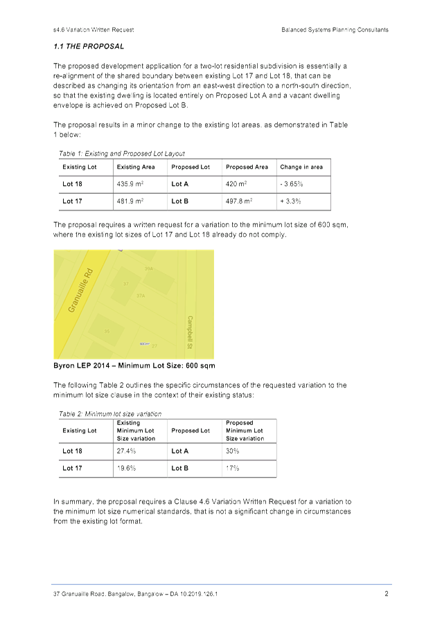
Development Application 10.2019.126.1 – Subdivision: Two (2) Lots at 37
Granuaille Road Bangalow
Attachment
1... Attachment A – Recommended conditions of consent DA10.2019.126.1 112
Attachment
2... Attachment B – Subdivision Plans DA10.2019.126.1........................... 123
Attachment
3... Attachment C – Clause 4.6 Variation Request DA10.2019.126.1......... 124
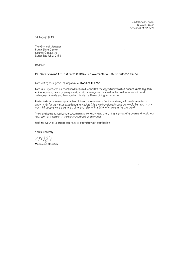
13.3 PLANNING -
Development Application 10.2019.375.1 Alterations and Additions to Existing
Commercial Development Including Expanded Outdoor Dining Area Associated with
Existing Restaurant 1 Porter Street Byron Bay (Habitat)
Attachment
1... Proposed Plans 10.2019.375.1.............................................................. 131
Attachment
2... Proposed condtions of consent 10.2019.375.1..................................... 135
Attachment
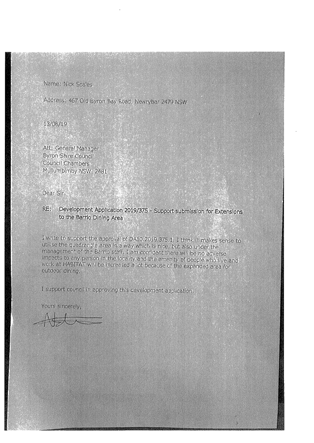
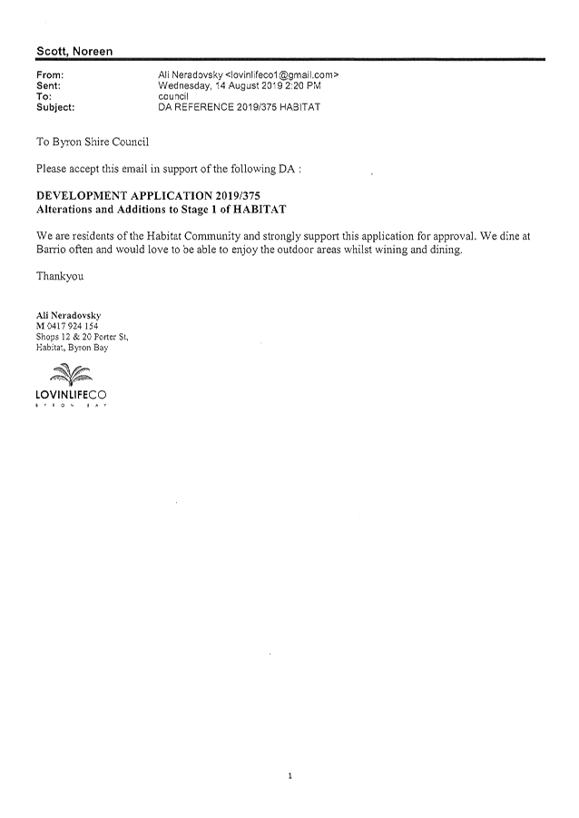
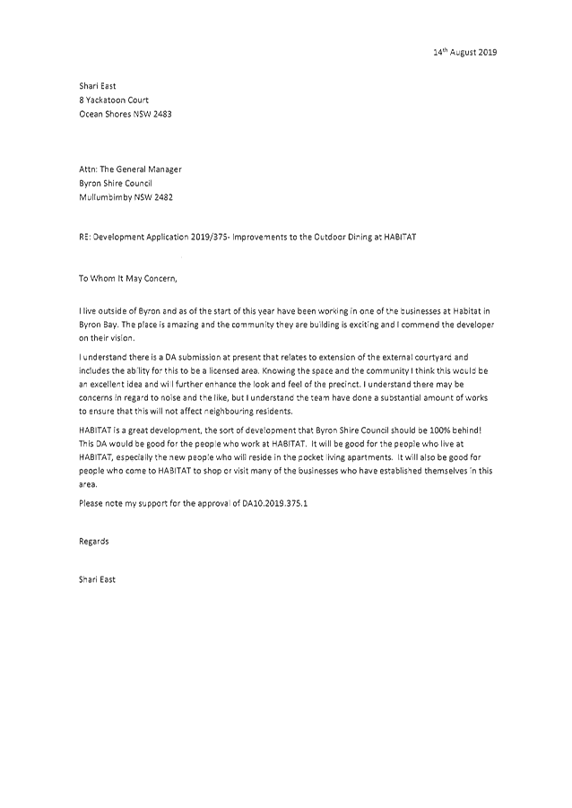
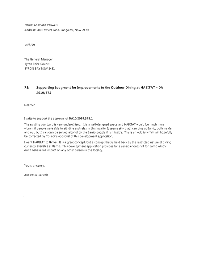
3... Submissions received 10.2019.375.1.................................................... 144
13.4 PLANNING S8.2
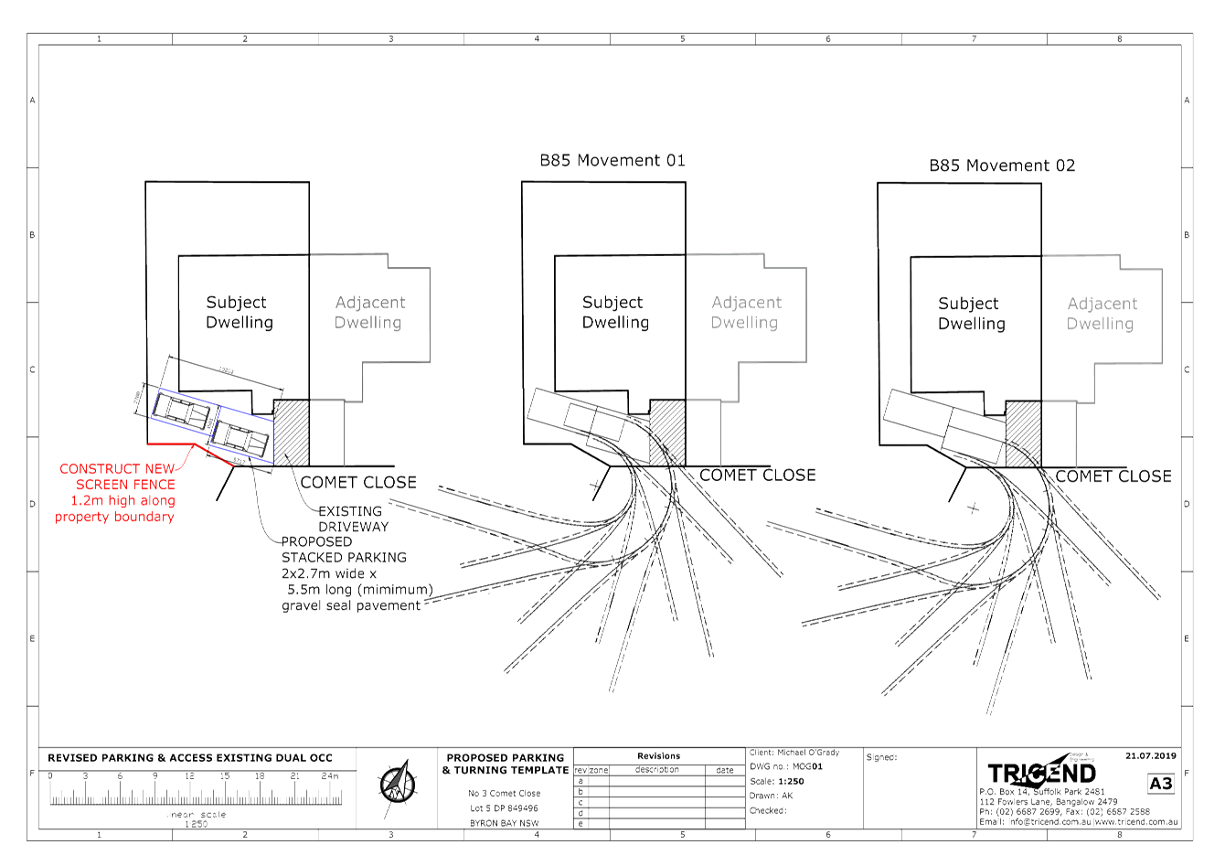
Review - Use of unauthorised additions to existing dual occupancy (conversion
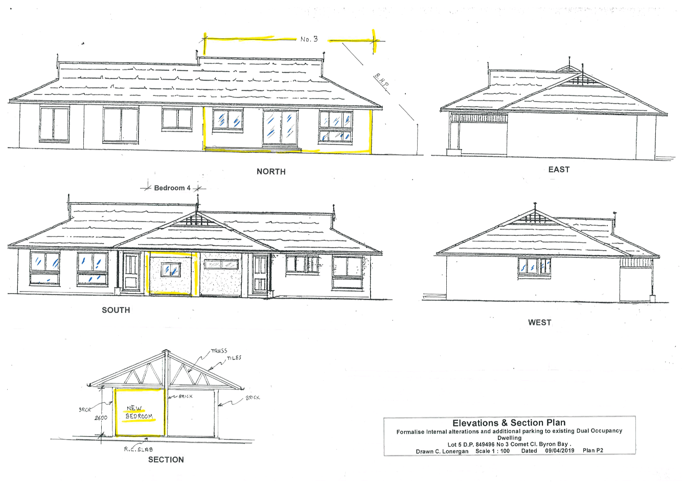
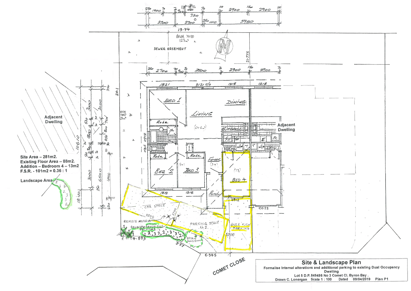
of garage to bedroom), car parking and tree removal at 3 Comet Close Byron Bay.
Attachment
1... Byron Bay Planning & Property Consultants - 10.2019.220.1 - PR200950 -
Revised parking Plan........................................................................................... 183
Attachment
2... Byron Bay Planning & Property Consultants - 10.2019.220.1 -
Development Assessment Report................................................................................ 184
Attachment
3... Original DA Plans prepared by Byron Bay Planning & Property
Consultants - 10.2019.220.1........................................................................................ 191
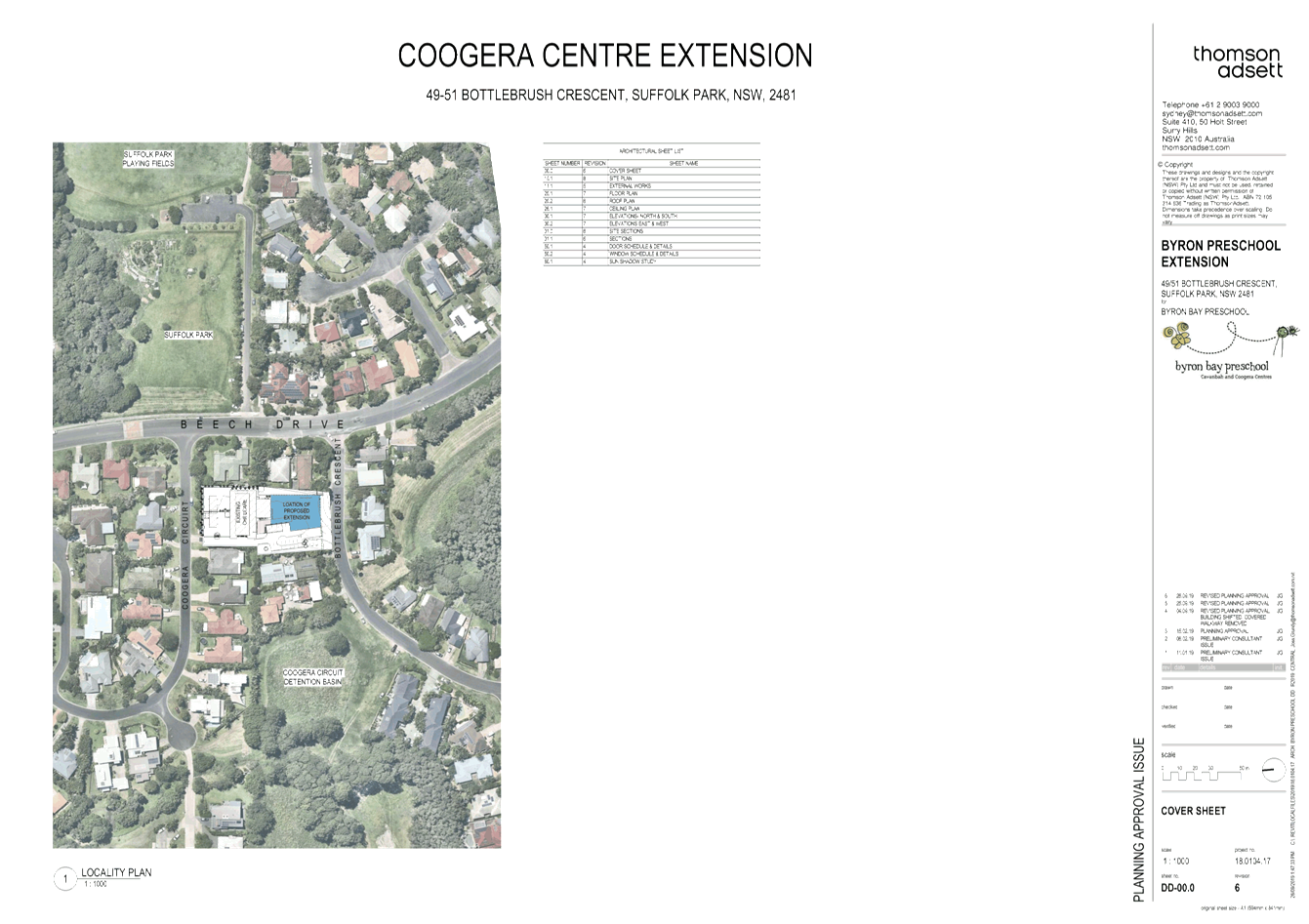
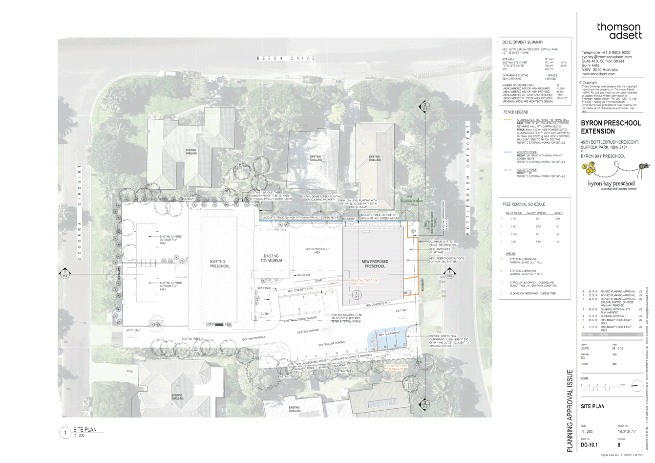
13.5 PLANNING -
Development Application 10.2019.146.1 Alterations and Additions to existing
Child Care Centre including increase in enrolment numbers to Fifty (50)
Children and Tree Removal at 49 Bottlebrush Crescent Suffolk Park
Attachment
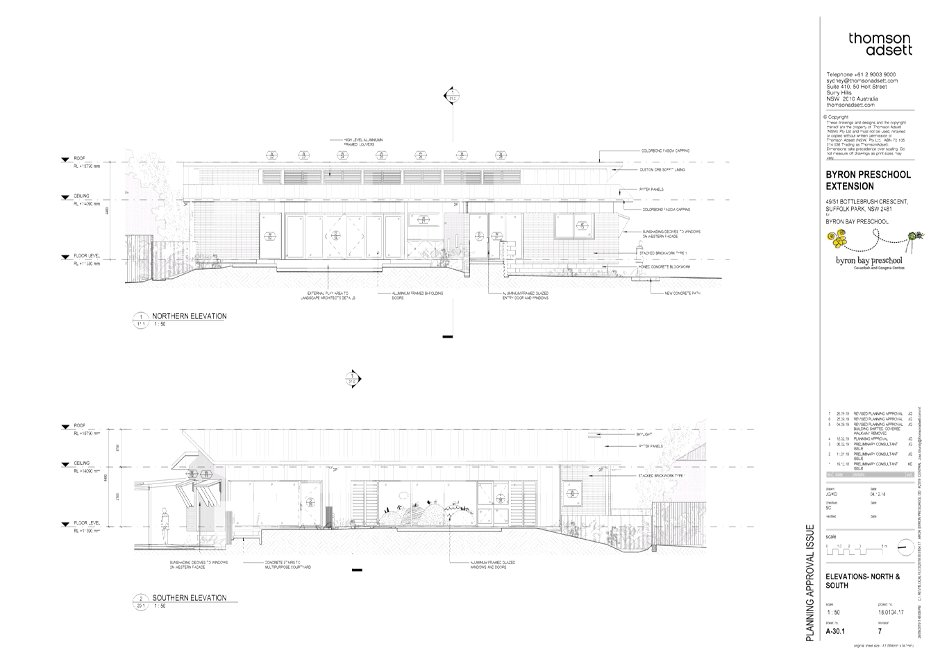
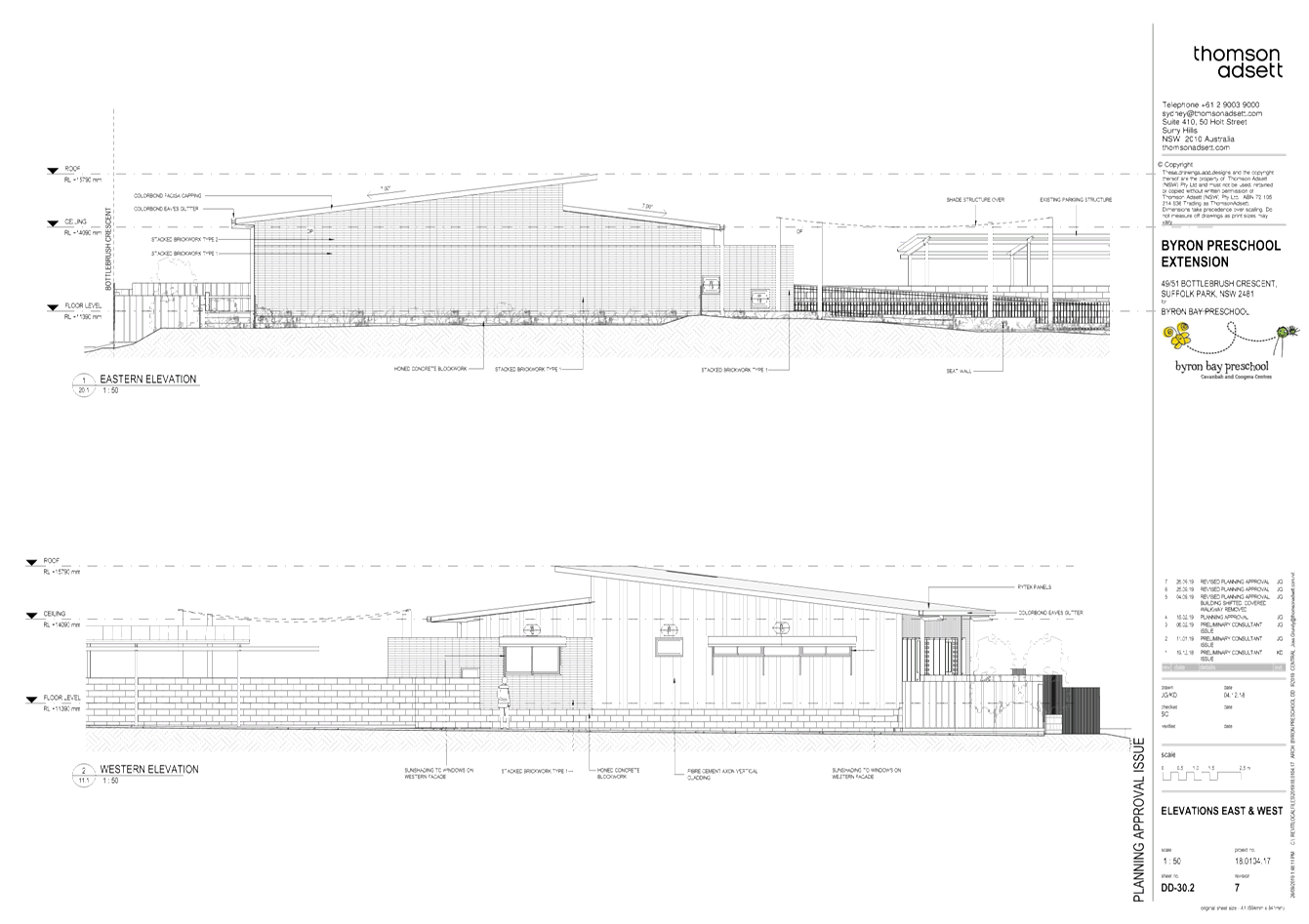
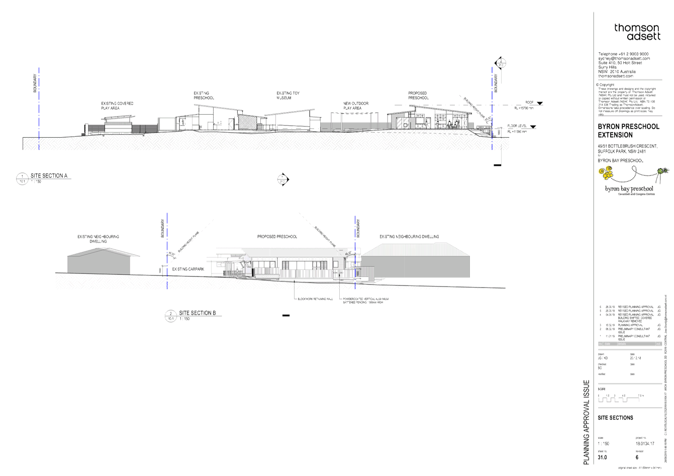
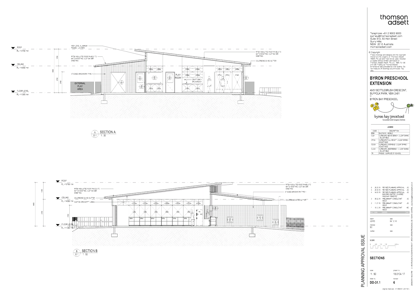
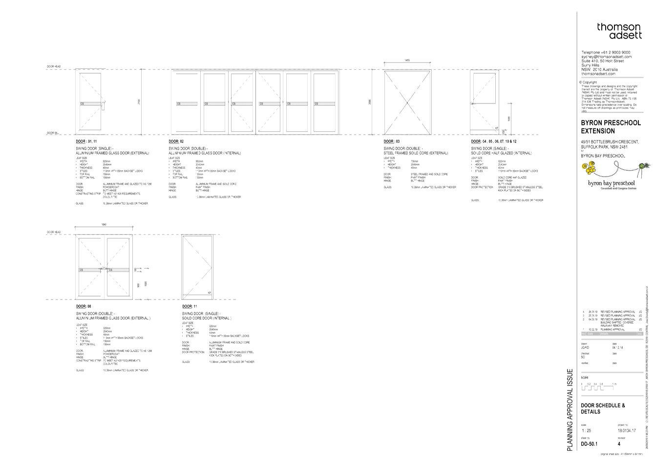
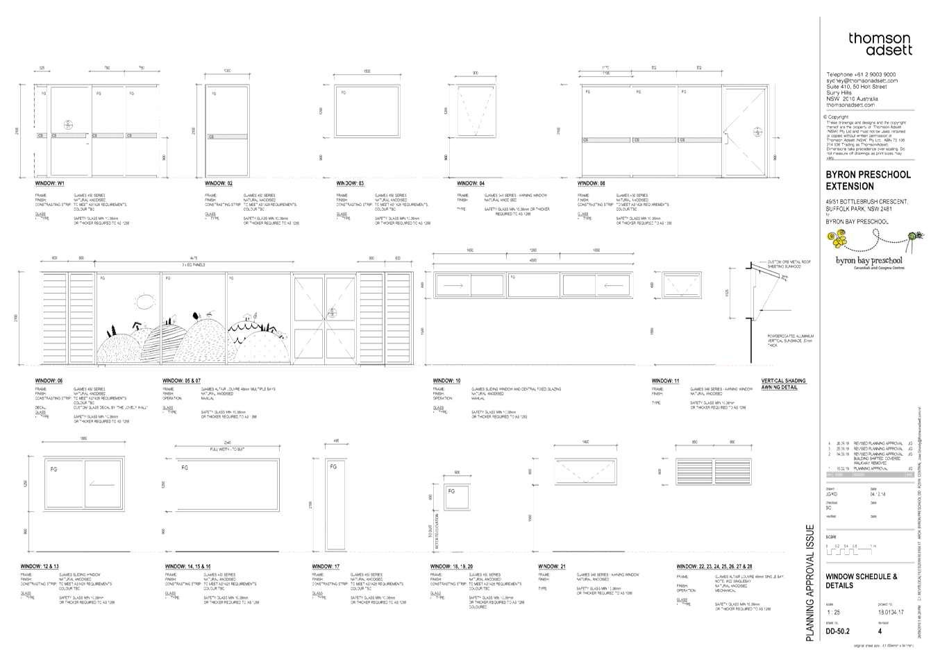
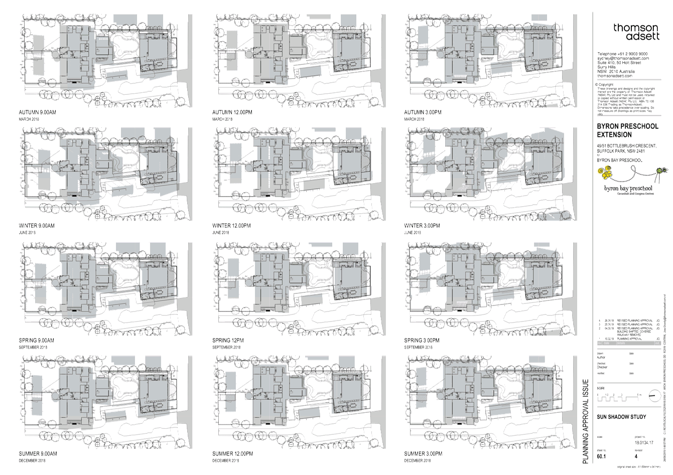
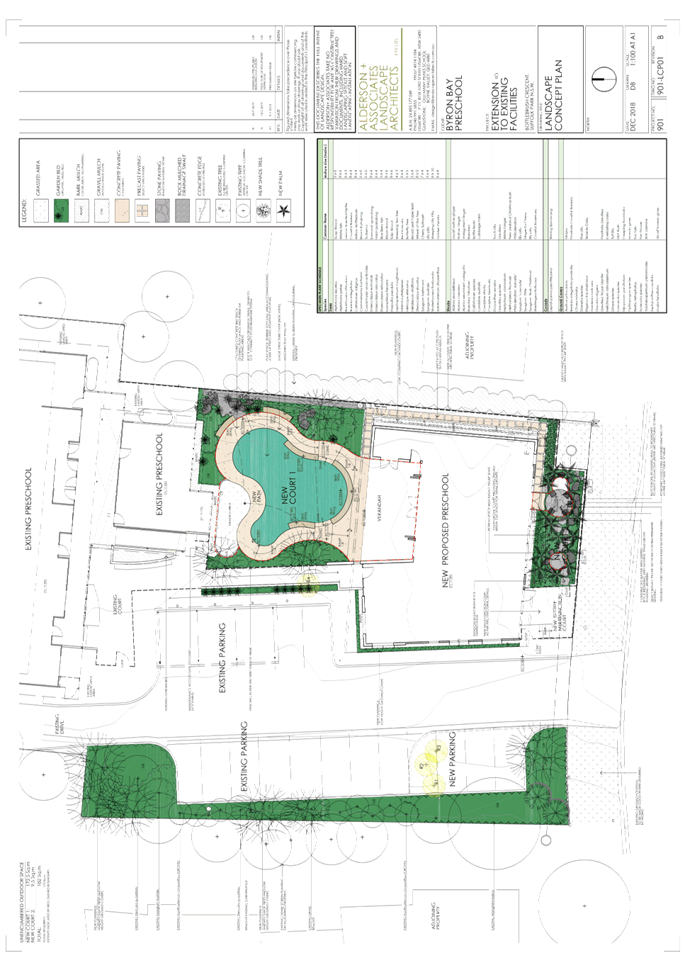
1... 10.2019.146.1 - Revised Plans prepared by Thomson Adsett.............. 195
Attachment
2... 10.2019.146.1 - Recommended conditions of consent......................... 211
Attachment
3... 10.2019.146.1 - Submissions received.................................................. 223
13.6 PLANNING -
Development Application 10.2019.60.1 New Subdivision - Boundary Adjustment to
create Two (2) Lots at 148 Woodford Lane Ewingsdale
Attachment
1... Proposed boundary adjustment Plan prepared by NDC dated 23 July 2019 234
Attachment
2... Recommended conditions of consent on DA 10.2019.60.1.................. 235
Attachment
3... Submissions on DA 10.2019.60.1.......................................................... 241
13.7 PLANNING - Development
Application 10.2019.158.1 Agricultural Produce Industry including Use of
Existing Wind Turbine and Ancillary Rural Infrastructure and Roadside Stall at
219 The Saddle Road Brunswick Heads
Attachment
1... 10.2019.158.1 - Proposed Plans............................................................ 245
Attachment
2... 10.2019.158.1 - Proposed conditions of consent................................. 267
Attachment
3... 10.2019.158.1 - Submissions received 219 The Saddle Road Brunswick Heads 280
13.8 PLANNING -
Development Application 10.2019.468.1 Alterations and Additions to Existing
Dwelling House at 860 The Pocket Road The Pocket
Attachment
1... Proposed floor plans and elevations...................................................... 301
Attachment
2... Site plan................................................................................................. 302
Attachment
3... Recommended conditions of approval.................................................. 303
13.9 Biodiversity Conservation
Strategy Vision and Aims
Attachment
1... Report 17/06/2019 Biodiversity Advisory Committee Update on the review of
the Biodiversity Conservation Strategy....................................................... 310
Attachment
2... Report 11/02/2019 Biodiversity Advisory Committee Biodiversity
Conservation Strategy Consultation............................................................................. 316
Infrastructure Services
13.10 Amendment 4 of Byron
Developer Contributions Plan Removal of Waiver for Secondary Dwellings
Attachment
1... Submissions Received - Contributions Plan.......................................... 319
Attachment
2... Developer Contributions Plan 2012 Amendment 4............................... 324
Notices of Motion 9.1 - Attachment 1
Notices of Motion 9.1 - Attachment 2


Notices of Motion 9.1 - Attachment 3

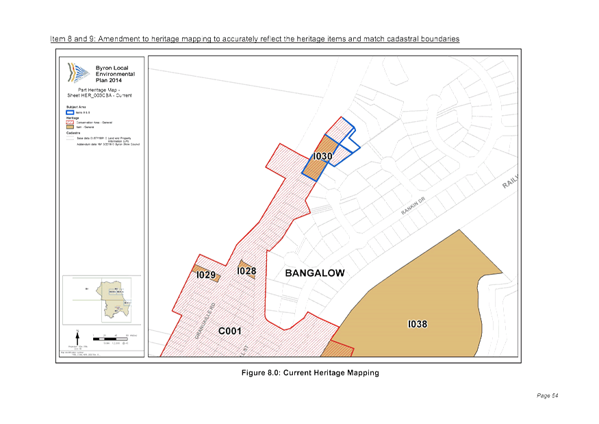
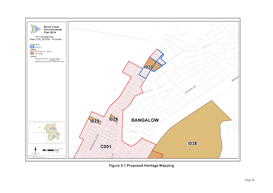
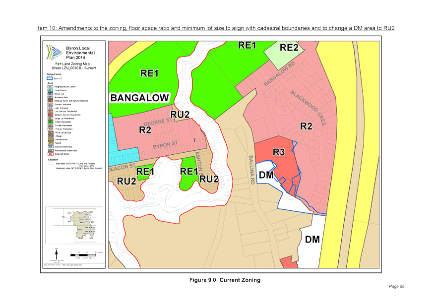
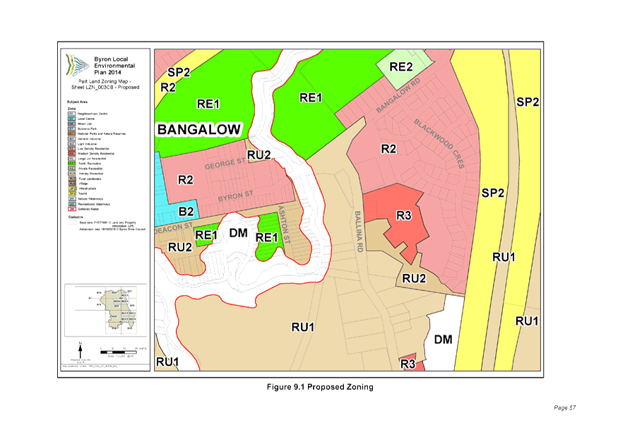
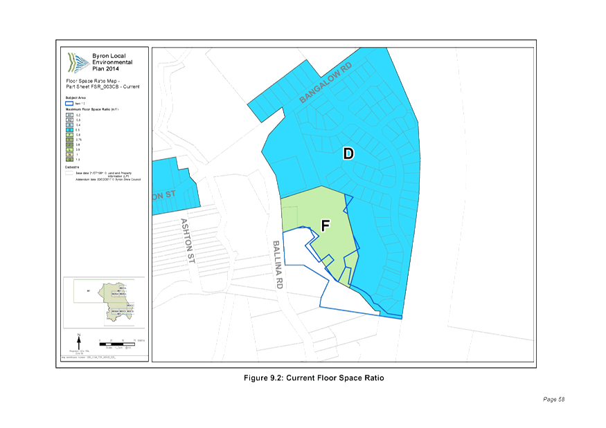
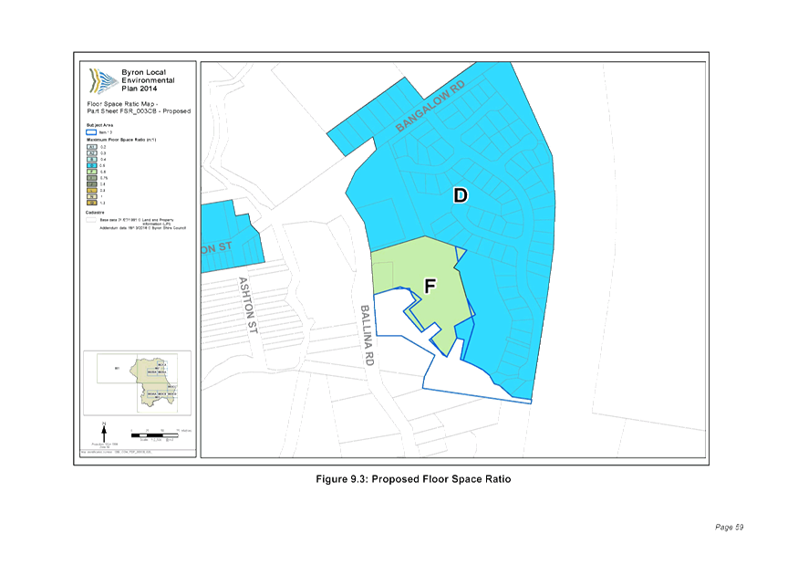
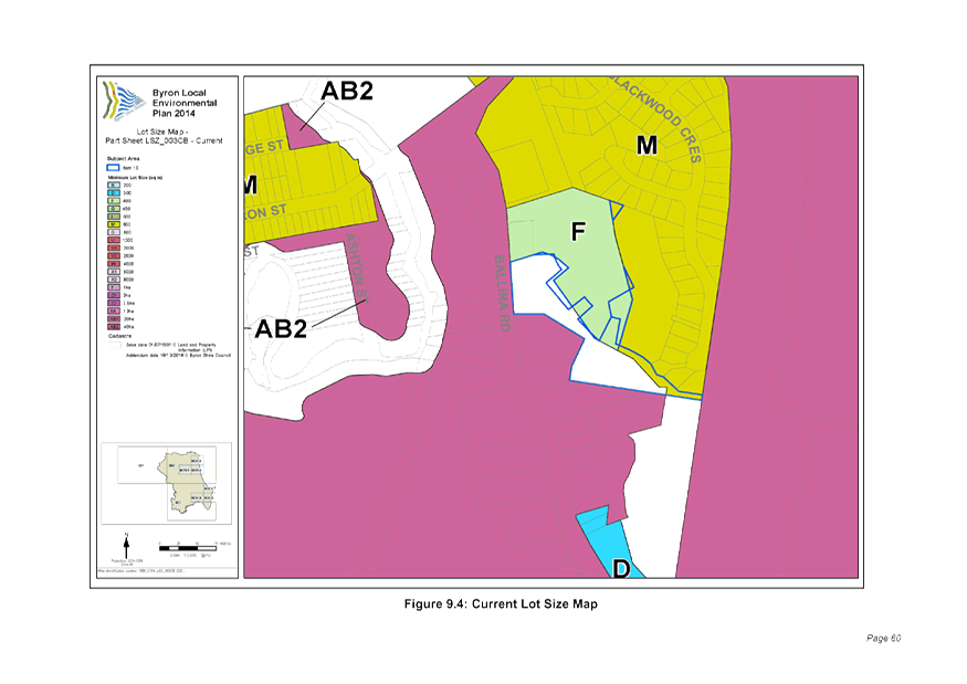
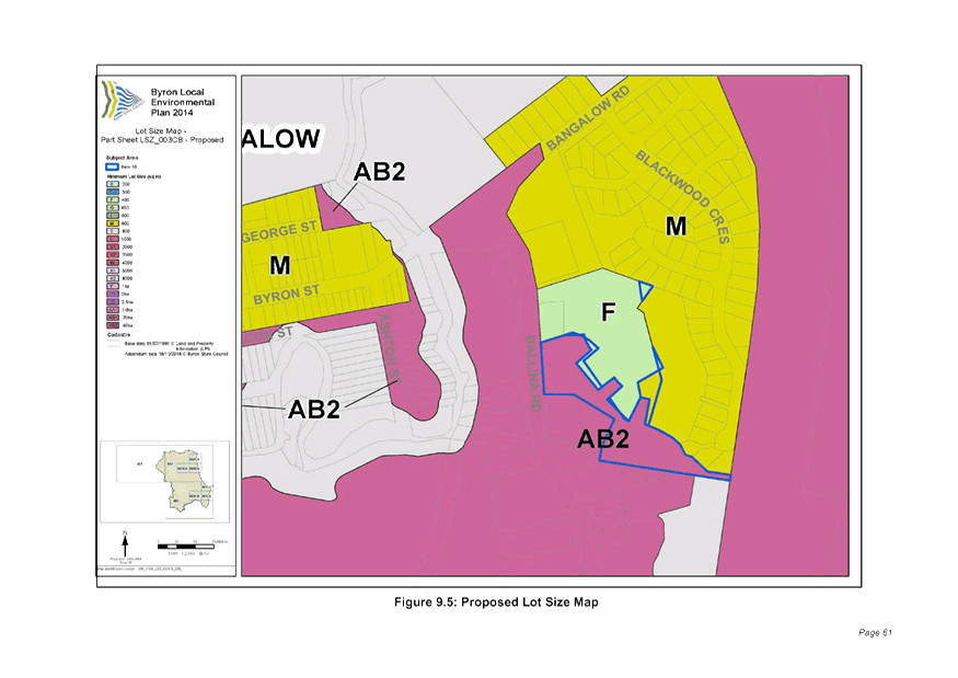
Staff Reports - Sustainable Environment and Economy 13.1 - Attachment 1


Staff Reports - Sustainable Environment and Economy 13.1 - Attachment 2
Staff Reports - Sustainable Environment and Economy 13.1 - Attachment 3

Staff Reports - Sustainable Environment and Economy 13.1 - Attachment 4
Staff Reports - Sustainable Environment and Economy 13.1 - Attachment 5
Schedule 3 Form
of special disclosure of pecuniary interest
submitted under Clause 4.25 of the Code of Conduct for Councillors
1. This
form must be completed using block letters or typed.
2. If
there is insufficient space for all the information you are required to
disclose, you must attach an appendix which is to be properly identified and
signed by you.
Important information
This information is being
collected for the purpose of making a special disclosure of pecuniary interests
under clause 4.24(c) of the Byron Shire Council Code of Conduct for Councillors
(the Code of Conduct).
The special disclosure must
relate only to a pecuniary interest that a councillor has in the
councillor’s principal place of residence, or an interest another person
(whose interests are relevant under clause 4.3 of the Code of Conduct) has in
that person’s principal place of residence.
Clause 4.3 of the Code of
Conduct states that you will have a pecuniary interest in a matter because of
the pecuniary interest of your spouse or your de facto partner or your relative
or because your business partner or employer has a pecuniary interest. You will
also have a pecuniary interest in a matter because you, your nominee, your
business partner or your employer is a member of a company or other body that
has a pecuniary interest in the matter.
“Relative” is
defined by clause 4.4 of the Code of Conduct as meaning your, your
spouse’s or your de facto partner’s parent, grandparent, brother,
sister, uncle, aunt, nephew, niece, lineal descendant or adopted child and the
spouse or de facto partner of any of those persons.
You must not make a special disclosure
that you know or ought reasonably to know is false or misleading in a material
particular. Complaints about
breaches of these requirements are to be referred to the Office of Local
Government and may result in disciplinary action by the Chief Executive of the
Office of Local Government or the NSW Civil and Administrative Tribunal.
This form must be completed by
you before the commencement of the council or council committee meeting at
which the special disclosure is being made. The completed form must be tabled
at the meeting. Everyone is entitled to inspect it. The special disclosure must
be recorded in the minutes of the meeting.
Special
disclosure of pecuniary interests
by ____________________________________________________________________________________
[full
name of councillor]
in the matter of
__________________________________________________________________________
[insert
name of environmental planning instrument]
which is to be considered at a meeting of the
______________________________________________________________________________________
[name of council or council committee (as the case
requires)]
Report No. __________ to be held on the _________________ day of
________________________ 201
|
Pecuniary
interest
|
|
Address
of the affected principal place of residence of the councillor or an
associated person, company or body (the identified land)
|
|
|
Relationship of identified land to the councillor
[Tick or cross one box.]
|
The Councillor has interest in the land (e.g.
is owner or has another interest arising out of a mortgage, lease, trust,
option or contract, or otherwise).
An associated person of the councillor has an
interest in the land.
An associated
company or body of the councillor has an interest in the land.
|
|
Matter giving rise to pecuniary interest[1]
|
|
Nature of the
land that is subject to a change in zone/planning control by the proposed LEP
(the subject land)[2]
[Tick or cross one box]
|
The identified land.
Land that adjoins
or is adjacent to or is in proximity to the identified land.
|
|
Current
zone/planning control
[Insert name of current planning instrument and identify relevant
zone/planning control applying to the subject land]
|
|
|
Proposed
change of zone/planning control
[Insert name of proposed LEP and identify proposed change of zone/planning
control applying to the subject land]
|
|
|
Effect
of proposed change of zone/planning control on councillor or associated
person
[Insert one of the following: “Appreciable financial gain” or
“Appreciable financial loss”]
|
|
[If
more than one pecuniary interest is to be declared, reprint the above box and
fill in for each additional interest.]
_____________________________
Councillor’s
signature
_____________________________
Date
[This form is to be retained by
the council’s general manager and included in full in the minutes of the
meeting]
Staff Reports - Sustainable Environment and Economy 13.2 - Attachment 1


Staff Reports - Sustainable Environment and Economy 13.2 - Attachment 2
Staff Reports - Sustainable Environment and Economy 13.2 - Attachment 3


Staff Reports - Sustainable Environment and Economy 13.3 - Attachment 1
Staff Reports - Sustainable Environment and Economy 13.3 - Attachment 2
|
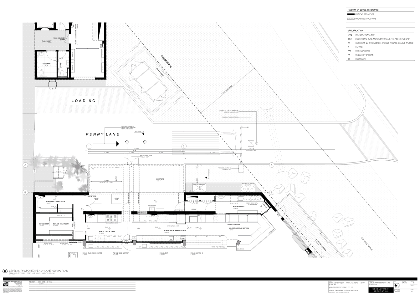
10.2019.375.1
SCHEDULE 1 CONDITIONS OF
CONSENT
|
|
Parameters of consent
|
|
1.
|
Development is to be in accordance with approved plans
The development is to be in accordance with plans listed
below:
|
Plan No.
|
Description
|
Prepared by
|
Dated:
|
|
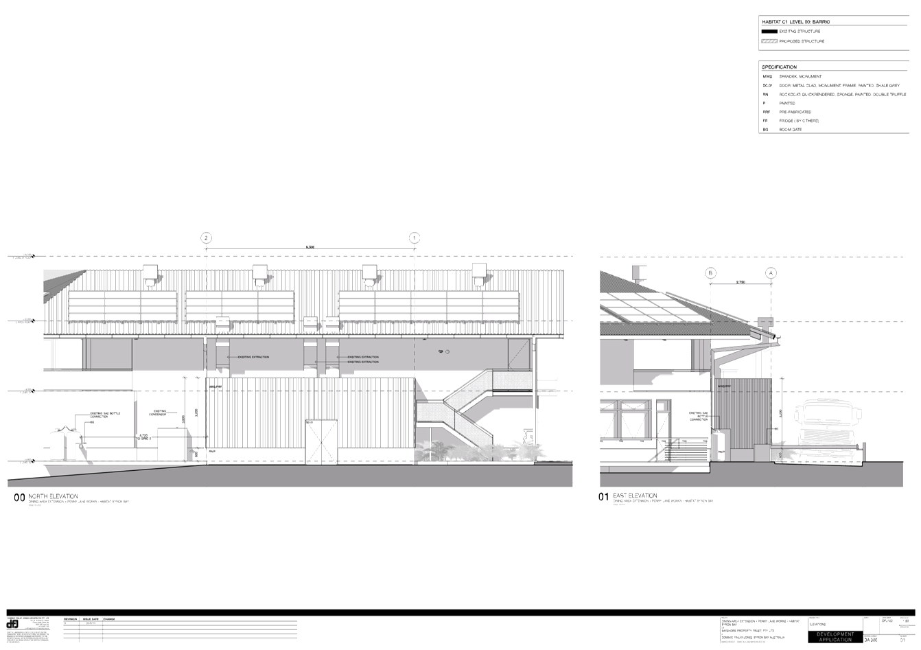
DA100
Rev 01
|
Site Plan
|
Dominic Finlay-Jones
|
26/06/19
|
|
DA220
Rev 01
|
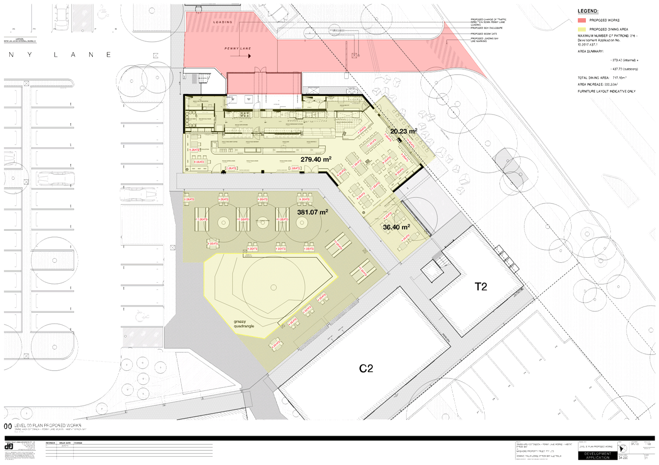
Plan Proposed Woks
|
Dominic Finlay-Jones
|
26/06/19
|
|
DA222
Rev 01
|
Proposed Penny Lane Works Plan
|
Dominic Finlay-Jones
|
26/06/19
|
|
DA300
Rev 01
|
Elevations
|
Dominic Finlay-Jones
|
26/06/19
|
|
|
|
|
|
The development is also to be in accordance with any
changes shown in red ink on the approved plans or conditions of consent.
The approved plans and related documents endorsed with the
Council stamp and authorised signature must be kept on site at all times
while work is being undertaken.
|
|
2.
|
Operational Noise Management
The development must be operated in accordance with the
recommendations contained Noise Impact Assessment Ref: 26/2019_ext
dining prepared by Tim Fitzroy & Associates dated 4 July 2019.
The operator shall ensure that:
· Eastern
facing windows and doors are to remain closed from 6pm until closing;
· The
breezeway noise barrier is to remain closed from 6pm until closing;
· Southern
door is to remain closed from 6pm until closing;
· Exhaust
fans in mechanical ventilation should be generally operated at medium speed;
· Condensers
Louvers are to remain in place as per recommendations in Environmental
Nosie Impact Assessment of Mechanical Plant, Habitat Development, 2 Porter
Street Byron Bay (5 February 2018).
|
|
The following conditions are to be complied with prior
to issue of a Construction Certificate for building works
|
|
3.
|
Revised Noise Management Plan required
Recommended operational measures contained in Noise
Impact Assessment Ref: 26/2019_ext dining prepared by Tim Fitzroy &
Associates dated 4 July 2019 must be incorporated in a revised Noise
Management Plan. The NMP shall detail the methods that will be
implemented for the whole project to minimise operational noise. Information
should include:
a) Identification
of nearby residences and other sensitive land uses;
b) Assessment
of expected noise impacts;
c) Detailed
examination of feasible and reasonable work practices that will be
implemented to minimise noise impacts;
d) Clear
and defined acceptable rules of behaviour of patrons;
e) Adherence
to responsible service of alcohol regulations;
f) Strategies
to promptly deal with and address noise complaints;
g) Details
of performance evaluating procedures (for example, noise monitoring or
checking work practices and equipment);
h) Procedures
for notifying residents of forthcoming worlds that are likely to produce
noise impacts, and
i) Reference
to relevant consent conditions.
The NMP must be prepared by a suitably qualified acoustic
engineer or equivalent professional and submitted for approved as part of the
application for a Construction Certificate.
|
|
4.
|
Details
of acoustic barrier to be submitted for approval
The application for a Construction Certificate must
include plans and specifications for noise barrier for attenuation of
condensers recommended in Noise Impact Assessment Ref: 26/2019_ext
dining prepared by Tim Fitzroy & Associates dated 4 July 2019.
Such plans and specifications must be approved as part of the Construction
Certificate for building works.
|
|
5.
|
Long Service Levy to be paid
In accordance with Section 4.68 of
the Environmental Planning and Assessment Act 1979 (as amended), a
Construction Certificate for SUBDIVISION WORKS OR BUILDING WORKS shall NOT be
issued until any Long Service Levy payable under Section 34 of the Building and
Construction Industry Long Service Payments Act, 1986 (or where such levy is
payable by instalments, the first instalment of the levy) has been paid (as
applicable).
These payments can be made online at www.longservice.nsw.gov.au.
Proof of payment is required to be submitted with the Construction
Certificate application.
For further information regarding the Long Service Payment
please refer to the website above.
|
|
6.
|
Certificate of Compliance – Water Management Act
2000
A Certificate of Compliance will be issued upon payment of
developer charges for water and sewer as calculated in accordance with Byron
Shire Council and Rous Water Development Servicing Plans.
Byron Shire Council acts as Rous Water’s agent in
this matter and will issue a Certificate of Compliance on behalf of Rous
Water upon payment of the Rous Water Development Servicing Charge to this
Council.
Note: Copies of
the application forms for Certificates of Compliance are available on
Council’s website http://www.byron.nsw.gov.au/files/Forms/Section_305_Certificate.pdf
or from Council’s Administration Office. Copies of Byron Shire
Council’s Development Servicing Plans are available at Council’s
Administration Office.
Developer charges will be
calculated in accordance with the Development Servicing Plan applicable at
the date of payment. A check must be made with Council to ascertain the
current rates by contacting Council’s Principal Engineer Systems
Planning, Water on 02 6626 7081. Applicable charges can be found on
Council’s website: http://www.byron.nsw.gov.au/development-contributions-plans-section-94-and-64
The contributions payable will be adjusted in
accordance with relevant plan and the amount payable will be calculated on
the basis of the contribution rates that are applicable at the time of
payment.
Payment by
Personal or Company Cheque will not be Accepted
|
|
7.
|
Site Waste
Minimisation and Management
All works must comply with the objectives of waste
minimisation and waste management of Part B8.1.2 of DCP 2014.
|
|
The following conditions are to be complied with
prior to any building or construction works commencing
|
|
8.
|
Erosion
and sediment measures
Where erosion of soils or runoff of any substance is
likely to occur, erosion and sedimentation controls are to be in place in
accordance with the Guidelines for Erosion & Sediment Control on Building
Sites. This may include stockpiled materials such as sand, etc.
Any such measures that are deemed to be necessary because
of the local conditions must be maintained at all times until the site is
made stable (i.e. by permanent vegetation cover or hard surface).
|
|
The following conditions are to be complied with
during any building or construction works
|
|
9.
|
Construction
times
Construction works must not unreasonably interfere with
the amenity of the neighbourhood. In particular construction noise, when
audible from adjoining residential premises, can only occur:
a. Monday to Friday,
from 7 am to 6 pm.
b. Saturday, from 8 am
to 1 pm.
No construction work to take place on Saturdays and
Sundays adjacent to Public Holidays and Public Holidays and the Construction
Industry Awarded Rostered Days Off (RDO) adjacent to Public Holidays.
Note: Council may impose on-the-spot fines for
non-compliance with this condition.
|
|
10.
|
Construction
Noise
Construction noise is to be limited as follows:
a. For
construction periods of four (4) weeks and under, the L10 noise level
measured over a period of not less than fifteen (15) minutes when the
construction site is in operation must not exceed the background level by
more than 20 dB(A).
b. For
construction periods greater than four (4) weeks and not exceeding twenty‑six
(26) weeks, the L10 noise level measured over a period of not less than
fifteen (15) minutes when the construction site is in operation must not
exceed the background level by more than 10 dB(A)
Note: Council may impose on-the-spot fines for
non-compliance with this condition.
|
|
11.
|
Signs to
be erected on building and demolition sites
A sign must be erected in a prominent position on the work
site:
a. stating that
unauthorised entry to the work site is prohibited, and
b. showing the name of
the person in charge of the work site and a telephone number at
which that person may be contacted outside working hours.
Any such sign is to be removed when the work has been
completed.
|
|
12.
|
Builders
rubbish to be contained on site
All builders rubbish is to be contained on the site in a
‘Builders Skips’ or an enclosure. Footpaths, road reserves and
public reserves are to be maintained clear of rubbish, building materials and
all other items.
|
|
13.
|
Prevention
of water pollution
Only clean and unpolluted water is to be discharged to
Council’s stormwater drainage system or any watercourse to ensure
compliance with the Protection of Environment Operations Act.
Note: Council may impose on-the-spot fines for
non-compliance with this condition.
|
|
14.
|
Maintenance of sediment and erosion control measures
Sediment and erosion control measures must be maintained
at all times until the site has been stabilised by permanent vegetation cover
or hard surface.
|
|
15.
|
Acoustic
Barriers must be constructed
Acoustic barriers must be
constructed in accordance with Noise Impact Assessment Ref: 26/2019_ext
dining prepared by Tim Fitzroy & Associates dated 4 July 2019 and
conditions of this consent.
|
|
The following conditions are to be complied with
prior to occupation of the building
|
|
16.
|
Works to be completed prior to issue of a Final
Occupation Certificate
All of the works indicated on the plans and approved by
this consent, including any other consents that are necessary for the
completion of this development including approvals issued under the Local
Government Act 1993 and the Roads Act 1993, are to be completed and approved
by the relevant consent authority/s prior to the issue of a Final Occupation
Certificate.
Any Security bond paid for this application will be held
until Council is satisfied that no further works are to be carried out that
may result in damage to Councils road/footpath reserve.
|
|
17.
|
Acoustic
Barriers must be certified
The Principle Engineer must
provide certification in writing to Council that all works including
construction of acoustic barriers for attenuation of condensers were carried
out in accordance with Noise Impact Assessment Ref: 26/2019_ext
dining prepared by Tim Fitzroy & Associates dated 4 July 2019.
|
|
18.
|
Modification of Condition 80 of Development Consent
10.2015.353.1 (as amended)
Prior to the issue of any Occupation Certificate for this
development application the owner or other authorised persons shall modify
development Consent DA10.2015.353.7 pursuant to Section 4.17(5) of the EPA
Act 1979 and Clause 97 of the EPA Regulations 2000 by amending Condition 80
of DA10.2015.353.7 as follows:
80. Hours of
Operation
The opening hours of
the various land uses contained within the development are limited to those
provided below;
• Commercial and Retail areas
within Buildings B1 and C1 - C5: 7am to 8pm.
• Creative Industry uses
within Buildings LW1-1, LW1-2 & LW1-3: 7am to 8pm.
• Office uses within Dwelling
Types A1, A2 & A5: 7am to 8pm.
• Workspace uses within
Dwelling Types D4, D5A, D7A, D8, D8B & D9: 7am to 8pm.
• Restaurant within Building
C1 : 7am to midnight.
• Recreation facilities: 6am to
10pm Monday to Sunday.
A Notice of
Modification to be submitted to Council in accordance with Clause 97 of the
EPA Regulations 2000 prior to the issue of any Occupation Certificate.
|
|
The following conditions are to be complied with at
all times
|
|
19.
|
Operational Noise Management
Development shall be operated in accordance with Noise
Impact Assessment Ref: 26/2019_ext dining prepared by Tim Fitzroy &
Associates dated 4 July 2019; Environmental Nosie Impact Assessment of
Mechanical Plant, Habitat Development, 2 Porter Street Byron Bay (5 February
2018) and Revised Noise Management Plan as approved by Council.
|
|
20.
|
Hours of Operation of the Outdoor Dining Area
The Hours of operation for the outdoor dining area
approved in association with the Restaurant in Building C1 are limited to 7am
to 10pm.
|
|
21.
|
Use of outdoor dining area
The use of the outdoor dining area approved in association
with the restaurant in Building C1 is limited to outdoor dining only and
excludes any amplified/live music.
|
|
22.
|
Approved licensed area
The approved licensed area must be consistent with the
approved dining area as approved by stamped plan “DA 220 Plan Proposed
Works” prepared by Dominic Finlay-Jones and dated 26/06/19.
|
|
23.
|
Total Number of Patrons
The total number of patrons utilising the Outdoor Dining
area in association with the restaurant in Building C1 is limited to 216
people combined.
|
|
24.
|
Delivery Vehicles
All delivery vehicles to enter the site via Wallum Place
and exit via Penny Lane.
|
|
25.
|
Waste
collection services
Waste collection services
must not unreasonably interfere with the amenity of the neighbourhood. In
particular vehicle and mechanical noise from waste collection services can
only occur between the hours of 7.00am and 5pm Monday - Saturday and 8am and
5pm Sunday.
|
|
26.
|
No interference with amenity
The use of the premises shall not interfere with the
amenity of the neighbourhood by reason of noise, vibration, smell, fumes,
smoke, dust, wastewater or otherwise. In particular:
a) Any
complaints to Council about ‘offensive’ noise will be dealt with
under the provisions of the Protection of the Environment Operations Act
1997.
b) Only
clean and unpolluted water is permitted to be discharged to Councils’
stormwater drainage system or any waters.
c) All
wastes shall be contained within appropriate containers fitted with a
tight-fitting vermin-proof lid.
d) All
trade waste pre-treatment devices and other waste storage facilities shall be
serviced and maintained to ensure that all relevant environment protection
standards are satisfied.
e) Goods
deliveries shall be restricted to between 7.00am and 5.00pm Monday to
Saturday, and 8am and 5pm Sunday.
|
|
27.
|
No Weddings or Group Functions at Any time
The outdoor dining area approved in association with the
restaurant in Building C1 must not be used for wedding receptions, ceremonies
or other group functions. .
|
|
SCHEDULE 3 NOTES
|
|
Construction Certificate required:
This development consent is issued under the Environmental
Planning and Assessment Act 1979 and does not relate to structural aspects or
specifications of the building under the Building Code of Australia. All
buildings and alterations require the issue of a Construction Certificate
prior to works commencing. Application forms are available from the customer
services counter or Council’s website www.byron.nsw.gov.au
|
|
Principal Certifying Authority:
Work must not commence until the applicant has:-
a. appointed
a Principal Certifying Authority (if the Council is not the PCA); and
b. given
Council at least two days notice of the intention to commence the erection of
the building. Notice must be given by using the prescribed ‘Form
7’.
c. notified
the Principal Certifying Authority of the Compliance with Part 6 of the Home
Building Act 1989.
|
|
Occupation Certificate required:
The building must not be occupied until the Principal
Certifying Authority has issued an Occupation Certificate.
|
|
Protection of the Environment Operations Act 1997:
It is an offence under the provisions of the Protection of
the Environment Operations Act 1997 to act in a manner causing, or likely to
cause, harm to the environment. Anyone allowing material to enter a waterway
or leaving material where it can be washed off-site may be subject to a
penalty infringement notice (“on-the-spot fine”) or prosecution.
|
|
Penalties apply for failure to comply with development
consents
Failure to comply with conditions of development consent
may lead to an on the spot fine being issued pursuant to section 4.2(1) of
the Environmental Planning & Assessment Act 1979 or prosecution pursuant
to section 9.50 of the Environmental Planning & Assessment Act 1979.
|
|
Water payments under the Water Management Act 2000
Charges will be calculated based
on the additional water and sewerage load that the proposed development
generates, shown in Equivalent Tenements (ET) by the following table:
ADDITIONAL
WATER & SEWER LOAD OF DEVELOPMENT
(ET Policy 2018)
|
Water
|
4.34 ET
|
|
Bulk Water
|
4.34 ET
|
|
Sewer
|
4.34 ET
|
NB: Information regarding Development Servicing charges
can be found on the Byron Shire Council website (http://www.byron.nsw.gov.au/development-contributions-plans-section-94-and-64).
These charges will enable you to calculate the total contribution charges
payable when you are ready to pay them. Developer charges will be
calculated in accordance with the Development Servicing Plan applicable at
the date of payment.
|
|
|
|
Relics Provisions- Advice
Attention is directed to the NSW Heritage Act 1977 and the
provisions of the Act in relation to the exposure of relics. The Act
requires that if:
a) a
relic is suspected, or there are reasonable grounds to suspect a relic in
ground, that is likely to be disturbed damaged or destroyed by excavation;
and/or
b) any
relic is discovered in the course of excavation that will be disturbed,
damaged or destroyed by further excavation;
Those responsible for the discovery must notify nominated
management personnel who will in turn notify the Heritage Council of New
South Wales or its delegate, the Office of Environment and Heritage, NSW
Heritage Branch, and suspend work that might have the effect of disturbing,
damaging or destroying such relic until the requirements of the NSW Heritage
Council have been satisfied (ss139, 146).
|
Staff Reports - Sustainable Environment and Economy 13.3 - Attachment 3


Staff Reports - Sustainable Environment and Economy 13.4 - Attachment 1
Staff Reports - Sustainable Environment and Economy 13.4 - Attachment 2
DEVELOPMENT APPLICATION EVALUATION REPORT
Doc No. #A2019/13319
|
DA No:
|
10.2019.220.1
|
|
Proposal description:
|
Use of Unauthorised Additions to Existing Dual Occupancy
Dwelling (Conversion of Garage to Bedroom), Carparking and Tree Relocation
|
|
Property description:
|
LOT: 5 DP: 849496
|
|
3 Comet Close BYRON BAY
|
|
Parcel No/s:
|
200950
|
|
Applicant:
|
Byron Bay Planning & Property Consultants
|
|
Owner:
|
Mrs A O'Grady
|
|
Zoning:
|
R2 Low Density Residential
|
|
Date received:
|
29 April 2019
|
|
Integrated / Designated Development:
|
☐
Integrated
|
☐
Designated
|
☒
Not applicable
|
|
Concurrence required
|
No
|
|
Public notification or exhibition:
|
-
Level 1 advertising under DCP 2014 Part A14 – Public
Notification and Exhibition of Development Applications
-
Exhibition period: 9/5/19 to 22/5/19
-
Submissions received: Nil
|
|
Planning Review Committee:
|
Not applicable
|
|
Concurrent approvals (S68/138):
|
Not applicable
|
|
Variation request
|
☐
Clause 4.6
|
☐
SEPP 1
|
☒
Not applicable
|
|
Delegation to determine
|
Manager, Sustainable Development
|
|
Issues:
|
- Front building setback
- Car parking manoeuvrability
|
|
Summary:
|
Development consent is sought for Use of Unauthorised
Additions to Existing Dual Occupancy Dwelling (Conversion of Garage to
Bedroom) and new Carparking and Tree Relocation.
The proposed development has not demonstrated compliance
with the provisions of DCP 2014. The Development Application is recommended
for refusal for the reasons listed in the recommendation of the report below.
|
|
Recommendation:
|
Pursuant to Section
4.16 of the Environmental Planning & Assessment Act 1979, Development
Application No. 10.2019.220.1 for
Use of Unauthorised Additions to Existing Dual Occupancy Dwelling (Conversion
of Garage to Bedroom), Carparking and Tree Relocation, be refused for the
reasons attached at the end of this report:
|
|
Determination
|
Agree with recommendation: ☐ Yes ☐ No
Check for comments in report: ☐ Yes ☐ No
Further information required: ☐ Yes ☐ No
|
1.
INTRODUCTION
1.1.
History/Background
5.1992.433.1 – 12 x Dual Occupancies and subdivision
to create 24 lots – approved 05/05/93
1.2.
Description of the proposed development
This application seeks approval for Use of Unauthorised
Additions to Existing Dual Occupancy Dwelling (Conversion of Garage to
Bedroom), Carparking and Tree Relocation
1.3.
Description of the site
A site inspection was carried out on 6 May 2019
|
Land is legally described as
|
LOT: 5 DP: 849496
|
|
Property address is
|
3 Comet Close BYRON BAY
|
|
Land is zoned:
|
R2 Low Density Residential
|
|
Land area is:
|
281 m2
|
|
Property is constrained by:
|
Bushfire prone land Acid Sulfate Soils Class
2
|
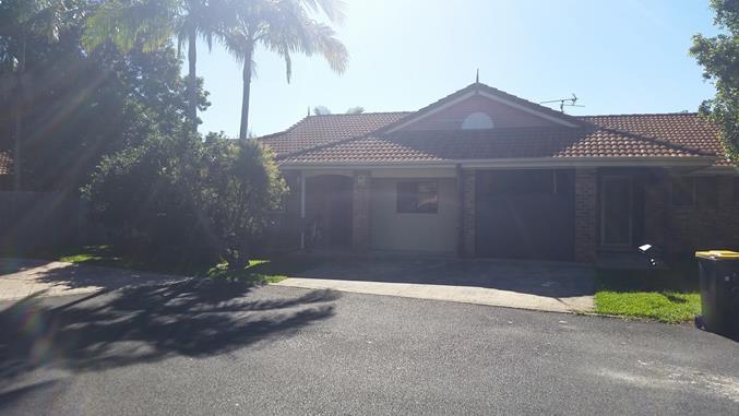
Existing converted
garage viewed from Comet Cl looking NW
2.
SUMMARY OF REFERRALS
|
Referral
|
Issue
|
|
Development Engineer
|
Refusal recommended. See Doc # A2019/13334
|
|
Building Surveyor
|
No objections subject to recommended deferred commencement
condition. See Doc # A2019/13338
|
3.
SECTION 4.14 – BUSH FIRE PRONE LAND
Under section 4.14 of the Act, Council must be satisfied
prior to making a determination for development on bush fire prone land, that
the development complies with the document Planning for Bush Fire Protection
2006. The site is bush fire prone land. The proposal can reasonably comply with
Planning for Bushfire Protection 2006.
4.
SECTION 4.15C – MATTERS FOR CONSIDERATION –
DISCUSSION OF ISSUES
Having regard to the matters for consideration detailed in
Section 4.15(1) of the Environmental Planning & Assessment Act 1979
(EP&A Act), the following is a summary of the evaluation of the issues.
4.1
State Environmental Planning Instruments
|
|
Satisfactory
|
Unsatisfactory
|
|
State
Environmental Planning Policy No 55—Remediation of Land
|
☒
|
☐
|
|
Consideration:
The application does not
propose any disturbance of soil so no further investigation is required.
|
|
State Environmental Planning
Policy (Coastal Management) 2018
|
☒
|
☐
|
|
Consideration:
Clause 11 –
Development on land in proximity to coastal wetlands or littoral rainforest
(1) Development consent
must not be granted to development on land identified as “proximity
area for coastal wetlands” or “proximity area for littoral
rainforest” on the Coastal Wetlands and Littoral Rainforests Area Map unless
the consent authority is satisfied that the proposed development will not
significantly impact on:
(a) the biophysical,
hydrological or ecological integrity of the adjacent coastal wetland or
littoral rainforest, or
(b) the quantity and
quality of surface and ground water flows to and from the adjacent coastal
wetland or littoral rainforest.
The subject site is located
within proximity to coastal wetlands. The application proposes only
residential works. The proposal is consistent with the provisions of Clause
11 of the Coastal Management SEPP.
|
4.2 Byron Local Environmental
Plan 2014 (LEP 2014)
LEP 2014 is an applicable matter for consideration in the
assessment of the subject development application in accordance with subsection
4.15(1) of the EP&A Act because it applies to the subject land and the
proposed development.
In accordance with LEP 2014 clauses 1.4 and 2.1 – 2.3:
(a) The
proposed development is defined in the LEP 2014 Dictionary as Dual Occupancy
(alterations and additions to)
;
(b) The
land is within the R2 Low Density Residential according to the Land Zoning Map;
(c) The
proposed development is permitted with consent ; and
(d) Regard
is had for the Zone Objectives as follows:
|
Zone Objective
|
Consideration
|
|
encourage a range of housing types
|
The application seeks approval for the use of alterations
and additions to a dual occupancy dwelling
|
|
ensure non residential uses have a domestic scale and
character.
|
The proposal is for residential use only
|
The proposed development is generally compliant with LEP
2014.
4.3
Any proposed Instrument that has been the subject of public
consultation and has been notified to the consent authority
Not applicable
4.4 Byron Shire Development
Control Plan 2014 (DCP 2014)
DCP 2014 is an applicable matter for consideration in the
assessment of the subject development application in accordance with subsection
4.15(1) of the EP& A Act because it applies to the land to which LEP 2014
applies.
B4 Traffic Planning, Vehicle Parking, Circulation and
Access
The proposed parking arrangement does not comply
with Byron Shire Council DCP 2014 part B.4.2.2.4 Parking Layout Standards.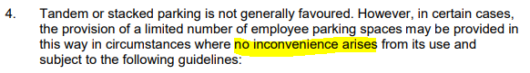
Due to the alignment of the narrow roadway vehicles
reversing onto the roadway to allow the egress of the other vehicle is likely
to cause traffic conflicts and inconvenience (approximately 5 other crossovers
within this area). It is also noted that there is a high number of cars
informally parking and bins placed on the street which further limit the
available turning area.
D1.2.2 – Setbacks from Boundaries
The DCP requires a 5.5m street frontage setback to car
parking. The DCP also requires that “no development is permitted within
the building setbacks other than garbage storage facilities, mail boxes,
landscaping and driveways”.The application seeks consent for car parking
with a street frontage setback of approximately 1m.
The proposal does not comply with the objectives of this
development standard as a variation to permit car parking with a 1m front
building setback would not complement and harmonise with the existing
streetscape. Permitting such a setback would detract from the existing amenity
in the locality and reduce the quality of the living environment.
Approval of such a variation would set an undesirable
precedent that would not be in the public interest.
The proposal has not demonstrated compliance with DCP 2014
and refusal of the application is recommended.
4.5
Any Planning Agreement or Draft Planning Agreement?
|
|
Yes
|
No
|
|
Is there any applicable planning agreement or draft
planning agreement?
|
☐
|
☒
|
|
Consideration:
|
4.6
Environmental Planning & Assessment Regulation 2000
Considerations
|
Clause
|
This
control is applicable to the proposal:
|
I
have considered this control as it relates to the proposal:
|
If
this control is applicable, does the proposal comply?
|
|
92
|
No
|
N/A
|
N/A
|
|
93
|
No
|
N/A
|
N/A
|
|
94
|
No
|
N/A
|
N/A
|
|
94A
|
No
|
N/A
|
N/A
|
4.7
Any Coastal Zone Management Plan?
|
|
Satisfactory
|
Unsatisfactory
|
Not applicable
|
|
Is there any applicable coastal zone management plan?
|
☐
|
☐
|
☒
|
|
Consideration:
|
4.8
The likely impacts of that development, including environmental
impacts on both the natural and built environments, and social and economic
impacts in the locality
|
Impact on:
|
Likely significant impact/s?
|
|
Natural environment
|
No. The proposal will not have a significantly adverse
impact on the natural environment of the locality.
|
|
Built environment
|
No. The proposal will not have a significantly adverse
impact on the built environment of the locality.
|
|
Social Environment
|
No. The proposal will not have a significant social impact
on the locality.
|
|
Economic impact
|
No. The proposal will not have a significant economic
impact on the locality.
|
Are there any Council Policies that are applicable to the proposed
development?
|
Council Policy
|
Consideration
|
|
Development Policy
|
The proposal is not consistent with this policy as it does
not comply with DCP 2014 and the granting of approval for the requested
variation would not be in the public interest.
|
4.9
The suitability of the site for the development
The site is a serviced, unconstrained property.
4.10
Submissions made in accordance with this Act or the regulations
The development application was publicly exhibited
There were no submissions
made on the development application:
4.11 Public interest
The proposed development does not comply with DCP 2014 front
setback requirements. Approval of the requested variation to front setback
requirements would set an undesirable precedent that would not be in the public
interest.
5. DEVELOPER
CONTRIBUTIONS
5.1 Water & Sewer Levies
No Section 64 levies will be required.
5.2 Section 7.11 Contributions
No Section 7.11 Contributions
will be required.
6. CONCLUSION
The proposed development has not demonstrated compliance
with the provisions of DCP 2014. The Development Application is recommended for
refusal for the reasons listed in the recommendation of the report below:
7. REASONS
FOR DECISION, HOW COMMUNITY VIEWS WERE ADDRESSED
Note:
From July 1 2018, Council’s are required to give and publicly notify
reasons for a range of planning decisions where they are deciding if
development should proceed to help community members to see how their views
have been taken into account and improve accountability to stakeholders. A
statement of reasons for the determination of this application is provided
below.
|
Statement of Reasons
|
|
The proposed development does not comply with the
considerations of Section 4.15 of the Environmental Planning & Assessment
Act 1979.
|
|
The proposed development does not comply with the
provisions of Development Control Plan 2014.
|
|
The proposed development is not in the public interest.
|
|
How community views were addressed
|
|
The DA was notified/advertised in accordance with
Development Control Plan 2014. No submissions were received.
|
8. RECOMMENDATION
It is recommended that
pursuant to Section 4.16 of the Environmental Planning & Assessment Act
1979, Development Application No. 10.2019.220.1 for Use of Unauthorised Additions to Existing Dual Occupancy Dwelling
(Conversion of Garage to Bedroom), Carparking and Tree Relocation, be refused
for the following reasons:
REASONS
FOR REFUSAL
1. Pursuant
to Section 4.15(1)(a)(iii) the proposal has not demonstrated compliance with
the requirements of part B4.2.2.4 and the objectives and performance criteria
of part D1.2.2 of Development Control Plan 2014.
2. Pursuant
to Section 4.15(1)(b) the proposed development would create an unreasonable
visual amenity impact on the streetscape.
3. Pursuant
to Section 4.15(1)(e) the proposed development is not in the public interest as
it would create an undesirable precedent.
9. DISCLOSURE OF
POLITICAL DONATIONS AND GIFTS
|
Has a Disclosure Statement been received in relation
to this application
|
No
|
|
Have staff received a ‘gift’ from anyone
involved in this application that needs to be disclosed. Where the answer is
yes, the application is to be determined by the Director or Manager of the
Planning, Development and Environment Division.
|
No
|
Provide Disclosure Statement register details here: Not
applicable
10. ENDORSEMENT
Assessment Officer: Mr D J Johnstone
Signature: ..............................................................................................................................
Date: 27/06/2019
11. INSTRUMENT OF EXERCISE OF
DELEGATED AUTHORITY
The application is determined in accordance with the above
recommendation (amendments have been made where necessary) under delegated
authority.
Name: Chris
Larkin
Position: Manager
- Sustainable Development
Signature: ...................................................................................................................................
Determination Date: ...................................................................................................................
Staff Reports - Sustainable Environment and Economy 13.4 - Attachment 3
Staff Reports - Sustainable Environment and Economy 13.5 - Attachment 1
Staff Reports - Sustainable Environment and Economy 13.5 - Attachment 2
10.2019.146.1 Conditions of Consent
Parameters of this Consent
1) Development is to be in accordance
with approved plans
The development is to be in accordance with plans listed below:
|
Plan No.
|
Description
|
Prepared by
|
Dated:
|
|
DD10.1 – Rev 8
|
Site Plan
|
Thomson Adsett Architect
|
26.09. 2019
|
|
DD-11.1–Rev 5
|
External Works
|
Thomson Adsett Architect
|
26.09. 2019
|
|
DD20.1 –
Rev 7
|
Floor Plan
|
Thomson Adsett Architect
|
26.09. 2019
|
|
DD-20.2–Rev
6
|
Roof Plan
|
Thomson Adsett Architect
|
26.09. 2019
|
|
DD26.1 –
Rev 7
|
Ceiling Plan
|
Thomson Adsett Architect
|
26.09. 2019
|
|
DD30.1 –
Rev 7
|
Elevations North and South
|
Thomson Adsett Architect
|
26.09. 2019
|
|
DD30.2 –
Rev 7
|
Elevations East and West
|
Thomson Adsett Architect
|
26.09. 2019
|
|
DD31.0 –
Rev 6
|
Site Sections
|
Thomson Adsett Architect
|
26.09. 2019
|
|
DD31.0 –
Rev 6
|
Sections
|
Thomson Adsett Architect
|
26.09. 2019
|
|
DD50.1 –
Rev 4
|
Door Schedules and Details
|
Thomson Adsett Architect
|
26.09. 2019
|
|
DD50.2 –
Rev 4
|
Window Schedules and Details
|
Thomson Adsett Architect
|
26.09. 2019
|
|
60.1 –
Rev 4
|
Sun Shadow Study
|
Thomson Adsett Architect
|
26.09. 2019
|
|
901-LCP01 – Rev B
|
Landscape
Concept Plan
|
Alderson and
Associates Landscape Architects
|
26.09. 2019
|
|
19215-SW_B
|
SMP
|
Greg Alderson
& Associates
|
7/2/19
|
The development is also to be in accordance with any changes
shown in red ink on the approved plans or conditions of consent. The
approved plans and related documents endorsed with the
Council stamp and authorised signature must be kept on site at all
times while work is being undertaken.
2) Essential Energy Requirements
If the proposed
development changes, there may be potential safety risks and it is recommended
that Essential Energy is consulted for further comment. Notwithstanding, the following
conditions apply:
a) Any existing encumbrances in favour of
Essential Energy (or its predecessors) noted on the title of the above property
should be complied with;
b) Any activities must be undertaken in
accordance with the latest industry guideline currently known as ISSC 20
Guideline for the Management of Activities within Electricity Easements and
Close to Infrastructure;
c) Prior to carrying out any works, a
“Dial Before You Dig” enquiry should be undertaken in accordance
with the requirements of Part 5E (Protection of Underground Electricity Power
Lines) of the Electricity Supply Act 1995 (NSW); and
d) Given there is electricity
infrastructure in the area, it is the responsibility of the person/s completing
any works around powerlines to understand their safety responsibilities.
SafeWork NSW (www.safework.nsw.gov.au) has publications that provide guidance
when working close to electricity infrastructure. These include the Code of
Practice – Work near Overhead Power Lines and Code of Practice –
Work near Underground Assets.
The following conditions are to be complied with prior to issue of a
Construction Certificate
3) Plans and specifications for
acoustic fence must be submitted for approval
The application for a Construction
Certificate must include plans and specifications for the acoustic fences
recommended in Noise Impact Assessment prepared by Greg Alderson and Associates
No. 19215_NIA_2) dated August 2019. Such plans and specifications must be
approved as part of the application for a Construction Certificate for building
works.
4) Geotechnical
Report required – Engineering Works
A certificate from a professional
Engineer experienced in soil mechanics is to be provided to
the Principal Certifying
Authority, certifying that:
a) the design of the civil
engineering works, including cut & fill batters, has been assessed as
structurally adequate,
b) the civil engineering works
will not be affected by landslip or subsidence either above or
below the works and,
c) adequate
drainage has been provided.
5) On-site
stormwater detention approval required
The application for a Construction
Certificate is to include plans and specifications for stormwater drainage in
accordance with the relevant Australian Standard. All
stormwater drainage for the development must be conveyed via an on-site
stormwater detention system by gravity to pit in Bottlebrush Cres
Such plans and specifications must
be approved as part of the Construction Certificate.
All stormwater drainage systems within the lot and the connection
to a public or an inter-allotment drainage system must:
(a) Generally
in accordance with Greg Alderson & Associates SMP19215-SW_B;
(b) Provision
of a trafficable trench grate in the driveway at the property boundary adjacent
to Bottlebrush Cres and connect into the OSD tank;
(c) comply
with any requirements for the disposal of stormwater drainage and on-site
stormwater detention contained in Council’s Development Control Plan,
Stormwater Guideline and Local Approvals Policy; and
(d) unless
exempt from obtaining an approval under section 68 of the Local Government Act 1993 by a Local Approvals Policy, an approval must be obtained under that Act prior to issue of a Construction
Certificate.
6) Water and Sewerage - Section 68
approval required
An Approval under Section 68 of
the Local Government Act 1993 to carry out water supply work and sewerage work
must be obtained.
7) Flood Planning Level for Buildings
The flood planning level for this
development is R.L.11.39 metres A.H.D.
The plans and specifications to
accompany the construction certificate application are to indicate
a minimum floor level that is at or above the flood planning level.
The plans and specifications to
accompany the construction certificate application are to also indicate the use
of flood compatible materials and services below the flood planning level in
accordance with the requirements of Council’s Development Control Plan
2014 – Chapter C2 – Areas Affected by Flood; and
Such plans and specifications must
be approved as part of the Construction Certificate.
8) Access and facilities for disabled
The application for a Construction
Certificate is to include plans and specifications that
indicate
access and facilities for persons with access disabilities to and within the
development
in accordance with AS 1428.1 -
Design for Access and Mobility and Part D3 of the Building
Code of Australia. Such plans and
specifications must be approved as part of the Construction Certificate.
9) Long Service Levy to be paid
A Long Service Levy must be paid to the Long Service Payments
Corporation. This is a State Government Levy and is subject to change. These
payments may be made online at
www.lspc.nsw.gov.au or at Council’s
Administration Office, Station Street, Mullumbimby. Where paying to Council,
cheques are to be made payable to ‘Byron Shire Council’.
For further information regarding the Long Service Payment please
refer to the website above.
10) Section 7.12 Levy to
be paid
Prior to the issue of a construction certificate the section 7.12
levy required by the Byron Developer Contributions Plan 2012 must be paid to
Council.
The levy will be calculated as follows:
Levy payable = %C x $C
%C is the levy rate applicable as set
out in the latest Ministerial Direction issued under section 7.17.
$C is the proposed cost of carrying out
the development.
The rate of %C
is:
|
Proposed cost of the
development
|
Maximum percentage of the
levy
|
|
Up to $100,000
|
Nil
|
|
$100,001–$200,000
|
0.5 percent
|
|
More than $200,000
|
1.0 percent
|
The cost of
development must be calculated in accordance with clause 25J of the
Regulation. The Cost Summary Report (copy attached) as set out in
schedule 2 of the Section 7.12 contributions plan must be submitted to Council
with the payment. The cost summary report must be prepared by a quantity
surveyor. Copies of Cost Summary Report are available at Council’s
main office or may be downloaded from Council’s website.
PAYMENTS WILL ONLY BE ACCEPTED BY CASH OR BANK CHEQUE.
11) Certificate of Compliance – Water
Management Act 2000
A Certificate
of Compliance will be issued upon payment of developer charges for water and
sewer as calculated in accordance with Byron Shire Council and Rous Water
Development Servicing Plans.
Byron Shire
Council acts as Rous Water’s agent in this matter and will issue a
Certificate of Compliance on behalf of Rous Water upon payment of the Rous
Water Development Servicing Charge to this Council.
Note:
Copies of the application forms for Certificates of Compliance are available on
Council’s website http://www.byron.nsw.gov.au/files/Forms/Section_305_Certificate.pdf
or from Council’s Administration Office. Copies of Byron Shire
Council’s Development Servicing Plans are available at Council’s
Administration Office.
Developer
charges will be calculated in accordance with the Development Servicing Plan
applicable at the date of payment. A check must be made with Council to
ascertain the current rates by contacting Council’s Principal Engineer
Systems Planning, Water on 02 6626 7081. Applicable charges can be found
on Council’s website: http://www.byron.nsw.gov.au/development-contributions-plans-section-94-and-64
The contributions payable will
be adjusted in accordance with relevant plan and the amount payable will be
calculated on the basis of the contribution rates that are applicable at the
time of payment.
Payment by
Personal or Company Cheque will not be Accepted
12) Consent required for works within the road
reserve
Consent from Council must be obtained for works within the road
reserve pursuant to Section 138 of the Roads Act 1993. Three (3) copies
of engineering construction plans must accompany the application for consent
for works within the road reserve.
Such plans are to be in accordance with Council’s current
Design & Construction Manuals.
13) Car parking layout, vehicle circulation and
access plans required.
The application for a Construction Certificate for the Centre-based
child care facility is to include plans and specification
that indicate access, parking and manoeuvring details in accordance with the
plans approved by this consent.
The access, parking and
manoeuvring for the site is to comply with the requirements of AS 2890.1-2004:
Parking facilities, Part 1: Off-street car parking and AS 2890.2 – 2010 -
Parking facilities, Part 2: Off-street commercial vehicle facilities. Plans are
to include, but not be limited to, the following items:
a) A
total of 18 car parking spaces including 1 dedicated for people with
disability. (NB. One car parking space to be marked as a short term drop
off and pick up space);
b) pavement
design, comprising an all weather surface, such as asphalt, bitumen seal,
concrete, pavers or other similar treatment;
c) site
conditions affecting the access;
d) existing
and design levels;
e) longitudinal
section from the road centreline to the car space(s);
f) cross
sections every 15 metres;
g) drainage
details;
h) turning
paths; and
i) line
marking and signage.
The engineering plans and
specifications are to be designed by a qualified practising Civil Engineer. The
Civil Engineer is to be a corporate member of the Institution of Engineers
Australia or is to be eligible to become a corporate member and have appropriate
experience and competence in the related field.
Such plans and specifications must
be approved as part of the Construction Certificate.
NOTE: The plans must be in
compliance with Council's current “Northern Rivers Local Government
Development Design & Construction Manuals and Standard Drawings”.
14) Building Code of Australia
Construction of the Centre-based child care
facility must comply with any requirements such as
building attenuation and ventilation deemed necessary under the Building Code of
Australia and any other building standard.
15) Trade Waste - Section 68 Part C approval
required
An approval under Section 68 Part C of the Local Government Act
1993 to discharge trade waste into Council’s sewer must be obtained in
accordance with NSW Office of Water Liquid Trade Waste Regulations Guidelines
2009, Council’s Liquid Trade Waste Policy and Liquid Trade Waste
Guidelines.
Commercial, business, trade and industrial activities discharging or
proposing to discharge to the sewer are required to notify Council and complete
the Trade Waste Registration Form available at the Mullumbimby Office and from
Council’s website at: http://www.byron.nsw.gov.au/files/publications/liquid_trade_waste_application_form_0.pdf
Trade Waste approval is required prior to gain Section 68 Part B approval
to carry out water supply work and sewerage work.
16) Site Waste Minimisation and Management Plan
Chapter B8 of Byron Shire Development Control Plan 2014 (DCP 2014)
aims to facilitate sustainable waste management in a manner consistent with the
principles of Ecologically Sustainable Development. Prior to the issue of a
Construction Certificate, a Site Waste Minimisation and Management Plan (SWMMP)
must be submitted outlining measures to minimise and manage waste generated
during demolition, construction and the ongoing operation and use of the
development. The SWMMP must specify the proposed method of recycling or
disposal and the waste management service provider.
A template is provided on Council’s website to
assist in providing this information www.byron.nsw.gov.au/files/publication/swmmp - pro-forma-.doc
The following conditions are to be complied with prior to
commencement of building works
17) Erosion and sediment measures
Erosion and sedimentation controls are to be in place in accordance
with the Guidelines for Erosion & Sediment Control on Building Sites.
A copy may be downloaded from Council’s web site at
http://www.byron.nsw.gov.au.
Sediment and erosion control measures must be maintained at all
times until the site has been stabilised by permanent vegetation cover or hard
surface.
Note: Council may
impose on-the-spot fines for non-compliance with this condition. Any such measures that are deemed to be necessary because of the
local conditions must be maintained at all times until the site is made stable
(i.e. by permanent vegetation cover or hard surface).
The following conditions are to be complied with during construction
18) Acoustic fence
The acoustic fence is to be
constructed in accordance with the Noise Impact Assessment by Greg Alderson and
Associates (report no. 19215_NIA) dated August 2019, and plans approved by
Council.
19) Fence Top Privacy Screen
A fence top
privacy screen shall be constructed as shown on the plans to provide visual
privacy to all Beech Drive residences.
20) Kitchen areas
The following
facilities must be provided in the kitchen areas:
a) all surfaces
must be smooth, impervious and able to be easily cleaned;
b) water used
for any activities involved in the preparation of food, personal hygiene,
cleaning and sanitising must be potable.
21) Inspection for sewage and drainage
All plumbing
and drainage works is to be installed by a suitably qualified person. The plumber
must adhere to the requirements of the NSW Code of Practice and AS/NZ 3500. The
plumber is to arrange for the following inspections to be undertaken:
a) Internal
drainage prior to covering of the works.
b) External
drainage prior to the covering of works.
c) Irrigation
installation prior to the covering of works.
d) Final
22) Waste minimisation and management
All works must
comply with the objectives of waste minimisation and waste management of
Chapter B8: Waste Minimisation and Management of DCP 2014.
23) WorkCover Authority
All works must be undertaken in accordance with the
requirements of the WorkCover Authority.
24) Construction times
Construction
works must not unreasonably interfere with the amenity of the neighbourhood. In
particular construction noise, when audible on adjoining residential premises,
can only occur:
a) Monday to Friday, from 7 am to 6 pm.
b) Saturday, from 8 am to 1 pm.
c) No construction work to take place on Sundays or
Public Holidays.
Note: Council may impose on-the-spot fines for non-compliance with
this condition.
25) Construction Noise
Construction noise is to be limited as follows:
a) For construction
periods of four (4) weeks and under, the L10 noise level measured over a period
of not less than fifteen (15) minutes when the construction site is in
operation must not exceed the background level by more than 20 dB(A); and
b) For construction
periods greater than four (4) weeks and not exceeding twenty‑six (26)
weeks, the L10 noise level measured over a period of not less than fifteen (15)
minutes when the construction site is in operation must not exceed the
background level by more than 10 dB(A)
Note: Council may impose on-the-spot fines for non-compliance with
this condition.
26) Signs to be erected on building sites
A sign must be erected in a prominent position on the work site:
a) Stating that
unauthorised entry to the work site is prohibited; and
b) Showing the name of
the person in charge of the work site and a telephone number at which that
person may be contacted outside working hours.
Any such sign is to be removed when the work has been completed.
27) Builders rubbish to be contained on
site
All builders
rubbish is to be contained on the site in a ‘Builders Skips’ or an
enclosure. Footpaths, road reserves and public reserves are to be maintained
clear of rubbish, building materials and all other items.
28) Removal of wastes
All wastes
associated with these works are to be handled and disposed of in accordance
with the requirements of the Work Cover Authority. The applicant/owner is to
produce documentary evidence that this condition has been met. Wastes must be
disposed of at a Licensed Waste Facility. All wastes removed from the
site must be managed and disposed of in accordance with NSW DECC Waste
Classification Guidelines (2008) www.environment.nsw.gov.au/resources/waste/08202classifyingwaste.pdf
29) Prevention of water pollution
Only clean and unpolluted water is to be discharged to
Council’s stormwater drainage system or any watercourse to ensure
compliance with the Protection of Environment Operations Act 1997.
Note: Council may impose on-the-spot fines for non-compliance with this
condition.
30) Maintenance of sediment and erosion control
measures
Sediment and erosion control measures must be maintained at all
times until the site has been stabilised by permanent vegetation cover or hard
surface.
31) Stormwater drainage work
Stormwater drainage for the development shall be constructed in
accordance with the approved plans and specification by a suitably qualified
person.
The following conditions are to be complied with prior to issue of a
Final Occupation Certificate
32) Works to be completed prior to issue of a
Final Occupation Certificate
All of the works indicated on the plans and approved by this
consent, including any other consents that are necessary for the completion of
this development, is to be completed and approved by the relevant consent
authority/s prior to the issue of a Final Occupation Certificate.
Any Security bond paid for this application will be held until
Council is satisfied that no further works are to be carried out that may
result in damage to Councils road/footpath reserve.
33) Acoustic Privacy fencing
All Acoustic and privacy fencing to be constructed as per the
conditions of consent prior to the issue of any Occupation Certificate
34) Carparking in
accordance approved plans
All carparking are to be
constructed from the property boundary to the proposed car space(s) in
accordance with the approved plans.
35) Floor Levels – Certification for
Flooding
Prior to the issue of an
Occupation Certificate, a certificate from a registered surveyor must be
submitted to the Principal Certifying Authority confirming the height of
habitable and non-habitable floors. An Occupation Certificate must not be
issued unless the floor levels are at or above the relevant flood planning
levels.
36) Compliance
with bushfire conditions under Section 100B of Rural Fires Act 1997
Documentary
evidence from a suitably qualified professional is to be submitted to the
Principal Certifying Authority demonstrating that the bushfire conditions as
issued under Section 100B of the Rural fire Act 1997 have been complied with.
37) On-site Stormwater Detention –
Certification of works
All stormwater drainage works,
including on-site stormwater detention works, for the development must be
constructed in accordance with the approved plans and specification prior to
issue of an occupation certificate. Certificate/s of Compliance and
Work-As-Executed (WAE) plans for the stormwater works must be submitted to the
Principal Certifying Authority prior to the issue of an occupation certificate.
The certificate/s and WAE plans
are to be prepared by a suitably qualified engineer and must be in accordance
with Council’s Comprehensive
Guidelines for Stormwater Management.
The following conditions are to be complied with at all times
38) External lighting arrangements
External
lighting arrangements should be in accordance with AS4282-1997: Control of the
obtrusive effects of outdoor lighting and NSW WorkCover OH&S requirements.
39) New South Wales Food Act 2003 and Food
Regulation 2010
The premises shall be operated and maintained to ensure that the
requirements of the Food Act 2003 and Food Regulation 2010
(incorporating Food Standard Code) are satisfied at all times. Access to
the Food Standard Code is available at http://www.foodstandards.gov.au
40) Maximum childcare placements
Maximum childcare placements are a total of fifty infants for the
Child Care Centre.
41) Hours of operation
The hours of
operation of the pre-school are limited to between 7:45 am to 5:30 pm, Monday
to Friday.
42) No interference with amenity
The use of the
premises shall not interfere with the amenity of the neighbourhood by reason of
noise, vibration, smell, fumes, smoke, dust, wastewater or otherwise. In
particular:
a) Any complaints to Council about ‘offensive’
noise will be dealt with under the provisions of the Protection of the
Environment Operations Act 1997.
b) Only clean and unpolluted water is permitted to be
discharged to Councils’ stormwater drainage system or any waters.
c) All wastes shall be contained within appropriate
containers fitted with a tight-fitting vermin-proof lid.
d) All trade waste pre-treatment devices and other waste
storage facilities shall be serviced and maintained to ensure that all relevant
environment protection standards are satisfied.
e) Goods deliveries and waste collection shall be
restricted to daytime operating hours.
Section 100B NSW Rural Fires Act 1997 – General Terms of
Approval
Asset Protection Zones
The intent of measures is to
provide sufficient space and maintain reduced fuel
loads so as to ensure radiant
heat levels of buildings are below critical limits and to prevent direct flame
contact with a building. To achieve this, the following conditions shall apply:
1. At the commencement of
building works and in perpetuity the entire property shall be managed as an
inner protection area (IPA) as outlined within section 4.1.3 and Appendix 5 of
'Planning for Bush Fire Protection 2006' and the NSW Rural Fire Service's
document 'Standards for asset protection zones'.
Water and Utilities
The intent of measures is to
provide adequate services of water for the protection of buildings during and
after the passage of a bush fire, and to locate gas and electricity so as not
to contribute to the risk of fire to a building. To achieve this, the following
conditions shall apply:
2. Electricity
are to comply with section 4.2.7 of ‘Planning for Bush Fire Protection
2006’.
Evacuation and Emergency
Management
The intent of measures is to
provide suitable emergency and evacuation (and relocation) arrangements for
occupants of special fire protection purpose developments. To achieve this, the
following conditions shall apply:
3. An emergency
evacuation procedure and detailed plans of all Emergency Assembly Areas
(onsite and offsite) are to be prepared in accordance with the RFS
Guidelines for the
Preparation of Emergency/Evacuation Plan and AS 3745‐2002. The emergency evacuation
plan is to be submitted to the consent authority and approved prior
to the occupation of the
building. The applicant is to provide a copy of the above document
to the local Bush Fire
Management Committee for their information prior occupation of the
building subject to this
development.
Design and Construction
The intent of measures is that
buildings are designed and constructed to withstand the potential impacts of
bush fire attack. To achieve this, the following conditions shall apply:
4. New construction shall
comply with Sections 3 and 5 (BAL 12.5) Australian Standard AS3959-2009
'Construction of buildings in bush fire prone areas' or NASH Standard (1.7.14
updated) ‘National Standard Steel Framed Construction in Bushfire Areas
– 2014’ as appropriate and section A3.7 Addendum Appendix 3 of
'Planning for Bush Fire Protection 2006'.
Water payments under the Water Management Act 2000
Charges will be calculated based on the additional water and
sewerage load that the proposed development generates, shown in Equivalent
Tenements (ET) by the following table:
ADDITIONAL
WATER & SEWER LOAD OF DEVELOPMENT
(ET Policy 2018)
|
Water
|
1.68 ET
|
|
Bulk Water
|
1.68 ET
|
|
Sewer
|
2.80 ET
|
NB: Information regarding Development Servicing charges can
be found on the Byron Shire Council website (http://www.byron.nsw.gov.au/development-contributions-plans-section-94-and-64).
These charges will enable you to calculate the total contribution charges
payable when you are ready to pay them. Developer charges will be
calculated in accordance with the Development Servicing Plan applicable at the
date of payment.
Construction
Certificate required
This development
consent is issued under the Environmental Planning and Assessment Act 1979
and does not relate to structural aspects or specifications of any building
under the Building Code of Australia. All buildings and alterations require the
issue of a Construction Certificate prior to works commencing. Application
forms are available from the customer services counter or Council’s
website www.byron.nsw.gov.au.
Occupation
Certificate required
The buildings
must not be occupied until the Principal Certifying Authority has issued an
Occupation Certificate.
Principal Certifying Authority
Work must not
commence until the applicant has:-
· Appointed a Principal Certifying Authority (if the Council is not
the PCA);
· Given the Council at least two (2) days notice of their intention to
commence the erection of the building. Notice must be given by using the
prescribed ‘Form 7’; and
· Notified the Principal Certifying Authority of the Compliance with
Part 6 of the Home Building Act 1989.
Protection
of the Environment Operations Act 1997
It is an offence
under the provisions of the Protection of the Environment Operations Act
1997 to act in a manner causing, or likely to cause, harm to the
environment. Anyone allowing material to enter a waterway or leaving material
where it can be washed off-site may be subject to a penalty infringement notice
(“on-the-spot fine”) or prosecution.
Penalties
apply for failure to comply with development consents
Failure to
comply with conditions of development consent may lead to an on the spot fine
(generally $600) being issued pursuant to section 127A of the Environmental
Planning and Assessment Act 1979 or prosecution pursuant to section 125 of
the Environmental Planning and Assessment Act 1979.
Reason for conditions
The conditions imposed have been included
in response to development considerations and to ensure a high standard of
development having regard to the effect upon the environment and the amenity of
the neighborhood.
Dial Before You Dig
Underground assets may exist in the area
that is subject to your application. In the interests of health and safety and
in order to protect damage to third party assets please contact Dial before you
dig at www.1100.com.au or telephone on 1100 before excavating or erecting structures (This
is the law in NSW). If alterations are required to the configuration, size,
form or design of the development upon contacting the Dial before You Dig
service, an amendment to the development consent (or a new development
application) may be necessary. Individuals owe asset owners a duty of care that
must be observed when working in the vicinity of plant or assets. It is the
individual’s responsibility to anticipate and request the nominal
location of plant or assets on the relevant property via contacting the Dial
before you dig service in advance of any construction or planning activities.
Telecommunications Act 1997 (Commonwealth)
Telstra (and its authorised contractors) are the only companies that are
permitted to conduct works on Telstra’s network and assets. Any person
interfering with a facility or installation owned by Telstra is committing an
offence under the Criminal Code Act 1995 (Cth) and is liable for prosecution.
Furthermore, damage to Telstra’s
infrastructure may result in interruption to the provision of essential
services and significant costs. If you are aware of any works or proposed works
which may affect or impact on Telstra’s assets in any way, you are
required to contact: Telstra’s Network Integrity Team on Phone Number
1800810443.
Are you dissatisfied with conditions of
consent?
If you are unhappy with conditions of
consent discuss your concerns with the officer who dealt with your application.
You may submit an application to Council to modify the consent under Section
4.55 of the Environmental Planning & Assessment Act, 1979.
You will need to provide reasons why the
conditions should be changed or deleted. You may lodge a Section 4.55
application at any time after the notice of determination. If you are not happy
with Council’s decision on your request for modification, then you may
appeal to the Land & Environment Court within six (6) months of the
notification by Council.
Right of Review
You may request Council to review its
decision under Section 8.2 of the Environmental Planning and Assessment Act,
1979. Such a request must be made within six (6) months of the date of the
determination, or if there is an appeal to the Land and Environment Court, up
to the time when the court hands down its decision. In reviewing its decision
Council is able to consider alterations to the above plans, provided that the
Development Application remains substantially the same as the one for which the
consent was originally sought, and the changes are publicly notified.
NOTE: This
clause does not relate to Integrated Development Applications, applications
determined by the Joint Regional Planning Panel or applications previously
considered under Section 8.2 of the Environmental Planning and Assessment Act
1979.
Right of Appeal
If you are dissatisfied with this decision,
Section 8.7 of the Environmental Planning and Assessment Act 1979 gives
you the right to appeal to the Land and Environment Court within six (6) months
after the date on which you receive this notice.
Staff Reports - Sustainable Environment and Economy 13.5 - Attachment 3

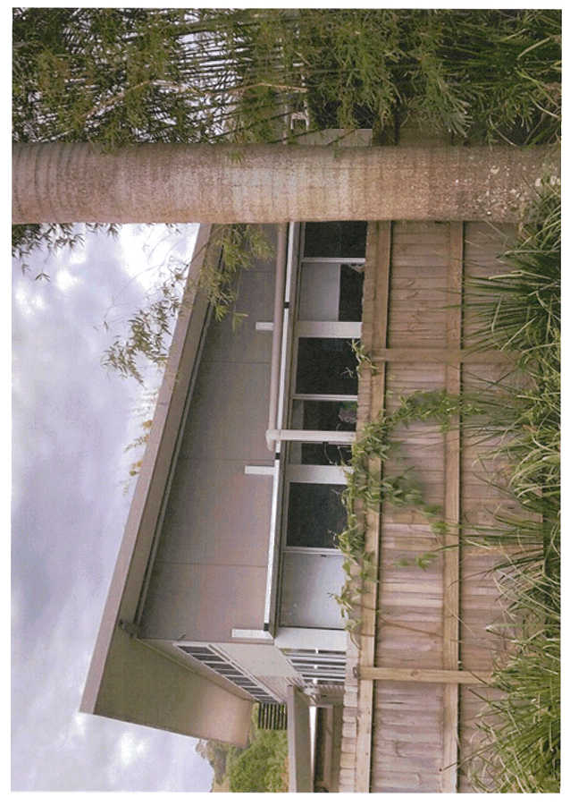
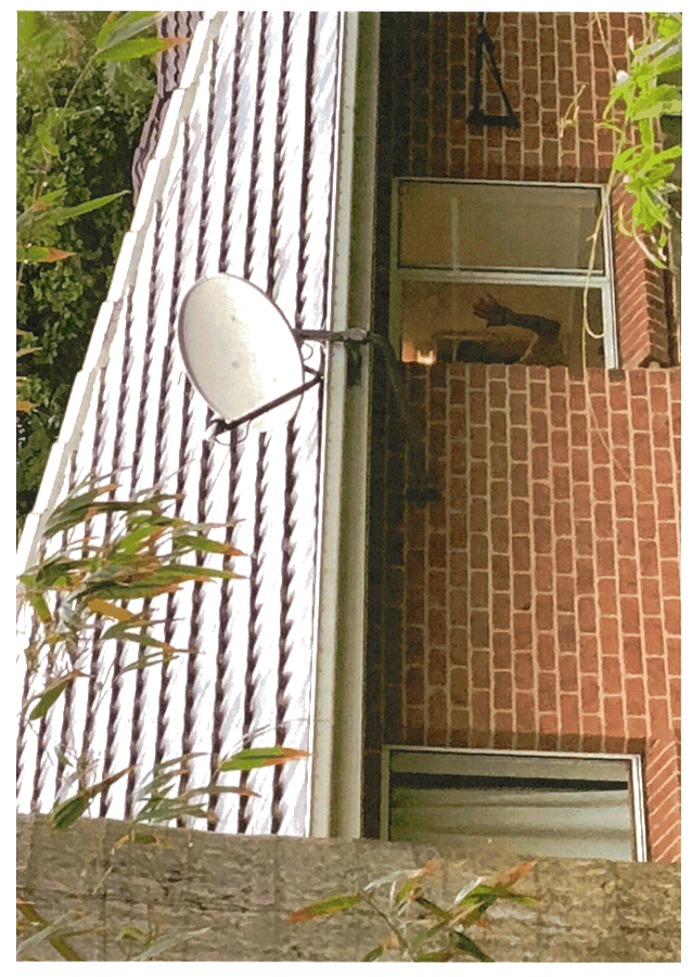
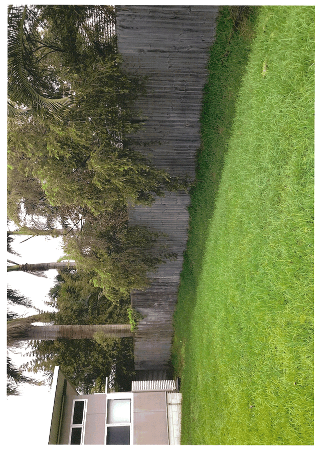
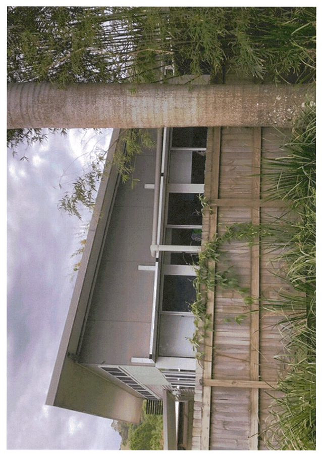
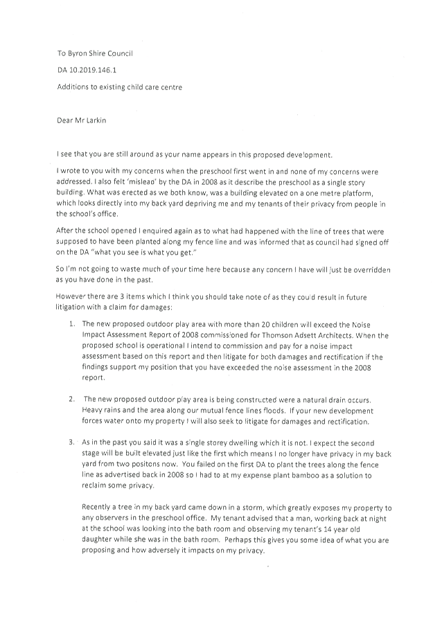

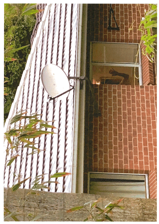
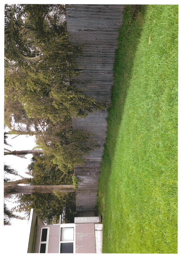
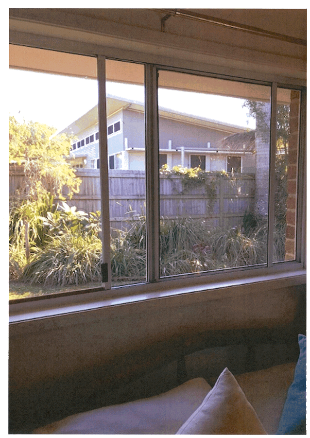
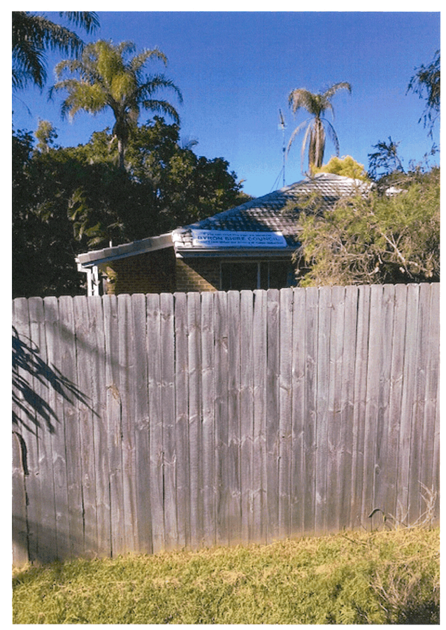
Staff Reports - Sustainable Environment and Economy 13.6 - Attachment 1
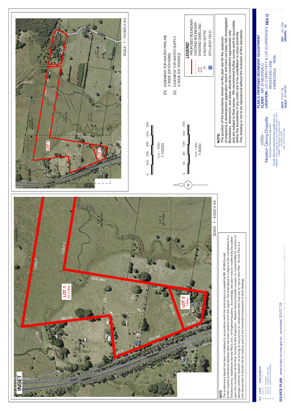
Staff Reports - Sustainable Environment and Economy 13.6 - Attachment 2
10.2019.60.1
RECOMMENDED
CONDITIONS OF CONSENT:
|
SCHEDULE 1 CONDITIONS
OF CONSENT
|
|
Parameters of
consent
|
|
1.
|
Development is to be in accordance with approved plans
The development is to be in accordance with plans listed
below:
|
Plan No.
|
Description
|
Prepared by
|
Dated:
|
|
3, Ref: 18/338, Revision D
|
Proposed Boundary Adjustment
|
Newton Denny Chapelle
|
23.07.19
|
The development is also to be in accordance with any
changes shown in red ink on the approved plans or conditions of consent.
The approved plans and related documents endorsed with the
Council stamp and authorised signature must be kept on site at all times
while work is being undertaken.
|
|
2.
|
Integrated Approvals from other Authorities.
This development consent includes an Integrated
development approval under Sections 4.46 and 4.47 of the Environmental
Planning and Assessment Act 1979, being a Bush Fire Safety Authority, under
Section 100B of the Rural Fires Act 1997, subject to the conditions listed
under the “General Terms of Integrated Development Approval” in
this consent.
|
|
The following
conditions are to be complied with prior to commencement of subdivision works
|
|
3.
|
Consent required for works within the road
reserve
Consent from Council must be obtained for works within the
road reserve pursuant to Section 138 of the Roads Act 1993. Three (3) copies
of engineering construction plans must accompany the application for consent
for works within the road reserve.
Such plans are to be in accordance with Council’s
current Design & Construction Manuals and are to provide for the
following works:
|
Driveway (rural & residential areas without kerb
& gutter)
|
A driveway(s) in accordance with Council’s current
“Northern Rivers Local Government Development Design &
Construction Manuals and Standard Drawings”.
The existing driveway servicing proposed Lot 1 & 3
must be upgraded in accordance with Northern Rivers Local Government
standard drawing R-14.
|
|
|
4.
|
Traffic Control Plan
The plans and specifications to accompany the construction
certificate application are to include a traffic control plan to indicate the
measures to be employed to control traffic during construction of the
subdivision. The traffic control plan is to be designed in accordance with
the requirements of the Roads and Traffic Authority’s Manual (1998), Traffic
Control at Work Sites, and Australian Standard 1742.3 - 1985, Manual
of Uniform Traffic Control Devices Part 3, ‘Traffic Control Devices for
Works on Roads’.
The traffic control plan must be prepared by a suitably
qualified and RTA accredited Work Site Traffic Controller.
|
|
5.
|
Certificate of Compliance from Rous Water – Water
Management Act 2000
Obtain a Certificate of Compliance from Rous Water confirming
that all water supply works to be constructed for Rous Water and all
Developer Charges payable to Rous Water have been provided to Rous Water.
Note: Rous Water is the Water Supply provider for the
location of the subject development. The applicant must organise the
provision of a water service to the development with Rous Water and provide a
Certificate of Compliance from Rous Water to this Council.
|
|
6.
|
Erosion and sediment control measures
Where erosion of soils or runoff of any substance is likely
to occur, erosion and sedimentation controls are to be in place in accordance
with the Guidelines for Erosion & Sediment Control on Building Sites (A
copy may be downloaded from Council’s website). This may include
stockpiled materials such as sand.
Any such measures that are deemed to be necessary because
of the local conditions must be maintained at all times until the site is
made stable (i.e. by permanent vegetation cover or hard surface).
|
|
The following
conditions are to be complied with during subdivision works
|
|
7.
|
Construction noise
Construction
noise is to be limited as follows:.
a) For
construction periods of four (4) weeks and under, the L10 noise level
measured over a period of not less than fifteen (15) minutes when the construction
site is in operation must not exceed the background level by more than 20
dB(A).
b) For
construction periods greater than four (4) weeks and not exceeding twenty‑six
(26) weeks, the L10 noise level measured over a period of not less than fifteen
(15) minutes when the construction site is in operation must not exceed the
background level by more than 10 dB(A).
|
|
8.
|
Construction times
Construction works must not unreasonably interfere with
the amenity of the neighbourhood. In particular construction noise, when
audible from adjoining residential premises, can only occur:
c) Monday
to Friday, from 7 am to 6 pm.
d) Saturday,
from 8 am to 1 pm.
No construction work to take place on Saturdays and
Sundays adjacent to Public Holidays and Public Holidays and the Construction
Industry Awarded Rostered Days Off (RDO) adjacent to Public Holidays.
Note: Council may impose on-the-spot fines for
non-compliance with this condition.
|
|
9.
|
Council Specification
All works to be constructed to at least the minimum
requirements of the “Northern
Rivers Local Government Design and Construction Manual”.
|
|
10.
|
Approved Plans to remain on site
A copy of the approved Construction Certificate including
plans, details and specifications must remain at the site at all times during
the construction of the subdivision.
|
|
The following
conditions are to be complied with prior to issue of a Subdivision
Certificate
|
|
11.
|
Subdivision Certificate application required
An application for a Subdivision Certificate must be made
on the approved form. The Subdivision Certificate fees, in accordance with
Council's adopted schedule of fees and charges, must accompany such
application.
Note: The application MUST be one complete concise
package addressing ALL conditions of consent relevant to the subdivision with
a clear explanation how each condition has been complied with, together with
supplying ALL the relevant information /documents/ certificate and/or plans
that is required by that condition. Failure to provide the abovementioned
information in one package will likely result in the application being
refused or rejected and returned to you.
|
|
12.
|
Plan of Subdivision
The final plan of subdivision must be in accordance with
the approved plan/s. A Deposited Plan Administration Sheet (original plus one
(1) copy), two (2) copies of the plan of subdivision and any necessary
section 88B instrument (original plus one (1) copy) are to be submitted with
the application for a subdivision certificate.
An additional copy of the final plan of subdivision is to
be submitted showing the location of all buildings and/or other permanent
improvements including any fences, internal access driveways/roads, and where
relevant effluent disposal areas and the 1 in 100 year flood and flood
planning level extents on land within or adjacent to a flood planning area.
Where the building/s or improvements are close to boundaries, offset
distances are to be included on the additional copy of the plan. This
plan must be endorsed by a Registered Surveyor. Any encroachments
affecting new boundaries or the road reserve must be removed or relocated
wholly within the allotment. The new boundaries must not cause any
existing building/s to contravene the Building Code of Australia.
|
|
13.
|
Completion of All Works
All subdivision works required by this development
consent, and associated Construction Certificate, are to be completed prior
to issue of the subdivision certificate. A copy of the final completion
letter/s, issued by the Principal Certifying Authority, and final plumbing
certificate, issued by the water supply authority, for the relevant
subdivision works must be submitted with the application for a subdivision
certificate.
|
|
14.
|
Section 88B Instrument
A Section 88B Instrument and one (1) copy are to be
submitted with the application for a strata certificate. The strata plan and
accompanying Section 88B Instrument are to provide for:
a) Easement
for Electricity
The creation of any necessary
easements for electricity purposes as required by the electricity supply
authority.
|
|
15.
|
Vegetated Buffer
A vegetated buffer is to be established along, and
adjacent to, the northern property boundary of proposed Lot 2 as follows:
a. Starting
from 30 metres from the western end of the boundary and extending along the
northern boundary for at least 60 metres.
The vegetated buffer shall comprise:
· At
least two rows of trees and shrubs;
· Only
native species;
· Trees
capable of growing up to four metres in height; and
· Trees
and shrubs spaced at no greater than three metres apart.
|
|
16.
|
Compliance with bushfire conditions
Documentary evidence from a suitably qualified
professional is to be submitted to the PCA demonstrating that the bush fire
conditions as issued under Section 100B of the Rural Fires Act 1997 have been
complied with.
|
|
General Terms of
Integrated Development Approval – Rural Fires Act 1997
|
|
|
The Rural Fire Service, in correspondence dated 29 August
2019, issued General Terms of Approval and a Bush Fire Safety Authority
subject to the following conditions:
|
|
|
Asset Protection Zones
The intent of measures is to provide
sufficient space and maintain reduced fuel loads so as to ensure radiant heat
levels of buildings are below critical limits and to prevent direct flame
contact with a building. To achieve this, the following conditions shall
apply:
1. At the issue of subdivision certificate and in
perpetuity, the land surrounding the existing dwellings on proposed Lots 1
and 2, to a distance of 10 metres, shall be maintained as an inner protection
area (IPA) as outlined within Section 4.1.3 and Appendix 5 of ‘Planning
for Bush Fire Protection 2006’ and the NSW Rural Fire Service's
document ‘Standards for asset protection zones’.
|
|
|
Water and Utilities
The intent of measures is to minimize the
risk of bush fire attack and provide protection for emergency services
personnel, residents and others assisting fire fighting activities. To
achieve this, the following conditions shall apply:
2. Any alteration to electricity services over bush
fire prone land shall comply with Section 4.1.3 of ‘Planning for Bush
Fire Protection 2006’.
|
|
SCHEDULE 3 NOTES
|
|
Construction Certificate required:
This development consent is issued under the Environmental
Planning and Assessment Act 1979 and does not relate to structural aspects or
specifications of the building under the Building Code of Australia. All
buildings and alterations require the issue of a Construction Certificate
prior to works commencing. Application forms are available from the customer
services counter or Council’s website www.byron.nsw.gov.au
|
|
Principal Certifying Authority:
Work must not commence until the applicant has:-
a. appointed
a Principal Certifying Authority (if the Council is not the PCA); and
b. given
Council at least two days notice of the intention to commence the erection of
the building. Notice must be given by using the prescribed ‘Form
7’.
c. notified
the Principal Certifying Authority of the Compliance with Part 6 of the Home
Building Act 1989.
|
|
Protection of the Environment Operations Act 1997:
It is an offence under the provisions of the Protection of
the Environment Operations Act 1997 to act in a manner causing, or likely to
cause, harm to the environment. Anyone allowing material to enter a waterway
or leaving material where it can be washed off-site may be subject to a
penalty infringement notice (“on-the-spot fine”) or prosecution.
|
|
Penalties apply for failure to comply with development
consents
Failure to comply with conditions of development consent
may lead to an on the spot fine being issued pursuant to section 4.2(1) of
the Environmental Planning & Assessment Act 1979 or prosecution pursuant
to section 9.50 of the Environmental Planning & Assessment Act 1979.
|
|
Plumbing Standards and requirements.
All Plumbing, Water Supply, Sewerage and Stormwater Works
shall be installed in accordance with the Local Government Act 1993, Plumbers
Code of Australia and AS/NZS 3500 Parts 0-5, the approved plans (any
notations on those plans) and the approved specifications. Any plumbing
inspections required under a Section 68 Approval are to occur in accordance
with that approval.
|
|
Relics Provisions- Advice
Attention is directed to the NSW Heritage Act 1977 and the
provisions of the Act in relation to the exposure of relics. The Act
requires that if:
a) a
relic is suspected, or there are reasonable grounds to suspect a relic in
ground, that is likely to be disturbed damaged or destroyed by excavation;
and/or
b) any
relic is discovered in the course of excavation that will be disturbed,
damaged or destroyed by further excavation;
Those responsible for the discovery must notify nominated
management personnel who will in turn notify the Heritage Council of New
South Wales or its delegate, the Office of Environment and Heritage, NSW
Heritage Branch, and suspend work that might have the effect of disturbing,
damaging or destroying such relic until the requirements of the NSW Heritage
Council have been satisfied (ss139, 146).
|
Staff Reports - Sustainable Environment and Economy 13.6 - Attachment 3

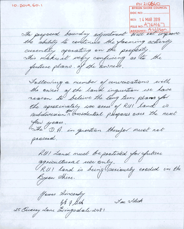
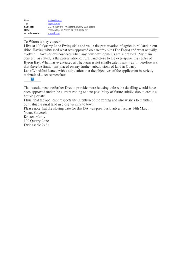
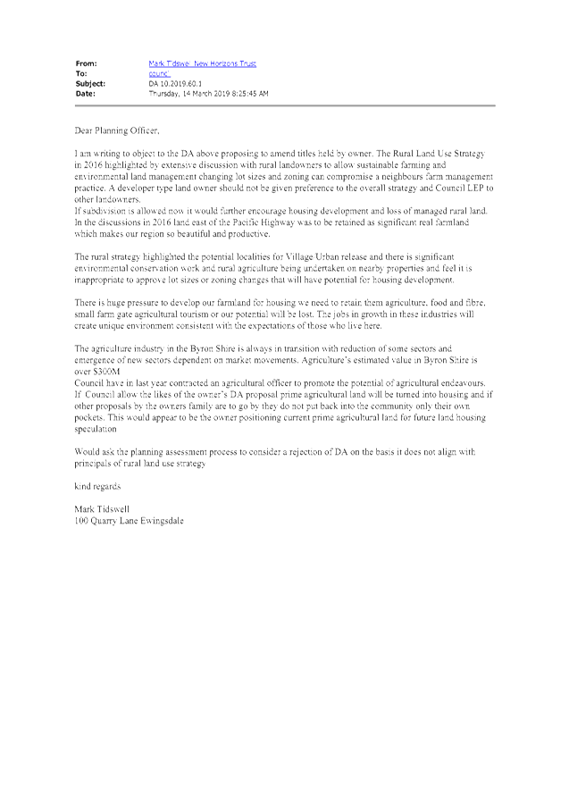
Staff Reports - Sustainable Environment and Economy 13.7 - Attachment 1
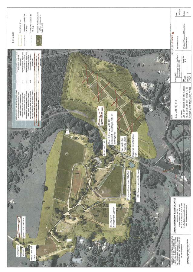
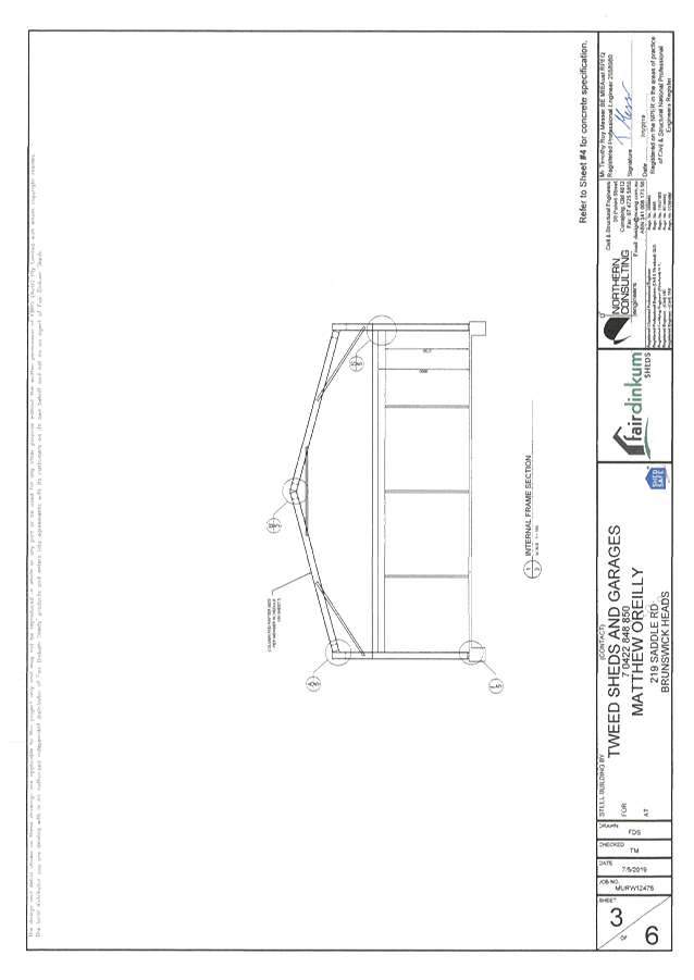
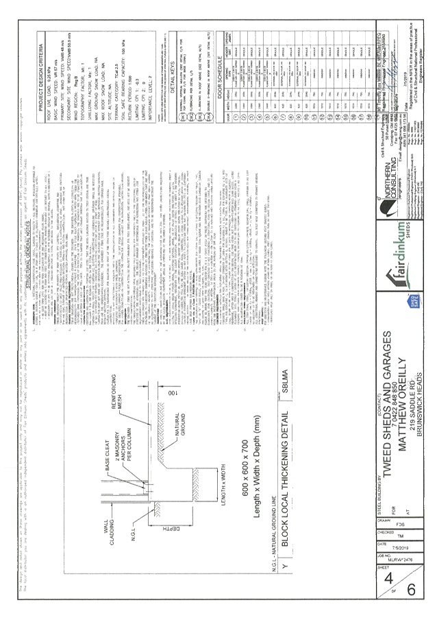
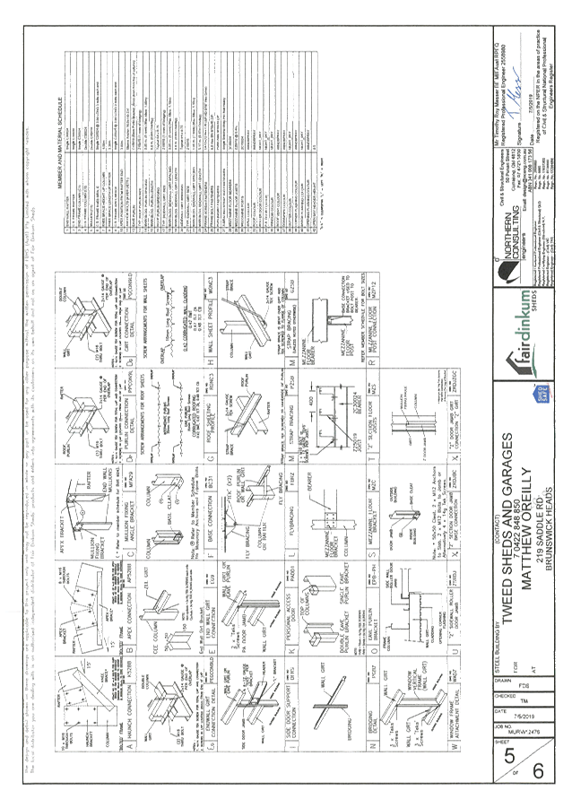
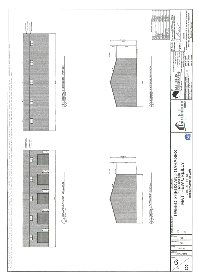
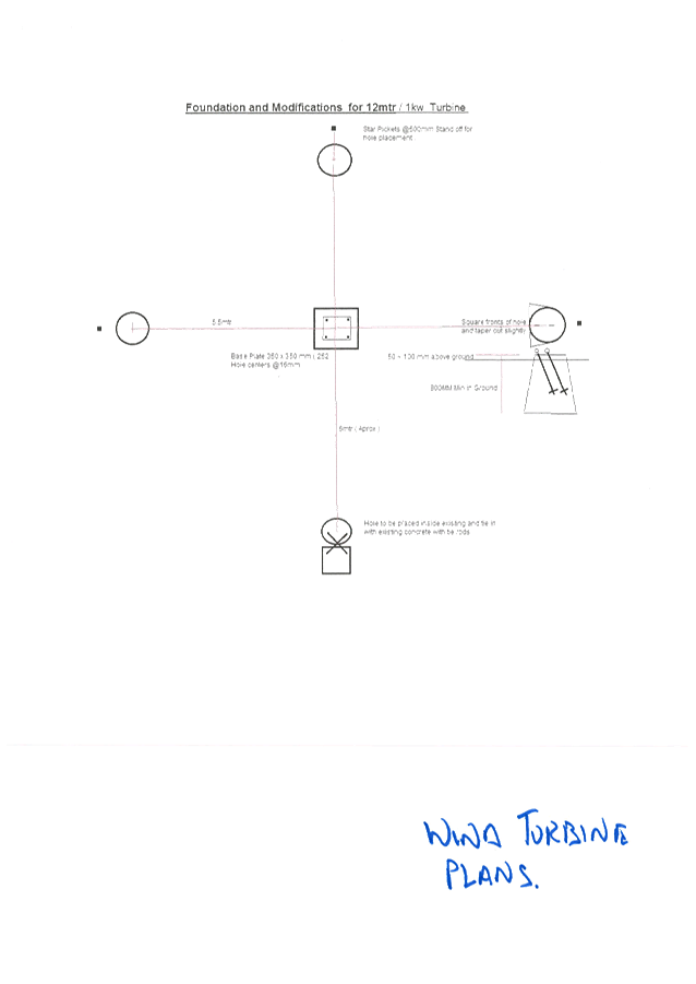
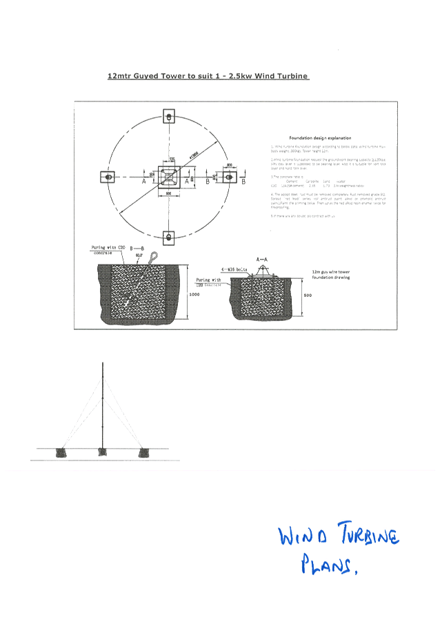

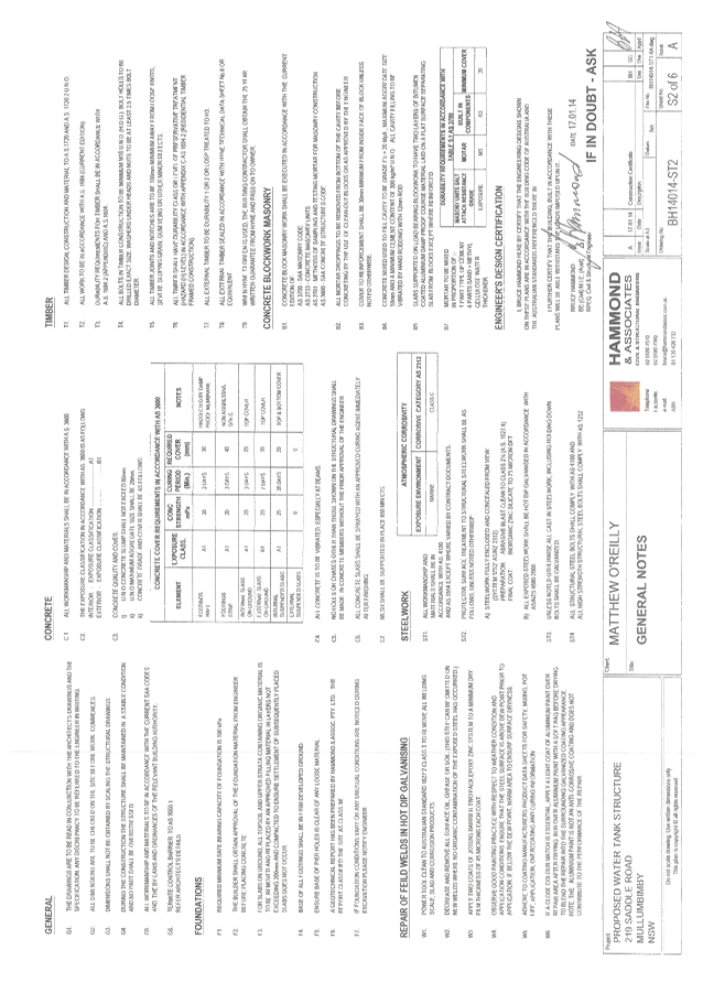
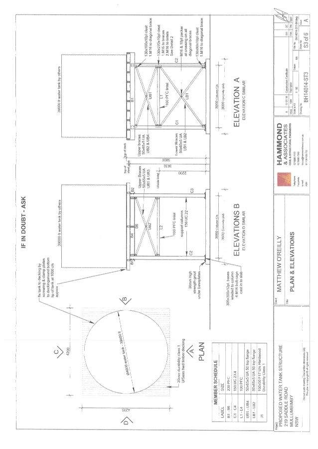
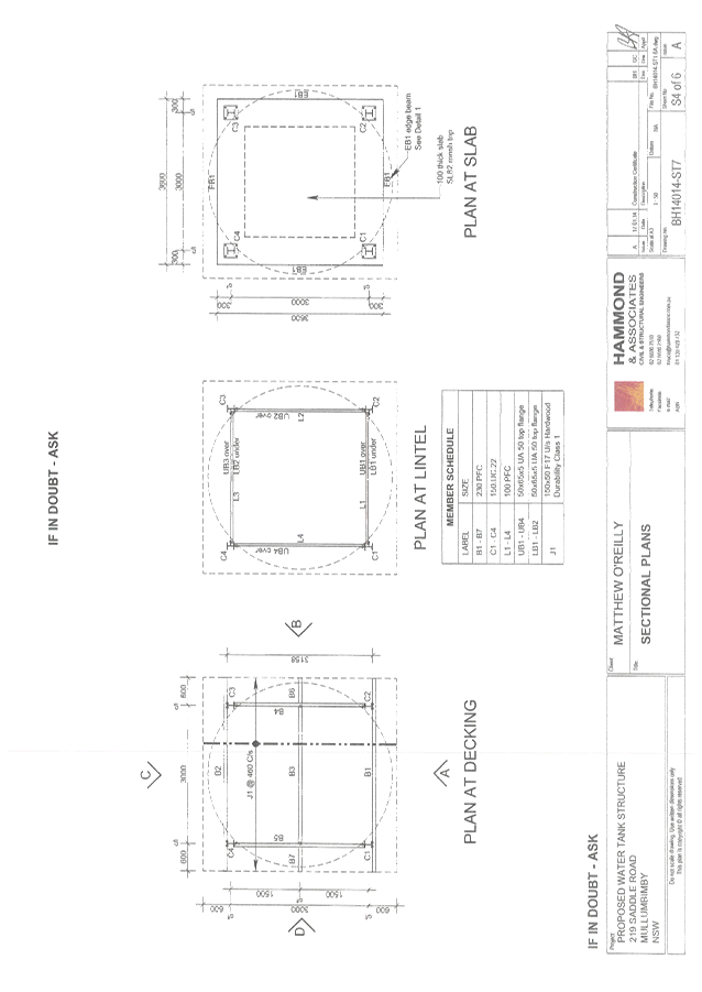
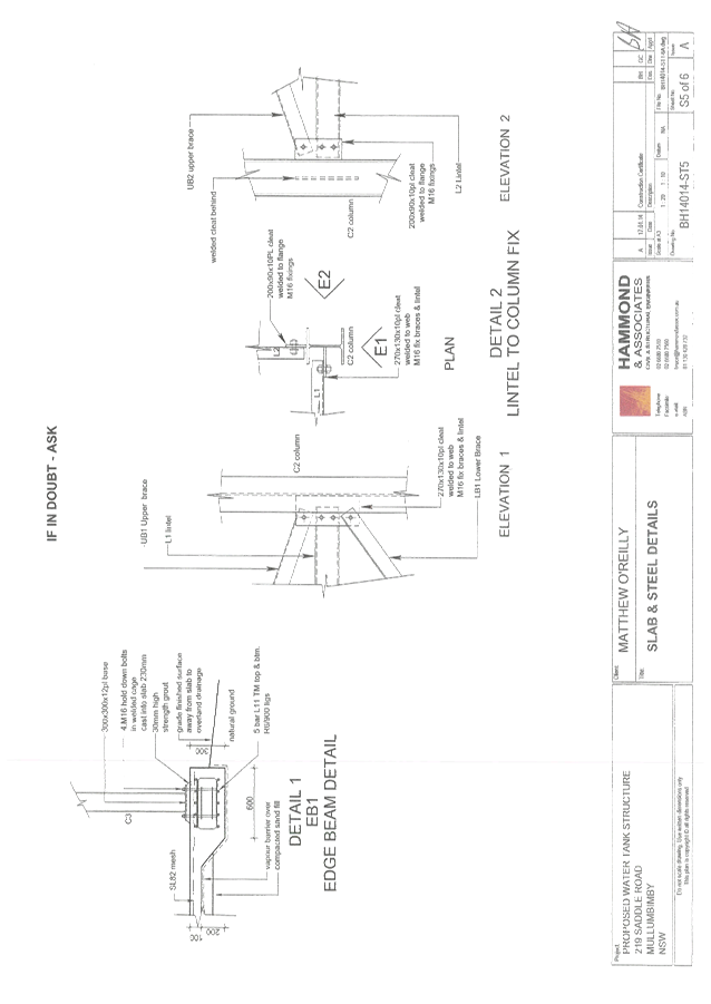
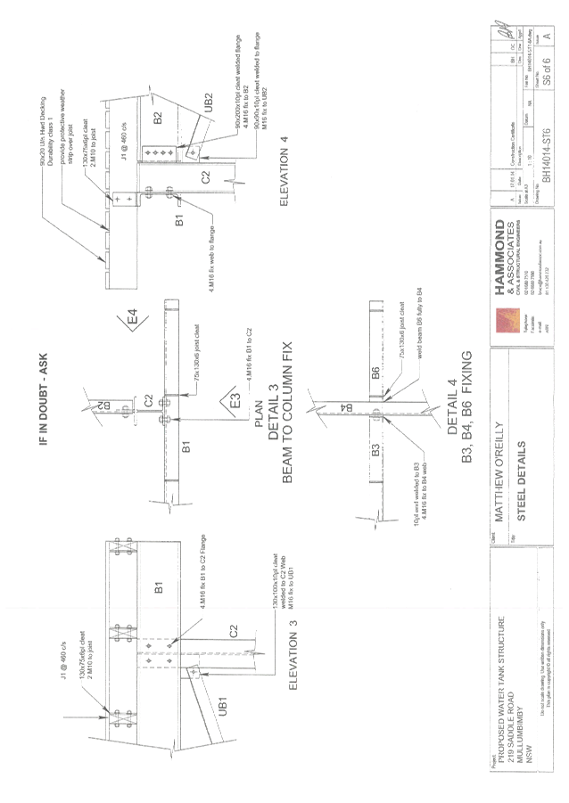
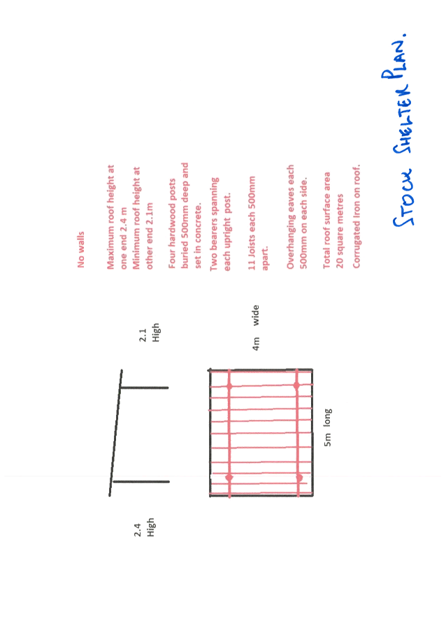
Staff Reports - Sustainable Environment and Economy 13.7 - Attachment 2
10.2019.158.1
Conditions of
Consent
Parameters of this Consent
1) Development is to be in accordance
with approved plans
The development is to be in accordance with plans listed below:
|
Plan No.
|
Description
|
Prepared by
|
Dated:
|
|
Job No. 17224
|
Site Plan A
|
Greg Alderson
and Associates
|
6 May 2019
|
|
Job No. 17224
|
Site Plan B
|
Greg Alderson
and Associates
|
7 May 2019
|
|
Job 17224 SEE
|
Proposed
Business Identification Sign (App K to SEE)
|
Greg Alderson
and Associates
|
March 2019
|
|
Job No. 17224
|
Conceptual
Landscaping Plan
|
Greg Alderson
and Associates
|
13 May 2019
|
|
Job No. 17224
|
Concept
Stormwater Management Plan and Schematic farm dam section
|
Greg Alderson
and Associates
|
26 March 2019
(Rev B)
|
|
Job No. 17224
|
Sediment and Erosion Control
Plan
|
Greg Alderson
and Associates
|
8 February
2018
|
|
Job No. 17224
|
Site plan
– new stock loading ramp location
|
Greg Alderson
and Associates
|
20 August 2019
|
|
Job No.
MURW12476
Sheets 1 to 6
|
Five Bay Farm
Shed - foundation, floor framing, elevations, sections, block detail,
etc
|
Tweed Sheds and
Garages
|
7 May 2019
|
|
App B1 to SEE
|
Wind Turbine
Plans – 12 metre and 1 KW (App B1 to SEE)
|
Not stated
|
undated
|
|
BH14014
– ST1-6A
Sheets S1 to
S6
|
Water tank
stand plans
(App B2 to
SEE)
|
Hammond and
Associates
|
17 January
2014
|
|
App B3 to SEE
|
Stock shelter plans
(no walls)
(App B3 to
SEE)
|
Not stated
|
undated
|
The development is also to be in accordance with any changes
shown in red ink on the approved plans or conditions of consent. The
approved plans and related documents endorsed with the Council stamp and
authorised signature must be kept on site at all times while work is being
undertaken.
2) Staging
This development is to be
undertaken in stages with both stage 1 and stage 2 development only to commence
when conditions listed in this consent have been complied with. For clarity the
development in each stage is as follows:
Stage 1:
intensive plant agriculture, agriculture structures (wind turbine, water tank
and stand, stockyards and shelters, farm dam), stormwater management system,
business identification sign, extractive industry and roadside stall.
Stage 2:
agricultural produce industry, wholesale plant nursery, wholesale landscaping
supplies, and garden centre
3) Essential Energy Requirements
If the proposed
development changes, there may be potential safety risks and it is recommended
that Essential Energy is consulted for further comment. Notwithstanding, the
following conditions apply:
a) Any existing encumbrances in favour of
Essential Energy (or its predecessors) noted on the title of the above property
should be complied with;
b) Any activities must be undertaken in
accordance with the latest industry guideline currently known as ISSC 20
Guideline for the Management of Activities within Electricity Easements and
Close to Infrastructure;
c) Prior to carrying out any works, a
“Dial Before You Dig” enquiry should be undertaken in accordance
with the requirements of Part 5E (Protection of Underground Electricity Power
Lines) of the Electricity Supply Act 1995 (NSW); and
d) Given there is electricity
infrastructure in the area, it is the responsibility of the person/s completing
any works around powerlines to understand their safety responsibilities.
SafeWork NSW (www.safework.nsw.gov.au) has publications that provide guidance
when working close to electricity infrastructure. These include the Code of
Practice – Work near Overhead Power Lines and Code of Practice –
Work near Underground Assets.
4) Business
Identification sign
Only one business identification
sign is permitted on the Gulgan Road frontage to Lot 4 DP
810118 and it is to be single sided and limited to 3m2 in
area. The consent for this sign is limited to 15 years and expires in October
2034.
5) Internal
road signage
A sign is to be erected along the
main internal road advising that it is a private road and garden centre
customers are not to proceed beyond the centre. This is to ensure the public /
customers do not access the old quarry area or use the Saddle Road access to
the site.
6) Garden
centre structures and use
No buildings or structures are
approved for use as a garden centre as part of this development approval. This
consent does not include a restaurant, café, or takeaway food and drink
premises.
7) Stockyard
loading ramp
The stockyard loading ramp is
approved as a structure located within the site and this development approval
does not authorise the loading or unloading of stock in The Saddle Road
reserve.
8) Extractive
industry and wholesale landscaping material supplies
The use of this site for an
extractive industry specifically excludes the old quarry located on the subject
land. Extraction is limited to “rock picking” in paddocks specified
in the plans to this consent, stockpiling in the area identified for wholesale
landscape supplies for eventual sale in bulk quantities. The quantity of rocks
picked out of paddocks is not limited. No blasting, crushing or drilling is
permitted. No extractive material washing or processing is permitted. Retail
sale of rocks is not permitted at any time and the public is to be excluded
from the stockpiling area with appropriate barriers and signage. Wholesale
supply of rocks is not to commence under stage 1 of this consent.
Wholesale supply of rocks under
stage 2 of this consent is limited to 1,000 tonnes per year. The wholesale
landscaping material supplies business shall not sell material
imported onto the property only rocks obtained from the property.
9)
Agricultural produce industry
Only two of the
five farm shed bays at the Gulgan Road frontage are to be used to prepare
produce from the farm for sale.
10) Farm
field days etc
Workshops,
seminars, farm field days and farm information tours can only be undertaken as
ancillary to lawfully permitted uses on the site. Attendance shall be limited
to 20 persons.
11) Whole sale plant nursery
The public is to
be excluded from the wholesale plant nursery. A minimum of 20 plants per
customer constitutes wholesale.
12) Roadside stall
The gross floor area of the
roadside stall is limited to 20 m2. Operating hours shall be limited
to 7AM to 7PM. Only agricultural produce or hand crafted
goods (or both) produced from the property on which the stall is situated or
from an adjacent property are permitted to be sold.
The following conditions are to be complied with prior to issue of a
Construction Certificate
13) Stormwater
Drainage – Drain 1, Drain 2, Sediment Basins and Harvestable Dam for
Stage 1
The application for a construction
certificate is to include plans and specifications for stormwater drainage in
accordance with the relevant Council guidelines, policies and Landcom Soils and
Construction Volume 1 4th Edition March 2004. All stormwater drainage for the development must be
conveyed by a gravity system to the harvestable dam.
The following must be considered:-
· Provision of cobble lining at the bottom of drains 1 &
2 and turf side batters;
· Details and sizing of the 3ML Harvestable Dam including the
spillway; and
· Details and sizing of the sediment and erosion control
measures.
14) Long Service Levy to be paid
A Long Service Levy must be paid to the Long Service Payments
Corporation. This is a State Government Levy and is subject to change. These
payments may be made online at
www.lspc.nsw.gov.au or at Council’s
Administration Office, Station Street, Mullumbimby. Where paying to Council,
cheques are to be made payable to ‘Byron Shire Council’.
For further information regarding the Long Service Payment please
refer to the website above.
15) Section 7.12 Levy to
be paid
Prior to the
issue of a construction certificate the section 7.12 levy required by the Byron
Developer Contributions Plan 2012 must be paid to Council.
The levy will
be calculated as follows:
Levy payable
= %C x $C
§ %C is the
levy rate applicable as set out in the latest Ministerial Direction issued
under section 7.17.
§ $C is the
proposed cost of carrying out the development.
The rate of %C
is:
|
Proposed
cost of the development
|
Maximum
percentage of the levy
|
|
Up to
$100,000
|
Nil
|
|
$100,001–$200,000
|
0.5 percent
|
|
More than
$200,000
|
1.0 percent
|
The cost of
development must be calculated in accordance with clause 25J of the
Regulation. The Cost Summary Report (copy attached) as set out in
schedule 2 of the Section 7.12 contributions plan must be submitted to Council
with the payment. The cost summary report must be prepared by a quantity
surveyor. Copies of Cost Summary Report are available at Council’s
main office or may be downloaded from Council’s website.
PAYMENTS WILL ONLY BE ACCEPTED BY CASH OR BANK CHEQUE.
16) Stormwater Drainage – Five bay farm shed
The application for a Construction Certificate is to include plans
and specifications for stormwater drainage in accordance with the relevant
Australian Standard. All stormwater drainage for the shed must be conveyed by a
gravity system via a 5000L BASIX tank to a dispersion trench or trenches
complying with the requirements of Council’s Comprehensive Guidelines
for Stormwater Management.
Such plans and specifications must be approved as part of the
Construction Certificate.
17) Building materials and colours to be specified
for five bay farm shed
The application for a Construction Certificate is to include plans
and specifications that indicate the proposed building materials and colours
consistent with the provisions of Section C3.1 of Council’s Development
Control Plan 2010. Please note that colours must be non-reflective earth
tone colours and that the use of white and near white colours is not
permissible
Such plans and specifications must be approved as part of the
Construction Certificate.
18) Consent required for works within the road
reserve in Gulgan Road for Stage 1
Consent from Council must be
obtained for works within the road reserve pursuant to Section 138 of the Roads
Act 1993. Three (3) copies of engineering construction plans must accompany the
application for consent for works within the road reserve.
Such plans are to be in accordance
with Council’s current Design & Construction Manuals and are to
provide for the following works: Concurrence from RMS is required for the
design & construction of roadworks inside the classified road.
|
Channelised Right Turn
Treatment short CHR(s) and Basic Left Treatment (BAL)
|
Road pavement, linemarking and associated drainage
construction, including any necessary relocation of services to provide a CHR(s) and BAL treatment in accordance with
AUSTROADS.
|
19) Consent required for works within the road
reserve in Gulgan Road for Stage 2
Consent from Council must be
obtained for works within the road reserve pursuant to Section 138 of the Roads
Act 1993. Three (3) copies of engineering construction plans must accompany the
application for consent for works within the road reserve.
Such plans are to be in accordance
with Council’s current Design & Construction Manuals and are to
provide for the following works: Concurrence from RMS is required for the
design & construction of roadworks inside the classified road.
|
Auxiliary Left Turn
Treatment short AUL(s)
|
Road pavement, linemarking and associated drainage
construction, including any necessary relocation of services to provide AUL(s) treatment in accordance with AUSTROADS.
|
20) Traffic Management Plan for Stage 1 &
Stage 2
Consent from
Council must be obtained for a Traffic Management Plan pursuant to Section 138
of the Roads Act 1993. The plans and specifications are to include the measures
to be employed to control traffic (inclusive of construction vehicles) during
construction of the development. The traffic management plan is to be designed
in accordance with the requirements of the Roads and Traffic Authority’s
Manual, Traffic Control at Work Sites Version 2, and the current Australian
Standards, Manual of Uniform Traffic Control Devices Part 3, ‘Traffic
Control Devices for Works on Roads’.
The report
must incorporate measures to ensure that motorists using road adjacent to the
development, residents and pedestrians in the vicinity of the development are
subjected to minimal time delays due to construction on the site or adjacent to
the site.
The
traffic management plan must be prepared by a suitably qualified and RTA
accredited Work Site Traffic Controller.
21) Internal access plans required for stage 1
The application for a construction
is to include plans and specification that indicate access, and manoeuvring
details.
The access and manoeuvring for the
site is to comply with the requirements of AUSTROADS and Council’s
Guidelines and policies. Plans are to include, but not be limited to, the
following items:
a) Provision
of splitter island;
b) Provision
of an internal roundabout;
c) Internal
storage to accommodate the maximum sized vehicle (semi trailer), the full
length of the vehicle must not encroach in the road reserve;
d) 8
car parking spaces for the roadside stall
e) pavement
design, comprising an all weather surface, such as asphalt, bitumen seal,
concrete, pavers or other similar treatment;
f) site
conditions affecting the access;
g) existing
and design levels;
h) longitudinal
section from the road centreline
i) cross
sections;
j) drainage
details;
k) turning
paths at access points and internal roundabout of the maximum sized vehicle;
l) line
marking; and
m) signage.
The engineering plans and
specifications are to be designed by a qualified practising Civil Engineer. The
Civil Engineer is to be a corporate member of the Institution of Engineers
Australia or is to be eligible to become a corporate member and have appropriate
experience and competence in the related field.
Such plans and specifications must
be approved prior to construction.
NOTE: The
plans must be in compliance with Council's current “Northern Rivers Local
Government Development Design & Construction Manuals and Standard
Drawings” and AUSTROADS.
22) Car parking layout, vehicle circulation and
internal access plans required for Stage 2.
The application for a Construction
Certificate is to include plans and specification that indicate internal
access, parking and manoeuvring details in accordance with the plans approved
by this consent.
The internal access, parking and
manoeuvring for the site is to comply with the requirements of AS 2890.1-2004:
Parking facilities and Part 1: Off-street car parking. Plans are to include,
but not be limited to, the following items:
a) 48
carparking spaces;
b) pavement
design, comprising an all weather surface, such as asphalt, bitumen seal,
concrete, pavers or other similar treatment;
c) Sealing
from the boundary in Gulgan Rd up to the entry of the proposed carparking area;
d) ramp
widths and grades must be shown on the design & construction plan;
e) grades
greater than 12% must be provided with sealed surface;
f) widths
to accommodate 2 way traffic;
g) site
conditions affecting the access;
h) existing
and design levels;
i) longitudinal
section from the road centreline to the car space(s);
j) cross
sections;
k) drainage
details;
l) turning
paths; and
m) line
marking;
The engineering plans and
specifications are to be designed by a qualified practising Civil Engineer. The
Civil Engineer is to be a corporate member of the Institution of Engineers
Australia or is to be eligible to become a corporate member and have
appropriate experience and competence in the related field.
Such plans and specifications must
be approved as part of the Construction Certificate.
NOTE: The plans must be in
compliance with Council's current “Northern Rivers Local Government
Development Design & Construction Manuals and Standard Drawings”.
23) Bond required to guarantee against damage to
public land
A bond of
$10,000 is to be paid to Council as guarantee
against damage to surrounding public land and infrastructure during
construction of the proposed development. Evidence is to be provided to Council
indicating the pre development condition of the surrounding public land and
infrastructure. Such evidence must include photographs. The proponent will be
held responsible for the repair of any damage to roads, driveway crossovers or
other assets.
Such bond will be held until
Council is satisfied that the infrastructure is maintained/repaired to pre
development conditions and that no further work is to be carried out that may
result in damage to Council’s roads, driveway crossovers or other assets
24) On-site sewage management facility Section 68
approval required
An approval under Section 68 of the Local Government Act 1993
for on-site effluent disposal must be obtained from Council prior to issue of a
Construction Certificate for stage 2 development. Such approval must be issued
after the date of this consent. The application for Section 68 approval must be
accompanied by a report prepared by a suitably qualified professional with
demonstrated experience in effluent disposal matters, which addresses the site
specific design of sewage management in accordance with the requirements of the
NSW Local Government Act 1993, and Approvals Regulation and Guidelines
approved by the Director General.
25) Rous Water connection
An approval under
Section 307 of the Water Management Act 2000 must be obtained from Rous Water
if the Rous connection is to be used to fill water tanks for the Garden Centre
or other stage 2 uses.
26) Private Water Supply Quality Assurance Program
The applicant is to submit to
Council for approval a Private Water Supply Quality Assurance Program
prepared by a suitably qualified consultant in accordance with the Public
Health Act 2010 and the Public Health Regulation 2012
27) Building Code of Australia
Construction of the 5 bay farm shed must comply with
any requirements such as building attenuation and ventilation deemed necessary
under the Building Code of Australia and any other building standard.
28) Site Waste Minimisation and Management Plan
Chapter B8 of Byron Shire Development Control Plan 2014 (DCP 2014)
aims to facilitate sustainable waste management in a manner consistent with the
principles of Ecologically Sustainable Development. Prior to the issue of a
Construction Certificate, a Site Waste Minimisation and Management Plan (SWMMP)
must be submitted outlining measures to minimise and manage waste generated
during demolition, construction and the ongoing operation and use of the
development. The SWMMP must specify the proposed method of recycling or
disposal and the waste management service provider.
A template is provided on Council’s website to
assist in providing this information www.byron.nsw.gov.au/files/publication/swmmp - pro-forma-.doc
The following conditions are to be complied with prior to
commencement of building or construction works
29) Dilapidation Reports required
Prior to the commencement of any
excavation works requiring rock drilling, blasting or breaking, a
pre-construction Dilapidation Report is to be submitted to Council detailing
the current condition of all adjoining buildings, infrastructure and roads.
A second Dilapidation Report must
be submitted to Council, prior to occupation of the building (whole or
partial), to ascertain if any structural damage has occurred to any adjoining
building, infrastructure or roads.
30) Erosion and sediment measures
Erosion and sedimentation controls
are to be in place in accordance with the approved Erosion and Sediment Control
Plan.
Sediment and erosion control
measures in accordance with the approved Erosion and Sedimentation Control
plan/s must be maintained at all times until the site has been stabilised by
permanent vegetation cover or hard surface.
Any such measures that are deemed
to be necessary because of the local conditions must be maintained at all times
until the site is made stable (i.e. by permanent vegetation cover or hard
surface).
Note: Council may impose on-the-spot fines for
non-compliance with this condition.
31) Traffic Management Plan
The approved traffic management
plan is to be implemented.
The following conditions are to be complied with during construction
32) Inspection for on-site sewage management
All plumbing
and drainage works is to be installed by a suitably qualified person. The
plumber must adhere to the requirements of the NSW Code of Practice and AS/NZ
3500. The plumber is to arrange for the following inspections to be undertaken:
a) Internal
drainage prior to covering of the works.
b) External
drainage prior to the covering of works.
c) Irrigation
installation prior to the covering of works.
d) Final
33) Waste minimisation and management
All works must
comply with the objectives of waste minimisation and waste management of
Chapter B8: Waste Minimisation and Management of DCP 2014.
34) WorkCover Authority
All works must be undertaken in accordance with the
requirements of the WorkCover Authority.
35) Construction times
Construction
works must not unreasonably interfere with the amenity of the neighbourhood. In
particular construction noise, when audible on adjoining residential premises,
can only occur:
a) Monday to Friday, from 7 am to 6 pm.
b) Saturday, from 8 am to 1 pm.
c) No construction work to take place on Sundays or
Public Holidays.
Note: Council may impose on-the-spot fines for non-compliance with
this condition.
36) Construction Noise
Construction noise is to be limited as follows:
a) For construction periods
of four (4) weeks and under, the L10 noise level measured over a period of not
less than fifteen (15) minutes when the construction site is in operation must
not exceed the background level by more than 20 dB(A); and
b) For construction
periods greater than four (4) weeks and not exceeding twenty‑six (26)
weeks, the L10 noise level measured over a period of not less than fifteen (15)
minutes when the construction site is in operation must not exceed the
background level by more than 10 dB(A)
Note: Council may impose on-the-spot fines for non-compliance with
this condition.
37) Signs to be erected on building sites
A sign must be erected in a prominent position on the work site:
a) Stating that
unauthorised entry to the work site is prohibited; and
b) Showing the name of
the person in charge of the work site and a telephone number at which that
person may be contacted outside working hours.
Any such sign is to be removed when the work has been completed.
38) Builders rubbish to be contained on site
All builders rubbish is to be contained on the site in a
‘Builders Skips’ or an enclosure. Footpaths, road reserves and
public reserves are to be maintained clear of rubbish, building materials and
all other items.
39) Prevention of water pollution
Only clean and unpolluted water is to be discharged to
Council’s stormwater drainage system or any watercourse to ensure
compliance with the Protection of Environment Operations Act 1997.
Note: Council may impose on-the-spot fines for non-compliance with
this condition.
40) Maintenance of sediment and erosion control
measures
Sediment and erosion control measures must be maintained at all
times until the site has been stabilised by permanent vegetation cover or hard
surface.
41) Stormwater drainage work
Stormwater drainage for the development shall be constructed in
accordance with the approved plans and specification by a suitably qualified
person.
42) Food safety – design and construction: Agricultural produce industry
a) The Agricultural produce industry
is a food premises that must be designed and constructed to comply with Food
Safety Standard 3.2.3 Food Premises and Equipment of the Food Standards Code.
Note:
Requirements of Australian Standard AS4674 – 2004 “Design,
construction and fit-out of food premises” and NSW Food Authority
“Food premises – Design, construction and fit-out guide” to
be considered to achieve the necessary construction standards for the food
premises.
b) The applicant must arrange for an inspection of the
food premises to assess compliance with Food Safety Standard 3.2.2 Food Safety
Practices and General Requirements and Food Safety Standard 3.2.3 Food Premises
and Equipment of the Food Standards Code prior to operating the food
business.
c) Payment for the inspection at b) above will be levied
in accordance with Council’s fees and charges and must be paid to
Council.
Note:
Inspections are available on business days and must be arranged at least three
working days prior to the inspection occurring by telephoning (02) 6626 7054
The
following conditions are to be complied with prior to commencement of use for
Stage 1
43) Works to be completed prior to commencement of
use
All of the works indicated on the
plans and approved by this consent, including any other consents that are
necessary for the completion of this development, are to be completed and
approved by the relevant consent authority/s prior to the issue of an Occupation
Certificate for stage 1.
Any Security bond paid for this
application will be held until Council is satisfied that no further works are
to be carried out that may result in damage to Councils road/footpath reserve.
44) CHR(s) and BAL treatment to be completed.
The CHR(s) and BAL treatment in
Gulgan Road are to be constructed in accordance with the approved plans and
Roads Act Consent.
45) Internal access in accordance approved plans
A driveway is to be constructed in
accordance with the approved plans.
46) Stormwater drainage work
Stormwater
drainage for the development must be constructed in accordance with the
approved plans and specification
47) On-site
sewage management system must be completed
The on-site sewage management system is to be constructed in
accordance with approved plans and in accordance with current specifications
and standards. The system is not to be used and/or operated until a Council
Officer has inspected the system and authorised its use.
48) Approval to Operate required
In accordance with the Local Government Act 1993,
an Approval to Operate the onsite sewage management system must be obtained
from Council. Forms may be downloaded from Council’s website with 'http://www.byron.nsw.gov.au/on-site-sewage'.
The
following conditions are to be complied with prior to commencement of use for
Stage 2
49) Works to be completed prior to issue of a
Final Occupation Certificate
All of the works indicated on the
plans and approved by this consent, including any other consents that are
necessary for the completion of this development, are to be completed and
approved by the relevant consent authority/s prior to the issue of a Final
Occupation Certificate.
Any Security bond paid for this
application will be held until Council is satisfied that no further works are
to be carried out that may result in damage to Councils road/footpath reserve.
50) Auxiliary Left turn treatment Short AUL(s)
The Auxiliary
Left Turn Treatment short AUL(s) in Gulgan Road to be constructed in accordance
with the Approved plans and the Road Act Consent
51) Internal driveway and carparking in accordance
approved plans
A driveway is to be constructed
from the property boundary to the proposed car space(s) in accordance with the
approved plans.
52) Stormwater disposal
Stormwater must be collected and
disposed of in a controlled manner such that stormwater flows are:
a) Clear
of buildings and infrastructure,
b) Clear
of effluent disposal areas,
c) Not
concentrated so as to cause soil erosion,
d) Not
directly to a watercourse, and
e) Not
onto adjoining land.
53) On-site
sewage management system must be completed
The on-site sewage management system is to be constructed in
accordance with approved plans and in accordance with current specifications
and standards. The system is not to be used and/or operated until a Council
Officer has inspected the system and authorised its use.
54) Approval to Operate required
In accordance with the Local Government Act 1993,
an Approval to Operate the onsite sewage management system must be obtained
from Council. Forms may be downloaded from Council’s website with 'http://www.byron.nsw.gov.au/on-site-sewage'.
The following conditions are to be complied with at all times
55) Private Water Supply Quality Assurance Program
The water
supply to the development is to be operated strictly in accordance with Council
approved the Private Water Supply Quality Assurance Program.
56) No Interference with Amenity of Neighbourhood
The proposed
use of the premises shall not interfere with the amenity of the neighbourhood
by reason of noise, vibration, smell, fumes, smoke, dust, wastewater or
otherwise. In particular:
a) The noise level emanating from the use of the premises
must comply with the New South Wales Noise Policy for Industry 2017
b) Only clean and unpolluted water is permitted to be
discharged to stormwater drainage system or any waters.
c) All wastes shall be contained within appropriate
containers fitted with a tight-fitting vermin-proof lid.
d) All trade waste pre-treatment devices and other waste
storage facilities shall be serviced and maintained to ensure that all relevant
environment protection standards are satisfied.
e) Goods deliveries, fuel deliveries and waste collection
shall be restricted to daytime operating hours.
57) Food safety
The food premises must be operated and maintained to comply with the NSW
Food Act 2003 and Food Standard Code.
58) External lighting arrangements
External lighting arrangements should be in accordance with AS4282-1997: Control of the obtrusive effects of outdoor lighting
and NSW WorkCover OH&S requirements.
Construction
Certificate required
This development
consent is issued under the Environmental Planning and Assessment Act 1979
and does not relate to structural aspects or specifications of any building
under the Building Code of Australia. All buildings and alterations require the
issue of a Construction Certificate prior to works commencing. Application
forms are available from the customer services counter or Council’s
website www.byron.nsw.gov.au.
Occupation
Certificate required
The buildings
must not be occupied until the Principal Certifying Authority has issued an
Occupation Certificate.
Principal Certifying Authority
Work must not
commence until the applicant has:-
· Appointed a Principal Certifying Authority (if the Council is not
the PCA);
· Given the Council at least two (2) days notice of their intention to
commence the erection of the building. Notice must be given by using the
prescribed ‘Form 7’; and
· Notified the Principal Certifying Authority of the Compliance with
Part 6 of the Home Building Act 1989.
Protection
of the Environment Operations Act 1997
It is an offence
under the provisions of the Protection of the Environment Operations Act
1997 to act in a manner causing, or likely to cause, harm to the
environment. Anyone allowing material to enter a waterway or leaving material
where it can be washed off-site may be subject to a penalty infringement notice
(“on-the-spot fine”) or prosecution.
Penalties
apply for failure to comply with development consents
Failure to
comply with conditions of development consent may lead to an on the spot fine
(generally $600) being issued pursuant to section 127A of the Environmental
Planning and Assessment Act 1979 or prosecution pursuant to section 125 of
the Environmental Planning and Assessment Act 1979.
Reason for conditions
The conditions imposed have been included
in response to development considerations and to ensure a high standard of
development having regard to the effect upon the environment and the amenity of
the neighborhood.
Dial Before You Dig
Underground assets may exist in the area
that is subject to your application. In the interests of health and safety and
in order to protect damage to third party assets please contact Dial before you
dig at www.1100.com.au or telephone on 1100 before excavating or erecting structures (This
is the law in NSW). If alterations are required to the configuration, size,
form or design of the development upon contacting the Dial before You Dig
service, an amendment to the development consent (or a new development
application) may be necessary. Individuals owe asset owners a duty of care that
must be observed when working in the vicinity of plant or assets. It is the
individual’s responsibility to anticipate and request the nominal
location of plant or assets on the relevant property via contacting the Dial
before you dig service in advance of any construction or planning activities.
Telecommunications Act 1997 (Commonwealth)
Telstra (and its authorised contractors) are the only companies that are
permitted to conduct works on Telstra’s network and assets. Any person
interfering with a facility or installation owned by Telstra is committing an
offence under the Criminal Code Act 1995 (Cth) and is liable for prosecution.
Furthermore, damage to Telstra’s
infrastructure may result in interruption to the provision of essential
services and significant costs. If you are aware of any works or proposed works
which may affect or impact on Telstra’s assets in any way, you are
required to contact: Telstra’s Network Integrity Team on Phone Number
1800810443.
Are you dissatisfied with conditions of
consent?
If you are unhappy with conditions of
consent discuss your concerns with the officer who dealt with your application.
You may submit an application to Council to modify the consent under Section
4.55 of the Environmental Planning & Assessment Act, 1979.
You will need to provide reasons why the
conditions should be changed or deleted. You may lodge a Section 4.55
application at any time after the notice of determination. If you are not happy
with Council’s decision on your request for modification, then you may
appeal to the Land & Environment Court within six (6) months of the
notification by Council.
Right of Review
You may request Council to review its
decision under Section 8.2 of the Environmental Planning and Assessment Act,
1979. Such a request must be made within six (6) months of the date of the
determination, or if there is an appeal to the Land and Environment Court, up
to the time when the court hands down its decision. In reviewing its decision
Council is able to consider alterations to the above plans, provided that the
Development Application remains substantially the same as the one for which the
consent was originally sought, and the changes are publicly notified.
NOTE: This
clause does not relate to Integrated Development Applications, applications
determined by the Joint Regional Planning Panel or applications previously
considered under Section 8.2 of the Environmental Planning and Assessment Act
1979.
Right of Appeal
If you are dissatisfied with this decision,
Section 8.7 of the Environmental Planning and Assessment Act 1979 gives
you the right to appeal to the Land and Environment Court within six (6) months
after the date on which you receive this notice.
Staff Reports - Sustainable Environment and Economy 13.7 - Attachment 3

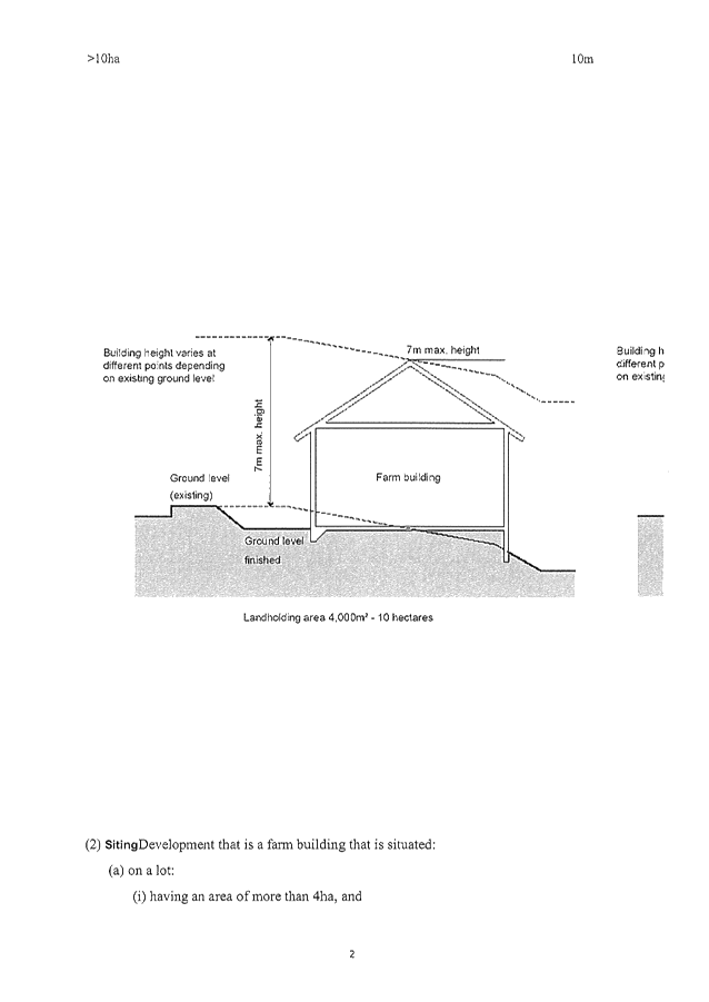
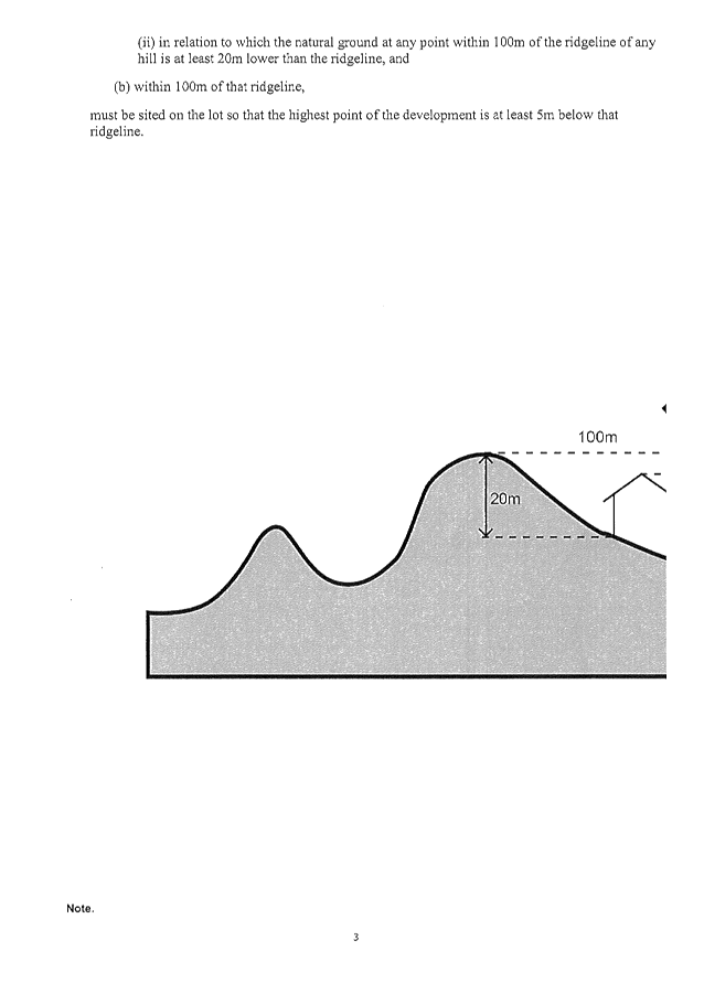
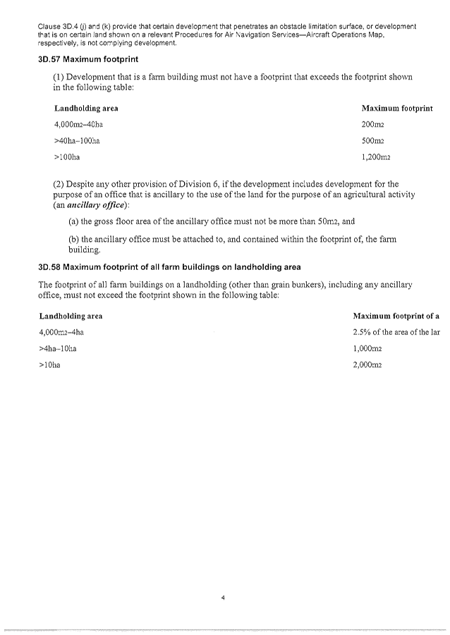
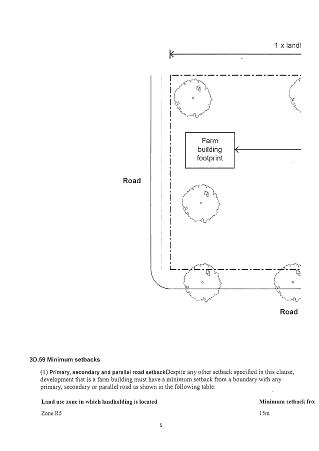
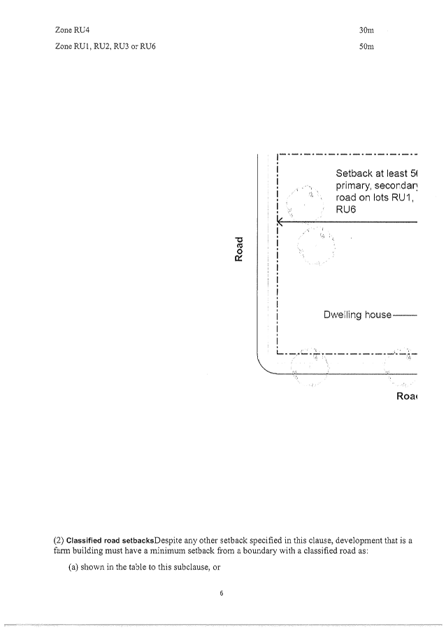

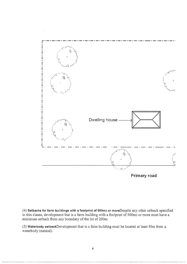
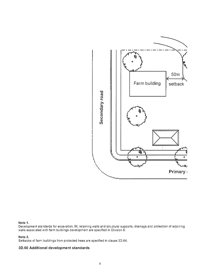
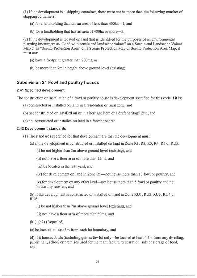


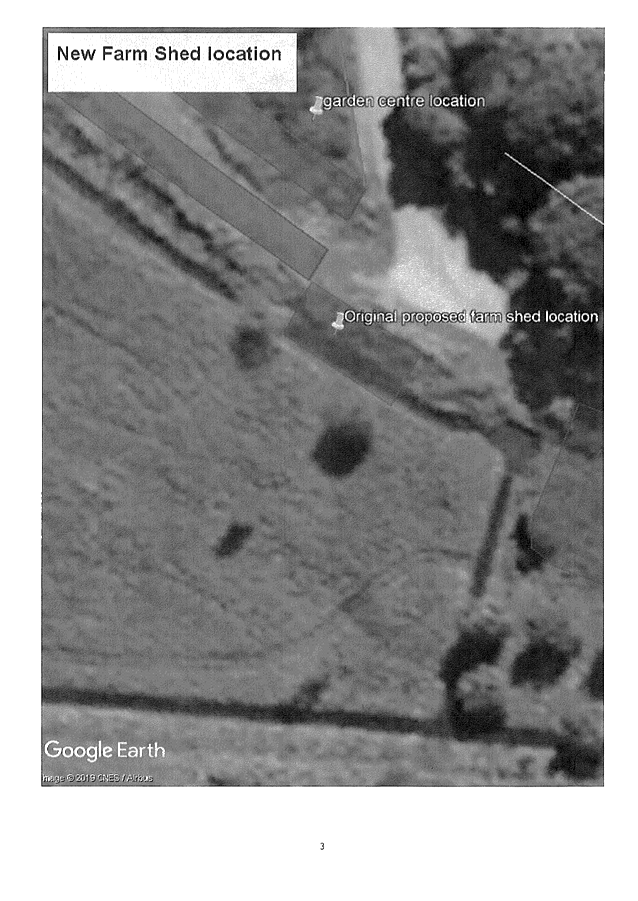

Staff Reports - Sustainable Environment and Economy 13.8 - Attachment 1
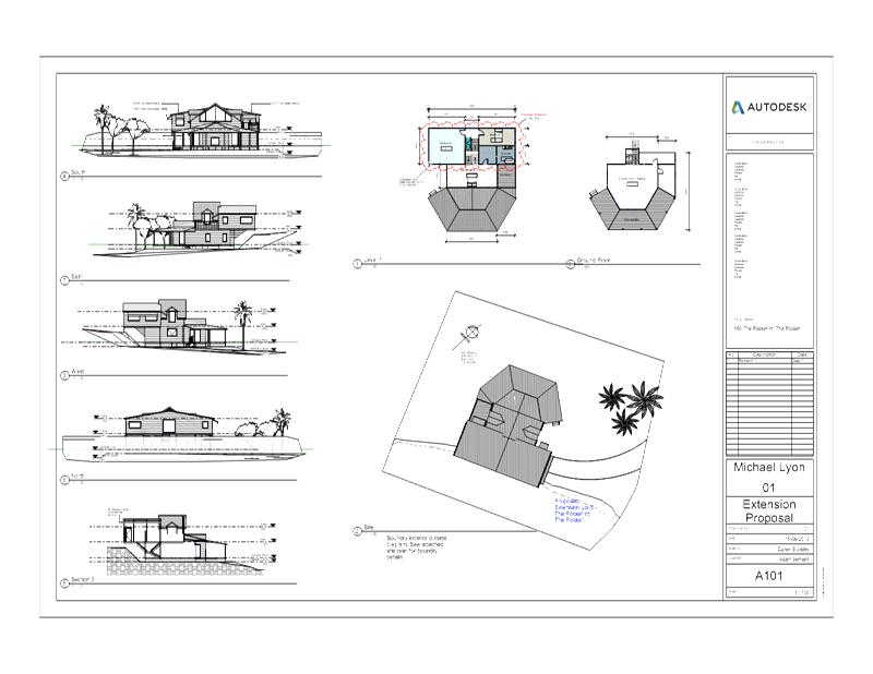
Staff Reports - Sustainable Environment and Economy 13.8 - Attachment 2
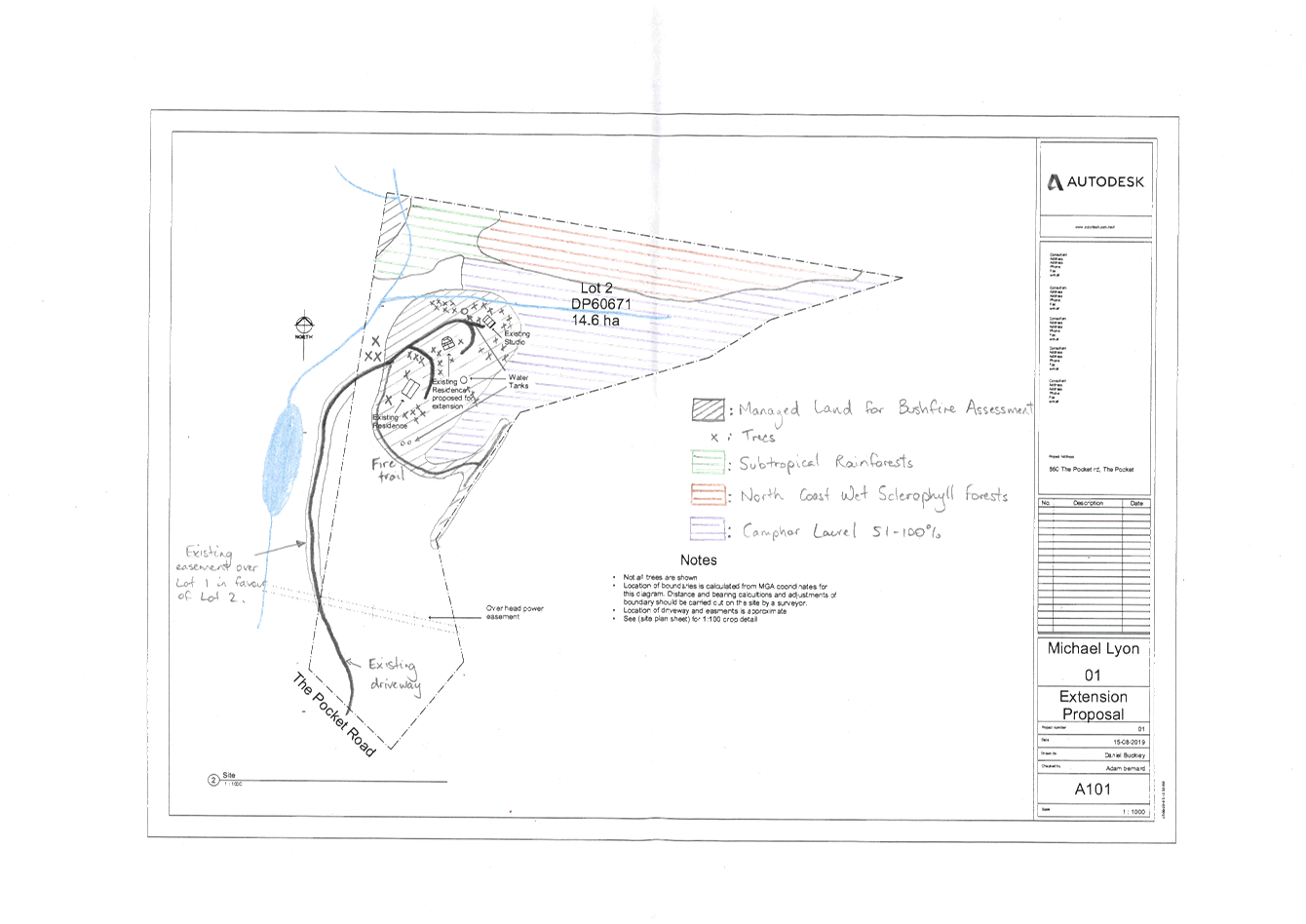
Staff Reports - Sustainable Environment and Economy 13.8 - Attachment 3
10.2019.468.1
CONDITIONS
OF CONSENT:
|
SCHEDULE 1 CONDITIONS
OF CONSENT
|
|
Parameters of
consent
|
|
1.
|
Development
is to be in accordance with approved plans
The development is to be in accordance with plans listed
below:
|
Plan No.
|
Description
|
Prepared by
|
Dated:
|
|
A101
|
Extension Proposal (2) Site
|
Daniel Buckley
|
15/08/2019
|
|
A101 Revision 1
|
Extension Proposal (5) Section 3
|
Daniel Buckley
|
15/08/2019
|
The development is also to be in accordance with any
changes shown in red ink on the approved plans or conditions of consent.
The approved plans and related documents endorsed with the
Council stamp and authorised signature must be kept on site at all times
while work is being undertaken.
|
|
2.
|
Bush fire
safety measures
This land is identified as being designated bush fire
prone land and under section 79BA of the Act, Council must be satisfied prior
to making a determination for development on bush fire prone land that the
development complies with “Planning for Bush Fire Protection
2006”. The development is approved subject to the following
requirements applying:
Asset Protection Zones
The intent of measures is to provide sufficient space and
maintain reduced fuel loads so as to ensure radiant heat levels of buildings
are below critical limits and to prevent direct flame contact with a
building. To achieve this, the following conditions shall apply:
At the commencement of building works and in perpetuity
the property around the dwelling shall be managed as follows:
a) north and east for a
distance of 20 metres as an inner protection area.
Water and Utilities
The intent of measures is to provide adequate services of
water for the protection of buildings during and after the passage of a bush
fire, and to locate gas and electricity so as not to contribute to the risk
of fire to a building. To achieve this, the following conditions shall apply:
In recognition that no reticulated water supply is
available to the development, a total of 20,000 litres water supply shall be
provided for fire fighting purposes. The fire fighting water supply shall be
installed and maintained in the following manner:
a) Fire fighting water
supply may be provided by a tank, a swimming pool or a dam that shall be
located not less than 5 metres and not more than 20 metres from the dwelling
b) New above ground fire
fighting water supply storage’s are to be manufactured using non
combustible material (concrete, metal, etc). Where existing fire fighting
water supply storage’s are constructed of combustible (polycarbonate,
plastic, fibreglass, etc) materials, they shall be shielded from the impact
of radiant heat and direct flame contact.
c) Non combustible materials
(concrete, metal, etc) will only be used to elevate or raise fire fighting
water supply tank(s) above the natural ground level.
d) A 65mm metal Storz outlet
with a gate or ball valve shall be fitted to any fire fighting water supply
tank(s) and accessible for a fire fighting truck.
e) The gate or ball valve,
pipes and tank penetration are adequate for the full 50mm inner diameter
water flow through the Storz fitting and are constructed of a metal material.
f) All associated
fittings to the fire fighting water supply tank(s) shall be non-combustible.
g) Any below ground fire
fighting water supply tank(s) constructed of combustible (polycarbonate,
plastic, fibreglass, etc) materials shall be shielded from the impact of radiant
heat and direct flame contact.
h) A hardened ground surface
for fire fighting truck access is to be constructed up to and within 4 metres
of the fire fighting water supply.
i) Any fire
fighting water supply tank(s) located below ground shall be clearly
delineated to prevent vehicles being driven over the tank.
j) All water
supplies for fire fighting purposes shall be clearly signposted as a fire
fighting water supply.
k) Below ground fire
fighting water supply tank(s) shall have an access hole measuring a minimum
200mm x 200mm to allow fire fighting trucks to access water direct from the
tank.
l) A Static
Water Supply (SWS) sign shall be obtained from the local NSW Rural Fire
Service (RFS) and positioned for ease of identification by RFS personnel and
other users of the SWS. In this regard:
i) Markers must
be fixed in a suitable location so as to be highly visible; and
ii) Markers should be
positioned adjacent to the most appropriate access for the water supply.
Note: The definition of below ground dedicated fire
fighting water supply tank(s) is when the outlet valve is located below
natural ground level.
Electricity and gas services are to comply with section
4.1.3 of ‘Planning for Bush Fire Protection 2006’.
Design and Construction
The intent of measures is that buildings are designed and
constructed to withstand the potential impacts of bush fire attack. To
achieve this, the following conditions shall apply:
New construction shall comply with Sections 3 and 5 (BAL
12.5) Australian Standard AS3959-2009 'Construction of buildings in bush
fire-prone areas' and section A3.7 Addendum Appendix 3 of 'Planning for Bush
Fire Protection'.
Landscaping
Landscaping within the required inner protection area is
to comply with the principles of Appendix 5 of 'Planning for Bush Fire
Protection 2006'.
|
|
3.
|
Existing building/s to be bought into compliance with
fire safety provisions
In accordance with Clause 94 of Environmental Planning
& Assessment Regulation 2000, the existing building is to be bought into
partial compliance with the fire protection and structural provisions of the
Building Code of Australia.
|
|
4.
|
No native
tree removal
This consent
does not authorise the removal of any native trees.
|
|
5.
|
Earthworks
This development consent does not authorise earthworks,
excavation, filling and/or retaining walls.
NOTE: If earthworks and/or retaining walls beyond that
allowed under the State Environmental Planning Policy (Exempt and Complying
Development Codes) 2008 are required, a separate development consent will be
required.
|
|
The following
conditions are to be complied with prior to issue of a Construction
Certificate for building works
|
|
6.
|
On-site sewage management facility - Section 68
approval required
An Approval under Section 68 of the Local
Government Act 1993 for on-site effluent disposal must be obtained from
Council prior to issue of a Construction Certificate. Such approval must be
issued after the date of this consent.
The application for Section 68 approval must be
accompanied by a report prepared by a suitably qualified professional with
demonstrated experience in effluent disposal matters, which addresses the
site specific design of sewage management in accordance with the requirements
of the NSW Local Government Act, and Approvals Regulation and Guidelines
approved by the Director General.
|
|
7.
|
Compliance with BASIX Certificate requirements
The development is to comply with Basix Certificate No. A355628,
dated 25 August 2019
The commitments indicated in the Certificate are to be
indicated on the plans submitted for approval of the Construction
Certificate.
The plans submitted must clearly indicate all windows
numbered or identified in a manner that is consistent with the identification
on the Basix Certificate.
Minor changes to the measures may be undertaken without
the issue of any amendment under Section 4.55 of the Act, provided that the
changes do not affect the form, shape or size of the building.
Such plans and specifications must be approved as part of
the Construction Certificate.
|
|
8.
|
Long Service Levy to be paid
In accordance with Section 6.8 of the Environmental
Planning and Assessment Act 1979 (as amended), a Construction Certificate for
SUBDIVISION WORKS OR BUILDING WORKS shall NOT be issued until any Long
Service Levy payable under Section 34 of the Building and Construction
Industry Long Service Payments Act, 1986 (or where such levy is payable by
instalments, the first instalment of the levy) has been paid (as applicable).
These payments can be made online at www.longservice.nsw.gov.au.
Proof of payment is required to be submitted with the Construction
Certificate application.
For further information regarding the Long Service Payment
please refer to the website above.
|
|
9.
|
Site Waste
Minimisation and Management
All works must comply with the objectives of waste
minimisation and waste management of Part B8.1.2 of DCP 2014.
|
|
10.
|
Tree Removal
No trees or vegetation to be cleared or
removed until a Construction Certificate has been issued.
|
|
The following conditions
are to be complied with prior to any building or construction works
commencing
|
|
11.
|
Erosion
and sediment measures
Where erosion of soils or runoff of any substance is
likely to occur, erosion and sedimentation controls are to be in place in accordance
with the Guidelines for Erosion & Sediment Control on Building
Sites. This may include stockpiled materials such as sand, etc.
Any such measures that are deemed to be necessary because
of the local conditions must be maintained at all times until the site is
made stable (i.e. by permanent vegetation cover or hard surface).
|
|
The following
conditions are to be complied with during any building or construction works
|
|
12.
|
Construction
times
Construction works must not unreasonably interfere with
the amenity of the neighbourhood. In particular construction noise, when
audible from adjoining residential premises, can only occur:
a. Monday to Friday,
from 7 am to 6 pm.
b. Saturday, from 8 am
to 1 pm.
No construction work to take place on Saturdays and
Sundays adjacent to Public Holidays and Public Holidays and the Construction
Industry Awarded Rostered Days Off (RDO) adjacent to Public Holidays.
Note: Council may impose on-the-spot fines for
non-compliance with this condition.
|
|
13.
|
Construction
Noise
Construction noise is to be limited as follows:
a. For
construction periods of four (4) weeks and under, the L10 noise level
measured over a period of not less than fifteen (15) minutes when the
construction site is in operation must not exceed the background level by
more than 20 dB(A).
b. For
construction periods greater than four (4) weeks and not exceeding twenty‑six
(26) weeks, the L10 noise level measured over a period of not less than
fifteen (15) minutes when the construction site is in operation must not
exceed the background level by more than 10 dB(A)
Note: Council may impose on-the-spot fines for
non-compliance with this condition.
|
|
14.
|
Signs to
be erected on building and demolition sites
A sign must be erected in a prominent position on the work
site:
a. stating that
unauthorised entry to the work site is prohibited, and
b. showing the name of
the person in charge of the work site and a telephone number at
which that person may be contacted outside working hours.
Any such sign is to be removed when the work has been
completed.
|
|
15.
|
Builders
rubbish to be contained on site
All builders rubbish is to be contained on the site in a
‘Builders Skips’ or an enclosure. Footpaths, road reserves and
public reserves are to be maintained clear of rubbish, building materials and
all other items.
|
|
16.
|
Fill to be
retained on the subject land
Fill material must not encroach onto any adjoining land.
|
|
17.
|
Prevention
of water pollution
Only clean and unpolluted water is to be discharged to
Council’s stormwater drainage system or any watercourse to ensure
compliance with the Protection of Environment Operations Act.
Note: Council may impose on-the-spot fines for
non-compliance with this condition.
|
|
18.
|
Maintenance of sediment and erosion control measures
Sediment and erosion control measures must be maintained
at all times until the site has been stabilised by permanent vegetation cover
or hard surface.
|
|
19.
|
Removal of demolition and other wastes
All wastes, including asbestos and lead-contaminated
wastes, associated with these works are to be handled and disposed of in
accordance with the requirements of the Work Cover Authority. The
applicant/owner is to produce documentary evidence that this condition has
been met. Wastes must be disposed of at a Licenced Waste Facility. All wastes
removed from the site must be managed and disposed of in accordance with the
NSW DECC Waste Classification Guidelines (2008) www.environment.nsw.gov.au/resources/waste/08202classifyingwaste.pdf
|
|
20.
|
Character
and visual impact
To ensure the development is compatible with the
surrounding environment:
a. The
roof must not have a highly reflective surface (White or light-coloured
roofing must not be used where likely to be visually intrusive or to result
in significant glare for neighbouring properties); and
b. Colours
and finishes of building materials must be compatible in character with their
surrounding environment.
|
|
The following
conditions are to be complied with prior to occupation of the building
|
|
21.
|
Works to be completed prior to issue of a Final
Occupation Certificate
All of the works indicated on the plans and approved by
this consent, including any other consents that are necessary for the
completion of this development including approvals issued under the Local
Government Act 1993 and the Roads Act 1993, are to be completed and approved
by the relevant consent authority/s prior to the issue of a Final Occupation
Certificate.
Any Security bond paid for this application will be held
until Council is satisfied that no further works are to be carried out that
may result in damage to Councils road/footpath reserve.
|
|
22.
|
Plumbing Works
All works in relation to any associated Section 68 Water
and Sewerage approval must be fully complied with and have a Final Plumbing
Certificate issued prior to the issue of an Interim or Final Occupation
Certificate.
|
|
23.
|
Stormwater disposal
Stormwater must be collected and disposed of in a
controlled manner such that stormwater flows are:
a. Clear of buildings
and infrastructure,
b. Clear of effluent
disposal areas,
c. Not concentrated so as
to cause soil erosion,
d. Not directly to a
watercourse, and
e. Not onto adjoining land.
|
|
24.
|
Compliance with bushfire conditions
Documentary evidence from a suitably qualified
professional is to be submitted demonstrating that the bush fire conditions
of this Notice of Determination have been complied with.
|
|
SCHEDULE 3 NOTES
|
|
Construction Certificate required:
This development consent is issued under the Environmental
Planning and Assessment Act 1979 and does not relate to structural aspects or
specifications of the building under the Building Code of Australia. All
buildings and alterations require the issue of a Construction Certificate
prior to works commencing. Application forms are available from the customer
services counter or Council’s website www.byron.nsw.gov.au
|
|
Principal Certifying Authority:
Work must not commence until the applicant has:-
a. appointed
a Principal Certifying Authority (if the Council is not the PCA); and
b. given
Council at least two days notice of the intention to commence the erection of
the building. Notice must be given by using the prescribed ‘Form
7’.
c. notified
the Principal Certifying Authority of the Compliance with Part 6 of the Home
Building Act 1989.
|
|
Occupation Certificate required:
The building must not be occupied until the Principal
Certifying Authority has issued an Occupation Certificate.
|
|
Protection of the Environment Operations Act 1997:
It is an offence under the provisions of the Protection of
the Environment Operations Act 1997 to act in a manner causing, or likely to
cause, harm to the environment. Anyone allowing material to enter a waterway
or leaving material where it can be washed off-site may be subject to a
penalty infringement notice (“on-the-spot fine”) or prosecution.
|
|
Penalties apply for failure to comply with development
consents
Failure to comply with conditions of development consent
may lead to an on the spot fine being issued pursuant to section 4.2(1) of
the Environmental Planning & Assessment Act 1979 or prosecution pursuant
to section 9.50 of the Environmental Planning & Assessment Act 1979.
|
|
Plumbing Standards and requirements.
All Plumbing, Water Supply, Sewerage and Stormwater Works
shall be installed in accordance with the Local Government Act 1993, Plumbers
Code of Australia and AS/NZS 3500 Parts 0-5, the approved plans (any
notations on those plans) and the approved specifications. Any plumbing
inspections required under a Section 68 Approval are to occur in accordance
with that approval.
|
|
Relics Provisions- Advice
Attention is directed to the NSW Heritage Act 1977 and the
provisions of the Act in relation to the exposure of relics. The Act
requires that if:
a) a
relic is suspected, or there are reasonable grounds to suspect a relic in
ground, that is likely to be disturbed damaged or destroyed by excavation;
and/or
b) any
relic is discovered in the course of excavation that will be disturbed,
damaged or destroyed by further excavation;
Those responsible for the discovery must notify nominated
management personnel who will in turn notify the Heritage Council of New
South Wales or its delegate, the Office of Environment and Heritage, NSW
Heritage Branch, and suspend work that might have the effect of disturbing,
damaging or destroying such relic until the requirements of the NSW Heritage
Council have been satisfied (ss139, 146).
|
Staff Reports - Sustainable Environment and Economy 13.9 - Attachment 1
Report No. 4.4 Update
on the review of the Biodiversity Conservation Strategy
Directorate: Sustainable
Environment and Economy
Report
Author: Chloe
Dowsett, Coastal and Biodiversity Coordinatior
Peter Boyd, Project Officer -
Environmental Projects
Lizabeth Caddick, Biodiverity
Officer
File No: I2019/844
Summary:
This report is to update the Biodiversity Advisory Committee
regarding progress with the review of the Biodiversity Conservation Strategy
(BCS). Delivery of the BCS has been delayed due the requirement for extensive
detailed shire-wide vegetation mapping, recent and ongoing changes to State
Government biodiversity legislation, and the resignation of Council’s
Biodiversity Officer in late 2018.
Notwithstanding the above, and as interim actions, Council
has been able to deliver several key projects integral to the BCS, including
shire-wide and high environmental value (HEV) vegetation mapping, the Byron
Shire Integrated Pest Management Policy and Strategy (soon to be endorsed by
Council), the Byron Shire Flying-fox Camp Management Plan, the Byron Shire Pest
Animal Management Plan and the Byron Coast Comprehensive Koala Plan of
Management.
Council has recently appointed a new Biodiversity Officer,
who will now progress development of the BCS review as a key priority,
incorporating recent NSW legislative changes, new mapping data and information
from current best practice research.
Staff are aiming to present the revised BSC to Council for
endorsement of public exhibition in late 2019.
|
·
RECOMMENDATION:
That the Biodiversity Advisory Committee note
the update on the review of the Biodiversity Conservation Strategy.
|
Attachments:
1 Report to
Biodiversity and Sustainabilty Advisory Committee meeting 25 October 2013 -
Status of Actions from Biodiversity Conservation Strategy 2013, E2013/64342
REPORT
Background
The Biodiversity Conservation
Strategy 2004 - 14 (BCS 2004) was released in 2004 in parallel with a four year
works program approved from 2004 to 2008. An Environmental Levy was endorsed in
2008 to fund actions and Council’s Environmental and Coastal programs.
As part of the Environmental Levy
process an internal review of the BCS 2004 actions was completed to identify
new and existing actions for inclusion in a works program. The Environmental
Levy and external funding (grant opportunities) have enabled continued
implementation of actions from the BCS 2004. Projects that have been funded
(and continue to be funded in some cases) include development of a Coastal Zone
Management Plan (now CMP – Coastal Management Program), funding of
Council’s bush regeneration team, and pest animal management / control.
In 2013, an internal review
process determined that 69 out of 82 (or 84%) actions had been
implemented (refer Attachment #1 - report to the Biodiversity and
Sustainability Advisory Committee, 25 October 2013).
At this time a commitment was made
to review the BCS 2004 with Council resolving on 7 August 2014 (14-334)
to review and update the BCS in line with five (5) key objectives. Staff
determined that any review of the BCS 2004 would need to be consistent with all
local, regional and state legislation and policy changes, and be guided by a
review of the Shire’s vegetation mapping.
The key objectives for the BCS review are to:
1. Ensure
the Strategy is in accordance with recent local, regional and national plans,
strategies and policies
2. Ensure
the Strategy is in accordance with legislative changes completed since 2004
3. Ensure
the Strategy is reflective of current research and best practise in
biodiversity conservation and management
4. Review
vegetation mapping to reflect changes in vegetation extent and composition over
time, and improve accuracy of line work
5. Identify
new actions to be included to direct future work priorities following
consultation and input from stakeholders and the community.
How did we propose to review the BSC 2004?
The review was to be project managed by Council’s
Biodiversity Officer and overseen by the Biodiversity & Sustainability
Advisory Committee / Panel (now the Biodiversity Advisory Committee). Subgroups
were also formed to assist Council staff responsible for managing and directing
the review process.
The original timeline was delayed, primarily due to the
3-year timeframe required to complete shire-wide vegetation mapping, which
included extensive ground truthing, three rounds of public exhibition, plus
subsequent changes required by the Office of Environment and Heritage (OEH) to
re-map all high conservation value (HCV) vegetation as high environmental value
(HEV), using new criteria. In 2015 major changes to NSW biodiversity and other
related legislation commenced, causing significant challenges and further
delaying delivery of the review.
|
Original Timeline
|
Activity
|
Current status
|
|
Sep–Dec 2014
|
Community engagement
|
Nov 2014-Feb 2015 – Complete
|
|
Oct 2014
|
Review of shire-wide vegetation mapping
|
2015-2017 - Complete
|
|
Feb 2015
|
Draft Strategy reported to Council
|
Pending
|
|
Mar 2015
|
Public exhibition
|
Pending
|
|
April 2015
|
Strategy review finalised
|
Pending
|
Whilst the review was stalled by legislative changes, other
works programs and biodiversity projects have continued in line with the key
objectives of the BCS review. Key achievements include:
· Byron Shire
Flying-fox Camp Management Plan (2018-2023): Completed September 2017. A
plan to guide future management of five flying-fox camps within the LGA. Currently
being implemented by the Biodiversity Projects Officer (Flying-fox PRG reports
to BAC).
· Pest Animal
Management Plan (2018-2023): Completed November 2018. A framework for
management of pest animals on Council managed land, with opportunities for
Council to assist with pest management on private land when funds allow. Currently
being implemented by the Biodiversity Projects Officer.
· Integrated Pest
Management (IPM) Policy: Completed August 2018. A policy framework for
effective and efficient control of pests on Council managed land, using
integrated pest management to minimise the use of pesticides. This project
required in-depth research, trials and technical review of IPM methods over two
years prior to completion.
· Integrated Pest
Management Strategy (2019-2029): Draft due to go to Council on 20 June 2019
for endorsement to go to public exhibition. Provides specific tools and
procedures to enable implementation of Council’s Integrated Pest
Management Policy.
· Byron Coast
Comprehensive Koala Plan of Management (2016): Completed August 2016.
Several projects being implemented by Biodiversity Projects Officer, e.g. NE
Hinterland Regional Koala Project has just commenced (refer other report to the
BAC – 17./06/19). On-going SEPP 44 review and amendments by the
state government may result in some changes to CKPOM.
A summary of current information that now needs to be
incorporated into the updated BCS to achieve the key objectives of the BCS
review is outlined below:
Key Objective #1: Ensure the Strategy is in accordance
with recent local, regional and national plans, strategies and policies
These include:
· Australia’s
Biodiversity Conservation Strategy (2010-2030)
· Byron Coast
Comprehensive Koala Plan of Management (2016)
· North Coast
regional Strategic Weed Management Plan 2017-2022
· Northern Rivers
Biodiversity Management Plan (2010-2020)
· Border Ranges
Rainforest Biodiversity Management Plan (2010-2020)
Key Objective #2: Ensure the Strategy is in accordance
with legislative changes
These include:
· Biosecurity Act
2015 & Regulations 2017: Outlines general biosecurity duty, which means
that anyone who is aware of a potential risk should take all reasonable and
practical measures to minimise or eliminate that risk. Legislation interacts
with integrated pest management & Council Res 13-621.
· Biodiversity
Conservation Act (2016): Significant and complex changes to laws regulating
land clearing and biodiversity protection. The NSW Government put 25 documents
(around 657 pages) on public display and after 2-years consultation, the Act
commenced on 25 August 2017. Council is presently paving its way forward
through the new legislation, and staff are undergoing training delivered by
OEH. Transfer of OEH into the new NSW Department of Planning, Industry and
Environment on 1 July 2019 creates ongoing uncertainty regarding state
government interaction with Council plans and policies.
Key Objective #3: Ensure the Strategy is reflective of
current research and best practise in biodiversity conservation and management
priorities
Including:
· Consideration of
climate change and incorporating measures to accommodate it’s known and
anticipated effects.
· Incorporation of
best practice methodologies outlined in Council’s Pest Animal Management
Plan, Integrated Pest Management Strategy, Comprehensive Koala Plan of
Management and Flying Fox Camp Management Plan.
· Incorporating up
to date Plant Community Types (PCTs), currently in preparation by OEH. Council
biodiversity project officers have been assisting OEH with these updates for
two years, and final PCTs are likely to be available July 2019.
Key Objective #4: Review vegetation mapping to reflect
changes in vegetation extent and composition over time, and improve accuracy of
line work
Whilst Council’s shire-wide vegetation mapping and
High Environmental Value (HEV) vegetation mapping are complete, other local and
regional mapping projects that will be relevant to the BCS are still in
progress, including:
· Byron Shire
Environmental Zones Mapping
· OEH Regional-Scale
Native Vegetation Mapping – Plant Community Types.
Key Objective #5: Identify new actions to be
included to direct future work priorities following consultation and input from
stakeholders and the community
A community survey completed in 2015 received 430 responses,
representing about 1.4% of the shire’s population. Community engagement
for the BCS review was undertaken in 2018-19 to establish what the
Communities’ perceived values, threats, concerns and preferred threat
mitigations for biodiversity in the shire. Engagement included:
· Farmers workshop
(Huonbrook, Oct. 2018)
· Community and
interest groups workshop (Mullumbimby, Dec 2018)
· Online community
survey - BSC website (December 2018 – April 2019)
· Stakeholder
meetings with
o Aboriginal landholders, LALCs
and community groups (Jan – Feb 2019)
o Public Land Managers - NPWS,
Marine Parks, Crown Lands (Feb 2019)
o BSC Council Staff, Managers
and Directors (Feb 2019)
· Report to
Biodiversity Advisory Committee (Feb 2019).
Key Issues
The BCS 2004 review is listed in Council’s 2017-21 OP
and staff will continue to implement the review.
The Strategy is a key document for guiding planning,
decision-making and activities that impact on our environment and community. It will shape future planning and growth, and
provide a framework for navigating future environmental challenges and
opportunities. It will be based on a 10 year timeframe (2019 – 2029) and
will be an overarching reference document, informing a number of other Council
strategies, master plans and initiatives. It must direct Council, as well as
providing best practice leadership to other stakeholders involved in
biodiversity conservation, including the community, landholders, government
agencies and neighbouring local governments.
As such it is imperative that we get it right. To this end,
it is critical that sufficient time is allowed for the strategy review to align
with recent legislative changes, mapping updates and up to date information
regarding current emerging issues including climate change.
Where do we go from here?
Staff are aware that the delivery of the review of the BSC
2004 is overdue, the delay due to various circumstances, some out of staff
control. However, due to some of the emerging issues and high priority threats
facing our biodiversity we suggest a moment to ‘pause and reflect’.
We have the chance to develop a Strategy that is innovative and tackles the key
issues that we are now facing as a priority. Others will look to Council for best
practice and guidance, not just in NSW but Australia-wide, and as such we
suggest that the review is not rushed to completion, just in order to satisfy
reporting timeframes. Since the review began, Council has delivered on many
environmental projects contributing to biodiversity outcomes in the Shire.
Next steps involve our new Biodiversity Officer taking over
the management of the project and developing a new timeframe for delivery of
the project. An indicative timeframe has been developed, below, and the
Committee will be updated on this during the planned August field-trip.
|
Date
|
Activity
|
|
Jun-Jul 2019
|
Biodiversity Officer and consultant (Ecosure) to
complete draft BCS review.
|
|
Jul 2019
|
New OEH vegetation mapping available
|
|
Jul-Aug 2019
|
Expert peer review of BCS
|
|
Aug 2019
|
Update on BCS to BAC during field trip
|
|
Aug 2019
|
Costings
Graphic design
|
|
Sep 2019
|
Presentation of BSC at Councillor Strategic Planning
Workshop
|
|
Oct 2019
|
Update on BCS to BAC during field trip
|
|
Oct 2019
|
Draft BCS to Planning Council Meeting
|
|
Oct-Dec 2019
|
Public exhibition
|
STRATEGIC CONSIDERATIONS
Community Strategic Plan and
Operational Plan
|
CSP Objective
|
L2
|
CSP Strategy
|
L3
|
DP Action
|
L4
|
OP Activity
|
|
Community Objective 3: We protect
and enhance our natural environment
|
3.1
|
Partner to protect and enhance our
biodiversity, ecosystems and ecology
|
3.1.1
|
Protect and enhance our natural
environment and biodiversity
|
3.1.1.2
|
Continue to undertake the Biodiversity
Strategy review
|
Legal/Statutory/Policy Considerations
Relevant Council policies described above. Legislation
relevant to the BCS that has been recently changed or is in the progress of
being amended includes:
· State
Environmental Planning Policy 44 (SEPP 44) for Koala Habitat Protection. Still
under review by State Government. Key changes to SEPP 44 relate to definitions
of Koala habitat, list of tree species, list of Councils and development
assessment process.
· Biodiversity
Conservation Act (2016): Act commenced on 25 August 2017, however Plant
Community Types (PCTs) still under review.
Financial Considerations
A budget bid for $42,700 has been put forward in FY2019/20
to continue with the review of the Biodiversity Conservation Strategy. The
budget will be adopted on 27 June 2019.
Staff Reports - Sustainable Environment and Economy 13.9 - Attachment 2
Report No. 4.3 Biodiversity
Conservation Strategy Consultation
Directorate: Sustainable
Environment and Economy
Report
Author: Peter
Boyd, Project Officer - Environmental Projects
File No: I2019/6
Theme: Sustainable Environment and Economy
Planning Policy and Natural Environment
Summary:
Community engagement is a large component of project
delivery for the revised Biodiversity Strategy (Strategy) and will help inform
the development of the revised Strategy. The Consultant (Ecosure) and council
staff have already held meetings with a variety of relevant stakeholders during
late 2018, and will continue engagement during early 2019.
Late last year a Farmers Workshop was held at Huonbrook and
a Community and Interest Groups Workshop was held in Mullumbimby, along with
discussion with Council management and staff. Meetings with traditional owners
and other public land managers are being organised for early February 2019.
To further inform the development of the Strategy, engaging
with the Biodiversity Advisory Committee is a key step. At today’s
meeting, Ecosure will discuss with the Committee the project to gain insight
into the more specific areas of concern regarding biodiversity in the Shire.
Key questions asked will include what biodiversity values are important to
the Committee, and what are the key issues and threats to Biodiversity?
Council also has a Community Survey available on
Council’s website for members of the community that may not have been
able to attend an engagement event.
The Strategy is presently on-track to be delivered to
Council by May 2019.
|
2)
RECOMMENDATION:
That the
Biodiversity Advisory Committee:
a) Note
that community engagement forms a key part of developing the revised
Biodiversity Conservation Strategy.
b) Inform
the Consultant of the key biodiversity values, issues and threats important
to the Committee.
|
Report
Background
As advised in a report to the March 2018 meeting, a revised
Biodiversity Conservation Strategy (Strategy) is currently under development.
This Strategy will highlight what Council should do in the next 10 years
(including an implementation plan for the first 5 years), what hurdles Council
might face and what Council may need to do to continue to protect and restore
Byron’s biodiversity. It will be shaped by community values, changing
legislation, population growth, consumption patterns and climate change.
The revised Strategy will aim to serve as a roadmap for Council’s
stewardship of our local environment. It will guide our planning decisions and
policy making in all areas that have the ability to influence or impact on the
environment.
Key issues
Important issues relevant to the Strategy include (but are
not limited to):
· Important
biodiversity values
· Threatened species
including the iconic Koala
· Managing
biodiversity on private land
· Diversifying farm
income through private land conservation
· Coastal wetlands
and the intertidal environment
· Managing pest
animals and weeds
· Corridors and
connectivity
· Relevant new
legislative and policy framework including:
o Biodiversity Conservation Act
2016
o Biodiversity Conservation
Investment Strategy 2018
All feedback gathered through engagement activities will
assist in developing the Strategy which is presently on-track to be delivered
to Council by May 2019.
Consultation
and Engagement
Critical to the development of the revised Strategy is
consultation with relevant stakeholders. To ascertain community values and
inform how to go about protecting these values, the Consultant (Ecosure) has
already held meetings with relevant stakeholders during December 2018, and will
continue to engage with during early 2019. Stakeholders include the broader
community, environmental groups, Traditional Owners, Public Land Managers,
Council Managers and Directors as well as the Biodiversity Advisory Committee.
A Farmers Workshop was held on 5 September 2018 at Huonbrook
specifically for members of the farming community. A Community and Interest
Groups Workshop was held in Mullumbimby on 5 December 2018, along with
discussion with Council management and staff also on the same day. The general
Community and Interest Groups Workshop was attended by 50 community members and
was highly successful with a number of great initiatives and feedback gained.
Meetings with traditional owners and other public land
managers are being organised for early February 2019.
To further inform the development of the Strategy, engaging
with the Biodiversity Advisory Committee is a key step. At today’s
meeting, Ecosure will be presenting to the Committee to discuss the project and
gain insight into the more specific areas of concern regarding biodiversity in
the Shire. Key questions asked will include what biodiversity values are
important to the Committee, and what are the key issues and threats to
Biodiversity?
STRATEGIC CONSIDERATIONS
Community Strategic Plan and Operational Plan
|
Objective: 3:
|
We protect and enhance our
natural environment
|
|
Strategy 3.1:
|
Partner to protect and enhance
our biodiversity, ecosystems and ecology
|
|
Action 3.1.1
|
Protect and enhance our natural
environment and biodiversity
|
|
Activity: 3.1.1.2
|
Continue to undertake the
Biodiversity Strategy review
|
Legal/Statutory/Policy Considerations
Biodiversity Conservation Act (2016)
Biosecurity Act (2015)
Strategic Plan for Biodiversity 2011–2020
Australia's Biodiversity Conservation Strategy 2010-2030
Australia’s Threatened Species Strategy
Australian Pest Animal Strategy 2017-2027
Australian Weeds Strategy 2017-2027
Draft Biodiversity Conservation Investment Strategy
2017-2037
NSW Biosecurity Strategy 2013-2021 (launched on 22 May 2013)
Draft NSW Invasive Species Plan 2017–2021
North Coast Regional Weed Management Plan 2017-2022
North Coast Regional Pest Animal Management Plan
Financial
Considerations
N/A
Staff Reports - Infrastructure Services 13.10 - Attachment 1


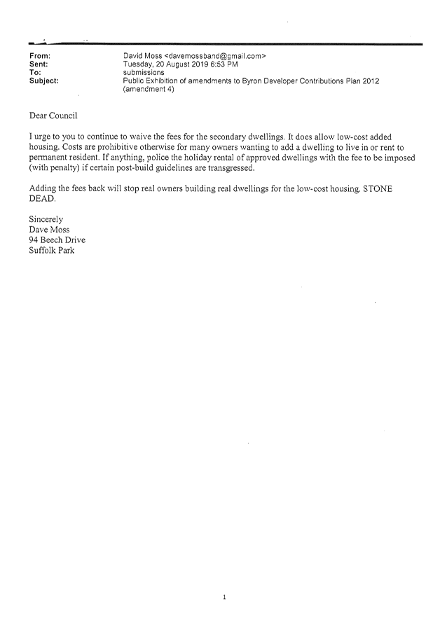
Staff Reports - Infrastructure Services 13.10 - Attachment 2
Byron Shire
Developer Contributions Plan 2012 Amendment 4
Incorporating a section 7.11 and a section 7.12 Plan
under the Environmental Planning and Assessment Act 1979
E2018/72973
This page has been left blank
Contents
Executive Summary. vi
Part A – Section 7.11
Developer Contributions Plan.. 1
Section 1 – Summary schedules. 1
Section
2 –
Administration and operation of the plan. 4
2.1 What is the name
of this development contributions plan?. 4
2.2 Area the plan
applies to. 4
2.3 What is the
purpose of this development contributions plan?. 4
2.4 Commencement of
the plan. 5
2.5 Relationship
with other plans and policies. 5
2.6 Definitions. 5
2.7 For What
Amenities and Services will Contributions be Levied?. 7
2.8 How is this Plan
Structured?. 8
2.9 Operation of the
Plan. 8
2.10 What is the Life
of the Plan?. 8
2.11 When is the
Contribution Payable?. 8
2.12 Construction
certificates and the obligation of accredited certifiers. 9
2.13 Credits and
Exemptions for Certain Types of Development 9
2.14 Secondary
Dwellings. 10
2.15 Exemptions for
Private Boarding Houses, Group Homes and Affordable Housing. 11
2.16 Other Public
Benefit Exemptions from the Contributions Plan. 11
2.17 Development
under State Environmental Planning Policy (Seniors Living) 2004. 12
2.18 Review of Plan
and Contribution Rates. 12
2.19 Adjustment of
Contributions. 13
2.20 Accountability. 13
2.21 Can Deferred or
Periodic Payments be Made?. 13
2.22 Pooling of
Contributions and Staging of works. 14
2.23 Savings and Transitional
Arrangements. 15
2.24 Policy for the
Recoupment of Past Works. 15
2.25 Works in Kind
and Material Public Benefit 15
2.26 Context and
Catchments. 16
Section 3 Population Growth and Increased Demand. 25
3.1 Population and
Housing Profile. 25
3.2 Growth in Byron
Shire LGA. 25
3.3 Demographic
Characteristics. 26
3.4 Predicted Growth
in the LGA. 27
3.5 Growth in
Individual Planning Catchments. 27
3.6 Byron Bay /
Suffolk Park Population Growth. 31
3.7 Bangalow
Population Growth. 32
3.8 Mullumbimby Population
Growth. 33
3.9 Brunswick Heads
Population Growth. 34
3.10 Ocean Shores /
South Golden Beach Population Growth. 35
3.11 Rural North
Population Growth. 36
3.12 Rural South
Population Growth. 37
Section
4 Bikeways and Pedestrian Facilities Strategy Plan. 38
4.1 Bikeways and
Pedestrian Facilities. 38
4.2 Bikeways and
Pedestrian Facilities Existing Provision. 38
4.3 Bikeways and
Pedestrian Facilities Nexus and Future Demand. 39
4.4 Bikeways and
Pedestrian Facilities Reconciliation of Section 94
Contributions Plan 2005. 39
4.5 Bikeways and
Pedestrian Facilities Apportionment 39
4.6 Collection and
Expenditure. 40
4.7 Works schedule. 40
4.8 Formula for the
Calculation of Contributions. 40
5 Strategy Plan Community
Facilities and Libraries. 63
5.1 Introduction. 63
5.2 Byron Bay
Library and Library Services. 63
5.3 Nexus for
Library. 64
5.4 Apportionment
for Library. 64
5.5 Other Community
Facilities. 64
5.6 Nexus and Future
Demand for other Community Facilities. 65
5.7 Reconciliation
of Section 7.11 Contributions Plan 2005. 65
5.8 Community
Facilities Collection and Expenditure. 66
5.9 Timeframe for
Provision Library and other Community Facilities. 66
5.10 Apportionment
for other Community Facilities. 66
5.11 Calculation of
Rate of Contribution. 66
5.12 Formula for the
Calculation of Contributions. 66
6 Open Space and Recreational
Facilities. 90
6.1 Existing
Provision of Open Space and Recreation Facilities. 90
6.2 Nexus and Future
Demand Open Space and Recreation Facilities. 90
6.3 Increased
Capacity Open Space and Recreation Facilities. 91
6.4 Reconciliation
of Section 94 Contributions Plan 2005. 91
6.5 Timeframe for
collection for Open Space and Recreation Facilities. 91
6.6 Timeframe for
Provision of Open Space and Recreation Facilities. 92
6.7 Apportionment
for Open Space and Recreation Facilities. 92
6.8 Calculation of
Rate of Contribution for Open Space and Recreation Facilities. 92
6.9 Formula for the
Calculation of Contributions. 92
7 Urban and Rural Roads. 153
7.1 Nexus and Future
Demand. 153
7.2 Timeframe for
collection. 153
7.3 Timeframe for
Provision. 153
7.4 Apportionment 153
7.5 Calculation of
Rate of Contribution. 154
7.6 Formula for the
Calculation of Contributions. 154
8 Administration. 162
8.1 Nexus and Future
Demand. 162
8.2 Reconciliation
of Section 94 Contributions Plan 2005. 162
8.3 Apportionment 162
8.4 Formula for the
Calculation of Contributions. 163
Part B – Section 7.12
Developer Contributions Plan.. 1
Section
1 – Summary schedules. 1
Section
2 – Expected development and demand for public facilities. 3
Maps
Map 2.1 –Catchments -
Shirewide. 17
Map 2.2 –Catchments
– Rural north. 18
Map 2.3 –Catchments
– Rural South. 19
Map 2.6 –Catchments
– Brunswick Heads. 22
Map 2.7 –4 Catchments -
Mullumbimby. 23
Map 2.8 –Catchments
– Ocean Shores / South Golden Beach. 24
Map 4.1 – Mullumbimby existing and potential cycleways. 52
Map 4.2 – Ocean Shores
North existing and potential cycleways. 53
Map 4.3 – Ocean Shores
South existing and potential cycleways. 54
Map 4.4 – Brunswick
Heads existing and potential cycleways. 55
Map 4.5 – Brunswick
Heads South existing and potential cycleways. 56
Map 4.6 – Bangalow
existing and potential cycleways. 57
Map 4.7 – Ewingsdale
existing and potential cycleways. 58
Map 4.8 – Byron Bay
West existing and potential cycleways. 59
Map 4.9 – Byron Bay
East existing and potential cycleways. 60
Map 4.10 – Byron Bay
South existing and potential cycleways. 61
Map 4.11 – Suffolk Park
existing and potential cycleways. 62
Map 5.1 - Byron Bay Library. 73
Map 5.2 Suffolk Park
Community Hall. New access ramp and accessible toilets. 74
Map 5.3 Sandhills Early
Childhood Centre Playspace Upgrade and Landscape Design. 75
Map 5.4 Mullumbimby Drill
Hall (refer to Community Infrastructure 10 Year Plan) 76
Map 5.5 Sound Shell at Skate
Park (refer Cultural Plan 1.2.e and Youth Strategy and Action Plan) 77
Map 5.6 Mullumbimby CWA
(refer to Community Infrastructure 10 Year Plan) 78
Map 5.7 Civic Hall Acoustics
Upgrade. 79
Map 5.8 Pilgrim Park
Public toilets. Upgrade to toilet block utilising crime prevention
through environmental design (refer #1160588) 80
Map 5.9 Brunswick Heads
Memorial Hall. New Car Park and Accessibility Ramp. 81
Map 5.10 Heritage House -
General Purpose Facilities Requirements. 82
Map 5.11 Bangalow A&I
Hall Improvement Program.. 83
Map 5.1 Mia Court Tennis
Courts/Basketball Construct public toilets. 84
Map 5.13 Acquisition of SGB
Community Hall from the Crown. 85
Map 5.13 Ocean Shores
Community Centre Improvements. 86
Map 5.15 Broken Head Hall
Improvement Program.. 87
Map 5.16 Aboriginal Cultural
Centre. 88
Map 5.17 Landfill expansion. 89
Map 6.1 Byron Regional Sport
and Cultural Complex Multiple Facilities. 109
Map 6.2 Shade Structures and
seating at Suffolk Park skate park. 110
Map 6.3 Enlarged public
toilet facilities at Byron Bay Surf Club. 111
Map 6.4 West Byron Local
Parks Acquisition and Embellishment 112
Map 6.5 Clarkes Beach play
equipment & shade sail 113
Map 6.6 Apex Park Infants
play unit & shade sail, exercise equipment 114
Map 6.7 Railway Park Byron
Bay Additional Play ground equipment/Sail and exercise equipment 115
Map 6.8 Recreation Ground
Byron Bay Additional Playground equipment/sail 116
Map 6.9 Gordon Street
Park. Enlarged Play unit and shade sail 117
Map 6.10 Sunrise Beach Park
Play unit and Sail 118
Map 6.11 Makellar St Play
unit and sail 119
Map 6.12 Pepperbush park play
unit 120
Map 6.13 Baywood Chase Park
Play Equipment 121
Map 6.14 Suffolk Sports field
Play equipment and sail 122
Map 6.15 Gaggin Park Play
Unit 123
Map 6.16 Byron Bay Pool -
Improvements (refer Community Infrastructure 10 Year Plan) 124
Map 6.17 Byron Bay Town
centre upgrade Landscape Precinct Plan. 125
Map 6.18 Community Gardens. 126
Map 6.19 Acquisition and
embellishment of 0.25ha park. 127
Map 6.20 Acquisition and
embellishment of 0.25ha park. 128
Map 6.21 Embellishment of
existing park in Area 2. 129
Map 6.22 Embellishment of
existing park in Area 3. 130
Map 6.23 Bangalow Play
equipment shade sail, Sports Fields Change Rooms / Amenities at Sports Fields. 131
Map 6.24 Bangalow Pool Park
Bangalow Play Unit & sail 132
Map 6.25 Palm Estate Play Unit 133
Map 6.26 Leopardwood Park 2
shade sails. 134
Map 6.27 Riverside park Shade
sail and park play equipment 135
Map 6.28 Mullumbimby Civic
Centre precinct. Exercise Equipment 136
Map 6.29 Pine Avenue sports
ground. Play equipment and shade sail 137
Map 6.30 Heritage park Play
equipment 138
Map 6.31 Pool park.
Play equipment and shade sail 139
Map 6.32 Mullumbimby Pool
Improvements and Heating. 140
Map 6.33 Acquisition and
embellishment of Parks in area 5 as identified in Chapter 11 of DCP. 141
Map 6.34 Acquisition and
embellishment of sports fields as identified in Chapter 11 of DCP. 142
Map 6.35 Tom Kendal Park Play
equipment 143
Map 6.36 SGB community centre
Play equipment & shade sail 144
Map 6.37 Waterlily
park. Play unit and Shade sail 145
Map 6.38 Fern Beach.
Play unit & sail 146
Map 6.39 Surf Club for South
Golden Beach. 147
Map 6.40 Acquisition and
embellishment of 4000 square meter park in Bayside. 148
Map 6.41 Tweed Street
Masterplan Landscaping Upgrades. 149
Map 6.42 Upgrade Surf
Club. 150
Map 6.43 Brunswick Recreation
Ground play equipment & shade sail 151
Map 6.44 Bayside Park.
Play equipment and shade sail 152
Executive Summary
This Plan is called the Byron
Shire Developer Contributions Plan 2012 (amendment 4). This Plan applies to the area known
as Byron Shire as shown on the map 2.1. The plan is split into two parts,
Part A being the Byron Section 7.11 plan that applies to all residential
development and Part B being the Bryon Section 7.12 plan that applies to all
non residential development.
The purpose of this amendment is
to:
1. Deletion
of clause 2.14 that allowed for the waiver of contributions on secondary
dwellings.
2. Consequential
numerical changes of the plan to reflect the updated numbering of the
Environmental Planning and Assessment Act 1979.
For Part A contributions will be
collected for facilities in each catchment and the incoming population in each
catchment will contribute in greater or lesser amounts, to particular
facilities. Some facilities will benefit only the residents of that part
of the LGA and others will benefit residents in the LGA. Where a facility
will service both the local catchment and the entire LGA, the cost of the
facilities will be split proportionally across these catchments.
Both Parts of this plan were
prepared in accordance with the Environmental Planning and Assessment Act
1979 and Environmental Planning and Assessment Regulation 2000.
Both Parts of this plan addresses the public facilities and amenities that will
be required to meet the needs of the current population and the incoming
population of Byron Shire up to 2026.
State Government and Council
plans and policies have been prepared in order to sustain continued population
and employment growth in the Byron Shire. The resident population of the LGA is
forecast to grow by approximately 6,940 between 2011 and 2026. The growth
in the resident population will generate an increase in the demand for public
facilities and services provided by Byron Shire Council.
This Plan has been prepared
taking into consideration the principles of nexus, apportionment and
reasonableness. Using these principles, contributions are being utilised
by Council to ensure that the service level to the existing population is not reduced,
whilst ensuring a similar level of service for the incoming population.
Unless this approach is followed, there will be inequities for the community
– both to those who are long-term residents and for the incoming
population. Incoming populations should make a reasonable contribution
toward the provision of these new and/or augmented facilities. This Plan
describes the future demands for services and facilities in Byron Shire and its
planning catchments. It also sets out the programs of works (projects),
which will be implemented to meet these demands, the anticipated costs of these
programs, and the basis for determining a reasonable apportionment of the costs
to the incoming resident population.
The incoming resident population
emanating from new development in Byron Shire will result in the need for
augmented and/or additional library, community services, open space and
recreation facilities, traffic management, roads, pedestrian and bikeways
improvements.
Part B contributions will be
based on the increased demand for new facilities created by all non residential
development. Part B takes the form of a section 7.12 plan.
Part A – Section 7.11 Developer Contributions
Plan
Section 1 –
Summary schedules
The following summary schedules
are included in this plan:
· Contributions
by area per Standard Dwelling Unit (1 SDU)
· Contribution
by area per person (0.42 SDU)
· Contributions
by area per 2 bedroom dwelling (0.75 SDU)
· Contributions
by area per 1 bedroom dwelling (0.55 SDU)
These are provided as summary tables
only and more details are contained in the individual strategies within the
plan.
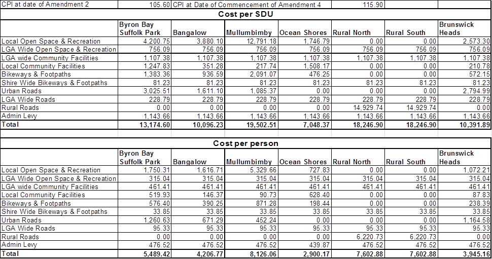
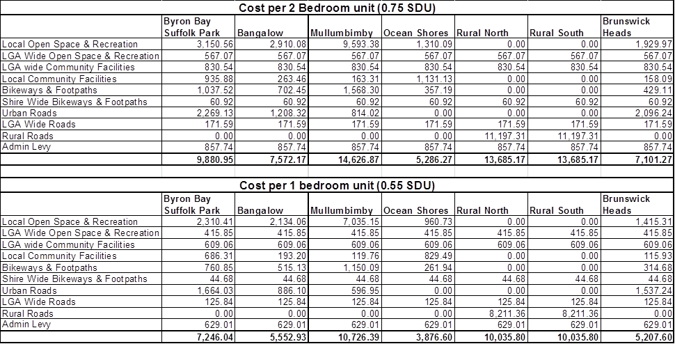
Section 2 – Administration and operation of
the plan
2.1 What
is the name of this development contributions plan?
This development contributions
plan is called the Section
7.11
Development Contributions Plan 2012 (Amendment
4).
2.2 Area the plan applies to
This plan applies to all land
within the local government area(s) as shown on the Map 2.1 Contributions are to be collected either on a LGA
wide basis or on a catchment basis and in some circumstances both.
Catchments are mapped and are shown as maps 2.1 to 2.8.
2.3 What is the purpose of this
development contributions plan?
The primary purpose of this Plan
is to satisfy the requirements of the Environmental Planning and Assessment Act
and the EP&A Regulation to enable Byron Shire Council to require payment of
a monetary contribution, a dedication of land, or, in lieu thereof, to accept
the provision of material public benefits (including the dedication of land) or
the carrying out of works in kind, towards the provision, extension or
augmentation of services and facilities that will, or are likely to be,
required as a consequence of development in Byron Shire.
Other purposes of this Plan are
to:
(a) provide
an administrative framework under which specific public facilities strategies
may be implemented and coordinated
(b) ensure
that adequate public facilities are provided for as part of any new development
(c) to
authorise the council to impose conditions under section 7.11 (s7.11) of the Environmental Planning and
Assessment Act 1979 when
granting consent to development on land to which this plan applies
(d) provide
a comprehensive strategy for the assessment, collection, expenditure accounting
and review of development contributions on an equitable basis
(e) ensure
that the existing community is not burdened by the provision of public amenities
and public services required as a result of future development
(f) enable
the council to be both publicly and financially accountable in its assessment
and administration of the development contributions plan.
(g) provide
the framework for the efficient and equitable determination, collection and
management of development contributions towards the provision of services and
facilities;
(h) ensure
that community infrastructure is provided in a reasonable time;
(i) ensure
that all new development that benefits from community infrastructure
contributes to its provision.
(j) determine
likely development patterns and needs of the population which will result from
that development;
(k) ensure
that the existing Byron Shire community is not unreasonably burdened by the
provision of public infrastructure required (either partly or fully) as a
result of the ongoing development and redevelopment of Byron Shire;
(l) provide
an overall strategy for the coordinated delivery of services and facilities
consistent with Council’s strategic intent and Management Plan;
(m) provide
a comprehensive and transparent strategy which is implemented for the
assessment, accounting and review of development contributions made under
Section 7.11 of the Environmental Planning and Assessment Act 1979 and EP&A
Regulation for Byron Shire; and
(n) indicate a program of works and expenditure for the provision
of community infrastructure required as a result of development.
2.4 Commencement
of the plan
This development contributions
plan has been prepared pursuant to the provisions of s7.11 of the EP&A Act and
Part 4 of the EP&A
Regulation and takes effect from the date on which public notice was
published, pursuant to clause 31(4) of the EP&A
Regulation.
2.5 Relationship
with other plans and policies
This development contributions
plan repeals the Section 94 Development Contributions
Plan 2012 (amendment 3). Contributions raised and paid under the
auspices of the repealed plan will be directed towards the highest priority
facility in the respective categories contained in this Plan.
This Plan is consistent with
Council’s current Management Plan and provides a means of implementing
priority facilities and strategies adopted by Council for the provision of
public facilities and amenities in Byron Shire.
This Plan complements
Council’s various development control plans and policies. However,
developers and owners should check other relevant plans and policies for
further information and development standards that may relate to their site.
The development contributions
plan supplements the provisions of the Byron Local Environmental Plan 2014 and
any amendment or local environmental plan which may supersede it.
2.6 Definitions
The definitions relating to this
Plan not stated in this chapter has the same definition as that contained in
the Byron Shire LEP and Byron Shire DCP. Where a definition is not
contained in this plan, the LEP or DCP then the following documents in order of
preference shall be used to determine them meaning of the word:
1. The Environmental Planning and Assessment Act 1970;
2. The Environmental Planning and Assessment Regulation 2000;
3. Other acts and regulations of the NSW Parliament;
4. The latest edition of the Macquarie Dictionary.
“ABS” means
the Australian Bureau of Statistics.
“Applicant”
means the person, company or organisation submitting a development application.
“Bedroom”
means (for the purposes of this Section 7.11
Contributions Plan) any room,
which is, in the opinion of Council, by its physical design, designated or
capable of being used as a bedroom. This includes separately accessible rooms
designated a bedroom, study, studio, den, attic, home office or the like.
“Consumer Price Index”
means the Consumer Price Index (All Groups Index for Sydney) as published by
the Australian Bureau of Statistics.
“Council”
means the Council of the Shire of Byron.
“Development application”
has the meaning under Section 4 of the Environmental Planning and Assessment
Act,
“Development”
has the meaning under Section 4 of the Environmental Planning and Assessment
Act,
“Development Control
Plan” means the relevant Byron Shire Council Development Control Plan
made according to the Environmental Assessment and Planning Act 1979.
“LGA” means
the local government area.
“Lot” means
an area of topographical space shown on an approved plan of subdivision and on
which it is intended to carry out development.
“Open space”
in the context of this plan, means publicly accessibly parkland or civic space
that may exist or may be provided in accordance with this plan.
“Catchment”
means a geographic or other defined area in which contributions will be
collected for public facilities.
“Planning benefit”
means a development contribution that confers a net public benefit. That is a
benefit that exceeds the benefit derived from measures that would address the
impacts of particular development on surrounding land or the wider community.
Benefit to the community greater than the steps taken to mitigate the impact of
the development.
“Planning obligation”
means an obligation imposed by a Planning Agreement on a developer requiring
the developer to make a development contribution.
“Civic Improvements”
means a work carried out to improve the appearance or us of public
areas, such as streets, malls,
seating, lighting, information boards, footpaths and the like.
“Public benefit”
means the benefit enjoyed by the public as a consequence of a development
contribution.
“Works Schedule”
means the schedule of public facilities and infrastructure for which
development contributions may be required. It also includes the likely timing
of provision of those public facilities based on projected rates of
development.
2.6.1 Mathematical
Interpretation
This plan has been prepared
using Microsoft Excel. The “round” function has been used
throughout the spreadsheet. The following rules have been applied
throughout the spreadsheet:
· Calculations
using persons have been rounded to the nearest integer at the final stage of
calculation.
· Calculations
involving percentages have been rounded to four decimal places and displayed
using the % format showing two decimal places i.e. 0.0476 is displayed as
4.76%.
· Calculations
involving money have been rounded to the nearest cent at each step of the
calculation.
· Conversions
of number of persons to SDU have been rounded to the nearest integer for the
purposes of showing the number of SDU.
The spreadsheet may yield minor
variations to the results obtained with a hand held calculator. This is
due to the spreadsheet using ISO/IEC/IEEE 60559:2011 for floating point
numbers. The rounding used in the formula should mitigate against these
errors. However with regard to rounding and discrepancies between the
spreadsheet and a hand held calculator the output of the spreadsheet is to be
preferred.
In the case where there is an
obvious error in the formula / output then the spreadsheet should be updated
and the contributions plan adjusted in accordance with the regulations.
2.7 For
What Amenities and Services will Contributions be Levied?
This Plan establishes strategies
(Part C) that allow section 7.11 contributions to be levied towards the
provision of the following amenities and services insofar as these amenities
and services relate to the needs generated by new development:
1. Local Open Space & Recreation
2. LGA Wide Open Space & Recreation
3. LGA wide Community Facilities
4. Local Community Facilities
5. Bikeways & Footpaths
6. Shire Wide Bikeways & Footpaths
7. Urban Roads
8. LGA Wide Roads
9. Rural Roads
10. Admin Levy
2.8 How
is this Plan Structured?
This Plan is arranged in four
parts:
Section 1 – contains the summary schedules
for all contributions rates affecting each catchment
Section 2 – provides a summary of the
essential components of the Plan, including the basis for preparing a
development contributions plan, describes the Plan’s operation and
administration, defines the area affected by the Plan and its relationship to
other plans
Section 3 – provides details of the need
for the public facilities to be provided, including the expected development
and population characteristics of Byron Shire.
Section 4 – provides details on the
strategies to deliver each of the categories of public facilities, including
the causal, spatial and temporal link between expected development and the
facilities required, and the philosophy, standards and manner of facility and
service delivery. The works schedules and maps are found in this part
2.9 Operation
of the Plan
Section 7.11 of the
Environmental Planning and Assessment Act 1979 permits Council to require
developers to provide or assist in providing new facilities required as a
consequence of new development. The mechanism to require the contribution is
through the development assessment process. In determining a development
application or issuing a complying development certificate, Council or a
private certifier may impose a condition of consent requiring the payment of a
monetary contribution, dedication of land and/or works in kind, in accordance
with the provisions of this Plan.
This Plan identifies the quantum
of contribution to be levied on an individual development, and what facilities
the contribution may be directed towards. Such details are to be included in
the respective development approval. The parameters and assumptions used to
identify contributions and the works as a result of development occurring are
dynamic. As a result, this Plan will be reviewed periodically. Information on
the contributions received, and details of how these contributions have been applied
toward the provision of the services and facilities described in this Plan,
will be reported in Council’s annual financial statements. A register of
contributions received under this Plan will also be maintained and made
publicly available by Council.
2.10 What
is the Life of the Plan?
This Plan seeks development
contributions for services and facilities required as a result of population
increases. The time frame of this plan is over 15 years from the date of
adoption of the original plan. Where a facility has been completed
Council shall amend the plan and move this facility into recoupment.
Council will continue to recoup the cost of the facility from incoming
population until such time as the facility reaches capacity. The
intention of this plan is for it to be reviewed every five years with
adjustments made to the population projections based on census data and costs
of works updated at this time. Council will also conduct an annual review
to amend priorities and to change completed works over to recoupment. It
is proposed to collect funds under this plan for fifteen years or if a new plan
is prepared then for facilities where the funds have not been fully collected
those works should be rolled forward into a new plan.
2.11 When
is the Contribution Payable?
The amount of developer
contributions will be determined as part of the assessment of a development
application and will appear as a condition of approval on the respective
development consent issued under Section 80 of the Environmental Planning and
Assessment Act 1979. The notice will include a condition indicating the
timing, amount of payment and the specific public amenity or service in respect
of which the condition is imposed.
Generally a condition of consent
shall be worded to the effect that a contribution is payable:
(a) In the case of a
development application involving subdivision - prior to the release of the
Subdivision Certificate. Where the subdivision certificate is for a part
of the development the contribution shall relate to the number of lots created by
the Subdivision Certificate;
(b) In the case of a
development application involving building work - prior to the release of a
Construction Certificate. Where the construction certificate is for part
of a development the contribution shall relate to the number of dwellings ;
(c) In the case of complying
development – prior to the issue of a complying development certificate
(d) In the case a development
application for the use of building or the use of works – prior to the
issue of an 149D certificate,
(e) In the case of a
development application where no building works are involved - prior to
occupation or commencement of the approved use.
(f) In the case of an
extractive industry – at the end of each financial year based upon
extraction rates indicated in the quarterly returns for that year.
These criteria are not
exhaustive and circumstances may arise with a particular development
application where alternative timing of payments is warranted. If a
development does not relate to one of the above criteria then Council may
consider and alternative timing of the payment. The alternative timing
will be determined by Council and is to be set out in a condition of
development consent. The discretion to alter the timing of payment is the
sole discretion of the Council and does not extend to accredited
certifiers.
Where a condition of consent
requiring the payment of a monetary contribution is to be satisfied by way of
provision of a
material public benefit, works in kind or dedication of land then the provision
of a material
public benefit (MPB) , works in kind (WIK) or dedication of land shall be
completed or dedicated prior to the release of the subdivision certificate,
construction certificate, 149D certificate, occupation certificate
complying development certificate, occupation certificate or commencement of
the use as per the criteria (a) to (f) above.
The amount of any monetary
contribution to be paid will be the contribution payable at the time of
consent, and depending on when the development consent is acted upon, may be
subject to reasonable adjustment due to movements in the financial indices and
rates indicated in Section 2.
2.12 Construction
certificates and the obligation of accredited certifiers
In accordance with section 7.21
of the EP&A Act and Clause 146 of the EP&A Regulation, a certifying
authority must not issue a construction certificate for building work or
subdivision work under a development consent unless it has verified that each
condition requiring the payment of monetary contributions has been satisfied.
In particular, the certifier
must ensure that the applicant provides a receipt(s) confirming that
contributions have been fully paid and copies of such receipts must be included
with copies of the certified plans provided to the council in accordance with
clause 142(2) of the EP&A Regulation. Failure to follow this procedure may
render such a certificate invalid. The only exceptions to the requirement
are where a works in kind, material public benefit, dedication of land or
deferred payment arrangement has been agreed by the council. In such
cases, council will issue a letter confirming that an alternative payment
method has been agreed and that the condition has been satisfied.
2.13 Credits
and Exemptions for Certain Types of Development
This plan is based around the
concept of the standard dwelling unit (SDU). One SDU is a three or more
bedroom dwelling with an occupancy rate of 2.4 persons. The following
rates will be adopted for dwellings of less than three bedrooms:
· 2
bedroom dwelling (0.75 SDU)
· 1
bedroom dwelling (0.55 SDU)
This plan assumes that all
existing allotments have an underlying credit of one SDU except in the
following circumstances:
(a) Lots created without Council approval by way of departmental
subdivision by the Crown; or
(b) Lots created for the purposes of utility installations; or
(c) [Deleted in amendment 2]; or
(d) Lots created by way of the closure of a public or crown road;
or
(e) Lots to which clause 15 of the Byron LEP applies and that form
part of an existing holding where a dwelling has already been erected upon
another lot within that holding; or
(f) Vacant lots within commercial or industrial zones.
Lots that meet the criteria
listed in (a) to (f) do not have any credit and development upon this land that
increases population will be required to pay a contribution.
This plan also assumes that
existing dwellings (including multiple dwellings) will have a credit based upon
the number of bedrooms.
Certain additional types of
development have been exempted from the requirement to make a contribution
towards provision or improvement of amenities or services. These types of
development are listed below. Council acknowledges that these various
types of development provided a planning benefit that outweighs the increase in
demand for services generated by the new population that the development will
accommodate.
2.14 [Deleted by amendment 4]
2.15 Exemptions
for Private Boarding Houses, Group Homes and Affordable Housing
Unless superseded by legislation
or direction, in the case of private developments such as hostels, group homes
and boarding houses, this type of development may be able to justify a case for
an exemption so long as it meets State Government criteria for a tax exemption
for low-cost residential accommodation.
An applicant may as part of
their development application make application for the suspension of
contributions. An applicant must comprehensively argue the case for
suspension including the specific circumstances that would distinguish the
subject proposal’s merit case from others.
Applications for merit
suspension will be referred to Council for formal determination and
accompanying submissions will be made public as part of that process.
Applicants should liaise with
Byron Shire Council in relation to Development Applications of this nature.
2.16 Other
Public Benefit Exemptions from the Contributions Plan
It is not always possible to
identify in advance all developments which may be able to make a meritorious
case for an exemption from the obligation to pay some or all of the applicable
contributions. On the principle of ensuring public accountability,
transparency and equity between all developers, this section specifies the
limited opportunity for making a merit-based case for exemption.
Council may formally consider,
on the individual merits, a case for exempting the following types of
development from the levying of contributions:
· Developments
which provide a distinct community benefit on a not-for-profit basis including
but not necessarily limited to: accommodation associated with fire stations,
police stations or police shop fronts, ambulance stations, rescue services,
State Emergency Service (SES) and Rural Fire Services (RFS) operational bases
and the like. This provision is not intended to include corporate
headquarters of any type; and
· Development
by or for non-profit or cooperative organisations which provide a distinct
community benefit including but not limited to: the provision of childcare
services (especially for under-2s and/or special needs children) including
kindergartens and pre-schools; outreach services, community services or the
like, on a cooperative or not-for-profit basis.
Full details of any case for
exemption must be included as part of the Development Application to enable the
Council to make a merit-based assessment of the unique circumstances of the
specific case in question concurrent with the consideration of the Development
Application as a whole.
If Council does not grant a full
exemption to the payment then Council may allow a reduction in the rate of
demand (SDU) for a particular development or Council may allow for the
exclusion of individual line items in the works schedule to enable a
contribution to be calculated.
2.17 Development
under State Environmental Planning Policy (Seniors Living) 2004
All new development, including
housing for seniors and people with disabilities, intensifies the use of the
existing infrastructure and adds incrementally to the demand for public
amenities and services. Older people and people with disabilities enjoy the
current provision of open space and are one of the major users of parkland
areas.
Older people and people with a
disability also use public libraries. Many attend senior citizens meetings in
Council facilities. They also receive services, such as meals on wheels,
community transport, and neighbour aid, organised from the offices of the
Commonwealth and State funded Home and Community services located in
Council’s multipurpose facilities.
Further development of any sort
within the planning catchments to which this Plan applies will lead to an
increase in the demand for road upgrades and traffic management
facilities. It is therefore reasonable for Council to levy contributions
on all development within the area, including housing built under State
Environmental Planning Policy (Seniors Living) 2004.
However, Council may consider an
application to discount or exempt the development from certain
contributions. Applicants seeking Council’s acceptance of such an arrangement
must be able to demonstrate to the satisfaction of Council that sufficient on
site facilities are provided.
Council will consider the merits
of the application, including the potential social and financial implications,
and the ability of the proposed facilities to meet the demand of the incoming
residents. The applicant will need to initiate action by applying to Council in
writing, including full details and plans for the facilities to be provided.
The acceptance of an application will be at Council’s absolute
discretion.
The reduction in the
contribution rate for seniors living will in the case of open space and
community facilities and be calculated by excluding individual items from the
works schedule where it can be demonstrated by the applicant that the
development does not create a demand for a particular facility. In the
case of roads the number of SDU may be reduced to reflect a reduction in trip
generation per person. A traffic study to justify the reduction in trips
per person will be required.
The occupancy rates used for the
purpose of determining contributions will be 1.5 persons per dwelling.
The exclusion of line items from
the works schedule and a reduction in the number of SDU for seniors living
developments is at the sole discretion of Council.
2.18 Review
of Plan and Contribution Rates
Byron Shire Council acknowledges
the need to periodically monitor and review this Contributions Plan.
For this reason, the
contributions will be subject to a number of reviews to take account of such
matters as community needs, costs of amenities and services, rate and extent of
development, affordability of contributions and progress in providing scheduled
works.
In the event of the Council
identifying changes as a result of the review process, amendments to this Plan,
(apart from the periodic adjustment of contributions that is provided for in
Part C of this plan, based on published indices), will be publicly exhibited in
accordance with the requirements of the Environmental Planning and Assessment
Regulation 2000. Pursuant to Clause 32(3) of the Environmental Planning
and Assessment Regulation 2000, Council may make certain minor adjustments or
amendments to this Plan without prior public exhibition and adoption by Council.
It is intended to review this
plan upon adoption of a new LGA wide LEP and /or every five (5) years upon
release of the census data from the ABS.
2.19 Adjustment
of Contributions
To ensure that the values of the
contributions are not eroded over time by movements of the consumer price
index, the Council will amend the contribution rates. The contribution rates
listed in each of the strategy plans will be amended and increased according to
consumer price index to allow for increases in the cost of provision of
facilities. Contributions will also be adjusted at the time of payment in
accordance with the quarterly consumer price index.
Contributions required as a
condition of development consent will be adjusted at the time of payment in
accordance with the latest Consumer Price Index (All Groups – Sydney) as
published quarterly by the Australian Bureau of Statistics, using the following
formula:

C = The
original contribution amount as shown on the consent
Ind1 = The
Consumer Price Index Number (Sydney - All Groups) currently available from the
Australian Bureau of Statistics at the time of payment.
Ind2 = The
Consumer Price Index Number (Sydney - All Groups) last published by the
Australian Bureau of Statistics at the time of the grant of development consent.
2.20 Accountability
Financial management and
accountability are important components of Developer Contributions planning and
is in accordance with the Environmental Planning and Assessment Act 1979.
Council is responsible for the maintenance of an accurate and up to date
register of all Section 7.11 Contributions.
Monetary contributions received
under this Plan are kept in a separate account specifically for this Plan.
Accounting records show the contributions received and expended, including any
interest earned on invested funds for each account.
Separate accounting records are
maintained for Council’s Section 7.11 Contributions Plan. Information on
Contributions accounts and funds relating to this Plan will be provided in a
condensed format within Byron Shire Council’s Annual Reports in
accordance with the requirements of the Environmental Planning and
Assessment Regulation 2000. Information is also available in
Council’s contribution register relating to this Plan, which can be
inspected at Council’s Customer officers during Council’s ordinary
office hours.
2.21 Can
Deferred or Periodic Payments be Made?
Deferred or periodic payments
may only be permitted in the following circumstances:
· Where
the applicant can demonstrate to the Council that the payment of contributions
in accordance with this plan is unreasonable and Council accepts deferred or
periodic payment; or
· Where
the applicant intends to make a contribution by way of works-in-kind or land
dedication in lieu of a cash contribution in a future stage of the development
being levied and Council and the applicant have a legally binding agreement for
the provision of the works or dedication; or
· In
other circumstances considered reasonable by Council.
All requests for deferred or
periodic payment of contributions are required to be made in writing and may
only be accepted where:
· There
are valid reasons for the deferral or periodic payment (as outlined above);
· The
granting of the request will not adversely impact on the administration,
operation or cash reserves;
· The
granting of the request will not jeopardise the timely provision of works or
land identified.
Where Council allows a deferral
of contributions an appropriate bank guarantee shall be secured for the amount
of contributions to be deferred. The conditions under which the Council may
accept deferred settlement by way of a bank guarantee are that:
· The
bank guarantee be by an Australian bank for the amount of the total
contribution, or the amount of the outstanding contribution, plus an amount
equal to thirteen (13) months interest plus any charges associated with
establishing or operating the bank security;
· The
bank unconditionally pays the guaranteed sum to the Council if the Council so
demands in writing not earlier than 12 months from the provision of the
guarantee or completion of the work;
· The
bank must pay the guaranteed sum without reference to the applicant or
landowner or other person who provided the guarantee, and without regard to any
dispute, controversy, issue or other matter relating to the development consent
or the carrying out of development;
· The
Bank's obligations are discharged when payment to the Council is made in
accordance with this guarantee or when Council notifies the Bank in writing
that the guarantee is no longer required;
· Where
a bank guarantee has been deposited with Council, the guarantee shall not be
cancelled until such time as the original contribution and accrued interest are
paid.
The conditions under which the
Council may accept payment by way of periodic payment for a staged development
are that:
· the
instalment be paid before the work commences on the relevant stage of the
development;
· the
amount to be paid at each stage is to be calculated on a pro-rata basis in proportion
to the demand for the relevant facility being levied by the overall
development, plus CPI and any interest that may be due.
Any outstanding component of the
contribution shall be indexed, at the date of payment, in accordance with the
Indicative Borrowing Rate for NSW Local Government Authorities, as published
weekly.
2.22 Pooling of
Contributions and Staging of works
This Plan expressly authorises
monetary Section 7.11 Contributions paid for different purposes to be pooled
and applied (progressively or otherwise) for those purposes or different
purposes. The priorities for the expenditure of the levies are shown in the
works schedule. Monetary contributions collected under previous issues of
this contribution plan, or under equivalent contribution plans to be repealed
on adoption of this contribution plan, are authorised to be pooled and used for
purposes outlined in this plan where those uses are consistent with the purpose
for which the contributions were originally collected, and the intended
original purpose has been either completed, abandoned or provided for by other
means and/or the contributions are surplus.
Where funds from a previous
contributions plan have been allocated to a new work (reconciliation column in
the works schedules) Council may access all or part of these funds to conduct
the works in stages.
The works programme under this
Contributions Plan has, from draft stage, commenced the process of full
integration into Byron Shire’s Council’s Long Term Financial Plan
looking forward over the next ten years. This process facilitates the
assessment of all consequential financial effects of pooling contributions to
bring forward any given work allowing those effects to be recognised and
managed.
2.23 Savings and
Transitional Arrangements
A development application or a modification to a development
application, which has been lodged prior to the commencement of this Plan but
not determined, shall be determined in accordance with the provisions of the
previously adopted plan, which applied at the date of lodgement. A development
application lodged after the commencement of this plan shall be determined in
accordance with the provisions of this plan. A modification to development
consent that was determined under the previously adopted plan shall be assessed
by reviewing the application in accordance with the plan that applied to the
original consent. .
Contributions levied on development consents under the
previous contributions plans remain payable and are indexed in accordance with
that plan. Contributions levied under a previous plan will be allocated to the
highest priority uncompleted project in the new works schedules for the pooling
of funds.
2.24 Policy for the
Recoupment of Past Works
Byron Shire Council entered the
present development phase effectively from 2011. This Contributions Plan covers development growth from the period of 2011 to 2026
for some projects. Long term works which support the full
anticipated extent of population growth commencing from the Byron Shire
Contributions Plan 2005 and previous iterations of the 2012 plan, are rolled
into this Contributions Plan. Where works that were commenced before 2010
are recouped in this Contributions Plan it is because such works have spare
capacity to meet the demands of the new population. Works that will meet
demand arising from the total end population at 2026 and which are, therefore,
proportionally funded over that period of time by that total population, will
be provided on a rolling works programme through to 2026. These
works will roll over to recoupment works on completion. They cannot be
deleted from the Contributions Plan until the technical payback of internal
borrowings from within the Contributions Plan as a whole, in order to bring
that work forward from 2026, is achieved. To do so prematurely would
compromise the proportional funding of the remaining works programme.
2.25 Works in Kind
and Material Public Benefit
The Council may accept an offer
by the applicant to provide an “in-kind” contribution (i.e. the
applicant completes part of all of a work identified in the Plan) or through
provision of another material public benefit in lieu of the applicant
satisfying its obligations under this Plan by way of payment of a monetary
contribution. A material public benefit is defined in the EP&A Act as
not comprising the dedication of land or the payment of monetary contribution.
Council will only accept such
alternatives provided the value of the works to be undertaken is at least equal
to the value of the contribution that would otherwise be required under this
Plan and the standard of the works is to Council’s full satisfaction.
The value of the works must be provided by the applicant at the time of the
request and must be independently certified by a Quantity Surveyor who is
registered with the Australian Institute of Quantity Surveyors or a person who
can demonstrate equivalent qualifications.
Acceptance of works in kind is
at the sole discretion of the Council. Council may review the valuation
of works and may seek the services of an independent person to verify the
costs. In these cases, all costs will be at the expense of the applicant.
2.26 Context
and Catchments
Byron Shire
is a coastal area located in north-eastern New South Wales and is a popular
national and international tourist destination. Byron Shire is located on the
Far North Coast of NSW. The Shire is 556 square kilometres in size and extends
30 kilometres along the coast from Broken Head in the south to South Golden Beach in the North and 20 kilometres inland. The main streets and precincts
in the Shire reflect a myriad of cultural influences, which have developed
largely as a result of its strong tourist trade and its population, which over
the last 20 years has diversified. Rolling green hills and rainforest remnants
characterise the hinterlands whilst extensive clean white beaches flank the
coast.
Historically the main urban
development has centred around Byron Bay and Suffolk Park. However, other
coastal and inland towns have also experienced significant urban development
these include Mullumbimby, Bangalow, Brunswick Heads, Ocean Shores, New Brighton,
and South Golden Beach. The Shire contains many smaller rural villages
dispersed throughout the hinterland including Federal, Main Arm, Wilsons Creek, Eureka, Billinudgel and Goonengerry.
The Strategy Plans contain a
number of different ‘planning catchments’. Maps of these catchments
can be found on Pages 17-24. For the purpose of this Plan certain
contributions are levied on development within these planning catchments or as
whole of LGA or a combination of both an LGA wide and a catchment contribution
for certain types of development. Development in each contribution
catchments will be subject to contributions for some or all of the public
facilities and public amenities described in this plan, depending on the nexus
between development and facilities. The contribution catchments include:
· Byron
Bay/ Suffolk Park.
· Mullumbimby.
· Brunswick
Heads.
· Bangalow.
· Ocean
Shores
· Rural
North.
· Rural
South.
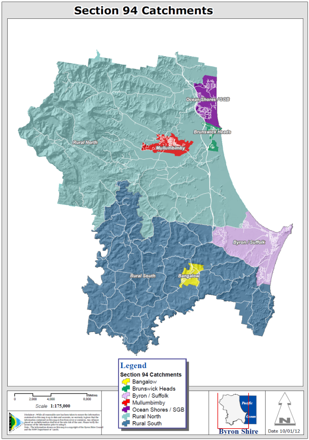
Map 2.1 Shirewide Catchment
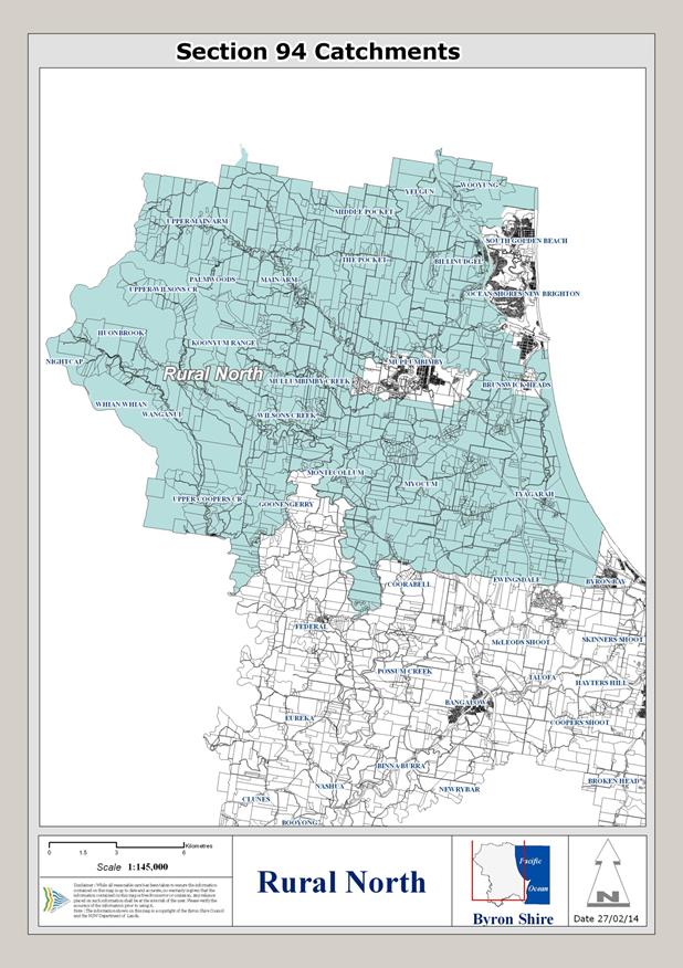
Map 2.2 Rural north Catchment
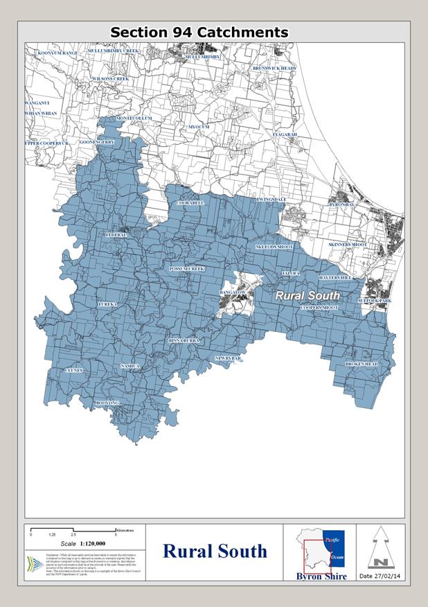
Map 2.3 Rural South Catchment
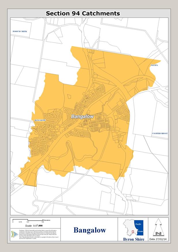
Map 2.4 Bangalow Catchment
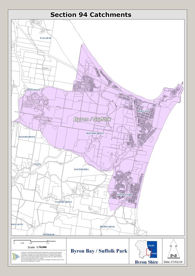
Map 2.5 Byron Bay / Suffolk Park Catchment
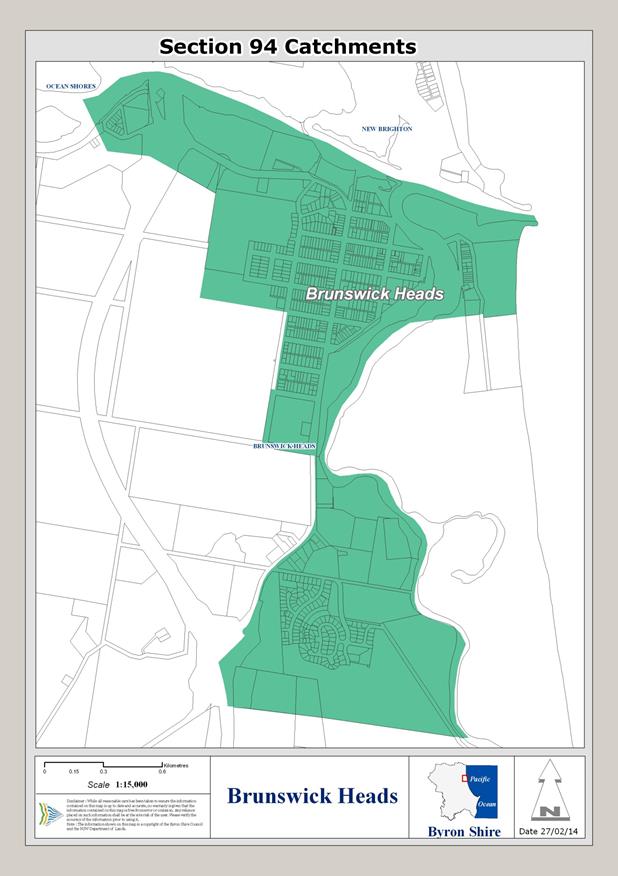
Map 2.6 Brunswick Heads Catchment
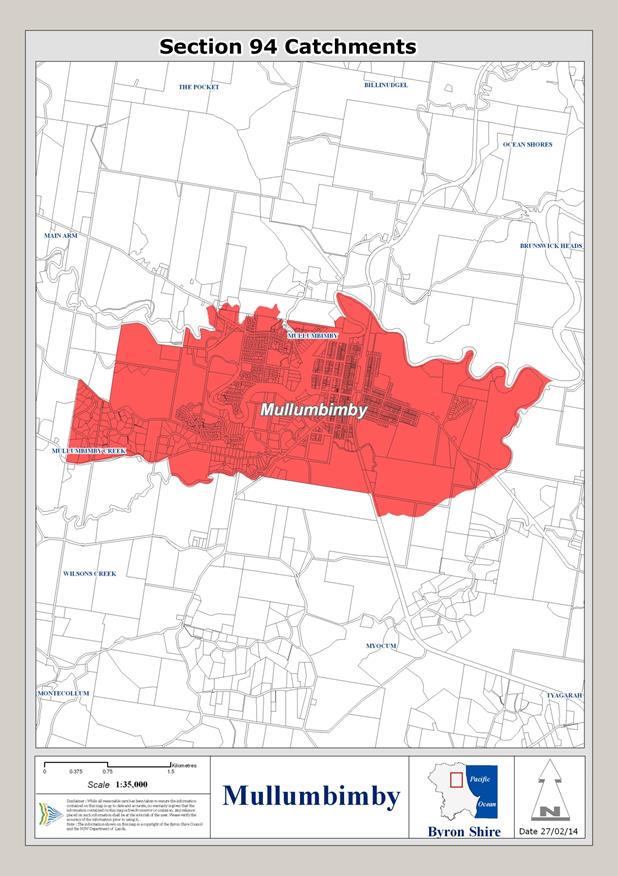
Map 2.7 Mullumbimby Catchment
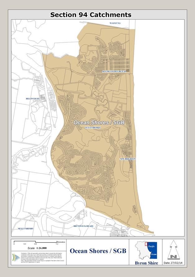
Map 2.8 Ocean Shores /
South Golden Beach Catchment
Section 3 Population Growth and
Increased Demand
3.1 Population
and Housing Profile
The population and housing
profile has been prepared to provide a clear understanding of the
characteristics of the resident population in Byron Shire (the Shire) and to
identify trends. The profile assists in projecting residential population
growth and determining what facilities will be required to meet the needs of
the population resulting from future development. Data has been drawn from the
ABS census data held in 1991, 1996, 2001 and 2006.
3.2 Growth
in Byron Shire LGA
Historically, the population of
Byron Shire has been experiencing rapid growth since 1976. Over the last 30
years (from 1976 to 2006) the population of the Byron Shire has grown by 177
percent. This is significantly more than the NSW growth rate during the same
period of 39.6 percent. In the Byron Shire average annual growth rates
prior to the 2001 census (from 1976 to 1996) averaged 4.74% per annum.
However, these growth rates have slowed, with average annual growth rates of
1.87% per annum in 2001 and 0.42% per annum in 2006. During the 2006
census only 30,329 persons were counted (includes non-residents and
visitors).
However, over the last two
decades rapid development growth has occurred in the hinterlands of the Byron
Shire, particularly in the urban areas of Mullumbimby and Bangalow. One of the
more striking characteristics of the Byron Shire is the large proportion of the
population that live in the hinterlands (Rural North, Rural South, Mullumbimby
and Bangalow accommodate around 43 percent of the population). This spatial
distribution of population creates unique challenges for the provision of
community facilities and services throughout the local government area.
During the mid to late
1990’s, it became evident that a number of existing sewage treatment
works (STP’s) were at or over capacity and there was a concern by the
Council that future development would exacerbate inherent problems with these
plants. These STP’s included Byron Bay, Bangalow, Mullumbimby and
Brunswick Heads. Consequently, Council adopted a policy of restricting urban
releases and development of land until the capacity constraints associated with
the STP’s could be addressed (Council refers to this as the sewerage
moratorium). This sewerage moratorium has been lifted for Byron Bay, Bangalow, Brunswick Heads and Mullumbimby to allow development in these
areas. The sewerage moratorium is one of the primary reasons for the
lower than expected growth up to 2011.
Prior to the sewerage
moratorium, the Byron Shire experienced a boom in development activity
associated with improved property yields and strong residential and tourism
demand at this location. These factors have led to most urban release
development being focused around the coastal urban centres.
The average annual growth rates
in the Byron Shire during the 2001 to 2006 census period were significantly
less than neighbouring local government areas with the Tweed Shire LGA average
annual growth rate of 1.9 percent over this period which was among the fastest in
the state (May 2007, DoP).
The Mid North Coast region has
had a similar increase over the same period of 1.2 per cent per annum, again
this is this is well above growth rates for the state as a whole and one of the
fastest growing regions in New South Wales (Dec 200, DoP).
3.3 Demographic
Characteristics
Byron Shire has a high
proportion of older people. In 2006, 17 percent of Byron Shire’s
population was aged 65 years or over, compared with 14 percent in NSW as a
whole (see Table 10). In 2006, of those persons over 55 years old
approximately 18 percent were not engaged in the work force. Meanwhile, there
are low numbers of person’s aged 25 to 35 in Byron Shire, especially when
compared to NSW. The number of persons under 25 years old is comparable to NSW.
It is interesting to note that
those persons aged 0 to 24 years declined from 31 percent in 2001 to 29 percent
in 2006 and persons aged 55 and above increased from 21 percent in 2001 to 24
percent in 2006.
The Byron Shire population has
large numbers of people aged in their teens and from ages 40 to 60 years.
This is a result of in-migration of older families and people in pre-retirement
years. However Byron Shire has very high out-migration of young adults,
resulting in a relatively small number of people in the 20 to 40 years age
range. The proportion of older people in the population is expected to
increase rapidly as a result of ageing of the existing population and
retirement migration this is shown in table 3.1 from the Department of Planning’s
NSW SLA Population Projections, 2006-2036.
Table 3.1
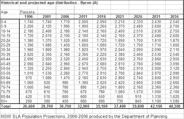
Department of Planning 2010
It is to be noted that the Department
of Planning’s NSW SLA Population Projections, 2006-2036 are based
upon the Estimated Residential Population ERP form the ABS. The ERP has
not been used as the basis for this contributions plan as the smallest unit
that the ERP is available at is the LGA. Place of usual resident was
available at the collection district level. This enables council to determine the starting population if individual catchments as at 2006.
3.4 Predicted
Growth in the LGA
The growth model used for the
LGA uses the 5 year average annual growth rate calculated from the Department
of Planning’s 2010 release of the New South Wales Statistical Local Area
Population Projections (April 2010) Detailed Summary. These projections
translate the 2008 State and regional projections to the local level, along
with projecting demographic changes in areas covered by regional or subregional
strategies.
The ABS census data for place of
usual residence 2006 was used as the start point for the population of the
LGA. The growth rates calculated from the Department of Planning’s
2010 release of the New South Wales Statistical Local Area Population
Projections (April 2010) Detailed Summary were then applied to the place of
usual residence population figures to project and estimate the usual resident
population of the LGA in five year increments.
Each catchment was then
designated as either a growth area or a non-growth area. A growth area
would have available zoned land for significant urban development or proposals
for new development with Council or the State Government. Non-growth
areas would have little or no available land for further urban
development. The growth in each catchment had to be estimated based upon
existing proposed developments or on available zoned land. The potential
population was predicted by lot layouts for proposals such as Bayside Brunswick
Heads, and West Byron or used lot yields for existing zoned land.
These known amounts of growth were allocated to their respective
catchments. The remaining non-growth catchments then had the remaining
growth allocated to them. This enabled differing growth rates to each
catchment rather than use a shire wide average that would produce misleading
outcomes.
The tables on pages 29 to 38
shows the outcomes from the growth model for the LGA and the various
catchments.
The growth model adopts slightly
higher growth rates for some catchments than the department of planning in the
short to medium term (2021) and then the model predicts that growth rates will
then decrease over time. It has been assumed that the higher growth rate
over the next period will be mainly due to the release of some development
areas and the sewerage moratorium being lifted. As the projections make the
assumption that the 2006 occupancy rates will be maintained, these estimates
are therefore generally consistent with the Far North Coast Region Residential
Submarket Analysis (Marcro Plan, 2008) and with the NSW SLA Population
Projections, 2006-2036 produced by the Department of Planning 2010.
3.5 Growth
in Individual Planning Catchments
Over the last 30 years, from
1976 to 2006, each planning precinct has been experiencing a rapid population
growth, with the largest population growth occurring in Ocean Shores. Other planning precincts such as Byron Bay/ Suffolk Park, Bangalow and Rural South have
also had rapid population growth during this period. However, the recent
population history (from 2001 to 2006) in some planning precincts is quite
different to the growth prior to 2001. Over this period the population declined
slightly in Byron Bay/ Suffolk Park, Rural South and Rural North and within
Mullumbimby and Brunswick Heads the population increased only slightly. Ocean Shores continued to slow experience population growth.
Growth in each of the catchments
has been based upon the ABS place of usual resident count and then an average
annual growth rate has been applied in five yearly increments. The
catchments have been divided into two broad categories based on different
growth scenarios:
1. High growth (variable and dependant on lot yield); and
2. Low growth (remainder of growth allocated to achieve the
shire wide growth predicted by the Department of Planning).
Catchments with high growth have known areas of new
development with defined lot yields. These lots yields coupled with a
growth factor to cover redevelopment and dual occupancies will have a growth
rate that is higher than the Department of Planning’s LGA wide average.
Low growth areas have no new release areas and are reliant on dual occupancies
and a limited number new dwellings. Low growth areas will have a growth
rate less than the average growth rate provided by the Department of
Planning.
High Growth Catchments are:
· Byron Bay /
Suffolk Park
· Mullumbimby
· Brunswick Heads
· Bangalow
Low Growth Catchments are:
· Rural North
· Rural South
· Ocean Shores /
South Golden Beach
High growth catchments will have
a growth rate that varies in each catchment based upon known lot yields.
This is will be higher than the Department of Planning’s shire wide
average but tapers off to be equal to the Departments predictions by then end
of the 25 year period. The justification for this demand is the
desirability of certain of the growth areas as places to live and the pent up
demand as a result of the sewer moratorium.
Table
3.2.1 Population Projections for the whole of the Local Government Area
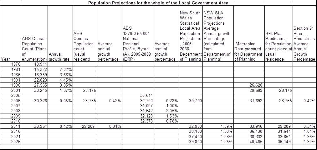 .
.

Table 3.2.2 Shire Wide Growth
3.6 Byron Bay / Suffolk Park Population Growth
Byron Bay/ Suffolk Park is Byron Shire’s largest population centre (30 percent in 2006). In 2006, the
population in this precinct experienced continued growth. The lifting of
the sewerage moratorium will allow this precinct will see continued substantial
growth, as the demand to live in this locality, as shown in the property
market, is relatively strong. The proposed release area at West Byron and
brownfield redevelopment at higher densities will drive growth in this
catchment. A growth rate of 2.14% has been adopted for this catchment
over the 15 year period. Table 3.3.1 shows the predicted population
growth in this catchment.
Table 3.3.1
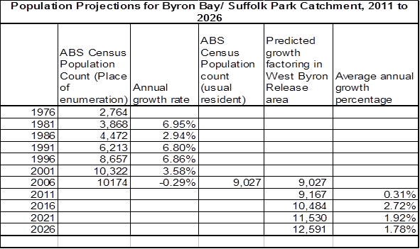
Table 3.3.2
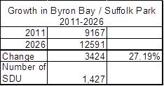
3.7 Bangalow
Population Growth
Bangalow is likely to have continued strong growth.
The basis for growth in the Bangalow catchment is the new release areas as
identified in Chapter 22 of Bryon Council DCP 2010. These greenfield sites have the potential to yield 140-170 new dwellings. A lot yield of
150 lots has been adopted for the purposes of this plan. Additional
growth to account for dual occupancies and other brownfield redevelopment has
been factored into the growth model. This results in Bangalow growing at
a rate significantly higher than the LGA wide average.
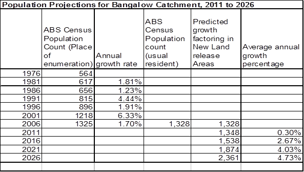
Table 3.4.1
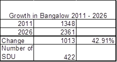
Table 3.4.2
3.8 Mullumbimby
Population Growth
Mullumbimby historically, has
had moderate growth and during the 2006 census the precinct experienced a
positive growth rate. This growth rate has been restricted by the sewer
moratorium. Since the moratorium has been lifted there is likely to be
growth in the new release are known as precinct 5 in Chapter 11 of Byron Shire
DCP 2010. The remaining zoned land in this precinct is likely to yield
and additional 200 lots. Additional growth to account for dual
occupancies and other ‘brownfield’ redevelopment has been factored
into the growth model. This results in Mullumbimby growing at a rate
higher than the LGA wide average.
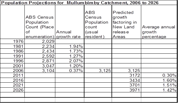
Table 3.5.1
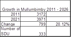
Table 3.5.2
3.9 Brunswick Heads Population Growth
Brunswick Heads due to its limited land availability has
wide historically had variations in its growth rates. The lifting of the
sewerage moratorium in March 2011 will result in continued substantial
growth. There is a new land release area at Bayside that will yield up to
193 lots. This combined with redevelopment of existing lots will drive
growth in this catchment to above the LGA wide average.
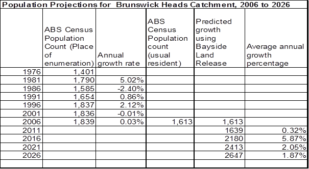
Table 3.6.1
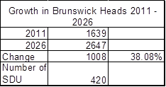
Table 3.6.2
3.10 Ocean Shores / South Golden Beach Population Growth
Ocean Shores and South Golden Beach historically has had
large growth rates due to the large release of land in the area. However,
given the limited land availability in this precinct it is unlikely these rates
will continue. Most of the vacant residential land in this precinct are
subject to existing consents for subdivision and will not be affected by this
Contributions Plan. The projected growth rates have been based on the
amount of land available for residential capacity, demand to reside in the area
and historical take up rates of these lands. Therefore, the population of the Ocean Shores and South Golden Beach is not expected to grow significantly. Growth will be
less than the LGA wide average.
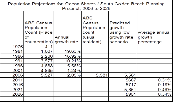
Table 3.7.1
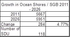
Table 3.7.2
3.11 Rural
North Population Growth
Between the 2001 and 2006
census, the Rural North catchment experienced a decrease in population of over
1 percent. However, given historical (prior to the 2001 census)
population growth rates and land capacity the population is likely to slightly
increase. This assumption is based on Council’s recent approval of
rural residential development at Main Arm and the potential for attached dual
occupancy development. There is further potential for Rural Residential
and Multiple Occupancy development in this catchment but even with this
development this catchment will grow more slowly than the LGA wide
average.
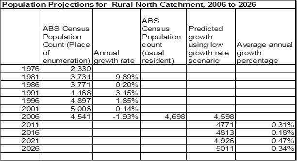
Table 3.8.1
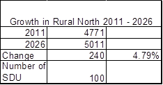
Table 3.8.2
3.12 Rural
South Population Growth
The Rural South catchment, during the 2006 census,
experienced a decrease in population of 1 percent. Given historical (prior to
the 2001 census) population growth rates and the limited land availability and
significant constraints in this precinct it is estimated to increase only
slightly. Growth in this catchment will be due to the remaining zoned
rural residential land and dual occupancy development. Growth in this
catchment will be below the LGA wide average
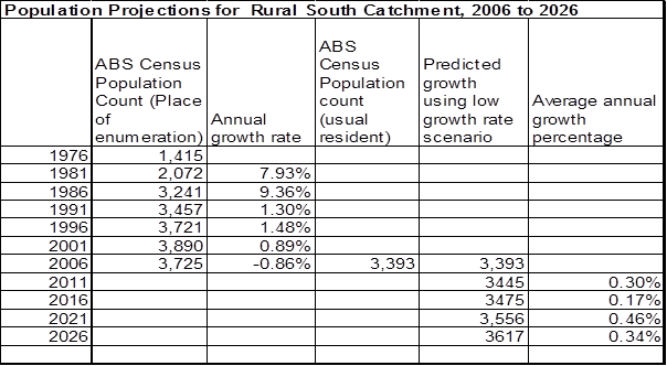
Table 3.9.1
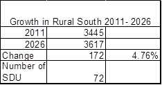
Table 3.9.2
Section 4 Bikeways and
Pedestrian Facilities Strategy Plan
4.1 Bikeways
and Pedestrian Facilities
Transport is a major issue for
many within the Byron Shire. With limited public transport most people rely on
a vehicle or are restricted in their access to essential services and
educational facilities (GHD, 2007). The integration of suitable
pedestrian and bike facilities into a council’s planning activities
provides improvements to equity, health and the environment within the
community and can demonstrate Council’s commitment to ecological
sustainable development. Byron Shire Council remains committed to the
development of a safe and practical pedestrian and cycleway network for the
LGA. Council recognises that additional residential developments, will
increase the demand for cycleways to be constructed.
Council’s objectives are to
provide a consistent standard of facilities for pedestrians and cyclists within
the LGA. The Byron Pedestrian Access and Mobility Plan and Bike Plan
(PAMP) (GHD, 2007) identifies:
· the
demand for multi-use accessways, including off-road pedestrian and cycleway
facilities, walk ways likely to be required as a result of the future urban
development; and
· the
cycleway and path related public amenities and services that will be required
to meet those demands.
In addition, Byron Shire
Council’s Byron Shire Bike Strategy and Action Plan 2008
identifies:
· the
retention, increase and improvement of cycling facilities;
· consistent
review of cyclist needs; and
· the
need to provide a consistent standard of facilities for cyclists within the
area.
The Bike Strategy and Action
Plan will be used as a means to ensure that bike facilities are provided in a
consistent and appropriate manner throughout the Shire and that they meet the
needs of the different user groups.
4.2 Bikeways
and Pedestrian Facilities Existing Provision
Council has for many years been
establishing a cycleway and pedestrian network including acquiring and
embellishing linkages that connect large recreation areas and commercial areas.
The cycleway and pedestrian network offer a flexible and low impact alternative
to the use of private motor vehicles and need to be considered in a whole of
network approach with regard to transport planning.
The Byron Shire Bike Strategy
and Action Plan 2008 reviews the pedestrian and cyclist needs of the different
user groups in Byron Shire. The Byron Shire Bike Strategy and Action
Plan 2008) provides an assessment of existing conditions in each town and
between towns for the LGA. Byron Shire currently accommodates bike and
pedestrian paths combined with the road system and offers good opportunities
for residents, workers and visitors to use bicycles and pedestrian paths for
recreation access. The Byron Shire Bike Strategy and Action Plan 2008 facilitates
the expansion of the existing network of bicycle facilities in Byron
Shire. This plan analyses the existing bike needs and demands which is
necessary to assess the appropriateness of existing facilities and any
additional requirements for the future population. The plan recognises
the needs of different cyclists (commuter, recreational, child, utility or
tourist) and the often competing demands they and other road users generate,
including on and for limited road space, land use and funding.
4.3 Bikeways
and Pedestrian Facilities Nexus and Future Demand
Residential development in Byron
Shire is which will create a demand for travel and recreation by
residents. Sustainable transport management involves the provision of
non-motorised transport modes as well as roads for motorised transport needs.
Provision of multi-use accessways can be effective in providing a sustainable
and balanced transport regime, particularly for trips in the immediate locality
as well as providing an extremely attractive form of recreation and access to
recreation facilities within the Byron Shire.
The PAMP (GHD, 2007) and
the Byron Shire Bike Strategy and Action Plan 2008 identify the need to
provide a well-planned access way network in order to promote alternative
transport use and to cater for the recreational needs of incoming residents.
These plans identify the opportunities for and constraints on developing
bicycle and pedestrian facilities and recommendations for actions required in
establishing a safe, functional and integrated bicycle network throughout the
Shire. The provision of the cycle way and pedestrian network is a reasonable
expectation of incoming residents to the Byron Shire. The cycle way and
pedestrian paths identified are expected to be used for commuters to
travel to school or work, or to link to other transport networks.
There are also new Bikeways
identified in the various chapters of the Byron Shire DCP 2010 and in planning
proposals such as the West Byron Part 3A application. Works identified in
these plans have been included in the works schedules.
4.4 Bikeways
and Pedestrian Facilities Reconciliation of Section 94 Contributions Plan 2005
Council held funds for bikeways
that were not under a contributions plan, pre 1993 funds, and contributions
under the 1993 CP and 2001 CP. Some of the works in these plans were
carried forward into the Section 94 Contributions Plan 2005. This
plan replaces all works within the previous plans with a new works
schedule. All funds held in each catchment have been allocated to the
highest priority works in the works schedule within that catchment to ensure
that funds collected in that catchment are expended in the same
catchment. The funds held under the previous plans have been used to
reduce the cost of the works program and thereby reduce the cost to the incoming
population.
4.5 Bikeways
and Pedestrian Facilities Apportionment
The pedestrian and cycleway
works to be provided to meet the demands of the incoming population of Byron
Shire are identified in the works schedule. The pedestrian and cycleway
facilities have been developed and located to service the industrial,
commercial, tourist and residential land development areas alike. This
plan assumes that there is a proportion of demand created by the new
residential population.
Provision of pedestrian and
bicycle facilities such as signage, bicycle storage racks, special kerb
crossings, etc will be undertaken as part of the public domain
improvements. The purpose of the proposed pedestrian and cycle links and
the associated facilities will be for commuter access (whether just to the
villages and railway station etc or beyond) as well as for recreational
purposes. Accordingly, it is reasonable for all of the incoming population to
contribute towards the cost of these facilities.
The Byron Shire Bike Strategy
and Action Plan 2008 will be provided public facilities that also benefit
the existing population. In this regard there is an existing demand for
all of these facilities. The split in demand was recognised in the Section
94 Contributions Plan 2005. For each catchment the apportionment rate
will be the percentage increase in new population from 2011 through to
2026. These changes are show in the tables on pages A29-A35 for each
catchment.
The new bikeways show in the
chapters of the Byron DCP 2010 and in the West Byron Draft DCP prepared by Land
Partners are 100% attributable to new development in these localities.
4.6 Collection
and Expenditure
Certain elements of the cycleway
network are located within different planning precincts, the cycleway system
that contributions are being sought for under this Plan effectively lead to the
creation of a shire wide trunk route system. As there are different
growth rates in each catchment and therefore different apportionment rates the
contributions will be collected on a catchment basis. The contributions
will then be pooled and as funds become available in the plan they are expended
in priority order. Expenditure will occur when Council’s share of
the apportioned cost is available. The timeframe for collection and
expenditure is based on the priority order in the works schedule. As
works are completed the plan will be reviewed annually and these works moved
over to recoupment. New priorities will be added at each annual
review.
4.7 Works
schedule
The details of the public facilities to be built with the
contributions are set out in the schedule on pages 41 to 50. Maps 1 to 11
from the Byron Shire Bike Strategy and Action Plan 2008 are adopted in
this plan to satisfy the requirements of clause 27 (h) of the Environmental
Planning and Assessment Regulation 2000. These are shown on Pages
51-60. These maps are numbers as maps 4.1 to 4.11 for the purposes of
this plan.
4.8 Formula
for the Calculation of Contributions
The formula used to calculate the contribution for each line
item in a Catchment is:

Where:
W = Total cost of works
R = Reconciliation
amount
P =
Percentage attributable to new development
N = Number of SDU in the
catchment
The formula to calculate the total contribution (TC) per SDU
in a catchment at the time of consent the grant of consent is the sum of all
the line items multiplied by the increase in the
consumer price index:

Where:
CPI = Ind1
at date of consent / Ind2 at date of adoption of plan
n =
number of line items to be summed in a catchment
C =
Contribution(per line item)
Note: Where the consumer price index is negative or
remains the same then value adopted for the purposes of calculation of the
contribution plan shall be the previous quarterly index value.
Bikeways and
Footpaths Works Schedule
|
Facility
(Refer to Bikeways plan for detailed description of works and maps #790722)
|
Priority
|
Priority for Pooling of Funds
|
Estimated Timing for works
|
Time Frame for collection (Years)
|
SDU in time frame
|
Cost of Works
|
Cost of Works Indexed to
24 April 2014
|
S94 Funds bought forward
(reconciliation from old plan)
|
Net cost of works (less
from old plan reconciliation amount)
|
Apportionment (% attributable to new development)
|
Cost of works
attributable to new development
|
Cost of Works
Attributable to Council
|
Cost per SDU
|
|
|
|
|
|
|
N
|
W
|
|
R
|
W-R
|
P
|
|
|
C
|
|
Mullumbimby
|
|
1
Shared path Pine Avenue from Riverside Drive to Main Arm Road 571.2m
|
26
|
|
|
15
|
333
|
114,240.00
|
118,040.55
|
-
|
118,040.55
|
20.12%
|
23,750.79
|
94,289.76
|
71.32
|
|
10
Shared path Main Arm Road from Pine Avenue to primary school 570.6m
|
7
|
|
|
15
|
333
|
114,120.00
|
117,916.56
|
-
|
117,916.56
|
20.12%
|
23,725.85
|
94,190.71
|
71.25
|
|
2
Shared path Station Street from Argyle Street to Fern Street 423.3m
|
8
|
|
|
15
|
333
|
84,660.00
|
87,476.48
|
-
|
87,476.48
|
20.12%
|
17,601.03
|
69,875.45
|
52.86
|
|
3
On-road advisory Fern Street from Station Street to Jubilee Street 200.4m
|
6
|
|
|
15
|
333
|
802.00
|
828.68
|
-
|
828.68
|
20.12%
|
166.74
|
661.94
|
0.50
|
|
4
Shared path Left Bank Road from Jubilee Avenue to Tuckeroo Avenue 770.7m
|
3
|
|
|
15
|
333
|
206,900.00
|
213,783.17
|
27,089.91
|
186,693.26
|
20.12%
|
37,564.32
|
149,128.94
|
112.81
|
|
5
Shared path (see map inset) Left Bank Road from Tuckeroo Avenue to Steiner
School 2,439.8m
|
28
|
|
|
15
|
333
|
487,960.00
|
504,193.50
|
-
|
504,193.50
|
20.12%
|
101,448.15
|
402,745.35
|
304.65
|
|
6
Shared path Azalea Street from western end of existing path to the
intersection of Coolamon Drive 173.1
|
29
|
|
|
15
|
333
|
34,620.00
|
35,771.74
|
-
|
35,771.74
|
20.12%
|
7,197.59
|
28,574.15
|
21.61
|
|
7
Shared path Riverside Drive, from Pine Avenue, with bridge across river to
Burringbar Street 606.4m
|
53
|
|
|
15
|
333
|
2,000,000.00
|
2,066,536.20
|
-
|
2,066,536.20
|
20.12%
|
415,805.19
|
1,650,731.01
|
1,248.66
|
|
8
On-road bike lane Burringbar Street from Dalley Street to Gordon Street
97.4m
|
19
|
|
|
15
|
333
|
389.60
|
402.56
|
-
|
402.56
|
20.12%
|
81.00
|
321.56
|
0.24
|
|
9
Shared path From Riverside Terrace along existing road reserve with bridge
across Saltwater Creek to Memorial Swimming Pool car park 170.9m
|
24
|
|
|
15
|
333
|
34,180.00
|
35,317.10
|
-
|
35,317.10
|
20.12%
|
7,106.11
|
28,210.99
|
21.34
|
|
Mullumbimby
Total
|
|
|
|
|
|
3,077,871.60
|
3,180,266.54
|
27,089.91
|
3,153,176.63
|
|
634,446.77
|
2,518,729.86
|
1,905.24
|
|
|
|
|
|
|
|
|
|
|
|
|
|
|
|
|
Ocean Shores / South Golden Beach
|
|
11 On-road bike lanes Kolora
Way from Shara Boulevard to Old New Brighton Road 532.1m
|
5
|
|
|
15
|
118
|
2,128.40
|
2,199.21
|
-
|
2,199.21
|
4.77%
|
104.95
|
2,094.26
|
0.89
|
|
12 Shared path New Brighton
Road from Kolora Way to Redgate Road 222.2m
|
12
|
|
|
15
|
118
|
51,106.00
|
52,806.20
|
-
|
51,106.00
|
4.77%
|
2,438.94
|
48,667.06
|
20.67
|
|
14 Shared path Kallaroo
Circuit from Public School to existing path at the Bund 185.3m
|
4
|
|
|
15
|
118
|
42,619.00
|
44,036.85
|
-
|
42,619.00
|
4.77%
|
2,033.91
|
40,585.09
|
17.24
|
|
15 Shared path Balemo Drive
from Orana Road to Brunswick Valley Way 2,373.80m
|
71
|
|
|
15
|
118
|
545,974.00
|
564,137.52
|
104,624.34
|
441,349.66
|
4.77%
|
21,062.56
|
420,287.10
|
178.50
|
|
16 On-road advisory Pacific
Esplanade from Helen Street to Gloria Street 332.1m
|
78
|
|
|
15
|
118
|
1,328.40
|
1,372.59
|
-
|
1,328.40
|
4.77%
|
63.40
|
1,265.00
|
0.54
|
|
17 Shared path Rangal Road
from end of existing to intersection of Gloria Street and Beach Avenue
92.1m
|
44
|
|
|
15
|
118
|
21,183.00
|
21,887.72
|
-
|
21,183.00
|
4.77%
|
1,010.92
|
20,172.08
|
8.57
|
|
18 On-road advisory Gloria
Street from Beach Avenue to Pacific Esplanade 105.6m
|
83
|
|
|
15
|
118
|
24,288.00
|
25,096.02
|
-
|
24,288.00
|
4.77%
|
1,159.10
|
23,128.90
|
9.82
|
|
19 Shared path Helen Street
from Pacific Esplanade to canal 540.9m
|
45
|
|
|
15
|
118
|
124,407.00
|
128,545.78
|
-
|
124,407.00
|
4.77%
|
5,937.08
|
118,469.92
|
50.31
|
|
20 Shared path Helen Street
from canal to Kolora Way251.3m
|
41
|
|
|
15
|
118
|
57,799.00
|
59,721.86
|
-
|
57,799.00
|
4.77%
|
2,758.35
|
55,040.65
|
23.38
|
|
21 On-road advisory Brunswick
Valley Way – Orana Road to Bonanza Drive, Billinudgel 979.5m
|
56
|
|
|
15
|
118
|
3,918.00
|
4,048.34
|
-
|
3,918.00
|
4.77%
|
186.98
|
3,731.02
|
1.58
|
|
22 On-road advisory
Brunswick Valley Way – Shara Boulevard to Yelgun Interchange
1,105.60m
|
57
|
|
|
15
|
118
|
4,422.40
|
4,569.52
|
-
|
4,422.40
|
4.77%
|
211.05
|
4,211.35
|
1.79
|
|
23 On-road advisory Wilfred
Street to The Pocket school 5929m
|
65
|
|
|
15
|
118
|
23,716.00
|
24,504.99
|
-
|
23,716.00
|
4.77%
|
1,131.80
|
22,584.20
|
9.59
|
|
24 On-road advisory
Brunswick Valley Way - Yelgun Interchange to Shire boundary with Tweed Shire
3,366.90m
|
58
|
|
|
15
|
118
|
13,467.60
|
13,915.64
|
-
|
13,467.60
|
4.77%
|
642.72
|
12,824.88
|
5.45
|
|
25 On-road advisory Rajah
Road 1,741.20m
|
54
|
|
|
15
|
118
|
6,964.80
|
7,196.51
|
-
|
6,964.80
|
4.77%
|
332.38
|
6,632.42
|
2.82
|
|
26 On-road advisory Orana
Road, from intersection of The Strand & Wirree Dve to Yengarie Way 426.4m
|
51
|
|
|
15
|
118
|
1,705.60
|
1,762.34
|
-
|
1,705.60
|
4.77%
|
81.40
|
1,624.20
|
0.69
|
|
27 Shared path Water Lilly Park
1017.6m
|
74
|
|
|
15
|
118
|
234,048.00
|
241,834.33
|
-
|
234,048.00
|
4.77%
|
11,169.49
|
222,878.51
|
94.66
|
|
28 On-road advisory Orana
Road from Balemo Drive to Warrambool Rd 1,422.50m
|
61
|
|
|
15
|
118
|
5,690.00
|
5,879.30
|
-
|
5,690.00
|
4.77%
|
271.54
|
5,418.46
|
2.30
|
|
29 On-road advisory
Warrambool Road from Rajah Road to Orana Road 773.7m
|
59
|
|
|
15
|
118
|
3,094.80
|
3,197.76
|
-
|
3,094.80
|
4.77%
|
147.69
|
2,947.11
|
1.25
|
|
30 On-road advisory Orana
Road from Warrambool Rd to Yengarie Way 480.7m
|
69
|
|
|
15
|
118
|
1,922.80
|
1,986.77
|
-
|
1,922.80
|
4.77%
|
91.76
|
1,831.04
|
0.78
|
|
31 On-road advisory North
Head Road from The Strand to Nature Reserve road 541.5m
|
42
|
|
|
15
|
118
|
2,166.00
|
2,238.06
|
-
|
2,166.00
|
4.77%
|
103.37
|
2,062.63
|
0.88
|
|
32 On-road advisory
Brunswick Valley Way – Ocean Shores STP Access Road to Orana Road
1,371.40m
|
60
|
|
|
15
|
118
|
5,485.60
|
5,668.10
|
-
|
5,485.60
|
4.77%
|
261.79
|
5,223.81
|
2.22
|
|
Ocean Shores / SGB Total
|
|
|
|
|
|
1,177,434.40
|
1,216,605.41
|
104,624.34
|
1,072,880.87
|
|
51,201.18
|
1,021,679.69
|
433.93
|
|
|
|
Byron Bay Suffolk Park
|
|
Pedestrian improvements
Jonson Street (refer to Community Infrastructure 10 year works program)
|
|
|
|
15
|
1427
|
200,000.00
|
206,653.62
|
-
|
206,653.62
|
27.19%
|
56,197.44
|
150,456.18
|
39.38
|
|
Marine Parade Boardwalk
|
|
1
|
2013
|
15
|
1427
|
150,000.00
|
154,990.22
|
60,000.00
|
94,990.22
|
27.19%
|
25,831.67
|
69,158.55
|
18.10
|
|
Upgrade lighting from
McGettingans Lane to Sunrise Blvd 3200m
|
|
|
|
15
|
1427
|
320,000.00
|
330,645.79
|
-
|
330,645.79
|
27.19%
|
89,915.91
|
240,729.88
|
63.01
|
|
47 Shared path McGettigans
Lane from Ewingsdale Road to Balraith Lane 1,801.9m
|
63
|
|
|
15
|
1427
|
360,380.00
|
372,369.16
|
-
|
372,369.16
|
27.19%
|
101,262.17
|
271,106.99
|
70.96
|
|
48 Shared path Balraith Lane
from McGettigans Lane to Steiner School 337.2m
|
43
|
|
|
15
|
1427
|
67,440.00
|
69,683.60
|
-
|
69,683.60
|
27.19%
|
18,949.78
|
50,733.82
|
13.28
|
|
Recoupment for project
49 Shared path Ewingsdale Road from McGettigans Lane to Bayshore Drive
2106.8m (excludes grants)
|
11
|
|
|
15
|
1427
|
180,800.00
|
186,814.87
|
-
|
186,814.87
|
27.19%
|
50,802.49
|
-
|
35.60
|
|
50 Shared path Ewingsdale
Road from McGettigans Lane to Pacific Highway 806.5m
|
30
|
|
|
15
|
1427
|
161,300.00
|
166,666.14
|
-
|
166,666.14
|
27.19%
|
45,323.24
|
121,342.90
|
31.76
|
|
51 Shared path William Flick
Lane from Ewingsdale Road to Hall. 160.6m
|
55
|
|
|
15
|
1427
|
32,120.00
|
33,188.57
|
-
|
33,188.57
|
27.19%
|
9,025.31
|
24,163.26
|
6.32
|
|
52 On-road advisory Internal
Ewingsdale access from Hall along William Flick Lane to Plantation Drive.
919.1m
|
81
|
|
|
15
|
1427
|
3,676.40
|
3,798.71
|
-
|
3,798.71
|
27.19%
|
1,033.02
|
2,765.69
|
0.72
|
|
53 Shared path From William
Flick Lane to Avocado Crescent 202.4m
|
79
|
|
|
15
|
1427
|
40,480.00
|
41,826.69
|
-
|
41,826.69
|
27.19%
|
11,374.36
|
30,452.33
|
7.97
|
|
54 On-road advisory Woodford
Lane from Ewingsdale Road to Kennedy’s Lane 1,919m
|
72
|
|
|
15
|
1427
|
7,676.00
|
7,931.37
|
-
|
7,931.37
|
27.19%
|
2,156.86
|
5,774.51
|
1.51
|
|
55 Shared path Butler Street
from Somerset Street to “emergency” rail level crossing.
223.1m
|
33
|
|
|
15
|
1427
|
892.40
|
922.09
|
-
|
922.09
|
27.19%
|
250.75
|
671.34
|
0.18
|
|
56 Crossing facility Rail
level crossing connecting Butler Street to Jonson Street. 71.9m
|
52
|
|
|
15
|
1427
|
10,000.00
|
10,332.68
|
-
|
10,332.68
|
27.19%
|
2,809.87
|
7,522.81
|
1.97
|
|
57 Shared path Arts Factory to
Butler Street via Gordon, Wordsworth & Burns Streets 679.5m
|
38
|
|
|
15
|
1427
|
135,900.00
|
140,421.14
|
-
|
140,421.14
|
27.19%
|
38,186.16
|
102,234.98
|
26.76
|
|
58 Shared path Bayshore
Drive from Ewingsdale Road to rail corridor 917.7m
|
21
|
12
|
2015
|
15
|
1427
|
183,540.00
|
189,646.03
|
28,751.72
|
160,894.31
|
27.19%
|
43,753.64
|
117,140.67
|
30.66
|
|
59 Shared path Sunrise
Boulevard and Julian Rocks Drive to existing path 246.2m
|
18
|
3
|
2014
|
15
|
1427
|
49,240.00
|
50,878.12
|
24,620.00
|
26,258.12
|
27.19%
|
7,140.64
|
19,117.48
|
5.00
|
|
60 On-road advisory Kendall
Street from Shirley Street to the end of The Esplanade 1,168.8m
|
66
|
|
|
15
|
1427
|
4,675.20
|
4,830.74
|
-
|
4,830.74
|
27.19%
|
1,313.67
|
3,517.07
|
0.92
|
|
61 Road Crossing facility
Shirley Street / Ewingsdale Road near Kendall Street 19.3m
|
35
|
|
|
15
|
1427
|
10,000.00
|
10,332.68
|
-
|
10,332.68
|
27.19%
|
2,809.87
|
7,522.81
|
1.97
|
|
62 On-road advisory
Along Cowper Street through to Browning Street 523.6m
|
9
|
8
|
2016
|
15
|
1427
|
2,094.40
|
2,164.08
|
1,047.20
|
1,116.88
|
27.19%
|
303.72
|
813.16
|
0.21
|
|
63 On-road advisory Bay
Street from Council Car park to Apex Park 49.8m
|
25
|
|
|
15
|
1427
|
199.20
|
205.83
|
-
|
205.83
|
27.19%
|
55.97
|
149.86
|
0.04
|
|
64 On-road advisory Along
Lighthouse Road from Brooke Drive (The Pass) to Lighthouse. 1018m
|
17
|
5
|
2015
|
15
|
1427
|
4,072.00
|
4,207.47
|
2,036.00
|
2,171.47
|
27.19%
|
590.51
|
1,580.96
|
0.41
|
|
65 Shared path Browning
Street from Bangalow Road to Jonson Street and to RSL 161.3m
|
13
|
6
|
2015
|
15
|
1427
|
32,260.00
|
33,333.23
|
16,130.00
|
17,203.23
|
27.19%
|
4,678.25
|
12,524.98
|
3.28
|
|
66 Shared path Through
reserve, from existing path to Lawson St 286.9m
|
64
|
|
|
15
|
1427
|
57,380.00
|
59,288.92
|
-
|
59,288.92
|
27.19%
|
16,123.05
|
43,165.87
|
11.30
|
|
67 On-road advisory Browning
Street from Cowper Street to Bangalow Road 203.8m
|
40
|
|
|
15
|
1427
|
815.20
|
842.32
|
-
|
842.32
|
27.19%
|
229.06
|
613.26
|
0.16
|
|
69 On-road advisory Lilli
Pilli Drive, from Cemetery Road to end 689m
|
76
|
|
|
15
|
1427
|
2,756.00
|
2,847.69
|
-
|
2,847.69
|
27.19%
|
774.40
|
2,073.29
|
0.54
|
|
70 On-road advisory Cemetery
Road from Old Bangalow Road to Lilli Pilli Drive 293.6m
|
73
|
|
|
15
|
1427
|
1,174.40
|
1,213.47
|
-
|
1,213.47
|
27.19%
|
329.99
|
883.48
|
0.23
|
|
71 On-road advisory Old
Bangalow Road, from Cemetery Road to Bangalow Road 1,929.6m
|
67
|
|
|
15
|
1427
|
7,718.40
|
7,975.18
|
-
|
7,975.18
|
27.19%
|
2,168.77
|
5,806.41
|
1.52
|
|
72 Shared path Broken Head
Road (western side) between Beech Drive (north) to “Byron at Byron
Resort” 398.6m
|
34
|
12
|
2016
|
15
|
1427
|
79,720.00
|
82,372.13
|
39,860.00
|
42,512.13
|
27.19%
|
11,560.76
|
30,951.37
|
8.10
|
|
73 Shared path Broken Head
Road (western side) between Beech Drive north and south roundabouts
654.9m
|
22
|
13
|
2016
|
15
|
1427
|
130,980.00
|
135,337.46
|
87,301.59
|
48,035.87
|
27.19%
|
13,062.89
|
34,972.98
|
9.15
|
|
74 On-road advisory Beech
Drive - full length 1,266.0m
|
50
|
|
|
15
|
1427
|
5,064.00
|
5,232.47
|
-
|
5,232.47
|
27.19%
|
1,422.92
|
3,809.55
|
1.00
|
|
75 On-road advisory To
Broken Head, from Clifford Street, via Broken Head Road and Beach Road
6,843.2m
|
31
|
|
|
15
|
1427
|
27,372.80
|
28,283.44
|
-
|
28,283.44
|
27.19%
|
7,691.41
|
20,592.03
|
5.39
|
|
76 Shared path From Broken
Head Rd to Alcorn Street 683.9m
|
70
|
14
|
2016
|
15
|
1427
|
136,780.00
|
141,330.41
|
75,000.00
|
66,330.41
|
27.19%
|
18,037.91
|
48,292.50
|
12.64
|
|
77 Crossing facilities (not
mapped) Broken Head Road between Beech Drive (north) and Clifford
Street.
|
23
|
|
|
15
|
1427
|
10,000.00
|
10,332.68
|
-
|
10,332.68
|
27.19%
|
2,809.87
|
7,522.81
|
1.97
|
|
New footpath from Broken
Head Road to Kalemajere Drive 420m
|
|
|
|
15
|
1427
|
79,800.00
|
82,454.79
|
-
|
82,454.79
|
27.19%
|
22,422.78
|
60,032.01
|
15.71
|
|
Internal Shared path to West
Byron Development. Refer Draft West Byron DCP Prepared by Land Partners
Approximately 5000m
|
|
NA
|
Progressive completion. Prior to release of
subdivision certificate for each stage of the West Byron development
|
15
|
1427
|
1,150,000.00
|
1,188,258.32
|
-
|
1,188,258.32
|
100.00%
|
1,188,258.32
|
-
|
832.70
|
|
Byron Bay Suffolk Park
Total
|
|
|
|
|
|
3,646,306.40
|
3,767,612.11
|
334,746.51
|
3,432,865.60
|
|
1,798,657.43
|
1,498,195.79
|
1,260.42
|
|
|
|
|
|
|
|
|
|
|
|
|
|
|
|
|
Bangalow
|
|
38 Shared path From 7 Byron
Street to Bowling Club & extension on southern side to Ferros Village
entry168.4m
|
2
|
7
|
2014
|
15
|
422
|
38,732.00
|
40,020.54
|
19,366.00
|
20,654.54
|
42.91%
|
8,861.94
|
11,792.60
|
21.00
|
|
39 Shared path Across
Railway land from Station Street to Leslie Street / Rankin Drive 69.3m
|
62
|
|
|
15
|
422
|
15,939.00
|
16,469.26
|
-
|
16,469.26
|
42.91%
|
7,066.23
|
9,403.03
|
16.74
|
|
40 Shared path Lismore Road
from Reading Bridge to Rifle Range Road 735m
|
|
|
|
15
|
422
|
139,650.00
|
144,295.89
|
-
|
144,295.89
|
42.91%
|
61,910.94
|
82,384.95
|
146.71
|
|
40 Shared path Lismore Road
from Rifle Range Road to Dudgeons Lane, Industrial Estate 1078m
|
27
|
4
|
2041
|
15
|
422
|
277,547.00
|
286,780.46
|
37,375.39
|
249,405.07
|
42.91%
|
107,008.61
|
142,396.46
|
253.57
|
|
41 Shared path Rankin
Drive to Sports Ground via Showground 440.6m
|
47
|
|
|
15
|
422
|
101,338.00
|
104,709.32
|
-
|
104,709.32
|
42.91%
|
44,926.11
|
59,783.21
|
106.46
|
|
42 Shared path Rifle Range
Road from viaduct on Lismore Road to existing at Samson Street 376.1m
|
39
|
15
|
2017
|
15
|
422
|
86,503.00
|
89,380.79
|
43,251.50
|
46,129.29
|
42.91%
|
19,792.02
|
26,337.27
|
46.90
|
|
43 Shared path Raftons Road
from Samson Street to Lismore Road via Leslie Street 649.4m
|
75
|
9
|
2014
|
15
|
422
|
149,362.00
|
154,330.99
|
74,681.00
|
79,649.99
|
42.91%
|
34,174.27
|
45,475.72
|
80.98
|
|
44 Shared path Byron Street
from Snows Bridge to Ashton Street 56m
|
10
|
|
|
15
|
422
|
12,880.00
|
13,308.49
|
-
|
13,308.49
|
42.91%
|
5,710.08
|
7,598.41
|
13.53
|
|
45 On-road advisory From
Byron & Ashton Streets to Lismore Rd at Readings Bridge via Deacon St
613.1m (or in another location as determined by Council)
|
48
|
|
|
15
|
422
|
141,013.00
|
145,704.23
|
-
|
145,704.23
|
42.91%
|
62,515.20
|
83,189.03
|
148.14
|
|
46 Shared path Tristania
Street from Rifle Range Road to Sansom Street 168.6m
|
49
|
|
|
15
|
422
|
30,134.00
|
31,136.50
|
12,125.89
|
19,010.61
|
42.91%
|
8,156.61
|
10,854.00
|
19.33
|
|
Bangalow Total
|
|
|
|
|
|
993,098.00
|
1,026,136.47
|
186,799.78
|
839,336.69
|
|
360,122.01
|
479,214.68
|
853.36
|
|
|
|
|
|
|
|
|
|
|
|
|
|
|
|
|
Brunswick Heads
|
|
Tweed Street Masterplan
Footpath and Bikeway Upgrades
|
|
10
|
2015
|
15
|
420
|
250,000.00
|
258,317.03
|
1,456.54
|
256,860.49
|
38.08%
|
97,814.65
|
159,045.84
|
232.89
|
|
33 Shared path Through
Venture Park from Torakina car park to Surf Club.316.8m
|
36
|
|
|
15
|
420
|
72,864.00
|
75,288.05
|
-
|
75,288.05
|
38.08%
|
28,670.33
|
46,617.72
|
68.26
|
|
34 On-road advisory From
Tweed Street via The Terrace to Park Street and to the southern side of
Fingal Street to Banner Park 513.1m
|
32
|
|
|
15
|
420
|
118,013.00
|
121,939.07
|
-
|
121,939.07
|
38.08%
|
46,435.43
|
75,503.64
|
110.56
|
|
35 Shared path From Bayside
Way through Crown Reserve to Sports Fields linking to facilities at Coastline
Cycleway 273.9m
|
15
|
|
|
15
|
420
|
62,997.00
|
65,092.79
|
-
|
65,092.79
|
38.08%
|
24,787.89
|
40,304.90
|
59.02
|
|
36 Shared path From
Kingsford Drive to Excelsior Circuit 192.1m
|
46
|
|
|
15
|
420
|
44,183.00
|
45,652.88
|
-
|
45,652.88
|
38.08%
|
17,385.00
|
28,267.88
|
41.39
|
|
37 On-road advisory Gulgan
Road, from Mullumbimby Rd (at Uncle Toms) to east side of Pacific Highway (Brunswick
South) interchange 2,451m
|
37
|
|
|
15
|
420
|
9,804.00
|
10,130.16
|
-
|
10,130.16
|
38.08%
|
3,857.65
|
6,272.51
|
9.18
|
|
Brunswick Heads Total
|
|
|
|
|
|
557,861.00
|
576,419.98
|
1,456.54
|
574,963.44
|
|
218,950.95
|
356,012.49
|
521.30
|
|
|
|
|
|
|
|
|
|
|
|
|
|
|
|
|
Shire Wide
|
|
Inspection Program for
compliance with Disability access
|
|
2
|
2014
|
15
|
2,892
|
50,000.00
|
51,663.41
|
39,803.61
|
11,859.80
|
19.20%
|
2,276.88
|
9,582.92
|
0.79
|
|
Disability access ramps and
footpaths upgrades (Refer Community Infrastructure 10 year works program)
|
|
3
|
Progressive expenditure from 2014
|
15
|
2,892
|
837,000.00
|
864,845.40
|
-
|
864,845.40
|
19.20%
|
166,035.77
|
698,809.63
|
57.41
|
|
79 On-road advisory
Mullumbimby Road from Kings Creek Bridge to Gulgan Road 1,839m
|
14
|
|
|
15
|
2,892
|
7,356.00
|
7,600.72
|
-
|
7,600.72
|
19.20%
|
1,459.21
|
6,141.51
|
0.50
|
|
80 On-road advisory Gulgan
Road from Mullumbimby Road (Uncle Toms) to Pacific Highway (south) to
Tyagarah 2,203.40m
|
20
|
|
|
15
|
2,892
|
8,813.60
|
9,106.81
|
-
|
9,106.81
|
19.20%
|
1,748.35
|
7,358.46
|
0.60
|
|
81 On-road advisory Myocum
Road from Ewingsdale Road to Coolamon Scenic Drive 12,137.90m
|
84
|
|
|
15
|
2,892
|
48,551.60
|
50,166.82
|
-
|
50,166.82
|
19.20%
|
9,631.19
|
40,535.63
|
3.33
|
|
86 Cyclist warning signs
Coolamon Scenic Drive from Mullumbimby to Pacific Highway (north) 7,298.50m
|
16
|
|
|
15
|
2,892
|
5,000.00
|
5,166.34
|
-
|
5,166.34
|
19.20%
|
991.85
|
4,174.49
|
0.34
|
|
89 Shared path Federal Park
- Pre-school to Roses Road (400m) 400m
|
82
|
|
|
15
|
2,892
|
92,000.00
|
95,060.67
|
-
|
95,060.67
|
19.20%
|
18,250.05
|
76,810.62
|
6.31
|
|
90 Shared path Federal Park
- Roses Road, Cul de sac to Park Gateway 300m
|
77
|
|
|
15
|
2,892
|
69,000.00
|
71,295.50
|
-
|
71,295.50
|
19.20%
|
13,687.54
|
57,607.96
|
4.73
|
|
91 Village Centres
|
68
|
|
|
15
|
2,892
|
100,000.00
|
103,326.81
|
-
|
103,326.81
|
19.20%
|
19,837.01
|
83,489.80
|
6.86
|
|
Shire Wide Total
|
|
|
|
|
|
1,117,721.20
|
1,154,905.67
|
39,803.61
|
1,115,102.06
|
|
214,080.84
|
901,021.22
|
74.01
|
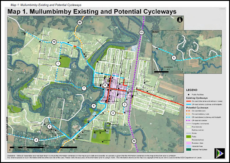
Map 4.1 – Mullumbimby
existing and potential cycleways
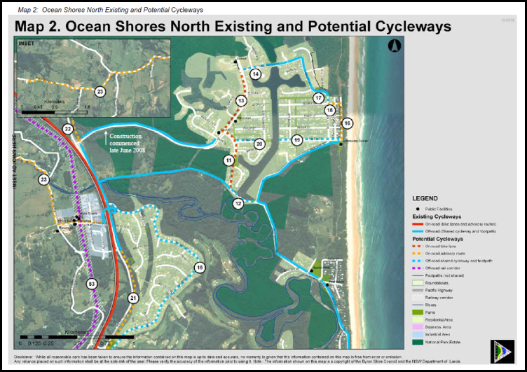
Map 4.2 – Ocean Shores North existing and potential cycleways
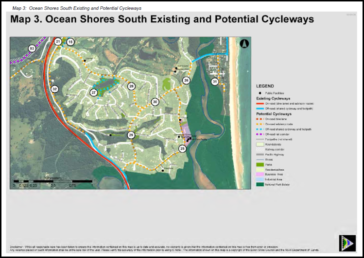
Map 4.3 – Ocean Shores South existing and potential cycleways
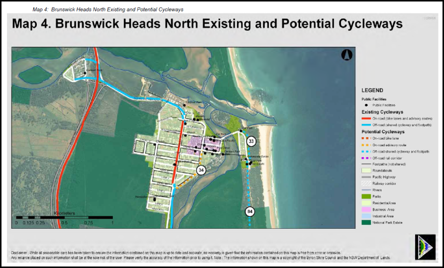
Map 4.4 – Brunswick
Heads existing and potential cycleways
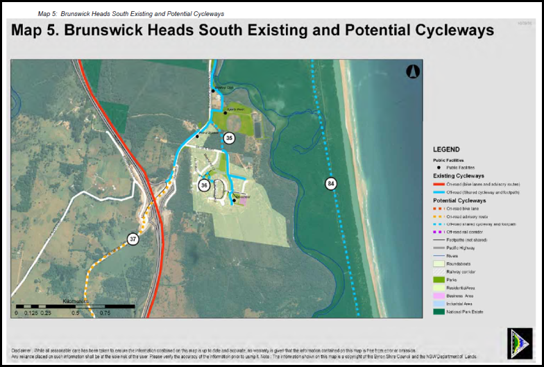
Map 4.5 – Brunswick
Heads South existing and potential cycleways
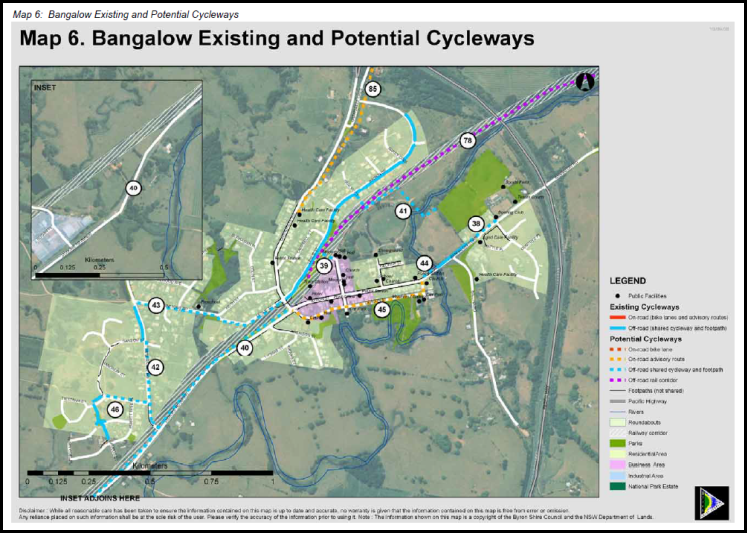
Map 4.6 – Bangalow
existing and potential cycleways
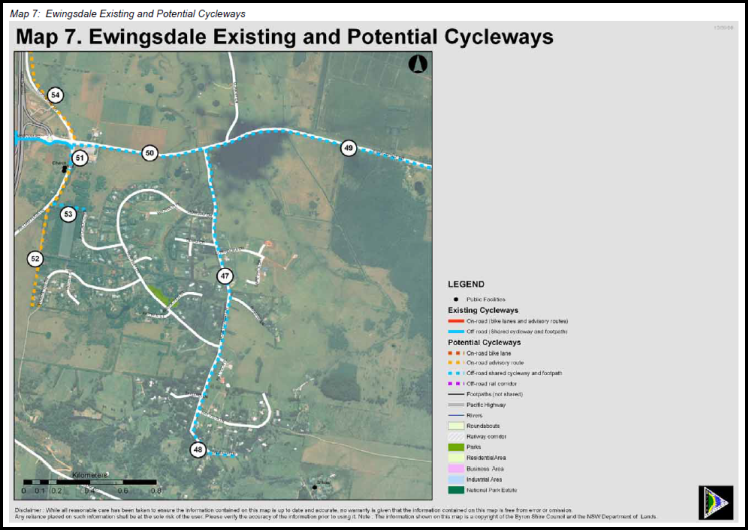
Map 4.7 –
Ewingsdale existing and potential cycleways
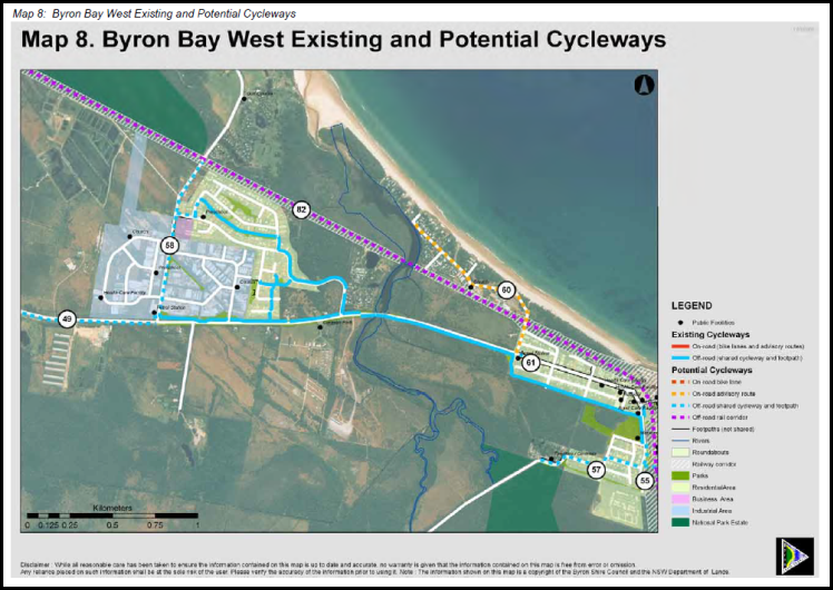
Map 4.8 – Byron Bay West existing and potential cycleways
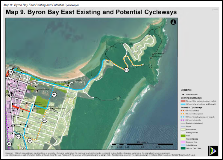
Map 4.9 – Byron Bay East existing and potential cycleways
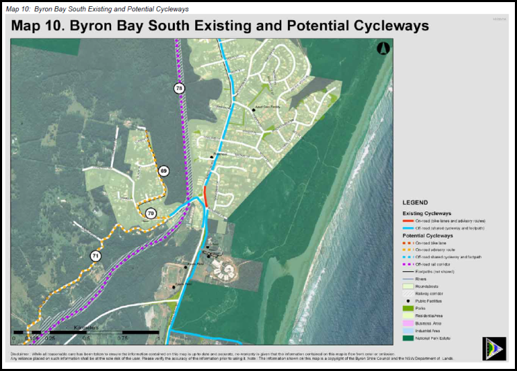
Map 4.10 – Byron Bay South existing and potential cycleways
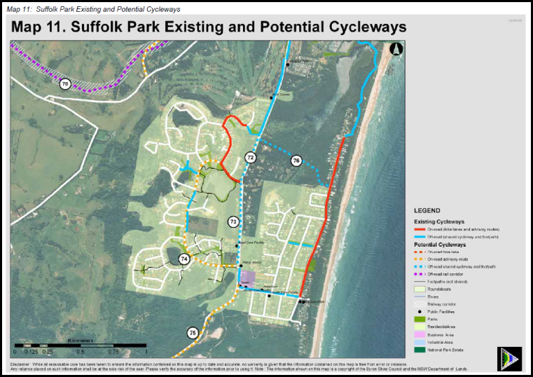
Map 4.11 – Suffolk Park existing and potential cycleways
5 Strategy Plan
Community Facilities and Libraries
5.1 Introduction
This section identifies the
existing provision of community services and facilities, their distribution
throughout Byron Shire and within each planning precinct, the manner in which
they are used by the existing population and other issues associated with their
provision.
This section presents an
assessment of existing community facilities, drawn from Council studies. Benchmarks
have been derived for existing levels of provision. The relationship between
the additional population and the need for increased provision of community
facilities is also examined. A number of studies have been undertaken to assess
the adequacy of existing community facilities and identify needs of people
living, working and visiting Byron Shire. These studies provide a good basis
for the assessment of existing facilities having been based on resident, worker
and visitor surveys and consultations with key service providers and community
groups. An assessment of the level of provision of community services and
facilities and the specific needs of residents was initially documented in the Byron
Shire Section 94 Development Contributions Plan 2001 –2006 and
accompanying report, Byron Shire Council Social Plan 2004 –
2009 (2004), and Byron Shire Cultural Plan (2006). These
studies recognised the high priority for the provision of larger community
facilities and library services. As a consequence, new community facilities
that will be required, have been included in this Plan and incorporated into
the works schedule.
Services provided in Byron Shire
include health, education, counselling, other family support, ageing and
disability, youth, employment, children’s services, culture, arts and
recreation and community information. Specific facilities offered in
Byron Shire (for which contributions have been collected), include a number of
community centres, childcare, pre school facilities, library and youth and
sport facilities.
This Plan identifies both
individual facility concepts and the unit cost of certain types of library and
community facilities, which Council intends to provide for its residents in the
future. Some facilities described below perform both a shire wide function a
local function and the cost of these facilities has been split between the two
differing population groups. Further detail on design concepts for
facilities will be determined as part of the annual Management Plan process during
this Plan’s period. New residents will only be levied a proportion of
these facilities commensurate with the demand generated by new residents and
the established standard of provision for the facility type.
5.2 Byron Bay Library and Library Services
Council places a high priority
on library services, as do members of the community. Public libraries are one
of the most well used educational, cultural and social facilities available
within our community. The relevance of libraries to today’s community is
evident in their high levels of use and attraction to a broad range of users
from all ages and backgrounds (State Library of NSW, 2005).
The physical constraints of old
library building at Byron Bay means that it would be difficult to expand
current facilities to provide additional floor space without major capital
works being undertaken. Construction of a the new library to provide more
appropriate standards of provision for existing residents and for the
population of new development would not be a suitable course of action.
Council proposes as part of its
program to achieve better utilisation of its assets to close the current
library and relocate facilities and additional books and facilities to provide
a central library within a new building. This will include additional
library space to meet State Library of NSW guidelines as well as car parking
spaces for members. The additional library area proposed would provide an
improved standard of library facilities and services for the additional population
that will live in the Shire.
5.3 Nexus
for Library
Population growth and new
residential development give rise to the need for additional library
services. Council currently provides library services in three locations
Brunswick Heads, Mullumbimby and Byron Bay. The old Byron Bay Library was
too small to meet the current demand. The new library will service the
local catchment as well as fulfilling a function as a central library for the
entire local government area. The Library Council of New South
Wales’ guideline “People Places A Guide For Public Library
Buildings In New South Wales” (guideline) identifies that a library
can perform the functions of a local library and central library. The
guideline sets a central area factor to allocate additional floor space to the
library to facilitate the additional functions. The guideline identify
that 15% of the floor space of a library should be allocated to this central
function. This central area factor will be utilised to split the cost of
the facility between the local catchment and shire wide.
5.4 Apportionment
for Library
Due to the closure of the old
library there was to be a significant short fall of library facilities in the
local catchment. The new library caters for this existing need. The
library also has capacity to cater for the population somewhat greater than
predicted population growth over the life of this plan. The cost of the
library will be apportioned to the percentage of new population growth as set out
in tables 1 and 2. Accordingly 15% of the cost of the facility will be
attributable to the whole of the local government area and 85% of the cost will
be attributable to the local catchment. Because the population local
catchment will also benefit from this centralised administrative function it is
reasonable to apply the LGA wide charge to the local catchment as well.
5.5 Other
Community Facilities
A place for the community to meet is considered a basic
prerequisite for community development. A sense of identity in a locality can
be created through shared activities. A local community facility such as a
community centre provides a home for existing groups, encourages the formation
of new groups and provides a place for both to meet and integrate. Locality based
groups are some of the building blocks of community cohesion and often the
focus of effective neighbourhoods. Community centres provide flexible
space that can cater for the needs of a diverse population of various age
groups, community groups and ethnic, cultural, linguistic, educational and
socio-economic backgrounds. Activities and programs can be adapted to
accommodate the changing needs and characteristics of the population. In
recognition of these benefits, Byron Shire Council seeks to provide community
centres for the residents of the Byron Shire.
Activities accommodated and needed in community centres for
the Byron Shire include:
· Social activities
for all age groups.
· Adult education.
· Playgroups and
pre-schools.
· Toy libraries.
· Youth activities.
· Child care
centres.
· Art and craft
activities.
· Community markets.
· Support services
for older residents.
· Support services
for those with a disability.
· Catering and
function rooms for events.
5.6 Nexus
and Future Demand for other Community Facilities
The demand for new community facilities within the Byron
Shire will be influenced by a number of factors including the anticipated
demographic composition of the new population, the availability and type of
facilities currently available, and whether there is any spare capacity within
existing infrastructure. It should be noted there would continue to be
existing facilities to which the incoming population will have access and the
current population will also have access to new facilities. Where practical,
under the Plan, public facilities will be provided in locations best suited to
meet the demands of the new population and in areas from which the
contributions were made.
Byron Shire Section 94 Development Contributions Plan 2001
–2006 and accompanying report, Byron Shire Council Social Plan 2004
– 2009 (2004), included a detailed examination of the current and
projected demand for community facilities for children, youth, and ageing and
disability services, as well as for general family activities and functions, to
develop a standard for the provision for community facilities and
services. The existing facilities generally satisfy the needs of the
existing population with limited, if any, capacity available to serve the
additional demand created by the incoming population. Further, the
existing demand for facilities is evidenced by the requests for provision of
additional services and facilities from community groups that cannot be
accommodated in existing facilities. It is apparent, through previous research,
that there is no capacity in the existing community facilities to cater for the
demand likely to arise from expected population growth over the next 10
years.
All sectors of the community share the need for some type of
facility or community service at some time. Some types of community
services are age specific (such as child care, youth centres or senior citizens
centres) while others are generic and used by people of all ages (such as
exhibition space). Council’s works schedule seeks to provide community
facilities and services that are able to provide for the demands of the whole
population. Therefore, based on a review of Council’s strategic community
facilities and services priorities and its desire/ability to deliver local
services, it is considered that the needs of the incoming population will be
best met by provision of the following:
· Community centres
and meeting spaces.
· Youth facilities.
· Family centres.
The community centres and the range of services and amenities
that the works schedule provides will satisfy the anticipated demands of the
expected population increase. It is proposed that the community services
and facilities will be capable of providing services for and catering to the
needs of all ages, socio economic groups and diverse ethnic groups.
5.7 Reconciliation
of Section 94 Contributions Plan 2005
Council held funds for Community
Facilities that were not under a contributions plan, pre 1993 funds, and
contributions under the 1993 CP and 2001 CP. Some of the works in these
plans were carried forward into the Section 94 Contributions Plan 2005 and the Section 94
Development Contributions Plan 2012 (amendment 1). This plan
replaces all works within the previous plans with a new works schedule.
All funds held in each catchment have been allocated to the highest priority
works in the works schedule within that catchment to ensure that funds
collected in that catchment are expended in the same catchment. The funds
held under the previous plans have been used to reduce the cost of the works
program and thereby reduce the cost to the incoming population.
5.8 Community
Facilities Collection and Expenditure
As there are different growth
rates in each catchment and therefore different apportionment rates the
contributions will be collected on a catchment basis. The contributions
will then be pooled and as funds become available in the plan they are expended
in priority order. Expenditure will occur when Council’s share of
the apportioned cost is available. The timeframe for collection and
expenditure is based on the priority order in the works schedule. As
works are completed the plan will be reviewed annually and these works moved
over to recoupment. New priorities will be added at each annual
review.
5.9 Timeframe
for Provision Library
and other Community Facilities
The works schedules provide a
priority order for the completion of works in the schedule. Council will
utilise this priority order to determine the pooling of funds as provided by
clause 27 (g) of the Environmental Planning and Assessment Regulation
2000. Certain items have already commenced construction, such as the
library and Council will be recouping the cost of these facilities.
5.10 Apportionment
for other
Community Facilities
Some of the facilities required for the community are also
designed to provide for the needs of existing residents in the vicinity of new
development. Where a facility is partially meeting the needs of the
existing population then the apportionment rate will be based on the percentage
change in population over the time period before which the facility will reach
capacity. Where a facility is only servicing the needs of new population
then the apportionment rate will be 100%. The purpose of this approach is
to reflect the nexus between the expected population and the demand for these
facilities, and to ensure that only new development pays for their share.
5.11 Calculation
of Rate of Contribution
Contributions for community
facilities are based on two components –
Local Facilities and LGA wide
Facilities. The contribution rate is calculated on the following basis:
a) The estimated proportion of
LGA wide and local "use".
b) The proportion of costs which
are considered to be directly attributable to the requirements of new
residential development.
A catchment may be the local catchment or the whole of the
local government area.
5.12 Formula
for the Calculation of Contributions
The formula used to calculate the contribution for each line
item in a catchment is:

Where:
W =
Total cost of works
L =
Proportion of local or shire wide catchment use
R =
Reconciliation amount
P =
Percentage attributable to new development
N =
Number of SDU in the catchment
The formula to calculate the
total contribution (TC) per SDU in a catchment at the time of consent the grant
of consent is the sum of all the line items multiplied by the increase in the
consumer price index:
Where:
CPI = Ind1
at date of consent / Ind2 at date of adoption of plan
n =
number of line items to be summed in a catchment
C =
Contribution(per line item)
Note: Where the
consumer price index is negative or remains the same then value adopted for the
purposes of calculation of the contribution plan shall be the previous
quarterly index value.
These calculations are set out in the works schedule.
Community
Facilities Works Schedule
|
Facility
|
Priority for Pooling of Funds
|
Estimated Timing for
completion of works
|
SDU in time frame
|
Cost of Works Indexed to 24 April 2014
|
S94 Funds bought forward (reconciliation from old
plan)
|
Proportion of local Catchment use
|
Net cost of works
|
Apportionment (% attributable to new development)
|
Cost of works attributable to new development
|
Cost of Works Attributable to Council
|
Cost per SDU
|
|
|
|
|
N
|
W
|
R
|
L
|
( W x L) - R
|
P
|
|
|
C
|
|
Byron Bay / Suffolk Park
|
|
Recoupment for Land acquisition for Byron Library PN: 239677
|
1
|
Completed
|
1,427
|
3,874,755.38
|
0.00
|
85%
|
3,293,542.07
|
27.19%
|
895,646.74
|
0.00
|
627.64
|
|
Recoupment for Construction & Approval of Byron Library
(For costing refer doc #1121738) PN 239677. Excluding grants and
special rate variation loans.
|
2
|
Completed
|
1,427
|
2,829,104.41
|
0.00
|
85%
|
2,404,738.75
|
27.19%
|
653,945.32
|
0.00
|
458.27
|
|
Ewingsdale Hall BBQ, tables
and shelter adjacent to hall. PN 214900
|
3
|
2013
|
1,427
|
25,831.70
|
|
100%
|
25,831.70
|
100.00%
|
25,831.70
|
0.00
|
18.10
|
|
Ewingsdale Hall
Kitchen expansion & upgraded to commercial standard PN 214900
|
6
|
2013
|
1,427
|
41,330.72
|
20,000.00
|
100%
|
21,330.72
|
100.00%
|
21,330.72
|
0.00
|
14.95
|
|
Suffolk Park Community
Hall. Kitchen upgrade and hall expansion. PN 237911
|
4
|
2016
|
1,427
|
361,643.84
|
305,150.01
|
100%
|
56,493.83
|
27.19%
|
15,362.95
|
41,130.88
|
10.77
|
|
Suffolk Park Community
Hall. New access ramp and accessible toilets. PN 237911
|
5
|
2013
|
1,427
|
87,827.79
|
50,000.00
|
100%
|
37,827.79
|
27.19%
|
10,286.90
|
27,540.89
|
7.21
|
|
Byron Bay / Suffolk Park
Totals
|
|
|
|
7,220,493.84
|
375,150.01
|
|
5,839,764.86
|
|
1,622,404.33
|
68,671.77
|
1,136.94
|
|
|
|
|
|
|
|
|
|
|
|
|
|
|
Mullumbimby
|
|
Fit out of Youth Hub (refer Community
Economic Development Strategy also Youth Strategy and Action Plan actions -
various) Site to be determined.
|
6
|
|
333
|
100,000.00
|
0.00
|
100%
|
100,000.00
|
20.12%
|
20,120.88
|
79,879.12
|
60.42
|
|
Mullumbimby Drill Hall
Tiered Seating PN: 35480
|
4
|
|
333
|
25,200.00
|
0.00
|
100%
|
25,200.00
|
100.00%
|
25,200.00
|
0.00
|
75.68
|
|
Mullumbimby Drill Hall
Airconditioning and power upgrade PN: 35480
|
3
|
|
333
|
25,586.00
|
0.00
|
100%
|
25,586.00
|
20.12%
|
5,148.13
|
20,437.87
|
15.46
|
|
Sound Shell at Skate Park
(refer Cultural Plan 1.2.e and Youth Strategy and Action Plan ) PN:238167
|
5
|
|
333
|
51,663.41
|
0.00
|
100%
|
51,663.41
|
20.12%
|
10,395.13
|
41,268.28
|
31.22
|
|
Mullumbimby CWA Hall (refer
to Community Infrastructure 10 Year Plan)
|
2
|
|
333
|
25,831.70
|
0.00
|
100%
|
25,831.70
|
20.12%
|
5,197.56
|
20,634.14
|
15.61
|
|
Expenditure of existing
funds on Civic Hall precinct. Works to include landscaping and Crime
Prevention Through Environmental Design (CPTED) upgrades.
|
1
|
|
333
|
114,125.69
|
114,125.69
|
100%
|
0.00
|
20.12%
|
0.00
|
0.00
|
0.00
|
|
Mullumbimby Totals
|
|
|
|
342,406.80
|
114,125.69
|
|
228,281.11
|
|
66,061.70
|
162,219.41
|
198.39
|
|
|
|
|
|
|
|
|
|
|
|
|
|
|
Brunswick Heads
|
|
Sound Shell (refer Cultural
Plan 1.2.e and Youth Strategy and Action Plan ) Location to be determined
|
3
|
|
420
|
51,663.41
|
0.00
|
100%
|
51,663.41
|
38.08%
|
19,673.86
|
31,989.55
|
46.84
|
|
Pilgrim Park Public
toilets. Upgrade to toilet block utilising Crime Prevention through
Environmental design (refer #1160588)
|
2
|
|
420
|
82,661.45
|
0.00
|
100%
|
82,661.45
|
38.08%
|
31,478.18
|
51,183.27
|
74.95
|
|
Brunswick Heads Memorial
Hall. New Car Park and Accessibility Ramp. PN 24270
|
1
|
|
420
|
77,495.11
|
0.00
|
100%
|
77,495.11
|
38.08%
|
29,510.79
|
47,984.32
|
70.26
|
|
Brunswick Heads Totals
|
|
|
|
211,819.97
|
0.00
|
|
211,819.97
|
|
80,662.83
|
131,157.14
|
192.05
|
|
|
|
|
|
|
|
|
|
|
|
|
|
|
Bangalow
|
|
Bangalow A&I Hall
Improvement Program PN:85440
|
1
|
|
422
|
346,558.12
|
31,764.50
|
100%
|
314,793.62
|
42.91%
|
135,063.93
|
179,729.69
|
320.06
|
|
Bangalow Totals
|
|
|
|
346,558.12
|
31,764.50
|
|
314,793.62
|
|
135,063.93
|
179,729.69
|
320.06
|
|
|
|
|
|
|
|
|
|
|
|
|
|
|
Ocean Shores / South Golden Beach
|
|
Ocean Shores Community
Centre Improvements. PN: 121280
|
4
|
|
118
|
154,990.22
|
0.00
|
100%
|
154,990.22
|
100.00%
|
154,990.22
|
0.00
|
1,313.48
|
|
Waterlily Park
Construct public toilets.
|
3
|
2016
|
118
|
150,000.00
|
0.00
|
100%
|
150,000.00
|
4.77%
|
7,158.46
|
142,841.54
|
60.66
|
|
Tom Kendall Oval Change
Facilities. PN: 207250
|
2
|
2015
|
118
|
130,890.50
|
130,890.50
|
100%
|
0.00
|
4.77%
|
0.00
|
0.00
|
0.00
|
|
New covered decks at SGB
Community Hall. Expenditure of funds collected from the old plan.
|
1
|
2014
|
118
|
134,458.29
|
134,458.29
|
100%
|
0.00
|
4.77%
|
0.00
|
0.00
|
0.00
|
|
Ocean Shores SGB Totals
|
|
|
|
570,339.01
|
265,348.78
|
|
304,990.22
|
|
162,148.68
|
142,841.54
|
1,374.14
|
|
|
|
|
|
|
|
|
|
|
|
|
|
|
Rural North
|
|
Future Community Facilities
works to be identified. These funds are to be held in trust pending a
further needs analysis and community consultation to identify new projects
|
|
Community
Consultation and project scoping to
occur in 2015
|
100
|
8,841.34
|
8,841.34
|
100%
|
0.00
|
4.77%
|
0.00
|
0.00
|
0.00
|
|
Rural North Totals
|
|
|
|
8,841.34
|
8,841.34
|
|
0.00
|
|
0.00
|
0.00
|
0.00
|
|
|
|
Rural South
|
|
Broken Head Hall Improvement
Program. Upgrade external doors, disabled access ramp, disabled access
toilet, storeroom, concrete path, covered deck & steps, new timber deck
& steps at front entry, new awning over doors - eastern side, 22,000L
tank, electrical upgrade and upgrade kitchen facilities. Expenditure
from Old Plan.
|
|
|
72
|
113,446.16
|
113,446.16
|
0%
|
0.05
|
0.00%
|
0.00
|
0.00
|
|
|
Rural South Totals
|
|
|
|
113,446.16
|
|
$
|
|
$
-
|
0.00
|
0.00
|
|
|
Shire Wide
|
|
Recoupment for Land acquisition for Byron Library PN: 239677
|
3
|
Under construction
|
2,892
|
3,874,755.38
|
0.00
|
15%
|
581,213.31
|
19.20%
|
111,583.18
|
0.00
|
38.58
|
|
Library resources.
|
5
|
Paid annually to RTRL
|
2,892
|
31,193.33
|
0.00
|
100%
|
31,193.33
|
100.00%
|
31,193.33
|
0.00
|
10.79
|
|
Landfill Expansion.
Refer #890668 Byron Waste Disposal Strategy for detailed description.
PN 238899 & PN 91960 & PN 238898
|
|
Staged expansion in 5 year increments
|
2,892
|
13,432,485.32
|
0.00
|
100%
|
13,432,485.32
|
19.20%
|
2,578,811.26
|
10,853,674.06
|
891.71
|
|
Energy efficiency
improvements at Cavanbah Sports Centre including but not limited to
installation of a Solar Photo-Voltaic generation system, hot water and
lighting improvements. (Expenditure of Existing Funds)
|
1
|
|
2,892
|
150,000.00
|
150,000.00
|
100%
|
0.00
|
19.20%
|
0.00
|
0.00
|
0.00
|
|
Implementation of works
identified in the Mullumbimby Town Centre Master Plan. Being community
Facilities works such as tourist information kiosks, art installations and
public toilet upgrades.
|
6
|
Works to commence upon completion of the Mullumbimby Town Centre Master plan and
after other priorities are completed.
|
2,892
|
200,000.00
|
200,000.00
|
100%
|
0.00
|
100.00%
|
0.00
|
0.00
|
0.00
|
|
Implementation of works
identified in the Byron Bay Town Centre Master Plan. Being community
Faculties works such as tourist information centres, art galleries, art
installations and public toilets,
|
2
|
Progressive construction
from 2015
|
2,892
|
1,100,000.00
|
501,662.11
|
100%
|
598,337.89
|
19.20%
|
114,870.81
|
483,467.08
|
39.72
|
|
Recoupment for Construction & Approval of Byron Library
(For costing refer doc #1121738) PN 239677. Excluding grants and
special rate variation loans.
|
4
|
Under construction
|
2,892
|
2,829,104.41
|
0.00
|
15%
|
424,365.66
|
19.20%
|
81,471.07
|
0.00
|
28.17
|
|
Shire Wide Total
|
|
|
|
21,617,538.44
|
851,662.11
|
|
15,067,595.51
|
|
2,917,929.65
|
11,337,141.14
|
1,008.97
|
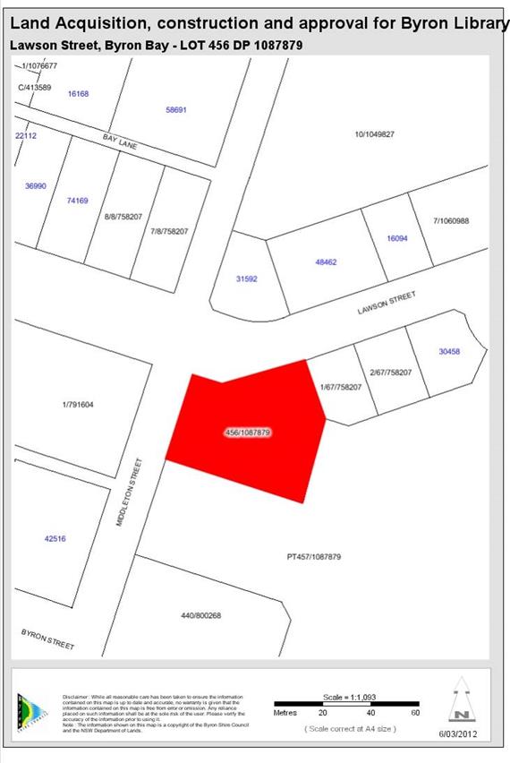
Map 5.1 - Byron Bay Library

Map 5.2 Suffolk Park
Community Hall. New access ramp and accessible toilets
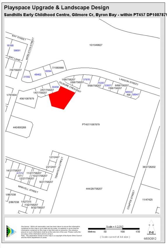
Map 5.3 Sandhills Early
Childhood Centre Playspace Upgrade and Landscape Design
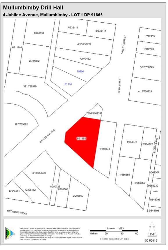
Map 5.4 Mullumbimby
Drill Hall (refer to Community Infrastructure 10 Year Plan)
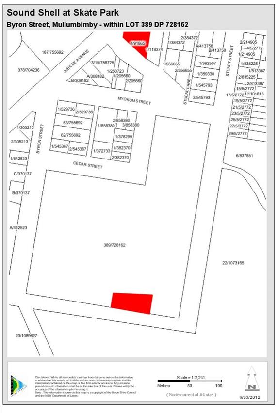
Map 5.5 Sound Shell at Skate Park (refer Cultural Plan 1.2.e and
Youth Strategy and Action Plan)
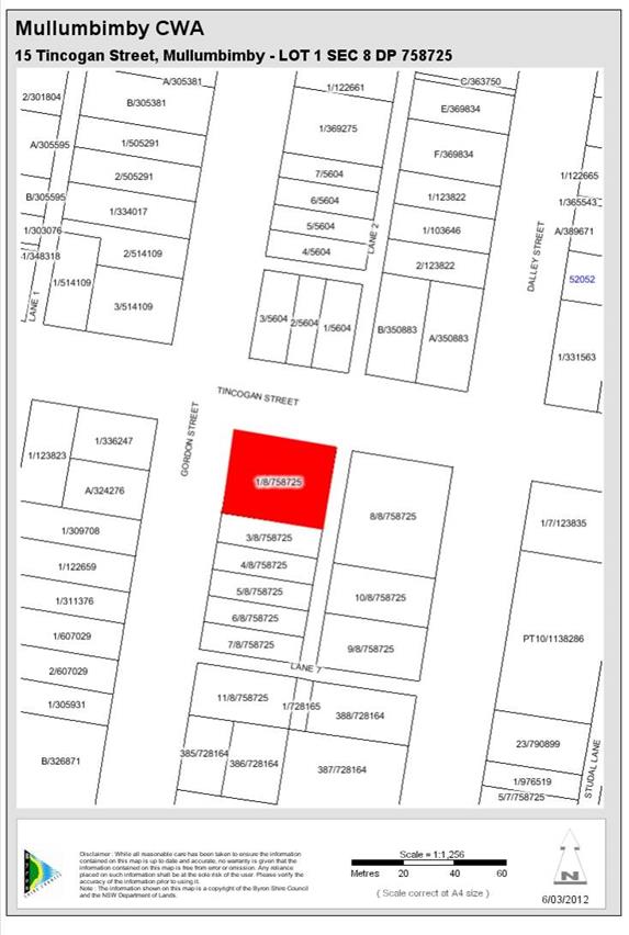
Map 5.6 Mullumbimby CWA
(refer to Community Infrastructure 10 Year Plan)
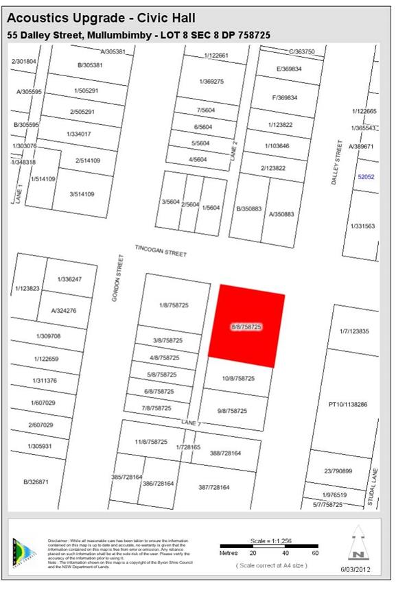
Map 5.7 Civic Hall
Acoustics Upgrade
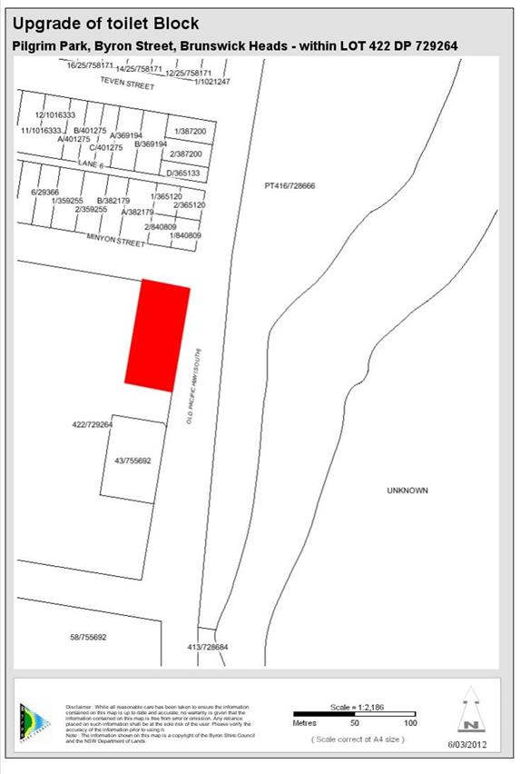
Map 5.8 Pilgrim Park Public toilets. Upgrade to toilet block
utilising crime prevention through environmental design (refer #1160588)
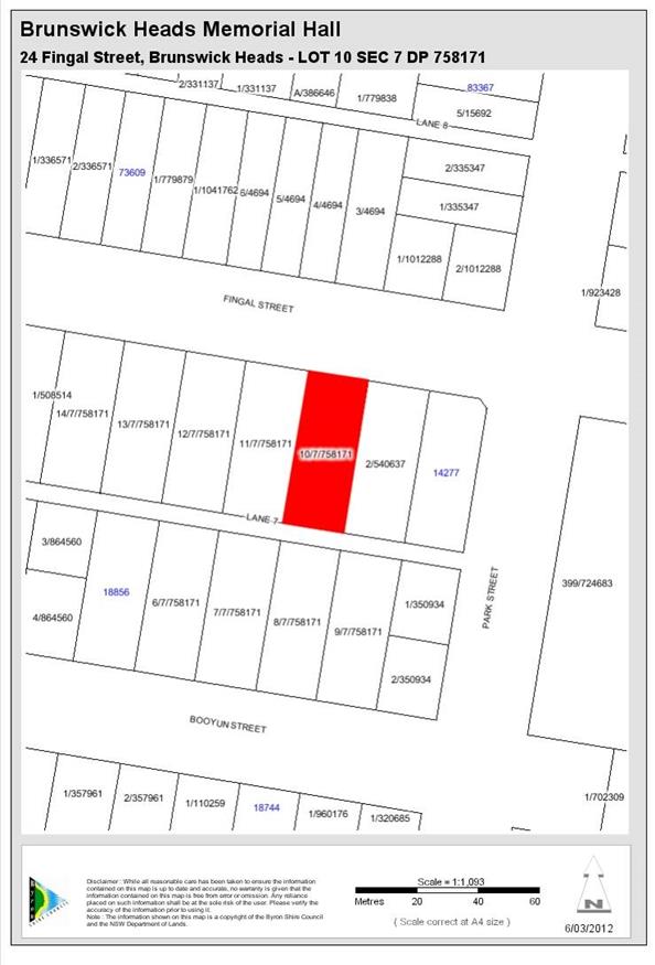
Map 5.9 Brunswick Heads
Memorial Hall. New Car Park and Accessibility Ramp
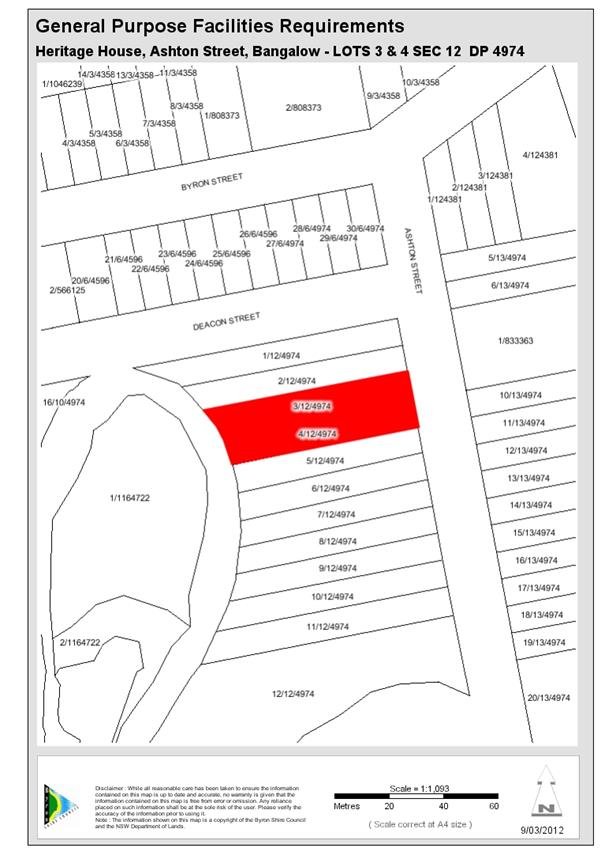
Map 5.10 Heritage House
- General Purpose Facilities Requirements
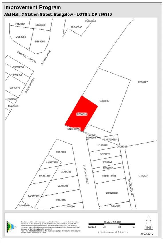
Map 5.11 Bangalow
A&I Hall Improvement Program
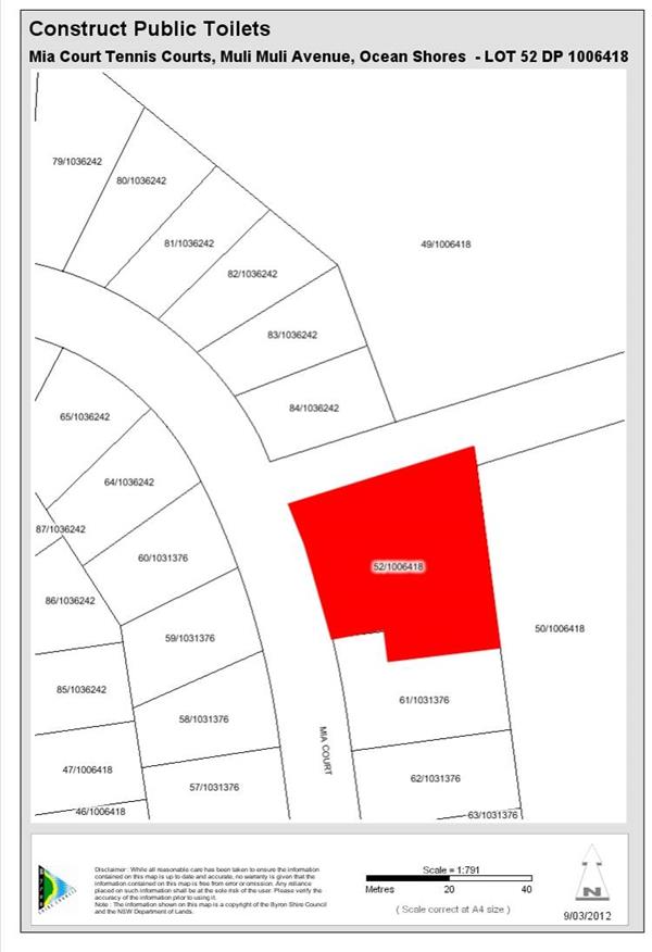
Map 5.1 Mia Court Tennis
Courts/Basketball Construct public toilets
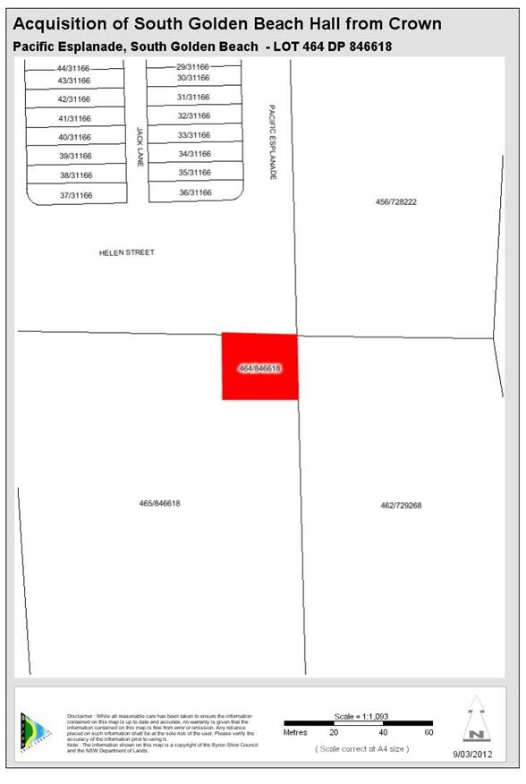
Map 5.13 Acquisition of
SGB Community Hall from the Crown
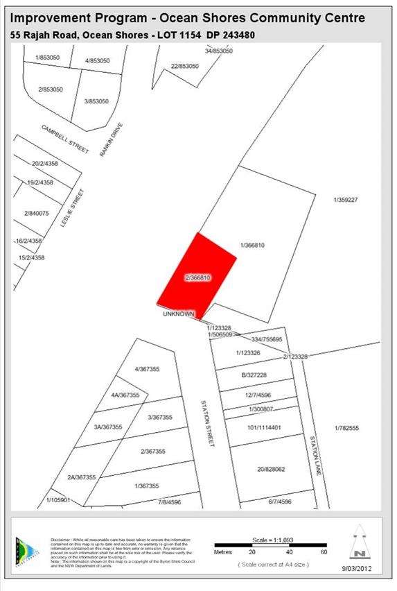
Map 5.13 Ocean Shores Community Centre Improvements
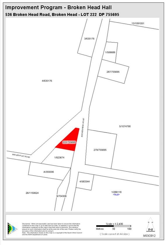
Map 5.15 Broken Head
Hall Improvement Program
Map 5.16 [Deleted
in amendment 2]
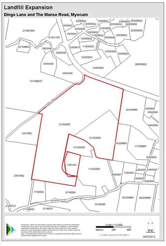
Map 5.17 Landfill
expansion
6 Open Space and
Recreational Facilities
The purpose of this chapter is to ensure that an adequate
level and quality of open space is provided throughout the Byron Shire to meet
the needs of an increased population resulting from development.
6.1 Existing
Provision of Open Space and Recreation Facilities
The Byron Shire community strongly supports the conservation
and enhancement of the unique environmental qualities of the Byron Shire LGA,
as highlighted in numerous studies and community consultation surveys. This
Plan seeks to support these community values and strategic goals by ensuring
that the contributions provided by new development maintains and enhances this
unique environment for the benefit of all residents. Byron Shire Council
already provides a range of open space and recreation facilities including a
range of facilities for unstructured play and recreation (including picnic
areas, playgrounds and walking paths). Parks and open spaces are key
components of the environmental, recreation and social infrastructure in all
communities. They are used and/or valued by a wide cross section of residents,
from all age groups and socio-economic backgrounds. Byron Shire is well served,
in terms of the everyday needs of its residents, through the provision of local
and district parks.
Open space can be considered to include those areas, which
are in public ownership (Council-owned or Crown land), which have been (or are
to be) set aside for use for recreation purposes. The amount and type of
open space and recreation facilities required to be provided and embellished
under the Plan has been based on the specific identified needs of the incoming
residential population of the Byron Shire LGA. Byron Shire currently has
approximately 91 open space areas covering 2,220,113m2 or 222
hectares. The open space areas in Byron Shire vary in size from 225 m2 to
354,000 m2.
Bay Street, Byron Bay (354,000 m2) and South
Beach Road, Brunswick Heads (115,000 m2) are some the larger parks
controlled by Council that draw people from all over Byron Shire and provide
diverse activities. Byron Shire is also well served, in terms of the
everyday needs of its residents, through the provision of local parks.
In recent years, there has been a move away from the
traditional standards-based approach (2.83 Ha. per thousand persons), towards a
“needs based approach”. In the past, open space areas were
designated on a “per thousand persons” basis, ignoring the
socio-economic, cultural and developmental attributes of the population being
catered for. The emphasis was on quantitative measures of provision, rather
than on the provision of a diverse range of high-quality recreation
opportunities. Despite the official nature of the standards and their
professional endorsement, they have never been qualified, tested or evaluated in
human terms. Considerable uncertainty exists as to whether the standards
developed reflect minimum, maximum, desirable or optimum levels of provision.
In general, the standards approach fails to assess the needs of the community
being planned for, and because it is concerned with the area of land, rather
than the opportunity for provision of recreational resources, it often fails to
meet the needs of the community.
6.2 Nexus
and Future Demand Open Space and Recreation Facilities
In order to prevent the level of service in the provision of
open space decreasing there is a need to acquire more space (in some
locations). There is also a need to provide improvements to existing spaces to
increase capacity and therefore provide for the increased population resulting
from development. The existing level of provision of open space will be
maintained through the acquisition of additional open space and the
embellishment of existing open spaces to increase capacity. Current general
standards of provision, and a review of expressed contemporary aspirations for
the provision of facilities, have been used, as a basis for developing the
Works Schedule to address cumulative future needs.
6.3 Increased
Capacity Open Space and Recreation Facilities
To create additional parks,
throughout Byron Shire, which offer a reasonable level of residential, worker
and visitor amenity would be financially prohibitive and would require
channelling a substantial proportion (if not all) of Section 7.11 contribution
funds into an acquisition programme for new parks/open space areas. The
acquisition of land in Byron Shire is becoming increasingly constrained due to
the high cost of land and the finite amount of land available for acquisition.
Given these constraints the amount of open space to be acquired for the
increased population is not realistic. To ensure that the additional population
does not result in a decrease in the level of service provision, it is
recognised in this Plan that the remainder of the total amount of open space
required will be achieved through increasing the capacity of existing open
spaces. It is recommended, therefore, that open space contributions be sought
for embellishment purposes and provision of recreational facilities in existing
Council owned space.
The Byron Shire Council
Social Plan 2004 – 2009 (2004) has also established that many
existing open space areas are currently in an underdeveloped state, delivering
reduced recreation opportunity. An inventory of parks identified in the study
indicated that many parks were not embellished with facilities.
Many parks have also been
assessed as having the necessary size and ease of access to enable them to
function within a designated open space category, subject to appropriate
augmentation/ embellishment. This further enhances their potential to
satisfy the open space and outdoor recreation demands of the new population.
Therefore, it is anticipated that some of the demand for additional open space
can be met by increasing the capacity of the existing underdeveloped local and
district parks.
6.4 Reconciliation
of Section 94 Contributions Plan 2005
Council held funds for Open
Space and Recreation facilities that were not under a contributions plan, pre
1993 funds, and contributions under the 1993 CP and 2001 CP. Some of the
works in these plans were carried forward into the Section 94 Contributions Plan
2005 and the Section 94 Development Contributions Plan 2012 (amendment
1). This plan replaces all works within the previous plans with a
new works schedule. All funds held in each catchment have been allocated
to the highest priority works in the works schedule within that catchment to
ensure that funds collected in that catchment are expended in the same
catchment. The funds held under the previous plans have been used to
reduce the cost of the works program and thereby reduce the cost to the incoming
population.
6.5 Timeframe
for collection for Open
Space and Recreation Facilities
As some facilities will not
reach capacity within a 25 year time frame the contributions have been
calculated over that time frame as it is unreasonable to extend the timeframe
for collection beyond this based on the increasing uncertainty in the population
model. Where a facility is 100% attributable to new development and the
demand for that facility is likely to arise in the near future due to growth
then the timeframe for collection may be limited to a 10 year period. The
timeframes for collection directly impact on the size of the population for
which a given facility will pay for. Both of these figures are to be
found in the works schedule.
6.6 Timeframe
for Provision of Open Space and Recreation Facilities
The works schedules provide a
priority order for the completion of works in the schedule. Council will
utilise this priority order to determine the pooling of funds as provided by
clause 27 (g) of the Environmental Planning and Assessment Regulation
2000.
6.7 Apportionment
for Open Space and Recreation Facilities
Some of the facilities required for the community are also
designed to provide for the needs of existing residents in the vicinity of new
development. Where a facility is partially meeting the needs of the
existing population then the apportionment rate will be based on the percentage
change in population over the time period before which the facility will reach
capacity. Where a facility is only servicing the needs of new population
then the apportionment rate will be 100%. The purpose of this approach is
to reflect the nexus between the expected population and the demand for these
facilities, and to ensure that only new development pays for their share.
6.8 Calculation
of Rate of Contribution for Open Space and Recreation Facilities
Contributions for community
facilities are based on two components –
Local Facilities and LGA wide
Facilities. The contribution rate is calculated on the following basis:
a) The estimated proportion of
LGA wide and local "use".
b) The proportion of the cost of
works which are considered to be directly attributable to the requirements of
new residential development.
6.9 Formula
for the Calculation of Contributions
The formula used to calculate the contribution (C) for each
line item in a catchment is:

Where:
W = Total cost of works
L = Proportion of
local or shire wide catchment use
R = Reconciliation
amount
P =
Percentage attributable to new development.
N = Number of SDU in the
catchment (from table X.1.2
The formula to calculate the total contribution (TC) per SDU
in a catchment at the time of consent the grant of consent is the sum of all
the line items multiplied by the increase in the consumer price index:
Where:
CPI = Ind1 at date of consent / Ind2
at date of adoption of plan
n = number of line
items to be summed in a catchment
C = Contribution (per
line item)
Note: Where the consumer price index is negative or
remains the same then value adopted for the purposes of calculation of the
contribution plan shall be the previous quarterly index value.
These calculations inclusive of intermediate steps in the
calculations are set out in the works schedule.
Open Space
and Recreation Works Schedule
|
Facility
|
Priority for Pooling of Funds
|
Estimated Timing for completion of works
|
SDU in time frame
|
Cost of Works Indexed to 24 April 2014
|
S94 Funds bought forward (reconciliation from
old plan)
|
Proportion of local Catchment use
|
Net cost of works
|
Apportionment (% attributable to new development)
|
Cost of works attributable to new development
|
Cost of Works Attributable to Council
|
Cost per SDU
|
|
|
|
|
N
|
|
R
|
L
|
( W x L) - R
|
P
|
[( W x L) - R] x P
|
|
C
|
|
Byron Bay/ Suffolk Park Catchment
|
|
Byron Regional Sport and
Cultural Complex Stage 2 Skate Park. PN: 132490
|
4
|
2013
|
1427
|
185,988.26
|
-
|
100%
|
185,988.26
|
27.19%
|
50,577.70
|
135,410.56
|
35.44
|
|
All-abilities Playground
(Cultural Plan 7.1.d Accessible playground facilities) Location to be
determined pending further community consultation.
|
3
|
2013
|
1427
|
671,624.27
|
-
|
50%
|
335,812.14
|
27.19%
|
91,320.85
|
244,491.29
|
63.99
|
|
Byron Regional Sport and
Cultural Complex Stage 2 Southern field lighting. PN: 132490
|
1
|
|
1427
|
154,990.22
|
-
|
75%
|
116,242.67
|
100.00%
|
116,242.67
|
-
|
81.46
|
|
Byron Regional Sport and
Cultural Complex Stage 2 Grandstands. PN: 132490
|
|
|
1427
|
516,634.05
|
-
|
75%
|
387,475.54
|
100.00%
|
387,475.54
|
-
|
271.53
|
|
Byron Regional Sport and
Cultural Complex Stage 2 MPF (2 additional courts) PN: 132490
|
|
|
1427
|
1,033,268.10
|
-
|
75%
|
774,951.08
|
100.00%
|
774,951.08
|
-
|
543.06
|
|
Byron Regional Sport and
Cultural Complex Stage 2 Netball court lighting. PN: 132490
|
|
|
1427
|
464,970.65
|
-
|
75%
|
348,727.99
|
100.00%
|
348,727.99
|
-
|
244.38
|
|
Byron Regional Sport and
Cultural Complex Stage 2 Southern Carpark. PN: 132490
|
|
|
1427
|
206,653.62
|
-
|
75%
|
154,990.22
|
100.00%
|
154,990.22
|
-
|
108.61
|
|
Byron Bay Gateway project in
inclusive of tree plantings. Ewingsdale Road to Byron Bay No specific parcel
numbers
|
|
|
1427
|
154,990.22
|
-
|
100%
|
154,990.22
|
27.19%
|
42,148.08
|
112,842.14
|
29.54
|
|
Enlarged public toilet
facilities at Byron Bay Surf Club. PN: 238790
|
|
|
1427
|
103,326.81
|
12,480.69
|
50%
|
39,182.71
|
100.00%
|
39,182.71
|
-
|
27.46
|
|
West Byron Local Parks
Acquisition (refer maps) various parcel numbers
|
-
|
Upon Lot release in stages
|
1427
|
1,115,929.55
|
-
|
100%
|
1,115,929.55
|
100.00%
|
1,115,929.55
|
-
|
782.01
|
|
West Byron Local Parks
embellishment (refer maps) various parcel numbers
|
-
|
Upon Lot release in stages
|
1427
|
309,980.43
|
-
|
100%
|
309,980.43
|
100.00%
|
309,980.43
|
-
|
217.23
|
|
Clarkes Beach P/N
238790 play equipment & shade sail
|
|
|
1427
|
72,328.77
|
-
|
100%
|
72,328.77
|
100.00%
|
72,328.77
|
-
|
50.69
|
|
Apex Park Byron Bay P/N
238790 Infants play unit & shade sail
|
|
|
1427
|
36,164.38
|
-
|
100%
|
36,164.38
|
100.00%
|
36,164.38
|
-
|
25.34
|
|
Railway Park Byron Bay P/N
187200 Additional Play ground equipment/Sail
|
|
|
1427
|
22,731.90
|
-
|
100%
|
22,731.90
|
100.00%
|
22,731.90
|
-
|
15.93
|
|
Recreation Ground Byron Bay
P/N177670 Additional Playground equipment/sail
|
|
|
1427
|
46,497.06
|
-
|
100%
|
46,497.06
|
100.00%
|
46,497.06
|
-
|
32.58
|
|
Gordon St Park P/N (classed
road reserve at present) Play unit & sail
|
|
|
1427
|
30,998.04
|
-
|
100%
|
30,998.04
|
100.00%
|
30,998.04
|
-
|
21.72
|
|
Sunrise Beach Park P/N
112460 Play unit and Sail
|
|
2016
|
1427
|
41,330.72
|
-
|
100%
|
41,330.72
|
27.19%
|
11,239.49
|
30,091.23
|
7.88
|
|
Makellar St park P/N 122160
Play unit and sail
|
|
2016
|
1427
|
41,330.72
|
-
|
100%
|
41,330.72
|
27.19%
|
11,239.49
|
30,091.23
|
7.88
|
|
Pepperbush park P/N 103760 Play
unit Expenditure from old Plan
|
|
2016
|
1427
|
22,731.90
|
-
|
100%
|
22,731.90
|
0.00%
|
-
|
22,731.90
|
-
|
|
Gaggin Park P/N 41330 Play
Unit
|
|
2016
|
1427
|
43,397.26
|
-
|
100%
|
43,397.26
|
27.19%
|
11,801.46
|
31,595.80
|
8.27
|
|
Byron Bay Pool -
Improvements (refer Community Infrastructure 10 Year Plan) PN: 187220
|
|
|
1427
|
131,225.05
|
-
|
100%
|
131,225.05
|
100.00%
|
131,225.05
|
-
|
91.96
|
|
Byron Bay Town centre
upgrade Landscape Precinct Plan (refer to Community Infrastructure 10 year
works plan) Refer map. Works to be carried out within mapped
area. Works include: Footpath upgrades, landscaping, bicycle
facilities, kerb and gutter works, drainage, benches, and street tree
planting.
|
2
|
2013
|
1427
|
2,583,170.25
|
963,360.96
|
100%
|
1,619,809.29
|
100.00%
|
1,619,809.29
|
-
|
1,135.12
|
|
Railway Park exercise
equipment. PN 187200
|
|
2016
|
1427
|
30,998.04
|
-
|
100%
|
30,998.04
|
27.19%
|
8,429.62
|
22,568.42
|
5.91
|
|
Playground equipment for
Ewingsdale Park. PN 2320
|
|
|
1427
|
30,998.04
|
-
|
100%
|
30,998.04
|
27.19%
|
8,429.62
|
22,568.42
|
5.91
|
|
Exercise equipment. Apex
Park. PN 238790
|
|
2016
|
1427
|
30,998.04
|
-
|
100%
|
30,998.04
|
27.19%
|
8,429.62
|
22,568.42
|
5.91
|
|
Design Costs for works at
Suffolk Park PN 186840 Expenditure from Old Plan
|
|
2016
|
1427
|
30,000.00
|
30,000.00
|
100%
|
-
|
27.19%
|
-
|
-
|
-
|
|
Skate Park Upgrade at
Suffolk Park PN 186840 Expenditure from Old Plan
|
|
2014
|
1427
|
50,000.00
|
50,000.00
|
100%
|
-
|
0.00%
|
-
|
-
|
-
|
|
Shade Structures and seating
at Suffolk Park skate park. PN 186840 Expenditure from Old Plan
|
|
2014
|
1427
|
40,000.00
|
40,000.00
|
100%
|
-
|
0.00%
|
-
|
-
|
-
|
|
Upgrade Playground Equipment
at Suffolk Park PN 186840
|
|
2013 Works completed
|
1427
|
200,000.00
|
200,000.00
|
100%
|
-
|
0.00%
|
-
|
-
|
-
|
|
Upgrade to toilet block,
change rooms and canteen PN 186840 Expenditure from Old Plan
|
|
2014
|
1427
|
300,000.00
|
300,000.00
|
100%
|
-
|
0.00%
|
-
|
-
|
-
|
|
Extend Footpath and fix
drainage PN 186840 Expenditure from Old Plan
|
|
2013 Works Completed
|
1427
|
20,000.00
|
20,000.00
|
100%
|
-
|
0.00%
|
-
|
-
|
-
|
|
Community Garden Suffolk
Park (Location to be determined)
|
|
2015
|
1427
|
50,000.00
|
20,000.00
|
100%
|
30,000.00
|
0.00%
|
-
|
30,000.00
|
-
|
|
Additional seating and shade
sails adjacent to sports field PN 186840 Expenditure from Old Plan
|
|
2015
|
1427
|
40,000.00
|
40,000.00
|
100%
|
-
|
0.00%
|
-
|
-
|
-
|
|
New Mini Sports Field at
Suffolk Park (Expenditure from old Plan)
|
|
2015
|
1427
|
25,000.00
|
25,000.00
|
100%
|
-
|
0.00%
|
-
|
-
|
-
|
|
Bike Park (road rules
instructional) at Suffolk Park (Location to be determined) Expenditure from
Old Plan
|
|
2016
|
1427
|
350,000.00
|
350,000.00
|
100%
|
-
|
0.00%
|
-
|
-
|
-
|
|
Open Space Embellishment
Works in Suffolk Park Further works to be determined after community
consultation. Expenditure form old plan.
|
|
2015
|
1427
|
515,166.39
|
515,166.39
|
100%
|
-
|
0.00%
|
-
|
-
|
-
|
|
Improved Beach Access (One
at Suffolk park and Byron Bay) Location to be determined. (refer 1998
Heads of Agreement between Council and the Arakwal People)
|
|
|
1427
|
40,000.00
|
-
|
100%
|
40,000.00
|
27.19%
|
10,877.61
|
29,122.39
|
7.62
|
|
Totals
|
|
|
|
9,743,422.74
|
2,566,008.04
|
|
6,195,810.02
|
|
5,461,728.22
|
734,081.80
|
3,827.43
|
|
|
|
|
|
|
|
|
|
|
|
|
|
|
Bangalow
|
|
Acquisition of 0.25ha
of park for area 6 as mapped in Chapter 22 of DCP 2010. PN: 213520
|
-
|
Upon Lot release in stages
|
422
|
371,976.52
|
-
|
100%
|
371,976.52
|
100.00%
|
371,976.52
|
-
|
881.46
|
|
Embellishment of park in
Area 6 as set out in Element 3.12 of Chapter 22 of DCP 2010. PN: 213520
|
-
|
Upon Lot release in stages
|
422
|
51,663.41
|
-
|
100%
|
51,663.41
|
100.00%
|
51,663.41
|
-
|
122.43
|
|
Acquisition of 0.25ha
of park for area 7 as mapped in Chapter 22 of DCP 2010. PN 237920
|
-
|
Upon Lot release in stages
|
422
|
371,976.52
|
-
|
100%
|
371,976.52
|
100.00%
|
371,976.52
|
-
|
881.46
|
|
Embellishment of park in
Area 7 as set out in Element 3.12 of Chapter 22 of DCP 2010. PN 237920
|
-
|
Upon Lot release in stages
|
422
|
51,663.41
|
-
|
100%
|
51,663.41
|
100.00%
|
51,663.41
|
-
|
122.43
|
|
Embellishment of existing
park in Area 2 as set out in Element 3.12 of Chapter 22 of DCP 2010.
PN:241499
|
-
|
Upon Lot release in stages
|
422
|
51,663.41
|
-
|
100%
|
51,663.41
|
100.00%
|
51,663.41
|
-
|
122.43
|
|
Embellishment of existing
park in Area 3 as set out in Element 3.12 of Chapter 22 of DCP 2010. PN:
241499
|
-
|
Upon Lot release in stages
|
422
|
51,663.41
|
-
|
100%
|
51,663.41
|
100.00%
|
51,663.41
|
-
|
122.43
|
|
Landscaping for Bangalow
Pool
|
6
|
|
422
|
41,330.72
|
-
|
80%
|
33,064.58
|
42.91%
|
14,186.54
|
18,878.04
|
33.62
|
|
Car parking for Bangalow
pool
|
7
|
|
422
|
154,990.22
|
-
|
80%
|
123,992.18
|
42.91%
|
53,199.52
|
70,792.66
|
126.07
|
|
Pool Park Bangalow P/N
241425 Play Unit & sail
|
|
|
422
|
56,829.75
|
-
|
100%
|
56,829.75
|
100.00%
|
56,829.75
|
-
|
134.67
|
|
Palm estate Bangalow P/N
121740 Play equipment
|
|
|
422
|
36,164.38
|
-
|
100%
|
36,164.38
|
100.00%
|
36,164.38
|
-
|
85.70
|
|
Leopardwood Park P/N 230510
needs 2 shade sails
|
|
|
422
|
15,499.02
|
-
|
100%
|
15,499.02
|
100.00%
|
15,499.02
|
-
|
36.73
|
|
Bangalow Rec ground P/N
67730 Play equipment & shade sail
|
|
|
422
|
67,162.43
|
-
|
100%
|
67,162.43
|
100.00%
|
67,162.43
|
-
|
159.15
|
|
Park and landscaping
upgrades on Parklands South of Deacon Street Bangalow (Multiple Parcel
Numbers refer map)
|
8
|
|
422
|
60,000.00
|
-
|
100%
|
60,000.00
|
100.00%
|
60,000.00
|
-
|
142.18
|
|
Change Rooms / Amenities at
Sports Fields. PN: 238382
|
|
|
422
|
258,317.03
|
-
|
75%
|
193,737.77
|
42.91%
|
83,124.25
|
110,613.52
|
196.98
|
|
Solar lighting around
walking track PN 238382
|
3
|
2015
|
422
|
41,330.72
|
20,000.00
|
100%
|
21,330.72
|
42.91%
|
9,152.06
|
12,178.66
|
21.69
|
|
Construct new car park and
access to sports fields to rectify encroachment on Bangalow Bowling Club
Land.
|
4
|
2015
|
422
|
200,000.00
|
47,327.74
|
100%
|
152,672.26
|
42.91%
|
65,504.87
|
87,167.39
|
155.22
|
|
Skate Park at Bangalow
Sports Fields. Expenditure from old plan.
|
2
|
Works to be completed 2014
|
422
|
164,200.00
|
164,200.00
|
100%
|
-
|
42.91%
|
-
|
-
|
-
|
|
Hard surface netball
courts. (Land unknown) To be located somewhere within the
Bangalow Catchment
|
5
|
|
422
|
250,000.00
|
-
|
75%
|
187,500.00
|
42.91%
|
80,447.90
|
107,052.10
|
190.63
|
|
Additional Sports Field
lighting. PN: 238382 No further collection
|
1
|
Works Completed with Grant of 55,800
|
422
|
111,600.00
|
55,800.00
|
75%
|
-
|
42.91%
|
-
|
-
|
-
|
|
Totals
|
|
|
|
2,408,030.95
|
287,327.74
|
|
1,898,559.77
|
|
1,491,877.40
|
406,682.37
|
3,535.28
|
|
|
|
|
|
|
|
|
|
|
|
|
|
|
Mullumbimby
|
|
Mullumbimby Civic Centre
precinct. Exercise Equipment. PN 18210
|
6
|
2016
|
333
|
41,330.72
|
20,000.00
|
100%
|
21,330.72
|
20.12%
|
4,291.93
|
17,038.79
|
12.89
|
|
Pine Ave sports ground
P/N128960 Play equipment and shade sail
|
|
|
333
|
46,497.06
|
-
|
100%
|
46,497.06
|
100.00%
|
46,497.06
|
-
|
139.63
|
|
Heritage park Play equipment
|
|
|
333
|
56,829.75
|
-
|
100%
|
56,829.75
|
100.00%
|
56,829.75
|
-
|
170.66
|
|
Pool
park P/N
35350 Play equipment and shade sail
|
|
|
333
|
46,497.06
|
-
|
100%
|
46,497.06
|
100.00%
|
46,497.06
|
-
|
139.63
|
|
Stuart Street Mullumbimby
Road reserve Cultural/recreational precinct upgrade. Involves replacing a
culvert, regrading the road and construction of a car park.
|
1
|
2013
|
333
|
309,980.43
|
260,918.08
|
100%
|
49,062.35
|
20.12%
|
9,871.77
|
39,190.58
|
29.64
|
|
Mullumbimby Pool
Improvements (refer to Community Infrastructure 10 Year Plan) PN:35350
|
3
|
Progressive from 2013
|
333
|
161,189.82
|
112,433.05
|
100%
|
48,756.77
|
100.00%
|
48,756.77
|
-
|
146.42
|
|
Mullumbimby town Centre
Master plan. (Existing budgeted staff wages cost to be used to fund Council
share of the apportionment)
|
4
|
To be commenced upon completion of the Byron Bay Town
Centre Master plan (2016-2017)
|
333
|
60,000.00
|
0.00
|
100%
|
60,000.00
|
20.12%
|
12,072.53
|
47,927.47
|
36.25
|
|
Implementation of
Mullumbimby Town Centre Masterplan. Works include: Footpath upgrades,
landscaping, bicycle facilities, kerb and gutter works, drainage, benches,
street tree planting and landscaping.
|
5
|
Works to commence upon completion of the Mullumbimby Town Centre Master plan and
after other priorities are completed.
|
333
|
100,000.00
|
0.00
|
80%
|
80,000.00
|
100.00%
|
80,000.00
|
0.00
|
240.24
|
|
Acquisition of Park in area
5 as identified in Chapter 11 of DCP 2010
|
|
Upon Lot release in stages
|
333
|
516,634.05
|
-
|
100%
|
516,634.05
|
100.00%
|
516,634.05
|
-
|
1,551.45
|
|
Embellishment of a Park as
identified in Chapter 11 of DCP 2010
|
-
|
Upon Lot release in stages
|
333
|
51,663.41
|
-
|
100%
|
51,663.41
|
100.00%
|
51,663.41
|
-
|
155.15
|
|
Acquisition of sports fields
as identified in Chapter 11 of DCP 2010
|
-
|
Upon Lot release in stages
|
333
|
3,099,804.31
|
-
|
75%
|
2,324,853.23
|
100.00%
|
2,324,853.23
|
-
|
6,981.54
|
|
Embellishment of sports
fields as identified in Chapter 11 of DCP 2010
|
-
|
Upon Lot release in stages
|
333
|
867,945.21
|
-
|
75%
|
650,958.91
|
100.00%
|
650,958.91
|
-
|
1,954.83
|
|
Shade Structures at Lot 33
DP 1169053 Tallowood Estate
|
2
|
2014
|
333
|
32,000.00
|
-
|
100%
|
32,000.00
|
100.00%
|
32,000.00
|
-
|
96.10
|
|
Totals
|
|
|
|
5,390,371.82
|
393,351.13
|
|
3,985,083.31
|
|
3,880,926.47
|
104,156.84
|
11,654.43
|
|
|
|
|
|
|
|
|
|
|
|
|
|
|
Ocean Shores / South Golden Beach
|
|
Tom Kendal Park P/N 207250
Play equipment
|
|
|
118
|
36,164.38
|
-
|
100%
|
36,164.38
|
100.00%
|
36,164.38
|
-
|
306.48
|
|
SGB community centre P/N
201300 Play equipment & shade sail
|
|
|
118
|
41,330.72
|
-
|
100%
|
41,330.72
|
100.00%
|
41,330.72
|
-
|
350.26
|
|
Waterlily park
P/N 63020 Play unit and Shade sail
|
|
|
118
|
30,998.04
|
-
|
100%
|
30,998.04
|
100.00%
|
30,998.04
|
-
|
262.70
|
|
Fern
Beach P/N 227610 Play unit &
sail
|
|
|
118
|
41,330.72
|
-
|
100%
|
41,330.72
|
100.00%
|
41,330.72
|
-
|
350.26
|
|
Sports fields
Acquisition. Land unknown. To be located within Ocean Shores SGB
catchment or in Rural North
|
1
|
2013
|
118
|
500,000.00
|
250,000.00
|
50%
|
-
|
4.77%
|
-
|
-
|
-
|
|
Sports fields
Embellishment. Land unknown. To be located within Ocean Shores
SGB catchment or in Rural North
|
2
|
2013
|
118
|
3,197,964.77
|
803,178.13
|
50%
|
795,804.26
|
4.77%
|
37,978.22
|
757,826.04
|
321.85
|
|
Total
|
|
|
|
3,847,788.63
|
1,053,178.13
|
|
945,628.12
|
|
187,802.08
|
757,826.04
|
1,591.55
|
|
|
|
|
|
|
|
|
|
|
|
|
|
|
Brunswick Heads
|
|
Acquisition of 4000 square
meter park in Bayside. Lots not yet identified.
|
-
|
Upon Lot release in stages
|
420
|
371,976.52
|
-
|
100%
|
371,976.52
|
100.00%
|
371,976.52
|
-
|
885.66
|
|
Embellishment of new park in
Bayside. Lots not yet identified.
|
-
|
Upon Lot release in stages
|
420
|
51,663.41
|
-
|
100%
|
51,663.41
|
100.00%
|
51,663.41
|
-
|
123.01
|
|
Terrace Park exercise
equipment
|
2
|
2014
|
420
|
30,998.04
|
-
|
100%
|
30,998.04
|
38.08%
|
11,804.32
|
19,193.72
|
28.11
|
|
Tweed Street Masterplan
Landscaping Upgrades. Multiple parcels refer map.
|
1
|
2016 or sooner if funds become available
|
420
|
774,951.08
|
60,585.66
|
100%
|
714,365.42
|
38.08%
|
272,036.40
|
442,329.02
|
647.71
|
|
Improved boat and kayak
launching facilities. Riverfront Brunswick Heads
|
|
|
420
|
103,326.81
|
-
|
100%
|
103,326.81
|
38.08%
|
39,347.72
|
63,979.09
|
93.69
|
|
Upgrade Surf Club.
PN:181600
|
|
|
420
|
258,317.03
|
5,429.76
|
75%
|
188,308.01
|
100.00%
|
188,308.01
|
-
|
448.35
|
|
Brunswick Rec ground P/N
238575 play equipment & shade sail
|
|
|
420
|
18,598.83
|
-
|
100%
|
18,598.83
|
100.00%
|
18,598.83
|
-
|
44.28
|
|
Bayside park P/N 203080 play
equipment & shade sail
|
|
|
420
|
30,998.04
|
-
|
100%
|
30,998.04
|
100.00%
|
30,998.04
|
-
|
73.80
|
|
Totals
|
|
|
|
1,640,829.76
|
66,015.43
|
|
1,510,235.08
|
|
984,733.25
|
525,501.83
|
2,344.61
|
|
|
|
|
|
|
|
|
|
|
|
|
|
|
Rural South
|
|
Eureka Sport Field
lighting PN 157230 (expenditure from Old plan)
|
1
|
2014
|
72
|
125,000.00
|
125,000.00
|
100%
|
-
|
4.76%
|
-
|
-
|
-
|
|
Totals
|
|
|
|
125,000.00
|
125,000.00
|
|
-
|
|
-
|
-
|
-
|
|
|
|
|
|
|
|
|
|
|
|
|
|
|
LGA Wide Facilities
|
|
Recoupment for Byron Regional Sport and Cultural Complex Loan
Funds. (Total cost is $17,205,020 refer to #1187988 for full budget) PN:
132490
|
Refer local Priority
|
Complete
|
2,892
|
1,300,000.00
|
-
|
25%
|
325,000.00
|
19.20%
|
62,394.53
|
|
21.57
|
|
Byron Regional Sport and
Cultural Complex Stage 2 All-abilities Playground (Cultural Plan 7.1.d
Accessible playground facilities) PN: 132490
|
Refer local Priority
|
|
2,892
|
671,624.27
|
-
|
50%
|
335,812.14
|
19.20%
|
64,470.28
|
271,341.86
|
22.29
|
|
Byron Regional Sport and
Cultural Complex Stage 2 Southern field lighting. PN: 132490
|
Refer local Priority
|
|
2,892
|
154,990.22
|
-
|
25%
|
38,747.56
|
100.00%
|
38,747.56
|
-
|
13.40
|
|
Byron Regional Sport and
Cultural Complex Stage 2 Grandstands. PN: 132490
|
Refer local Priority
|
|
2,892
|
516,634.05
|
-
|
25%
|
129,158.51
|
100.00%
|
129,158.51
|
-
|
44.66
|
|
Byron Regional Sport and
Cultural Complex Stage 2 MPF (2 additional courts) PN: 132490
|
Refer local Priority
|
|
2,892
|
1,033,268.10
|
-
|
25%
|
258,317.03
|
100.00%
|
258,317.03
|
-
|
89.32
|
|
Byron Regional Sport and
Cultural Complex Stage 2 Netball court lighting. PN: 132490
|
Refer local Priority
|
|
2,892
|
464,970.65
|
-
|
25%
|
116,242.66
|
100.00%
|
116,242.66
|
-
|
40.19
|
|
Byron Regional Sport and
Cultural Complex Stage 2 Southern Carpark. PN: 132490
|
Refer local Priority
|
|
2,892
|
206,653.62
|
-
|
25%
|
51,663.41
|
100.00%
|
51,663.41
|
-
|
17.86
|
|
Enlarged public toilet
facilities at Byron Bay Surf Club. PN: 238790
|
Refer local Priority
|
|
2,892
|
103,326.81
|
-
|
50%
|
51,663.41
|
100.00%
|
51,663.41
|
-
|
17.86
|
|
Ocean Shores Sports fields
Embellishment Land unknown. To be located within Ocean Shores SGB
catchment or in Rural North
|
Refer local Priority
|
|
2,892
|
3,197,964.77
|
1,021,715.90
|
50%
|
577,266.49
|
19.20%
|
110,825.46
|
466,441.03
|
38.32
|
|
Sports fields Acquisition
for Ocean Shores Catchment. Land unknown. To be located within Ocean
Shores SGB catchment or in Rural North Expenditure from Old Plan
|
Refer local Priority
|
|
2,892
|
500,000.00
|
250,000.00
|
50%
|
-
|
19.20%
|
-
|
-
|
-
|
|
Upgrade Brunswick Heads Surf
Club PN:181600
|
Refer local Priority
|
|
2,892
|
258,317.03
|
-
|
25%
|
64,579.26
|
100.00%
|
64,579.26
|
-
|
22.33
|
|
Bangalow Hard surface
netball courts. Land unknown. To be located somewhere within the
Bangalow Catchment
|
Refer local Priority
|
|
2,892
|
258,317.03
|
-
|
25%
|
64,579.26
|
19.20%
|
12,398.13
|
52,181.13
|
4.29
|
|
Bangalow Change Rooms /
Amenities at Sports Fields. PN: 238382
|
Refer local Priority
|
|
2,892
|
258,317.03
|
-
|
25%
|
64,579.26
|
19.20%
|
12,398.13
|
52,181.13
|
4.29
|
|
Bangalow Additional Sports
Field lighting
|
Refer local Priority
|
Works Completed with Grant of 55,800
|
2,892
|
111,600.00
|
-
|
25%
|
-
|
19.20%
|
-
|
-
|
-
|
|
Mullumbimby Acquisition of
sports fields as identified in Chapter 11 of DCP 2010
|
Refer local Priority
|
Upon Lot release in stages
|
2,892
|
3,099,804.31
|
-
|
25%
|
774,951.08
|
100.00%
|
774,951.08
|
-
|
267.96
|
|
Landscaping for Bangalow
Pool
|
|
|
2,892
|
41,330.72
|
-
|
20%
|
8,266.14
|
19.20%
|
1,586.96
|
6,679.18
|
0.55
|
|
Implementation of
Mullumbimby Town Centre Masterplan. Works include: Footpath upgrades,
landscaping, bicycle facilities, kerb and gutter works, drainage, benches,
street tree planting and landscaping.
|
Refer local Priority
|
Works to commence upon completion of the Mullumbimby
Town Centre Master plan and after other priorities are completed.
|
2,892
|
100,000.00
|
-
|
20%
|
20,000.00
|
100.00%
|
20,000.00
|
-
|
6.92
|
|
Car parking for Bangalow
pool
|
|
|
2,892
|
154,990.22
|
-
|
20%
|
30,998.04
|
19.20%
|
5,951.10
|
25,046.94
|
2.06
|
|
Mullumbimby Embellishment of
sports fields as identified in Chapter 11 of DCP 2010
|
Refer local Priority
|
Upon Lot release in stages
|
2,892
|
867,945.21
|
-
|
25%
|
216,986.30
|
100.00%
|
216,986.30
|
-
|
75.03
|
|
Totals
|
|
|
|
13,300,054
|
1,271,715.90
|
|
3,128,810.55
|
|
1,992,333.81
|
873,871.27
|
688.90
|
Map 6.1 Byron Regional Sport
and Cultural Complex Multiple Facilities
Map 6.2 Shade Structures
and seating at Suffolk Park
skate park
Map 6.3 Enlarged public
toilet facilities at Byron Bay
Surf Club
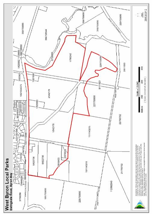
Map 6.4 West Byron Local
Parks Acquisition and Embellishment
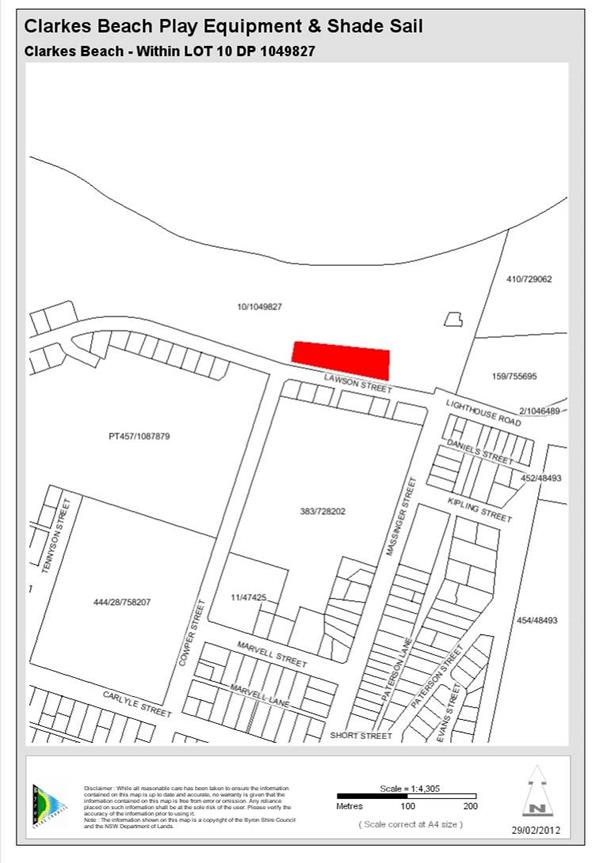
Map 6.5 Clarkes Beach play equipment & shade sail
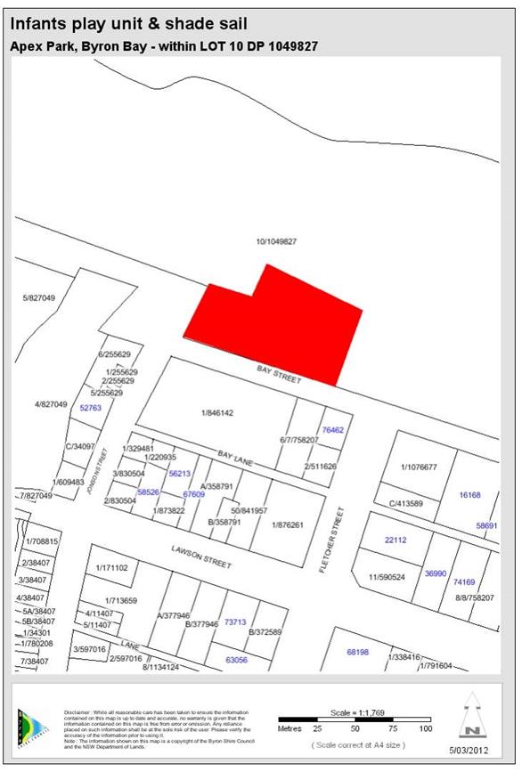
Map 6.6 Apex Park Infants play unit & shade sail, exercise
equipment
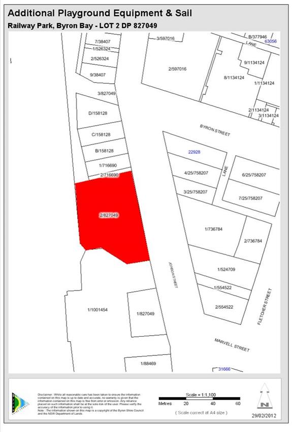
Map 6.7 Railway Park Byron Bay Additional Play ground
equipment/Sail and exercise equipment
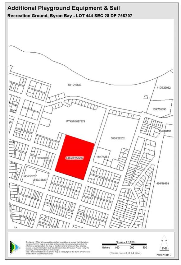
Map 6.8 Recreation Ground Byron Bay Additional Playground
equipment/sail
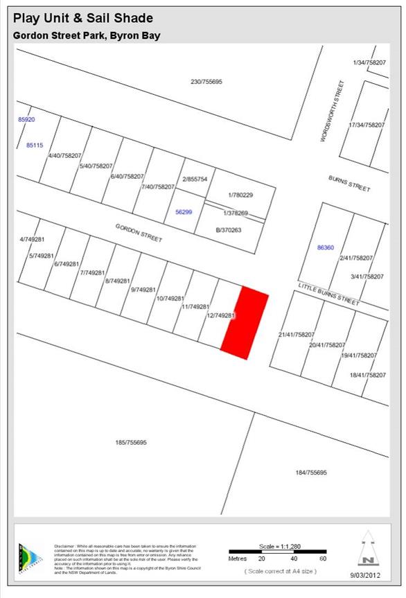
Map 6.9 Gordon Street Park. Enlarged Play unit and shade sail
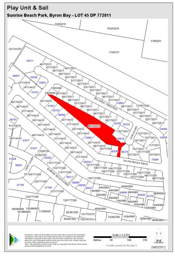
Map 6.10 Sunrise Beach
Park Play unit and Sail
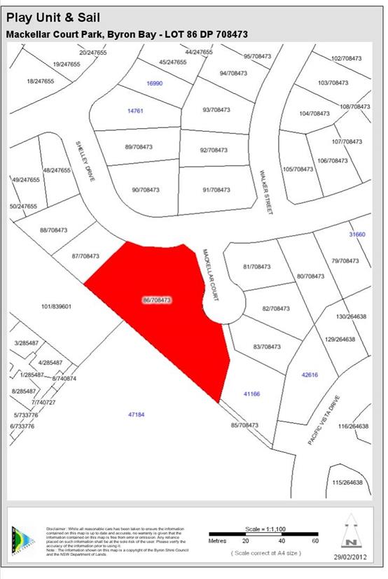
Map 6.11 Makellar St
Play unit and sail
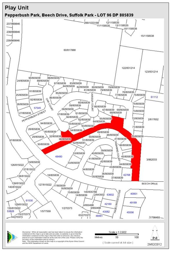
Map 6.12 Pepperbush park
play unit
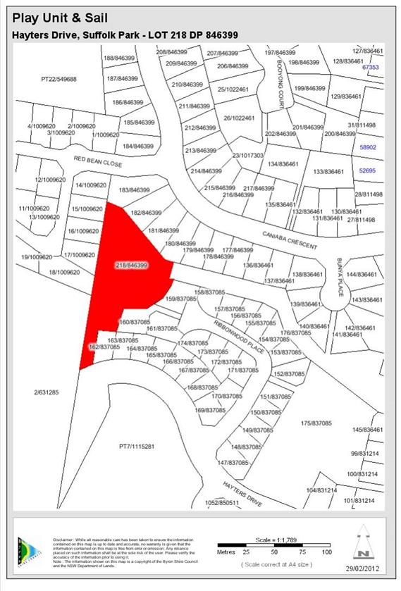
Map 6.13 Baywood Chase
Park Play Equipment
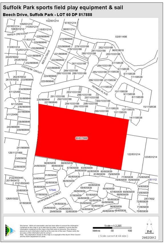
Map 6.14 Suffolk
Sports field Play equipment and sail

Map 6.15 Gaggin Park
Play Unit
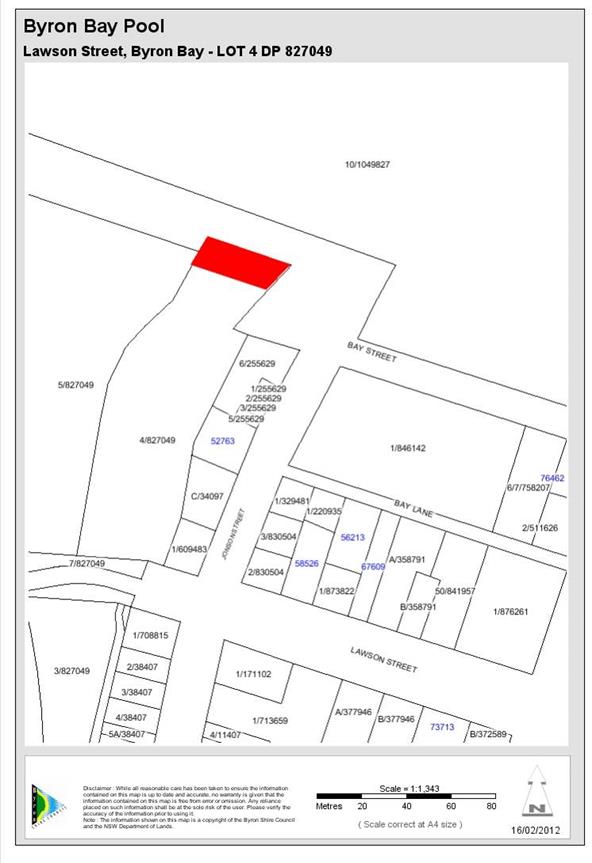
Map 6.16 Byron Bay Pool - Improvements (refer Community
Infrastructure 10 Year Plan)
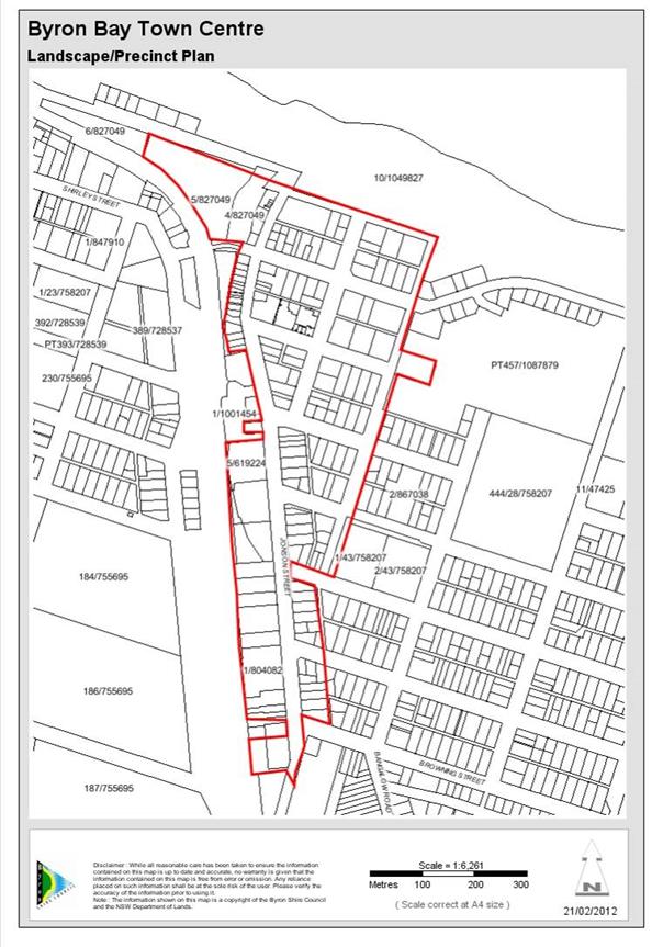
Map 6.17 Byron Bay Town centre upgrade Landscape Precinct Plan
(refer to Community Infrastructure 10 year works plan)
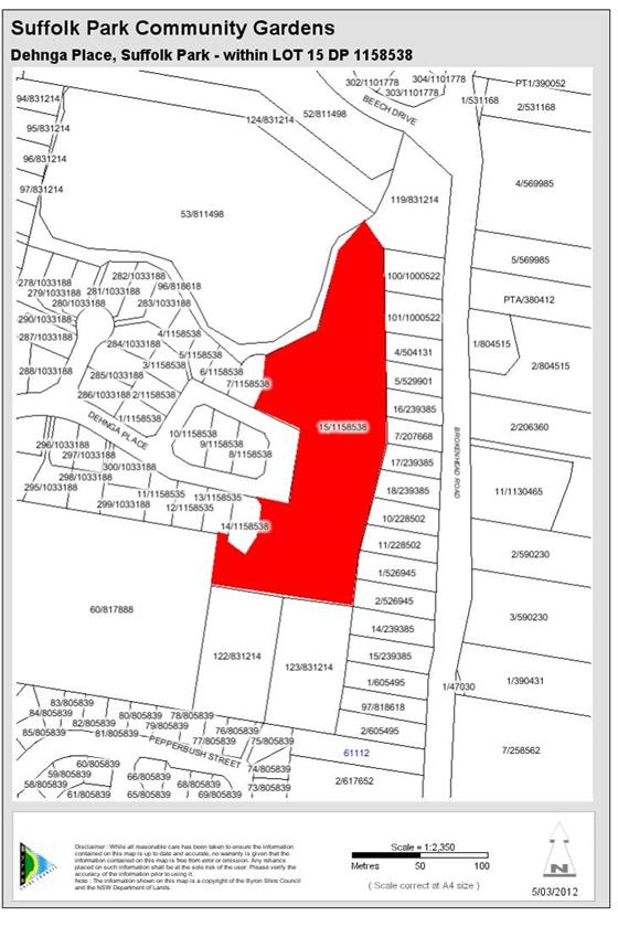
Map 6.18 Community Gardens
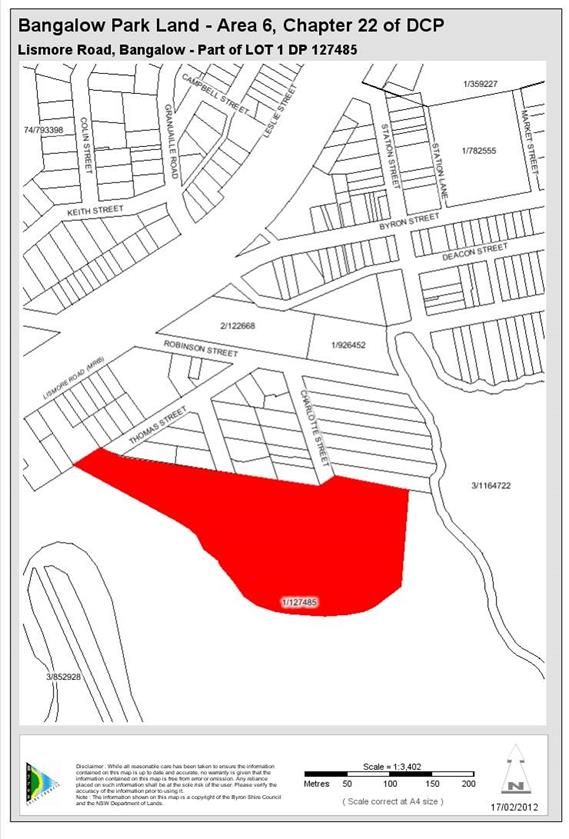
Map 6.19 Acquisition and
embellishment of 0.25ha park.
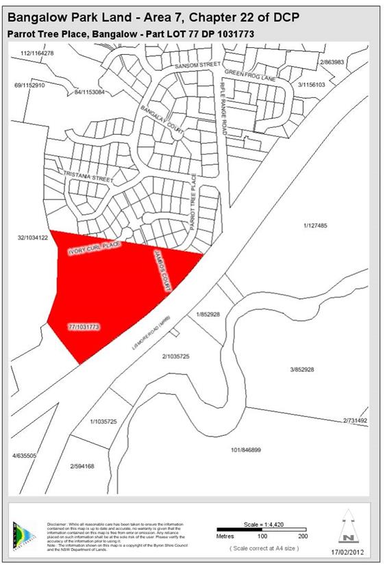
Map 6.20 Acquisition and
embellishment of 0.25ha park.
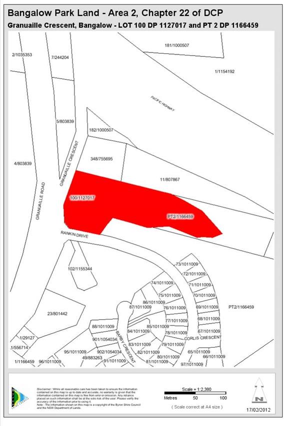
Map 6.21 Embellishment
of existing park in Area 2
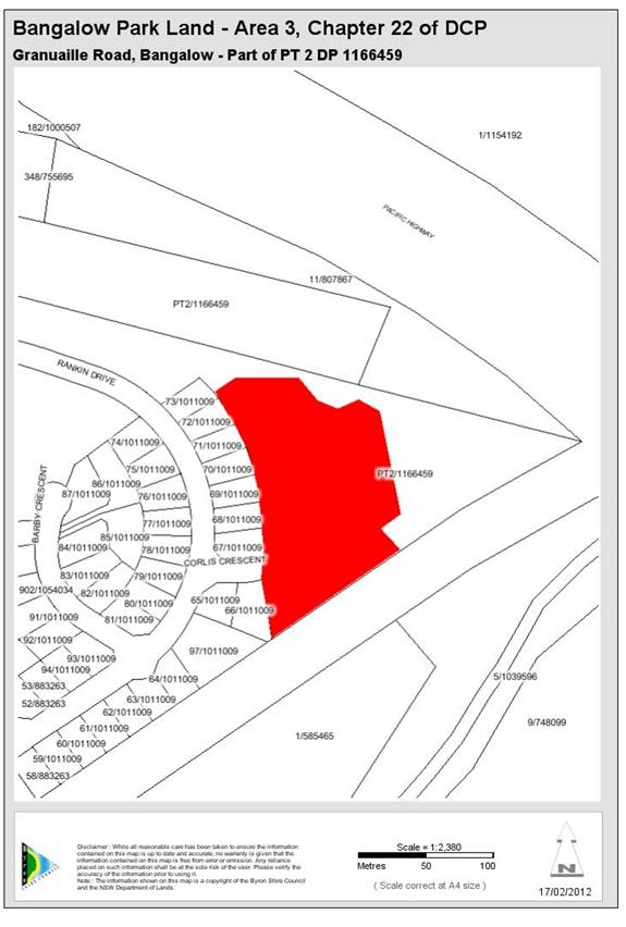
Map 6.22 Embellishment
of existing park in Area 3
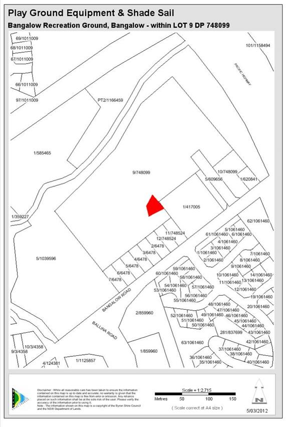
Map 6.23 Bangalow Play
equipment shade sail, Sports Fields Change Rooms / Amenities at Sports Fields
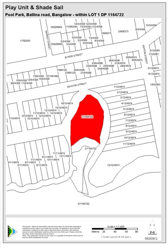
Map 6.24 Bangalow Pool Park Bangalow Play Unit & sail
Map 6.25 Palm Estate
Play Unit
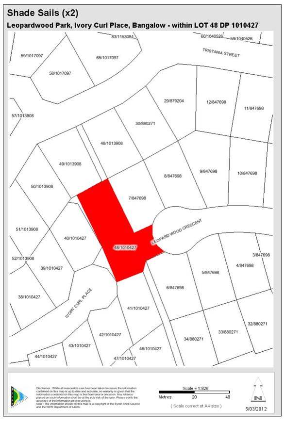
Map 6.26 Leopardwood Park 2 shade sails
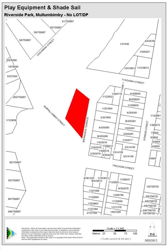
Map 6.27 Riverside
park Shade sail and park play equipment
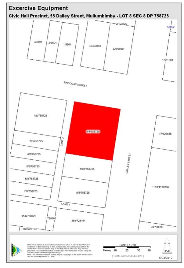
Map 6.28 Mullumbimby
Civic Centre precinct. Exercise Equipment
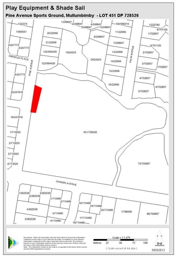
Map 6.29 Pine Avenue
sports ground. Play equipment and shade sail
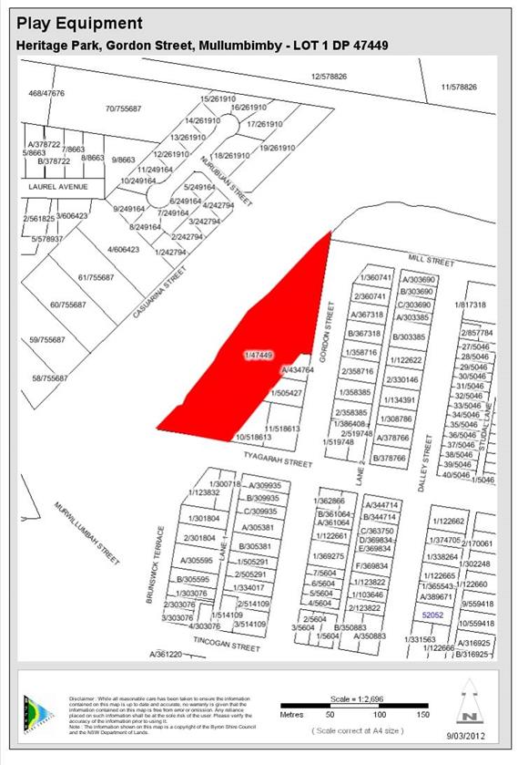
Map 6.30 Heritage park
Play equipment
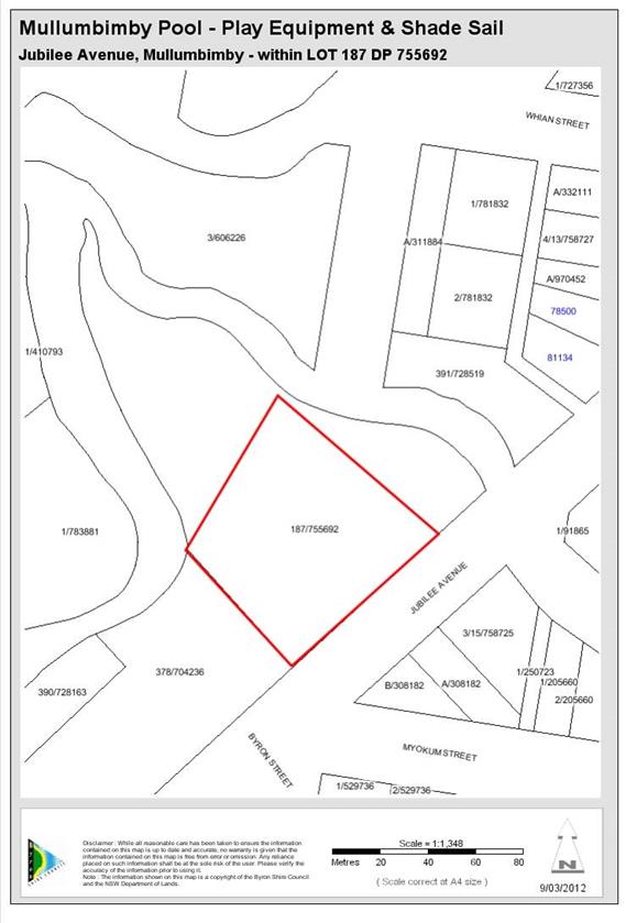
Map 6.31 Pool
park. Play equipment and shade sail
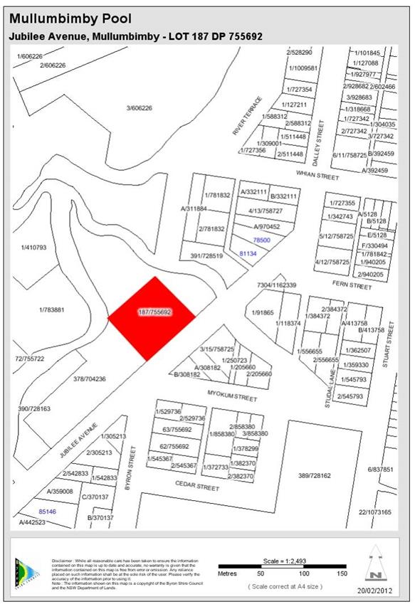
Map 6.32 Mullumbimby
Pool Improvements and Heating
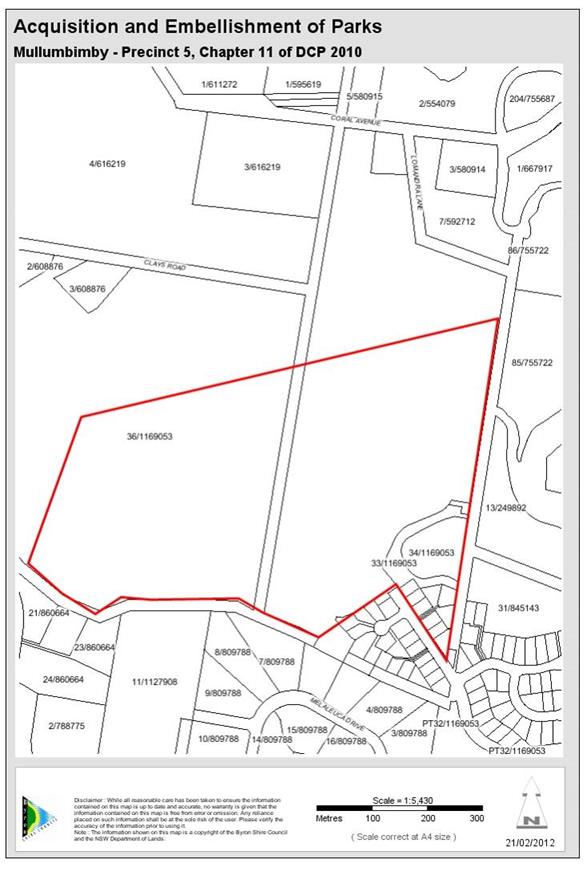
Map 6.33 Acquisition and
embellishment of Parks in area 5 as identified in Chapter 11 of DCP
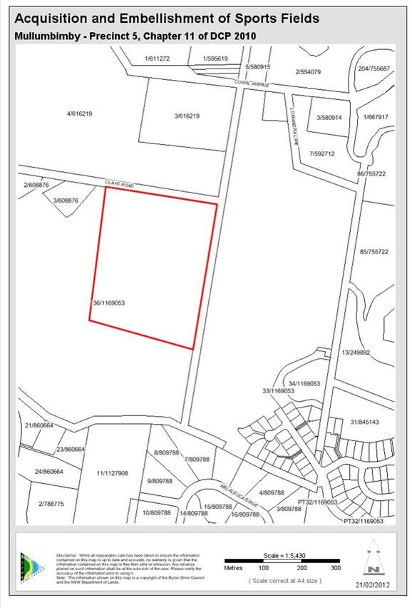
Map 6.34 Acquisition and
embellishment of sports fields as identified in Chapter 11 of DCP
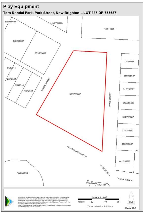
Map 6.35 Tom Kendal Park
Play equipment
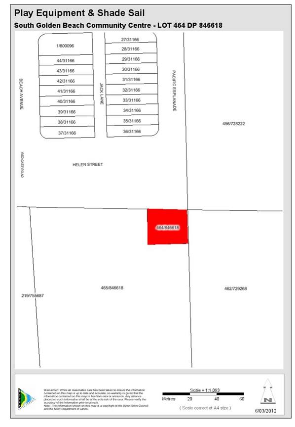
Map 6.36 SGB community
centre Play equipment & shade sail

Map 6.37 Waterlily park.
Play unit and Shade sail
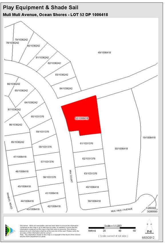
Map 6.38 Fern Beach. Play unit & sail
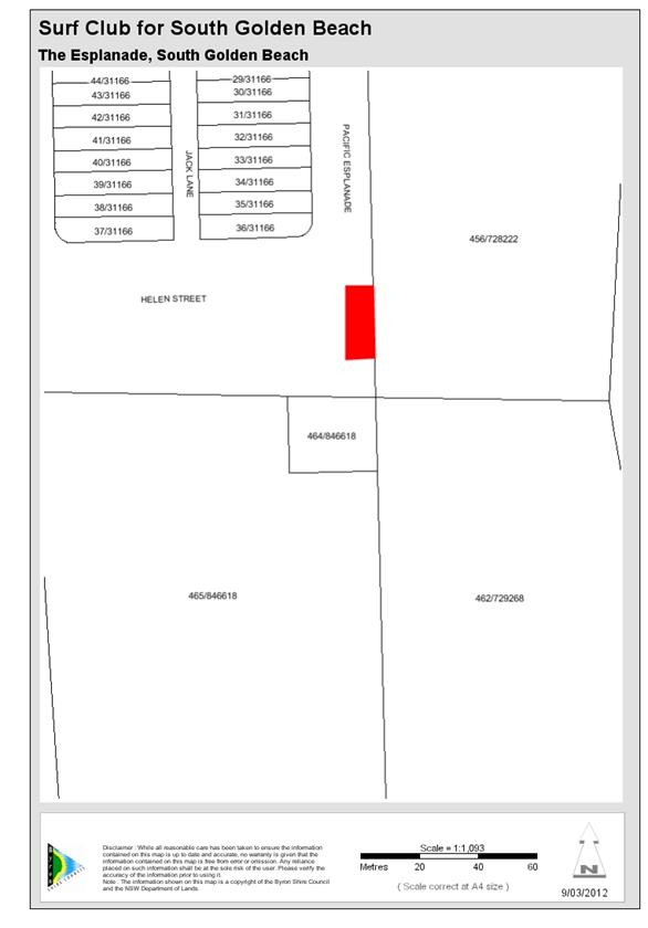
Map 6.39 Surf Club for South Golden Beach
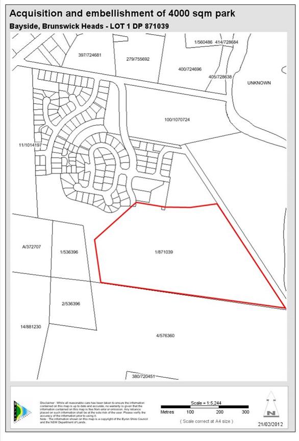
Map 6.40 Acquisition and
embellishment of 4000 square meter park in Bayside
(Lots not yet
identified)
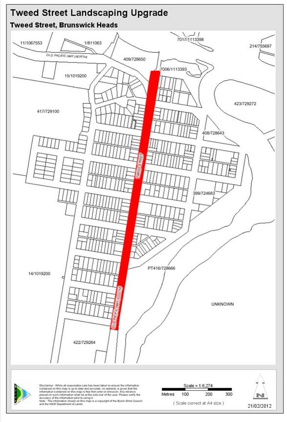
Map 6.41 Tweed Street Masterplan Landscaping Upgrades
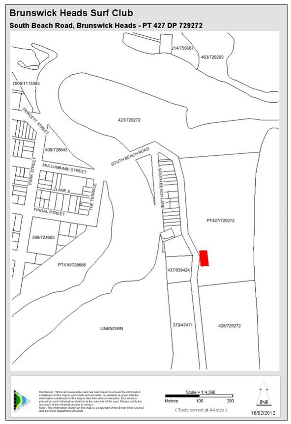
Map 6.42 Upgrade
Surf Club
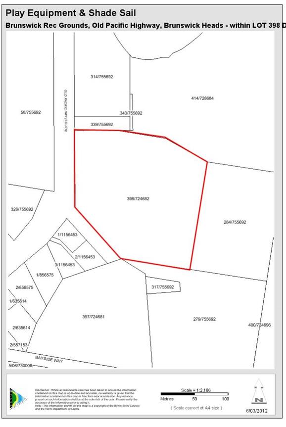
Map 6.43 Brunswick
Recreation Ground play equipment & shade sail
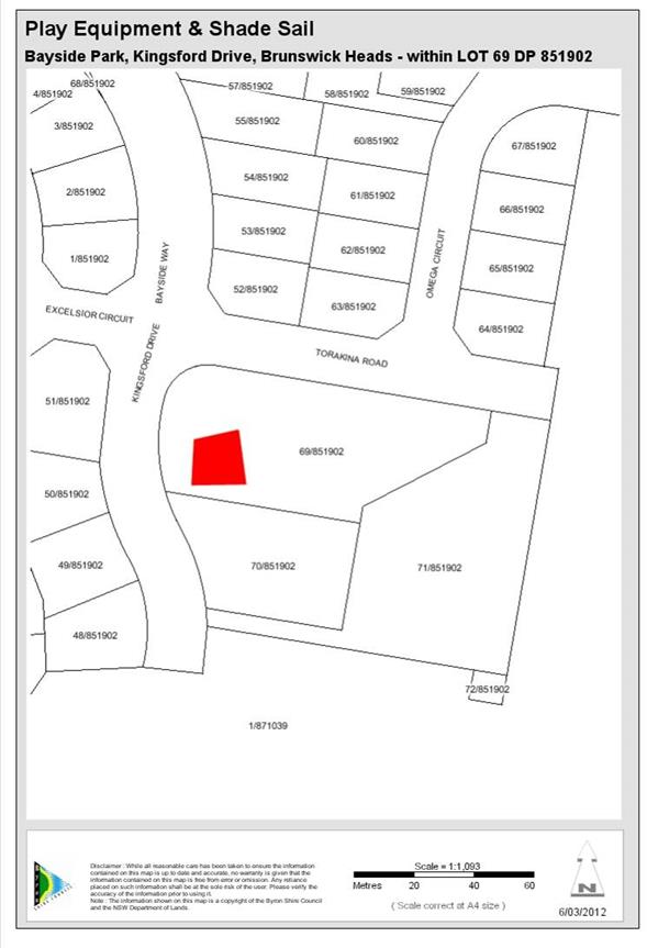
Map 6.44 Bayside
Park. Play equipment and shade sail
7 Urban
and Rural Roads
This chapter examines future demand for traffic facilities
within Byron Shire, primarily traffic control, intersection upgrades and road
widening and associated drainage works.
The Byron Shire contains a road network comprising state,
regional, collector and local roads. This Strategy involves only roads that are
the responsibility of and that are funded by Byron Shire Council. It therefore
does not include roads funded only by the RTA (state roads). In certain
areas the current level of service provided by the roads and intersections in
the Byron Shire is not adequate to accommodate existing demand generated by
residents, workers and visitors. In other areas of the road network the
capacity is adequate for the needs of the existing population. Byron Shire
Council has carried out traffic counts on the majority of its major roads since
1992. These figures on average daily traffic volumes on the existing road
network are illustrated in Byron Shire Section 94 Development Contributions
Plan 2001 –2006. The average growth over the period 1992 to 2001 across
all roads surveyed was 33 percent, which correlates with the increased
population during this period. As there is a strong correlation between
traffic growth and population increase this plan moves away from utilising trip
generation as the unit of measure for calculation of contributions and will use
population either expressed in persons or in SDU.
7.1 Nexus
and Future Demand
Council's aim should be to make adequate capacity available
on approach roads and at major intersections due to demand generated by new
developments. The costs for improvements can be allocated to those new
developments generating the additional traffic expected to use the roads and
major intersections. These costs are in addition to the on-site and
immediate access requirements specifically attributed to new development.
7.2 Timeframe
for collection
As some facilities will reach
capacity within a 10 or 15 year time frame the contributions have been
calculated over that time frame as it is unreasonable to extend the timeframe
for collection beyond this. Where a facility is 100% attributable to new
development and the demand for that facility is likely to arise in the near
future due to growth then the timeframe for collection may be limited to a 10
year period. The timeframes for collection directly impact on the size of
the population for which a given facility will pay for. Both of these
figures are to be found in the works schedule.
7.3 Timeframe
for Provision
The works schedules provide a
priority order for the completion of works in the schedule. Council will
utilise this priority order to determine the pooling of funds as provided by
clause 27 (g) of the Environmental Planning and Assessment Regulation
2000.
7.4 Apportionment
In calculating the contributions rate for traffic
improvements, consideration is given to the location of the incoming population
and the Council’s current capital works program relating to traffic
improvements. Apportionment of costs for traffic facilities is determined
on the basis of those who will benefit from the works.
The Byron Bay bypass as identified in the Opus Traffic
Reports of 27 August 2010 and 13 October 2010 has a split in demand of 80% for
the local catchment and 20% for shire wide. Accordingly the cost of this
facility will be split between these two catchments. The Byron Bay bypass
will reach capacity in 2028. Contributions will be collected for this
facility over a 15 year timeframe (medium term).
Some of the works required for the road network are also
designed to provide for the needs of existing residents in the vicinity of new
development. Where work is partially meeting the needs of the existing
population then the apportionment rate will be based on the percentage change
in population over the time period before which the facility will reach
capacity. Where a facility is only servicing the needs of new population
then the apportionment rate will be 100%. The purpose of this approach is
to reflect the nexus between the expected population and the demand for these
facilities, and to ensure that only new development pays for their share.
7.5 Calculation
of Rate of Contribution
Contributions for urban and
rural roads are based on two components –
Local Facilities and LGA wide
Facilities. The contribution rate is calculated on the following basis:
a) The estimated proportion of
LGA wide and local "use".
b) The proportion of the cost of
works which are considered to be directly attributable to the requirements of
new residential development.
7.6 Formula
for the Calculation of Contributions
The formula used to calculate the contribution (C) for each
line item in a catchment is:
Where:
W = Total cost of works
L = Proportion of
local or shire wide catchment use
R = Reconciliation
amount
P =
Percentage attributable to new development.
N = Number of SDU in the
catchment (from table X.1.2
The formula to calculate the total contribution (TC) per SDU
in a catchment at the time of consent the grant of consent is the sum of all
the line items multiplied by the increase in the consumer price index:
Where:
CPI = Ind1 at date of consent / Ind2
at date of adoption of plan
n = number of line
items to be summed in a catchment
C = Contribution(per
line item)
Note: Where the consumer price index is negative or
remains the same then value adopted for the purposes of calculation of the
contribution plan shall be the previous quarterly index value.
These calculations inclusive of intermediate steps in the
calculations are set out in the works schedule.
Urban and
Rural Roads Works Schedule
|
Facility
|
Priority for Pooling of Funds
|
Estimated Timing for works
|
Time Frame for collection (Years)
|
SDU in time frame
|
Cost of Works Indexed to 24 April 2014
|
S94 Funds bought forward (reconciliation from old
plan)
|
Proportion of local Catchment use
|
Net cost of works (less from old plan reconciliation
amount)
|
Apportionment (% attributable to new development)
|
Cost of works attributable to new development
|
Cost of Works Attributable to Council
|
Cost per SDU
|
|
|
|
|
N
|
|
R
|
L
|
(W x L) - R
|
P
|
|
|
C
|
|
Byron Bay / Suffolk Park
|
|
Byron Bay bypass to Browning
Street
|
1
|
2016
|
15
|
1427
|
8,467,270.45
|
2,500,000.00
|
80%
|
4,273,816.36
|
27.19%
|
1,162,222.80
|
3,111,593.56
|
814.45
|
|
Roundabout Ewingsdale Rd and
Sunrise Blvd. To service West Byron
|
3
|
Completed based on scheduling of land release at West
Byron
|
Completed based on scheduling of land release at West
Byron
|
1427
|
2,066,536.20
|
-
|
80%
|
1,653,228.96
|
27.19%
|
449,579.54
|
1,203,649.42
|
315.05
|
|
Ewingsdale Road/
Bayshore Dr Roundabout
|
2
|
Completed based on scheduling of land release at West
Byron
|
15
|
1427
|
3,099,804.31
|
450,000.00
|
80%
|
2,029,843.45
|
27.19%
|
551,996.19
|
1,477,847.26
|
386.82
|
|
Roundabout Ewingsdale Rd and
McGettigans Lane
|
4
|
|
15
|
1427
|
2,066,536.20
|
-
|
80%
|
1,653,228.96
|
27.19%
|
449,579.54
|
1,203,649.42
|
315.05
|
|
Widen Middleton Street,
between Marvel Street and Byron Street for two way traffic (Line item for
expenditure)
|
|
Works Completed 2013
|
15
|
1427
|
125,000.00
|
125,000.00
|
100%
|
-
|
0.00%
|
-
|
-
|
-
|
|
Shirley Street Roundabout
|
10
|
2022
|
15
|
1427
|
1,120,821.39
|
-
|
100%
|
1,120,821.39
|
27.19%
|
304,796.48
|
816,024.91
|
213.59
|
|
Tennyson Street (extension
through to Lawson)
|
|
|
15
|
1427
|
1,055,942.84
|
-
|
100%
|
1,055,942.84
|
27.19%
|
287,153.39
|
768,789.45
|
201.23
|
|
Jonson Street
|
|
|
15
|
1427
|
730,105.88
|
-
|
100%
|
730,105.88
|
27.19%
|
198,545.19
|
531,560.69
|
139.13
|
|
Town Centre Traffic Mgmt
|
|
|
15
|
1427
|
206,653.62
|
-
|
100%
|
206,653.62
|
100.00%
|
206,653.62
|
-
|
144.82
|
|
Traffic management strategy
Byron Bay
|
|
|
15
|
1427
|
206,653.62
|
-
|
100%
|
206,653.62
|
100.00%
|
206,653.62
|
-
|
144.82
|
|
Intersection Upgrade on
Broken Head Rd (Clifford Street). Type to be determined.
|
6
|
2013
|
15
|
1427
|
1,239,921.72
|
650,000.00
|
100%
|
589,921.72
|
27.19%
|
160,423.47
|
429,498.25
|
112.42
|
|
Broken Head Rd Improvements
|
5
|
2015
|
15
|
1427
|
981,604.70
|
625,536.62
|
100%
|
356,068.08
|
27.19%
|
96,829.25
|
259,238.83
|
67.86
|
|
Expenditure of Heavy Vehicle
(Quarry) haulage funds on road reconstruction and maintenance
|
|
As Required
|
|
1427
|
691,217.88
|
691,217.88
|
100%
|
-
|
27.19%
|
-
|
-
|
-
|
|
Total
|
|
|
|
|
21,366,850.93
|
4,350,536.62
|
|
13,876,284.88
|
|
4,074,433.09
|
9,801,851.79
|
2,855.24
|
|
|
|
|
|
|
|
|
|
|
|
|
|
|
|
Mullumbimby
|
|
Left Bank/Jubilee
intersection
|
|
|
15
|
333
|
30,661.78
|
20,000.00
|
100%
|
10,661.78
|
20.12%
|
2,145.24
|
8,516.54
|
6.44
|
|
Left Bank/Azalea St
intersection
|
2
|
2015
|
15
|
333
|
51,663.41
|
25,000.00
|
100%
|
26,663.41
|
20.12%
|
5,364.91
|
21,298.50
|
16.11
|
|
Pine/Main Arm intersection
|
3
|
2015
|
15
|
333
|
63,101.05
|
30,000.00
|
100%
|
33,101.05
|
20.12%
|
6,660.22
|
26,440.83
|
20.00
|
|
Main Arm Road
|
1
|
2015
|
15
|
333
|
1,120,821.39
|
548,595.70
|
100%
|
572,225.69
|
20.12%
|
115,136.82
|
457,088.87
|
345.76
|
|
Additional car parking in
Mullumbimby town centre (expenditure of s94 car parking funds)
|
NA
|
Works to be integrated with Town Centre Traffic
Management
|
|
|
135,254.06
|
135,254.06
|
100%
|
-
|
20.12%
|
-
|
-
|
-
|
|
Town Centre Traffic Management
inclusive of a traffic study. Implementation of Mullumbimby Town Centre
Master Plan
|
4
|
Works to commence upon completion of the Mullumbimby Town Centre Master plan and
after other priorities are completed.
|
15
|
333
|
200,000.00
|
-
|
100%
|
200,000.00
|
100.00%
|
200,000.00
|
-
|
600.60
|
|
Total
|
|
|
|
|
1,601,501.69
|
758,849.76
|
|
842,651.93
|
|
329,307.19
|
513,344.74
|
988.91
|
|
|
|
|
|
|
|
|
|
|
|
|
|
|
|
Brunswick Heads
|
|
Town Centre Traffic Mgmt
|
2
|
|
15
|
420
|
103,326.81
|
|
100%
|
103,326.81
|
100.00%
|
103,326.81
|
-
|
246.02
|
|
Tweed Street Masterplan
Roadworks Upgrades
|
1
|
2020
|
15
|
420
|
2,066,536.20
|
78,471.38
|
100%
|
2,066,536.20
|
38.08%
|
786,954.47
|
1,279,581.73
|
1,873.70
|
|
South Beach Road
|
3
|
|
15
|
420
|
470,813.78
|
|
100%
|
470,813.78
|
38.08%
|
179,289.87
|
291,523.91
|
426.88
|
|
Total
|
|
|
|
|
2,640,676.79
|
78,471.38
|
|
2,640,676.79
|
|
1,069,571.15
|
1,571,105.64
|
2,546.60
|
|
|
|
|
|
|
|
|
|
|
|
|
|
|
|
Bangalow
|
|
Deacon Street on street
carparking expansion (Expenditure of car parking funds)
|
1
|
2015
|
|
422
|
196,000.00
|
196,000.00
|
100%
|
-
|
0.00%
|
-
|
-
|
-
|
|
Town Centre Traffic Mgmt
|
6
|
|
15
|
422
|
103,326.81
|
-
|
100%
|
103,326.81
|
100.00%
|
103,326.81
|
-
|
244.85
|
|
Leslie St
|
4
|
|
15
|
422
|
78,209.57
|
50,000.00
|
100%
|
28,209.57
|
42.91%
|
12,103.47
|
16,106.10
|
28.68
|
|
Bangalow Road
|
3
|
|
15
|
422
|
394,937.07
|
250,000.00
|
100%
|
144,937.07
|
42.91%
|
62,186.04
|
82,751.03
|
147.36
|
|
Rifle Range Road
Intersection
|
2
|
2015
|
15
|
422
|
495,968.69
|
400,000.00
|
100%
|
95,968.69
|
42.91%
|
41,175.89
|
54,792.80
|
97.57
|
|
Rifle Range Rd Railway
Viaduct
|
5
|
|
15
|
422
|
1,151,705.35
|
217,857.38
|
100%
|
933,847.97
|
42.91%
|
400,672.59
|
533,175.38
|
949.46
|
|
Total
|
|
|
|
|
2,224,147.49
|
1,113,857.38
|
|
1,306,290.11
|
|
619,464.80
|
686,825.31
|
1,467.92
|
|
|
|
|
|
|
|
|
|
|
|
|
|
|
|
Shire Wide
|
|
Byron Bay bypass to Browning
Street
|
Refer local Priority
|
|
15
|
2892
|
8,467,270.45
|
-
|
20%
|
1,693,454.09
|
19.20%
|
325,114.70
|
1,368,339.39
|
112.42
|
|
Roundabout Ewingsdale Rd and
Sunrise Blvd. To service West Byron
|
Refer local Priority
|
|
15
|
2892
|
2,066,536.20
|
-
|
20%
|
413,307.24
|
19.20%
|
79,348.04
|
333,959.20
|
27.44
|
|
Ewingsdale
Road/Bayshore Dr Roundabout
|
Refer local Priority
|
|
15
|
2892
|
3,099,804.31
|
-
|
20%
|
619,960.86
|
19.20%
|
119,022.06
|
500,938.80
|
41.16
|
|
Roundabout Ewingsdale Rd and
McGettigans Lane
|
Refer local Priority
|
|
15
|
2892
|
2,066,536.20
|
-
|
20%
|
413,307.24
|
19.20%
|
79,348.04
|
333,959.20
|
27.44
|
|
Total
|
|
|
|
|
15,700,147.16
|
-
|
|
3,140,029.43
|
|
602,832.84
|
2,537,196.59
|
208.46
|
|
|
|
|
|
|
|
|
|
|
|
|
|
|
|
Rural Roads
|
|
Blind Mouth Creek Causeway
(refer Council report # 1160407)
|
1
|
2013
|
15
|
172
|
981,604.70
|
379,694.01
|
100%
|
601,910.69
|
4.78%
|
28,742.14
|
573,168.55
|
167.11
|
|
Main Arm Road Upper
Main Arm
|
2
|
2013
|
15
|
172
|
206,653.62
|
-
|
100%
|
206,653.62
|
4.78%
|
9,868.02
|
196,785.60
|
57.37
|
|
Federal Rd Federal
|
|
|
15
|
172
|
584,397.62
|
-
|
100%
|
584,397.62
|
4.78%
|
27,905.87
|
556,491.75
|
162.24
|
|
Federal Dr Eureka
Expenditure form old plan
|
|
2013 Works Completed
|
15
|
172
|
100,000.00
|
100,000.00
|
100%
|
-
|
0.00%
|
-
|
-
|
-
|
|
Binna Burra Rd Expenditure
from Old Plan
|
|
2013 Works Completed
|
15
|
172
|
200,000.00
|
200,000.00
|
100%
|
-
|
0.00%
|
-
|
-
|
-
|
|
Intersection Wilfred Street
and Brunswick Street Billinudgel
|
4
|
2017
|
15
|
172
|
258,317.03
|
-
|
100%
|
258,317.03
|
100.00%
|
258,317.03
|
-
|
1,501.84
|
|
Left Bank Road Mullumbimby
(Upgrade)
|
3
|
2016
|
15
|
172
|
516,634.05
|
-
|
100%
|
516,634.05
|
100.00%
|
516,634.05
|
-
|
3,003.69
|
|
The Pocket Road upgrade from
Skyline Road West
|
5
|
2018
|
15
|
172
|
774,951.08
|
-
|
100%
|
774,951.08
|
100.00%
|
774,951.08
|
-
|
4,505.53
|
|
Upgrade of Skinners Shoot
Road south of Yagers Lane.
|
NA
|
2015
|
NA
|
172
|
16,000.00
|
16,000.00
|
100%
|
-
|
100.00%
|
-
|
-
|
-
|
|
Greys Lane, Tyagarah.
Concrete upgrade across flood zone
|
6
|
2020
|
15
|
172
|
361,643.84
|
-
|
100%
|
361,643.84
|
100.00%
|
361,643.84
|
-
|
2,102.58
|
|
Mudges Quarry. Road
Maintenance expenditure from old plan
|
|
Maintenance expenditure as required
|
|
172
|
11,591.11
|
11,591.11
|
100%
|
-
|
100.00%
|
-
|
-
|
-
|
|
Leela Quarry Road
Maintenance Expenditure from old plan
|
|
Maintenance expenditure as required
|
|
172
|
3,308.78
|
3,308.78
|
100%
|
-
|
100.00%
|
-
|
-
|
-
|
|
Myocum Quarry (Council) Road
maintenance Expenditure from old plan
|
|
Maintenance expenditure as required
|
|
172
|
42,546.08
|
42,546.08
|
100%
|
-
|
100.00%
|
-
|
-
|
-
|
|
Myocum Road, Myocum /
Ewingsdale
|
7
|
2022
|
15
|
172
|
361,643.84
|
-
|
100%
|
361,643.84
|
100.00%
|
361,643.84
|
-
|
2,102.58
|
|
Total
|
|
|
|
|
4,419,291.75
|
753,139.98
|
|
3,666,151.77
|
|
2,339,705.87
|
1,326,445.90
|
13,602.94
|
|
|
|
|
|
|
|
|
|
|
|
|
|
|
|
|
|
|
8 Administration
The purpose of this chapter is to ensure that the cost
associated with preparation and administration of this plan are paid by new
development.
The management of Section 7.11
contributions imposes costs on Council in the preparation, implementation, monitoring
and review of this Plan. With the increase in population and workforce there is
a necessity to ensure there is a continuous process of managing, monitoring,
revising and implementing this Plan. The earlier parts of this Plan have
demonstrated that the new incoming population of the Byron Shire will need
improvements and additions to facilities and services of a variety of types,
which are not currently available. Section 7.11 provides the mechanism by which
contributions can be collected to provide these.
However, the administration of a
this plan requires resources which otherwise would not be devoted to this
purpose. Since these would not be required if a contribution plan was not to be
put in place, they are directly attributable to new development.
8.1 Nexus
and Future Demand
Section 94 plans and management
systems exist because the nature of new development justifies and requires it.
The costs to prepare, review and implement the plan, including for background
studies, is to be funded solely by new development.
The administration of
contributions plan is an expensive task. Council employs staff on both a part
time and full time basis that coordinate the implementation of contributions
plans and works. In addition, consultant studies are often commissioned in
order to determine design and costings of works, as well as to review the
development and demand assumptions of the plan. Council considers that the
costs involved with administering the plan are an integral and essential
component of the efficient provision of facilities demanded by development
throughout the Byron Shire. The new resident populations of Byron Shire should
pay a reasonable contribution towards costs associated with the management and
administration of this Plan.
The schedule of works, which
includes the management, and administration of this Plan will be ongoing
throughout the life of the Plan. Resources will be required to undertake an
annual review of key assumptions as well as to commission facility planning and
demand studies from time to time. Council staff accountable for
facility/service planning and delivery, or their delegates, will be involved in
reviewing/updating the Plan. This may include the annual review of assumptions
or review of the Works Schedule or latest information on community attitudes to
ensure that facility planning best reflects contemporary community needs. From
time to time, this may extend to engaging specialist consultants (such as
planning and valuation specialists) to carry out studies in order to either
research changes in the plan’s assumptions or better understand the
changing community profile of the Byron Shire.
8.2 Reconciliation
of Section 94 Contributions Plan 2005
Council held funds for
Administration that were under the Section 94 Contributions Plan 2005.
This plan replaces all works within the previous plans with a new works
schedule. All funds held have been allocated against the staffing costs
to reduce the demand on the new population and to represent the payment made by
the existing community to the administration of this plan.
8.3 Apportionment
The ongoing administration of
this plan is directly related to new population and the full cost of the
administration will be apportioned to new development.
8.4 Formula
for the Calculation of Contributions
The formula used to calculate the
contribution (C) for each line item in a catchment is:

Where:
W = Total cost of
administration
R = Reconciliation
amount
P =
Percentage attributable to new development.
N = Number of SDU in the
catchment
The formula to calculate the total contribution (TC) per SDU
in a catchment at the time of consent the grant of consent is the sum of all
the line items multiplied by the increase in the consumer price index:
Where:
CPI = Ind1 at date of consent / Ind2
at date of adoption of plan
n = number of line
items to be summed in a catchment
C = Contribution
(per line item)
Note: Where the consumer price index is negative or
remains the same then value adopted for the purposes of calculation of the
contribution plan shall be the previous quarterly index value.
These calculations inclusive of intermediate steps in the
calculations are set out in the works schedule.
Administration Schedule
|
Facility
|
Number of SDU
|
Cost of Works Indexed to 24 April 2014
|
S94 Funds bought forward (reconciliation from old
plan)
|
Net cost of works (less from old plan reconciliation
amount)
|
Apportionment (% attributable to new development)
|
Cost of works attributable to new development
|
Cost of Works Attributable to Council
|
Cost per SDU
|
|
|
N
|
W
|
R
|
L
|
P
|
|
|
C
|
|
|
|
|
|
|
|
|
|
|
|
Staff Costs (Planner, Admin & Accountant)
|
2,892
|
3,099,804.31
|
311,277.53
|
2,788,526.78
|
100%
|
2,788,526.78
|
0.00
|
964.22
|
|
Consultants
|
2,892
|
232,485.32
|
0.00
|
225,000.00
|
100%
|
225,000.00
|
0.00
|
77.80
|
|
|
|
3,332,289.63
|
311,277.53
|
3,013,526.78
|
|
3,013,526.78
|
0.00
|
1,042.02
|
Part B
– Section 7.12 Developer Contributions Plan
Section 1
– Summary schedules
The works schedule identifies the public facilities for
which section 7.12 levies will be required. Schedule 1 identifies the works
schedule adopted in [year to be inserted] and a summary of the expenditure on
the respective items.
Levies paid to council will be applied towards meeting the
cost of provision or augmentation of new public facilities. Schedule 1 provides
a summary of new public facilities, which will be provided by council over the
next 10 years, as well as the estimated cost of provision and timing.
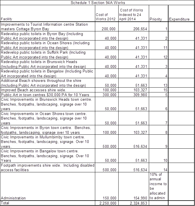
Section
2 – Expected development and demand for public facilities
The relationship between expected development and the demand
is established through the increase in demand for public facilities created by:
· Commercial
development
· Industrial
development
· Increasing tourist
numbers including day trip visitors
· Other non
residential development
Administration and operation of the plan
This development contributions plan is called the Byron
Shire Section 7.12 Development Contributions Plan 2012.
Application of this plan
This plan applies to all land within the local government
area as shown on the Map 2.1 of the section 7.11 plan.
This development contributions plan applies to all non
residential development including commercial, retail and other employment based
development, or non residential development or subdivision, including mixed use
that would create a demand for public amenities and services where the proposed
cost of carrying out the development is greater than $100,000.
The rates for different types of development are set out
below:
When does this development contributions plan commence?
This contributions plan commences on the date of [Insert
date of notification]
What is the purpose of this contributions plan?
The primary purposes of this contributions plan are:
· to authorise the
imposition of a condition on certain development consents and complying
development certificates requiring the payment of a contribution pursuant to
section 7.12 of the Environmental Planning and Assessment Act 1979;
· to assist the
council to provide the appropriate public facilities which are required to
maintain and enhance amenity and service delivery within the area;
· to publicly
identify the purposes for which the levies are required.
Are there any exemptions to the levy?
The levy will not be imposed in respect of development:
(a) Where
the proposed cost of carrying out the development is $100,000 or less; or
· for the purpose of
disabled access; or
· for the sole
purpose of providing affordable housing; or
· for the purpose of
reducing a building’s use of potable water (where supplied from water
mains) or energy; or
· for the sole
purpose of the adaptive reuse of an item of environmental heritage; or
· for residential
development.
(b) Where
a development proposal contains both a residential component and a
non-residential component, then Council will calculate the levy for the
residential component under the adopted section 7.11 plan and the levy for the
non-residential component under this section 7.12 plan. The levy finally
imposed on the development consent will be which ever the greater amount
is.
Pooling of levies
This plan expressly authorises section 7.12 levies paid for
different purposes to be pooled and applied (progressively or otherwise) for
those purposes. The priorities for the expenditure of the levies are shown in
the works schedule.
Construction certificates and the obligation of
accredited certifiers
In accordance with clause 146 of the EP&A Regulation
2000, a certifying authority must not issue a construction certificate for
building work or subdivision work under a development consent unless it has
verified that each condition requiring the payment of levies has been
satisfied.
In particular, the certifier must ensure that the applicant
provides a receipt(s) confirming that levies have been fully paid and copies of
such receipts must be included with copies of the
certified plans provided to the council in accordance with
clause 142(2) of the of the EP&A Regulation. Failure to follow this
procedure may render such a certificate invalid.
The only exceptions to the requirement are where a works in
kind, material public benefit, dedication of land or deferred payment
arrangement has been agreed by the council. In such
cases, council will issue a letter confirming that an
alternative payment method has been agreed with the applicant.
How will the levy be calculated?
The levy will be determined on the basis of the rate as set
out in summary schedule. The levy will be calculated as follows:
Levy payable = %C x $C
Where: %C is
the levy rate applicable as set out in the latest Ministerial Direction issues
under section 7.17.
$C is
the proposed cost of carrying out the development.
The rate of %C at the date of adoption is:
|
Proposed cost of the development
|
Maximum percentage of the levy
|
|
Up
to $100,000
|
Nil
|
|
$100,001–$200,000
|
0.5 percent
|
|
More than $200,000
|
1.0 percent
|
The proposed cost of carrying out the development will be
determined in accordance with clause 25J of the EP&A Regulation. The
procedures set out in Schedule 1 to this plan must be followed to enable
Council to determine the amount of the levy to be paid.
The value of the works must be provided by the Applicant at
the time of the request and where the value exceeds $500,000 must be
independently certified by a Quantity Surveyor who is registered as an
Associate member or above with the Australian Institute of Quantity Surveyors.
Without limitation to the above, Council may review the
valuation of works and may seek the services of an independent person to verify
the costs. In these cases, all costs associated with obtaining such advice will
be at the expense of the Applicant and no Construction Certificate will be
issued until such time that the levy has been paid.
How will the levy be adjusted?
Pursuant to clause 25J(4) of the Regulation, the proposed
cost of carrying out development is to be indexed before payment to reflect
quarterly variations in the Consumer Price Index All Group Index Number for the
weighted average of eight capital cities between the date the proposed cost was
determined by the Council and the date the levy is paid.
Contributions requested, as a condition of consent under the
provisions of this Plan will be adjusted at the time of payment of the
contribution in accordance with the following formula:
Contribution at time of payment = 1% x IDC
Where IDC = the indexed development cost
= ODC x (CP2-CP1)/CP1
Where: ODC = the
original development cost estimated by the Council
CP2 = the
current CPI at the date the levy is paid
CP1 = the
previous CPI at the date the original development cost was estimated by the
Council.
CPI = Consumer
Price Index All Group Index Number for weighted average of eight capital cities
as published by the Australian Bureau of Statistics
Note: In the event that the Current index CP2 is less than
the previous index CP1, then the previous development cost and levy shall
apply.
When is the levy payable?
A levy must by paid to the council at the time specified in
the condition that imposes the levy. If no such time is specified, the levy
must be paid prior to the issue of a construction certificate or complying
development certificate.
Can deferred or periodic payments be made?
Deferred or periodic payments may be permitted in the
following circumstances:
· deferred or
periodic payment of the contribution will not prejudice the timing or the
manner of the provision of public facilities included in the works program,
· in other
circumstances considered reasonable by council.
If council does decide to accept deferred or periodic
payment, council may require the applicant to provide a bank guarantee by a
bank for the full amount of the contribution or the outstanding balance on
condition that:
· the bank guarantee
be by a bank for the amount of the total contribution, or the amount of the
outstanding contribution, plus an amount equal to thirteen (13) months interest
plus any charges associated with establishing or operating the bank security;
· the bank
unconditionally pays the guaranteed sum to the council if the council so
demands in writing not earlier than 12 months from the provision of the
guarantee or completion of the work
· the bank must pay
the guaranteed sum without reference to the applicant or landowner or other
person who provided the guarantee, and without regard to any dispute,
controversy, issue or other matter relating to the development consent or the
carrying out of development
· the bank's
obligations are discharged when payment to the council is made in accordance
with this guarantee or when council notifies the bank in writing that the
guarantee is no longer required
· where a bank
guarantee has been deposited with council, the guarantee shall not be cancelled
until such time as the original contribution and accrued interest are
paid.
Savings and Transitional Agreements
A development application or a
modification to a development application, which has been lodged prior to the
commencement of this Plan but not determined, shall be determined in accordance
with the provisions of the previously adopted plan,
which applied at the date of lodgement.
Contributions levied on
development consents under the previous contributions plans remain payable and
are indexed in accordance with that plan. Contributions levied under a
previous plan will be allocated to the highest priority uncompleted project in
the new works schedules for the pooling of funds.
Part D – Schedule 2 and Schedule 3 - Cost Summary
Reports
Procedure
An Application for a
Construction Certificate or an application for a complying development
certificate must be accompanied by a report setting out an estimate of the
proposed cost of carrying out development prepared as follows:
· Where
the estimated cost of carrying out the whole of the development as approved by
the consent is $500,000 or less - a cost summary report in accordance with Schedule
1;
· Where
the estimated cost of carrying out the whole of the development as approved by
the consent is more than $500,000 - A Quantity Surveyor’s Detailed Cost
Report, completed by a Quantity Surveyor who is a registered Associate member
or above of the Australian Institute of Quantity Surveyors, in accordance with
Schedule 2.
Section 25J of the Environmental
Planning and Assessment Act 1979 sets out the things that are included in the
estimation of the construction costs by adding up all the costs and expenses
that have been or are to be incurred by the Applicant in carrying out the
development, including but not limited to the following:
(a) if the development involves the erection of a building, or the
carrying out of engineering or construction work—the costs of or
incidental to erecting the building, or carrying out the work, including the
costs (if any) of and incidental to demolition, excavation and site
preparation, decontamination or remediation;
(b) if the development involves a change of use of land—the
costs of or incidental to doing anything necessary to enable the use of the
land to be changed.
SCHEDULE
1
Cost
Summary Report
[Development
Cost not greater than $500,000]
DA /CC/CDC No.........................................................................................................................
DATE:..........................................................................................................................................
APPLICANT’S NAME:................................................................................................................
APPLICANT’S ADDRESS:.........................................................................................................
DEVELOPMENT DETAILS:.......................................................................................................
DEVELOPMENT ADDRESS:....................................................................................................
ANALYSIS OF DEVELOPMENT COSTS:
|
Demolition and alterations
|
$
|
Hydraulic services
|
$
|
|
Structure
|
$
|
Mechanical services
|
$
|
|
External walls, windows and
doors
|
$
|
Fire services
|
$
|
|
Internal walls, screens and
doors
|
$
|
Lift services
|
$
|
|
Wall finishes
|
$
|
External works
|
$
|
|
Floor finishes
|
$
|
External services
|
$
|
|
Ceiling finishes
|
$
|
Other related work
|
$
|
|
Fittings and equipment
|
$
|
Sub-total
|
$
|
|
Sub-total above carried
forward
|
$
|
|
Preliminaries and margin
|
$
|
|
Sub-total
|
$
|
|
Consultant Fees
|
$
|
|
Other related development
costs
|
$
|
|
Sub-total
|
$
|
|
Goods and Services Tax
|
$
|
|
TOTAL DEVELOPMENT COST
|
$
|
I certify that I have:
· inspected
the plans the subject of the application for development consent or
construction certificate.
· calculated
the development costs in accordance with the definition of development costs in
clause 25J of the Environmental Planning and Assessment Regulation 2000 at
current prices.
· included
GST in the calculation of development cost.
Signed: .........................................................................................................................................
Date: ..............................................................................................................................................
Name: ...........................................................................................................................................
Phone: ..........................................................................................................................................
Position and Qualifications: .....................................................................................................
Address: .......................................................................................................................................
SCHEDULE
2
Cost
Summary Report
[Development
Cost greater than $500,000]
DA /CC/CDC No.........................................................................................................................
DATE:..........................................................................................................................................
APPLICANT’S NAME:................................................................................................................
APPLICANT’S ADDRESS:.........................................................................................................
DEVELOPMENT DETAILS:.......................................................................................................
DEVELOPMENT ADDRESS:....................................................................................................
ANALYSIS OF DEVELOPMENT COSTS:
|
Gross Floor Area –
Commercial
|
m2
|
Gross Floor Area –
Other
|
m2
|
|
Gross Floor Area –
Retail
|
m2
|
Total Gross Floor Area
|
m2
|
|
Gross Floor Area –
Car Parking
|
m2
|
Total Site Area
|
m2
|
|
Total Development Cost
|
$
|
Total Car Parking - Spaces
|
|
|
Total Construction Cost
|
$
|
|
|
|
Total GST
|
$
|
|
|
I certify that I have:
· inspected
the plans the subject of the application for development consent or
construction certificate.
· calculated
the development costs in accordance with the definition of development costs in
clause 25J of the Environmental Planning and Assessment Regulation 2000 at
current prices.
· included
GST in the calculation of development cost.
Signed: .........................................................................................................................................
Date: ..............................................................................................................................................
Name: ...........................................................................................................................................
Phone: ..........................................................................................................................................
Position and Qualifications: .....................................................................................................
Address: .......................................................................................................................................