Agenda
Ordinary
(Planning) Meeting
Thursday,
20 February 2020
held
at Council Chambers, Station Street, Mullumbimby
commencing
at 11.00am
 Public Access relating to items
on this Agenda can be made between 11.00am and 11.30am on the day of the
Meeting. Requests for public access should be made to the General Manager
or Mayor no later than 12.00 midday on the day prior to the Meeting.
Public Access relating to items
on this Agenda can be made between 11.00am and 11.30am on the day of the
Meeting. Requests for public access should be made to the General Manager
or Mayor no later than 12.00 midday on the day prior to the Meeting.
Mark
Arnold
General
Manager
What is a “Conflict of Interests” - A conflict of
interests can be of two types:
Pecuniary - an interest that a person has in a matter because of a reasonable
likelihood or expectation of appreciable financial gain or loss to the person
or another person with whom the person is associated.
Non-pecuniary – a private or personal interest that a Council
official has that does not amount to a pecuniary interest as defined in the Code
of Conduct for Councillors (eg. A friendship, membership of an association,
society or trade union or involvement or interest in an activity and may
include an interest of a financial nature).
Remoteness – a person does not have a pecuniary interest in a matter
if the interest is so remote or insignificant that it could not reasonably be
regarded as likely to influence any decision the person might make in relation
to a matter or if the interest is of a kind specified in the Code of Conduct
for Councillors.
Who has a Pecuniary Interest? - a person has a pecuniary interest in a
matter if the pecuniary interest is the interest of the person, or another
person with whom the person is associated (see below).
Relatives, Partners - a person is taken to have a pecuniary interest in a
matter if:
§ The person’s
spouse or de facto partner or a relative of the person has a pecuniary interest
in the matter, or
§ The person, or a
nominee, partners or employer of the person, is a member of a company or other
body that has a pecuniary interest in the matter.
N.B. “Relative”, in relation to a person means any of the
following:
(a) the
parent, grandparent, brother, sister, uncle, aunt, nephew, niece, lineal
descends or adopted child of the person or of the person’s spouse;
(b) the
spouse or de facto partners of the person or of a person referred to in
paragraph (a)
No Interest in the Matter - however, a person is not taken to have a
pecuniary interest in a matter:
§ If the person is
unaware of the relevant pecuniary interest of the spouse, de facto partner,
relative or company or other body, or
§ Just because the
person is a member of, or is employed by, the Council.
§ Just because the
person is a member of, or a delegate of the Council to, a company or other body
that has a pecuniary interest in the matter provided that the person has no
beneficial interest in any shares of the company or body.
Disclosure and participation in meetings
§ A Councillor or a
member of a Council Committee who has a pecuniary interest in any matter with
which the Council is concerned and who is present at a meeting of the Council
or Committee at which the matter is being considered must disclose the nature
of the interest to the meeting as soon as practicable.
§ The Councillor or
member must not be present at, or in sight of, the meeting of the Council or
Committee:
(a) at any
time during which the matter is being considered or discussed by the Council or
Committee, or
(b) at any
time during which the Council or Committee is voting on any question in
relation to the matter.
No Knowledge - a person does not breach this Clause if the person did
not know and could not reasonably be expected to have known that the matter
under consideration at the meeting was a matter in which he or she had a
pecuniary interest.
Non-pecuniary Interests - Must be disclosed in meetings.
There are a broad range of options available for managing conflicts &
the option chosen will depend on an assessment of the circumstances of the
matter, the nature of the interest and the significance of the issue being
dealt with. Non-pecuniary conflicts of interests must be dealt with in at
least one of the following ways:
§ It may be appropriate
that no action be taken where the potential for conflict is minimal.
However, Councillors should consider providing an explanation of why they
consider a conflict does not exist.
§ Limit involvement if
practical (eg. Participate in discussion but not in decision making or vice-versa).
Care needs to be taken when exercising this option.
§ Remove the source of
the conflict (eg. Relinquishing or divesting the personal interest that creates
the conflict)
§ Have no involvement by
absenting yourself from and not taking part in any debate or voting on the
issue as of the provisions in the Code of Conduct (particularly if you have a significant
non-pecuniary interest)
RECORDING OF VOTING ON PLANNING MATTERS
Clause 375A of the Local Government Act 1993
– Recording of voting on planning matters
(1) In this section, planning
decision means a decision made in the exercise of a function of a council
under the Environmental Planning and Assessment Act 1979:
(a) including a decision
relating to a development application, an environmental planning instrument, a
development control plan or a development contribution plan under that Act, but
(b) not including the making of
an order under that Act.
(2) The general manager is
required to keep a register containing, for each planning decision made at a
meeting of the council or a council committee, the names of the councillors who
supported the decision and the names of any councillors who opposed (or are
taken to have opposed) the decision.
(3) For the purpose of
maintaining the register, a division is required to be called whenever a motion
for a planning decision is put at a meeting of the council or a council
committee.
(4) Each decision recorded in
the register is to be described in the register or identified in a manner that
enables the description to be obtained from another publicly available
document, and is to include the information required by the regulations.
(5) This section extends to a
meeting that is closed to the public.
Ordinary (Planning) Meeting
BUSINESS OF Ordinary (Planning) Meeting
1. Public Access
2. Apologies
3. Requests for Leave of
Absence
4. Declarations of Interest
– Pecuniary and Non-Pecuniary
5. Tabling of Pecuniary
Interest Returns (Cl 4.9
Code of Conduct for Councillors)
6. Adoption of Minutes from
Previous Meetings
6.1 Ordinary
(Planning) Meeting held on 31 December 2019
7. Reservation of Items for
Debate and Order of Business
8. Mayoral Minute
9. Notices of Motion and Rescission
9.1 Final
Business and Industrial Lands Strategy for adoption............................................... 5
10. Petitions
11. Submissions and Grants
12. Delegates' Reports
13. Staff Reports
Sustainable Environment and Economy
13.1 PLANNING
- Development Application 10.2019.275.1 Boundary Adjustment 45 Monet Drive
Montecollum...................................................................................................................... 8
13.2 PLANNING
- 26.2019.8.1 Planning Proposal Parrot Tree Place Bangalow to rezone 690m2 of
RU1 to R2 low density residential............................................................................................ 22
13.3 PLANNING
- Development Application - further report following resolution 19-279
10.2018.384.1 Alterations and Additions to existing Dwelling House, Alterations
and Additions to existing structure to create Dual Occupancy (detached) and
Upgrade Wastewater System at 183 Coopers West Lane Main Arm......................................................................................................................... 28
13.4 Integrated
Pest Management Strategy........................................................................... 34
13.5 PLANNING
- S8.2 Review - Alterations & Additions to Tourist Cabin, Alcorn Street,
Suffolk Park......................................................................................................................................... 36
13.6 Tiny
House Development Proposal................................................................................ 50
13.7 PLANNING
- 26.2019.4.1 Outcome of Public Exhibition - Planning Proposal to Introduce
Minimum Lot Size Standards (BLEP 2014) for Manor House and Multi Dwelling
Housing (Terraces) 59
13.8 PLANNING
- 26.2018.5.1 Outcome of Public Exhibition - Planning Proposal to Rezone Land
at 4 Picadilly Hill Road, Coopers Shoot................................................................................. 70
13.9 PLANNING
- Development Application 10.2019.161.1 - Multi Dwelling Housing - 15 Units, No
23 Lismore Road Bangalow................................................................................................. 77
13.10 PLANNING
- 26.2016.6.1 The Farm Planning Proposal, Ewingsdale Road Byron Bay 112
13.11 Coastal
Management Program (Stage One) Scoping Study for Cape Byron to South Golden
Beach - status and update.......................................................................................................... 117
13.12 PLANNING
- 26.2020.1.1 - Planning Proposal for Short Term Rental Accommodation 120
14. Questions
With Notice
Nil
Questions with Notice: A response to Questions with
Notice will be provided at the meeting if possible, that response will be
included in the meeting minutes. If a response is unable to be provided
the question will be taken on notice, with an answer to be provided to the
person/organisation prior to the next Ordinary Meeting and placed on Councils
website www.byron.nsw.gov.au/Council/Council-meetings/Questions-on-Notice
Councillors are
encouraged to ask questions regarding any item on the business paper to the
appropriate Director prior to the meeting. Any suggested amendments to the
recommendations should be provided to Councillor Support prior to the meeting
to allow the changes to be typed and presented on the overhead projector at the
meeting.
Notices of Motion and Rescission 9.1
Notices of Motion
Notice of Rescission Motion No. 9.1 Final
Business and Industrial Lands Strategy for adoption
File
No: I2019/2134
|
We move that Council rescind Resolution No. 19-674 from
its Ordinary meeting held on 12 December 2019 which reads as follows:
1. That
Council note the Business and Industrial Lands Strategy has been updated to
reflect the outcomes of consultation, as applicable on Area 5 Gulgan North
described as part of Lot 2 DP 1159910, 66 The Saddle Road, Brunswick Heads
which has been included as a possible industrial and business park area.
2. That
Council adopt the Business and Industrial Lands Strategy as contained in
Attachment 4 (E2019/85987) and together with the Background Report contained
in Attachments 3, 5 and 6 (E2019/86202, E2019/83593 and E2019/86203) send to
the NSW Department of Planning, Industry & Environment for final
endorsement.
3. That
Council note that the colour contrasts used on some figures in the Business
and Industrial Lands Strategy will be reviewed and if necessary, changed to
enhance readability under the Web Content Accessibility Guidelines before
sending to NSW Department of Planning, Industry & Environment for final
endorsement.
|
If successful we intend to move:
1. That
council not adopt the current Business and Industrial Lands Strategy
2. That
Council removes the Gulgan North Precinct ‘A’& ‘B’
(part of Lot 2 DP 1159910, 66 The Saddle Road, Brunswick Heads)
3. That
Council is provided with detailed responses to NSW Government agency advice
explaining why the Strategy diverges from this advice
4. That
the Strategy be redrafted to include the following:
• an
overarching servicing and delivery framework for industrial and business land
to fulfil the requirements of Resolution 15 19-281
• the
inclusion of more background from regional and state documents that explain how
assessed future land requirements meet the guidelines in these documents
• an
explanation of the options presented for growth and delivery and presented as
Scenario 1, 2 and 3, with infrastructure and other impact analysis for each
scenario 20
• detailed
justification and clarification of any proposed exceedance of growth scenarios
5. That
the Strategy be brought back to Council for approval before going on public
exhibition.
Attachments:
1 Special
Disclosure of Pecuniary Interest Annexure, E2012/2815

Signed: Cr
Catherine Coorey
Cr Jan Hackett
Cr Basil Cameron
Comments from Director of Sustainable Environment and
Economy:
Under the Environmental Planning
and Assessment Act 1979 Part 3 Division 3.1 Section 3.3 Regional Plans set the
framework, vision and direction for strategic planning and land use planning.
A regional priority for Byron Shire under the North Coast Regional Plan 2036 (NCRP) is to
identify employment investigation areas. To deliver, Council is required to:
• develop
a local growth management strategy that identifies commercial or industrial
urban growth areas
• prepare
land release criteria to assess appropriate locations for commercial and
industrial uses.
The Business and Industrial Lands
Strategy (BILS) complies with:
• clearly
identified areas for investigation for business or industrial growth
• stating
of further investigations to be undertaken to support any future rezoning
within these areas to confirm the suitability of land for business and/or industrial
uses.
The further investigations for each area were identified in
collaboration with NSW Government agencies and through a state policy
consistency check of the North Coast Regional Plan 2036 (NCRP), State
Environmental Planning Policies, and section 9.1 Ministerial Directions 2019.
This information was contained in the BILS Background Report that accompanied
the report to Council Ordinary meeting 12 December 2019.
The ‘investigation
areas’ are a gross land area. The growth scenario land area projections
are different in that they reflect a net developed area demand. The allocated
investigation area in the BILS generally equates with meeting a growth Scenario
3 requirement of 16.5 to 24.7 ha of developed land. It was considered prudent
to look at the Shire’s capacity to provide for the Scenario 3, due to
current strong business and employment growth (524 new businesses established in
the Shire between 2015 – 2018), as well as population (in the overall
Northern Rivers region). As comparison, the low growth Scenario 1 drew on a
period when business growth was lower 2011 -2105 when only 27 new businesses
were recorded.
An assumption of land area attrition
as part of the rezoning process and post the zoning of the land acknowledges that
the majority of investigation areas may be affected in part by constraints and
that the future development of some parts of investigation sites may not be
supported. An analysis of existing zoned land supports this assumption. Whilst
the Shire has 24.4ha of currently zoned industrial land only around 11.9 ha
(i.e. 50%) currently has capacity to accommodate some of projected demand.
The BILS use of ‘investigation
areas’ is consistent with state government requirements for a Local
Growth Management Strategy. Importantly when considering this motion, it needs
to be noted that a parcel’s inclusion in Business and Industrial Lands
Strategy does not automatically mean it will be zoned for business or industry
and any subsequent rezoning application will require a detailed assessment and
public notification. This stepped assessment approach has the benefit of
placing the cost of more detailed investigations with the land developer rather
than being carried by the community upfront and providing a safety net for
changes in land management information and techniques that may come in to play
between the adoption of the BILS and a proponent seeking to rezone the land.
Financial/Resource/Legal Implications:
The redrafting and re-exhibition of the BILS as proposed by
the motion will have financial and resource allocation implications.
Is the proposal consistent with any Delivery Program
tasks?
The proposal would immediately stop the finalisation of the
Business and Industrial Lands Strategy, with an estimated new finalisation date
of late 2020. It will also direct staff away from other work programs that they
need to progress in line with the current and forward year DP/OP.
|
Community
Objective 4: We manage growth and change responsibly
|
4.5
|
Work to improve
community resilience in our changing environment
|
4.5.1
|
Develop and
implement strategies for our community's needs
|
4.5.1.1
|
Finalise the Business
and Industrial Land Strategy
|
Staff Reports - Sustainable Environment and Economy 13.1
Staff Reports - Sustainable Environment and
Economy
Report No. 13.1 PLANNING
- Development Application 10.2019.275.1 Boundary Adjustment 45 Monet Drive
Montecollum
Directorate: Sustainable
Environment and Economy
Report
Author: Patricia
Docherty, Planner
File No: I2019/2024
Proposal:
|
DA No:
|
10.2019.275.1
|
|
Proposal description:
|
Boundary Adjustment
|
|
Property description:
|
LOT: 1 DP: 1231141, LOT: 9 DP: 259415
|
|
45 Monet Drive MONTECOLLUM; 105 Monet Drive MONTECOLLUM
|
|
Parcel No/s:
|
268840, 163740
|
|
Applicant:
|
Balanced Systems Planning Consultants
|
|
Owner:
|
Mr A J King
|
|
Zoning:
|
RU2 Rural Landscape / PART DM Deferred Matter (1A Hatched
General Rural Zone
|
|
Date received:
|
23 May 2019
|
|
Integrated / Designated Development:
|
☒
Integrated
|
☐
Designated
|
☐
Not applicable
|
|
Concurrence required
|
RFS 100B; DPIE Secretary’s variation to a
development standard.
|
|
Public notification or exhibition:
|
- Level
0 advertising under DCP 2014 Part A14 – Public Notification and
Exhibition of Development Applications
- Exhibition
period: Not Applicable
- Submissions received:
Nil
|
|
Variation request
|
☒
Clause 4.6
|
☒
SEPP 1
|
☐
Not applicable
|
|
Delegation to determine
|
Council
|
|
Issues:
|
SEPP 1 Variation
|
Summary:
This development application seeks consent for a boundary
adjustment between two lots at 45-105 Monet Drive, Montecollum, known as the
Crystal Castle. The subject properties have an area of 7.66 ha (Lot 1 DP
1231141 – Crystal Castle Lot) and 20.02 ha (Lot 9 DP 259415). The
reconfigured lots will increase the size of the property that contains the
Crystal Castle as follows:
· Proposed Lot A -
10 ha (Crystal Castle Lot) and
· Proposed Lot B -
17.88 ha
The development incorporates a SEPP 1 Variation to the 40 ha
minimum lot size requirements and the Secretary (Department of Planning,
Industry and Environment) has granted concurrence to vary the development
standard under Clause 11 of Byron LEP 1988 in this instance.
The purpose of the proposal to adjust the shared boundary
between the two rural allotments is to expand the current ecological
enhancement program on site, by incorporating the additional land into the
current rainforest regeneration area.
No additional dwelling entitlements will be created. There
are no expected adverse environmental impacts to the site or surrounding
properties as a result of the proposed boundary adjustment, which is seen as a
logical alignment of the boundaries to the land.
The application is recommended for
approval subject to conditions of consent.
NOTE TO COUNCILLORS:
In accordance with the
provisions of S375A of the Local Government Act 1993, a Division is to be
called whenever a motion for a planning decision is put to the meeting, for the
purpose of recording voting on planning matters. Pursuant to clause 2(a)
under the heading Matters to be Included in Minutes of Council Meetings of Council's
adopted Code of Meeting Practice (as amended) a Division will be deemed to have
been called by the mover and seconder of all motions relating to this report.
|
RECOMMENDATION:
That pursuant to Section 4.16 of the
Environmental Planning & Assessment Act 1979, Development Application No.
10.2019.275.1 for Boundary Adjustment, be granted consent subject to the
conditions of approval in Attachment 4 (E2020/3957).
|
Attachments:
1 Plans
prepared by Balanced Systems dated 20/8/19, E2020/3848
2 Department
of Planning - Secretary's concurrence, E2020/3827
3 Rural Fire
Service - General Terms of Approval, E2020/3824

4 Recommended
Conditions - Attachment 4 - 10.2019.275.1 Monet
Drive Montecollum, E2020/3957 
REPORT
Assessment:
1. INTRODUCTION
1.1. History/Background
A search of Council records provides the following
development approval history for the site:
BA 6.1987.2600.1 Conversion,
Finalised 31/01/1987
BA 6.1995.2173.1
Addition/Alteration to Shop - Roof over tea rooms, Approved 02/05/1995
DA 5.1995.285.1 Change of Use -
Tourist Facility, Approved 03/11/1995
DA 5.1997.413.1 Tree removal (5
trees), Approved 17/12/1997
DA 10.1998.472.1 Camping ground (4
sites), 6 cabins (rural tourist facility), Approved 17/05/1999
DA 10.2004.247.1 Farm Shed,
Approved 28/06/2004
DA 10.2006.517.1 Rural Dwelling,
Approved 01/11/2006
S96 10.2006.517.2 - Minor mods to
dwelling inc. new entrance porch, Approved 19/09/2007
CDC 16.2008.44.1 New Carport &
Small Screened Area, Approved 09/07/2008
DA 10.2011.411.1 Special purpose
subdivision - established rural tourist facility, Approved 12/04/2012
DA 10.2011.3.1 Construction of a
"Stupa Monument", Approved 4/02/2011
DA 10.2014.278.1 Alts/Adds to a
Rural Tourist Facility, for toilet facilities Approved 02/07/2014
S96 10.2014.278.2 Delete condition
6 regarding disabled access, Approved 18/07/2014
S96 10.2011.411.2 Delete condition
no. 5 in relation to electricity supply. Approved 22/07/2014
S96 10.2011.411.3 Modify Bushfire
Safety Authority Requirements, Approved 10/11/2015
1.2. Description
of the proposed development
This application seeks approval for a boundary adjustment
between Lot 1 DP 1231141 (7.866 ha) and Lot 9 DP 259415 (20.02 ha) to create
proposed Lot A (10 ha) and Lot B (17.886 ha) (refer to illustration below).
Proposed Boundary
Adjustment
The proposed boundary adjustment is located entirely within
the 1(a) Hatched General Rural Zone and the nominated building envelope on
proposed Lot B is on land zoned RU2 Rural Landscape in an existing cleared area
with access to Monet Drive.
Access to
Proposed Lot A is via the existing access.
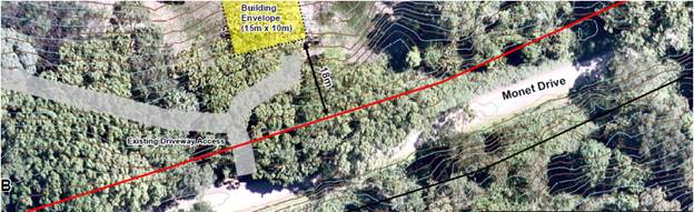
Access to
Proposed Lot B
1.3. Description
of the site
The combined site area is approximately 27.886 ha. The site
is formally known as:
Lot 1 DP 1231141 - 45 Monet Drive Montecollum, 2482; and
Lot 9 DP 259415 - 105 Monet Drive, Montecollum, 2482.
Existing Lot 1, which is the lot to the south on the
locality plan is 7.866 ha and contains the ‘Crystal Castle’ rural
tourist facility and associated uses including a café, gift shop and
managers residence.
Existing Lot 9 is 20.02 ha and has an existing dwelling
entitlement that will not be changed by the proposed boundary adjustment. There
are no buildings or structures on Lot 9 DP 259415 other than a car park with
access from Monet Drive.
It is noted that a separate residence is located on an
adjoining parcel to the west of existing Lot 1, legally described as Lot
2 DP 1231141 at 461 Goonengerry Road and that this does not form part of this
proposal.
This proposal does not create a new dwelling entitlement.
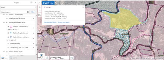
Dwelling entitlement
mapping extract from Geocortex
.
2. SUMMARY OF
REFERRALS
|
Referral
|
Issue
|
|
Environmental Health Officer
|
No objections subject to conditions.
|
|
Development Engineer
|
No objections subject to conditions.
|
|
S94 / Contributions Officer
|
No contributions are payable. No increase in the
demand for public facilities.
|
|
Rural Fire Service (100B)
|
No objections subject to conditions.
|
|
Department of Planning & Environment
|
No objections. Concurrence granted.
|
3. SECTION 4.14
– BUSH FIRE PRONE LAND
Under section S100B of the Rural Fires Act 1997, the NSW
Rural Fire Service must provide General Terms of Approval, under Division 4.8
of the Environmental Planning and assessment Act 1979, and a Bushfire Safety
Authority for land subdivision on bushfire prone land that the development
complies with the document Planning for Bush Fire Protection 2006. The site is
bush fire prone land. The development application was referred to the NSW Rural
Fire Service, which provided a Bushfire Safety Authority subject to conditions
reflected in the Recommendation of this Report.
4. SECTION 4.15C
– MATTERS FOR CONSIDERATION – DISCUSSION OF ISSUES
Having regard to the matters for consideration detailed in
Section 4.15(1) of the Environmental Planning & Assessment Act 1979
(EP&A Act), the following is a summary of the evaluation of the issues.
4.1 State Environmental
Planning Instruments
|
|
Satisfactory
|
Unsatisfactory
|
|
State
Environmental Planning Policy No 1—Development Standards
|
☒
|
☐
|
|
Consideration:
The applicant’s written request to vary the
development standard Clause 11 – Subdivision in rural areas for
agriculture etc. of the Byron LEP 1998, for land use zone 1AH (General Rural
Zone) has been considered. The written request provides justification
that in the circumstances of this particular development application, that
compliance with the development standard is unreasonable and
unnecessary. The written request provided grounds of the objection in
summary, as follows:
SEPP 1 Variation – Department of Planning, Industry
and Environment Secretary’s Concurrence was granted on 13 September
2019 “in this instance for the following reasons:
· the proposal
will not result in additional lots or opportunities for additional dwellings
and will provide increased opportunities for the improved environmental
management of the land;
· The areas of
the existing lots are already significantly less than the 40 hectare minimum
lot size development standard; and
· There is no
public benefit in maintaining the development standard in this
instance.”
|
|
State
Environmental Planning Policy No 44—Koala Habitat Protection
|
☒
|
☐
|
|
Consideration:
SEPP
44 is a relevant consideration as both Lots are greater than 1 ha in area
(Cl.6). Both Lots contain mapped potential koala habitat (Cl.7). The
property contains some Koala sightings as shown on the NSW Bionet Species
Sightings dataset.
The
site contains some scattered Eucalyptus species that were historically
planted as a windbreak and are comprised predominately of Flooded Gum. There
are some mature Brushbox trees on the site as well. There are also some large
Eucalyptus to the north-west of the vacant dwelling envelope. Most of the
native vegetation comprises Camphor Laurel with some native rainforest
species.
The site has NSW Bionet
Sightings recorded for the Koala, to the north-east of the proposed vacant
dwelling envelope. All large Eucalyptus trees on the site will be retained
and protected.
The
mapped vegetation is not considered to be core koala habitat. The
proposal does not require clearing of any koala food trees and will result in
improved vegetation management by consolidating the land for bush
regeneration purposes. A Plan of Management for koalas is not required
based on this assessment.
|
|
State
Environmental Planning Policy No 55—Remediation of Land
|
☒
|
☐
|
|
Consideration: The applicant’s SEPP 55 report
assessed the site of the proposed building envelope for proposed Lot B.
The preliminary site investigation concludes that: there is negligible
risk of contamination at the site of the proposal (the proposed building site
for new Lot B) and no further detailed investigation or soil testing is
warranted. In accordance with the Byron Shire Council
Contaminated Sites Guidelines, NSW EPA Guidelines and SEPP55 provisions, the
site is suitable for the proposed dwelling envelope”
It is considered that the proposed building envelope
is suitable for residential use.
|
|
State Environmental Planning
Policy (Primary Production and Rural Development) 2019
|
☒
|
☐
|
|
Consideration: The proposed boundary adjustment as
assessed is not inconsistent with the aims of the SEPP as
follows:
(a) to facilitate the orderly economic use
and development of lands for primary production,
(b) to reduce land use conflict and
sterilisation of rural land by balancing primary production, residential
development and the protection of native vegetation, biodiversity and water
resources,
(c) to identify State significant
agricultural land for the purpose of ensuring the ongoing viability of
agriculture on that land, having regard to social, economic and environmental
considerations,
(d) to simplify the regulatory process for
smaller-scale low risk artificial waterbodies, and routine maintenance of
artificial water supply or drainage, in irrigation areas and districts, and
for routine and emergency work in irrigation areas and districts,
(e) to encourage sustainable agriculture,
including sustainable aquaculture,
(f) to require consideration of the effects
of all proposed development in the State on oyster aquaculture,
(g) to identify aquaculture that is to be
treated as designated development using a well-defined and concise
development assessment regime based on environment risks associated with site
and operational factors.
|
4.2A Byron
Local Environmental Plan 2014 (LEP
2014)
In accordance with LEP 2014
clauses 1.4 and 2.1 – 2.3:
(a) The proposed development is
defined in the EP&A Act (s.6.2) as Subdivision;
(b) Part of the land is within the
RU2 Rural Landscape zones according to the Land Zoning Map;
(c) The proposed development is
permitted with consent (Cl.2.6); and
(d) Regard is had for the Zone
Objectives and relevant planning controls as follows:
|
Zone Objectives (Zone RU2)
|
Consideration
|
|
• To encourage sustainable primary industry
production by maintaining and enhancing the natural resource base.
|
The proposed boundary adjustment will not adversely impact
the natural resource base.
|
|
• To maintain the rural landscape character of the
land.
|
The proposed boundary adjustment provides an increased
opportunity to enhance the rural landscape character of the land.
|
|
• To provide for a range of compatible land uses,
including extensive agriculture.
|
The proposed boundary adjustment will not restrict the
land uses potential within the lots or on adjoining lots.
|
|
• To enable the provision of tourist accommodation,
facilities and other small-scale rural tourism uses associated with primary
production and environmental conservation consistent with the rural character
of the locality.
|
Existing approved activities for the Crystal Castle
already provide tourist facilities which are demonstrated to be compatible
with the rural landscape values and character of the locality.
|
|
• To protect significant scenic landscapes and to
minimise impacts on the scenic quality of the locality.
|
The proposed subdivision will result in a realignment of
lot boundaries, which will provide greater potential for ongoing
environmental management and bush regeneration outcomes. This is
consistent with and will protect the scenic quality of the locality. The
proposed building envelope with close proximity to the road will limit the
impact of further development or associated clearing on significant scenic
landscapes.
|
Clause 4.1C Minimum subdivision lot size for boundary adjustments
in certain rural and residential zones
The subject site contains parts of Zone RU2 –
Rural Landscape zoned land, and therefore this clause applies. The clause permits rural boundary adjustment,
where the resulting lots are below the minimum subdivision lot size. Both of
the existing lots subject to the proposal are already well below the minimum
lot size.
The boundary adjustment does not
result in any additional lots or opportunities for dwellings. The proposal does
not result in the fragmentation of the land and provides for enhanced
accessibility and management of the land. The proposal also considers land use
conflicts.
Clause
5.16 Subdivision of, or dwellings on, land in certain rural,
residential or environment protection zones
The
objective of this clause is to minimise potential land use conflict between
existing and proposed development on land in the rural, residential or environment
protection zones concerned (particularly between residential land uses and
other rural land uses).
The
following matters have been taken into account and the proposal meets the
objectives of this clause:
· the proposal is not incompatible with the existing uses and
approved uses of land in the vicinity of the development,
· the proposal does not change any use and is not likely to
have a significant impact on land uses that, in the opinion of the consent
authority, are likely to be preferred and the predominant land uses in the
vicinity of the development,
· the applicant has considered the proposed boundary
alignment and building envelope to avoid or minimise any incompatibility.
Clause
6.5 Drinking water catchments
The subject properties are located within the Wilsons Creek
drinking water catchment; the proposal will have no impact on the drinking
water catchment. A wastewater capability assessment has been assessed by
Council’s Environmental Health Officer and is considered to demonstrate
that a dwelling site contains suitable area for the treatment of wastewater.
Clause 6.6 Essential Services
Both Lots have essential services
or the ability to make such services available when required (clause 6.6). The proposed Rural
Boundary Adjustment will have no additional servicing requirements.
The Proposal raises no other
issues under Byron LEP 2014.
4.2B Byron
Local Environmental Plan 1988 (LEP
1988)
The remainder of both lots are
zoned 1(a) under Byron LEP 1988 and is therefore an applicable matter for
consideration in the assessment of the subject development application in
accordance with subsection 4.15(1) of the EP&A Act because it applies to
the subject land and the proposed development. In accordance with LEP 1988
clauses 5, 8 and 9:
(a) The proposed development is
defined in the EP&A Act (s.6.2) as Subdivision;
(b) Part of the land is within the
1(a) General Rural Zone according to the map under LEP 1988;
(c) The proposed development is
permitted with consent (Cl.10); and
(d) The proposed development is
consistent with the relevant objectives of the Zone for the following reasons:
|
Zone Objective
|
Consideration
|
|
(a) to encourage and
permit a range of uses creating a pattern of settlement, at a scale and
character that maintains or enhances the natural, economic, cultural, social
and scenic amenity of the rural environment of the Shire of Byron,
|
The proposed subdivision
does not propose a change of use.
|
|
(b) to encourage and permit a pattern of settlement
which does not adversely affect the quality of life of residents and visitors
and maintains the rural character,
|
The proposed subdivision does not result in additional
dwelling entitlements.
|
|
(c) to ensure development only occurs on land which
is suitable for and economically capable of that development and so as not to
create conflicting uses,
|
The proposed subdivision and location of the proposed
building envelope is not likely to result in a land use conflict.
|
|
(d) to allow the use of land within the zone for
agricultural purposes and for a range of other appropriate purposes whilst
avoiding conflict between other uses and intensive agriculture,
|
The proposed subdivision will result in a realignment of
lot boundaries, which will provide greater potential for ongoing
environmental management and bush regeneration outcomes. This is
consistent with the scenic rural values of the land and will not conflict
with other uses in the surrounding area.
|
|
(e) to identify lands (shown hatched on the map)
which in the opinion of the council possess a limited capability for more
intensive uses or development,
|
Not applicable.
|
|
(f) to restrict the establishment of inappropriate
traffic generating uses along main road frontages other than in road side
service areas,
|
Not applicable.
|
|
(g) to ensure sound management of land which has an
extractive or mining industry potential and to ensure that development does
not adversely affect the potential of any existing or future extractive
industry,
|
Not applicable.
|
|
(h) to enable the provision of rural tourist
accommodation and facilities only where such facilities are compatible with
the form and density of the nature of the locality, and
|
The existing approved activities for the Crystal Castle
already provide tourist facilities which are demonstrated to be compatible
with the nature of the locality.
|
|
(i) to permit the development of limited light
industries which do not pose any adverse environmental impact, (e.g. software
manufacture and film processing), and
|
Not applicable.
|
|
(j) to ensure that the development and use of land
shown cross-hatched on the map adjacent to areas of significant vegetation
and wildlife habitat do not result in any degradation of that significant
vegetation and wildlife habitat, and that any development conserves and
protects and enhances the value of the fauna and flora.
|
The intention of the boundary alignment is to enhance and
regenerate the value of fauna and flora and their habitats.
|
|
What clause does the development not comply with and what
is the nature of the non-compliance?
|
Further consideration, including whether the development
application is recommended for approval or refusal accordingly.
|
|
Clause 11 Subdivision in rural areas for agriculture
etc.
Both the proposed lots are less than the minimum lot size
of 40 ha prescribed for Zone 1(a) land.
|
As noted above, the application included a SEPP 1
Objection request. The Secretary of the Department of Planning &
Environment has provided concurrence for the variation to the development
standard for the reasons detailed below.
|
Clause 11 Subdivision in rural
areas for agriculture etc.
Clause 11 states that Council
shall not consent to the subdivision of land unless the area of each of the
allotments to be created is not less than the minimum area for the zone of the
subject land and, “in the opinion of the council, each allotment is of
satisfactory shape and has a satisfactory frontage”.
Both the current and proposed lots
are less than the minimum lot size of 40 ha prescribed for Zone 1(a) land and
therefore do not meet the minimum lot size requirement. The DA is
supported by an objection pursuant to SEPP 1. The identified requirements
needed in order to uphold a SEPP 1 objection, are addressed in the
circumstances of this particular case as follows (Wehbe v Pittwater Council [2007]
NSWLEC 827).
Is the requirement a development standard?
The
minimum subdivision lot size requirement is a development standard as defined
by section 1.4 of the EP&A Act 1979, because it is a provision of an
environmental planning instrument in relation to the carrying out of
development, being a provision by or under which requirements are specified and
standards are fixed in respect of the area of any land.
Is the objection in writing, is it an objection “that
compliance with the development standard is unreasonable or unnecessary in the
circumstances of the case” and does it specify “the grounds of the
objection”?
The
development application is accompanied by an objection in writing. It is an
objection that compliance with the development standard is unwarranted in the
circumstances of the case and specifies the grounds provided in Section 4.1 of
this report above.
Is “the objection well founded” and will
“granting of consent to the development application be consistent with
the aims of SEPP 1 as set out in clause 3”?
An
objection under SEPP 1 may be well founded and be consistent with the aims set
out in clause 3 of the Policy in one of a variety of ways (according to the
above mentioned judgment). These are:
1. Compliance
with the development standard is unreasonable or unnecessary because the
objectives of the development standard are achieved notwithstanding
non-compliance with the standard.
2. The
underlying objective or purpose is not relevant to the development with the
consequence that compliance is unnecessary.
3. The
underlying objective or purpose would be defeated or thwarted if compliance was
required with the consequence that compliance is unreasonable.
4. The
development standard has been virtually abandoned or destroyed by the
Council’s own actions in granting consents departing from the standard
and hence compliance with the standard is unreasonable and unnecessary.
5. The zoning
of particular land was unreasonable or inappropriate so that a development
standard appropriate for that zoning was also unreasonable or unnecessary as it
applied to that land and compliance with the standard in that case would also
be unreasonable or unnecessary.
For
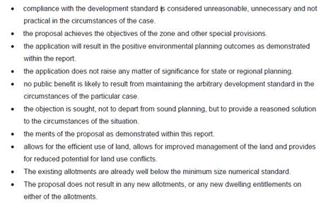
the proposal, compliance with the development standard is unreasonable and
unnecessary because the objectives of the development standard are achieved
notwithstanding non-compliance with the standard.
Clause
11 does not provide any stated objectives. However, compliance with the
development standard is unreasonable and unnecessary because the underlying
objectives of the development standard are achieved for the following reasons:
· the
proposal will not result in additional lots or opportunities for additional
dwellings and will provide increased opportunities for the improved
environmental management of the land;
· The areas of
the existing lots are already significantly less than the 40 hectare minimum
lot size development standard; and
· There is no
public benefit in maintaining the development standard in this instance.
The SEPP 1 objection is
well founded, concurrence of the Secretary has been granted and it is
recommended it be supported.
38 Development within Zone No 1
(a) shown hatched on the map
The proposal has considered
environmental hazards, including flooding, landslip, bushfire, soil erosion and
other environmental impacts.
52 Tree preservation
The proposal does not require the
removal of any native vegetation; the vacant dwelling envelope was selected
because of the high presence of environmental weeds, mostly Camphor Laurel and
other weeds, and did not require any removal of native trees.
The proposal raises no other
issues under Byron LEP 1988.
4.3 Any proposed Instrument
that has been the subject of public consultation and has been notified to the
consent authority
The site does not form part of any Planning Proposal to
amend Byron LEP 2014 or any other proposed Instrument that has been the subject
of public consultation and has notified to the consent authority.
4.4A Byron
Shire Development Control Plan 2014 (DCP 2014)
B6 - Buffers and Minimising
Land Use Conflict
The proposed subdivision is not
likely to result in actual or potential land use conflict as no new neighbours or
land uses will be created by the subdivision. The dwelling envelope is
located to reduce any potential impacts from the existing Crystal Castle, which
includes substantial vegetation in between.
D6 - Subdivision
The proposed boundary adjustment
has considered the site in terms of landform, topography, soils, vegetation,
drainage, watercourses and aspect.
|
What Section and prescriptive measure does the development
not comply with?
|
Does the proposed development comply with the Objectives
of this Section? Address.
|
Does the proposed development comply with the Performance
Criteria of this Section? Address.
|
|
D6.3.1 Lot Size, Shape and Configuration
The proposed lots are less than the minimum area specified
in Byron LEP 2014 on the lot size map contrary to Prescriptive Measure 1.
|
Yes
The proposed lots will:
· Not prevent the
orderly and economic use and development of the land.
· Retain the use
of the lots for the approved rural purposes.
· Ensure adequate
access is retained that will not create a hatchet shaped lot or extensive
works associated with vehicle access.
|
Yes
The proposed boundary adjustment is consistent with the
buffer recommended by Chapter B6. The new dwelling envelope is located to
reduce any potential impacts from the existing Crystal Castle.
This application does not propose new dwelling
entitlements.
|
The proposed development raises no
other issues under Byron DCP 2014.
4.4B Byron
Shire Development Control Plan 2010 (DCP
2010)
Part B4 Subdivision
|
What Section and prescriptive measure does the development
not meet?
|
Does the proposed development meet the Element Objectives
of this Section? Address.
|
Does the proposed development meet the Performance
Criteria of this Section? Address.
|
|
B4.1 Element – Lot Size and Shape
The lots will both remain less than 40 ha (the minimum
area specified in Byron LEP 1988 for zone 1(a) land – clause 11).
|
Yes.
The proposed lots are largely consistent with defined
planning objectives but for the minimum area requirement (see comments
above).
Adequate access to the lots is maintained.
|
Yes.
The proposed boundary adjustment and dwelling envelope has
considered:
Protection from noise, dust, odours, spraying, etc,
considering wind direction and topography in relation to nearby agricultural
uses.
Ridgelines, vegetation and distance can provide
effective buffers
Avoidance of interference with own and neighbouring access
for fire protection, flood or stock movement.
|
The proposal raises no other
issues under the DCP 2010.
4.5 Environmental Planning
& Assessment Regulation 2000 Considerations
|
Clause
|
This control is applicable to the proposal:
|
I have considered this control as it relates to the
proposal:
|
If this control is applicable, does the proposal
comply?
|
|
92
|
No
|
N/A
|
N/A
|
|
93
|
No
|
N/A
|
N/A
|
|
94
|
No
|
N/A
|
N/A
|
|
94A
|
No
|
N/A
|
N/A
|
4.6 The likely impacts of that
development, including environmental impacts on both the natural and built
environments, and social and economic impacts in the locality
|
Impact on:
|
Likely significant impact/s?
|
|
Natural environment
|
No. The proposal will not have a significantly adverse
impact on the natural environment of the locality.
|
|
Built environment
|
No. The proposal will not have a significantly adverse
impact on the built environment of the locality.
|
|
Social Environment
|
No. The proposal will not have a significant social impact
on the locality.
|
|
Economic impact
|
No. The proposal will not have a significant economic
impact on the locality.
|
Council Policies that are applicable to the proposed
development have been considered during assessment.
4.7 The suitability of the site
for the development
The site is a serviced, unconstrained property and is
suitable for the proposed development subject to recommended conditions of
consent.
4.8 Submissions made in
accordance with this Act or the regulations
The development application was not publicly notified.
There were no submissions made on the
development application.
4.9 Public interest
The proposed development is unlikely to prejudice or
compromise the public interest or create an undesirable precedent.
5. DEVELOPER
CONTRIBUTIONS
There is no nexus to levy developer contributions in this
instance as no additional lots are being created.
5.1 Water & Sewer Levies
No Section 64 levies will be required.
5.2 Section 7.11 Contributions
No Section 7.11 Contributions
will be required.
6. CONCLUSION
The proposed boundary adjustment
raises no significant planning, environmental issues or site constraints to not
support the proposal. The application is recommended for approval subject to
conditions of consent.
Staff Reports - Sustainable Environment and Economy 13.2
Report No. 13.2 PLANNING
- 26.2019.8.1 Planning Proposal Parrot Tree Place Bangalow to rezone 690m2 of
RU1 to R2 low density residential
Directorate: Sustainable
Environment and Economy
Report
Author: Sam
Tarrant, Planning Support Officer
File No: I2019/1850
Summary:
Council has received a request to prepare a planning
proposal to amend Byron Local Environmental Plan (BLEP) 2014. The proposal seeks
to rezone part of 54 Parrot Tree Place, Bangalow (Lot 33 DP 1223152) from RU1
Primary Production to R2 Low Density Residential.
The proposed rezoning applies to approximately 690m2
of land directly adjacent to residential land.
The rezoning is sought to correct an anomaly where the R2
zone boundary was created in accordance with the 400 metre buffer to the sewer
treatment plant located to the south west of the site. A recent survey
has indicated that the original 400 metre buffer line was incorrect and can be
moved several meters south west, creating an additional 690m2 of
residential zoning on the lot.
The planning proposal also includes amendments to the
minimum lot size and floor space ratio of the subject site to match the
appropriate residential zoning.
The subject site is unconstrained and adjacent to a recent
subdivision allowing for easy access to infrastructure and services. It is
estimated that an additional 2 lots will be created as a result of this
amendment.
As the site is outside of the urban growth boundary and is
mapped as regionally significant farmland, the rezoning has been assessed
against the criteria in the North Coast Regional Plan, found in the planning
proposal.
A biodiversity assessment and contaminated land assessment
applying to the site are provided within the planning proposal and present no
issues with the rezoning.
Due to the minor scale of the rezoning and the proximity to
existing residential land, it is recommended that Council proceed with the
planning proposal, and forward it to the Department of Planning, Industry and Environment
for a Gateway determination.
NOTE TO COUNCILLORS:
In accordance with the
provisions of S375A of the Local Government Act 1993, a Division is to be
called whenever a motion for a planning decision is put to the meeting, for the
purpose of recording voting on planning matters. Pursuant to clause 2(a)
under the heading Matters to be Included in Minutes of Council Meetings of
Council's adopted Code of Meeting Practice (as amended) a Division will be
deemed to have been called by the mover and seconder of all motions relating to
this report.
|
RECOMMENDATION:
1. That
Council request the NSW Department of Planning, Industry and Environment
(DPIE) to issue a Gateway determination for the planning proposal, as
included at Attachment 1 (E2020/6094).
2. That
Council obtain any further studies from the applicant if required by the
Gateway determination.
3. That
Council undertake public exhibition of the planning proposal and consult with
government agencies in accordance with the Gateway determination.
4. That
Council receive a report outlining the exhibition outcomes.
|
Attachments:
1 26.2019.8.1
Parrot Tree Place Planning Proposal V1, E2020/6094
2 Template -
Form of Special Disclosure of Pecuniary Interest, E2012/2815
REPORT
Subject site
The planning proposal applies to
part Lot 33 DP 1223152, 54 Parrot Tree Place, Bangalow. The current and
proposed zoning is shown below.
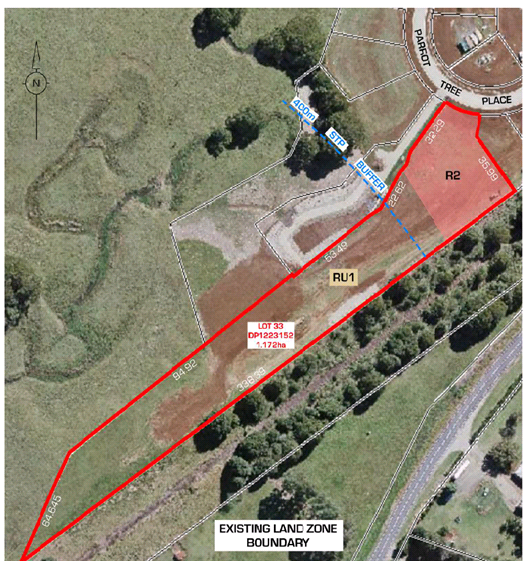
The rezoning seeks to accurately reflect the 400m buffer
zone from the Bangalow sewerage treatment plant. This enables
approximately 690m2 of additional low density residential
development that abuts an existing residential subdivision.
There is currently no development on this lot, the
additional residential zoning and 300m2 minimum lot size will enable
additional housing on the lot.
Proposed amendments
The proposed amendments in this planning proposal are as
follows
1 Rezone
the subject area to R2 Low Density Residential to accurately reflect the 400m
STP buffer.
2 Amend
the minimum lot size of the subject area from 40 hectares to 300m2 in
line with existing minimum lot size for the residential component of the lot.
3 Extend
the floor space ratio map requiring a maximum FSR of 0.5:1 in line with the
existing FSR for the residential component of the lot.
Supporting studies
Two studies for the subject
site are attached to the planning proposal including a biodiversity assessment
and contaminated land assessment. Both studies conclude the site is suitable
for residential purposes.
A flood study was undertaken for the area for the recent
Parrot Tree Place subdivision and shows that the subject site is not flood
prone. Additionally the site is not mapped as bushfire prone or as having
acid sulfate soils on Council’s mapping.
Key issues
The subject site it located
outside of the urban growth boundary. The planning proposal address the
criteria set out in the North Coast Regional Plan for minor alterations to the
urban growth boundary. As the proposal is small scale and is to correct a
mapping anomaly the variation is considered appropriate.
The subject site, as well as all
of Parrot Tree Place is mapped as regionally significant farmland. The planning
proposal addresses the criteria set out in the North Coast Regional Plan for
land that may be suitable for uses other than farmland. As the subject site is
of a small scale, adjacent to residential land and has not been used for
agricultural purposes for an extended period of time the variation is
considered to be appropriate.
Conclusion
There is sufficient information to
support the planning proposal as submitted and forward it to the Department of
Planning, Industry and Environment for a Gateway Determination. This
forms the basis of the report recommendation.
Options
Council has two options
1 Forward the planning
proposal as attached or with amendments to the Department of Planning, Industry
and Environment for a Gateway determination.
2 Not continue
with the planning proposal and notify the applicant giving reason for the
decision.
STRATEGIC CONSIDERATIONS
Community Strategic Plan and
Operational Plan
|
CSP Objective
|
L2
|
CSP Strategy
|
L3
|
DP Action
|
L4
|
OP Activity
|
|
Community
Objective 4: We manage growth and change responsibly
|
4.1
|
Support the
visions and aspirations of local communities through place-based planning and
management
|
4.1.3
|
Manage
development through a transparent and efficient assessment process
|
4.1.3.10
|
Prepare and
assess Planning Proposals and Development Control Plans, and amend Local
Environmental Plan maps
|
|
|
|
|
|
|
|
|
|
|
|
|
|
|
Legal/Statutory/Policy Considerations
This planning proposal will
amend the Byron Local Environmental Plan 2014
Financial Considerations
If Council chooses to proceed with the planning proposal, it
will be at the proponent’s expense as an applicant initiated planning
proposal. Full cost recovery of the remaining stages will be undertaken
by Council. If the applicant chooses not to pay then the planning
proposal will not proceed.
If Council chooses not to proceed then the matter does not
incur any additional costs.
Consultation and Engagement
Consultation for this proposal has not yet occurred.
If Council decides to move forward with the planning proposal, consultation
will occur in accordance with the Gateway determination.
Staff Reports - Sustainable Environment and Economy 13.3
Report No. 13.3 PLANNING
- Development Application - further report following resolution 19-279
10.2018.384.1 Alterations and Additions to existing Dwelling House, Alterations
and Additions to existing structure to create Dual Occupancy (detached) and
Upgrade Wastewater System at 183 Coopers West Lane Main Arm
Directorate: Sustainable
Environment and Economy
Report
Author: Ivan
Holland, Planner
File No: I2019/1124
Summary:
Council resolved at the Planning Meeting held 20 June as
follows:
19-279 Resolved
that determination of Development Application 10.2018.384.1 be deferred until
such time as further detail can be provided in a future report to Council on:
· the alignment
of the Right of Way through Lot 3 DP 558858 and
· whether any
further road widening is required on this section of the right of way to
satisfy the requirements of the Rural Fire Service.
· The fire
assessment be further considered.
This report addresses the matters contained in the
resolution.
Following the June 20 Council Planning Meeting, the
applicant provided further information to address the matters raised in the
resolution including
· A survey plan of
the access road and right of carriageway (ROC) from Coopers Lane West to the
subject property;
· Written approval
from the owners of Lot 7 DP 591828 and Lot 1 DP 445771 for the modification of
the ROC through their property and legal advice on available options for
rectifying the misalignment of the right of carriageway in Lot 3 DP 558858; and
· A revised Bush
Fire Assessment Report.
The alignment of the Right of Way through Lot 3 DP
558858
The survey plan provided by the applicant indicates that the
access road is largely consistent with the legal ROC through Lot 3
DP558858. Deviations between the actual access road and the legal ROC can
be corrected either by physically realigning the road to be within the legal
ROC, or altering the legal ROC to match the actual road alignment. A
condition has been recommended to require this exercise to be conducted.
The access road also passes through two other properties (Lot
1 DP 445771 and Lot 7 DP 591828) before reaching the subject property.
The access road and legal ROC in these two properties are also misaligned
however, the owners of these two properties have provided written approval for
the ROC to be realigned to be consistent with the actual access road and
upgrades (i.e., widening and passing bays) required by the Rural Fire Service
(RFS).
Whether any further road widening is required on this section
of the right of way to satisfy the requirements of the Rural Fire Service
The applicant provided a revised Bush Fire Assessment Report
which was referred back to the RFS for further assessment. RFS issued an
updated approval and conditions for the development on 3 December 2019 which in
relation to external property access requires the following:
5. The right of way is to be
realigned over the existing property access road within the subject property,
Lot 1 DP 445771 and Lot 7 DP 591828 and is to include the proposed/existing
passing bays (on the aforementioned properties) as identified on the survey
plan prepared by Heath & McPhail Surveying Pty Ltd, Drawing No. HM18147-2,
Issue B dated 14th October 2019. The road widening opportunity
within the existing easement in the vicinity of chainage 120 as identified on
the survey plan is not to extend beyond the communications cable located 3-4m
above ground level.
The fire assessment be further considered
Council Planning staff, the
applicant’s bush fire consultant and RFS staff carried out a site
inspection prior to the RFS finalising their assessment, approval and
conditions for the development. The asset protection zones specified in
the updated approval from RFS are the same or a lesser distance than those
required in the original RFS approval, validating the applicant’s bush
fire expert’s previous findings, including in relation to slope analysis.
Based on the additional information provided by the
applicant, the updated RFS approval and updated recommended conditions, it is
considered that all outstanding issues including matters raised in the Council
resolution have been adequately addressed. Consequently, it is
recommended that Development Application 10.2018.384.1 for Alterations and
Additions to existing Dwelling House (central east of the site), use of an
existing structure (house) as a Dual Occupancy (detached) including alteration
and additions to this structure, and upgrading of the existing Wastewater
System be approved subject to the amended recommended conditions of consent
E2020/5837.
NOTE TO COUNCILLORS:
In accordance with the
provisions of S375A of the Local Government Act 1993, a Division is to be
called whenever a motion for a planning decision is put to the meeting, for the
purpose of recording voting on planning matters. Pursuant to clause 2(a)
under the heading Matters to be Included in Minutes of Council Meetings of Council's
adopted Code of Meeting Practice (as amended) a Division will be deemed to have
been called by the mover and seconder of all motions relating to this report.
|
RECOMMENDATION:
That pursuant to
Section 4.16 of the Environmental Planning & Assessment Act 1979,
Development Application No.10.2018.384.1 for Alterations and Additions to existing Dwelling House Use,
Alterations and Additions to existing structure to create Dual Occupancy
(detached) and Upgrade Wastewater System, be approved subject to the
recommended conditions in Attachment 12 (E2020/5837).
|
Attachments:
1 Proposed
Plans, E2020/5808
2 Submissions
received, E2019/38225
3 Letter
from Peter Thornton Re: Tree Retention in Asset Protection Zone, E2019/54501
4 Applicant's
summary of further information, E2020/5729
5 Survey of
access road, E2020/5751
6 Written
approval from owner of Lot 7 DP 591828 for modification of easement, E2020/7597
7 Written
approval from owner of Lot 1 DP 445771 for modification of easement, E2020/5721
8 Applicant's
legal advice regarding amendment of easements, E2020/11984
9 Additional
information to support Bush Fire Assessment, E2020/5832
10 Amended Bush Fire
Assessment Report, E2020/5697
11 Rural Fire Service
Response - Amended referal recommended conditions, E2020/3631
12 Recommended
conditions, E2020/5837
REPORT
Council
considered Report No. 6.10 PLANNING – 10.2018.384.1 Use of existing
structure as a Dwelling House and Alterations and Additions to create Dual
Occupancy (detached), Alterations and Additions to existing Dwelling House at
the Planning Meeting of 20 June 2019 and resolved as follows:
19-279 Resolved
that determination of Development Application 10.2018.384.1 be deferred until
such time as further detail can be provided in a future report to Council on:
· the alignment
of the Right of Way through Lot 3 DP 558858 and
· whether any
further road widening is required on this section of the right of way to
satisfy the requirements of the Rural Fire Service.
· The fire
assessment be further considered.
Following the June 20 Council Planning Meeting, the
applicant provided further information to address the matters raised in the
resolution being:
· A summary of the
response to the matters raised in the Council resolution (Doc# E2020/5729);
· A survey plan of
the access road and right of carriageway (ROC) from Coopers Lane West to the
subject property (Doc# E2020/5751);
· Written approval
from the owner of Lot 7 DP 591828 for the modification of the ROC through their
property (Doc# E2019/54503);
· Written approval
from the owner of Lot 1 DP 445771 for the modification of the ROC through their
property (Doc# E2020/5721);
· Legal advice on
available options for rectifying the misalignment of the right of carriageway
(Doc# E2020/5719);
· A revised Bush
Fire Assessment Report (Bushfire Certifiers, 14 October 2019) (Doc#
E2020/5697); and
· An updated
assessment and approval from the Rural Fire Service (RFS) for the development
based on a joint site inspection, the survey plan of the access road and the
revised Bush Fire Assessment Report (Doc# E2020/3631).
This report presents to Council a response to the
matters raised in the resolution. These matters are discussed below:
Resolution 1 – The
alignment of the Right of Way through Lot 3 DP 558858
The applicant provided a survey plan of the access road and
right of carriageway (ROC) from Coopers Lane West to the subject
property. The survey plan indicates that the access road is largely
consistent with the ROC through Lot 3 DP558858. Within Lot 3 DP558858,
the survey plan shows some partial deviations between the actual access road
and the legal ROC within the first 500m from the Coopers Lane West
junction. From approximately chainage (CH) 500 to chainage 630 (where the
access road leaves Lot 3 DP 558858) the access road is adjacent to, but largely
outside, the legal ROC. The applicant states in their summary that they
have made attempts to obtain written approval from the owners of Lot 3 DP558858
to alter the ROC to match the actual access road without success.
However, the applicant has provided legal advice that outlines a number of
options available to the applicant for rectifying the misalignment of the ROC.
The actual access road is near to, but largely outside, the
legal right of way within Lot 1 DP445771 and for the most part runs through Lot
7 DP 591828. The owners of these two properties (Lot 1 DP 445771 and Lot
7 DP 591828) have provided written approval for the ROC to be realigned to be
consistent with the actual access road and upgrades (i.e., widening and passing
bays) required by the Rural Fire Service (RFS).
The minor deviations between the actual access road and the
legal ROC within Lot 3 DP558858, Lot 1 DP445771 and Lot 7 DP 591828 can be
corrected either by physically realigning the road to be within the legal ROC,
or altering the legal ROC to match the actual road alignment. In addition
to the applicant’s property, the access road/ROC provides vehicular
access from Coopers Lane West to a number of properties further uphill.
A condition has been recommended that requires physical
realignment of the access road to be within the legal ROC, or altering the
legal ROC to match the actual access road alignment, including any widening
required by the RFS approval (or a combination of these approaches) prior to
the issue of a construction certificate for the development. In this
regard, the following conditions have been recommended:
|
Property Access
The application for a Construction
Certificate is to include sufficient evidence to demonstrate that the
dwellings have suitable vehicular access, particularly that the property
access road through the subject property, Lot 3 DP 558858, Lot 1 DP 445771
and Lot 7 DP 591828, including any changes required by the Rural Fire Service
(DA-2018-03006-CL55-1, 3 December 2019), is wholly contained within a legal
right of carriageway.
Such evidence should include:
a) an updated survey of the access road
that shows the actual access road and the updated right of carriageway, and
b) amended property titles that show the
right of carriageway has been updated or the equivalent.
NOTE: Rectifying and upgrading the property access my
require a combination of:
a) Amending
the right of carriageway to overlay the actual property access road,
including widening/passing bays required by the Rural Fire Service; and
b) Reconstructing/altering
the property access road to align with the legal right of carriageway.
|
|
Property Access - Design
details
The application for a
Construction Certificate is to include design plans and details of any
upgrades/amendments to the property access required to comply with the
conditions recommended by the NSW Rural Fire Service in the letter dated 3
December 2019, Reference: DA-2018-03006-CL55-1 and condition 12 of this
consent.
Such plans and specifications must be approved as part of
the Construction Certificate.
|
Resolution 2 – whether
any further road widening is required on this section of the right of way to satisfy
the requirements of the Rural Fire Service
The applicant provided a revised Bush Fire Assessment Report
which was referred back to the RFS for further assessment. RFS issued an
updated approval and conditions for the development on 3 December 2019 which in
relation to external property access requires the following:
5. The right of way is to be
realigned over the existing property access road within the subject property,
Lot 1 DP 445771 and Lot 7 DP 591828 and is to include the proposed/existing passing
bays (on the aforementioned properties) as identified on the survey plan
prepared by Heath & McPhail Surveying Pty Ltd, Drawing No. HM18147-2, Issue
B dated 14th October 2019. The road widening opportunity
within the existing easement in the vicinity of chainage 120 as identified on
the survey plan is not to extend beyond the communications cable located 3-4m
above ground level.
In relation to Lot 3 DP558858, the survey plan identifies a
“road widening opportunity” from near chainage 100 to near chainage
160 that can be accommodated within the current easement. The RFS
condition (detailed above) requires that road widening is not extend beyond the
communications cable.
Resolution 3 – The
fire assessment be further considered
The applicant provided supplementary advice from the
applicant’s bush fire expert (Peter Thornton), dated 17 July 2019, to
support the previous findings of the bush fire assessment (E2019/54749).
The supplementary advice states that:
· A thorough site
inspection was conducted as part of the bush fire assessment;
· The gully to the
north/north west of the proposed dual occupancy was taken into account in the
assessment of effective slope;
· The assessment was
consistent with NSW Rural Fire Service methodology;
· Peter Thornton has
the necessary qualification and experience to carry out the bush fire
assessment owing to 18 years experience in bushfire consulting, A Masters in
Fire Safety engineering and being an Accredited Level 3 Bushfire Practitioner;
· The bush fire
assessment complies with Planning for Bush Fire Protection 2006; and
· The bush fire
assessment was accepted by the Rural Fire Service.
The supplementary advice from the applicant’s bush
fire expert validates the findings of the original bush fire assessment
submitted with the development application, including relating to slope
analysis.
As noted above, the applicant provided a revised Bush Fire
Assessment Report which was referred back to the RFS for further
assessment. Council Planning staff, the applicant’s bush fire
consultant and RFS staff carried out a site inspection prior to the RFS
finalising their amended assessment, approval and conditions for the
development. RFS issued an updated approval and conditions for the development
on 3 December 2019 in which the asset protection zones are the same or a lesser
distance than those required in the original RFS approval, demonstrating that
the applicant’s bush fire expert’s previous findings were
conservative. The updated conditions provided by the RFS have been
incorporated into the updated recommended conditions of approval.
Conclusion
The additional information provided by the
applicant has suitably addressed the reasons for deferral in the Council
resolution. The proposed development is in accordance with the relevant
planning controls that apply to the site, is capable of meeting conditions
recommended by the RFS, has adequate access (or the ability to achieve adequate
access) and is unlikely to result in significant adverse impacts on the natural
or built environment.
It is recommended that DA 10.2018.384.1 be
approved subject to the recommended conditions, be approved subject to the
conditions in Attachment 12 to this report.
Staff Reports - Sustainable Environment and Economy 13.4
Report No. 13.4 Integrated
Pest Management Strategy
Directorate: Sustainable
Environment and Economy
Report
Author: Karen
Love, Research Officer – Climate Change
File No: I2019/2136
Summary:
In 2014, Council resolved (Res 13-621) to develop an
Integrated Pest Management (IPM) Policy and Strategy for Council owned and
managed land. The IPM Policy was adopted by Council in August 2018 (Res
18-565).
The IPM Strategy (Strategy) was presented to Council on 19 September 2019 however resolution 19-455
was rescinded on 17 October 2019 by Res 19-519.
Six items within Res 19-519 were addressed and presented to
Council 12 December 2019 for review and adopted (Res 19-633).
This report presents the final item (7) from Res 19-519
that “on completion of items 1-6 above, present the revised
draft to the next available Planning Meeting of Council”.
|
RECOMMENDATION:
That Council adopt the Integrated Pest
Management Strategy 2019-2029 at Attachment 1 (E2020/6168).
|
Attachments:
1 Byron
Integrated Pest Management Strategy 2019-2029, E2020/6168
REPORT
The Integrated Pest Management Strategy 2019 – 2029 is
presented at attachment 1, for adoption.
STRATEGIC CONSIDERATIONS
Community Strategic Plan and
Operational Plan
|
CSP Objective
|
L2
|
CSP Strategy
|
L3
|
DP Action
|
L4
|
OP Activity
|
|
Community Objective 3: We protect and enhance our
natural environment
|
3.1
|
Partner to protect and enhance our biodiversity,
ecosystems and ecology
|
3.1.1
|
Protect and enhance our natural environment and
biodiversity
|
3.1.1.4
|
Prepare a Shire Wide Integrated Pest Management Strategy
|
Legal/Statutory/Policy
Considerations
Related Legislation:
As per 19 September 2019 report
Related Council Policies:
As per 19 September 2019 report
Related Plans/Standards and Registers:
As per 19 September 2019 report
Financial Considerations
Development of the IPMS is funded in the 2019/20 budget.
Consultation and Engagement
Council’s Manager Works consulted with a
representative of the Goonengerry Landcare group for information relating to
partnership development, and advocacy of Landcare groups wanting to work in
conjunction with Council on rural roadsides.
Staff Reports - Sustainable Environment and Economy 13.5
Report No. 13.5 PLANNING
- S8.2 Review - Alterations & Additions to Tourist Cabin, Alcorn Street,
Suffolk Park
Directorate: Sustainable
Environment and Economy
Report
Author: Rob Van
Iersel, Major Projects Planner
File No: I2019/2141
Summary:
This report provides a review of determination for
development application 10.2019.276.1, which proposed additions to an existing
tourist cabin located at the northern end of Alcorn Street, Suffolk Park.
The application was refused under delegated authority on 20 September 2019.
The existing cabin is one of 12 located at the extreme
northern end of Alcorn Street. The tourist development was originally
approved in 1986 and involved 30 cabins. A 1997 consent approved a
subdivision of the land and removal of 18 cabins, to be replaced by a Community
Title subdivision for residential development of the southern part of the site,
leaving the 12 existing cabins on the northern portion. Dwellings have
subsequently been constructed on the residential lots.
The remaining cabins, while individually owned within a
strata plan, are operated collectively as Tallow Beach Houses. The
portion of the property within which they are located is zoned 7(f1) Coastal
Lands.
Tourist cabins are prohibited in this zone. However,
because the existing cabins were lawfully approved before the land was zoned
7(f1), they enjoy existing use rights.
The applicant proposed a substantial increase in size for an
existing two-bedroom cabin, primarily by way of an upper level extension.
The existing cabin has a floor area of 127m2, and this was proposed
to increase to 242m2. No additional bedrooms were, however,
proposed; the upgraded cabin would still contain two-bedrooms.
A swimming pool, pool house and associated facilities were
also proposed.
The application plans, as lodged, are contained as
Attachment 1.
The application was refused primarily because it was
considered that the extent of the alterations and additions were too
significant to be considered under existing use rights. The area in which
the swimming pool and facilities were proposed is mapped as littoral rainforest,
and it was considered that those components would result in unacceptable
environmental impacts.
In requesting a review of the refusal, the applicant has
deleted the pool and associated facilities, slightly reduced the overall floor
space (by around 10m2), and redesigned the roof to lower overall
height and reduce bulk. The amended plans subject of this review
application are contains as Attachment 2.
Deletion of the pool means that all works are confined to
the footprint of the existing building, reducing direct impacts on any areas
mapped as littoral rainforest. The redesign of the roof structure will
adequately address potential for visual impacts, given the location of the
cabin, which cannot be directly seen from any adjacent public areas.
The legislation governing existing uses specifically allows
for the enlargement or extension of a building. There are no specified
limits or restrictions that control the extent of such alteration. The
Land & Environment Court have published a Planning Principle for how
this should be considered, which relates to an assessment of the relationship
between the proposed building and development that is permissible on adjoining
land.
In this case, the existing cabin directly adjoins
residential development at the northern end of Alcorn Street, which consists of
large two-storey dwellings. In that context, the bulk and scale of the
proposed development in not excessive, and it is recommended that the refusal
be overturned and the amended development application approved.
NOTE TO COUNCILLORS:
In accordance with the
provisions of S375A of the Local Government Act 1993, a Division is to be
called whenever a motion for a planning decision is put to the meeting, for the
purpose of recording voting on planning matters. Pursuant to clause 2(a)
under the heading Matters to be Included in Minutes of Council Meetings of
Council's adopted Code of Meeting Practice (as amended) a Division will be
deemed to have been called by the mover and seconder of all motions relating to
this report.
|
RECOMMENDATION:
That, pursuant to
Section 4.16 of the Environmental Planning & Assessment Act 1979,
development application 10.2019.276.1 for alterations and additions to tourist cabin. Alcorn Street, Suffolk
Park, be granted consent subject to the conditions listed in Attachment 4 (E2020/4651).
|
Attachments:
1 10.2019.276.1
Original Application Plans, E2019/37667
2 10.2019.276.1
Amended Plans for review Application, E2020/4445
3 10.2019.176.1
Submission to review application, E2020/4658

4 10.2019.276.1
Recommended Conditions of Consent, E2020/4651

Assessment:
1. INTRODUCTION
1.1. History/Background
The existing cabin is part of the tourist facility known as
‘Tallow Beach Houses’, located at the north end of Alcorn Street,
Suffolk Park. It contains 11 holiday cabins and a manager’s
residence.
Development consent was originally issued in 1986 over the
former Lot 12 DP 625342, for 30 cabins, amenities block and associated
facilities (DA 85/457). The approved development was constructed and
operated until the mid-1990s.
In 1997, development approval was given to subdivide the
property, under Community Title, to remove 18 cabins from the southern part of
the property, to be replaced by 8 dwelling lots and a community parcel.
The remaining 12 tourist cabins were reconfigured into the current arrangement.
In 2011, Council approved DA 10.2010.541.1, for alteration/additions
to the existing tourist facility and its strata subdivision (12 lots). In
that application, the cabin that is subject to this review application was identified
as the “Yoga Pavilion” with a floor area of 131.6m2, a
deck area of 131.6m2 and a total roof area of 204m2.
In 2012, Council approved DA 10.2012.2.1 to change the use
of this yoga pavilion to create a two-bedroom cabin, which is how it has
remained since that time.
Development Application 10.2019.276.1, which is subject of
this review request, was submitted on 23 May 2019. It proposed
alterations and additions to the existing two-bedroom cabin and the
construction of a swimming pool, pool house and associated facilities.
The development plans, as lodged, are contained in Attachment 1.
The plans showed a substantial enlargement of the existing
cabin, providing an open plan living area for most of the existing floor space,
with a second floor addition to contain two larger bedrooms, each with
en-suite.
The application was refused under delegated authority on 20
September 2019. The reasons for refusal are addressed below.
1.2. Description
of the site
|
Land is legally described as:
|
LOT: 12 SP: 90496
|
|
Property address is:
|
18/2 Alcorn Street SUFFOLK PARK
|
|
Land is zoned:
|
The property containing
‘Tallow Beach Houses’ is ‘deferred matter’ under BLEP
2014.
Lot 12 is zoned 7(f1) Coastal
Land under BLEP 1988.
|
|
Land area is:
|
1,212m2
|
|
Property is constrained by:
|
Bushfire prone land (category 1
and buffer);
Acid Sulfate Soils (Class 3);
High Environmental Value
vegetation (littoral rainforest); and
Coastal Erosion Precinct 3.
|
Tallow Beach Houses is located at the northern end of Alcorn
Street, Suffolk Park and is accessed through a private road (part of the
overall community title) that also services eight residential dwellings.
The access road is gated at the Alcorn Street frontage.
The area comprising the tourist facility is relatively flat,
with sandy soils and scattered native trees.
Figure 1 – The property
& location
The existing cabin that is subject of this application is
located at the south-eastern end of the Tallow Beach Houses property, to the
beachside of the internal access. It is a single storey structure
containing two bedrooms, bathroom, living and kitchen surrounded by a covered
deck.
The existing cabin is screened by vegetation (see photos
below), although the majority of Lot 12 is cleared grass.
The eastern boundary of the property is fenced, with a solid
brushwood and timber fence of around 1.8m high.
A public pedestrian/ cycle path is located on the beachside
of the fences (see photo below).
Existing Cabin
Pedestrian/ cycle path
immediate adjacent to site
2. REVIEW
APPLICATION
2.1. Revised submission
The application for review was submitted with an updated
plan set (Attachment 2) and a report addressing the reasons for refusal.
To support this submission, the proposal has been amended
to:
· remove the
swimming pool, pool house and associated facilities from the application;
· reduce the
size of the upper floor bedroom areas, reducing the proposed floor space from
242m2 to 232m2 as currently proposed (the existing cabin
has a floor space of 127m2); and
· redesign the
roof to lower the overall height and reduce its size.
2.2. Submissions made in
accordance with this Act or the regulations
The application for review was publicly exhibited from 2 -15
January 2020. There was one submission received, from owners of one of
the residential community title lots adjoining the southern part of the
property. (Attachment 3)
The objection to the development is based on an assumption
that the extensions proposed to the cabin will increase its capacity,
increasing traffic on the internal private road that passes their house.
Other concerns are raised associated with increased capacity, including impacts
on sewer capacity and high environmental value vegetation.
The submission expresses concern that approval could set a
precedent that could lead to further substantial increase in the capacity of
the existing tourist facility.
It is considered that these concerns are unfounded as the
proposed extensions, while resulting in a larger cabin, do not increase the
number of bedrooms. Therefore, the extensions do not increase the
capacity of the cabin, in terms of the number of guests it can cater for.
At most, the extensions may result in a higher occupancy rate over a year if
the cabin is a more attractive place to stay.
However, occupancy rates are more dependant on a wide range
of external factors and it is considered that improving the amenity of the
facility will have only a minor effect in this regard.
As such, approval does not establish a precedent for
increasing the population capacity of the facility.
2.3. Review of
Determination
Reason for refusal No. 1 - The proposed new swimming pool and associated deck are designated
development under clause 10 of the State Environmental Planning Policy (Coastal
Management) 2018, as they are located in an area mapped as littoral rainforest,
but was not lodged with an environmental impact statement contrary to Section
4.12(8) of the Environmental Planning and Assessment Act 1979.
The swimming pool and associated facilities are no longer
part of the proposal. The existing cabin and its immediate curtilage is
not within the mapped littoral rainforest area.
This reason for refusal therefore is no longer relevant.
Reason for refusal No. 2 - The application does not adequately demonstrate that sufficient measures
have been, or will be, taken to protect, and where possible enhance, the
biophysical, hydrological and ecological integrity of the littoral rainforest,
contrary to Clause 10(4) of the State Environmental Planning Policy (Coastal
Management) 2018.
The applicant has demonstrated that no tree clearing is
required in order to construct the additions and extensions. The swimming
pool and associated facilities are no longer part of the proposal.
Bushfire protection conditions were imposed on the 2012
development for the strata title of the tourist facility, including a requirement
that the area between the existing cabin and the eastern property boundary is
to be maintained as an Inner Protection Asset Protection Zone.
The applicant has provided a report by a qualified bushfire
consultant demonstrating that this APZ is in place and that the proposed
alterations and extensions do not generate a need to remove vegetation for the
APZ.
As such, the proposal has no direct impact on the mapped
littoral rainforest and this reason for refusal, therefore, is no longer
relevant.
Reason for refusal No. 3 - The proposed alterations and additions to the existing holiday cabin and
new swimming pool may cause an adverse impact on “the visual amenity and
scenic qualities of the coast” as the modified building will be more
noticeable from the nearby public walking path and possibly the beach, contrary
to Clause 14 of the State Environmental Planning Policy (Coastal Management)
2018.
The photos below were provided by the applicant to show how
much of the extended cabin would be viewed from the public path.
Existing view
Modelled view of proposed
addition
The views shown were confirmed on site inspection. It
is also noted that residential dwellings located immediately to the south are
much more visible from the public path (see below).
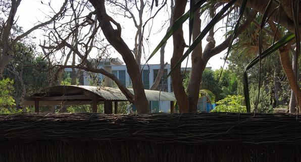
Dwelling to the south –
viewed from public path
It is considered that the visual impacts associated with the
extensions, particularly given the reduced scale of the roof, will be very
minor.
This reason for refusal, therefore, is no longer relevant.
Reason for refusal No. 4 - The proposed alterations and additions to the existing holiday cabin and
new swimming pool are prohibited in Zone No 7 (f1) and are beyond the scope of
allowable changes to existing uses, contrary to Clause 9 of the Byron Local
Environmental Plan 1988, Section 4.67 of the Environmental
Planning and Assessment Act 1979 and sections 41, 42 and 43 of the Environmental Planning and
Assessment Regulation 2000.
Because the tourist facility was lawfully approved prior to
the 7(f1) zoning, under which tourist facilities are a prohibited use, the
existing cabin enjoys existing use rights.
Clause 41 of the Environmental Planning and Assessment
Regulation 2000 provides that a building subject to an existing use may be
enlarged or extended, subject to development consent. The regulation does
not set any limit to such enlargement or extension.
The NSW Land & Environment Court have considered this
question in a number of cases, and established a Planning Principle
useful in determining existing use rights development, involving four (4)
questions, addressed below:
How do the bulk and scale (as expressed by height, floor
space ratio and setbacks) of the proposal relate to what is permissible on
surrounding sites?
Council does not have any controls restricting the size of
holiday cabins in the urban context (a maximum floor space applies in rural
zones).
The bulk and scale of the proposal needs to be compared to
the scale of residential development permissible on land to the south, which is
zoned 7(f2) Urban Coastal Lands.
The photo below shows the size of the nearest residential
dwelling, located within the community titled part of the wider property.
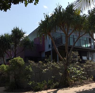
Adjoining residential dwelling
All of the dwellings within this community titled part of
the land are of a size and scale equal to or larger than the proposed
cabin. Dwellings of that scale are common along Alcorn Street in Suffolk
Park.
What is the relevance of the building in which the
existing use takes place?
This question relates to proposals for a change of existing
use, and is therefore not directly relevant in this case.
What are the impacts on adjoining land?
Impacts on adjoining private and/ or public land are
minimal. The height extension will not result in any overshadowing or
overlooking of other cabins in the facility or dwellings adjoining to the
south. As indicated above, the extended cabin will only be visible in
glimpses from the adjoining public path.
What is the internal amenity?
The proposed additions significantly improve the amenity of
the cabin as a holiday house.
Based on the Court’s Planning Principles, and the
absence of any restriction or development standard on the size of cabins in
this urban environment, it is considered that the proposed development is
consistent with the existing use rights applying and, therefore, this reason
for refusal is no longer relevant.
Reason for refusal No. 5 - The proposed alterations and additions to the existing holiday cabin and
new swimming pool may have a detrimental effect on the scenic quality of the
locality and may be adversely affected by coastal processes, contrary to the
objectives of Zone No 7 (f1) in Clause 9 of the Byron Local Environmental Plan
1988.
The scenic amenity is addressed above. In relation to
coastal processes, the original approval for tourist cabins included a
condition specifying that consent would cease and structures would need to be
removed if the erosion escarpment comes within 50m of the buildings.
There is also an existing covenant on the title of the land to this effect.
The applicant has confirmed that they accept reinforcement
of this conditions, and indicate that the buildings would be demolished and
removed if the consent condition is triggered.
This is consistent with the requirements of Part J of DCP
2010, and therefore this reason for refusal is no longer valid.
Reason for refusal No. 6 - The proposed alterations and additions to the existing holiday cabin and
new swimming pool is an overdevelopment of the site and may adversely affect
the scenic or environmental quality of the locality and may be adversely
affected by coastal processes, contrary to Clause 33 of the Byron Local
Environmental Plan 1988.
Clause 33 requires that Council consider the potential
impacts of coastal processes before granting consent to development on land
zoned 7(f1).
As outlined above, this is an existing approved cabin with a
condition requiring its removal in the event that the erosion escarpment comes
within 50m.
This condition will be reinforced on consent for the
alterations and additions and therefore approval of the development is not
inconsistent with clause 33.
Therefore, this condition is no longer relevant.
Reason for refusal No. 7 - The proposed alterations and additions to the existing holiday cabin and
new swimming pool do not adequately integrate with the “existing built
and natural environment” contrary to Element C3.1 Visual Impact of the
Byron Shire Development Control Plan 2010.
This is addressed above. It is considered that the
redesign of the roof structure is a positive amendment in this regard and that
the cabin as proposed will integrate with its environment.
This reason is no longer relevant.
Reason for refusal No. 8 - The proposed alterations and additions to the existing holiday cabin and
new swimming pool are unlikely to “enhances its surroundings”
or make “a positive contribution to the Shire, in visual, social and
environmental terms” contrary to
Element C8.1 Tourism Development in Byron Shire of the Byron Shire Development
Control Plan 2010.
The proposed alterations and additions will result in a
building that is consistent in scale and design with the dwellings to the south
and elsewhere in this part of Suffolk Park.
This condition is no longer relevant.
Reason for refusal No. 9 - The proposed alterations and additions to the existing holiday cabin and
new swimming pool are not “designed to be relocate or
demolished, or to cease operation, should the erosion escarpment come within 50
metres” contrary to Element J2.3
Precinct 3 - between the 50 Year and 100 Year Erosion Lines of the Byron Shire
Development Control Plan 2010.
As outlined above, the proponent accepts that the building
would need to be demolished and removed if the current consent condition is
triggered.
This is reinforced by a covenant on the title of the
land. The condition is therefore no longer relevant.
Reason for refusal No. 10 - The proposed alterations and additions to the
existing holiday cabin and new swimming pool may result in environmental
impacts on the natural environment particularly adverse affects on the scenic
or environmental quality of the locality, contrary to section 4.15(1)(b) of the
Environmental Planning and Assessment Act 1979.
Deletion of the swimming pool and associated facilities from
the application means that potential impacts are restricted the site of the
existing cabin. The applicants advise that no vegetation removal will be
required during construction.
There are unlikely, therefore, to be direct impacts on the
natural environment. The scenic environment is addressed above.
This reason for refusal is no longer relevant.
Reason for refusal No. 11 - The site is located within an a restricted
zone (PART 7(f1) Coastal Land) and Coastal Erosion Precinct 3 and is not suitable for the proposed alterations and
additions to the existing holiday cabin and new swimming pool, contrary
to section 4.15(1)(c) of the Environmental
Planning and Assessment Act 1979.
The suitability of the site, in this case, relates primarily
to coastal processes. This is addressed above, and it is considered that
this reason for refusal in no longer relevant.
Reason for refusal No. 12 - The site for the proposed development is located
within mapped littoral rainforest and/or littoral rainforest buffer under the State Environmental Planning Policy (Coastal
Management) 2018 and is not suitable
for the proposed alterations and additions to the existing holiday cabin and
new swimming pool, contrary to section
4.15(1)(c) of the Environmental Planning and Assessment Act 1979.
Deletion of the swimming pool and associated facilities from
the application means that potential impacts are restricted the site of the
existing cabin. The applicants advise that no vegetation removal will be
required during construction.
There are unlikely, therefore, to be direct impacts on the
littoral rainforest vegetation. This reason for refusal is no longer relevant.
Reason for refusal No. 13 - The proposed alterations and additions to the
existing holiday cabin and new swimming pool are contrary to relevant zones
objectives, contrary to other relevant planning provisions and are beyond the
scope of allowable changes to existing use rights and consequently the proposed
development is not considered to be in the public interest, contrary to section
4.15(1)(e) of the Environmental Planning and Assessment Act 1979.
This is a re-iteration of reasons above. This reason
for refusal is no longer relevant.
Reason for refusal No. 14 - The proposed
development is not likely to achieve a “better environment” or
“enhance community well-being”, contrary to the aim and objectives
of the Byron Local Environmental Plan 1988,
Clauses 2 and 2A.
The alterations and extension will result in an improved
building form that is more consistent with existing development in this part of
Alcorn Street Suffolk Park. Deletion of the swimming pool and associated
facilities removes the direct environmental impacts.
This reason for refusal is no longer relevant.
Reason for refusal No. 15 - The proposed
development is not likely to achieve a “better environment”,
contrary to the objects of the Environmental
Planning and Assessment Act 1979, Section 1.3.
This is a re-iteration of reasons above. This reason
for refusal is no longer relevant.
2.4. Legal Implications
Should the application be refused the applicant has a right
of appeal under the Environmental Planning and Assessment Act 1979.
DISCLOSURE OF POLITICAL
DONATIONS AND GIFTS
|
Has a Disclosure Statement been received in relation
to this application
|
No
|
|
Have staff received a ‘gift’ from anyone
involved in this application that needs to be disclosed. Where the answer is
yes, the application is to be determined by the Director or Manager of the
Planning, Development and Environment Division.
|
No
|
3. PLANNING
ASSESSMENT CONCLUSION
The request to formally review the application
DA10.2019.276.1 has been undertaken in accordance with Division 8.2 (Reviews)
under the EPA Act 1979, also having regard to relevant provisions of Section
4.15 (Evaluation).
Based on the assessment undertaken, it is recommended that, pursuant to Section 4.16 of the Environmental
Planning & Assessment Act 1979, Development Application No. 10.2019.267.1, for alterations and additions to an existing
tourist cabin, be granted consent subject to the attached conditions
(Attachment 4).
Staff Reports - Sustainable Environment and Economy 13.6
Report No. 13.6 Tiny
House Development Proposal
Directorate: Sustainable
Environment and Economy
Report
Author: Shannon
Burt, Director Sustainable Environment and Economy
Vanessa Adams, Director Corporate
and Community Services
File No: I2019/2143
Summary:
The concept of using a tiny house as a low cost housing
solution has been the subject of recent interest and discussion.
In this regard, tiny houses can help address acute and
unexpected housing shortages, including housing for aged or dependant persons,
affordable housing, housing in bushfire prone areas for emergency relief, or
transition housing for the homeless.
Their potential use however is currently impeded in New
South Wales by a lack of a coherent regulatory and policy framework and
variable community support.
The purpose of this report is to seek Council support for an
amendment to the Byron Local Environmental Plan 2014 to facilitate tiny house
development on Council owned and or managed land for the provision of supported
housing for people experiencing (or at risk of) homelessness.
This matter was raised with the Minister for Planning and
Public Spaces last year when he met with the Mayor and senior staff from
Council. A planning proposal was invited subject to it being consistent with
relevant state and regional strategic planning documents, including Byron Shire
Local Strategic Planning Statement now under preparation.
|
RECOMMENDATION:
That Council support:
1. The preparation of an
amendment to the Byron Local Environmental Plan 2014 to facilitate Tiny House
Development on Council owned and or managed land for the provision of
supported housing for people experiencing (or at risk of) homelessness.
2. The Planning proposal being
drafted on the basis of the definitions and draft local provision outlined in
the report.
3. The Planning proposal
once prepared by staff is submitted to the Department of Planning for a
gateway determination to enable public exhibition.
4. Staff writing to the
Planning and Local Government departments to request formation of a working
group with Byron Council and others (including industry) to further examine
the tiny house spectrum and recommend changes to the planning and local
government legislation to enable this type of development more flexibly and
permanently.
|
REPORT
Supported Housing Proposal
Homelessness is a growing concern for our Shire. From 2011
to 2016, the homelessness rate increased by 245.83%[1]. In addition, Council coordinates periodic street counts
of people sleeping rough in Byron Shire. From August 2018 to August 2019, we
found an increase of 18% in three identified hotpots.
People experiencing homelessness are part of our community.
And our community has a rate of homelessness twice the national average and
within that the percentage of homeless people sleeping rough is 6 times the
national average.
Homelessness covers a broad spectrum of situations. The ABS
definition recognises three levels of homelessness:
Primary homelessness (rough sleeping): includes people
without conventional accommodation. They may be living on the streets, sleeping
in cars, in deserted buildings, in improvised or substandard dwellings, under
bridges, or in parks.
Secondary homelessness: includes people moving frequently
between various forms of temporary shelter including staying with friends and
relatives, couch surfing, in emergency accommodation, youth refuges, hostels
and boarding houses on a short term basis (12 weeks or less).
Tertiary homelessness: includes people living in boarding
houses (or similar) on a medium to long term basis (13 weeks or longer).
Residents may not have separate bedrooms and living rooms, they do not have a
kitchen and bathroom facilities of their own, their accommodation is not
self-contained, and they do not have security of tenure provided by a lease.
People who sleep rough are among the most vulnerable and
disadvantaged. Their resilience and strength are put to the test daily and the
experience has lasting impacts on their health and wellbeing. People
experiencing long-term rough sleeping have an average life expectancy of 47
years. This is far below the national average life expectancy of 77 years or
more.
[1] Census 2011 indicated
28.8 homeless persons per 10 000. By Census 2016 the number went up to 99.6
according to data provided by ABS. Homelessness
This is not the trend we want to see and Council is working
on a number of responses to address this including a supported housing solution
in the form of a tiny house development. The legislation presently
impedes this due to the lack of a legal term and category for a tiny house in
the planning legislation.
Therefore, it is considered easiest to amend the Local
Environmental Plan to include a local provision that would introduce new terms
‘tiny house’ and ‘tiny house development’ and a local
provision for this type of development to occur including eligible land,
persons, and a time frame for use. This would remove the current Local
Environmental Plan definition impediment to this type of development. Other
approvals under the Environmental Planning and Assessment Act and Local
Government Act would otherwise remain where appropriate.
The concept in its simplest form is to provide a temporary
and relocatable housing solution under the terms of a lease for a moveable
dwelling/s (MD) on Council owned and or managed land. Rent would be paid by the
tiny house occupier to Council. Council could also chose to waive any rent
payable depending on the circumstances. The MD is able to be removed and or
relocated to another site when required. The land is able to be the
subject of a new application and or returned to its original state once the
MD/s is no longer required. A diagram below illustrates what this could look
like.
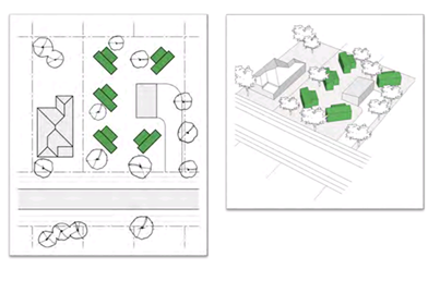
Source:
A Place for Tiny Homes http://www.tinyhousecompany.com.au/tiny-house-planning-resource
Council should note that a governance model and management
plan will need to be developed to provide for project development, property
management and lodger support guidance once the planning proposal is finalised.
It is likely that Council will need to partner with an appropriate housing and service
provider for any development; and an expression of interest will be called in
this regard.
In addition, a commitment is needed from the Planning and
Local Government departments to form a working group with Byron Council and
others (including industry) to further examine the tiny house spectrum and
recommend changes to the planning and local government legislation to enable
this type of development more flexibly and permanently will also be sought.
It is understood that this matter is not unique to Byron
Shire and any successful pilot may assist other councils in addressing their
own local housing challenges by informing changes to the standard LEP
instrument to enable this type of development to occur more broadly.
There are various examples of tiny house development already
in and around Australia.
Launch Housing Melbourne, Victoria
Led by Launch Housing, the Harris Transportable Housing
Project is a first-of-its-kind initiative in Victoria to increase housing for
those experiencing or at risk of homelessness using vacant government-owned
land.
https://www.launchhousing.org.au/harris-transportable-housing-project/
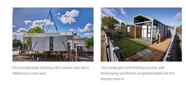
Tiny Homes Foundation Racecourse Road Gosford, NSW
The Tiny Homes Foundation has already built four miniature
houses to help combat homelessness in Gosford.
http://www.tinyhomesfoundation.org.au/projects
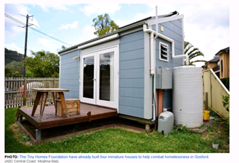
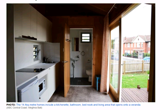
NBRS Architecture partnered with Tiny Homes Foundation to
design and develop 4 single-occupancy self-contained affordable houses in a
group for people experiencing homelessness. These were approved as
self-contained boarding accommodation for four lodgers (i.e. maximum of one
lodger per ‘tiny home’).
http://nbrsarchitecture.com/portfolio/tiny-homes/
Transition Village Wallan, Victoria
Transition Village Wallan is a project to build a village of
Tiny Houses, utilising sustainable living and design practices, for people
experiencing (or at risk of) homelessness in and around Wallan.
https://transitionvillagewallan.com.au/
Current legislation in NSW
As it stands ‘tiny houses’ can fall into a
number of categories - a moveable dwelling – relocatable home –
flat pack home - a granny flat / secondary dwelling.
As a consequence this creates a grey zone for tiny house
approvals, particularly in NSW.
‘Fixed tiny houses’ (FTH) can be defined and
accommodated through the planning system as a secondary dwelling / granny flat.
A FTH can remain on site and be used on a permanent basis by its occupants. A
FTH however can be costly and time consuming to have approved and then built.
FTH are permitted in certain zones and circumstances.
A ‘tiny house on wheels’ (THOW) is regarded as a
‘moveable dwelling’ (MD) and is generally treated the same a
caravan. The Local Government legislation restricts the number of MD, stay time
and type of occupant in each on land other than a caravan park or manufactured
home estate.
Further a ‘moveable dwelling’ (MD) is excluded
from the definition of ‘building’ which means a MD cannot be
considered as a ‘dwelling house’ and or part of ‘multi
dwelling housing’. These are land use terms in the Local Environmental
Plan dictionary which form the basis of the land use tables. Where development
consent is possible for a ‘dwelling house or multi dwelling
housing’ on land other than a caravan park or manufactured home estate, a
MD as a design approach is unable to be considered.
A portable tiny home (PTH) no wheels, is regarded as a
‘relocatable home’ and as a consequence has additional requirements
for location and installation when on land other than a caravan park or
manufactured home estate. This is despite the fact that most contemporary tiny
homes that are transported in do not have ‘compliance plates’ as
per the MHE definition.
Tiny House Development Controls
The Australian Tiny House Association has developed a
definition of tiny houses in Australia to provide a level of consistency in
language being used to describe a tiny house. This definition is based on
feedback from the ATHA General Committee and international definitions and
understandings.
Tiny houses are moveable dwellings up to 50m2* that
are suitable for residential use. Tiny houses can be largely grouped into 2
categories: on wheels or on skids.
(*for one dwelling,
excluding if they are connected)
It is proposed to use this definition for the purposes of
the planning proposal.
The following would form the basis of a local provision in
the LEP:
Tiny House Development
(1) The
objectives of this clause are as follows—
a) To
enable development for the purposes of tiny house development for the provision
of supported housing for people experiencing (or at risk of) homelessness.
b) To
ensure that tiny house development is appropriately located.
c) To
minimise the impact of tiny house development on the locality in which it is
situated.
(2) Despite
any other provision of this Plan, development consent may be granted for
development of a tiny house and or tiny house development on Council owned and
or managed land for the provision of supported housing for people experiencing
(or at risk of) homelessness.
(3) In
determining an application under subclause (2) Council must have regard to:
a) locating
the tiny house and or tiny house development as close as possible to existing
residential facilities and social support services;
b) the
availability and capacity of infrastructure to the site;
c) the
purpose and provisions of the applicable zone and any applicable controls; and
d) the
potential for land use conflict with other use or development on adjoining
properties and any measures available to manage or mitigate such conflict.
(4) In
this clause:
“Tiny house” is a
moveable dwelling up to 50m2 GFA that is suitable for residential use, and may
be on wheels or on skids.
“Tiny house
development” is 2 or more tiny houses on one parcel of land.
“Supportive
housing” is temporary accommodation to bridge the gap from homelessness
to permanent housing and is located as close as possible to existing
residential facilities and social support services.
“Temporary accommodation”
is a residential use or development for a period of not more than 48 months
from the date on which an occupation certificate is issued under the Act.
The exact legal drafting of the LEP amendment will need to
be discussed with the Policy branch of the Department of Planning and
Parliamentary Counsel.
Key issues
Housing Affordability and Availability
Media has reported that, based on research by a leading
property market research firm, that Byron Bay is now Australia’s most
expensive city, with a median house price of $987,500 as at December 2018.
The high housing prices are also reflected in local rental
costs, with recent studies showing the average rent in Byron Bay was $590 per
week, which is 48% of the average household income for renters.
More recently the Anglicare’s Rental Affordability
Snapshot found that there is no accommodation at all available for single
people or those on government benefits in Byron, or the neighbouring Ballina
and Tweed Shires.
Council, in developing the shire-wide residential strategy,
is looking to implement a range of measures that might address this over time.
Housing and accommodation in the Byron Shire is a
significant challenge because of a range of factors including:
· A demand
for, and high investment return on, tourist accommodation including the use of
platforms such as Airbnb.
· The Byron
Shire is a desirable place to live with the population forecast to grow by
approximately 5,500 by 2036, requiring 3,150 additional dwellings.
· Compared to
the Northern Rivers region the Byron Shire has a higher proportion of low
income earners (earning less than $500/week) and a lower proportion earning
more than $1,750 a week.
· There is
limited stock of social housing (1.7% of housing stock, or 223 dwellings in the
Shire is social housing). There is a 10-year waiting list for social
housing in the one-three bedroom range.
· Compared to
the Northern Rivers and NSW generally there are high median house prices, high
median rents and high levels of household stress (17.2% rental stress, 8.5%
mortgage stress).
To add another layer of complexity to the situation our
economy is growing at a marginally faster rate than regional NSW and the
Northern Rivers region and the workforce is relatively young with a majority
under the age of 45.
This means that, because of the high property prices people
can’t afford to buy their own home, and given the high cost of rent they
can’t even save for a deposit.
Next steps
Staff to finalise a planning
proposal for tiny House development on Council owned and managed land
for the provision of supported housing for people experiencing (or at risk of)
homelessness.
The planning proposal to be based on the definitions and
draft local provision outlined in the report.
The planning proposal once
prepared is submitted to the Department of Planning for a gateway determination
to public enable exhibition.
STRATEGIC CONSIDERATIONS
Community Strategic Plan and Operational Plan
|
CSP Objective
|
L2
|
CSP Strategy
|
L3
|
DP Action
|
L4
|
OP Activity
|
|
Community Objective 4: We manage growth and
change responsibly
|
4.2
|
Support housing diversity in appropriate locations
across the Shire
|
4.2.1
|
Establish planning mechanisms to support housing that
meets the needs of our community
|
4.2.1.4
|
Investigate and implement planning controls to encourage
an increase in the supply of affordable and inclusive housing stock (Action
in Residential Strategy)
|
|
|
Community
Objective 4: We manage growth and change responsibly
|
4.2
|
Support
housing diversity in appropriate locations across the Shire
|
4.2.1
|
Establish
planning mechanisms to support housing that meets the needs of our community
|
4.2.1.5
|
Prepare a
report on deliberative development models to facilitate the delivery of
accessible housing
|
|
|
|
|
|
|
|
|
|
|
|
|
|
|
|
|
North Coast Region Plan 2036
Direction 25 Deliver more
opportunities for affordable housing
5.1 Deliver more opportunities for
affordable housing by incorporating policies and tools into local growth
management strategies and local planning controls that will enable a greater
variety of housing types and incentivise private investment in affordable
housing.
Byron Shire Draft Local
Strategic Planning Statement
A Liveable Shire
Local Priority 3: Support housing
diversity and affordability with housing growth in the right locations.
Byron Shire Draft
Residential Strategy
Policy 2: Improved housing choice,
diversity and equity
DIRECTION 2.1: Enable opportunities
for innovative new residential forms and models that give a sense of place,
promote environmental stewardship and encourage social, economic and cultural
diversity and equity.
DIRECTION 2.2: Facilitate and
promote growth in the proportion of rental and tobuy housing aimed at the lower
end of the market, including those with very low incomes.
Legal/Statutory/Policy
Considerations
As discussed in the report.
Financial Considerations
Not
applicable to this report.
Consultation and Engagement
As required by the gateway determination issued by the DPIE.
Staff Reports - Sustainable Environment and Economy 13.7
Report No. 13.7 PLANNING
- 26.2019.4.1 Outcome of Public Exhibition - Planning Proposal to Introduce
Minimum Lot Size Standards (BLEP 2014) for Manor House and Multi Dwelling
Housing (Terraces)
Directorate: Sustainable
Environment and Economy
Report
Author: Steve
Daniels, Project Officer - Planning Reforms
File No: I2020/14
Summary:
On 20 June 2019 Council considered a planning proposal to
amend Clause 4.1E Minimum lot sizes for dual occupancies, multi dwelling
housing and residential flat building of the Byron Shire LEP 2014 which currently
sets out minimum lot size standards for dual occupancies, multi dwelling
housing and residential flat buildings within certain zones.
The Department of Planning, Industry & Environment
issued a Gateway determination on 19 August 2019. The planning proposal (Attachment
1) was then placed on public exhibition for a period of 4 weeks from 23 October
2019 to 22 November 2019. One (1) public authority submission and five
(5) public submissions were received during the exhibition period. Key
issues raised are summarised in this report in Table 1, with staff comment
provided. It is worth noting that the majority of submissions posed
questions and sought changes that are outside the scope of this planning
proposal. A discussion has been included in the report that seeks to
clarify the scope of the planning proposal and where it fits within
Council’s broader strategic framework.
The planning proposal is necessitated by the introduction of
the Low Rise Medium Density Housing Code (SEPP Exempt and Complying Development
Codes) 2008 which is scheduled to come into effect across Byron Shire on 1 July
2020. To respect the desired future character of our urban towns and
villages, and to maintain consistency with existing planning controls and zone
objectives, the planning proposal seeks to introduce minimum lot size standards
for manor houses and multi dwelling housing (terraces) in Byron LEP 2014, these
are new medium density development typologies introduced under the new Code.
Council supports the NSW government’s initiatives to
deliver greater diversity and supply of medium density housing stock, but for
Byron Shire this must be in the right locations to manage population change,
housing affordability and pressure to secure future housing to meet our
community needs and circumstances.
Our analysis to date indicates development of manor houses
and multi dwelling housing (terraces) at the higher densities currently
specified in the code will result in poor planning outcomes for our community
in terms of infrastructure, character, safety and wellbeing. It will also fail
to tackle our local idiosyncratic housing market.
This planning proposal is the initial step of a practical
response to the Code. This planning proposal supports the strategic planning
policy in the draft Byron Shire Residential Strategy and will set an
appropriate density policy framework. Having established this, staff will move
to the next steps of:
· Investigating
infrastructure capacity and delivery; and
· Reviewing and
updating Development Control Plan character provisions (as per Res 17-597).
|
RECOMMENDATION:
That Council forward the planning
proposal in Attachment 1 (E2020/7569) to the Department of Planning, Industry
& Environment requesting that the Department finalise the plan by
30 June 2020.
|
Attachments:
1 26.2019.4.1
Planning Proposal for Manor House and Mutli Dwelling (terraces) Minimum Lot
Size controls (v2 Public Exhibition), E2020/7569

2 Submission
to DPIE review of the Low Rise Medium Density Housing Code, E2020/7572
3 26.2019.4.1
- LRMDC Minimum Lot Size_Combined Submissions for attachment to Council report,
E2020/7520
4 Template -
Form of Special Disclosure of Pecuniary Interest, E2012/2815
REPORT
Background
On 6 April 2018 amendments were made to the NSW planning
framework to facilitate the development of low rise medium density housing
through the introduction of a new Low Rise Medium Density Housing Code (SEPP
Exempt and Complying Development Codes) 2008. The amendments came into
effect on 6 July 2018. However, the commencement of the Code has been
deferred to land in the Byron Shire LGA until 1 July 2020.
The new Low Rise Medium Density Housing
Code (LRMD Code) will allow one and two storey dual occupancies, manor houses
and multi-dwelling housing (terraces) to be carried out under a fast-track
complying development approval process if the development meets the
requirements of the Code and the supporting design guideline.
Manor houses and multi-dwelling housing
(terraces) are new development typologies defined in the State Environmental
Planning Policy (Exempt and Complying Development Codes) 2008 as:
· Manor house
– being a maximum two-storey residential flat building which contains 3
or 4 dwellings. At least one dwelling must be located above another, and
dwellings are attached by a common wall or floor.
· Multi
dwelling housing (terraces) – being three or more attached
dwellings on one lot of land, facing and generally aligned along one or more
public roads.
Council supports the NSW Government’s initiatives to
deliver greater diversity and supply of medium density housing stock, but for
Byron Shire this must be in the right locations to manage population change,
housing affordability and pressure to secure future housing to meet our community
needs and circumstances.
Our analysis to date indicates development of Manor House
and Terraces at the higher densities currently specified in the code will
result in poor planning outcomes for our community in terms of infrastructure,
character, safety and wellbeing. It will also fail to tackle our local
idiosyncratic housing market.
This planning proposal is the initial step of a practical
response to the Code. It will set an appropriate density policy framework.
Having established this, staff will move to the next steps of:
· Investigating
infrastructure capacity and delivery; and
· Reviewing and
updating Development Control Plan character provisions (as per Res 17-597).
This planning proposal supports the strategic planning
policy in the draft Byron Shire Residential Strategy.
Planning Proposal
On 20 June 2019 Council considered a planning proposal to
amend Clause 4.1E Minimum lot sizes for dual occupancies, multi dwelling
housing and residential flat building of the Byron Shire LEP 2014 which currently
sets out minimum lot size standards for dual occupancies, multi dwelling
housing and residential flat buildings within certain zones.
Following consideration of the 20 June 2019 Council report, 17-597
resolved (in part) that Council:
1. Agree
to initiate a planning proposal to amend clause 4.1E of Byron LEP 2014, by
inserting minimum lot size standards for ‘manor houses’ and
‘multi dwelling housing (terraces)’ as contained in E2019/41816
(Attachment 1).
2. Forward
the planning proposal to the NSW Department of Planning and Environment for a
Gateway determination.
Proposed amendment to Byron
LEP 2014
To respect the desired future
character of our urban towns and villages, and to maintain consistency with
existing planning controls and zone objectives, the planning proposal seeks to
introduce minimum lot size standards for manor houses and multi dwelling
housing (terraces) in Byron LEP 2014 as follows:
Table 1: Proposed Minimum Lot
Size Controls
|
Manor house
|
Zone R2 Low Density Residential,
|
1,000 square metres
|
|
Manor house
|
Zone R3 Medium Density Residential
|
800 square metres
|
|
Multi dwelling housing (terraces)
|
Zone R2 Low Density Residential
|
1000 square metres
|
|
Multi dwelling housing (terraces)
|
Zone R3 Medium Density Residential
|
800 square metres
|
Scope of the Planning Proposal
This planning proposal is the
initial step of a practical response to the Code. The key objective of the planning proposal is to set an
appropriate density policy framework by applying consistent
minimum lot size standards to similar development types. Therefore, for
consistency in Byron LEP 2014, manor houses and multi dwelling housing
(terraces) should reflect:
· The
existing 800 square metre minimum lot size for residential flat buildings and
multi dwelling housing in Zone R3 Medium Density Residential.
· The
existing 1000 square metre minimum lot size for multi dwelling housing in Zone
R2 Low Density Residential.
Submissions received during public exhibition (see Table 2) suggest
that the public expects this planning proposal to go further by specifying
when, where and how the LRMD Code will come into effect across the Shire,
noting relevant considerations such as infrastructure capacity. Such
changes however are beyond the scope of a planning proposal. A planning
proposal can only amend an LEP; it is not a mechanism for amending State level
planning policies, i.e. the LRMD Code. Matters pertaining to the
requirements and application of the LRMD Code are determined by the State
Government, not Council.
However, the LRMD Code does make reference to a
Council’s LEP when specifying the minimum lot sizes at which certain
types of development can be assessed as complying development. It should
be noted that at present, the LRMD Code excludes reference to a Council’s
LEP in the case of manor houses. Council planning staff raised this with
the DPIE and highlighted that the exclusion would undermine residential zone
objectives. In this regard, Council was invited by the NSW Minister for
Planning & Public Spaces to lodge a planning proposal to ensure that both
manor house and multi dwelling housing (terrace) development is consistent with
Council’s existing minimum lot size controls, and does not undermine the
density objectives of Council’s residential zones.
Council planning staff agree that there are well founded
concerns as to when, where and how the LRMD Code will apply to Byron Shire, and
it is generally considered that the Code does not currently give adequate
consideration to the local planning context. Council raised these
concerns with the Department of Planning, Industry & Environment (DPIE) in
a letter dated 5 July 2019 (Attachment 2) which provided input into the DPIE
review of the Code. Of particular note, the letter recommended that the
Code’s application be limited to specific precincts that meet location,
infrastructure and hazard based criteria. The letter also suggested a
requirement for local character and context considerations (design verification
statement) to be completed by a qualified urban designer or architect.
In addition, Action 2 of the Byron Shire Draft Residential
Strategy highlights the need for infrastructure capacity to be investigated to
identify any areas unable to support significant infill development, and
explore mechanisms to manage any infill until such times as they can be
serviced with adequate and cost effective physical and social infrastructure.
An Independent Review Report: Low Rise medium Density
Housing Code has since been released by the DPIE that addresses some of
these concerns in its recommendations, however the DPIE has not provided any
indication that corresponding changes will be made to the LRMD Code. If
adopted, Action 2 in the Draft Residential Strategy will provide Council with
further grounds to continue lobbying the DPIE to make the necessary changes as
to when, where and how the LRMD Code is applied in Byron Shire.
In the event that the LRMD Code comes into effect across
Byron Shire on 1 July 2020, it is critical that LEP minimum lot size provisions
introduced via the planning proposal are already in effect. If not, then
the minimum lot size standards specified under the LRMD Code will apply, these
being 600m2 for manor houses and 400m2 for multi dwelling
housing (terraces) – well below the Byron LEP 2014 minimum lot size
standards for similar development types.
Gateway Determination
A Gateway determination was issued by the DPIE on 19 August
2019, requiring that Council:
· Amend the planning
proposal to include a plain English explanation of provisions to help better
inform the community on the intent of the proposal.
· Publicly exhibit
the planning proposal for a period of 28 days.
· Consult with the
Rural Fire Service (RFS) and allow 21 days for comment.
Consultation Undertaken
In accordance with the Gateway determination, the planning
proposal was placed on public exhibition for a period of 4 weeks from 23
October 2019 to 22 November 2019.
Rural Fire Service (RFS) Submission
In response to the planning proposal minimum lot size
provisions, the RFS raised no concerns or issues in relation to bushfire.
Public Submissions
Five (5) public submissions were received during the
exhibition period. Key issues raised are summarised below in Table 2,
with staff comment provided.
Key Issues Raised
Table 2: Public Submissions - Key Issues and
Staff Response
|
Item #
|
Issues Raised
|
Council Staff Response
|
|
1.
|
The move by Council to have the Low Rise Medium Density Code
be consistent with the present LEP Clause 4.1E for Minimum Lot Sizes in
R2 Zone 1000Sqm and in R3 Zone 800sqm is supported.
The Code has minimum lot sizes for Terraces 400m2
and Manor Houses 600m2.
|
Noted.
|
|
2.
|
It is supported that Floor
Area Ratios be consistent with the provisions in the LEP 2014.
|
This Planning Proposal only seeks to introduce Minimum Lot
Size standards for manor houses and multi dwelling housing (terraces).
Gross Floor Area for complying development is regulated
under the LRMD Code with no option to refer to LEP standards (unlike Minimum
Lot Size).
Existing LEP 2014 Floor Space Ratio controls will apply to
manor houses and multi dwelling housing (terraces) when assessed by Council
under a DA pathway.
|
|
3.
|
The Low Rise Medium Density
Housing Code should be introduced with a gradual roll-out to take into
account the capacity of present infrastructure to cope with the increase in
usage: In particular; sewage capacity, drinking water, roads, long term
car-parking in the CBD and recreation facilities.
|
Noted.
The scope of this planning proposal is limited to the
introduction of LEP minimum lot size standards for manor houses and multi
dwelling housing (terraces). Council is unable to influence the
requirements, application and rollout of the LRMD Code via a planning
proposal because the Code is a State level planning policy. A planning
proposal can only amend a Council’s LEP.
For further detail please refer to the above discussion
under heading “Scope of the Planning Proposal”.
Council planning staff agree that the rollout of the code
should align with the capacity to meet infrastructure and servicing
requirements.
Representations have been made to the DPIE in this regard
(see Attachment 2), and Action 2 of the Byron Shire Draft Residential
Strategy reflects this desired approach. Action 2 (if adopted) requires
that Council:
Examine our current infrastructure capacity, charges
and engineering standards to determine… any areas unable to support
significant infill development, and explore mechanisms to manage any infill
until such times as they can be serviced with adequate and cost effective
physical and social infrastructure.
Action 2 will be measured by:
Investigations undertaken and reported to Council
including implications to the Section 94 Plan.
And….
State Government support for deferring from Low Rise
Medium Density Code until servicing is adequate.
|
|
4.
|
I oppose the planning proposal
to allow intensified development (manor houses and terraces) in existing
residential areas.
I believe the proposed changes
will impact on the existing character of Byron Shire localities and will also
create additional pressure on infrastructure and that there is no certainty
that it can be accommodated.
|
This planning proposal is not the instrument that allows
development of manor houses and multi dwelling housing (terraces) in existing
residential areas. It is the State governments LRMD Code that enables
this.
Rather, the planning proposal seeks to restrict
development allowed under the LRMD Code by increasing the minimum lot size requirement
for manor houses and multi dwelling housing (terraces). This amendment
is made possible because of provisions in the Code that refer to a
Council’s LEP when setting Minimum Lot Size standards for certain
development.
For further detail please refer to the above discussion
under heading “Scope of the Planning Proposal”.
|
|
5.
|
Council is requested by the NSW Planning Department to
investigate Special Local Character Areas in the Shire they wish to be exempt
from the SEPP Code. These areas are in addition to the Heritage Conservation
Areas which are already exempt.
|
Council has not formally been requested by DPIE to
determine special local character areas for exemption.
This is a proposed recommendation in the Independent
Review Report: Low Rise medium Density Housing Code released by the DPIE.
It recommends that areas of special character be excluded from the code,
however the DPIE has not confirmed if they will act on the recommendations of
the review.
Council has prepared character narratives as part of the
Byron Shire Draft Residential Strategy, and if adopted, would inform a
planning proposal to designate Special Local Character Areas if
required. Council will continue to work with the DPIE in this regard.
This planning proposal only seeks to introduce Minimum Lot
Size standards for manor houses and multi dwelling housing (terraces).
The designation of Special Local Character Areas is outside the scope of this
planning proposal.
|
|
6.
|
There is concern about how the
LRMD Code will apply to Heritage Conservation Areas.
It is noted that manor
house and multi dwelling housing (terraces) can be approved via the normal
Council DA approval process in Heritage Conservation Areas. It is requested
that the LEP and DCP for Heritage Areas be updated to state that this type of
development is not appropriate in Heritage Conservation Areas of single
dwelling houses.
|
This planning proposal only seeks to introduce Minimum Lot
Size standards for manor houses and multi dwelling housing (terraces).
Heritage considerations are outside the scope of this planning proposal.
It should be noted that
Heritage Conservation Areas are excluded from the LRMD Code.
However, if the DPIE
introduces Manor Houses and multi dwelling housing (terraces) into the
standard instrument as being permitted with consent in the R2 and R3 zones, then
it would be correct to state that the development of manor houses and
terraces will require a DA if proposed within a Heritage Conservation
Area.
Any such DA would be
subject to the usual heritage considerations under BLEP 2014 clause 5.10
Heritage Conservation. Character and context considerations will
also need to be considered. These considerations are an integral
component of the Byron Shire Draft Residential Strategy.
Multi dwelling housing,
dual occupancies, secondary dwellings and other more intensive forms of
development are already permissible within the Shire’s Heritage
Conservation Areas and contribute to the fabric of the built environment, not
just “single dwelling houses”.
|
|
7.
|
There is concern that
complying development approved under the LRMD Code will negate neighbour
notification.
Development notification
protocols for complying development under the LRMD Code should consider
relevant aspects of the BSC Community Participation Plan.
|
This planning proposal only seeks to introduce Minimum Lot
Size standards for manor houses and multi dwelling housing (terraces).
For further detail please refer to the above discussion
under heading “Scope of the Planning Proposal”.
In the planning system, Council does not make all the
planning decisions that may affect the community. In the case of
complying development (i.e. development assessed against the LRMD Code),
Councils cannot regulate Development notification protocols.
Notification protocols for complying development are specified by the State
government. As it stands, residents may not be notified or consulted
about the development.
|
|
8.
|
Council should defer adopting the LRMD Planning Proposal
changes and provide more detailed information to the community about the
potential impacts by way of information sheets and or articles for
publication in local media.
Council should write a full article for both local
newspapers outlining the details and changes the SEPP will mean for all the
residential areas of the Shire. These changes are very significant and yet
very few residents know what is coming.
|
Council has undertaken significant community consultation as
part of the Byron Shire Draft Residential Strategy community engagement
program, in particular the ‘Shaping Our Neighbourhoods’
exhibition.
The ‘Shaping our Neighbourhoods’ exhibition
explored the possible implications of the code and sought community feedback
in this regard.
Since this exhibition, the DPIE has undertaken a further
review of the Code, the outcome of which is yet to be determined.
Therefore Council is not in a position to provide an update beyond that which
was provided in the ‘Shaping our Neighbourhoods’ exhibition.
|
|
9.
|
The potential introduction of the LRMD Code emphasises the
need for BSC to produce published versions of planning strategies. For
Bangalow, it also reinforces the urgency of updating DCP 2014 Sect E2.3 and
doing a structure plan for the Station St Triangle. Completing these
tasks will provide clear and concise guidelines to developers.
|
DCP 2014 Chapter E2.3 relates to development within a
conservation area.
Conservation areas are exempt form the LRMD Code.
Council is working towards adoption of the Draft
Residential Strategy.
|
|
10.
|
Council should wait for the adoption of the Local
Character Statements for urban areas as per the Byron Shire Residential
Strategy and then determine if there are ‘Special Areas’ that
need to be mapped for exclusion from the application of the LRMD Code.
|
See response to Item 5.
|
|
11.
|
It is not clear if council is adopting the Design Guide or
whether an amendment to the DCP will be undertaken, it could be that
additional controls may further refine design guidelines to ensure that
impacts on adjoining properties are reduced (PS 18-007 – LRMD Design
Guide for Development Applications)
|
This planning proposal is an initial step in response to
the Code and seeks to establish a consistent density framework for low rise
medium density development in the Shire.
Council has committed to reviewing and updating the Development
Control Plan character provisions as they relate to Low Rise Medium density
housing (as per Res 17-597).
Design considerations cannot be considered in a meaningful
way unless the density of development (i.e. minimum lot size) is known.
|
|
12.
|
The proposal may have an adverse effect of reducing the
supply of single housing stock that provides much needed housing for
families. It’s clear that the code allows higher densities than what is
allowed under existing planning controls.
|
Council supports the NSW government’s initiatives to
deliver greater diversity and supply of medium density housing stock, but for
Byron Shire this must be in the right locations to manage population change,
housing affordability and pressure to secure future housing to meet our
community needs and circumstances.
This planning proposal will counter the higher densities
allowed under the code by introducing relevant minimum lot size LEP
provisions. The proposal will ensure that Council’s existing
density framework is maintained.
|
|
13.
|
Building certifiers should not be given total approval
rights for these developments. These developments will bring major changes to
an area and should go through the accepted Council Development Application
process.
Certifiers will be required to consider the Local
Character of an Area before determining an approval. However, there is no
avenue to review their interpretation by either Council, the Community or the
Courts.
|
The LRMD Code is a State level planning policy. The
role of certifiers in the complying development approvals process is
determined by the State, not Council.
For further detail please refer to the above discussion
under heading “Scope of the Planning Proposal”.
|
Options
Option 1 (Recommended)
Forward the Planning Proposal
in Attachment 1 to the Department of Planning, Industry & Environment
requesting finalisation by 30 June 2020.
Option 2
Remove support for the Planning Proposal, thus enabling
manor houses and multi dwelling housing (terraces) to be developed as complying
development on lot sizes specified under the LRMD Code. Note that this
option would fail to establish minimum lot size standards for this type of
development in Byron LEP 2014.
STRATEGIC CONSIDERATIONS
Community Strategic Plan and
Operational Plan
|
CSP Objective
|
L2
|
CSP Strategy
|
L3
|
DP Action
|
L4
|
OP Activity
|
|
Community
Objective 4: We manage growth and change responsibly
|
4.2
|
Support
housing diversity in appropriate locations across the Shire
|
4.2.1
|
Establish
planning mechanisms to support housing that meets the needs of our community
|
|
|
|
|
|
|
|
|
|
|
Legal/Statutory/Policy Considerations
This planning proposal intends to amend the Byron LEP
2014. Relevant legal and statutory considerations have been addressed
above.
Financial Considerations
As this is a Council initiated planning proposal, the costs
will be borne by Council if it chooses to proceed further.
Consultation and Engagement
Details pertaining to community consultation and engagement
are provided above. Consultation has been undertaken in accordance with
the Gateway determination.
Staff Reports - Sustainable Environment and Economy 13.8
Report No. 13.8 PLANNING
- 26.2018.5.1 Outcome of Public Exhibition - Planning Proposal to Rezone Land
at 4 Picadilly Hill Road, Coopers Shoot
Directorate: Sustainable
Environment and Economy
Report
Author: Steve
Daniels, Project Officer - Planning Reforms
File No: I2020/15
Summary:
On 21 March 2019 Council considered a planning proposal
(Attachment 1) to amend Byron Shire LEP 2014 by rezoning approximately
5.53 hectares of land at 4 Picadilly Hill Road, Coopers Shoot to R5 Large
Lot Residential which will permit a four-lot subdivision.
Three existing dwellings will be located on three of the
lots to be created and the fourth lot will have a dwelling permitted subject to
consent. The balance of the land will remain zoned RU2 Rural Landscape
and will also have a dwelling permitted subject to consent. The site has a
history of approvals for multiple occupancy and community title development.
The planning proposal is consistent with the Byron Rural Land Use Strategy
2017 and the North Coast Regional Plan 2036.
The Department of Planning, Industry & Environment
issued a Gateway determination on 6 August 2019 and the planning proposal
(Attachment 1) was placed on public exhibition for a period of 4 weeks from 20
November to 20 December 2019.
One (1) public submission was received and one (1) public
authority submission was received. Key issues raised are summarised in
the report in Table 1, with staff comment provided.
|
RECOMMENDATION:
That Council forward the planning
proposal in Attachment 1 (E2020/7587) to the Department of Planning, Industry
& Environment requesting finalisation.
|
Attachments:
1 26.2018.5.1
Planning Proposal (V3 Public Exhibition version) - BLEP 2014 – Lot 3 DP
592005 and Lot 1 DP 1124504, 4 Picadilly Hill Road, Coopers Shoot, E2020/7587 
2 26.2018.5.1
Gateway determination - PP_2019_BYRON_003_00 - Picadilly Road, Coopers
Shoot.pdf, E2019/64767
3 26.2018.5.1
Combined Submissions for attachment to Council report, E2020/4123
4 Template -
Form of Special Disclosure of Pecuniary Interest -, E2012/2815
REPORT
Background
On 21 March 2019 Council considered a planning proposal to
amend Byron Shire LEP 2014 by rezoning approximately 5.53 hectares of land
at 4 Picadilly Hill Road, Coopers Shoot to R5 Large Lot Residential which will
permit a four-lot subdivision.
The Byron
Shire Rural Land Use Strategy 2017 (BSRLS) identifies the subject land as a “priority site for future rural
lifestyle living opportunities”. The subject land is identified
for “Expansion of adjoining R5 zone over subject land for a maximum of
5 lots (as per current community title subdivision approval)”.
This strategy was endorsed by the NSW Department of
Planning and Environment (DPE) in July 2018.
Following
consideration of the 20 June 2019 Council report, 19-095 Resolved
that Council:
1. Request that the NSW
Department of Planning and Environment issue a Gateway determination for the
planning proposal as contained in Attachment 1 (E2019/14770), conditional on
the applicant preparing a site specific study on land contamination from past use
consistent with SEPP 55. This study must be produced (to Council’s
satisfaction) prior to public exhibition of the planning proposal.
2. Agree that staff can proceed
to obtain further studies from the applicant (if required by the Gateway
determination), then undertake the public exhibition of the planning proposal
and government agency consultation based on the Gateway determination.
Planning
Proposal
The
planning proposal (Attachment 1) seeks to amend the existing zone for part of
the subject land (Part Lot 3 DP 592005 and part Lot 1
DP 1124504) under Byron LEP 2014 to:
· permit a five-lot large lot residential subdivision on the
subject site; and
· leave the existing Deferred Matter over the environmentally
sensitive land (in the absence of an “environmental zone”).
The
planning proposal will rezone approximately 5.53 hectares of the existing
RU2 Rural Landscape zone to R5 Large Lot Residential. The balance of the
subject land will remain in its current RU2 Rural Landscape zone and partly as
a Deferred Matter under Byron LEP 1988 (See Figure 1 below).
Figure 1: Proposed
land use zones under Byron LEP 2014 – RU2 Rural Landscape,
R5 Large Lot Residential and Deferred Matter
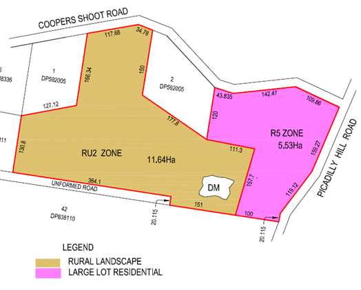
The
planning proposal will also make consequential changes to maps regarding
Minimum Lot Size (MLS) to match the proposed R5 Large Lot Residential
zone. A variable MLS is proposed to reflect existing development and past
approvals on the subject land (Figure 8). Part of the R5 zone will
have a 1.5-hectare MLS permitting two lots, and part will have a 0.8-hectare
MLS permitting two lots. The remaining RU2 zoned land will have a
10-hectare MLS, which will enable it to be subdivided from the R5 land and have
a dwelling erected on it. It is not intended to introduce an FSR to the
site (it currently does not apply to the site), and the current Height of
Building (9 metres) will be retained.
A “Plain English” version of the proposed Byron
LEP 2014 Schedule 1 clause is as follows:
What Land Does it Apply to?
Part Lot 3 DP 592005 and part Lot 1
DP 1124504. Land at the corner of Coopers Shoot Road and Picadilly
Hill Road, Coopers Shoot.
What Additional Development will be Permitted?
A rural subdivision creating a total of five
lots (each with a dwelling permitted or existing) that reflects past approvals.
Gateway Determination
A Gateway determination (Attachment 2) was issued by the
DPIE on 6 August 2019. The Gateway determination required:
· minor amendments
to the planning proposal (these were completed to the satisfaction of the
Department)
· Public exhibition
for a period of 28 days
· Consultation with
public authorities (see details below)
Consultation Undertaken
Consultation with Public Authorities
In accordance with the Gateway determination, comment on the
planning proposal was sought from the following public authorities:
· Department of
Planning, Industry & Environment (Environment, Energy and Science)
· NSW Rural Fire
Service
· Rous County
Council
· Jali Local
Aboriginal Land Council
· Arakwal
Corporation
One (1) submission was received from the Biodiversity and
Conservation Division (BCD) of the Department of Planning, Industry &
Environment (Environment, Energy and Science). Issues raised and staff
comments are provided below in Table 1.
Public Exhibition
In accordance with the Gateway determination, the planning
proposal was placed on public exhibition for a period of 4 weeks from 20 November
to 20 December 2019.
One (1) public submission was received during the exhibition
period. Issues raised and staff comments are provided below in Table 2.
Key Issues Raised
Table 1: Key Issues Raised by Public Authorities
|
Public Authority
|
Issues Raised
|
Council Staff Response
|
|
Biodiversity Conservation
Division of the DPIE
|
The planning proposal should be informed by:
a) Consultation
with the Bundjalung of Byron Bay Aboriginal Corporation (Arakwal) regarding
any areas of important Aboriginal cultural heritage in the planning area.
b) A
current search of the Aboriginal Heritage Information Management System
(AHIMS)
|
The proponent consulted with the Bundjalung of Byron Bay
Aboriginal Corporation (Arakwal) prior to the Study and was referred to the
Tweed Byron Land Council due to resourcing limitations.
Council also referred the planning proposal to the Bundjalung
of Byron Bay Aboriginal Corporation (Arakwal) in accordance with the Gateway
determination but did not receive comment.
An AHIMS search was conducted on 22 January 2020 which
found that there are no Aboriginal sites recorded, or Aboriginal places
declared, in or near the subject land (to a buffer of 1000 metres).
|
|
The areas of rainforest vegetation in the planning area
should be zoned E2 Environmental Conservation as part of the planning
proposal. This could be delayed given the Byron Shire Council’s
advice that it is proceeding with a separate planning proposal for its
broader E-zones, but only if the Council enters into a planning agreement
with the landowner to commit to zoning these areas E2 as part of that Broader
zoning program.
|
An agreement has already been reached with the proponent
to apply an environmental zone (E2) on land where vegetation planting and
enhancements has occurred. This includes the areas of rainforest
vegetation referred to in the BCD – DPIE submission.
The application of E-Zones to the site is being undertaken
via Council’s E-Zone Review and is a separate process to this planning
proposal.
|
|
A Planning Agreement should be prepared as part of the
planning proposal committing to the preparation and implementation of a
Vegetation Management Plan (VMP) over existing native vegetation in the
planning area at the time of subdivision of the planning area, to secure the
ongoing management of biodiversity values in the planning area.
|
Extensive planting of native vegetation has been
undertaken as part of the environmental enhancement program tied to previous
development consents. The assessment report prepared by Blackwood
Ecological Services (exhibited with the planning proposal) notes that works
completed on the site more than satisfy the statutory requirement.
There is no statutory requirement for a Vegetation
Management Plan (VMP) to be put implemented for subdivision generally (i.e.
rural subdivision and large lot residential subdivision).
Council policies and guidelines (including DCP provisions)
do not require a VMP unless the subdivision is for the purpose of community
title. Incidentally, DCP 2014 Part D6.3.5 Rural Community Title
Subdivision notes that:
Where vegetation management works have been completed
previously as part of a development application, credit will be given against
those works. Details are to be submitted with the development application
demonstrating that the aims and objectives of the previously completed
vegetation management works have been achieved.
However, Byron DCP 2014 Chapter D6 Subdivision does
require that any subdivision impacting on native vegetation may require a VMP
to be prepared.
For these reasons, the requirement to prepare a VMP is
best considered at the DA stage for subdivision.
|
Table 2: Key Issues Raised During Public
Exhibition
|
Item #
|
Issues Raised
|
Council Staff Response
|
|
1.
|
The 2014 Byron LEP altered the rules for R5 to ensure a
more suitable minimum of 2.5 Ha lots. With this rezoning to R5 all Community
Titles should be negated and any future application for Torrens Title should
be treated under the current DA rules and standards. These smaller lot sizes
are also setting a precedent for future applications.
|
The variation to the R5 minimum lot size
is necessary to align with the current community title subdivision
approval.
This variation for the site is made
possible via the Byron Shire Rural Land Use Strategy 2017 which allows
for:
Expansion of adjoining R5 zone over subject land for a
maximum of 5 lots (as per current community title subdivision approval)
The planning proposal will amend Byron
LEP 2014 to include a Schedule 1 Additional Permitted Use clause for the site
enabling a subdivision that reflects past approvals.
The above provisions allowing a variation
to the minimum lot size for this site are quite specific and have been
previously endorsed by Council and the DPIE. Therefore, there should be
no concerns with regard to setting a precedent for future applications in the
R5 zone generally.
|
|
2.
|
As part of a 3-lot subdivision at 384 Coopers Shoot Road,
we are currently widening the road to a
ridiculously high standard, including hotmix, which is not
seen on any other rural road in this area.
We trust that Picadilly Hill Road is also upgraded upon
application for a subdivision if this re-zoning is
allowed by Council.
|
Specific works associated with any potential road upgrade
requirement will be considered at the DA stage for
subdivision.
|
Options
Option 1 (Recommended)
Forward the Planning Proposal
in Attachment 1 to the Department of Planning, Industry & Environment
requesting finalisation
Option 2
Remove support for the Planning Proposal.
STRATEGIC CONSIDERATIONS
Community Strategic Plan and
Operational Plan
|
CSP Objective
|
L2
|
CSP Strategy
|
L3
|
DP Action
|
L4
|
OP Activity
|
|
Community
Objective 4: We manage growth and change responsibly
|
4.2
|
Support
housing diversity in appropriate locations across the Shire
|
4.2.1
|
Establish
planning mechanisms to support housing that meets the needs of our community
|
|
|
|
|
|
|
|
|
|
|
Legal/Statutory/Policy
Considerations
This planning proposal intends to amend the Byron LEP
2014. Relevant legal and statutory considerations have been addressed
above.
Financial Considerations
As this is an applicant funded planning proposal, all
associated costs will be borne by the applicant.
Consultation and Engagement
Details pertaining to community consultation and engagement
are provided above. Consultation has been undertaken in accordance with
the Gateway determination.
Staff Reports - Sustainable Environment and Economy 13.9
Report No. 13.9 PLANNING
- Development Application 10.2019.161.1 - Multi Dwelling Housing - 15 Units, No
23 Lismore Road Bangalow
Directorate: Sustainable
Environment and Economy
Report
Author: Rob Van
Iersel, Major Projects Planner
Ralph James, Legal Counsel
File No: I2020/20
Proposal:
|
DA No:
|
10.2019.161.1
|
|
Proposal description:
|
Multi Dwelling Housing Comprising Fifteen (15) Dwellings
|
|
Property description:
|
LOT: A DP: 376877
|
|
23 Lismore Road BANGALOW
|
|
Parcel No/s:
|
45640
|
|
Applicant:
|
Lismore Venture Pty Ltd
|
|
Owner:
|
Windmill Property Investments 3 Pty Ltd & P & M
Lismore Pty Ltd & others
|
|
Zoning:
|
R2 Low Density Residential
|
|
Date received:
|
5 April 2019
|
|
Integrated / Designated Development:
|
☐
Integrated
|
☐
Designated
|
☒
Not applicable
|
|
Concurrence required
|
No
|
|
Public notification or exhibition:
|
Level 2 advertising under DCP 2014 Part A14 –
Public Notification and Exhibition of Development Applications
Initial Exhibition period:
18/4/19 to 8/5/19
- Submissions received:
115 – 97 oppose; 18 support.
Amended plans re-notified:
02/01/2020 – 23/01/2020
- Submissions received: 7
– all objecting
|
|
Planning Review Committee:
|
9 May 2019
|
|
Delegation to determination:
|
Council / Land and Environment Court
|
|
Issues:
|
· Land &
Environment Court appeal – deemed refusal
Conciliation Conference: 31/01/2020
· Plans amended to
reduce unit numbers (17 to 15) and address DCP non-compliance
· Consistency with
character of the locality, which is a Heritage Conservation Area;
· Access works
– requirement for works in Lismore Road
|
Summary:
This development application was received in April 2019, proposing
a multi dwelling housing proposal comprising 17 dwellings in three (3) separate
buildings. The application was made under the provisions of State
Environmental Planning Policy (Affordable Rental Housing) 2009, and sought to
implement the ‘concessions’ on car parking’ provided under
that SEPP.
The site is located on Lismore Road on the southern edge of
Bangalow within a Heritage Conservation Area characterised primarily by single
storey dwellings. Public exhibition of the application attracted 97
objections, concerned mainly that the proposed multi dwelling housing would be
significantly inconsistent with the character of the area.
The applicants lodged an appeal in the NSW Land &
Environment Court in May 2019, against Council’s “deemed
refusal” of the application.
Assessment of the proposal identified that, while it was
consistent with the provisions of SEPP (Affordable Rental Housing) 2009, there
were a number of conflicts with the Byron LEP and DCP, primarily exceedance of
maximum building height (for a small section of roof) and encroachment into the
Building Height Plane.
Without prejudice discussions were held with the applicants
to identify these and other concerns with the application.
As a result, amended plans were submitted reducing the
number of individual units from 17 to 15, achieved by dividing what was
originally a 32m long building along the rear boundary into two (2) separate
buildings. The amendments also remedied the height exceedance and
encroachment into the building height plane.
Council’s Heritage Adviser reviewed the original
proposal and concluded that the built form, design and materials were generally
consistent with the heritage character of the locality, other that the single
long building at the rear. Her suggestion that this building be broken into two
was taken up in the amended plans.
As amended, the proposal now involves four (4) separate
buildings, each two storey in height, providing a total of:
· 5 one-bedroom
studios;
· 4 one-bedroom
units;
· 4 two-bedroom
units; and
· 2 three-bedroom
units.
The footprint of each of the four (4) buildings is in scale
with the dwellings in this locality.
It is considered that the amended proposal, which now
substantially complies with relevant regulatory requirements, is appropriate
for the site and consistent with the character of the locality. The
amended proposal provides a better balance between increased housing diversity,
which is lacking in Bangalow, and maintaining the character of the Village.
As part of the Land & Environment Court Proceedings, a
S34 Conciliation Conference was held on 31 January 2020, facilitated by a
Commissioner of the Court.
Three community objectors spoke at the site view, before
discussions were held between the parties. Council was represented by an
external solicitor (Marsdens), Council’s Major Projects Planner and
Development Engineer.
Agreement was reached at the Conference, including agreement
on the wording of consent conditions (Attachment 8).
It is recommended that Council authorise the General Manager
to finalise agreement, which will include filing a Notice of Agreement with the
Court, who will then issue Consent Orders approving the development subject to
the agreed conditions.
NOTE TO COUNCILLORS:
In accordance with the provisions
of S375A of the Local Government Act 1993, a Division is to be called whenever
a motion for a planning decision is put to the meeting, for the purpose of
recording voting on planning matters. Pursuant to clause 2(a) under the
heading Matters to be Included in Minutes of Council Meetings of Council's
adopted Code of Meeting Practice (as amended) a Division will be deemed to have
been called by the mover and seconder of all motions relating to this report.
|
RECOMMENDATION:
That Council authorise the General Manager to enter
into a section 34 Conciliation Agreement approving development application
10.2019.161.1 subject to the conditions of consent agreed to in Attachment 8
(E2020/7293).
|
Attachments:
1 Original
Plans, E2019/26175
2 submissions
received to original exhbition 18.4.19 to 8.5.19, E2020/6448
3 Statement
of Facts and Contentions filed 09/07/19, E2019/49621
4 Amended
Plan Set, E2019/90811
5 Confidential
- Letter from Marsdens Law Group - Regarding Lismore Venture Pty Ltd - Land and
Environment Court Case No. 2019/153305 - 23 Lismore Road BANGALOW, S2020/467
6 Heritage
Assessment, E2019/34007
7 submissions
received to amended proposal 9.1.20 to 22.1.20, E2020/6450
8 Conditions
of Consent agreed at S34 Conciliation Conference, E2020/7293
REPORT
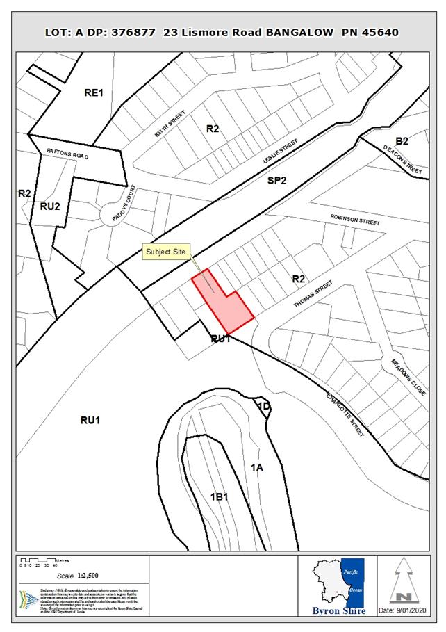
Assessment:
1. INTRODUCTION
1.1. History/Background
Prior to the mid-1990s, the property, which was owned by
Telstra, contained telecommunication plant, garages for Telstra vehicles,
including a below-ground fuel tank and bowser, and staff toilet facilities.
Some time in 1995, the telecommunications facilities were
replaced by a portable 8m x 4m exchange building, containing telecommunications
equipment that no longer needed to be manned. The remaining site buildings
were subsequently removed over the next few years, including removal of the
underground fuel tank in 1998.
More recently, the property was sold in around 2017,
following completion of further contamination assessment.
Council confirmed, by letter dated 9 January 2019, that site
remediation works had been satisfactorily undertaken, as documented in Statement
of Completion of Remedial Action Plan Proposed Residential Land Use Lot A DP
376877, 23 Lismore Road, Bangalow Job No. 51/2018_validation, prepared by
Tim Fitzroy & Associates, dated November 2018.
On 5 April 2019, Development Application No.10.2018.161.1 was lodged with Council seeking
consent for development described as “multi dwelling
housing containing seventeen
dwellings”. The plans as originally lodged are contained
as Attachment 1.
On 9 April 2019, Council issued
correspondence to the applicant
acknowledging the lodgement of the development application. On 9 April 2019, the development application was also referred to NSW Roads and Maritime Services.
The development application was publicly notified to adjoining and nearby owners between 18 April 2019 and 8 May 2019.
Council received 116 submissions,
comprising of 97 submissions objecting
to the proposed development and 19 in support
of the proposed development. One (1) of the submissions of objection was in the form of a petition
containing 24 signatures, with another containing 15 signatures.
The submissions to the original public exhibition of the application are
contained in Attachment 2.
The development application has not been determined by Council.
1.2. Land
& Environment Court Proceedings
On 16 May 2019, the applicant lodged a Class 1 application
in of the NSW Land and Environment Court in respect to Council’s
‘deemed refusal’ of the application.
In response to the appeal, Council prepared a Statement of
Facts and Contentions outlining the key issues associated with the proposal
(see Attachment 3). The main issues raised included:
· inconsistent with
the character of the locality;
· inadequate solar
access to internal and external living areas, particularly relating to terrace
units and studios;
· exceedance of the
9m maximum building height;
· encroachment into
the building height plane and associated issues of overlooking and
overshadowing; and
· no provision for
adaptable housing.
Following their review of the Council’s Contentions, a
‘without prejudice’ meeting was requested by the applicants to
discuss their response to the issues raised.
At this voluntary meeting, held on 6 December 2019, the
applicants provided an amended set of plans (discussed below). The
amended plan set is contained as Attachment 4.
A compulsory Conciliation Conference was held 31 January
2020, facilitated by a Commissioner of the Court.
Three community objectors spoke at the site view, before
discussions were held between the parties. Council was represented by
external solicitors (Marsdens), Council’s Major Projects Planner and
Development Engineer.
Prior to the Conciliation Conference, Council’s
external solicitors (Marsdens) were briefed with the full DA file. They
attended, with Council staff, the voluntary meeting on 6 December 2019.
They have reviewed the amended set of plans.
Council’s external solicitors have provided an advice
as to Council’s prospects of success in the Land and Environment Court,
having regard to the amended plans and documents provided on behalf of the
Applicant. That advice is Confidential Attachment 5.
Council’s attention is drawn to paragraphs 2, 3 and 4 on page 4 of the
advice.
As to costs, the estimated professional legal
costs of defending the appeal is $24,000-$28,000 excluding GST, assuming that
the matter is not settled at a conciliation conference and the ultimate hearing
in the matter only takes 2 days. If the hearing takes longer the legal
costs will be higher.
Based on the amended plans, agreement was reached during the
Conciliation Conference, including agreement on the wording of consent
conditions (Attachment 8).
It is recommended that Council authorise the General Manager
to finalise agreement, which will filing a Notice of Agreement with the Court,
who will then issue Consent Orders approving the development subject to the
agreed conditions.
1.3. Description
of the proposed development
Application as submitted
The development application was lodged with Council on 5
April 2019. As originally submitted, the application sought approval for
multi dwelling housing comprising seventeen (17) dwellings, consisting of:
· eight (8) two
bedroom dwellings (terraces);
· four (4) one
bedroom dwellings (row houses); and
· five (5) one
bedroom studios.
The application was lodged under the provisions of State
Environmental Planning Policy (Affordable Rental Housing) 2009 (SEPP ARH).
The five studio apartments were proposed in a single
building, located toward the mid-point of the south-western property boundary
(S1-S5 on the plan above). Each studio contained a lounge, kitchen and
bathroom at ground level, with a mezzanine bedroom above. Laundries were
not shown on the plans.
Each had an external covered porch on the north-eastern
side, facing the internal driveway area, and a small external private open
space and clothes drying area on the south-western side.
Each studio had a floor space of 32m2.
The one bedroom dwellings (row houses) were located in a
separate building (R1-R4 on plan above). Each contained an open-plan
lounge/ kitchen/ dining space at ground level, with a small external front
porch, internal storeroom and a laundry accessed from the rear yard. A
single bedroom, dressing room and bathroom were located on the upper level.
Figure 1 – Proposed Site Plan – as lodged
Each row house had an area of 52m2, with an
external private garden area on the northern side.
The terrace houses were within a separate building set along
the rear boundary, containing T1-T8 on the plan above. Each terrace house
contained a covered car parking space, a study/ storeroom, bedroom, bathroom
and laundry at ground level, with a bedroom, lounge/ kitchen/ dining area and
bathroom on the upper floor, with a covered deck facing the rear property
boundary.
Each terrace unit had a floor space of 93m2.
Fourteen (14) parking spaces were provided, one for each of
the eight terrace houses and six shared spaces. Bike parking was also
provided. All access was proposed via a driveway off Lismore Road. (Plans
in Attachment 1).
Amended Proposal
As amended, the development now proposes 15 dwellings; with
the number of two-bedroom terrace units reduced from 8 to 6, and proposed as
two stand-alone buildings, each containing three units.
Overall therefore, the application now proposes:
· two (2) three
bedroom units (Terraces T1 & T6);
· four (4) two
bedroom units (Terraces T2 – T5);
· four (4) one bedroom
dwellings (row houses); and
· five (5) one
bedroom studios.
Figure 2 – Proposed
Site Plan – as amended
The five studio apartments have been redesigned to have the
bedroom at ground level, with the kitchen and bathroom, with the lounge room as
the mezzanine level. A 6m2 north-east facing covered deck is
included in this upper level (facing into the property). The gross floor
area of the studios has been increased to 35m2, in accordance with
the requirements of clause 14 of SEPP ARH.
3 of the 4 studios have a 7m2 outdoor open space
at the rear, with S1 having 9m2.
The row houses are mostly unchanged, other than R1 & R2
are now designed to be adaptable dwellings in accordance with AS4299 –
i.e. they are able to be adapted in the future (if required) to be accessible
for people with disability.
Each row house has an area of 52m2, with an
external private garden area on the northern side.
The number of terrace units has been reduced to 6, located
within two separate buildings set along the rear boundary. The units on
the boundary ends (i.e. T1 & T6) have 2 bedrooms and a bathroom at ground
level, with a third bedroom plus kitchen/ lounge on the upper floor. The
remaining terrace units have a bedroom and bathroom at ground level and a
second bedroom kitchen and lounge above.
Each terrace house contains a covered car parking space, and
a covered deck on the upper level, facing the rear property boundary.
Each terrace unit has a floor space of 93m2.
The following units are nominated as ‘affordable’
for the purposes of SEPP (Affordable Rental Housing) 2009):
· Studio 5;
· Row House 1;
· Row House 2; and
· Row House 3.
Twelve (12) parking spaces are provided, one for each of the
six terrace units and six shared spaces. One of the spaces would be
removed to become a shared zone between 2 accessible parking spaces if the row
houses are adapted.
Bike parking is also provided. All access remains via
the existing driveway off Lismore Road. (Amended Plans in Attachment 4).
1.4. Description
of the site
|
Land is legally described as:
|
LOT: A DP: 376877
|
|
Property address is:
|
23 Lismore Road BANGALOW
|
|
Land is zoned:
|
R2 Low Density Residential
|
|
Land area is:
|
2,341.6m2
|
|
Property is constrained by:
|
Drinking Water Catchment
|
|
|
Heritage Conservation Area
|
|
|
Sewer Main through middle of site
|
|
|
Potential impact zone – Flying Fox Camp
|
The site is vacant block of
land, with an existing portable, unmanned Telstra exchange building located
toward the Lismore Road frontage, contained within a wire fence. There is
a Right of Carriageway over an existing concrete driveway off Lismore Road,
which ensures Telstra’s ongoing access to that exchange.
|
|
|
|
Plate 1 – Existing
Telstra portable exchange
|
Plate 2 – Existing
concrete driveway
|
The property slopes away from the
Lismore Rd frontage towards the southern rear boundary, which adjoins a
relatively narrow section of rural land with frontage to Charlotte
Street. A number of retaining walls, approx. 1m high, are located on the
northern and eastern boundaries.
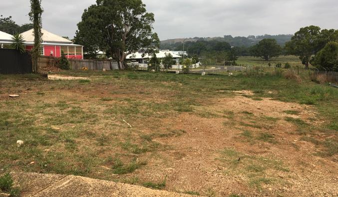
Plate 3 – Property from end of driveway looking south
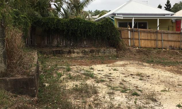
Plate 4 – Retaining walls within property
The site has vehicular access from Lismore Road by way of an
existing driveway crossing.
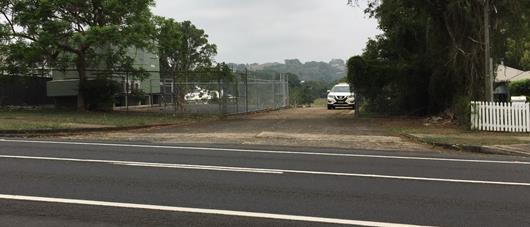
Plate 5 – Property access from Lismore Road
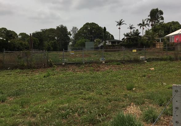
Plate 6 – Property viewed from Charlotte Street at rear
2. SUMMARY OF
REFERRALS
|
Referral
|
Issue
|
|
Environmental Health Officer
|
Support subject to recommended conditions of approval.
|
|
Development Engineer
|
Support subject to recommended conditions of approval,
including requirement for upgrade works within the Lismore Road
reserve. The applicant’s traffic consultant disputes that these
upgrades are required. However, at the S34 Conciliation Conference, the
applicants accepted Council’s requirement for these works.
|
|
S64 / Systems Planning Officer
|
Support subject to recommended conditions of approval.
|
|
S7.11 Contributions
Officer
|
In accordance with Council policy, the development
generates a requirement for Contributions for the
“non-affordable” component of the development (i.e. 11 of the 15
units).
Contributions for the 4
affordable units are not required until such time as they cease to be managed
by a social housing provider as affordable units, in accordance with SEPP
(Affordable Rental Housing).
Appropriate conditions of consent
are recommended, and the applicant raised no objection to these conditions at
the S34 Conciliation Conference.
|
|
Heritage Consultant
|
Council’s Heritage Advisor provided a detailed
assessment of the original development proposal (i.e. 17 dwellings).
Comments of note included:
· The studio and
row house buildings are smaller in footprint than the traditional dwellings
in the surrounding landscape;
· Given their
location within the site, the visual impact of these two-storey buildings is
likely to have little or no impact upon the town entry;
· The proposed
two-storey terrace building is larger in bulk than most buildings in the
surrounding Conservation Area (Note: proposal subsequently amended to delete
two terrace units, and divide the building into two separate buildings);
· Two-storey
terraced buildings are a noted element of the historical commercial main
street precinct, but are not representative of the surrounding residential
areas;
· Two-storey
development is not out of character in the Charlotte Street residential area
opposite the site;
· The design, roof
forms, material palette and landscaping aspects are considered to have been
thoughtfully addressed with regard to the site and setting of the Bangalow
Heritage Conservation Area; and
· Division of the
proposed terrace building into smaller elements, or incorporation of a
single-storey element at each end is suggested to make it more harmonious
with the built character of the area (Note: amended design is consistent with
this suggestion).
|
|
Roads & Maritime Services
|
RMS advised that Lismore Road at Bangalow is a classified
(State) road under the Roads Act 1993, with Council as the roads
authority.
They provided the following
comments to assist Council’s assessment:
1. Council should be satisfied that
the impact of traffic entering and leaving the site has been adequately
addressed, and that such ingress/egress can occur in a safe and efficient
manner. Points for consideration include adequate street lighting at the entrance
to the development; identification of any pedestrian points of conflict given
the pedestrian pathway along the frontage of the development; possible
restrictions on parking in front of the development to ensure that
appropriate sight distances are available and that provision to manoeuvre
around a right turning vehicle can be safely achieved (if vehicles are parked
directly opposite the development)..
2. Any
upgraded access to the site should be designed and constructed in accordance
with Austroads Guidelines, Australian Standards and Roads and Maritime
Supplements.
In response
to the amended proposal, and the updated Traffic Report provided in support,
RMS further advised that AUSTROADS Guide to Road
design Part 4A should be used to assess the requirements for turning traffic.
|
3. SECTION 4.14
– BUSH FIRE PRONE LAND
Under section 4.14 of the Act, Council must be satisfied
prior to making a determination for development on bush fire prone land, that
the development complies with the document Planning for Bush Fire Protection
2006.
The site is not bush fire prone land.
EFFECT OF 10/50 RULE ON SIGNIFICANT VEGETATION
The clearing entitlement is unavailable as the property is
within a Heritage Conservation Area.
4. SECTION 4.15C
– MATTERS FOR CONSIDERATION – DISCUSSION OF ISSUES
Having regard to the matters for consideration detailed in
Section 4.15(1) of the Environmental Planning & Assessment Act 1979
(EP&A Act), the following is a summary of the evaluation of the issues.
4.1 State Environmental
Planning Instruments
|
|
Satisfactory
|
Unsatisfactory
|
|
State
Environmental Planning Policy No 44 - Koala Habitat Protection
|
☒
|
☐
|
|
Consideration: The site has an area less than 1ha.
The development control provisions of this SEPP, therefore do not apply.
|
|
State
Environmental Planning Policy No 55 - Remediation of Land
|
☒
|
☐
|
|
Consideration: Remediation of the site has been
undertaken, following preliminary investigations that identified a number of
potential contaminants associated with previous site use as a Telstra Depot.
Remediation was completed in 2018
and Council have confirmed satisfactory completion of the works, based on a
detailed validation report.
As such, the site is now
considered suitable for the proposed use.
|
|
State
Environmental Planning Policy (Affordable Rental Housing) 2009
|
☒
|
☐
|
|
Consideration: Consideration: The proposed development has
been submitted under the provisions of Division 1 of this SEPP. See
detailed assessment below.
|
|
State
Environmental Planning Policy (Building Sustainability Index: BASIX) 2004
|
☒
|
☐
|
|
Consideration: Certification provided.
|
|
State
Environmental Planning Policy (Infrastructure) 2007
|
☒
|
☐
|
|
Consideration: Lismore Road is a ‘classified
road’ for the purposes of this SEPP.
Clause 101 of the SEPP requires
that a consent authority should not approve development on land with frontage
to a classified road unless:
· access is
provided from a road other than the classified road – in this case, the
property does not have frontage to any other public road;
· the safety,
efficiency and ongoing operation of the classified road will not be adversely
affected by the development – see commentary above from Council’s
Development Engineer and from RMS.
Conditions are recommended
that will require the development to provide minor upgrading at the property
access and within Lismore Road, which will ensure that vehicles entering and
exiting the site will not adversely affect the safety and efficiency of
traffic on that road.
|
State
Environmental Planning Policy (Affordable Rental Housing) 2009
|
Policy requirement/summary
|
Comments
|
Complies
|
|
8. Relationship with other environmental planning
instruments
If there is an inconsistency between this Policy
and any other environmental planning instrument, whether made before or after
the commencement of this Policy, this Policy prevails to the extent of the
inconsistency.
|
The provisions of this SEPP prevail over any
inconsistencies with Byron LEP 2014.
|
Noted
|
|
Part 2 New affordable rental housing
|
|
|
|
Division 1 In-fill affordable housing
|
|
|
|
10. Development
to which Division applies
|
|
|
|
(1) This Division applies to development for the
purposes of dual occupancies, multi dwelling housing or residential flat
buildings if:
(a) the development concerned is permitted with
consent under another environmental planning instrument, and
(b) the development is on land that does not contain
a heritage item that is identified in an environmental planning instrument,
or an interim heritage order or on the State Heritage Register under the Heritage Act 1977.
|
The site is zoned R2 Low Density Residential.
Multi dwelling housing is
permissible in the R2 zone.
While the site is located within
a Heritage Conservation Area, identified within Byron LEP 2014, it does not
contain a listed heritage item.
|
Yes
|
|
(2) Despite subclause (1), this Division
does not apply to development on land in the Sydney region unless all or part
of the development is within an accessible area.
|
Not applicable.
|
|
|
(3) Despite subclause (1), this Division does not apply to development on land that is not in the Sydney region
unless all or part of the development is within 400 metres walking distance
of land within Zone B2 Local Centre or Zone B4 Mixed Use, or within a land
use zone that is equivalent to any of those zones.
|
The site is located approximately 250m (walking distance)
from the nearest edge of the B2 Local Centre Zone (Bangalow Village Centre).
|
Yes
|
|
13. Floor
space ratios
|
|
|
|
(1) This clause applies to development to which this
Division applies if the percentage of the gross floor area of the development
that is to be used for the purposes of affordable housing is at least 20 per
cent.
|
The application nominates 4 one-bedroom units as the
affordable housing component.
The combined floor space of these
units is 191m2.
The total proposed floor space is
quoted as 949m2.
Based on these areas, the
application proposes to use 20.1% of the total floor space for affordable
housing.
The clause, therefore, applies.
|
Yes
|
|
(2) The maximum floor space ratio for the development
to which this clause applies is the existing maximum floor space ratio for
any form of residential accommodation permitted on the land on which the
development is to occur, plus:
(a) if the existing maximum floor space ratio is
2.5:1 or less:
(i) 0.5:1 - if the percentage of the gross floor area
of the development that is used for affordable housing is 50 per cent or
higher, or
(ii) Y:1 - if the percentage of the gross floor area
of the development that is used for affordable housing is less than 50 per
cent,
where:
AH is the percentage of the gross floor area of the
development that is used for affordable housing.
Y = AH ÷ 100
|
The existing FSR applicable in
this location is 0.5:1.
Based on the formula contained in
the clause, the applicable FSR will be 0.5:1 plus 0.2 = 0.7:1.
Based on the site survey plan
provided, the site (Lot A DP 376877) has a total area of 2,341.6m2.
The proposed development has a
FSR of 0.41:1.
There is, however, an area of
approx. 332m2 fenced off toward the Lismore Road frontage of the
site, with an easement for use of the existing telecommunications facility.
This reduces the
‘useable’ site area to 2,009.6m2.
Relative to the reduced site
area, the proposed development has a FSR of 0.47:1, which complies with the
Byron LEP requirement.
The proposed development,
therefore, does not seek to take advantage of the FSR ‘bonus’
provided in this clause.
|
Yes
|
|
14. Standards that cannot be
used to refuse consent
|
|
|
|
(1) Site and solar
access requirements
A consent
authority must not refuse consent to development to which this Division
applies on any of the following grounds:
(a) (repealed)
|
|
|
|
(b) site area
if the site
area on which it is proposed to carry out the development is at least 450
square metres,
|
The site has an area of 2,341.6m2,
reduced to 2,009.6m2 if the Telstra easement land is excluded.
|
Yes
|
|
(c) landscaped area
if:
(i) in the case of a
development application made by a social housing provider - at least 35 square
metres of landscaped area per dwelling is provided, or
(ii) in any other case - at
least 30 per cent of the site area is to be landscaped,
|
Application not made by a social housing provider.
Plans show a total of 604m2
landscaped space; which is 30% of the site (with Telstra easement area
excluded).
|
Yes
|
|
(d) deep soil zones
if, in
relation to that part of the site area (being the site, not only of that
particular development, but also of any other associated development to which
this Policy applies) that is not built on, paved or otherwise sealed:
(i) there is soil of a
sufficient depth to support the growth of trees and shrubs on an area of not
less than 15 per cent of the site area (the deep soil zone), and
(ii) each area forming part
of the deep soil zone has a minimum dimension of 3 metres, and
(iii) if practicable, at least
two-thirds of the deep soil zone is located at the rear of the site area,
|
A total of 340m2 deep
soil zone is provided, being 16.9% of the site area.
It is provided in 2 areas, each
having a minimum dimension of at least 3m.
Dimensions and location apply
with requirements.
|
Yes
|
|
(e) solar access
if living
rooms and private open spaces for a minimum of 70 per cent of the dwellings
of the development receive a minimum of 3 hours direct sunlight between 9am
and 3pm in mid-winter.
|
Studios:
· Living areas and
upper level outdoor decks comply
· Rear yards do
not receive sun until after approx. 1.00pm
Row Houses:
· Rear private
open spaces all receive 6hrs sun;
· Living areas receive
little or no direct sun within nominated period
Terrace Houses:
· Open spaces:
- Part of rear yard for T3
&T6 – 2-3hrs;
- Yards of remaining units
– 1-1.5hrs only;
· Living areas
receive no direct sun within nominated period
While this does not fully comply
with the SEPP provisions, particularly regarding solar access to living
rooms, it is considered that the lack of solar access, by itself, is not
sufficient to provide a reason to refuse the application.
In the context of the north coast
climate, all of the units will be ‘liveable’, with adequate
internal amenity.
|
Not full compliance
|
|
(2) General
A consent
authority must not refuse consent to development to which this Division
applies on any of the following grounds:
|
|
|
|
(a) parking
if:
(i) in the case of a
development application made by a social housing provider for development on
land in an accessible area - at least 0.4 parking spaces are provided for
each dwelling containing 1 bedroom, at least 0.5 parking spaces are provided
for each dwelling containing 2 bedrooms and at least 1 parking space is
provided for each dwelling containing 3 or more bedrooms, or
(ii) in any other case - at least
0.5 parking spaces are provided for each dwelling containing 1 bedroom, at
least 1 parking space is provided for each dwelling containing 2 bedrooms and
at least 1.5 parking spaces are provided for each dwelling containing 3 or
more bedrooms,
|
Application not made by a social housing provider.
Application generates the
following:
9 x 1 bedroom = 4.5 spaces
4 x 2 bedroom = 4 spaces
2 x 3 bedroom = 3 spaces
TOTAL = 11.5 say 12 spaces
12 spaces are provided
|
Yes
|
|
(b) dwelling size
if each
dwelling has a gross floor area of at least:
(i) 35 square metres in
the case of a bedsitter or studio, or
(ii) 50 square metres in the
case of a dwelling having 1 bedroom, or
(iii) 70 square metres in the case
of a dwelling having 2 bedrooms, or
(iv) 95 square metres in the case of a
dwelling having 3 or more bedrooms.
|
The 5 studio dwellings each have
35m2 floor area.
The 4 x 1 bedroom row dwellings
each have 52m2 floor area.
The 4 x 2 bedroom terrace units
each have 93m2 floor area.
The 2 x 3 bedroom terrace units
each have 100m2 floor area
|
Yes
|
|
(3) A consent authority
may consent to development to which this Division applies whether or not the
development complies with the standards set out in subclause (1) or (2).
|
Noted
|
|
|
15. Design requirements
|
|
|
|
(1) A consent authority must
not consent to development to which this Division applies unless it has taken
into consideration the provisions of the Seniors Living Policy: Urban Design
Guidelines for Infill Development published by the Department of Infrastructure,
Planning and Natural Resources in March 2004, to the extent that those
provisions are consistent with this Policy.
|
Part 1 – Responding to
context
Context of the locality is well
documented in DCP 2014 and recently adopted Bangalow Village Plan.
See discussion below –
design of built form has responded well to local character in terms of form
and materials.
The scale/ density of proposed is
inconsistent with that existing in the local area in terms of the number of
units; i.e. 15 units where locality is predominantly singe dwellings.
However, the units are grouped
into four (4) separate buildings, each with a footprint similar to the size
of dwellings in the locality.
Overall, it is considered that the proposal, as
amended, adequately responds to the local context.
Part 2 – Site Planning
& Design
The amended design largely
removes previous encroachments into the Building Height Plan. The only
encroachments that remain are:
· northern
elevation of T6, involving only the eave overhang of the upper floor.
This does not raise any issues of overlooking or overshadowing in relation to
the property adjoining to the north.
· western
elevation of studios, also comprising just the eave overhang, but at ground
level as the building is single storey at this boundary. This does not
raise any issues of overlooking or overshadowing of neighbouring property.
· Southern elevation of terrace
units. The encroachment includes part of the external upper level
decks. The southern boundary adjoins a relatively narrow parcel of
vacant rural land (zoned RU1 Primary Production), which has no potential for
residential development. The encroachment, therefore, results in no
practical impacts. Textured glass screening is proposed at the east and
west ends of the decks to ensure no overlooking impacts on adjoining
residences.
Part 4 – Impacts on
neighbours
The amended plans adequately
remedy potential impacts identified in the original design (see BHP comments
above).
Shadow diagrams demonstrate that
the proposal will not unduly shadow the private open space of the residential
property to the south.
The development will result in a two storey built form
on the eastern boundary, adjoining a single storey heritage home on the
adjoining block. In this part of the site, however, the development
site is approx. 1.5m lower than the ground level of the adjoining property,
with a retaining wall on the boundary. With a standard 1.8m timber
fence on top of the retaining wall, the eastern elevation of the row houses
will present as single storey when viewed from the neighbour’s
property.
Part 5 Internal site amenity
The amended proposal provides
adequate residential amenity for the units.
|
Yes
|
|
16A Character of local area
A consent
authority must not consent to development to which this Division applies
unless it has taken into consideration whether the design of the development
is compatible with the character of the local area.
|
See comments above from
Council’s Heritage Advisor:
· The design, roof
forms, material palette and landscaping aspects are considered to have been
thoughtfully addressed with regard to the site and setting of the Bangalow
Heritage Conservation Area; and
· Division of
the proposed terrace building into smaller elements, or incorporation of a
single-storey element at each end is suggested to make it more harmonious
with the built character of the area (Note: amended design is consistent
with this suggestion).
|
Yes
|
|
17. Must be used for affordable housing for 10 years
(1) A consent authority must
not consent to development to which this Division applies unless conditions
are imposed by the consent authority to the effect that:
(a) for 10 years from the
date of the issue of the occupation certificate:
(i) the dwellings
proposed to be used for the purposes of affordable housing will be used for
the purposes of affordable housing, and
(ii) all accommodation that is used for affordable housing will be managed
by a registered community housing provider, and
|
The application nominates Studio 5 and Row Houses 1, 2
& 3 as the affordable housing components.
A condition is recommended to
require that these dwellings are to be used for the purposes of affordable
housing for a period of at least ten years from the date of issue of an
occupation certificate.
This affordable housing is also
required to be managed by a registered community housing provider.
An appropriate condition is
recommended.
|
Yes
(Subject to conditions)
|
|
(b) a restriction will be
registered, before the date of the issue of the occupation certificate,
against the title of the property on which development is to be carried out,
in accordance with section 88E of the Conveyancing Act 1919, that
will ensure that the requirements of paragraph (a) are met.
|
An appropriate condition is
recommended.
|
|
|
(2) Subclause (1) does not
apply to development on land owned by the Land and Housing Corporation or to
a development application made by, or on behalf of, a public authority.
|
Noted
|
|
|
18. Subdivision
Land on which
development has been carried out under this Division may be subdivided with
the consent of the consent authority.
|
The subject development application
does not seek consent for subdivision at this time.
|
Noted
|
Character & Design:
Existing character
The property is located within a residential precinct on the
south-western edge of the Village of Bangalow. Lismore Road, the
property’s frontage, is a regional connector road between Bangalow and
Lismore, so the property is located in an area where passers-by are either
arriving in or leaving Bangalow.
The residential block between Lismore Road and Thomas Street
is small, containing only 16 lots. A heritage listed commercial building,
which was a rural supplies store, anchors the block on the corner of Lismore
Road and Robinson Street.
This residential block is part of a larger heritage
conservation area that covers a large portion of the Bangalow Village.
The immediate locality fronting Lismore Road contains traditionally styled
timber and iron single storey detached dwellings, set close to the road
frontage, on lots of around 500m2. Most properties have
generous rear yards.
All lots in the block contain a single dwelling.
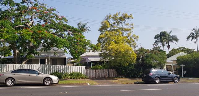
Plate 7 – Properties in the vicinity fronting Lismore Road
A newer residential subdivision is located to the
south-east, containing approx. 40 residential lots. This subdivision is
outside of the Heritage Conservation Area and contains primarily single
dwellings, some elevated given the slope and some two-storey elements (see
Plate 8 below). A number of these dwellings are relocated
‘Queenslanders’ and many of the newer homes also reflect a heritage
character.
Two heritage-style dwellings border the rear of the site,
fronting Thomas Street (see Plate 9). It is understood these dwellings
were not originally located on these properties, being relocated from
elsewhere. Neither is listed as heritage items.
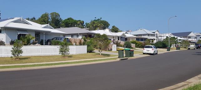
Plate 8 – Properties within recent residential subdivision
(Charlotte Street)
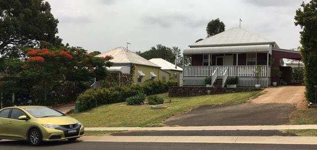
Plate 9 – Adjacent properties fronting Thomas Street
The site
The property was previously used as a Telstra depot, and a
single exchange building remains toward the Lismore Road frontage. The
need to retain this building, and access to it, will result in the built form
of the development proposal being located well back from the Lismore Road
frontage.
The development
As outlined above, Council’s Heritage Advisor has
assessed the application and is of the view that, “The design, roof
forms, material palette and landscaping aspects are considered to have been
thoughtfully addressed with regard to the site and setting of the Bangalow
Heritage Conservation Area”.
She notes that the two-storey row house and studio buildings
are set well back from the Lismore Road frontage and, as such, the visual
impact of these two-storey buildings is likely to have little or no impact upon
the town entry.
She noted, however, that the scale of the two-storey terrace
unit building (as originally proposed) was not in keeping with the local
character and suggested that it be broken into smaller building elements, or
that single-storey elements be incorporated into each end.
This suggestion was accepted by the applicants, and the
revised design comprises two separate terrace unit buildings, each containing
three units. While both remain two-storey, their bulk and scale is now
consistent with the size of buildings in the locality.
4.2 Byron Local Environmental Plan
2014 (LEP 2014)
LEP 2014 is an applicable matter for consideration in the
assessment of the subject development application in accordance with subsection
4.15(1) of the EP&A Act because it applies to the subject land and the
proposed development. The LEP 2014 clauses that are checked below are of
relevance to the proposed development:
|
Part 1
|
☒1.1|
☒1.1AA| ☒1.2| ☒1.3| ☒1.4| ☒Dictionary| ☒1.5| ☒1.6| ☒1.7| ☒1.8| ☐1.8A| ☒1.9|
☐1.9A
|
|
Part 2
|
☒2.1|
☒2.2 | ☒2.3 |☒Land Use Table | ☐2.4 | ☐2.5 | ☐2.6 | ☐2.7 | ☐2.8
|
|
Part 3
|
☐3.1|
☐3.2| ☐3.3
|
|
Part 4
|
☐4.1|
☐4.1A| ☐4.1AA| ☐4.1B |☐4.1C| ☐4.1D| ☒4.1E| ☐4.2| ☐4.2A| ☐4.2B| ☐4.2C| ☐4.2|☒4.3|☒4.4 |☐4.5 | ☐4.6
|
|
Part 5
|
☐5.1|
☐5.2| ☐5.3| ☐5.4| ☐5.5| ☐5.6| ☐5.7| ☐5.8|☐5.9| ☐ 5.9AA| ☒5.10| ☐5.11| ☐5.12|
☐5.13
|
|
Part 6
|
☐6.1|
☐6.2| ☐6.3| ☐6.4| ☐6.5| ☒6.6| ☒ 6.7| ☐6.8| ☐6.9
|
In accordance with LEP 2014 clauses 1.4 and 2.1 – 2.3:
(a) The
proposed development is defined in the LEP 2014 Dictionary as multi dwelling
housing;
(b) The
land is within the R2 Low Density Residential according to the Land Zoning Map;
(c) The
proposed development is permissible with consent; and
(d) Regard
is had for the Zone Objectives as follows:
|
Zone Objective
|
Consideration
|
|
To
provide for the housing needs of the community within a low density
residential environment.
To enable other land uses that provide facilities or
services to meet the day to day needs of residents.
|
The proposal will provide additional rental accommodation,
with an affordable component, which is an identified housing need for
Bangalow.
|
Relevant LEP issues are addressed below:
Floor Space Ratio
The existing FSR applicable in this
location is 0.5:1.
Based on the site survey plan provided, the property has a
total area of 2,341.6m2.
The proposed development has a total floor space of 949m2
and therefore has a FSR of 0.40:1.
There is, however, an area of approx. 332m2
fenced off toward the Lismore Road frontage of the site, with an easement for
use of the existing telecommunications facility.
This reduces the ‘useable’ site area to 2,009.6m2.
Relative to the reduced site area, the proposed development
has a FSR of 0.47:1, which complies with the LEP standard. The
application does not propose, therefore, use of the floor space
‘bonus’ available in clause 13 of SEPP ARH.
Heritage
The LEP requires that, before granting consent for
development on land within a heritage conservation area, Council must consider the effect of the proposed
development on the heritage significance of the item or area concerned.
As outlined
above, Council’s Heritage Advisor has provided a report in this regard
(see Attachment 6). The assessment concludes that the proposed row
house and studio buildings are not considered likely to have an adverse impact
upon the assessed significance of the Bangalow Heritage Conservation
Area.
The assessment
noted that the two-storey terrace building, in the form originally proposed,
would have an impact on the aesthetic values of the Conservation Area as viewed
from Charlotte/ Thomas Street, and suggested that the terrace building be
broken into smaller components.
This suggestion
was taken up by the applicants in the amended design now proposed.
4.3 Any proposed Instrument
that has been the subject of public consultation and has been notified to the
consent authority
None relevant.
4.4 Byron Shire Development
Control Plan 2014 (DCP 2014)
DCP 2014 is an applicable matter for consideration in the
assessment of the subject development application in accordance with subsection
4.15(1) of the EP& A Act because it applies to the land to which LEP 2014
applies. The DCP 2014 Parts/Chapters that are checked below are of
relevance to the proposed development:
|
Part A
|
☐
|
|
Part B Chapters:
|
☐B2|
XB3| XB4| ☐B5|
☐B6| ☐B7| XB8| XB9|
☐B10| ☐B11| ☐B12| XB13|
☐B14
|
|
Part C Chapters:
|
XC1| ☐C2| ☐C3| XC4
|
|
Part D Chapters
|
XD1| ☐D2| ☐D3| ☐D4| ☐D5| ☐D6| ☐D7| ☐D8
|
|
Part E Chapters
|
☐
E1| XE2| ☐E3| ☐E4| ☐E5| ☐E6| ☐ E7
|
Chapter D1 Residential
Accommodation in Urban, Village and Special Purpose Zones
|
DCP
requirement/summary
|
Proposed/
Comments
|
Complies
|
|
D1.2.1 Building Height Plane
Prescriptive measures:
BHP applies
Exemption may be considered where: floor level needs to
elevated because of flood; it can be demonstrated that the development will
not increase overshadowing or reduce the level of privacy on adjoining
properties.
|
As originally lodged, the western end of Terrace Unit 1,
including a portion of the upper level external deck, encroached into the
Building Height Plane in relation to the western property boundary.
This was raised in
Council’s Statement of Facts and Contentions relevant to the
Class 1 appeal, as one of the primary issues of concern.
|
No
|
|
Original
Proposal:
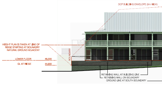
The property to the west contains
a single-storey dwelling adjoining the common boundary, with that
dwelling’s private open space (rear yard) overlooked by the proposed
terrace building.
The existing ground level in this
corner of the subject site is at approx. 44.5m AHD. While levels have
not been provided, the rear yard of the adjoining property appears to fall
gently from this level.
The terrace building was proposed
to be built on retained fill in this location, with the ground floor level
set at 46.00m AHD; i.e. 1.5m above ground level. This resulted in the
upper floor level (i.e. the level of the external deck) being at 48.6m AHD;
approx. 4.1m above ground level. The western edge of the building was
set at 2.4m from the common boundary.
Residents of Terrace Unit 1 would have a clear, direct
view down onto the adjoining rear yard.
Amended Proposal:
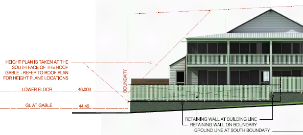
As shown above, the amended
design has removed all encroachment on this part of the building, such that
it complies fully with the DCP requirement.
The only encroachments that
remain on other building components are:
· northern elevation
of T6, involving only the eave overhang of the upper floor. This does
not raise any issues of overlooking or overshadowing in relation to the
property adjoining to the north.
· western
elevation of studios, also comprising just the eave overhang, but at ground
level as the building is single storey at this boundary. This does not
raise any issues of overlooking or overshadowing of neighbouring property.
· southern
elevation of terrace units. The encroachment includes part of the
external upper level decks. The southern boundary adjoins a relatively
narrow parcel of vacant rural land (zoned RU1 Primary Production), which has
no potential for residential development. The encroachment, therefore,
results in no practical impacts. Textured glass screening is proposed
at the east and west ends of the decks to ensure no overlooking impacts on
adjoining residences.
|
|
D1.2.2 Setbacks from Boundaries
Prescriptive measures:
Street frontage – Classified Road: 9m
Side & rear – 1.5m (plus BHP)
Between buildings on site – 3m
|
Complies with front and side requirements and with
building separation.
|
Yes
|
|
D1.2.4 Character & Visual Impact
No prescriptive measures.
Performance
measures:
|
|
|
|
Site, building and landscaping design must address
climate
|
The application as amended provides adequate solar access
to the majority of the individual units, improving this aspect from the
original design. Complies with requirement under SEPP ARH.
|
Yes
|
|
The street face
of a building, together with any open space between it and the street, must
contribute to the general attractiveness of the streetscape by means of good
design, appropriate materials and effective landscaping
|
Acceptable response, particularly
given that the proposed buildings need to be set well back into the property
to account for the existing telecommunications structure at the street
frontage.
|
Yes
|
|
Development
should be designed to minimise loss of privacy
|
See issue above re: Building
Height Plane - issues have been resolved in the amended proposal.
Private open space areas provided
for each unit.
|
Yes
|
|
There must be a
reasonable degree of integration with the existing built and natural
environment, balanced with the desirability of providing for variety in
streetscapes
|
See discussion above regarding
local character. Amended proposal now provides an acceptable balance
between consistency with local character and increase in local housing
diversity.
|
Yes
|
|
Long, straight
wall areas will be discouraged and must be broken up visually by a combination
of building materials and/or changes in the wall plane
|
As originally submitted, the rear
elevation of the Terrace Unit building was 32m in length and only articulated
visually through the upper deck partitions.
The amended proposal has
addressed with by dividing the building into two separate structures,
achieved by the deletion of 2 units.
|
Yes
|
|
The provision
of verandahs, balconies, pergolas and other protective outdoor elements will
be encouraged for visual, climatic and energy efficiency reasons
|
Protected decks are included on
the upper level of all units.
|
Yes
|
|
Well-designed
overhanging eaves should be provided where feasible to protect against heavy
rainfall and summer sun, while allowing winter sun penetration
|
Eaves are provided.
|
Yes
|
|
All building
materials must be compatible in character with their surrounding environment.
Any metal roof must have a colourbond or equivalent finish and no roof may be
highly reflective. White or light-coloured roofing may be approved where it
is demonstrated that it is not likely to be visually intrusive. Details of
building materials and surface colours must be submitted for assessment with
a development application
|
Acceptable – see commentary
in Council’s Heritage Advisors’ report (Attachment 6).
|
Yes
|
|
D1.2.5
Fences
|
Complies with Prescriptive
Measures
|
Yes
|
|
D1.2.6
Balconies
|
Consistent with Performance
Measure
|
Yes
|
|
D1.2.7
Pedestrian and Cycle Access
|
Consistent with Performance
Measures
|
Yes
|
|
D1.6 Multi
Dwelling Housing
|
|
|
|
D1.6.1
Private Open Space
Prescriptive
Measures:
Each dwelling
must have access to an individual courtyard at ground level having a minimum
area of 30m2 and a minimum length and width each of 4
metres. The courtyard must be designed to facilitate access to winter
sunshine and must be landscaped to Council’s satisfaction.
|
Studios: Each unit
has a ground level courtyard of 2m x 3m - 6m2. Does not
comply. Each studio also has an upper north-facing deck of 6m2.
Row Houses: Each
unit has a ground level courtyard of 2.58m x 4.31m – 11.1m2.
Does not comply.
Terrace Units: Each
unit has a ground level courtyard of 4.6m x 4.0m – 18.4m. Does
not comply. Most courtyards receive minimal winter sun.
|
No*
|
|
D1.6.3
Landscaping
Refer to B9
Landscaping:
B9.4.2 Common
Landscaped Area
Required:
small units
(i.e less than 55m2) - 50m2 per unit
medium units
(i.e. 55-85m2) - 70m2 per unit;
large units
(i.e. over 85m2) - 90m2 per unit
|
Required:
9 x small units – 450m2;
6 large units – 540m2
Proposed:
217m2
|
No*
|
|
D1.6.4
On-Site Car Parking
Refer to B4 Car
Parking
B4.2.12 Parking
Schedules
Required
– 1 space per 1 or 2 bedroom unit; 2 spaces per 3 bedroom unit; 1
visitor space per 4 units; 1 covered space per dwelling
|
Required:
|
13 x 1 & 2 bed units:
|
13 spaces
|
|
2 x 3 bed units:
|
6
spaces
|
|
Visitor:
|
4
spaces
|
|
TOTAL:
|
23 spaces
|
Provided: 13
spaces
|
No*
|
|
D1.6.5 Sound
Proofing
|
Can be conditioned
|
Yes
|
|
D1.6.6
Clothes Drying Facilities
Prescriptive
measures:
7.5 metres of
line per dwelling, located in suitably screened external drying areas
|
Can be conditioned
|
Yes
|
|
D1.6.7
Equity of Access and Mobility
Refer to B13
Access and Mobility
A minimum of
10% of units (rounded up) should be adaptable housing
|
15 dwellings proposed – 2
units required to be adaptable.
Row House units 1 & 2 shown
as adaptable
|
Yes
|
|
Access/
Continuous accessible path of travel within the site
|
Accessible car parking provided
directly adjacent to adaptable units.
|
Yes
|
* Standards within SEPP (Affordable
Rental Housing) 2009 take precedence.
The only non-compliances that remain for the amended
proposal are in relation to standards that are ‘overwritten’ by the
provisions of SEPP ARH. As indicated above, the proposal is now compliant
with all relevant SEPP ARH requirements.
4.5 Any Planning Agreement or
Draft Planning Agreement?
|
|
Yes
|
No
|
|
Is there any applicable planning agreement or draft
planning agreement?
|
☐
|
☒
|
|
Consideration:
|
4.6 Environmental Planning
& Assessment Regulation 2000 Considerations
|
Clause
|
This control is applicable to the proposal:
|
I have considered this control as it relates to the
proposal:
|
If this control is applicable, does the proposal
comply?
|
|
92
|
No
|
N/A
|
N/A
|
|
93
|
No
|
N/A
|
N/A
|
|
94
|
No
|
N/A
|
N/A
|
|
94A
|
No
|
N/A
|
N/A
|
4.7 Any
COASTAL ZONE MANAGEMENT PLAN?
|
|
Satisfactory
|
Unsatisfactory
|
Not applicable
|
|
Is there any applicable
coastal zone management plan?
|
☐
|
☐
|
☒
|
|
Consideration:
|
4.8 The likely impacts of that
development, including environmental impacts on both the natural and built
environments, and social and economic impacts in the locality
|
Impact on:
|
Likely significant impact/s?
|
|
Natural environment
|
No. The proposal will not have a significantly
adverse impact on the natural environment of the locality.
|
|
Built environment
|
No. The proposal will not have a significantly
adverse impact on the built environment of the locality – see
assessment/commentary above.
|
|
Social Environment
|
No. The proposal will not have a significant social
impact on the locality. The provision of small rental units will add to
the housing diversity available in Bangalow, addressing an identified housing
need.
|
|
Economic impact
|
No. The proposal will not have a significant
economic impact on the locality.
|
4.9 The suitability of the site
for the development
The site is a serviced, relatively unconstrained property
and is suitable for the proposed development. The primary consideration
regarding suitability is the consistency of the proposed development with the
local character, particularly given that the property is located within the
Bangalow Heritage Conservation Area.
This issue is addressed in detail within this report, and it
is concluded that, notwithstanding that the proposal is for multiple units in a
locality characterised by single dwellings, the form, density and scale of the
proposed development, as amended, is consistent with the local character.
It consists of four (4) individual buildings on a large
property, each of a size similar to surrounding dwellings.
The buildings form and aesthetics reflect the general
heritage themes of houses in the area.
Overall, the amended proposal provides an appropriate
balance between providing additional housing diversity and reflecting the
density, aesthetics and built form of the surrounding development.
4.10 Submissions made in accordance with
this Act or the regulations
The development application was originally exhibited for
public comment from 18/04/2019 to 08/05/2019.
There were 115 submissions made on the development
application (Attachment 2):
- 18
For
- 97
Against
It is noted that the submissions of support were in the form
of a signed ‘form letter’. A number of the objections were
also provided by way of a copies ‘form letter’.
The amended proposal was re-notified to all who had made
previous submissions, with an exhibition period from 2 January to 23 January
2020.
There were 7 submissions made in relation to the amended
proposal; all objecting (Attachment 7).
The issues raised in all of the public submissions are
addressed below (in no particular order):
|
Issues
|
Comment
|
|
Initial exhibition 18 April – 8 May 2018:
|
|
Objections:
|
|
Inadequate parking
|
Clause 14(2) of State Environmental Planning Policy
(Affordable Rental Housing) 2009 specifies that a consent authority must not
refuse consent to development made under this SEPP is the car parking
provided meets the minimum standards contained in the SEPP.
As outlined in the report above,
the SEPP requirements for this development are for the provision of 12 car
parking spaces. The application proposes to provide 12 spaces.
Experience in the local area
would suggest that there is likely to be more than 12 cars associated with
the development. Additional cars will need to park on the street within
Lismore Road.
While this is not ideal, there is
physical space on either side of Lismore Road for cars to park.
As highlighted above, the
provisions of the SEPP specify that Council is not able to refuse the
application solely on the basis of the number of car parking spaces.
|
|
Additional traffic movements will impact on safety on this
section of Lismore Road
|
Council’s Development Engineer and NSW RMS have
reviewed the proposal and conditions are recommended requiring a minor
widening of the northern side of Lismore Road, to provide a ‘passing
bay’ that would allow motorists travelling toward Bangalow to pass a
vehicle entering the site from that direction.
The existing driveway will need
to be upgraded, unless it can be demonstrated that it meets contemporary
AUSTROAD standards relevant to the circumstances.
These measures will satisfy
traffic safety/ efficiency concerns.
|
|
Inadequate solar access
|
The amendment to the development has improved the solar
access somewhat.
The proposal does not fully
comply with the SEPP requirement for solar access to at least 70% of living
rooms; although at least 70% of private open spaces do comply.
Overall, in the context of the
north coast climate and the design of the units (particularly providing for
natural ventilation), it is suggested that a lack of solar access is not, by
itself, a reason to refuse the application.
|
|
Not compatible with the character of the area –
particularly given location within Heritage Conservation Area –
“the development grossly offends the existing character of
Bangalow”
|
See discussion above. The proposal as amended
comprises four (4) individual buildings, each of which are of a scale that is
consistent with dwellings in the locality.
In combination with the design
and materials, which reflect the heritage character in the area, the amended
proposal provides an acceptable response to the site and its context.
|
|
Encroachment into Building Height Plane –
overlooking/ privacy impacts; encroachment cannot be justified given
character of the locality
|
See discussion above. The amendment has remedied the
height plane encroachments that would have resulted in overlooking / privacy
issues.
The only encroachment remaining,
apart from very minor encroachment of eaves, is in respect of the southern
boundary, which adjoins rural land that has no potential for development.
|
|
Concessions available within SEPP (Affordable Rental Housing)
2009 should not apply in a Heritage Conservation Area
|
The SEPP does not contain any provisions relating to
heritage conservation areas.
In terms of the SEPP
“concessions”, the subject application only relies on the
provisions relating to car parking and landscaped area.
It does not seek the additional
floor space that is “available” under the SEPP.
|
|
The applicant is not entitled to SEPP ARH concessions that
are restricted to listed community housing providers
|
The proposal does not rely on any concessions that are
only applicable only to social housing providers.
|
|
The application does not comply with provisions of SEPP
ARH and Byron LEP 2014, including Floor Space Ratio
|
See detailed assessment above – amended proposal now
complies.
FSR is calculated at
0.47:1. The maximum FSR for the locality is set at 0.5:1.
|
|
Width of some units is only 1.8m – too narrow for a
double bed
|
The studio units are 3.0m in width, with the bedroom being
2.4m x 3.0m.
The row houses have a width of
4.3m, with a bedroom 3.1m x 3.4.
The terrace units have a minimum
width of 4.0m.
|
|
Setbacks and building height will result in visual impacts
for neighbours
|
The amended proposal complies with setback and height
standards, and is therefore a reasonable response to the site.
The development will result in a
significant visual change for the immediate neighbours, who have looked out
over vacant land for a long period.
However, compliance with the
relevant planning controls (see above) ensures that such impacts are
reasonable in the circumstances.
|
|
Units will not be affordable – affordable component
only needs to be such for 10 years – not permanently affordable
|
SEPP ARH specifies that the affordable housing components
must be used for affordable housing for a minimum of 10 years.
This does not apply to all units;
only to those nominated as ‘affordable’, which are four units in
the amended plan.
Council has no power to require
these units to be affordable for a longer period, nor the power to require
all units to be ‘affordable’.
|
|
Proposal is inconsistent with Bangalow Village Plan
|
The Bangalow Village Plan – Vision and Initiatives;
was adopted by Council in February 2019.
The relevant principles in the
plan include:
· There is a harmonious unison between old and new
structures that respects and integrates with what’s already here.
· A greater diversity of housing types are available to
suit residents’ needs at different stages of their life.
· New housing in Bangalow is largely provided through
infill development, limiting urban sprawl and maintaining the village’s
walkability.
The proposal as amended provides
an acceptable balance between respecting the character of the locality and
providing a greater diversity of housing product on a property that is in
walking distance to the Village centre.
In that regard, the development
is considered to be consistent with the Village Plan as adopted.
|
|
Support:
|
|
Development will deliver long term rental housing and
generate housing diversity
|
Noted. As above, the proposal provided an acceptable
balance between provision of additional housing and consistency with
character of the area.
|
|
Does not contribute to urban sprawl
|
As above.
|
|
Site is well located in terms of access to shops and
services
|
The site is located in easy walking distance to the
Bangalow Village Centre.
|
|
Re-exhibition of amended plans January 2020:
|
|
Amendments do not resolve inconsistency with character of
the area nor lack of parking;
|
See commentary above, particularly comments from
Council’s Heritage Advisor.
|
|
Too many units on a small block of land
|
As detailed in the assessment above, the scale and density
of the development is consistent with relevant statutory requirements in SEPP
ARH and Byron LEP 2014.
|
|
Development will significantly alter the amenity for the
neighbouring property to the north – outlook from dwelling on that
property will be to walls as opposed to current open outlook.
|
The development will substantially alter the existing
amenity, as the southerly view from the adjoining dwelling, located at a
higher level that the subject site, currently looks over a vacant site onto
rural land in the distance.
However, given the residential
zoning of the land and the principal planning controls of height and setback,
it is not reasonable to assume that this outlook would be
‘protected’.
The proposed development complies
with the height, setback and building height plane requirements in respect of
this adjoining boundary.
The lower ground level of the
development site further assist in reducing the apparent bulk of the
two-storey building components when viewed from the adjoining property.
A 1.8m fence is proposed on the boundary (at the applicants cost) and site
landscaping will further assist in soften the impacts.
|
|
Single-storey cottages would be more suitable for this
site and locality.
|
This is true. However, the planning controls
applicable to the site and development do not restrict buildings to single
storey.
While single storey buildings may
be more compatible with the character of the area, the assessment above,
including the assessment of Council’s Heritage Advisor, concludes that
the two storey components are not inconsistent with the character.
|
4.11 Public interest
The proposed development is unlikely to prejudice or
compromise the public interest or create a dangerous precedent.
5. DEVELOPER
CONTRIBUTIONS
5.1 Water & Sewer Levies
Section 64 levies will be payable.
5.2 Section 7.11 Contributions
Section 7.11 Contributions will
be payable.
In accordance with Council policy, the development generates
a requirement for Contributions for the “non-affordable” component
of the development (i.e. 11 of the 15 units).
Contributions for the 4 affordable units are not required
until such time as they cease to be managed by a social housing provider as
affordable units, in accordance with SEPP (Affordable Rental Housing).
6. DISCLOSURE OF
POLITICAL DONATIONS AND GIFTS
|
Has a Disclosure Statement been received in relation
to this application
|
No
|
|
Have staff received a ‘gift’ from anyone
involved in this application that needs to be disclosed. Where the answer is
yes, the application is to be determined by the Director or Manager of the
Planning, Development and Environment Division.
|
No
|
7. CONCLUSION
The proposed development is submitted under the provisions
of State Environmental Planning Policy (Affordable Rental Housing) 2009.
It will provide for additional rental housing and a diversity of housing types,
which are identified community needs in Bangalow.
The proposal complies with key development controls and
standards and, as amended, is an adequate response to the character of the
area.
The property is located within a Heritage Conservation Area
and Council’s Heritage Advisor is satisfied that it has been designed to
respect the key characteristics of that area.
The surrounding locality is dominated by single dwellings,
the majority of which are single storey. The number of units, most being
two-storey, is inconsistent. However, the units are broken into four (4)
separate buildings, each of with a footprint that is consistent with dwellings
in the locality.
The design, form and building materials are consistent with
the character in this locality. Overall, the proposed development
provides an acceptable balance between respecting local character and providing
greater housing diversity / choice.
8. REASONS
FOR DECISION, HOW COMMUNITY VIEWS WERE ADDRESSED
|
Statement of Reasons
|
|
The proposed development complies with the provisions of
Byron Local Environmental Plan 2014.
|
|
The proposed development complies with relevant State
Environmental Planning Policies
|
|
The proposed development complies with relevant provisions
of Development Control Plan 2014
|
|
The proposed development will not have significant adverse
impact on the natural, built or social environment or economic impacts on the
locality.
|
|
The proposed development is considered suitable for the
proposed site.
|
|
The development application was notified/advertised in
accordance with Development Control Plan 2014. Issues raised in the
submissions have been addressed during assessment of the DA.
|
|
The proposed development is unlikely to prejudice or
compromise the public interest.
|
|
How community views were addressed
|
|
The DA was advertised in accordance with Development
Control Plan 2014. The submissions received were considered on merit
and addressed during assessment of the application.
|
Staff Reports - Sustainable Environment and Economy 13.10
Report No. 13.10 PLANNING
- 26.2016.6.1 The Farm Planning Proposal, Ewingsdale Road Byron Bay
Directorate: Sustainable
Environment and Economy
Report
Author: Rob Van
Iersel, Major Projects Planner
File No: I2020/47
Summary:
There have been a number of Council reports addressing
unauthorised land uses at The Farm, resulting in some of those uses ceasing and
a Planning Proposal to amend Byron LEP 2014 to provide a mechanism to approve
nominated uses, such as the bakery.
The Department of Planning issued Gateway approval to
proceed with the Planning Proposal in July 2018. Given that traffic
generation onto the Pacific Motorway roundabout is a key issue in relation to
the Proposal, the Gateway required that Council liaise with Roads and Maritime
Services (RMS).
As outlined in an update report to Council’s meeting
in December 2018, discussions with RMS and the proponent determined that a
Voluntary Planning Agreement (VPA) would be an appropriate mechanism to address
traffic congestion issues.
RMS’s suggestion was that the VPA be entered into by
Council, RMS and the land owners of The Farm, to provide for the dedication of
a strip of land along the Ewingsdale Road frontage of the property, which would
allow the future widening of Ewingsdale Road between the Motorway roundabout
and McGettigans Lane.
The landowners indicated that dedication of the land would
be acceptable, subject to being satisfied that the value of the land to be
dedicated would be commensurate with the extent to which traffic generated by
the unauthorised uses contribute to existing traffic problems.
A number of discussions have been held attempting to
determine provisions for inclusion in the VPA that protect the interests of all
parties.
Despite a 9-month extension to the Gateway approval, it is
now clear that it will not be possible to finalise a draft VPA that is
acceptable to all parties within the Gateway timeframe.
An alternate solution is now proposed, where the Planning
Proposal is amended to include the rezoning of a strip of land along The
Farm’s Ewingsdale Road frontage, to SP2 Infrastructure (Classified Road).
This zoning ‘reserves’ the land for future
acquisition under the Land Acquisition (Just Terms Compensation) process.
This will allow the Planning Proposal to move forward while Council and RMS
continue to plan and design road improvement works which will address existing
traffic issues.
This will require a further amendment to the Gateway
determination, and it is recommended that Council resolve to write to the
Department seeking that amendment.
NOTE TO COUNCILLORS:
In accordance with the
provisions of S375A of the Local Government Act 1993, a Division is to be
called whenever a motion for a planning decision is put to the meeting, for the
purpose of recording voting on planning matters. Pursuant to clause 2(a)
under the heading Matters to be Included in Minutes of Council Meetings of
Council's adopted Code of Meeting Practice (as amended) a Division will be
deemed to have been called by the mover and seconder of all motions relating to
this report.
|
RECOMMENDATION:
1. That
Council forward the amended Planning Proposal (Attachment 1 E2020/6032) to
NSW Department of Planning, Industry and Environment for an amended Gateway
Determination, to provide an approval mechanism for the nominated
unauthorised land uses at The Farm.
2. That,
following Gateway Determination, the Planning Proposal be publicly exhibited
for a period of 28 days and; following this time a further report be put to
Council.
3. That
Council concurrently exhibit the draft amendment to Chapter E5 of Byron DCP
2014 - Certain Locations in Byron Bay and Ewingsdale (Attachment 2
E2020/6033) and report on submissions received.
|
Attachments:
1 Attachment
1 - Planning Proposal The Farm - Public Exhibition Version, E2020/6032
2 Attachment
2 - Draft amendment to Chapter E5 of DCP 2014 - The Farm, E2020/6033
3 Form of
Special Disclosure of Pecuniary Interest, E2012/2815
REPORT
At the Council meeting of December 2018, Council noted a
report providing an update on the Planning Proposal for The Farm, relating to a
proposed Voluntary Planning Agreement (VPA) as a way of addressing traffic
issues associated with use of the site.
The Planning Proposal addresses existing unauthorised land
uses at the Farm (it does not approve additional uses). Council had previously
resolved (17-671) to initiate this Planning Proposal and seek a
Gateway Determination from the Department of Planning that would allow for its
public exhibition.
The support for the Planning Proposal was to allow
authorisation of the following uses at the site:
· the bakery;
· agricultural
training/education facilities and activities;
· administration
offices;
· small-scale
information centre.
Previous compliance actions was undertaken to address the
produce store, which was significantly reduced in scale to be consistent with
the existing approval for ‘roadside stall’, and the homewares/gift
shop, which was modified to operate in accordance with the approval for a plant
nursery.
Prior to issuing a Gateway Determination for this Planning
Proposal, the Department of Planning, Industry & Environment undertook
preliminary consultation with a number of State Agencies. In response,
NSW Roads and Maritime (RMS) recommended that a Voluntary Planning Agreement be
negotiated as part of the Planning Proposal, to provide for a contribution
“to offsetting the development’s contribution to the traffic and
safety issues around access to the site”.
The Department advised that this request from RMS be
addressed prior to exhibition of the Planning Proposal.
The unauthorised uses at The Farm generate traffic which
contributes to existing congestion problems at the western end of Ewingsdale
Road and its connection to the Pacific Motorway.
The intention of the VPA was to facilitate the dedication of
a strip of land along the Ewingsdale Road frontage of The Farm, so that this
section of Ewingsdale Road can be widened as part of a suite of road
improvement works to be carried out by RMS and Council.
RMS advised that, in order to accept this VPA as the
Farm’s contribution to traffic solutions, they would need to be
signatories to it. Their position has been that the VPA should provide
for the land dedication with no provision for further compensation to the land
owner.
The Farm advised that they would agree to such dedication
provided that it could be demonstrated to their satisfaction that the value of
the land to be dedicated is commensurate with the scale of their contribution
to existing traffic volumes. They also sought to include provisions that
provide for compensation should it be determined that the land value is greater
than their contribution to the traffic problems.
To achieve this, Council, RMS and the land owner would need
to agree on:
· traffic volumes
generated by the nominated unauthorised uses at The Farm, quantified as a
percentage of overall traffic volumes through the motorway interchange and on
Ewingsdale Road in this location;
· the value of the
land to be dedicated; and
· the construction
cost of the agreed road improvement works.
Discussions with Council, RMS and The Farm have not reached
an agreement on these numbers, and it is clear that it is not yet possible to
reach such an agreement until such time as the suite of road upgrades are
designed and costed. Latest discussions indicate that the time frame for
that could potentially be quite protracted.
In order to move forward, therefore, an alternate approach
is recommended, amending the Planning Proposal to change the zone of a 15m wide
strip of land along The Farm’s frontage of Ewingsdale Road from RU1
Primary Production to SP2 Infrastructure (Classified Road).
This will have the effect of
reserving that land for potential future acquisition by RMS.
Clause 5.1 of Byron LEP 2014
specifies that RMS is the relevant authority to acquire land zoned SP2
Infrastructure (Classified Road), pursuant to the Land Acquisition (Just Terms
Compensation) Act 1991.
The proposed zone will also cover
sufficient area to accommodate a future ‘fourth leg’ of the
(upgraded) hospital roundabout, should that be required in the future.
In addition to adding this rezoning, the following minor
amendments are also proposed to the version of the Proposal previously reported
to Council. These are:
· Artisan food and
drink industry: One of the unauthorised uses being addressed is the Bread
Social bakery. On initiating the Planning Proposal there were discussions
with the Proponents about the appropriate planning definition for that use,
with the previous version of the Planning Proposal settling on
“shop”.
Since that time, the Department of Planning, Industry and
Environment have established a new definition of artisan food and drink
premises, which means:
a building or place the principal
purpose of which is the making or manufacture of boutique, artisan or craft
food or drink products only. It must also include at least one of the
following:
(a) a
retail area for the sale of the products,
(b) a
restaurant or cafe,
(c) facilities for holding
tastings, tours or workshops
This new definition is a much better fit for the Bread
Social bakery, but is currently prohibited in the RU1 zone. It has
therefore been included in the updated Planning Proposal.
· Draft DCP
amendment: Recent discussions with the Department of Planning, Industry and
Environment indicate a preference to keep local provisions in the LEP as simple
as possible, with more detailed controls supporting those provisions to be
outlined in a Development Control Plan.
It is therefore proposed that a new
section be added to Chapter E5 of the DCP – Certain Locations in Byron
Bay and Ewingsdale; to outline the controls which will manage the land uses
authorised in the Planning Proposal.
A copy of the recommended DCP
section is contained at Attachment 2.
Key issues
Traffic has been the primary issue
to delay this Planning Proposal, for the reasons outlined above.
Council and RMS are working toward
solutions to the existing road congestion issues at the western end of Ewingsdale
Road, and while a solution is not yet agreed, it is reasonable to assume that
solution(s) will be implemented in the foreseeable future.
On that basis, it is considered
that the Planning Proposal can proceed at this time, to establish a mechanism
whereby The Farm can obtain development approval for the existing unauthorised
uses (subject to a DA).
Given that widening of the western
section of Ewingsdale Road is highly likely to form part of the road upgrade
solution, it is appropriate that a 15m wide strip of land along the Ewingsdale
Road frontage of The Farm be zoned SP2 Infrastructure (Classified Road),
reserving that land for potential future acquisition by RMS.
The proposed zone will also cover
sufficient area to accommodate a future ‘fourth leg’ of the
(upgraded) hospital roundabout, should that be required in the future.
Options
The proposal outlined above allows
the Planning Proposal to proceed toward a final resolution of the existing
unauthorised uses at The Farm while traffic solutions for the locality are
being developed.
The alternative would be to wait
until solutions have been determined, designed and implemented before
proceeding with this proposal.
While no firm timeframe is set,
that process has the potential to take 3-5 years to complete. In the
meantime, Council would need to take enforcement action (under the Enforcement
Policy) to require The Farm to operate strictly in accordance with its existing
approvals. It should be noted that there are however a number of conflicts in
these approvals consent conditions which will complicate any enforcement action
in the short term.
Council has been working with The
Farm to address and reduce any non-compliances on site. The Farm has
operated for at least a year now without significant complaint or issue
raised.
Next steps
To move forward, Council staff
will refer the amended Planning Proposal to the Department of Planning,
Industry and Environment to seek an amended Gateway determination.
Subject to receiving that, the Planning Proposal can then move to public
exhibition.
Staff Reports - Sustainable Environment and Economy 13.11
Report No. 13.11 Coastal
Management Program (Stage One) Scoping Study for Cape Byron to South Golden
Beach - status and update
Directorate: Sustainable
Environment and Economy
Report
Author: Chloe
Dowsett, Coastal and Biodiversity Coordinatior
File No: I2020/70
Summary:
The (draft) CMP Stage 1 Scoping Study for Cape Byron to
South Golden Beach was reported to Council at the 21 November 2019 meeting,
where it was resolved (Res 19-560):
1. That
Council upload the draft CMP Stage 1 Scoping Study for Cape Byron to
South Golden Beach for public comment to 10 January 2020.
2. That
Council send the draft CMP Stage 1 Scoping Study for Cape Byron to South
Golden Beach to key stakeholders and state agencies for their review and
comment. Agencies with a role or responsibility associated with recommended
actions/studies/components in the Forward Plan are requested to provide formal
support and clarification of their role and/or responsibility.
3. That
staff report back to Council in February 2020 on the outcomes of public
comment, key stakeholder and state agency review.
The timeframe for public
comment on the (draft) Scoping Study was extended on Council’s website to 3 February 2020 to allow suitable time over the holiday
period for the community and agencies to review the comprehensive report.
At the time of writing this report
(28 January 2020), feedback from eight
community members had been received, however no comments or support
letters had been received by public agencies. It
is anticipated that agency feedback and the Department
of Planning, Industry and Environment detailed assessment of the draft report
will be received by the end of February 2019.
Once received, staff will finalise the Scoping Study
accordingly and report back to Council.
|
RECOMMENDATION:
1. That
Council note the update provided on the Coastal Management Program
Stage 1 Scoping Study for Cape Byron to South Golden Beach.
2. That
Council note that once the Department of Planning, Industry and
Environment detailed assessment has been received a further report will be
tabled at the next available Council meeting.
|
REPORT
In September 2018 Council was successful in obtaining 50%
funding through the Coastal and Estuary Grants Program (Department of Planning,
Industry and Environment – former Office of Environment and Heritage)
to prepare a Scoping Study for the Byron Shire Coastline from Cape Byron to
South Golden Beach. The preparation of a Scoping Study is the first stage
of developing a Coastal Management Program (CMP) under the new coastal
legislation, the Coastal Management Act 2016.
A CMP aims to provide a long-term, coordinated strategy for
management of the coastal zone.
The first stage of the CMP process is nearing completion
with the (draft) CMP Stage 1 Scoping Study for Cape Byron to South Golden
Beach reported to Council at the 21 November 2019 meeting, where it was
resolved (Res 19-560):
1. That
Council upload the draft CMP Stage 1 Scoping Study for Cape Byron to
South Golden Beach for public comment to 10 January 2020.
2. That
Council send the draft CMP Stage 1 Scoping Study for Cape Byron to South
Golden Beach to key stakeholders and state agencies for their review and
comment. Agencies with a role or responsibility associated with recommended
actions/studies/components in the Forward Plan are requested to provide formal
support and clarification of their role and/or responsibility.
3. That
staff report back to Council in February 2020 on the outcomes of public
comment, key stakeholder and state agency review.
This report provides an update for Councillors on the
status of the resolution.
Item # 1: Public Comment on the (draft) Scoping Study
The timeframe for public
comment on the (draft) Scoping Study was extended on Council’s website to 3 February 2020 (period of eight weeks) to allow suitable
time over the holiday period for the community and agencies to review the
comprehensive report. At the time of writing this report (28 January 2020),
eight community members had provided feedback in the form of email comments on
the study. Of this feedback, two comprised lengthy submissions to Council of up
to 80 pages.
Staff are presently reviewing the
comments and submissions in detail which is taking longer than anticipated.
Item #2: Agency review and comment on the (draft) Scoping
Study
Agencies with a role or responsibility associated with
recommended actions/studies/components in the Forward Plan have been requested
to provide formal support and clarification of their role and/or
responsibility. At the time of writing this report
(28 January 2020), no comments or support letters had been received by public agencies.
The Department of Planning,
Industry and Environment ( DPIE - former Office of Environment and Heritage)
is required to undertake a detailed assessment of the (draft) Scoping Study,
however at the time of writing this report the detailed assessment had not been
received.
Item #3: Report back to Council
It is anticipated that agency feedback and DPIE’s
detailed assessment will be received by the end of February 2019. Once
received, staff will finalise Scoping Study accordingly and report back to
Council.
STRATEGIC CONSIDERATIONS
Community Strategic Plan and Operational Plan
|
CSP Objective
|
L2
|
CSP Strategy
|
L3
|
DP Action
|
L4
|
OP Activity
|
|
Community Objective 3: We protect and enhance our
natural environment
|
3.3
|
Partner to protect and enhance the health of the
Shire’s coastlines, estuaries, waterways and catchments
|
3.3.1
|
Implement Coastal Management Program
|
3.3.1.1
|
Continue preparing a Coastal Management Program (CMP) in
accordance with the staged process
|
|
|
|
|
|
|
|
|
|
|
|
|
|
|
|
|
Legal/Statutory/Policy Considerations
The Coastal Management Act 2016 and associated
Manual.
Financial Considerations
Stage 1 Scoping Study for Cape Byron to South Golden Beach
is funded in the FY 2019/20 budget.
Staff Reports - Sustainable Environment and Economy 13.12
Report No. 13.12 PLANNING
- 26.2020.1.1 - Planning Proposal for Short Term Rental Accommodation
Directorate: Sustainable
Environment and Economy
Report
Author: Ben
Grant, Planner
File No: I2020/111
Summary:
A report was tabled at the Ordinary Council meeting of 12
December 2019, presenting preliminary research on the volume and growth of
‘online listings’ for short term rental accommodation in Byron
Shire.
This report was in response to a
Ministerial Planning Direction issued 15 February 2019, to address the high
concentration and unique impacts of short term rental accommodation in the
Byron Shire. The Direction allows Council to reduce non-hosted short-term
rental accommodation to a minimum of 90 days per calendar year, as long as
there is a sound base of evidence to support the proposed changes.
Report link:
https://byron.infocouncil.biz/Open/2019/12/OC_12122019_AGN_1002.PDF
The report noted very high numbers of listings relative to
other Local Government Areas in the region, and recommended new planning
controls be introduced to improve the management of short term rental
accommodation through an amendment to Byron Local Environmental Plan 2014.
The recommendations of the report were supported by the
Council, with an additional request for staff to investigate
and apply an appropriate planning mechanism to limit 10% of the total housing
stock in use as non-hosted short term rental accommodation (STRA).
Council resolved (19-676)
as follows:
1. That Council request staff to prepare a planning proposal
to amend Byron Local Environmental Plan 2014 in accordance with the draft
planning controls in Attachment 1 (E2019/85833) except to replace point 4 with
a new point 4 “investigate and apply an appropriate planning mechanism to
limit 10% of the total housing stock in use as non-hosted STRA”.
2. That Council request staff to undertake an online community
engagement activity of the draft planning proposal controls during December and
January to canvass community opinion on the controls.
3. That Council receive a report on the community engagement
activity with a finalised planning proposal, for endorsement to submit to the
Department of Industry and Environment for Gateway Determination in February
2020.
As per item 2, an online community engagement activity of draft planning
controls was undertaken during December and January to canvass community
opinion. Feedback over the planning controls was generally mixed, with
responses being roughly split between those who favoured a precinct model and
those who felt a simpler 90 day cap should be applied equally in all areas.
After considering the community
feedback and the results of further research, several
changes have now been made to the proposed draft planning controls.
A proposed precinct model has not
been progressed as it requires significant more data analysis to validate, and
without this has the potential to create an unequal distribution of benefits
and burdens across the community.
Instead, a more simplified
approach is recommended that will seek to introduce a 90 day limit for
non-hosted STRA in all areas as an initial planning control response, with
further data analysis to continue on the potential for a precinct based model
which could be implemented at a future time.
NOTE TO COUNCILLORS:
In accordance with the
provisions of S375A of the Local Government Act 1993, a Division is to be
called whenever a motion for a planning decision is put to the meeting, for the
purpose of recording voting on planning matters. Pursuant to clause 2(a)
under the heading Matters to be Included in Minutes of Council Meetings of
Council's adopted Code of Meeting Practice (as amended) a Division will be
deemed to have been called by the mover and seconder of all motions relating to
this report.
|
RECOMMENDATION:
1. That
Council forward the Planning Proposal (Attachment 1 #E2020/9498) to
NSW Department of Planning for a Gateway determination.
2. That,
following the issue of a Gateway determination, the Planning Proposal be
publicly exhibited in accordance with the requirements of it and the Byron
Shire Community Participation Plan.
3. That
following public exhibition, a further report is put to Council on the
results of the public exhibition and next steps for the finalisation of the
Planning Proposal.
|
Attachments:
1 26.2020.1.1
- STRA Planning Proposal - Pre-Gateway V1.1, E2020/9498
2 Combined
Submissions List - Short Term Holiday Letting (STRA) - Redacted
(20-02-2020).pdf, E2020/12192
REPORT
Background
At the ordinary meeting of 12 December 2019, Council resolved (19-676)
as follows:
1. That Council request staff to prepare a planning proposal
to amend Byron Local Environmental Plan 2014 in accordance with the draft
planning controls in Attachment 1 (E2019/85833) except to replace point 4 with
a new point 4 “investigate and apply an appropriate planning mechanism to
limit 10% of the total housing stock in use as non-hosted STRA”.
2. That Council request staff to undertake an online community
engagement activity of the draft planning proposal controls during December and
January to canvass community opinion on the controls.
3. That Council receive a report on the community engagement
activity with a finalised planning proposal, for endorsement to submit to the
Department of Industry and Environment for Gateway Determination in February
2020.
Community Engagement Activity
As per item 2, an online community
engagement activity of draft planning controls was undertaken during December
and January to canvass community opinion.
The engagement activity included a
mini-survey asking people whether they supported the idea of STRA precincts
with higher day limits in certain areas. A mapping exercise also gave the
community the opportunity to pin locations where they thought locations for 365
day or 90 days STRA might be appropriate.
Mini-survey results
The mini-survey posed two
questions:
(1) Should STRA be capped at 90 days per year across the Byron
Shire?
(2) Should there be precincts with higher day limits? (please
specify locations)
In response to question 1,
opinions were evenly split. A small majority of respondents (52%) preferred a
simplified approach with a 90 day cap applied equally throughout the Shire.
Refer to table 1.
Table 1: Responses to survey question 1
|
Should STRA be capped at 90 days across the
Byron Shire?
|
No. of Responses
|
%
|
|
Yes
|
396
|
52%
|
|
No
|
340
|
44%
|
|
Unsure / No response
|
30
|
4%
|
|
Total
|
766
|
100%
|
Responses to survey question 2
were also evenly split, with approximately 46% of respondents answering no or
providing no response. 13% of respondents stated that higher day limits should
be provided at Byron Bay, followed by Brunswick Heads with 7%. Refer to table
2.
Table 2: Responses to survey
question 2
|
Should there be
precincts with higher day limits? Please specify locations (Town, suburb or
address)
|
No. of Responses
|
%
|
|
No (same limits
everywhere)
|
290
|
27%
|
|
Yes (in favour of
precincts)
|
|
|
|
Byron Bay
|
141
|
13%
|
|
Suffolk Park
|
60
|
6%
|
|
Mullumbimby
|
32
|
3%
|
|
Brunswick Heads
|
78
|
7%
|
|
Bangalow
|
33
|
3%
|
|
Ocean Shores/New
Brighton/South Golden
|
55
|
5%
|
|
Rural
|
61
|
6%
|
|
Areas Zoned Commercial or
Tourism
|
54
|
5%
|
|
Other
|
70
|
6%
|
|
No response
|
199
|
19%
|
|
Total
|
1073
|
100%
|
Pin the Map
There were a total of 274
responses to ‘pin the map’, with a roughly even split between the
number of suggested areas for 90 day precincts or 365 day precincts. A small
majority of respondents suggested Byron Bay (57%) as an area for higher day
limits while others suggested Brunswick Heads (70%). In other areas the
majority of responses favoured a 90 day limit. It should be noted that sample
sizes overall were not high, except for Byron Bay which had 157 responses.
Refer to table 3.
Table 3: Summary of responses to ‘pin the
map’ exercise.
|
Marker location
|
90 days
|
365 days
|
Total
|
|
Byron Bay
|
68
|
89
|
157
|
|
Suffolk Park
|
31
|
17
|
48
|
|
Brunswick Heads
|
8
|
19
|
27
|
|
Bangalow
|
6
|
2
|
8
|
|
Mullumbimby
|
2
|
1
|
3
|
|
Ocean Shores/New Brighton/South Golden
|
6
|
3
|
9
|
|
Rural
|
15
|
7
|
22
|
|
Total
|
136
|
138
|
274
|
Feedback by submission
The engagement activity also
provided an opportunity for people to provide general comments and feedback to
the draft planning controls. Council received e-mail and hardcopy submissions.
Issues were categorised into five main themes relating to economy, amenity,
housing, social impacts and other issues.
The most commonly cited issues
were:
· Economic impacts – impacts on existing STRA
operators, businesses and employment (246);
· Social impacts – change in community, loss of locals
(228);
· Housing impacts - such as loss of housing, housing
affordability and rental stress (200);
· Amenity impacts – noise, parking and rubbish (197);
· Other issues – such as impacts on the environment
(106).
Overall, the majority of comments
were focused on the adverse impacts of STRA. Similar levels of concern were
expressed over residential amenity, availability of housing and loss of
community. On the other side of the debate, there were also a number of
submissions received on the potential economic impacts of imposing a day
limitation, with some suggesting it would reduce tourism and employment across
the Shire.
Concerns were raised by some
participants over the issue of multiple submissions and the potential for this
to distort the survey and mapping results. While it is acknowledged that there
may be some bias in the feedback due to multiple responses, all submissions
have been reviewed by staff with this in mind, and the results as presented are
generally considered to be a fair representation of current community views.
New data
Since
the December Council meeting, further research has been carried out using new
data obtained from consulting firm AirDNA. The new data covers the two most
popular online booking platforms Airbnb and HomeAway and includes monthly
listings going back to July 2016. This has allowed more detailed research to be
carried out, including analysis of growth trends over the last three and a half
years.
The
number of Byron Shire Airbnb and HomeAway listings at 1 November 2019 was
estimated to be 4237 across both sites. When considered as proportion of total
dwellings, total listings equate to approximately 25% of dwellings in Byron
Shire, and 62% of dwellings in Byron Bay. This figure is inclusive of
shared rooms, private rooms and entire dwellings and covers frequent and
infrequent users.
To gain an insight into the usage of properties, listings
were filtered to identify the number of days that a property was listed as
‘reserved’ (i.e. booked), as this provides an indication of a
dwelling being actively used for STRA. In terms of reservations, slightly more
than half of listings (55%) were reserved for less than 90 days per year. This
compares to 27% of listings that were reserved from 91-181 days per year and 18%
that were reserved for more than 181 days per year. This illustrates that about
half of listed properties were highly utilised holiday lets and would most
likely be considered de facto tourist and visitor accommodation.
Between 1 July 2016 and 1 November 2019 the total number of
Airbnb and HomeAway listings increased from 1586 to 4237. Listings growth
appears to have accelerated rapidly in period from 2016 – 2018 and while
the total volume of listings is still increasing, take up rates appear to be
slowing overall. The majority of growth is being driven by new listings in
Byron Bay.
Additional graphs and tables
illustrating the data can be found in Attachment 1 Planning Proposal.
Further research
Council has also been assisted by researchers from Southern
Cross University (SCU) who have undertaken two studies into the impacts of
Airbnb in the Byron Shire.
The first study, finished in 2019, involved a series of
in-depth interviews and a survey on the perceptions of Byron Shire residents on
the impacts of Airbnb. Respondents acknowledged the economic benefits of
increased tourism, but noted negative effects on the availability of housing,
affordability, residential amenity and a perceived loss of neighbourhood and
community.
Overall, housing availability was the main adverse impact
identified by interviewees in the study, with 82% agreeing the Airbnb had
reduced the supply of and increased prices for long term rentals.
These views were also reflected in a 2018 study by Gurran
et. al. for the Australian Coastal Council where interviewees in the Byron
Shire described a process of ‘tourism displacement’ whereby local
workers and prospective first home buyers have been priced out of the market by
low rental availability and unaffordable prices.
The second SCU study, conducted in late 2019 and early 2020,
looked at the perceived impact of Airbnb on the Shires approved accommodation
providers such as hotels and motels. Preliminary results provided to Council
show that most respondents pointed to the negative effects of Airbnb on their
businesses along with the perception of an ‘unfair playing field’
that favoured the STRA market.
Preliminary analysis of the survey data shows that
the majority of respondents (84%) reported a decrease in occupancy rates and in
their net revenue (82%). As a consequence, around half the respondents
considered changing their business operations, including selling (40%),
upgrading or renovating (40%) or repositioning their business to target a
different type of guest (48%). There was a high degree of agreement that the
growth in STRA had led to changes in personal lives, including increased stress
(74%) and decreased job satisfaction. Overwhelmingly, respondents felt that STRA
needed better regulation and that the growth of the sector had led to an
‘unequal playing field for AAP’s’ and decreased commercial
viability for approved businesses.
Changes to the draft planning
controls
After considering further research
and taking into account feedback from the community engagement, a proposed
precinct model has not been progressed as it requires significant more data
analysis to validate, and without this has the potential to create an unequal
distribution of benefits and burdens across the community.
Instead, a more simplified
approach is recommended that will seek to introduce a 90 day limit for
non-hosted STRA in all areas as an initial planning control response, with
further data analysis to continue on the potential for a precinct based model
which could be implemented at a future time.
The draft controls have been
changed as follows:
· Removal of the STRA map with different day limits. The Map
will now only identify excluded lands were non-hosted STRA is not permitted.
· Removal of provisions establishing occupancy levels and day
limits in the STRA map as a development standard. This is no longer required
following the discontinuation of the precinct model.
· Amended proposed local provisions clause in Part 6 of LEP
2014 to include:
o a prohibition on non-hosted STRA for dwellings located on
the STRA exclusion map;
o a prohibition on consent being granted for non-hosted STRA
where it exceeds 90 days per year;
o a requirement that occupancy levels for STRA be limited to
2 persons per bedroom up to a maximum of 12 persons, whichever is the lesser.
An explanation of the proposed
planning controls can be found in the Planning Proposal in Attachment 1.
Basis for the changes
A simplified approach with a 90
day limit on non-hosted STRA in all areas is considered to be the most
effective way of achieving the purpose and objectives of the Planning Proposal
to minimise the impacts of STRA activity on permanent rental housing supply,
residential amenity and local character and community; while still allowing for
diversity in type and tenure of accommodation options in Byron Shire.
If a 90 day cap were to
be introduced, it is estimated that about 45% of listings with active reservations
would be required to reduce the number of days they are currently used for
non-hosted STRA. This equates to 1591 dwellings.
By comparison, if a more
permissive 180 day cap were introduced, approximately 18% of listings with
active reservations would be required to reduce the number of days. This
equates to 645 dwellings.
Considering the very
high concentrations of STRA listings evident in the analysis and the impacts
suggested in other research, a 90 day limit is considered to be the most
effective approach for the immediate achievement of the purpose and objectives
of the Planning Proposal.
Alternative options
Alternatively, Council could
consider proceeding with a precinct model at this time, with further refinement
to the STRA maps. The maps could be expanded in some areas where deemed
appropriate, for example certain areas of Byron Bay or Brunswick Heads. This approach has the advantage of offering additional
flexibility by designating areas where ‘holiday letting’ can occur
albeit also allowing some acknowledgment of activity in tourist areas of the
Shire. The disadvantage is that it has the potential to unevenly distribute the
benefits and burdens of STRA and could be perceived as discriminatory and or
preferential in its application. The detailed data analysis required to support
this approach has also not been completed.
The preference of staff at this
time is for Council to support a staged implementation that begins with a
simplified 90 day limit in all areas of the Shire, while further investigation
is undertaken into the potential for a future precinct model. This has the
benefit of starting out cautiously, allowing more time to be invested into
research, consultation and mapping to determine the most appropriate areas for
future precincts with longer day limitations.
SEPP option
A third option is to not proceed
with a planning proposal and instead accept regulation under the proposed State
Environmental Planning Policy (Short Term Rental Accommodation) 2019 (the
SEPP), which is expected to come into force at some point in 2020.
Under the SEPP, non-hosted STRA
will be permitted 365 days per calendar year in NSW with the exception of the
Greater Sydney Region and certain nominated Local Government Areas, where it
will be limited to 180 days per calendar year.
The advantage of the SEPP is that
it offers a simpler regulatory system of exempt and complying development and
would potentially place fewer burdens on Council’s planning assessment
and enforcement teams, particularly if non-hosted STRA was permitted 365 days
per year.
The disadvantage of this approach
is that it would not be as effective in addressing the impacts of STRA on
rental housing availability, amenity, character and community (as sought by the
community through their feedback).
Mechanism to limit STRA to 10%
of total housing stock
As per item 1 of the Council
resolution (19-676), staff investigated options for a planning mechanism
to limit non-hosted STRA to 10% of the Shires
total housing stock.
This is an innovative option that
has the potential to limit the impact of STRA on housing supply, without the
need for a precinct model or day restrictions.
Facilitating this approach through
the planning system will require three things:
(1) A
planning control that permits non-hosted STRA, but only with development
consent. Under this model, there needs to be a mechanism in place whereby
Council is required refuse consent for non-hosted STRA under certain
circumstances. Allowing non-hosted STRA via exempt development is therefore not
advisable under this model.
(2) A
STRA register, to record the total number of dwellings that are lawfully
providing non-hosted STRA. The register would need to be publicly available and
would identify all non-hosted STRA in the Shire for which development consent
has been granted.
(3) An
accurate and reliable statistic of the total number of lawful dwellings in the
Byron Shire, preferably reported monthly or quarterly. Ideally, this would be a
statistic published by the ABS, or a similar reputable third party.
If these three things could be
provided, a planning mechanism could conceivably be created that would enable
Council to refuse development consent for non-hosted STRA if the total number
of non-hosted STRA on the Council register was greater than 10% of the total
number of reported dwellings.
The main issue preventing Council
from implementing this control at the current time is the lack of a frequently
reported statistic on the number of lawful dwellings. A registration system is
also a necessary precursor.
As such, it is recommended that
this option be further explored subsequent to the implementation of the
planning controls, and establishment of a STRA registration system. Further
advice will also be sought on the legality and drafting of such a planning
control.
Registration system
Adequate monitoring and
enforcement of the planning controls cannot occur without a register to provide
information to Council about which properties are used for STRA and the number
of days that properties are let.
In its simplest form, a registration
system could mimic that which exists in Western Australia.


https://ablis.business.gov.au/service/wa/registration-of-short-term-accommodation/18595
Staff are currently investigating
the option of implementing a local STRA register through Council’s fees
and charges under section 608 Local Government Act 1993.
The services for which an approved
fee may be charged include the following services provided under the Act (or
any other Act or the regulations) by the council—
• supplying a service, product or
commodity
• giving information
• providing a service in connection with
the exercise of the council's regulatory functions--including receiving an
application for approval, granting an approval, making an inspection and
issuing a certificate
• allowing admission to any building or
enclosure.
A council may also charge an
approved fee for inspecting premises that are reasonably required to be
inspected in the exercise of the council's functions, whether or not the
inspection is requested or agreed to by the owner or occupier of the premises.
Annual fees levied for STRA
registration would fund the establishment of the register and its ongoing
operation and maintenance by staff; as well as inspections of properties
required to ensure compliance with the planning controls and conditions for
STRA. Third party software solutions for registration and monitoring systems
are also currently being investigated to assist in this regard.
A registration system to support
the planning controls will be exhibited concurrently with the Planning
Proposal.
Next steps
The next step is to refer the
Planning Proposal to the Department of Planning for a Gateway determination.
Subject to receiving that, the Planning Proposal can be formally publicly
exhibited.
STRATEGIC CONSIDERATIONS
Community Strategic Plan and Operational Plan
|
CSP Objective
|
CSP Strategy
|
DP Action
|
OP Activity
|
|
Objective 4:
We manage growth and change responsibly
|
4.1
Support the visions and aspirations of local communities
through place-based planning and management
|
4.1.3
Manage development through a transparent and efficient
assessment process
|
4.1.3.10
Prepare and assess Planning Proposals and Development
Control Plans, and amend Local Environmental Plan maps
|
Financial Considerations
The establishment of a STRA
register will require funding to establish, operate and maintain. Further,
analysis to determine a register design and how it can be incorporated into
Council’s IT systems is the subject of separate consideration by staff.
The implementation of any
framework to manage and regulate STRA in Byron Shire is likely to have
implications for the planning and enforcement teams of Council.
Additional resources may be required.