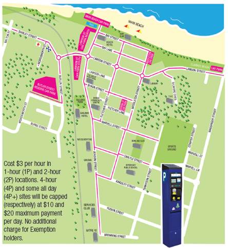
|
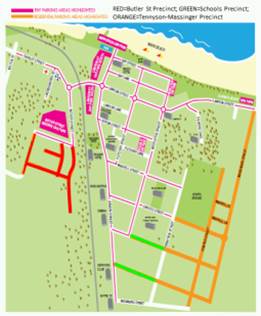
In light of changes about to be implemented due to the
introduction of pay parking throughout Byron Bay town centre, Gilmore
Crescent poses challenges, namely an unregulated parking area with most of
the road (as the below map shows) being upon crown land and not within a road
reserve; therefore meaning Council is not considered the authority over the
land.
However most of the existing road was built specifically
for access to two facilities: Sandhill’s Child Care and the Youth Activity
Centre (YAC). Accordingly the car parking as also shown was constructed
ancillary to these same two facilities. As both car park areas fall outside
of the pay parking scheme (until such time crown approval is gained) a means
of regulating the parking is required; otherwise the constructed parking area
will not meet its intended purpose. This is especially likely for the child
care which unlike the YAC operates with both consistent, staffed hours
Monday-Friday (except for Christmas/New Year) and during times when pay
parking will apply, being 9am-6pm every day.
Therefore of the two facilities the child care is seen as
more critical at this time and provides:
· 10
permissive parking spaces on the south side opposite the centre;
· 8
permissive + 2 mobility permit car spaces on the north side at front of the
Centre; and
· that
No Parking applies 1am to 5am.
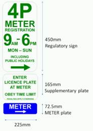
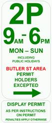
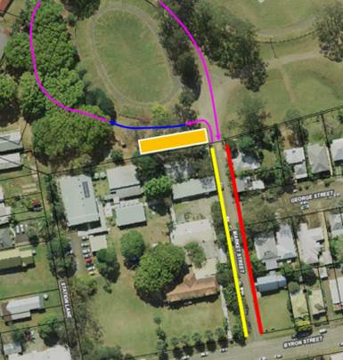
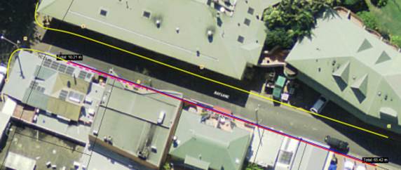
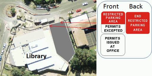
Figure 1:
proposal and location
A lunchtime site inspection on 11 November found all
spaces in use except the permit parks, indicating that strong demand already
exists. However exacerbating the situation further is that currently no time
limit applies, and that enforcement is not possible given lack of signage and
the inability to distinguish vehicles between child care staff, patrons and
other users. However as the parking area is clearly upon crown land and
situated at the child care frontage with a single point of entry/exit it is
believed regulation is possible (and appropriate) via designating the car
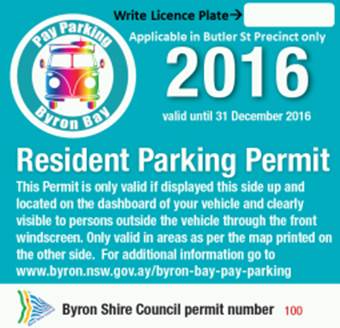
park as a Restricted Parking Area (permits excepted).
Under such a scheme permits would be controlled and issued
by Council’s child care management for the purpose of displaying on vehicle
dashboards. The design and location of the proposed signage is depicted, i.e.
at entry/exit of the car park area.
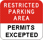
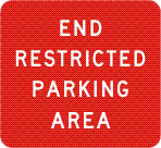
The regulatory signage is also depicted including proposed
modification of R5-541 to include “Permits Excepted” and no changes to
R5-542, noting both can be enforced under NSW Road Rule 168-1:
(1) The driver of a vehicle (other than a public
utility service vehicle) must not stop in a restricted parking area, unless
the driver is:
(a) stopping in a parking station or in accordance
with the directions marked on (or on a sign displayed adjacent to) a parking
bay, or
(b)
actually engaged in dropping off, or picking up, passengers or goods.
Maximum penalty: 20 penalty units.
(2)
A restricted parking area is an area with:
(a) a restricted parking area sign on each road
into the area, and
(b) an end restricted parking area sign on each
road out of the area.
(3)
In this rule:
vehicle does not include a bicycle or animal that is
being ridden.
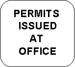
To assist further, supplementary signage is also
recommended; noting an example is also depicted which according to the above
road rule needs to be installed adjacent to the regulatory signage. It is
also noted that the use of permits is only likely to be required by long term
parking (i.e. child care staff) as the above road rule allows for short stays
who are in the act of dropping off or picking up (which will namely be
parents/carers).
Figure 2:
recommended regulatory and supplementary signage
|
|
|
|
|
R5-541 Modified
|
R5-542
|
Supplementary
sign
|
It should be noted Council/LTC
have set a precedent for use of a Restricted Parking Area via the 2012
resolution 12-496 which has been implemented with success and without need of
further review at Council’s First Sun Holiday Park in Byron Bay.
Lastly, given the child care does not operate weekends
there is potential the Restricted Parking Areas not apply at such times and
on this Committee advice is sought.
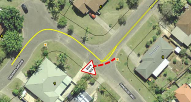
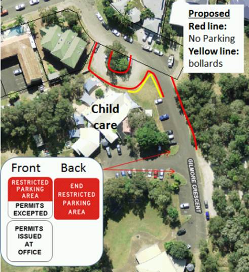
On a related matter, Committee advice and endorsement is
also sought for introducing No Parking restrictions to the road and grassed
verge on the north-east of the child care as also depicted, noting the red
line represents the extent of the proposed No Parking and the yellow line
indicates bollards (approx. 15 spaced at 2m apart).
With the commencement of pay parking it is expected this
already in-demand parking area will only increase noting that on 11 November
during a site visit the area was at ‘capacity’ with:
· 9
vehicles parked on the east side;
· 6
vehicles parked on the grass verge;
· 6
vehicles parked within the turning circle; and
· 11
vehicles parked on Gilmore Crescent proper.
In doing so, vehicles had parked adjacent to the child
care fence line and across the grass verge blocking access. To stop this
practice No Parking as proposed is required. Alternatively options to
regulate and allow permissive parking could be investigated.
|