Agenda
Ordinary
(Planning) Meeting
Thursday,
15 August 2019
held
at Council Chambers, Station Street, Mullumbimby
commencing
at 11.00am
 Public Access relating to items
on this Agenda can be made between 11.00am and 11.30am on the day of the
Meeting. Requests for public access should be made to the General Manager
or Mayor no later than 12.00 midday on the day prior to the Meeting.
Public Access relating to items
on this Agenda can be made between 11.00am and 11.30am on the day of the
Meeting. Requests for public access should be made to the General Manager
or Mayor no later than 12.00 midday on the day prior to the Meeting.
Mark
Arnold
General
Manager
What is a “Conflict of Interests” - A conflict of
interests can be of two types:
Pecuniary - an interest that a person has in a matter because of a reasonable
likelihood or expectation of appreciable financial gain or loss to the person
or another person with whom the person is associated.
Non-pecuniary – a private or personal interest that a Council
official has that does not amount to a pecuniary interest as defined in the
Local Government Act (eg. A friendship, membership of an association, society
or trade union or involvement or interest in an activity and may include an
interest of a financial nature).
Remoteness – a person does not have a pecuniary interest in a matter
if the interest is so remote or insignificant that it could not reasonably be
regarded as likely to influence any decision the person might make in relation
to a matter or if the interest is of a kind specified in Section 448 of the
Local Government Act.
Who has a Pecuniary Interest? - a person has a pecuniary interest in a
matter if the pecuniary interest is the interest of the person, or another
person with whom the person is associated (see below).
Relatives, Partners - a person is taken to have a pecuniary interest in a
matter if:
§ The person’s
spouse or de facto partner or a relative of the person has a pecuniary interest
in the matter, or
§ The person, or a
nominee, partners or employer of the person, is a member of a company or other
body that has a pecuniary interest in the matter.
N.B. “Relative”, in relation to a person means any of the
following:
(a) the
parent, grandparent, brother, sister, uncle, aunt, nephew, niece, lineal
descends or adopted child of the person or of the person’s spouse;
(b) the
spouse or de facto partners of the person or of a person referred to in
paragraph (a)
No Interest in the Matter - however, a person is not taken to have a
pecuniary interest in a matter:
§ If the person is
unaware of the relevant pecuniary interest of the spouse, de facto partner,
relative or company or other body, or
§ Just because the
person is a member of, or is employed by, the Council.
§ Just because the
person is a member of, or a delegate of the Council to, a company or other body
that has a pecuniary interest in the matter provided that the person has no
beneficial interest in any shares of the company or body.
Disclosure and participation in meetings
§ A Councillor or a
member of a Council Committee who has a pecuniary interest in any matter with
which the Council is concerned and who is present at a meeting of the Council
or Committee at which the matter is being considered must disclose the nature
of the interest to the meeting as soon as practicable.
§ The Councillor or
member must not be present at, or in sight of, the meeting of the Council or
Committee:
(a) at any
time during which the matter is being considered or discussed by the Council or
Committee, or
(b) at any
time during which the Council or Committee is voting on any question in
relation to the matter.
No Knowledge - a person does not breach this Clause if the person did
not know and could not reasonably be expected to have known that the matter
under consideration at the meeting was a matter in which he or she had a
pecuniary interest.
Participation in Meetings Despite Pecuniary Interest (S 452 Act)
A Councillor is not prevented from taking part in the consideration or
discussion of, or from voting on, any of the matters/questions detailed in
Section 452 of the Local Government Act.
Non-pecuniary Interests - Must be disclosed in meetings.
There are a broad range of options available for managing conflicts &
the option chosen will depend on an assessment of the circumstances of the
matter, the nature of the interest and the significance of the issue being
dealt with. Non-pecuniary conflicts of interests must be dealt with in at
least one of the following ways:
§ It may be appropriate
that no action be taken where the potential for conflict is minimal.
However, Councillors should consider providing an explanation of why they
consider a conflict does not exist.
§ Limit involvement if
practical (eg. Participate in discussion but not in decision making or
vice-versa). Care needs to be taken when exercising this option.
§ Remove the source of
the conflict (eg. Relinquishing or divesting the personal interest that creates
the conflict)
§ Have no involvement by
absenting yourself from and not taking part in any debate or voting on the
issue as if the provisions in S451 of the Local Government Act apply
(particularly if you have a significant non-pecuniary interest)
RECORDING OF VOTING ON PLANNING MATTERS
Clause 375A of the Local Government Act 1993
– Recording of voting on planning matters
(1) In this section, planning
decision means a decision made in the exercise of a function of a council
under the Environmental Planning and Assessment Act 1979:
(a) including a decision
relating to a development application, an environmental planning instrument, a
development control plan or a development contribution plan under that Act, but
(b) not including the making of
an order under Division 2A of Part 6 of that Act.
(2) The general manager is
required to keep a register containing, for each planning decision made at a
meeting of the council or a council committee, the names of the councillors who
supported the decision and the names of any councillors who opposed (or are
taken to have opposed) the decision.
(3) For the purpose of maintaining
the register, a division is required to be called whenever a motion for a
planning decision is put at a meeting of the council or a council committee.
(4) Each decision recorded in
the register is to be described in the register or identified in a manner that
enables the description to be obtained from another publicly available
document, and is to include the information required by the regulations.
(5) This section extends to a
meeting that is closed to the public.
Ordinary (Planning) Meeting
BUSINESS OF Ordinary (Planning) Meeting
1. Public Access
2. Apologies
3. Requests for Leave of
Absence
4. Declarations of Interest
– Pecuniary and Non-Pecuniary
5. Tabling of Pecuniary
Interest Returns (s450A Local Government Act 1993)
6. Adoption of Minutes from
Previous Meetings
7. Reservation of Items for
Debate and Order of Business
8. Staff Reports
Sustainable Environment and Economy
8.1 PLANNING
- Update on Resolution 19-209 Development Application 10.2018.483.1 Rural
Tourist Accomodation Eight (8) Cabins and Swimming Pool at 58 Montecollum Road
Wilsons Creek 4
8.2 PLANNING
- Bangalow Village - Implementation Plan.................................................. 13
8.3 PLANNING
- Submissions Report for Amendment to Byron DCP - Public Art 24.2018.48.1 17
8.4 PLANNING
- DCP 2014 Minor Amendments Submissions Report 24.2018.65.1......... 20
8.5 Report
of Planning Review Committee held on 13 June 2019....................................... 27
8.6 PLANNING
- Community Participation Plan.................................................................. 29
8.7 PLANNING
- Development Application 10.2019.20.1 Multi Dwelling Housing, Five (5)
Dwellings - Lot 14 DP 792128 Bangalow Road, Byron Bay.................................................................... 32
8.8 PLANNING
- Exceptions to Development Standards 1 April to 30 June 2019.............. 51
8.9 PLANNING
- Development Application 10.2019.129.1 Subdivison Two Lots at 480 -544
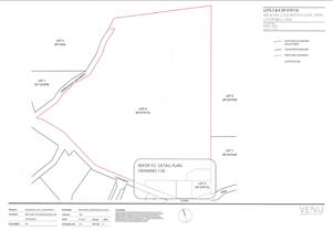
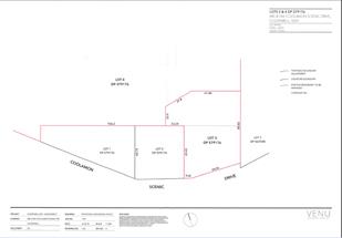
Coolamon Scenic Drive Coorabell................................................................................................... 54
8.10 PLANNING
- 10.2018.425.1 Alteration and Additions to Existing Dwelling House, Swimming
Pool and Tree Removal.................................................................................................................. 66
8.11 Update
on the Planning Status of Short Term Rental Accommodation in Byron Shire. 86
Councillors are
encouraged to ask questions regarding any item on the business paper to the
appropriate Director prior to the meeting. Any suggested amendments to the
recommendations should be provided to Councillor Support prior to the meeting
to allow the changes to be typed and presented on the overhead projector at the
meeting.
Staff Reports - Sustainable Environment and Economy 8.1
Staff Reports - Sustainable Environment and
Economy
Report No. 8.1 PLANNING
- Update on Resolution 19-209 Development Application 10.2018.483.1 Rural
Tourist Accomodation Eight (8) Cabins and Swimming Pool at 58 Montecollum Road
Wilsons Creek
Directorate: Sustainable
Environment and Economy
Report
Author: Ben
Grant, Planner
File No: I2019/974
Summary:
Council resolved at the Planning Meeting held 16 May 2019
the following:
19-209 Resolved
that determination of application 10.2018.483.1 be deferred for the following
reasons:
1. To
review the road upgrade consent condition to consider ensuring the most
regularly damaged segments are upgraded;
2. The
submission by Tweed Byron Aboriginal Land Council be given due diligence and
assessed;
3. A
redesign be submitted of common entertaining area to minimise potential for
gatherings and events and for noise attenuation; and
4. That
staff review the number of cabins on the site and clustering arrangements of
the cabins.
This report presents to Council a response to the matters
contained in the resolution.
Following the 16 May Planning Meeting, the applicant has
amended the proposal by reducing the size of the pool deck by 30% and by
reducing the number of cabins from eight to seven. These amendments will serve
to limit the total number of guests that can congregate around the pool at any
one time, thereby minimising the potential for excessive noise being generated
by a large group.
Council’s Development Engineer carried out a Road
Safety Audit of Montecollum Road and reviewed the existing road upgrade
conditions. The Audit concluded that sealing the full length of the road is not
warranted, but correcting the gravel road formation of the first 450m along
with the provision of a passing bay at 200m is recommended given the increased
maintenance that will be required as a result of the development.
The site was inspected by an officer from Tweed
Byron Local Aboriginal Land Council (TBLALC) and a Cultural Heritage Sites
Inspection report has been provided to Council. The report did not identify any
tangible cultural material or objects in the vicinity of the proposed
development, but noted that Coolamon Scenic Drive and Montecollum Road were
pathways between Koonyum Range and the coast. Ground disturbing works will need
to proceed with caution in accordance with the recommended procedures for
unexpected cultural heritage finds.
Staff have reviewed the clustering arrangement of the cabins
and concluded that the design is reasonable given the characteristics of the
site and that no amendments are required. Each cabin is 19m apart on average,
and no more than 67m apart at the most. As discussed further in the report, the
development is considered to comply with the Prescriptive Measures and
Objectives of DCP 2014, Part D3.3.4.
Based on the additional information provided, amended plans
and updated conditions, it is recommended that Development Application
10.2018.483.1 be approved subject to the attached conditions of consent.
NOTE TO COUNCILLORS:
In accordance with the
provisions of S375A of the Local Government Act 1993, a Division is to be
called whenever a motion for a planning decision is put to the meeting, for the
purpose of recording voting on planning matters. Pursuant to clause 2(a)
under the heading Matters to be Included in Minutes of Council Meetings of
Council's adopted Code of Meeting Practice (as amended) a Division will be
deemed to have been called by the mover and seconder of all motions relating to
this report.
|
RECOMMENDATION:
That, pursuant to
Section 4.16 of the Environmental Planning & Assessment Act 1979,
development application 10.2018.483.1 for Rural Tourist Accommodation Seven (7) Cabins and Swimming Pool, be
granted consent subject to the following conditions listed in Attachment 7
(#E2019/52983).
|
Attachments:
1 Attachment
1 – 10.2018.483.1 – Road Safety Audit, A2019/20128 
2 Attachment
2 – 10.2018.483.1 – TBLALC Cultural Heritage Sites Inspection
Report, E2019/52482 
3 Attachment
3 – 10.2018.483.1 – Due Diligence Code, E2019/52891
4 Attachment
4 – 10.2018.483.1 – Drawing A09 Issue B – Amended pool deck
plans, E2019/52479 
5 Attachment
5 – 10.2018.483.1 – Diagram A – Illustration of separation
distances between cabins, E2019/52477
6 Attachment
6 – 10.2018.483.1 – Diagram B – Layout plan illustrating
clustering of cabins on the site, E2019/52478
7 Attachment
7 – 10.2018.483.1 Amended conditions of consent (19/07/2019), E2019/52893
8 Attachment
8 - 10.208.483.1 - Plans, E2019/54626
9 Attachment
9 - Engineering Assessment Report (Submission) - Ingen Consulting, E2019/55504
1
REPORT
Council considered
Report No. 6.1 PLANNING – 10.2018.483.1 Rural Tourist Accommodation Eight
(8) Cabins and Pool at the Planning Meeting of 16 May 2019 and resolved as
follows:
19-209
Resolved that determination of application 10.2018.483.1 be deferred for the
following reasons:
1. To
review the road upgrade consent condition to consider ensuring the most
regularly damaged segments are upgraded;
2. The
submission by Tweed Byron Aboriginal Land Council be given due diligence and
assessed;
3. A
redesign be submitted of common entertaining area to minimise potential for
gatherings and events and for noise attenuation; and
4. That
staff review the number of cabins on the site and clustering arrangements of
the cabins.
This report presents to Council a response to the
matters raised in the resolution. These matters are discussed below:
Reason 1 – To
review the road upgrade consent condition to consider ensuring the most
regularly damaged segments are upgraded
Road upgrades
Council’s
Development Engineer carried out a Road Safety Audit of Montecollum Road on
Friday 12 July 2019. The investigation considered geometric features, road
surface type and condition, roadside hazards and driver sightlines. Please refer to Attachment 1.
Montecollum Road extends east from Cedar Road to
the subject site over a distance of approximately 800m, comprising gravel and
sealed sections. The first 450m has a 4.0m wide formed gravel pavement and is in
reasonable condition. The second section, approximately 350m in length, has a
5.0m sealed pavement in reasonable condition, but with some pot holes and
corrugations. The road extends beyond this point but is not maintained by
Council.
Overall, the condition of the Council maintained
section of Montecollum Road is reasonable and does not show significant
pavement structural defects. Surface defects such as pot holes and slight
corrugations are due to a lack of maintenance.
Montecollum Road is a Local Access Rural Road with
a capacity of 150 vehicles per day. The road currently services seven rural
properties generating an estimated 63 vehicles per day and 5.95 vehicles per
peak hour. The proposed development is estimated to generate an additional 36
vehicles per day and 4.1 peak hour trips. The total volume of traffic
post-development is expected to be 99 vehicles per day and will therefore not
exceed the capacity of the road.
In relation to road upgrades, the traffic
generated by the proposed development is likely to increase the frequency of
maintenance required along the gravel section of Montecollum Road. Sealing the
road is not warranted, but correcting the gravel road formation for the first
450m is recommended with passing bays at 200m.
Council’s Development Engineer noted:
“The volume of
development traffic will not create adverse impact main section of Montecollum
Road east of Cedar Road; however, the development will increase the frequency
of maintenance requirement to provide an acceptable level of service. The
gravel road must be upgraded to correct the road formation prior to the issue
of occupation certificate”.
The following amendment to Condition 15 is
recommended (changes in bold):
15) Consent
required for works within the road reserve
Consent
from Council must be obtained for works within the road reserve pursuant to
Section 138 of the Roads Act 1993. Three (3) copies of engineering construction
plans must accompany the application for consent for works within the road
reserve.
Such
plans are to be in accordance with Council’s current Design &
Construction Manuals and are to provide for the following works:
|
Road Upgrade
|
The following sections of Montecollum Road
must be upgraded:-
1. The
first 450m from Cedar Road;
2. From
the end of the existing sealed section (approximately 800m from Cedar Road)
and up to 10m past the proposed driveway servicing Cabin 1 to Cabin 6.
The upgrade must included the following:-
1. Generally
in accordance with Council’s standard drawing R13 for a rural crowned
road with a formation of 4m carriageway with roadside drainage and table
drains in accordance with Section D1.22 of NRLG D1 Geometric Road Design.
2. Provision
shall be made to provide passing bay at 200m spacing. The passing bay shall
be 20m long x 6m wide carriageway.
3. Provision
of sealed surface at all access points, longitudinal grades 10º or
greater, 10m before and after the dwelling house in Lot 3 DP621548.
|
|
Driveway (rural & residential areas
without kerb & gutter)
|
A driveways (2x) servicing the Cabins shall
be upgraded in accordance with Council’s current “Northern Rivers
Local Government Development Design & Construction Manuals and Standard
Drawing R14”.
|
Reason 2 – The submission by Tweed Byron
Aboriginal Land Council be given due diligence and assessed
Cultural Heritage Sites Inspection Report
A Cultural Heritage Sites Officer from the Tweed
Byron Local Aboriginal Land Council (TBLALC) visited the property on 31 May
2019. A Cultural Heritage Sites Inspection report was provided to Council on 5
June 2019 (refer to Attachment 2).
The report did not identify any tangible cultural
material or objects in the vicinity of the proposed development, but noted that
Coolamon Scenic Drive and Montecollum Road were pathways between Koonyum Range
and the coast.
The Report made the following recommendations:
· “In
regard to Aboriginal Cultural Heritage, insofar as it relates to proposed
development of the site that is the subject of this report, in TBLALC’s
opinion there is nothing at this stage to halt or delay work on this site.
· TBLALC
generally recommends that the Due Diligence Code of Practice for the Protection
of Aboriginal Objects in NSW (‘the Code’), published by the DECCW
OEH, being the basic standard of assessment, should be referred to. A copy of
the Code will be included with this report.
· Note
that this report provides a useful part of supporting documentation for
proceeding in accordance with the Code”.
An assessment of the application has been carried
out in accordance with the Due Diligence Code of Practice as noted in the
TBLALC recommendation (refer to Attachment 3). On the basis of the information
provided, it is considered that the proposed development is unlikely to have a
significant impact on Aboriginal cultural heritage and further investigation or
impact assessment is not warranted. All ground disturbing works should proceed
with caution in accordance with the recommended procedures for unexpected
cultural heritage finds.
The following conditions are recommended:
3)
Discovery of Aboriginal relics
If any Aboriginal
archaeological relics or items are exposed during construction works, the
Developer or Contractor shall immediately cease works, notify the NSW Office of
Environment and Heritage (OEH) or its successor, and obtain any necessary
permits and/or approvals to continue the work under the National Parks and
Wildlife Act 1974. The Developer or Contractor shall comply with any further
request made by the OEH to cease work for the purposes of archaeological
assessment and recording.
4)
Procedures for unexpected finds
The following procedure must be
applied in the case of unexpected finds (including even suspected Aboriginal
cultural heritage objects):
a) Stop
all work on-site immediately. Do not further disturb the object(s) or the site
in any way.
b) Place
a protective barrier around the site.
c) The
NSW Office of Environment and Heritage (OEH), or its successor, and Tweed Byron
Local Aboriginal Land Council (TBLALC) must be contacted as soon as possible
for information, advice, assessment and guidance.
d) In
the event that human skeletal material is encountered NSW Police must be
contacted immediately, a buffer zone surrounding the area should be setup and
all activities must cease within this buffer zone until such time as the
necessary approval is given to continue work within the buffer zone.
Reason 3 – A redesign be submitted of
common entertaining area to minimise potential for gatherings and events and
for noise attenuation
Reduction in deck
size
The applicant has amended the proposal by reducing
the size of the pool deck by 30%. The amended deck has dimensions of 14.5m by
5m and an area of 72.5m2. Refer to Figure 4.
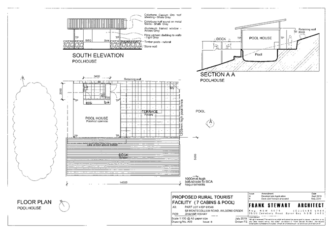 Figure 4: Amended plans illustrating the pool facilities. The
deck has been reduced in size by 30%.
Figure 4: Amended plans illustrating the pool facilities. The
deck has been reduced in size by 30%.
The smaller deck will reduce the number of guests
that can congregate around the pool at any one time, minimising the possibility
of large groups generating excessive noise. As the proposed development offers
no central facilities buildings or large entertainment areas, there is limited
potential for the development to be used as a venue or function centre.
Reason 4 – That staff review the number
of cabins on the site and clustering arrangements of the cabins
Clustering arrangements
The requirement for rural tourist accommodation to
be arranged in a ‘cluster’ pattern is established by Byron
Development Control Plan 2014, Part D3.3.4, Prescriptive Measure 2 (h) (iii),
as shown below:
D3.3.4 Rural Tourist Accommodation and Farm
Stay Accommodation
h)
The siting of rural tourist accommodation must be such
that:
iii) rural
tourist accommodation is to be arranged in a ‘cluster’ pattern and
located on average no further than 80 metres apart with adequate vegetation
screening between for privacy and amenity purposes.
The assessment report considered by Council on 16
May interpreted this control as requiring all cabins to be located in a single
‘cluster’ with an average diameter of 80m. The proposed arrangement
of cabins over a distance of 150m was therefore considered to be a variation to
the Prescriptive Measures and was assessed as such. The assessment report
concluded that the design was, nonetheless, reasonable given the
characteristics of the site and satisfied the Performance Criteria and
Objectives of Part D3.3.4.
Following a review of
Prescriptive Measure 2 (h) (iii), it is evident that this interpretation was
overly conservative. The intention of the clause is not to restrict cabins to a
single 80m cluster, but rather, to ensure that cabins are arranged in groups
with an average separation distance of 80m between each building. Further
discussion with senior staff has revealed that the clustering provisions in
Part D3.3.4 were directly drawn from the guidelines in the Byron Rural
Settlement Strategy 1998 (BRSS) and were intended to reflect these existing
provisions. The BRSS provides:
7.
The siting of holiday cabins must be such that:
d) all
holiday cabins are to be arranged in a ‘cluster’ pattern unless a
dispersed arrangement can be clearly demonstrated to be an ecologically
superior solution. In the context of rural tourist facilities, a
‘cluster’ is defined as a group of three (3) or more cabins located
an average of 80 m and no more than 160 m apart from each other with
adequate vegetation screening between cabins (i.e. to ensure privacy) and with
the layout of developments in the cluster having regard to the physical
characteristics of the land and the need to provide access to the cabins for
the provision of accident or fire emergency and other services such as sewerage
disposal system, water supply and electricity.
As demonstrated in Figures 5 and 6, the proposed
development complies with the clustering provisions established by Prescriptive
Measure 2 (h) (iii). Each cabin is 19m apart on average, and no more than 67m
apart at the most. The development footprint is contained within an area of 1.6
hectares (5% of the site) with the remaining land available for agriculture
and/or environmental restoration.
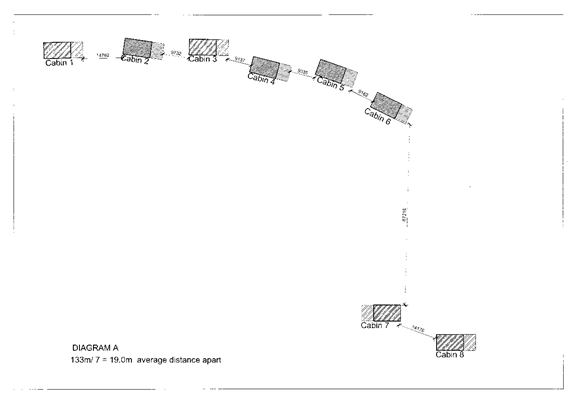
Figure 5: An
illustration of the separation distances between each cabin. The development
has a 19m average separation distance between cabins, with a maximum separation
of 67 between cabins 6 and 7.
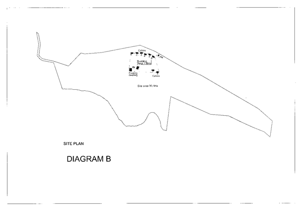
Figure 6: A
layout plan illustrating the development footprint in relation to the site.
The cabins are clustered around the main dwelling over an area of 1.6 hectares,
or 5% of the site area.
The arrangement of cabins is therefore assessed as
reasonable given the characteristics of the site and accords with the
provisions of DCP 2014. No changes are recommended.
Number of cabins
The applicant has agreed to reduce the number of
cabins from eight to seven. The removal of a cabin will likely see a reduction
in the potential impacts of the development in relation to noise, traffic and
rural amenity. Amended plans have not been provided, however, the reduction can
be given effect through the following condition of consent:
6) Amendments
The
Principal Certifying Authority shall be satisfied that the plans have been
amended as follows:
· “Cabin
1” shall be deleted from the plans.
Such
plans and specifications shall be provided for approval as part of the
construction certificate application.
Late submission
Council received a late email submission in
relation to the condition of Montecollum Road on 29 July 2019. The submission
included a report from Ingen Consulting that provides an evaluation of traffic
safety issues associated with the proposed development. The submission author
noted that the report was sent to all councillors prior to the Planning Meeting
on 16 May. It was requested that the report be taken into consideration. Please
refer to Attachment 9. The report states that Montecollum Road is in poor
condition and is generally unsafe due to the following reasons:
· Limited passing
opportunities and sight distances;
· Poor pavement
condition;
· Dense roadside
vegetation blocking sightlines;
· Power poles and
trees close to edge of pavement;
· Inappropriate
speed controls;
· Insufficient sight
distances at the intersection of Montecollum and Cedar Road;
· Unclear priority
arrangements at the intersection of Montecollum and Cedar Road.
The report concludes that the proposed development
is likely to increase road safety risks as a result of driver behaviour from
tourist who are unfamiliar to the area, and from increased traffic volumes
along the single lane stretches of road. The submission has been reviewed by
Council’s Development Engineer and there remains a general concern as to
traffic safety and the ability for vehicles to pass each other on the narrower
sections of the road. As detailed in the report, this issue has been addressed
through an additional condition that requires the first 450m of Montecollum
Road to be upgraded along with a passing bay to be provided at 200m spacing.
This requirement, in conjunction with the existing road upgrade conditions, is
considered sufficient to improve traffic safety to an appropriate level
commensurate with the impact of the development.
Conclusion
The additional information and amendments to the
application have adequately addressed the reasons for deferral in the Council
resolution. The proposed development is considered to be in accordance with the
relevant planning controls that apply to the site and is unlikely to result in
significant adverse impacts on the natural or built environment.
It is recommended that development application
10.2018.483.1 for Rural Tourist Accommodation Seven (7) Cabins be granted
consent subject to the conditions appended to this report (E2019/52893).
Staff Reports - Sustainable Environment and Economy 8.2
Report No. 8.2 PLANNING
- Bangalow Village - Implementation Plan
Directorate: Sustainable
Environment and Economy
Report
Author: Rob Van
Iersel, Major Projects Planner
File No: I2019/842
Bangalow Village Plan – Implementation Plan
Summary:
In 2016, Council resolved (16-623) to prepare a
masterplan for the village of Bangalow, through a participative planning
process involving the establishment of the Bangalow Guidance Group.
The resultant Bangalow Village Plan - Visions and Initiatives
is a strategic plan that documents the visions for Bangalow and lists a range
of initiatives that would contribute to those visions. Council resolved
to adopt the Bangalow Village Plan at the planning meeting of 21
February 2019 (19-006).
Council also resolved to prepare an Implementation
Plan, to prioritise the initiatives and actions identified during exhibition,
so that they can be considered in future budget processes.
Bangalow Village – Implementation Plan (Attachment
1 to this report) has been prepared to form Part B of the Village Plan.
It provides a delivery framework and Implementation Plan for the initiatives
and actions adopted in Part A of the Plan.
Within the Implementation Plan, the adopted initiatives have
been prioritised taking into account the community feedback received during the
exhibition of the Bangalow Village Plan, Community Strategic Plan (Decision
Making Framework), the current Delivery Program 2017-2021 and the 2019/20 Operational
Plan and budget.
The projects and initiatives are prioritised as either
highest, medium or lowest in terms of their strategic priority, to assist with
sequencing in Council’s Delivery, Operational and capital works plans
into the future.
It is recommended that Council adopt the Bangalow Village
–Implementation Plan (Attachment 1), to compliment and complete the
Village Plan previously adopted by Council.
NOTE TO COUNCILLORS:
In accordance with the
provisions of S375A of the Local Government Act 1993, a Division is to be
called whenever a motion for a planning decision is put to the meeting, for the
purpose of recording voting on planning matters. Pursuant to clause 2(a)
under the heading Matters to be Included in Minutes of Council Meetings of
Council's adopted Code of Meeting Practice (as amended) a Division will be
deemed to have been called by the mover and seconder of all motions relating to
this report.
|
RECOMMENDATION:
That Council
1. Adopt
Part B of the Bangalow Village Plan – Implementation Plan (Attachment 1
#E2019/54316) to complement the previously adopted Part A – Visions and
Initiatives.
|
Attachments:
1 Bangalow
Village Plan - Draft Part B - Implementation Plan, E2019/54316 
REPORT
In 2016, Council resolved (16-623) to prepare
a master plan for the village of Bangalow, through a participative planning
process involving the establishment of the Bangalow Guidance Group.
At the ordinary meeting of 18 October 2018, Council resolved
(18-683) to exhibit Part A of that master plan; the draft Bangalow
Village Plan – Vision and Ideas. The exhibition period
ran for a 6 week period between 5 November 2018 and 17 December 2018.
Council received valuable and constructive feedback during this period from the
community.
A final meeting of the Bangalow Village Plan Guidance group
was held in January 2019, to review community feedback, fine-tune the draft
Plan and assist in prioritising the nominated initiatives.
Council resolved to adopt Part A of the Bangalow Village
Plan; Vision and Initiatives at the planning meeting of 21 February 2019 (19-006)
and to prepare an Implementation Plan, to prioritise the initiatives and
actions identified during exhibition, so that they can be considered in future
budget processes.
Implementation of the initiatives adopted in Part A of the
Village Plan will generally be delivered through Council’s Delivery
Program and Operational Plan, although some of the initiatives can be delivered
by the community of Bangalow, through the Chamber of Commerce or other local
community group.
There are a small number of initiatives that have been
adopted into the Operational Plan for the current financial year, and these are
highlighted in the Implementation Plan (Attachment 1). The main one of
these is the preparation of a Structure Plan and updated Development Control
Plan provisions for the Station Street precinct. Planning for that
project is currently underway.
Council is also currently working on a number of projects
that closely align with the initiatives of the Bangalow Village Plan, which
include the PAMP and Bike Plan, Multi-Use Rail Corridor Study, Employment Lands
and Residential Lands strategies.
The Implementation Plan outlines each of the priority and
supporting initiatives, along with when (current, short, medium or long term),
who and likely funding source for each of the Initiatives contained in Part A.
In terms of priority:
· Current
means budget is allocated in the 2019/20 Operational Plan;
· Short-term
means a budget bid will be considered for inclusion in the Operational Plan within
the next three (3) years;
· Medium-term
means a budget bid would be considered within the following three (3) to five
(5) years; and
· Long-term
means within the next ten (10) years.
The tenure of the Guidance Group, who were involved in the
development of the Village Plan, finished with the adoption of the Plan.
A separate report to a Planning meeting will recommend that Council establishes
a Place Planning Cluster, which would include representatives from the
locations where implementation of Master Plans / Village Plans are active, to
assist with and overview the implementation of actions/ initiatives.
Representatives of the Bangalow Village Plan Guidance Group
would be invited to nominate to be included in the Cluster group.
STRATEGIC CONSIDERATIONS
Community Strategic Plan and
Operational Plan
|
CSP Objective
|
L2
|
CSP Strategy
|
L3
|
DP Action
|
L4
|
OP Activity
|
|
Community
Objective 4: We manage growth and change responsibly
|
4.1
|
Support the
visions and aspirations of local communities through place-based planning and
management
|
4..1
|
Develop,
implement and update Place Plans that promote place-based forward planning
strategies and actions
|
|
2018/19
Finalise Bangalow Village
Plan
|
|
|
|
|
4.1.1.4
|
2019/20
Implement high
priority actions from the Bangalow Village Plan
|
|
|
|
|
|
|
|
|
|
|
|
|
Financial Considerations
Budget has been allocated for the initiatives included in
this year’s Operational Plan. The remaining initiatives will be
subject to future budget bids.
Staff Reports - Sustainable Environment and Economy 8.3
Report No. 8.3 PLANNING
- Submissions Report for Amendment to Byron DCP - Public Art 24.2018.48.1
Directorate: Sustainable
Environment and Economy
Report
Author: Sam
Tarrant, Planning Support Officer
File No: I2019/843
Summary:
This report outlines the public exhibition outcomes of Byron DCP 2014 Chapter D8 - Public Art,
Byron DCP 2010 Chapter 1 Part E, and consequential amendments to additional DCP
chapters. During the public exhibition period one submission was received.
An amendment to the clause concerning notification to the
Bundjalung of Byron Bay (Arakwal) is proposed as a result of this submission.
This will ensure any artwork depicting indigenous heritage or culture that is
subject to the public art chapters will be referred to
Arakwal for comment.
A minor amendment has also been
made to update a reference to out of date legislation.
No other changes to the exhibited
chapters are proposed.
NOTE TO COUNCILLORS:
In accordance with the
provisions of S375A of the Local Government Act 1993, a Division is to be
called whenever a motion for a planning decision is put to the meeting, for the
purpose of recording voting on planning matters. Pursuant to clause 2(a)
under the heading Matters to be Included in Minutes of Council Meetings of Council's
adopted Code of Meeting Practice (as amended) a Division will be deemed to have
been called by the mover and seconder of all motions relating to this report.
|
RECOMMENDATION:
That Council:
1. Adopt
the draft Byron DCP 2010 and draft
Byron DCP 2014 Chapters appended to this report
as Attachments 1 – 5 (#E2018/59059, #E2019/6129, #E2019/50709,
#E2019/52406, #E2019/52418).
2. Notify
the public as required by the Environmental Planning and Assessment Regulation
2000.
|
Attachments:
1 24.2018.48.1
Draft Byron Shire DCP 2014 Chapter D8 Public Art - public exhibition
version, E2018/59059 
2 24.2018.48.1
Draft DCP 2010 Chapter 1 Part E - Public Art, E2019/6129
3 24.2018.48.1
Draft Byron Shire DCP 2014 Part A Preliminary Public art amendments, E2019/50709
4 24.2018.48.1
Draft DCP 2010 chapter 17 - Advertising and Notification of Development
Applications public art amendment, E2019/52406
5 24.2018.48.1
Draft DCP 2010 Chapter 1 Part A General - public art amendment, E2019/52418
6 24.2018.48.1
Submissions, E2019/51704
7 Form of
Special Disclosure of Pecuniary Interest, E2012/2815
REPORT
One of the recommendations from
the Public Art Strategy is to build strength into the DCP with regards to
public art. The review of the public art DCP chapter was a direct result of
this recommendation.
A draft public art DCP chapter was
presented to Council at the ordinary meeting of 13 December 2018 at which
Council resolved (18-840) to publicly exhibit the draft Byron DCP 2014,
Chapter D8 – Public Art along with the amended definitions of
‘public art’ and ‘mural’. For consistency, consequential amendments to
Byron DCP 2010 Chapter 1, Part E –
Public Art were
also exhibited.
Public exhibition
The draft 2010 and 2014 DCP Public Art chapters were placed on public
exhibition from 1 May to 16 June 2019. The proposed amendment was available on
Council’s website and notice was given in the local newspaper on two
occasions. During this time one submission was received.
The submission received stated the
need to include a section on indigenous artwork, specifically that any proposed
indigenous public art subject to the
DCP is to be referred
to the Bundjalung
of Byron Bay (Arakwal). The submission notes that the Arakwal Indigenous community has the right to
manage how their culture is portrayed on Country. Staff agree that
Arakwal and relevant Land Councils should be notified about any proposed
Indigenous artwork subject to the DCP Public Art chapters. This change has been placed into the Part A –
Preliminary chapter of the 2014 Byron DCP under A14.4 Notification to the
Bundjalung of Byron Bay (Arakwal). The same amendment is made in
Chapter 17 of the 2010 DCP. The proposed change
is as follows:
|
Current clause
|
|
Written notification shall be provided to the Bundjalung
of Byron Bay (Arakwal) for development on
a public reserve or community land; or applications listed
within the category of Level 2 and Level
3, where such developments are located within a property that
is mapped by Byron Shire Council,
in association with Bundjalung of Byron Bay (Arakwal), as
having Aboriginal significance.
|
|
Proposed clause
|
|
Written notification shall be provided to the Bundjalung
of Byron Bay (Arakwal) and relevant Land Councils
for any of the following:
a) development
on a public reserve or community land,
b) applications
listed within the category of Level 2 and Level 3, where such developments
are located within a property that is mapped by Byron Shire Council, in
association with Bundjalung of Byron Bay (Arakwal), as having Aboriginal
significance,
c) Artwork subject to Chapter D8 that:
(i) is produced in an Indigenous style; or
(ii) is identified as an Aboriginal artwork; or
(iii) is in any way related to Indigenous heritage or culture
|
A minor amendment has also been
made to update a reference to out of date legislation.
Amended Chapters
The following Chapters are
attached to this report
· Attachment 1 and 2 – the 2010 and 2014 DCP Public art
chapters as exhibited
· Attachment 3 – the exhibited public art and mural
definition and the change to Arakwal notification in the 2014 DCP
· Attachment 4 – change to Arakwal notification in the
2010 DCP
· Attachment 5 – the exhibited public art and mural
definition in the 2010 DCP
Changes to the 2010 DCP are for
consistency purposes, and are the same as the 2014 DCP but apply to different
chapters.
Options
There are three options available for
Council’s consideration:
1) Adopt the DCP chapters
with the recommend changes as a result of the public exhibition period and
staff comments. Recommended.
2) Adopt
the DCP chapters as exhibited with no change.
3) Not
proceed with the adoption of the DCP chapters
Next steps
If Council
resolves to adopt the draft DCP, notice of the decision must be given in
the local newspaper. The amended DCP chapters will come into effect on the date
it is advertised in the local newspaper.
If Council resolves not to proceed with the amendment, no
further action is required.
STRATEGIC CONSIDERATIONS
Community Strategic Plan and
Operational Plan
|
CSP Objective
|
L2
|
CSP Strategy
|
L3
|
DP Action
|
L4
|
OP Activity
|
|
Community
Objective 2: We cultivate and celebrate our diverse cultures, lifestyle and
sense of community
|
2.1
|
Support and
encourage our vibrant culture and creativity
|
2.1.3
|
Enhance
opportunities for interaction with art in public spaces
|
2.1.3.1
|
Implement
Public Art Strategy
|
Legal/Statutory/Policy Considerations
The
amendment of development control plans is governed by Environmental Planning
and Assessment Regulation 2000 (Part 3 – Development Control Plans).
Financial Considerations
As this is a Council initiated DCP amendment, the processing
costs will be borne by Council. If Council chooses not to proceed then
the matter does not incur any additional costs.
Consultation and Engagement
The consultation process is explained above in the report.
Staff Reports - Sustainable Environment and Economy 8.4
Report No. 8.4 PLANNING
- DCP 2014 Minor Amendments Submissions Report 24.2018.65.1
Directorate: Sustainable
Environment and Economy
Report
Author: Sam
Tarrant, Planning Support Officer
File No: I2019/909
Summary:
This report presents the public exhibition outcomes for a
proposed ‘housekeeping’ amendment to Byron DCP 2014 (various
chapters) in accordance with Council Resolution 19-091. The
amendments are of a minor nature and seek to resolve a number of anomalies and
inconsistencies when assessing development applications.
The proposed amendment was placed on exhibition from 1 May
to 16 June 2019. During this time two submissions were received from the
public. Staff also reviewed the amendment and proposed a number of small
changes. The submission and proposed changes are discussed in the body of
this report.
The Chapters for adoption and the submissions are attached
to this report
NOTE TO COUNCILLORS:
In accordance with the provisions
of S375A of the Local Government Act 1993, a Division is to be called whenever
a motion for a planning decision is put to the meeting, for the purpose of
recording voting on planning matters. Pursuant to clause 2(a) under the
heading Matters to be Included in Minutes of Council Meetings of Council's
adopted Code of Meeting Practice (as amended) a Division will be deemed to have
been called by the mover and seconder of all motions relating to this report.
|
RECOMMENDATION:
That Council:
1. Adopt
the DCP 2014 Chapters, with the changes as a result of the public exhibition
period which are detailed in the body of this report and included in
Attachments 1 to 10 (#E2019/29634, #E2019/31383, #E2019/29557, #E2019/29556,
#E2019/29415, #E2019/29404, #E2019/29393, #E2019/29392, #E2019/29357,
#E201928932).
2 Notify
the public as required by the Environmental Planning and Assessment
Regulation 2000.
|
Attachments:
1 Draft
Byron Shire DCP 2014 Chapter D6 Subdivision, E2019/29634
2 Draft
Byron Shire DCP 2014 Chapter B4 Traffic Planning, Vehicle Parking, Circulation
and Access, E2019/31383
3 Draft
Byron Shire DCP 2014 Chapter D2 Residential Accomodation and Ancillary
Development in Rural Zones, E2019/29557
4 Draft
Byron Shire DCP 2014 Chapter D3 Tourist Accommodation, E2019/29556
5 Draft
Byron Shire DCP 2014 Chapter B9 Landscaping, E2019/29415
6 Draft
Byron Shire DCP 2014 Chapter D1 Residential Accomodation in Urban, Village and
Special Purpose Zones, E2019/29404
7 Draft Byron
Shire DCP 2014 Chapter E8 West Byron Urban Release Area, E2019/29393
8 Draft
Byron Shire DCP 2014 Chapter B14 Excavation and Fill, E2019/29392
9 Draft
Byron Shire DCP 2014 Chapter E5 Certain Locations in Byron Bay and Ewingsdale, E2019/29357
10 Draft Byron Shire DCP
2014 Chapter B3 Services, E2019/28932
11 Submissions, E2019/51633
12 Form of Special
Disclosure of Pecuniary Interest, E2012/2815
REPORT
At the 26 March 2019 planning
meeting Council resolved 19-091 to prepare and exhibit the minor
housekeeping amendment of the Byron DCP 2014 and report any submissions
at the end of the exhibition period. A total of 20 amendments were proposed
across a number of chapters and were exhibited from 1 May to 16 June 2019. The
draft housekeeping amendment was accessible on Council’s website and
notification was posted in the Echo on two occasions. During the six week
exhibition period two submissions were received. Both submissions are attached.
One of the submissions related to
item 13 (affecting Chapters D2 and D3) which was exhibited as below:
“Reason for Proposed
Amendment
To create clearer guidelines
for environmental reparations for Rural Tourist facilities, Eco Tourist
Facilities and other rural development, including Multiple Occupancy and
Community Titled Development. Currently, the primary document for this is the
Rural Settlement Strategy 1998. As this document is now 20 years old,
Council staff have suggested that some more specific guidelines be built into
the DCP to ensure consistency.
Description of Proposed
Amendment
Require a vegetation management
plan and the planting of 900 trees per cabin (or equivalent determined action)
to be included in any development application for rural tourist
facilities. In addition, clarify the requirements for environmental
reparations for multiple occupancies and community titled properties.
Please refer to the attachment for specific details relating to Vegetation
Management Plan requirements.”
The submission argued that other
aspects of the Byron Rural Settlement Strategy 1998 should be placed
into the DCP and the 900 trees per cabin and vegetation management plan should
apply to more rural tourist uses. The addition of many of the requirements from
the Byron Rural Settlement Strategy would likely require a further
amendment and may be more appropriate in other DCP chapters. Staff agree that a
more detailed review of the Residential Accommodation
and Ancillary Development in
Rural Zones and Tourism Accommodation DCP
chapters will be required. Other issues brought up in this submissions are
addressed in the below table.
At Council’s planning
meeting on 20 June 2019 Council resolved (19-284) to review and amend Byron
Local Environmental Plan 2014 and Byron Development Control Plan 2014 in
relation to rural tourism/holiday cabins.
Based on the above resolution it
is proposed that item 13 be removed from the DCP minor amendments and the
entire chapter be reviewed as part of the rural tourism and holiday cabin DCP
review. This will allow for a more holistic approach to rural tourism and
environmental offsets.
The two submissions had comments
on a number of items and are addressed in the table below.
|
Submission issue number
|
Issue raised
|
Staff comment
|
|
1.
|
The housekeeping amendments
contains changes that have implications that are not of a minor nature and
should not be titled as such
|
Noted. Staff periodically review
Development Control Plans to assist with the assessment of Development
Applications and to address minor inconsistencies, as a group amendment.
These changes are grouped
together in one amendment for efficiency. All aspects of the amendments
are advertised. Staff will consider not using the term ‘minor’
for future group amendments.
No changes from exhibited drafts
are recommended.
|
|
2.
|
B4.2.3 2) Current requirements
for dwelling houses and dual occupancy do not require vehicles to enter and
exit the site in a forward direction and current wording is sufficient.
Providing turning bays in residential lots significantly reduces the site
area available for open space or building footprint.
|
The exhibited proposed amendment
is only a minor rewording to change “exemption” to “may
seek a variation”. This change is providing clarity to ensure traffic
safety is considered when designing driveways and is considered reasonable.
No change from exhibited draft
is recommended.
|
|
3.
|
B4.2.3 6) A driveway width of 4
meters is excessive for dual occupancy development. Current standards allow 3
meter driveway widths so the increase to 4 meters is not justified.
|
The 4 meter driveway handle is
to allow room for services such as bins, letterboxes and landscaping. The 4
meter width ensures there is enough space for these services and a 3 meter
wide driveway.
No change from exhibited draft
is recommended.
|
|
4.
|
D1.2.2 The proposed increase to
1.5 meter setbacks is unnecessary when Council has a building height plane to
protect neighbours views/privacy /overshadowing
|
The proposed increase is
considered reasonable as it protects the adjoining neighbours amenity and
privacy. It will help prevent secondary dwellings/dual occupancies from
impacting on neighbours on other properties.
Recommendation: make additional changes
to clause D1.2.2 to clarify
that 1.5 meter setbacks and the building height plane apply to single storey
buildings.
|
|
5.
|
D1.2.8 I support this amendment
in relation to providing alternative parking
|
Noted.
|
|
6.
|
D1.2.9 There is no need for the
energy efficiency additions in the DCP as the BASIX requirements provide a
state wide approach. The additional costs for retrofitting existing buildings
based on these new controls is completely unreasonable for small scale
projects. Promoting other means for reducing greenhouse gas emissions such as
providing cycleways etc. would be more appropriate.
|
These requirements are only for
dwellings that are exempt from BASIX requirements. It is considered
reasonable to ensure that all new buildings are striving for high energy
efficiency standards.
Council actively promotes other
methods for reducing emissions including providing active transport options.
No change from exhibited draft
is recommended.
|
|
7.
|
D1.4.3 I support this amendment
in relation to secondary dwellings being prohibited on strata lots as it
aligns with the SEPP
|
Noted.
|
|
8.
|
D2 and D3 – Item 13 The
requirement for 900 trees per holiday cabin has not been well thought through
and it is unreasonable to require the planting of so many trees especially on
small property’s or when no trees have been removed in building the
cabins. It would also have potential bush fire safety impacts. The VMP
requirement to be submitted with development applications goes unfairly
beyond the detail of information required for submitting a development
application as prescribed within the Act. This control needs to be properly
considered and refined before being put into the planning controls
|
Agreed, both submissions have
noted that this amendment requires further thought.
Recommendation: to remove Item 13 (from
Chapters D2 and D3) and address this in the review of Chapter D3 Tourist
accommodation, as per resolution (19-284).
|
|
9.
|
D2.7.2 I support this amendment
in providing clarity but the prescriptive controls for fencing design is not
a relevant DCP control
|
This amendment has been placed
into the performance criteria and not the prescriptive controls. The
inclusion of fencing in the performance controls is to provide guidance
for fencing types and not considered unreasonable
No change from exhibited draft
is recommended.
|
|
10.
|
D3.3.2 I support the increase in
bedroom numbers and guest numbers within a bed and breakfast establishment
|
Noted, this is to keep
consistency with the LEP.
|
|
11.
|
D6.4.1 I support the removal of
table D6.1 as some of the requirements don’t make any sense. The
requirement for 6 meter frontage for hatchet shaped lots is excessive and a
poor use of land creating an inefficient subdivision layout. Also the lot
size requirement for hatchet shaped lots is too restrictive as they do not
require large boundary setbacks as the building envelope is well away from
the street frontage. It would be more appropriate to allow lot size for hatchet
lots (excluding the handle) to be a percentage of the prescribed minimum lot
size as there are a number of these lots that have a lot size that is well
beyond that needed for a dwelling construction. These comments are made in
recognition of efficient use of land.
|
Recommendation: change clause D6.4.1 to
reflect that the 6 meter frontage requirement is only for each Torrens title
lot to facilitate services such as bins, landscaping and fencing.
Recommendation: an additional sentence
has been added to strengthen clause D6.4.1 by clarifying that relying on
rights of carriageway with no road frontage is not supported.
Clause D6.4.1 does not amend the
minimum lot size requirement as this is set out in Byron LEP 2014. This
provision applies to Torrens lots only, there may still be opportunity to
vary frontage in strata title subdivision.
|
|
12.
|
The guidelines for the VMP and
BCMP are not on Council’s website despite the clause saying they are
|
The guidelines are available on
Council’s website at https://www.byron.nsw.gov.au/Services/Building-development/Plans-maps-and-guidelines/Other-Guidelines
|
|
13.
|
There is ambiguity in rural
tourist accommodation and farm stay in their definitions and what measures
apply to each in the DCP.
|
This will be considered in the
review of Chapter D3 Tourist accommodation as per resolution (19-284).
No change from exhibited draft
is recommended.
|
Staff also reviewed the proposed
amendments and noted two minor changes that should be made prior to the
adoption of some of the DCP Chapters. The proposed changes and reasoning are
presented in the table below
|
Item #
|
Provision (s)
|
Reason for and Description of
Proposed Amendment
|
|
6
|
B4.2.3 7)
|
Reason for Proposed Amendment
To clarify the intent of fencing
the access of hatchet shaped lots to ensure that adjoining existing dwellings
are not unfairly impacted, without requiring fencing of the driveway to occur
at the subdivision stage when there is no impact to any neighbours.
Recommendation: Amend
B4.2.3 7) by inserting “with different ownership”
|
|
16
|
D2.6 9b)
|
Reason for Proposed Amendment
To clarify that dual occupancies
and secondary dwellings are not permitted in community title or multiple
occupancy development. We only included this amendment in community title but
did not include it in multiple occupancy when the change should apply to
both.
Recommendation: Amend
D2.6 9b) to read “Dual occupancies and secondary dwellings are not
permitted unless otherwise specified in the multiple occupancy approval or in
Schedule 1 of Byron LEP 2014”
|
The amended Chapters are attached
for adoption. Changes as a result of the submissions and staff comments are
identified in red in Chapter B4, D1, D2 and D6.
Options
1. Proceed with the
adoption of the proposed DCP Chapters as a result of the public exhibition
period and staff comments (attached)
2. Proceed with the
adoption of the proposed DCP Chapters with any changes Council sees fit.
Next steps
If Council adopts the amended DCP
Chapters they will be published on Council’s website and come into force
on the day that notice is given in the local newspaper.
STRATEGIC CONSIDERATIONS
Community Strategic Plan and
Operational Plan
|
CSP Objective
|
L2
|
CSP Strategy
|
L3
|
DP Action
|
L4
|
OP Activity
|
|
Community
Objective 4: We manage growth and change responsibly
|
4.5
|
Work to improve
community resilience in our changing environment
|
4.5.1
|
Develop and
implement strategies for our community's needs
|
4.5.1.1
|
Scope and
prepare a comprehensive Development Control Plan (DCP) review
|
Legal/Statutory/Policy
Considerations
The amendment of development control plans is governed by Environmental
Planning and Assessment Regulation 2000 (Part 3 – Development Control
Plans).
Financial Considerations
As this is a Council initiated DCP amendment, the processing
costs will be borne by Council. If Council chooses not to proceed then
the matter does not incur any additional costs.
Consultation and Engagement
As discussed in the report.
Staff Reports - Sustainable Environment and Economy 8.5
Report No. 8.5 Report
of Planning Review Committee held on 13 June 2019
Directorate: Sustainable
Environment and Economy
Report
Author: Noreen
Scott, EA Sustainable Environment and Economy
File No: I2019/941
Summary:
This report provides the outcome of the Planning Review
Committee meeting held on 13 June, 2019.
NOTE TO COUNCILLORS:
In accordance with the
provisions of S375A of the Local Government Act 1993, a Division is to be
called whenever a motion for a planning decision is put to the meeting, for the
purpose of recording voting on planning matters. Pursuant to clause 2(a)
under the heading Matters to be Included in Minutes of Council Meetings of Council's
adopted Code of Meeting Practice (as amended) a Division will be deemed to have
been called by the mover and seconder of all motions relating to this report.
|
RECOMMENDATION:
That Council note the report of the Planning
Review Committee meeting held on 13 June 2019.
|
REPORT
The meeting commenced at 4:30pm and concluded at 4:45pm.
Present: Crs Hunter Hackett, Martin, Cameron,
Staff: Chris Larkin (Manager Sustainable Development)
Apologies: Crs Richardson, Lyon,
The following development
application was reviewed with the outcome shown in the final column.
|
DA No.
|
Applicant
|
Property Address
|
Proposal
|
Exhibition
Submission/s
|
Reason/s
Outcome
|
|
10.2019.158.1
|
Mr M OReilly
|
219 The Saddle Road
Brunswick Heads
|
Agricultural produce industry including use of existing
wind turbine and ancillary rural infrastructure and roadside stall
|
Level 2
18/4/19 to 8/5/19
4 submissions
|
The perceived public significance of the application
Council
|
Staff Reports - Sustainable Environment and Economy 8.6
Report No. 8.6 PLANNING
- Community Participation Plan
Directorate: Sustainable
Environment and Economy
Report
Author: Sam
Tarrant, Planning Support Officer
File No: I2019/1055
Summary:
This report summarises the draft Community Participation
Plan (CPP) and proposes that the draft be placed on public exhibition for
wider community input.
The CPP is a central document that sets out how and when the
community can have their say on planning matters. The primary purpose of the
plan is to outline the legislative exhibition timeframes for planning matters.
The plan is also intended to be a helpful document for the community to
participate in planning matters. The CPP works in tandem with the Byron Model
and the Community Engagement Policy.
The minimum requirements for the CPP are governed by the
Environmental Planning and Assessment Act 1997.
The CPP must be completed and uploaded to the NSW Planning
Portal by 1 December 2019.
Parts of the DCP relating to community consultation will be
placed into the CPP, particularly the exhibition and notification requirement
tables. Part A Preliminary of the 2014 DCP will be reviewed after exhibition to
remove any material that is now in the CPP and provide reference to the CPP
where appropriate.
NOTE TO COUNCILLORS:
In accordance with the
provisions of S375A of the Local Government Act 1993, a Division is to be
called whenever a motion for a planning decision is put to the meeting, for the
purpose of recording voting on planning matters. Pursuant to clause 2(a)
under the heading Matters to be Included in Minutes of Council Meetings of
Council's adopted Code of Meeting Practice (as amended) a Division will be
deemed to have been called by the mover and seconder of all motions relating to
this report.
|
RECOMMENDATION:
1. That
Council endorse the draft Community Participation Plan (Attachment 1
E2019/53186) for public exhibition.
2. That
Council delegate to the General Manager the making of minor edits including
phrase clarification and or grammar corrections prior to exhibition.
3. That
the draft plan is placed on exhibition for a minimum of 28 days and a
report be presented to Council after the exhibition period.
|
Attachments:
1 Draft
Byron Community Participation Plan V3, E2019/53186
REPORT
The purpose of this report is to
present to Council the draft Community Participation Plan (CPP) before
taking the plan to the community for wider consultation.
The CPP is a high level document
which describes how and when the community can have their say on Council’s
planning functions. It does not need to outline specific engagement strategies.
The intent of the Plan is to make
it easier for the community to understand how they can participate in planning
matters.
The CPP is a new requirement under
the Environmental Planning and Assessment Act 1979 (EP&A Act) and
must set out the minimum public exhibition timeframes as stipulated in Schedule
1 of the EP&A Act. While the Plan must meet the minimum requirements
for community participation as set out in the EP&A Act, Council can go
beyond the minimum requirements if they decide it is appropriate.
Plans are required to be completed
and uploaded to the NSW Planning Portal by 1 December 2019.
The Draft Community
Participation Plan
The draft CPP has been produced in
consultation with Locale Consultants and has been designed with the aim of the
plan being easy to understand and clear for the community.
The draft is in three main
sections:
· Strategic Planning
· Development Assessment, and
· Other Planning Matters which includes Reviews of
Environmental Factors (REF), Plans of Management (POM), Voluntary Planning
Agreements (VPA) and Contribution Plans
The draft also includes a guide on
writing submissions, a planning jargon buster, overview of the planning system,
and frequently asked questions. These additions are hoped to be useful for the
community and help them to meaningfully participate in planning matters.
The exhibition and notification
table from the 2014 Development Control Plan (DCP) have been placed into
the CPP. This information will be removed from the DCP, with reference made to
its availability in the CPP once adopted.
A minor change to the notification
table has also been included for housekeeping purposes. Specifically the change
to fences to clarify that they require notification if they are over 1.8 metres
in height, and to clarify that development over $3 million and less than $20
million will be exhibited.
Staff across different departments
have collaborated to form the relevant sections of this document. Staff have
reviewed the draft CPP and made changes to ensure the document is accurate and
will act as a useful tool for both the community and staff to follow.
The Mayor’s message however
is not currently in the attached draft, and will be placed into the draft CPP
prior to exhibition.
Next steps
The draft CPP must be publicly
exhibited for a minimum of 28 days. To ensure Council can meet the 1 December
deadline, it is essential that the draft CPP be placed on exhibition as soon as
possible to allow enough time for community input and any submission to be
considered.
STRATEGIC CONSIDERATIONS
Community Strategic Plan and
Operational Plan
|
CSP Objective
|
L2
|
CSP Strategy
|
L3
|
DP Action
|
L4
|
OP Activity
|
|
Community
Objective 5: We have community led decision making which is open and
inclusive
|
5.1
|
Engage and
involve community in decision making
|
5.1.1
|
Facilitate
inclusive community consultation and stakeholder engagement to inform Council
decision making (SP)
|
5.1.1.6
|
Prepare a
Community Participation Plan
|
Legal/Statutory/Policy Considerations
The Community Participation Plan is a requirement
under the Environmental Planning and Assessment Act 1979.
Financial Considerations
Funding has been allocated for the development of the CPP in
the 2019/20 budget.
Consultation and Engagement
A workshop was held with a small number of community members
and planning professionals to help guide the style and layout of the CPP. Wider
community consultation will now occur and be reported back to Council for final
endorsement.
Staff Reports - Sustainable Environment and Economy 8.8
Report No. 8.7 PLANNING
- Development Application 10.2019.20.1 Multi Dwelling Housing, Five (5)
Dwellings - Lot 14 DP 792128 Bangalow Road, Byron Bay
Directorate: Sustainable
Environment and Economy
Report
Author: Rob Van
Iersel, Major Projects Planner
File No: I2019/1076
Proposal:
|
DA No:
|
10.2019.20.1
|
|
Proposal description:
|
Multi dwelling housing comprising five (5) two-bedroom
dwellings, with plunge pools, associated landscaping and civil works,
including relocation of existing sewer main.
|
|
Property description:
|
LOT: 14 DP: 792128
|
|
Bangalow Road BYRON BAY
|
|
Parcel No/s:
|
60550
|
|
Applicant:
|
Ardill Payne & Partners
|
|
Owner:
|
Mr I A Andreou
|
|
Zoning:
|
R2 Low Density Residential / PART DM Deferred Matter (2(a)
Residential & 7(a) Wetlands under BLEP 1988)
|
|
Date received:
|
8 January 2019
|
|
Integrated / Designated Development:
|
☐
Integrated
|
☐
Designated
|
☒
Not applicable
|
|
Concurrence required
|
No
|
|
Public notification or exhibition:
|
Level 2 advertising under DCP 2014 Part A14 –
Public Notification and Exhibition of Development Applications
- Exhibition
period: Original Proposal: 7/2/19 to 6/3/19
Amended
Proposal: 20/6/19 to 3/7/19
- Submissions
received: Original - 21 objections
Amended
- 9 objections
|
|
Concurrent approvals (S68/138):
|
Not applicable
|
|
Variation request
|
☐
Clause 4.6
|
☐
SEPP 1
|
☒
Not applicable
|
|
Issues:
|
· Relocation of
sewer and associated easements;
· Potential
impacts on coastal wetland values
· Stormwater &
flooding
· Privacy for
neighbouring properties
· No covered car
parking spaces
|
Summary:
The property is located immediately to the west of the
existing residential lots that front Bangalow Road in Byron Bay. While
the property has a total area of approx. 3.5ha, only a relatively narrow part
of the land is cleared, located along the property’s eastern edge. The
cleared area, which is zoned R2 Low Density Residential, has an area of approx.
2,000m2. The remainder of the site is heavily vegetated coastal
wetland, backing onto the rail corridor on the western boundary, and is zoned
7(a) Wetlands under BLEP 1988.
The application originally proposed seven (7) stand-alone,
single-storey, two bedroom dwellings within the cleared part of the property,
accessed from an existing driveway from Bangalow Road.
The application proposed the relocation of an existing local
sewer main to be clear of the proposed dwellings, with updated connections to
the rear of the adjoining residential properties. As originally designed,
the development did not provide for sufficient easement widths over the
residential connections.
The bush fire hazard assessment undertaken for the
development specifies a requirement for a 17m wide APZ from the eastern
elevation of the dwellings, to be maintained clear of ground fuel. In the
northern part of the property, the 17m APZ encroached within the mapped Coastal
Wetland boundary. Pursuant to the Coastal Management SEPP, this meant that
the application would be ‘designated development’. The
Biodiversity Conservation Act would also require a full BDAR assessment as the
Coastal Wetland area is also included in the Biodiversity Value Map.
In response to these issues, the applicant amended the development
proposal, to remove two (2) dwellings and redesign the floor plan of one of the
remaining dwellings, such that there is now no encroachment of the APZ (or any
other aspect of the development) into the mapped Coastal Wetland. The amended
proposal now includes five (5) detached small dwellings, with floor areas of
42m2 – 46m2. Each dwelling contains a central
open plan living/ kitchen/ dining area, opening to the west to an external
courtyard. Laundry facilities can be incorporated into the kitchen
layout. Bedrooms are located either side of the central living area, each
with an ensuite. Each dwelling includes an outdoor private courtyard containing
a small plunge pool.
Two (2) external car parking spaces (uncovered) are provided
for each dwelling, with visitor spaces (including a PWD space) provided
adjacent to the site entrance. Council’s water and sewer engineer has
reviewed the amended proposal and is now satisfied that appropriate easements
will be available over the relocated sewer main and the reinstated residential
connections to neighbouring properties.
The application includes the clearing of five (5) trees
within the cleared part of the land (i.e. outside of the coastal wetland) and
the pruning of an existing tree that straddles the property boundary.
Council’s Consulting Ecologist has reviewed the application and is
satisfied that the proposed development will not result in detrimental impacts
on the coastal wetland, subject to a detailed Vegetation Management Plan that
will require weed control and native planting, specifically to bolster the
wetland edge.
Objections from the owners of adjoining residential land are
based on a number of concerns, primarily relating to privacy impacts,
stormwater/ flooding risks, and potential for dwellings to be ‘holiday
let’. In terms of privacy, the boundary between the development site and
most of the adjoining properties is not currently fenced, and these owners have
for a number of years looked out across the grassed part of the site toward the
vegetated wetland. This has provided an additional level of amenity for those
owners. However, the land is privately owned and has been zoned for residential
development since at least 1993.
The dwellings are proposed to be set 1.5m from the adjoining
property boundaries. They are all single storey and the elevations facing the
boundary (eastern elevations) have been designed with smaller narrow window
openings that each include external window boxes, specifically to minimise the
ability for residents to look into the rear yards of the adjoining properties.
Overall, while the development will undoubtedly alter the existing amenity of
the adjoining residents, it is considered that residential development of the
land is a reasonable expectation of the site’s zoning and that the design
of the 5 dwellings has adequately minimised the potential for overlooking into
neighbours yards.
In relation to stormwater and flooding, the flat grades of
the subject property result in pooling of stormwater following rain events.
Significant rain events result in stormwater flows from the catchment to the
east of the property flowing through the adjoining properties onto the land. In
terms of flooding, the dwellings will comply with the flood planning level
applicable to the site, which results in the dwelling being elevated on piers,
approx. 500mm above existing ground level.
Council’s Development Engineer has reviewed the
stormwater management plan and is satisfied that minor regrading works will be
achievable in order to address the issue of ponding in a manner that does not
exacerbate existing stormwater issues on adjoining land. These regrading
works will also be able to convey flood flows from the adjoining eastern
catchments in a manner that does not result in any additional flood impacts on
neighbours.
In response to ‘holiday let’ concerns, the
applicant has stated that this is not the intention of the development and
agrees to the imposition of a condition prohibiting holiday letting or other
tourism uses of the dwellings.
The application is consistent with all relevant statutory
requirements and is recommended for approval subject to conditions of consent.
NOTE TO COUNCILLORS:
In accordance with the
provisions of S375A of the Local Government Act 1993, a Division is to be
called whenever a motion for a planning decision is put to the meeting, for the
purpose of recording voting on planning matters. Pursuant to clause 2(a)
under the heading Matters to be Included in Minutes of Council Meetings of
Council's adopted Code of Meeting Practice (as amended) a Division will be
deemed to have been called by the mover and seconder of all motions relating to
this report.
|
RECOMMENDATION:
That, pursuant to Section 4.16 of the
Environmental Planning and Assessment Act 1979, development application
10.2019.20.1, for multi dwelling housing comprising five (5) two-bedroom
dwellings, be approved subject to the conditions contained in Attachment 3
(#E2019/54343).
|
Attachments:
1 Attachment
1 Submissions received, E2019/54465
2 Attachment
2 Application Plans, E2019/54353
3 Attachment
3 Recommended Conditions of Consent, E2019/54343
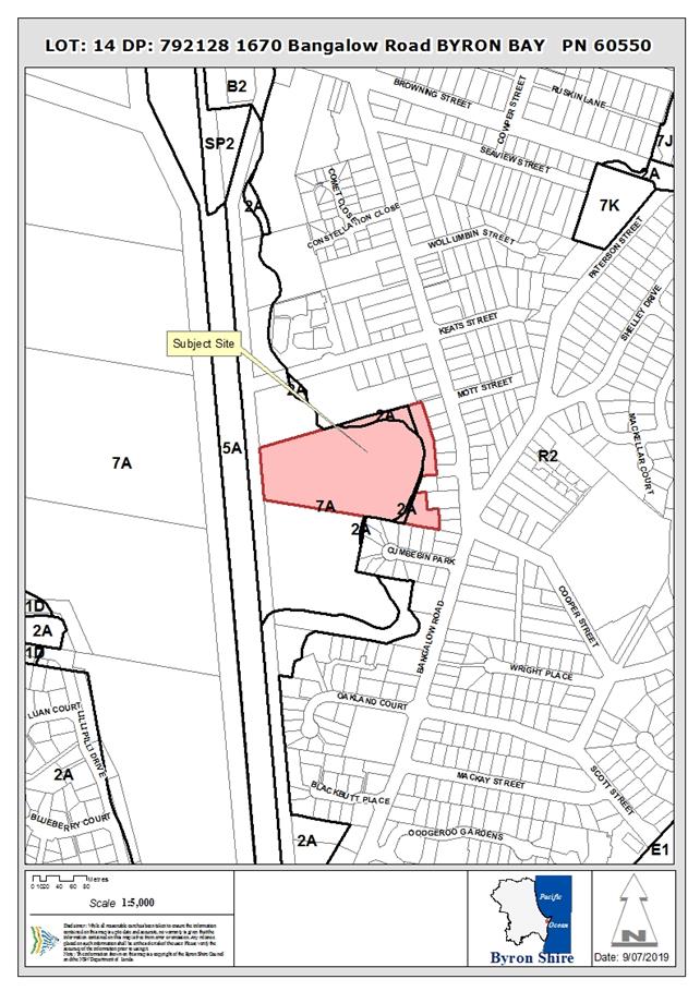
REPORT
Assessment:
1. INTRODUCTION
1.1. History/Background
|
5.1993.175.1
|
Residential flat building
|
Refused 07/04/97
|
|
10.2000.204.1
|
Dwelling
|
Refused 12/09/00
|
|
10.2001.478.1
|
New dwelling and tree removal
|
Approved 12/12/01
|
1.2. Description
of the proposed development
This application seeks approval for five (5) detached small
dwellings, with floor areas of 42m2 – 46m2.
Each dwelling contains a central open plan living/ kitchen/ dining area,
opening to the west to an external courtyard. Laundry facilities can be
incorporated into the kitchen layout.
Bedrooms are located either side of the central living area,
each with an ensuite. Each dwelling includes an outdoor private courtyard
containing a small plunge pool.
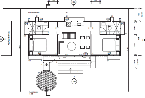
Typical Floor Plan
Two (2) external car parking spaces (uncovered) are provided
for each dwelling, with visitor spaces (including a PWD space) provided
adjacent to the site entrance. Access is available from an existing
driveway access within a ‘stub road’ that is a part of the Bangalow
Road Reserve. This ‘stub road’ also provides access to an
existing dwelling on Lot 13 DP 792128, by way of an existing Right of Way across
the development property (see aerial photo below).
The application includes the clearing of five (5) trees
within the cleared part of the land (i.e. outside of the coastal wetland) and
the pruning of another tree located directly on the property boundary, partly
within a residential property to the east.
The proposal includes the relocation of an existing 150mm
diameter sewer main and the reinstatement of existing connections from that
main to adjoining properties. The existing main is proposed to move to
the west, to be located beneath the internal driveway, to a depth of around
2m. Sufficient width is available for easements over both the relocated
main and the reinstated connections.
1.3. Description
of the site
|
Land is legally described as
|
LOT: 14 DP: 792128
|
|
Property address is
|
Bangalow Road BYRON BAY
|
|
Land is zoned:
|
R2 Low Density Residential / PART DM Deferred Matter
|
|
Land area is:
|
3.48ha
|
|
Property is constrained by:
|
Acid Sulfate Soils (Class 5)
|
|
|
Bush Fire Prone Land
|
|
|
Flood Prone Land
|
|
|
High Environmental Value Vegetation
|
|
|
Key Fish Habitat
|
|
|
Koala Potential Habitat
|
The property is located immediately to the west of existing
residential lots that front Bangalow Road in Byron Bay. While the
property has a total area of approx. 3.5ha, only a relatively narrow part of
the land is cleared, located along the property’s eastern edge. The
cleared area, which is zoned RU2 Low Density Residential, has an area of
approx. 2,000m2.
The remainder of the site is heavily vegetated coastal
wetland, backing onto the rail corridor on the western boundary. Access into
the property is via a ‘stub road’, which is part of the Bangalow
Road reserve. This access also serves adjoining Lot 13, via a ROW across
the subject land.
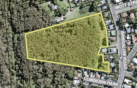
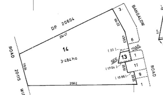
|
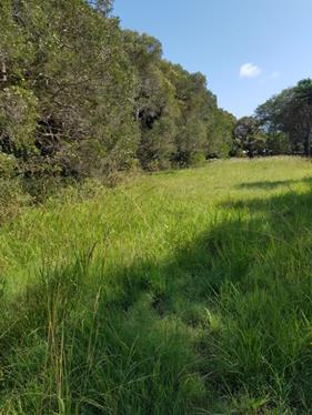
|
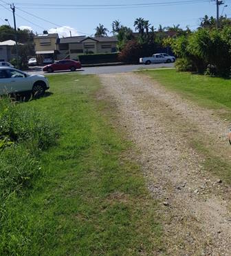
|
|
Edge of Coastal Wetland
(looking north)
|
‘Stub Road’
(looking east from property boundary to Bangalow Road)
|
The site is currently vacant. A Right of Carriageway
5m wide exists along the northern boundary of the adjoining Lot 13, providing
for access to that land. No other easements or restrictions apply.
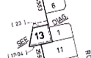
2. SUMMARY OF
REFERRALS
|
Referral
|
Issue
|
|
Development Engineer
|
No engineering objections, subject to recommended
conditions of approval (see Doc #A2019/2449). See summary of issues
below
|
|
S64 / Systems Planning Officer
|
Plans of proposed relocation of sewer main, including
reinstatement of connections to adjoining properties, have been reviewed and
are acceptable, subject to conditions, particularly requiring appropriate
easements. See Doc # A2019/2458
|
|
Contributions Officer
|
Contributions payable.
|
|
Ecologist
|
No objections, subject to conditions. See Doc # A2019/43052
and summary below.
|
Development Engineer:
· Access:
Conditions are recommended to ensure
that adequate access arrangements can be provided. S138 Roads Act
approval will require RMS concurrence.
The ‘stub road’ must be
upgraded to Council’s current standard and be made available prior to the
issue of the occupation certificate.
Provision must be made to provide a
turn-around area at the end of the stub road to facilitate the movement of a
standard garbage truck.
· Traffic:
The proposal will generate 25
vehicle trips per day and 2.5 peak hour trips. This increased traffic
constitutes minimal impact on the existing road network. Conditions
recommended requiring upgrade of the ‘stub road’ and appropriate
treatment at Bangalow Rd intersection.
· Car parking:
There is over supply of car parking
spaces. However, there are no covered car spaces provided.
· Stormwater:
The Stormwater
Management Plan proposes landscaped depressions as detention areas and
surcharge flows into vegetated areas to the west. The site is proposed to
be regraded to drain north-west and into the existing drain running along the
northern boundary, draining west.
The external
catchment, coming from the exiting dwellings in the east, will be captured via
a swale drain (Q5) and drained to the north and to the south. The
external catchment (Q100) coming from the road will be contained via an
easement.
Conditions are
recommended requiring detailed design of the drainage system prior to issue of
a Construction Certificate.
Ecologist:
The major components of the development have been designed to
avoid direct impacts to the wetland area, including the proposed relocation of
the existing Council sewer line. The initial proposal impinged upon the Coastal
Wetland and Biodiversity Values mapped area in the west of the site, through
the necessity to remove vegetation for maintenance of an APZ that extended into
this area.
Updated Architect plans (Shane Thomson Architects
Development Approval Plan: May 2019) include the deletion of the 2 northern
dwellings, which results in an APZ that does not intrude into the Coastal
Wetland and Mapped Biodiversity Values area.
The development proposes the loss of 5 native trees: 4 Swamp
Turpentine Lophostemon suaveolens and 1 Cheese Trees Glochidion
fernandi, and 2 exotics: Mango and Cockspur Coral Tree. Since the
development is proposed in a cleared area dominated by exotic flora, but
adjoining native forest, impacts of the proposal are likely to include
disturbance to shy fauna in the coastal swamp forest during construction, and
the ongoing impacts of increased human presence adjacent to the coastal swamp
forest.
This can include the development of tracks into the forest,
dumping of garden waste and plant clippings, and increases in nutrient
loads. Newly constructed buildings produce a risk of window strike for
birds, which can be avoided by screening all windows in new dwellings. The need
to maintain an Asset Protection Zone adjacent to the coastal swamp forest
boundary also produces an ongoing edge effect likely to promote the growth of
exotic weed species.
A Vegetation Management Plan is needed to control and direct
vegetation works to establish and maintain the APZ, and reduce growth of weeds
on the edge of the forest. The edge of the Coastal Wetland needs to be
clearly defined to prevent accidental incursions during APZ maintenance.
Weed removal in the Coastal Wetland edge is encouraged, but the removal of
native species in the wetland contrary to the purpose of the Biodiversity
Values mapping and is to be strictly avoided. Conditions of consent are recommended
in this regard.
3. SECTION 4.14
– BUSH FIRE PRONE LAND
Under section 4.14 of the Act, Council must be satisfied
prior to making a determination for development on bush fire prone land, that
the development complies with the document Planning for Bush Fire Protection
2006. The site is bush fire prone land.
Both the original and amended development applications were
referred to the NSW Rural Fire Service, which provided conditions reflected in
the Recommendation of this Report below.
The 17m APZ is available from the western elevation of the
dwellings to the mapped Coastal Wetland boundary. While establishment and
maintenance of the APZ will not require any tree removal, it may require some
pruning where the trees are located outside the APZ but with parts of the
canopy overhanging into the 17m APZ.
This will not require the total removal of all overhanging
canopy. Guidelines associated with Planning for Bushfire Protection 2006
indicate that the canopy should not overhang within 2-5 m of dwellings, which
is achieved at the site. The guidelines also suggest that only branches
within 2m of the ground would need to be pruned.
Accordingly, the APZ maintenance will not have significant
impacts on the wetland vegetation.
EFFECT OF 10/50 RULE ON SIGNIFICANT VEGETATION
The property is located in a designated 10/50 vegetation
entitlement clearing area. However, the 10/50 exemption cannot be used to
clear vegetation in this case as the property includes land mapped as Coastal
Wetland under the Coastal SEPP.
4. SECTION 4.15C
– MATTERS FOR CONSIDERATION – DISCUSSION OF ISSUES
Having regard to the matters for consideration detailed in
Section 4.15(1) of the Environmental Planning & Assessment Act 1979
(EP&A Act), the following is a summary of the evaluation of the issues.
4.1 State Environmental
Planning Instruments
SEPP (Coastal Management)
2018:
|
Provision
|
Comments
|
|
10. Development on certain land within
coastal wetlands and littoral rainforests area
|
|
(1) The following may be
carried out on land identified as “coastal wetlands” or
“littoral rainforest” on the Coastal Wetlands and Littoral
Rainforests Area Map only with development consent:
(a) the clearing of native
vegetation within the meaning of Part 5A of the Local Land Services Act 2013,
(b) the harm of marine
vegetation within the meaning of Division 4 of Part 7 of the Fisheries Management Act 1994,
(c) the carrying out of any
of the following:
(i) earthworks
(including the depositing of material on land),
(ii) constructing a levee,
(iii) draining the land,
(iv) environmental protection
works,
(v) any other development.
|
The amended development proposal does not include any
physical development within the part of the property that is identified as
coastal wetland.
|
|
11. Development on land in proximity to coastal
wetlands or littoral rainforest
|
|
(1) Development consent must
not be granted to development on land identified as “proximity area for
coastal wetlands” or “proximity area for littoral
rainforest” on the Coastal Wetlands and Littoral Rainforests Area
Map unless the consent authority is satisfied that the proposed
development will not significantly impact on:
(a) the biophysical, hydrological
or ecological integrity of the adjacent coastal wetland or littoral
rainforest, or
(b) the quantity and quality
of surface and ground water flows to and from the adjacent coastal wetland or
littoral rainforest.
|
The Stormwater Management Plan submitted with the amended
application demonstrates that run-off from the development will be managed in
a way that does not impact the adjacent wetland.
|
4.2A Byron Local Environmental Plan 2014 (LEP 2014)
LEP 2014 is an applicable matter for consideration in the
assessment of the subject development application in accordance with subsection
4.15(1) of the EP&A Act because it applies to the subject land and the
proposed development. The LEP 2014 clauses that are checked below are of
relevance to the proposed development:
|
Part 1
|
☒1.1|
☒1.1AA| ☒1.2| ☒1.3| ☒1.4| ☒Dictionary| ☒1.5| ☒1.6| ☒1.7| ☒1.8| ☐1.8A| ☒1.9|
☐1.9A
|
|
Part 2
|
☒2.1|
☒2.2 | ☒2.3 |☒Land Use Table | ☐2.4 | ☐2.5 | ☐2.6 | ☐2.7 | ☐2.8
|
|
Part 3
|
☐3.1|
☐3.2| ☐3.3
|
|
Part 4
|
☐4.1|
☐4.1A| ☐4.1AA| ☐4.1B |☐4.1C| ☐4.1D| ☒4.1E| ☐4.2| ☐4.2A| ☐4.2B| ☐4.2C| ☐4.2|☒4.3|☒4.4 |☐4.5 | ☐4.6
|
|
Part 5
|
☐5.1|
☐5.2| ☐5.3| ☐5.4| ☐5.5| ☐5.6| ☐5.7| ☐5.8|☐5.9| ☐ 5.9AA| ☐5.10| ☐5.11| ☐5.12|
☐5.13
|
|
Part 6
|
☒6.1|
☒6.2| ☒6.3| ☒6.4| ☐6.5| ☒6.6| ☒ 6.7| ☐6.8| ☐6.9
|
In accordance with LEP 2014 clauses 1.4 and 2.1 – 2.3:
(a) The
proposed development is defined in the LEP 2014 Dictionary as multi dwelling
housing;
(b) The
land is within the R2 Low Density Residential / PART DM Deferred Matter
according to the Land Zoning Map, with the proposed development wholly within
the area zoned R2;
(c) The
proposed development is permissible with consent; and
(d) Regard
is had for the Zone Objectives as follows:
|
Zone Objective
|
Consideration
|
|
To
provide for the housing needs of the community within a low density
residential environment.
To enable other land uses that provide facilities or
services to meet the day to day needs of residents.
|
The proposed development assists in meeting local housing
needs by providing smaller two-bedroom dwellings in close proximity to the
Byron Bay Town Centre.
Concern has been expressed that
the dwellings will be holiday let. The proponent categorically denies
this and advises that he is happy to accept a condition of approval preventing
tourism use of the dwellings.
|
The remaining checked clauses have been taken into
consideration in the assessment of the subject development application in
accordance with subsection 4.15(1) of the EP&A Act. The proposed
development complies with all clauses of LEP 2014 (in some cases subject to
conditions and/or to the satisfaction of other assessing officers).
4.2B Byron Local Environmental Plan 1988 (LEP 1988)
LEP 1988 is an applicable matter for consideration in the
assessment of the subject development application in accordance with subsection
4.15(1) of the EP&A Act because it applies to the subject land and the
proposed development.
In accordance with LEP 1988 clauses 5, 8 and 9:
(a) The
proposed development is defined in the LEP 1988 Dictionary as dwellings;
(b) The
DM part of the land is partly within the 2(a) Residential Zone and partly
within the 7(a) Wetlands Zone, according to the map under LEP 1988;
(c) No
part of the development is located within the area zoned 2(a). Only a
small part of the internal driveway (max approx. 2m of width) and a proposed
garbage bin store are located in the area zoned 7(a) Wetland (both are outside
of the mapped Coastal Wetland). The garbage store can be conditioned to
be relocated, onto a grassed area to the north, out of the 7(a) zone and out of
the coastal wetland. Condition could also require narrowing of the
driveway in this location to avoid encroachment into 7(a).
Given that, there are no provisions of LEP 1988 that are
directly applicable to the subject application.
4.3 Any proposed Instrument
that has been the subject of public consultation and has been notified to the
consent authority
None applicable.
4.4A Byron Shire Development Control Plan 2014
(DCP 2014)
DCP 2014 is an applicable matter for consideration in the
assessment of the subject development application in accordance with subsection
4.15(1) of the EP& A Act because it applies to the land to which LEP 2014
applies. The DCP 2014 Parts/Chapters that are checked below are of relevance
to the proposed development:
|
Part A
|
☒
|
|
Part B Chapters:
|
xB2| xB3| xB4| xB5| ☐B6| xB7| xB8| xB9| ☐B10| ☐B11| ☐B12| xB13|
☐B14
|
|
Part C Chapters:
|
☐C1|
xC2| ☐C3| ☐C4
|
|
Part D Chapters
|
xD1| ☐D2|
☐D3| ☐D4| ☐D5| ☐D6| ☐D7| ☐D8
|
|
Part E Chapters
|
☐
E1| ☐E2| ☐E3| ☐E4| ☐E5| ☐E6| ☐ E7
|
Chapter D1 Residential
Accommodation in Urban, Village and Special Purpose Zones
|
DCP
requirement/summary
|
Proposed/
Comments
|
Complies
|
|
D1.2.1 Building Height Plane
Prescriptive measures
|
All dwellings comply with Height
Plane.
|
Yes
|
|
D1.2.2 Setbacks from Boundaries
Prescriptive measures:
Street frontage – Classified Road: 9m
Side & rear – 1.5m (plus BHP)
Between buildings on site – 3m
|
Setbacks from boundaries comply. Separation between
buildings does not comply – 2.0m provided instead of 3.0m.
The siting of the dwellings
‘behind’ existing development, it will not be visible from the
public road. Given this, and the constraints of the site, it is
considered that the variation to the required separation between dwellings is
acceptable.
|
Yes (setbacks)
No (separation
between buildings)
|
|
D1.2.4 Character & Visual Impact
No prescriptive measures.
Performance
measures:
|
|
|
|
Site, building and landscaping design must address
climate
|
Appropriate design response
|
Yes
|
|
The street face
of a building, together with any open space between it and the street, must
contribute to the general attractiveness of the streetscape by means of good
design, appropriate materials and effective landscaping
|
Site is distant from street
frontage and won’t be visible from Bangalow Road
|
Yes
|
|
Development
should be designed to minimise loss of privacy
|
Appropriate response –
windows on the eastern elevation (facing rear yards of adjoining properties)
minimised and screened
|
Yes
|
|
There must be a
reasonable degree of integration with the existing built and natural
environment, balanced with the desirability of providing for variety in
streetscapes
|
Appropriate response to a narrow
constrained site
|
Yes
|
|
Long, straight
wall areas will be discouraged and must be broken up visually by a
combination of building materials and/or changes in the wall plane
|
No unbroken long walls
|
Yes
|
|
The provision
of verandahs, balconies, pergolas and other protective outdoor elements will
be encouraged for visual, climatic and energy efficiency reasons
|
Decks are located on western
elevation. While not ideal for sun, the orientation maximises internal
site views of vegetation and avoids privacy impacts in relation to
neighbouring rear yards to the east
|
Yes
|
|
Well-designed
overhanging eaves should be provided where feasible to protect against heavy
rainfall and summer sun, while allowing winter sun penetration
|
Minimal eaves
|
No
|
|
All building
materials must be compatible in character with their surrounding environment.
Any metal roof must have a colorbond or equivalent finish and no roof may be
highly reflective. White or light-coloured roofing may be approved where it
is demonstrated that it is not likely to be visually intrusive. Details of
building materials and surface colours must be submitted for assessment with
a development application
|
Acceptable
|
Yes
|
|
D1.2.5
Fences
|
No details provided. Can be
addressed at Construction Certificate
|
Yes
|
|
D1.2.7
Pedestrian and Cycle Access
|
Consistent with Performance
measures
|
Yes
|
|
D1.6 Multi
Dwelling Housing
|
|
|
|
D1.6.1
Private Open Space
Prescriptive
Measures:
Each dwelling
must have access to an individual courtyard at ground level having a minimum
area of 30m2 and a minimum length and width each of 4
metres. The courtyard must be designed to facilitate access to winter
sunshine and must be landscaped to Council’s satisfaction.
|
Compliant individual courtyards
provided
|
Yes
|
|
D1.6.3
Landscaping
Refer to B9
Landscaping:
B9.4.2 Common
Landscaped Area
Required
– 5 x 50m2 (small dwellings) = 250m2
|
The developed site will have in
excess of 250m2 outside of the mapped Coastal Wetland area.
If that vegetated area were included in the calculation, the common area is
in the order of 3ha.
|
Yes
|
|
D1.6.4
On-Site Car Parking
Refer to B4 Car
Parking
B4.2.12 Parking
Schedules
Required
– 1 space per 1 or 2 bedroom unit; 1 visitor space per 4 units; 1
covered space per dwelling
|
Required: 5 spaces; 1 visitor
space – total 6 spaces (5 covered)
Proposed (5 x 2 bedroom units)
– 11 spaces; none covered.
In the context of the site,
located well off the street behind other properties, the requirement for
covered spaces can be waived. Carports could easily be erected in the
future if required by residents
|
Yes – quantum
of spaces;
No – no
covered spaces
|
|
D1.6.5 Sound
Proofing
|
Can be conditioned
|
Yes
|
|
D1.6.6
Clothes Drying Facilities
Prescriptive
measures:
7.5 metres of
line per dwelling, located in suitably screened external drying areas
|
Not shown. However,
suitably screened external drying areas are available to all dwellings
|
No
|
|
D1.6.7
Equity of Access and Mobility
Refer to B13
Access and Mobility
A minimum of
10% of units (rounded up) should be adaptable housing
|
5 dwellings proposed – 1
required to be adaptable. Not shown on plans, however, can be conditioned
|
No - can be
conditioned
|
|
Access/ Continuous
accessible path of travel within the site
|
1 accessible car parking space
provided. Internal pathway is shared with internal driveway
|
Yes
|
|
Car parking
|
1 accessible space provided.
|
Yes
|
Chapter C2 Areas Affected by
Flood
|
DCP
requirement/summary
|
Proposed/
Comments
|
Complies
|
|
C2.2 General Assessment Criteria
|
|
|
|
Council will
not consent to any development on land at or below the flood planning level
if there is sufficient suitable area on that land above the flood planning
level on which to carry out the development
|
Whole of property is mapped as flood prone land.
|
Yes
|
|
Where the
development is on land below the flood planning level, floor levels of any
buildings must be constructed at or the above the flood planning level.
Council will not support filling beneath the building footprint of the
proposed development unless it is demonstrated that it will not adversely
impact on the floodplain. Filling outside the Byron Shire building footprint
generally will not be permitted, other than for driveways and/or pedestrian
pathways immediately adjoining the walls of the building
|
Dwellings are raised such that floor level is at the
relevant Flood Planning Level.
There is no filling proposed.
Minor site regarding works will be required to construct
driveway and to provide for appropriate stormwater management.
|
Yes
|
|
C2.3.2
Minimum Floor Levels
The finished
floor level of habitable rooms must be above the relevant level defined by
the flood planning matrix
|
The applicable 2100 Flood Planning Level is RL 3.1m AHD.
The finished floor level of the
dwellings is proposed at RL 3.12m AHD.
|
Yes
|
4.4B Byron Shire Development Control Plan 2010 (DCP 2010)
Given that no aspects of the development are proposed within
the deferred area, there are no provisions of DCP 2010 that are directly
applicable to the subject application.
4.5 Any Planning Agreement or
Draft Planning Agreement?
|
|
Yes
|
No
|
|
Is there any applicable planning agreement or draft
planning agreement?
|
☐
|
☒
|
|
|
4.6 Environmental Planning
& Assessment Regulation 2000 Considerations
|
Clause
|
This control is applicable to the proposal:
|
I have considered this control as it relates to the
proposal:
|
If this control is applicable, does the proposal
comply?
|
|
92
|
No
|
N/A
|
N/A
|
|
93
|
No
|
N/A
|
N/A
|
|
94
|
No
|
N/A
|
N/A
|
|
94A
|
No
|
N/A
|
N/A
|
4.7 Any COASTAL ZONE MANAGEMENT
PLAN?
|
|
Satisfactory
|
Unsatisfactory
|
Not applicable
|
|
Is there any applicable coastal zone management plan?
|
☐
|
☐
|
☒
|
|
|
4.8 The likely impacts of that
development, including environmental impacts on both the natural and built environments,
and social and economic impacts in the locality
|
Impact on:
|
Likely significant impact/s?
|
|
Natural environment
|
No. The proposal will not have a significantly adverse
impact on the natural environment of the locality.
|
|
Built environment
|
No. The proposal will not have a significantly adverse
impact on the built environment of the locality.
|
|
Social Environment
|
No. The proposal will not have a significant social impact
on the locality. However the 5 dwellings will provide additional housing
stock which is generally in demand in Byron Bay.
|
|
Economic impact
|
No. The proposal will not have a significant economic
impact on the locality.
|
Conditions of consent proposed to control construction
activities including sedimentation and erosion control measures, hours of work,
construction noise and builders waste
Are there any Council Policies that are applicable to the
proposed development?
4.9 The suitability of the site
for the development
The assessment outlined above demonstrates that, although
the property is significantly constrained, it is suitable to the development as
proposed, given that the proposal has been designed to address the constraints
in a manner that will minimise impacts.
4.10 Submissions made in accordance with
this Act or the regulations
The development application was originally publicly
exhibited from 7/2/19 to 6/3/19. 21 objections were received. The amended
proposal was publically exhibited from 20/6/19 to 3/7/19. A further 9
submissions were received. All submissions are addressed below.
|
Issue
|
Comment
|
|
Original Proposal:
|
|
Insufficient information – stormwater and sewer main
relocation.
|
This information was omitted from original
exhibition. This was subsequently remedied, exhibition period extended
and neighbours advised.
|
|
Proposed landscape works and the requirement for a bush
fire APZ that encroaches within the mapped Coastal Wetland constitutes
‘designated development’ in accordance with clause 10 of SEPP
(Coastal Management) 2018.
|
Applicant was subsequently amended to remove 2 dwellings
to ensure that no works directly impact on mapped Coastal Wetland.
Whole of APZ is therefore outside
of the mapped area.
|
|
Garbage bin store and driveway are located within 7(a)
zone and therefore prohibited.
|
Condition recommended to relocate bin storage and driveway
edge out of the 7(a) zone.
|
|
Loss of privacy – dwellings proposed 900mm from
adjoining boundary; occupants will look directly into rear yard of adjoining
properties.
Rear yards of these adjoining
dwellings are their only useable open space, given that they front a busy
main road.
|
Amended proposal includes relocation of all dwellings to
provide 1.5m separation from adjoining boundary.
Dwelling design also addresses
privacy issues by limiting windows on eastern side of the dwellings to three
narrow openings, each with ‘window boxes’ to further limit views
from within the dwellings into adjoining yards.
|
|
Drainage and flooding – property is low lying and
subject to frequent inundation resulting in prolonged ‘pooling’
of stormwater.
Stormwater from external
catchment to the east flows westward through adjoining properties – development
will ‘dam’ this, exacerbating existing stormwater issues for
adjoining residents.
Stormwater Management Plan does
not contain sufficient information to demonstrate that stormwater will not
impact adjoining wetland.
|
See stormwater/ flooding comments above from
Council’s Development Engineer.
|
|
Concern that dwellings will be used for short-term holiday
letting, based on dwelling design (small and no separate laundries shown).
|
Proponent advises that this will not be the case; and
agrees to imposition of a condition of approval requiring that no dwellings
can be used for holiday accommodation.
|
|
Additional noise at rear of adjoining properties –
extra cars and people
|
Noise is not anticipated to be in excess of what would be
expected given the residential zoning of the land.
|
|
Traffic impacts associated with access onto Bangalow Rd in
close proximity to busy intersections
|
See traffic comments above from Council’s
Development Engineer.
|
|
Encroachment into wetland – flora and fauna impacts
– koalas have been sighted in the wetland
|
The proposed development does not physically encroach on
the wetland vegetation.
Council’s Consulting
Ecologist notes that Koalas are likely to use the western (wetland) part of
the site, but the development site is unlikely to be used. A condition
is recommended requiring a detailed Vegetation Management Plan to ensure weed
management within the wetland and additional planting to bolster the eastern
edge.
This will mitigate indirect
impacts and ensure minimal impact on Koalas or their habitat.
|
|
Relocation of sewer line will result in impacts on acid
sulfate soils
|
An Acid Sulfate Soils Management Plan will be required
prior to construction and excavation, ensuring that impacts will be managed/
mitigated.
|
|
Construction of buildings on what is currently cleared
grassland will increase fire risks
|
Bush fire risks have been review by RFS, who have provided
conditions to be incorporated into approval.
|
|
The Cheese Tree at the rear of 50 Bangalow Road (shown as
being removed) straddles the boundary. Land owner authority is required
for removal of that tree.
|
Tree no longer proposed to be removed. Lopping of
some branches will be required to allow construction of adjoining dwelling.
Condition recommended requiring arborists report to
confirm that extent of lopping will not cause the tree to die.
|
|
No covered car parking spaces proposed –
inconsistent with DCP requirement.
|
The requirement for at least one covered space is aimed,
in part, at reducing the visual impact of car parking. In this location,
set well away from Bangalow Road, it is considered that the DCP requirement
to have one covered space per dwelling can be waived.
Car ports could easily be erected in the future if
required by residents.
|
|
Impacts of headlights/ privacy associated with existing
house adjoining Lot 13.
|
Condition recommended to provide for headlight shielding
at southern end of internal driveway.
|
|
Amended Proposal:
|
|
Amended proposal does not address acid sulfate soils risks
|
Risks can be managed through appropriate construction
techniques. Condition recommended requiring Construction Management
Plan that specifically addresses ASS risks.
|
|
Amended proposal does not adequately address stormwater
issues, particularly overland flows from adjoining properties
|
See Development Engineer comments above.
|
|
Amended proposal does not reduce privacy impacts on
adjoining properties
|
See comments above.
|
|
Impact of construction on trees at the edge of the wetland
– pruning of branches/ foliage that encroaches into bushfire APZ and
impact of sewer relocation on root zone
|
See comments above from Council’s Consulting
Ecologist – Vegetation Management Plan will strengthen the forest edge.
|
|
Pruning of tree that ‘straddles’ boundary of
adjoining land, to allow construction of dwelling 5, has not been quantified
and has the potential damage the tree to an extent that kills it
|
Condition recommended requiring arborists report to
confirm that extent of lopping will not cause this tree to die.
|
|
Amended proposal still appears to be aimed at short term
holiday let
|
See above – condition recommended prohibiting
tourism or holiday letting use.
|
|
Amended proposal still results in too many cars using the
existing ‘stub road’ to access Bangalow Road, where right turns
are exceedingly difficult
|
See comments above from Development Engineer.
|
|
Adjoining lot is accessed via a Right of Way from the
western end of the ‘stub road’, across the subject land.
Application indicates potential for a future access gate. Adjoining
land owner does not agree to installation of gate
|
Condition recommended specifying that free and unfettered
access is to remain for Lot 13, with any proposed gate structure located
accordingly.
|
|
Amended proposal still includes aspects within the
boundary of 7(a) zone
|
See comments above.
|
|
Cumulative impact from whole of proposal will be
detrimental to environmental values of the site
|
Proposal has been designed to address site constraints/
values and minimise impacts.
|
4.11 Public interest
The proposed development is unlikely to prejudice or compromise
the public interest or create a dangerous precedent
5. DEVELOPER
CONTRIBUTIONS
5.1 Water & Sewer Levies
Section 64 levies will be payable.
5.2 Section 7.11 Contributions
Section 7.11 Contributions will
be payable.
6. CONCLUSION
The proposed development is a satisfactory response to the
site’s constraints and the applicable planning controls that apply to the
land. Potential environmental impacts on the wetland to the west have
been ameliorated by way of the amended plans and the reduction in the number of
units from 7 to 5. The application is recommended for approval subject to
conditions of consent.
7. REASONS
FOR DECISION, HOW COMMUNITY VIEWS WERE ADDRESSED
|
Statement of Reasons
|
|
The proposed development complies with the provisions of
Byron Local Environmental Plan 1988.
|
|
The proposed development complies with the provisions of
Byron Local Environmental Plan 2014.
|
|
The proposed development complies with relevant State
Environmental Planning Policies
|
|
The proposed development complies with relevant provisions
of Development Control Plan 2014
|
|
The proposed development complies with relevant provisions
of Development Control Plan 2010
|
|
The proposed development complies with Environmental
Planning & Assessment Regulation 2000 considerations.
|
|
The proposed development will not have significant adverse
impact on the natural, built or social environment or economic impacts on the
locality.
|
|
The proposed development is considered suitable for the
proposed site.
|
|
The development application was notified/advertised in
accordance with Development Control Plan 2014. Issues raised in the
submissions have been addressed during assessment of the application.
|
|
The proposed development is unlikely to prejudice or
compromise the public interest.
|
|
How community views were addressed
|
|
The DA was advertised in accordance with Development
Control Plan 2014. The submissions received were considered on merit and
addressed during assessment of the application.
|
Report No. 8.8 PLANNING
- Exceptions to Development Standards 1 April to 30 June 2019
Directorate: Sustainable
Environment and Economy
Report
Author: Noreen
Scott, EA Sustainable Environment and Economy
File No: I2019/1084
Theme: Sustainable Environment and Economy
Development and Certification
Summary:
This report is provided as a requirement of the NSW
Department of Planning Circular PS17-006, for reporting on exceptions to
development standards for applications made under clause 4.6 of the Standard
Instrument LEP and Clause 6 of SEPP 1.
NOTE TO COUNCILLORS:
In accordance with the
provisions of S375A of the Local Government Act 1993, a Division is to be
called whenever a motion for a planning decision is put to the meeting, for the
purpose of recording voting on planning matters. Pursuant to clause 2(a)
under the heading Matters to be Included in Minutes of Council Meetings of
Council's adopted Code of Meeting Practice (as amended) a Division will be
deemed to have been called by the mover and seconder of all motions relating to
this report.
|
RECOMMENDATION:
That Council note the report on exceptions to
development standards for the period 1 April to 30 June 2019.
|
REPORT
This report is provided as a requirement of the NSW
Department of Planning Circular PS17-006, for reporting on exceptions to
development standards for applications made under Clause 4.6 of the Standard
Instrument LEP and Clause 6 of SEPP 1.
SEPP 1 applies to development applications submitted under
Byron Local Environmental Plan 1988. Clause 4.6 applies to development
applications submitted under Byron LEP 2014.
The period of reporting is for the 1 April 2019 to 30 June
2019 for the following DAs:
|
DA No
|
10.2018.305.1
|
|
Development
|
Subdivision to create 32 residential lots, a public reserve,
drainage basin, earthworks, environmental enhancement works and associated
civil infrastructure
|
|
Property:
|
77 Tuckeroo Avenue MULLUMBIMBY
|
|
Lot and DP:
|
Lot 162 DP1251169
|
|
Zoning:
|
1(a) General Rural Zone
|
|
Development Standard being varied
|
Clause 11 - Subdivision in rural areas for agriculture
etc.
|
|
Justification
|
The 1(a) zone only applies to three small fragments of a
residual parcel. Strict adherence to the 40 hectare standard would hinder an
approved staged residential subdivision. Strict compliance is both
unreasonable and unnecessary in this particular instance.
|
|
Extend of variation
|
29%
|
|
Concurrence
|
Concurrence issued by the Department of Planning and
Environment.
|
|
Determination Date
|
11 April 2019
|
|
Determined by
|
Council
|
|
|
|
DA No.
|
10.2018.469.1
|
|
Development
|
Subdivision of two (2) lots into three (3) lots
|
|
Property:
|
89 Parkway Drive and 15 Magnolia Place EWINGSDALE
|
|
Lot and DP:
|
LOT 182 DP 1105787 and LOT 34 DP1123445
|
|
Zoning:
|
R5 Large Lot Residential
|
|
Development Standard being varied:
|
Clause 4.1 Minimum lot size
|
|
Justification
|
There are a reasonable number of lots in the locality that
are under the minimum lot size; and development on Lot 34 has been restricted
to the west of the site leaving a large undeveloped area to the east which is
suitable for creation of an additional lot.
|
|
Extent of variation
|
9.95%.
|
|
Concurrence
|
Assumed concurrence
|
|
Determined Date
|
11 April 2019
|
|
Determined By
|
Staff
|
|
|
|
DA No.
|
10.2018.508.1
|
|
Development
|
Multi dwelling housing comprising of six (6) dwellings,
one (1) swimming pool, associated earthworks and strata subdivision
|
|
Property:
|
7 Keats Street BYRON BAY
|
|
Lot and DP:
|
LOT 6 DP 7117
|
|
Zoning:
|
R2 Low Density Residential
|
|
Development Standard being varied:
|
Clause 4.3 Floor Space Ratio
|
|
Justification
|
The proposed development does not conflict with the
objectives of the development standard and or zone; is adequately serviced
and will not negatively impact on character or amenity.
|
|
Extent of variation
|
4%
|
|
Concurrence
|
Assumed concurrence
|
|
Determined Date
|
15 May 2019
|
|
Determined By
|
Staff
|
|
|
|
DA No.
|
10.2017.588.1
|
|
Development
|
Mixed use development
|
|
Property:
|
4 Marvel Street BYRON BAY
|
|
Lot and DP:
|
Lot B DP 325834
|
|
Zoning:
|
B2 Local Centre
|
|
Development Standard being varied:
|
Clause 4.3 Height of Buildings and Clause 4.4 Floor
Space ratio
|
|
Justification
|
Refer to LEC judgement
https://www.caselaw.nsw.gov.au/decision/5d1173efe4b08c5b85d8a6e0
|
|
Extent of variation
|
Height: The maximum permissible height under the
LEP is 11.5m. The amended application proposes to exceed this height for: the
lift overrun to 13.87m (a 20.61% exceedance); to the top of the roof
over the rooftop deck to 12.67m (a 10.17% exceedance); and up to 12.09m to
the top of the pool deck (a 5.13% exceedance).
FSR: The proposed development with an FSR of 1.33:1
exceeds the maximum FSR of 1.3:1, a 3.3% exceedance.
|
|
Concurrence
|
N/A
|
|
Determined Date
|
27 June 2019
|
|
Determined By
|
Commissioner of Land and Environment Court NSW under
assumed concurrence of the Secretary of Planning
|
STRATEGIC CONSIDERATIONS
Community Strategic Plan and Operational Plan
|
CSP Objective
|
L2
|
CSP Strategy
|
L3
|
DP Action
|
L4
|
OP Activity
|
|
Community
Objective 4: We manage growth and change responsibly
|
4.1
|
Support the
visions and aspirations of local communities through place-based planning and
management
|
4.1.3
|
Manage
development through a transparent and efficient assessment process
|
4.1.3.1
|
Assess and
determine development applications
|
|
|
|
|
|
|
|
|
|
|
|
Legal/Statutory/Policy Considerations
The report is provided as a requirement of NSW Department of Planning circular PS 17-006.
Staff Reports - Sustainable Environment and Economy 8.9
Report No. 8.9 PLANNING
- Development Application 10.2019.129.1 Subdivison Two Lots at 480 -544
Coolamon Scenic Drive Coorabell
Directorate: Sustainable
Environment and Economy
Report
Author: Ivan
Holland, Planner
File No: I2019/1122
Proposal:
|
DA No:
|
10.2019.129.1
|
|
Proposal description:
|
Subdivision two (2) lots
|
|
Property description:
|
LOT: 3 DP: 579176, LOT: 4 DP: 579176
|
|
480 Coolamon Scenic Drive COORABELL, 544 Coolamon Scenic
Drive COORABELL
|
|
Parcel No/s:
|
13160, 13150
|
|
Applicant:
|
Balanced Systems Planning Consultants
|
|
Owner:
|
Ms J M Rochelli
|
|
Zoning:
|
7(d) – Scenic/Escarpment / RU1 – Primary
Production
|
|
Date received:
|
15 March 2019
|
|
Integrated / Designated Development:
|
☒
Integrated
|
☐
Designated
|
☐
Not applicable
|
|
Concurrence required
|
Yes. Provided by Department of Planning & Environment
|
|
Public notification or exhibition:
|
- Level
0 advertising under DCP 2014 Part A14 – Public Notification and
Exhibition of Development Applications
|
|
Variation request
|
☐
Clause 4.6
|
☒
SEPP 1
|
☐
Not applicable
|
|
Delegation to determination:
|
Acting - Director Sustainable Environment and Economy
|
|
Issues:
|
· Proposed lots
are less than minimum lot size (clause 11 – LEP 1988).
· Proposed Lot 4
is less than the minimum lot size (clause 4.1 – LEP 2014).
|
Summary:
This application seeks approval for Subdivision comprising a
boundary adjustment between two (2) lots. The proposal is to increase the
size of Lot 3 from 4047m2 to 7822m2 by reducing the size
of Lot 4 from 29.87 ha to 29.49 ha. Both lots have existing dwelling
entitlements and the purpose of the adjustment is to facilitate the ongoing
management of land for bushfire protection purposes on the smaller parcel.
Notwithstanding, variations have been submitted to the
minimum lot size requirements (40 ha) under both Clause 4.6 of Byron LEP 2014
and SEPP 1 Development Standards. The variations to the development Standards
are supported in this instance and strict compliance with the 40 ha minimum lot
size controls under both Byron LEP 2014 and 1988 is unreasonable and
unnecessary having regards to the circumstances of the proposal.
The proposal raises no planning or environmental issues and
is recommended for approval subject to conditions of consent.
NOTE TO COUNCILLORS:
In accordance with the
provisions of S375A of the Local Government Act 1993, a Division is to be
called whenever a motion for a planning decision is put to the meeting, for the
purpose of recording voting on planning matters. Pursuant to clause 2(a)
under the heading Matters to be Included in Minutes of Council Meetings of
Council's adopted Code of Meeting Practice (as amended) a Division will be
deemed to have been called by the mover and seconder of all motions relating to
this report.
Attachments:
1 Proposed
plans, E2019/53326
2 Recommended
conditions, E2019/53236
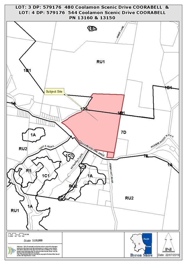
Assessment:
1. INTRODUCTION
1.1. History/Background
Council’s records show the following development
approval history for the properties:
Lot 3
· Home
industry (DA 5.1998.37.1) - approved 20/4/1998;
· Studio
(10.2004.118.1) – approved 12/8/2004; and
· Dwelling
house alterations & additions, swimming pool (DA 10.2010.358.1) –
approved 23/11/2010.
Lot 4
· Dwelling
(DA 5.1993.460.1) - approved 22/3/1994;
· Two-storey
dwelling, including garage and studio (DA 10.2003.326.1) – refused
27/11/2003;
· Dwelling
alterations & additions, shed and garage (DA 10.2004.136.1) –
approved 7/7/2004;
· Modifications
to DA 10.2004.136.1) - approved 4/7/2005 and 15/12/2006;
· Swimming
pool (DA 10.2007.337.1) – approved 23/7/2007;
· Dwelling
house alterations & additions (DA 10.2009.35.1) – approved 1/7/2009;
and
· Farm
shed (DA 10.2017.354.1) – approved 25/7/2017.
1.2. Description
of the proposed development
This application seeks approval for Subdivision (Boundary
Adjustment) Two (2) Lots. The proposal is to increase the size of Lot 3
from 4047m2 to ~7822m2 at the northern extent of the lot by
reducing the size of Lot 4 from 29.87 ha to ~29.4925 ha (see Appendix B of
application). The boundary to be adjusted and the associated area to be
exchanged is entirely within land zoned 7(d) under LEP 1998.
1.3. Description
of the site
|
Land is legally described as
|
LOT: 3 DP: 579176, LOT: 4 DP: 579176
|
|
Property address is
|
480 Coolamon Scenic Drive COORABELL, 544 Coolamon Scenic
Drive COORABELL
|
|
Land is zoned:
|
7(d) – Scenic/Escarpment / RU1 – Primary
Production
|
|
Land area is:
|
Lot 3 - 4047 m2, Lot 4 – 29.87 ha
|
|
Property is constrained by:
|
Bushfire prone land (category 1, category 2 and buffer)
|
|
|
High Environmental Value vegetation (Lot 4 only –
three isolated patches of Rainforest)
|
2. SUMMARY OF
REFERRALS
|
Referral
|
Issue
|
|
Development Engineer
|
No objections subject to conditions. Refer to Doc # A2019/9036
|
|
Rural Fire Service (100B/4.14/4.14)
|
General terms of approval provided. Refer to Doc #
E2019/29143
|
|
Department of Planning & Environment
|
The Secretary issued concurrence for the application in
terms of the SEPP 1 Objection. Refer to Doc # E2019/50231
|
3. SECTION 4.14
– BUSH FIRE PRONE LAND
Under section 4.14 of the Act, Council must be satisfied
prior to making a determination for development on bush fire prone land, that
the development complies with the document Planning for Bush Fire Protection
2006. The site is bush fire prone land. The development application was
referred to the NSW Rural Fire Service, which provided conditions which are
reflected in the Recommendation of this Report below.
EFFECT OF 10/50 RULE ON SIGNIFICANT VEGETATION
Online tool was accessed on 11/7/2019 – 480 Coolamon
Scenic Drive (Lot 3) and 544 Coolamon Scenic Drive (Lot 4) are located in a
designated 10/50 vegetation entitlement clearing area.
4. SECTION 4.15C
– MATTERS FOR CONSIDERATION – DISCUSSION OF ISSUES
Having regard to the matters for consideration detailed in
Section 4.15(1) of the Environmental Planning & Assessment Act 1979
(EP&A Act), the following is a summary of the evaluation of the issues.
4.1 State Environmental
Planning Instruments
|
|
Satisfactory
|
Unsatisfactory
|
|
State
Environmental Planning Policy No 1—Development Standards
|
☒
|
☐
|
|
Consideration: The application included a SEPP 1 Objection
request (Appendix D) to the minimum lot size development standard (clause 11,
LEP 1988) as required by clause 6. As the variation sought is greater
than a 10% change to a numerical standard, the Secretary’s concurrence
may not be assumed (Circular – PS18-003). However, the Secretary
of the Department of Planning & Environment has provided concurrence for
the variation to the development standard (E2019/50231) and consent may be
granted pursuant to clause 7.
|
|
State
Environmental Planning Policy No 44—Koala Habitat Protection
|
☒
|
☐
|
|
Consideration: Although lot 4 is greater than 1ha
(clause 6), there is no potential Koala habitat mapped on either property
(lot 3 or Lot 4).
|
|
State
Environmental Planning Policy No 55—Remediation of Land
|
☒
|
☐
|
|
Consideration: The proposed boundary adjustment
raises no issues in terms of contamination from past land uses.
|
4.2A Byron Local Environmental Plan 2014 (LEP 2014)
LEP 2014 is an applicable matter for consideration in the
assessment of the subject development application in accordance with subsection
4.15(1) of the EP&A Act because it applies to the subject land and the
proposed development (northern ~200m of Lot 4). The LEP 2014 clauses that are
checked below are of relevance to the proposed development:
|
Part 1
|
☒1.1|
☒1.1AA| ☒1.2| ☒1.3| ☒1.4| ☒Dictionary| ☒1.5| ☒1.6| ☒1.7| ☒1.8| ☐1.8A| ☒1.9|
☐1.9A
|
|
Part 2
|
☒2.1|
☒2.2 | ☒2.3 |☒Land Use Table | ☐2.4 | ☐2.5 | ☒2.6 | ☐2.7 | ☐2.8
|
|
Part 3
|
☐3.1|
☐3.2| ☐3.3
|
|
Part 4
|
☒4.1|
☐4.1A| ☐4.1AA| ☐4.1B |☒4.1C| ☐4.1D| ☐4.1E| ☐4.2| ☐4.2A| ☐4.2B| ☐4.2C| ☐4.2|☐4.3|☐4.4 |☐4.5 | ☐4.6
|
|
Part 5
|
☐5.1|
☐5.2| ☐5.3| ☐5.4| ☐5.5| ☐5.6| ☐5.7| ☐5.8|☐5.9| ☐ 5.9AA| ☐5.10| ☐5.11| ☐5.12|
☐5.13
|
|
Part 6
|
☐6.1|
☐6.2| ☐6.3| ☐6.4| ☐6.5| ☒6.6| ☐ 6.7| ☐6.8| ☐6.9
|
In accordance with LEP 2014 clauses 1.4 and 2.1 – 2.3:
(a) The
proposed development is defined in the EP&A Act (Section 6.2) as
Subdivision;
(b) The
land is within the RU1 – Primary Production according to the Land Zoning
Map;
(c) The
proposed development is permitted with consent (clause 2.6); and
(d) Regard
is had for the Zone Objectives as follows:
|
Zone Objective
|
Consideration
|
|
• To encourage sustainable primary industry
production by maintaining and enhancing the natural resource base.
|
The proposed subdivision will result in the reduction of
Lot 4 by ~1.3% which will have a minimal impact on the primary production
capacity of this lot.
|
|
• To encourage diversity in primary industry
enterprises and systems appropriate for the area.
|
The proposed subdivision will not impact on the diversity
or opportunity for diversity in primary industry in the area.
|
|
• To minimise the fragmentation and alienation
of resource lands.
|
The proposed subdivision will not result in further
fragmentation or alienation of land as Lot 4 (the only affected lot of
sufficient size to be used for commercial agriculture) will be reduced in
size by only ~1.3%.
|
|
• To minimise conflict between land uses
within this zone and land uses within adjoining zones.
|
The proposed subdivision is not likely to result in actual
or potential land use conflict as no new neighbours or land uses are
authorised by the subdivision.
|
|
• To encourage consolidation of lots for the
purposes of primary industry production.
|
Not applicable.
|
|
• To enable the provision of tourist
accommodation, facilities and other small-scale rural tourism uses associated
with primary production and environmental conservation consistent with the
rural character of the locality.
|
Not applicable.
|
|
• To protect significant scenic landscapes and
to minimise impacts on the scenic quality of the locality.
|
The proposed subdivision will not have an impact on
significant scenic landscapes or the scenic quality of the locality.
|
At ~7822m2 (proposed Lot 3) and ~29.4925 ha
(proposed Lot 4), both proposed lots are less than the minimum lot size for RU1
zoned land being 40 ha (clause 4.1). However, consent may be granted for
the proposed subdivision under clause 4.1C(3) if it “…consists
of an adjustment of boundaries between existing lots where the size of one or
more of the resulting lots will be less than the minimum subdivision lot size”
and a series of criteria are met. The proposed subdivision is considered
to be an adjustment of boundaries as:
· No
significant changes will be made to the configuration of any existing
allotments;
· The
resulting parcels of land will bear some resemblance to the lots which existed
before the subdivision; and
· The
applicant argues that the proposed changes to the boundaries are to enable the
owners/occupiers of Lot 3 better capacity to manage bush fire risk (section 1.2
of the SEE) (Johnson v Coffs Harbour City Council [2018] NSWLEC 1094).
Further, the proposed subdivision is considered to be
consistent with the additional criteria set out under clause 4.1C(3) in that:
· the
subdivision will not result in the creation of any additional lots or the opportunity
for additional dwellings as it is restricted to an adjustment of current lot
boundaries (sub a);
· the
subdivision will not result in further fragmentation or alienation of land (sub
b) as Lot 4 (the only affected lot of sufficient size to be used for commercial
agriculture) will be reduced in size by only ~1.3%,
· the
subdivision is not likely to result in actual or potential land use conflict
(sub c) and no new neighbours or land uses are authorised by the subdivision,
and
· the
subdivision is not likely to affect the rural character, environmental heritage
and scenic quality of the land (sub d) particularly as no additional lots, land
uses or the opportunity for additional dwellings will be created by the
subdivision.
The remaining checked clauses have been taken into
consideration in the assessment of the subject development application in
accordance with subsection 4.15(1) of the EP&A Act. The proposed
development complies with all clauses of LEP 2014 (in some cases subject to
conditions and/or to the satisfaction of other assessing officers).
4.2B Byron Local Environmental Plan 1988 (LEP 1988)
LEP 1988 is an applicable matter for consideration in the
assessment of the subject development application in accordance with subsection
4.15(1) of the EP&A Act because it applies to the subject land and the
proposed development. The LEP 1988 clauses that are checked below are of
relevance to the proposed development:
|
Part 1
|
☒1|
☒2| ☒2A| ☒3| ☒4| ☒5| ☒LEP 1988 Dictionary| ☒7
|
|
Part 2
|
☒8|
☒9
|
|
Part 3
|
☒10|
☒11| ☐11A| ☐11B| ☐12| ☐13| ☐14| ☐15| ☐16| ☐17| ☐17A| ☐17B| ☐18| ☐19| ☐22| ☐22| ☐23| ☐24| ☐25| ☐27| ☐ 29| ☐29AA| ☐29A| ☒30| ☐31| ☐32| ☐33| ☐34| ☐35| ☐36| ☐37| ☐38| ☐38A| ☐38B| ☐39| ☐39A| ☐39B| ☐39C| ☐40| ☐41| ☐42| ☐43| ☐44| ☐45| ☐46| ☐47| ☐47AA| ☐47A| ☐48| ☐49| ☐51| ☐52| ☐53| ☐54| ☐55| ☐56| ☐ 57| ☐58| ☐59| ☐60| ☐61| ☐62| ☐63| ☐64
|
In accordance with LEP 1988 clauses 5, 8 and 9:
(a) The
proposed development is defined in the EP&A Act (Section 6.2) as
Subdivision;
(b) The
land is within the LEP1988 Property Zone 7(d) – Scenic/Escarpment
according to the map under LEP 1988;
(c) The
proposed development is permitted with consent (clause 10); and
(d) The
proposed development is consistent with the relevant objectives of the Zone for
the following reasons:
|
Zone Objective
|
Consideration
|
|
(a) to protect and enhance the scenic qualities of
the Shire of Byron which enhance the visual amenity by controlling the choice
and colour of building materials, position and bulk of buildings, access
roads and landscaping,
|
The proposed development, being a subdivision, will not
have a visual impact.
|
|
(b) to prohibit development within the zone that is
likely to have a visually disruptive effect on the scenic quality and visual
amenity of the Shire,
|
The proposed development, being a subdivision, will not
have a visual impact.
|
|
(c) to enable development for certain purposes where
such development would not have a detrimental effect on the scenic quality
and visual amenity of the Shire,
|
The proposed development, being a subdivision, will not
have a visual impact.
|
|
(d) to minimise soil erosion from escarpment areas
and prevent development in geologically hazardous zones, and
|
The proposed development, being a subdivision, will not
disturb soil.
|
|
(e) to enable the careful control of noxious plants
and weeds by means not likely to be significantly detrimental to the native
ecosystem.
|
The proposal, of its self, will not have an impact on the
control of noxious plants and weeds.
|
The remaining checked clauses have been taken into
consideration in the assessment of the subject development application in
accordance with subsection 4.15(1) of the EP&A Act. The proposed
development complies with all of these clauses (in some cases subject to
conditions and/or to the satisfaction of other assessing officers), except in
relation to which considered further as follows:
|
What clause does the development not comply with and what
is the nature of the non-compliance?
|
Further consideration, including whether the development
application is recommended for approval or refusal accordingly
|
|
Clause 11 Subdivision in rural areas for agriculture
etc
Both the proposed lots are less than the minimum lot size
of 40 ha prescribed for Zone 7(d) land.
|
As noted above, the application included a SEPP 1 Objection
request. The Secretary of the Department of Planning & Environment
has provided concurrence for the requested variation to the development
standard (E2019/50231) for the reasons detailed below.
|
Clause 11 Subdivision in rural areas for agriculture etc
Clause 11 states that Council shall not consent to the
subdivision of land unless the area of each of the allotments to be created is
not less than the minimum area for the zone of the subject land and, “in
the opinion of the council, each allotment is of satisfactory shape and has a
satisfactory frontage”.
Both the current and proposed lots are less than the minimum
lot size of 40 ha prescribed for Zone 7(d) land and therefore do not meet the
minimum lot size requirement. The DA is supported by an objection
pursuant to SEPP 1.
The identified requirements needed in order to uphold a SEPP
1 objection, are addressed in the circumstances of this particular case as
follows (Wehbe v Pittwater Council [2007] NSWLEC 827):
Is the requirement a development standard?
The
minimum subdivision lot size requirement is a development standard as defined
by section 1.4 of the EP&A Act 1979, because it is a provision of an
environmental planning instrument in relation to the carrying out of
development, being a provision by or under which requirements are specified and
standards are fixed in respect of the area of any land.
Is the objection in writing, is it an objection “that
compliance with the development standard is unreasonable or unnecessary in the
circumstances of the case” and does it specify “the grounds of the
objection”?
The
development application is accompanied by an objection in writing (Appendix D
of the SEE). It is an objection that compliance with the development standard
is unreasonable or unnecessary in the circumstances of the case and specifies
the grounds of the objection as follows:
Is “the objection well founded” and will
“granting of consent to the development application be consistent with
the aims of SEPP 1 as set out in clause 3”?
An
objection under SEPP 1 may be well founded and be consistent with the aims set
out in clause 3 of the Policy in one of a variety of ways (according to the
above mentioned judgment). These are:
1. Compliance
with the development standard is unreasonable or unnecessary because the
objectives of the development standard are achieved notwithstanding
non-compliance with the standard.
2. The
underlying objective or purpose is not relevant to the development with the
consequence that compliance is unnecessary.
3. The
underlying objective or purpose would be defeated or thwarted if compliance was
required with the consequence that compliance is unreasonable.
4. The
development standard has been virtually abandoned or destroyed by the
Council’s own actions in granting consents departing from the standard
and hence compliance with the standard is unreasonable and unnecessary.
5. The zoning
of particular land was unreasonable or inappropriate so that a development
standard appropriate for that zoning was also unreasonable or unnecessary as it
applied to that land and compliance with the standard in that case would also
be unreasonable or unnecessary.
For
the current development application, compliance with the development standard
is unreasonable and unnecessary because the objectives of the development
standard are achieved notwithstanding non-compliance with the standard. Clause
11 does not provide any stated objectives. However compliance with the
development standard is unreasonable and unnecessary because the underlying
objectives of the development standard are achieved for the following reasons:
a) No
additional lots will be created;
b) Further
opportunities for additional dwellings will not be created;
c) No
additional dwelling entitlements will be created; and
d) The
current lots are under the minimum lot size, with no change proposed to this
scenario. .
The SEPP 1 objection is
well founded notwithstanding non-compliance with the development standard and
it is recommended that the SEPP 1 objection be upheld.
4.3 Any proposed Instrument
that has been the subject of public consultation and has been notified to the
consent authority
No proposed instruments were identified that are applicable
to this application.
4.4A Byron Shire Development Control Plan 2014
(DCP 2014)
DCP 2014 is an applicable matter for consideration in the
assessment of the subject development application in accordance with subsection
4.15(1) of the EP& A Act because it applies to the land to which LEP 2014
applies. The DCP 2014 Parts/Chapters that are checked below are of relevance to
the proposed development:
|
Part A
|
☒
|
|
Part B Chapters:
|
☐B2|
☒ B3| ☒ B4| ☐B5| ☐B6| ☐B7| ☐B8| ☐B9| ☐B10| ☐B11| ☐B12| ☐B13|
☐B14
|
|
Part C Chapters:
|
☐C1|
☐C2| ☐C3| ☐C4
|
|
Part D Chapters
|
☐D1|
☐D2| ☐D3| ☐D4| ☐D5| ☒ D6| ☐D7| ☐D8
|
|
Part E Chapters
|
☐
E1| ☐E2| ☐E3| ☐E4| ☐E5| ☐E6| ☐ E7
|
Servicing and access/traffic aspects of the proposal have
been adequately considered in the engineering referral.
D6 - Subdivision
It is considered that no benefit would be obtained from
requiring a consideration of the subdivision design guidelines (D6.2.1) for the
proposed subdivision, being a relatively minor adjustment of the boundary
between two rural lots with no changes to dwellings, access, wastewater
disposal, water supply, stormwater management or vegetation. As discussed above
the proposal seeks a variation to the lot size requirements with the following
additional comments provided in terms of the DCP Controls
|
What Section and prescriptive measure does the development
not comply with?
|
Does the proposed development comply with the relevant Objectives
of this Section?
|
Does the proposed development comply with the Performance
Criteria of this Section?
|
|
D6.3.1 Lot Size, Shape and Configuration
The proposed lots are less than the minimum area specified
in Byron LEP 2014 on the lot size map contrary to Prescriptive Measure 1.
|
Yes
The proposed lots are similar to the current lots and
will:
· Not prevent the
orderly and economic use and development of the land (Objective 1).
· Not impair the
ability to use and manage the lots for agricultural and rural purposes
(Objective 2).
|
Yes
The proposed lots are similar to the current lots and will
not increase the risk of land use conflict (P.C. 1).
|
The proposed development is demonstrated to meet the
relevant Objectives of DCP 2014.
4.4B Byron Shire Development Control Plan 2010 (DCP 2010)
DCP 2010 is an applicable matter for consideration in the
assessment of the subject development application in accordance with subsection
4.15(1) of the EP& A Act because its purpose is to provide planning
strategies and controls for various types of development permissible in
accordance with LEP 1988. The DCP 2010 Chapters/Parts that are checked below
are of relevance to the proposed development:
|
Chapter 1 Parts:
|
☒A|
☒B| ☐C| ☐D| ☐E| ☐F| ☐G| ☐H| ☐J| ☐K| ☐L| ☐ N
|
|
Chapters:
|
☐4|
☐6| ☐7| ☐8| ☐9| ☐10| ☐11| ☐12| ☐14| ☐15| ☐16| ☒17| ☐18| ☐19| ☐20| ☐21| ☐22
|
The proposed subdivision does:
· not
impact on agriculture as the affected land is vegetated with trees and no
additional dwelling entitlements will be created (B2.6);
· does
not require the removal of native vegetation (B2.7);
· not
impact on roads as current access to the subject lots will remain the same
(B3.2-4, B4.6); and
· provide
a range of allotment sizes (B3.6) and maintains road frontages (B3.7).
The proposal raises no other issues under the DCP 2010 or
DCP 2014.
4.5 Any Planning Agreement or
Draft Planning Agreement?
|
|
Yes
|
No
|
|
Is there any applicable planning agreement or draft
planning agreement?
|
☐
|
☒
|
4.6 Environmental Planning
& Assessment Regulation 2000 Considerations
The proposal raises no issues under the Regulations.
4.7 Any COASTAL ZONE MANAGEMENT
PLAN?
|
|
Satisfactory
|
Unsatisfactory
|
Not applicable
|
|
Is there any applicable coastal zone management plan?
|
☐
|
☐
|
☒
|
4.8 The likely impacts of that
development, including environmental impacts on both the natural and built
environments, and social and economic impacts in the locality
|
Impact on:
|
Likely significant impact/s?
|
|
Natural environment
|
No. The proposal will not have a significantly adverse
impact on the natural environment of the locality.
|
|
Built environment
|
No. The proposal will not have a significantly adverse
impact on the built environment of the locality.
|
|
Social Environment
|
No. The proposal will not have a significant social impact
on the locality.
|
|
Economic impact
|
No. The proposal will not have a significant economic
impact on the locality.
|
No Council Policies were identified that are applicable to
the proposed development.
4.9 The suitability of the site
for the development
The site is a serviced, unconstrained property and is
suitable for the proposed development.
4.10 Submissions made in accordance with
this Act or the regulations
The development application was not publicly notified.
4.11 Public interest
The proposed development is unlikely to prejudice or
compromise the public interest or create a dangerous precedent
5. DEVELOPER
CONTRIBUTIONS
5.1 Water & Sewer Levies
Section 64 levies will be payable.
5.2 Section 7.11 Contributions
Section 7.11 Contributions will
be payable.
6. CONCLUSION
The proposed development is consistent with the relevant
environmental planning instruments and planning controls applicable to the
site. The proposal raises no significant issues in terms of environmental
impacts which cannot be managed and the site is considered suitable for the
development. The application is recommended for approval subject to conditions
of consent.
7. REASONS
FOR DECISION, HOW COMMUNITY VIEWS WERE ADDRESSED
Note:
From July 1 2018, Council’s are required to give and publicly notify
reasons for a range of planning decisions where they are deciding if
development should proceed to help community members to see how their views
have been taken into account and improve accountability to stakeholders. A
statement of reasons for the determination of this application is provided
below.
|
Statement of Reasons
|
|
The proposed development complies with the provisions of
Byron Local Environmental Plan 1988.
|
|
The proposed development complies with relevant State
Environmental Planning Policies
|
|
The proposed development complies with the provisions of
Byron Local Environmental Plan 2014.
|
|
The proposed development complies with relevant provisions
of Development Control Plan 2010
|
|
The proposed development complies with relevant provisions
of Development Control Plan 2014
|
|
The proposed development will not have significant adverse
impact on the natural, built or social environment or economic impacts on the
locality.
|
|
The proposed development is considered suitable for the
proposed site.
|
|
The proposed development is unlikely to prejudice or
compromise the public interest.
|
|
How community views were addressed
|
|
The DA did not require advertising or notification as per
Development Control Plan 2014.
|
Staff Reports - Sustainable Environment and Economy 8.10
Report No. 8.10 PLANNING
- 10.2018.425.1 Alteration and Additions to Existing Dwelling House, Swimming
Pool and Tree Removal
Directorate: Sustainable
Environment and Economy
Report
Author: Ben
Grant, Planner
File No: I2019/1134
|
DA No:
|
10.2018.425.1
|
|
Proposal description:
|
Alteration and additions to existing dwelling house,
swimming pool and tree removal
|
|
Property description:
|
LOT: 2 DP: 862599
|
|
40 Childe Street BYRON BAY
|
|
Parcel No/s:
|
210510
|
|
Applicant:
|
Planners North
|
|
Owner:
|
Ms B A & Mr D R Trewern
|
|
Zoning:
|
7(f2) Urban Coastal Lands
|
|
Date received:
|
22 August 2018
|
|
Integrated / Designated Development:
|
☐
Integrated
|
☐
Designated
|
☒
Not applicable
|
|
Concurrence required
|
No
|
|
Public notification or exhibition:
|
- Level
1 advertising under DCP 2014 Part A14 – Public Notification and
Exhibition of Development Applications
- Exhibition
period: 04/08/2018 to 17/08/2018
- Submissions received:
Nil
|
|
Issues:
|
· Coastal
erosion (precinct 1)
· Inconsistency
with Part J of DCP 2010.
· Clause
32 of LEP 1988 and the 7(f)2 zone objectives.
· Size of extension and method of construction.
· Site
suitability.
· Public
interest – undesirable precedent.
|
|
Summary
Council is in receipt of a development application for
alterations and additions to a dwelling house at 40 Childe Street, Byron Bay.
The site is located in Erosion Precinct 1 and is zoned 7 (f2) (Urban Coastal
Land Zone) under Byron Local Environmental Plan 1988. The application
seeks a variation to the Prescriptive Measures of Byron DCP 2010, Part J, in
relation to the size of the dwelling additions and the proposed method of
construction. Given the sensitive nature of the
site and the variations being sought, the development application is being
reported to Council for determination.
Subject site
The subject property is known as 40 Childe Street and is a
hatchet shaped lot with an area of 1394m2 located approximately
halfway along the Belongil Spit, 1km from the Byron Bay township.
A timber dwelling house is located at the highpoint of the
dune and overlooks the beach. The only other development on the site is a
metal carport that stands over a manhole near the southern boundary. The site
is landscaped with a mixture of palms and local natives such as pandanus and
coastal banksia. Adjoining development comprises residential dwellings.
Proposed Development
The development involves:
(a) A
two storey extension to an existing dwelling house comprising two bedrooms,
rumpus room and an elevated deck on the first floor with unenclosed car
parking on the ground floor with an additional floor area of 74 m2
plus 26 m2 of deck.
(b) A
concrete in-ground swimming pool and spa with a capacity of 38,500L and 1.8m
high blockwork pool fence along the western boundary.
(c) Construction
of a blockwork wall around the subfloor of the existing dwelling to contain
the pool pump and other equipment.
(d) Removal of 14 trees,
including eight Palms, two Banksias, three Pandanus palms and one Dracaena.
Planning controls
Precinct 1 is identified as land
that is located between the beach escarpment and the immediate impact line.
Land in this area has a high risk of being impacted by coastal processes. The
existing dwelling is situated at its closest point less then 10 metres from
the defined beach escarpment.
Development in Precinct 1 is
primarily regulated through Clause 32 of Byron LEP 1988 and Part J2.1 of
Byron DCP 2010. Clause 32 provides a broad range of overarching
considerations for development in the 7(f)2 zone, while J2.1 provides more
detailed development controls that regulate the size and design of new
development.
Under J2.1, extensions to
existing buildings within Precinct 1 are generally not permitted to result in
a total gross floor area of more than100m2. Where an existing
dwelling already exceeds 100m2, the extension is limited to
a 10% increase. Any new development must be capable of rapid removal in an
erosion event.
Key Issues
In this case, the proposed
extension will increase the gross floor area (GFA) of the building by 100m2,
resulting in a total GFA of 265m2. The design exceeds the maximum
floor area allowed under the Prescriptive Measures of J2.1 by 83.5m2.
The applicant contends that,
despite the numerical non-compliance, the proposal is still able to satisfy
the Performance Criteria and Objectives of the J2.1 through the use of
flat-pack modular construction. They argue that because the structure can be
removed relatively quickly, it should be viewed as a separate building on the
site, rather than an extension of the existing building.
As discussed further in this
report, this approach is not supported. The development is physically
connected to the main building and is configured to allow a natural extension
of the floor plan. The structure is clearly intended to operate as an extension
of the existing dwelling and should be treated as such for the purposes of
assessment under Part J.
With respect to the method of construction, the
removability report has not addressed the sacrificial elements (swimming
pool, external slab, retaining wall, columns, piers or internal plumbing) or
demonstrated that they can be removed from the site in 12 hours. It is also
unclear what effect the new development would have on the removal of the
existing dwelling in an erosion emergency.
The proposal is not considered to be consistent with the
intent of the Performance Criteria and the Objectives of J2.1, which seek to
minimise development in Precinct 1 and to ensure extensions to existing
buildings are limited to ‘minor works’. In this regard the
development will result in an intensification of residential development on a
property that is at risk of coastal processes with little buffer to such
risks. Further the primary objective and the first performance measures
state the following:
Element Objective
To ensure the impact of
coastal processes on potential development is minimised by limiting
development and ensuring any development is only temporary.
Performance Criteria
New buildings or works are to
be temporary and able to be readily removed in the event of coastal erosion.
The extensions and additions to the dwelling including the
pool fail in this regard. Whilst the intentions of the applicant to
provide for increased residential amenity for the residents is acknowledged,
such constraints cant be ignored in the context of Councils planning controls
and the threat of the property being affected by a coastal erosion event at
any time.
Conclusion
Should the application be
approved it undoubtedly will be used by other land owners in this coastal
erosion precinct to justify similar proposals. Given the inconsistencies with
Council’s planning controls and the potential to set an undesirable
precedent in the locality, it is concluded that the application should be
refused for the reasons listed in the recommendation below.
|
NOTE TO COUNCILLORS:
In accordance with the
provisions of S375A of the Local Government Act 1993, a Division is to be
called whenever a motion for a planning decision is put to the meeting, for the
purpose of recording voting on planning matters. Pursuant to clause 2(a)
under the heading Matters to be Included in Minutes of Council Meetings of
Council's adopted Code of Meeting Practice (as amended) a Division will be
deemed to have been called by the mover and seconder of all motions relating to
this report.
|
RECOMMENDATION:
Pursuant to Section
4.16 of the Environmental Planning & Assessment Act 1979, Development
Application no. 10.2018.425.1 for
alteration and additions to existing dwelling house, swimming pool and tree
removal, be refused for the following reasons:
1. The
proposed development is not supported having regard to the relevant matters
for consideration under clause 32 of Byron Local Environmental Plan 1988.
The size of the dwelling addition, method of construction and
subsequent increase in the intensity of development on the site is considered
to be inappropriate given the high level of risk the property faces from
coastal processes.
2. The
proposed development is considered to be inconsistent with the objectives of
the 7(f2) (Urban Coastal Land
Zone) in Byron Local Environmental Plan 1988 and is not supported for
the same reasons as those listed in Reason 1 above.
3. The
proposed development is inconsistent with Byron Development Control Plan
2010, Chapter 1: Part J. The proposal development is not in accordance with
the Prescriptive Measures, Performance Criteria or Objectives of J2.1, which
seek to limit development in Precinct 1 and to ensure additions to existing
buildings are limited to minor works that are capable of rapid relocation.
4. The
site is not considered to be suitable for the development as proposed given
the high level of risk the property faces from coastal processes.
5. Allowing
a significant contravention of DCP 2010 and LEP 1988 without justification is
likely to set an undesirable precedent and is not in the public interest.
|
Attachments:
1 10.2018.425.1
- Architectural Plans, E2019/55070
2 10.2018.425.1
- Removability Plans, E2019/55071
3 10.2018.425.1
- Engineering Drawings, E2019/55072
4 10.2018.425.1
- Vehicle Turning Circles, E2019/55073
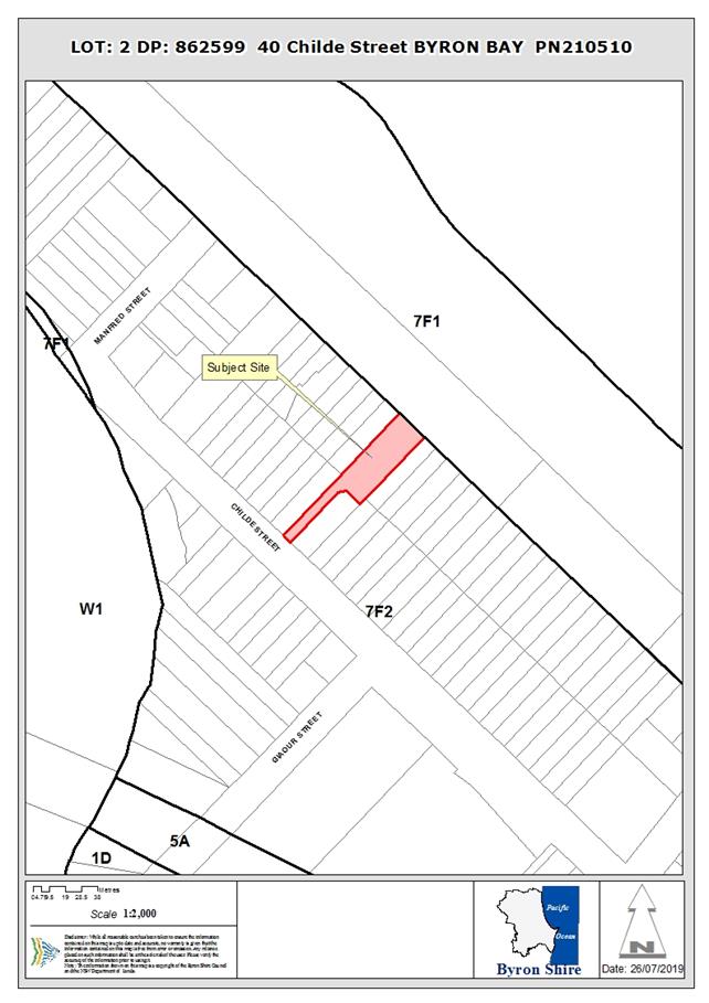
REPORT
1. INTRODUCTION
1.1. History relevant to the
development application
The site contains a dwelling house overlooking the beach
that was approved in 1981. The conditions of approval required the building to
be constructed in a manner to allowed it to be removed by road vehicle, but no
specific conditions or legal restrictions were imposed compel the owner to
relocate the building in the event of coastal erosion. A verandah extension,
approved in 1991, is subject to conditions requiring it to cease use should the
erosion escarpment come within 50m of the structure. This has already occurred,
but the verandah has not been removed.
Previous determinations are listed below:
· Development
Application No. 80/344 for a demountable dwelling house was refused by the
Council on 16 September 1980 due to a lack of entitlement under the Interim
Development Order and a lack of constructed road access to permit the buildings
removal. Advice from the NSW Department of Public Works indicated the
application should be refused due to the risk associated with coastal erosion.
· Development
Application No. 81/244 for a dwelling house was granted consent on 27 April
1981. Condition No. 4 of the consent required the building to be designed and
constructed so it could be easily dismounted and readily removed from the site
by road vehicle when endangered by the adverse effect of the sea.
· Building
Application No. 229/85 for additions to a dwelling was refused on 18 October
1985 on the grounds that the subject property may be subject to erosion and
inundation by the sea at a future time.
· Development
Application No. 86/205 for a dwelling extension was refused on 3 July 1986. The
extension was deemed an unwarranted intensification of a dwelling under
immediate threat of coastal erosion.
· Development
Application No. 91/124 for a verandah extension was granted consent on 27 June
1991. The development included a new covered deck on the seaward side of the
dwelling, removal of existing steps and landing and internal alterations
including installation of a spiral staircase.
· Development
Application No. 95/346 for a two lot subdivision was granted consent on 11
December 1995. The subdivision created a hatchet shaped lot containing the
existing dwelling and vacant lot facing Childe Street. The decision to grant
consent also had the undesirable consequence of preventing the demountable
dwelling from being relocated from the site by road vehicle as originally
intended.
· Development
Application No. 96/169 for alterations and additions was granted consent on 11
October 1996. The proposal included an elevated timber deck off the landward
side of the dwelling and minor alterations to a barbeque area. The consent does
not appear to have been acted on and has possibly lapsed.
1.2. Description
of the proposed development
The proposed development comprises:
(e) A
two storey extension to the existing dwelling house with two bedrooms, rumpus
room and elevated deck on the first floor and unenclosed car parking on the
ground floor. The new wing has a gross floor area of 100m2
(including decking). Construction methods involve prefabricated cassettes and
structural panels that can be bolted together on a steel frame.
(f) A
concrete in-ground swimming pool and spa with a capacity of 38,500L and 1.8m
high blockwork fence along the western boundary.
(g) Construction
of a blockwork wall around the subfloor of the existing dwelling to contain the
pool pump and other equipment.
(h) Removal
of fourteen trees, including eight Palms, two Banksias, three Pandanus palms
and one Dracaena.
Note. Removability report no. N17-203 by Westera
Partners claims the proposed dwelling extension can be removed within 12 hours
by a six person team using power tools. Other elements of the development are
considered sacrificial and will need to be demolished.
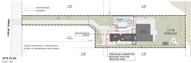
Figure 1: Site plan extract.
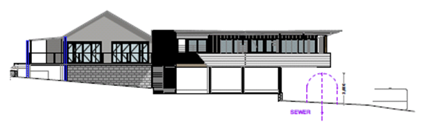
Figure 2: Elevations of the proposed extension.
1.3. Description
of the site
|
Land is legally described as:
|
LOT: 2 DP: 862599
|
|
Property address is
|
40 Childe Street BYRON BAY
|
|
Land is zoned:
|
7 (f2) (Urban Coastal Land
Zone)
|
|
Land area is:
|
1394 m2
|
|
Property is constrained by:
|
Flood Liable Land, Acid
Sulfate Soils Class 5, Coastal Erosion Precinct 1
|
40 Childe Street is a hatchet shaped lot with an area of
1394m2 located approximately halfway along the Belongil Spit, 1km
from the Byron Bay township. The north-eastern boundary is delineated by a rock
rubble wall with steps leading down to Belongil Beach.
A timber dwelling house, built in the early 1980’s, is
located towards the seward end of the block approximately 8m from the beach
escarpment as defined in May 2011. A large metal carport stands over a sewer
pipe and manhole near the southern boundary. The site is landscaped with a
mixture palms and local natives such as pandanus and coastal banksia. Adjoining
development comprises similar residential dwellings.
The property is burdened by a right-of-footway that grants
pedetrian access to the beach for the neighbouring property at 40A Childe
Street.
The land is within the 7 (f2) (Urban Coastal Land Zone)
under Byron Local Environmental Plan 1988 and is within Precinct 1 under
Byron Development Control Plan 2010. Land in Precinct 1 is identified as being
under immediate threat from coastal erosion.
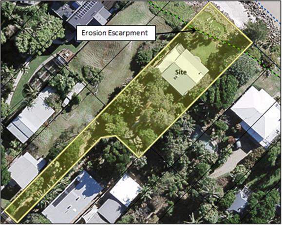
Figure 1: Aerial image of the subject site. The green dotted
line represents the defined erosion escarpment (May 2011).
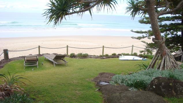
Figure 2: View of Belongil Beach from the subject site, looking
east.
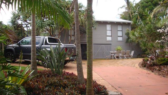
Figure 3: Existing dwelling house as viewed from the backyard,
looking east.
Figure 4: Proposed location of new two storey extension.
Figure 5: Existing carport located at the rear of the site. The
structure stands over a sewer pipe and manhole.
2. SUMMARY OF
REFERRALS
|
Referral
|
Comments
|
|
Development Engineer
|
The development is not supported from an
engineering viewpoint (E2019/54054). Refer to discussion of issues below.
|
|
Systems Planning Officer
|
The amended design appears to comply with Policy 4.20
in relation to proximity to sewer infrastructure. No objections
(E2019/23113).
|
|
Essential Energy
|
No objections subject to standard notes. Care will
need to be exercised during excavation to ensure underground powerlines are
not damaged (E2019/54049).
|
Issues:
Development Engineer
Council’s Development Engineer was not supportive of
the proposal, noting that design and method of construction compromises the
provisions of DCP 2010, Element J2.1.
Council’s Development Engineer noted:
“The
amended removability report does not address the proposed sacrificial elements
(including swimming pool, external slab and retaining wall, columns and piers
and internal plumbing) or demonstrate that they can be removed from the site
within the 12 hour period. The amended removability report does not demonstrate
that there will be no adverse effects on the removability of the existing
building. More than a 4WD vehicle is proposed for the removal procedure”.
“The
development does not ensure the impact of coastal processes on potential
development is minimised by limiting development and ensuring any development
is only temporary, which compromises section J2.1 of Byron Shire Council
Development Control Plan 2010”.
As discussed further in this
report, the proposed design is not supported having regard to the scale of the
new addition and the method of construction given the high level of risk the
site faces from coastal erosion.
3. SECTION 4.15C
– MATTERS FOR CONSIDERATION – DISCUSSION OF ISSUES
Having regard to the matters for consideration detailed in
Section 4.15(1) of the Environmental Planning & Assessment Act 1979
(EP&A Act), the following is a summary of the evaluation of the issues.
3.1 State Environmental
Planning Instruments
State
Environmental Planning Policy No 55—Remediation of Land
SEPP 55 requires the consent authority to consider if the
land is contaminated, and if so, whether the land needs to be remediated.
The site has a residential history dating to the early
1980’s and there are no records of previous land uses that are likely to
have contaminated the site. The property is not included on Council’s
contaminated lands register and is not known to contain radioactive sand fill.
Based on all the available information, the site is considered to be suitable
for the proposed residential use in its current state and does not require
further investigation.
State Environmental Planning Policy (Infrastructure) 2007
The provisions of SEPP (Infrastructure) 2007 have been
considered in the assessment of the development application.
Clause 45 – Determination of development
applications
The application is subject to
Clause 45 of the SEPP as the development involves the installation of a
swimming pool within 30m of a structure
supporting an overhead electricity transmission line as indicated by
Council’s infrastructure mapping.
The application
was referred to Essential Energy for a period of 21 days. Essential Energy did
not raise any objections, noting that the pole
and overhead service are a satisfactory distance away from the proposed pool
and extension. Underground mains from the service pole will need to be located
during excavation for the swimming pool to avoid damage. Standard notes for
construction near powerlines have been provided.
State
Environmental Planning Policy (Building Sustainability Index: BASIX) 2004
A valid BASIX certificate has been supplied with the
application. All of the relevant commitments for water, energy and thermal
comfort have been shown on the DA plans
State Environmental Planning Policy
(Coastal Management) 2018
The property is within the coastal
zone. The following provisions of the Coastal Management SEPP are applicable:
Clause 11 - Development on land in proximity to coastal wetlands or
littoral rainforest
(1) Development consent
must not be granted to development on land identified as “proximity area
for coastal wetlands” or “proximity area for littoral rainforest”
on the Coastal Wetlands and Littoral Rainforests Area Map unless the
consent authority is satisfied that the proposed development will not
significantly impact on:
(a) the
biophysical, hydrological or ecological integrity of the adjacent coastal
wetland or littoral rainforest, or
(b) the quantity
and quality of surface and ground water flows to and from the adjacent coastal
wetland or littoral rainforest.
Comment:
Two stands of littoral rainforest can be found near the beach
approximately 70m from the property in either direction. Given the separation
distances involved and the residential nature of the development, no impacts
are expected. Stormwater runoff and pool backwash are capable of being directed
to Council’s reticulated systems and will not be discharged to the
surrounding environment.
Clause 13 - Development on land within the coastal
environment area
(1) Development consent
must not be granted to development on land that is within the coastal
environment area unless the consent authority has considered whether the
proposed development is likely to cause an adverse impact on the following:
(a) the integrity and resilience of the biophysical, hydrological
(surface and groundwater) and ecological environment,
(b) coastal environmental values and natural coastal processes,
(c) the water quality of the marine estate (within the meaning of
the Marine Estate
Management Act 2014),
in particular, the cumulative impacts of the proposed development on any of the
sensitive coastal lakes identified in Schedule 1,
(d) marine vegetation, native vegetation and fauna and their
habitats, undeveloped headlands and rock platforms,
(e) existing public open space and safe access to and along the
foreshore, beach, headland or rock platform for members of the public,
including persons with a disability,
(f) Aboriginal cultural heritage, practices
and places,
(g) the use of the surf zone.
(2) Development consent
must not be granted to development on land to which this clause applies unless
the consent authority is satisfied that:
(a) the development is designed,
sited and will be managed to avoid an adverse impact referred to in subclause
(1), or
(b) if that impact cannot be
reasonably avoided—the development is designed, sited and will be managed
to minimise that impact, or
(c) if that impact cannot be
minimised—the development will be managed to mitigate that impact.
Comment:
The proposal is unlikely to affect the integrity if the
coastal environment or interfere with public open space or safe access to the
beach. Issues associated with coastal erosion are addressed elsewhere in this
report.
Clause 14 - Development on land within the coastal
use area
(1) Development consent must not be granted to development on
land that is within the coastal use area unless the consent authority:
(a) has considered whether the proposed development is likely to
cause an adverse impact on the following:
(i) existing, safe access to
and along the foreshore, beach, headland or rock platform for members of the
public, including persons with a disability,
(ii) overshadowing, wind funnelling
and the loss of views from public places to foreshores,
(iii) the visual amenity and scenic
qualities of the coast, including coastal headlands,
(iv) Aboriginal cultural heritage,
practices and places,
(v) cultural and built environment
heritage, and
(b) is satisfied that:
(i) the development is
designed, sited and will be managed to avoid an adverse impact referred to in
paragraph (a), or
(ii) if that impact cannot be
reasonably avoided—the development is designed, sited and will be managed
to minimise that impact, or
(iii) if that impact cannot be
minimised—the development will be managed to mitigate that impact, and
(c) has taken into account the
surrounding coastal and built environment, and the bulk, scale and size of the
proposed development.
Comment:
The new extension will sit below the roof line of the existing
dwelling and will not be easily seen in views from the beach or nearby public
places. No overshadowing of the coastal foreshore will occur nor will public
access to the beach be impeded.
Clause 15 - Development in coastal zone
generally—development not to increase risk of coastal hazards
Development
consent must not be granted to development on land within the coastal zone
unless the consent authority is satisfied that the proposed development is not
likely to cause increased risk of coastal hazards on that land or other land.
Comment:
Given the new building works are located on the landward side
of the existing dwelling, there is unlikely to be any increase to the risk of
coastal hazards on adjoining sites as a direct result of the development.
However, it is not clear if the proposed works will prevent
the existing dwelling from being easily removed, and it is similarly unclear
what affect the swimming pool and blockwork walls would have if left in-situ
during an erosion emergency. These issues are discussed further in Sections
4.2B and 4.4B of this report
4.2A Byron Local Environmental Plan 2014 (LEP 2014)
The site is located within the 7 (f2) (Urban Coastal Land
Zone). As such, LEP 2014 is not a relevant matter for consideration.
4.2B Byron Local Environmental Plan 1988 (LEP 1988)
LEP 1988 is an applicable matter for consideration in the
assessment of the subject development application in accordance with subsection
4.15(1) of the EP&A Act because it applies to the subject land and the
proposed development. The LEP 1988 clauses that are checked below are of
relevance to the proposed development:
|
Part 1
|
☒1|
☒2| ☒2A| ☒3| ☒4| ☒5| ☒LEP 1988 Dictionary| ☒7
|
|
Part 2
|
☒8|
☒9
|
|
Part 3
|
☒24|☒32| ☒40| ☒45| ☒52| ☒63
|
In accordance with LEP 1988 clauses 5, 8 and 9:
(a) The
proposed development is defined in the LEP 1988 Dictionary as dwelling house
and swimming pool (being ancillary to a dwelling house);
(b) The
land is within the LEP1988 7(f2) (Urban Coastal Land Zone) according to the map
under LEP 1988;
(c) The
proposed development is permitted with consent; and
(d) The
proposed development is considered to be inconsistent with the relevant
objectives of the Zone as discussed below:
|
Objective 7 (f2) (Urban Coastal Land Zone)
|
Consideration
|
|
(a) to identify urban land likely to be
influenced by coastal processes,
|
The size of the dwelling addition and the method of
construction are considered to be inappropriate given the high risk the site
faces from coastal processes.
Furthermore, the new additions will increase the
difficulty of removing the existing dwelling which is only 8m from the
erosion escarpment as identified in May 2011.
|
|
(b) to permit urban development within the zone
subject to the council having due consideration to the intensity of that
development and the likelihood of such development being adversely affected
by, or adversely affecting, coastal processes,
|
|
(c) to permit urban development within the zone
subject to the council having due consideration to:
(i) the need to relocate
buildings in the long term,
(ii) the need for
development consent to be limited to a particular period,
(iii) the form, bulk, intensity
and nature of the development, and
(iv) continued safe public access to
the site
|
|
(d) to allow detailed provisions to be made, by
means of a development control plan, to set aside specific areas within the
zone for different land uses and intensities of development.
|
The remaining checked clauses have been taken into
consideration in the assessment of the subject development application in
accordance with subsection 4.15(1) of the EP&A Act. The proposed
development complies with all of these clauses, except in relation Clause 32,
which is considered further as follows:
Clause 32 Development within Zone
No 7 (f2) (Urban Coastal Land Zone)
The purpose of clause 32 is to
ensure that due consideration is given to the scale, intensity and design of
new development in areas which are subject to coastal erosion processes.
The Council, in
deciding whether to grant consent, must take into consideration:
(a) the likelihood of the proposed development adversely
affecting, or being adversely affected by, coastal processes,
(b) the need to relocate buildings in the long term,
(c) the need for the development consent to be limited to a
particular period,
(d) the form, bulk, intensity and nature of the development,
and
(e) continued safe public access to the site.
The new addition will increase the floor
area of the existing dwelling by over 60% and is considered to be an
over-intensification of development on the site. A significant amount of the
new building work consists of sacrificial elements that are not relocatable and
will be difficult to quickly demolish and remove from the land in the event of
coastal erosion.
As such, the
proposal is considered to be inappropriate for the site having regard to the
above matters for consideration.
4.3 Any proposed Instrument
that has been the subject of public consultation and has been notified to the
consent authority
There are no proposed instruments that have particular
relevance to the development application.
4.4A Byron Shire Development Control Plan 2014
(DCP 2014)
DCP 2014 is not an applicable matter for consideration in
this assessment.
4.4B Byron Shire Development Control Plan 2010 (DCP 2010)
DCP 2010 is an applicable matter for consideration in the
assessment of the subject development application in accordance with subsection
4.15(1) of the EP& A Act because its purpose is to provide planning
strategies and controls for various types of development permissible in
accordance with LEP 1988. The DCP 2010 Chapters/Parts that are checked below
are of relevance to the proposed development:
|
Chapter 1 Parts:
|
☒A|
☒C| ☒F| ☒G| ☒H| ☒J|☒K| ☒
N
|
These checked Chapters/Parts have been taken into
consideration in the assessment of the subject development application in
accordance with subsection 4.15(1) of the EP&A Act. The proposed
development complies with all sections of these Chapters/Parts, except in
relation to certain prescriptive measures which are considered further (having
regard to the DCP 2010 Section A4 “How does this DCP work?” alternative
assessment procedure) as follows:
Chapter 1: Part J Coastal Erosion Lands
J2.1 Element – Precinct 1 - from the Beach
Escarpment to the Immediate Impact Line
The subject site is located in Precinct 1 and is subject to
the provisions of Part J2.1. The design and the method of construction do not
satisfy the Prescriptive Measures for Precinct 1 as detailed in the table
below.
|
Prescriptive Measures Element J2.1
|
Proposed development
|
Complies
|
|
1. No building is to be
located with 20 metres of the erosion escarpment.
|
The existing building is located 8m from the defined
erosion escarpment at its closest point. The new part of the building is 22m
from the erosion escarpment and therefore complies with this provision.
|
Yes but the exiting house is located 8m at its closest
point to the erosion escarpment.
|
|
2. Dwellings and component modules be single storey
only and of minimal practical floor level, except where a minimum floor level
is required in flood prone areas in which case an elevated floor level may be
permitted.
|
The proposed extension is a two storey structure that
has been designed to maintain the same floor level as the existing dwelling
that sits at the high point of the dune.
|
No
|
|
3. Dwellings must be entirely modular in construction,
apart from sacrificial elements such as decks. Removable panels or similar
componentry must not be used as structural elements, other than to provide
screening to open space or car parking areas.
|
Council’s Development Engineer has noted that
the proposal is not entirely modular in construction and includes sacrificial
components that cannot be relocated or removed within 12 hours.
|
No
|
|
4. Dwellings must consist of no more than three (3)
modules. Each module must satisfy the following specifications:
a) Maximum
width: 4.6m
b) Maximum
height: 4.4m when loaded for towing
c) Maximum
weight: 5000kg including towing equipment (engineers certification required).
|
The proposed method of construction requires the
building to be disassembled and demolished. The method differs from the Prescriptive
Measures that requires buildings to comprise three or less
‘modules’ that are capable of being towed.
The amended removability report states that the
building components, when disassembled, will comply with the relevant
numerical specifications. Council’s Development Engineer did not
disagree with this assertion but it is difficult to confirm based on the
available information.
|
No
|
|
Existing buildings
Alterations or extensions will be considered where
there will be no adverse effect on the ability of the building to be removed
in an emergency. Generally, extensions to existing buildings will be limited
to:
(a) where the gross
floor area of the existing building is less than 100 m2 -
extensions that will make the gross floor area no greater than 100 m2;
(b) where the gross
floor area of the existing building is 100 m2 or more - 10% of the
gross floor area of the existing building at the date of commencement,
providing that only one such extension per building will be permitted since
1989.
|
The proposed extension will increase the floor area of
the building by 100m2, which equates to an increase of 60% over
the existing floor area. Calculations are shown below.
· Existing
dwelling: 96m2
· Existing
deck: 69m2
· Proposed
extension: 76m2
· Proposed
deck: 24m2
· Total:
265m2
The prescriptive measures allow for only one extension
per building since 1989. This proposal would constitute the second addition
to the house since 1989, the first being DA 91/124 for dwelling alterations
and a deck extension.
|
No
|
Byron Shire Development
Control Plan 2010 - Issues
Chapter 1: Part J Coastal Erosion Lands
J2.1 Element – Precinct 1 - from the Beach
Escarpment to the Immediate Impact Line
In the applicants view, the development satisfies the
provisions of J2.1 on the basis that the new section is more than 20m from the
erosion escarpment, does not increase the floor area of the existing building
and incorporates flat-packed modular construction to allow rapid removal.
The applicant states:
“The proposed development is consistent with the
provisions of J2.1. As discussed at our meeting with Council officers the new
building work is located more than 20m from the erosion escarpment. As detailed
in the engineering report prepared by Westera Partners the building is modular
in construction and is able to be easily dismantled and removed from the site.
It is submitted that the proposed modification is superior to that envisaged by
J2.1 in that modules are not towed individually from the site, rather the
building is essentially flat packed.
“No
additional floor area is proposed in relation to the existing dwelling and the
new building works are consistent with the removability requirements of Part
J”.
The Objectives and Performance
Criteria of Element J2.1 are detailed below:
J2.1 Element –
Precinct 1 - from the Beach Escarpment to the Immediate Impact Line
Element Objective
To ensure the impact of coastal
processes on potential development is minimised by limiting development and
ensuring any development is only temporary.
Performance Criteria
New buildings or works are to
be temporary and able to be readily removed in the event of coastal erosion.
Development that is of a
community nature, which relates to the use of the beachfront, may be
considered, provided that any building is easily removable and does not require
a major extension to a service main.
Where vacant urban-sized lots
exist wholly within this precinct, the location of unregistered mobile homes as
defined by the Local Government (Manufactured Home Estates, Caravan Parks,
Camping Grounds and Moveable Dwellings) Regulation 2005 and as further
described in this DCP, may be considered. These may comprise more than one unit,
but all units must be capable of separation and relocation by four wheel drive
car (rather than truck) prior to damage by the sea.
Erection of sacrificial
structures, such as decks, may be possible where these do not prejudice
relocation of other building sections. All elements, including decks,
foundations and supports must be removed from the site prior to damage by the
sea.
Extensions or alterations to
existing buildings in Precinct 1 must be limited to minor works only, and must
be capable of swift removal or demolition if coastal processes threaten the
development.
The applicant’s view of the development as a separate
building, rather than an extension of the existing building is unable to be
supported. The development is physically connected to the main building and is
configured to allow a natural extension of the floor plan. The structure is
intended to operate as an extension of the existing dwelling and should be
treated as such for the purposes of assessment under J2.1. However if
considered as a new development, the application then fails to satisfy the
element objective and the first performance criteria in that the
intensification of residential development on the site is not easily removed or
temporary.
With respect to the method of construction, the
removability report has not addressed the sacrificial elements (swimming pool,
external slab, retaining wall, columns, piers or internal plumbing) or
demonstrated that they can be removed from the site in 12 hours. It is also
unclear what effect the new development would have on the removal of the
existing dwelling in an erosion emergency. In this regard the pool would be
sited in the way of the existing dwelling from being relocated.
In conclusion, the proposal is not considered to be consistent
with the intent of the Performance Criteria and the Objectives of J2.1, which
is to limit development and ensure extensions to existing buildings are limited
to ‘minor works’. As such, approval of the development is
considered to be inappropriate.
4.5 Any Planning Agreement or
Draft Planning Agreement?
There are no planning agreements or draft planning
agreements that apply to the site.
4.6 Environmental Planning
& Assessment Regulation 2000 Considerations
There are no relevant matters for consideration in the
Regulations.
4.7 The likely impacts of that
development, including environmental impacts on both the natural and built
environments, and social and economic impacts in the locality
Natural environment
Tree removal
The application proposes to remove
14 trees and palms to accommodate the development. An inspection of the site
revealed that most of the vegetation appears to be planted specimens with
limited environmental significance. Provision of new landscaping using local
native species is a normal requirement of consent in these circumstances
however no further discussion is necessary given the application is recommended
for refusal.
Built environment
The proposal will not have a significantly adverse impact on
the built environment of the locality in relation to visual impact, view loss
or overshadowing. Impacts in relation to coastal erosion are addressed
elsewhere in this report.
Social and Economic Impact
No significant social or economic impacts are expected.
4.8 Council policies
Policy 4.20 – Building over pipelines and other
underground structures Policy
The applicant has conceived a design which cantilevers the
first floor over a Council sewer pipe and manhole. Council’s Systems
Planning officer noted that the new design appears to comply with Council
policy 4.20 because there is a 3m clearance from the pipe to the first level of
the building. While this may be acceptable in relation to sewer infrastructure,
it does not address the more fundamental problem of scale and intensity which
are discussed in sections 4.2 and 4.4 of this report.
4.9 The suitability of the site
for the development
The site is subject to significant
risk from coastal erosion and is not suitable for the proposed development
given the scale of the new building and chosen methods of construction.
4.10 Submissions made in accordance with
this Act or the regulations
The development application was publicly exhibited for a
period of 14 days in accordance with Chapter 17 of Byron DCP 2010. No
submissions were received.
4.11 Public interest
Allowing a significant contravention of DCP 2010 Part J is
likely to set an undesirable precedent and may undermine future efforts to
control development in Precinct 1. As such, the proposal is not considered to
be in the public interest.
5. DEVELOPER
CONTRIBUTIONS
5.1 Water & Sewer Levies
No Section 64 levies will be required.
5.2 Section 7.11 Contributions
No Section 7.11 Contributions
will be required.
6. CONCLUSION
It is concluded that the development as proposed is
considered to be an intensification of a dwelling that is at high risk from
coastal erosion. The proposal exhibits inconsistencies with Chapter J of Byron
DCP 2010 and the provisions of LEP 1988 in relation to development in the Zone No 7 (f2) (Urban Coastal Land Zone).
Therefore, it is concluded that the development application
should be refused based on the issues raised in this report.
Staff Reports - Sustainable Environment and Economy 8.11
Report No. 8.11 Update
on the Planning Status of Short Term Rental Accommodation in Byron Shire
Directorate: Sustainable
Environment and Economy
Report
Author: Shannon
Burt, Director Sustainable Environment and Economy
File No: I2019/1171
Summary:
The purpose of this report is to provide Council with an
update on the current planning status of Short Term Rental Accommodation (STRA)
in Byron Shire.
|
RECOMMENDATION:
That Council note the update provided on the
current planning status of Short Term Rental Accommodation in Byron Shire.
|
REPORT
Holiday letting is not a new
issue. Council resolutions, brought about due to the rise in complaints, on the
subject of holiday letting date back to 2003. Complaints include:
· prohibited development in residential areas
· loss of neighbourhood amenity
· noise and antisocial behaviour, particularly from
late-night parties
· excessive numbers of people and cars
· parking which may block driveways or impede visibility and
traffic movement
· excess or poorly managed garbage
In addition to these adverse
impacts, housing affordability and stock have also become an issue with houses
being purchased specifically for holiday letting purposes, therefore decreasing
the available stock in the rental market.
Background
On 5 June 2018, the Minister for
Planning and the Minister for Better Regulation and Innovation announced a
whole–of–government framework for Short Term Rental Accommodation (STRA)
in New South Wales. Note: The term STRA replaces that of holiday let.
The framework enables STRA to
occur through:
• A
state-wide planning framework
• Changes
to strata legislation
• A
mandatory Code of Conduct - the Code will apply to anyone involved in providing
or using short-term rental accommodation including hosts, guests, online
booking platforms, and letting agents. The Department of Finance, Services and
Innovation is developing the Code
While the NSW Parliament passed
the Government’s STRA reforms on 14 August 2018. The state-wide planning
rules and an industry-wide mandatory Code of Conduct are yet to be finalised by
the relevant Departments.
State wide planning rules
The proposed amendments to
planning rules were placed on exhibition by the then Department of Planning and
Environment 5 October – 16 November 2018.
The proposed amendments to
planning rules propose to:
1. Introduce a single
definition for STRA;
2. Introduce exempt and
complying development pathways that enable STRA as:
· Exempt development for up to 365 days per year, when the
host is present.
· Exempt development, when not on bushfire prone land and
when the host is not present, for:
o No more than 180 days per year in Greater Sydney.
o Up to 365 days per year outside of Greater Sydney.
o Councils outside Greater Sydney will be able to decrease
the 365 day threshold to no lower than 180 days per year.
· Complying development, when on bushfire prone land under
BAL29 rating and the host is not present for:
o No more than 180 days per year in Greater Sydney
o Up to 365 days per year outside of Greater Sydney.
o Councils outside Greater Sydney will be able to decrease
the 365 day threshold to no lower than 180 days per year; and
3. Introduce
minimum fire safety and evacuation requirements for premises used for STRA.
It is understood that the
Department of Planning continue to consider the submissions made during the
exhibition period.
Council response to the STRA framework
To date, Council has made multiple
submissions to the relevant Ministers for Planning and Department of Planning,
and has made various resolutions on STRA including the most recent 21 November
2018 Report 13.21 Update
on the release of the Short Term Rental Accommodation Planning Framework by the
Department of Planning and Environment.
At this meeting Council resolved
as follows:
18-763 Resolved that Council:
1. Note
the update on the release of the short term rental accommodation planning
framework by the Department of Planning and Environment provided in the report.
2. Write
(again) to the Minister for Planning to seek an urgent meeting to request a
deferral of Byron Shire from the new state-wide planning rules (pause to
implementation). This pause is necessary to enable a full consideration of the
current impact of, and that of the proposed planning rule changes to legitimise
short term rental accommodation on Byron Shire in terms of environmental,
social and economic impacts. That Council also include reference in the letter
to the undermining of decades of planning of residential zones in Byron Shire
that has been caused by the sudden increase of short-term letting businesses in
residential areas. That Council also provide examples of areas where the
approach of restricting short term letting to owner occupiers has proven
effective, such as Santa Monica
3. Concurrent
with 2 above, write to the Department of Planning and Environment to advise
that Council has significant concerns in relation to the planning rules as
exhibited including:
i) the
burden to be placed on council to enforce the planning rules;
ii) the
lack of a coherent registration system including fees for short term rental
accommodation to resource council with the enforcement role of short term
rental accommodation;
iii) the
absence of a Code of Conduct to inform the planning rules;
iv) the
ambiguity in the planning rules due to the definition of ‘short term
rental accommodation’ and exempt and complying criteria applicable to same;
v) the
known impact of short term rental accommodation on local neighbourhoods,
community, and other tourist accommodation and failure to address this;
vi) the
known impact on housing availability and affordability and failure to address
this;
vii) the
lack of recognition of the clear detriment to local communities with
high tourist numbers caused by commercial investors
in residential areas.
vii) the
number of days policy position which conflicts with other State Government
policy initiatives to address housing affordability, local character and place
planning and needs review.
4. Concurrent
with 2 and 3 above, make a formal submission to Department of Planning and
Environment to the planning rules as exhibited to include the following as
local exceptions to the planning rules for Byron Shire through either a state
wide planning policy schedule or Byron local environmental plan amendment:
i) require
the ‘dwelling’ used for short term rental accommodation to be the
principle place of residence of the owner;
ii) a
reduction in the number of days that short term rental accommodation is
permissible from 365 days to 90 days (not 180 days);
iii). In
the event that a reduction to 90 days is not possible, than under the current
rules, an application for 180 days be made in its place
iv) require
the owner or manager of a property used for short term rental accommodation to
register on a Byron Shire Council Short Term Rental Accommodation Register;
v) exclude
short term rental accommodation from (to be nominated) areas in the Byron Shire
that are needed for permanent residential and key worker accommodation.
This resolution was actioned by
staff, letters sent, and meeting request with relevant Ministers lodged.
On 7 February 2019, the Acting
Mayor Michael Lyon, General Manager and Director Sustainable Environment and
Economy, accompanied by Ben Franklin the then Parliamentary Secretary for
Renewable Energy and Northern NSW, met with the then Minister for Planning and
Housing Anthony Roberts about the proposed STRA planning rules and the impact
of STRA on the Byron Shire community.
Subsequent to this meeting, on 11
February 2019, the Minister announced that due to the high concentration and
unique impacts of STHL on some parts of Byron Shire, he would issue a Ministerial
Direction 3.7 Reduction in non-hosted short term rental accommodation period.
This Direction invites the Byron Shire Council to prepare a Planning Proposal
that could introduce a 90 day threshold in the most impacted towns of the Local
Government Area. This Planning Proposal process would include impact assessment
and consultation with communities.
The Direction issued is very
specific as to what must be included in the planning proposal:
The
council must include provisions which give effect to the following principles
in a planning
proposal
to which this direction applies:
· non-hosted short term rental accommodation periods must not
be reduced to be less than 90 days
· the reasons for changing the non-hosted short-term rental
accommodation period should be clearly articulated
· there should be a sound evidence base for the proposed
change, including evidence of the availability of short-term rental
accommodation in the area (or parts of the area) in the 12 months preceding the
proposal, relative to the amount of housing in the area, and trend data on the
availability of short-term rental accommodation over the past 5 years.
· the impact of reducing the non-hosted short-term rental
accommodation period should be analysed and explained, including social and
economic impacts for the community in general, and impacted property owners
specifically
This Direction requires a
substantial body of research work, impact assessment and consultation to be
completed to accompany and justify any planning proposal put forward by
Council. Work on the planning proposal has commenced. A further report on the
planning proposal will be presented to Council before years end.
In addition to the LEP amendment
mentioned above. Council has been a strong advocate for a local Council register
system for STRA. This has been raised also with relevant Ministers.
There are various ways to
establish a register including through Council’s Fees and Charges or by
the submission and approval of an application for approval to operate short
term rental accommodation premise/s under Section 68 of the Local Government
Act 1993 much like that for a caravan park. The latter would require
a legislative amendment.
The current reported statistics on
STRA being the number of Airbnb properties, and its impacts on housing
availability, rental stress, accommodation providers in Byron Shire, justify
the need for a Council register.
A Council register would allow:
• identification
of properties being used as STRA
• real time
data to be collected on the growth and supply of this market; this data could
then be used to monitor and evaluate the costs and benefits over time
• an
additional revenue source for councils to fund the enforcement of the yet to be
determined code of conduct
It is proposed to require the
owner or manager of a property used for STRA to register on a Council maintained
STRA Register.
At a more recent meeting 28 May
2019, with the Minister for Planning and Public Spaces Rob Stokes, Minister for
Environment Matt Kean and Minister for Local Government Shelley Hancock; the
Mayor Simon Richardson, Deputy Mayor Michael Lyon, General Manager and Director
Sustainable Development were again able to express concerns about the
increasing impact of STRA activity on the Byron Shire community and need for
local planning controls and Council maintained register.
Further development of a register
for Byron Shire Council will be completed in concert with the planning
proposal.
Current situation
STRATEGIC CONSIDERATIONS
Community Strategic Plan and
Operational Plan
|
CSP Objective
|
L2
|
CSP Strategy
|
L3
|
DP Action
|
L4
|
OP Activity
|
|
Community Objective 4: We manage growth and change
responsibly
|
4.1
|
Support the visions and aspirations of local communities through
place-based planning and management
|
4.1.3
|
Manage development through a transparent and efficient
assessment process
|
4.1.3.9
|
Prepare a Planning Proposal to enable precinct based Short
Term Rental Accommodation.
|
|
|
|
|
|
|
|
|
|
|
|
|
Legal/Statutory/Policy Considerations
In the absence of specific
‘holiday letting’ provisions, the use of dwellings for STRA falls
within the Standard LEP Template definition of ‘tourist and visitor
accommodation’ and is a prohibited land use in the residential zones of
the Byron LEP 2014. Tourist and visitor accommodation is permitted
with consent in the B2 Local Centre zone and SP3 Tourist zone.
However, under Byron LEP 2014
a one bedroom bed and breakfast establishment is exempt development, subject to
the basic standards for exempt development.
Financial Considerations
Planning proposal to be managed
within existing operations budget.
Consultation and Engagement
To comply with relevant
legislation and Council policy.