Ordinary (Planning) Meeting
Public ATTACHMENTS
EXCLUDED FROM THE
Ordinary
(Planning) Meeting AGENDA
OF 15 August 2019
8. Staff Reports
Sustainable Environment and Economy
8.1 PLANNING
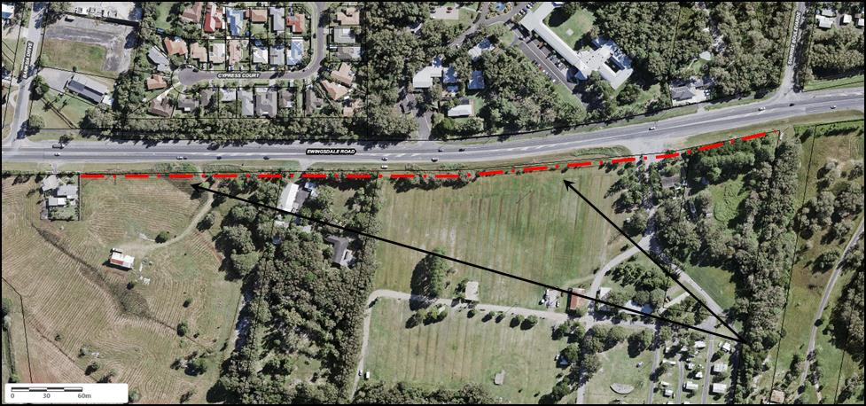
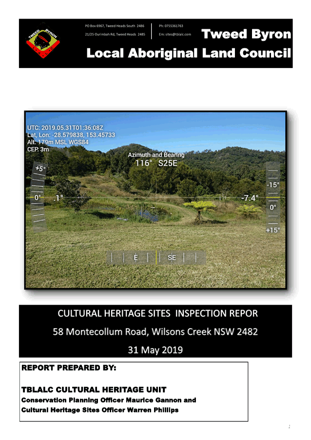
- Update on Resolution 19-209 Development Application 10.2018.483.1 Rural
Tourist Accomodation Eight (8) Cabins and Swimming Pool at 58 Montecollum Road
Wilsons Creek
Attachment
1... Attachment 1 – 10.2018.483.1 – Road Safety Audit................................. 3
Attachment
2... Attachment 2 – 10.2018.483.1 – TBLALC Cultural Heritage Sites
Inspection Report................................................................................................................... 7
Attachment
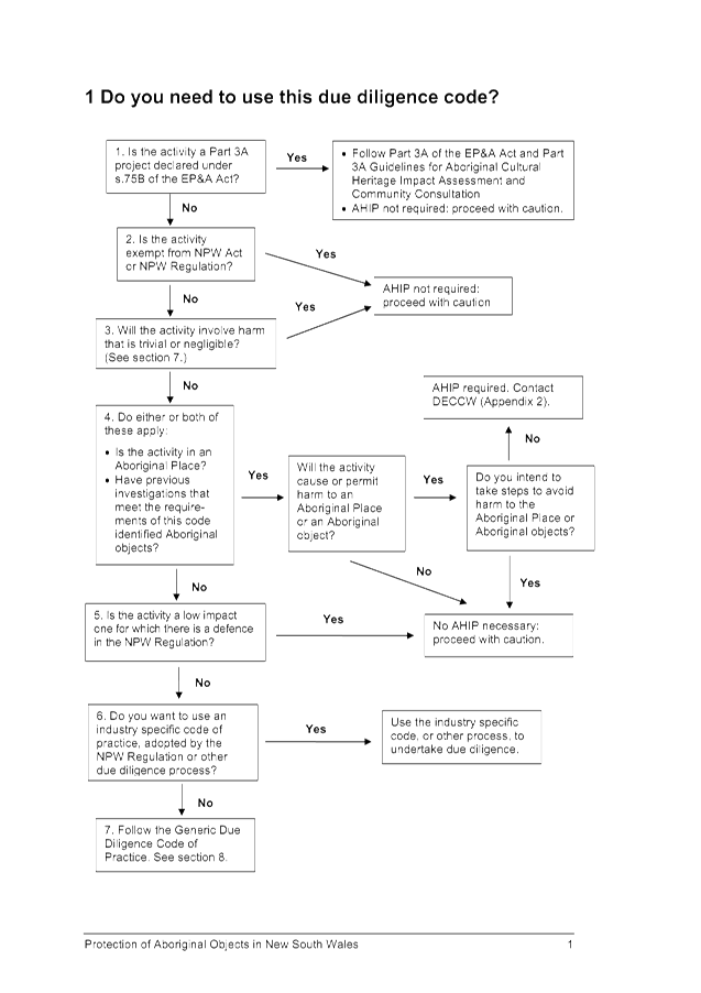
3... Attachment 3 – 10.2018.483.1 – Due Diligence Code............................ 19
Attachment
4... Attachment 4 – 10.2018.483.1 – Drawing A09 Issue B –
Amended pool deck plans................................................................................................................. 51
Attachment
5... Attachment 5 – 10.2018.483.1 – Diagram A – Illustration
of separation distances between cabins........................................................................................ 52
Attachment
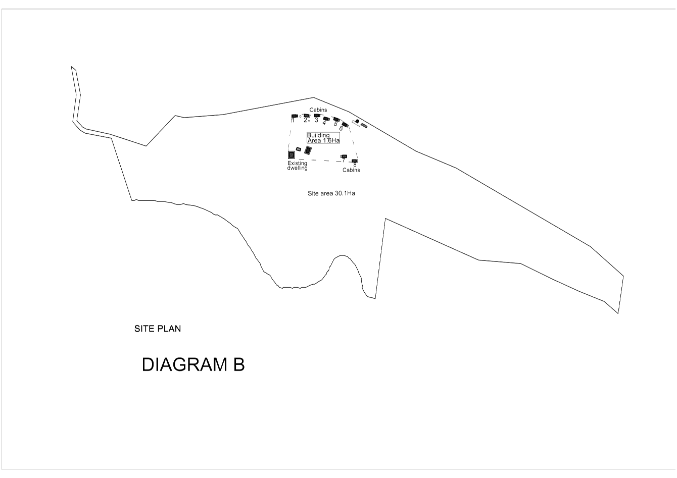
6... Attachment 6 – 10.2018.483.1 – Diagram B – Layout plan
illustrating clustering of cabins on the site..................................................................................... 53
Attachment
7... Attachment 7 – 10.2018.483.1 Amended conditions of consent
(19/07/2019) 54
Attachment
8... Attachment 8 - 10.208.483.1 - Plans....................................................... 74
Attachment
9... Attachment 9 - Engineering Assessment Report (Submission) - Ingen
Consulting................................................................................................................. 83
8.2 PLANNING
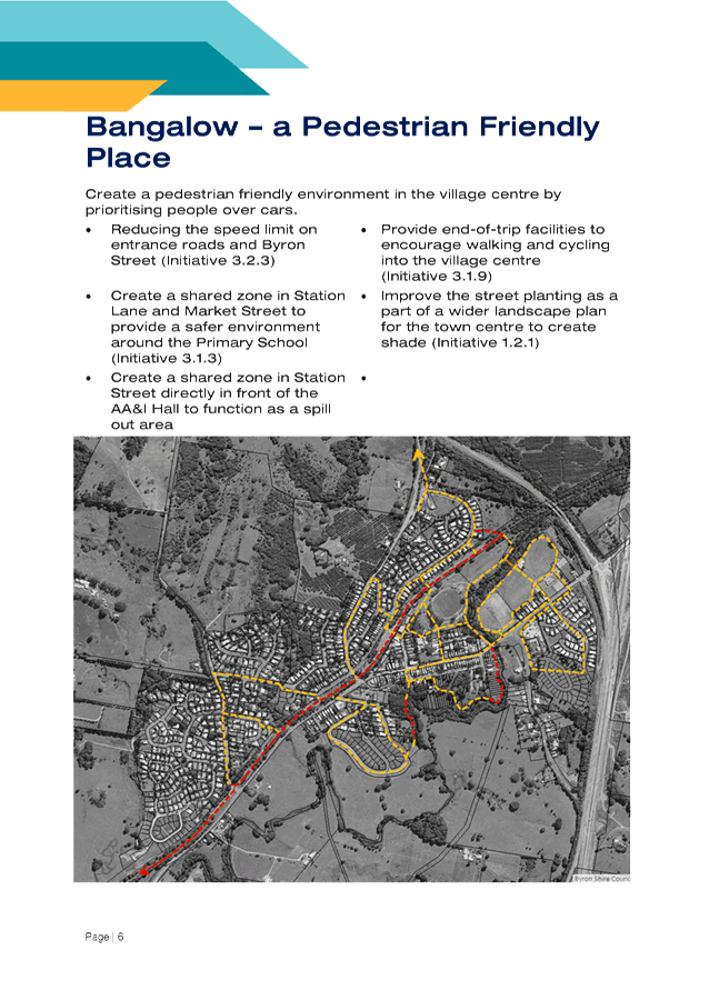
- Bangalow Village - Implementation Plan
Attachment
1... Bangalow Village Plan - Draft Part B - Implementation Plan................. 89
8.3 PLANNING
- Submissions Report for Amendment to Byron DCP - Public Art 24.2018.48.1
Attachment
1... 24.2018.48.1 Draft Byron Shire DCP 2014 Chapter D8 Public Art -
public exhibition version.................................................................................................... 112
Attachment
2... 24.2018.48.1 Draft DCP 2010 Chapter 1 Part E - Public Art................ 124
Attachment
3... 24.2018.48.1 Draft Byron Shire DCP 2014 Part A Preliminary Public art
amendments.......................................................................................... 135
Attachment
4... 24.2018.48.1 Draft DCP 2010 chapter 17 - Advertising and Notification of
Development Applications public art amendment................................. 183
Attachment
5... 24.2018.48.1 Draft DCP 2010 Chapter 1 Part A General - public art
amendment............................................................................................................... 198
Attachment
6... 24.2018.48.1 Submissions..................................................................... 219
Attachment
7... Form of Special Disclosure of Pecuniary Interest................................. 220
8.4 PLANNING
- DCP 2014 Minor Amendments Submissions Report 24.2018.65.1
Attachment
1... Draft Byron Shire DCP 2014 Chapter D6 Subdivision.......................... 222
Attachment
2... Draft Byron Shire DCP 2014 Chapter B4 Traffic Planning, Vehicle Parking,
Circulation and Access.......................................................................... 249
Attachment
3... Draft Byron Shire DCP 2014 Chapter D2 Residential Accomodation and
Ancillary Development in Rural Zones................................................................. 271
Attachment
4... Draft Byron Shire DCP 2014 Chapter D3 Tourist Accommodation..... 296
Attachment
5... Draft Byron Shire DCP 2014 Chapter B9 Landscaping........................ 313
Attachment
6... Draft Byron Shire DCP 2014 Chapter D1 Residential Accomodation in Urban,
Village and Special Purpose Zones....................................................... 341
Attachment
7... Draft Byron Shire DCP 2014 Chapter E8 West Byron Urban Release Area 376
Attachment
8... Draft Byron Shire DCP 2014 Chapter B14 Excavation and Fill............ 454
Attachment
9... Draft Byron Shire DCP 2014 Chapter E5 Certain Locations in Byron Bay and
Ewingsdale............................................................................................. 463
Attachment
10. Draft Byron Shire DCP 2014 Chapter B3 Services.............................. 512
Attachment
11. Submissions........................................................................................... 532
Attachment
12. Form of Special Disclosure of Pecuniary Interest................................. 541
8.6 PLANNING
- Community Participation Plan
Attachment
1... Draft Byron Community Participation Plan V3...................................... 543
8.7 PLANNING
- Development Application 10.2019.20.1 Multi Dwelling Housing, Five (5)
Dwellings - Lot 14 DP 792128 Bangalow Road, Byron Bay
Attachment
1... Attachment 1 Submissions received..................................................... 606
Attachment
2... Attachment 2 Application Plans............................................................. 668
Attachment
3... Attachment 3 Recommended Conditions of Consent........................... 681
8.9 PLANNING
- Development Application 10.2019.129.1 Subdivison Two Lots at 480 -544
Coolamon Scenic Drive Coorabell
Attachment
1... Proposed plans...................................................................................... 699
Attachment
2... Recommended conditions..................................................................... 701
8.10 PLANNING -
10.2018.425.1 Alteration and Additions to Existing Dwelling House, Swimming
Pool and Tree Removal
Attachment
1... 10.2018.425.1 - Architectural Plans....................................................... 705
Attachment
2... 10.2018.425.1 - Removability Plans...................................................... 711
Attachment
3... 10.2018.425.1 - Engineering Drawings.................................................. 724
Attachment
4... 10.2018.425.1 - Vehicle Turning Circles................................................ 739
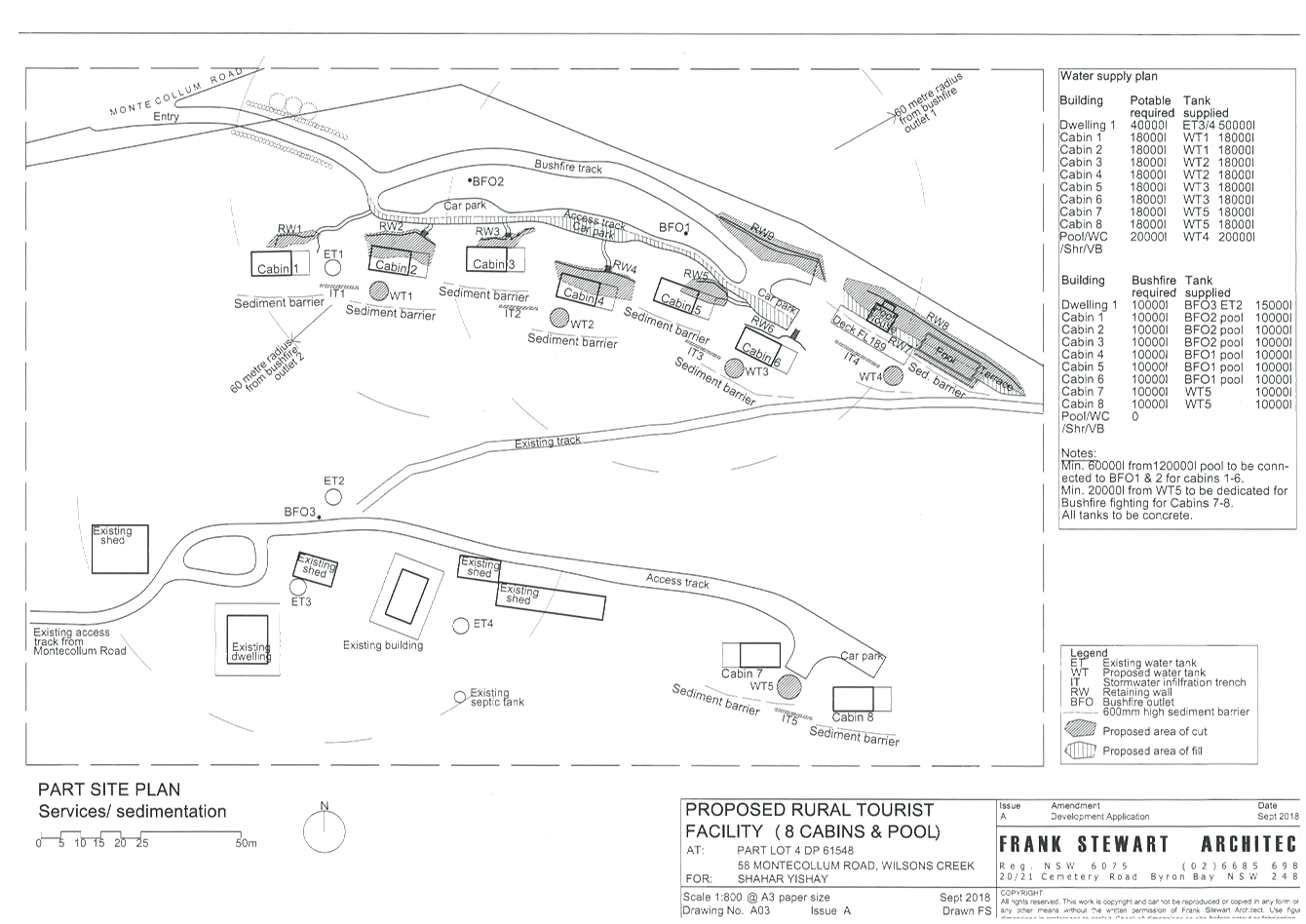
Staff Reports - Sustainable Environment and Economy 8.1 - Attachment 1
Engineering Referral
#Enter the doc. number
|
DA No.
|
10.2018.483.1
|
|
Proposal:
|
Rural Tourist Accommodation: Eight (8) Cabins, Swimming
Pool and Associated Works
|
|
Property description:
|
LOT: 4 DP: 621548
|
|
58 Montecollum Road WILSONS CREEK
|
|
Parcel No/s:
|
53590
|
|
Applicant:
|
Frank Stewart Architect
|
|
Owner:
|
Mr S B Yishay & Ms L B Levi
|
|
Zoning:
|
Zone No. RU2 Rural Landscape / PART DM Deferred Matter
|
|
Planning Officer:
|
Mr B J Grant
|
|
Referral Date:
|
26 June 2019
|
CONCURRENT SECTION 68 AND 138
APPLICATIONS: Not applicable
|
|
Fees paid
|
Date paid
|
Receipt No.
|
|
Stormwater (55)
|
|
|
|
|
Roads Act (51)
|
|
|
|
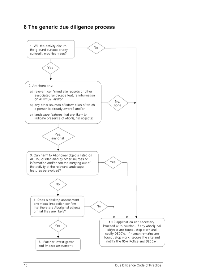
This engineering assessment is based on the following
documents:
|
Date
|
Description
|
TRIM Doc. No.
|
|
28/9/18
|
Engineering Referral & Assessment
|
A2018/31532
|
|
26/6/19
|
Report 15 08 2019
|
I2019/974
|
|
24/4/19
|
Recommended Conditions
|
E2019/29050
|
|
|
|
|
|
|
|
|
|
|
|
|
|
|
|
|
|
|
|
|
Supported, subject to the
amended conditions recommended at the end of this report
Click
here to enter any comments.
|
Renan Solatan
|
14 July 2019
|
ASSESSMENT
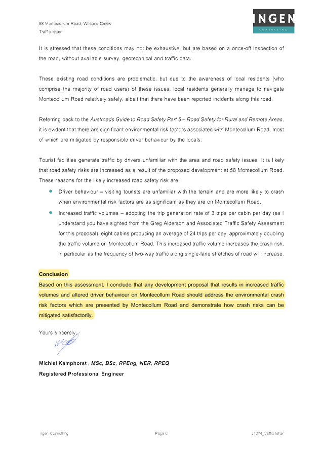
Road
Investigation
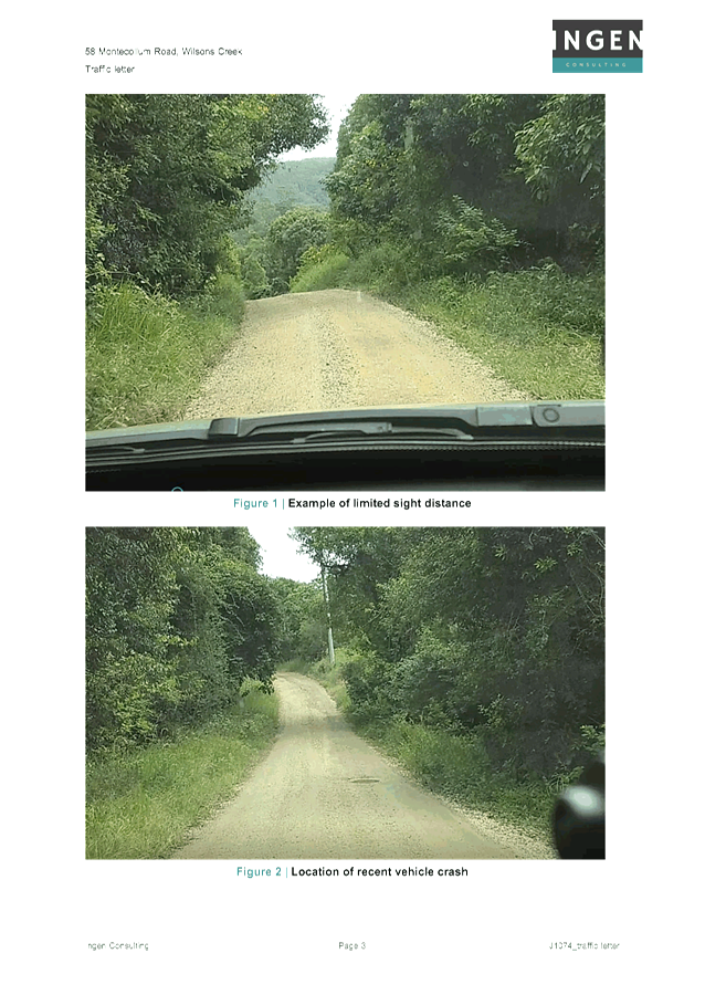
This report is based on observations made during the
road investigation conducted on Friday the 12th of July 2019, and determines
any potential hazards and risks within the gravel and sealed sections of
Montecollum Road from Cedar Road up to the frontage of the development in 58
Montecollum Road.
The
following aspects were investigated during the site inspection:
· Road cross section and geometric features
· Road surface type and condition
· Observed roadside hazards and driver risk
· Driver sightline availability, particularly at
intersections
Site Inspection
A
daytime site inspection was conducted from 1:00 pm to 2 pm on Friday the 12th
of
July 2019. Weather conditions
during the audit inspection were fine and sunny.
Audit Data
Existing
Road Description Summary
Montecollum Road from
Cedar Road east bound direction
Road cross section 4.0m
pavement, 1.0m grassed shoulders/verge
Section length 450m
Speed Assumed
50 km/h however due to the road formation vehicles can safely travel below 50
km/h
Running surface &
condition formed
gravel, reasonable condition
Side drainage Table
drain right side
Horizontal Alignment Long
straight sections with bends
Vertical
alignment grade
less than 10 degrees
Typical Photo

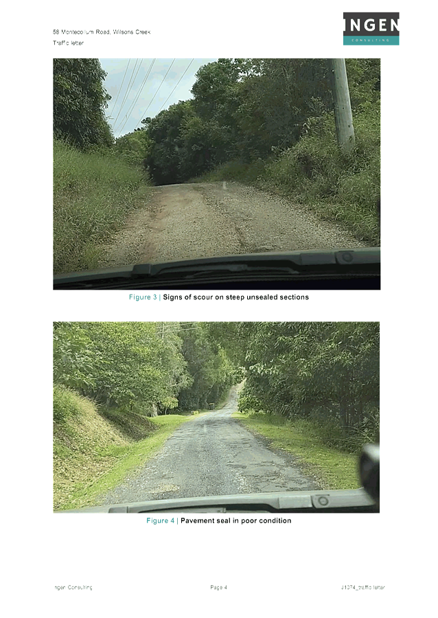
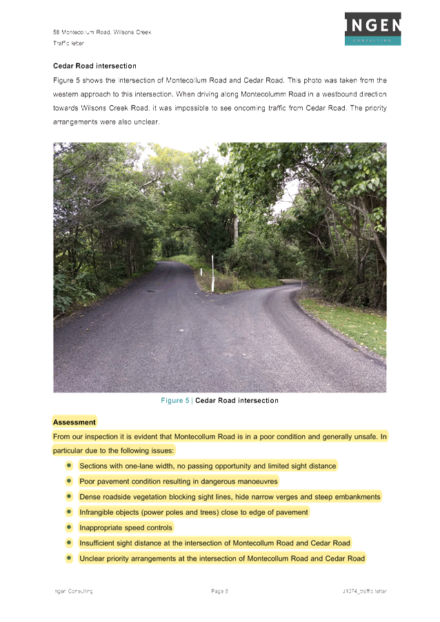
Figure 1 Gravel Section from Cedar Road

Figure 2 Gravel Section 200m from Cedar Road
Montecollum Road 450m
to 800m from Cedar Road east direction
Road cross section 5.0m
pavement, 1.0m grassed shoulders/verge
Section length 450m
Speed Assumed
50 km/h however due to the road formation vehicles can safely travel below 50
km/h
Running surface &
condition formed
seal, reasonable condition with few pot holes
Side drainage Table
drain right side
Horizontal Alignment Long
straight sections
Vertical
alignment steep
Typical Photo

Figure 3 Road past the Development Access

Figure 4 Midway of Sealed Section
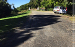
Figure 5 End of Council Maintained Section
Assessment
Montecollum Road is classified as a Local Access Rural Road
with an approximate capacity of 150 vehicles per day (Austroads). The first
450m of Montecollum Road east of Cedar Road is the main section of road that
carries the majority of traffic east of Cedar Road. The road currently services
7 rural properties generating 63 vehicles per day and 5.95 vehicles per peak
hour. The new development generate a projected total traffic of 36 vehicles per
day and 4.1 peak hour trips utilising Montecollum Rd.
On many roads in Australia, traffic volumes are less than 150
vehicles per day. Where traffic volumes are less than 150 vehicles per day and,
particularly, where terrain is open, single lane carriageways may be used. The
traffic lane width adopted on such roads should be at least 3.7 m in accordance
with Austroads Guide to Road Design. A width of less than 3.7 m can result in
excessive shoulder wear. A width greater than 4.5 m but less than 6.0 m may
lead to two vehicles trying to pass with each remaining on the seal. This
potentially increases head-on accidents. The width of 3.5 m ensures that one or
both vehicles must have the outer wheels on the shoulders while passing.
The total volume of traffic post development is
approximately 99 vehicles per day. The total traffic volume does not exceed the
current capacity of the road. The additional traffic therefore does not create
adverse impact onto the road capacity.
The current surface condition of Montecollum Road is
reasonable and does not show pavement structural defects. There are surface
defects however such as pot holes and slight corrugations, this is due to lack
of maintenance.
There were no vehicles travelling the road during the
inspection. The main safety concern is the ability and manoeuvrability to pass
over the 5.0m wide road formation especially at bends. Vehicles tend to travel
at slow speed due to the road formation, vertical & horizontal alignment
and limited sight distance. The sealing of the full length of Montecollum Road
will improve the driving comfort however it will not improve the road safety.
Sealing is not warranted in this case. Safety of traffic at this section of
Montecollum Road may be improved by regrading the road to provide a minimum
road pavement and carriageway of 4.0m with the provision of passing bays at
200m.
Recommendations
The volume of development traffic will not create adverse
impact main section of Montecollum Road east of Cedar Road, however the
development will increase the frequency of maintenance requirement to provide
an acceptable level of service. The gravel road must be upgraded to correct the
road formation prior to the issue of occupation certificate.
Recommended Conditions
Amend Condition 15
Consent required for works within the road reserve
Consent from Council must be obtained for works within the
road reserve pursuant to Section 138 of the Roads Act 1993. Three (3) copies of
engineering construction plans must accompany the application for consent for
works within the road reserve.
Such plans are to be in accordance with Council’s
current Design & Construction Manuals and are to provide for the following
works:
|
Road Upgrade
|
The following sections of Montecollum Road must be
upgraded:-
1. The
first 450m from Cedar Road;
2. From
the end of the existing sealed section (approximately 800m from Cedar Road)
and up to 10m past the proposed driveway servicing Cabin 1 to Cabin 6.
The upgrade must included the following:-
1. Generally
in accordance with Council’s standard drawing R13 for a rural crowned
road with a formation of 4m carriageway with roadside drainage and table
drains in accordance with Section D1.22 of NRLG D1 Geometric Road Design.
2. Provision
shall be made to provide passing bay at 200m spacing. The passing bay shall
be 20m long x 6m wide carriageway.
3. Provision
of sealed surface at all access points, longitudinal grades 10º or
greater, 10m before and after the dwelling house in Lot 3 DP621548.
|
|
Driveway (rural & residential areas without kerb
& gutter)
|
A driveways (2x) servicing the Cabins shall be upgraded in
accordance with Council’s current “Northern Rivers Local
Government Development Design & Construction Manuals and Standard Drawing
R14”.
|
Staff Reports - Sustainable Environment and Economy 8.1 - Attachment 2


Staff Reports - Sustainable Environment and Economy 8.1 - Attachment 3


Staff Reports - Sustainable Environment and Economy 8.1 - Attachment 4
Staff Reports - Sustainable Environment and Economy 8.1 - Attachment 5
Staff Reports - Sustainable Environment and Economy 8.1 - Attachment 6
Staff Reports - Sustainable Environment and Economy 8.1 - Attachment 7
|
SCHEDULE 1 CONDITIONS OF CONSENT
|
|
Parameters of consent
|
|
1.
|
Development is to be in accordance with approved plans
The development is to be in accordance with plans listed
below:
|
Plan No.
|
Description
|
Prepared by
|
Dated:
|
|
A01 Issue B
|
Site Plan
|
Frank Stewart
|
Oct 2018
|
|
A02 Issue C
|
Part Site Plan
|
Frank Stewart
|
Jan 2018
|
|
A03 Issue A
|
Part Site Services/Sedimentation Plan
|
Frank Stewart
|
Sep 2018
|
|
A04 Issue A
|
Part Site Landscaping plan
|
Frank Stewart
|
Sep 2018
|
|
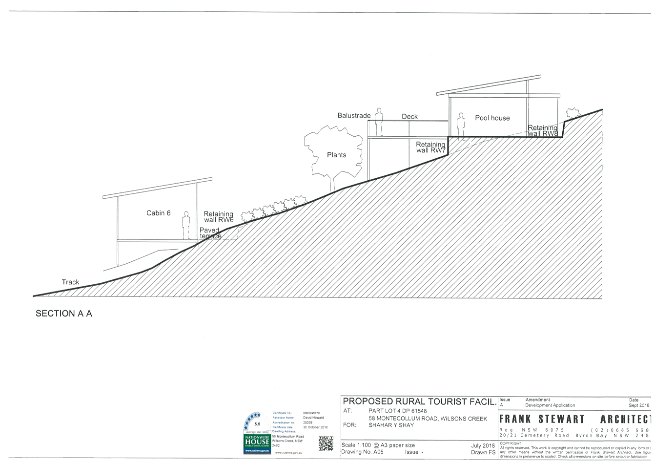
A05
|
Section A-A
|
Frank Stewart
|
Sep 2018
|
|
A06
|
Section B-B
|
Frank Stewart
|
Sep 2018
|
|
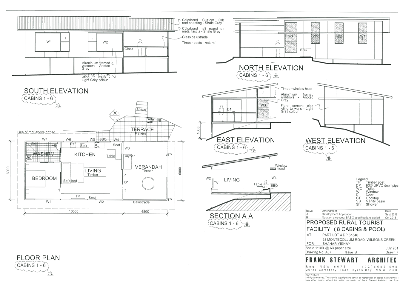
A07 Issue B
|
Cabins 1-6, Floor Plan, Section , Elevations
|
Frank Stewart
|
Oct 2018
|
|
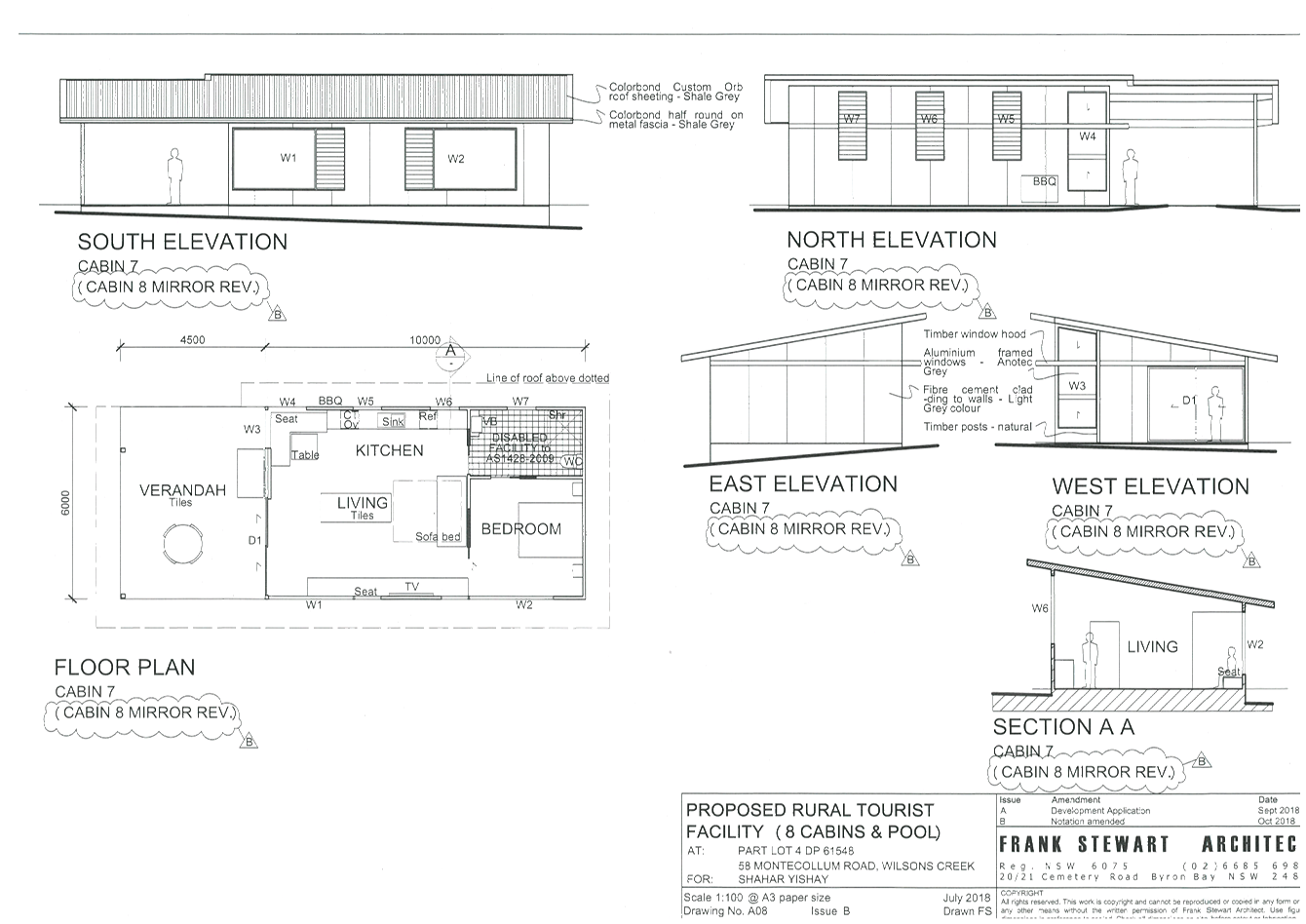
A08 Issue B
|
Cabins 7-8, Floor Plan, Section , Elevations
|
Frank Stewart
|
Oct 2018
|
|
A09 Issue B
|
Pool House Floor
Plan, Section, Elevation
|
Frank Stewart
|
May 2019
|
|
NJ01 Issue A
|
Relocation of Overhead Powerline
|
Frank Stewart
|
April 2018
|
The development is also to be in accordance with any
changes shown in red ink on the approved plans or conditions of consent.
The approved plans and related documents endorsed with the
Council stamp and authorised signature must be kept on site at all times
while work is being undertaken.
|
|
2.
|
Integrated Approvals from
other Authorities.
This development consent includes an Integrated
development approval under Sections 4.46 and 4.47 of the Environmental
Planning and Assessment Act 1979, being a Bush Fire Safety Authority Issued
under section 100B of the Rural Fires Act 1997 subject to the
conditions listed under the “General Terms of Integrated Development
Approval” in this consent.
|
|
3.
|
Discovery of Aboriginal
relics
If any Aboriginal
archaeological relics or items are exposed during construction works, the
Developer or Contractor shall immediately cease works, notify the NSW Office
of Environment and Heritage (OEH) or its successor, and obtain any necessary
permits and/or approvals to continue the work under the National Parks and
Wildlife Act 1974. The Developer or Contractor shall comply with any further
request made by the OEH to cease work for the purposes of archaeological
assessment and recording.
|
|
4.
|
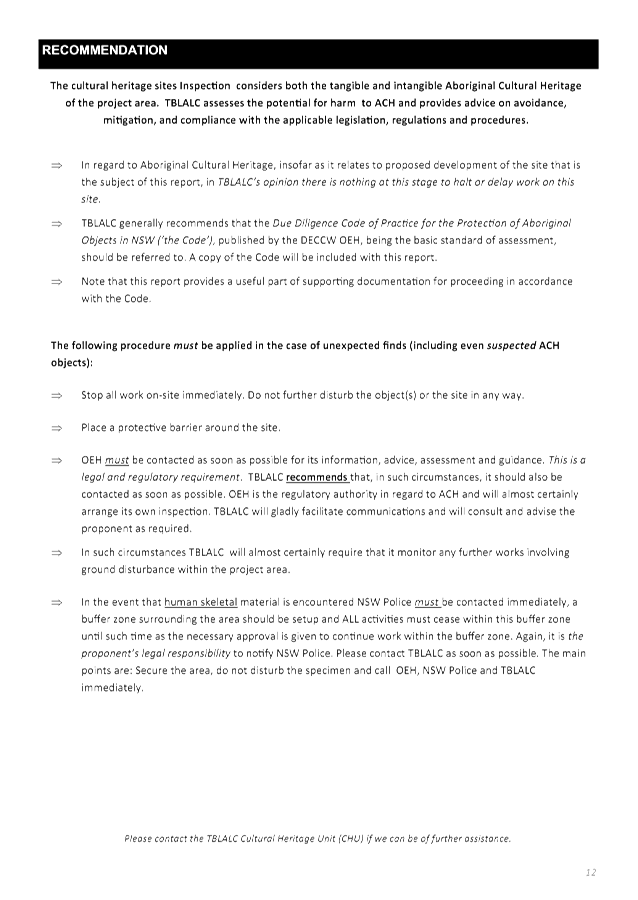
Procedures for unexpected finds
The following procedure must
be applied in the case of unexpected finds (including even suspected Aboriginal
cultural heritage objects):
a) Stop all work on-site
immediately. Do not further disturb the object(s) or the site in any way.
b) Place a protective
barrier around the site.
c) The NSW Office of
Environment and Heritage (OEH), or its successor, and Tweed Byron Local
Aboriginal Land Council (TBLALC) must be contacted as soon as possible for
information, advice, assessment and guidance.
d) In the event that human
skeletal material is encountered NSW Police must be contacted immediately, a
buffer zone surrounding the area should be setup and all activities must
cease within this buffer zone until such time as the necessary approval is
given to continue work within the buffer zone.
|
|
The following conditions are to be complied with
prior to issue of a Construction Certificate for building works
|
|
5.
|
Section 7.12 Levy to be paid
Prior to the issue of a construction certificate the
section 7.12 levy required by the Byron Developer Contributions Plan 2012
must be paid to Council.
The levy will be calculated as follows:
Levy payable = %C x $C
§ %C
is the levy rate applicable as set out in the latest Ministerial Direction
issued under section 7.17.
§ $C
is the proposed cost of carrying out the development.
The rate of %C is:
|
Proposed cost of the development
|
Maximum percentage of the levy
|
|
Up to $100,000
|
Nil
|
|
$100,001–$200,000
|
0.5 percent
|
|
More than $200,000
|
1.0 percent
|
The cost of development must be calculated in accordance
with clause 25J of the Regulation. The Cost Summary Report (copy
attached) as set out in schedule 2 of the Section 7.12 contributions plan
must be submitted to Council with the payment. The cost summary report
must be prepared by a quantity surveyor. Copies of Cost Summary Report
are available at Council’s main office or may be downloaded from
Council’s website.
|
|
6.
|
Amendment to the plans
The Principal Certifying Authority shall be satisfied that
the plans have been amended as follows:
· At
least one cabin at the northern part of the site (i.e. Cabins 1 to 6) shall
be designed to provide disabled access, facilities and car parking to guests.
· “Cabin 8” shall be
deleted from the plans.
|
|
7.
|
Building materials and colours to be specified
The application for a Construction Certificate is to
include plans and specifications that indicate the proposed building
materials and colours consistent with the provisions of Development Control
Plan 2014 – Chapter D1.2.4 (Residential) or D2.2.3 (Rural) - Character
and Visual Impact. Please note that colours must be non-reflective
earth tone colours and that the use of white and near white colours is not
permissible
Such plans and specifications must be approved as part of
the Construction Certificate.
|
|
8.
|
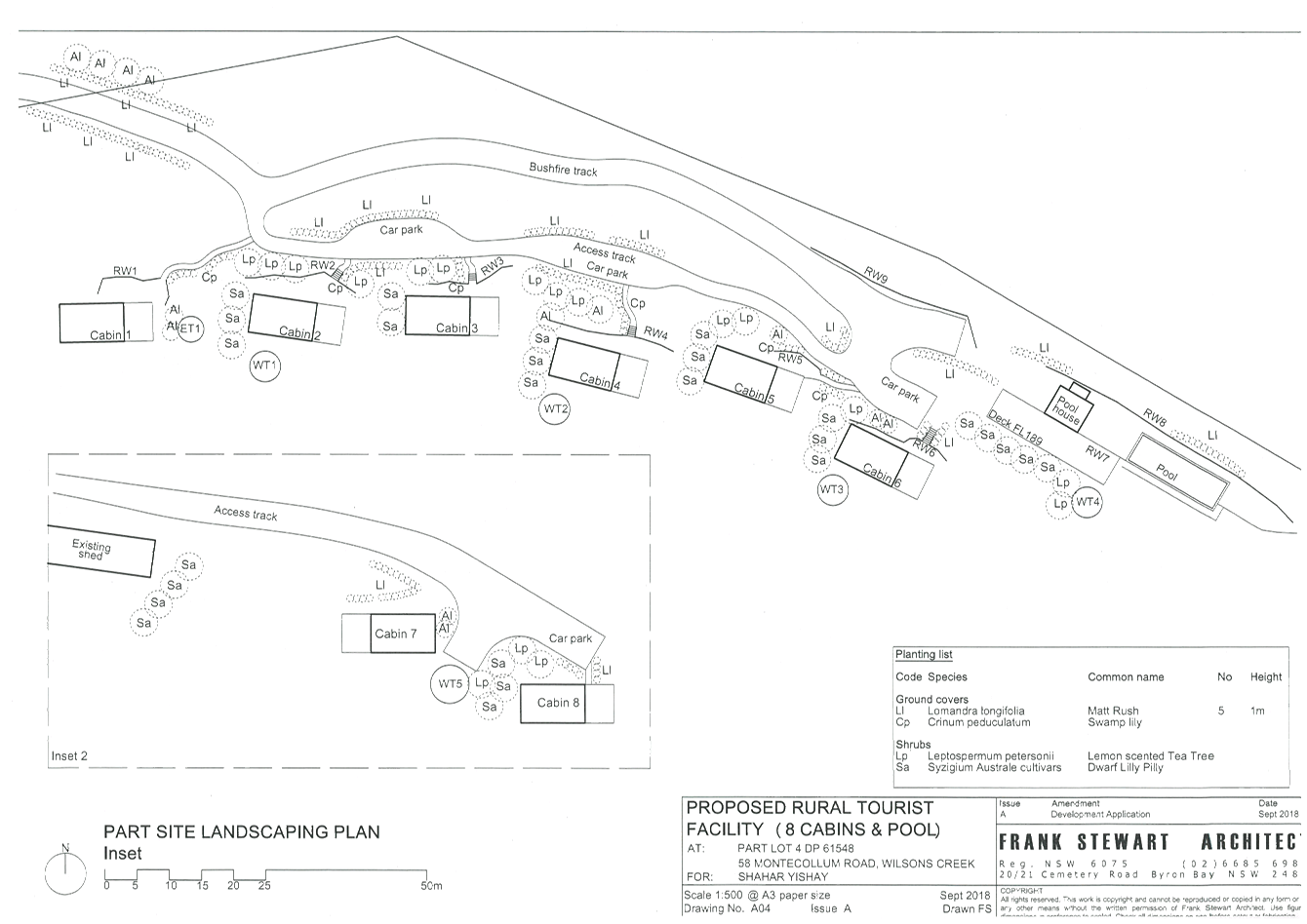
Landscaping plan required
The application for a Construction
Certificate is to include plans and specifications that indicate the
landscaping of the site. Such landscaping plan must incorporate
adequate detail to demonstrate compliance with the provisions of Chapter B9
of Development Control Plan 2014. Species identified in Chapter B9 of
Development Control Plan 2014 are to be planted wherever possible. The
landscaping plan must indicate:
a) proposed location
for planted shrubs and trees
b) botanical name of
shrubs and trees to be planted
c) mature height of
trees to be planted
d) location of grassed
and paved areas,
e) location of trees
identified for retention in the development application plans.
f) Location of
garden lighting with such lighting to be limited to bollard style with a low
wattage to limit light spill onto neighbouring properties.
g) Maintenance
of the stand of Eucalypts to the south of Cabins 1-3 as a visual
screen.
h) The
plan is to be prepared by a suitably qualified landscape architect /
architect /ecologist who has appropriate experience and competence in
landscaping.
Such plans and specifications must be approved as part of
the Construction Certificate.
Note: Landscaping to the site is to comply with the
principles of Appendix 5 of Planning for Bushfire Protection 2006.
|
|
9.
|
Cabins to be relocated so that APZ
does not encroach on any part of BV or HEV mapping on the site
The extent of any bushfire asset
protection zones must be entirely outside high conservation value vegetation
mapped on the Biodiversity Values Map under the Biodiversity Conservation Act
2016 or as High Environmental Value by Council.
|
|
10.
|
Biodiversity Conservation Management
Plan
A Biodiversity Conservation Management
Plan must be prepared in accordance with the attached Guidelines for
preparing a Vegetation Management Plan (VMP) or Biodiversity Conservation
Management Plan (BCMP) and
the plan submitted to and approved by Council. Such plan must detail
protection and compensation measures proposed to protect native flora and fauna and their habitats and must retain and improve habitat on that part of the site covered by the Management Plan.
The plan must:
a. Provide and implement strategies to avoid
impacts to Koalas and their habitat on the site.
b. Provide ecological restoration within
High Conservation Value rainforest vegetation, particularly targeted at
Camphor Laurel control, over an area twice the size as would be achieved by
planting 900 trees per cabin (total of 7200 trees) at the usual spacing.
c. illustrate on maps of a suitable scale
the accurate extent of the Biodiversity Values mapping, vegetation
communities classified to Plant Community Type, overall development
footprint, approved asset protection zones and driveways on the subject site.
d. detail the methodology for habitat
restoration and specify the
use of qualified and
experienced bush regenerators
only.
e. specify that planting and/or restoration
works will commence immediately upon approval of the Management Plan.
f. include lists of locally occurring native
tree, shrub and ground cover plant species suitable for planting as part of
the ecological restoration program and site landscaping.
Include a list of environmental weeds,
comprising introduced plant species known to have the capacity to invade
native vegetation communities to prevent their introduction to the site.
|
|
11.
|
Building materials and colours to be specified
The application for a Construction
Certificate is to include plans and specifications that indicate the proposed
building materials and colours consistent with the provisions of Development
Control Plan 2014 – Chapter D2.2.3 - Character and Visual Impact.
Colours must be non-reflective earth tone colours and that the use of white
and near white colours is not permissible.
To blend in with the surrounding landscape, roof colours
shall be recessive earthly tones, in a natural shade of green.
Such plans and specifications must
be approved as part of the Construction Certificate.
|
|
12.
|
Geotechnical Report required – Building Works
A certificate from a professional Engineer experienced in
Geotechnical Science is to be provided to the Principal Certifying Authority,
certifying that the site is stable and will not be affected by landslide or
subsidence at, above or below the site when the building and swimming pool
are erected. The certificate must be prepared in accordance with AS 1726.
|
|
13.
|
Geotechnical Report required – Engineering Works
A certificate from a professional Engineer experienced in
soil mechanics is to be provided to the Principal Certifying Authority,
certifying that:
a) the
design of the civil engineering works, including roads, stormwater
infiltration system and others, retaining walls and/or cut & fill
batters, has been assessed as structurally adequate,
b) the
civil engineering works will not be affected by landslip or subsidence either
above or below the works; and
c) adequate
drainage has been provided.
|
|
14.
|
Sediment and Erosion Control Management Plan required
The application for a Construction
Certificate is to include plans and specifications that indicate the measures
to be employed to control erosion and loss of sediment from the site. Control
over discharge of stormwater and containment of run-off and pollutants
leaving the site/premises must be undertaken through the installation of
erosion control devices such as catch drains, energy dissipaters, level
spreaders and sediment control devices such as filter fences and
sedimentation basins.
Such plans and specifications must
be approved as part of the Construction Certificate.
NOTE: The plans
must be in compliance with Council's current “Northern Rivers Local
Government Development Design & Construction Manuals and Standard
Drawings”.
|
|
15.
|
Stormwater Drainage – Connection to Existing
Drainage System
The application for a Construction Certificate is to
include plans and specifications for stormwater drainage in accordance with
AS/NZS 3500.3:2003, Plumbing and drainage, Part 3: Stormwater drainage.
All stormwater drainage for the development must be
conveyed by a gravity system to the existing stormwater drainage system
within the site. Such plans and specifications must be approved as
part of the Construction Certificate.
|
|
16.
|
Stormwater Drainage – Infiltration Trench &
Additional Plans addressing Stormwater Quality
The application for a Construction Certificate is to
include plans and specifications for stormwater drainage in accordance with
the relevant Australian Standard. All stormwater drainage for the development
must be conveyed by a gravity system to an infiltration trench or trenches
complying with the requirements of Council’s Comprehensive
Guidelines for Stormwater Management.
The infiltration trench or trenches must be designed by a
qualified practising Civil Engineer to fully infiltrate the 20 year ARI runoff
from all impervious areas of the proposed development for all storm durations
without surcharge onto neighbouring properties. The Civil Engineer is to be a
corporate member of the Institution of Engineers Australia or is to be
eligible to become a corporate member and have appropriate experience and
competence in the related field.
The stormwater management plan shall also provide
separate/additional details and detailed plans to demonstrate compliance to
Table B3.1 of Council’s DCP.
Such plans and specifications must be approved as part of
the Construction Certificate.
|
|
17.
|
Consent required for works within the road reserve
Consent from Council must be obtained for works within the
road reserve pursuant to Section 138 of the Roads Act 1993. Three (3) copies
of engineering construction plans must accompany the application for consent
for works within the road reserve.
Such plans are to be in accordance with Council’s
current Design & Construction Manuals and are to provide for the
following works:
|
Road Upgrade
|
The following sections of Montecollum Road must be
upgraded:-
1. The
first 450m from Cedar Road;
2. From
the end of the existing sealed section (approximately 800m from Cedar Road)
and up to 10m past the proposed driveway servicing Cabin 1 to Cabin 6.
The upgrade must included the following:-
1. Generally
in accordance with Council’s standard drawing R13 for a rural crowned
road with a formation of 4m carriageway with roadside drainage and table
drains in accordance with Section D1.22 of NRLG D1 Geometric Road Design.
2. Provision
shall be made to provide passing bay at 200m spacing. The passing bay shall
be 20m long x 6m wide carriageway.
3. Provision
of sealed surface at all access points, longitudinal grades 10º or
greater, 10m before and after the dwelling house in Lot 3 DP621548.
|
|
Driveway (rural & residential areas without kerb
& gutter)
|
A driveways (2x) servicing the Cabins shall be upgraded
in accordance with Council’s current “Northern Rivers Local
Government Development Design & Construction Manuals and Standard
Drawing R14”.
|
|
|
18.
|
Access plans required
The application for a Construction Certificate is to
include plans and specification that indicate access, parking and manoeuvring
details in accordance with the plans approved by this consent.
The internal access and manoeuvring servicing Cabins 1 to
6 and Cabins 7 & 8 are to comply with condition 7 of the NSW RFS General
Terms of Approval with Reference No D18/7488 – DA18100215336 WS dated 9
January 2019. Plans are to include, but not be limited to, the following
items:
a) pavement design,
comprising an all weather surface, such as asphalt, bitumen seal, concrete,
pavers or other similar treatment;
b) site conditions
affecting the access;
c) existing and design
levels;
d) longitudinal
section for the full length of the internal access
e) cross sections
every 15 metres; and
f) drainage
details.
The engineering plans and specifications are to be
designed by a qualified practising Civil Engineer. The Civil Engineer is to
be a corporate member of the Institution of Engineers Australia or is to be
eligible to become a corporate member and have appropriate experience and
competence in the related field.
Such plans and specifications must be approved as part of
the Construction Certificate.
NOTE: The plans must be in compliance with Council's
current “Northern Rivers Local Government Development Design &
Construction Manuals and Standard Drawings”.
|
|
19.
|
Plans of retaining walls and drainage
The application for a Construction Certificate is to
include plans and specifications that indicate retaining walls or other
approved methods of preventing movement of the soil, where any excavation or
filled area exceeds 600mm in height. Adequate provision must be made for
drainage.
Such plans and specifications must be approved as part of
the Construction Certificate.
|
|
20.
|
Compliance with BASIX Certificate requirements
The development is to comply with Basix Certificate No.
968587M, dated Tuesday, 30 October 2018.
The commitments indicated in the Certificate are to be
indicated on the plans submitted for approval of the Construction
Certificate.
The plans submitted must clearly indicate all windows
numbered or identified in a manner that is consistent with the identification
on the Basix Certificate.
Minor changes to the energy efficiency measures may be
undertaken without the issue of any amendment under Section 96 of the Act,
provided that the changes do not affect the form, shape or size of the
building.
Such plans and specifications must be approved as part of
the Construction Certificate.
|
|
21.
|
Long Service Levy to be paid
A Long Service Levy must be paid to the Long Service
Payments Corporation. This is a State Government Levy and is subject to
change.
These payments may be made online at www.longservice.nsw.gov.au or at
Council’s Administration Office, Station Street, Mullumbimby. When
paying to Council, cheques are to be made payable to ‘Byron Shire
Council’.
For further information regarding the Long Service Payment
please refer to the website above.
|
|
22.
|
Onsite Effluent Waste Water systems (Rural Swimming
Pools)
The owner is responsible to ensure works do not conflict
with the Onsite Waste Water System (Sewage Management Facility).
Details to be submitted with the Construction Certificate
to demonstrate there is no conflict with both the disposal areas, plumbing
and treatment/ storage/ septic tanks.
Where required, a S68 Application is to be submitted to
Council to relocate any system prior to the issue of the Construction
Certificate.
|
|
23.
|
Details of pool fence required
The application for a Construction Certificate is to
include plans and specifications that indicate the details of the fence
around the swimming pool in accordance with the Swimming Pools Act 1992 and
AS1926.1.
Such plans and specifications must be approved as part of
the Construction Certificate.
|
|
24.
|
Site Waste Minimisation and Management Plan
Chapter B8 of Byron Shire Development
Control Plan 2014 (DCP 2014) aims to facilitate sustainable waste management
in a manner consistent with the principles of Ecologically Sustainable
Development. Prior to the issue of a Construction Certificate, a Site Waste
Minimisation and Management Plan (SWMMP) must be submitted outlining measures
to minimise and manage waste generated during demolition, construction and
the ongoing operation and use of the development. The SWMMP must specify the
proposed method of recycling or disposal and the waste management service
provider.
A template
is provided on Council’s website to assist in providing this
information www.byron.nsw.gov.au/files/publication/swmmp
- pro-forma-.doc
|
|
25.
|
Potable
Water Supply Management Plan
Prior to the issue of a Construction Certificate provided
to the Principle Certifying Authority a Potable Water Supply Management Plan
(PWSMP). For further information refer to the following website
http://www.health.nsw.gov.au/environment/water/Publications/private-water-supply-guidelines.pdf
The PWSMP must be prepared by a suitable qualified professional.
|
|
26.
|
Tree Removal
No trees or vegetation to be cleared or
removed until a Construction Certificate has been issued.
|
|
The following conditions are to be complied with
prior to any building or construction works commencing
|
|
27.
|
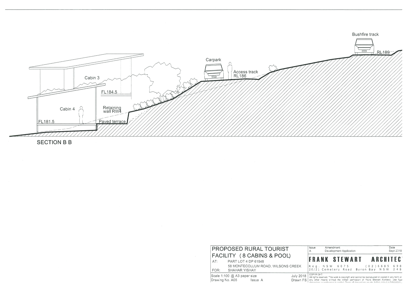
Powerlines to be relocated
Prior to the commencement of any building works, the power
lines traversing the ridgeline on the northern part of the site must be
relocated in accordance with the Powerline Relocation Plan NJ01, dated April
2019, and any requirements of Essential Energy. The powerlines must be
relocated to provide a minimum separation distance of at least 10m from the
centre line to the closest roof eave of any liveable structure (i.e. tourist
cabins).
If Essential Energy require an easement to be burdened on
the title of the property, this easement must be registered prior to the
commencement of any works and evidence of such provided to the Principal
Certifying Authority.
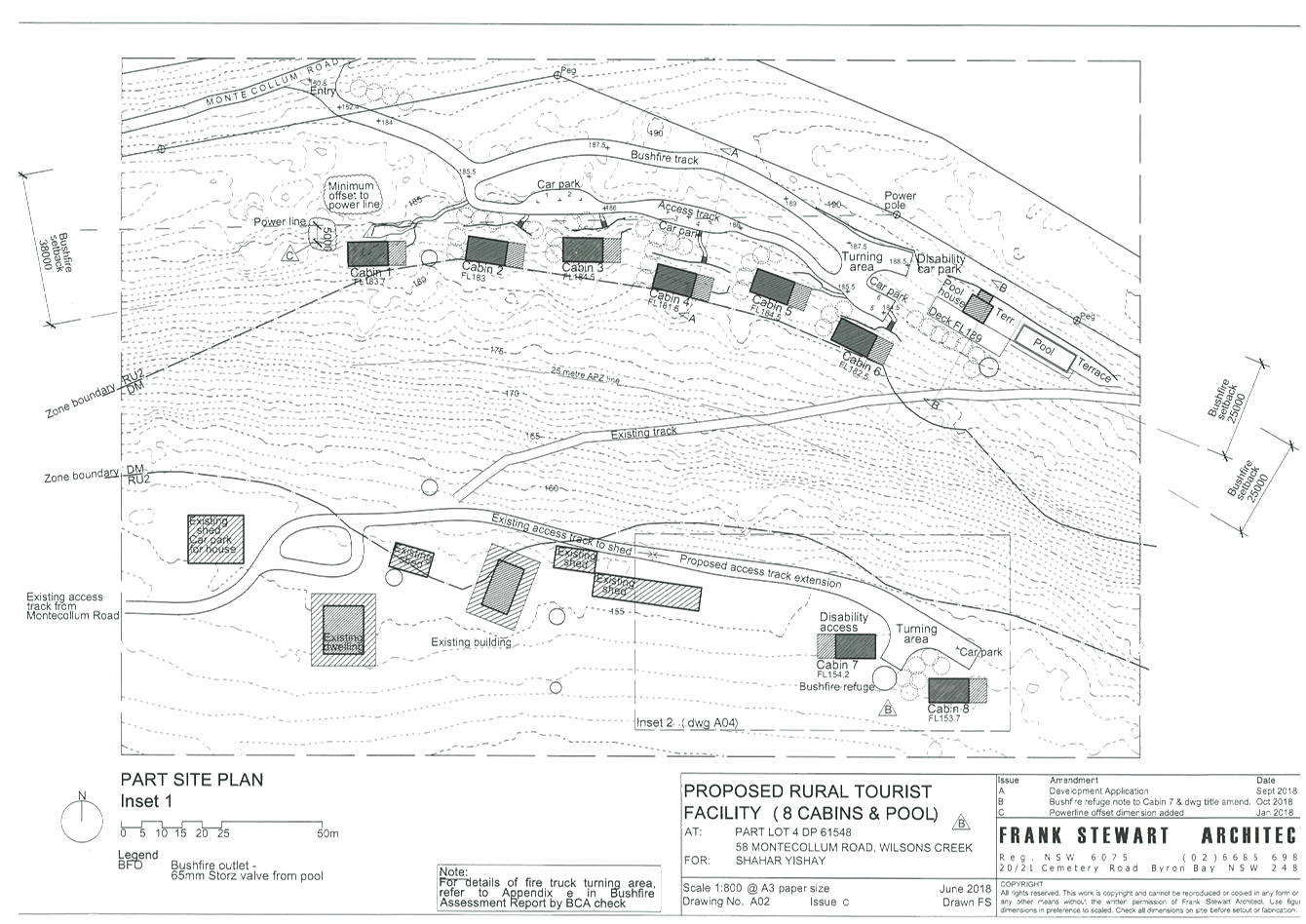
Note. The cabins cannot be relocated further south
due to the zoning of the land. The powerlines will need to be accurately
realigned to ensure a 10m separation to any approved liveable structures.
|
|
28.
|
Erosion and Sediment Control Management Plan required
Erosion and sedimentation controls are to be in place in
accordance with the approved Erosion and Sediment Control Plan.
Sediment and erosion control measures in accordance with
the approved Erosion and Sedimentation Control plan/s must be maintained at all
times until the site has been stabilised by permanent vegetation cover or
hard surface.
Any such measures that are deemed to be necessary because
of the local conditions must be maintained at all times until the site is
made stable (i.e. by permanent vegetation cover or hard surface).
Note: Council may impose on-the-spot fines for
non-compliance with this condition.
|
|
The following conditions are to be complied with
during any building or construction works
|
|
29.
|
Protection of koalas/ native fauna from
disturbance
a) Clearing
of native vegetation and/or earthworks as part of any development approval
from Council must be temporarily suspended within a range of 25m from any
tree which is concurrently occupied by a koala and must not resume until the koala
has moved from the tree of its own volition.
b) Any
clearing of land must not commence until the area proposed for clearing has
been inspected for the presence of koalas and approval given in writing by a
suitably qualified individual.
c) Approval
to proceed with the clearing of vegetation in accordance with this section is
only valid for the day on which the inspection has been undertaken.
The
individual referred to in (ii) above, or a nominated representative, must
remain on site during any approved clearing of vegetation.
|
|
30.
|
Inspection for on-site
sewage management
All plumbing and drainage
works is to be installed by a suitably qualified person. The plumber must
adhere to the requirements of the NSW Code of Practice and AS/NZ 3500. The
plumber is to arrange for the following inspections to be undertaken:
a) Internal drainage prior to
covering of the works.
b) External drainage prior to the
covering of works.
c) Irrigation installation prior
to the covering of works.
d) Final
|
|
31.
|
Construction times
Construction works must not unreasonably interfere with
the amenity of the neighbourhood. In particular construction noise, when
audible from adjoining residential premises, can only occur:
a. Monday to Friday,
from 7 am to 6 pm.
b. Saturday, from 8 am
to 1 pm.
No construction work to take place on Saturdays and
Sundays adjacent to Public Holidays and Public Holidays and the Construction
Industry Awarded Rostered Days Off (RDO) adjacent to Public Holidays.
Note: Council may impose on-the-spot fines for
non-compliance with this condition.
|
|
32.
|
Construction Noise
Construction noise is to be limited as follows:
a. For construction
periods of four (4) weeks and under, the L10 noise level measured over a
period of not less than fifteen (15) minutes when the construction site is in
operation must not exceed the background level by more than 20 dB(A).
b. For construction
periods greater than four (4) weeks and not exceeding twenty‑six (26)
weeks, the L10 noise level measured over a period of not less than fifteen
(15) minutes when the construction site is in operation must not exceed the
background level by more than 10 dB(A)
Note: Council may impose on-the-spot fines for
non-compliance with this condition.
|
|
33.
|
Signs to be erected on building and demolition sites
A sign must be erected in a prominent position on the work
site:
a. stating that
unauthorised entry to the work site is prohibited, and
b. showing the name of
the person in charge of the work site and a telephone number at which that
person may be contacted outside working hours.
Any such sign is to be removed when the work has been
completed.
|
|
34.
|
Builders rubbish to be contained on site
All builders rubbish is to be contained on the site in a
‘Builders Skips’ or an enclosure. Footpaths, road reserves and
public reserves are to be maintained clear of rubbish, building materials and
all other items.
|
|
35.
|
Fill to be retained on the subject land
Fill material must not encroach onto any adjoining land.
|
|
36.
|
Prevention of water pollution
Only clean and unpolluted water is to be discharged to
Council’s stormwater drainage system or any watercourse to ensure
compliance with the Protection of Environment Operations Act.
Note: Council may impose on-the-spot fines for non-compliance
with this condition.
|
|
37.
|
Removal of asbestos
All asbestos wastes associated with removal of the
existing building to be disposed of in accordance with the requirements of
the Workcover Authority. The applicant/owner is to produce documentary
evidence that this condition has been met.
Please note the Byron Resource Recovery Centre can not
accept asbestos. You will need to arrange disposal at an alternate landfill
site.
|
|
38.
|
Maintenance of sediment and erosion control measures
Sediment and erosion control measures must be maintained
at all times until the site has been stabilised by permanent vegetation cover
or hard surface.
|
|
39.
|
Stormwater drainage work
Stormwater drainage for the development must be
constructed in accordance with the approved plans and specification by a
suitably qualified person.
|
|
40.
|
Demolition
Any required demolition works must be undertaken in
accordance with the relevant requirements of Australian Standard AS
2601–1991: The Demolition of Structures published by Standards
Australia, and the WorkCover Authority of NSW.
|
|
41.
|
Removal of demolition and other wastes
All wastes, including asbestos and lead-contaminated
wastes, associated with these works are to be handled and disposed of in
accordance with the requirements of the Work Cover Authority. The
applicant/owner is to produce documentary evidence that this condition has
been met. Wastes must be disposed of at a Licenced Waste Facility. All wastes
removed from the site must be managed and disposed of in accordance with the
NSW DECC Waste Classification Guidelines (2008) www.environment.nsw.gov.au/resources/waste/08202classifyingwaste.pdf
|
|
42.
|
Muted bushland tones external finishes
To ensure the development is compatible with the
surrounding environment, colours and finishes are to be muted bushland tones.
In this regard white, light or bright colours are not permissible.
|
|
The following conditions are to be complied with
prior to the issue of an occupation certificate
|
|
43.
|
Dwelling to be decommissioned
Prior to the issue of an interim or final
occupation certificate the second dwelling on the property, identified on
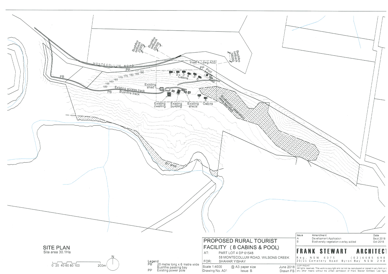
site plan A01 Issue B, dated October 2018, as “existing
building” is to be rendered non-habitable. All kitchens, laundries and
the like must be removed from the building and the services disconnected and
capped.
|
|
44.
|
Relocation of powerlines
The Principal Certifying Authority shall
be satisfied that the cabins have a minimum separation of 10m from
powerlines, as measured from the centerline to the closest roof eave. An
occupation certificate (interim or final) must not be issued unless the developer
is able to demonstrate that the cabins have been constructed in accordance
with this requirement.
|
|
45.
|
Habitat Compensation works to be
completed
Plantings and/or
restoration works are to be completed in accordance with the approved Biodiversity
Conservation Management Plan prior to issue of the occupation certificate for
the development. The site must be assessed to determine satisfaction of
performance criteria by Council. Alternatively, Independent sign-off may be
undertaken by (Australian Association of Bush Regenerators) AABR-accredited
Bush Regenerators, see http://www.aabr.org.au/do/business-directory/wpbdm-category/aabr-accredited-bush-regenerators/.
In all cases a final monitoring report must accompany any application for
satisfaction of this condition.
|
|
46.
|
On-site sewage
management system must be completed
The on-site sewage management system is to be constructed
in accordance with approved plans and in accordance with current
specifications and standards. The system is not to be used and/or operated
until a Council Officer has inspected the system and authorised its use.
|
|
47.
|
Approval to Operate
required
In accordance with the Local
Government Act, an Approval to Operate the onsite sewage management system
must be obtained from Council. Forms may be downloaded from Council’s
website with 'http://www.byron.nsw.gov.au/on-site-sewage'.
|
|
48.
|
Road upgrade to be completed
The road upgrade is to be constructed in accordance with
the approved plans and Roads Act consent.
|
|
49.
|
Internal accesses in accordance approved plans
Internal accesses are to be constructed in accordance with
the approved plans.
|
|
50.
|
Stormwater drainage work
Stormwater drainage for the development must be
constructed in accordance with the approved plans and specification prior to
issue of an occupation certificate.
|
|
51.
|
Site to be landscaped
Prior to the issue of an occupation certificate, the site
is to be landscaped in accordance with the approved landscaping plan and
conditions of consent.
|
|
52.
|
Stormwater disposal
Stormwater must be collected and disposed of in a
controlled manner such that stormwater flows are:
a. Clear of buildings
and infrastructure,
b. Clear of effluent
disposal areas,
c. Not concentrated so as
to cause soil erosion,
d. Not directly to a
watercourse, and
e. Not onto adjoining land.
|
|
53.
|
Swimming pool fencing
Swimming pool fencing is to comply with the requirements
of the Swimming Pools Act 1992 and Regulations.
|
|
54.
|
Compliance with bushfire conditions
Documentary evidence from a suitably qualified
professional is to be submitted demonstrating that the bush fire conditions
of this Notice of Determination have been complied with.
|
|
55.
|
Works to be completed prior to issue of a Final
Occupation Certificate
All of the works indicated on the plans and approved by
this consent, including any other consents that are necessary for the
completion of this development including approvals issued under the Local
Government Act 1993 and the Roads Act 1993, are to be completed and approved
by the relevant consent authority/s prior to the issue of a Final Occupation
Certificate.
Any Security bond paid for this application will be held
until Council is satisfied that no further works are to be carried out that
may result in damage to Councils road/footpath reserve.
|
|
The following conditions are to be complied with at
all times
|
|
56.
|
Site not be used for functions or events
The tourist facility is not to be used for functions,
weddings, concerts, events or the like, unless separately approved by
Council.
|
|
57.
|
Cabins not to be used as dwellings
The cabins are not approved for used as dwelling houses
and are not to be used for permanent residential occupation.
|
|
58.
|
Use of lighting after certain hours
In order to protect the dark
night sky and rural atmosphere of the area , any outdoor lighting,
other than that required for reasonable security, shall not be used between
the hours of 10.00 p.m. and 7.00 a.m. on any day. Low garden lighting and
sensor lighting for paths and car parking areas permitted.
|
|
59.
|
Landscaping
The landscaping works must be
maintained to ensure the establishment and successful growth of plants,
meeting the intent of the landscape design. This must include but not be
limited to watering, weeding, and the replacement of failed plant material.
The stand of Eucalypts to the south of Cabins 1-3 are to be maintained at all
times.
|
|
60.
|
Limited Tree Removal
Removal of
existing native trees from the site is limited to three small native trees as
defined within the letter entitled DA 483/2018 - Request for
further information regarding vegetation clearing potentially triggering the
Biodiversity Offset Scheme at Lot 4 DP 61548, 58 Montecollum Road, Wilsons
Creek by Greg Alderson and Associates dated 11
January 2019. All other trees and native plants
within the site are to be retained and protected.
|
|
61.
|
No dogs or cats to be brought or kept
with cabin users
Due to the biodiversity
value of the adjacent rainforest as well as the presence of preferred Koala
habitat on the site, the keeping of cats and dogs in association with cabin
visitor use is prohibited.
|
|
62.
|
Replanting and restoration works
Replanting and restoration
works must be undertaken and continued until the performance criteria have
been achieved in accordance with the approved Biodiversity Conservation
Management Plan for a minimum period of five years, during which annual
monitoring reports must be submitted to Council for approval.
|
|
63.
|
Must not interfere with
the amenity of the neighbourhood
The use of the amenities block must not interfere with the
amenity of the neighbourhood by reason of noise, vibration, smell, fumes,
smoke, dust, wastewater or otherwise. In particular:
a) The noise level emanating
from the use of the premises must comply with the New South Wales Policy for
Industry (2017) and the Noise Guide for Local Government. All sources of
noise and vibration must be effectively managed so as not to be intrusive or
‘offensive’ within the nearest residential properties.
b) Only clean and unpolluted
water is permitted to be discharged to Councils’ stormwater drainage
system or any waters.
c) All wastes shall be
contained within appropriate containers fitted with a tight-fitting
vermin-proof lid.
d) Goods
deliveries and waste collection must be restricted to daytime operating hours.
|
|
64.
|
Noise limitations of the Pool Amenities Building
The noise level emitted from the pool amenities building
must not exceed the background noise level plus 5dB (A) between the hours of
7:00am and 10:00 pm at the nearest affected residence*. The noise level
emitted from the pool amenities building between 10.00 pm and 7:00 am must
not exceed the background noise level at the nearest affected
residence*. No correction for tonality is applied.
In assessing noise levels at residences, the noise level
is to be assessed at the most affected point on or within the residential
property boundary or, if this is more than 30m from the residence, at the
most affected point within 30m of the residence.,
|
|
65.
|
Pool Safety Sign
The occupier of the premises must ensure that there is at
all times a sign in the immediate vicinity of the swimming pool bearing the
words ‘Young children must be supervised when using this swimming
pool’. The sign is to be a prominent position and be otherwise in accordance
with clause 9 of the Swimming Pools Regulation.
A pool resuscitation sign is to be installed in a
conspicuous location within the pool area to the satisfaction of the
Principle Certifying Authority.
|
|
66.
|
Use of second dwelling
The second dwelling on the property,
identified on site plan A01 Issue B, dated October 2018, as
“existing building” must not be occupied or used as a dwelling
house unless separately approved by Council.
|
|
67.
|
Pool
backwash in rural areas
Pool water disposal and backwash is to be directed to a
soakage trench located in such a location as to not cause any nuisance to
adjoining properties or damage to any structures or impact on any land
application areas for the on-site sewage management system.
|
|
68.
|
Swimming
pool health requirements
The
swimming pool water is to be re-circulated, filtered and disinfected in
accordance with the requirements of Council and NSW Health. The
swimming pool water is to be maintained at satisfactory levels of purity for
bathing at all times
|
|
69.
|
Swimming pool pump location
The filter pump is to be located such that noise from its
operations does not cause a nuisance to adjoining residents. If necessary an
acoustic enclosure must be provided around the pump to achieve the required
noise attenuation.
|
|
70.
|
Swimming Pool Fencing
Swimming pool fencing is to comply with the requirements
of the Swimming Pool Act 1992 and Regulations at all times.
|
|
General Terms of Integrated Development Approval
|
|
71.
|
Bush Fire Safety Authority
– S100B Rural Fires Act 1997
The New South Wales Rural Fire
Service (NSW RFS) has considered the information submitted. General Terms of
Approval, under Division 4.8 of the ‘Environmental Planning and
Assessment Act 1979’, and a Bush Fire Safety Authority, under Section 100B
of the 'Rural Fires Act 1997', are now issued subject to the following
conditions:
1. The proposed development is to comply with the plan
titled 'Part Site Plan, Inset 1', prepared by Frank Stewart Architect,
reference June 2018, issue A dated September 2018, except where modified by
conditions of this Bush Fire Safety Authority.
Asset Protection Zones
The intent of measures is to
provide sufficient space and maintain reduced fuel loads so as to ensure
radiant heat levels of buildings are below critical limits and to prevent
direct flame contact with a building. To achieve this, the following
conditions shall apply:
2. At the commencement of building works of cabins 1-3
and in perpetuity the property around the building shall be managed as
follows as outlined within section 4.1.3 and Appendix 5 of 'Planning for Bush
Fire Protection 2006' and the NSW Rural Fire Service's document 'Standards
for asset protection zones':
· north
for a distance of 38 metres as an asset protection zone;
· east
for a distance of 9 metres as an asset protection zone;
· south
for a distance of 25 metres as an asset protection zone; and
· west
for a distance of 9 metres as an asset protection zone.
·
(Note: in forested areas a
portion of the asset protection zone may be maintained as an outer protection
zone as specified in Table A2.7 of 'Planning for Bush Fire Protection 2006'.)
3. At the commencement of building works of cabins 4-6
and in perpetuity the property around the building shall be managed as
follows as outlined within section 4.1.3 and Appendix 5 of 'Planning for Bush
Fire Protection 2006' and the NSW Rural Fire Service's document 'Standards
for asset protection zones':
· north
for a distance of 25 metres as an asset protection zone;
· east
for a distance of 9 metres as an asset protection zone;
· south
for a distance of 25 metres as an asset protection zone; and
· west
for a distance of 9 metres as an asset protection zone.
·
(Note: In forested areas a
portion of the asset protection zone may be maintained as an outer protection
zone as specified in Table A2.7 of 'Planning for Bush Fire Protection 2006'.)
4. At the commencement of building works of cabins 7
and 8 and in perpetuity the property around the building shall be managed as
follows as outlined within section 4.1.3 and Appendix 5 of 'Planning for Bush
Fire Protection 2006' and the NSW Rural Fire Service's document 'Standards
for asset protection zones':
· north
for a distance of 22 metres as an asset protection zone;
· east
for a distance of 22 metres as an asset protection zone;
· south
for a distance of 39 metres as an asset protection zone; and
· west
for a distance of 34 metres as an asset protection zone.
·
(Note: in forested areas a
portion of the asset protection zone may be maintained as an outer protection
zone as specified in Table A2.7 of 'Planning for Bush Fire Protection 2006'.)
Water and Utilities
The intent of measures is to
provide adequate services of water for the protection of buildings during and
after the passage of a bush fire, and to locate gas and electricity so as not
to contribute to the risk of fire to a building. To achieve this, the
following conditions shall apply:
5. Electricity are to comply with section 4.2.7 of
‘Planning for Bush Fire Protection 2006’.
6. In recognition that no reticulated water supply is
available to the development, a 10,000 litres firefighting water supply shall
be provided for firefighting purposes for each cabin. The firefighting water
supply shall be installed and maintained in the following manner:
a) Firefighting water supply may be provided by a tank,
a swimming pool or a dam that shall be located not less than 5 metres and not
more than 60 metres from the approved structure. Amalgamation of the water
supply is permitted if more than 1 cabin is within the specified 60 metres.
b) A hardened ground surface for firefighting truck
access is to be constructed up to and within 4 metres of the firefighting
water supply.
c) New above ground firefighting water supply
storage’s are to be manufactured using non-combustible material
(concrete, metal, etc). Where existing firefighting water supply
storage’s are constructed of combustible (polycarbonate, plastic,
fibreglass, etc) materials, they shall be shielded from the impact of radiant
heat and direct flame contact.
d) Non-combustible materials (concrete, metal, etc)
will only be used to elevate or raise firefighting water supply tank(s) above
the natural ground level.
e) A 65mm metal Storz outlet with a gate or ball valve
shall be fitted to any firefighting water supply tank(s) and accessible for a
firefighting truck.
f) The gate or ball valve, pipes and tank penetration
are adequate for the full 50mm inner diameter water flow through the Storz
fitting and are constructed of a metal material.
g) All associated fittings to the firefighting water
supply tank(s) shall be non-combustible.
h) Any pipes not of metal material shall be buried
300mm below natural ground level.
i) Any below ground firefighting water supply tank(s)
constructed of combustible (polycarbonate, plastic, fibreglass, etc)
materials shall be shielded from the impact of radiant heat and direct flame
contact.
j) Any firefighting water supply tank(s) located below
ground shall be clearly delineated to prevent vehicles being driven over the
tank.
k) All water supplies for firefighting purposes shall
be clearly signposted as a firefighting water supply.
l) Below ground firefighting water supply tank(s) shall
have an access hole measuring a minimum 200mm x 200mm to allow firefighting
trucks to access water direct from the tank.
m) Pumps are to be shielded from the direct impacts of
bush fire.
n) A Static Water Supply (SWS) sign shall be obtained
from the local NSW Rural Fire Service (RFS) and positioned for ease of
identification by RFS personnel and other users of the SWS. In this regard:
i. Markers must be fixed in a suitable location so as
to be highly visible; and
ii. Markers should be positioned adjacent to the most
appropriate access for the water supply.
Note: The definition of below
ground dedicated firefighting water supply tank(s) is when the outlet valve
is located below natural ground level.
Access
The intent of measures for
property access is to provide safe access to/from the public road system for
fire fighters providing property protection during a bush fire and for
occupants faced with evacuation. To achieve this, the following conditions
shall apply:
7. Property access roads shall comply with the
following requirements of section 4.1.3 (2) of 'Planning for Bush Fire Protection
2006'.
a) Bridges clearly indicate load rating and pavements
and bridges are capable of carrying a load of 15 tonnes.
b) Roads do not traverse a wetland or other land
potentially subject to periodic inundation (other than a flood or storm surge).
c) A minimum carriageway width of 4 metres for single
lane and 6 metres for 2 way.
d) In forest, woodland and heath situations, rural
property access roads shall have passing bays every 200 metres, or where
there are crests or blind corners, that are 20 metres long by 2 metres wide,
making a minimum trafficable width of 6 metres at the passing bay.
e) A minimum vertical clearance of 4 metres to any
overhanging obstruction, including tree branches.
f) Internal roads provide a loop road around any
dwelling or incorporate a turning circle with a minimum 12 metre outer
radius. Except that a reversing bay may be provided in lieu of a loop road
around the dwelling or a turning circle. Where a reversing bay is provided it
shall be not less than 6 metres wide and 8 metres deep with an inner minimum
turning radius of 6 metres and outer minimum radius of 12 metres.
g) Curves have a minimum inner radius of 6 metres and
are minimal in number to allow for rapid access and egress.
h) The minimum distance between the inner and outer
curves is 6 metres. The crossfall is not to exceed 10 degrees.
i) Maximum grades for sealed roads do not exceed 15
degrees and not more than 10 degrees for unsealed roads.
Evacuation and Emergency
Management
The intent of measures is to
provide suitable emergency and evacuation (and relocation) arrangements for
occupants of special fire protection purpose developments. To achieve this,
the following conditions shall apply:
8. An Emergency/Evacuation Plan is to be prepared in
accordance with the NSW Rural Fire Service Guidelines for the Preparation of
Emergency/Evacuation Plan and comply with Australian Standard AS 3745 -2010
'Emergency Control Organisation and Procedures for Buildings Structures and
Workplaces for Residential Accommodation'. The emergency evacuation plan will
include a procedure to contact the NSW Rural Fire Service District Office /
NSW Fire Brigade and inform them of the evacuation and the location they will
be evacuated to. A copy of the emergency evacuation plan shall be provided to
the consent authority and the Local Emergency Management Committee prior to
occupation of the development.
Design and Construction
The intent of measures is that
buildings are designed and constructed to withstand the potential impacts of
bush fire attack. To achieve this, the following conditions shall apply:
9. New construction of cabins 1-6 shall comply with
section 3 and section 7 (BAL 29) Australian Standard AS3959-2009
‘Construction of buildings in bush fire prone areas’ or NASH
Standard (1.7.14 updated) ‘National Standard Steel Framed Construction
in Bushfire Areas – 2014’ as appropriate and section A3.7
Addendum Appendix 3 of 'Planning for Bush Fire Protection' 2006’.
10. New construction of cabins 7 and 8 shall comply with
Sections 3 and 5 (BAL 12.5) Australian Standard AS3959-2009 'Construction of
buildings in bush fire prone areas' or NASH Standard (1.7.14 updated)
‘National Standard Steel Framed Construction in Bushfire Areas –
2014’ as appropriate and section A3.7 Addendum Appendix 3 of 'Planning
for Bush Fire Protection 2006'.
11. New construction of the pool house and deck is to be
sited no closer than 10 metres to cabin 6.
Landscaping
12. Landscaping to the site is to comply with the
principles of Appendix 5 of 'Planning for Bush Fire Protection 2006'. In this
regard the following landscaping principles are to be incorporated into the
development:
a) Suitable impervious areas being provided immediately
surrounding the building such as courtyards, paths and driveways;
b) Grassed
areas/mowed lawns/ or ground cover plantings being provided in close proximity
to the building;
c) Restrict planting in the immediate vicinity of the
building which may over time and if not properly maintained come in contact
with the building;
d) Maximum tree cover should be less than 30%, and
maximum shrub cover less than 20%;
e) Planting should not provide a continuous canopy to
the building (i.e. trees or shrubs should be isolated or located in small
clusters);
f) When considering landscape species consideration
needs to be given to estimated size of the plant at maturity;
g) Avoid species with rough fibrous bark, or which
retain/shed bark in long strips or retain dead material in their canopies;
h) Use smooth bark species of trees species which
generally do not carry a fire up the bark into the crown;
i) Avoid planting of deciduous species that may
increase fuel at surface/ ground level (i.e. leaf litter);
j) Avoid climbing species to walls and pergolas;
k) Locate combustible materials such as
woodchips/mulch, flammable fuel stores away from the building;
l) Locate combustible structures such as garden sheds,
pergolas and materials such timber garden furniture way from the building;
and
m) Use of low flammability vegetation species.
|
|
SCHEDULE 3 NOTES
|
|
Construction Certificate required:
This development consent is issued under the Environmental
Planning and Assessment Act 1979 and does not relate to structural aspects or
specifications of the building under the Building Code of Australia. All
buildings and alterations require the issue of a Construction Certificate
prior to works commencing. Application forms are available from the customer
services counter or Council’s website www.byron.nsw.gov.au
|
|
Schedule of Development
Contributions
The following contributions
are current at the date of this consent. The contributions payable will be
adjusted in accordance with the relevant plan and the amount payable will be
calculated on the basis of the contribution rates that are applicable at the
time of payment. The current contribution rates are available from Council
offices during office hours. Payment will only be accepted by cash or bank
cheque.
Section 7.12 Levy to be paid
Prior to the issue of a construction certificate the
section 7.12 levy required by the Byron Developer Contributions Plan 2012
must be paid to Council.
The levy will be calculated as follows:
Levy payable = %C x $C
§ %C
is the levy rate applicable as set out in the latest Ministerial Direction
issued under section 7.17.
§ $C
is the proposed cost of carrying out the development.
The rate of %C is:
|
Proposed cost of the development
|
Maximum percentage of the levy
|
|
Up to $100,000
|
Nil
|
|
$100,001–$200,000
|
0.5 percent
|
|
More than $200,000
|
1.0 percent
|
The cost of development must be calculated in accordance
with clause 25J of the Regulation. The Cost Summary Report (copy
attached) as set out in schedule 2 of the Section 7.12 contributions plan
must be submitted to Council with the payment. The cost summary report
must be prepared by a quantity surveyor. Copies of Cost Summary Report
are available at Council’s main office or may be downloaded from
Council’s website.
|
|
Principal Certifying Authority:
Work must not commence until the applicant has:-
a. appointed a
Principal Certifying Authority (if the Council is not the PCA); and
b. given Council at
least two days notice of the intention to commence the erection of the
building. Notice must be given by using the prescribed ‘Form 7’.
c. notified the
Principal Certifying Authority of the Compliance with Part 6 of the Home
Building Act 1989.
|
|
Occupation Certificate required:
The building must not be occupied until the Principal
Certifying Authority has issued an Occupation Certificate.
|
|
Protection of the Environment Operations Act 1997:
It is an offence under the provisions of the Protection of
the Environment Operations Act 1997 to act in a manner causing, or likely to
cause, harm to the environment. Anyone allowing material to enter a waterway
or leaving material where it can be washed off-site may be subject to a
penalty infringement notice (“on-the-spot fine”) or prosecution.
|
|
Penalties apply for failure to comply with development
consents
Failure to comply with conditions of development consent
may lead to an on the spot fine being issued pursuant to section 4.2(1) of
the Environmental Planning & Assessment Act 1979 or prosecution pursuant
to section 9.50 of the Environmental Planning & Assessment Act 1979.
|
|
Plumbing Standards and requirements.
All Plumbing, Water Supply, Sewerage and Stormwater Works
shall be installed in accordance with the Local Government Act 1993, Plumbers
Code of Australia and AS/NZS 3500 Parts 0-5, the approved plans (any
notations on those plans) and the approved specifications. Any plumbing
inspections required under a Section 68 Approval are to occur in accordance
with that approval.
|
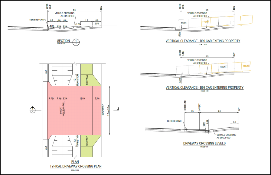
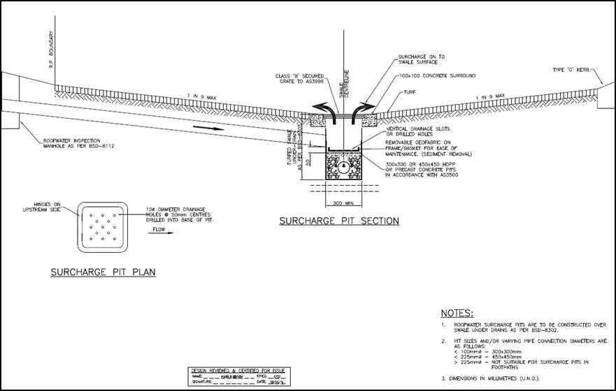
Staff Reports - Sustainable Environment and Economy 8.1 - Attachment 8
Staff Reports - Sustainable Environment and Economy 8.1 - Attachment 9

Staff Reports - Sustainable Environment and Economy 8.2 - Attachment 1

Staff Reports - Sustainable Environment and Economy 8.3 - Attachment 1

Byron Shire
Development Control Plan 2014
Chapter D8
Public Art
This page has been intentionally left blank
Chapter D8 – Public Art
Contents
D8.1 Introduction. 5
D8.1.1 Aims
of this Chapter 5
D8.1.2 Application
of this Chapter 6
D8.2 General
Provisions. 7
D8.2.1 Provision
of Public Art 7
D8.2.2 Requirements
for a development application for the provision of public art 8
D8.3 Provision
of Murals. 9
Appendix D8.1 Assessment
Pathways. 11
Document History
|
Doc No.
|
Date Amended
|
Details
(e.g. Resolution No.)
|
|
#E2014/49
|
20 March 2014
|
Res 14-118 –
Public exhibition version
|
|
#E2014/33050
|
|
Draft to
26 June 2014 Extraordinary Meeting - for adoption
|
|
#E2014/43422
|
26 June 2014
|
Adopted
Version – Res 14-513
|
|
#E2018/27657
|
22 March 2018
|
Adopted
22 March 2018 Effective 12 April 2018 – Res 18-130
‘Housekeeping’
amendment (various chapters).
|
|
#E2018/59059
|
13 December 2018
|
Public
Exhibition Version amended Res 18-840
|
D8.1 Introduction
Public Art is defined in the broadest sense as artistic
works or activities accessible to the public. The work is of a permanent
nature, located in or part of a public space or facility provided by both the
public and private sector. Public art also includes the conceptual contribution
of an artist to the design of public spaces and facilities.
Council supports Public Art as outlined in the:
· Public
Art Policy
· Public
Art Strategy
· Public
Art Guidelines and Criteria
A Public Art Panel is appointed to provide appropriate specialist
advice and recommendations to Council and to oversee the acquisition of public
artworks according to the Policy, Strategy and Guidelines and Criteria. The
Panel is made up of invited members and community members with specialist
expertise and experience in the arena of public art.
More about Public Art can be found on Council’s
website
https://www.byron.nsw.gov.au/Community/Arts-and-culture/Public-Art
D8.1.1 Aims
of this Chapter
The Aims of this Chapter are:
1. To
implement relevant Strategic Actions and provisions of the Byron Shire Council
Cultural Plan and Council’s Public Art Policy where they apply to the
development process.
2. To
recognise the importance of artistic expression to community well-being.
3. To
cultivate a climate in which innovative and creative design and public Art contribute to the cultural life,
liveability and amenity of Byron Shire.
4. To
encourage public art that is:
a) Integral to social
and cultural development as outlined in the Byron Shire Community Strategic
Plan.
b) Developed and
managed by appropriate procedures and processes
c) Created
considering standards of excellence, in a professional manner
d) Adequately
planned with relevant stakeholders throughout the project duration, with
partnerships and collaboration encouraged
e) Meaningful,
aesthetically stimulating and site specific
f) Aimed to
provide a cultural outcome
g) Supportive of
local creative industries
5. To facilitate
the provision of public art through
the development process that:
a) Encourages
innovative, original work with high artistic merit
b) Is reflective and
responsive to local culture, including the local Aboriginal context, if
relevant
c) Adds life, texture
and interest to the site
d) Encourages the
use of innovative materials including environmentally sustainable and
eco-friendly material
e) Is durable,
robust, and of quality, low-maintenance materials, and if applicable, be
treated with anti-graffiti coating
f) Comply with
all relevant Australian Standards and Building Codes and Regulations with
regard to public safety
g) Enhance existing
public art assets of the Shire.
6. To specify
considerations for the assessment of murals.
7. To enable
equivalent financial contributions in lieu of providing public art.
8. To specify
documents to be provided with a development application for the provision of public art.
D8.1.2 Application
of this Chapter
1. This Chapter applies to Development
Applications for projects that:
a) have an estimated
cost greater than $1,000,000 (calculated in accordance with the Environmental
Planning & Assessment Regulation); and
b) are located on
land (partly or wholly) within zones RU2, RU5, B1, B2, B3, B4, B7, SP3 or W2; and
c) include
development for one or more of the following purposes:
i) business premises
ii) entertainment facility
iii) function centres
iv) marina
v) office premises
vi) recreation area
vii) recreation facility
(indoor, major
and/ or outdoor)
viii) registered club
ix) retail premises
x) tourist and visitor accommodation.
2. This chapter applies to
residential subdivision of land within zones R1, R2 and R3 resulting in 20 lots
or greater, with an estimated project cost greater than $1,000,000 (calculated
in accordance with the Environmental Planning & Assessment Regulation)
3. This chapter applies to
the provision of murals requiring development consent under Byron LEP 2014,
Part 5.10 – Heritage Conservation.
|
Note:
Unsolicited offers of permanent public art works to which
this chapter does not apply, both existing and proposed, will be referred to
the Public Art Panel for approval. The panel will consider the art work in
the context of Council’s:
· Public
Art Policy
· Public
Art Strategy
· Public
Art Guidelines and Criteria
The recommendations of the Public Art Panel will be
presented to Council as required. Public
art not approved via the Public Art Panel will be subject to
removal.
Unsolicited offers of permanent public art to be located
on Council owned or managed land are to be managed in accordance with
Council’s Public Art Guidelines & Criteria.
|
D8.2 General
Provisions
D8.2.1 Provision of Public Art
This section enables 2 assessment pathways for the provision
of public
art. A flow chart is provided in Appendix D8.1 that provides
an overview of the assessment pathway options
Objectives
1. To
facilitate the provision of public art
through the development process.
Performance Criteria
1. In
lieu of providing public art, the
applicant could enter into a Voluntary Planning Agreement with Council to
provide an equivalent financial contribution for the installation of public art in a
suitable location.
2. Public art may
be located on public land in any of the towns and villages in Byron Shire at
the discretion of Council and the Public Art Panel. Council is to be
consulted prior to lodgement of a development application for installations on
public land.
|
Note:
Preparation of a Voluntary Planning Agreement (VPA) is to
be coordinated with Council’s Section 7.11 Officer.
|
Prescriptive Measures
1. Development
to which this Section applies must include the provision of public art to the value of at least 2.5% of development costs
(calculated in accordance with the Environmental Planning & Assessment
Regulation) up to $2 million, and 1% of further development costs exceeding
$2 million. Where development costs exceed $5 million, the provision of public art may
be negotiated at a value no less than $80,000.
2. A
Public Art Plan is to be prepared that provides details of the proposed public art and
must be submitted as part of the Development Application documentation.
Council is to be consulted prior to lodgement of a development application. The
Public Art Plan must include the following details to the satisfaction of
Council and the Public Art Panel:
a) A statement that
explains the rationale behind the artwork and demonstrates how it will relate
to the proposed development and site.
b) Details of the nature,
materials and form of the proposed public art.
c) Define and illustrate
the intended location and approximate size of the artwork
d) Provide
a program for documentation, fabrication and installation, and integration with
the construction program for the development.
e) Deaccessioning
agreements in accordance with Council’s Public Art Guidelines &
Criteria.
f) Evidence of
partnerships and/or collaboration and funding sources for the public art project
where applicable.
g) Evidence of Public
Liability Insurance to cover construction and installation of the work.
h) Expenditure for the public art and
a budget for ongoing maintenance.
3. The
Public Art Plan must also demonstrate how the proposed public art meets
the following Design Selection Criteria:
a) The artwork
demonstrates artistic excellence and demonstrates local and cultural
appropriateness.
b) The public art must
be permanent and durable, with consideration given to maintenance requirements
and potential for vandalism.
c) The design is
consistent with the themes outlined in the Public Art Policy and Public Art
Strategy.
d) Public art must
be provided in a location that allows users of the public domain an
unobstructed view of the artwork and the ability to freely access and interact
with the artwork. Public art will not be considered inside buildings, except for
public buildings.
e) Meets relevant
building and safety standards.
D8.2.2 Requirements
for a development application for the provision of public art
1. Development
applications for the provision of public art are to include the following two documents:
a) Public
Art Plan to be submitted by the applicant at the development application stage.
The Public Art Plan
must address the Prescriptive Measures outlined in D8.2.1 and demonstrate how
the proposed work will accord with this DCP chapter.
Once submitted, the Public Art
Plan will be referred by Council assessment officers to the Public Art Panel
for review.
b) Public
Art Report to be submitted by the applicant at the Occupation Certificate
Stage.
The Public Art Report is to satisfy
Council that the public art has been delivered and the public art commitments
have been fulfilled. This will enable the Occupation Certificate to be
released. The Public Art Report should provide information about the artworks
and artist, the fabrication and installation of the work, the documentation and
engineers’ drawings, the maintenance requirements, any additional
relevant information regarding ownership, and copyright of the work. The Public
Art Report is a condition of Occupation Certificate.
2. Where
the development application for Public art is associated with a staged development, the
following three documents are required:
a) Preliminary
Public Art Plan to be submitted with the Master Plan for Master Plan sites or
with the Stage 1 development application.
The Preliminary Public Art Plan
should include an analysis of the locational context, planning requirements and
any studies pertinent to the public art objectives. It should identify public art
opportunities, propose a methodology for the selection and commissioning of
artists and provide an estimated budget and program for the inclusion of
artists. Once submitted, the Preliminary Public Art Plan will be referred to
the Public Art Panel for review.
b) Public
Art Plan to be submitted by the applicant at the DA Stage of a Master Plan site
or with the Stage 2 development application
The Public Art Plan
must address the Prescriptive Measures outlined in D8.2.1 and demonstrate how
the proposed work will accord with this DCP chapter.
Once submitted, the
Public Art Plan will be referred by Council assessment officers to the Public
Art Panel for review.
c) Public
Art Report to be submitted at Occupation Certificate Stage
The Public Art Report
is to satisfy the Council that the public art has been delivered and the public art commitments
have been fulfilled. This will enable the Occupation Certificate to be
released. The Public Art Report should provide information about the artworks
and artist, the fabrication and installation of the work, the documentation and
engineers’ drawings, the maintenance requirements, any additional
relevant information regarding ownership, and copyright of the work. The Public
Art Report is a condition of Occupation Certificate.
D8.3 Provision
of Murals
This Subchapter applies to the
provision of murals requiring development consent under Byron LEP
2014, Part 5.10 – Heritage Conservation. This may include murals that
impact on a heritage item or are located within a heritage
conservation area, or may include murals that
impact on an Aboriginal object or Aboriginal place of heritage significance.
Objectives
1. To conserve the
environmental heritage of Byron Shire.
2. To facilitate the
provision of murals
that are appropriate for the location and the community.
Performance Criteria
1. The following considerations are to be
addressed in a development application for a mural requiring development consent under Byron LEP 2014,
Part 5.10 – Heritage Conservation:
a) Is the artwork suited to a diverse
audience?
b) Does the mural add to the character and integrity of the location?
c) Is the artwork a mural as defined in this DCP
or does it meet the definition of signage?
2. Consideration
is to be given to the use of mediums that will not affect the original fabric
of the heritage item (e.g. mural may be
painted on removable ply boards).
3. Development
applications must include a heritage impact statement in accordance with Byron
LEP 2014, Part 5.10(4).
4. Where
the mural is
considered to be of minor impact, applicants are to consult with Council prior
to lodgement of a development application to determine if Byron LEP 2014,
Part 5.10(10) is applicable.
Prescriptive Measures
There are no prescriptive measures.
|
Note:
Murals that do not
require development consent under Byron LEP 2014, Part 5.10 – Heritage
Conservation do not require a development application. Where
development consent is not required, developers and artists are encouraged to
submit their concept to the Public Art Panel for review.
|
Appendix D8.1 Assessment Pathways


Staff Reports - Sustainable Environment and Economy 8.3 - Attachment 2
Chapter 1: Part E
Public Art
Document History
|
Doc No.
|
Date
Amended
|
Details Comments eg
Resolution No.
|
|
#962911
|
|
Reported to Council 21 October 2010
|
|
#1021375
|
21 October 2010
|
Res 10-867 – to exhibit the Public Art section
as a new section for the DCP 2002
|
|
#1021375
|
|
Draft DCP 2010 Part E (public exhibition copy)
|
|
#1068277
|
14 March 2011
|
Adopted Res 11-169 - Format changes applied
|
|
#E2019/6129
|
30 April 2019
|
Updated to reflect changes in the 2014 DCP Res 18-840
(public exhibition version)
|
PART E - PUBLIC ART
PART E - PUBLIC ART 1
E1 INTRODUCTION 3
E1.1 Objectives
of this Section of the DCP.. 3
E1.2 Development
Controlled by this Section of the DCP.. 4
E2 GENERAL
PROVISIONS 5
E2.1 Provision
of Public Art 5
E2.2 Documents
to be provided with a development application for the provision of public
art 6
E3 Provision
of Murals 7
Appendix E1 Assessment Pathways.. 8
This page has been
intentionally left blank
E1 INTRODUCTION
Public Art is defined in the broadest sense as artistic
works or activities accessible to the public. The work is of a permanent
nature, located in or part of a public space or facility provided by both the
public and private sector. Public art also includes the conceptual
contribution of an artist to the design of public spaces and facilities.
Council
supports Public Art as outlined in the:
· Public
Art Policy
· Public
Art Strategy
· Public
Art Guidelines and Criteria
A Public Art Panel is appointed to provide appropriate
specialist advice and recommendations to Council and to oversee the acquisition
of public artworks according to the Policy, Strategy and Guidelines and
Criteria. The Panel is made up of invited members and community members with
specialist expertise and experience in the arena of public art.
More about Public Art can be found on Council’s
website https://www.byron.nsw.gov.au/Community/Arts-and-culture/Public-Art
E1.1 Objectives of this Section of the DCP
The Objectives of this Section of the DCP are:
1. To
implement relevant Strategic Actions and provisions of the Byron Shire Council
Cultural Plan and Council’s Public Art Policy where they apply to the
development process.
2. To
recognise the importance of artistic expression to community well-being.
3. To
cultivate a climate in which innovative and creative design and public Art contribute
to the cultural life, liveability and amenity of Byron Shire.
4. To
encourage public art that is:
a) Integral to
social and cultural development as outlined in the Byron Shire Community
Strategic Plan.
b) Developed and
managed by appropriate procedures and processes
c) Created
considering standards of excellence, in a professional manner
d) Adequately
planned with relevant stakeholders throughout the project duration, with
partnerships and collaboration encouraged
e) Meaningful,
aesthetically stimulating and site specific
f) Aimed to
provide a cultural outcome
g) Supportive of
local creative industries
5. To
facilitate the provision of public art through the development process that:
a) Encourages
innovative, original work with high artistic merit
b) Is reflective and
responsive to local culture, including the local Aboriginal context, if
relevant
c) Adds life,
texture and interest to the site
d) Encourages the
use of innovative materials including environmentally sustainable and
eco-friendly material
e) Is durable,
robust, and of quality, low-maintenance materials, and if applicable, be
treated with anti-graffiti coating
f) Comply with
all relevant Australian Standards and Building Codes and Regulations with
regard to public safety
g) Enhance existing
public art assets of the Shire.
6. To specify
considerations for the assessment of murals.
7. To enable
equivalent financial contributions in lieu of providing public art.
8. To specify
documents to be provided with a development application for the provision of public art.
E1.2 Development Controlled by this Section of the
DCP
1. This Chapter applies to
Development Applications for projects that:
a) have an estimated
cost greater than $1,000,000 (calculated in accordance with the Environmental
Planning & Assessment Regulation); and
b) are located on
land (partly or wholly) within zones 1(a), 2(t), 2(v), 3(a) or 6 (b); and
c) include
development for one or more of the following purposes:
i) Club
ii) Commercial
premises
iii) Entertainment
facility
iv) Recreation area
v) Recreation
facility (indoor, major and/ or outdoor)
vi) Rural tourist
facilities
vii) Shop
viii) Tourist facilities
2. This chapter applies to
residential subdivision of land within the 2(a) zone resulting in 20 lots or
greater, with an estimated project cost greater than $1,000,000 (calculated in
accordance with the Environmental Planning & Assessment Regulation)
3. This chapter applies to the
provision of murals requiring development consent under Byron LEP 1988,
Clause 19 – Development relating to certain heritage items.
|
Note:
Unsolicited offers of permanent public art works to which
this chapter does not apply, both existing and proposed, will be referred to
the Public Art Panel for approval. The panel will consider the art work in
the context of Council’s:
· Public Art Policy
· Public Art Strategy
· Public Art Guidelines and Criteria
The recommendations of the Public Art Panel will be
presented to Council as required. Public art not approved by Council
will be subject to removal.
Unsolicited offers of permanent public art to be located
on Council owned or managed land are to be managed in accordance with Council’s
Public Art Guidelines & Criteria.
|
E2 GENERAL
PROVISIONS
E2.1 Provision of Public Art
This section enables 2 assessment pathways for the provision
of public art. A flow chart is provided in Appendix E1 that
provides an overview of the assessment pathway options.
Objectives
1. To
facilitate the provision of public art through the development process.
Performance Criteria
1. In
lieu of providing public art, the applicant could enter into a Voluntary
Planning Agreement with Council to provide an equivalent financial contribution
for the installation of public art in a suitable location.
2. Public
art may be located on public land in any of the towns and villages in Byron
Shire at the discretion of Council and the Public Art Panel. Council is to be
consulted prior to lodgement of a development application for installations on
public land.
|
Note:
Preparation of a Voluntary Planning Agreement (VPA) is to
be coordinated with Council’s Section 7.11 Officer.
|
Prescriptive Measures
1. Development
to which this Section applies must include the provision of public art to the
value of at least 2.5% of development costs (calculated in accordance with the Environmental
Planning & Assessment Regulation) up to $2 million, and 1% of further
development costs exceeding $2 million. Where development costs exceed $5
million, the provision of public art may be negotiated at a value no less
than $80,000.
2. A
Public Art Plan is to be prepared that provides details of the proposed public
art and must be submitted as part of the Development Application
documentation. Council is to be consulted prior to lodgement of a
development application. The Public Art Plan must include the following details
to the satisfaction of Council and the Public Art Panel:
a) A statement that explains the
rationale behind the artwork and demonstrates how it will relate to the
proposed development and site.
b) Details of the nature, materials
and form of the proposed public art.
c) Define and illustrate the
intended location and approximate size of the artwork
d) Provide a
program for documentation, fabrication and installation, and integration with
the construction program for the development.
e) Deaccessioning
agreements in accordance with Council’s Public Art Guidelines &
Criteria.
f) Evidence of
partnerships and/or collaboration and funding sources for the public art
project where applicable.
g) Evidence of Public
Liability Insurance to cover construction and installation of the work.
h) Expenditure for the public art
and a budget for ongoing maintenance.
3. The Public Art
Plan must also demonstrate how the proposed public art meets the following Design
Selection Criteria:
a) The artwork
demonstrates artistic excellence and demonstrates local and cultural
appropriateness.
b) The public art must be
permanent and durable, with consideration given to maintenance requirements and
potential for vandalism.
c) The design is
consistent with the themes outlined in the Public Art Policy and Public Art
Strategy.
d) Public art must be
provided in a location that allows users of the public domain an unobstructed
view of the artwork and the ability to freely access and interact with the
artwork. Public
art
will not be considered inside buildings, except for public buildings.
e) Meets relevant
building and safety standards.
E2.2 Documents to be provided with a development
application for the provision of public art
1. Development
applications for the provision of public art are to include
the following two documents:
a) Public Art Plan to be
submitted by the applicant at the development application stage.
The Public Art Plan
must address the Prescriptive Measures outlined in E2.1 and demonstrate how the
proposed work will accord with this DCP chapter.
Once submitted, the Public Art
Plan will be referred by Council assessment officers to the Public Art Panel
for review.
b) Public Art
Report to be submitted by the applicant at the Occupation Certificate Stage.
The
Public Art Report is to satisfy Council that the public art has been delivered
and the public art commitments have been fulfilled. This will enable the
Occupation Certificate to be released. The Public Art Report should provide
information about the artworks and artist, the fabrication and installation of
the work, the documentation and engineers’ drawings, the maintenance
requirements, any additional relevant information regarding ownership, and
copyright of the work. The Public Art Report is a condition of Occupation
Certificate.
2. Where the
development application for Public art is associated with a staged development,
the following three documents are required:
a) Preliminary
Public Art Plan to be submitted with the Master Plan for Master Plan sites or
with the Stage 1 development application.
The Preliminary Public Art Plan
should include an analysis of the locational context, planning requirements and
any studies pertinent to the public art objectives. It should identify public
art opportunities, propose a methodology for the selection and commissioning of
artists and provide an estimated budget and program for the inclusion of
artists. Once submitted, the Preliminary Public Art Plan will be referred to
the Public Art Panel for review.
b) Public
Art Plan to be submitted by the applicant at the DA Stage of a Master Plan site
or with the Stage 2 development application
The Public Art Plan
must address the Prescriptive Measures outlined in E2.1 and demonstrate how the
proposed work will accord with this DCP chapter.
Once submitted, the
Public Art Plan will be referred by Council assessment officers to the Public
Art Panel for review.
c) Public
Art Report to be submitted at Occupation Certificate Stage
The Public Art Report
is to satisfy the Council that the public art has been delivered and the public
art commitments have been fulfilled. This will enable the Occupation
Certificate to be released. The Public Art Report should provide information
about the artworks and artist, the fabrication and installation of the work,
the documentation and engineers’ drawings, the maintenance requirements,
any additional relevant information regarding ownership, and copyright of the
work. The Public Art Report is a condition of Occupation Certificate.
E3 Provision of Murals
This section applies to the
provision of murals requiring development consent under Byron LEP 1988,
Clause 19 – Development relating to certain heritage items. This may
include murals that impact on a heritage item or are located within a heritage
conservation area, or may include murals that impact on an Aboriginal object or
Aboriginal place of heritage significance.
Objectives
1. To conserve the
environmental heritage of Byron Shire.
2. To facilitate
the provision of murals that are appropriate for the location and the
community.
Performance Criteria
1. The following
considerations are to be addressed in a development application for a mural
requiring
development consent under Byron LEP 1988,Clause 19 – Development
relating to certain heritage items:
a) Is the artwork suited
to a diverse audience?
b) Does the mural
add to the character and integrity of the location?
c) Is the artwork a mural
as defined in this DCP or does it meet the definition of signage?
2. Consideration is
to be given to the use of mediums that will not affect the original fabric of
the heritage item (e.g. mural may be painted on removable ply boards).
Prescriptive Measures
There are no prescriptive measures.
|
Note:
Murals that do not require development consent under Byron LEP
1988 do not require a development application. Where development
consent is not required, developers and artists are encouraged to submit
their concept to the Public Art Panel for review.
|
Appendix E1 Assessment
Pathways
Staff Reports - Sustainable Environment and Economy 8.3 - Attachment 3
This page has been
intentionally left blank
Part A Preliminary
Part B Controls
Applying Generally to Development Applications
Chapter B1 Not
in Use
Chapter B2 Preservation
of Trees and Other Vegetation
Chapter B3 Services
Chapter B4 Traffic
Planning, Vehicle Parking, Circulation and Access
Chapter B5 Providing
for Cycling
Chapter B6 Buffers
and Minimising Land Use Conflict
Chapter B7 Mosquitoes
and Biting Midges
Chapter B8 Waste
Minimisation and Management
Chapter B9 Landscaping
Chapter B10 Signage
Chapter B11 Planning
for Crime Prevention
Chapter B12 Social
Impact Assessment
Chapter B13 Access
and Mobility
Chapter B14 Excavation
and Fill
Part C Further
Controls Applying to Land with Specific Constraints and Environmental Characteristics
Chapter C1 Non-Indigenous
Heritage
Chapter C2 Areas
Affected by Flood
Chapter C3 Visually
Prominent Sites, Visually Prominent Development and View Sharing
Chapter C4 Development
in a Drinking Water Catchment
Part D Further
Controls Applying to Specific Land Uses
Chapter D1 Residential
Accommodation in Urban, Village & Special Purpose Zones
Chapter D2 Residential
Accommodation and Ancillary Development in Rural Zones
Chapter D3 Tourist
Accommodation
Chapter D4 Commercial
and Retail Development
Chapter D5 Industrial
Development
Chapter D6 Subdivision
Chapter D7 Sex
Services Premises
Chapter D8 Public
Art
Part E Further
Controls Applying to Specific Localities
Chapter E1 Suffolk Park
Chapter E2 Bangalow
Chapter E3 Mullumbimby
Chapter E4 Brunswick Heads
Chapter E5 Certain
locations in Byron Bay and Ewingsdale
Chapter E6 Federal Village
Chapter E7 Main Arm
Chapter E8 West
Byron Urban Release Area
This page has been intentionally left blank
Byron Shire
Development Control Plan 2014
Part A
Preliminary
This page has been intentionally left blank
Part A – Preliminary
Contents
A1 Introduction. 9
A2 Name
of this DCP.. 9
A3 Purpose
and Objectives of this DCP.. 9
A4 Structure
of this DCP.. 11
A5 Where
this DCP Applies. 12
A6 Relationship
to other Plans and Legislation. 12
A6.1 Consistency
with North Coast Urban Design Guidelines 2009. 13
A7 Operation
and Amendment of this DCP.. 13
A8 Repeal
of Various DCPs and Savings Provisions. 14
A9 Definitions
of Words and Phrases used in this DCP.. 14
A10 When
a Development Application is not Required. 14
A11 When
a Development Application is Required. 15
A12 The
Development Application Process and DCP Controls. 15
A13 Information
Required to Submit a Development Application. 17
A13.1 Context
and Site Analysis. 17
A13.1.1 Context and Site Analysis. 18
A13.2 Perspectives
and Models. 19
A13.2.1 Three Dimensional (3D)
Representation. 19
A13.3 Online
Development Application Templates. 19
A13.4 Community
Consultation Prior to Development Application Lodgement 19
A13.4.1 Minimum Requirements for
pre-lodgement community consultation. 20
A13.4.2 Minimum Documentation
Required upon Lodging the Development Application 20
A13.4.2 Timing of Pre-lodgement
community consultation. 21
A14 Public
Notification and Exhibition of Development Applications. 21
A14.1 Different
Forms of Public Exhibition and Notification. 22
A14.2 Levels
of Public Exhibition and Notification. 24
A14.3 Public
Exhibition and Notification of Applications to Modify Development Consents ..
and Review Determinations. 28
A14.4 Notification
to the Bundjalung of Byron Bay (Arakwal) 28
A14.5 Increases
in the level of public notification or exhibition. 28
A14.6 Waiving
of Public Notification or Exhibition. 29
A15 How
Council will consider your Development Application. 29
A16 Determination
of a Development Application - Statement of Reasons. 29
Tables
Table A1
– Schedule of Amendments. 13
Table A2
– No Public Exhibition or Notification. 24
Table A3
– Level 1 Notification. 25
Table A4
– Level 2 Notification. 26
Appendices
Appendix
A1 Dictionary. 165
Appendix
A2 Development Application Process. 181
Document History
|
Doc No.
|
Date Amended
|
Details
(e.g. Resolution No.)
|
|
#E2014/3783
|
20 March 2014
|
Res 14-118 - Public
exhibition version
|
|
#E2014/31047
|
|
Draft to
26 June 2014 Extraordinary Meeting - for adoption
|
|
#E2014/42346
|
26 June 2014
|
Adopted
Version Res 14-315
|
|
#E2015/66483
|
8 October 2015
|
Updated
Table A1 - Amendments to Chapter D2 Residential
Accommodation and Ancillary Development in Rural Zones Res 15-525. (Amd 1)
|
|
#E2017/66983
|
22 June 2017
|
Adopted
22 June 2017 Effective 20 July 2017 - Res 17-273 following adoption of
Chapter E8 – West Byron Urban Release Area (Amd 2)
|
|
E2018/17817
|
22 February 2018
|
Adopted
22 February 2018 Effective 15 March 2018 – Res 18-081
Amends
Chapter E5 - Certain Locations in Byron
Bay and Ewingsdale (Amd 3)
|
|
E2018/26152
|
22 March 2018
|
Adopted
22 March 2018 Effective 12 April 2018 – Res 18-130
‘Housekeeping’
amendment (Amd 4 various chapters).
|
|
E2018/79935
|
1 October 2018
|
Res
18-358. Updated public exhibition controls and introduced pre-lodgement
community consultation requirements (pdf version to 13/12 meeting
E2018/91234).
|
|
E2018/79935
|
17 January 2019
|
Changes
made to levels of public exhibition and notification table - Public
Exhibition version (Res 18-838)
|
|
E2019/28771
|
24 April 2019
|
Version based on
public exhibition and staff comments – submitted to 20 June 2019 for
adoption
|
|
E2019/28771
|
20 June 2019
|
Adopted
20 June 2019 Effective10 July 2019 (Res 19-260) – amending levels of
public exhibition and notification table; community significant development
(Amd 5)
|
|
E2019/50709
|
August 2019
|
Amendments
as a result of Public Art review 24.2018.48.1
|
A1 Introduction
This Plan is a Development Control
Plan (DCP) prepared in accordance with the provisions of Section 3.43 of the Environmental
Planning and Assessment Act, 1979 (the Act). Under section 4.15 of
the Act, the consent authority is required to take into consideration, among
other things, the relevant provisions of this DCP in determining any
Development Application.
 This
Plan supplements the statutory provisions of Byron Local Environmental Plan
2014 (LEP 2014) by providing more details, guidelines and controls applying to
the various forms of development permitted under the provisions of LEP
2014. This Plan aims to promote flexibility and innovation in design by
allowing alternative means of demonstrating compliance with its requirements.
This
Plan supplements the statutory provisions of Byron Local Environmental Plan
2014 (LEP 2014) by providing more details, guidelines and controls applying to
the various forms of development permitted under the provisions of LEP
2014. This Plan aims to promote flexibility and innovation in design by
allowing alternative means of demonstrating compliance with its requirements.
A2 Name
of this DCP
This Plan is Byron Shire Development Control Plan 2014 (DCP
2014).
A3 Purpose
and Objectives of this DCP
The primary purpose of this DCP is to specify Council's
requirements for quality development and sustainable environmental outcomes on
land to which Byron LEP 2014 applies and land identified under Part 4 –
West Byron Bay Site of the Byron Local Environmental Plan 1988. This Plan
nominates planning strategies and controls for various types of development
that are permissible in accordance with LEP 2014, pursuant to the provisions of
the Environmental Planning and Assessment Act, 1979.
The objectives of this plan are to:
1. Provide
development controls and guidelines that will assist in achieving the Aims and
Guiding Principles of Byron LEP 2014.
2. Ensure that
development is consistent with the Council’s established Vision and its
adopted planning policies and strategies.
3. Ensure that
development incorporates the Principles of Sustainable Development and delivers
balanced social, economic and environmental outcomes.
4. Encourage
quality, innovative and sustainable design.
5. Manage
change in a way that ensures an ecologically, socially and economically
sustainable urban and rural environment in which the needs and aspirations of
the community are recognised.
6. Provide for
public participation in the development application and determination process.
7. Provide a
framework of considerations against which development proposals can be
consistently measured.
The specific objectives for each Section in this Plan are
nominated within each Section contained in the Chapters.
A4 Structure
of this DCP
Part A Preliminary
Part B Controls
Applying Generally to Development Applications
Chapter B1 Not
in Use
Chapter B2 Preservation
of Trees and Other Vegetation
Chapter B3 Services
Chapter B4 Traffic
Planning, Vehicle Parking, Circulation and Access
Chapter B5 Providing
for Cycling
Chapter B6 Buffers
and Minimising Land Use Conflict
Chapter B7 Mosquitoes
and Biting Midges
Chapter B8 Waste
Minimisation and Management
Chapter B9 Landscaping
Chapter B10 Signage
Chapter B11 Planning
for Crime Prevention
Chapter B12 Social
Impact Assessment
Chapter B13 Access
and Mobility
Chapter B14 Excavation
and Fill
Part C Further
Controls Applying to Land with Specific Constraints and Environmental
Characteristics
Chapter C1 Non-Indigenous
Heritage
Chapter C2 Areas
Affected by Flood
Chapter C3 Visually
Prominent Sites, Visually Prominent Development and View Sharing
Chapter C4 Development
in a Drinking Water Catchment
Part D Further
Controls Applying to Specific Land Uses
Chapter D1 Residential
Development in Urban and Special Purpose Zones
Chapter D2 Residential
Accommodation and Ancillary Development in Rural Zones
Chapter D3 Tourist
Accommodation
Chapter D4 Commercial
and Retail Development
Chapter D5 Industrial
Development
Chapter D6 Subdivision
Chapter D7 Sex
Services Premises
Chapter D8 Public
Art
Part E Further
Controls Applying to Specific Localities
Chapter E1 Suffolk Park
Chapter E2 Bangalow
Chapter E3 Mullumbimby
Chapter E4 Brunswick Heads
Chapter E5 Certain
Locations in Byron Bay and Ewingsdale
Chapter E6 Federal Village
Chapter E7 Main Arm
Chapter E8 West
Byron Urban Release Area
A5 Where
this DCP Applies
This Plan applies to the land to which Byron LEP 2014
applies and land identified under Part 4 – West Byron Bay Site of the
Byron Local Environmental Plan 1988. This Plan applies to all categories
of ‘development’ as defined within the Environmental Planning
and Assessment Act, 1979 and as addressed within the various Chapters of
this Plan.
A6 Relationship
to other Plans and
Legislation
The provisions contained in this DCP supplement the
provisions of Byron LEP 2014 and the provisions under Part 4 – West Byron
Bay Site of the Byron Local Environmental Plan 1988. This Plan must be
read in conjunction with Byron LEP 2014 and with the provisions under Part 4
– West Byron Bay Site of the Byron Local Environmental Plan 1988.
If there is any inconsistency between this Plan and the Byron LEP 2014 or the
provisions under Part 4 – West Byron Bay Site of the Byron Local
Environmental Plan 1988, the applicable LEP will prevail.
This plan must also be read in conjunction with any
Environmental Planning Instrument that applies to the land, including State
Environmental Planning Policies (SEPPs) and deemed SEPPs.
The provisions contained in this DCP are in addition to the
provisions and requirements of the Far North Coast Regional Strategy, the NSW
Department of Planning’s Settlement Planning Guidelines: Mid and North
Coast Regional Strategies, the NSW Department of Planning’s Coastal
Design Guidelines for NSW, the NSW Department of Planning’s North
Coast Urban Design Guidelines 2009, the Building Code of Australia, the
North Coast Engineering Standards Manual and the Council's Contributions
Plans. Other commonwealth, state, regional or local policies and
strategies may be added to this list from time to time.
Approval may also be required for certain types of development
and activities under other legislation including:
· NSW Fisheries
Management Act 1994
· NSW Heritage
Act 1977
· NSW Local
Government Act 1993
· NSW National
Parks and Wildlife Act 1974
· NSW Protection
of the Environment Operations Act 1997
· NSW Roads Act
1993
· NSW Rural Fires
Act 1997
· NSW Threatened
Species Conservation Act 1995
· NSW Water
Management Act 2000
· Environment
Protection & Biodiversity Conservation Act 1999 (Cth)
Applicants should make themselves aware of the relevant
provisions contained within this legislation in terms of the development
proposed as this will assist with the timely assessment of the development
application. For further information applicants can contact Council’s
duty planner in the first instance.
A6.1 Consistency with North Coast Urban
Design Guidelines 2009
Objectives
1. To
ensure that development is consistent with the North Coast Regional Urban
Design Guidelines and with adopted State and Regional Visions and Objectives in
terms of character and style of development and Settlements.
Performance Criteria
Developments must be located and designed so that they are
consistent with the relevant Guidelines and Principles contained in the
‘North Coast Urban Design Guidelines’ published by the NSW
Department of Planning, ISBN 0-7347-5131-1. In particular, developments
must have regard to the relevant Guidelines and Principles contained in Chapter
10 Section A ‘Settlement Growth Guidelines’, Section B
‘Streetscape Guidelines’ and Section C ‘Built Form –
Urban Design Guidelines’ of that document.
Prescriptive Measures
There are no Prescriptive Measures.
A7 Operation
and Amendment of this DCP
This Plan was adopted by Council on 26 June 2014 and came
into effect on 21 July 2014.
From time to time this DCP will be amended. Table A1
defines the amendments that have taken place and their status at the time of
printing.
It is the responsibility of persons submitting a development
application to ensure that the proposal is consistent with the current version
of this DCP.
Table A1 – Schedule of Amendments
|
Amendment No.
|
Date
|
Provisions Amended
|
|
1
|
8/10/2015
|
Chapter D2 Residential Accommodation and Ancillary
Development in Rural Zones (Res 15-525).
|
|
2
|
22/6/2017
|
· Adoption
of Chapter E8 – West Byron Urban Release Area (Res 17-273)
· Part
A4, A5 and Appendix A1 Dictionary (Res 17-273)
· Chapter
D1 (Res 17-273)
|
|
3
|
22/2/2018
|
Chapter E5 - Certain Locations in Byron Bay and
Ewingsdale: Section E5.5 – Habitat (Res 18-081)
|
|
4
|
22/3/2018
|
‘Housekeeping’
amendment various chapters (Res 18-130):
· Chapter B3 Services
· Chapter B4 Traffic Planning, Vehicle
Parking Circulation and Access
· Chapter B5 Providing for Cycling
· Chapter B6 Buffers and Minimising Land
Use Conflict
· Chapter B11 Planning for Crime Prevention
· Chapter B13 Access and Mobility
· Chapter D1 Residential Accommodation in
Urban, Village and Special Purpose Zones
· Chapter D2 – Residential
Accommodation and Ancillary Development in Rural Zones
· Chapter D6 Subdivision
· Chapter D8 Public Art
|
|
5
|
20/6/2019
|
· Part
A to include site notifications and pre-lodgement community consultation
requirements into the development application process; new definition
Community Significant Development (Res 19-260)
· Part
A Housekeeping amendments (see I2018/1891 for list)
|
A8 Repeal
of Various DCPs and
Savings Provisions
Upon
the commencement of the Byron Shire Development Control Plan 2014, the
following development control plans are repealed:
· Byron Shire Development
Control Plan 2010 as it applies to land to which Byron LEP 2014 applies
Where land is still covered by Byron Local Environmental
Plan 1988, then the Byron Shire DCP 2010 and the Tree Preservation Order will
prevail.
Pursuant to clause 1.8A of Byron LEP 2014, any development
application made in relation to land to which Byron LEP 2014 applies, prior to
the commencement of Byron LEP 2014 that has not been finally determined before
the commencement of Byron LEP 2014, will still be assessed under Byron LEP
1988. For these applications Byron Shire DCP 2010 and the Tree Preservation
Order will apply.
A9 Definitions
of Words and Phrases used in this DCP
Words and phrases used in this DCP that have the same
meaning as defined in LEP 2014 are coloured in orange.
Where words and phrases are not defined in LEP 2014, they
have the meaning defined in the Dictionary contained in Appendix A1 of this
Chapter and are coloured in blue.
A10 When
a Development Application is not Required
The Land Use Table in Byron LEP 2014 specifies certain types
of development within the various zones that may be carried out without
development consent. A development application is not required for
development listed in that particular category within the relevant zone.
Byron LEP 2014 also nominates certain types and categories
of development as ‘Exempt Development’ and ‘Complying
Development’, in many cases subject to certain criteria. A
development application is not required for Exempt or Complying development
that meets the requirements and relevant criteria nominated in Byron LEP
2014. ‘Complying Development’ may be carried out only in
accordance with a Complying Development Certificate issued in accordance with
the requirements of the Act.
In addition, State Environmental Planning Policy (Exempt and
Complying Development Codes) 2008 nominates certain types and categories of
development as ‘Exempt Development’ and ‘Complying
Development’, in many cases subject to certain criteria. A development
application is not required for Exempt or Complying development that meets the
requirements and any criteria nominated in that State Environmental Planning
Policy. ‘Complying Development’, however, may be carried out
only in accordance with a Complying Development Certificate issued in
accordance with the requirements of the Act.
Similarly, State Environmental
Planning Policy (Infrastructure) 2007 nominates certain types of infrastructure
development as ‘exempt development’, ‘complying
development’ and ‘development permitted without consent’.
The statutory provisions of any
applicable SEPP will prevail over this DCP in the event of any inconsistency.
It is recommended that before preparing to undertake or to
seek approval for development you should contact the NSW Department of Planning
and Infrastructure to confirm whether or not the provisions of other Planning
Instruments or statutes supplement, amend or override the controls in Byron LEP
2014 and this DCP. Council’s Duty Planner is also available to
assist with this.
A11 When
a Development Application is Required
The Land Use Table in Byron LEP 2014 specifies development
that may be carried out without consent and development that may be carried out
only with consent within the various zones. A development application is
required for all such permissible development, other than that referred to
above in Section A10 - When a Development Application Is Not Required.
The development may only proceed in accordance with the terms and conditions of
a development consent issued under the provisions of the Act.
Additionally, various SEPPs such as State Environmental
Planning Policy (Infrastructure) 2007 nominate certain types of development as
permitted with consent. Therefore, as well as Byron LEP 2014, the
provisions of relevant State Environmental Planning Policies (SEPPs) should be
reviewed to determine whether a development application is required.
You may consult Council’s planning staff to assist in
determining whether or not a Development Application is required for particular
developments. You may need also to seek your own legal advice.
A12 The
Development Application Process and DCP Controls
The development application process is governed by the Environment
Planning and Assessment Act, 1979 and the Environmental Planning and
Assessment Regulation, 2000.
Section 4.15 of the Environment Planning and Assessment
Act, 1979 requires the Council to take into account the provisions of this
DCP when considering any development application.
This DCP is structured to specify:
1. Controls
that apply generally to most development applications (Part B);
2. Further
controls that apply to land with specific constraints and environmental
characteristics (Part C);
3. Further
controls that apply to specific land uses (Part D); and
4. Further
controls that apply to specific localities (Part E).
This ‘layered’ approach means that some parts of
the DCP are relevant to all development, some to specific land or precincts and
some to specific types of development.
The following steps will assist you to determine which parts
of this DCP apply to your particular development application.
Step 1 Establish
the zoning, permissibility and planning controls that apply to your site and
the proposed use under all relevant environmental planning instruments
including Byron LEP 2014.
Step 2 If
a development application is required, determine whether each of the issues and
controls discussed in Part B Controls Applying Generally to Development
Applications apply to your site and your proposed development. The
Part B controls apply to most development applications.
Step 3 Determine
whether any of the specific constraints and environmental characteristics
outlined in Part C Further Controls
Applying to Land with Specific Constraints and Environmental Characteristics
apply to your site. If they do, the relevant controls in the applicable
Part C Chapters must be addressed.
Step 4 Determine
whether your development application involves any of the particular land uses
discussed in Part D Further
Controls Applying to Specific Land Uses. If so, the relevant controls
in the applicable Part D Chapters must be addressed.
Step 5 Determine
whether your site is located in any of the specific localities discussed in Part
E Further Controls Applying to
Specific Localities. If so, the relevant controls in the applicable
Part E Chapters must be addressed.
Step 6 Determine
whether your proposed development is considered by Council as community significant development – see
A13.4. If so, consultation with the community must be taken prior to lodgement
of your application in accordance with A13.4.1.
Once you have determined the Chapters of this DCP that apply
to your development application you will need to identify the particular
Sections within each of those Chapters that apply to your proposal. The
various Sections stipulate the matters that must be addressed individually by
your development application. Your development application must demonstrate
compliance with each of the relevant Sections.
The Sections comprise Objectives, Performance Criteria and
Prescriptive Measures. In some cases both Performance Criteria and
Prescriptive Measures are specified, but in other cases only one of those categories
is specified.
|
Dual Path Assessment
The Sections are structured to provide a dual path to
demonstrating your development’s compliance with the various provisions
of this DCP. Every development application must demonstrate compliance
with the relevant Objectives. This will usually be achieved by meeting
the Prescriptive Measures. The Prescriptive Measures are requirements
that Council considers are likely to meet the Objectives and Performance
Criteria of the particular Section. Alternatively Council may be
prepared to approve development proposals that are demonstrated to meet both
the Objectives and the Performance Criteria. This provision:
1. fosters
flexibility in design
2. enables
the development of innovative schemes that meet the particular
characteristics of an individual site
3. provides
for positive outcomes in terms of ecologically sustainable development.
Where applicants are departing from the prescriptive
measures, it is the applicant’s responsibility to highlight these
departures and provide a written justification as to why compliance is
unreasonable or unnecessary having regards to the circumstances of the case,
the Objectives and Performance Criteria.
|
A13 Information
Required to Submit a Development Application
The information and documents that must accompany a
development application are specified in Clause 50 and Schedule 1 of the
Environmental Planning and Assessment Regulation, 2000. The Council's
Development Application Help Guide nominates the way that information and those
documents must be submitted for a development application in Byron Shire.
The Development Application Help Guide is available on request from the
Council, or may be downloaded from Council's website.
Before lodging a development application you are encouraged
to discuss your proposal with Council's Duty Planner. You may also wish
to arrange a Pre-lodgement meeting with the Council's Development Advisory
Panel. The Development Advisory Panel is made up of Council specialists who
can advise you on the specific needs of your proposal. Information about
arranging a meeting with the duty planner and/or seeking a pre-lodgement
meeting with the Development Advisory Panel is available on request from
Council, or direct from Council's website.
A13.1 Context
and Site Analysis
A thorough analysis and understanding of the context and
environmental characteristics of the site and its surrounds is an essential
cornerstone of good design. A proper understanding of the site and its
surrounds is also an essential component of the development application
evaluation process. Development that is designed in context enhances the
sense of place, reinforces the role and character of the individual towns and
localities and improves the quality of the environment for the community.
Consequently, development applications must be accompanied
by a comprehensive site and context analysis, other than applications for minor
proposals such as dwelling houses,
ancillary structures, boundary adjustment subdivision (boundary adjustments) in
accordance with Byron LEP 2014, strata subdivision of a lawfully erected
building (where not exempt) and most changes of use.
A13.1.1 Context
and Site Analysis
Objectives
1. To
ensure that the environmental characteristics and planning context of the site
and its surrounds are considered from the outset in the design process.
2. To
ensure that development applications demonstrate that the formulation process
for the proposed development incorporates all relevant site context and environmental
considerations.
3. To
ensure that the resultant proposal delivers a design that is sensitive to its
natural and built environment and is compatible with the current and planned
character of its locality.
Performance Criteria
There are no Performance Criteria.
Prescriptive Measures
Development applications for all proposals, other than for dwelling houses, ancillary structures,
boundary adjustment subdivision in accordance with Byron LEP 2014, strata
subdivision of lawfully erected buildings and changes of land use that do not
involve works or environmental impacts outside a building, must be accompanied
by a Site and Context Analysis Plan. The information contained within the Site
and Context Analysis Plan(s) must be diagrammatically represented where
possible and must be drawn to a scale appropriate to the development
proposal. The Site and Context Analysis Plan must define and address:
a) the zoning;
environmental constraints; spot levels and contours; vegetation type, species,
canopy and height; drainage paths and drainage management systems; easements;
known hazards; heritage values and physical characteristics of the site and
adjoining properties. In cases where the nature of the proposal or its
planning context so warrant, Council may require that the Site and Context
Analysis Plan shall extend beyond the boundaries of the immediately adjoining
properties.
b) existing
development on the site and surrounds, including existing buildings on the site
and adjoining land; location of adjoining windows, doors and open space; the
location, height and materials of fences and walls; elevations of adjoining
buildings if more than single storey;
overshadowing of and by adjoining buildings; advertising
structures and signage.
c) adjoining street
or public land characteristics such as subdivision pattern, streetscape
features and trees, pedestrian networks, kerb and gutter, drainage systems,
service poles, bus stops and underground services.
d) potential sources
of nuisance such as noise, odour, light spill and the like.
e) views, vistas and
view corridors to and from the site.
f) where
relevant to the development proposal, the direction and distance to local
shops, public transport, schools, parks and community facilities.
g) a synopsis of
opportunities and constraints for the proposed development, having regard to
the results of the Site and Context Analysis process.
A13.2 Perspectives
and Models
Certain large-scale or potentially high impact developments
require the submission of additional drawings, perspectives and models to
assist the community and council to understand the implications and potential
impact of the project.
A13.2.1 Three Dimensional (3D) Representation
Objectives
1. To
ensure that sufficient information is provided to enable the community and the
Council to fully understand and evaluate the potential implications and
environmental impacts of certain development proposals.
Performance Criteria
There are no Performance Criteria.
Prescriptive Measures
1. Applications
for residential development with a height in excess of 9 metres (i.e.
applications submitted in accordance with the ‘height of buildings’
clause in Byron LEP 2014), or in the case of a dwelling-house with a gross floor area in excess of 400m2,
must be accompanied by a three dimensional (3D) representation using computer
software.
2. Applications
for commercial development or tourist and
visitor accommodation (other than bed
and breakfast accommodation and farm
stay accommodation) must be accompanied by a three dimensional (3D)
representation using computer software if:
a) the
development/building costs are in excess of $3,000,000 or
b) the development
is likely to have a significant impact on the streetscape.
A13.3 Online
Development Application Templates
To assist and simplify the development application as much
as possible, Council has developed online Development Application Templates for
certain types of development that are expected to be relatively simple and to
have minimal impact on surrounding properties or the environment. The
Templates are designed to allow the development application form and a
pro-forma Statement of Environmental Effects to be completed online, with
electronic lodgement of drawings and supporting information.
The development application templates are available on
Council's website.
A13.4 Community
Consultation Prior to Development Application Lodgement
For all developments considered to be community significant development, consultation with the community is required
prior to the lodgement of the development application. Development
applications for community significant
development must meet the minimum requirements for pre-lodgement
community consultation.
A13.4.1 Minimum
Requirements for pre-lodgement community consultation
Pre-consultation with communities likely to be affected by community significant development will assist with identifying issues of
concern and enable the development design to respond at an early stage.
Pre-consultation can reduce costs, time and quantities of submissions.
Well considered community consultation has the ability to
address issues and inform the community with background information to assist
in understanding the proposed development. It also allows the community more
involvement in the design of development in the Shire.
The following Pre-lodgement community consultation must
always be carried out as a minimum:
1. A
facilitated community meeting or workshop.
The following advertisements must always be undertaken as a
minimum prior to the consultation period, giving at least 10 days notice of the
above meeting or workshop:
1. Advertisement in
a weekly Shire wide newspaper,
2. Site notice
3. Letter to any
known community groups and/or landowners within 500m of the proposed
development,
4. Use of social
media platform
The following must always be included in the above
advertisements as a minimum:
1. An explanation of the
proposed application, noting that it has not yet been lodged with Council,
2. Details of where
further information can be found,
3. Information, including
the date and time, on the arranged community meeting or workshop,
4. Alternative avenues for
feedback to be shared – email, telephone etc.
5. Final date feedback
will be received and considered.
Council will consider facilitating/assisting pre-lodgement
consultation processes within reasonable means which may include:
· Putting applicants
in contact with local community groups
· Publishing details
of the proposed application and consultation on Council’s website and
Council’s foyer screens.
It is the responsibility of the applicant to collect and
collate the submissions and/or feedback received.
If an applicant would like to alter the required
consultation as set out, an engagement plan, stipulating the consultation that
would take place instead, must be submitted to Council in writing for approval,
giving at least 14 days notice prior to the commencement of any consultation.
A13.4.2 Minimum
Documentation Required upon Lodging the Development Application
In addition to requirements of a development application as
per A13 of the Byron DCP 2014, the following documents are required where a
development requires pre-lodgement consultation with the community. A
development application for community
significant development that is lodged without the following
information will be deemed as incomplete and therefore unlikely to be accepted.
The developer must submit a report to Council as part of the
development application at the time of lodgement.
At a minimum, submitted information must include:
· a statutory
declaration that consultation was undertaken in accordance with this DCP
· accurate details
of the nature and extent of the consultation
· copies of what the
community was shown during the consultation process
· copies of all
submissions and/or written feedback received
· a summary of how
the community responded to the proposal and the main comments received
· an outline on how
the submitted application has responded to the community’s concerns with
meaningful changes highlighted. If the application being submitted is
substantially different to what the community was shown during the consultation
period detailed reasons are to be given for how and why the proposal is
different. Where there are significant changes that do not respond to community
feedback, further pre-consultation may be required.
This report will be made publicly available through the
statutory notification period for the development application.
A13.4.3 Timing
of Pre-lodgement community consultation
It is recommended that community consultation is designed,
prepared for and executed as early as possible. This is to allow the community
enough time to genuinely engage and provide feedback and to ensure that the
development application can have time to respond and potentially adapt prior to
lodgement.
The developer must ensure that the community has adequate
time to consider and comment on a proposal depending on its complexity and the
issues involved.
The period between 20 December and 10 January (inclusive) is
excluded from the calculation of a period of public exhibition as per schedule
1 of the Environmental Planning and Assessment Act 1979 (The Act).
Development applications advertised during periods of public
holiday will have their exhibition period extended by a minimum of the holiday
period.
A14 Public
Notification and Exhibition of Development Applications
This Section is prepared pursuant to Section 3.43(1)(c) of
the Environmental Planning and Assessment Act, 1979 and specifies the
way the Council will publicly exhibit and notify development applications
pursuant to Schedule 1 of the Environmental Planning and Assessment Act,
1979.
This section does not apply to public exhibition and
notification of development applications for the following:
1. Designated
development.
2. Advertised
development.
3. Nominated
integrated development.
4. Development
applications accompanied by a Species Impact Statement.
5. Aquaculture
development as defined by State Environmental Planning
Policy No 62 — Sustainable Aquaculture.
A14.1 Different
Forms of Public Exhibition and Notification
Public exhibition and notification of development
applications must consist of one or more of the following components:
1. Display
within Council’s Front Counter or Website
The application and the documents accompanying that
application will be made available for inspection within Council’s
website, for the duration of the exhibition period. Council may specify
additional locations for inspection of the application at its discretion.
2. Newspaper
Notice
A public notice must be placed within a newspaper that is
circulated within the Byron Shire on or before the day the public exhibition
period commences. That notice must be repeated one week later. The notice must
contain the following:
a) a description of
the land (including the address) on which the development is proposed to be
carried out,
b) the name of the
applicant and the name of the consent authority,
c) a description of
the proposed development,
d) a statement that
the application and the documents accompanying that application may be inspected
at Council’s Front Counter, Station Street Mullumbimby during ordinary
office hours (Council may specify additional locations for inspection of the
application) or within Council’s website during the exhibition period,
e) the dates of the
exhibition period,
f) a statement
that any person during the exhibition period may make a written submission to
the General Manager in relation to the application,
g) a statement that,
where the submission is by way of objection, the submission must set out the grounds
of the objection.
h) a statement as to
Council’s policy for suppling copies of written submissions to other
people
i) in
the case of an application to modify consent, a statement summarising the
modification sought.
3. Letter
to adjoining landowners and/or surrounding
landowners
A letter to an adjoining
landowner and/or surrounding
landowner (as prescribed in A14.2 of this DCP) is to be posted no
later than three business days before the exhibition period commences and must
contain the following information;
a) a description of
the land (including the address) on which the development is proposed to be
carried out,
b) the name of the
applicant and the name of the consent authority,
c) a description of
the proposed development,
d) a statement that
the application and the documents accompanying that application may be
inspected at Council’s Front Counter, Station Street Mullumbimby during
ordinary office hours (Council may specify additional locations for inspection
of the application),
e) the dates of the
exhibition period,
f) a statement
that the person may during the exhibition period may make a written submission
to the General Manager in relation to the development application,
g) a statement that
where the submission is by way of objection the submission must set out the
grounds of the objection.
h) a statement as to
Council’s policy for suppling copies of written submissions to other
people.
i) in
the case of an application to modify consent, an outline of the modification
sought.
j) notification
that an email address must be supplied to Council by all those wishing to be
notified of the determination. Email addresses should be supplied to council@byron.nsw.gov.au
stating the development application number.
When notifying adjoining
landowners and/or surrounding landowners;
a) if the land is a
lot within the meaning of the Strata Schemes (Freehold Development) Act 1973,
a written notice to the owners corporation is taken to be a written notice to the
owner or occupier of each lot within the strata scheme, and
b) if the land is a
lot within the meaning of the Strata Schemes (Leasehold Development) Act
1986, a written notice to the lessor under the leasehold strata scheme
concerned and to the owners corporation is taken to be a written notice to the
owner or occupier of each lot within the strata scheme, and
c) if the land is
owned or occupied by more than one person, a written notice to one owner or one
occupier is taken to be a written notice to all the owners and occupiers of
that land.
4. Site
Notices
A sign on the land is to be erected by Council no later than
the day before the exhibition period and;
a) must be
headed in capital letters and bold type ‘DEVELOPMENT PROPOSAL’,
b) must
display a copy of the notice to be placed in the local newspaper and, if
practical, a plan showing the boundaries of the development,
c) must
contain the applicant, a brief description of the development proposal and the
location where further details can be found,
d) must be
erected on the land to which the development application relates,
e) must,
if practical be capable of being read from a public road, public place or
public reserve(Council may erect a second sign near the land where the sign can
not be read from a public road, public place or public reserve),
f) must
be displayed on a board with minimum dimensions of A3 standard paper,
5. Exhibition
Period
The exhibition period is the period in days during which a
copy of the Development Application and supporting information is available to
be viewed by any member of the public at Council’s Front Counter, Station
Street Mullumbimby or via Council’s website.
The exhibition period is determined by the type and scale of
the development as per clause 14.2 of this DCP. The period between 20 December
and 10 January (inclusive) is excluded from the calculation of a period of
public exhibition as per schedule 1 of the Environmental Planning and
Assessment Act 1979 (The Act).
Development applications advertised during periods of public
holiday will have their exhibition period extended by a minimum of the holiday
period.
If a particular matter has different exhibition or
notification periods that apply, the longer period applies.
A14.2 Levels
of Public Exhibition and Notification
The types of development listed below are to be subject to
the nominated levels of notification prior to determination. Should there
be any conflict between the following provisions or the development is
described in more than one level the higher level must apply. A reference to a
type of development must also be read as a reference to alterations or
additions to that type of development (i.e. Hotel includes additions to a
hotel).
Table A2 – No Public
Exhibition or Notification
|
No Public
Exhibition or Notification
(Level 0)
|
|
Development applications involving the following types of
development will not be exhibited or notified:
|
|
Development Types
· Agriculture other than intensive livestock
agriculture
· Alterations
and additions to a building type that is not specifically listed in Level 1
or Level 2
· Boundary
adjustment subdivisions that do not provide an additional dwelling entitlement
· Buildings
and works ancillary to a dwelling-house
(garages, pools, sheds, fences etc.)
· Buildings
and works ancillary to agriculture
5 metres or greater from a property boundary
· Change
of use to a business or office premises
within a Business Zone
· Change
of use to a light industry within an Industrial Zone
· Change
of use to a shop within a Business
Zone
· Business
or Office premises within a Business Zone that are
single storey.
· Demolition of a structure that is not a heritage item
or within a heritage conservation area
· Development
required to be carried out in an emergency (e.g. relocation of a dwelling to prevent damage from coastal
erosion)
· Dwelling-houses that are single storey
· Dwelling-houses that are double storey and comply with the prescriptive
measures of this DCP for setbacks
and building height plane
· Environmental facilities
· Forestry involving establishment of native
plantations
· Fences.
· Industrial
buildings within an Industrial Zone
· Internal
alterations to a building
· Signage
· Shops
within a Business Zone that are single storey
· Strata
subdivision of existing buildings
· Vegetation removal
· Utility
installations.
|
Table A3 – Level 1 Notification
|
Level
1
|
|
Development applications, with less than $3 million dollar
estimated development cost, involving the following types of development will
be notified via:
· a
letter to adjoining landowners.
· a
fourteen (14) day exhibition period.
· Only
those adjoining landowners who may detrimentally affected by the proposed
development will be notified (e.g. a garage with a reduced setback will only be notified to the
immediately adjoining landowner). Exhibition of the proposal will take place
within Council’s website.
|
|
Development Types
· Alterations
and additions to building or use that is included within this Level
· Buildings
and works ancillary to a dwelling-house
(garages, pools, sheds, fences etc.) that do not comply with the prescriptive
measures of this DCP for setbacks
and building height plane
· Buildings
ancillary to agriculture within 5
metres of a property boundary
· Change
of use to a light industry not within an Industrial Zone
· Dual occupancy
developments
· Dwelling-houses that are double storey and
do not comply with the prescriptive measures of this DCP for setbacks and building height plane
· Farm stay accommodation
· Professional
consulting rooms
· Rural industry
· Rural workers dwellings
· Secondary dwellings
· Subdivisions
that will result in the creation of two or up to and including five lots
· Any
other development type not listed in any other level
· Alterations
and additions to any development type listed in Table A4 – Level 2
Notification.
|
Table A4 – Level 2
Notification
|
Level
2
|
|
Development applications, with less than $20 million
dollar estimated development cost, involving the following types of
development will be notified and exhibited via:
· a
letter to adjoining landowners.
· Site
notification.
· a
newspaper notice.
· notification
to the Bundjalung of Byron Bay (Arakwal) where located within a property that
is mapped as an area of Aboriginal significance or Development on a public
reserve or community land.
· a
fourteen (14) day exhibition period.
· exhibition
of the proposal will take place at Council’s Administration Building
(Station Street, Mullumbimby) and / or within Council’s website.
|
|
Development Types
· Any
development type listed under with an estimated development cost of more than
$3 million dollars and less than $20 million dollars
· Amusement centres
· Change
of use to a restaurant or café
within a Business Zone
· Change
of use to a take away food
and drink
premises within a Business Zone
· Demolition of a building or work that is a heritage item
or a use of a building or land that is a heritage
item for a purpose that would
otherwise be prohibited
· Development
on a public reserve or community land
· Educational establishments
· Entertainment facilities
· Erection
of a neighbourhood shop within a Residential Zone.
· Forestry involving harvesting of native
forests or establishing non-native plantations.
· Function centres
· Group Homes
· Hazardous industries
· Hotel or
motel accommodation
· Hostels
· Intensive livestock
agriculture
· Liquid fuel
depots
· Non-designated
extractive industries
· Offensive industries
· Places of
public worship
· Pubs
· Recreation facility
(major), recreation facility
(indoor), recreation facility
(outdoor)
· Regional
development
· Retrospective
approvals
· Residential flat buildings, multi dwelling housing, multiple occupancies
or the like
· Restaurants or cafes and commercial premises other than within a
Business Zone
· Sawmill or log processing works
· Seniors housing
· Sex services premises
· Small bars
· Subdivisions
that create subdivisions of more than 6-49 lots inclusive
· Tourist and visitor accommodation (other
than bed and breakfast accommodation
and Farm stay accommodation, camping grounds, caravan
parks and eco tourist facilities)
· Any
development that exceeds a development standard of the Byron Local
Environmental Plan 2014.
|
Table A5 – Level 3 Notification
|
Level 3
|
|
Development applications involving the following types of
development will be notified and exhibited via:
· a
letter to adjoining landowners and surrounding landowners
· Site
notification
· a
newspaper notice
· notification
to the Bundjalung of Byron Bay (Arakwal) where located within a property that
is mapped as an area of Aboriginal significance or Development on a public
reserve or community land.
· a
twenty one (21) day exhibition period.
· exhibition
of the proposal will take place within Council’s website.
· Notification
to all community members involved in the pre-consultation process
|
|
Development Types
· Any
development type with an estimated development cost of $20 million dollars or
more
· Any
development application that will be referred to the Joint Regional Planning
Panel for determination
· Subdivision
that create 50 or more lots
· Telecommunication
towers
|
A14.3 Public
Exhibition and Notification of Applications to Modify Development Consents and
Review Determinations
Applications to modify a development consent pursuant to
Section 4.55(1A), 4.55(2) and 4.56 and applications to review a determination
pursuant to Division 8.2 and Section 8.9 of the Environmental Planning and
Assessment Act 1979, must be placed on public exhibition and notified in
the same manner as described above, as for the original development
application.
Where the original development application was
advertised/placed on public exhibition/ notified prior to this Development
Control Plan coming into force, the level of public exhibition or notification
of the application to modify the consent must be determined in accordance with
the levels set out in A14.2 above.
Exceptions
Applications to modify development consent (Section 4.55)
and applications to review a determination (Division 8.2) will not be placed on
public exhibition or notified where the modification or amendments to the
development involves either:
1. modification
to conditions of consent where those conditions do not involve the design or
location of a building (or key component) or hours of operation,(i.e. developer
contributions); or
2. modification
considered by Council to be a minor change to the proposed development and of
low environmental impact (i.e. altered car parking layout, changes to the entry
of a shop); or
3. internal
alterations to a building; or
4. modification
to a dwelling-house which does not
involve a reduction in setback of the
dwelling-house from the boundaries of
the property; or modification to the first or higher floor level of the dwelling-house; or
5. In the case
of Division 8.2 or Section 8.9, where no amendments are made to the development
described in the original application.
A14.4 Notification
to the Bundjalung of Byron Bay (Arakwal) and Land Councils
Written notification shall be provided to the Bundjalung
of Byron Bay (Arakwal) for development on a public reserve or community land;
or applications listed within the category of Level 2 and Level 3, where such
developments are located within a property that is mapped by Byron Shire
Council, in association with Bundjalung of Byron Bay (Arakwal), as having
Aboriginal significance.
Written notification shall be provided to the Bundjalung of
Byron Bay (Arakwal) and relevant Land Council for
any of the following:
a) development
on a public reserve or community land,
b) applications
listed within the category of Level 2 and Level 3, where such developments are
located within a property that is mapped by Byron Shire Council, in association
with Bundjalung of Byron Bay (Arakwal), as having Aboriginal significance,
c) Artwork subject to Chapter D8 that:
(i) is produced in an Indigenous style; or
(ii) is identified as an Aboriginal artwork; or
(iii) is in any way related to Indigenous heritage or culture
A14.5 Increases
in the level of public notification or exhibition
Council may, at its discretion:
1. notify or
publicly exhibit (Levels 1 to 3) a development application that would not have
been otherwise notified or publicly exhibited; or
2. publicly
exhibit (Level 2 to 3) a development application that would not have been
otherwise publicly exhibited (i.e. Level 1); or
3. increase
the period of notification by 7 days or more.
Council’s discretion on this matter will have regard
to whether:
a) previous developments
on the land have received a significant level of objection; or
b) the location of
the development is unique in terms of unusual landform or vegetation; or
c) the size or
extent of the development is beyond that which would normally be expected for
the category of development.
Council may increase the level of public exhibition at the
time of first giving public notice or at any time prior to the conclusion of
the exhibition period.
Where a particular use has not been nominated as requiring
public exhibition or notification, Council will make a decision on a case by
case basis as to whether it should be notified or exhibited.
A14.6 Waiving
of Public Notification or Exhibition
Council has the discretion to waive the public notification
or exhibition of any application.
A15 How
Council will consider your Development Application
Depending on the nature and site of the proposed
development, your development application may need to be referred to government
agencies and/or advertised and notified for public comment before it can be
determined by Council. Council may also need to seek further information
from you in relation to certain aspects of your application.
Information explaining how your application will be
processed, considered and determined after it is lodged is available on
Council's website, www.byron.nsw.gov.au, or in Appendix A2. Council's
policy in relation to Appropriate Dispute Resolution of Development is also available
on Council's website.
A16 Determination
of a Development Application - Statement of Reasons
Once a development application has been determined, Council
will email notification to all submitters and interested parties who supplied a
valid email address – as per 14.1 of this DCP.
The determination will also be published online to
Council’s website. The notice of determination of the development
application includes Council’s reasons for the decision and how community
views were taken in to account in making the decision, in accordance with
schedule 1 of The Act.
This will include:
a) the
decision, and
b) the
date of the decision, and
c) the
reasons for the decision, and
d) how
community views were taken into account in making the decision
Appendix A1 Dictionary
Accommodation unit
means, in relation to Chapter E5 Certain Locations in Byron Bay and Ewingsdale (E5.7 The North Byron Beach Resort Site) room or suite of rooms
used, or intended to be used, for the provision of holiday accommodation
only. The building is to have a maximum floor area of 80m2 excluding
balconies, and a maximum of three bedrooms. An accommodation unit may be freestanding, or may be attached
to one or more other accommodation units.
Adaptable housing
means housing that is designed in such a way that it can be
modified easily in the future to become accessible to both occupants and
visitors with disabilities or
progressive frailties.
Adjoining landowner
means the land which abuts an application site or is
separated from it only by a road, lane, pathway, right of way, river or stream
or similar thoroughfare.
Access
means the provision of an environment that is free of
barriers to the mobility of people with disabilities
that are not present to people without disabilities.
This includes entry to and mobility within a building or place by means of the
provision of a continuous accessible path of travel. It also means the
provision of information in such a manner that it can be interpreted by people
with sensory disabilities.
AEP
means Annual Exceedence Probability, and has the same
meaning as in the Floodplain Development Manual 2005.
Allotment (or Site)
means the area to which title is held, excluding any land zoned
or reserved for any other purpose.
Animated sign
means signage with
movement, that flashes or changes colour, wording, numbers or pictures due to
the use of electrical or manufactured sources of power.
Annual exceedance
probability (AEP)
means the chance of a flood of a given or larger size
occurring in any one year, usually expressed as a percentage. For
example, if a peak flood discharge of 100 m3/s has an AEP of 1%, it
means that there is a 1% chance of a peak flood discharge of 100m3/s
or larger occurring in any one year.
Average recurrence
interval (ARI)
has the same meaning as in the Floodplain Development Manual 2005.
Aquifer
means a layer of relatively porous substrate that contains
and transmits groundwater.
Balcony
means:
1. a raised
platform, commonly referred to as a deck or verandah, having a floor level more
than 1 m above an adjacent lower level; or
2. any deck or
verandah covered by a roof.
Bangalow Urban Area
means the land shown on the Bangalow
Urban Area DCP Map.
Bangalow Urban Area DCP
Map
means the Map described as Map E2.1 - Bangalow Urban Area
DCP Map in Chapter E2 Bangalow of this DCP.
Bangalow Urban Release
Area
means the land shown as ‘Urban Release Areas’ on
the Map E2.1 – Bangalow Urban Area DCP Map
in Chapter E2 Bangalow of this DCP.
Best management practice
means the actions and practices outlined in
‘Current Recommended Practices and Performance Standards’ published
by the Sydney Catchment Authority that is available on its web site. It
also means the actions and practices outlined in ‘Living and Working
in Rural Areas - A handbook for managing land use conflict issues on the NSW
North Coast’ published by the Department of Primary Industries and
the Northern Rivers Catchment Management Authority that is available on its web
site.
Bicycle
storage space
means a space with associated support and security equipment
that is dedicated to the secure parking or storage of a bicycle or bicycles.
Billboard sign
means a board with an advertising display area of in excess of 6 square metres.
Biodiversity Conservation
Management Plan (BCMP)
means a plan which describes how the biodiversity
values occurring on a property will be managed to ensure their protection and
enhancement, during and following development of land.
Blackwater
means domestic wastewater
which includes wastewater from the
toilet, i.e. containing faecal material.
Brunswick Heads Urban Area
means the land shown on the Brunswick
Heads Urban Area DCP Map.
Brunswick Heads Urban Area DCP Map
means the Map described as Map E4.1 - Brunswick Heads Urban Area DCP Map in Chapter E4 Brunswick Heads of this
DCP.
BSC
means Byron Shire Council.
Building height plane
means the plane projected at an angle of 450 over
the land to be built upon, measured from a vertical distance of 1.8 metres
above ground level (existing) at the
site boundary.
Building elevation
means an elevation of a building as commonly shown on
building plans.
Bunting
means signage
consisting of a continuous string of lightweight coloured material secured so
as to allow movement.
Byron Bay
Coastal Hazards Map
means the Map described as Map E5.1 - Byron Bay Coastal
Hazards Map in Chapter E5 Certain Locations in Byron Bay and Ewingsdale of this
DCP.
Byron Shire Bike Strategy
and Action Plan
means the Bike Plan adopted by Council (and as amended from
time to time) that sets out the strategic framework regarding the bike network
and its future expansion and management. The Plan is available on
Council’s web site.
Coastal hazard
means the following:
(a) beach
erosion,
(b) shoreline
recession,
(c) coastal
lake or watercourse entrance instability,
(d) coastal
inundation,
(e) coastal
cliff or slope instability,
(f) tidal
inundation,
(g) erosion
caused by tidal waters, including the interaction of those waters with
catchment floodwaters.
Coastal zone
means the same as it does in the Coastal Protection Act,
1979 i.e.
(a) the
area within the coastal waters of the State as defined in Part 10 of the Interpretation
Act 1987 (including any land within those waters), and
(b) the
area of land and the waters that lie between the western boundary of the
coastal zone (as shown on the maps outlining the coastal zone) and the landward
boundary of the coastal waters of the State, and
(c) the
seabed (if any) and the subsoil beneath, and the airspace above, the areas
referred to in paragraphs (a) and (b).
Note. The coastal zone consists of the area between
the western boundary of the coastal zone shown on the maps outlining the
coastal zone and the outermost boundary of the coastal waters of the State. The
coastal waters of the State extend, generally, to 3 nautical miles from the
coastline of the State.
Collection area
means the location on the development site
where garbage, compostable material or recyclable materials are transferred
from a building’s storage containers to a collection vehicle for removal
from the site.
Collection point
means the usual (or agreed) point on the footpath/roadway,
or on site where applicable, where garbage and recyclables are loaded onto
vehicles.
Common landscaped area
means that part of the site not occupied by any building,
that is predominantly landscaped by way of planting, trees, gardens, lawns or
shrubs and is available for common use and enjoyment by the occupants of the
building erected on the site. It excludes drying yards, garbage collection and
handling spaces and any spaces used for the movement or parking of vehicles but
can include swimming pools at or below ground
level (existing). Where Council deems it appropriate in terms of
accessibility, treatment and appearance, the common landscaped area may include
rooftop spaces, terraces, steps, walkways, pergolas or other built elements.
Community significant
development
means:
· a
building with a gross floor area of
5,000m2 or more in an industrial, rural or commercial zone; or
· any
development that will be referred under the Act to the Joint Regional Planning
Panel; or
· any
subdivision resulting in 50 lots or more; or
· residential accommodation resulting in 10 or
more dwellings; or
· any
development that proposes demolition of a heritage listed item; or
· pubs; or
· small
bars (nightclubs) within the meaning
of the Liquor Act 2007;
or
· function centres; or
· restaurants in rural areas; or
· offensive industries; or
· telecommunications facility.
Compost
means vegetative material capable of being converted
to humus by a biological microbial process in the presence of oxygen.
Conflict risk assessment
(CRA)
means a written document that outlines the
circumstances of the intended activities or uses that may create conflict in
the context of the surrounding environment. It also outlines locations,
separation distances and use of all adjoining and other lands likely to create
or influence potential for conflict between the proposed development and
existing or proposed land use. Additionally, it details the proposed management
measures, buffers and other planning or operational strategies to be
incorporated in the proposed development to manage potential land use
conflicts, together with an evaluation of the nature, extent and quantum of
mitigation expected to be achieved.
Continuous accessible path
of travel
means an uninterrupted route to or within premises or
buildings and providing access to all services and facilities. It should
not contain any step, stairway, turnstile, revolving door, escalator, hazard or
other impediment that would prevent being safely negotiated by people with disabilities.
Core koala habitat
means an area of land with a resident population of koalas,
evidenced by attributes such as breeding females (that is females with young)
and recent sightings of and historical records of a population.
Creative industry
means, in relation to Chapter E5 Certain Locations in Byron Bay and Ewingsdale (E5.5 Bayshore Village) industries
that generate copyrights, patents, designs or trademarks and include businesses
and industries involved in:
· advertising, graphic
design and marketing;
· architecture, visual
arts and design;
· music composition
and production;
· computing and
intellectual technologies;
· performing arts;
· writing, publishing
and print media; and
· film, television and entertainment.
Critical facilities
means uses where any inundation or loss of
function in an extreme flood would represent an unacceptable level of risk. It
includes emergency services organisations
(SES HQ, Police Stations, Fire Stations (including rural bushfire), Ambulance
Stations, hospitals), Public Halls
(where used for flood evacuation centre), Intensive Aged Care, Nursing Homes,
Telephone Exchanges, Telecommunication Repeaters, Flood Evacuation Centres and
Flood Refuges, and Critical Service Facility Components (e.g. essential components
of sewage treatment plants, essential
water supply reservoirs).
Deep soil area
means a specified area of the development site, not covered
by an impervious surface, that allows water on the site to infiltrate naturally
to the groundwater and allows for the
future provision of mature vegetation.
Development footprint
means the area of land to be developed inclusive of dwellings and all other associated
infrastructure including but not limited to roads, driveway, waste water
systems, landscaping, asset protection zones, phone and electricity connection.
Diameter at breast height
(DBH)
means the diameter of the trunk of a tree at 1.4 metres
above the ground level taken at the base of the trunk.
Disability
for the purpose of this DCP can be physical, intellectual,
psychiatric, sensory, neurological, learning, physical disfigurement or
presence in the body of disease causing organism. Disability applies to people who have a disability now, have had a disability in the past, may have a disability in the future or are believed to
have a disability.
Display area
means the area of a device or structure used for signage, and includes any borders of, or
surrounds to the signage, but does
not include safety devices, platforms or lighting devices associated with signage. Display area is further defined
as:
1. in the case
of a sign with clearly defined edges, its height multiplied by its length;
2. in the case
of a sign without clearly defined edges (e.g. a skeleton letter type sign), the
area of the minimum rectangle within which the letters or graphics fit;
3. the display
area of a structure that contains signage
on two or more sides is to be calculated separately for each side and is not
the sum of the display areas on all sides (e.g. A-Frame signs).
Drinking water catchment
means land so defined on the Drinking
Water Catchment
Map contained in Byron LEP 2014.
Dual key
Means an internal door linking two attached dwellings
together. The door needs to be suitably designed and constructed fire
door as per the Building Code of Australia. Dual key arrangements maybe
considered suitable for dual occupancy, secondary dwelling and attached
dwelling housing arrangements where the housing is on one lot.
Effluent
means the liquid discharged from a
treatment unit. It may be qualified according to type of treatment (e.g.
septic tank effluent, secondary effluent or disinfected secondary effluent).
Erosion escarpment
means the vertical or steep drop in the beach profile caused
by tidal or storm erosion.
Essential worker
means a person or persons whose work is considered
strategically important to the economic development and sustainability of the
NSW Northern Rivers region.
Expanded house
means a dwelling house comprising a main building and a maximum
of three habitable outbuildings.
Fabric
means, in relation to heritage items or buildings within
heritage conservation areas, the physical material of the place.
Federal Village
Map
means the Map described as Map E6.1 – Federal Village
Map in Chapter E6 Federal Village of this DCP.
Federal Village
means the land shown as ‘Federal Village’ on the
Map E6.1 – Federal Village Map in
Chapter E6 Federal Village of this DCP.
First order stream, second
order stream, third order stream
A first order stream is defined as that part of a drainage
system between its point of origin and the first junction with another stream.
A second order stream commences at the junction of two first order
streams. A third order system commences at the junction of two second
order streams.
Flood compatible material
means materials used in building
construction that can withstand inundation without suffering any form of damage
and which can be readily cleaned when floodwaters subside.
Flood liable land
has the same meaning as in the ‘Floodplain Development
Manual 2005’.
Flood planning level (FPL)
has the same meaning as in Byron LEP 2014.
Flood planning matrix
means Table C2.1 – Flood Planning Matrix in Chapter C2
Areas affected by Flood.
Floodplain Development
Manual 2005
means the NSW Government publication titled ‘Floodplain
Development Manual, the management of flood liable land, April 2005’
or its successor.
Flood prone land
has the same meaning as in the ‘Floodplain Development
Manual 2005’.
Freeboard
means a factor of safety to provide
reasonable certainty that the risk exposure selected in deciding on a
particular flood chosen as the basis for the particular flood planning level (FPL) is actually
provided, and is incorporated into the FPL.
The freeboard is the difference between the particular FPL and the flood used to derive it and may
vary with different land uses, parts of the floodplain or types of mitigation
works.
Garage
means a fully enclosed building or part of a building that
is designed for the purpose of accommodating one or more motor vehicles,
whether or not it is used for storage of other goods or materials.
Garbage
means refuse or waste material other than
trade or special waste, liquid waste, compostable material, green waste or recyclable material.
Garbage chute
means a duct in which deposited garbage descends from one
level to another within the building, due to gravity.
Garbage and recycling
room/area
means a room or area where garbage and recycling
receptacles are stored awaiting re-use or removal from the premises.
Garden waste
means surplus vegetation material.
GDD
means Greywater Diversion Device.
Greywater
means domestic wastewater that does not
contain wastewater from the toilet, i.e. containing shower and sink water only.
Ground water and
groundwater
means water located beneath the ground
surface in soil pore spaces and in the fractures of lithologic formations and
includes an aquifer.
Gross leasable floor area
means the sum of the area of each floor of
a building where the area of each floor is taken to be the area within the
internal faces of the walls, excluding stairs, amenities, lifts, corridors and
other public areas but including stock storage areas.
GTD
means Greywater Treatment Device.
Guidelines
means (in relation to Chapter B10 Signage) the provisions of
the publication titled ‘Transport Corridor Outdoor Advertising and
Signage Guidelines’ published by the NSW State Government.
Habitable room
- in a residential situation: means (in relation
to Chapter C2 Areas affected by Flood) a living or working area, such as a
lounge room, dining room, rumpus room, kitchen, bedroom, workroom or the like.
Laundries, bathrooms and garages are non-habitable rooms.
- in an industrial or commercial situation: means
(in relation to Chapter C2 Areas affected by Flood) an area used for offices or
to store valuable possessions susceptible to flood damage in the event of a
flood.
High environmental value
vegetation and habitats or HEV
means land identified as being high environmental value
according to the ecological criteria specified in the relative ecological Value
Matrix in Part 3 of the ‘Byron Biodiversity Strategy 2004’ as
amended.
Indirect impact
means impacts caused by an action later in time, or farther
removed in distance, but are still reasonably foreseeable. Indirect effects may
include secondary impacts caused by direct impacts. Indirect impacts may relate
to induced changes in the vegetation condition and composition (such as
increased weed invasion or an increase in edge effects) and significant
reduction in foraging resource for fauna or impacts on other natural processes.
Integrated Housing
Means the subdivision of land into three or
more lots and the erection of a dwelling (attached or semi attached) or
dwelling house on each lot as per Clause 83 of Byron LEP 1988.
In the vicinity of
(In relation to a heritage item or Heritage
Conservation Area)
means close enough to influence the visual and aesthetic
characteristics and appeal of the heritage
item or Heritage
Conservation Area. Consequently the determination of
what is in the vicinity of a heritage
item or Heritage
Conservation Area will vary with the particular
circumstances, including:
1. The nature
and availability of views and vistas to and from the heritage item or Heritage
Conservation Area.
2. The
distance to the Heritage item or Heritage
Conservation Area.
3. Local
topography, vegetation and building forms and any resultant obstruction of
views and vistas.
Key threatening process
means a key threatening process specified in Part 2 Schedule
3 of the Threatened Species Conservation Act 1995; or Subdivision A
of Division 1 of Part 13 of the Environmental Protection and
Biodiversity Conservation Act 1999.
Koala food tree
means a species of tree whose leaves are consumed by koalas
as an important component of their diet. Includes primary and secondary
food species listed in Appendix 2 of the Approved Recovery Plan for the Koala
for Koala Management Area 1: North Coast, (DECC 2008).
Koala habitat
means vegetation that meets the definition of Primary,
Secondary (Class A) or Secondary (Class B) habitat in accordance with the table
below.
|
Koala Habitat type
|
Description
|
|
Primary habitat
|
Areas of forest and/or woodland wherein primary food trees
species comprise the dominant or co-dominant (i.e ≥50%) overstorey tree
species. Capable of supporting high density koala populations (≥ 0.75
koala/ha)
|
|
Secondary (class A)
|
Areas of forest and woodland wherein primary food trees
are present, usually (but not always) growing in association with one or more
secondary food tree species. Capable of supporting medium density koala
populations (≥ 0.10 koala/ha but < 0.75 koala/ha)
|
|
Secondary (class B)
|
Areas of forest or woodland wherein primary food tree
species are absent, habitat comprised of secondary and supplementary food
tree species, capable of supporting viable, low density koala populations
(< 0.10 koala/ha)
|
Landscaped area
means an area of ground available for planting and/ or
management of vegetation.
Lawful point of discharge
means the point of discharge for
stormwater from a development or a particular location if the location is under
the lawful control of the Council or other statutory authority from whom
permission to discharge has been received, and that in discharging in that
location, the discharge will not cause an actionable nuisance.
Lawful structure
means any structure which has been subject to development
consent and has been erected in accordance with that consent; or any structure
where development consent was not required and was lawfully erected.
Locally indigenous
means a plant species that
occurs naturally in Byron Shire and existed in the Shire prior to European
settlement.
Low scale
means (in relation to Chapter D3 Tourist
Accommodation of this DCP) rural tourist developments that are small enough to
be generally managed and operated by the principal owner(s) living on the
property. Such development must create minimal visual and environmental
impacts on the surrounding natural features of an area by incorporating the
appropriate measures (i.e. structure height, gross
floor area, density, colour, energy-efficient building design,
management of sewage and greywater, and composting) outlined in the Best
Practice Guidelines and performance standards contained in Chapters 7 and 8 of
the ‘Byron Rural Settlement Strategy 1998’.
Liquid trade waste
means liquid waste generated from a
commercial or industrial development that requires treatment prior to disposal
to the reticulated sewage system.
Main Arm Village Map
means the Map described as Map E7.1 – Main Arm Village
Map in Chapter E7 Main Arm of this DCP.
Main Arm Village
means the land shown as ‘Main Arm Village’ on the Map E7.1 – Main Arm Village Map
in Chapter E7 Main Arm of this DCP.
Manufactured home
means a self-contained dwelling
(that is, a dwelling that includes at
least 1 kitchen, bathroom, bedroom and living area and that also includes
toilet and laundry facilities), being a dwelling:
a) that comprises
one or more major sections that are each constructed, and assembled, away from
the manufactured home estate and transported to the estate for installation on
the estate, and
b) that is not
capable of being registered under the Traffic Act 1909
and includes any associated structures that form part of the
dwelling.
Manufactured home estate
means land on which manufactured
homes are, or are to be, erected.
Medium density housing
means two or more dwellings on the same property.
Minimum useable
undeveloped land area
means the area left available for OSMS
installation (including requirements for the land application area)
post-construction of the main dwelling,
associated buildings (e.g. studios, garages, driveways, car parking and service
access etc), and including OSMS buffer requirements.
Mixed use development
means, in relation to Chapter E5 Certain Locations in Byron Bay and Ewingsdale (E5.5 Bayshore Village) the following range of uses: commercial premises, community building, place
of assembly, recreational facilities, restaurant
or café
and shops. It may also include
residential uses.
Mixed waste
means waste such as concrete, bricks,
timber, masonry, scrap metal, gyprock, soil etc presented at the
Council’s landfill in a mixed load, not separated.
Mullumbimby Urban Area
means the land shown as ‘Mullumbimby Urban Area’
on Map E3.1 - Mullumbimby Urban Area Map
in Chapter E3 Mullumbimby of this DCP.
Mullumbimby Urban Area Map
means the Map described as Map E3.1 – Mullumbimby
Urban Area Map (read in combination with the Mullumbimby Precinct Maps –
E3.2, E3.3, E3.4 and E3.5) in Chapter E3 Mullumbimby of this DCP.
Mural
means a piece of visual art created on an appropriate,
publicly visible wall or surface with the permission of the property owner.
Native Species Planting
Guide to Byron Shire
means the document of that name produced in 2012 and updated
periodically. The Guide contains more than 1,580 plant species locally
indigenous to Byron Shire that are cross indexed with a range of physical and
ecological attributes. It is available on Council’s web site.
Neon sign
means illuminated signage
constructed of neon tubing.
New release areas
refer to largely undeveloped sites that
have been rezoned or subdivided for urban development (ie. residential,
industrial, commercial) purposes in accordance with Council’s Climate
Change Strategic Planning Policy.
Ongoing management
means (in relation to Chapter B8 Waste
Minimisation and Management) post occupancy management of waste on-site.
On-site sewage management
system or OSMS
includes all types of human waste storage and treatment facilities, e.g.
septic tanks, cesspits, compost toilets, urinals. Also includes the
wastewater application (dispersal) area, e.g. absorption trenches, irrigation
fields.
Pathogen reduction
means removal or reduction of pathogens in
the wastewater, usually by chemical
disinfection but can also include ultraviolet radiation, and micro filtration
(membrane). Stabilisation or maturation ponds are simple methods of
pathogen reduction.
PMF
means Probable Maximum Flood, and has the same meaning as in
the Floodplain Development Manual 2005.
Primary treatment
means a physical treatment process to
remove suspended solids by settling, with or without chemical assistance.
Projected 2050 Flood
Planning Level
means the level of a 1:100 ARI (average
recurrent interval) flood event plus 0.5 metres freeboard plus projected
climate changes allowances for the year 2050.
Projected 2100 Flood
Planning Level
means the level of a 1:100 ARI (average
recurrent interval) flood event plus 0.5 metres freeboard plus projected
climate changes allowances for the year 2100.
Public art
is defined in the broadest sense as artistic works or
activities accessible to the public. The work is of a permanent nature, located
in or part of a public space or facility provided by both the public and
private sector. Public art also includes the conceptual contribution of
an artist to the design of public spaces and facilities.
Recyclable
means capable of being reprocessed into
useable material and includes any item collected by Council’s Recycling
Service.
Remnant vegetation
means the natural vegetation that still exists or, if the
natural vegetation has been altered, is still representative of the structure
and/or floristic composition of the natural vegetation.
Riparian corridor
means the transition zone between the land, also known as
the terrestrial environment, and the river or watercourse or aquatic environment. Riparian corridors perform a range of
important environmental functions such as:
· providing bed and
bank stability and reducing bank and channel erosion
· protecting water
quality by trapping sediment, nutrients and other contaminants
· providing diversity
of habitat for terrestrial, riparian and aquatic plants (flora) and animals (fauna)
· providing
connectivity between wildlife habitats
· conveying flood
flows and controlling the direction of flood flows
· providing an
interface or buffer between developments and waterways
· providing passive
recreational uses.
The protection, restoration or rehabilitation of vegetated riparian corridors is important for
maintaining or improving the shape, stability (or geomorphic form) and
ecological functions of a watercourse.
Riparian vegetation
means vegetation occurring within the riparian corridor.
Riparian land
means land within 40 metres of the high bank
of a watercourse. It is that
part of the landscape adjoining rivers and streams that has a direct influence
on the water and aquatic ecosystems.
Roof advertisement
means signage that
is displayed on, or erected on or above, the parapet or eaves of a building.
Rural tourist
accommodation
means (in relation to Section D3.3.4 and
D3.3.5 of this DCP) a structure containing a room or suite of rooms used, or
intended to be used, for the provision of holiday accommodation only.
Such accommodation is to have a maximum of two bedrooms and must be
freestanding.
Secondary treatment
means a process or processes that remove
dissolved and suspended organic material by biological treatment and
sedimentation. Some biodegradable organics, volatile organics, nitrogen
and phosphorus are removed [e.g. activated sludge/ aerated treatment devices,
sand filters, constructed wetlands].
Setback
has the same meaning as building line or setback in Byron LEP 2014.
Sewage
means any effluent of the kind referred to in paragraph (a)
of the definition of waste in the dictionary to the Local Government Act
1993.
Sewered land
means land within the urban reticulated
sewerage catchment.
Shared accommodation
(in relation to Chapter B13 Access and Mobility of this DCP)
includes backpackers accommodation,
bed and breakfast accommodation, boarding houses, farm stay accommodation, group homes, hostels, hotel or motel accommodation, residential accommodation in pubs, residential care facilities, tourist and visitor accommodation.
Shared zones
means, in relation to Chapter E5 Certain Locations in Byron Bay and Ewingsdale (E5.5 Bayshore Village) a reference to roads with low traffic volumes,
which are shared by vehicles and pedestrians.
Shelterbelt
means a barrier of trees and
shrubs that protects against, or buffers, the wind.
Shopping centre
means any combination of retail, office and business
premises including department stores,
discount stores, food and drink
premises, supermarkets, specialty
shops, secondary shops, service providers, (e.g. medical, hairdressing, travel,
banking) and other offices. Generally the gross leasable floor area for a
shopping centre
would exceed 1000m2).
Site (or allotment)
means the area to which title is held,
excluding any land zoned or reserved for any other purpose.
Site waste bins
means the receptacle provided for surplus
and unwanted materials on-site.
Site waste minimisation
and management plan (SWMMP)
means a written document, usually including graphics, that
outlines measures to minimise and manage waste
generated during various stages of a development, including demolition,
construction and ongoing use of the development. In doing so the SWMMP
specifies the method of recycling or disposal and the waste management service provider. It
nominates for each stage:
1. Volume and
type of waste and
recyclables to be generated;
2. Storage and
treatment of waste and
recyclables on site;
3. Disposal of
residual waste and
recyclables; and
4. Operational
procedures for ongoing waste
management once the development is complete.
5. Other
matters specified by Chapter B8 Waste Minimisation and Management of this DCP.
Small Lots
Means vacant residential lots less than 350m2 in
area.
Social impact assessment
scope
means the pro-forma completed at the pre-lodgement meeting
by the applicant and Council staff to identify issues of concern, delineate
study boundaries and define community consultation requirements.
Social impact management
plan
means a plan identifying the likely social impacts of a
proposed development and ongoing requirements for mitigation and management of
those impacts.
Sorted waste
means waste
such as concrete, bricks, timber, masonry, scrap metal, gyprock, soil etc
presented at the landfill in sorted loads, for example, are presented in
individually separated skips or are kept separate in a domestic size trailer.
Special purpose facilities
means infrastructure, community service and other
developments where use of the General FPL is considered to represent an
unacceptable level of risk for the type of development. Included in this
category are developments such as: generating works; sub stations; liquid fuel depots; units for aged persons
(other than self-care); retirement villages (other than self-care); schools; and hazardous
industries.
Special waste
means medical and household hazardous waste, chemicals and other associated products
past their expiry dates or contaminated or toxic materials or products.
Spot assessment technique
means the koala survey methodology outlined by Phillips
and Callaghan 2011.
Stockpile
means an accumulation of materials for
future reuse, recycling or disposal.
Stratum lot
means a lot that is limited in height or depth (or both) by
reference to Australian Height Datum or another datum approved by the
Surveyor-General, but does not include a lot within the meaning of the Strata
Schemes (Freehold Development) Act 1973 or the Strata
Schemes (Leasehold Development) Act 1986.
Stream order
means the stream or waterway order number developed by
Strahler. Figure 1 shows the Strahler stream ordering method. Numbering
begins at the top of a catchment with headwater flow paths being assigned the
number 1. Where two flow paths of order 1 join, the section downstream of the
junction is referred to as a second order stream. Where two second order
streams join, the waterway downstream of the junction is referred to as a third
order stream, and so on. Where a lower order stream (e.g. first order) joins a
higher order stream (e.g. third order), the area downstream of the junction
will retain the higher number (i.e. it will remain a third order stream).
Figure 1 Stream ordering of
catchment using the Strahler (1952) method
Studio
means a building that is detached from but ancillary to a dwelling, used or intended to be used for a
purpose that is permissible in the dwelling,
where because of its nature or space requirements the proposed use is not
practical within the confines of the dwelling.
Suffolk Park
Urban Area Map
means the Map described as Map E1.1 – Suffolk Park
Urban Area Map in Chapter E1 Suffolk Park of this DCP.
Suffolk Park
Urban Area
means the land shown as ‘Suffolk Park
Urban Area’ on Map E1.1 Suffolk
Park Urban
Area Map
in Chapter E1 Suffolk Park of this DCP.
Surrounding
Landowner
means a landowner up to 500m from the
application site.
Tallow Creek Floodplain
Risk Management Study and Plan
means the report prepared for Council in 2009 that models
and maps the land affected by flooding and assists Council in managing the risk
in the Tallow Creek floodplain. It is available on Council’s web site.
Tertiary treatment
means a process or processes that provide
effluent polishing and may include higher levels of nutrient removal (nitrogen
and phosphorus), removal of dissolved solids and removal of heavy metals.
Technology used may include filtration, membrane filtration, and detention in
polishing lagoons or wetlands; usually combined with coagulation, sedimentation
(or flotation), filtration and disinfection.
Threatened ecological
community
means an ecological community specified in Part 2 Schedule 2
, Part 3 of Schedule 1 or Part 2 of Schedule 1A of the Threatened Species
Conservation Act 1995; or Subdivision A of Division 1 of
Part 13 of the Environmental Protection and Biodiversity Conservation
Act 1999.
Threatened population
means a population specified in Part 2 of schedule 1
of the Threatened Species Conservation Act 1995.
Threatened species
means a species specified in Part 1 or 4 of Schedule 1, or
Schedule 2 of the Threatened Species Conservation Act 1995; or
Subdivision A of Division 1 of Part 13 of the Environmental
Protection and Biodiversity Conservation Act 1999; or Part 7A of the Fisheries
Management Act 1994.
Tourist accommodation
has the same meaning as tourist and
visitor accommodation, camping ground, caravan park and eco-tourist
facility in Byron
LEP 2014.
Trade waste
means refuse or waste
material arising from any trade or industry, but excludes liquid waste, demolition waste,
contaminated waste, green waste or recyclable material.
Transport corridor land
means the following land:
a) land comprising a
railway corridor,
b) land comprising a
road corridor,
c) land zoned
industrial under an environmental planning instrument and owned, occupied or
managed by the RMS or RailCorp.
Tweed Street Masterplan
means the plan adopted by Council on 26 August 2010
(Resolution 10-629) that sets out the preferred strategic direction and vision
for the future development of Tweed Street, Brunswick Heads
Unsewered land
means land outside the urban reticulated
sewerage catchment.
Vegetation management plan
or VMP
means a plan which describes how the vegetation
occurring on a property will be managed to ensure it is protect and enhanced,
during and following the development of land.
Vegetation removal
means any activity or work that affects vegetation and
includes the undertaking of any of the following actions with regard to
vegetation: burning, clearing, cutting down, destroying, felling, injuring,
killing, logging, lopping, poisoning, pruning, removing, ringbarking, slashing,
thinning, topping, digging up or uprooting.
Visually prominent
development
means any development located on a visually prominent site or development in a
location that has the potential to impact the visual or scenic character of a visually prominent site.
Visually prominent site
means land that is wholly or partly within the coastal zone; and land in Zone RU1 Primary
Production, RU2 Rural Landscape with a height of 60m AHD or greater.
Volume reduction equipment
means machinery capable of compacting
garbage to make efficient use of space. Such techniques should not be
used on recyclable material unless specified.
Water sensitive urban
design or
WSUD
means an holistic approach to the planning
and design of urban development that aims to minimise negative impacts on the
natural water cycle and protect the health of aquatic ecosystems through the
integration of stormwater, water supply and sewage management at the
development scale.
Waste
has the same meaning as in the Protection
of the Environment Operations Act 1997, and includes:
1. any
substances (whether solid, liquid or gaseous) that is discharged, emitted or
deposited in the environment in such volume, constituency or manner as to cause
an alteration in the environment, or
2. any
discarded, rejected, unwanted, surplus or abandoned substance, or
3. any
otherwise discarded, rejected, unwanted, surplus or abandoned substances
intended for sale or for recycling, reprocessing, recovery or purification by a
separate operation from that which produced the substance, or
4. any
substance prescribed by the Protection of the Environment Operations
Regulations to be waste for the purposes of the Protection of the Environment
Operations Act 1997.
A substance is not precluded from being
waste for the purposes of the Protection of the Environment
Operations Act 1997 merely because it can be reprocessed, re-used or
recycled.
Waste/ recycling cupboard
means a storage area within each dwelling (usually in the kitchen) of a size
sufficient to enable source separation of a single day’s waste into garbage,
recyclables and compostable material.
Wastewater
means the water carrying wastes from dwellings and other premises.
Wildlife corridor
means an area of habitat or land managed to promote the
movement, migration, colonisation and interbreeding of plants and animals
between two or more larger areas of habitat. For the purposes of this DCP it
includes areas identified and mapped as a wildlife corridor by Council as part
of the Byron Biodiversity Conservation Strategy 2004 as amended.
Workspace
means, in relation to Chapter E5 Certain Locations in Byron Bay and Ewingsdale (E5.5 Bayshore Village) the component of a dwelling
that is used as a commercial premises, or for the purposes of home industry, creative industry or light industry.
Appendix A2 Development
Application Process
The
various stages and key steps involved in the Development Application process
are summarised below:
1. Pre-lodgment
1. Review
Planning Controls for your property
2. Discuss
your proposal with the Development Support Officer (DSO) or arrange a meeting
with the Pre-lodgment meeting if appropriate
3. Obtain
the services of a Planning Consultant if required
4. Prepare
plans and drawings
5. Prepare
and undertake pre-lodgment consultation with the community if applicable
2. Preparation
and lodgment of application and initial administration
1) Complete
the application form and including:
a) Any
necessary specialist reports
b) DA
form
c) All
matters required for a DA as listed in the EP&A Regulation (Schedule 1,
Part 1)
d) Required
fees
2) Lodge
with Council’s DSO during office hours, or by mail
3) Council
will review the information provided,
a)
if adequate the DA is registered and will advise you of the planner responsible
for assessing your applications
b) If
inadequate, further information may be required before it is accepted for
lodgment.
3. Referrals
and Public Notification
1) Where
required, adjoining owners notified, sign erected on land, newspaper notice
2) External
referrals, e.g. RMS, OEH
3) Internal
referrals, e.g. engineering, environmental health
4) Submissions
from public and internal/ external referrals received and considered
4. Assessment
1) Site
inspection, planning assessment (Section 4.15 EP&A Act)
2) Liaison
with applicant if required
3) Report
prepared recommending either approval (with conditions) or refusal (with
reasons)
5. Determination
1) Decision
by Council officer under delegation, or by Councillors at a formal meeting, in
which case you may address the meeting if you wish.
2) Formal 'Notice
of Determination' to the applicant.
3) Determination
advertised within the Council Notices section of the local newspaper.
6. Development
commencement
1) Construction
Certificate before work commences, issued either by Council or a Private
Certifier
2) 2
days notice to Council before commencement
3) Inspections
during construction either by Council or Private Certifier
4) Final
inspection, all conditions satisfied
5) Occupation
certificate issued
Staff Reports - Sustainable Environment and Economy 8.3 - Attachment 4
Chapter 17:
Public Exhibition and Notification
of
Development Applications
Document History
|
Doc No.
|
Date Amended
|
Details Comments eg Resolution No.
|
|
#274156
|
Adopted
4 September 2001
Effective 10 October 2002
|
Res 01-1031
|
|
#355911
|
Adopted
15 April 2003
Effective 24 April 2003
|
Res 03-324
|
|
#417123
|
Adopted
2 January 2004
Effective 15 January 2004
|
Res 03-856
|
|
#462544
|
Adopted
8 June 2004
Effective 1 July 2004
|
Res
04-515
|
|
#462544
|
14
October 2010
|
Res
10-696 - to create Draft DCP 2010 for public exhibition
|
|
#1018673
|
|
Draft
DCP 2010 Chapter 17 (public exhibition copy)
|
|
#1072373
|
14
March 2011
|
Adopted
Res 11-169: format changes applied
|
|
#E2013/36947
|
27
June 2013
|
Draft
DCP 2010 Chapter 17 for review as per Res 13-249
|
|
#E2013/41003
|
2
July 2013
|
Draft
DCP2010 Chapter 17 (Public Exhibition Copy) Res 13-351
|
|
#E2013/52113
|
Adopted
19 August 2013
Effective 20 August 2013
|
Res
13-351
|
|
#E2018/88824
|
1
October 2018
|
Res 18-358. Updated public exhibition controls and
introduced pre-lodgement community consultation requirements
|
|
#E2019/4299
|
17
January 2019
|
Res 18-838 changes made to levels of public
exhibition table (public exhibition copy)
|
|
#E2019/28781
|
Adopted
20 June 2019
Effective 10 July 2019
|
Res 19-260
|
|
#E2019/52406
|
|
Public art amendment – notification to
Arakwal
|
CHAPTER
17 – PUBLIC EXHIBITION AND NOTIFICATION OF DEVELOPMENT APPLICATIONS
1....... Citation and Parameters.. 3
2....... Objectives.. 3
3....... Community Consultation Prior to Development
Application Lodgement 3
3.1.... Minimum
Requirements for pre-lodgement community consultation. 4
3.2.... Minimum
Documentation Required upon Lodging the Development Application. 5
3.3.... Timing
of Pre-lodgement community consultation. 5
4....... Forms of Public Exhibition and Notification.. 6
4.1.... Display within Council’s
Website: 6
4.2.... Newspaper Notice. 6
4.3.... Letter to adjoining and/or
surrounding landowners: 6
4.4 ... Site Notices. 7
4.5.... Exhibition Period. 7
5....... Levels of Public Exhibition and Notification.. 8
5.1.... No Public Exhibition or
Notification. 8
5.2.... Level 1. 9
5.3.... Level 2. 10
5.4.... Level 3. 11
6....... Public Exhibition and Notification of
Applications to Modify Development Consents and Review of Determinations.. 11
6.1.... Exceptions. 11
7....... Notification to the Bundjalung of Byron Bay
(Arakwal) 12
8....... Increases in the Level of Public Notification
or Exhibition.. 12
9....... Waiving of public notification or exhibition.. 12
10.
... Determination of a Development Application -
Statement of Reasons.. 12
This page has been
intentionally left blank
1. Citation
and Parameters
(a) This plan may be
cited as Byron Shire Development Control Plan 2010 Chapter No. 17 –
Public Exhibition and Notification of Development Applications.
(b) This Chapter is
prepared pursuant to Section 3.43 of the Environmental Planning and Assessment
Act, 1979. In accordance with Section 3.43(1)(c) this plan provides for
particular advertising and/or notification relating to specified development.
This plan does not include public participation provisions relating to:
(i) Designated
Development;
(ii) State Significant
Development;
(iii) Advertised Development; or
(iv) Other Advertised
Development,
as defined within Environmental Planning and Assessment
Act 1979 and the Environmental Planning and Assessment Regulation 2000.
(c) Definitions are those
contained in the Environmental Planning and Assessment Act 1979, the
Environmental Planning and Assessment Regulation 2000, the Local Government Act
1993 and Byron Local Environmental Plan 1988.
(d) This DCP chapter
shall prevail over any other DCP chapter with regard to advertising and public
exhibition and notification provisions.
2. Objectives
The objectives of this chapter are:
(a) To provide
for public participation in the development application process.
(b) To specify
which development applications will require pre-lodgement community
consultation, which will be notified, which will be advertised and which will
not be notified or advertised.
(c) To specify
whether the whole public, only sections of the public or specified persons will
be notified.
(d) To specify
the procedures for advertising and notification of development applications.
(e) To specify
which applications to modify consents (Section 4.55) will be placed on public
exhibition or notified.
(f) To
specify where an application is made to review a determination (Division 8.2
& Section 8.9) and amendments are made to the development
described in the original application, when that application will be
placed on public exhibition or notified.
(g) To recognise
the traditional owners of the land in Byron Shire Council and to provide them
with an opportunity to provide advice to Council on matters of Aboriginal
significance and heritage.
3. Community
Consultation Prior to Development Application Lodgement
For all developments considered to be community significant
development, consultation with the community is required prior to the lodgement
of the development application.
The following development types will always be considered
as community significant development.
a) a
building with a gross floor area of 5,000m2 or more in an industrial, rural or
commercial zone; or
b) any development that will be referred under the Act to the Joint
Regional Planning Panel; or
c) any subdivision resulting in 50 lots or more; or
d) residential accommodation resulting in 10 or more dwellings;
or
e) any development
that proposes demolition of a heritage listed item; or
f) pubs; or
g) small bars (nightclubs) within the meaning of the Liquor Act 2007; or
h) function centres; or
i) restaurants in rural areas; or
j) offensive industries; or
k) telecommunications facilities.
3.1 Minimum Requirements for
pre-lodgement community consultation
Pre-consultation with communities likely to be affected by
community significant development will assist with identifying issues of
concern and enable the development design to respond at an early stage.
Pre-consultation can reduce costs, time and quantities of submissions.
Well considered community consultation has the ability to
address issues and inform the community with background information to assist
in understanding the proposed development. It also allows the community more
involvement in the design of development in the Shire.
The following Pre-lodgement community consultation must
always be carried out as a minimum:
a) A facilitated
community meeting or workshop.
The following advertisements must always be undertaken as a
minimum prior to the consultation period, giving at least 10 days notice of the
above meeting or workshop:
a) Advertisement in a
weekly Shire wide newspaper,
b) Site notice
c) Letter to any known
community groups and/or property owners within 500m of the proposed
development,
d) Use
of social media platform
The following must always be included in the above
advertisements as a minimum:
a) An explanation of the
proposed application, noting that it has not yet been lodged with Council,
b) Details of where further
information can be found,
c) Information, including
the date and time, on the arranged community meeting or workshop,
d) Alternative avenues for
feedback to be shared – email, telephone etc.
e) Final date feedback will
be received and considered.
Council will consider facilitating/assisting pre-lodgement
consultation processes within reasonable means which may include:
a) Putting applicants in
contact with local community groups
b) Attending community
meetings
c) Publishing details of
the proposed application and consultation on Council’s website and
Council’s foyer screens.
It is the responsibility of the applicant to collect and
collate the submissions and/or feedback received.
If an applicant would like to alter the required
consultation as set out, an engagement plan, stipulating the consultation that
would take place instead, must be submitted to Council in writing for approval,
giving at least 14 days notice prior to the commencement of any consultation.
3.2 Minimum
Documentation Required upon Lodging the Development Application
In addition to any requirements when submitting a
development application, the following documents are required where a
development requires pre-lodgement consultation with the community.
The developer must submit a report to Council as part of
the development application at the time of lodgement.
At a minimum, submitted information must include:
a) a statutory declaration
that consultation was undertaken in accordance with this DCP
b) accurate details of the
nature and extent of the consultation
c) copies of what the
community was shown during the consultation process
d) copies of all
submissions and/or written feedback received
e) a summary of how the
community responded to the proposal and the main comments received
f) an outline on how
the submitted application has responded to the community’s concerns with
meaningful changes highlighted. If the application being submitted is
substantially different to what the community was shown during the consultation
period detailed reasons are to be given for how and why the proposal is
different. Where there are significant changes that do not respond to community
feedback, further pre-consultation may be required.
This report will be made publicly available through the
statutory notification period for the development application.
3.3 Timing of Pre-lodgement community
consultation
It is recommended that community consultation is designed,
prepared for and executed as early as possible. This is to allow the community
enough time to genuinely engage and provide feedback and to ensure that the
development application can have time to respond and potentially adapt prior to
lodgement.
The developer must ensure that the community has adequate
time to consider and comment on a proposal depending on its complexity and the
issues involved.
The period between 20 December and 10 January (inclusive)
is excluded from the calculation of a period of public exhibition as per
schedule 1 of the Environmental Planning and Assessment Act 1979 (The Act).
Development applications advertised during periods of
public holiday will have their exhibition period extended by a minimum of the
holiday period.
4. Forms of Public
Exhibition and Notification
Public exhibition and notification of development
applications must consist of one or more of the following components:
4.1 Display within Council’s
Website:
The application and the documents
accompanying that application will be made available for inspection within
Council’s website, for the duration of the exhibition period. Council may
specify additional locations for inspection of the application at its
discretion.
4.2 Newspaper Notice
A public notice must be placed within a newspaper that is
circulated within the Byron Shire on the day the public exhibition period
commences. That notice must be repeated one week later. The notice must contain
the following:
a) a
description of the land (including the address) on which the development is
proposed to be carried out,
b) the
name of the applicant and the name of the consent authority,
c) a
description of the proposed development,
d) a
statement that the application and the documents accompanying that application
may be inspected at Council’s Front Counter, Station Street Mullumbimby
during ordinary office hours (Council may specify additional locations for
inspection of the application) or within Council’s website during the
exhibition period,
e) the
dates of the exhibition period,
f) a
statement that any person during the exhibition period may make a written
submission to the General Manager in relation to the application,
g) a statement
that, where the submission is by way of objection, the submission must set out
the grounds of the objection.
h) a statement as
to Council’s policy for suppling copies of written submissions to other
people
i) in the
case of an application to modify consent, a statement summarising the
modification sought.
4.3 Letter to adjoining and/or
surrounding landowners:
A letter to an adjoining and/or surrounding landowner is to
be posted no later than three business days before the exhibition period and
must contain the following information;
a) a description of
the land (including the address) on which the development is proposed to be
carried out,
b) the name of the
applicant and the name of the consent authority,
c) a description of
the proposed development,
d) a statement that
the application and the documents accompanying that application may be
inspected at Council’s Front Counter, Station Street Mullumbimby during
ordinary office hours (Council may specify additional locations for inspection
of the application),
e) the dates of the
exhibition period,
f) a
statement that the person may during the exhibition period may make a written
submission to the General Manager in relation to the development application,
g) a statement that
where the submission is by way of objection the submission must set out the
grounds of the objection.
h) a statement as
to Council’s policy for suppling copies of written submissions to other
people.
i) In the
case of an application to modify consent, an outline of the modification
sought.
j) notification that
an email address must be supplied to Council by all those wishing to stay
informed on the progress and outcome of the development application. Email
addresses should be supplied to council@byron.nsw.gov.au
stating the development application number.
An adjoining landowner is a person who owns land that abuts
the land the subject of the development application or is separated only by a
road, access handle, railway line or public pathway.
A surrounding landowner is a person who owns land up to
500m in distance from the application site.
When notifying adjoining and/or surrounding landowners;
a) if the land is a
lot within the meaning of the Strata Schemes (Freehold Development) Act 1973, a
written notice to the owners corporation is taken to be a written notice to the
owner or occupier of each lot within the strata scheme, and
b) if the land is a
lot within the meaning of the Strata Schemes (Leasehold Development) Act 1986,
a written notice to the lessor under the leasehold strata scheme concerned and
to the owners corporation is taken to be a written notice to the owner or
occupier of each lot within the strata scheme, and
c) if the land is
owned or occupied by more than one person, a written notice to one owner or one
occupier is taken to be a written notice to all the owners and occupiers of
that land.
4.4 Site
Notices
A sign on the land is to be erected by Council no later
than the day before the exhibition period and;
a) must be headed in
capital letters and bold type ‘DEVELOPMENT PROPOSAL’,
b) must display a copy of
the notice to be placed in the local newspaper and, if practical, a plan
showing the boundaries of the development,
c) must contain the
applicant, a brief description of the development proposal and the location
where further details can be found,
d) must be erected on the
land to which the development application relates,
e) must, if practical be
capable of being read from a public road, public place or public
reserve(Council may erect a second sign near the land where the sign can not be
read from a public road, public place or public reserve),
f) must be displayed
on a board with minimum dimensions of A3 standard paper,
4.5 Exhibition Period
The exhibition period is the period in days during which a
copy of the Development Application and supporting information is available to
be viewed by any member of the public at Council’s Front Counter, Station
Street Mullumbimby or via Council’s website.
The exhibition period is determined by the type and scale
of the development as per clause 5 of this DCP chapter. The period between 20
December and 10 January (inclusive) is excluded from the calculation of a
period of public exhibition as per schedule 1 of the Environmental Planning and
Assessment Act 1979 (The Act).
Development applications advertised during periods of
public holiday will have their exhibition period extended by a minimum of the
holiday period.
If a particular matter has different exhibition or notification
periods that apply, the longer period applies.
5. Levels of Public
Exhibition and Notification
The types of development listed below are to be subject to
the nominated levels of notification prior to determination. Should there be
any conflict between the following provisions or the development is described
in more than one level the higher level must apply. A reference to a type of
development must also be read as a reference to alterations or additions to
that type of development (i.e. Hotel includes additions to a hotel).
5.1 No Public Exhibition or Notification
|
No Public Exhibition or
Notification
|
|
Development applications involving the following types
of development will not be exhibited or notified:
|
|
Development Types
¨ Advertising signs and
structures.
¨ Agriculture.
¨ Alterations and
additions to a building type that is not specifically listed in Level 1 or
Level 2.
¨ Boundary adjustment
subdivisions that do not provide an additional dwelling entitlement.
¨ Buildings and works
ancillary to a dwelling-house (garages, pools, sheds, fences etc.).
¨ Buildings and works
ancillary to agriculture 5 metres or greater from a property boundary.
¨ Change of use to a
commercial premises within a Business Zone.
¨ Change of use to a
light industry within an Industrial Zone.
¨ Commercial premises
within a Business Zone that are single storey.
¨ Demolition of a
structure that is not a heritage item.
¨ Development
required to be carried out in an emergency (e.g. relocation of a dwelling to
prevent damage from coastal erosion).
¨ Dwelling-houses
that are single storey.
¨ Dwelling-houses
that are double storey and comply with the prescriptive measures of this DCP
for setbacks and building height plane.
¨ Environmental
facilities.
¨ Forestry involving
establishment of native plantations.
¨ Fences.
¨ Industrial buildings
within an Industrial Zone.
¨ Internal alterations
to a building.
¨ Shops within a
Business Zone that are single storey.
¨ Strata subdivision
of existing buildings.
¨ Tree removals and
tree lopping.
¨ Utility
installations.
|
5.2 Level 1
|
Level 1
|
|
Development applications, with less than $3 million
dollar estimated development cost, involving the following types of
development will be notified via:
§ a letter to adjoining landowners,
as defined in 4.3 of this DCP.
§ a fourteen (14) day exhibition
period.
Only those adjoining landowners who may detrimentally
affected by the proposed development will be notified (e.g. a garage with a
reduced setback will only be notified to the immediately adjoining
landowner). Exhibition of the proposal will take place within Council’s
website.
|
|
Development Types
¨ Alterations and
additions to building or use that is included within this Level.
¨ Buildings ancillary
to agriculture within 5 metres of a property boundary.
¨ Change of use to a
light industry not within an Industrial Zone.
¨ Clearing of land
within a Rural Zone.
¨ Dwelling-houses that
do not comply with the prescriptive measures of this DCP for setbacks and
building height plane.
¨ Dual occupancy
developments.
¨ Professional
consulting rooms.
¨ Rural industries.
¨ Rural tourist
facilities.
¨ Rural workers
dwellings.
¨ Secondary dwellings.
¨ Any other
development type not listed in any other level.
|
5.3 Level 2
|
Level 2
|
|
Development applications, with
less than $20 million dollar estimated development cost, involving the
following types of development will be notified and exhibited via:
§ a letter to adjoining landowners,
as defined in 4.3 of this DCP.
§ a site notice
§ a newspaper notice.
§ notification to the Bundjalung of
Byron Bay (Arakwal) where located within a property that is mapped as an area
of Aboriginal significance or Development on a public reserve or community
land.
§ a fourteen (14) day exhibition
period.
§ exhibition of the proposal will
take place within Council’s website.
|
|
Development Types
¨ Any development type listed
under with an estimated development cost of more than $3 million dollars and
less than $20 million dollars
¨ Animal
establishments.
¨ Brothels.
¨ Change of use to a
restaurant within a Business Zone.
¨ Change of use to a
shop or a food shop within a Business Zone
¨ Change of use to a
drive-in take-away food shop within a Business Zone
¨ Demolition of a
building or work that is an item of environmental heritage or a use of a
building or land that is an item of environmental heritage for a purpose that
would otherwise be prohibited.
¨ Development on a
public reserve or community land.
¨ Educational
establishments.
¨ Erection of a
general store or shop within a Residential Zone.
¨ Forestry involving
harvesting of native forests or establishing non-native plantations.
¨ Hotels.
¨ Hostels.
¨ Liquid fuel depots.
¨ Motels.
¨ Places of assembly.
¨ Places of public
worship.
¨ Residential flat
buildings, tourist facilities, multiple occupancies or the like.
¨ Restaurants and
commercial premises other than within a Business Zone.
¨ Sawmills.
¨ Subdivisions
involving the creation of additional allotments.
¨ Tourist facilities.
¨ Clearing of land
within an Environmental Protection Zone.
¨ Non-designated
extractive industries.
¨ Offensive or
hazardous industries.
¨ Residential flat
buildings, tourist facilities or the like.
|
5.4 Level 3
|
Level 3
|
|
Development
applications involving the following types of development will be notified
and exhibited via:
§ a letter to adjoining landowners
and surrounding landowners
§ Site notification
§ a newspaper notice
§ notification to the Bundjalung of
Byron Bay (Arakwal) where located within a property that is mapped as an area
of Aboriginal significance or Development on a public reserve or community
land.
§ a twenty one (21) day exhibition
period.
§ exhibition of the proposal will
take place within Council’s website.
§ Notification to all community
members involved in the pre-consultation process
|
|
Development Types
¨ Any development type with an
estimated development cost of $20 million dollars or more
¨ Any development application that
will be referred to the Joint Regional Planning Panel for determination
¨ Subdivision that create more
than 50 lots
¨ Telecommunication towers
|
6. Public Exhibition and
Notification of Applications to Modify Development Consents and Review of
Determinations
Applications to modify a development consent pursuant to
Section 4.55(1A), 4.56(AA) and 96(2), and applications to review a
determination pursuant to Division 8.2 and Section 8.9 of the Environmental
Planning and Assessment Act 1979, must be placed on public exhibition and
notified in the same manner as described above, as for the original development
application.
Where the original development application was
advertised/placed on public exhibition/ notified prior to this Development
Control Plan coming into force, the level of public exhibition or notification
of the application to modify the consent must be determined in accordance with
the levels set out in Clause 5 above.
6.1 Exceptions
Applications to modify development consent (Section 4.55)
and applications to review a determination (Division 8.2) will not be placed on
public exhibition or notified where the modification or amendments to the
development involves either:
(a) modification
to conditions of consent where those conditions do not involve the design or
location of a building (or key component) or hours of operation,(i.e. developer
contributions); or
(b) modification
considered by Council to be a minor change to the proposed development and of
low environmental impact (i.e. altered car parking layout, changes to the entry
of a shop); or
(c) internal
alterations to a building; or
(d) modification
to a dwelling-house which does not involve a reduction in setback of the
dwelling-house from the boundaries of the property; or modification to the
first or higher floor level of the dwelling-house; or
(e) In the case
of Division 8.2 or Section 4.56, where no amendments are made
to the development described in the original application.
7. Notification
to the Bundjalung of Byron Bay (Arakwal) and
Land Councils
Written notification shall be provided to the Bundjalung
of Byron Bay (Arakwal) for development on a public reserve or community land;
or applications listed within the category of Level 2, where such developments
are located within a property that is mapped by Byron Shire Council, in
association with Bundjalung of Byron Bay (Arakwal), as having Aboriginal
significance.
Written notification shall be provided to the Bundjalung of
Byron Bay (Arakwal) and relevant Land Council for
any of the following:
a) development
on a public reserve or community land,
b) applications
listed within the category of Level 2 and Level 3, where such developments are
located within a property that is mapped by Byron Shire Council, in association
with Bundjalung of Byron Bay (Arakwal), as having Aboriginal significance,
c) Artwork
subject to Chapter D8 that:
(i) is
produced in an Indigenous style; or
(ii) is
identified as an Aboriginal artwork; or
(iii) is
in any way related to Indigenous heritage or culture
8. Increases
in the Level of Public Notification or Exhibition
Council may, at its discretion:
(a) notify or
publicly exhibit (Levels 1 to 2) a development application that would not have
been otherwise notified or publicly exhibited; or
(b) publicly
exhibit (Level 2) a development application that would not have been otherwise
publicly exhibited (ie. Level 1); or
(c) increase
the period of notification from 14 days to 21 or 28 days.
Council’s discretion on this matter
will have regard to:
(i) whether
previous developments on the land have received a significant level of
objection; or
(ii) the
location of the development is unique in terms of unusual landform or
vegetation; or
(iii) the size
or extent of the development is beyond that which would normally be expected
for the category of development.
Council may increase the level of public exhibition at the
time of first giving public notice or at any time prior to the conclusion of
the exhibition period.
9. Waiving
of public notification or exhibition
Council has the discretion to waive the public notification
or exhibition of any application.
10.
Determination of a Development Application - Statement of Reasons
Once a development application has been determined, Council
will email notification to all submitters and interested parties who supplied a
valid email address – as per 4 of this DCP chapter.
The determination will also be published online to
Council’s website. The notice of determination of the development
application includes Council’s reasons for the decision and how community
views were taken in to account in making the decision, in accordance with
schedule 1 of The Act.
This will include:
a) the
decision, and
b) the
date of the decision, and
c) the
reasons for the decision, and
d) how
community views were taken into account in making the decision
Staff Reports - Sustainable Environment and Economy 8.3 - Attachment 5
Chapter 1: Part A
General
Document History
|
Doc No.
|
Date
Amended
|
Details Comments eg
Resolution No.
|
|
#312294
|
14 November 2002
|
Res 02-946 Part A1 - General
– Preamble
Amendment: No. 3
|
|
|
25 November 2004
|
Res 04-727: Part
A8 - General – Definitions
Part
A9 - General - Perspectives and Models
Amendment No. 5
|
|
#312294
|
14 October 2010
|
Res 10-696 - to create Draft DCP 2010 for public
exhibition
|
|
#1016668
|
|
Draft DCP 2010 Part A (public exhibition copy)
|
|
#1068436
|
14 March 2011
|
Adopted Res 11-169 - Format changes applied
|
|
#E2013/36342
|
1 July 2013
|
Addition of Chapter 1, Part F (Res 13-250) &
Chapter 22
(Res 11-368) onto page A4
|
|
#E2019/5490
|
21 January 2019
|
Public exhibition - Definition for adjoining
landowners, surrounding landowners and community significant development added
|
|
#E2019/28779
|
20 June 2019
|
Res 19-260 Adopted 20 June 2019 Effective 10 July 2019
|
|
#E2019/52418
|
15 August 2019
|
Definition update for public art amendment
24.2018.48.1
|
PART A - GENERAL
A1. PREAMBLE.. A2
What is this Plan called?. A2
Where does this Plan apply?. A2
A2. PURPOSE AND STRUCTURE.. A3
What is the Purpose of this
DCP?. A3
How is this Development
Control Plan structured?. A3
A3. OBJECTIVES.. A4
What are the Objectives of
this DCP?. A4
A4. PROCEDURES.. A5
How does this DCP work?. A5
When is a Development
Application not required?. A5
When is a Development
Application required?. A5
When is an Environmental
Impact Statement (EIS) required?. A5
How does Council consider a
Development Application?. A6
What information is required
to submit a Development Application?. A6
A5. TREE PRESERVATION AND VEGETATION MANAGEMENT.. A7
A6. PLANNING FOR CRIME PREVENTION.. A8
Formal Crime Risk Assessment A8
Applying CPTED Principles. A8
A7. DEFINITIONS.. A11
What do terms used in this
DCP mean?. A11
A8 PERSPECTIVES AND MODELS.. A18
A9 BUFFER ZONES.. A19
A9.1 Element
– Buffer Areas. A19
A1. PREAMBLE
A1. PREAMBLE
What is this Plan called?
This Plan is called Byron
Shire Development Control Plan 2010 (DCP 2010).
Where does this Plan apply?
DCP 2010 applies to the whole of
Byron Shire.
How does this plan relate to other plans?
This plan has been prepared in
accordance with Clause 74C of the Environmental Planning and Assessment Act
1979 and the requirements of the Environmental Planning and Assessment
Regulation 2000.
DCP 2010 repeals the following
plans:
· Byron Development
Control Plan 2002
· Development
Control Plan No 3 – The Epicentre, Border Street, Belongil
· Development
Control Plan No 4 – Friday Hut Road, Coorabell
· Development
Control Plan No 6 – Bayside Brunswick Estate
· Development
Control Plan No 7 – Village of Federal
· Development
Control Plan No 8 – Village of Main Arm
· Development
Control Plan No 9 – Suffolk Park
· Development
Control Plan No 10 – Cooper’s Shoot Small Holdings Zone
· Development
Control Plan No 11 – Mullumbimby
· Development
Control Plan No 12 – Bangalow
· Development
Control Plan No 14(a) – South Ocean Shores
· Development
Control Plan No 15 – Industrial Development
· Development
Control Plan No 16 – Exempt and Complying Development
· Development
Control Plan No 17 – Public Exhibition and Notification of Development
Applications
· Development
Control Plan No 18 – Becton Site and Adjoining Lands
· Development
Control Plan No 19 – Broken Head
· Development
Control Plan No 20 – Bayshore Village Byron Bay
· Development
Control Plan No 21 – Social Impact Assessment
The plan is generally consistent
with the provisions of Byron Local Environmental Plan 1988 as amended.
Reference should be made to
adopted Policies and Guideline documents prepared by Council.
A2. PURPOSE AND STRUCTURE
A2. PURPOSE
AND STRUCTURE
What is the Purpose of this DCP?
The purpose of DCP 2010 is to
provide planning strategies and controls for various types of development
permissible in accordance with Byron Local Environmental Plan 1988.
How is this Development Control Plan
structured?
DCP 2010 contains the following
Chapters:
Chapter 1: Part
A General
Part B Subdivision
Part C Residential
Development
Part D Commercial
Development
Part E Public
Art
Part F Waste
Minimisation and Management
Part G Vehicle
Circulation and Parking
Part H Landscape
Part I Not
in Use
Part J Coastal
Erosion Lands
Part K Flood
Liable Lands
Part L Signs
Part M Not
in Use
Part N Stormwater
Management
Chapter 2: Not
in Use
Chapter 3: Not
in Use
Chapter 4: Friday
Hut Road, Coorabell
Chapter 5: Not
in Use
Chapter 6: Bayside
Brunswick Estate
Chapter 7: Village of Federal
Chapter 8: Village of Main Arm
Chapter 9: Suffolk Park
Chapter 10: Cooper’s
Shoot Small Holdings Zone
Chapter 11: Mullumbimby
Chapter 12: Bangalow
Chapter 13: Not
in Use
Chapter 14: South Ocean Shores
Chapter 15: Industrial
Development
Chapter 16: Exempt
and Complying Development
Chapter 17: Public
Exhibition and Notification of Development Applications
Chapter 18: Becton
Site and Adjoining Lands
Chapter 19: Broken
Head
Chapter 20: Bayshore Village Byron Bay
Chapter 21: Social
Impact Assessment
Chapter 22: Bangalow
Urban Release Areas (Rezoned 2010)
A3. OBJECTIVES
What are the Objectives of this DCP?
The specific
objectives for each matter included in this plan are described in the Chapter
relating to that matter.
The general
objectives of this plan are:
· To
provide development controls and guidelines which will assist in achieving the
Aim, Objective and Guiding Principles of Byron Local Environmental Plan 1988.
· To provide
development controls and guidelines which are sufficiently flexible to promote
innovative and imaginative building and development which relates well to its
surroundings, both man-made and natural but sufficiently defined to remove
ambiguity.
· To promote and
encourage a high quality of design and amenity for all development in the
Shire.
· To
manage change in a way that ensures an ecologically, socially and economically
sustainable urban and rural environment in which the needs and aspirations of
the community are recognised.
A4. PROCEDURES
How does this DCP work?
Specific requirements for
various forms of development addressed by DCP 2010 are generally divided into
the primary Control Elements of the particular type of
development. Control Elements comprise Element Objectives, Performance
Criteria and Prescriptive Measures. In some cases both
Performance Criteria and Prescriptive Measures are specified, but in other
cases only one of those criteria is specified.
Every development proposal must
meet the Element Objectives. This will usually be achieved by meeting the
prescriptive measures. The prescriptive measures are requirements that Council
considers are likely to meet the objectives and performance criteria of the
particular control element. Alternatively Council may be prepared to approve
development proposals that are demonstrated to meet both the element objectives
and the performance criteria. This provision enables the development of
innovative schemes that meet the particular characteristics of an individual
site.
When is a Development Application not
required?
The following Instruments and
documents specify certain circumstances in which various types of development
may be carried out without the prior submission and approval of a Development
Application:
· Byron Local
Environmental Plan 1988
· State
Environmental Planning Policy (SEPP) No. 4 – Development Without Consent
· State
Environmental Planning Policy (SEPP) (Exempt and Complying Development Codes)
2008
· State
Environmental Planning Policy (SEPP) (Infrastructure) 2007
· Byron Shire DCP
2010 Chapter 16 – Exempt and Complying Development
Council’s planning staff
should be consulted to assist in determining whether or not a Development
Application is required for particular developments. You may need to seek legal
advice.
When is a Development Application
required?
A development application is
required for all permissible development, other than that listed above.
Prior to the commencement of a development, formal Council consent is
required. Consent can be sought through the submission of a Development
Application.
Different information may be
required for different types and scales of development so applicants are
encouraged to consult with Council staff to determine critical issues and
applicable standards prior to the preparation of plans.
When is an Environmental Impact
Statement (EIS) required?
The Environmental Planning
and Assessment Regulation 2000 classifies certain developments which have
the potential to cause significant environmental impact, as Designated
Development.
Designated development requires
the preparation and assessment of an Environmental Impact Statement (EIS) as
part of a Development Application. Proponents of designated development
are required to consult with the Department of Planning for guidelines for the
preparation of the EIS.
Council’s planning staff
can advise whether or not particular developments will be Designated Development.
You may need to seek legal advice.
How does Council consider a Development
Application?
In assessing development
proposals, Council will have regard to Section 79C of the Environmental
Planning and Assessment Act, 1979. The assessment process will
consider how the development satisfies the Aim, Objectives and Guiding
principles of Byron Local Environmental Plan 1988 and how it conforms
with the provisions of this DCP. In assessing development proposals,
consideration will also be given to how they comply with the provisions of North
Coast Regional Environmental Plan, relevant State Environmental Planning
Policies (SEPPs) and any other applicable Environmental Planning instruments.
What information is required to submit
a Development Application?
See the Environmental
Planning and Assessment Regulation 2000 – Schedule1.
A5. TREE PRESERVATION AND
VEGETATION MANAGEMENT
Council’s Tree
Preservation Order (TPO) sets out controls on clearing, removing, trimming and
managing trees and certain other vegetation in Byron Shire. It also
details the procedures required to obtain consent under the TPO.
The Threatened Species
Conservation Act 1995 and the Native Vegetation Act 2003 also
contain provisions which regulate clearing, removing or damaging certain
vegetation in NSW. Approval may be required from state government
agencies such Department of Environment, Climate Change and Water.
Council’s planning staff
can assist with advice on tree and vegetation preservation requirements in
Byron Shire.
A6. PLANNING FOR CRIME
PREVENTION
The Department of Urban Affairs
and Planning in April 2001 published “Crime prevention and the
Assessment of Development Applications – Guidelines under Section 79C of
the Environmental Planning and Assessment Act 1979”. The
Guidelines recognise the principles of Crime Prevention Through
Environmental Design (CPTED), and establish two levels of assessment of
crime risk for consideration of Development Applications:
1. A
formal Crime Risk assessment is required for any development which, in the
Council’s opinion, is likely to create a risk of crime.
2. CPTED
principles are to be considered in the assessment of all developments.
Formal Crime Risk Assessment
Council will usually undertake
formal Crime Risk Assessments in consultation with local Police.
Council will undertake a formal
Crime Risk Assessment for the following types of development:
· New or refurbished
shopping centres or transport interchanges;
· Residential
developments comprising more than 20 dwellings;
· Development or
redevelopment of a mall or other public place, including the installation of
new street furniture; and
· Other developments
which, in the Council’s opinion, are likely to create a risk of crime.
Development applications for all
such proposals are to be accompanied by a Crime Risk Assessment prepared by or
on behalf of the applicant, which:
· Assesses the crime
risk characteristics of the area; and
· Addresses the
CPTED principles outlined in this Section of the DCP as they apply to the proposed
development.
Applying CPTED Principles
The following CPTED principles
will be considered by Council where relevant in assessing all
development applications. Statements of Environmental Effects
accompanying Development Applications should address these principles where
relevant. A comprehensive assessment of all relevant CPTED principles by
the applicant will facilitate Council’s processing of applications.
The CPTED principles
There are four principles that
need to be used in the assessment of development applications to minimise the
opportunity for crime:
· surveillance
· access control
· territorial
reinforcement
· space management.
1. Surveillance
Providing opportunities for
effective surveillance, both natural and technical can reduce the
attractiveness of crime targets.
Good surveillance means that
people can see what others are doing. People feel safe in public areas
when they can easily see and interact with others. Would-be offenders are
often deterred from committing crime in areas with high levels of
surveillance. From a design perspective, 'deterrence' can be achieved by:
· clear sightlines
between public and private places
· effective lighting
of public places
· landscaping that
makes places attractive, but does not provide offenders with a place to hide or
entrap victims.
2. Access
control
Physical and symbolic barriers
can be used to attract, channel or restrict the movement of people. They
minimise opportunities for crime and increase the effort required to commit
crime.
By making it clear where people
are permitted to go or not go, it becomes difficult for potential offenders to
reach and victimise people and their property. Illegible boundary markers
and confusing spatial definition make it easy for criminals to make excuses for
being in restricted areas. However, care needs to be taken to ensure that
the barriers are not tall or hostile, creating the effect of a compound.
Effective access control can be
achieved by creating:
· landscapes and
physical locations that channel and group pedestrians into target areas
· public spaces
which attract, rather than discourage people from gathering
· restricted access
to internal areas or high-risk areas (like carparks or other rarely visited
areas). This is often achieved through the use of physical barriers.
3. Territorial
reinforcement
Community ownership of public
space sends positive signals. People often feel comfortable in, and are
more likely to visit, places which feel owned and cared for. Well used
places also reduce opportunities for crime and increase risk to criminals.
If people feel that they have
some ownership of public space, they are more likely to gather and to enjoy
that space. Community ownership also increases the likelihood that people
who witness crime will respond by quickly reporting it or by attempting to
prevent it. Territorial reinforcement can be achieved through:
· design that
encourages people to gather in public space and to feel some responsibility for
its use and condition
· design with clear
transitions and boundaries between public and private space
· clear design cues
on who is to use space and what it is to be used for.
Care is needed to ensure that
territorial reinforcement is not achieved by making public spaces private
spaces, through gates and enclosures.
4. Space
management
Popular public space is often
attractive, well maintained and well used space. Linked to the principle
of territorial reinforcement, space management ensures that space is
appropriately utilised and well cared for.
Space management strategies
include activity coordination, site cleanliness, rapid repair of vandalism and
graffiti, the replacement of burned out pedestrian and car park lighting and
the removal or refurbishment of decayed physical elements.
Further Information
Further information about
applying CPTED principles to development proposals is available from the
following sources:
1. AMCORD
Design and Development Practice Note PND 17 – Guidelines for Crime
prevention is an excellent source of advice and guidelines on planning to
create safer neighbourhoods, commercial centres and open space areas through
urban design.
2. NSW
Department of Planning.
3. NSW
Police Service Safer by Design team
4. The
Safer by Design program and course are available on website www.police.nsw.gov.au.
A7. DEFINITIONS
What do terms used in this DCP mean?
Words and phrases used in this
DCP have the meanings defined in Byron LEP 1988.
Particular words and phrases
used in the various Parts of this DCP are defined in this Section.
Wherever any discrepancy arises between definitions used in this DCP and Byron
LEP 1988, the provisions of Byron LEP 1988 prevails.
Those words and phrases that
have a definition included below have been noted with (D) throughout the DCP.
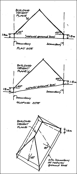
Adjoining landowner
applies to land which abuts an
application site or is separated from it only by a road, lane, pathway, right
of way, river or stream or similar thoroughfare.
Allotment (or Site)
means the area to which title is
held, excluding any land zoned or reserved for any other purpose.
Balcony
means a raised platform,
commonly referred to as a deck or verandah, having a floor level more than 1m
above an adjacent lower level or any deck or verandah covered by a roof.
Note: the
Building Code of Australia would normally require a handrail to be installed
where the edge of a floor level is more than 1m above an adjacent lower level.
Bed and
breakfast establishment
means a dwelling-house which
provides temporary home-style or farm-stay accommodation for the short-term
traveller and contains no more than five (5) bedrooms for accommodation.
Such that, dwelling-houses will have a total floor area not exceeding 300 m2
(excluding separate garages, sheds or the like) in which not more than 12
persons would be accommodated.
Note: the
reference to 300m2 and 12 persons is drawn from the Building Code of
Australia’s definition of a Class 1b building.
Boarding-house
includes a house let in lodgings
or a hostel but does not include a motel;
Building
height plane
means the plane projected at an
angle of 45 degrees over the actual land to be built upon, from a distance of
1.8 metres above natural ground level at the boundary of the site.
See the
diagram to the right
Caravan park
means land on which caravans,
other moveable dwellings, tents or camper vehicles are, or are to be installed
or placed.
Cattle feedlot
means any area of land where
cattle are held and exclusively hand fed.
Common landscaped area
means that part of the site area
above natural ground level not occupied by any building except swimming pools
at or below natural ground level, which part is predominantly landscaped by way
of planting, trees, gardens, lawns or shrubs and which is available for common
use and enjoyment by the occupants of the building erected on the site.
It excludes drying yards,
garbage collection and handling spaces and any spaces used for the movement or
parking of vehicles.
Where Council deems it
appropriate in terms of accessibility, treatment and appearance, the common
landscaped area may include rooftop spaces, terraces, steps, walkways, swimming
pools, pergolas or other built elements.
Community significant
development
The following development types will always be considered
as community significant development.
· a
building with a gross floor area of 5,000m2 or more in a industrial, rural or
commercial zone; or
· any
development that will be referred under the Act to the Joint Regional Planning
Panel; or
· any
subdivision resulting in 50 lots or more; or
· residential
accommodation resulting in 10 or more dwellings; or
· any
development that proposes demolition of a heritage listed item; or
· pubs;
or
· small
bars (nightclubs) within the meaning
of the Liquor Act 2007;
or
· function
centres; or
· restaurants
in rural areas; or
· offensive
industries; or
· telecommunications
facility
Dual Occupancy
Any reference to a dual
occupancy development includes development consisting of 2 dwellings.
The local environmental plan
provides that dual occupancy may consist of:
a) the conversion
of a dwelling house into 2 dwellings, by alteration or addition; or
b) the erection of
a building containing 2 dwellings,
but only if
not more than 2 dwellings will be created or result on the allotment.
In zones 2(a), 2(t), 2(v) or
7(f2), a dual occupancy may also consist of:
a) the
erection of a separate dwelling on an allotment of land on which a dwelling
house is already situated;
b) the
erection of 2 separate dwellings on an allotment of land,
but only if
not more than 2 dwellings will be created or result on the allotment.
Dwelling
means a room or suite of rooms
occupied or used or so constructed or adapted as to be capable of being
occupied or used as a separate domicile.
Dwelling-house
means a building or buildings
containing one but not more than one dwelling.
Erosion Line
Where used in
Chapter 1 Part J of this DCP means 50 year erosion line or the 100 year erosion
line, as defined in the following paragraphs.
50 year
erosion line
means the line shown on the map
indicating that the land to the seaward side of that line may come under threat
from coastal erosion within 50 years.
100 year
erosion line
means the line shown on the map
indicating that the land to the seaward side of that line may come under threat
from coastal erosion within 100 years.
Expanded house
means a single dwelling-house
comprising of a main building and a maximum of three (3) habitable outbuildings.
The design and use of the expanded house must incorporate the following
requirements:
a) all
buildings are contained within a circle diameter no greater than 40 metres; and
b) the
main building contains an identifiable common living area including the
kitchen; and
c) a
maximum of three (3) outbuildings may be connected to the main building by
paths with an all-weather surface; and
no separate driveways, car parking area or carport structure is to be provided
to any outbuilding; and
d) one
outbuilding is to be limited to a maximum floor area of 45m2 and the
others are to be limited to a maximum 30m2 excluding deck, patio,
balconies and the like; and
e) no
outbuilding is to contain facilities (eg. kitchen, sink and the like) for the
preparation of food or beverages; and
f) each
separate outbuilding may consist of:
· a maximum of two
(2) bedrooms or rooms with an ensuite or bathroom; and
· a maximum of one
(1) laundry.
Note: A dual
occupancy development is not possible in conjunction with an expanded dwelling
as the terms “attached,” “detached” and “dual
occupancy building” as referred to in Byron LEP 1988 do not apply in the
context of an expanded dwelling.
Exposed elevation
means the side or sides of a
building which face towards the direction or directions which are the most
likely source of a bush fire.
Floor plan area
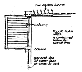 means the area contained within the outer face of the external
enclosing walls of a storey, including the area of balconies, but excluding:
means the area contained within the outer face of the external
enclosing walls of a storey, including the area of balconies, but excluding:
(a) columns,
fin walls, sun control devices and any elements outside the general line of the
outer face of the external wall;
(b) lift
towers, cooling towers, machinery and plant rooms and ancillary storage space
and vertical air-conditioning ducts;
(c) car
parking needed to meet any requirements of Council and any internal access
thereto;
(d) space
for the loading and unloading of goods.
Flood planning level (FPL)
means a level that is
500 mm above the 1% AEP flood level. This represents the adopted flood
level as referred to in the definition of flood liable land in Byron
Local Environmental Plan 1988.
Floor space ratio
means the ratio of gross floor
area to site area.
Gross floor area
means the sum of the floor plan
areas of all floors of a building.
Group dwelling
means a group of 3 or more
dwelling houses such as are commonly known as group houses, villa homes or
cluster housing or the like with each dwelling having an individual entrance
and access to private open space.
Habitable room
means
- -in a residential
situation: a living or working area, such as a lounge room, dining room,
rumpus room, kitchen, bedroom, workroom or the like. Laundries, bathrooms and
garages are non-habitable rooms. Non-habitable rooms capable of being adapted
for occupation for habitable purposes or used to store valuable possessions
susceptible to flood damage will not be permitted below the flood planning
level.
- -in
an industrial or commercial situation: an area used for offices or to
store valuable possessions susceptible to flood damage in the event of a flood
Height
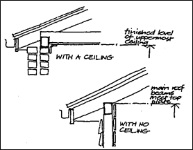 means the vertical distance between natural ground level at any
point and the finished level of the uppermost ceiling in the building, or where
there is no ceiling or a "cathedral" ceiling, the level at which the
main roof beams meet the top plate at that point.
means the vertical distance between natural ground level at any
point and the finished level of the uppermost ceiling in the building, or where
there is no ceiling or a "cathedral" ceiling, the level at which the
main roof beams meet the top plate at that point.
Holiday cabin
means a building containing a
room or a suite of rooms used, or intended to be used, for the provision of
holiday accommodation only.
The building is to have a
maximum gross floor area of 60 m2 excluding balconies, a maximum of 2 bedrooms
and may have a kitchenette and one bathroom.
Hostel
means a building or buildings
incorporating bedrooms or dormitory accommodation containing beds available for
separate rental and where cooking, dining, laundry, cleaning, toilet, bathrooms
and other facilities are all provided on a shared basis, and primarily used or
intended for use for the overnight accommodation of travellers and their
vehicles.
Immediate impact line
means the line shown on the map
marking the extent of land considered to be under immediate threat of coastal
erosion.
Inappropriate Development
where used in Chapter 1 Part K -
Flood Liable Lands, of this DCP means development that Council will not approve
under any circumstances. There may be situations where, due to its proximity to
higher ground, the development site could be placed in a lower flood hazard
category. Council would then be able to consider the proposal on its merits.
Intensive horticulture
includes propagation nurseries,
turf farming, cut flowers and the like, where the activity involves intensive
propagation utilising regular mechanical and/or chemical management of the crop
likely to cause some interference or nuisance with the living amenity of
residents on adjoining land.
Landscaped area
means area of ground available
for planting and/or management of vegetation.
Large piggery
Means a piggery accommodating in
excess of 2000 pigs or 200 breeding sows.
Map
· where used in
Chapter 1 Part J of this DCP, means maps entitled 'Coastal Erosion Lands'.
Medium density development
means residential urban
development consisting of three or more dwellings located on the same lot such
as group houses, villa homes, town houses, terraces or cluster housing or the
like.
Motel
means a building or buildings
containing not less than 6 motel units, substantially used or intended to be
used for the overnight accommodation of travellers and their vehicles, whether
or not the building or buildings are also used in the provision of meals to
those travellers or the general public.
Motel unit
means a room or suite of rooms
incorporating self-contained bathroom facilities, which is substantially used
or intended to be used for the overnight accommodation of travellers.
Multiple occupancy
means a form of rural settlement
that enables a group of people to collectively own a single allotment of land
and erect three (3) or more dwelling houses as their principal place of
residence.
Mural
means a piece of visual art
created on an appropriate, publicly visible wall or surface with the permission
of the property owner.
Other piggery
Means a piggery accommodating
10,000 pigs or less.
Porous paving
Means paving which allows
infiltration of water to the subsoil.
Primitive Camping Ground
means land used for the
placement of tents and campervans on a temporary basis in accordance with the Local
Government (Manufactured Home Estates, Caravan Parks, Camping Grounds and
Moveable Dwellings) Regulation 2005.
Probable maximum flood (PMF)
is the flood calculated to be
the maximum that is likely to occur.
Protected elevation
means the side or sides of a
building which face away from the direction or directions which are the most
likely source of a bush fire.
Public Art
is defined in the broadest sense
as artistic works or activities accessible to the public. The work is of a
permanent nature, located in or part of a public space or facility provided by
both the public and private sector. Public art also includes the
conceptual contribution of an artist to the design of public spaces and
facilities.
Rural tourist facility
means an establishment for
provision of low-scale holiday accommodation, or used for recreation or
educational purposes and may consist of a bed and breakfast establishment, boat
landing facilities, environmental facilities, holiday cabins, horse riding
facilities, a picnic ground, a primitive camping ground or a refreshment room
or the like.
Site (or allotment)
means the area to which title is
held, excluding any land zoned or reserved for any other purpose.
Site area or allotment area
means the area contained within
the title boundaries of the site, but, in the case of a hatchet-shaped site,
excludes the area of the access corridor.
Soft landscaping area
Area of ground planted for
vegetation.
Storey
means
a) the
space between two floors;
b) the
space between any floor and its ceiling or roof; and
c) foundation
areas, garages, workshops, plantrooms, storerooms and the like where the height
between the adjacent natural ground level and horizontal plane in which the top
of the floor above is situated is 1.5 metres or more.
A storey which exceeds 4.5
metres is counted as two storeys.
Surrounding Landowner
means a landowner up to 500m
from the application site.
Zone Numbers
Zones are specified by Clause 8 of Byron Local
Environmental Plan 1988
A8. PERSPECTIVES
AND MODELS
A8. PERSPECTIVES
AND MODELS
Applications for residential
development with a height in excess of 9 metres (ie, applications submitted
under the provisions of SEPP No. 1) or (in the case of a dwelling-house) a
gross floor area in excess of 300 m2, are to be accompanied by
suitable perspective drawings or a model to an appropriate scale.
Any
application for commercial development with development/building costs in
excess of $500,000 is to be accompanied by suitable perspective drawings and
photomontage. Any application for commercial development with
development/building costs in excess of $1,500,000 or a height in excess of 2
storeys is to be accompanied by a model to an appropriate scale.
Models and perspective's are to
include details of other developments around the site. Pre-lodgement
discussions with Council’s Development Assessment Panel are recommended.
A9. BUFFER
ZONES
A9. BUFFER ZONES
A9.1 Element – Buffer
Areas
Element Objectives
- To
recognise that certain types of developments create off-site environmental
impacts;
- To
protect authorised residential development from intrusion by such developments
; and
- To
minimise land use conflicts between residential developments and such
development;
Performance Criteria
Developments must be located so
that they will not adversely affect residential development, and so that there
will not be land use conflicts arising from, environmental impacts generated by
developments referred to in the Prescriptive Measures.
Prescriptive Measures
To minimise land use conflicts
and avoid undue interference with the living amenity of residents, the
following developments must be located so as to ensure the following minimum
buffer areas:
|
Landuse
|
Buffer
|
|
Large piggeries
|
2km
|
|
Other piggeries
|
1km
|
|
Feedlots
|
1km
|
|
Quarries
|
1km
|
|
Intensive horticulture(D)
|
500 metres
|
|
Sewage treatment plants
|
400 metres
|
|
Garbage tips
|
500 metres
|
|
Dairies
|
300 metres
|
|
Chicken farms
|
300 metres
|
|
Cattle dips
|
200 metres
|
Applicants for such development
above must demonstrate to Council’s satisfaction that there is a clear
case for variation of this standard. The applicant must demonstrate that the
element objectives and performance criteria will be met.
Applicants must address the
following matters. This may involve an independent assessment of the
issues by a person nominated by Council at the cost of the applicant for
development.
1. Consultation
with Council in respect of individual cases to determine specific matters to be
addressed.
2. Operational
characteristics of the land use.
3. Advice
from the relevant statutory authorities.
4. Details
of surveys undertaken must be provided.
5. Prevailing
wind conditions and velocity of winds.
6. Topography
and height(D) of the development.
7. Slope,
odour, dust and noise.
Where
applications are received for development that requires buffering, the buffer
zone must be provided as far as possible within the subject property and the
applicant must address the abovementioned heads of consideration to Council's
satisfaction.
Staff Reports - Sustainable Environment and Economy 8.3 - Attachment 6
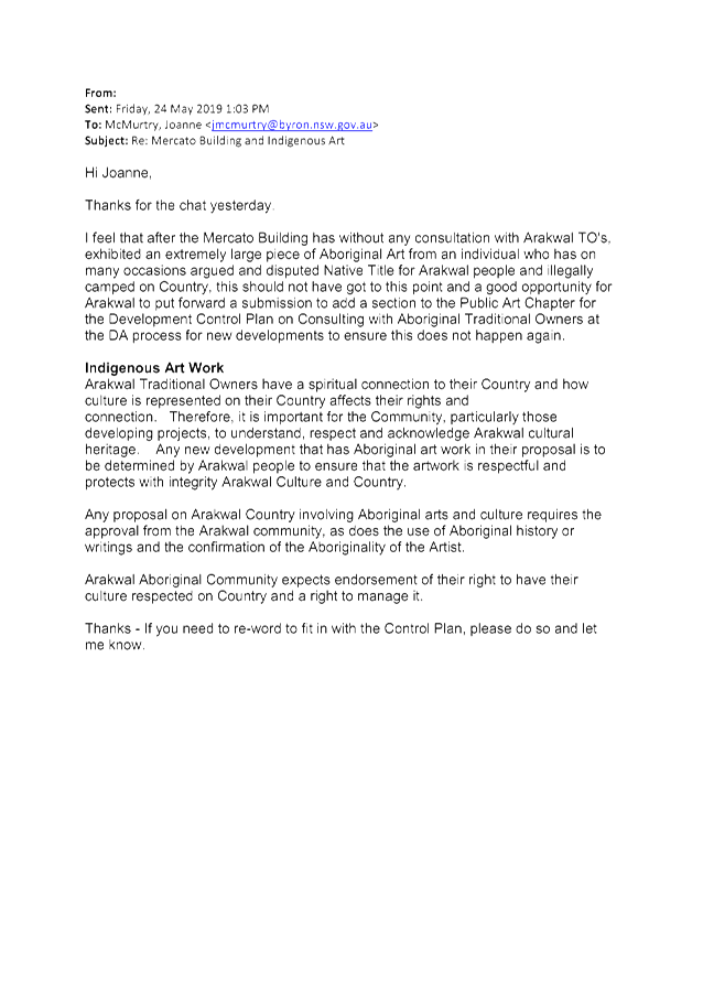
Staff Reports - Sustainable Environment and Economy 8.3 - Attachment 7
Local
Government (General) Regulation 2005
Schedule 3A Form of special disclosure
of pecuniary interest
(Clause 195A)
Section 451 of the Local Government
Act 1993
Form of Special Disclosure of Pecuniary Interest
1 The particulars of
this form are to be written in block letters or typed.
2 If any space is
insufficient in this form for all the particulars required to complete it, an
appendix is to be attached for that purpose which is properly identified and
signed by you.
Important information
This information is being collected for the purpose of
making a special disclosure of pecuniary interests under sections 451 (4) and
(5) of the Local Government Act 1993. The special disclosure must relate to a pecuniary
interest that arises only because of an interest of the councillor in the
councillor’s principal place of residence or an interest of another
person (whose interests are relevant under section 443 of the Act) in that
person’s principal place of residence. You must not make a special
disclosure that you know or ought reasonably to know is false or misleading in
a material particular. Complaints made about contraventions of these
requirements may be referred by the Director-General to the Local Government
Civil and Administrative Tribunal.
This form must be completed by you before the
commencement of the council or council committee meeting in respect of which
the special disclosure is being made. The completed form must be tabled at the
meeting. Everyone is entitled to inspect it. The special disclosure must be
recorded in the minutes of the meeting.
Special
disclosure of pecuniary interests
by
____________________________________________________________________________________
[full
name of councillor]
in the matter of
__________________________________________________________________________
[insert
name of environmental planning instrument]
which is to be considered at a meeting of the
______________________________________________________________________________________
[name of council or council committee (as the case
requires)]
Report No. __________ to be held on the _________________ day of
________________________ 201
|
Pecuniary
interest
|
|
Address of land
in which councillor or an associated person, company or body has a
proprietary interest (the identified land)1
|
|
|
Relationship of identified land to councillor
[Tick or cross one box.]
|
Councillor
has interest in the land (e.g. is owner or has other interest arising out of
a mortgage, lease, trust, option or contract, or otherwise).
Associated
person of councillor has interest in the land.
Associated company
or body of councillor has interest in the land.
|
|
Matter giving rise to pecuniary interest
|
|
Nature of land that is subject to a
change
in zone/planning control by proposed
LEP (the subject land)2
[Tick or cross one box]
|
The identified
land.
Land
that adjoins or is adjacent to or is in proximity to the identified land.
|
|
Current
zone/planning control
[Insert name
of current planning instrument and identify relevant zone/planning control
applying to the subject land]
|
|
|
Proposed
change of zone/planning control
[Insert name of proposed
LEP and identify proposed change of zone/planning control applying to the
subject land]
|
|
|
Effect
of proposed change of zone/planning control on councillor
[Insert
one of the following:
“Appreciable financial gain” or
“Appreciable
financial loss”]
|
|
[If
more than one pecuniary interest is to be declared, reprint the above box and
fill in for each additional interest.]
_____________________________
Councillor’s
signature
_____________________________
Date
(This
form is to be retained by the Council’s general manager and included in
full in the minutes of the meeting.)
1 Section 443 (1) of the Local Government Act 1993 provides
that you may have a pecuniary interest in a matter because of the pecuniary
interest of your spouse or your de facto partner or your relative 4 or because
your business partner or employer has a pecuniary interest. You may also have a
pecuniary interest in a matter because you, your nominee, your business partner
or your employer is a member of a company or other body that has a pecuniary
interest in the matter.
Section 442
of the Local Government Act 1993 provides
that a "pecuniary interest" is an interest that a
person has in a matter because of a reasonable likelihood or expectation of
appreciable financial gain or loss to the person. A person does not have a
pecuniary interest in a matter if the interest is so remote or insignificant
that it could not reasonably be regarded as likely to influence any decision
the person might make in relation to the matter or if the interest is of a kind
specified in section 448 of that Act (for example, an interest as an elector or
as a ratepayer or person liable to pay a charge).
2 A pecuniary interest may
arise by way of a change of permissible use of land adjoining, adjacent to or
in proximity to land in which a councillor or a person, company or body
referred to in section 443 (1) (b) or (c) of the Local Government Act 1993 has a proprietary interest-see section 448 (g) (ii) of
the Local Government Act 1993 .
3 "Relative" is
defined by the Local Government Act 1993 as meaning your, your spouse’s or your de facto
partner’s parent, grandparent, brother, sister, uncle, aunt, nephew,
niece, lineal descendant or adopted child and the spouse or de facto partner of
any of those persons.
Staff Reports - Sustainable Environment and Economy 8.4 - Attachment 1

Byron Shire
Development Control Plan 2014
Chapter D6
Subdivision
This page has been intentionally left blank
Chapter D6 – Subdivision
Contents
D6.1 Introduction. 5
D6.1.1 Purpose
of this Chapter 5
D6.1.2 Aims
of this Chapter 5
D6.1.3 Application
of this Chapter 5
D6.2 Development
Controls. 6
D6.2.1 Subdivision
Design Guidelines. 6
D6.3 Rural
Subdivision. 15
D6.3.1 Lot
Size, Shape and Configuration. 15
D6.3.2 Stormwater
Management 17
D6.3.3 Road
Design and Construction. 17
D6.3.4 Sewage
Management 18
D6.3.5 Rural
Community Title Subdivision. 18
D6.3.6 Subdivision
Design and Lot Layout on Rural land within the Drinking Water Catchment 20
D6.4 Urban
Residential Subdivision. 21
D6.4.1 Lot
Size and shape. 21
D6.4.2 Access
Design. 22
D6.4.3 Infill
Subdivision with Rear Lane Access. 23
D6.5 Industrial
and Commercial Subdivision. 24
D6.5.1 Lot
Size and Shape (Industrial) 24
D6.5.2 Lot
Size and Shape (Commercial) 25
D6.5.3 Subdivision
design (Industrial and Commercial Development) 25
Figures
Figure D6.1 – Shelterbelt 7
Figure D6.2 – Orientation and Aspect 7
Figure D6.3 – Preferred subdivision layout on
east-west or north-south axis. 8
Figure D6.4 – Lots with a NW-SE axis. 8
Figure D6.5 – Example of preferred
subdivision design along a watercourse. 21
Figure D6.6 – Pre Development (existing) Subdivision
Pattern. 24
Figure D6.7 – Post Development Subdivision Pattern. 24
Tables
Table D6.1 – Preferred Minimum Lots Sizes –
Urban Subdivision. Error!
Bookmark not defined.
Document History
|
Doc No.
|
Date Amended
|
Details
(e.g. Resolution No.)
|
|
#E2014/4864
|
20 March 2014
|
Res 14-118 –
Public exhibition version
|
|
#E2014/33037
|
|
Draft to
26 June 2014 Extraordinary Meeting - for adoption
|
|
#E2014/43407
|
26 June 2014
|
Adopted
Version – Res 14-513
|
|
#E2018/27636
|
22 March 2018
|
Adopted
22 March 2018 Effective 12 April 2018 – Res 18-130
‘Housekeeping’
amendment (various chapters).
|
|
#E2019/29634
|
April 2019
|
Public
Exhibition Version (Res 19-091) 24.2018.65.1
|
|
#E2019/29634
|
July 2019
|
New
revision for adoption at 15 August 2019 planning meeting
|
D6.1 Introduction
D6.1.1 Purpose
of this Chapter
The subdivision of land establishes the basis on which
future development is built. Therefore the Council seeks to ensure that
the environment, the nature of future development and the aspirations of the
community are given due consideration in all subdivision proposals.
The primary purpose of this Chapter is to provide
guidelines, controls and standards for subdivision in Byron Shire.
D6.1.2 Aims
of this Chapter
The Aims of this Chapter are to:
1. To promote
subdivision development which is of a high design standard and which minimises
impact on the environment.
2. To provide
for a variety of housing and other forms of development reflecting the growing
diversity of the community and its household types, incomes and lifestyles.
3. To
encourage the use of innovative design and engineering principles which enhance
the physical environment and the social fabric.
4. To optimise
the provision of infrastructure services in the most efficient and effective
manner.
5. To ensure
the continued supply of agriculturally viable land.
D6.1.3 Application
of this Chapter
This Chapter of the DCP applies to all forms of subdivision,
including Torrens, Strata, Stratum and Community Title subdivision. The
provisions in this Chapter supplement those provisions of Byron LEP 2014 that
apply to subdivision development.
Applicants must familiarise themselves with the matters
contained in other Chapters of this DCP, since good subdivision design cannot
be achieved without proper consideration of the way in which the land will be
developed and used later. Additionally applicants may refer to the
following publications for further guidance on subdivision design: NSW
Department of Planning’s ‘Coastal Design Guidelines for NSW
(2003)’; the Byron Rural Settlement Strategy 1998; The NSW Rural Fire
Service ‘Planning for Bushfire Protection; and, the Northern Rivers
Development and Design Manual and, other engineering criteria including
relevant Australian Standards.
D6.2 Development
Controls
D6.2.1 Subdivision
Design Guidelines
Objectives
1. To
specify development controls, design guidelines and criteria that apply
generally to subdivisions.
2. To
ensure that subdivision proposals deliver contemporary construction and
services standards and result in development that is consistent with the
particular needs, character and environment of Byron Shire.
Performance Criteria
There are no Performance Criteria.
Prescriptive Measures
Development applications for subdivision must address the
following Design Guidelines:
1. Site
Design
a) The following
natural environment factors must be addressed in the overall site design of any
proposed subdivision:
i) Climate
control (wind and sun)
ii) Landform
iii) Aspect and
views
iv) Geology and
soils
v) Drainage and
groundwater
vi) Vegetation.
b) Site design must
integrate these factors with consideration of the existing and proposed
human-made environment with which the subdivision interacts. This will
include consideration of the effects of, and the impacts on the following
human-made factors:
i) Accessibility
to urban centres
ii) Accessibility
to community and recreational facilities
iii) Road and
transport networks
iv) Site access
v) Physical and
human services
vi) Built
environment in the vicinity
vii) Existing buildings
and improvements on the site.
c) Development
applications for subdivision (except for applications for boundary adjustment
subdivision in accordance with Byron LEP 2014 or strata subdivision of a lawfully
erected building) must include a Site and Context Analysis Plan complying with
the requirements of Section A13.1 – Context and Site Analysis. The
Context and Site Analysis Plan must also demonstrate how the above-mentioned
natural and man-made environmental factors have been considered and addressed.
2. Climate
Control and Aspect
Design of the proposed subdivision must aim to gain the most
advantage of cooling breezes in summer and reduce the impact of adverse winds
in winter by effective site layout and use of landscaping. Significant
topographical features such as valleys and ridges can serve to channel or block
prevailing winds.
Similarly, the selection of vegetation types and location of
vegetation buffers and shelterbelts can be used to advantage in climate control
on the site.
The design of site layout and landscaping should be
structured to avoid funnelling unfavourable winds and encourage cooling summer
breezes.
Aspect is an important factor in designing the subdivision
layout in regard to optimising solar access. The following principles are
a basic guide.
Solar access is maximised where:
a) Buildings can be
sited so that the main living areas are oriented north.
b) Overshadowing of,
or by other buildings is minimised.
Shadows are small on a north-facing slope so dwelling sites can be closer together.
On a south-facing slope, shadow length is increased so dwelling sites should be further apart.
On east or west-facing slopes, dwellings
need to be stepped back to maintain solar access.
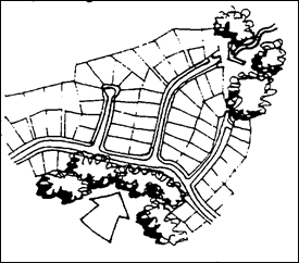
Figure D6.1 – Shelterbelt
Note: Shelterbelt of trees protects subdivision from cold
southerly winds
|
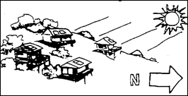
Note: Subdivision orientated to the north for maximum
solar access – limited shadow impacts
|

Note: Subdivision orientated on southern side of hill.
Restricted solar access and increased shadow impacts
|
Figure D6.2 – Orientation and Aspect
Lots with a main north-south axis (from 200W to 3O0E)
give the most flexibility in the siting of dwellings
and reduce problems of overshadowing. Lots with a main east-west axis may
need to be wider than normal.
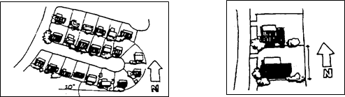
Figure D6.3 – Preferred
subdivision layout on east-west or north-south axis
Lots with a NW-SE or NE-SW axis are less favourable and may
need to be specially designed or larger than normal to allow the siting of a
house that is not parallel to the boundaries (see Figure D6.4 below).
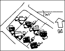
Figure D6.4 – Lots with a
NW-SE axis
These guidelines must be considered together with the
particular topography and vegetation of the site to achieve a layout that
optimises solar access and site characteristics. A regular grid of N-S
and E-W streets is unlikely to result in an attractive living environment or
offer the flexibility for different housing needs.
3. Hazards
Hazard constraints potentially affecting land must be
identified and addressed in preparing an application for subdivision. The
following list identifies some hazards that may affect the potential for
subdivision or influence subdivision design:
a) Flooding.
b) Bushfire.
c) Landslip and
subsidence.
d) Land
contamination and the need to address the requirements under State
Environmental Planning Policy No.55 – Remediation of Land.
e) Acid sulfate soils.
f) Coastal hazards.
Development applications must identify and address all
potential hazards of the site in accordance with the requirements of Byron LEP
2014, this DCP and other relevant Council and State Government policies,
guidelines and legislation.
4. Vegetation
removal
Subdivision road layout must be designed around significant
stands of trees. These may be located within reserves or accommodated
within the subdivision layout such that dwelling
construction may be achieved without causing any undue interference with existing
trees.
The environmental buffer distances in chapter B6 Buffers and
Minimising Land Use Conflict should be incorporated into the subdivision
design. Where urban subdivision adjoins bushland, Council may impose
particular consent conditions relating to the ongoing management of the
interface between the subdivision and the bushland.
Proposals that require the removal of vegetation for
bushfire protection purposes (e.g. asset protection zone) may need to include a
Flora and Fauna Assessment and, where native vegetation is to be removed, may
need to prepare a Vegetation Management Plan.
Vegetation to be removed must be located within the subject
land unless an agreement has been reached to provide the necessary asset
protection zone on the neighbouring property. Evidence of any agreement
with the neighbouring land owner, together with that owners’ written
consent to lodgement of the DA must be submitted with the development
application. The agreement must be in the form of a proposed Section 88B
Instrument under the Conveyancing Act 1919, consistent with the
requirements of the NSW Rural Fire Service. For specific details on
subdivision on bushfire prone land, applicants are referred to the NSW RFS
document ‘Planning for Bushfire Protection’.
Any trees proposed to be removed as a result of a
subdivision proposal must be identified in accordance with the provisions of
B2.2.1 (Chapter B2 Preservation of Trees and Other Vegetation) or a Site and
Context Analysis Plan (as required by Part A13) and be marked clearly to
facilitate identification at the time of site inspection.
5. Riparian
Buffers and land fronting watercourses
Subdivision design must encourage the retention of riparian vegetation and should incorporate
riparian buffers. The retention of existing vegetation and landforms
assists in infiltrating, detaining and treating stormwater, as well as
maintaining water balance and aesthetics. The retention of vegetation
along watercourses also assists in
habitat connectivity, which is critical to maintaining biodiversity.
Riparian corridors
must be left undisturbed. Their natural and ecological values must be
enhanced where possible. Street and lot layout must be planned so that
riparian habitat is retained and where possible connected to remnant habitat in
adjoining areas. Where land proposed for subdivision fronts a watercourse, it is preferable that the
subdivision be designed to limit direct access to the water.
Vegetation and topography must be retained along the
site’s natural drainage lines. This vegetation will play a key part
in providing habitat connectivity and maintaining biodiversity.
The retention or reinstatement of vegetation and provision
of habitat connectivity must utilise locally
indigenous species and be incorporated in the design of public areas
and facilities such as parks, detention/ infiltration basins, or water
treatment areas.
Allotments having
frontage to a watercourse are to
comply with the minimum requirements for buffers under Chapter B6 Buffers and
Minimising Land Use Conflict (where relevant).
6. Landscaping
The effective use of landscaping can make a significant
contribution to climate control, ecological characteristics, the overall
appearance of the subdivision and the residential environment which is
ultimately created.
Generally, one street tree per 15 metres of residential lot
street frontage with a maximum canopy diameter of 8 metres at maturity is to be
provided for new subdivisions.
Applicants must comply with the landscaping design and
maintenance requirements in Chapter B9 Landscaping.
7. Roads
Roads are to be designed to provide a pronounced road
hierarchy in which the size, width and appearance matches its function. Streets
at the lower end of the hierarchy must not become through-routes for unrelated
traffic and proper provision must be made for buses and service and delivery
vehicles.
Depending on the overall size and layout of a subdivision, a
typical road hierarchy could include:
a) Arterial or
sub-arterial roads – roads giving access to the subdivision but not part
of it.
b) Collector street
- a main link through the subdivision, connecting directly with arterial roads.
c) Local access road
- a loop road or cul-de-sac serving more than 15 lots.
d) Minor road - a cul-de-sac,
minor loop or minor access street, serving less than 15 lots.
Where cul-de-sacs are proposed, consideration to is be given
to providing pedestrian and cycling traffic through to the next street with
regards to the CPTED principles in Chapter B11 Planning for Crime
Prevention.
Roads (including footpaths, cycleways, and watercourse
crossings) are to be designed in accordance with the requirements specified in
the Northern Rivers Development and Design Manual as amended from time to time.
Council will consider variations to these requirements on merit where
compliance is proven to be onerous and having regards to the scale, location
and density of the development.
Where an allotment
to be subdivided has access via an unsealed, unconstructed or partly
constructed road, the applicant must provide constructed road access from the
nearest constructed road to all allotments
involved in the subdivision to facilitate ultimate design road capacity.
The applicant must supply and erect street signs in
accordance with Councils requirements.
Subdivision development must provide footpath and nature
strip treatment that reflects the particular road function and provides a safe
and pleasant people-oriented environment for pedestrians and cyclists.
New roads are to be appropriately landscaped with street trees in accordance
with Chapter B9 Landscaping and retain significant existing vegetation to
complement the subdivision.
Other street furniture such as bus stops to be provided as
required.
All development applications for subdivision to incorporate
preliminary engineering drawings of the work to be carried out as required
under the regulations.
8. Street
Lighting
Council will require energy efficient street lighting to be
provided and installed in conjunction with any subdivision located in an area
where street lighting is required.
New street lighting to be installed as part of a subdivision
is to incorporate energy efficient technology to reduce power consumption and
carbon footprint with a wattage of 55 watts or less, and may include:
a) Compact
fluorescent
b) T5 linear
fluorescent
c) Metal halide
d) White LED
e) Low Pressure
Sodium lamps of 55W or less
f) High
Pressure Sodium lamps of 55w or less
Council will consider alternate street lighting arrangements
powered from solar or wind turbines with back up mains power for subdivisons
comprising 25 lots or more. Details to be submitted with the development
application including maintenance/ cleaning regime, suppliers/ installers
warranties/ guarantees, accessibility to replacement parts, battery, panel and
turbine life, useability in high wind situations for wind turbines and any
noise issues.
Street lighting to comply with AS1158 or AS3771 and any
requirements for disability access and mobility. Written evidence that
satisfactory arrangements have been made with the Energy Provider will be
required prior to the release of a Subdivision Certificate
9. Public
open space and public reserves
The value to the public of public open space is determined by
how easy it is to get to, how well it is used, it’s potential for active
or passive uses, it’s environmental value and how pleasant it is to be
there.
Public open space within a subdivision should form part of a
pedestrian/cycleway network that connects residential areas and other
facilities. Where appropriate, landscaping of open space must be integrated
with street and private landscaping to bring the whole landscape environment
together. Some Key Principles include:
a) There must be a
functional hierarchy of open space to ensure leisure activities for a wide
variety of people.
b) Open space must
be safe to use for access or leisure.
c) It must enhance
the function and appearance of the subdivision.
d) It must act as a
landscape-linking element.
Only land which is in a suitable location and which is able
to be used for active or passive recreation will be considered to meet the
requirements for public open space. Public open space areas must be
functional, well-located and distributed appropriately throughout the
subdivision to maximise accessibility and provide for passive and active
recreational opportunities.
Applicants proposing urban subdivisions of
25 lots or more are encouraged to contact Council for the requirements for the
provision of open space or local parks as part of the subdivision prior to the
preparation and lodgement of the development application.
Land which is primarily used for drainage
purposes may not be considered as open space if predominantly unusable.
Specific requirements under the chapters for the Shire's towns and villages may
also apply in relation to open space.
Dedication and embellishment of land used
for open space may be offset against the S94 contributions for open
space. Applicants should consider the
requirements of Council’s section 94 contributions plan and the site
specific chapters for urban release areas as these documents contain the site
specific requirements for the provision of open space. Council’s
section 94 plan sets out the requirements for undertaking works in kind or the
dedication of land in lieu of payment of monetary contributions. It is at
the discretion of Council to accept land as open space.
Local parks when provided to be generally in accordance with
the following criteria:
a) Contain a minimum
usable park area of 2000m2;
b) Be designed and
located so as to maximise street frontage and encourage natural surveillance
from surrounding residents;
c) Be generally
level with gradients not exceeding 5%;
d) Be equipped with
play equipment and/or park furniture;
e) Provide shade
cover over all play equipment;
f) Include
soft-fall under all play equipment in accordance with the relevant Australian
Standards;
g) Be situated so
that dwellings in the development and
surrounding area are generally within a 500m lineal distance of a local
park;
h) Be situated on
land that is readily accessible to the surrounding dwellings
and be physically connected to the pathway network;
g) Be cleared of
weed species and have a bush regeneration plan if required;
h) Be cleared of
surface rock and be suitable for mowing / maintenance.
10. Stormwater
Management
Management of stormwater is an integral part of subdividing
land and a means to control flooding and other amenity impacts. The
following minimum provisions apply.
a) Development
applications must demonstrate compliance with Chapter B3 Services, the Northern
Rivers Local Government Development Design and Construction Manuals, Byron
Shire Council Comprehensive Guidelines for Stormwater Management and relevant
Australian Standards.
b) Each new allotment must be capable of discharging
stormwater runoff from impervious areas to a lawful
point of
discharge. A lawful point
of discharge
(d) may be a natural watercourse or
drainage path to which the site drains naturally, or a location where any
discharge will not cause any actionable nuisance. Where a lawful
point of
discharge does not exist on the allotment (d), constructed drainage and any
necessary easements must be provided to a lawful
point of
discharge.
c) The applicant
must construct all necessary drainage works and must provide all necessary
drainage easements and/or drainage reserves including on adjoining or
downstream properties to the lawful point of discharge. Where easements
are proposed over downstream properties for drainage purposes, a letter of
consent from the owner(s) of the downstream properties must be submitted with
the development application. Deferred commencement consent may be issued
subject to the registration of the easement in these circumstances.
d) An appropriate
stormwater flow management system must be established to reduce the velocity
and peak flow of stormwater discharge (i.e. the provision of an on-site
stormwater detention system).
e) For small lot
subdivision where onsite stormwater detention is required, the construction may
be deferred until the dwelling construction
stage. In this regard a Restriction as to User must be created on the
plan of subdivision pursuant to the provisions of S.88E of the Conveyancing Act
1919, stating:
“No building or
development shall be erected on the lots burdened unless the proprietor has
first constructed or has made provision for construction of an on-site
stormwater detention system (which expression shall include all ancillary
gutters, pipes, drains, walls, curves, pits, grates, tanks, chambers, basins
and surfaces designed to temporarily detain stormwater) (here in after called
“the system”). The design, construction and/or provision of the
system shall be to the requirements and satisfaction of Byron Shire
Council.”
f) Lands
identified as containing or directly adjoining watercourses
or trunk drainage lines may be subject to partial inundation during the 1 in
100 year ARI storm event. A
hydrology study must be submitted to identify the 1 in 100 year ARI flow level where the land is traversed by
or adjacent to a watercourse or trunk
drainage system. Development applications must demonstrate that the proposal
complies with the requirements of the Northern Rivers Development and Design
Manual and Chapters B3 Services and C2 Areas Affected by Flood.
11. Utility
Services
Utility Services, including power and telephone, are to be
provided in accordance with Chapter B3 Services.
The siting and design of proposed utilities must be
illustrated on the subdivision plan submitted with the development application.
Written evidence of satisfactory arrangements with a
telecommunications and electricity provider must be submitted prior to release
of a Subdivision Certificate. Provision must be made for the placement of
telephone and electricity underground in visually sensitive locations. A
renewable energy system may be approved for the subdivision where development
applications demonstrate that the proposed system is sustainable, will provide
adequate levels of service to future residents, and minimises the need to remove
vegetation for service corridors.
Where possible, subdivision design must provide for common
trenching of services to reduce the number of trenches and the amount of land
required, and to reduce costs and disruption due to maintenance.
Trenching must meet the standards detailed within the Streets Opening
Conference current Guide to Codes and Practices for Streets opening.
12. Provision
of Potable Water Supply
Development applications must demonstrate that an adequate
water supply will be available to meet the needs of future residents and
occupants, either through the provision of reticulated water supply or
rainwater tanks if reticulation is not available in accordance with the
provisions of Chapter B3 Services, and the Northern Rivers Development and
Design Manual.
13. Sewer
Sewer must be provided to all lots within urban zones.
Satisfactory arrangements for provision of sewer services must be made with
Council in accordance with Chapter B3 Services.
14. Geotechnical
Report
a) Development
applications for vacant lot subdivision must include a report and certificate
from a NATA - accredited practising civil engineer confirming that all proposed
allotments contain a building
envelope of adequate size and shape (i.e. a rectangle with dimensions at least
15m x 12m) that is geotechnically capable of accommodating a dwelling house and is not subject to slip or
subsidence. The certified building envelopes must be identified on the DA
drawings.
b) The report must
address the matters listed in AS1726 (as amended from time to time).
c) Engineer
specialising in geophysical sciences and preparing reports for the
consideration of Council must provide written evidence of their holding an
insurance policy to the value of at least $10m indemnifying him/her against
professional negligence.
15. Strata
Title, Community Title and Stratum Subdivision
The minimum areas specified by the Byron LEP 2014 lot size map apply to Stratum subdivision in
all zones. The LEP sets out minimum lot sizes for Strata and Community Title
subdivision in certain zones. For those zones where there is no
prescribed minimum area for strata or community title subdivision, minimum lot
sizes will be based on the development footprint.
The terms of the development consent will be subject to the
relevant provisions of the LEP and this DCP, depending on the location, zoning,
characterisation and nature of the development proposed. Generally,
approved Strata or Community Title Lots must include sufficient area to accommodate
the approved development unit, together with any ancillary area, development or
structure related exclusively to that unit, unless those facilities are
provided in an approved Community Lot or Common Property.
Council will not grant consent to a development application
seeking consent for Strata or Stratum Title subdivision unless either that
consent or a previous consent identifies and approves one or more buildings
that will be erected on or in each of the new Strata or stratum lots.
Where vacant lots (Stratum, Strata and Community Title) are
proposed all relevant services, infrastructure and access provisions are to be
constructed, and any necessary contributions to be paid, prior to the issue of
the subdivision/ strata certificate.
Other than for dual
occupancy development, vacant Strata
lots must be created as “development lots” in accordance with Part
5 of the Strata Schemes Development Act 2015.
Strata subdivision of dual
occupancies may create a vacant strata
lot subject to:
a) One
of the dwellings having been
constructed and a final occupation certificate issued for that dwelling.
b) All
relevant services, infrastructure and access provisions are to be constructed
and any necessary contributions to be paid, prior to the issue of the
subdivision / strata certificate.
c) Relocation
of all services to facilitate construction of the development on the vacant lot
without affecting service provision to existing development.
d) Creation
of a restriction on use that prohibits the construction of a dwelling on the vacant Strata lot other than
in accordance with the development consent for the dual
occupancy building.
Applications for Stratum Subdivision must provide the
following:
a) Draft Plan of
Subdivision showing the parcel at ground level and subsequent sheets for each
level within the building
b) A draft Building
Management Statement as per Schedule 8A of the Conveyancing Act 1919.
c) Details on
easements including easements for support and shelter, vehicular personal
access, services and any other easements.
For further details on Stratum Subdivision applicants are
referred to Part 23 - Division 3B Provisions relating to Stratum Lots of the
Conveyancing Act 1919 and the Land and Property Information Registrar
Generals Directions on Stratum Subdivisions.
D6.3 Rural
Subdivision
The following provides planning controls for land in rural
and rural residential areas including the RU1, RU2 and R5 Zones. R5 is an urban
zone however the most appropriate subdivision controls are those which apply to
rural lots.
D6.3.1 Lot Size, Shape and Configuration
Objectives
1. To
ensure that lot sizes and shapes facilitate the orderly and economic use and
development of land.
2. To
ensure that the configuration of the subdivision and the size and shape of lots
facilitates the use and management of the resultant land parcels for
agricultural and other rural purposes.
3. To
ensure that adequate access is available to hatchet-shaped lots.
Performance Criteria
1. Land
suitable for agriculture is both a limited resource and an important part of
the Shire’s economy. Rural subdivisions must be designed to avoid
conflicts between neighbouring land uses and consequently must demonstrate
compliance with Chapter B6 Buffers and Minimising Land Use Conflict.
Where a subdivision is proposed near an area where land is used or has
potential for agriculture, Council will give particular consideration to the
likely social, economic and environmental consequences of the proposal and to
the following principles:
a) New lots must
have dwelling sites protected from
noise, dust, odours, spraying, etc, considering wind direction and topography
in relation to nearby agricultural uses.
b) Ridgelines,
vegetation and distance can provide effective buffers.
2. Lots
intended to accommodate a dwelling in
rural areas must have an identified dwelling
site that:
a) has access by two
wheel drive vehicle to a constructed public road;
b) is not affected
by significant environmental constraints;
c) is not at or
below the flood planning level;
d) complies with
bushfire provisions under the requirements of Planning for Bushfire Protection
as in force at the time of the proposed development;
e) has adequate
solar access;
f) will not
create conflicts with or adverse impacts on nearby farming or rural activities;
g) is not subject to
slip or subsidence.
Prescriptive Measures
1. Lot
sizes must not be less than the minimum area specified in Byron LEP 2014 on the
lot size map.
2. Battle-axe
or hatchet-shaped lots may be permitted in rural zones and the R5 Zone provided
the access handle is of sufficient width to accommodate an access driveway,
associated drainage, services and landscaping that conforms to the existing
landform. The minimum road frontage of each allotment
must be 7 metres. This may translate as 3.5 metres frontage
each if reciprocal rights of carriageway provide shared access to two or more
adjoining lots. Pavement widths are to be in accordance with Northern Rivers
Development and Design Manual.
3. Applications
for rural subdivision for primary production purposes in accordance with Clause
4.2 of Byron LEP 2014 are to include written information from either the
Department of Primary Industries (or its successor) or an accredited expert in
the field of agriculture confirming that the proposed lot(s) is suited for
viable agricultural activity of the type proposed. Splays of 4 m x 4 m should
generally be provided on corner lots, except in site specific circumstances
where increased sight lines are required.
4. Splayed
corners must be provided and dedicated to Council at existing and new road
intersections in accordance with the following schedule:
a) At the junction
of a local road with a main road. (note Main Road has the same meaning as Main
Road under the Roads Act 1993)
D6.3.2 Stormwater
Management
Objectives
1. To
facilitate effective water and drainage management and to preserve existing
natural drainage systems.
Performance Criteria
1. Development
applications must demonstrate that the proposed development will incorporate
water management and drainage provisions consistent with the requirements of
Chapter B3 Services and the other stormwater provisions in Section D6.2.1.
2. Stormwater
runoff from each new allotment must
not create significant detrimental effects on downstream properties or the
environment. Natural watercourses and
existing drainage paths must be retained. Subdivision works must not
impede natural drainage paths or significantly increase existing flow velocity
or quantity.
3. Small
rural and rural residential lots may have to provide an inter-allotment drainage system constructed in
accordance with the Northern Rivers Development and Design Manual.
Prescriptive Measures
Dwelling sites
must not be located within the 1 in 100 year ARI
flow path of any existing watercourses
or drainage paths.
D6.3.3 Road
Design and Construction
Objectives
1. To
ensure access and drainage provision to new lots.
2. To
enable flexibility in design of new rural roads.
3. To
ensure that adequate sight distance is provided at intersections.
4. To
ensure that constructed access is provided to new lots.
Performance Criteria
All roads required to service existing and proposed new lots
must be designed and constructed to comply with the Northern Rivers Development
and Design Manual and Chapter B3 Services. The Council may consider alternative
designs in particular instances where the development application demonstrates
that:
a) Safety
requirements are not compromised.
b) The proposed road
will not carry more than 60 vehicle movements per day.
c) Visibility is not
impaired from start to finish of the road along its centre-lines.
d) The grassed verge
of the proposed road will not be damaged by traffic movements along the road.
e) An adequate
manoeuvring area is provided to accommodate the turning of a standard (8.8m)
service vehicle at the end of a road or in a location approved by Council.
f) Any
proposed narrow pavement will be no longer than 120 metres in length.
Prescriptive Measures
1. The
design of such works must comply with the Northern Rivers Development and
Design Manual. Construction must be carried out in accordance with those
requirements.
2. Additional
standards may apply in bushfire prone areas as per the requirements of the NSW
Rural Fire Service.
D6.3.4 Sewage
Management
Objectives
1. To
ensure that sustainable sewage management facilities are available to new lots
in Rural areas.
2. To
ensure that on-site sewage management systems
comply with the requirements of Chapter B3 Services and will remain
economically viable in terms of ongoing management and maintenance.
Performance Criteria
There are no performance criteria.
Prescriptive Measures
1. Where
Council deems that reticulated sewer service is available and feasible, each allotment created must be connected to
Council's sewerage reticulation system.
2. In
all other cases development applications must demonstrate that an on-site sewage management system complying
with the requirements of Chapter B3 Services can be provided to service each
lot. Where lots are constrained and specialised on-site sewage management systems are proposed
or required, Council may specify as a condition of consent a restriction to be
placed on the title advising new land owners of the type of system to be
installed in the future.
D6.3.5 Rural
Community Title Subdivision
Objectives
1. The
objective of this Section is to provide guidelines for rural Community title
subdivision including the conversion of existing approved multiple occupancies
to community title under the Community Land Development Act 1989.
Performance Criteria
1. Rural
community title subdivision under the Community Land Development Act 1989,
should demonstrate compliance with the relevant guidelines and performance
standards contained in Sections 6.2, 6.3 and Sections 8.1 – 8.6 of the
Byron Rural Settlement Strategy 1998.
2. The
conversion of existing approved multiple occupancies to rural community title
subdivision under the Community Land Development Act 1989 should
demonstrate compliance with the objectives contained in Sections 6.2, 6.3 and
Sections 8.1 – 8.6 of the Byron Rural Settlement Strategy 1998.
Prescriptive Measures
1. The
maximum number of lots resulting from the Community Title subdivision of rural
land (including the conversion of existing approved multiple occupancies to
rural community title subdivision) must not exceed the number of approved house
sites (excluding the neighbourhood lot/common land) identified in the multiple
occupancy approval in relation to the land concerned, or the number of lots
identified under the Byron LEP 2014.
2. Consent
must not be granted to a development application for rural Community Title
subdivision under clause 4.1AA of Byron LEP 2014 unless the Council has
considered the following information in relation to the proposed development:
a) a water
management plan;
b) an on-site sewage management plan in accordance
with the requirements of Chapter B3 Services;
c) a waste
management plan;
d) a vegetation management
plan and planting requirements;
e) a bushfire
management plan;
f) measures to
address the unauthorised/ unapproved illegal construction and occupation of dwelling houses. Where such dwellings are to remain as part of the development
and not be demolished, a detailed engineers report and certification is to be
submitted with the development application demonstrating the dwelling is structurally sound, how it meets
the relevant provisions of the Building Code of Australia, and/or what works
are proposed to upgrade the building to a safe standard. Such works are
to be completed prior to the issue of a subdivision certificate for the
Community Title Development;
g) a draft
neighbourhood management statement consistent with the Community Land
Development Act 1989, including but not limited to the following:
i) provision
for bushfire management;
ii) a
prohibition on domestic cats and dogs or provisions providing for their
management;
iii) provision for
environmental repair and enhancement;
iv) provision for
waste management;
v) provision for
water management;
vi) provision for
on-site sewage management;
vii) provision for design
and construction of any new dwellings;
viii) provision for safe
vehicular access and driveways in accordance with Northern Rivers Development
and Design Manual.
3. Where
vegetation management works have been completed previously as part of a
development application, credit will be given against those works.
Details are to be submitted with the development application demonstrating that
the aims and objectives of the previously completed vegetation management works
have been achieved.
4. In
this Section, Community Title Subdivision means subdivision in accordance with
the Community Land Development Act 1989.
D6.3.6 Subdivision
Design and Lot Layout on Rural land within the Drinking Water Catchment
Objectives
1. To
minimise water quality impacts through application of appropriate subdivision
design criteria.
2. To
provide appropriate planning controls for the subdivision of rural land within
the drinking water catchment as identified under Byron LEP 2014.
Performance Criteria
There are no Performance Criteria.
Prescriptive Measures
1. Lot
layout must be designed around building envelopes that have been identified
taking into consideration the location and characteristics of roads, watercourses and other constraints identified
in the site analysis and constraints mapping prepared under Chapter C4
Development in a Drinking Water Catchment. Lot boundaries must be located
to minimise impacts on existing vegetation and sensitive areas such as steep
land or highly erosive soils. Section 88E restrictive covenants may be
required to restrict fencing, and reinforce riparian management practices.
2. When
watercourses and drainage depressions
exist on the site, the following design criteria apply:
a) A watercourse should not form the boundary
between two allotments, as this can
create conflict over who is responsible for watercourse
maintenance.
b) A solution is to
design the lots that are adjacent to a watercourse
to each include a minimum buffer of 10m to the watercourse while incorporating
the watercourse into the adjacent lots (see Figure D6.5). If required,
water for the stock on lots to the north can be provided through offline
watering infrastructure and a suitable easement to ensure water supply.
Consideration of buffers in B6 Buffers and Minimising Land Use Conflict must be
taken into account.
3.
For Community Title developments, watercourses
and riparian land are to be managed
collectively within the Community lot.
The purpose of this is to enable
appropriate management of the watercourse without a boundary (e.g. a fence)
located in the middle of the watercourse, or ‘give and take’ fencing
with numerous watercourse
crossings. As a result the boundary will be easier to fence off, it is
less likely that the fence will be washed away, and consistent management of
the watercourse can be achieved. Such an approach can also reduce land
management conflicts between both sides of the creek.
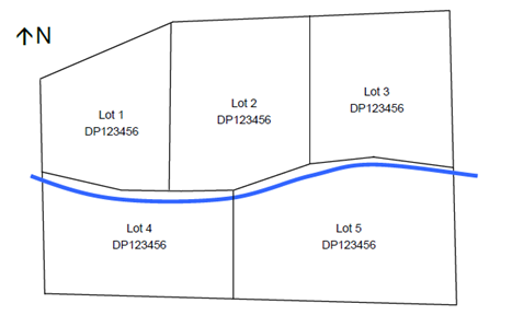
Figure D6.5
– Example of preferred subdivision design along a watercourse
D6.4 Urban
Residential Subdivision
The following provides planning controls for subdivision of
land in residential areas including the R2, R3 and RU5 Zones. RU5 is a rural
zone however the most appropriate subdivision controls are those which apply to
urban lots.
D6.4.1 Lot Size and shape
Objectives
1. To
provide lots of sufficient size to satisfy the needs of future residents, and
which will accommodate well designed and innovative development;
2. To
encourage diversity in lot size and opportunities for a variety of housing
choice;
3. To
ensure that lot design takes into account the natural features of the site and
locality.
Performance Criteria
1. Lots
must be of sufficient area to allow for the siting of a dwelling and ancillary buildings, including
provisions for private open space, solar access, vehicle access and
parking. Lots must provide sufficient effluent disposal areas where
required.
2. Lot
sizes must enable dwellings and
driveways to be sited to protect natural or cultural features, and must respond
to site constraints including topography, bushland, soil erosion, drainage, and
bushfire risk.
3. To
provide useable areas, lot sizes may need to be increased where sites are steep
or contain significant constraints or landscape features including watercourses and easements.
4. Lot
design must enable the construction of a built form that is sympathetic to the
established character of the area.
Prescriptive Measures
1. Lot
sizes must not be less than the minimum area specified in Byron LEP 2014 on the
lot size map.
2. Proposed
lots containing existing dwellings
must not result in that lot having a floor space ratio lower than that
specified on the floor space ratio
map.
3. Lots
must provide an appropriate shape and area to accommodate an unconstrained
building envelope with minimum dimensions of 12 metres by 15 metres.
4. Each
Torrens title lot must have a minimum road frontage of 6 metres (i.e. 3 metre driveway and
provision for services, landscaping etc). This may translate as 3 metres
frontage each if reciprocal rights of carriageway provide shared access to 2 or
more adjoining lots. Consideration will be given to a further reduction
in lot width for four or more lots where the pavement widths comply with the
Northern Rivers Development and Design Manual. Lots
relying on rights of carriageway with no road frontage will not be supported
5. The
access handle of hatchet-shaped lots must be landscaped in accordance with the
requirements of Chapter B9 Landscaping. A landscaping plan must be
submitted with the development application for subdivision. Such details
could incorporate, for example a meandering driveway with landscaping elements,
passing bays, different pavement treatments and kerb blisters incorporating
landscaping beds.
6. Hatchet
shaped lots (excluding the access handle) should meet the minimum lot sizes as
set out in lot size map (BLEP 2014). The area of battle-axe handles is
not to be included in determining minimum lot sizes.
7. Splays
of 4m X 4m should generally be provided on corner lots, except in site specific
circumstances where increased sight lines are required.
D6.4.2 Access
Design
Objectives
1. To
ensure provision of safe and effective access to properties.
Performance Criteria
1. Driveways
and access must form an integral part of the overall design of the subdivision.
2. Driveway
and access design is to provide a safe and efficient entrance/exit to
individual lots.
Prescriptive Measures
1. Applications
must demonstrate that vehicle access can be provided to each lot created by the
subdivision in accordance with Chapter B3 Services. In certain
circumstances, due to topography and other constraints, the driveway will need
to be designed and constructed at the subdivision stage.
2. Additional
standards may apply in bushfire prone areas as per the requirements of the NSW
Rural Fire Service.
D6.4.3 Infill
Subdivision with Rear
Lane Access
Objectives
1. To
ensure infill development occurs in a co-ordinated manner.
2. To
ensure vehicle and pedestrian safety and residential amenity is maintained.
Performance Criteria
There are no Performance Criteria.
Prescriptive Measures
The re-subdivision of existing residential
lots which rely on or propose rear lane access will necessitate an upgrade of
the rear lane. The following minimum standards are to apply for Strata,
Community and Torrens Title subdivision: (See Figures D6.6 and D6.7 for
detail)
a) Construction of
the laneway to provide a nominal minimum width of 3 metres bitumen seal with
controlled drainage for the full laneway frontage of the property. Where
required Council may require sealing to be extended to finalise a laneway or to
connect with the nearest cross street.
b) Driveways are to
be installed, and, where crossing of an existing table drain is proposed,
installation of appropriate sized concrete pipe and headwalls may be required.
c) Fencing and
access to comply with B4.2.4.
d) Legal pedestrian
access is to be provided back to the main street frontage by way of a Right of
footway, common property or battleaxe subdivision design. This can also
be used for the provision of services (water, sewer, power and telecommunications)
to the rear dwelling house / lot and
enable garbage and postal services to be collected from the street as opposed
to the laneway. Where it is to be used for pedestrian purposes only, the
handle to be a minimum 1.2 metres wide to facilitate easy access and
manoeuvring of a garbage bin, whilst also providing a main street frontage for
visitors and delivery services. Where infrastructure services are also
sited in the handle, this may need to be increased to a width of three (3)
metres. The access handle should be appropriately fenced for privacy
purposes, but must not restrict sight distances to adjoining
driveways.
e) Applicants are to
demonstrate that each lot can accommodate an unconstrained building envelope of
12 x 15 metres. Dwelling houses
and garages are to be set back a minimum of 3 metres from the laneway boundary.
f) No gates or
doors are to open out onto the public road reserve including the laneway.
g) Landscaping is to
comply with the requirements of Chapter B9 Landscaping.
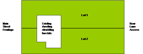

Figure D6.6 – Pre
Development (existing) Subdivision Pattern
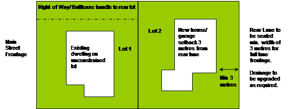

Figure D6.7 – Post
Development Subdivision Pattern
h) For development
incorporating more than two lots, or development for the purpose of two or more
dwellings (not including
any secondary dwelling),
Council may require a higher standard of laneway upgrade in terms of width of
seal and drainage infrastructure.
D6.5 Industrial
and Commercial Subdivision
The following provides planning controls
for the subdivision of land in the Business and Industrial Zones.
D6.5.1 Lot Size and Shape (Industrial)
Objectives
1. To
provide lots of sufficient size and design to satisfy the needs of future
industry and to accommodate well designed development.
2. To
ensure that adequate access is available to allotments
Performance Criteria
Lots must be of sufficient size to allow for the siting of
industrial units/ buildings and ancillary facilities including vehicular
access, parking, loading and unloading of goods, storage, waste management and
landscaping.
Prescriptive Measures
1. Lots
to comply with the lot size map
under Byron LEP 2014. Minimum width and frontage is 25 metres.
2. Battle-axe
allotments should be
avoided where possible, however where there is no alternative, development
applications must demonstrate that the layout can provide for effective
vehicular circulation, (including entry and exit in a forward direction)
parking and loading, storage, waste management and landscaping. The
battleaxe handle is to be a minimum of 8 metres.
3. Splays
of 4m X 4m should generally be provided on corner lots, except in site specific
circumstances where increased sight lines are required.
D6.5.2 Lot Size and Shape (Commercial)
Objectives
1. To
provide lots of sufficient size to satisfy the needs of future
business/commercial development and the multi-functional character of Business
Zones.
2. To
ensure that new Lots are capable of accommodating well designed business,
commercial and other development.
3. To
ensure that adequate access is available to allotments.
Performance Criteria
1. Lots
must be of sufficient size to allow for the siting of commercial and ancillary
development, including vehicular access, parking, loading and unloading of
goods, waste management and landscaping.
2. For
developments incorporating a mixture of residential and commercial
developments, lots must be of a sufficient size to incorporate ancillary
residential development including private open space, landscaping, storage
areas, clothes drying areas and the like.
Prescriptive Measures
1. Lots
to comply with the lot size map under Byron LEP 2014.
2. Battle-axe
allotments should be
avoided where possible, however where there is no alternative development
applications must demonstrate that the layout can provide for effective
vehicular circulation, (including entry and exit in a forward direction)
parking and loading, storage, waste management and landscaping. The
battleaxe handle is to be a minimum of 8 metres.
3. Splays
of 4m X 4m should generally be provided on corner lots, except in site specific
circumstances where increased sight lines are required.
D6.5.3 Subdivision
design
(Industrial and Commercial Development)
Objectives
1. To
ensure that industrial subdivisions are designed to facilitate the provision of
efficient and functional industrial development.
2. To
ensure that subdivision development is compatible with nearby development and
with the existing and desired future character of the locality.
Performance Criteria
1. Lot
sizes and configurations must create an efficient allotment
layout and facilitate future industrial development on that land.
2. Development
applications must demonstrate that the subdivision design identifies and
addresses all natural constraints and landscape elements, and mitigates adverse
environmental impacts. The design must address and respect natural
constraints including topography, drainage, soil landscapes, flora, fauna and
bushfire hazard.
3. Development
applications must demonstrate that lots are configured to provide for adequate
vehicular parking, circulation, storage, waste management and loading and
unloading of goods.
4. Lot
layout and pedestrian networks must be configured to enhance personal safety
and minimise potential for crime, vandalism and potential for crime.
Prescriptive Measures
1. Subdivision
design must be consistent with the requirements of Chapter B11 Planning for
Crime Prevention. Subdivision design must maximise the opportunities for
observation of buildings, spaces and activities by occupants, passing motorists
and pedestrians.
2. Development
applications for subdivision must identify, address and respect all
environmental constraints that affect the site and surrounds. Where lands
contain or adjoin bushland or adjoin lands containing endangered flora and/or
fauna species, development proposals must be accompanied by a flora and fauna
assessment.
3. Lands
identified as containing or directly adjoining watercourses
or trunk drainage lines may be subject to partial inundation during the 1 in
100 year ARI storm event.
Development applications must demonstrate that the proposal complies with the
requirements of the Northern Rivers Development and Design Manual and Chapter
B3 Services and C2 Areas Affected by Flood.
4. Lots
must be designed to allow the construction of a building or carriageway with a
maximum excavation or fill in accordance with the requirements of
Chapter B14 Excavation and Fill, whilst not impeding
the flow of waters.
Staff Reports - Sustainable Environment and Economy 8.4 - Attachment 2
Byron Shire
Development Control Plan 2014
Chapter B4
Traffic Planning, Vehicle Parking,
Circulation and Access
This page has been
intentionally left blank
Chapter B4 – Traffic Planning,
Vehicle Parking, Circulation and Access
Contents
B4.1 Introduction. 5
B4.1.1 Purpose
of this Chapter 5
B4.1.2 Aims of
this Chapter 5
B4.1.3 Application
of this Chapter 5
B4.1.4 Relevant
Byron LEP 2014 Provisions. 5
B4.2 Development
Controls. 6
B4.2.1 Traffic
Impact 6
B4.2.2 Parking
Layout Standards. 8
B4.2.3 Vehicle Access
and Manoeuvring Areas. 8
B4.2.4 Structures
Adjacent to Driveways. 9
B4.2.5 Car
Parking Requirements. 10
B4.2.6 Underground/
Basement Car Parks. 10
B4.2.7 Car
Parking Credits and Street Parking. 11
B4.2.8 Bicycle,
Motorcycles and Coach Parking. 11
B4.2.9 Loading
Bays. 12
B4.2.10 Monetary
Contributions. 13
B4.2.11 Landscaping. 13
B4.2.12 Parking Schedules. 15
Tables
Table B4.1 – Parking Rates. 15
Table B4.2 – Loading Bays. 20
Figures
Figure B4.1 – Minimum Sight Lines for Pedestrian
Safety. 258
Figure
B4.2 – Car park landscaping configurations. 263
Document History
|
Doc No.
|
Date Amended
|
Details
(e.g. Resolution No.)
|
|
#E2014/4306
|
20 March 2014
|
Res 14-118 –
Public exhibition version
|
|
#E2014/32417
|
|
Draft to
26 June 2014 Extraordinary Meeting - for adoption
|
|
#E2014/42597
|
26 June 2014
|
Adopted
Version – Res 14-315
|
|
#E2018/26218
|
22 March 2018
|
Adopted
22 March 2018 Effective 12 April 2018 – Res 18-130
‘Housekeeping’
amendment (various chapters).
|
|
#E2019/31383
|
April 2019
|
Public
Exhibition version (Res 19-091) 24.2018.65.1
|
|
#E2019/31383
|
July 2019
|
Minor
amendments for adoption at 15 August planning meeting
|
B4.1 Introduction
B4.1.1 Purpose
of this Chapter
The purpose of this Chapter is to provide guidelines,
controls and standards for traffic planning, vehicle access, circulation and
parking for developments.
B4.1.2 Aims
of this Chapter
The Aims of this Chapter are to:
1. To ensure
that all relevant traffic impacts relating to development are identified,
assessed and mitigated.
2. To ensure that
parking supply and management in new developments supports Council policies and
objectives for the development of Byron Shire;
3. To ensure
that traffic generating developments make adequate provision for off-street car
parking, such that the needs of occupants, users, visitors, employees, service
and delivery vehicles are met;
4. To ensure
the safe and efficient circulation of vehicles entering, leaving and within car
parking and service/delivery areas;
5. To minimise
the detrimental effects (particularly visual and radiated heat effects)
associated with off-street car parking areas on the amenity of urban areas
6. To ensure
that entry/exit points to car parking and service/delivery areas are situated
in a way that sight distances are maximised, and disruption to the circulation
of vehicles on the public road system is minimised.
7. To have
regard to the objectives contained within the Byron Shire Strategic Transport
Statement (Transport Policy)
B4.1.3 Application
of this Chapter
This Chapter applies to all development types where vehicle
access and/or parking is required.
B4.1.4 Relevant
Byron LEP 2014 Provisions
There are no specific LEP provisions relating to car parking
and vehicle access other than Clause 6.6 which requires the provisions of suitable
vehicular access for developments. A car park
has the same meaning as defined under Byron LEP 2014. Land uses in Table
B4.1 have the same meaning as defined under Byron LEP 2014.
B4.2 Development
Controls
B4.2.1 Traffic
Impact
1. Introduction
A traffic impact assessment is a process of compiling and
analysing information on the impacts that a specific development proposal is
likely to have on the operation of roads and transport networks.
The assessment will not only include general impacts relating
to traffic management (road efficiency and safety), but should consider
specific impacts on all road users, including on-road public transport,
pedestrians, cyclists and heavy vehicles.
The scope of a traffic impact assessment will depend on the
location, type and size of the development and the ability of the road network
to handle traffic generated by the development. The assessment may have to
address broader transport planning and environmental considerations and will
need to take into account any traffic management strategy, strategic plan or
local development plan.
A traffic impact assessment is undertaken by competent
experts on behalf of the proponent of a development and is documented in a Traffic
Impact Statement or Traffic Impact Study, according to level of
impact.
2. The
Need for Traffic Impact Assessment
The traffic attracted to a new land use development or a
major expansion of an existing development, such as an industrial project or a
major shopping centre, can have significant impacts on the performance of the
current or future road network. These need to be properly assessed and
addressed so that a satisfactory level of road safety and transport efficiency
is maintained.
Judgment is required to decide whether a project requires a full
traffic impact assessment or some lesser analysis of traffic issues. For
example, small urban developments may only require alterations to driveways and
off-street parking spaces, whereas a similar development on a rural road may
require turn lanes because of the high speed environment, the level of traffic
generated and/or site geometry that restricts visibility.
The following is a guide for deciding on the level of
traffic assessment required:
a) Low Impact
(generally less than 10 peak hour trips) – submit a safety assessment
demonstrating satisfactory access location, sight distances and sightlines to
pedestrians.
b) Moderate Impact
(10 – 50 peak hour trips) – Traffic Impact Statement
required.
c) High Impact (more
than 50 peak hour trips) – Traffic Impact Study required.
The need for a traffic impact assessment can be influenced
by many factors apart from the volume of peak hour traffic to be generated by
the development. Where other criteria are significant, the discretion of
Council can be exercised. Where development is to be located in a particularly
sensitive area (e.g. densely populated) a traffic impact study may be deemed
necessary, even though fewer than 10 peak hour trips are generated. Conversely,
there may be cases where the development is in an isolated and less sensitive
area and a traffic impact statement is considered to be sufficient even though
the development generates more than 50 peak hour trips. Similarly a lower
threshold, in terms of additional traffic generated, may be appropriate in more
densely populated areas.
3. Traffic
Impact Statement
A Traffic Impact Statement serves the same purpose as a
traffic impact study but is not as comprehensive. A Traffic Impact
Statement should include:
a) a brief
description of the development in terms of proposed land use and trips
generated;
b) a brief
description of the existing operational conditions of the road network in the
immediate vicinity of the development;
c) analysis of the
operation of the accesses and parking arrangements for the development;
d) analysis of the
parking demand and supply of the development;
e) analysis for the
mobility impaired;
f) analysis of
the operation of the first intersection, as a minimum, on either side of the
accesses;
g) a conceptual
geometric layout of the access arrangements, including any nearby driveways and
intersections; and
h) professional
opinion on the expected traffic impact based on a site observation during the
expected critical peak hour and the analysis conducted.
4. Traffic
Impact Study
A Traffic Impact Study should follow the standard
format and structure described in the Roads and Maritime Authority’s
(RMS) ‘Guide to Traffic Generating Developments’ (as amended
from time to time by a superseding document prepared by RMS).
All proposed developments listed in Schedule 3 of State
Environmental Planning Policy (Infrastructure) 2007 require referral to either
a Regional Traffic Development Committee or a Local Traffic Development
Committee. In most situations, a Traffic Impact Study will be required
for developments listed under column 2 in that schedule.
5. Road
Safety Audit
The person carrying out the traffic impact assessment will
need to determine whether a Road Safety Audit, prepared in accordance with RMS
requirements, needs to be included as part of the traffic impact assessment.
This would be particularly relevant when road safety is identified as a major
concern, for example, activities that generate large numbers of heavy vehicles
or new schools.
B4.2.2 Parking
Layout Standards
1. Car
parking requirements, parking layout, driveway widths and vehicle manoeuvring
areas are to be in accordance with the relevant sections of the current
editions of Australian Standard 2890.
2. All
parking spaces in commercial and industrial developments must be available for
unrestricted public access and employee use. There shall be no
restriction on public parking in the required car park, other than car spaces
set aside for any residential units approved on the site.
3. Access
for the disabled and parking facilities are to be provided in accordance with
the current editions of AS 2890 and the Building Code of Australia and the
requirements of the Disability Discrimination Act, 1992 (Commonwealth).
4. Tandem
or stacked parking is not generally favoured. However, in certain cases, the
provision of a limited number of employee parking spaces may be provided in
this way in circumstances where no inconvenience arises from its use and
subject to the following guidelines:
a) The applicant
must be able to demonstrate that there is a real need for stacked parking and
that the provision of stacked parking will not adversely affect the use of the
site.
b) No more than two
(2) cars are parked in a stacked arrangement, so that no more than one (1) vehicle
has to move to allow egress of another.
c) Stacked parking
is only to be used to provide parking for people employed on the premises and
likely to park all day or a major part of the day.
d) Stacked parking
spaces are to be used by the occupants of the site in one tenancy.
e) Stacked
parking for customer/public and for separate dwellings
on the same property will not be supported.
B4.2.3 Vehicle
Access and Manoeuvring Areas
1. Driveways
and manoeuvring areas are to be designed and constructed in accordance with the
requirements of the current editions of Australian Standard 2890 and the
Northern Rivers Local Government Development & Design Manual.
2. All
parking and service areas shall be provided with sufficient manoeuvring areas
to allow vehicles to enter and leave the site in a forward direction. Dwelling houses and dual occupancy
developments may seek a variation
this requirement on roads with low traffic volumes by demonstrating there are
no traffic safety issues on the frontage roadway or within the site.
3. Designs
for manoeuvring areas are to be in accordance with the current editions of
Australian Standard 2890 and must include a swept path analysis for the
relevant design vehicle.
4. Driveways,
manoeuvring areas and parking areas, including loading & unloading areas,
should be sealed with an all weather surface, such as asphalt, bitumen seal,
concrete, pavers or other similar treatment. Porous paving should be provided,
where soils are capable of high infiltration rates, for parking spaces (other
than those for people with disabilities) and domestic driveways. Gravel
surfaces are generally not acceptable in urban locations and some rural
situations (issues such as noise, dust, and erosion need to be considered).
5. Internal
driveways for more than three dwellings
should have a minimum driveway width of 5.5 metres to facilitate two way
access. The driveway width may be reduced to a minimum width of 3.5m
where there are no potential internal driveway conflicts or traffic safety
issues having regard to the following:
a) a minimum
driveway width of 5.5m is provided for at least the first 6 m from the property
boundary;
b) adequate passing
opportunities are provided;
c) good sight
distance is available;
d) slope of driveway
is not excessive;
e) frontage roadway
has less than 3000 vehicle trips per day; and
f) traffic and
pedestrian volumes on the driveway.
6. Where
driveways are to be negotiated by a waste collection vehicle, they must have a
maximum gradient of 16% at any one point.
7. Internal
driveways for three dwellings or less are to have a minimum width of 3m with a
4m wide X 2.7m high access corridor to facilitate landscaping, services,
retaining walls etc.
8. Driveways
for hatchet shaped lots should be fenced and landscaped on either side in order
to minimise any potential noise or light pollution for adjoining lots with different ownership.
B4.2.4 Structures
Adjacent to Driveways
Boundary fencing, garages, carports, landscaping, vegetation,
signs, letterboxes or any other structures adjacent to a driveway that exceed
1.15 metres in height are to demonstrate compliance with the current editions
of Australian Standard 2890 in relation to the provision of sight lines for
vehicles and pedestrians. No permanent sight obstruction exceeding 1.15 metre
in height shall be located within the identified clearance area for sight
distances. The following diagram is provided from Australian Standard
2890.1:2004 for guidance:
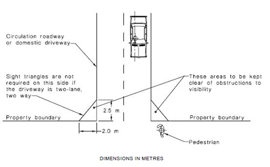
Figure B4.1 – Minimum Sight Lines for Pedestrian Safety
(Source: Australian Standard 2890.1: 2004)
B4.2.5 Car
Parking Requirements
1. Unless
otherwise specified elsewhere in this DCP, car parking is to be provided in
accordance with the schedule contained in Table B4.1
2. Where
a proposed use is not represented in Table B4.1 or elsewhere in this DCP, the
rates under the RMS Guide to Traffic Generating Developments (as amended from
time to time by a superseding document prepared by RMS) will apply.
3. If
a rate is not provided by the RMS Guide to Traffic Generating Developments (as
amended from time to time by a superseding document prepared by RMS) a merit
based assessment will apply. In such circumstances applicants are
encouraged to review car parking rates for adjoining or surrounding Councils
and to contact Council’s Development Engineers as to what an appropriate
rate may be.
B4.2.6 Underground/
Basement Car Parks
1. Where
excavation is proposed for basement car parks
development applications should demonstrate that:
a) The proposed
access to and appearance of the car park
will be visually compatible with the existing and desired future character of
the locality, streetscape and immediate surrounds.
b) The proposed
access to the car park is consistent with the Council’s pedestrian
and traffic management strategies for the commercial area and will not detract
from pedestrian safety or the safety and amenity of community spaces or any
public road. In this regard rear lane or secondary street access to the
basement car park is preferred to minimise amenity impacts
to streetscape and remove pedestrian conflicts.
c) All earthworks are located on the subject property
and do not require any underpinning into neighbouring properties or adjoining
road reserves.
d) Access to the basement
complies with the Flood Planning Level
to prevent the ingress of flood waters. Where grading cannot achieve
compliance with the Flood Planning Level and provided no other feasible option (i.e.
driveway design) is available, then the design may incorporate elements (e.g.
ramps etc) or automatic mechanisms (e.g. hydraulic barriers etc) to prevent the
ingress of flood waters to the basement, subject to the elements or mechanisms
complying with the relevant Flood Planning Level.
The basement to also include facilities for the pumping of water in the event
of failure, or larger flood events.
e) Access to the
basement is designed to prevent the entry of stormwater. Driveway ramps that
allow for the ingress of rainwater are to be predominantly covered, with a
maximum area of 60m2 only that is exposed to direct rainfall.
f) The
proposal will not adversely affect groundwater
levels, flows, characteristics or quality.
B4.2.7 Car
Parking Credits and Street Parking
1. Council
may acknowledge car parking credits for a site based on the current approved
use/s.
2. Any
car parking credit shall be based on the rates in Table B4.1 in this DCP
Chapter.
3. Car
parking credit is equivalent to the parking requirement for current approved
use/s calculated in accordance with (1) and (2) above, less the number
of parking spaces specified by current approvals.
4. Where
a developer contribution for car parking has previously been paid for a current
approved use/s on a development site, new development may be entitled to car
parking credits equivalent to the number of spaces for which developer
contributions were received by Council if the above calculation does not
acknowledge the credit.
5. Where
a car parking credit has previously been granted for land dedications in
conjunction with development, a new development on the same site will be
entitled to take that into consideration in calculating the number of car
parking credits.
6. Car
parking credits are not transferable to other development sites.
7. Council
will consider proposals to increase on street parking capacity for the
provision of some or all customer car parking spaces by increasing on street
parking capacity where there is a material public benefit, and where:
a) The
net increase in formalised (ie paved &/or linemarked) on street parking is
25% greater than the number otherwise required on site;
b) The
resulting streetscape conforms with the principles of good urban design;
c) The
level of pedestrian, cycle and traffic amenity on the street is maintained; and
d) The
proposal is not detrimental to utility services.
Note:
Council is more likely to give favourable consideration to such proposals if
they provide an offsetting benefit to the public - such as property boundary
setback dedication to allow conversion of existing parallel parking to angle
parking. Other proposals that promote ESD policies will also be entertained.
In B4.2.7, ‘current
approved use ’ means a current use for which there is an effective
development consent in place or an existing lawful use.
B4.2.8 Bicycle,
Motorcycles and Coach Parking
1. Bicycle
Parking
Development Proposals must make provision for bicycle parking
in accordance with Table B4.1. The Bicycle parking is also to be designed
in accordance with the current editions of AS 2890 Parking Facilities,
Austroads and the NSW RTA Bicycle Guideline 2005 as appropriate and as
nominated under Chapter B5 Providing for Cycling.
2. Coach
Parking
Large developments, such as shopping centres, sporting
facilities and hotels require on-site parking for regular passenger buses (and
taxis), shopper-coaches, tourist coaches, etc. Parking for sufficient numbers
of vehicles at convenient places (usually at main entrance points) should be
provided on-site. Adequate provision must be made for access, safe
manoeuvring and parking of coaches in proposals for tourist, commercial and
recreational developments. Where applicants submit alternate proposals
for a lesser number of car parking spaces based on bus/ coach transport, then
bus parking will be required on the site.
A reduction in car parking may be approved if adequate
demonstrated arrangements are made for bus/coach or other transport to the
development. Any reduction shall be validated by a Traffic Impact Study &
Survey.
3. Motorcycles
To encourage alternative forms of motor transport and to
enable applicants to utilise areas within a car park that are undersized for
the standard vehicle space, the following motorcycle parking provisions are to
apply:
a) Large commercial
developments with a gross floor area exceeding 1000m2 shall make
provision for the parking of motorcycles. Two percent of car parking spaces
shall be converted to Motorcycle spaces at a general rate of 4 motor cycle
spaces for every space converted. (e.g. a development generating 50 car parking
spaces will have 49 car parking spaces and 4 motorcycle spaces).
b) For smaller
developments where motorcycle spaces are proposed in lieu of car parking, these
will be considered on merit, provided a minimum of 90% of parking is for cars,
and 4 bike spaces are provided for every vehicle space not provided (eg a
development generating 10 car parking spaces, could propose 9 spaces and 4
motorcycle spaces).
B4.2.9 Loading
Bays
1. All developments have a need for a safe loading and unloading area
(service area) which does not obstruct the passage of vehicles or pedestrians. Unless
designed specifically for a nominated vehicle type or types appropriate to the
use of the proposed development, loading bays should be provided in accordance
with the schedule contained in Table B4.2.
2. Where
a proposed use is not represented in Table B4.2, the rates under the RMS Guide
to Traffic Generating Developments (as amended from time to time by a
superseding document prepared by RMS) will apply.
3. Access,
loading bays and manoeuvering for a service area must be designed in accordance
with the current editions of AS 2890 Parking Facilities.
4. In
general, service areas should satisfy the following requirements:
a) The service area
must be a physically defined location, screened from public view, and not used
for purposes other than servicing, loading and unloading.
b) Service area
layout must facilitate its efficient use and must effectively discourage
on-street loading and unloading.
c) Requirements for
storage and collection of waste must be taken into account in service area
design.
d) All service
vehicles must be able to enter and leave the site in a forward direction, i.e.
adequate manoeuvring space is required on site.
e) Internal roadways
must be of a size adequate for the largest vehicle anticipated to use the site.
f) Service
vehicle movements should be separated from car movements.
B4.2.10 Monetary
Contributions
Council may consider accepting a monetary contribution in
lieu of on-site car parking on land predominantly zoned B2 where there is a
nexus between the development and the area in which public parking is or will
be provided. Such cases will be considered on merit, with reference to:
a) the size of the
development;
b) the site's
proximity to, and the accessibility of, existing or proposed public car parking
areas;
c) the demand for
car parking generally in the locality; and
d) the general
traffic flow in the area;
e) the cost to
Council of providing the parking off site;
f) the
likelihood of the parking being occupied and not being available for parking
associated with the proposed development.
Should a monetary contribution be proposed, applicants will
need to discuss this option with Council prior to lodgement of the Development
Application, and propose either a voluntary planning agreement (VPA) or submit
a VPA with the development application. (Note: There is no Section 94
Plan for car parking).
In locations away from the main commercial areas, or where
no public car parks are planned,
on-site car parking is to be provided with the development.
For works in kind, Council may consider car parking on
public land or in the road reserve for all or part of the car parking required
for an adjacent development proposal. Such work if permitted, is at the
applicants expense, and such arrangements will only be allowed when a positive
outcome results and the streetscape is improved.
B4.2.11 Landscaping
As an integral and important component of outdoor parking
area design, suitable landscaping must be provided in accordance with the
requirements of Chapter B9 Landscaping. In particular shade trees can
assist with cooling the car parking area and the vehicles parked therein, and
assist with managing the microclimate of urban areas.
Specifically outdoor car
parks comprising 10 or more vehicle spaces are to incorporate a
landscape bay of a suitable dimension to support the healthy growth of shade
trees with a minimum height of 8 metres (at maturity) to shade every 2-5
parking spaces. The bay can also incorporate water
sensitive urban design principles to facilitate stormwater disposal
and also irrigation of the trees. Figure B4.1 below illustrates various car park
landscaping configurations.
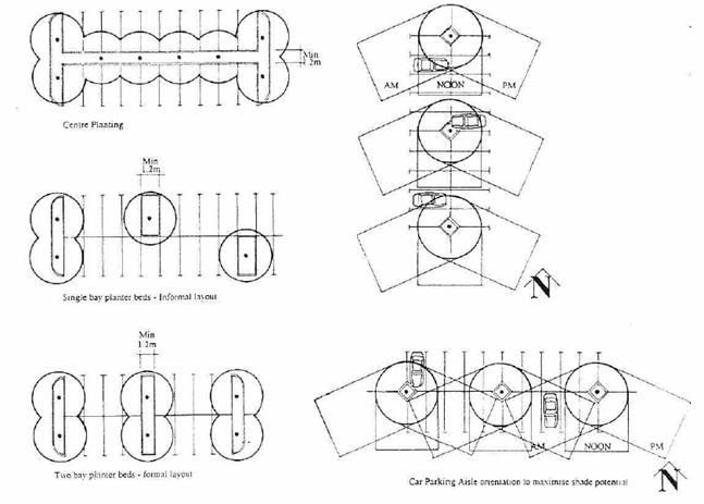
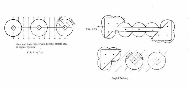
Figure B4.2 – Car park landscaping configurations
(Source: South Sydney DCP No. 11 Transport Guidelines for Development 1996)
B4.2.12 Parking
Schedules
Table B4.1
– Parking Rates
|
Land Use
|
Car Parking
|
Bicycle Spaces
|
|
Amusement centre
|
4 spaces per 100m² GFA plus 1 per 2 employees
|
8 per 100m² of GFA
|
|
Backpackers
accommodation
|
1 space per 8 beds
|
1 per 5 beds
|
|
Bed and breakfast
accommodation
|
1 space per guest bedroom plus 1 space per dwelling
|
|
|
Boarding house
|
See SEPP (Affordable Rental Housing) 2009
|
1 space per bed
|
|
Business premises
|
1 space per 20m² GFA
|
2 per 100m² (or part thereof) up to a floor area of
200 m² and 1 per 200 m² thereafter
|
|
Bulky goods premises
|
1 space per 50m² GFA
|
|
|
Caravan park/ Camping
grounds
|
In accordance with the Local Government (Manufactured
Home Estates, Caravan Parks, Camping Grounds and
Moveable Dwellings) Regulation 2000
|
|
|
Commercial premises
|
See business premises
|
|
|
Community facilities
|
Merit based at a general rate of 1 space per 40m2
of GFA.
|
1 per 100 m2 of GFA
|
|
Child care centre
|
1 space per 4 children plus drop off/pick up area
|
|
|
Dual occupancy
|
See medium density
housing, except visitor car spaces are not required where
on-street car parking is available within close proximity to the development.
|
|
|
Dwelling house
|
2 spaces per dwelling
|
|
|
Educational
establishment
|
(Primary)
1 space per 2 staff members
|
1 per 5 students over year 4
|
|
Educational
establishment
|
(Secondary)
1 space per 2 staff members plus 1 per 10 students aged 17
and over
|
1 per 5 students
|
|
Educational
establishment
|
(Tertiary)
1 space per 5 students plus 1 space per 2 staff members
|
1 per 5 students
|
|
Entertainment facility
|
1 per 10 seats
|
1 Space per 10 car parks
|
|
Exhibition home
|
2 spaces per home external to garage/dwelling parking Space
|
|
|
Food and Drink Premises
|
1 per 20 m2 of GFA in Business and Industrial
Zones.
1 per 7.5 m2 in all other zones.
|
1 per 25m2 of GFA
|
|
Function centre
|
Same as food and drink premises
|
|
|
Funeral home
|
2 spaces plus either 1 space per 30m² GFA or 1 per 5
seats in chapel, whichever is greater
|
|
|
Garden centre
|
1 space per 70m² display area (including
accessories).
Where landscape supplies are included an additional 1
space per employee plus 2 customer spaces.
|
|
|
Group home
|
Refer SEPP (Affordable Rental Housing) 2009
|
|
|
Hardware and building
supplies
|
1 space for 50m2 GFA.
|
|
|
Health consulting rooms
|
2 spaces per consulting room plus 1 space per 2 employees
plus any dwelling requirement
|
1 space per consulting room
|
|
Hotel or motel
accommodation
|
1 spaces per unit plus 1 space per 2 employees (on site at
any one time) plus 1 space for on-site manager.
If public restaurant or function room included, as per
food and drink premises
|
2 Spaces for accommodation units only
If public restaurant or function room included, add 1 per
25m2 of GFA
|
|
Industry
|
1 space per 100 m2 or two per factory unit
which ever is the greater.
|
|
|
Kiosk
|
See food and drink premises
|
See food and drink premises
|
|
Landscape material
supplies
|
1 space per employee plus 2 customer spaces
Where applicable add 1 space per 70m² product
display/showroom area
|
|
|
Market
|
2.5 spaces per stall
|
1 space per 10 stalls
|
|
Medical centre
|
1 space per 20m2 GFA plus any ancillary
development requirement
|
1 space per consulting room
|
|
Mortuary
|
See funeral home
|
|
|
Medium density housing including
multi dwelling housing, residential flat buildings and shop top housing
|
1 space per 1 or 2 bed unit, 2 spaces per 3 or more bed
unit, 1 visitor space per 4 dwellings
or part thereof. Each dwelling
to have at least one covered car space.
Where dwellings
are designed with studies/ offices and other areas capable of being utilised
as separate sleeping quarters these will be counted as bedrooms.
|
|
|
Neighbourhood shop
|
See retail premises
|
|
|
Office premises
|
See business premises
|
See business premises
|
|
Place of public worship
|
1 space per 10 seats
|
1 space per 100 seats
|
|
Plant nursery
|
See garden centre
|
|
|
Pub
|
1 space per 5m2 of public area in bars and
lounges.
|
2 per 25 m2 of public areas in bars and 2 per 100 m2
of lounges and beer gardens
|
|
Public administration
building
|
See business premises
|
|
|
Recreation facility
(indoor)
|
Bowling Alley: 3 spaces per lane
Squash Courts: 3 spaces per court
Gymnasium: 1 spaces per 20m² GFA
Other activities: on merit
|
1 per 4 employees and 1 per 200m2 of GFA
|
|
Recreation facility
(outdoor)
|
Tennis Courts: 3 spaces per court
Bowling Club: 15 spaces per green plus any restaurant and
pub requirements where applicable
Golf Course: 4 spaces per hole on course plus any food and
drink requirements where applicable.
Other activities: on merit
|
1 per 4 employees and 1 per 200m2 of GFA
|
|
Registered club
|
See pub
|
See pub
|
|
Restaurant
|
See food and drink premises
|
See food and drink premises
|
|
Retail premises
|
See business premises
|
See business premises
|
|
Roadside stall
|
Assessed on merit
Consideration to be given to parking rates for markets
|
|
|
Rural supplies
|
1 space per 50m2 GFA
|
|
|
Rural tourist
accommodation
|
1 space per guest bedroom
|
|
|
Secondary dwelling
|
Nil
|
|
|
Seniors housing
|
See SEPP (Housing for seniors or people with a
disability) 2004
|
|
|
Service station
|
5 spaces per mechanical
Work bay plus 1 space per 20m² of GFA of convenience
store GFA. Tandem Parking permitted and work bays can be counted as a space.
|
|
|
Serviced apartment
|
See medium density
housing
|
|
|
Shop
|
See business premises
|
See business premises
|
|
Shopping centre
|
Per area of gross
leasable floor area (GLFA):
1000 -10,000m2 GLFA - 6.1 spaces per 100m2
10,000 - 20,000m2 GLFA - 5.6 spaces per 100m2
> 20,000 m2 GLFA Parking Study required
|
See business premises
|
|
Small Bars
|
See Pub
|
See Pub
|
|
Shop top housing
|
See Medium density housing requirement plus shop requirement
|
|
|
Takeaway food or drink
premises
|
See food and drink
premises
|
See food and drink
premises
|
|
Timber yard
|
See landscape material supplies
|
|
|
Transport Depot
|
1 space per vehicle driver, 1 per 2 onsite employee
|
|
|
Truck Depot
|
1 space per vehicle driver, 1 per 2 onsite employee
|
|
|
Vehicle repair station
|
5 spaces per service bay. Tandem parking permitted and
service bays are counted as a car parking space
|
|
|
Vehicle sales or hire
premises
|
1 space per 200 m2 of GFA and any outdoor motor
display, plus 5 per mechanical work bay. Tandem parking permitted and service
bays are counted as a car parking space
|
|
|
Veterinary hospital
|
3 spaces per veterinarian plus 1 space per 2 employees
|
|
|
Warehouse or
distribution centre
|
1 space per 300 m2 of GFA
|
|
|
Wharf or boating
facilities
|
1 per mooring
1 spaces per two employees
|
|
|
Wholesale supplies
|
See bulky goods premises
|
|
Table B4.2 –
Loading Bays
|
Development type
|
Gross floor area (GFA), m2
|
Number of Loading Bays Required by Vehicle Class
|
|
Small rigid vehicle
|
Medium rigid vehicle
|
Heavy rigid vehicle
|
Articulated vehicle
|
|
Business premises/office
premises
(For premises less than 200
m2, loading bays can be shared with staff parking provided the
parking bay meets the minimum dimension requirements under AS2890 for a small
rigid vehicle, there is adequate manoeuvring area and the space is suitably
located for loading and unloading on-site)
|
0-999
|
1
|
-
|
-
|
-
|
|
1,000-2,499
|
-
|
1
|
-
|
-
|
|
2,500-7,999
|
1
|
1
|
-
|
-
|
|
8,000-19,999
|
2
|
1
|
-
|
-
|
|
20,000-34,999
|
2
|
2
|
-
|
-
|
|
35,000-64,999
|
2
|
2
|
1
|
-
|
|
>65,000
|
2
|
3
|
1
|
-
|
|
Retail premises,
tourist and visitor
accommodation (except bed and breakfast accommodation and farmstay
accommodation)
(For premises less than
200 m2, loading bays can be shared with staff parking provided the
parking bay meets the minimum dimension requirements under AS2890 for a small
rigid vehicle, there is adequate manoeuvring area and the space is suitably
located for loading and unloading on-site)
|
0-199
|
1
|
-
|
-
|
-
|
|
200-599
|
-
|
1
|
-
|
-
|
|
600-1,499
|
1
|
1
|
-
|
-
|
|
1,500-1,999
|
2
|
1
|
-
|
-
|
|
2,000-2,799
|
2
|
2
|
-
|
-
|
|
2,800-4,399
|
2
|
2
|
1
|
-
|
|
4,400-8,499
|
2
|
2
|
1
|
1
|
|
8,500-11,499
|
3
|
2
|
1
|
1
|
|
11,500-20,999
|
3
|
3
|
1
|
1
|
|
21,000-23,999
|
3
|
3
|
2
|
1
|
|
24,000-32,999
|
3
|
3
|
2
|
2
|
|
>33,000
|
3
|
4
|
3
|
2
|
|
Industry
(For premises less than
200 m2, loading bays can be shared with staff parking provided the
parking bay meets the minimum dimension requirements under AS2890 for a
medium rigid vehicle, there is adequate manoeuvring area and the space is
suitably located for loading and unloading on-site)
|
0-199
|
|
1
|
-
|
-
|
|
200-799
|
|
-
|
1
|
-
|
|
800-1,599
|
|
1
|
1
|
-
|
|
1,600-2,399
|
1
|
1
|
1
|
-
|
|
2,400-3,199
|
1
|
1
|
1
|
1
|
|
3,200-3,999
|
1
|
2
|
1
|
1
|
|
4,000-4,799
|
2
|
2
|
1
|
1
|
|
4,800-5,599
|
2
|
3
|
1
|
1
|
|
5,600-6,399
|
2
|
3
|
2
|
1
|
|
6,400-7,199
|
2
|
3
|
3
|
1
|
|
7,200-7,999
|
2
|
3
|
3
|
2
|
|
>8,000
|
Same as previous – additional loading bays to
be assessed on merit at a general rate of 1 bay per 1000m2 GFA
|
Staff Reports - Sustainable Environment and Economy 8.4 - Attachment 3

Byron Shire
Development Control Plan 2014
Chapter D2
Residential Accommodation
and Ancillary Development
in Rural Zones
This page has been intentionally left blank
Chapter
D2 – Residential Accommodation and Ancillary Development in Rural Zones
Contents
D2.1 Introduction. 5
D2.1.1 Aims
of this Chapter 5
D2.1.2 Application
of this Chapter 5
D2.2 General
Provisions. 6
D2.2.1 Location
and Siting of Residential Accommodation and other Buildings. 6
D2.2.2 Setbacks
from Boundaries. 7
D2.2.3 Character
and Visual Impact 8
D2.3 Dwelling
Houses. 9
D2.3.1 On-Site
Car Parking and Vehicle Access. 9
D2.3.2 Recycling
and Waste Management and On-site Sewage Management 10
D2.3.3 Expanded
House. 10
D2.4 Rural
Worker’s Dwellings. 11
D2.4.1 Rural
Worker’s Dwellings. 11
D2.5 Dual
Occupancies and Secondary Dwellings. 12
D2.5.1 On-Site
Car Parking. 13
D2.5.2 Character
and Siting of Dwellings. 13
D2.5.3 Sound
Proofing. 14
D2.5.4 Private
Open Space. 15
D2.5.5 Adjoining
and Nearby Development 15
D2.6 Multiple
Occupancy Development 16
D2.6.1 Multiple
Occupancy Development of Rural Land. 16
D2.7 Studios
and Farm Buildings. 24
D2.7.1 Studios. 24
D2.7.2 Farm
Buildings, Sheds and other Structures. 25
D2.8 Community
Title Development of Rural Land. 26
Tables
Table D2.1 - Tree Spacing Numbers / Hectare (Ha) 23
Table D2.2 - Tree Spacing Numbers / Hectare (Ha) 27
Document History
|
Doc No.
|
Date Amended
|
Details
(e.g. Resolution No.)
|
|
#E2014/4449
|
20 March 2014
|
Res 14-118 –
Public exhibition version
|
|
#E2014/32920
|
|
Draft to 26
June 2014 Extraordinary Meeting - for adoption
|
|
#E2014/43195
|
26 June 2014
|
Adopted
Version - Res 14-315.
|
|
#E2015/22176
|
11 June 2015
|
Public
exhibition version – Res 15-251
|
|
#E2015/68566
|
8 October
2015
|
Adopted
Version – Res 15-525
|
|
#E2018/27393
|
22 March 2018
|
Adopted
22 March 2018 Effective 12 April 2018 – Res 18-130
‘Housekeeping’
amendment (various chapters).
|
|
#E2019/29557
|
April 2019
|
Public
Exhibition version (Res 19-091) 24.2018.65.1
|
|
#E2019/29557
|
July 2019
|
New
revision for adoption at 15 August 2019 planning meeting
|
D2.1 Introduction
Byron Shire Council recognises the need to plan for and
control the form of residential accommodation and other forms of development in
the Shire’s rural zones. Such development will need to be in
harmony with its surroundings, both natural and constructed, and enhance the
physical context valued by the local community and by the Shire's increasing
number of visitors.
This Section complements the provisions of Byron LEP
2014. The aim has been to develop controls that provide flexibility to
promote innovative and imaginative building forms, whilst ensuring development
outcomes consistent with the character of the Shire and its rural lands.
Building forms need to be related to each other and to their surroundings by
careful attention to design, orientation, forms, scale, materials and
landscaping.
D2.1.1 Aims
of this Chapter
The Aims of this Chapter are:
1. To promote
a high standard of design for development in rural lands that is sensitive to
and enhances the natural and physical environment and the social fabric
particular to Byron Shire.
2. To
accommodate a variety of residential forms and dwelling
sizes to reflect the growing diversity of household types, sizes, incomes,
lifestyles and needs.
3. To promote
energy efficiency and consideration of the Shire’s climatic
characteristics in the design process.
4. To promote
sustainable food and agriculture production.
5. To minimise
conflict between developments, including conflict with agricultural activities
in farming lands.
6. Where
possible to limit potential for additional traffic on the road system and to
reduce car dependence through facilitation of public transport, cycling and
walking.
D2.1.2 Application
of this Chapter
This Chapter applies to development applications seeking
consent for various forms of residential accommodation and associated
development in rural zoned lands, namely Zones RU1 and RU2. The types of
development to which this Chapter applies include the following:
· Dual occupancies (attached and detached)
· Dwelling houses
· Expanded houses
· Farm buildings
· Rural worker’s
dwellings
· Secondary
dwellings
· Studios
The definitions of various residential and associated development
types are contained in the Byron LEP 2014 Dictionary, or in the Dictionary to
this DCP. The provisions in this Chapter supplement those provisions of
Byron LEP 2014.
D2.2 General
Provisions
D2.2.1 Location
and Siting of Residential Accommodation and other Buildings
Objectives
1. To
implement the relevant Aims, Guiding Principles and provisions of the Byron
Rural Settlement Strategy 1998.
2. To
ensure that decisions relating to siting of development are consistent with the
objectives and provisions of Chapter B6 Buffers and Minimising Land Use
Conflict.
Performance Criteria
1. All
development to which this Section applies must be consistent with the relevant
Aims, Guiding Principles, Best Practice Guidelines and Performance Standards
contained in the Byron Rural Settlement Strategy 1998 (the Strategy). The
Strategy’s relevant Aims are:
i) To
ensure that ecological, social and economic considerations are successfully
integrated into the decision-making process for all future rural settlement in
Byron Shire.
ii) …
iii) To ensure
future rural settlement is directly linked to the repair, enhancement and
protection of the natural environment, thereby increasing the shire's natural
capital.
The Strategy’s relevant Guiding Principles are:
i) overriding
principle -- all new rural settlement must meet the needs of Byron's
residents today while conserving the shire's ecosystems, agricultural
viability, lifestyles, heritage and culture for the benefit of future
generations;
ii) sustainability
-- development meets the needs of today without compromising the ability of
future generations (long timeframes) to meet their own needs and enjoy a
quality life resulting from clean air, water and soils;
iii) planning
-- shire wide planning identifies potential rural settlement areas
integrated with catchment-based (geographical, water and social) planning;
iv) consultation
-- there is full community consultation and participation with the local
community prior to decision-making, and support for participatory settlement
planning;
v) environment
-- existing habitat areas are identified, protected and enhanced,
environmental repair is undertaken and corridors of native vegetation linking
habitat areas are provided;
vi) water quality
-- natural watercourses and the riparian lands, wetlands and groundwater
systems are protected from sources of pollution and the water quality is
maintained and improved;
vii) identity
-- Byron Shire's unique image, diverse lifestyle and local character are
maintained;
viii) facilities
-- adequate community facilities to meet the needs of rural settlement
areas are provided; and
ix) land
use -- existing and potential agricultural and horticultural land uses and
extractive resources on-site are protected; and off-site, on adjacent and
nearby areas, their landuses and resources are not adversely impacted by rural
settlement.
The relevant
Best Practice Guidelines and Performance Standards are contained in Chapters 6
and 8 respectively of the Strategy.
Determination of
siting, extent and nature of development must be consistent with the provisions
of Chapter B6 Buffers and Minimising Land Use Conflict.
Prescriptive Measures
There are no Prescriptive Measures.
D2.2.2 Setbacks
from Boundaries
Objectives
1. To
achieve varied and interesting landscapes that preserve and complement the
rural and scenic character and amenity of the Shire’s rural and
environmental protection areas.
2. To
achieve good orientation and spacing of developments in rural and environmental
protection areas that achieve high quality living environments relative to
privacy, sunlight, shade, wind and weather protection, and proximity of
neighbouring development.
3. To
minimise potential for land use conflict between rural land uses and
activities.
Performance Criteria
1. Setback requirements may be flexible provided
they are demonstrated to achieve the Objectives and Performance Criteria.
Determination of setbacks will also
depend on assessment of potential conflicts and buffer requirements pursuant to
Chapter B6 Buffers and Minimising Land Use Conflict.
2. The
setbacks and design of dwellings and other buildings must contribute
to the locality’s rural character and attractiveness by means of siting,
good design, appropriate materials and effective landscaping.
3. The
setback from a road frontage or side
boundaries for dwellings and other
buildings will be determined on its merits, having regard to:
a) the Objectives;
b) any provisions of
this development control plan applying to the specific location;
c) consistency with
the rural and scenic character of the locality;
d) the position and setback of any existing buildings in the
locality;
e) the siting and
nature of nearby rural landuses and potential for creation of conflict with
those uses;
f) the siting
and nature of nearby residential accommodation
buildings or other development and the potential for intrusion on privacy,
amenity, solar access or climate characteristics of those buildings.
g) the effect on
vehicular safety and visibility on a public road;
h) the orientation
of the allotment and the
proposed dwelling with regard to the
sun and prevailing winds;
i) the
location and treatment of any car parking areas and car parking structures on
the site.
Prescriptive Measures
1. Minimum
Road Frontage Setbacks: 55
metres from the boundary of a classified road
and 15 metres from the boundary of other roads. (Note. The provisions of SEPP
Infrastructure 2007 apply to development with frontage to a classified road). The “Byron Shire Roads
Hierarchy” maps are available on Council’s website and show classified roads such as the Pacific Highway
and other main roads.
No development is permitted within
the building setback other than
garbage storage facilities, mail boxes, landscaping, driveways and car parking
spaces.
2. Minimum
Side and Rear Boundary Setbacks:
Based on consistency with the Objectives and Performance Criteria. Must
comply with the requirements of the Building Code of Australia.
Determination of setbacks will also depend on assessment of
potential conflicts and buffer requirements pursuant to Chapter B6 Buffers and
Minimising Land Use Conflict.
D2.2.3 Character
and Visual Impact
Objectives
1. To
retain and enhance the unique character of Byron Shire and its distinctive
landscapes, ecology, rural and natural areas.
2. To
ensure that new development contributes to the character of its locality by
respecting and complementing the natural and built environment.
Performance Criteria
The following principles shall be applied to all
development:
a) site, building
and landscaping design must address the climate;
b) where a building
is visible from a public road, it must contribute to the rural and scenic
character of the locality by means of good design, appropriate materials and
effective landscaping;
c) there must be a
reasonable degree of integration with the existing built, rural and natural
environment, balanced with the desirability of providing for variety in the
landscape;
d) the provision of
verandahs, balconies, pergolas and
other protective outdoor elements will be encouraged for visual, climatic and
energy efficiency reasons;
e) well-designed
overhanging eaves should be provided where feasible to protect against heavy
rainfall and summer sun, while allowing winter sun penetration;
f) no roof may
have a highly reflective surface. Any metal roof must have a colorbond or
equivalent finish in a colour approved by council. White or
light-coloured roofing will not be approved where likely to be visually
intrusive or would result in significant glare for neighbouring properties;
g) details of
building materials and surface colours must be submitted for assessment with a
development application. All building materials must be compatible in
character with their surrounding environment;
h) consistent with
the NSW Coastal Council’s February 2003 publication ‘Coastal Design
Guidelines for NSW’, namely the recommended design principles for
buildings and development located in various categories of coastal and inland
settlements, and for isolated coastal dwellings.
i) rural
character and rural environment is not adversely affected by over development
Prescriptive Measures
1. The
total number of residential buildings per property in RU1 and RU2 zones,
including dwelling house, expanded house, dual
occupancies and secondary dwellings
is not to exceed six (6). This excludes multiple occupancy, community
title, farm buildings, sheds and
other structures meant for rural activities.
D2.3 Dwelling
Houses
This Section outlines the controls applicable specifically
to single dwelling houses in rural
lands. It must be read in conjunction with the general provisions set out
in Sections D2.1 and D2.2 of this Chapter.
In this Section, a reference to a dwelling house also includes a reference to an expanded house.
D2.3.1 On-Site
Car Parking and
Vehicle Access
Objectives
1. To
provide adequate and visually compatible accommodation for vehicles.
Performance Criteria
1. Car
parking must be provided on the site in a manner that provides
convenient access for residents of the dwelling;
safe and accessible in terms of visibility, turning and manoeuvring
capabilities; and visually compatible with the site and its locality.
2. Car
parking structures, including garages and carports, which are visible from the
road must be compatible with the dwelling
in terms of design and materials, and may form part of the dwelling structure.
Prescriptive Measures
Refer to Chapter B4 Traffic Planning, Vehicle Parking,
Circulation and Access for detailed provisions regarding car parking and
vehicle access.
D2.3.2 Recycling
and Waste Management
and On-site Sewage Management
Objectives
1. To
facilitate the storage and collection of garbage and recyclable products.
2. To
ensure responsible management of sewage on the site.
Performance Criteria
1. Garbage
and recyclable storage and collection facilities must be provided to meet
residents’ needs and collections service requirements where roadside
collection is available.
2. On-site
sewage management is to comply with Chapter B3 Services.
Prescriptive Measures
There are no Prescriptive Measures.
D2.3.3 Expanded
House
Objectives
1. To
facilitate the provision of a dwelling house
comprising a number of separate building components.
Performance Criteria
There are no Performance Criteria.
Prescriptive Measures
The design and use of the expanded
house must conform to the following criteria:
a) No expanded house habitable outbuilding is to be
located more than 20m from the wall of the main building, measured from wall to
wall at the closest point;
b) the main building
must contain an identifiable living area including the kitchen;
c) a maximum of
three outbuildings may be connected to the main building by paths with an
all-weather surface;
d) outbuildings are
to be connected to the main building by paths with an all weather surface;
e) no separate
driveway, car parking area, garage or carport structure is to be provided to
service any outbuilding;
f) one
outbuilding must be limited to a maximum floor area of 45m2
excluding decks, verandahs, patios, balconies
and the like; and the others must be limited to a maximum 30m2 floor
area excluding decks, verandahs, patios, balconies
and the like;
g) none of the
outbuildings is to contain facilities (e.g. kitchen, sink or the like) that
would enable the preparation of food or beverages;
h) each separate
outbuilding may incorporate a maximum of two bedrooms (including rooms with an
ensuite or bathroom);
i) a
maximum of one laundry per dwelling.
D2.4 Rural
Worker’s Dwellings
D2.4.1 Rural Worker’s Dwellings
Objectives
1. To
meet the genuine long term needs of viable agricultural enterprises for housing
for workers on the land.
2. To
ensure that rural worker’s dwellings
are located to avoid potential for conflicts with agricultural activities on
adjoining land, to avoid adversely affecting the sustainability of the land for
agriculture, and to ensure compatibility with the rural character of the
locality and the shire.
3. To
specify the evaluation criteria and development requirements that apply to
establishment of rural worker’s dwellings.
Note: Pursuant to the statutory
definition in Byron LEP 2014, a rural
worker’s dwelling means a building or place that is additional
to a dwelling house on the same lot and that is used predominantly as a place
of residence by persons employed, whether on a long-term or short-term basis,
for the purpose of agriculture or a rural industry on that land.
Performance Criteria
1. Development
applications must demonstrate that there is a genuine need and justification
for a rural worker to live on the land, based on an existing/established
legitimate agricultural activity.
2. The
rural worker’s dwelling must be located so that it does not
create potential for conflict with adjoining land uses. Determination of
location and siting will depend on assessment of potential conflicts and buffer
requirements pursuant to Chapter B6 Buffers and Minimising Land Use Conflict.
3. Rural worker’s
dwellings must be located and retained
on the same legal title as the principal dwelling
house on the farm property, and may not
be excised by subdivision.
4. The
rural worker’s
dwelling to be commensurate in size,
area and number of bedrooms to accommodate the rural worker(s) and immediate
family.
Prescriptive Measures
1. The
property must have at least the minimum land area specified for that land by
the lot size
map.
2. The
rural worker’s
dwelling must be erected within 160m of
the existing principal dwelling house on the site, and must share the same
vehicular access to the adjoining public road.
3. A
development application must be accompanied by the following information that demonstrates:
a) property details,
including legal description, area, zoning, existing use of all parts of the
site;
b) property plan
showing existing and proposed infrastructure (including buildings, sheds,
services, etc) and land use;
c) labour requirements,
including the number of persons required to conduct the farming operation, the
times that labour is required (e.g. seasonal, daily), a description of the work
to be undertaken by all personnel, and the critical components of the operation
that require an on-site residence and rural worker/s;
d) potential
conflicts, including the distance from the proposed rural
worker’s dwelling to adjoining land holdings and potentially
conflicting landuses (e.g. intensive horticulture, pesticide use, intensive
livestock activities and the like).
e) access and site
details, including a plan showing the location of the principal dwelling and the proposed rural worker’s dwelling; and proposed
access arrangements from the public road to the principal dwelling on the site and the proposed rural worker’s dwelling.
f) justification
demonstrating why it is not feasible to accommodate the rural worker offsite,
e.g. in a nearby village, rural property or urban area.
|
|
Note: Council may impose a condition requiring that the
dwelling must not be occupied as a dwelling other than by a rural worker
employed for the purpose of agriculture or rural industry on the land.
|
|
D2.5 Dual
Occupancies and
Secondary Dwellings
This Section outlines requirements for the
provision of dual occupancies (attached
and detached) and secondary dwellings in rural areas where
permitted under the provisions of Byron LEP 2014.
Objectives
1. To
ensure that dual occupancies and secondary dwellings in rural areas are located to avoid potential for
conflicts with agricultural activities on adjoining land, to avoid adversely
affecting the sustainability of the land for agriculture, and to ensure
compatibility with the rural character of the locality and the shire.
2. To
specify the evaluation criteria and development requirements that apply to
establishment of dual occupancies and secondary dwellings in rural areas.
Performance Criteria
1. Dual occupancy and secondary dwelling development in rural areas must
be located so that it does not create potential for conflict with adjoining
land uses. Determination of location and siting will depend on assessment
of potential conflicts and buffer requirements pursuant to Chapter B6 Buffers
and Minimising Land Use Conflict.
2. Dual occupancies and secondary dwellings in rural
areas must be located and retained on the same legal title as the
principal dwelling house on the property, and may not be excised
by subdivision.
Prescriptive Measures
A development application must be
accompanied by information that demonstrates:
a) property details,
including legal description, area, zoning, existing use of all parts of the
site;
b) property plan
showing existing and proposed infrastructure (including buildings, sheds, services,
onsite wastewater disposal, etc) and land use;
c) potential
conflicts, including the distance from the proposed dual
occupancy and secondary dwelling to adjoining land holdings
and potentially conflicting landuses (e.g. intensive horticulture, pesticide
use, intensive livestock activities, rural industry and the like).
d) access and site
details, including a plan showing the location of the principal dwelling and
the proposed dual occupancy and secondary dwelling; and proposed access
arrangements from the public road to the principal dwelling on the site and the
proposed dual occupancy and secondary dwelling.
D2.5.1 On-Site
Car Parking
Objective
1. To
provide adequate and visually compatible on-site accommodation of vehicles for
residents and visitors.
Performance Criteria
Vehicular access to a dual
occupancy and secondary dwelling
development should comprise a shared driveway. Driveways must be located
and designed to minimise danger to pedestrians and cyclists using the public
road and to ensure that vehicles do not need to reverse into or out of
the driveway.
Prescriptive Measures
1. Car
parking shall satisfy the requirements for on-site car parking for dual occupancy development as set out in
Chapter B4 Traffic Planning, Vehicle Parking, Circulation and Access.
2. There
is no car parking requirement for secondary
dwellings.
D2.5.2 Character and Siting of Dwellings
Objectives
1. To
ensure that dual occupancy and secondary dwelling development is compatible
in character with development in the locality, provides adequate private open
space and addresses environmental, slope and drainage issues.
2. To
minimise the footprint of dual occupancy and secondary
dwelling development through location of dwellings
and the use of shared services and common areas.
Performance Criteria
1. In
assessing any proposal for dual occupancy
and secondary dwelling development,
particular consideration will be given to the topography and slope of the site,
design to minimise loss of privacy, bushfire and environmental constraints, the
visual impact of the proposal and the likely impact on water flows and
drainage.
2. To
encourage better visual quality and greater public acceptance, dual occupancy and secondary dwelling development must be
designed to be responsive to its location. It could look like a single dwelling or be sited in a clustered
arrangement with other farm buildings, garages, car ports or farm
sheds.
3. Separate
private open space must be provided for each dwelling
in accordance with Section D2.5.4, and must be designed to be easily accessible
to the dwelling it serves.
4. The
applicant must demonstrate that the design of the development and the siting of
the two dwellings will not generate
additional adverse environmental impacts through excessive vegetation removal
for bushfire protection or detract from the visual amenity of the locality.
Prescriptive Measures
1. Dual occupancy (attached) dwellings are to be attached to each other by
a common dividing wall, this may include garage walls. The dwellings must be serviced by a common vehicle
access.
2. Dual occupancy (detached) dwellings shall be located not more than 100
metres apart between the closest points. The dwellings
must be serviced by a common vehicle access.
3. Secondary dwellings can be either attached to
or detached from the principle dwelling as per the controls for dual occupancy (attached and detached) above.
Note: Clause 4.6 of Byron
LEP 2014 (Exceptions to Development Standards) allows for flexibility in
applying certain LEP 2014 development standards if it is justified in the
circumstances. A merit case for development standards (except the floor
space of a secondary dwelling) can be
submitted to Council where it can be demonstrated to achieve better development
outcomes.
D2.5.3 Sound
Proofing
Objectives
1. To
ensure an acceptable acoustic environment for residents.
Performance Criteria
1. Where
the dual occupancy (attached) is
separated by a common dividing wall, that wall must be designed and constructed
to resist sound and to ensure acoustic privacy and amenity between rooms.
2. Development
must be designed to minimise noise and vibration impacts upon occupants of
nearby dwellings. Where
practicable, sources of noise must be sited away from adjoining properties, and
where necessary must be screened by acoustic treatments.
Prescriptive Measures
There are no Prescriptive Measures.
D2.5.4 Private
Open Space
Objectives
1. To
ensure that adequate accessible and useable open space is provided to meet the
recreational, gardening and landscape needs of residents.
Performance Criteria
1. Private
open space areas must be of dimensions to suit the projected requirements of
the occupants and guests and to accommodate outdoor recreation needs, as well
as providing space for service functions such as clothes drying and domestic
storage.
2. Part
of the private open space must be capable of enabling an extension of the
function of the dwelling for
relaxation, dining, entertainment, recreation and children's play, and be
directly accessible from the dwelling.
Provision must be made for space for private gardening such as vegetable
gardens.
3. Location
of private open space must take account of outlook, natural features of the
site and neighbouring buildings or open space. Orientation of private
open space must provide for maximum year round use in terms of sunlight.
4. Private
recreational facilities must not adversely affect the amenity of adjacent
properties.
Prescriptive Measures
1. Each
dwelling must have a minimum
landscaped area of private open space at ground level, not located in the front
setback. The minimum private open
space area will be 30m2 and will have a minimum length and width
each of 4m, excluding any area used for vehicle circulation or parking.
2. The
private open space area must not include any areas used for the management of
on-site sewage effluent.
D2.5.5 Adjoining
and Nearby Development
Objective
1. To
ensure that rural dual occupancies and
secondary dwellings are located to avoid potential for conflicts with
agricultural activities on adjoining land, and to ensure compatibility with the
rural character and scenic amenity of the locality and the shire.
1. Dual occupancy and secondary dwelling development must be located so that it does not create
potential conflict with adjoining agricultural activities or other legitimate
land uses. Determination of location and siting will depend on assessment
of potential conflicts and buffer requirements pursuant to Chapter B6 Buffers
and Minimising Land Use Conflict.
2. Dual occupancies and secondary dwellings must be compatible
with the bulk, scale, height and character of the locality and nearby
development. The site characteristics, including slope and aspect, must
be taken into consideration in assessing the appropriate height and number of
storeys.
3. Dual occupancies and secondary dwellings must be compatible with
the scenic amenity of the locality.
4. Adequate
provision must be made for:
a) solar access and
privacy of the proposed dwelling(s) and
any adjacent dwellings;
b) reasonable
protection of existing views and privacy from neighbouring houses;
c) access to natural
light and solar access for the proposed dwelling(s)
and any adjacent dwelling(s).
Prescriptive Measures
There are no Prescriptive Measures.
D2.6 Multiple
Occupancy
Development
Multiple Occupancy has historically been a preferred way of
living in the rural areas of Byron Shire. The following controls have been
prepared to implement the Aims, Guiding Principles, Best Practice Guidelines
and Performance Standards of the Byron Rural Settlement Strategy 1998
relating to Multiple Occupancy Development.
D2.6.1 Multiple
Occupancy Development of Rural Land
Objectives
1. To
reflect the objectives and provisions of Byron LEP 2014 relating to Multiple
Occupancy Development.
2. To
enable:
a) people to
collectively own a single property and use it as their principal place of
residence, and
b) the erection
of multiple dwellings on the lot and
the sharing of facilities and resources, and
c) the collective
environmental repair and management of the lot, and
d) the pooling of
resources to economically develop a wide range of communal rural living
opportunities.
3. To
facilitate closer rural settlement in a clustered style in a manner that:
a) protects the
environment, and
b) does not
create an unreasonable demand for the provision of services or a demand for the
uneconomic provision of services, and
c) does not
involve subdivision under Community Title, Torrens Title or Strata Title, or
any other form of separate land title, and
d) to implement
the aims, guiding principles, guidelines and performance standards for rural
settlement in the Byron Rural Settlement Strategy 1998, available from the
office of the council.
Performance Criteria
1. The
location of dwelling houses,
including any existing dwelling house(s),
are to be sited in a clustered style to facilitate social interaction between
residents, to limit the cost of construction for residents in terms of the
provision of services and access roads, and minimising environmental impacts
from unnecessary earthworks and vegetation removal.
2. The
siting of dwelling houses shall have
regard to the physical characteristics of the land, including topography,
drainage lines, existing vegetation, bushfire constraints and other hazards and
accessibility by vehicle.
3. Suitable
detail, reports and management plans to be submitted with the application
demonstrating:
a) the proposal will
have a positive impact upon the environment through environmental repair and
enhancement;
b) measures for the
management of the land by various landowners setting out rights and
responsibilities, dispute resolution and collective use of resources;
c) how effluent will
be disposed of on site, water will be managed and hazards such as bushfire
mitigated.
Prescriptive Measures
1. Siting
and Clustering of House Sites
a) Dwelling houses must be clustered in three (3)
or more houses or future house sites. Separate clustering must
demonstrate that the environmental and social impact or impacts of a number of dwelling houses and building clusters is less
than a single clustering of dwelling houses
and buildings. Clustering is defined to be dwelling
houses, community buildings, garages, farm sheds and any other
buildings located within close proximity and easy walking distance to each
other. The distances apart must average 80 metres in a cluster but not
exceeding 160 metres between any two dwelling
houses in a cluster.
b) The Council shall
not grant consent where the proposed development is in a dispersed style.
A dispersed style is a style in which the dwelling
houses are located throughout the developable land resulting in
longer than necessary road access arrangements or longer than necessary power
supply arrangements or adverse social or environmental impacts.
c) All dwelling houses, or sites for future dwelling houses to be located with floor
levels above the flood planning level
of any natural waterbody, watercourse, river, creek or wetland.
d) No building or
future dwelling house site envelope
to be within 55 m of a classified road.
e) Dwelling houses, future house sites, farm
sheds and other structures to be sited in accordance with the requirements of
Chapter C3 Visually Prominent Sites, Visually Prominent Development & View
Sharing.
2. Environmental
Impact Assessment Report
An Environmental Impact
Assessment Report should be prepared to Council’s satisfaction to
determine the area and location of developable land. It should address the
following matters:
a) A full
description of the development and the existing environment likely to be
affected, including a concept plan and land capability and suitability report
which identifies the following:
i) lands
subject to bushfire hazards (Vegetation Category 1 and 2), flooding (land
affected by 1:100 ARI flood event) and slopes greater than 20 percent;
ii) prime
agricultural lands, (classes 1, 2 and 3);
iii) High environmental value vegetation and habitats
and existing habitat areas for flora, fauna or ecological communities listed
under the Threatened Species and Conservation Act 1995 and associated
buffers;
iv) areas identified
for environmental repair, weeding and plantings;
v) watercourses,
natural drainage lines, permanent creeks, streams, wetlands and associated
buffers;
vi) areas of visual
significance as seen from public roads, parks and elsewhere in the general
public domain;
vii) land slip areas and
soil erosion areas;
viii) adjoining or surrounding
land uses, including intensive livestock
agriculture, extensive agricultural activities, intensive plant agriculture and extractive industries (including potential
areas of extractive resources) which may produce a conflict with the proposed
multiple occupancy having regard to the buffers needed to protect future
residential amenity;
ix) any contaminated
sites such as dip sites, sawmills, quarries or chemical storage dumps and
associated buffers;
x) directions,
distances and standard of roads to local shops, halls, schools, parks and
community facilities;
xi) school bus
services and capacity to meet any likely increase in demand;
xii) internal access roads
both existing and proposed;
xiii) indicative footprints of
all proposed and existing dwelling houses
and other building sites including community buildings, sheds and any other
farm structures.
Note: Any required buffers
to be calculated in accordance with Chapter B6 Buffers and Minimising Land Use
Conflict.
b) As a result of
the above, an assessment is to be made to calculate the area and location of
developable land which is relatively unconstrained and potentially suitable for
the location of dwelling houses,
community buildings and other buildings. It is this developable land area
where Council will expect to see the proposed dwellings
clustered.
The decision as
to whether or not land is unsuitable for development must take into account the
combined effect of each of the matters described in Prescriptive Measure
2(a)(i) to (ix) above on all parts of the property, together with any proposed
management or impact amelioration measures.
3. Rural
Landsharing Management Plan
A Rural Landsharing Management
Plan should be prepared to Council’s satisfaction and clearly address the
following issues:
a) the degree of
recognition and understanding among the community regarding collective land
ownership and use of resources;
b) the designated
theme for the respective Multiple Occupancy Community;
c) the aims and
objectives of the respective Multiple Occupancy Community;
d) any intentions of
the respective Multiple Occupancy Community in terms of social cohesion,
development of community, cooperation and sharing, development of rural living
opportunities, the construction of buildings, the use of land, and any economic
or business development or other activities which are intended to take place on
the land;
e) how ownership
‘shares’ or an individuals entitlements are to be allocated
including the means proposed for establishing land ownership, dwelling house occupancy rights, environmental
and community management and the internal enforcement provisions of the Rural
Landsharing Management Plan are deemed by the Council to be adequate and
workable;
f) how
shareholders or owners in the Multiple Occupancy Development are to reach
decisions on matters affecting the Multiple Occupancy Community;
g) how shareholders
or owners can dispose of their interest in the Multiple Occupancy Community;
h) provisions for
mediation and dispute resolution provisions;
i) the
type of behaviour which is permissible on the Multiple Occupancy Community in
terms of what is acceptable regarding:
i) use
of the land for housing, commercial agriculture, domestic food production and
other purposes;
ii) visitors
and tourists;
iii) noise;
iv) use of
chemicals;
v) keeping of cats,
dogs and other animals;
vi) lifestyle;
vii) Landcare;
viii) disposal of sewage;
ix) disposal of
domestic waste and recycling;
x) environmental
repair; and
xi) any other
appropriate matters.
4. Access
roads
All internal access roads
a) must have a
minimum width of 4.0m;
b) gradients in
excess of 12% are to be bitumen or concrete sealed;
c) must be
constructed and drained to provide all-weather access for two wheel drive
vehicles; and
d) in bushfire prone
areas must be designed and constructed to comply with the requirements of the
Rural Fire Service (for further detail see Planning for Bushfire Protection
2006).
5. Bushfire
Management
In areas mapped as bushfire
prone land a detailed Bushfire Assessment Report, prepared by a
suitably qualified professional to be submitted with the development
application. The report is to include as a minimum the following details:
a) a description
(including the address) of the property on which the development the subject of
the application is proposed to be carried out;
b) a classification
of the vegetation on and surrounding the property (out to a distance of 140
metres from the boundaries of the property) in accordance with the system for
classification of vegetation contained in Planning for Bush Fire Protection;
c) an assessment of
the slope of the land on and surrounding the property (out to a distance of 100
metres from the boundaries of the property);
d) identification of
any significant environmental features on the property;
e) the details of
any threatened species, population or ecological community identified under the
Threatened Species Conservation Act 1995 that is known to the applicant
to exist on the property;
f) the details
and location of any Aboriginal object (within the meaning of the National
Parks and Wildlife Act 1974) or Aboriginal place (within the meaning of
that Act) that is known to the applicant to be situated on the property;
g) a bush fire
assessment for the proposed development (including the methodology used in the
assessment) that addresses the following matters:
i) the
extent to which the development is to provide for setbacks, including asset
protection zones for each dwelling house
or future house site within the multiple occupancy;
ii) the siting
and adequacy of water supplies for fire fighting;
iii) the capacity of
public roads in the vicinity to handle increased volumes of traffic in the
event of a bush fire emergency, and any upgrading that may be required;
iv) whether or not
public roads in the vicinity that link with the fire trail network have two-way
access;
v) the adequacy of
proposed arrangements for access to and egress from the Multiple Occupancy for
the purposes of an emergency response;
vi) the adequacy of
bush fire maintenance plans and fire emergency procedures for the multiple
occupancy;
vii) the construction
standards to be used for building elements in the development, including
details on any upgrading of existing buildings in terms of the Australian
Standard 3959 – 2009 Construction of Buildings in Bushfire Prone Areas,
or construction standards for new buildings;
viii) the adequacy of sprinkler
systems and other fire protection measures to be incorporated into the
development;
h) an assessment of
the extent to which the proposed development conforms with or deviates from the
standards, specific objectives and performance criteria set out in Planning for
Bush Fire Protection 2006 or as amended.
6. Vegetation
Management Plan
a) In accordance
with the Byron Rural Settlement Strategy it has been a requirement that
proposals for Multiple Occupancy development to also include an element of
environmental repair and enhancement based on 900 trees per dwelling house. Such repair is to be focused
on the expansion of wildlife corridors, reconnecting vegetation remnants, and
enhancing riparian areas and habitat for threatened species and endangered
plant communities.
b) Where properties
are significantly infested by woody weeds (e.g. camphor laurel, lantana etc)
Council will consider requests to undertake environmental repair and
enhancement activities based on weed control and assisted natural regeneration
and a lesser number of trees to be planted where it can be demonstrated that
the proposal will have a similar positive environmental impact to planting 900
trees per dwelling house.
a) Council will also
consider requests to undertake environmental repair and enhancement activities
on other rural sites within the Shire (instead of on the land the subject of
the application) where it can be demonstrated that the subject land:
i) contains
adequate native vegetation cover not threatened by competitive/ inhibiting weed
or noxious plant invasion and requires no further environmental repair and enhancement
activities; or
ii) contains
existing reafforestation works undertaken as part of a long term program and
where such works can be substantiated to Council’s satisfaction; or
iii) notwithstanding
the vegetation attributes of the land, the applicant identifies a higher
priority location in the same local catchment area requiring urgent
environmental repair and enhancement and that Council agrees to such a
location.
Note: Where an applicant
seeks to carry out environmental repair and enhancement work on another rural
property, the consent from the land owner is to be submitted with the
Development Application.
b) Applications for
Multiple Occupancy Development are to include a vegetation
management plan detailing the revegetation and/or restoration
program to be carried out over a period of at least five (5) years. The
content of the vegetation management plan
shall include the following:
i) site
features including maps showing the location of riparian areas, existing native
vegetation stands, weed infestations, threatened species and proposed
management zones for revegetation and/or restoration;
ii) the
principal aims and objectives of the plan as they relate to the flora and fauna
communities and habitat on the land and surrounding localities;
iii) a detailed
planting and/or restoration strategy to achieve these aims and objectives and,
where applicable, a longer term program for the eradication/ management of
Camphor Laurels and other weed species;
iv) specific
locations, spacing/density, names and mature heights of tree and shrub and
other species to be planted;
v) an implementation
schedule including the expected completion date for planting activities;
vi) how adequate
site preparation and maintenance, including the initial clearing and on-going
control of competitive/inhibiting grass and weeds, mechanisms to protect
plantings from stock (fencing essential) or other browsing animals including
natives (e.g. Wallabies) will be undertaken within planting areas;
vii) a species planting
list appropriate to the relevant area and details of provenance to ensure only
locally sourced species are used in revegetation works;
viii) performance indicators
such as a 90% survival rate (of establishment of planted trees), to be achieved
at the end of 24 months following the completion of planting activities or at a
later date as agreed upon by Council for reasons such as climatic or geographic
factors, or appropriate changes in cover of native and exotic species. A Council
appointed person may undertake a site assessment at a nominal cost to applicant
to determine compliance with any performance indicators;
ix) a monitoring and
evaluation strategy to measure performance indicators and demonstrate progress
against plan objectives. This may involve both qualitative and quantitative
monitoring;
x) templates for
documenting revegetation and/or restoration activities (i.e. daily record
sheets), and vegetation monitoring;
xi) reporting and
auditing requirements over a five year period from the time of commencement to
the time of completion. Reports are to include:
· an assessment of
progress against plan objectives, performance targets and activities as
detailed in the implementation schedule;
· copies
of daily record sheets and monitoring sheets, deviations from the approved
schedule of works and adaptive management recommendations (if required).
As a minimum, one progress report
to be factored in after year 2 and reported to Council and a final audit report
following completion of work to be submitted to Council. The progress report
and final audit report are to be certified by a suitably qualified bush
regenerator, ecologist or environmental scientist that works approved under the
vegetation management plan have been
completed.
7. Water
Management Plan
a) A Water
Management Plan to be submitted with the development application addressing the
following:
i) location,
source and capacity of water supply for domestic, agricultural and fire
prevention uses;
ii) how the
layout of the multiple occupancy and location of dwelling
houses and future house sites, will protect drainage lines and water
courses;
iii) where a reliable dam supply is necessary to satisfy
irrigation and stock requirements, that a quantifiable criteria of water
catchment area has been established based on rainfall data, runoff data,
expected consumption and a connecting formulae;
iv) minimum water
tank storage for domestic use is 40,000 litres per dwelling house plus any
additional requirements of the Rural Fire Service for fire fighting purposes;
and
v) adequate water
conservation measures (dual flush toilets, aerated shower roses and bathroom
taps, water reuse, etc.) to be implemented as part of the development.
b) An assessment of
the impact on groundwater and surface water according to the NSW State
Groundwater Policy and Framework Document 1997.
c) Multiple use of
dams and pumps to supply water for any purpose must be authorised under the
provisions of the Water Management Act 2000 or the Water Act 1912
8. Effluent
Disposal
Details to be submitted with the development application by
a suitably qualified professional that effluent can be disposed of on site in
accordance with Council requirements for rural dwelling houses. The report
is to be prepared in accordance with the requirements of Chapter B3 Services.
9. Dwelling
houses
a) Individual
dwelling houses to comply with the
relevant provisions contained within this Chapter for single dwelling houses,
including D2.2 and D2.3.
b) Dual occupancies and
secondary dwellings are not permitted unless otherwise specified in the
multiple occupancy approval or in Schedule 1 of Byron LEP 2014.
D2.7 Studios
and Farm Buildings
Studios are meant for activities
which may not be suitable in the dwelling
house. This could include for example painting, pottery,
playing music, writing, other artistic pursuits or an office space for a home
office. The studio is not meant
to be used a separate bedroom, nor is meant to be a secondary
dwelling or for other habitable purposes.
Farm buildings, sheds and other structures are meant for
rural activities such as a farm workshop, and the storage of farm equipment,
stock, feed, and the like. Like studios they
are not meant to be used for separate habitable purposes.
D2.7.1 Studios
Objectives
1. To
enable construction and use of a detached building that is ancillary to and
compatible in character with a dwelling
where, because of its nature or space requirements the proposed use of the
building is not practical within the confines of the dwelling.
2. To limit
the number of studios
allowed per property.
Performance Criteria
1. The
proponent must demonstrate that the studio is
required for a purpose that, because of its nature or space requirements is not
practical to undertake within the confines of the dwelling.
2. The
studio must not be used for separate
habitation and be compatible in design and character with the dwelling and its environment.
Prescriptive Measures
Studios are limited to one per property, or in the case of
multiple occupancy and community title, one per dwelling.
The studio must:
a) be situated on
the same site as the dwelling;
b) not exceed 60m2
gross floor area;
c) not contain
internal partitions other than those necessary for ablution facilities or
demonstrably required for the use of the studio (e.g. photography darkroom);
d) not contain a
kitchen;
e) not be used for
separate habitation;
f) the studio to be contained in a circle with a
diameter no greater than 100 metres around the dwelling
house;
g) not require
additional clearing of native vegetation, or the provision of additional public
services infrastructure over and above that required by the dwelling.
D2.7.2 Farm Buildings, Sheds and other Structures
Objectives
1. To
specify criteria for establishment of farm
buildings.
2. To
maintain the character and amenity of the Shire’s Rural Zones.
3. To
minimise conflicts between developments in Rural Zones.
Performance Criteria
1. Farm
buildings must observe the road and boundary setback requirements specified in Section
D2.2.2 and the character and visual impact requirements specified in Section
D2.2.3.
2. Determination
of siting, extent and nature of development must be consistent with the
provisions of Chapter B6 Buffers and Minimising Land Use Conflict.
3. Fencing,
particularly adjoining E-zones, should aim to reduce negative impacts on native
wildlife by complying with the Wildlife Friendly Fencing guidelines.
4. Fencing
in flood prone areas should aim to meet the guidelines set out in the
“Riparian Fences Guides”.
5. Dwelling
house to shed conversions should include at a minimum the removal of the
kitchen cooking and washing facilitate use for agricultural needs which may
include the addition of a roller door. This should include the removal of any
non-structural internal partitions.
6. Sheds
should be open, have minimal dividing walls and plumbing and be suitable for
machinery and vehicle storage. Plans of decommissioning should be included with
Development Applications seeking to change the use of the building from a
dwelling to a shed.
Prescriptive Measures
There are no Prescriptive Measures.
D2.8 Community
Title Development of Rural Land
Objectives
1. To
reflect the objectives and provisions of Byron LEP 2014 relating to Rural
Community Title Development.
2. To
maintain the character and amenity of the Shire’s Rural Zones
3. To
specify development requirements that apply to the establishment of dwellings in Rural Community Title
Developments.
Performance Criteria
There are no Performance Criteria
Prescriptive Measures
1. Individual
dwelling houses are
to comply with the relevant provisions contained within this Chapter for single
dwelling houses,
including D2.2 and D2.3.
2. Dual occupancies and secondary
dwellings are not permitted unless otherwise specified in the
community title approval or in Schedule 1 of Byron LEP 2014.
Staff Reports - Sustainable Environment and Economy 8.4 - Attachment 4

Byron Shire
Development Control Plan 2014
Chapter D3
Tourist Accommodation
This page has been intentionally left blank
Chapter D3 – Tourist Accommodation
Contents
D3.1 Introduction. 5
D3.1.1 Aims
of this Chapter 5
D3.1.2 Application
of this Chapter 5
D3.1.3 Byron
LEP 2014 Provisions relating to Tourist Accommodation. 6
D3.2 General
Provisions. 6
D3.2.1 Location
and Siting. 6
D3.2.2 Character
and Design in Residential, Village and Tourist Zones. 6
D3.2.3 Character
and Design in Rural Zones. 7
D3.2.4 Character
and Design in Business and Mixed Use Zones. 8
D3.2.5 Character
and Design in Recreation Zones. 9
D3.3 Specific
Provisions. 9
D3.3.1 Backpackers’
Accommodation. 9
D3.3.2 Bed
and Breakfast Accommodation. 10
D3.3.3 Caravan
Parks and Camping Grounds. 11
D3.3.4 Rural
Tourist Accommodation and Farm Stay Accommodation. 12
D3.3.5 Eco-Tourist
Facility. 14
D3.3.6 Hotel
or Motel Accommodation. 16
D3.3.7 Serviced
Apartments. 16
Tables
Table D3.1 – Density of Rural Tourist Accommodation. 13
Table D3.3 – Density of Ecotourism Accommodation. 15
Document History
|
Doc No.
|
Date Amended
|
Details
(e.g. Resolution No.)
|
|
#E2014/2212
|
20 March 2014
|
Res 14-118 –
Public exhibition version
|
|
#E2014/32923
|
|
Draft to 26
June 2014 Extraordinary Meeting - for adoption
|
|
#E2014/43347
|
26 June 2014
|
Adopted
Version – Res 14-315
|
|
#E2019/29556
|
April 2019
|
Public Exhibition
Version (Res 19-091) 26.2018.65.1
|
|
#E2019/29556
|
July 2019
|
New Revision for
adoption at 15 August 2019 planning meeting
|
D3.1 Introduction
Council is committed to a sustainable future for the Shire that
involves balancing the protection and enhancement of its sensitive natural
environment and improving social and economic outcomes for both residents and
visitors. Byron Shire, with its scenic landscapes, attractive climate and
relaxed but cosmopolitan lifestyle is a widely recognised domestic and
international tourist destination. Tourism is an important contributor to
the Shire's economy and to the lifestyle and wellbeing of its residents.
In September 2009 Council adopted the Byron Shire Tourism Management
Plan 2008 to 2018 (Tourism Management Plan). The Tourism Management Plan
provides a strategic and integrated framework to guide the management,
development and marketing of tourism for Byron Shire during its 10 year life
span.
This Chapter provides development
guidelines and controls for tourist
accommodation in the Shire. It aims to supplement the
statutory provisions of Byron LEP 2014; to support the council's commitment to
a sustainable natural, built and economic environment; and to implement those
strategies and actions of the Tourism Management Plan that can be achieved
through the development process.
D3.1.1 Aims of
this Chapter
The Aims of this Chapter are:
1. To provide
development guidelines and controls for various forms of sustainable tourist accommodation development across the
Shire.
2. To promote
a high standard of environmentally sustainable and responsive design for tourist accommodation development that is
sensitive to and enhances the natural and physical environment and the social
fabric particular to Byron Shire.
3. To promote
energy efficiency and to ensure consideration of the Shire’s ecological
characteristics and sub-tropical climate in the design process.
4. To minimise
conflict arising from development, including conflict with the amenity of local
residents and residential precincts, commercial areas and agricultural
activities on farming lands.
5. To give
effect to the objectives of the ‘Byron Shire Tourism Management Plan 2008
to 2018’ through the development process.
D3.1.2 Application
of this Chapter
This Chapter specifies the controls
that apply to development applications seeking consent for tourist accommodation in Zones RU1, RU2, RU5,
R2, R3, R5, B1, B2, B4, SP3 and RE1.
D3.1.3 Byron LEP
2014 Provisions relating to Tourist Accommodation
Byron LEP 2014 applies specific development
standards to bed and breakfast accommodation,
farm stay accommodation and eco-tourist facilities. Clause 6.8 Rural
and nature based tourism development also applies to tourism development in
rural areas.
D3.2 General
Provisions
D3.2.1 Location
and Siting
Objectives
1. To
ensure that the siting and design of tourist
accommodation does not conflict with important ecological
characteristics or conservation values of the site or the Shire, and respects
the natural systems and values of its location and surrounds.
2. To
ensure that decisions relating to siting of development are consistent with the
Objectives and provisions of Chapter B6 Buffers
and Minimising Land Use Conflict.
Performance Criteria
1. The
siting, design and operation of tourist
accommodation and associated development must not adversely affect
important conservation values, ecological systems or characteristics of the
site or the Shire. Development must respect and contribute to the natural
environmental systems and values of its location and surrounds.
2. Development
applications for proposals located in or near ecologically sensitive areas,
areas of high environmental values and/ or
important natural features or sites must include a full description of those
ecological, conservation and natural values and systems, together with a
comprehensive, professional assessment of the impact of the proposed
development thereon. The impact assessment must include an evaluation of the
effectiveness and sustainability of any proposed amelioration and management
measures.
3. Determination
of the siting, extent and nature of development must be consistent with the
provisions of Chapter B6 Buffers and Minimising Land Use Conflict.
Prescriptive Measures
There are no Prescriptive Measures.
D3.2.2 Character
and Design in Residential, Village and Tourist Zones
Objectives
1. To
ensure that tourist accommodation in
Residential, Village and Tourist Zones is compatible with the character and
amenity of development in the locality.
Performance Criteria
1. Tourist accommodation in Zones RU5, R2, R3,
R5, and SP3 must be compatible in character and amenity with development in the
locality.
2. The
provisions of the following Sections in Chapter D1 Residential Development in
Urban and Special Purpose Zones apply to all tourist
accommodation development in zones RU5, R2, R3, R5, and SP3 in the
same way they apply to residential
accommodation in Urban, Village and Special Purpose Zones:
a) Section D1.2.1
– Building Height Plane;
b) Section D1.2.2
– Setbacks from Boundaries;
c) Section D1.2.3
– Screening the Underfloor Space of Buildings;
d) Section D1.2.4
– Character and Visual Impact;
e) Section D1.2.5
– Fences;
f) Section
D1.2.6 – Balconies;
g) Section D1.2.7
– Pedestrian and Cycle Access.
3. All
service pipes and vents must be concealed within the walls of developments,
with provision for access as required by relevant authorities. Recessed
service pipes in external walls may be acceptable subject to individual
assessment.
4. Where
televisions are provided common television reception facilities must be
included in the development.
Prescriptive Measures
There are no Prescriptive Measures.
D3.2.3 Character
and Design in Rural Zones
Objectives
1. To
ensure that tourist accommodation in
Rural Zones is compatible with the surrounding landscape and with the character
and amenity of development in the locality.
2. To
implement the relevant Aims, Guiding Principles and provisions of the Byron
Rural Settlement Strategy 1998.
Performance Criteria
1. Tourist accommodation development in Zones RU1
and RU2 must be compatible in character and amenity with the surrounding rural
and natural landscape, and with development in the locality.
2. The
provisions of Chapter D2 Residential Accommodation and Ancillary Development in
Rural Zones apply to all tourist accommodation
development in zones RU1 and RU2 in the same way they apply to residential
accommodation in Rural Zones.
3. All
development to which this Chapter applies in Rural Zones must be low scale consistent with the relevant Aims,
Guiding Principles, Best Practice Guidelines and Performance Standards
contained in the Byron Rural Settlement Strategy 1998 (‘the
Strategy’) as follows:
a) The Strategy’s relevant aims are:
i) To
ensure that ecological, social and economic considerations are successfully
integrated into the decision-making process for all future rural settlement in
Byron Shire.
ii) ……
iii) To ensure
future rural settlement is directly linked to the repair, enhancement and protection
of the natural environment, thereby increasing the Shire's natural capital.
b) The Strategy’s relevant
Guiding Principles are:
i) overriding
principle -- all new rural settlement must meet the needs of Byron's residents
today while conserving the Shire's ecosystems, agricultural viability,
lifestyles, heritage and culture for the benefit of future generations;
ii) sustainability
-- development meets the needs of today without compromising the ability of
future generations (long timeframes) to meet their own needs and enjoy a
quality life resulting from clean air, water and soils;
iii) planning --
Shire wide planning identifies potential rural settlement areas integrated with
catchment-based (geographical, water and social) planning;
iv) consultation
-- there is full community consultation and participation with the local
community prior to decision-making, and support for participatory settlement
planning;
v) environment --
existing habitat areas are identified, protected and enhanced, environmental repair
is undertaken and corridors of native vegetation linking habitat areas are
provided;
vi) water quality
-- natural watercourses and the riparian lands, wetlands and groundwater
systems are protected from sources of pollution and the water quality is maintained
and improved;
vii) identity -- Byron
Shire's unique image, diverse lifestyle and local character are maintained;
viii) facilities -- adequate
community facilities to meet the needs of rural settlement areas are provided;
and
ix) land use --
existing and potential agricultural and horticultural land uses and extractive
resources on site are protected; and off-site, on adjacent and nearby areas,
their landuses and resources are not adversely impacted by rural settlement.
c) The relevant Best Practice
guidelines are contained in Chapter 7 of the Strategy.
d) The relevant Performance
Standards are contained in Chapter 8 of the Strategy.
Prescriptive Measures
There are no Prescriptive Measures.
D3.2.4 Character
and Design in Business and Mixed Use Zones
Objectives
1. To
ensure that tourist accommodation in
Business and Mixed Use Zones is compatible with the character and amenity of
development in the locality.
Performance Criteria
Tourist accommodation
in Zones B1, B2 and B4 must be compatible in character and amenity with
development in the locality. The provisions of the following Sections in
Chapter D4 Commercial and Retail Development apply to all tourist accommodation development in Zones B1,
B2 and B4 in the same way they apply to commercial and retail development in
Business and Mixed Use zones:
a) Section D4.2.1
– Design Character of Retail and Business Areas.
b) Section D4.2.2
– Design Detail and Appearance.
Prescriptive Measures
There are no Prescriptive Measures.
D3.2.5 Character
and Design in Recreation Zones
Objectives
1. To
ensure that caravan parks and camping grounds in Zone RE1 Public Recreation
are compatible with the surrounding landscape and land uses, and with the
character and amenity of development in the locality.
Performance Criteria
Caravan parks and camping grounds in Zone RE1 must be compatible
in character and amenity with the character, landscape and land uses within the
zone. The development must not create adverse environmental impacts in
the surrounding landscape, or on development in the locality.
Prescriptive Measures
There are no Prescriptive Measures.
D3.3 Specific
Provisions
D3.3.1 Backpackers’
Accommodation
Objectives
1. To
ensure that backpackers’ accommodation
development is compatible with the character and amenity of development in the
locality.
2. To
ensure that establishment and operation of backpackers’
accommodation development does not adversely affect the social and
economic robustness, diversity and vitality of retail, business and community
areas.
Performance Criteria
1. The
design and operation of backpackers’
accommodation must be compatible with the streetscape and character
of development in the locality.
2. Development
applications must demonstrate that the proposed development will be consistent
with the requirements of Chapter B11 Planning for Crime Prevention.
3. Development
applications may need to be accompanied by a Social Impact Assessment prepared
pursuant to Chapter B12 Social Impact Assessment, where applicable. The
Social Impact Assessment must identify and take into account cumulative impacts
of the proposed development, having regard to the scale, location and operation
of other development, including other backpackers’
accommodation.
4. Accommodation
areas must have access to an outdoor sitting area adequate for the proposed
number of occupants, which must be adjacent to the general living or kitchen
area and which must provide adequate access to winter sun and summer shade. The
outdoor area may comprise part of a common access balcony.
Prescriptive Measures
There are no Prescriptive Measures.
D3.3.2 Bed and
Breakfast Accommodation
Objectives
1. To
ensure that the design and operation of bed and
breakfast accommodation is compatible with the character of
development in the locality.
Performance Criteria
1. The
design and operation of bed and breakfast
accommodation must be compatible with the streetscape and character
of development in the locality.
2. The
design and operation of bed and breakfast
accommodation must not adversely affect the amenity of the precinct
in which it is located.
3. The
following additional criteria apply to bed and
breakfast accommodation in Zones RU1 and RU2:
a) The development
must be located and operated so that it does not adversely affect the conduct
and productivity of agricultural operations on the site, or create potential
for conflict with adjoining land uses. Determination of location and
siting will depend on assessment of potential conflicts and buffer requirements
pursuant to Chapter B6 Buffers and Minimising Land Use Conflict.
b) Development for
the purpose of bed and breakfast accommodation
must be designed and located to be compatible with the surrounding rural and
natural landscape.
Prescriptive Measures
Bed and breakfast
accommodation must:
a) contain no more
than 5 bedrooms for the accommodation of guests;
b) accommodate no
more than 10 guests;
c) require the owner
and/or operator to be a permanent resident on the site;
d) offer at least
breakfast for guests;
e) provide meals for
residents and guests only;
f) contain no
facilities (e.g. kitchen, sink and the like) in the rooms for preparation of
food by guests;
g) be consistent
with Council's requirements in relation to kitchen facilities, fire protection,
acoustic control and the like;
h) provide car
parking in accordance with Chapter B4 Traffic Planning, Vehicle Parking,
Circulation and Access;
i) in
urban areas, incorporate and maintain landscaping provided in accordance with
the requirements of Chapter B9 Landscaping;
j) be
designed to ensure consistency with Chapter B6 Buffers and Minimising Land Use
Conflict;
k) be designed to
ensure consistency with Chapter B13 Access and Mobility and the relevant
disabled access and sanitary/ bathroom facility requirements of the Building
Code of Australia.
D3.3.3 Caravan Parks and Camping Grounds
Objectives
1. To
ensure that the design and operation of caravan
parks and camping grounds
will meet the needs of users and will be compatible with the character of
existing development in the locality.
Performance Criteria
1. The
design of caravan parks and camping grounds must be compatible with the
existing streetscape and character of the precinct in which they are
located.
2. Caravan parks and camping
grounds should be designed to avoid adverse effects on the amenity
of the precinct in which they are located.
3. The
proposed site must be suitable for the development of the caravan park or camping
ground, having particular regard to the following principles:
a) steep slopes must
be avoided because of drainage, slip and bushfire problems and potential damage
to the environment;
b) parks must not
disturb water courses and must not be located in low-lying areas with poor
drainage, or on flood liable land;
c) existing
vegetation and areas with ecological and conservation values must be protected;
d) sites which are
difficult to landscape and integrate into the visual environment are
unsuitable;
e) site layout and
landscaping must break up or conceal the repetitive image of caravans and
movable dwellings;
f) climatically
and visually exposed sites such as headlands and ridges are unsuitable;
g) location adjacent
to incompatible land uses is unacceptable;
h) sites must not
form a barrier to adjacent public lands (e.g. foreshore areas);
i) sites
that accommodate or are to accommodate long-term residents must have good
access to appropriate services and facilities.
4. A
minimum 10% of the total area of the caravan
park or camping ground
must be developed for recreation and communal activities. The recreation
and communal activities area must not include any caravan site, campsite,
roadway or land designated for any other purpose, but may be grassed and
landscaped with trees and/ or other plants. A maximum 10% of the
recreation area may be used as the site of a building devoted to recreation or
communal activities that are appropriate to the proposed mix of occupants and
users of the caravan park. Any
such building must be integrated with the landscape and aesthetic
characteristics of the site and the recreation area.
5. Development
applications must demonstrate that the proposed development will be consistent
with the requirements of Chapters B6 Buffers and Minimising Land Use Conflict,
B9 Landscaping, B11 Planning for Crime Prevention and B13 Access and Mobility.
6. Development
applications may need to be accompanied by a Social Impact Assessment prepared
pursuant to Chapter B12 Social Impact Assessment, where applicable.
Prescriptive Measures
There are no Prescriptive Measures.
D3.3.4 Rural Tourist
Accommodation
and Farm Stay Accommodation
Objectives
1. To
ensure that rural tourist accommodation
does not detract from the rural and natural character of its locality.
2. To
ensure that rural tourist accommodation
does not adversely affect the conduct and productivity of
agricultural operations on the site or nearby lands.
3. To
facilitate and support the establishment of low
scale farm tourism as a secondary business to primary production,
where farm stay accommodation
is proposed.
Performance Criteria
1. The
development must be located and operated so that it does not:
a) adversely affect
the conduct and productivity of agricultural operations on the site;
b) create potential
for conflict with adjoining land uses;
c) disrupt
environmental enhancement projects on the land; and
d) impact on the
ecological or environmental values of the land; and
e) conflict with
buffer requirements pursuant to Chapter B6 Buffers and Minimising Land Use
Conflict.
2. Rural tourist accommodation must be designed
and located to be compatible with the surrounding rural and natural
landscape. Where new buildings are proposed to be constructed for the
purpose of rural tourist accommodation
such buildings are to be clustered and located in proximity to the primary dwelling house on the lot.
3. The
development is to be low scale and
designed and located to be compatible with the surrounding rural environment
and of minimal environmental impact.
4. Car
parking for guests must be provided in accordance with Chapter B4 Traffic
Planning, Vehicle Parking, Circulation and Access.
5. Provision
of recycling and waste management
facilities must be in accordance with Chapter B8 Waste Minimisation and
Management.
6. The
development must observe the road and boundary setback requirements specified in Chapter D2
Residential Accommodation and Ancillary Development in Rural Zones (D2.2.2) and
the character and visual impact requirements (D2.2.3).
7. Rural tourist accommodation to be suitably
sited in accordance with the requirements of Chapter C3 Visually Prominent Sites, Visually Prominent Development &
View Sharing.
Prescriptive Measures
1. Rural tourist accommodation can incorporate up
to 12 bedrooms collectively and accommodate a maximum of 2 persons per bedroom,
with overall accommodation densities in accordance with Table D3.1 below:
Table D3.1 – Density of Rural Tourist
Accommodation
|
Land Size
|
Max Number of Bedrooms
|
|
0 – 3 ha
|
3
|
|
1 additional
bedroom for every 1.5 ha to a maximum of 12 bedrooms
|
|
20 ha or greater
|
12
|
2. Rural tourist accommodation is to be designed
with the following features.
a) Each rural tourist accommodation structure is to
have a gross floor area not more than
60 m2 comprising a maximum of two (2) bedrooms, a kitchenette and
bathroom/ toilet amenities. Rural tourist
accommodation is to open up onto outdoor recreation/living areas
with access to winter sun and summer shade, and where possible orientated to
take advantage of views of the surrounding hinterland, rural landscapes, the
Pacific Ocean and/or other natural features.
b) All weather car
parking must be provided on-site in accordance with Chapter B4 Traffic
Planning, Vehicle Parking, Circulation and Access. The paving of car parking
areas is not encouraged (except where roads need to be on more steeply sloping
lands), rather these areas should be a pervious surface such as hailstone or
gravel or other forms of permeable paving to an all-weather standard to
ameliorate stormwater runoff.
c) Provide external
pedestrian access between buildings and facilities associated with the
development, including car parking. The access must comprise connecting
pathways or access balconies with an
all-weather surface and must be integrated with the overall landscape plan for
the development. Where feasible, access pathways between buildings and
parking areas should be covered to provide weather
protection.
d) Be designed and
constructed to minimise noise and vibration impacts on occupants of adjoining
or nearby dwellings or buildings.
e) A landscape plan
to be submitted with the application in accordance with Chapter B9 Landscaping.
The plan to incorporate adequate landscaping and screen plantings when viewed
from a public road or a dwelling on
other land in the locality, and for privacy between rural tourist accommodation structures.
f) Be located
so that it may benefit from existing road and physical
infrastructure.
g) One of the
bedrooms within the rural tourist accommodation
structure must have disabled access.
h) The siting of rural tourist accommodation must be such that:
i) adequate
separation distances are incorporated to minimise the potential for land use
conflict between the proposed rural tourist facility and existing or potential
conflicting land uses such as intensive agriculture, quarries, animal
establishments, on adjoining or adjacent land in accordance with Chapter B6
Buffers and Minimising Land Use Conflict;
ii) all rural tourist accommodation is to be located
on land having either a North, Northwest,/Northeast or Easterly aspect to
maximise solar energy collection and minimise energy use;
iii) rural tourist accommodation is to be arranged
in a ‘cluster’ pattern and located on average no further than 80
metres apart with adequate vegetation screening between for privacy and amenity
purposes;
iv) on-site sewage
management to be designed in accordance with Chapter B3 Services;
v) it is
located and operated so that it does not adversely affect the conduct and
productivity of agricultural operations on the site. Determination of location
and siting will depend on assessment of potential conflicts and buffer
requirements pursuant to Chapter B6 Buffers and Minimising Land Use Conflict.
3. All
development applications for farm stay
accommodation to include suitable details demonstrating that the
accommodation is secondary to farming activity on the land.
4. Night
time lighting for outdoor recreational facilities such as tennis courts or
sporting facilities is prohibited. All other external lighting should be
limited to protect the dark night sky and the rural atmosphere of the locality
(e.g. lighting located around pool areas).
D3.3.5 Eco-Tourist
Facility
Objectives
1. To
facilitate and support the establishment of low
scale nature based tourism.
2. To
ensure that the size and scale of eco-tourist
facilities are consistent with the goal of protecting and enhancing
the natural environment or scenic amenity of the locality.
3. To
ensure that eco-tourist facilities
are sympathetically designed and sited such that the development does not
impinge on the amenity or agricultural productivity of adjoining properties.
Performance Criteria
1. The
development must be located and operated so that it does not:
a) adversely affect
the conduct and productivity of agricultural operations on the site;
b) create potential
for conflict with adjoining land uses;
c) disrupt
environmental enhancement projects on the land;
d) impact on the
ecological or environmental values of the land;
e) impact upon the
scenic qualities of the landscape;
f) conflict
with buffer requirements pursuant to Chapter B6 Buffers and Minimising Land Use
Conflict.
2. The
development is to be low scale and
designed and located to be compatible with the surrounding rural environment
and of minimal environmental impact.
3. Car
parking for guests must be provided in accordance with Chapter B4 Traffic
Planning, Vehicle Parking, Circulation and Access. Provision of recycling
and waste management facilities must
be in accordance with Chapter B8 Waste Minimisation and Management.
4. The
development must observe the road and boundary setback requirements specified in Chapter D2
Residential Accommodation and Ancillary Development in Rural Zones (D2.2.2) and
the character and visual impact requirements (D2.2.3).
5. The
development is to be suitably sited in accordance with the requirements of
Chapter C3 Visually Prominent Sites, Visually Prominent Development & View
Sharing.
Prescriptive Measures
1. To
ensure the development respects the environmental values of the land and is
sensitively located, the density of accommodation to be provided is as follows:
Table D3.3 – Density of
Ecotourism Accommodation
|
Land Size
|
Max Number of Bedrooms
|
|
0 – 3 ha
|
3
|
|
1 additional
bedroom for every 1.5 ha to a maximum of 12 bedrooms
|
|
20 ha or greater
|
12
|
2. In
the event that free standing buildings or structures are proposed, the
prescriptive measures for rural tourist accommodation
in Section D3.3.4 (Prescriptive Measure 2) apply.
3. In
the event that camping sites are proposed the performance criteria in Section
D3.3.3 for caravan parks and camping grounds apply.
4. In
the event that a purpose-built building is constructed or an existing building
is converted into guest accommodation, such a building is to have a gross floor
area not exceeding 40 m2 per bedroom.
5. A
plan for the environmental repair and enhancement of the property (i.e. a vegetation management plan or biodiversity conservation management plan)
should be submitted with any application. Works can incorporate a mixture of
weed removal and/or tree planting dependant upon the environmental and
ecological qualities and features of the property.
6. A
water management plan shall be submitted with the development application
demonstrating how rain water is to be harvested from the roofs of buildings or
other sources and stored in tanks for use. Potable Water is to be stored and
distributed in accordance with the Private Water Supply Guidelines prepared by
NSW Health.
7. Where
possible, power shall be provided by renewable sources including wind and solar
generators. Details to be submitted with the application.
8. A
waste management plan shall be submitted with the development application which
sets out as a minimum, measures to separate and dispose of green waste, paper
and cardboard, glass bottles, metal cans, plastics, and putrescible waste.
9. A
demonstrated connection between the development and the ecological,
environmental, or cultural values of the site or area must include that the
site or area is not more than 1km from the development and that it is
accessible to visitors so they can experience it in a tangible way.
D3.3.6 Hotel
or Motel Accommodation
Objectives
1. To
ensure that hotel or motel accommodation
development is compatible with the character and amenity of development in the
locality.
2. To
ensure that establishment of hotel or motel
accommodation development does not adversely affect the social and
economic robustness, diversity and vitality of retail, business and community
areas and precincts.
Performance Criteria
1. The
design and operation of hotel or motel
accommodation must be compatible with the streetscape and character
of development in the locality.
2. Development
applications must demonstrate that the proposed development will be
appropriately designed and landscaped consistent with the requirements of
Chapters B11 Planning for Crime Prevention and B9 Landscaping.
3. Hotel or motel accommodation development must
not adversely affect the amenity of the precinct in which it is located.
Development applications may need to be accompanied by a Social Impact
Assessment prepared pursuant to Chapter B12 Social Impact Assessment, where
applicable.
4. External
pedestrian access must be provided between accommodation units and other
facilities associated with the development, including car parking. The
access must comprise covered connecting pathways or access balconies with an all-weather surface and must
be integrated with the overall landscape plan for the development.
5. Motels
must incorporate eating and living areas and facilities, together with outdoor
recreation/ living areas with access to winter sun and summer shade. They may
also include self-contained cooking facilities.
6. Development
must be designed and constructed to minimise noise and vibration impacts on
occupants of adjoining or nearby dwellings
or buildings.
Prescriptive Measures
There are no Prescriptive Measures.
D3.3.7 Serviced
Apartments
Objectives
1. To
ensure that serviced apartment
development is compatible with the character and amenity of development in the
locality.
2. To
ensure that establishment of serviced apartment
development does not adversely affect the social and economic robustness, diversity
and vitality of retail, business and community areas and precincts.
Performance Criteria
1. The
design and operation of serviced apartments
must be compatible with the streetscape and character of development in the
locality.
2. Development
applications must demonstrate that the proposed development is designed and
landscaped consistent with the requirements of Chapters B11 Planning for Crime
Prevention and B9 Landscaping.
3. Serviced apartments must not adversely affect
the amenity of the precinct in which it is located.
4. Serviced apartments must comply with the
requirements of Chapter D1 Residential Development in Urban and Special Purpose
Zones, Section D1.6.
Prescriptive Measures
There are no Prescriptive Measures.
Staff Reports - Sustainable Environment and Economy 8.4 - Attachment 5
Byron Shire
Development Control Plan 2014
Chapter B9
Landscaping
This page has been intentionally left blank
Chapter B9 – Landscaping
Contents
B9.1 Introduction. 7
B9.1.1 Purpose
of this Chapter 7
B9.1.2 Application
of this Chapter 7
B9.1.3 Aims
of this Chapter 7
B9.2 Landscape
Plan Requirements. 8
B9.2.1 When
is a Landscape Plan required?. 8
B9.2.2 Landscape
Plans for Development Applications. 8
B9.2.3 Further
requirements for more complex developments. 9
B9.2.4 Landscape
Plan prior to issue of a Construction Certificate. 10
B9.3 General
Landscaping Principles. 12
B9.3.1 General
Landscape Design Principles. 12
B9.4 Multi
Dwelling Housing, Attached Dwellings and Residential Flat Buildings. 15
B9.4.1 Landscape
Principles. 15
B9.4.2 Common
Landscaped Area. 15
B9.5 Dual
Occupancies and Semi Detached Dwellings. 16
B9.5.1 Landscape
Principles. 16
B9.6 Tourist
and Visitor Accommodation, Caravan Parks, Camping Grounds and Eco-tourist
Facilities 17
B9.6.1 Landscaping
of Tourist and Visitor Accommodation (excluding bed and breakfast and farmstay
accommodation) 17
B9.6.2 Landscaping
of Caravan Parks, Camping Grounds and Eco-tourist Facilities. 17
B9.7 Commercial
and Retail Development 18
B9.8 Industrial
Development 19
B9.8.1 Industrial
Landscaping. 19
B9.9 Car
Parking and Open Storage Areas. 19
B9.9.1 Landscaping
Of Car Parking and Open Storage Areas. 19
B9.10 Cycleways,
Pedestrian Routes, Drainage and Watercourses. 21
B9.10.1 Landscaping
of Cycleways and Pedestrian Routes. 21
B9.10.2 Drainage
and Watercourses. 22
B9.11 Street Trees
in Subdivision and Developments. 23
B9.11.1 Design
and Selection of Street Trees. 23
B9.12 Landscape
Design Considerations. 24
B9.12.1 Underground
Car Parks. 24
B9.12.2 Roof
Decks and Balconies. 25
B9.12.3 Climate
and Microclimate. 25
B9.12.4 Existing
Vegetation. 26
B9.12.5 Planting
Size, Density and Species. 27
B9.13 Landscape
Works and Maintenance. 28
B9.13.1 Landscape
Construction Works. 28
Figures
Figure B9.1 – Planting maintains
sightlines into public areas for safety. 12
Figure B9.2 – Landscaping relative to
building scale. 13
Figure B9.3 – Landscaping breaks up the
hard stand/car park area. 20
Figure B9.4 – Planting in car parks. 20
Figure B9.5 – Planting of commercial and
industrial car parks. 20
Figure B9.6 – Surveillance for pedestrians
and cyclists to provide security. 21
Figure B9.7 – Example of Natural
vegetation alongside watercourses. 22
Figure B9.8 – Example of drainage line
that encourages the use of natural materials. 23
Figure B9.9 – Street trees that allow
pedestrian movement 23
Figure B9.10 – Retention of suitable vegetation is
encouraged. 27
Tables
Table B9.1 – Dwelling Size to Landscape Area. 327
Document History
|
Doc No.
|
Date Amended
|
Details
(e.g. Resolution No.)
|
|
#E2014/2581
|
20 March 2014
|
Res 14-118 –
Public exhibition version
|
|
#E2014/32492
|
|
Draft to 26
June 2014 Extraordinary Meeting - for adoption
|
|
#E2014/42764
|
26 June 2014
|
Adopted
Version Res 14-315
|
|
#E2019/29415
|
April 2019
|
Public
Exhibition version (Res 19-091) 24.2018.65.1
|
|
#E2019/29415
|
July 2019
|
New revision
for adoption at 15 August 2019 Planning Meeting
|
This page has been
intentionally left blank
B9.1 Introduction
B9.1.1 Purpose
of this Chapter
This Chapter provides advice, guidelines and controls
relating to design, construction and maintenance of landscape and vegetation
associated with all developments on land to which Byron LEP 2014 applies.
B9.1.2 Application
of this Chapter
This Chapter applies to all development on land subject to
Byron LEP 2014.
B9.1.3 Aims
of this Chapter
The Aims of this Chapter are:
1. To
facilitate implementation and achievement of the relevant Aims contained in
Clause 1.2 of Byron LEP 2014.
2. To
maintain, protect and enhance the Shire’s biodiversity in conjunction
with development.
3. To
encourage the enhancement of the natural sub-tropical environment particular to
the Shire of Byron.
4. To nominate
landscaping requirements relating to all forms of development.
5. To ensure
that adequate provision is made for landscaping, in accordance with the type,
scale and location of the proposed development.
6. To
encourage the recognition of climatic influences and the incorporation of
landscaping design features to enhance or modify the climatic factors relating
to the site.
7. To
encourage design for low maintenance landscaping.
8. To
encourage the retention of trees and native vegetation of ecological, aesthetic
and cultural significance through integration as part of landscaping design.
9. To
encourage the planting of species locally
indigenous to Byron Shire.
To facilitate achievement of these Aims this DCP requires
the planning and design of landscaping associated with all types of development
to:
1. Consider
the broader landscape setting and environmental context of the site;
2. Reflect the
natural sub-tropical landscape character particular to the Shire of Byron;
3. Be
sensitive to the natural landscape features and land capability of the site;
4. Retain
trees and other vegetation of ecological, aesthetic and/or cultural
significance;
5. Conserve
and improve biodiversity and incorporate plants that are locally indigenous in preference to exotic
species wherever possible;
6. Incorporate
plants that are suited to prevailing site conditions (e.g. soil type, sun,
shade, wind, water, nutrient and drainage regimes) that will be hardy,
long-lasting and require minimal maintenance;
7. Be
complementary to the scale of the proposed buildings and helps to integrate the
development into the existing landscape setting;
8. Enhance the
function, legibility and amenity of the proposed development;
9. Improve the
microclimate in and around buildings, car parking areas and outdoor living
spaces;
10. Incorporate innovation
in design to contribute towards more sustainable lifestyles in the Byron Shire.
B9.2 Landscape
Plan Requirements
B9.2.1 When
is a Landscape Plan required?
A Landscape Plan must be submitted with all Development
Applications, other than applications for:
1. minor
development with minimal environmental impact (e.g. shed, fence, garage);
2. dwelling houses (unless on sites which are
steeply sloping, in an area that Council considers to be environmentally
sensitive, or on bushfire prone land);
3. secondary dwellings;
4. rural workers dwellings and dual occupancies (attached) in a Rural zone.
5. farmstay accommodation and bed and breakfast accommodation in a Rural
zone;
6. change of
use where no building works are proposed;
7. minor
alterations and additions to existing residential, commercial and industrial
buildings.
B9.2.2 Landscape
Plans for Development Applications
Landscape plans preferably should be prepared by a landscape
architect or qualified landscape designer. Where a Landscape Plan is
required for approval as part of a development application, the following
documentation must be submitted:
1. A Site
Plan that accurately shows existing site conditions including: contours,
property boundaries, easements and any other restrictions or encumbrances affecting
the property, existing vegetation, buildings and structures (e.g. sheds, roads,
retaining walls, fences, water tanks, dams), natural landscape features (e.g.
waterways, drainage lines, existing vegetation, wetlands, escarpments),
location of driveways and pedestrian access points, location of overhead and
underground services (electricity, water, sewer, gas, telecommunications),
inspection pits, manhole covers, sewer vents, grease traps and stormwater
drainage infrastructure. The location and extent of significant views to
and from the site must also be indicated on the Site Plan.
2. A Landscape
Concept Plan (drawn at an appropriate scale, e.g. 1:100 or 1:200) that
includes the following information:
a) name,
qualifications and contact details of the person who prepared the plan;
b) north point;
c) scale bar;
d) legend;
e) site boundaries;
f) all
proposed buildings, including eave overhang;
g) demonstration
that the proposal complies with any “minimum landscaped area”
requirements according to type of development (e.g. dual
occupancy and multi-dwelling residential developments);
h) location, spread
and botanical name of existing trees to be removed/ retained;
i) location
and botanical name of existing native vegetation to be removed/ retained;
j) all proposed
surface finishes e.g. areas of concrete, paving, bitumen, gravel, garden beds,
proposed edge treatment to garden beds, mown turf;
k) all proposed
structures e.g. retaining walls, pergolas, awnings, fences, swimming pools,
decks, driveways, kerb crossovers;
l) the
existing soil characteristics;
m) details and depth of
proposed imported soil and mulch to areas to be planted;
n) indicative
planting (indicated as trees, shrubs, groundcovers);
o) indicative plant
species, planting densities and container sizes.
B9.2.3 Further
requirements for more complex developments
For larger scale or more complex development projects,
additional documentation may be required to adequately communicate what is
proposed. For these projects Landscape Plans and supporting information
must be prepared by a landscape architect or qualified landscape designer, and
applicants are encouraged to discuss the landscaping requirements prior to
lodging the Development Application.
Council may request any or all of the following:
1. Statement
of Landscape Intent – A statement of Landscape Intent is a short
report describing the aims, objectives, and design rationale that underpin the
proposed Landscape Plan. It describes how the landscape proposal
addresses any issues identified in an initial site analysis or assessment of
the site. It describes the main features of the landscape proposal and
can provide additional information to support accompanying Landscape Plans.
2. Landscape
Structure Plan – A Landscape Structure Plan indicates the broad
conceptual framework for larger scale projects and new subdivision
proposals. It shows how the proposed development will “fit”
into the existing environment. The Landscape Structure Plan defines the
location, extent and proposed landscape treatments of the different functional
areas proposed, such as: new residential allotments, existing vegetation to be
retained, environmental protection areas, proposed road hierarchy drainage
infrastructure, open space areas, pedestrian and cycle networks.
3. Landscape
Master Plan – A Landscape Master Plan is a concept plan for larger
scale projects which describes the design intent and rationale for landscaping
of larger and more complex sites. Landscape Master Plans must be prepared
by a qualified landscape architect.
4. Earthworks
Plan – An Earthworks Plan may be required for larger or more complex
projects. The Earthworks Plan identifies:
a) existing and
proposed contours;
b) finished surface
levels to clearly indicate the depth of excavation
/ fill;
c) the extent of all
excavation / fill batters;
d) the location and heights
of retaining walls and other structures for retaining soil;
e) location of trees
to be retained and finished levels within the dripline of trees.
5. Site
Drainage Plan – A Site Drainage Plan may be required for larger or
more complex projects. The Site Drainage Plan identifies:
a) proposed contours
and spot levels at critical locations such as inlet and outlet points;
b) strategy for
managing stormwater on the site including any water
sensitive urban design landscaping measure;
c) direction of flow;
d) location and
details of drainage infrastructure;
e) where landscaping
is to be carried out above a basement, podium roof or other upper level, the
means of drainage.
B9.2.4 Landscape
Plan prior to issue of a Construction Certificate
Where a condition in a development consent requires a
Landscape Plan to be submitted and approved prior to issue of a Construction
Certificate for building works, the following documentation is required:
1. A
‘Detailed Landscape Design Plan’ (drawn at an appropriate
scale, e.g. 1:100 or 1:200) prepared by a suitably qualified landscape
architect or landscape designer that includes:
a) name,
qualifications and contact details of the person who prepared the plan;
b) North point;
c) scale bar;
d) legend;
e) site boundaries;
f) dimensions;
g) location, spread
and botanical name of existing trees/ other vegetation to be removed and
retained in accordance with the Landscape Plan approved with the development
consent;
h) measures to be
taken to protect vegetation during construction works;
i) all
proposed buildings and structures e.g. pathways, retaining walls, fences,
roads, driveways, driveway kerb crossovers, water features;
j) all
proposed surface finishes e.g. areas of concrete, paving, bitumen, gravel,
garden beds, mown turf;
k) details of
proposed edging treatment to garden beds;
l) car
parking spaces, in accordance with plans approved with the development consent;
m) vehicle barriers,
bollards, wheel stops;
n) location and
details of seating, bins, lighting, furniture, balustrades;
o) proposed
materials and height of fences;
p) location and
depth of planter boxes on balconies;
q) location of taps
and/or irrigation system;
r) typical
landscape construction details.
2. A
‘Detailed Planting Plan’ (drawn at an appropriate scale, eg
1:100 or 1:200) that includes:
a) name,
qualifications and contact details of the person who prepared the plan;
b) North point;
c) scale bar;
d) legend;
e) site boundaries.
f) location,
spread and botanical name of existing trees/ other vegetation to be removed and
retained, in accordance with the Landscape Plan approved with the development
consent;
g) layout and
spacing of all plants, with each species clearly labelled;
h) a ‘Plant
Schedule’ that lists:
i) the
Botanical Name and Common Name of all plants, sorted under the headings: Trees,
Shrubs, Groundcovers;
ii) quantity of
each species;
iii) pot/ container
sizes;
i) specifications
for imported topsoil, mulch, fertiliser application at time of planting;
j) section
details of proposed planting method and staking;
k) details of
maintenance period and program.
B9.3 General
Landscaping Principles
B9.3.1 General
Landscape Design Principles
Objectives
1. To
specify the general principles that apply to landscape design associated with
development in Byron Shire.
Performance Criteria
Landscape Plans and supporting information must demonstrate
that the proposed landscaping will be consistent with the following general
principles:
1. Landscape
design for crime prevention and safety
Landscape design must comply with the requirements of
Chapter B11 Planning for Crime Prevention, and must minimise the potential for
crime and vandalism.
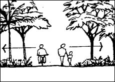
Figure
B9.1 – Planting maintains sightlines into public areas for safety.
2. Landscaping
not to interfere with utilities and services
Landscaping and planting must not interfere with the
function and accessibility of underground or overhead services and facilities,
including inspections pits/ meters.
3. Landscaping
not to interfere with the structural integrity of buildings and structures
a) Trees must not be
planted within 3 metres of any building.
b) When placing
trees in the landscape, consideration must be given to the size and spread of
the tree when it is mature. Ensure that trees have adequate space for their
branches and roots to grow without interfering with building eaves, walls,
concrete slabs, foundations, driveways, paths, retaining walls or other built
structures.
4. Landscaping
conserves and improves natural resources and biodiversity
Site and landscape design must:
a) retain and
protect existing significant native vegetation on the site wherever possible;
b) retain any trees
or other vegetation of cultural or heritage significance;
c) incorporate the
retention of existing mature trees (with the exception of weed species) into
the landscape design wherever possible;
d) utilise plant
species locally indigenous to the
area (and preferably) sourced from the local area, in preference to exotic
plant material, wherever practicable;
e) Ensure that weed
species are removed from the site and are not used in the landscape design;
f) Incorporate
compensatory plantings whenever significant native vegetation is removed or
damaged;
g) on larger land
parcels, incorporate bushland restoration/ regeneration works in strategic
areas to consolidate naturally occurring plant communities and assist in the
remediation of damaged lands.
5. Landscaping
reinforces local character, identity and sense of place
Where a street or a locality has a specific character
derived from existing vegetation, similar or compatible species are planted on
the site (except where the existing species are undesirable weed species).
6. Landscaping
contributes positively to streetscape amenity and helps to integrate the
development into the existing landscape setting
Landscaping must endeavour to soften the harsh visual effect
of extensive areas of hard-surfacing, such as the cumulative effect of building
walls, car parking areas and pavements. The height of plants selected
must relate to the scale of the building(s), helping to visually break up hard
surfaces and providing a balance between built and natural forms when the development
is viewed from adjoining public streets or neighbouring properties.
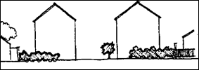
Note: This landscaping does not relate well to the building
scale.
Note: This landscape relates to the building scale and
assists integration of the building into the street.
Figure
B9.2 – Landscaping relative to building scale
7. Plant
species are selected for long-term survival, minimal maintenance and visual
interest
Plant species used in landscaping must:
a) be suited to
prevailing site conditions (such as soil characteristics, sun, shade, wind,
rainfall and drainage regimes) and require minimal maintenance;
b) be hardy and
long-lived;
c) be predominantly locally indigenous species (sourced from the
local area wherever practicable), in preference to exotic plant species;
d) provide on-going
visual interest through form, colour, texture, floral display and the like.
8. Landscaping
improves the microclimate in and around buildings and enhances the function of
outdoor living spaces
Landscaping must provide year-round shade, shelter and
amenity to outdoor living areas and help to define the function of different
outdoor spaces.
9. Landscaping
of public and semi-public areas provides clearly defined pedestrian pathways
and assists with way-finding
The landscape design of public areas and semi-public spaces
such as car parking areas and the frontages of commercial and industrial
buildings must incorporate:
a) pedestrian
pathways that have a different surface finish to, and are clearly
differentiated from, driveways and vehicular movement areas;
b) planting or other
design elements that help drivers and pedestrians locate the main entry/ exit
points into the site;
c) planting or other
design elements that assist pedestrians find their way around the development
safely and locate the main entry/exit points into the building(s).
10. Adequate
landscape buffers are provided between incompatible landuses
Where the proposed development has the potential to impact
upon the amenity of adjoining development, vegetative buffers are required to
provide dense screening along the boundary of the proposed development.
11. Landscaping
complies with bushfire protection requirements
Where the proposed development is located on land mapped as Bushfire Prone Land, landscaping around proposed buildings must comply with the current
legislative requirements of the Rural Fires Act, 1997 in regards to
measures required to protect the proposed development from bushfires.
Further standards for landscape design specific to different
types of development (e.g. multi-dwelling
housing, business or industrial development) are included in the
relevant Sections below.
Prescriptive Measures
There are no Prescriptive Measures.
B9.4 Multi
Dwelling Housing,
Attached Dwellings and Residential Flat Buildings
B9.4.1 Landscape
Principles
Objectives
1. To
ensure a high quality landscape and aesthetic environment for multi dwelling housing, attached dwellings
and residential flat buildings.
Performance Criteria
Multi dwelling housing,
attached dwellings
and residential flat buildings
shall provide a high quality landscape that seeks to enhance the amenity and
function of the development and provide a pleasant environment for residents
that supports their physical and psychological well-being.
Prescriptive Measures
1. The
following design requirements apply to multi
dwelling housing,
attached dwellings
and residential flat buildings
developments:
a) retention of
suitable existing vegetation;
b) screen planting
to street frontages and driveway areas, to provide privacy between dwelling houses
and around the boundaries of the site;
c) provision of
pleasant landscaped settings for the enjoyment of residents;
d) planting
selection that relates to building scale and mass.
2. The
common landscaped area of the site must not be less than the total of the
areas required for each dwelling house, calculated from the following table,
less the total of the areas of approved private courtyards and approved private
open space balconies in accordance with Chapter D1 Residential Accommodation in
Urban, Village and Special Purpose Zones.
Table B9.1 – Dwelling
Size to Landscape Area
|
Dwelling(D) Size
|
Landscaped Area(D)
|
|
Small (under 55 m2 in floor plan area(D))
|
50 m2
|
|
Medium (55-85 m2 in
floor plan area(D))
|
70 m2
|
|
Large (over 85 m2 in floor plan area(D))
|
90 m2
|
B9.4.2 Common
Landscaped Area
Objectives
1. To
ensure appropriate treatment of common
landscaped areas.
Performance Criteria
1. Landscaped
areas and landscaping must be considered as components of the site planning
process and must reflect the scale of development.
2. Landscaping
must complement existing streetscapes, urban landscape and bushland, and must
be in scale with the height and bulk of buildings. Landscaping must be
sensitive to site attributes such as existing landscape features, streetscape,
ecology, land capability, micro-climate, views and vistas.
3. Development
must be designed to maximise the number of trees retained on the site.
Prescriptive Measures
1. The
common landscaped
area of the site must be in accordance with Section
B9.4.1.
2. A
minimum of 75% of the total common landscaped area
of the site must consist of deep soil areas.
Areas of landscaping over underground car parks, and the like, cannot be
included in the calculation of deep soil areas.
3. The
landscape design must address:
a) the retention and
provision of appropriate trees on the site;
b) the use of earth
mounding and terraced areas to create useful and visually pleasing recreation
areas and to assist screening;
c) the orientation
of landscape areas with regard to sunlight and prevailing winds;
d) the provision of
sufficient areas adequately shaded against the summer sun and giving adequate
access to the winter sun.
4. Areas
used for the management of on-site sewage effluent must be excluded from
calculations of the common landscaped area.
B9.5 Dual
Occupancies and Semi Detached Dwellings
B9.5.1 Landscape
Principles
Objectives
1. To
ensure a high quality landscape and aesthetic environment for dual occupancies,
and semi detached
dwellings.
Performance Criteria
Dual occupancies and semi
detached dwellings
shall provide a high quality landscape that seeks to enhance the amenity and function
of the development and provide a pleasant environment for residents that
supports their physical and psychological well-being.
Prescriptive Measures
1. The
following design requirements apply to dual
occupancies, and semi detached
dwellings developments:
a) retention of
suitable existing vegetation;
b) screen planting
to street frontages and driveway areas, to provide privacy between dwelling houses
and around the boundaries of the site;
c) provision of
pleasant landscaped settings for the enjoyment of residents;
d) planting
selection that relates to building scale and mass.
2. Each
dwelling must have a minimum landscaped
area of 90m2, excluding any area used
for vehicle circulation or parking. At least 25% of the site must consist
of deep soil
areas.
B9.6 Tourist and Visitor Accommodation, Caravan Parks, Camping Grounds and Eco-tourist Facilities
B9.6.1 Landscaping
of Tourist and
Visitor Accommodation (excluding bed and breakfast and farmstay accommodation)
Objectives
1. To
ensure that tourist and visitor
accommodation (excluding farmstay and bed
and breakfast)
provide useable outdoor areas that improve the amenity of the locality and
visual appearance of the development.
Performance Criteria
The following design guidelines apply to tourist and visitor accommodation (excluding farmstay and bed
and breakfast):
a) retention of
suitable existing vegetation;
b) creation of a
pleasant landscaped environment for customers;
c) planting
selection which can endure an intensively used environment;
d) planting
selection which relates to building proportions;
e) embellishment and
landscaping of the street and footpath area to integrate the development with
the pedestrian network and to provide shade. (See B9.11.1)
Prescriptive Measures`
1. A
minimum 10% of the site area must be dedicated to landscaping of tourist and visitor accommodation developments
(excluding farmstay and bed and breakfast). Landscaped areas
can be used for pedestrian access provided porous paving is utilised.
2. Screen
and shade planting to car parking and driveway areas as required under B9.8.1
Screening is also required to visually obtrusive facades of the building. For
effective landscaping a minimum garden bed width of 2 metres may be required
for the front boundary (this will not be appropriate for all design layouts).
B9.6.2 Landscaping
of Caravan Parks, Camping Grounds and Eco-tourist
Facilities
Objectives
1. To
ensure that caravan parks and camping
grounds provide useable outdoor areas
that improve the amenity of the locality and visual appearance of the
development.
2. To
ensure that eco-tourist facilities
blend into their natural setting with minimal impact, while still providing a
landscaped environment that improves the biodiversity of the locality without
exacerbating bushfire risk.
Performance Criteria
1. The
following design guidelines apply to camping
grounds and caravan parks:
a) retention of
suitable existing vegetation;
b) creation of a
pleasant landscaped environment for customers;
c) planting
selection which can endure an intensively used environment;
d) planting
selection which relates to building proportions;
e) landscaping that
provides for privacy balanced with crime prevention;
f) landscaping
that is responsive to bushfire hazards.
2. The
following design guidelines apply to eco-tourist
facilities:
a) retention of
suitable existing vegetation;
b) landscaping that
minimises visual impacts of the development;
c) landscaping that
minimises bushfire hazard;
d) planting
selection that is locally indigenous to locality and improves
biodiversity where possible.
Prescriptive Measures
There are no Prescriptive Measures.
B9.7 Commercial
and Retail Development
Objectives
1. To
enhance the built form of commercial and retail areas.
Performance Criteria
1. Retain
existing vegetation where appropriate;
2. Where
possible, provide street trees and/or plantings;
3. For
stand-alone large scale retail or commercial development, provide suitable
landscaping to visually soften the hard stand features of the built
environment.
Prescriptive Measures
For stand-alone large scale retail or commercial
development, a minimum 10% of the site area must be dedicated to landscaping.
B9.8 Industrial
Development
B9.8.1 Industrial
Landscaping
Objectives
1. To
enhance the appearance, climatic conditions and character of industrial areas.
Performance Criteria
Industrial development is potentially the most visually
unattractive form of development in the Shire, particularly due to building
type, use and size. Effective landscaping can reduce the visual impacts
of such development and create a unifying element in the streetscape.
The following criteria apply to industrial developments:
a) Screen planting
at the rear and sides of industrial buildings, particularly where the
development is located on the edge of industrial areas and abuts non-industrial
lands;
b) Retention of
suitable existing vegetation;
c) Screen planting
to street frontages, adjacent to car parking and driveway areas, around the
boundaries of the site and to
visually intrusive facades of the building;
d) Planting
selection and design which is low maintenance and can endure an intensively
used environment;
e) Planting
selection which relates to building scale and mass;
f) Minimal use
of concrete in landscaped areas;
g) Use porous paving
where appropriate.
Prescriptive Measures
The following design criteria apply to industrial
developments:
1. For
effective landscaping a minimum garden bed width of 2 metres is required for
the front boundary. The garden bed must contain low shrubs and ground
covers and clear trunked canopy shade trees with a minimum spacing of 6m
between each tree;
2. At
least 80% of the planting of industrial sites is to be at the front of the site.
B9.9 Car
Parking and Open Storage Areas
B9.9.1 Landscaping
Of Car Parking and Open Storage Areas
Objectives
1. To
enhance the built form, provide shade and assist in screening car parking and
open storage areas.
Performance Criteria
1. Planting
in car parks reduces the harsh visual
effect created by open concrete and asphalt areas and provides shade and wind
protection. The landscape design should be an integral part of car park
design and layout. The design can incorporate shade tree planting
throughout the car park and dense planting, mounding, walling and
fencing on boundaries to provide screening.
Figure
B9.3 – Landscaping breaks up the hard stand/car park area

Figure
B9.4 – Planting in car parks
Prescriptive Measures
1. In
commercial and industrial parking areas and in open storage areas, shade trees
shall:
a) be provided at
the rate of 1 tree to shade every 2-5 parking spaces and aim to provide
adequate shade cover after five (5) years or less;
b) have high
spreading branches;
c) have a low
attraction to bird species;
d) be provided in
garden beds of minimum width 2m.

Figure
B9.5 – Planting of commercial and industrial car parks
2. Use
smooth-barked trees, shrubs to 1m and ground covers for maximum visibility and
surveillance.
3. The
following design guidelines apply to car parks:
a) retention of
suitable existing vegetation;
b) screen planting
to street frontages and around the boundaries of the site;
c) buffer planting
to adjacent land uses;
d) planting of shade
trees throughout the car park
(landscape works in the car park
should aim to provide adequate shade cover after 5 years);
e) Shade trees are
to be selected on the basis of those species which are not prone to limb drop
or other risks that may cause damage to cars;
f) separation
and definition of pedestrian and vehicular circulation routes;
g) for effective
landscaping, a minimum garden bed width of 2 metres is required for the front
boundary;
h) use of porous
paving for parking bays and driveways where appropriate.
B9.10 Cycleways,
Pedestrian Routes, Drainage and Watercourses
B9.10.1 Landscaping
of Cycleways and Pedestrian Routes
Objectives
1. To
maximise natural characteristics and promote safety within cycleways and
pedestrian routes.
Performance Criteria
There are no Performance Criteria.
Prescriptive Measures
1. Landscaping
along pedestrian and cycle routes shall consist of clear trunked trees, shrubs
to 1 metre height and groundcovers to allow for maximum visibility and
surveillance.
Figure B9.6 – Surveillance
for pedestrians and cyclists to provide security
B9.10.2 Drainage
and Watercourses
Objectives
1. To
promote ecological diversity and to maximise aesthetic values of drainage lines
and watercourses.
Performance Criteria
1. The
natural vegetation associated with rivers, streams and creeks forms the
riverine and creek community. This vegetation can provide vital corridors
for fauna and genetic links between remnant patches of forest. It also
assists in maintaining high water quality and stream stability values.

Figure
B9.7 – Example of Natural vegetation alongside watercourses
2. Development
adjacent to rivers and creeks can degrade the function of these communities and
careful landscape design is warranted. Planting should consist of locally indigenous
species to reinforce ecological functions, and be tolerant of occasional
inundation. It is important not to plant weed species along waterways as
the river system will further distribute the unwanted species.
3. The
following landscape design principles apply to areas adjoining watercourses and
drainage lines:
a) retention of
suitable existing vegetation;
b) rehabilitation of
degraded areas and removal of weed infestation;
c) replanting of
species which are indigenous to the area, tolerant of possible inundation and
not likely to cause a weed problem;
d) landscape
solutions for drainage lines, particularly in urban areas, which promote:
i. the utilisation of natural materials
and natural feature solutions as an alternative to traditionally hard and
unattractive open concrete drains;
ii. integration of engineering and
landscape solutions for stormwater management;
iii. on
steep land, swales and contour banks to reduce the detrimental effects of
overland flow.
Prescriptive Measures
There are no Prescriptive Measures.
Figure B9.8 – Example of
drainage line that encourages the use of natural materials.
Note: Planting species should be tolerant of inundation and
not likely to create a weed problem.
B9.11 Street
Trees in
Subdivision and Developments
Street trees contribute to the identity of the Shire through
the provision of pleasant streetscapes and planting themes. The character
or theme in residential and commercial areas can be enhanced by the selection
of street trees.
B9.11.1 Design
and Selection of Street Trees
Objectives
1. To
promote ecological diversity and landscape character in the Shire’s
streets.
Performance Criteria
1. Native
species, (preferably locally indigenous species), must be used as street
trees in association with subdivision and development to preserve and enhance
the natural character of the Shire. In addition, the retention and
featuring of existing vegetation within the road reserve may provide a suitable
established landscaped streetscape. Careful consideration is required in
the location and choice of street trees, with particular attention to:
a) services and
infrastructure (both underground and overhead),
b) sight lines at
intersections, and
c) pedestrian and
cycleway movements.

Figure
B9.9 – Street trees that allow pedestrian movement
2. For
multi dwelling housing, attached dwellings,
residential flat buildings and
commercial development the embellishment of the road reserve with street trees
will be considered on merit and dependant upon existing street trees, width of
the road frontage and size of the development. The Landscape Concept Plan
prepared for the development needs to consider street trees and other
landscaping of the road reserve as an integral part of the
development.
3. The
design of the planted area for street trees should encourage passive watering
from the road and footpath surface and incorporate the principles of water sensitive urban design.
For design and technical guidelines refer to the Landcom
Street Tree Design Guidelines available on the internet.
Prescriptive Measures
1. Street
trees should be chosen for their:
a) non-invasive root
systems;
b) good canopy
spread and shade provision;
c) mature height
growth nature (under 10m in height)
d) colour and
appeal;
e) low maintenance
requirements;
f) suitability
for soil type and drainage conditions.
2. Street
trees provided as part of a new development must be a minimum of 45 litres in
size to provide an early established character to the development. In
some circumstances the use of root barriers will be required when planting
trees close to kerbs, buildings and other structures under the possible threat
of root damage.
3. A
minimum of one street tree per 15 metres of residential lot street frontage
with a minimum canopy diameter of 8 metres at maturity to be provided for new
subdivisions.
B9.12 Landscape
Design Considerations
B9.12.1 Underground
Car Parks
Objectives
1. To
prevent adverse visual impacts from ventilation shafts and grilles.
Performance Criteria
Ventilation openings in underground car parking structures
must be carefully integrated into the landscape. Ventilator shafts or
grilles must be positioned so that they are screened from view, yet still
function effectively.
Prescriptive Measures
There are no Prescriptive Measures.
B9.12.2 Roof
Decks and Balconies
Objectives
1. To
enhance the visual amenity and appearance of rooftops and
balconies.
Performance Criteria
1. Rooftop
and balcony planting (or vertical
landscaping) is to be used on the upper levels of higher buildings to:
a) promote a more
attractive facade for multi-level buildings;
b) soften the bulk
of the building;
c) graduate the
height of the building with planting;
d) increase privacy
between upper level balconies and dwelling
houses;
e) provide a
subtropical ambience for buildings.
2. Where
planter bays or landscape beds are proposed applicants are directed to the
minimum landscaping provisions under the Residential Design Flat Code (Planning
NSW) – Planting on Structures for depth and dimensions of planter bays
and volume of soil required.
3. Roof
decks must be so designed and constructed as to be structurally capable of
carrying a sufficient volume of topsoil to allow development of a planting
program integrated with landscape development on other parts of the site.
Prescriptive Measures
There are no Prescriptive Measures.
B9.12.3 Climate
and Microclimate
Objectives
1. To
ensure that the design of developments and landscaped
areas addresses the climatic
characteristics of the area and the microclimate of the site.
Performance Criteria
1. Landscaping
should be designed to enhance and reinforce positive climatic influences and
minimise the impact of adverse climatic features.
2. A
site's microclimate is directly affected by a combination of the prevailing
climatic conditions, the site's aspect (i.e. the direction it faces), the
topography, the vegetation and the structures. With due consideration to the
prevailing weather conditions, landscaping can effectively control climatic
impacts on buildings and outdoor spaces.
Microclimate control aspects of landscaping must be designed
to maximise the opportunity to create a comfortable environment.
Landscape design must take into account the placement of evergreen and
deciduous species to ensure winter sun penetration and summer shade to
buildings and outdoor open space/ recreation areas. In particular:
a) consider shade
and canopy spread of trees when locating planting in design;
b) deciduous
vegetation to the north of the block provides summer shade and allows winter
sun;
c) vegetation on the
western side of the block assists in control of afternoon sun;
d) evergreen
vegetation should be planted on the eastern, western and southern sides of the
block to provide summer shade and to deflect cold winter winds.
Prescriptive Measures
In summer the western elevations of buildings should be
protected from the afternoon sun with trees of suitable mature height.
B9.12.4 Existing
Vegetation
Objectives
1. To
promote ecological sustainability and to optimise aesthetic character by
maximising retention of existing vegetation.
Performance Criteria
1. Landscaping
should retain, protect and enhance existing natural vegetation.
2. Vegetation
retention must be considered at the initial stages of development design.
Buildings, roads, parkland, or other components of a development must be
located to retain maximum vegetation on a site.
Design intent is important in the protection of significant vegetation.
3. Maximum
advantage should be taken of existing mature trees and shrubs on the site and these should be incorporated into the
overall landscape strategy. The retention of vegetation on a development site adds an “established” effect
and an immediate vertical dimension to the design. Existing vegetation
also assists in the retention of the natural character of the Shire and has
ecological benefits. In addition, existing vegetation on a site may be significant for historical, aesthetic
or environmental reasons and may be required to be retained by Council
provisions.
4. Provision
must be made in the design for the protection of existing vegetation during
construction works – for example, fencing barriers and appropriate
signage should be provided. Particular effort must be made to protect the
root zone of those trees to be retained, by avoiding compaction of this area by
construction vehicles, and by ensuring that any stockpiling of materials occurs
well away from the drip line of the tree.
5. The
effective use of vegetation on a site
can also substantially reduce the landscaping costs of a development and should
be considered in the design process.
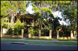
Figure B9.10 – Retention of
suitable vegetation is encouraged
Prescriptive Measures
There are no Prescriptive Measures.
B9.12.5 Planting
Size, Density
and Species
Objectives
1. To
ensure that landscape and planting design is compatible with the scale and
character of the proposed development.
2. To
ensure that the density of landscaping and planting is compatible with the long
term and short term character of the proposed development.
3. To
promote a landscape character in the Shire which is based on locally indigenous
plant species and the natural, subtropical environment of the area.
4. To
promote sustainability through the provision of edible species in appropriate
locations.
Performance Criteria
1. The
selected planting size, density and species is dependent upon a number of
factors, including the scale and nature of the project, availability of
planting stock and particular requirements specified in conditions in a
development consent. In many cases follow-up planting is advantageous
once initial planting is established.
2. The
landscape plan needs to address size, density and species composition
consistent with best practice landscape architecture or landscape design
principles.
Prescriptive Measures
1. The
following planting sizes are the minimum required to achieve an initial impact
in the landscape design:
a) street and
feature trees: 45
litre minimum
b) trees: 300mm
minimum pot size
c) large shrubs: 200mm
minimum pot size
d) groundcovers: 140mm
minimum pot size
2. A
minimum of 90% of all plants used shall be locally
indigenous. These species are listed
in the Native Species Planting Guide to Byron Shire which can be found on
Council’s website.
3. No
species listed as undesirable in Chapter B2 Preservation of Trees and Other
Vegetation shall be used in landscaping on any site.
4. Species
listed as threatened species under the Threatened Species Conservation Act
1995 should not be used for landscaping purposes unless the genetic
provenance can be demonstrated in terms of locally sourced seed stock.
5. In
new developments, consideration will be given to the provision of dedicated
areas for the growing of vegetables, fruit trees and other edible species as
part of the landscaped areas.
B9.13 Landscape
Works and Maintenance
B9.13.1 Landscape
Construction Works
Objectives
1. To
ensure the viability and survival of landscape and planting works.
2. To
ensure survival and ongoing functioning of landscaping and planting.
Performance Criteria
Landscape areas shall be constructed and maintained in
accordance with best practice landscape architecture or landscape design
principles.
Prescriptive Measures
There are no Prescriptive Measures.
Staff Reports - Sustainable Environment and Economy 8.4 - Attachment 6

Byron Shire
Development Control Plan 2014
Chapter D1
Residential Accommodation in Urban, Village and
Special Purpose Zones
This page has been intentionally left blank
Chapter D1 – Residential
Accommodation in Urban, Village and Special Purpose Zones
Contents
D1.1 Introduction. 7
D1.1.1 Aims
of this Chapter 7
D1.1.2 Application
of this Chapter 7
D1.2 General
Provisions. 8
D1.2.1 Building
Height Plane. 8
D1.2.2 Setbacks
from Boundaries. 9
D1.2.3 Screening
the Underfloor Space of Buildings. 12
D1.2.4 Character
& Visual Impact 13
D1.2.5 Fences. 14
D1.2.6 Balconies. 15
D1.2.7 Pedestrian
and Cycle Access. 16
D1.2.8 – Garage to Habitable Space Conversions. 16
D1.2.9 Energy
Efficiency. 16
D1.3 Dwelling
Houses. 17
D1.3.1 On-Site
Car Parking. 17
D1.3.2 Landscaping. 18
D1.3.3 Expanded
House. 18
D1.4 Secondary
Dwellings. 19
D1.4.1 Private
Open Space. 19
D1.4.2 Access
and Car Parking. 20
D1.4.3 Siting,
Design and Character 20
D1.5 Dual
Occupancy and Semi-Detached Dwellings. 21
D1.5.1 On-Site
Car Parking. 21
D1.5.2 Character 22
D1.5.3 Adjoining
and Adjacent Development 22
D1.5.4 Private
Open Space. 23
D1.5.5 Landscaping. 24
D1.5.6 Sound
Proofing. 24
D1.6 Multi
Dwelling Housing, Residential Flat Buildings and Attached Dwellings. 24
D1.6.1 Private
Open Space Courtyards. 25
D1.6.2 Open
Space Balcony. 25
D1.6.3 Landscaping. 26
D1.6.4 On-Site
Car Parking. 26
D1.6.5 Sound
Proofing. 26
D1.6.6 Clothes
Drying Facilities. 27
D1.6.7 Equity
of Access and Mobility. 27
D1.6.8 Pipes
and Vents. 28
D1.6.9 TV
Antennae. 28
D1.7 Affordable
Housing. 28
D1.7.1 Affordable
Housing in R2, R3, B2 and B4 Zones. 28
D1.8 Boarding
Houses. 29
D1.9 Hostels. 29
D1.10 Shop
Top Housing. 29
D1.10.1 Density
Control 30
D1.10.2 Accessibility. 30
D1.10.3 Private
Open Space. 30
D1.10.4 Sound
Proofing. 31
D1.10.5 Clothes
Drying Area. 32
D1.10.6 Site
Facilities. 32
D1.11 Ancillary
Dwellings in Business Park and Industrial Zones. 33
D1.11.1 Ancillary
Dwellings in Zones IN1, IN2 and B7. 33
D1.12 Studios. 34
D1.12.1 Studios. 34
Figures
Figure D1.1 – Setbacks. 11
Tables
Table D1.1 – Height of Fences. 14
Document History
|
Doc No.
|
Date Amended
|
Details
(e.g. Resolution No.)
|
|
#E2014/4221
|
20 March 2014
|
Res 14-118 - Public
exhibition version
|
|
#E2014/32914
|
|
Draft to
26 June 2014 Extraordinary Meeting - for adoption
|
|
#E2014/43143
|
26 June 2014
|
Adopted
Version - Res 14-315.
|
|
#E2017/67065
|
22 June 2017
|
Adopted
22 June 2017 Effective 20 July 2017 – Res 17-273 – amended
D1.4.1, Point 3
|
|
#E2018/27310
|
22 March 2018
|
Adopted
22 March 2018 Effective 12 April 2018 – Res 18-130
‘Housekeeping’
amendment (various chapters).
|
|
#E2019/29404
|
April 2019
|
Public Exhibition version
(Res 19-091) 24.2018.65.1
|
|
#E2019/29404
|
July 2019
|
New revision for adoption
at 15 August 2019 planning meeting
|
This page has been
intentionally left blank
D1.1 Introduction
Byron Shire is one of the most desirable residential
locations in New South Wales, as much for its unique natural environment as for
its lifestyle and climate attractions. The form of the built environment
and its relationship to the natural environment will remain crucial factors in
determining the future character and attractiveness of the Shire.
Byron Shire Council recognises the need to plan for and
control the form of residential development. Such development will need
to be in harmony with its surroundings, both natural and constructed, and
enhance the physical context valued by the local community and by the Shire's
increasing number of visitors.
Council also recognises that there is a growing diversity in
residential needs, reflecting changing household types and incomes, lifestyles
and recreational pursuits. It is aware of the need to promote a higher
quality of design within a more cost-efficient development framework.
This Chapter complements the provisions of Byron LEP
2014. The aim has been to develop controls that provide flexibility to
promote innovative and imaginative building forms, whilst ensuring development
outcomes are consistent with the character of the Shire and its urban and rural
towns, villages, localities and precincts. Building forms need to be
related to each other and to their surroundings by careful attention to design,
orientation, forms, scale, materials and landscaping.
D1.1.1 Aims of
this Chapter
The Aims of this Chapter are:
1. To
implement and expand on the provisions of Byron LEP 2014 relating to residential
development.
2. To promote
a high standard of design for residential development that is sensitive to and
enhances the natural and physical environment and the social fabric particular
to Byron Shire.
3. To
accommodate a variety of residential forms and dwelling
sizes to reflect the growing diversity of household types, sizes, incomes,
lifestyles and needs.
4. To promote
energy efficiency and consideration of the Shire’s climatic
characteristics in the design process.
5. Where
possible, to limit potential for additional traffic on the road system and to
reduce car dependence through facilitation of public transport, cycling and
walking.
D1.1.2 Application
of this Chapter
This Chapter specifies the controls that apply to
Development Applications seeking consent for various forms of residential accommodation development that is
located in Residential, Village, Mixed Use, Business, Industrial and Special
Purpose zones throughout the Shire, ie Zone Nos. R2, R3, R5, RU5, B1, B2, B4,
B7, IN1, IN2, SP1, SP2 and SP3.
The types of residential development to which this Chapter
applies include the following:
1. Attached dwellings
2. Dual occupancies
3. Dwelling houses
4. Expanded houses
5. Multi dwelling housing
6. Residential flat buildings
7. Secondary dwellings
8. Semi-detached dwellings
9. Shop top housing
10. Studios
The definitions of those various housing types are contained
in the Byron LEP 2014 Dictionary, or in the Dictionary
contained in Part A (Appendix A1) of this DCP. The provisions in this Chapter
supplement those provisions of Byron LEP 2014 that
apply to residential development.
This Chapter does not apply to residential
accommodation development in Rural Zones, or to tourist and visitor accommodation –
those forms of development are addressed in Chapters D2 Residential
Accommodation and Ancillary Development in Rural Zones and D3 Tourist
Accommodation, respectively.
D1.2 General
Provisions
D1.2.1 Building
Height Plane
Objectives
1. To
ensure that residential development is designed to minimise impacts on solar
access and privacy on adjoining properties, and on the views from adjacent
existing buildings.
2. To
ensure that the occupants of the building or buildings will enjoy the optimum
use of winter sunlight and summer shade.
Performance Criteria
1. Developments
must be set back progressively from the site boundaries as height increases so
that they do not adversely affect existing or future development on adjoining
properties by way of overshadowing, impinging on privacy or obstructing views.
2. Developments
must be designed so that they will promote energy efficiency and so that
residents may enjoy optimum use of winter sunlight and summer shade.
3. Development
applications must demonstrate that the windows of living areas (decks, living
rooms, bedrooms, kitchens, etc.) of development on adjoining properties will,
as a minimum, retain full solar access between the hours of 9.00am to 3.00pm on
any day.
Prescriptive Measures
1. The
building height plane in combination
with boundary setbacks prescribed in
this DCP, and building height
prescribed in the Byron LEP 2014, form the maximum building envelope for all
residential development other than for shop top
housing and ancillary dwellings
in Zones IN1, IN2 and B7.
2. An
exemption from the building height plane
may be considered in relation to one or more boundaries in the following
circumstances:
a) where the floor
level is required to be above ground level to comply with Council’s
requirements for flood protection; or
b) for the zero lot
line boundaries of semi-detached dwellings and attached
dwellings; or
c) in circumstances
referred to in Prescriptive Measure 2. of Section D1.2.2.
D1.2.2 Setbacks
from Boundaries
Objectives
1. To
achieve varied and interesting streets that complement and harmonise with
existing and planned streetscapes and development in the locality.
2. To
achieve good orientation and spacing of residential developments that achieve
high quality living environments relative to sunlight, shade, wind and weather
protection, residential amenity and proximity of neighbouring development.
3. To
achieve effective use of allotments
to create useable and liveable private open space and courtyards.
4. To
provide flexibility in siting and design of dwelling
house development in urban residential areas.
5. To
ensure that development in residential areas seeks to minimise any negative
impacts on neighbours caused by siting.
Performance Criteria
1. Setback requirements may be flexible provided
they are demonstrated to achieve the above Objectives and Performance Criteria.
2. The
street façade of a building, and any open space between it and the
street must contribute to the general attractiveness of the streetscape by
means of good design, appropriate materials and effective landscaping. A
reasonable degree of integration with the existing pattern of setbacks must be balanced with the need to
provide variety in the streetscape.
3. Private
open space and common landscaped areas of the site must be useable as part of
the living environment available for the occupants of the development.
Council will discourage the provision of bare spaces between buildings and the
street which are unusable because they lack privacy, or because they are
inappropriately planned or treated for climate control.
4. The
setback from a street frontage for a
building that is part of a residential development will be determined on its
merits, having regard to:
a) the Objectives;
b) any provisions of
this DCP applying to the specific location;
c) the position of
any existing buildings in the locality;
d) the size and
shape of the allotment;
e) the effect on
vehicular safety and visibility, particularly on corner sites;
f) the
orientation of the allotment and the
proposed dwelling with regard to the
sun and prevailing winds;
g) the proposed
location of any private open space, courtyard or landscaped areas;
h) the facade of the
proposed building or buildings which will face the street and the proposed
landscape treatment of that part of the allotment
which is visible from the street;
i) the
location and treatment of any car parking areas or car parking structures on
the site.
5. Notwithstanding
any of the above criteria, buildings must comply with the building height plane as detailed in Section
D1.2.1.
6. Dwelling house development may be permitted to
encroach into the side setback and building height plane where it enhances the
design of buildings, complements the streetscape and does not adversely affect
privacy, solar access, microclimate, traffic safety or amenity of adjoining
development.
7. When
considering applications for variations to minimum setbacks
nominated below in the Prescriptive Measures, Council will have regard to:
a) the Objectives;
b) compliance with
the Performance Criteria;
c) the visual impact
of the variation on the streetscape;
d) the impact of the
variation on the amenity, privacy, views and access of surrounding properties;
e) the existing and
future status of the road;
f) potential
traffic impacts and required sight lines as per AS2890; and
g) compliance with
the Building Code of Australia.
8. The
Development must seek to minimize any impacts on neighbouring properties
through considerate siting and design
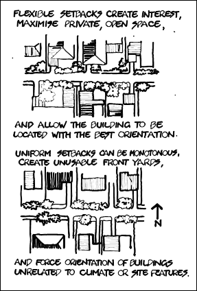
Figure D1.1 – Setbacks
Prescriptive Measures
Strict compliance with the following minimum setback prescriptive measures will not
necessarily be sufficient by itself to meet the Objectives.
1. Minimum
Street Frontage Setbacks
a) Local Roads - A
minimum setback of 4.5 metres must be
maintained from the primary front boundary.
b) Classified roads- A minimum setback of 9 metres applies to these roads
from the primary front boundary. A variation to 6.5 metres may be sought
for single storey dwellings or single
storey elements of two storey dwellings.
(NB. The provisions under SEPP Infrastructure 2007 apply to such
developments)
c) Garages and
carports are to be set back 5.5m from the front boundary except from classified roads where the setbacks under (b) are to apply.
d) Corner allotments on local or secondary roads - setbacks may be reduced to 3m on one frontage.
e) Rear Lane or
unformed roads - 3 metres, unless it is the primary frontage to the development
(eg. Shirley Lane, Byron Bay) in which case a setback
of 4.5 metres applies including to garages and carports. Consideration
may be given to setback variations in Heritage
Conservation Areas where strict compliance with these
provisions would result in conflict with the Chapter and Section Objectives
specified in Chapter C1 Non-Indigenous Heritage.
No development is permitted within the building setbacks other
than garbage storage facilities, mail boxes, landscaping and driveways.
Car parking must not be provided within setbacks,
other than informal parking within the driveway (i.e. parking not required by
the DCP). Stacked car parking is not permitted within setbacks.
2. Minimum
Side and Rear Boundary Setbacks
a) Side and rear setbacks are to be a minimum 900mm, with all dwellings also complying with the requirements
of the building height plane.
b) In urban
residential areas, Council may consent to the construction of one or more
building walls set back less than 900mm from a side or rear boundary, such that
the building/s cannot comply with the building
height plane, where:
i) such
wall or walls contain no openings; and
ii) it is
demonstrated to Council's satisfaction that the development, if carried out,
would improve the siting or orientation of the dwelling/s
or the provision of private open space; and would not significantly:
· increase
the overshadowing of adjoining properties; or
· reduce
the level of privacy enjoyed by adjoining properties.
c) Applications for
zero lot line development will only be considered where the relevant lot or
lots are part of an integrated design, and where all buildings set to a zero
lot line are constructed prior to issue of a Subdivision Certificate.
3. Minimum Setbacks
for Dual Occupancies and Secondary Dwellings
a) Side and rear
setback – 1.5 metres for single
storey, and must comply with the building height
plane
4. Minimum
Setbacks for Residential Flat Buildings and Multi-Dwelling Housing
b) Side and rear setback – 1.5 metres for single storey,
otherwise governed by the building height plane.
c) Between buildings
on a site – 3 metres.
5. Minimum
Setbacks for Swimming Pools and Spas
a) The
outer edge of the pool concourse or coping must be set back a minimum of one
(1) metre from the side or rear boundaries, with the water line being a minimum
of 1.5 metres from those boundaries.
b) Pools
should not be located within the street frontage setback, except on sites
where private open space can be accommodated only in this location or other
site attributes support this outcome.
c) Pool
pumps shall be located as far back from a side or rear boundary as practical
and if closer than 3 m from either it shall be acoustically shielded.
D1.2.3 Screening
the Underfloor Space of Buildings
Objectives
1. To
improve the external appearance of elevated buildings.
2. To
provide for compatibility in appearance and character between buildings in the
locality.
Performance Criteria
1. The
underfloor space of elevated buildings must be provided with infill panelling,
advanced landscaping or other forms of visual screening to improve the external
appearance of the building and to ensure compatibility with other development
in the locality.
2. In
flood liable land the screening of
the underfloor space of elevated buildings may not be appropriate.
Screening below the flood planning level must
have openings to allow for entry and exit of flood water and must be
structurally adequate and not reduce the structural capacity of the building
during a 1 in 100 year flood event.
3. Where
buildings are proposed on bush fire prone land,
underfloor screening may be required to comply with specific requirements
prescribed by the Building Code of Australia and Australian Standard AS3959 - Construction
of Buildings in Bushfire Prone Areas.
Prescriptive Measures
There are no Prescriptive Measures.
D1.2.4 Character
& Visual Impact
Objectives
1. To
retain and enhance the unique character of Byron Shire and its distinctive
landscapes, ecology, towns, villages, rural and natural areas.
2. To
ensure that new development respects and complements those aspects of an
area’s natural and built environment that are important to its existing
character.
Performance Criteria
1. Site,
building and landscaping design must address the climate;
2. The
street face of a building, together with any open space between it and the
street, must contribute to the general attractiveness of the streetscape by
means of good design, appropriate materials and effective landscaping;
3. Development
should be designed to minimise loss of privacy;
4. There
must be a reasonable degree of integration with the existing built and natural
environment, balanced with the desirability of providing for variety in
streetscapes;
5. Long,
straight wall areas will be discouraged and must be broken up visually by a combination
of building materials and/or changes in the wall plane;
6. The
provision of verandahs, balconies, pergolas and other protective outdoor
elements will be encouraged for visual, climatic and energy efficiency reasons;
7. Well-designed
overhanging eaves should be provided where feasible to protect against heavy
rainfall and summer sun, while allowing winter sun penetration;
8. All
building materials must be compatible in character with their surrounding
environment. Any metal roof must have a colorbond or equivalent finish
and no roof may be highly reflective. White or light-coloured roofing may be
approved where it is demonstrated that it is not likely to be visually
intrusive. Details of building materials and surface colours must be submitted for
assessment with a development application.
Prescriptive Measures
There are no Prescriptive Measures.
D1.2.5 Fences
Objectives
1. To
enable residents to erect fences to provide for a sense of privacy, noise
reduction and security.
2. To
ensure that fences do not remove the sense of safety in the street that
pedestrians gain from the casual observation by residents.
3. To
ensure that fences do not unduly reduce opportunities for casual social
interaction in the community.
4. To
ensure that fences do not become a dominant built element in the streetscape.
5. To
exclude unwanted light from vehicles in particular circumstances.
6. To
ensure that the design and placement of fences do not adversely impact traffic
or pedestrian safety.
7. To
ensure provision for access by safety and emergency vehicles and personnel.
Performance Criteria
1. Fences
must not:
a) impair
driver or pedestrian visibility at road intersections;
b) prevent
residents of a dwelling from casually
observing the adjacent street;
c) detract
from the streetscape in terms of fencing design, materials, scale or colours;
d) prevent
emergency access by safety and emergency vehicles and personnel.
2. Gates
or openings in fences must facilitate safe entry and exit conditions for
vehicles to and from public roads. Fences must not create or contribute
to unsafe sight distance restrictions for vehicles entering or exiting
neighbouring properties.
3. Fencing
of corner allotments must allow for
reasonable enclosure of rear yard areas for privacy and security, while
minimising the impact of the fence on the street scene, safe sight distance and
traffic and pedestrian safety.
Prescriptive Measures
1. Height
of Fences
a) The height of
fences should not exceed:
Table
D1.1 – Height of Fences
|
Fence Location
|
Height
|
|
Front Fence
|
1.2 metres.
|
|
Side Fence
|
1.2 metres within the building line setback and 1.8 metres for the remainder.
|
|
Rear Fence
|
1.8 metres. Where the rear fence is the primary
frontage front fence height provisions may apply.
|
Note: A front fence is any fence or like barrier erected
forward of the building line setback, whether it is erected on the boundary or not.
b) Front fences and
side fences within the building line setback higher than 1.2 metres but not higher
than 1.8 metres may be permitted for properties:
i) adjoining
land used for business or commercial purposes, in cases where screening from
the adjoining business activity is necessary to protect residential amenity;
ii) where it
is demonstrated that traffic noise and light impacts from car headlights on a
public road will create adverse impacts on residential amenity in the absence
of the higher fence;
iii) necessary for
safety, noise mitigation purposes or to enclose the primary open space area.
c) Any front fence
higher than 1.2 metres must be:
i) located
not less than 50cm inside the front boundary with the area in front of the
fence to be landscaped; or
ii) articulated
with recessed sections of a minimum 0.9 x 0.9 metres at a maximum interval of 5
metres to allow planting of vegetation to reduce the impact of the fence.
2. Corner
Allotments
Fencing of the secondary frontage will be allowed up to 1.8m
high on the boundary, up to either of the following alignment setbacks from the primary street:
a) the established
building line setback to the street;
or
b) if the existing dwelling is forward of the established
building line setback, in line with
the existing dwelling.
Fencing forward of this alignment must comply with the front
fence requirements.
3. Sight
Lines at Intersections
Where a visually solid fence is proposed at the intersection
of two public roads, satisfactory sight distance must be provided for traffic
using the road. A minimum corner splay of 4m x 4m must be provided in the
fence. Landscaping or planting in the splay area must not impede driver
visibility and must contain low shrubs and ground covers and/or clear trunked
canopy shade trees to maintain sight lines.
D1.2.6 Balconies
Objectives
1. To
ensure that the visual character of balconies
is consistent with and does not dominate the design of residential buildings.
Performance Criteria
Balconies must not
dominate the visual character of buildings or development. The design of balconies must be consistent in character with
the building and development in terms of materials, colours, dimensions, bulk,
scale and proportion.
Prescriptive measures
There are no Prescriptive Measures.
D1.2.7 Pedestrian
and Cycle Access
Objectives
1. To
reduce car dependence through the promotion of alternative forms of transport.
2. To
assist in the delivery of Council’s adopted bike plan where possible.
3. To
provide an expansion of the existing pedestrian/ cycleways to improve
connectivity throughout the Shire.
Performance Criteria
1. Development
applications for residential accommodation
of more than 3 dwellings must
demonstrate that the pedestrian/cycleway network detailed in Council’s
adopted Byron Shire Bike Strategy and Action Plan will be
incorporated into new development.
2. Refer
to Chapter B5 Providing for Cycling and Chapter B13 Access and Mobility.
Prescriptive Measures
Refer to Chapter B5 Providing for Cycling and Chapter B13
Access and Mobility.
D1.2.8 Garage
to Habitable Space Conversions
Objectives
1. To
ensure that adequate parking is provided when garages are converted to
habitable space.
Performance Criteria
1. Development applications
seeking to convert a garage to a habitable space must provide an alternate
parking solution in accordance with Chapter B4 and Chapter D1.2.2.
2. Applicants at the head of a
cul-de-sac should seek to retain garages and carparking and look for alternate
solutions when siting a secondary dwelling or developing habitable
space.
Prescriptive Measures
There are no prescriptive measures.
D1.2.9 Energy
Efficiency
Objectives
1. To
reduce greenhouse gas emissions created from residential development
2. To
increase thermal comfort and efficiency for residential development
Performance Criteria
1. Buildings for habitable
purposes should seek to incorporate measures to reduce energy consumption,
reduce reticulated water consumptions and improve thermal comfort.
2. Where possible, development
should seek to fit or retrofit energy efficient fixtures and fittings to reduce
greenhouse gas emissions.
Prescriptive
Measures
1. Long
term residential accommodation exempt from BASIX must incorporate measures to
reduce energy consumption, reduce reticulated water consumption and improve
thermal comfort. Details are to be provided on development application
plans. Measures are to include but are not limited to:
a) Minimum
R2.5 ceiling insulation when access is available.
b) Hot water
system must not be an electric storage tank that is connected to mains power.
c) Minimum 3
stars taps and fixtures to be installed in all kitchen, laundry And bathrooms.
d) Minimum 4
star air conditioning (if proposed)
e) Minimum
5000 litre rainwater tank collecting at least 30% of the development’s
roof water. 1 garden tap connected to rainwater tank.
D1.3 Dwelling Houses
This Section outlines the controls applicable specifically
to dwelling house development.
It must be read in conjunction with the general provisions set out in Sections
D1.1 and D1.2.
In this Section, a reference to a dwelling house also includes a reference to an expanded house.
D1.3.1 On-Site
Car Parking
Objectives
1. To provide
adequate and visually compatible accommodation for vehicles.
Performance Criteria
1. Car
parking must be provided on the site in a manner which is convenient in terms
of access for residents of the dwelling;
safe and accessible in terms of visibility, turning and manoeuvring
capabilities; and visually compatible with the site and its locality.
2. Car
parking structures, including garages and carports, which are visible from the
street must be compatible with the dwelling
in terms of design and materials, and may form part of the dwelling structure.
Prescriptive Measures
1. Refer
to Chapter B4 Traffic Planning, Vehicle Parking, Circulation and Access for
detailed provisions regarding car parking and vehicle access.
2. Council may consent to the location of a carport such that it does not
comply with the building height plane in
relation to a boundary, having regard to the matters contained in Section
D1.2.1 and to the adequacy and safety of vehicular access.
D1.3.2 Landscaping
Objectives
1. To
enhance the visual quality of residential areas and to improve the residential
amenity of the Shire.
2. To limit
stormwater runoff from residential areas.
Performance Criteria
To enhance the visual quality and improve the residential amenity
of the Shire, Council encourages the landscaping of dwelling
house allotments in
accordance with the principles contained in Chapter B9 Landscaping.
Prescriptive Measures
1. In
cases where a dwelling is to be
erected closer than 4.5 metres to the front boundary, Council will require, as
a condition of approval, adequate landscaping to be provided to the street
frontage of the lot prior to occupation of the dwelling.
Landscaping must be consistent with the principles contained in Chapter B9
Landscaping.
2. At
least 25% of the site must consist of deep soil
areas. The deep soil area
must not include any areas used for the management of on-site sewage effluent.
D1.3.3 Expanded
House
Objectives
1. To
facilitate the provision of a dwelling house
comprising a number of separate building components.
Performance Criteria
There are no Performance Criteria.
Prescriptive Measures
The design and use of an expanded
house must conform to the following criteria:
1. No
expanded house habitable outbuilding
is to be located more than 20m from the wall of the main building, measured
from wall to wall at the closest point;
2. The
main building must contain an identifiable living area including the kitchen;
3. A
maximum of three outbuildings may be connected to the main building by paths
with an all-weather surface;
4. No
separate driveway, car parking area, garage or carport structure is to be
provided to service any outbuilding;
5. One
outbuilding must be limited to a maximum floor area of 45m2 excluding decks,
verandahs, patios, balconies and the like; and the others must be limited to a
maximum 30m2 floor area excluding decks, verandahs, patios, balconies and the
like;
6. None
of the outbuildings are to contain facilities (e.g. kitchen, sink or the like)
that would enable the preparation of food;
7. Each
separate outbuilding may incorporate a maximum of two bedrooms (including rooms
with an ensuite or bathroom);
8. A
maximum of only one laundry is permitted per dwelling.
D1.4 Secondary
Dwellings
Both Byron LEP 2014 and State
Environmental Planning Policy (Affordable Rental Housing) 2009 (SEPP)
permit the erection of secondary
dwellings in some zones to which this Chapter applies. Secondary dwellings may be complying
development under certain circumstances.
Consistent with the hierarchy of environmental planning
instruments if development for a secondary dwelling is proposed and can comply
with SEPP (Affordable Rental Housing) then the application should be lodged
pursuant to those provisions.
This Section nominates further standards (to support the
provisions in SEPP (Affordable Rental Housing) 2009 and Byron LEP 2014) for
development of secondary
dwellings where permitted with consent.
D1.4.1 Private
Open Space
Objectives
1. To
ensure that residents of secondary dwellings have access to useable private open
space.
Performance Criteria
1. An
open space courtyard (which may include decking) must be provided for a secondary dwelling, with dimensions to suit
the projected requirements of the residents and to accommodate outdoor
recreation needs.
2. The
courtyard must be capable of enabling an extension of the living area of the secondary dwelling.
3. Location
of courtyards must take account of outlook and natural features of the site
without impacting on neighbouring buildings or open space.
4. Orientation
and shading of courtyards must provide for maximum year round use in terms of
sunlight.
Prescriptive Measures
1. Secondary dwellings must have access to an
individual courtyard at ground level having a minimum area or 15m2
and a minimum length and width each of 2.5 metres, not including any area used
exclusively for the circulation or parking of vehicles. The courtyard
should be designed to facilitate access to winter sunshine.
2. The
private open space area must not include any areas required for the management
of on-site sewage effluent.
3. Decks
and verandahs for secondary dwellings not to exceed 20m2
in area.
D1.4.2 Access
and Car Parking
Objectives
1. To
ensure that the provision of access to secondary
dwellings does not adversely impact pedestrian, cycle and vehicle
safety in urban streets, and is compatible with urban streetscape and
character.
Performance Criteria
1. Where
feasible and where pedestrian and traffic safety will be improved, vehicular
access to a secondary dwelling
should be shared with the driveway access serving the principal dwelling. Driveways must be
located and designed to minimise danger to pedestrians and cyclists using the
street as a result of vehicles entering or leaving the driveway.
2. Consistent
with the provisions of State Environmental Planning Policy (Affordable
Rental Housing) 2009, no additional parking is required
for a secondary dwelling, over and above the requirements for
the principal dwelling.
3. Secondary dwellings should not be
sited so as to remove car parking servicing the
principal dwelling.
Prescriptive Measures
There are no Prescriptive Measures.
D1.4.3 Siting,
Design and Character
Objectives
1. To
ensure that the siting and design of secondary
dwellings do not detract from the streetscape and the residential
character of urban areas.
Performance Criteria
The siting and design of development comprising a principal dwelling and a secondary
dwelling must:
a) ensure
compatibility in character between the dwellings
on the site, the site itself and the surrounding urban environment;
b) ensure visual and
acoustic privacy between dwellings on
the site, and between the site and the adjoining neighbourhood;
c) ensure that the
development is suited to the site in terms of topography, slope, water flows
and drainage;
d) ensure that the
development on the site will be visually compatible with the surrounding
neighbourhood.
e) ensure that the
siting of the development does not externalize impacts of noise, overshadowing,
or compromises to privacy onto neighbouring properties.
Prescriptive Measures
1. Secondary Dwellings are not permitted on
strata-titled lots
2. Secondary
Dwellings are to comply with the Building Height Plane requirements under
Chapter D1.2.1 of Byron DCP 2014
D1.5 Dual
Occupancy and
Semi-Detached Dwellings
Council recognises the role of dual
occupancy development in contributing to infill development, making
fuller use of existing services, adding to the stock of rental accommodation
and widening the range of housing options. Council wishes to encourage dual occupancy and semi-
detached dwelling developments which suit the differing needs of the
community and which enhance the residential character of the Shire.
In addition to the controls in this Chapter applying to dual occupancy and semi-detached
dwelling development, proposals which have rear lane access with one
of the dwellings fronting that lane
are to comply with the provisions under Chapter D6 Subdivision (Section
D6.4.3).
D1.5.1 On-Site
Car Parking
Objective
1. To
provide adequate and visually compatible on-site accommodation of vehicles for
residents and visitors.
Performance Criteria
1. On
corner lots there may be an advantage in providing access to each dwelling from a different street frontage,
paying particular attention to the need to make the best use of the site, to
promote traffic safety and to orient buildings and landscaped areas to maximise
climatic advantages.
2. In
other cases, where feasible and where pedestrian and traffic safety will be
improved, vehicular access to dwellings
should comprise a shared driveway.
3. Driveways
must be located and designed to minimise danger to pedestrians and cyclists
using the street as a result of vehicles reversing into or out of the driveway.
Prescriptive Measures
1. Generally
2 car parking spaces will be required for a dwelling
and 2 for each dual occupancy.
2. Refer
to Chapter B4 Traffic Planning, Vehicle Parking, Circulation and Access for
detailed provisions regarding car parking and vehicle access.
D1.5.2 Character
Objectives
1. To
ensure that dual occupancy and semi-detached dwelling development is
compatible in character with development in the locality, provides adequate
private open space and addresses slope and drainage issues.
Performance Criteria
1. In
assessing any proposal for dual occupancy or semi-detached dwelling development,
particular consideration will be given to the topography and slope of the site,
the use of design to minimise loss of privacy, the visual impact of the
proposal and the likely impact on water flows and drainage.
2. To
encourage better visual quality and greater public acceptance, any dual occupancy (attached) or semi-detached
dwelling development must be designed as far as possible to look
like a dwelling house.
Mirror-image dwellings must be
avoided.
3. Private
open space must be specifically designed to be easily accessible to each dwelling.
Prescriptive Measures
There are no Prescriptive Measures.
D1.5.3 Adjoining
and Adjacent Development
Objectives
1. To
ensure that new development is consistent with the character and amenity of
existing development in the locality.
Performance Criteria
1. Development
must be compatible with the bulk, scale, height and character of adjoining and
adjacent development. The site characteristics, including slope and
aspect, must be taken into consideration in assessing the appropriate height
and number of storeys.
2. Adequate
provision must be made for solar access and privacy of the proposed dwelling(s) and any adjacent dwelling.
Prescriptive Measures
Council will only consider dual
occupancy and semi-detached dwelling
development in urban areas where, in its opinion, it has been demonstrated that
the following objectives have been met:
1. Adequate
provision for reasonable protection of existing views from neighbouring houses;
2. Adequate
provision for privacy of the proposed dwelling(s)
and any adjacent dwelling(s);
3. Adequate
provision for access to natural light and solar access for the proposed dwelling(s) and any adjacent dwelling(s);
4. Maintenance
of the character and neighbourhood amenity of the adjoining residential area.
D1.5.4 Private
Open Space
Objectives
1. To
ensure that adequate accessible and useable open space is provided to meet the
recreational, gardening and landscape needs of residents.
Performance Criteria
1. Private
open space areas must be of dimensions to suit the projected requirements of
the occupants and guests and to accommodate outdoor recreation needs, as well
as providing space for service functions such as clothes drying and domestic
storage.
2. Part
of the private open space must be capable of enabling an extension of the
function of the dwelling for
relaxation, dining, entertainment, recreation and children's play, and be
directly accessible from the dwelling.
Provision must be made for space for private gardening such as vegetable
gardens.
3. Location
of private open space must take account of outlook, natural features of the
site and neighbouring buildings or open space. Orientation of private
open space must provide for maximum year round use in terms of sunlight.
4. Private
recreational facilities must not adversely affect the amenity of adjacent
properties.
Prescriptive Measures
1. Each
dwelling must have an area of private
open space at ground level not located in the front setback,
having a minimum area of 30m2 and a minimum length and width each of
4m, excluding any area used for vehicle circulation or parking.
2. The
private open space area must not include any areas used for the management of
on-site sewage effluent.
D1.5.5 Landscaping
Objectives
1. To
provide attractive landscapes that reinforce the function of the street and
enhance the amenity of dwellings and
the built environment.
Performance criteria
Refer to Chapter B9 Landscaping.
Prescriptive Measures
Refer to Chapter B9 Landscaping.
D1.5.6 Sound
Proofing
Objectives
1. To
ensure an acceptable acoustic environment for residents.
Performance Criteria
1. Division
walls between separate occupancy areas of dual
occupancy (attached) and
semi-detached dwelling development must
be of sound resisting construction to ensure acoustic privacy and amenity
between rooms.
2. Development
must be designed to minimise noise and vibration impacts upon occupants of
surrounding dwellings. Where
practicable, sources of noise must be sited away from adjoining properties, and
where necessary must be screened by acoustic treatments.
Prescriptive Measures
There are no Prescriptive Measures.
D1.6 Multi
Dwelling Housing, Residential Flat
Buildings and
Attached Dwellings
Council wishes to encourage variation in medium density
housing development by providing simple, flexible controls that are intended to
produce more attractive and innovative residential buildings, more imaginative
use of outdoor spaces, more privacy and better access to sunlight and shade.
This Section applies to medium density housing development,
including multi-dwelling housing, residential flat buildings and attached dwellings. To facilitate good
design a Context and Site Analysis Plan will be required as per Part
A13.1.1.
D1.6.1 Private
Open Space Courtyards
Objectives
1. To
ensure that residents have access to private, useable, landscaped open space.
Performance Criteria
1. Open
space courtyards must be provided for each dwelling,
with dimensions to suit the projected requirements of the residents and to
accommodate outdoor recreation needs.
2. Courtyards
must be capable of enabling an extension of the living area of the dwelling.
3. Location
of courtyards must take account of outlook and natural features of the site
without impacting on neighbouring buildings or open space.
4. Orientation
and shading of courtyards must provide for maximum year round use in terms of
sunlight.
Prescriptive Measures
1. Each
dwelling must have access to an
individual courtyard at ground level having a minimum area of 30m2
and a minimum length and width each of 4 metres, not including any area used
exclusively for the circulation or parking of vehicles. The courtyard
must be designed to facilitate access to winter sunshine and must be landscaped
to Council’s satisfaction.
2. The
private open space area must not include any areas used for the management of
on-site sewage effluent.
D1.6.2 Open
Space Balcony
Objectives
1. To
ensure that residents of above-ground dwellings
have immediate access to outdoor private open space.
Performance Criteria
Where dwellings
are situated or have access entirely above the ground level of the development,
Council may consent to the provision of private open space by means of a balcony which is of sufficient size and which
is located so as to provide a usable private outdoor area to Council’s
satisfaction.
Prescriptive Measures
1. This
provision is only activated when it is not possible to allocate private open
space at ground level.
2. A
private open space balcony must have
a minimum area of 15m2 and a minimum length and width of 2.4
metres. A private open space balcony
must be demonstrated to have appropriate orientation and adequate provision
for winter sun and summer shade.
3. Balconies and/or eaves may overhang minimum
length or width dimensions of private courtyards or other private open space balconies, subject to compliance with the building height
plane, and provided that adequate access
to winter sun and summer shade is demonstrated for all potentially shaded balconies and/or courtyards.
D1.6.3 Landscaping
Objectives
1. To
provide attractive landscapes that reinforce the function of the street,
enhance the amenity of dwellings and
the built environment, and allow preservation of significant vegetation.
Performance Criteria
Refer to Chapter B9 Landscaping.
Prescriptive Measures
Refer to Chapter B9 Landscaping.
D1.6.4 On-Site
Car Parking
Objectives
1. To
provide sufficient convenient car parking for residents and visitors.
2. To
maintain the amenity of adjoining properties and the efficiency of the road
network by providing for car parking on-site.
3. To
ensure that vehicle access to and from development is safe, effective and
enhances visual amenity.
Performance Criteria
1. Driveway
design must provide safe and efficient ingress/egress to and from the site.
2. Resident
and visitor car parking must be provided according to projected needs.
3. The
design of driveways and parking areas must minimise the visual impact of hard
paved areas and long straights, eg by incorporating curves and landscaping.
Prescriptive measures
1. Refer
to Chapter B4 Traffic Planning, Vehicle Parking, Circulation and Access for
detailed provisions regarding vehicle access, numbers, dimensions and layout of
car parking spaces.
2. Large
areas of car parking must be broken up by variation in layout, pavement
treatment, landscaping, mounding and/or other means to Council's satisfaction.
D1.6.5 Sound Proofing
Objectives
1. To
ensure an adequate acoustic environment for residents.
Performance Criteria
1. Development
must be designed to provide a reasonable acoustic environment within dwellings and to minimise the potential for
noise impact on the occupants of surrounding dwellings.
2. Where
practicable, sources of noise must be sited away from adjoining properties and
where necessary must be screened by effective acoustic treatments.
3. Development
must be designed to minimise noise and vibration impacts on occupants of
surrounding dwellings or buildings.
Prescriptive measures
1. Division
walls between dwellings must be of
sound-resisting construction to Council's satisfaction.
2. The
floors in single storey multi-dwelling housing,
residential flat buildings and attached dwellings must be so constructed or
treated as to minimise the conduct of sound between dwellings.
D1.6.6 Clothes
Drying Facilities
Objectives
1. To
ensure that adequate, effective space is provided and provision is made for
clothes drying.
Performance Criteria
Outdoor clothes drying facilities must be provided to meet
projected needs and located to facilitate privacy and sunlight access.
Prescriptive measures
The minimum provision of clothes drying facilities must be
at the rate of 7.5 metres of line per dwelling,
located in suitably screened external drying areas.
D1.6.7 Equity of
Access and Mobility
Objectives
1. To
ensure equity of access and mobility to all members of the community.
Performance Criteria
There are no Performance Criteria.
Prescriptive measures
Provision for access and mobility
must be made pursuant to Chapter B13 Access and Mobility.
D1.6.8 Pipes and
Vents
Objectives
1. To
optimise the aesthetic appeal of development and to minimise visual impacts of
external pipes and vents.
Performance Criteria
External pipes and vents must be concealed.
Prescriptive measures
1. All
service pipes and vents must be concealed within the walls of residential flat buildings,
multi-dwelling housing
and attached dwellings.
Provision of recessed service pipes in external walls may be acceptable where
it is demonstrated that the proposal is consistent with the Objectives.
2. Access
to pipes and vents must be provided as required by relevant authorities.
D1.6.9 TV
Antennae
Objectives
1. To
minimise adverse visual impacts of TV antennae and dishes, and to ensure the
availability of television reception for all dwellings.
Performance Criteria
Common television antennae and/or dishes must be provided to
meet the expected needs of residents.
Prescriptive measures
Each development must be provided with a common television
reception system designed to minimise adverse visual impacts whilst enabling
high quality reception for each dwelling.
D1.7 Affordable
Housing
D1.7.1 Affordable
Housing in R2, R3, B2 and B4 Zones
Objectives
1. To
provide guidance regarding the implementation clause 6.7 Affordable housing in
residential and business zones of Byron LEP 2014.
2. To
ensure the provision of a diverse range of dwelling
types and sizes that meet the needs of a wide range of family and household
types and provides greater availability of affordable
housing.
Performance Criteria
1. Council
shall consider the matters listed in clause 6.7 Affordable housing in
residential and business zones of LEP 2014 when considering development
applications in Zones R2, R3, B2 or B4 for:
a) subdivision of 25
or more lots where a diversity of lot sizes can be provided;
b) residential accommodation
of 25 or more dwellings where a
diversity of dwelling types can be
provided;
c) redevelopment of
existing housing where a reduced number of dwellings
and/or a reduced diversity of dwelling
types are proposed.
2. Council
may consider applying a condition to the development consent for affordable housing requiring that the
development not be used for the purposes of tourist
and visitor accommodation including holiday letting.
3. Council
may consider varying density controls for subdivision to allow additional lots
to be created for dedication to a public housing provider.
4. The
meaning of ‘very low income household’, ‘low income
household’ and ‘moderate income household’ is the same as
provided in clause 6 of State Environmental Planning Policy (Affordable
Rental Housing) 2009.
Prescriptive measures
There are no Prescriptive Measures.
D1.8 Boarding
Houses
Division 3 (Boarding Houses) of State Environmental
Planning Policy (Affordable Rental Housing) 2009 governs the
provision of boarding houses in various Residential and Business
Zones. Those provisions and standards will be applied to all boarding house
development to which this Section applies.
D1.9 Hostels
State Environmental Planning Policy (Housing for Seniors
or People with a Disability) 2004 governs the provision of hostels. Those provisions and standards
will be applied to all hostel
development to which this Section applies.
D1.10 Shop Top Housing
This Section applies to shop
top housing, which includes dwellings
located above ground floor retail premises or business
premises.
D1.10.1 Density
Control
Objectives
1. To
provide affordable shop top housing
accommodation close to transport, employment and services.
Performance Criteria
The siting, design and density of the dwelling component of the development must be
consistent with the character of the surrounding area and must provide a mix of
dwelling sizes to accommodate
different family profiles.
Prescriptive Measures
1. The
density of the dwelling component of
the development must not be greater than one (1) dwelling
per 150 square metres of site area where no floor
space ratio restriction applies under Byron LEP 2014.
2. A
minimum of 25% of the floor space of the entire development, not including car
parking, must be set aside for commercial/ retail purposes. All ground
floor space fronting the street must be devoted to retail
premises and/or business premises.
D1.10.2 Accessibility
Objectives
1. To
ensure accessible and direct entrance to and exit from the residential
component of a development.
Performance Criteria
Development must be designed to ensure that adequate direct
resident access is provided to the residential component of the development.
Prescriptive Measures
Each dwelling must
have direct access from the main street frontage of the premises (or side
street where located on a corner). This may be by means of a separate,
isolated passage or stairway connecting to the street frontage, which would
allow unrestricted access to the dwelling without
the need to pass through any associated retail
premises or business
premises. Alternatively, such an
access arrangement may be shared with development on adjoining land with a
similar residential component, provided suitable arrangements are made to
ensure that legal access is available and guaranteed in perpetuity.
D1.10.3 Private Open Space
Objectives
1. To
ensure that the residential component of a development contains adequate,
accessible and well designed private open space to meet the needs of occupants.
Performance Criteria
Each dwelling must
be provided with an adequate area of private open space for sole use by the
occupants of that dwelling. The
private open space must be located to provide solar access and a sense of
territory, privacy and safety for residents.
Prescriptive Measures
1. Each
dwelling must be provided with
private open space for sole use by the occupants of that dwelling. Where the private open space
cannot be provided at ground level the dwelling
must be provided with a balcony or
roof terrace.
2. The
private open space, whether at ground level or not, must have a minimum area of
15m2 and a minimum width of 2.5 metres. Part of the private
open space must be a minimum of 10 square metres and directly accessible from a
living area.
3. The
private open space must have solar access to 50% of its area for at least 3
hours per day. Enclosure of balconies
that provide private open space to a dwelling
will not be permitted.
4. The
private open space area must be located to maximise privacy for
residents. If necessary the area must be screened by vegetation, a wall
or fence, to ensure that the area is private.
5. The
private open space must be located to ensure that residents are provided with an
outlook to public areas rather than overlooking directly onto adjoining
buildings, and must not diminish the commercial/retail character of the street
frontage at ground level.
D1.10.4 Sound Proofing
Objectives
1. To
ensure that an adequate acoustic environment is provided for residents.
Performance Criteria
Development must be designed to minimise the potential for
noise impact upon the occupants of the dwellings,
both from within the development and from adjoining developments, public areas
and streets.
Prescriptive Measures
1. Development
must be designed to minimise external noise impacts on residents and to ensure
that noise sensitive areas are screened from noise sources. This can be
facilitated through the design process, eg by locating noise tolerable areas
towards noise sources (e.g. kitchens, laundries etc located toward major
frontages with sleeping areas screened from road frontages, garbage collection
areas, accessways and parking areas). Noise transmission between dwellings can be minimised by not locating
living areas or garages adjacent to bedrooms of other dwellings.
2. Walls
or ceilings of dwellings that are
attached must have a sound transmission class (STC) of not less than that
required by the Building Code of Australia.
3. Applicants
must demonstrate to Council’s satisfaction that the design of dwellings in shop
top housing adequately addresses the issue of sound proofing.
A specialist acoustic report may be required to demonstrate that the
development adequately achieves acceptable sound proofing for residential
amenity.
D1.10.5 Clothes Drying Area
Objectives
1. To
ensure that adequate, effective space is provided for clothes drying.
Performance Criteria
1. Where
feasible, outdoor clothes drying facilities must be provided to meet projected
needs and located to facilitate privacy and sunlight access. The clothes
drying area must be screened from view from the street.
2. Dwellings without private open
space at ground level must provide internal laundry facilities in each unit and
must provide either a clothes drying area on site, or a space for a clothes
dryer in each unit.
Prescriptive Measures
There are no Prescriptive Measures.
D1.10.6 Site Facilities
Objectives
1. To
ensure that adequate site facilities are provided for the development and its
residents.
2. To
ensure that sediment and nutrient laden car wash runoff does not impact on the
water quality of the Shire’s waterways.
Performance Criteria
There are no Performance Criteria.
Prescriptive Measures
1. Mailboxes
must be provided for each dwelling,
located to ensure convenient access for residents and Australia Post. The
street number must be clearly displayed and all mailboxes must be clearly
identified with the unit number. Where an Owners’ Corporation or
equivalent has been created an additional mailbox must be provided for
Corporation correspondence.
2. All
dwellings must be wholly independent
of the commercial portion of the building in respect of such amenities and
facilities as toilets, laundries, kitchens, bathrooms and the like.
3. Common
television antennae and/or dishes must be provided to meet the expected needs
of residents.
4. A
separate water meter must be provided for each dwelling.
5. A
lockable storage facility of 8 cubic metres for each dwelling must be provided. This may form part of a
carport or garage.
6. A
car washing area must be provided at a general rate of 1 per every 10 dwelling units, with a minimum of one wash
area being provided for each multi-unit housing development containing more
than 10 residential units. The car wash area must have minimum dimensions
of 7.6m x 3m. This may be part of a visitor car space, driveway or
turning area where it can be shown that it will not cause undue conflict of
use. This area must have water and electricity available and must be
drained by on site disposal. Where there are separate internal driveway
systems within a site, each must have a car washing area.
D1.11 Ancillary
Dwellings in Business Park and Industrial Zones
This Section applies to the development of ancillary dwellings in Industrial zones and the B7
Business Park Zone. The only dwellings
permitted in Zones IN1, IN2 and B7 are dwellings that are ancillary to other
development that is permissible in those zones and which is situated on the
same site as that other development. Other types of residential accommodation
are not permitted in these zones. Such residential development must be
designed and constructed to provide the resident with a suitable level of
amenity having regards to the industrial and business activities on surrounding
properties. As an example, this could include late night/ early morning noise
from loading and unloading of vehicles, odours and fumes from a manufacturer,
noise from refrigeration plant and equipment, dust from a landscape garden
supplier. In some instances an ancillary dwelling
may not be suitable due to the business and industrial activities on
surrounding properties.
D1.11.1 Ancillary
Dwellings in Zones IN1, IN2 and B7
Objectives
1. To
ensure that residential development remains subordinate to industrial
development in industrial zones, and other development in the Business Park
Zone.
2. To
ensure that an adequate level of amenity is provided for residents of ancillary
dwellings.
Performance Criteria
There are no Performance Criteria.
Prescriptive Measures
1. Applications
seeking consent for establishment of an ancillary dwelling
in Zones IN1, IN2 and B7 must demonstrate that the dwelling
will be used in conjunction with other development that is permissible in those
zones on the same site, and that the dwelling
will be ancillary to that other development.
2. The
ancillary dwelling component of a
development must not be greater than one (1) dwelling
for each allotment, whether or not
that allotment is created via Torrens
Title, Strata or Community Title.
3. The
total floor area of an ancillary dwelling must
not exceed 60m2.
4. An
ancillary dwelling must not have
street frontage when located at ground level.
5. Ancillary
dwellings must be designed to
minimise external noise, dust, fumes and odour impacts on residents. A
specialist acoustic report may be required to demonstrate that the development
adequately achieves acceptable sound proofing for residential amenity.
D1.12 Studios
Studios are meant
for activities which may not be suitable in the dwelling
house. This could include for example painting, pottery,
playing music, writing, other artistic pursuits or an office space for a
home office. The studio is not
meant to be used as a separate bedroom, nor is it meant to be a secondary dwelling or granny flat.
D1.12.1 Studios
Objective
1. To
enable construction and use of a detached building that is ancillary to and
compatible in character with a dwelling where,
because of its nature or space requirements the proposed use of the building is
not practical within the confines of the principal dwelling.
Performance Criteria
1. The
proponent must demonstrate that the studio is
required for a purpose that, because of its nature or space
requirements is not practical to undertake within the confines of the principal
dwelling.
2. The
studio must
not be used for separate habitation.
3. The
studio must
be situated on the same lot and located close to the dwelling and be compatible in design and
character with the dwelling and its
environment.
4. The
studio must not require additional clearing of native vegetation, additional
vehicle access or the provision of additional public services infrastructure
over and above that required by the dwelling.
Prescriptive Measures
Only one studio is
permitted for each dwelling.
The studio must:
a) be situated on
the same lot as the dwelling;
b) not exceed 60m2
gross floor area;
c) not contain
internal partitions other than those necessary for ablution facilities or
demonstrably required for the use of the studio
(eg photography darkroom);
d) not contain
facilities (e.g. kitchen, sink or the like) that would enable the preparation
of food;
e) not be used for
separate habitation;
f) be located
not more than 40 metres from the main building of the dwelling.
Staff Reports - Sustainable Environment and Economy 8.4 - Attachment 7
Byron Shire
Development Control Plan 2014
Chapter E8
West Byron Urban Release Area
Document History
|
Doc No.
|
Date Amended
|
Details
Comments eg Resolution No.
|
|
#E2015/14159
|
|
Draft public
exhibition version October 2015 (Res 15-422)
|
|
#E2016/43278
|
June 2016
|
Draft Post exhibition
version – for 6 October 2016 Council meeting
|
|
#E2016/83304
|
|
Draft pdf reported to
20 April 2017 & 22 June 2017 Council meetings for adoption
|
|
#E2017/66860
|
22 June 2017
|
Adopted 22 June 2017
Effective 20 July 2017 (Res 17-273)
|
|
E2019/29393
|
April 2019
|
Public Exhibition
version (Res 19-091) 24.2018.65.1
|
|
E2019/29393
|
July 2019
|
New revision for
adoption 15 August 2019 planning meeting
|
Contents
E8.1 Introduction. 1
E8.2 Name
and Application of this Chapter. 1
E8.3 Land
to which this Chapter applies. 1
E8.4 Purpose
of this Chapter. 1
E8.5 Relationship
to other Plans and Policies. 3
E8.6 Background
Information. 4
E8.7 Interpretation. 6
E8.8 Compliance
with Objectives and Controls in this Chapter. 7
E8.9 Notification
of Development Applications. 7
E8.10 Design
Principles. 7
E8.10.1 .. Staging Plan. 8
E8.10.2 .. Housing Subdivision
Layout, Orientation and Diversity. 11
E8.10.3 .. Transport Movement and
Street Hierarchy. 14
E8.10.4 .. Stormwater Water
Management 17
E8.10.5 .. Biodiversity, Vegetation
Management and Landscaping. 19
E8.10.5.1 Biodiversity
and Vegetation Management 19
E8.10.5.2 Landscaping. 23
E8.10.6 .. Public Facilities,
Services and Infrastructure. 24
E8.10.7 .. Recreational Areas. 26
E8.10.8 .. Hazards and Constraints. 28
E8.10.8.1 Flooding. 28
E8.10.8.2 Acid
Sulfate Soils. 29
E8.10.8.3 Groundwater 30
E8.10.8.4 Bushfire. 31
E8.10.8.5 Odour 32
E8.10.8.6 Contamination. 33
E8.10.8.7 Mosquitoes. 34
E8.10.8.8 Buffer to
Ewingsdale Road. 34
E8.10.9 .. Aboriginal Cultural
Heritage. 37
E8.10.10 Urban
Design of Significant Sites and Higher Densities. 37
E8.10.10.1 West
Byron Village Centre Precinct 37
E8.10.10.2 Neighbourhood
Business Area. 39
E8.10.10.3 Residential
Areas. 42
E8.10.10.4 Industrial
Area. 61
E8.10.11 Development
in the E3 Zone. 63
E8.10.12 Tourist and Visitor
Accommodation in the Residential R2 and R3 Zones and the B1 Zone 63
Figures
Figure E8.1 ........ Land
to which this Chapter applies. 2
Figure E8.2 ........ Alignment
of Subdivision Lots. 12
Figure E8.3 ........ Street
Parking for Small Lots. 13
Figure E8.4 ........ Typical
Road Verge with Swale and Footpath. 15
Figure E8.5 ........ Road
and parking design combined with vacant small lot subdivision. 16
Figure E8.6 ........ General
Habitat Corridors to be Strengthened. 23
Figure E8.7 ........ Street
Tree Landscaping 24
Figure E8.8 ........ Example
of exercise equipment on soft fall material 26
Figure E8.9 ........ Examples
of playground equipment 28
Figure E8.10 ...... Predicted
2 Odour Unit Contour for Poultry Processing Plant 32
Figure E8.11 ...... Landscape
Buffer and Acoustic Barrier to Ewingsdale Road. 36
Figure E8.12 ...... Planning
Principles for the West Byron Village Centre Precinct 38
Figure E8.13 ...... Example
of a green wall 41
Figure E8.14 ...... Example
of Cafe opening onto a park area. 42
Figure E8.15 ...... Examples
of Various Building Elements against Planning Controls 2, 3, 4 and 8 in Table
E8.3 58
Figure E8.16 ...... Examples
of Various Building Elements against Planning Control 11 in Table E8.3 59
Figure E8.17 ...... Photo
Plates – Examples of Various Building Elements against Planning Controls
in Table E8.3 60
Figure E8.18 ...... Examples
of access from the Spine Road fronting the IN2 Zone. 62
Tables
Table
E8.1 ......... Relevant Provisions of the Byron Shire DCP 2014. 384
Table
E8.2 ......... State Significant Site Study – Technical Studies. 385
Table
E8.3 ........ Key Controls for Dwelling Houses, Dual Occupancy (attached
and detached), multi-dwelling housing and integrated development permissible
under Clause 83 of Byron LEP 1988 in the R2 and R3 Zones. 426
Appendices
Appendix A - Staging Plan. 447
Appendix B – Concept Plan. 447
Appendix C – WSUD Street Tree with Pit 448
Appendix D – Typical Road Cross Sections (Not to
scale) 449
Appendix E – Typical Driveway Access across Swales
(Not to Scale) 451
Appendix F – Typical Stormwater House Connection
(Not to Scale) 451
Appendix G – Widening of Ewingsdale Road Plan. 452
E8.5
Relationship to other Plans
and Policies
·
Relevant State Environmental Planning Policies
(SEPP) and Byron Local Environmental Plan (LEP) 1988 are the statutory
environmental planning instruments applicable to the site and will prevail over
any inconsistencies with provisions contained in the Chapter.
·
State Environmental Planning Policy (West Byron
Bay) 2014 amended the Byron LEP 1988 by inserting Clauses 65 – 101 and
identified the site as an urban release area on the 14 November 2014.
Clause 101 requires the preparation of a DCP for the West Byron Urban Release
Area. The West Byron SEPP after amending the Byron LEP 1988 was subsequently
repealed the following day.
·
The flow chart below provides a summary of the
relationship between the now repealed SEPP and the DCP Chapter.
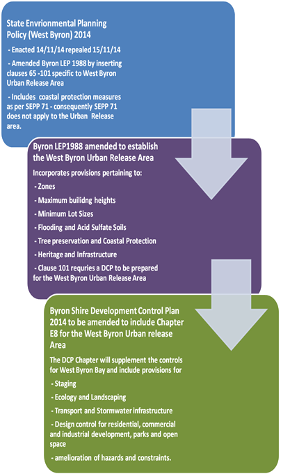
·
Development within West Byron Bay will need to
comply with this chapter, as well as other relevant chapters in the Byron Shire
DCP 2014 set out in Table E8.1. In the event of any inconsistency between
this DCP Chapter and other Chapters within Byron Shire DCP 2014 or any other
plan or policy of Council, this chapter will prevail to the extent of the
inconsistency.
Table E8.1 Relevant Provisions of the Byron
Shire DCP 2014
|
Section and Provisions of Byron Shire DCP 2014
|
|
Part A Preliminary
|
|
Part B Controls
Applying Generally to Development Applications
Chapter B2 Preservation of
Trees and Other Vegetation
Chapter B3 Services
Chapter B4 Traffic
Planning, Vehicle Parking, Circulation and Access
Chapter B5 Providing for
Cycling
Chapter B6 Buffers and
Minimising Land Use Conflict
Chapter B7 Mosquitoes and
Biting Midges
Chapter B8 Waste
Minimisation and Management
Chapter B9 Landscaping
Chapter B10 Signage
Chapter B11 Planning for Crime
Prevention
Chapter B12 Social Impact Assessment
Chapter B13 Access and Mobility
Chapter B14 Excavation and Fill
|
|
Part C Further
Controls Applying to Land with Specific Constraints and Environmental
Characteristics
Chapter C1 Non-Indigenous
Heritage
Chapter C2 Areas Affected
by Flood
Chapter C3 Visually
Prominent Sites, Visually Prominent Development and View Sharing
Chapter C4 Development in
a Drinking Water Catchment
|
|
Part D Further
Controls Applying to Specific Land Uses
Chapter D1 Residential
Accommodation in Urban, Village & Special Purpose Zones
Chapter D2 Residential
Accommodation and Ancillary Development in Rural Zones
Chapter D3 Tourist
Accommodation
Chapter D4 Commercial and
Retail Development
Chapter D5 Industrial
Development
Chapter D6 Subdivision
Chapter D7 Sex Services
Premises
Chapter D8 Public Art
|
E8.6 Background
Information
·
A number of technical studies have been
completed for the site previously for the West Byron Bay Urban Release Area
when it was rezoned by the Department of Planning and Environment. The
technical studies completed as part of the SSS Study are set out in Table
E8.2. These are available from the NSW Department of
Planning and Infrastructure’s website www.planning.nsw.gov.au.
·
Table E8.2 State Significant Site Study
– Technical Studies
|
Issue
|
Technical Study
|
Author
|
Date
|
|
Acid Sulfate Soils
|
Preliminary Acid
Sulfate Soils Assessment
|
Southern Cross
University Environmental Analysis Laboratory
|
December 2010
|
|
Air Quality
|
Odour & Air
Quality Constraints West Byron
|
PAE Holmes
|
December 2010
|
|
Options for Future Development
on West Byron SSS Site: Odour Constraints
|
PAE Holmes
|
May 2012
|
|
Aquatic Ecology
|
Aquatic Assessment
of West Byron Urban Land Release Program
|
Peter Parker
Environmental Consultants Pty Ltd
|
August 2010
|
|
Bushfire
|
Bushfire Assessment
|
LandPartners
|
December 2010
|
|
Civil Engineering
|
Byron West
Engineering Advice
|
Cardno
|
April 2011
|
|
Contamination
|
Preliminary
Contamination Land Assessment
|
EAL Consulting Service
|
December 2010
|
|
Cultural Heritage
|
Proposed West Byron
Urban Release Area Cultural Heritage Assessment
|
Jacqueline Collins
(Consultant Archaeologist)
|
December 2010
|
|
Ecology
|
Preliminary
Ecological Assessment
|
LandPartners
|
August 2010
|
|
Ecological
Assessment West Byron Project
|
Australian Wetlands
Consulting Pty Ltd
|
December 2010
|
|
West Byron Urban Land
Release Area: Response to Submissions Received during Public Exhibition
Period – Ecological Matters
|
Australian Wetlands
Consulting Pty Ltd
|
April 2012
|
|
Flooding
|
West Byron Flood
Impact Assessment
|
BMT WBM
|
December 2010
|
|
West Byron Flood
Impact Assessment – Assessment Revision - Correspondence
|
BMT WBM
|
22 November 2011
|
|
West Byron Flood
Impact Assessment – Response to Submissions - Correspondence
|
BMT WBM
|
22 March 2012
|
|
West Byron Bay
Development Proposal – Flooding – Final Report
|
WMA Water
|
21 June 2012
|
|
Geotechnical
|
Geotechnical
Assessment for Development of West Byron/Belongil Fields
|
Shaw Urquhart
|
June 2010
|
|
Koala Management
|
West Byron Urban
Release Area Response to Submissions by Byron Shire Council and Office of
Environment and Heritage – Koala Management
|
Austeco
Environmental Consultants for Setscan Pty Ltd
|
6 November 2012
|
|
Koala Management in
the West Byron Urban Release Area
– Memorandum to Byron Bay West Landholders Association
|
Austeco
Environmental Consultants for Setscan Pty Ltd
|
16 November 2012
|
|
Land Use Conflicts
|
Land Use Conflict
Risk Assessment
|
LandPartners
|
December 2010
|
|
Mosquitoes
|
Mosquito Risk
Assessment
|
Sydney West Area Health
Service
|
December 2010
|
|
Noise
|
Revised Preliminary
Acoustic Advice
|
TTM Acoustics
|
June 2010
|
|
Retail and Commercial
Demand
|
West Byron Urban
Release Area Retail and Commercial Demand Study
|
Hill PDA
|
July 2010
|
|
Social Impact
|
West Byron Urban
Release Area Housing and Human Services Study Social Impact Assessment
|
BBC Consulting Planners
|
February 2011
|
|
Traffic
|
West Byron
Development Transport Study
|
Veitch Lister Consulting
|
March 2011
|
|
West Byron
Development Transport Study – Supplementary Report on Changes in Level
of Service
|
Veitch Lister
Consulting
|
March 2011
|
|
Urban Design
|
West Byron Urban
Release Area Enquiry-by-Design Workshop Outcomes Report
|
Deicke Richards
Architects
|
September 2010
|
|
Summary of Issues
and Proposed Resolution of Traffic Noise, Visual Impact and Urban Design
along Ewingsdale Road
|
TTM Acoustics, Ennismore
Field P/L & Deicke Richards P/L
|
May 2011
|
|
Visual Impact
|
West Byron Urban
Release Area Visual Assessment
|
Ennismore Field Pty Ltd
|
Undated
|
|
Water Management
|
West Byron Urban
Land Release Project Report
|
The Water &
Carbon Group
|
October 2010
|
E8.7 Interpretation
·
In this chapter Urban Release Area is the West
Byron Bay site identified under Part 4 of the Byron Local Environmental Plan
1988.
·
Any other word or expression used in this Chapter has the same
meaning as it has in the standard instrument (as prescribed by the Standard
Instrument (Local Environmental Plans) Order 2006) unless it is otherwise
defined in this Chapter. Where the word or expression is not defined in
the standard instrument, it will have the same meaning as defined in the Byron
Shire DCP 2014. Wherever any discrepancy arises, the provisions used in
the standard instrument prevail.
·
·
Where not otherwise defined, the meaning is to be taken as the
meaning most commonly understood. A reference in this Chapter to any Australian
Standard or legislation includes a reference to any amendment or replacement as
made.
·
Notes: are included in this document to provide
additional guidance and explanation of the provisions. These notes are
not part of the formal provisions of the Chapter.
E8.8 Compliance
with Objectives and Controls in this Chapter
·
Clauses in this plan contain Objectives, performance criteria
and prescriptive measures. The prescriptive measures are requirements that
Council considers likely to meet the objectives and performance criteria.
In certain circumstances applicants can propose alternate solutions to the
prescriptive measures, however they will need to demonstrate that the
alternative design satisfies the objectives and performance criteria for that
clause. Further information is provided in Part A of DCP 2014 (see Clause A12)
where an explanation is provided on dual path assessment.
E8.9 Notification
of Development Applications
·
Notification of development applications will be undertaken in
accordance with Part A of the Byron Shire DCP 2014.
E8.10 Design
Principles
·
The development of the site is underpinned by the following key
design principles:
Legible and connected
a) A vibrant mixed
use village centre to provide a community meeting place and to provide retail
and commercial opportunities
b) a street pattern
that connects the new residential areas with the mixed use village centre, the
light industrial area and local parks
c) neighbourhoods
where residents can safely walk or cycle to the local shops and open space
d) public transport,
cycle and pedestrian ways that links with existing networks.
e) high speed
broadband to the entire estate
Reinforcing the natural
environment
a) high quality
streetscapes with generous green verges, street trees and footpaths with access
to safe open space areas
b) Appreciation of
areas of high quality habitat for conservation
c) Residential open
space areas which link with the natural environment
Innovative and integrated
a) mixture of
dwellings types to improve housing choice for a variety of residents and
budgets and create diversity in the built form
b) housing
arrangements different to the existing model in Byron Shire including small lot
housing and co-operative housing
c) Clearly defined
entry statements at the access points from Ewingsdale Road
Amenity
a) Residents and
properties are protected from hazards including flooding and bushfire
b) Coherent buffers
provided to Ewingsdale Road and other environmental constraints.
·
Concept and Staging Plan
·
A Staging and Concept Plan has been developed for the site as
shown in Appendix A and B. The plans form the basis for urban development
by setting out:
a) access points from
Ewingsdale Road and associated intersection treatments
b) a key circulation
route through and around the development area including cycleways
c) the location of
future land uses including low and medium density residential development, the
neighbourhood centre, the light industrial area, and open space
d) buffers to
Ewingsdale Road
e) the identification
of environmental conservation and management areas for revegetation
f) landscaping
and street trees
Both plans
are indicative and further changes to the layout and or staging may occur
through the development of West Byron and further assessment. Where major
variations are proposed the applicant will be required to demonstrate the
development remains consistent with the Design Principles in this section.
E8.10.1 Staging
Plan
Objectives
1. Enable
the orderly development of the site.
2. Enable
land to be developed in a co-ordinated fashion.
Performance Criteria
1. Land
use development will be integrated, coordinated and planned in line with the
provision of infrastructure
2. All infrastructure will be designed to provide a high
standard of living for residents and a vibrant, well serviced village centre
and industrial estate.
3. Rehabilitation
and re-vegetation works are to be delivered in a timely manner and in
accordance with management plans.
Prescriptive Measures
1. West
Byron is to be developed in two main stages generally as shown in Appendix A
Staging Plan.
2. Stage
1 to comprise the following minimum infrastructure and works to enable the
site to be subsequently developed for commercial, residential and industrial
land uses. This includes a detailed traffic study be undertaken to confirm the
appropriate configuration of the two round about intersections with Ewingsdale
Rd. The study to address the requirements of the Guide to Traffic Generating
Developments (RTA 2002), and any additional traffic studies and design plans
prepared by Council to inform the final design of the roundabouts. The study
should be completed to address the requirements of the whole site based on a
maximum dwelling yield of 856 dwellings.
a) The two
roundabouts on Ewingsdale Road – Details to be submitted and approved as
to the timing of construction of the roundabouts to minimise disruption to
traffic flows on Ewingsdale Road. The roundabout at the intersection of
Bayshore Drive and Ewingsdale Road to be designed and constructed with a
concrete pavement to facilitate heavy vehicle movements into West
Byron.
b) The start of the
two ends of the Main Spine Road for a length of approximately 250 metres to the
first major internal intersections;
c) Legal access to
roads and services for any allotments (including Lot 1 DP780242) not having
land frontage to the constructed Main Spine Road;
d) Closing of
Melaleuca Drive from Ewingsdale road and measures to ensure access to other
properties on this road.
e) Noise attenuation
measure to Ewingsdale Road including earth bunds, noise fencing and landscaping
to satisfy the Australian Standard;
f) Trunk water
services (including Dual Reticulation mains to service the IN2 Light
Industrial Zone and B1 Neighbourhood Centre Zone) for the length of the
constructed roads;
g) Main Trunk Sewer
infrastructure, pump stations and other necessary sewage infrastructure for the
length of the constructed roads;
h) Bulk Earthworks
to satisfy the flooding and stormwater requirement for the site including the
reconstruction of the main stormwater drain through to the point of discharge;
i) Any
necessary stormwater infrastructure to service this Stage including embellishment
and landscaping of the main drain in this Stage. Where appropriate drainage
work in Stage 2 can commence with Stage 1 including works on the main drain.
j) Bulk
Earthworks for Central Park on Ewingsdale Road (not embellishment) zoned RE1;
k) Acid Sulfate
Soils Management Plan for the entire site, Water Management Plan for Belongil
Creek including baseline data, monitoring and hold points in the event that
water quality is adversely affected by the development, and Biodiversity Conservation Management Plan
including a program for environmental management and staged rehabilitation for
the E2 and E3 Zones;
l) Identification
and protection of any special cultural or heritage places for the entire site;
m) Construction of the
pedestrian/ cycleway for the full frontage of Ewingsdale Road and other
pedestrian/ cycleways through Stage 1 as required;
n) General
landscaping, street trees and the like where relevant to Stage 1 for the
sections of roads being constructed;
o) Subdivision for
the purpose of creating super or master lots and smaller site specific
residential, commercial and industrial lots where appropriate;
p) Address the
provisions for the West Byron Village Centre Precinct under Clause E8.10.10.1
q) Design for the
construction and embellishment of the Park adjacent to the B1 Zone. The timing
for the dedication of the park to be linked with the development of the B1
Zoned Land and the adjacent R3 Zone Land.
r) Any
landscaping or buffer treatments as required under Clause E8.10.5.1.
s) General timing
and sequencing of work within this stage.
t) Applicants
to demonstrate that Infrastructure to be constructed at Stage 1 is designed to
accommodate the expected population yield for West Byron.
Subsequent development applications for residential, business
and industrial development including subdivision, are to demonstrate how they
will be co-ordinated with infrastructure being provided with the Stage 1
approval.
3. Stage
2 - Stage 2 to comprise the following works and infrastructure:
a) Completion of the
Spine Road link;
b) Completion of
trunk water supply and sewer links;
c) Any other
necessary stormwater infrastructure to service this Stage;
d) Compliance with
any plans of management or Cultural Heritage recommendations approved in
Stage 1:
e) General
landscaping, street trees and the like where relevant to Stage 2 for the
sections of roads being constructed;
f) Subdivision
for the purpose of creating super or master lots or smaller site specific
residential lots where appropriate;
g) Any landscaping
or buffer treatments as required under Clause E8.10.5.1;
h) Embellishment of
the Central Park on Ewingsdale Road; and
i) General
timing and sequencing of work within this stage.
Subsequent development applications for
residential, including subdivision are to demonstrate how they will be
co-ordinated with the infrastructure being provided within Stage 2.
Should housing numbers exceed 856 dwellings a further
traffic impact assessment is required on impacts on Ewingsdale Rd and the wider
road network for traffic exceeding this number. Such a study to be prepared in
accordance with the Guide to Traffic Generating Developments (RTA 2002).
4. Where
road reserves are to be dedicated to Council they are to terminate at the
property boundary to ensure access to adjoining properties.
5. Where
drain crossings over Crown Land or other public property are deferred from
Stage 1 to Stage 2, details to be submitted to Council outlining how the
construction of the crossing will be financed including the agreement of land
owners where nominated.
6. The
boundaries with Ewingsdale Road for the site to be adjusted to reflect future
widening of Ewingsdale Road as indicated in Appendix G - Widening of Ewingsdale
Road Plan. The boundary adjustment(s) to occur with Council agreement and can
occur with Stage 1 or 2 or by a standalone application process. Such widening
to have regards to the requirements under E8.10.8.8 Buffers to Ewingsdale Road
7. Where
more than 100 lots are to be released as part of a subdivision, a staging plan
to be submitted with the development application breaking such land releases
into stages of no more than 50 lots to enable the co-ordination and provision
of necessary infrastructure and services.
E8.10.2 Housing
Subdivision Layout, Orientation and Diversity
The subdivision layout needs to consider not only orientation,
vegetation and constraints but also provide for suitably located and shaped
lots for a diverse range of housing types in addition to standard single
dwelling lots. In addition to the minimum lot size provisions under Byron LEP
1988 the following controls apply.
Objectives
1. To
facilitate the provision of a diversity of dwelling types and land tenure to
service the needs of residents at different stages of life.
2. Street layout and the configuration and
sizing of residential lots is responsive to site characteristics and achieves
the following outcomes wherever possible:
a) potential for
solar access to the main living areas and private open space of future
dwellings on each lot, is maximised;
b) lots are
oriented so that future buildings can make best use of the site’s
characteristics (e.g. desirable views/ outlook, most suitable access) in order
to maximise amenity and privacy and keep building and running costs to a
minimum;
c) potential for
overshadowing and overlooking of neighbouring dwellings and their private open
space, is minimised.
3. Consideration to be given to the residential
controls when planning lots sizes and dimensions in relation to car parking,
open space and landscaping areas and building footprint.
Performance Criteria
1. A
diversity of lot sizes and dwelling types, to suit different household
structures.
2. Higher
density development lots sited in proximity to walkways, cycleways, parkland,
and public transport. Corner lots and lots with rear lane access to
facilitate alternate access arrangements that reduce the number of driveways
across the primary street frontage are preferred.
3. Subdivision
design addresses existing vegetation (to be retained), bushfire and other
environmental constraints in terms of the location and sizing of lots.
4. The
configuration, shape and size of lots maximises solar access to each lot and
are of appropriate shape and width to accommodate dwelling designs where the
main indoor and outdoor living spaces can be orientated to the north, north
east or north west.
5. Consideration
to be given to the siting of dwellings in the design of subdivision for small lots.
Prescriptive Measures
1. Applications
for subdivision to be generally in accordance with the Concept Plan for West
Byron. Details to be submitted with the relevant application demonstrating how
access to properties on Melaleuca Drive will be provided and maintained.
2. A
minimum building envelope of 12m x 15m to apply in R2 zone and 12m x 10m in the
R3 Zone for vacant residential allotments.
3. Subdivision
layouts provide rectangular shaped lots with the long side of the lot aligned
on a general east-west or north-south axis wherever possible, in order to
maximise the potential for solar access to future dwellings. (see note below
and Figure E8.2)
4. The
use of battle-axe lots is to be kept to an absolute minimum. To ensure a
suitable residential area to build upon, the access handle is not to be
included in the lot size calculations. Access handle widths to comply with
Chapter D6 of Byron DCP 2014.
5. Dual Occupancy, Multi Dwelling Housing, residential flat
buildings and Integrated
Housing lots in the R2 Zone are to be designed as follows:
a) The plan of
subdivision to clearly nominate lots for dual occupancy, multi dwelling
housing, residential flat buildings and integrated
housing as per Clause 83 of Byron LEP 1988.
b) Lots nominated for
higher densities than single dwelling housing should be carefully chosen having
regards to vehicle access, solar orientation, location of pedestrian paths and
cycleways and public open space areas and the residential controls contained
within this Chapter.
6. Dual
occupancy, multi dwelling housing, residential flat building or integrated housing
lots to have a minimum dimensions of 25 metres on a general north -south axis
with secondary street or rear lane access.
Such lots are not to be clustered in one location but
generally dispersed throughout the R2 Zone.
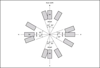
Figure E8.2: Alignment of Subdivision Lots
7. Subdivision
with the R3 Zone to have careful consideration to the final built form in terms
of vehicle access and car parking, solar orientation, private open space, and
the public domain. Accordingly it is preferable that master or super lots be
created with an area greater than 1000m2, which can be subsequently
developed and purposely planned for medium density residential development.
Such lots should have dual frontage as a minimum in terms of either a corner
lot, rear lane access or extend through from one street to the next
street.
Where vacant small lots are proposed pursuant to Clause 81
of Byron LEP 1988, the following controls are to apply in the R3 Zone:
a) Access to be
provided by way of a rear lane, secondary street or reciprocal right of
carriageway to be incorporated into the subdivision design to provide access to
the rear of these properties. In circumstances where access is provided via a
battleaxe handle, the area of the handle to be excluded from the lot size
calculation. Access to be designed and constructed in accordance with Chapter
D6 of Byron DCP 2014.
b) To include an
appropriate Section 88B instrument for the subject lot and the adjoining lot(s)
that will enable zero lot line development on each property boundary.
c) Where 4 or more small lots are proposed in a street
section, the street to be of a suitable width to accommodate nose in, or 45
degree angle parking across the frontage of those lots. The parking to be
integrated with footpaths, cycleways and landscaping including street tree
blisters every five parking spaces to break up the parking areas and to provide
shade.
d) Lots to be
clearly orientated between the north east to the north west to ensure good
solar access.
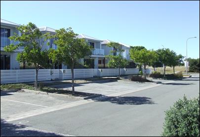
Nose in car parking in
front of small lots with street tree blisters
|
|
Figure E8.3: Street Parking
for Small Lots
8. Where
lots incorporate vegetation to be retained, details to be submitted with the
subdivision application demonstrating that the vegetation will be managed and
not removed for bushfire protection purposes or for residential buildings with
subsequent applications for residential development. In certain circumstance
Council may require a Section 88B instrument on the title to aid in the
protection of the vegetation and to override the 10/50 Vegetation Clearing
Scheme exemptions for vegetation removal.
Notes:
· Applicants
are encouraged to consider the residential provisions when designing the
subdivision layout, and in particular for multi dwelling housing and integrated housing lots. Lots with
potential private open space within the front setback may need to be longer/
wider to enable a suitable, useable, private area with solar access to be
provided.
· Corner lots
provide good opportunities for dual occupancy and multi dwelling housing/ integrated housing
options with vehicle access provided from both streets for a dual occupancy, or
a single shared access point provided from the secondary street for three or
more dwellings.
· Lots that
run from one street through to a second street also provide good design
solutions for vehicle and pedestrian access and egress.
E8.10.3 Transport
Movement and Street Hierarchy
Objectives
1. To provide a hierarchy of interconnected
streets that gives safe, convenient and legible access through West Byron.
2. To minimise through traffic in residential
neighbourhoods.
3. To
ensure that the hierarchy of the streets is clearly legible through variations
in carriageway width, on-street parking, threshold parking, incorporation of
water sensitive urban design measures (where possible), street tree planting,
and pedestrian amenities.
4. To
provide a safe and convenient public transport, pedestrian and cycleway
network.
5. To
ensure a high quality, functional, safe, legible and visually attractive public
domain.
6. To
design streets within each neighbourhood primarily for people, not for cars, by
providing a level of access, safety and convenience to residents in each
neighbourhood.
Performance Criteria
1. The
street network is to be designed to achieve the following principles:
a) Access to
Ewingsdale Road restricted to the two main entrances as indicated on the
concept plan. All properties with frontage to Ewingsdale Road to gain access
from an internal local road. Existing properties on Ewingsdale road to re-site
driveways to the internal road network.
b) Establish a
permeable pedestrian and cycleway network that is based on AMCORD principles
that will encourage walking and cycling and reduce travel distances involving
those activities,
c) Provide for a
safe pedestrian cycleway crossing point across Ewingsale Road to facilitate
access to Sunrise Estate, the Byron Arts an Industrial Estate and the Cavanbah
Sports Centre.
d) maximise
neighbourhood connectivity between residential neighbourhoods, recreational
areas and the Village Centre;
e) accommodate
significant vegetation to avoid its removal and to maintain and habitat
corridors;
f) optimise
solar access opportunities for dwellings having regards to the controls
relating to dual occupancy, multi dwelling housing and integrated housing;
g) maximise
surveillance of open space and environmental protection corridors; and
h) maximise the use
of water sensitive urban design measures.
Prescriptive Measures
1. The
road layout is based generally on the Concept Plan. The road hierarchy is based
on the following:
a) a main Spine Road
which intersects with Ewingsdale Road in two places at roundabouts (Distributor
road)
b) Collector roads;
c) Local roads;
d) Access Roads;
e) Laneways;
and
f) Pedestrian
and cycleway routes.
Typical Road
Cross Sections are provided at Appendix D incorporating swales. Figure E8.4
shows typical road verge with swale and footpath. The final road
layout is subject to detailed design and assessment having regards to
topography, drainage, environmental factors and lot layout.
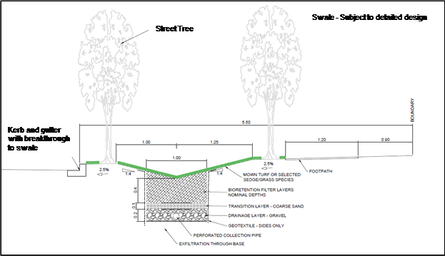
Figure E8.4: Typical Road Verge
with Swale and Footpath
2. The
street network layout and associated infrastructure to be carefully sited and
designed, having regards to the provisions contained under E8.10.5.1
Biodiversity and Vegetation Management and in particular threatened species of
flora, fauna and endangered ecological communities, habitat corridors and
links.
3. Street
design to provide generally no more than three (3) intersection turns to be
traversed from the furthermost lot to the Ewingsdale Road entrances.
Local roads in a residential zone shall be designed to discourage through
traffic via traffic calming measures, such as landscaped street blisters,
chicanes and on-street parking.
4. Cul-de-sacs
to be a maximum of 200m in length and for a maximum of 25 dwellings.
Cul-de-sacs are to provide for pedestrian and cycle permeability.
5. Formal
entry statement to be provided at both entrances from Ewingsdale Road through
fencing and landscaping and changes in road pavement. Each neighbourhood area
(including the Village centre and Industrial precinct) to provide a distinctive
entry statement by way of changes to the road pavement material at the
entrance.
6. Formal
pedestrian crossings to be clearly delineated through changes in road pavement
material and or raised, plus appropriate signage and line marking as
required.
7. Except
where otherwise provided for in this Chapter, all roads, streets and
roundabouts are to be designed and constructed in accordance with the minimum
requirements set out in the Northern Rivers Local Government Development Design
and Construction Manual.
8. For
all local roads and access roads, traffic management, (i.e. road layout and/or
speed reducing devices), to be used to produce a low speed traffic environment.
Such traffic management devices are to be identified at the time of the
subdivision application.
9. Laneways
that are solely designed for back of house access and egress in the residential
and business zones to be contained within a minimum 6 metre wide road reserve
with a 6 metre wide pavement based on vehicle design speeds of 15kmh The
laneway to generally service no more than 300 vehicles per day. The road
reserve may need to be widened to accommodate services, intersections and other
constraints.
10. The road
through the IN2 Zone Land to terminate in a cul de sac at the boundary with Lot
181 DP755695. Alternatives to extend the road through this parcel and back to
Ewingsdale Road will be considered where it can be demonstrated with a traffic
study a positive outcome for traffic management on Ewingsdale Road and to
enable the free flow and movement of heavy vehicles, delivery trucks and other
traffic entering the IN2 Zone.
11. Four bus
stops to be sited either side of the Spine Road in a minimum of two locations
to facilitate public transport within the eastern and western halves of the
Urban Release Area.
12. 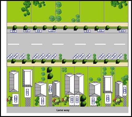 The road to incorporate
nose in / 45 degree angle on-street car parking in the R3 Zone for overflow
parking as required under Clause E8.10.2. The parking areas to be integrated
with street landscaping including street tree blisters passively watered by WSUD,
cycleways and footpath areas.
The road to incorporate
nose in / 45 degree angle on-street car parking in the R3 Zone for overflow
parking as required under Clause E8.10.2. The parking areas to be integrated
with street landscaping including street tree blisters passively watered by WSUD,
cycleways and footpath areas.
|
|
For Small Lot Subdivisions in the R3 Zone
(<350m2) comprising four or more lots nose in or angle
parking as per Clause E8.10.2 is required with rear lane access
|
|
Figure E8.5: Road and parking design
combined with vacant small lot subdivision
E8.10.4 Stormwater
Water Management
Objectives
1. To
facilitate the disposal of stormwater in a sustainable manner.
2. To
maintain and improve the quality of water entering Belongil Creek.
3. To ensure
groundwater levels are considered in the management of stormwater.
Performance
Criteria
1. To
enable stormwater to be managed in accordance with the concept of Water Sensitive Urban Design.
2. To
enable stormwater infrastructure in the main drain to also become environmental
features for native flora and fauna, habitat corridors and to facilitate
pedestrian and cycling access.
3. To
ensure a coordinated response to the design of stormwater infrastructure
combined with landscaping and the built form in the public and private realm.
4. To
provide stormwater infrastructure that can be readily maintained at minimum
cost to Council and the public.
5. Groundwater
levels are not to be significantly altered by stormwater works in areas of
actual or potential acid sulphate soils or such impacts are appropriately
managed
6. Vegetated
buffers are provided around stormwater infrastructure and to trap sediments,
nutrients and pollutants from the surrounding environment
7. Stormwater is managed to maintain appropriate water quality and
levels for wallum froglet and wallum sedge frog habitat.
Prescriptive
measures
1. A
detailed Stormwater Management Plan to be submitted with the Stage 1
Development Application for approval by Council based on the concept of Water Sensitive Urban Design. The plan
is to be for the entire Urban Release Area of West Byron and include the
following:
a) Outline
stormwater treatment facilities, infrastructure and landscaping associated with
water sensitive urban design measures.
b) Be consistent
with the stormwater requirements of Chapter D6 Subdivision of Byron DCP 2014
and the Northern Rivers Development and Design Manual unless otherwise agreed
to by Council;
c) Demonstrate
through stormwater modelling that the proposed development will not adversely
impact the coastal wetlands, Belongil Creek or Cape Byron Marine Park;
d) Demonstrate a lawful point of discharge for all stormwater
outlets. Where Union Drains and other private infrastructure is to be accessed,
details to be provided on lawful access and ability for such drains to be
maintained legally by Council.
e) Works within the
main drain including excavation and widening, environmental embellishment and
access arrangements for pedestrians, cyclist and maintenance vehicles to be
generally consistent with the Concept Plan for West Byron;
f) Any
stormwater detention/ treatment basins are to be limited in number for ease of
maintenance. (N.B. preference will be given to the design and construction of
larger basin(s) rather than multiple smaller basins/ponds);
g) Landscaping as
part of the WSUD Strategy for West Byron to provide details on:
i) Soils,
mulch and sub-grade treatment. The plans should reference relevant engineering
drawings for filter media requirements;
ii) Contours
and spot levels;
iii) Proposed plant
species (only native species to be used – except where turf is utilised
in swales), including the plant’s botanical name, planting height,
quantities and densities;
iv) existing
vegetation proposed to be retained and details of proposed protection
measures;
v) Planting
specification notes are required to include details on plant procurement,
timing, maturity, preparing filter media, mulching, planting procedures,
watering and the acceptable measures of successfully established plants;
and
vi) Any targeted
habitat improvement for threatened or endangered species.
h) Outline any
requirements for ongoing monitoring of water quality impacts and measures for
managing Acid Sulfate Soils;
i) Outline
mitigation measures to minimise mosquitoes;
j) Be
consistent with other stormwater measures included in this DCP Chapter;
k) Staging and timing
of works and financial responsibility for construction.
l) Identify any
additional stormwater detention requirements for subdivision and subsequent
development in the residential, business and industrial zones;
m) Outline long term
management, ownership and maintenance arrangements for all stormwater
infrastructure. An extended maintenance period to be provided for WSUD
measures. Typically this will require that 90% of dwellings are substantially
commenced within the development sub-catchment associated with the relevant
treatment measure;
n) Baseline studies
to be prepared of water quality of surface and groundwater and within drainage
lines across the site. The Studies to consider wet and dry period, tidal
movements and incorporate sampling upstream (eg Arts and Industrial Estate) and
Down Stream (eg Belongil Creek);
o) Identification of
all areas proposed for fill or other major earth works and an assessment of
impacts on stormwater runoff, ground water levels, acid sulphate soils and wallum froglet and wallum sedge frog habitat and
identification of effective mitigation measures where impacts can’t be
avoided.
p) Detailed designs
for the central drainage line that identify impacts on the watertables in the
vicinity of Acid Sulfate Soils and minimises damage to existing native
vegetation.
q) A monitoring
regime for Belongil Creek to ensure a Neutral or Beneficial Impact (NorBE) is
being achieved for the creek. Target criteria for water quality including
litter, coarse sediments, fine particles, total phosphorus and nitrogen and
hydrocarbons to be nominated consistent with the Northern Rivers Development
Local Government Design Manual. The monitoring regime to be applied to assess
impacts as the development proceeds from the start of construction for a period
of 10 years.
2. The
embellishment of the main drain through the site and the secondary drain on the
Belongil Fields site to be carefully designed to protect high environmental value vegetation. The drain(s) to be strategically
widened at areas with limited conservation value. Where vegetation is proposed
to be removed, details to be provided under Section E8.10.5.1.
3. Any
subsequent development application is to be consistent with the Stormwater
Management Plan.
4. Construction
water quality impacts are to be mitigated through appropriate erosion and
sediment controls in accordance with Managing Urban Stormwater - Soils and
Construction ('The Blue Book').
E8.10.5 Biodiversity,
Vegetation Management and Landscaping
The subject site provides
important habitat for a range of species and ecological communities including
koalas, wallum froglet, wallum sedge frog, blossom bat and remnant coastal
cypress pine communities. A voluntary planning agreement has been signed
between the Minister for Planning and the landowners requiring a vegetation
management plan to be prepared addressing matters such as a program and
implementation strategy of environmental management works for the land zoned E2
Environmental Conservation. Vegetation management however will need to apply to
the entire site, and any native vegetation that is proposed to be removed from
within the urban footprint will need to be appropriately compensated.
Landscaping will play an important role as part of the overall environmental
management of the site, and will enhance habitat attributes, whilst also
playing a part in the management of stormwater. The following controls apply:
E8.10.5.1 Biodiversity and Vegetation Management
Objectives
1. Maintain
and improve habitat and ecosystem connectivity;
2. Protect biodiversity values of the site
particularly within E2 Environmental Conservation and E3 Environmental
Management zoned land including flora, fauna, habitat, wetlands, and the
riparian areas of Belongil Creek.
3. Maintain or improve the ecological and hydrological
functions and values of Belongil Creek
4. Environmental
buffers to sensitive ecological areas
5. Improve koala ecological values on the site.
Performance
Criteria
1. Ensure
that a comprehensive Biodiversity
Conservation Management Plan, including identified sub-plans, is
prepared and approved to minimize and offset the impact of development on the
site with the Stage 1 Development Application.
2. Environmental buffers to sensitive ecological areas to be revegetated or
restored, with development located outside environmental buffers.
3. Protect potential and core koala
habitat areas
from development that would compromise habitat quality and integrity and
enhance koala habitat to provide connectivity links to facilitate the natural
movement of koalas.
4. Protect, maintain and enhance key habitat corridors to improve linkages
between habitats.
5. Improve
biodiversity on the site by rehabilitating and
re-vegetating areas identified for conservation within an established timeframe
for delivery.
6. Mitigation
of direct and indirect impacts of development on
drainage lines and riparian areas.
7. To
identify, protect and maintain wallum froglet and wallum sedge frog habitat
areas where appropriate and to provide additional wallum froglet and wallum
sedge frog habitat areas within the West Byron Site, so that there is no net
loss in habitat.
Prescriptive
Measures
1. A comprehensive
Biodiversity Conservation Management Plan
is required to be prepared for the Stage 1 Development Application. The plan
is to be for the entire Urban Release Area and to include the following:
a) identification of
existing vegetation to be retained;
b) the types of
vegetation management works required and how those works will be implemented,
including allocation of responsibility for funding works;
c) an initial
five-year implementation program setting out habitat restoration and management
works including strategies for planting, weed control and maintenance based on
strengthening general key habitat corridors along the eastern and southern
periphery of the Urban Release Area (See Figure E8.6 below). Such works are to
be incorporated into the first Construction Certificate for the site to ensure
any compensatory planting that may be required is established as West Byron is
gradually developed;
d) details of
responsibility for the ongoing management of habitat areas in the E2 and E3
Zones following the initial five year implementation program;
e) methods to
prevent the introduction of exotic pest species or to manage and reduce pest
species already present;
f) methods to
reduce potential for bird strikes into windows of buildings;
g) details of
ongoing monitoring, reporting to Council and processes for adaptive management
where necessary;
h) The Vegetation
Management Plan for the E2 Zone as required under the Voluntary Planning
Agreement (VPA) dated 21/10/14 to be incorporated into the comprehensive Biodiversity Conservation Management Plan. The
plan to address threatened species, SEPP 44 Koala Habitat Protection, measures
to manage Belongil Creek and the requirements of the VPA. The plan can be
detailed in the following sub plans:
i) Threatened
species management plan providing details on any expected impacts on threatened
species or their habitat, how such impacts will be avoided as far as practical
or mitigated if necessary, and how any impacts will be compensated through
rehabilitation and revegetation work. Council records indicate the site
provides habitat for wallum sedgefrog and the wallum tree frog. The management
plan is to address the National Recovery Plan for Wallum Sedgefrogs and other
wallum dependant frog species.
ii) A Belongil
Creek Plan of Management to be prepared in consultation with the relevant land
owner and provide for bushland restoration on land adjacent to the creek and
within riparian buffers provided by the E2 conservation zones, weed control and
habitat restoration along drainage lines. Any new culverts over existing water
crossings to provide improvements in water quality and fish passage
iii) A Koala Plan of
Management (KPOM) is to be prepared in accordance with the requirements of
State Environmental Planning Policy No. 44 – Koala Habitat Protection.
Should Council have an adopted KPOM for the area, Applicants have the choice to
use this plan or prepare their own plan. An Individual KPOM as a minimum to
address the following:
· SEPP
44 Guidelines for Individual KPOMs
· Potential
and Core Koala Habitat on and surrounding
the site
· Rehabilitation
of habitat in the E Zones to focus on Koala Habitat restoration to address any
compensation requirement and to provide or embellish linkages between potential
and core koala habitat areas
· measures
to protect existing koalas whilst new habitat is
being established.
· details
of koala friendly crossings under / over Ewingsdale Road, and timing and
responsibility for their delivery.
· other
measures to protect koalas including reduced vehicle speeds and traffic calming
measures, development fencing, dog prohibition or control, pool safety through
design measures such as ramps or “beaches”, control on construction
activities, signage, appropriate building envelopes having regards to bushfire
requirements for asset protection zones.
2. Revegetation
and rehabilitation works are to be delivered in accordance with the Biodiversity Conservation Management Plan and the sub plans, and is to be based on the
Concept Plan in Appendix B. All plantings should use species
locally sourced with local genetics, and include the aim of achieving a 90%
survival rate.
3. Development
applications for subdivision (excluding subdivision for the consolidation of
lots that does not create additional lots or the opportunity for additional
dwellings, boundary adjustments or to dedicate land for a public purpose) are
to:
a) Address the
relevant statutory considerations under the Environmental Planning and
Assessment Act 1979 (specifically Section 5A, 5C and Section 79C) consider
potential impacts to:
i) threatened
species, populations and endangered ecological communities under the Threatened Species Conservation Act 1995 and the
Environmental Protection and Biodiversity Conservation Act 1999
ii) SEPP 14 Wetlands
and SEPP 44 Koala Habitat Protection
iii) Relevant
provisions of the Water Management Act 2000, Fisheries
Management Act 1994, Marine Parks Act 1997 and the Native
Vegetation Act 2003
iv) Be accompanied
by a detailed ecological assessment including habitat values, location and
extent of any habitat proposed for removal and offset location, extent and
timing.
b) Identify buffers
between development (in zones R2 Low Density Residential, R3 Medium Density
Residential, IN2 Light Industrial, B1 Neighbourhood Centre) and any land zoned
E2 or E3 and provide a plan of management for the buffers and the zone
interface. Buffers or buffer zones are not required between E2 and E3
zones. Buffer management plans must:
i) Mitigate
direct and indirect impacts from development in order to protect the integrity
and health of the natural environment.
ii) Avoid
negative impacts on the natural environment and ensure retention and
enhancement of those functions and characteristics that are important to
biodiversity conservation, landform stability, erosion management, hydraulic
function and other important natural, geophysical and biophysical processes.
iii) Provide a
minimum width buffer of 20 metres. The buffer can include a perimeter
road/ bushfire trail for bushfire protection purposes provided that road is
located outside of the E2 and E3 zone and comprises a minimum vegetated edge
adjacent to the E2 and E3 zone of 7 metres. Cycleways and pedestrian
paths are also acceptable within buffer areas. Where required the vegetated
edge to the E3 Zone to be widened to 10 metres to provide for a suitable level
of amenity to properties in the E3 Zone off Melaleuca Drive.
iv) Incorporate
existing native vegetation into the buffer.
v) Provide details
on long term management and responsibility.
4. Landscaping
of drainage lines, parks, reserves, road buffers and other large areas within
the urban footprint of the Urban Release Area to be designed to enhance
biodiversity values and habitat linkages. Concept landscaping plan to be
submitted with development applications for subdivision which form one or more
stages of the proposal for West Byron.
5. The
road network within the south eastern perimeter of the Urban Release Area
including vehicle access from the main residential areas to include traffic
calming measures such as narrower road widths including chicanes and or one way
traffic flows to facilitate the movement of fauna through this area from the E3
Zones to the E2 Zones. Other options to regulate and limit through traffic in
this area is to develop Lot 1 DP 780242 and Lot 229 DP 755695 as community
title/ strata title residential estates with an “Environmental Living
Theme” and incorporate surrounding E2 and E3 Zoned land into the
common/ neighbourhood property for ongoing management.
6. Any
roads, cycleways, pedestrian footpaths, bushfire trails and other necessary
infrastructure that traverses into or across the E2 and E3 Zone to be sited to
minimise impacts on the environmental qualities of native vegetation and
habitat in those zones by utilising existing breaks in the native vegetation
and or siting and designing such works to have minimal disturbance (eg narrow
road width/ locate where weeds and exotics are to be removed, signage for
wildlife crossings etc). Details to be submitted with the development
application.
7. For
ongoing removal of trees and vegetation after West Byron is developed, land
owners to comply with Chapter B2 Preservation of Trees and Other Vegetation,
and any requirements of the Biodiversity
Conservation Management Plan approved under this Chapter.
8. Despite
the provisions of Clause E8.3, residual areas outside of the Urban Release
Area in Lots 227 and 229 DP 755695, Lot 9 DP 111821, and Lot 2 DP818403
to be incorporated into the Biodiversity Conservation Management Plan as
required.
9. The
keeping of cats and dogs other than guide dogs is to be prohibited. Any plan of
subdivision to include an appropriately worded S.88B instrument in relation to
keeping such pets. The prohibition to also apply to community title and strata
tittle subdivisions and to be incorporated into Strata Plans of Management and
or Neighbourhood Management plans and the like. Appropriate conditions to apply
for applications to residential development including multi dwelling housing, integrated housing, dwelling houses, dual occupancy and
secondary dwellings.
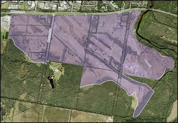
Figure E8.6: General Habitat
Corridors to be Strengthened
(as denoted by orange arrows)
E8.10.5.2 Landscaping
Objectives
1. Landscaping
to provide for the enhancement of the biodiversity values of the Urban Release
Area.
2. To be an
integral part of the development of the site to provide attractive and
aesthetically pleasing environments.
Performance Criteria
1. Native
vegetation to be retained where possible and incorporated into landscaping.
2. Landscaping
to reflect the subtropical character of Byron Bay.
3. Landscaping
to be an integrated into street and park designs and stormwater management
through Water Sensitive Urban Design (WSUD) with street trees provided
throughout the subdivision.
Prescriptive Measures
1. Landscape
plans to be submitted with all development applications for:
a) Subdivision
b) Multi
dwelling housing
c) Residential
flat buildings
d) Dual
occupancies
e) Development
in the B1 and IN2 Zones and
f) As
specified for any other development in DCP 2014
The Landscape Plan to be prepared in accordance with Chapter
B9 of DCP 2014.
2. Applications
for subdivision to identify street tree planting every 15 metres of road
frontage, landscaping and plantings for drainage lines, car parks and
recreational reserves to be dedicated to Council. The Landscape Plan to
indicate how planting will be maintained, identify existing native vegetation
to be retained, nominate species to be planted and describe any passive
watering arrangements through WSUD.
3. Street
trees in the B1 Zone to be incorporated into the footpath as per Appendix C
– WSUD Street Tree Pit with Grate. Other treatments within West Byron
include landscaping of any footpath blisters and roundabouts, and road side
rain-gardens. Such landscaping to be passively watered through WSUD.
4. For
minimum requirements for planting size, density and species please refer to
Chapter B9 of DCP 2014. Locally indigenous species are to be
predominantly used in landscaping. Street trees are to have a general maturity
height of 10 metres and a canopy diameter of 8 meters to provide shade and
assist with managing the micro climate. No species listed as undesirable in
Chapter B2 of DCP 2014 are to be used in landscaping on any site.
 Figure E8.7: Street Tree
Landscaping
Figure E8.7: Street Tree
Landscaping
5. Where
feasible, edible landscapes (bush tucker and other fruit trees and vegetation)
can be used in selected areas throughout the Urban Release Area including
sections of the public reserve and as landscaping for development on private
property. Details to be submitted with the development application where such
vegetation is being proposed for assessment.
E8.10.6 Public
Facilities, Services and Infrastructure
Objectives
1. To
provide guidance for public facilities, services and general infrastructure.
Performance Criteria
1. To
establish controls for infrastructure, public car parking areas, cycleways and
footpaths that services the needs of residents, workers and visitors.
Prescriptive Measures
1. General
Infrastructure
a) The
subdivision shall be fully serviced with water, sewer, roads, drainage and
underground electricity and telecommunication services. The telecommunication
service to be designed to connect to the National Broadband Network. This
service infrastructure may be constructed on a staged basis to accommodate the
staged release of land.
b) Street
lighting to be provided in accordance with Chapter D6 of DCP 2014. Where agreed
to by the electricity provider, LED street lighting or solar power lighting
will be considered.
c) All
service infrastructure is to be designed and constructed in accordance with the
Northern Rivers Local Government Development and Design Manual.
d) Service
infrastructure internal to the development site shall be provided by the
developer at no cost to Council.
2. Dual
Reticulation Water
a) A
dual-reticulation water supply for non-potable water is to be provided to all
lots in the IN2 Light Industrial Zone and the B1 Neighbourhood Centre Zone as a
minimum.
b) The
developer shall incorporate on the Certificate of Title for all allotments
Restrictions as to User which require all dwellings and buildings with plumbing
(including commercial, industrial buildings and the like) to make provision for
non-potable water service plumbing and facilities to the satisfaction of
Council
3. Public
car parking
a)  Public car parking areas to be designed and
constructed to meet the minimum standards within the Northern Rivers Local
Government Development Design Manual and the relevant Australian Standards.
Public car parking areas to be designed and
constructed to meet the minimum standards within the Northern Rivers Local
Government Development Design Manual and the relevant Australian Standards.
b) Such areas to be
dedicated at no cost to Council after construction and at the end of the
relevant maintenance periods.
c) Car parks to be
appropriately landscaped with shade trees in accordance with Chapters B4 and B9
of DCP 2014 and passively watered through WSUD.
d) Applicants are to
consider the installation of an electric vehicle charging station for major car
parking areas around the B1 Zone. (Note: Opportunities may exist to partner
with Council and other organisations with the design and installation of such
infrastructure as per the Byron Shire Low Carbon Strategy)
4. Cycleways
and Footpaths
a) To be suitably
sited and designed to provide for the effective movement of people throughout
the West Byron Site linking residential precincts with one another, the village
centre, and the open space recreational areas. As a minimum 1.2 metre wide
concrete footpaths to be provided on one side of all access roads and both
sides of local, collector and distributor roads. Laneways to be shared with
pedestrians and cyclists.
b) To connect with
existing cycling pedestrian infrastructure in Ewingsdale Road and beyond.
c) Cycleways, bike
parking and storage facilities to comply with Chapter B5 of DCP 2014.
d) Cycleway footpath
along the main drain to be designed and constructed as an exercise/ fitness
trail with designated training stops with appropriate equipment in three places
approximately 400 - 500 metres apart.
5. Bus
Stops
The road network is to be
designed to provide for designated bus routes and bus stops in locations which
provide safe and convenient access for residents.
6. Public
access to Belongil Creek
No public access to be provided to Belongil Creek
Figure
E8.8: Example of exercise equipment on soft fall material
E8.10.7 Recreational
Areas
Objectives
1. To
help engender a sense of community.
2. To
help to promote social interaction, community health and wellbeing.
3. To provide a network of
active and passive open recreational areas
Performance Criteria
1. Lots are to be within walking and cycling distance to a
neighbourhood park
2. Parks are to include a range of recreational facilities
3. Neighbourhood parks need to be designed to meet the Crime
Prevention through Environmental Design (CPTED) principles and Active Living
criteria.
Prescriptive Measures
1. Residential lots are to be approximately 500 metres from
the nearest neighbourhood park.
2. Outside of the two areas zoned RE1 any other neighbourhood
park provided within the development site to have a usable area of approx. 0.2
hectares.
3. Neighbourhood parks are to be provided with the following
facilities:
a) A hard stand play
area (e.g. half court basketball/ skate area) to be provided in one of the RE1
Zoned Parks as a minimum;
b) Be designed and sited such that
adjoining development can provide casual surveillance of the park. Be designed
and located so as to maximise street frontage and encourage natural surveillance
from surrounding residents;
c) Be situated on land that is readily
accessible to the surrounding dwellings and physically connected to the
cycleway/ pedestrian network;
d) Be equipped with play equipment, park
furniture including seating for adults and toilet amenities;
e) Include soft-fall
under all play equipment in accordance with the relevant Australian Standards;
f) Appropriate
shade cover over play equipment;
g) Provide an
electric BBQ, two roofed picnic tables, rubbish bins on stands to be provided
in one of the areas zoned RE1;
h) Be landscaped
with appropriate plantings of local native trees (no exotics) and weeds to be
removed. Trees must have non-invasive root systems and be suitable for
under-pruning as they develop to allow mower egress and undisturbed lines of
sight. Vacant areas to be turfed with a suitable lawn species for mowing and
incorporate earth mounds to provide visual interest and general play areas.
i) Adequate
lighting be provided for crime prevention purposes.
j) The
RE1 zoned land adjacent to the B1 Zone to provide for a village square or
piazza as a community focal point and a casual meeting place for social
interaction.
k) Other features
such as a chess tables, bocce courts, ground level garden labyrinth or concrete
table tennis facilities will also be considered on merit having regards to
ongoing maintenance costs and the anticipated demographics of residents.
l) A
footbridge for pedestrians and cyclist over the Main Drain in the Central Park
on Ewingsdale Road.
4. Developer contributions credits will be provided for
the provision and embellishment of new neighbourhood parks in accordance with
Council’s Development Contribution Plan.
5. Other
community uses for the parks such as community
gardens and as a site for public art will be considered on merit. Where this is
proposed, car parking, water and toilet amenities will be required for the
community gardeners as a minimum. Any public art proposed will need to be
consistent with the Byron Shire Cultural Plan and the Public Art
Policy.
|
|
|
|
|
Park with play equipment and
park furniture within a landscaped setting.
|
|
|
Multipurpose concrete
basketball half court and skate rail.
|
|
Figure
E8.9: Examples of playground equipment
Note:
– for further information on Community Gardens please see the Byron Shire
Community Gardens Policy (10/012)
E8.10.8 Hazards
and Constraints
Flooding, acid, sulfate soils,
ground water, bushfire, mosquitoes, contamination and potential odour from the
adjacent chicken processing plant on Ewingsdale Road have been identified as
hazards and constraints affecting the site. The following specific controls
apply.
E8.10.8.1 Flooding
Objectives
1. Minimise the flood risk to life and property
associated with the use of land.
2. Allow
development on land that is compatible with the land’s flood hazard,
taking into account potential changes as a result of climate change.
3. Avoid
significant adverse impacts on flood behaviour and the environment.
4. Ensure
that development does not have a significant impact on pre-development flood
levels and flows.
Performance
Criteria
1. Development
shall be generally designed so that it is not affected by flooding.
2. Ensure
that safe evacuation can be provided during flood events for land up to the
probable maximum flood level.
3. Enable
limited filling on flood prone land to facilitate the design and construction
of stormwater infrastructure and to ensure residential development can meet the
habitable floor level.
4. Demonstrate
that the filling of flood prone lands and other earthworks do not result in any
significant adverse flooding or environmental issues for adjoining land
including stormwater overland flow paths.
5. Building
design and levels are to consider climate change impacts including sea level
rises.
Prescriptive Measures
1. The
provisions of Byron DCP 2014: Chapter C2 – Areas Affected by Flooding
apply to the site.
2. Development
to comply with the adopted Belongil Creek Floodplain Risk Management Study and
Plan, and the NSW Flood Plain Development Manual, 2005.
E8.10.8.2 Acid
Sulfate Soils
Objectives
1. To
ensure that acid sulfate soils do not result in water quality or other
environmental impacts.
Performance
Criteria
1. Where
acid sulfate soils may be exposed such as from earthworks, installation of
infrastructure, reshaping stormwater drains, construction of footings for
buildings and swimming pools, details to be submitted with the development
application how such soils will be managed to ensure no adverse impacts on the
environment.
2. Where
the watertable in the vicinity of Acid Sulphate Soils maybe affected by
hydrological changes associated with drainage works or alteration in rainfall
infiltration and runoff, an assessment must be undertaken to assess the likely
consequences on groundwater and surface water quality and effective.
3. Effective
mitigation measures are identified to ensure there is no deterioration in water
quality in drains or the Belongil Estuary.
Prescriptive Measures
1. An
Acid Sulfate Soil Management Plan is required to be submitted with any
development application for Stages 1 and 2 which would result in interception
of the local groundwater or acid sulphate soils to suitably mitigate the
potential impacts arising from the disturbance.
2. The
Acid Sulfate Soils Management Plan is required to be prepared in accordance
with the Acid Sulphate Soils Manual and include the following:
a) Identification of
activities that are expected to intersect and disturb acid sulphate soils
b) Identification of
the acid sulphate soils risks and identified acid sulphate soils layers on site
c) Estimation of
volumes of acid sulphate soils requiring treatment and proposed treatment
measures;
d) Estimated liming
rates and treatment procedures
e) Validation
procedures and target criteria of treated soils
f) Monitoring
protocols and target criteria as per the ASSMAC guidelines for surface and
groundwaters within the site.
g) Monitoring
protocols for Belongil Creek including baseline data and target criteria for
water quality and ph levels as per ANZECC/NHMRC Guidelines.
h) Include a generic
management plan for the use of landowners and developers of vacant residential
lots after Stage 1 and 2 has been completed. The Plan to address standard
development issues such as footing for a dwelling and earthworks for services to
the house.
Note: The Preliminary
Acid Sulfate Soils Assessment by Southern Cross University Environmental
Analysis Laboratory dated December 2010 provides background information on acid
sulfate soils for West Byron.
E8.10.8.3 Groundwater
Objectives
1. Mitigate impacts on groundwater having regard to the high water
table present on the site.
2. To
maintain existing groundwater level in the vicinity of wallum sedge frog and
Wallum froglet habitats and wetlands
Performance
Criteria
1. Groundwater
to be managed in accordance with best practice guidelines including the Acid
Sulfate Soils Manual.
2. Groundwater
quality is to be maintained and levels are not lowered
in the vicinity of wallum sedge frog and wallum froglet
habitats and wetlands.
Prescriptive
Measures
1. Any development application
involving excavation works is to identify:
a) The depth of the
excavation works
b) Any potential
interaction with the water table
c) Associated
impacts on groundwater
d) Any potential
risk associated with acid sulfate soils
and as
necessary include appropriate measures to mitigate any impacts.
2. Any
development application involving stormwater detention infrastructure such as
bio-retention basins, constructed ponds, wetlands and vegetated swales is to
demonstrate how any potential groundwater impacts will be mitigated. This
may require the base of associated excavations to be at least 1 metre above the
water table or where this is not possible, the use of impermeable liners.
3. The
ph and water levels of groundwater near and or adjacent to wallum sedge frog
and wallum froglet habitat and wetlands not to be altered such that it impacts
on the health of that habitat for the frogs.
Note: Where dewatering is
proposed, additional approvals may be required under the Water Management Act
2000. Applicants are encouraged to contact the NSW Office of Water to avail
themselves of the Offices requirements
Note: Acid
sulfate soil provisions in Byron LEP 1988 apply to the Urban Release Area.
E8.10.8.4 Bushfire
Objectives
1. Reduce
the risk to human life and property from bushfires.
2. Encourage
sound management of bushfire prone areas.
Performance
Criteria
1. Ensure
development is appropriately sited and designed on bushfire prone land.
2. Appropriate
access and services are provided to developments to facilitate the safe access
and egress of residents and emergency personnel in the event of a bushfire, and
water supply is provided for firefighting purposes.
Prescriptive
Measures
1. Subdivision
and development applications are to comply with Planning for Bushfire
Protection 2006 (NSW Rural Fire Service), including measures for perimeter
roads, fire trails and reticulated water for fire fighting purposes.
2. Development
applications are to be accompanied by accurately mapped plans and details for
each affected lot setting out the location and widths of asset protection zones
(APZs) and building envelopes for constrained lots.
3. Asset
protection zones:
a) Are to be located
wholly within the Urban Release Area and wholly located outside of the E2
Environmental Conservation and E3 Environmental Management Zone (unless
specifically required for development within those zones);
b) May incorporate
roads and flood prone land;
c) May be used for
open space and recreation subject to appropriate fuel management;
d) May incorporate
the building setback on private residential land;
e) Are not to
increase the maintenance burden on public lands; and
4. Water
supply is to be via a ring main system, engineered to the requirements of Australian
Standard 2419.1-1994 Fire Hydrant Installations.
5. Buildings
adjacent to APZs are to be constructed in accordance with the requirements of
Appendix 3 of Planning for Bushfire Protection 2006 and Australian Standard
3959-1999 - Construction of Building in Bushfire Prone Areas.
6. Where
a lot fronts and partially incorporates an APZ it is to have sufficient depth
to accommodate a dwelling with private open space and the minimum required APZ.
The APZ and building envelope is to be identified through a Section 88B
instrument.
7. Temporary
APZs, identified through a Section 88B instrument, will be required where
development is proposed on lots next to undeveloped land. Once the adjacent
stage of development is undertaken, the temporary APZ will no longer be
required and shall cease.
8. The
bushfire assessment to address potential risk from a peat fire.
Note: Technical Study
Bushfire Assessment S.100B Rural Fires Act 1997 (Proposed Rezoning of Land at
West Byron on behalf of Byron Bay West Landowners Association) prepared by
LandPartners (December 2010) is relevant to this section.
Note: Certain
proposals on bushfire prone land, including subdivision of land for residential
purposes, child care centres, seniors housing and retirement villages will require
an approval (Bushfire Safety Authority) under Section 100B of the Rural Fires
Act 1997. Applicants should avail themselves of the requirements of the NSW
Rural Fire Service (RFS) and include a detailed Bushfire report from a suitably
qualified professional with the development application to enable assessment by
the RFS and issue approval as appropriate.
E8.10.8.5 Odour
Objective
1. Mitigate
the impacts on future development of odour generated by the poultry processing
plant located outside and to the west of the site on Ewingsdale Road.
Performance Criteria
There are no performance criteria.
Prescriptive Measures
1. The
first development application within the 2 Odour Unit (OU) contour as shown in
Figure E8.10 is to be accompanied by details of a dense vegetation
buffer to be planted along the western boundary within the site. The
extent and requirements for the buffer are to be informed by odour
modelling.
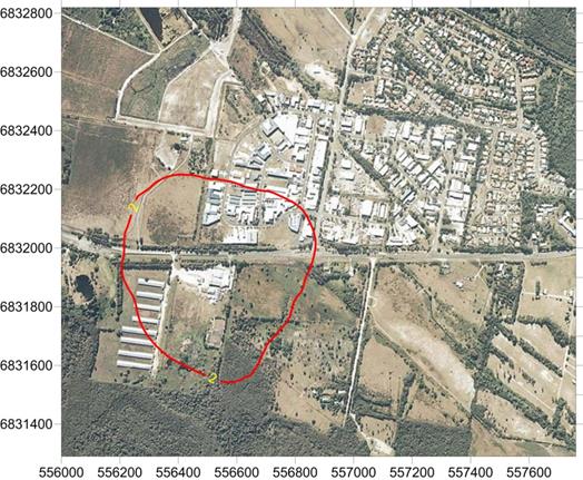
Figure E8.10: Predicted 2 Odour
Unit Contour for Poultry Processing Plant
2. Sensitive
land uses (e.g. child care facilities) are not to be located within the 2 odour
unit contour identified in Figure E8.10.
3. Development
applications within the 2 odour unit contour identified in Figure E8.10 are to
be accompanied by a land use conflict risk assessment in accordance with the
Land Use Conflict Risk Assessment Guide (Department of Primary Industries
2011), and outline odour mitigation strategies that may include (but is not
limited to):
a) Additional vegetation
b) Appropriate land
use siting
c) Site layout and
building orientation
d) Design of natural
air flow and ventilation
e) Use of mechanical
heating/cooling/ventilation.
4. The
extent of the 2 odour unit (ou) contour is based on Figure E8.10, unless it can
be demonstrated through appropriate modelling that the contour has been
reduced, for example through the provision of the vegetation buffer required
along the western boundary, or as a result of odour reduction at the source.
5. Where
it can be demonstrated that the Poultry Processing Plant has been closed and
will not be re-opened and or redeveloped for a similar offensive use utilising
existing use or existing consent rights, the above requirements may not apply.
Details to be submitted with the development application.
Note: Technical study Odour and
Air Quality Constraints prepared by PAEHolmes (20 December 2010) is relevant to
this section and includes recommendations in relation to the dense vegetation
buffer.
E8.10.8.6 Contamination
Objective
1. Ensure
the site is suitable for development in terms of past land uses
2. Any
contaminated land is appropriately remediated.
Performance
Criteria
There are no
performance criteria.
Prescriptive
Measures
1. Development
applications are to address the matters for consideration under Clause 7 of
SEPP 55 Remediation of Contaminated Lands.
2. Where
sites are found to be contaminated, details to be provided to Council by a
suitably qualified professional demonstrating how the site will be remediated
having regards to the proposed use.
Note:
Preliminary Contaminated Land Assessment as Part of a State Significant Site
Study at West Byron Urban Release Area, Byron Bay NSW (EAL, 14 December 2010)
is relevant to this section.
E8.10.8.7 Mosquitoes
Objectives
1. Minimise mosquito hazard to residents.
2. To
remove the need for coordinated management of mosquitoes from Council or other
public bodies in the medium to long term post development.
Performance
Criteria
There are no
performance criteria.
Prescriptive
Measures
1. Subdivision
development to incorporate design measures to limit the habitat for mosquitoes
within the Urban Release Area. Such measures to be incorporated into the design
of development to include (but are not limited to).
a) Stormwater ponds
and artificial wetlands to be located in open areas to enable wind action to
create surface waves that will disrupt mosquito breeding and reduce habitat
refuges for immature mosquitoes.
b) Stormwater swales
to be designed to ensure ponding or standing water does not occur after
rainfall events.
c) Asset Protection
Zones for Bushfire Protection Purposes around residential development to be
suitable designed and sited to reduce habitat for mosquitoes, and harbourage
sites which can act as “stepping stones” that facilitate the
movement of mosquitoes from denser vegetated areas into residential
neighbourhoods.
2. Residential
development to incorporate measures to minimise mosquito impacts, to include
(but are not limited to):
a) Cross flow
ventilation for dwellings;
b) Fitting of insect
screens to dwelling openings including door and windows;
c) Appropriate plant
selection and management of garden vegetation to reduce habitat opportunities
for mosquitoes;
d) Location, design
and management of any individual stormwater treatment systems;
e) Leaf guard on
roof guttering to reduce potential for water to pond in gutters; and
f) The inlet
and outlet (overflow) of rainwater tanks to be effectively screened with
stainless steel or other durable materials to prevent entry to the tank by
mosquitoes. Inlet filters must be readily removable for cleaning.
Note: The Mosquito Risk
Assessment: West Byron Bay NSW (Sydney West Area Health Service, December 2010)
is relevant to this section.
E8.10.8.8 Buffer
to Ewingsdale Road
Objectives
1. To
ensure the development is appropriately
screened from Ewingsdale Road with landscaping.
2. To
provide suitable buffers and amelioration measures for vehicle noise which may
impact on future residents.
Performance
Criteria
Noise attenuation measures along Ewingsdale Road to comply
with the RMS Noise Mitigation Guideline and the Noise Wall Design Guideline,
and are to be incorporated into the subdivisions design, layout and built form
and not passed onto future residents to complete with the design and
construction of dwelling houses.
Prescriptive
Measures
1. A
landscaped buffer including both physical barriers and earth mounds adjacent to
Ewingsdale Road to be incorporated into the subdivision design generally in
accordance with Figure E8.11 for the full length of the West Byron Site zoned
IN2, R2 and R3, subject to all required road, drainage, cycleway, services and
landscaping being able to be located within the road reserve.
2. The
final height and design of the barrier to be supported by an acoustic noise
assessment report prepared in accordance with the NSW Road Noise Policy 2011
demonstrating that future residential dwellings will not be adversely affected
by traffic noise on Ewingsdale Road.
3. The
buffer to be landscaped with native trees and vegetation to conceal the mounds
and barriers, and to provide a general visual screen to the development in West
Byron. A concept landscape plan to be submitted with the development
application in accordance with B9 of DCP 2014.
4. The
buffer can be erected in stages. Details to be submitted with the Development
Application as to any staging arrangements.
Figure E8.11: Landscape Buffer and Acoustic
Barrier to Ewingsdale Road
E8.10.9 Aboriginal
Cultural Heritage
Objectives
1. Traditional
Owners are recognised and respectfully
consulted to identify ways to protect culture and features of Indigenous
cultural significance.
2. Culturally
significant features are to be protected
and incorporated in accordance with the recommendations and findings of such
consultation.
3. Opportunities
for Traditional Owners to look after country both physically and spiritually
will be encouraged.
Performance
Criteria
There are no
performance criteria.
Prescriptive
Measures
1. An
Aboriginal Cultural Heritage Assessment to be carried out by a suitably
qualified professional for the West Byron Site with the Stage 1 Development
Application. The assessment to be carried out in accordance with the relevant
Office of Environment and Heritage (OEH) Guidelines for Aboriginal cultural
heritage matters.
2. Any
sites, items, objects, relics or places of significance that are located within
the development site are to be appropriately identified and management measures
for their ongoing protection are to be recommended as required under the OEH
Guidelines.
3. The
assessment is to demonstrate consultation with the Byron Bay Bundjalung People,
and other Key Stakeholders pursuant to Clause 80C of the NPW Regulation 2009,
in accordance with the OEH Aboriginal Cultural Heritage Consultation
Requirements for Proponents 2010.
Note: The provisions of the
National Parks and Wildlife Act 1974 apply to protecting Aboriginal objects and
places.
Note: Heritage provisions in
Byron LEP 1988 apply to West Byron.
E8.10.10 Urban
Design of Significant Sites and Higher Densities
The following sections sets out controls for the West
Byron Village Centre Precinct, the Neighbourhood Business Zone, Residential
Zoned Land and the Industrial area.
E8.10.10.1 West
Byron Village Centre Precinct
The heart of West Byron will be centred around the
neighbourhood Business Zone, the adjacent RE1 Zone parkland and surrounding
residential areas. It is important that the village centre is designed in an
integrated manner.
Objectives
1. To
create a village centre precinct area that is integrated with surrounding
development and is pedestrian and cycle friendly.
2. To
provide a functional village centre area that is attractive for residents to
use on a day to day basis for shopping and recreational needs.
Performance Criteria
1. To
provide for village centre precinct with an integrated pedestrian/ cycleway/
road network through shared “mews style” laneways and designated
pedestrian – cycleways to take traffic away from the main spine road.
2. To
design for the car parking needs of retail and commercial operators on the
periphery of the neighbourhood business zone.
3. To
promote different forms of residential and commercial development providing
passive surveillance of parkland, surrounding businesses and the public domain.
4. To
provide planning principles for the West Byron Village Centre Precinct based on
Figure E8.12.
Figure E8.12: Planning Principles
for the West Byron Village Centre Precinct
Planning Principles for the West Byron Village Centre
Precinct
1. Mews
Style Laneways - Opportunities exist for “Mews style
development” in this area providing narrow streets that
balance the access and service functions of a lane with active building
frontages which provide for surveillance of surrounding parkland, home office
workshop uses, and a roadway shared by cars, cyclist and pedestrians.
Such lanes where part of the road network will provide access to the public,
however where retained in private property they will be designed to facilitate
the needs of residents of that particular estate. In certain circumstances the
lane may not provide through traffic for vehicles and may be blocked by
bollards, but allow for connectivity for pedestrians and cyclist.
2. Address
the Park - Adjoining
residential and commercial development to the RE1 Zone parkland also to address
the park through design and function. Vegetation of high environmental
value is to be retained.
3. Public
Domain – Plan for an area that provides interest as a meeting place
for residents through public art, activity and function.
Prescriptive Measures
An initial development application is to be submitted for
this location at the subdivision stage demonstrating how the planning
principles in Figure E8.12 will be generally achieved. This includes
formalising the layout for roads, lanes and cycleways, details on embellishment
of the RE1 Zone parkland including tree and weed removal and retention of
existing native vegetation, identification of master lots for medium density
housing forms, and conceptual designs for commercial and residential
development in this location. Where appropriate Council will consider staged
development application where the final built form is known. Subsequent
development applications for residential and commercial development are also to
address the Planning Principles for the West Byron Village Centre
Precinct.
E8.10.10.2 Neighbourhood
Business Area
Objectives
1. To
create a village centre for local residents that provides general shopping
needs in the B1 Neighborhood Business Zone
2. To
provide a pedestrian and cycle friendly neighbourhood business centre.
3. To
enable creative solutions for car parking.
Performance Criteria
1. Business,
commercial and retail development within the B1 Zone must be designed to
promote and encourage safe, convenient pedestrian and cycle access to and from
the development itself and the surrounding precinct. The neighbourhood
business area is the key hub for the locality's pedestrian and cycle network.
Development must be designed to integrate well with this pedestrian and cycle
network and to contribute to the aesthetics, landscape design and usage of
adjoining streets.
2. The
design of development must be compatible with the diversity and
multi-functional character of its locality.
3. A
Main Street frontage is to be provided along the designated collector road so
as to achieve an active street frontage to animate the street Apart
from the collector road, the design should utilise shared streets to
accommodate pedestrians, cycle lanes and limited on-street parking.
4. Shops
and commercial premises to be designed to
promote visual interest, to maximise shopfront window access, and to minimise
blank walls along street frontages.
5. Development
on the spine road corner to address and wrap around the corner splay to create
visual interest.
6. Development
to address the adjacent RE1 Land as indicated in Figure E8.12.
Prescriptive Measures
In addition to the relevant measures contained within DCP
2014, the following specific controls apply:
1. Development
at the ground level to incorporate display windows which consume a minimum of
50% of the street frontage and incorporate awnings over the footpath for
weather protection. Awnings and structures on the road reserve must be setback
a minimum distance of 1000mm from the kerb alignment. The underside of any
awning or verandah is to be not less than 3200mm above the footpath.
2. Development
on the corner splay to:
a) addresses neighbouring
and surrounding development, with its turning of the corner.
b) Creating a splayed or
recessed treatment of the corner in a way that gives form to the corner and
provides more circulation space for pedestrians.
c) Stepping up at the
corner and creating a perceived height greater than neighbouring buildings
through the incorporation of distinctive architectural features such as stepped
parapet, turret or tower, clocks, flag pole, roof elements, vertical green
walls or the like.
d) Both street
frontages to provide active street elevations through windows, awnings and shop
entrances as required. Blank walls will not be accepted.
e) Public art as
required under Chapter D8 to be installed in this corner locale to provide a
focal point for the Neighbourhood Centre Zone or alternatively in the adjacent
RE1 Zone.
3. Setbacks
in the B1 Zone are as follows:
a) Generally to the
boundary as per the Building Code of Australia.
b) Upper levels are
to incorporate steps in the elevation to provide articulation in the street
facade. This can be achieved by utilising verandahs, loggias and balconies
which can also be utilised for private open space purposes for shop top
housing, or staff or office breakout space. Other architectural features which
may be appropriate include recessed windows, vertical fins and other climate
appropriate measures consistent with the bulk and scale of the area.
c) Where it is
proposed to extend upper level verandas over the footpath awning for commercial
purposes, appropriate leasing arrangements to be entered into with Council.
Where the verandah is to be used as part of a restaurant the area to be
included in the car parking calculations. The verandah is not to be
enclosed.
d) Where buildings
adjoin residential development or the adjacent land zoned RE1, a setback of 3
metres to apply.
4. The
built form to utilise contemporary materials, design elements and energy
efficient architecture to facilitate natural lighting, cooling from air flow,
and appropriate roof orientation for solar hot water and photovoltaic
electricity generation. The treatment of facades, corner elements and
blank elevation with green walls or vertical gardens to be considered as a
means of providing visual interest and aesthetics to the building, regulating
the building temperature, improving air quality, and reducing the developments
carbon footprint.
5. The
footpath through the B1 Zone to adopt a single uniform pattern (eg wave pattern
per Chapter D4 of DCP 2014). The footpath is to be of a suitable width to
accommodate bike parking, pedestrian traffic, footpath dining with allowances
for street trees and other general landscaping. Street trees to
incorporate water sensitive urban design. (See Appendix C for details).
Figure E8.13: Example of a green wall
6. In
addition to the requirements of Chapter B4 and B5 of DCP 2014, bike parking to
be provided at a general rate of 1 space per 25m2 of gross floor
area with customer parking provided in the public domain to enable casual
surveillance from the business premises.
7. Car
parking to be provided:
a) In accordance
with Chapter B4 of DCP 2014.
b) To facilitate the
free flow of traffic through the business area, and to provide for larger
footpath areas for activations and landscaping, consideration to be given to
the construction of a general shared car parking of 50 spaces or more for
business and commercial needs. Limited on street parking to be provided other
than accessible parking and suitably located loading zones. Should a general
shared car park be provided, the park can be dedicated to Council (with council
agreement) after construction and the appropriate maintenance period. Car
parking in such a shared arrangement will be allocated to the development based
on the rates in Chapter B4 of DCP 2014 at the time of approval. Any additional
development not catered for in this approval will need to provide parking
onsite.
c) Resident parking
and loading bays to be provided onsite at the rear of the premises. Loading
bays to be designed to facilitate the storage and collection of waste and the
loading and unloading of goods.
8. Where
vehicular access is proposed across pedestrian areas or footpaths, the design
must give priority to pedestrian amenity, accessibility and safety whilst
ensuring that contemporary vehicle and traffic safety criteria are achieved.
9. The
public domain to:
a) Incorporate
the principles of Crime Prevention Through Environmental Design (CPTED) and Safer
by Design (NSW Police) into all development within the neighbourhood
centres.
b) Provide
a high quality landscape design including a co-ordinated package of street
furniture and lighting that enhances the character of the neighbourhood
centres.
c) Street
trees and other landscaping to be provided through the neighbourhood centre to
provide shade, manage stormwater by WSUD and to assist with managing the micro
climate. On average one tree to be provided every 15 metres and can be sited in
roadside blisters to delineate parking and loading zones.
d) Site
servicing and loading facilities, waste storage and other infrastructure is to
be designed to minimise visual impact on the public domain and impacts on
neighbours.
e) Bus
stops to be provide on both sides of the road within or on the immediate
periphery of the Neighbourhood Centre Zone.
f) Commercial
development adjacent to the RE1 Zone to address the Park by shops, businesses
and cafes or other food and drink premises opening onto the reserve area at the
ground level through outdoor dining areas, display areas and large doors and
windows fronting the park. Landscaping along the frontage to provide a shady
environment, with a footpath and cycleway providing access along the boundary
of the two zones.
Figure
E8.14: Example of Cafe opening onto a park area
g) Footpath
dining permissible in accordance with Chapter D4 of Byron DCP 2014
h) Public
Art to be provided in accordance with Chapter D8 of Byron DCP 2014.
10. Plumbing of
development within the Neighbourhood Zone to consider the potential need for
liquid trade waste treatment systems as per D4.2.6 of Byron DCP 2014.
11. Any shop top housing to be provided in accordance
with Chapter D1 of Byron DCP 2014.
E8.10.10.3 Residential Areas
The following controls apply to various forms of residential
development including dwelling houses,
attached dwellings, dual occupancy, multi-dwelling housing and integrated housing development under 83 of
Byron LEP 1988.
Objectives
1. Ensure
development is at a bulk and scale that reflects the residential character of
Byron Shire.
2. Provide
housing with a suitable degree of amenity to cater for the needs of the
residents.
3. To
facilitate diverse housing outcomes in the R2 Zone and R3 Zone,
4. To
encourage sustainable housing through energy and water efficient design
measures.
Performance Criteria and Prescriptive Measures
see Table E8.3
Note: Photo plates
and diagrams following Table E8.3 are provided as examples of some of the
planning controls to assist in explaining those provisions.
Table E8.3 - Key Controls for Dwelling
Houses, Dual Occupancy (attached and detached), multi-dwelling housing and
integrated development permissible under Clause 83 of Byron LEP 1988 in the R2
and R3 Zones
|
·
Performance Criteria
|
·
Prescriptive Measures – R2 Zone
|
·
Prescriptive Measures – R3 Zone
|
|
1. Location of
Development
|
|
To ensure residential land has been suitably designed
and orientated to accommodate residential development comprising more than 1
dwelling.
|
For Dual occupancy, multi dwelling
housing, residential flat buildings and integrated
housing, the land
has been identified at the subdivision stage for this type of development.
|
Not
applicable in the R3 Zone
|
|
2. Minimum
Frontage
|
|
Properties are to be of a suitable width to ensure
garages, car port and car parking do not dominate the front facade.
Safe vehicle access and egress is provided to the
development.
|
a. Garages, car ports and car parking areas consume no more than 40%
of the main street frontage width.
b. Where development is located on splayed and battleaxe handle
arrangements the development to demonstrate that vehicles can enter and leave
in a forward direction. Driveways to comply with AS 2890 and Chapter B3 of
Byron DCP 2014. For three or more dwellings passing bays with two way access/
egress will be required at the street frontage.
c. For
development comprising three or more dwellings,
corner lots with a shared access on the narrower secondary street frontage is
preferable to individual access from the main frontage.
|
See R2
Controls
|
|
3. Setbacks
- Streets
- Corner Lots
- Lanes
|
|
Residential development to be designed with suitable
setbacks to the street:
a. To delineate a
clear transition between the public and private domain;
b. as an extension
to residents landscaped open space area; and
c. to ensure safe
vehicle access into and out of the property.
|
a. Front setback to be 4.5 metres from front boundary to building
b. Garage line to be 5.5.metres from front boundary
c. Corner lots – 3 metres setback from secondary street
boundary to building.
d. Rear Lanes – 0.9 metres to the dwelling, 2.5 metres to any
garage or car port
|
Same as R2
Zone except front setback is 3.5 metres from front boundary to building
|
|
4. Side and
rear setback
|
|
Side and
rear setbacks:
a. To provide
spatial separation between dwellings in relation to privacy and amenity.
b. To enable
climate control devices over windows and doors to encroach into the setback.
c. To
allow zero line setbacks for certain types of residential development
|
In addition to any setback requirements under the Building Code of
Australia the following minimums will apply
a. For
single storey dwellings - 0.9 metres setback.
b. For
two storey buildings - 2.5 metres setback for the second storey or any part
of the building higher than 4.5 metres.
c. Eaves and gutters, canopies and other
climate control devices over windows and doors permitted to encroach into the
setback.
d. Reduced
setbacks down to zero line are permitted for attached dual occupancy, multi
dwelling housing and integrated development for shared boundaries between the
proposed dwellings.
|
In addition to any setback requirements under the Building Code of
Australia the following minimums will apply
a. For
single storey dwellings - 0.9 metres setback.
b. For
two storey buildings – 1.5 metres setback for the second storey or any
part of the building higher than 4.5 metres.
c. Eaves
and gutters, canopies and other climate control devices over windows and
doors permitted to encroach into the setback.
d. Reduced
setbacks down to zero line are permitted for attached dual occupancy, multi
dwelling housing and integrated development for shared boundaries between the
proposed dwellings.
|
|
5. Building
height
|
|
To ensure development maintains the general low rise - two storey
nature of residential development in Byron Shire
|
a. 9
metres as per Byron LEP 1988
b. Shadow
plans required for any two storey proposal for mid winter at 9am, 12 midday
and 3pm. Such plans to be provided in plan view as a minimum.
c. Any
third storey elements to be integrated into the roof/ attic space or as a
mezzanine level.
|
Same for
R2 Zone
|
|
6. Upper level
development
|
|
Upper level development:
a. To maintain neighbourhood privacy and
amenity.
b. To limit the potential for overlooking into neighbouring
properties from upper levels through design.
c. To minimize overshadowing of neighbouring properties private open
space areas during the winter months
|
a. Upper
level development to be primarily utilised for bedrooms, bathrooms and study
areas.
b. Main
living and kitchen areas to be situated on the ground floor, except where
orientated to overlook public open space/ land zoned environmental
protection, or where required for solar access provided it can be
demonstrated that there is no direct overlooking into adjacent properties
with spatial separation of 6 metres or more between dwellings.
c. Upper
level windows to be sited so that there is no direct looking into upper level
windows of adjoining dwellings. Where this cant be achieved windows are sited
a minimum 1.7 metres above the upper level floor.
d. Any
upper level deck/ to be orientated to ensure no direct overlooking of
adjoining properties.
e. Where required screening with lattice, battens, fixed louvres to
be provided over upper level windows and decks/ balconies. The screening to
have a maximum of 25% opening with dimension no greater than 50mm.
f. No
upper levels to overshadow the principle private open space of neighbouring
dwellings for more than 3 hours between 9am and 3pm at the
winter solstice (21 June).
Note: In certain
circumstances applicants may submit 3D or perspective shadow plans as well as
in plan view to demonstrate the level of overshadowing on neighbouring
dwellings
|
Same for R2 Zone
|
|
7. Upper wall
length
|
|
a. To ensure
development is at a bulk and scale that is not overbearing for
adjoining dwellings.
b. To ensure buildings are not dominated by
long straight elevations.
|
a. Maximum
allowable continuous upper storey wall length is 12 metres.
b. For
facades longer than 12 metres, the upper wall must be broken up with a step
of 600mm deep for a length of at least 1.8m. The roof line and eaves must
follow the line of the step. The stepped area must remain within the building
envelope as defined by minimum setbacks.
|
Same for R2
|
|
8. Building
design and material in relation to streetscape
|
|
a. To
provide articulated building designs that present
well to the street.
b. To
provide for casual surveillance of the street.
c. To
reflect the coastal environment of Byron Bay and traditional coastal
architecture through the use of lightweight materials
|
a. Front
façades to be articulated with one or more of the following:
i. an entry
feature or portico;
ii. a
balcony, deck, patio, pergola, terrace or verandah;
iii. an
upper level overhang or cantilever;
iv. a
window box treatment;
v. a
bay window or similar feature;
vi. an
awning or other feature over a window; and
vii. a
sun shading feature.
b. The
articulated feature or element may intrude into the front setback by up to 1
metre (averaged) provided the feature does not exceed 25% of the articulation
zone. (eg a property with a frontage width of 12 metres, can have an
articulate feature 3 metres wide and intrude into the setback by 1 metre, or
the intrusion can be averaged and intrude for example by 0.5 metres but for a
width of 6 metres)
c. Buildings
to utilise a mix of materials and colours to provide interest and variation
to the streetscape and to delineate a change in storeys, to embellish an
architectural feature or to reflect different elements of the building.
d. Dwellings
to incorporate windows and doors within the frontage to enable casual
surveillance of the public domain and the street.
e. Building
materials and designs which are heavily urbanised through the use of brick,
concrete and tiles or attempt to replicate tuscan, tudor or federation styles
will not be supported.
|
Same for R2
|
|
9. Site
coverage (includes garages, car ports, decks, balconies and verandas) and
size of dwellings to lot size
|
|
a. To ensure site coverage for residential development is consistent
with the residential character of the area.
b. To
ensure the size of residential dwellings are
proportional to the size of the land.
c. To
provide for a diversity of dwelling sizes across West
Byron.
|
a. Ground
Floor Level – maximum 60%
b. Upper
Level – maximum 35%
c. The
maximum number of bedrooms in a dwelling to be sized to the Site (or allotment) area as follows:
|
a. Ground
Floor Level – maximum 70%
b. Upper
Level – maximum 40%
c. The
maximum number of bedrooms in a dwellings to be sized to the Site (or allotment) area as follows
|
|
Number of Bedrooms
|
Site (or allotment) area required per
dwelling
|
Number of Bedrooms
|
Site (or allotment) area required per
dwelling
|
|
1-2 Bedrooms
|
>150m2
|
1-2 Bedrooms
|
>150m2
|
|
3 Bedrooms
|
>250m2
|
3 Bedrooms
|
>200m2
|
|
4
Bedrooms
|
> 300m2
|
4
Bedrooms
|
> 250m2
|
|
10. Private
open space (POS) and Landscaped area
|
|
a. To
provide an even distribution of open space, landscaping and building
footprint, to facilitate a balance of indoor and outdoor recreation within a
garden setting.
b. To provide an attractive landscaped area to
facilitate the planting of trees, shrubs, lawn and vegetable gardens.
|
Landscape
area to comprise:
a. Minimum
30% of the area of an allotment to be landscaping.
b. Minimum 50% of the landscaped area must consist of deep soil areas with minimum dimensions of 5
metres.
Landscape Plan to be submitted with
development application in accordance with E8.10.5.2.
Private
Open Space per dwelling to comprise
a. Minimum 24 m2 at ground level with minimum dimension of
4 metres to be provided for Private Open Space
b. Must be directly accessible from the living area.
c. The principal open space area to receive at least 3 hours of
sunlight between 9am and 3pm at the winter solstice (21 June).
d. Where the private open space area due to orientation of a property
is provided in the front of a property, dwellings to be setback a further
metre from the street boundary to accommodate suitable landscaping (eg lilly
pilly hedge) for privacy.
e. For secondary dwellings a minimum of 15 m2 with minimum
dimensions of 2.5 metres to be provided in a private courtyard setting.
The secondary dwelling not to compromise the overall landscaping and private
open space required for the principal dwelling.
f. Private Open Space at ground level is a component of the overall
landscaped area.
|
Landscape
area to comprise:
a. Minimum
25% of the area of an allotment to be landscaping.
b. Minimum 50% of the landscaped
area must consist of deep soil areas
with minimum dimensions of 4 metres.
Landscape Plan to be submitted with
development application in accordance with E8.10.5.2
Private
Open Space to comprise
Same as R2 Zone except a minimum 20 m2 at ground level with
minimum dimension of 4 metres to be provided for Private Open Space.
|
|
11. Car
Parking and Vehicle Access
|
|
|
Development
to ensure that
a. Vehicle
access and parking is accommodated on site with an appropriate number of car
parking spaces for the dwelling house and the normal activities of the
household.
b. Safe
vehicle access and egress is provided.
c. To provide incentives to reduce the dominance of the
motor vehicle.
|
Car parking for residential development to comprise the following:
a. 1
– 2 bedroom dwellings - 1 Space
b. 3
or more bedroom dwelling – 2 spaces
c. Visitor Parking required for multi dwelling housing/ integrated housing comprising 4 or more dwellings at a rate of 1 space/ 4 dwellings
d. As a minimum at least one vehicle space/ dwelling to be covered
either in a garage or car port.
e. Where two spaces are required these can be provided in a tandem
arrangement provided the tandem space complies with the minimum setback
provisions.
f. Access, driveways, maneuvering and turning areas, and structures
adjacent to driveways to comply with Chapter B3 and B4 of Byron DCP 2014.
g. Driveways where crossing swales to be designed in accordance with
Appendix E.
h. Where 3 or more dwellings are proposed on a property, mews style
development and or common/ central car parking areas are permissible to
reduce the amount of land required for the motor vehicle.
i. Secondary dwellings are not to be sited to so as to remove car
parking servicing the principle dwelling.
j. To encourage car pooling and to reduce car dependency for three or
more dwellings, a reduction in car parking of 33% will be agreed to for
residential development in a community title or strata title arrangement, if
a vehicle is provided as part of the common or neighbourhood property and for
the use of the residents. The following will be required:
i. 3
- 8 dwellings – 1 community vehicle
ii. 8
-12 dwellings – 2 community vehicles
iii. More
than 12 – 3 community vehicles
Details to be provided with the application on the type of
vehicle, where it will be garaged on the property under cover, and how it
will be maintained, managed, shared and replaced by the residential
community. The car(s) is to be no older than 5 years at the time of the issue
of the occupation certificate and be able to seat four adults.
|
Same for R2
|
|
12. Energy
Conservation
|
|
a. To
reduce total energy use in residential buildings by reducing heat loss and
energy consumption for heating and cooling.
b. To
utilise design features to passively control the climate within residential
dwellings
|
a. A clothes drying area to be provided in an
outdoor area that receives a minimum of 2 hours sunlight midwinter. The area
to accommodate a minimum of 25 metres of line.
b. Dwellings to be designed to facilitate cross
ventilation of air to assist with cooling with operable windows on opposite
sides of the house.
c. Dwellings to be designed with a roof
orientated between the north east to the north west to facilitate the
installation of photovoltaic cells for electricity generation or solar hot
water systems with a minimum area of 15m2.
d. The western elevation of dwellings to incorporate
a range of climate control features including canopy and shading devices over
windows and doors, pergolas and verandahs, and eaves with a minimum width of
450mm for increased shading and weather protection.
|
Same for R2
|
|
13. Fencing
|
|
To enable fencing to be erected for privacy, territorial
reinforcement between the public domain and private property and security
|
Any fencing
to comply with Chapter D1 of Byron DCP 2014.
|
Same as R2
|
|
14. Adaptable
Housing
|
|
Development
ensures that housing is able to be readily adapted to a resident's changing
life-cycle needs.
|
To comply
with Chapter B13 of Byron DCP 2014.
|
Same as R2
|
|
15.
Subdivision
|
|
To facilitate separate
ownership of dwellings in a co-ordinated manner
|
Where land is
to be further subdivided as part of the proposal details to be included with
the application including:
a. a
plan of subdivision;
b. type
of titling proposed (eg Torrens, Strata or Community title) and
c. Management/
Neighbourhood Plan (if required).
|
Same as R2
|
|
16. Waste
Disposal
|
|
|
a. Waste to be adequately
stored and separated on site prior to being collected by the waste
contractor.
b. Bin storage area is adequately screened from the
public domain.
c. Common or shared storage areas permissible for
medium density housing forms
|
In addition to the measures contained in Chapter B8 of DCP 2014
the following to apply:
a. Sufficient storage area is available behind the front building line for the
location of garbage, recycling and green bins (The three bin system), and the
area is not to be visible from the street.
b. For
three or more dwellings within a strata or community
title arrangement, shared waste disposal facilities can be provided on the
common or neighbourhood property.
c. Details
to be provided as to how the three bin system can be
accommodated onsite.
|
Same as R2
|
|
17. Stormwater
Management And Water Consumption
|
|
a. To
minimise water consumption from potable water
supplies
b. To
assist with the management of stormwater
|
a. In
addition to any water storage requirements for BASIX a further 3000 litres of
storage capacity per dwelling to be provided for stormwater management.
b. Rainwater
tanks to be connected to the stormwater down pipes from the roof of the
dwelling and be plumbed back into the house as a minimum for the flushing of
toilet(s) and for external gardening purposes.
c. Overflow
from the water tank and house to be connected to the street stormwater system
generally in accordance with the drawing shown at Appendix F - Typical
Stormwater House Connection
|
|
|
18.
Co-operative Housing
Explanatory
Note: This is a type of shared housing in which
people come together to live in an intentional community. The housing from
the outside may look similar to other residential development in the
neighbourhood, but the co-operative can arrange for the sharing of resources,
land and other components of the development to provide for a more inclusive
type of housing between residents, to have a smaller environmental footprint,
and to make housing more affordable. Co-operative housing could be suitable
for extended family groups, couples and singles, retirees, students,
families, a group of friends, or a community organisation (eg a charity
providing housing), provided the residents have the same goals and objectives
to live in an intentional housing community. Making housing more affordable
is one benefit of Co-operative Housing, but this is partly achieved through a
restriction on further subdivision. Potential applicants who wish to
pursue this type of residential housing are encouraged to research the topic
thoroughly before making application to establish rules of ownership, voting
rights, dispute resolution, cost sharing, collective use of resources and
exit/ entrance strategies for people who want to move out/ buy in. Other
issues for consideration and research include financial and legal
implications for the residents living and investing in such housing.
The following controls apply:
|
|
a. To enable intentional housing communities to
develop residential land in a co-operative manner.
b. To enable the efficient and shared uses
of resources between households on a single property.
|
a. Should
a cooperative housing project be proposed on a lot
consisting of three or more dwellings the above residential controls will
generally still apply.
b. If
the property is in the R2 Zone, then the lot will need to be identified for
either multi dwelling housing or integrated
housing at the
subdivision stage.
c. Variation
will be given to the following in terms of achieving a shared outcome:
i. private open space per dwelling down to 15m2
provided landscaping minimums are satisfied;
ii. Garbage
bin and storage areas;
iii. Clothes
drying areas;
iv. Common
water tanks;
v. Common
roof area for solar collectors;
vi. Common
car parking area for residents and visitors – covered or uncovered;
vii. A
car parking reduction of 33% will be given, as per Strata and Community Title
Development, where a shared car is provided; (See Control 10)
viii. Common
vehicle access point; and
ix. Front
setbacks down to 3 metres.
d. Such
variations are provided on the basis that the land won’t be further
subdivided under Torrens, Strata or Community title and a condition of
consent will apply.
e. Other shared infrastructure may be provided including a vegetable
garden, storage shed, bicycles, laundry area, children’s play area,
barbeque and outdoor setting.
f. Details
to be submitted with the development application on measures for the
management of the land, ownership model, rights and responsibilities, dispute
resolution, collective use of resources and cost sharing.
Note: Where a co-operative
housing project seeks consent at a latter stage to be further subdivided,
applicants will need to demonstrate how the development complies with the
normal provisions applicable to housing.
|
Same as R2 Zone except the land does
not need to be identified for multi dwelling housing or integrated housing at the subdivision stage.
|
|
19. Secondary
Dwellings
Secondary
Dwellings provide opportunities for applicants to create a range of housing
types that will suit family, lifestyle and financial needs. Secondary
dwellings can be attached or detached from the main house. They could also be
attached with a dual key
arrangement to facilitate housing for a growing family or to provide
accommodation for an older family member, enabling residents of both
dwellings to live together. Alternatively the secondary dwelling could be
locked of from the main house, and tenanted to a third party as a stand alone
dwelling.
|
|
To provide for small affordable housing opportunities
|
a. Other than planning controls 1, 11, 14, 15 and 18,
Secondary dwellings to comply with the above controls, and the requirements
of SEPP Affordable Rental Housing 2009.
b. Decks and verandahs for secondary dwellings
not to exceed 20m2 in area.
c. Dual key
arrangements are permissible for secondary
dwellings.
|
Same as
R2
|
|
20. Seniors
Housing or housing for people with a disability
Opportunities
exist across the residential areas in both the R2 and R3 Zones of West Byron
to provide housing for Seniors and people with a disability. No specific
prescriptive measures are referenced in this Chapter and applicants are
directed to the controls under SEPP (Housing for Seniors or
People with a Disability) 2004.
|
E8.10.10.4
Industrial Area
Approximately 7.5 hectares of the West Byron Site is zoned
IN2 Light Industrial. The IN2 Zoned land sits opposite the Byron Bay Industrial
Estate to the north and residential land to the east. For specific development
guidelines for construction of factory units in this area, applicants are
directed to Chapter D5 Industrial Development within DCP 2014. The following
controls though apply to the subdivision design and development of the land
Zoned IN2.
Objectives
1. To
ensure the subdivision layout and design facilitates a wide range of light
industrial and warehouse uses and employment opportunities.
2. To
provide industrial land that is of a size, shape and area to cater for a range
of light industrial and other permissible uses that are suitably serviced with
necessary infrastructure.
3. To
ensure development presents to the main spine road and is sympathetic to
surrounding residential area.
Performance Criteria
1. Access
roads are designed to facilitate the movement of large vehicles.
2. Lot
sizes meet minimum requirements to facilitate safe manoeuvring onsite for
delivery trucks.
3. Lots
are serviced with all necessary infrastructure.
4. Suitable
setbacks, built form and landscaping are provided within the design of
industrial development to make a positive contribution to the streetscape
including Ewingsdale Road.
5. Development
be designed and sited to minimise land use conflicts with surrounding
residential development.
Prescriptive Measures
1. A
single DA be submitted to Council for the initial subdivision of the IN2 Zoned
Land presenting an integrated proposal for the road and allotment layout, based
on potential industries seeking industrial land in Byron Bay. Details to be
provided with the development application.
2. Access
roads through the IN2 Zoned land to be of a suitable width to accommodate
articulated vehicles plus on street parking.
3. A
minimum of twenty five percent (25%) of lots are to be designed with an
appropriate area and width to enable Articulated Vehicles to enter and leave in
a forward direction.
4. In
addition to normal infrastructure required by Council, lots to be provided with
telecommunication infrastructure to facilitate connection to the National
Broadband Network.
5. Development
fronting the main spine road to include the following design features
a) Industrial
development fronting the main spine road to be designed to address the street
with a mixture of facade treatments, landscaping and pedestrian access. Two
storey frontages are to be appropriately articulated through the use of
different building materials including glass, masonry steel and timber elements
and changes in setbacks. Large blank walls facing the main spine road will not
be supported and screening of poorly designed buildings with vegetation is not
an acceptable streetscape treatment.
b) A minimum setback
of 5 metres to apply to the Spine Road which is to be suitably landscaped in
accordance with B9 of DCP 2014. For corner lots on the spine road this can be
reduced to 3 metres.
c) Private Access
from the Spine Road to be generally limited and consideration to be given to
the creation of large lots along this frontage with shared access points, rear
lane/ secondary street access, or a slip lane combined with car parking and
landscaping to the Spine Road.
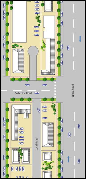
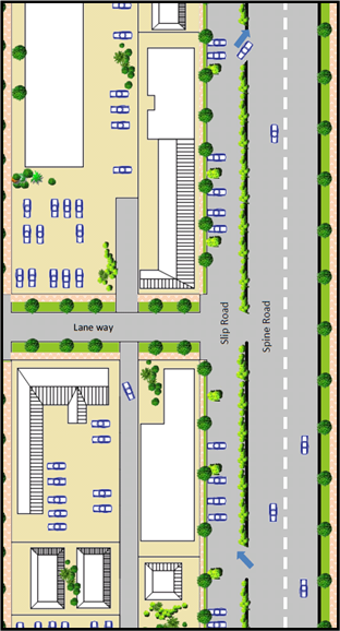
Figure E8.18: Examples of access
from the Spine Road fronting the IN2 Zone.
6. Industrial
development adjacent to Ewingsdale Road to be setback a minimum of 10 metres
from this boundary and appropriately screened with native trees and vegetation.
This setback can be varied down to 3 metres where other alternatives are
utilised in the facades of buildings along this boundary including use of green
walls, mix of building materials including glass wall and upper level windows,
and articulation or variation in building alignment.
7. A
minimum 10 metre wide vegetated buffer to be provided between the IN2 and R2
Zones unless separated by a public road. The buffer to be suitably
landscaped with native species in accordance with Chapter B9 of DCP 2014. A
Landscape plan to be submitted with the development application for
subdivision.
8. Development
within the Industrial Zone to be designed and sited to minimise potential land
use conflicts with surrounding adjoining residential uses. Where required noise
attenuation to be provided within industrial units or on the boundary to ensure
compliance with the relevant EPA guidelines for industrial noise.
9. Any
retail uses to be in accordance with Byron LEP 1988 and Clause 87(4) as
required. Such uses to be subservient to retail uses within the B1 Zone so as
not to undermine the function and hierarchy of this zone. Consideration be
given to the installation of a takeaway food shop and drink premises in a
central location within the IN2 Zone to serve the needs of workers in the
industrial estate. (N.B Restaurants and cafes are prohibited in the IN2 Zone)
10. Large car
parking areas of 20 spaces or more to consider the installation of an electric
vehicle charging station. (Note: Opportunities may exist to partner with
Council and other organisations with the design and installation of such
infrastructure as per the Byron Shire Low Carbon Strategy)
11. All
development to be connected to the dual reticulation water
supply for non potable water. From this supply a minimum of one external tap to
be provided for the watering of landscaping and a minimum of one internal tap
provided for the flushing of toilets with each industrial unit.
12. Development
in the IN2 Zone not covered by the above provisions is to comply with Chapter
D5 of Byron DCP 2014.
Note: For design
specification, please refer to the Northern Rivers Local Government Development
and Design Manual and Chapters B3 and B4 of DCP 2014.
E8.10.11 Development
in the E3 Zone
A small part of the West Byron site has been zoned E3 in the
South west corner and along two drainage lines in the eastern half of the site.
A minimum lot size of 40ha applies to subdivision and it is not envisaged any
additional dwelling entitlements will be created in the E3 Zone.
Development opportunities in the E3 Environmental Management
Zone are restricted by the permitted uses listed in the zoning table under
Byron LEP 1988. Many of these uses are covered in part in other sections of DCP
2014, whereby specific controls apply to developments such as bed and breakfast
establishments, eco-tourist facilities, dual occupancies, dwelling houses, farm
stay accommodation and camping grounds. Accordingly no specific controls are
drafted for the E3 Zone and applicants are directed to other relevant chapters
within the DCP 2014.
E8.10.12 Tourist
and Visitor Accommodation in the Residential R2 and R3 Zones and the B1 Zone
Bed and Breakfast Establishments
are permissible with consent in the R2 and R3 Zone and Serviced Apartments are
permissible with consent in the R3 Zones only, whilst only Hotel and Motel
Accommodation is permitted in the B1 Zone. Applicants are directed to the
planning controls under Byron DCP 2014 including Chapter D3 Tourist
Accommodation.
Note: Other forms of
tourist and visitor accommodation, including holiday letting of a dwelling or a
dwelling house (Short term rental accommodation) are prohibited in the
R2, R3 and B1 Zones.
Staff Reports - Sustainable Environment and Economy 8.4 - Attachment 8

Byron Shire
Development Control Plan 2014
Chapter B14
Excavation and Fill
This page has been intentionally left blank
Chapter B14 – Excavation and Fill
Contents
B14.1 Introduction. 5
B14.1.1 Purpose
of this Chapter 5
B14.1.2 Aims
of this Chapter 5
B14.1.3 Application
of this Chapter 5
B14.2 Excavation
and Fill in all Zones. 5
Figures
Figure B14.1 – General Excavation and Fill
Requirements. 7
Figure B14.2 – Excavation and Fill for Car Parking. 7
Figure B14.3 – Pool on level land. 8
Figure
B14.4 – Pool on sloping land.. 8
Document History
|
Doc No.
|
Date Amended
|
Details
(e.g. Resolution No.)
|
|
#E2013/83370
|
20 March 2014
|
Res 14-118 –
Public exhibition version
|
|
#E2014/32507
|
|
Draft to 26
June 2014 Extraordinary Meeting - for adoption
|
|
#E2014/42829
|
|
Adopted
Version – Res 14-315
|
|
#E2019/29392
|
April 2019
|
Public
Exhibition version (Res 19-091) 24.2018.65.1
|
|
#E2019/29392
|
July 2019
|
Revision for
adoption at 15 August 2019 planning meeting
|
B14.1 Introduction
B14.1.1 Purpose
of this Chapter
The purpose of this Chapter is to limit and control the
extent of excavation and fill within development projects for aesthetic,
character, engineering and geotechnical reasons, and to promote the appropriate
use of earthworks for thermal
sustainability and insulation.
B14.1.2 Aims
of this Chapter
1. To ensure
that development applications for earthworks
address aesthetics, character, engineering and geotechnical factors.
2. To ensure
that the character, bulk and scale of development remain compatible with the
unique environment that has been created by the area’s natural features
and its historical built character.
3. To control
the extent of earthworks, so that the
bulk, scale and appearance of development remain compatible with the character
and visual amenity of the Shire’s towns, villages, rural areas and
natural landscapes.
4. To promote
the appropriate use of well designed earthworks
to achieve compatible and positive design outcomes in terms of improved
landscapes, streetscapes, thermal sustainability and insulation in buildings
and developments.
5. To prevent
cumulative deterioration in the attractiveness of the Shire’s built
environment as a result of large scale earthworks,
buildings and structures that by themselves may not appear highly significant,
but that collectively and progressively contribute to reduced character and
appeal.
6. To minimise
the need for extensive engineering works required to support and manage large
scale earthworks.
7. To minimise
risks of geotechnical instability, landslip and surface movement associated
with development in the Shire.
B14.1.3 Application
of this Chapter
This Chapter applies to all earthworks
that require development consent on land to which Byron LEP 2014 applies.
B14.2 Excavation
and Fill in all Zones
Objectives
1. To
ensure that towns, villages, commercial, industrial, residential and rural
areas maintain overall compatibility with the Shire’s natural features
and its historical built character.
2. To
control the extent, character, bulk and scale of earthworks so that both individual and
cumulative earthworks over time do not detract from the existing and desired
future character of their immediate locality, and the surrounding area.
3. To
promote the use of earthworks to
create landscapes and streetscapes that make a positive contribution to the
existing and desired future character of their immediate locality and the
surrounding area.
Performance Criteria
1. Development
proposals must demonstrate that proposed earthworks
will be compatible with the low rise, low to medium density form, scale and
desired future character of their locality and immediate surrounds.
Proposals must demonstrate that excavation
and fill will be limited to ensure
that:
a) Adverse visual
impacts, bulk and scale of both the proposed earthworks
and the resultant overall development are minimised;
b) Overshadowing of
adjoining private and public land is avoided;
c) The scale and
character of the resultant landform and buildings will remain compatible with
their surrounds and with the desired future character of the locality;
d) Resultant
drainage characteristics and systems both on the site and in the locality will
be consistent with Chapter B3 Services and with Water
Sensitive Urban Design Principles.
e) The need for
engineering and support works is minimised;
f) Risk
of geotechnical instability and/ or landslip is minimised.
2. Where
earthworks are designed to facilitate
and/ or improve thermal sustainability and insulation in buildings and
developments rather than as structural or landscape elements, development
proposals must demonstrate the particular benefits to be gained from those earthworks.
3. Earthworks must be designed to ensure that the
community /pedestrian scale and character of commercial areas will be retained
and reinforced.
4. Where
filling is proposed to mitigate flooding and stormwater issues, details are to
be submitted with the application demonstrating the fill
will not have a significant adverse impact on the flow
characteristics of flood waters or detrimentally increase the level of flooding
or stormwater on other properties or development.
5. Lots
that are identified as having stability problems either on Council’s GIS
mapping or through the development assessment process (slopes greater than 15
degrees, land that has historically been used for uncontrolled filling, or land
that is constrained by springs or wet areas etc.) are to adequately address
geotechnical constraints through the submission of a detailed geotechnical
report prepared by a suitably qualified professional.
The development application shall
also incorporate preliminary design detail for footings, driveways and storm
water management to demonstrate how the risk is adequately managed. In certain
circumstances the geotechnical constraints will prevent properties from being
developed for infill development and applications will not be approved.
Prescriptive Measures
1. Unless
otherwise stated below, excavation and filling must be limited to a
depth of 1 metre. See Figure B14.1.
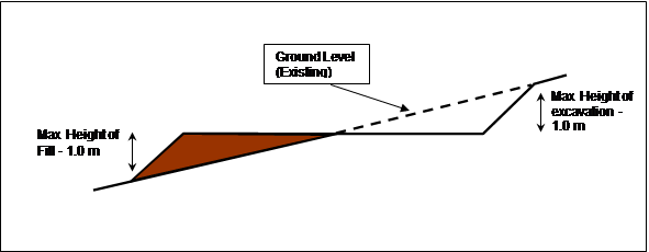

Figure B14.1 – General Excavation
and Fill Requirements
2. The
maximum excavation restriction is not
applicable where the excavation is
incorporated into the dwelling
structure to satisfy minimum car parking requirements up to a maximum height of
2 metres. For details see Figure B14.2.
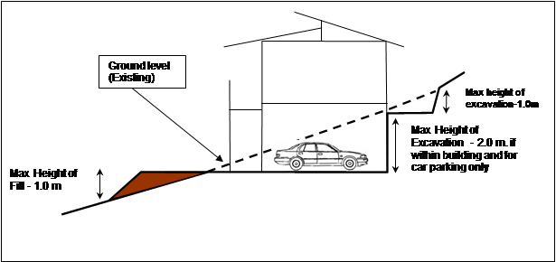

Figure B14.2 – Excavation
and Fill for Car Parking
3. Batters
and cuttings to be landscaped with appropriate native shrubs and ground covers
to prevent erosion and not left exposed to the elements. Stripped top soil to
be stockpiled on site and used to top dress disturbed areas
4. Where
earthworks
are proposed for swimming pools, the earthworks to have a maximum depth of no more than 2 metres.
Where swimming pools are partially benched into the side of a hill to create an
infinity edge or similar, the pool to extend no more than 1 metre out of the
ground. For details see Figures B14.3 and B14.4.
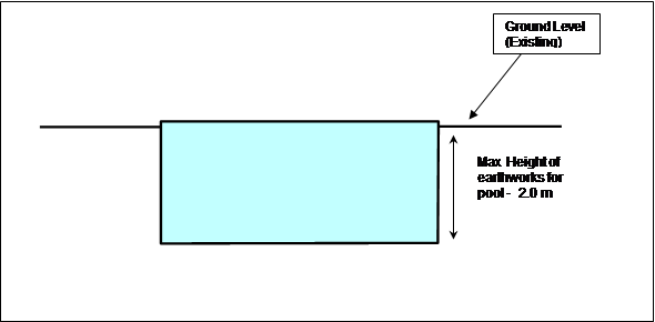

Figure B14.3 – Pool on
level land
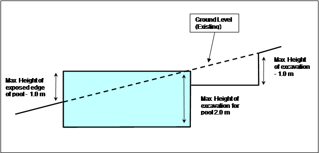

Figure B14.4 – Pool on
sloping land
5. Where
pools are to be located on sloping land or on land considered by Council as
geotechnically constrained, appropriate geotechnical investigations to be
carried out by a suitably qualified engineer. Details to be submitted with the
development application demonstrating that the site is suitable for the
proposed pool.
6. Where
in-ground water tanks and effluent disposal systems are proposed, there are no
specific restrictions limiting the depth of earthworks.
Where required details on geotechnical and acid
sulfate soils constraints to be submitted with the development
application.
7. Basement
car parks - Any development
application that seeks consent for a basement car
park will need to have regard to the provisions contained within
Chapter B4 Traffic Planning, Vehicle Parking, Circulation and Access.
8. Filling
on the floodplain – Any development application that seeks consent to fill land within the flood planning area will need to have regard
to the provisions contained within Chapter C2 Areas Affected by Flood.
9. Engineering
detail by a suitably qualified structural or geotechnical engineer to be
submitted for earthworks on land with a gradient exceeding 15% or where cut and
fill of more than 1 metre is proposed.
10. A site plan
shall be provided that shows all areas of cut and fill on the site and
specifically identifies any areas over one metre.
Staff Reports - Sustainable Environment and Economy 8.4 - Attachment 9

Byron Shire
Development Control Plan 2014
Chapter E5
Certain Locations in Byron Bay and Ewingsdale
This page has been intentionally left blank
Chapter E5 – Certain Locations in Byron Bay and Ewingsdale
Contents
E5.1 Introduction. 7
E5.2 Application
of this Chapter. 7
E5.3 Aims
of this Chapter. 7
E5.4 Development
Controls. 7
E5.4.1 Development
and servicing of land affected by predicted coastal hazards. 7
E5.5 Habitat 10
E5.5.1 Where
this Section Applies. 10
E5.5.2 Objectives
of this Section. 10
E5.5.3 Desired
Future Character and Development Principles. 11
E5.5.3.1 Statement
of Desired Future Character 11
E5.5.3.2 Planning
Principles. 11
E5.5.3.3 Achieving
the Desired Future Character 12
E5.5.3.4 Precinct
Plan. 12
E5.5.4 Design
and Development Controls. 14
E5.5.4.1 Land Use,
Management and Environmental Assessment 14
E5.5.4.2 Car Parking. 17
E5.5.4.3 Building
Design. 19
E5.5.4.4 Site and
Open Space Design. 22
E5.5.4.5 Lot Size
and Subdivision. 24
E5.5.4.6 Water Cycle
Management 25
E5.5.4.7 Ecological
Enhancement 26
E5.6 Byron
Central Hospital Locality. 30
E5.6.1 Where
this Section Applies. 30
E5.6.2 Objectives
of this Section. 30
E5.6.3 Landscaped
Buffer 30
E5.7 The
North Byron Beach Resort Site. 31
E5.7.1 Where
this Section Applies. 31
E5.7.2 Objectives
of this Section. 31
E5.7.3 Statement
of Desired Future Character 32
E5.7.4 Planning
Principles. 33
E5.7.5 Achieving
the Desired Future Character 34
E5.7.6 Development
Applications and Site Concept Plan. 35
E5.7.7 Conservation
Areas and Corridors. 36
E5.7.7.1 Western
Wetland and Heath Precinct C.. 36
E5.7.7.2 Southern
Wildlife Corridor Precinct D.. 37
E5.7.7.3 Eastern
Wetland and Littoral Rainforest Precinct E.. 38
E5.7.8 Buffers
and Hazards. 39
E5.7.8.1 Bush Fire
Asset Protection Zones. 39
E5.7.8.2 Water Body
Buffers. 39
E5.7.8.3 Mosquito
Management 40
E5.7.9 The
Developable Area. 40
E5.7.9.1 Built Form.. 40
E5.7.9.2 Low Density
Perimeter (Precinct 1) 41
E5.7.9.3 Central
Development Area (Precinct 2) 41
E5.7.9.4 Drainage
and Water Cycle Management 42
E5.7.9.5 Landscape. 43
E5.7.9.6 Tourism
Management 43
E5.7.10 Environmental
Management and Repair 44
E5.7.10.1 Beach Access. 44
E5.7.10.2 Environmental Management 44
Maps
Map E5.1 – Byron Bay Coastal Hazards Map. 9
Map E5.2 – Habitat 28
Map E5.3 – Habitat Precinct Plan. 29
Map E5.4 – North Byron Beach Resort Precinct Map. 46
Figures
Figure E5.1 – Indicative examples of Byron vernacular 483
Tables
Table E5.1 – Land Uses Consistent with Desired Future
Character 15
Table E5.2 – Setbacks. 479
Table E5.3 – Car Parking Standards. 481
Document History
|
Doc No.
|
Date Amended
|
Details
(e.g. Resolution No.)
|
|
#E2014/19980
|
20 March 2014
|
Res 14-118 - Public
exhibition version
|
|
#E2014/33071
|
|
Draft to 26
June 2014 Extraordinary Meeting - for adoption
|
|
#E2014/43427
|
26 June 2014
|
Adopted
Version – Res 14-315
|
|
#E2017/104988
|
November 2017
|
Res 17-224
Public Exhibition version (#E2017/104987
- Marked Up Version)
|
|
#E2018/6783
|
February 2018
|
Draft to 22
February 2018 Ordinary Council Meeting – for adoption
|
|
E2018/19959
|
15 March 2018
|
Adopted
Version – Res 18-081, Effective 15 March 2018
|
|
E2019/29357
|
April 2019
|
Public Exhibition version
(Res 19-091) 24.2018.65.1
|
|
E2019/29357
|
July 2019
|
New revision for adoption
15 August 2019 planning meeting
|
This page has been
intentionally left blank
E5.1 Introduction
Byron Bay is an iconic coastal town characterised by
spectacular beaches and coastline. It is a relatively low density urban place
with a compact, walkable CBD and a predominance of one and two storey development in residential areas with
three storeys in the business area.
It is partly affected by coastal hazards
and flooding.
E5.2 Application
of this Chapter
This Chapter applies to certain land at Byron Bay and Ewingsdale that is subject to Byron LEP 2014. The land to which this
Chapter applies is only that land identified in this Chapter.
E5.3 Aims
of this Chapter
The Aims of this Chapter are:
1. To identify
land in Byron that may be affected by future coastal
hazards and to apply development controls
proportionate to the hazards affecting that land.
2. To identify
land on Bayshore Drive, Byron Bay that is suitable for an innovative suite of
land uses that will result in a compatible mix and density of business, office,
residential, retail, light industry and other development on the site.
3. To
facilitate the development of a new hospital
for Byron Bay on Ewingsdale Road and ensure that it fits well with its
surrounding rural locality.
4. To
facilitate the responsible development of land at the Eastern end of Bayshore
Drive for tourist and visitor
accommodation and related uses while
preserving and regenerating the vegetation on the site.
E5.4 Development
Controls
E5.4.1 Development
and servicing of land affected by predicted coastal hazards
Objectives
1. To
define how public utility services may be provided to development which is
potentially threatened by coastal hazards.
2. To
ensure the impact of coastal hazards on potential development is minimised
by ensuring any development ceases as the erosion
escarpment approaches the development.
Performance Criteria
1. Vehicular
access, water, sewerage, electricity, telephone and other services must be
located so as to minimise the impact from actual or predicted coastal hazards.
2. Development
on land marked as ‘Coastal Erosion Hazard Area’ on the Byron Bay Coastal Hazards Map (Map E5.1) must
be designed to be relocated or demolished, or to cease operation, should the erosion escarpment come within 50 metres.
Prescriptive Measures
1. All
services must be provided from the landward side of the development such that
the building is between the services and the erosion
escarpment.
2. Development
within the ‘Coastal Erosion Hazard Area’ on the Byron Bay Coastal Hazards Map (E5.1) will be
considered on the understanding that any consent granted will be subject to the
proviso that should the erosion escarpment come within 50 metres of any
building then the development consent will cease.
3. If
the development consent does cease then the owner of the land will be
responsible for the removal of all buildings.
4. The
option of demolition as the means of removal will be available to all
buildings.
5. Prior
to the issue of a Construction Certificate a restriction as to user must be
placed on the title pursuant to the provisions of section 88E of the
Conveyancing Act 1919, stating:
“The subject land and any
improvements erected thereon must not be used for the purpose of (land use) in
the event that the erosion escarpment as defined by the Works and Services
Director of the Council of the Shire of Byron from time to time comes to within
50 metres of any buildings or any part thereof at any time erected on the said
land’.
Map E5.1 – Byron Bay Coastal Hazards Map
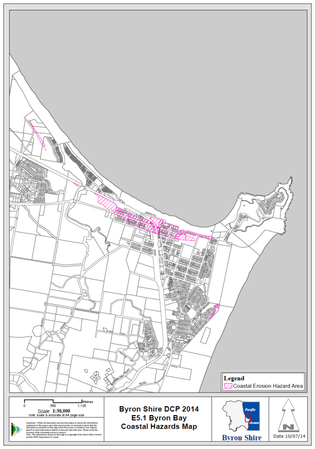
E5.5 Habitat
E5.5.1 Where
this Section Applies
This section applies to the land defined by a heavy black
line on Map E5.2 known as Habitat, and identified as Lot 3 DP1004514,
Bayshore Drive, Byron Bay. It is bounded by the Byron Bay Arts and
Industry Estate to the south, the West Byron Sewage Treatment Plant to the
west, regenerating heathland, shrubland and low woodland to the north, and the
Sunrise Beach residential estate to the east.
In the event of any inconsistency between Section E5.5 and
other Chapters of this DCP, the provisions of Section E5.5 shall prevail.
E5.5.2 Objectives
of this Section
The primary purpose of this Section is to provide standards
for the future development of the site. To assist in this regard, the
objectives of this Section are to:
1. Promote and
implement the principles of ecologically sustainable development identified in
aims of Byron LEP 2014, in the planning, development and management of the
site;
2. Contribute
to the implementation of the Byron Shire Affordable Housing Strategy, the Byron
Biodiversity Conservation Strategy, the Byron Shire Cultural Policy, and the
Byron Shire Social Plan;
3. Define a
compatible mix and density of business, office, residential, retail, light
industry and other development on parts of the site;
4. Seek to
increase the range of housing choice and further promote affordable living
opportunities.
5. Enhance and
protect the bio-physical environment, particularly the Wallum vegetation and
wildlife habitat adjacent to the site;
6. Enhance and
protect ground water and surface water quality and hydrology;
7. Ensure that
the siting, scale and intensity of development enhance and protect Byron
Bay’s social and cultural qualities by:
a) responding to
local and regional values, community needs and aspirations;
b) reflecting Byron
Bay’s character and scale;
c) ensuring that
development of the site contributes to the range of services available and the
identity of West Byron; and
d) ensuring that
site access does not compromise the amenity or safety of adjacent residential
areas.
E5.5.3 Desired
Future Character and Development Principles
E5.5.3.1 Statement
of Desired Future Character
Habitat provides a vibrant and sustainable urban
environment, which enhances social equity, economic vitality, environmental
performance and sustainability, and cultural expression within the Byron Bay
community.
It provides a wide range of housing and employment choice
and has strong connections to nearby shops, industry, town services, facilities
and transport corridors.
A mix of housing types and small scale creative enterprises
contribute to the neighbourhood’s vitality and the town’s
identity. Dwelling types
reflect the household profile of Byron Bay. Smaller dwellings and multiple dwelling types cater
for Byron’s higher than average proportion of group households and lone
person households. Integrated work and living spaces provide affordable
and flexible opportunities for small scale businesses. Commercial
ventures provide for local employment, creative
industries and an outlet for goods and services produced on the
site.
Land is used efficiently and energy and water use is
minimised. The community actively contributes to the enhancement and
maintenance of important habitats on adjoining land. Buffers are provided
to these adjoining habitats, and to bushfire hazards and the West Byron Sewage
Treatment Plant. Edges are well defined, the public domain is safe and
permeable and amenity is fostered by transitions between uses and by integrated
site planning.
E5.5.3.2 Planning
Principles
The desired future character reflects the following planning
principles:
1. Social
Equity
a) Enables the
co-location of uses to provide housing close to employment opportunities while ensuring
potential conflict between the different land uses is minimised;
b) Provides a range
of low cost residential and live/ work solutions that will enable creative
artisans/business people to establish an economically achievable base; and
c) Includes a mix of
housing, ownership patterns, prices and building types for a diverse community.
2. Economic
Vitality
a) Provides a mix of
employment opportunities with particular emphasis on creative industries;
b) Facilitates a
density of development (with amenity) which makes cost effective use of scarce
land; and
c) Embraces the
concept of shared opportunities and synergies within the surrounding
neighbourhood, which contributes to overall efficiencies.
3. Environmental
Performance
a) Facilitates a
smaller environmental footprint than traditional suburban development;
b) Utilises a site
sensitive approach which provides filters and buffers protecting the ecological
values of adjoining lands;
c) Provides for
habitat enhancement that integrate with work previously undertaken on adjoining
land to restore significant new wetland habitat.
4. Cultural
Expression
a) Encourages a
clustering of artistic and lifestyle based small scale industries; and
b) Promotes the
cultural identity of the area by building upon the commercial / services and
industrial base in the surrounding neighbourhood.
E5.5.3.3 Achieving
the Desired Future Character
This Plan aims to achieve the Desired Future Character of
the site as described in Section E5.5.3.1 by:
1. Providing a
Precinct Plan for the major elements of Habitat (refer to Map E5.3);
2. Specifying
Principles that must apply to development of the site;
3. Specifying
objectives, performance criteria and prescriptive measures for a number of
environmental elements relevant to the future development of Habitat; and
4. Specifying
ecological enhancement measures that are to be undertaken in adjoining
habitats.
E5.5.3.4 Precinct
Plan
1. The Habitat
Precinct Plan (Map E5.3) identifies the major bio-physical elements that will
make up the structure of the developed site. These elements
include:
a) Major entries/
exits;
b) Internal access
connections;
c) Land use
‘precincts’, including:
i) Precinct
1 - commercial terraces / tiered living.
ii) Precinct 2
- pocket living.
iii) Precinct 3 -
warehouse lofts.
iv) Precinct 4 -
mixed use, retail / business / residential / café / community recreation
facilities / commercial terraces.
v) Precinct 5 -
ecological enhancement.
2. The
Precinct Plan provides a framework for development in Habitat. It will
assist developers and designers to obtain an understanding of the context for
their proposed development. Components of the plan include the following:
a) Major entries/
exits
The major entries / exits for Habitat will be from
Wallum Place, at the northern frontage of the site. Entry-only service
access and entry-only access to car parking areas within the site will be from
Bayshore Drive, at the eastern frontage of the site.
b) Precinct 1: Commercial
terraces / Tiered Living
The three Commercial Terrace buildings are comprised of 4x
two-bedroom units, each with integrated, dedicated commercial or home office
spaces. This product will suit an array of people wanting to run a small
professional business from home.
Tiered Living consists of 8x two-and-a-half storey buildings along the northern edge of
the site (half storey comprised of a
mezzanine or loft that utilises the roof space). Tiered living provides for a
range of housing options, with 12x one bedroom units, 22x two bedroom units and
12x three bedroom units.
c) Precinct 2: Pocket
Living
The Pocket Living Precinct consists of 4x two-and-a-half storey buildings along the north western edge of
the site and an amenities block (half storey
comprised of a mezzanine or loft that utilises the roof space). This precinct
offers the opportunity for high quality, small scale living units at an
affordable price point and is comprised of 56x one bedroom units and 4x two
bedroom units.
d) Precinct 3: Warehouse
Lofts
The Warehouse Lofts consist of 4x two storey buildings along the southern edge of
the site. Each building is comprised of six ground floor commercial/retail
spaces with a one-bedroom apartment above. There is also an option for a second
bedroom on the ground floor. This integrated solution will suit many creative
industries.
e) Precinct 4: Retail
/ Business / Residential / Café / Community Recreation Facilities
This area offers a mix of business, retail and living
spaces including; approx. 1200m2 of retail space; approx.1700m2
of commercial office space plus a café/restaurant, gym and pilates
studio, as well as 10x two bedroom apartments, with attached retail or
commercial workspaces. The recreational precinct includes a swimming pool,
change rooms, barbecue areas, bicycle storage and shaded lawn.
f) Precinct
5: Ecological Enhancement
Existing low lying areas or swales on adjoining lands will
be extended and revegetated with freshwater wetland and heath plant species of
local provenance to improve wetland habitats and increase important habitat
components for local fauna species, particularly the Wallum frogs (Wallum Sedge
frog, Litoria olongburensis, Wallum froglet Crinia tinnula).
Appropriate restrictions on the title of the property (Lot 3) will ensure that
the community will continue to contribute to the maintenance of these important
Wallum frog habitats.
E5.5.4 Design
and Development Controls
Section E5.5.4 contains a range of controls which reflect
environmental and design aspects of the future development of Habitat.
E5.5.4.1 Land
Use, Management and Environmental Assessment
Background
A key characteristic of villages is the mix of uses that
occur throughout them. Mixing uses facilitates a vibrant and safe
environment by day and by night. The close proximity of workplaces and
housing reduces travel distances and creates affordable and accessible urban
environments. The economic viability of the development is supported over
its life cycle by the provision of both housing and productive uses.
Provision of a variety of housing types and configurations supports a diversity
of households and reflects local demands for differentiated and affordable
housing options.
The site has a number of constraints which will require
detailed environmental assessment as part of any future development application
for the site. These constraints include proximity to the West Byron
Sewage Treatment Works and its primary access road, potential acid sulfate soils, and various ecological
constraints.
Objectives
1. To
achieve the Desired Future Character for the site as defined by Section
E5.5.3.1;
2. To
facilitate the creation of a mixed use
development with a diversity of housing and employment choice
and optimum density that reflects the environmental capability of the site and
the socio-economic and cultural context; and
3. To
assess and mitigate potential environmental impacts.
Performance Criteria
1. Utilise
the site and building layout to maximise the potential for acoustic privacy by
providing adequate building separation within the development and from
neighbouring buildings;
2. In
Precinct 1, utilise front fences and walls to enable use of private open space
abutting Wallum Place to provide an acoustic barrier to vehicle
movements;
3. In
mixed use development, ensure loading
bays, garbage collection areas etc are located away from bedrooms and other
quiet areas in the residential component;
4. Provide
diverse dwelling types within
Precincts 1, 2, 3 and 4;
5. In
Precinct 1, provide spaces to
be used for a home office, creative industry or as an additional bedroom.
Prescriptive Measures
1. Land
Use and Density
a) Distribute land
uses across the site in accordance with the Precinct Plan (Map E5.3) and
the consistent land uses and densities outlined in Table E5.1; and
b) Provide for a
maximum of 152 residential dwellings
within the site.
Table E5.1 – Land Uses Consistent with Desired
Future Character
|
Precinct
|
Consistent Land Uses*
|
Maximum Densities*
|
|
Precinct 1
Land Area:
Approximately 12,129m2
Built Gross Floor Area:
7,430m2
Bedroom Total: 126
|
- Commercial
Terraces (CT
- Tiered
Living (TL)
|
Commercial Terraces
- Part
of the ground floor is for home office / creative industry or use as an
additional bedroom
- Rear
portion of the ground floor and all of upstairs is residential (Class 1A or
Class 2)
- 2
bedrooms
Tiered Living
- Mix
of configurations ranging from 1 – 3 bedrooms depending on how the
space is used.
- Garage
to ground floor.
|
|
Precinct 2
Land Area:
Approximately 10,255m2
Built Gross Floor Area:
3,655m2
Bedroom Total: 64
|
Pocket Living (PL)
|
Pocket Living
- Mix
of 1 + 2 bedroom units to ground floor
- 1
bedroom units to first floor
|
|
Precinct 3
Land Area:
Approximately 7,360m2
Built Gross Floor Area:
3,200m2
Bedroom Total: 48
|
Warehouse Lofts (WL)
|
Warehouse Lofts
- Commercial
/ retail to the ground floor (class 5 / 6)
- Generally
residential to the first floor with additional bedroom permissible to ground
floor
- Able
to be configured with 1 or 2 beds
|
|
Precinct 4
Land Area: Approximately 16,740m2.
Built Gross Floor Area: 5,325m2
Bedroom Total: 20
|
- Retail
- Business
- Residential
- Café
- Community
/ Recreation Facilities
|
Commercial Precinct
B1 / C1 / C2 / C3 / C4 / C5
- Retail
(class 6) to lower level with the exception of C5 (dentist)
- Commercial
(class 5) to upper level with the exception of C1 (gym) C3 and C5 (pilates
studio)
- Shared
meeting rooms and wc’s
Recreation Precinct
- Swimming
pool and change facilities
Commercial Terraces
- Part
of the ground floor is commercial/retail (class 5/6)
- Rear
portion of the ground floor and all upstairs is residential (class 2)
- 2
bedrooms
|
|
Precinct 5
Land Area: Approximately 2,728m2
|
Ecological enhancement, restoration, management and
monitoring.
|
No buildings allowed
|
2. Setback
Provide setbacks
within the development consistent with the minimum distances outlined in Table
E5.2.
Table E5.2 – Setbacks
|
Land Use
|
Minimum Setback
|
Distance (m)
|
|
Precinct 1
|
External Property (lot) Boundary
|
4
|
|
External road
|
9
|
|
Internal roads
|
0.5
|
|
Adjoining buildings
|
0
|
|
Precincts
2 & 3
|
External Property (lot) Boundary
|
4
|
|
Internal roads
|
0.5
|
|
Adjoining Buildings
|
0
|
|
Precinct 4
|
Bayshore Drive
|
7
|
|
Wallum Place
|
4
|
|
Internal Roads
|
0
|
3. Buffering
a) Provide a minimum
20m setback between dwellings and the western and north-western
site boundaries, where these adjoin the adjacent Wallum frog habitats;
b) Provide a minimum
5m setback between dwellings and the internal boundary between
Precincts 2 and 5, located in the north-western corner of the site as
denoted by the approved Acid Frog Management Plan (Geolink, 2017) for the site;
and
c) Provide buffering
from the Byron Bay Sewerage Treatment Works in the form of a minimum 20m buffer
along the north western boundary of the site (this acknowledges the buffer
provided in the original subdivision of the land, by the creation of Lot 12 DP
1189646).
4. Environmental
Assessment
The following environmental assessment reports must be
prepared as part of any development application for the site:
a) Preliminary
Acoustic Report;
b) Site Waste Minimisation and Management Plan
and assessment consistent with the requirements of Chapter B8 Waste
Minimisation and Management.
E5.5.4.2 Car
Parking
Background
An integrated ‘live/work’ approach to
development, characterized by the inclusion of workspaces
in detached and attached residential dwellings,
presents the opportunity for dual use of parking spaces, thereby
reducing the overall parking demand of the proposed development.
Dual use of parking spaces occurs when the same parking
space can serve more than one component of a development, such as where
residents of living areas also operate businesses in the attached
workplaces. In circumstances where the parking demand generated by
residents is satisfied by parking provided to serve the living areas, there is
no need to satisfy the parking demand generated by residents’ use of the
workplaces.
A mixed use development also provides the potential for complementary
use of parking spaces. This occurs when the peak parking demand of
one component of the proposed development does not coincide with the peak
parking demand of another.
Objectives
1. To
provide sufficient parking to satisfy the needs of the proposed development
taking into account the potential for dual and complementary use of parking
spaces; and
2. To
assist in achieving the Desired Future Character for the site as defined by
Section E5.5.3.1 by minimising the total area of hard stand car parking within
the site.
Performance Criteria
1. Provide
on-site car parking appropriate to the needs of both residents and off-site
workers, with consideration to potential for dual use and complimentary use of
spaces;
2. Dual
Use Parking - apply the concept of dual use parking, as described above, as
appropriate to the nature of the proposed site development. In this regard it
is not unreasonable to expect that the actual parking demand generated by the
workplace floorspace in the commercial precinct (most notably the office
floorspace), and in the industrial precinct, will be up to 30% less than the
parking requirement which is calculated without regard to the duplication of
parking provision, which is a consequence of the integrated “live/work”
approach to the development. It should be noted, however, that it is
possible that not all of the workforce employed by businesses that occupy the
workplaces incorporated in integrated ‘live/work’ components of a mixed use development will also be residents
of that development. For example, a resident operating a business from a
workplace could employ a non-resident/residents to assist in the operation of
the business;
3. Complementary
Use - seek to reduce the total number of car parking spaces associated with
a mixed use development proposal by
comparing peak demands of each use by time of day, day of the week, and
season. Where the varied parking demand for proximate uses allows joint
use of a single parking space or facility, a reduced number of spaces is
strongly encouraged;
4. Located
shared parking spaces to be convenient to all users;
5. Provide
non-residential parking on internal streets and accessways, providing that such
parking does not affect the capacity of the internal access system to allow
efficient internal movement of vehicles and pedestrians; and
6. Provide
cycle access and facilities within the site, consistent with the requirements
of Chapter B5 Providing for Cycling.
Prescriptive Measures
Provide on-site car parking in accordance with standards
outlined in Table E5.3. Total provision of car parking is to consider
potential for dual use and complementary use, as described above.
Table E5.3 – Car Parking Standards
|
Type of Development
|
Minimum Car Parking Provision
|
Special Requirements
|
Precinct Requirements
|
|
Precinct One – Commercial Terraces / Tiered
Living
|
|
large dwellings
- 3 or 4 bedrooms
|
2 spaces per dwelling
|
1 space must be capable of being covered (stacked car
parking will not be acceptable)
|
1 per cent of spaces to be provided for people with a disability
|
|
small dwellings
– 1 bedroom
|
1 space per dwelling
|
|
|
visitor car parking
|
1 space per 4 dwellings
|
|
|
Workspace
|
1 space per workspace
|
|
|
delivery / service vehicles
|
1 space per 50 units
|
Visitor parking can be used if designed for dual use
|
|
Precinct Two – Pocket Living
|
|
small dwellings
– 1 bedroom
|
1 space per dwelling
|
|
1 per cent of spaces to be provided for people with a disability
|
|
small dwellings
– 2 bedroom
|
1.5 spaces per dwelling
|
|
|
delivery/ service vehicles
|
1 space per 800 m2 gross floor area
|
Visitor parking can be used if designed for dual use
|
|
Precinct Three – Warehouse Lofts
|
|
small dwellings
(1bedroom)
|
1 space per dwelling
|
|
1 per cent of spaces to be provided for people with a disability
|
|
small dwellings
– 2 bedroom
|
1.5 spaces per dwelling
|
|
|
visitor car parking
|
1 space per 4 dwellings
|
|
|
Workspace
|
1 space per workspace
|
|
|
delivery / service vehicles
|
1 space per 800 m2 gross floor area
|
Visitor parking can be used if designed for dual use
|
|
Precinct 4 – Mixed Use
|
|
retail
|
1 space per 20 m2 gross floor area
|
|
1 per cent of spaces to be provided for people with a disability
|
|
office / professional rooms/ business premises
|
1 space per 40m2 gross floor area x 70%
|
|
|
spa
|
1 space per 20m2 gross floor area
|
|
|
small dwellings
(1 or 2 bedrooms)
|
1.5 spaces per dwelling
|
|
|
large dwellings
(3 or 4 bedrooms)
|
2 spaces per dwelling
|
|
|
visitor car parking
|
1 space per 4 dwellings
|
|
|
delivery / service vehicles
|
1 space per 400 m2
|
|
E5.5.4.3 Building
Design
Background
The climate, coastal location and the evolving culture of
Byron Bay has given rise to a ‘Byron style’ which can be
characterised as informal, light weight construction and is referred to in this
Section as the ‘Byron vernacular’ and the ‘Byron
style’. Achieving the Byron vernacular will ensure
that the site will be characterised by lush vegetation, open spaces and linked
landscaped areas, sloping rooflines, timber and glass structures typical of the
local Byron style of lightweight construction and tropical appearance (refer to
Figure E5.1).
An opportunity exists for Habitat to be an intense living
and working environment of a considerably higher density than suburbia.
Consequently, a high degree of detailed design resolution is required in the
architecture and urban design.
The density proposed for the site means that the form and
layout of each building needs to consider its relationship to its immediate
neighbour and its context in the street. It means that the creation of
identifiable and well defined space in the public domain is more important than
the individual building and garden. Further, it means that gardens and
the landscaping on private lots need to contribute to the public domain.
The issue of overshadowing will also need to be carefully considered in any
design for the site.
Building design should:
1. Reinforce
the structure of the public domain;
2. Respond to
climate and local ‘Byron vernacular’;
3. Ensure
privacy and amenity are maintained;
4. Contribute
to high environmental performance; and
5. Ensure an
adequate level of solar access is provided to living areas.
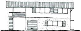
Figure E5.1 – Indicative
examples of Byron vernacular
Objectives
1. To
achieve the Desired Future Character for the site as defined by Section
E5.5.3.1;
2. To
ensure that buildings on the site reinforce the structure of the public domain,
respond to climate and the ‘Byron vernacular’, ensure that privacy
and amenity are maintained, and contribute to high environmental performance;
3. To
ensure that residential development will not significantly increase the
overshadowing of adjoining properties; and
4. To
ensure that occupants of buildings will enjoy the optimum use of winter
sunlight and summer shade.
Performance Criteria
1. Provide
low-rise (two and a half storey
maximum) building forms that are in proportion to street trees (half storey comprised
of a mezzanine or loft that utilises the roof space);
2. Where
possible, provide rear lane vehicular access to housing sites to facilitate a
coherent, safe and visually pleasing streetscape and negate the need for
private hard surfaced driveways;
3. Provide
articulation and variety in building forms and utilise screening features to
facilitate visual interest, privacy and energy efficiency;
4. Ensure
that the width and internal layout of buildings facilitate natural cross ventilation;
5. Design
entrances so that they are a clearly identifiable element of the building in
the street;
6. Utilise
durable materials and finishes;
7. No
roof should have a highly reflective surface; any metal roof must have a
colorbond or equivalent finish in a colour approved by Council. White or
light coloured roofing will not be approved where it’s likely to be
intrusive;
8. Locate
habitable rooms and open spaces away from noise sources and utilise car parking
areas and zero side building setbacks
to provide a buffer to noise sources;
9. In
Precinct 1, design and construct development adjoining Wallum Place to ensure
that acceptable living conditions can be created within dwellings, particularly in relation to noise
and odour;
10. Incorporate
lush vegetation to provide shade and screening; and
11. Orientate dwellings and design building roof and shade
structures to maximise solar access into private open space areas and internal
living spaces during winter months.
Prescriptive Measures
1. Provide
details of building materials and surface colours for assessment with the
development application;
2. External
materials must demonstrate consistency with the ‘Byron vernacular’
and must be light weight in appearance and can include various forms of
cladding including pre-painted corrugated steel, fibrous cement, weatherboard
and timber;
3. Allow
zero side setbacks and boundary walls
to efficiently utilise the site, create an urban edge to streets, minimise
building material and energy usage, and enable the provision of private
internal open space;
4. Design
buildings to ensure a minimum of 3 hours of sunshine to the living area of dwellings between 9am and 3pm mid winter;
5. Coordinate
and integrate building services, such as drainage pipes and air conditioners,
with overall façade and balcony
design;
6. Coordinate
security grills/ screens, ventilation louvres and car
park entry doors with the overall
façade design;
7. Provide
operable walls and large openings to allow for windows and doors to be opened
during summer and closed in winter;
8. Incorporate
mosquito mitigation devices;
9. Locate
living areas with direct access to private outdoor spaces; and
10. Avoid large
expanses of any single material.
11. Design
buildings to ensure that building heights do not exceed the maximum height shown for the land on the Byron LEP
2014 Height of Buildings
Map.
12. Design
buildings to ensure that he maximum
floor space ratio for a building is not to exceed the floor space ratio shown
for the land on the Floor Space Ratio
Map.
E5.5.4.4 Site
and Open Space Design
Background
The flat topography and high water table of the site and the
sensitive wetland habitats of its context mean that managing stormwater runoff
will be important. Minimising impervious surfaces across the site is
critical to the reduction of stormwater runoff. This issue will also be
supported by building design and infrastructure design elements of this
Section.
The provision of areas for communal exchange, relaxation,
education and contemplation will support the village concept. At the same
time, territorial reinforcement of public and private space will facilitate
efficient utilisation of the land and discourage crime opportunities.
Universal access
will need to be built into the design of the site at ground level in order to
produce a village that is supportive of people with the range of physical and
mental functionality.
The mixed use nature and density of the proposed land use
pattern and the availability and augmentation of existing cycling and walking
networks delivers an opportunity to provide wide transport choice.
Minimising and integrating vehicular parking is a demand management measure
that can further support, walking, cycling and public transport. Locating
visitor parking within the street system reduces the footprint of dwelling sites.
Objectives
1. To
achieve the Desired Future Character for the site as defined by Section
E5.5.3.1; and
2. To
minimise the impervious footprint of the site, provide communal and private
open space, delineate the public or private role of space and facilitate
universal access.
Performance Criteria
1. Provide
common open space to facilitate communal exchange and foster a sense of
community;
2. Locate
communal open space so that it exists as a focal point for the development;
3. Provide
private outdoor open space areas in dwelling
sites as an extension of living spaces, to allow yards to be fully planted as
landscaped deep soil areas and to
maximise pervious areas;
4. Provide
private open space for workspaces by
way of open space balconies as an
extension of living spaces;
5. Provide
adequate facilities for storage, clothes drying and waste management while
minimising their visual and amenity impacts;
6. Provide
universal access throughout the site
by providing continuous accessible paths of
travel and some housing and car parking specifically designed to
support persons who have reduced physical or cognitive function;
7. Ensure
communal open space areas are useable and accessible to all including those
persons with a disability;
8. Ensure
passive surveillance of the communal open space area;
9. Improve
the amenity of open space with landscape design by:
a) providing
appropriate shade in the form of locally
indigenous trees or structures;
b) providing
accessible routes through the space and between buildings; and
c) screening cars,
communal drying areas, swimming pools and the courtyards of ground floor
residential buildings;
10. Contribute to
streetscape character and the amenity of the public domain by:
a) relating
landscape design to the desired proportions and character of the streetscape;
b) using planting
and landscape elements appropriate to the scale of the development; and
c) allowing for
locating public art where they can be viewed by users of open
space and/ or from within courtyards and the public domain;
11. Improve the
energy efficiency and solar efficiency of dwellings
and the microclimate of private open spaces. Planting design solutions
include:
a) locally indigenous
trees for shading low-angle sun on the eastern and western sides of a
buildings;
b) locating locally indigenous
dense-foliaged trees well away from the building to permit winter sun access;
c) varying heights
of different species of locally indigenous trees
and shrubs to shade walls and windows; and
d) locating pergolas
on balconies and courtyards to create
shaded areas in summer and private areas for outdoor living.
Prescriptive Measures
1. Public
Open Space
a) Provide a minimum
of 2,000m2 of public / communal open space, with at least one
central location having an area of not less than 450m2; and
b) Orientation of
communal open spaces to the north with a minimum of three hours of sunlight
between 9am and 3pm mid winter provided to at least 50% of the communal open
space area.
2. Private
Open Space
a) A private open
space balcony must be provided for each dwelling
where the residential component is not located on the ground floor (note this
includes dwelling that contain a dwelling on the first floor and workspaces / office on the ground
floor). Within the commercial precinct, such private open space balconies must have a minimum area of 10m2
and a minimum length and width of 2.5m. Within the Pocket Living
precinct, private open space balconies must have a minimum area of 11m2.
In all other precincts, the private open space balconies
must have a minimum area of 15m2 and a minimum length and width of
2.5m;
b) Private open
space balconies must have appropriate
orientation and adequate provision for winter sun and summer shade; and
c) Each dwelling that has a residential
component on the ground floor must have a minimum private landscaped area
of 49m2 (including terrace) plus additional common
outdoor area.
3. Universal
Access
a) Provide a minimum
of one dwelling as adaptable housing,
designed in accordance with AS4299, for every 10 dwellings
or part thereof;
b) Design facilities
for disabled persons (including car parking) to comply with the Australian
Standard 1428 (Part 1 and 2), the Building Code of Australia and the Disability
Discrimination Act 1992 (as amended);
c) Provide continuous accessible paths of travel from all
public roads and public spaces, as well as throughout the ground level internal
spaces of adaptable housing dwellings; and
d) Design adaptable housing
dwellings in accordance with AS 1428
Parts 1, 2 and 4 and AS 4299 Adaptable Housing.
E5.5.4.5 Lot Size and Subdivision
Objectives
1. To
provide lots of sufficient size to satisfy the needs of future residents and
occupants, and which will accommodate well designed and innovative development;
2. To
encourage diversity in lot size and opportunities for a variety of
housing/building choice; and
3. To
ensure that lot design takes into account the natural features of the site and
locality.
Performance Criteria
1. Lots
must be of sufficient area to allow for the siting of dwellings / buildings including provisions for
private open space, landscaped area,
vehicle access and car parking and to permit solar access; and
2. Lot
sizes and design must enable dwellings
/ buildings and driveways to be sited to protect natural or cultural features,
and respond to site constraints including topography, bushland, soil, erosion,
drainage, and bushfire risk.
Prescriptive Measures
1. The
minimum lot size requirements for the site (including residential community
title) shall be in accordance with Byron LEP 2014.
2. Lots
must enable the construction of a built form which is sympathetic to the
established character of the area.
3. Subdivision
of the site is to occur only through strata and/or community title subdivision.
4. There
is no minimum allotment size for
strata subdivision provided the allotment
boundaries substantially correspond with parts of any building intended for
separate ownership. Demonstration of compliance with the Building Code of
Australia with regard to fire separation and egress will be required prior to
subdivision approval.
5. In
the case of strata or community-title subdivisions, car spaces are not to be
given separate lot numbers, and all visitor spaces are to be included within
common property where possible. All private landscape area attached to a dwelling shall be identified on the
subdivision plan as being part of the appropriate dwelling
unit/ lot. All common landscaped areas and community facilities shall be
identified as being within the common property.
E5.5.4.6 Water Cycle Management
Background
The wetland systems to the south-west and west of the site
demand a water management regime that ensures that water leaving the site is
appropriately treated and managed.
Objectives
1. To
achieve the Desired Future Character for the site as defined by Section
E5.5.3.1;
2. To
ensure that management of surface water and ground
water on the site is consistent with the principles of Integrated
Water Cycle Management and water sensitive urban
design; and
3. To
protect the area’s sensitive ecological and geophysical environment, particularly
by ensuring that water released into the ground
water and adjacent swales is low in
pH and nutrients.
Performance Criteria
1. Utilise
uncontaminated, low pH, low nutrient fill to provide for drainage of stormwater
within and from the site;
2. Minimise
building footprints by including two storey and
two-and-a-half storey building forms
in order to maximise pervious open space areas;
3. Minimise
impervious surfaces dedicated to vehicular access and manoeuvring by minimising
the length of driveways and parking provided within individual house sites;
4. Incorporate
water use minimisation measures, such as water saving devices, into building
designs;
5. Minimise
filling of the site by adopting above-surface drainage regime with the use of
swales;
6. Council
may consider variations to its engineering standards to allow swale drainage,
as an alternative to standard kerb and gutter drainage, if it can be
demonstrated that the swale drainage design could be adapted to conform to
standard kerb and gutter drainage in the event of system failure;
7. Avoid
the need for deep basins or permanent pools for the detention of stormwater by
incorporating shallow detention areas or swales across the site which fully
drain following rainfall events;
8. Utilise
car parking areas for the detention and treatment of stormwater runoff from
roads;
9. Ensure
that stormwater leaving the site is treated to a quality equal or better to
pre-development quality;
10. Ensure that
stormwater flow rates leaving the site are no greater than pre-development flow
rates;
11. Manage the
flow and quality of water leaving the site to avoid adverse impacts upon
adjoining sensitive wetland areas, particularly in relation to maintaining low
pH and low nutrient levels;
12. Maximise the
reuse of treated wastewater and stormwater for non potable purposes such as
garden watering and toilet flushing within site capability and public health
limits; and
Prescriptive Measures
1. Requirements
of the site wide Integrated Water Cycle and Soil Management Plan (Geolink,
2011) as amended by Stormwater Management Plan (Ardill Payne & Partners,
2013) are to be adhered to;
2. Provide
dual reticulation within the site for the reuse of recycled water from the West
Byron sewage treatment plant (STP) for toilet flushing and watering of open
spaces where suitable;
3. Rainwater
tanks to be provided as required by the approved Stormwater Management Plan
(Ardill Payne and Partners, 2013);
4. Private
courtyards are to minimise surfaces with impervious materials. Where timber
decking is provided, water must be capable of infiltrating into the soil
beneath the deck;
5. Contribute
to water and stormwater efficiency by integrating landscape design with water
and stormwater management, by:
a) using locally indigenous plants with low water
demand to reduce water consumption;
b) using locally indigenous
plants with low fertiliser requirements;
c) using locally indigenous
plants with high water demand, where appropriate, to reduce run off from the
site;
d) utilising
permeable surfaces; and
e) incorporating
wetland filter systems using locally indigenous plant species;
6. Employ
sub-surface irrigation for watering of public spaces, using recycled water with
scheduling to avoid over-watering and adverse impacts to soils and groundwater;
7. Employ
swale drainage within drainage systems to promote infiltration and treatment of
stormwater. Swales shall be designed to minimise maintenance requirements
with the use of locally indigenous
plant species or alternative coverings such as river pebble;
8. Council
will require the body corporate of Habitat to enter into an appropriate
management agreement for the maintenance of any drainage swale on the public
roads (Bayshore Drive and Wallum Place) fronting the site;
9. Drainage
systems are to be maintained to ensure that ongoing stormwater quality is achieved.
10. Design car
parking areas to facilitate stormwater detention and treatment; and
11. Carry out all
excavation above the existing
water table and in a way that does not change the natural characteristics of
the water table.
E5.5.4.7 Ecological
Enhancement
Background
Habitat is almost devoid of non-grass vegetation, having
been slashed for decades. Three (3) vegetation communities occur on the
site. These are swamp forest (small clump on southern boundary),
sedgeland (located in depressions across the site) and grassland (majority of
the site). No threatened plant species have been identified on the site.
The threatened Wallum Froglet (Crinnia tinnula) has
been recorded on and adjacent to the site and the threatened Wallum Sedge frog Litoria
olongburensis occurs adjacent to the site. The site itself offers
marginal habitat for the Wallum froglet as a result of degradation due to past
disturbance.
A Compensatory Habitat Agreement exists between the land
owner and Council, which will substantially enhance Wallum frog habitats and
provide linkages between existing habitats of importance for these
species. The development of the Habitat site will implement and inform
the development of this compensatory habitat agreement.
Objectives
1. To achieve
the Desired Future Character for the site as defined by Section E5.5.3.1; and
2. To
assist and increase ecological restoration being undertaken to the west of the
site and extend ecological restoration into the site.
Performance Criteria
1. Continue to contribute to the establishment and maintenance of
Wallum frog habitats being created on adjoining land; and
2. Provide
restored Wallum frog habitat in accordance with the Council approved Acid
Frog Management Plan: Habitat North Beach, Byron Bay by Geolink
Environmental Management and Design, Version 4 dated 4/5/17.
Prescriptive Measures
Habitat
restoration within the site and adjoining lands is to be in accordance with the
Council approved Acid Frog Management Plan: Habitat North Beach, Byron Bay
by Geolink Environmental Management and Design, Version 4 dated 4/5/17.
Map E5.2 –Habitat
Map E5.3 – Habitat Precinct
Plan
E5.6 Byron Central Hospital Locality
E5.6.1 Where
this Section Applies
This Section applies to land within Zone ‘SP2
Hospital’ at Ewingsdale, described as Lot 100 DP 1140936, Ewingsdale Road.
E5.6.2 Objectives
of this Section
The objectives of this Section are:
1. To
facilitate achievement of the objectives of R5 zone on land adjoining
development to which this Section applies.
2. To minimise
conflict between land uses within the SP2 Hospital zone and land uses within
adjoining zones.
3. To promote
retention of a semi-rural landscape in the locality.
E5.6.3 Landscaped
Buffer
Objectives
1. To
provide an effective acoustic and visual buffer between the proposed hospital site and adjoining land within the R5
zone; and
2. To
achieve a semi rural landscape character in and around the proposed hospital site.
Performance Criteria
Development applications must incorporate landscape and
management measures to ensure that the proposed development will not create
adverse visual, noise, lighting or residential character impacts on the
existing or potential residential amenity of adjoining land within the R5 zone.
Prescriptive Measures
Development applications must be accompanied by a landscape
plan consistent with the requirements of Chapter B9 Landscaping. The
landscape plan must include (but is not limited to) construction of a mounded
and landscaped buffer a minimum of 20m wide between the proposed development
and adjoining land within the R5 zone. The buffer must be designed,
located, intensively planted and maintained in perpetuity as a visual and
acoustic screen. All planting must utilise locally indigenous
species.
E5.7 The
North Byron Beach Resort Site
E5.7.1 Where
this Section Applies
This Section applies to land at the eastern end of Bayshore Drive identified as the North Byron Beach Resort Site on Map E5.4.
In the event of any inconsistency between Section E5.7 and
other Chapters in this DCP, the provisions of Section E5.7 shall prevail.
E5.7.2 Objectives
of this Section
The objectives of this Section are:
1. To promote
and implement the principles of ecologically sustainable development, as
identified in the aims of Byron LEP 2014, in the planning, development and
management of the site.
2. To define
controls on location, form, character and density of permissible development on
the site.
3. To define
those parts of the site that require protection from development because of
their inherent habitat or biodiversity values, visual characteristics, hazard
characteristics, community values or other environmental values or
characteristics.
4. To
maintain, protect and enhance wildlife corridors to facilitate the movement and
dispersal of species between Tyagarah Nature Reserve and significant areas of
native vegetation on and beyond the site.
5. To define
the remediation, environmental repair and ongoing management measures that are
required in order to ensure appropriate environmental restoration and
improvement of specific areas and characteristics of the site.
6. To protect
and enhance the visual and scenic quality of the site.
7. To ensure
that the siting, scale and intensity of development protect and enhance Byron
Bay’s social and cultural qualities by:
a) protecting areas
and features of cultural significance;
b) accounting for
local and regional values, community needs and aspirations;
c) reflecting Byron
Bay’s character and scale;
d) ensuring that
development of the site does not dominate or detract from the town centre; and
e) ensuring that
site access does not compromise the amenity or safety of adjacent residential
areas.
E5.7.3 Statement
of Desired Future Character
The site is characterised by a mix of native bushland,
coastal dune systems, wetlands and low intensity, low-rise and low scale tourist accommodation and ancillary
uses. The integrity of native vegetation, wildlife habitats and
waterbodies will be enhanced through active management and strategic
revegetation. Natural areas will be separated from development by
vegetated buffers and fire protection areas that are designed to minimise
impacts on the integrity and quality of ecologically sensitive areas. The
buffers also define the boundary of the development footprint and provide a
transition between the two.
The textures, colours and design of new development will
complement the existing bushland and coastal landscapes, both within and
adjoining the site. Buildings will be designed to optimize energy and water
efficiency. A public car park
and cycle racks will be provided within the Bayshore Drive road reserve for
beach users not accommodated on the site.
The land has three distinct components, each with a
particular desired future character:
1. Ecologically
sensitive wetlands, habitat and corridor areas, beaches and waterbodies that
provide foraging and nursery areas for shorebirds and other conservation
priority species. These areas also include an important habitat corridor
adjoining the railway line, which is presently partly developed with holiday accommodation units
but which provides a connective wildlife corridor between the Belongil Creek
estuary and the Tyagarah Nature Reserve. Development (including
re-development) in these areas will maximise the retention of native vegetation
and habitats and provide opportunities for further revegetation over time to
enhance the effectiveness of the wildlife corridor.
2. Dunes and
adjacent lands that are susceptible to shoreline recession and coastal
processes. These lands are characterised by vegetated and grassed dunes,
hind-dune littoral rainforests and wetlands, grassed areas and
waterbodies. Development in these areas will be limited to low-impact
environmental facilities, coastline access and environmental management
activities, and surf lifesaving facilities (note: such land is not subject to
this DCP however the provisions of DCP 2010 will apply to these areas).
3. A
development area central to the site containing low scale tourist accommodation and associated
facilities and waterways in a landscaped setting of grassed areas and locally indigenous
trees and vegetation. Within the development area:
a) the perimeter
adjoining ecologically sensitive areas provides a transition between the
natural environment and the central development area. It will be characterised
by low building densities and open areas landscaped with grassed areas and
local endemic species. The only buildings that will be located in this
transition area are tourist accommodation
units and environmental facilities;
and
b) the centre of the
developable area will contain a range of tourist facilities including a function centre and may contain shops, restaurants or cafes and related facilities.
Note: A number
of
existing approvals are applicable to the
subject site (i.e. for the
areas subject to Byron LEP 2014 and this DCP and adjoining areas that remain
subject to Byron LEP 1988 and Byron DCP 2010). Those approvals include
Development Application 82/479 and DA 83/513 for what was
initially called
Belongil Woods and now referred to as Bayshore Bungalows; and Development
Application 5.1987.208.3
relating to the
tourism
development
on the Byron
Bay
side of Bayshore Drive.
Development will be designed to respect and protect the
ecological values, coastal processes, natural hazards and access limitations of
the locality. Development will be designed to respect the relationship of
the site to the adjoining Sunrise Beach residential neighbourhood, Tyagarah
Nature Reserve, Cape Byron Marine Park and Belongil Beach.
Areas of natural vegetation and important wildlife habitats
will be retained, protected and managed to maintain and enhance their
biodiversity values. Wildlife corridors that facilitate the movement and
dispersal of native species between Tyagarah Nature Reserve and significant
areas of native vegetation on and beyond the site will be enhanced.
To ensure protection of native fauna species, no cats or
dogs will be kept on, or brought to or through the site.
The areas that are subject to potential coastal processes
will be managed in a way that ensures protection of the natural dunal and
hind-dune systems. Development will be cognisant of coastal processes and will
not be designed or located so as to create demands for protection from coastal
erosion.
Public pedestrian access to the beach will be provided and
situated so as to avoid the shorebird nesting area and to respect coastal and
dune system processes.
Public car parking and cycle racks will be provided within
the Bayshore Drive road reserve for beach users not accommodated on the site.
E5.7.4 Planning
Principles
The desired future character shall also reflect the
following planning principles:
1. Transport,
Access and Parking
a) There is no
significant increase in stress on the Byron Bay community in terms of access to
transport infrastructure, and in particular, transport time, parking
availability, traffic congestion or access to local services.
b) Additional demand
on existing transport infrastructure and networks is addressed.
c) Pedestrian,
bicycle and alternative transport systems (including bus and rail where
feasible) connect the site to local community facilities, reducing dependence
on car use.
d) Access
infrastructure avoids locations of ecological or conservation value.
e) A public road is
provided through the site and includes provision of a public car parking area.
2. Land Use
a) A mix of tourist,
commercial /retail, community, recreational, environmental /conservation and
open space uses is provided.
b) Land uses
recognise, protect and enhance conservation values and coastal processes.
c) New development
reflects the unique character and scale of Byron Bay.
d) The design and
arrangement of buildings discourages permanent residential occupation.
3. Tourist Development
a) The type and
amount of permissible development reflects the environmental, social and
economic capacity of the site and Byron Bay.
b) Areas of high environmental
value or cultural significance are left largely undeveloped and protected for present
and future generations.
c) Natural,
landscape, archaeological and cultural features are protected and enhanced.
d) Low-rise accommodation units will be the basis of any
tourist accommodation, with central resort facilities incorporating a function centre.
e) Public access is
provided to the beach.
4. Conservation
and Habitat Protection
a) Sensitive areas
are protected and enhanced.
b) Only those areas
with low ecological value are used for tourism purposes.
c) The State and
Regional significance of existing wildlife corridor values of the site are
protected and enhanced.
d) The habitats of
threatened or endangered terrestrial and aquatic species are protected and
enhanced.
5. Coastal
Processes and Environmental Hazards
a) Structures and
facilities are designed and located to account for climate change including
potential sea level rise, storm tide, flooding and other associated impacts.
b) Buildings and
activities are located away from areas of active coastal processes.
c) The natural
topography and physical features of the coastal dune system are protected and
managed.
d) Emergency
evacuation routes are provided for flood events, including those rarer than 1% AEP.
e) Community
services and facilities are located outside areas of coastal or other natural
hazards.
E5.7.5 Achieving
the Desired Future Character
The Desired Future Character of the site set out in Section
E5.7.3 is to be achieved by:
a) Defining
particular Precincts and Areas within the site;
b) Specifying
Principles that must apply to development of the site;
c) Specifying the
type, character, form and nature of development that will be permitted within
each of the Precincts; and
d) Specifying
specific environmental management and environmental repair measures that must
apply as a consequence of development on the site.
Map E5.4 North Byron Beach Resort Precinct Map defines the
following Precincts and Areas on the site:
· Precinct
1 Developable Area Low Density Precinct.
· Precinct
2 Developable Area Higher Density Precinct.
· Precinct
C Western Wetland and Heath Precinct.
· Precinct
D South-western Wildlife Corridor Precinct.
· Precinct
E Eastern Wetland and Littoral Rainforest Precinct.
· Bush
Fire Asset Protection Zone (APZ) Areas.
· Waterbody
Areas within Precincts 1 and 2.
E5.7.6 Development
Applications and Site Concept Plan
Objectives
1. To
ensure that development approved on land within the site will be consistent
with the objectives, desired future character, principles and provisions of
Section E5.7.
2. To
ensure that individual developments approved on land within the site will be
consistent with existing and potential future approved development.
Performance Criteria
There are no Performance Criteria.
Prescriptive Measures
1. The
Consent Authority will grant consent to development on the site only if it is
satisfied that:
a) the proposed
development will be consistent with the Objectives, Desired Future Character,
Principles and relevant provisions defined by Section E5.7; and
b) the proposed
development will not jeopardise the achievement of the Objectives, Desired
Future Character, Principles and relevant provisions defined by Section E5.7
for other approved or potential future development on the site.
2. Development
applications that propose development of only part of the site must be
accompanied by a Site Concept Plan that demonstrates that the proposed
development will be compatible with the longer term development of the site in
a manner that can achieve the Objectives, Desired Future Character, Principles
and relevant provisions defined by Section E5.7.
3. Development
applications proposing development of all or a significant part of the site
must contain the following supporting management plan/s:
a) Biodiversity
Conservation Management Plan addressing the following specific matters:
i) Conservation,
restoration and management of native vegetation, wildlife corridors and
buffers.
ii) Staged
removal of weed species.
iii) Buffers around
waterbodies.
iv) Rehabilitation
and revegetation of walking tracks through the littoral rainforest in Precinct
E (where applicable).
v) Revegetation and
restoration opportunities within Precinct D to enhance the operation of the wildlife
corridor between the Belongil Creek estuary and the Tyagarah Nature Reserve
vi) Shorebird and seabird
management strategies (where relevant)
b) Landscaping and
landscape management.
c) Control and
management of biting insects including mosquitoes, consistent with the
requirements of Chapter B7 Mosquitoes and Biting Midges.
d) Water cycle
management.
e) Dune management
(where relevant)
f) An
environmental education strategy to inform visitors and the general public of
the environmental sensitivity of the site and the locality. The strategy must
include mechanisms to encourage avoidance of the shorebird nesting area and
prevention of dogs and cats being kept on or brought to the site.
Note: Further details of matters to be included in the
abovementioned plans may be found in the provisions below.
E5.7.7 Conservation
Areas and Corridors
E5.7.7.1 Western
Wetland and Heath Precinct C
Objectives
1. To
facilitate sensitively designed and managed low intensity tourism uses.
2. To
identify, protect and restore endangered ecological communities.
3. To
protect the paperbark and eucalypt/Lophostemon-dominated swamp forest and
woodland and dry sclerophyll woodland vegetation by restoration together with
revegetation of buffering vegetation.
4. To
provide protection for the open freshwater habitat by revegetation of buffering
vegetation.
5. To focus
environmental repair and protection measures on the habitats of native fauna
species (particularly threatened species).
6. To
protect and enhance wildlife corridor values on the site and in the general
locality.
Performance Criteria
1. Development
in this precinct should incorporate revegetation and/or restoration works based
on the following outcomes:
a) Restoration of
the swamp sclerophyll vegetation must achieve regeneration of the understorey
layers (particularly along the eastern edge) and must minimise habitat and
breeding opportunities for invasive fauna species (e.g. cane toad, red fox).
b) Revegetation of a
buffer to the eastern edge of the paperbark and mixed swamp sclerophyll forest
vegetation must incorporate local swamp sclerophyll tree species planted at spacings
designed to achieve a closed canopy and extend fully to meet the north-eastern
boundaries of other precincts and/or adjoining land not subject to this DCP.
c) Revegetation of a
buffer to the open freshwater habitat must incorporate local sedge and swamp
sclerophyll species planted at a suitable density to maintain water quality and
disadvantage access by the cane toad.
2. Development
in this precinct is designed, sited and managed to avoid any adverse impacts on
native vegetation or the native fauna that relies on such vegetation as habitat
(whether for food, shelter or breeding).
Prescriptive Measures
There are no Prescriptive Measures.
E5.7.7.2 Southern
Wildlife Corridor Precinct D
Objectives
1. To
facilitate sensitively designed and managed low intensity tourism uses.
2. To
identify, protect and restore endangered ecological communities and other high environmental value vegetation and habitats.
3. To
protect koala habitat and enhance connectivity of koala populations
4. To focus
environmental repair and protection on the habitats of native fauna species
(particularly threatened species).
Performance Criteria
1. Development
in this precinct should incorporate revegetation and/or restoration works based
on the following outcomes:
a) Restoration and
revegetation of the regenerating littoral rainforest vegetation must involve
staged removal of weed species that provide food resources for frugivores, such
as Camphor Laurel and Queensland Umbrella Tree, and incorporate a replacement
planting program using native tree species attractive to frugivores such as
figs, laurels, quandongs and acronychias.
b) Revegetation of a
buffer to the eastern edge of the littoral rainforest and swamp sclerophyll
vegetation must incorporate local littoral rainforest and swamp sclerophyll
tree species and aim to achieve a closed canopy.
c) Revegetation of a
buffer to the northern section of the dry sclerophyll forest must incorporate
local dry sclerophyll forest tree species.
d) Provision must be
made for safe fauna crossing of the road in the corridor between Precinct D and
adjoining land to the west.
2. Development
in this precinct should be designed, sited and managed to maximise
opportunities for establishment and/or enhancement of the wildlife corridor
between the Belongil Creek estuary and the Tyagarah Nature Reserve and to avoid
any adverse impacts on native vegetation or native fauna that relies on such
vegetation as habitat (whether for food, shelter or breeding).
Prescriptive Measures
A Biodiversity Conservation Management Plan submitted in
accordance with Section E5.7.6 must identify opportunities for revegetation and
restoration within Precinct D (including any proposed works) to enhance the
operation of the wildlife corridor between the Belongil Creek estuary and the
Tyagarah Nature Reserve.
E5.7.7.3 Eastern
Wetland and Littoral Rainforest Precinct E
Objectives
1. To
facilitate sensitively designed and managed low intensity tourism uses.
2. To
identify, protect and restore endangered ecological communities and other high environmental value vegetation and habitats.
3. To
protect the littoral rainforest and regenerating littoral rainforest, paperbark
swamp forest and woodland and saltmarsh vegetation by restoration and
revegetation.
4. To focus
environmental repair and protection on the littoral rainforest and saltmarsh
communities and the habitats of native fauna species (particularly threatened
species).
5. To
reconnect the littoral rainforest vegetation with other areas of littoral
rainforest occurring in the locality.
6. To
establish an effective habitat connection with Precinct D, the Southwestern
Wildlife Corridor by consolidation of the littoral rainforest link through the
regenerating littoral rainforest vegetation in the southwestern section of the
precinct.
Performance Criteria
1. Development
in this precinct should incorporate revegetation and/or restoration works based
on the following outcomes:
a) Restoration of
the littoral rainforest and regenerating littoral rainforest vegetation must
involve staged removal of weed species that provide food resources for
frugivores, such as Camphor Laurel and Queensland Umbrella Tree, and
incorporate a replacement planting program using native tree species attractive
to frugivores such as figs, laurels, quandongs and acronychias.
b) Revegetation of
the regenerating littoral rainforest and a buffer to the western edge of the
littoral rainforest must incorporate locally
indigenous littoral rainforest and
swamp sclerophyll tree species and aim to achieve a closed canopy.
c) Revegetation of
the regenerating littoral rainforest should initially focus on consolidating
the corridor link in the south-western section of Precinct E where it abuts
Precinct D, the South-western Wildlife Corridor.
d) Closing and
rehabilitation of existing walking tracks through the Precinct.
2. Development
in this precinct is designed, sited and managed to avoid any adverse impacts on
native vegetation or the native fauna that relies on such vegetation as habitat
(whether for food, shelter or breeding).
Prescriptive Measures
A Biodiversity Conservation Management Plan (submitted in
accordance with E5.7.6 with a Development Application and Site Concept Plan)
must identify the existing walking tracks to be closed and rehabilitated
(including the approach to such rehabilitation).
E5.7.8 Buffers
and Hazards
E5.7.8.1 Bush
Fire Asset
Protection Zones
Objectives
1. To
provide for an Asset Protection Zone (APZ) to minimise the impacts of
bushfires.
2. To
establish a buffer to minimise impacts of development and associated bush fire
protection measures on adjoining native vegetation, revegetation areas and
wildlife habitats.
Performance Criteria
1. Bushfire
hazards must be managed in accordance with Planning for Bushfire Protection
(2006) or its successor.
2. Habitat
revegetation and rehabilitation must be undertaken consistent with bush fire
management requirements.
Prescriptive Measures
1. An
Outer Protection Area of sufficient width is to be established generally as
depicted by the Asset Protection Zones on the Precinct Map (Map E5.4) to act
both as a fuel reduced hazard reduction area and a buffer between any
development and native vegetation.
2. Where
consistent with bush fire protection measures, appropriate plantings or
regeneration of native species will be encouraged in this area so as to reduce
the exposure of the adjoining vegetation to wind, noise, light, pollution or
other detrimental factors and to provide additional resources and benefits to
fauna.
3. No
development or works other than bush fire protection and revegetation or
landscaping is to occur in the Outer Protection Area.
4. Development
comprising walking or cycle tracks, access roads, drainage, environmental
facilities or recreation areas may be carried out in other parts of the defined
Asset Protection Zones, provided that development or work does not compromise
the Objectives of adjoining Precincts.
5. No
habitable structures or storage structures may be constructed within the
defined Asset Protection Zones.
E5.7.8.2 Water
Body Buffers
Objectives
1. To
revegetate buffers around waterbodies with appropriate local native species.
2. To
reduce cane toad impacts, provide cover refuge for water fowl and improve
wildlife habitat and water quality.
Performance Criteria
1. Vegetated
buffers should be provided around all waterbodies to disadvantage cane toads
and to improve wildlife habitat and water quality.
2. Dense
plantings of local sedges and rushes should be undertaken around the edges of
waterbodies to minimise opportunities for cane toad habitat.
Prescriptive Measures
1. Plantings
must comprise a suite of locally indigenous
species comparable with the surrounding indigenous vegetation.
2. All
planting and buffers around waterbodies must be designed to disadvantage cane
toads and to improve wildlife habitat and water quality.
3. Plans
for revegetation of buffers around waterbodies within C, D, and E must be
included in the Biodiversity Conservation
Management Plan prepared in accordance with this Section.
E5.7.8.3 Mosquito
Management
Objectives
1. To
manage potential risks from mosquito borne diseases.
Performance Criteria
There are no Performance Criteria.
Prescriptive Measures
Development applications must include provision for
management of mosquitoes and sandflies consistent with Chapter B7 Mosquitoes
and Biting Midges.
E5.7.9 The
Developable Area
E5.7.9.1 Built
Form
Objectives
1. To
ensure that development on the site achieves relevant standards that apply to
development generally within Byron Shire, provides acceptable levels of
daylight and ventilation, provides appropriate levels of visual and acoustic
amenity, respects local climate and achieves an acceptable micro-climate.
2. To
provide variety in the visual amenity of development and avoid a monotonous and
excessively uniform appearance.
Performance Criteria
1. Buildings
will vary in size, design and appearance, density and height throughout and be
responsive to the environmental and climatic context of the site.
Buildings range from low density detached and single storey built form around the perimeter to a higher density
and more consolidated built form at the centre of Precinct 2.
2. Accommodation units are to be designed having
regard to the NSW Government’s North Coast Urban Design Guidelines and
Coastal Design Guidelines for NSW and avoid masonry construction with small
eaves.
Prescriptive Measures
1. Tourist accommodation development must comply
with the requirements of Chapter D3 Tourist Accommodation.
2. All
traffic, access and parking provision on the site must comply with the
provisions of Chapter B4 Traffic Planning, Vehicle Parking, Circulation and
Access.
3. Development
on land below the Flood Planning Level
must comply with the provisions of Chapter C2 Areas Affected by Flood.
4. Signage on the site must comply with the
provisions of Chapter B10 Signage.
5. The
placement and design of development must ensure that buildings, private open
space and public spaces will have:
a) access to
daylight;
b) access to natural
ventilation;
c) appropriate
levels of visual and acoustic privacy; and
d) a pleasant micro-climate.
E5.7.9.2 Low
Density Perimeter (Precinct 1)
Objectives
1. To
facilitate development of tourist and
visitor accommodation on land adjoining conservation areas
and habitat corridors at a density, and in a form and character that ensure
that the conservation values of the adjoining lands are not compromised.
Performance Criteria
1. Development
within Precinct 1 will consist of tourist and visitor accommodation units
at low densities in a landscaped area of grasses and local native species,
consistent with the Desired Future Character Statement in Section E5.7.3 and
the Objectives of this section.
2. Buildings
in Precinct 1 shall be low-scale, use materials that are light weight in
appearance and have a gross floor area less than, and a function secondary to,
buildings in the Central Development Area (Precinct 2).
3. Landscaping
will enhance amenity and be appropriate to its location adjoining conservation
areas and habitat corridors.
Prescriptive Measures
1. No
single tourist and visitor accommodation
unit should have a gross floor area greater than 80m2
or more than 3 bedrooms.
E5.7.9.3 Central
Development Area (Precinct 2)
Objectives
1. To
facilitate development of a range of tourist
and visitor accommodation including a function centre, shops, restaurants
and cafes and related facilities in Precinct 2 designed and
located to maximise convenience to potential users and to minimise adverse
impacts on the amenity of persons utilising tourist accommodation on the site.
2. To
promote flexibility and innovation in design and form of development within
Precinct 2.
Performance Criteria
1. The
development of facilities and services that provide for the recreational,
cultural and social needs of both tourists and residents of Byron Shire is
encouraged in Precinct 2.
2. Development
other than tourist accommodation should be:
a) clustered
together in a focal area in Precinct 2;
b) be located to
minimise adverse impacts on the amenity and quiet enjoyment of tourist
accommodation on the site.
Prescriptive Measures
There
are no prescriptive measures
E5.7.9.4 Drainage
and Water Cycle Management
Objectives
1. To
ensure that management of surface water and ground water on the site is
consistent with the principles of Integrated Water Cycle management and Water Sensitive Urban Design.
2. To
protect the site’s sensitive geophysical environment.
Performance Criteria
1. Water
cycle and drainage design on the site must incorporate water sensitive urban design principles such
as stormwater source control, stormwater and wastewater re-use, potable water
demand reduction, the utilisation of natural flow paths and provision of
drainage measures with pervious surfaces. It must also address flooding
impacts in accordance with the requirements of Chapter C2 Areas Affected by
Flood.
2. The
site’s water cycle must be designed to utilise natural processes, systems
and storage. The design must apply reuse principles to reduce the
quantities, velocities and pollutant loads of stormwater discharged from
developed areas, improve the efficiency of water use and reduce demand for
imported mains water.
3. The
system must be designed to install a continuous chain of treatment elements
(“treatment chain”) that address not only flooding impacts, but
also flow volumes, water quality, water conservation and ecological impacts
arising from processes such as flooding and fluctuations in the water
table. A development application for development on the site must contain
a comprehensive Water Cycle Management Strategy. The Strategy must
address the principles of water sensitive urban
design and treatment system maintenance.
4. All
excavation must be carried out above
the existing water table and in a way that does not change the natural characteristics
of the water table.
5. No
building elements, parking or storage areas shall be constructed below the
level of the natural water table.
Prescriptive Measures
1. All
drainage and water cycle management measures must comply with the requirements
of Chapter B3 Services. Flooding issues and impacts must be addressed in
accordance with the requirements of Chapter C2 Areas Affected by Flood.
2. A
comprehensive assessment of the contaminants in groundwaters
and waterbodies must be undertaken, specifically focusing on heavy metals and
arsenic. Causes of any contamination and appropriate mitigation measures
must be identified. Waterbodies found to be unsafe for human use must be
clearly signposted.
E5.7.9.5 Landscape
Objectives
1. To
provide a development landscaped with locally
indigenous species.
2. To
ensure that the landscape of the site is harmonious with the natural
environment and respects and protects the sensitive character of its setting.
Performance Criteria
1. Precincts
C, D, and E must be rehabilitated, landscaped and managed in accordance with
the requirements identified in this Section.
2. The
landscape of the developed areas must be designed to reinforce protect and
enhance the spread of the indigenous tree canopy and preserve existing waterways.
3. Landscaping
in Precincts 1 and 2 must be characterized by only locally
indigenous tree and shrub species and
grassed areas, and must not include species that have the potential to be
environmental weeds.
4. Landscaping
must be designed, constructed and maintained so as to:
a) Retain and
rehabilitate natural watercourses, native riparian
vegetation and other natural landscape features;
b) Promote natural
water balance;
c) Take into account
site constraints, hazards and microclimatic conditions;
d) Promote efficient
water use;
e) Provide for the
removal of pollutants prior to the discharge of runoff to receiving waters; and
f) Minimise
the need to use herbicides and artificial fertilizers.
Prescriptive Measures
1. A
landscape plan prepared in accordance with the requirements of Chapter B9
Landscaping must be submitted with a development application proposing
development of all or part of the site for tourist
accommodation or other ancillary or associated tourist development.
2. Plants
known or with the potential to become weed species must not be used.
3. Landscaping
must use locally indigenous native tree and shrub species, and
must prefer local provenance seed sources.
E5.7.9.6 Tourism
Management
Objectives
1. To
ensure that development will be operated and managed as tourist and visitor accommodation and that these facilities are not used for
permanent residential occupation.
Performance Criteria
A development application must identify controls on the
proposed development that ensure to the Council’s satisfaction that tourist and visitor accommodation will not be
utilised for residential purposes.
Prescriptive Measures
There are no Prescriptive Measures.
E5.7.10 Environmental
Management and Repair
E5.7.10.1 Beach
Access
Objectives
1. To
provide for legal public access to the beach.
2. To limit
human impacts on the shorebird nesting area, dunes, Aboriginal sites,
vegetation and adjacent reserves.
Performance Criteria
1. The
siting and design of the road, pedestrian and cycle access across the site for
tourists and the general public must be consistent with the Section Objective
of the Precinct(s) through which it travels and must be located so as to
promote safety and convenience for users.
2. Provision
must be made in a convenient location on the Bayshore Drive road reserve for
public parking and for safe bicycle storage, primarily to accommodate beach
parking for Shire residents. The location of the parking and cycle
storage areas must be such that people are encouraged to use the existing beach
access track and are discouraged from crossing the dunes elsewhere. The
location and design of the parking facilities must be consistent with the
Section Objective of the Precinct(s) in which they are located and must have
regard for water cycle management, coastal processes, vegetation management,
erosion management and maintenance.
3. Signage must be provided to inform people of
the location of the shorebird nesting area, the need to avoid the shorebird
area during the breeding season, the need to respect and avoid turtle nesting
sites, the location of the Tyagarah Nature Reserve, and zonings, and associated
restrictions on activities, of the Cape Byron Marine Park in the vicinity.
4. All
facilities referred to in this Section must be designed and constructed to
avoid damage to any Aboriginal sites, littoral rainforest or threatened plants,
and so as not to hinder the movement of wildlife due to inappropriate fencing
or other structures.
5. Full
details of the proposed works, environmental management measures and
maintenance measures described above must be included with the Development
Application for the first stage of development on the site.
Prescriptive Measures
There are no Prescriptive Measures.
E5.7.10.2 Environmental
Management
Objectives
1. To
ensure the preparation of appropriate environmental management plans for the
conservation precincts on the site.
2. To
ensure the preparation of a Biodiversity
Conservation Management Plan to protect and enhance high
value native vegetation, to consolidate vegetation boundaries and reduce edge
effects, to control and where possible eliminate environmental weeds, to
enhance habitat values and to revegetate and consolidate wildlife corridors.
3. To
ensure the preparation of strategies for Seabird and Shorebird Management
(where relevant) to enhance the breeding success of seabirds and shorebirds and
to manage impacts of human activities, foxes and dogs on their habitat.
4. To
ensure the preparation of a Dune Management Plan (where relevant) to protect
and enhance natural coastal dune vegetation, to control the impact of
development on dune stability and to maintain coastal processes.
5. To
identify and ameliorate Key Threatening Processes.
Performance Criteria
Development applications must include management strategies
to address Key Threatening Processes under the Threatened Species
Conservation Act 1995, including specified measures to reduce the
distribution and abundance of species identified as a Key Threatening Process.
Prescriptive Measures
1. Where
relevant strategies for Dune Management and Seabird and Shorebird Management
(included in the Biodiversity Conservation
Management Plan) must be submitted for approval by Council in
conjunction with the first stage of any tourist, recreational, accommodation or
related development on the site. These management strategies/management
plans must be developed in consultation with the relevant Government Agencies
and Byron Shire Council.
2. Plantings
must be of locally indigenous species
of local provenance seed stock, and comprise a suite of species compatible with
the surrounding indigenous vegetation.
3. No
cats or dogs are to be kept on, or brought to or through the site.
Map E5.4 – North Byron
Beach Resort Precinct Map
Staff Reports - Sustainable Environment and Economy 8.4 - Attachment 10

Byron Shire Development Control Plan 2014
Chapter B3
Services

This page has been intentionally left blank
Document
History
|
Doc No.
|
Date
Amended
|
Details
(e.g. Resolution No.)
|
|
#E2014/5449
|
20 March 2014
|
Res 14-118 – Public exhibition version
|
|
#E2014/32402
|
|
Draft to 26 June 2014 Extraordinary Meeting
- for adoption
|
|
#E2014/42564
|
26 June 2014
|
Adopted Version – Res 14-315
|
|
#E2018/26196
|
22 March 2018
|
Adopted 22 March 2018 Effective 12 April 2018 – Res 18-130
‘Housekeeping’ amendment (various chapters).
|
|
#E2019/28932
|
June 2019
|
Housekeeping amendment for adoption
at Planning 15 August 2019 planning meeting
|
B3.1 Introduction
B3.1.1 Purpose of this Chapter
The purpose
of this Chapter is to identify the minimum requirements necessary to adequately service development for water,
sewer, stormwater management, on-site effluent disposal
and other necessary infrastructure.
B3.1.2 Aims of this Chapter
The Aims of this Chapter are:
1. to protect
the environment and public health
2. to ensure
developments are adequately serviced with necessary infrastructure
3. to enable
Council to plan and co-ordinate the installation of necessary services
B3.1.3 Application of this Chapter
This Chapter
applies to all development where services are required to facilitate the construction and ongoing operation of the development.
B3.1.4 Relevant Byron LEP 2014 Provisions
The provisions of Clause 6.2 Essential Services
requires that development consent should not be granted unless
adequate arrangements have been made in relation
to the supply of water, supply
of electricity, the disposal and management of sewage, stormwater management and suitable road access. This Chapter provides
more detailed guidelines as to how satisfy
the provisions of Clause 6.2.
B3.2 Development Controls
B3.2.1 Provision of Services
Objectives
1. Ensure adequate
water, electricity, sewerage, drainage, road and telecommunication facilities are provided to development;
2. Provide flexibility for the provision of alternative water,
electricity and
telecommunications sources where
appropriate;
3. To ensure
provision of adequate
engineering and safety
standards for public road
access, together with equitable apportionment of road upgrading requirements and
associated costs for development served by existing
public roads, un-constructed or partially constructed public
roads and Crown
Roads.
Performance Criteria
There are no performance criteria.
Prescriptive Measures
1. Water Supply
a) Development
shall be provided
with an adequate
water supply connection or have suitable arrangements in place for the provision
of an adequate water supply service.
b) Development requiring a water supply from off-site
is to be connected to a
reticulated water system where such a connection is practically available
to the site. Alternate water
sources may be provided in conjunction with reticulated
services.
c) For Reticulated Water, the following applies:
i) The water supply system must be located
and designed to optimise the effective
building envelope of each parcel
of land designed for occupation, having regard to site constraints.
ii) All water mains within private
property must be located within
easements designed in accordance with Council’s requirements.
iii) Pump Stations, Hydrants, Metering and other ancillary works must be located
with due consideration to the amenity of the subdivision, adjacent developments, and the environment; and provide for the access
and maintenance requirements of the Council.
iv) Subdivisions and residential development must
demonstrate compliance with relevant NSW Fire and Rescue Guidelines for
provision of hydrants.
d) Businesses or facilities (e.g. caravan parks, camping
grounds, farm stay accommodation, educational establishments, restaurants or cafes) that supply people
with drinking water
from an independent water supply shall
comply with the Private Water Supply Guidelines, published by NSW Health.
This includes water
pumped from rivers,
creeks, bores, dams and rainwater
tanks. It does not include
supplies provided by water utilities or individual household supplies.
e) A business involved
in the preparation or manufacture of food must use potable water for all activities associated with these
activities. Non potable
water may be used
only where it can be demonstrated that it will not adversely
affect the safety of the food handled
by the business.
f) Rural
dwellings without reticulated water are to have a minimum domestic tank capacity of 40,000 litres.
Secondary dwellings must have a minimum 20,000 litres in addition to the
primary dwelling requirements. For applicants who seek to be better prepared
for extended periods
of little or no rain, please refer
to Section 8.4 of the Byron Rural Settlement Strategy 1998. In bushfire prone
areas additional water dedicated for fire fighting
purposes is to be provided.
For specific bushfire
requirements please refer
to the current version of the NSW Rural Fire Service (RFS) Planning for Bushfire
Protection and any additional design information included
in the Practice Notes or Fast Facts Sheets provided
by the RFS.
g) Substantial contributions and developer charges
may be payable in relation
to different types of development. Applicants should contact
Council before preparing a development application to determine what costs are involved.
Note: Applicants should
be aware of Council’s equivalent tenement (ET) policy and
make enquiries to Council or on Council’s website as to the required
charges.
2.  Electricity Supply
a) Development shall be provided with an adequate
connection to grid supplied
electricity services or its equivalent. Transformers and associated infrastructure is to be contained within the development.
b) Alternative electricity sources
for development other
than urban and rural
residential subdivision may be considered where the applicant can demonstrate the provision of reticulated services
is prohibitive due to cost of connection or there is a clear
environmental benefit in not connecting to mains infrastructure (e.g. enables supply
from renewable sources,
avoids the need to remove
areas of high environmental value
vegetation and habitats). Details are to be provided with the development application.
3. Telecommunications Infrastructure
a) Development shall be provided
with access to the telecommunications network for fixed line telephone services.
b) Developers are required to install fibre ready facilities for all developments unless exempted by Planning
Circular No. PS 17-005. Arrangements are to be made for the provision of fixed-line telecommunications infrastructure in the fibre-ready facilities to all individual lots and/or premises
in a real estate development project demonstrated through an agreement with a carrier.
Developers are to have regard to other new technologies to improve
telecommunications speeds for the internet
and other computer
based communication devices, and to facilitate new and evolving
industries.
c) Alternative means of telecommunications access for rural subdivision may be
considered where the applicant can demonstrate that an NBN Fixed Wireless service is available and is supported by a letter
from NBN Co Limited confirming that each allotment can be serviced
by such a system.
Approvals for rural subdivisions utilising
alternative means of telecommunications
access will require restrictions on the title
of all new allotments consistent with the concept sought
by the developer (e.g. fixed line telephone
services not provided).
d) Alternative means of telecommunications access
for development other than
subdivision may be considered where
the applicant can demonstrate that the
provision of fixed line services
is prohibitive due to the cost of connection or that there
is a clear environmental benefit
in not connecting to fixed
line infrastructure. Details are to be provided with the development application.
4. Sewage Management
a) Development
shall be provided
with an adequate
reticulated sewer connection or have suitable arrangements in place for such a connection to be made where
access to reticulated sewer is available.
b) For reticulated sewer
the following applies:
i) The system must be sized and designed in accordance with the Northern
Rivers Development and Design
Manual;
ii) Sewer reticulation for the proposed
development must be constructed at the
proponent’s cost by an approved
contractor;
iii) A sewer connection point must be provided to each parcel of land designed for separate occupation. The system
must be designed
to optimise the effective
building envelope of each lot;
iv) All sewer mains and rising
mains must be located within
easements designed in accordance with Council’s requirements;
v) Pump Stations, Wells,
Access Chambers, Vents and other ancillary works must
be located with due consideration to the amenity
of the subdivision, of adjacent developments and the environment. Consideration must be given to noise, odours and the aesthetic
impact of the system, and to access and maintenance requirements of the Council.
c) Where access to reticulated sewer is not available, arrangements must meet the requirements of Section B3.2.2
in relation to on-site sewage
management.
d)  Substantial contributions and developer charges
may be payable in relation
to different types of development. Applicants should contact
Council before preparing a development application to determine what costs are involved.
Substantial contributions and developer charges
may be payable in relation
to different types of development. Applicants should contact
Council before preparing a development application to determine what costs are involved.
Note: Applicants should be aware of Council’s equivalent tenement (ET) policy and make
enquiries to Council
or on Council’s website as to the required charges.
5. Stormwater and Drainage
Development must comply with the requirements set out in Sections B3.2.3 and B3.2.4 relating to stormwater management and erosion and sedimentation control.
6. Road Access
– General (Including Driveways)
a) Development must comply
with road access
requirements contained in Chapter
B4 Traffic Planning, Vehicle Parking,
Circulation and Access,
and the Northern Rivers Development & Design Manual.
b) On bushfire prone land, road access
may need to be improved
to facilitate access
by the NSW Rural Fire Service. For specific requirements please refer
to the current version of the NSW RFS Planning for Bushfire
Protection and any additional design information included
in “Practice Notes or Fast Facts Sheets”.
7. Road Access
- Council controlled roads
Where development is proposed with frontage to a Council
controlled road, or where access to a development site relies on a Council
controlled road, the following road construction and upgrading requirements will apply:
a) Construction
or upgrading of the adjoining road to Council’s adopted engineering
standards, currently the Northern Rivers Development Design & Construction Manuals, for the full frontage of the property.
In cases where the development is staged or does not utilise
the full property
frontage a reduced
length of frontage construction may be applied
— applicants should
discuss those cases
with
Council’s development engineer
before lodging a Development Application. Council may require upgrading
for the full frontage or more, for safety, dust, noise,
amenity, or environmental reasons. Laneway
construction or upgrading should be in accordance with Chapter D6 Subdivision (D6.4.3).
b) Where road(s) providing access to the immediate site frontage do not meet Council’s construction standards to accommodate the additional traffic
volume predicted to be generated by the proposed
development, Council will require
partial or full construction or upgrading of those road(s)
to Council’s adopted engineering standards, currently the Northern Rivers Development Design & Construction Manuals. The proportional quantum of the construction required
will be based on the proportion of the volume of traffic
predicted to be generated by the proposed development relative to the total traffic
predicted on the access road.
If in Council’s opinion the proportional works
or equivalent contribution will not be sufficient to provide a safe and practical standard
of road access
Council may refuse consent
to the development application.
c) In cases where
the above requirements are not appropriate to the proposed development developers may seek to enter into a Voluntary Planning Agreement
with Council pursuant to Section
93F of the Environmental Planning and Assessment Act 1979 to address
access road requirements.
d)  Where the construction or upgrade works
are specifically identified in an adopted contributions plan and the works are not required
to provide a safe and practical
standard of road access, the works can be provided
for by payment of the relevant
contributions. If the works
are required, the Council may accept an offer by the
applicant to provide the works as an “in-kind” contribution (i.e. the applicant completes part or all of the work identified in the Plan) in lieu of the payment of the
monetary contribution. The applicant should
make any request
for an “in-kind” contribution at the time of lodging
a Development application.
Where the construction or upgrade works
are specifically identified in an adopted contributions plan and the works are not required
to provide a safe and practical
standard of road access, the works can be provided
for by payment of the relevant
contributions. If the works
are required, the Council may accept an offer by the
applicant to provide the works as an “in-kind” contribution (i.e. the applicant completes part or all of the work identified in the Plan) in lieu of the payment of the
monetary contribution. The applicant should
make any request
for an “in-kind” contribution at the time of lodging
a Development application.
8. Road Access
– Crown Roads:
a) Crown Roads are public roads
administered by the NSW Land and Property Management Authority
under the Roads Act 1993. Crown roads are generally available as ‘natural terrain
roads’ to provide
a means of public access
for pedestrians, vehicles
(where possible) and to drive stock. The entitlement to use a Crown Road for the purpose of access must not be interpreted as an automatic
right to undertake
construction or upgrading works to improve
access along the Crown road.
b) Applicants proposing to upgrade a Crown Road to provide
access to a property
need to submit the written
consent from the NSW Land and Property
Management Authority. The NSW Land and Property Management Authority may agree
to applications seeking
approval for minor works on Crown roads involving:
i) Slashing undergrowth and clearing
trees where demonstrated to be necessary
ii) Light
grading of the natural terrain
iii) Slightly crowning the track formation
to establish surface
and cross for drainage
iv) Establishing
cross-banks and/or mitre
drains or comparable effective devices to control
water and sediment
run-off
v) Placement of gravel,
road base or stones to stabilise the track formation
or fill potholes.
c) Where development consent with access
from a Crown Road will require
upgrading of the road in part or full to Council's standards, the road standards applied will be the same as for Council
controlled roads, discussed
above. In such instances the NSW Land and Property
Management Authority will usually require the road to be dedicated to Council. Council
will not accept
dedication of the Crown
Road unless the road has been constructed to Council’s standards
and the Council
has agreed to accept the transfer of such a road reserve
from the Crown.
d) Council may accept
access construction to the “minor works” standard of the NSW Land
and Property Management Authority, (subject to the Authority’s agreement) for developments that are not estimated to increase the traffic demand (e.g. where there is an existing
dwelling entitlement). However,
construction or upgrading works may be required
to provide a safe and practical standard
of road access or to satisfy bushfire
requirements.
B3.2.2 On-site Sewage Management
Objectives
1. To ensure
that on-site sewage management systems are designed and operated to ensure protection of ground and surface water,
including drinking water supplies;
2. To ensure
rural residential developments including rural subdivisions are adequately serviced with on-site sewage management system(s);
3. To ensure
on-site
sewage management systems
that service or are required for industrial, commercial and rural
industries are appropriately designed.
4. To encourage and provide for the use of water recycling systems
where appropriate;
5. To minimise
public health risk including the spread of disease by micro-organisms;
6. To prevent
degradation of soil and vegetation including soil structure, salinisation, water logging, chemical
contamination and soil erosion; and
7. To ensure that neighbouring properties are not adversely affected
by effluent or effluent management systems.
Performance Criteria
There are no performance criteria.
Prescriptive Measures
1. Residential, commercial and industrial development that produces sewage
and is not to be connected to the urban sewage system
must comply with the Council’s Design Guidelines for On-Site Sewage Management for Single Households.
2. A detailed
on-site sewage management report may be required with a development application depending
upon the scale of the development, the size of the land and
distances to watercourses. A report
is generally required
with a Development Application for systems
that service rural dwellings on land less than 1 hectare, rural and rural
residential subdivisions creating
lots smaller than 5 ha, rural tourist
and commercial developments, or for dwellings
on constrained land such as:
a) steeply sloping land > 15%,
b) land within 100 metres to permanent surface
water, 250 metres
to groundwater wells or 40 metres
to intermittent watercourse, dams, dry gullies
and drainage channels;
c) flood prone land;
d) land within 12 metres to a neighbouring property; or
e) land subject to erosion or mass movement;
f) land with poor soils (clay
or sand); or
g) land located within
the drinking water catchment
For further
details on constrained land see Council’s Design Guidelines for On-Site
Sewage Management for Single Households and Chapter C4 Development in a
Drinking Water Catchment for land in the drinking water
catchment.
 Applicants proposing
an on-site sewage management system are encouraged to Contact Councils Environmental Health Officers to discuss the level of detail to be
submitted with a development application.
Applicants proposing
an on-site sewage management system are encouraged to Contact Councils Environmental Health Officers to discuss the level of detail to be
submitted with a development application.
Note: The Rous Water On-site Wastewater Management Guidelines may assist
applicants to identify appropriate solutions to situations when site limitations represent a risk to drinking water
quality.
3. Generally, as a minimum
secondary treatment will be required. Primary treatment is
not supported. For developments on small lots,
tertiary level treatment will likely
be required. Upgrades to an existing
on-site sewage management system may be required
when alterations or additions to an existing
dwelling house are proposed (depending on the age, capacity and performance of the existing
system, and the scale and size of the development).
4.  Plans must be submitted
with reports to show the location of the on-site sewage
management system drawn to scale
relative to boundaries, structures (proposed and existing), roads and driveways, environmentally sensitive areas
and vegetation, watercourses, bores, dams, and other topographic features.
Details of the type of system, storage
capacity and area for land disposal must be indicated.
Plans must be submitted
with reports to show the location of the on-site sewage
management system drawn to scale
relative to boundaries, structures (proposed and existing), roads and driveways, environmentally sensitive areas
and vegetation, watercourses, bores, dams, and other topographic features.
Details of the type of system, storage
capacity and area for land disposal must be indicated.
Note: In addition to any development approval obtained as above, separate
approval must be obtained
under Section 68 of the Local Government Act 1993 with respect to on-site sewage management systems. This includes
new systems as well as alterations/ upgrades to existing
systems. An application for Section 68 approval can be
made concurrently with a development application or separately. Such an application under
Section 68 requires
a detailed on-site
sewage management report.
B3.2.3 Stormwater Management
Objectives
1. To promote
on-site stormwater management practices that support
the ‘pre-
development’ hydrological regime
(surface flow, streams
and groundwater).
2. To ensure that new development does not reduce
the effectiveness of existing
drainage patterns (including built infrastructure).
3. To minimise
the impacts of stormwater runoff
from a site on adjoining
properties.
4. To provide
an acceptable level
of protection against
personal injury and property
damage due to localised stormwater runoff.
5. To promote on-site
retention, detention and infiltration of stormwater.
6. To promote
stormwater harvesting and other forms of innovative water conservation.
7. To promote
better integration of stormwater management into development
proposals.
8. To ensure that on-site
stormwater management facilities can be economically maintained, and that adequate
arrangements are made for on-going
maintenance.
9. To provide
for the ongoing environmental health of receiving
waters;
10. To ensure
that stormwater management systems protect ground
and surface water and other ecological values;
11. To achieve
best practice stormwater treatment targets for stormwater quality.
Performance Criteria
There are no performance criteria.
Prescriptive Measures
1. Development Applications
Development applications must contain sufficient information to assess
whether the proposed stormwater system is effective and feasible, both within the site and in its connection to the public
drainage system.
An approval
of the stormwater management system may be required under Section 68 of the Local
Government Act 1993 or Section 138 of the Roads Act 1993.
An applicant may lodge detailed
stormwater management plans
with the development application for concurrent approval
under Section 68 of the Local Government Act 1993 and Section 138 of the Roads Act 1993, as necessary. Alternatively stormwater management
concept plans must be lodged
with the development application and a condition of consent
will require the relevant approvals
prior to issue of the Construction Certificate.
Plans showing
the method of draining the land are to be in accordance with the Northern Rivers Local Government Development Design and Construction Manuals, Byron Shire Council Comprehensive Guidelines for Stormwater Management and relevant Australian Standards. Sample
drawings developed as part of the Northern
Rivers Local Government Development Design
and Construction Manuals
provide guidance on the type of information that should be included
in stormwater management plans for subdivision works. AS/NZS 3500.3:2003 Plumbing
and drainage - Stormwater drainage
is the relevant Australian
Standard at the time of writing this document. Appendices C and K of AS/NZS 3500.3:2003
provide guidance on the type of information that should be included in stormwater
management plans for building works.
Council’s manuals,
and guidelines, including standard and sample
drawings, are available on Council’s website.
2.  Properties adjacent
to or containing waterways
Properties adjacent
to or containing waterways
Lands identified as containing or directly adjoining waterways may be subject to inundation
(during the 1 in 100 year ARI storm event). Development applications must demonstrate that the proposal complies
with the requirements of the Northern
Rivers Development and Design
Manual. Development proposals in close proximity to waterways or other areas of possible inundation must be accompanied by a hydrologic study submitted by an appropriately qualified person
to demonstrate that the proposal
or any future development will not interfere
with the natural
flowpath or be subject to flooding (refer
to Chapter C2 Areas Affected
by Flood). Appropriate buffers
to waterways must be provided.
3. Site Drainage
a) Site drainage shall
be in accordance with the Northern Rivers
Local Government Development Design
and Construction Manuals,
Byron Shire Council Comprehensive Guidelines for Stormwater Management and relevant Australian Standards.
b) For building works, the piped property drainage
system is to capture and convey to a lawful point of discharge all stormwater runoff
from the following
areas of the development site:
i) impervious areas including roofs, paved areas and driveways
ii) areas
subject to changes
to ground level (existing) including excavation or
filled areas
iii) areas where the natural or pre-development overland
flow regime is disrupted
to the potential detriment of an adjoining property.
c) The development must not introduce, impede or divert
stormwater runoff in such a manner
as to increase stormwater flow across a boundary onto adjoining property. Concentrated, collected
or diverted stormwater flow onto an adjoining property
must be at a lawful point of discharge.
4. Lawful Point of Discharge
a) A lawful point of discharge exists at a particular location, if:
i) the location of the discharge is under the lawful control
of the Council or other statutory authority from whom permission to discharge has been received; and
ii) in discharging in that location,
the discharge will not cause an actionable nuisance.
b) Where a lawful point of discharge is not available
in the vicinity drainage may need to be constructed and any easements
may need to be acquired
to direct collected stormwater to a lawful point of discharge. Negotiations with property owners
must be undertaken along feasible easement
routes to determine
whether an easement can be obtained
to provide stormwater system that will drain by gravity to a public drainage system.
Where easements are proposed over downstream properties for drainage purposes, a letter of consent from the owner(s)
of the downstream properties must be submitted with the development application.
c) For properties involving building works generally at a higher
level than the adjoining road, where the site drainage
system can be piped under gravity to the road drainage system,
then the discharge is to be connected to the street
drainage system.
d) For properties involving building works generally at a lower
level than the adjoining
road, where the site drainage
system cannot be piped under gravity to the road drainage system, the discharge
is to be carried out entirely in accordance with one of the following options:
i) Discharge to a public
drainage system within the development site.
ii) Private
drainage easement across
neighbouring properties.
iii) Charged systems,
but ONLY for residential developments up to and including
a single dwelling where it can be demonstrated that an easement
cannot be obtained and where the roof gutters
are sufficiently above
the road gutter
to permit drainage via a (pressurised) sealed system.
iv) Dispersion trenches, but ONLY for residential developments up to and including a single dwelling, where it can be demonstrated that an easement cannot be obtained and sufficient land is available.
v) Infiltration
trenches, but ONLY where it can be demonstrated that: an
easement cannot be obtained; there
is sufficient land available; the underlying
soil is sandy enough to infiltrate all runoff up to the 20 year ARI storm; and
infiltration will not lead to contamination of the groundwater. Other storm events may be considered having
regard to the consequences of failure and impacts on downstream properties.
vi) Pump-out systems, but ONLY for basement car park areas where: it can be demonstrated that, if gravity
drainage is not possible, an easement cannot
be obtained; the contributing catchment is the driveway ramp only, up to a maximum of 60 m2; and, pump failure
will not cause
overflow affecting
neighbouring properties or habitable floor
areas.
5. Easements
a) Easements are to be in accordance with the Northern
Rivers Local Government Development Design
and Construction Manuals.
b) Where a site is traversed
by a drain (under the control of Council) that is not within
an easement, a suitable easement
must be created
in favour of the Council.
c) Where an easement
is benefiting private
property(s) only, the easement is not to be to the benefit
of Council.
d) Where an easement
is required to be created
a written agreement
must be made between all relevant
parties agreeing to its creation.
Evidence of the written
agreement to the creation of the easement
is to be submitted with a Development Application. Council
may grant deferred
commencement consent subject
to easement creation.
6. On-site Stormwater Detention (OSD)
a) On-site Stormwater Detention (OSD) shall be provided in accordance with the
Northern Rivers Local
Government Development Design
and Construction Manuals, Byron Shire Council
Comprehensive Guidelines for Stormwater
Management and relevant
Australian Standards.
b) OSD shall generally be incorporated into all development (except as provided
by ‘c)’ below), including the following:
i) residential, commercial and industrial development;
ii) educational establishments, hospitals, community services
and other institutions;
iii) public buildings;
iv) impervious car parks; and
v) tennis and other impervious playing
courts.
c) OSD is not required in the following
circumstances:
i) where the total net increase in impervious area is less than 150 m2;
ii) if the application is for or relates to a dwelling house unless a restriction on title specifies otherwise;
iii) if the application is for development on land zoned
RU1, RU2, or R5 unless needed to provide a lawful point of discharge;
iv) where the site drains directly
to a trunk drainage system
within the tidal reach
of a
river or stream;
v) where the site is located
within a catchment within which a regional detention structure has been provided
for the ultimate development of the catchment;
vi) where dispersion or infiltration is used as the means
of stormwater discharge from the site; or
vii) where a Consulting Engineer has undertaken a detailed analysis
of the entire catchment and demonstrated that the provision of detention on the subject property, including consideration of the cumulative affect of detention
provision across the catchment, will provide no benefit to any downstream drainage system for storm frequencies between
the 5 year and 100 year ARI.
7. Stormwater Quality
and Treatment
Applications for development types listed in Table B3.1 (including redevelopment) must address
the “key” pollutants identified in that table (see below).
a)
Table B3.1 –
Key pollutants in stormwater flows to be addressed
|
Development
Type
|
Litter
|
Coarse Sediment
|
Fine Particles
|
Total Phosphorous
|
Total Nitrogen
|
Hydrocarbons,
motor fuels, oils &
grease
|
|
Low Density Residential 1. bed and
breakfast accommodation
& farm stay accommodation
|
Y
|
N
|
N
|
Y
|
Y
|
N
|
|
Medium Density Residential 2. & tourist and visitor
accommodation (excluding bed
and breakfast accommodation
& farm stay accommodation)
|
Y
|
Y
|
Y
|
Y
|
Y
|
N
|
|
Commercial, Shopping & Retail Outlets
|
Y
|
Y
|
Y
|
N
|
N
|
N
|
|
Industrial
|
Y
|
Y
|
Y
|
?
|
?
|
Y
|
|
Car Parks, Service Stations
& Wash Bays
|
Y
|
Y
|
Y
|
N
|
?
|
Y
|
Y - Key pollutant, needs to be addressed.
? - Variable, requires
site specific assessment.
N - Not significant.
(Source: Adapted from the Byron
Shire Urban Stormwater Management Plan)
1. - “Low Density
Residential” development refers
to dual occupancies, dwelling houses, rural workers’ dwellings, secondary dwellings, shop top housing comprising 2 or less dwellings and semi-detached dwellings.
2. - “Medium Density
residential” development refers
to attached dwellings, boarding houses,
group homes, hostels,
multi dwelling housing,
residential flat buildings, seniors housing and shop top housing comprising 3 or more dwellings.
b)
Applications for subdivisions and developments involving
disturbance of an area of land greater than 2,500m2 must provide measures
to address the “key” pollutants in accordance with Table B3.2 for all stormwater flows up to 25% of the 1 year ARI peak flow from the development site.
Table B3.2 –
Pollutants and Retention
Criteria
|
Pollutant / Issue
|
Retention Criteria
|
|
Litter
|
70% of average annual
load greater than
5mm.
|
|
Coarse Sediment
|
80% of average annual
load for particles 0.5mm or less.
|
|
Fine Particles
|
50% of average annual
load for particles 0.1mm or less.
|
|
Total Phosphorous
|
45% of average annual
load.
|
|
Total Nitrogen
|
45% of average annual
load.
|
|
Hydrocarbons, motor
fuels, oils &
grease
|
90% of average annual
load.
|
a) c)Runoff from all areas (including roofs and paved areas) needs
to be treated.
Significant water
quality improvements can be achieved
by configuring a sequence
of treatment measures (a ‘treatment train’). Such measures
may include roofwater tanks, infiltration devices, filtration & bio-retention devices,
porous paving, grassed swales, better landscape practices, ponds & wetlands
and stormwater tanks. The
suitability of treatment measures will depend largely
on site conditions. For example, infiltration devices
are not suitable
in areas with heavy clay soils and subsoils.
d) A soil and water
management plan is required where the area of soil surface
disturbance exceeds 2 500m2. Sites of this scale typically require
sediment retention basins to minimise sediment
pollution.
B3.2.4 Sedimentation and Erosion Control
Measures
Objectives
1. Encourage implementation of contemporary best practice in erosion and sediment
control;
2. Prevent land degradation by soil erosion
through inappropriate land use practices;
3. Protect waterways
and sensitive environments from being degraded
by increased sediment load;
4. Promote and protect biodiversity by minimising cumulative impacts of sedimentation on the environment; and
5. Protect amenity
and prevent discharge of sediment on to both public land and
private land.
Performance Criteria
There are no performance criteria.
Prescriptive Measures
1. An erosion
and sediment control
plan is required
where the area of soil surface
disturbance is in the range
250m2 – 2 500m2, or where the area of soil surface disturbance is less than 250m2 but the site has either a slope exceeding 20% or immediately adjoins
a waterway.
2. A soil and water
management plan is required where the area of soil surface
disturbance exceeds 2 500m2. Sites of this scale typically require
sediment retention basins to minimise sediment
pollution.
3. Plans must be prepared
in accordance with Northern Rivers
Local Government Development Design
and Construction Manuals,
Byron Shire Council
Comprehensive Guidelines for Stormwater Management and ‘Managing Urban Stormwater: Soils and
Construction’ (Landcom, Sydney,
2003). An approval
must be obtained for the plan from Council, under Section 68 of the Local Government Act, 1993, prior
to issue of a
Construction Certificate.
Staff Reports - Sustainable Environment and Economy 8.4 - Attachment 11


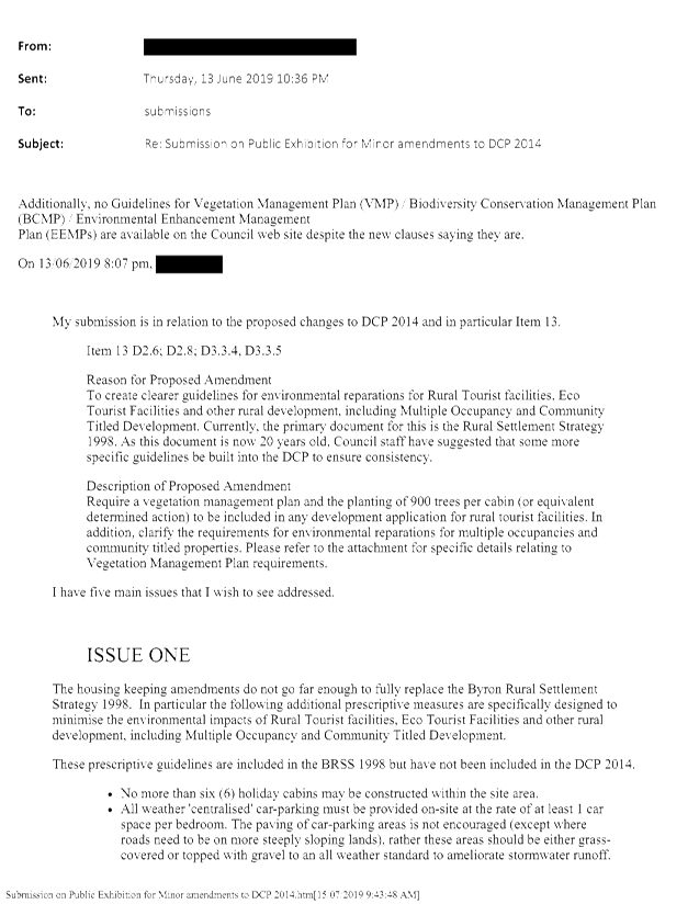
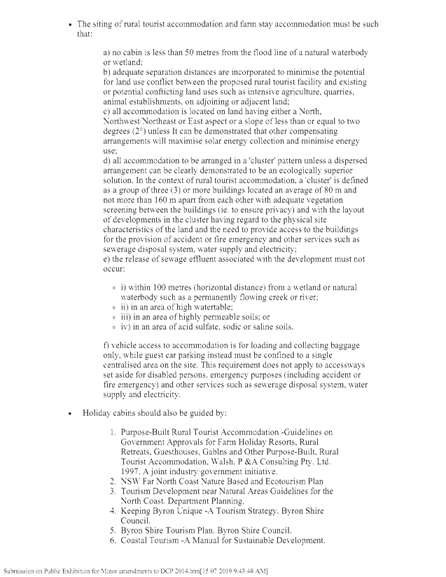
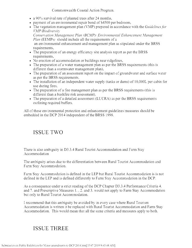
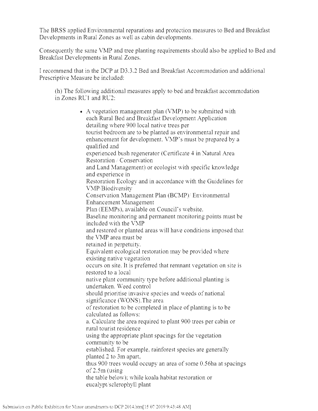
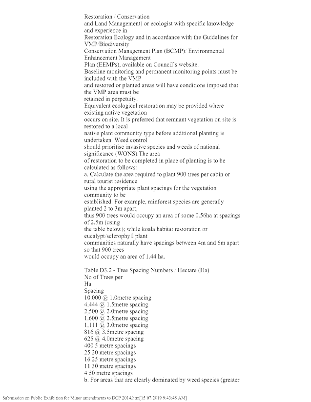
Staff Reports - Sustainable Environment and Economy 8.4 - Attachment 12
Local
Government (General) Regulation 2005
Schedule 3A Form of special disclosure
of pecuniary interest
(Clause 195A)
Section 451 of the Local Government
Act 1993
Form of Special Disclosure of Pecuniary Interest
1 The particulars of
this form are to be written in block letters or typed.
2 If any space is
insufficient in this form for all the particulars required to complete it, an
appendix is to be attached for that purpose which is properly identified and signed
by you.
Important information
This information is being collected for the purpose of
making a special disclosure of pecuniary interests under sections 451 (4) and
(5) of the Local Government Act 1993. The special disclosure must relate to a pecuniary
interest that arises only because of an interest of the councillor in the
councillor’s principal place of residence or an interest of another
person (whose interests are relevant under section 443 of the Act) in that
person’s principal place of residence. You must not make a special
disclosure that you know or ought reasonably to know is false or misleading in
a material particular. Complaints made about contraventions of these
requirements may be referred by the Director-General to the Local Government
Civil and Administrative Tribunal.
This form must be completed by you before the
commencement of the council or council committee meeting in respect of which
the special disclosure is being made. The completed form must be tabled at the
meeting. Everyone is entitled to inspect it. The special disclosure must be
recorded in the minutes of the meeting.
Special
disclosure of pecuniary interests
by
____________________________________________________________________________________
[full
name of councillor]
in the matter of
__________________________________________________________________________
[insert
name of environmental planning instrument]
which is to be considered at a meeting of the
______________________________________________________________________________________
[name of council or council committee (as the case
requires)]
Report No. __________ to be held on the _________________ day of
________________________ 201
|
Pecuniary
interest
|
|
Address of land
in which councillor or an associated person, company or body has a
proprietary interest (the identified land)1
|
|
|
Relationship of identified land to councillor
[Tick or cross one box.]
|
Councillor
has interest in the land (e.g. is owner or has other interest arising out of
a mortgage, lease, trust, option or contract, or otherwise).
Associated
person of councillor has interest in the land.
Associated company
or body of councillor has interest in the land.
|
|
Matter giving rise to pecuniary interest
|
|
Nature of land that is subject to a
change
in zone/planning control by proposed
LEP (the subject land)2
[Tick or cross one box]
|
The identified
land.
Land
that adjoins or is adjacent to or is in proximity to the identified land.
|
|
Current
zone/planning control
[Insert name
of current planning instrument and identify relevant zone/planning control
applying to the subject land]
|
|
|
Proposed
change of zone/planning control
[Insert name of proposed
LEP and identify proposed change of zone/planning control applying to the
subject land]
|
|
|
Effect
of proposed change of zone/planning control on councillor
[Insert
one of the following:
“Appreciable financial gain” or
“Appreciable
financial loss”]
|
|
[If
more than one pecuniary interest is to be declared, reprint the above box and
fill in for each additional interest.]
_____________________________
Councillor’s
signature
_____________________________
Date
(This
form is to be retained by the Council’s general manager and included in
full in the minutes of the meeting.)
1 Section 443 (1) of the Local Government Act 1993 provides
that you may have a pecuniary interest in a matter because of the pecuniary
interest of your spouse or your de facto partner or your relative 4 or because
your business partner or employer has a pecuniary interest. You may also have a
pecuniary interest in a matter because you, your nominee, your business partner
or your employer is a member of a company or other body that has a pecuniary
interest in the matter.
Section 442
of the Local Government Act 1993 provides
that a "pecuniary interest" is an interest that a
person has in a matter because of a reasonable likelihood or expectation of
appreciable financial gain or loss to the person. A person does not have a
pecuniary interest in a matter if the interest is so remote or insignificant
that it could not reasonably be regarded as likely to influence any decision
the person might make in relation to the matter or if the interest is of a kind
specified in section 448 of that Act (for example, an interest as an elector or
as a ratepayer or person liable to pay a charge).
2 A pecuniary interest may
arise by way of a change of permissible use of land adjoining, adjacent to or
in proximity to land in which a councillor or a person, company or body
referred to in section 443 (1) (b) or (c) of the Local Government Act 1993 has a proprietary interest-see section 448 (g) (ii) of
the Local Government Act 1993 .
3 "Relative" is
defined by the Local Government Act 1993 as meaning your, your spouse’s or your de facto
partner’s parent, grandparent, brother, sister, uncle, aunt, nephew,
niece, lineal descendant or adopted child and the spouse or de facto partner of
any of those persons.
Staff Reports - Sustainable Environment and Economy 8.6 - Attachment 1


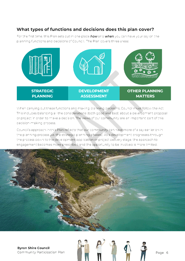
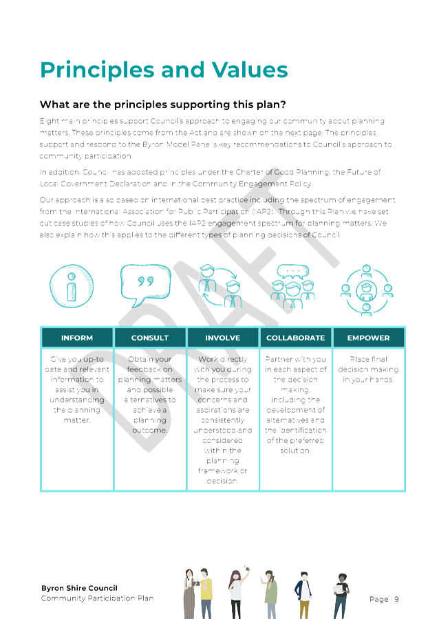


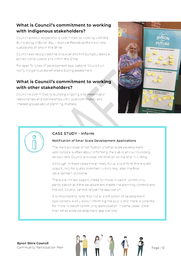

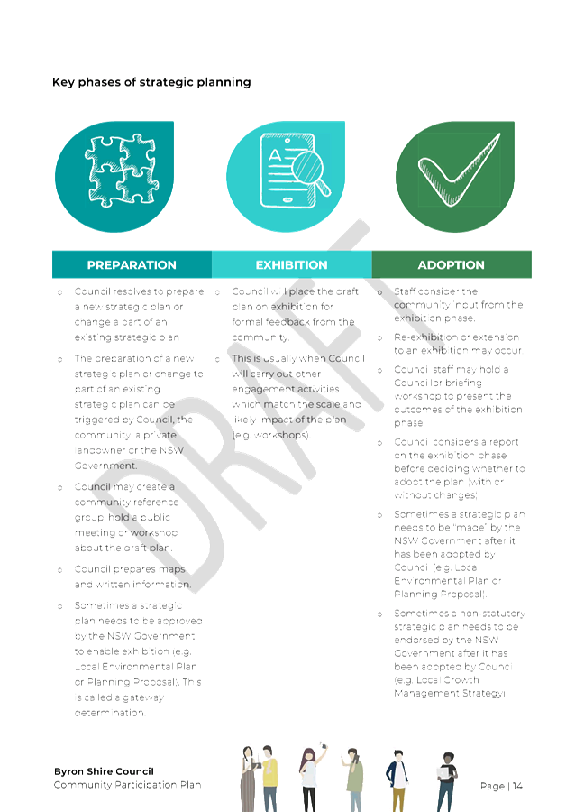
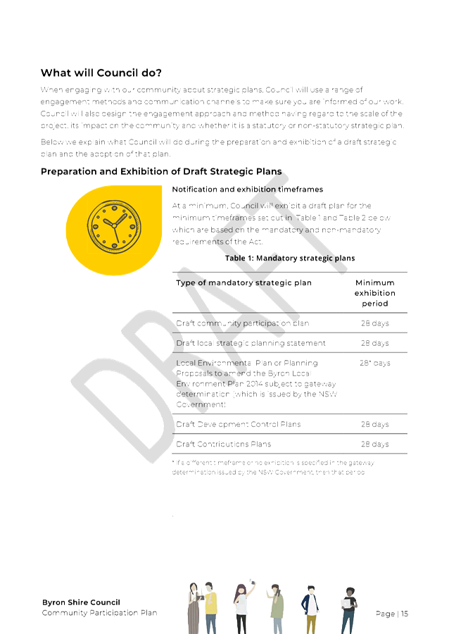
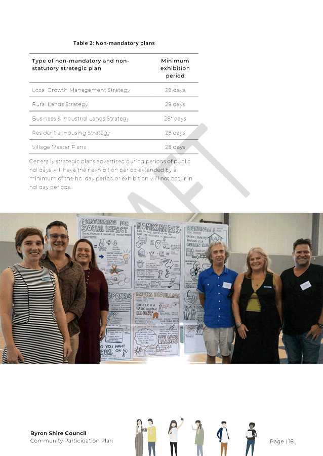

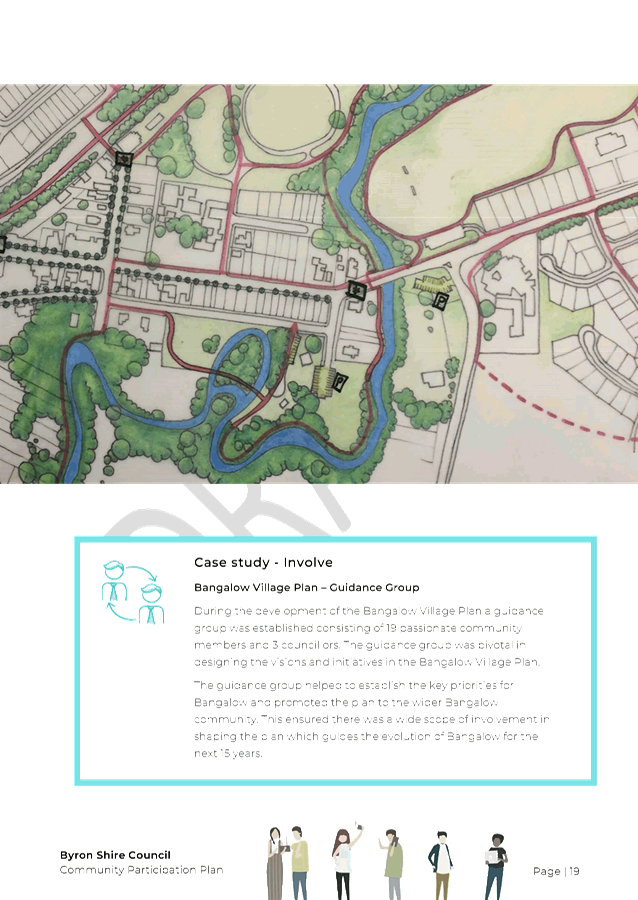

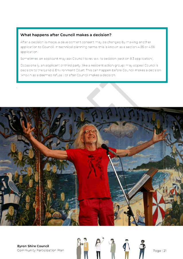
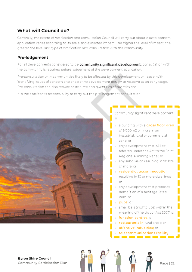
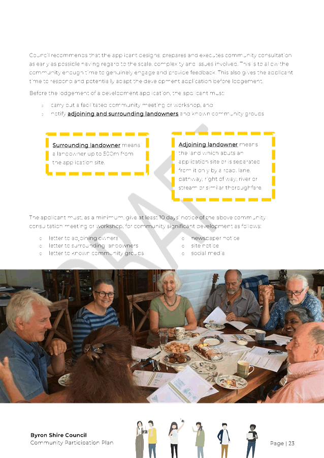
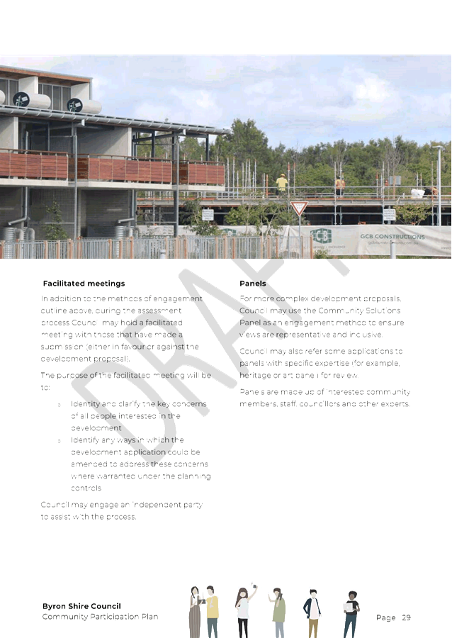
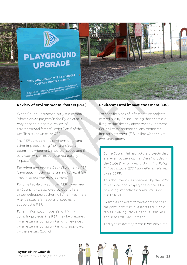
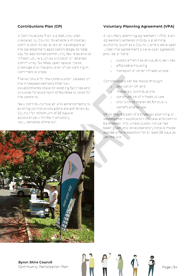
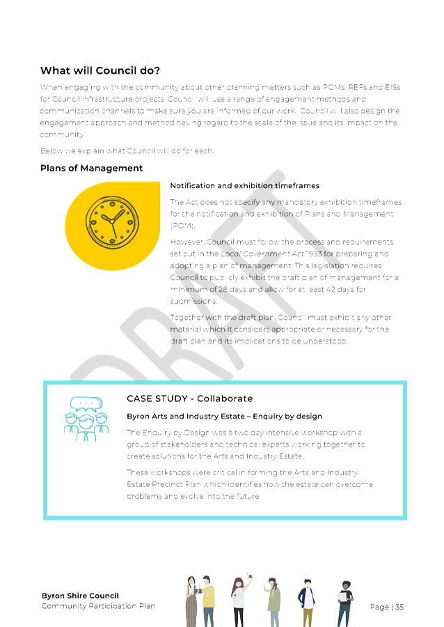
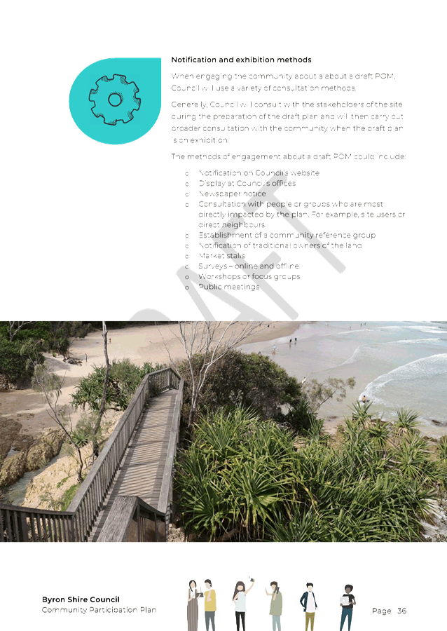


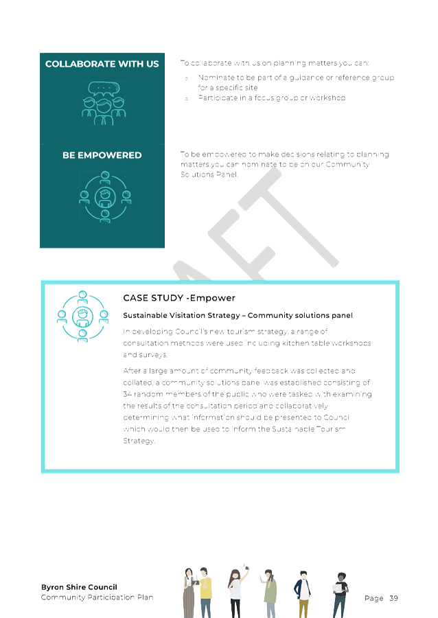

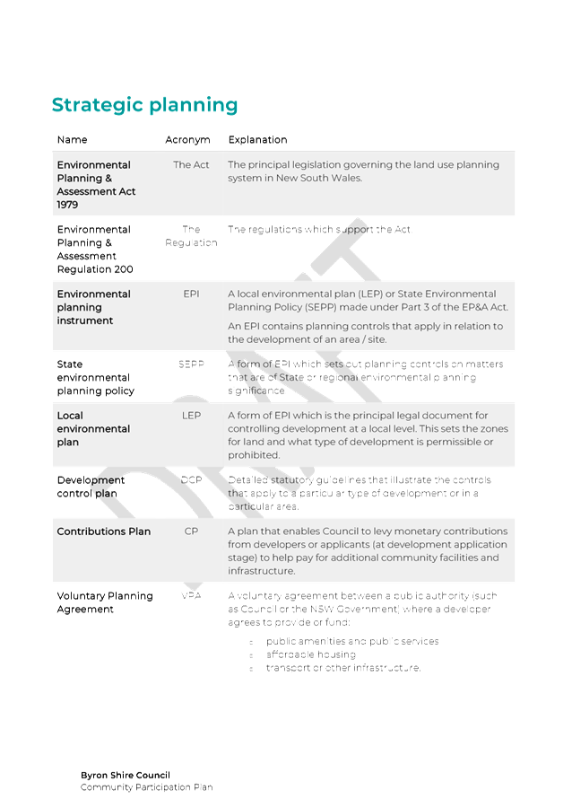
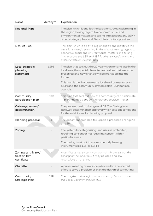
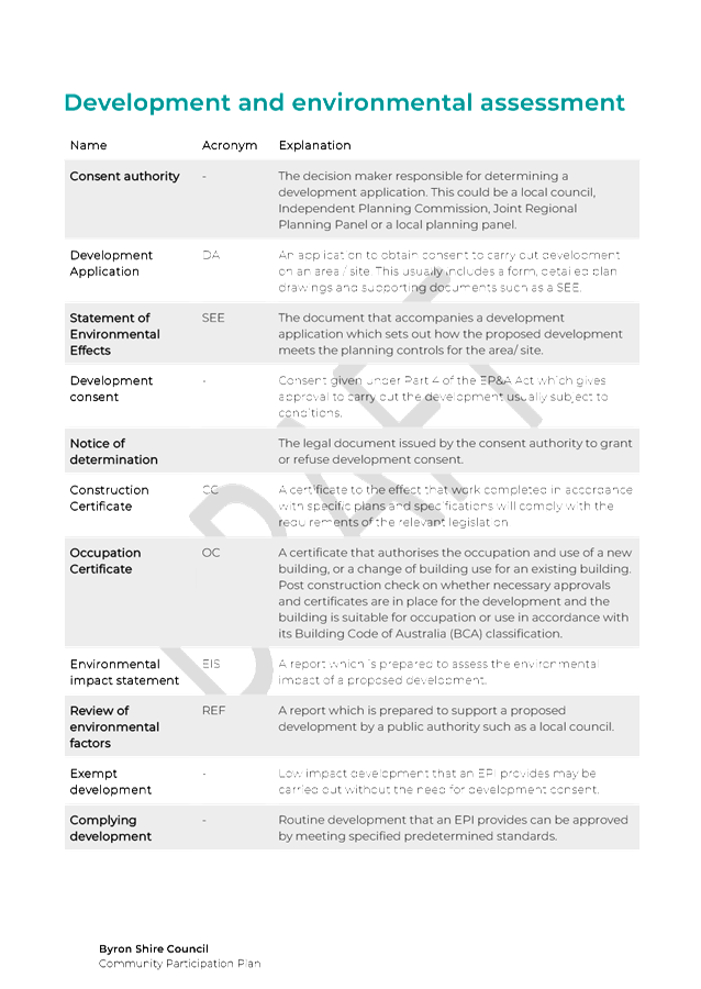
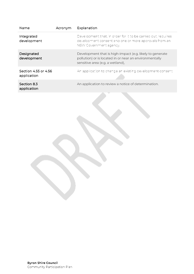


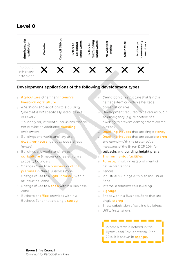
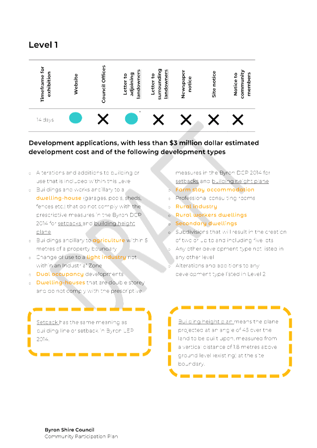
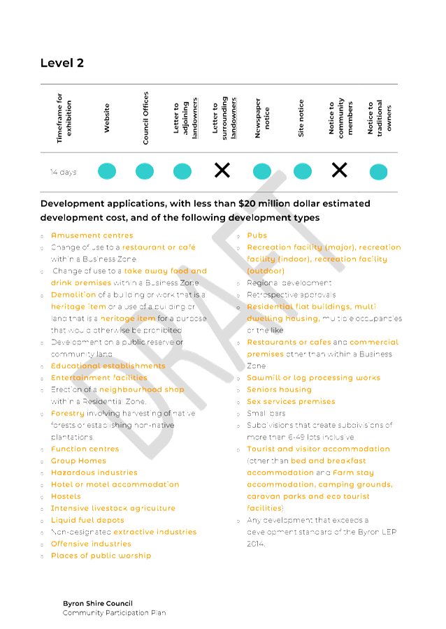
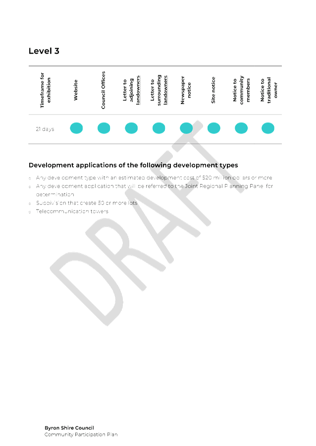


Staff Reports - Sustainable Environment and Economy 8.7 - Attachment 1


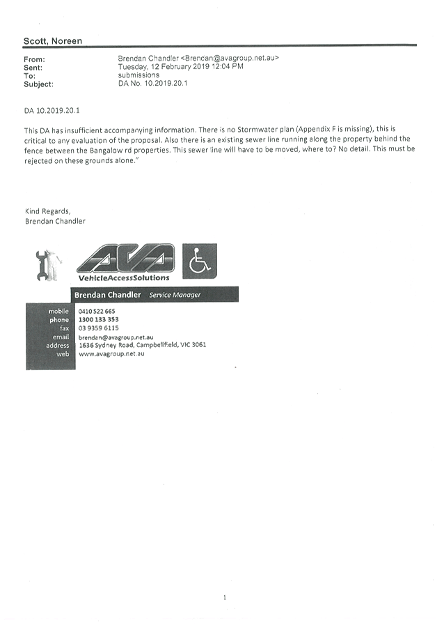


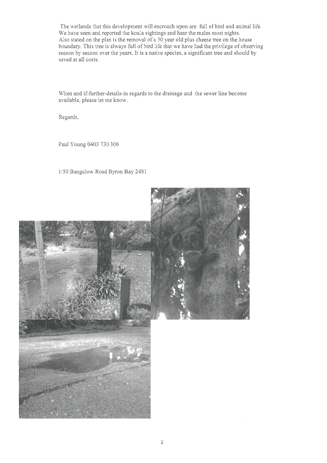


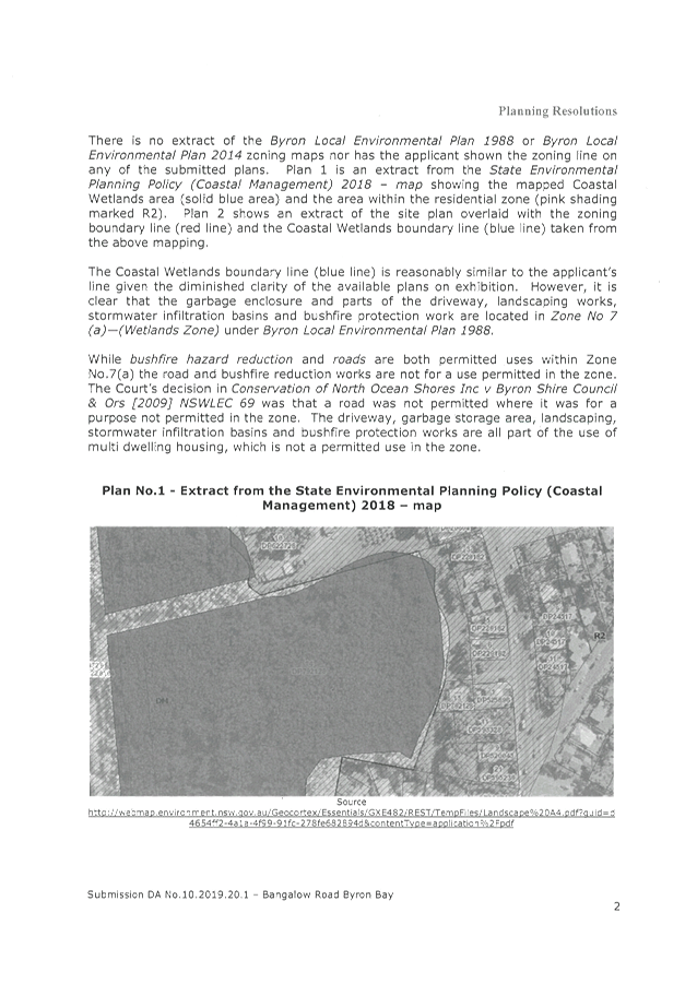
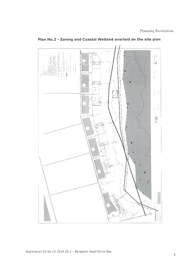
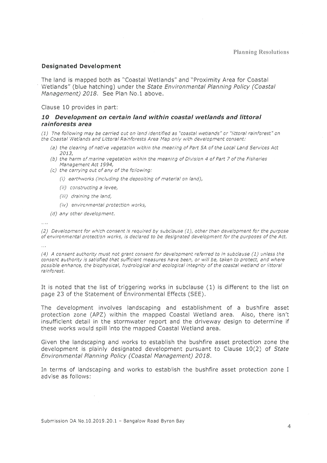
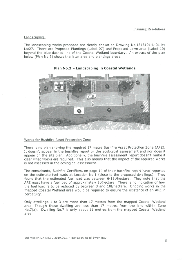


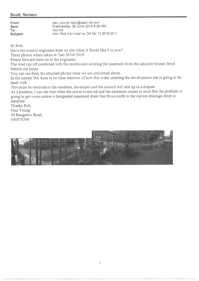


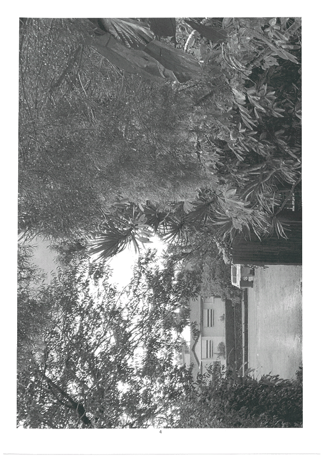

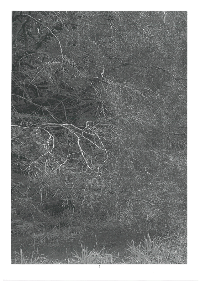
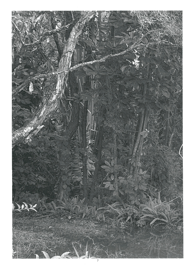
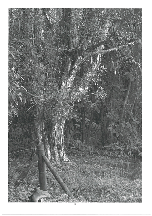


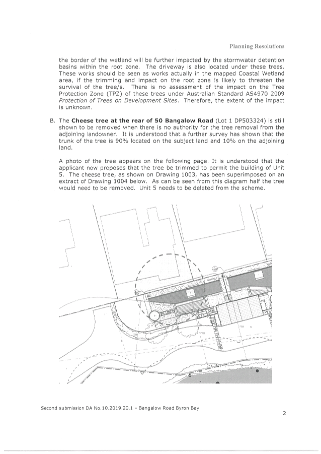
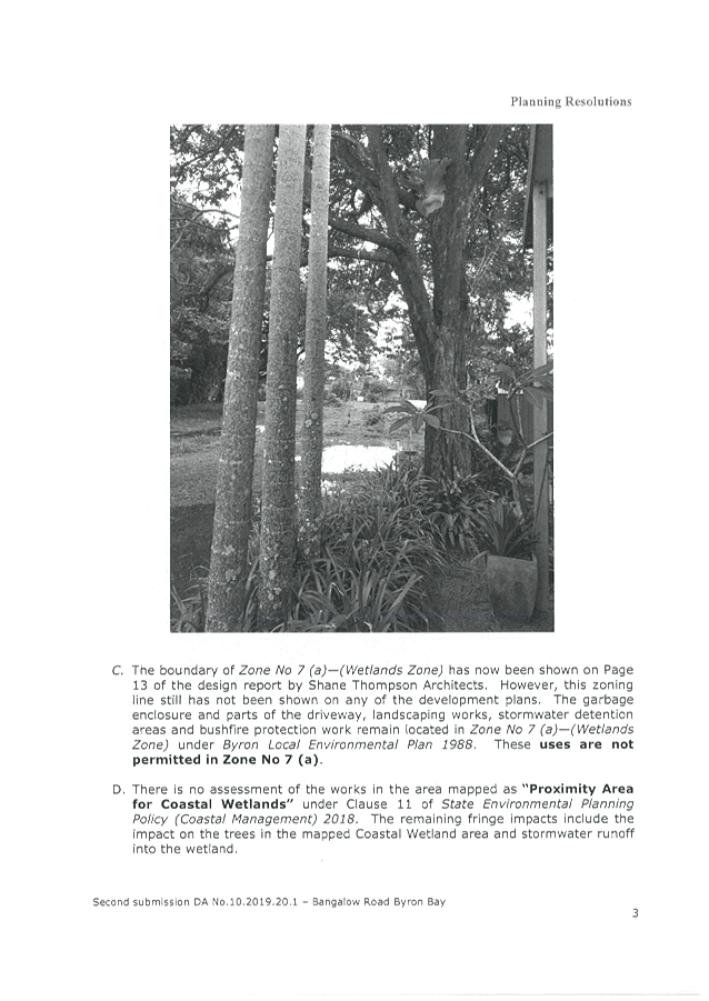
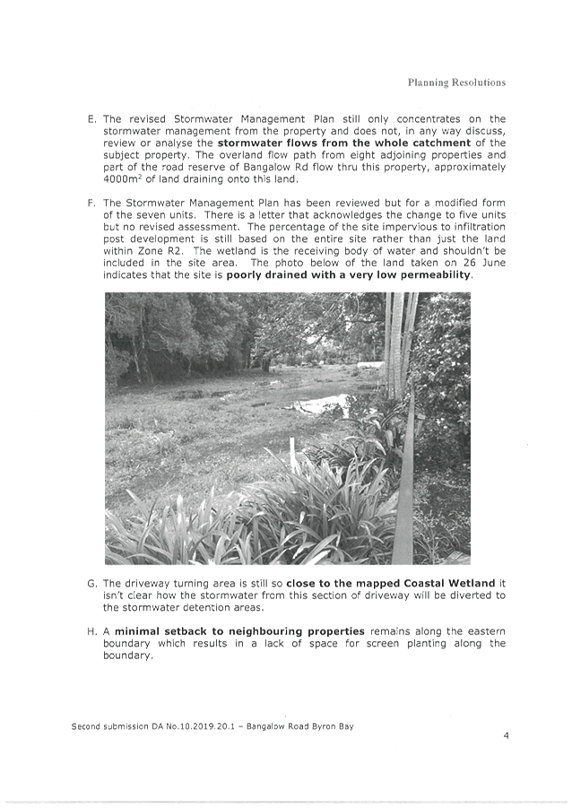
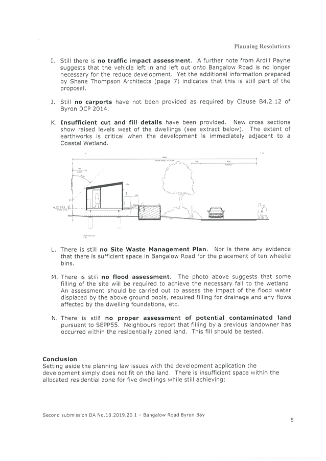


Staff Reports - Sustainable Environment and Economy 8.7 - Attachment 2
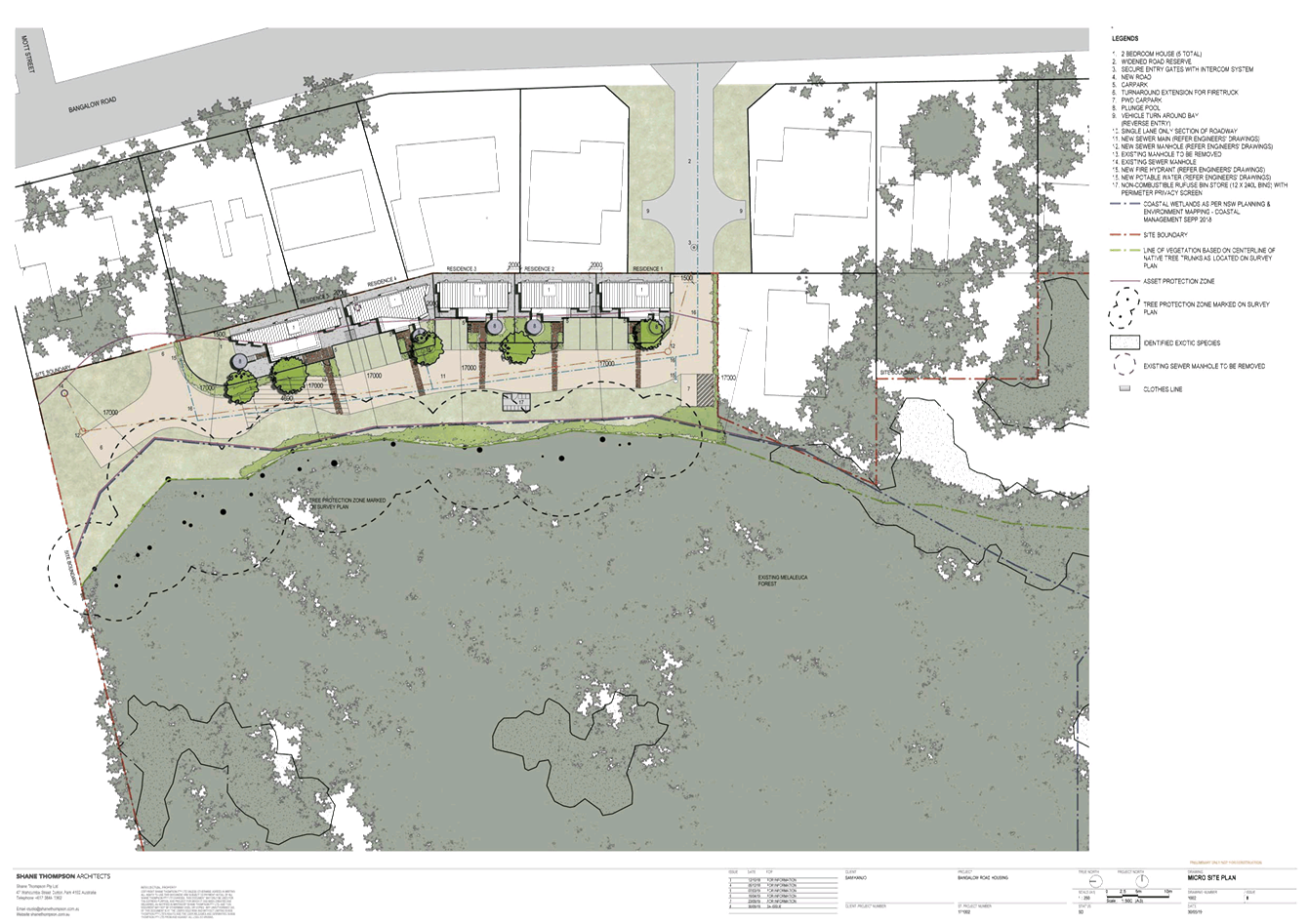
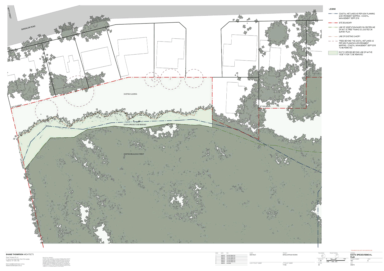
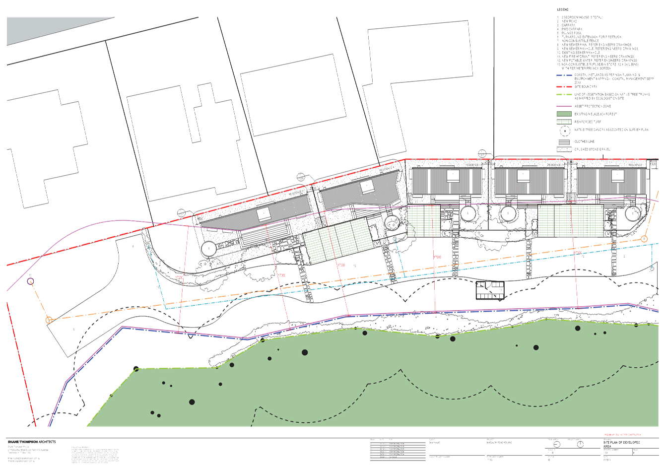
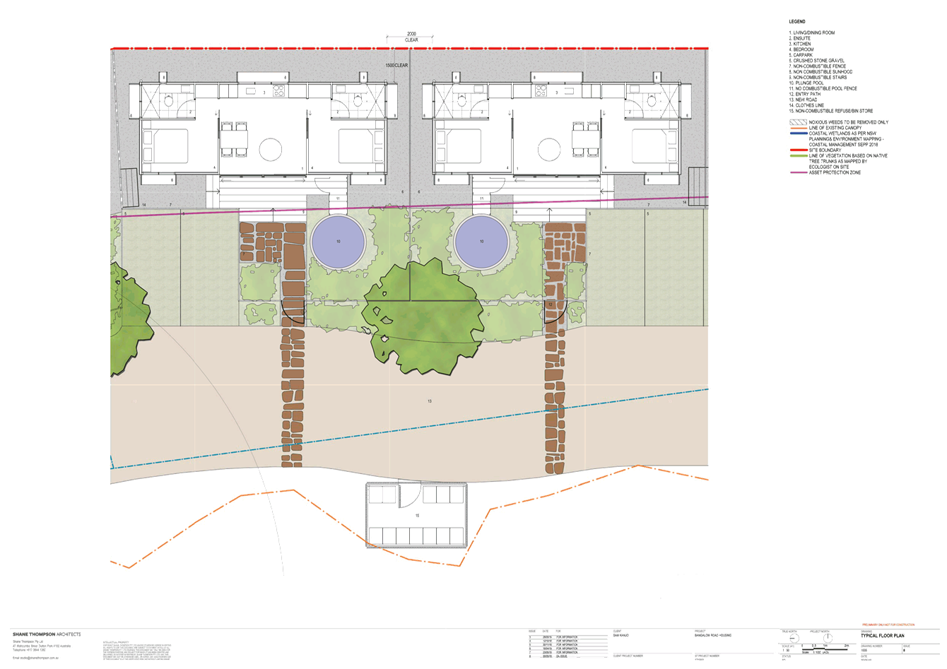
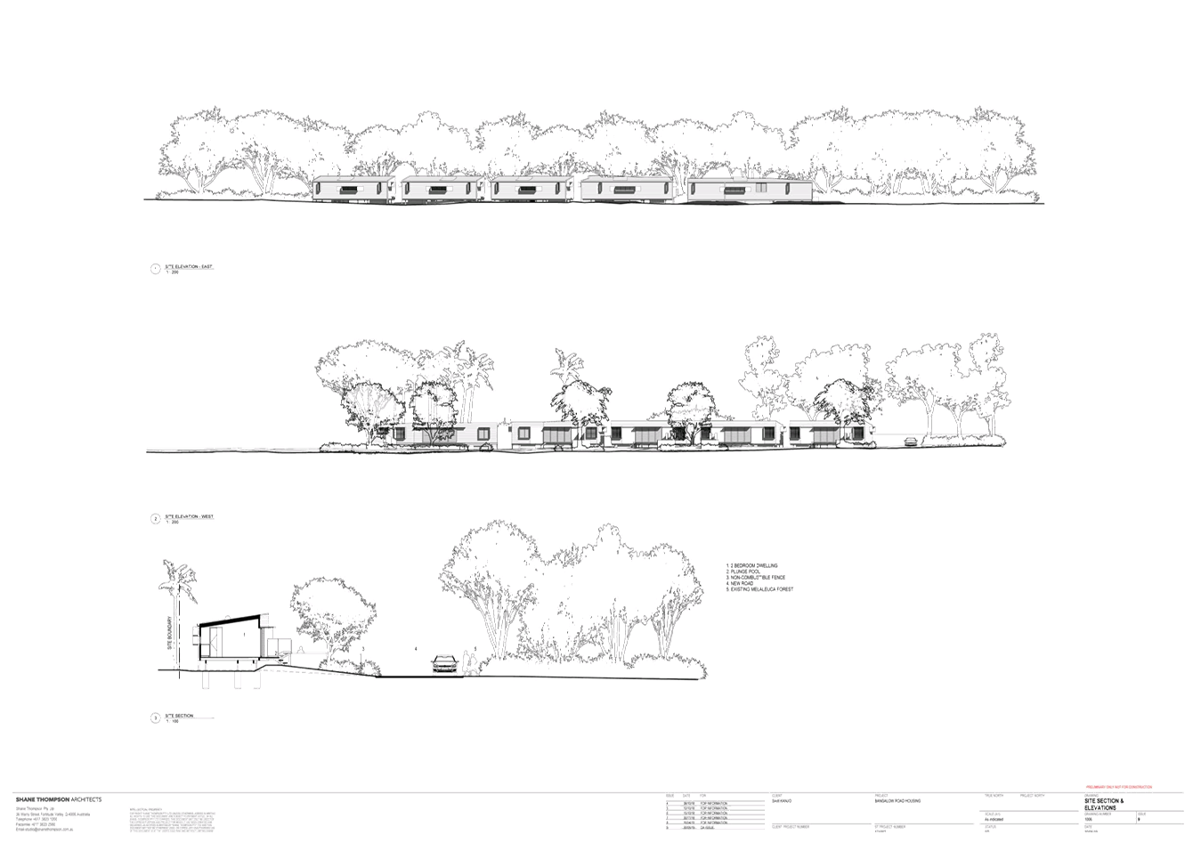
Staff Reports - Sustainable Environment and Economy 8.7 - Attachment 3
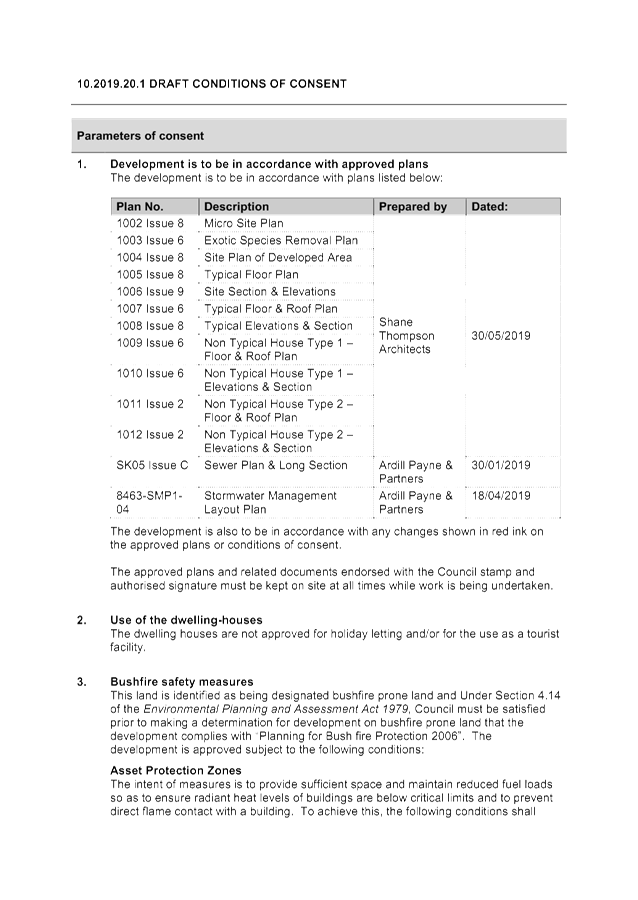
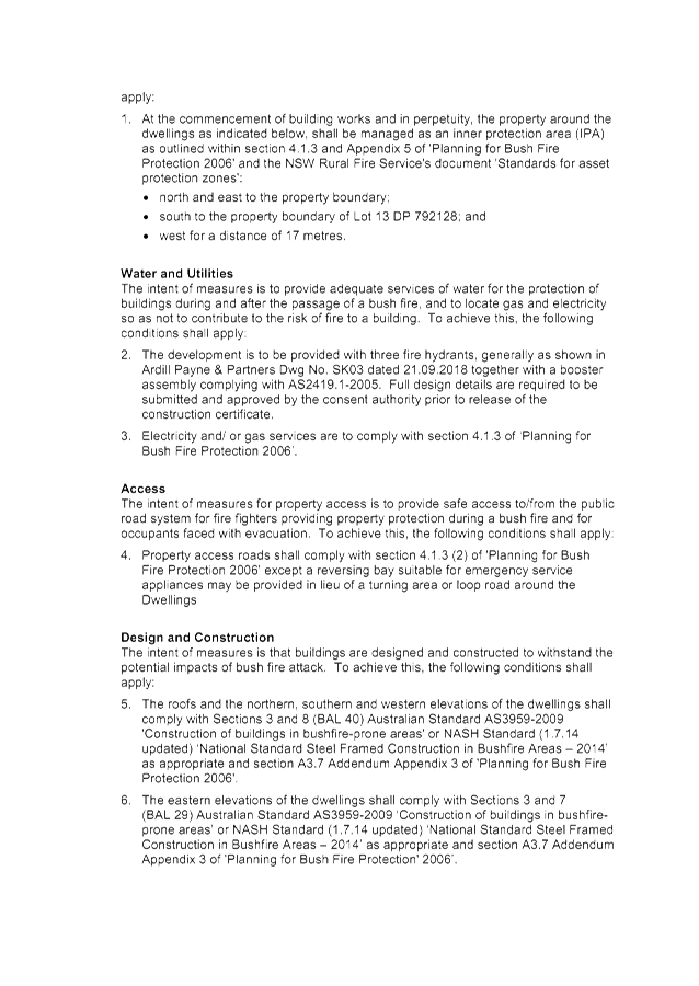
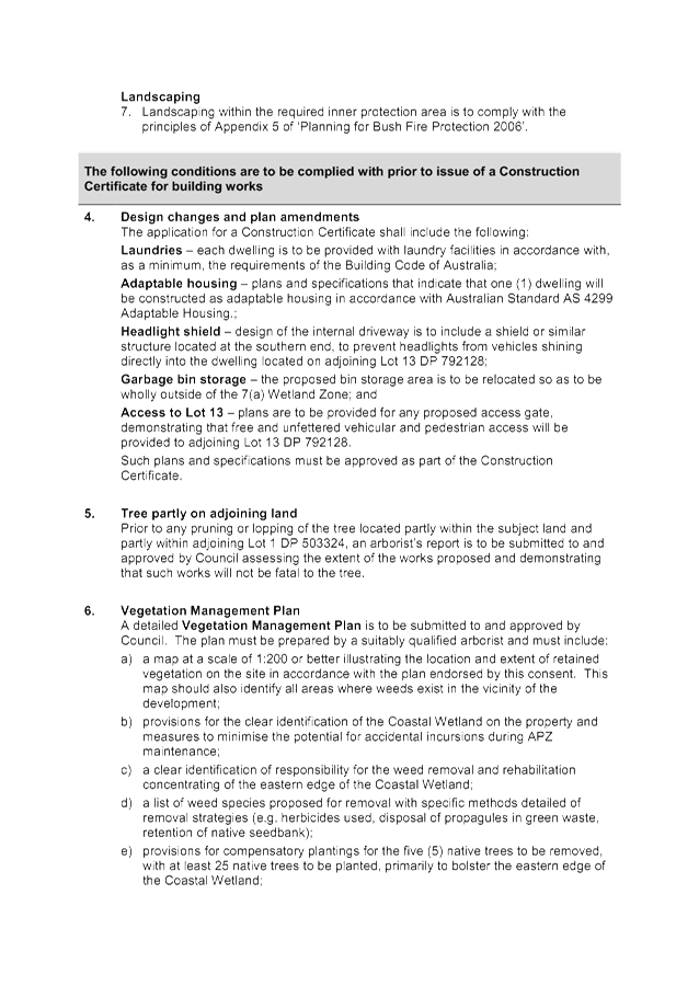
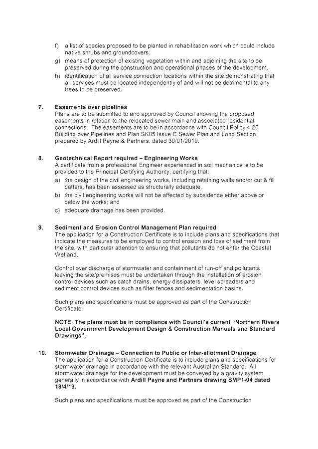
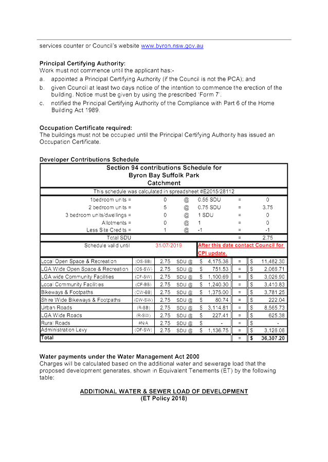
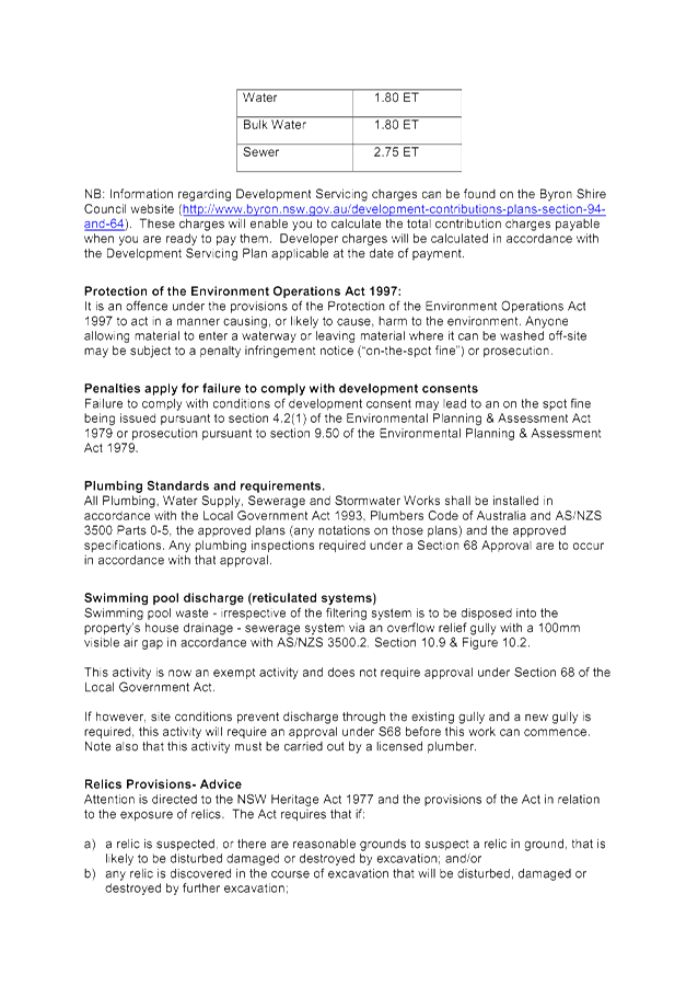

Staff Reports - Sustainable Environment and Economy 8.9 - Attachment 1
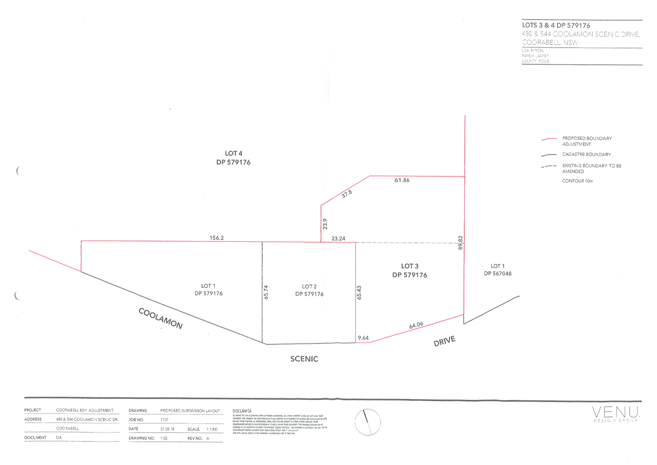
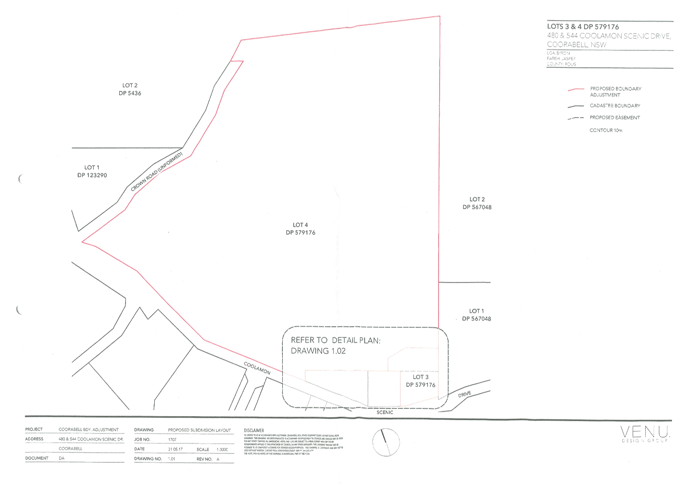
Staff Reports - Sustainable Environment and Economy 8.9 - Attachment 2
10.2019.129.1
CONDITIONS
OF CONSENT:
|
SCHEDULE 1 CONDITIONS
OF CONSENT
|
|
Parameters of
consent
|
|
1.
|
Development is to be in accordance with approved plans
The development is to be in accordance with plans listed
below:
|
Plan No.
|
Description
|
Prepared by
|
Dated:
|
|
1.01 - A
|
Proposed Subdivision Layout
|
Venu Design Group
|
31.05.17
|
|
1.02 - A
|
Proposed Subdivision Layout
|
Venu Design Group
|
31.05.18
|
The development is also to be in accordance with any
changes shown in red ink on the approved plans or conditions of consent.
The approved plans and related documents endorsed with the
Council stamp and authorised signature must be kept on site at all times
while work is being undertaken.
|
|
2.
|
Integrated Approvals from other Authorities.
This development consent includes an Integrated
development approval under Sections 4.46 and 4.47 of the Environmental
Planning and Assessment Act 1979, being a Bush Fire Safety Authority, under
Section 100B of the Rural Fires Act 1997, subject to the conditions listed
under the “General Terms of Integrated Development Approval” in
this consent.
|
|
The following
conditions are to be complied with prior to issue of a Subdivision
Certificate
|
|
3.
|
Subdivision Certificate application required
An application for a Subdivision Certificate must be made
on the approved form. The Subdivision Certificate fees, in accordance with
Council's adopted schedule of fees and charges, must accompany such
application.
NOTE: The application MUST be one
complete concise package addressing ALL conditions of consent relevant to the
subdivision with a clear explanation how each condition has been complied
with, together with supplying ALL the relevant information /documents/
certificate and/or plans that is required by that condition. Failure to
provide the abovementioned information in one package will likely result in
the application being refused or rejected and returned to you.
|
|
4.
|
Plan of Subdivision
The final plan of subdivision must be in accordance with
the approved plan/s. A Deposited Plan Administration Sheet (original plus one
(1) copy), two (2) copies of the plan of subdivision and any necessary
section 88B instrument (original plus one (1) copy) are to be submitted with
the application for a subdivision certificate.
|
|
5.
|
Compliance with bushfire conditions
Documentary evidence from a suitably qualified
professional is to be submitted to the PCA demonstrating that the bush fire
conditions as issued under Section 100B of the Rural Fires Act 1997 have been
complied with.
|
|
General Terms of
Integrated Development Approval – Rural Fires Act 1997
|
|
|
The Rural Fire Service, in correspondence dated 24 April
2019, issued General Terms of Approval and a Bush Fire Safety Authority
subject to the following conditions:
|
|
|
Asset Protection Zones
The intent of measures is to provide
sufficient space and maintain reduced fuel loads so as to ensure radiant heat
levels of buildings are below critical limits and to prevent direct flame
contact with a building. To achieve this, the following conditions shall
apply:
1. At the issue of subdivision certificate and in
perpetuity, the land surrounding the existing dwelling(s) on proposed Lot 3
shall be maintained as an inner protection area (IPA) as outlined within
Section 4.1.3 and Appendix 5 of ‘Planning for Bush Fire Protection
2006’ (PBP) and the NSW Rural Fire Service's document ‘Standards
for asset protection zones’ as follows:
· North for a
distance of 48 metres as an IPA;
· South to the
property boundary as an IPA;
· East to the property
boundary as an IPA; and
· West to the
property boundary as an IPA.
|
|
|
Water and Utilities
The intent of measures is to minimize the
risk of bush fire attack and provide protection for emergency services
personnel, residents and others assisting fire fighting activities. To
achieve this, the following conditions shall apply:
2. In recognition that no reticulated water supply is
available to the development, a total of 10,000 litres fire fighting water
supply shall be provided to the existing dwelling on proposed Lot 3 for fire
fighting purposes as follows:
· (Existing) tanks shall have a 65mm metal Storz outlet with a gate
or ball valve fitted and be accessible for a fire fighting truck.
· All water supplies for fire fighting purposes shall be clearly
signposted as a fire fighting water supply.
· A Static Water Supply (SWS) sign shall be obtained from the local
NSW Rural Fire Service (RFS) and positioned for ease of identification by RFS
personnel and other users of the SWS. In this regard:
i) Markers must be fixed in a suitable location
so as to be highly visible; and
ii) Markers should be positioned adjacent to the most
appropriate access for the water supply.
Fire fighting
water supply may be provided by a tank, a swimming pool or a dam that shall
be located within the IPA.
|
|
|
Landscaping
3.
Landscaping within the IPA (proposed Lot 3) is to comply with the principles
of Appendix 5 of 'Planning for Bush Fire Protection 2006'.
|
|
SCHEDULE 3 NOTES
|
|
Construction Certificate required:
This development consent is issued under the Environmental
Planning and Assessment Act 1979 and does not relate to structural aspects or
specifications of the building under the Building Code of Australia. All
buildings and alterations require the issue of a Construction Certificate
prior to works commencing. Application forms are available from the customer
services counter or Council’s website www.byron.nsw.gov.au
|
|
Principal Certifying Authority:
Work must not commence until the applicant has:-
a. appointed
a Principal Certifying Authority (if the Council is not the PCA); and
b. given
Council at least two days notice of the intention to commence the erection of
the building. Notice must be given by using the prescribed ‘Form
7’.
c. notified
the Principal Certifying Authority of the Compliance with Part 6 of the Home
Building Act 1989.
|
|
Protection of the Environment Operations Act 1997:
It is an offence under the provisions of the Protection of
the Environment Operations Act 1997 to act in a manner causing, or likely to
cause, harm to the environment. Anyone allowing material to enter a waterway
or leaving material where it can be washed off-site may be subject to a
penalty infringement notice (“on-the-spot fine”) or prosecution.
|
|
Penalties apply for failure to comply with development
consents
Failure to comply with conditions of development consent
may lead to an on the spot fine being issued pursuant to section 4.2(1) of
the Environmental Planning & Assessment Act 1979 or prosecution pursuant
to section 9.50 of the Environmental Planning & Assessment Act 1979.
|
|
Plumbing Standards and requirements.
All Plumbing, Water Supply, Sewerage and Stormwater Works
shall be installed in accordance with the Local Government Act 1993, Plumbers
Code of Australia and AS/NZS 3500 Parts 0-5, the approved plans (any
notations on those plans) and the approved specifications. Any plumbing
inspections required under a Section 68 Approval are to occur in accordance
with that approval.
|
|
Relics Provisions- Advice
Attention is directed to the NSW Heritage Act 1977 and the
provisions of the Act in relation to the exposure of relics. The Act
requires that if:
a) a
relic is suspected, or there are reasonable grounds to suspect a relic in
ground, that is likely to be disturbed damaged or destroyed by excavation;
and/or
b) any
relic is discovered in the course of excavation that will be disturbed,
damaged or destroyed by further excavation;
Those responsible for the discovery must notify nominated
management personnel who will in turn notify the Heritage Council of New
South Wales or its delegate, the Office of Environment and Heritage, NSW
Heritage Branch, and suspend work that might have the effect of disturbing,
damaging or destroying such relic until the requirements of the NSW Heritage
Council have been satisfied (ss139, 146).
|
Staff Reports - Sustainable Environment and Economy 8.10 - Attachment 1
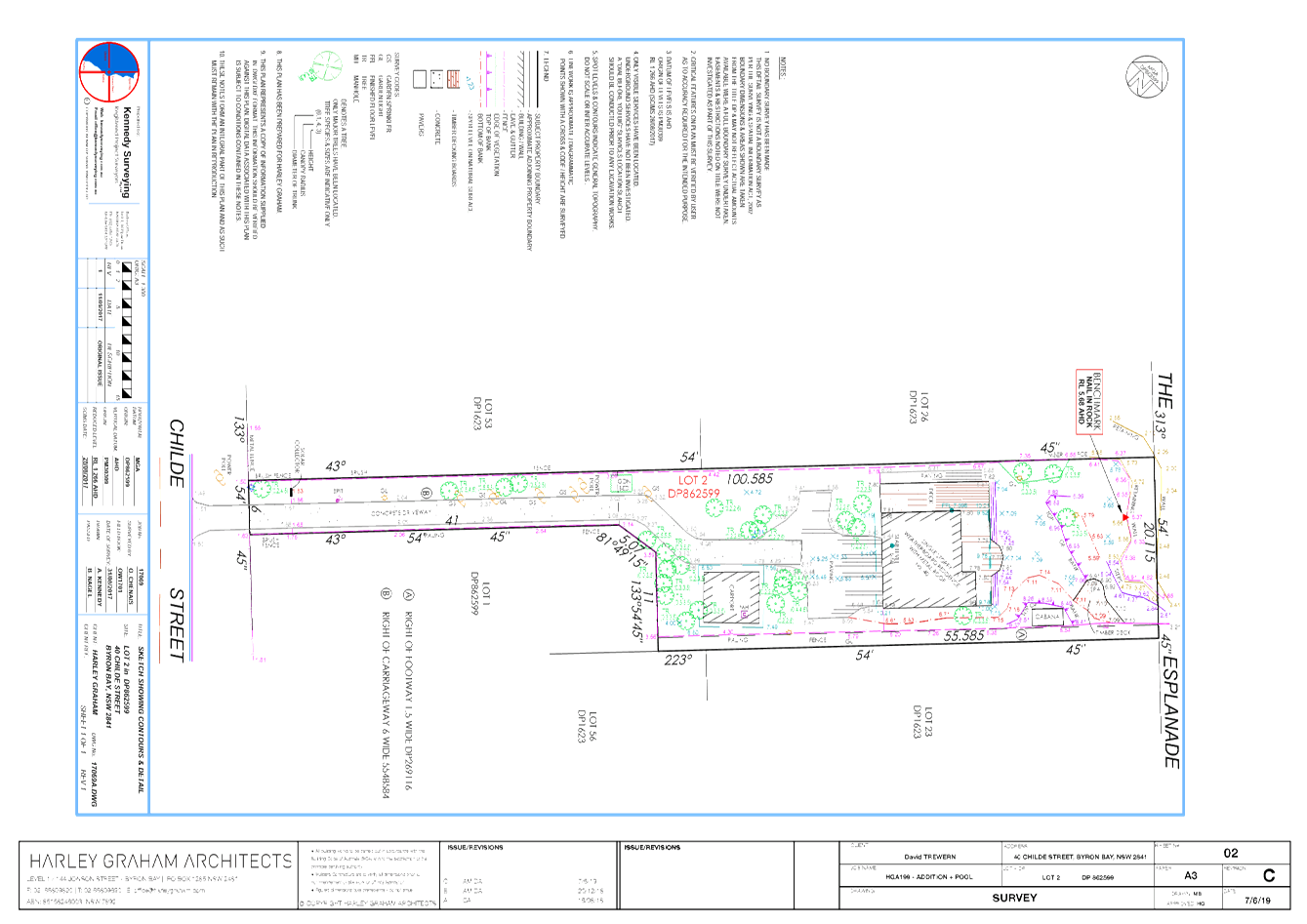
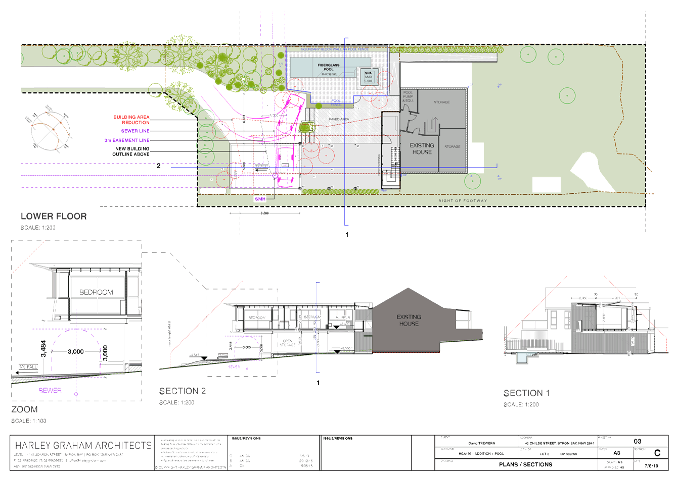
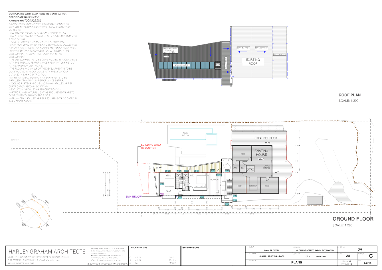
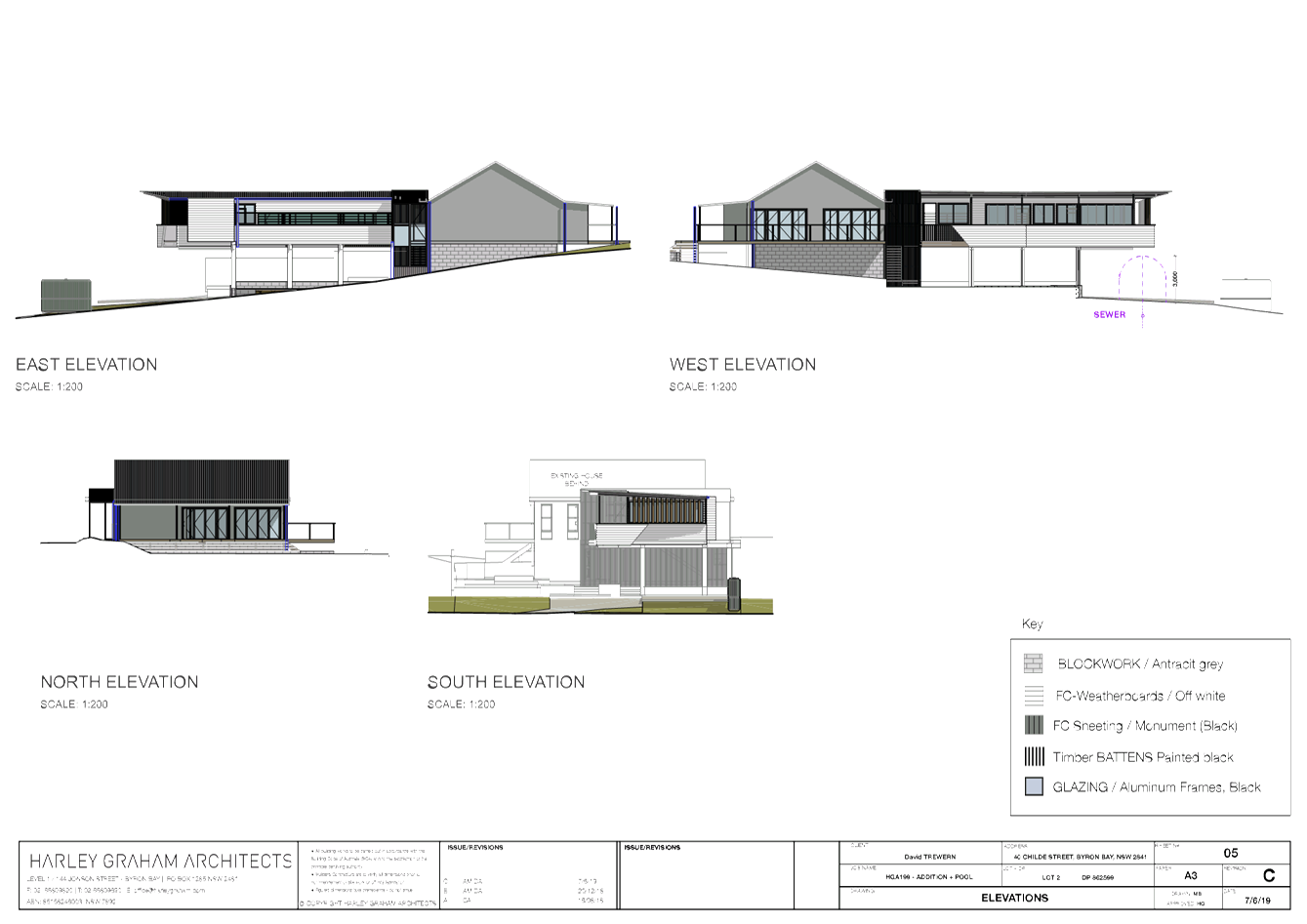
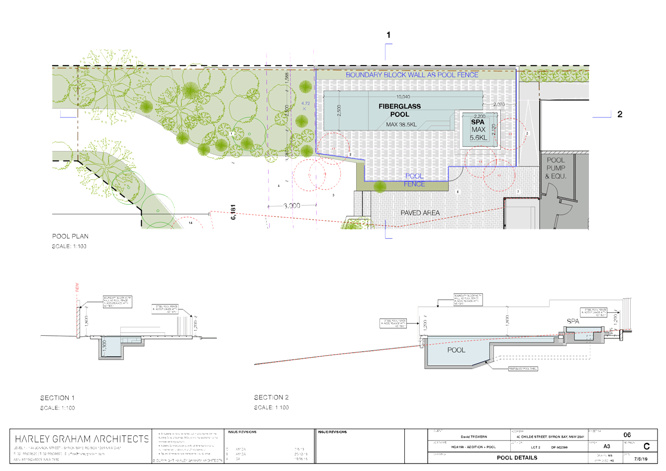
Staff Reports - Sustainable Environment and Economy 8.10 - Attachment 2
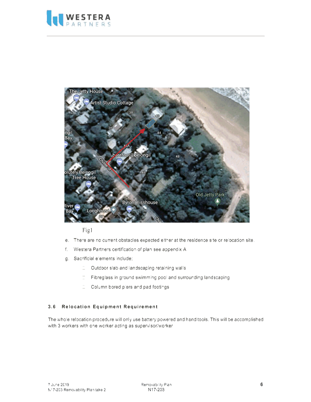
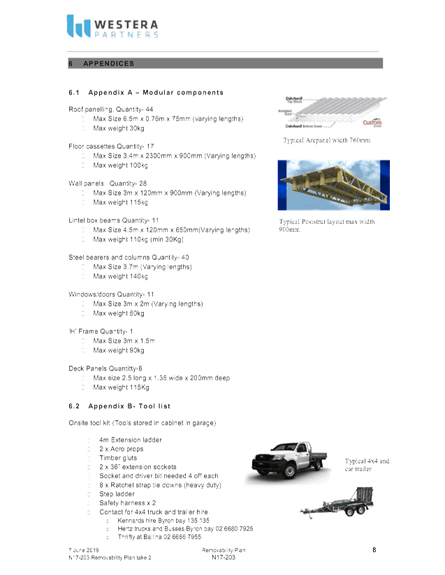


Staff Reports - Sustainable Environment and Economy 8.10 - Attachment 3
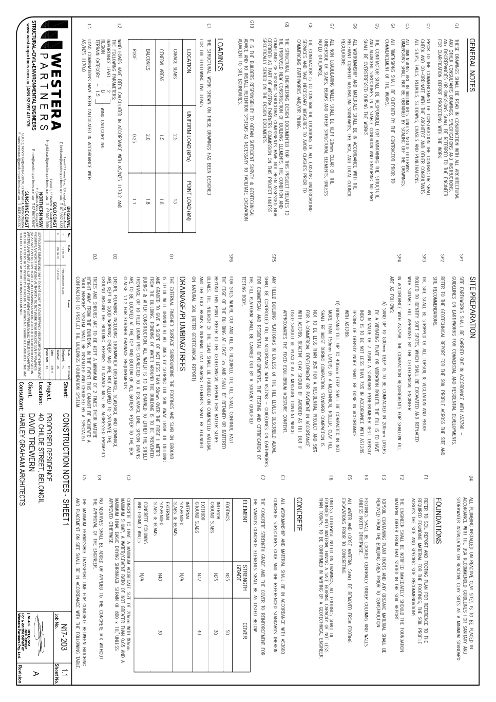
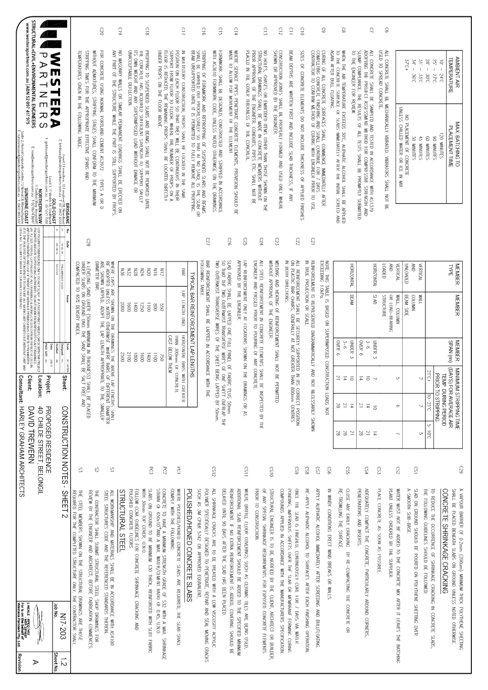
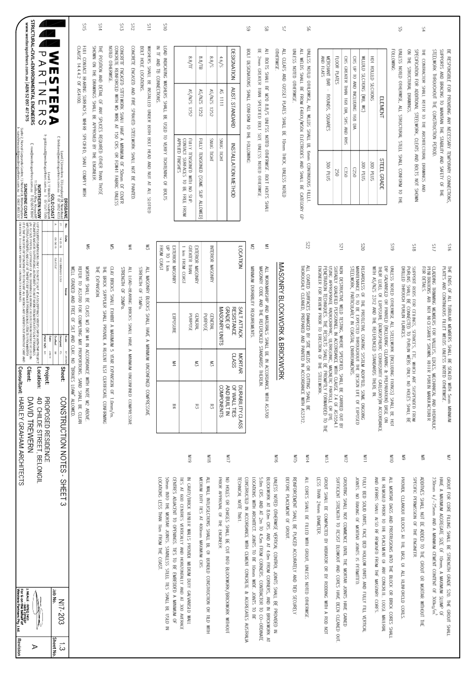
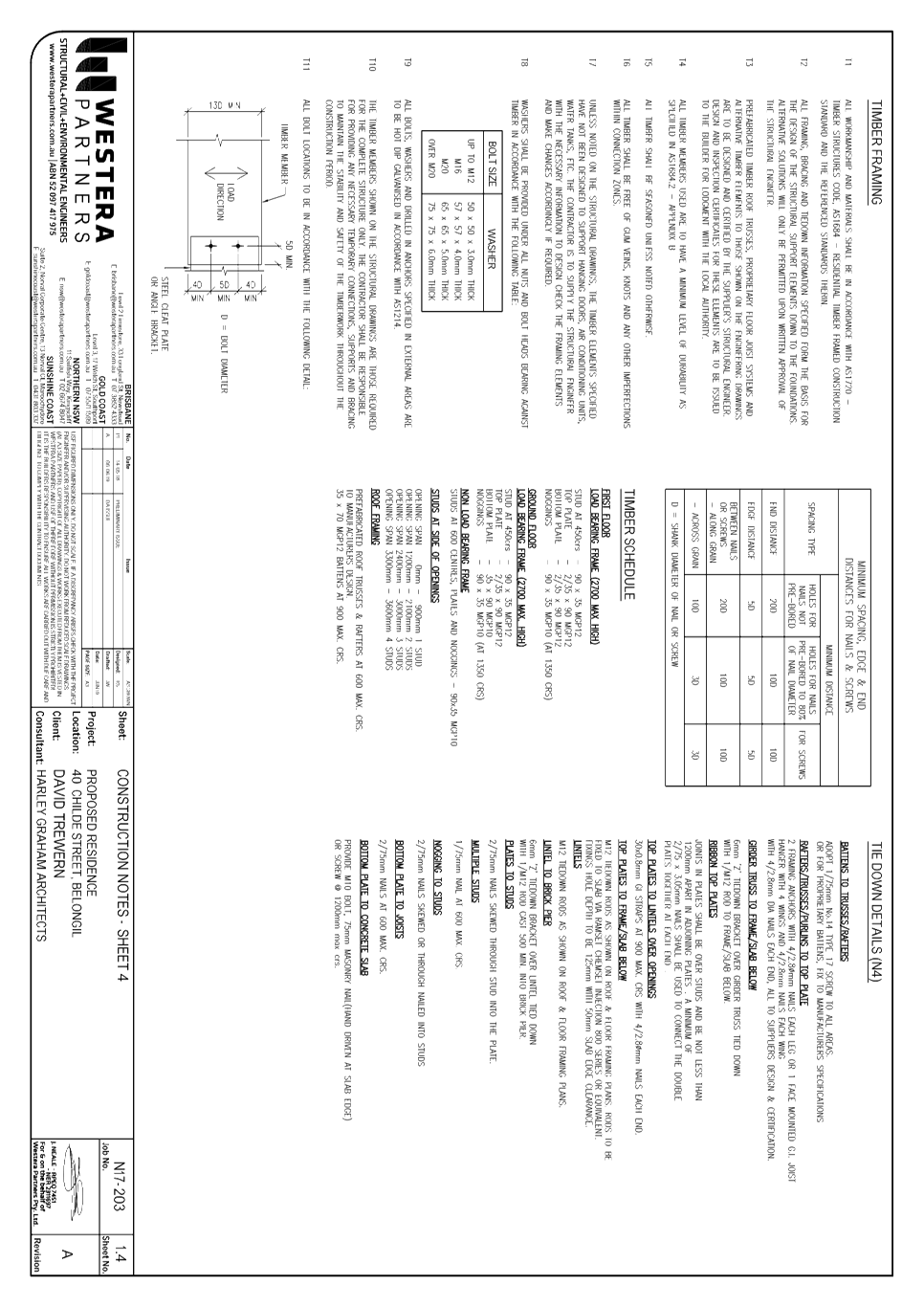
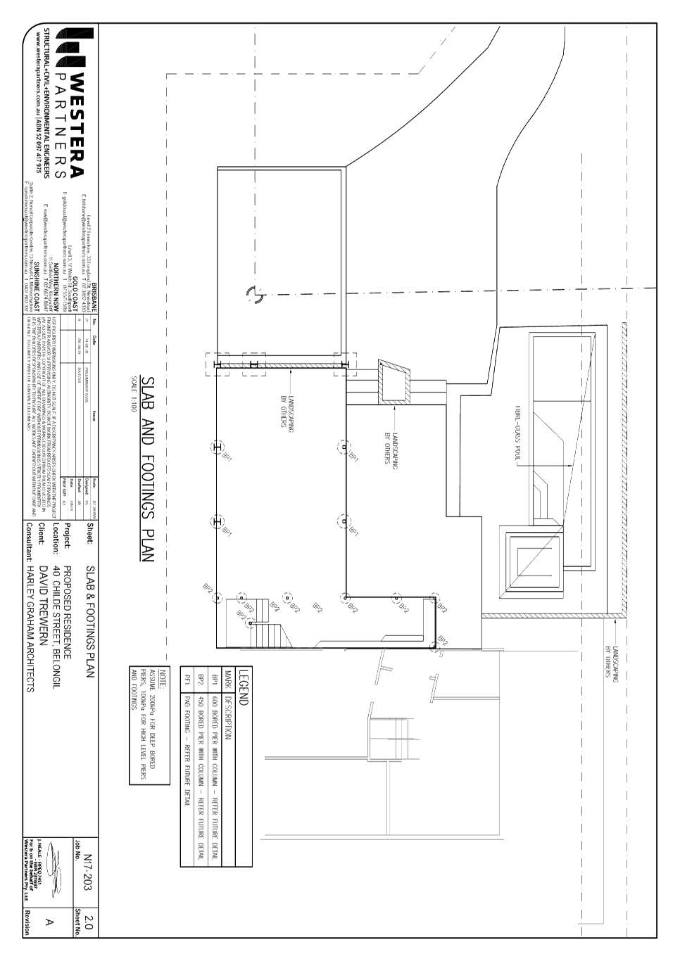
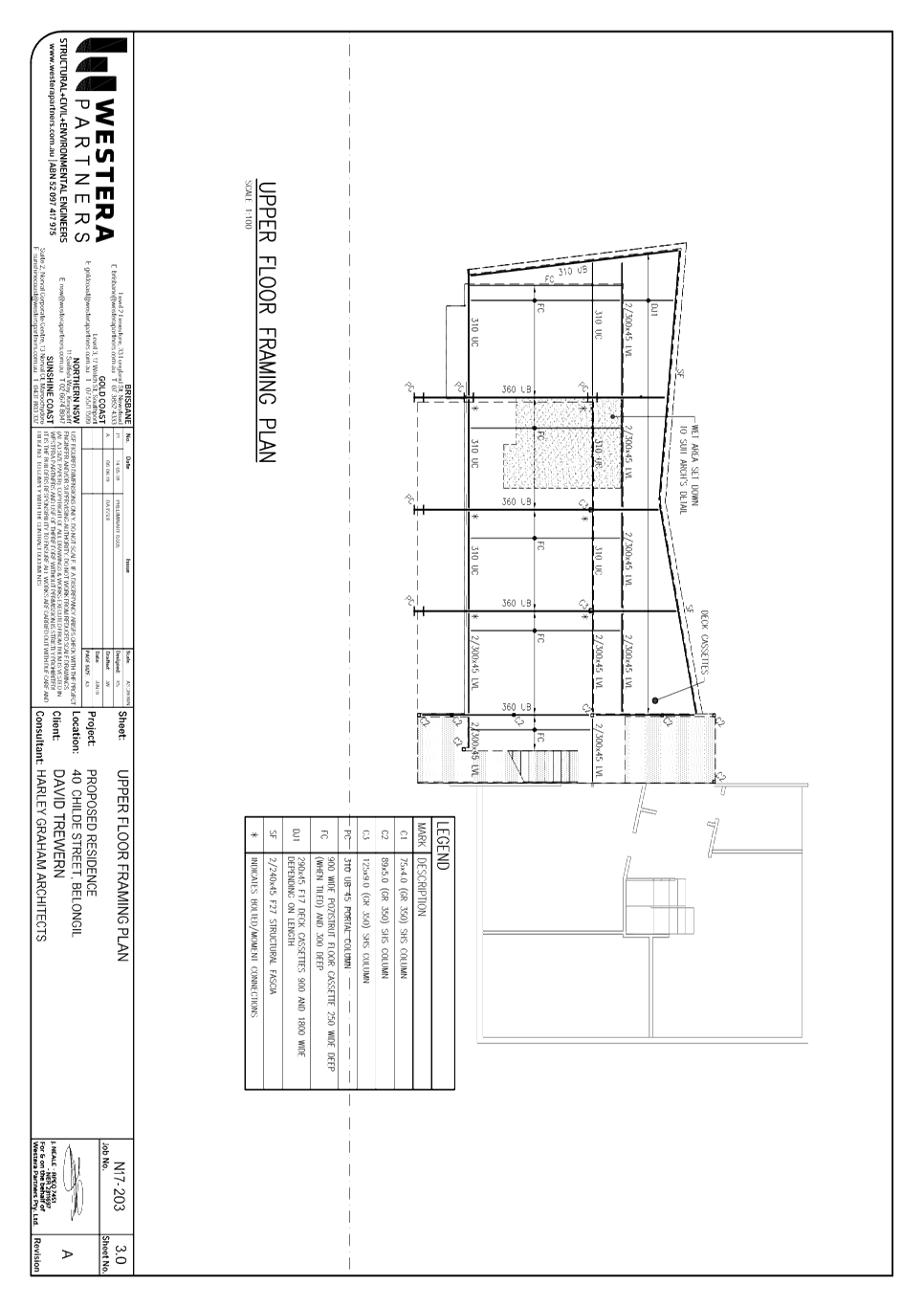
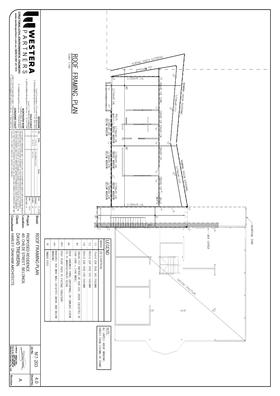
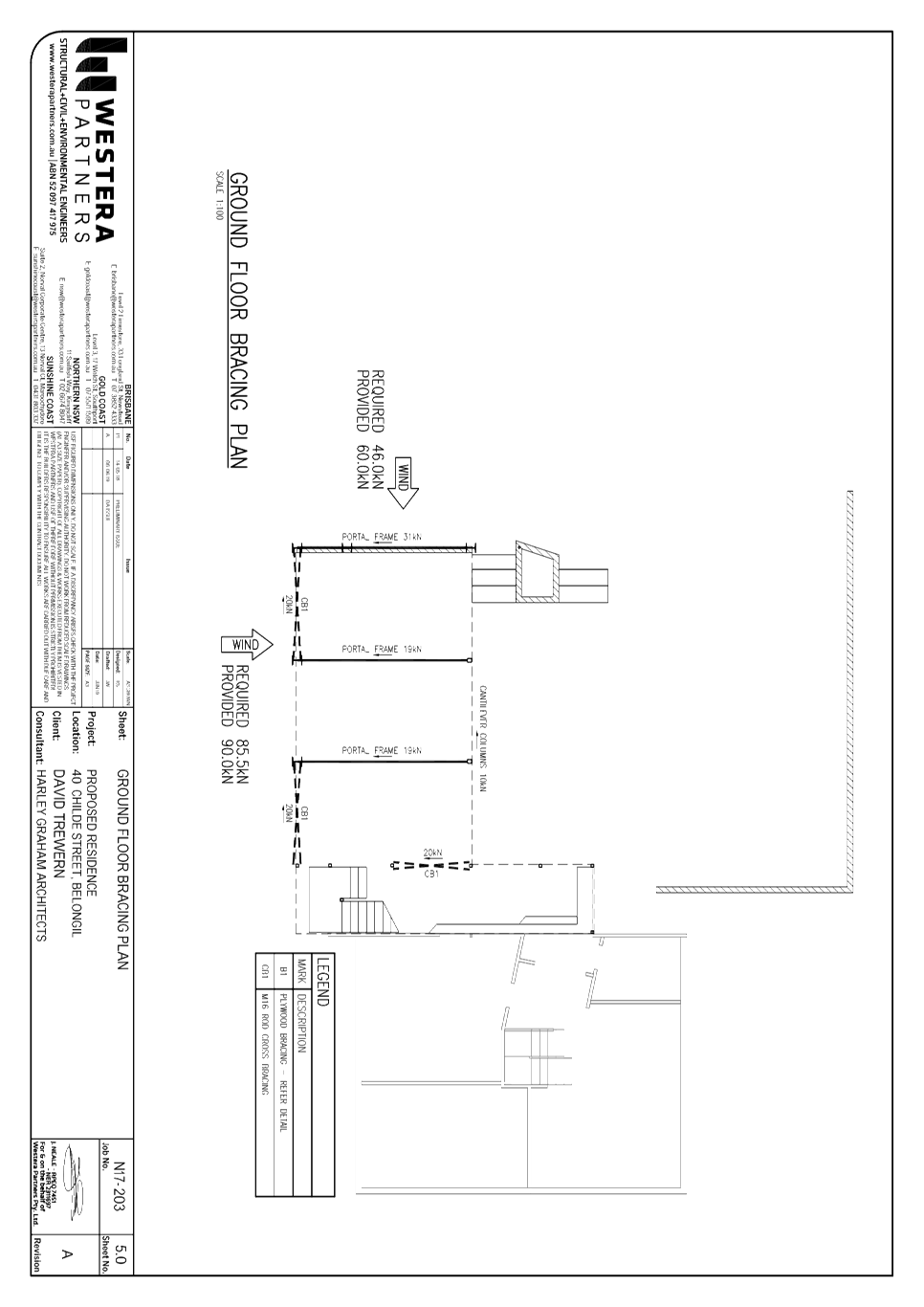
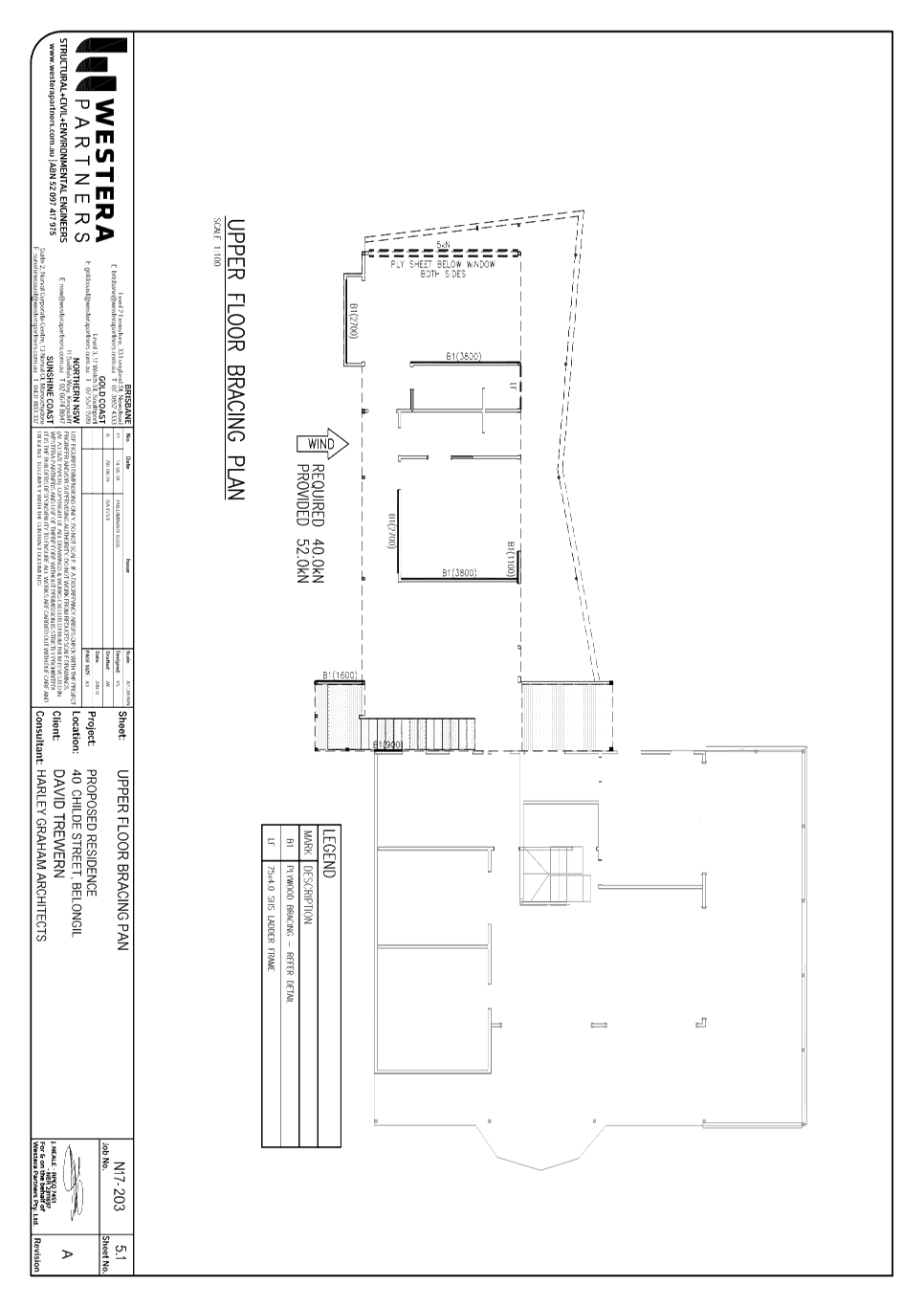
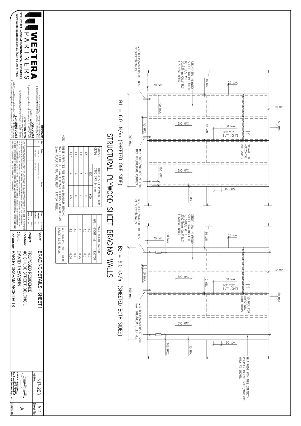
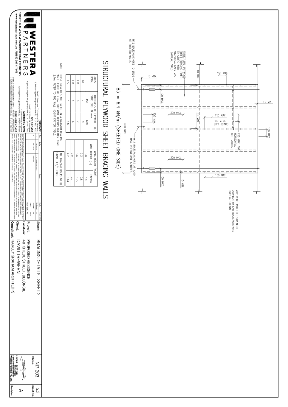
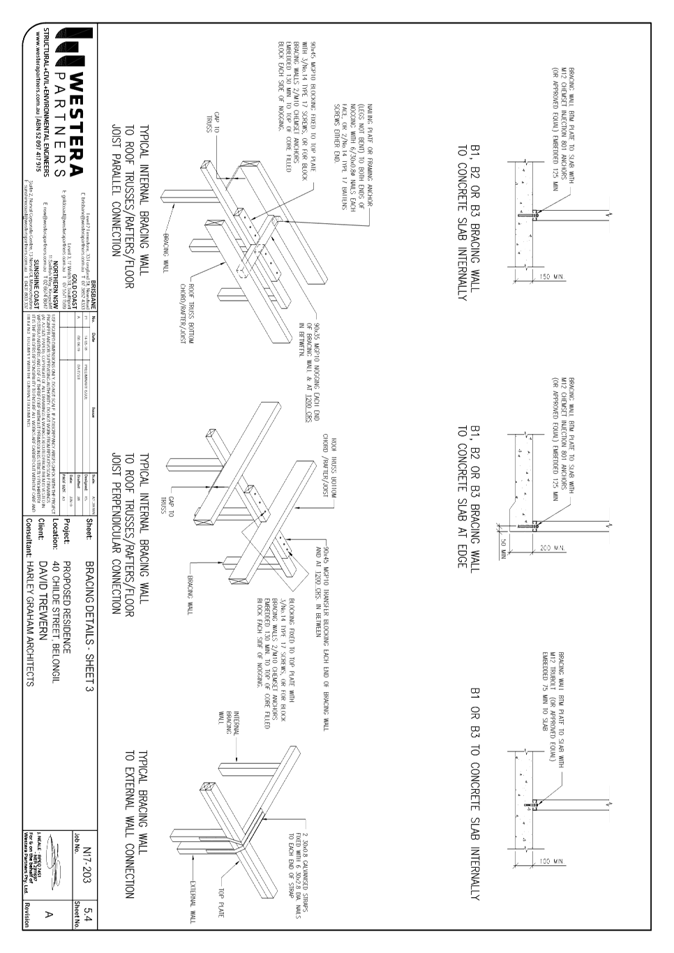
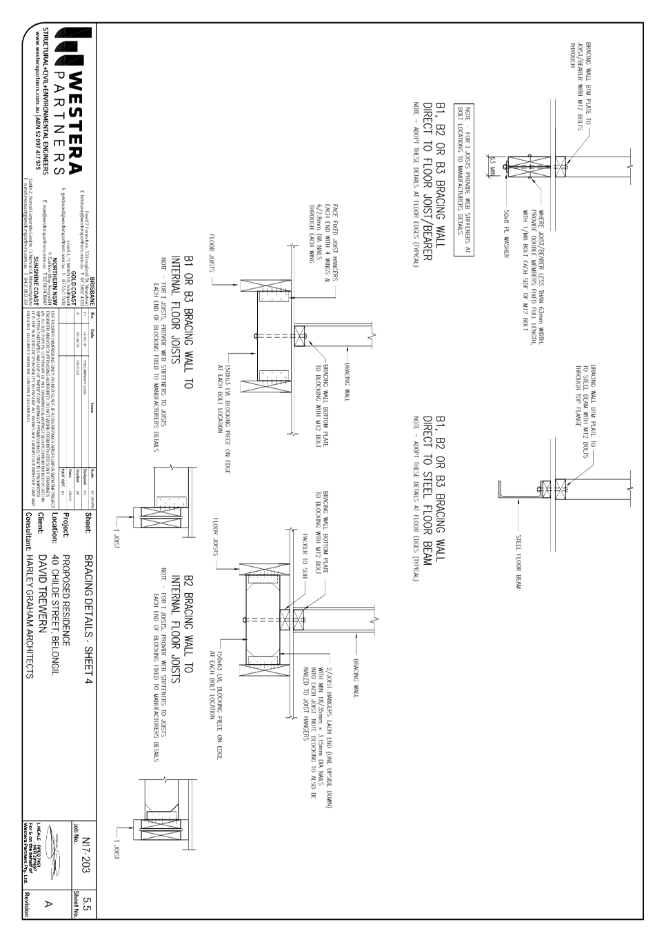
Staff Reports - Sustainable Environment and Economy 8.10 - Attachment 4
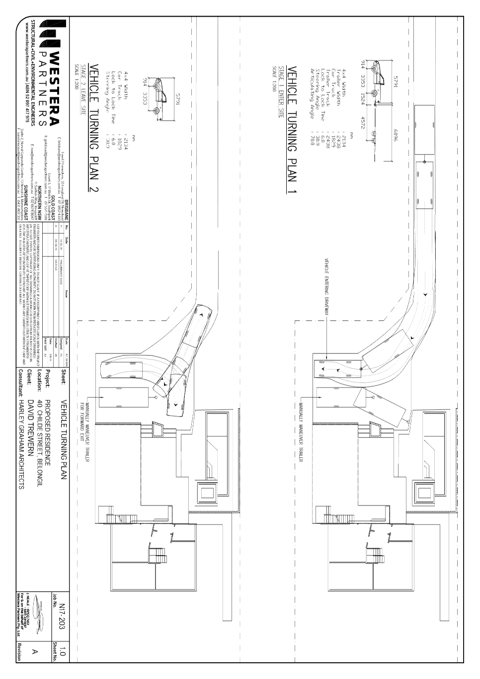
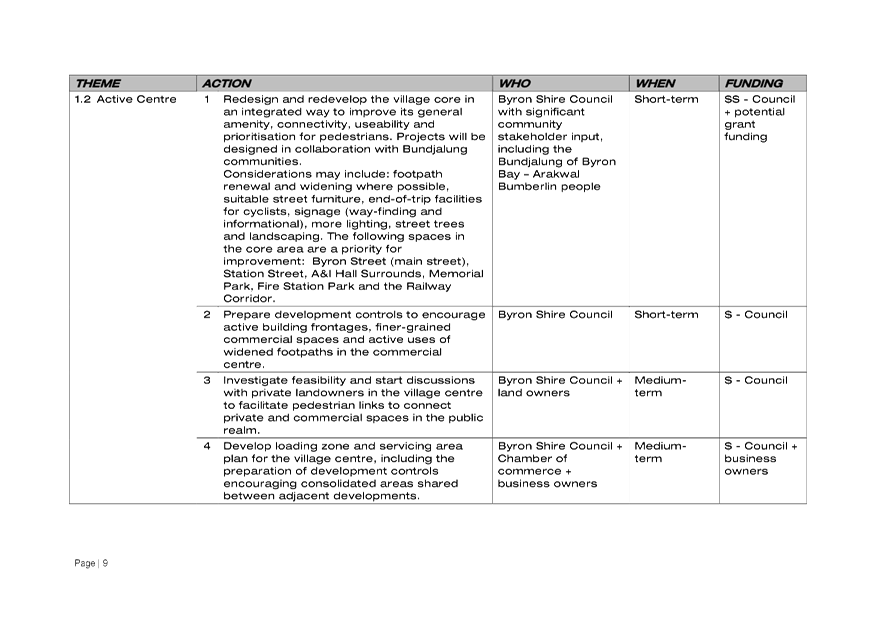

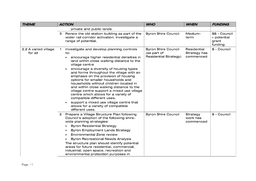
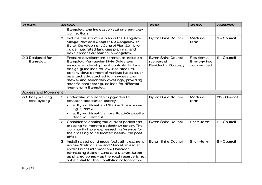
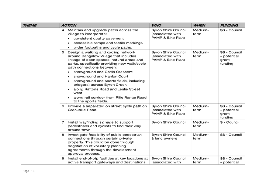
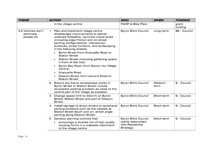
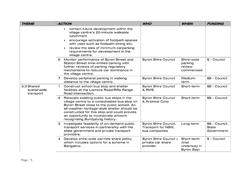
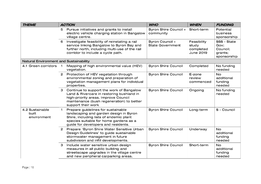
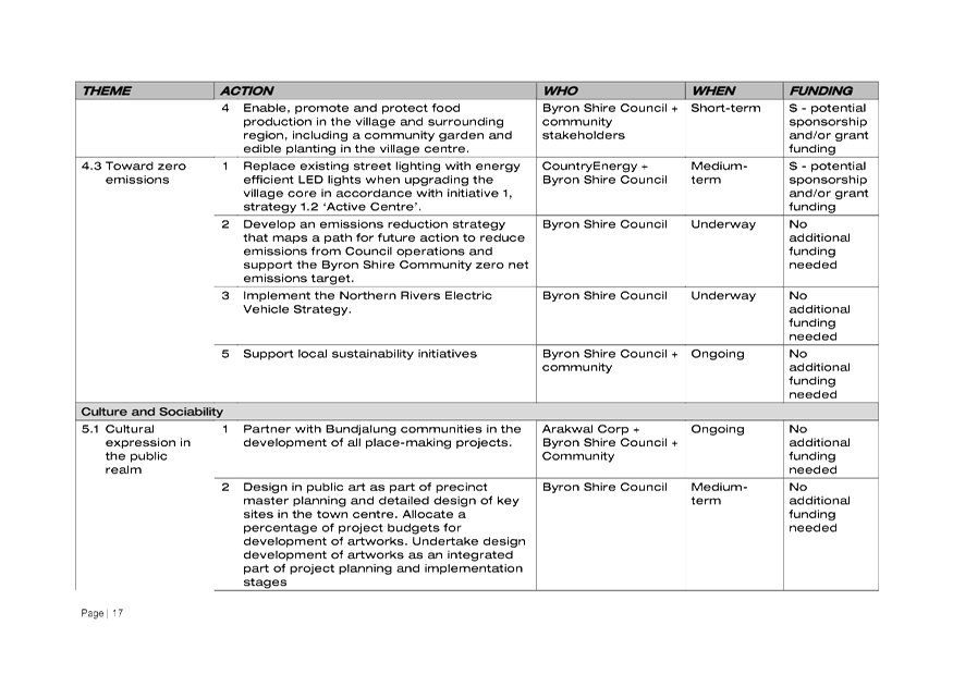

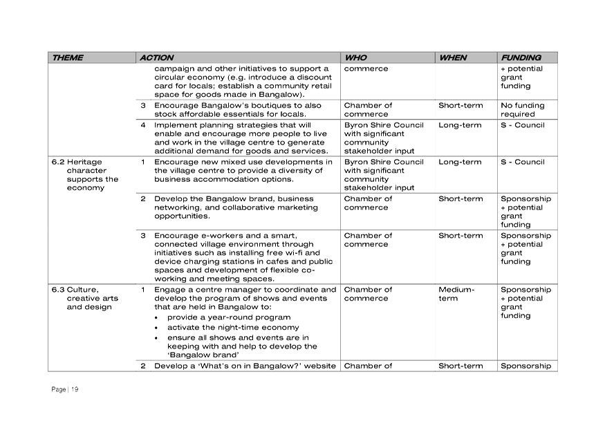
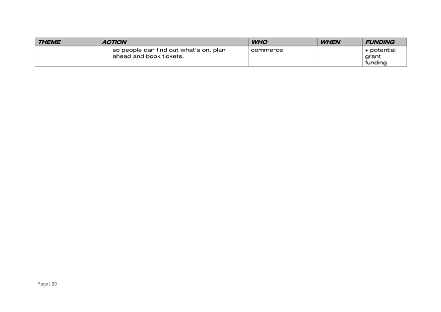


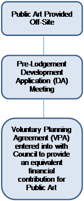
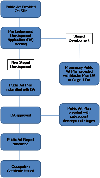


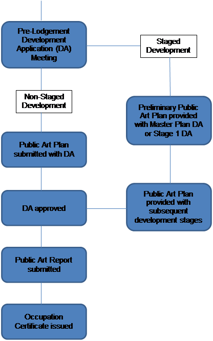

.svg)