|
The purpose of this report is to gain engineering related
advice from LTC relating to a shared path along Tennyson St with associated
crossings.
LTC and Council recently endorsed regulatory devices
associated with a shared path / cycleway from Suffolk Park to Browning
Street, Byron Bay (I2020/1061). This proposed project is designed to
tie in with that Suffolk Park to Browning Street path.
In addition, another report has been submitted to this LTC
meeting agenda requesting LTC and Council support for regulatory devices
associated with a Shared Path / Cycleway along the new Byron Bay
Bypass. This path will tie in with the Suffolk Park to Browning Street
path and extend along the Bypass to Shirley Street.
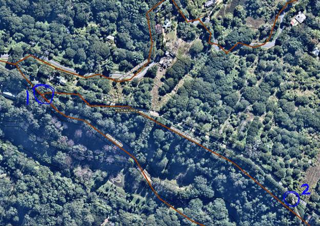
Figure 1 below is an extract from the Bike Plan approved
in 2019 and is provided to show how the path proposed in this report fits
into the approved Bike Plan. Tennyson Street has been circled in blue
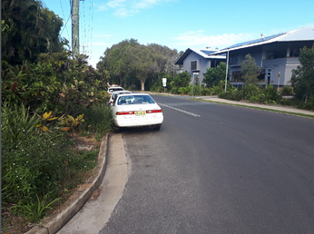
to help locate the proposed path. Photos 1 to 4 show snippets from Google
Street view to indicate the site conditions. The location of Photo 1 is shown
in Figure 1 as the number 1. Photo 2 is taken at location 2 etc.
As the Byron Bay Master Plan is rolled out it is expected
that Tennyson St will become a higher order road with increased traffic.
As seen in Figure 1, an existing path is shown on the
western side of Tennyson St, however, this is considered undersize. To
function as a proper compliant shared path it would need to be widened and
upgraded in a number of places. It is proposed in the Bike Plan to
construct a new shared path along the eastern side of Tennyson Street with a
number of pedestrian crossings at each intersection along the road.
The detail design for this length of Tennyson St is now
commencing. Staff are requesting engineering related advice from LTC relating
to a number of options:
1. Locate
the shared path along the western side and upgrade / widen the Shared Path as
required.
2. Locate
the new shared path along the eastern side of Tennyson Street and not upgrade
the western side.
3. Upgrade
the western path from Browning St through to Byron Public School, upgrade the
school crossing (see photo 3) and construct a new shared path from this
crossing to the Recreation Grounds. The Ruskin St and Marvel St crossings
across Tennyson St would not be constructed .
4. Upgrade
the western path from Browning Street to Marvell Lane and construct a new
crossing to the Recreation Grounds and shared path through the end of
Tennyson St (Figure 2).
At some stage along Tennyson Street a crossing will be
required to bring pedestrian and cyclists to the Recreation Grounds at the
North Eastern end of Tennyson Street. This will also provide linkage
into the Sandhills Estate which is currently having a skate park and paths
designed. These paths will link into the Byron Town Centre path
network.
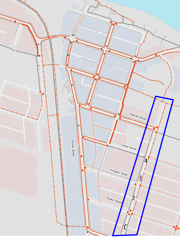
Figure 1 – Bike Plan approved in 2019 (Blue Line
shows the location of Tennyson St).
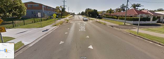
Photo 1
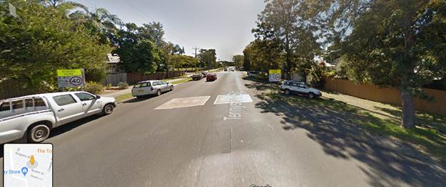
Photo 2
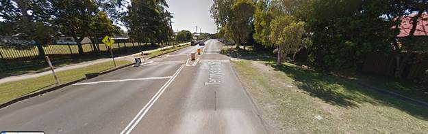
Photo 3
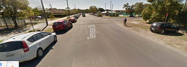
Photo 4
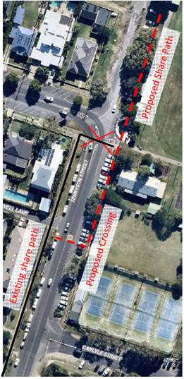
Figure 2 – Marvel Lane
crossing
|