|
Background
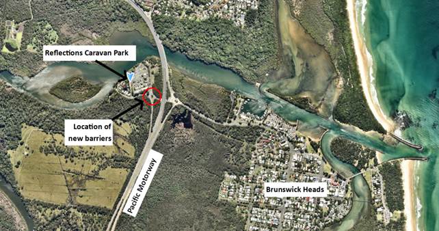
Council has recently opened the fourth leg on the
roundabout at Bayshore Drive / Ewingsdale Road, following the opening of the
access road to a new development in West Byron. Figure 1 below outlines
the issues expressed by the public and verified onsite by Council staff.
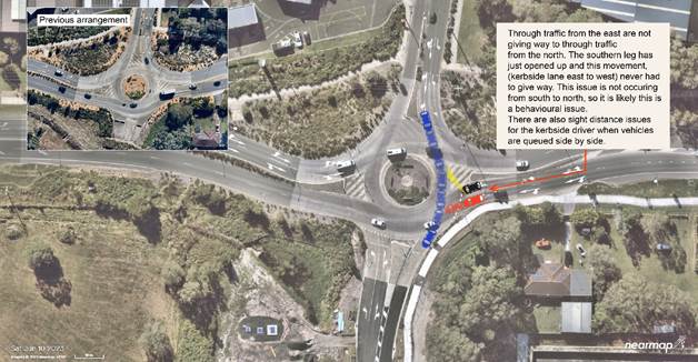
Figure 1: Issues diagram
Proposed Solution
Council staff are proposing a
spiral merge lane scenario to help clarify exiting/give way issues from the
new leg. This treatment is contained within the RMS, R141 pavement
marking guidelines for a dual right turn exit (Figure 2).
The Bayshore Dr/Ewingsdale Road
roundabout does not technically allow the double right turn manoeuvre.
However, the northern and southern approach right turns are single approaches
with dual lane departures and future demand may require dual right turns from
the northern approach.
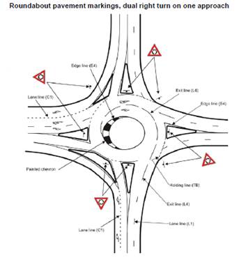
Figure 2:
RMS, R141 pavement marking guidelines excerpt.
This treatment (spiral lane)
will push the through movement (north and southbound) to the outside of the
circulating lane, reinforcing the driver’s intent to exit the
roundabout. This will also improve sight distance for the opposing east
and westbound through traffic. It is considered that this treatment while not
being currently used within the Shire can be implemented with very little
risk even if drivers are unfamiliar.
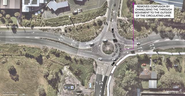
Figure 3:
Traffic flow spiral lane markings
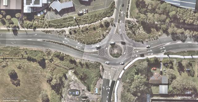
Figure 4:
Spiral Lane treatment concept
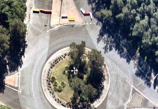
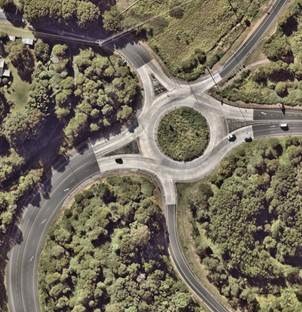
Other treatments considered
Removal of all chevron
line-marking from within the circulating lane of the roundabout, without any
form of delineation (below). This option is not recommended due to the
current sight distance issues; drivers may still stick close to the central
roundabout island when exiting southbound.
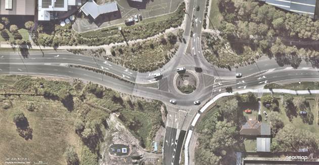
Figure 5: No
circulating delineation within the east and west sections of the circulating
lane
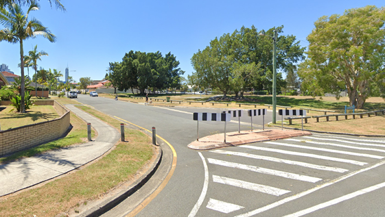
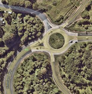
This works at the Myocum Road/Hinterland
Way western M1 interchange, however it has been observed that the eastbound
approach (kerbside lane) still seems to have the same sight distance issue
when looking for drivers exiting northbound (Myocum Rd). It is noted there is
only one crash on this approach that may be attributed to this issue (table
1).
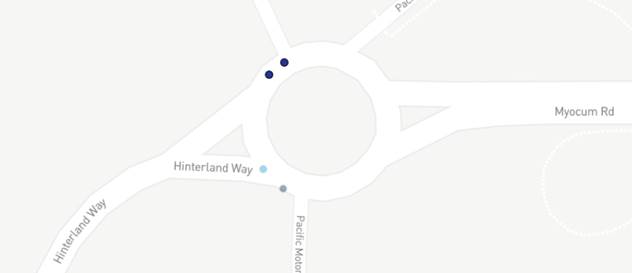
Figure 6:
Crash map TfNSW (above)
Table 1:
Crash data, Myocum Rd/Hinterland Way western M1 interchange (Hinterland Way
Ebnd)
|
Crash ID
|
Data source
|
Degree of crash
|
Date of crash
|
Identifying feature
|
Identifying feature type
|
Town
|
Type of location
|
Other TU manoeuvre
|
|
1186825
|
Police investigated
|
Moderate Injury
|
7/11/2018
|
MYOCUM
|
RD
|
EWINGSDALE
|
Roundabout
|
Proceeding in lane
|
|
1254990
|
Police investigated
|
Moderate Injury
|
27/01/2021
|
MYOCUM
|
RD
|
EWINGSDALE
|
Roundabout
|
|
Figure 7:
Myocum Rd/Hinterland Way western M1 interchange
|