
Transport and Infrastructure Advisory Committee Meeting
A Transport and Infrastructure Advisory
Committee Meeting of Byron Shire Council will be held as follows:
|
Venue
|
Conference Room, Station Street, Mullumbimby
|
|
 Date Date
|
Thursday, 14 June 2018
|
|
Time
|
11.30am
|
Phillip
Holloway
Director Infrastructure Services I2018/1092
Distributed 07/06/18
What is a “Conflict of Interests” - A conflict of
interests can be of two types:
Pecuniary - an interest that a person has in a matter because of a reasonable
likelihood or expectation of appreciable financial gain or loss to the person
or another person with whom the person is associated.
Non-pecuniary – a private or personal interest that a Council
official has that does not amount to a pecuniary interest as defined in the
Local Government Act (eg. A friendship, membership of an association, society
or trade union or involvement or interest in an activity and may include an
interest of a financial nature).
Remoteness – a person does not have a pecuniary interest in a matter
if the interest is so remote or insignificant that it could not reasonably be
regarded as likely to influence any decision the person might make in relation
to a matter or if the interest is of a kind specified in Section 448 of the
Local Government Act.
Who has a Pecuniary Interest? - a person has a pecuniary interest in a
matter if the pecuniary interest is the interest of the person, or another
person with whom the person is associated (see below).
Relatives, Partners - a person is taken to have a pecuniary interest in a matter
if:
§ The person’s
spouse or de facto partner or a relative of the person has a pecuniary interest
in the matter, or
§ The person, or a
nominee, partners or employer of the person, is a member of a company or other
body that has a pecuniary interest in the matter.
N.B. “Relative”, in relation to a person means any of the
following:
(a) the
parent, grandparent, brother, sister, uncle, aunt, nephew, niece, lineal
descends or adopted child of the person or of the person’s spouse;
(b) the
spouse or de facto partners of the person or of a person referred to in
paragraph (a)
No Interest in the Matter - however, a person is not taken to have a
pecuniary interest in a matter:
§ If the person is
unaware of the relevant pecuniary interest of the spouse, de facto partner,
relative or company or other body, or
§ Just because the
person is a member of, or is employed by, the Council.
§ Just because the
person is a member of, or a delegate of the Council to, a company or other body
that has a pecuniary interest in the matter provided that the person has no
beneficial interest in any shares of the company or body.
Disclosure and participation in meetings
§ A Councillor or a
member of a Council Committee who has a pecuniary interest in any matter with
which the Council is concerned and who is present at a meeting of the Council
or Committee at which the matter is being considered must disclose the nature
of the interest to the meeting as soon as practicable.
§ The Councillor or
member must not be present at, or in sight of, the meeting of the Council or
Committee:
(a) at any
time during which the matter is being considered or discussed by the Council or
Committee, or
(b) at any
time during which the Council or Committee is voting on any question in
relation to the matter.
No Knowledge - a person does not breach this Clause if the person did
not know and could not reasonably be expected to have known that the matter
under consideration at the meeting was a matter in which he or she had a
pecuniary interest.
Participation in Meetings Despite Pecuniary Interest (S 452 Act)
A Councillor is not prevented from taking part in the consideration or
discussion of, or from voting on, any of the matters/questions detailed in
Section 452 of the Local Government Act.
Non-pecuniary Interests - Must be disclosed in meetings.
There are a broad range of options available for managing conflicts &
the option chosen will depend on an assessment of the circumstances of the
matter, the nature of the interest and the significance of the issue being
dealt with. Non-pecuniary conflicts of interests must be dealt with in at
least one of the following ways:
§ It may be appropriate
that no action be taken where the potential for conflict is minimal.
However, Councillors should consider providing an explanation of why they
consider a conflict does not exist.
§ Limit involvement if
practical (eg. Participate in discussion but not in decision making or
vice-versa). Care needs to be taken when exercising this option.
§ Remove the source of
the conflict (eg. Relinquishing or divesting the personal interest that creates
the conflict)
§ Have no involvement by
absenting yourself from and not taking part in any debate or voting on the
issue as if the provisions in S451 of the Local Government Act apply
(particularly if you have a significant non-pecuniary interest)
RECORDING OF VOTING ON PLANNING MATTERS
Clause 375A of the Local Government Act 1993
– Recording of voting on planning matters
(1) In this section, planning
decision means a decision made in the exercise of a function of a council
under the Environmental Planning and Assessment Act 1979:
(a) including a decision
relating to a development application, an environmental planning instrument, a
development control plan or a development contribution plan under that Act, but
(b) not including the making of
an order under Division 2A of Part 6 of that Act.
(2) The general manager is
required to keep a register containing, for each planning decision made at a
meeting of the council or a council committee, the names of the councillors who
supported the decision and the names of any councillors who opposed (or are
taken to have opposed) the decision.
(3) For the purpose of
maintaining the register, a division is required to be called whenever a motion
for a planning decision is put at a meeting of the council or a council
committee.
(4) Each decision recorded in
the register is to be described in the register or identified in a manner that
enables the description to be obtained from another publicly available
document, and is to include the information required by the regulations.
(5) This section extends to a
meeting that is closed to the public.
Transport and Infrastructure Advisory
Committee Meeting
BUSINESS OF MEETING
1. Apologies
2. Declarations of Interest
– Pecuniary and Non-Pecuniary
3. Adoption of Minutes from
Previous Meetings
3.1 Transport
and Infrastructure Advisory Committee Meeting held on 15 March 2018
3.2 Extraordinary
Transport and Infrastructure Advisory Committee Meeting held on 20 April 2018
4. Staff Reports
Infrastructure Services
4.1 Draft
2018/19 - 2020/21 Local Roads Operational & Capital Works Programs............... 4
4.2 Massinger
Street, Byron Bay - Shared Path Design Report.......................................... 15
4.3 Balemo
Drive, Ocean Shores - Shared Path Design Report......................................... 36
4.4 Koala
Wildlife Signage .................................................................................................... 58
4.5 Lismore
Road, Bangalow - Off-Road Shared Path Design Report................................ 65
4.6 Tourist,
Street Name, Community Facility and Service Signs - Policy 07/102.............. 71
4.7 Ewingsdale
Road Shared Path - Project Update.......................................................... 142
4.8 Bike
Plan and PAMP Status Update............................................................................. 142
Staff Reports - Infrastructure Services
Report No. 4.1 Draft
2018/19 - 2020/21 Local Roads Operational & Capital Works Programs
Directorate: Infrastructure
Services
Report
Author: Tony
Nash, Manager Works
File No: I2018/4
Theme: Community Infrastructure
Local Roads and Drainage
Summary:
This report provides information to the Committee about the
Draft maintenance (operational) budgets and the capital works projects and
programmes of works for 2018/19 and those projected for the next three years, 2019/20
to 2021/22.
|
RECOMMENDATION:
That the committee note the
information in this report.
|
Attachments:
1 Local
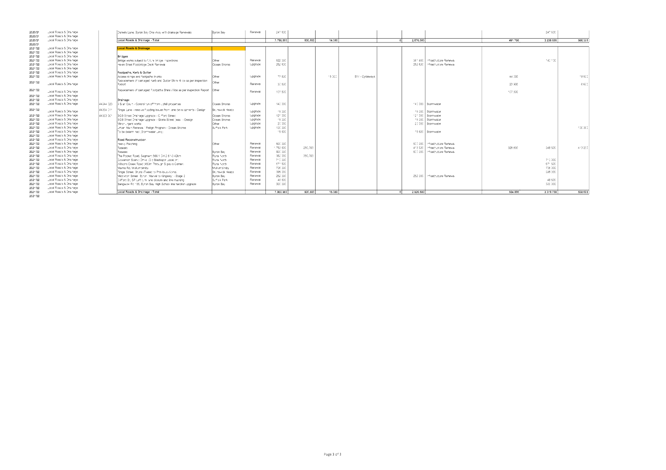
Roads Operational Budget for 2018-19 to 2021-22, e2018/47216 , page 8⇩ 
2 Local
Roads Capital Budgets for 2018-19 to 2021-22, E2018/47215
, page 12⇩
Report
Council at its Extra Ordinary
Meeting on 17 May 2018, considered a report on Public Exhibition – Draft 2018-2019 Statement of Revenue Policy and resolved as
follows:
Res 18-282
1. That
Council adopt for exhibition the Draft 2018-2019 Statement of Revenue Policy,
comprising Budget Estimates (with the following changes), Rates and Charges,
Borrowings and Fees and Charges (with the following changes):
a) Increase
the budget for the Byron Street Cruise (a Community Wellbeing Project within
Community Services) by $10,000, to be taken from the General Fund (Unrestricted
Cash)
b) That
the Better Byron Crew wages including on-costs for labour activities for
services performed within the Better Byron Crew Service area be capped at
$200,000 or as near as practicable, with the additional $210,000 proposed to be
drawn for these services be instead used for implementing water sensitive urban
design upgrades to the Byron Bay stormwater system
c) That
the fees for swimming pools pensioner price (25 visits) be amended to $78
rather than $85
2. That
the Draft 2018-2019 Statement of Revenue Policy, comprising Budget Estimates,
Rates and Charges, Borrowings and Fees and Charges be placed on public
exhibition for a period of 28 Days.
3. That
clarity be provided on the proposal to increase charges for gravesite and
interment of ashes and that this be highlighted in the public exhibition
document.
It also endorsed the Draft
Delivery Program & Operational Plan for public exhibition and to adopt the
amended Community Strategic Plan 2028, as follows:
Res 12-285
1. Endorse
the draft Delivery Program 2017-2021 (Revised) and Operational Plan 2018-2019
(Attachment 1 #E2018/41807) for public exhibition for a period of 28 days.
2. Accept
the Byron Shire Community Solutions Panel recommendations as listed in their
Final Report (Attachment 2 #E2018/33402).
Res 18-286
1. That
Council notes the submissions.
2. That
Council adopt the amended Community Strategic Plan 2028 shown at Attachment 1
(E2018/40030).
This Extra Ordinary Meeting is an important milestone in
Council’s Integrated Planning and Reporting (IP&R) process for
2018/19, including our operational and capital works budgets.
There have been previous discussions at TIAC about the
future draft operational budgets and capital projects budgets and programmes of
work, when considering risk-based asset plans for renewal of assets, including:
· Causeway
· major rural
culverts
· guardrail and
safety barriers
· bridges
· resealing
· road pavement
renewals
· kerb and gutter
· footpath’s
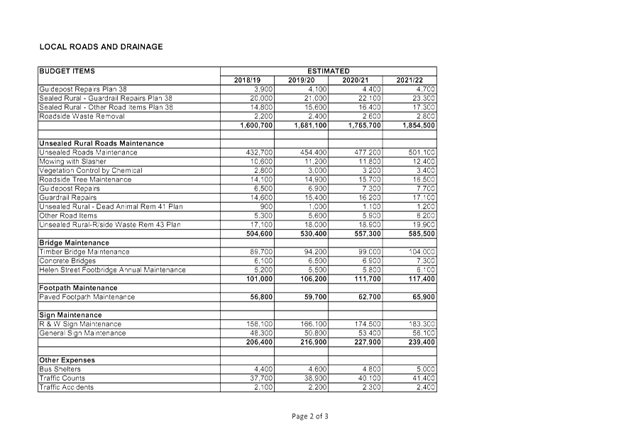
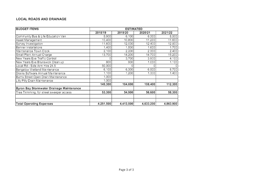
The summary for local roads for 2018/19 follows:
Maintenance / Operational budgets
|
Maintenance activity
|
2018/19 proposed budget
|
|
Urban drainage
|
$528,400
|
|
Rural drainage
|
$304,500
|
|
Bitumen operations (pothole filling)
|
$1,232,200
|
|
Rural vegetation control and roadside trees
|
$190,200
|
|
Road grading (unsealed roads)
|
$585,400
|
|
Street sweeping (Urban Roads Cleaning)
|
$290,900
|
|
Rural mowing and slashing
|
$382,600
|
|
Bridges
|
$101,000
|
|
Footpath’s
|
$56,800
|
|
Signs
|
$206,400
|
|
Miscellaneous / other expenses
|
$373,100
|
|
Total
|
$4,251,500
|
|
Maintenance location
|
2018/19 proposed budget
|
|
Urban drainage
|
$528,400
|
|
Rural drainage
|
$304,500
|
|
Urban Roads Mtce
|
$508,900
|
|
Urban Roads Cleaning (Street sweeping)
|
$290,900
|
|
Sealed Rural Roads Mtce
|
$1,600,700
|
|
Unsealed Rural Roads Mtce
|
$504,600
|
|
Bridges
|
$101,000
|
|
Footpath’s
|
$56,800
|
|
Signs
|
$206,400
|
|
Miscellaneous / other expenses
|
$149,300
|
|
Total
|
$4,251,500
|
The programs of work to be undertaken for our local roads
includes:
· heavy patching
· resealing
· causeway and
culverts
· drainage (rural
and urban)
· road pavements
· gravel resheeting
· bridges
· cycleways
· kerb & gutter
· civil design &
studies
· other such as
traffic islands, road safety works & upslope batter treatment
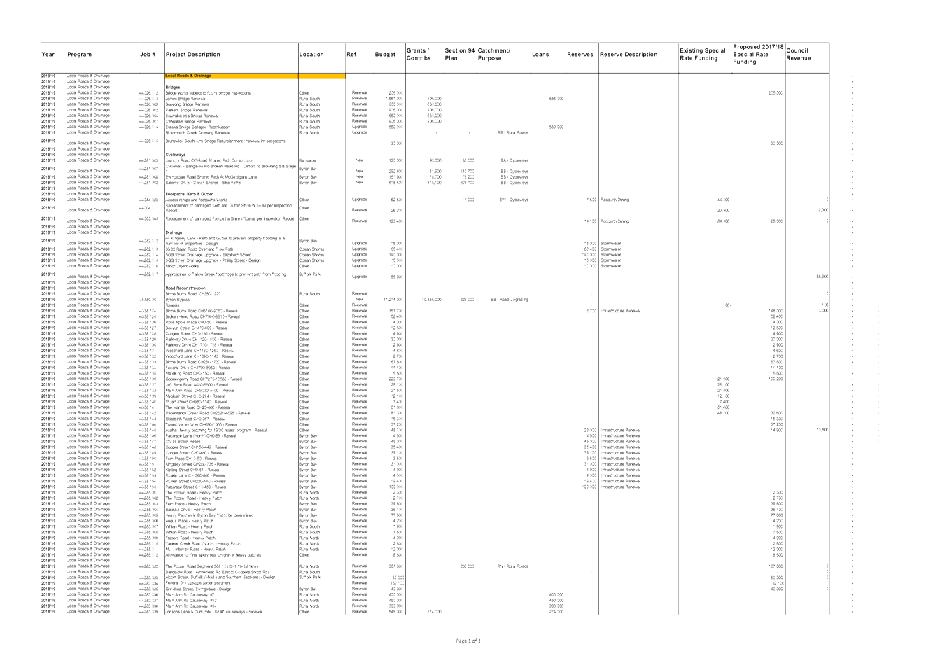
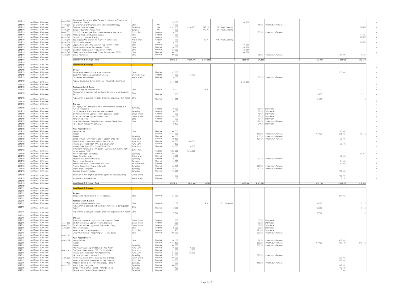
Programs of capital works
|
Program
|
2018/19 proposed budget
|
|
Heavy patching
|
$200,000
|
|
Resealing
|
$1,167,100
|
|
Causeways and culverts
|
$2,968,000
|
|
Drainage
|
$354,300
|
|
Road pavements
|
$634,000
|
|
Gravel re-sheeting
|
$200,000
|
|
Bridges
|
$5,608,000
|
|
Cycleways
|
$1,183,300
|
|
Footpaths & K&G
|
$212,100
|
|
Designs & studies
|
$165,000
|
|
Other
|
$322,100
|
|
Total
|
$13,013,900
|
Note the above table does not include the Byron Bay Bypass
and Bayshore Dr roundabout projects.
The attached documents shows the details for the programs of
operational and capital works and the individual projects for 2018/19 and the
projects and programs of work for 2019/20 to 2021/22. This includes the source
of funds for the various capital projects and programme of works, noting that
all maintenance / operational works are revenue funded.
In 2018/19 Council has introduced a gravel re-sheeting
program for our unsealed roads and a heavy patching program for our sealed
roads. Both these programs have been missing from Council’s annual
programme of works in the past, which has been detrimental to the ongoing
condition of our road network. Both programs of work should normally be
undertaken by a local government road authority.
Discussions about the methods for selecting projects for
individual programs of work will be done during the meeting.
In 2017/18, the information about our capital works projects
and programs of work, including timing and sources of funds, have been
displayed on the Council website and updated throughout the financial year. It
is noted that this update has not been as regular as requested and after a
recent resolution of Council will be done quarterly throughout 2018/19, when
the financial quarterly reviews are typically reported to Council in November,
February and May of each financial year.
Financial Implications
The detail in this report is provided for the information of
the committee members and there are no recommendations proposed that have a
financial impact on Council.
Statutory and Policy Compliance Implications
There are no recommendations proposed that have a negative
implications on Council.
Staff Reports - Infrastructure Services 4.1 - Attachment 1

Staff Reports - Infrastructure Services 4.1 - Attachment 2
Staff Reports - Infrastructure Services 4.2
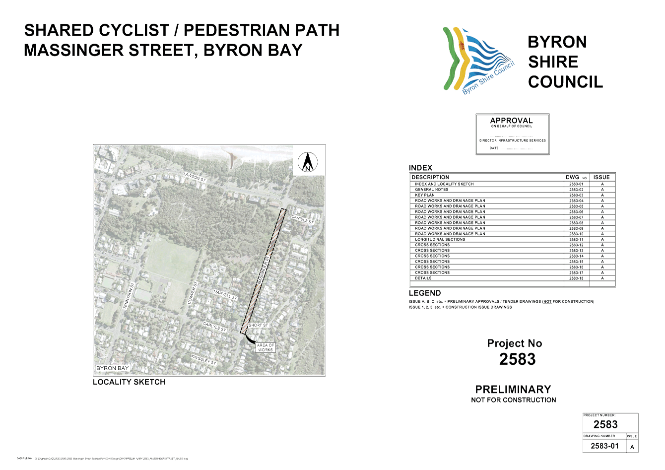
Report No. 4.2 Massinger
Street, Byron Bay - Shared Path Design Report
Directorate: Infrastructure
Services
Report
Author: Dominic
Cavanough , Contract Engineer
Evan Elford, Team Leader
Infrastructure Planning
File No: I2018/187
Theme: Community Infrastructure
Local Roads and Drainage
Summary:
The purpose of this report is to provide to the Transport
and Infrastructure Advisory Committee an opportunity to provide comments on the
Massinger Street Shared Path concept design to improve cyclist and pedestrian
connectivity through Byron Bay.
The project is not identified in Council’s current
2018/19 budget allocations however, Council will be applying for grant funds
under the 2019/20 Walking and Cycling Program and accordingly, the
committee’s comments are sought to resolve any issues prior to the
application being made.
|
RECOMMENDATION:
That the Transport and Infrastructure Advisory
Committee provide comments to the Project Engineer in relation to the
Massinger Street Shared Path concept design.
|
Attachments:
1 24.2017.89.1
- Massinger St SP - DWG 2583 (Concept Design), E2018/4724 , page 18⇩ 
Report
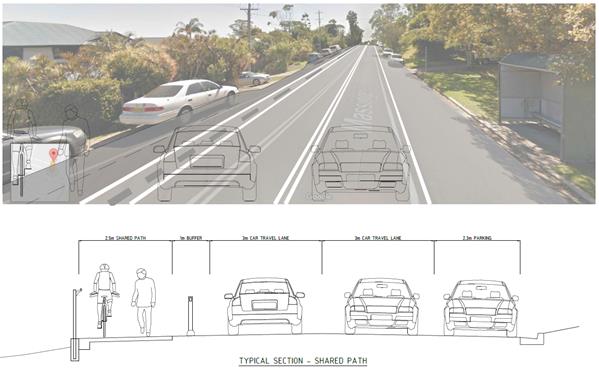
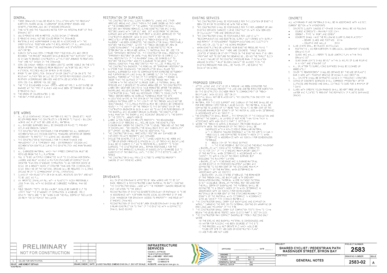
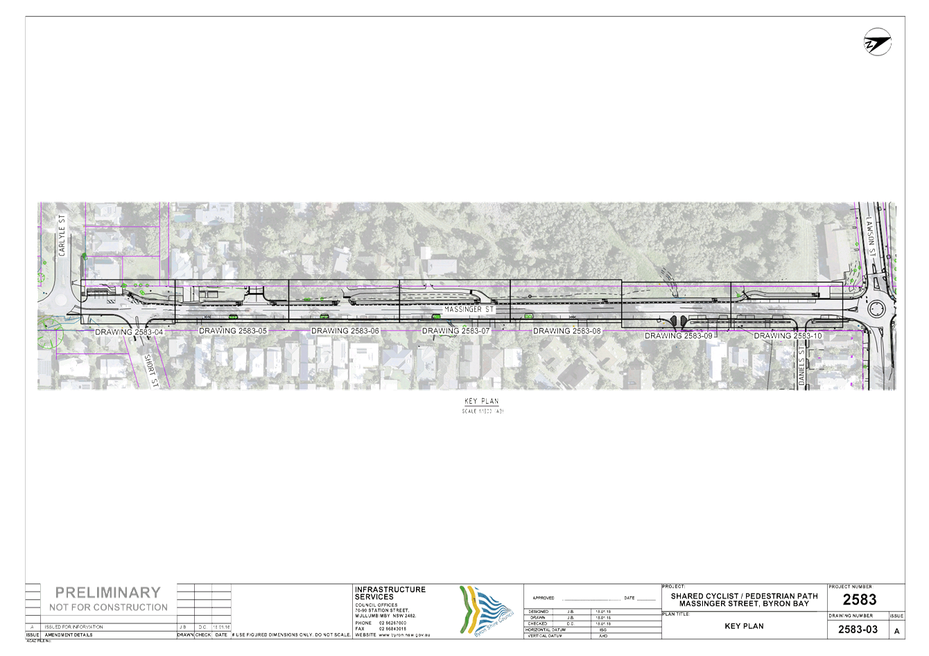
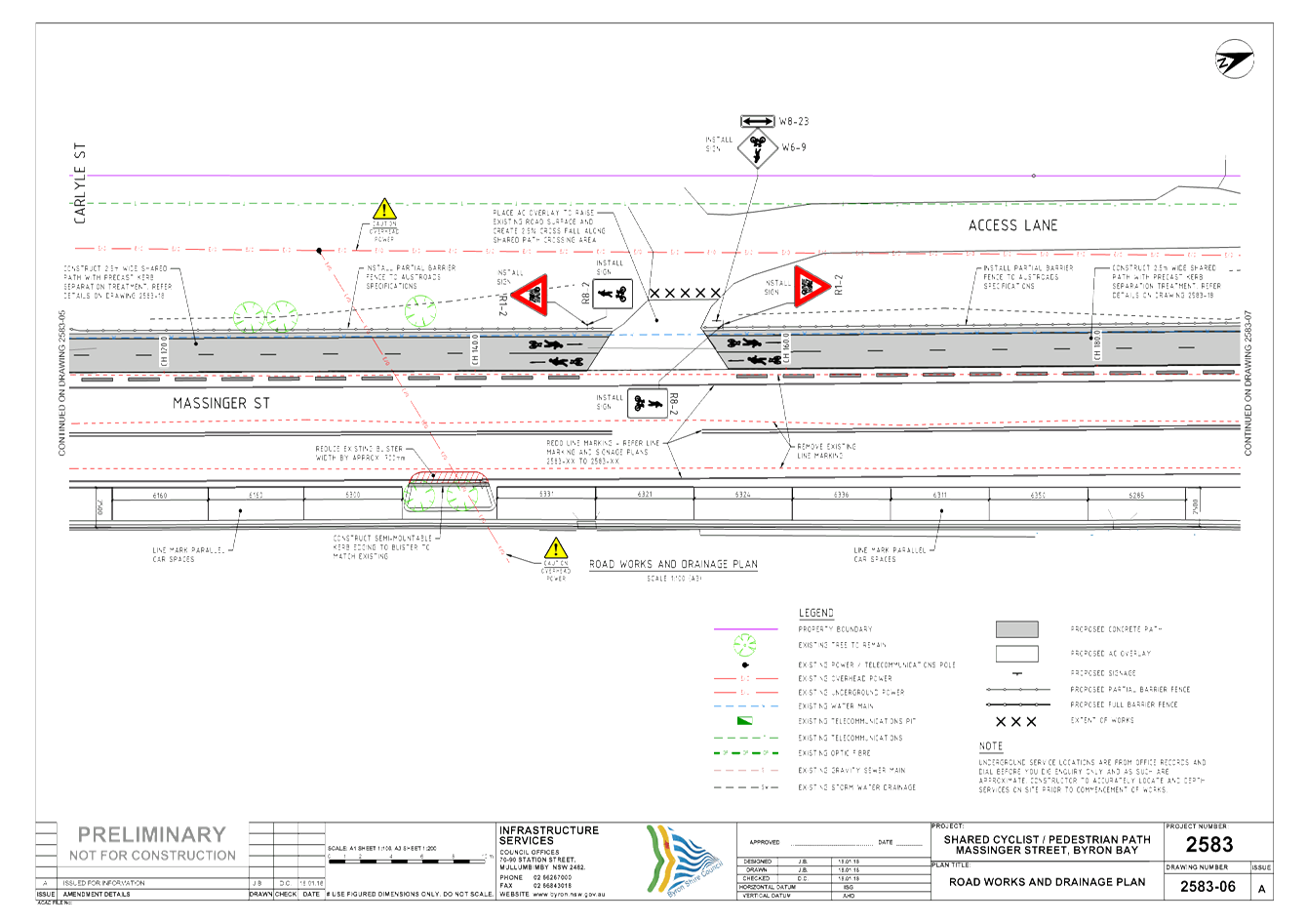
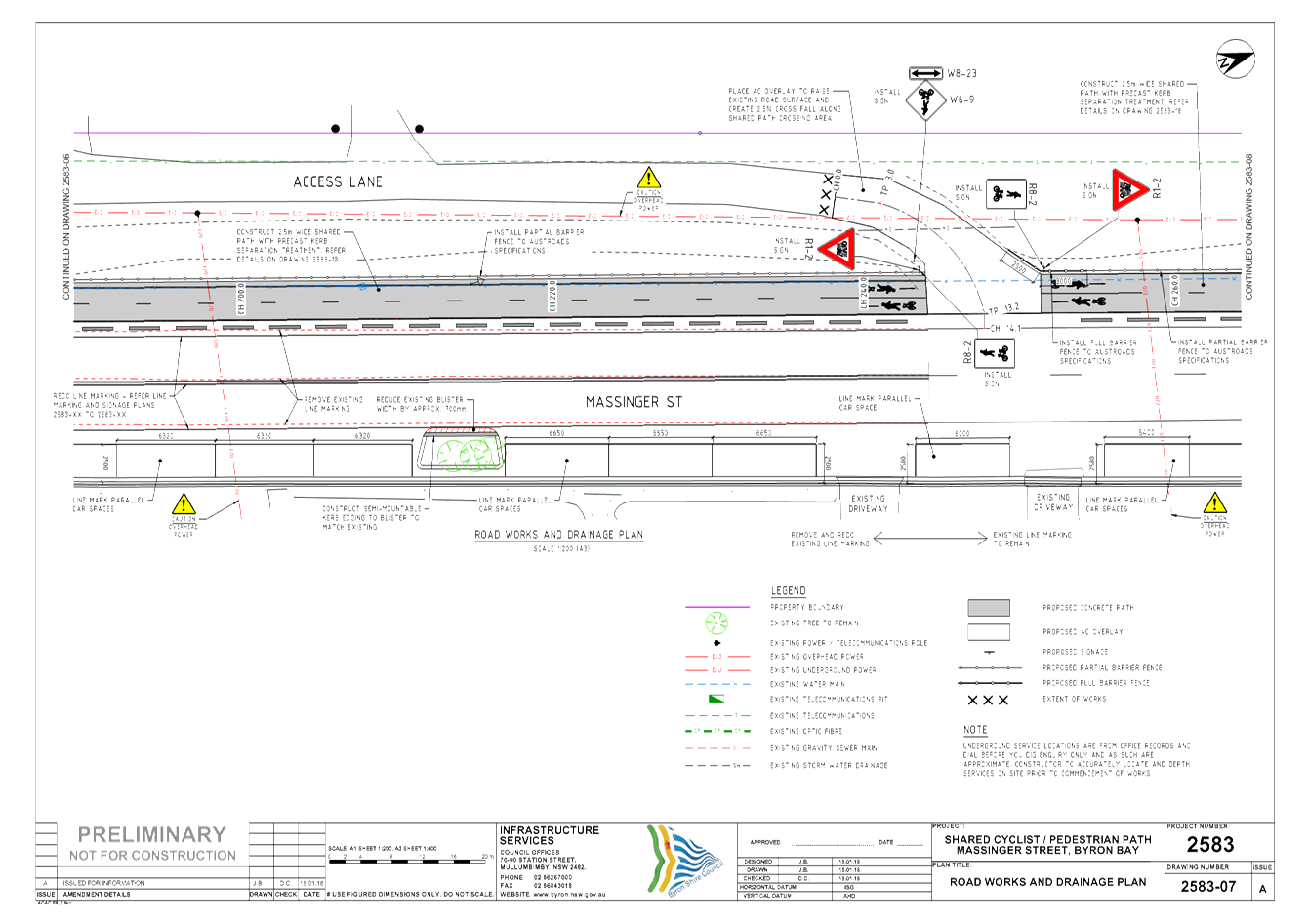
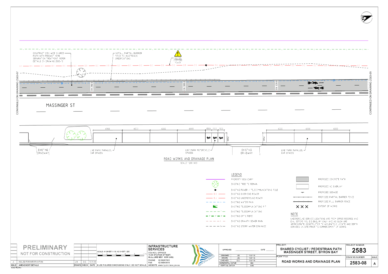
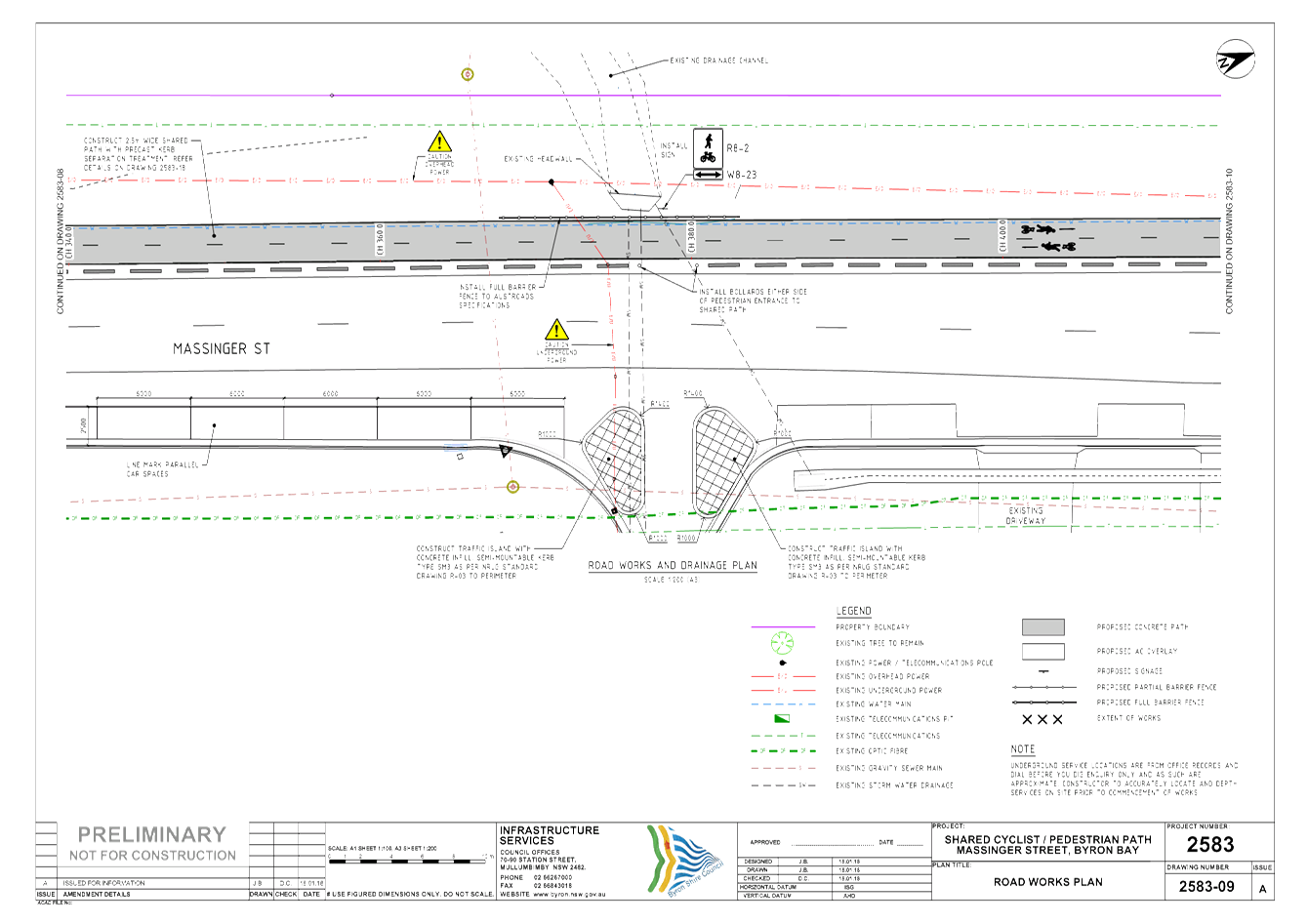
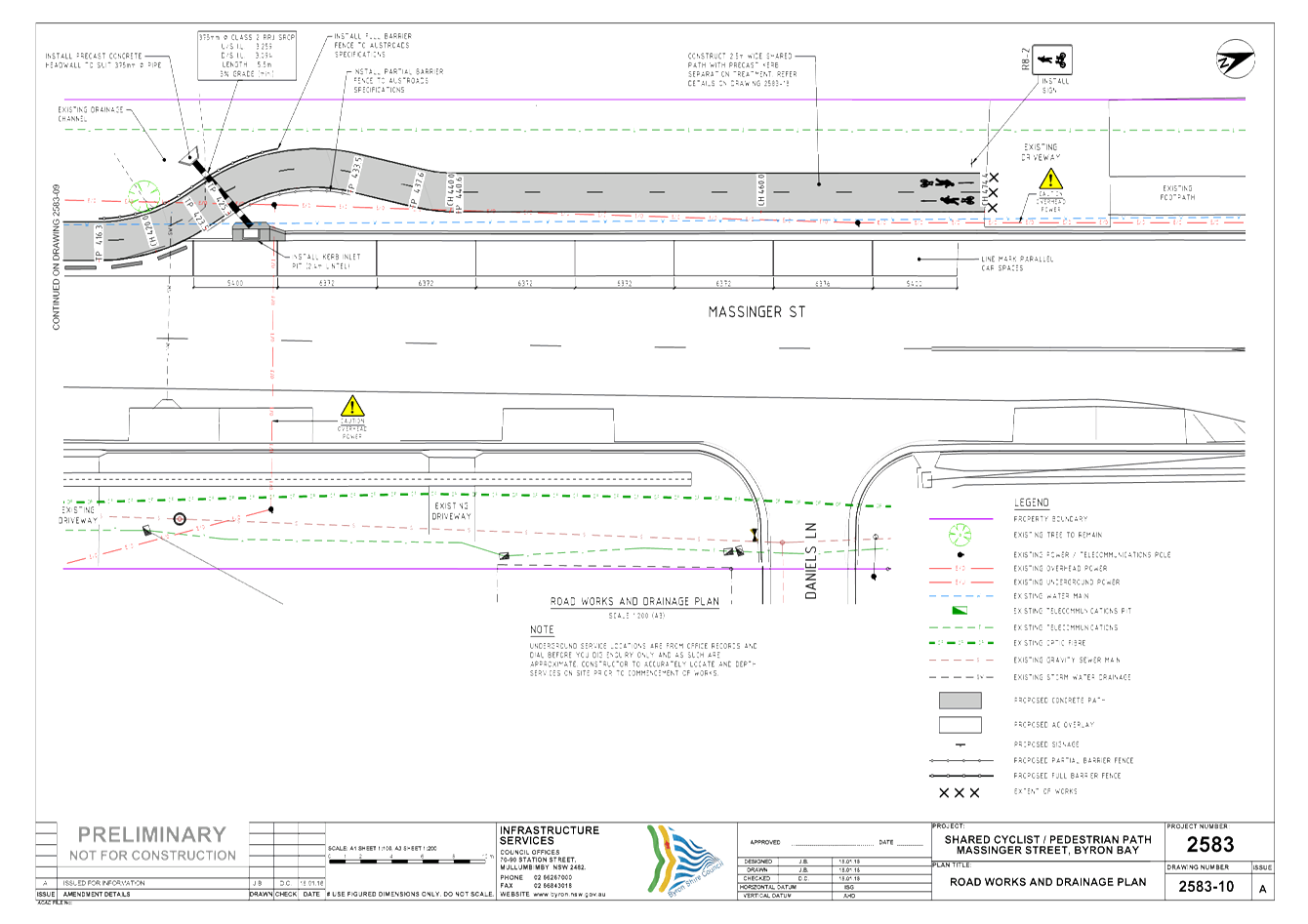
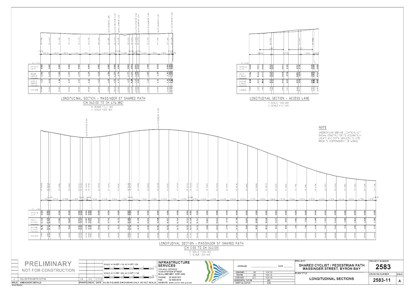
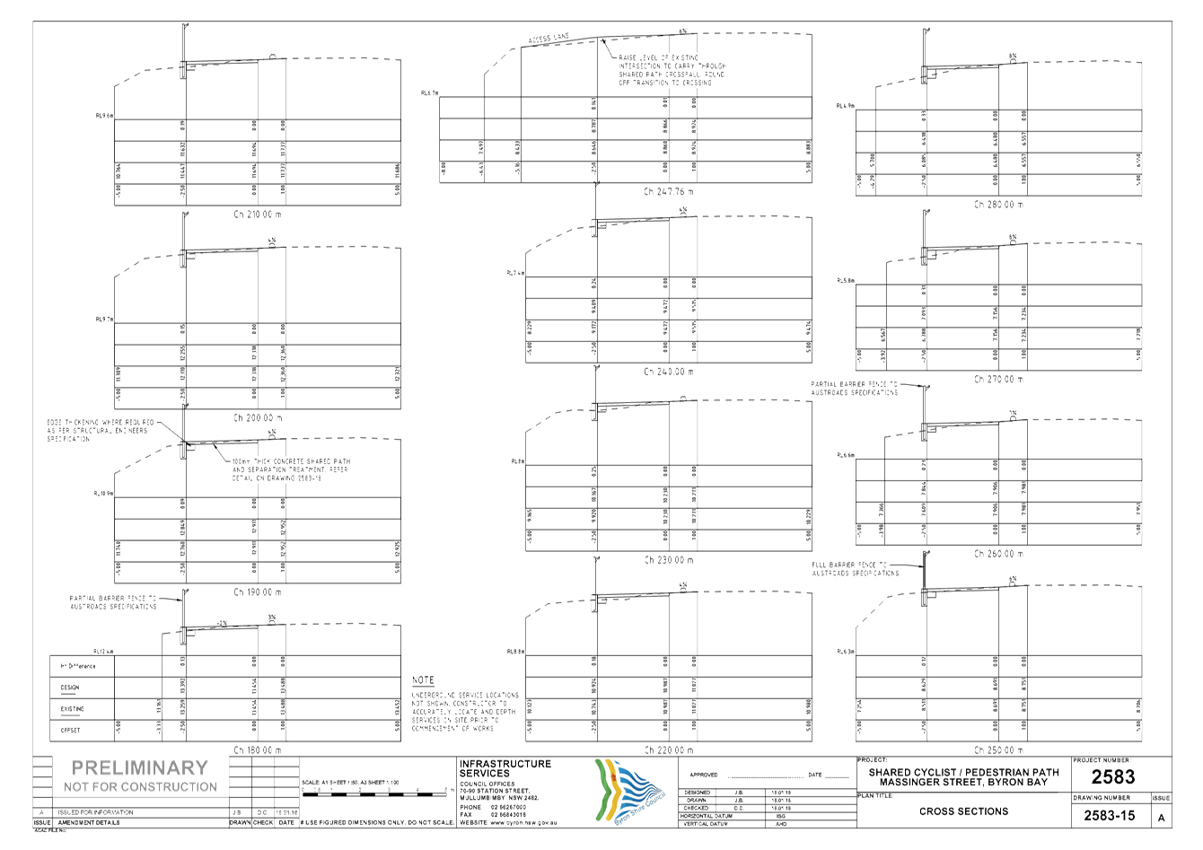
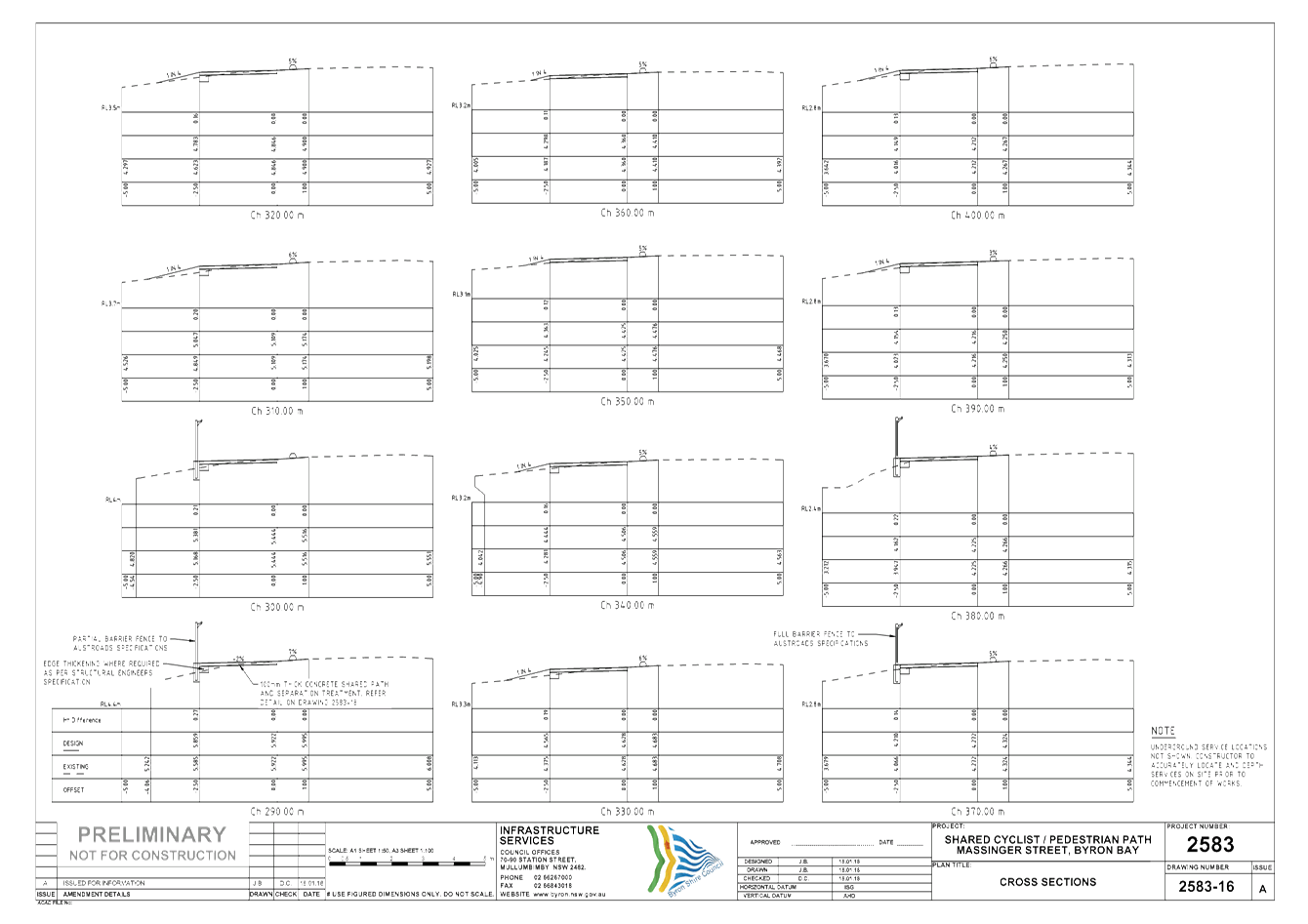
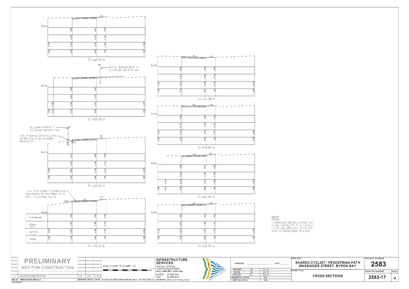
The objective of the project is to design a 2.5m wide off
road shared path along Massinger St from Marvel St to Lawson St to the quality
standards of Austroads and Australian Standards in Byron Bay, NSW.
The purpose of this report is to provide to the Transport
and Infrastructure Advisory Committee an opportunity to provide comments on the
Massinger Street Shared Path concept design to improve cyclist and pedestrian
connectivity through Byron Bay.
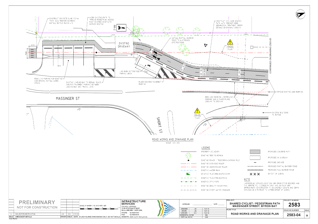
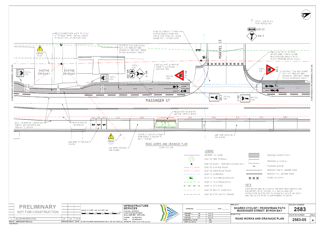
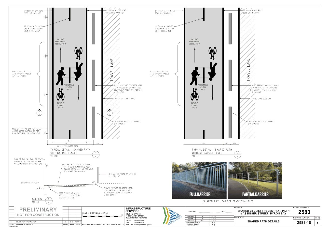
The detailed design provides for 60 parallel parking bays
and travel lanes 3.0m wide. Parallel parking bays on the eastern side
will be wider than normal as a consequence of utilising existing line-marking.
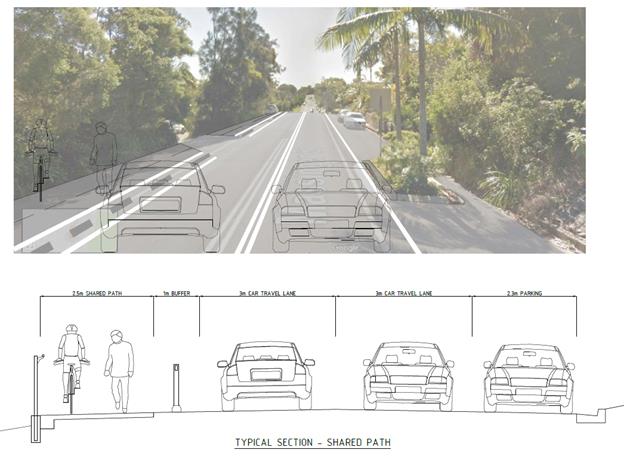
Concrete blisters for pedestrian protection and strategic
landscaping at Kipling Street will direct pedestrian traffic across Massinger
Street to the shared pathway/cycleway.
This retains the current traffic lane alignment and most of
the existing line-marking. No adjustment to existing garden beds within
the pavement area on the eastern side of Massinger Street will be required
under this design. Construction of approximately 60 lineal metres of
retaining wall will be required on the western side.
The detailed design has overcome a number of difficult site
issues by making the majority of the shared path at the same level of the
travel lane. Shared Path separation will be achieved by installing 2m
long precast kerb units.
|
Sketch 1. Image
showing typical arrangement at 58 and 60 Massinger Street.
|
|
|
|
Sketch 2. Typical
arrangement at landscaped gardens
|
|
|
Financial Implications
Detailed cost estimates are yet to be
finalised, however preliminary estimatesd indicate the project will cost
between $260,00 to $300,000.
The project is currently unfunded however
will be the subject of a grant application under the next round of the Walking
and Cycling Program or other applicable funding opportunity.
Statutory and Policy Compliance Implications
The Massinger Street Shared Path is not
identified in the 2008 Bike Plan noting that the bike plan is currently being
updated. There are no other Statutory and Policy Compliance Implications at
this stage.
Staff Reports - Infrastructure Services 4.2 - Attachment 1


Staff Reports - Infrastructure Services 4.3
Report No. 4.3 Balemo
Drive, Ocean Shores - Shared Path Design Report
Directorate: Infrastructure
Services
Report
Author: Dominic
Cavanough , Contract Engineer
Evan Elford, Team Leader
Infrastructure Planning
File No: I2018/188
Theme: Community Infrastructure
Local Roads and Drainage
Summary:
The purpose of this report is to provide to the Transport
and Infrastructure Advisory Committee an opportunity to provide comments on the
Balemo Drive Shared Path concept designs to improve cyclist and pedestrian
connectivity through Ocean Shores.
|
RECOMMENDATION:
That Council support Concept Design 1 - Shared Path on
the eastern side of Balemo Drive to be designed and constructed pending the
outcome of the grant funding application and allocation of budget.
|
Attachments:
1 24.2017.29.1
- Balemo Dr SP - Planit - DWG J251 Concept Designs Issue A , E2018/15557 , page 44⇩
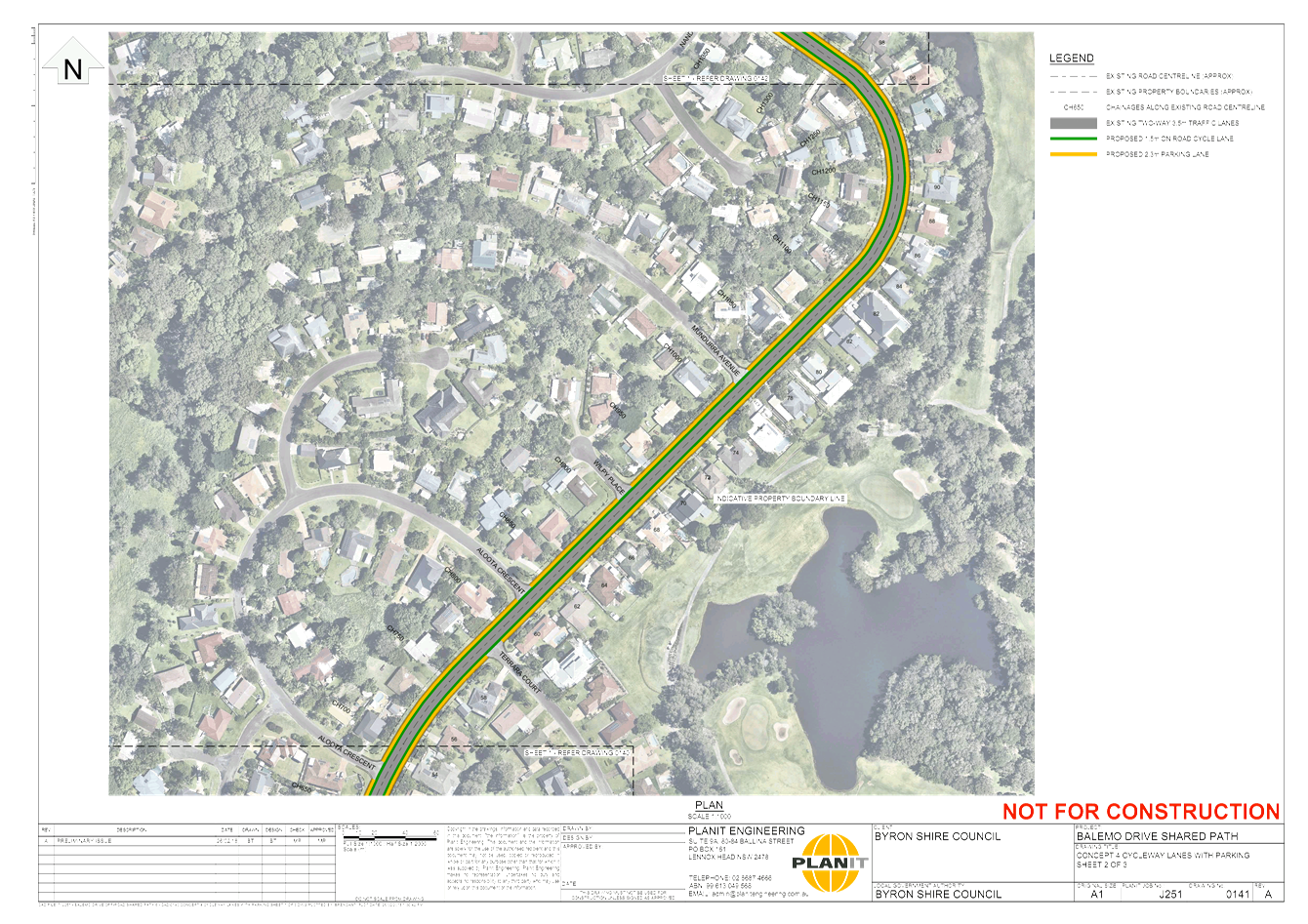
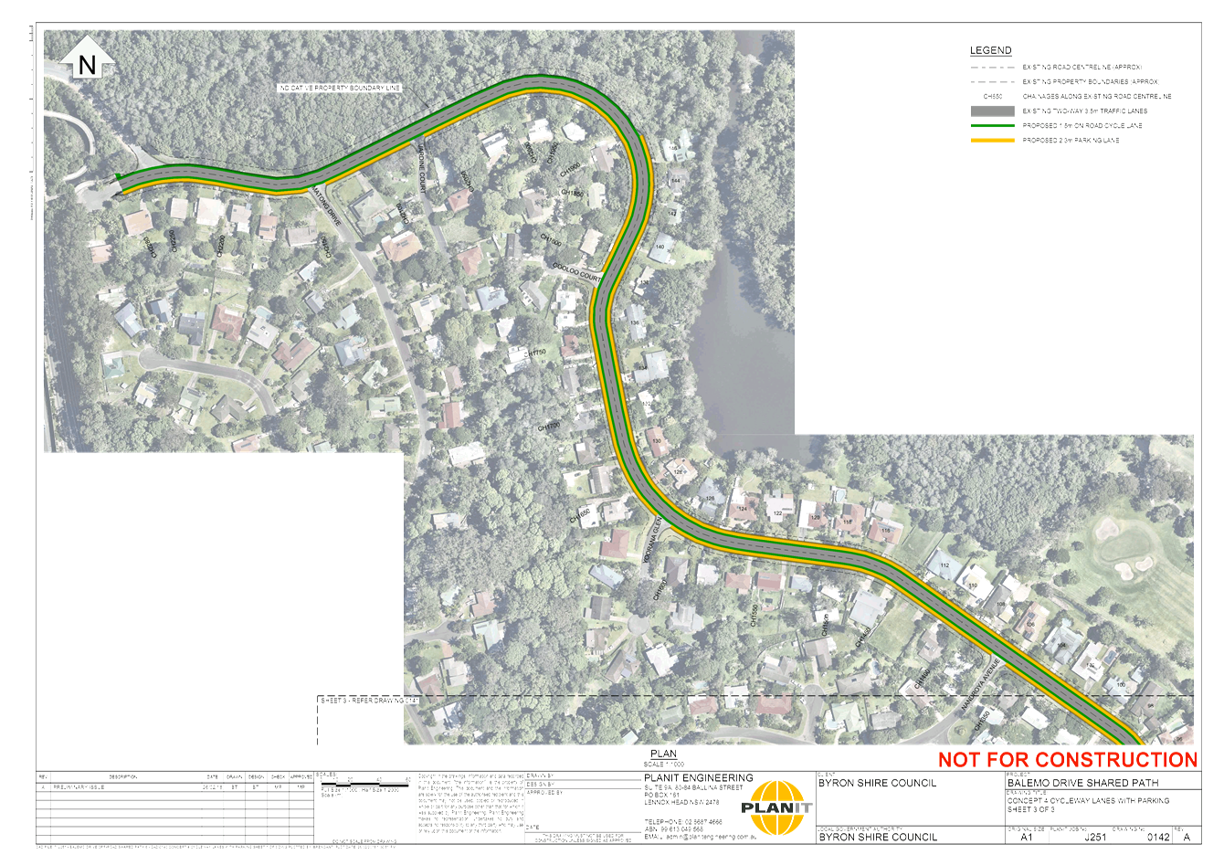
Report
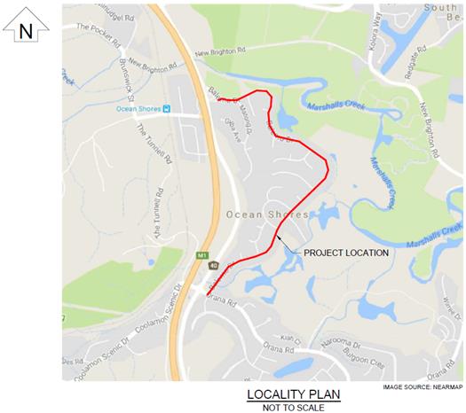
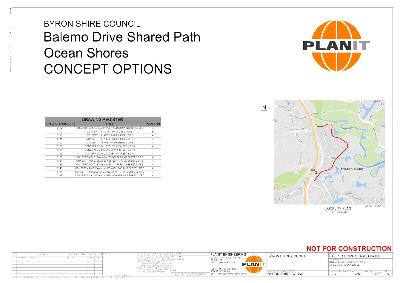
The objective of the
project is to design and construct a new cycleway along Balemo Drive from Orana
Rd to Brunswick Valley Way connection to the quality standards of Austroads and
Australian Standards in Ocean Shores, NSW.
The purpose of this report is to provide to the Transport
and Infrastructure Advisory Committee an opportunity to provide comments on the
Balemo Drive Shared Path concept designs to improve cyclist and pedestrian
connectivity through Ocean Shores.
|
Figure 1. Location Plan
|
|
|
|
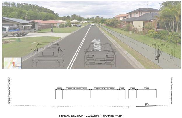
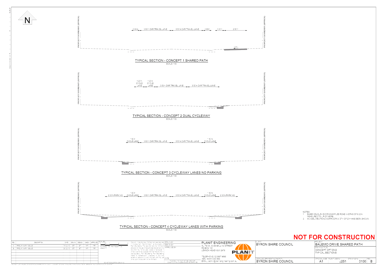
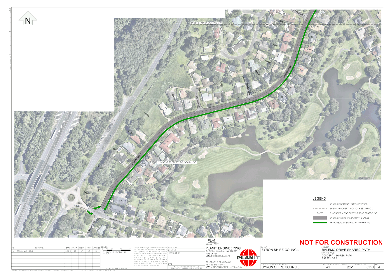
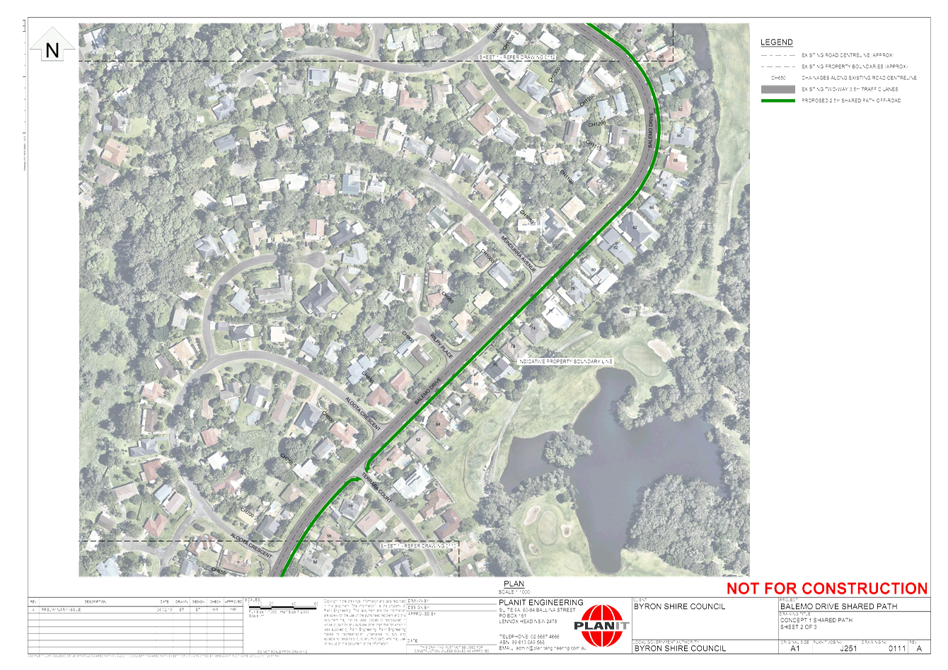
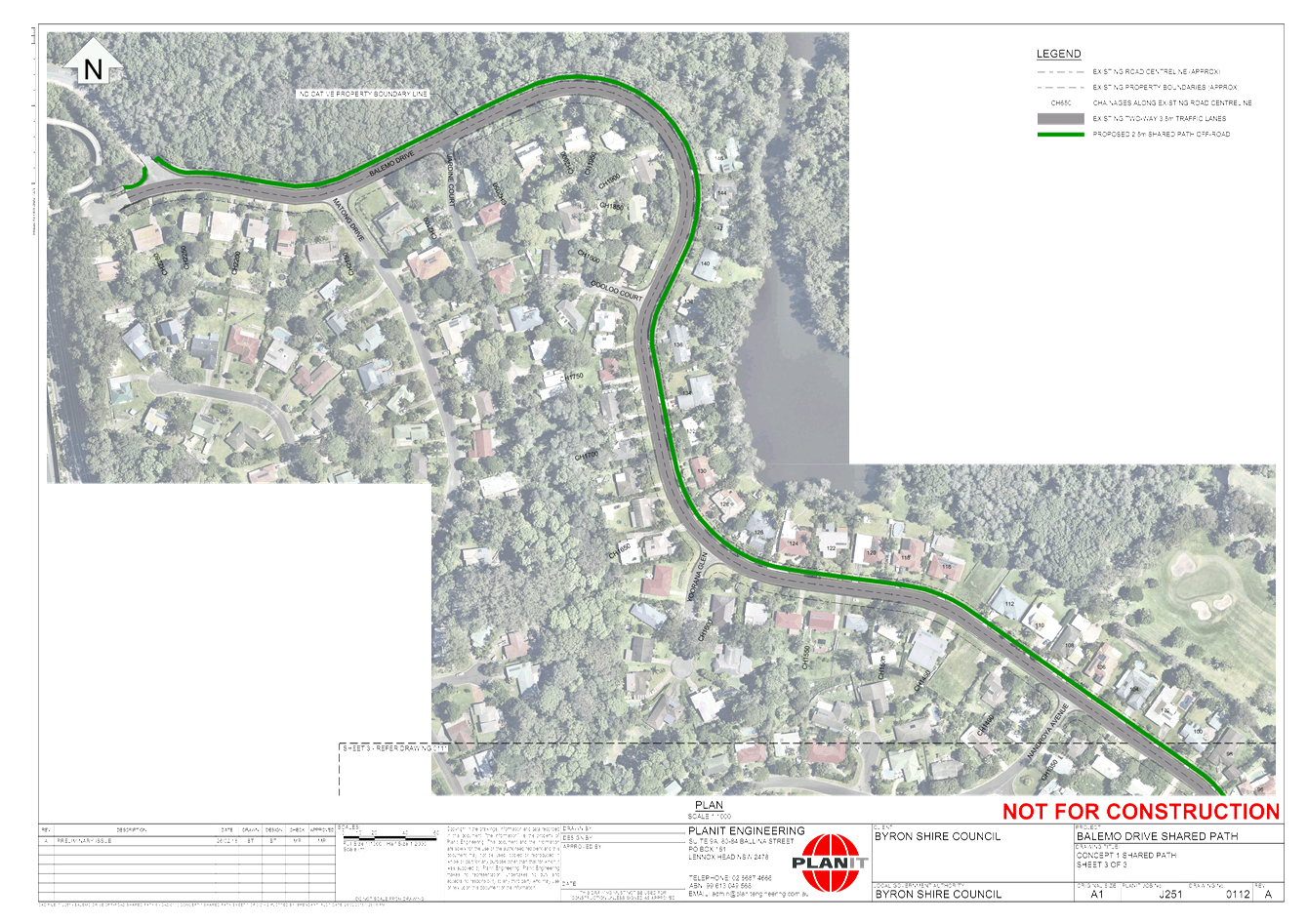
Concept 1 Shared Path
The 2.5m wide concrete
shared path on the Eastern side of Balemo Drive would cross 73 driveways,
four roads and remove approximately 21 trees leaving a meter wide turf strip
between the kerb and the shared path. There are issues relating to safety
around reversing vehicles out of private residences onto the shared path and
vehicles parking on the shared path. However, this option provides the lowest
risk to users due to the lowest number of driveways being crossed and the
route requiring only three street crossings
If this shared path was to
be installed on the Western side of Balemo Drive there would be approximately
13 road crossings, 64 driveways and a number of trees for removal. The
increased number in road crossings combined with the high number of
driveways presents a risk of vehicle and pedestrian/cyclist interactions.
This option will impact
residents ability to park on the verge area as is currently the case on the
cycleway side of Balemo Drive.
The western side option would
be more expensive to build than the eastern side alignment although it would
provide for improve connectivity from the local street network onto
the shared path.
|
|
|
|
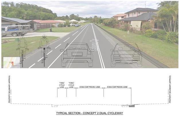
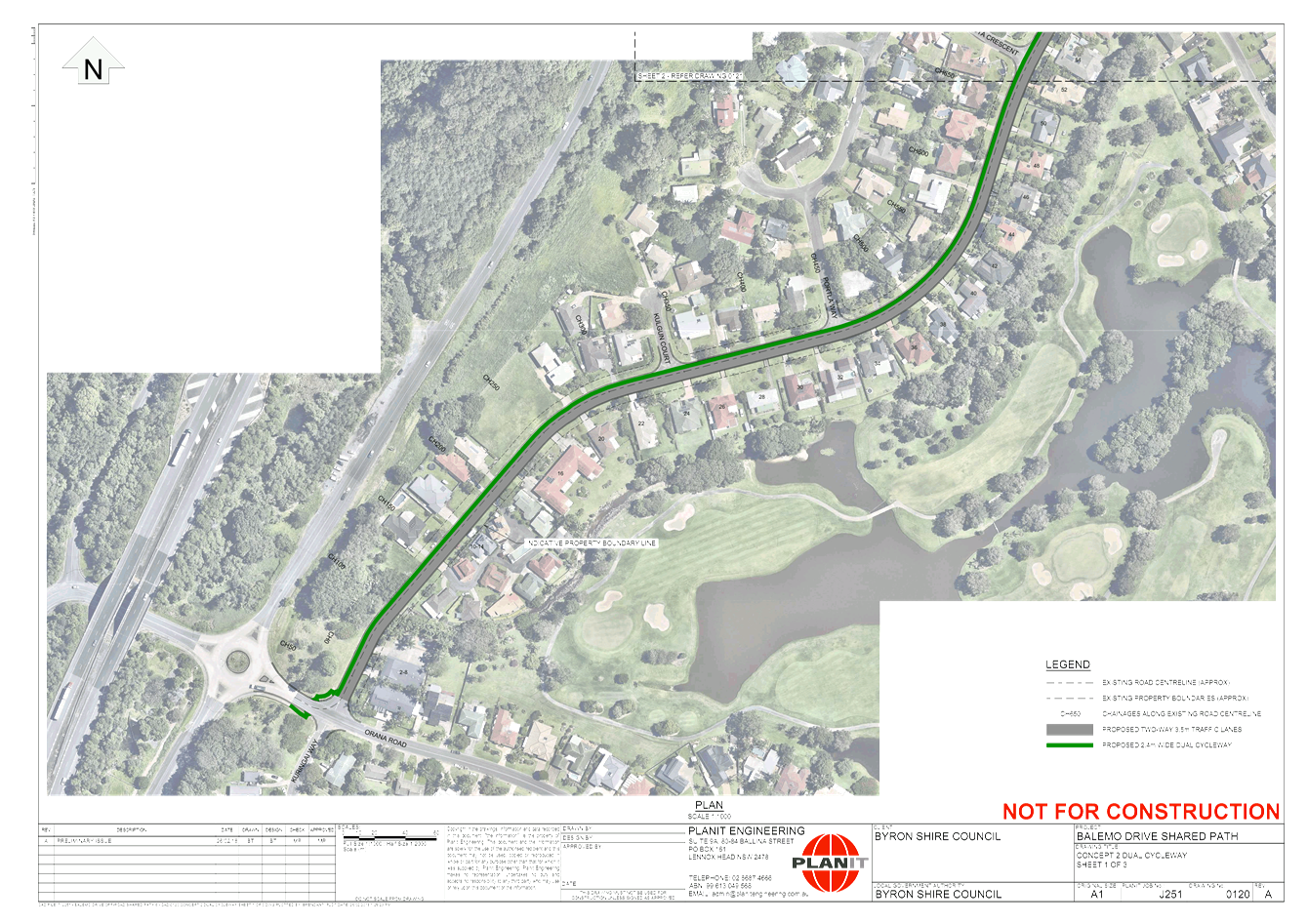
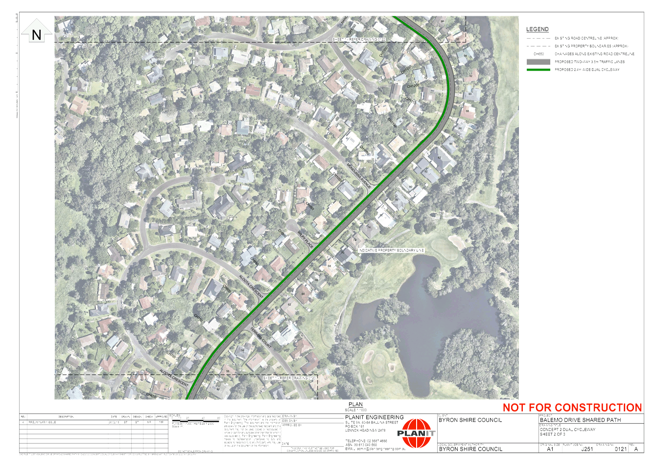
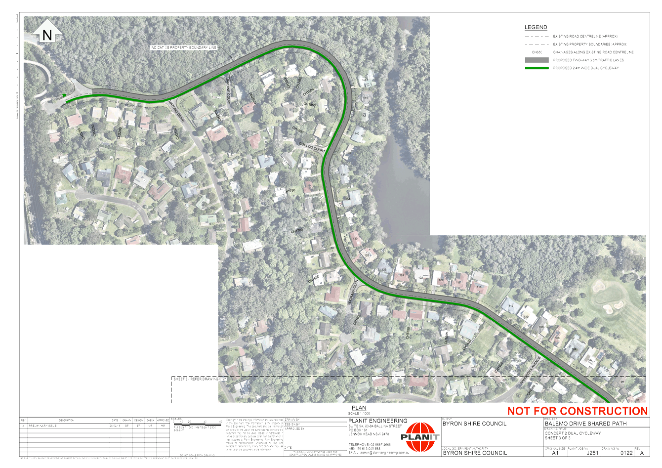
Concept 2 Dual Cycleway
This option provides a dual
lane cycleway on the existing roadway with no separation from live traffic
which will be problematic with regards meeting Austroads and Australian
Standards. This option would require 2250m of kerb and channel to be removed
and replaced. There is a risk that there is no subsoil drainage has been
constructed in this area which may cause premature failure in the road
pavement if not installed. This option is considered to present greater
safety concerns for cyclists over other options particularly option 1.
This option does not make
any provision for improved pedestrian connectivity and vehicles will
still need to park on verge areas.
|
|
|
|
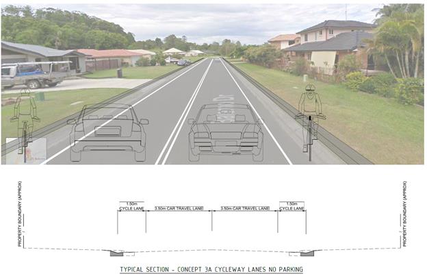
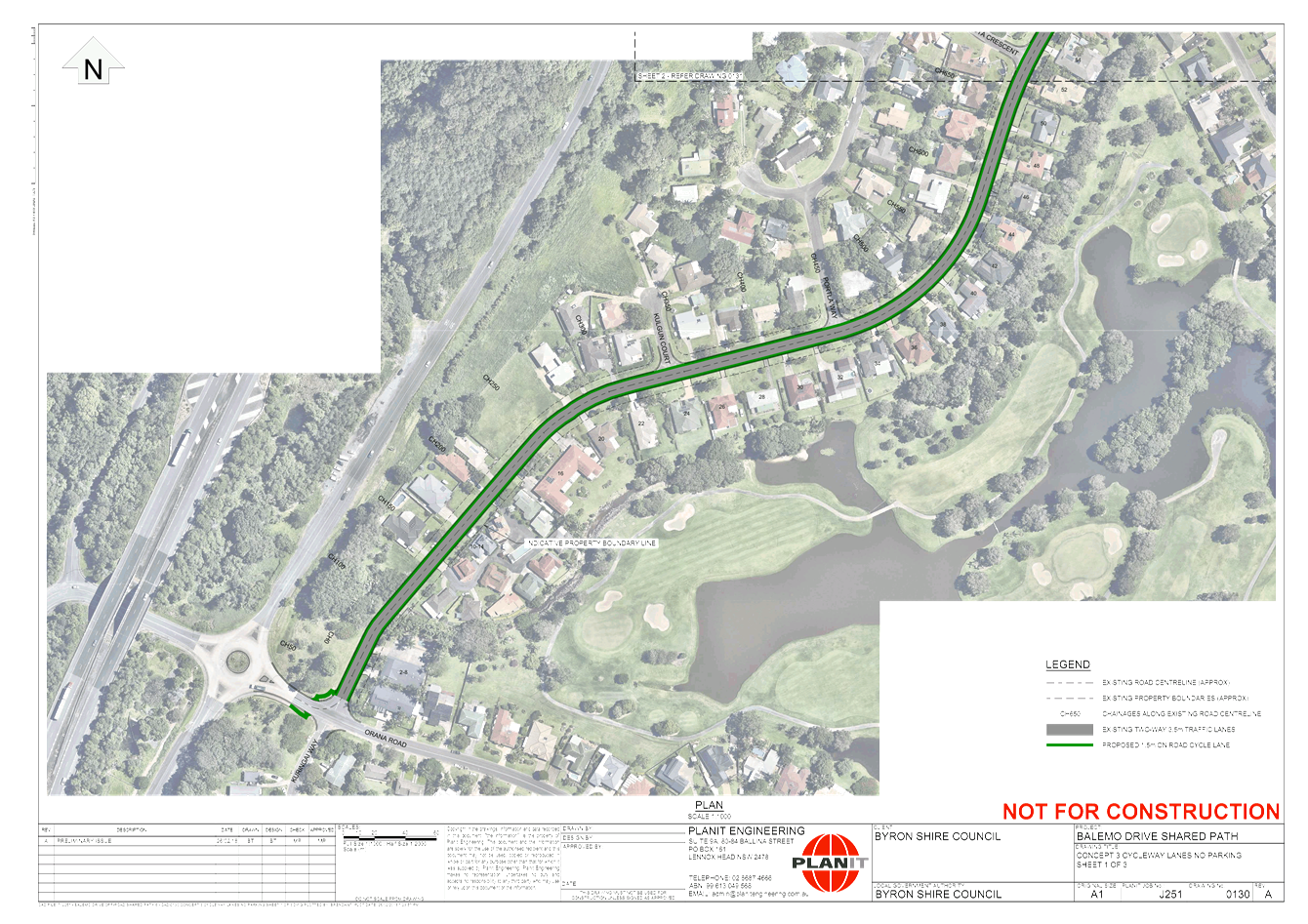
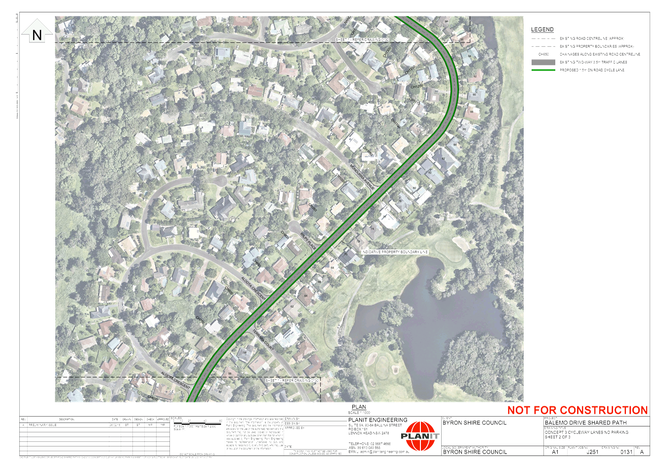
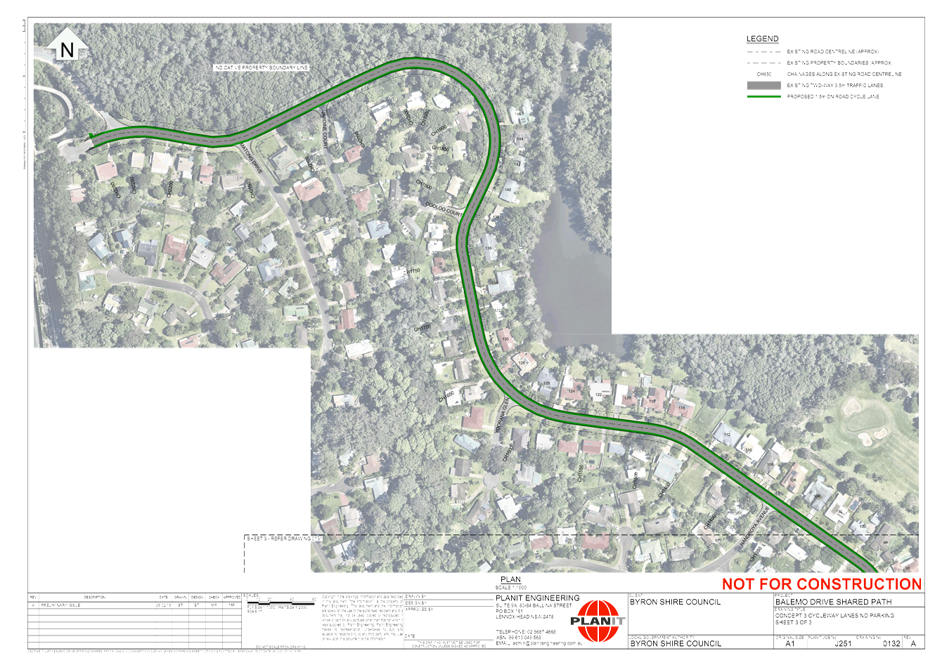
Concept 3A Cycleway
lanes with no parking – On road
This option involves
creating two on road 1.5m wide cycleway that would require reconstruction of
kerb and gutter on both sides of Balemo Drive with potentially less tree
removal. This option crosses 12 intersections and137 driveways which add
significantly to the cost of construction. The road would require widening by
1.4m approximately. There would be improvement for cyclist from contiguous on
road cycle lanes however these lanes make no provision for improved
pedestrian connectivity.
This option does not make
any provision for improved pedestrian connectivity and vehicles will still
need to park on verge areas.
Pot hole patching and
potentially road resealing would be required to improve the riding surface
for cyclists safety.
|
|
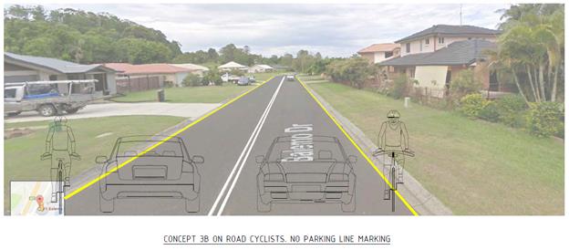
Concept 3B Cycleway
lanes with no parking – On road
The existing travel lanes
on Balemo Drive are approximately 4.4m in width. Road rules
dictate that parallel parking must be at least 3.0m from any
centreline. Essentially to comply with road rules, local residents need
to straddle the kerb and/ or park on the road verge within the footpath
designated zone. Site observations confirm that residents are generally
parking wholly within the grassed footpath zone.
Option 3B would essentially
formalise these existing arrangements through the application of a
yellow “no Stopping” line either side of the road as indicated in
the sketch below including line marking a double barrier white centreline
along the whole length of Balemo Drive.
The wide lane would allow
vehicles to pass the cyclist and complies with Austroads.
This would be a cheaper
alternative to relocating the kerb and channel however, this option does not
provide for any designated cycleway or pedestrian walkways
Pot hole patching and
potentially road resealing would be required to improve the riding surface
for cyclists safety.
|
|
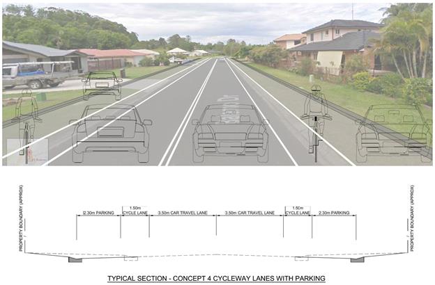
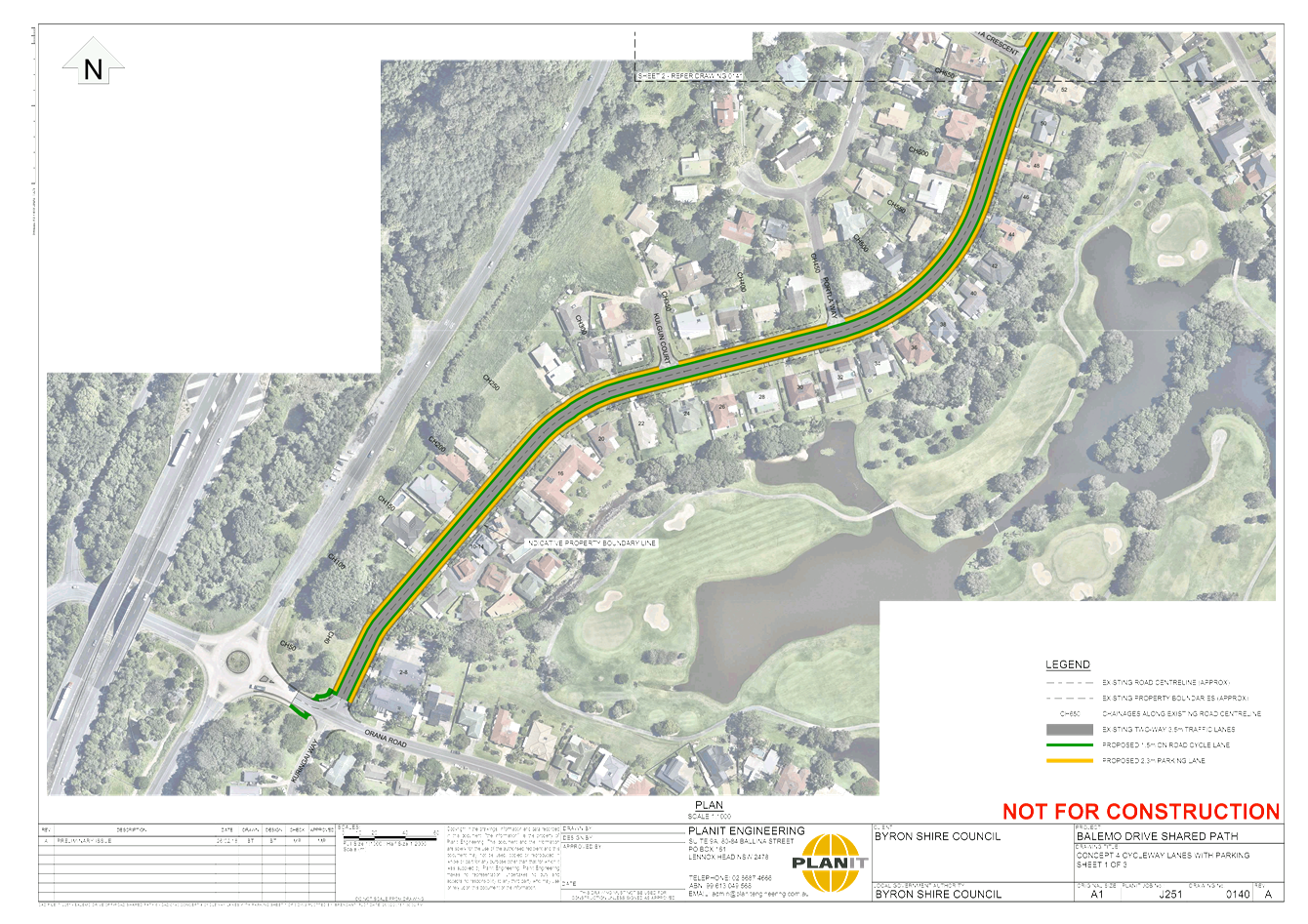
Concept 4 Cycleway lanes
with parking – On road
This option would widen the road by approximately 6m to
allow for two parking lanes and a cycleway. The on road parking should
relieve parking demand however at the expense of improvements for
pedestrians. Cyclist would have a better chance of avoiding any vehicle
reversing onto the road as the road is much wider. There are high costs of
renewing both kerbs, new pavement, garden beds and 137 driveways with
potential for the community to resist the changes. It is also possible that
the increased pavement width will encourage higher vehicle speeds.
All property boundaries would need to be surveyed
accurately and there may be issues with underground services.
|
|
|
Option 1 is the only
realistic option to improve both cycling and walking amenity in Balemo
Drive. The committees support for proceeding with Option 1 is sought.
Financial Implications
The indicative budget for this project is $618,800 (Option
1) as noted in the cost comparison table below. Council currently has an Active
Transport (Walking and Cycling Program) funding grant application lodged with
construction timelines pending the success of the grant application.
|
Table 1. Indicative
Cost
|
|
1 Shared Path – Off road (On Eastern side)
|
$ 618,800
|
|
1 Shared Path – Off Road (On Western side)
|
$ 825,00
|
|
2 Dual Cycleway - On road
|
$ 1,150,000
|
|
3A Cycleway lanes with no parking – On road
|
$ 2,500,000
|
|
3B No stopping lines on existing road surface
|
$ 80,000
|
|
4 Cycleway lanes with parking – On road
|
$ 4,200,000
|
Statutory and Policy Compliance Implications
There are no Statutory and Policy
Compliance Implications at this stage.
Staff Reports - Infrastructure Services 4.3 - Attachment 1
Staff Reports - Infrastructure Services 4.4
Report No. 4.4 Koala
Wildlife Signage
Directorate: Infrastructure
Services
Report
Author: Evan
Elford, Team Leader Infrastructure Planning
File No: I2018/1117
Theme: Community Infrastructure
Roads and Maritime Services
Summary:
This report has been prepared in relation to the
notification contained in the agenda for the 26 June 2018 meeting of the TIAC.
|
RECOMMENDATION:
That the Committee note the report.
|
Report
The purpose of the report is to provide the committee with
background information to facilitate and advance discussions in relation to
what procedures or policies may be appropriate for Council to action in
relation to road side signage to help protect Koalas and other Wildlife.
As noted on Council’s website. koalas have been
recorded over much of the Shire from the coast to the hinterland. Within
the coastal belt significant koala habitat areas have been identified at
Brunswick Heads, Tyagarah, Myocum, West Mullumbimby and West Byron. In
the hinterland, significant koala habitat has been identified in Bangalow,
Federal, Goonengerry, Wilson Creek Huonbrook and Montecollum.
Koala populations are under increasing pressure and the
draft Byron Coast Comprehensive Koala Plan of Management (KPOM) provides a
coordinated strategy that addresses all of the identified key threatening
processes (habitat loss, road kills, dogs and fire) together with measures to
stimulate koala movement within the Byron Coast planning area.
In 2016 Council resolved to submit the draft KPOM to the
Department of Planning and Environment for approval in accordance with State
Environmental Planning Policy 44 - Koala Habitat Protection (SEPP 44).
Shortly after Council submitted the draft KPOM, a review of
SEPP 44 was commenced by the Department. Finalisation of the draft KPOM
will be dependent on the outcomes of the SEPP 44 review.
Some actions identified in the draft KPOM are being
implemented via Council’s current projects and partner projects.
The Byron Coast Koala Habitat Study was
undertaken in 2012 and provides the scientific background used to inform the
development of the KPOM. The habitat study includes analysis of:
· historical
records
· assessment
of current koala population distribution and size
· analysis
of preferred food trees
· mapping
of koala habitat
· identification
of important linkages between high activity areas
· assessment
of threatening processes
· recommendations
for the KPOM.
Koala projects aim to secure the koala in the wild in the
Shire by:
· reducing
critical threats to the species
· ensuring
adequate protection, management and restoration of koala habitat
· maintaining
healthy breeding populations of koalas throughout their current range.
Byron Habitat Corridors 2017-20 funded by NSW
Environmental Trust
The project focuses on rebuilding 10ha of eucalypt forest
ecosystems for koalas in areas identified by the draft Byron Coast
Comprehensive Koala Plan of Management and the latest habitat restoration
literature.
Target areas for revegetation and regeneration works are
existing patches of eucalypt forest, wetlands and creek lines to enhance and
create vital koala habitat. A strong focus of the project is inclusion of
landowners who are keen to manage their land for long-term threatened species
protection leading by example.
Iconic Koala 2017-18 funded by the Environment Levy
and NSW Government
The project aims to address critical threats to the koala as
identified in the KPOM such as:
· reducing
vehicle strikes,
· identifying
risk areas where high levels of domestic dog ownership and/or wild dogs
coincide with or are adjacent to koala habitat
· reviewing
the Pest Animal Management Plan
· promoting
better engagement with landholders and the broader community in koala
conservation actions across the Shire
In 2017, Council engaged the services of a Koala Expert, Dr
Steve Phillips, to investigate and report on Koala kills and mitigation
measures for the proposed upgrade of Ewingsdale Road.
Dr Phillips’ advice (E2018/21348 attached)
particularly focused on opportunities to provide safe under-road
crossings for Koalas and was silent in respect of wildlife signage.
In 2004 the Cooperative Research Centre for Sustainable
Tourism (CRCST) funded a project by the
University of Tasmania, in conjunction with the Tasmanian
Wildlife Roadkill Collective (WRC) to investigate and report on methods for
reducing wildlife roadkill in Tasmania.
The Reducing Wildlife Roadkill Tasmania (RWRT) full report
can be found at https://eprints.utas.edu.au/3027/1/Reducing_Wildlife_RoadKill_Tasmania.pdf
Whilst the project was based in Tasmania and the study
looked at a number of different wildlife species, the objective of the
project to evaluate techniques to reduce wildlife roadkill and discuss the
suitability and implementation of these methods may be of value to the
committee’s deliberations as the following techniques were evaluated:
• ultrasonic whistles: attached to vehicles to warn
wildlife of oncoming traffic;
• overpasses: consisting of rope tied between trees or
other structures to allow possums to cross over the road without coming down to
the ground;
• escape routes: moderating obstacles such as batters
(roadside ‘cuttings’) to allow animals to move off the road
quickly, even when panicked;
• table drain management: reduction of roadside grass
and water aiming to reduce the number of animals attracted to the roadside to
feed and drink;
• platypus crossings: increasing the attractiveness to
platypuses to travel through the culvert underneath roads rather than crossing
over the road surface;
• signage (with night-time speed limits): advisory
speed limits which are 20 kph or more slower than the normal speed limit
between dusk and dawn; and
• public education: informing people of the negative
and dangerous aspects of wildlife roadkill and aiming for fauna friendly driving
attitudes.
The following techniques were not evaluated but where
discussed within the report:
• underpasses: a variety of structures passing
underneath the road, ranging from small concrete culverts to large bridges spanning
gullies, usually used in conjunction with wing fencing to provide an alternative
route for wildlife;
• reflectors: plastic prisms attached to guideposts,
which reflect headlights to prevent wildlife from moving onto roads and to
scare wildlife off roads;
• roadside lighting: produces increased visibility
which may discourage wildlife from spending time on the road or roadside and/or
improve visibility for drivers;
• light-coloured road surfacing: produces a contrast
in colour between dark animals and a light-coloured road, which may
discourage wildlife from spending time on the road or
roadside and/or improve visibility for drivers; and
• odour repellents: synthetic substance manufactured
to mimic canine urine to discourage wildlife from roadsides.
Several measures were identified as being likely to reduce
wildlife roadkill and/or decreasing driver distress on account of roadkill as
follows:
• wildlife signage,
• escape routes,
• table drain (ditch) management,
• platypus crossings,
• underpasses and
• potentially odour repellents.
Ultrasonic whistles, wildlife reflectors and lighting have
doubtful application, at least in Tasmania.
Note the Tasmanian project did not evaluate the construction
of long lengths of roadside fencing.
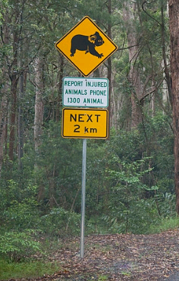
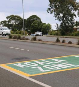
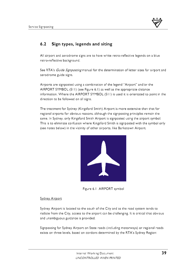
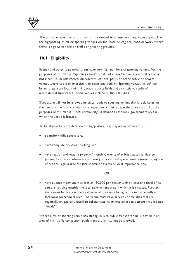
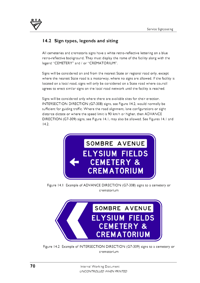
Wildlife Signage

Wildlife signage has typically taken the form of a black
animal silhouette on a yellow diamond-shaped background as detailed above.
While this is a familiar sign to most Australians, and the
implication is that it depicts wildlife on the road, it gives no information
about what the risk is, or what the driver is expected to do in response to the
sign.
Also, the RWRT project highlighted anecdotal information
suggesting that some tourists mistake the signs for tourist information about
areas for viewing wildlife.
The project noted that if signs are expected to have any
impact, more information must be provided.
The second issue to be considered is the variety of
different signs currently used, and whether this is advantageous or disadvantageous.
Across various parts of Australia, councils have produced specific signs
for particular species that are the focus of the roadkill problem in certain
places. These are still in the same style as the original signs detailed above,
but rather than a Koala or a kangaroo, they depict one of a number of animals
such as bettongs, wombats, penguins, bandicoots and quolls etc.
The report surmised that these signs may have become popular
because the belief is that people are more sympathetic to special or rare animals
than they are to wildlife in general. However, there are a number of arguments against
the use of these specific signs.
The project found that while they provide more detailed
information to the road users, this type of information does not necessarily
reduce the risk of a vehicle colliding with roadkill. It is not particularly
relevant what type of animal is at risk, because the recommendations remain the
same: be aware and slow down. It could even be argued that these specific
signs are confusing to the driver.
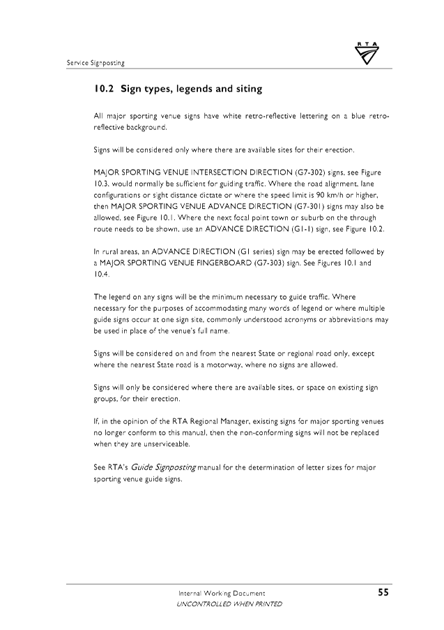
The RWRT project determined that unambiguous information was
required and deemed that signs must:
• portray the risk to human safety/car damage;
• portray the risk to wildlife;
• provide a regulatory or advisory speed limit;
• make it clear that the sign is relevant from dusk to
dawn, preferably in writing and in the graphics;
• display the word “wildlife” or
“wildlife zone”; and
• attempt to make the sign simple but striking.
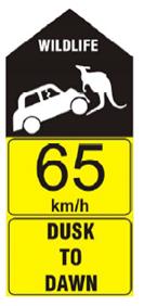
One of the signs the project came up with depicted a car
with headlights approaching a wallaby-type animal (because this obviously
represents wildlife), on a black background with a legal speed limit and the
words “wildlife zone” and “dusk to dawn”.
Currently Byron Shire does not have a clear directive or
policy in relation to the installation of or standards for wildlife signage.
Council also receives regular requests for the installation
of advisory signs to warn motorists of wildlife activities ranging from ducks
crossing roads to Koalas moving across roads along wildlife corridors.
Actions moving forward
Further investigation and the preparation of standards and
policies to implement appropriate Wildlife warning signage should be undertaken
in the longer term.
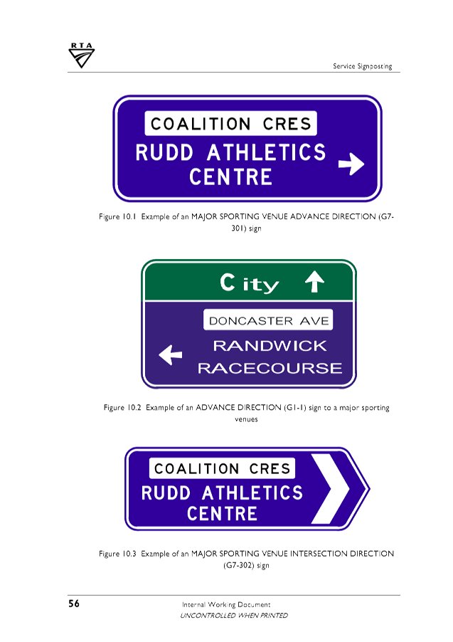
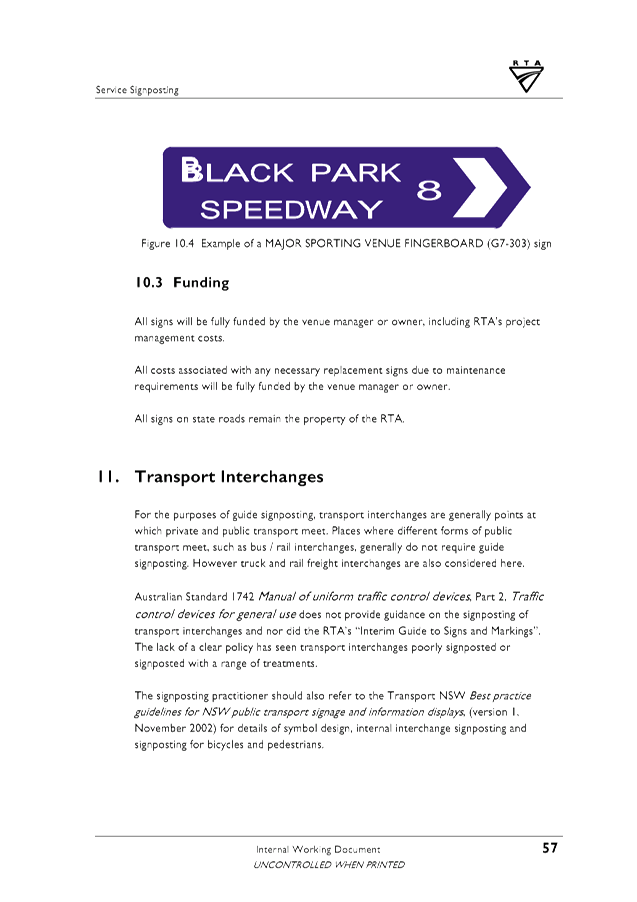
In the short term, Council could give consideration to
installing Koala signage in known localities based on previous requests
received.
“Corflute” signs could be procured however these
would only be of a temporary nature. A more appropriate solution would be
to install more permanent signage along the lines of the examples shown below
including consideration of pavement marking.
The advice of the Committee is sought in relation to the
design and implementation of Koala Wildlife warning signage.


Financial Implications
There are no statutory or policy compliance implications at
this time.
Statutory and Policy Compliance Implications
There are no statutory or policy compliance implications at
this time.
Staff Reports - Infrastructure Services 4.5
Report No. 4.5 Lismore
Road, Bangalow - Off-Road Shared Path Design Report
Directorate: Infrastructure
Services
Report
Author: Dominic
Cavanough , Contract Engineer
Evan Elford, Team Leader
Infrastructure Planning
File No: I2018/359
Theme: Community Infrastructure
Local Roads and Drainage
Summary:
The Transport and
Infrastructure Advisory Committee are invited to provide comments on the
attached concept design for 700m long a 2.5m wide concrete shared path to
improve pedestrian and cyclist connectivity in Bangalow.
|
RECOMMENDATION:
That the Transport and Infrastructure Advisory
Committee provide comments to the Project Engineer in relation to the Lismore
Road, Bangalow - Shared Path concept design.
|
Attachments:
1 24.2017.88.1
- Lismore Rd SP - Planit - DWG J252 Issue A (Concept Design), E2018/10965 , page 69⇩ 
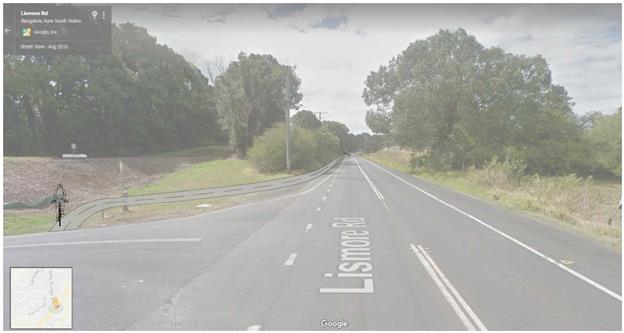
Report
The objective of the
project is to design a 2.5m wide off road shared path along Lismore Road from
Rifle Range Road to Granullie R0ad to the quality standards of Austroads and
Australian Standards in Bangalow, NSW.
The Transport and
Infrastructure Advisory Committee are invited to provide comments on the
attached concept design for 700m long a 2.5m wide concrete shared path to
improve pedestrian and cyclist connectivity in Bangalow.
Please note the bridge
over Paddy’s Creek will require a further detailed design.
|
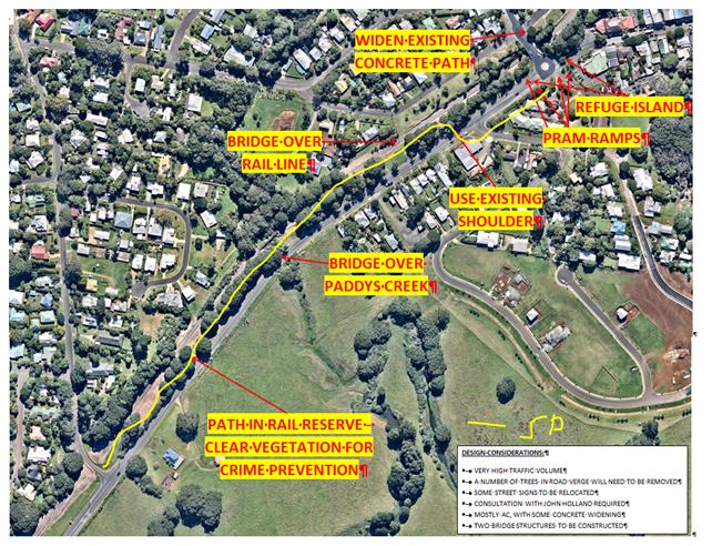
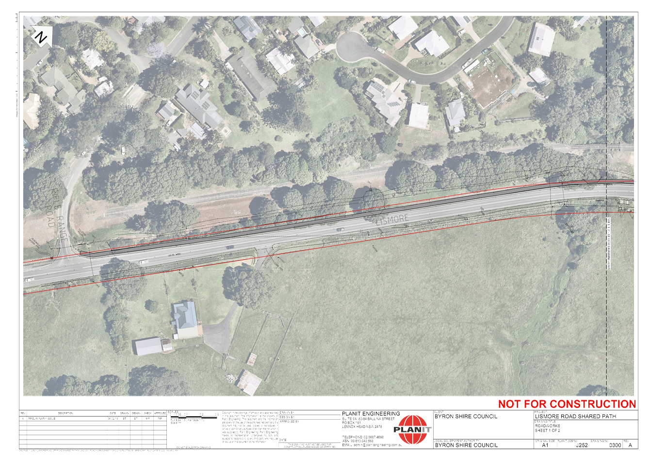
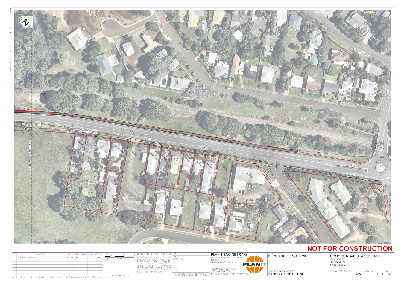
Image 1. Shared path shown in yellow beside Lismore Road
with comments from the Bangalow Place Plan.
|
|
|
This shared path will join
foot paths in Parrot Tree Place with Leslie Drive and Bangalow, which will link
existing active transport routes.
As per the 2008 Bike Plan
(E207/102438) this shared path is listed under table 4: Community requested
faculties as ID 3 and Map 40.
The concept design positions
the shared path on the Northern side of Lismore Road with a pedestrian refuge
at the Robinson Street intersection to use the existing path into Bangalow.
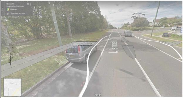
|
Image 2. Artist Impression of the pedestrian refuge to be
built near Lismore Road and Robinson Street intersection looking towards
Bangalow.
|
|
|
|
Image 3. Artist Impression bridge over Paddy’s
Creek look towards Bangalow.
|
|
|
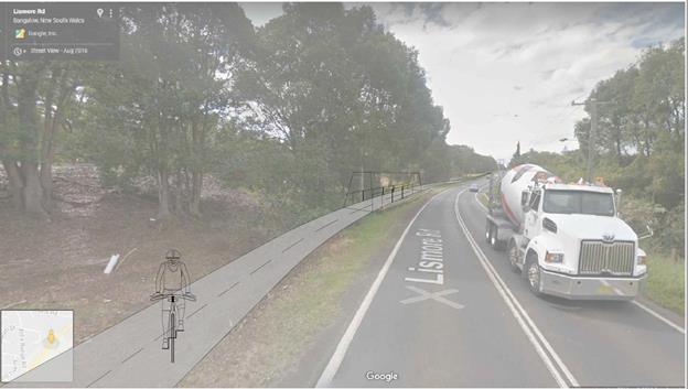
|
Image 4. Artist Impression of shared path from Rifle
Range Road and Lismore Intersection looking towards Bangalow.
|
|
|
Financial Implications
There are no Financial Implications at this
to stage of concept design.
An Indicative budget estimate has been
created from this concept design.
|
Table 1. Indicative
Budget Estimate
|
|
Stage
|
Item
|
Estimate
|
|
Plan
|
Project Management
|
$34,410.00
|
|
Design
|
Design
|
$30,000.00
|
|
Construct
|
Shared Path 700m @ $250/m
|
$175,000.00
|
|
|
Bridge
|
$100,000.00
|
|
|
PAMP and Lismore Rd Crossing (High traffic control risk)
|
$30,000.00
|
|
|
Connection to Rifle Range Rd
|
$10,000.00
|
|
|
Traffic separation
|
$30,000.00
|
|
Finalisation
|
Defect liability period @ $5/m
|
$3,500.00
|
|
|
Project Finalisation Report
|
$2,500.00
|
|
|
Risk Management – such as poor subgrade and latent site
conditions
|
$40,000.00
|
|
Total estimated cost
|
$455,410.00
|
Statutory and Policy Compliance Implications
There are no Statutory and Policy Compliance
Implications at this stage.
Staff Reports - Infrastructure Services 4.5 - Attachment 1
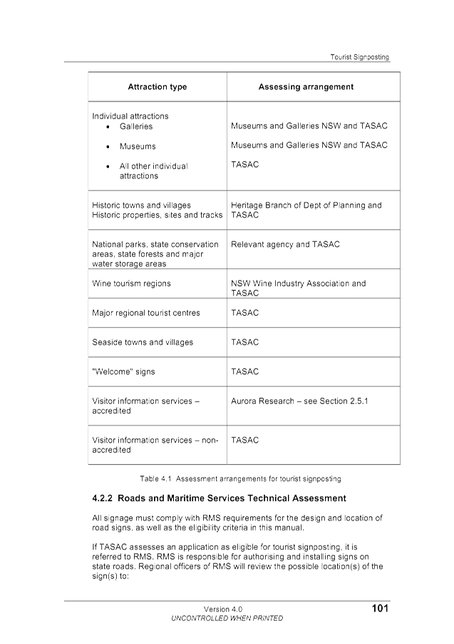
Staff Reports - Infrastructure Services 4.6
Report No. 4.6 Tourist,
Street Name, Community Facility and Service Signs - Policy 07/102.
Directorate: Infrastructure
Services
Report
Author: Dominic
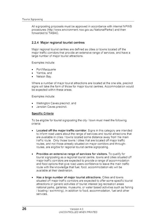
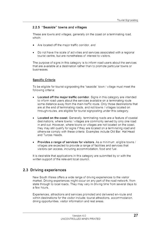
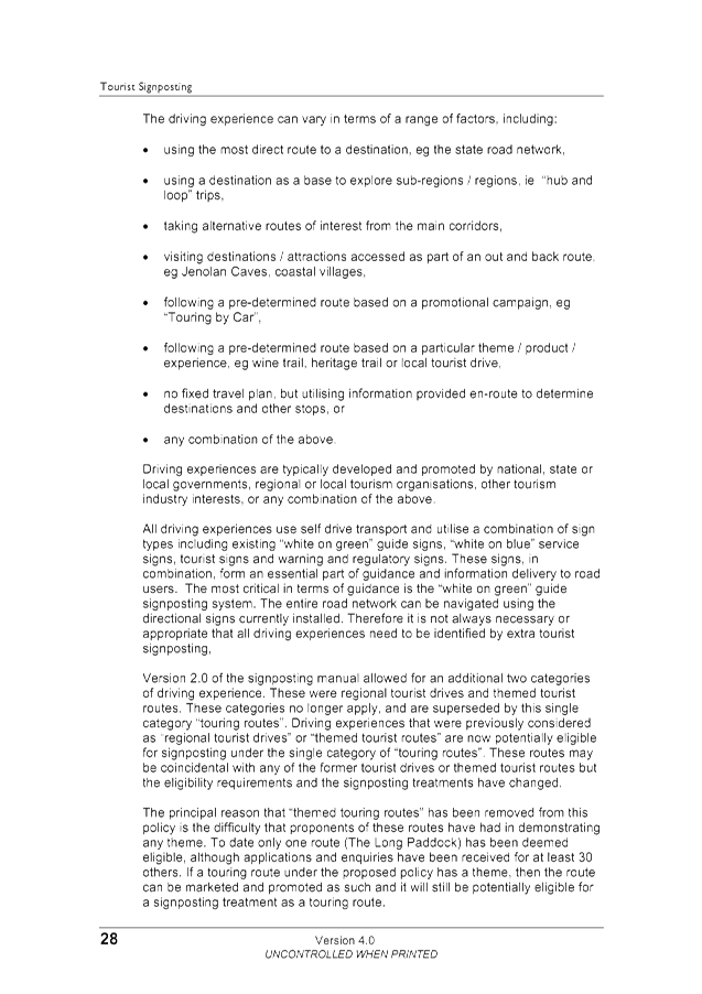
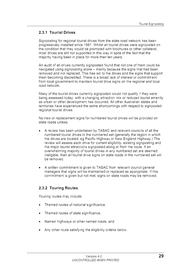
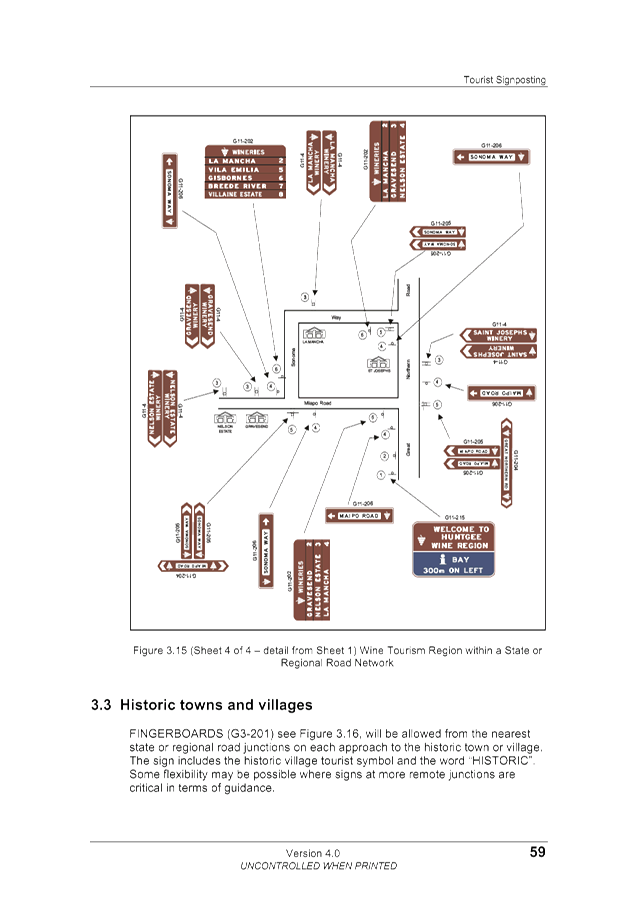
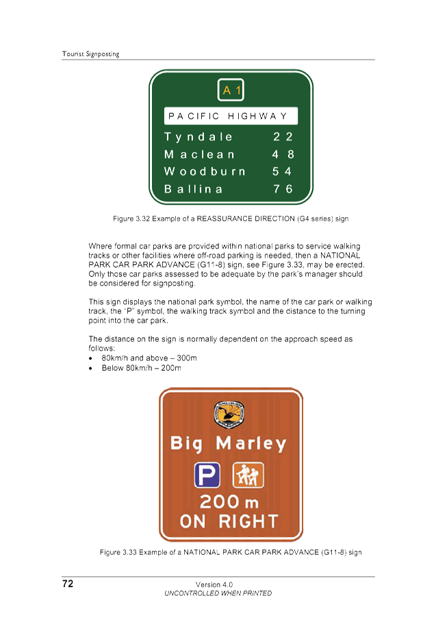
Cavanough , Contract Engineer
Evan Elford, Team Leader
Infrastructure Planning
File No: I2018/924
Theme: Community Infrastructure
Local Roads and Drainage
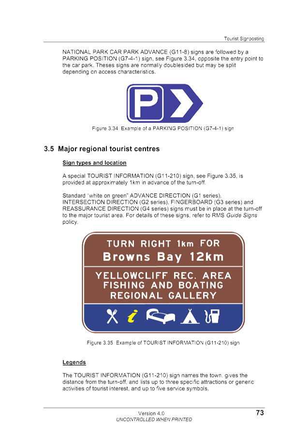
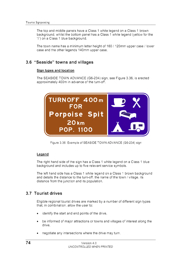
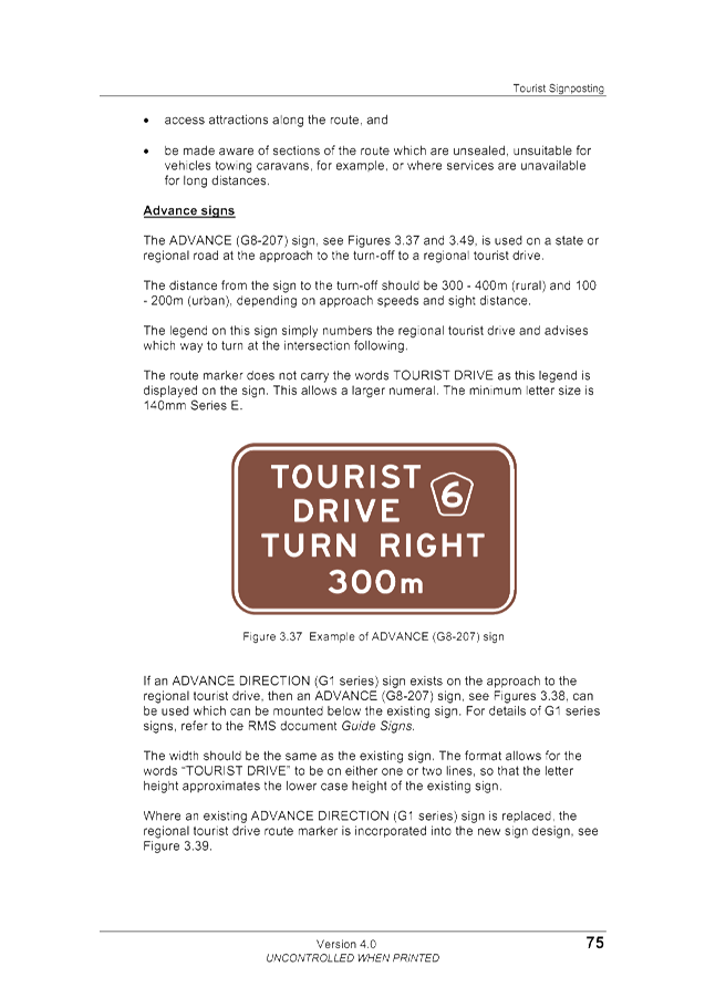
Council is in receipt of numerous enquiries in relation to
the siting and provision of tourist signs in relation to impacts on amenity and
possible removal of these signs.
Summary:
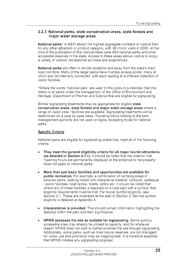
This report provides initial advice and information to the
committee in relation to policies, legislation and procedures relating to
tourist signs within our shire for consideration of future appropriate actions
necessary to better manage signage installations or potentially remove existing
signs and/or place a restriction on these signs being installed in the future.
Council’s Tourist, Street Name, Community Facility and
Service Signs Policy, 07/102 establishes the current framework for what signage
will be provided, where they will be placed, the criteria for their
establishment, who pays for them and which signs will be provided around the
Byron Shire.
Further investigation of the issues and a review of policy
07/102 to determine appropriate future actions is considered warranted.
|
RECOMMENDATION:
That further investigation of the issues relating to
the Tourist, Street Name, Community Facility and Service Signs and complete a
review of Policy 07/102 is undertaken with a view to reporting outcomes to
the 15 November 2018 meeting of the Transport and Infrastructure Advisory
Committee.
|
Attachments:
1 Policy:
Tourist, Street Name, Community Facility and Service Signs (Adopted 30/8/07), DM705283 , page 75⇩
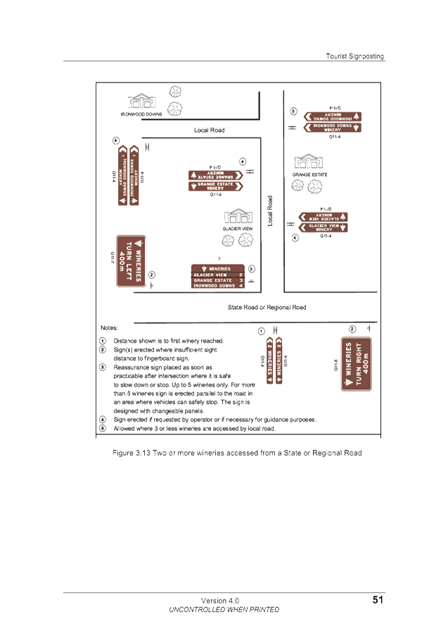
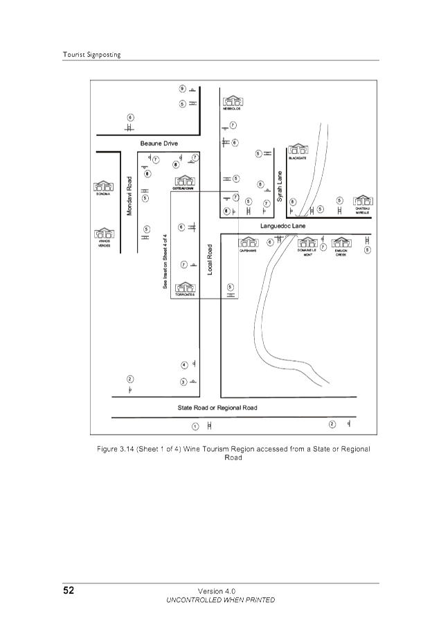
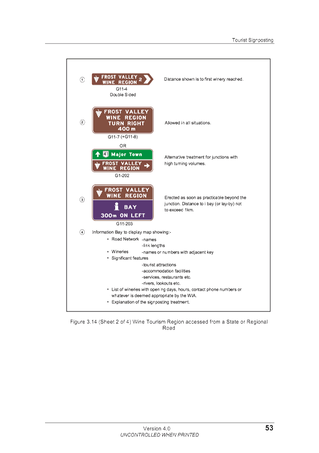
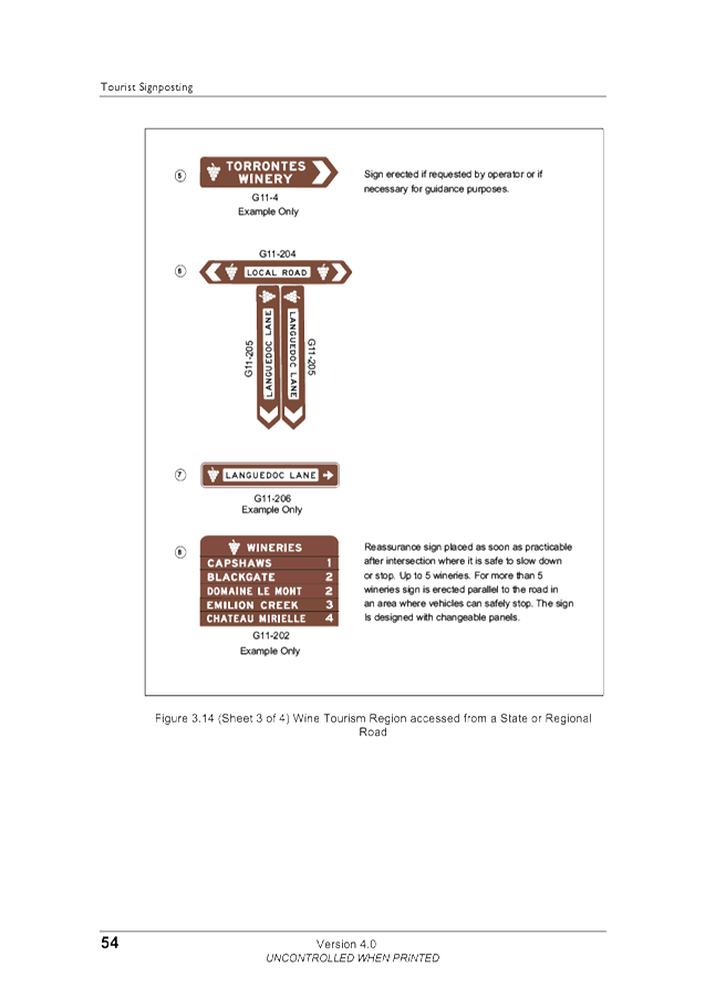
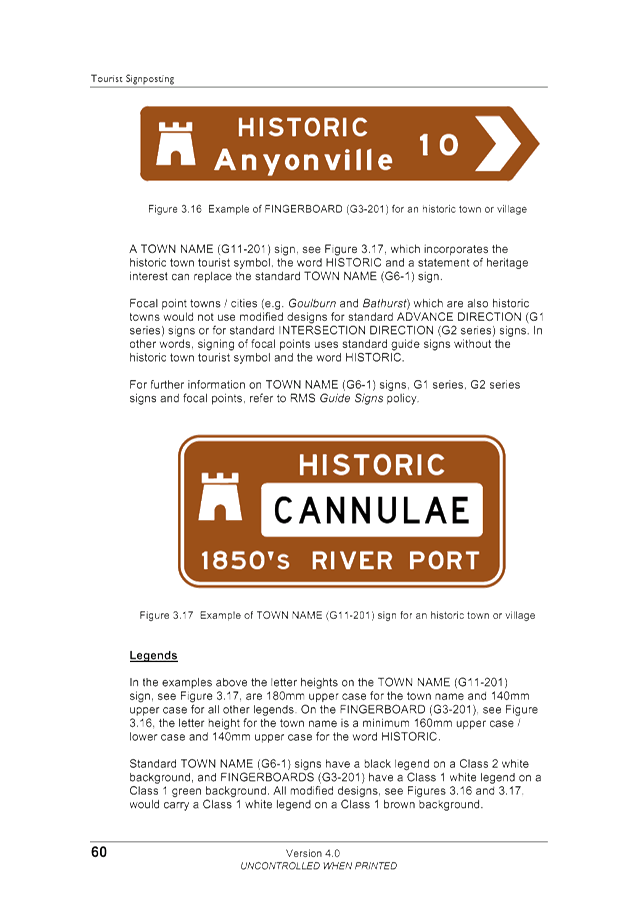
2 RMS
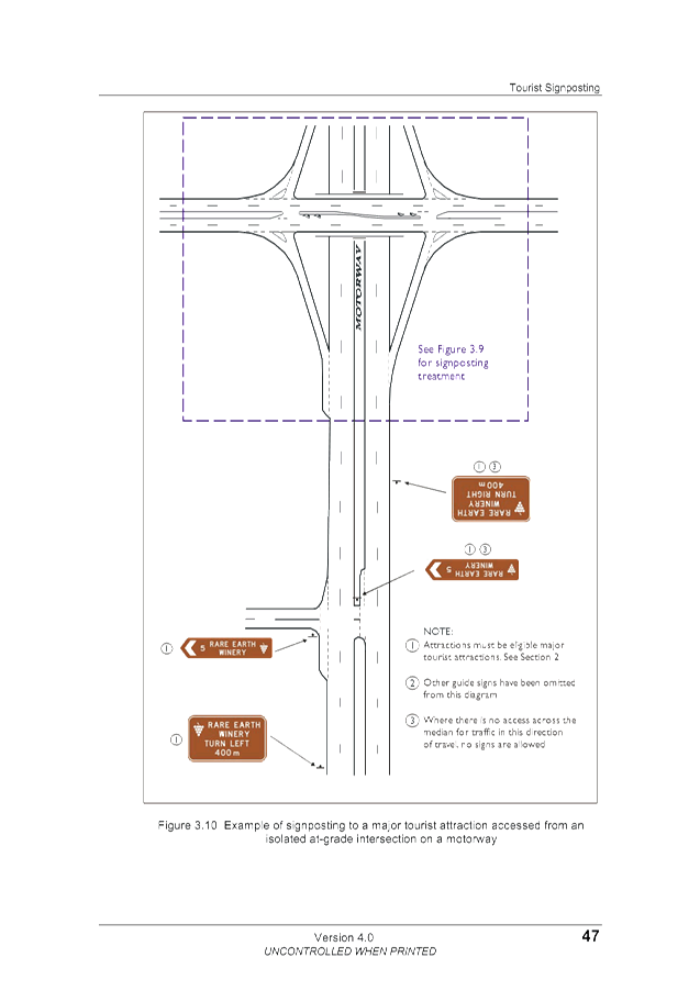
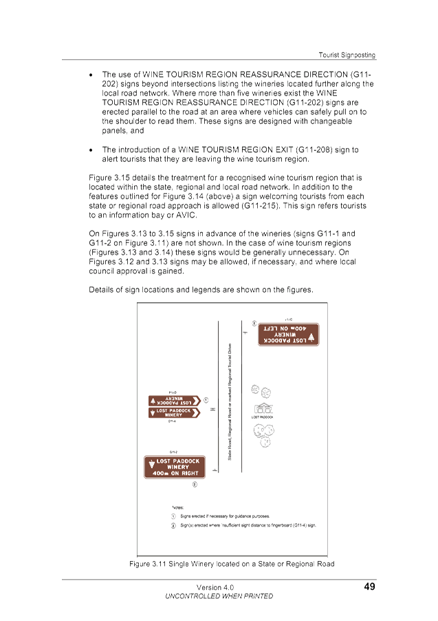
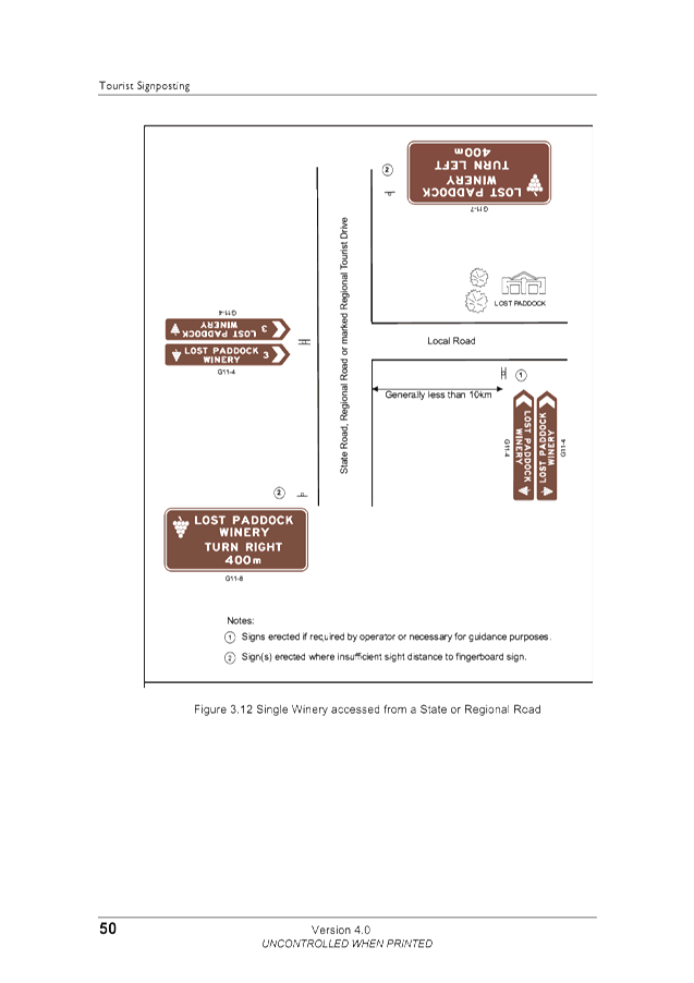
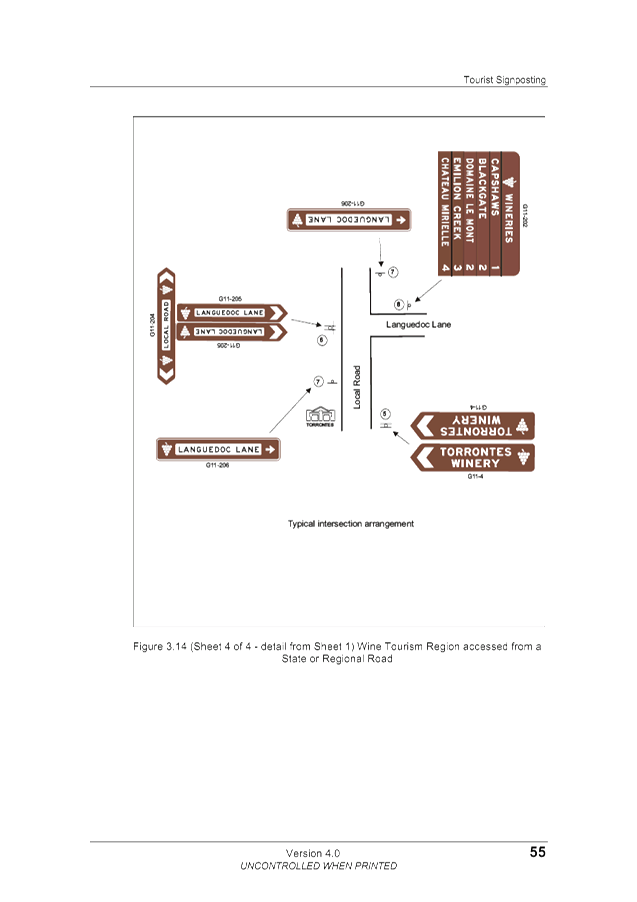
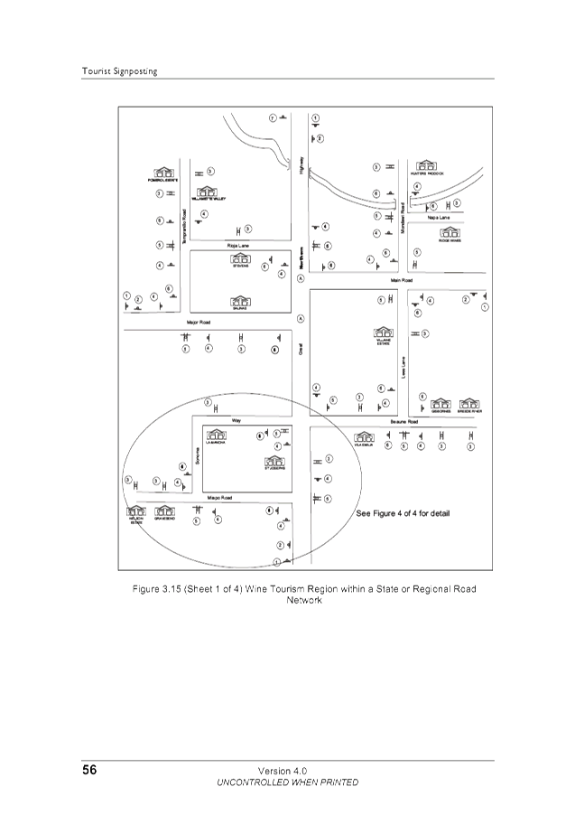
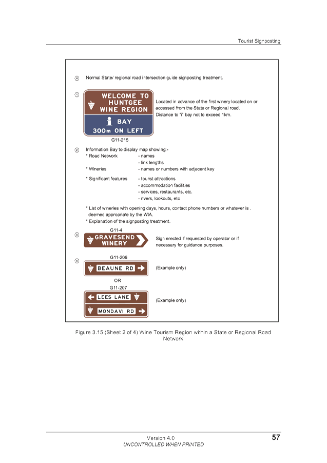
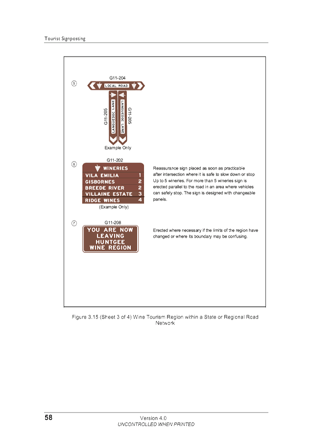
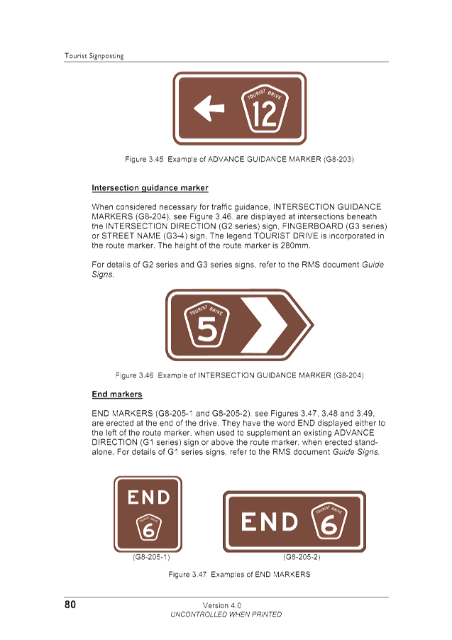
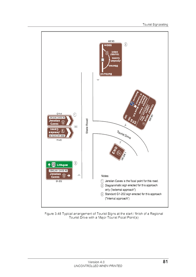
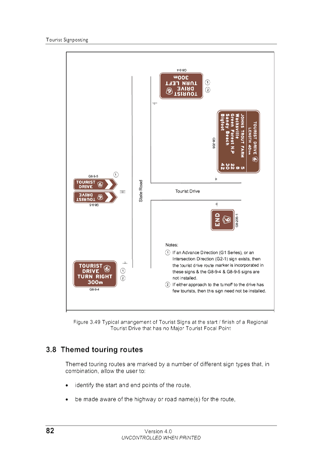
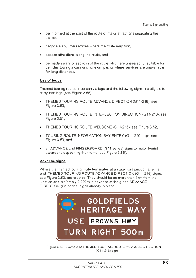
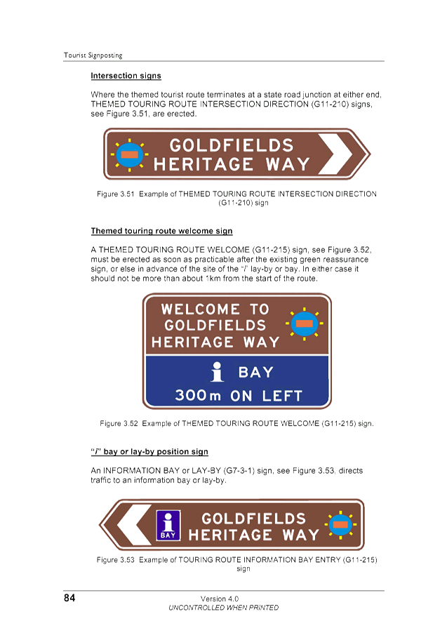
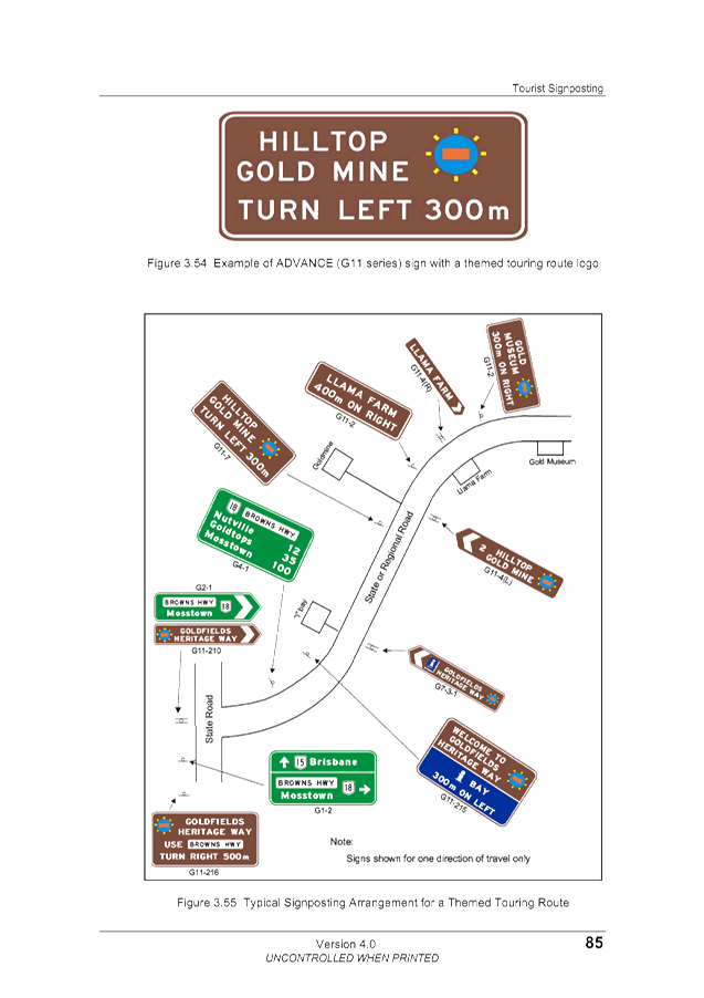
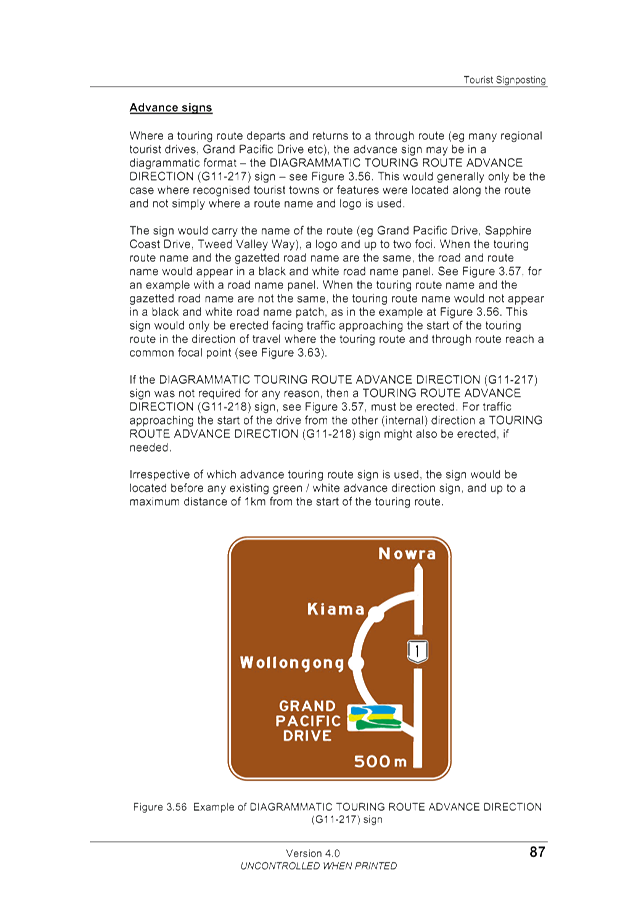
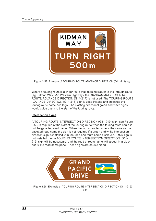
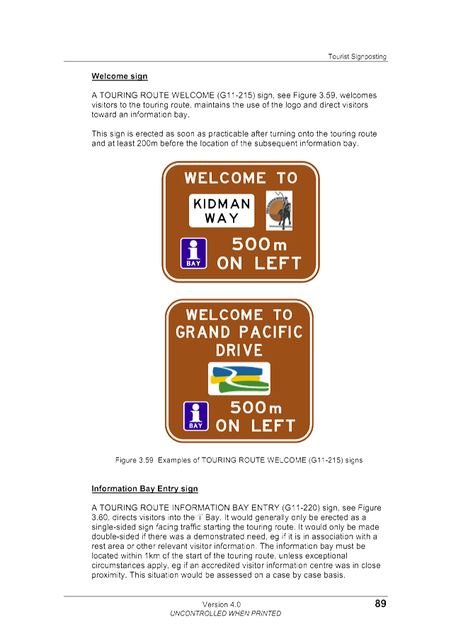
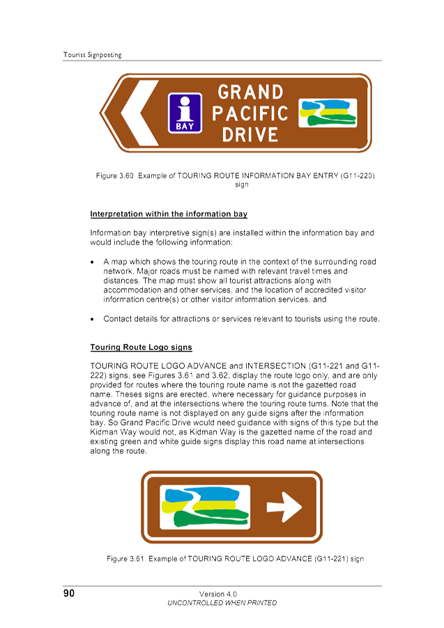
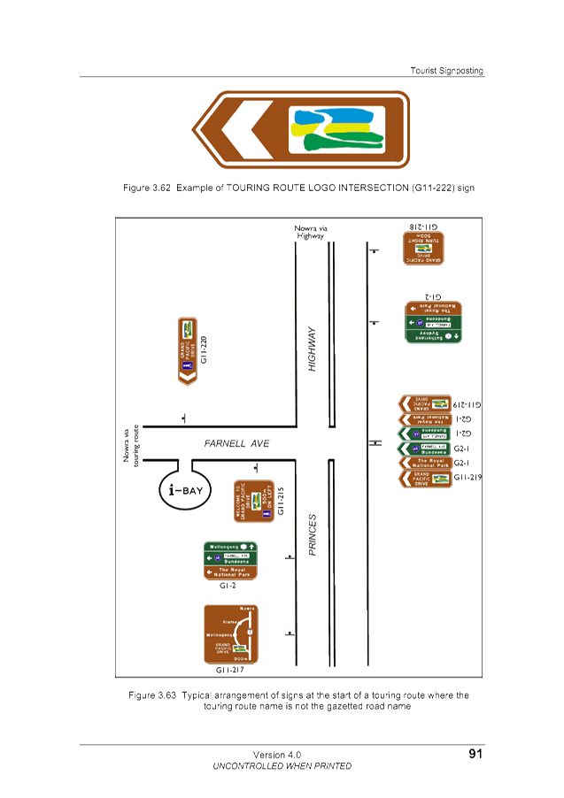
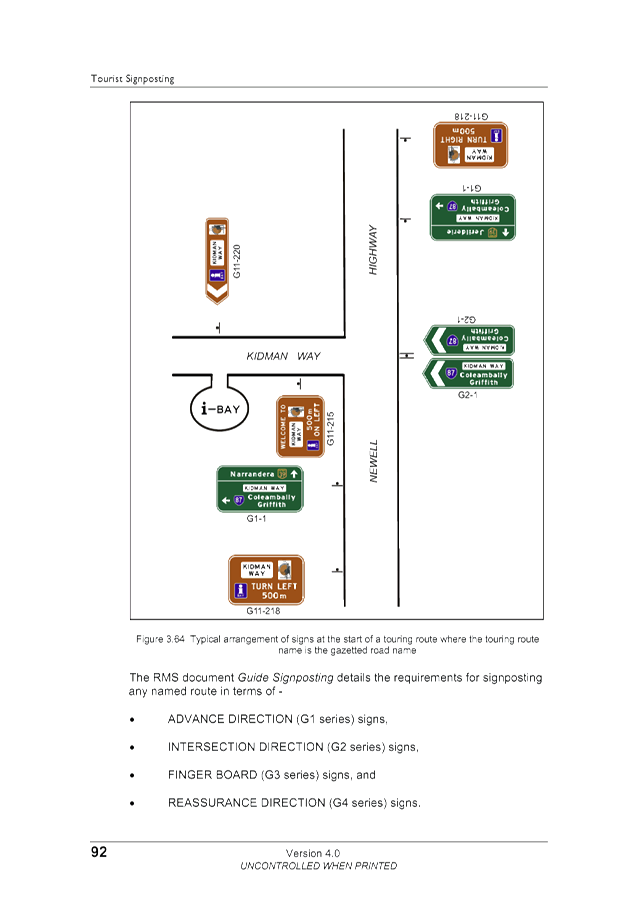
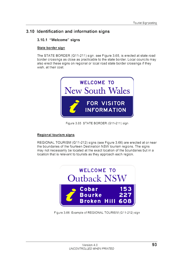
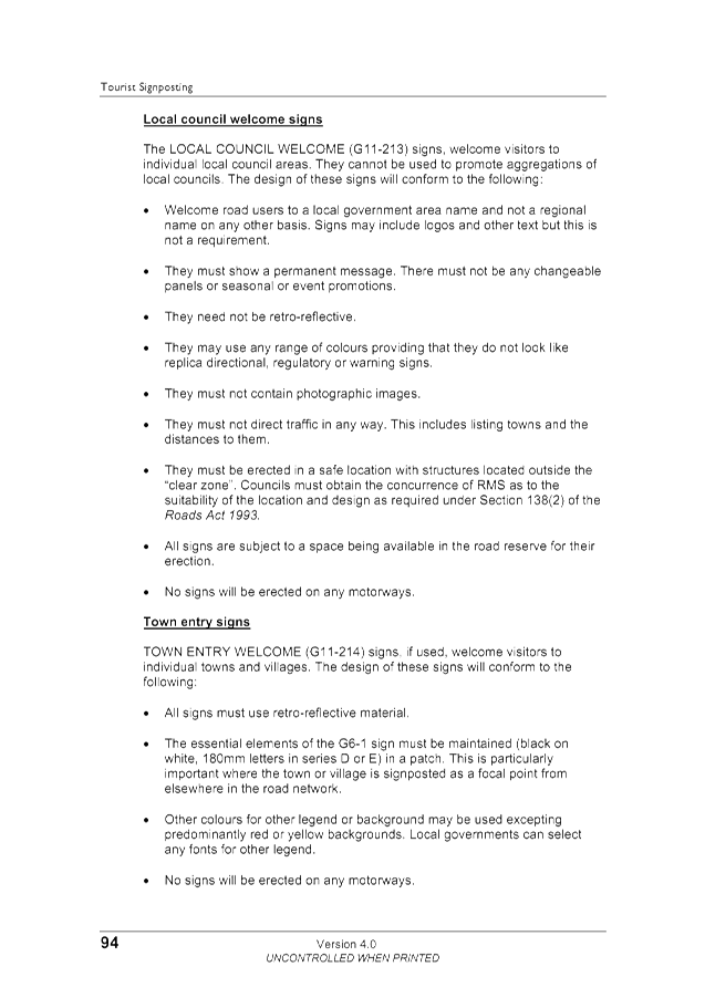
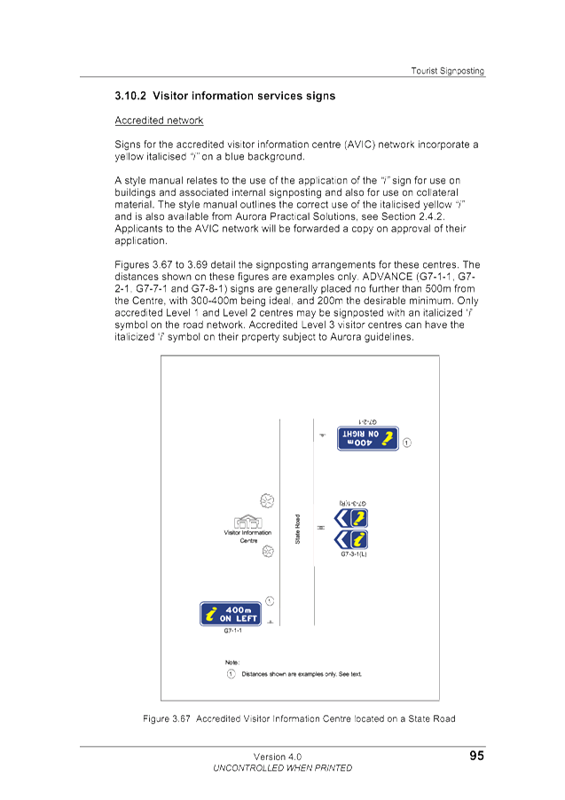
Tourist signposting guidelines, E2018/42446
, page 82⇩ 
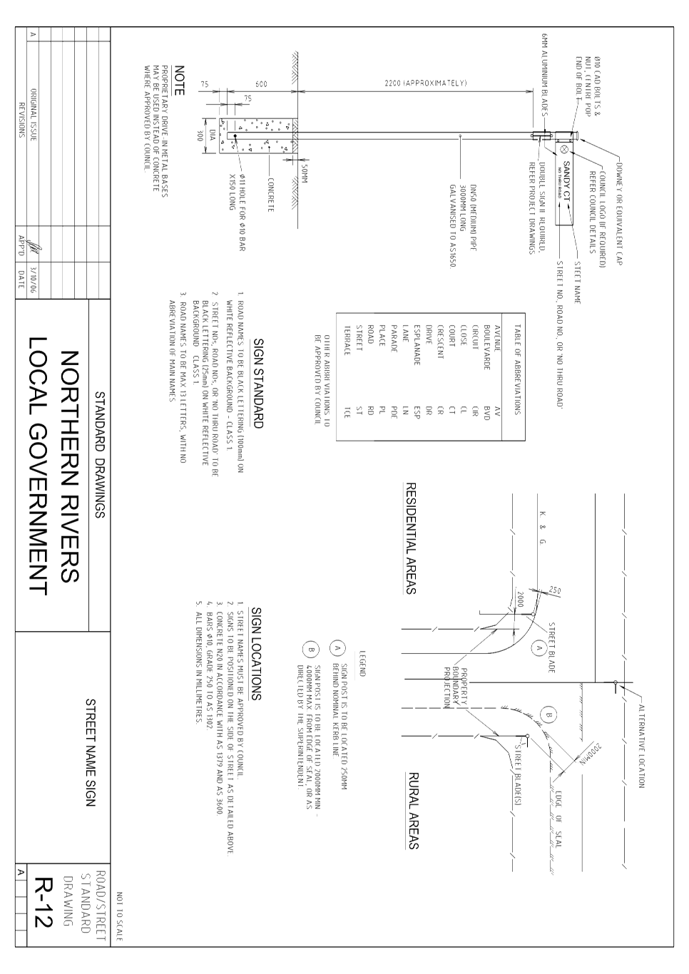
3 AUSPEC
Standard Drawing R12, E2018/42468
, page 142⇩ 
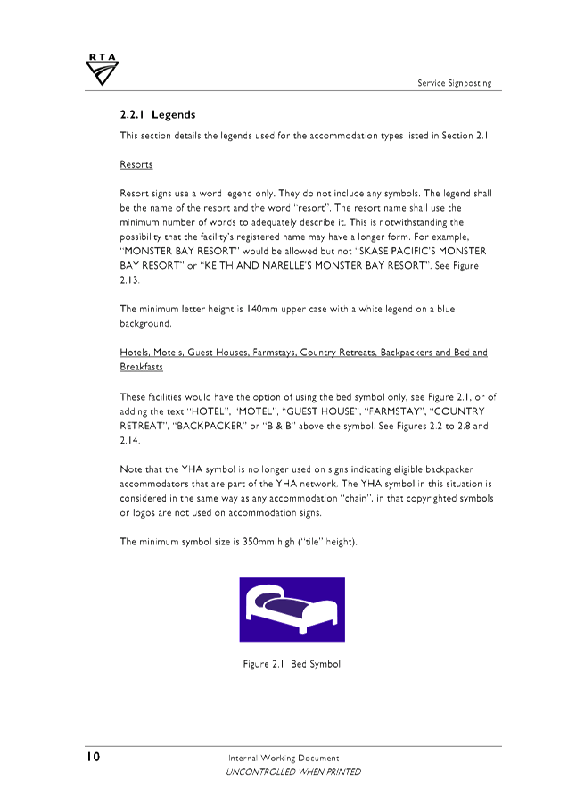
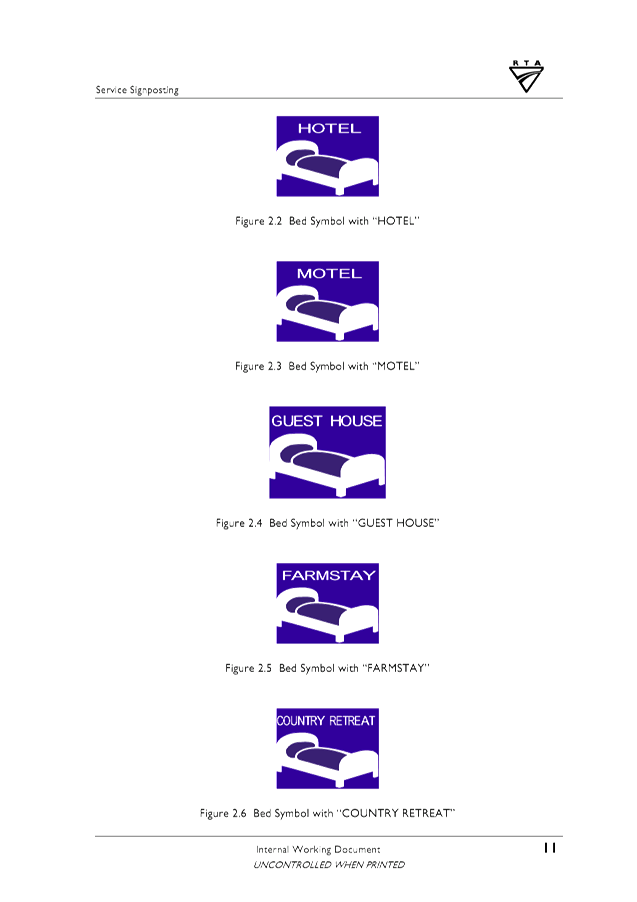
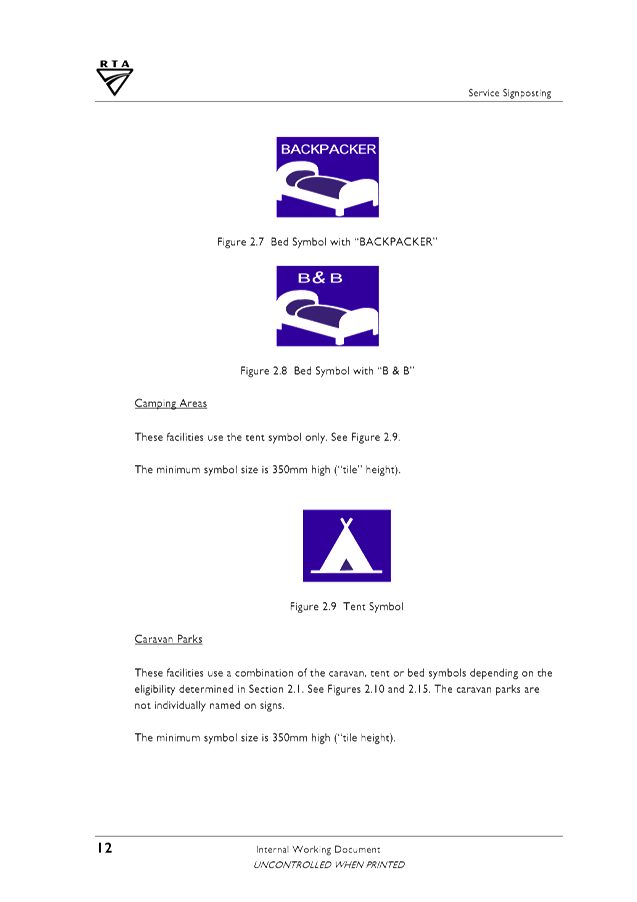
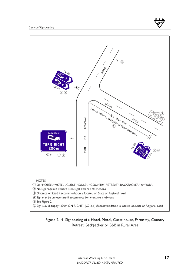
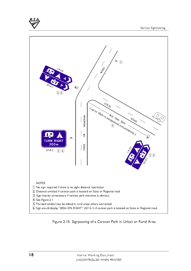
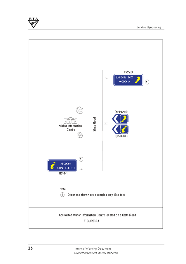
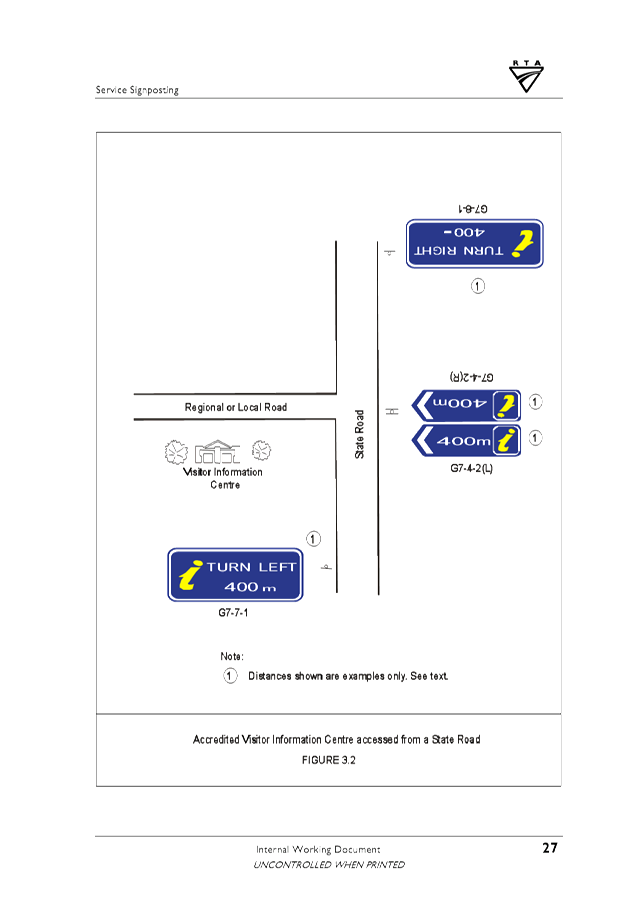
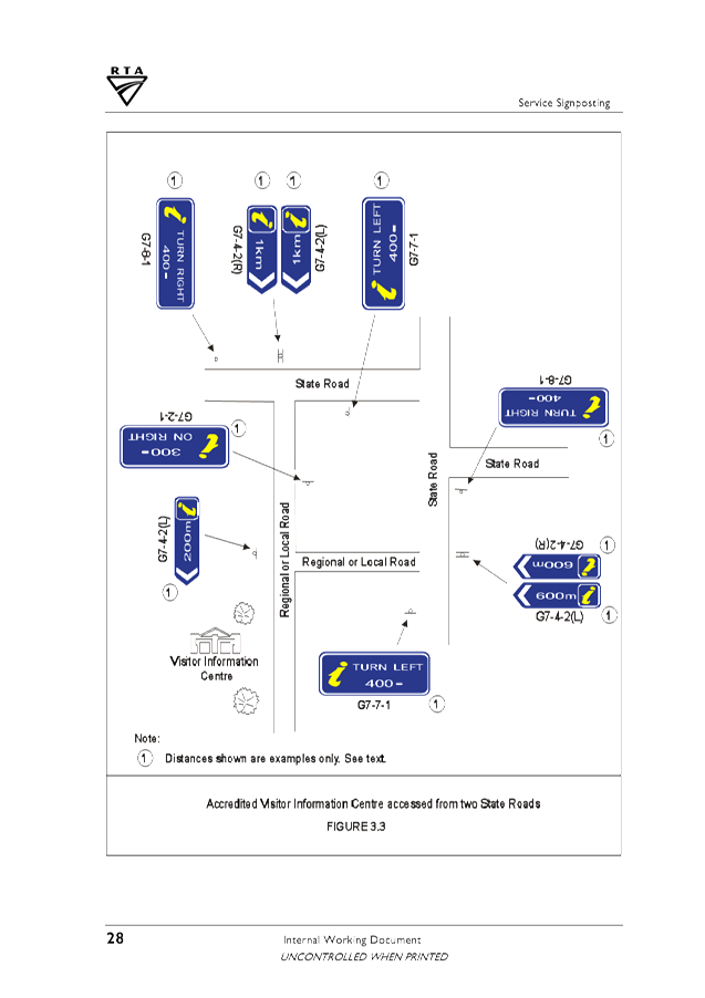
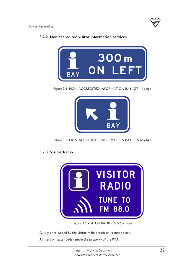
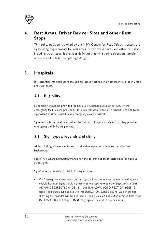
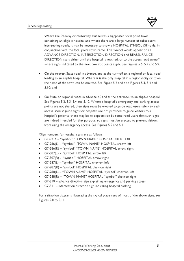
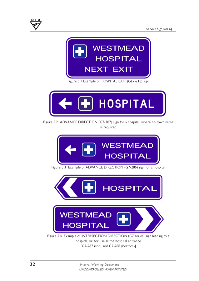
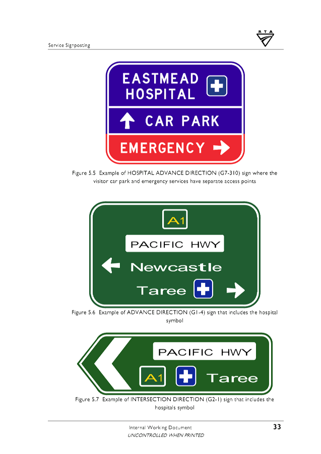
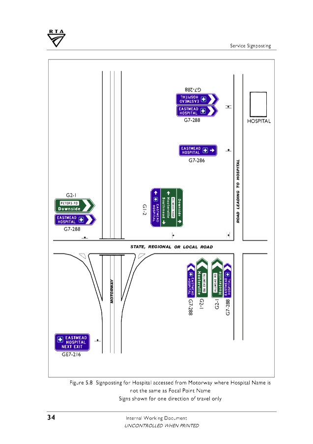
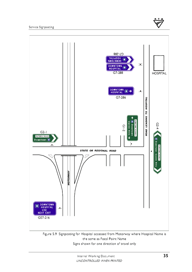
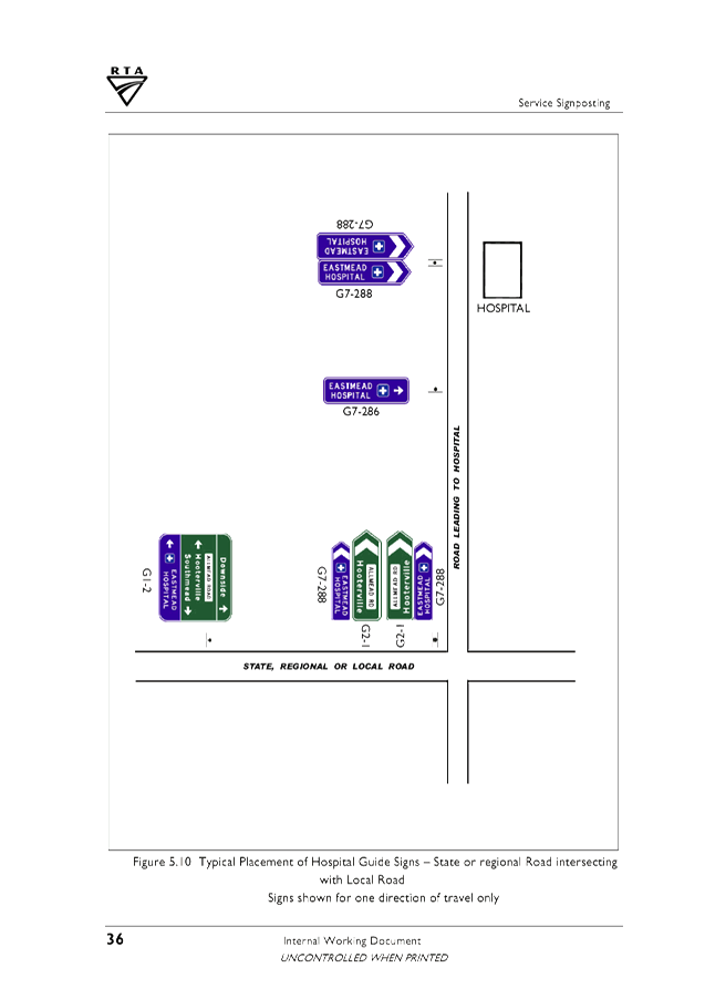
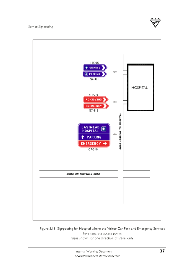
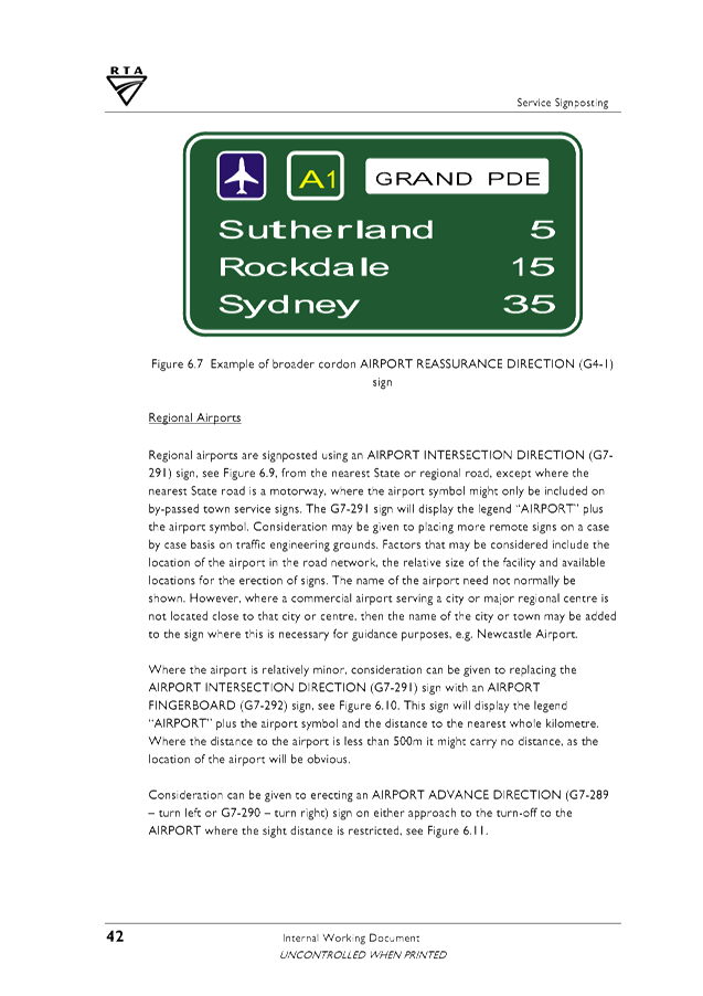
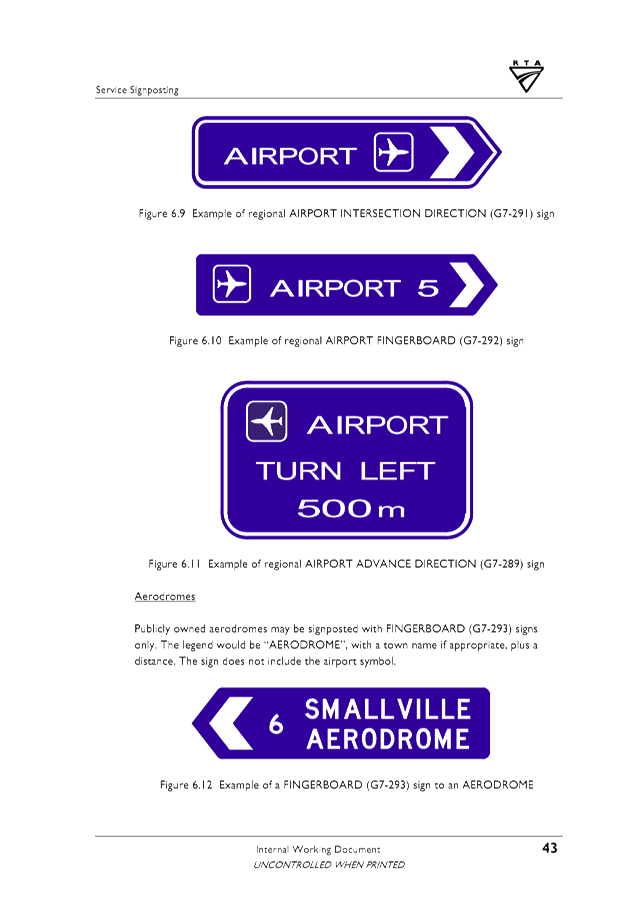
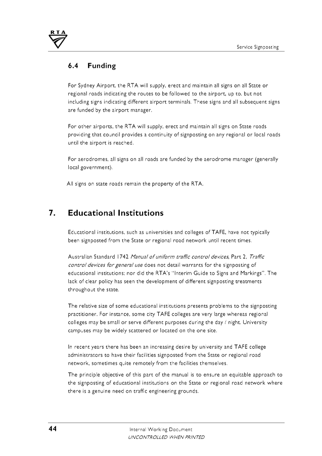
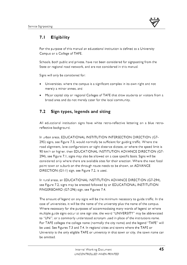
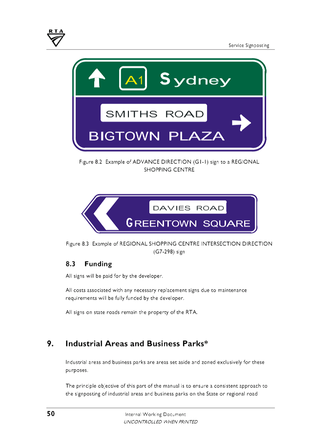
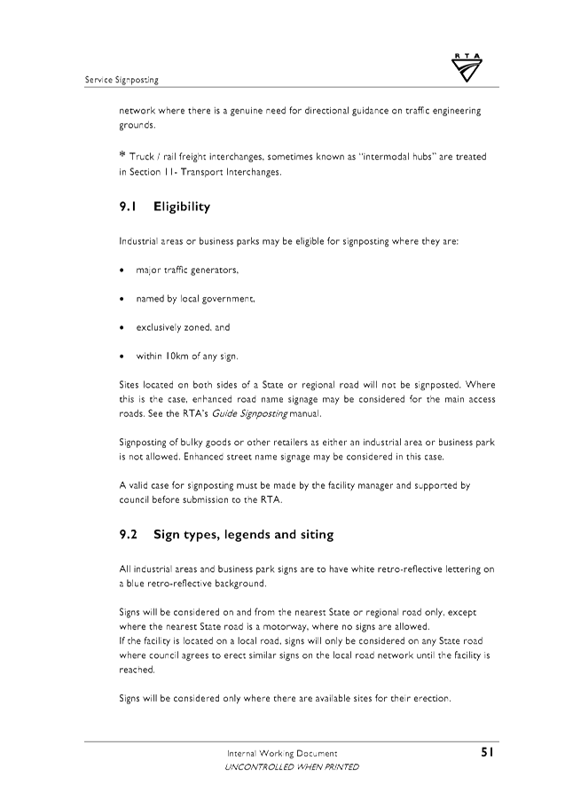
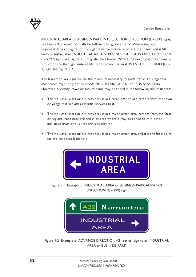
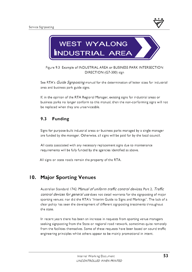
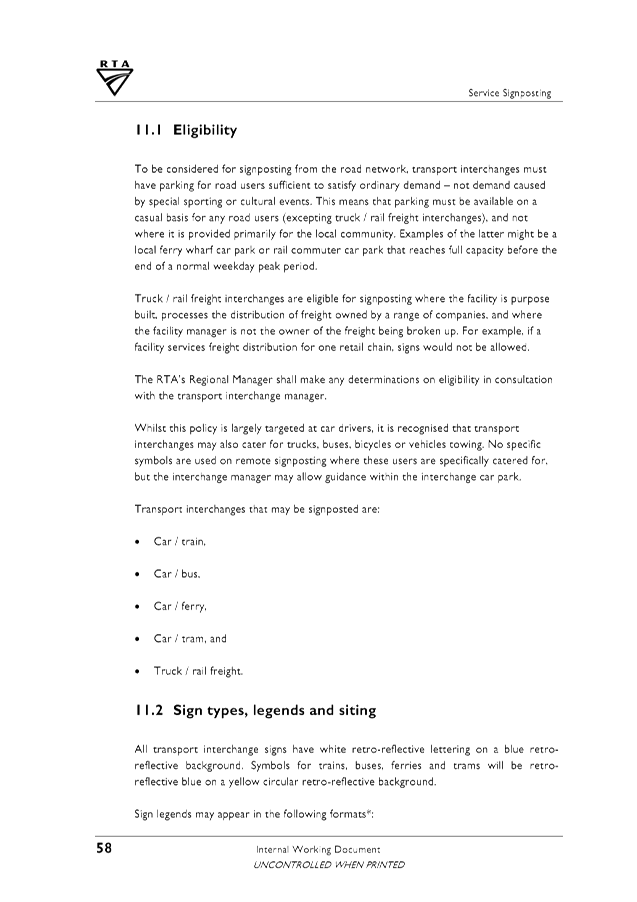
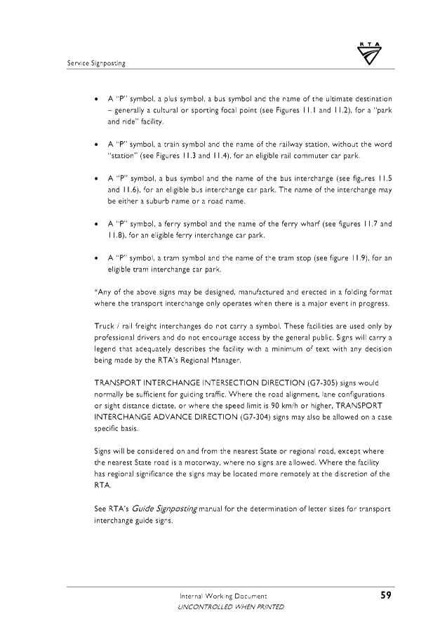
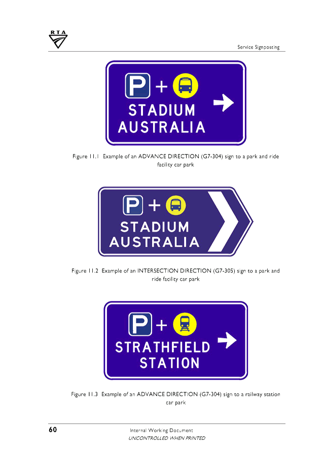
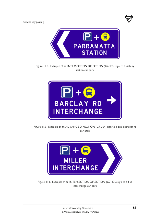
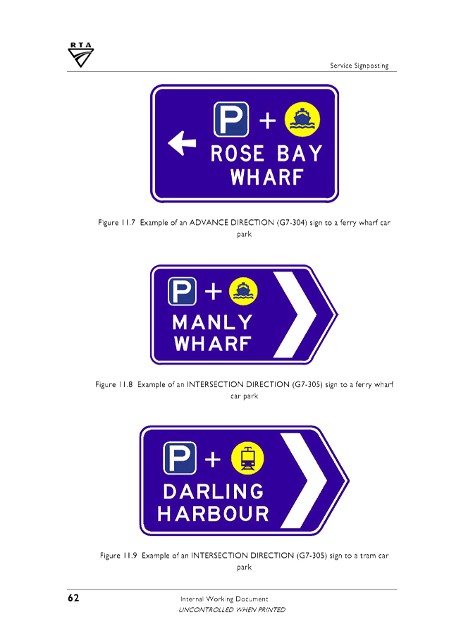
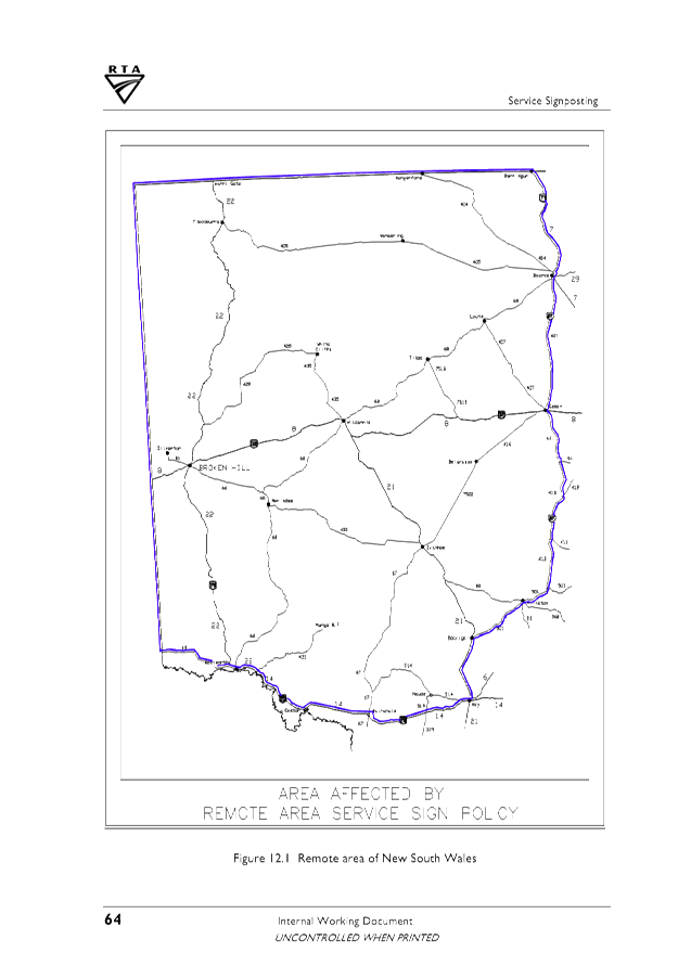
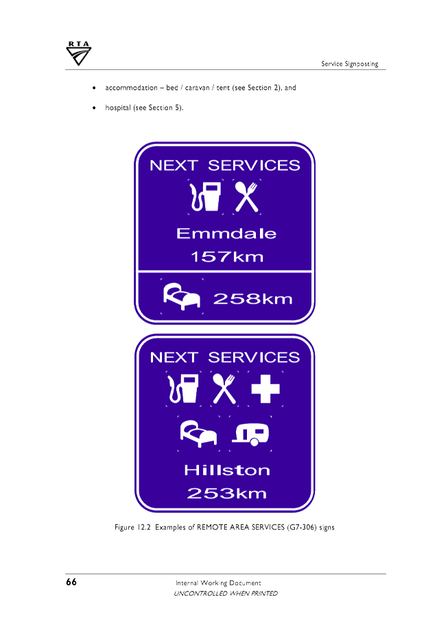
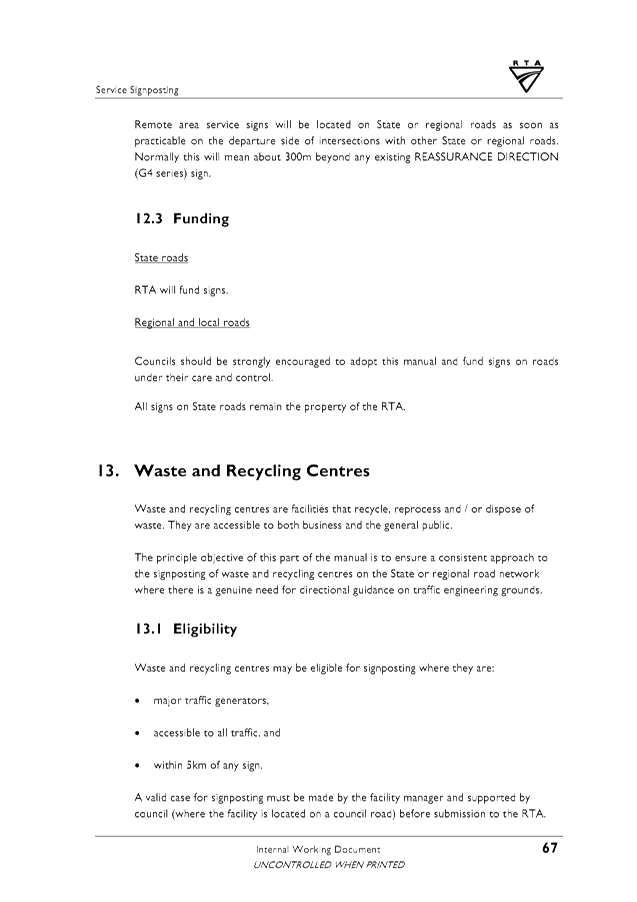
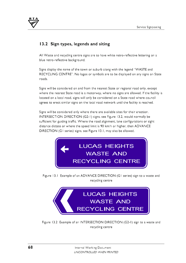
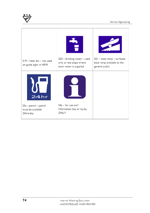
4 RTA Service
Signposting Dec 2010, E2018/42496
, page 142⇩
Report:
On the 30 August 2007 Council adopted the Tourist, Street
Name, Community Facility and Service Signs Policy, 07/102.
The Policy establishes the framework for what signage will
be provided, where they will be placed, the criteria for their establishment,
who pays for them and which signs will be provided around the Byron Shire,
including:-
· Tourist signage
(brown sign with white text);
· Street names in
new subdivisions (white sign with black text)
· Applications for
the renaming of existing street names; (white sign with black text)
· Place names; and
· Guide signs for
community facilities and services (blue signs with white text).
Since the policy was adopted in 2007 a variety of issues
have arisen, including:-
· The policy is
out-dated and refers to superseded documents
· There is no
process to approve the design, installation and removal of signs.
· A fee for
designing, installing and removal of signs is not in the Byron Shire Council
2017/18 Fees and Charges
· There is no data
base of all signs in our shire detailing their owner, sign design, installation
date and expected renewal or removal date.
· There are no
dedicated internal resources to manage the life cycle of this Policy.
· An audit of all
existing signs has not been completed to ensure that they:
o Safely and efficiently guide
visitors to their destinations for example, the Lighthouse.
o Inform visitors of the range
of attractions and services available at a destination
o Are still in a good state of
repair and are easily read
o Appropriately positioned as an
individual sign or a group of signs leading to a destination.
o Are still relevant and
applicable to the destination which may no longer exist.
· Non-approved signs
including advertising have been installed inappropriately.
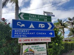
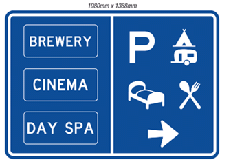
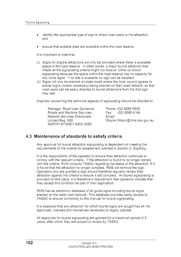
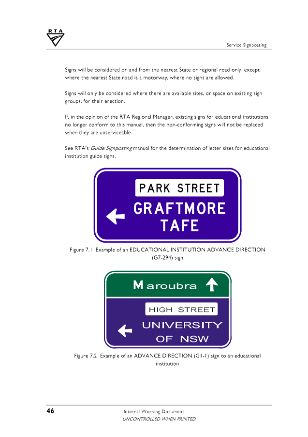
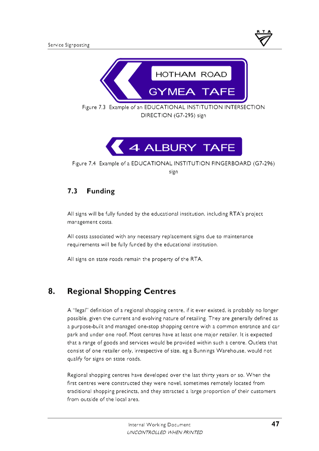
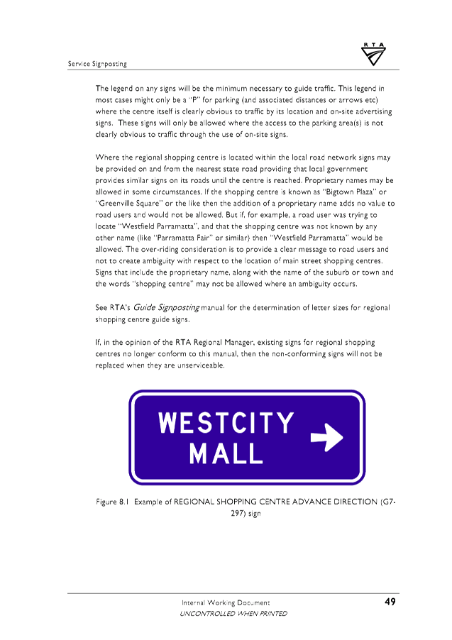
The following examples of non-compliant and compliant
signage demonstrates the inconsistencies of signage across the shire and
highlights the need to undertake a review of the policy and the systems
surrounding signage implementation and installation.
|
Table 1. Shirley
Street and Butler Street intersection service sign
|
|
Non compliant
sign
|
Compliant sign
|
|
|
|
|
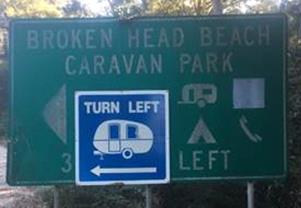
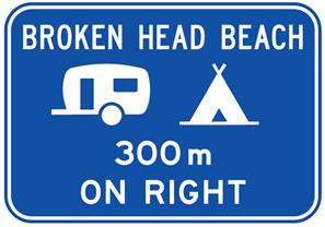
Table 2. 300m
North of the Broken Head Road and Broken Head Reserve Road intersection
|
|
Non compliant
sign
|
Compliant sign
|
|
|
|
|
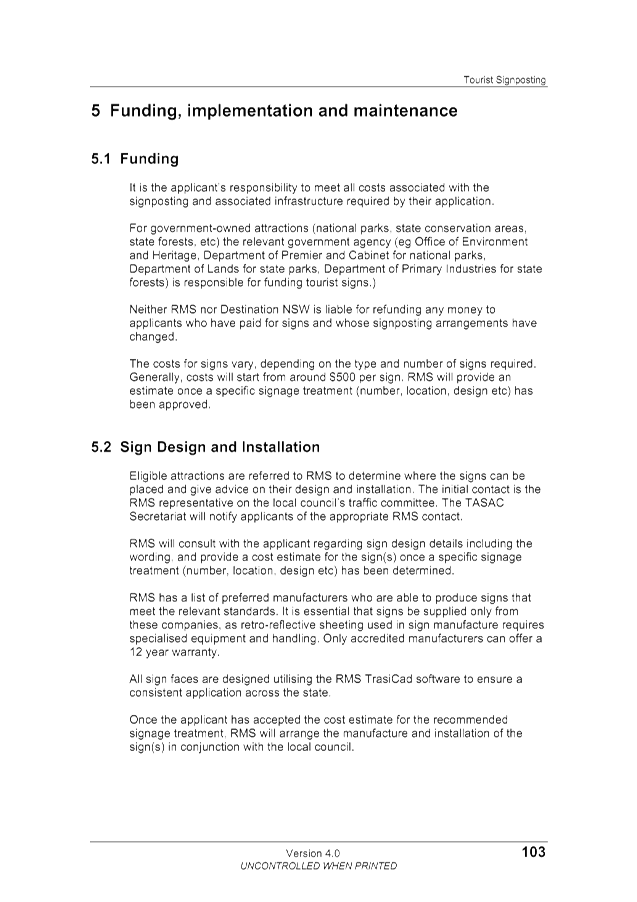
Table 3.
Examples of non compliant signs
|
|
Sign
|
Comments
|
|
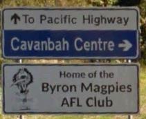
|
The top sign should be green background with white text.
The middle sign is complaint as it is a sporting
facilities.
The bottom sign is considered to be an advertising sign and
should be removed at the owners expense.
|
|
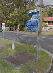
|
Multiple fingerboard signs on a single post are reducing
sight distance at the intersection and do not comply with the RTA Service
Signposting Internal Guidelines Dec 2010
|
Financial Implications
Applicants are responsible for the cost of community facilities
and service signs including:
· Design, supply and
installation of the signs
· Ongoing
maintenance of signs
o Including fading, vandalism,
damage caused by a motor vehicle accident or similar circumstances.
· Removal of the
sign if/when they become redundant
Statutory and Policy Compliance Implications
Service Signs are not detailed under the Roads Act 1993 so
therefore Council is not compelled to any actions in regards to provision of Service
Signs.
However If Council choses to install Service Signs they must
be consistent with the relevant RMS guidelines and RMS Tourist Signposting
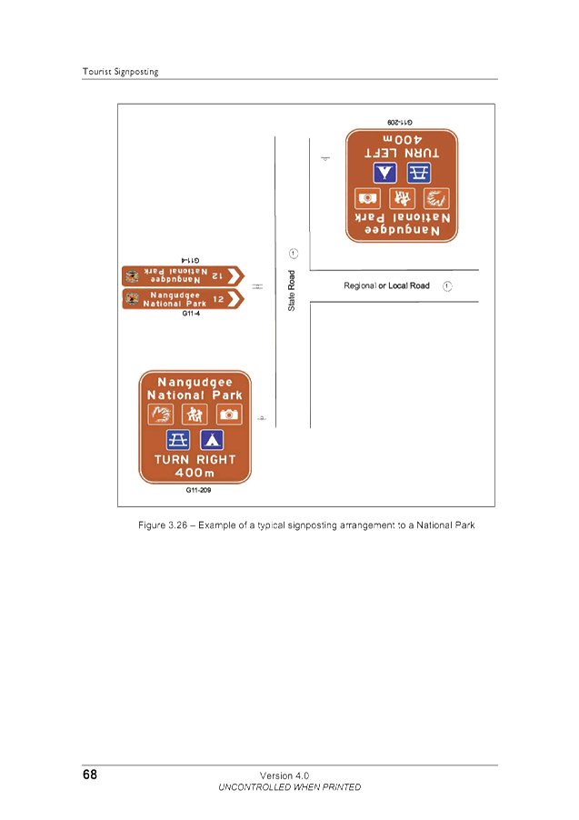
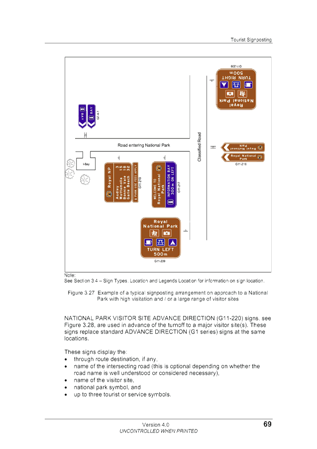
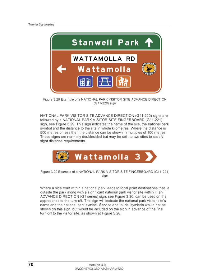
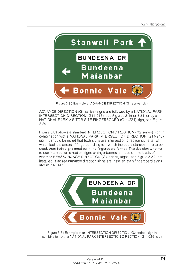
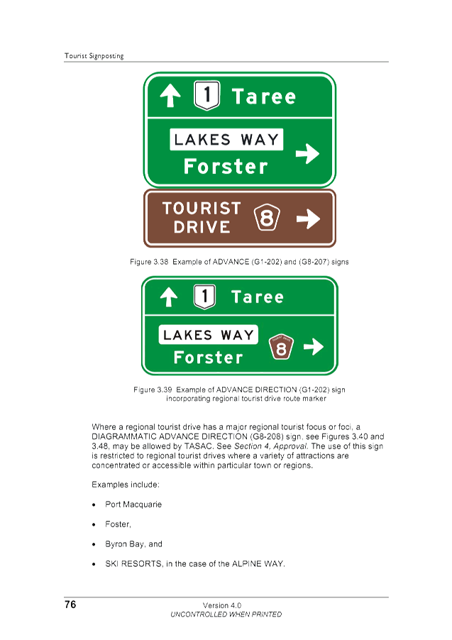
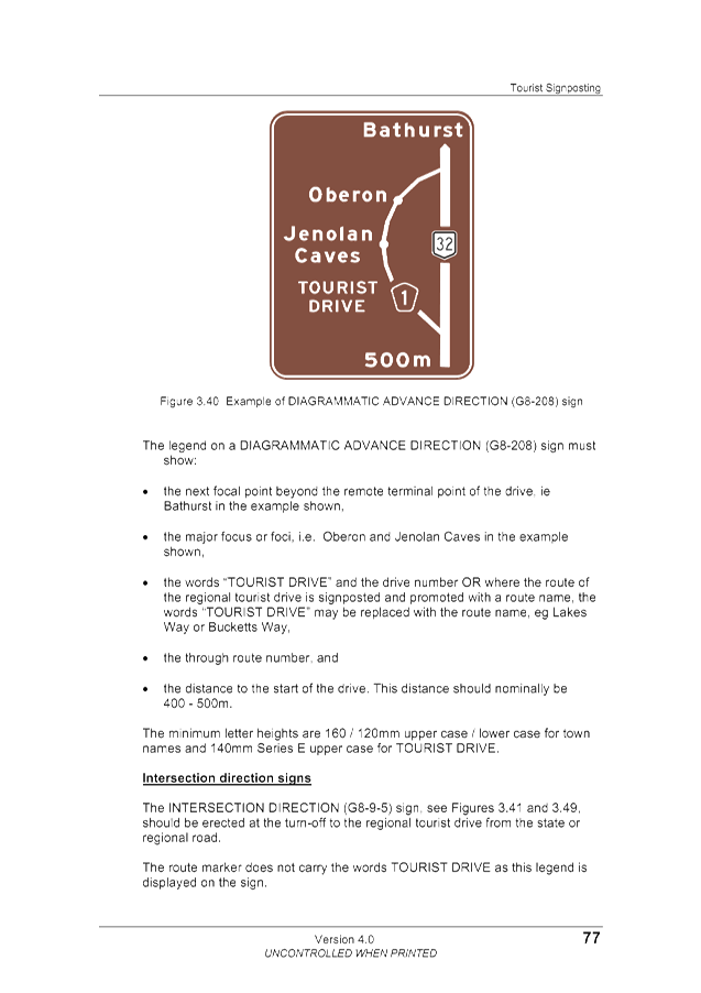
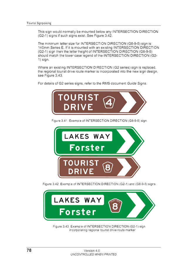
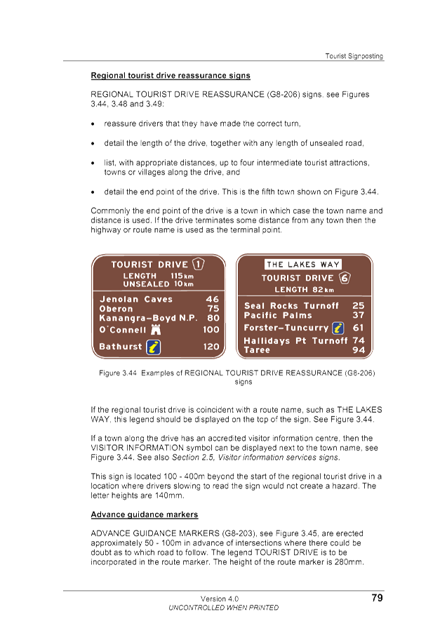
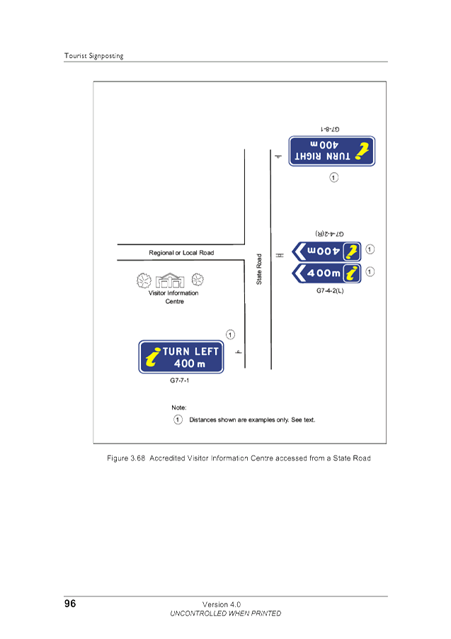
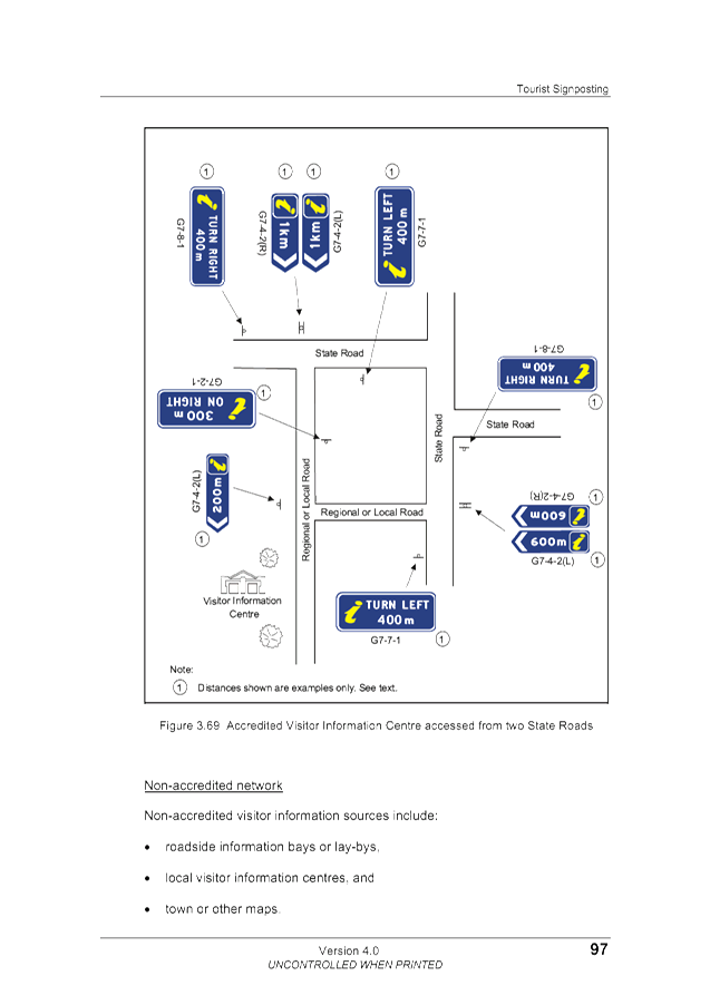
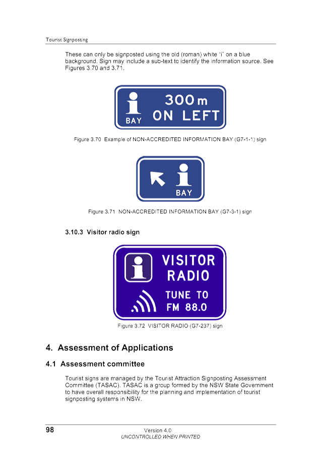
version 4, February 2012 .
Staff Reports - Infrastructure Services 4.6 - Attachment 1
BYRON SHIRE COUNCIL
POLICY NO. 07/102
TOURIST, STREET NAME, COMMUNITY FACILITY AND SERVICE
SIGNS
#705283
Staff Reports - Infrastructure Services 4.6 - Attachment 1
INFORMATION
ABOUT THIS DOCUMENT
(INTERNAL USE ONLY)
|
Date Commenced
|
29/3/94 (Street Names
and Signs Policy 4.14)
|
|
Policy Responsibility
|
Asset Management
Services, Infrastructure Planning
|
|
Date Adopted
|
29/3/94
|
Resolution No.
|
|
|
Review Timeframe
|
|
|
|
|
Last Review Date:
|
30/8/07
|
Next Scheduled Review
Date
|
|
Document History
|
Doc No.
|
Date Amended
|
Details Comments eg
Resolution No.
|
|
#406870
|
May 2007
|
Replace Policy 4.14
Street Names and Signs-Draft Replacement #647516
|
|
#647516
|
June 2007
|
Draft Policy –
Tourist, Street Name, Community Facility and Service Signs – Amended by
Res 07-288
|
|
#680330
|
August 2007
|
Res 07-467
|
Further Document
Information and Relationships
|
Related Legislation
|
Australian Standard 1742
Tourist Signposting – Roads & Traffic Authority 2003
The Roads Act 1993 – Section 162
Roads (General) Regulation 2000 Part 2, Division 2
The Geographical Names Board – “Guidelines for the Naming of
Roads”
|
|
Related Policies
|
|
|
Related Procedures/
Protocols, Statements, documents
|
Council approved list of
suitable names #354461
Council Standard Drawing No R12
|
TABLE OF CONTENTS
1. OBJECTIVES............................................................................................................................... 1
2. POLICY
STATEMENT................................................................................................................. 1
3. Tourist
Signposting........................................................................................................... 2
3.1 Key
Elements........................................................................................................................ 2
4 Street
Names......................................................................................................................... 2
4.1 New
Street Names in developing subdivisions..................................................................... 2
4.2 Renaming
of existing streets................................................................................................. 3
4.3 Crown
Roads......................................................................................................................... 3
5 Community
Facilities and Service Signs................................................................... 3
5.1 General.................................................................................................................................. 3
5.2 Community
facility signs....................................................................................................... 4
5.3 Service
signs......................................................................................................................... 4
Staff Reports - Infrastructure Services 4.6 - Attachment 1
Policy No. 07/102
|
POLICY TITLE
|
TOURIST, STREET NAME,
COMMUNITY FACILITY AND SERVICE SIGNS
|
1. OBJECTIVES
1.1. To aid the safe and orderly
movement of traffic.
1.2. To provide clarity for the
community, businesses and Council in the provision of roadside signage
throughout Byron Shire.
1.3. To provide appropriate
street names for new subdivisions, recognising the history, indigenous culture,
natural environment and character of the area and Australia.
1.4. To
provide an effective street sign standard that is aesthetically acceptable.
2. POLICY
STATEMENT
2.1. This Policy addresses the
provision of road-side signs around Byron Shire, including:
a) tourist
signage;
b) street
names in new subdivisions
c) applications
for the renaming of existing street names;
d) place
names; and
e) guide
signs for community facilities and services.
2.2. The Policy establishes the
framework for what signage will be provided, where they will be placed, the
criteria for their establishment and who pays for them.
2.3. Tourist, street name,
community facility and service signs are in general, to be provided in
accordance with Australian Standards and State Guidelines established by the
Roads and Traffic Authority. In this regard:|
a) Australian
Standard 1742 – Manual of Uniform Traffic Control Devices (relevant
version at the time of applying the standards):
i) Part
1 General Introduction and index of signs,
ii) Part
2 Traffic control devices for general use,
iii) Part
5 Street names and community facility name signs, &
iv) Part
6 Service & Tourist signs for motorists.
b) Tourist
Signposting – Roads & Traffic Authority 2003;
2.4. Street name and place name
signs will be erected in accordance with the above and be approved in accordance
with:
a) The
Roads Act 1993 – section 162 – providing the Council with the
Authority to name roads;
b) The
Roads (General) Regulation 2000 Part 2, Division 2 – setting out the
procedure for naming roads; and
c) The
Geographical Names Board – “Guidelines for the Naming of
Roads”.
2.5. This
Policy does not include the provision of Regulatory, Warning and Guide signs
intended for the regulation, road safety improvements and effective traffic
management of our roads.
3. TOURIST
SIGNPOSTING
3.1. Key Elements
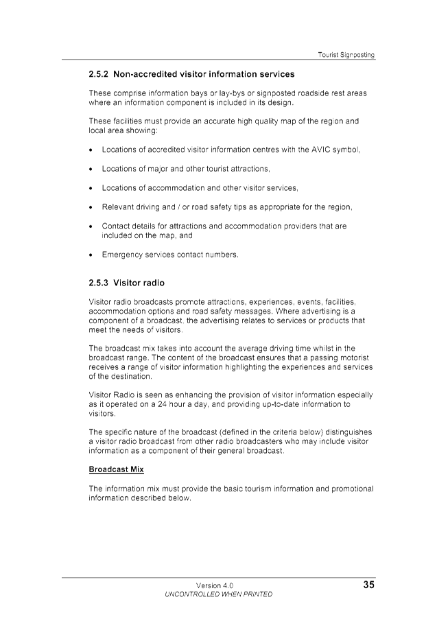
a) Tourist
signposting shall be approved and erected in accordance with the RTA Guide
– “Tourist Signposting” – Published July 2003, subject
to verification that the facility is an approved use.
b) Documentary
evidence is to be supplied to Council by the applicant for signage indicating
that the facility has been accepted by the Tourist Attraction Signposting
Assessment Committee (TASAC) detailing the level of signage permitted.
c) Council
cannot consider signage requests associated with State Roads (Lismore/Bangalow
Road and Pacific Highway).
d) Commercial
attractions receiving eligibility for signposting by TASAC are responsible for
the cost of erecting and the ongoing maintenance of signs.
e) Tourist
signposting colours are brown background with white lettering.
4. STREET
NAMES
4.1. New Streets in developing
subdivisions and existing unnamed roads
a) Naming
of new streets and roads shall be in accordance with the Geographical Names
Board’s document – “GUIDELINES FOR THE NAMING OF
ROADS”.
b) Developers
of new subdivisions shall advise Council of their preference on names for new
streets and roads provided in the subdivision prior to the release of final
plans of subdivision.
c) The
names shall be selected from a Council approved list of suitable names detailed
in Council Document #354461 – a
copy of which can be provided to the developer upon request.
d) An
alternative name may be selected in accordance with this policy for
consideration by Council’s Director Environment and Planning Services.
e) Alternative
road names will be selected from the following categories:
i) Australian
natives animal and plant species
ii) Aboriginal
names
iii) Poets
iv) Pioneers
v) Maritime
themes
vi) Themes
eg sports, arts, geographical
f) The
selected list for each town, village or area shall be relevant to the local
area and approved by Council’s Director Environment and Planning
Services.
g) Street
name signs shall be consistent throughout the Council area and of a design and
standard in accordance with Council Standard Drawing No R12 – inclusive
of the Council logo.
4.2. Renaming of Existing
Streets
a) A
request to change a street name must be received from an owner or resident of
the affected street;
b) Council
must receive 100% written concurrence on the proposed name from owners and
residents of the subject road, prior to advertising the proposed change;
c) The
onus for obtaining this concurrence of owners/residents rests with the
applicant;
d) A
road name shall not be altered if it bears historical, local, regional,
indigenous or family significance;
e) All
road renaming requests must comply with the Geographical Names Board Guidelines
and The Roads (General) Regulation 2000 (Government Gazette No. 112) Part 2, Division
2;
f) The
request will be referred to Council for consideration following the public
advertising of the proposed change of name.
4.3. Crown Roads
a) Council
will not name Crown Roads.
b) Residents/owners
requesting Council to name a Crown Road will be referred to the NSW Department
of Lands.
5. COMMUNITY
FACILITIES AND SERVICE SIGNS
5.1. General
a) Community
facilities and service signs will be provided by Council as required generally
in accordance with Australian Standard 1742 - Part 5 Street names and community
facility name signs and Part 6 Service & Tourist signs for motorists.
b) The
signs will generally be erected in accordance with AUSPEC Standard Drawing No
R12:
i) Inclusive
of the Council logo where the public facility is owned and/or operated by
Council; or
ii) Without
the Council logo when the facility is owned and/or operated by organisations
other than Council.
iii) Distances
to the service will not be shown on the sign unless it is a walking distance
and is related directly to a designated walking track.
c) Signs
to be erected for community facilities and services will be erected by Council
and the applicant is responsible for the cost of erecting and the ongoing
maintenance of signs and their removal if/when they become redundant;
d) Council
will provide a quote for the erection of signs and prepayment must be made
prior to their erection. Council will not be responsible for their
replacement under any circumstances including fading, vandalism, damage caused
by a motor vehicle accident or similar circumstances.
e) Community
facilities and service signs will only be erected at two locations.
f) The
commercial name of a business eligible for a directional service sign will not
be included on the sign. For example a Bed and Breakfast owned by ABC
will state on the sign the words “Bed & Breakfast”, NOT
“ABC Bed & Breakfast”.
g) Community
facilities and service signs colours are blue background with white lettering.
5.2. Community Facility Signs
a) Community
facility signs are not advertising signs for commercial interests.
b) These
are specific facilities not necessarily related to travel, but which maybe
sought by strangers to the area, and which includes:
i) recreational
facilities such as libraries, swimming pools, other sporting facilities;
ii) public
facilities such as telephones, emergency medical services;
iii) Administrative
facilities such as Council Chambers / Administration and post offices;
iv) Educational
facilities such as TAFE’s and Universities;
v) Churches
and religious institutions;
vi) Other
non-profit organisations such as charities, Scout Groups, Youth Centres, and
vii) Airports,
railway stations and Shopping Centres.
c) Primary
and secondary schools would only be included if they have some special facility
sought by large numbers of strangers to the area.
5.3. Service signs
a) Service
signs are not advertising signs for commercial interests.
b) Service
signs include commercial facilities and public facilities.
c) A
Commercial service is an establishment that provides travellers with services
such as meals, refreshments, overnight accommodation, Caravan Park and camping
grounds.
d) Non-commercial
service signs are predominantly Highway signs with the blue background with
white lettering and symbols indicating town centres with facilities including
accommodation, meals, shopping, service stations etc.
Staff Reports - Infrastructure Services 4.6 - Attachment 2


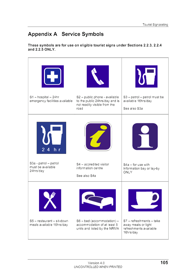
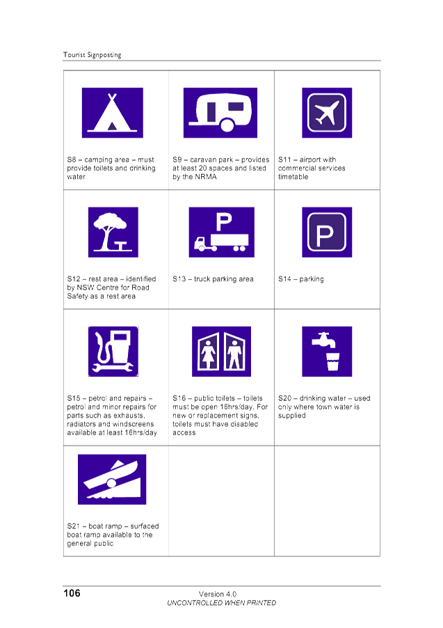


Staff Reports - Infrastructure Services 4.6 - Attachment 3
Staff Reports - Infrastructure Services 4.6 - Attachment 4


Staff Reports - Infrastructure Services 4.7
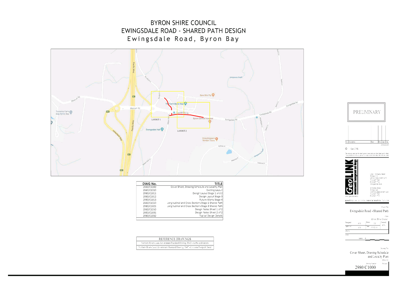
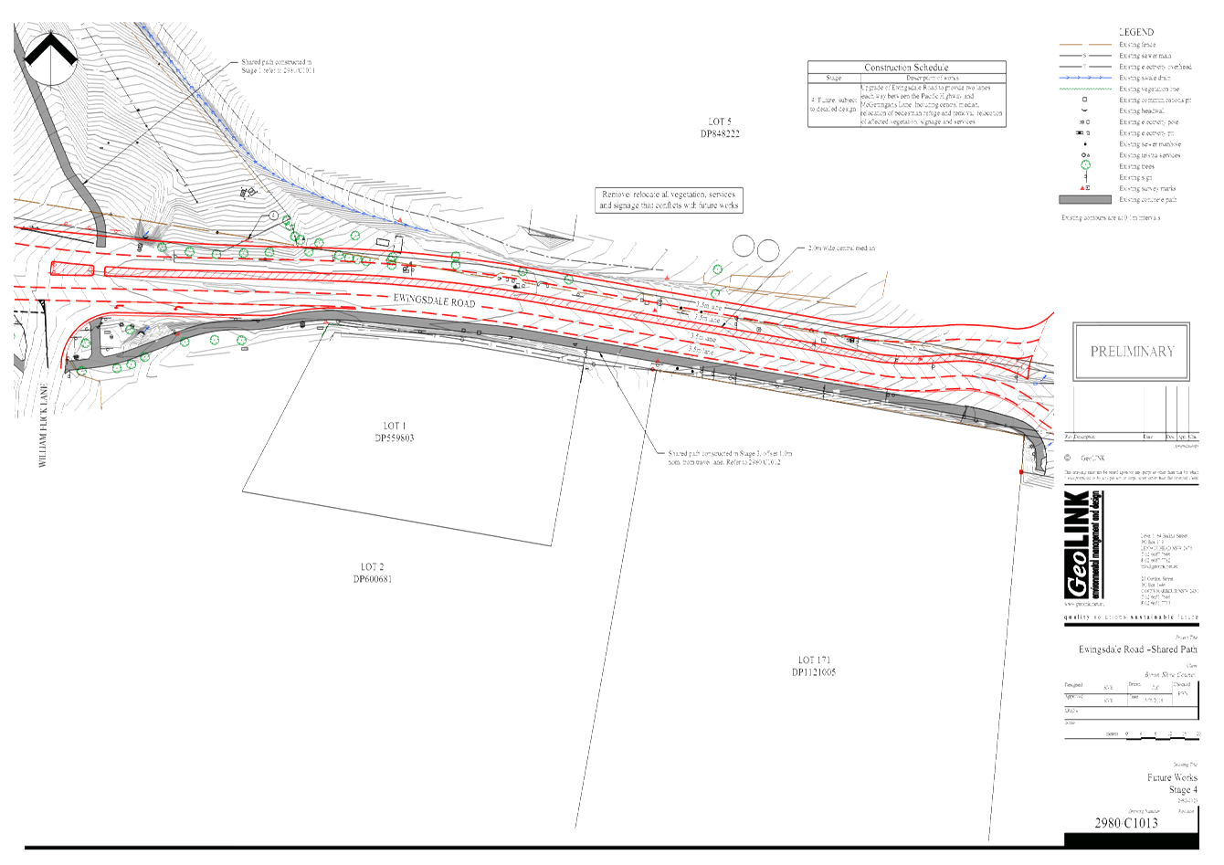
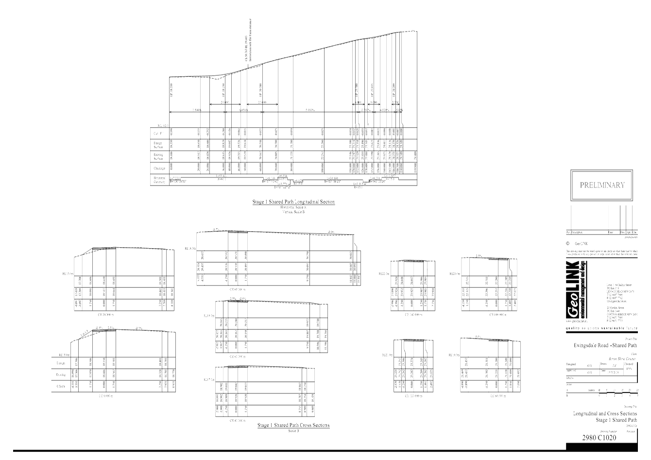
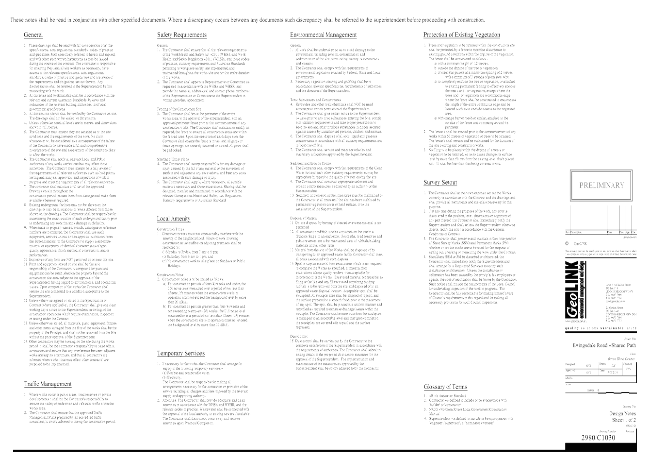
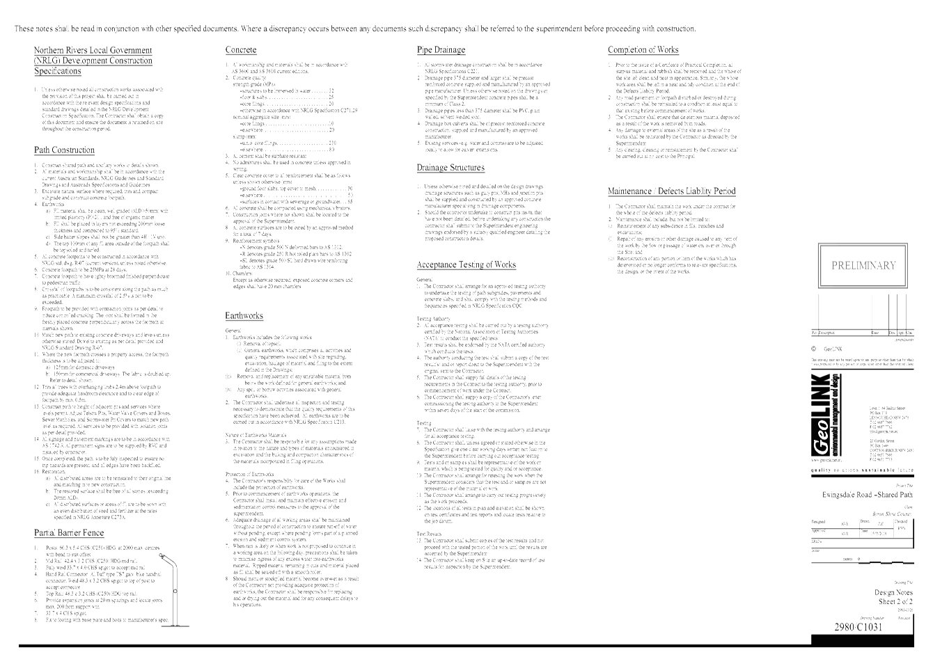
Report No. 4.7 Ewingsdale
Road Shared Path - Project Update
Directorate: Infrastructure
Services
Report
Author: Dominic
Cavanough , Contract Engineer
Evan Elford, Team Leader
Infrastructure Planning
File No: I2018/964
Theme: Community Infrastructure
Local Roads and Drainage
Summary:
The purpose of this report is to provide a project update to
the Transport and Infrastructure Advisory Committee on the Ewingsdale Road and
Woodford Lane Shared Path concept designs and works to improve cyclist and
pedestrian connectivity from the Pacific Highway to Ewingsdale.
|
RECOMMENDATION:
That the Transport and Infrastructure Advisory
Committee note the report on the Ewingsdale Road and Woodford Lane Shared
Path concept designs.
|
Attachments:
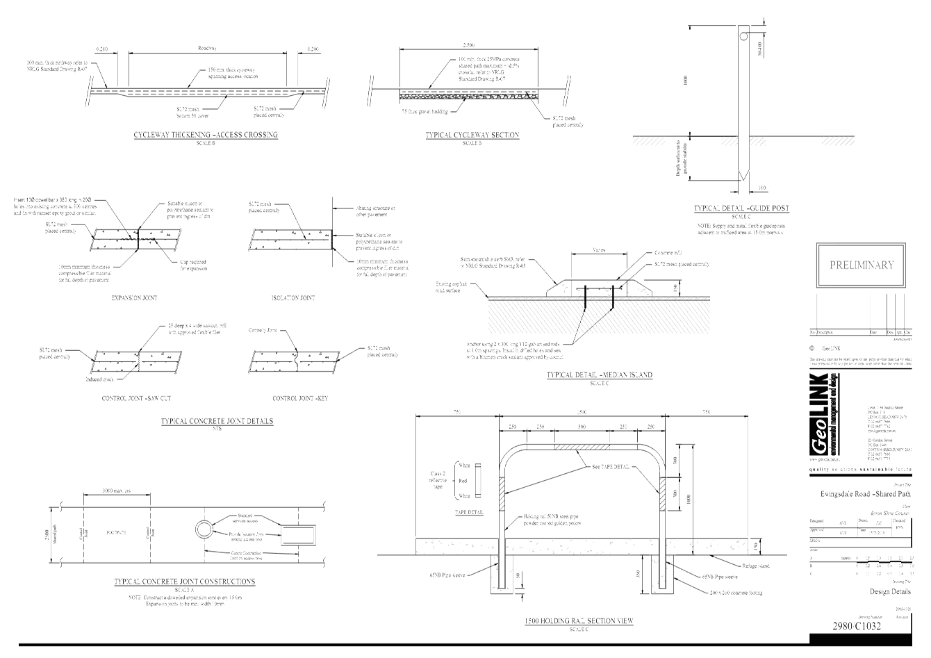
1 24.2017.87.1
- Ewingsdale Rd SP - GeoLINK - DWG2980 BSC Shared Path, E2018/44821 , page 142⇩
Report
The purpose of this report is to advise the Transport and
Infrastructure Advisory Committee on the Ewingsdale Road and Woodford Lane
Shared Path concept designs and construction works to improve cyclist and
pedestrian connectivity from the Pacific Highway to Ewingsdale.
RMS has been liaising with Council officers in carrying out
design and installation of duplication of the Pacific Highway Southbound off
ramp and part of Ewingsdale Road at RMS expense.
Council Officers have been working with the RMS to create
concept designs for the following projects in relation to Ewingsdale Road:-
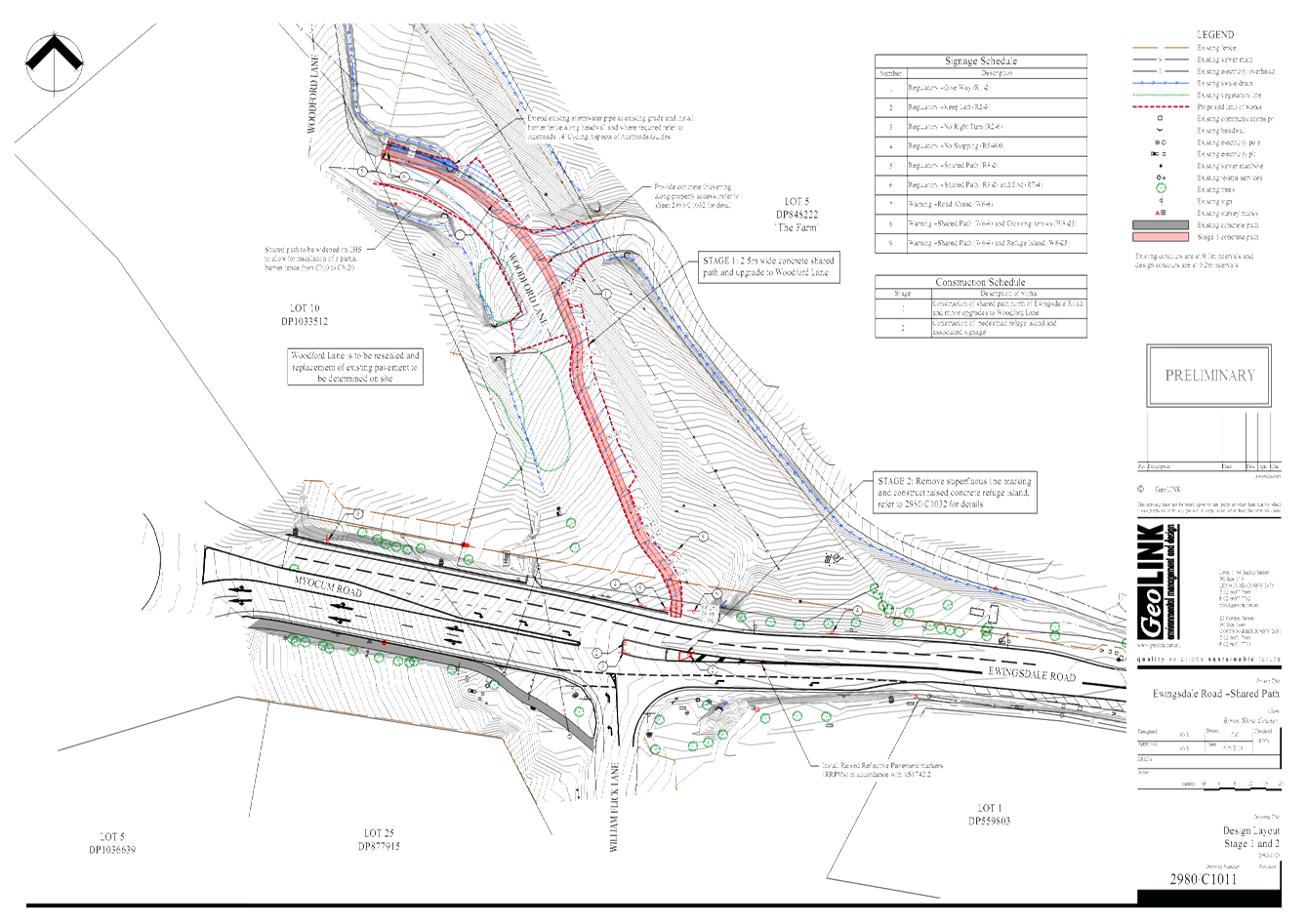
1. Woodford
Lane 2.5m wide Shared Path
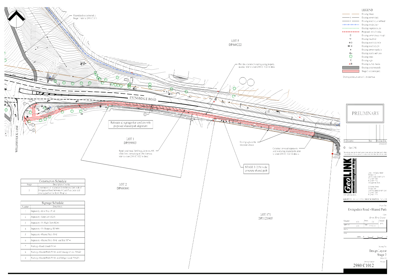
2. Ewingsdale
Road 2.5m wide Shared Path
3. Ewingsdale
Road Lane duplication between the Pacific Highway to McGettigans
Intersection
The Ewingsdale Road Shared Path from The Byron
Central Hospital Roundabout to the Pacific Highway is ranked as the 33 request
for the Community Requested Facilities. Woodford Lane shared path is not part
of the 2008 Bike Plan (E2017/102438).
The concept design for Woodford Lane and Ewingsdale Road
Shared Path are attached to show the committee our current progress with RMS.
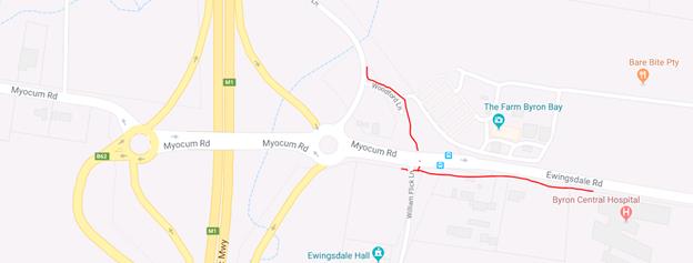
|
Image 1 – Site Map
with proposed shared paths shown in red.
|
|
|
Financial Implications
The Ewingsdale Road shared path has an
estimated cost of $152,000 and is currently the subject of a grant funding
application which is still yet to be determined. The cost and timing of
construction for the Woodford Lane shared path and works associated with the
Ewingsdale Road duplication are still subject to further discussions with RMS.
Statutory and Policy Compliance Implications
There are no other Statutory and Policy
Compliance Implications at this stage.
|
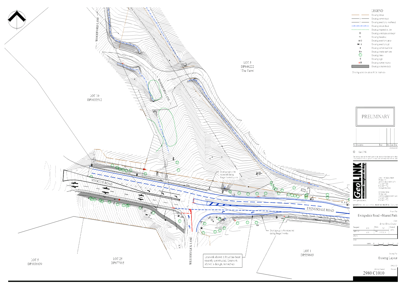
Image 2 –
24.2017.87.1 – Woodford Ln SP - Site Map with proposed shared path in
red.
|
|
|
|
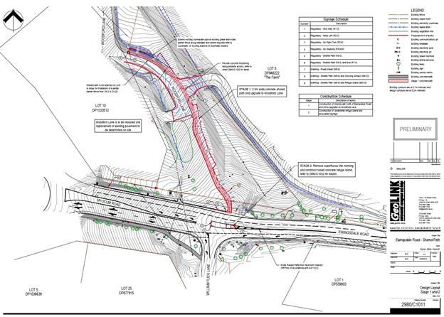
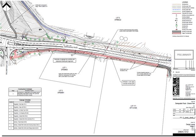
Image 3 –
24.2017.87.1 – Ewingsdale Rd SP - Site Map with proposed shared path in
red.
|
|
|
Staff Reports - Infrastructure Services 4.7 - Attachment 1

Staff Reports - Infrastructure Services 4.8
Report No. 4.8 Bike
Plan and PAMP Status Update
Directorate: Infrastructure
Services
Report
Author: Daniel
Strzina, Project Engineer
File No: I2018/969
Theme: Community Infrastructure
Local Roads and Drainage
Summary:
The purpose of this report is to provide to TIAC a status
update on the progress of the Bike Strategy and Action Plan (Bike Plan) and the
Pedestrian Access and Mobility Plan (PAMP).
Status reports will be provided to every ordinary TIAC
meeting.
|
RECOMMENDATION:
That the Committee note the progress of the Bike
Strategy and Action Plan (Bike Plan) and the Pedestrian Access and Mobility
Plan (PAMP).
|
Background
Council at its meeting on 19
April 2018 resolved to adopt Committee Recommendation 4.4.1 on the Bike Plan
and PAMP Status Report (File No: I2018/358) as follows:-
Res
18-250
1. That
the Communications Plan be developed and reported to the Communications
Committee.
2. That
Council:
a) note
the update on the progress of Council’s Pedestrian Access and Mobility
Plan (PAMP) and Bike Strategy and Action Plan (Bike Plan).
b) note
the submissions by preferred consultant, PSA Consulting, in response to Request
for Quotations for the PAMP and Bike Plan works.
c) engage PSA Consulting to develop the
Pedestrian Access and Mobility Plan (PAMP) and review and update the Bike
Strategy and Action Plan (Bike Plan).
Report
In accordance with item 2c above, PSA Consulting have been
engaged to develop the Pedestrian Access and Mobility Plan (PAMP) and review
and update the Bike Strategy and Action Plan (Bike Plan).
In accordance with item 1 of the above resolution, Council
Staff are currently collaborating with PSA Consulting to develop Communications
Plans for both the Bike Plan and PAMP projects. They will be reported to the
Communications Panel at its meeting on 28 June 2018.
Draft project delivery schedules for each of the two
projects have been prepared by PSA Consulting in consultation with Staff.
These schedules (summarised below) take into account the timeframes required to
gather and analyse relevant information, plan and undertake community
consultation as well as prepare and revise the documents.
Target dates have been based around ordinary and proposed
extraordinary meetings of TIAC to ensure suitable involvement during the project.
Ordinary Council meetings have also been taken into consideration to ensure
adoption and endorsement prior to broader community consultation.
Draft Bike Plan Project Delivery Schedule
28 Jun 2018 Communications
Panel Meeting: Communications Plan
16 Aug 2018 TIAC
Meeting: Project Delivery Plan and Key Stakeholder Consultation Plan
27 Aug 2018 Key
Stakeholder Consultation Period (27 Aug 2018 to 7 Sep 2018)
25 Oct 2018 TIAC
Extraordinary Meeting (proposed): Bike Plan Progress Update
11 Dec 2018 TIAC Extraordinary
Meeting (proposed): Draft Bike Plan for Public Exhibition
07 Feb 2019 Council
Meeting (date TBC): Draft Bike Plan for Public Exhibition
16 Feb 2019 Broader
Community Consultation Period (16 Feb 2019 to 10 Mar 2019)
25 Mar 2019 Delivery
of Final Bike Plan (Council and TIAC meeting dates TBC)
Draft PAMP Project Delivery Schedule
28 Jun 2018 Communications
Panel Meeting: Communications Plan
16 Aug 2018 TIAC
Meeting: Project Delivery Plan and Key Stakeholder Consultation Plan
27 Aug 2018 Key Stakeholder
Consultation Period (27 Aug 2018 to 7 Sep 2018)
25 Oct 2018 TIAC
Extraordinary Meeting (proposed): Draft PAMP for Public Exhibition
22 Nov 2018 Council
Meeting: Draft PAMP for Public Exhibition
01 Dec 2018 Broader
Community Consultation Period (01 Dec 2018 to 23 Dec 2018)
11 Mar 2019 Delivery
of Final PAMP (Council and TIAC meeting dates TBC)
Financial Implications
There are no financial implications at this time.
Statutory and Policy Compliance Implications
There are no statutory or policy compliance implications at
this time.