Agenda
Planning
Meeting
Thursday,
16 May 2019
held
at Council Chambers, Station Street, Mullumbimby
commencing
at 11.00am
 Public Access relating to items
on this Agenda can be made between 11.00am and 11.30am on the day of the
Meeting. Requests for public access should be made to the General Manager
or Mayor no later than 12.00 midday on the day prior to the Meeting.
Public Access relating to items
on this Agenda can be made between 11.00am and 11.30am on the day of the
Meeting. Requests for public access should be made to the General Manager
or Mayor no later than 12.00 midday on the day prior to the Meeting.
Mark
Arnold
General
Manager
What is a “Conflict of Interests” - A conflict of
interests can be of two types:
Pecuniary - an interest that a person has in a matter because of a reasonable
likelihood or expectation of appreciable financial gain or loss to the person
or another person with whom the person is associated.
Non-pecuniary – a private or personal interest that a Council
official has that does not amount to a pecuniary interest as defined in the
Local Government Act (eg. A friendship, membership of an association, society
or trade union or involvement or interest in an activity and may include an
interest of a financial nature).
Remoteness – a person does not have a pecuniary interest in a matter
if the interest is so remote or insignificant that it could not reasonably be
regarded as likely to influence any decision the person might make in relation
to a matter or if the interest is of a kind specified in Section 448 of the
Local Government Act.
Who has a Pecuniary Interest? - a person has a pecuniary interest in a
matter if the pecuniary interest is the interest of the person, or another
person with whom the person is associated (see below).
Relatives, Partners - a person is taken to have a pecuniary interest in a
matter if:
§ The person’s
spouse or de facto partner or a relative of the person has a pecuniary interest
in the matter, or
§ The person, or a
nominee, partners or employer of the person, is a member of a company or other
body that has a pecuniary interest in the matter.
N.B. “Relative”, in relation to a person means any of the
following:
(a) the
parent, grandparent, brother, sister, uncle, aunt, nephew, niece, lineal
descends or adopted child of the person or of the person’s spouse;
(b) the
spouse or de facto partners of the person or of a person referred to in
paragraph (a)
No Interest in the Matter - however, a person is not taken to have a
pecuniary interest in a matter:
§ If the person is
unaware of the relevant pecuniary interest of the spouse, de facto partner,
relative or company or other body, or
§ Just because the
person is a member of, or is employed by, the Council.
§ Just because the
person is a member of, or a delegate of the Council to, a company or other body
that has a pecuniary interest in the matter provided that the person has no
beneficial interest in any shares of the company or body.
Disclosure and participation in meetings
§ A Councillor or a
member of a Council Committee who has a pecuniary interest in any matter with
which the Council is concerned and who is present at a meeting of the Council
or Committee at which the matter is being considered must disclose the nature
of the interest to the meeting as soon as practicable.
§ The Councillor or
member must not be present at, or in sight of, the meeting of the Council or
Committee:
(a) at any
time during which the matter is being considered or discussed by the Council or
Committee, or
(b) at any
time during which the Council or Committee is voting on any question in
relation to the matter.
No Knowledge - a person does not breach this Clause if the person did
not know and could not reasonably be expected to have known that the matter
under consideration at the meeting was a matter in which he or she had a
pecuniary interest.
Participation in Meetings Despite Pecuniary Interest (S 452 Act)
A Councillor is not prevented from taking part in the consideration or
discussion of, or from voting on, any of the matters/questions detailed in
Section 452 of the Local Government Act.
Non-pecuniary Interests - Must be disclosed in meetings.
There are a broad range of options available for managing conflicts &
the option chosen will depend on an assessment of the circumstances of the
matter, the nature of the interest and the significance of the issue being
dealt with. Non-pecuniary conflicts of interests must be dealt with in at
least one of the following ways:
§ It may be appropriate
that no action be taken where the potential for conflict is minimal.
However, Councillors should consider providing an explanation of why they
consider a conflict does not exist.
§ Limit involvement if
practical (eg. Participate in discussion but not in decision making or
vice-versa). Care needs to be taken when exercising this option.
§ Remove the source of
the conflict (eg. Relinquishing or divesting the personal interest that creates
the conflict)
§ Have no involvement by
absenting yourself from and not taking part in any debate or voting on the
issue as if the provisions in S451 of the Local Government Act apply
(particularly if you have a significant non-pecuniary interest)
RECORDING OF VOTING ON PLANNING MATTERS
Clause 375A of the Local Government Act 1993
– Recording of voting on planning matters
(1) In this section, planning
decision means a decision made in the exercise of a function of a council
under the Environmental Planning and Assessment Act 1979:
(a) including a decision
relating to a development application, an environmental planning instrument, a
development control plan or a development contribution plan under that Act, but
(b) not including the making of
an order under Division 2A of Part 6 of that Act.
(2) The general manager is
required to keep a register containing, for each planning decision made at a
meeting of the council or a council committee, the names of the councillors who
supported the decision and the names of any councillors who opposed (or are
taken to have opposed) the decision.
(3) For the purpose of maintaining
the register, a division is required to be called whenever a motion for a
planning decision is put at a meeting of the council or a council committee.
(4) Each decision recorded in
the register is to be described in the register or identified in a manner that
enables the description to be obtained from another publicly available
document, and is to include the information required by the regulations.
(5) This section extends to a
meeting that is closed to the public.
Planning Meeting
BUSINESS OF Planning Meeting
1. Public Access (only on items on the agenda)
2. Apologies
3. Declarations of Interest
– Pecuniary and Non-Pecuniary
4. Adoption of Minutes from
Previous Meetings
4.1 Planning
Meeting held on 11 April 2019
5. Reservation of Items for
Debate and Order of Business
6. Staff Reports
Sustainable Environment and Economy
6.1 PLANNING
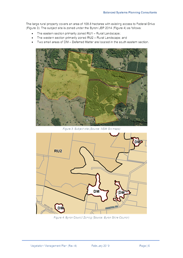
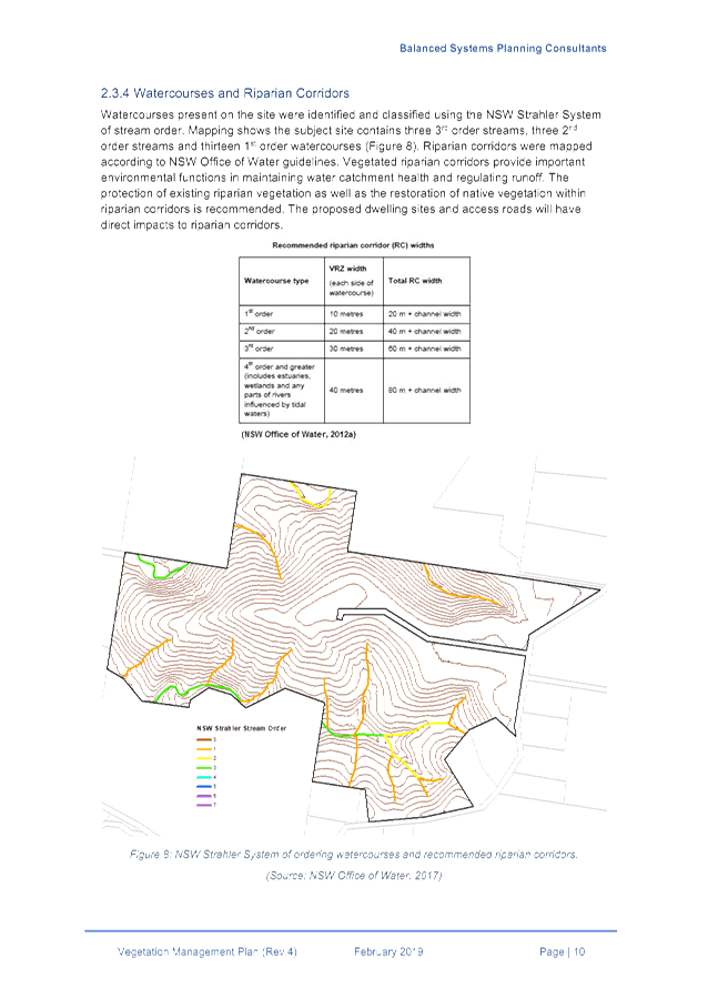
- 10.2018.483.1 Rural Tourist Accommodation Eight (8) cabins and pool... 4
6.2 PLANNING:
Submission to 'Discussion Paper - Local Character Overlays'................. 91
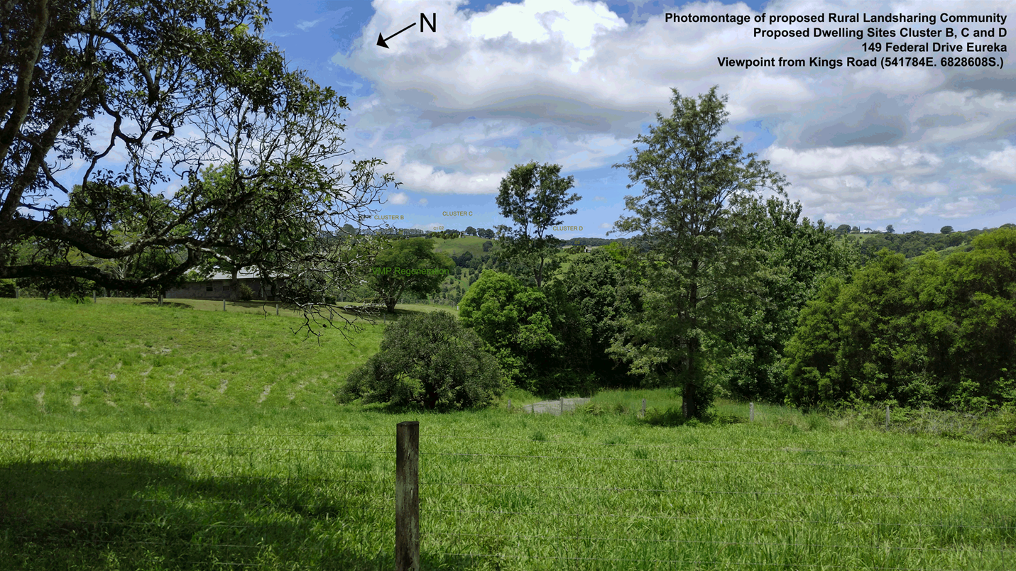
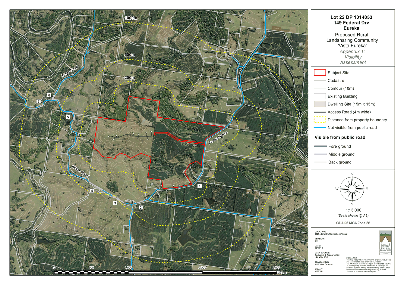
6.3 PLANNING
- 10.2018.137.1 - Rural Land Sharing Community (Multiple Occupancy) consisting
of Fifteen (15) Dwelling Sites and Associated Works....................................................... 102
6.4 PLANNING
- 10.2019.42.1 Boundary Adjustment 2 lots into 2 lots at 1660 and 1670 Coolamon
Scenic Drive MULLUMBIMBY..................................................................................... 314
6.5 PLANNING
- Exceptions of Development Standards 1 January 2019 to 31 March 2019 330
6.6 PLANNING
- 10.2013.587.6 S4.55 for Minor Changes to Approved Plans and Amendments to
Easements and Hours of Operation and Removal of Requirement to Comply with
Council's Airspace Policy at 108-110 Jonson Street BYRON BAY NSW 24........................................... 334
Infrastructure Services
6.7 Suffolk
Beachfront Holiday Park - Sale of homes on site 3 & 8.................................. 362
Councillors are
encouraged to ask questions regarding any item on the business paper to the
appropriate Director prior to the meeting. Any suggested amendments to the
recommendations should be provided to Councillor Support prior to the meeting
to allow the changes to be typed and presented on the overhead projector at the
meeting.
Staff Reports - Sustainable Environment and Economy 6.1
Staff Reports - Sustainable Environment and
Economy
Report No. 6.1 PLANNING
- 10.2018.483.1 Rural Tourist Accommodation Eight (8) cabins and pool
Directorate: Sustainable
Environment and Economy
Report
Author: Ben
Grant, Planner
File No: I2019/433
Proposal:
|
DA No:
|
10.2018.483.1
|
|
Proposal description:
|
Rural Tourist Accommodation: Eight (8) Cabins, Swimming
Pool and Associated Works
|
|
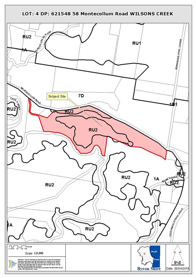
Property description:
|
LOT: 4 DP: 621548
|
|
58 Montecollum Road WILSONS CREEK
|
|
Parcel No/s:
|
53590
|
|
Applicant:
|
Frank Stewart Architect
|
|
Owner:
|
Mr S B Yishay & Ms L B Levi
|
|
Zoning:
|
RU2 Rural Landscape / PART DM Deferred Matter
|
|
Date received:
|
21 September 2018
|
|
Integrated / Designated Development:
|
☒
Integrated
|
☐
Designated
|
☐
Not applicable
|
|
Concurrence required
|
No
|
|
Public notification or exhibition:
|
- Level
2 advertising under DCP 2014 Part A14 – Public Notification and
Exhibition of Development Applications
- Exhibition
period: 11/10/18 to 24/10/18
- Submissions received:
18 submissions from 16 persons opposed.
|
|
Planning Review Committee:
|
14 February 2018
|
|
Variation request
|
☐
Clause 4.6
|
☐
SEPP 1
|
☒
Not applicable
|
|
Delegation to determination:
|
Council
|
|
Issues:
|
· Bushfire
prone land.
· Clustering
of rural tourism facilities.
· Vehicular
access – Montecollum Road will require upgrading.
· Visual
and rural amenity impacts.
|
Summary:
Proposed
Development
This development application seeks approval for eight
tourist cabins and a swimming pool on a rural site at 58 Montecollum Road,
Wilsons Creek. Six cabins and the swimming pool are proposed just below a
ridgeline near the northern boundary and a further two cabins are proposed
centrally on the site, east of the existing dwelling house. A new
driveway access will be constructed about 500m further east of the existing
property entrance to service cabins one to six.
The site
The site is located about 5km south-west of Mullumbimby in
the Koonyum Range. The site has an area of about 31 hectares and is partially
cleared, with environmentally significant vegetation on the eastern ridgeline.
The southern boundary is formed by Wilsons Creek. Land uses in the surrounding
area are a mixture of small horticultural activities, rural living, rural
landsharing communities and a few rural tourist facilities. Two dwelling houses
are located centrally on the site, with a number of sheds located nearby.
The site is zoned partly RU2 Rural
Landscape under LEP 2014 and partly 1(a) (General Rural Zone) under LEP 1988.
The proposed development is located wholly within the RU2 zone and is
permissible with consent.
Key Issues
The main issues arising from the
assessment of this application are:
· Bush fire risk.
· DCP 2014, Part
D3.3.4 – clustering of tourism development within 80m.
· Visual impact.
· Vehicular access
and road upgrades.
· Impacts on the
amenity of nearby residences.
· Proximity to
overhead powerlines.
The site is identified as bush fire prone land and the
development requires a Bush Fire Safety Authority (BFSA) under Section 100B of
the Rural Fires Act 1997. The application is integrated development. The
Rural Fire Service have assessed the proposal as acceptable and issued general
terms of approval. A range of bushfire protection measures for access, water
supply and emergency access will need to be incorporated into the development
in accordance with the BFSA.
The location and siting of the proposed facility results in
a variation to the prescriptive measures of DCP 2014, Chapter 3, Part D3.3.4,
which requires cabins to be arranged in a cluster pattern of 80m around the
existing dwelling. In this particular case, the cabins are clustered around the
dwelling over a distance of about 150m. For reasons explained further in the
body of this report, the design is able to satisfy the objectives and
performance criteria of the control and has sufficient merit to warrant
support. In particular, the cabins are able to be easily managed by the resident/s of the property without the need for a caretaker
and the siting and design of the development will not have an unreasonable
impact on the environmental values of the land or result in land use conflicts
that are unable to be managed through conditions of consent.
The proposal does have some potential to impact on the rural
amenity of the locality, mostly as a result of increased noise, light from
traffic movements, with neighbouring dwellings at 70 and 80 Montecollum Road
the most likely to be affected. These impacts are, on balance, considered to be
acceptable on the basis that such externalities can be reasonably managed
through conditions of consent. The recommendations of this report include conditions
requiring Montecollum Road to upgraded and limitations placed on the use and
operation of the facility.
In relation to visual impact, the proposal is considered to
be acceptable given that the development cannot be clearly viewed from public
locations and is unlikely to visually disrupt the skyline. Views to the site
from surrounding properties will be at a considerable distance and screened by
existing vegetation. The use of recessive earth-toned colours can be used in
conjunction with landscaping to soften the appearance of the development.
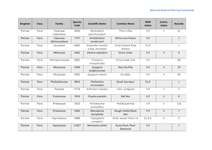
Council’s Ecologist raised no objection to the
proposal from an ecological perspective, but recommended that a Biodiversity
Conservation Management Plan be prepared and adopted as a condition of consent.
This will include the planting of 7,200 trees providing a positive
environmental outcome. No adverse impacts on flora or fauna are anticipated as
a result of the proposal subject to the required environmental enhancement
works.
Conclusion
The proposed development is considered to comply with the
relevant planning controls and is compatible with the constraints of the site.
There are no significant issues that are unable to be managed through
conditions of consent. As such the application is recommended for approval.
NOTE TO COUNCILLORS:
In accordance with the
provisions of S375A of the Local Government Act 1993, a Division is to be
called whenever a motion for a planning decision is put to the meeting, for the
purpose of recording voting on planning matters. Pursuant to clause 2(a)
under the heading Matters to be Included in Minutes of Council Meetings of
Council's adopted Code of Meeting Practice (as amended) a Division will be
deemed to have been called by the mover and seconder of all motions relating to
this report.
|
RECOMMENDATION:
That pursuant
to Section 4.16 of the Environmental Planning & Assessment Act 1979,
development application 10.2018.483.1 for rural tourist accommodation: eight (8) cabins, swimming pool and
associated works be granted consent subject to conditions in Attachment 1
#E2019/29050.
|
Attachments:
1 Recommended
conditions of consent, E2019/29050
, page 26⇩ 
2 Proposed
plans, E2019/29060 , page 46⇩ 
3 Submissions,
E2019/31203 , page 56⇩
Assessment
1. INTRODUCTION
1.1. History/Background
The site contains two dwelling houses and several sheds.
Previous determinations for the property are shown below:
· Building
Permit No. 253/77 – Dwelling, approved 5 October 1977.
· Development
Application No. 81/403 – Dwelling, approved 27 May, 1981.
· Building
Permit No. 81/438 – Dwelling, approved 26 July, 1981.
The 1977 Building Permit relates to the western most
dwelling, which appears to have been lawfully constructed and occupied in
accordance with this approval. Unfortunately, there are no building plans with
the 1981 approval to confirm if it relates any existing buildings on the site.
It is therefore unclear if this approval was ever lawfully commenced.
Detached dual occupancies were not permitted in the
non-urban (a) zone under the former Interim Development Order No. 1 which was
in force when DA 81/403 was issued. This is further clarified by Condition 3 of
the consent, which states that the development consent is valid only in the
instance of there being “no other dwelling already existing on the
subject property”.
Based on the available information, it is considered highly
likely that the second dwelling on the property is unlawful and should be
decommissioned in the event that Council decides to grant consent to the
current application. Suitable conditions have been included in the recommendations
of this report.
1.2. Description
of the proposed development
This Development Application seeks approval for:
· Eight
tourist cabins. Six cabins will be located just below a ridge that runs
parallel with the properties northern boundary. A further two cabins will be
located centrally on the site, approximately 100m east of the existing
dwelling. The cabins are simple rectangular buildings featuring lightweight
external materials, covered decks, skillion roofing and suspended flooring.
Each cabin will have a single bedroom, bathroom, living area, kitchen, and
covered verandah.
· Construction
of an in-ground concrete swimming pool with dimensions of 5m by 16m and a total
capacity of 120kL. The pool is intended to be used by guests of the proposed
facility.
· A
pool house and associated paved terrace and timber deck. The pool house will
contain a toilet and BBQ facilities to be used as part of the proposed
facility.
· Associated
landscaping works and the construction of internal access roads and car parking
in accordance with Council and RFS standards.
An application under section 68 of the Local Government
Act 1993 to install on on-site sewage management system (OSMS) has been
made concurrently with the development application.
1.3. Property
Description
|
Land is legally described as
|
LOT: 4 DP: 621548
|
|
Property address is
|
58 Montecollum Road WILSONS CREEK
|
|
Land is zoned:
|
RU2 Rural Landscape / PART DM Deferred Matter
|
|
Land area is:
|
30.97 hectares
|
|
Property is constrained by:
|
Bushfire Prone Land, High Environmental Value Vegetation
|
The site is located about 5km south-west of Mullumbimby, and
is situated on an elevated site in the Koonyum Range. The site has an area of
about 31 hectares and is partially cleared, with environmentally significant
vegetation on the eastern ridgeline. The southern boundary is formed by Wilsons
Creek. Land uses in the surrounding area are a mixture of small horticultural
activities, rural living, rural landsharing communities and a few rural tourist
facilities. Two dwelling houses are located centrally on the site, with a
number of sheds located nearby.
The site is zoned partly RU2 Rural
Landscape under LEP 2014 and partly 1(a) (General Rural Zone) under LEP 1988.
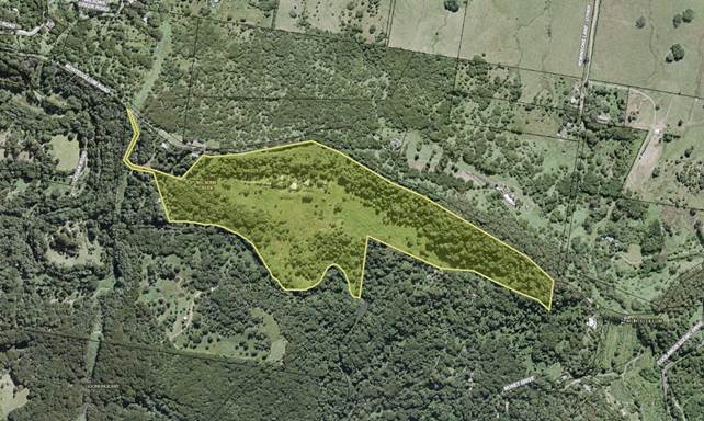
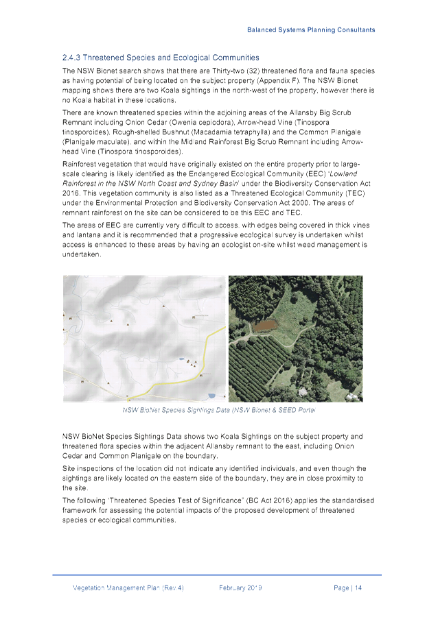
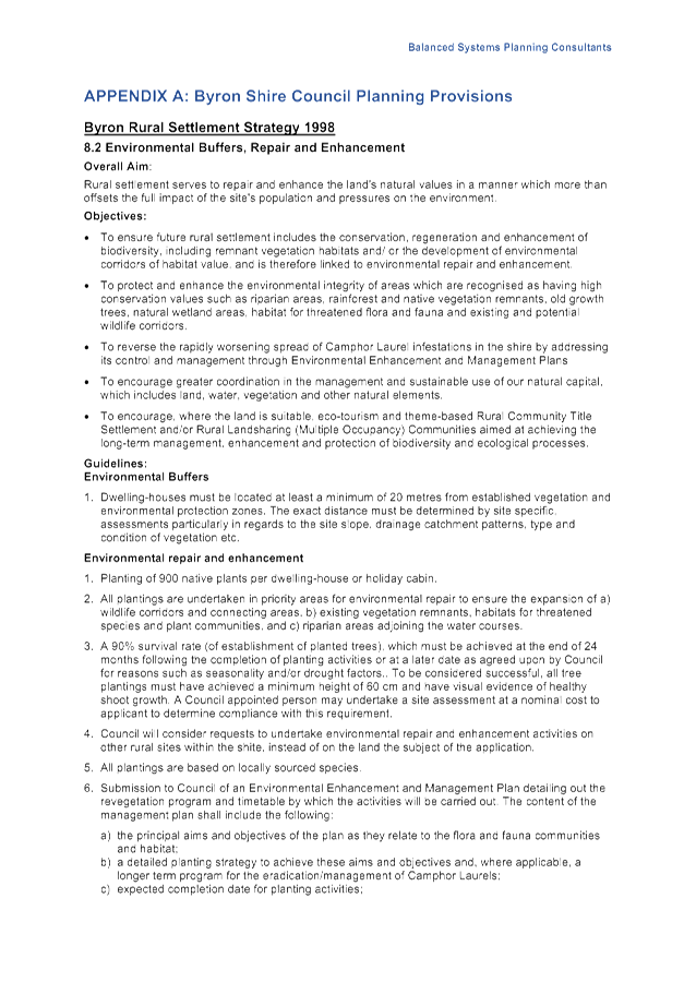
Figure 1: Aerial image of the site.
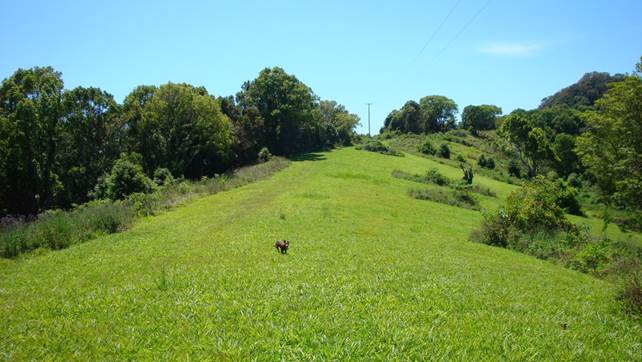
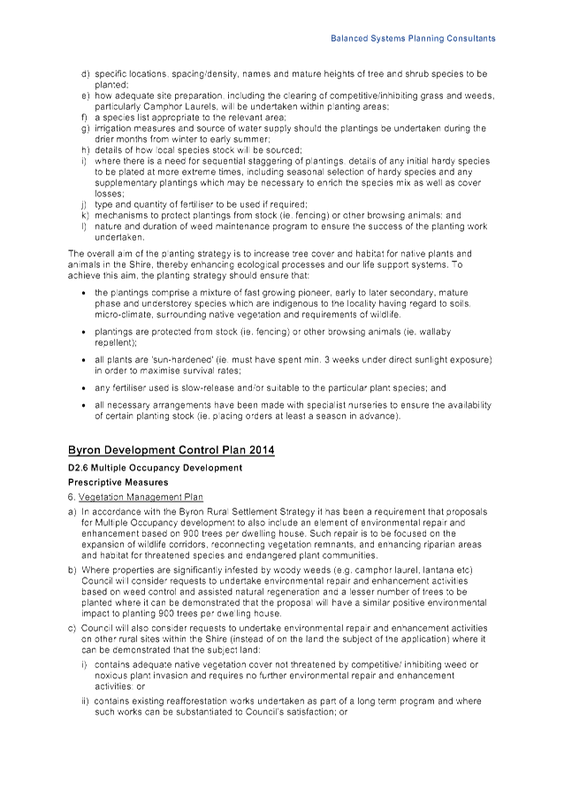
Figure 2: Location of proposed cabins 1-6 and swimming
pool.
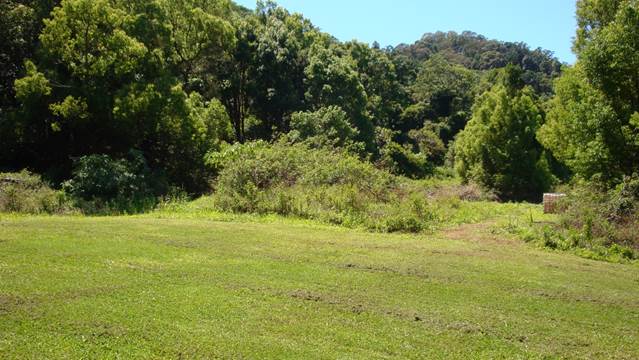
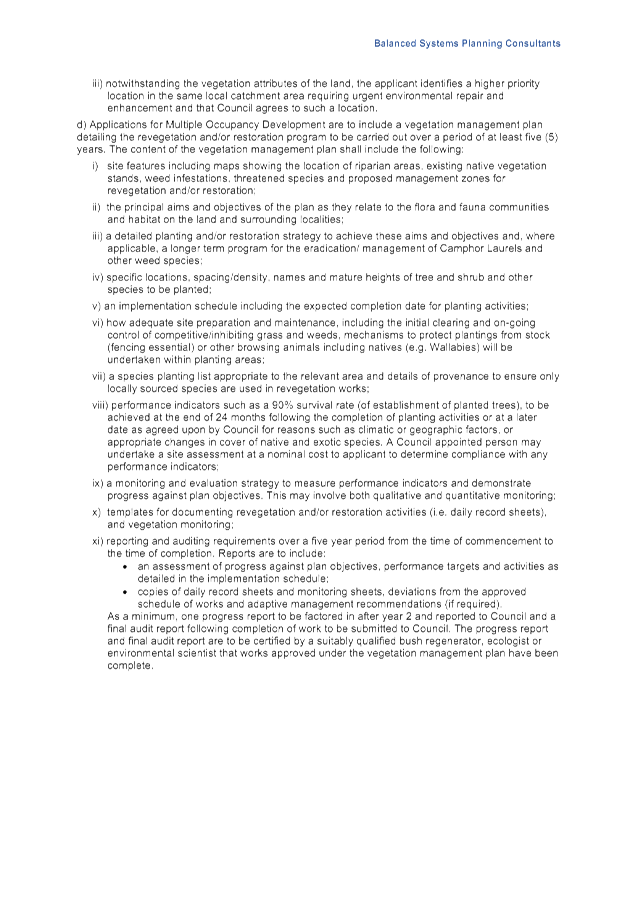
Figure 3: Location of proposed cabins 7-8.
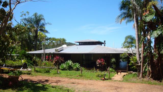
Figure 4: Existing dwelling house.
2. SUMMARY OF
REFERRALS
|
Referral
|
Issue
|
|
Environmental Health Officer
|
No objections subject to conditions.
|
|
Development Engineer
|
No objections subject to conditions.
|
|
Building Surveyor
|
No objections subject to conditions.
|
|
Ecologist
|
No objections subject to conditions.
|
|
Rural Fire Service (100B/4.14/4.14)
|
No objections subject to conditions contained within the
Bush Fire Safety Authority.
|
|
Essential Energy (Cl. 45 ISEPP)
|
Objection due to proximity to powerlines. This
infrastructure will need to be relocated. See discussion below.
|
Issues:
Proximity to powerlines
Proposed cabins 1-3 are located
close to an 11kV over head powerline that runs along the northern ridgeline.
Essential Energy commented that any liveable structure must be located at least
10m from the centreline of the powerlines. To achieve this, the applicant is
proposing to relocate the powerlines further north, increasing the separation
distance to at least 10m. Essential Energy raised no objection to this but
noted that all works will be at the owner’s expense. A condition is
recommended for the powerlines to be suitably realigned in accordance with the
requirements of Essential Energy prior to the commencement of any building
works.
3. ENVIRONMENTAL
PLANNING AND ASSESSMENT ACT 1979
3.1 Section 4.56 Integrated
development
The proposed development is classified as a Special Fire
Protection Purpose and requires a Bush Fire Safety Authority (BSFA) from the
NSW Rural Fire Service (RFS) under S100B of the Rural Fires Act 1997 and
is integrated development under S4.56 of the Environmental Planning and
Assessment Act 1979.
General Terms of Approval have been issued by the Rural Fire
Service and are included in the recommendations of this report.
3.2 Section 4.15 –
Evaluation
Having regard to the matters for consideration detailed in
Section 4.15(1) of the Environmental Planning & Assessment Act 1979
(EP&A Act), the following is a summary of the evaluation of the issues.
3.3 State Environmental
Planning Instruments
|
|
Satisfactory
|
Unsatisfactory
|
|
State
Environmental Planning Policy No 44—Koala Habitat Protection
|
☒
|
☐
|
|
The site is not considered as core Koala habitat but it is
noted that the north-eastern ridge is mapped as containing preferred Koala
feed tree species. To improve environmental outcomes for the site, a
Biodiversity Conservation Management Plan is recommended as a condition of
consent along with a condition restricting the keeping of cats or dogs by
guests to improve environmental outcomes on the property.
|
|
State
Environmental Planning Policy No 55—Remediation of Land
|
☒
|
☐
|
|
A preliminary soil contamination
assessment was provided with the application. Samples were analysed for heavy
metals, organochlorines and organophosphorous, which were considered to be
the most likely chemicals used on the property. The sampling results were
compared to adjusted Health Investigation Limits (HIL) from NEPM 1999 (2013)
and concentrations of all tested contaminants were below the relevant HILs.
Council’s Environmental Health Officer concluded that based on the
known history of the site, the land is considered to be suitable for the
proposed use and does not require remediation.
|
|
State
Environmental Planning Policy (Building Sustainability Index: BASIX) 2004
|
☒
|
☐
|
|
A multi-dwelling BASIX certificate has been provided and
all commitments for energy, water and thermal comfort have been shown on the
DA plans. The proposal is classified as BASIX optional development.
|
|
State
Environmental Planning Policy (Infrastructure) 2007
|
☒
|
☐
|
|
Pursuant to clause 45(1) in the Infrastructure SEPP, the
application was referred to Essential Energy for comment due to the proximity
of the proposed cabins and swimming pool to overhead powerlines. Essential
Energy raised safety concerns and commented that the proposal must be able to
achieve a separation distance of at least 10m from the powerlines. The
applicant is proposing to realign the powerlines to comply with this
requirement. Refer to Section 2 of this report.
|
4.2A Byron Local Environmental Plan 2014 (LEP 2014)
LEP 2014 is an applicable matter for consideration in the
assessment of the subject development application in accordance with subsection
4.15(1) of the EP&A Act because it applies to the subject land and the
proposed development. The LEP 2014 clauses that are checked below are of
relevance to the proposed development:
|
Part 1
|
☒1.1|
☒1.1AA| ☒1.2| ☒1.3| ☒1.4| ☒Dictionary| ☒1.7| ☒1.8| ☒1.8A| ☒1.9| ☒1.9A
|
|
Part 2
|
☒2.1|
☒2.2 | ☒2.3 |☒Land Use Table | ☒2.4 | ☒2.5 | ☒2.6 | ☒2.7 | ☒2.8
|
|
Part 4
|
☒4.2A|
☒4.2D| ☒4.3
|
|
Part 5
|
☒5.13
|
|
Part 6
|
☒6.2|
☒6.5| ☒6.6| ☒6.8
|
In accordance with LEP 2014 clauses 1.4 and 2.1 – 2.3:
(a) The
proposed development is defined in the LEP 2014 Dictionary as Swimming Pool,
Tourist and Visitor Accommodation.
(b) The
land is partly within the RU2 Rural Landscape zone under LEP 2014 and partly
within the 1(a)–(General Rural Zone) under LEP 1988 according to the Land
Zoning Map. The proposed development is entirely within the RU2 zone.
(c) The
proposed development is permitted with consent; and
(d) Regard
is had for the Zone Objectives as follows:
|
Zone Objective: RU2 Rural Landscape zone
|
Consideration
|
|
To
encourage sustainable primary industry production by maintaining and
enhancing the natural resource base.
|
The proposed development is a small scale tourist
facility that is generally compatible with the rural character of the
locality. Cabins are clustered around the existing dwelling house within a
distance of about 150m and the site will be subject a biodiversity
conservation management plan including the planting of 7200 trees in
accordance with the Byron Rural Settlement Strategy 1998.
Cabins one to six will not be clearly visible from
surrounding public places or roads and view from surrounding properties will
be partially screened by existing vegetation. A condition is recommended for
landscaping and recessive earth-toned colours to minimise the impact on the
scenic qualities of the locality.
|
|
To maintain
the rural landscape character of the land.
|
|
To provide
for a range of compatible land uses, including extensive agriculture.
|
|
To enable
the provision of tourist accommodation, facilities and other small-scale
rural tourism uses associated with primary production and environmental
conservation consistent with the rural character of the locality.
|
|
To protect
significant scenic landscapes and to minimise impacts on the scenic quality
of the locality.
|
Clause 4.2A Erection of dwelling
houses and dual occupancies on land in certain rural zones
Deposited Plan 621548 is included in schedule 7 of Byron LEP
1988 and the property is recognised as having a dwelling entitlement.
Clause 4.3 Height of buildings
A maximum building height of 9m applies to the subject site.
The cabins and pool house have a maximum height of 6m and comply with this
development standard.
Clause 6.2 Earthworks
The proposed cabins have suspended flooring to minimise the
amount of earthworks required to site the buildings. The majority of the cut
and fill associated with these structures will not exceed 1m in depth. Deeper
excavation to a depth of approximately 1.5m is required to create the swimming
pool which is benched into the slope to create an infinity edge design.
To
mitigate the potential for sediments and particulate matter entering Wilsons
Creek during construction, a condition is recommended requiring a detailed
erosion and sediment control plan to be submitted for approval with the
construction certificate application. Sediment and erosion controls are to be
implemented and maintained at all times until the site has ben stabilised and
revegetated.
Clause 6.5 Drinking water
catchments
The site adjoins Wilsons Creek
which feeds into a drinking water catchment. The development will have a
minimum separation of 300m from the Creek and the discharge from the swimming
pool and cabins will eventually be treated through the on-site waste
water treatment system. Council’s Environmental Health Officer considers
this to be a safe distance to avoid pollutants entering the drinking water
storage.
Clause 6.8 Rural and nature-based
tourism development
Clause 6.8 seeks to ensure that tourism development in rural
areas is small scale and does not adversely
impact on the agricultural production, scenic or environmental values of the
land. The following provisions are applicable:
(3) Development
consent must not be granted to tourism development on land to which this clause
applies unless the consent authority is satisfied that:
(a) there
is, or will be, adequate vehicular access to and from a road, other than a
classified road, taking into account the scale of the development proposed, and
(b) the
development is small scale and low impact, and
(c) the
development is complementary to the rural or environmental attributes of the
land and its surrounds, and
(d) the
development will not have a significant adverse impact on agricultural
production, amenity or significant features of the natural environment.
(4) Development
consent must not be granted to development for the purpose of tourism
development on land to which this clause applies unless:
(a) a
lawfully erected dwelling house or dual occupancy (attached) is situated on the
land, or
(b) a dwelling
house may be erected on the land under this Plan.
(5) Development
consent must not be granted to development under subclause (4) if the development:
(a) includes
an ancillary caretaker’s or manager’s residence, or
(b) is for the
purpose of more than 1 bed and breakfast accommodation.
In relation to rural tourism, small scale means a scale that is small enough to be
generally managed and operated by the principal owner living on the property.
The proposal is considered to accord with this definition because the cabins
are generally near to the existing dwelling house and are capable of being
managed by the resident/s of the dwelling.
The proposed
development otherwise meets the requirements of this clause, although
Montecollum Road will require upgrading to enable suitable vehicular access to
the site. Conditions for the use of earth toned colours and the use of
landscaping are also recommended to reduce the visual impact of the development
on the scenic qualities of the area.
4.2B Byron Local Environmental Plan 1988 (LEP 1988)
The proposed development and associated works are located
wholly in the RU2 zone under LEP 2014. LEP 1988 is not an applicable matter for
consideration in this assessment.
4.3 Any proposed Instrument
that has been the subject of public consultation and has been notified to the
consent authority
There are no proposed instruments that are of relevance to
the subject application.
4.4A Byron Shire Development Control Plan 2014
(DCP 2014)
DCP 2014 is an applicable matter for consideration in the
assessment of the subject development application in accordance with subsection
4.15(1) of the EP& A Act because it applies to the land to which LEP 2014
applies. The DCP 2014 Parts/Chapters that are checked below are of relevance to
the proposed development:
|
Part A
|
☒
Preliminary
|
|
Part B Chapters:
|
☒
B2| ☒ B3| ☒ B4| ☒ B6| ☒ B8| ☒ B9| ☒ B13| ☒ B14
|
|
Part C Chapters:
|
☒
C3| ☒ C4
|
|
Part D Chapters
|
☒
D2| ☒ D3
|
These checked Parts/Chapters have been taken into
consideration in the assessment of the subject development application in
accordance with subsection 4.15(1) of the EP&A Act. The following comments
are provided on relevant DCP provisions :
D3.3.4 Location and Siting
The proposed development does not
strictly accord with Prescriptive Measure 2(h), which requires tourist
developments to be configured in a ‘cluster’ pattern and located,
on average, no further than 80 metres apart on a north facing slope. The
cabins for this particular development are clustered around the dwelling, but
over a distance of approximately 150m on a south facing slope. The site layout
for this development is mostly the result of site constraints, including steep
topography and zoning restrictions, as well as a desire to achieve optimal
amenity for guests by taking advantage of views and breezes.
Despite the non-conformance with
the numeric control, the proposal is considered to meet the underlying
objectives and performance criteria of this part for the following reasons:
· The cabins are located within short walking distance to the
existing dwelling and are capable of being managed by the resident/s of the
property. A separate caretaker is not necessary.
· No significant impact on the ecological or environmental
values of the land is likely to occur. A Biodiversity Conservation Management
Plan is recommended as a condition of consent, which, if enacted, will likely
result in improved environmental outcomes for the site.
· The proposed cabins are of a domestic scale and comply with
the design and setback requirements specified in Chapter D2 Residential
Accommodation and Ancillary Development in Rural Zones (D2.2.2) and the
character and visual impact requirements (D2.2.3).
· Land use conflicts with adjoining properties, primarily by
way of noise, traffic and light pollution, are able to be reasonably managed
through the imposition of conditions of consent.
Chapter B4 Traffic Planning,
Vehicle Parking, Circulation and Access
A Traffic Impact Statement was submitted with the application.
Montecollum Road currently services two allotments east of the subject site,
which generate 18 vehicles movements per day (vpd) and 1.7 peak hour trips
(pht). The new development will result in an increase to 36 vpd and 4.1 pht
along this section of the road; Council’s Development Engineer has assessed
the increase in vehicle movements as low impact.
Despite the increase, there are two existing dwellings at 70
and 80 Montecollum Road, about 500m west of the new site entrance, that will be
affected more than other properties in the area owning to the proximity of
these houses to the road frontage. In particular one of the buildings which
appears to be used as a cabin sits adjacent to the road reserve. To improve
vehicular access and mitigate amenity impacts on neighbouring properties,
Montecollum Road will require upgrading including widening, and sealed surfaces
at all access points, longitudinal grades 10º or greater and 10m
before and after the dwelling house at 80 Montecollum Road.
Chapter B6 Buffers and Minimising Land Use Conflict
The proposed facility is considered to have a reasonable
separation from surrounding properties, however, there is some potential for
land use conflict with respect to noise from patrons at the swimming pool
amenities, especially during the nigh time period. It is concluded that
conditions should be imposed to ensure activities are restricted to certain
hours and that the site is not used for events and functions.
Chapter B8 Waste Minimisation and Management
Waste generated by the development is able to be collected
by Council pickup from Montecollum Road. A Site Waste Minimisation and
Management Plan is to be submitted for approval to the Principal Certifying
Authority that includes details for waste management and cleaning in accordance
with Part B8.4.3.
Chapter B13 Access and Mobility
Tourist cabins are classified as class (1b) buildings under
the BCA and therefore must comply with the relevant provisions including at
least one cabin with ambulant facilities, compliant paths of travel and
disabled parking.
Cabin 7 has been designed with disabled facilities. However,
due to its location at the bottom of the site, it will be difficult for guests
with limited movement to access the swimming pool area. To improve
accessibility, a condition is recommended for at least one of the cabins at the
top of the site to have disabled access.
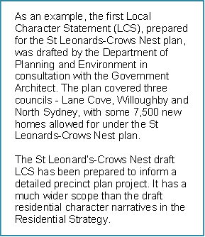
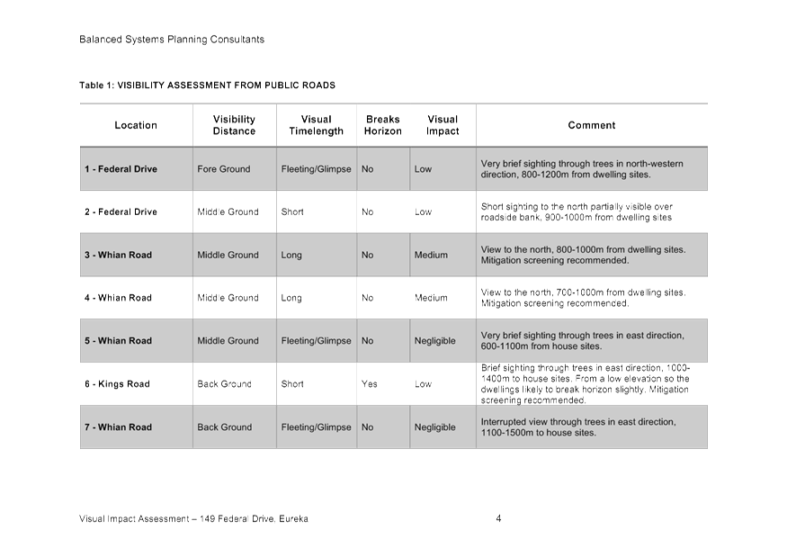
Chapter C3 Visually Prominent Sites, Visually Prominent
Development and View Sharing
A Visual Impact Assessment (VIA) was provided including
photos of the site and sections of the cabins and pool in relation to the
ridgeline. The VIA concludes that the visual impact will not be significant
because the development cannot be clearly viewed from public locations and will
not visually disrupt the skyline. Earth toned colours and landscaping are
proposed as a means of softening the appearance of the development when viewed
from surrounding sites.
As can be seen in figure 5 below, views from the south will
be partially screened by a stand of tall trees which will obscure cabins one,
two and three. Other elements will be visible from surrounding properties,
however, the overall impact is not considered to be significant given the
distances involved and the domestic scale of the architecture.
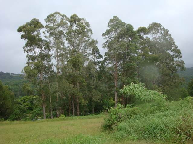
Figure 5: A stand of trees located below proposed
cabins one, two and three.
Chapter D3 Tourist Accommodation
D3.2.3 Character and Design in Rural Zones
Overall, the proposed development is considered to be
compatible with the surrounding landscape and development in the locality given
the site is largely obscured from the public domain and there will be no clear
views of the cabins from any nearby roads, lookouts or public places. A further
reduction in the visual impact can be achieved through the use of recessive
earth toned colours and landscaping.
D3.3.4 Rural Tourist Accommodation and Farm Stay
Accommodation
The proposed development has demonstrated compliance with
the objectives and prescriptive measures of Part D3.3.4, except in relation to
the numeric control in prescriptive measures D3.2.1 (9)(iii) and (iv), which
requires development to be clustered no further than 80m apart on a north
facing slope. A departure from these elements is addressed elsewhere in this
report. Compliance with the remaining prescriptive measures is demonstrated in
Table 1 below.
Table
1: DCP 2014, Part D3.2.1 –
Assessment against the Prescriptive Measures.
|
D3.2.1 Location and Siting
|
Compliance
|
Comment
|
|
1. Must
accommodate no more than 12 bedrooms collectively and a maximum of 2 persons
per room in accordance with table D3.1:
|
Land size
|
Max No. Bedrooms
|
|
0–3
ha
|
3
|
|
1
additional bedroom for every 1.5 has to a maximum of 12 bedroom
|
|
20
ha or greater
|
12
|
The
site has an area of approximately 29 hectares and is allowed up to a maximum
of 12 bedrooms.
|
Yes
|
Site has an area of about 28 hectares and is able to
accommodate a maximum of 12 bedrooms in accordance with Part D3.2.1. The
tourism facility includes 8 bedrooms within 8 separate cabins and complies
with the provisions of this clause.
|
|
2. Rural
tourist accommodation is to be designed with the following features:
a) Each
cabin must not exceed 60m2 with maximum of 2 bedrooms. Cabins must
open up onto recreation areas with access to winter sun and summer shade and,
where possible, take advantage of views of the rural landscape.
|
Yes
|
Each cabin has a GFA of 60m2 in accordance
with this clause (excluding decks).
|
|
b) All
weather car parking must be provided. Gravel or porous surface treatments are
encouraged except on steep slopes.
|
Yes* Condition
|
A suitable gravel surface is able to be installed in
accordance with appropriate conditions of consent.
|
|
c) Must
provide external pedestrian access between buildings and facilities
associated with the development.
|
Yes
|
Pathways between the cabins, car parking areas and site
facilities have been illustrated on a landscaping plan.
|
|
d) Must
minimise noise and vibration on adjoining dwellings.
|
Yes*
Condition
|
Vibration and dust emanating from traffic are to be
mitigated through a condition requiring Montecollum Road to be upgraded and
sealed in certain places.
|
|
e) Must be
accompanied by a landscaping plan. The plan is to incorporate screen
plantings for privacy between cabins.
|
Yes
|
A suitable landscaping plan has been provided
demonstrating privacy between cabins. For details can be provided with the
construction certificate.
|
|
f) Must
benefit from existing roads and infrastructure.
|
Yes
|
Access to the site can be achieved from existing
roads.
|
|
g) One of
the bedrooms must have disabled access.
|
Yes
|
Cabin 7 has been designed with disabled facilities and
access.
|
|
h) The
siting of rural tourist accommodation must be such that:
i) Adequate
separation distances to neighbouring properties must be maintained to
minimise land use conflict.
|
Yes
|
The cabins and pool are approximately 200m from the
nearest dwelling. The main impact will come from passing traffic which has
been assessed as being acceptable subject to upgrading of Montecollum Road.
|
|
ii) All
rural tourist accommodation must be located on land with a north, north-west,
north-east, or easterly aspect to maximise solar energy collection.
|
No
|
The proposed development will be located on a south
facing slope, although there will be adequate opportunities for solar energy
collection. See assessment against performance criteria above.
|
|
iii) Rural
tourist accommodation must be sited in a cluster pattern located on average
no further than 80m apart with adequate vegetation screening for privacy and
amenity purposes.
|
No
|
The cabins are spread across the site is two areas,
over a distance of approximately 150m. See assessment against performance
criteria above.
|
|
iv) Must be
located so that it does not adversely affect the conduct and productivity of
agricultural operations on the site.
|
Yes
|
The sites agricultural capacity is unlikely to be
significantly reduced by the proposed development.
|
|
v) Night
time lighting for outdoor recreational facilities is prohibited.
|
Yes*
Condition
|
A condition is recommended which limits the use of
lighting after 7pm.
|
4.4B Byron Shire Development Control Plan 2010 (DCP 2010)
The proposed development is located wholly within the RU2
zone. DCP 2010 is not a relevant matter for consideration in this assessment.
4.5 Any Planning Agreement or
Draft Planning Agreement?
There are no planning agreements or draft planning
agreements.
4.6 Environmental Planning
& Assessment Regulation 2000 Considerations
Clause 92 Additional matters that
consent authority must consider
The property contains a dwelling that will need to be
decommissioned prior to the occupation of the new cabins. A condition is
recommended requiring any the works to be carried out in accordance with
AS2601–The demolition of structures.
4.7 Any Coastal Zone Management
Plan
Not applicable.
4.8 The likely impacts of that
development, including environmental impacts on both the natural and built
environments, and social and economic impacts in the locality
|
Impact on:
|
Likely significant impact/s?
|
|
Natural environment
|
Flora and Fauna
The site is to be rehabilitated in accordance with a
Biodiversity Conservation Management Plan along with 7200 additional trees to
be planted. No adverse impacts on flora and fauna are anticipated as a result
of the proposal subject to the required environmental enhancement works.
|
|
Built environment
|
Visual impact
The proposed cabins will sit slightly below the ridgeline.
Some of the roofed elements will extend above the ridgeline, but will sit
below a backdrop of vegetation that runs along the northern boundary. The use
of recessive, earth tone colours and landscaping is recommended to minimise
the visual impact of the proposal.
Hazards
The site is constrained by bushfire prone land and
overhead powerlines. These constraints have been adequately addressed through
the realignment of powerlines and a range of bushfire conditions.
Amenity
Impacts from traffic, dust and noise will be manageable
subject to conditions of consent requiring Montecollum Road to be upgraded
and the use of the pool area limited from 7am to 7pm.
Use and operation of the facility
Conditions are recommended to prevent the facility from
being operated as a function centre or wedding venue.
|
|
Social Environment
|
No. The proposal will not have a significant social impact
on the locality.
|
|
Economic impact
|
No. The proposal will not have a significant economic
impact on the locality.
|
4.9 The suitability of the site
for the development
The site is considered to be
suitable for the development subject to conditions being imposed in relation to
bushfire safety, road upgrades and realignment of powerlines.
4.10 Submissions made in accordance with
this Act or the regulations
The development application was publicly exhibited for a
period of 14 days in accordance with DCP 2014. There were 19 submissions from
16 persons made objecting to the development application.
|
Issue
|
Comment
|
|
Lack of notification
|
|
· Did not receive neighbour
notification.
· Neighbours not
consulted or notified.
· More time should have
been given to notify the surrounding community.
|
A review of records indicates that all 12 neighbouring
properties were sent notification letters in accordance with DCP 2014.
|
|
Amenity
|
|
· Amenity will be
adversely affected by traffic and noise.
· Road noise and dust
will impacts on existing residents will be severe.
· Dust will significantly
impact on neighbouring properties during dry spells. May affect
people’s health.
· Extreme dust problems
will impact on neighbouring homes
· Lighting from the pool
area will disturb the surrounding area at night time.
|
Montecollum Road will require upgrading with bitumen
seal in certain sections. A condition is recommended for most of the lighting
to be minimised and turned off after 10pm except where required for
reasonable security.
|
|
Visual impact
|
|
· The proposed
development is clearly visible from many households and the Crystal Castle.
If the proposal is to proceed, only dark recessive colours should be used.
· Lighting could be used
as part of the entertainment facilities around the pool and barbeque area.
· The cabins are to be
built on top of the ridge and will impact on the natural beauty of the area.
· The new access to be created
for the development past the original single entrance would require
considerable earthworks and vegetation clearance on the ridgeline.
· The proposed
development will be visible from surrounding properties and will scar the
ridgeline and the landscape.
· A full visual impact
assessment should be submitted.
|
A condition is recommended for the use of recessive,
earth toned colours and landscaping to reduce the visual impact of the
proposed development.
|
|
Sound impact
|
|
· As we live in a valley,
the sound is an amphitheatre effect. Music, or any sound emanating from the
tourist facility will be greatly enhanced.
· Noise generated by the
facility will echo around the valley.
· Facility will generate
excessive noise pollution.
|
Council’s Environmental Health Office has
recommended noise levels must not exceed the background noise level plus 5dB
(A) between the hours of 7:00am and 10:00 pm at the nearest affected
residence. Given the small scale of the development and the separation from
nearby residences, compliance with this condition is considered to be
achievable.
|
|
Wastewater
|
|
· Waste water treatment
system appears inadequate for the use.
· Waste water system
appears to be designed for minimal occupancy and will likely be unable to
cope effectively.
|
Council’s Environmental Health Officer has
assessed the adequacy of the proposed wastewater system. The system is
considered suitable for the intended use.
|
|
Environmental impacts
|
|
· The DA has not
addressed surrounding populations of endangered flora and fauna.
· Increase human
population in the area will increase danger to valuable flora and fauna.
· Clearing has been
undertaken on the property. Further clearing is likely if the DA is approved.
· Concerned about local
wildlife such as eastern cod, platypus, goanna, koalas etc.
· Additional traffic will
affect local wildlife.
|
Council’s Ecologist commented that the proposal
will not have a significant environmental impact subject to appropriate
conditions of consent. A biodiversity conservation management plan is
recommended along with the planting of 7200 trees.
|
|
Stormwater management
|
|
· No details are given in
the DA for stormwater management.
|
A condition is recommended that requires a properly
engineered stormwater system to be designed that fully infiltrates the 20
year ARI runoff from all impervious areas for all storm durations without
surcharge onto neighbouring properties.
|
|
Garbage
|
|
· No details of garbage
collection or waste management have been provided.
|
Council garbage collection is available off
Montecollum Road.
|
|
Privacy
|
|
· My privacy will be
severely compromised as the cabins face my home and outdoor living areas.
· Cabins will detract
from peacefulness and privacy.
· Tourist and friends
will wander all over private properties, with loss of privacy and causing
friction.
|
The facility is unlikely to result in a severe loss of
privacy due to the separation distances between the cabins and surrounding
dwellings. The nearest residence is approximately 200m from the cabins. Lines
of sight from the facility will be directed to the south; the nearest
dwelling in this direction has a separation of approximately
400m.
|
|
Planning controls
|
|
· The proposal
contravenes clause 6.8 of LEP 2014.
|
The proposal is considered to be in accordance with
the provisions of clause 6.8. The tourism use is of a small enough scale that
it can be managed and operated by the principal owner living on the property.
In addition, there will not be a significant adverse impact on the amenity or
significant features of the landscape.
|
|
Traffic and access
|
|
· There will be serious
and unsafe traffic volumes created on Montecollum Road which is a narrow and
dusty road.
· 20,000 additional
vehicle movements will occur on this unsealed road.
· Excessive traffic
impacts for a poorly maintained rural road.
· The road has a history
of deterioration from rainwater and traffic and required repairs by Council
in mid 2018.
· The new access up the
steep bank, along with increased traffic, will seriously affect nos. 70 and
80 Montecollum Road.
· Traffic will further
degrade and erode Montecollum Road.
· Increased danger to
school children who walk to bus stop on Cedar Road.
· A traffic impact
statement has not been provided.
· Gravel roads break down
already from overuse. Impact of additional traffic will further deteriorate
roads.
· Intersection near Montecollum
Road and Cedar Lane is already dangerous.
· The design of the
access and additional tourist traffic will slow down ambulance access to the
area.
|
Council’s Development Engineer has assessed the
increase in vehicle movements as being low impact. Road upgrades, including
widening and sealing in certain section will be required.
|
|
Bushfire
|
|
· Development will
increase risk of bushfire.
· Bushfire report
unacceptable as it relies on the use of a secondary dwelling and two other
cabins which are not in the proposal.
|
A Bush Fire Safety Authority has been issued by the
RFS. A second dwelling has not been included as a bush fire shelter.
|
|
Compliance issues
|
|
· Council’s ability
to regulate this development, which has all the elements of a function
centre, is almost zero.
· The site has been
subject of illegal clearing.
|
It is acknowledged that rural function centres and
wedding venues are an ongoing issue in the Shire. Notwithstanding, this
particular development is comprised of individual cabins, rather than a
purpose built function centre. Other than the swimming pool and BBQ area,
there are no central facilities or areas suitable for large gatherings.
|
|
Status of two bedroom building
|
|
· It is unclear what the
proposed use of the two bedroom building is, and whether it is intended to
form part of the rural tourist accommodation.
|
The property has a potentially unauthorised dwelling
that is shown on the plans, but is not included in this development
application. A condition to clarify this is recommended.
|
|
Scale of the development
|
|
· The
development is not small scale.
· The
proposed eight cabins and two bedroom existing building can accommodate up to
36 people.
· The
proposal has the characteristics of a function centre.
· Site
not capable of accommodating the proposed development.
· Eight
cabins grossly excessive considering the location of the development site.
· Floor
plans of cabins also include sofa beds, indicating additional guest capacity.
· This
is more like a tourist park than a small scale low key farm stay.
|
DCP 2014 allows up to 12 bedrooms and 24 guests for
sites greater than 20 hectares. Each cabin has one bedroom for a total of
eight bedrooms and 16 guests.
|
|
Errors and omissions in the application
|
|
· The statement of
environmental effect includes various errors in relation to the floor area of
the cabins, the distance from neighbouring dwellings, visual impact and
condition of the road.
· The term farm stay is
used several times, however, the property is not used as a farm.
· No mention is made of
garbage disposal. The facility will require provision of additional garbage
bins, which will create an unpleasant visual impact and may attract animals
and create a serious health hazard.
· There is no traffic
impact statement with the DA.
|
There were a number of anomalies in the original
application that have since been clarified. A traffic impact statement has
been provided. The proposal is not considered farm stay accommodation.
|
|
Future environmental zoning
|
|
· The site is proposed to
be zoned E2 Environmental Conservation and being located so close to the
ridgeline it would be considered scenic escarpment.
|
Stage 1 of Council’s Environmental Zone
Implementation Program does not include the subject site. It is not clear if
the site will eventually be transitioned into an environmental zone at the
current time.
|
|
Drinking water catchment
|
|
· The location is above
and fronting the Wilsons Creek, a drinking water catchment. Earthworks will
cause runoff of materials into the creek, into which the whole site drains.
|
Conditions are recommended for a sediment and erosion
control plan to be prepared and implemented as part of the development. Given
the separation distances from the Creek (>250m), the likelihood of
sediments and particulate matter being transported into the drinking water
catchment is low so long as appropriate controls are in place during
construction.
|
4.11 Public interest
The proposed development is unlikely to prejudice or
compromise the public interest or create an undesirable precedent.
5. DEVELOPMENT
CONTRIBUTIONS
Section 7.12 levies are
applicable. Conditions to apply.
6. REASONS
FOR DECISION, HOW COMMUNITY VIEWS WERE ADDRESSED
Note: From July 1 2018,
Council’s are required to give and publicly notify reasons for a range of
planning decisions where they are deciding if development should proceed to
help community members to see how their views have been taken into account and
improve accountability to stakeholders. A statement of reasons for the
determination of this application is provided below.
|
Statement of Reasons
|
|
The proposed modifications were minor and substantially
the same as the original development approval with no detrimental
environmental impacts.
|
|
The proposed development complies with the provisions of
Byron Local Environmental Plan 2014.
|
|
The proposed development complies with relevant State Environmental
Planning Policies
|
|
The proposed development complies with relevant provisions
of Development Control Plan 2014
|
|
The proposed development complies with Environmental
Planning & Assessment Regulation 2000 considerations.
|
|
The proposed development will not have significant adverse
impact on the natural, built or social environment or economic impacts on the
locality.
|
|
The proposed development is considered suitable for the
proposed site.
|
|
The development application was notified/advertised in accordance
with Development Control Plan 2014. Issues raised in the submissions have
been addressed during assessment of the application.
|
|
The proposed development is unlikely to prejudice or
compromise the public interest.
|
|
How community views were addressed
|
|
The DA was advertised in accordance with Development
Control Plan 2014. The submissions received were considered on merit and
addressed during assessment of the application. To view the considerations,
please contact Council to view a copy of the assessment report relating to
this DA.
|
7. CONCLUSION
The proposal is considered to be consistent with the
relevant environmental planning instruments and planning controls applicable to
the site and is recommended of approval subject to conditions of consent.
Staff Reports - Sustainable Environment and Economy 6.1 - Attachment 1
|
SCHEDULE 1 CONDITIONS OF
CONSENT
|
|
Parameters of consent
|
|
1.
|
Development is to be in accordance with approved plans
The development is to be in accordance with plans listed
below:
|
Plan No.
|
Description
|
Prepared by
|
Dated:
|
|
A01 Issue B
|
Site Plan
|
Frank Stewart
|
Oct 2018
|
|
A02 Issue C
|
Part Site Plan
|
Frank Stewart
|
Jan 2018
|
|
A03 Issue A
|
Part Site Services/Sedimentation Plan
|
Frank Stewart
|
Sep 2018
|
|
A04 Issue A
|
Part Site Landscaping plan
|
Frank Stewart
|
Sep 2018
|
|
A05
|
Section A-A
|
Frank Stewart
|
Sep 2018
|
|
A06
|
Section B-B
|
Frank Stewart
|
Sep 2018
|
|
A07 Issue B
|
Cabins 1-6, Floor Plan, Section , Elevations
|
Frank Stewart
|
Oct 2018
|
|
A08 Issue B
|
Cabins 7-8, Floor Plan, Section , Elevations
|
Frank Stewart
|
Oct 2018
|
|
A09 Issue A
|
Pool House Floor Plan, Section, Elevation
|
Frank Stewart
|
Sep 2018
|
|
NJ01 Issue A
|
Relocation of Overhead Powerline
|
Frank Stewart
|
April 2018
|
The development is also to be in accordance with any
changes shown in red ink on the approved plans or conditions of consent.
The approved plans and related documents endorsed with the
Council stamp and authorised signature must be kept on site at all times
while work is being undertaken.
|
|
2.
|
Integrated Approvals from
other Authorities.
This development consent includes an Integrated
development approval under Sections 4.46 and 4.47 of the Environmental
Planning and Assessment Act 1979, being a Bush Fire Safety Authority Issued
under section 100B of the Rural Fires Act 1997 subject to the
conditions listed under the “General Terms of Integrated Development
Approval” in this consent.
|
|
The following conditions are to be complied with
prior to issue of a Construction Certificate for building works
|
|
3.
|
Section 7.12 Levy to be paid
Prior to the issue of a construction certificate the
section 7.12 levy required by the Byron Developer Contributions Plan 2012
must be paid to Council.
The levy will be calculated as follows:
Levy payable = %C x $C
§ %C
is the levy rate applicable as set out in the latest Ministerial Direction
issued under section 7.17.
§ $C
is the proposed cost of carrying out the development.
The rate of %C is:
|
Proposed cost of the development
|
Maximum percentage of the levy
|
|
Up to $100,000
|
Nil
|
|
$100,001–$200,000
|
0.5 percent
|
|
More than $200,000
|
1.0 percent
|
The cost of development must be calculated in accordance
with clause 25J of the Regulation. The Cost Summary Report (copy
attached) as set out in schedule 2 of the Section 7.12 contributions plan
must be submitted to Council with the payment. The cost summary report
must be prepared by a quantity surveyor. Copies of Cost Summary Report
are available at Council’s main office or may be downloaded from Council’s
website.
|
|
4.
|
Amendment to the plans
The Principal Certifying Authority shall be satisfied that
the plans have been amended as follows:
· At
least one cabin at the northern part of the site (i.e. Cabins 1 to 6) shall
be designed to provide disabled access, facilities and car parking to guests.
|
|
5.
|
Building materials and colours to be specified
The application for a Construction Certificate is to
include plans and specifications that indicate the proposed building
materials and colours consistent with the provisions of Development Control
Plan 2014 – Chapter D1.2.4 (Residential) or D2.2.3 (Rural) - Character
and Visual Impact. Please note that colours must be non-reflective
earth tone colours and that the use of white and near white colours is not
permissible
Such plans and specifications must be approved as part of
the Construction Certificate.
|
|
6.
|
Landscaping plan required
The application for a Construction
Certificate is to include plans and specifications that indicate the
landscaping of the site. Such landscaping plan must incorporate
adequate detail to demonstrate compliance with the provisions of Chapter B9
of Development Control Plan 2014. Species identified in Chapter B9 of
Development Control Plan 2014 are to be planted wherever possible. The
landscaping plan must indicate:
a) proposed location
for planted shrubs and trees
b) botanical name of
shrubs and trees to be planted
c) mature height of
trees to be planted
d) location of grassed
and paved areas,
e) location of trees
identified for retention in the development application plans.
f) Location of
garden lighting with such lighting to be limited to bollard style with a low
wattage to limit light spill onto neighbouring properties.
g) Maintenance
of the stand of Eucalypts to the south of Cabins 1-3 as a visual
screen.
h) The
plan is to be prepared by a suitably qualified landscape architect /
architect /ecologist who has appropriate experience and competence in
landscaping.
Such plans and specifications must be approved as part of
the Construction Certificate.
Note: Landscaping to the site is to comply with the
principles of Appendix 5 of Planning for Bushfire Protection 2006.
|
|
7.
|
Cabins to be relocated so that APZ
does not encroach on any part of BV or HEV mapping on the site
The extent of any bushfire asset
protection zones must be entirely outside high conservation value vegetation
mapped on the Biodiversity Values Map under the Biodiversity Conservation Act
2016 or as High Environmental Value by Council.
|
|
8.
|
Biodiversity Conservation Management
Plan
A Biodiversity Conservation Management
Plan must be prepared in accordance with the attached Guidelines for
preparing a Vegetation Management Plan (VMP) or Biodiversity Conservation
Management Plan (BCMP) and
the plan submitted to and approved by Council. Such plan must detail
protection and compensation measures proposed to protect native flora and fauna and their habitats and must retain and improve habitat on that part of the site covered by the Management Plan.
The plan must:
a. Provide and implement strategies to avoid
impacts to Koalas and their habitat on the site.
b. Provide ecological restoration within
High Conservation Value rainforest vegetation, particularly targeted at
Camphor Laurel control, over an area twice the size as would be achieved by
planting 900 trees per cabin (total of 7200 trees) at the usual spacing.
c. illustrate on maps of a suitable scale
the accurate extent of the Biodiversity Values mapping, vegetation
communities classified to Plant Community Type, overall development footprint,
approved asset protection zones and driveways on the subject site.
d. detail the methodology for habitat
restoration and specify the
use of qualified and
experienced bush regenerators
only.
e. specify that planting and/or restoration
works will commence immediately upon approval of the Management Plan.
f. include lists of locally occurring native
tree, shrub and ground cover plant species suitable for planting as part of
the ecological restoration program and site landscaping.
Include a list of environmental weeds,
comprising introduced plant species known to have the capacity to invade
native vegetation communities to prevent their introduction to the site.
|
|
9.
|
Building materials and colours to be specified
The application for a Construction
Certificate is to include plans and specifications that indicate the proposed
building materials and colours consistent with the provisions of Development
Control Plan 2014 – Chapter D2.2.3 - Character and Visual Impact.
Colours must be non-reflective earth tone colours and that the use of white
and near white colours is not permissible.
To blend in with the surrounding landscape, roof colours
shall be recessive earthly tones, in a natural shade of green.
Such plans and specifications must
be approved as part of the Construction Certificate.
|
|
10.
|
Geotechnical Report required – Building Works
A certificate from a professional Engineer experienced in
Geotechnical Science is to be provided to the Principal Certifying Authority,
certifying that the site is stable and will not be affected by landslide or
subsidence at, above or below the site when the building and swimming pool
are erected. The certificate must be prepared in accordance with AS 1726.
|
|
11.
|
Geotechnical Report required – Engineering Works
A certificate from a professional Engineer experienced in
soil mechanics is to be provided to the Principal Certifying Authority,
certifying that:
a) the
design of the civil engineering works, including roads, stormwater
infiltration system and others, retaining walls and/or cut & fill
batters, has been assessed as structurally adequate,
b) the
civil engineering works will not be affected by landslip or subsidence either
above or below the works; and
c) adequate
drainage has been provided.
|
|
12.
|
Sediment and Erosion Control Management Plan required
The application for a Construction
Certificate is to include plans and specifications that indicate the measures
to be employed to control erosion and loss of sediment from the site. Control
over discharge of stormwater and containment of run-off and pollutants
leaving the site/premises must be undertaken through the installation of
erosion control devices such as catch drains, energy dissipaters, level
spreaders and sediment control devices such as filter fences and
sedimentation basins.
Such plans and specifications must
be approved as part of the Construction Certificate.
NOTE: The plans
must be in compliance with Council's current “Northern Rivers Local
Government Development Design & Construction Manuals and Standard
Drawings”.
|
|
13.
|
Stormwater Drainage – Connection to Existing
Drainage System
The application for a Construction Certificate is to
include plans and specifications for stormwater drainage in accordance with
AS/NZS 3500.3:2003, Plumbing and drainage, Part 3: Stormwater drainage.
All stormwater drainage for the development must be
conveyed by a gravity system to the existing stormwater drainage system
within the site. Such plans and specifications must be approved as
part of the Construction Certificate.
|
|
14.
|
Stormwater Drainage – Infiltration Trench &
Additional Plans addressing Stormwater Quality
The application for a Construction Certificate is to
include plans and specifications for stormwater drainage in accordance with
the relevant Australian Standard. All stormwater drainage for the development
must be conveyed by a gravity system to an infiltration trench or trenches
complying with the requirements of Council’s Comprehensive
Guidelines for Stormwater Management.
The infiltration trench or trenches must be designed by a
qualified practising Civil Engineer to fully infiltrate the 20 year ARI runoff
from all impervious areas of the proposed development for all storm durations
without surcharge onto neighbouring properties. The Civil Engineer is to be a
corporate member of the Institution of Engineers Australia or is to be
eligible to become a corporate member and have appropriate experience and
competence in the related field.
The stormwater management plan shall also provide
separate/additional details and detailed plans to demonstrate compliance to
Table B3.1 of Council’s DCP.
Such plans and specifications must be approved as part of
the Construction Certificate.
|
|
15.
|
Consent required for works within the road reserve
Consent from Council must be obtained for works within the
road reserve pursuant to Section 138 of the Roads Act 1993. Three (3) copies
of engineering construction plans must accompany the application for consent
for works within the road reserve.
Such plans are to be in accordance with Council’s
current Design & Construction Manuals and are to provide for the
following works:
|
Road Upgrade
|
Montecollum Road must be upgraded from the end of the
existing sealed section and up to 10m past the proposed driveway servicing
Cabin 1 to Cabin 6. The following shall be included:-
1. Generally
in accordance with Council’s standard drawing R13 for a rural crowned
road with a formation of 4m carriageway with 1m gravel shoulders.
2. Provision
shall be made to provide passing bay at 200m spacing. The passing bay shall
be 20m long x 6m wide carriageway.
3. Provision
of sealed surface at all access points, longitudinal grades 10º or
greater, 10m before and after the dwelling house in Lot 3 DP621548.
|
|
Driveway (rural & residential areas without kerb
& gutter)
|
A driveways (2x) servicing the Cabins shall be upgraded
in accordance with Council’s current “Northern Rivers Local
Government Development Design & Construction Manuals and Standard
Drawing R14”.
|
|
|
16.
|
Access plans required
The application for a Construction Certificate is to
include plans and specification that indicate access, parking and manoeuvring
details in accordance with the plans approved by this consent.
The internal access and manoeuvring servicing Cabins 1 to
6 and Cabins 7 & 8 are to comply with condition 7 of the NSW RFS General
Terms of Approval with Reference No D18/7488 – DA18100215336 WS dated 9
January 2019. Plans are to include, but not be limited to, the following
items:
a) pavement design,
comprising an all weather surface, such as asphalt, bitumen seal, concrete,
pavers or other similar treatment;
b) site conditions
affecting the access;
c) existing and design
levels;
d) longitudinal
section for the full length of the internal access
e) cross sections
every 15 metres; and
f) drainage
details.
The engineering plans and specifications are to be
designed by a qualified practising Civil Engineer. The Civil Engineer is to
be a corporate member of the Institution of Engineers Australia or is to be
eligible to become a corporate member and have appropriate experience and
competence in the related field.
Such plans and specifications must be approved as part of
the Construction Certificate.
NOTE: The plans must be in compliance with Council's
current “Northern Rivers Local Government Development Design &
Construction Manuals and Standard Drawings”.
|
|
17.
|
Plans of retaining walls and drainage
The application for a Construction Certificate is to
include plans and specifications that indicate retaining walls or other
approved methods of preventing movement of the soil, where any excavation or
filled area exceeds 600mm in height. Adequate provision must be made for
drainage.
Such plans and specifications must be approved as part of
the Construction Certificate.
|
|
18.
|
Compliance with BASIX Certificate requirements
The development is to comply with Basix Certificate No.
968587M, dated Tuesday, 30 October 2018.
The commitments indicated in the Certificate are to be
indicated on the plans submitted for approval of the Construction
Certificate.
The plans submitted must clearly indicate all windows
numbered or identified in a manner that is consistent with the identification
on the Basix Certificate.
Minor changes to the energy efficiency measures may be undertaken
without the issue of any amendment under Section 96 of the Act, provided that
the changes do not affect the form, shape or size of the building.
Such plans and specifications must be approved as part of
the Construction Certificate.
|
|
19.
|
Long Service Levy to be paid
A Long Service Levy must be paid to the Long Service
Payments Corporation. This is a State Government Levy and is subject to
change.
These payments may be made online at www.longservice.nsw.gov.au or at
Council’s Administration Office, Station Street, Mullumbimby. When
paying to Council, cheques are to be made payable to ‘Byron Shire
Council’.
For further information regarding the Long Service Payment
please refer to the website above.
|
|
20.
|
Onsite Effluent Waste Water systems (Rural Swimming
Pools)
The owner is responsible to ensure works do not conflict
with the Onsite Waste Water System (Sewage Management Facility).
Details to be submitted with the Construction Certificate
to demonstrate there is no conflict with both the disposal areas, plumbing
and treatment/ storage/ septic tanks.
Where required, a S68 Application is to be submitted to
Council to relocate any system prior to the issue of the Construction
Certificate.
|
|
21.
|
Details of pool fence required
The application for a Construction Certificate is to
include plans and specifications that indicate the details of the fence
around the swimming pool in accordance with the Swimming Pools Act 1992 and
AS1926.1.
Such plans and specifications must be approved as part of
the Construction Certificate.
|
|
22.
|
Site Waste Minimisation and Management Plan
Chapter B8 of Byron Shire Development
Control Plan 2014 (DCP 2014) aims to facilitate sustainable waste management
in a manner consistent with the principles of Ecologically Sustainable
Development. Prior to the issue of a Construction Certificate, a Site Waste
Minimisation and Management Plan (SWMMP) must be submitted outlining measures
to minimise and manage waste generated during demolition, construction and
the ongoing operation and use of the development. The SWMMP must specify the
proposed method of recycling or disposal and the waste management service
provider.
A template
is provided on Council’s website to assist in providing this
information www.byron.nsw.gov.au/files/publication/swmmp
- pro-forma-.doc
|
|
23.
|
Potable
Water Supply Management Plan
Prior to the issue of a Construction Certificate provided
to the Principle Certifying Authority a Potable Water Supply Management Plan
(PWSMP). For further information refer to the following website
http://www.health.nsw.gov.au/environment/water/Publications/private-water-supply-guidelines.pdf
The PWSMP must be prepared by a suitable qualified professional.
|
|
24.
|
Tree Removal
No trees or vegetation to be cleared or
removed until a Construction Certificate has been issued.
|
|
The following conditions are to be complied with
prior to any building or construction works commencing
|
|
25.
|
Powerlines to be relocated
Prior to the commencement of any building works, the power
lines traversing the ridgeline on the northern part of the site must be
relocated in accordance with the Powerline Relocation Plan NJ01, dated April
2019, and any requirements of Essential Energy. The powerlines must be
relocated to provide a minimum separation distance of at least 10m from the
centre line to the closest roof eave of any liveable structure (i.e. tourist
cabins).
If Essential Energy require an easement to be burdened on
the title of the property, this easement must be registered prior to the
commencement of any works and evidence of such provided to the Principal
Certifying Authority.
Note. The cabins cannot be relocated further south
due to the zoning of the land. The powerlines will need to be accurately
realigned to ensure a 10m separation to any approved liveable structures.
|
|
26.
|
Erosion and Sediment Control Management Plan required
Erosion and sedimentation controls are to be in place in
accordance with the approved Erosion and Sediment Control Plan.
Sediment and erosion control measures in accordance with
the approved Erosion and Sedimentation Control plan/s must be maintained at
all times until the site has been stabilised by permanent vegetation cover or
hard surface.
Any such measures that are deemed to be necessary because
of the local conditions must be maintained at all times until the site is
made stable (i.e. by permanent vegetation cover or hard surface).
Note: Council may impose on-the-spot fines for
non-compliance with this condition.
|
|
The following conditions are to be complied with
during any building or construction works
|
|
27.
|
Protection of koalas/ native fauna
from disturbance
a) Clearing
of native vegetation and/or earthworks as part of any development approval
from Council must be temporarily suspended within a range of 25m from any
tree which is concurrently occupied by a koala and must not resume until the
koala has moved from the tree of its own volition.
b) Any
clearing of land must not commence until the area proposed for clearing has
been inspected for the presence of koalas and approval given in writing by a
suitably qualified individual.
c) Approval
to proceed with the clearing of vegetation in accordance with this section is
only valid for the day on which the inspection has been undertaken.
The
individual referred to in (ii) above, or a nominated representative, must
remain on site during any approved clearing of vegetation.
|
|
28.
|
Inspection for on-site
sewage management
All plumbing and drainage
works is to be installed by a suitably qualified person. The plumber must
adhere to the requirements of the NSW Code of Practice and AS/NZ 3500. The
plumber is to arrange for the following inspections to be undertaken:
a) Internal drainage prior to
covering of the works.
b) External drainage prior to the
covering of works.
c) Irrigation installation prior
to the covering of works.
d) Final
|
|
29.
|
Construction times
Construction works must not unreasonably interfere with
the amenity of the neighbourhood. In particular construction noise, when
audible from adjoining residential premises, can only occur:
a. Monday to Friday,
from 7 am to 6 pm.
b. Saturday, from 8 am
to 1 pm.
No construction work to take place on Saturdays and
Sundays adjacent to Public Holidays and Public Holidays and the Construction
Industry Awarded Rostered Days Off (RDO) adjacent to Public Holidays.
Note: Council may impose on-the-spot fines for
non-compliance with this condition.
|
|
30.
|
Construction Noise
Construction noise is to be limited as follows:
a. For construction
periods of four (4) weeks and under, the L10 noise level measured over a
period of not less than fifteen (15) minutes when the construction site is in
operation must not exceed the background level by more than 20 dB(A).
b. For construction
periods greater than four (4) weeks and not exceeding twenty‑six (26)
weeks, the L10 noise level measured over a period of not less than fifteen
(15) minutes when the construction site is in operation must not exceed the
background level by more than 10 dB(A)
Note: Council may impose on-the-spot fines for non-compliance
with this condition.
|
|
31.
|
Signs to be erected on building and demolition sites
A sign must be erected in a prominent position on the work
site:
a. stating that
unauthorised entry to the work site is prohibited, and
b. showing the name of
the person in charge of the work site and a telephone number at which that
person may be contacted outside working hours.
Any such sign is to be removed when the work has been
completed.
|
|
32.
|
Builders rubbish to be contained on site
All builders rubbish is to be contained on the site in a
‘Builders Skips’ or an enclosure. Footpaths, road reserves and
public reserves are to be maintained clear of rubbish, building materials and
all other items.
|
|
33.
|
Fill to be retained on the subject land
Fill material must not encroach onto any adjoining land.
|
|
34.
|
Prevention of water pollution
Only clean and unpolluted water is to be discharged to
Council’s stormwater drainage system or any watercourse to ensure
compliance with the Protection of Environment Operations Act.
Note: Council may impose on-the-spot fines for
non-compliance with this condition.
|
|
35.
|
Removal of asbestos
All asbestos wastes associated with removal of the
existing building to be disposed of in accordance with the requirements of
the Workcover Authority. The applicant/owner is to produce documentary
evidence that this condition has been met.
Please note the Byron Resource Recovery Centre can not
accept asbestos. You will need to arrange disposal at an alternate landfill
site.
|
|
36.
|
Maintenance of sediment and erosion control measures
Sediment and erosion control measures must be maintained
at all times until the site has been stabilised by permanent vegetation cover
or hard surface.
|
|
37.
|
Stormwater drainage work
Stormwater drainage for the development must be
constructed in accordance with the approved plans and specification by a
suitably qualified person.
|
|
38.
|
Demolition
Any required demolition works must be undertaken in
accordance with the relevant requirements of Australian Standard AS
2601–1991: The Demolition of Structures published by Standards
Australia, and the WorkCover Authority of NSW.
|
|
39.
|
Removal of demolition and other wastes
All wastes, including asbestos and lead-contaminated
wastes, associated with these works are to be handled and disposed of in
accordance with the requirements of the Work Cover Authority. The
applicant/owner is to produce documentary evidence that this condition has
been met. Wastes must be disposed of at a Licenced Waste Facility. All wastes
removed from the site must be managed and disposed of in accordance with the
NSW DECC Waste Classification Guidelines (2008) www.environment.nsw.gov.au/resources/waste/08202classifyingwaste.pdf
|
|
40.
|
Muted bushland tones external finishes
To ensure the development is compatible with the
surrounding environment, colours and finishes are to be muted bushland tones.
In this regard white, light or bright colours are not permissible.
|
|
The following conditions are to be complied with
prior to the issue of an occupation certificate
|
|
41.
|
Dwelling to be decommissioned
Prior to the issue of an interim or final
occupation certificate the second dwelling on the property, identified on
site plan A01 Issue B, dated October 2018, as “existing
building” is to be rendered non-habitable. All kitchens, laundries and
the like must be removed from the building and the services disconnected and
capped.
|
|
42.
|
Relocation of powerlines
The Principal Certifying Authority shall
be satisfied that the cabins have a minimum separation of 10m from
powerlines, as measured from the centerline to the closest roof eave. An
occupation certificate (interim or final) must not be issued unless the developer
is able to demonstrate that the cabins have been constructed in accordance
with this requirement.
|
|
43.
|
Habitat Compensation works to be
completed
Plantings and/or
restoration works are to be completed in accordance with the approved Biodiversity
Conservation Management Plan prior to issue of the occupation certificate for
the development. The site must be assessed to determine satisfaction of
performance criteria by Council. Alternatively, Independent sign-off may be
undertaken by (Australian Association of Bush Regenerators) AABR-accredited
Bush Regenerators, see http://www.aabr.org.au/do/business-directory/wpbdm-category/aabr-accredited-bush-regenerators/.
In all cases a final monitoring report must accompany any application for
satisfaction of this condition.
|
|
44.
|
On-site sewage
management system must be completed
The on-site sewage management system is to be constructed
in accordance with approved plans and in accordance with current
specifications and standards. The system is not to be used and/or operated
until a Council Officer has inspected the system and authorised its use.
|
|
45.
|
Approval to Operate
required
In accordance with the Local
Government Act, an Approval to Operate the onsite sewage management system
must be obtained from Council. Forms may be downloaded from Council’s
website with 'http://www.byron.nsw.gov.au/on-site-sewage'.
|
|
46.
|
Road upgrade to be completed
The road upgrade is to be constructed in accordance with
the approved plans and Roads Act consent.
|
|
47.
|
Internal accesses in accordance approved plans
Internal accesses are to be constructed in accordance with
the approved plans.
|
|
48.
|
Stormwater drainage work
Stormwater drainage for the development must be
constructed in accordance with the approved plans and specification prior to
issue of an occupation certificate.
|
|
49.
|
Site to be landscaped
Prior to the issue of an occupation certificate, the site
is to be landscaped in accordance with the approved landscaping plan and
conditions of consent.
|
|
50.
|
Stormwater disposal
Stormwater must be collected and disposed of in a controlled
manner such that stormwater flows are:
a. Clear of buildings
and infrastructure,
b. Clear of effluent
disposal areas,
c. Not concentrated so as
to cause soil erosion,
d. Not directly to a
watercourse, and
e. Not onto adjoining land.
|
|
51.
|
Swimming pool fencing
Swimming pool fencing is to comply with the requirements
of the Swimming Pools Act 1992 and Regulations.
|
|
52.
|
Compliance with bushfire conditions
Documentary evidence from a suitably qualified
professional is to be submitted demonstrating that the bush fire conditions
of this Notice of Determination have been complied with.
|
|
53.
|
Works to be completed prior to issue of a Final
Occupation Certificate
All of the works indicated on the plans and approved by
this consent, including any other consents that are necessary for the
completion of this development including approvals issued under the Local
Government Act 1993 and the Roads Act 1993, are to be completed and approved
by the relevant consent authority/s prior to the issue of a Final Occupation
Certificate.
Any Security bond paid for this application will be held
until Council is satisfied that no further works are to be carried out that
may result in damage to Councils road/footpath reserve.
|
|
The following conditions are to be complied with at
all times
|
|
54.
|
Site not be used for functions or events
The tourist facility is not to be used for functions,
weddings, concerts, events or the like, unless separately approved by
Council.
|
|
55.
|
Cabins not to be used as dwellings
The cabins are not approved for used as dwelling houses
and are not to be used for permanent residential occupation.
|
|
56.
|
Use of lighting after certain hours
In order to protect the dark
night sky and rural atmosphere of the area , any outdoor lighting, other
than that required for reasonable security, shall not be used between the
hours of 10.00 p.m. and 7.00 a.m. on any day. Low garden lighting and sensor
lighting for paths and car parking areas permitted.
|
|
57.
|
Landscaping
The landscaping works must be
maintained to ensure the establishment and successful growth of plants,
meeting the intent of the landscape design. This must include but not be
limited to watering, weeding, and the replacement of failed plant material.
The stand of Eucalypts to the south of Cabins 1-3 are to be maintained at all
times.
|
|
58.
|
Limited Tree Removal
Removal of
existing native trees from the site is limited to three small native trees as
defined within the letter entitled DA 483/2018 - Request for
further information regarding vegetation clearing potentially triggering the
Biodiversity Offset Scheme at Lot 4 DP 61548, 58 Montecollum Road, Wilsons
Creek by Greg Alderson and Associates dated 11
January 2019. All other trees and native plants
within the site are to be retained and protected.
|
|
59.
|
No dogs or cats to be brought or kept
with cabin users
Due to the biodiversity
value of the adjacent rainforest as well as the presence of preferred Koala
habitat on the site, the keeping of cats and dogs in association with cabin
visitor use is prohibited.
|
|
60.
|
Replanting and restoration works
Replanting and restoration
works must be undertaken and continued until the performance criteria have
been achieved in accordance with the approved Biodiversity Conservation
Management Plan for a minimum period of five years, during which annual
monitoring reports must be submitted to Council for approval.
|
|
61.
|
Must not interfere with
the amenity of the neighbourhood
The use of the amenities block must not interfere with the
amenity of the neighbourhood by reason of noise, vibration, smell, fumes,
smoke, dust, wastewater or otherwise. In particular:
a) The noise level emanating
from the use of the premises must comply with the New South Wales Policy for
Industry (2017) and the Noise Guide for Local Government. All sources of
noise and vibration must be effectively managed so as not to be intrusive or
‘offensive’ within the nearest residential properties.
b) Only clean and unpolluted
water is permitted to be discharged to Councils’ stormwater drainage
system or any waters.
c) All wastes shall be
contained within appropriate containers fitted with a tight-fitting
vermin-proof lid.
d) Goods
deliveries and waste collection must be restricted to daytime operating
hours.
|
|
62.
|
Noise limitations of the Pool Amenities Building
The noise level emitted from the pool amenities building
must not exceed the background noise level plus 5dB (A) between the hours of
7:00am and 10:00 pm at the nearest affected residence*. The noise level
emitted from the pool amenities building between 10.00 pm and 7:00 am must
not exceed the background noise level at the nearest affected
residence*. No correction for tonality is applied.
In assessing noise levels at residences, the noise level
is to be assessed at the most affected point on or within the residential
property boundary or, if this is more than 30m from the residence, at the
most affected point within 30m of the residence.,
|
|
63.
|
Pool Safety Sign
The occupier of the premises must ensure that there is at
all times a sign in the immediate vicinity of the swimming pool bearing the
words ‘Young children must be supervised when using this swimming
pool’. The sign is to be a prominent position and be otherwise in
accordance with clause 9 of the Swimming Pools Regulation.
A pool resuscitation sign is to be installed in a
conspicuous location within the pool area to the satisfaction of the
Principle Certifying Authority.
|
|
64.
|
Use of second dwelling
The second dwelling on the property,
identified on site plan A01 Issue B, dated October 2018, as
“existing building” must not be occupied or used as a dwelling
house unless separately approved by Council.
|
|
65.
|
Pool
backwash in rural areas
Pool water disposal and backwash is to be directed to a
soakage trench located in such a location as to not cause any nuisance to
adjoining properties or damage to any structures or impact on any land
application areas for the on-site sewage management system.
|
|
66.
|
Swimming
pool health requirements
The
swimming pool water is to be re-circulated, filtered and disinfected in
accordance with the requirements of Council and NSW Health. The
swimming pool water is to be maintained at satisfactory levels of purity for
bathing at all times
|
|
67.
|
Swimming pool pump location
The filter pump is to be located such that noise from its
operations does not cause a nuisance to adjoining residents. If necessary an
acoustic enclosure must be provided around the pump to achieve the required
noise attenuation.
|
|
68.
|
Swimming Pool Fencing
Swimming pool fencing is to comply with the requirements
of the Swimming Pool Act 1992 and Regulations at all times.
|
|
General Terms of Integrated Development Approval
|
|
69.
|
Bush Fire Safety Authority
– S100B Rural Fires Act 1997
The New South Wales Rural Fire
Service (NSW RFS) has considered the information submitted. General Terms of
Approval, under Division 4.8 of the ‘Environmental Planning and
Assessment Act 1979’, and a Bush Fire Safety Authority, under Section
100B of the 'Rural Fires Act 1997', are now issued subject to the following
conditions:
1. The proposed development is to comply with the plan
titled 'Part Site Plan, Inset 1', prepared by Frank Stewart Architect,
reference June 2018, issue A dated September 2018, except where modified by
conditions of this Bush Fire Safety Authority.
Asset Protection Zones
The intent of measures is to
provide sufficient space and maintain reduced fuel loads so as to ensure
radiant heat levels of buildings are below critical limits and to prevent direct
flame contact with a building. To achieve this, the following conditions
shall apply:
2. At the commencement of building works of cabins 1-3
and in perpetuity the property around the building shall be managed as
follows as outlined within section 4.1.3 and Appendix 5 of 'Planning for Bush
Fire Protection 2006' and the NSW Rural Fire Service's document 'Standards
for asset protection zones':
· north
for a distance of 38 metres as an asset protection zone;
· east
for a distance of 9 metres as an asset protection zone;
· south
for a distance of 25 metres as an asset protection zone; and
· west
for a distance of 9 metres as an asset protection zone.
·
(Note: in forested areas a
portion of the asset protection zone may be maintained as an outer protection
zone as specified in Table A2.7 of 'Planning for Bush Fire Protection 2006'.)
3. At the commencement of building works of cabins 4-6
and in perpetuity the property around the building shall be managed as
follows as outlined within section 4.1.3 and Appendix 5 of 'Planning for Bush
Fire Protection 2006' and the NSW Rural Fire Service's document 'Standards
for asset protection zones':
· north
for a distance of 25 metres as an asset protection zone;
· east
for a distance of 9 metres as an asset protection zone;
· south
for a distance of 25 metres as an asset protection zone; and
· west
for a distance of 9 metres as an asset protection zone.
·
(Note: In forested areas a
portion of the asset protection zone may be maintained as an outer protection
zone as specified in Table A2.7 of 'Planning for Bush Fire Protection 2006'.)
4. At the commencement of building works of cabins 7
and 8 and in perpetuity the property around the building shall be managed as
follows as outlined within section 4.1.3 and Appendix 5 of 'Planning for Bush
Fire Protection 2006' and the NSW Rural Fire Service's document 'Standards
for asset protection zones':
· north
for a distance of 22 metres as an asset protection zone;
· east
for a distance of 22 metres as an asset protection zone;
· south
for a distance of 39 metres as an asset protection zone; and
· west
for a distance of 34 metres as an asset protection zone.
·
(Note: in forested areas a
portion of the asset protection zone may be maintained as an outer protection
zone as specified in Table A2.7 of 'Planning for Bush Fire Protection 2006'.)
Water and Utilities
The intent of measures is to
provide adequate services of water for the protection of buildings during and
after the passage of a bush fire, and to locate gas and electricity so as not
to contribute to the risk of fire to a building. To achieve this, the
following conditions shall apply:
5. Electricity are to comply with section 4.2.7 of
‘Planning for Bush Fire Protection 2006’.
6. In recognition that no reticulated water supply is
available to the development, a 10,000 litres firefighting water supply shall
be provided for firefighting purposes for each cabin. The firefighting water
supply shall be installed and maintained in the following manner:
a) Firefighting water supply may be provided by a tank,
a swimming pool or a dam that shall be located not less than 5 metres and not
more than 60 metres from the approved structure. Amalgamation of the water
supply is permitted if more than 1 cabin is within the specified 60 metres.
b) A hardened ground surface for firefighting truck
access is to be constructed up to and within 4 metres of the firefighting
water supply.
c) New above ground firefighting water supply
storage’s are to be manufactured using non-combustible material
(concrete, metal, etc). Where existing firefighting water supply
storage’s are constructed of combustible (polycarbonate, plastic,
fibreglass, etc) materials, they shall be shielded from the impact of radiant
heat and direct flame contact.
d) Non-combustible materials (concrete, metal, etc)
will only be used to elevate or raise firefighting water supply tank(s) above
the natural ground level.
e) A 65mm metal Storz outlet with a gate or ball valve
shall be fitted to any firefighting water supply tank(s) and accessible for a
firefighting truck.
f) The gate or ball valve, pipes and tank penetration
are adequate for the full 50mm inner diameter water flow through the Storz
fitting and are constructed of a metal material.
g) All associated fittings to the firefighting water
supply tank(s) shall be non-combustible.
h) Any pipes not of metal material shall be buried
300mm below natural ground level.
i) Any below ground firefighting water supply tank(s)
constructed of combustible (polycarbonate, plastic, fibreglass, etc)
materials shall be shielded from the impact of radiant heat and direct flame
contact.
j) Any firefighting water supply tank(s) located below
ground shall be clearly delineated to prevent vehicles being driven over the
tank.
k) All water supplies for firefighting purposes shall
be clearly signposted as a firefighting water supply.
l) Below ground firefighting water supply tank(s) shall
have an access hole measuring a minimum 200mm x 200mm to allow firefighting
trucks to access water direct from the tank.
m) Pumps are to be shielded from the direct impacts of
bush fire.
n) A Static Water Supply (SWS) sign shall be obtained
from the local NSW Rural Fire Service (RFS) and positioned for ease of
identification by RFS personnel and other users of the SWS. In this regard:
i. Markers must be fixed in a suitable location so as
to be highly visible; and
ii. Markers should be positioned adjacent to the most
appropriate access for the water supply.
Note: The definition of below
ground dedicated firefighting water supply tank(s) is when the outlet valve
is located below natural ground level.
Access
The intent of measures for
property access is to provide safe access to/from the public road system for
fire fighters providing property protection during a bush fire and for
occupants faced with evacuation. To achieve this, the following conditions
shall apply:
7. Property access roads shall comply with the
following requirements of section 4.1.3 (2) of 'Planning for Bush Fire
Protection 2006'.
a) Bridges clearly indicate load rating and pavements
and bridges are capable of carrying a load of 15 tonnes.
b) Roads do not traverse a wetland or other land
potentially subject to periodic inundation (other than a flood or storm
surge).
c) A minimum carriageway width of 4 metres for single
lane and 6 metres for 2 way.
d) In forest, woodland and heath situations, rural
property access roads shall have passing bays every 200 metres, or where
there are crests or blind corners, that are 20 metres long by 2 metres wide,
making a minimum trafficable width of 6 metres at the passing bay.
e) A minimum vertical clearance of 4 metres to any
overhanging obstruction, including tree branches.
f) Internal roads provide a loop road around any
dwelling or incorporate a turning circle with a minimum 12 metre outer
radius. Except that a reversing bay may be provided in lieu of a loop road
around the dwelling or a turning circle. Where a reversing bay is provided it
shall be not less than 6 metres wide and 8 metres deep with an inner minimum
turning radius of 6 metres and outer minimum radius of 12 metres.
g) Curves have a minimum inner radius of 6 metres and
are minimal in number to allow for rapid access and egress.
h) The minimum distance between the inner and outer
curves is 6 metres. The crossfall is not to exceed 10 degrees.
i) Maximum grades for sealed roads do not exceed 15
degrees and not more than 10 degrees for unsealed roads.
Evacuation and Emergency
Management
The intent of measures is to
provide suitable emergency and evacuation (and relocation) arrangements for
occupants of special fire protection purpose developments. To achieve this,
the following conditions shall apply:
8. An Emergency/Evacuation Plan is to be prepared in
accordance with the NSW Rural Fire Service Guidelines for the Preparation of
Emergency/Evacuation Plan and comply with Australian Standard AS 3745 -2010
'Emergency Control Organisation and Procedures for Buildings Structures and
Workplaces for Residential Accommodation'. The emergency evacuation plan will
include a procedure to contact the NSW Rural Fire Service District Office /
NSW Fire Brigade and inform them of the evacuation and the location they will
be evacuated to. A copy of the emergency evacuation plan shall be provided to
the consent authority and the Local Emergency Management Committee prior to
occupation of the development.
Design and Construction
The intent of measures is that
buildings are designed and constructed to withstand the potential impacts of
bush fire attack. To achieve this, the following conditions shall apply:
9. New construction of cabins 1-6 shall comply with
section 3 and section 7 (BAL 29) Australian Standard AS3959-2009
‘Construction of buildings in bush fire prone areas’ or NASH
Standard (1.7.14 updated) ‘National Standard Steel Framed Construction
in Bushfire Areas – 2014’ as appropriate and section A3.7
Addendum Appendix 3 of 'Planning for Bush Fire Protection' 2006’.
10. New construction of cabins 7 and 8 shall comply with
Sections 3 and 5 (BAL 12.5) Australian Standard AS3959-2009 'Construction of
buildings in bush fire prone areas' or NASH Standard (1.7.14 updated)
‘National Standard Steel Framed Construction in Bushfire Areas –
2014’ as appropriate and section A3.7 Addendum Appendix 3 of 'Planning
for Bush Fire Protection 2006'.
11. New construction of the pool house and deck is to be
sited no closer than 10 metres to cabin 6.
Landscaping
12. Landscaping to the site is to comply with the
principles of Appendix 5 of 'Planning for Bush Fire Protection 2006'. In this
regard the following landscaping principles are to be incorporated into the
development:
a) Suitable impervious areas being provided immediately
surrounding the building such as courtyards, paths and driveways;
b) Grassed
areas/mowed lawns/ or ground cover plantings being provided in close proximity
to the building;
c) Restrict planting in the immediate vicinity of the
building which may over time and if not properly maintained come in contact
with the building;
d) Maximum tree cover should be less than 30%, and
maximum shrub cover less than 20%;
e) Planting should not provide a continuous canopy to
the building (i.e. trees or shrubs should be isolated or located in small
clusters);
f) When considering landscape species consideration
needs to be given to estimated size of the plant at maturity;
g) Avoid species with rough fibrous bark, or which
retain/shed bark in long strips or retain dead material in their canopies;
h) Use smooth bark species of trees species which generally
do not carry a fire up the bark into the crown;
i) Avoid planting of deciduous species that may
increase fuel at surface/ ground level (i.e. leaf litter);
j) Avoid climbing species to walls and pergolas;
k) Locate combustible materials such as
woodchips/mulch, flammable fuel stores away from the building;
l) Locate combustible structures such as garden sheds,
pergolas and materials such timber garden furniture way from the building;
and
m) Use of low flammability vegetation species.
|
|
SCHEDULE 3 NOTES
|
|
Construction Certificate required:
This development consent is issued under the Environmental
Planning and Assessment Act 1979 and does not relate to structural aspects or
specifications of the building under the Building Code of Australia. All
buildings and alterations require the issue of a Construction Certificate
prior to works commencing. Application forms are available from the customer
services counter or Council’s website www.byron.nsw.gov.au
|
|
Schedule of Development
Contributions
The following contributions
are current at the date of this consent. The contributions payable will be
adjusted in accordance with the relevant plan and the amount payable will be
calculated on the basis of the contribution rates that are applicable at the
time of payment. The current contribution rates are available from Council
offices during office hours. Payment will only be accepted by cash or bank
cheque.
Section 7.12 Levy to be paid
Prior to the issue of a construction certificate the
section 7.12 levy required by the Byron Developer Contributions Plan 2012
must be paid to Council.
The levy will be calculated as follows:
Levy payable = %C x $C
§ %C
is the levy rate applicable as set out in the latest Ministerial Direction
issued under section 7.17.
§ $C
is the proposed cost of carrying out the development.
The rate of %C is:
|
Proposed cost of the development
|
Maximum percentage of the levy
|
|
Up to $100,000
|
Nil
|
|
$100,001–$200,000
|
0.5 percent
|
|
More than $200,000
|
1.0 percent
|
The cost of development must be calculated in accordance
with clause 25J of the Regulation. The Cost Summary Report (copy
attached) as set out in schedule 2 of the Section 7.12 contributions plan
must be submitted to Council with the payment. The cost summary report
must be prepared by a quantity surveyor. Copies of Cost Summary Report
are available at Council’s main office or may be downloaded from
Council’s website.
|
|
Principal Certifying Authority:
Work must not commence until the applicant has:-
a. appointed a
Principal Certifying Authority (if the Council is not the PCA); and
b. given Council at
least two days notice of the intention to commence the erection of the
building. Notice must be given by using the prescribed ‘Form 7’.
c. notified the
Principal Certifying Authority of the Compliance with Part 6 of the Home
Building Act 1989.
|
|
Occupation Certificate required:
The building must not be occupied until the Principal
Certifying Authority has issued an Occupation Certificate.
|
|
Protection of the Environment Operations Act 1997:
It is an offence under the provisions of the Protection of
the Environment Operations Act 1997 to act in a manner causing, or likely to
cause, harm to the environment. Anyone allowing material to enter a waterway
or leaving material where it can be washed off-site may be subject to a
penalty infringement notice (“on-the-spot fine”) or prosecution.
|
|
Penalties apply for failure to comply with development
consents
Failure to comply with conditions of development consent
may lead to an on the spot fine being issued pursuant to section 4.2(1) of
the Environmental Planning & Assessment Act 1979 or prosecution pursuant
to section 9.50 of the Environmental Planning & Assessment Act 1979.
|
|
Plumbing Standards and requirements.
All Plumbing, Water Supply, Sewerage and Stormwater Works
shall be installed in accordance with the Local Government Act 1993, Plumbers
Code of Australia and AS/NZS 3500 Parts 0-5, the approved plans (any
notations on those plans) and the approved specifications. Any plumbing
inspections required under a Section 68 Approval are to occur in accordance
with that approval.
|
Staff Reports - Sustainable Environment and Economy 6.1 - Attachment 2
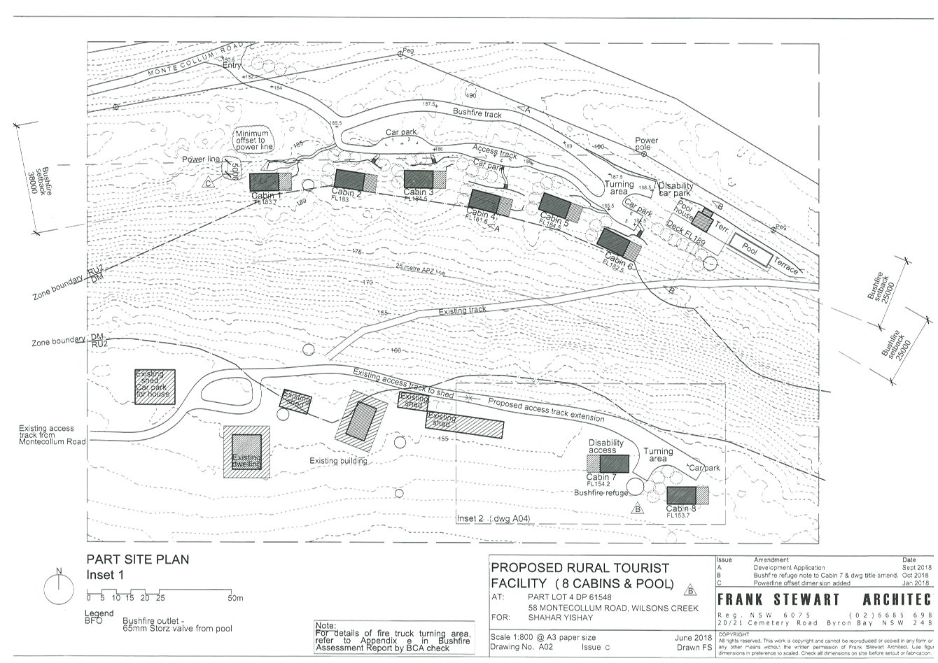
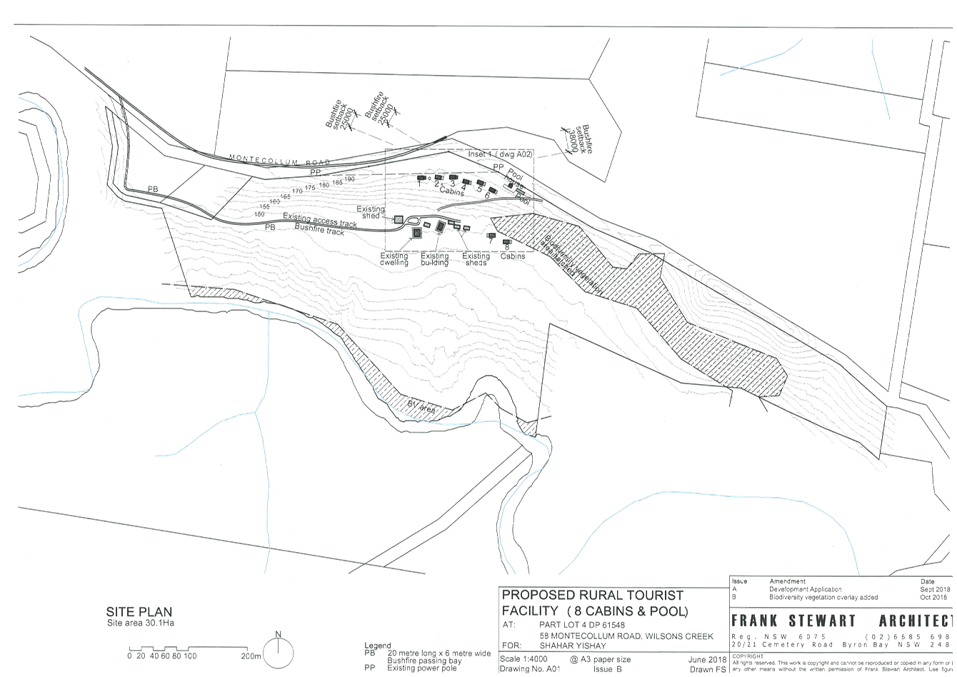
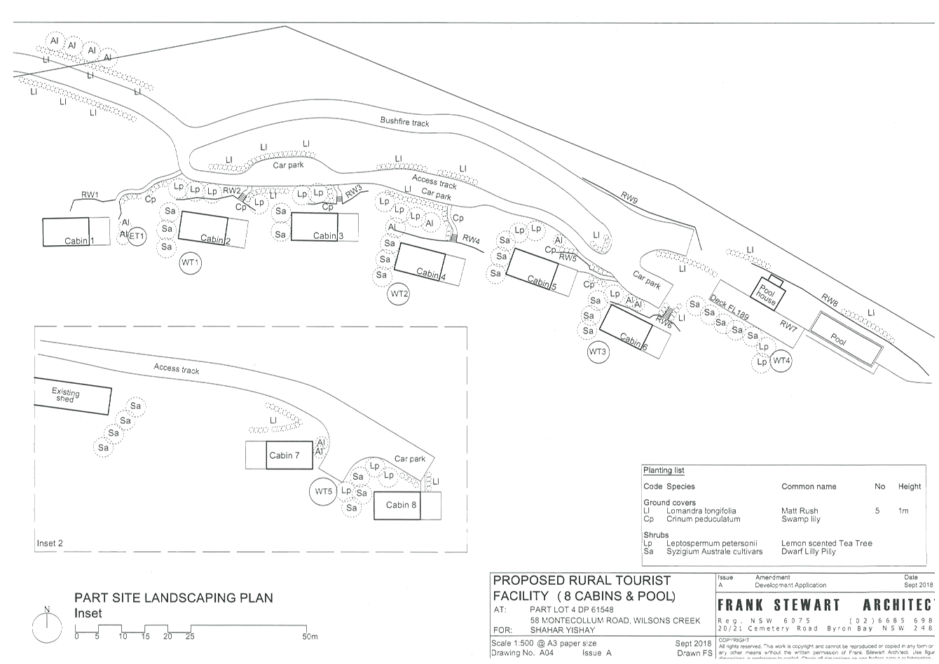
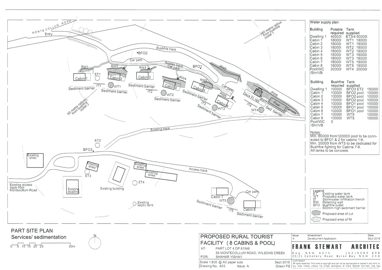
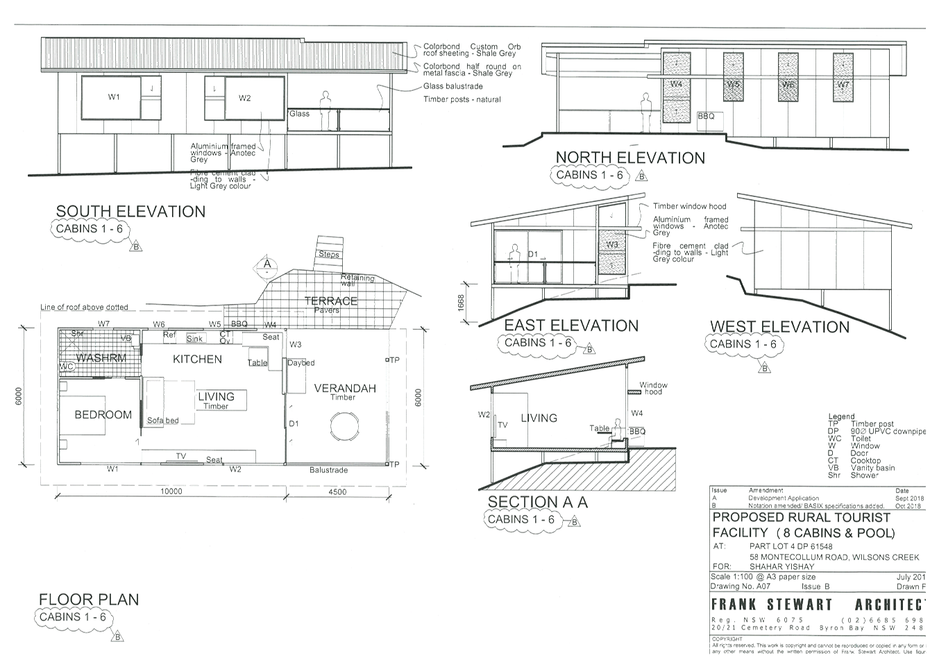
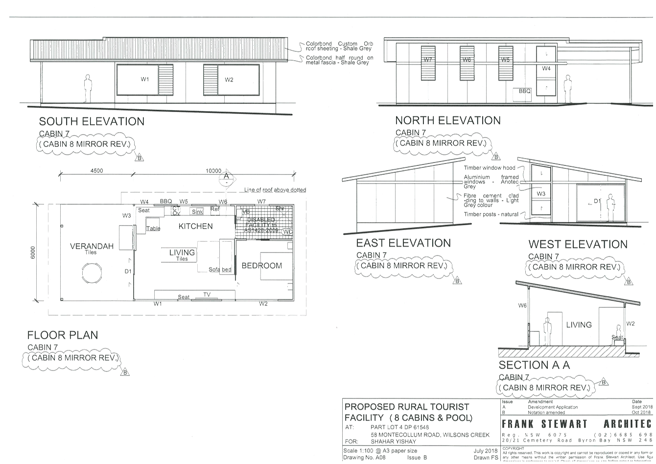
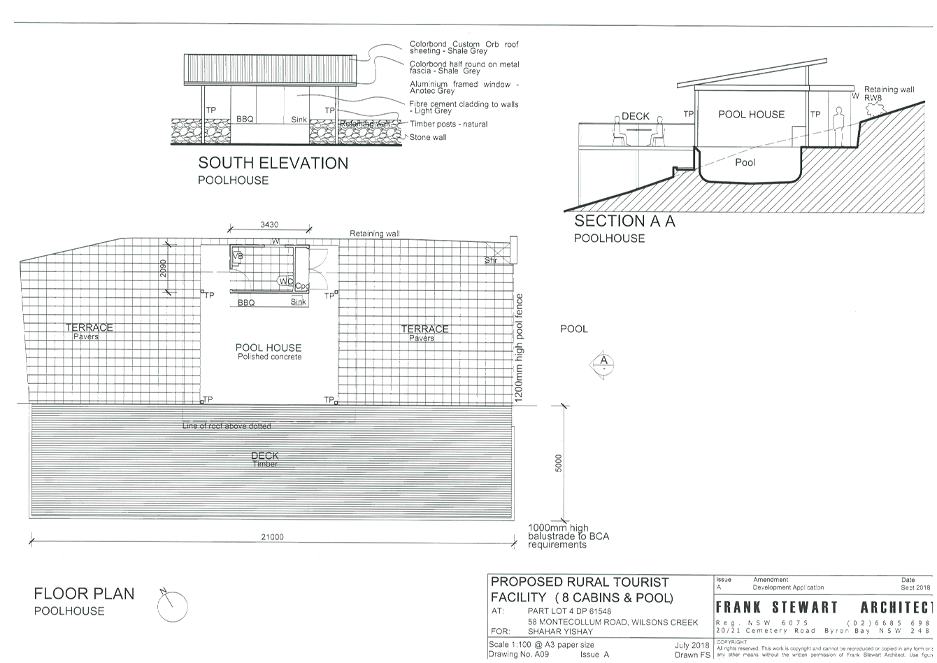
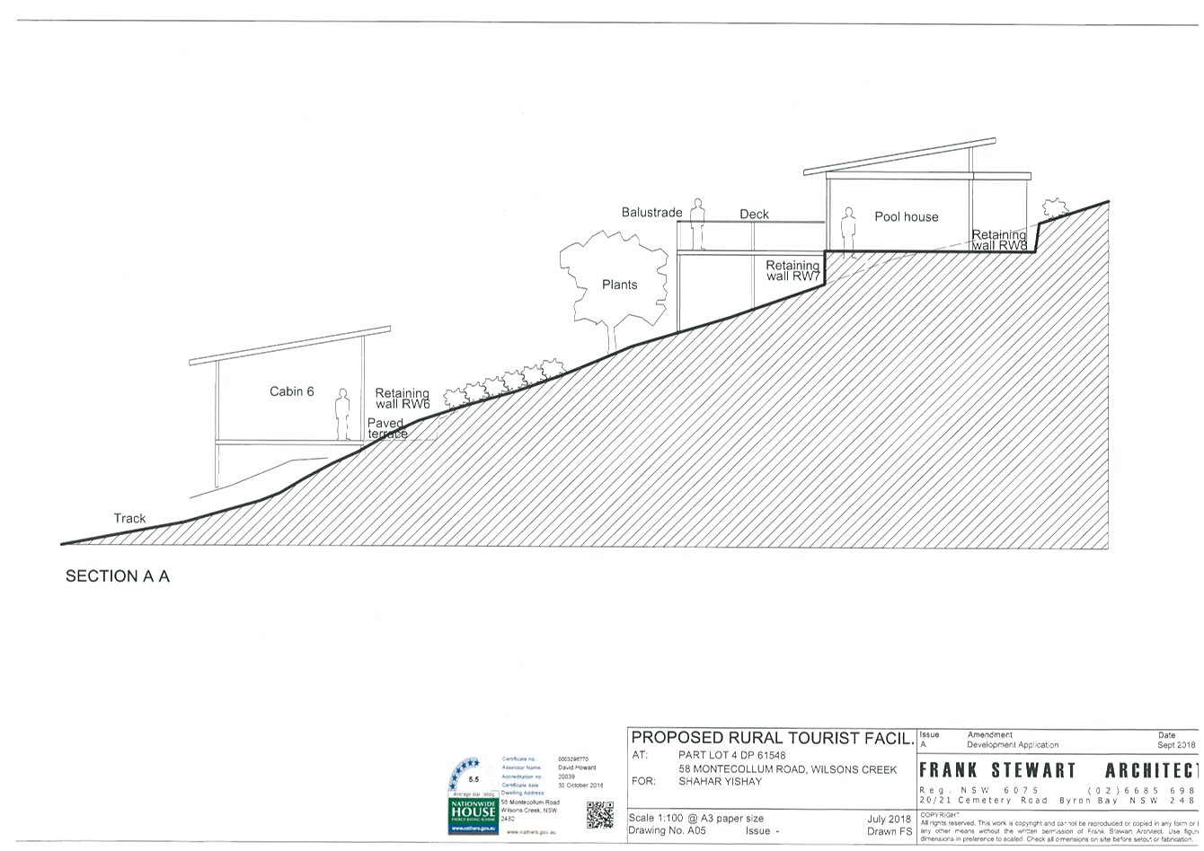
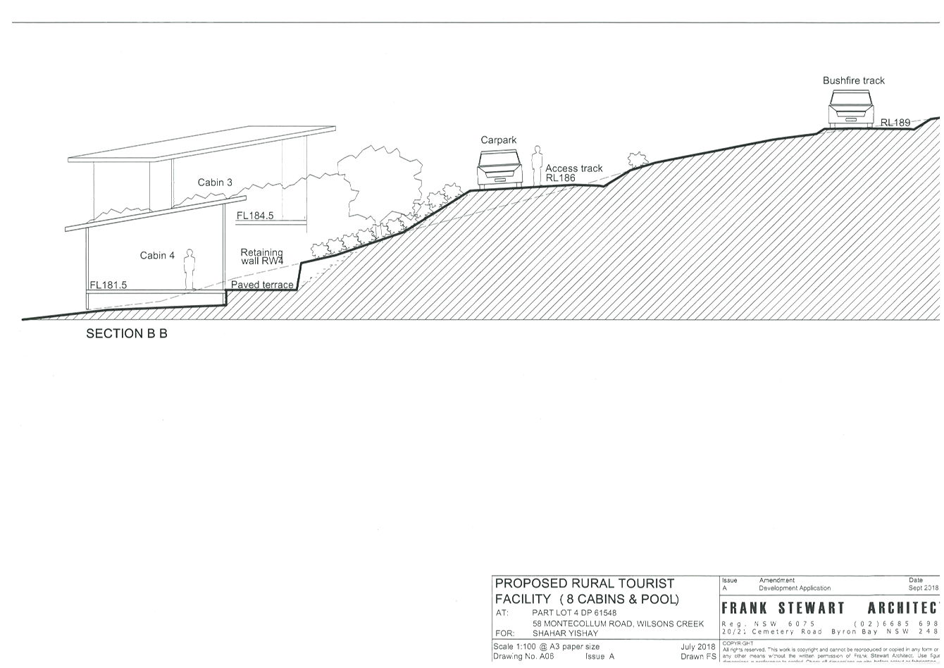
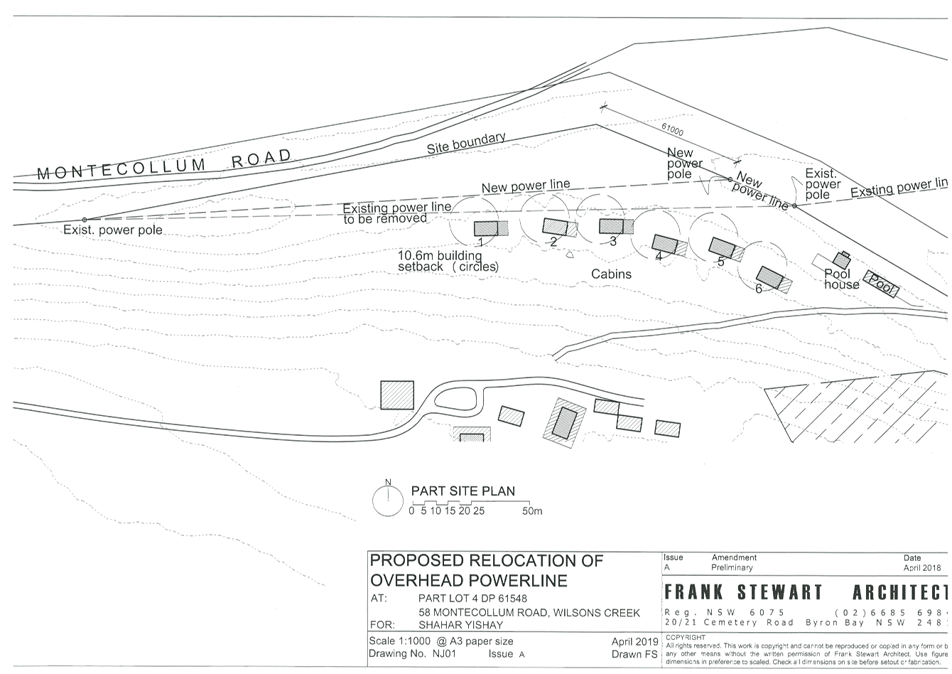
Staff Reports - Sustainable Environment and Economy 6.1 - Attachment 3
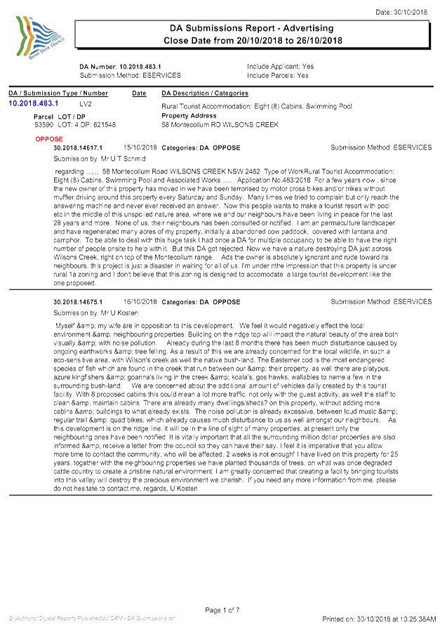
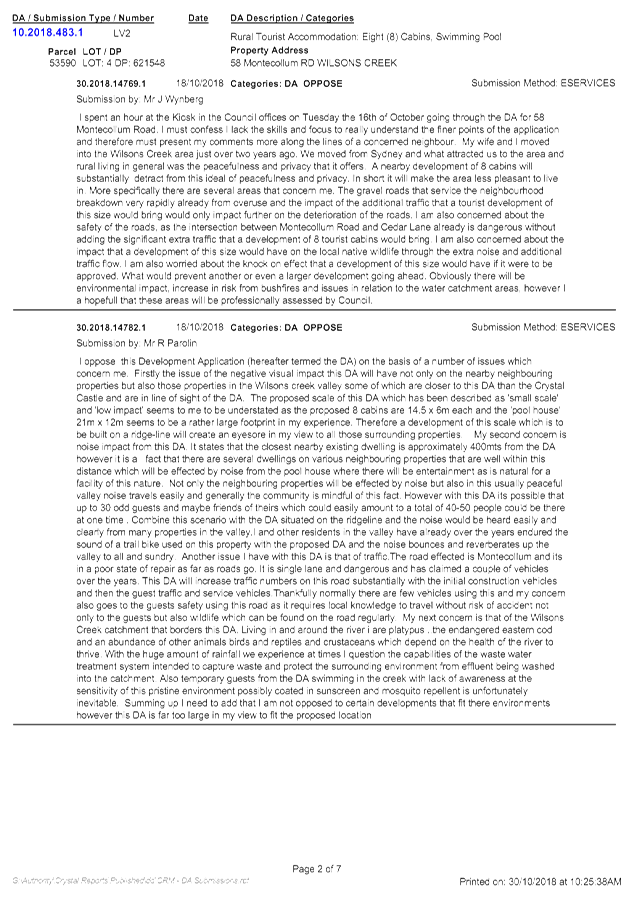
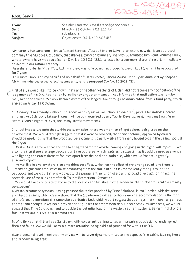
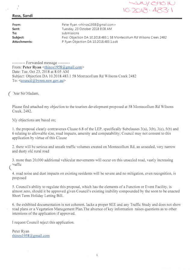
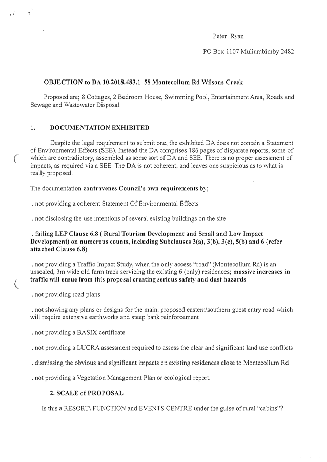
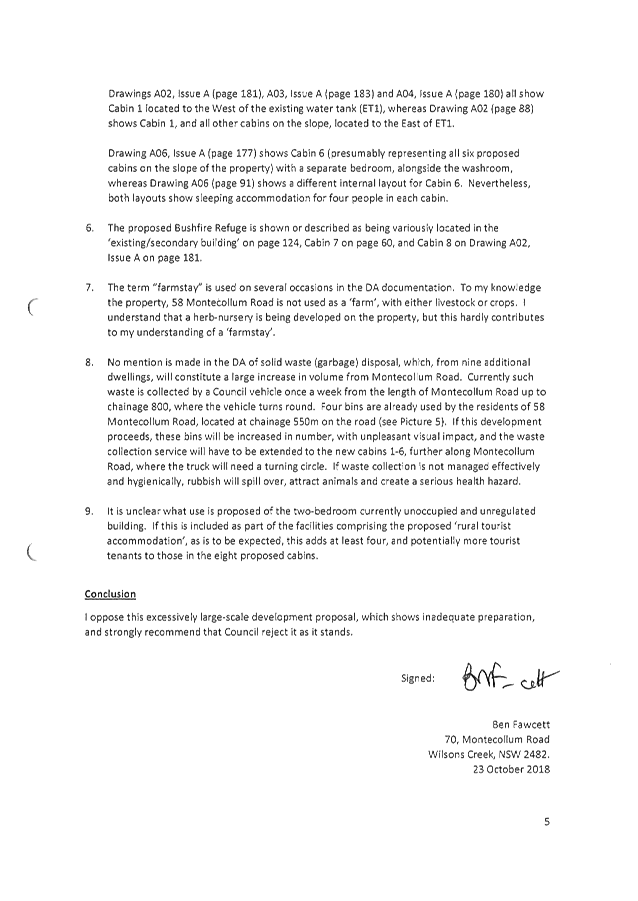
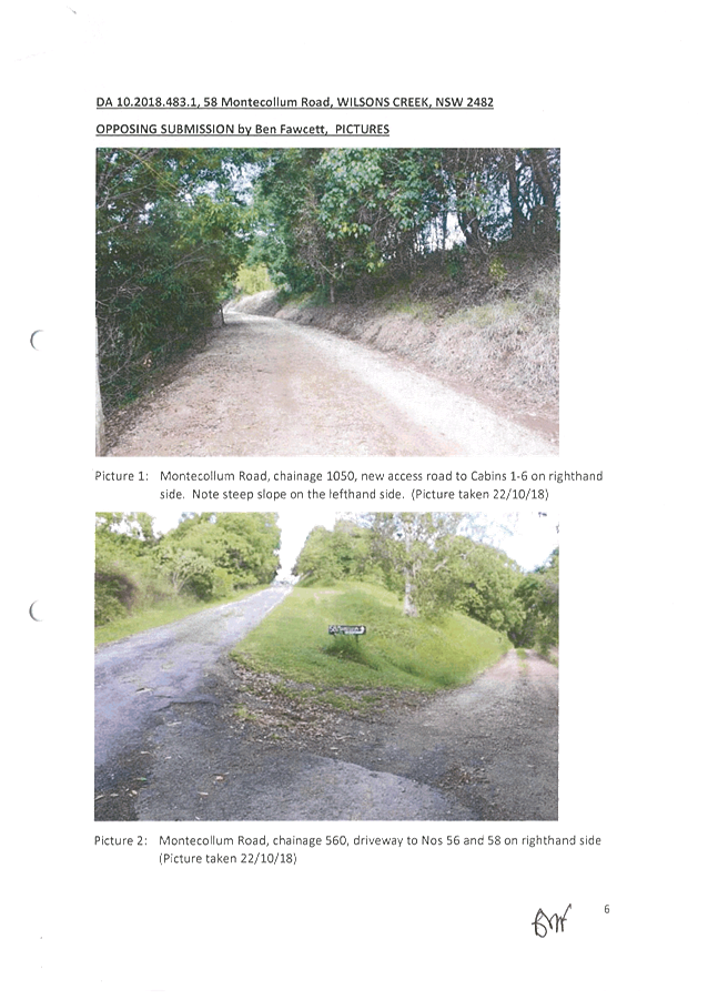
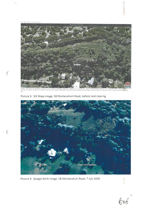
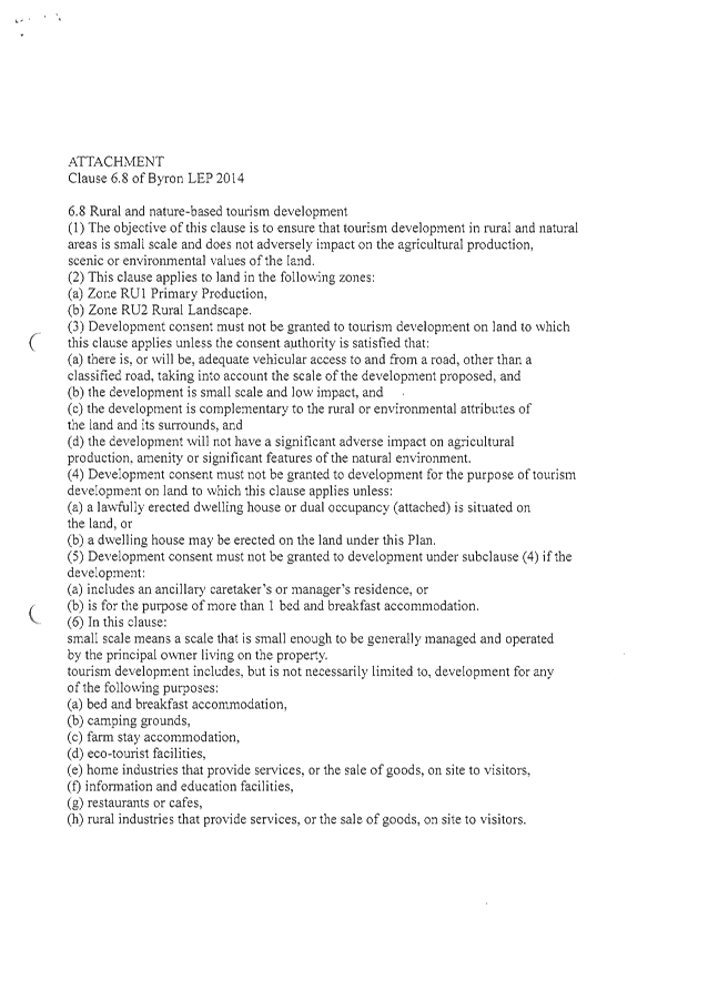

Staff Reports - Sustainable Environment and Economy 6.2
Report No. 6.2 PLANNING:
Submission to 'Discussion Paper - Local Character Overlays'
Directorate: Sustainable
Environment and Economy
Report
Author: Alex
Caras, Land Use Plannning Coordinator
Natalie Hancock, Senior Planner
File No: I2019/447
Summary:
On 28 February the Department of Planning and Environment (DPE) released
a Discussion Paper – Local Character
Overlays (Discussion Paper) for public comment. A copy of the Discussion
Paper may be accessed at: https://www.planning.nsw.gov.au/Policy-and-Legislation/Local-Character/Discussion-paper-local-character-overlays
. The period for feedback closes on 20 May 2019.
The Discussion Paper explores the introduction of an
optional Local Character Overlay within the Standard Instrument Local
Environmental Plan (SILEP).
Local character overlays are
intended as a new tool to help the community and Council recognise and
strengthen local character. The local character overlay would consist of a map
layer in the LEP identifying character areas and an associated clause within
the LEP which identifies the additional assessment requirements, or in
exceptional circumstances a local variation/exclusion from state-wide policy
(i.e. complying development).
The Discussion Paper states that
‘a local character overlay could effectively align the development
outcome to the strategic vision and plans that sit above the LEP. Early
consultation with community groups, as part of the preparation of the
Residential Strategy and Employment Lands Strategy, has indicated strong
interest in Council’s ability to strengthen this alignment. Also, to
assist in our discussions with the community staff have prepared an info sheet
to explain how Council is incorporating local residential character into
strategic planning, planning for places and development assessment (Attachment
1).
Staff
have undertaken an initial review of the Discussion Paper and are preparing
feedback generally in support of introducing Local Character Overlays within
the SILEP, however also highlighting the following matters of concern:
· Suitability of providing only 1 “standard”
optional overlay clause in the SI LEP
· Complying development excluded from application of local
character controls
· Onerous criteria and information requirements for
proposed local variations and exclusions
· Relationship to existing Heritage Conservation Area
assessment provisions remains unclear
A more
detailed submission on the above matters will be prepared by staff for
submission to the DPE by the 20 May closing date.
NOTE TO COUNCILLORS:
In accordance with the
provisions of S375A of the Local Government Act 1993, a Division is to be
called whenever a motion for a planning decision is put to the meeting, for the
purpose of recording voting on planning matters. Pursuant to clause 2(a)
under the heading Matters to be Included in Minutes of Council Meetings of
Council's adopted Code of Meeting Practice (as amended) a Division will be
deemed to have been called by the mover and seconder of all motions relating to
this report.
|
RECOMMENDATION:
That Council note the information in this report and
advise of any other issues to be included in a submission on the
‘Discussion Paper – Local Character Overlays’ to be
submitted to the Department by 20 May 2019.
|
Attachments:
1 Infosheet
- How Council is planning for local character, E2019/16908 , page 96⇩
REPORT
On 28 February the Department of Planning and Environment (DPE) released
a Discussion Paper – Local Character Overlays
(Discussion Paper) for public comment. A copy of the Discussion Paper
may be accessed at: https://www.planning.nsw.gov.au/Policy-and-Legislation/Local-Character/Discussion-paper-local-character-overlays
. The period for feedback closes on 20 May 2019.
The Discussion Paper explores the introduction of an
optional Local Character Overlay within the Standard Instrument Local
Environmental Plan (SILEP). This was initially flagged in a Local Character Planning Circular released by the DPE in
January 2018 to allow additional consideration of local character in areas of
significance.
Local character overlays are
intended as a new tool to help the community and Council recognise and
strengthen local character. The local character overlay would consist of a map
layer in the LEP identifying character areas and an associated clause within
the LEP which identifies the additional assessment requirements, or in
exceptional circumstances a local exclusion from state-wide policy (ie.
complying development). The Discussion Paper notes that a local character
overlay could have the following functions:
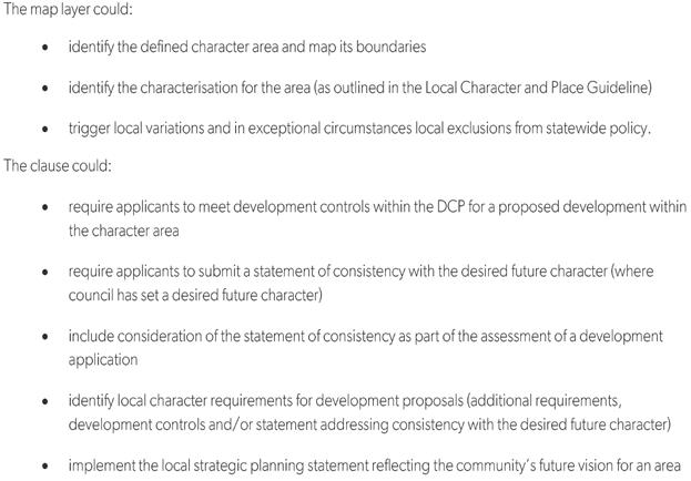
A character overlay is expected to
complement the Byron Shire LEP 2014 current Heritage Map layer which has a
distinct focus on heritage character and items. Council in conjunction
with the community may apply local character overlays to areas that do not have
heritage provision status, but non-the-less hold a distinct and valued
character. For example, the older parts of Brunswick Heads may be one possible
area to consider applying a character overlay.
Staff
have undertaken an initial review of the Discussion Paper and are preparing
feedback generally in support of introducing Local Character Overlays within
the SILEP. However there are also some key areas of concern and these are
briefly discussed below.
Key issues
Suitability
of providing only 1 “standard” optional overlay clause in the SI
LEP
Providing only 1 “standard” optional clause
in the SI LEP may not be suitable to apply across the State, or reflect key
differences between metropolitan and regional areas when it comes to planning
for character. It is considered that introducing more than one standard
optional clause could better accommodate these differences.
Complying
development excluded from application of local character controls
The Discussion Paper states local character controls
prepared for development assessment cannot apply to complying development under
relevant state-wide policy. However, in instances where there are key
attributes that strongly influence local character such as roof design, Council
could introduce a ‘local variation’ to the complying development
(subject to meeting proposed criteria, as discussed below).
In
circumstances where the character of the area warrants substantial variation to
complying development standards, beyond the scope of a local variation, Council
also may seek a ‘local exclusion’ from individual codes of the
state-wide policy to better manage the desired future character of those areas
(subject to meeting proposed criteria, as discussed below).
Excluding
complying development from application of local character controls (as the
starting point) is of significant concern as ‘complying
development’ can potentially have greater impacts on future residential
character than DA assessable development.
Onerous
criteria for proposed local variations and exclusions
The Discussion Paper contains draft criteria and
information requirements for any proposed local variations and/or exclusions
from state-wide policy (ie. complying development). However these are
considered very onerous and present significant resourcing challenges for this
council. Some of the more onerous information requirements include:
· Modelling of existing and proposed controls, shadows,
impacts on neighbours (where dealing with heights, setbacks, location of upper
level);
· Strategic basis within an adopted council policy,
supported by evidence;
· [Identifying] where within the local government area
councils will be encouraging complying development as the approval pathway, so
as to offset any reduction in complying development update because of a
proposed local character overlay.
The
Discussion Paper notes that if a request cannot address one or more criteria
(ie. by satisfying the relevant information requirements) then it would not
be considered for inclusion in the state-wide policy. Council’s
capacity to satisfy all criteria may not be possible without financial
assistance from the State government.
Relationship
to existing Heritage Conservation Area assessment provisions remains unclear
The Discussion Paper is silent on how the introduction of
character overlays would align with the current Byron LEP 2014 Heritage Map
layer and assessment requirements. While it may be assumed that mapped
character overlays are not intended to replace the Heritage Map layer, it is
nevertheless important that Council seeks clarity on the following:
§ the relationship between both overlays;
§ confirmation that the current assessment process for
Heritage Conservation Areas and their current exclusion from complying
development under the State Policy will remain in place.
A more
detailed submission on the above matters along with any other matters raised by
Council will be sent to the DPE by the 20 May closing date.
STRATEGIC CONSIDERATIONS
Community Strategic Plan and Operational Plan
Although feedback on this
Discussion Paper is not a specific action in the Operational Plan, it does
relate to the following components of the Community Strategic Plan (CSP)
framework:
|
CSP
Objective
|
CSP
Strategy
|
Delivery
Program Action
|
Operational
Plan Activity
|
|
Community Objective 4: We manage growth and change responsibly
|
4.1 – Support
the visions and aspirations of local communities through place-based planning
and management
|
-
|
-
|
Legal/Statutory/Policy Considerations
Detailed feedback on the Discussion
Paper will be informed by the relevant state, regional and/or local planning
framework and best practice planning principles.
Financial
Considerations
Administration costs to provide feedback will be met
within Council’s existing budget.
Consultation
and Engagement
The
Discussion Paper states that ‘a local character overlay could
effectively align the development outcome to the strategic visions and plans
that sit above the LEP. Early consultation with community groups, as part
of the preparation of the Residential Strategy and Employment Lands Strategy,
has indicated strong interest in Council’s ability to strengthen this
alignment.
Staff Reports - Sustainable Environment and Economy 6.2 - Attachment 1
How Council is planning for
local character
This explains how Council is incorporating
local residential character into strategic planning, planning for places and
development assessment.
What
is the draft Residential Strategy?
The
Byron Shire Residential Strategy (the Strategy) is one of Byron Shire Council’s
main growth management strategies. It is our policy framework and action
plan that guides residential development in our urban areas for at least the
next 20 years.
The Strategy
mainly relates to future housing in Bangalow, Brunswick Heads, Byron Bay,
Mullumbimby, New Brighton, Ocean Shores, South Golden Beach, Suffolk Park and
Sunrise.
This Strategy
includes residential character narratives for our towns and villages.
These narratives were developed with key community stakeholders and will be
open for comment to everyone, during the Strategy’s exhibition.
What is a Residential
Character Narrative?
A Residential
Character Narrative is a high level story about the past, for the future
– using a mix of facts, imagery and community words to tell the story of
connected events that have led to the pattern of development and what is
fundamentally ‘local’ about our residential areas. It
captures what makes one neighbourhood distinct from another in the way it
‘looks and feels’.
What is a ‘Local Character
Statement’?
A
Local Character Statement is part of a process to prepare detailed precinct
plans for areas that have been identified for substantial change, led by the
NSW Department of Planning and Environment.
Why do we need to plan for
character?
Our community sees character as a critical
element of our local areas and neighbourhoods and requires that it be carefully
considered in future planning for ongoing growth and change occurring in Byron
Shire.
Council’s role is to guide the management
of growth. This guidance is to be consistent with Council’s
Community Strategic Plan 2028 – Our Byron Our Future.
The State Government through the Environmental
Planning and Assessment Act 1997 requires that ‘local character’ be
considered at all levels of planning.
|
What
is the difference?
A residential character narrative serves a
different purpose to a local character statement and the following sets out
the differences.
|
|
A
Residential Character Narrative is:
|
|
A
Local Character Statement is:
|
|
· a
Council initiative as part of the Byron Shire Residential
Strategy to
help find a balance between respecting and enhancing the local character of
our urban areas and accommodating the community’s future housing in our
urban residential areas for the next 20 years.
· included
in the Residential Strategy. It is anticipated that 2,720 new homes
will be required in our urban areas to house our growing population. A key
policy of the Strategy is to transition to greater housing diversity, choice
and equity - the narratives articulate the desired local residential
character of each of our villages and towns (now and in the future) to help
with a smooth transition.
· a
high level story about
the past, for the future - using a mix of facts, imagery and community words
to tell the story of connected events that have led to the pattern of
development and what is fundamentally ‘local’ about our
residential areas.
· prepared
with local communities to articulate what is fundamentally
‘local’ about their residential areas and how best to guide a
change.
· to
inform more detailed design controls and will
eventually be translated into local residential design guidelines and
planning controls for inclusion in Council's Development Control Plan.
|
|
· a
NSW Government initiative under a Department of
Planning and Environment led planning process of designing for planned
precinct areas that have been identified for renewal and investment.
No precinct areas have been identified in Byron Shire by the State
Government.
Should
the State Government identify a precinct in the future for the Shire, it will
be developed in consultation with local communities.
· a detailed statement to provide a comprehensive
land use and implementation plan.
|
|
|
|
|
|
|
|
|
What is the process for
preparing Residential Character Narratives?
We are using a staged process to prepare the draft
narratives and supporting design controls.
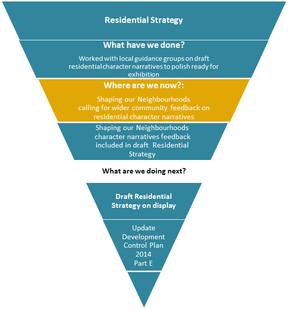
Note: Updating DCP 2014 Part E is an action in the
draft Residential Strategy.
When
commenced, this will involve further consultation with local communities and
other stakeholders
How are key messages on
character being conveyed in our planning documents?
Council
considers local character at all levels - from higher level strategic planning
documents such as the Community Strategic Plan, to more detailed place plans
such as the Bangalow Village Plan.
The
following provides a snapshot of how various council plans consider local
character:
|
Community Strategic Plan
2028 - Our Byron, Our Future
|
Endorsed in 2018
10-year vision
Aspiration mandatory document
setting high level community priorities and articulates community values with
a broader focus on achieving the long term social, environmental and economic
aspirations of the community
Community objectives:
• We have infrastructure, transport and services which meet
our expectations
• We cultivate and celebrate our diverse cultures,
lifestyle and sense of community
• We protect and enhance our natural environment
• We manage growth and change responsibly
• We have community led decision making which is open and
inclusive
|
|
Local Strategic Planning
Statement (LSPS)
|
Work yet to commence
20 year vision
LSPS are prescribed and
timetabled by the Department of Planning and Environment (DPE) for completion
in 2020.
It will link with the State
Government’s North Coast Regional Plan and Council’s Community
Strategic Plan and specify:
· special characteristics which contribute to local identity
· shared community values to be maintained or enhanced
· how growth and change will be managed into the future
|
|
Local growth management
strategies
20 year forward planning
|
Rural
Land Use Strategy - adopted 2018
· vision - 'sustainability for our rural communities, land
uses, natural resources and infrastructure through collective responsibility
for their protection, management and use.'
Residential
Strategy - draft for public comment
second half 2019
· includes local residential character
narratives
Employment
Lands Strategy - report to
council mid 2019 for endorsement
· includes future roles for business
centres
Guiding mandatory
documents setting out how to strategically balance between respecting and
enhancing the local character of an area and identifying and accommodating
the community’s future economic, housing, infrastructure and social
needs, as relevant to the Strategy.
|
|
Place Plans
10 year forward planning
|
Byron Bay Town
Centre Masterplan - complete and being
implemented
Bangalow Village
Plan - adopted February 2019
Our Mullumbimby
Master Plan - public exhibition pending
Byron Arts and
Industry Estate - 'enquiry by design' in April 2019
Place
plans are developed with Guidance Groups and the broader community. They
shape the future of our towns and villages by concentrating on the look and
feel of places, their form and character, rather than only focusing on
conventional categories of land use. They set a vision which recognises that
existing local character can be reflected and strengthened in planning for
the future.
|
|
Local Environmental Plan (LEP)
mandatory statutory
document
|
LEP aims and zone
objectives describe the broader characteristics of the Shire.
Principal development standards
(such as height and floor space ratio controls) can reflect character.
Overlays can provide for
additional consideration of local character in areas of significance.
|
|
Development Control Plan (DCP)
2014
in particular Part E
|
The
DCP includes more detailed guidance on implementing LEP controls relating to
the design of development and consideration of local character.
Locality
specific provisions will be updated in Part E to include design guidelines
that build on the residential character narratives, place planning and other
strategic planning work.
|
Staff Reports - Sustainable Environment and Economy 6.3
Report No. 6.3 PLANNING
- 10.2018.137.1 - Rural Land Sharing Community (Multiple Occupancy) consisting
of Fifteen (15) Dwelling Sites and Associated Works
Directorate: Sustainable
Environment and Economy
Report
Author: Dylan
Johnstone, Planner
Noreen Scott, EA Sustainable
Environment and Economy
File No: I2019/586
Proposal:
|
DA No:
|
10.2018.137.1
|
|
Proposal description:
|
Rural Land Sharing Community (Multiple Occupancy)
consisting of Fifteen (15) Dwelling Sites and Associated Works
|
|
Property description:
|
LOT: 22 DP: 1014053
|
|
149 Federal Drive EUREKA
|
|
Parcel No/s:
|
231770
|
|
Applicant:
|
Balanced Systems Planning Consultants
|
|
Owner:
|
EGS Investments Pty Ltd
|
|
Zoning:
|
RU1 Primary Production / PART RU2 Rural Landscape / PART
DM Deferred Matter (1(a) General Rural Zone / 1(b2) Agricultural Protection)
|
|
Date received:
|
4 April 2018
|
|
Integrated Development:
|
No
|
|
Public notification or exhibition:
|
- Level
2 advertising under DCP 2014 Part A14 – Public Notification and
Exhibition of Development Applications
- Exhibition
period: 26/4/18 to 9/5/18
- Submissions received:
Thirty-one (31)
|
|
Planning Review Committee:
|
09/08/18
|
|
Delegation to determination:
|
Council
|
|
Issues:
|
· Bushfire prone
land
· High
environmental value vegetation and its long term management
· Land use
conflict
· Visual Impact
|
Summary:
This application seeks development consent for a Rural Land
Sharing Community (Multiple Occupancy) consisting of Fifteen (15) Dwelling
Sites and Associated Works at 149 Federal Drive Eureka. The property is partly
zoned RU1 Primary Production, RU2 Rural Landscape, 1(a) General Rural and 1
(b2) Agricultural Protection under Byron LEP 2014 and LEP 1988, respectively.
The subject property has an area of 108.8 ha and contains an existing approved
dual occupancy (detached), and a number of farm buildings.
The fifteen dwelling sites are proposed in five clusters of
three. Dwelling cluster “A” incorporates the existing approved dual
occupancy (detached) and one new dwelling site. Clusters “B”
– “D” are proposed to be located in the western portion of
the site along a ridgeline that traverses the land. Dwelling clusters
“A” – “D” will be accessed by a new single
driveway to Federal Drive. Dwelling cluster “E” is located in the
south-eastern portion of the site and will be accessed by a second new driveway
to Federal Drive. Dwelling cluster “E” will be connected to the
other dwelling sites and communal areas via internal access tracks.
The proposal also includes environmental protection works to
restore areas identified by Council mapping as having high ecological value. A
Vegetation Management Plan was submitted with the application which involved
analysis of the environmental features and current ecological status of the
property. The report provides a 5-year ecological works schedule as well as
long-term actions by nominating environmental management zones (EMZs) and
associated monitoring and reporting procedures in accordance with Byron Shire
Council requirements.
The proposed development is consistent with the relevant
environmental planning instruments and planning controls applicable to the site
including the LEP and DCP provisions and relevant State Environmental Planning
Policies for this type of development.
It is considered the proposal raises no significant issues
which cannot be managed through reasonable and relevant conditions of approval,
and the site is considered suitable for the development. As such the
application is recommended for approval subject to conditions of consent.
NOTE TO COUNCILLORS:
In accordance with the
provisions of S375A of the Local Government Act 1993, a Division is to be
called whenever a motion for a planning decision is put to the meeting, for the
purpose of recording voting on planning matters. Pursuant to clause 2(a)
under the heading Matters to be Included in Minutes of Council Meetings of
Council's adopted Code of Meeting Practice (as amended) a Division will be
deemed to have been called by the mover and seconder of all motions relating to
this report.
|
RECOMMENDATION:
That pursuant
to Section 4.16 of the Environmental Planning & Assessment Act 1979,
development application, 10.2018.137.1 - Rural Land Sharing Community
(Multiple Occupancy) consisting of Fifteen (15) Dwelling Sites and Associated
Works be granted consent subject to conditions in Attachment 4 #E2019/29581.
|
Attachments:
1 Proposed
Plans, E2019/28736 , page 126⇩
2 Visual
Impact Assessment prepared by Balanced Systems amended July 2018, E2019/33179 , page 140⇩ 
3 submissions
received, E2019/28723 , page 212⇩ 
4 Conditions
of consent, E2019/29581 , page 302⇩
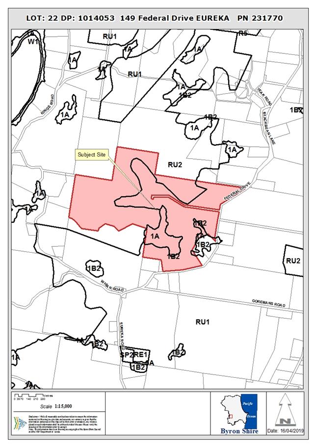
Assessment:
1. INTRODUCTION
1.1. History/Background
BA 86/0285 – Machinery Shed – approved 12/12/86
BA 86/2173 – Farm Shed – approved 07/05/86
BA 86/2207 – Dwelling additions – approved
22/05/86
BA 87/2219 – Amenities Building – approved
25/05/87
BA 86/0350 – Worker’s Cottage – approved
23/10/86
6.1994.2827.1 – Rural Shed – approved 21/12/94
10.2016.425.1 – Subdivision
to Create Two (2) Lots and Change of Use of Existing Dwelling House and Rural
Workers Dwelling to Dual Occupancy (Detached) – approved 31/07/17
1.2. Description
of the proposed development
This application seeks approval for Rural Land Sharing
Community (Multiple Occupancy) consisting of Fifteen (15) Dwelling Sites.
The dwelling sites are proposed in clusters of three:
· Cluster
“A” consists of an existing Dual Occupancy (detached) and one
proposed dwelling site.
· Clusters
“B”, “C” and “D” consist of three new
dwelling sites which extend westwards along a natural ridgeline
· Cluster
“E” consists of three new dwelling sites which are proposed to be
accessed via a new single access to Federal Drive.
The application also includes community garden / park areas
and proposes ecological repair and enhancement works and internal access works.
The subject site is a large
rural property that contains macadamia orchards, grazing grasslands, rural
living areas, a small native hoop pine plantation and native rainforest
vegetation at varying degrees of age, structure and diversity however most of
the native habitat contains significant infestations of environmental weeds.
The property contains some remnant patches of rainforest as a part of the
‘Allansby’ Big Scrub rainforest.
The application proposes to
undertake previously recommended work on the subject property to further
protect, connect and enhance the ‘Allansby’ remnant.
1.3. Description
of the site
|
Land is legally described as
|
LOT: 22 DP: 1014053
|
|
Property address is
|
149 Federal Drive EUREKA
|
|
Land is zoned:
|
RU1 Primary Production / PART RU2 Rural Landscape / PART
DM Deferred Matter
|
|
Land area is:
|
108.8 ha
|
|
Property is constrained by:
|
Bushfire prone land
High Conservation Value High Environmental Value
|
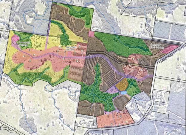
Plan Extract
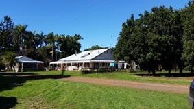
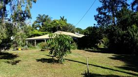
Existing dual occupancy dwelling on site “A1” Existing
dual occupancy dwelling on site “A2”
looking SE looking
SW
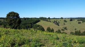
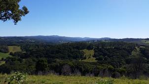
Dwelling site “B3”
looking South Dwelling
site “C2” looking North

Dwelling Cluster “D”
looking S Looking
West from dwelling site “E1”
2. SUMMARY OF
REFERRALS
|
Referral
|
Issue
|
|
Environmental Health Officer
|
No objections to the proposal subject to conditions.
|
|
Development Engineer
|
No objections to the proposal subject to conditions.
|
|
S94 / Contributions Officer
|
No objections to the proposal subject to conditions.
|
|
Ecologist
|
No objections to the proposal subject to conditions.
|
|
Rural Fire Service (4.14)
|
No objections to the proposal subject to conditions.
|
|
Department of Primary Industries – Office of Water
|
No objections to the proposal.
|
3. SECTION 79BA
– BUSH FIRE PRONE LAND
Under section 4.14 of the Act, Council must be satisfied
prior to making a determination for development on bush fire prone land, that
the development complies with the document Planning for Bush Fire Protection
2006. The site is bush fire prone land. The development application was referred
to the NSW Rural Fire Service, who provided conditions which are reflected in
the Recommendation of this Report below.
EFFECT OF 10/50 RULE ON SIGNIFICANT VEGETATION
The land is a designated 10/50 vegetation entitlement
clearing area however there is no significant vegetation to be impacted.
4. SECTION 79C
– MATTERS FOR CONSIDERATION – DISCUSSION OF ISSUES
Having regard to the matters for consideration detailed in
Section 79C(1) of the Environmental Planning & Assessment Act 1979
(EP&A Act), the following is a summary of the evaluation of the issues.
4.1 State Environmental
Planning Instruments
|
|
Satisfactory
|
Unsatisfactory
|
|
State
Environmental Planning Policy No 44—Koala Habitat Protection
|
☒
|
☐
|
|
Consideration: Two Koala records occur in the north-west
of the lot associated with Macadamia windbreaks. The windbreaks are not
considered as core koala habitat for the purposes of the SEPP and a KPOM is
not required.
|
|
State
Environmental Planning Policy No 55—Remediation of Land
|
☒
|
☐
|
|
Consideration: Preliminary Site Investigation SEPP55
– Contamination Assessment prepared by Balanced Systems Planning
Consultants dated January 2018 provides that soil sampling results were below
the Health Investigation Levels (HIL) in accordance with NEPM (2013) Table 1
A (1) Column A – ‘Standard’ Residential with
garden/accessible soil (home grown produce <10% fruit and vegetable intake
(no poultry). Reporting was conducted in accordance with relevant EPA
Guidelines for Consultants reporting on Contaminated Sites. The site is
considered to be suitable for the intended development.
|
|
State
Environmental Planning Policy (Rural Lands) 2008
|
☒
|
☐
|
|
Consideration: Clause 7 outlines the Rural Planning
Principles to be considered:
(a) the promotion and protection of opportunities
for current and potential productive and sustainable economic activities in
rural areas,
(b) recognition of the importance of rural lands
and agriculture and the changing nature of agriculture and of trends, demands
and issues in agriculture in the area, region or State,
(c) recognition of the significance of rural land
uses to the State and rural communities, including the social and economic
benefits of rural land use and development,
(d) in planning for rural lands, to balance the
social, economic and environmental interests of the community,
(e) the identification and protection of natural
resources, having regard to maintaining biodiversity, the protection of
native vegetation, the importance of water resources and avoiding constrained
land,
(f) the provision of opportunities for rural
lifestyle, settlement and housing that contribute to the social and economic
welfare of rural communities,
(g) the consideration of impacts on services and
infrastructure and appropriate location when providing for rural housing,
(h) ensuring consistency with any applicable
regional strategy of the Department of Planning or any applicable local
strategy endorsed by the Director-General.
The proposal is located on land containing a working
macadamia farm. The clusters of dwellings are proposed to be located so as
not to significantly impact on the existing productivity of the farm. A
recommended condition of consent will require a management plan detailing
practices to appropriately manage the potential impacts of pesticide use on
future dwelling sites.
The subject property includes areas identified on Council
GIS Mapping as state significant farmland while the remainder of the site is
identified as regionally significant farmland. An Agricultural
Assessment Report prepared by Balanced Systems dated July 2018 provides that
the development results in minimal impact to the agricultural prospects of
the property. A small area of macadamias will be permanently removed
with some smaller trees to be transplanted to another location of the site.
Whilst an existing de-husking facility on site will be decommissioned, with
de-husking and drying activities to occur offsite at other facilities in
Nashua and Dunoon to process the nuts.
An On-site Wastewater Management Land Capability
Assessment Report was submitted with the application and demonstrates that
wastewater generated by the proposed development can be adequately management
by the provision of on-site sewage management facilities. Existing
electricity infrastructure can reasonably be extended to service the
proposal.
The combination of uses of the site for a rural land
sharing community (multiple occupancy) and a working macadamia farm are
considered to be an appropriate use of land. It is considered that the
development is unlikely to have any adverse impacts on local ecological
values and that an improvement will occur in the longer term through
additional assisted regeneration of the site. The proposal is consistent with
Rural Land Use Strategy 1998 and 2017.
|
4.2A Byron Local Environmental Plan 2014 (LEP 2014)
LEP 2014 is an applicable matter for consideration in the
assessment of the subject development application in accordance with subsection
79C(1) of the EP&A Act because it applies to the subject land and the
proposed development. The following LEP 2014 clauses are of relevance to the
proposed development:
Land Use Table
In accordance with LEP 2014 clauses 1.4 and 2.1 – 2.3:
(a) The
proposed development is defined in the LEP 2014 Dictionary as Multiple
Occupancy
;
(b) The
land is within the RU1 Primary Production / PART RU2 Rural Landscape / PART DM
Deferred Matter (1(a) General Rural Zone / 1(b2) Agricultural Protection)
according to the Land Zoning Map (all proposed dwelling sites and community
areas are located within the RU1 and RU2 zones);
(c) The
proposed development is permitted with consent ; and
(d) Regard
is had for the Zone Objectives as follows:
RU1 – Primary Production
|
Zone Objective
|
Consideration
|
|
To encourage sustainable
primary industry production by maintaining and enhancing the natural resource
base
|
The proposed Rural Landsharing Community consisting of
additional dwelling sites, associated infrastructure, and ongoing management,
is consistent with the relevant zoning objectives.
The proposal is considered to enhance the site’s
natural resource base, especially ecological values, while also maintaining
the quality of the natural resources.
The primary production values of the property are a
central component of the proposal, with the existing macadamia orchards
providing an ongoing compatible rural industry and will be supported by
additional food growing pursuits on the site.
The impacts on agricultural values of the site will be
minimised and an integrated, sustainable land use of the site is proposed
with a variety of land uses.
The proposal will not have a significant impact on the
existing scenic value of the locality.
|
|
To encourage diversity
in primary industry enterprises and systems appropriate for the area
|
|
To minimise the
fragmentation and alienation of resource lands.
|
|
To minimise conflict
between land uses within this zone and land uses within adjoining zones
|
|
To encourage
consolidation of lots for the purposes of primary industry production
|
|
To enable the provision
of tourist accommodation, facilities and other small-scale rural tourism uses
associated with primary production and environmental conservation consistent
with the rural character of the locality
|
|
To protect significant
scenic landscapes and to minimise impacts on the scenic quality of the
locality
|
RU2 – Rural Landscape
|
Zone Objective
|
Consideration
|
|
To encourage sustainable
primary industry production by maintaining and enhancing the natural resource
base
|
The proposed Rural Landsharing
Community consisting of additional dwelling sites, associated
infrastructure, and ongoing
management, is consistent with the relevant zoning objectives.
The proposal is considered to
enhance the site’s natural resource base, especially ecological values,
while also maintaining the quality of the natural resources.
The primary production values
of the property are a central component of the proposal, with the existing
macadamia orchards providing an ongoing compatible rural industry and will be
supported by additional food growing pursuits on the site.
The impacts on agricultural values of the site will be
minimised and an integrated, sustainable land use of the site is proposed
with a variety of land uses.
The proposal will not have a significant impact on the
existing scenic value of the locality.
|
|
To maintain the rural
landscape character of the land
|
|
To provide for a range
of compatible land uses, including extensive agriculture.
|
|
To enable the provision
of tourist accommodation, facilities and other small-scale rural tourism uses
associated with primary production and environmental conservation consistent
with the rural character of the locality.
|
|
To protect significant
scenic landscapes and to minimise impacts on the scenic quality of the
locality.
|
Clause 4.2B Maximum number of dwelling houses or dual
occupancies on multiple occupancy or rural landsharing community developments
This clause requires that the maximum number of dwellings of
a multiple occupancy development complies with the number shown on the Multiple
Occupancy and Community Title Map. If no number is shown on this map (as is the
case with the subject site) there will
not be less than 3 dwellings, and not more than 1 dwelling for every 3
hectares, up to a maximum of 15 dwellings, on the lot. The lot has an area of
108.8 hectares therefore the proposed 15 dwelling sites is compliant with this
clause.
Clause 6.5 Drinking water catchments
All works associated with the proposed development provide a
suitable buffer to a watercourse on the land mapped as “Key Fish
Habitat” by DPI Fisheries. The application was formally referred to NSW
Office of Water who raised no objections. It is considered that a further
thirteen dwelling sites on the land will have a negligible impact given that
the land has contained a significant macadamia plantation for a number of
years.
Clause 6.6 Essential services
An On-site Wastewater Management Land Capability Assessment
Report was submitted with the application and demonstrates that wastewater
generated by the proposed development can be adequately management by the
provision of on-site sewage management facilities. Existing electricity infrastructure
can reasonably be extended to service the proposal.
Access for dwelling cluster “E” is proposed off
Federal drive. A common 4m seal on 6m pavement is proposed with a width of 6m
at Federal Drive. With a rural property type access. This is seen as an
acceptable solution due to the low volumes.
Access for dwelling clusters “A”-“D”
is proposed off Federal drive. A 4m seal on 6m pavement is proposed with a
width of 6m at Federal Drive. With a type BAR intersection. This is seen as an
acceptable solution.
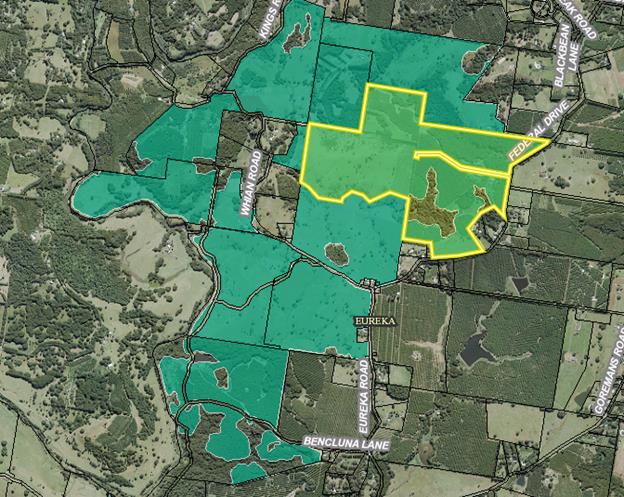
Subject Property (highlighted yellow) and surrounding
lands identified under Byron LEP 2014 for Multiple Occupancy
4.2B Byron Local Environmental Plan 1988 (LEP 1988)
The proposed multiple occupancy is located entirely on land
zoned RU1 And RU2 under LEP 2014 however proposed environmental restoration
works are located on land zoned 1(a) and 1(b2) under LEP 1988.
LEP 1988 is an applicable matter for consideration in the
assessment of the subject development application in accordance with subsection
4.15(1) of the EP&A Act because it applies to the subject land and the
proposed development. The following LEP 1988 clauses are of relevance to the
proposed development:
In accordance with LEP 1988 clauses 5, 8 and 9:
(a) The
proposed development is defined in the LEP 1988 Dictionary as Environmental
Facilities;
(b) The
land is within the 1 (a) General Rural Zone and 1(b2) Agricultural Protection
(b2) Zone according to the map under LEP 1988;
(c) The
proposed development is permitted with consent; and
(d) The
proposed development is consistent with the relevant objectives of the Zone for
the following reasons:
|
Zone Objective
|
Consideration
|
|
(a) to
encourage and permit a range of uses creating a pattern of settlement, at a
scale and character that maintains or enhances the natural, economic,
cultural, social and scenic amenity of the rural environment of the Shire of
Byron,
|
The application proposes
ecological repair and enhancement works. The subject site is a large rural
property that contains macadamia orchards, grazing grasslands, rural living
areas, a small native hoop pine plantation and native rainforest vegetation
at varying degrees of age, structure and diversity however most of the native
habitat contains significant infestations of environmental weeds. The
property does contain some remnant patches of rainforest as a part of the
‘Allansby’ Big Scrub rainforest which is to be protected and
enhanced.
Environmental repair and
enhancement works have the potential to protect and enhance flora & fauna
habitat, increase biodiversity, regional landscape connectivity, improved air
quality and water catchment health.
A Vegetation Management Plan was submitted with the
application which involved analysis of the environmental features and current
ecological status of the property. The report provides a 5-year ecological
works schedule as well as long-term actions by nominating environmental
management zones (EMZs) and associated monitoring and reporting procedures in
accordance with Byron Shire Council requirements.
The subject site is a large rural property that contains
macadamia orchards, grazing grasslands, rural living areas, a small native
hoop pine plantation and native rainforest vegetation at varying degrees of
age, structure and diversity however most of the native habitat contains
significant infestations of environmental weeds. The site has been largely
modified by large-scale clearing following settlement and the establishment
of agriculture in the late 1800s. The property does contain some remnant
patches of rainforest as a part of the ‘Allansby’ Big Scrub
rainforest of which an adjacent property has undergone bush regeneration
works in the recent past.
The VMP proposes to undertake previously recommended work
on the subject property to further protect, connect and enhance the
‘Allansby’ remnant. The site has potential to deliver an
important ecosystem to the Byron Shire including; flora & fauna habitat,
increased biodiversity, regional landscape connectivity, and water catchment
health. Environmental works are to be undertaken within designated
Environmental Management Zones (EMZs).
|
|
(b) to
encourage and permit a pattern of settlement which does not adversely affect
the quality of life of residents and visitors and maintains the rural
character,
|
|
(c) to ensure
development only occurs on land which is suitable for and economically
capable of that development and so as not to create conflicting uses,
|
|
(d) to allow
the use of land within the zone for agricultural purposes and for a range of
other appropriate purposes whilst avoiding conflict between other uses and
intensive agriculture,
|
|
(e) to identify
lands (shown hatched on the map) which in the opinion of the council possess
a limited capability for more intensive uses or development,
|
|
(f) to
restrict the establishment of inappropriate traffic generating uses along
main road frontages other than in road side service areas,
|
|
(g) to ensure
sound management of land which has an extractive or mining industry potential
and to ensure that development does not adversely affect the potential of any
existing or future extractive industry,
|
|
(h) to enable
the provision of rural tourist accommodation and facilities only where such
facilities are compatible with the form and density of the nature of the
locality, and
|
|
(i) to permit
the development of limited light industries which do not pose any adverse
environmental impact, (eg software manufacture and film processing), and
|
|
(j) to ensure
that the development and use of land shown cross-hatched on the map adjacent
to areas of significant vegetation and wildlife habitat do not result in any
degradation of that significant vegetation and wildlife habitat, and that any
development conserves and protects and enhances the value of the fauna and
flora.
|
Clause 52 Tree
Preservation
The application proposes to
remove only weed species such as Asparagus Fern, Lantana, Large Leaved Privet
and Camphor Laurel from areas identified by Council mapping as subtropical
rainforest.
4.3 Any proposed Instrument
that has been the subject of public consultation and has been notified to the
consent authority
Not applicable.
4.4A Byron Shire Development Control Plan 2014
(DCP 2014)
DCP 2014 is an applicable matter for consideration in the
assessment of the subject development application in accordance with subsection
4.15(1) of the EP& A Act because it applies to the land
to which LEP 2014 applies. The following DCP 2014 chapters
are of relevance to the proposed development:
B3 Services
The application has demonstrated that the site is suitable
for the proposed development including the provision of an onsite sewage
management system for each dwelling site. Electricity supply is already
available to the site and can reasonably be extended to service the proposal.
Each dwelling will require the provision of a 40,000L rainwater tank.
B6 Buffers and Minimising
Land Use Conflict
The proposed development is located within an agricultural
land use area. The area contains orchards and macadamias located both on
the subject property and on surrounding properties. De-husking and crop
spaying could potentially generate a land use conflict. The applicant submitted
a Land Use Conflict Risk Assessment (LUCRA). The LUCRA states:
The on-site macadamia
processing and de-husking facility poses the most significant risk to Dwelling
Cluster A, containing the two existing dwellings and the new dwelling, It
is proposed that this processing faciillity be closed and macadamia processing
is conducted off site so that living amenity is not compromised.
Dwelling Cluster E is
located in close proximity to a neighbouring macadmaia farm (<200m) on the
southern side of Federal Drive There are significant existing vegetation
buffers on both the northern and southern side of Federal Drive, adjacent to
the road reserve. It is recommended that these buffers be retained
and additional vegetation screening be implemented between the proposed house
sites and the southern boundary. This additional screening shall achieve the
minimum requirements for spray drift buffers as recommended by NSW DPI
guidelines. There are numerous rural dwellings located in similar
circumstances along Federal Drive.
The Vegetation Management Plan recommended for approval
includes a spray buffer to minimise any potential land use conflict between
dwelling cluster “E” and the existing macadamia orchard on the
adjacent property on the southern side of Federal Drive. Recommended conditions
of consent will require a detailed spray buffer landscape plan prior to issue
of a construction certificate and for planting to be completed prior to issue
of an occupation certificate. The vegetative spray buffer will need to comply
with the guidelines of NSW Agriculture and Planning Guidelines: Separating
Agricultural and Residential Land Uses published by the Department of
Natural Resources, Queensland. The vegetation will be required to be a minimum
30m width to provide a sufficient buffer.
A condition is recommended to ensure that the de-husking
facility located in close proximity to proposed dwelling cluster
“A” is decommissioned from use to further minimise any potential
land use conflict. Separation distances between the proposed dwelling sites and
existing de-husking facilities located on neighbouring sites meet the
recommended buffer distances contained in DCP 2014.
C3 Visually Prominent Sites, Visually Prominent
Development and View Sharing
A Visual Impact Statement was submitted including a photo
montage from a number of viewpoints surrounding the proposal illustrating the
impacts of superimposed future dwellings on the existing landscape. These
viewpoints were taken from a location on Whian Rd to the south and Kings Rd to
the west (see below).
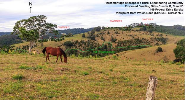
Photo montage of proposal viewed from Whian Rd to the
South (Balanced Systems Planning Consultants)
. 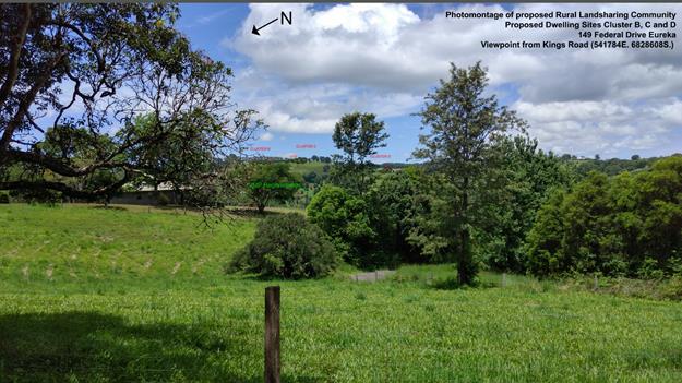
Photo montage of proposal viewed from Kings Rd to the
West (Balanced Systems Planning Consultants)
A ridgeline traverses the site (approximately 150m AHD at
its highest point). Proposed dwelling clusters “B”, “C”
and “D” are located below the highest point of this ridgeline so
that they do not dominate the skyline. The VIA has also proposed screen
plantings to soften the visual impact of these dwelling sites. A recommended
condition of consent ensuring these screen plantings are established prior to
issue of the relevant occupation certificate for these dwellings is attached to
this report.
It is considered that dwelling clusters “A” and
“E” will have a negligible visual impact on the existing landscape.
D2.2.1 Location and Siting of Residential
Accommodation and other Buildings
The proposal is consistent with the relevant Aims, Guiding
Principles, Best Practice Guidelines and Performance Standards contained in the
Byron Rural Settlement Strategy 1998. This is reflected by the LEP 2014 Multiple
Occupancy and Community Title map.
D2.2.3 Character and Visual Impact
The submitted Visual Impact Statement has demonstrated that
the proposal will integrate with the existing landscape and rural character of
the locality. The restoration of rainforest on the site outlined within the VMP
further integrates the proposal with the ecology and natural areas of the site.
D2.6 Multiple Occupancy Development
Objectives
1. To reflect the objectives and provisions of Byron LEP
2014 relating to Multiple Occupancy Development.
2. To enable:
a) people to collectively own a single property and use
it as their principal place of residence, and
b) the erection of multiple dwellings on the lot and the
sharing of facilities and resources, and
c) the collective environmental repair and management of
the lot, and
d) the pooling of resources to economically develop a
wide range of communal rural living opportunities.
3. To facilitate closer rural settlement in a clustered
style in a manner that:
a) protects the environment, and
b) does not create an unreasonable demand for the
provision of services or a demand for the uneconomic provision of services, and
c) does not involve subdivision under Community Title,
Torrens Title or Strata Title, or any other form of separate land title, and
d) to implement the aims, guiding principles, guidelines
and performance standards for rural settlement in the Byron Rural Settlement
Strategy 1998, available from the office of the council.
The development proposed by this application achieves these
objectives by siting the proposed new dwelling sites in a clustered format that
does not require the removal of native vegetation and proposes to protect
significant existing ecological values on the site. The site proposes a number
of community parks and food garden areas along with a VMP to form a collective
of environmental repair and management of the lot.
The proposed dwelling sites are clustered (five clusters of
three dwellings) and located so as to facilitate social interaction between
residents, limit the extent of infrastructure (access roads and services)
required to service the development and minimising environmental impacts.
Dwellings within each of the proposed clusters comply with the separation
requirements of DCP 2014.
Dwelling houses are proposed to be appropriately located in
terms of topography, drainage lines, existing vegetation, access and natural
hazards such as bushfire and flooding.
Works carried out in accordance with the submitted VMP will
have a positive impact on the environment through environmental repair and
enhancement. An outline for a rural landsharing management plan was submitted
with the application but needs to be completed as per a condition of consent.
The plan will set out the ongoing management of the land by the various
landowners including rights and responsibilities, dispute resolution and
collective use of resources. This is discussed in further detail below.
1. Siting
and Clustering of House Sites
The proposed clustering of dwelling sites (five clusters of
three dwellings) is considered appropriate as any additional dwelling sites
within clusters “A” and “E” would impact upon
vegetation mapped by Council as having high ecological value. The steep
topography surrounding clusters “C” and “D” does not
permit any appropriate dwelling sites additional to the three proposed for
each. Also the proposed clustering arrangement minimises the impacts on the
existing macadamia orchard located on the land. The application included a
“Developable Land” map (shown below) that illustrates those areas
of the site that are suitable for development. Proposed dwelling sites have
been demonstrated to have a minimal visual impact on the surrounding locality.
Social interaction between each of the dwelling clusters is
facilitated through community access, community activity areas and the
management of habitat, macadamia orchard and woodlot areas throughout the site.
Dwelling clusters are appropriately located so that the length of internal
access roads and the length of extensions to existing electricity
infrastructure are minimised.
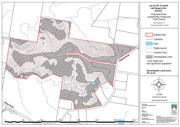
Developable Land Map (Balanced Systems
Planning Consultants)
2. Environmental
Impact Assessment Report
A concept plan and land capability and suitability report
was submitted with the application and identifies that the proposal has been
appropriately designed with consideration for bushfire hazards, flooding,
slopes greater than 20%, prime agricultural land, high conservation value
vegetation and habitats, areas identified for environmental repair and
restoration, watercourses, visual impact, land slip areas, land use conflict,
contaminated land and internal access roads.
Federal village is located approximately 3km away and
provides a local preschool, shop, recreation facilities and other amenities.
The Eureka Hall is located approximately 0.5km away and the Eureka Recreation
Ground is some 1.2 kilometres away. The site is well located with good access
to other centres in the shire, including local facilities at Clunes Village and
Bangalow Village, as well as regional facilities at Mullumbimby and Lismore.
The local school bus service utilises the adjoining Federal
Drive thus providing convenient access for residents of the proposed dwellings.
3. Rural
Landsharing Management Plan
The Rural Landsharing Management Plan (RLMP) provides the
internal management provisions for the community to collectively manage and
make decisions regarding the on-going management of the community and site.
The
final Rural Landsharing Management Plan will incorporate all of the management
areas on the site, as depicted within Illustration 6 – Management Zones.
These areas include:
· Rural Living – containing dwelling clusters and
dwelling sites
· Habitat – areas subject to the VMP and other
protected areas designated for habitat
· Grazing – grassland management areas that can be used
for grazing
· Macadamia Orchard – areas where the macadamia
orchards will be managed
· Woodlot – proposed woodlot areas which can be used
for to grow trees
· Community/Access/Infrastructure – shared areas used
for services including designated community areas.
Most of the land of the proposed Rural Landsharing Community
remains as shared areas, with only the Rural Living management areas designated
as privately managed by the residents.
All community management areas will be collectively managed
by means of an internal management plan, for example the Vegetation Management
Plan provides an allocation of time and resources for ecological works within
these habitat areas.
The theme is to combine social values (community members),
environmental (enhanced habitat) values and agricultural values (operational
farm) of the property in a sustainable manner while providing appropriate
housing and amenities and ongoing primary production use of the site. The goal
is to provide an integrated mix of land uses that implements best practice
management to each of the components.
The overall objectives of the Multiple Occupancy Community
are:
· to enable the
intentional incoming residents to occupy the site to generate an interactive,
social community;
· enhance the
site’s substantial ecological values;
· provide a
sustainable agricultural operation; and
· create community
space and generate new values on the site
The RLMP will make provision for social cohesion,
development of community, cooperation and sharing, development of rural living
opportunities, the construction of buildings, the use of land, and any economic
or business development on the land with a dwelling on each Home Improvement
Area (HIA) and agricultural, recreational, bushfire protection and
environmental enhancement activities on the common land.
The founding members currently own the property with
collective ownership to be established following formation of the community.
The individual’s entitlements are to be allocated by means of the
‘deed of agreement’. The deed contains the necessary mechanisms for
effective ongoing management of the property. The individual’s
entitlements will stipulate rights and responsibilities for community members.
Shareholders of the community make decisions in accordance
with the internal legal management structure (the deed). Decision making is
based on the protocols within the deed. The deed provides for mediation
processes where issues need resolution and also the procedure for the disposal
of a share. The deed provides for mediation and dispute resolution processes
where issues need resolution. The mediation and dispute resolution provisions
are established and proven mechanisms utilised successfully by other
communities.
The internal legal management structure stipulates approved
behaviour based on a system of ‘rights’ and
‘responsibilities’ of members and visitors within the three land
management zones – rural living (‘private’ home improvement
areas) and primary production and environmental enhancement zones (community
land). This approach to the structure of the internal management system allows
all the ‘issues’ to be addressed within this framework.
The final Rural Landsharing Management Plan will be prepared
as per conditions of consent. The plan will also include provisions restricting
the keeping of cats and dogs, management of the Macadamia Plantation and
internal land use conflicts, bushfire requirements limitations on white and
reflective cladding and roofing, and minimum tank sizes for domestic water
supply.
4. Access
Roads
A 4m seal on 6m pavement is proposed with a width of 6m for
each of the proposed accesses from Federal Drive.
The proposed internal access to dwelling clusters
“A” – “D” has a maximum grade of 20%. This will
be required to be bitumen/concrete sealed in accordance with recommended
conditions of consent. The proposed internal access road to dwelling cluster
“E” has a maximum grade of 12% which does not require
bitumen/concrete seal. All internal access roads are required to be constructed
of an all-weather surface in accordance with recommended conditions of consent.
Drainage works are proposed to direct natural courses underneath the proposed road
way in culverts, the size of which range from 450mm diameter to 600mm diameter.
This will allow the water course to flow on its natural path with minimal
disturbance.
The land is bushfire prone and was referred to RFS for
comment. RFS have supplied recommended conditions of consent including the
requirement for access roads to be constructed in accordance with Section
4.1.3(2) of Planning for Bushfire 2006 which is reflected in the recommended
conditions of consent attached to this report.
5. Bushfire
Management
The application included a bushfire assessment report
prepared by a BPAD accredited bushfire consultant. The application was referred
to NSW RFS for comment in accordance with section 4.14 of the EP&A Act.
Appropriate conditions of consent are recommended to minimise the potential
impacts of bushfire and are attached to this report.
6. Vegetation
Management Plan
A Vegetation Management Plan (VMP) was submitted with the
application which involved analysis of the environmental features and current
ecological status of the property. The report provides a 5-year ecological
works schedule as well as long-term actions by nominating environmental
management zones (EMZs) and associated monitoring and reporting procedures in
accordance with Byron Shire Council requirements.
The subject site is a large rural property that contains
macadamia orchards, grazing grasslands, rural living areas, a small native hoop
pine plantation and native rainforest vegetation at varying degrees of age,
structure and diversity however most of the native habitat contains significant
infestations of environmental weeds.
The site has been largely modified by large-scale clearing
following settlement and the establishment of agriculture in the late 1800s.
The property does contain some remnant patches of rainforest as a part of the
‘Allansby’ Big Scrub rainforest of which an adjacent property has undergone
bush regeneration works in the recent past.
The VMP proposes to undertake previously recommended work on
the subject property to further protect, connect and enhance the
‘Allansby’ remnant. The site has potential to deliver an important
ecosystem to the Byron Shire including; flora & fauna habitat, increased
biodiversity, regional landscape connectivity, and water catchment health.
Environmental works are to be undertaken within designated Environmental
Management Zones (EMZs).
7. Water
Management Plan
For domestic water supply, each
of the dwelling sites will install a roof water harvesting and storage system
at the time when the dwellings are constructed. BASIX requirements requires
water efficient devices to be installed throughout the dwellings. A minimum
storage of 40,000 litres is required for domestic purposes. The actual
storage usage will reflect the different household sizes with larger dwellings
with more occupants having larger roof areas and larger storage tanks. Each
dwelling will have a minimum dedicated bushfire water storage supply of 10,000 litres
for firefighting purposes. Conditions of consent to apply.
All of the dwelling sites are
located away from drainage lines and water courses to protect these important
areas. No dam is proposed or required although there is an existing dam on the
site.
No component of the proposal is
seeking to extract groundwater or is likely to impact on groundwater values. The
application was referred to the Natural Resources Access Regulator who advised
that the proposal does not require any approvals under the Water Management Act
2000.
8. Effluent
Disposal
The application has demonstrated that all proposed dwelling
sites can be provided with on-site sewage management services to suitably
dispose of effluent.
4.4B Byron Shire Development Control Plan 2010 (DCP 2010)
The proposed multiple occupancy is located entirely on land
zoned RU1 and RU2 under LEP 2014 however proposed environmental restoration
works are located on land zoned 1(a) and 1(b2) under LEP 1988 and are
therefore subject to DCP 2010.
Chapter 1 Part C Residential Development
C12 Multiple Occupancy of Rural Land
A Vegetation Management Plan was submitted with the
application which involved analysis of the environmental features and current
ecological status of the property. The report provides a 5-year ecological
works schedule as well as long-term actions by nominating environmental
management zones (EMZs) and associated monitoring and reporting procedures in
accordance with Byron Shire Council requirements. THE VM is considered
acceptable for the proposed development.
4.5 Any Planning Agreement or
Draft Planning Agreement?
|
|
Yes
|
No
|
|
Is there any applicable planning agreement or draft
planning agreement?
|
☐
|
☒
|
|
|
4.6 Environmental Planning
& Assessment Regulation 2000 Considerations
|
Clause
|
This
control is applicable to the proposal:
|
I
have considered this control as it relates to the proposal:
|
If
this control is applicable, does the proposal comply?
|
|
92
|
No
|
N/A
|
N/A
|
|
93
|
No
|
N/A
|
N/A
|
|
94
|
No
|
N/A
|
N/A
|
|
94A
|
No
|
N/A
|
N/A
|
* Non-compliances and any other significant issues
discussed below
4.7 Any coastal zone management
plan?
|
|
Satisfactory
|
Unsatisfactory
|
Not applicable
|
|
Is there any applicable coastal zone management plan?
|
☐
|
☐
|
☒
|
|
|
4.8 The likely impacts of that
development, including environmental impacts on both the natural and built
environments, and social and economic impacts in the locality
|
Impact on:
|
Likely significant impact/s?
|
|
Natural environment
|
No. The proposal will not have a significantly adverse
impact on the natural environment of the locality.
|
|
Built environment
|
No. The proposal will not have a significantly adverse
impact on the built environment of the locality.
|
|
Social Environment
|
No. The proposal will not have a significant social impact
on the locality.
|
|
Economic impact
|
No. The proposal will not have a significant economic
impact on the locality.
|
Are there any Council Policies that are applicable to the
proposed development?
|
Council Policy
|
Consideration
|
|
Development Policy
|
The proposal has been demonstrated to comply with the
relevant legislation, environmental planning instruments, development control
plans and is considered to be in the public interest.
|
|
Management of Contaminated Land Policy
|
The application has demonstrated that the site is suitable
for the proposed use in accordance with SEPP55 and this policy.
|
|
Provision of Driveways Policy
|
The existing and proposed driveways are required to be
constructed and maintained in accordance with this policy and conditions
attached to this report.
|
|
Local Approvals Policy
|
An On-site Wastewater Management Land Capability
Assessment Report was submitted with the application and demonstrates that
wastewater generated by the proposed development can be adequately management
by the provision of on-site sewage management facilities.
|
4.9 The suitability of the site
for the development
The site is a serviced, unconstrained property and is
suitable for the proposed development.
4.10 Submissions made in accordance with
this Act or the regulations
The development application was publicly exhibited. There
were 31 submissions made on the development application including 23
objections and 8 submissions in support of the application. Issues raised
within submissions are identified below including the number of submissions
that raised the same issue.
|
Issue - Objections
|
Comment
|
|
Proposed development site not appropriate for multiple
occupancy development
|
The site is identified on the LEP 2014 Multiple Occupancy
(MO) and Community Title Map as being permitted for Multiple Occupancy use.
The property was originally identified for an MO under the Byron Rural Settlement
Strategy 1998.
|
|
Proposal is inconsistent with objectives of land zoned RU1
and RU2
|
This report has identified that the proposal is consistent
with the objectives of the RU1 and RU2 zones as it maintains the existing
agricultural potential of the land while enhancing the ecological values of
the site, it does not result in fragmentation of resource lands, minimises
any potential land use conflict, minimises impacts on the scenic quality of
the locality and maintains the rural character of the land.
|
|
No rural land management plan has been submitted but
rather a deed of agreement
|
Noted – Conditions of consent recommended requiring
the management plan to be prepared and submitted to Council for approval
|
|
Visual impact
|
A Visual Impact Statement was submitted including a photo
montage from a number of viewpoints surrounding the proposal illustrating the
impacts of superimposed future dwellings on the existing landscape. These
viewpoints were taken from a location on Whian Rd to the south and Kings Rd
to the west.
A ridgeline traverses the site (approximately 150m AHD at
its highest point). Proposed dwelling clusters “B”,
“C” and “D” are located below the highest point of
this ridgeline so that they do not dominate the skyline. The VIA has also
proposed screen plantings to soften the visual impact of these dwelling
sites. A recommended condition of consent ensuring these screen plantings are
established prior to issue of an Occupation Certificate for each of the
future dwellings is attached to this report, combined with restriction on
reflective or white roof and cladding materials.
It is considered that dwelling clusters “A”
and “E” will have a negligible visual impact on the existing
landscape.
|
|
Road safety / traffic impact on local roads
|
Council staff are satisfied that Federal Drive is of a
sufficient standard to accommodate the extra traffic generated by the
proposal without the need for road upgrades.
|
|
Noise impact
|
The submitted Land Use Conflict Risk Assessment
demonstrates that the proposal will not create any significant land use
conflict including any additional noise generated by the development.
|
|
Scale of the proposal is out of character with the land
|
The subject site has an area of approximately 108
hectares. The property has been identified for a Multiple Occupancy for two
decades by various Council planning schemes. The development has been
designed to minimise visual impact and land use conflict and is considered to
be consistent with the existing rural character of the land.
|
|
No community consultation prior to lodgement.
|
While community consultation prior to lodgement is ideal
it is not a legislative planning requirement. Notwithstanding, the
Byron Rural Settlement Strategy 1998, amendments to Byron LEP 1988 and the
Byron LEP 2014 were all exhibited which identified this property and many
others in the Eureka Locality for Multiple occupancy.
|
|
Proposal is inconsistent with the Byron Shire Rural Land
Use Strategy 2017 and has not been identified as a priority MO site.
|
The LEP 2014 Multiple Occupancy and Community Title Map
identifies appropriate multiple occupancy sites in accordance with site
suitability requirements identified in the Byron Rural Settlement Strategy
1998. The 2017 Rural Land Use Strategy identifies priority sites for future
Multiple Occupancy that is not currently identified by LEP 2014 mapping.
|
|
DA proponents will not reside at the site
|
It is not a planning requirement for developers to reside
at the site.
|
|
The land has become invaded by weeds including camphor laurel
and land is currently not being managed in accordance with the Byron
Sustainable Agriculture Strategy.
|
A Vegetation Management Plan (VMP) was submitted with the
application which outlines a program of weed management and enhancement of
significant rainforest on the site. The VMP has been assessed by Council
staff and appropriate conditions are recommended for the implementation of
this plan. Approval of this application will enable the site to be
rehabilitated.
|
|
Impact on population increase on Federal and Eureka Public
School
|
It is not anticipated that the population increase
resulting from the proposed development will have a significant impact on
local villages and schools.
|
|
Use of prime agricultural land for dwelling sites /
fragmentation of farmland
|
The site contains areas mapped as state and regionally
significant farmland. An Agricultural Assessment report to assess the impacts
of the proposal on the agricultural viability of the land was submitted with
the DA. The report provided that the existing large macadamia orchard
occupies the majority of the recognised high value agricultural land on the
site (the areas mapped as State Significant Farmland) while other areas are
to be used for rural living, food growing (including existing Macadamia orchards)
and habitat enhancement. Some areas mapped as State Significant Farmland do
not truly represent the agricultural potential due to limiting factors such
as topography, soil condition, accessibility and long-term sustainability.
The report identified the existing important farmland
areas on the property and analysed the established Macadamia orchard in terms
of the existing economic value and the predicted economic impacts of the
development proposal. The report concluded that the proposal does not result
in a significant, detrimental impact on the ongoing agricultural viability of
the property, and provides for the diversification of land uses on the
property whilst improving long-term sustainability of the site with
significant ecological enhancement.
|
|
Geotechnical stability of land chosen for dwelling
clusters “B” and “C”
|
Council staff have determined that the land is suitable
for the proposed use and the development does not present any significant
geotechnical risk which is unable to be managed.
|
|
Land use conflict between dwelling sites and existing
macadamia farm
|
The submitted Land Use Conflict Risk Assessment
demonstrates that the proposal will not create any significant land use
conflict.
|
|
Dwelling currently located on the site which does not have
approval and does not comply with planning for bushfire protection
|
This building has been inspected and is being used as a
farm building and not for residential accommodation.
|
|
Significance of vegetation located adjacent to dwelling
site “A3” has not been considered
|
The significance of vegetation located adjacent to
dwelling site “A3” is recognised by the VMP and is included as a
“habitat management zone”.
|
|
Dwelling clustering does not facilitate social interaction
|
Social interaction between each of the dwelling clusters
is facilitated through community access, community activity areas and the
management of habitat, macadamia orchard and woodlot areas throughout the
site.
|
|
Proposed development is in a dispersed style and does not
limit the cost of construction for residents in terms of the provision of
services and access – does not comply with performance criteria and
prescriptive measures of D2.6.1 of DCP 2014
|
The proposed clustering of dwelling sites (five clusters
of three dwellings) is considered appropriate as any additional dwelling
sites within clusters “A” and “E” would impact upon
vegetation mapped by Council as having high ecological value. The steep
topography surrounding clusters “C” and “D” does not
permit any appropriate dwelling sites additional to the three proposed for
each. Also the proposed clustering arrangement minimises the impacts on the
existing macadamia orchard located on the land. Proposed dwelling sites have
been demonstrated to have a minimal visual impact on the surrounding
locality. Dwellings within each of the proposed clusters comply with the
separation requirements of DCP 2014.
|
|
Concern with the proximity of dwelling A3 to a 1000L
diesel fuel storage tank
|
The proposed development was considered in accordance with
State Environmental Planning Policy No. 33 – Hazardous and Offensive
Development. Diesel is classified as a Class 3 Packing Group III good in
accordance with the Australian Code for Dangerous Goods. The “Hazardous
and Offensive Development Application Guidelines – Applying SEPP
33” provides thresholds for dangerous goods in terms of the quantity of
the dangerous good related to the distance to a sensitive receiver i.e.
dwelling. The quantity of diesel storage on the site does not trigger these
thresholds therefore no further assessment is required.
|
|
SEPP 55 - Contamination
|
A contaminated land report was submitted to support the
proposal. The report satisfies the requirements of State Environmental
Planning Policy SEPP No. 55 Contaminated Land and demonstrates that the
land is suitable for the proposed use.
|
|
Pets should not be permitted to be kept by landowners in
order to protect native fauna and neighbouring cattle farms
|
The VMP recommends that the proposal include measures that
no pet cats or dogs be allowed on the property. A recommended condition will
require that a Section 88E instrument is registered on the title prohibiting the
keeping of dogs and cats on the land other than “assistance
animals” as defined by the Companion Animals Act 1998.
|
|
Potential environmental impacts of 15 onsite sewage
management systems on waterways and the environment and impacts of
Cluster D.
|
The application has demonstrated that all proposed
dwelling sites can be provided with on-site sewage management services to
suitably dispose of effluent.
|
|
Failure to illustrate how a management plan will enhance
local ecology i.e. siting new access near big scrub rainforest remnant
|
A VMP was submitted with the application which outlines a
program of weed management and enhancement of significant rainforest on the
site. The VMP has been assessed by Council staff and appropriate conditions
are recommended for the implementation of this plan.
|
The 9 submissions in support of the application make
reference to a positive use of land for a combination of agricultural and
residential uses and provision of affordable housing.
4.11 Public interest
The proposed development is unlikely to prejudice or
compromise the public interest or create an undesirable precedent
4.12 Section 5A of the EP&A Act –
Significant effect on threatened species
Having regard to sections 5A, 5C and 5D of the EP&A Act, there is unlikely to be a significant effect on threatened species,
populations or ecological communities, or their habitats as a result of the
proposed development because sufficient measures have been demonstrated to
minimise any potential adverse impacts on significant vegetation located on the
site.
4.13 Section 5B of the EP&A Act –
Have regard to register of critical habitat
The NSW Critical
Habitat Register does not identify any critical habitat on or adjacent to the
site.
5. DEVELOPER
CONTRIBUTIONS
5.1 Water & Sewer Levies
No Section 64 levies will be required.
5.2 Section 7.11 Contributions
Section 7.11 Contributions will
be payable.
6. DISCLOSURE OF
POLITICAL DONATIONS AND GIFTS
|
Has a Disclosure Statement been received in relation
to this application
|
No
|
|
Have staff received a ‘gift’ from anyone involved
in this application that needs to be disclosed. Where the answer is yes, the
application is to be determined by the Director or Manager of the Planning,
Development and Environment Division.
|
No
|
Provide Disclosure Statement register details here: Not
applicable
7. CONCLUSION
The proposed development is consistent with the relevant
environmental planning instruments and planning controls applicable to the
site. The proposal raises no significant issues in terms of environmental
impacts which cannot be managed and the site is considered suitable for the
development. The application is recommended for approval subject to conditions
of consent.
Staff Reports - Sustainable Environment and Economy 6.3 - Attachment 1
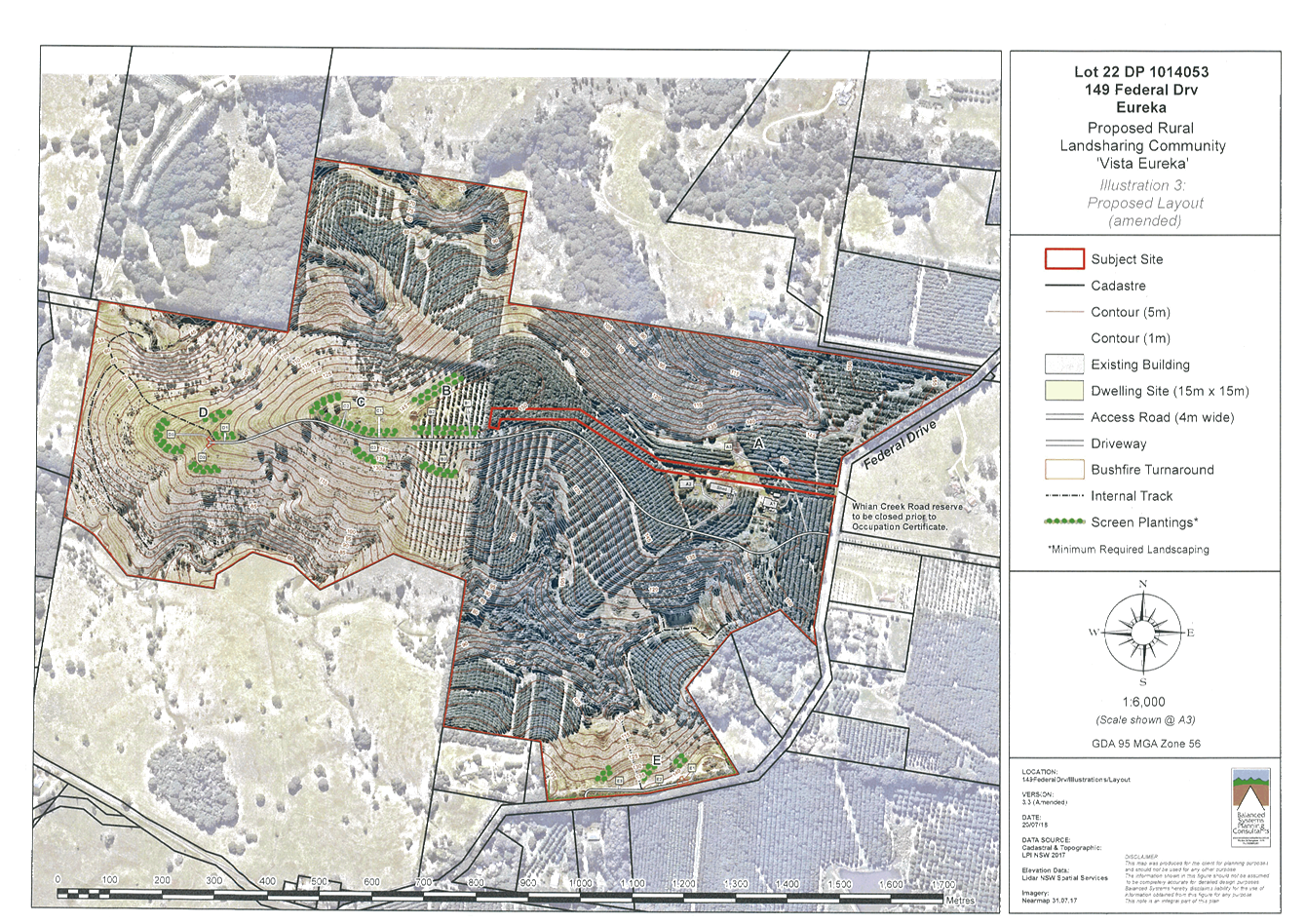
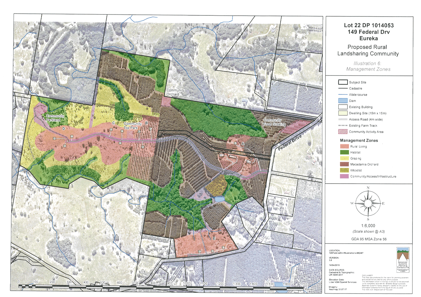
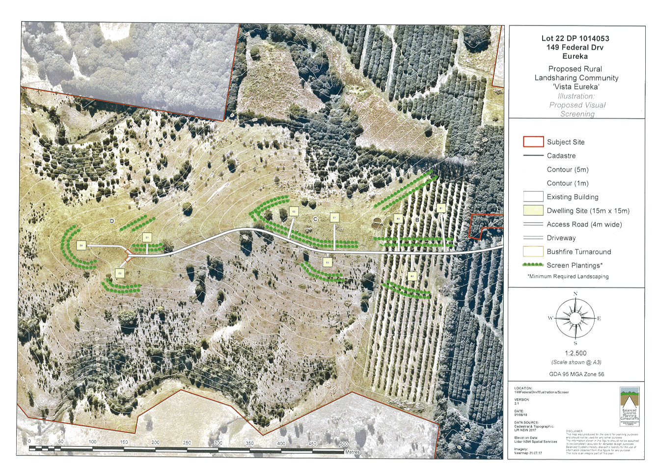
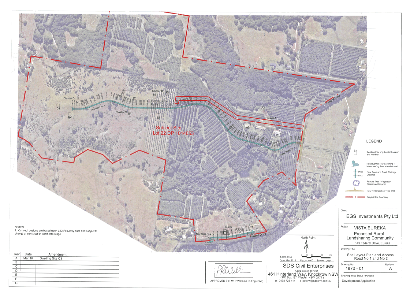
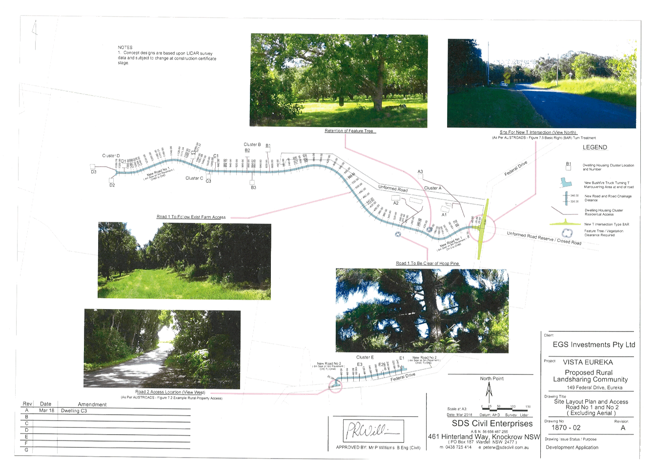
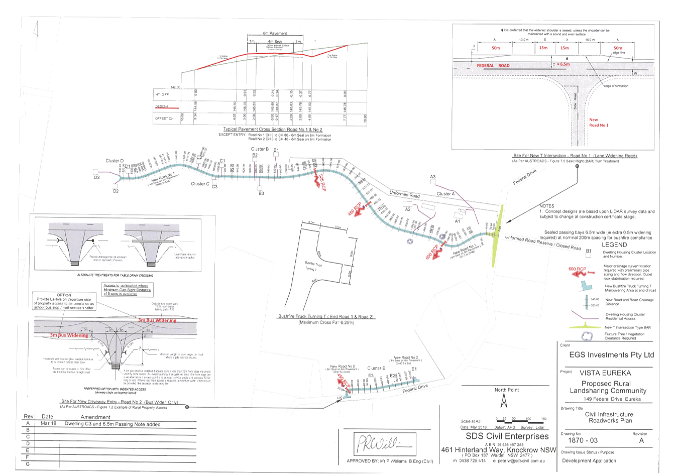
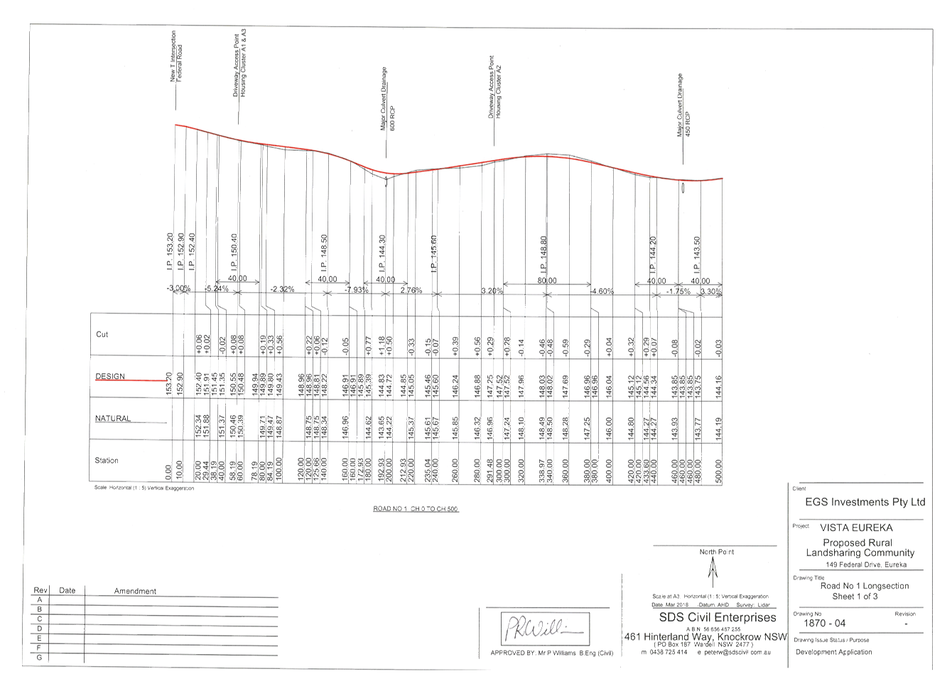
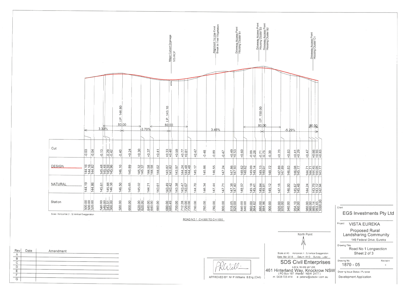
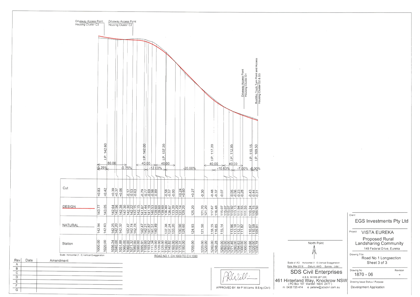
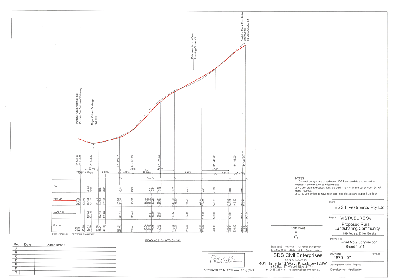
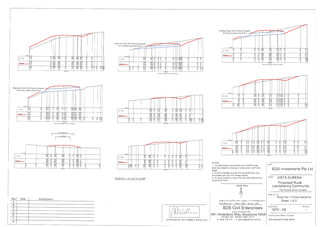
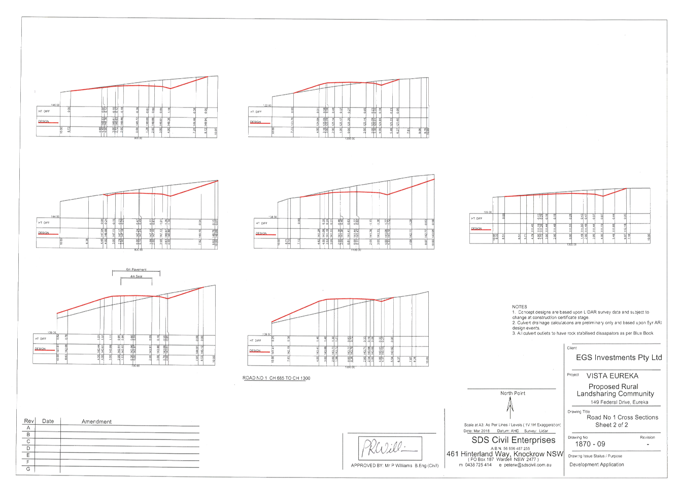
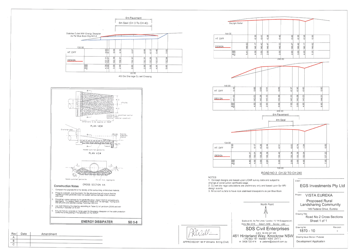
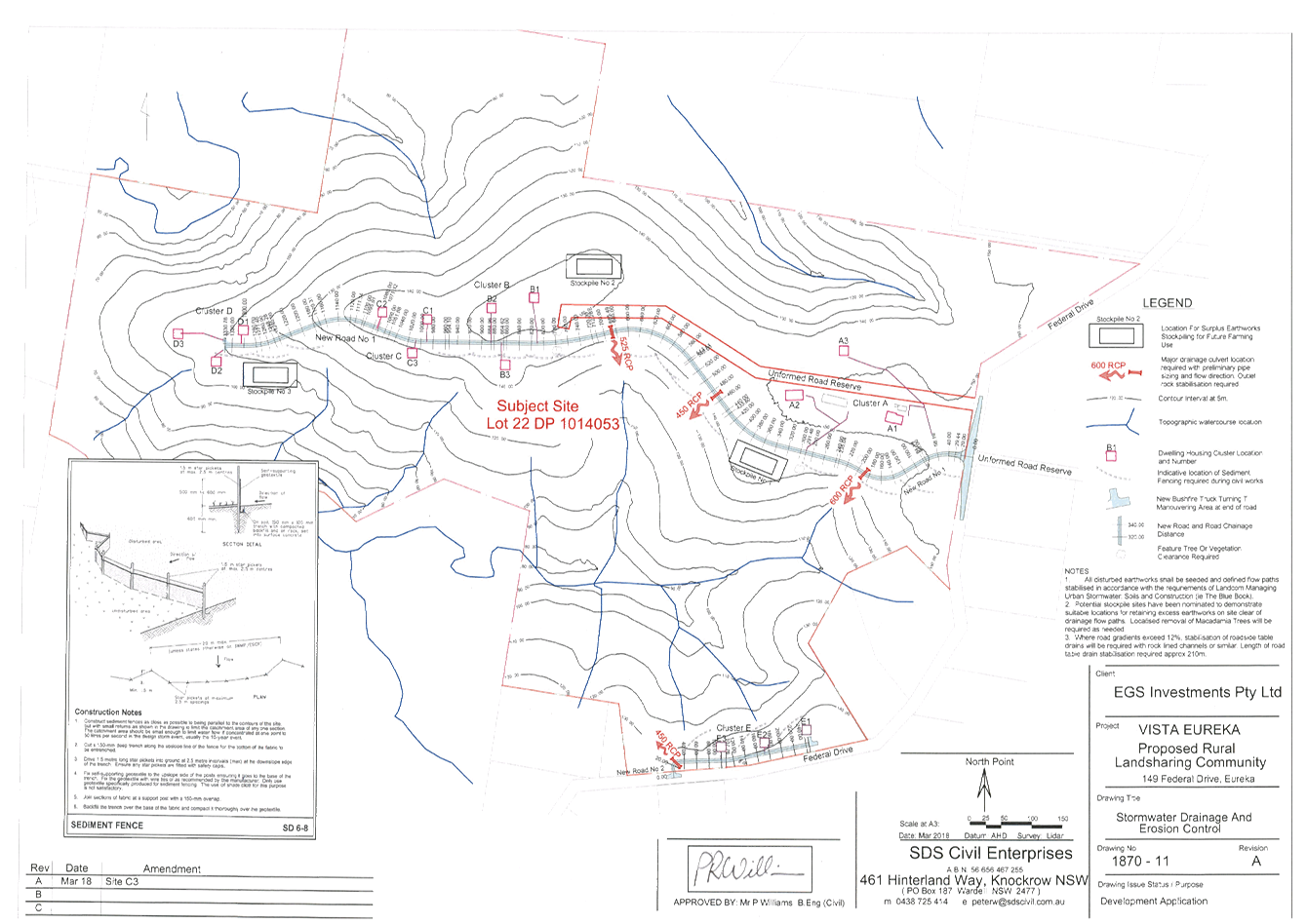
Staff Reports - Sustainable Environment and Economy 6.3 - Attachment 2
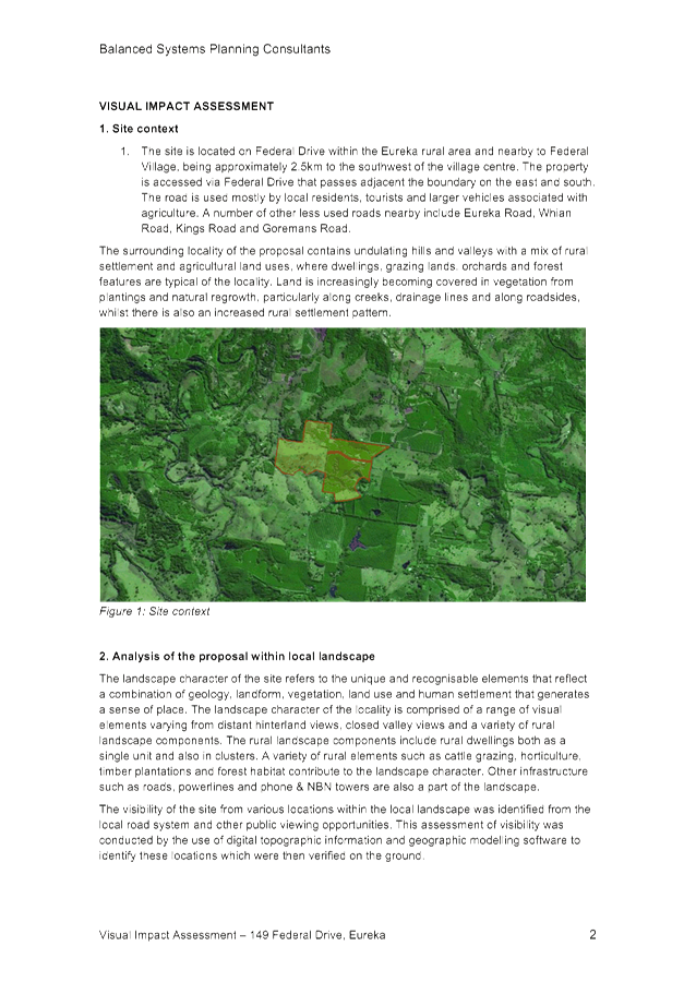
Staff Reports - Sustainable Environment and Economy 6.3 - Attachment 3
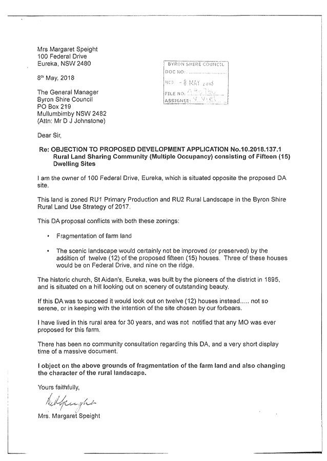
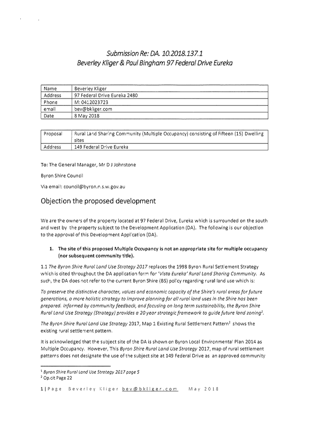


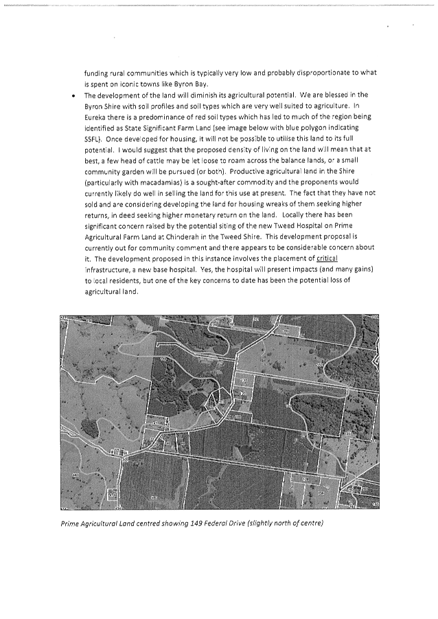

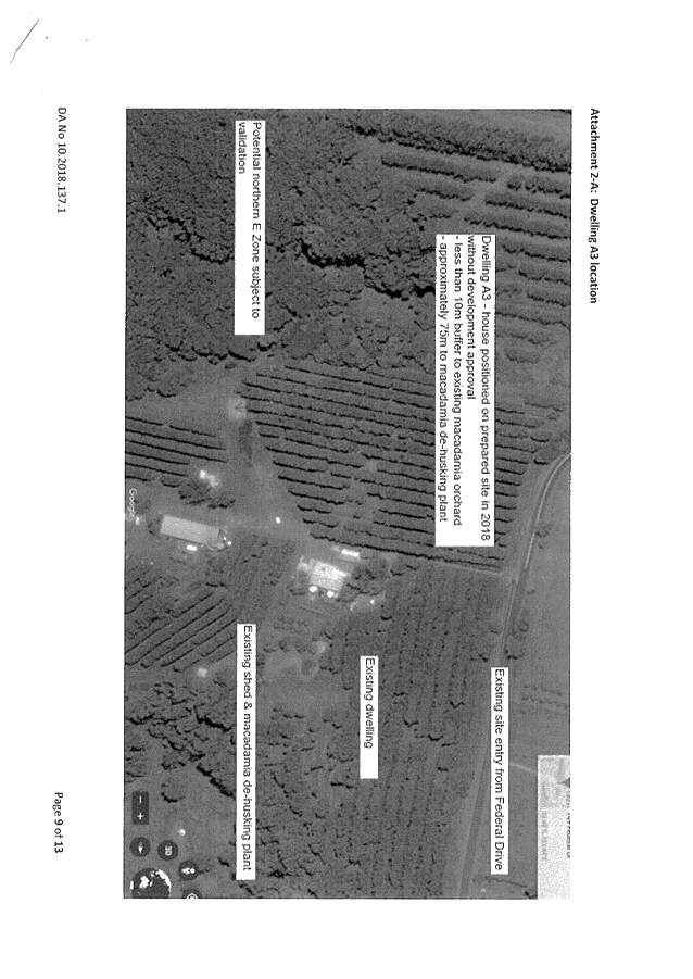
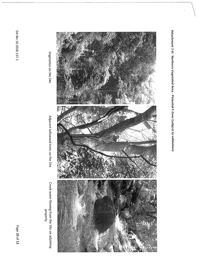
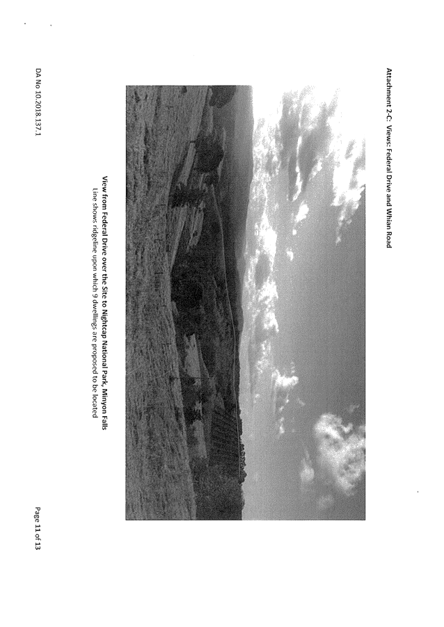
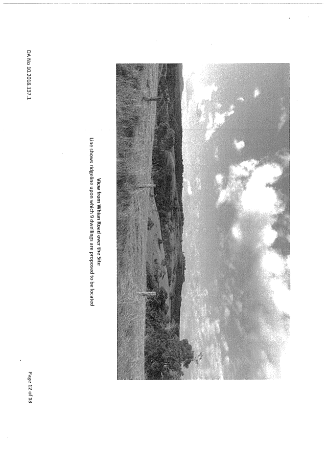

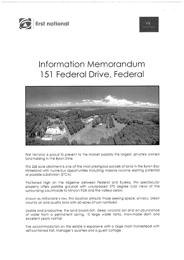
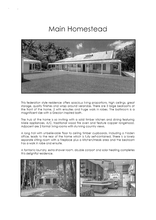
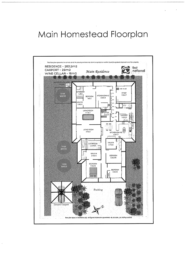
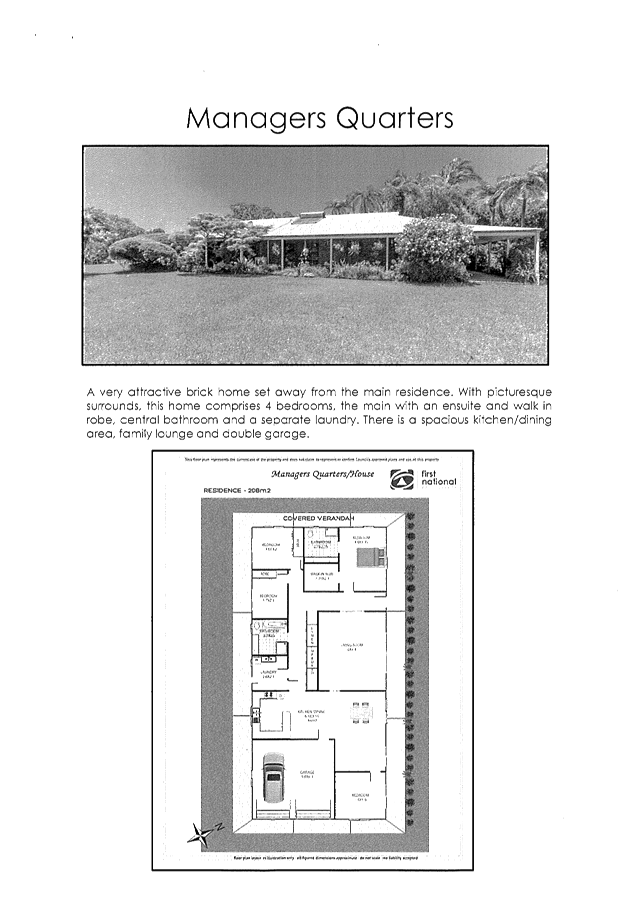

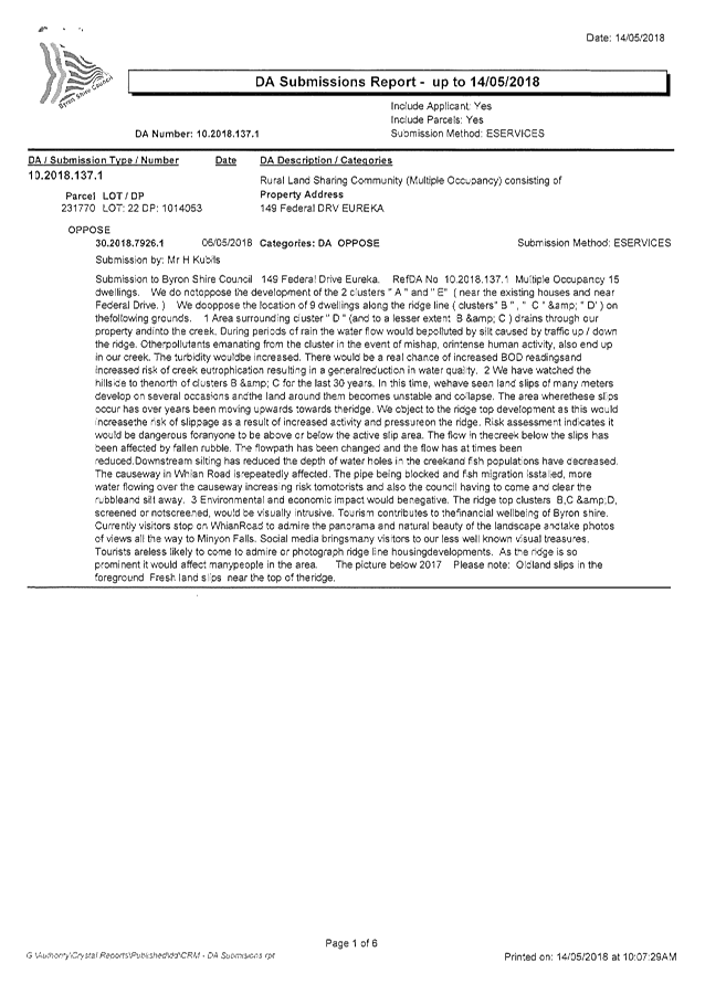
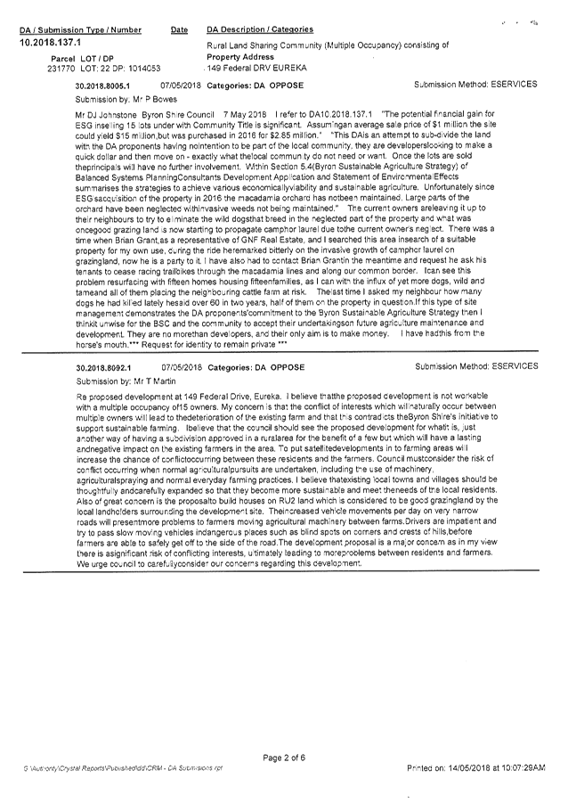
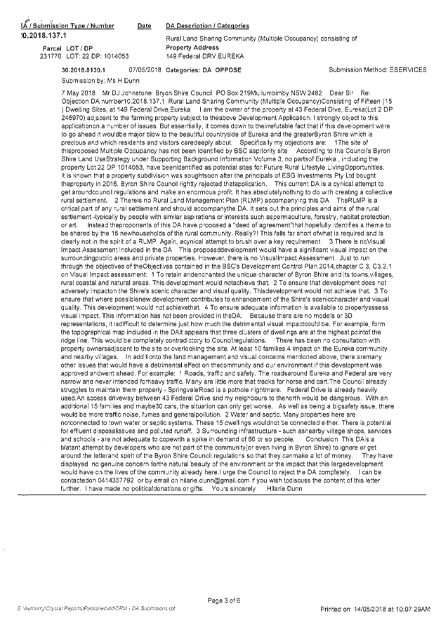
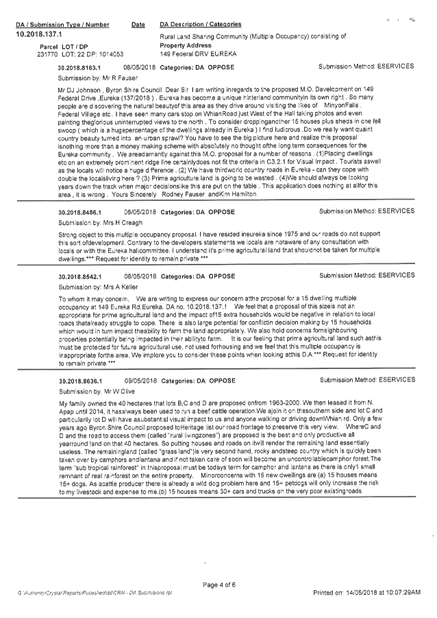
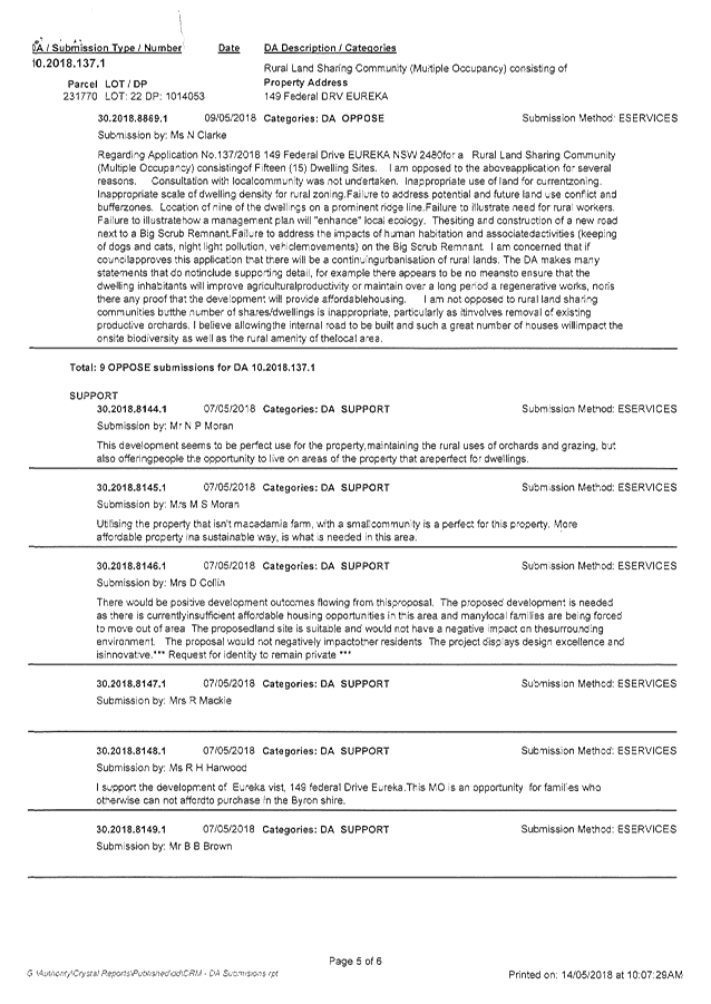

Staff Reports - Sustainable Environment and Economy 6.3 - Attachment 4
CONDITIONS
OF CONSENT:
|
SCHEDULE 1 CONDITIONS
OF CONSENT
|
|
Parameters of
consent
|
|
1.
|
Development is to be in accordance with approved plans
The development is to be in accordance with plans listed
below:
|
Plan No.
|
Description
|
Prepared by
|
Dated:
|
|
Illustration 3
|
Proposed Layout
|
Balanced Systems Planning Consultants
|
20 July 2018
|
|
Illustration 6
|
Management Zones Version 3.5
|
Balanced Systems Planning Consultants
|
14/04/19
|
|
Illustration
|
Proposed Visual Screening Version 2.1
|
Balanced Systems Planning Consultants
|
01/08/18
|
|
-
|
Visual Impact Assessment “Vista Eureka”
|
Balanced Systems Planning Consultants
|
July 2018
|
|
-
|
Vegetation Management Plan for Landsharing Community
Revision 4
|
Balanced Systems Planning Consultants
|
February 2019
|
|
1870-01 A
|
Site Layout Plan and Access Road No 1 and No 2
|
SDS Civil Enterprises
|
March 2018
|
|
1870-02 A
|
Site Layout Plan and Access Road No 1 and No 2
(Excluding Aerial)
|
SDS Civil Enterprises
|
March 2018
|
|
1870-03 A
|
Civil Infrastructure Roadworks Plan
|
SDS Civil Enterprises
|
March 2018
|
|
1870-04 to 1870-10
|
Long Sections for Roads 1 and 2
|
SDS Civil Enterprises
|
Received 4 April 2018
|
|
1870-11 A
|
Stormwater Drainage and Erosion Control
|
SDS Civil Enterprises
|
March 2018
|
The development is also to be in accordance with any
changes shown in red ink on the approved plans or conditions of consent.
The approved plans and related documents endorsed with the
Council stamp and authorised signature must be kept on site at all times
while work is being undertaken.
|
|
2.
|
No tree removal
This development consent does not authorise any local
native tree to be ringbarked, cut down, lopped, removed or damaged, or caused
to be ringbarked, cut down, lopped, removed or damaged in contravention of
Byron Development Control Plan 2014 and Development Control Plan 2010 as
applicable to the land.
|
|
3.
|
Bushfire safety measures
This land is identified as being designated bushfire prone
land and Under S4.14 of the act, Council must be satisfied prior to making a
determination for development on bushfire prone land that the development
complies with “Planning for Bush fire Protection 2006”.
The Community Management Statement shall contain the
following bush fire
outcomes:
· Each new dwelling site shall have a minimum 20 metres asset
protection zone
(APZ) around
the building envelope. APZ's shall be managed in accordance
with section
4.1.3 and Appendix 5 of 'Planning for Bush Fire Protection 2006'
and the NSW
Rural Fire Service's document 'Standards for asset protection
zones';
· New construction shall comply with Sections 3 and 5 (BAL 12.5)
Australian Standard AS39592009 'Construction of buildings in bushfireprone
areas' or NASH Standard (1.7.14 updated) ‘National Standard Steel
Framed Construction in Bushfire Areas – 2014’ as appropriate and
section A3.7 Addendum Appendix 3 of 'Planning for Bush Fire Protection 2006';
· Each new dwelling shall have a minimum 10,000 litres water supply
located
within the APZ
for each dwelling;
· Property access road to dwelling clusters B, C & D shall
comply with section 4.1.3 (2) of 'Planning for Bush Fire Protection 2006'
except no alternative access is required. A 5 metre APZ shall be managed on
either side of the property access road.
|
|
4.
|
Developer
Contributions to be paid
Contributions set out in the
schedule below are to be paid to Council prior to the approval of a
development application or complying development certificate for any dwelling
on sites 3 to 15. The developer contributions for the dwelling on site
2 must be paid prior to the approval of any development application or
complying development certificate for any dwellings on sites 3 to 15.
Contributions are levied in accordance with the Byron Shire Developer
Contributions Plan 2012 (as amended). The Plan may be viewed on line at
www.byron.nsw.gov.au
or during office hours at the Council Offices located at Station Street,
Mullumbimby. These contributions are to fund public amenities and
services as listed in the schedule. Additional details on the specific
amenities are to be found in the Byron Shire Developer Contributions Plan
2012 (as amended).
The contributions as set out in the
schedule may either be paid in full or they may be paid in stages on a
proportional basis dependent on the number of dwellings applied for.
The contributions in the schedule are
current at the date of this consent. The contributions payable will be
adjusted in accordance with the relevant plan and the amount payable will
be calculated on the basis of the contribution rates that are applicable at
the time of payment. The schedule contains a date for which the
schedule remains valid, after this date you will have to contact Council for
an updated schedule.
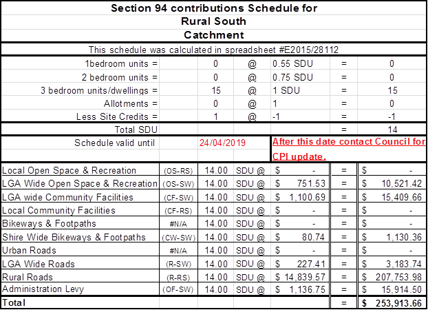
|
|
The following
conditions are to be complied with prior to issue of a Construction
Certificate for building works
|
|
5.
|
Decommission De-husking Facility
The de-husking facility located in proximity to approved
Cluster ‘A’ must be decommissioned. The applicant must
provide documentary evidence to the PCA that this condition has been met
prior to the issue of a construction certificate for the development.
|
|
6.
|
Previous development consent to be surrendered
Development Consent No.
10.2016.425.1 granted on 28 July 2017 is to be surrendered. This must
be in the form of a written memorandum to Council from the owner of the
subject property, in accordance with Clause 97 of the Environmental Planning
and Assessment Regulation, 2000.
|
|
7.
|
Road closure application
A permanent road closure application under the provisions
of the Roads Act 1993 for the existing paper road identified as Whian Creek
Road must be submitted to the relevant road authority.
|
|
8.
|
Landscape Plan - Vegetative Spray Drift Buffer and
Visual Screen Buffer
A landscape plan must be prepared for vegetative spay
drift buffers in accordance with the approved Vegetation Management Plan
prepared by Balanced Systems Planning Consultants dated February 2019
(Revision 4). Guidance on the design and maintenance of such buffers is
additionally available from NSW Agriculture and in Planning Guidelines:
Separating Agricultural and Residential Land Uses published by the
Department of Natural Resources, Queensland.
The plan to also include the Visual Screen Buffer
plantings. In accordance with the approved plans.
The plan is to be
prepared by a suitably qualified landscape architect / ecologist who
has appropriate experience and competence in landscaping. The plan must
be approved prior to issue of a Construction Certificate.
|
|
9.
|
Spray Drift Management Plan
A Spray Drift Management Plan
must be prepared to demonstrate appropriate practices for managing spray
drift associated with the macadamia orchard on the site and the potential
impacts on dwellings within the Rural Land Sharing Community (Multiple
Occupancy).
|
|
10.
|
Geotechnical Report required –
Engineering Works
A certificate from a professional Engineer experienced in
soil mechanics is to be provided to the Principal Certifying Authority,
certifying that:
a) the design of
the civil engineering works, including cut & fill batters, has been
assessed as structurally adequate; and
b) adequate drainage
has been provided.
|
|
11.
|
Sediment and Erosion Control Management Plan
required
The application for a Construction Certificate is to
include plans and specifications that indicate the measures to be employed to
control erosion and loss of sediment from the site. Control over discharge of
stormwater and containment of run-off and pollutants leaving the
site/premises must be undertaken through the installation of erosion control
devices such as catch drains, energy dissipaters, level spreaders and sediment
control devices such as filter fences and sedimentation basins.
Such plans and specifications must be approved as part of
the Construction Certificate.
NOTE: The plans must be in compliance with
Council's current “Northern Rivers Local Government Development Design
& Construction Manuals and Standard Drawings”.
|
|
12.
|
Consent required for works within the road
reserve
Consent from Council must be obtained for works within the
road reserve pursuant to Section 138 of the Roads Act 1993. Three (3) copies
of engineering construction plans must accompany the application for consent
for works within the road reserve.
Such plans are to be in accordance with Council’s
current Design & Construction Manuals and are to provide for the
following work:
|
Intersection
Driveway
|
Detailed design of Road 1 & Road 2 intersection
generally in accordance with SDS Civil Enterprises drawing 1870-03 A,
AUSTROADS, AS2890 and NRDC.
· Any existing
driveway crossings rendered unnecessary by this development along Federal
Drive are to be removed, and the area restored to match the existing road
profile.
· Any new
driveway along Federal Drive must be designed and constructed in accordance
with Council’s standard
|
|
|
13.
|
Traffic Management Plan
Consent from Council must be
obtained for a Traffic Management Plan pursuant to Section 138 of the Roads
Act 1993. The plans and specifications are to include the measures to be
employed to control traffic (inclusive of construction vehicles) during
construction of the development. The traffic management plan is to be
designed in accordance with the requirements of the Roads and Traffic
Authority’s Manual, Traffic Control at Work Sites Version 2, and the
current Australian Standards, Manual of Uniform Traffic Control Devices Part
3, ‘Traffic Control Devices for Works on Roads’.
The report must incorporate
measures to ensure that motorists using road adjacent to the development,
residents and pedestrians in the vicinity of the development are subjected to
minimal time delays due to construction on the site or adjacent to the site.
The traffic management plan must
be prepared by a suitably qualified and RTA accredited Work Site Traffic
Controller.
|
|
14.
|
Access & Parking
The application for a Construction Certificate is to
include plans and specification that indicate access, parking and manoeuvring
details in accordance with the plans approved by this consent.
The access, parking and manoeuvring for the site is to
comply with the requirements of AS 2890.1-2004: Parking facilities and Part
1: Off-street car parking. Plans are to include, but not be limited to, the
following items:
a) detailed
design of Road 1 and Road 2 and all driveways to dwelling sites;
b) detailed
survey to be submitted showing ground levels and location of all trees and
outcrops within the construction zone of all roads and driveways;
c) pavement
design, comprising an all weather surface, such as asphalt, bitumen seal,
concrete, pavers or other similar treatment;
d) site
conditions affecting the access;
e) existing
and design levels;
f) longitudinal
section and cross sections;
g) Stormwater
drainage calculation of proposed cross culverts under the road 1 & 2 and
table drains. The following must be provided and satisfied:-
· Extent of
inundation during Q5/Q100 events;
· Depth of
inundation during Q5/Q100 events;
· Duration of
inundation during Q5/Q100 events; and
· Calculate the v
x d product of safety. The v x d must be ≤ 0.40.
h) Stormwater
drainage details including catchment plan;
i) Stormwater
Quality; and
j) All
internal access roads and driveway shall comply with section 4.1.3 (2) of
Planning for Bushfire Protection 2006.
Such plans and specifications must be approved as part of
the Construction Certificate.
NOTE: The plans must be in compliance with Council's
current “Northern Rivers Local Government Development Design &
Construction Manuals and Standard Drawings”.
|
|
15.
|
Long
Service Levy to be paid
A Long Service Levy must be paid to the Long Service
Payments Corporation. This is a State Government Levy and is subject to
change.
These payments may be made online at www.longservice.nsw.gov.au
or at Council’s Administration
Office, Station Street, Mullumbimby. When paying to Council, cheques are to
be made payable to ‘Byron Shire Council’.
For further information regarding the Long Service Payment
please refer to the website above.
|
|
The following
conditions are to be complied with prior to any building or construction works
commencing
|
|
16.
|
Public safety requirements
All care is to be taken to
ensure the safety of the public in general, road users, pedestrians and
adjoining property. The public liability insurance cover, for a minimum
of $20 million, is to be maintained for the duration of the construction of
the development. Council is not held responsible for any negligence
caused by the undertaking of the works.
|
|
17.
|
Erosion and Sediment Control Management Plan
required
Erosion and sedimentation controls are to be in place in
accordance with the approved Erosion and Sediment Control Plan.
Sediment and erosion control measures in accordance with
the approved Erosion and Sedimentation Control plan/s must be maintained at all
times until the site has been stabilised by permanent vegetation cover or
hard surface.
Any such measures that are deemed to be necessary because
of the local conditions must be maintained at all times until the site is
made stable (i.e. by permanent vegetation cover or hard surface).
Note: Council may impose
on-the-spot fines for non-compliance with this condition.
|
|
The following
conditions are to be complied with during any building or construction works
|
|
18.
|
Protection of Native Trees
All trees nominated to be
retained by notation or condition as a requirement of the development consent
shall be maintained and protected during demolition, excavation and
construction on the site in accordance with AS 4970-2009 – Protection
of Trees on Development Sites.
|
|
19.
|
Construction
times
Construction works must not unreasonably interfere with
the amenity of the neighbourhood. In particular construction noise, when
audible from adjoining residential premises, can only occur:
a. Monday to Friday,
from 7 am to 6 pm.
b. Saturday, from 8 am
to 1 pm.
No construction work to take place on Saturdays and
Sundays adjacent to Public Holidays and Public Holidays and the Construction
Industry Awarded Rostered Days Off (RDO) adjacent to Public Holidays.
Note: Council may impose on-the-spot fines for
non-compliance with this condition.
|
|
20.
|
Construction
Noise
Construction noise is to be limited as follows:
a. For
construction periods of four (4) weeks and under, the L10 noise level
measured over a period of not less than fifteen (15) minutes when the
construction site is in operation must not exceed the background level by
more than 20 dB(A).
b. For
construction periods greater than four (4) weeks and not exceeding twenty‑six
(26) weeks, the L10 noise level measured over a period of not less than
fifteen (15) minutes when the construction site is in operation must not
exceed the background level by more than 10 dB(A)
Note: Council may impose on-the-spot fines for
non-compliance with this condition.
|
|
21.
|
Signs to
be erected on building and demolition sites
A sign must be erected in a prominent position on the work
site:
a. stating that
unauthorised entry to the work site is prohibited, and
b. showing the name of
the person in charge of the work site and a telephone number at
which that person may be contacted outside working hours.
Any such sign is to be removed when the work has been
completed.
|
|
22.
|
Builders
rubbish to be contained on site
All builders rubbish is to be contained on the site in a
‘Builders Skips’ or an enclosure. Footpaths, road reserves and
public reserves are to be maintained clear of rubbish, building materials and
all other items.
|
|
23.
|
Prevention
of water pollution
Only clean and unpolluted water is to be discharged to Council’s
stormwater drainage system or any watercourse to ensure compliance with the
Protection of Environment Operations Act.
Note: Council may impose on-the-spot fines for
non-compliance with this condition.
|
|
24.
|
Maintenance of sediment and erosion control measures
Sediment and erosion control measures must be maintained
at all times until the site has been stabilised by permanent vegetation cover
or hard surface.
|
|
25.
|
Muted
bushland tones external finishes
To ensure the development is compatible with the
surrounding environment, colours and finishes are to be muted bushland tones.
In this regard white, light or bright colours are not permissible.
|
|
The following
conditions are to be complied with prior issue of an occupation certificate
|
|
26.
|
Vegetation Management Plan
All works required as a minimum up to Year 2 of
the Vegetation Management Plan to be completed prior to the issue of the
Occupation Certificate. A Certified Progress Report demonstrating that all
actions for Years 1 and 2 have been completed as required in the VMP to be
submitted with the Application for the Occupation Certificate.
|
|
27.
|
Vegetative Spray Drift Buffer
Plantings works for the vegetative spray drift
buffer must be completed in accordance with the approved Landscape Plan and Vegetation
Management Plan prepared by Balanced Systems Planning Consultants dated
February 2019 (Revision 4) prior to issue
of an Occupation Certificate.
|
|
28.
|
Screen plantings
Screen plantings in accordance with stamp approved
“Illustration: Proposed Visual Screening” Version 2.1 dated
01/08/18 and “Visual Impact Assessment (Vista Eureka)” dated July
2018 and the approved landscape plan must be completed prior to issue of an
Occupation Certificate.
|
|
29.
|
Rural Landsharing Management Plan
A Rural Landsharing Management
Plan (RLMP) to be prepared and submitted to Council in accordance with Byron
DCP 2014 prior to the issue of the Occupation Certificate. The plan to
provide for the collective management and decision making of the community by
shareholders. The plan to also include measures to or for:
a) Limit the number of dwellings per site to one dwelling
house only prohibiting dual occupancies and secondary dwellings.
b) Management of the Macadamia Plantation and internal Land
Use Conflicts as per the LUCRA Report by Balanced System Planning Consultants
c) First Flush or Bypass Devices for rainwater tanks used
for domestic/ residential purposes with a minimum supply of 40,000 litres
excluding bushfire requirements
d) Restrict the use of reflective or white cladding or
roofing
e) Screen Plantings and landscaping as per Visual Impact
Assessment dated July 2018.
f) Bushfire Safety Measures as per the Conditions of
this consent
g) Restrictions on the Keeping of Cats and Dogs
|
|
30.
|
Approval to Operate
required – Existing Sewage management Systems
In accordance with the Local
Government Act, an Approval to Operate the onsite sewage management system
must be obtained from Council. Forms may be downloaded from Council’s
website with 'http://www.byron.nsw.gov.au/on-site-sewage'.
Documentary evidence must be
provided to Council to demonstrate that this condition has been fulfilled
prior to the issues of an Occupation Certificate.
|
|
31.
|
Intersection and access driveway construction
to be completed
Intersection and access driveway are to be constructed in
accordance with the approved plans and Roads Act consent.
|
|
32.
|
Works-As-Executed Plans
Following completion of works, Work-as-Executed Drawings,
together with a Work-As-Executed Certification Report, in accordance with
Council’s requirements are to be submitted to Council. Two categories
of Work-as-Executed Drawings are to be submitted to Council, being
Amended Design Work-as-Executed Drawings and Summary
Work-as-Executed Drawings.
Amended Design Work-as-Executed Drawings, being
certified copies of all approved design plans with as constructed departures,
deletions and additions clearly noted and detailed on the plans, are to be
submitted to Council in the following formats:-
a) One (1) paper copy at the same scale and format as
the approved design plans, but, marked appropriately for as constructed
information and with original signatures; and
b) An electronic copy of above in PDF format and
provided to Council on CD, DVD or via email.
Note: Council’s requirements are detailed in
Council’s adopted engineering specifications, currently the Northern
Rivers Local Government Development Design and Construction Manuals, and
on Council’s website.
|
|
33.
|
Stormwater drainage work
SEngineering certification must be submitted
certifying all Stormwater
drainage works including stormwater quality improvement
devices for the development must beare
constructed in accordance with the approved plans and specification.
prior to issue of an occupation certificate.
|
|
34.
|
Electricity Supply Certificate
Written evidence from an electricity supply authority is
to be submitted with the application stating that satisfactory arrangements
have been made for the provision of electricity supply throughout the
development.
|
|
35.
|
Fibre-ready Facilities and Telecommunications
Infrastructure
Prior to the issue of the occupation certificate in
connection with a development, the developer (whether or not a constitutional
corporation) is to provide evidence satisfactory to the Certifying Authority
that arrangements have been made for:
(i) the
installation of fibre-ready facilities to all individual lots and/or premises
in a real estate development project so as to enable fibre to be readily
connected to any premises that is being or may be constructed on those lots.
Demonstrate that the carrier has confirmed in writing that they are satisfied
that the fibre ready facilities are fit for purpose; and
(ii) the
provision of fixed-line telecommunications infrastructure in the fibre-ready
facilities to all individual lots and/or premises in a real estate
development project demonstrated through an agreement with a carrier.
(Note real estate development project has the meanings
given in section 372Q of the Telecommunications Act).
|
|
36.
|
Maintenance Bond
A maintenance bond of 5% (minimum bond amount of
$1,000.00) of the value of the intersection works constructed
is to be lodged with Council. A copy of the contract construction cost
of the intersection works is to be submitted with the bond. The maintenance
period is 6 months in accordance with Council’s current Design &
Construction Manuals and will commence upon the works accepted for on-maintenance.
The security may be provided, at the applicant's choice, by way of cash bond
or a satisfactory bank guarantee. An application in writing for the release
of the bond must be made at the satisfactory completion of the maintenance
period.
|
|
37.
|
Record of Infrastructure
A record of infrastructure coming into Council ownership,
upon registration of the completion of the intersection works, is to be
submitted to Council. The information is to be submitted in the form of
Council’s Standard Form titled “Asset Creation
Record”. This form is available from Council’s Local
Approvals Section.
|
|
38.
|
Road Closure to be completed
Documentary evidence must be submitted to Council
demonstrating completion of the permanent road closure of the existing paper
road identified as Whian Creek Road in accordance with the Roads Act 1993.
All separate parcels of land
are to be consolidated into one allotment and registered with NSW Land
Registry Services prior to issue of an Occupation Certificate.
|
|
39.
|
Restriction on the keeping of cats and dogs
A restriction as to use is required to prohibit the
keeping of dogs and cats on the land other than “assistance animals”
as defined by the Companion Animals Act 1998. Documentary evidence is
required to demonstrate that a restriction via a Section 88E instrument is
registered with NSW Land Registry Services prior to issue of an Occupation
Certificate.
|
|
40.
|
Works to be completed prior to issue of a Final
Occupation Certificate
All of the works indicated on the plans and approved by
this consent, including any other consents that are necessary for the
completion of this development including approvals issued under the Local
Government Act 1993 and the Roads Act 1993, are to be completed and approved
by the relevant consent authority/s prior to the issue of a Final Occupation
Certificate.
Any Security bond paid for this application will be held
until Council is satisfied that no further works are to be carried out that
may result in damage to Councils road/footpath reserve.
|
|
41.
|
Compliance with bushfire conditions
Documentary evidence from a suitably qualified
professional is to be submitted demonstrating that the bush fire condition of
this Notice of Determination regarding access has been complied with.
|
|
|
|
|
The following
conditions are to be complied with at all times
|
|
42.
|
Screen plantings
Screen plantings in accordance
with stamp approved “Illustration: Proposed Visual Screening”
Version 2.1 dated 01/08/18 and “Visual Impact Assessment (Vista
Eureka)” dated July 2018 and the approved landscape plan must be
maintained at all times.
|
|
43.
|
Vegetation Management Plan
The action prescribed in the approved Vegetation Management
Plan to be complied with at all times. Copies of the Certified Progress
Reports are to be submitted with future Development Applications for dwelling
houses demonstrating how compliance has been met with.
|
|
SCHEDULE 3 REASONS FOR
DECISION, HOW COMMUNITY VIEWS WERE ADDRESSED
|
|
Statement of Reasons
|
|
The proposed development complies with the provisions of
Byron Local Environmental Plan 1988 and 2014.
|
|
The proposed development complies with relevant State
Environmental Planning Policies
|
|
The proposed development complies with relevant provisions
of Development Control Plan 2010 and 2014
|
|
The proposed development will not have significant adverse
impacts on the natural, built or social environment or economic impacts on
the locality.
|
|
The proposed development is considered suitable for the
proposed site.
|
|
The proposed development is unlikely to prejudice or
compromise the public interest.
|
|
How community views were addressed
|
|
The DA was advertised in accordance with Level 2
notification as per Development Control Plan 2014. All issues raised within
submissions have been taken into consideration in determining this
application.
|
|
SCHEDULE 4 NOTES
|
|
Construction Certificate required:
This development consent is issued under the Environmental
Planning and Assessment Act 1979 and does not relate to structural aspects or
specifications of the building under the Building Code of Australia. All
buildings and alterations require the issue of a Construction Certificate
prior to works commencing. Application forms are available from the customer
services counter or Council’s website www.byron.nsw.gov.au
|
|
Principal Certifying Authority:
Work must not commence until the applicant has:-
a. appointed
a Principal Certifying Authority (if the Council is not the PCA); and
b. given
Council at least two days notice of the intention to commence the erection of
the building. Notice must be given by using the prescribed ‘Form
7’.
c. notified
the Principal Certifying Authority of the Compliance with Part 6 of the Home
Building Act 1989.
|
|
Occupation Certificate required:
The building must not be occupied until the Principal
Certifying Authority has issued an Occupation Certificate.
|
|
Protection of the Environment Operations Act 1997:
It is an offence under the provisions of the Protection of
the Environment Operations Act 1997 to act in a manner causing, or likely to
cause, harm to the environment. Anyone allowing material to enter a waterway
or leaving material where it can be washed off-site may be subject to a
penalty infringement notice (“on-the-spot fine”) or prosecution.
|
|
Penalties apply for failure to comply with development
consents
Failure to comply with conditions of development consent
may lead to an on the spot fine being issued pursuant to section 4.2(1) of
the Environmental Planning & Assessment Act 1979 or prosecution pursuant
to section 9.50 of the Environmental Planning & Assessment Act 1979.
|
|
Plumbing Standards and requirements.
All Plumbing, Water Supply, Sewerage and Stormwater Works
shall be installed in accordance with the Local Government Act 1993, Plumbers
Code of Australia and AS/NZS 3500 Parts 0-5, the approved plans (any
notations on those plans) and the approved specifications. Any plumbing
inspections required under a Section 68 Approval are to occur in accordance
with that approval.
|
Staff Reports - Sustainable Environment and Economy 6.4
Report No. 6.4 PLANNING
- 10.2019.42.1 Boundary Adjustment 2 lots into 2 lots at 1660 and 1670 Coolamon
Scenic Drive MULLUMBIMBY
Directorate: Sustainable
Environment and Economy
Report
Author: Heidi
Hutchinson, Planner
File No: I2019/591
Proposal:
|
DA No:
|
10.2019.42.1
|
|
Proposal description:
|
Boundary Adjustment
|
|
Property description:
|
LOT: 24 DP: 1089627, LOT: 23 DP: 1089627
|
|
1670 Coolamon Scenic Drive MULLUMBIMBY, 1660 Coolamon
Scenic Drive MULLUMBIMBY
|
|
Parcel No/s:
|
239799, 239798
|
|
Applicant:
|
Mr R E Darney
|
|
Owner:
|
Mullumbimby Rural Co-operative Society Ltd
|
|
Zoning:
|
RU1 Primary Production / PART DM Deferred Matter 1B1
Agricultural Protection
|
|
Date received:
|
16 January 2019
|
|
Integrated / Designated Development:
|
☐
Integrated
|
☐
Designated
|
☒
Not applicable
|
|
Concurrence required
|
DPE – SEPP 1 variation
|
|
Public notification or exhibition:
|
- Level
0 advertising under DCP 2014 Part A14 – Public Notification and
Exhibition of Development Applications
- No
Submissions were received
|
|
Variation request
|
☐
Clause 4.6
|
☒
SEPP 1
|
☐
Not applicable
|
|
Delegation to determination:
|
Council
|
|
Issues:
|
· SEPP 1 variation
to LEP 1988
|
Summary:
The proposed development is for the adjustment of boundaries
between 2 lots to add an area of land of approximately 1,106m2 to
the Mullumbimby Rural Co-operative from the adjacent farm. The proposed
boundary adjustment is considered to meet the requirements under Byron LEP
2014, however as part of the site is still zoned 1(b1) under Byron LEP 1988, a
SEPP 1 Variation is required to vary the 40Ha development standard. The
proposal was referred to the Department of Planning and Environment who issued
concurrence in this instance.
The proposal raises no significant issues in terms of
environmental impacts and the site is considered suitable for the development.
The application is recommended for approval subject to conditions of consent.
NOTE TO COUNCILLORS:
In accordance with the
provisions of S375A of the Local Government Act 1993, a Division is to be
called whenever a motion for a planning decision is put to the meeting, for the
purpose of recording voting on planning matters. Pursuant to clause 2(a)
under the heading Matters to be Included in Minutes of Council Meetings of
Council's adopted Code of Meeting Practice (as amended) a Division will be
deemed to have been called by the mover and seconder of all motions relating to
this report.
|
RECOMMENDATION:
That pursuant to
Section 4.16 of the Environmental Planning & Assessment Act 1979,
development application no. 10.2019.42.1 for Boundary Adjustment, be granted consent subject to conditions of
approval listed in attachment 1 (#E2019/27699).
|
Attachments:
1 Proposed
conditions of Consent.pdf, E2019/27699
, page 325⇩
2 Proposed
Plan, E2019/27698 , page 328⇩
3 SEPP 1
Concurrence from DPE, E2019/31708
, page 329⇩
REPORT
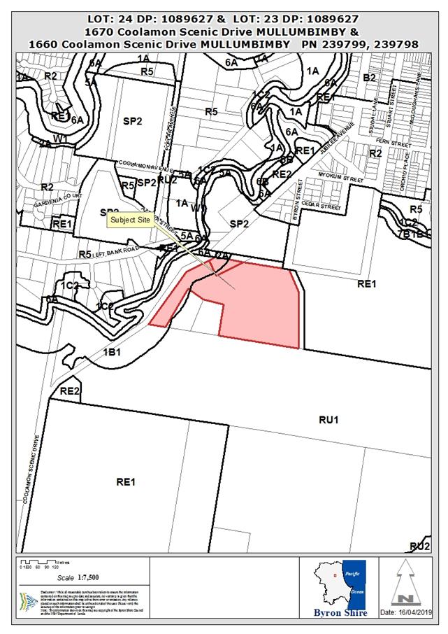
Assessment:
1.1. History/Background
DA10.2009.425.1 – Above ground Fuel Tanks –
Approved 17/9/09
DA10.2018.536.1 – Storage Shed – Approved
25/10/18
1.2. Description
of the proposed development
This application seeks approval for Boundary Adjustment
between Lot 23 and Lot 24 DP 239798. The boundary adjustment would add 1,106m2
to Lot 24 creating resultant lots as outlined below:
· Lot 24 (proposed
lot 30) – 5,153m2
· Lot 23 (proposed
lot 31) – 8.59ha.
Screening is proposed to the southern boundary with lilli
pillis and stock fencing is existing. As the site includes RU1 land under LEP
2014 and 1B1 land under LEP 1988, the proposed boundary adjustment requires
referral to DPE for concurrence as no controls exist for the adjustment of
boundaries within LEP 1988 and as such are a variation to subdivision
development standards.
The minimum lot size for 1B1 zoned Agricultural Protection
land is 40ha.
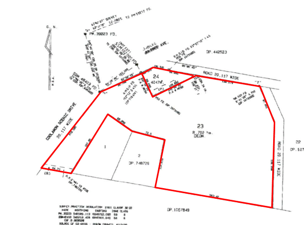

Figure 1 – Existing lots
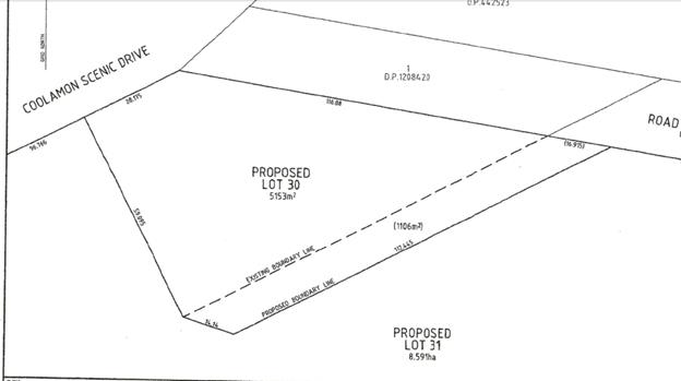
Figure 1 – Proposed adjustment
1.3. Description
of the site
|
Land is legally described as
|
LOT: 24 DP: 1089627, LOT: 23 DP: 1089627
|
|
Property address is
|
1670 Coolamon Scenic Drive MULLUMBIMBY, 1660 Coolamon
Scenic Drive MULLUMBIMBY
|
|
Land is zoned:
|
RU1 Primary Production / PART DM Deferred Matter
|
|
Land area is:
|
4047 m2
|
|
Property is constrained by:
|
Flood Liable Land Acid Sulfate Soils Class
4
|
SUMMARY OF REFERRALS
|
DPE (SEPP 1 Concurrence)
|
Referred to DPE for concurrence regarding SEPP 1 objection
for variation to minimum subdivision lot size.
The minister has provided concurrence for the following
reasons:
· the variation of
the development standard will enable the orderly development of the subject
lands;
· the area of land
zoned 1(b1) Rural Protection is already smaller than the development
standard; and
· there is no
public benefit in maintaining the development standard in this instance.
|
|
Development Engineer
|
No objections, subject to conditions of consent.
|
2. SECTION 4.15C – MATTERS FOR CONSIDERATION
– DISCUSSION OF ISSUES
Having regard to the matters for consideration detailed in
Section 4.15(1) of the Environmental Planning & Assessment Act 1979
(EP&A Act), the following is a summary of the evaluation of the issues.
2.1. State
Environmental Planning Instruments
|
|
Satisfactory
|
Unsatisfactory
|
|
State Environmental Planning Policy No 1 –
Development Standards
|
☒
|
☐
|
|
Consideration: The site is split zoned a portion of the
site being under the Byron LEP 1988 and the rest under Byron LEP 2014,
concurrence is requested for variation to the 1988 LEP regarding minimum
subdivision Lot size as the minimum lot size for 1B1 land is 40ha. The applicant
has lodged a SEPP 1 objection and provided that the boundary adjustment is
required to allow for expansion of the Mullumbimby Rural Co-Operative and
to correct encroachments onto the neighbouring farm.
The small reduction in farm area will not have an adverse
impact on the ability of the property to be used for agricultural
purposes which is currently utilised for the grazing of livestock, whilst the
additional land will provide further area for the Co-operative to expand in
terms of outdoor storage and as a buffer to more intensive agricultural
activities. The proposal does not create any additional lots or dwelling
entitlements. The SEPP 1 Objection was granted concurrence by DPE for the
following reasons:
· the variation of the development standard will enable the orderly
development of the subject lands;
· the area of land zoned 1(b1) Rural Protection is already smaller than
the development standard; and
· there is no public benefit in maintaining the development standard in
this instance.
The proposal can therefore be supported in this instance
as strict compliance with the minimum lot size is not warranted having
regards to the circumstances of the proposal.
|
|
State
Environmental Planning Policy No 55—Remediation of Land
|
☒
|
☐
|
|
Proposed boundary adjustment raises no issues under the
SEPP in terms of contamination.
|
|
State Environmental Planning
Policy (Coastal Management) 2018
|
☒
|
☐
|
|
Proposed boundary adjustment
raises no issues under the SEPP in terms of the management of coastal land.
|
4.2A Byron Local Environmental Plan 2014 (LEP 2014)
LEP 2014 is an applicable matter for consideration in the
assessment of the subject development application in accordance with subsection
4.15(1) of the EP&A Act because it applies to the subject land and the
proposed development. The LEP 2014 clauses that are checked below are of
relevance to the proposed development:
|
Part 1
|
☒1.1|
☒1.1AA| ☒1.2| ☒1.3| ☒1.4| ☒Dictionary| ☒1.5| ☒1.6| ☒1.7| ☒1.8| ☒1.9
|
|
Part 2
|
☒2.1|
☒2.2 | ☒2.3 |☒Land Use Table
|
|
Part 4
|
☒4.1|☒4.1C|☒4.3
|
|
Part 5
|
☒5.10
|
|
Part 6
|
☒6.1|
☒6.3
|
In accordance with LEP 2014 clauses 1.4 and 2.1 – 2.3:
(a) The
proposed development is defined in the LEP 2014 Dictionary as Subdivision -
Boundary Adjustment;
(b) The
land is within the RU1 Primary Production / PART DM Deferred Matter according
to the Land Zoning Map;
(c) The
proposed development is permissible with consent; and
(d) Regard
is had for the Zone Objectives as follows:
|
Zone Objective
|
Consideration
|
|
To encourage sustainable primary industry production by
maintaining and enhancing the natural resource base.
|
Lot 23 will be reduced by 1106m2. This space
will create a 10m wide buffer between lot 23 (cattle grazing) and Lot 24
Mullumbimby rural co-operative. The applicant has advised that the 10m buffer
will be screened with native lili pili trees and allows for the continued use
of agricultural activities and rural character of the land.
|
|
To maintain the rural landscape character of the land.
|
|
To provide for a range of compatible land uses,
including extensive agriculture.
|
|
To enable the provision of tourist accommodation,
facilities and other small-scale rural tourism uses associated with primary
production and environmental conservation consistent with the rural character
of the locality.
|
|
To protect significant scenic landscapes and to
minimise impacts on the scenic quality of the locality.
|
The only visible change is the potential for viewing of
more trees and is considered appropriate.
|
Clause 4.1C Minimum subdivision lot size for boundary
adjustments in certain rural and residential zones
The proposed boundary adjustment subdivision meets the
requirements of Clause 4.1C in that:
· Both lots will
remain under the minimum lot size of 40ha
· No additional lots
or dwelling entitlements will be created
· Will not further
fragment the land
· Will reduce land
use conflict
· Will maintain the
rural character of the land
Clause 5.10 Heritage
Lot 23 contains a local heritage conservation item (I131
– Mullumbimby House). A Statement of Heritage Impact has been
provided with the proposed development in accordance with this clause. The
report advises The report from Kate Gahan (Refer Annexure 5), Statement of
Heritage Impact (December, 2018) provides that the "heritage values remain
intact as a result of the boundary adjustment."
Clause 6.1 Acid Sulfate Soils
The site is mapped as potentially containing class 4 Acid
Sulfate Soils. The proposed development involves no works that will:
· Be more than 2
metres below the natural ground surface or;
· Works by which the
watertable is likely to be lowered more than 2 metres below the natural ground
surface.
Clause 6.3 Flood Planning
Both Lot 23 and 24 are mapped as flood prone. The boundary
adjustment is considered minor and will not provide additional dwelling
entitlements to either lot. The maximum 16m strip of land provided to lot 24
will serve as a buffer with no development proposed within this area. The site
is flood prone, potential Class 4 ASS and heritage listed therefore any
development will not meet the requirements of the Code SEPP and will require a
DA in future. The DA was referred to Council’s Development Engineers who
have provided comment that the boundary adjustment will not impact flood levels
(refer to Doc# A2019/4065)
4.2B Byron Local Environmental Plan 1988 (LEP 1988)
LEP 1988 is an applicable matter for consideration in the
assessment of the subject development application in accordance with subsection
4.15(1) of the EP&A Act because it applies to the subject land and the
proposed development. The LEP 1988 clauses that are checked below are of
relevance to the proposed development:
|
Part 1
|
☒1|
☒2| ☒2A| ☒3| ☒4| ☒5| ☒LEP 1988 Dictionary| ☒7
|
|
Part 2
|
☒8|
☒9
|
|
Part 3
|
☒10|
☒11| ☒63
|
In accordance with LEP 1988 clauses 5, 8 and 9:
(a) The
proposed development is defined in the LEP 1988 Dictionary as subdivision;
(b) The
land is partially zoned 1B1 Agricultural Protection within the LEP1988
according to the map under LEP 1988;
(c) The
proposed development is permissible with consent; and
(d) The
proposed development is consistent with the relevant objectives of the Zone for
the following reasons:
|
Zone Objective
|
Consideration
|
|
to protect and enhance the long term potential of the
Shire of Byron through the preservation of the higher quality agricultural
land within the zone and to restrict all forms of development within the zone
which, in the opinion of the council, might prejudice such potential,
|
No works are proposed within the 1B1 zone. The boundary
adjustment will impact the zone in so far as a reduction of land by 1106m2
to allow a buffer between the existing rural co-op and the adjoining farm.
This will allow for on-going farming activities whilst establishing an
appropriate buffer to the existing development on lot 24. The proposed
adjustment of the boundaries (subdivision under LEP 1988) is minor in nature
and the outcome is not expected to increase fragmentation or create traffic
generating uses.
|
|
to prevent fragmentation of rural holdings and to
encourage consolidation of lot sizes for the purposes of agricultural and
horticultural production,
|
|
to enable agricultural support facilities to be carried
out on land within the zone in a manner which does not significantly reduce
the agricultural and horticultural production potential of land in the
locality,
|
|
to permit subdivision only where it is considered by
the council to be necessary to maintain or increase agricultural production
or to allow the conduct of any use permitted in this zone other than
residential buildings, or where proven demand for legitimate agricultural or
horticultural holdings of a smaller size is established,
|
|
to restrict the establishment of inappropriate traffic
generating uses along main road frontages, and
|
|
to establish appropriate buffer zones between high
quality agricultural land and other uses, particularly near the perimeter of
such lands.
|
Clause 11 – Subdivision in rural areas for
agriculture etc
Both Lots 23 and 24 are split zoned RU1 Primary Production
(LEP 2014) and 1B1 Agricultural Protection (LEP 1988). The minimum lot size for
land zoned 1B1 is 40ha under clause 11. Lot 23 currently contains an area of
8.70ha and lot 24 currently contains an area of 4,047m2. The
boundary adjustment affects only the RU1 zoned land but in effect reduces lot
23 to 8.59ha and increases lot 24 to 5,153m2.
The proposed variation to minimum subdivision size is as
follows:
· Lot 23: proposed
8.59ha, required 40 ha, current variation to Development standard before
lodgement of this DA 78%. The proposed change from the original lot size
with this DA is a reduction of 1.2%
· Lot 24: proposed
5,152m2, required 40ha, current variation to Development standard
before lodgement of this DA 98%. The proposed change from the original lot size
with this DA is an increase in 27%
As such, the proposed development does not meet the
development standards of this clause within the LEP 1988. A SEPP 1 objection
was therefore lodged and concurrence granted by the Minister of Planning, refer
to doc#E2019/27454.
As both lots will remain under the 40ha minimum lot size
requirement, the subdivision will not create the potential for additional lots
or dwelling entitlements. In effect, maintaining of the development standard in
this instance has not benefit to the public and is considered unnecessary to
maintain.
4.3 Any proposed Instrument
that has been the subject of public consultation and has been notified to the
consent authority
No Draft EPIS’s affect the proposal.
4.4A Byron Shire Development Control Plan 2014
(DCP 2014)
Part C1 – Heritage
No works are requested to be undertaken other than screening
along the southern boundary with lilli pilli trees and existing stock proof
fencing as required that is in keeping with the area. The Heritage Impact
Statement provided advises heritage values remain intact as a result of the
boundary adjustment and therefore, no further information is required.
Part C2 – Areas affected by flood
Both lots are mapped on Council’s mapping as being
flood prone. The DA was referred to Council’s Development Engineers who
have provided comment that the boundary adjustment will not impact flood levels
(refer to Doc# A2019/4065)
Part D6 – Subdivision
Services exist to both allotments. The proposed boundary
adjustment won’t compromise the location of services. Conditions of
consent to apply.
4.4B Byron Shire Development Control Plan 2010 (DCP 2010)
Chapter 1 Part B Subdivisions is of relevance to the
proposal. The following comments are provided.
B2.6 Rural Areas
The proposed development is for an adjustment of boundaries
specifically on land zoned RU1 Primary Production under LEP 2014. However, the
site is split zoned and contains land zoned 1B1 Agricultural Protection under
LEP 1988. There is no expected impact due to a minor adjustment of boundaries,
no dwelling entitlements are created and the change in lot size will continue
to allow for access, maintainable paddock size and increase buffers.
4.5 Any Planning Agreement or
Draft Planning Agreement?
|
|
Yes
|
No
|
|
Is there any applicable planning agreement or draft
planning agreement?
|
☐
|
☒
|
|
|
4.6 Environmental Planning
& Assessment Regulation 2000 Considerations
|
Clause
|
This
control is applicable to the proposal:
|
I
have considered this control as it relates to the proposal:
|
If
this control is applicable, does the proposal comply?
|
|
92
|
Yes
|
Yes
|
Yes
|
|
93
|
No
|
NA
|
NA
|
|
94
|
No
|
NA
|
NA
|
|
94A
|
No
|
NA
|
NA
|
* Non-compliances and any other significant issues
discussed below
4.7 Any COASTAL ZONE MANAGEMENT
PLAN?
|
|
Satisfactory
|
Unsatisfactory
|
Not applicable
|
|
Is there any applicable coastal zone management plan?
|
☐
|
☐
|
☒
|
|
|
4.8 The likely impacts of that development,
including environmental impacts on both the natural and built environments, and
social and economic impacts in the locality
|
Impact on:
|
Likely significant impact/s?
|
|
Natural environment
|
No. The proposal will not have a significantly adverse impact
on the natural environment of the locality.
|
|
Built environment
|
No. The proposal will not have a significantly adverse
impact on the built environment of the locality.
|
|
Social Environment
|
No. The proposal will not have a significant social impact
on the locality.
|
|
Economic impact
|
No. The proposal will not have a significant economic
impact on the locality.
|
4.9 The suitability of the site
for the development
The proposed boundary adjustment raises no issues in terms
of site suitability.
4.10 Submissions made in accordance with
this Act or the regulations
No Submissions were received.
4.11 Public interest
The proposed development is unlikely to prejudice or
compromise the public interest or create a dangerous precedent
5. DEVELOPER
CONTRIBUTIONS
The proposal raises no nexus to
levy contributions or headworks charges.
6. REASONS
FOR DECISION, HOW COMMUNITY VIEWS WERE ADDRESSED
Note:
From July 1 2018, Council’s are required to give and publicly notify
reasons for a range of planning decisions where they are deciding if
development should proceed to help community members to see how their views
have been taken into account and improve accountability to stakeholders. A
statement of reasons for the determination of this application is provided
below.
|
Statement of Reasons
|
|
The proposed development complies with the provisions of
Byron Local Environmental Plan 1988 and 2014.
|
|
The proposed development complies with relevant State
Environmental Planning Policies
|
|
The proposed development complies with relevant provisions
of Development Control Plan 2010 and 2014
|
|
The proposed development complies with Environmental
Planning & Assessment Regulation 2000 considerations.
|
|
The proposed development complies with the Coastal Zone
Management Plan.
|
|
The proposed development will not have significant adverse
impact on the natural, built or social environment or economic impacts on the
locality.
|
|
The proposed development is considered suitable for the
proposed site.
|
|
The proposed development is unlikely to prejudice or
compromise the public interest.
|
|
The proposed development will not have a detrimental
impact on the heritage character of the precinct or the buildings contained
on the site. It is considered consistent with the heritage provisions contained
within Clause 5.10 of Local Environmental Plan 2014.
|
|
The proposed development will not have a detrimental
impact on the heritage character of the precinct or the buildings contained
on the site. It is considered consistent with the heritage provisions
contained within Development Control Plan 2014.
|
|
How community views were addressed
|
|
The DA did not require advertising or notification as per
Development Control Plan 2014 or Development Control Plan 2010.
|
7. CONCLUSION
The proposed boundary adjustment between the Mullum
Co-operative and the adjacent farm does not create any additional lots or
dwelling entitlements and has little to no impact on the built or natural
environment. The proposal is consistent with Councils planning controls and
does not prejudice the public interest. The application is recommended for
approval subject to conditions of consent.
Staff Reports - Sustainable Environment and Economy 6.4 - Attachment 1
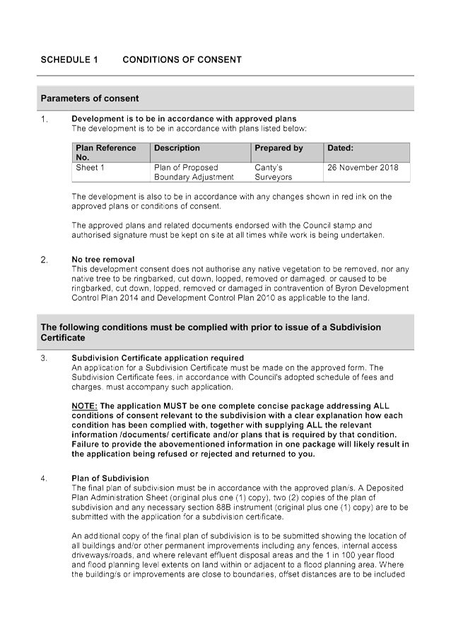

Staff Reports - Sustainable Environment and Economy 6.4 - Attachment 2
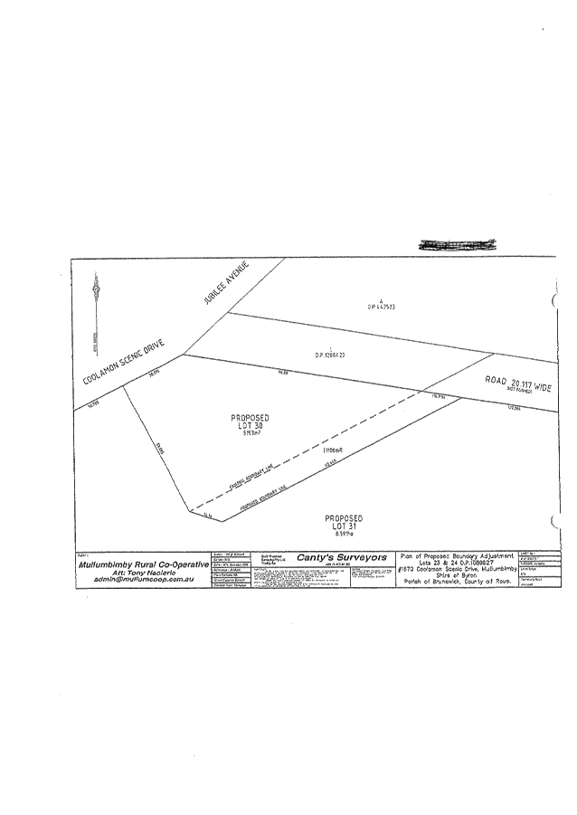
Staff Reports - Sustainable Environment and Economy 6.4 - Attachment 3

Staff Reports - Sustainable Environment and Economy 6.5
Report No. 6.5 PLANNING
- Exceptions of Development Standards 1 January 2019 to 31 March 2019
Directorate: Sustainable
Environment and Economy
Report
Author: Chris
Larkin, Manager Sustainable Development
Noreen Scott, EA Sustainable
Environment and Economy
File No: I2019/639
Summary:
This report is provided as a requirement of the NSW
Department of Planning Circular PS17-006, for reporting on exceptions to
development standards for applications made under clause 4.6 of the Standard
Instrument LEP and Clause 6 of SEPP 1.
NOTE TO COUNCILLORS:
In accordance with the
provisions of S375A of the Local Government Act 1993, a Division is to be
called whenever a motion for a planning decision is put to the meeting, for the
purpose of recording voting on planning matters. Pursuant to clause 2(a)
under the heading Matters to be Included in Minutes of Council Meetings of
Council's adopted Code of Meeting Practice (as amended) a Division will be
deemed to have been called by the mover and seconder of all motions relating to
this report.
|
RECOMMENDATION:
That Council note the report on exceptions to development
standards for the period 1 January 2019 to 31 March 2019.
|
REPORT
This report is provided as a requirement of the NSW
Department of Planning Circular PS17-006, for reporting on exceptions to
development standards for applications made under clause 4.6 of the Standard
Instrument LEP and clause 6 of SEPP 1.
SEPP 1 applies to development applications submitted under
Byron Local Environmental Plan 1988. Clause 4.6 applies to development
applications submitted under Byron LEP 2014.
The period of reporting is for 1 January 2019 to 31 March
2019 for the following DAs:
|
DA No.
|
10.2017.678.1
|
|
Development
|
Demolition of existing buildings and construction of two
(2) residential flat buildings, containing 17x3 bedrooms and 2 x 4 bedroom
dwellings including swimming pool, landscaping, basement car parking and
strata subdivision.
|
|
Property:
|
17-21 Shirley Street BYRON BAY
|
|
Lot and DP:
|
LOT: 1 DP: 1098133, LOT: 3 SEC: 52 DP: 758207
|
|
Zoning:
|
R3 Medium Density Residential (LEP 2014); 7(f2) Coastal
Lands (LEP 1988
|
|
Development Standard being varied
|
BLEP 2014 Cl.4.3 9.0m building height limit
|
|
Justification
|
The proposed non-compliance with the building height was attributed
to the existing variation in the level of the land. The building is
lower than the approved adjoining buildings to the east.
|
|
Extend of variation
|
The maximum height of roofs of the buildings is:
Building No. 1 - 9.77m (8.6% variation)
Building No. 2 - 9.88m (9.8% variation)
The written request indicated that a small section of the roof parapet safety
rail of Building No. 2 has a height of 9.99m (11% variation) above existing
ground level.
|
|
Concurrence
|
Assumed concurrence
|
|
Determination Date
|
21/02/2019
|
|
Determined by
|
Council
|
|
|
|
DA No.
|
10.2018.529.1
|
|
Development
|
Demolition of an Existing Bed and Breakfast
Establishment and construction of a new Garage and Studio Building to
be Completed in Three Stages
|
|
Property:
|
657B Broken Head Road BROKEN HEAD
|
|
Lot and DP:
|
Lot 4 DP 713515
|
|
Zoning:
|
RU2 Rural Landscape/DM Deferred Matter
|
|
Development Standard being varied:
|
BLEP 1988 Clause 40 (2) (b) (i) - The proposed upper
floor level of the studio over the garage building does not comply with
the maximum permitted topmost floor level of 4.5m.
|
|
Justification
|
The development did not raise any matter of significance
from a planning perspective. The building is overall lower in height than the
building being demolished on the same site.
|
|
Extent of variation
|
5.5% Variation to upper most floor of studio over garage
|
|
Concurrence
|
Assumed concurrence
|
|
Determined Date
|
22/2/2019
|
|
Determined By
|
Delegation Director
|
|
|
|
DA No.
|
10.2018.634.1
|
|
Development
|
Demolition of Existing Dwelling House and Construct new
dwelling house and swimming pool
|
|
Property:
|
1 Brownell Drive BYRON BAY
|
|
Lot and DP:
|
LOT: 1 DP: 112343
|
|
Zoning:
|
R2 Low Density Residential
|
|
Development Standard being varied:
|
BLEP 2014 - Clause 4.3 Height of BuildinG and Clause
4.4 Floor Space Ratio
|
|
Justification
|
DA REFUSED under delegation. Clause 4.6 variation requests
for breaches of maximum height and floor space ratio were not supported:
a. The extent of the non-compliance with the required development standards
is excessive, being more than 38% of the permissible 0.4:1 Floor Space Ratio
and 18% of the permissible 9 metre height of building;
b. There are no specific characteristics of the site or environmental
planning grounds that justify a variation to principal development standards;
c. The proposal would set an undesirable precedent; and
d. It is considered contrary to the public interest.
|
|
Extent of variation
|
More than 38% of the permissible 0.4:1 Floor Space Ratio
and 18% of the permissible 9 metre height of building.
|
|
Concurrence
|
DA refused concurrence not applicable
|
|
Determined Date
|
11 /03/2018
|
|
Determined By
|
Delegation Director
|
|
|
|
|
DA No.
|
2018NTH007 DA (10.2017.661.1)
|
|
Development
|
Subdivision of Six (6) Lots into One Hundred and Eighty
Six (186) Lots consisting of One Hundred and Sixty Three (163) Residential
Lots, Fourteen (14) Super (Master) Lots, Two (2) Business Lots, Two (2)
Industrial Lots, One (1) Recreation Lot and Four (4) Residue Lots.
|
|
Property:
|
364, 394, 412 Ewingsdale Road, / Melaleuca Drive
Byron Bay
|
|
Lot and DP:
|
LOT: 1, LOT: 2, LOT: 1, LOT: 2, LOT: 1, LOT: 7020
DP: 201626, DP: 542178, DP: 780242, DP: 818403, DP:
520063, DP: 1113431
|
|
Zoning:
|
R2 Low density residential, R3 Medium density residential,
IN2 Light industrial, B1 Neighbourhood Centre, RE1 Public recreation, E2 Environmental
conservation, E3 Environmental management, 7(a) Wetlands, 7(b) Coastal
Habitat.
|
|
Development Standard being varied
|
BLEP 1988 - Clause 11 Subdivision in rural areas for
agriculture etc
|
|
Justification
|
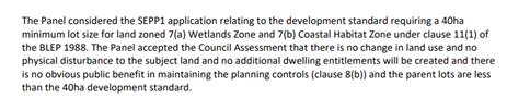
|
|
Extend of variation
|
84%, 60%
|
|
Concurrence
|
Assumed concurrence
|
|
Determination Date
|
14/02/2019
|
|
Determined by
|
Joint Regional Planning Panel
|
STRATEGIC CONSIDERATIONS
Community Strategic Plan and Operational Plan
|
CSP Objective
|
L2
|
CSP Strategy
|
L3
|
DP Action
|
L4
|
OP Activity
|
|
Community
Objective 4: We manage growth and change responsibly
|
4.1
|
Support the
visions and aspirations of local communities through place-based planning and
management
|
4.1.3
|
Manage
development through a transparent and efficient assessment process
|
4.1.3.1
|
Assess and
determine development applications
|
|
|
|
|
|
|
|
|
|
|
|
Legal/Statutory/Policy Considerations
The report is provided as a requirement of NSW Department of
Planning circular PS 17-006. This circular can be viewed at http://www.planning.nsw.gov.au/~/media/Files/DPE/Circulars/planning-circular-variations-to-development-standards-2017-12-19.ashx
Staff Reports - Sustainable Environment and Economy 6.6
Report No. 6.6 PLANNING
- 10.2013.587.6 S4.55 for Minor Changes to Approved Plans and Amendments to
Easements and Hours of Operation and Removal of Requirement to Comply with
Council's Airspace Policy at 108-110 Jonson Street BYRON BAY NSW 24
Directorate: Sustainable
Environment and Economy
Report Author: Stephen
McCarthy, Building Certifier
File No: I2019/641
|
Proposed modification:
|
S4.55 for Minor Changes to Approved Plans and
Amendments to Easements and Hours of Operation and Removal of Requirement to
Comply with Council's Airspace Policy
|
|
Original Development:
|
Redevelopment of existing shopping centre to create a ground floor supermarket, first
floor retail shops, restaurants, bowling ally (recreation facility), art gallery (commercial premises),
cinema complex (place of assembly), two levels of basement car
parking, terrace over Jonson Street road reserve, associated works and
subdivision of four (4) allotments into two (2) lots.
|
|
Type of modification sought:
|
|
|
|
|
|
Property description:
|
LOT: 7 DP: 619224, LOT: 6 DP: 619224, LOT: 8 DP: 617509,
LOT: 9 DP: 617509
|
|
108-110 Jonson Street BYRON BAY, 98-106 Jonson Street
BYRON BAY, 112-114 Jonson Street BYRON BAY
|
|
Parcel No/s:
|
116180, 116190, 34840, 177890
|
|
Applicant:
|
Mercato on Byron Pty Ltd CARE Urbis Pty Ltd
|
|
Owner:
|
Wingate Byron Property Holdings Pty Ltd & Task
Group Services Pty Ltd
|
|
Zoning:
|
B2 Local Centre
|
|
S4.55(1A) Date received:
|
14 March 2019
|
|
Original DA determination date:
|
20/11/14
|
|
Integrated Development:
|
Yes – NSW Office of Water (General Terms of Approval
for Dewatering) Controlled Activity Approval (this modification did not
trigger re referral to integrated agency).
|
|
Public notification or exhibition:
|
- Level
2 advertising under DCP 2014 Part A14 – Public Notification and
Exhibition of Development Applications
- Exhibition
period: 4 April 2019 to 17 April 2019
- Submissions received:
Nil.
|
|
Delegation to determination:
|
Council
|
|
Issues:
|
· Amendment to
Airspace Policy for balconies over Council land (Jonson Street footpath).
· Noise from
Balconies.
|
Summary:
An application has been received seeking to:
· Modify the
approved plans listed under Condition No. 1, to reflect certified construction
plans including changes to balcony doors opening onto balconies fronting Jonson
Street;
· Modify approved
plans to reflect proposed subdivision plans (between Mercato site and old
Woolworths site);
· Amendment to
easement condition wording to allow interim Occupation Certificate.
· Amendment to
conditional hours of operation of retail tenancies, restaurants and gallery.
· Amendment to
Airspace Policy for balconies over Council land (Jonson Street footpath)
The proposed requested changes are generally supported
except for the change to the condition requiring compliance with the Airspace
Policy for the balconies over Council’s Jonson Street Footpath.
The proposed development is considered to be substantially
the same development, having regard to relevant matters for consideration under
Section 4.55 of the EPA Act 1979. The application is recommended for part
approval subject to conditions and part refusal.
NOTE TO COUNCILLORS:
In accordance with the
provisions of S375A of the Local Government Act 1993, a Division is to be
called whenever a motion for a planning decision is put to the meeting, for the
purpose of recording voting on planning matters. Pursuant to clause 2(a)
under the heading Matters to be Included in Minutes of Council Meetings of
Council's adopted Code of Meeting Practice (as amended) a Division will be
deemed to have been called by the mover and seconder of all motions relating to
this report.
|
RECOMMENDATION:
That pursuant to Section 4.55 of the Environmental
Planning & Assessment Act 1979, Application No. 10.2013.587.6:
a) Minor
Changes to Approved Plans and Amendments to Easements and Hours of Operation,
be approved by modifying Development consent number 10.2013.587.6 as in
Attachment 2 (E2019/31159);
b)
The deletion of condition 23 being the requirement to comply with Byron Shire
Council’s Airspace Policy be refused.
|
Attachments:
1 Amended
plans to accompany Council report, E2019/31134
, page 343⇩
2 Amended
consent conditions, E2019/31159 ,
page 359⇩ 
SECTION 4.55
APPLICATION REPORT
1. INTRODUCTION
1.1. History/Background
The following development consent over the subject site is
noted:
10.2013.587.1 Development
consent was issued on 26 November 2014 for “Redevelopment of existing shopping centre to create a ground
floor supermarket, first floor retail shops, restaurants, bowling ally
(recreation facility), art gallery
(commercial premises), cinema complex (place of assembly), two levels of basement car parking, terrace
over Jonson Street road reserve, associated works and subdivision of four (4)
allotments into two (2) lots.”
10.2013.587.2 Section
96 application lodged 18 February 2015 seeking to delete Condition No.54 of
development consent 10.2013.587.1. Condition No.54 requires a formal agreement
between Council and the proponents regarding leases and future point of sale
contracts, application approved 21 May 2015.
10.2013.587.3 Section
96 application seeking to modify conditions relating to signage, amenity of
neighbourhood , availability of parking, traffic, construction staging, roof
height, stormwater, site waste management, flood planning, pipelines,
landscaping, excavation, public safety, water pollution, public art and
services, approved 21 May 2015.
10.2013.587.4 Section
96 application seeking to modify conditions relating to the addition of roof
top screen enclosures and other internal and external modifications, approved
17 May 2018.
10.2013.587.5 S455
application to modify Council condition No. 23 relating to Council requirement
to install a roundabout to Carlyle Street. This application is currently being
assessed by Council staff.
Occupation
Certificates Issued by Council as Principle Certifying Authority (PCA)
13.2013.587.1 issued
by Council as PCA on 24 December 2018 for use of basement carpark levels and
occupant access/ egress from basement levels.
13.2013.587.5 issued
by Council as PCA on 2 April 2019 Interim Occupation Certificate for remainder
of base building excluding balconies over Council footpath until a lease
agreement is in place. The issue of the base building Occupation Certificate
facilitated the issue of the retail tenancy fitout Occupation Certificates
including Woolworths and Palace Cinemas. Other specialty shop tenancies have
also received their Occupation Certificates for fitouts.
1.2. Description of the
Proposed Modification to the Development
1. Condition
No. 1 – Amend the approved Plans
This application seeks consent to modify the approved plans
to align with the internal layout, which has been refined to meet tenancy
demand and needs. The changes to the tenancy layout have resulted in changes to
the Gross Floor Area (GFA) with a reduction of approximately 113m² across
the entire development. A change is also requested to the access doors from
Tenancies T08 and T09 onto balconies which are constructed over Jonson Street.
The door change proposed is from double leaf doors to bifold/ stackers.
Comments: The changes to the internal layout are
considered to be minor changes and the reduction in GFA is not considered to
have any off site impacts or alter constructed car parking numbers. The change
to T08 and T09 door openings size have been assessed in relation to amenity
impact on adjacent properties and this change is not considered to
significantly contribute to off site impacts from the development. The changes
in plans currently before Council reflects certified construction plans and
allows the tenants of T08 & T09 to open up their tenancies to make use of
their leased floor area which include balconies over Council’s Jonson
Street footpath. For details please see Attachment A for plans showing changes.
2. Condition
No.3 – Amend the Hours of operation:
Consent is sought to amend the hours of operation for the
centre to be uniform for all tenancies regardless of use. With the
amended condition the centre will have the flexibility to operate to the
maximum stated hours. Each tenancy is not obligated to operate to these maximum
opening hours.
Current Condition;
3) Hours of
operation
The hours of operation for retail
uses are limited to the following:
· Monday
- Saturday 7.00am to 6.00pm & Sunday 7.00am to 4.00pm.
The hours of operation for the
restaurants and art gallery are limited to the following:
· Monday
to Saturday 7.00am to midnight (12:00am) and Sunday 7.00am to 10.00pm.
The hours of operation for the cinema
and bowling alley are not limited.
Proposed Condition;
3) Hours
of operation
The hours of operation for retail
uses, restaurants and gallery is limited to the following:
· Monday
to Sunday 6.00am to midnight (12:00am).
The hours of operation for the cinema are not limited.
The loading or delivery of
goods to, or the removal of waste from, the premises—only be carried out
between 7.00 am and 7.00 pm on any day
Comments: The change to approved operating hours as
recommended is supported as this allows the centre’s uses to operate to
meet retail demands commonly found at other like centres. It is noted there is
no longer a bowling alley as part of the development. Limiting loading dock
delivery times under this condition confirms no change to approved loading dock
use times. Extended (24 hour) trading hours over the Christmas period is currently
permitted as exempt development in State Government Planning Policies and it is
not necessary to state this in this condition. Having regards to the
centre’s location in the heart of the Byron CBD it is considered the
extension of the trading hours as proposed can be supported.
3. Condition
No.23i – delete the requirement for the airspace lease of the balconies
over the road reserve.
The applicant has submitted that
“This new policy has
been introduced after the original DA approval for the Mercato on Byron
shopping centre application and was not anticipated in the feasibility of the
centre. The balconies located over the road reserve are of public benefit as
they provide shelter to the pedestrian pathways located below. The leasing fee
associated with the newly introduced policy would place the balconies as
unfeasible, as the space that is located on the balcony is not leasable area.
The area located on the
balcony is allocated for tenancy seating and therefore has limited opportunity
to recapture the lost revenue. Yet, the balcony seating area provides a public
realm benefit as it creates opportunity for public surveillance and engagement
with the streetscape.
With a leasing fee introduced
over balcony areas, the centre would be required to be redesigned as the
leasing charges as unsustainable as an ongoing cost. If the balconies were to
be redesigned and located back from the road reserve, it would bring a lesser
design outcome, not providing shade over pedestrian pathways and greater
unrestricted public surveillance.”
Condition 23(i) requires
i) Awnings
and structures on the road reserve
Awnings and structures on the road reserve must be setback
a minimum distance of 1000mm from the kerb alignment. The underside of any
awning or verandah is to be not less than 3200mm above the footpath. Awnings
are to be structurally capable of withstanding all loads including self loads,
live loads (including maintenance crews walking over them), lateral wind loads,
impact loads (including being struck by a passing vehicle). Certification from
an appropriately qualified practising structural engineer that the design and
structure comply with the relevant clauses of the BCA must be submitted with
the Roads Act application.
The applicant is required to enter into an airspace
lease agreement with Council for the airspace structures (and associated
commercial floor space) of the first floor terrace over the Jonson Street road
reserve in accordance with Byron Shire Council Airspace Policy No.12/004.
Comment:
Development consent 10.2013.587.1 was granted on 20 November
2014 to Global Centres Australia Pty Ltd for the redevelopment of an existing
shopping centre on Lots 6-7 DP 619224 and Lots 8-9 DP 617509.
Condition 23(i) of the consent required the applicant to enter
into an airspace lease agreement with Council for the first floor area that
hangs over part of the Jonson Street road reserve. The applicant was
subsequently granted amended development consents in 10.2013.587.2 and
10.2013.587.3 on 21 May 2015 and 10.2013.587.4 on 16 May 2018. No amended
consent altered the need for the applicant to enter into an airspace lease in
accordance with condition 23(i) in 10.2013.587.1.
Despite having knowledge of clause 23(i) in 10.2013.587.1
since 20 November 2014, no airspace lease has been entered into either. The
applicant has had full knowledge of their obligations under the Road Airspace
Policy during the design, construct and tenancy acquisition periods of the
development to date.
The original DA assessment reported to Council identified
compliance with the Road Airspace policy necessary.
The purpose of a Road Airspace Policy is to recognise that
airspace structures enable private interests to profit from the use of public
space and that it is appropriate for Council to charge for that usage. It is
also to provide for approval arrangements for road airspace structures (e.g.
Balconies) that encroach into public space and provide for commercial floor
space.
The balcony areas in question are associated with upper level
restaurants and the cinema, which are commercial uses.
It is considered erroneous to suggest that this is a new
condition.
The removal of this condition is therefore not supported.
4. Condition
No.63 Rights of Way Easements be amended as follows:
The applicant has submitted that due to complications and
delays in confirming the electrical infrastructure requirements with Essential
Energy, the subdivision registration process has been delayed and they have
been unable to comply with the current timing requirements of the consent
condition. It is proposed that the condition be amended to read (see italics
for timing extension);
63. Rights of Way
and Easements
All proposed rights of footway,
rights of carriageway and easements for the shared use of parking spaces,
together with easements for services and other encroachments such the basement
air supply enclose, must be registered on title prior to the issue of the
Final Occupation Certificate or within 6 Months of determination of
DA10.2013.587.5 which ever comes first.
Comments: This change is supported given the
unexpected delays in obtaining third party approvals for the
development’s infrastructure. It is recommended this condition be amended
to place a timeframe on compliance with this condition in addition to a final
occupation certificate trigger for compliance.
1.3. Description of the site
and surrounds
The proposed development area comprises the Mercato Shopping
Centre (formerly known as Byron Shopping Plaza South) at 108-114 Jonson Street,
Byron Bay and the site occupied by a supermarket at 98-106 Jonson Street, Byron
Bay. The subject site is located on the western side of Jonson Street near the
intersections of Carlyle and Kingsley Streets towards the southern end of the
Byron Bay town centre.
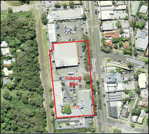
Figure 1 – Subject site and surrounds (Air photo
September 2012)
The subject site comprises a total of four (4) irregular
shaped allotments. The two most southern allotments of the site (Lot 7 DP
619224 and Lot 8 DP 617509) contain Mercato Shopping Centre site which is
recently completed. The two most northern allotments (Lot 9. DP 617509 &
Lot 6 DP 619224) contain the previous Woolworths supermarket and a portion of
the Mercato Shopping centre.
Located to the north of the site is the northern portion of
the Byron Plaza Shopping Centre. The adjoining property to the south contains
an existing backpacker’s hostel “Holiday Village”. Adjoining
to the west is railway corridor land forming part of the disused North Coast
Railway. To the east of the site, on the opposite the site of Jonson Street,
are various commercial and retail business.
2. SECTION 79C – MATTERS FOR CONSIDERATION
– DISCUSSION OF ISSUES
Having regard for the matters for consideration detailed in
Section 79C (1) of the Environmental Planning & Assessment Act 1979, the
following is a summary of the evaluation of the issues.
Section 4.55 of the EPA Act 1979.
It is considered the majority of the proposed amendments are
minor and that the development remains substantially the same as approved. It
is considered the proposal satisfies S4.55 of the EPA Act 1979. However, the
request to remove the condition requiring an airspace lease for the upper level
balconies is not supported, and that condition is recommended to remain.
2.1. State/Regional Planning
Policies, Instruments, EPA Regulations 2000
The majority of the proposed amendments raise no issues
under the relevant SEPPS, Policies or clauses of the EPA Regulation 2000.
2.2. Byron Local Environmental
Plan 2014
The majority of the proposed amendments raise no issues
under the LEP which have not been previously considered.
2.3. Draft EPI that is or has
been placed on public exhibition and details of which have been notified to the
consent authority - Issues
No draft EPIs affect the proposal.
2.4. Development Control Plans
The majority of the proposed amendments do not generate any
issues that have not been previously considered.
2.5. The likely impacts of that
development, including environmental impacts on both the natural and built
environments, and social and economic impacts in the locality
Built Environment
The various design modifications include:
· A revised internal
tenancy layout;
· An additional
external balcony area (12m²) off Tenancy T20 (north east corner of
tenancy) providing weather protection to customers accessing Woolworths via the
basement car parking moving walkway;
· Installation of
stacker (bifold) doors to Tenancy T08 and Tenancy T09. Other tenancies with
stacker doors have been accepted under previous modifications or as part of the
certified construction plans;
· Installation of
additional required fire exit stair to the northern boundary, adjacent to
previous Woolworth’s supermarket.
The above changes are considered minor and will not have a
detrimental impact on the built environment in terms of building design and
appearances.
Noise
Further consideration
has been given to the use of the balconies in terms of noise generation from
restaurant activities. Such usage can result in a breach the Protection
of the Environment Operations Act 1997 at the nearest affected residential
dwellings and surrounding properties, and also the standard NSW Liquor
Licensing noise requirements.
To minimise the
potential likelihood of noise intrusion to nearby residential dwellings, and
need for compliance action to remedy, it is recommended that the following
condition be imposed on the use of the upper balconies:
8a) Use and operation of upper Level Balconies to
not interfere with the amenity of the neighbourhood
The proposed use and operations of the
upper level balconies shall not interfere with the amenity of the neighbourhood
by reason of noise and vibration. In particular:
a The
noise and vibration level emanating from the use of the premises in accordance
with this development must not cause or permit “offensive noise” as
defined by the Protection of the Environment Operations Act 1997 to impact upon
neighbouring residential dwellings. Plant and equipment shall be maintained in
good condition and monitored to ensure operating conditions minimise noise and
vibration impacts off the property.
b All
amplified music and public address systems must be operated so that they are
not audible outside of the boundary of the property after 10:00pm on any day,
and before 8:00am on the following day.
Subdivision
The applicant proposes to modify
the approved plans of subdivision to reflect current needs and to facilitate
redevelopment of the previous Woolworths site which is the subject of a
separate development application for redevelopment as a hotel. The modified
subdivision layout raises no issues.
2.6 The suitability of the site for the development
No assessed impact.
2.7 Submissions
made in accordance with this Act or the regulations
No submissions were received.
2.8 Public
interest
The proposed amendments are unlikely to prejudice or
compromise the public interest.
2.9. DEVELOPER
CONTRIBUTIONS/ WATER AND SEWER CHARGES
There is no nexus to levy additional contributions.
3. DISCLOSURE OF POLITICAL DONATIONS AND GIFTS
|
Has a Disclosure Statement been received in relation
to this application
|
No
|
|
Have staff received a ‘gift’ from anyone
involved in this application that needs to be disclosed. Where the answer is
yes, the application is to be determined by the Director or Manager of the
Planning, Development and Environment Division.
|
No
|
4. CONCLUSION
The majority of the application is considered to have
sufficient planning merit to warrant approval. However, the request to remove the
condition requiring an airspace lease for the upper level balconies is not
supported, and that condition is recommended to remain.
Staff Reports - Sustainable Environment and Economy 6.6 - Attachment 1
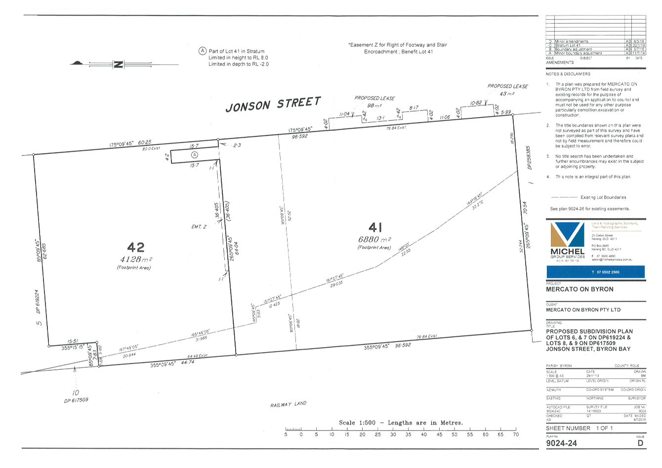
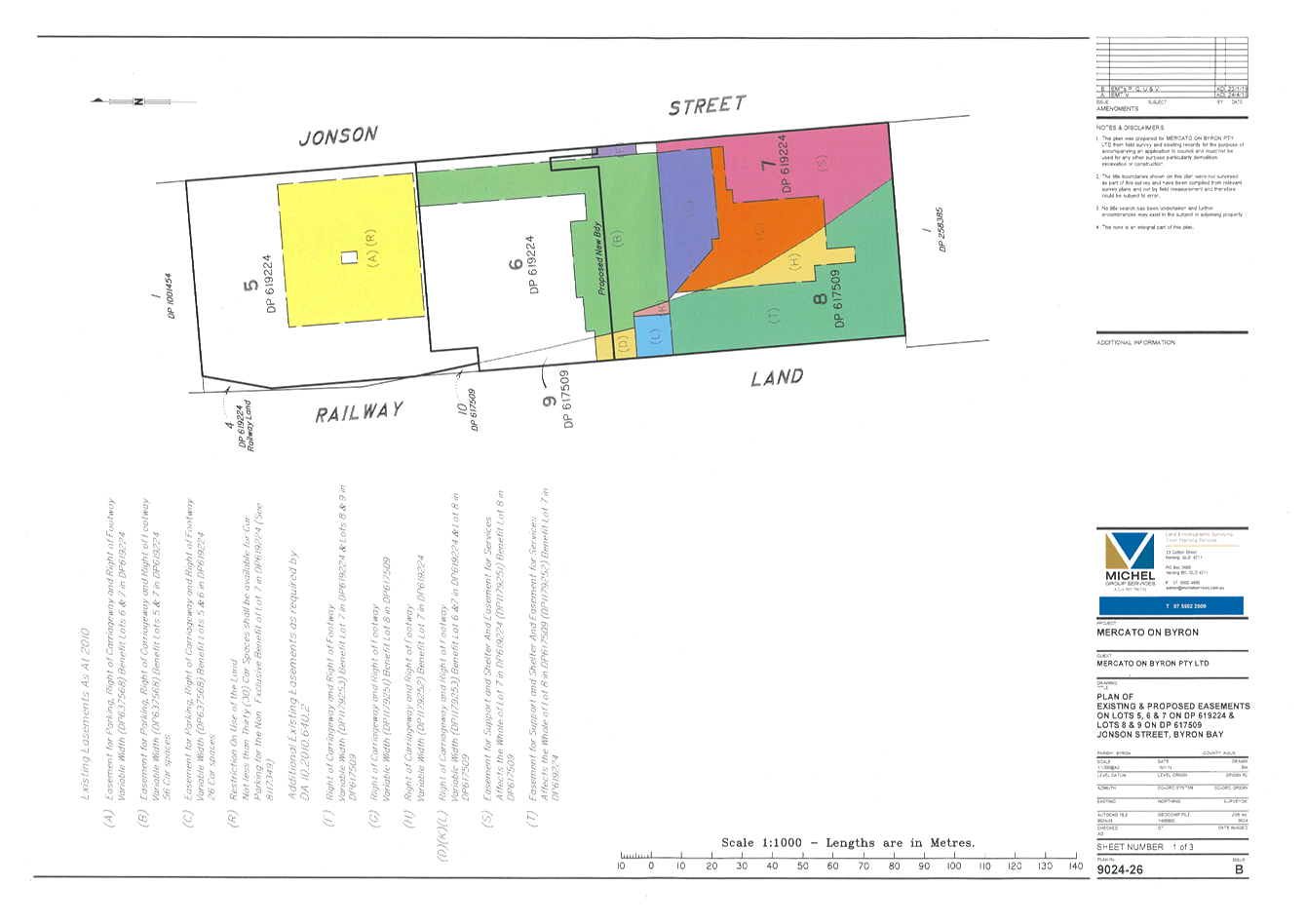
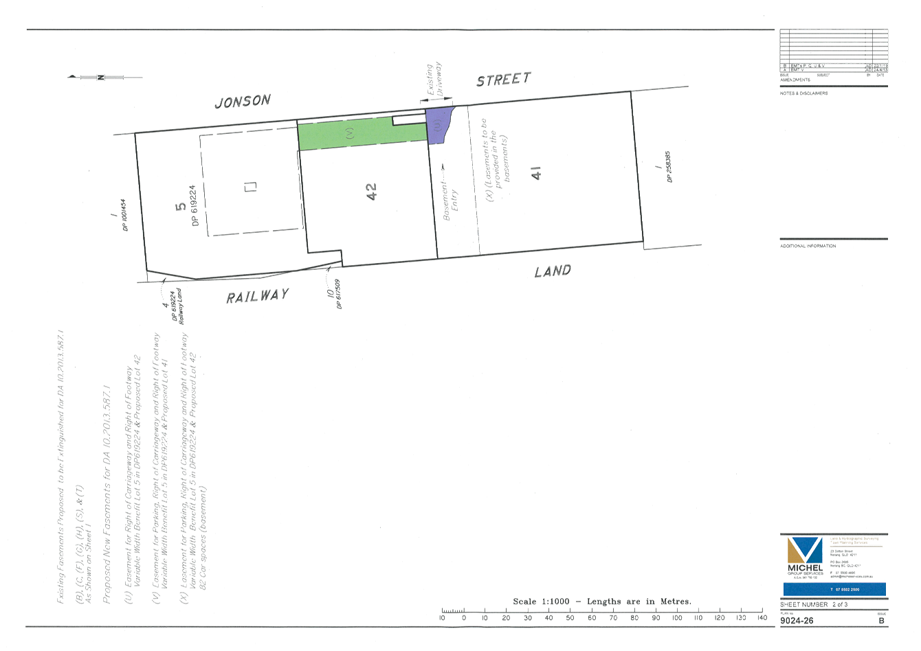
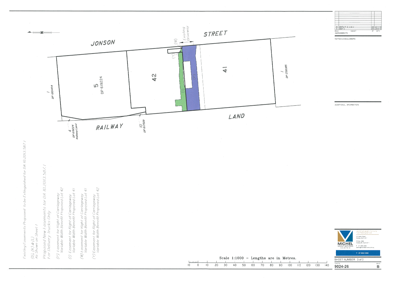
Staff Reports - Sustainable Environment and Economy 6.6 - Attachment 2

Staff Reports - Infrastructure Services 6.7
Staff Reports - Infrastructure Services
Report No. 6.7 Suffolk
Beachfront Holiday Park - Sale of homes on site 3 & 8
Directorate: Infrastructure
Services
Report
Author: Pattie
Ruck, Open Space Facilities Coordinator
File No: I2019/600
Summary:
Advice has recently been received from the home owners on
site 3 and 8 at Suffolk Beachfront Holiday Park of their intention to
sell.
Due to Crown Land Encroachments, Current Regulation
Compliance Program, Caravan Park Approval to Operate Conditions and Structural
Safety uncertainties, it is considered beneficial for Council to consider
purchasing these structures at market value.
|
RECOMMENDATION:
1. That subject to the meeting of the conditions set out in 2 below
Council purchase dwellings in Suffolk Beachfront Holiday Park.
2. That
Council’s purchase is conditional upon the purchase price being within budget
limits and does not exceed an amount which is 10% greater than the amount
verified by an independent valuation of each dwelling.
3. That Council authorise the General Manager to take all steps
necessary to enter into a purchase contract and to sign and
counter-sign all documents associated with the purchase of the dwellings.
|
Attachments:
1 Confidential
- SBHP Map PDF April 2019, E2019/28640
REPORT
Information/Background
Since the re-classification of the permanent sites from
community land to operational land, Staff has been working with permanent
residents in transitioning residents to new site agreements. This
transition program includes a regulation compliance program to ensure safety
standards are met.
Permanent resident history as it relates to the
reclassification, agreements and sales includes:
— Re-classification
Re-classification of
the permanent sites from Community to Operation land was achieved in
2018. The primary purpose for re-classification was to provide tenure
security to permanent residents.
— Site agreements before
and after the re-classification
The sale of homes
before the re-classification involved the transfer of an existing site
agreement to the new home owner in accordance with Resolution 07-364.
Resolution 07-364
‘That pending
reclassification of Lot 100 in DP1023737 and/or adoption of a Plan of
Management, Council not issue any leases for occupation of any
‘permanent’ sites on any part of the land’
One home sale has
occurred since re-classification, resulting in a new site agreement with the
new owner of the home on site 22.
Resolution 18-584
1. Endorse
the Project Plan (E2018/61386) and Communication Strategy (E2018/61762) for the
current owners to transition to new site agreements and Regulation Compliance
Program.
2. Endorse
that any new home owners enter a new agreement that will set site fees at
“fair market value” as outlined in section 109 of Act and use the
“Non-fixed Method” for future site fee increases and specify a term
of agreement for no longer than 5 years.
— Sale of dwellings prior
and post re-classification
Council owns the land
but not resident structures. Historically Council’s involvement in
a sale has included the transfer of an exiting site agreement to the new owner
and the entering into a new site agreement with a new owner post
re-classification.
The following
resolutions refer to home purchases at the Holiday Park.
· Resolution
00-1026
· Resolution
03-293
— Existing Encroachments
Confidential attachment
1, SBHP Map PDF April 2019, highlights encroachments along the Eastern Boundary
into Crown land. As shown, significant encroachment occurs to Crown Land
from a number of tourist sites with lesser encroachment from sites with
permanent residents. A letter has been sent to the Minister of Crown Land
seeking an Operational land classification for the area of Crown that has been
encroached.
— Meetings/workshops with
residents within the park and community
Meetings with the
residents within the Suffolk Park Community have been held in the past and more
recently providing advice as to the re-classification and new site agreement
process adopted by Council.
Key issue considerations
when purchasing structures on site 3 & 8 and future sites
Suffolk Beachfront Holiday
Park Communication Strategy and associated Key Messages aligning with
Council’s actions
Two workshops have been held recently with
residents to inform them of the next steps since the re-classification,
re-iterating Councils ability to enter into new site agreements, subsequently
providing long term security to residents of the park. Key advice has
included regulation compliance, importance of building and site safety and
necessary actions required in transitioning to new site agreements. The
purchase of structures on site 3 & 8 would allow Council to advance any
regulatory compliance and or structural safety needs for these sites.
The intention of purchasing these structures would
be for Council to undertake any necessary works that achieve regulatory
compliance and for it to remain as a long term permanent resident site in
alignment. This is in alignment with Council’s current communication
strategy and project plan adopted in Res 18-584.
Perceived purchase benefits
Benefits of purchasing structures on site 3
& 8
- Enables
Council to expedite the regulatory compliance program, addressing any
structural safety actions.
- Allows
Council with the capacity to ensure compliance with legislative requirements.
- Allows
Council to continue to offer tenure security to permanent residents.
- Avoids
Council entering into a new site agreement on sites with existing Crown Land
encroachments.
STRATEGIC CONSIDERATIONS
Community Strategic Plan and
Operational Plan
|
CSP Objective
|
L2
|
CSP Strategy
|
L3
|
DP Action
|
L4
|
OP Activity
|
|
Community
Objective 4: We manage growth and change responsibly
|
4.2
|
Support
housing diversity in appropriate locations across the Shire
|
4.2.1
|
Establish
planning mechanisms to support housing that meets the needs of our community
|
4.2.1.2
|
Identify
opportunities and partners to facilitate the provision of housing
diversity/affordability in the Shire
|
|
Community
Objective 5: We have community led decision making which is open and
inclusive
|
5.5
|
Manage
Council’s finances sustainably
|
5.5.1
|
Enhance the
financial capability and acumen of Council
|
5.5.1.2
|
Support the
organisation in identifying financial implications of projects, proposals and
plans
|
|
Community
Objective 1: We have infrastructure, transport and services which meet
our expectations
|
1.2
|
Provide
essential services and reliable infrastructure which meet an acceptable
community standard
|
1.2.9
|
Develop capital
upgrades, renewal and enhancements works program for buildings- including
community buildings, public toilets, emergency services, sports club
facilities and Council operations buildings (SP)
|
1.2.9.3
|
Consult with
user groups to establish user agreements, leases, licenses and Plans of
Management
|
|
|
|
|
|
|
|
|
|
|
|
|
|
Legal/Statutory/Policy
Considerations
Suffolk Beachfront Holiday Park is governed by the
Residential (Land Lease) Communities Act 2013, Local Government (General)
Regulation 2005 and Local Government (Manufactured Home Estates, Caravan Parks,
Camping Grounds and Moveable Dwellings) Regulation 2005.
The Caravan Park and Camping Ground Approval relies on
special condition completion regarding compliance to the above Acts and
Regulations within a 3 and 5 year timeframe. Special conditions within
this approval relate to the permanent structures for the long term residents.
Council’s current legal advice on purchasing the
moveable dwellings on sites 3 & 8 where there are Crown encroachments as
below
“Because the moveable dwellings on each site where
the legal boundary runs through the site are not part of the land, I
don’t see any impediment to Council buying them if the owner is willing
to sell. Nothing about a potential sale changes the boundary location. If anything,
it is preferable there’s only two parties involved where the land
boundary cuts a site (Council and Crown), rather than three parties (Council,
Crown and a home owner).”
Reviewed by Legal Counsel: ☒
Financial Considerations
Financial benefits of purchasing structures on
site 3 & 8 and future sites
- The
purchase of the homes would enable Council with the ability to consider
permanent site fees in the future and also the ability to set fees to continue
the few affordable housing options in Suffolk.
- Potential
income per site in table below
|
Action
|
Income per annum
|
Pay back period
|
ROI
|
Costs incl buy price $115K
|
|
Short term tourist site
|
$15,000
|
9 years
|
11.1%
|
Clean site $20K
|
|
Upgrade existing permanent structure
|
$23,000
|
6.7 years
|
14.8%
|
Upgrades $40k
|
|
Upgrade to short term cabin
|
$35,000
|
5.57 years
|
17.9%
|
Upgrade $80K
|
Financial Non-benefits/unknowns of purchasing
structures on site 3 & 8 and future sites
- Ensuring
homes are compliant will involve works with budget implications, currently
unknown.
Requested in March Review is a transfer from the caravan
park reserve of funds to determine the budgetary limits for the purchase.
The most recent sale of site 22 sold for $115K. Caravan Reserve actual at
30 June 2018 is $2,999,804.00.
Reviewed by Manager Finance: ☒
Consultation and Engagement
Past consultation and recent workshops with all permanent
residents has re-iterated their concern on Council buying back permanent
sites. They are concerned when Council buys their home it will become a
tourist site and eventually the permanent residents will decrease. It is
important that key messages within the communication strategy and
Council’s actions are aligned.