Agenda
Ordinary
(Planning) Meeting
Thursday,
19 September 2019
held
at Council Chambers, Station Street, Mullumbimby
commencing
at 11.00am
 Public Access relating to items
on this Agenda can be made between 11.00am and 11.30am on the day of the
Meeting. Requests for public access should be made to the General Manager
or Mayor no later than 12.00 midday on the day prior to the Meeting.
Public Access relating to items
on this Agenda can be made between 11.00am and 11.30am on the day of the
Meeting. Requests for public access should be made to the General Manager
or Mayor no later than 12.00 midday on the day prior to the Meeting.
Mark
Arnold
General
Manager
What is a “Conflict of Interests” - A conflict of
interests can be of two types:
Pecuniary - an interest that a person has in a matter because of a reasonable
likelihood or expectation of appreciable financial gain or loss to the person
or another person with whom the person is associated.
Non-pecuniary – a private or personal interest that a Council
official has that does not amount to a pecuniary interest as defined in the Code
of Conduct for Councillors (eg. A friendship, membership of an association,
society or trade union or involvement or interest in an activity and may
include an interest of a financial nature).
Remoteness – a person does not have a pecuniary interest in a matter
if the interest is so remote or insignificant that it could not reasonably be
regarded as likely to influence any decision the person might make in relation
to a matter or if the interest is of a kind specified in the Code of Conduct
for Councillors.
Who has a Pecuniary Interest? - a person has a pecuniary interest in a
matter if the pecuniary interest is the interest of the person, or another
person with whom the person is associated (see below).
Relatives, Partners - a person is taken to have a pecuniary interest in a
matter if:
§ The person’s
spouse or de facto partner or a relative of the person has a pecuniary interest
in the matter, or
§ The person, or a
nominee, partners or employer of the person, is a member of a company or other
body that has a pecuniary interest in the matter.
N.B. “Relative”, in relation to a person means any of the
following:
(a) the
parent, grandparent, brother, sister, uncle, aunt, nephew, niece, lineal
descends or adopted child of the person or of the person’s spouse;
(b) the
spouse or de facto partners of the person or of a person referred to in
paragraph (a)
No Interest in the Matter - however, a person is not taken to have a
pecuniary interest in a matter:
§ If the person is
unaware of the relevant pecuniary interest of the spouse, de facto partner,
relative or company or other body, or
§ Just because the
person is a member of, or is employed by, the Council.
§ Just because the
person is a member of, or a delegate of the Council to, a company or other body
that has a pecuniary interest in the matter provided that the person has no
beneficial interest in any shares of the company or body.
Disclosure and participation in meetings
§ A Councillor or a
member of a Council Committee who has a pecuniary interest in any matter with
which the Council is concerned and who is present at a meeting of the Council
or Committee at which the matter is being considered must disclose the nature
of the interest to the meeting as soon as practicable.
§ The Councillor or
member must not be present at, or in sight of, the meeting of the Council or
Committee:
(a) at any
time during which the matter is being considered or discussed by the Council or
Committee, or
(b) at any
time during which the Council or Committee is voting on any question in
relation to the matter.
No Knowledge - a person does not breach this Clause if the person did
not know and could not reasonably be expected to have known that the matter
under consideration at the meeting was a matter in which he or she had a
pecuniary interest.
Non-pecuniary Interests - Must be disclosed in meetings.
There are a broad range of options available for managing conflicts &
the option chosen will depend on an assessment of the circumstances of the
matter, the nature of the interest and the significance of the issue being
dealt with. Non-pecuniary conflicts of interests must be dealt with in at
least one of the following ways:
§ It may be appropriate
that no action be taken where the potential for conflict is minimal.
However, Councillors should consider providing an explanation of why they
consider a conflict does not exist.
§ Limit involvement if
practical (eg. Participate in discussion but not in decision making or vice-versa).
Care needs to be taken when exercising this option.
§ Remove the source of
the conflict (eg. Relinquishing or divesting the personal interest that creates
the conflict)
§ Have no involvement by
absenting yourself from and not taking part in any debate or voting on the
issue as of the provisions in the Code of Conduct (particularly if you have a significant
non-pecuniary interest)
§
RECORDING OF VOTING ON PLANNING MATTERS
Clause 375A of the Local Government Act 1993
– Recording of voting on planning matters
(1) In this section, planning
decision means a decision made in the exercise of a function of a council
under the Environmental Planning and Assessment Act 1979:
(a) including a decision
relating to a development application, an environmental planning instrument, a
development control plan or a development contribution plan under that Act, but
(b) not including the making of
an order under that Act.
(2) The general manager is
required to keep a register containing, for each planning decision made at a
meeting of the council or a council committee, the names of the councillors who
supported the decision and the names of any councillors who opposed (or are
taken to have opposed) the decision.
(3) For the purpose of
maintaining the register, a division is required to be called whenever a motion
for a planning decision is put at a meeting of the council or a council
committee.
(4) Each decision recorded in
the register is to be described in the register or identified in a manner that
enables the description to be obtained from another publicly available
document, and is to include the information required by the regulations.
(5) This section extends to a
meeting that is closed to the public.
Ordinary (Planning) Meeting
BUSINESS OF Ordinary (Planning) Meeting
1. Public Access
2. Apologies
3. Requests for Leave of
Absence
4. Declarations of Interest
– Pecuniary and Non-Pecuniary
5. Tabling of Pecuniary
Interest Returns (Cl 4.9
Code of Conduct for Councillors)
6. Adoption of Minutes from
Previous Meetings
6.1 Ordinary
(Planning) Meeting held on 15 August 2019
7. Reservation of Items for
Debate and Order of Business
8. Mayoral Minute
9. Notices of Motion
Nil
10. Petitions
11. Submissions and Grants
12. Delegates' Reports
13. Staff Reports
Sustainable Environment and Economy
13.1 PLANNING
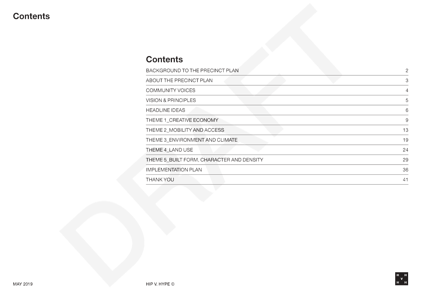
-Byron Arts and Industry Estate Draft Precinct Plan.................................... 5
13.2 Proposed
RU6 Transition Zone - Outcome of Public Exhibition.................................... 62
13.3 Draft
Mullumbimby Masterplan..................................................................................... 212
13.4 Place
Planning Cluster Group - A new method of managing implementation of place plans 296
13.5 Integrated
Pest Management Strategy 2019-2029....................................................... 302
13.6 Report
of Planning Review Committee held on 8 August 2019................................... 355
Infrastructure Services
13.7 Draft
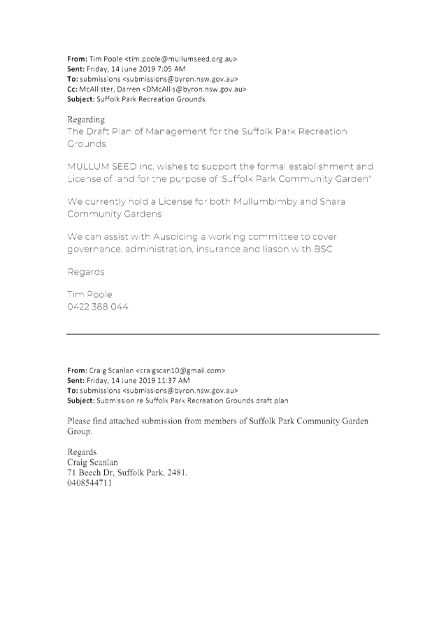
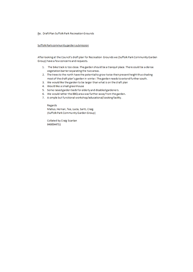
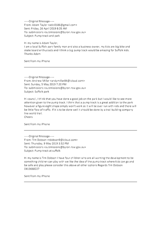
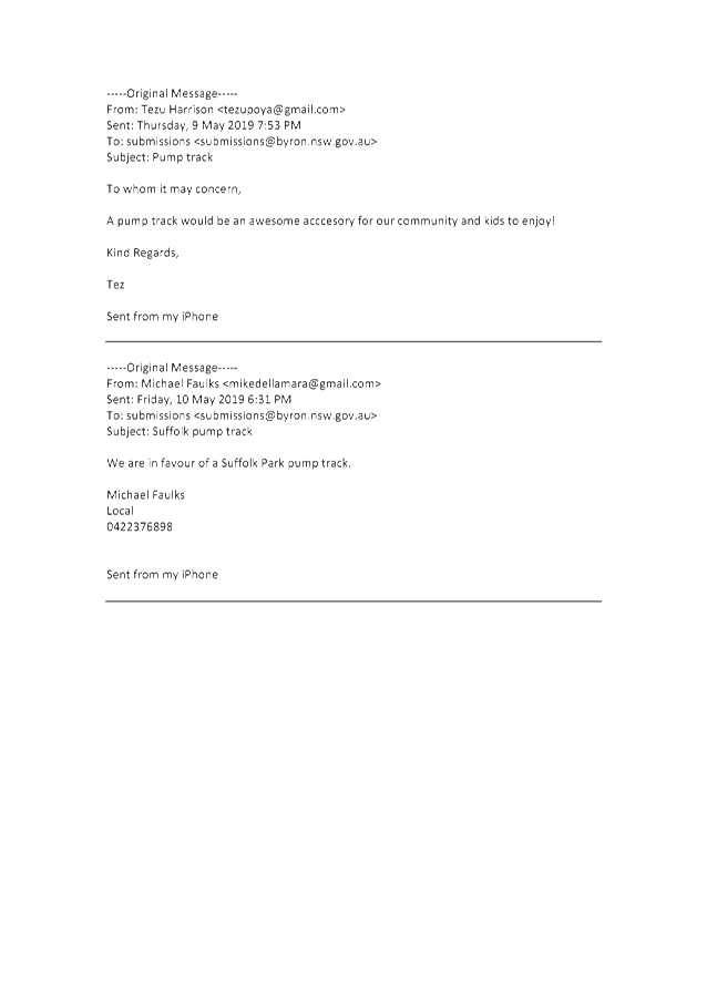
Plan of Management Suffolk Park Recreation Grounds.................................... 358
14. Questions
With Notice
Nil
Questions with Notice: A response to Questions with
Notice will be provided at the meeting if possible, that response will be
included in the meeting minutes. If a response is unable to be provided
the question will be taken on notice, with an answer to be provided to the
person/organisation prior to the next Ordinary Meeting and placed on Councils
website www.byron.nsw.gov.au/Council/Council-meetings/Questions-on-Notice
Councillors are
encouraged to ask questions regarding any item on the business paper to the
appropriate Director prior to the meeting. Any suggested amendments to the
recommendations should be provided to Councillor Support prior to the meeting
to allow the changes to be typed and presented on the overhead projector at the
meeting.
Staff Reports - Sustainable Environment and Economy 13.1
Staff Reports - Sustainable Environment and
Economy
Report No. 13.1 PLANNING
-Byron Arts and Industry Estate Draft Precinct Plan
Directorate: Sustainable
Environment and Economy
Report
Author: Isabelle
Hawton, Planner
Rob Van Iersel, Major Projects
Planner
File No: I2019/692
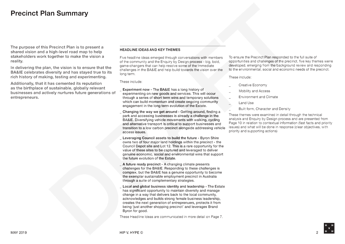
Summary:
At the ordinary meeting of 13 December 2018, Council
resolved to engage consultants HIP V HYPE to facilitate an Enquiry by Design (EbD)
process, as a first step in the preparation of a Precinct Plan for the Byron
Arts and Industry Estate (Res 18-817).
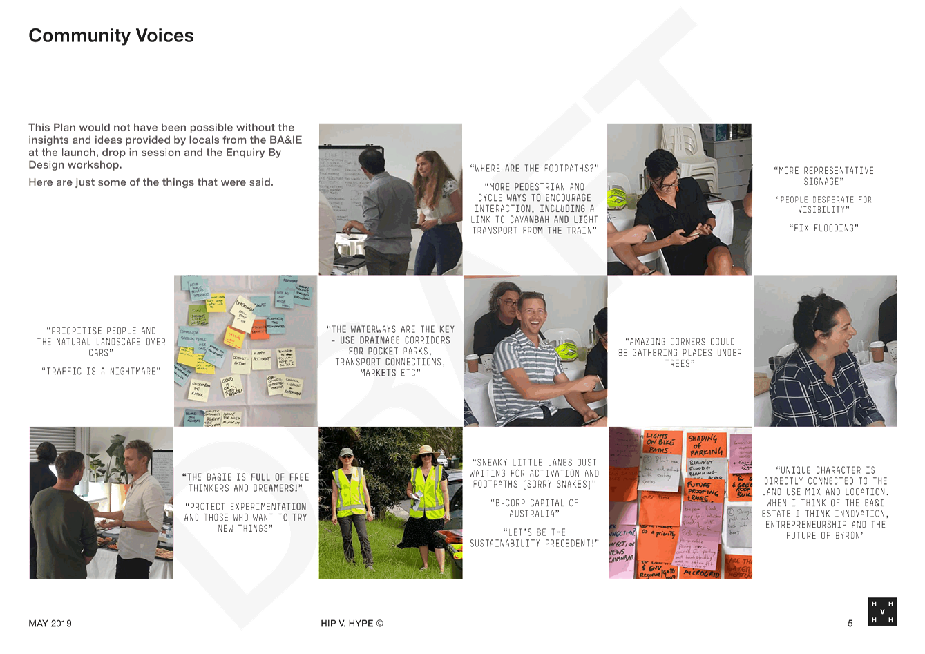
The two-day EbD workshop was held in April 2019, with eight
key community stakeholders attending for the full two days, along with a mix of
technical experts, Council staff and Councillors. The process was
extremely productive, with great enthusiasm, creativity and intellect shown by
the entire group.
Following the EbD, consultants HIP V HYPE compiled the
workshop outcomes into the attached Draft Precinct Plan, which documents key
issues, and tests and refines the suggested solutions that emerged through the
EbD process by the group.
As such the Draft Precinct Plan provides the starting point
for further, more extensive community engagement and internal Council
investigations that are required to finalise a Precinct Plan for the Estate.
The draft Precinct Plan as presented to Council is
structured around five “Themes” that were central to discussions at
the EbD:
· Mobility and
Access
· Environment
and Climate
· Land Use
· Built Form,
Density and Character
· Creative
Economy
Each theme was used during the EbD process to structure
priorities and explore solutions to issues that were identified.
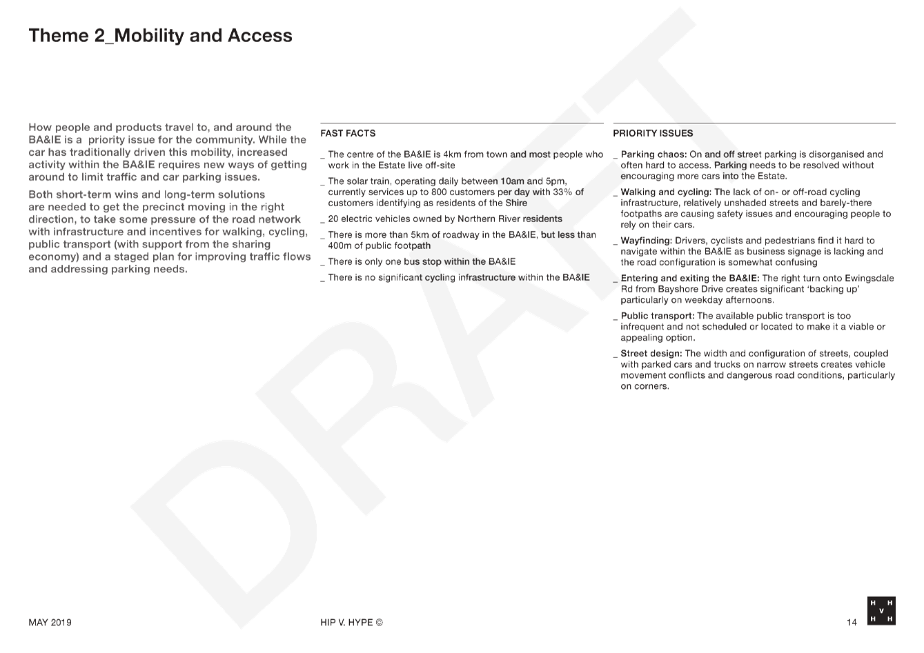
Issues around mobility, access and land use provide the most
significant challenges for the Precinct Plan.
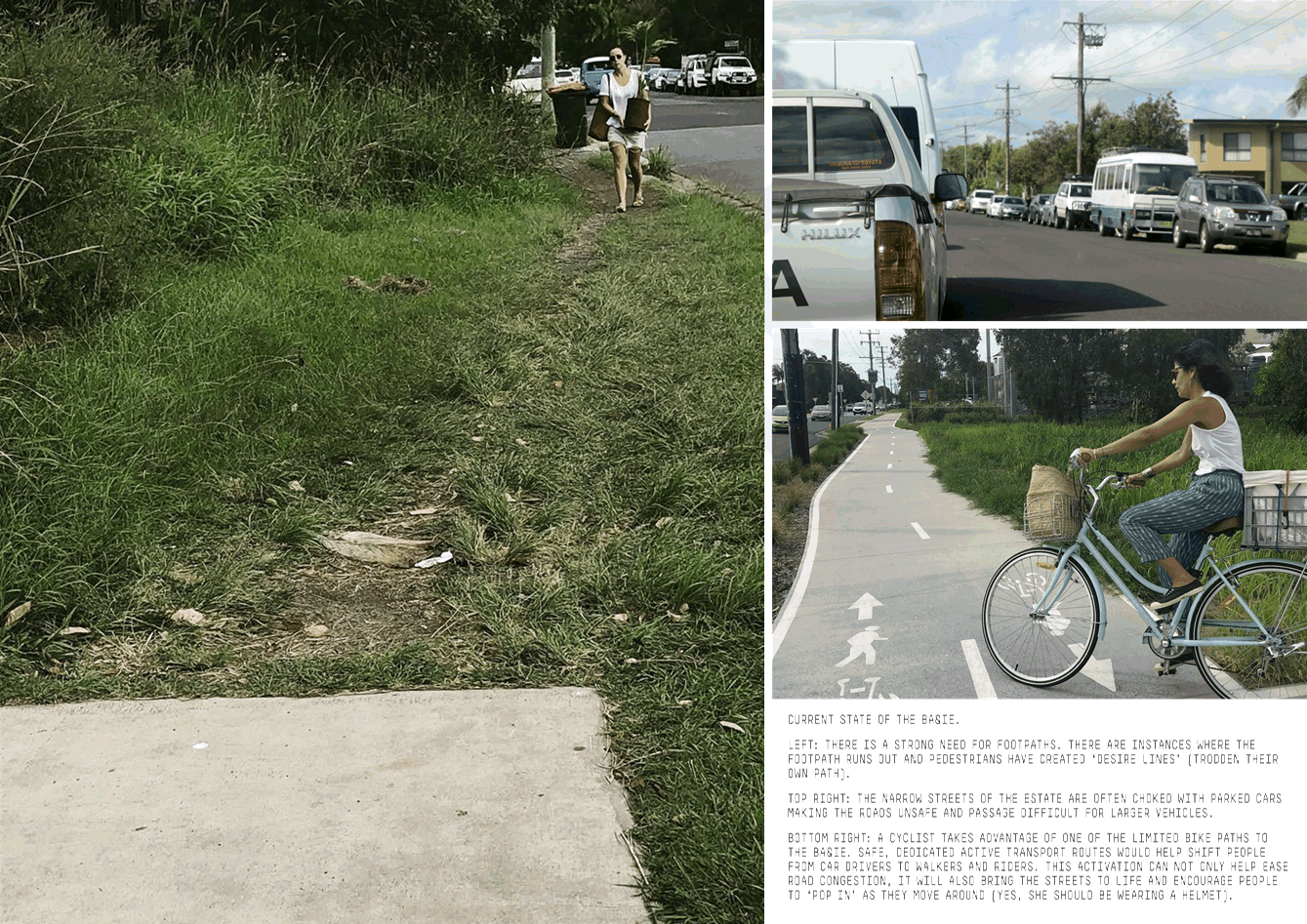
Functional issues around traffic and parking management are
obvious within the Estate, and the EbD identified and tested a range of
potential solutions, noting that traffic flow can be more easily addressed than
parking demand, which will require a range of interventions over both short and
longer timeframes.
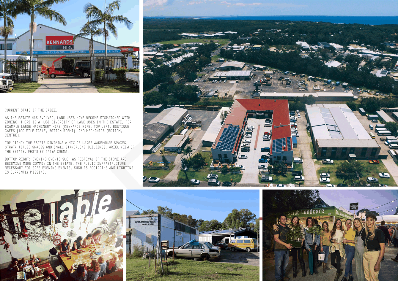
Land use was also explored in some depth at the EbD, noting
many positive aspects of the current land use mix; e.g. diversity, vibrancy,
etc. It was also noted, however, that there are significant planning
challenges regarding the wide range of current land uses, many of which are
unauthorised. Finding planning solutions, and a zoning regime, that can
maintain the positive aspects of the current land use mix, equitably address
unauthorised land uses, and provide a platform for positive future outcomes is
likely to require some difficult future decisions.
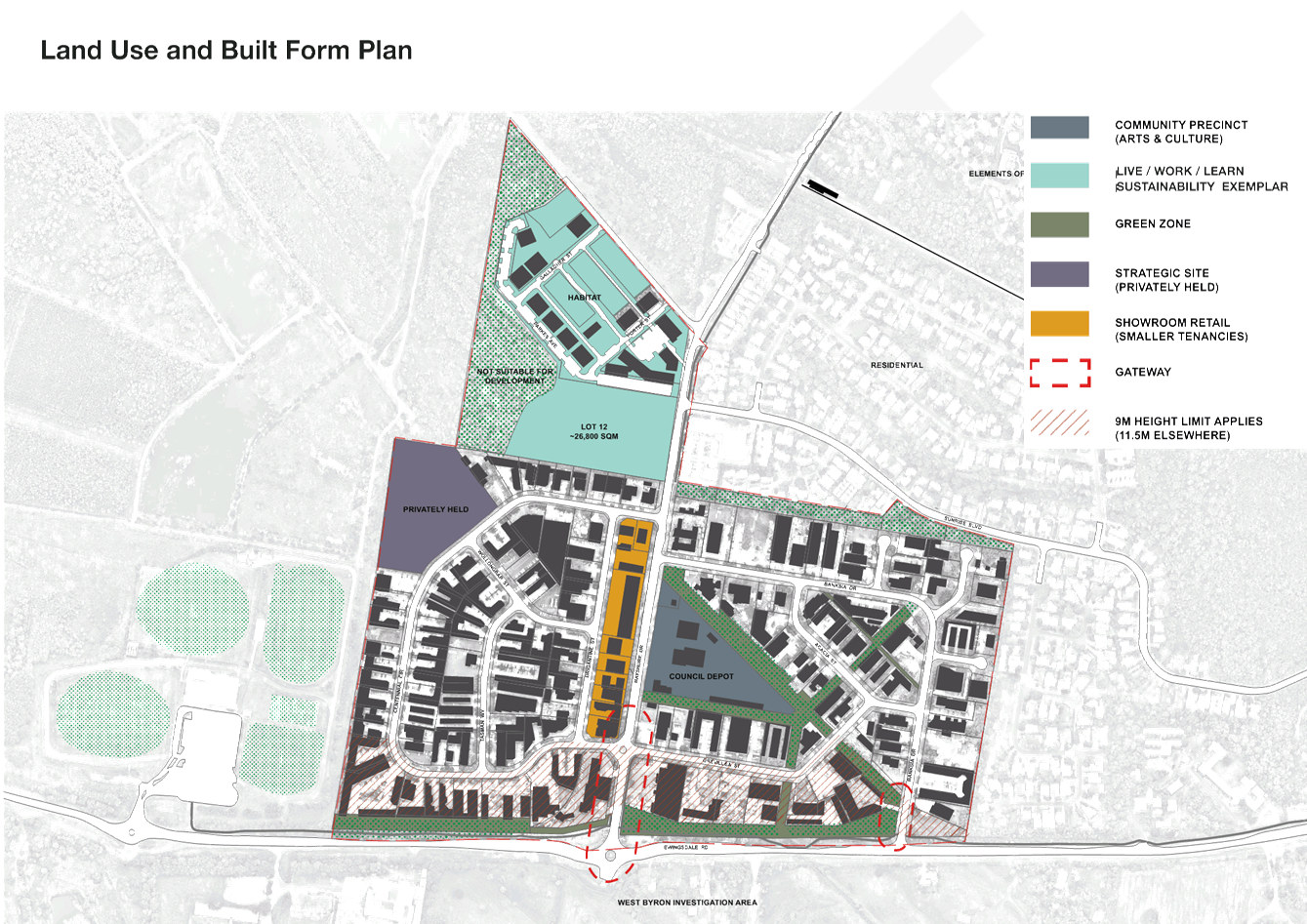
Discussions at the EbD identified
two Council-owned parcels: Lot 12 Bayshore Drive and the current depot site, as
key to the future of the Estate.
In relation to the Depot, EbD
participants were advised that, while some investigations have commenced
regarding the potential for its relocation, there is no formal resolution in
place about its future, and that further work is required before any such
decision could be made.
Nonetheless, the group noted that
this centrally located large parcel of land has the potential to form a
significant ‘anchor’ for the future of the Estate, through its redevelopment
for a significant community / commercial hub that emphasises the arts and local
community creativity.
The EbD participants also
recognised the significance of Lot 12 to the Estate for its potential to house
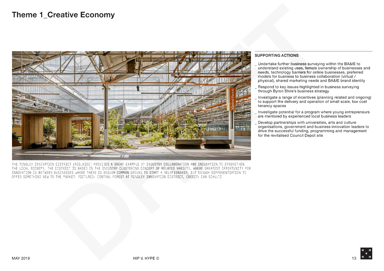
an innovation, creativity and sustainability hub. Other examples of this type
of development include Lot 14 in South Australia.
Given the above, the zoning and
remediated state of Lot 12, it is recommended that Council now accelerate the
development of a detailed Structure Plan for this land, concurrent with the Precinct
Plan finalisation.
While the stakeholder involvement in the EbD process was
extremely useful it was only a small sample of stakeholders, and as such can
only be considered as a first step in a larger planning project. It is
important, therefore, that a wider community engagement process now be
undertaken, based on the draft EbD outcomes document, to further test potential
suggestions / solutions leading to finalisation of a Precinct Plan for the Arts
and Industry Estate.
Notwithstanding the above, it was the strong desire of the
EbD participants that some of the recommended outcomes be used in the short
term to drive change throughout the estate, by achieving some “Quick
Win” solutions that show tangible changes for the community.
Two such “Quick Win” projects emerged.
Council staff have begun planning these projects and suggest that the momentum
built from the EbD be carried through with project implementation beginning in
the next six months. The two “Quick Win” projects are:
1. A
low cost trial of one way vehicle movement on the southern end of Centennial
Circuit, between Brigantine and Wollongbar Streets. This would also
provide an opportunity to re-arrange the street, bike lanes, signage and an
investigation of maximising parking space. It is an opportunity to test
the potential for more permanent functional changes in the estate.
2. A
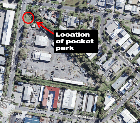
‘pocket park’ at the northern corner of the depot site on Bayshore
Drive, where the “greenway” runs at a diagonal alongside the depot,
to provide a central usable meeting place for the local community. Again,
this pocket park could provide a start for longer term changes to how the
currently underutilised public land along the central drainage corridor might
be used to leverage a range of wider community benefits.
It is recommended that Council
staff continue work to deliver the two “quick win” projects.
For the pocket park, this will
involve either grant funding or a combination of partnering with potential
community groups, crowdfunding, business sponsorship and sweat equity. It
is anticipated that this initiative can be achieved at minimal cost to Council.
For the one way trial, this is
likely to involve the procurement of necessary hardware (barriers, signs etc)
along with a campaign of advertisement and education for the business owners
nearby. Council staff estimate the cost of this action to be up to
$30,000. It is recommended that Council allocate funding for this project
in the September quarterly budget review.
NOTE TO COUNCILLORS:
In accordance with the
provisions of S375A of the Local Government Act 1993, a Division is to be
called whenever a motion for a planning decision is put to the meeting, for the
purpose of recording voting on planning matters. Pursuant to clause 2(a) under
the heading Matters to be Included in Minutes of Council Meetings of Council's
adopted Code of Meeting Practice (as amended) a Division will be deemed to have
been called by the mover and seconder of all motions relating to this report.
|
RECOMMENDATION:
1. That
Council endorse the Draft Precinct Plan, Attachment 1 (E2019/47098) for Byron
Arts and Industry Estate for Public Exhibition for a period of six weeks.
2. That
Council receive a further report at the close of the exhibition period
detailing submissions made and next steps for Plan implementation.
3. That
Council endorse Option 1 for the Centennial Circuit one way traffic
trial and consider an allocation of up to $30,000 at the September quarterly budget
review to achieve the project.
4. That
Council request staff to accelerate the preparation of a Structure Plan for
Lot 12 concurrent with the finalisation of the Draft Precinct Plan.
|
Attachments:
1 Hip V Hype
Precinct Plan, E2019/47098 , page 15⇩ 
2 Special
Disclosure of Pecuniary Interest Form, E2012/2815
, page 60⇩ 
REPORT
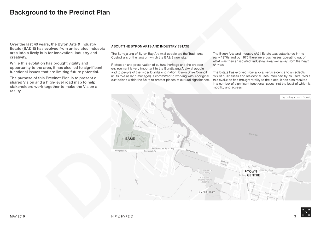
Background
On February 1 2018, Council
resolved (18-041) to:
3.
Request staff in the Place Planning Team to commence the
preparation of a detailed project plan for the preparation of a comprehensive
precinct plan for the Byron Arts and Industrial Estate and wider environs as
per 2 above; and that the precinct plan is to include consideration of the
following: traffic and parking management, alternate transport options
including car share, park and ride, use of the rail corridor, land use mix and
density, place activation and beautification, technology needs like NBN, identification
of land which links key sites including Cavanbah, Bayshore Drive railway
station, future park and ride sites and walking and pedestrian links. The
project plan will outline the key stages, milestones, stakeholders and a budget
outline for the project.
Subsequently, a Request for
Quotation (18-216) was issued to
several consulting firms to prepare a draft Precinct Plan through an Enquiry by
Design (EbD) Process. The preferred consultant was HIP V HYPE, and at the
meeting of 13 December 2018, Council resolved to engage them to undertake the
work (18-817).
From its inception in the early
1980s, the Byron Arts and Industry Estate has shifted to a multidisciplinary
hub of innovative business, and no longer houses the traditional mix of
industry and warehousing it was once intended for. The result is an
eclectic mix of businesses, and a myriad of functional issues, not the least of
which is transport and mobility.
The Precinct Plan aims to explore
solutions to issues that have been identified by the community, and set a
cohesive vision to move forward for the estate.
Key Priorities
The two-day EbD workshop was held in April, with the
consultants facilitating a mix of community stakeholders, technical experts,
Council staff and Councillors in the development of a vision and principals to
guide the future of the estate. The process was extremely productive,
with great enthusiasm, creativity and intellect shown by the entire group.
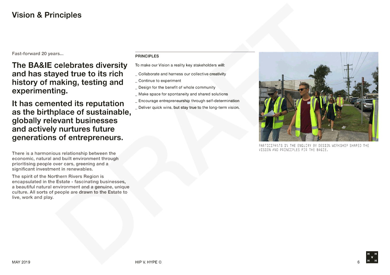
The vision for the
precinct, developed as a part of the EbD process is:
“The BA&IE celebrates
diversity and has stayed true to its rich history of making, testing and
experimenting. It has cemented its reputation as the birthplace of
sustainable, globally relevant businesses and actively nurtures future
generations of entrepreneurs.
There is a harmonious
relationship between the economic, natural and built environment through
prioritising people over cars, greening and a significant investment in
renewables.
The spirit of the Northern
Rivers Region is encapsulated in the Estate - fascinating businesses, a
beautiful natural environment and a genuine, unique culture. All sorts of
people are drawn to the Estate to live, work and play.”
During the EbD process, five key
themes were developed to capture issues, ideas and potential solutions. These
themes are:
· Mobility and
Access
· Environment
and Climate
· Land Use
· Built Form,
Density and Character
· Creative
Economy
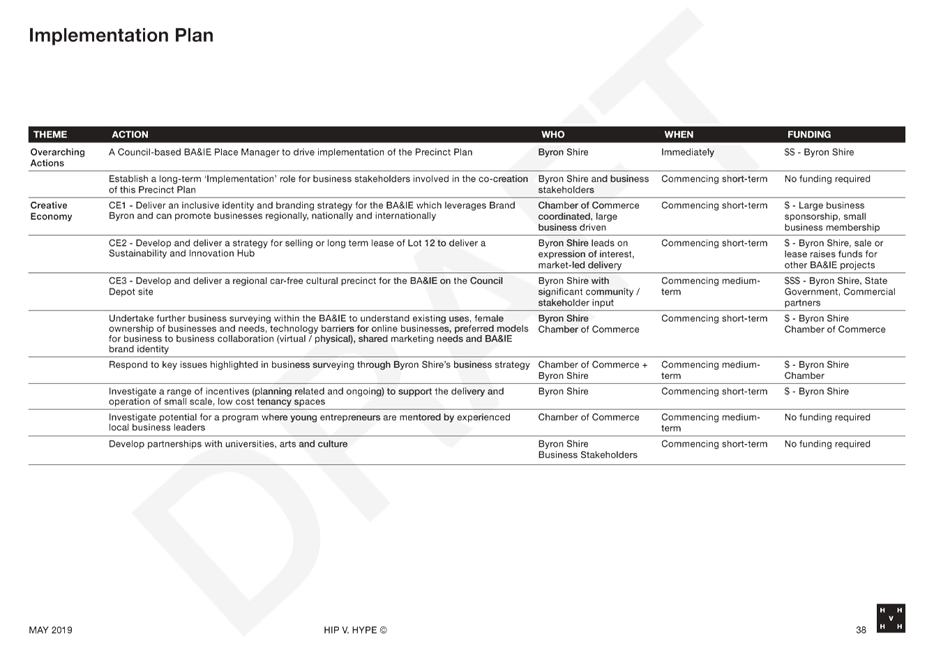
The table below summarises the key
priorities developed by EbD participants in relation to these themes. The
“code” preceding each initiative relates back to the theme to which
it belongs (i.e. CE1 = Creative Economy initiative 1).
While the stakeholder involvement in the EbD process was
extremely useful, it involved a relatively small sample of the wider
community. It is important, therefore, that a wider community engagement
process now be undertaken, based on the EbD outcomes documented in the attached
draft Precinct Plan, to further test the key priorities below, leading to
finalisation of a Precinct Plan for the Arts and Industry Estate.
|
Theme
|
Key Priorities
|
|
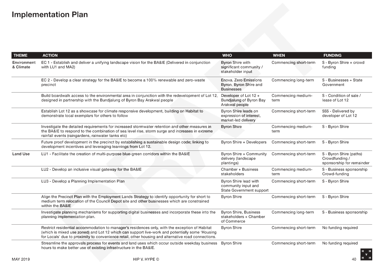
Land Use
|
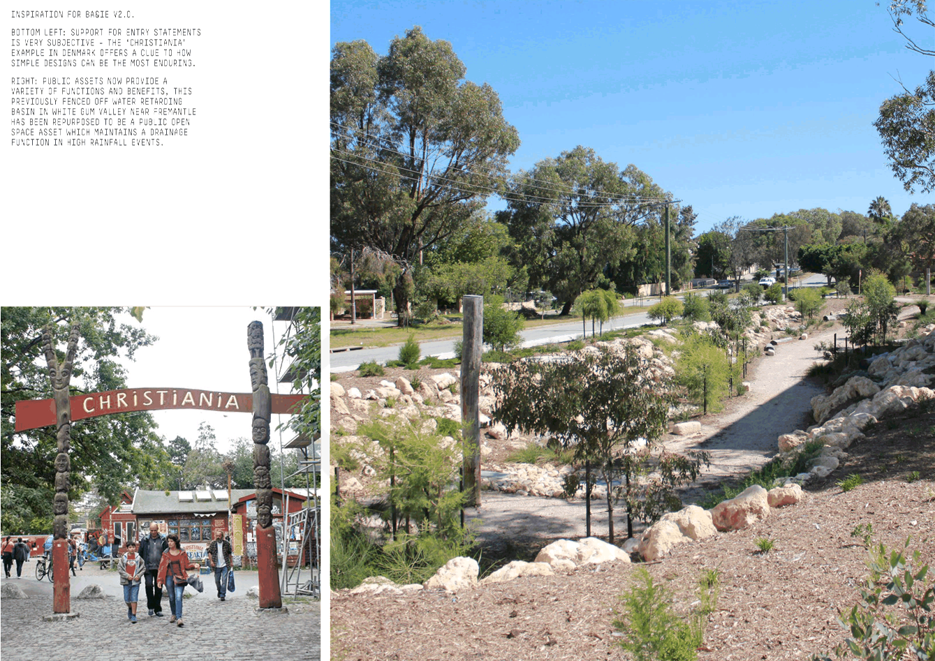
LU1 Facilitate the creation of multi-purpose
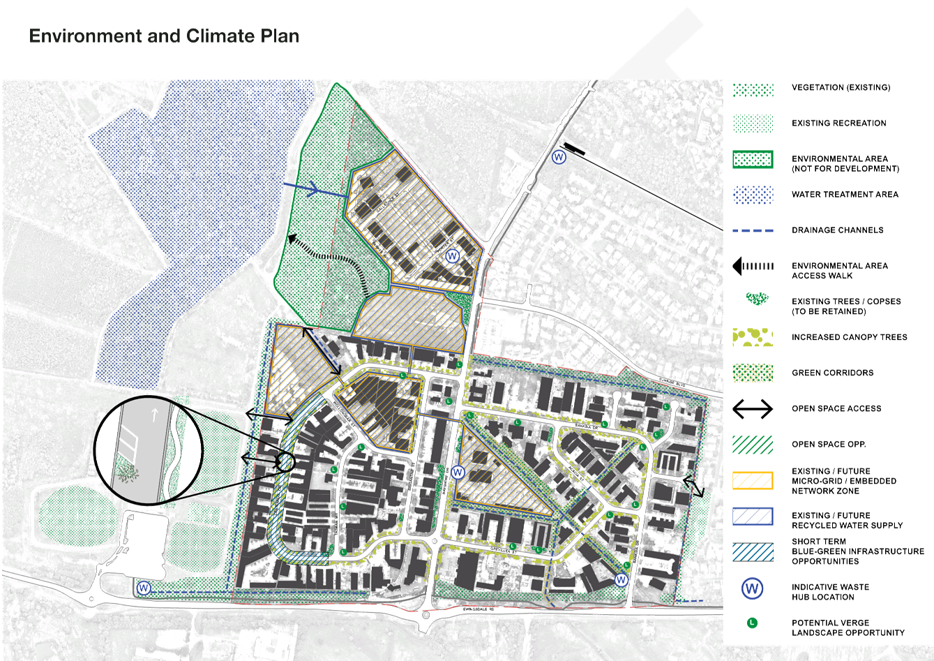
blue-green** corridors within the BA&IE
LU2 Develop and deliver a
Planning Implementation Plan
LU3 Develop an inclusive
visual gateway for the BA&IE
** Blue-green infrastructure
is about combining the green elements of urban spaces with good water
management (the blue). Often “green” assets (trees, parks,
gardens) and “blue” assets (Water Sensitive Urban Design (WSUD),
drainage areas and flood storage) are planned separately. However,
often the same asset can provide multiple outcomes that benefit both
“green” and “blue” objectives.
On
the ground this can mean using storm water to boost soil moisture to help
plants survive during dry periods and using plants to slow runoff through
infrastructure like rain gardens.
|
|
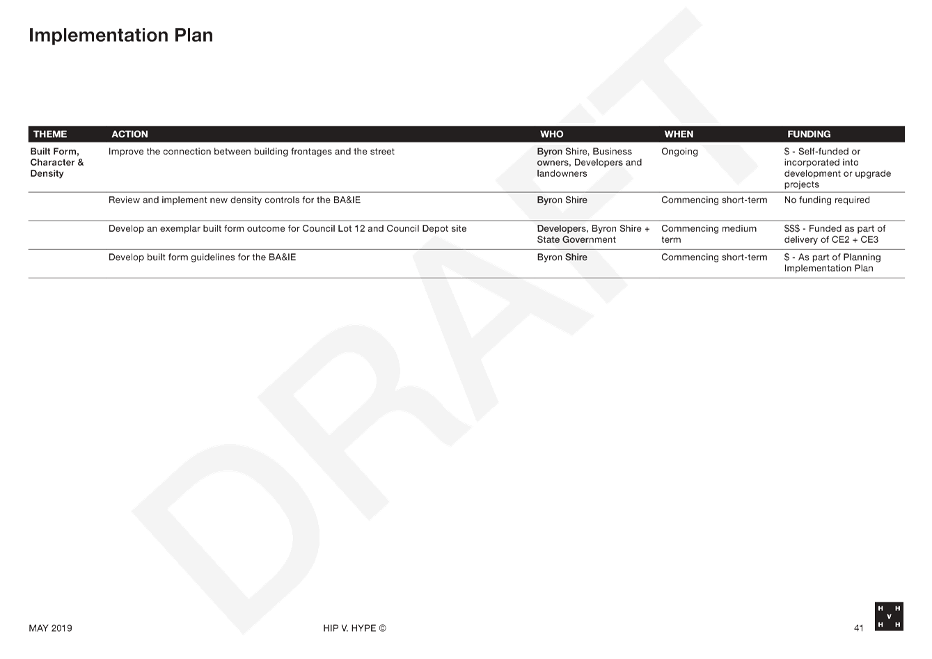
Built form, character and
Density
|
BCD1 Improve the
connection between building frontages and the street
BCD2 Review and implement
new density controls for the BA&IE
BCD3 Develop an exemplar built form outcome for
Council Lot 12 and Council Depot Site
|
|
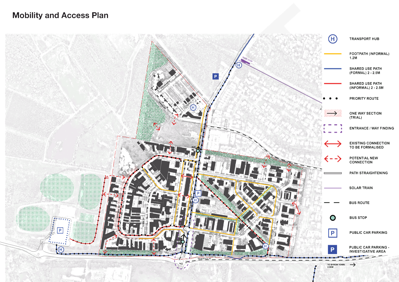
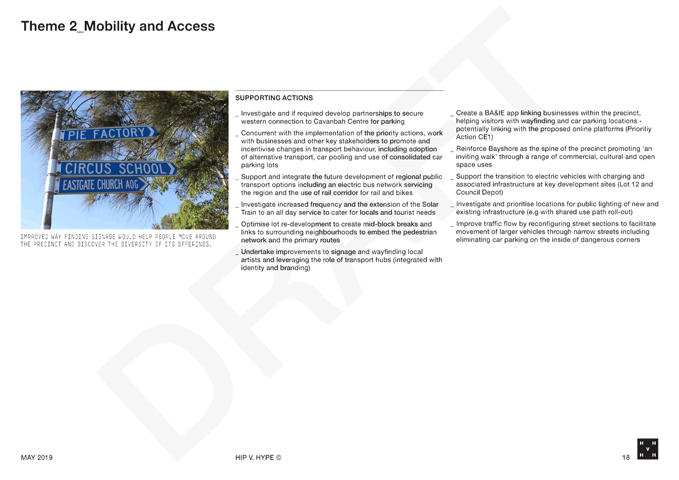
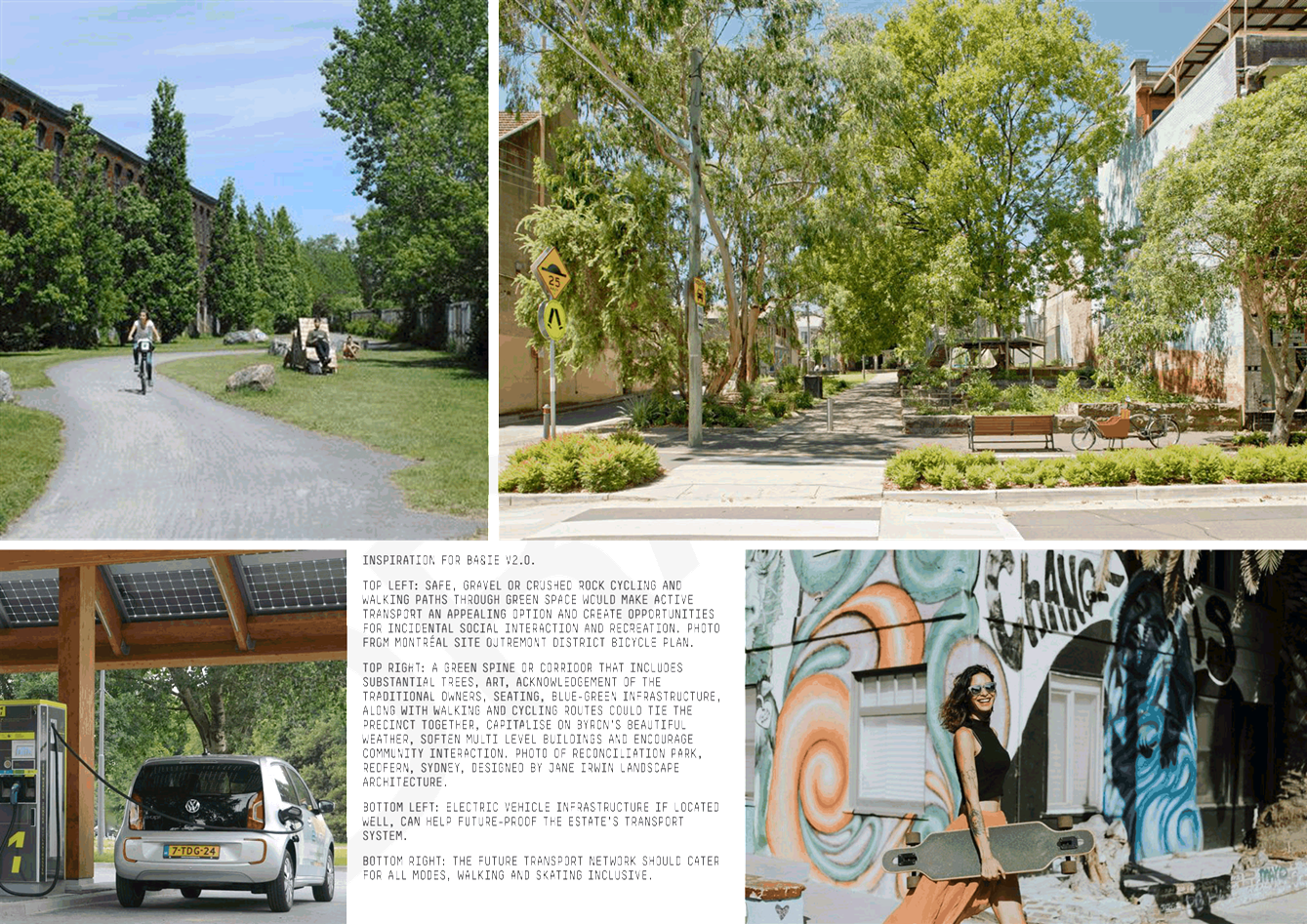
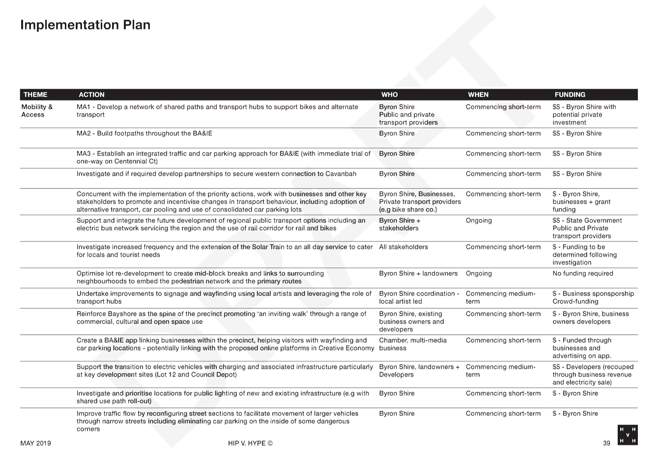
Mobility and Access
|
MA1 Develop a network of shared
paths and transport hubs to support bikes and alternate transport
MA2 Build footpaths throughout the
BA&IE
MA3 Establish an integrated traffic and
car parking approach for BA&IE
|
|
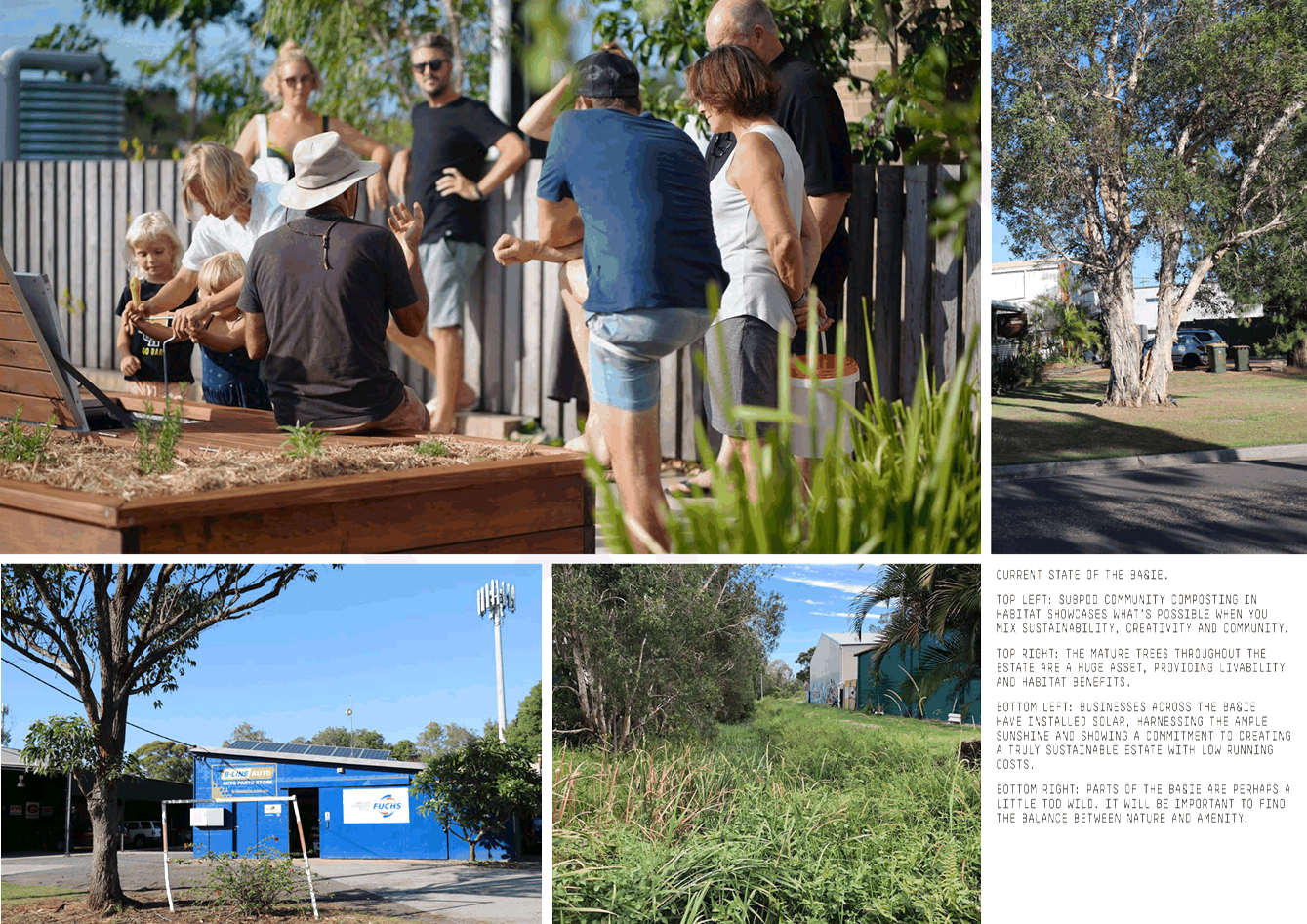
Environment and Climate
|
EC1 Establish and deliver a
unifying landscape vision for the BA&IE (Delivered in conjunction with
LU1 and MA2)
EC2 Develop a clear strategy for
the BA&IE to become a 100% renewable and zero waste precinct
|
|
Creative Economy
|
CE1 Deliver an inclusive identity
and branding strategy for the BA&IE, which leverages ‘Brand
Byron’ and can promote businesses regionally, nationally and
internationally
CE2 Develop and deliver a
strategy for selling or long term lease of Lot 12 to deliver a sustainability
and innovation hub
CE3 Develop and deliver a
regional car free cultural centre for the BA&IE precinct on the Depot
site
|
The EbD also explored a series of
solutions to issues of traffic, parking, lack of public space, active
transport, design and development, built form and density requirements and
climate change impacts.
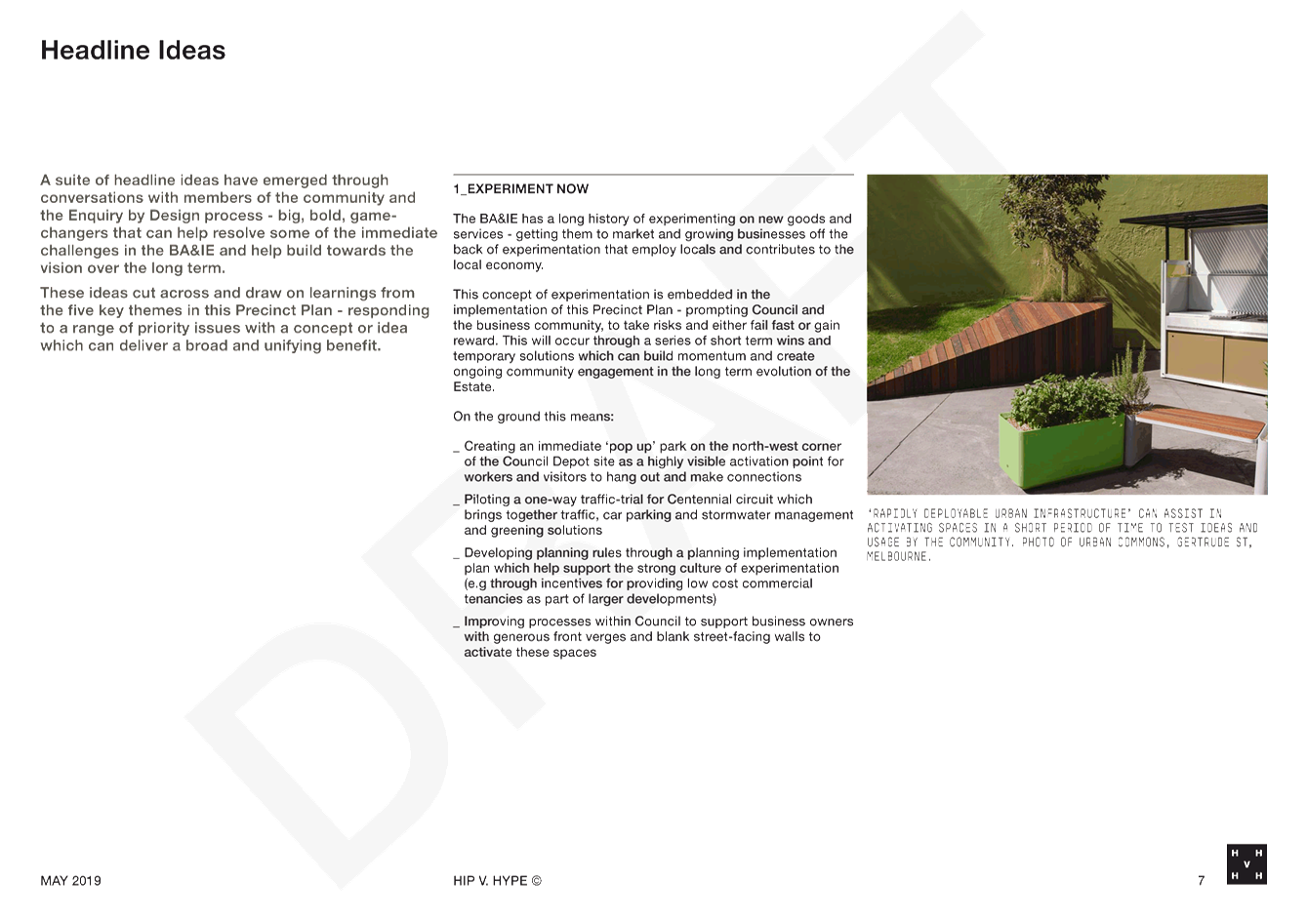
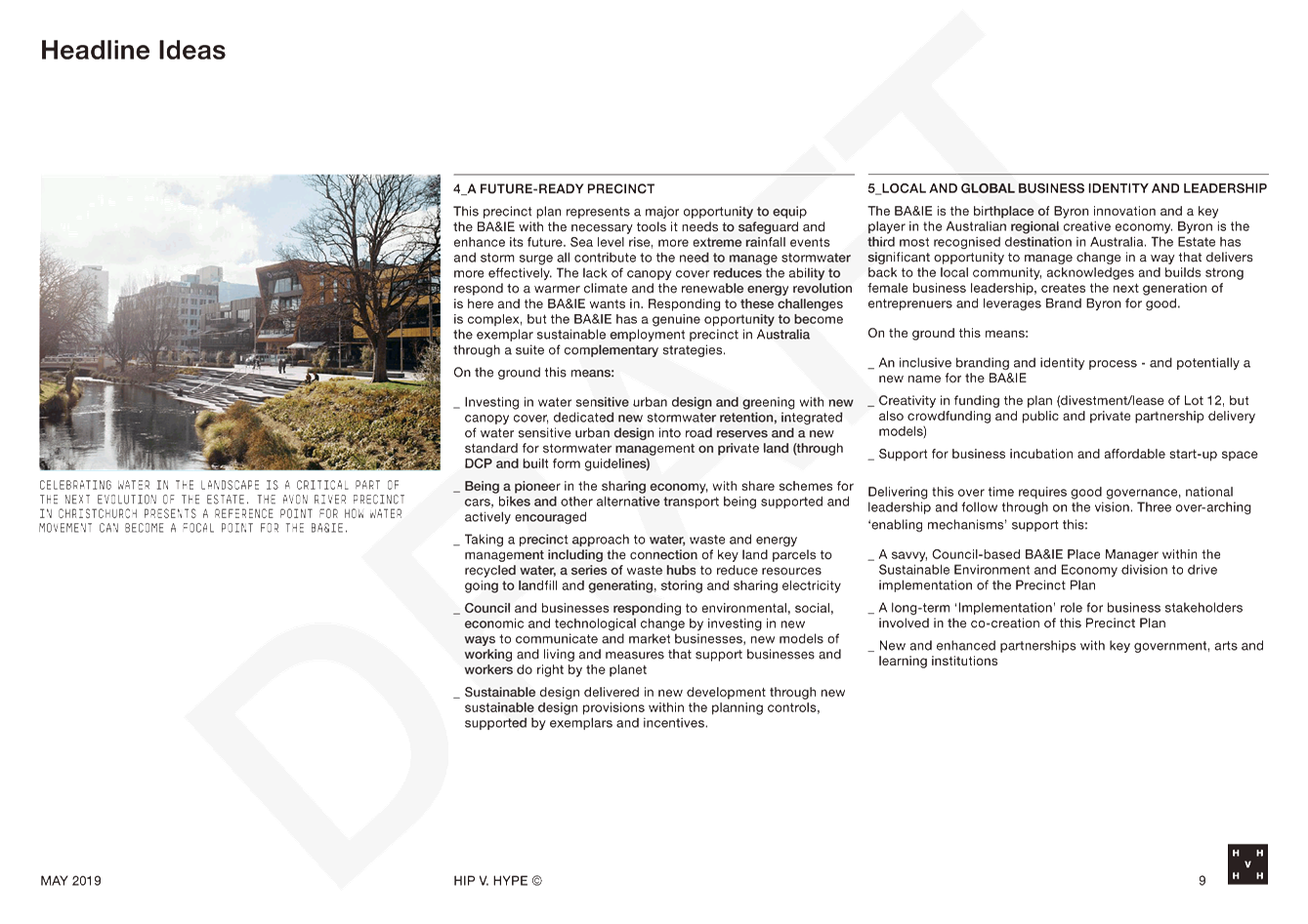
Headline Ideas
A series of headline ideas,
guiding the way the Precinct Plan might be delivered, were developed as a part
of the EbD:
· Experiment Now
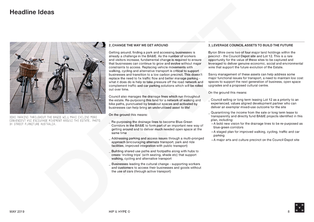
· Change the way we get around
· Leverage Council assets to build the future
· A future ready precinct
· Local and global business identity and leadership
Wider community engagement of the
draft Plan will provide an opportunity to further test whether these headline
ideas can be the key principles on which the future planning framework for the
Estate can be built.
Key Issues
Issues around mobility, access and land use provide the most
significant challenges for the Precinct Plan.
Functional issues around traffic and parking are obvious
within the Estate, and the EbD identified and tested a range of potential
solutions, noting that traffic flow can be more easily addressed than parking,
which will require a range of interventions over both short and longer
timeframes.
Land use was also explored in some depth at the EbD, noting
many positive aspects of the current land use mix; e.g. diversity, vibrancy,
etc. It was also noted, however, that there are significant planning
challenges regarding the wide range of current land uses, many of which are
unauthorised. Finding planning solutions, and a zoning regime, that can
maintain the positive aspects of the current land use mix, equitably address
unauthorised land uses, and provide a platform for positive future outcomes is
likely to require some difficult future decisions.
Rationale for the Quick Wins
The ‘quick win’
projects were identified due to their relatively straightforward nature and
their capacity to catalyse change in other areas of the Estate.
1. The pocket park, is an opportunity to
create a truly public space in an otherwise privatised precinct. It
allows for a reconnection with nature, and could help to change viewpoints that
might solve some environmental issues. There is well documented research
that indicates that green public spaces provide a myriad of psychological and
physical health benefits. It also links to an action that looks at using
the drainage corridors as an opportunity for active transport linkages through
the estate.
The
pocket park will work in conjunction with a current Council project to improve
outflows from the West Byron STP, through integration with stream
rehabilitation and the construction of a shared path.
2. Meanwhile, the one-way trial for
Centennial Circuit offers a chance to tackle some of the traffic flow and
safety issues that are prevalent across the Estate, in a controlled
environment. By removing one lane of traffic, the road space is
significantly expanded, allowing for improved access for vehicles, creating
better active transport links and an opportunity to re-orientate and maximise
parking space.
Pocket Park at the Depot
Site
Staff have begun investigating the
methods of delivery for a public space project on this site. It is
recommended that Council support this project for application for a Stronger
Country Communities Grant in order to fund public space and activation on the
site.
One way trial for Centennial
Circuit
It is expected that a one way
trial for Centennial Circuit would run for six months. The trial would
involve changing the traffic and parking management conditions in place to
improve the flow through a congested part of the estate. It would also
include the introduction of an on-road cycle lane.
Council staff have commenced early
engagement work on the two “quick win” projects. This
includes some public consultation on the preferred direction and scope of the
one way trial.
Three options were proposed to the
public and are shown below:
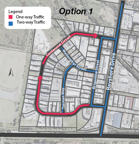
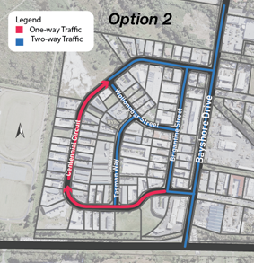
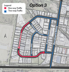
A survey was conducted on
Council’s Your Say page to seek the feedback from the public. The
preferred options were Option 1 followed by Option 2.
It is recommended based on the
feedback from the early community consultation that Council endorse Option 1
for the trial. This is consistent with the recent Local Traffic Committee
resolution.
The costs for the trial relate to
the procurement of necessary hardware (barriers, signs etc) along with a
campaign of advertisement and education for the business owners nearby.
Council staff have estimated the cost of this action to be up to $30,000.
It is recommended that Council consider an allocation of funding in the
September quarterly budget review to realise this project.
Lot 12 and the Depot Site
It is also suggested that Council
staff accelerate the preparation of a Structure Plan for Lot 12. Budget
is currently available for this work, which can consider a range of land use
options for the site including the potential to house an innovation, creativity
and sustainability hub. The work would also examine the options available to
Council to deliver the desired outcomes in a way that leverages the value of
the property for the best community outcomes.
Staff will also continue to
investigate the potential relocation of Council’s depot. Some work
has commenced on this project and this will need to be further advanced to
provide sufficient information to allow Council to make a fully informed decision
on the future of the site.
Next steps
The next step is to publicly
exhibit the Draft Byron Arts and Industry Estate Draft Precinct Plan to seek
the feedback of the wider community. It is recommended that this take
place over six weeks through web-based information, in person, and written
opportunities.
At the close of the exhibition
period, a further report will be put to Council to relay outcomes of the public
exhibition period and the next steps for implementation of the Plan.
In addition, staff will continue
work on the coordination and delivery of the quick win projects, particularly
the one way traffic trial.
STRATEGIC CONSIDERATIONS
Community Strategic Plan and
Operational Plan
|
CSP Objective
|
L2
|
CSP Strategy
|
L3
|
DP Action
|
L4
|
OP Activity
|
|
Community
Objective 4: We manage growth and change responsibly
|
4.1
|
Support the
visions and aspirations of local communities through place-based planning and
management
|
4.1.1
|
Develop,
implement and update Place Plans that promote place-based forward planning
strategies and actions
|
4.1.1.4
|
Prepare a
precinct plan for the Byron Arts and Industrial Estate
|
Legal/Statutory/Policy Considerations
The
Byron Arts and Industry Estate Draft Precinct Plan will likely require changes
to the Byron LEP 2014 and DCP for implementation; however these will be
considered at a later date as a part of individual projects and reported back
to Council in due course.
Financial Considerations
Council has currently allocated budget to complete the
Precinct Plan. However, further funding will be required in order to
implement the “quick win” projects and further projects that emerge
into the future.
Council has funding allocated within the draft budget
(#2605.137) for Lot 12 and Lot 107 (Depot Site) that may provide the basis for
funding some actions on those sites and in surrounding areas like a structure
plan for Lot 12.
In order to achieve the quick win projects, Council will
need to consider an allocation of funding during the September quarterly budget
review (or seek grant or other funding) for these projects.
Consultation and Engagement
It is recommended that the Draft Precinct Plan be put on
exhibition for a period of six weeks. During this period, Council staff
will seek the feedback from the wider community and will undertake in person
and web-based canvassing for ideas and comments.
It should be noted that some community engagement has
already occurred through the YourSay Page on Council’s website, the
‘launch day’ held at Habitat on 4 March and through the Enquiry by
Design that included local stakeholders.
Further community consultation and engagement has already
been undertaken as a part of the “Quick Win” projects. It is
recommended that further consultation for these happen during and beyond the
wider exhibition of the plan.
Staff Reports - Sustainable Environment and Economy 13.1 - Attachment 1


Staff Reports - Sustainable Environment and Economy 13.1 - Attachment 2
Schedule
3 Form
of special disclosure of pecuniary interest
submitted under Clause 4.25 of the
Code of Conduct for Councillors
1.
This form must be completed using
block letters or typed.
2.
If there is insufficient space for
all the information you are required to disclose, you must attach an appendix
which is to be properly identified and signed by you.
Important
information
This information is being collected for
the purpose of making a special disclosure of pecuniary interests under clause
4.24(c) of the Byron Shire Council Code of Conduct for Councillors (the Code of
Conduct).
The special disclosure must relate only to
a pecuniary interest that a councillor has in the councillor’s principal
place of residence, or an interest another person (whose interests are relevant
under clause 4.3 of the Code of Conduct) has in that person’s principal
place of residence.
Clause 4.3 of the Code of Conduct states
that you will have a pecuniary interest in a matter because of the pecuniary
interest of your spouse or your de facto partner or your relative or because
your business partner or employer has a pecuniary interest. You will also have
a pecuniary interest in a matter because you, your nominee, your business
partner or your employer is a member of a company or other body that has a
pecuniary interest in the matter.
“Relative” is defined by
clause 4.4 of the Code of Conduct as meaning your, your spouse’s or your
de facto partner’s parent, grandparent, brother, sister, uncle, aunt,
nephew, niece, lineal descendant or adopted child and the spouse or de facto
partner of any of those persons.
You must not make a special disclosure that you know or ought
reasonably to know is false or misleading in a material particular. Complaints about breaches of these requirements are to
be referred to the Office of Local Government and may result in disciplinary
action by the Chief Executive of the Office of Local Government or the NSW
Civil and Administrative Tribunal.
This form must be completed by you before
the commencement of the council or council committee meeting at which the
special disclosure is being made. The completed form must be tabled at the
meeting. Everyone is entitled to inspect it. The special disclosure must be
recorded in the minutes of the meeting.
Special disclosure of pecuniary interests
by ____________________________________________________________________________________
[full
name of councillor]
in the matter of __________________________________________________________________________
[insert
name of environmental planning instrument]
which is to be considered at a meeting of the
______________________________________________________________________________________
[name
of council or council committee (as the case requires)]
Report No. __________ to be held on the _________________ day of ________________________
201
|
Pecuniary interest
|
|
Address of
the affected principal place of residence of the councillor or an associated
person, company or body (the identified
land)
|
|
|
Relationship
of identified land to the councillor
[Tick
or cross one box.]
|
The Councillor has interest in the land (e.g. is owner
or has another interest arising out of a mortgage, lease, trust, option or
contract, or otherwise).
An associated person of the councillor
has an interest in the land.
An associated company or body of the councillor has an interest in
the land.
|
|
Matter
giving rise to pecuniary interest
|
|
Nature of the land that is
subject to a change in zone/planning control by the proposed LEP (the subject
land)
[Tick or cross one box]
|
The identified land.
Land that adjoins or is adjacent to or is in proximity to the
identified land.
|
|
Current
zone/planning control
[Insert name of current planning instrument and identify relevant
zone/planning control applying to the subject land]
|
|
|
Proposed
change of zone/planning control
[Insert name of proposed LEP and identify proposed change of zone/planning
control applying to the subject land]
|
|
|
Effect of
proposed change of zone/planning control on councillor or associated person
[Insert one of the following: “Appreciable financial gain” or
“Appreciable financial loss”]
|
|
[If
more than one pecuniary interest is to be declared, reprint the above box and
fill in for each additional interest.]
_____________________________
Councillor’s
signature
_____________________________
Date
[This form is to be retained by the
council’s general manager and included in full in the minutes of the
meeting]
Staff Reports - Sustainable Environment and Economy 13.2
Report No. 13.2 Proposed
RU6 Transition Zone - Outcome of Public Exhibition
Directorate: Sustainable
Environment and Economy
Report
Author: Steve
Daniels, Project Officer - Planning Reforms
File No: I2019/755
Summary:
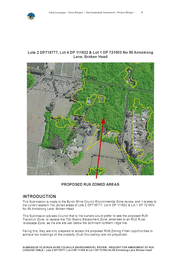
The E Zone review and the Rural Land Use Strategy engagement
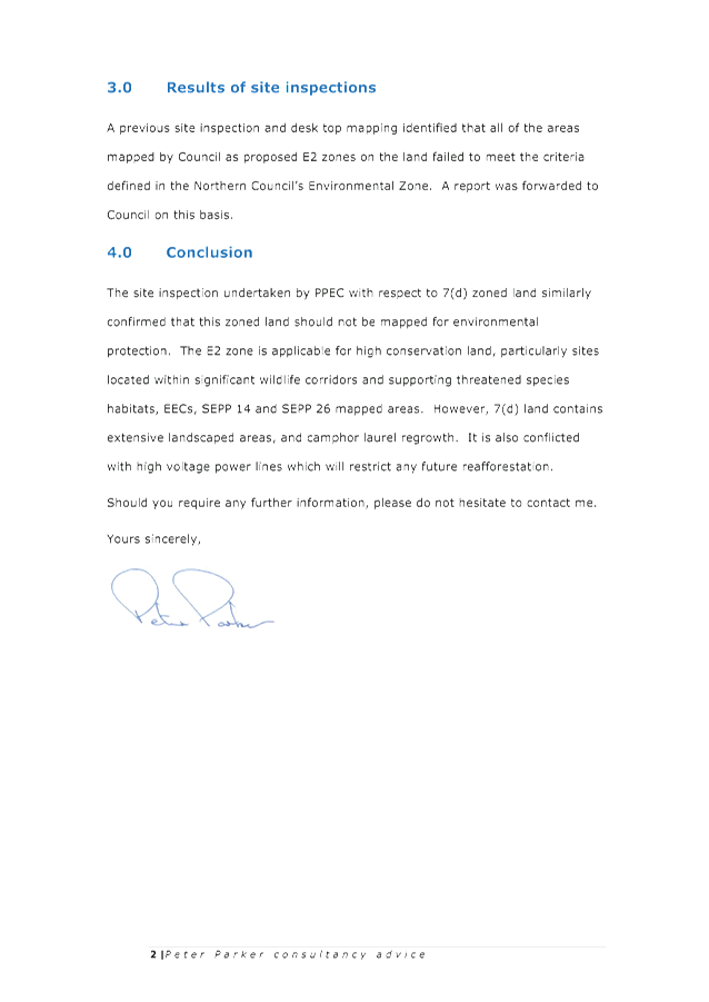
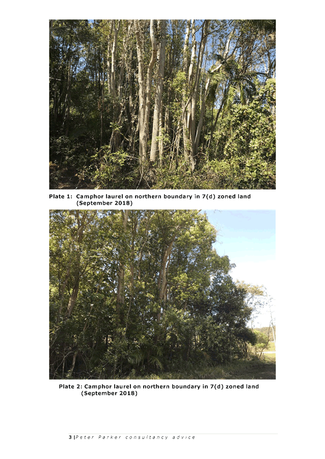
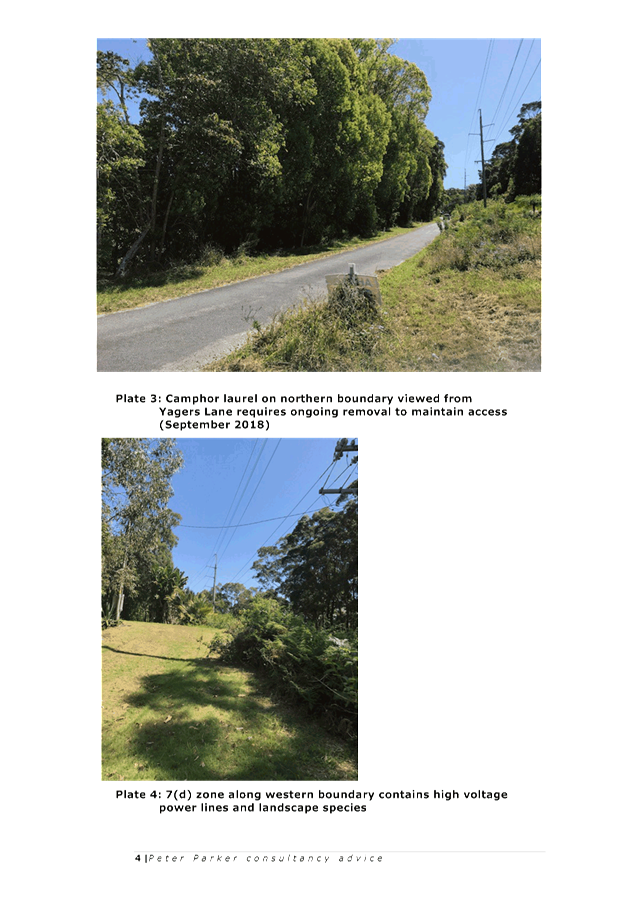
processes identified a need for a suitable replacement zone to the 7(d)
Scenic Escarpment Zone (LEP 1988) in order to:
· align with
community values and Council policy (i.e. by ensuring that visually prominent
areas are not eroded by inappropriate land uses that are otherwise
permitted in the rural RU1/RU2 Zones);
· avoid delays for
landowners who have already agreed to an E Zone on part of their land, but
cannot proceed without a comparable zone in LEP 2014 for the remaining 7(d)
Zone LEP 1988; and
· avoid the prospect
of other 7(d) zoned land remaining as Deferred Matter due to the absence of a
comparable LEP 2014 zone.
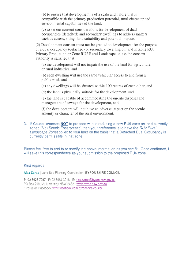
The proposed RU6 Transition Zone (LEP 2014) seeks to
maintain, as much as possible the existing permissible land uses in the current
7(d) Scenic Escarpment Zone. This report presents the outcomes of an
informal public exhibition of the proposed RU6 zone undertaken in late 2018,
and provides recommendations based on feedback from the community and the
Department of Planning, Industry & Environment (DPIE).
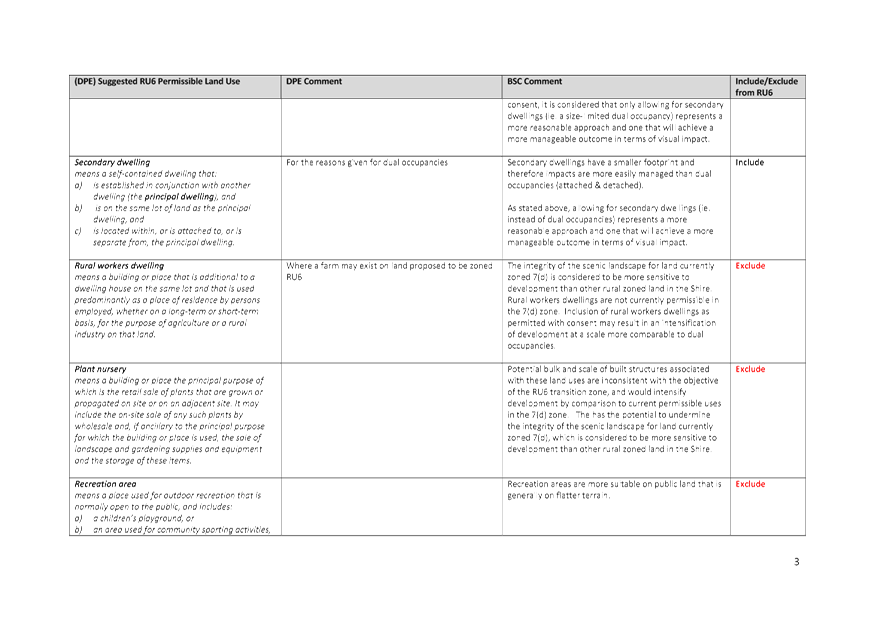
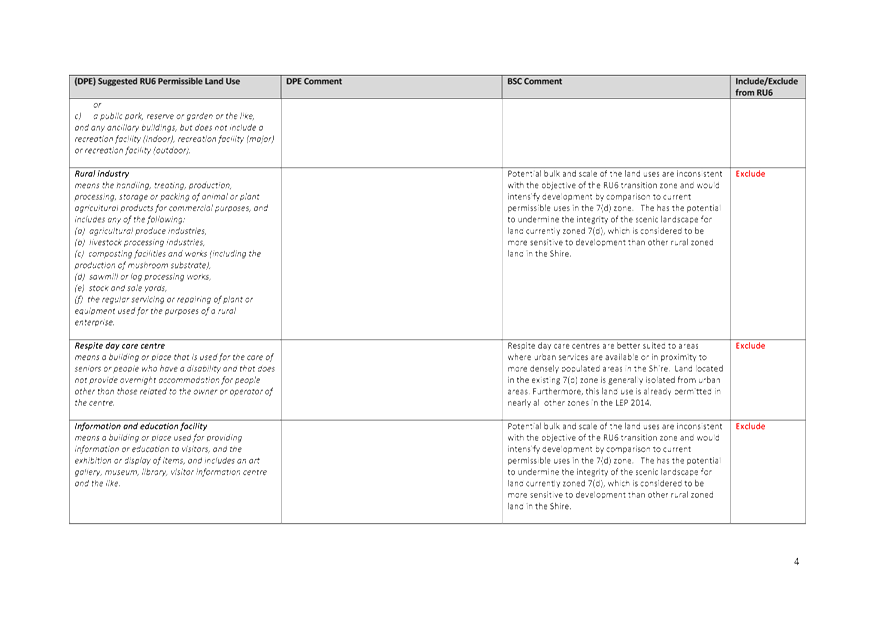
Community feedback was generally supportive of the proposed
RU6 zone objectives and land use table, however the majority of submissions
advocated for the inclusion of dual occupancies (detached) / secondary
dwellings as permitted with consent.
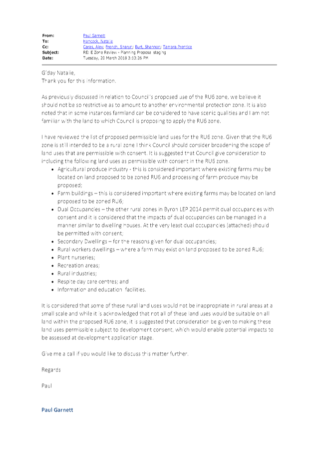
Council staff wrote to the DPIE requesting comment on the
preparation of a planning proposal to introduce the RU6 Transition zone
to LEP 2014. The letter outlined the proposed zone objectives and land
use table, and included secondary dwellings as permitted with consent in
response to community feedback and previous correspondence with the Department.
In response, the DPIE have advised that unlike the existing
7(d) Scenic Escarpment zone, the proposed RU6 Transition zone should not
restrict the permissible land uses, and should instead allow for land uses
normally permitted in a rural zone while relying on DCP controls to manage any
impacts on the Shire’s scenic amenity.
Staff do not support a reliance on DCP controls, instead of LEP controls, as the primary means for
protecting scenic values, mainly because DCP controls do not have
statutory weight and therefore cannot ensure specific
land use outcomes. The Shire’s scenic escarpments are a
significant economic and cultural asset to the community and should be
protected with the full weight of LEP land use controls.
In light of the DPIE’s inflexible position regarding
the use of zones to manage scenically important landscapes this report
recommends that Council retains the existing LEP 1988 zone, 7(d) Scenic
Escarpment, in locations that do not qualify for an environmental zoning, until
such time as a suitable replacement LEP 2014 zone is supported by the
Department. This is consistent with the approach previously resolved by Ballina
Council (Attachment 1) in response to the
Department’s position regarding their 7(d) Environmental Protection
(Scenic/Escarpment) Zone
|
RECOMMENDATION:
That Council:
1. Maintain
the existing LEP 1988 zone, 7(d) Scenic Escarpment, in locations that do not
qualify for an environmental zoning, until such time as a suitable
replacement LEP 2014 zone is supported by the Department of Planning,
Industry & Environment.
2. Place
the preparation of a planning proposal to introduce a new LEP 2014 zone, RU6
Transition, on hold pending further discussions with the DPIE and other Councils
within the region.
|
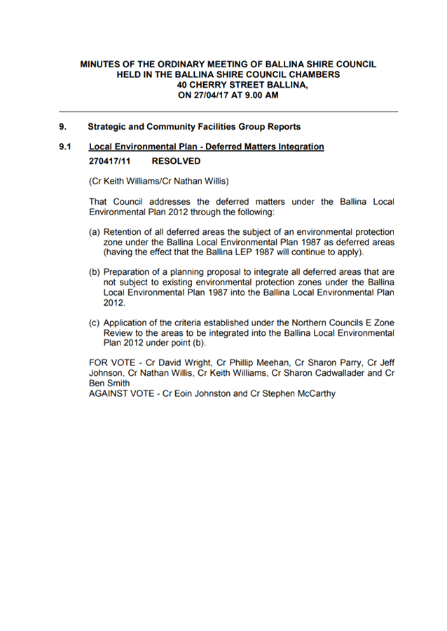
Attachments:
1 Ballina
Council Res 270417/11 - RE 7(d) Scenic Escarpment & Proposed RU6 Zone, E2019/64143 , page 69⇩ 
2 Proposed
Template for RU6 Zone Transition (exhibition version), E2018/12601 , page 70⇩ 
3 Submissions
RU6 feedback, E2019/63938 , page 74⇩ 
4 DPIE
Preliminary Advice 20/3/18, E2019/63319
, page 197⇩
5 Letter to
DPE to confirm position RE Proposed RU6 Zone and Updated Land Use Table, E2019/46771 ,
page 200⇩
6 Letter
from DPIE responding to proposed RU6 Transition zone 14/8/19, S2019/6588 ,
page 210⇩
REPORT
Protection of the rural landscape values, including scenic
amenity, was one of the key messages expressed by the community in the Rural
Land Use Strategy Discussion Paper. Under BLEP 1988 the 7(d)
Scenic Escarpment Zone largely covers most escarpment land in the Shire, as
well as other visually important areas. During preparation of the shire
wide LEP, areas within the 7(d) zone were proposed to be zoned either E2 Environmental
Conservation or E3 Environmental Management in accordance with the
Byron Shire Local Environmental Study 2008. This is partly because there
is no equivalent zone provided in the ‘Standard Instrument LEP Template’
to accommodate such areas.
All 7(d) areas deferred from LEP 2014 have been assessed
against the State Government’s
E zone Review Final Recommendations Report and related criteria for applying E
Zones. Under the Final Recommendations Report, councils on the Far North Coast
are not permitted to use scenic or aesthetic values as an attribute for the
application of an E2 or E3 Zone or mapped planning controls. Whilst some
vegetated areas in the 7(d) Scenic Escarpment Zone meet the criteria for
applying environmental zones, other areas do not and require an alternative
rural zone.
The E Zone review and the Rural Land Use Strategy engagement
processes identified a need for a suitable replacement zone to the 7(d)
Scenic Escarpment Zone in order to:
· align with
community values and Council policy (i.e. by ensuring that visually prominent
areas are not eroded by inappropriate land uses that are otherwise
permitted in the rural RU1/RU2 Zones);
· avoid delays for
landowners who have already agreed to an E Zone on part of their land, but cannot
proceed without a comparable zone in LEP 2014 for the remaining 7(d) Zone LEP
1988; and
· avoid the prospect
of other 7(d) zoned land remaining as Deferred Matter due to the absence of a
comparable LEP 2014 zone.
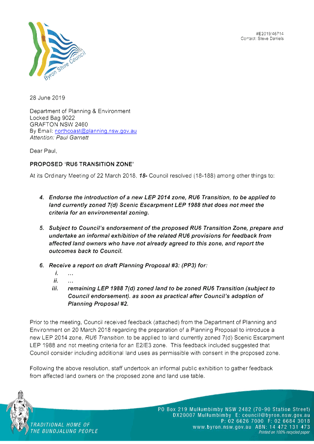
At its Ordinary Meeting of 22
March 2018, Council resolved (18-188) among other things to:
4. Endorse the introduction of a new LEP 2014
zone, RU6 Transition, to be applied to land currently zoned 7(d) Scenic
Escarpment LEP 1988 that does not meet the criteria for an environmental
zoning.
5. Subject to Council’s endorsement of
the proposed RU6 Transition Zone, prepare and undertake an informal exhibition
of the related RU6 provisions for feedback from affected land owners who have
not already agreed to this zone, and report the outcomes back to Council.
6. Receive a report on draft Planning Proposal
#3: (PP3) for:
i. …
ii. …
iii. remaining LEP 1988 7(d) zoned land to be
zoned RU6 Transition (subject to Council endorsement). as soon as practical
after Council’s adoption of Planning Proposal #2.
The proposed RU6 Transition Zone seeks to maintain,
as much as possible the existing permissible land uses in the current 7(d)
Scenic Escarpment Zone. Although the RU6 land uses have been prepared on this
basis they are not an exact translation of all land uses in the 7(d) zone,
mainly due to differences between LEP 1988 and LEP 2014 land use definitions.
A comparison between the existing 7(d) and proposed RU6
zones (as exhibited) is provided in Attachment 2.
Overview of Engagement
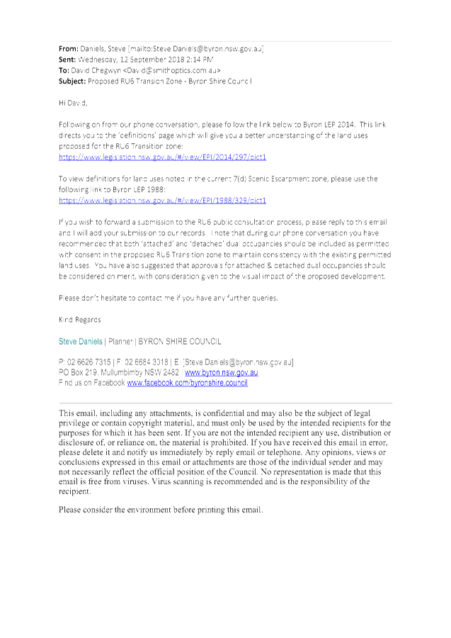
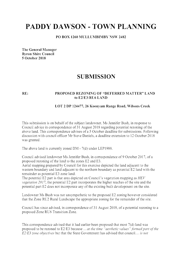
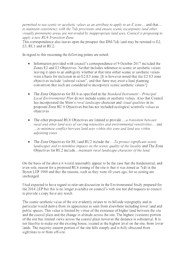
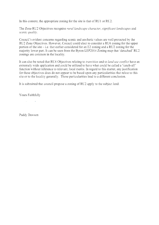
Informal Public Exhibition
Following the above resolution,
staff undertook an informal public exhibition to gather feedback from affected
land owners on the proposed zone and land use table. Exhibition
ran from 12 September – 5 October 2018 with advertisements placed in
local newspapers and details about the proposed zone provided on Councils
website to maximise the potential for community understanding. The public
was invited to provide feedback via written submissions.
Letters were also issued to affected land owners inviting them
to attend drop in sessions with Council planning staff. The drop in
sessions provided an opportunity for land owners to ask questions and discuss
property specific issues, thus enabling them to prepare an informed submission.
Although the public exhibition period officially closed on 5
October 2018, staff have continued to accept any additional feedback provided
since this time.
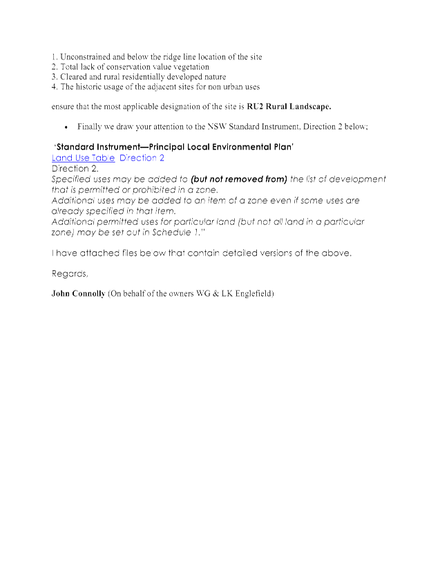
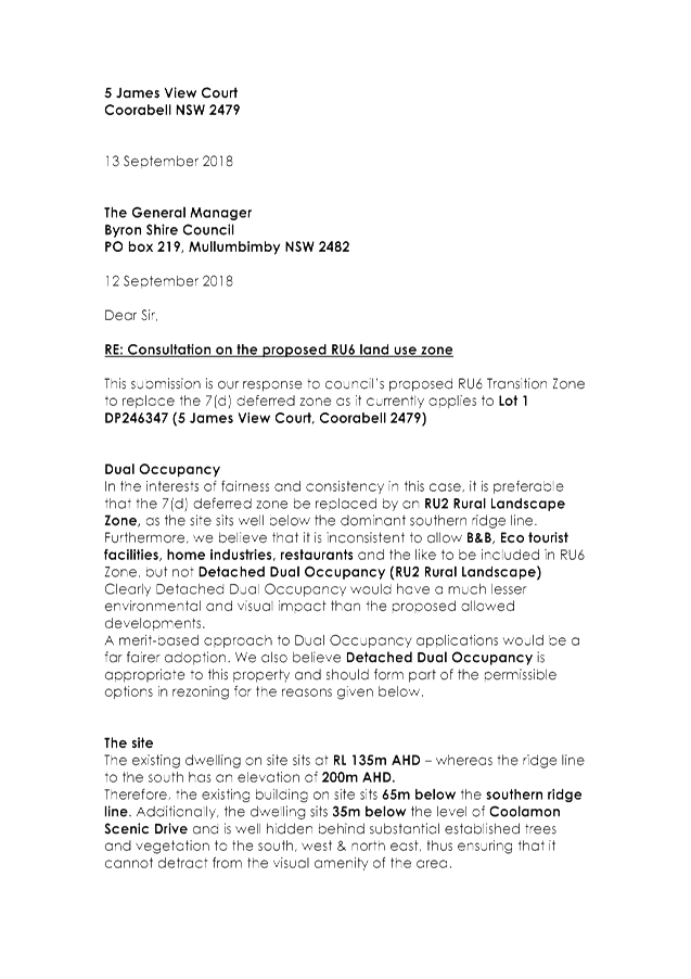
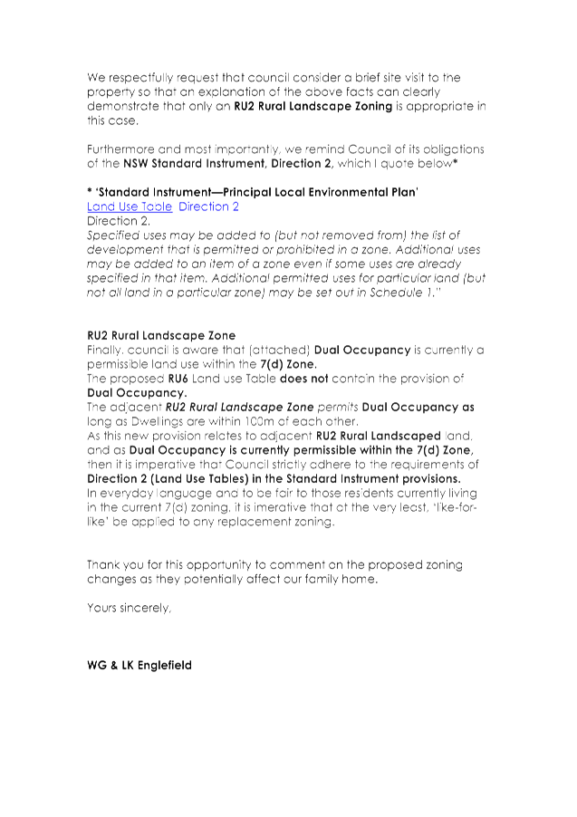
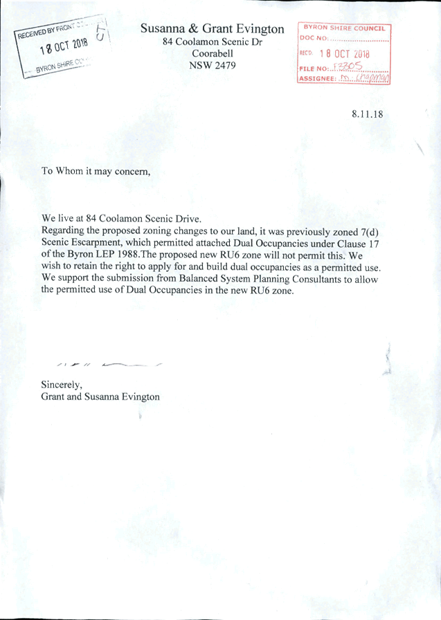
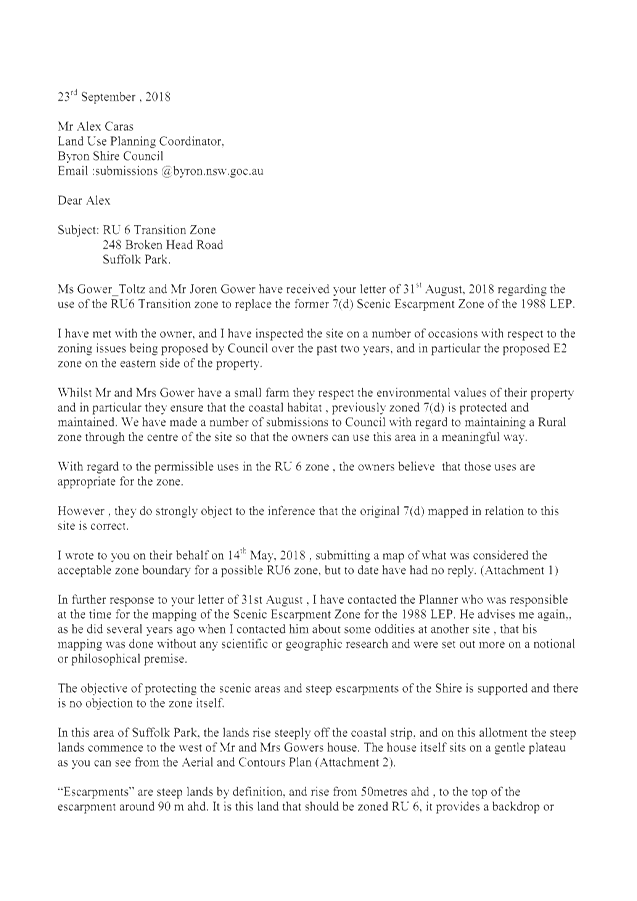
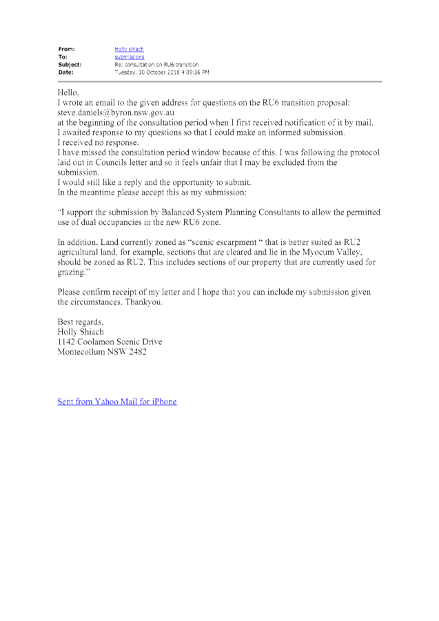
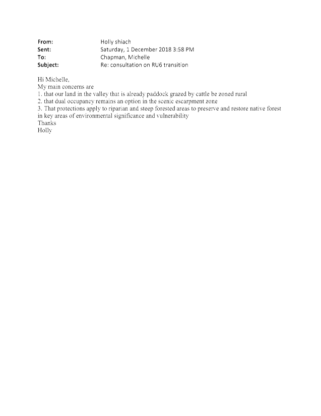
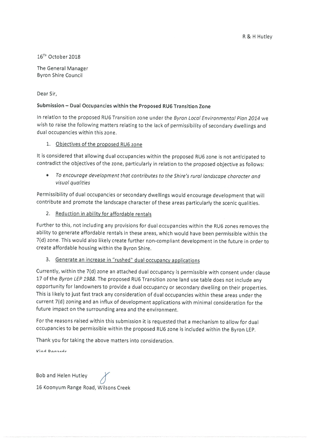
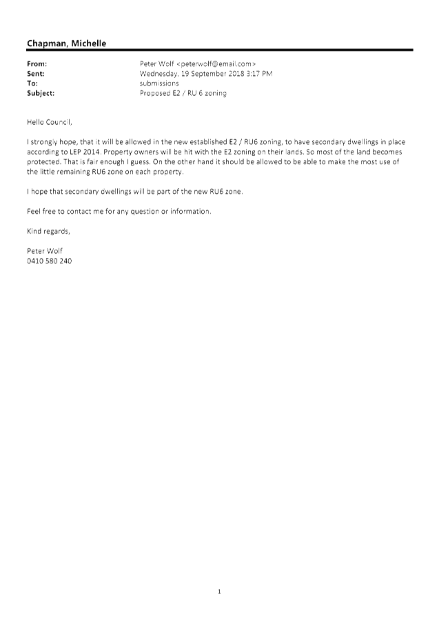
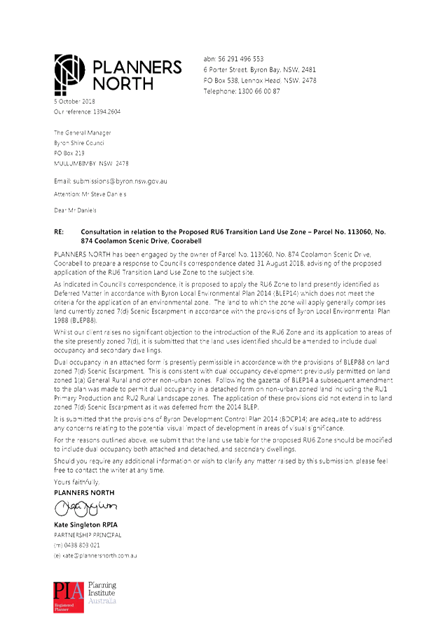
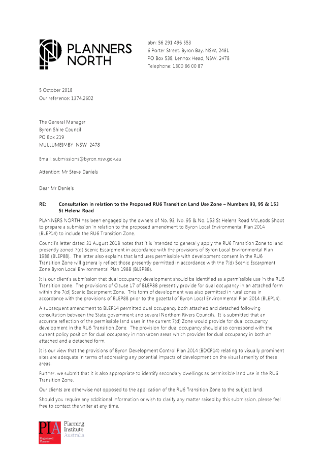
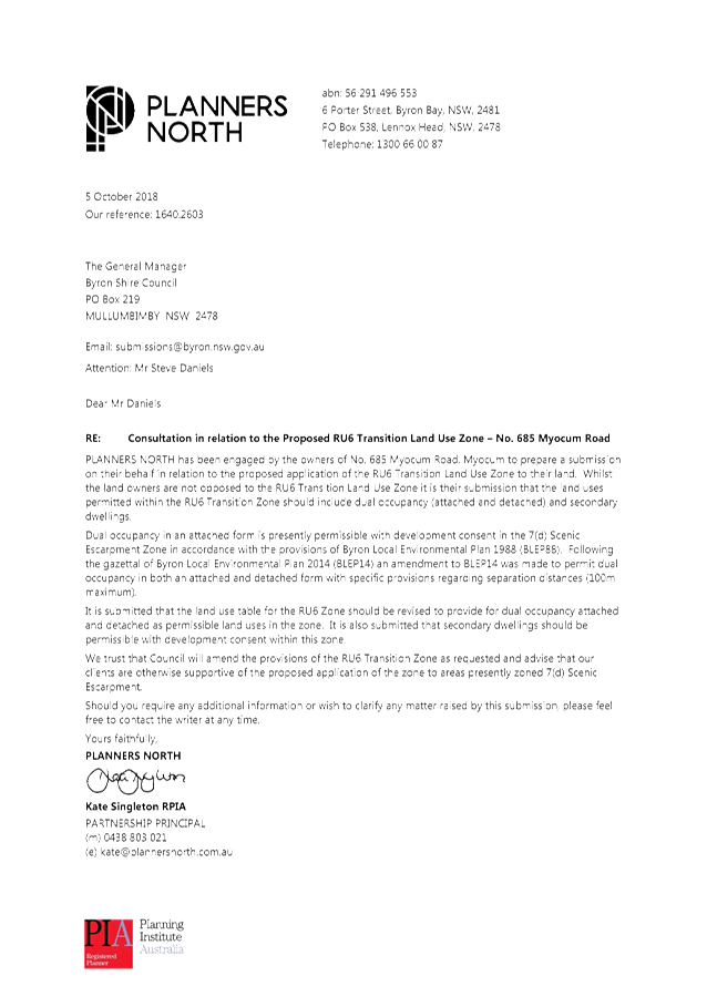
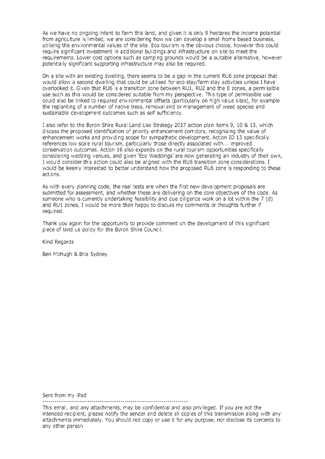
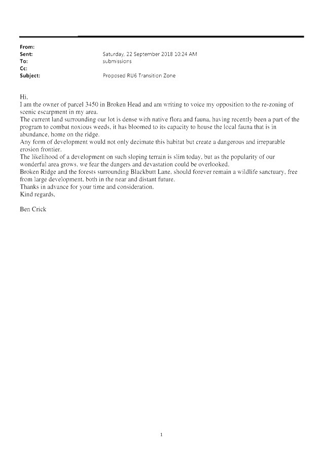
Community Response
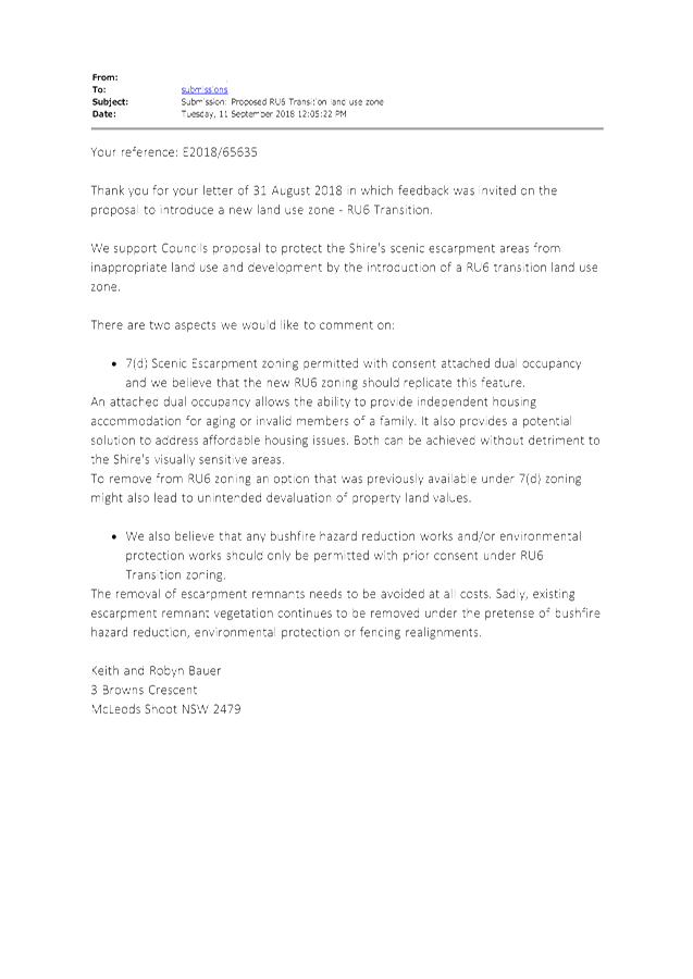
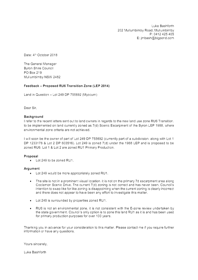
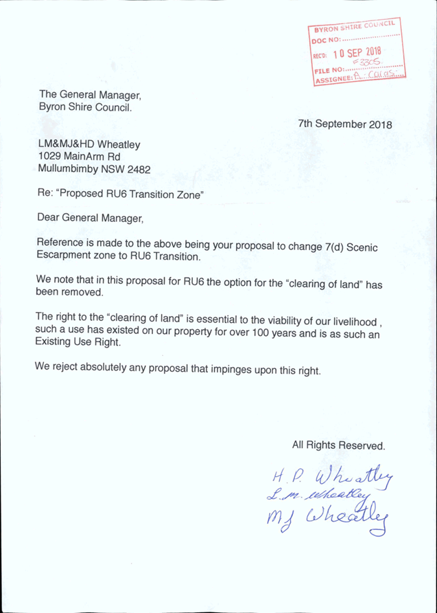
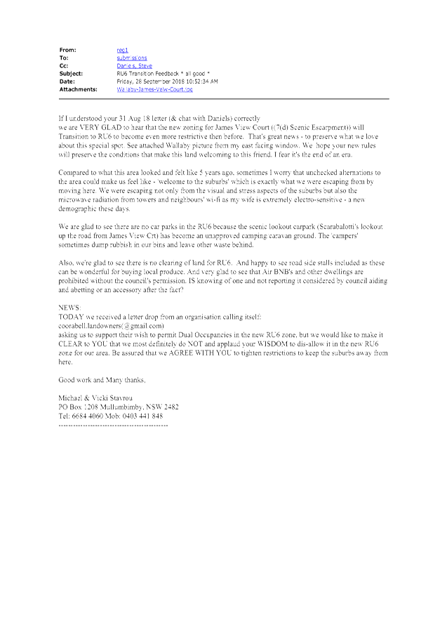
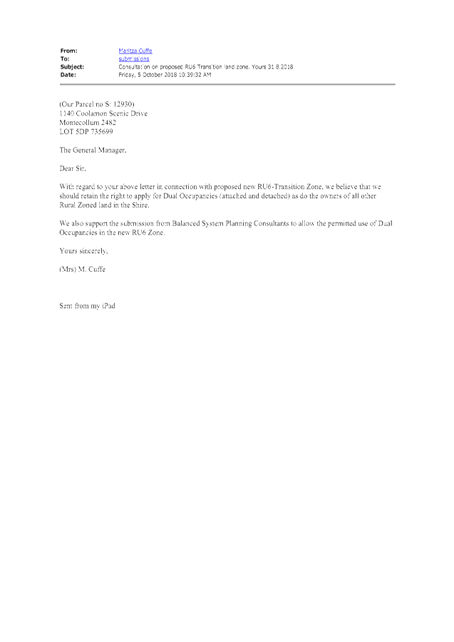
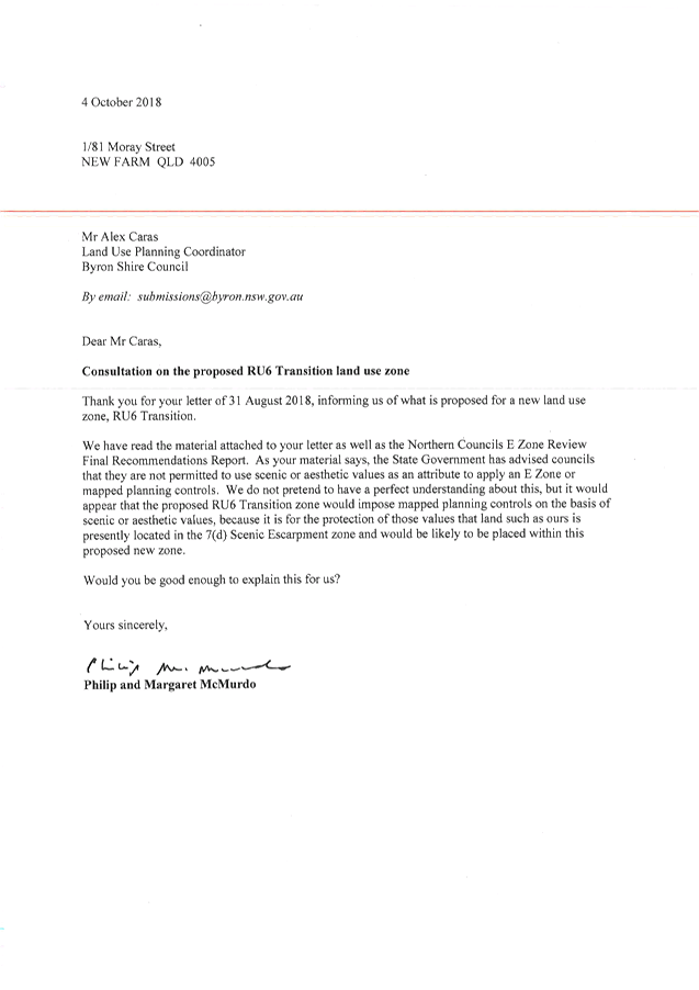
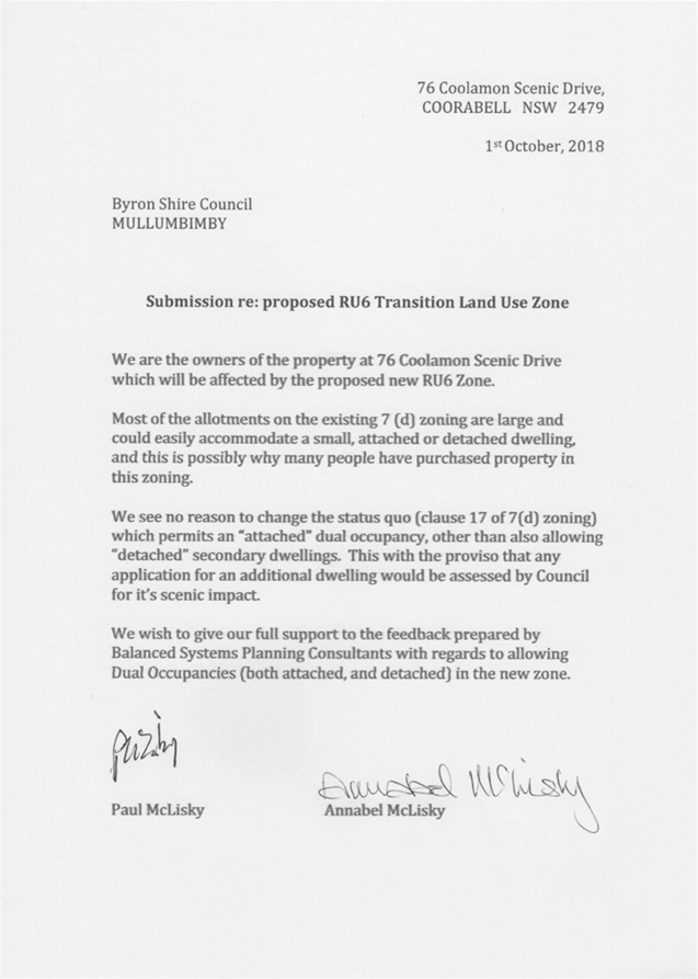
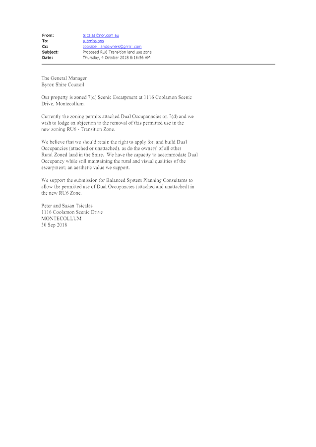
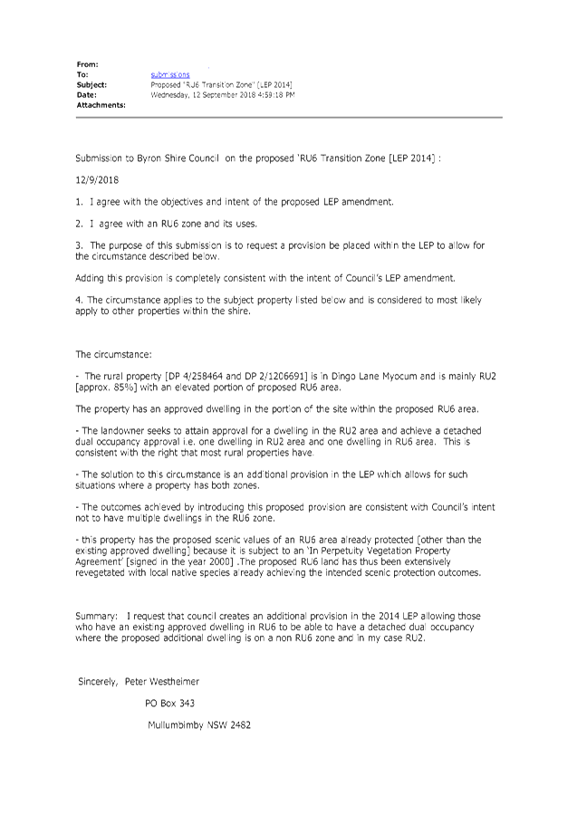
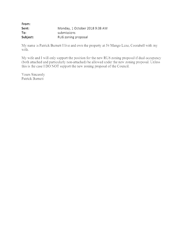
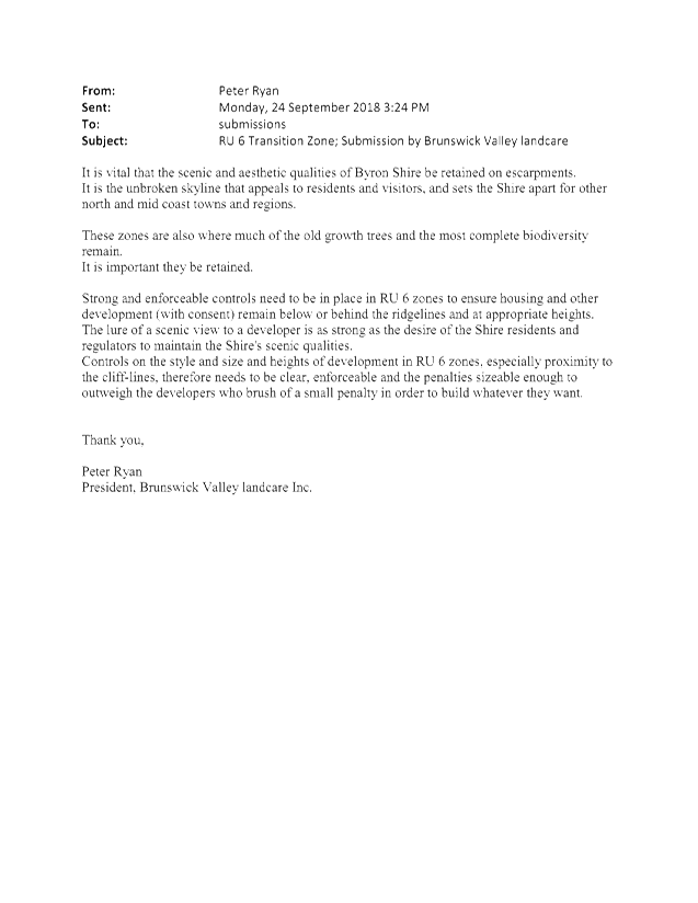
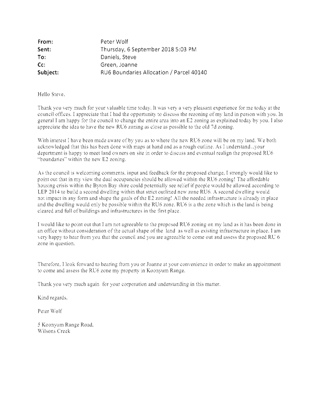
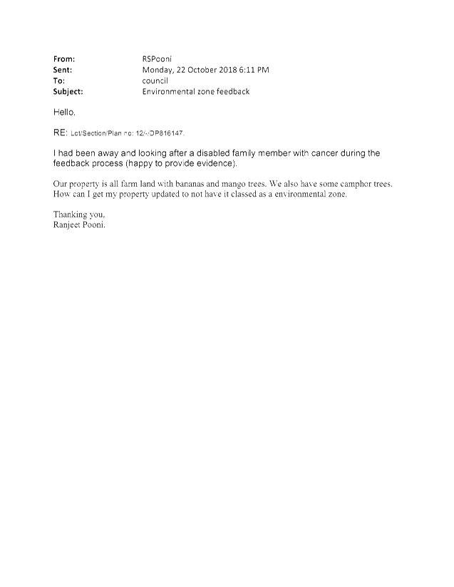
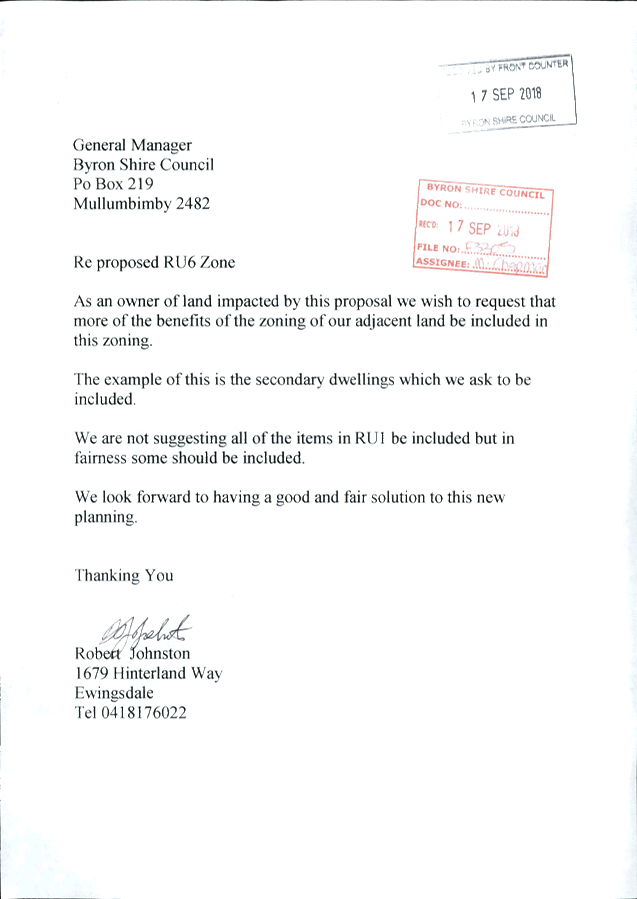
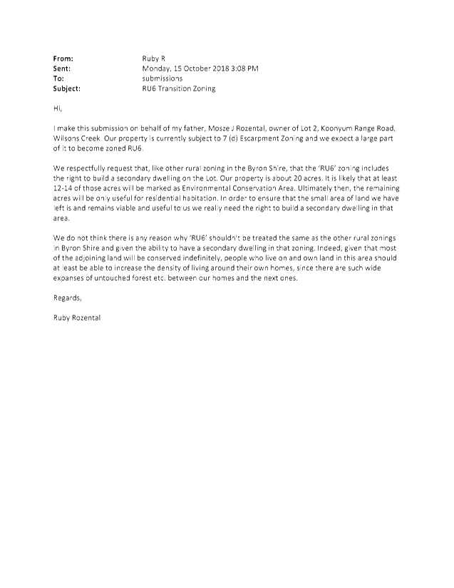
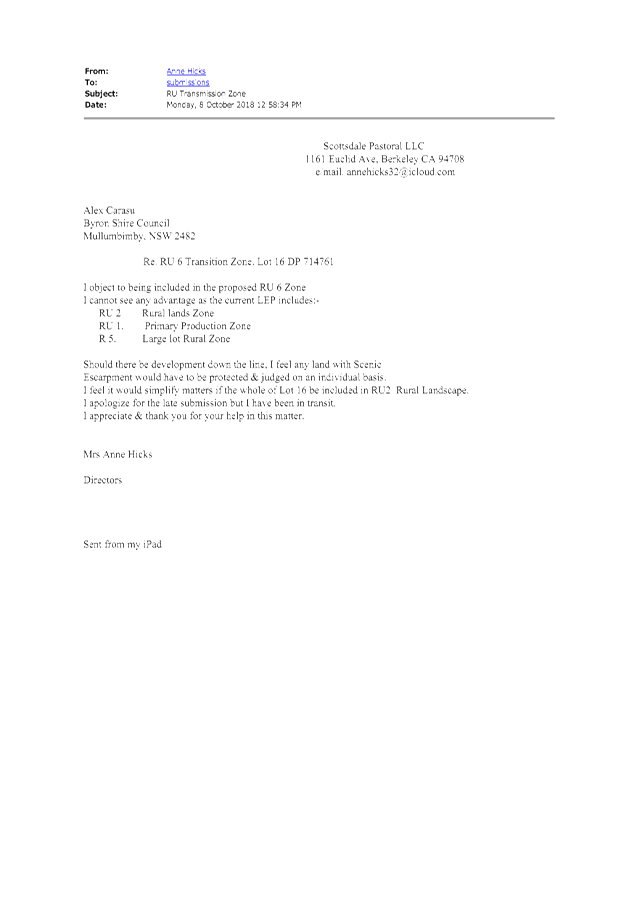
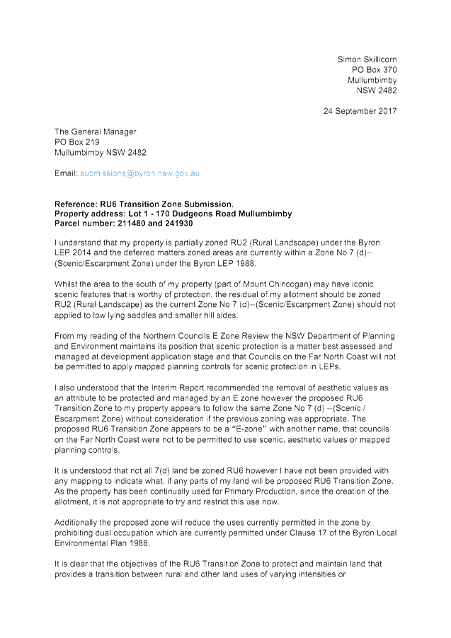
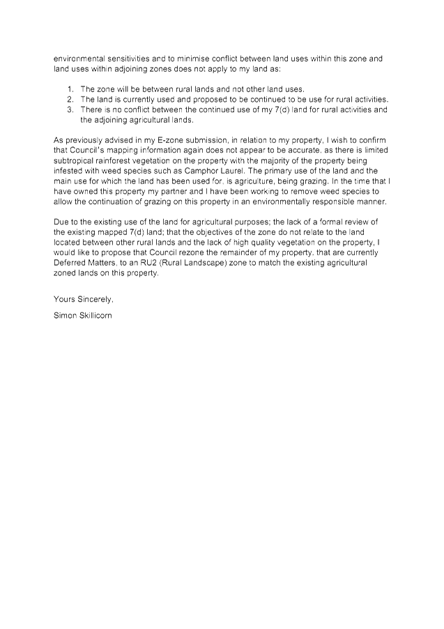
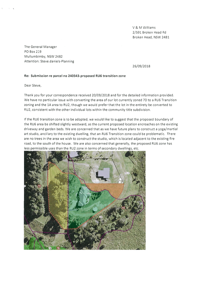
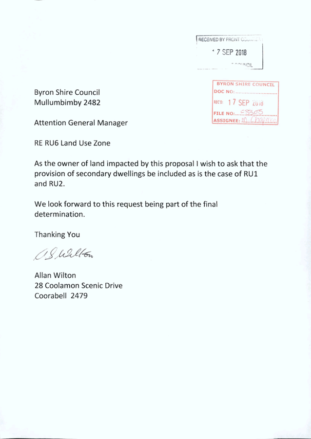
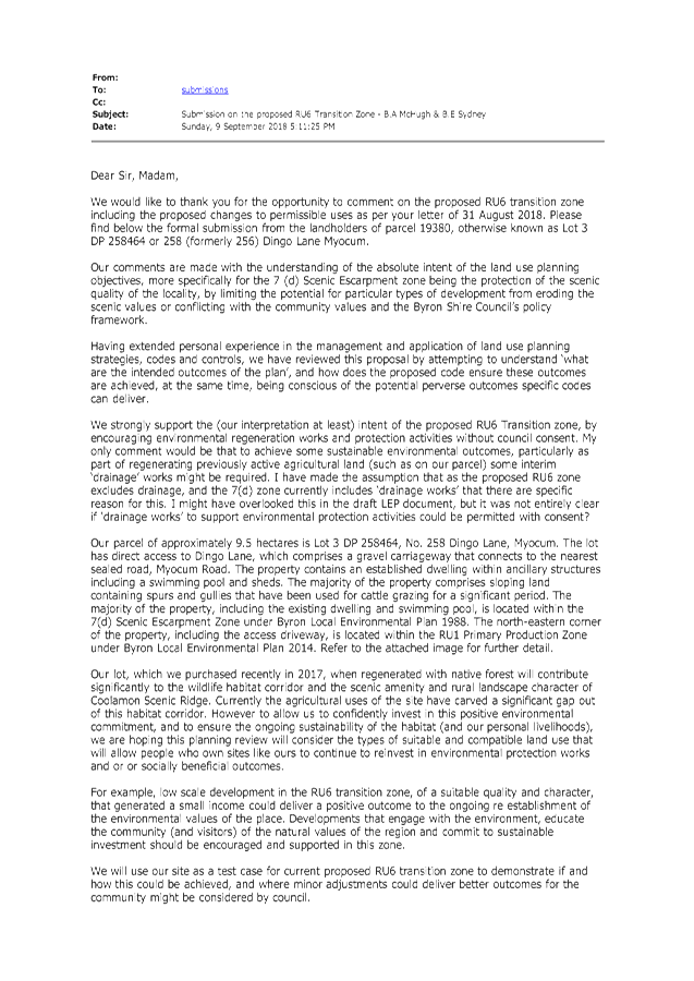
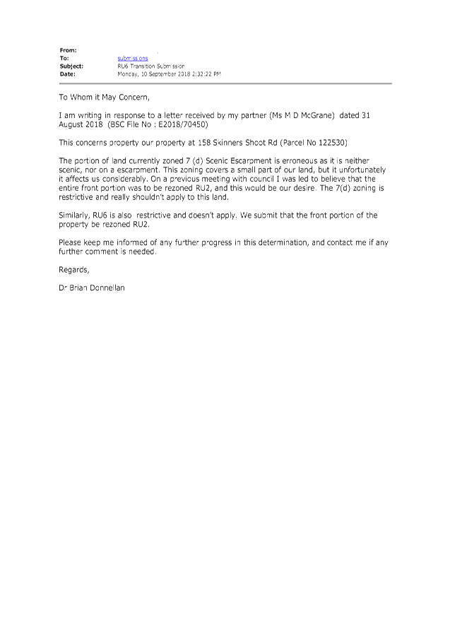
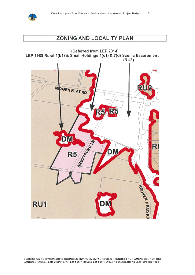
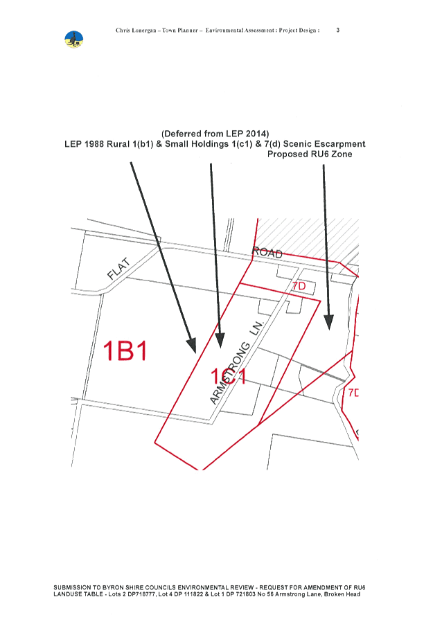
A total of 56 written submissions were received by Council
(Attachment 3), with the majority being generally supportive of the proposed
zone change and the objectives of the proposed zone.
The majority of submissions also advocated the introduction
of detached dual occupancies / secondary dwellings as being permissible with
consent in the RU6 zone, with many submitters disputing the merit of existing
zone 7(d) boundaries. The key submission issues are discussed below:
Table 1: Key Submission Issues
|
Submission Issue
|
Staff Response
|
|
Dual occupancies (detached) or secondary dwellings should
be permitted with consent in the proposed RU6 Transition Zone.
|
Only dual occupancies (attached) are currently
permitted with consent in the 7(d) zone. However, the take‐up rate of attached
dual occupancies has been very low.
The visual impact of dual occupancies (attached) is
potentially greater (due to bulk and scale) than two detached dwellings, as
the latter can be more flexibly sited so as to minimise the impact.
However, the cumulative impact of allowing for dual
occupancies (detached) throughout visually sensitive escarpment areas is
likely to be significantly greater over time than for dual occupancies
(attached). This is mainly due to the noticeably higher demand and
take-up rate for dual occupancies (detached) in our rural zones, as reflected
in the consultation feedback for the proposed RU6 zone.
Rather than allowing both ‘attached’ and
‘detached’ dual occupancies as permitted with consent, it is
considered that only allowing for secondary dwellings (i.e. a size‐limited dual
occupancy) represents a more reasonable approach and one that will achieve a
more manageable outcome in terms of visual impact.
|
|
The existing 7(d) zone boundaries are inappropriately
located and do not reflect areas of scenic value. A more appropriate,
less restrictive zone should be applied in these areas.
|
It is noted that many land owners questioned the merit of
existing 7(d) Scenic Escarpment zoning on their land, generally due to the
land being located below ridge lines and lacking visual prominence.
Rather than being rezoned to RU6, many of the landowners
argued that a more appropriate rural zoning be applied in these locations.
The 7(d) zone was introduced with the 1988 LEP, and staff
agree that a consistent methodology does not appear to have been applied when
the zone boundaries were delineated.
The scope of this informal exhibition was to gather
community feedback and make recommendations on the proposed land uses that
should apply in the RU6 zone. Although there is merit in undertaking a
future review of the current 7(d) zone boundaries, this constitutes a
significant body of work beyond the scope of this project and would need to
be considered in the DP/OP and budget process.
|
|
Landowners should retain the right to clear land, conduct
bushfire hazard reduction works and conduct drainage works.
|
These land uses are currently permitted with consent in
the 7(d) Scenic Escarpment zone; however they have not been included in the
proposed RU6 Transition zone land use table.
This is chiefly due to differences between LEP 1988 and
LEP 2014 land use definitions. These land uses are no longer defined
under the new LEP standard Instrument, which all NSW councils must use as the
basis for preparing their LEP.
However, this does not prevent such activities from being
undertaken in the proposed RU6 zone via other overriding legislation.
|
|
No development should be permitted on scenic escarpments.
|
It is recognised that visual amenity on the scenic
escarpments is sensitive to over development and/or inappropriate types of
development. It is also recognised that the Shire’s scenic
escarpments are a significant economic and cultural asset for the community
that warrant robust protection in a local environmental plan
To date, the restricted range of land uses in the 7(d)
zone has proven effective in maintaining scenic amenity in these locations
while allowing options for land owners to carry out appropriate development
with minimal impact. The proposed RU6 zone seeks to replicate these
land uses as closely as possible.
|
Consultation with Department of
Planning, Industry & Environment (DPIE)
Council received preliminary
advice (Attachment 4) from the Department of Planning, Industry &
Environment on 20 March 2018 regarding the introduction of a new LEP 2014 zone,
RU6 Transition, to be applied to land currently zoned 7(d) Scenic
Escarpment LEP 1988 and not meeting criteria for an E2/E3 zone. This
advice suggested that Council consider
including additional land uses as ‘permissible with consent’ in the
proposed RU6 zone, and also suggested using DCP controls as the primary
means for protecting scenic values at the development application stage.
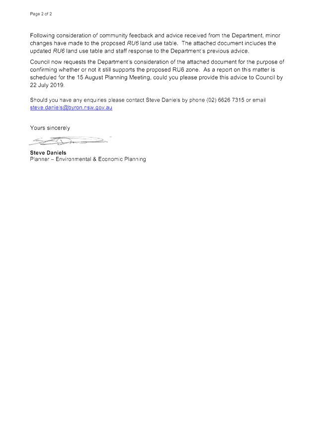
Once the outcomes of the informal
exhibition had been considered, staff then wrote a letter to the DPIE
requesting feedback on a revised RU6 land use table that included a minor
change in response to community feedback discussed above, and the previous DPIE
feedback. A copy of the letter is contained in Attachment 5.
The changes made to the proposed RU6
Transition Zone included the introduction of secondary dwellings as being
permissible with consent. The rationale for this change is discussed
above in Table 1.
In response to the DPIE’s
preference for using DCP controls instead of LEP controls as the primary means
for protecting scenic values, staff asserted that the DCP is not a suitable
mechanism for controlling land use. Because the DCP is a guideline document
that does not carry statutory weight, it cannot ensure a specific land use
outcome. Furthermore, relying primarily on DCP controls over LEP controls
can place the zone objectives at greater risk of being eroded over time via court
challenges and the subsequent implications of precedent.
State Government Response
Council received a letter from the
DPIE on 14 August 2019 (Attachment 6) responding to Council’s request for
the Department’s position on supporting a planning proposal to replace
the 7(d) Scenic Escarpment zone with the proposed RU6 Transition Zone
under LEP 2014.
Despite general support from the
community for the proposed RU6 land uses and zone objectives, and
despite correspondence from Council staff highlighting the inadequacy of DCP
controls as a primary means for protecting the scenic amenity of the
Shire’s escarpments, the DPIE maintains it’s position that:
· an expanded list of land uses (more akin to the RU1 and RU2
zones) should be permissible with consent in the proposed RU6 zone, and
· that DCP controls should be relied on to maintain scenic
amenity.
This
position is articulated in the following extract from the Department’s
response:
The E
Zone final recommendations note that matters of scenic protection are best
assessed and managed at the development application stage when the final
details of proposed developments are known. The primary controls relating to
scenic protection should therefore be contained in Council's development
control plan.
I
note Council's advice that it does not intend to permit a range of land uses
that would normally be permissible in a rural zone. Council's reasons for
excluding these land uses appear to be based on the potential scenic impact of
such developments. The Department is unlikely to support this approach.
The
Department's position remains that the scenic impact of a development is to be
assessed at the development application stage. Should Council pursue the
inclusion of the RU6 zone, I encourage you to reconsider permitting an
appropriate range of land uses with development consent.
Staff Response and
Recommendation
The economic and cultural
significance of the Shire’s scenic escarpments warrants greater
protection than can be delivered via DCP controls alone. The
Department’s position advocating a widely expanded list of permissible
land uses in these areas is considered at odds with the vision of the DPIE
North Coast Regional Plan which seeks to achieve:
The
best region in Australia to live, work and play thanks to its spectacular
environment… The natural beauty of its environment continues not
just to enrich the lives of its residents, but also to sustain a thriving
tourism and lifestyle economy…. The region’s natural environment is
safeguarded and enhanced to deliver a prosperous future and to ensure that it
remains one of the most beautiful parts of the State.
The Department’s position is
also at odds with the Northern Rivers Regional Economic Development
Strategy 2018 -2022, which states among other things
that:
“… the Northern
Rivers is shown to have an exceptionally diverse economy. Its key endowments
include its coastal, riverine and hinterland amenity; access to South
East Queensland; and generally excellent quality infrastructure.”
For the reasons discussed above,
it is recommended that Council retains the existing LEP 1988 zone, 7(d)
Scenic Escarpment, in locations that do not qualify for an environmental
zoning, until such time as a suitable replacement LEP 2014 zone is supported by
the Department. This is consistent with the approach previously resolved
by Ballina Council (Attachment 1) in response to the
Department’s position regarding their 7(d) Environmental Protection
(Scenic/Escarpment) Zone.
Community Strategic Plan and
Operational Plan
|
CSP Objective
|
L2
|
CSP Strategy
|
L3
|
DP Action
|
L4
|
OP Activity
|
|
Community
Objective 4: We manage growth and change responsibly
|
4.2
|
Support
housing diversity in appropriate locations across the Shire
|
4.2.1
|
Establish
planning mechanisms to support housing that meets the needs of our community
|
|
|
Legal/Statutory/Policy Considerations
The relevant legal/statutory/policy considerations have been
noted above.
Financial Considerations
The matter does not incur any additional costs if Council
chooses to retain the existing 7(d) Scenic Escarpment zone.
If the preparation of a planning proposal to introduce an
equivalent LEP 2014 zone becomes a viable option in the future, the associated
costs will be borne by Council. This action would be subject to a future
Council report and the financial implications would be considered at the time.
Consultation and Engagement
The relevant consultation and engagement considerations and outcomes
for the proposed RU6 zone have been noted above.
Staff Reports - Sustainable Environment and Economy 13.2 - Attachment 1
Staff Reports - Sustainable Environment and Economy 13.2 - Attachment 2
LEP
2014: Proposed RU6 Transition Zone
Rationale
Protection
of the rural landscape values, including scenic amenity, was one of the key
messages expressed by the community in the Rural Land Use Strategy
Discussion
Paper. Under BLEP 1988 the 7(d)
Scenic Escarpment Zone covers most of the escarpment land in the Shire, as well
as other visually important areas. During preparation of the shire wide
LEP, areas within the 7(d) zone were proposed to be zoned either E2
Environmental Conservation or E3 Environmental Management in accordance with
the Byron Shire LES 2008. This is because there is no equivalent zone
provided in the Standard Instrument LEP Template (SI LEP) to accommodate such
areas.
All 7(d)
areas deferred from LEP 2014 are now being assessed against the State
Government’s E zones Review Final Recommendations Report and related
criteria for applying E Zones. Under the Final Recommendations Report, councils
on the Far North Coast are not permitted to use scenic or aesthetic values as
an attribute for the application of an E2 or E3 zone or mapped planning
controls. The report also states that “A LEP Map is not to be used for
areas of scenic protection or aesthetic values”. Whilst some
vegetated areas in the 7(d) Scenic Escarpment Zone meet the criteria for
applying E2 Environmental Conservation, other areas do not and will require an
alternative rural zone.
The E Zone review and the Rural Land Use
Strategy engagement processes have identified a need for a suitable replacement
zone to the 7(d) Scenic Escarpment Zone. This is necessary in
order to:
· align with community values and Council policy (ie. by
ensuring that visually prominent areas are not eroded by inappropriate land uses
that are otherwise permitted in the RU1/RU2 zones);
· avoid delays for landowners who have already agreed to an E
Zone on part of their land, but cannot proceed without a comparable zone in LEP
2014 for the remaining 7(d) Zone LEP 1988; and
· avoid the prospect of other 7(d) zone land remaining as
Deferred Matter due to the absence of a comparable LEP 2014 zone.
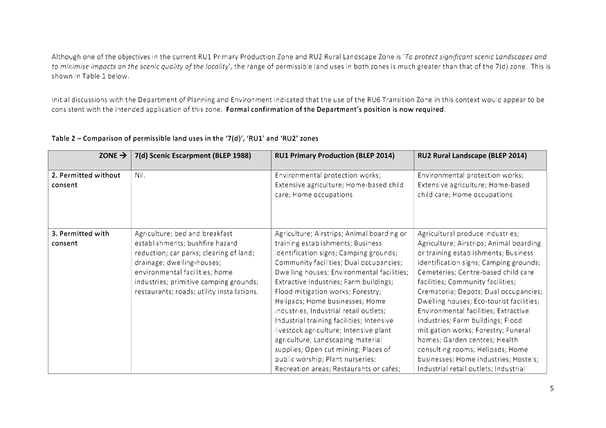
Although one of the objectives in the current RU1 Primary
Production Zone and RU2 Rural Landscape Zone is ‘To protect
significant scenic Landscapes and to minimise impacts on the scenic quality of
the locality’, the range of permissible land uses in both zones is
much greater than that of the 7(d) zone. This is shown in Table 1 below.
Initial discussions with the Department of Planning and Environment
have indicated that the use of the RU6 Transition Zone in this context would
appear to be consistent with the intend application of this zone.
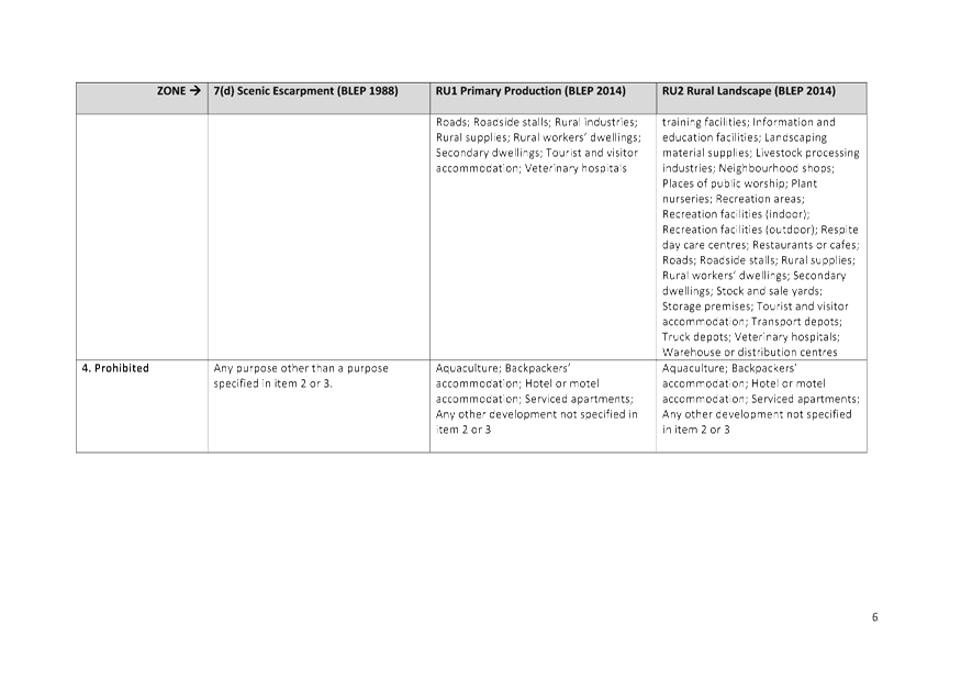
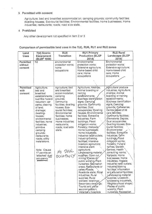
Table 1 – Comparison of permissible land uses in the
‘7(d)’, ‘RU1’ and ‘RU2’ zones
|
ZONE à
|
7(d) Scenic
Escarpment (BLEP 1988)
|
RU1 Primary
Production (BLEP 2014)
|
RU2 Rural
Landscape (BLEP 2014)
|
|
2. Permitted
without consent
|
Nil.
|
Environmental
protection works; Extensive agriculture; Home-based child care; Home
occupations
|
Environmental
protection works; Extensive agriculture; Home-based child care; Home
occupations
|
|
3. Permitted
with consent
|
Agriculture;
bed and breakfast establishments; bushfire hazard reduction; car parks;
clearing of land; drainage; dwelling-houses; environmental facilities; home industries;
primitive camping grounds; restaurants; roads; utility installations.
|
Agriculture;
Airstrips; Animal boarding or training establishments; Business
identification signs; Camping grounds; Community facilities; Dual
occupancies; Dwelling houses; Environmental facilities; Extractive
industries; Farm buildings; Flood mitigation works; Forestry; Helipads; Home
businesses; Home industries; Industrial retail outlets; Industrial training
facilities; Intensive livestock agriculture; Intensive plant agriculture;
Landscaping material supplies; Open cut mining; Places of public worship;
Plant nurseries; Recreation areas; Restaurants or cafes; Roads; Roadside
stalls; Rural industries; Rural supplies; Rural workers’ dwellings;
Secondary dwellings; Tourist and visitor accommodation; Veterinary hospitals
|
Agricultural
produce industries; Agriculture; Airstrips; Animal boarding or training
establishments; Business identification signs; Camping grounds; Cemeteries;
Centre-based child care facilities; Community facilities; Crematoria; Depots;
Dual occupancies; Dwelling houses; Eco-tourist facilities; Environmental
facilities; Extractive industries; Farm buildings; Flood mitigation works;
Forestry; Funeral homes; Garden centres; Health consulting rooms; Helipads;
Home businesses; Home industries; Hostels; Industrial retail outlets;
Industrial training facilities; Information and education facilities;
Landscaping material supplies; Livestock processing industries; Neighbourhood
shops; Places of public worship; Plant nurseries; Recreation areas;
Recreation facilities (indoor); Recreation facilities (outdoor); Respite day
care centres; Restaurants or cafes; Roads; Roadside stalls; Rural supplies;
Rural workers’ dwellings; Secondary dwellings; Stock and sale yards; Storage
premises; Tourist and visitor accommodation; Transport depots; Truck depots;
Veterinary hospitals; Warehouse or distribution centres
|
|
4. Prohibited
|
Any purpose other than a purpose specified in item 2 or
3.
|
Aquaculture; Backpackers’ accommodation; Hotel or motel
accommodation; Serviced apartments; Any other development not specified in
item 2 or 3
|
Aquaculture; Backpackers’ accommodation; Hotel or
motel accommodation; Serviced apartments; Any other development not specified
in item 2 or 3
|
To
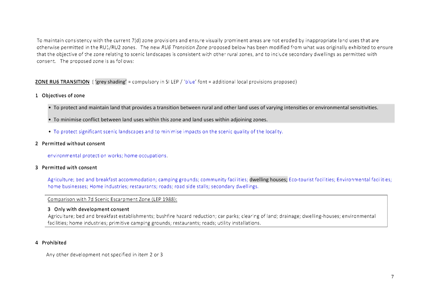
maintain consistency with the current 7(d) zone provisions and ensure visually
prominent areas are not eroded by inappropriate land uses that are otherwise permitted in the RU1/RU2 zones, a new RU6 Transition Zone is proposed as
follows.
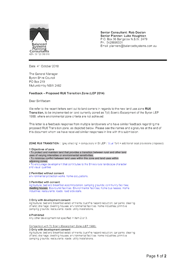
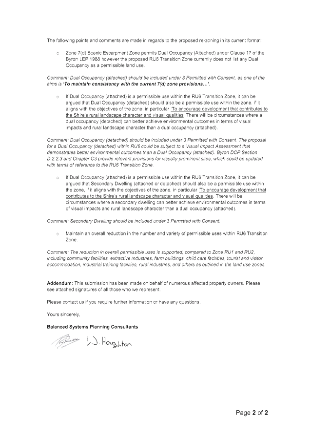
ZONE RU6 TRANSITION ( ‘grey shading’
= compulsory in SI LEP / ‘blue’ font = additional local provisions proposed)
1 Objectives of zone
• To protect and maintain land that
provides a transition between rural and other land uses of varying intensities
or environmental sensitivities.
• To minimise conflict between land uses
within this zone and land uses within adjoining zones.
• To encourage development that contributes to the
Shire’s rural landscape character and visual qualities
2 Permitted
without consent
environmental
protection works; home occupations.
3 Permitted
with consent
Agriculture; bed and breakfast accommodation; camping grounds; community facilities; dwelling houses; Eco-tourist facilities;
Environmental facilities; home businesses; Home industries; restaurants; roads;
road side stalls.
Comparison with 7d
Scenic Escarpment Zone (LEP 1988):
3 Only with development
consent
Agriculture; bed and
breakfast establishments; bushfire hazard reduction; car parks; clearing of
land; drainage; dwelling-houses; environmental facilities; home industries;
primitive camping grounds; restaurants; roads; utility installations.
4 Prohibited
Any other development not specified in
item 2 or 3
The proposed RU6 zone recognises that the
scenic escarpment is a sensitive landscape experiencing, and likely to continue
to experience, increased development pressure. Inappropriate development
has the potential to erode the scenic values of these areas and conflict with
community values and Council’s policy framework in this regard. The
proposed RU6 zone will maintain the existing development framework
around suitable land uses in these visually prominent areas and highly valued
landscapes (by both residents and visitors).
RU6
Planning Implications
It is noted that the introduction of a new
RU6 zone will not be an exact translation of landuses from the 7(d) zone,
mainly due differences between LEP 1988 and LEP 2014 landuse definitions.
In addition, DCP 2014 (Chp D3 - Visually Prominent Sites, Visually Prominent
Development and View Sharing) my need to be amended to included supporting
provisions for land affected by the RU6 Zone.
Staff Reports - Sustainable Environment and Economy 13.2 - Attachment 3

Staff Reports - Sustainable Environment and Economy 13.2 - Attachment 4
Staff Reports - Sustainable Environment and Economy 13.2 - Attachment 5
Staff Reports - Sustainable Environment and Economy 13.2 - Attachment 6
Staff Reports - Sustainable Environment and Economy 13.3
Report No. 13.3 Draft
Mullumbimby Masterplan
Directorate: Sustainable
Environment and Economy
Report
Author: Isabelle
Hawton, Planner
File No: I2019/885
Summary:
Council resolved in 2015 to prepare a ‘Masterplan for
Mullumbimby’ through a collaborative process involving a community
Guidance Group representing the wider Mullumbimby community.
The Group was established with 16 community members and
worked with Councillors and staff to identify the key values of Mullumbimby,
key issues that need to be addressed and suggested initiatives and ideas for
the future.
The process was put on hold in 2017 for resource reasons,
recommencing in late 2018. As a result, community participation in the
Guidance Group reduced and the final stages of development of the draft
Masterplan was guided by a smaller number of community representatives.
The draft Masterplan adopts the following Vision:
Mullumbimby is a
diverse, dynamic, creative and caring country town that fosters innovation,
sustainability and a funky verve for life.
It
embraces its history and confidently strides forward with a foundation of
resilience, strong community spirit and a desire to be
“good-different”.
To achieve this Vision, the draft Masterplan presents five
principles to guide future actions and initiatives:
Principle
1: Balance the need for housing with the desire to retain
Mullumbimby’s country town feel.
Principle
2: Maintain and enhance Mullumbimby’s high level of self
sufficiency.
Principle
3: Ensure Mullumbimby is accessible and well connected.
Principle
4: Protect and enhance Mullumbimby’s green and leafy
character and reconnect with the river.
Principle
5: Enhance and Celebrate Mullumbimby’s existing eclectic
character, spirit of entrepreneurship and identity and make the future of
Mullumbimby as fun as its people.
Within this framework of Vision and Principles, the draft
Masterplan outlines a range of actions and initiatives, presented across six
(6) town precincts. An Implementation Plan is also included, identifying
the key priority actions identified in the draft Plan.
It is recommended that comprehensive community engagement
now be undertaken to get the wider input of the Mullumbimby community and to
test the key principles, actions, initiatives and priorities suggested in the
draft Masterplan.
NOTE TO COUNCILLORS:
In accordance with the
provisions of S375A of the Local Government Act 1993, a Division is to be
called whenever a motion for a planning decision is put to the meeting, for the
purpose of recording voting on planning matters. Pursuant to clause 2(a)
under the heading Matters to be Included in Minutes of Council Meetings of
Council's adopted Code of Meeting Practice (as amended) a Division will be
deemed to have been called by the mover and seconder of all motions relating to
this report.
|
RECOMMENDATION:
That Council:
1. Endorse
the exhibition of the Draft Mullumbimby Masterplan as shown in Attachment 1
(E2019/61908) for six weeks; including coordinating a range of community
engagement activities during that period to maximise the community’s
input into finalisation of the draft Plan.
2. Receive
a further report at the close of the exhibition period detailing the
engagement undertaken and the community response received to the Plan.
|
Attachments:
1 Mullumbimby
Masterplan PUBLIC EXHIBITION VERSION, E2019/61908
, page 218⇩
2 Communication
Plan Table - Mullumbimby Masterplan, E2019/61853
, page 287⇩
3 Response
to the Suggestions of Guidance Group, E2019/61852
, page 291⇩
4 Form of
Special Disclosure of Pecuniary Interest, E2012/2815
, page 294⇩
REPORT
Background
In October 2015, Council resolved to “establish a PRG
to develop a draft brief, delivery plan and process for a Mullumbimby
Masterplan” (RES 15-555). The Group was subsequently
established, through an Expression of Interest process, to include 16 community
representatives.
The Guidance Group worked with Councillors and staff through
a series of facilitated workshops to define the key values of Mullumbimby,
identify a range of issues to be addressed for its future. This work also
provided a start to the development of a vision for the town and a set of key
principles to guide its future.
Work on the Mullumbimby Masterplan was put on hold in 2017
due to internal resourcing issues, and recommenced in late 2018.
The delay resulted in a significant reduction in the number
of community representatives on the Group.
Since that time, Council have been working with the smaller
group to review previous workshop outcomes and finalise a draft
Masterplan.
Scope and Purpose of the
Plan
The draft ‘Our Mullumbimby Masterplan’ is
a place plan to set out Council and the community’s visions and ideas for
the town. It will guide future change and provide a framework for the sustainable
development of Mullumbimby over the next 10 years (from 2019 to 2029).
The draft Masterplan adopts the following Vision:
Mullumbimby is a
diverse, dynamic, creative and caring country town that fosters innovation,
sustainability and a funky verve for life.
It
embraces its history and confidently strides forward with a foundation of
resilience, strong community spirit and a desire to be
“good-different”.
To guide future actions and initiatives, the draft
Masterplan adopts the following five principles:
Principle
1: Balance the need for housing with the desire to retain
Mullumbimby’s country town feel.
Principle
2: Maintain and enhance Mullumbimby’s high level of self
sufficiency
Principle
3: Ensure Mullumbimby is accessible and well connected.
Principle
4: Protect and enhance Mullumbimby’s green and
leafy character and reconnect with the river
Principle
5: Retain and celebrate Mullumbimby’s existing eclectic
character and identity and make the future of Mullumbimby as fun as its people
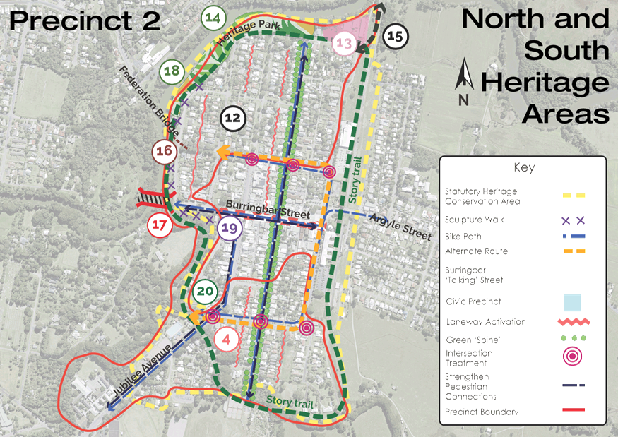
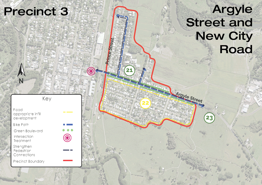
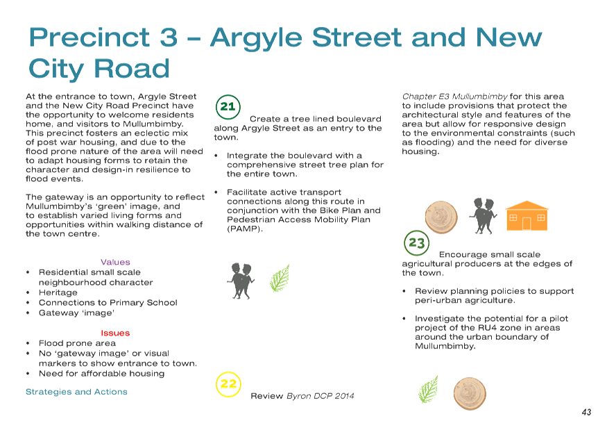
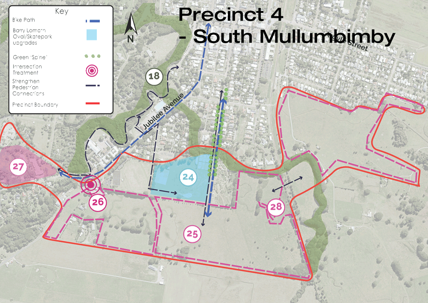
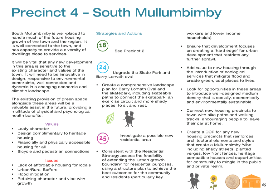
The draft Masterplan covers the
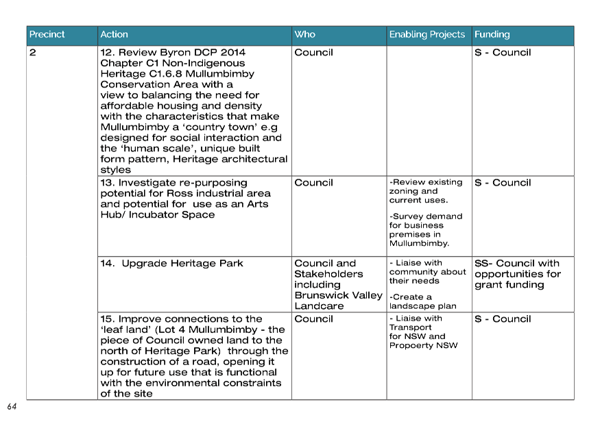
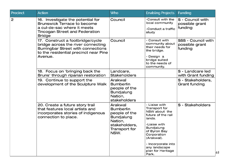
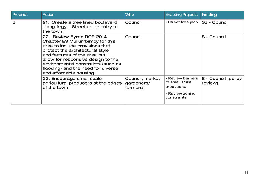
town centre, and surrounding areas, broken into six precincts, as identified in
Figure 1 below.
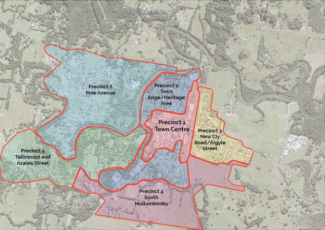
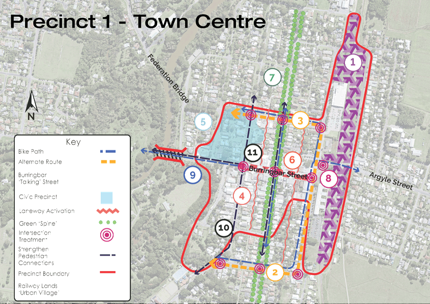
Figure 1: Precincts as
they are divided for the purposes of the plan
Each precinct has a specific set of actions.
A Snapshot of the Plan
The draft Masterplan has been
structured around:
Where
we’ve come from
Where
we are
Where
we’re going
How we’ll
get there
This framework is intended to
guide the actions of Council over the life of the Masterplan, but also to
provide opportunities for the community to deliver placemaking projects, be
involved in Council-led actions and initiatives, and contribute to Council
policy development as it relates to the future of Mullumbimby.
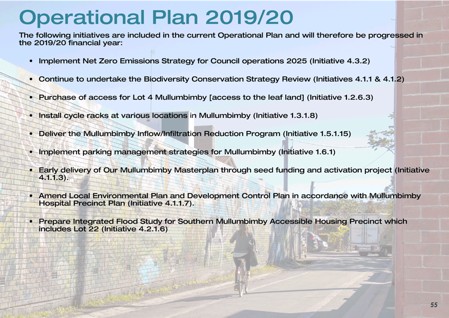
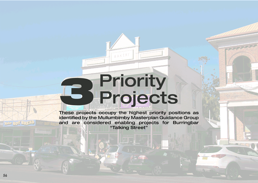
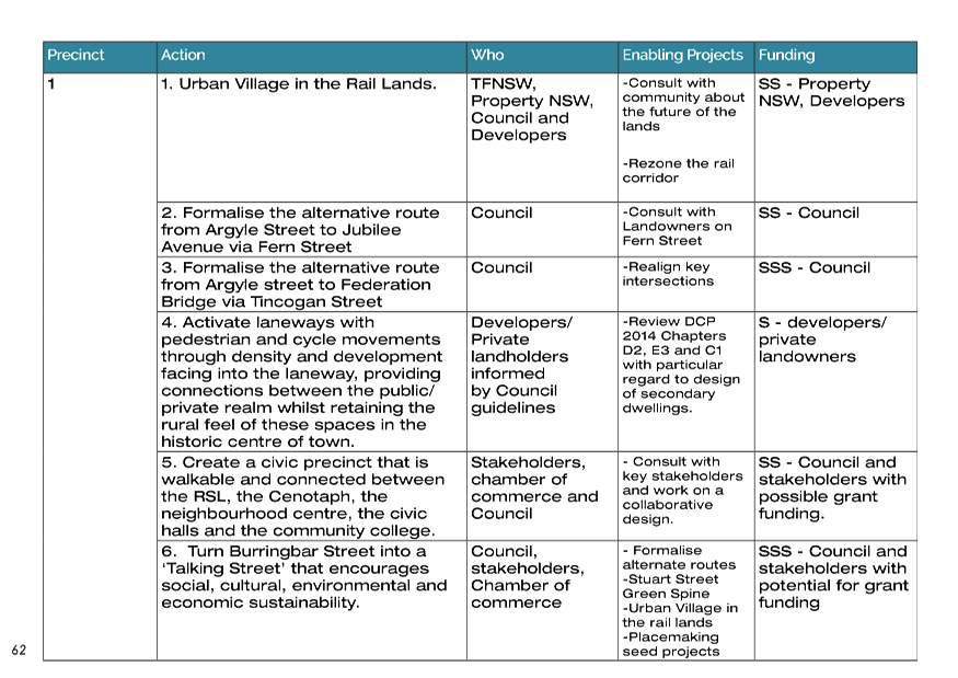
Priority Projects
The draft Plan highlights three
priority projects, identified through the Guidance Group workshop
process. These were suggested by community representatives as being the
most ‘value for money’ actions that could provide significant and
visible positive change, and therefore create community momentum for continues
implementation of the Masterplan. These key priority projects are:
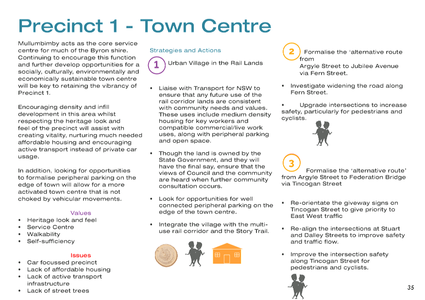
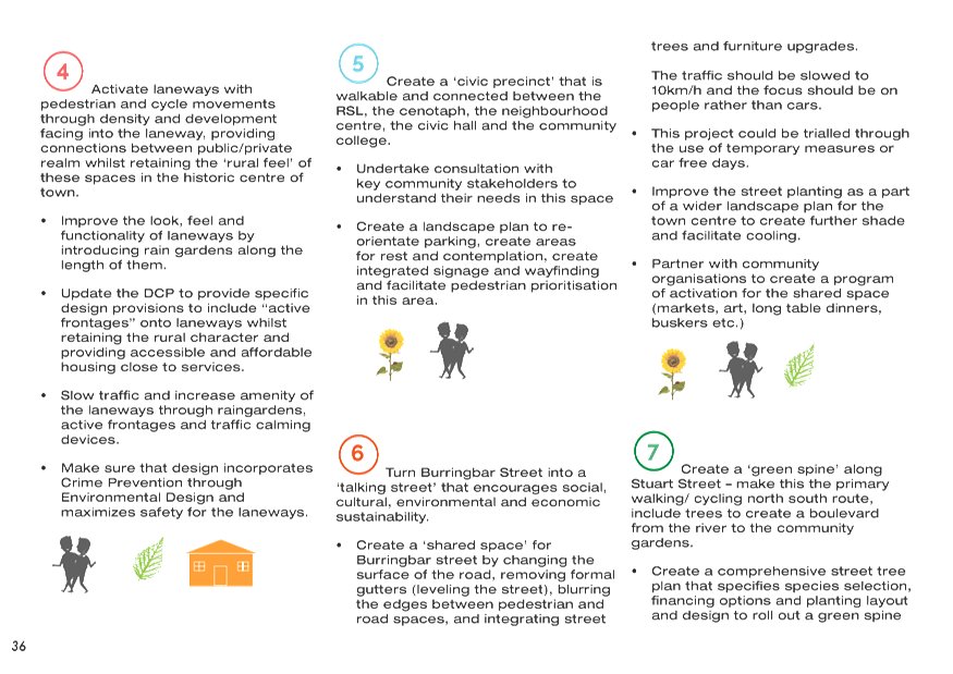
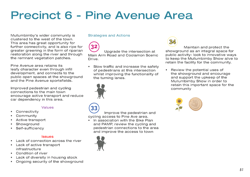
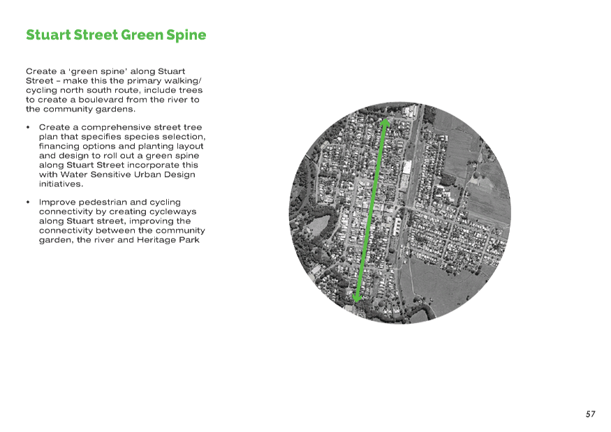
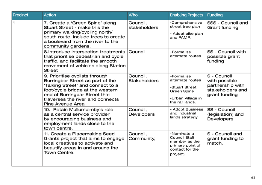
1. Stuart Street Green Spine –
creating a boulevard that acts as the primary town centre walking/cycling
route, linking the river to the community gardens.
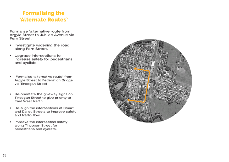
2. Alternate vehicle routes around Town
Centre – formalising alternate routes north and south of Burringbar
Street to reduce traffic in the Town Centre.
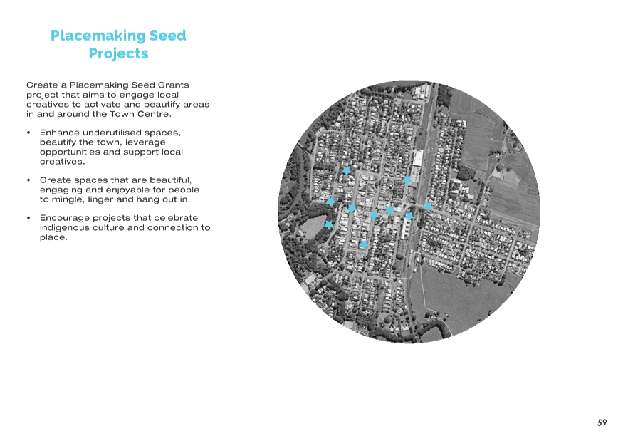
3. Placemaking seed projects –
similar to initiatives undertaken for the Byron Town Centre Masterplan,
supporting community groups in grant applications and potentially providing
small community grants that the community can access to undertake projects in
the Town Centre that are consistent with the Vision and Principles of the draft
Masterplan.
These projects are intended to be
‘enabling projects’ for the larger scale initiative for the
Burringbar Talking Street – which will see Burringbar Street become a
shared zone, a more people friendly place and the ‘living space’ of
the town.
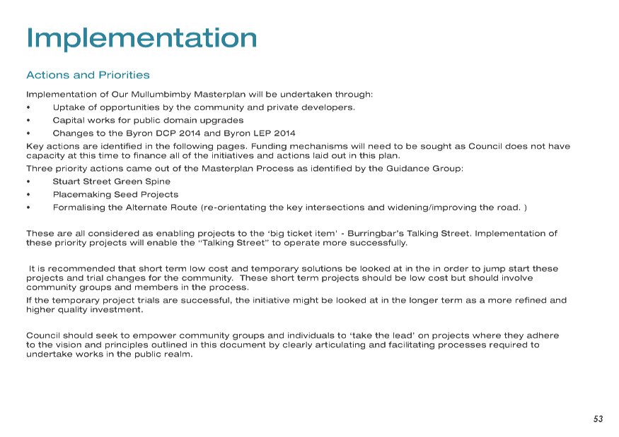
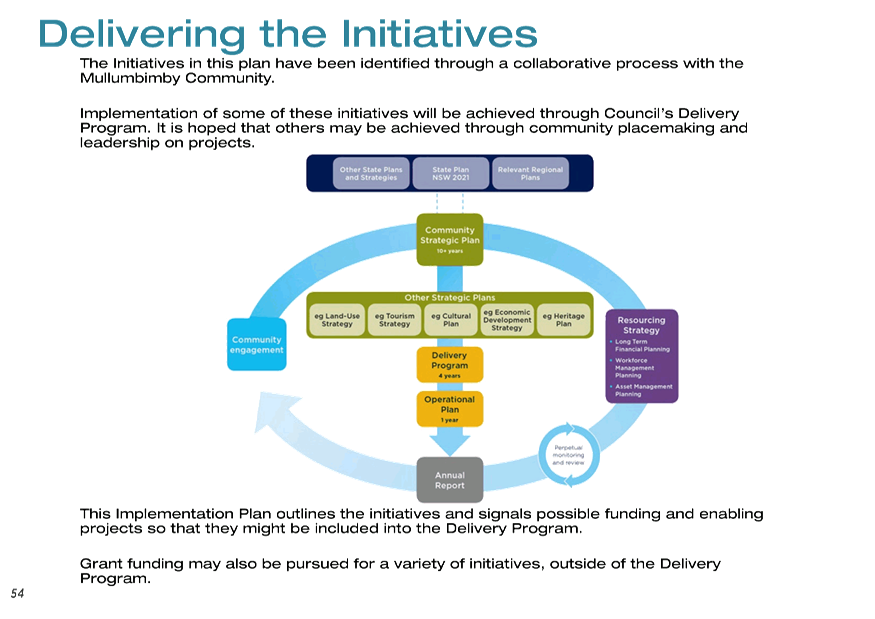
Implementation
An Implementation Plan is included
as a component of the draft Masterplan, highlighting priorities for the
identified actions and initiatives and identifying potential funding sources.
Governance of the implementation
will involve Council and the community, with the nature of that governance
mechanism yet to be determined.
Consultation and Engagement
Extensive consultation was undertaken
with the members of the Guidance Group, who were able to share the process with
a wider audience through their individual community networks.
The Place Planning Team also
undertook visits to schools, put a survey out to the wider community and held a
‘parklet’ in the main street in order to gain feedback from a wide
range of community members. The feedback has been reflected in the draft
Masterplan.
As stated above, it is now
appropriate to seek feedback from a wider audience. It is suggested that
the engagement activities described in Attachment 2 (which have been considered
by the Communications Panel) be undertaken in order to seek feedback from the
wider community.
It is also suggested that a photo
competition run alongside the exhibition of the Draft Masterplan, celebrating
things that people love about Mullumbimby in a way that links to the draft
vision and principles. It is hoped that these photos will not only be
able to be used in the final Masterplan, but will engage a wider audience in
the exhibition of the plan. The photo competition would have both a youth
and a general category, all with prize money available.
Suggested Additions from the
Guidance Group
There were a number of suggested
additions tabled at the last Guidance Group meeting that were not included in
this draft of the Masterplan. The justification for not including these
suggested amendments is in Attachment 3.
In addition, a suggestion came
from some members of the group to include the ‘Demographic
appendix’ and a constraints mapping appendix. Staff consider this
information to be unnecessary for the creation of a Masterplan (whose primary
purpose is to set a vision for the town for the next 10 years and corresponding
actions to meet this vision), as well as noting that the information can be
easily accessed in other planning documents such as the Draft Residential
Strategy and the Byron Local Environmental Plan 2014. The addition of
such information would make the Masterplan unnecessarily large and impractical
for its purpose, due to the large addition of superfluous pages.
Staff recommend instead displaying
the Masterplan in Attachment 1 in its current form for wider community
feedback.
Next steps
The next steps are to display the draft
Masterplan as per the Communication Plan. Following this, a submissions
report will be put to Council at a later date.
STRATEGIC CONSIDERATIONS
Community Strategic Plan and
Operational Plan
|
CSP Objective
|
L2
|
CSP Strategy
|
L3
|
DP Action
|
L4
|
OP Activity
|
|
Community Objective
4: We manage growth and change responsibly
|
4.1
|
Support the
visions and aspirations of local communities through place-based planning and
management
|
4.1.1
|
Develop,
implement and update Place Plans that promote place-based forward planning
strategies and actions
|
4.1.1.2
|
Continue to
develop Our Mullumbimby Masterplan
|
|
|
|
|
|
|
|
|
Legal/Statutory/Policy Considerations
N/A
Financial Considerations
A budget has been allocated in the FY19/20 for the
completion of the Masterplan.
Staff Reports - Sustainable Environment and Economy 13.3 - Attachment 1
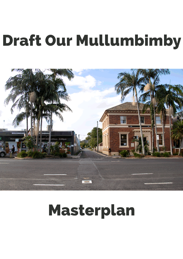

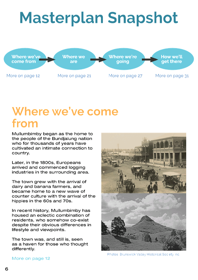
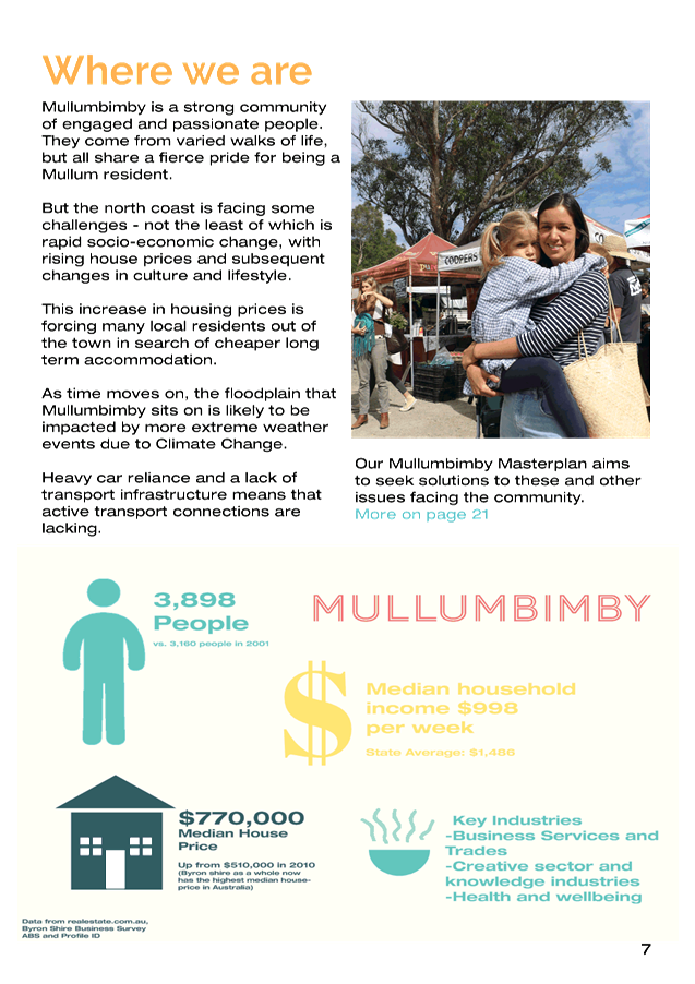
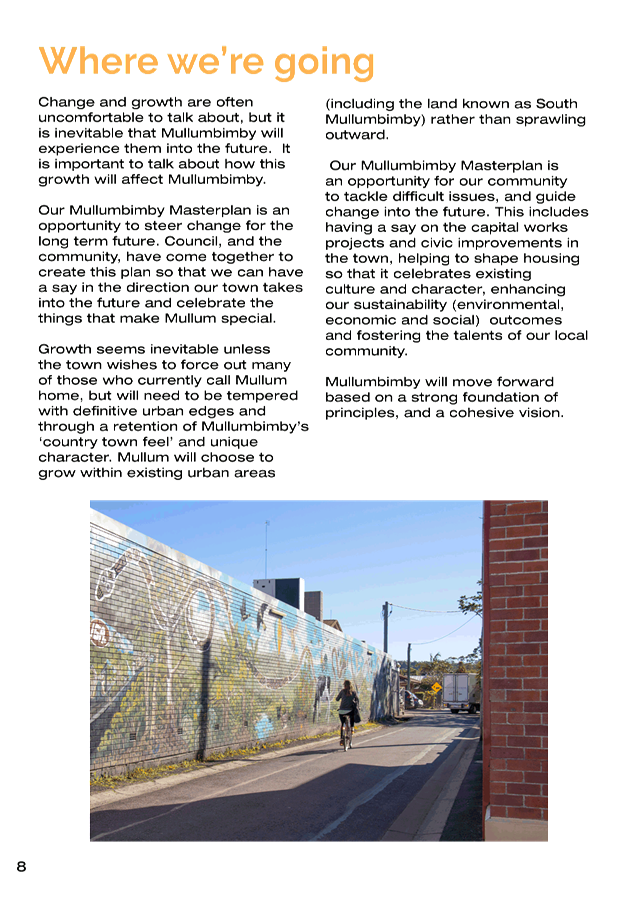
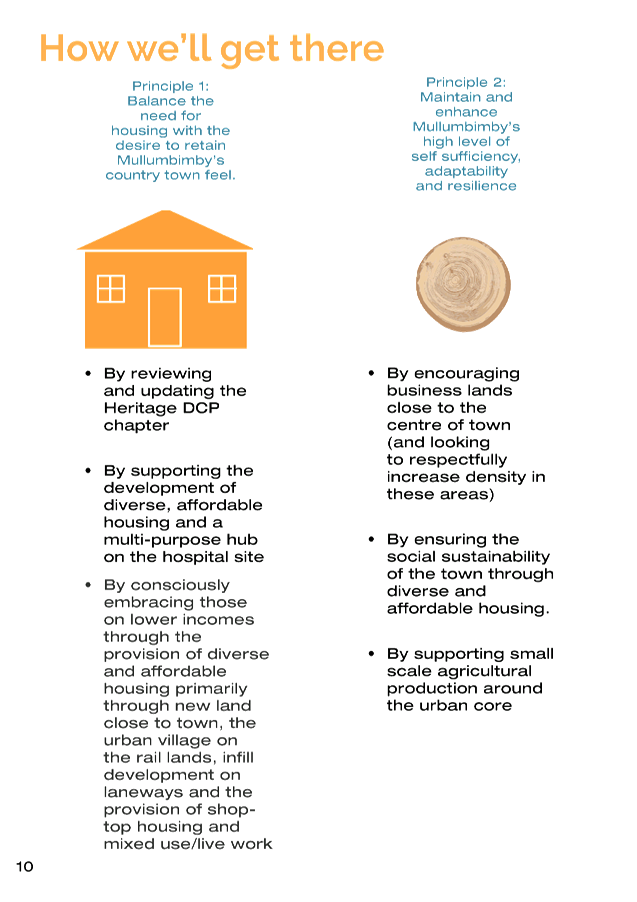
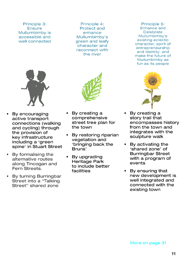

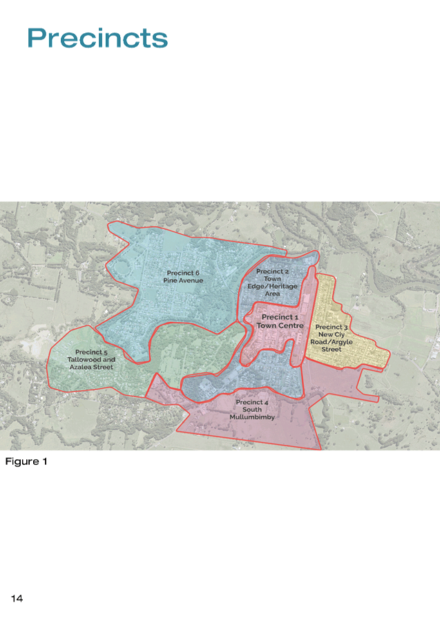


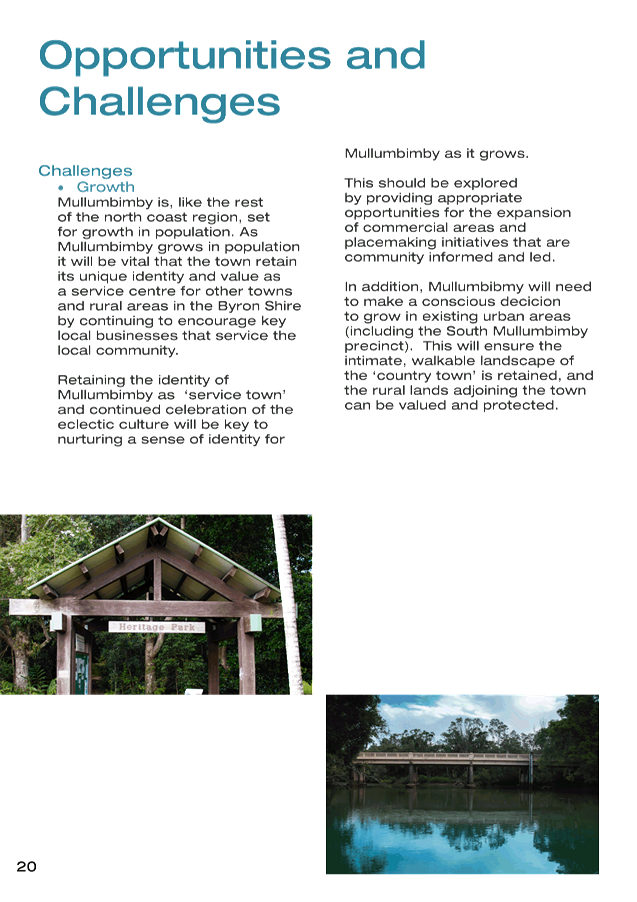
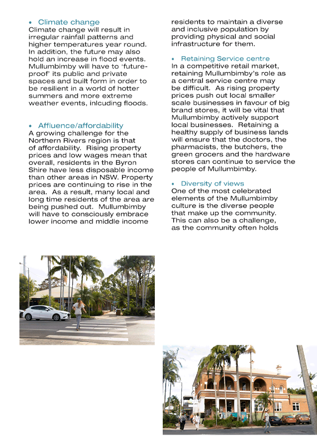

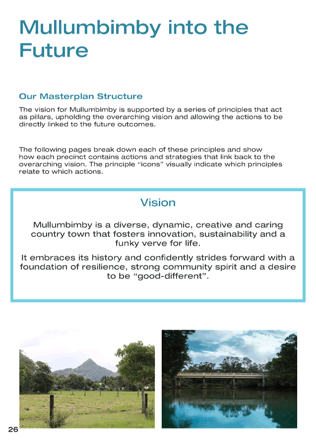
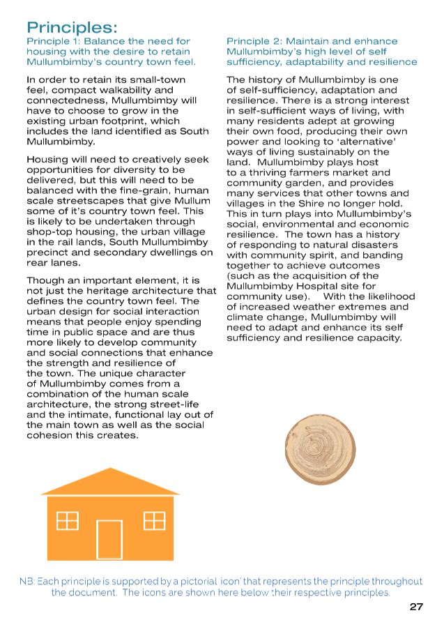
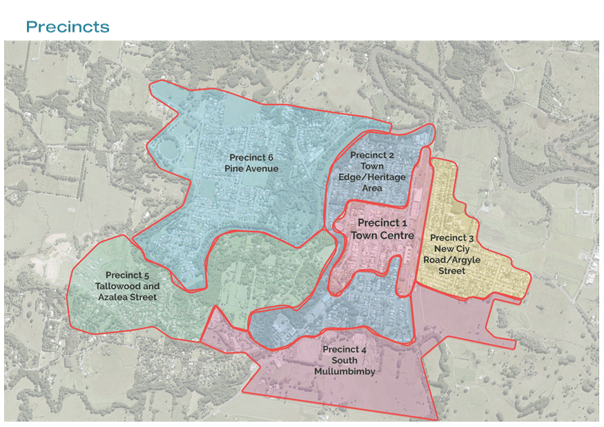

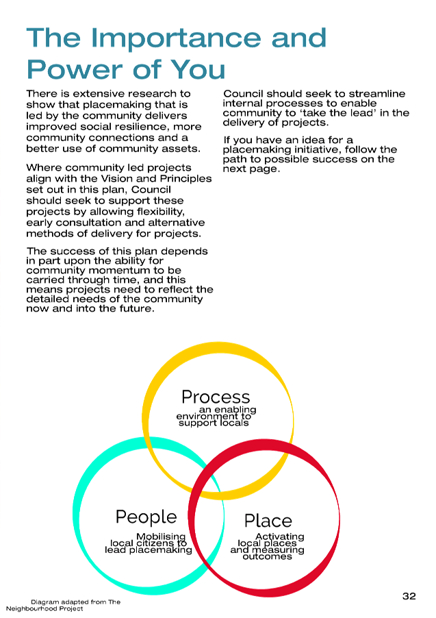
Staff Reports - Sustainable Environment and Economy 13.3 - Attachment 2
|
Communication/engagement
action plan
|
|
|
Method and intent
|
Quantity
|
Stakeholders
|
Further information
|
|
Flyer/ Pamphlet - to inform stakeholders of the
public exhibition dates, Snapshot of Masterplan, Photo Competition, Vision
and Principles, etc
|
500
|
Emailed to the members of the
Guidance Group to distribute to their relevant community groups.
|
|
|
Hand delivered to traders and
schools in the Town Centre
|
Staff to hand deliver
|
|
Distributed to the general public
|
Hand out at parklet, Farmers
Market, etc.
|
|
Poster
inform stakeholders of the public
exhibition dates, times, venues, vision and principles
|
20
|
Hand delivered to businesses in
main street – café notice boards, display windows, post office.
Hand delivered to child care centre
and school next to sign in sheet
|
|
|
Website notice
|
1
|
General public
|
|
|
Online Have Your Say page for
feedback
Include:
- Important links to data supporting
the plan
- A map for pinning
- Opportunities to comment on the
Vision, Principles and Actions outlined in the Draft Plan.
|
1
|
General public
|
|
|
Phone hotline
|
Yes
|
Contact for enquiries – Place
Planning Team
|
|
|
Weekly Ad in Echo
|
3
|
Ad 1 – Where to find us/give submission
Ad 2 – Plan and dates
Ad 3 – Where to find us/give submission
|
|
|
Ad in Byron Shire News
|
1
|
Single Ad at start of exhibition
|
|
|
Ad in school newsletter
|
All schools
in Mullumbimby
|
General public
|
|
|
Radio interview - ABC North Coast
|
1
|
General public
|
|
|
E-news general
|
1
|
Subscribed community in Shire
|
|
|
Media release
|
1
|
General public
|
Prior to public exhibition
|
|
Parklet in main street Mullumbimby
– drop in and view the Masterplan and talk with a Council Planner and
member/s of the Guidance Group
|
1 day/
fortnight. 2 in total
|
Mullumbimby residents and visitors
|
s138 Roads Act application required
Guidance Group members to assist in parklets & farmers
markets
|
|
Farmers Market stand - drop in and
view the Masterplan and talk with a Council Planner and member/s of the
Guidance Group
|
2 in total
(Fridays)
|
Mullumbimby residents and visitors
|
|
|
Social Media
|
Yes
|
General public
|
Facebook / Instagram
|
|
Photo Competition
|
2 X Cash
Prizes
|
General Public, Schools (Shearwater
and Mullum High Photography Students)
|
Photo Competition held concurrently
with the Exhibition Period to source photos for the final plan and to involve
pockets of the community who would not otherwise usually be involved.
|
|
Engagement with key stakeholder
groups
|
|
Arakwal Corporation Board
|
Face to Face meeting with Arakwal
|
|
|
Tweed/Byron Local Aboriginal Land
Council
|
Letter and Copy of the Plan sent to
Tweed Byron Local Aboriginal Land Council
|
|
Letter via email to other
government agencies
|
1
|
State government agencies (Roads
and Maritime Services, Department of Planning, Industry and
Environment)
|
Email draft plan for comment with
covering letter
|
|
Hard copy Plan (A4 colour bound
booklet) in Council’s Customer Service Centre
|
2
|
General Public
|
|
|
Report back to Guidance Group
|
1
|
Following public exhibition, staff
present summary of feedback received
|
|
|
Council reports
|
1
|
Councillors and general public
|
Summary of submissions
|
|
|
|
|
|
Staff Reports - Sustainable Environment and Economy 13.3 - Attachment 3
|
Suggestion of Guidance Group
|
Staff Comments
|
Recommendation
|
|
Inclusion
of Heritage Conservation Area in the Masterplan
|
The
Heritage conservation area was considered as particularly important to the
integrity of the plan by some members of the guidance group and as such has
been included on the map for Precinct 2.
|
That the
Heritage conservation area be shown on the map for Precinct 2 (as is the case
in the current draft).
|
|
The names
of the Precincts should appear on the Maps
|
Though
the names appear beside, it was considered a logical and straightforward task
to include the names of the Precincts on the Maps.
|
That the
current draft (including names of the precincts on the maps) be put on
display to a wider audience.
|
|
Change the
priority actions to include the placemaking seed projects
|
This was
at the request of the guidance group to enable the Burringbar Talking Street
and is considered appropriate.
|
That the
current draft (including the placemaking seed projects as a priority action)
be put on display to a wider audience.
|
|
Remove
the short term medium term long term labels from the implementation table
|
Guidance
Group members were concerned that this might rule out funding opportunities
for some projects so it was suggested this be removed and replaced with
enabling actions. This has been undertaken.
|
That the
current draft (including enabling projects) be put on display to a wider
audience.
|
|
Introduce
‘enabling projects’ in the implementation table
|
This was
suggested in lieu of the timeframes and has been undertaken in order to
provide some context for some actions.
|
That the
current draft (including enabling projects) be put on display to a wider
audience.
|
|
Make
changes to the snapshot to include more appropriate actions
|
Some of
the original actions included in the snapshot were not considered strong
representations of the principles, these have been altered.
|
That the
current draft be put on display to a wider audience.
|
|
Remove
the executive summary
|
Many
members felt the snapshot replaced the executive summary.
Consequentially this has been removed.
|
That the
current draft be put on display to a wider audience.
|
Changes
included in the Draft Our Mullumbimby Masterplan
Changes
not included in the Draft Our Mullumbimby Masterplan
|
Suggestion of Guidance Group
|
Staff Comments
|
Recommendation
|
|
Addition
of “and architectural Heritage” to the end of Principle 1
|
Although
architectural Heritage is a significant factor in Mullum’s Country Town
feel, it is not considered the only factor that influences the country town
feel, and it might be limiting to describe it as such.
The
architectural heritage of the town is described as being of importance not
only in the explanation of the principle, but also in the body of the
document, numerous times.
|
That the
principle remain as is, without the addition of “and architectural
heritage”.
|
|
Remove
the community led placemaking diagram
|
There was
some division in the guidance group regarding this diagram; however staff
believe that for the time being, it should be left in the document. The
process for community led placemaking can be complex depending on the outcome
desired; however the diagram is a way of flagging early the minimum requirements
from Council for any project.
|
That the
diagram be kept in the document.
|
|
More
prominently address and discuss flooding
|
Although
flooding is mentioned several times as being a key challenge in the
Masterplan, the masterplan is not a flood study, nor does it have capacity to
recommend engineering solutions to Mullumbimby’s ongoing flood
issues. It is therefore believed by staff that although the flooding
issues are of significance, they are prominent enough in the Masterplan to
warrant sufficient consideration in the future.
|
That the
document retains the current references to flood.
|
|
Include
outline of precincts so people can draw in their own ideas
|
This may
be an effective engagement tool, but is not considered vital to the draft
masterplan.
|
Retain
the masterplan in its current form and look to engage people during the
public exhibition period in various ways.
|
|
Minimum
of two months exhibition
|
The
current exhibition period is recommended to be six weeks which is considered
sufficient for a Place Plan. In addition, the current OP milestone is to have
the plan adopted by 31 Dec. Extending the exhibition period might
prevent this deadline from being met.
|
Maintain
the six week exhibition period.
|
|
Constraints
appendix and a Demographic analysis appendix
|
As
discussed in the body of the Council report, at this time, the demographics
analysis is not considered necessary to the Masterplan as a similar analysis
will appear in the Draft Residential Strategy and on the profile ID website.
In
addition, a constraints appendix is also considered superfluous as this
information is easily accessible through Council’s LEP.
|
That the
document be exhibited in its current form without the addition of appendices.
|
|
Embed a
Principle relating to Community led Placemaking
|
Although
community led placemaking is considered vital to enacting this plan, it does
not fit with the principles as they stand.
Staff consider
it to be more of a delivery mechanism, that is discussed in detail in other
areas of the plan.
|
That the
document be exhibited in its current form without the addition of another
principles.
|
Staff Reports - Sustainable Environment and Economy 13.3 - Attachment 4
Schedule 3 Form
of special disclosure of pecuniary interest
submitted under Clause 4.25 of the
Code of Conduct for Councillors
3.
This form must be completed using
block letters or typed.
4.
If there is insufficient space for
all the information you are required to disclose, you must attach an appendix
which is to be properly identified and signed by you.
Important
information
This information is being collected for
the purpose of making a special disclosure of pecuniary interests under clause
4.24(c) of the Byron Shire Council Code of Conduct for Councillors (the Code of
Conduct).
The special disclosure must relate only to
a pecuniary interest that a councillor has in the councillor’s principal
place of residence, or an interest another person (whose interests are relevant
under clause 4.3 of the Code of Conduct) has in that person’s principal
place of residence.
Clause 4.3 of the Code of Conduct states
that you will have a pecuniary interest in a matter because of the pecuniary
interest of your spouse or your de facto partner or your relative or because
your business partner or employer has a pecuniary interest. You will also have
a pecuniary interest in a matter because you, your nominee, your business
partner or your employer is a member of a company or other body that has a
pecuniary interest in the matter.
“Relative” is defined by
clause 4.4 of the Code of Conduct as meaning your, your spouse’s or your
de facto partner’s parent, grandparent, brother, sister, uncle, aunt,
nephew, niece, lineal descendant or adopted child and the spouse or de facto
partner of any of those persons.
You must not make a special disclosure that you know or ought
reasonably to know is false or misleading in a material particular. Complaints about breaches of these requirements are to
be referred to the Office of Local Government and may result in disciplinary
action by the Chief Executive of the Office of Local Government or the NSW
Civil and Administrative Tribunal.
This form must be completed by you before
the commencement of the council or council committee meeting at which the
special disclosure is being made. The completed form must be tabled at the
meeting. Everyone is entitled to inspect it. The special disclosure must be
recorded in the minutes of the meeting.
Special disclosure of pecuniary interests
by ____________________________________________________________________________________
[full
name of councillor]
in the matter of __________________________________________________________________________
[insert
name of environmental planning instrument]
which is to be considered at a meeting of the
______________________________________________________________________________________
[name
of council or council committee (as the case requires)]
Report No. __________ to be held on the _________________ day of ________________________
201
|
Pecuniary interest
|
|
Address of
the affected principal place of residence of the councillor or an associated
person, company or body (the identified
land)
|
|
|
Relationship
of identified land to the councillor
[Tick
or cross one box.]
|
The Councillor has interest
in the land (e.g. is owner or has another interest arising out of a mortgage,
lease, trust, option or contract, or otherwise).
An associated person of the councillor
has an interest in the land.
An associated company or body of the councillor has an interest in
the land.
|
|
Matter
giving rise to pecuniary interest
|
|
Nature of the land that is
subject to a change in zone/planning control by the proposed LEP (the subject
land)
[Tick or cross one box]
|
The identified land.
Land that adjoins or is adjacent to or is in proximity to the
identified land.
|
|
Current
zone/planning control
[Insert name of current planning instrument and identify relevant
zone/planning control applying to the subject land]
|
|
|
Proposed
change of zone/planning control
[Insert name of proposed LEP and identify proposed change of zone/planning
control applying to the subject land]
|
|
|
Effect of
proposed change of zone/planning control on councillor or associated person
[Insert one of the following: “Appreciable financial gain” or
“Appreciable financial loss”]
|
|
[If
more than one pecuniary interest is to be declared, reprint the above box and
fill in for each additional interest.]
_____________________________
Councillor’s
signature
_____________________________
Date
[This form is to be retained by the
council’s general manager and included in full in the minutes of the
meeting]
Staff Reports - Sustainable Environment and Economy 13.4
Report No. 13.4 Place
Planning Cluster Group - A new method of managing implementation of place plans
Directorate: Sustainable
Environment and Economy
Report
Author: Isabelle
Hawton, Planner
File No: I2019/1087
Summary:
The aim of this report is to introduce the concept of a
Place Planning Cluster Group (PPC group).
The PPC group would comprise key staff, councillors,
representatives from community groups and randomly selected community members,
who could represent the Byron Arts and Industry Estate, Mullumbimby and
Bangalow localities (i.e. localities subject to place plans / master plans).
Other towns and villages could be added when and as plans are completed.
The PPC group would enable early communication and a real
time information exchange with the community about the implementation of the
Bangalow Village Plan, Our Mullumbimby Masterplan and the Byron Arts and
Industry Estate Precinct Plan. Councillors would be invited to take part
in each meeting as is the case for the Byron Bay Town Centre Guidance Group.
The Byron Bay Town Centre Guidance Group would continue to operate separately,
alongside this group (unless resolved otherwise), but would also be invited to
participate through nominated representatives.
With the formation of the PPC group, any other existing town
/ village specific guidance groups would be disbanded at adoption of the
relevant town / village masterplans.
The amalgamation of these guidance groups into a single PPC
group for plan implementation purposes is considered critical by staff to
ensure the plans stay live, and to ensure the efficient and effective use of
staff resources, councillor and community time post plan adoption.
NOTE TO COUNCILLORS:
In accordance with the
provisions of S375A of the Local Government Act 1993, a Division is to be
called whenever a motion for a planning decision is put to the meeting, for the
purpose of recording voting on planning matters. Pursuant to clause 2(a) under
the heading Matters to be Included in Minutes of Council Meetings of Council's
adopted Code of Meeting Practice (as amended) a Division will be deemed to have
been called by the mover and seconder of all motions relating to this report.
|
RECOMMENDATION:
1. That
Council support the establishment of a Place Planning Cluster Group to
manage the implementation of Mullumbimby, Bangalow and Byron Arts and
Industry Estate Place Plans (in the first instance).
2. That
an Expression of Interest and random selection process for membership
commence concurrently with the public exhibition of the Mullumbimby
Masterplan and Byron Arts and Industry Estate Precinct Plan, in order to
identify members for the Place Planning Cluster Group, with a further report to
Council following on the outcome.
3. That
Council nominate Councillors to participate in the Place Planning Cluster
Group as deemed necessary.
|
Attachments:
1 Form of
Special Disclosure of Pecuniary Interest, E2012/2815
, page 300⇩
REPORT
Purpose of the Place Planning Cluster Group (PPC
group)
The purpose of a PPC group is to provide a centralised group
for council staff to disseminate information about, and assist with achieving
the outcomes and implementation actions of the Place Plans that Council has
adopted, and will adopt in the coming months, for various towns and
villages.
The PPC group would comprise key staff, councillors,
representatives from community groups and randomly selected community members,
who could represent the Byron Arts and Industry Estate, Mullumbimby and
Bangalow localities (i.e. localities subject to place plans / master plans).
Other towns and villages could be added when and as plans are completed.
The formation of a PPC group for implementation purposes is
critical to ensure the plans stay live, and to ensure the efficient and
effective use of staff resources, councillor and community time post plan
adoption. It will enable opportunities for the cross pollination of ideas and
an innovative and holistic approach to place making - from the fine grain town
and village scale to the Shire wide scale.
The PPC Group will inform Council decision making on the
implementation of place plans. It will function under a defined terms of
reference, which may include some of the following objectives:
· Develop and
maintain communication and understanding between the community and Council
regarding the implementation of Masterplans.
· Provide comment
and feedback to Council on projects relating to the implementation of the
Masterplans.
· Actively engage
with the community and provide feedback to Council on local aspirations,
visions, needs and concerns.
· Identify and
assist in facilitating partnerships between the community and Council for
relevant projects.
Draft terms of reference would be tabled at the first
meeting of the PPC Group and would be reported back to Council for endorsement.
The framework for the draft terms of Reference being as follows:-
Meeting Frequency
The PPC group would meet as a minimum on a quarterly basis
at Council or rotating to each town and village as deemed appropriate.
Reporting Mechanisms
Minutes from PPC Group meetings would be reported to Council
at regular intervals to ensure that information is filtered to and from the PPC
group. A web page could also be provided to enable the wider community to
have access to all relevant PPC Group information.
Numbers and Representatives
To keep the PPC group manageable, it is proposed that
membership is limited to a maximum of four representatives (two randomly
selected members and two members from an EOI process) from each town / village/
locality. In addition, selected staff, including members of the place
planning team, the Manager Environmental and Economic Planning, the Director of
Sustainable Environment and Economy, and the Place Manager – Byron Bay
will attend regularly, and others as required. Councillors would be
invited to attend the group, but no official Councillor quorum would be required
for meetings to take place.
Procurement of Group Members
An expression of interest combined with a random selection
process would be undertaken later in 2019, to run concurrent with the public
exhibition of Our Mullumbimby Masterplan and the Byron Arts and Industry Estate
Precinct Plan. It is thought that these different types of recruitment
processes used together will ensure the widest possible selection of membership
occurs.
Continuation of other Guidance Groups
The existing guidance groups for the Mullumbimby, Bangalow
and Byron Arts and Industry Estate would disband upon adoption of their
relevant plans and be replaced with the PPC Group.
Notwithstanding the above, the options remains for the
continuation of community led individual place planning groups or similar, as a
sub working group to the larger PPC Group at the discretion of those groups.
Representatives who sit on the PPC Group as such may choose to lead or host a
community led town / village group to report back on implementation matters
pertinent to them. Conversely, the community led groups could also push ideas
back through their representatives to the larger PPC Groups for support and or
sponsorship of Council.
Noteworthy is that the community led groups would not be
directly facilitated or resourced by Council.
The above approach is consistent with the ‘Future of
Local Government Declaration’ Council adopted (RES 18-176)
as it aligns with the directive to “Empower citizens
through participatory and deliberative democracy, including community boards,
precinct committees, cooperatives, citizens juries and others…”
Key issues
The PPC Group will ensure the
equitable distribution of information between Council and the wider
community. It is a new and some what innovative approach to manage the
implementation of the many Place Plans we have to enable the ongoing life of
the plans through their implementation.
More importantly, a PCC Group will
enable the efficient and effective use of staff and community time, by
streamlining the number of meetings required, persons that need to attend, and
creating a collaborative environment for the cross pollination of creative
ideas and solutions.
Options
1. Create the Place Planning Cluster Group to manage the
implementation of place plans for Mullumbimby, Bangalow, Byron Arts and
Industry Estate and any future place plans – disbanding any existing
groups. (recommended)
2. Continue with the current situation of individual
groups for each town / locality. Disband existing groups and run a new
EOI and random selection process to procure members for the individual town
implementation groups. (not recommended)
3. Disband existing guidance groups and not
constitute any further groups to manage place plan implementation. (not
recommended)
Next steps
Staff to commence an EOI and a
random selection process in order to gain members for the PPC Group.
A further report to Council to
endorse nominees as members of the PPC Group. First meeting of the PPC Group to
follow.
STRATEGIC CONSIDERATIONS
Community Strategic Plan and
Operational Plan
|
CSP Objective
|
L2
|
CSP Strategy
|
L3
|
DP Action
|
L4
|
OP Activity
|
|
Community Objective
4: We manage growth and change responsibly
|
4.1
|
Support the visions and
aspirations of local communities through place-based planning and management
|
4.1.1
|
Develop, implement and
update Place Plans that promote place-based forward planning strategies and
actions
|
|
|
|
|
|
|
|
|
|
|
Legal/Statutory/Policy
Considerations
Nil
Financial Considerations
Nil
Consultation and Engagement
The concept of the PPC Group has been discussed with Our
Mullumbimby Masterplan Guidance Group. The group are supportive of better
governance generally for the delivery of place plans.
The Executive Team has also been consulted regarding the introduction
of a PPC Group. They have endorsed the concept of the PPC Group.
Further consultation, including seeking members for the PPC
Group, is anticipated to run concurrently with the public exhibition of the
Byron Arts and Industry Precinct Plan and Our Mullumbimby Masterplan.
Staff Reports - Sustainable Environment and Economy 13.4 - Attachment 1
Schedule 3 Form
of special disclosure of pecuniary interest
submitted under Clause 4.25 of the
Code of Conduct for Councillors
5.
This form must be completed using
block letters or typed.
6.
If there is insufficient space for
all the information you are required to disclose, you must attach an appendix
which is to be properly identified and signed by you.
Important
information
This information is being collected for
the purpose of making a special disclosure of pecuniary interests under clause
4.24(c) of the Byron Shire Council Code of Conduct for Councillors (the Code of
Conduct).
The special disclosure must relate only to
a pecuniary interest that a councillor has in the councillor’s principal
place of residence, or an interest another person (whose interests are relevant
under clause 4.3 of the Code of Conduct) has in that person’s principal
place of residence.
Clause 4.3 of the Code of Conduct states
that you will have a pecuniary interest in a matter because of the pecuniary
interest of your spouse or your de facto partner or your relative or because
your business partner or employer has a pecuniary interest. You will also have
a pecuniary interest in a matter because you, your nominee, your business
partner or your employer is a member of a company or other body that has a
pecuniary interest in the matter.
“Relative” is defined by
clause 4.4 of the Code of Conduct as meaning your, your spouse’s or your
de facto partner’s parent, grandparent, brother, sister, uncle, aunt,
nephew, niece, lineal descendant or adopted child and the spouse or de facto
partner of any of those persons.
You must not make a special disclosure that you know or ought
reasonably to know is false or misleading in a material particular. Complaints about breaches of these requirements are to
be referred to the Office of Local Government and may result in disciplinary
action by the Chief Executive of the Office of Local Government or the NSW
Civil and Administrative Tribunal.
This form must be completed by you before
the commencement of the council or council committee meeting at which the
special disclosure is being made. The completed form must be tabled at the
meeting. Everyone is entitled to inspect it. The special disclosure must be
recorded in the minutes of the meeting.
Special disclosure of pecuniary interests
by ____________________________________________________________________________________
[full
name of councillor]
in the matter of __________________________________________________________________________
[insert
name of environmental planning instrument]
which is to be considered at a meeting of the
______________________________________________________________________________________
[name
of council or council committee (as the case requires)]
Report No. __________ to be held on the _________________ day of ________________________
201
|
Pecuniary interest
|
|
Address of
the affected principal place of residence of the councillor or an associated
person, company or body (the identified
land)
|
|
|
Relationship
of identified land to the councillor
[Tick
or cross one box.]
|
The Councillor has interest
in the land (e.g. is owner or has another interest arising out of a mortgage,
lease, trust, option or contract, or otherwise).
An associated person of the councillor
has an interest in the land.
An associated company or body of the councillor has an interest in
the land.
|
|
Matter
giving rise to pecuniary interest
|
|
Nature of the land that is
subject to a change in zone/planning control by the proposed LEP (the subject
land)
[Tick or cross one box]
|
The identified land.
Land that adjoins or is adjacent to or is in proximity to the
identified land.
|
|
Current zone/planning
control
[Insert name of current planning instrument and identify relevant
zone/planning control applying to the subject land]
|
|
|
Proposed
change of zone/planning control
[Insert name of proposed LEP and identify proposed change of zone/planning
control applying to the subject land]
|
|
|
Effect of
proposed change of zone/planning control on councillor or associated person
[Insert one of the following: “Appreciable financial gain” or
“Appreciable financial loss”]
|
|
[If
more than one pecuniary interest is to be declared, reprint the above box and
fill in for each additional interest.]
_____________________________
Councillor’s
signature
_____________________________
Date
[This form is to be retained by the
council’s general manager and included in full in the minutes of the
meeting]
Staff Reports - Sustainable Environment and Economy 13.5
Report No. 13.5 Integrated
Pest Management Strategy 2019-2029
Directorate: Sustainable
Environment and Economy
Report
Author: Karen
Love, Research Officer – Integrated Pest Management
File No: I2019/1212
Summary:
In 2014, Council resolved (Res 13-621) to
develop an Integrated Pest Management (IPM) Policy and Strategy for Council
owned and managed land.
The IPM Policy (Policy) was adopted by Council in August
2018 (Res 18-565). The IPM Strategy (Strategy) delivers the
Policy and was on public exhibition for six weeks from 24 June 2019 to 2 August
2019.
Five submissions (Attachment 1) were received: two in
support of the Strategy and three of non-support. This report summarises and
addresses the submissions received and recommends that Council adopt the
Integrated Pest Management Strategy 2019-2029 (Attachment 2) with minor only amendments.
Further, there is a prioritised action table in the Strategy
to deliver on the objectives of Council’s adopted Policy and its
implementation from now on. This however will require inclusion in the
Operational Plan as a new activity, and associated resourcing which is
addressed in the report and recommendation.
|
RECOMMENDATION:
That Council:
1. Adopt
the Integrated Pest Management Strategy 2019-2029 (Attachment 2 E2019/63575).
2. Include
the ‘Implementation of the Integrated Pest Management Strategy
2019-2029’ as an activity in the 2019/20 Delivery Program and
Operational Plan.
3. Note
that implementation of the Integrated Pest Management Strategy 2019-2029 will
be accommodated within the Infrastructure Services Directorate budgets.
|
Attachments:
1 Combined
submissions report Draft Integrated Pest Management Strategy 24.2018.71.1
Public, E2019/57660 , page 307⇩ 
2 Integrated
Pest Management Strategy 2019-2029, E2019/63575
, page 313⇩
3 IPM
Project milestones, E2019/63545 ,
page 354⇩
REPORT
Background
Council resolved (Res 13-621) to develop an Integrated
Pest Management (IPM) Policy (adopted by Council, 23 August 2018; Res
18-565) and Strategy for Council owned and managed land. Since passing the 2013 resolution, pesticide use by Council
staff has ceased in all children’s playgrounds, formal bus stops, town
and village centres, on roadsides and 15 of 23 sports fields. This significant
achievement has been realised through the adoption of IPM principles and
continues to be integrated and improved upon in Council practices.
The development of the Strategy
delivers the three objectives within the Policy and outlines the actions
required to deliver these objectives within a five and ten year timeframe.
Objective 1. Provide guidance for the development of an Integrated Pest
Management Strategy that will optimise efficient and effective resolution of
pest problems while avoiding adverse impacts upon human health and the
environment.
Objective 2. Establish decision-making tools to underpin and inform
Integrated Pest Management. These tools include (but are not limited to):
(i) a digital map – pesticide exclusion/minimisation
zones
(ii) a set of protocols – Managers Pesticide Use Decision
Tree
Objective 3. Provide impetus for Council to build, improve and maintain
employee and contractor knowledge and skills for selecting the lowest risk
methodologies, including but not exclusively applying non-pesticide methods,
for attaining the desired pest management outcome on Council-managed land.
Project Delivery
Key project deliverables are
summarised and presented (Attachment 3).
Public Exhibition and Submissions
The Strategy was on public exhibition for six weeks from 24
June 2019 to 2 August 2019.
Five submissions were received: two in support of the
Strategy and three of non-support. The five submissions have all been
considered; and all (except submission no.5) are contained in Attachment 1 of
this report. Submission no.5 has been withheld from the public agenda due to
Council’s concern that the submission contains defamatory statements that
Council does not wish to publish. A copy of this submission is available to
Councillors on the hub.
Submission comments are summarised in Table 1 (below) with
the relevant actions undertaken and incorporated into the final version
(Attachment 2).
Table 1: IPM Strategy Submission Comments and Staff Action
|
Submission
|
Issue
|
Comment
|
Staff
Action
|
|
1. Email
|
Supports the progressive
and innovative policy. Urges Council to stop the use of Glyphosate and or
phase out its use ASAP.
|
Noted
|
No change
|
|
2.
|
Asks where the Roadside
Management Plan is.
|
This is addressed within
the Strategy with the Roadside Vegetation Management Plan to be audited as an
action.
|
No change
|
|
False statement that
council roads are pesticide free.
|
Council roadside work teams
ceased pesticide use after 2013 resolution. Rous County Council regulate and
control the Biosecurity Act high risk weeds on rural roadsides.
|
Wording changed on pages
9 & 27.
|
|
Unable to find Rous County
Council’s Local Priority Weed Management Strategy 2018-2025.
|
A draft document that was
received by Council, however the priority weeds are listed on Rous County
Council’s website.
|
Reference changed on
page 14 and removed from references
|
|
Thinks that the document
appeases the community, promotes a mythical image, and is a marketing tool,
while erecting obstacles to efficient pest management.
|
Noted. The IPM Strategy
delivers the IPM Policy and is for Council staff to enact on Council owned
and managed land.
|
No change.
|
|
3.
|
Supports the goal of
minimising pesticide use and the eradication of pesticide use.
|
Noted.
|
No change
|
|
4.
|
States that the Strategy is
a watered down version of the original policy proposals where the original motion
wasn’t met. Comments on the original motion.
|
The IPM Strategy delivers
Councils adopted IPM Policy.
|
No change
|
|
5
|
Comments on the original
Council resolution in 2014 and the actions within that resolution.
|
The IPM Strategy delivers
Councils adopted IPM Policy.
|
No change
|
|
Questions the need or
suitability of the consultant.
|
This process was undertaken
via procurement process as per Council policy.
|
No change
|
|
Questions the public
consultation process.
|
The IPM Policy and Strategy
public consultation process was undertaken as per the approved Communication
plans. The Strategy’s public consultation included a six week public
exhibition period, peer review, staff workshops and Biodiversity Advisory
Committee Workshop.
|
No change
|
|
Questions the risk
assessment of pesticide use.
|
All risk assessments are
embedded into WH & S Policy and processes alongside monitoring and
reporting mechanisms on a monthly basis.
|
No change
|
|
States there is ignorance
of non-pesticide control methods.
|
The Strategy showcases
non-pesticide alternatives as well as illustrating where Council utilises
non-pesticide control methods. All current control methods (including
non-pesticide alternatives) are also listed within the Invasive Plant Species
List.
|
No change
|
|
Comments on the Public
right to know what pesticide is used.
|
See Council’s
Pesticide Notification Plan. All pesticides used by Council are notified via
Council’s website.
|
No change
|
|
Disagrees with pesticide
use as best practice.
|
Best practice is based on
the NSW Department of Primary Industries (DPI) and Australian Pesticide and
Veterinary Medicine Authority (APVMA) information, as well as the National
Standards for ecological restoration (SERA).
|
No change
|
|
Comments on there being no
baseline data to measure reduction.
|
All pesticide use is
recorded and monitored as per the NSW Pesticide Regulation 2017.
|
No change
|
|
Comments that Council has
no avenue for participation, inclusion or consultation of pesticide free
techniques.
|
There are three pesticide
free restoration sites currently operating within the Shire, one of which is
almost 10 years old. Please note that the Environmental Trust stipulates the
use of herbicide inclusion into funding for environmental restoration sites.
|
No change
|
|
Suggests improved pathways
for usage transparency, community reporting and participation be developed.
|
Noted. These actions are
within the action table – see Goal 3 actions on page 31 of the
Strategy.
|
No change
|
Conclusion
The submissions received during public exhibition of the
Strategy have resulted in only minor amendments to the document. As such, it is
recommended that Council adopt the Integrated Pest Management Strategy
2019-2029 with the amendments (Attachment 2).
STRATEGIC CONSIDERATIONS
Community Strategic Plan and
Operational Plan
|
CSP Objective
|
L2
|
CSP Strategy
|
L3
|
DP Action
|
L4
|
OP Activity
|
|
Community Objective 3: We protect and enhance our
natural environment
|
3.1
|
Partner to protect and enhance our biodiversity,
ecosystems and ecology
|
3.1.1
|
Protect and enhance our natural environment and
biodiversity
|
3.1.1.4
|
Prepare a Shire Wide Integrated Pest Management Strategy
|
|
|
|
|
|
|
|
|
|
|
|
|
|
Legal/Statutory/Policy Considerations
Related Legislation:
Agricultural and Veterinary
Chemicals Administration Act 1992
Agricultural and Veterinary
Chemicals Code Act 1994
Biodiversity Conservation Act 2016
Biosecurity Act 2015 &
Biosecurity Regulations 2017
Companion Animal Act 1998
Crown Land Management Act 2016
Crown Land Legislation Amendment
Act 2017
Environmental Planning and
Assessment Act 1979
Forestry and National Park Estate
Act 1998
Game and Feral Animal Control Act
2002 & Game and Feral Animal Control Regulations 2012
Local Government Act 1993
Local Land Services Act 2013
National Parks & Wildlife Act
1974
NSW Pesticide Act 1999 &
Pesticide Regulation 2017
Prevention of Cruelty to Animals
Act 1979
Protection of the Environment
Operations Act 1997
Roads Act 1993
Work Health and Safety Act (2011)
& Work Health and Safety Regulations (2017)
Related Council Policies
Integrated Pest Management Policy 2018
Personal Protective Equipment Policy 2016
Planting and Landscaping on Footpaths and Nature Strips
within Road Reserves and Drainage Easements Policy 4.16
Procurement and Purchasing Policy 2.6
Work Health & Safety Policy
Related Plans/ Standards and Registers
Byron Shire Pest Animal Management Plan 2018-23
Byron Shire Council Pesticide Use Notification Plan
Byron Shire Roadside Vegetation Management Plan 2012
Byron Shire Tree and Vegetation
Removal Procedure 2017
Byron Shire Chemical Sensitive
Residents and Organic Growers Register
National Standards for the
practice of Ecological Restoration in Australia 2017
North Coast Regional Strategic
Weed Management Plan 2017-2022
North Coast Regional Strategic
Pest Animal Management Plan 2018-2023
Pesticide Use Notification Plan
2018
Strategic Asset Management Plan
2016-2026
AS 4373-2007 Pruning of amenity
trees - SAI Global
Financial Considerations
In order to implement the Strategy
to deliver Objective 3 of the Policy, there are potential staff work load and
other resource allocations needed. These however can be accommodated within the
existing Infrastructure Services Directorate budgets.
Consultation and Engagement
· IPM Working Group
who comprise representatives across three divisions within the Infrastructure
Services Directorate and an external consultant.
· Staff strategic
planning workshop with approximately 30 field and office staff at the depot.
· Two field visits
with staff on roadsides.
· Presentation to
the Biodiversity Advisory Committee on the Pesticide Use Decision Tree and IPM
Mapping.
· Confidential peer
review to four members of the public and Rous County Council including two
representatives of ‘chemical free land care’ and two local
ecologists to inform the Draft IPM Strategy.
· Integrated peer
review Draft IPM Strategy distributed to Managers for comment.
· IPM Strategy
Presented to the Director’s - Infrastructure Services and Sustainable
Environment and Economy.
· Strategic Planning
Workshop with Councillors.
· Public exhibition
for six weeks from 24 June 2019 to 2 August 2019.
Staff Reports - Sustainable Environment and Economy 13.5 - Attachment 1

Staff Reports - Sustainable Environment and Economy 13.5 - Attachment 2
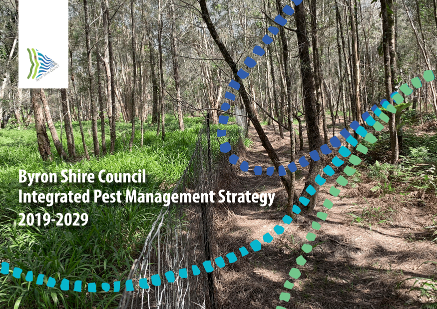
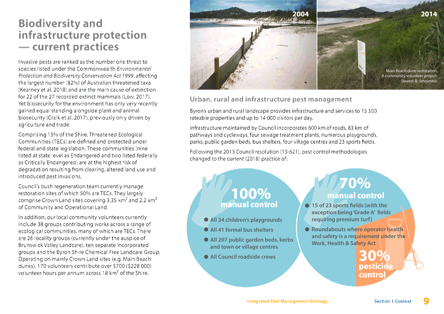
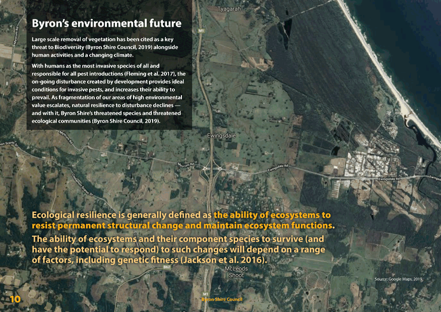
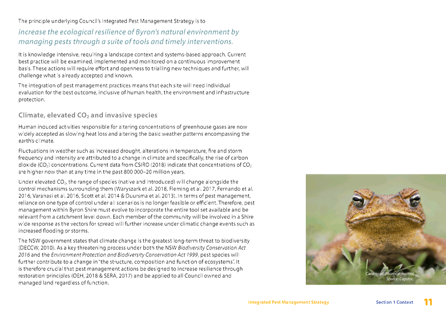
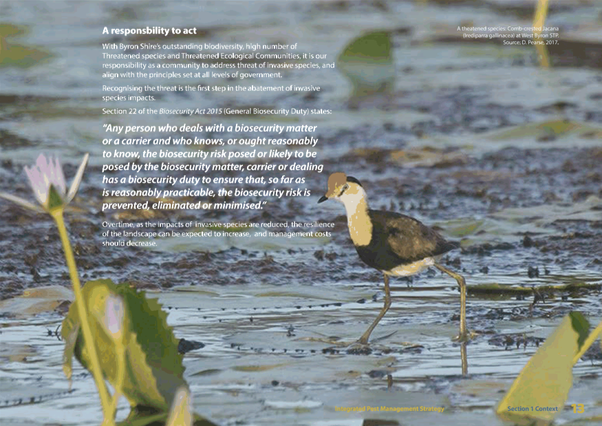
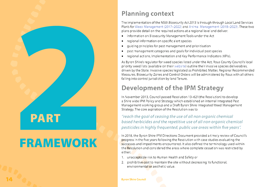
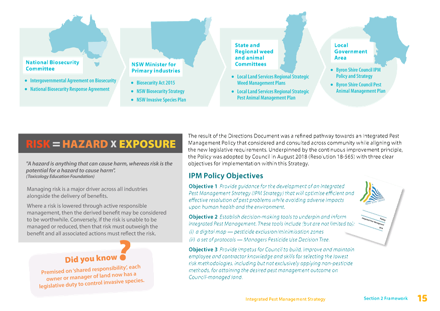
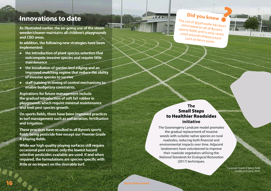
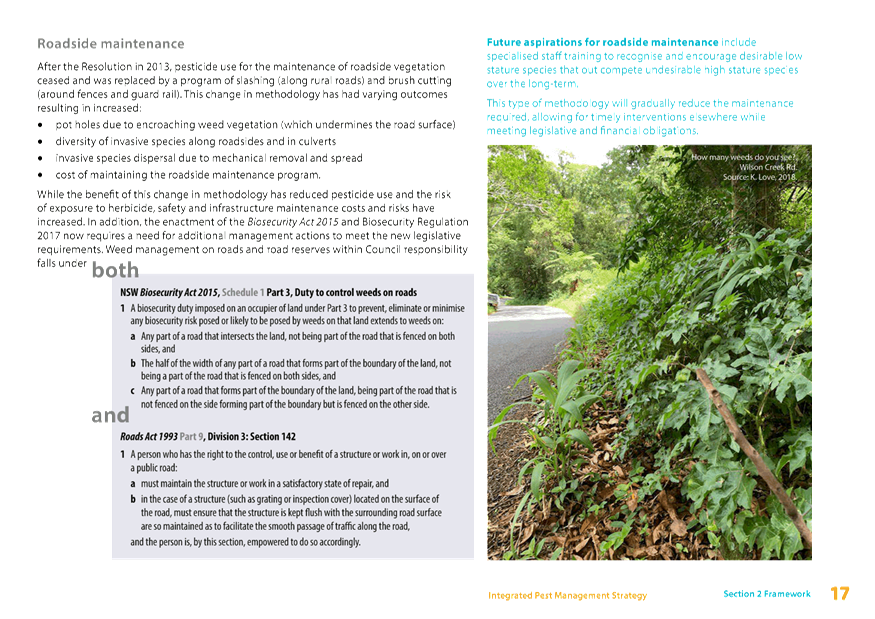
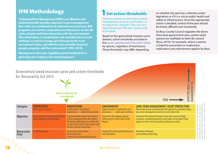
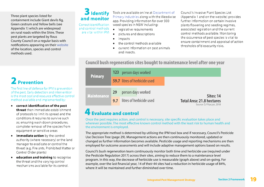
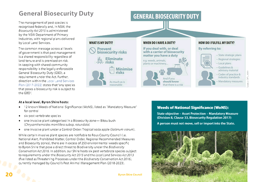
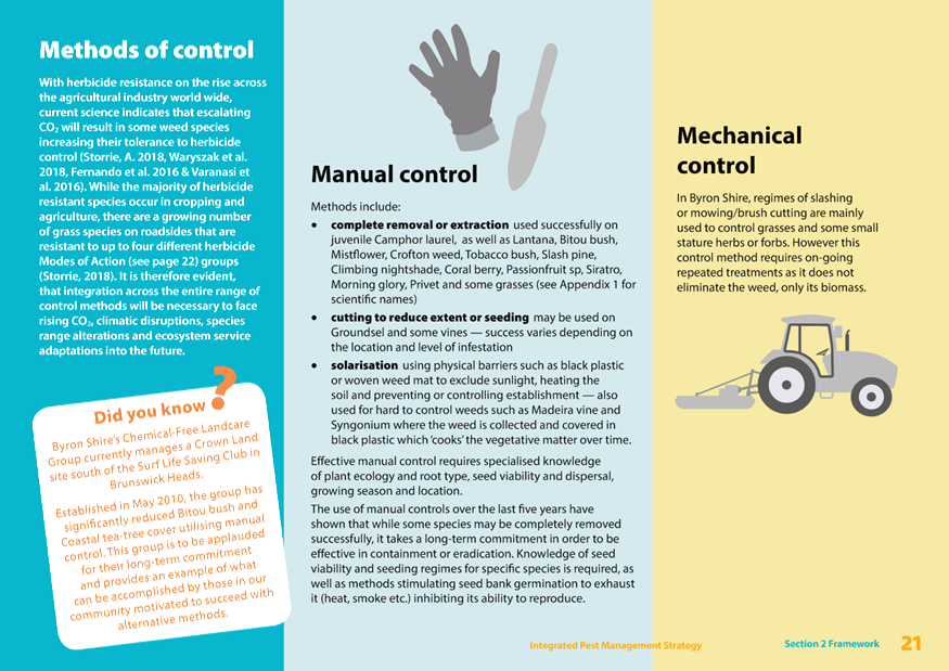
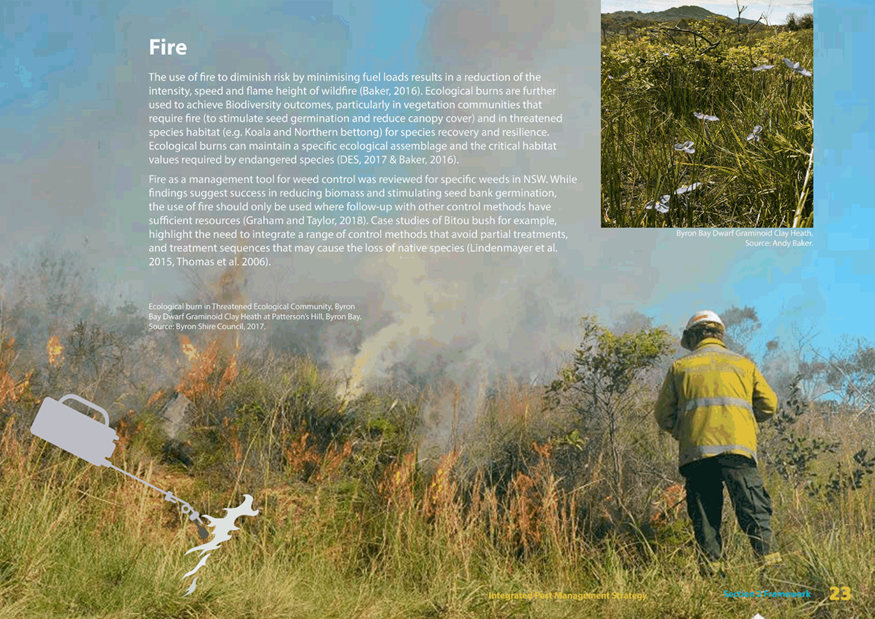
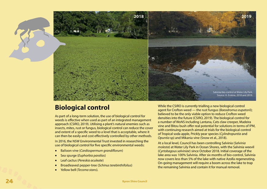
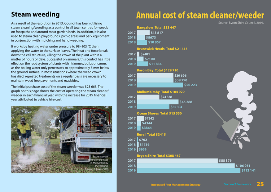
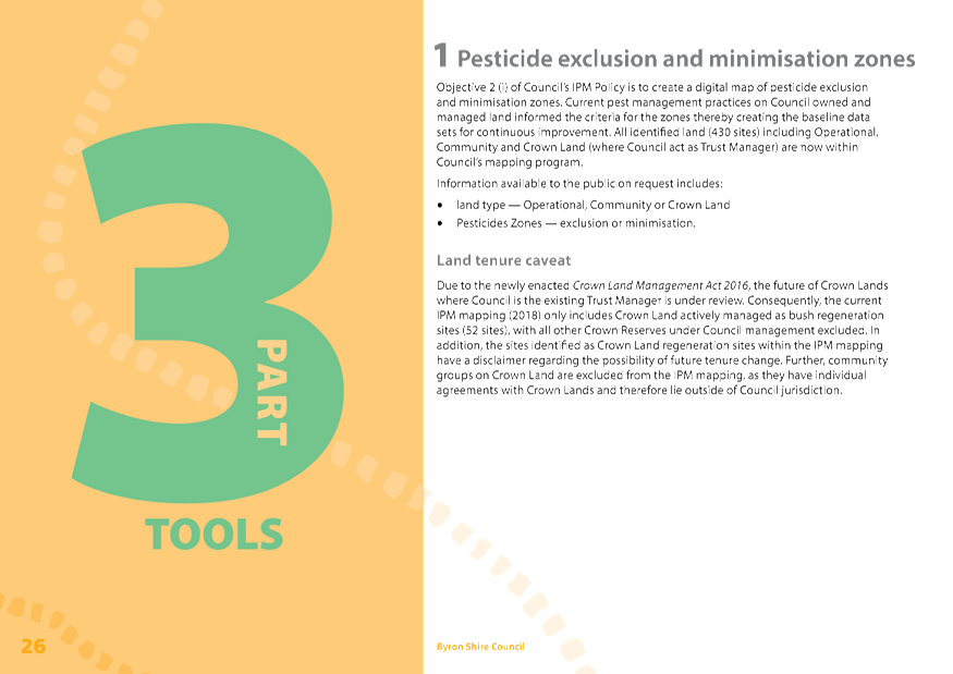
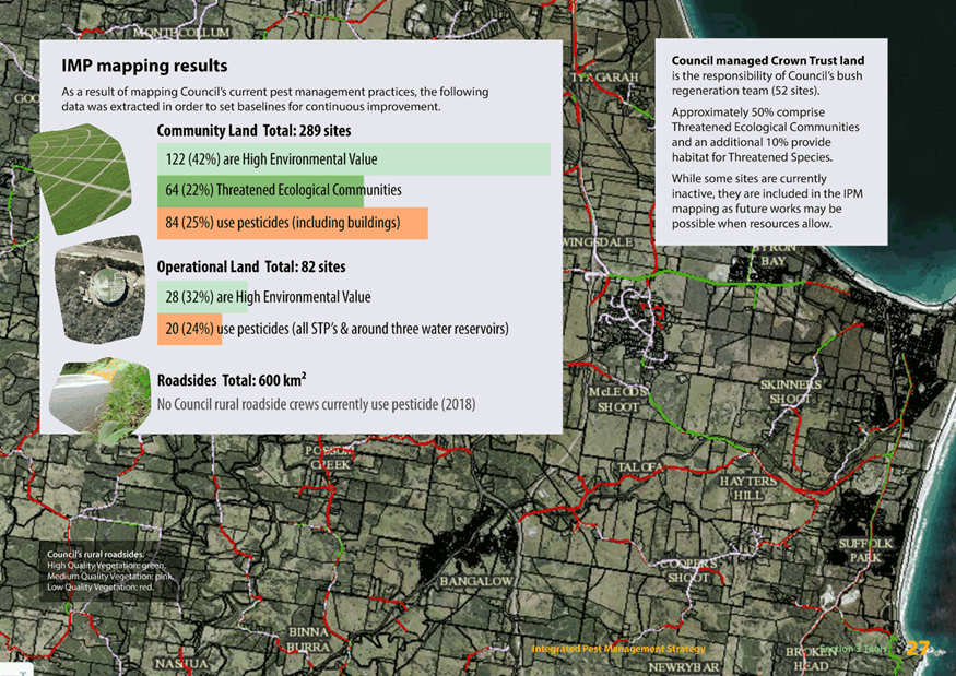
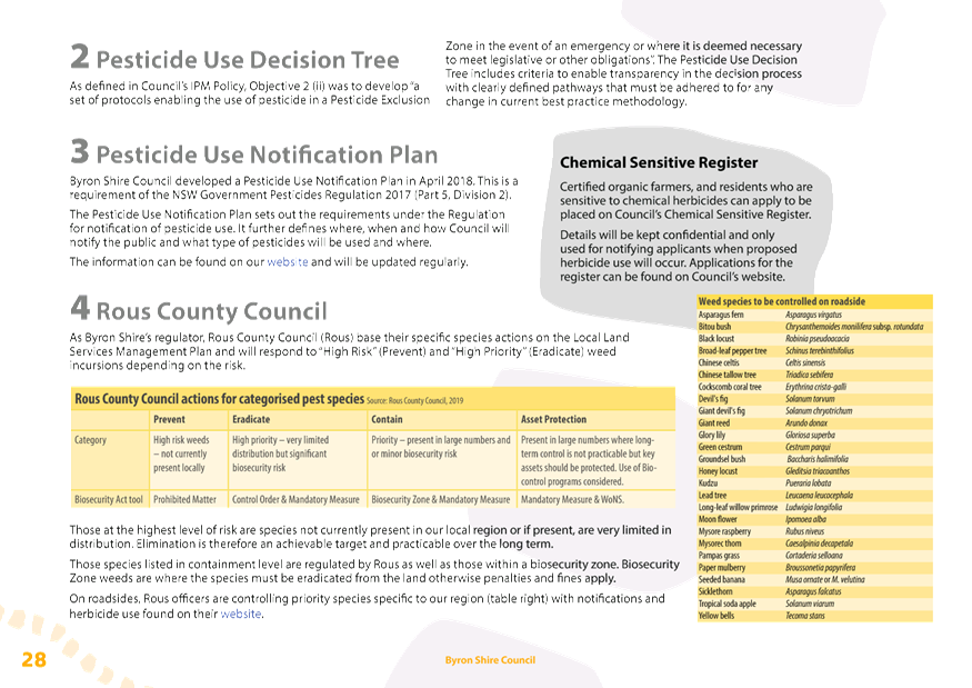
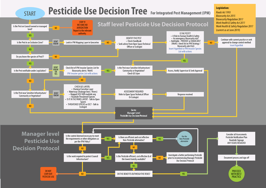
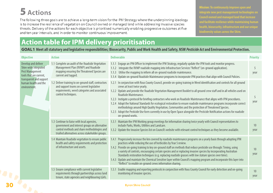
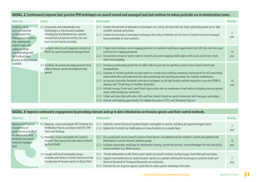
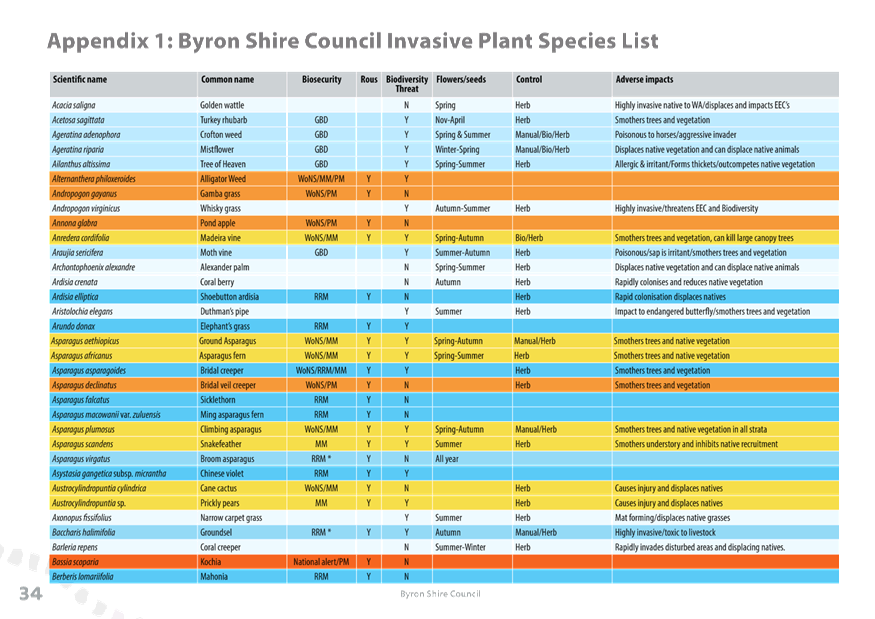
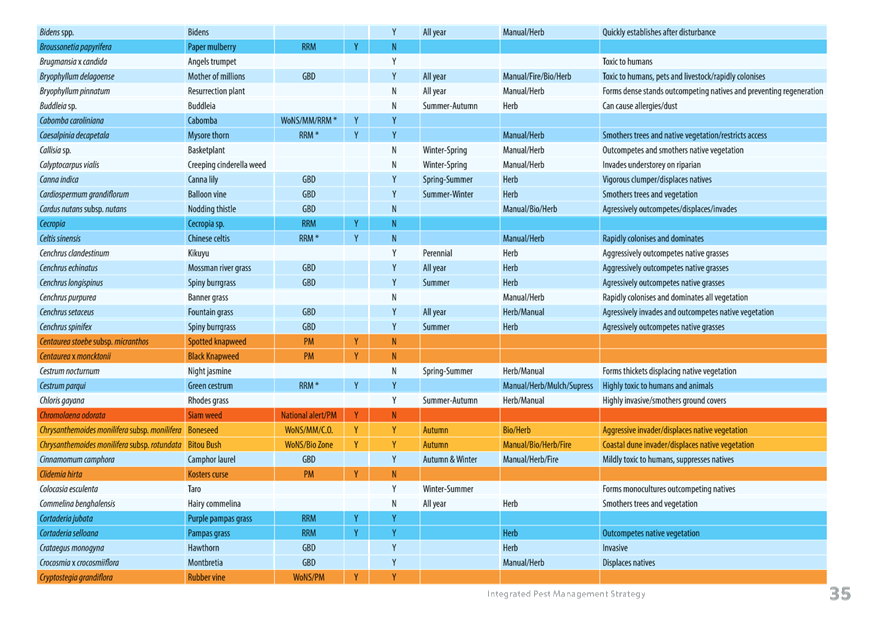
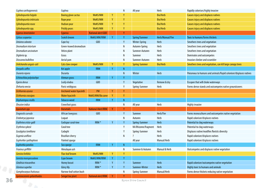
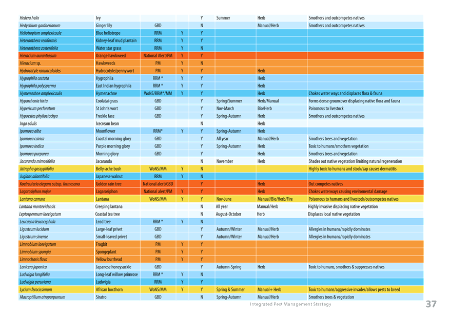
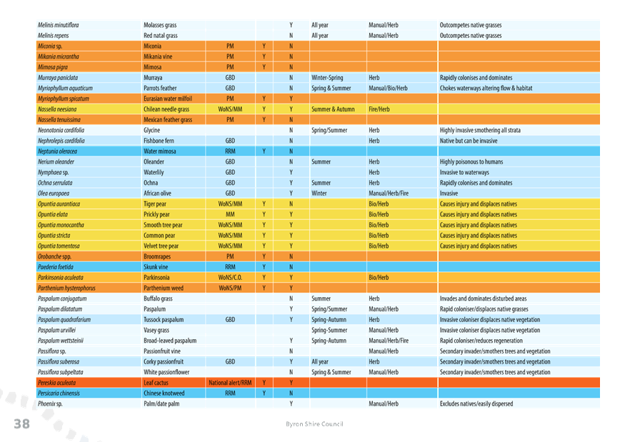
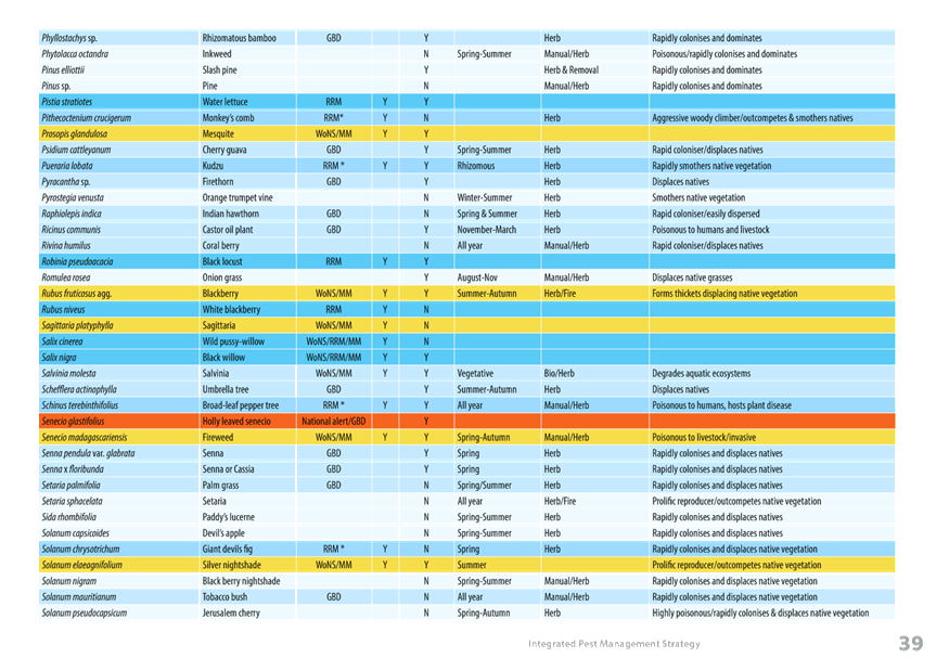
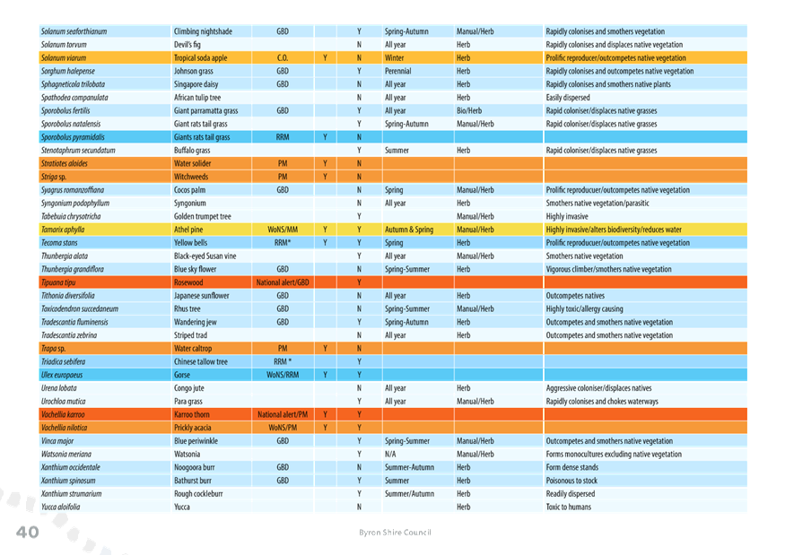
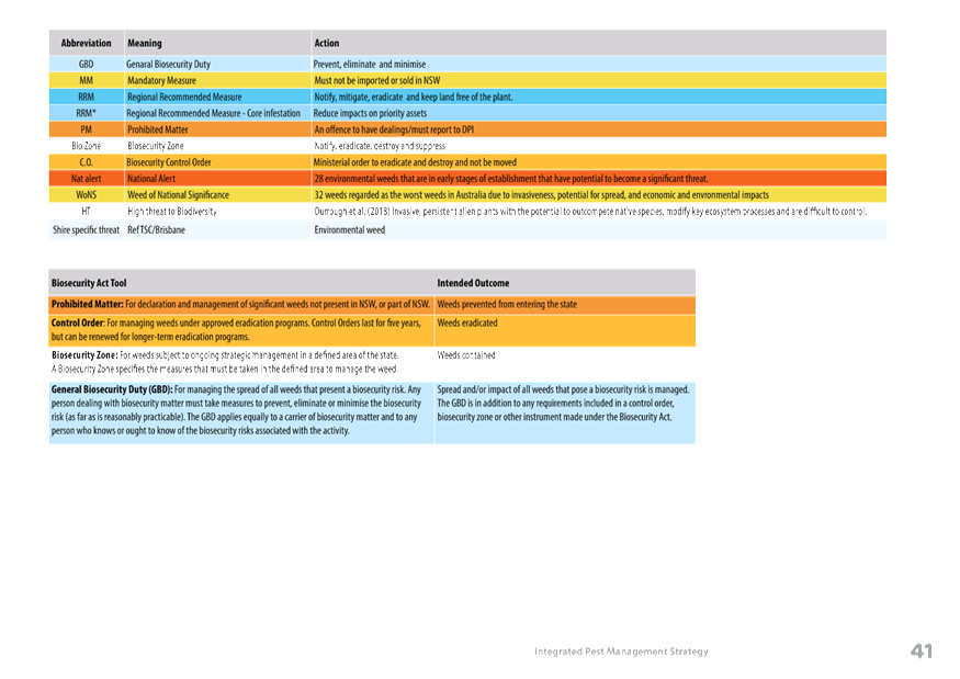
Staff Reports - Sustainable Environment and Economy 13.5 - Attachment 3
IPM Strategy Project
Key Milestones
|
Milestone
|
Description
|
Date
completed
|
|
Staff
Strategic Planning Workshop- Depot staff/ Biodiversity Officer, research
officer & consultant
|
Engage with
on-ground crews to establish priorities and actions in the IPM Strategy.
Information sharing across divisions. Scope of the IPM strategy/ concerns for
implementation.
|
Oct-18
|
|
A set
criteria for areas of Pesticide Exclusion Zone & Pesticide Minimisation
Zone mapping and discretionary use of pesticides complete
|
Audit of all
council owned and managed land and current pest management practices.
|
Nov-18
|
|
Risk matrix
enabling streamlined decision making – development of the Pesticide Use
Decision Tree
|
Pesticide Use
Decision Tree - developed with the Working group utilising the information
from the exclusion and minimisation zone mapping.
|
Dec-18
|
|
Utilise
criteria and map proposed Pesticide Exclusion and Minimisation Zones
|
Finalise
mapping and present to working group/put into Council's GIS system as a draft
|
Dec-18
|
|
Field visit
with Rob King & council staff-Wilsons creek
|
Discussion of
Pesticide exclusion / minimisation zones and roadside implementation on-site
|
Dec-18
|
|
Action
tables for implementation of strategy
|
Consult with
each division representative on key deliverables of the strategy - 5 yr &
10 yr.
|
Jan-19
|
|
Present
Draft IPM Mapping & Pesticide Use Decision Tree to the Biodiversity
Advisory Committee
|
Include the
data analysis of each zone & results - discussion of the Decision tree
|
Feb-19
|
|
First Draft
review
|
Collaboration
with Consultant and editing / presentation to the Working group for comments
|
Feb/Mar-19
|
|
On-site
visit with Rob King & Council Staff re- Roadside spray implementation -
Hinterland Way
|
Collaboration
regarding timing and techniques for spray trials.
|
Mar-19
|
|
Second Draft
technical review to go out to confidential Peer review
|
Seeking
confidential peer review of Draft IPM Strategy before presenting to Council.
Sent to four reviewers, Rous and internally for comment.
|
Mar/Apr-19
|
|
Peer review
comments integrated
|
Consolidate
comments and answer within context/ additions from editing and internal
Working group.
|
Apr-19
|
|
Prepare
Draft for graphic/ SPW & Council for Public Exhibition
|
Set overview
and provide detail on aim of the final edit & pictures in large format
for graphics
|
May-19
|
|
Presentation
to Directors
|
Timeline Table
& Summary
|
9-May-19
|
|
Presentation
to ET
|
Summary /
purpose & delivery table
|
22-May-19
|
|
SPW presentation
|
Summary,
discussion and feedback on IMP Strategy
|
6-Jun-19
|
|
Report to
Council
|
Report to
Council for Public Exhibition
|
20-Jun-19
|
|
Public
Exhibition
|
6 weeks of
public exhibition
|
24-Jun-19 to
2-Aug-19
|
|
Collate,
interpret and integrate comments
|
Submissions
report to Council on comments
|
28-Aug-19
|
|
Present for
adoption to Council Planning Meeting
|
Final ready
for adoption
|
19-Sep-19
|
Staff Reports - Sustainable Environment and Economy 13.6
Report No. 13.6 Report
of Planning Review Committee held on 8 August 2019
Directorate: Sustainable
Environment and Economy
Report
Author: Noreen
Scott, EA Sustainable Environment and Economy
File No: I2019/1221
Summary:
This report provides the outcome of the Planning Review
Committee meeting held on 8 August 2019.
NOTE TO COUNCILLORS:
In accordance with the
provisions of S375A of the Local Government Act 1993, a Division is to be
called whenever a motion for a planning decision is put to the meeting, for the
purpose of recording voting on planning matters. Pursuant to clause 2(a)
under the heading Matters to be Included in Minutes of Council Meetings of
Council's adopted Code of Meeting Practice (as amended) a Division will be
deemed to have been called by the mover and seconder of all motions relating to
this report.
|
RECOMMENDATION:
That Council note the report of the Planning
Review Committee meeting held on 8 August 2019.
|
REPORT
The meeting commenced at 4:30pm and concluded at 5:00pm.
Present: Crs Lyon, Martin, Hunter, Hackett
Staff: Chris Larkin (Manager Sustainable Development), Rob Van
Iersel (Major Projects Planner), Shannon Burt (Director Sustainable Environment and Economy)
Apologies: Crs Richardson, Spooner
The following development
applications were reviewed with the outcome shown in the final column.
|
DA No.
|
Applicant
|
Property Address
|
Proposal
|
Exhibition
Submission/s
|
Reason/s
Outcome
|
|
10.2019.301.1
|
Ardill Payne & Partners
|
16 Short Street BRUNSWICK HEADS
|
Demolition of existing Dwelling House and Construction of
Two (2) New Dwellings and Two (2) Swimming Pools to create Dual Occupancy
(Detached)
|
Level 1
18/6/19 to 1/7/19
116 submissions against
|
The number of public submissions
The perceived public significance of the application
Council
|
|
10.2019.349.1
|
Ardill Payne & Partners
|
14 Short Street BRUNSWICK HEADS
|
Stage 1: De-commissioning of existing Dual Occupancy to
form One (1) Dwelling,
Stage 2: Construction of New Dwelling House to form a Dual
Occupancy and Alterations & Additions to existing Dwelling House
|
Level 1
24/7/19 to 6/8/19
|
The perceived public significance of the application
Council
|
|
10.2019.285.1
|
Ardill Payne & Partners
|
18 Pioneers Crescent BANGALOW
|
Mixed Use Development comprising Agricultural Produce
Industries, Depot, Garden Centre, Childcare Centre, Swimming Pool and
Recreational Facilities
|
Level 2
11/7/19 to 9/8/19
35 submissions
|
Staff Delegation
|
Council determined the following
original development application. The Section 4.55 application to modify the
development consent is referred to the Planning Review Committee to decide if
the modification application can be determined under delegated authority.
|
DA No.
|
Applicant
|
Property Address
|
Proposal
|
Exhibition
Submission/s
|
Reason/s
Outcome
|
|
10.2006.322.3
|
Mr M C Wilkinson
|
471 Friday Hut Road
POSSUM CREEK
|
S4.55 to Modify Trading Hours and Seating Numbers
|
Level 1
26/7/19 to 8/8/19
3 submissions
|
Staff Delegation
|
Staff Reports - Infrastructure Services 13.7
Staff Reports - Infrastructure Services
Report No. 13.7 Draft
Plan of Management Suffolk Park Recreation Grounds
Directorate: Infrastructure
Services
Report
Author: Michael
Matthews, Manager Open Space and Resource Recovery
Darren McAllister, Acting Open
Space and Facilities Coordinator
File No: I2019/1297
Summary:
A draft Plan of Management
for the Suffolk Park Recreation Grounds (PoM) has been prepared in accordance
with requirements of the Local Government Act 1993 and associated
regulations.
Council resolved in March 2019 to publicly exhibit the draft
Plan of Management, and arrange an independently chaired Public Hearing prior
to reporting back to Council (19-110).
The Statutory process was
completed,and the draft was reported back to Council on the 22nd of
August 2019, where it was resolved that “Council defer the Draft Plan of
Management Suffolk Park Recreation Grounds to a future meeting of Council
as the Draft plan of management does not adequately address the Suffolk Park
Recreation Ground Public Hearing report.” (19-420)
The Draft Plan of Management has
been amended (Attachment 1)in accordance with Resolution 19-420.
This report provides the
submissions received (Attachment 3) during the public exhibition and the report
of the independent Chair of the public hearing; the “Suffolk Park
Recreation Grounds Public Hearing Report” (Attachment 2).
The public hearing report
provides a summary of the submissions made to the Public Hearing, a summary of
the written submissions made during public exhibition process and provides a
response to the issues raised in both the verbal and written submissions. The report
also makes recommendations to Council.
There was 1 formal verbal
submission made to the Public Hearing.
11 written submissions were
received during the exhibition period.
Based on the assessment of submissions, and the conclusions
and recommendations of the independent report into the Public Hearing, it is
recommended that Council adopt the Plan of Management as exhibited.
|
RECOMMENDATION:
That Council adopt the Draft Plan of Management
for the Suffolk Park Recreation Ground as amended at Attachment 1
(E2019/63630).
|
Attachments:
1 Draft Plan
of Management Suffolk Park Recreation Grounds V2, E2019/63630 , page 361⇩ 
2 Suffolk
Park Recreation Grounds Public Hearing Report - Planners North, E2019/52466 , page 382⇩
3 Submissions
Draft Plan of Management Suffolk Park Recreation Ground, E2019/52211 , page 391⇩
REPORT
The public hearing report
provides a summary of the submissions made to the Public Hearing, a summary of
the written submissions made during public exhibition process and provides a
response to the issues raised in both the verbal and written submissions. The
report also makes recommendations to Council.
There was 1 formal verbal
submission made to the Public Hearing. However, it is noted that other
attendees made comment throughout the hearing. A total of 7 people attended the
hearing, all representing the Suffolk Park Community Garden.
11 written submissions were
received during the exhibition period.
Based on the assessment of submissions, and the conclusions
and recommendations of the independent report into the Public Hearing, it is
recommended that Council adopt the Plan of Management as exhibited.
STRATEGIC CONSIDERATIONS
Community Strategic Plan and
Operational Plan
|
CSP Objective
|
L2
|
CSP Strategy
|
L3
|
DP Action
|
L4
|
OP Activity
|
|
Community
Objective 2: We cultivate and celebrate our diverse cultures, lifestyle and
sense of community
|
2.3
|
Provide
accessible, local community spaces and facilities
|
2.3.5
|
Maintain Public
Open space in a safe and efficient way that provides for both active and
passive recreation (SP)
|
2.3.5.1
|
Plan and
deliver Open Space works programs based on defined levels of service
|
|
|
|
|
|
|
|
|
|
|
|
Legal/Statutory/Policy
Considerations
Local Government Act 1993
38 Public notice of draft plans of management
(1) A
council must give public notice of a draft plan of management.
(2) The
period of public exhibition of the draft plan must be not less than 28 days.
(3) The
public notice must also specify a period of not less than 42 days after the
date on which the draft plan is placed on public exhibition during which
submissions may be made to the council.
(4) The
council must, in accordance with its notice, publicly exhibit the draft plan
together with any other matter which it considers appropriate or necessary to
better enable the draft plan and its implications to be understood
40 Adoption of plans of management
(1) After
considering all submissions received by it concerning the draft plan of
management, the council may decide to amend the draft plan or to adopt it
without amendment as the plan of management for the community land concerned.
(2) If
the council decides to amend the draft plan it must either:
(a) publicly
exhibit the amended draft plan in accordance with the provisions of this
Division relating to the public exhibition of draft plans, or
(b) if
it is of the opinion that the amendments are not substantial, adopt the amended
draft plan without public exhibition as the plan of management for the
community land concerned.
(2A) If
a council adopts an amended plan without public exhibition of the amended draft
plan, it must give public notice of that adoption, and of the terms of the
amended plan of management, as soon as practicable after the adoption.
(3) The
council may not, however, proceed to adopt the plan until any public hearing
required under section 40A has been held in accordance with section 40A.
40A Public hearing in relation to proposed plans
of management
(1) The
council must hold a public hearing in respect of a proposed plan of management
(including a plan of management that amends another plan of management) if the
proposed plan would have the effect of categorising, or altering the
categorisation of, community land under section 36 (4).
(2) However,
a public hearing is not required if the proposed plan would merely have the
effect of altering the categorisation of the land under section 36 (5).
(3) A
council must hold a further public hearing in respect of the proposed plan of
management if:
(a) the
council decides to amend the proposed plan after a public hearing has been held
in accordance with this section, and
(b) the
amendment of the plan would have the effect of altering the categorisation of
community land under section 36 (4) from the categorisation of that land in the
proposed plan that was considered at the previous public hearing.
41 Amendment of plans of management
A council may amend a plan of management adopted under this
Division by means only of a plan of management so adopted.
42 Revocation and cessation of plans of
management
(1) A
plan of management for community land may be revoked by a plan of management
adopted under this Division by the council.
(2) A
plan of management ceases to apply to land if:
(a) the
land is reclassified as operational land, or
(b) in
the case of land that is not owned by the council—the land ceases to be
controlled by the council.
Financial Considerations
There are no financial implications from the development and
adoption of the Plan of Management. Proposed actions consistent with an adopted
plan of management may generate income and expenditure that Council will have
to consider when they are presented.
Consultation and Engagement
Submissions closed 14 June 2019.
|
|
Draft Plan of Management
|
Public Hearing
|
|
Byron Shire Echo
|
1/5/19 + 8/5/19
|
1/5/19 + 8/5/19
|
|
Byron Shire News
|
2/5/19 + 9/5/19
|
2/5/19 + 9/5/19
|
|
Byron Shire Council Website/Public Notices
|
23/4/19 to 23/6/19
|
30/4/19 to 30/6/19
|
|
Public Hearing
|
|
Held 19/6/19 at Cavanbah Centre
|
PoM on exhibition 61 days (minimum required 28), allowing 50
days (52 minimum required) for submissions.
The amended draft was reviewed by staff of BSC’s SEE
directorate on 28 August 2019.
Staff Reports - Infrastructure Services 13.7 - Attachment 1
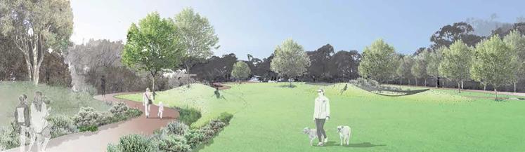
Draft Plan of Management
Suffolk Park Recreation Ground
Lot 60 DP 817888

Draft Plan of
Management Suffolk Park Recreation Ground

Information about this document
A Plan of Management
provides a framework
for the management and development of public land. The land to
which this plan applies is community land
that is owned
by Byron
Shire Council for the
benefit of the community. This land
is managed
by the legislative requirements under the Local Government Act 1993 (LGA).
The LGA requires
that all public land owned
by Council
be classified as either community land
or operational land. Council must
have a plan of management for all community
land. This is to
ensure that an endorsed
framework guides the operation
and development of
these community resources.

Byron Shire Council
August 2019
1 Introduction
1.1 Background
Under the Local Government
Act 1993 (LGA), a
Plan of Management provides a framework
for the management
and development of public land
owned by a local Council.
 The objective of this Plan of Management (Plan) is to guide future
management, development and use of the
Suffolk Park Recreation Ground to deliver positive social, environmental, economic and governance outcomes (QBL outcomes) and positively contribute to the health and wellbeing of community
as well as the financial
sustainability of the Council.
The objective of this Plan of Management (Plan) is to guide future
management, development and use of the
Suffolk Park Recreation Ground to deliver positive social, environmental, economic and governance outcomes (QBL outcomes) and positively contribute to the health and wellbeing of community
as well as the financial
sustainability of the Council.
The Suffolk Park Recreation
Ground is large and is capable of co-hosting
a large variety of compatible uses. Public spaces are
increasingly being used
in innovative ways to meet new and
emerging community needs
and how we recreate in the future will
be different to how we
have in the past, or even
today. This Plan
of Management has been
prepared to be as flexible and enabling as possible,
and to allow it to meet current but also future community
and Council needs.
1.2 Land description
This Plan of
Management relates to the land known
as the Suffolk Park Recreation Ground detailed and shown below in Figure 1.
Land Title: Lot 60 DP 817888
Address: 46 Beech Drive, SUFFOLK
PARK
Owner: Byron Shire Council
Zoning: RE1 Public Recreation
Figure 1: Suffolk Park
Recreation Ground Locality
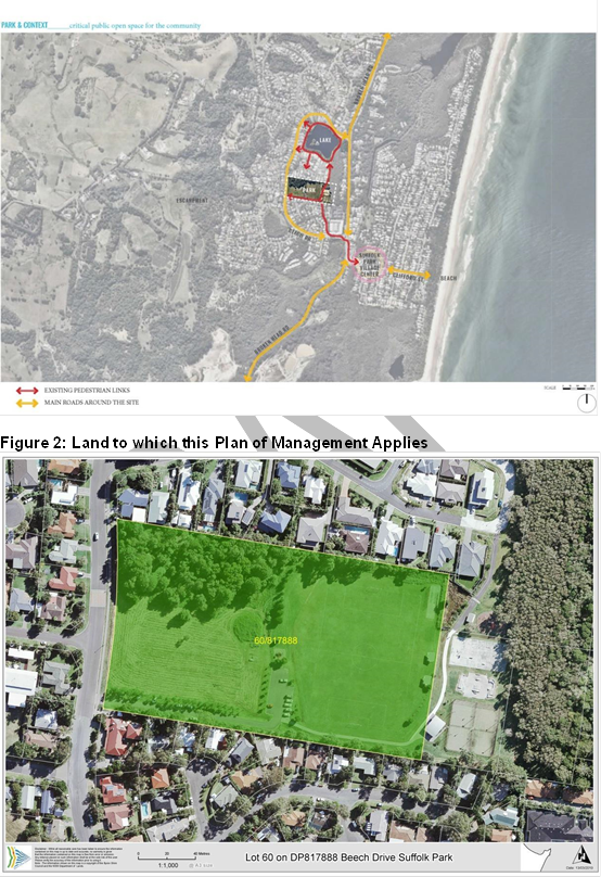
Draft Plan of Management Suffolk
Park Recreation Ground
1.3 Category and classification
of Suffolk Park Recreation
Ground
 The Suffolk
Park Recreation Ground
is undergoing a LEP amendment to be classified as community land under
the LGA with a categorisation
of general community use.
The Suffolk
Park Recreation Ground
is undergoing a LEP amendment to be classified as community land under
the LGA with a categorisation
of general community use.
Figure 3: Land Category
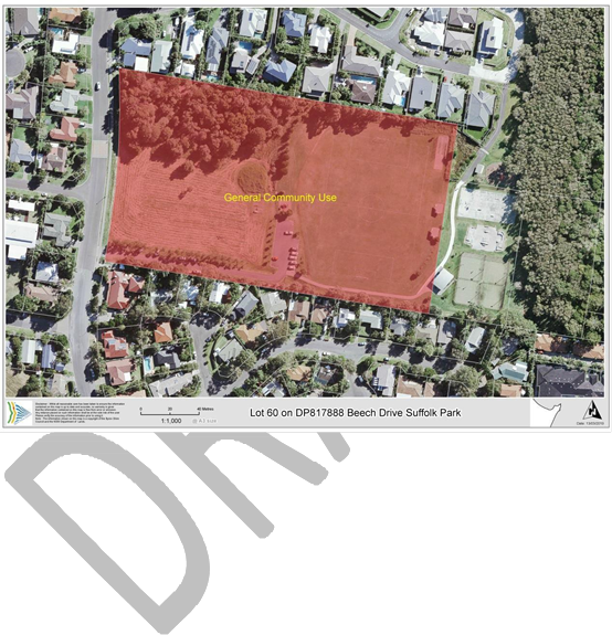
1. Objectives of zone
· To enable land to
be used
for
public open space or recreational purposes.
· To provide a range of
recreational settings and activities
and compatible land uses.
· To protect and enhance
the natural environment for recreational purposes.
2. Permitted without
consent
Environmental
protection works
3. Permitted with consent
 Boat launching ramps; Boat sheds; Camping grounds; Caravan parks; Child
care centres; Community facilities; Emergency services
facilities; Entertainment
facilities; Environmental facilities; Flood mitigation works; Function
centres; Horticulture; Information and
education facilities; Jetties;
Kiosks; Markets; Recreation
areas; Recreation facilities (indoor); Recreation facilities (major); Recreation facilities (outdoor); Respite day care centres;
Restaurants or cafes; Roads; Signage
Boat launching ramps; Boat sheds; Camping grounds; Caravan parks; Child
care centres; Community facilities; Emergency services
facilities; Entertainment
facilities; Environmental facilities; Flood mitigation works; Function
centres; Horticulture; Information and
education facilities; Jetties;
Kiosks; Markets; Recreation
areas; Recreation facilities (indoor); Recreation facilities (major); Recreation facilities (outdoor); Respite day care centres;
Restaurants or cafes; Roads; Signage
4. Prohibited
Any development no specified in item 2 or 3.
The Local Environment Plan is changed from time to time and it should be referred to directly for
up to date information on zoning and permissible uses.
2 Community Value and
Outcomes
The Suffolk Park Recreation
Ground has social, cultural,
recreational, natural and future generational
values, which are all significant at a local level.
The primary value
of the land
is its intrinsic worth as
publicly available open space centrally located
with easy access.
 The location
of
the site and its accessibility means it holds significant
value for the whole community. It is accessible for all age groups
and has the potential to increase
existing multi-generational
use. It is for
this reason that the primary vision
for the future outcomes
of the public open
space is for ‘…an open space for the whole community.
A multi-generational space that promotes cross generational
learning and interaction-
a space for
repose, relaxation. And informal and organised
activity. A multi-functional and flexible
space integrated through
community use.’
The location
of
the site and its accessibility means it holds significant
value for the whole community. It is accessible for all age groups
and has the potential to increase
existing multi-generational
use. It is for
this reason that the primary vision
for the future outcomes
of the public open
space is for ‘…an open space for the whole community.
A multi-generational space that promotes cross generational
learning and interaction-
a space for
repose, relaxation. And informal and organised
activity. A multi-functional and flexible
space integrated through
community use.’
The existing space
is highly valued
by the community as a space for
community connection. There is already
cross generational use of the space with play grounds
for young children, skate park facilities,
petanque courts, and organised sporting facilities including tennis courts,
soccer field and
cricket nets. The space is also valued
for
casual exercise activities
such as walking and riding. A
key future outcome
for the space is to provide additional
circulation paths to link the space to other nearby community assets and the street network.
Social Outcomes
The key social outcomes are promoting community health- both collective and individual. Social
health is already a key component
of park use-
community members across age groups connecting
in an inclusive outdoor setting. Physical health
is also an important outcome of the
community use of the space and this can be
encouraged and improved through
the provision of elements
such as additional walking
tracks.
Environmental Outcomes
Environmental outcomes for the
space include improving and
increasing native vegetation
plantings and encouraging
the stewardship
of existing vegetation areas. By extending
appropriate use into the existing
vegetation zone improved access is
provided to facilitate better
maintenance of vegetation
areas- including weed management.
Proposed plantings in
the space will encourage locally native
flora and fauna and will help to improve
community use through the provision
of additional natural shade.
Existing drainage issues within the space will require ongoing management.
The land
is easily accessible (with a
positive walkability factor), provides visual amenity to surrounding residential properties
and enhances the liveability of the town with resulting in
economic benefits to community.
Governance Outcomes
The primary governance outcome for Council
that this Plan
seeks to achieve
is the management of the Suffolk Park Recreation Grounds
over the short, medium and long
terms, in a financially sustainable
way.
Demands on local government and community needs are
changing increasingly fast. This Plan has been deliberately prepared
to be as flexible as possible so that it can
continue to deliver
governance outcomes over
the short, medium and long terms.
 It is never possible
to action every idea or meet all needs on
particular site and
a quadruple
bottom line outcomes (QBL outcomes) approach
will be taken to achieve balanced
management of the Suffolk Park Recreation
Ground in the best
overall community and Council interest.
It is never possible
to action every idea or meet all needs on
particular site and
a quadruple
bottom line outcomes (QBL outcomes) approach
will be taken to achieve balanced
management of the Suffolk Park Recreation
Ground in the best
overall community and Council interest.
Some individual
actions can have positive outcomes against one sustainability critiera
but negative against others or
vice versa. To address this, a holistic, strategic approach will be taken by Council and where required, actions that
have greater overall positive sustainability outcomes will be preferred.
3 Current Status
3.1 Existing Leases, Licenses and other Agreements
3.2 Current Uses
The known
uses of the Suffolk Park Recreation Grounds existing
as at the date of adoption
of this Plan of Management are as set out in the table
below.
|
Use
|
Description
|
|
Active
Recreation
|
· Football (soccer) – competition, training and social.
· Cricket – practice
nets.
· Tennis
· Skate Park
|
|
Passive Recreation
|
· General community use for a variety of passive uses and passive recreation pursuits
· Children’s playground and shade structure
· General access
and movement across site.
|
|
Informal Community Garden
|
· An informal community garden has pre existed
Councils ownership of the
land and has been developed on the
basis of permaculture principles.
|
|
General
|
· Various ancillary infrastructure and
uses, examples only lighting, bins, paths, public toilets, stormwater
infrastructure, underground utilities, seating, parking, bicycle parking and
lighting.
|
|
Maintenance, Infrastructure and Storage
|
· Facilities
for storage of
maintenance equipment and consumables.
· Maintenance of
grounds and infrastructure.
· Infrastructure, services and utilities.
|
3.3  Current Maintenance and Management
As at the date of adoption of this Plan of Management:
· Council manages
and maintains the Suffolk
Park Recreation Grounds as landowners.
4 Core Objectives
for
Management of General Community Use Land
The LGA at the date of adoption
of this Plan specifies
that the core objectives for management of community land categorised as general community use are to:
“…promote, encourage and provide
for the use of the
land, and to provide facilities on
the land,
to meet the current and future needs of the local community and
of the wider public:
(a) in relation to public recreation and the physical, cultural,
social and intellectual welfare or development
of individual members of the public, and
(b) in relation
to purposes for which a lease, licence or other estate may
be
granted in respect
of the land (other than the provision of public utilities
and works associated with or
ancillary to public utilities).”
The legislated core
objectives may change from time to time and this Plan will be
deemed to incorporate relevant statutory
changes.
Below are strategies, methods and performance targets
that will be implemented that go towards
meeting the core objectives
applicable at the date of adoption
of this Plan.
This is not an exhaustive
list and this Plan expressly authorises other strategies
or
actions that are consistent with the objectives
of this Plan and
the core objectives of the General
Community Use Land category and legislative
requirements that apply at the time. (In
the table Suffolk Park Recreation Ground is shortened
to SPRG.)

|
ITEM
|
STRATEGIES
|
PERFORMANCE TARGET
|
MEANS OF ACHIEVEMENT / ACTIONS
|
PRIORITY
|
METHOD OF MEASUREMENT
|
|
Active Recreation
|
Maintain and enhance use of the
land for appropriate active
recreation as a local facility within
the broader shire-wide network
of active open
space.
|
Land and infrastructure required to meet
active recreation demand at the relevant time, maintained to a standard appropriate for a local facility.
|
Ensure that use of the
grounds and facilities for
active recreation as a local
facility:
· meets an identified demand; and
· is authorised by way
of User Agreements.
Work with user groups who require
District or Regional scale fields
or
infrastructure to transition to the appropriate District or Regional facility.
Where an active
recreation use is no longer
required to meet current or future demand, investigate alternative uses.
Keep policies
and fee structures current.
|
High
Low
Low
Low
|
Active recreation user groups have
User Agreements in
place.
Levels of satisfaction.
Health and Wellbeing indicators.
Operational costs and revenue trends.
|
|
ITEM
|
STRATEGIES
|
PERFORMANCE TARGET
|
MEANS OF ACHIEVEMENT / ACTIONS
|
PRIORITY
|
METHOD OF MEASUREMENT
|
|
Community Garden
|
Allow for a community garden that
does not conflict with
other recreational uses.
Community Garden activities
in accordance with the Community Gardens Policy as
adopted
|
Maintained in accordance with the Community Gardens Policy and licence
agreement with an
approved garden operator.
|
Provide authorisation for the co-existence
of
a community garden
that complements other
recreational
activities within the land.
|
Medium
|
Compliance with licence agreement.
Level of community satisfaction.
|
|
ITEM
|
STRATEGIES
|
PERFORMANCE TARGET
|
MEANS OF ACHIEVEMENT / ACTIONS
|
PRIORITY
|
METHOD OF MEASUREMENT
|
|
Passive Recreation
|
Maintain and enhance
use of the land for a
wide variety of passive recreation uses.
|
Appropriate facilities provided and managed
for passive recreation.
|
Manage User Agreements to ensure
that a wide variety of passive recreation opportunities continue to be provided.
Leverage grant, co-funding and impact investment opportunities to fund maintenance or
upgrading of passive
recreation facilities and infrastructure.
Install park benches
and picnic facilities
in the area.
|
High
High
Medium
|
Increased passive recreation
use of the space.
Levels of satisfaction.
Health and Wellbeing indicators.
Landscape plan created and
implemented.
|
 Draft Plan of Management Suffolk Park Recreation Ground

|
ITEM
|
STRATEGIES
|
PERFORMANCE TARGET
|
MEANS OF ACHIEVEMENT / ACTIONS
|
PRIORITY
|
METHOD OF MEASUREMENT
|
|
Ancillary infrastructure
|
Provide inclusive ancillary infrastructure to meet the needs of all
age groups for example playground facilities, exercise opportunities, seating.
|
Ancillary infrastructure is
inclusive and meets
the community demand
at
the time.
|
Install drinking bubblers and water bottle
refill stations.
Improve the children’s playground
to meet the needs
of young children in Suffolk
Park.
Maintain seating appropriate to the levels of active
and passive use of the SPRG.
Install additional waste and recycling bins.
|
High
High
Medium
Medium
|
Drinking water facilities installed.
Installation and upgrade of playground completed.
Levels of satisfaction.
|
|
Emissions Reduction
|
Transition use,
maintenance and development of the Grounds
towards net zero emissions
|
The Grounds are used,
maintained and developed
in a manner that is consistent
with Council’s emissions targets.
|
Introduce emissions and waste minimisation/elimination actions
into User Agreements.
Support users to identify ways they can:
- transition towards net zero emissions; and
- develop and
implement waste minimisation
/elimination
plans.
|
Medium
|
Emissions (measured as
CO2 in tonnes) from electricity use.
|
|
ITEM
|
STRATEGIES
|
PERFORMANCE TARGET
|
MEANS OF ACHIEVEMENT / ACTIONS
|
PRIORITY
|
METHOD OF MEASUREMENT
|
|
Maintenance and Management
|
Ensure the SPRG is
clean and appropriate for a wide variety of uses.
|
SPRG maintained to agreed levels
of service.
|
Develop a comprehensive maintenance program
including levels
of service and details
of partnerships that
will deliver ground
maintenance services , for example:
- Inspections;
- waste and recycling management;
- grass cutting;
- line marking;
- delineation/management of boundaries;
- vegetation management;
- graffiti removal; etc.
|
High
|
Levels of service delivered.
|
|
Ground closures to ensure asset protection
and or community safety
|
Ensure grounds are maintained in a safe and effective manner.
|
Ground users are informed of closures due to wet weather.
|
In consultation
with the sports groups
and schools, implement a system which advises
the users when the
Ground is closed.
|
High
|
System developed and implemented.
|
|
ITEM
|
STRATEGIES
|
PERFORMANCE TARGET
|
MEANS OF ACHIEVEMENT / ACTIONS
|
PRIORITY
|
METHOD OF MEASUREMENT
|
|
|
Discourage and minimise antisocial behavior.
Undertake regular inspections of the SPRG
|
SPRG is a safe public space.
|
Apply Crime Prevention through Environmental Design (CPTED)
Principles to the land, buildings and
infrastructure.
Comprehensive maintenance program includes
partnerships and
processes to remove and repair damage caused
by
graffiti or vandalism as soon as
possible.
Activate the grounds and create family friendly spaces
to promote inter-generational activity.
|
High
High
Medium
|
Levels of satisfaction.
Health and Wellbeing indicators.
|
|
Safety and Risk Management
|
Lighting is installed and used only to meet safety and security purposes or to
meet an identified need arising
from use.
|
Adequate lighting is installed, provided no additional emissions are generated and/or no additional cost to Council is incurred.
|
Any proposed changes to lighting
be considered in consultation with adjoining owners and
users with User Agreements.
|
Low
|
Lighting upgraded with minimal impact on adjoining residents.
|
|
ITEM
|
STRATEGIES
|
PERFORMANCE TARGET
|
MEANS OF ACHIEVEMENT / ACTIONS
|
PRIORITY
|
METHOD OF MEASUREMENT
|
|
Lighting
|
Utilise the space
as a valuable link in a chain of circuits and linkages across the surrounding
community. Improved access
will not only improve
the use of this space
but also adjacent spaces as walking circuits and routes become longer, more
connected, and more viable for use
|
Adequate pathways and access
to, through and
around the SPRG are provided.
|
Incorporate landscape management plan recommendations in relation to shade and
beautification.
|
Medium
|
|
|
Access and movement
|
Maximise value of SPRG as a component in the overall
town drainage system.
Minimise damage and field closures
due to flooding in periods of high rainfall.
|
Stormwater is appropriately managed onsite.
Damage to fields
during wet weather
events is minimised.
|
Investigate potential to improve drainage.
Incorporate consideration of the SPRG
Ground as part
of any overall
review of town
stormwater management.
|
Medium
Low
|
Reduction in field damage
during wet weather
events.
Number of days of field closure.
|
Draft Plan of Management Suffolk Park Recreation Ground
|
ITEM
|
STRATEGIES
|
PERFORMANCE TARGET
|
MEANS OF ACHIEVEMENT / ACTIONS
|
PRIORITY
|
METHOD OF MEASUREMENT
|
|
Parking
|
Ensure inclusive vehicle and bicycle
parking is adequate to meet needs of users of the SPRG and adjoining residents.
Ensure safe movement of vehicles in and out of the reserve
within designated areas.
|
Adequate vehicle and bicycle
parking infrastructure is constructed.
Adequate vehicle
infrastructure that meets standards
|
Review existing and develop a plan for provision of adequate
bicycle parking facilities.
Review and develop a traffic management plan.
|
High
High
|
Levels of satisfaction
Traffic infrastructure Signage meets
standards for safe movement of vehicles within reserve.
|
5 Leases, licences
and other estate
Subject to the Local Government Act 1993,
this Plan of Management
expressly authorises the granting of any interest
in any of these
parts of the Land:
• Any sports field or
court; or
• Any building
or other structure,
 For any of the following purposes
(as well as any purpose
ancillary to these purposes):
For any of the following purposes
(as well as any purpose
ancillary to these purposes):
• Community
or non-profit;
• Sporting (whether recreational
or competitive);
• Commercial; or
• Any purpose that is consistent with
the objectives of this Plan, the
core objectives of the Suffolk Park Recreation Ground’s categorisation and legislative requirements applicable at the time.
6 Future use
and development of the land
The LGA requires
that a Plan of Management
must expressly authorise any proposed developments on community land.
It must detail the scale and intensity of this development and the
purpose for which it
will be used.
The following table details the development that this Plan of Management expressly authorises on the Suffolk Park
Recreation Ground
|
Description
|
Purpose/use
|
Authorised scale of development
|
|
Buildings and land
|
· active recreation;
· passive recreation;
· community use;
· commercial use (for example
but not limited
to markets, filming, events, cinema,
outdoor/indoor entertainment, gymnasium, primitive
camping, training camps
etc);
· services and
utilities;
· works (for example but not limited to demolition, building, earthworks, drainage,
roadworks etc);
· infrastructure (for example but not limited to lighting, seating, roads, paths, parking, bins, irrigation, equipment etc);
· facilities
and amenities (for
|
· anywhere on the Suffolk Park Recreation Grounds;
· 24/7;
· under or above ground; and/or
· of a size, scale
and intensity that is
permitted by planning
instruments or other laws applying at
the time
Provided it is consistent with the objectives of this Plan
and the Core Objectives
and legislative requirements applying
to the Suffolk Park Recreation Ground
at the time.
|

|
|
example but not limited to, canteens,
clubhouses, meeting spaces, viewer areas,
toilets, showers, changerooms etc); and
· any ancillary building, development and/or work for the above purposes.
· Community Garden in accordance with Councils adopted
Community Gardens Policy
|
Subject to
consultation
|
7  Estimated cost of works
There are no estimates
of costs for the authorised developments as most
are an overview of the types and range
of authorised development authorised and specific projects
will be costed at the relevant time.
Staff Reports - Infrastructure Services 13.7 - Attachment 2


Staff Reports - Infrastructure Services 13.7 - Attachment 3