
Local Traffic Committee Meeting
A Local Traffic Committee Meeting of
Byron Shire Council will be held as follows:
|
Venue
|
Conference Room, Station Street, Mullumbimby
|
|
Date
|
Tuesday, 3 November 2020
|
|
Time
|
10.30am
|
|
Committee
Members
|
Ian Shanahan – Transport for NSW
CID Matt Kehoe – Police
Cr Basil Cameron
Tamara Smith MP
|
Phillip
Holloway
Director Infrastructure Services I2020/1711
Distributed 27/10/20
Local Traffic Committee Meeting
BUSINESS OF MEETING
1. Apologies
2. Declarations of Interest
– Pecuniary and Non-Pecuniary
3. Adoption of Minutes from
Previous Meetings
3.1 Local
Traffic Committee Meeting held on 8 September 2020
3.2 Extraordinary
Local Traffic Committee Meeting held on 22 September 2020
3.3 Extraordinary
Local Traffic Committee Meeting held on 21 October 2020
4. Matters Arising
5. Outstanding
Issues/Resolutions
6. Regulatory Matters
6.1 Heritage
Park, Mill St, Mullumbimby - No Parking 1am -6am......................................... 3
6.2 Bayshore
Dr, Byron Bay - No Stopping............................................................................ 5
6.3 Give
Way Sign - Cedar Rd, Wilsons Creek...................................................................... 7
6.4 No
Stopping - South Beach Lane, Brunswick Heads..................................................... 10
6.5 Byron
Bay Bypass - On-Road Cycleway....................................................................... 12
6.6 Burringbar
Street Mullumbimby Street Activation and Traffic Flow Improvements...... 17
7. Matters for Traffic Engineering Advice
7.1 Tennyson
Street - Shared Path & Crossings.................................................................. 25
Local Traffic Committee Meeting 6.1
Regulatory Matters
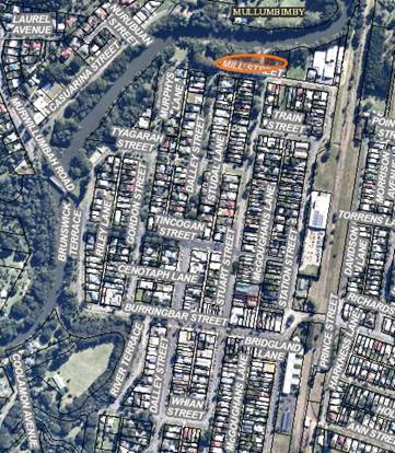
Report No. 6.1 Heritage Park, Mill St, Mullumbimby - No Parking 1am -6am
File No: I2020/1412
A request has been submitted by Council’s compliance
and enforcement team to install No Parking Area 1am – 6am signage
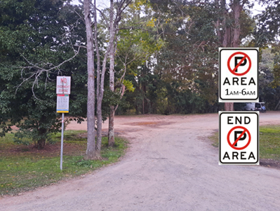
to cover Heritage Park, Mullumbimby. The map below shows the location of
the park and primary entrance to the park. Typical signage at the entrance is
shown. It is anticipated repeater signs will be required within the park area.
The purpose of the signage is to target frequent and violent
campers. Currently Council has the ability to fine the individual person
when found illegal camping. However, staff witnessed two stabbings during
recent enforcement inspections which highlight the significant risk for
enforcement officers when waking campers to fine them. Often campers are
still affected by drugs and alcohol increasing the risk of harm.
In addition, illegal campers are often international
visitors who ignore the fine and leave Australia without any impacts.
Installing No Parking Area signage permits staff to fine the vehicle without
having to wake up aggressive campers. This increases the safety for staff
and reduce the risk of the fine being ignored.
|
RECOMMENDATION:
That LTC and Council endorse the installation of
No Parking Area 1am-6am signage to cover Heritage Park, Mullumbimby.
|
Local Traffic Committee Meeting 6.2
Report No. 6.2 Bayshore Dr, Byron Bay - No Stopping
File No: I2020/1413
This report requests LTC and Council support for the
installation of a No Stopping sign along a portion of Bayshore Drive, Byron
Bay. The image below shows the general location under consideration, with
the light blue circles highlighting key problem areas. A red line shows
the location of an existing yellow No Stopping line that has significantly
faded and is hard to identify.
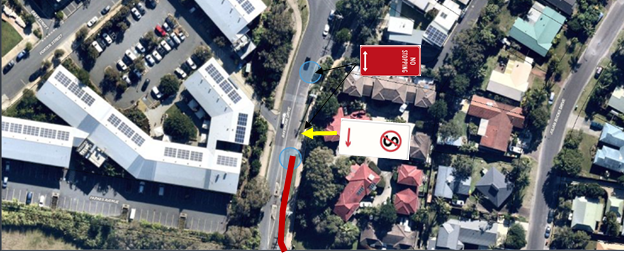
A superseded No Standing sign with an arrow pointing south
is located in the place shown above. It is requested to install 2 No Stopping
signs instead with 2 way arrows in the location shown above.
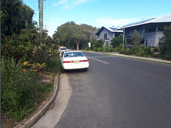
This image shows cars parked close to an intersection near
the northern circle creating line of sight concerns and extending down past the
pedestrian crossing / island.
|
RECOMMENDATION:
That LTC and Council endorse the installation of
2 No Stopping signs with 2 way arrows to prevent on street parking along the
Bayshore Drive frontage of 26 Bayshore Drive, Byron Bay.
|
Local Traffic Committee Meeting 6.3
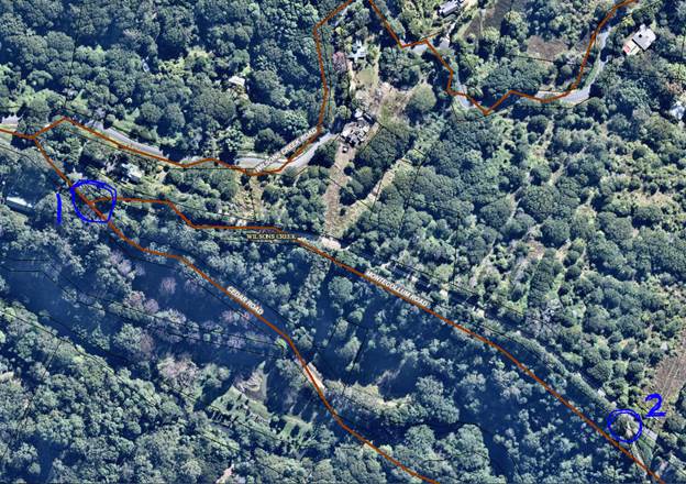
Report No. 6.3 Give Way Sign - Cedar Rd, Wilsons Creek
File No: I2020/1558
This report seeks Council and LTC support for the
installation of a Give Way sign at the intersection of Cedar Rd and Montecollum
Road, with associated linemarking.
In 2018 Council approved Rural Accomodation for 8
cabins at 58 Montecollum Road, Wilsons Creek. A S138 Roads Act application has now
been submitted to Council to undertake Road Works. As part of the S138
application it is proposed to install 2 giveway signs and associated
linemarking at two locations along Montecollum Drive, locations shown below in
the figure below.
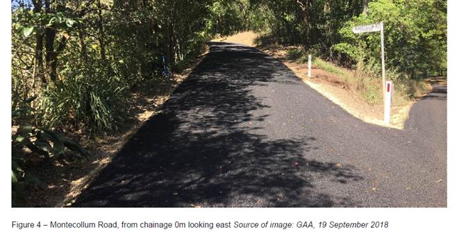
At location 1 the give way sign will be on Montecollum
Road and give preference to traffic on Cedar Road – Refer to Figure 4
below for a photo of this intersection.
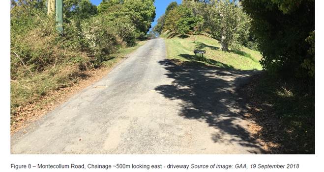
At location 2 the Give Way sign will be on private
property and give preference to traffic on Montecollum Road – refer to
Figure 8 for a photo at this intersection. Given this is on private property it
does not require Council apporval and does not have regulatory authority.
|
RECOMMENDATION:
That LTC and Council endorse the installation of
a Give Way sign and associated Linemarking at the intersection of Montecollum
Drive and Cedar Road give preference to through traffic on Cedar Road.
|
Local Traffic Committee Meeting 6.4
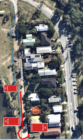
Report No. 6.4 No Stopping - South Beach Lane, Brunswick Heads
File No: I2020/1575
Council has received a request from the public to install No
Stopping signs in a portion of South Beach Lane, Brunswick Heads. The
image below shows the length of laneway requested to be No Stopping and the
residents request is circled.
A sight inspection confirmed the condition of the lane is
extremely poor, potholed and narrow in front of the resident’s house. It
was also confirmed that
· Vehicles parallel
parked along the section of laneway significantly restricted vehicle access
into and out of the existing dwellings.
· This section of
laneway has no parking restrictions and is a popular out of the way illegal
camping area. These vehicles are typically larger amplify the access problem.
It is recommended to support the installation of No Stopping
signs along this limited stretch of South Beach Lane.
As a result of this request and subsequent site inspection a
project has been approved to upgrade the laneway and improve parking
arrangements along the laneway. Concepts to be considered as part of this
project are to widen this section of laneway to enable 90 degree parking
without restricting residents. However the timeframe for this will be
approximately 6-12 months before the project is complete.
|
RECOMMENDATION:
That Council support the installation of No
Stopping signs within South Beach Lane and on the western edge, approximately
between chainages 130 to 190.
|
Local Traffic Committee Meeting 6.5
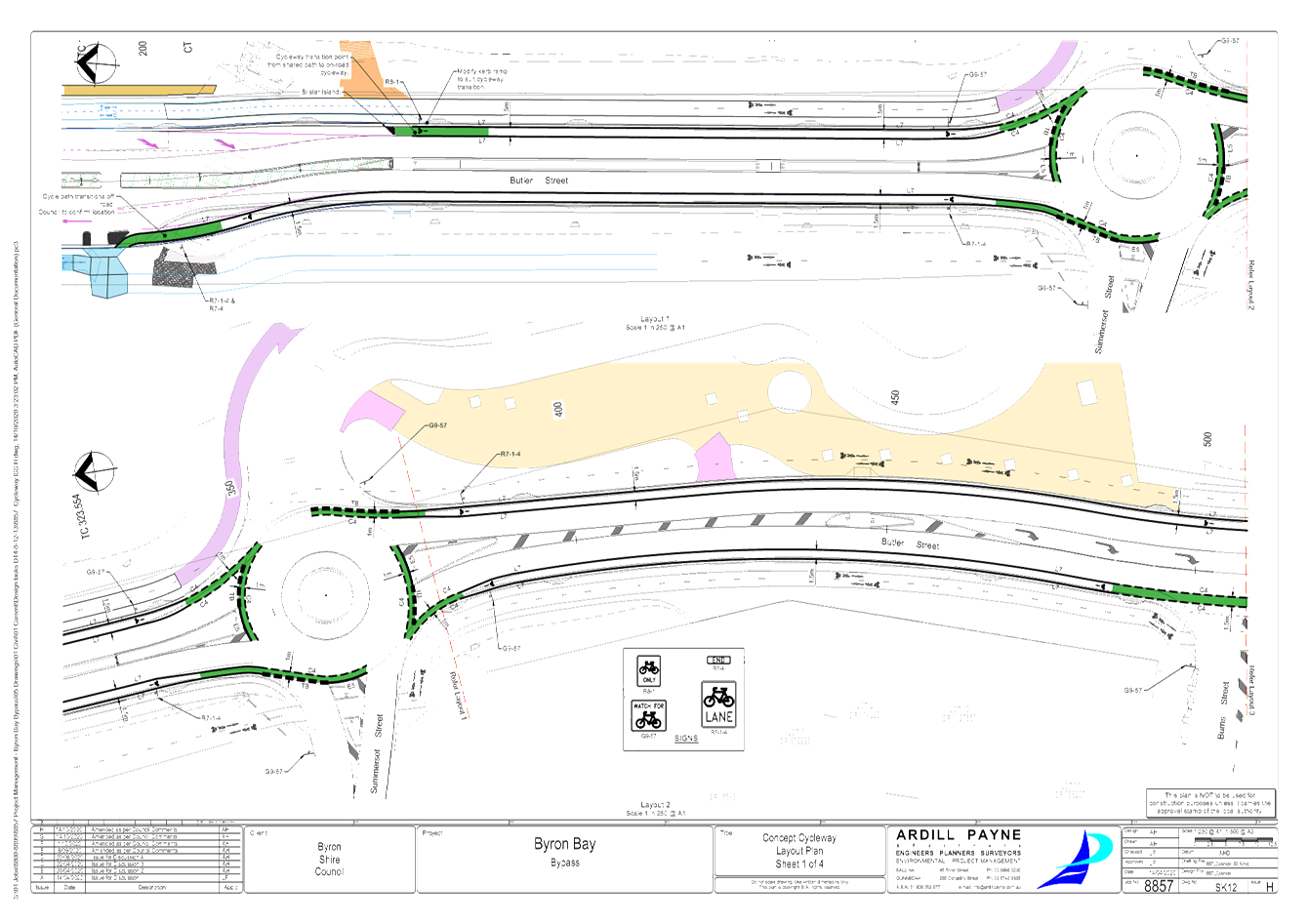
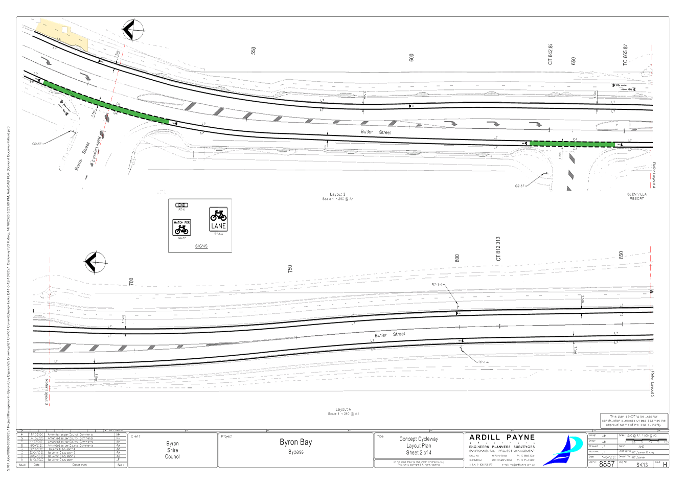
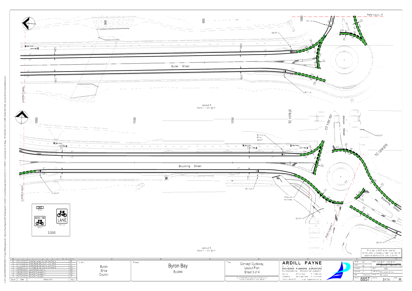
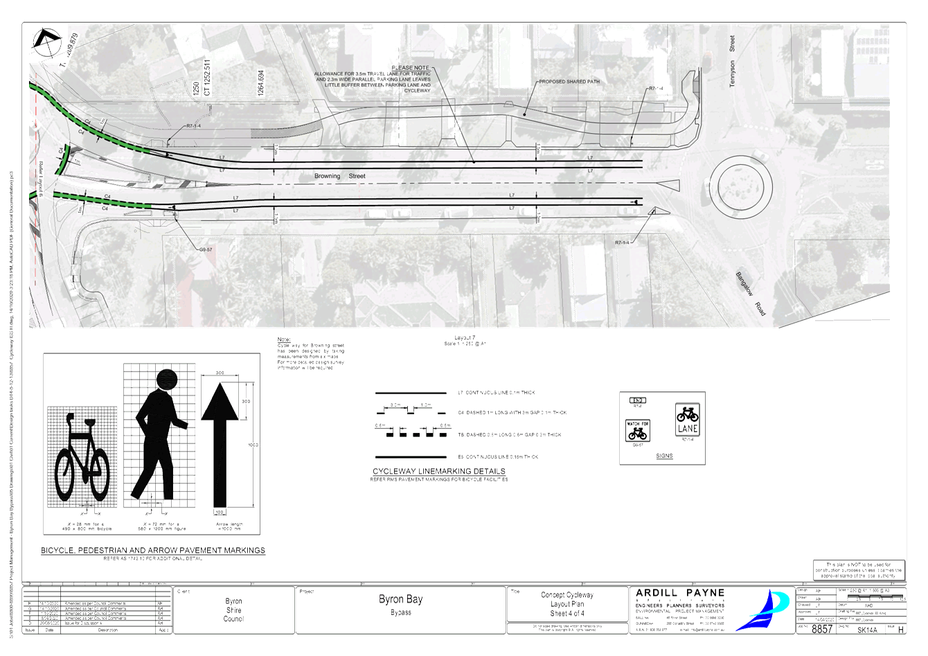
Report No. 6.5 Byron Bay Bypass - On-Road Cycleway
File No: I2020/1601
The Byron Bay Bypass presents a unique opportunity to
provide an extensive length of new on-road cycleway that can connect the
current ‘Byron to Suffolk’ cycleway from the south to the northern
end of town.
The Byron Bay Bypass project design includes a 1.5m shoulder
that is ideally suited for the purpose.
Therefore one of the project team’s initiatives was to
have designed said cycleway and this is now being presented for endorsement by
the Local Traffic Committee and subsequently Council.
The designs have been undertaken in accordance with the
current ‘Byron to Suffolk’ project to ensure consistency of the
overall cycleway.
The road shoulder does not extend north of ‘Stage
One’ of the Byron Bay Bypass project, which is why the current design
safely transitions to the off road cycleway at that point.
It is possible for on-road cyclists to continue north along
Butler and eventually Shirley Street, however this will not be formalised with
line marking and signs.
|
RECOMMENDATION:
That Council endorse the attached plans for the
Byron Bay Bypass On-Road Cycleway pavement marking and signage to be
installed as part of the Byron Bay Bypass project (#E2020/82748).
|
Attachments:
1 24.2018.83.1
- Byron Bay Bypass - On-Road Cycleway Design, E2020/82748
, page 13⇩ 
Regulatory Matters 6.5 - Attachment 1
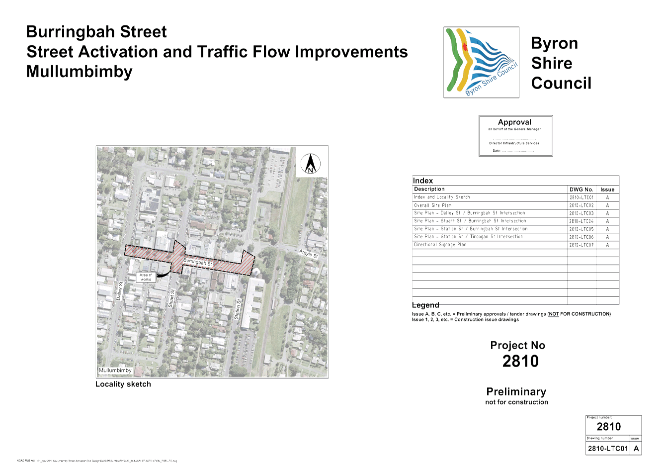
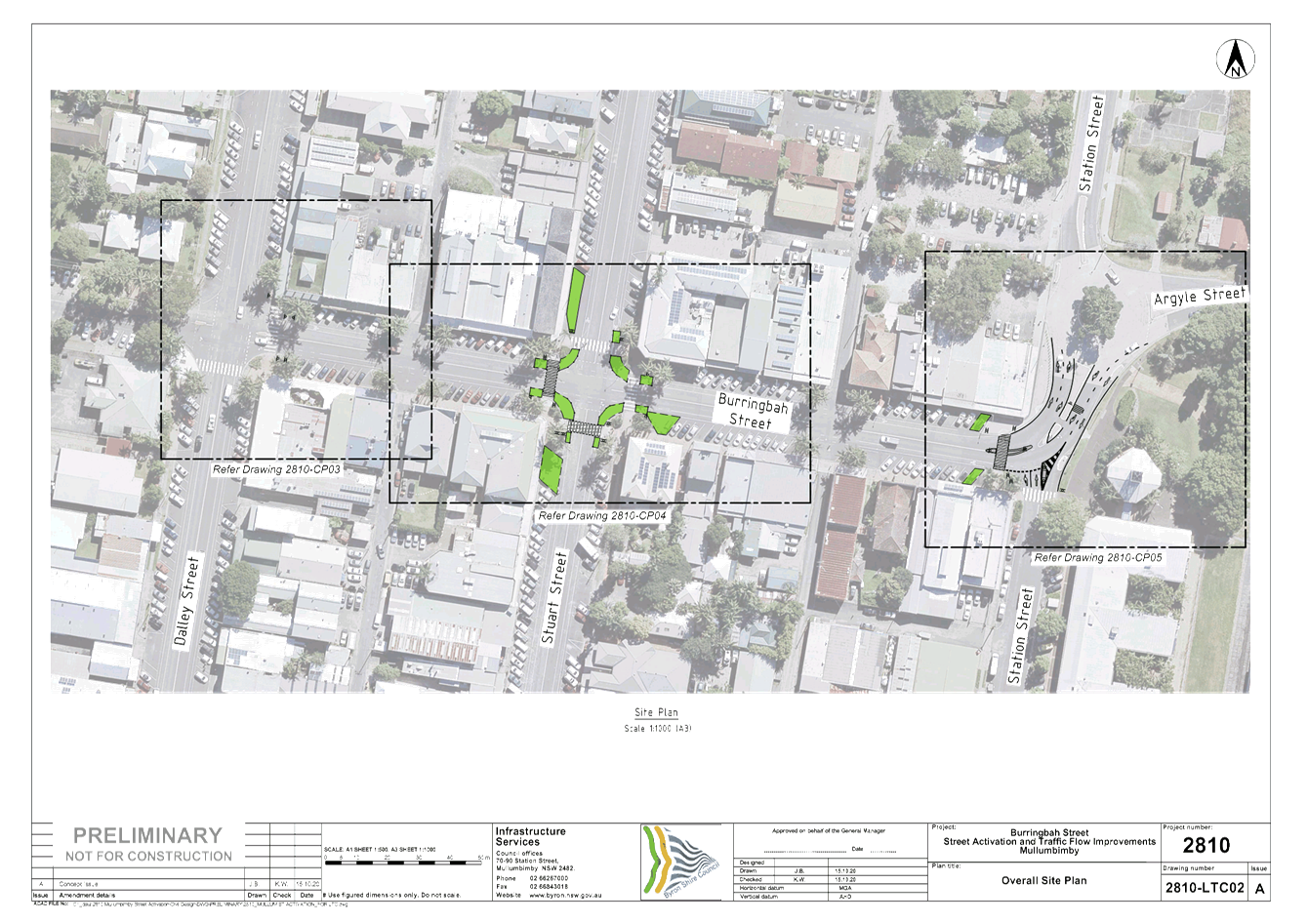
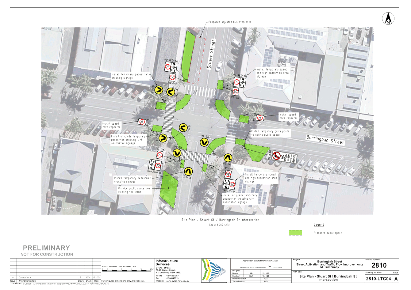
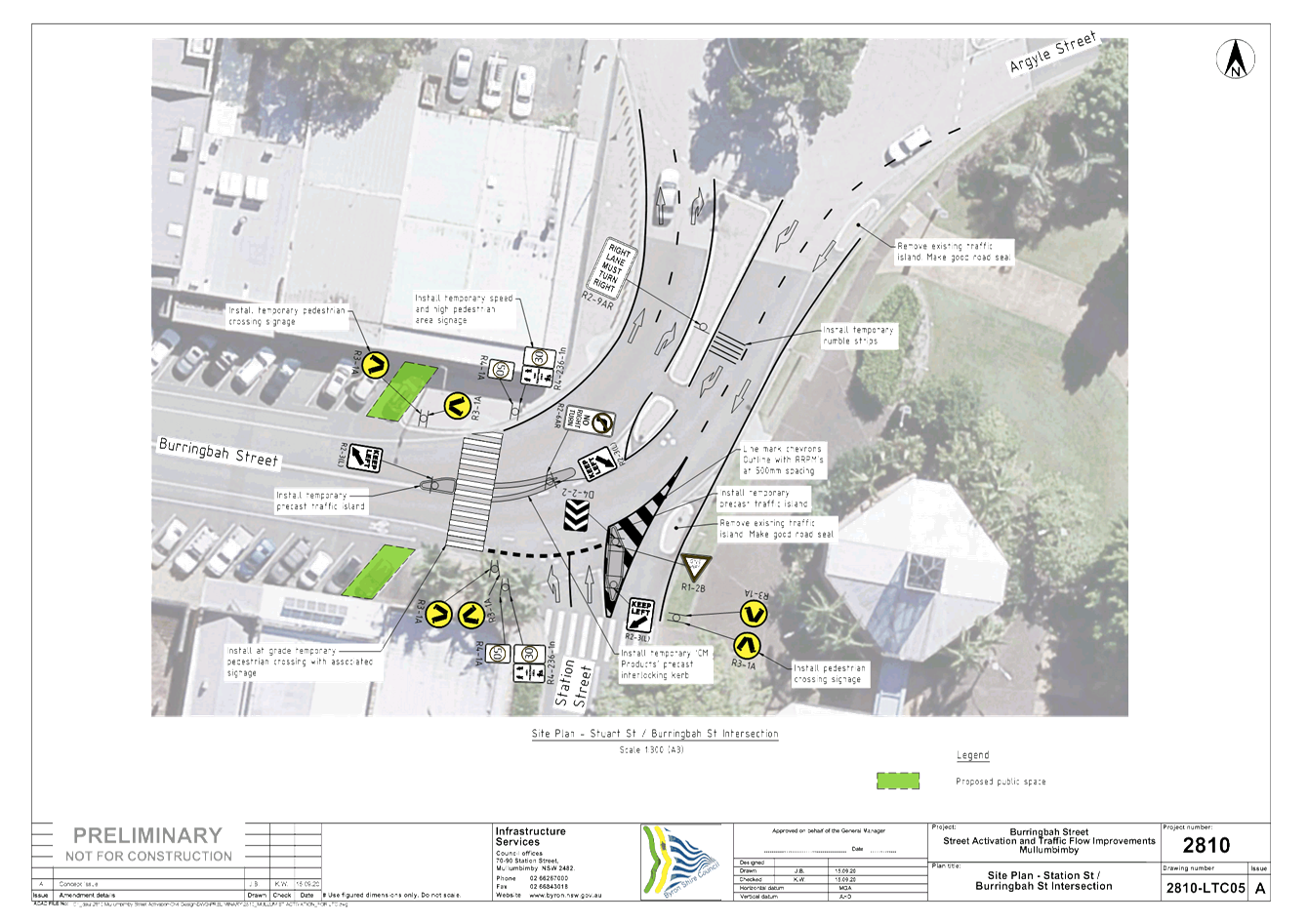
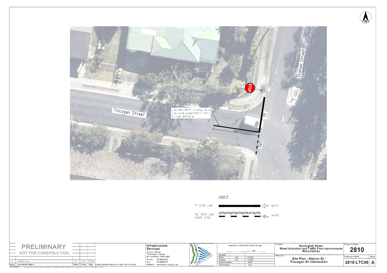
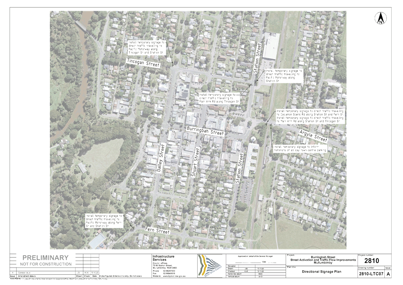
Local Traffic Committee Meeting 6.6
Report No. 6.6 Burringbar Street Mullumbimby Street Activation and Traffic Flow
Improvements
File No: I2020/1612
Council has been awarded funding from the NSW State
Government to trial temporary treatments including speed reductions and
parklets in Burringbar Street, Mullumbimby. The purpose of this trial is
to reduce vehicle movements through and on Burringbar Street within the town
centre, provide a safer space for cyclists and pedestrians as well as promote
social interaction through “activating” areas of the street.
The trial also aligns with the Council endorsed Mullumbimby Masterplan.
The preferred arrangement to facilitate the project requires
a number of regulatory devices to be implemented. These regulatory
devices are documented in the attached plan. This plan set will be
further embellished through the addition of non-regulatory treatments such as
parklets, park benches and artworks.
The following regulatory devices require LTC endorsement:
1. Speed
zone reduction from 50km/h to 30km/h along Burringbar Street (between Dalley
and Station Streets)
2. Linemarking
and signage to safely manage traffic through the project area
3. Additional
pedestrian crossing installations. The existing pedestrian crossings are
generally illuminated however unlikely to satisfy to current Australian
Standards. Council is investigating solar lighting options to supplement
any existing lighting to improve the safety of the temporary pedestrian
crossings. Due to the temporary nature of the project and slow speed
environment, a complete lighting design to Australian Standards may not be
appropriate.
Other points of mention include the temporary removal of the
taxi rank located on the south west leg of the Burringbar/Stuart Streets
intersection. This space will be converted to an activation space.
The existing bus stop located on the north west leg of the Burringbar/Stuart
Streets intersection will also be converted to a temporary activation
space. Buses will be required to utilise a temporary boarding and
disembarking area directly east of the activation space or utilise the existing
bus stop adjacent the Mullumbimby Post Office.
|
RECOMMENDATION:
That LTC endorse the attached plans for the
Burringbar Street Mullumbimby Street Action and Traffic Flow Improvements
(#E2020/83138).
|
Attachments:
1 24.2020.24.1
- 2810_MULLUMBIMBY SHARED STREETS_LTC, E2020/83138
, page 18⇩ 
Regulatory Matters 6.6 - Attachment 1
Local Traffic Committee Meeting 7.1
Matters for Traffic Engineering Advice
Report No. 7.1 Tennyson Street - Shared Path & Crossings
File No: I2020/1632
The purpose of this report is to gain engineering related
advice from LTC relating to a shared path along Tennyson St with associated crossings.
LTC and Council recently endorsed regulatory devices
associated with a shared path / cycleway from Suffolk Park to Browning Street,
Byron Bay (I2020/1061). This proposed project is designed to tie in with
that Suffolk Park to Browning Street path.
In addition, another report has been submitted to this LTC
meeting agenda requesting LTC and Council support for regulatory devices
associated with a Shared Path / Cycleway along the new Byron Bay Bypass.
This path will tie in with the Suffolk Park to Browning Street path and extend
along the Bypass to Shirley Street.
Figure 1 below is an extract from the Bike Plan approved in
2019 and is provided to show how the path proposed in this report fits into the
approved Bike Plan. Tennyson Street has been circled in blue to help
locate the proposed path. Photos 1 to 4 show snippets from Google Street view
to indicate the site conditions. The location of Photo 1 is shown in Figure 1
as the number 1. Photo 2 is taken at location 2 etc.
As the Byron Bay Master Plan is rolled out it is expected
that Tennyson St will become a higher order road with increased traffic.
As seen in Figure 1, an existing path is shown on the
western side of Tennyson St, however, this is considered undersize. To
function as a proper compliant shared path it would need to be widened and
upgraded in a number of places. It is proposed in the Bike Plan to
construct a new shared path along the eastern side of Tennyson Street with a
number of pedestrian crossings at each intersection along the road.
The detail design for this length of Tennyson St is now
commencing. Staff are requesting engineering related advice from LTC relating
to a number of options:
1. Locate
the shared path along the western side and upgrade / widen the Shared Path as
required.
2. Locate
the new shared path along the eastern side of Tennyson Street and not upgrade
the western side.
3. Upgrade
the western path from Browning St through to Byron Public School, upgrade the
school crossing (see photo 3) and construct a new shared path from this
crossing to the Recreation Grounds. The Ruskin St and Marvel St crossings
across Tennyson St would not be constructed .
4. Upgrade
the western path from Browning Street to Marvell Lane and construct a new
crossing to the Recreation Grounds and shared path through the end of Tennyson
St (Figure 2).
At some stage along Tennyson Street a crossing will be
required to bring pedestrian and cyclists to the Recreation Grounds at the
North Eastern end of Tennyson Street. This will also provide linkage into
the Sandhills Estate which is currently having a skate park and paths
designed. These paths will link into the Byron Town Centre path network.
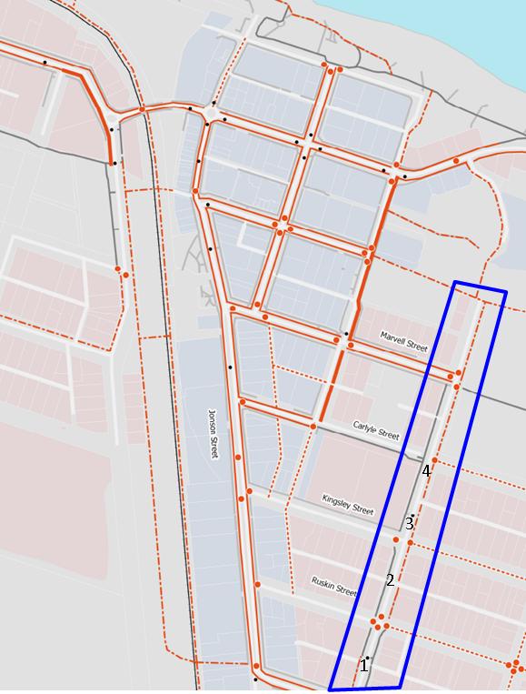
Figure 1 – Bike Plan approved in 2019 (Blue Line shows
the location of Tennyson St).
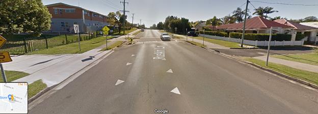
Photo 1
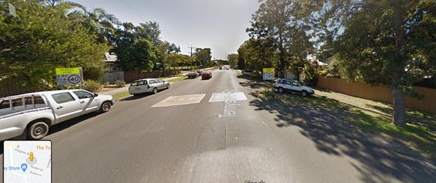
Photo 2
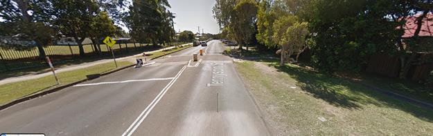
Photo 3
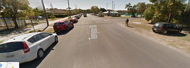
Photo 4
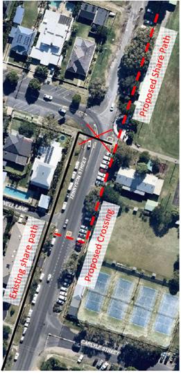
Figure 2 – Marvel Lane
crossing