Notice of Meeting
Extraordinary Local Traffic Committee
Meeting
An Extraordinary Local Traffic Committee Meeting of Byron Shire Council will be held as follows:
|
Venue
|
Zoom
|
|
Date
|
Friday, 21 July 2023
|
|
Time
|
10:00am
|
Phil Holloway
Director Infrastructure
Services
I2023/1089
 Distributed
13/07/23
Distributed
13/07/23
Extraordinary Local Traffic
Committee Meeting
BUSINESS OF MEETING
1. Apologies
2. Declarations
of Interest – Pecuniary and Non-Pecuniary
3. Adoption
of Minutes from Previous Meetings
3.1 Local
Traffic Committee Meeting held on 13 June 2023
3.2 Extraordinary
Local Traffic Committee Meeting held on 17 July 2023
4. Matters
Arising
5. Outstanding
Issues/Resolutions
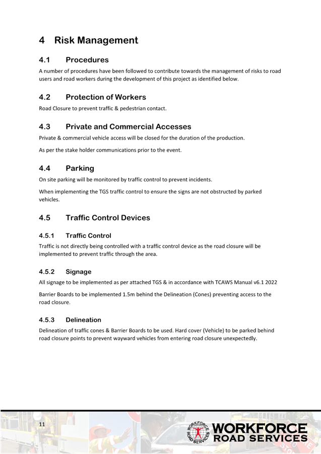
6. Regulatory Matters
6.1 Pedestrian
Refuge, Parking and Channelised Right (CHR) Treatment on Bayside Way........................................................................................................................................... 3
6.2 Toni
Childs - Filming Road Closure Secondary Proposal....................................... 9
6.3 Gilmore
Crescent - Parking restrictions and pedestrian facilities......................... 26
6.4 Wordsworth
Street / Shirley Street - Parking and intersection upgrades........... 32
Local Traffic Committee Meeting 6.1
Regulatory Matters
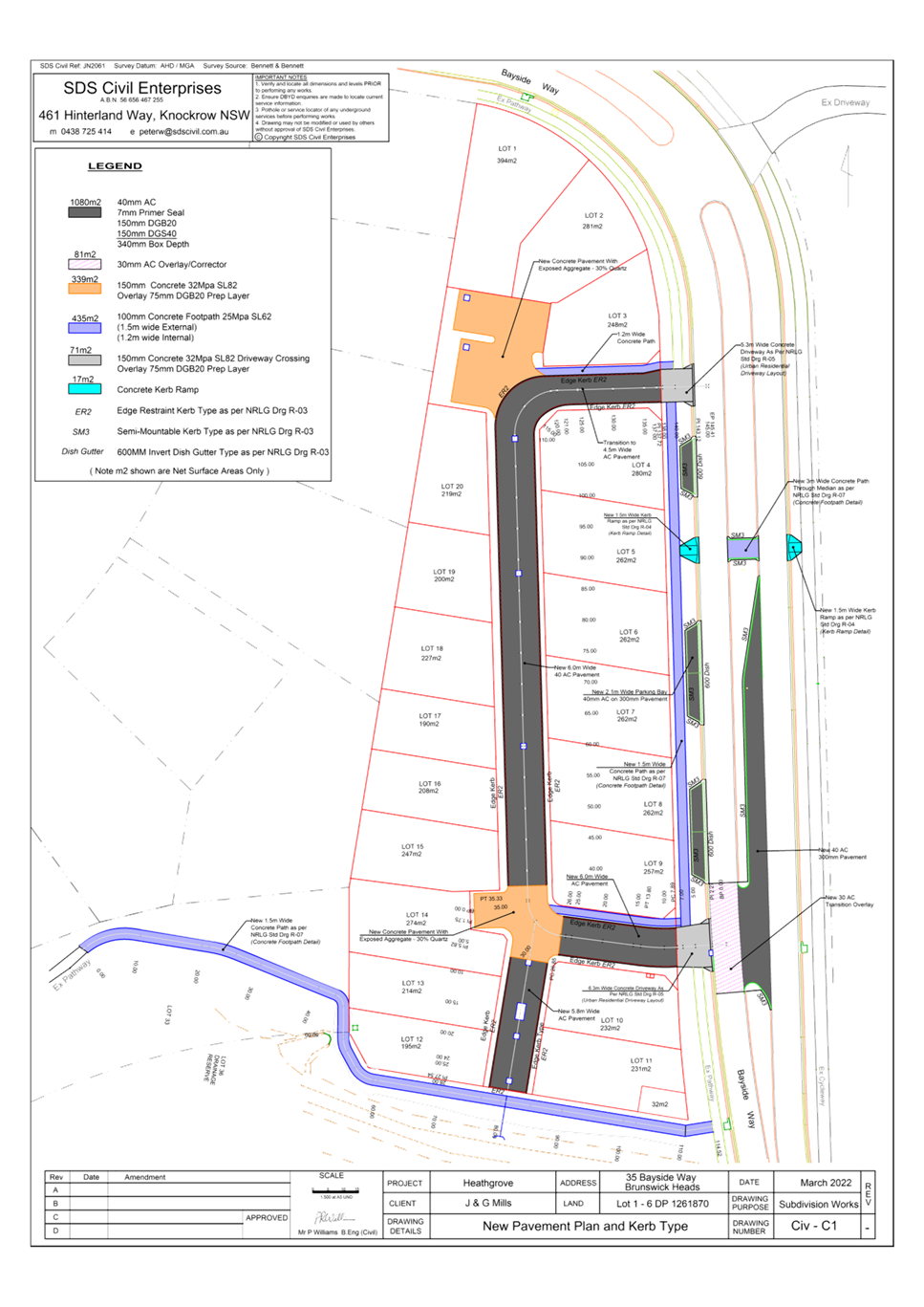
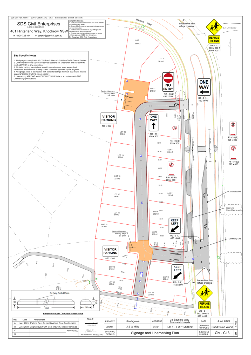
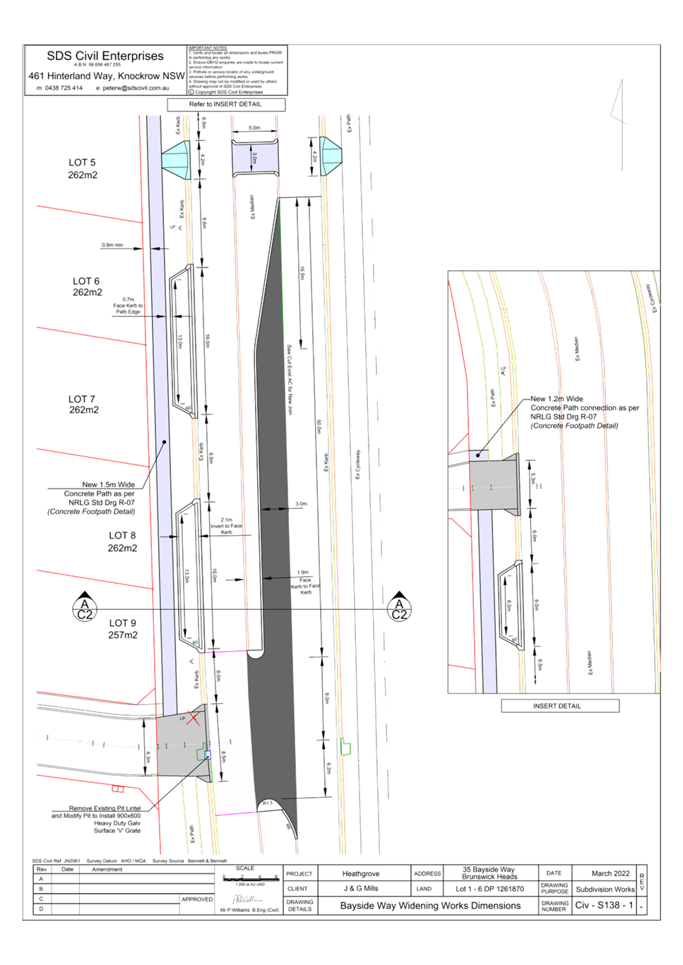
Report No. 6.1 Pedestrian Refuge, Parking and Channelised Right (CHR)
Treatment on Bayside Way
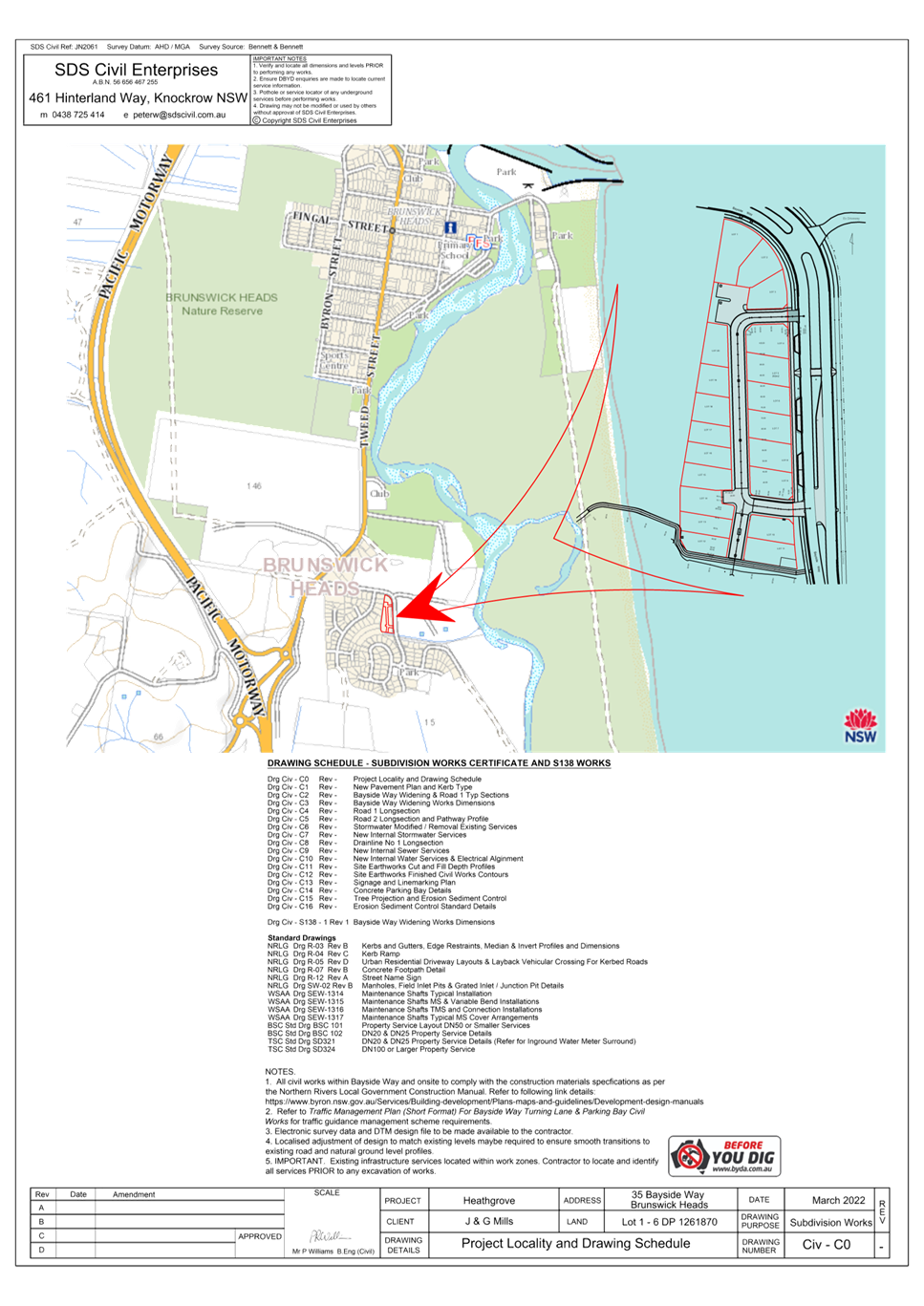
File No: I2023/951
The purpose of this report is to
gain Council support for the proposed regulatory signage and line markings
shown in Attachment 1 (E2023/61852).
Council has received a Roads Act application
associated with a development consent for a Community Title Subdivision
comprising twenty (20) lots at 24 Bayside Way BRUNSWICK HEADS.
Condition 41 of the development
consent (10.2021.425.1) partly requires the following:
a. Channelised
Right (CHR) Treatment opposite the southern driveway
Kerb and gutter, road pavement,
line-marking, streetlighting (AS 1158) and associated drainage construction,
including any necessary relocation of services in accordance with SDS Civil
Enterprises drawing 2061-C1 Rev B.
b. On-street
parking and relocation of footpath
A fully detailed design of five (5) on-street
parallel parking including line-marking and any necessary relocation of
services in accordance with AS 2890.5 and IPWEA drawing R-0031 (see
Note). The following must be adopted: -
· Carriageway of 3.5m.
· Parking lane of 2.1m.
· Safety barrier line
between the parking lane and carriageway of 0.5m.
· The parking lane be
sheltered by way of full indentation of the parking lane. It is necessary to
replace the existing kerb and gutter with a concrete invert or dish gutter in
accordance with NRLG drawing R-03 and install a mountable kerb at a new
alignment in accordance with IPWEA drawing R-0031 – Verge with Parking
Bays and Pathways.
· Relocate the existing 1.5m
wide footpath, measured 1.5m from the invert of the mountable kerb. Refer to
IPWEA drawing.
c. Concrete
footpath extension
The footpath located inside Lot
33 DP730006 and south of 13 Kingsford Drive is to be extended through to Lot 36
DP800926 & Lot 7 DP1261870 to connect onto the footpath on the western
section of Bayside Way. The footpath is to be 1.5m wide, concrete and
with a crossfall of 1 % or 1:100 (maximum 2.5% or 1 in 40).
d. Ramped
pedestrian crossing
A ramped pedestrian crossing
including streetlighting (AS1158) in accordance with Council’s standard
plan – No. 941 and SDS Civil Enterprises drawing 2061-C1.
e. Pedestrian
refuge
A pedestrian refuge including
streetlighting (AS1158) in accordance with SDS Civil Enterprises drawing
2061-C1. The pedestrian refuge is to be designed in accordance with
Australian Standard 1742.10 – Manual of Uniform Traffic Controls –
Pedestrian Control and Protection and Traffic Authority of New South Wales
Guidelines for Traffic Facilities, Part 4.2 – Pedestrian Refuges.
The design is to address siting, signs, line-marking, parking restrictions and
night-time visibility.
f. Driveways
Driveways are to be designed and
constructed generally in accordance with the approved plans and Council's
current “Northern Rivers Local Government Development Design &
Construction Manuals and Standard Drawings”. Adjustment and/or
relocation of services may be necessary to meet the requirements of the
relevant service authorities and to ensure that the services are constructed
flush with the finished surface levels.
RECOMMENDATION:
That Council support the
regulatory signage and line markings associated with the new works on Bayside
Way, as shown in Attachment 1 (E2023/61852)
Report writer: Have you mentioned
an attachment in your recommendation? If so, include the TRIM number in
brackets eg “…Attachment 1 (E2017/1234)…” It’s
necessary for the minutes document.
Attachments:
1 51.2021.425.1
LTC submission, E2023/61852 , page 5⇩

Regulatory
Matters 6.1 - Attachment 1
Local Traffic Committee Meeting 6.2
Report
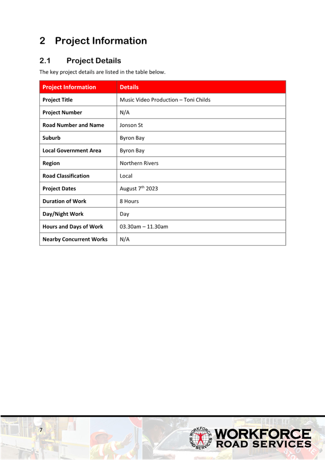
No. 6.2 Toni Childs - Filming Road Closure
Secondary Proposal
File No: I2023/1067
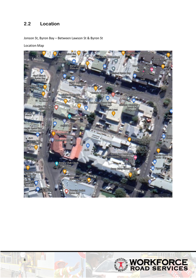
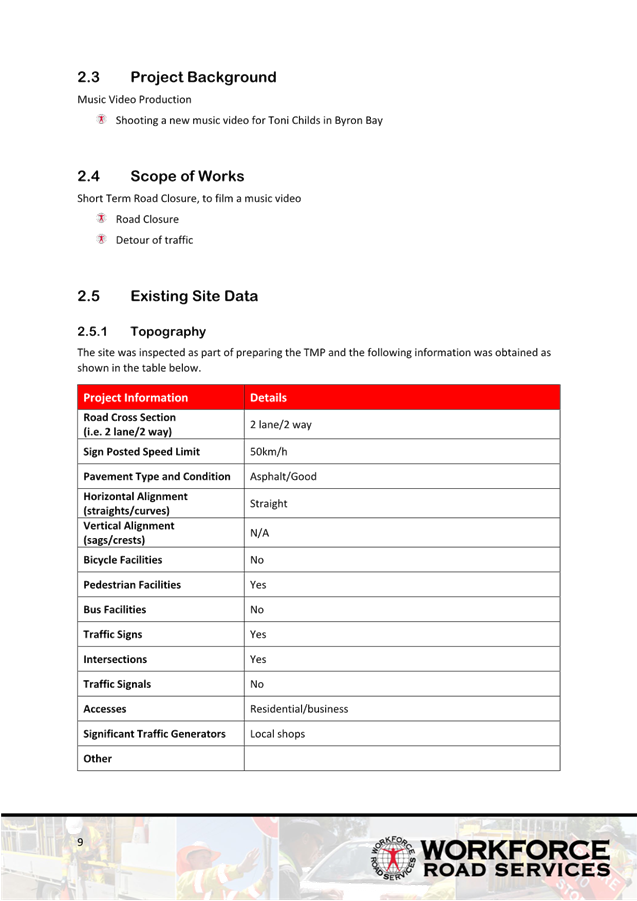
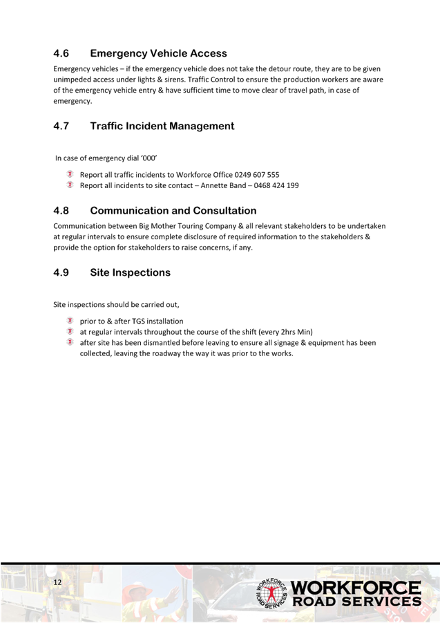
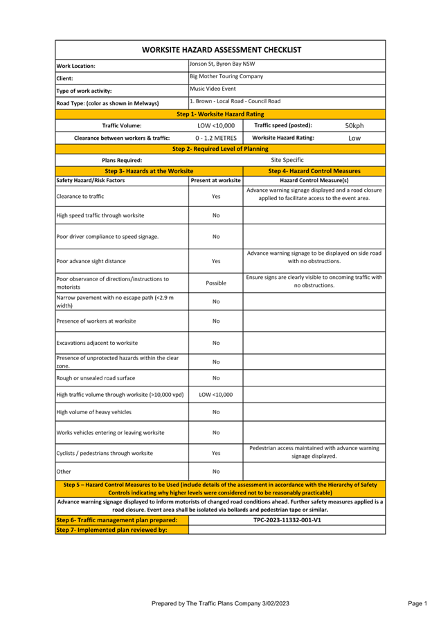
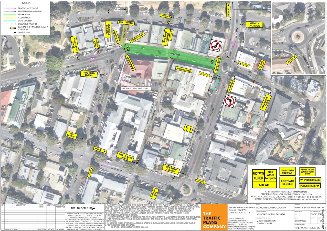
Council has received an application for the Toni Childs
Music Video Shoot to be held on Monday 7 August 2023. With the intention to
close off part of Jonson Street, Byron Bay – the section between Lawson
Street and Byron Street – between 3:30am and 11:30am (8 hours).
RECOMMENDATION:
1. That
the Local Traffic Committee (LTC) support the Toni Childs Music Video
Production to be held on Monday 7 August 2023.
2. That
(LTC) support in Part 1 is subject to:
a) the
event organiser providing council with an updated Traffic Management Plan and
Traffic Guidance Scheme/s for the film shoot;
b) development
and implementation of a Traffic Management Plan and Traffic Guidance Scheme/s
by those with appropriate TfNSW accreditation and the holding of current and
appropriate levels of insurance and liability cover;
c) the
impact of the film shoot be advertised, and charged at cost to the organisers,
via a notice in the local weekly paper and Variable Message Signage near the
site, a minimum of one week prior to the operational impacts taking effect,
noting it must include the film shoot name, specifics of any traffic impacts or
road closures and times, alternative route arrangements, Production Team, a
personal contact name and a telephone number for all event related enquiries or
complaints;
d) the
film shoot be notified on Council’s web page with the event organiser
supplying Council with the relevant information.
3. The Production Team to:
a) inform
the community and businesses that are directly impacted (e.g. within road
closure zones) via written information which is delivered to the property in a
timely manner so as to document, consider and respond to any concerns raised;
b) arranging
for private property access and egress affected by the film shoot;
c) liaising
with bus, taxi and waste operators and ensuring arrangements are made for
provision of services during conduct of the film shoot;
d) consulting with
emergency services and any identified issues be addressed;
e) holding $20m public
liability insurance cover which is valid for the film shoot;
f) paying
Council’s Road Event Application Fee prior to the film shoot;
g) not place any signage on
the road related area of the Pacific Highway.
h) apply/receive
consent by the relevant road authority under section 138 of the NSW road act
(1993) and pay any associated fees and charges within this process.
Attachments:
1 TMP
- Toni Chils Music Video - Byron 2023 - R4, E2023/72088
, page 11⇩

Regulatory
Matters 6.2 - Attachment 1

Local Traffic Committee Meeting 6.3
Report
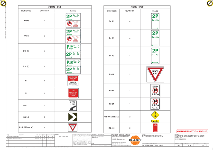
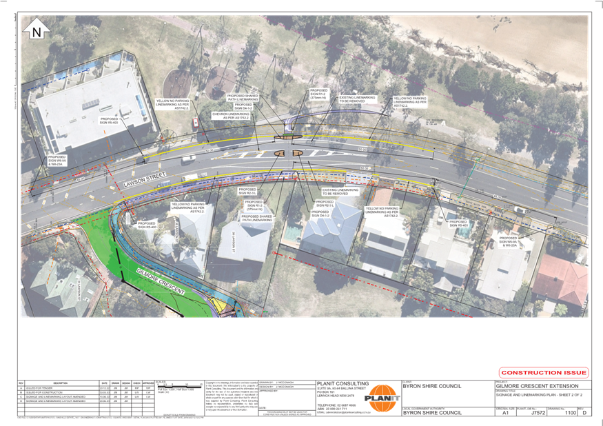
No. 6.3 Gilmore Crescent - Parking restrictions and
pedestrian facilities
File No: I2023/1070
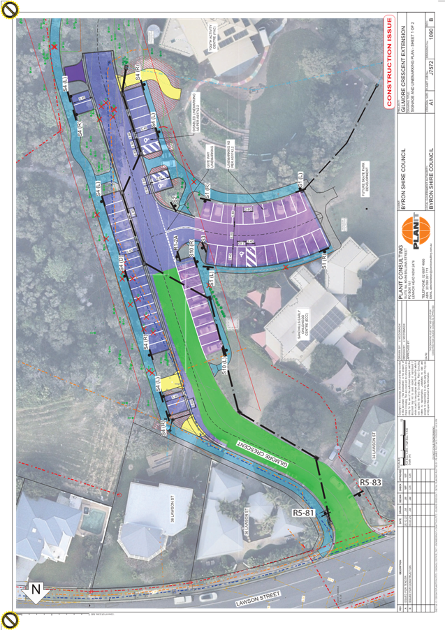
Gilmore Crescent has recently been upgraded and extended to
cater for Byron Bay’s new skate park.
As part of these upgrades additional parking bays have been
provided. All parking in the surrounding area is restricted to ensure
parking equity for the greater community and to prevent nuisance camping.
Council staff are proposing the restrictions contained within the plan in
attachment 1 (E2023/58247).
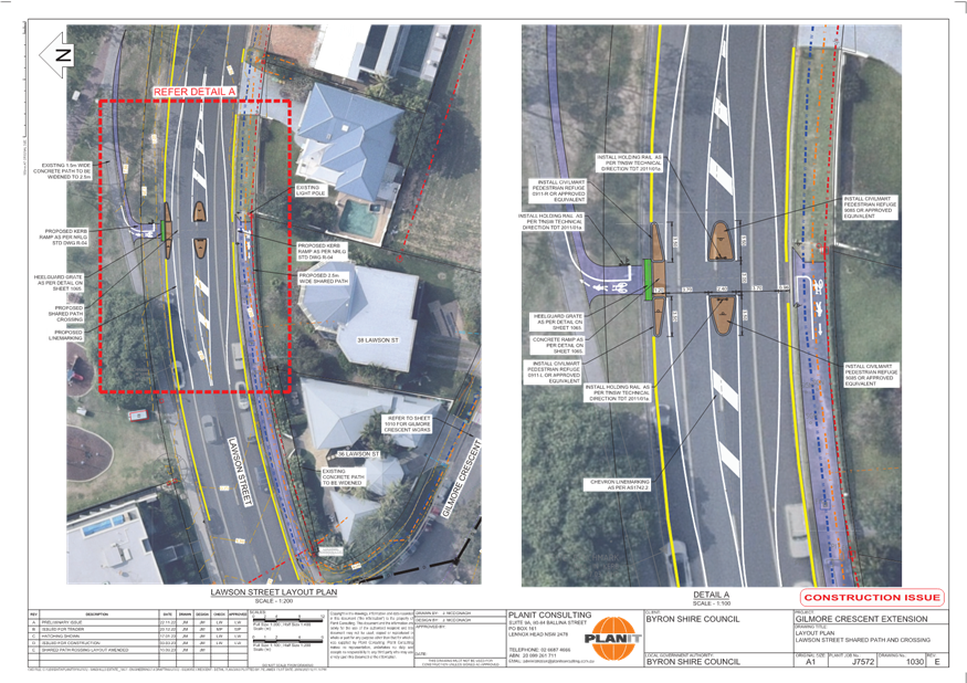
There will also be provision for pedestrians (refuge) on
Lawson Street for safe crossing and access to the new skate park (E2023/71557).
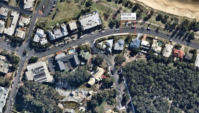
Figure 1: Locality map
RECOMMENDATION:
That the Local Traffic Committee endorse the
proposed parking restrictions within Gilmore Crescent and the pedestrian refuge
facility and associated no stopping restrictions on Lawson Street as per
attachments 1 (E2023/58247) and attachment 2 (E2023/71557).
Attachments:
1 Signage
Plans_Gilmore Cres, E2023/58247 ,
page 28⇩

2 Gilmore
Crescent - Detail Plan - Refuge -12 July 2023, E2023/71557 , page 30⇩
Regulatory
Matters 6.3 - Attachment 1
Regulatory
Matters 6.3 - Attachment 2
Local Traffic Committee Meeting 6.4
Report
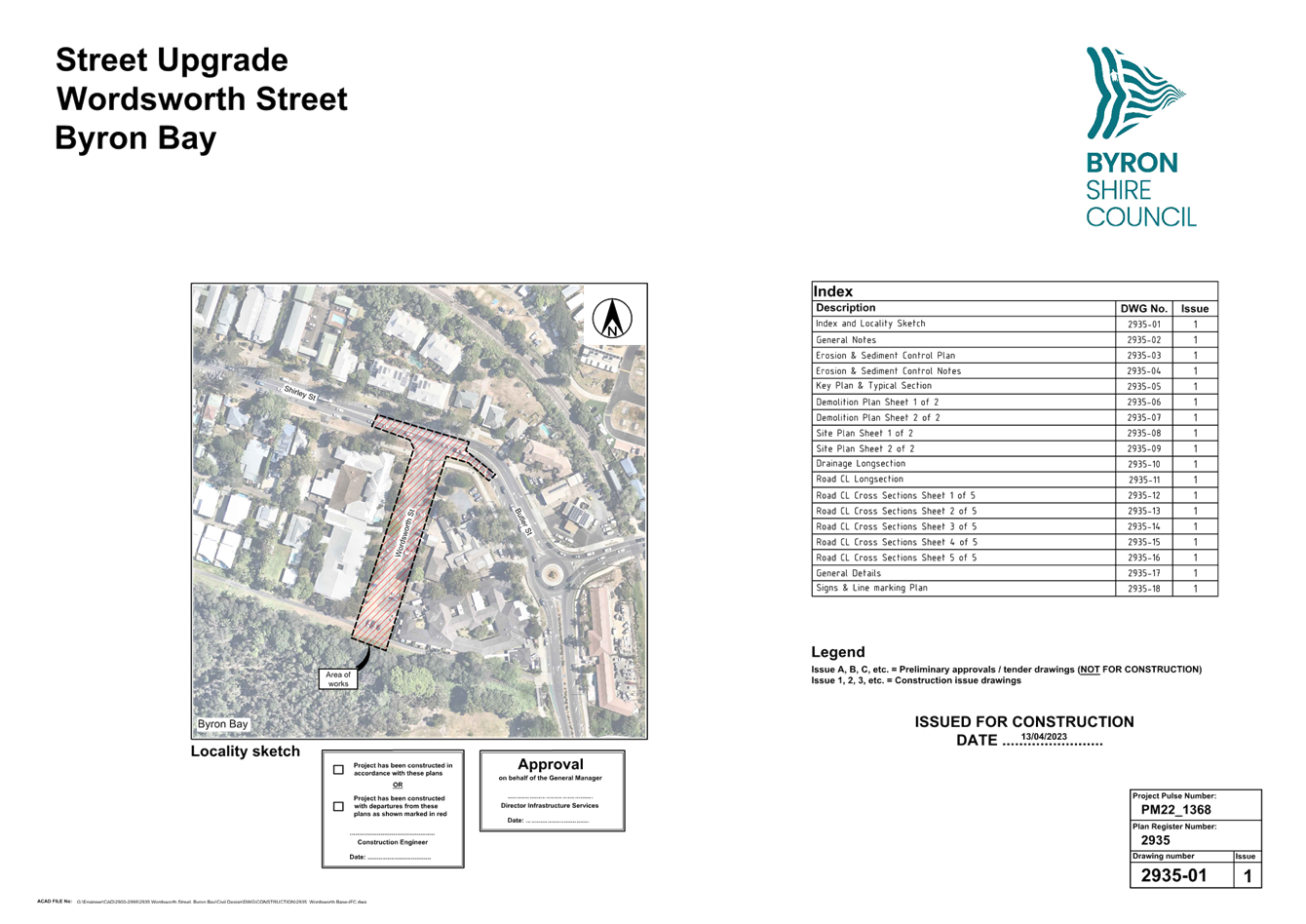
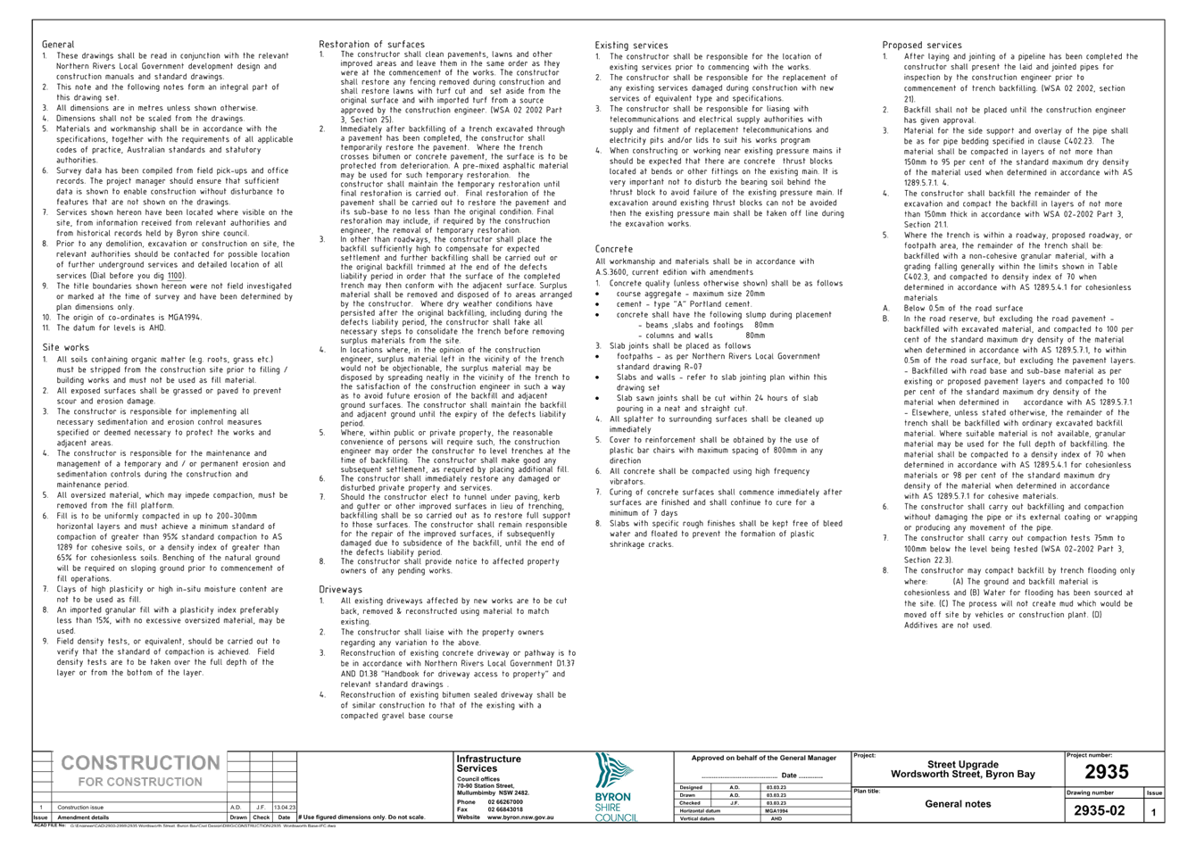
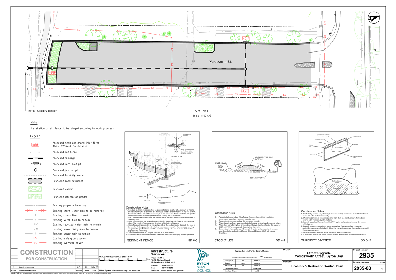
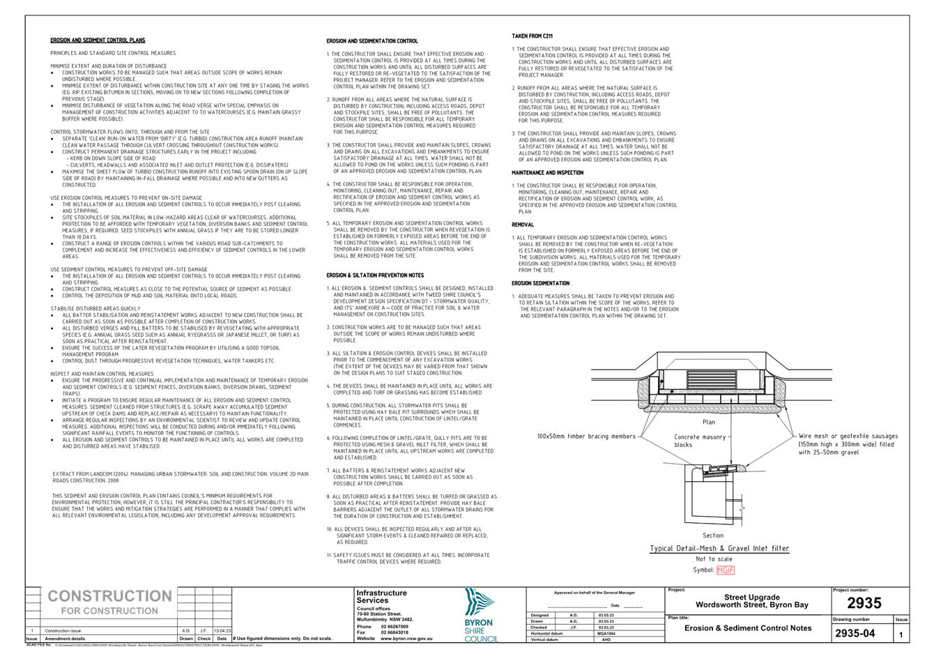
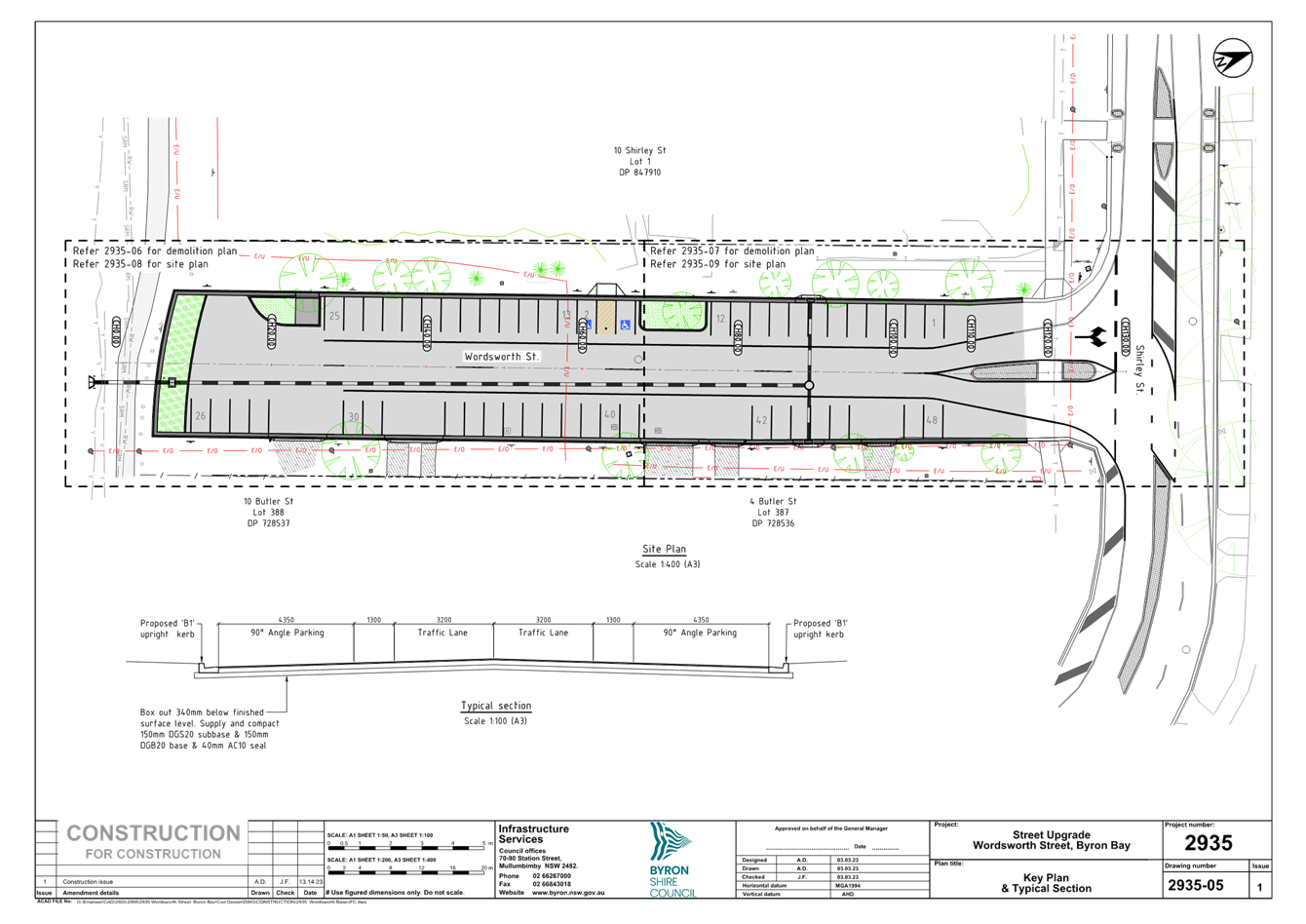
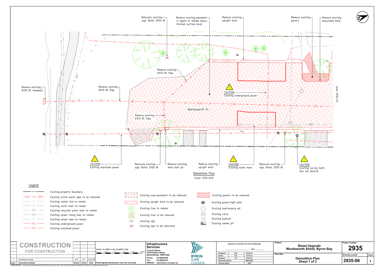
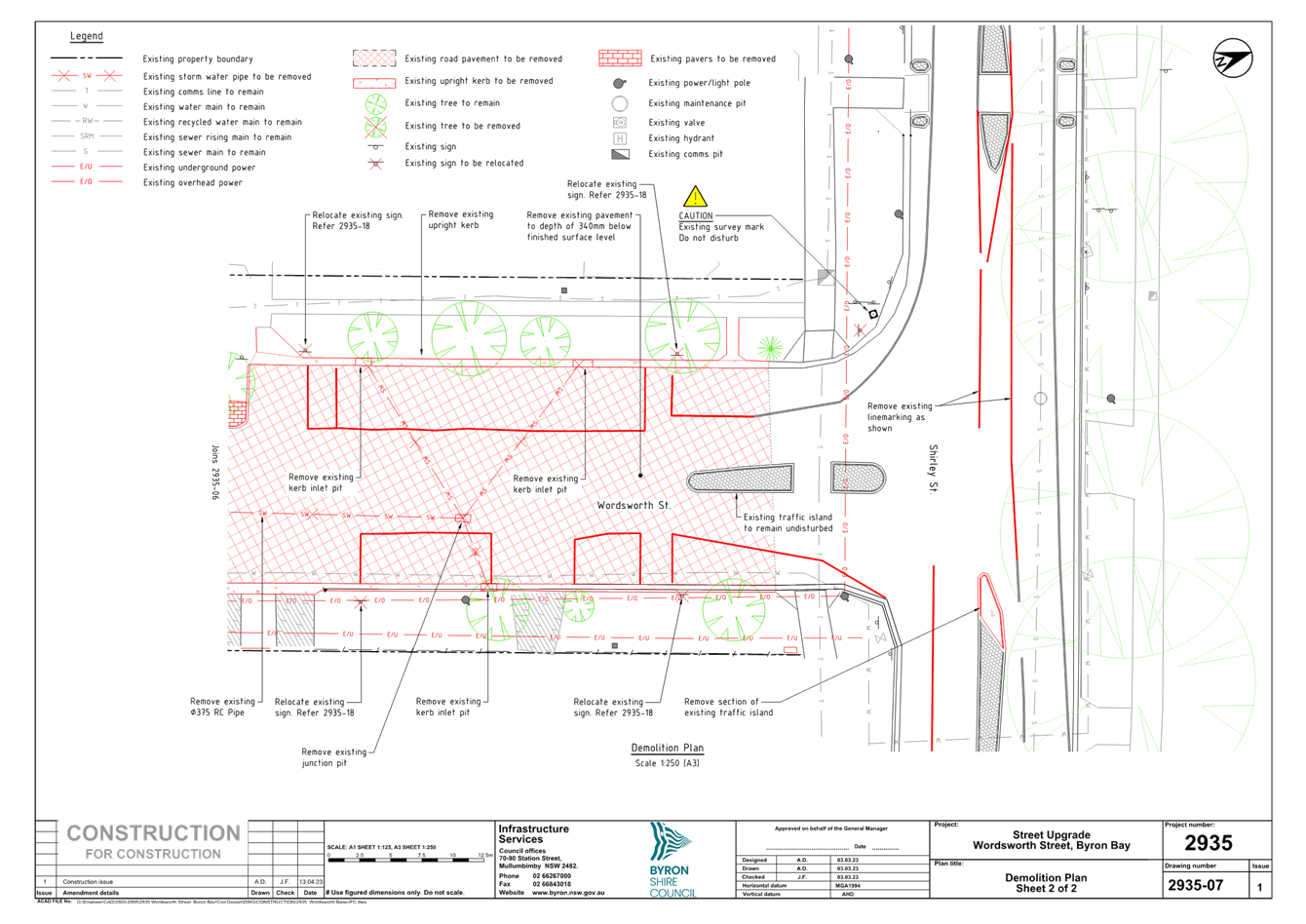
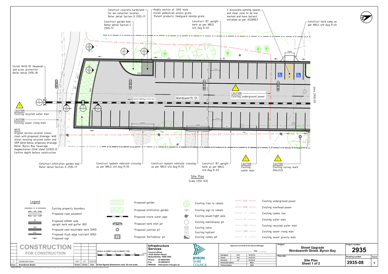
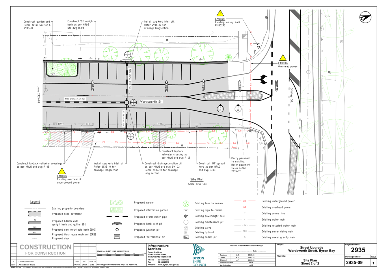
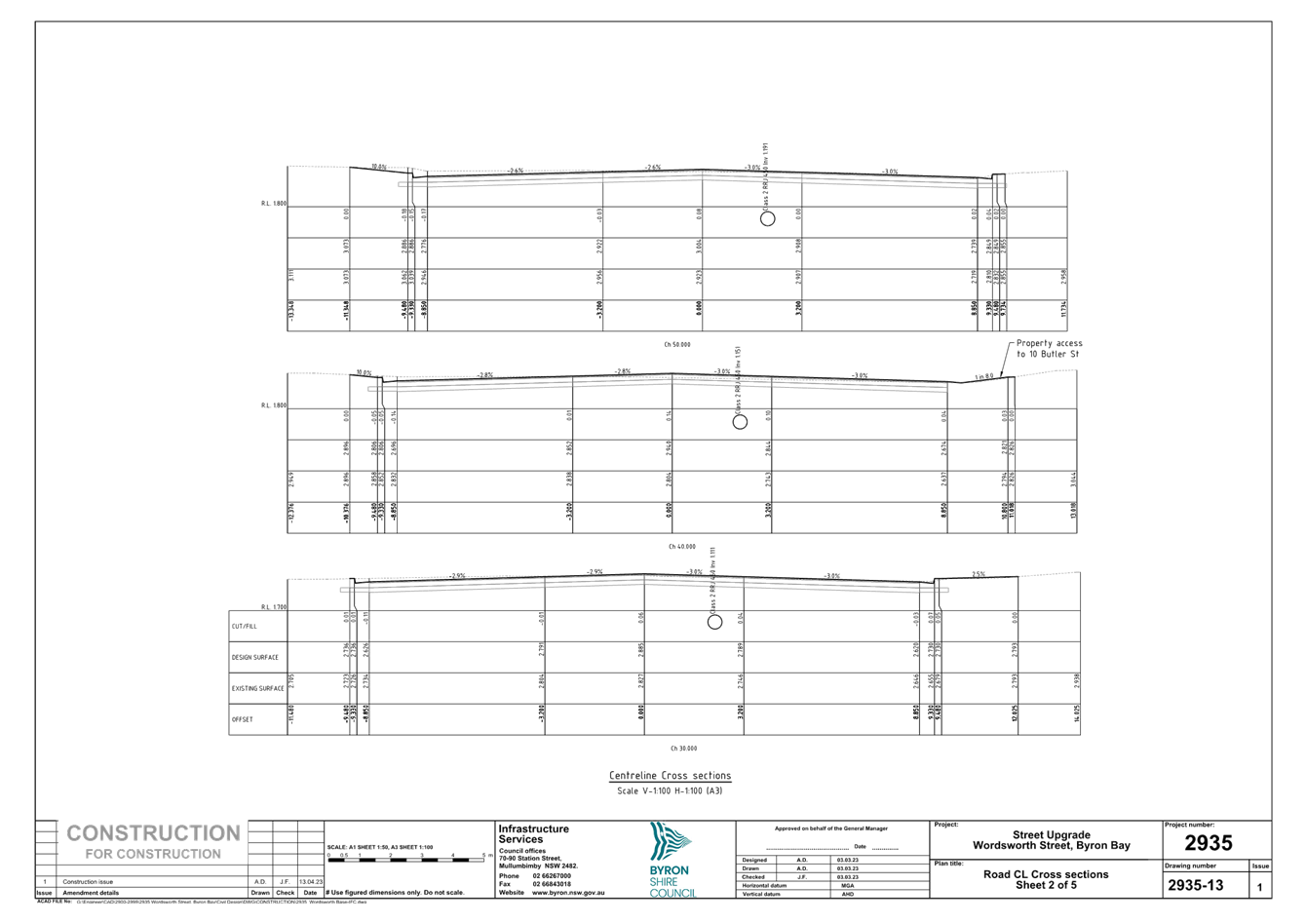
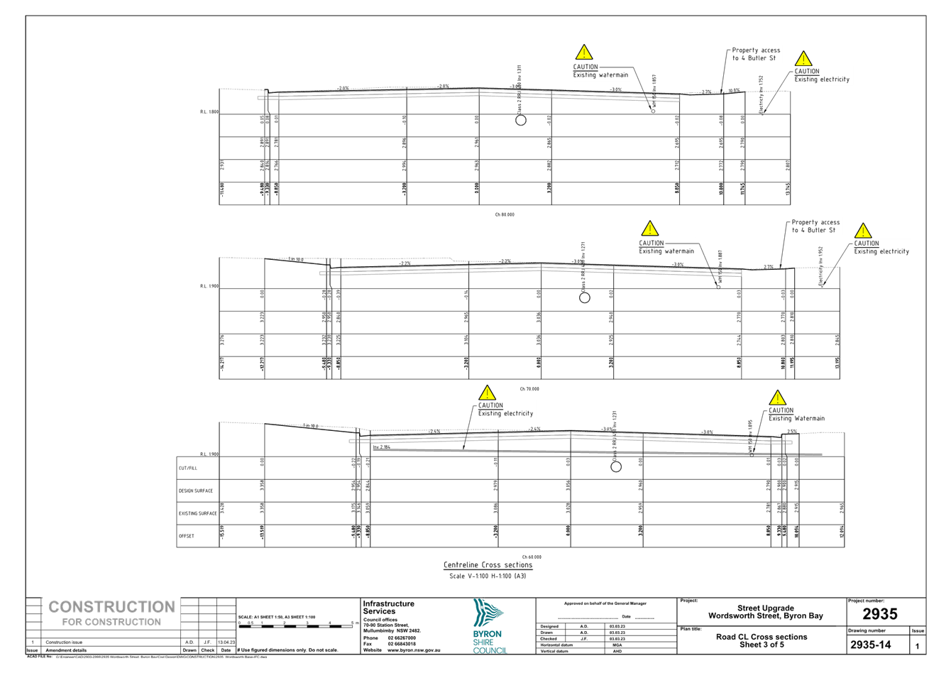
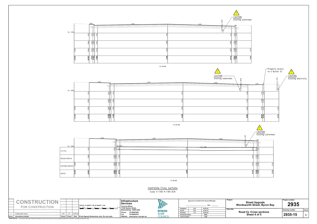
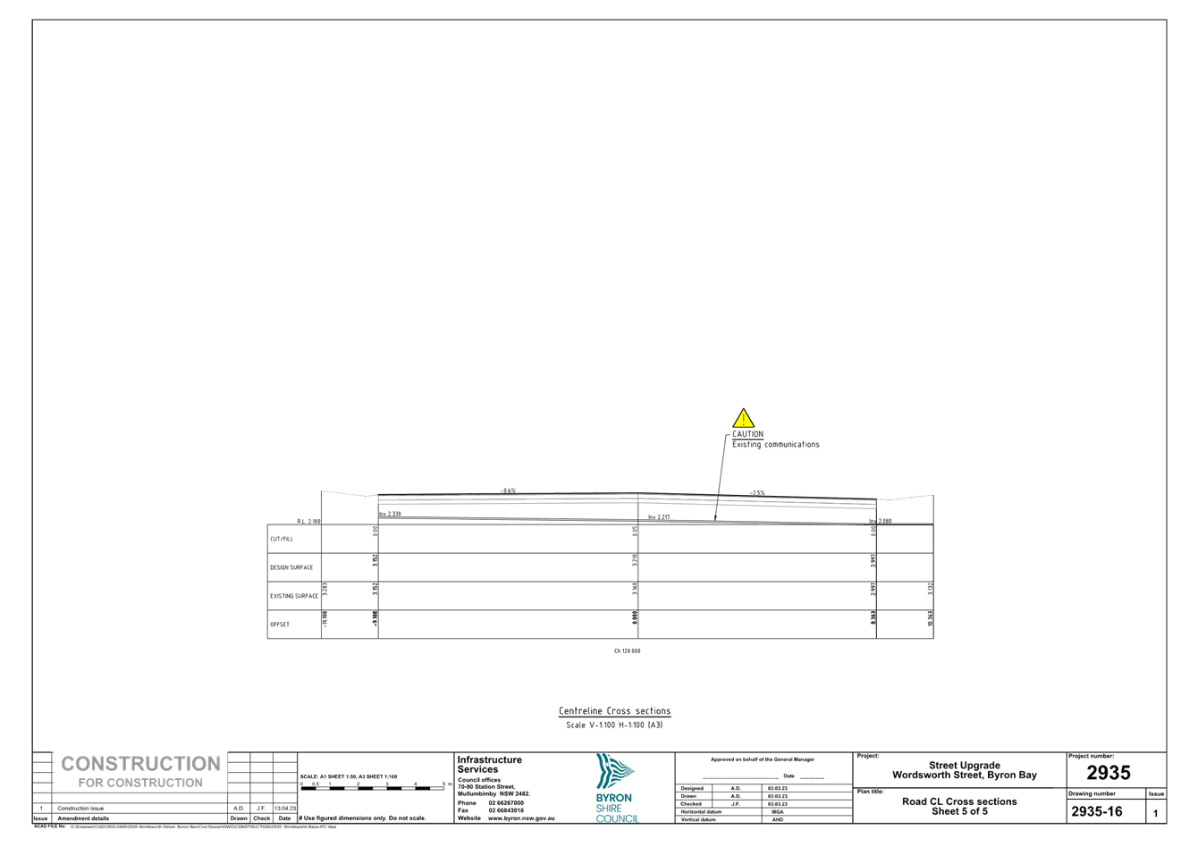
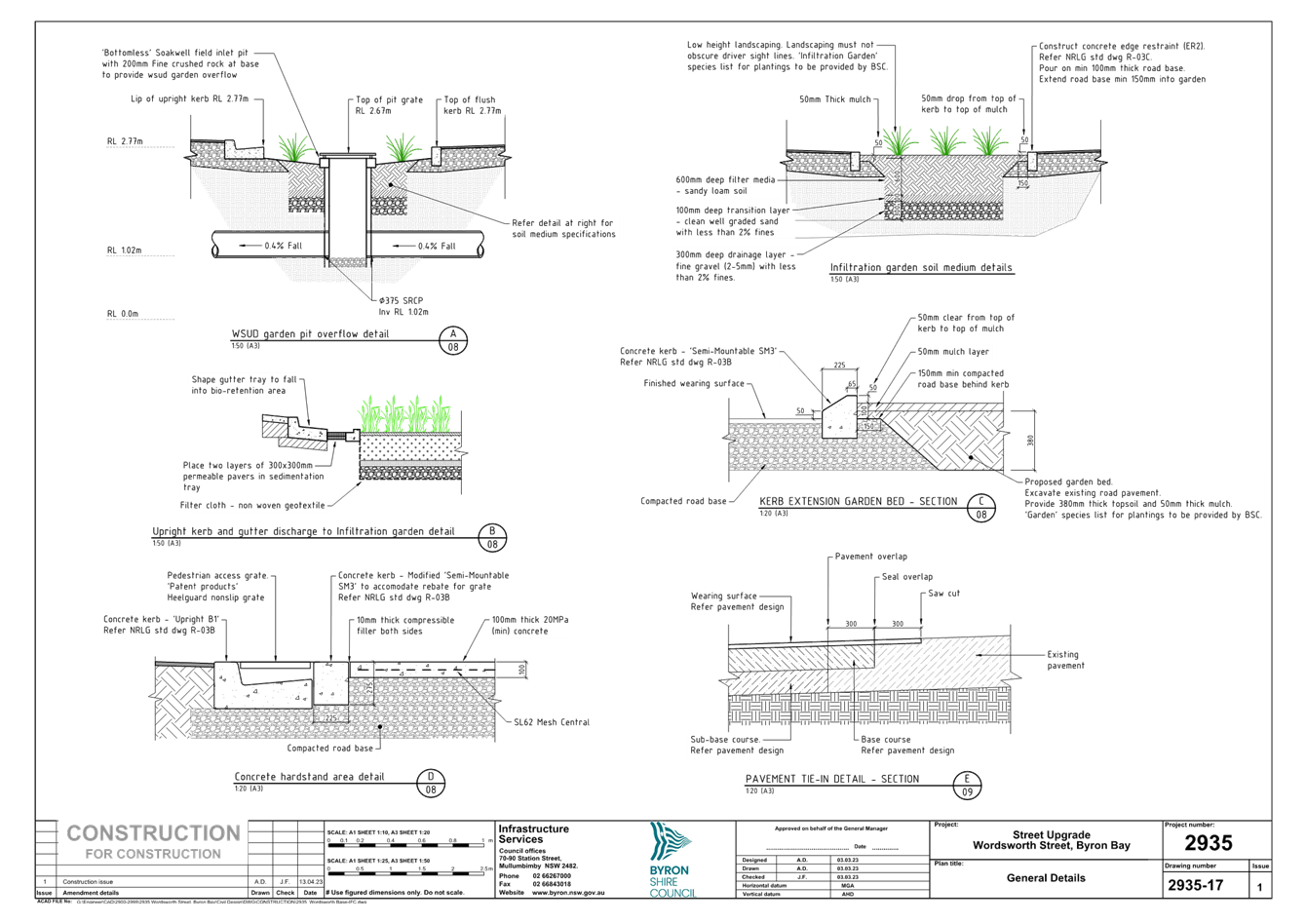
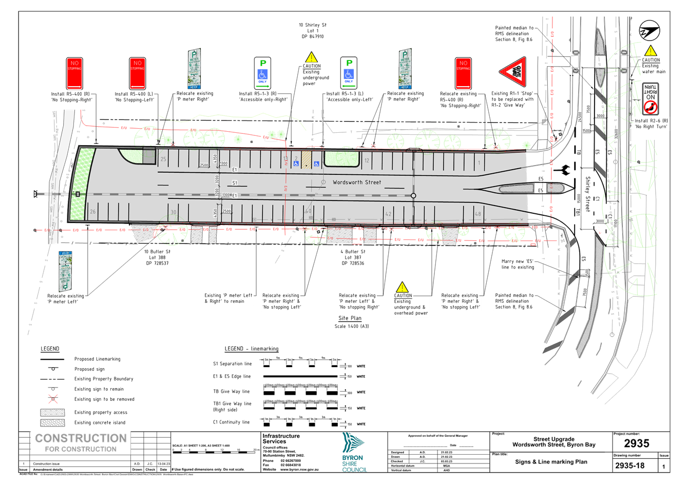
No. 6.4 Wordsworth Street / Shirley Street -
Parking and intersection upgrades.
File No: I2023/1071
Wordsworth Street is a short dead-end street that currently
provides access to the Byron Bay Police Station and a nursing home.
However, the nursing home also has secondary access off Butler Street.
Council plans to repair and upgrade Wordsworth Street. As part of these
works, Council will create additional car parking bays and modify the current
intersection arrangement at Shirley Street.
Traffic modelling (2033) has indicated that right turns
through the intersection of Shirley Street and Wordsworth Street will
experience significant delays in the future due to development.
Unfortunately, completely banning right turns from the intersection is not
recommended because the right-turn from Wordsworth Street would be redirected
to a U-turn downstream, which is not appropriate. Moreover, prohibiting
the right turn out of Wordsworth Street would interfere with police business.
To enhance safety at the intersection, the proposed design
eliminates the conflict of the right turn into Wordsworth Street from Shirley
Street by implementing a right-turn ban. This design also reduces delays
for the right-turn out by allowing one vehicle to wait in the centre median for
a two-stage right turn. Additionally, the design addresses sight distance
issues for the right turn from Wordsworth Street by removing the left turn
pocket on Butler Street (into Wordsworth Street) for westbound traffic.
Please note that the attached plans were the result of
Council seeking concurrence from TfNSW with respect to the intersection and the
plans were amended accordingly based on their advice.
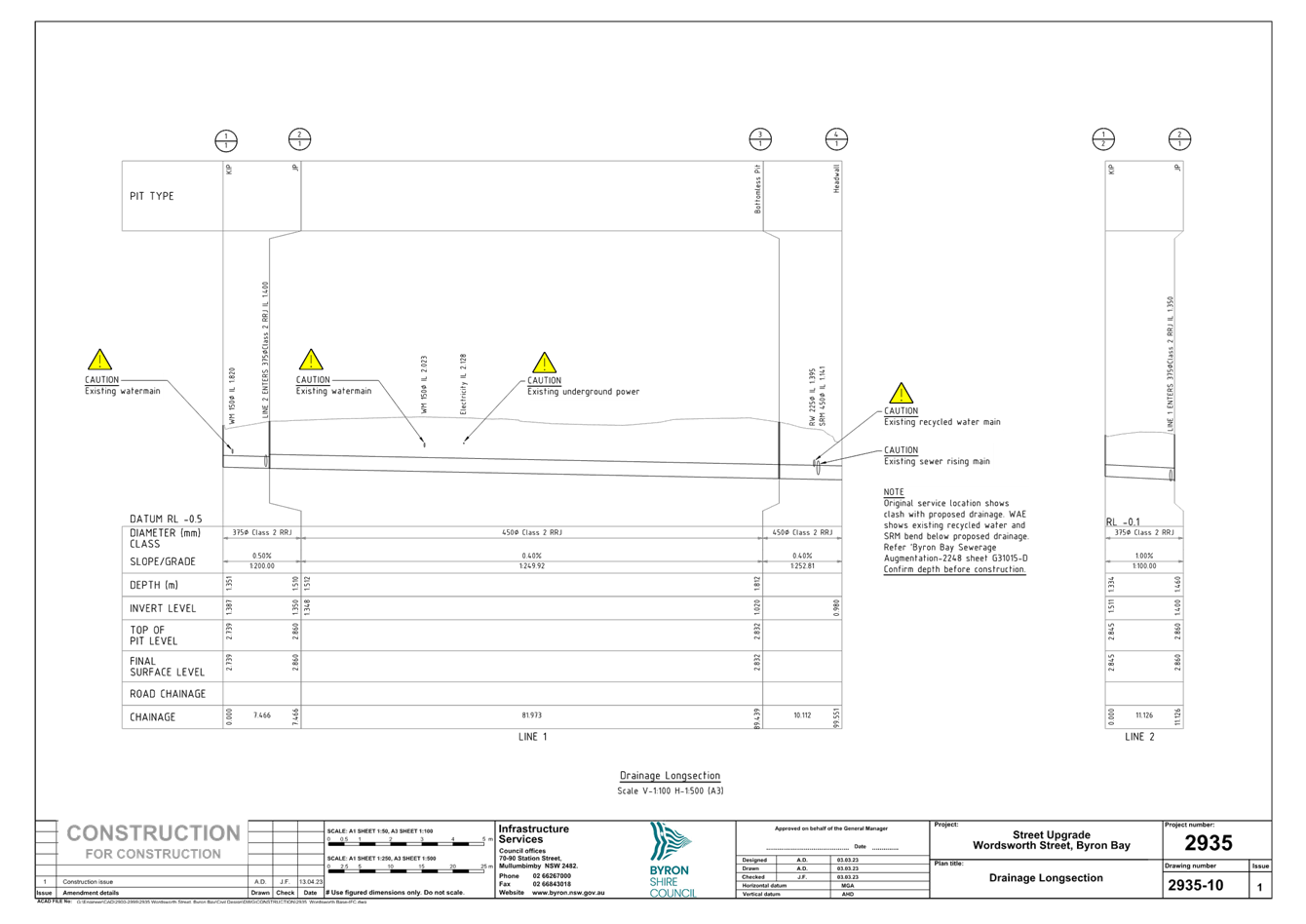
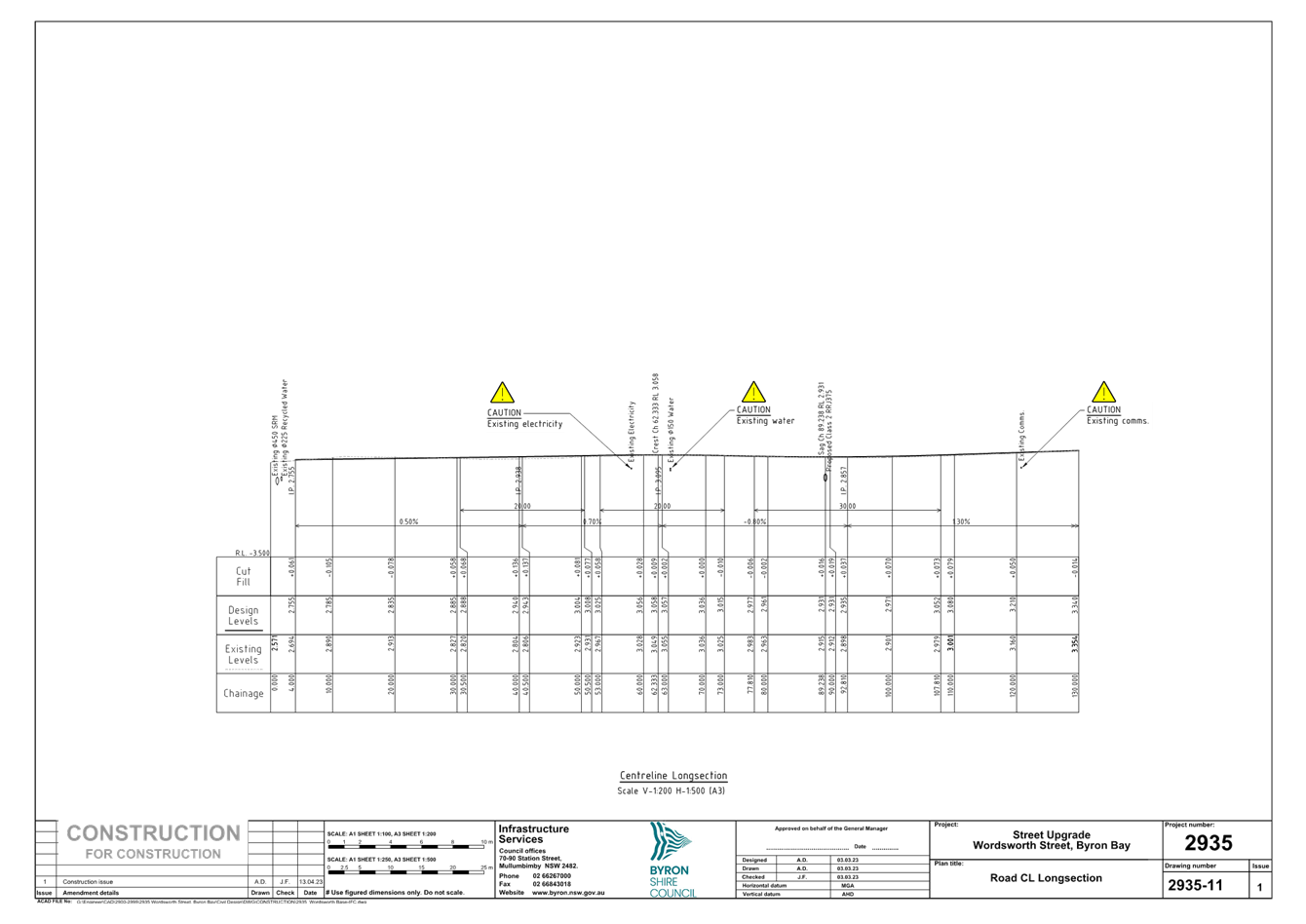
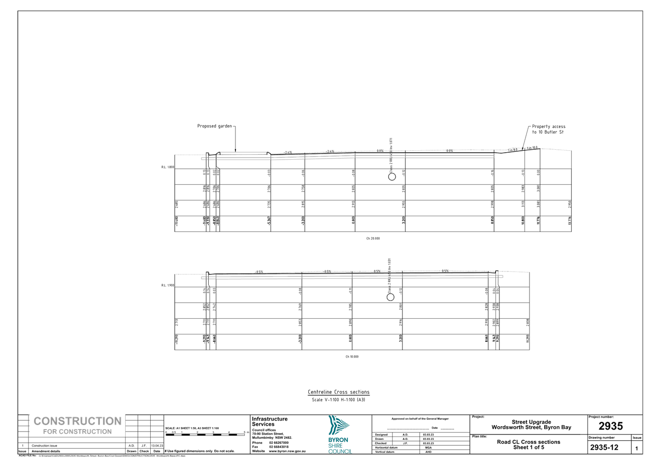
Please see attachment 1, Construction drawings Wordsworth
Street and Shirley Street (E2023/38317)
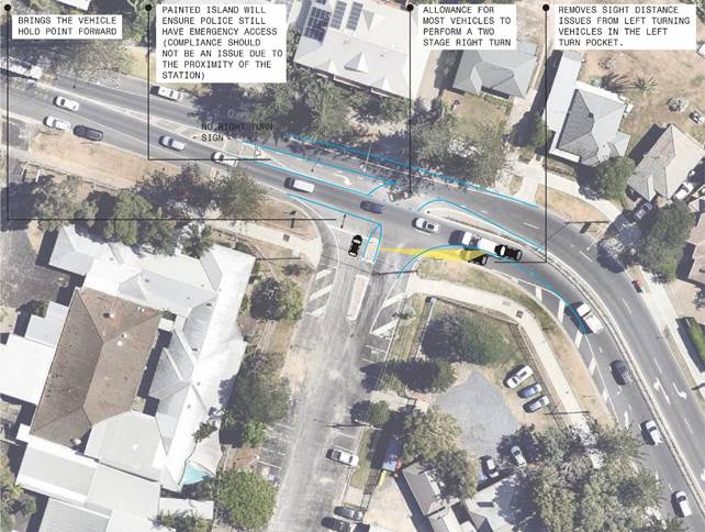
Figure 1: Design intent:
Intersection of Shirley Street at Wordsworth Street
RECOMMENDATION:
That the Local Traffic Committee endorse;
a) the
treatments at the intersection of Shirley Street to improve safety and capacity
b) the
updated parking restrictions within Wordsworth Street
Detailed plans for these improvements are shown in
attachment 1, Construction drawings Wordsworth Street and Shirley Street
(E2023/38317).
Attachments:
1 Construction
drawings Wordsworth Street and Shirley Street, E2023/38317 , page 35⇩

Regulatory
Matters 6.4 - Attachment 1