Notice of Meeting
Local Traffic Committee Meeting
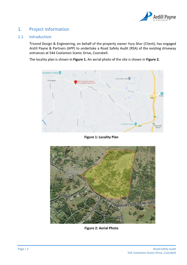
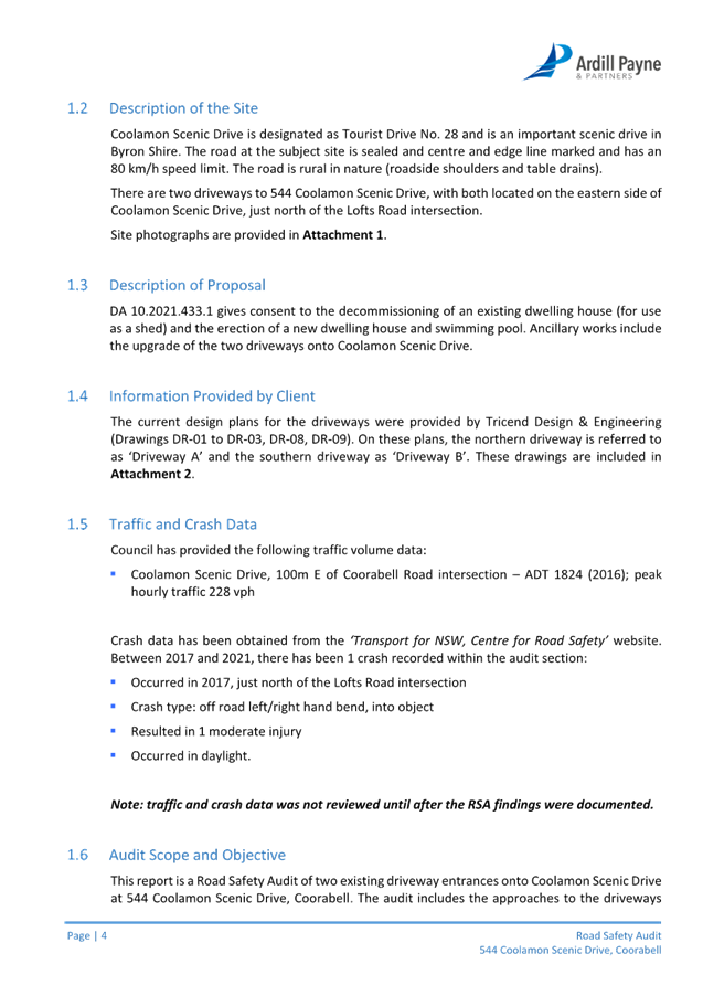
A Local Traffic Committee Meeting
of Byron Shire Council will be held as follows:
|
Venue
|
Conference Room, Station Street, Mullumbimby
|
|
Date
|
Tuesday, 15 August 2023
|
|
Time
|
9.00am
|
Phil Holloway
Director Infratructure
Services
I2023/1193
Distributed
11/08/23

Local Traffic Committee
Meeting
BUSINESS OF MEETING
1. Apologies
2. Declarations
of Interest – Pecuniary and Non-Pecuniary
3. Adoption
of Minutes from Previous Meetings
3.1 Local
Traffic Committee Meeting held on 13 June 2023
3.2 Extraordinary
Local Traffic Committee Meeting held on 21 July 2023
4. Matters
Arising
5. Outstanding
Issues/Resolutions
6. Regulatory Matters
6.1 Gilmore
Crescent, Byron Bay - Regulatory Signage, new carpark........................ 3
6.2 Bayshore
Drive - Parking Signage Exception For Permit Holders......................... 6
6.3 544
Coolamon Scenic Drive - Regulatory Signage & Line Marking for upgrade
driveway crossovers - Road Safety Audit.................................................................. 8
6.4 No
Parking Area - Booyun Street, Car Park (CWA and Brunswick Heads Public School)........................................................................................................................... 61
6.5 Proposed
BAR type intersection on Bangalow Road............................................. 63
6.6 South
Beach Road, Parking Area............................................................................. 69
7. Matters for Traffic
Engineering Advice
7.1 Road
Safety Improvements to Warrambool Road and Coomburra Crescent Intersection
Ocean Shores......................................................................................... 73
Local Traffic Committee Meeting 6.1
Regulatory Matters
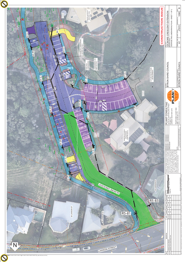
Report No. 6.1 Gilmore Crescent, Byron Bay - Regulatory Signage, new
carpark.
File No: I2023/907
The purpose of this report is to gain endorsement for the
implementation of parking restrictions within Gilmore Crescent.
Gilmore Crescent has recently been upgraded and extended to
cater for Byron Bay’s new skate park.
As part of these upgrades additional parking bays have been
provided. All parking in the surrounding area is restricted, to ensure
parking equity for the greater community and to prevent nuisance camping.
Council staff are proposing the restrictions contained within the plan in
attachment 1 (E2023/58247).
RECOMMENDATION:
That the Local Traffic Committee endorse the
proposed parking restrictions within Gilmore Crescent, Byron Bay as per
attachment 1 (E2023/58247)
Attachments:
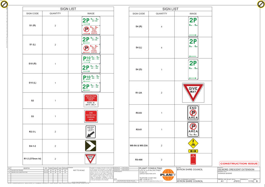
1 Signage
Plans_Gilmore Cres, E2023/58247 , page 4⇩ 
Regulatory
Matters 6.1 - Attachment 1
Local Traffic Committee Meeting 6.2
Report
No. 6.2 Bayshore Drive - Parking Signage Exception
For Permit Holders.
File No: I2023/909
The purpose for this report is to gain support for an
internal exception inside an approved No Parking Area (as per plan
below). The purpose of the current No Parking Area (1am – 6am) was
to prevent nuisance campers, however there are residents within the Parking
Area which require the use of a section of the kerb space for overnight parking.
The exception will be for residents who have a parking area permit.
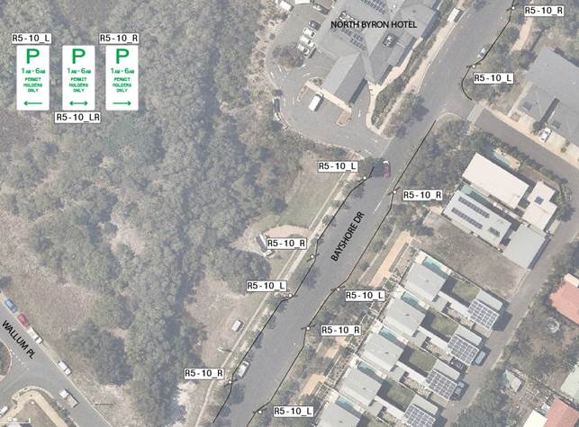
RECOMMENDATION:
That the Local Traffic Committee endorse the
permit holder exception from 1am – 6am on Bayshore Drive, between Wallum
Place and the railway tracks to the north.
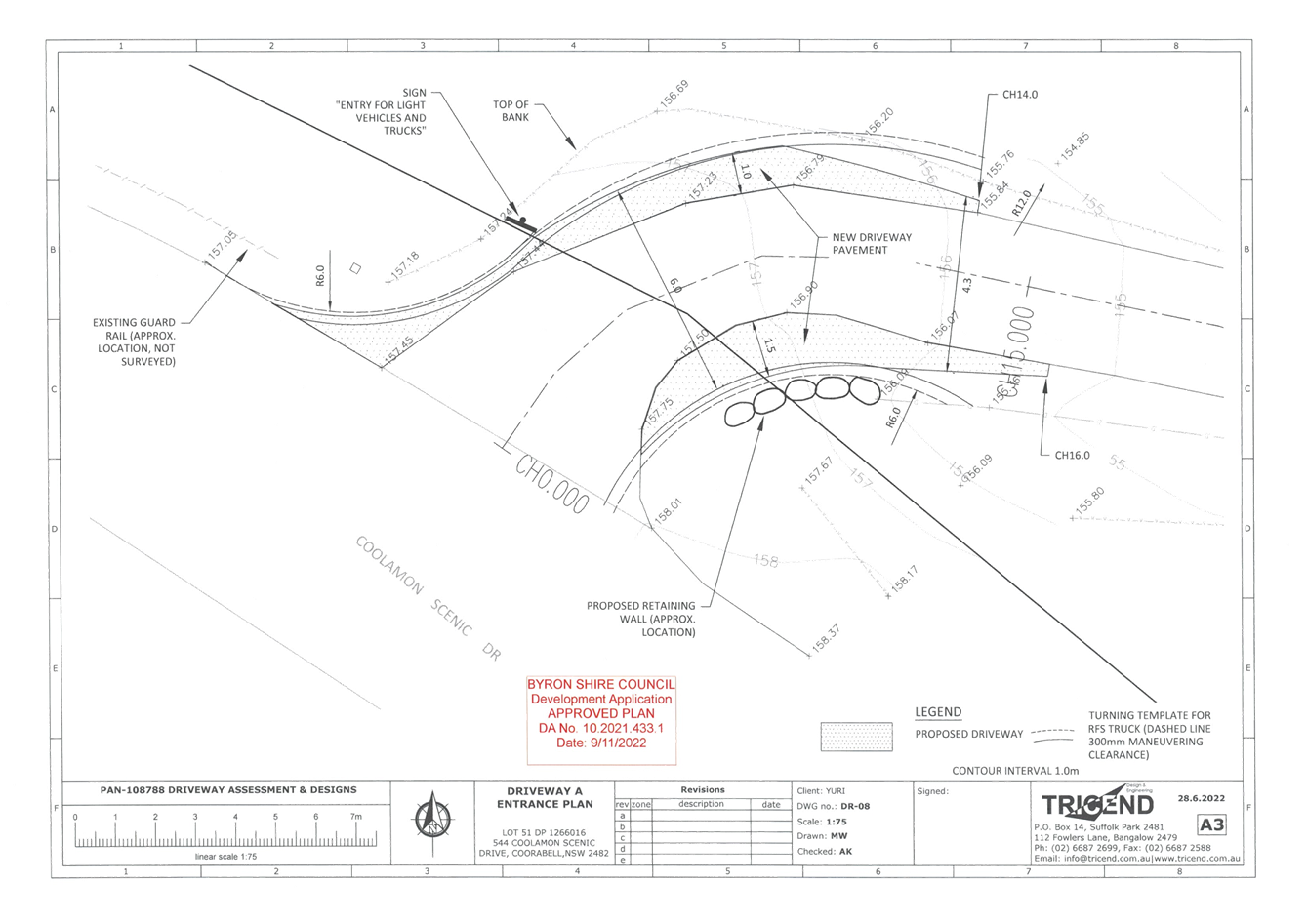
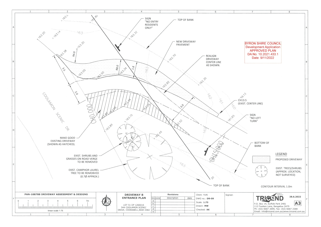
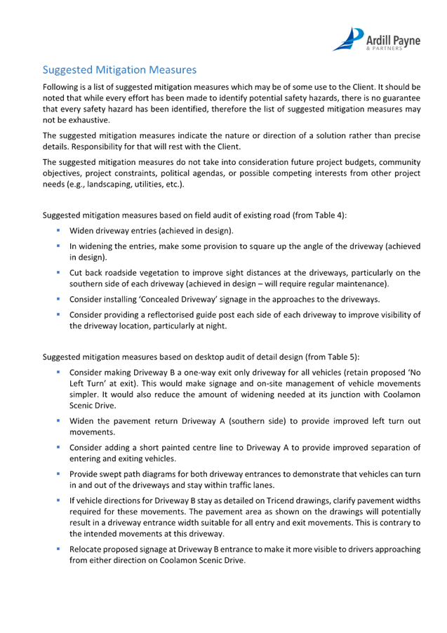
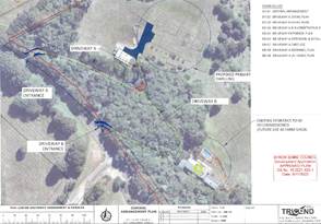
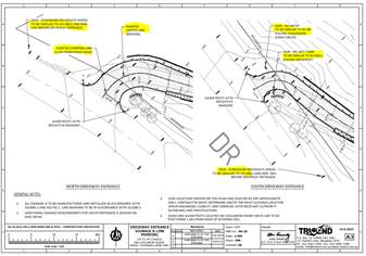
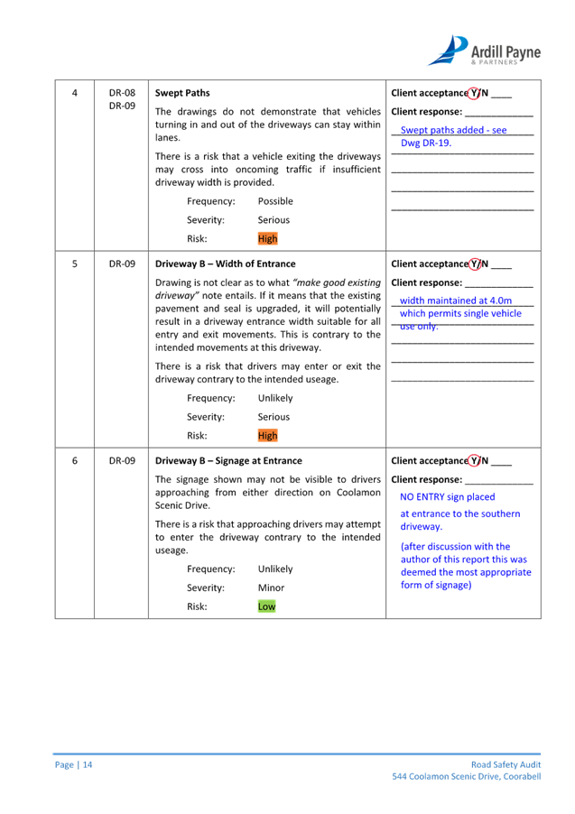
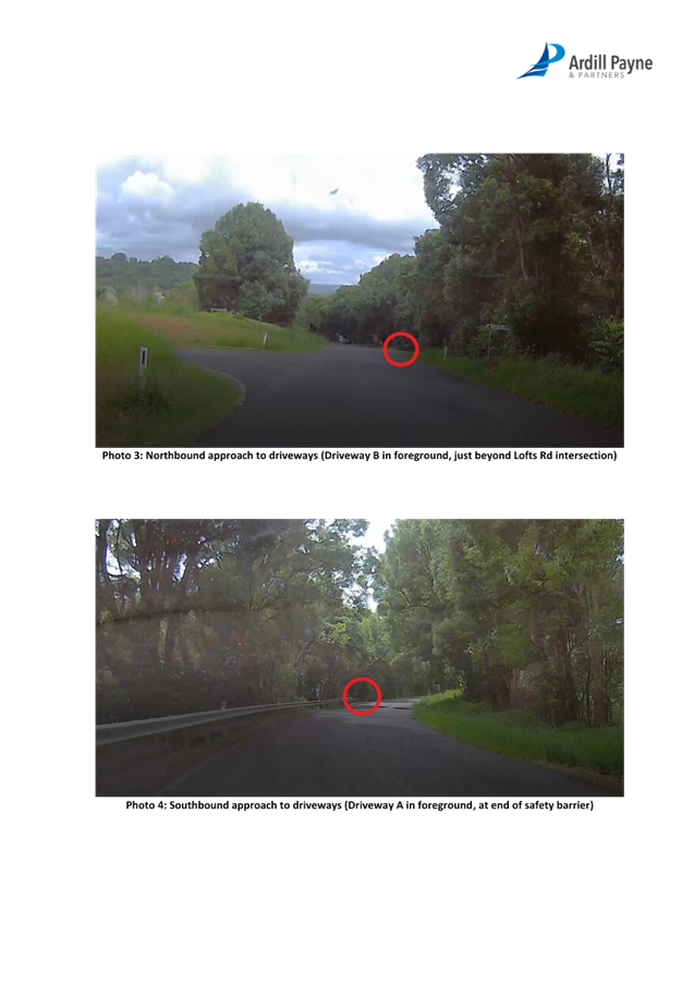
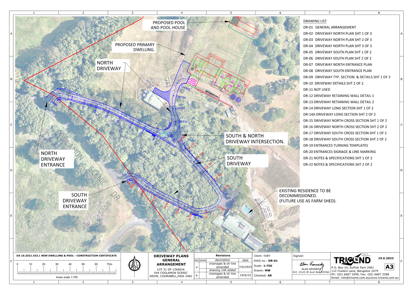
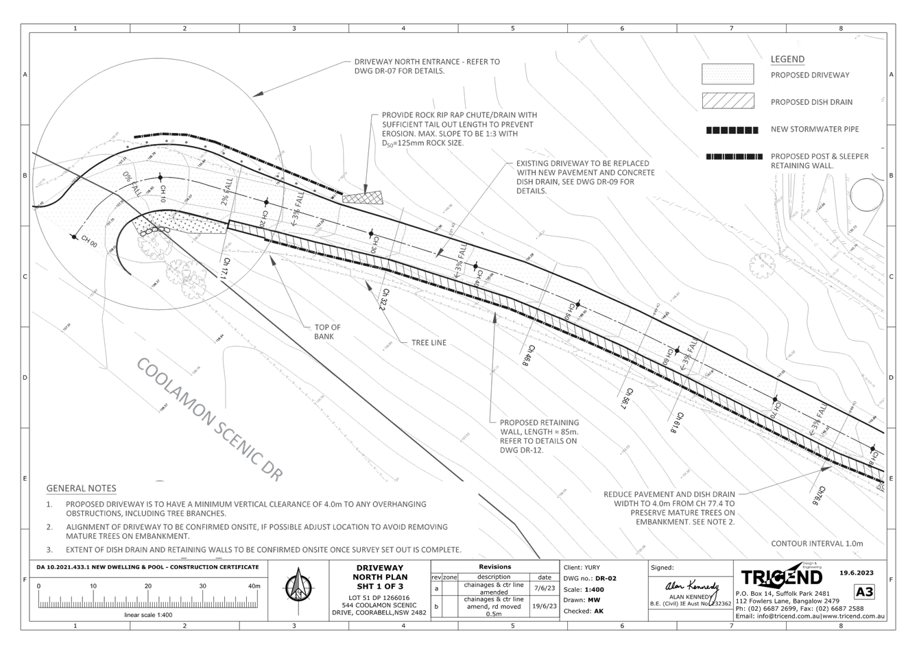
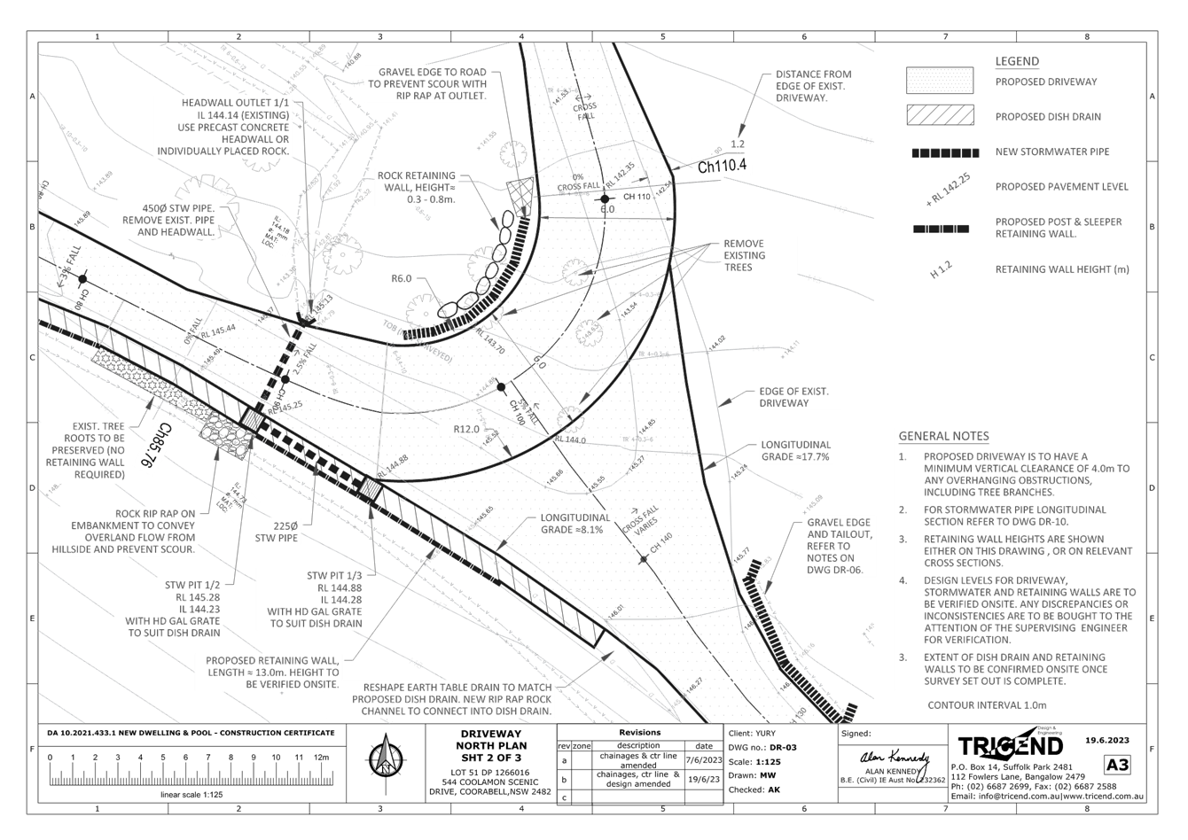
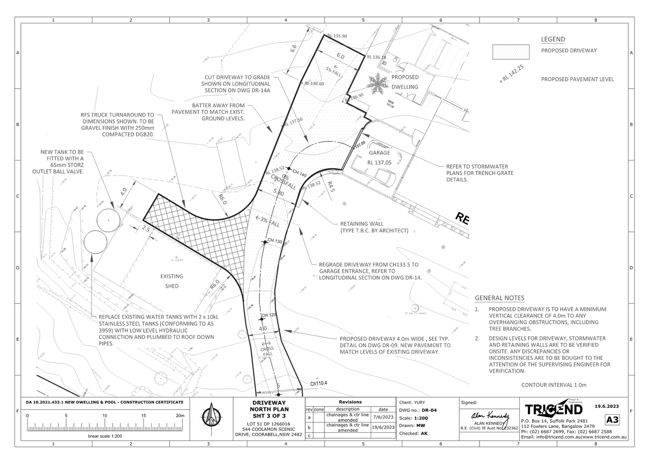
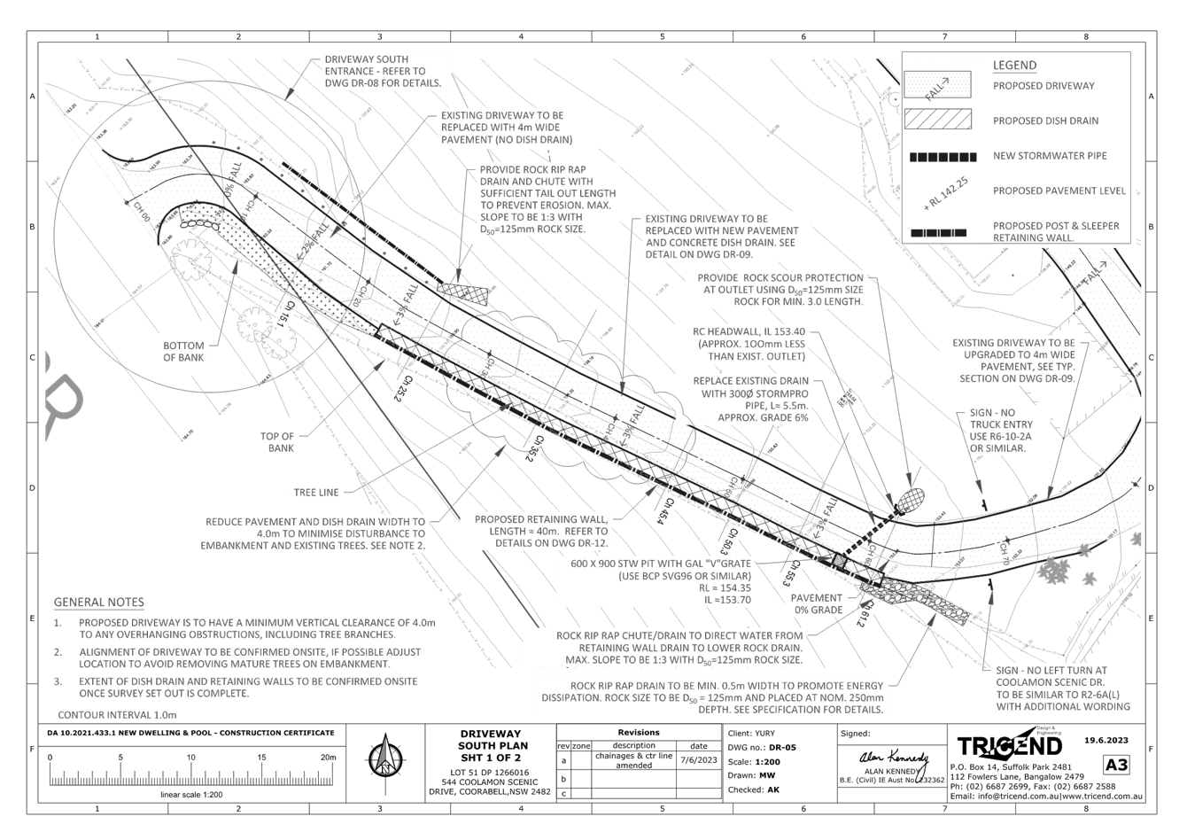
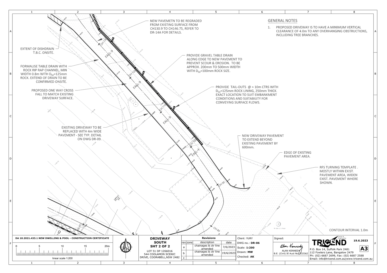
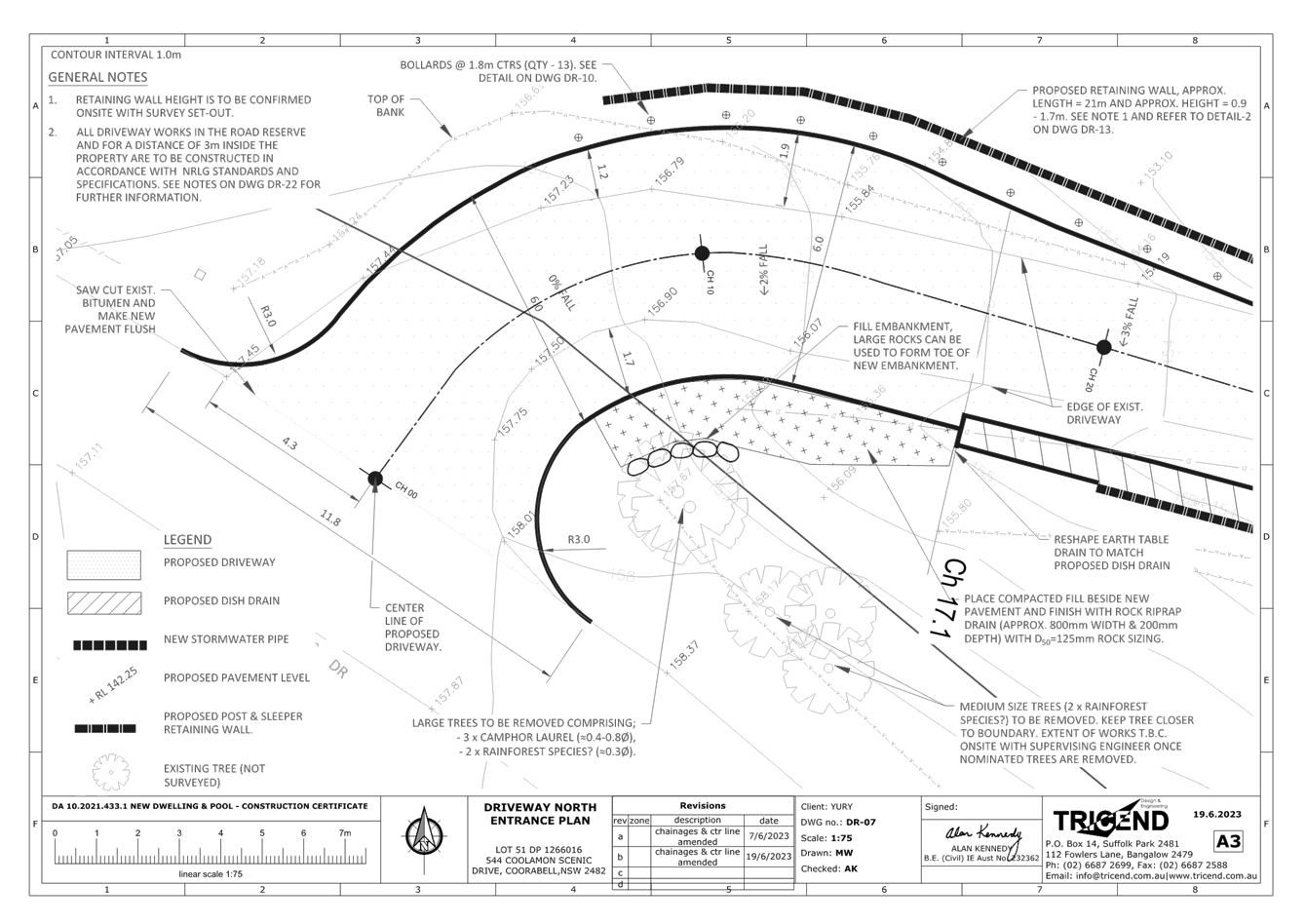
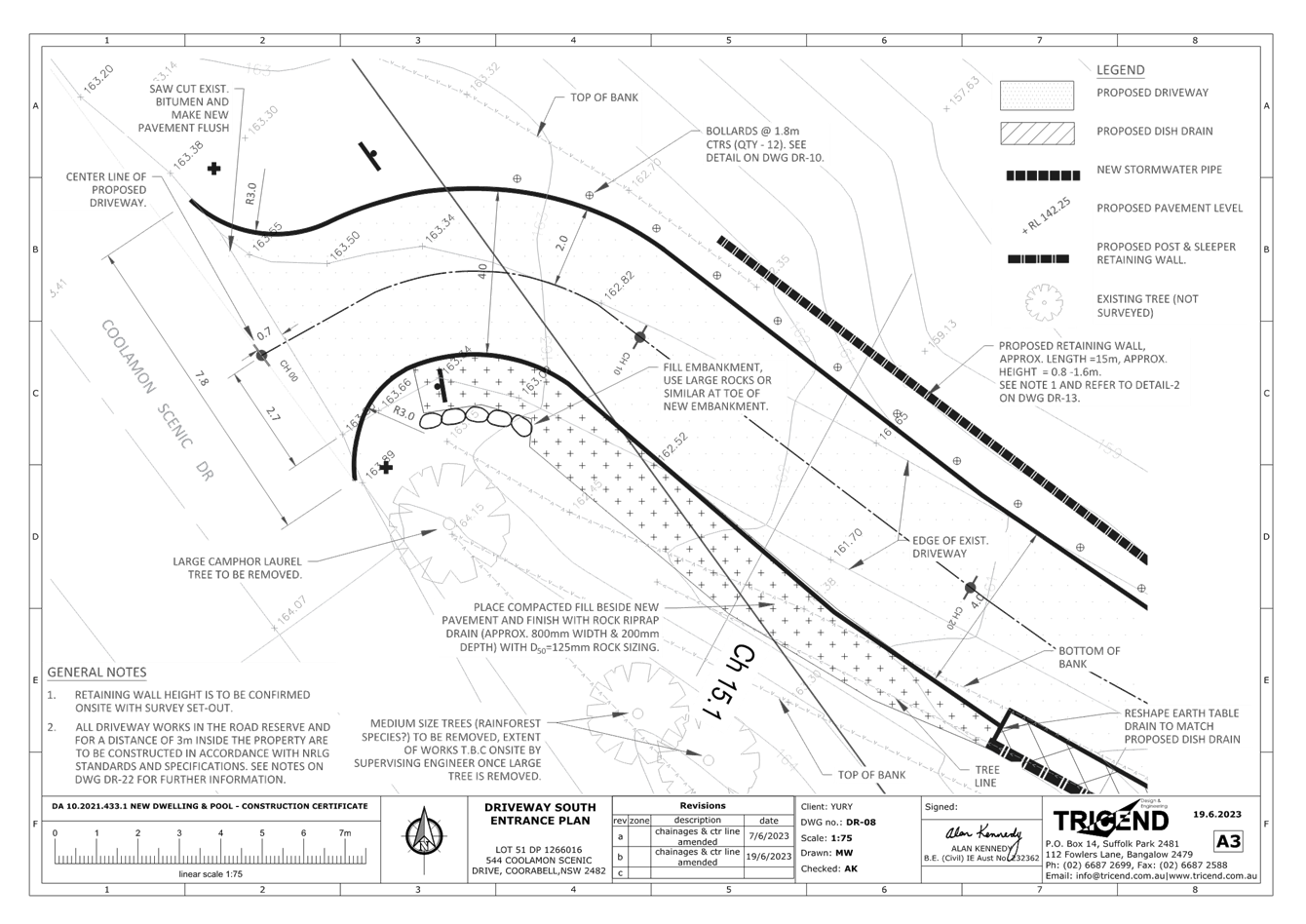
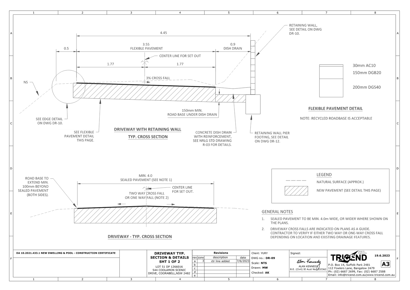
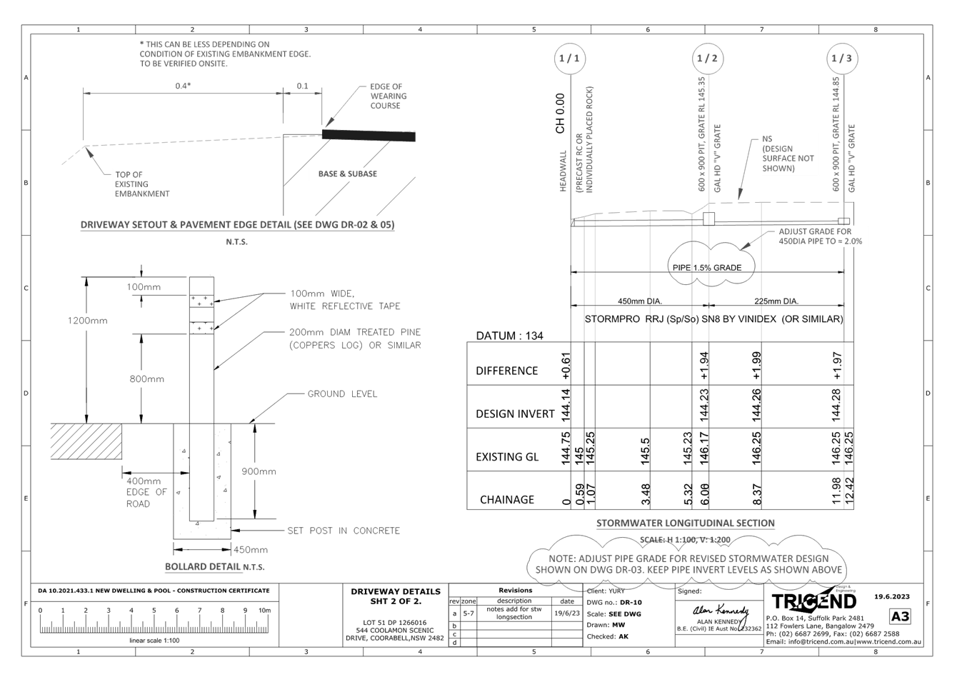
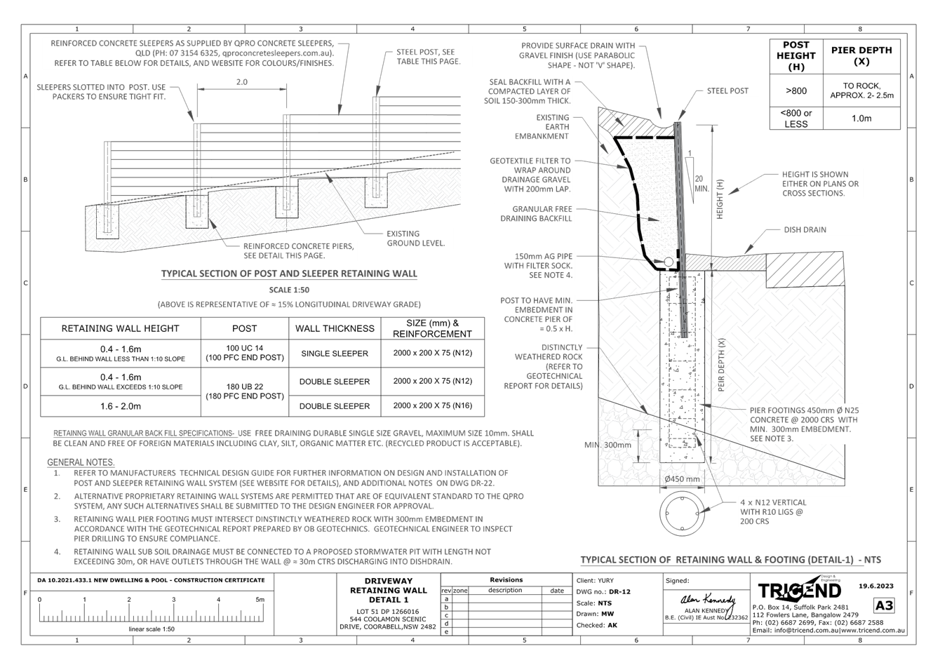
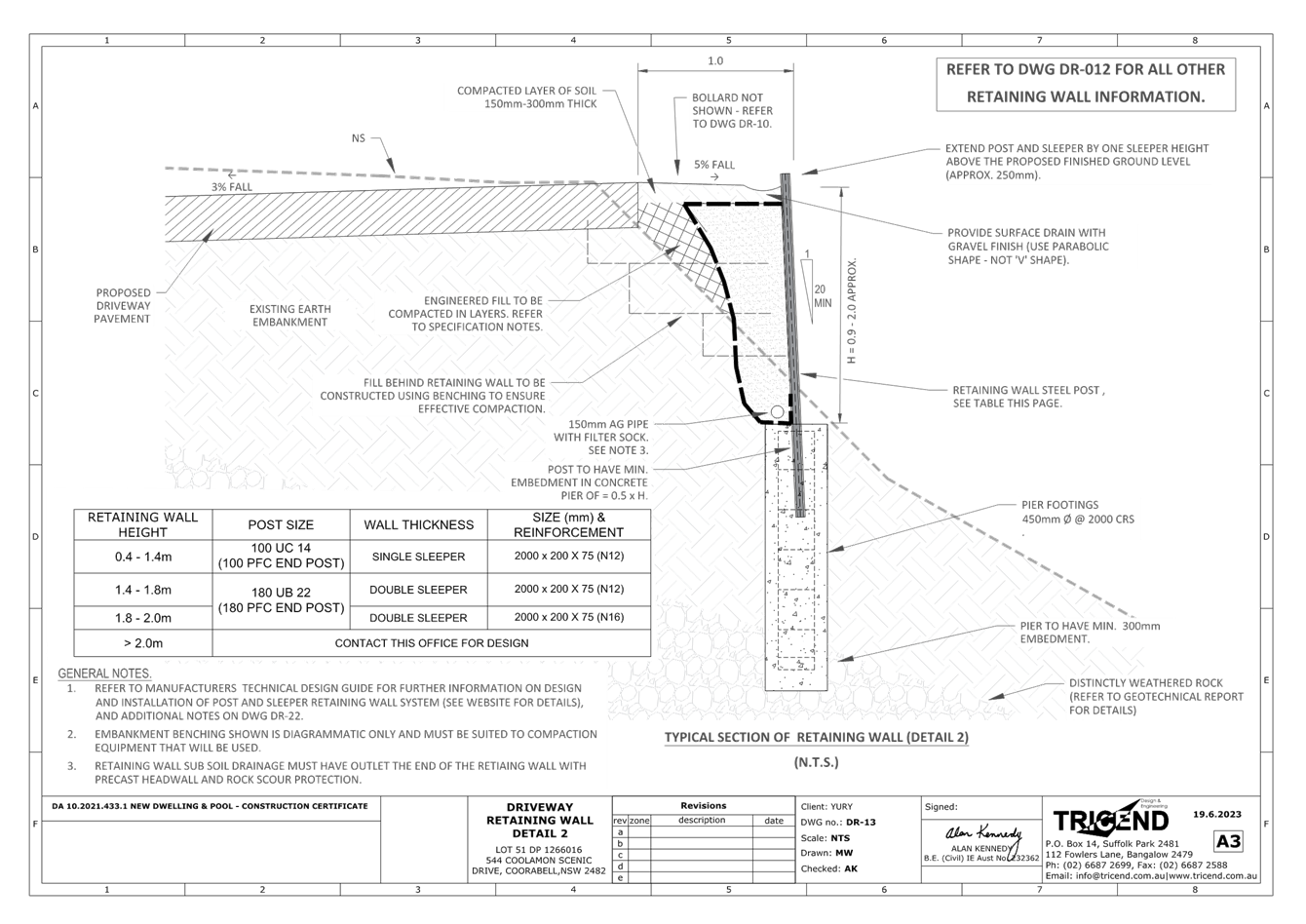
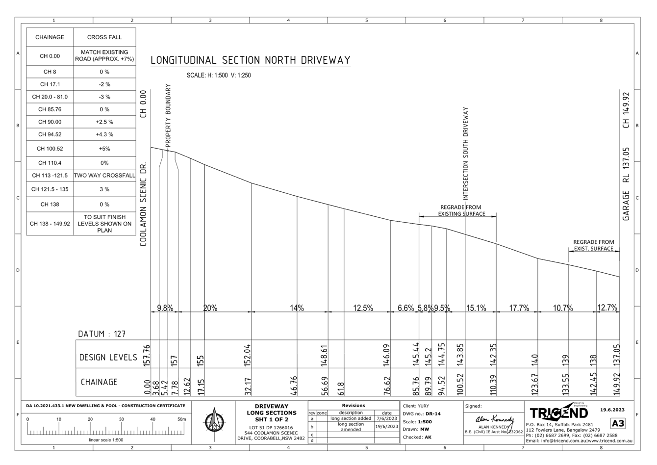
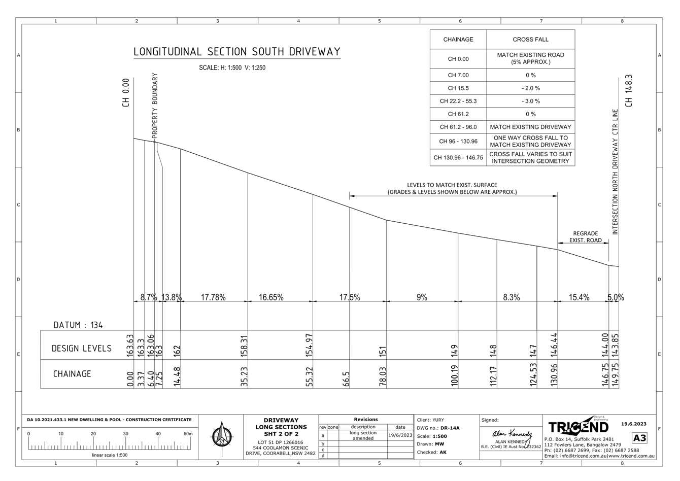
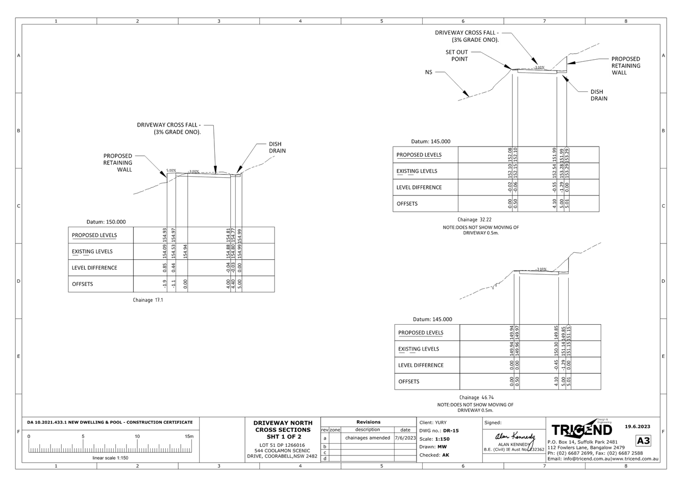
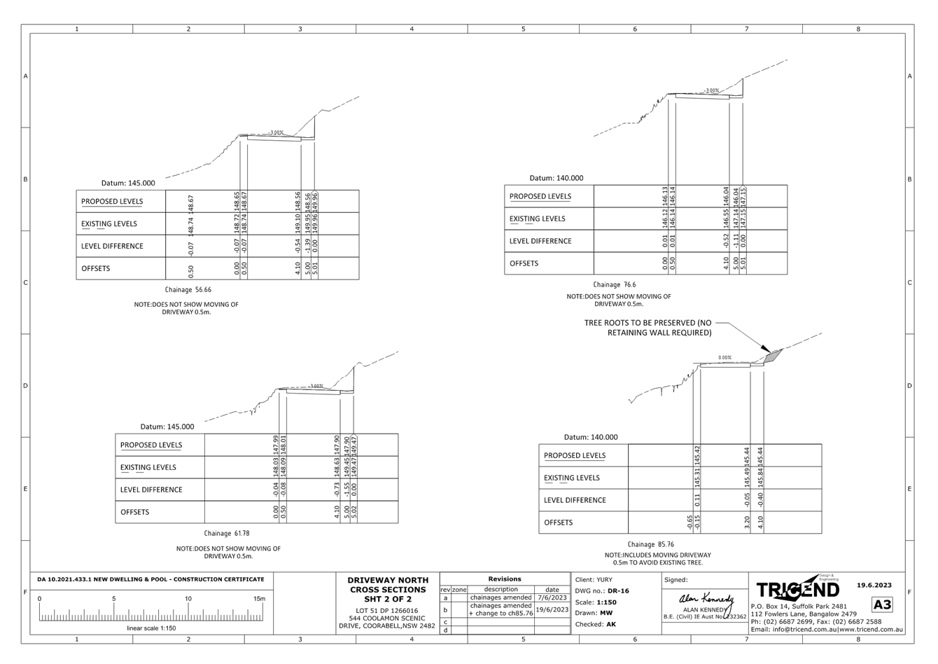
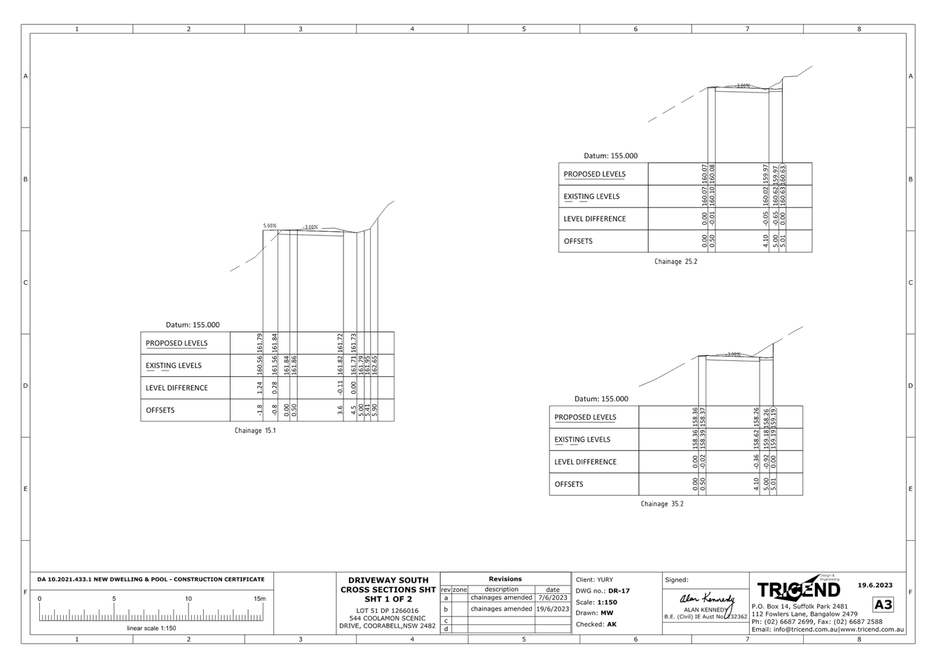
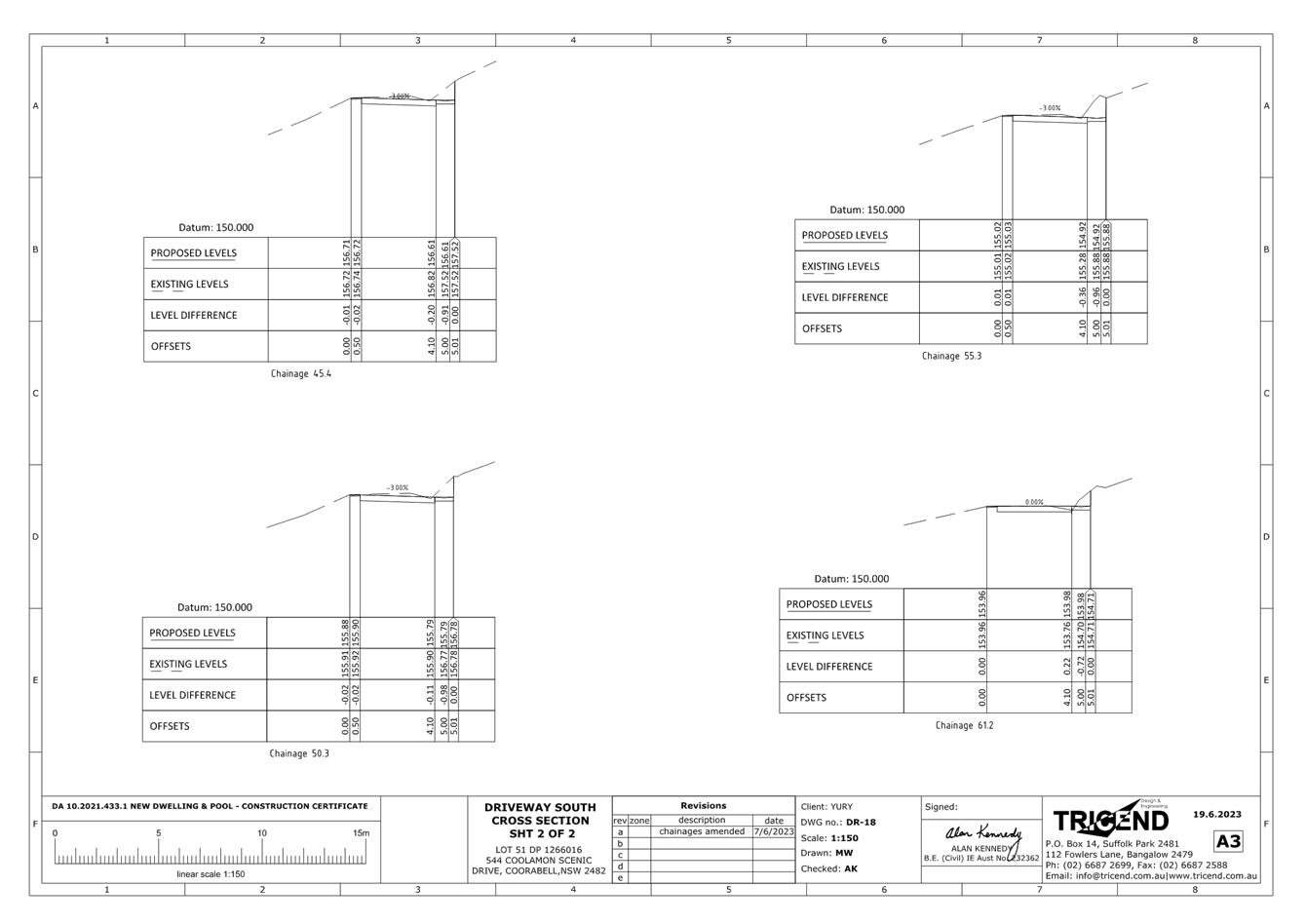
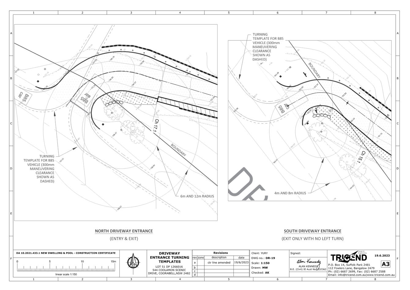
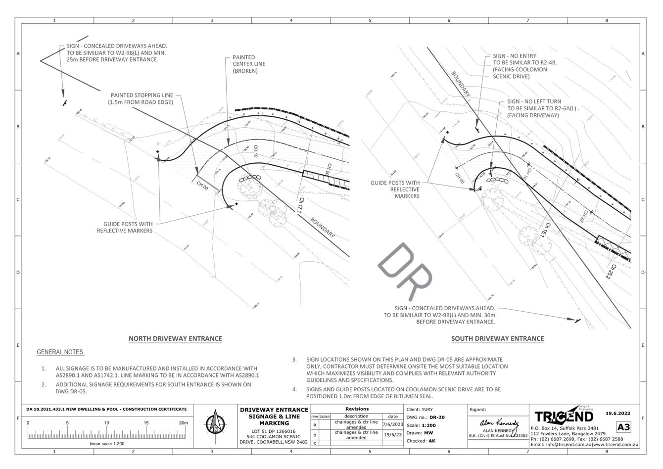
Local Traffic Committee Meeting 6.3
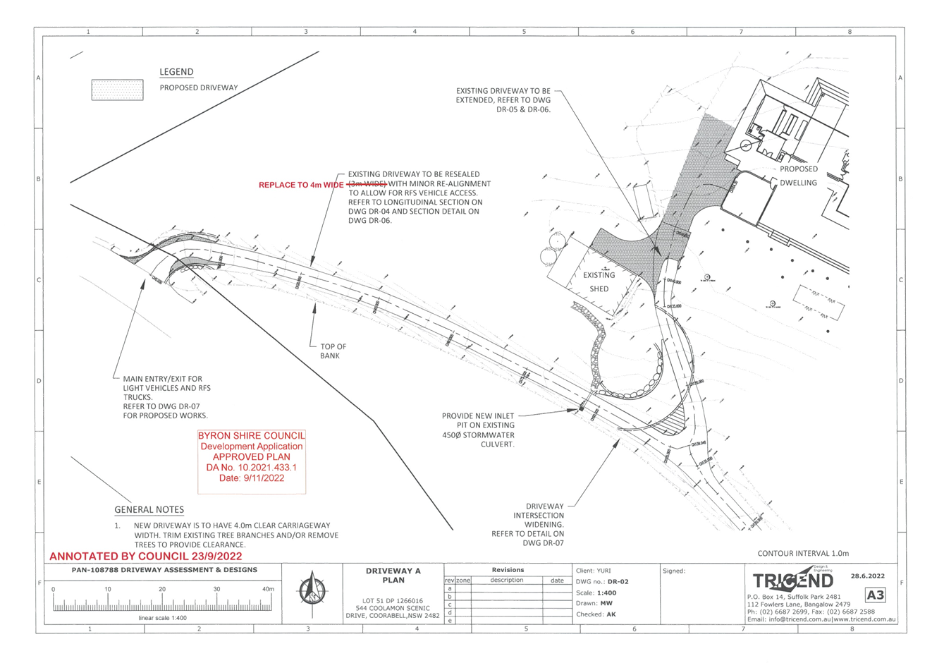
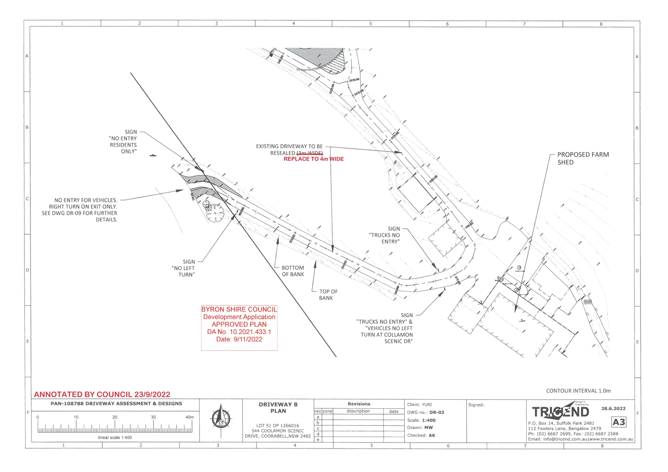
Report
No. 6.3 544 Coolamon Scenic Drive - Regulatory
Signage & Line Marking for upgrade driveway crossovers - Road Safety Audit
File No: I2023/1125
The purpose of this report is to
gain endorsement for the implementation of Regulatory Signage and new line
marking within Coolamon Scenic Drive, Coorabell road reserve for the purpose of
upgrading existing driveways associated with Development Consent Approval
10.2021.0433.1 and Roads Act Application 51.2021.433.1.
The regulatory signage and new
line marking is as a result of Road Safety Audit undertaken by the developers
Level 3 accredited consultant.
Audit in attachment 1
(E2023/63903)
Plans in attachment 2
(E2023/63902)
The proposed works involves the
upgrading of 2 existing driveways, The Road Safety Audit has identified that
the southern driveway is to be an exit only driveway with regulatory signage to
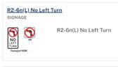
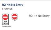
enforce this recommendation. The regulatory signage consists of:
· No Left Turn – facing vehicles heading south along
Coolamon Scenic Drive, identifying no access into the private property.
· No Entry – facing vehicles parallel to the property
boundary.
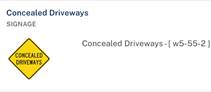
Note: Concealed driveway signage
is not a regulated sign.
The line marking proposed consists
of a painted stopping line and a driveway centre line to the northern driveway
to ensure vehicles exiting the property driveway do not spill onto the active
traffic lane of Coolamon Scenic Drive and the centre line is keep vehicles
exiting the driveway to the left of the driveway.
The works also include Traffic
Guidance Schemes certified by suitably accredited person.
RECOMMENDATION:
That the Local Traffic
Committee endorse the proposed regulatory signage and line marking within Coolamon Scenic Drive, Coorabell as per attachment 1 (#E2023/63902).
Attachments:
1 51.2021.433.1
- Amended Road Safety Audit Report 21 Jun 23_RA-2023-4629, E2023/63903 , page 10⇩ 
2 51.2021.433.1
- Updated Driveway Plans_19 Jun 23_RA-2023-4629, E2023/63902 , page 38⇩
Regulatory
Matters 6.3 - Attachment 1


Regulatory
Matters 6.3 - Attachment 2
Local Traffic Committee Meeting 6.5
Report
No. 6.4 No Parking Area - Booyun Street, Car Park
(CWA and Brunswick Heads Public School)
File No: I2023/1139
The purpose for this report is to obtain LTC endorsement for
No Parking restrictions to mitigate nuisance camping within the carparking area
on Booyun Street, adjacent the CWA and Brunswick Heads Public School.
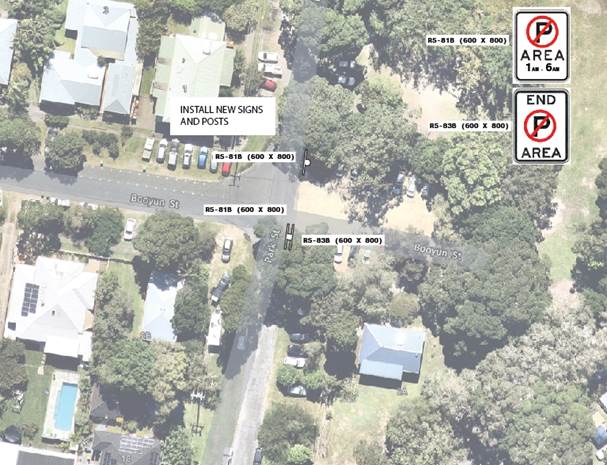
Figure 1:
Signage installation Plan
RECOMMENDATION:
That the Local Traffic Committee supports the No
Parking restrictions shown in figure 1, contained within this report.
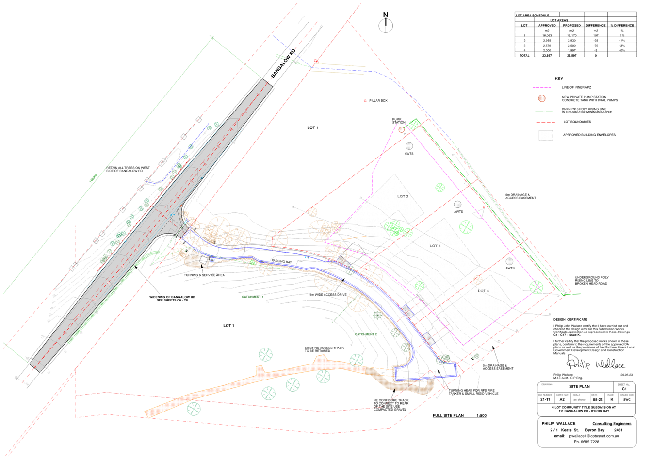
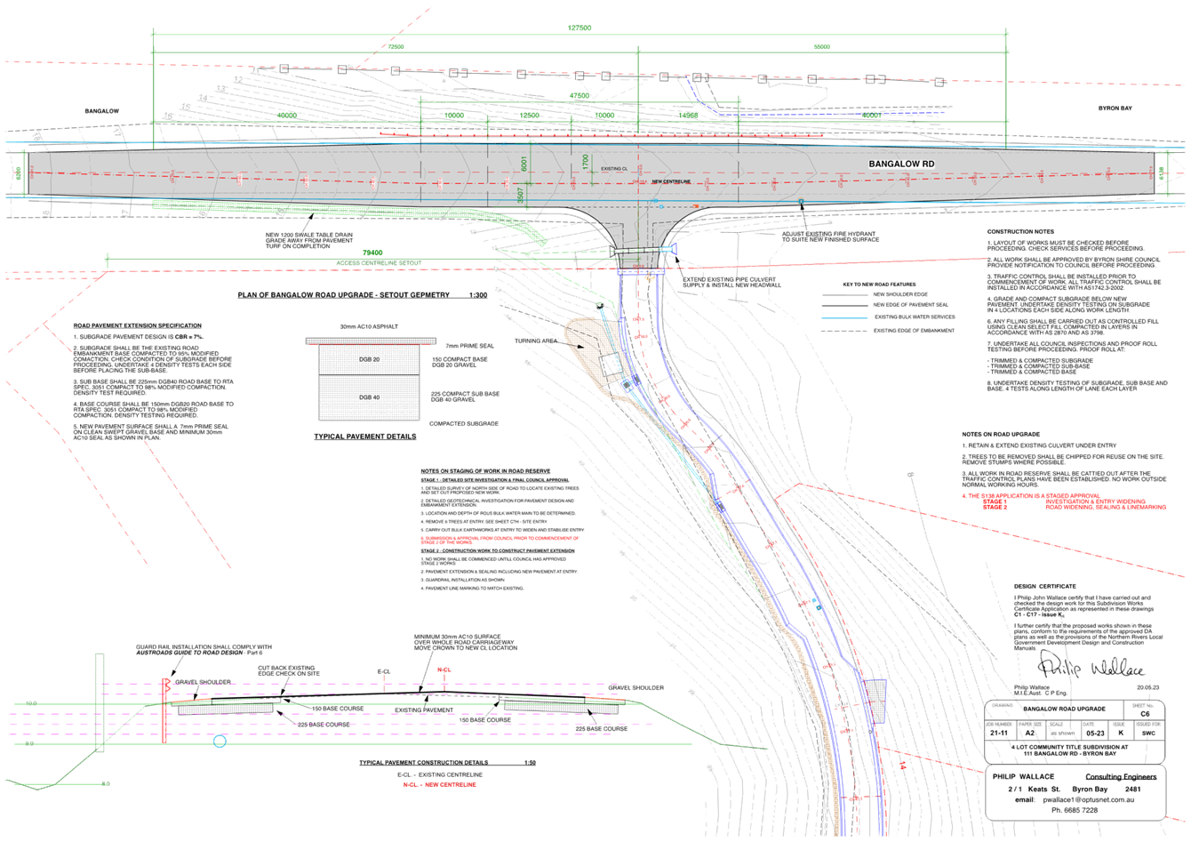
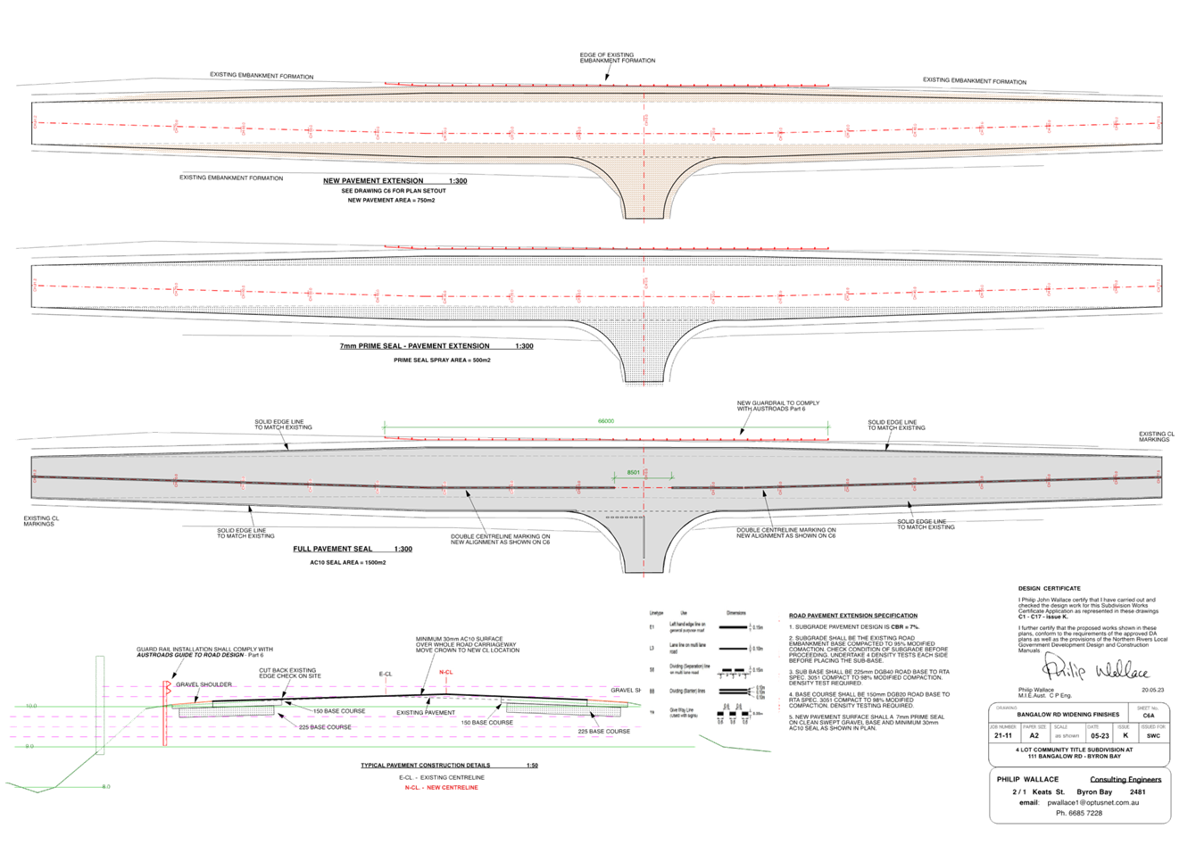
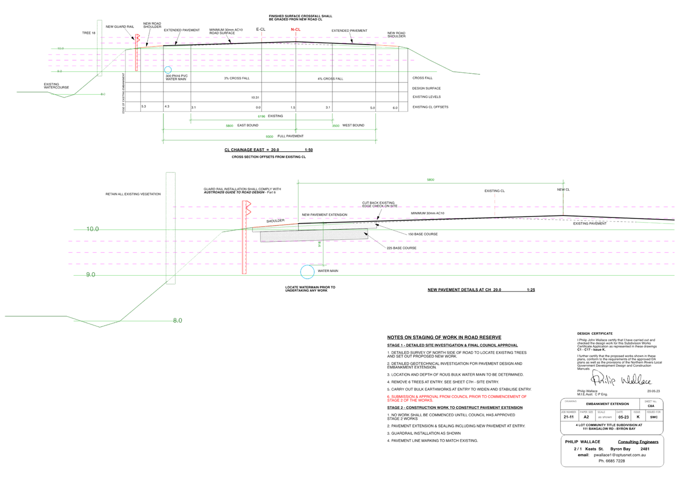
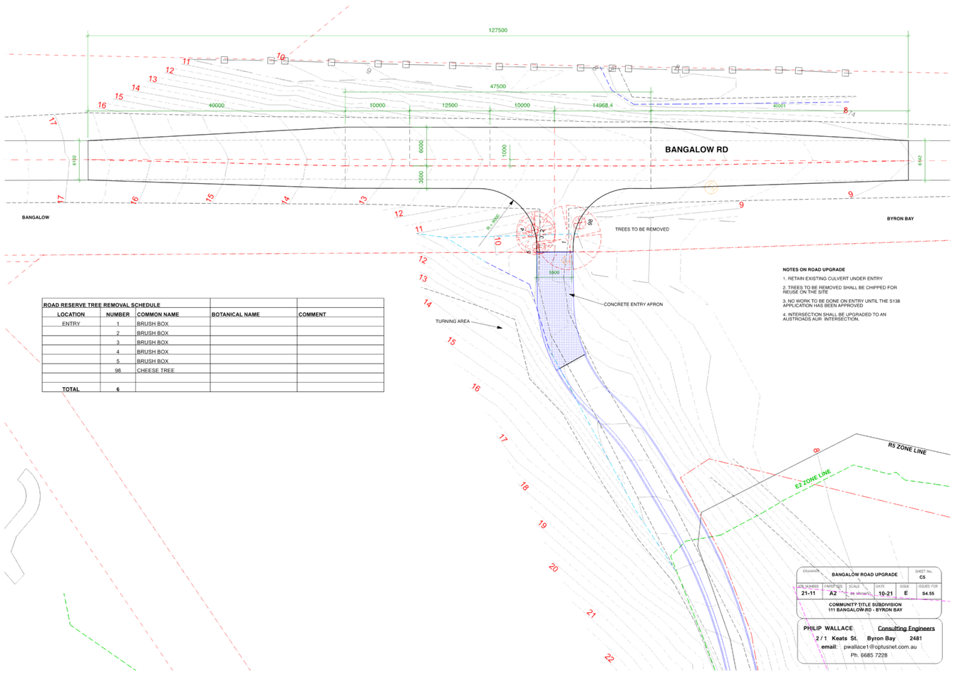
Report No. 6.5 Proposed BAR type intersection on Bangalow
Road
File No: I2023/1188
The purpose of this report is to
gain Council support for the proposed line markings shown in Attachment 1 (E2023/81016).
Council has received a Roads Act
application associated with a development approval for a Subdivision (Community
Title) to create Three (3) Neighbourhood Lots and One (1) Neighbourhood
Property at 111 Bangalow Road, Byron Bay
As part of the approved D.A
(10.2010.547.3) Condition 10, imposed the following requirement:
10)Engineering
Construction Plans
b) Intersection Works at
Bangalow Road
Full
width road and associated drainage construction including any necessary
relocation of services in Bangalow Road generally in accordance with Plan C5,
Issue E, dated 10-21 by Philip Wallace Consulting Engineers. All associated
costs shall be borne by the applicant.
Refer Attachment 1 (E2023/81016) for the D.A approved plan mentioned above.
RECOMMENDATION:
That Council support the line
markings associated with the Bangalow Road intersection works, as shown in
Attachment 1 (E2023/81016)
Attachments:
1 51.2010.457.1
- 111 Bangaow Rd LTC submission, E2023/81016
, page 64⇩ 
Regulatory
Matters 6.5 - Attachment 1
Local Traffic Committee Meeting 6.6
Report
No. 6.6 South Beach Road, Parking Area
File No: I2023/1198
The purpose of this report is to replace the current lineal
parking restrictions on South Beach Road, Brunswick Heads with a “No
Parking Area” for Brunswick Heads, east of the river (please refer to
figure 1). These parking restrictions will include a permit which will
exempt residents from the no parking restrictions adjacent their properties.
The only parking restrictions within this zone (shown in
figure 1) will be the No Parking Area restrictions adjacent the residential
properties.
The restrictions are to help mitigate nuisance camping in
the area and the vandalism of our current no parking signage.
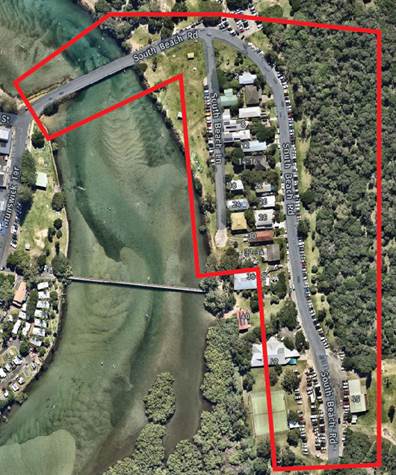
Figure 1:
Parking Area (shown in red)
These restrictions are shown in
the concept below –
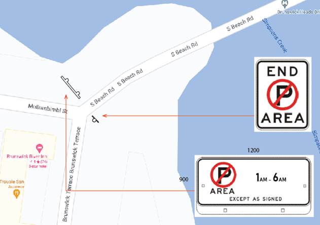
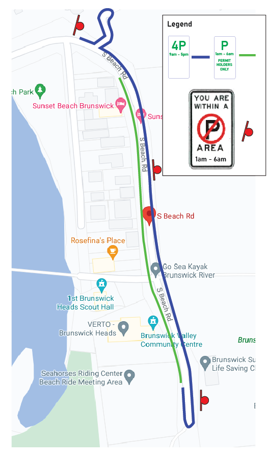
RECOMMENDATION:
That the Local Traffic Committee endorse the
proposed No Parking Area scheme for South Beach Road and South Beach Lane,
Brunswick Heads.
Local Traffic Committee Meeting 7.1
Matters for Traffic Engineering Advice
Report No. 7.1 Road Safety Improvements to Warrambool Road and
Coomburra Crescent Intersection Ocean Shores
File No: I2023/780
Council has been contacted by local residents in relation to
safety concerns at the intersection of Warrambool Road, Coomburra Crescent and
Goondooloo Drive in Ocean Shores (see circled area on location map
below).
Investigation of NSW crash data shows two serious crashes at
this intersection. The first, in 2019, resulted in a fatality and, the
second in 2022, caused a serious injury.
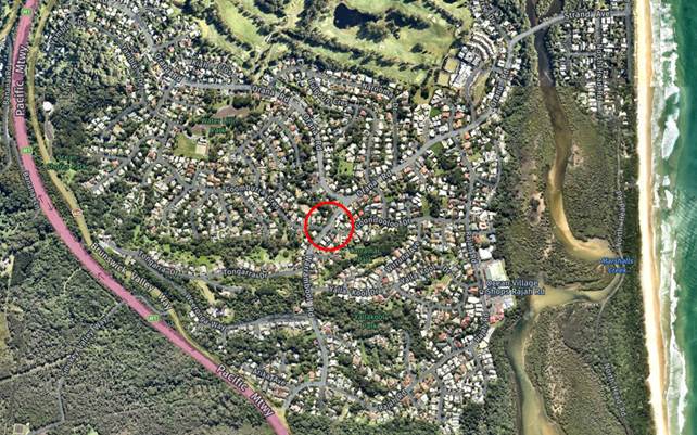
Fig.1 - Location map showing
intersection
Both incidents were multi-vehicle cross-traffic crashes
which involved vulnerable road users (a motorcyclist in 2019 and a pedal
cyclist in 2022). The fatal crash in 2019 involved a light truck
travelling south on Warrambool Road, striking a motorcyclist who was travelling
east across the intersection from Coomburra Cres to Goondooloo Drive (see
sketch below).
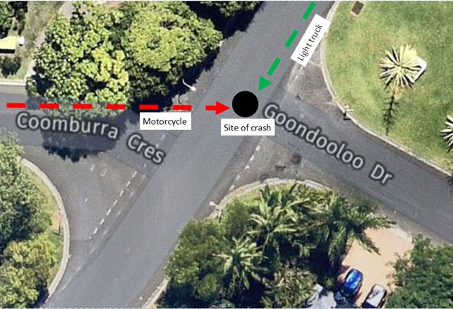
Fig.2 – Sketch of
motorcycle / light truck crash in 2019
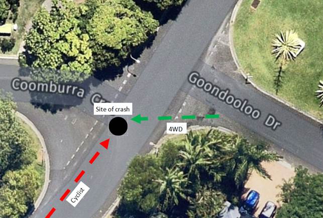
Fig.3 – Sketch of pedal
cyclist / 4WD crash in 2022
The following factors may have contributed to these
incidents (refer photos below):
· Topography and
geometry of intersection
Goondooloo Dr and Coomburra Cr run steeply uphill to meet
Warrambool Road and Warrambool Road runs downhill towards the Orana Road
roundabout. This, combined with the slight misalignment of Coomburra Cr
and Goondooloo Dr, limits driver sight distances at this intersection.
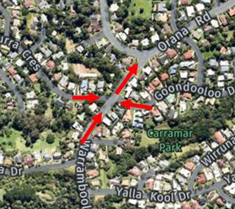
Fig.4 – Map showing
road topography
· Sun glare
Both incidents occurred approx. 2hrs prior to sunset,
impacting vehicles travelling in a westerly direction (e.g. vehicles travelling
from Goondooloo Dr to Coomburra Cr or vehicles turning down Coomburra Cr).
· Road
infrastructure
There are existing Give Way signs on both side streets,
however they are not prominent and the existing line markings are faded.
There is also no channelisation of traffic on the side streets.
Speed has been suggested as a factor by the local community
but we do not have any data to support this at this time.
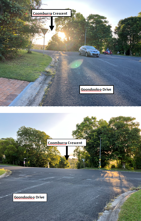
Fig.5 – Photos of
intersection
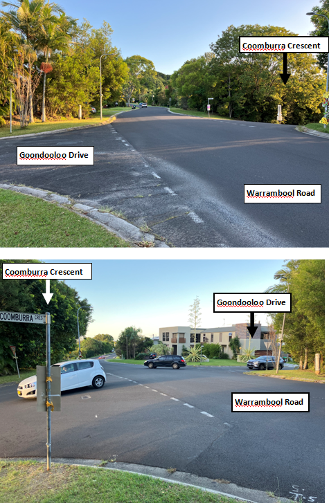
Fig.6 – Photos of
intersection
Proposed solution (refer sketch below)
The below solutions are intended to stagger the two minor
legs and tighten the entry angle from the Coomburra Cres. approach.
· New double centre
line to Warrambool Road to create a turning point for traffic and discourage
vehicles driving straight through the intersection.
· New line marking
and channelisation on Coomburra Crescent to prevent traffic driving straight
through onto Goondooloo Drive.
· Move Give Way signage
to more prominent locations.
· Potentially change
the give way to a stop (intersection sight distance is limited).
· Refresh all
existing line marking through the intersection.
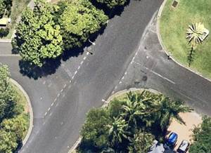
Fig.8 – Existing layout
of intersection
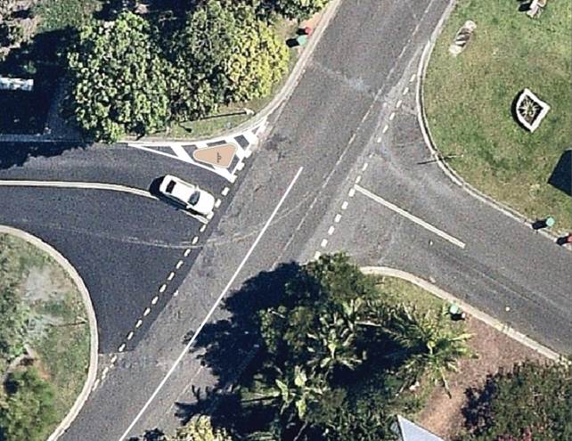
Fig.8 – Proposed layout
of intersection (concept only)
RECOMMENDATION:
That the Local Traffic Committee support:
1.
The implementation of the proposed intersection layout.
2.
Council seeking funding for these changes.