Notice of Meeting
Local Traffic Committee Meeting
A Local Traffic
Committee Meeting of Byron Shire Council will be held as follows:
|
Venue
|
Conference Room, Station Street, Mullumbimby
|
|
Date
|
Tuesday, 12 March 2024
|
|
Time
|
10.30am
|
Phil Holloway
Director Infrastructure
Services
I2024/355
Distributed
05/03/24

1. Apologies
2. Declarations
of Interest – Pecuniary and Non-Pecuniary
3. Adoption
of Minutes from Previous Meetings
3.1 Local
Traffic Committee Meeting held on 13 February 2024
4. Matters
Arising
5. Outstanding
Issues/Resolutions
6. Regulatory Matters
6.1 375
Coorabell Road Intersection Upgrade................................................................. 3
6.2 Bayshore
Drive Upgrade............................................................................................... 5
6.3 Council
Depot Bayshore Drive - Permit Holders Only Parking Signage For Staff Parking........................................................................................................................... 56
7. Matters for Traffic Engineering
Advice
7.1 Belongil
- Kendall Street to Childe Street Local Traffic Management................. 60
7.2 Police
Station Street Parking- Bangalow................................................................. 79
7.3 Bangalow
Weir Parklands - Illegal Camping........................................................... 81
7.4 Burringbar
Street Draft Concept Design.................................................................. 84
8. Events
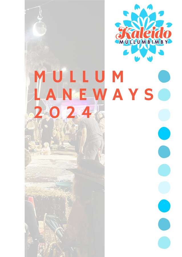
8.1 Mullum
Laneways 2024 - Kaleido Mullumbimby.................................................. 117
Local Traffic Committee Meeting 6.1
Regulatory Matters
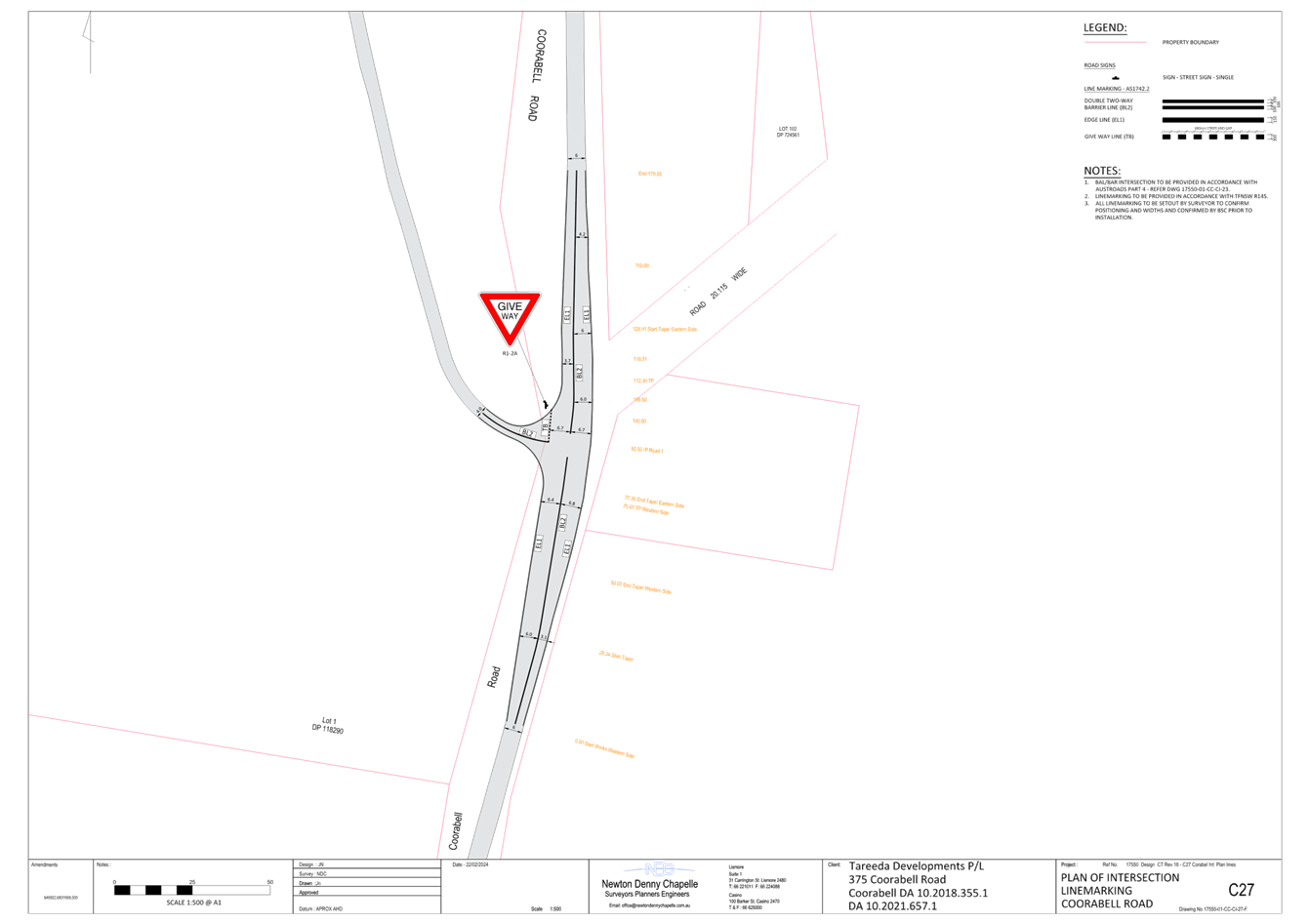
Report No. 6.1 375 Coorabell Road Intersection Upgrade
File No: I2024/261
The purpose of this report is to gain
Council support for the proposed line markings and regulatory signs shown in
Attachment 1 (E2024/18185).
Council has received a Subdivision
Works Certificate and Roads Act applications associated with a development
approval for a Community title subdivision to create sixteen (16) lots
inclusive of the neighbourhood management lot of an approved multiple occupancy
comprising fifteen (15) dwelling sites at 375 Coorabell Road, Coorabell
A standard Austroads BAL & BAR intersection is required.
Conditions 7 a) of development
consent 10.2021.675.1 state:
Access/Intersection Construction
Access/intersection,
road shoulder, pavement widening and associated drainage construction,
including any necessary relocation of services in accordance with the approved
drawings. Refer NDC drawings 17550-01-CC-CI-23 to CI-27 Rev B
Note: Any
removal of trees requires separate approval.
RECOMMENDATION:
That Council supports the
signage and line markings associated with the Coorabell Road intersection
works, as shown in Attachment 1 (E2024/18185)
Attachments:
1 14.2021.657.1
LTC submission, E2024/18185 , page 4⇩ 
Regulatory
Matters 6.1 - Attachment 1
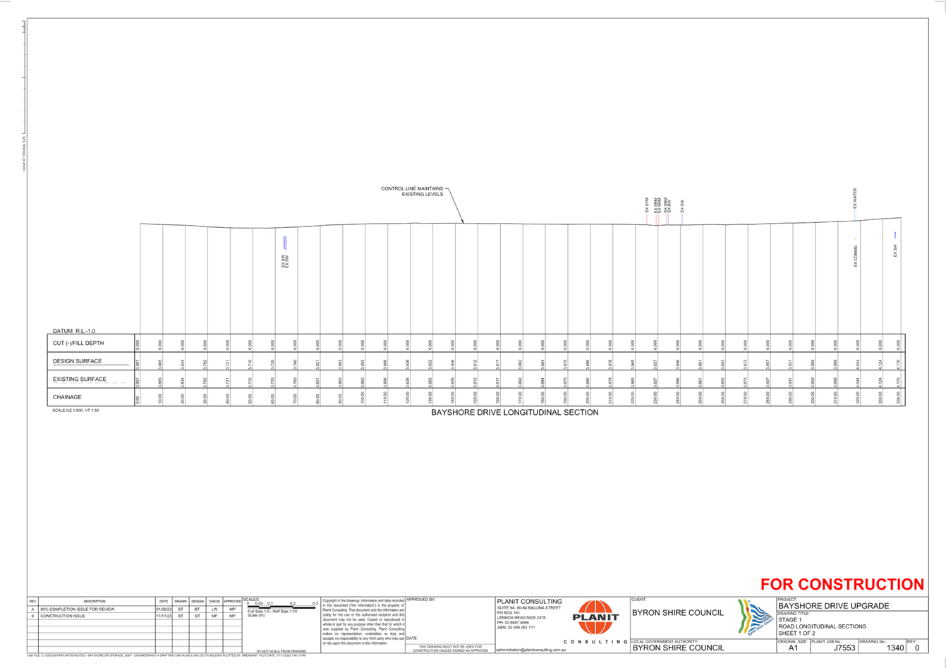
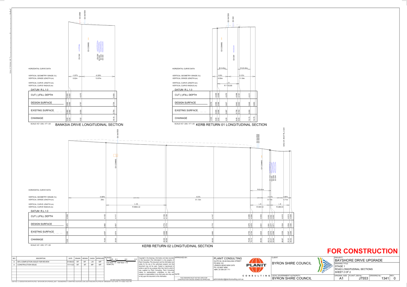
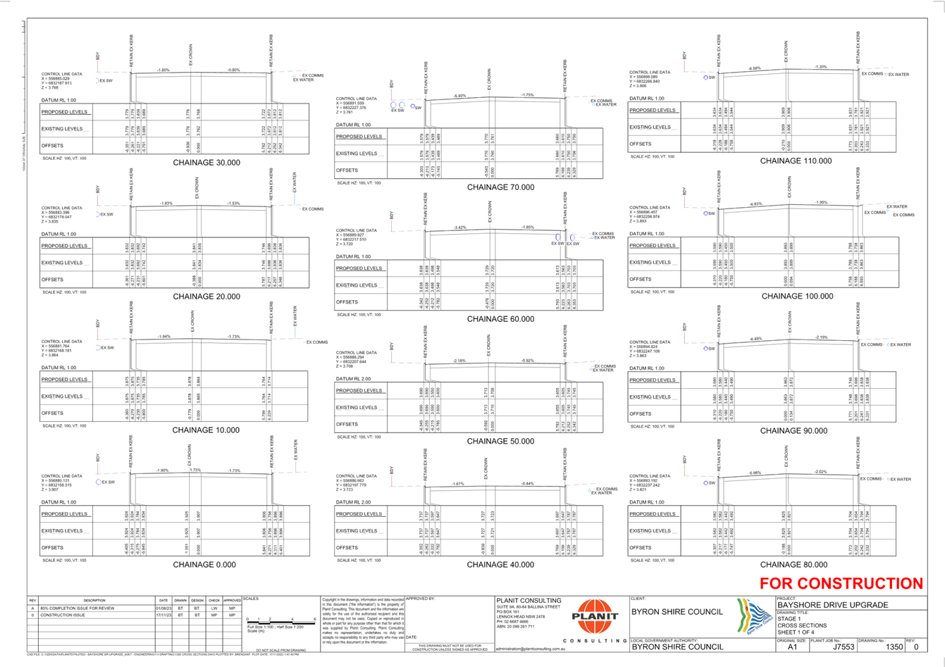
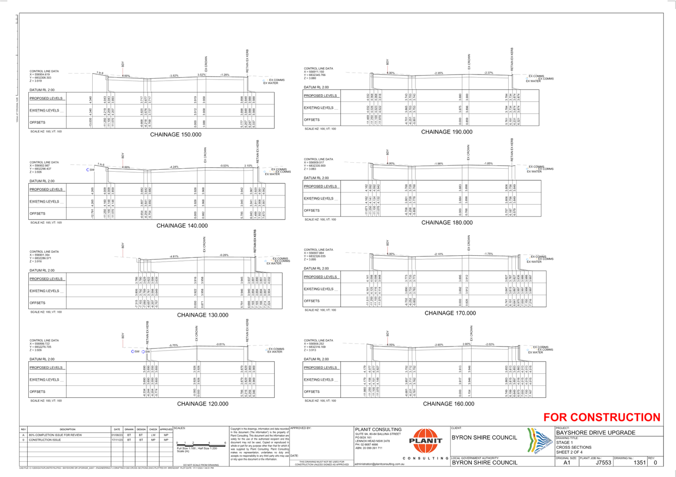
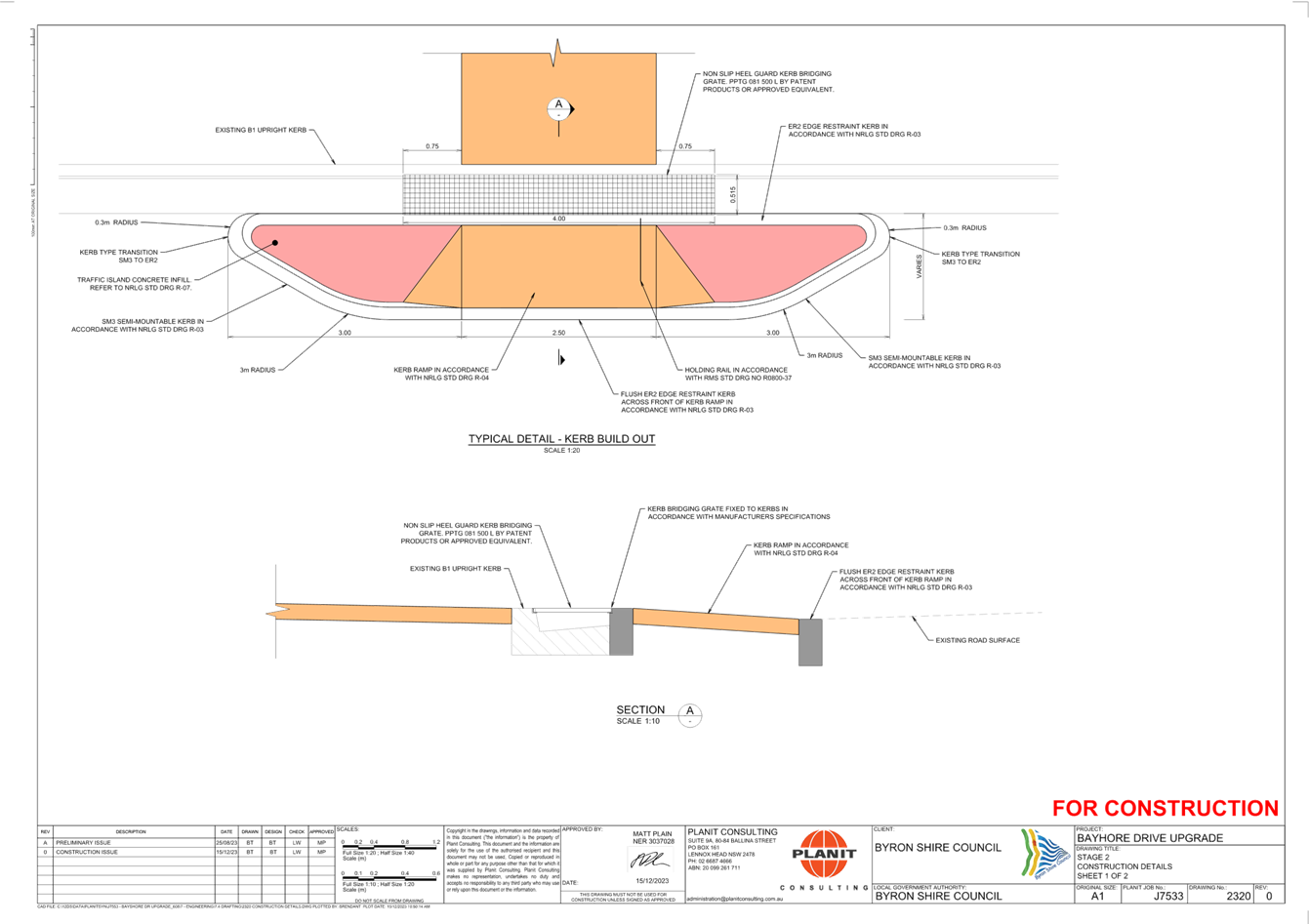
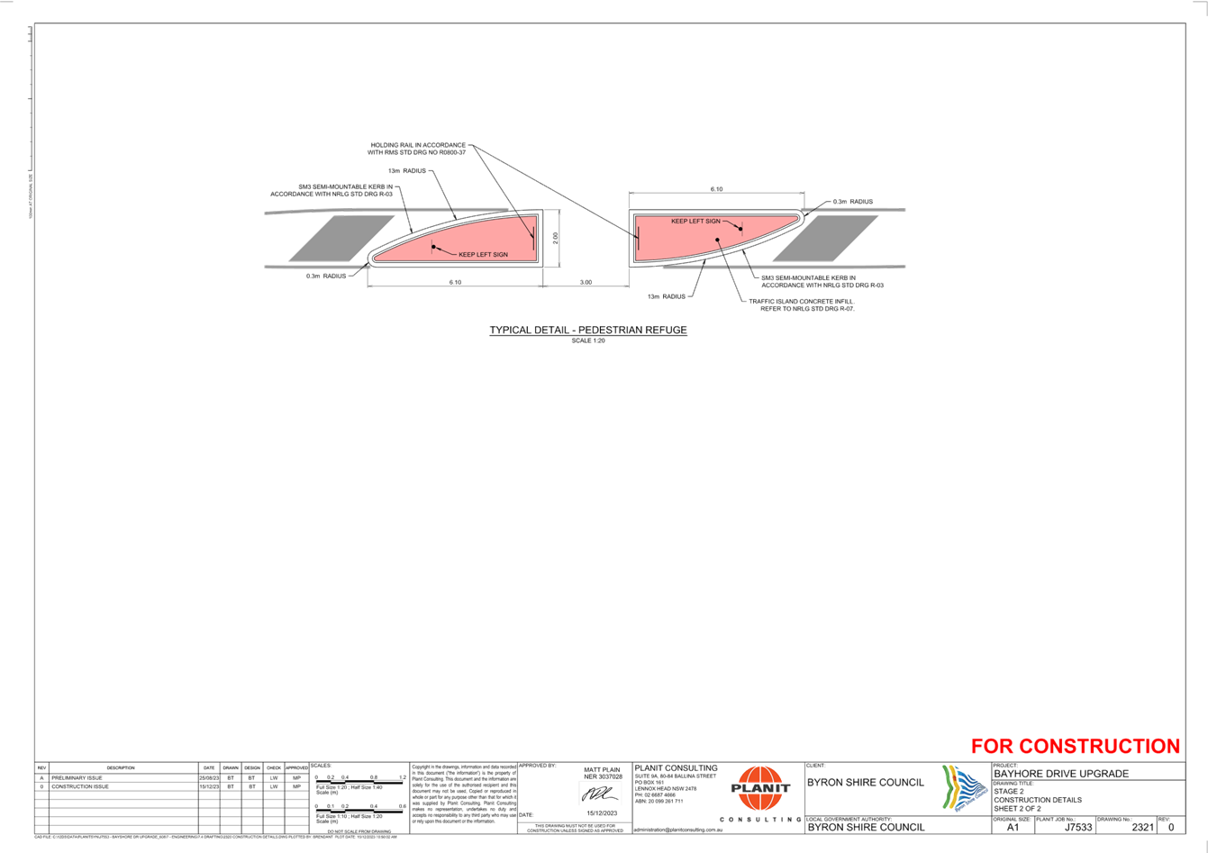
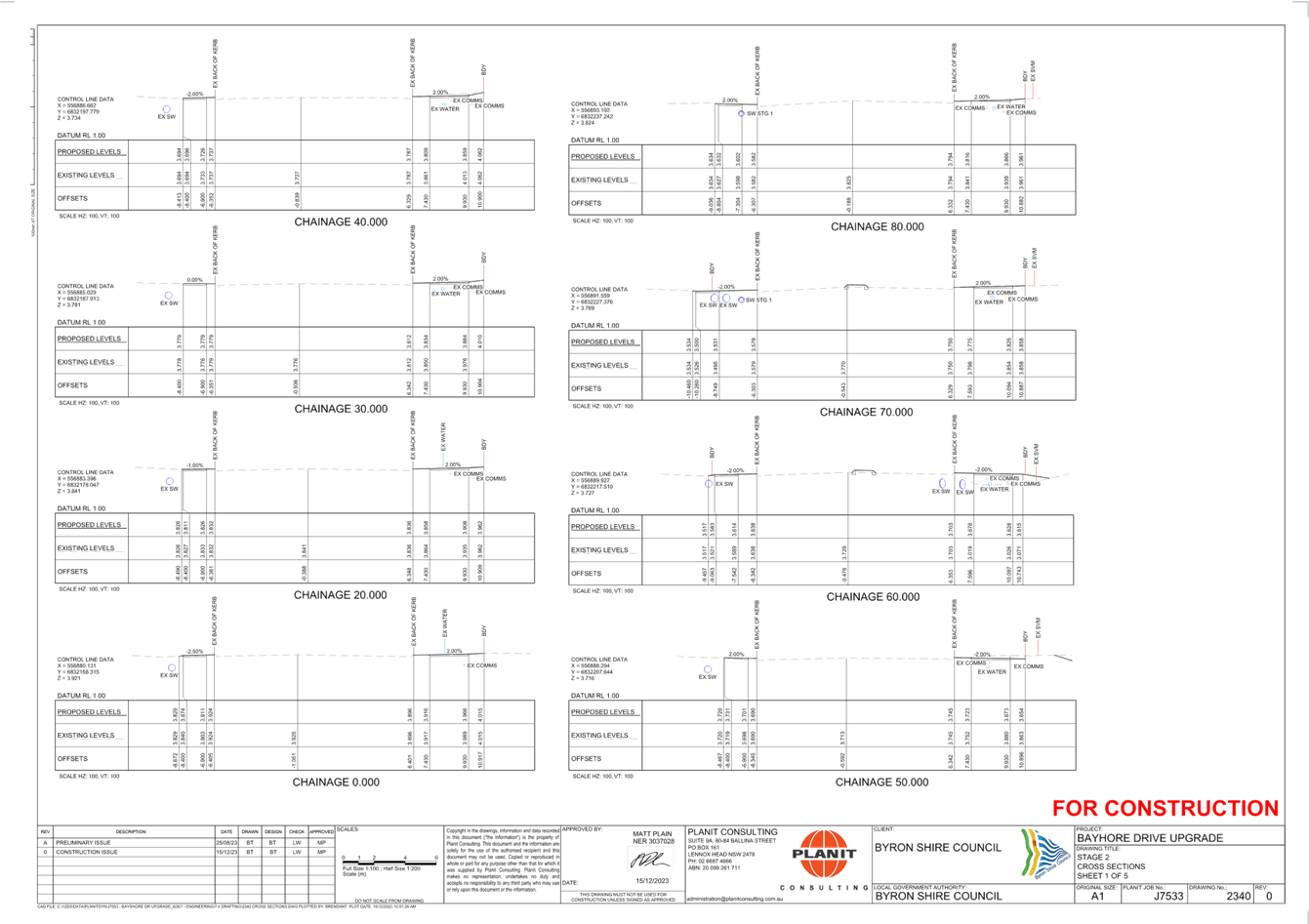
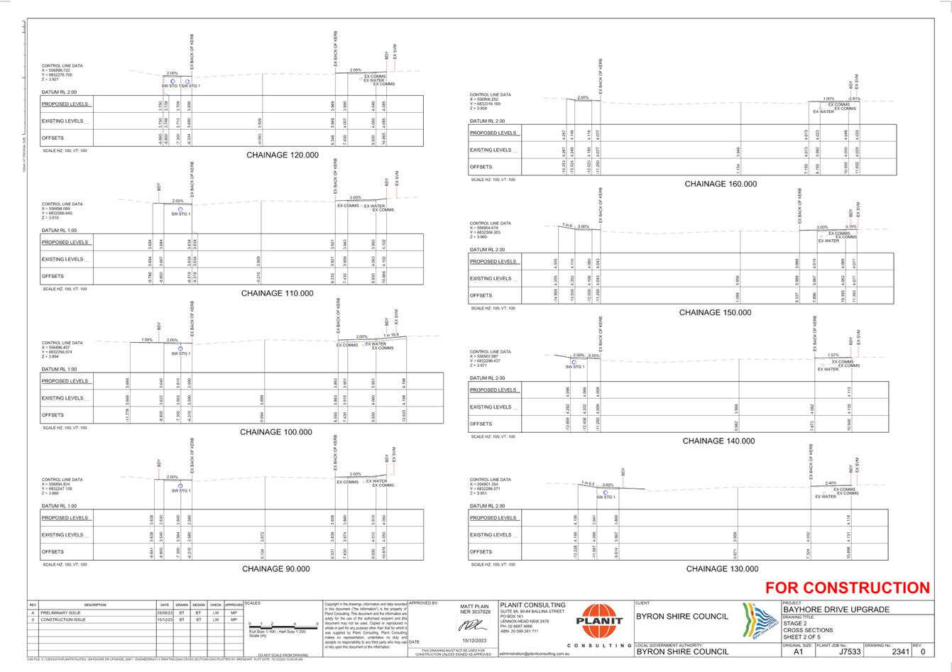
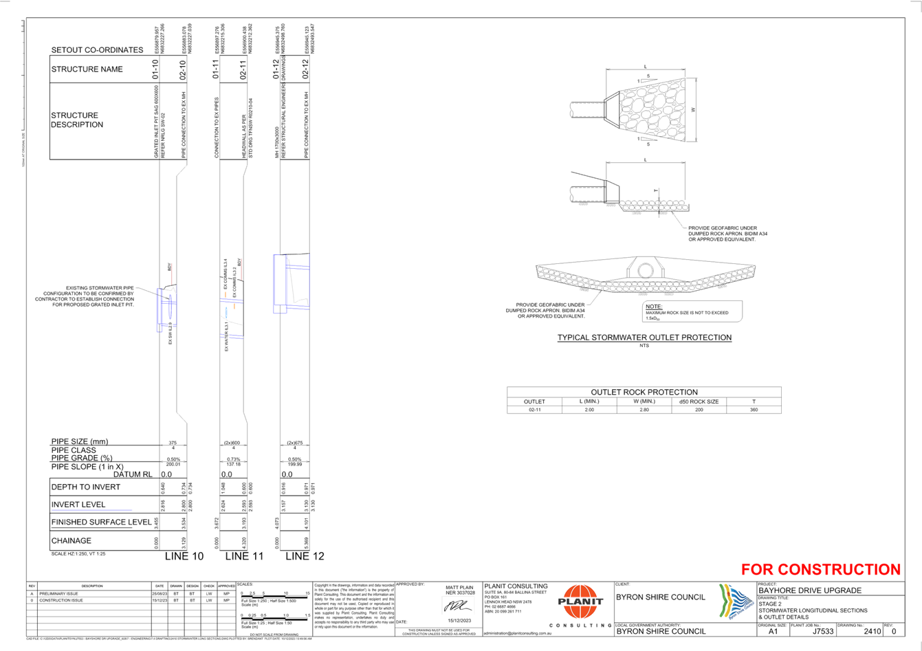
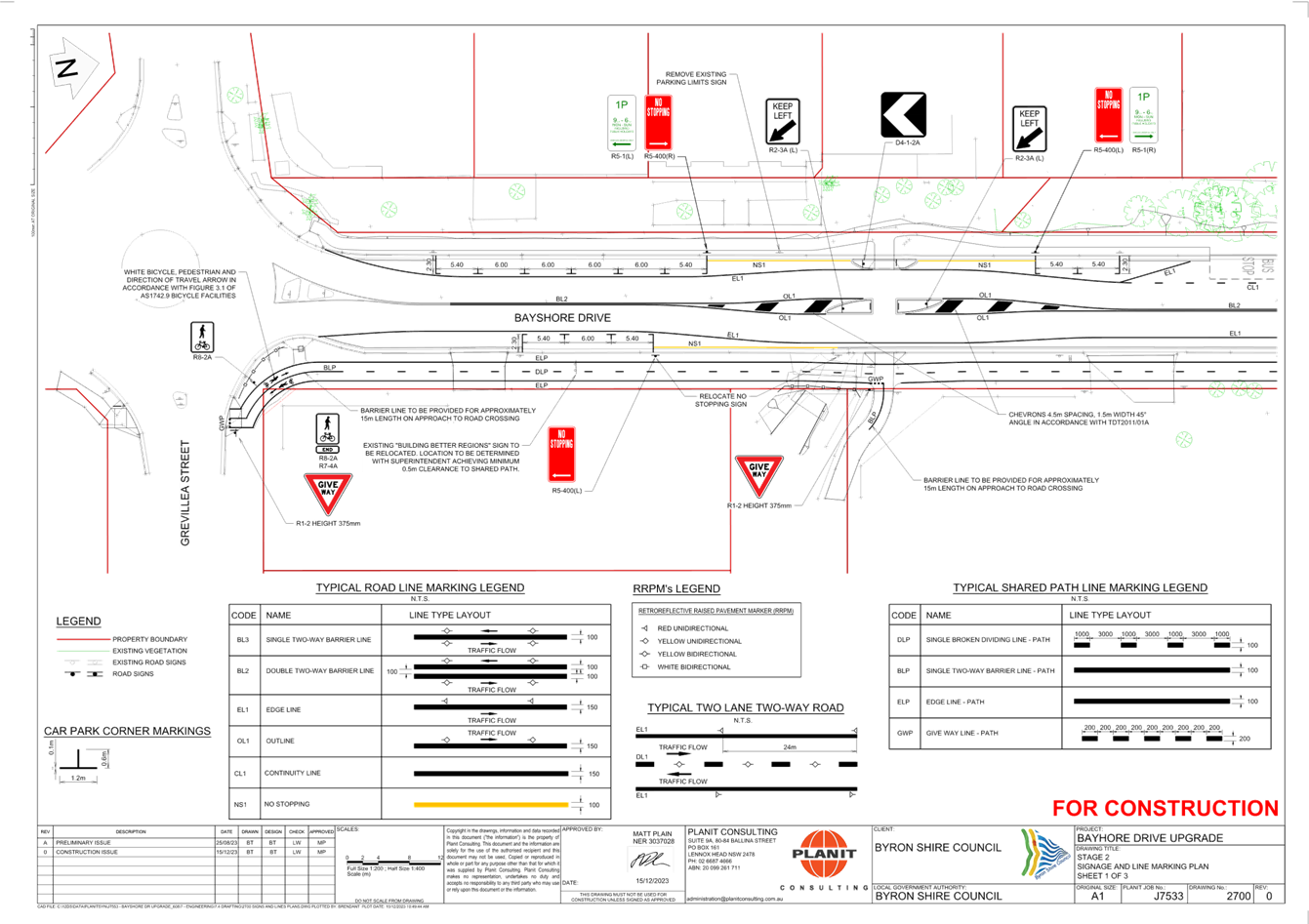
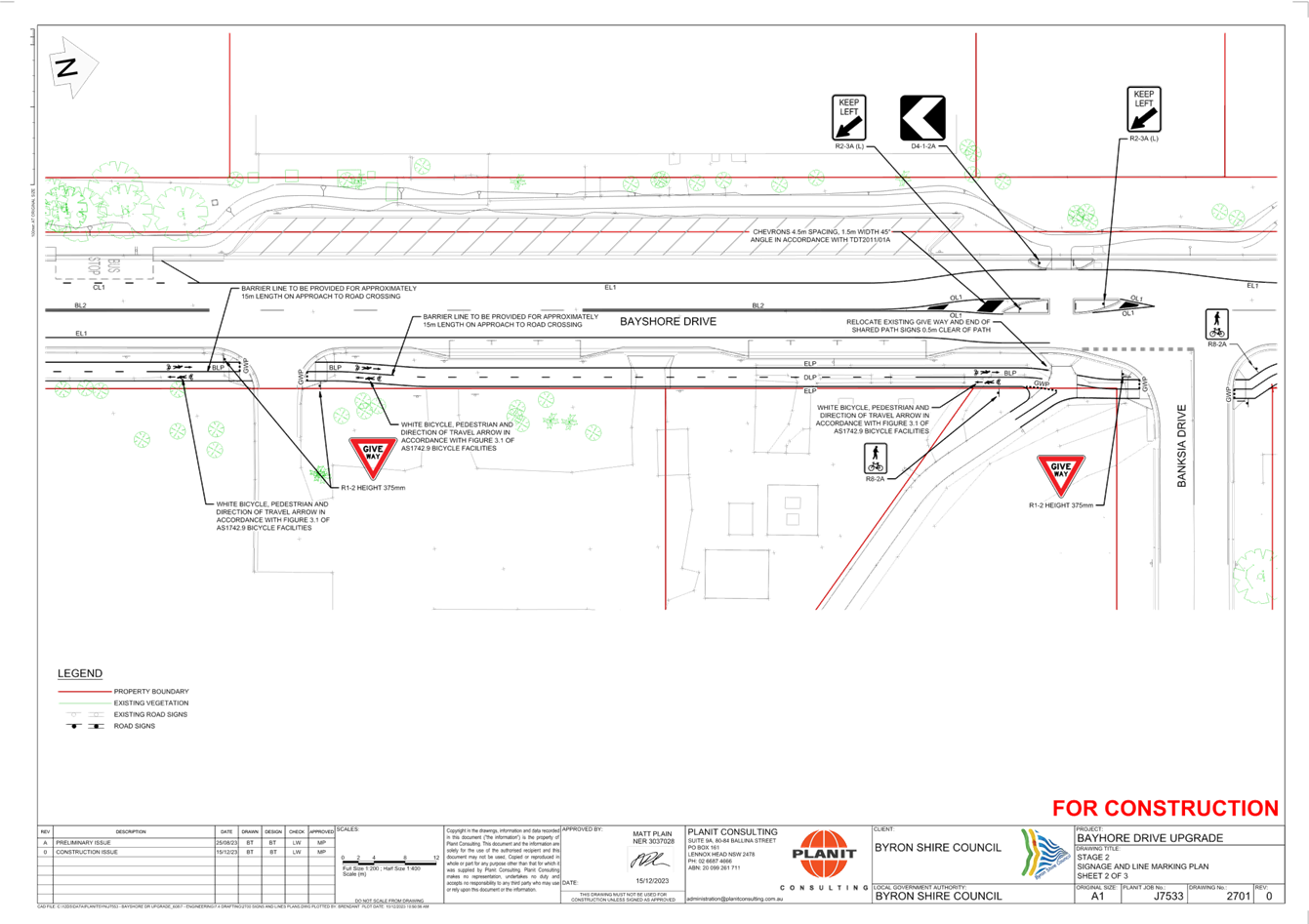
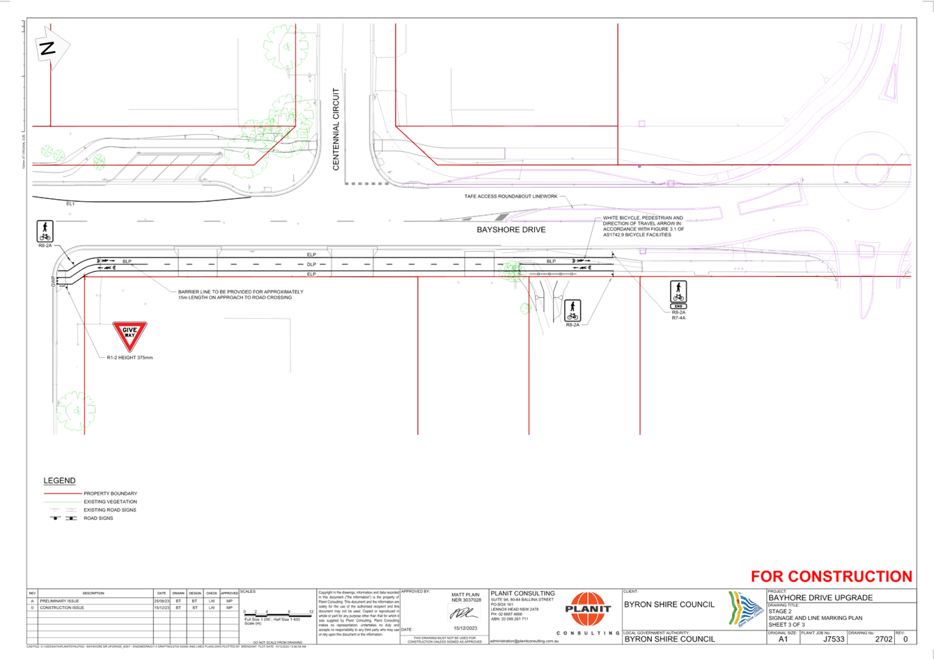
Local Traffic Committee Meeting 6.2
Report
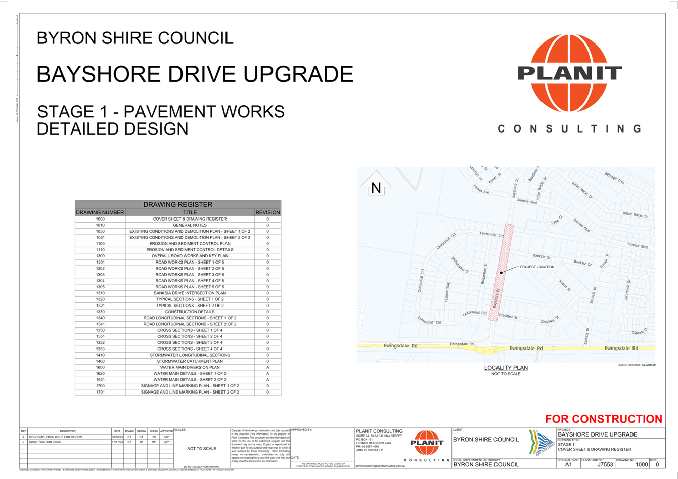
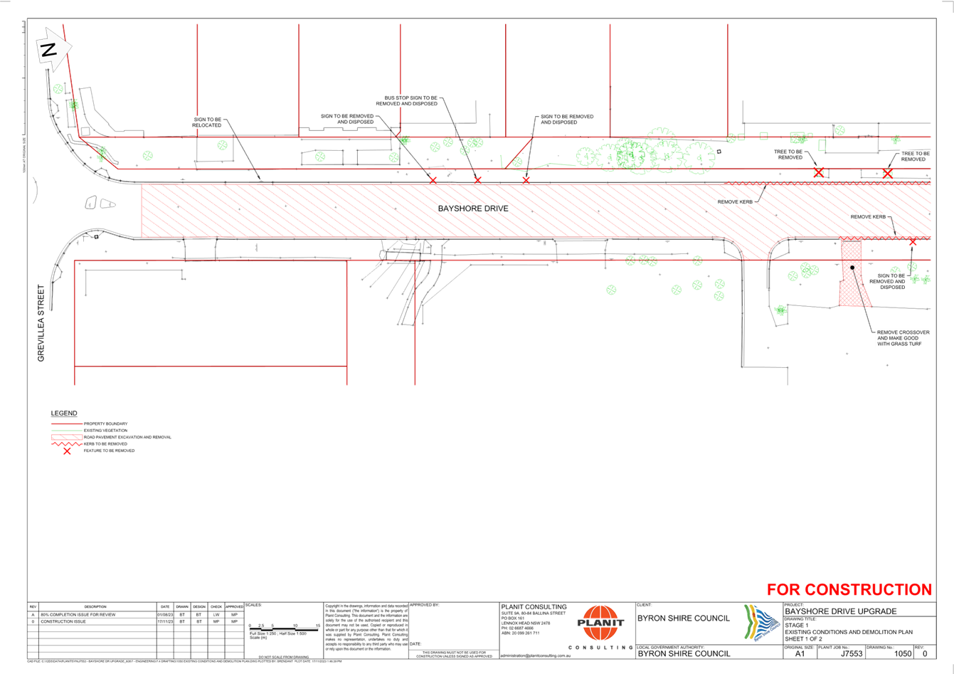
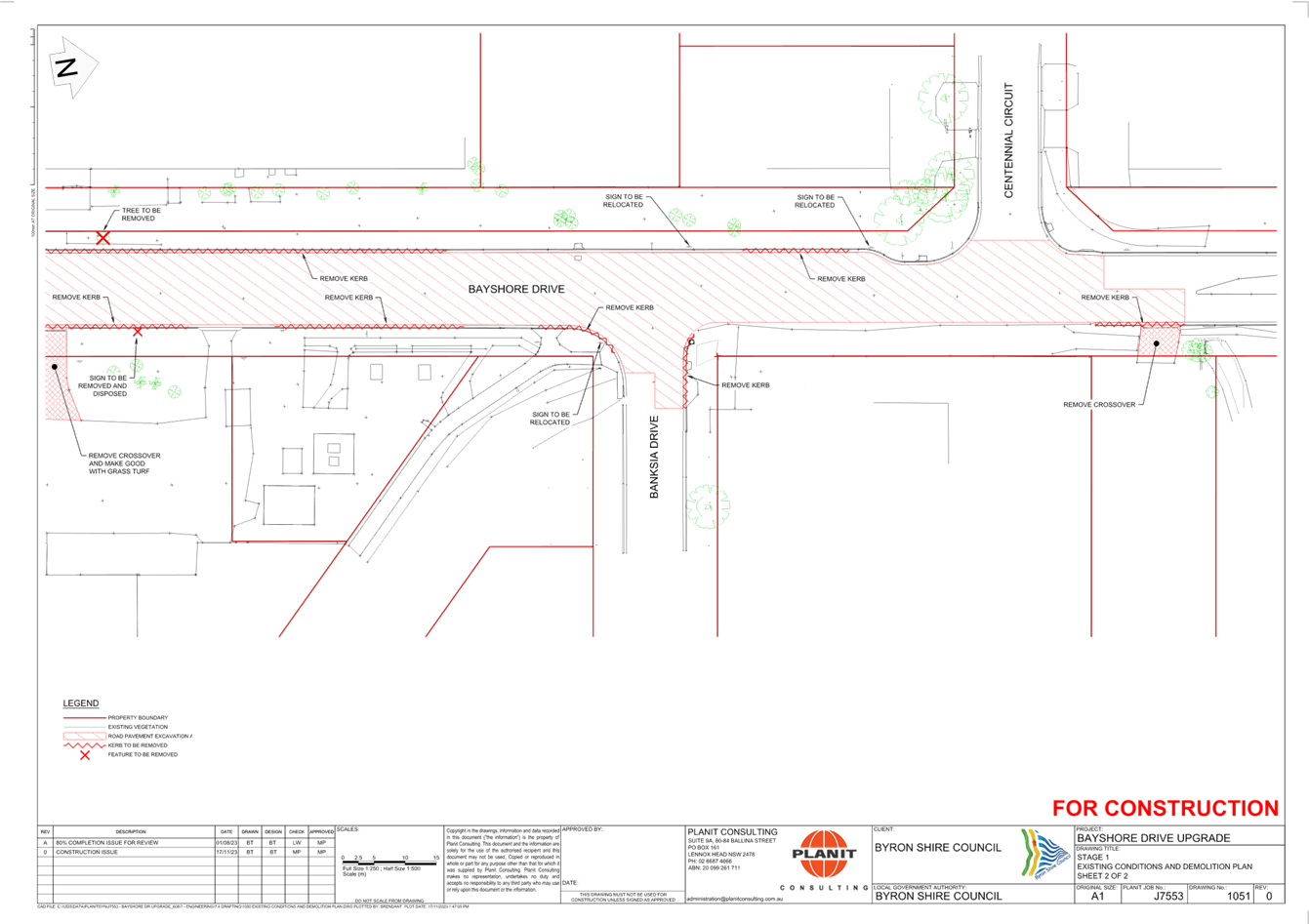
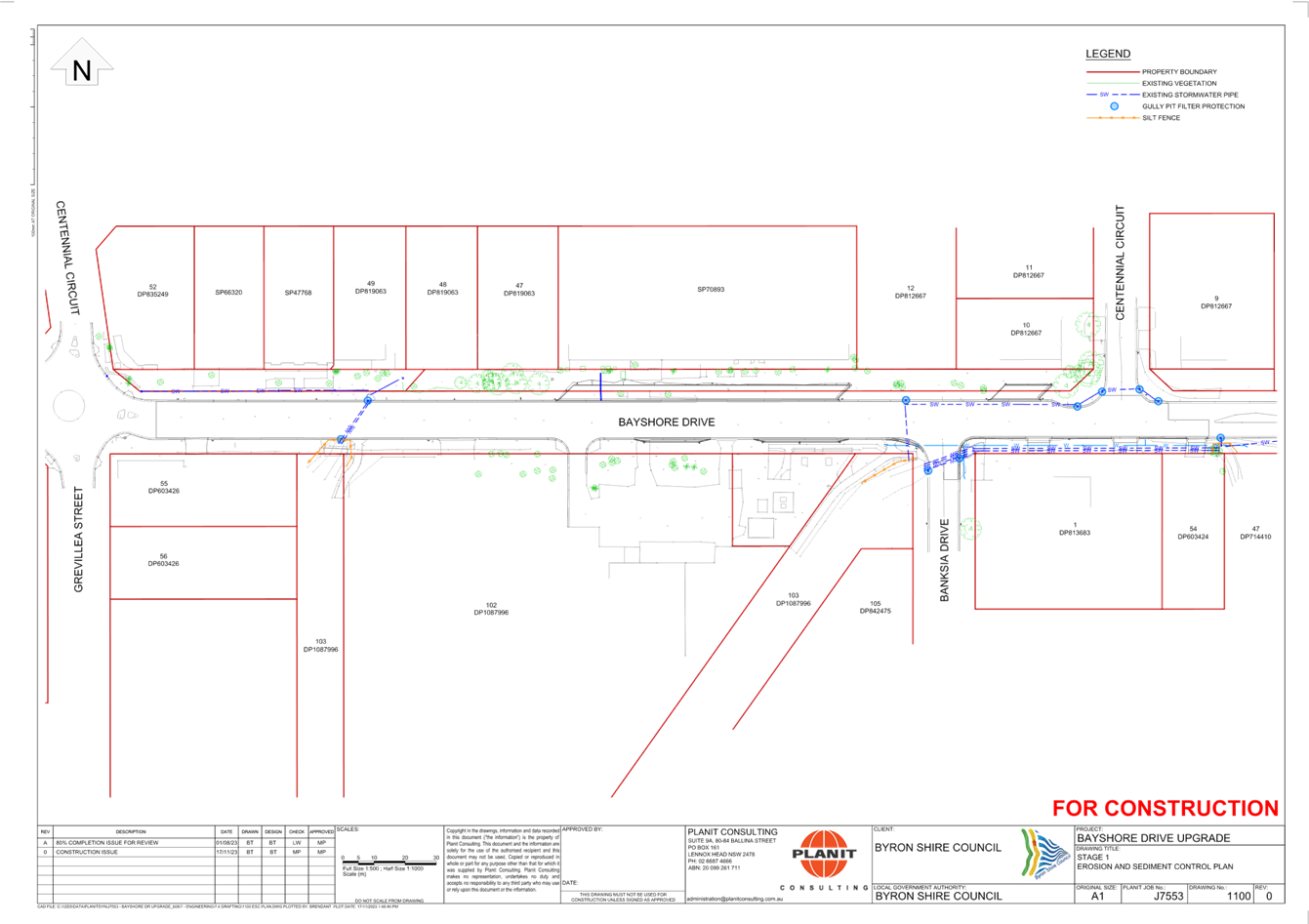
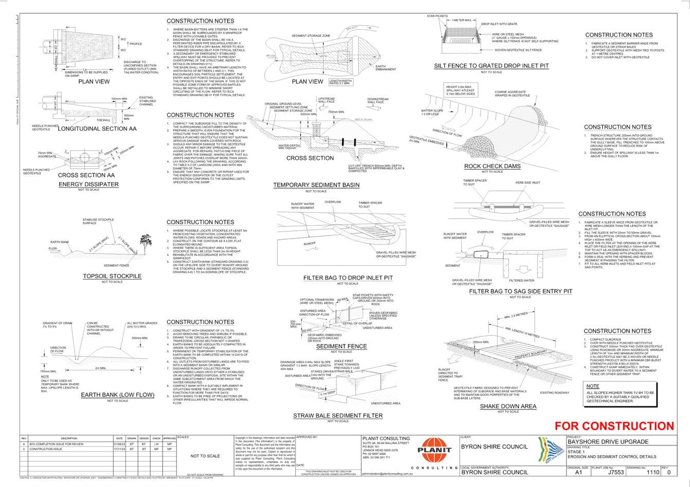
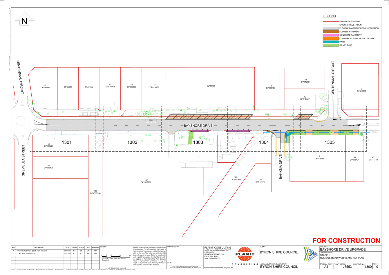
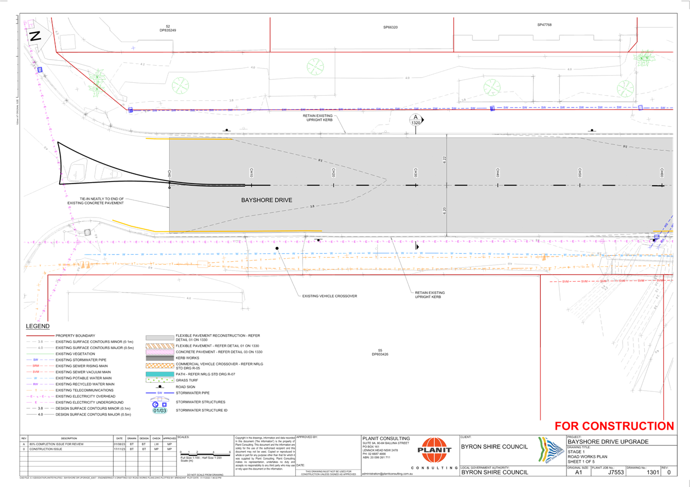
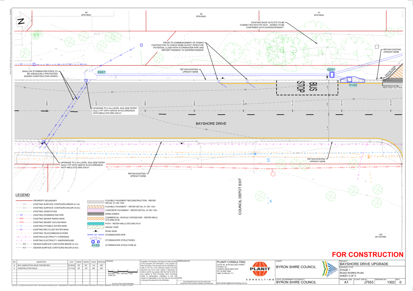
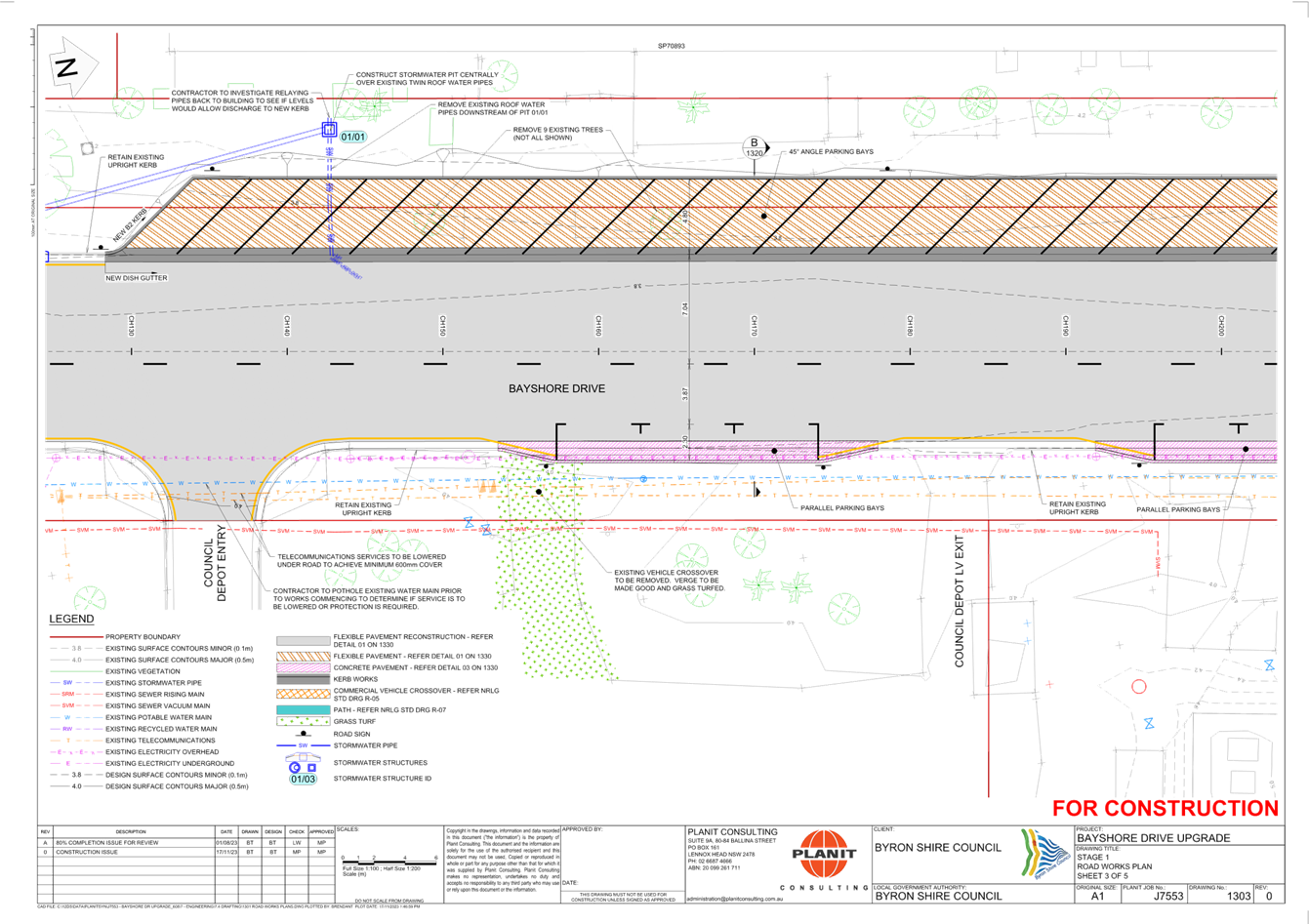
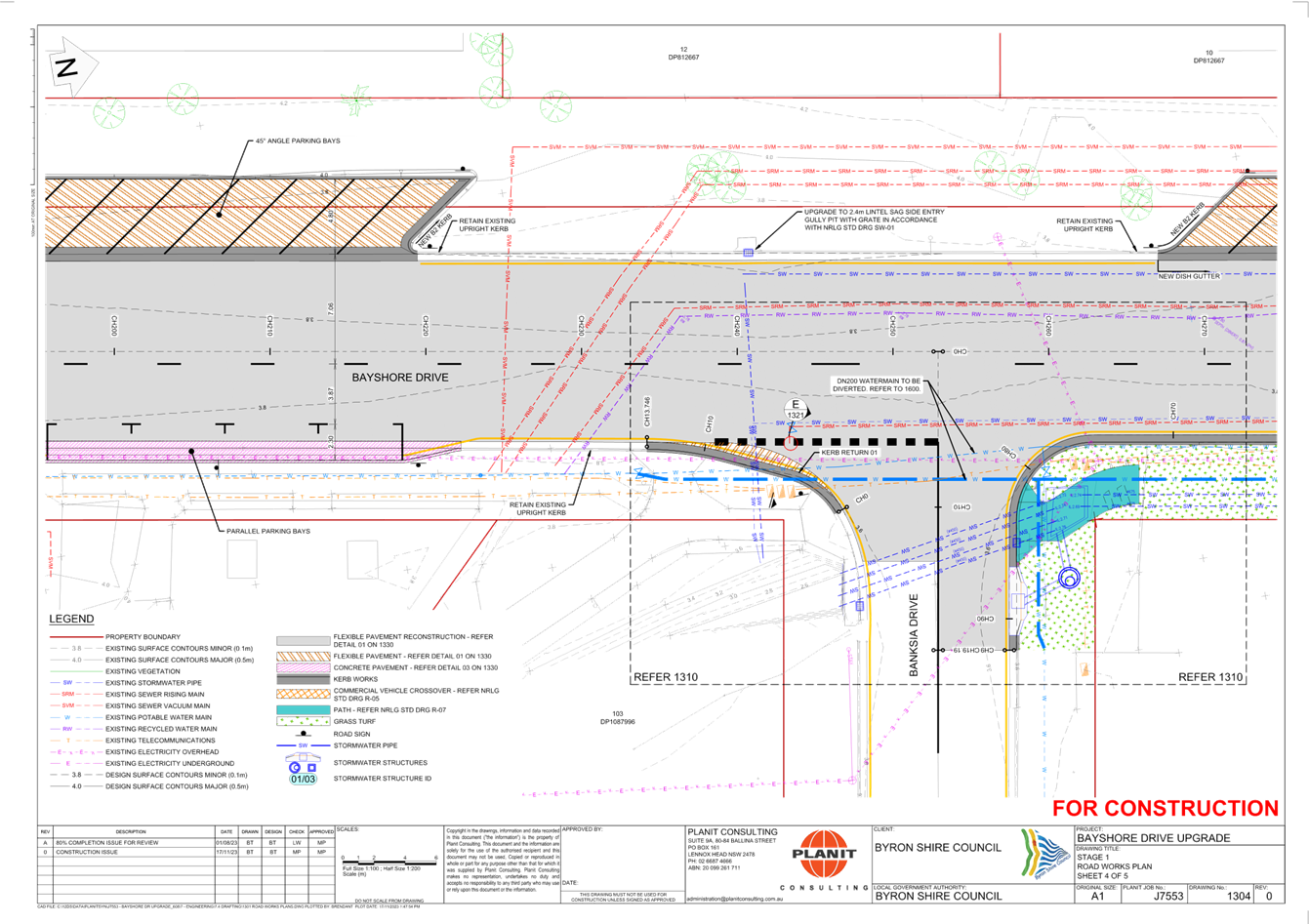
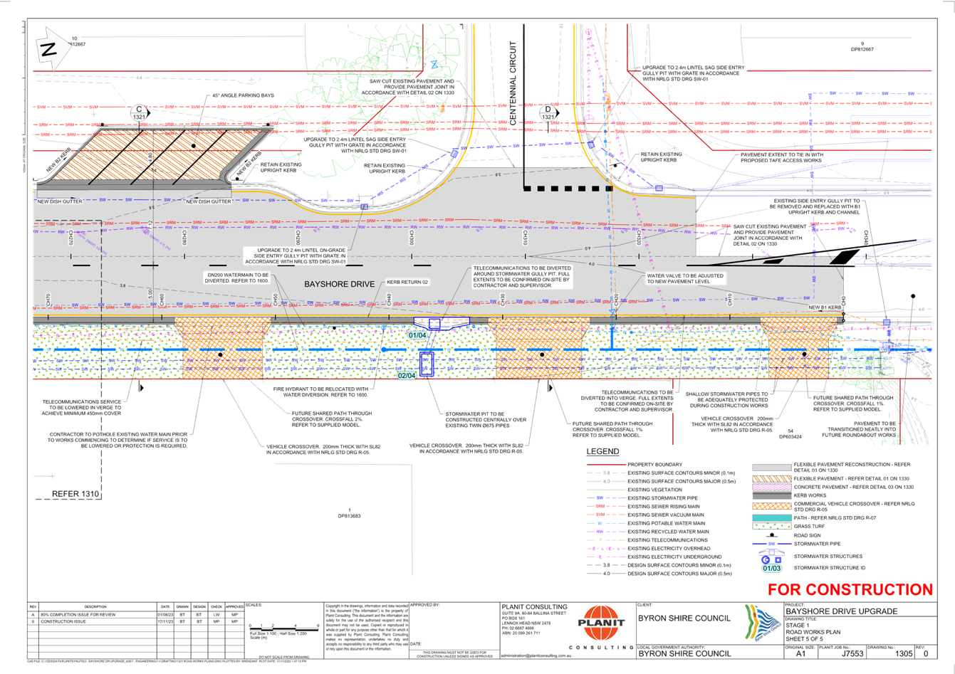
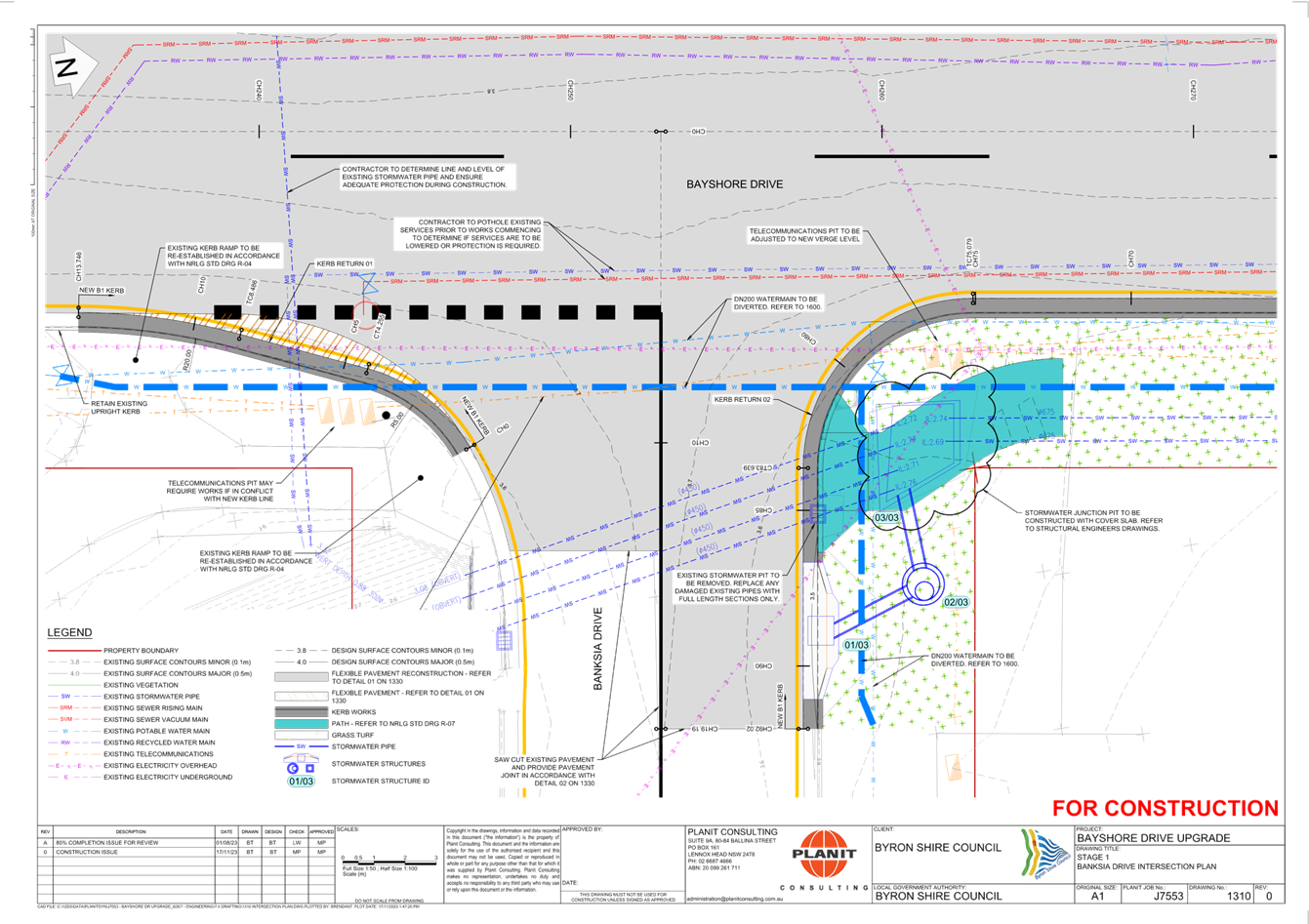
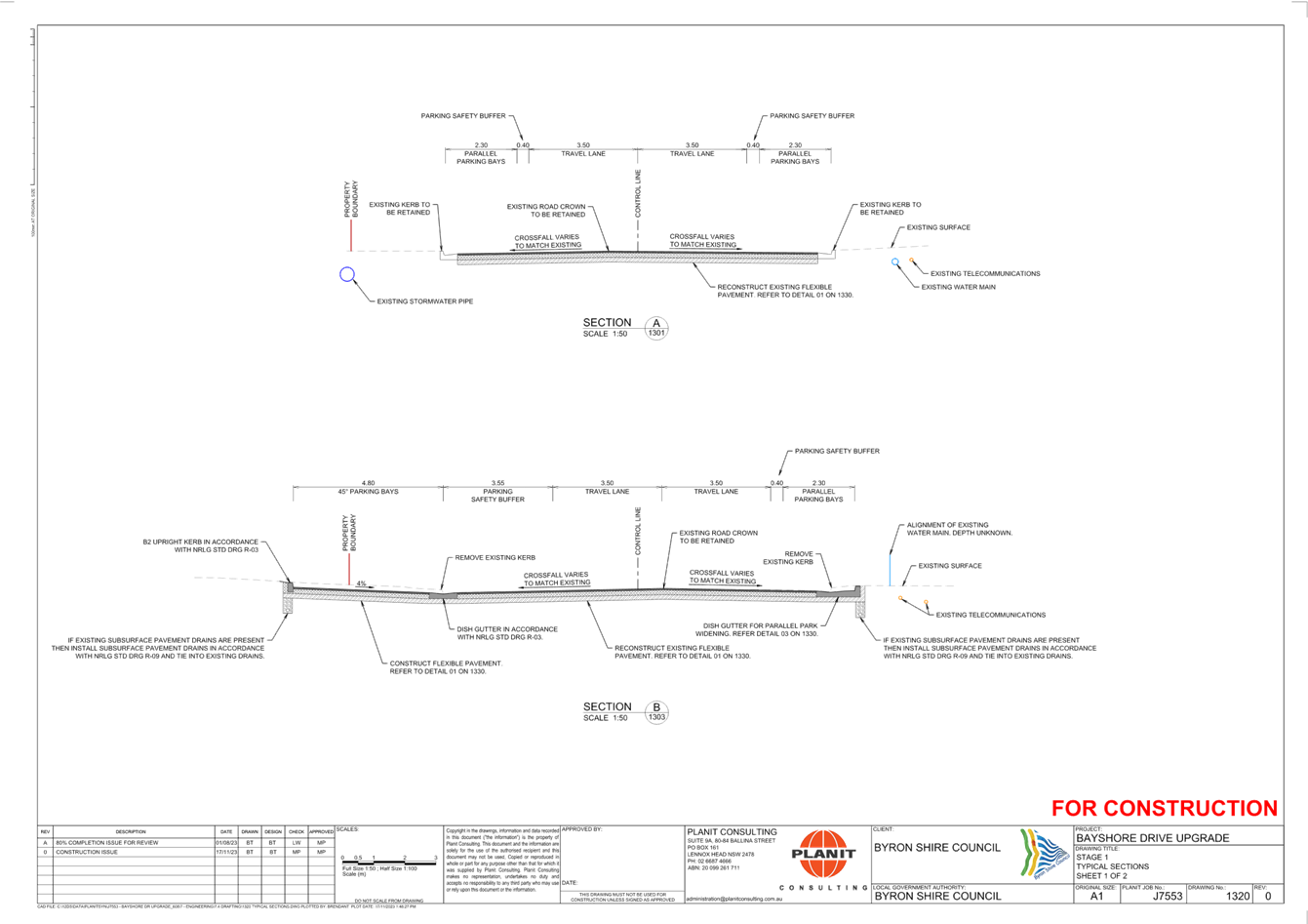
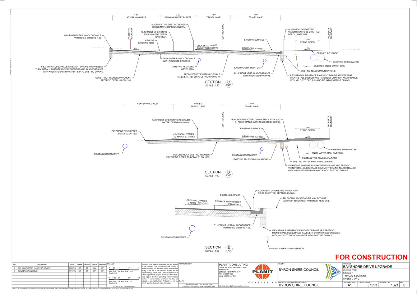
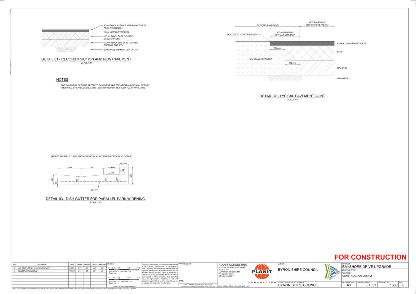
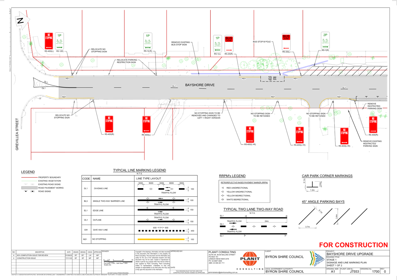
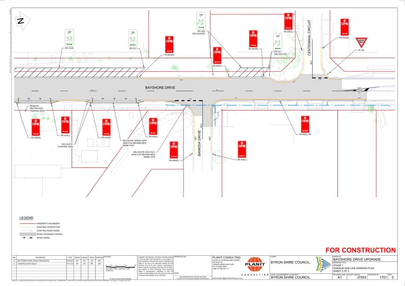
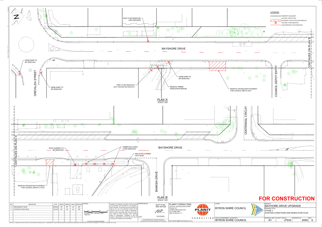
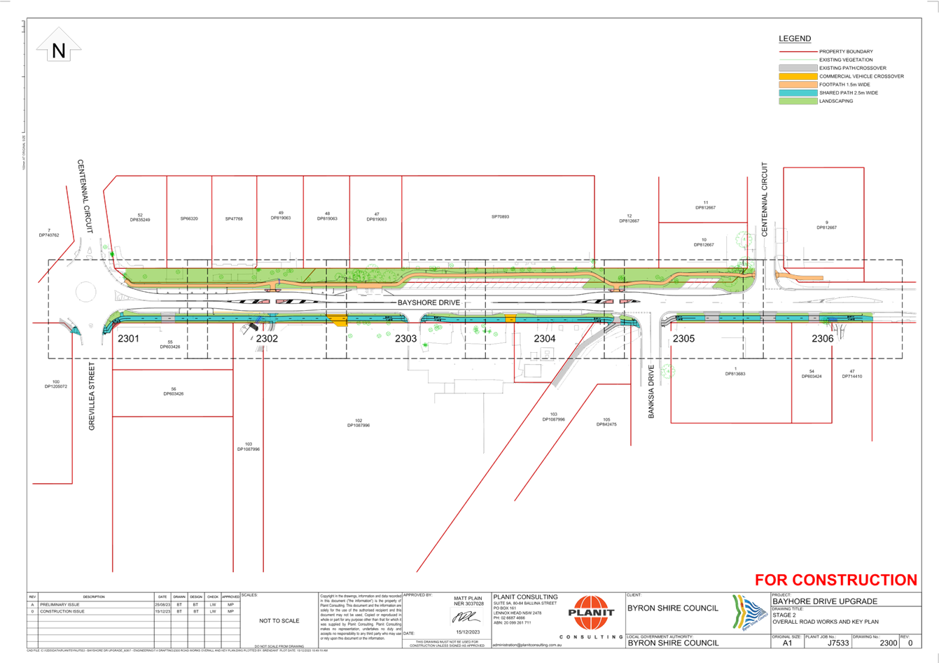
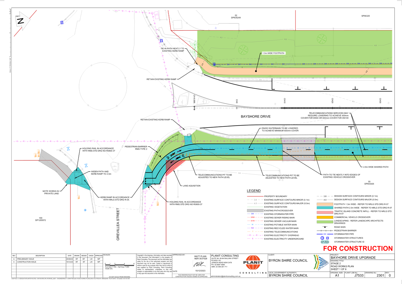
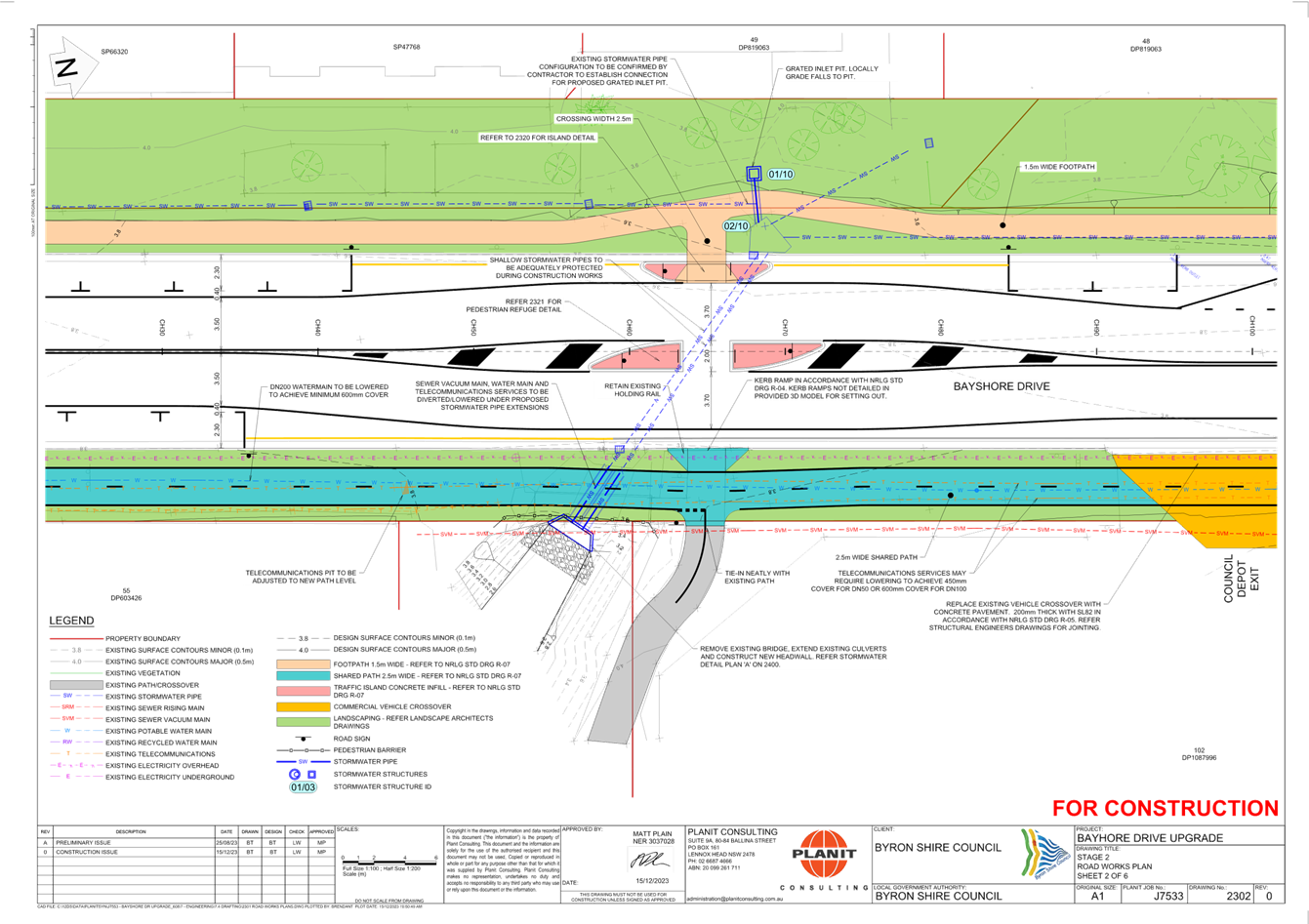
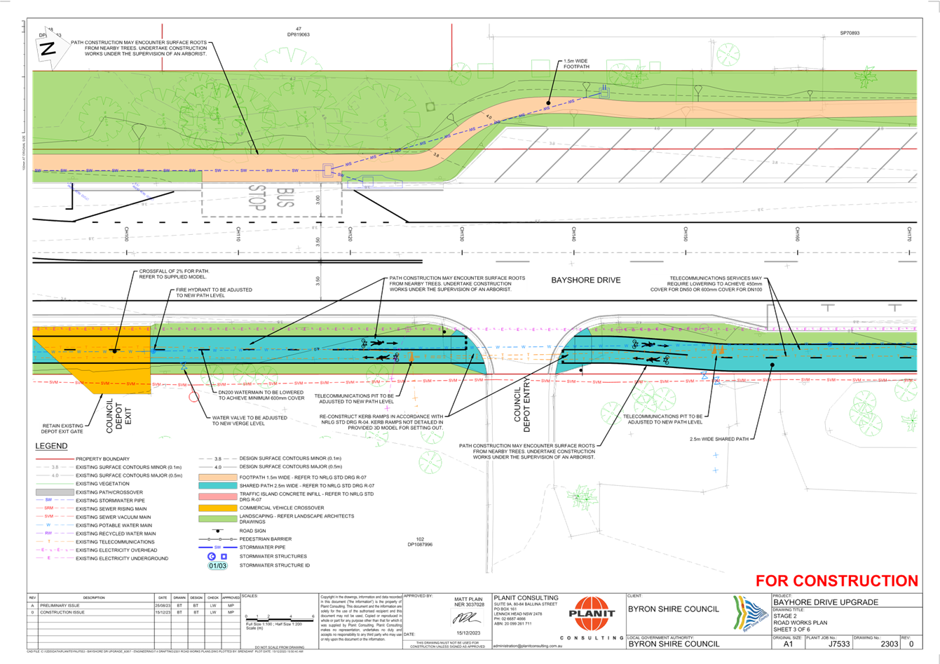
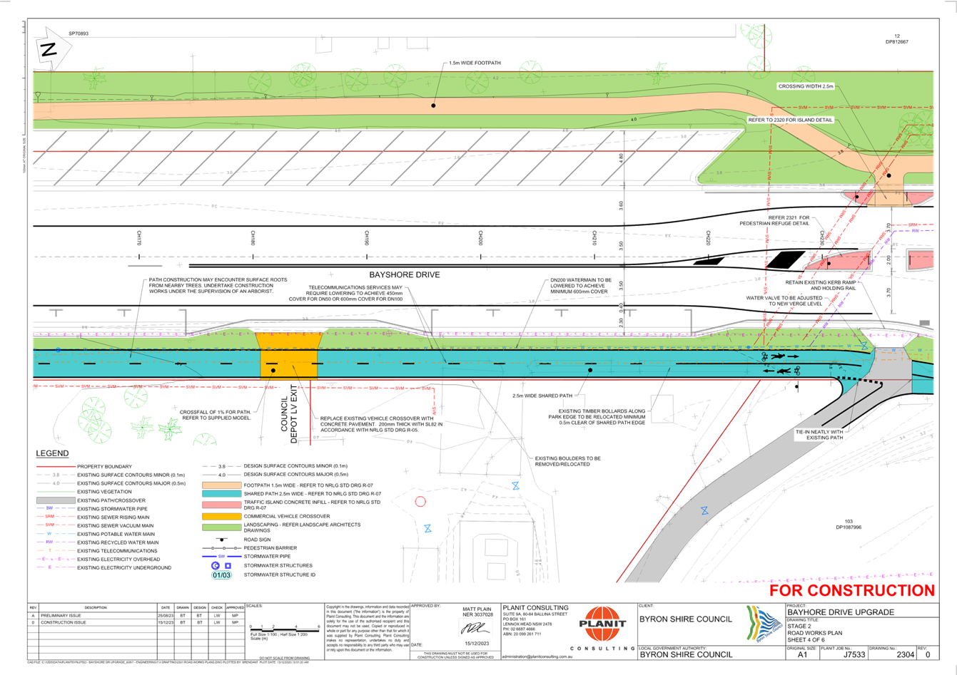
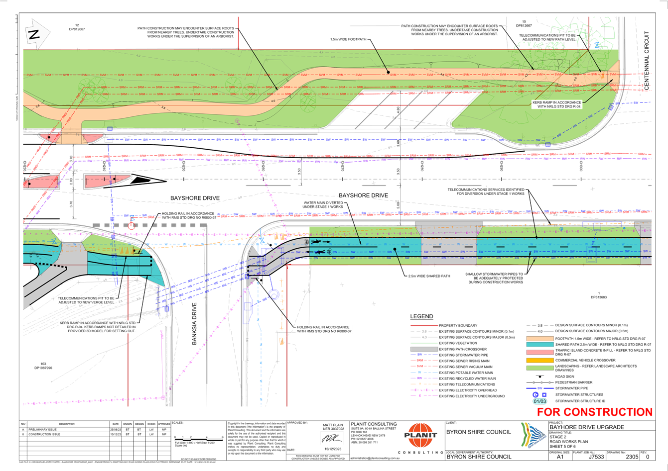
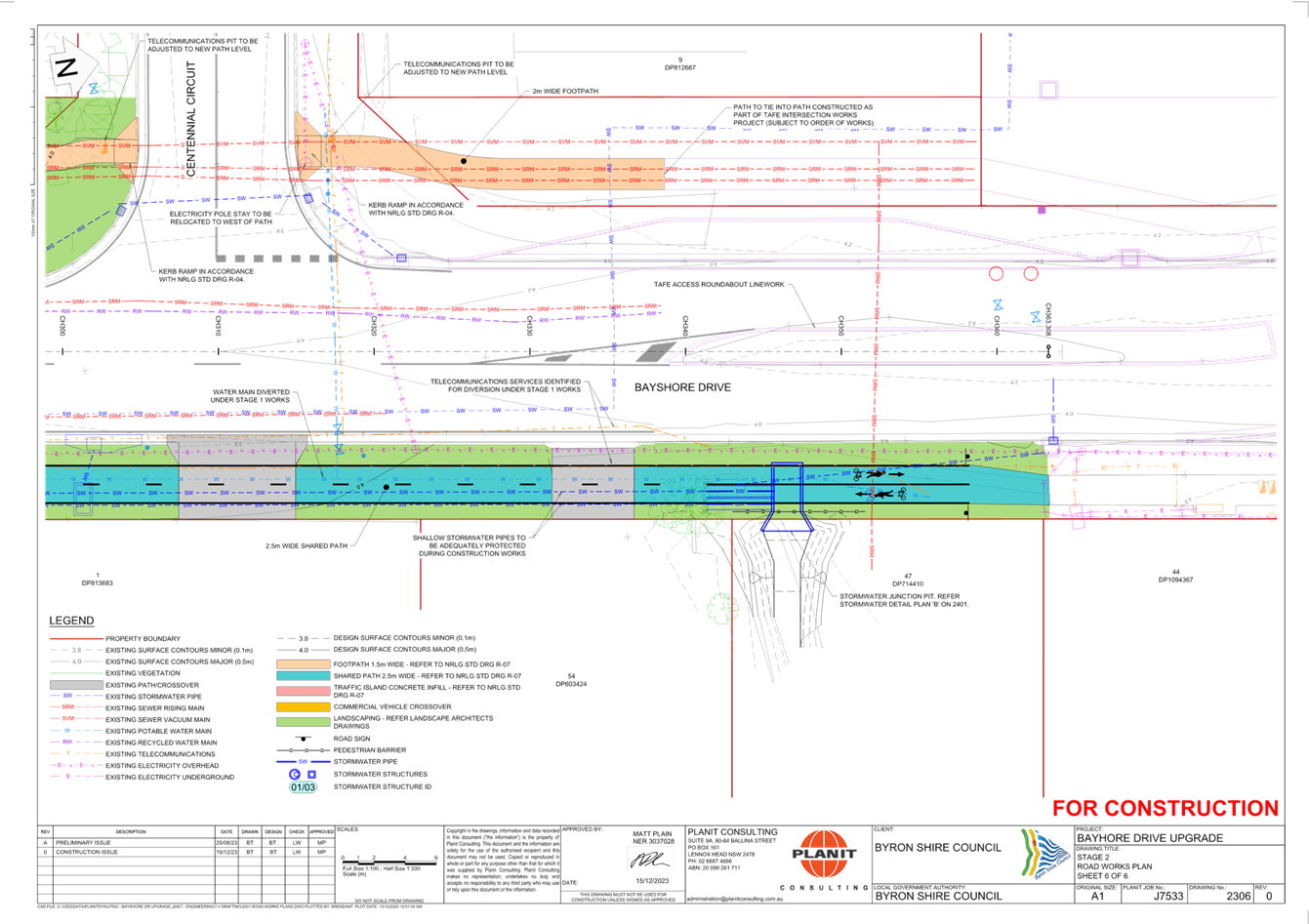
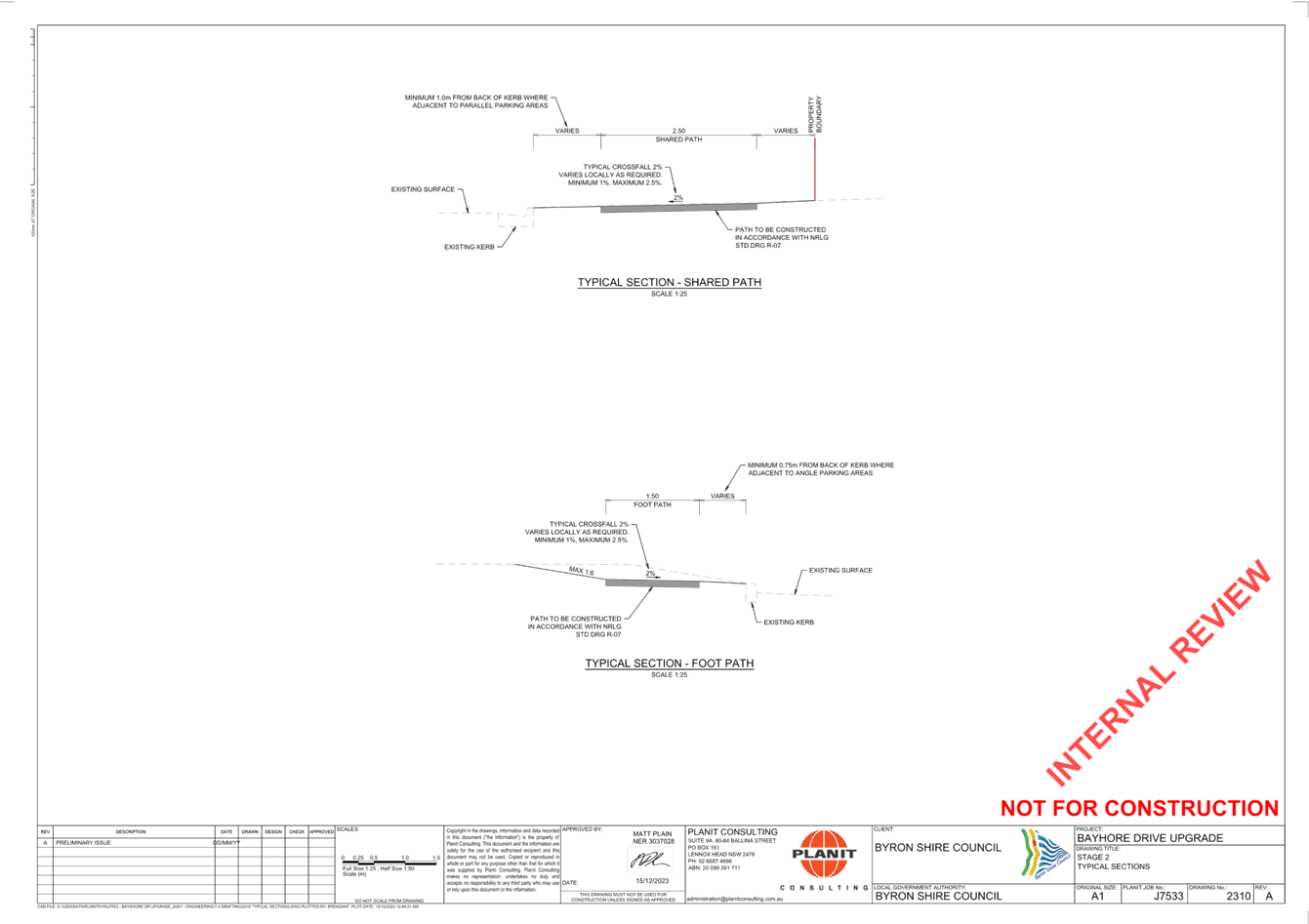
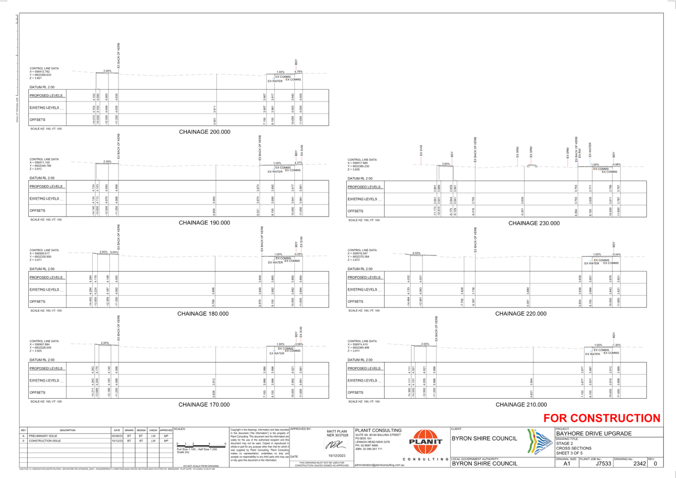
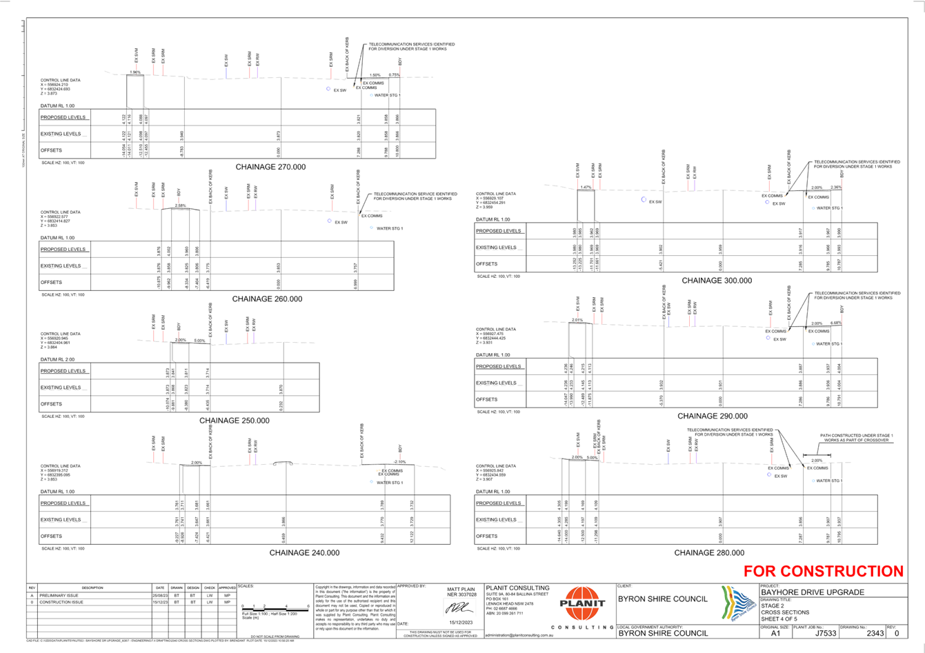
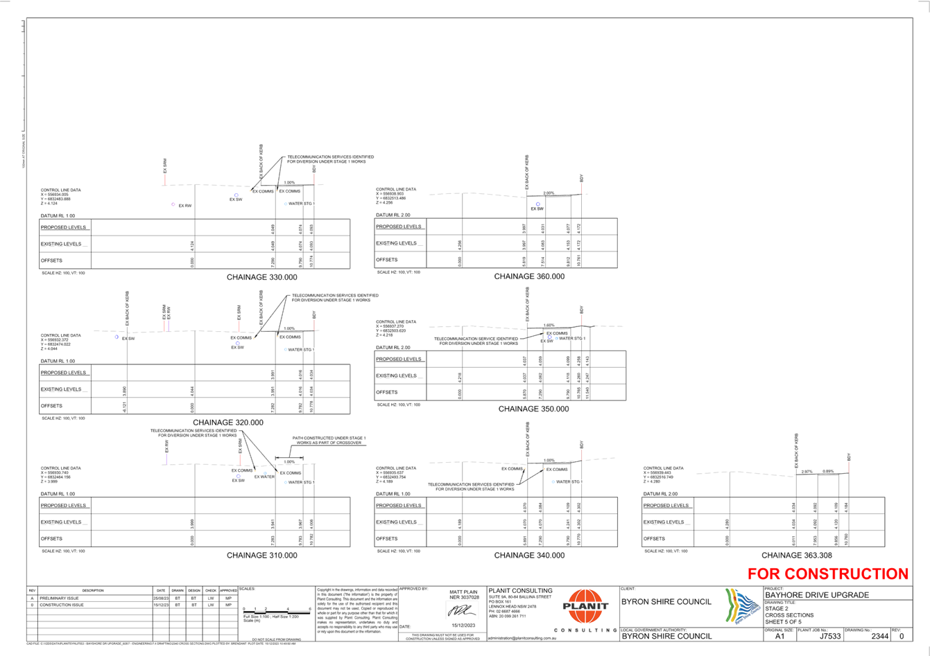
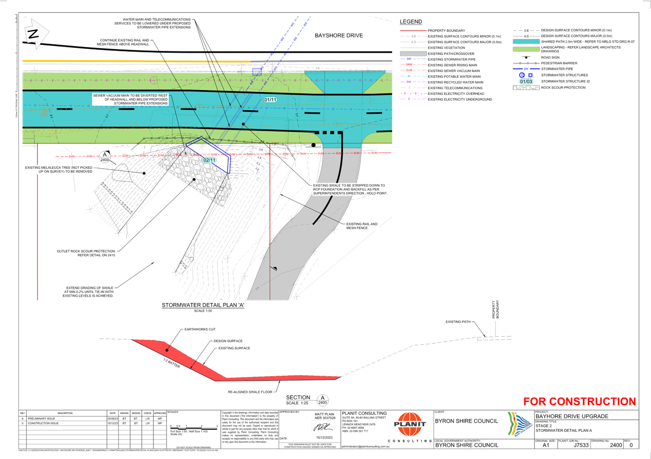
No. 6.2 Bayshore Drive Upgrade
File No: I2024/262
The purpose of this report is to gain Local Traffic
Committee and Council support for the proposed changes to Bayshore
Drive, Byron Bay.
This work will be from the
roundabout at the intersection of Centennial Circuit and Grevillea Street, to
just beyond the second intersection of Centennial Circuit near the IGA. This
tie into the TAFE roundabout design which was completed by the same
consultancy.
The proposed works will improve
parking, drainage, the bus stop, and the poor condition road surface, creating
a safer road environment.
Work will include:
• Renewing the
existing road pavement
• Angle and
parallel parking
• Stormwater
infrastructure
• Service
relocations
• An upgraded bus
stop.
The project has undergone
consultation with the community at two drop-in sessions in February 2024 and
over 2,000 letters and flyers being distributed to the local community.
Construction has been advertised on the radio, Council website and Facebook.
The project is designed in two
stages with the first stage consisting of the road and parking upgrades and the
second stage including a cycleway and footpath. Stage 2 also includes crossings
and further improvements to the bus stop. Stage 2 is currently shovel ready but
unfunded.
Plans for both Stages have been
attached to this report (Attachment 1 and Attachment 2).
A Safety in Design report and
Review of Environmental Factors has been completed for the proposed work.
RECOMMENDATION:
That Council supports the signage, line markings,
bus stops and traffic control devices associated with the Bayshore Drive works
as shown in Attachment 1 (E2023/127977)
Attachments:
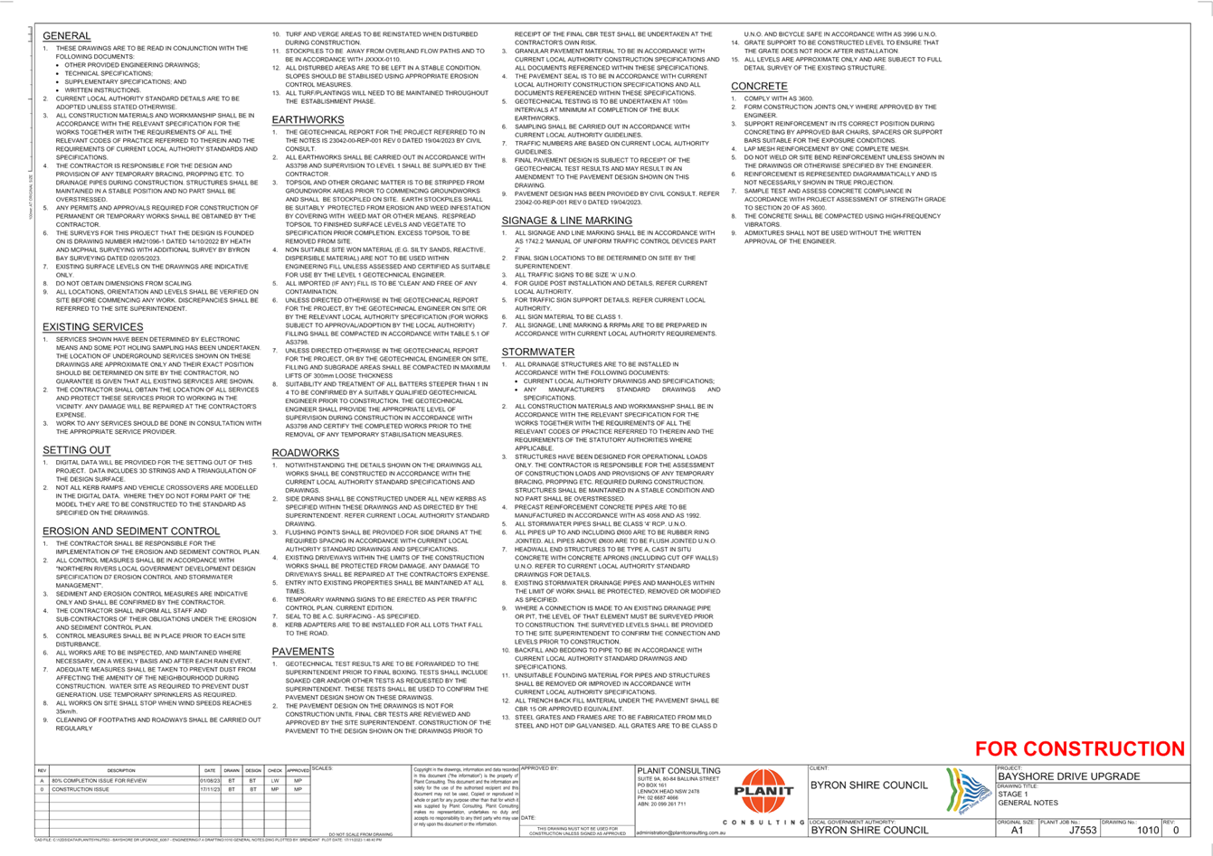
1 PM20_1201
- Bayshore Drive Upgrade - Stage 1 IFC Drawings, E2023/127977 , page 7⇩
2 J7553
BAYSHORE STAGE 2 IFC, E2024/18387
, page 33⇩
Regulatory
Matters 6.2 - Attachment 1
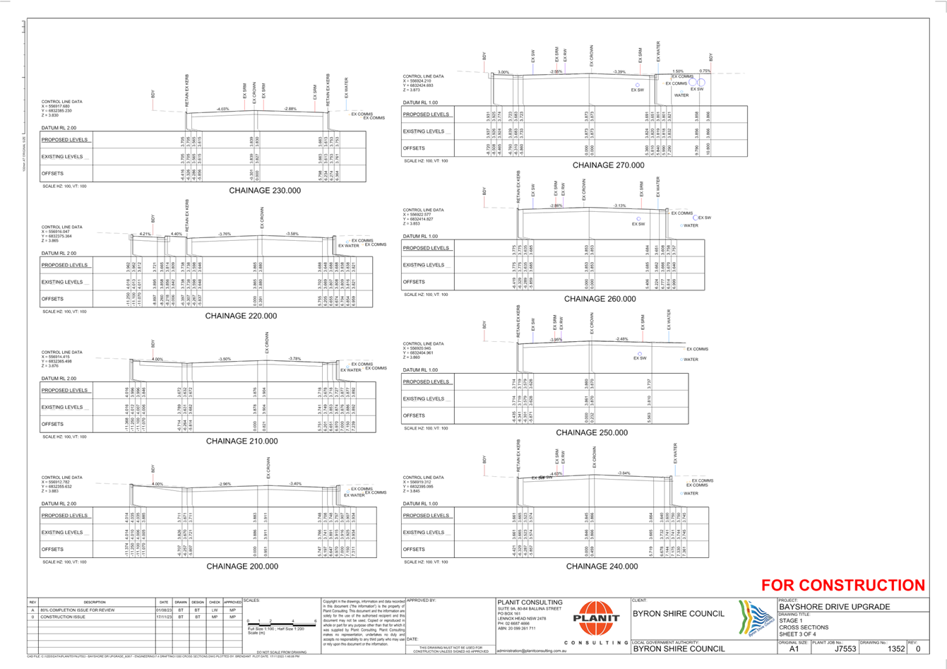
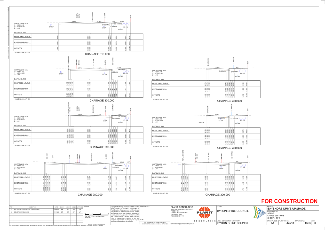
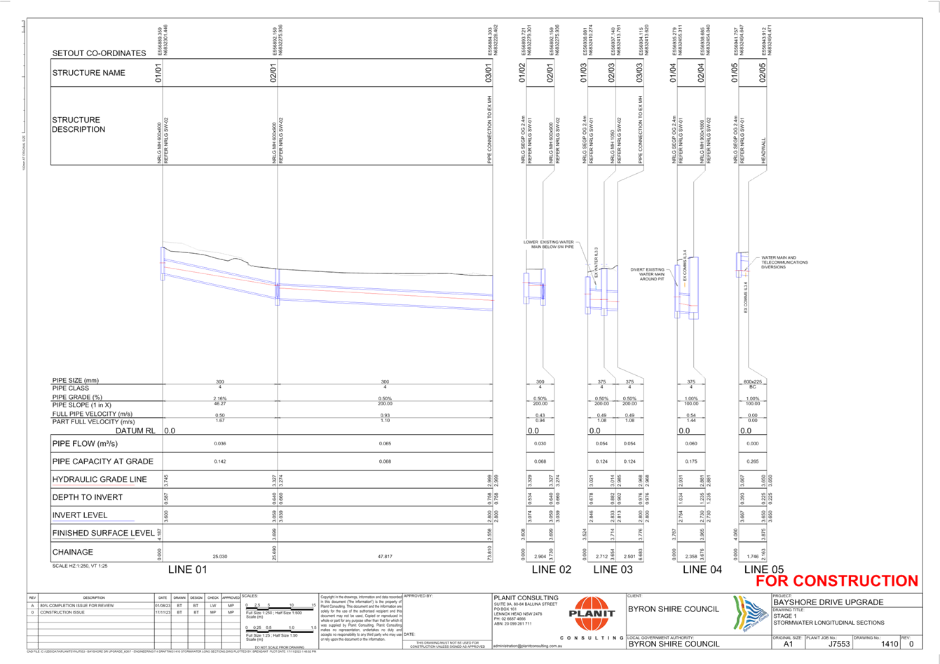
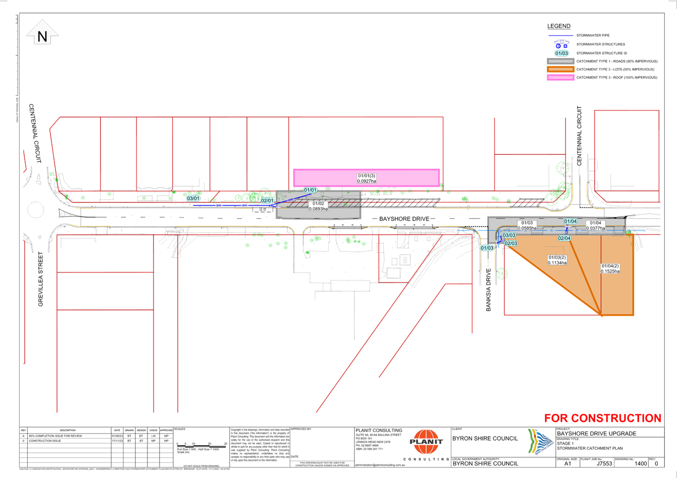
Regulatory
Matters 6.2 - Attachment 2

Local Traffic Committee Meeting 6.3
Report
No. 6.3 Council Depot Bayshore Drive - Permit
Holders Only Parking Signage For Staff Parking
File No: I2024/351
The purpose for this report is to gain support for an
internal exception inside Council’s Depot Parking Area requesting the
implementation of “Permit Holders Only” beyond this point. This
point is to ensure appropriate staff parking is provided to Byron Shire Depot
staff and visitors.
A review of the Council’s Bayshore Drive Depot has
highlighted some concerns as the number of vehicles and staff growth within the
premises. It has been observed several recurring issues regarding
parking, including but not limited to:
· Limited
parking space leading to congestion and inconvenience.
· Unauthorized
vehicles occupying designated spots, causing frustration among staff.
· Vehicles
parked in restricted areas, hindering the movement of essential equipment.
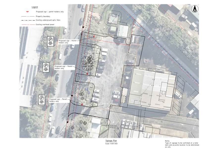
Please refer to signage plan in
Attachment 1 (E2024/22953) for the proposed signs and locations, as per Figure
1 below. Signage dimensions to be in accordance with R5 82A and R5-83A at the
exits.
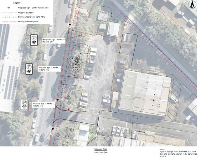
Figure 1: Proposed Parking signage
Current signage in place is as per
Figure 2, this is to ensure appropriate enforcement can be undertaken beyond
this point.
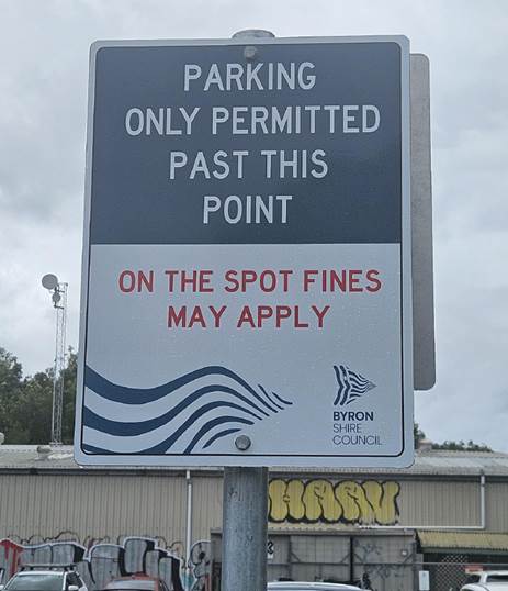
Figure 2: Current Parking signages
RECOMMENDATION:
That the Local Traffic Committee endorse the
permit holder only exception for Depot Staff and Visitors at Council Depot on
Bayshore Drive.
Attachments:
1 3037_DEPOT
PARKING_SP01 (Rev1), E2024/22953
, page 59⇩ 
Regulatory
Matters 6.3 - Attachment 1
Local Traffic Committee Meeting 7.1
Matters for Traffic Engineering Advice
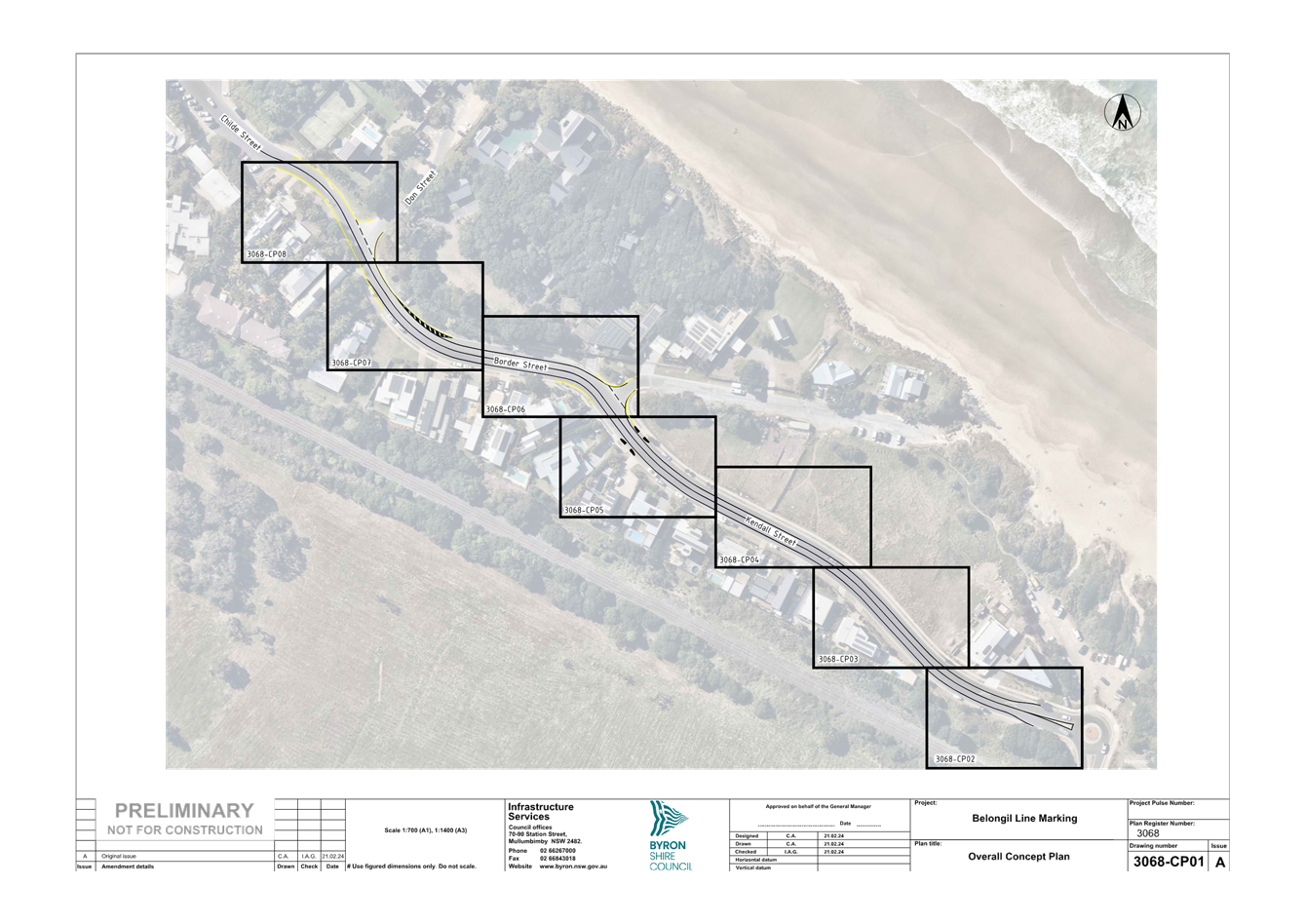
Report No. 7.1 Belongil - Kendall Street to Childe Street Local
Traffic Management
File No: I2024/226
The purpose of this report is to gain Local Traffic Committee
endorsement for the implementation of line-marking and no stopping restrictions
throughout the Belongil area from Kendall Street through to Childe Street to
manage driver behaviour.
Background
Council previously gained endorsement for the installation
of Local Area Traffic Management devices through the subject area (refer to
attachments 1 and 2). However, following the installation there was
issues with driver compliance (refer to figure 1). Drivers were commonly
observed to proceed in a straight line through the chicane into the path of
on-coming drivers avoiding the need to slow down. These devices also
removed a significant amount of parking adjacent residential properties.
Due to the safety issues associated with these devices staff
removed the devices and associated restrictions. 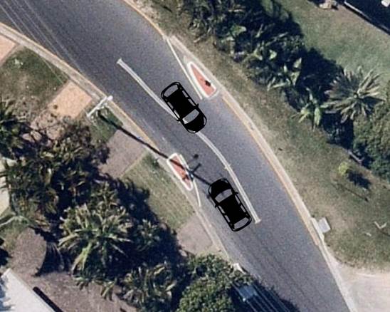
Figure 1: Safety issue
Kendall St and Childe St traffic management device
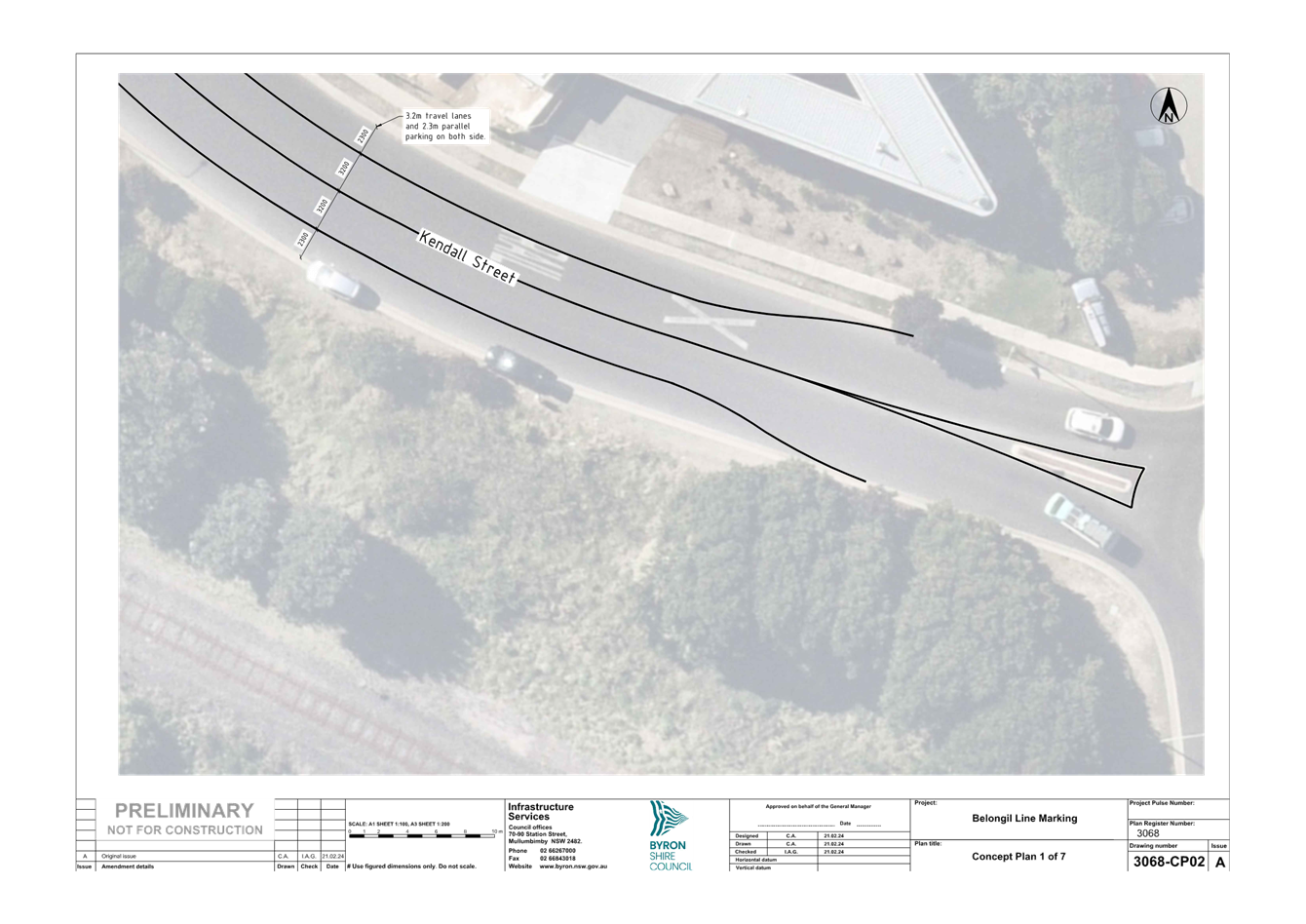
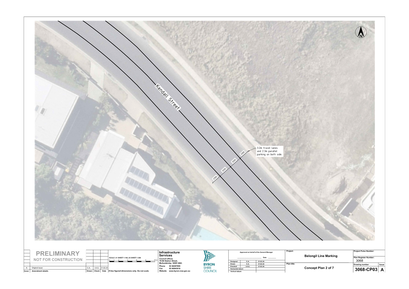
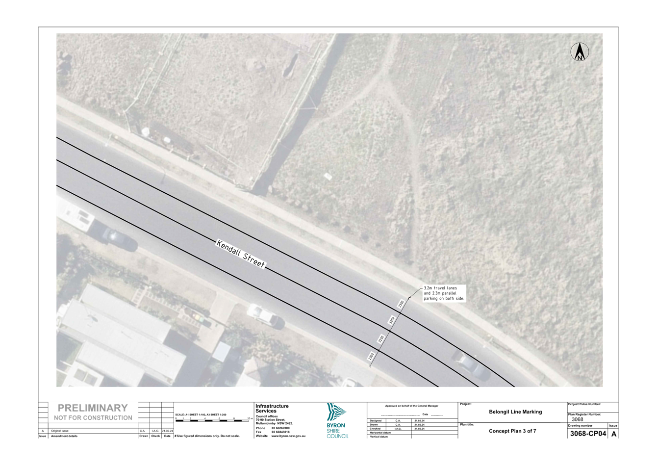
Proposed Solution
Following the removal of the chicanes staff are proposing a
less invasive speed management treatment for the area. This proposal
includes line-marking the travel lanes to provide a narrowing effect which can
reduce the likelihood of speeding. Currently the road is un-marked, and
due to the width (11m) people are willing to drive further to the right of the
road due to the lack of channelisation. Line-marking the area should
channelise most drivers further to the left while providing a narrower travel
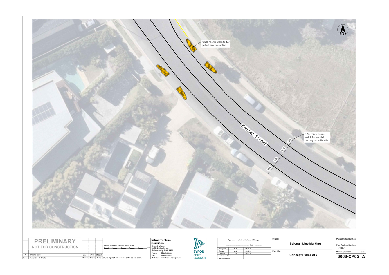
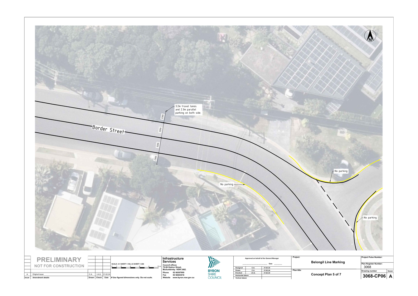
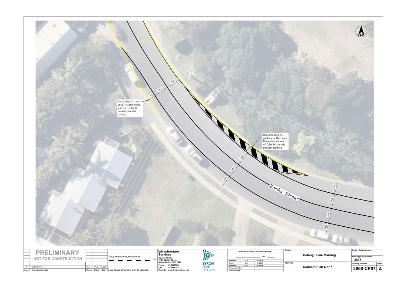
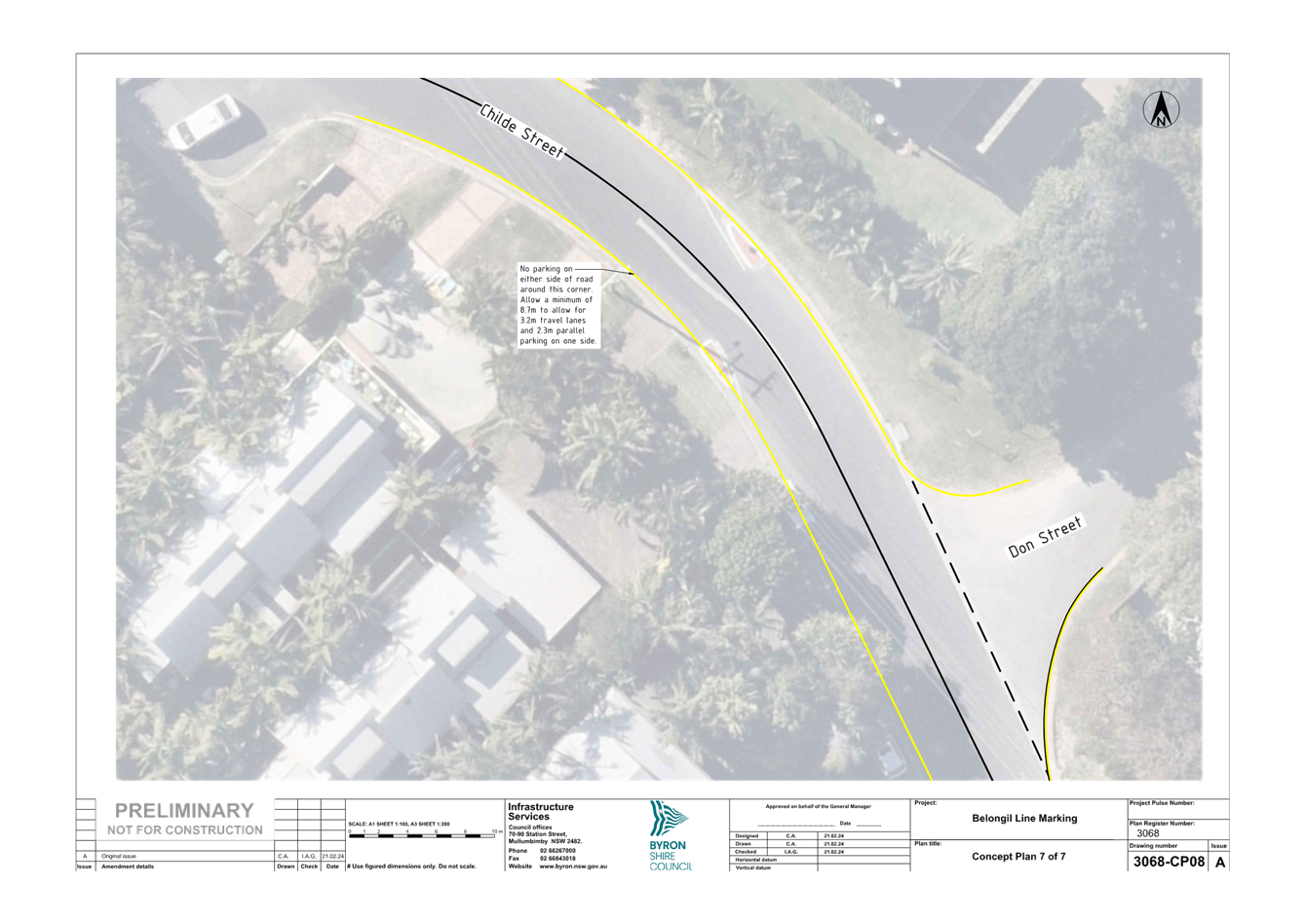
path while potentially slowing vehicle speeds (refer to attachment 3).
RECOMMENDATION:
That the Local Traffic Committee endorse the
line-marking traffic management treatments proposed in Attachment 3
(E2024/20677) of this report for installation.
Attachments:
1 Minutes
30/11/2022 Local Traffic Committee Extraordinary, I2022/1779 , page 62⇩ 
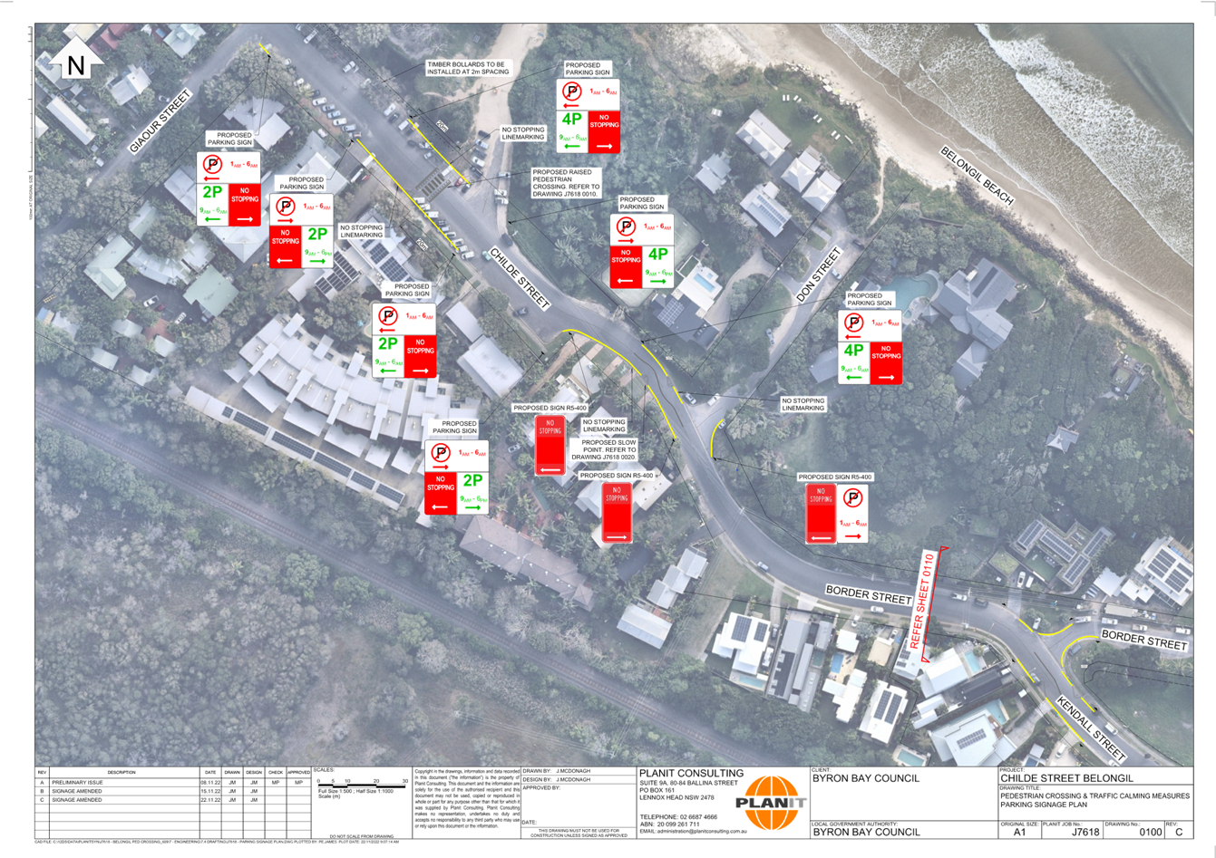
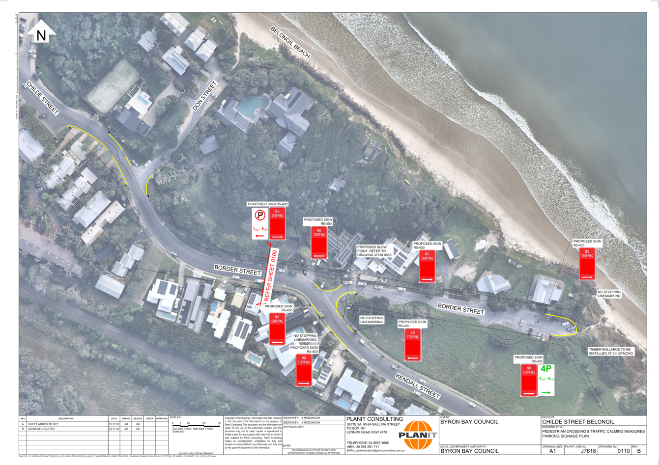
2 Belongil
Parking Changes, E2022/117545 ,
page 69⇩ 
3 3068
Belongil Line Marking, E2024/20677
, page 71⇩
Matters
for Traffic Engineering Advice 7.1 - Attachment 1

Matters
for Traffic Engineering Advice 7.1 - Attachment 2
Matters
for Traffic Engineering Advice 7.1 - Attachment 3
Local Traffic Committee Meeting 7.2
Report
No. 7.2 Police Station Street Parking- Bangalow
File No: I2024/276
Bangalow police station has contacted council in regard to
parking management concerns and to request the dedication of two on street
parking spaces for police vehicles.
The Byron Street on-street parking for the police in
Bangalow will need to be in front of the adjacent house due to the taper of the
road before the bend and intersection.
It should be noted that the Police station and the adjacent
dwelling is located on the same lot and is owned by Property NSW.
The markup below illustrates (Fig. 2) the location of the
proposed parking spaces and their required dimensions in line with AS-NZS
2890.1.
The signage required would be two narrow parking panels
“No Stopping Police vehicles excepted” located on either ends of
the parking spaces having the arrows pointing in towards the parking spaces.
(see Fig. 1 below).

Figure 1: Narrow parking panels “No Stopping Police
vehicles excepted”.


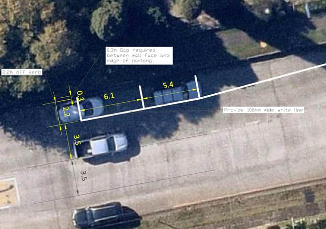
Figure 2: Parking layout
RECOMMENDATION:
That Council support the installation of signage
and line marking required to provide two on streetcar parking spaces allowing
police to have parking available on Byron Street.
Local Traffic Committee Meeting 7.3
Report
No. 7.3 Bangalow Weir Parklands - Illegal Camping
File No: I2024/279
Police in Bangalow have become aware that illegal camping is
on the rise in the Bangalow Wier Parklands and hence have requested that
no parking signs (between 1am- 5am) be placed at the Bangalow Weir carpark.
Therefore, it’s proposed that no camping signs be
placed at the entrance of the Bangalow Weir Parklands Carpark as well as a
secondary no camping sign with in the parking lot supported with no parking
signs (between 1am -5am) placed at approximately 25m centre to centre within
the parking lot, see Figure 2 below.


Figure 1- Bangalow Weir
Parklands Location (Lat:28.6875° S Lon:153.5267° E)
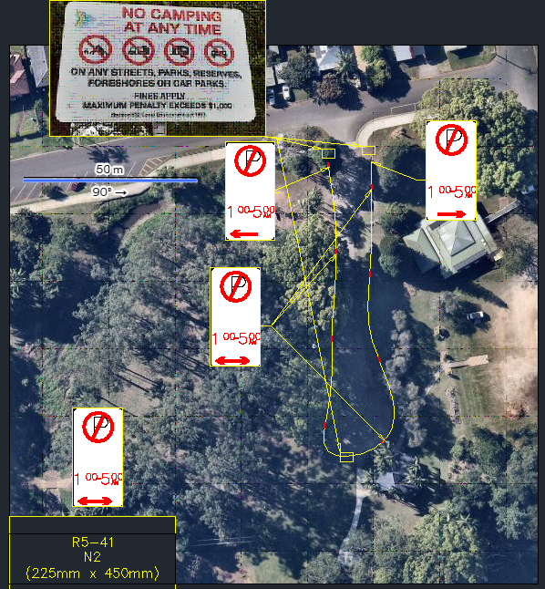
Figure 2 - Bangalow Weir Parklands
Carpark-Proposed Signage
RECOMMENDATION:
That Council supports the installation of no
camping and no parking signs (between 1am-5am) within the Bangalow Weir
Parklands Carpark to allow enforcement officers to fine/move on illegal
camping.
Local Traffic Committee Meeting 7.4
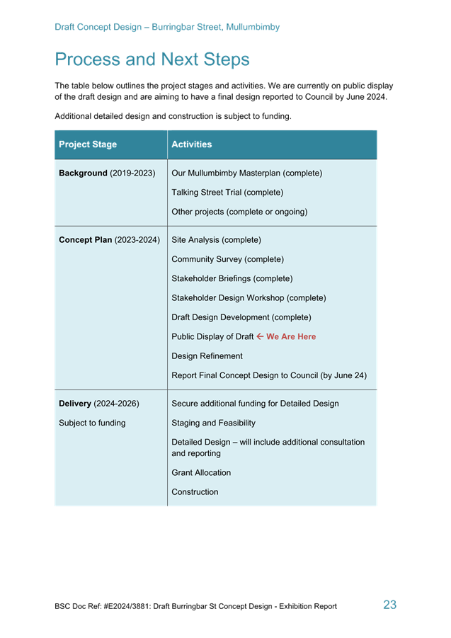
Report
No. 7.4 Burringbar Street Draft Concept Design
File No: I2024/323
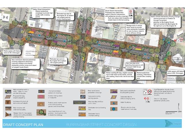
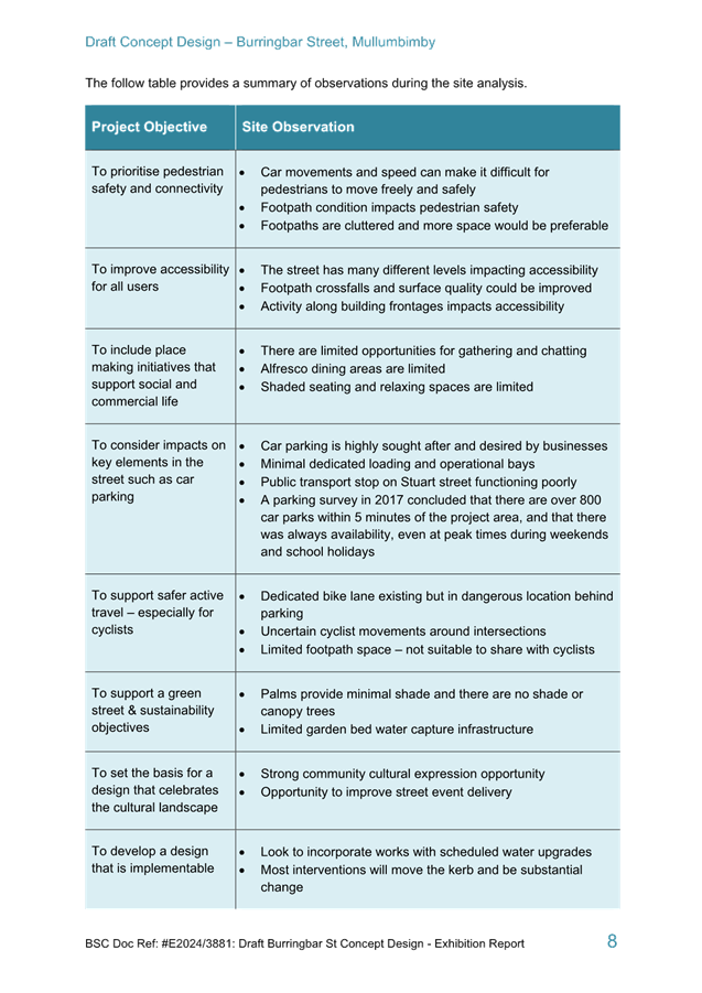
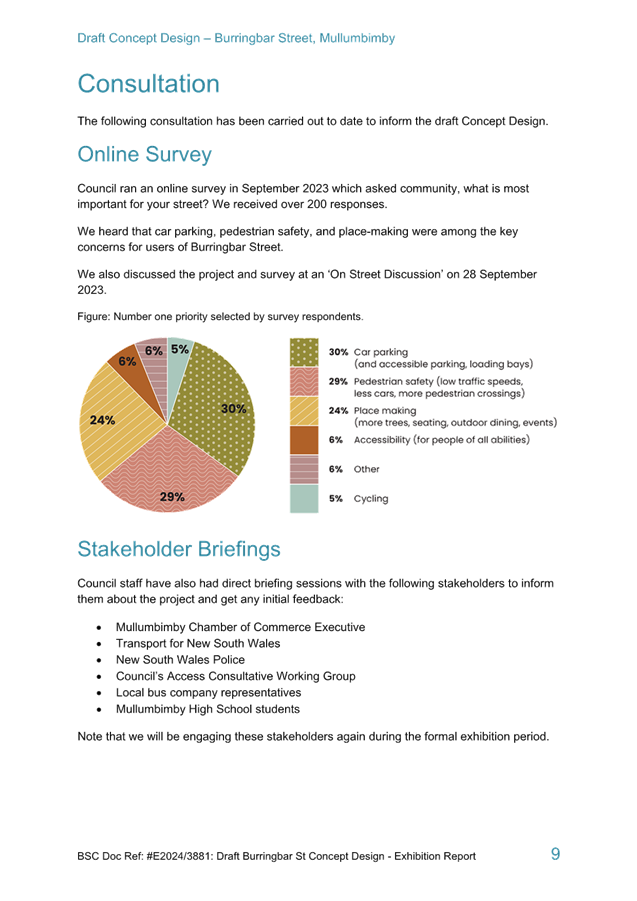
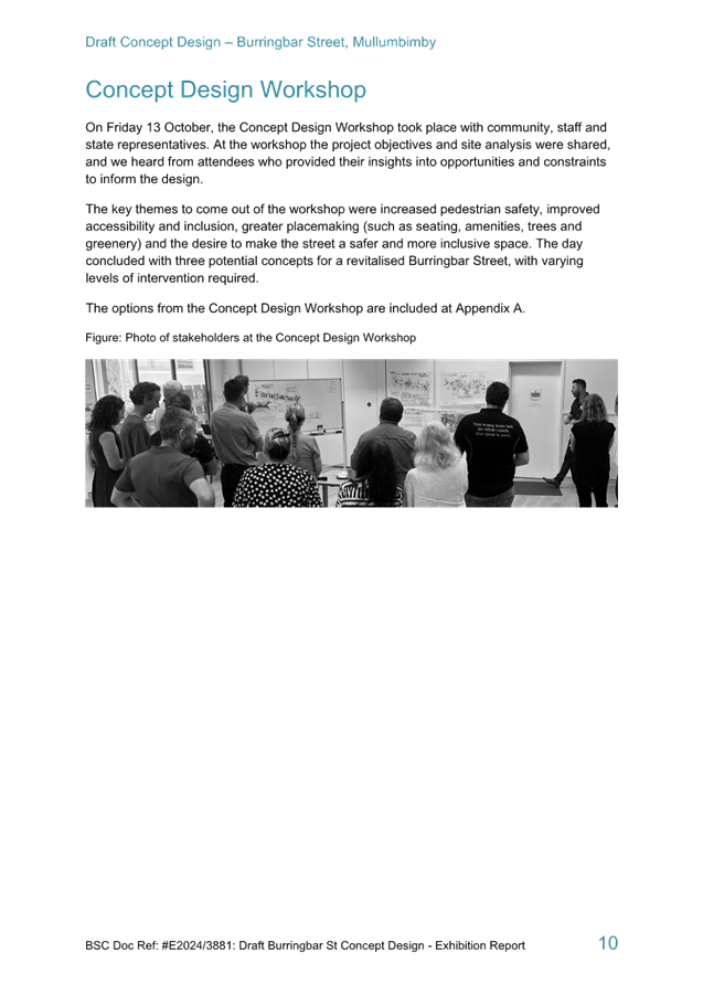
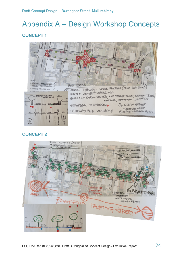
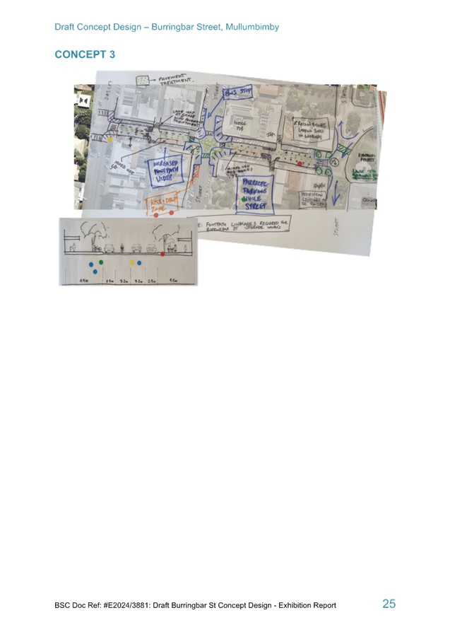
Following site analysis, consultation and workshops held in
2023, Council have developed a Draft Concept Design for Burringbar Street,
Mullumbimby.
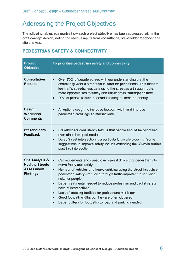
The Concept Design looks at ways to make Burringbar Street
more:
· Accessible
· Safe for
pedestrians
· Vibrant
· Enjoyable.
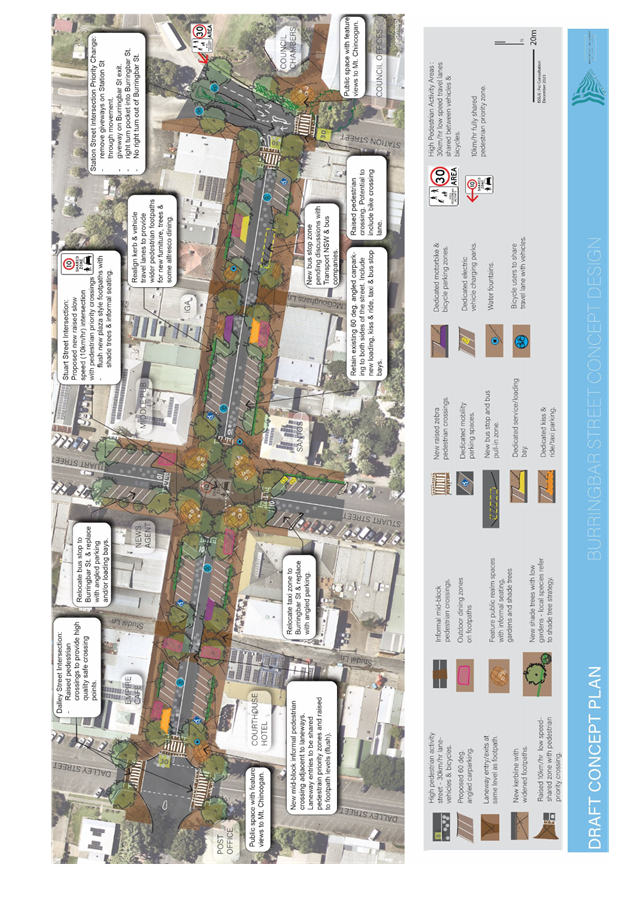
The Draft Concept Design is shown on the following page and
attached at Attachment 1 (E2024/16870).
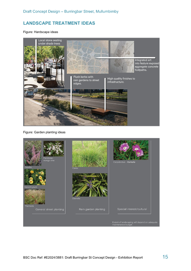
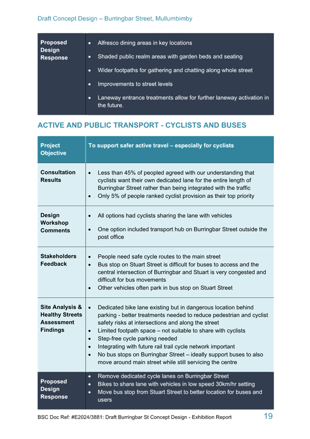
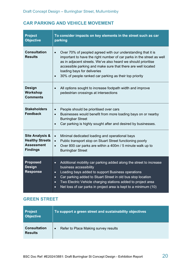
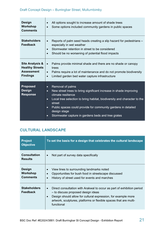
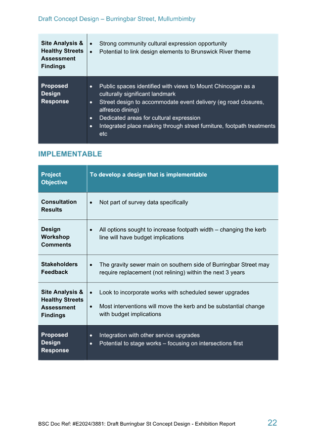
Key changes to Burringbar Street proposed in this design
include:
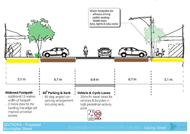
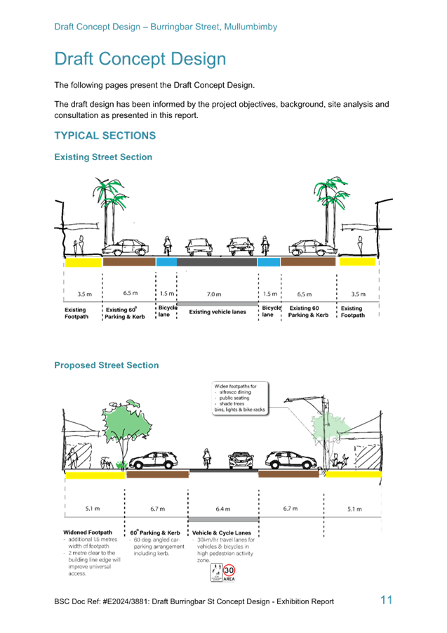
· Widen existing
footpaths from 3.5m to 5.1m to improve access and allow for afresco dining
and public seating.
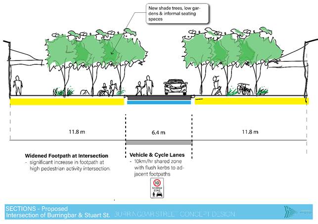
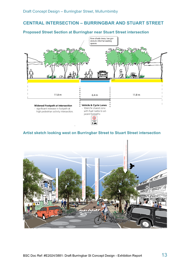
· Raised 10km/hr
shared zone at Burringbar and Stuart Street intersection where people have
priority to cross in any direction.
· Additional
pedestrian crossings at Dalley Street and adjacent to laneways.
· Station Street
Intersection priority change.
· Informal
pedestrian crossings across Burringbar Street near Studal Lane and
McGoughans Lane.
· Remove
dedicated cycle lanes on Burringbar Street and integrate cyclists with
vehicle lane.
· Net loss of car
parks in project area is kept to a minimum (10)
· Retain existing
60-degree angled carparking to both sides of the street and include new
loading, kiss and ride, taxi and bus stop bays.
· Relocate taxi
zone on Stuart Street to Burringbar Street and replace with angled parking.
· Relocate bus
stop zone pending discussions with Transport NSW and bus companies.
· Additional
mobility parking spaces increased from 3 to 4.
· Loading bays
added.
An Exhibition report providing detailed site analysis,
background information and further details of the design features is provided
at Attachment 2 (E2024/3881).
Council is seeking engineering feedback and advice on this
Draft Concept Design to support a final Concept.
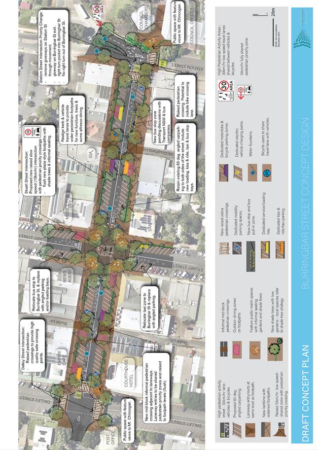
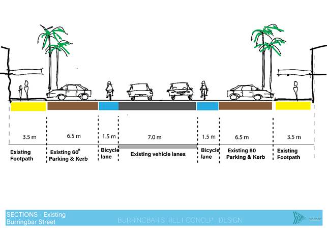
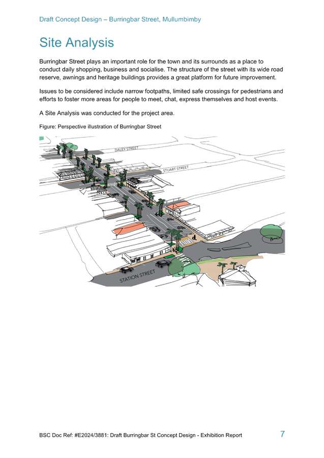
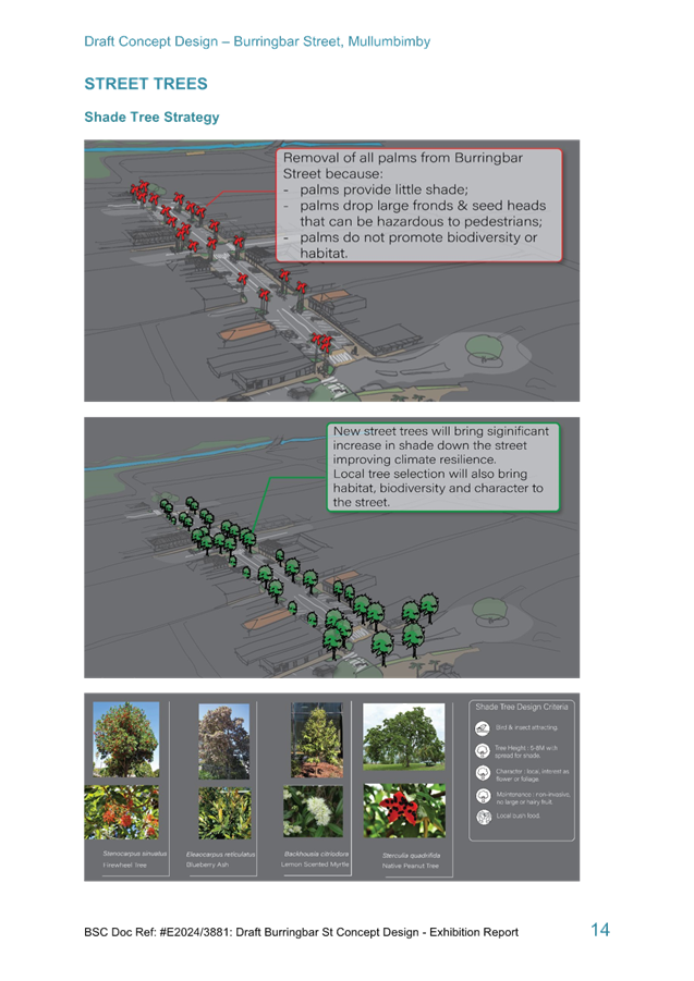
The following images present the
current street section and the proposed sections for the length of Burringbar
Street and the Burringbar Street/Stuart Street intersection (proposed 10km
Shared Zone).
RECOMMENDATION:
That the Local Traffic Committee note the Draft
Concept Design (E2024/16870) and Street Sections for Burringbar Street and
provide advice.
Attachments:
1 Burringbar
Street Draft Concept Design, E2024/16870
, page 90⇩ 
2 Burringbar
Street Concept Design Exhibition Report, E2024/3881
, page 91⇩ 
Matters
for Traffic Engineering Advice 7.4 - Attachment 1
Matters
for Traffic Engineering Advice 7.4 - Attachment 2


Local Traffic Committee Meeting 8.1
Events
Report No. 8.1 Mullum Laneways 2024 - Kaleido Mullumbimby
File No: I2024/135
Council has received an Event Application for Mullum
Laneways Festival, an event to be held on 5 May 2024.
Previous Event presented to LTC was under the name of Blues
on Burringbar. The organisers are hoping to do similar event each year.
RECOMMENDATION:
1. That
Council supports Mullum Lane Ways Festival to be held 5 May 2024 10am to
10.00pm.
2. That
Council support in Part 1 is subject to:
a) separate
approvals by NSW Police and TfNSW being obtained;
b) the
event organiser providing council with an updated Traffic Management Plan and
Traffic Guidance Scheme/s for the event;
c) development
and implementation of a Traffic Management Plan and Traffic Guidance Scheme/s
by those with appropriate TfNSW accreditation and the holding of current and
appropriate levels of insurance and liability cover;
d) the
impact of the event be advertised, and charged at cost to the organisers, via a
notice in the local weekly paper and appropriate variable message signage a
minimum of one week prior to the operational impacts taking effect, noting it must
include the event name, specifics of any traffic impacts or road closures and
times, alternative route arrangements, event organiser, a personal contact name
and a telephone number for all event related enquiries or complaints;
e) the
event be notified on Council’s web page with the event organiser
supplying Council with the relevant information.
3. The
event organiser to:
a) inform
the community and businesses that are directly impacted (e.g. within road
closure zones) via written information which is delivered to the property in a
timely manner so as to document, consider and respond to any concerns raised;
b) arranging
for private property access and egress affected by the event;
c)
liaising with bus, taxi and waste operators and ensuring arrangements are made
for provision of services during conduct of the event;
d) consulting
with emergency services and any identified issues be addressed;
e) holding
$20m public liability insurance cover which is valid for the event;
f) paying Council’s
Road Event Application Fee prior to the event;
g)
not place any signage on the road related area of the Pacific Highway.
4.
That provisions are made for safe access for heavy vehicles at the
intersections of Stuart Street/Burringbar Street, and Stuart Street/Tincogan
Street.
Attachments:
1 Event
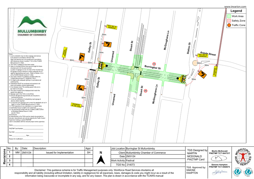
- Mullum Lane Way Fest 2024 - TGS - Burringbar St Mullumbimby, E2024/9367 , page 121⇩
2 Event
- Mullum Laneways Festival 2024 - Summary, E2024/9369
, page 124⇩ 
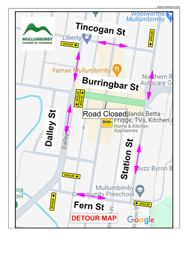
3 Event
- LTC - Mullum Laneway Festival - Burringbar St Mullumbimby (showing
detour), E2024/11496 , page 128⇩
Background
Byron Shire Council received an
application in 2023 through the Events & Festivals Sponsorship Program from
Mullum Lane Ways Festival (Kaleido-Mullumbimby). The program is aimed at
supporting community events.
The event, under the auspice of Mullumbimby
Chamber of Commerce, were a recipient of this funding. Their program
allows a series of creative producers to bring together the arts, music,
creative workshops, puppetry, and family-kids interactive activities.
The Mullumbimby Chamber of Commerce
have experience with a similar event (Biggest Little Banquet) they used to run,
that was successfully run for several years and a similar concept to this Blues
on Burringbar in 2023.
Event Overview
This community event will bring
locals together in a day of free musical entertainment and family fun
activities.
The event will temporarily close a
section of Burringbar Street between Stuart Street and Daley Street from 10am
to 10pm. Traffic will be detoured around Stuart Street and Whian Street
and Tincogan Street both linking back up with Daley Street.
The Traffic Guidance Scheme for
the event is provided at attachment 1.
The event overview is provided at
attachment 2.
The event detour layout is
provided at attachment 3.
Key Issues
While the proposal closes the road
it will not prevent pedestrian access to businesses and will support bringing
more people to local businesses, therefore, the closure is not seen as being a
negative for local business or those using the town centre.
Council Implications
Financial Considerations
Nil, costs borne by applicant.
Asset Management
Not applicable.
Policy or Regulation
All TGS’s are to be developed and
implemented by people with the appropriate level and type of accreditation.
Consultation
A condition of the endorsement of this
event is that the event organisers conduct appropriate community consultation,
including:
1. Advertising
the impact of the event in the local newspaper and on the Council website.
2. Informing
community and business that are directly impacted.
3. Liaising
with bus and taxi operators.
4. Consulting
with emergency services.
Legal and Risk Management
Events 8.1 - Attachment 1


Events 8.1 - Attachment 2
Events 8.1 - Attachment 3