Notice of Meeting
Local Traffic Committee Meeting
A Local Traffic
Committee Meeting of Byron Shire Council will be held as follows:
|
Venue
|
Conference Room, Station Street, Mullumbimby
|
|
Date
|
Tuesday, 19 November 2024
|
|
Time
|
9.00am
|
Phil Holloway
Director Infrastructure
Services
I2024/1541
Distributed
12/11/24

BYRON SHIRE COUNCIL
Local Traffic Committee
Meeting
BUSINESS OF MEETING
1. Apologies
2. Declarations
of Interest – Pecuniary and Non-Pecuniary
3. Adoption
of Minutes from Previous Meetings
3.1 Local
Traffic Committee Meeting held on 15 October 2024
4. Matters
Arising
5. Outstanding
Issues/Resolutions
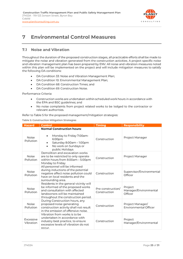
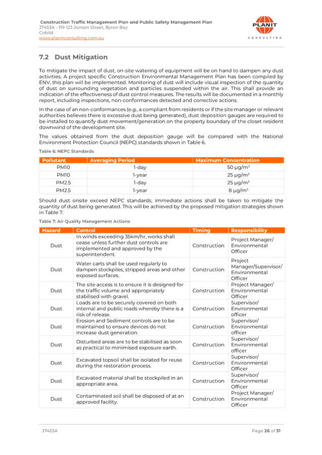
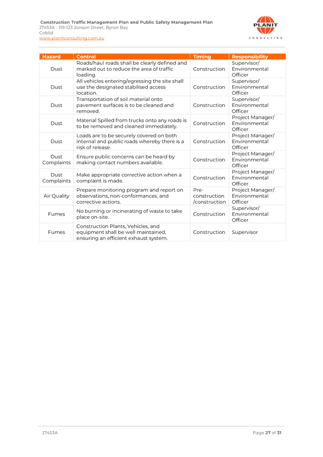
6. Regulatory Matters
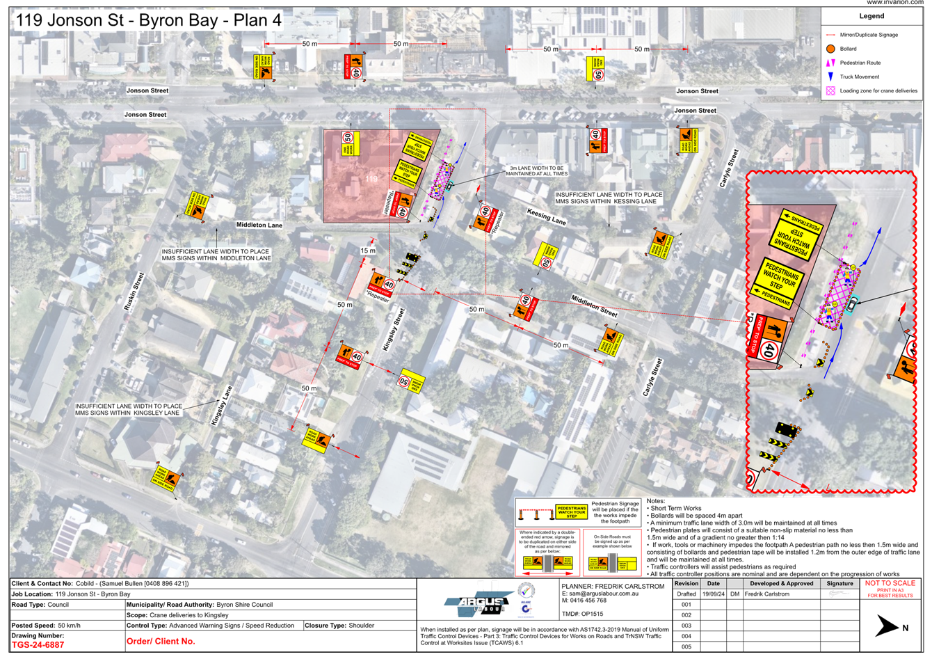
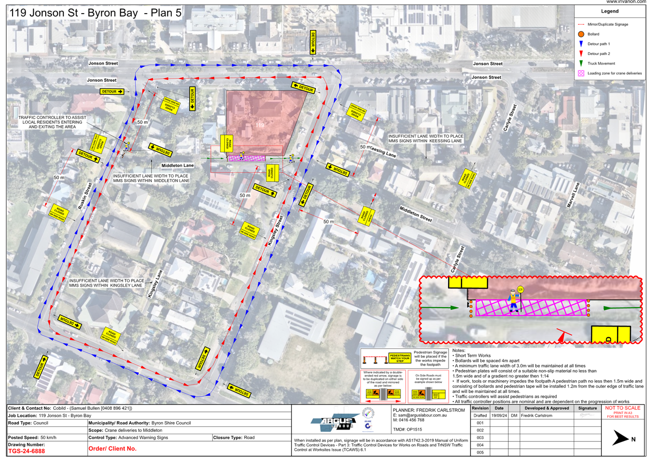
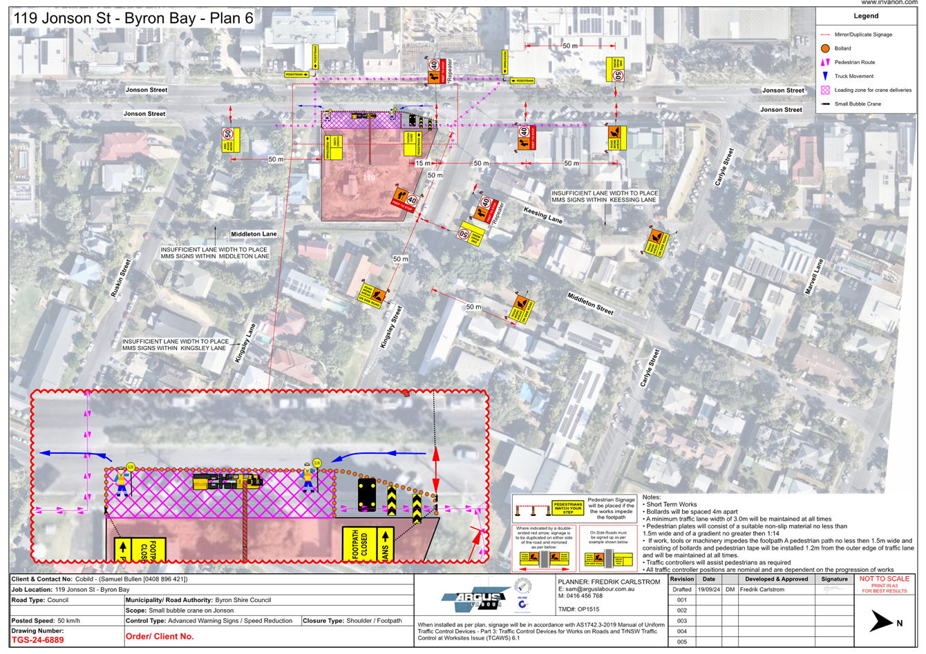
6.1 119-123
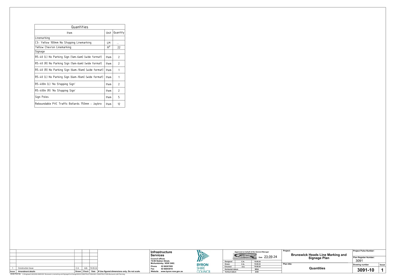
Jonson Street, Byron Bay - new line marking and signage..................... 3
6.2 Slessor
Lane, Brunswick Heads - No Stopping area............................................. 50
6.3 Mullumbimby
Road Upgrade...................................................................................... 54
6.4 Lighthouse
Road - Shared path - 'Get NSW Active' Grant Application............... 63
6.5 Byron
Street shared path – Bangalow - 'Get NSW Active' Grant Application.... 77
7. For Information Only
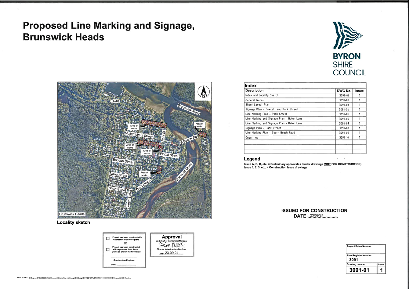
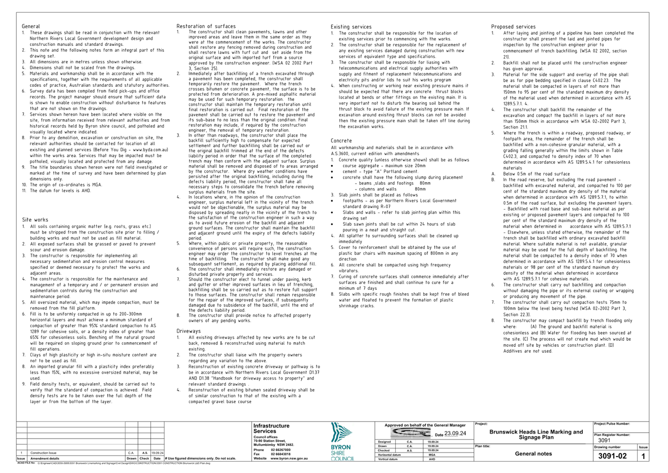
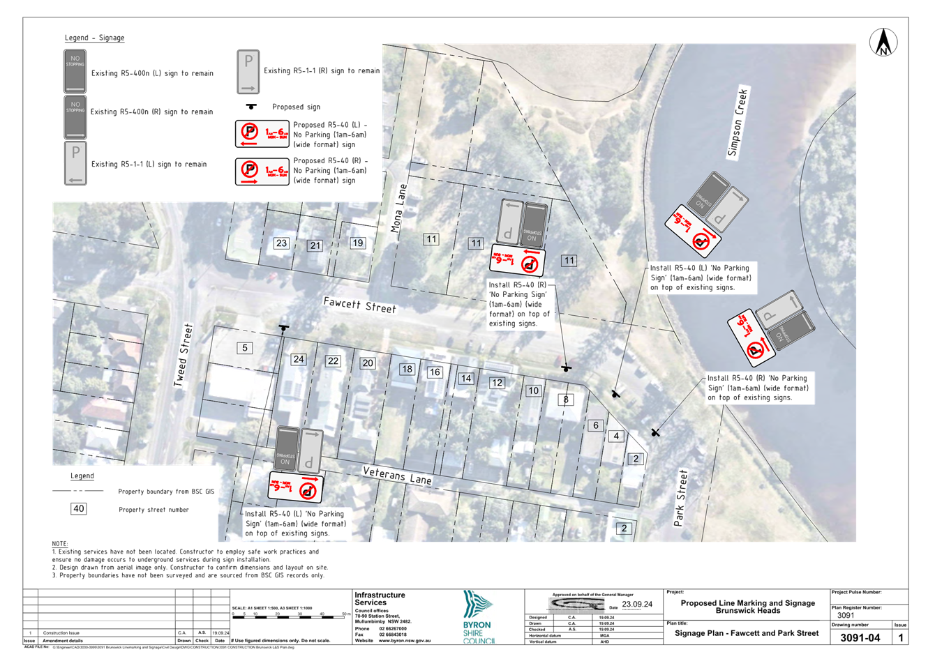
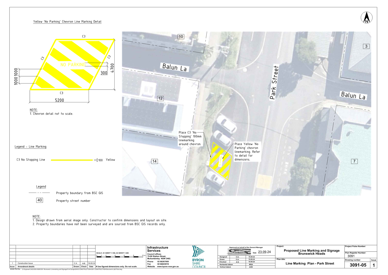
7.1 Brunswick
Heads Pay Parking - Notification of Completion................................. 92
BYRON SHIRE COUNCIL
Local Traffic Committee Meeting 6.1
Regulatory Matters
Report No. 6.1 119-123 Jonson Street, Byron Bay - new line marking
and signage
File No: I2024/1369
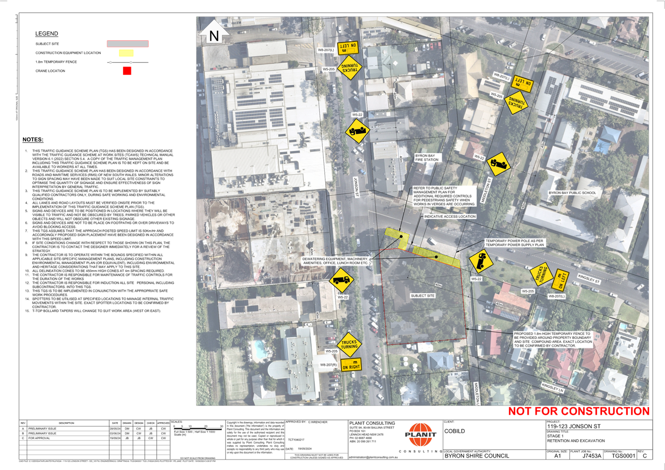
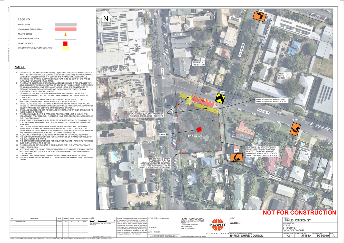
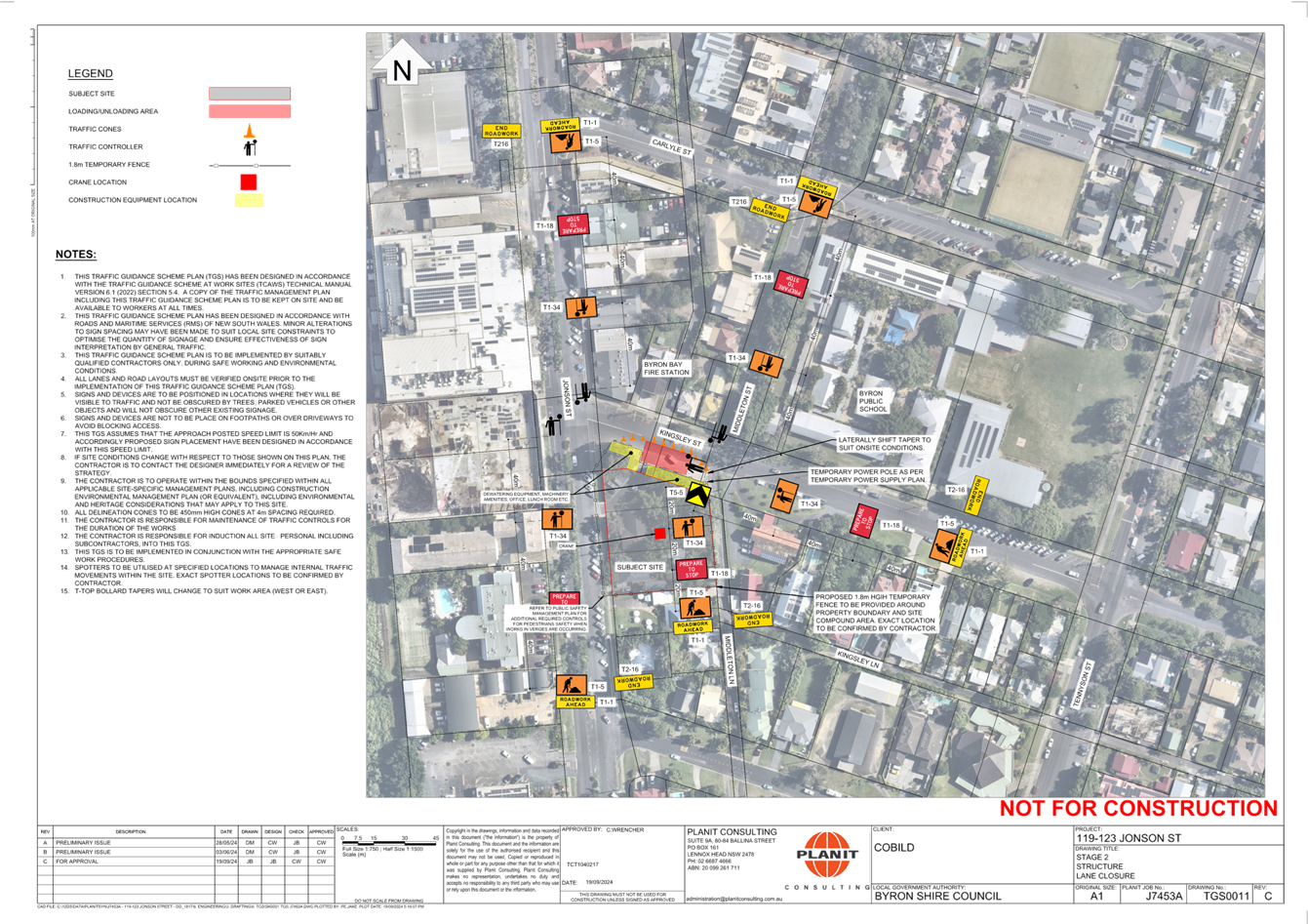
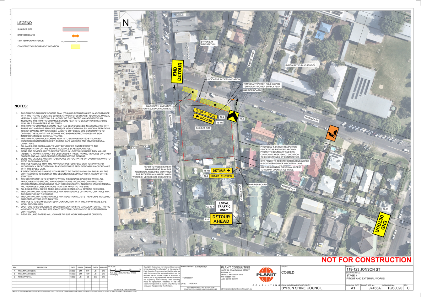
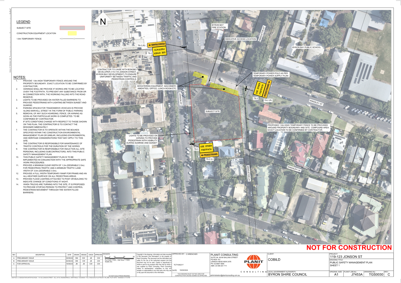
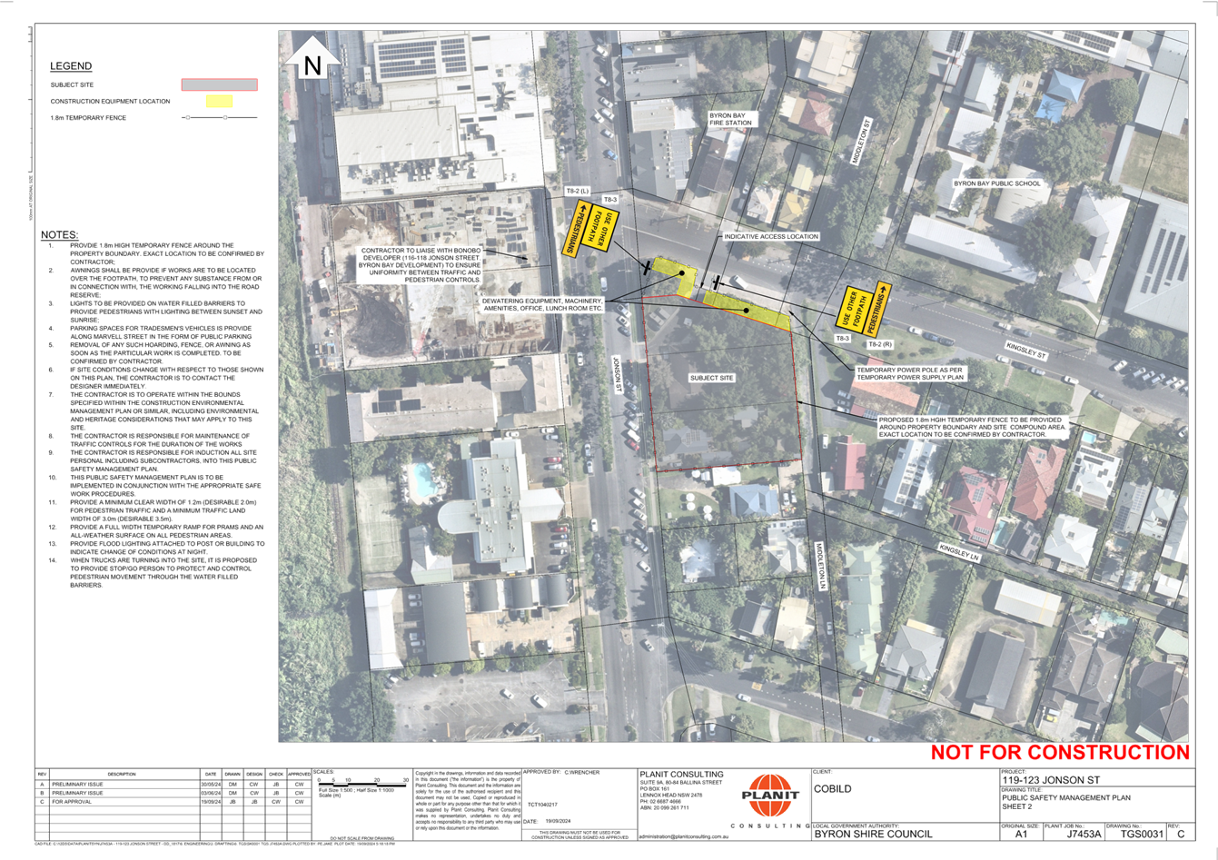
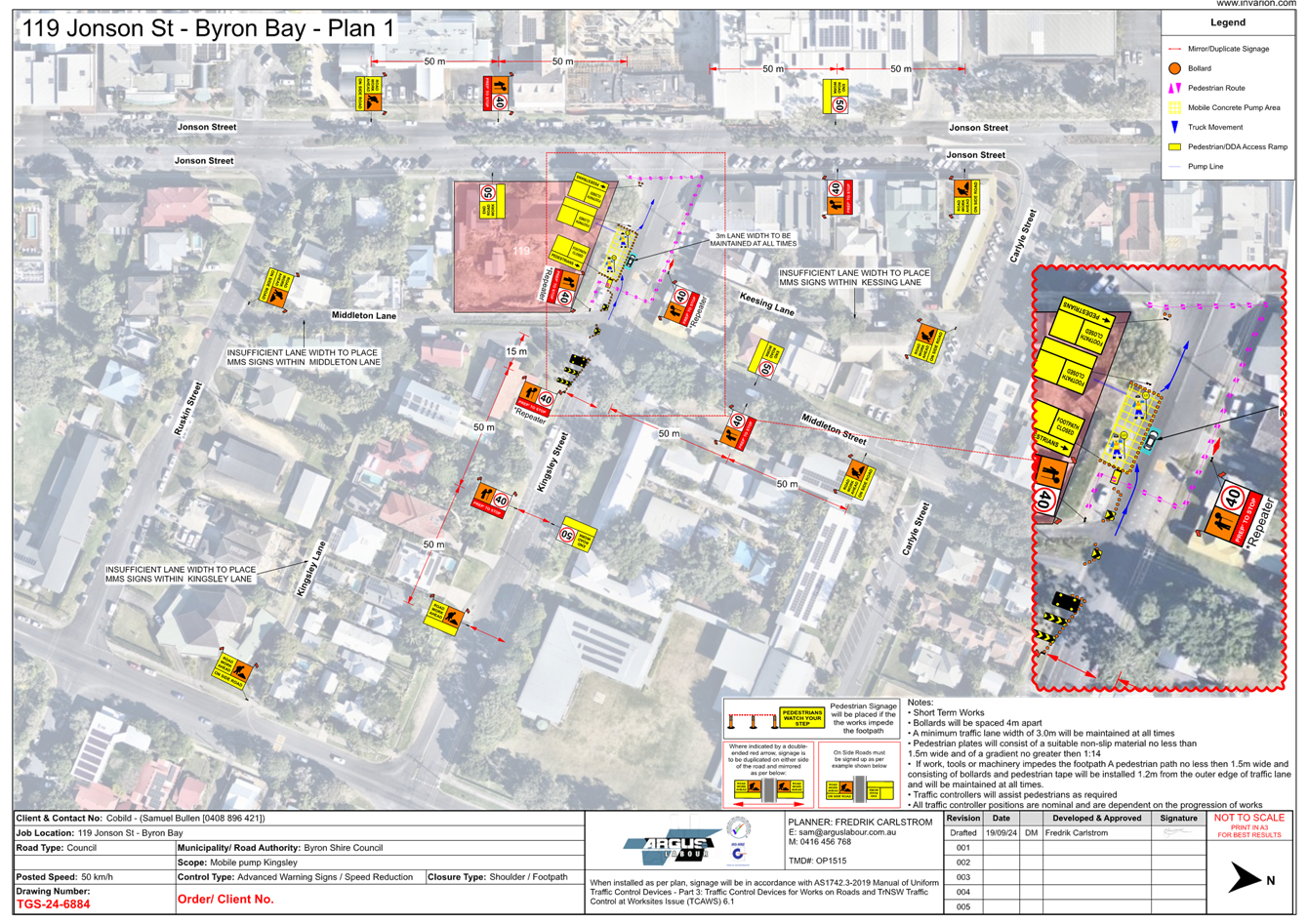
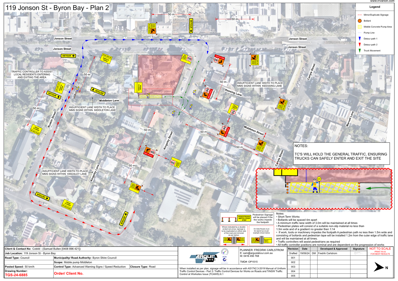
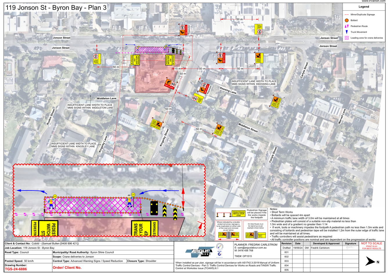
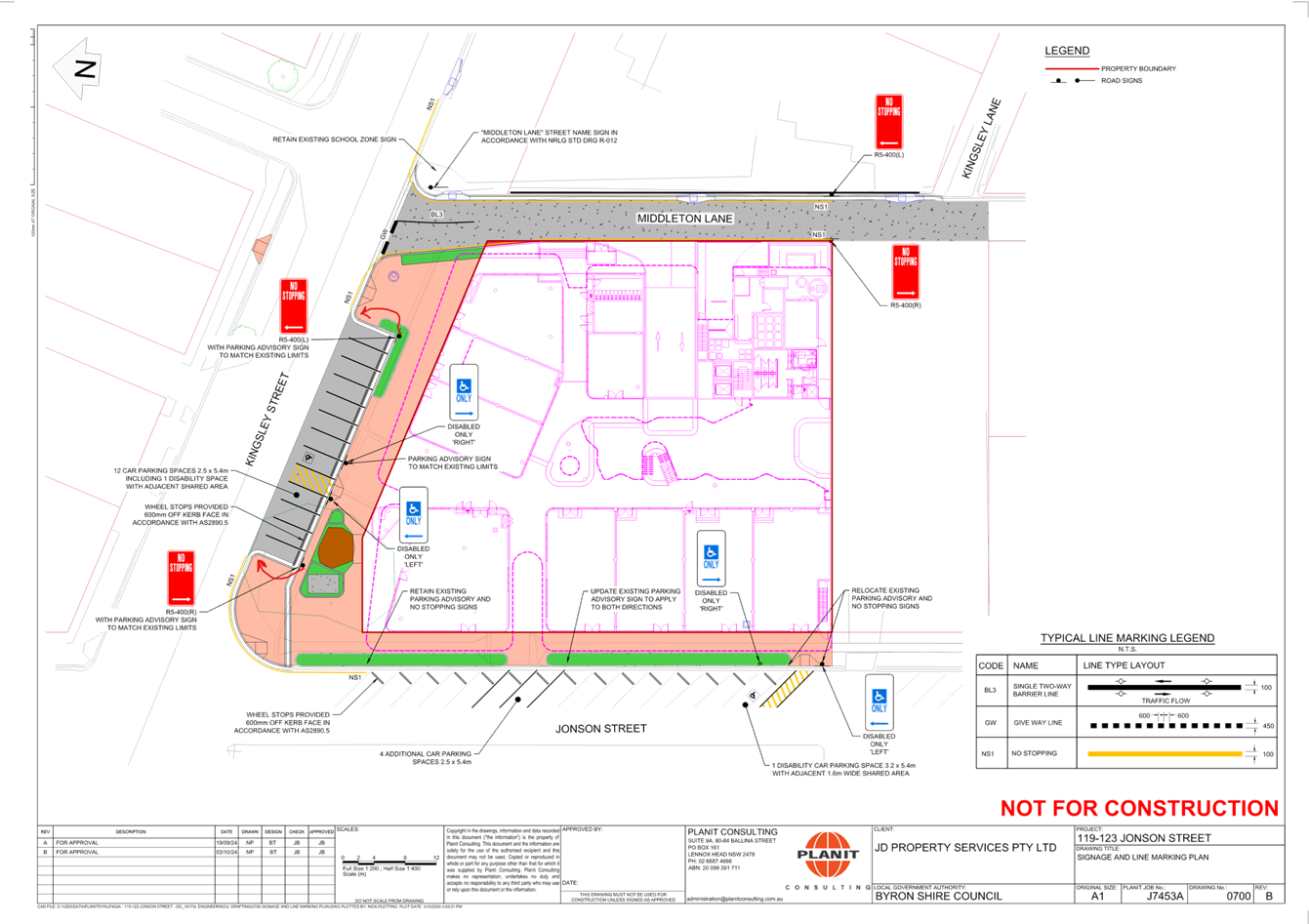
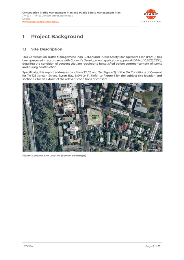
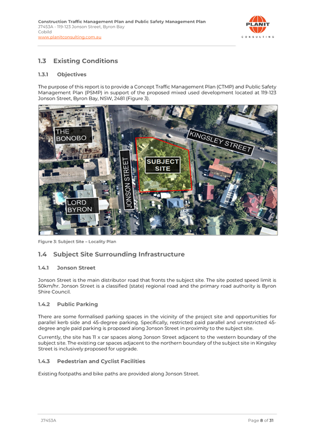
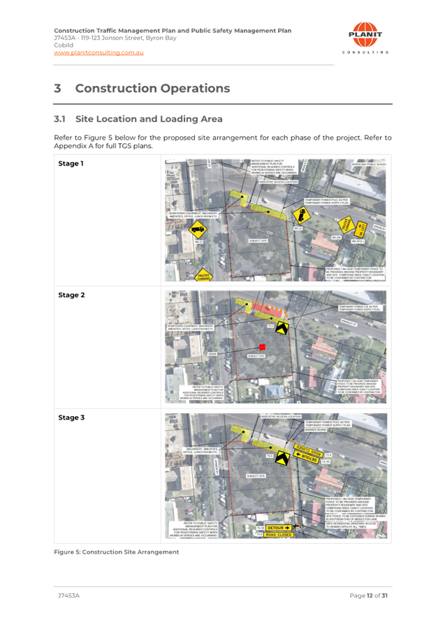
The purpose of this report is to
gain Council support for new regulatory signage and line marking for a proposed
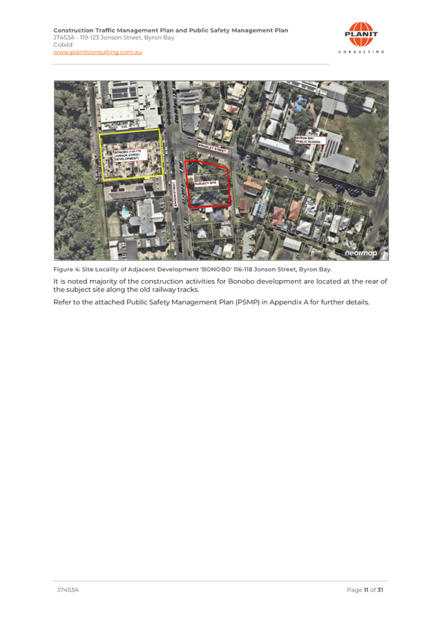
development at 119-123 Jonson Street, Byron Bay as shown in Attachment 1 (E2024/121173).
Council has received a Roads Act application
associated with a development approval (10.2023.235.1) to Demolish existing
development and clear the site, construction of mixed-use development
comprising basement parking, ground floor courtyard with commercial premises,
food and drink premises, two levels of shop top housing (total of 21), rooftop
terraces and pool.
The Roads Act application is for the associated external
works, which requires roadworks within Middleton Lane, Kingsley St and Jonson
Street. The new on-street parking with be in accordance with AS2890.5.
Middleton Lane, requires a full road reconstruction that will need a
“Road Closure” and a detour in place during this construction
period.
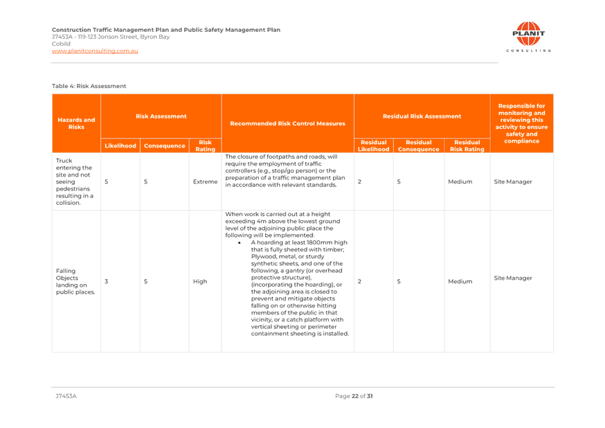
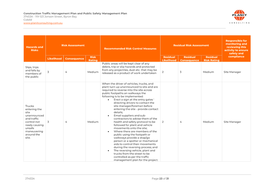
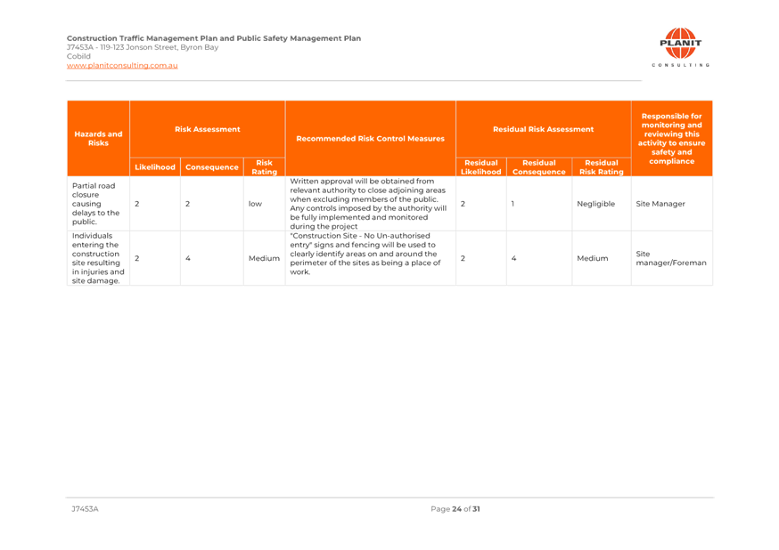
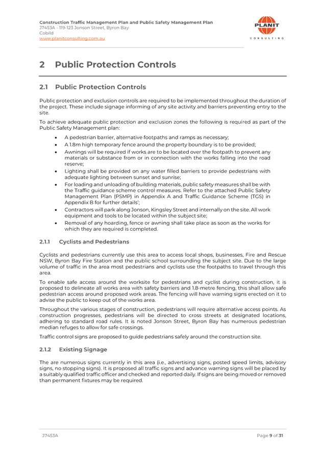
A Public Safety Management Plan
(PSMP) and Traffic Management Plan (TMP) have also been submitted to address
the 3 different stages of construction required and meets the associated
conditions of the D.A consent – refer Attachment 2 (E2024/121172)
Condition 18 of development
consent 10.2023.235.1 state:
|
18.
|
Consent required for
Works within Road Reserve
Consent
from Council must be obtained for works within the road reserve pursuant to
Section 138 of the Roads Act 1993. Three (3) copies of engineering
construction plans must accompany the application for consent for works
within the road reserve.
Such
plans are to be in accordance with Council’s current Design &
Construction Manuals and are to provide for the following works:
a) Roadworks
in Middleton Lane
(i) A
driveway in accordance with Council’s standard “Northern Rivers
Local Government Development Design & Construction Manuals and Standard
Drawings” and approved plans.
(ii) Full
road reconstruction including upright kerb and gutter, road pavement and
associated drainage construction and any necessary relocation of services as
follows:
· across the full frontage of the site, extending
across the full frontage of 125 Jonson St and the intersection of Middleton
Lane) and Kingsley St (including any driveway upgrading to the existing
driveway of 14 Kingsley St;
· retaining walls;
· upgrade existing driveways;
· electrical infrastructure in accordance with service
providers requirement
· streetlighting in accordance with AS1158;
· underground drainage;
· other services utilities upgrading requirement; and
· linemarking & signage.
b) Roadworks
in Kingsley St
(i) Roadworks
including the design and construction of on-street parking generally in
accordance with the approved plans;
(ii) Footpath
design to meet part D4.2.13 of Chapter D4 of BDCP 2014;
(iii) Ramps
in accordance with Council’s standard drawing R-04;
(iv) Redundant
driveway to be removed;
(v) Walkway
and ramps gradient to meet the accessible requirement in AS1428 and must
transition with the existing footpath levels with neighbouring sites in
Kingsley St and Jonson St;
(vi) Crossfall
of 1 % or 1:100 (maximum 2.5% or 1 in 40);
(vii) Redesign
the 45º metered parking to 90º metered parking to accommodate a
minimum of 11 parking spaces including 1 accessible parking;
(viii) Parking
design in accordance with Table 3.3 of AS2890.5;
(ix) Accessible
parking design to address all parts of clause 4.5 of AS2890.5;
(x) Stormwater
drainage upgrade;
(xi) Electricity
& streetlighting in accordance with AS1158; and
(xii) Linemarking
and signage including markings to guide traffic in accordance with Figure 2.1
typical end clearances of AS2890.5.
c) Roadworks
in Jonson St
(i) Roadworks
generally in accordance with the approved plans;
(ii) Footpath
design to meet part D4.2.13 of Chapter D4 of BDCP 2014;
(iii) Ramps
in accordance with Council’s standard drawing R-04;
(iv) Walkway
and ramps gradient to meet the accessible requirement in AS1428 and must
transition with the existing footpath levels with neighbouring sites in
Jonson St;
(v) Crossfall
of 1 % or 1:100 (maximum 2.5% or 1 in 40);
(vi) Redundant
driveways to be removed and replace kerb & gutter to match the existing;
(vii) Re-linemark
the 45º metered parking bays in accordance with the approved plans;
(viii) Parking
design in accordance with Table 3.3 of AS2890.5;
(ix) Accessible
parking design to address all parts of clause 4.5 of AS2890.5;
(x) Linemarking
and signage including markings to guide traffic in accordance with Figure 2.1
typical end clearances of AS2890.5.
d) Local
Traffic Committee requirements
All
works associated with the provisions of regulatory signage and linemarking
are subject to Local Traffic Committee Recommendation.
|
RECOMMENDATION:
That Council support the new
signage, line markings and traffic control devices associated with the 119-123
Jonson St, Byron Bay development as shown in Attachment 1 (E2024/121173)
Attachments:
1 51.2023.2325.1
10.2023.235.1 LTC submission, E2024/121173
, page 6⇩ 
2 51.2023.2325.1
10.2023.235.1 PSMP & TMP submission, E2024/121172
, page 7⇩
BYRON SHIRE COUNCIL
Regulatory
Matters 6.1 - Attachment 1
BYRON SHIRE COUNCIL
Regulatory
Matters 6.1 - Attachment 2

BYRON SHIRE COUNCIL
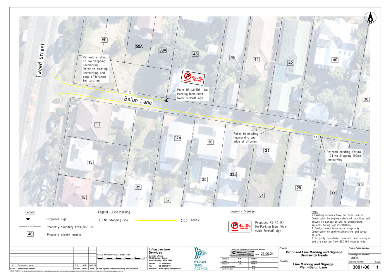
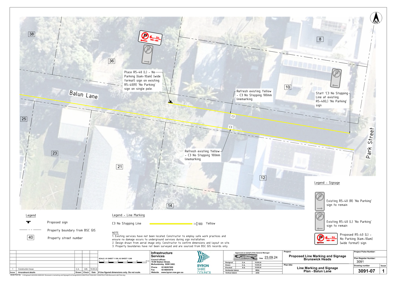
Local Traffic Committee Meeting 6.2
Report No. 6.2 Slessor Lane, Brunswick Heads - No Stopping area
File No: I2024/1373
Purpose
This report proposes new parking
signage and line marking on Slessor Lane to prevent driver confusion and avoid
conflicts between vehicles and pedestrians. The proposed changes also aim
to improve the safety of residents, businesses, workers, emergency services,
Council Staff, and other road users.
This is in response to the Notice
of Motion raised by Cr Michael Lyon during the Council Planning meeting held on
1 August 2024 and resolved under Council resolution 24-364, which states that
Council:
1. Investigates,
through the Local Traffic Committee, changes to Slessor Lane in Brunswick
Heads, where recent development activity on the corner of Tweed Street is
causing conflicts between patrons and residents, including investigating
changing it to one-way out to Tweed Street.
2. Investigates
other laneways in Brunswick Heads that may benefit from changes to traffic
conditions.
Note – Part 2 of the above
resolution will be dealt with separately.
Information/background
Three tenancies have been created
in the building where the former mechanic used to operate on the corner of
Tweed Street and Slessor Lane in Brunswick Heads. These include a retail
store, a café and a proposed gym which is under construction.
These tenancies have all been operated independently and all relied on
provisions relating to existing use under a SEPP. Staff have done a great
job of attempting to bring this into compliance and a DA is expected to be
lodged shortly to deal with the change of uses and the increase in parking that
is needed to service them.
Council has recently received
numerous requests from the community for investigations of traffic impacts
which have been caused by changes in land use, typically approved as a new
development application with council, or utilising existing development consent.
Traffic impacts on Slessor Lane associated with the development of 38 Tweed
Street are displayed in Figure 1 below.
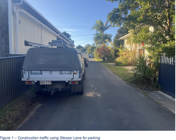
Vehicles are currently parking in
Slessor Lane to access the tenancies within the development at 38 Tweed
Street. This is creating confusion and safety hazards between residents,
patrons and pedestrians.
Vehicles parking on Slessor Lane
also increases the difficulty of refuse collection and servicing, given the
narrow roadway.
Council staff recommend installation of yellow line marking
and ‘No Stopping’ signs on both sides of Slessor Lane adjacent to
the 38 Tweed Street development. See Figure 2 below for locations.
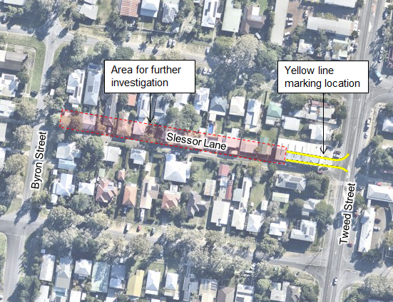
Figure 2:
Map showing no parking area on Slessor Lane, Brunswick Heads
Installing new signs and new line marking will reduce the likelihood
of vehicles parking at the corner of the laneway and conflicts between patrons
and residents, while a permanent solution including one-way laneways is
investigated for the wider Brunswick Heads area.
It is anticipated that Council enforcement officers and
Police officers would use their discretion when enforcing this signage.
See Figure 3 for an example of the signage type.
The proposed signage would replace existing in the same
location.
. 
Figure 3:
Example of No Stopping sign
RECOMMENDATION:
That the Local Traffic
Committee support installation of yellow line marking and “No
Stopping” signage on Slessor Lane where it meets Tweed Street, Brunswick
Heads.
BYRON SHIRE COUNCIL
Local Traffic Committee Meeting 6.3
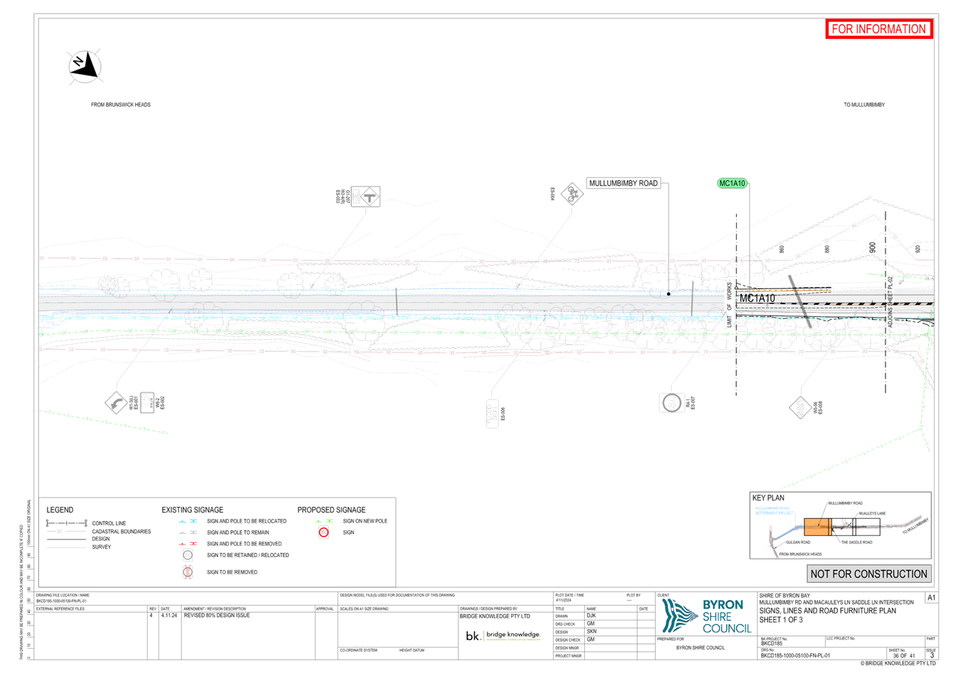
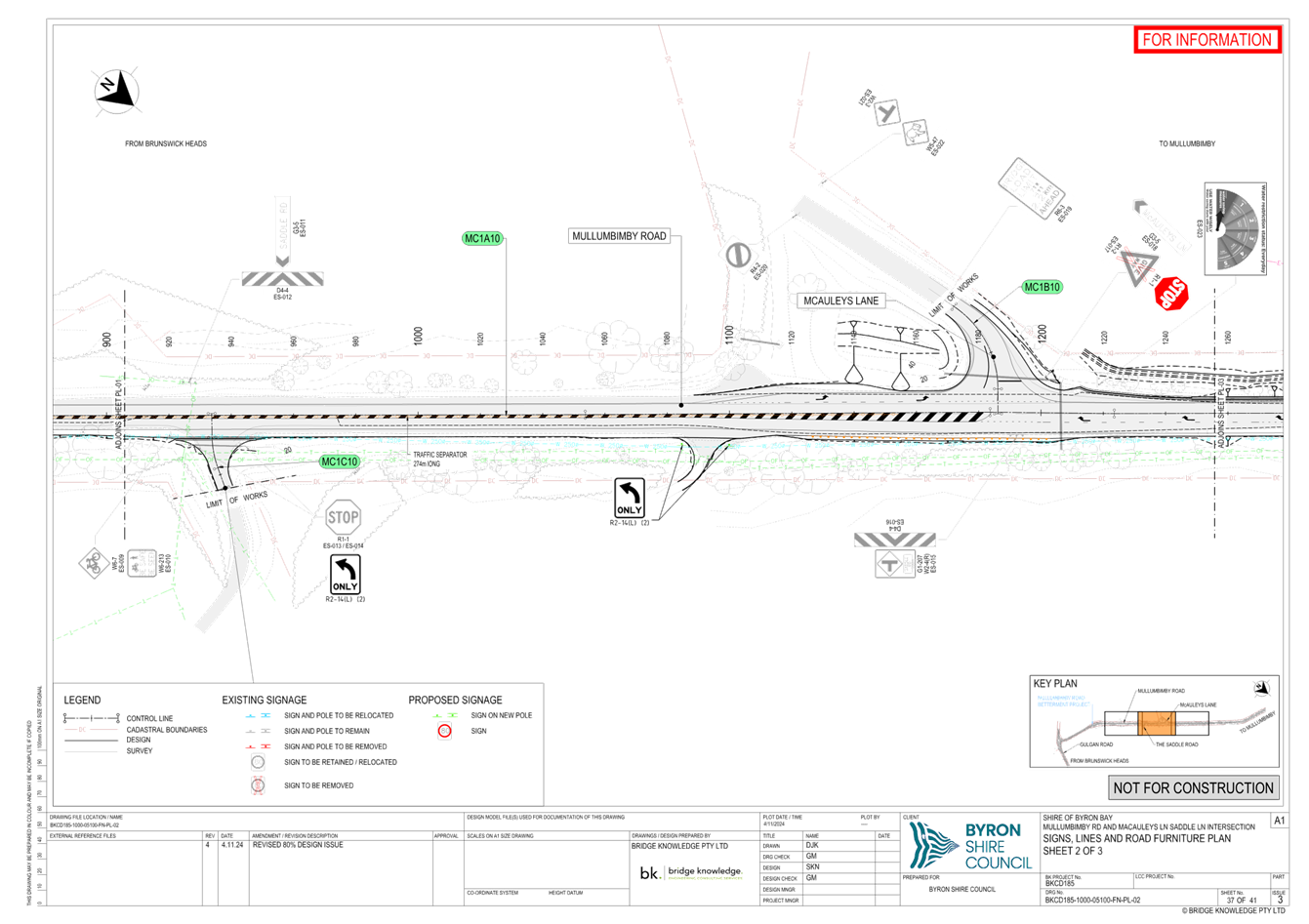
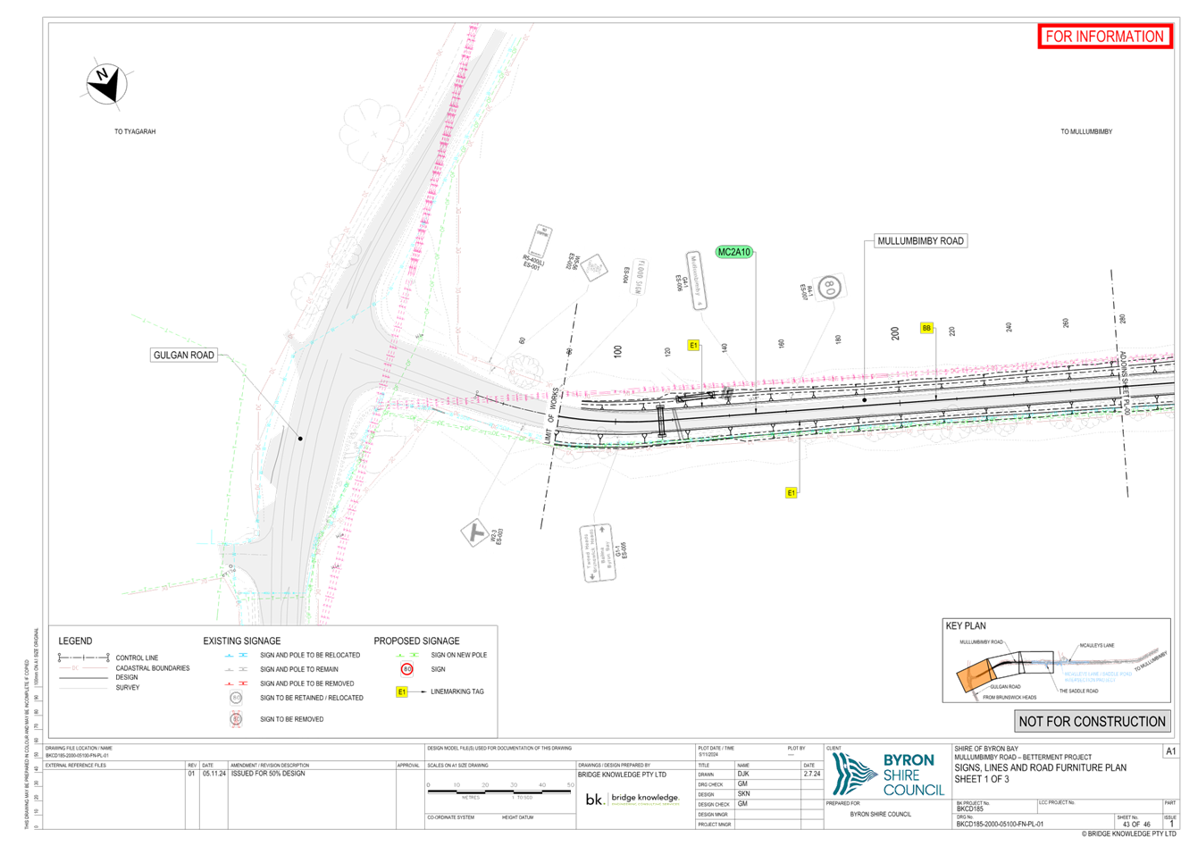
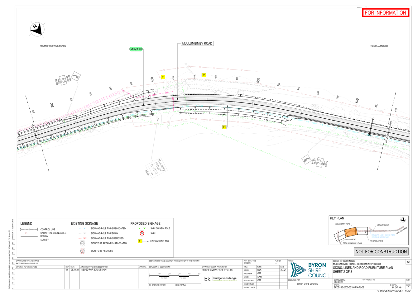
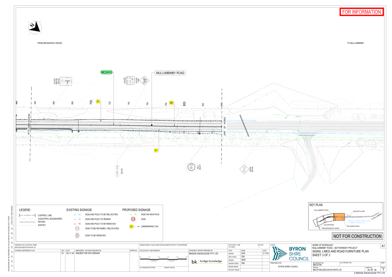
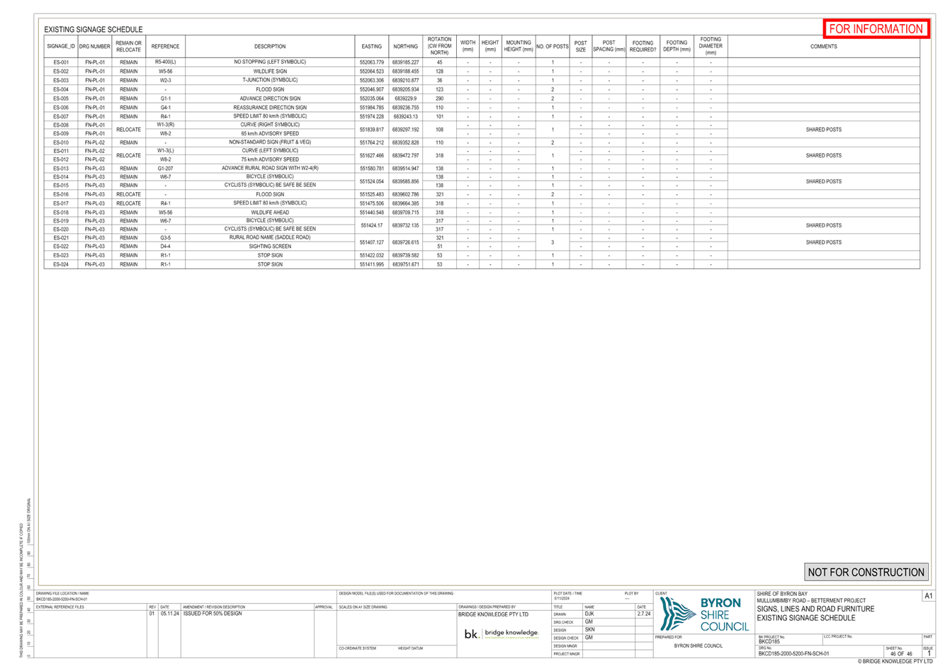
Report No. 6.3 Mullumbimby Road Upgrade
File No: I2024/1439
The purpose of this report is to gain Local Traffic
Committee and Council support for the proposed changes to Mullumbimby
Road.
The proposed works will improve
road widths, turning lanes, drainage and the poor condition road surface,
creating a safer road environment.
Pavement repair works will be
undertaken from Mullumbimby to Gulgan Road while pavement widening and drainage
improvements will be focused around the stretch of Mullumbimby Road from
McAuleys Lane to Gulgan Road.
The funding for this project is
divided into two Stages. Stage 1A is Blackspot, Council and R2R funding for
improvements at McAuleys Lane. Stage 1B is Betterment and EPAR funding
for the pavement repairs to the full length of the road and drainage improvements
centred around Gulgan Road. Draft plans for both Stages have been
attached to this report (Attachment 1 E2024/130657 and Attachment 2).
Design is currently being
finalised on the project, however, lines and signs will generally be in
accordance with the attached plans. Approval is sought in prinical and should
any significant changes occur to the proposed signs and linemarking then the plans
will be resubmitted to LTC for approval.
The main changes to the road
layout are as follows:
· Road widening to maintain minimum lane widths of 3.5m and
standard shoulder widths of 1.75m and an absolute minimum width of 0.5m where
highly constrained.
· Introduction of a left turn deceleration lane for McAuleys
Lane and a protected right turn lane.
· The Saddle Road and the residential driveway located
between The Saddle Road and McAuleys Lane will formally signed and linemarked
as left in left out only. This is due to the dangerous and inadequate stopping
sight distance , manoeuvre sight distance,
minimum gap sight distance, and safe intersection sight distance at these
accesses.
A meeting was held with Transport
to discuss the possibility of lowering the speed limit on Mullumbimby Road to
address the sight distance issues at the Saddle Road and McAuleys Lane
intersections. At this time Transport was not supportive of lowering the speed
limit from 80km/hr in this location.
RECOMMENDATION:
That Council supports the signage, line markings
and traffic control devices associated with the Mullumbimby Road works
generally in accordance with Attachment 1 (E2024/130657) and Attachment 2 (E2024/130677)
Attachments:
1 Mullumbimby
Road McAuleys Design Plans, E2024/130657
, page 56⇩ 
2 Mullumbimby
Road Betterment Design Plans LTC, E2024/130677
, page 59⇩ 
BYRON SHIRE COUNCIL
Regulatory
Matters 6.3 - Attachment 1
BYRON SHIRE COUNCIL
Regulatory
Matters 6.3 - Attachment 2
BYRON SHIRE COUNCIL
Local Traffic Committee Meeting 6.4
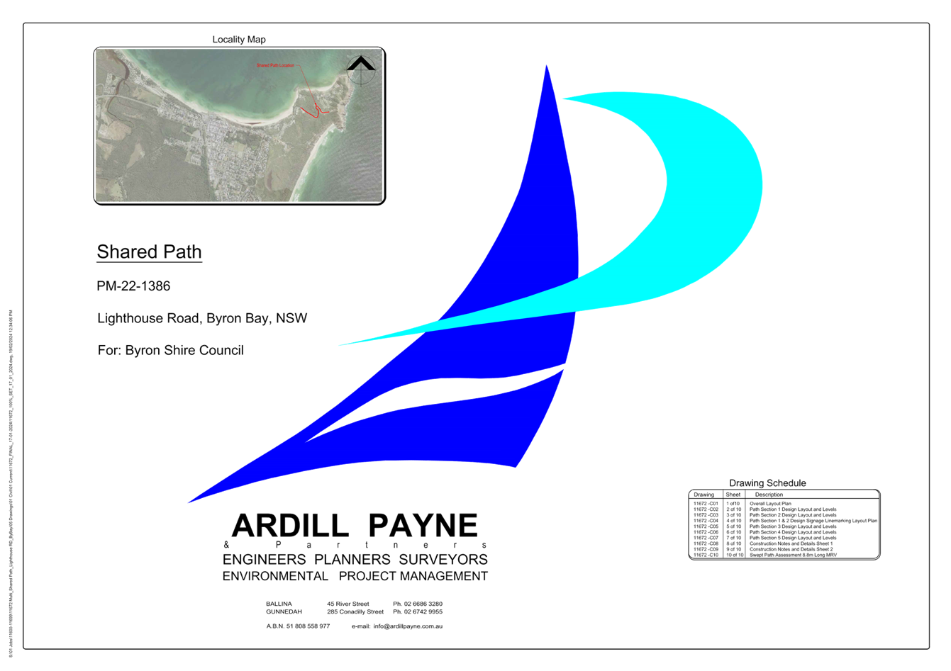
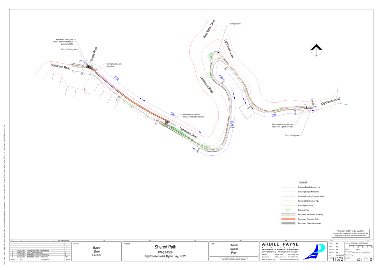
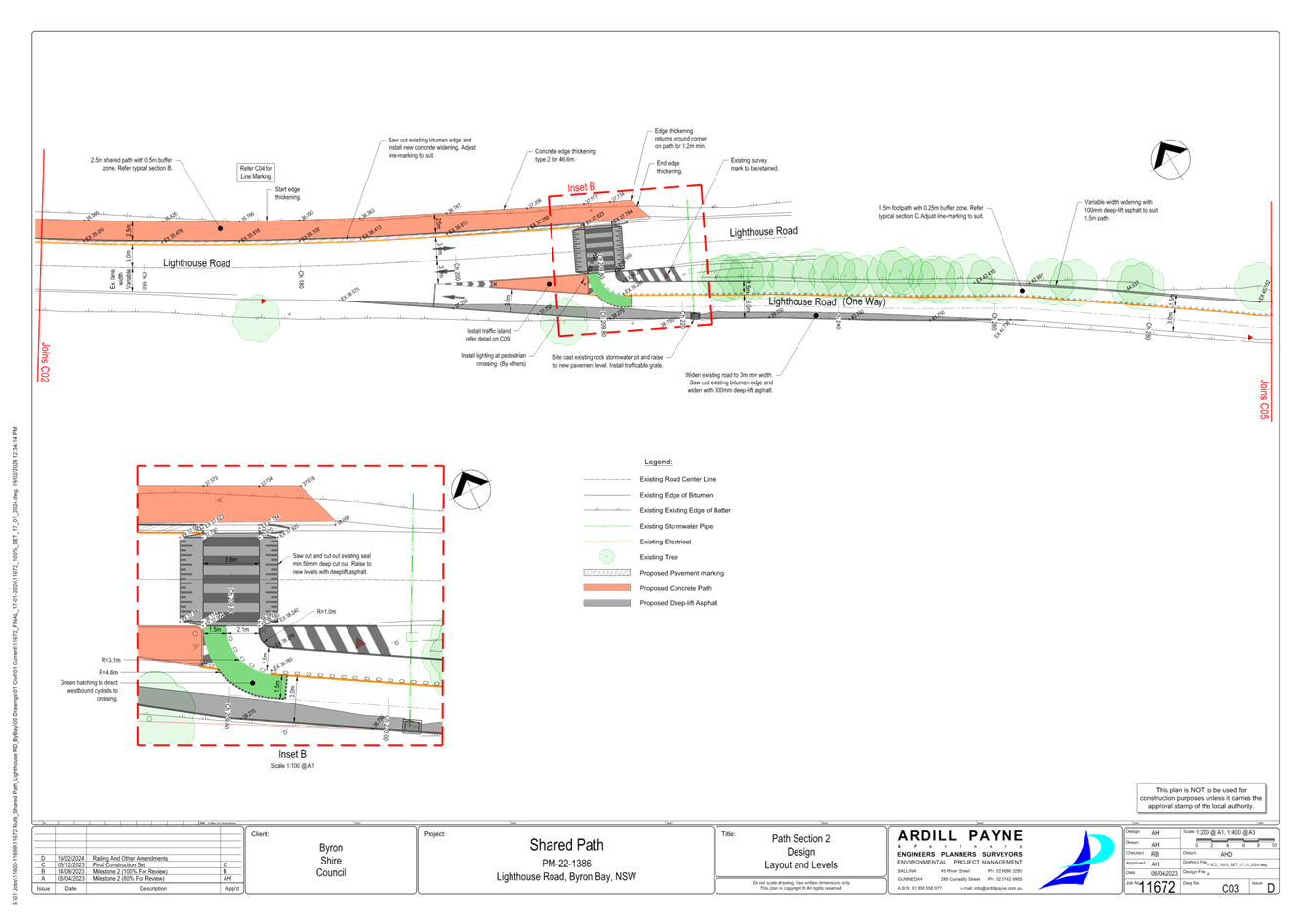
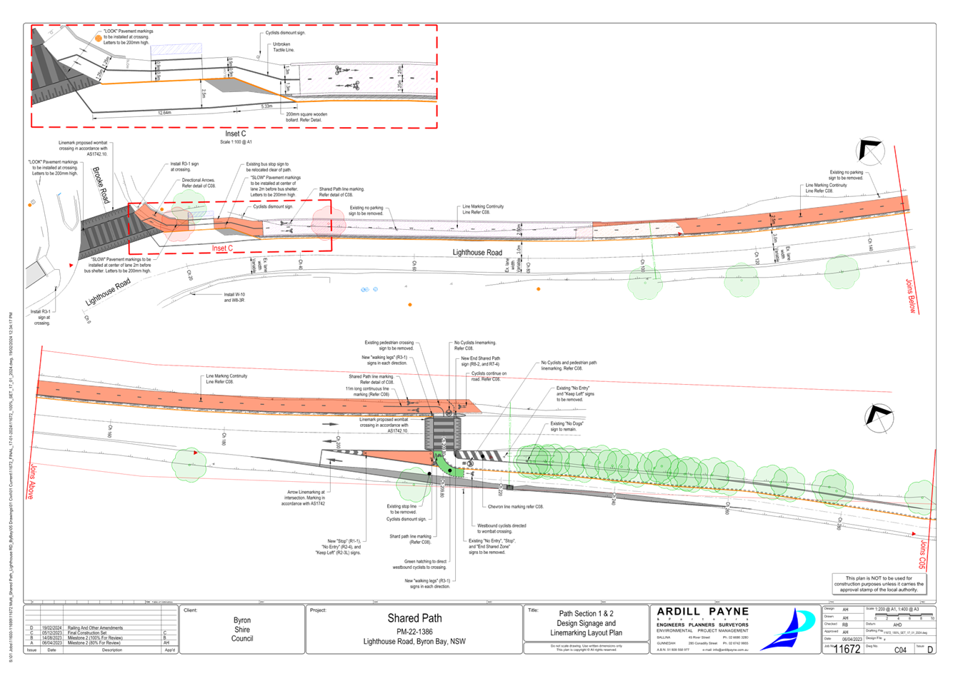
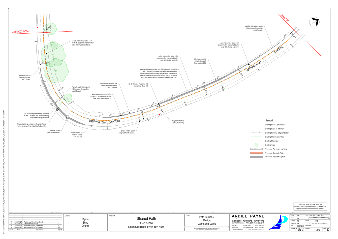
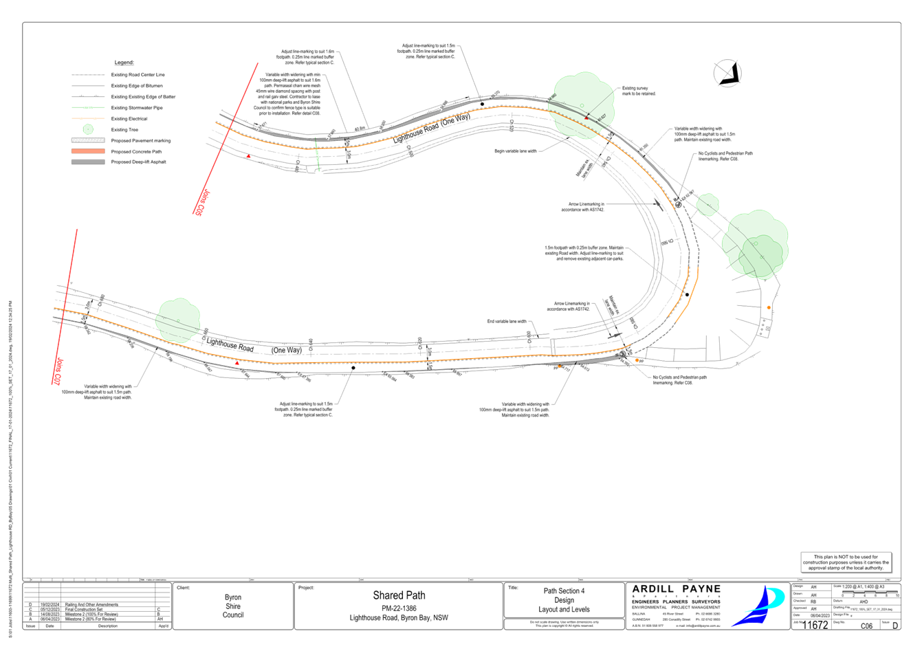
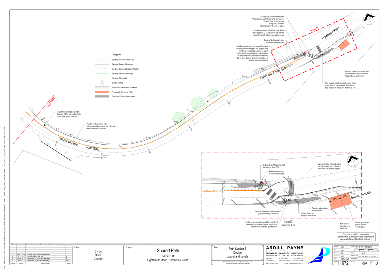
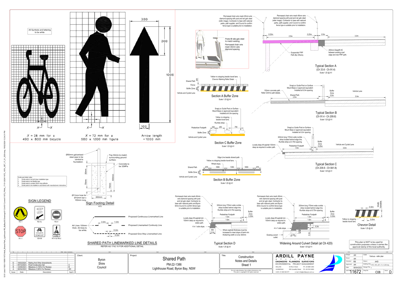
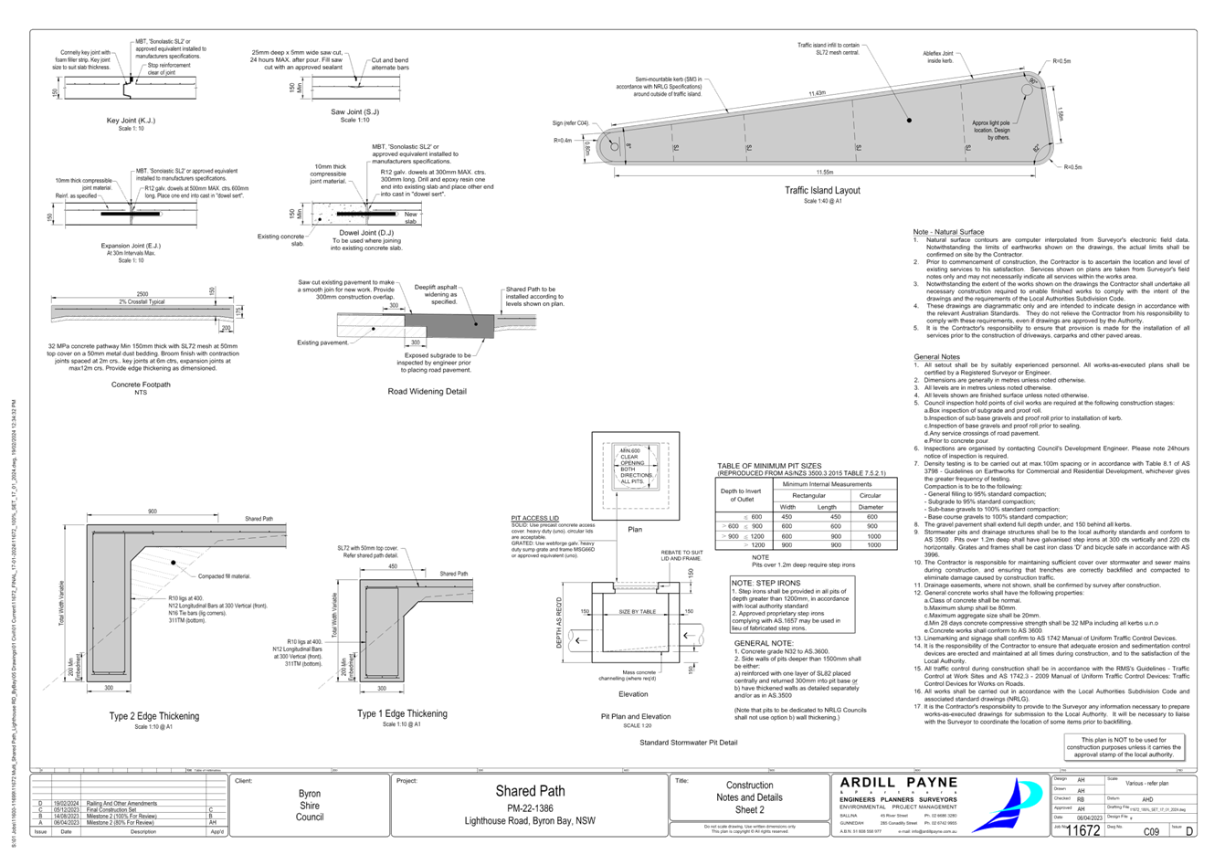
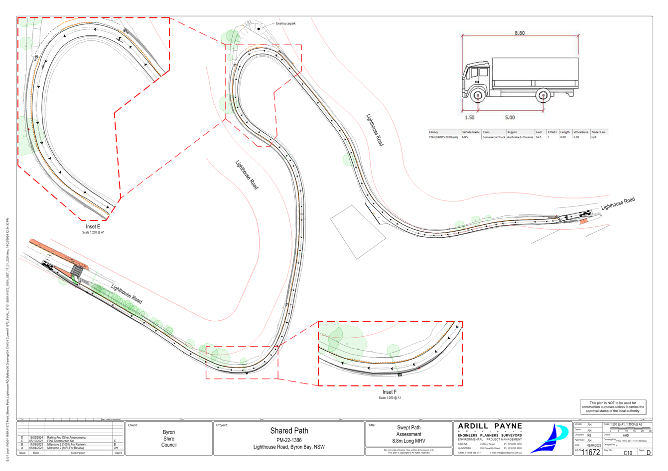
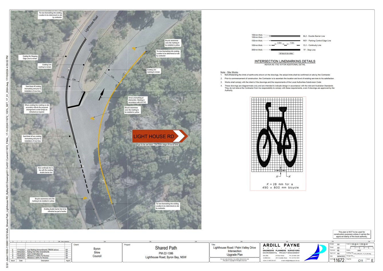
Report No. 6.4 Lighthouse Road - Shared path - 'Get NSW Active' Grant
Application
File No: I2024/1459
The purpose of this report is to gain Local Traffic
Committee and Council support for the proposed changes to Lighthouse Road,
Byron Bay.
The project entails construction of a footpath commencing at
the intersection of Brooke Road, extending toward the lighthouse, for 852m.
Inclusive of three new crossings, new signage, and line marking, as per attachment
1.
The width of the footpath varies along the alignment of
Lighthouse Road, primarily due to the steep topography of the land and limited
available space. The following describes the footpath alignment along the
road:
CH0 - 33 = 1.8m path | Footpath Type 1, Approach to
intersection crossing with Brooke Road, also have a width limitation due to an
existing bus stop that will be maintained. There is a 2.5m buffer zone which is
used as the width for the bus to pull over. Road speed limit of 50km/hr –
likely to be reduced to 30km/h, or at a maximum to 40km/h, as per TfNSW
speed limit review of Lighthouse Road - awaiting TfNSW formal support letter.
CH33 - 210 = 2.5m = Shared path | Footpath Type 2, Raised
boardwalk due to steep embankment for the length adjacent to Lighthouse
Road. There is a 0.5m buffer zone with either bollards or a cycle
friendly railing. Road speed limit of 50km/hr - likely to be reduced to 30km/h,
or at a maximum to 40km/h as per TfNSW speed limit review of Lighthouse Road -
awaiting TfNSW formal support letter.
CH210 - 842 = 1.5m = pedestrian path (uphill cyclists
directed to continue along Lighthouse Rd, downhill cyclists to use one-way
vehicle lane) | Footpath Type 1, buffer zone of 0.25m with guide-posts adjacent
to one way traffic with a posted 10km/hr shared zone speed limit.
Staff is now working on the ‘Get
NSW Active’ FY2025/25 Grant application to fund construction.
Staff has applied for the same Grant
FY2024/25 which was unsuccessful. As a result of that, staff has worked
to improve the application based on TfNSW feedback.
Based on the project specific feedback,
staff has consulted with TfNSW regarding the speed limit of the road and it
happened to be at the same time, TfNSW was already undertaking a speed limit
review for Lighthouse Road.
The speed limit is being proposed to
reduce from 50km/h to 30km/h, and the 10km/h shared space to continue.
A Review of Environmental Factors
and a Safety in Design Report have been completed for the proposed work.
RECOMMENDATION:
That the Local Traffic Committee endorses the detail
design of the Lighthouse Road footpath extension project, as per drawings
(E2024/126445) in attachment 1.
Attachments:
1 100%_SET_LIGHTHOUSE
RD - shared path 23.10.2024, E2024/126445
, page 65⇩ 
BYRON SHIRE COUNCIL
Regulatory
Matters 6.4 - Attachment 1
BYRON SHIRE COUNCIL
Local Traffic Committee Meeting 6.5
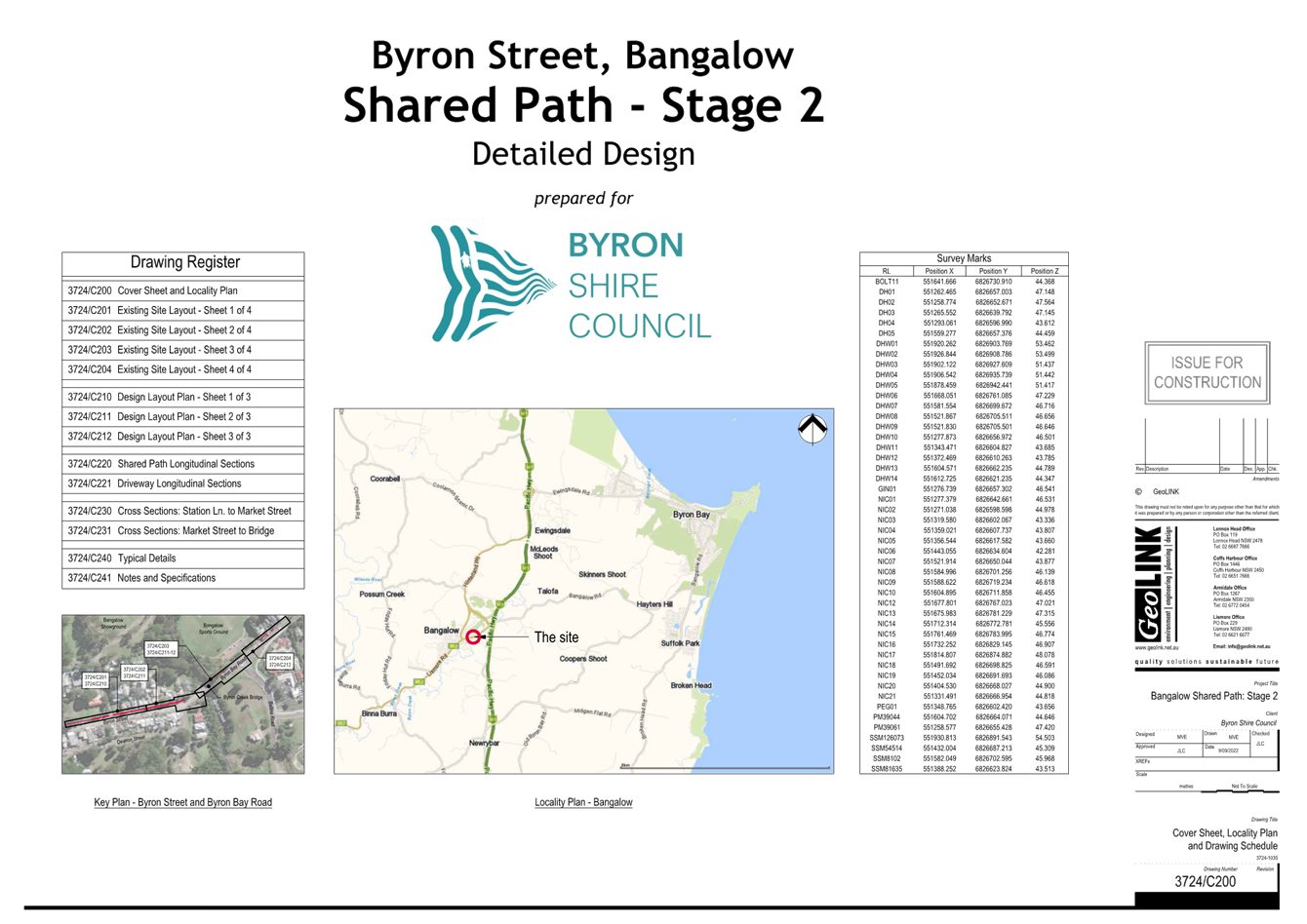
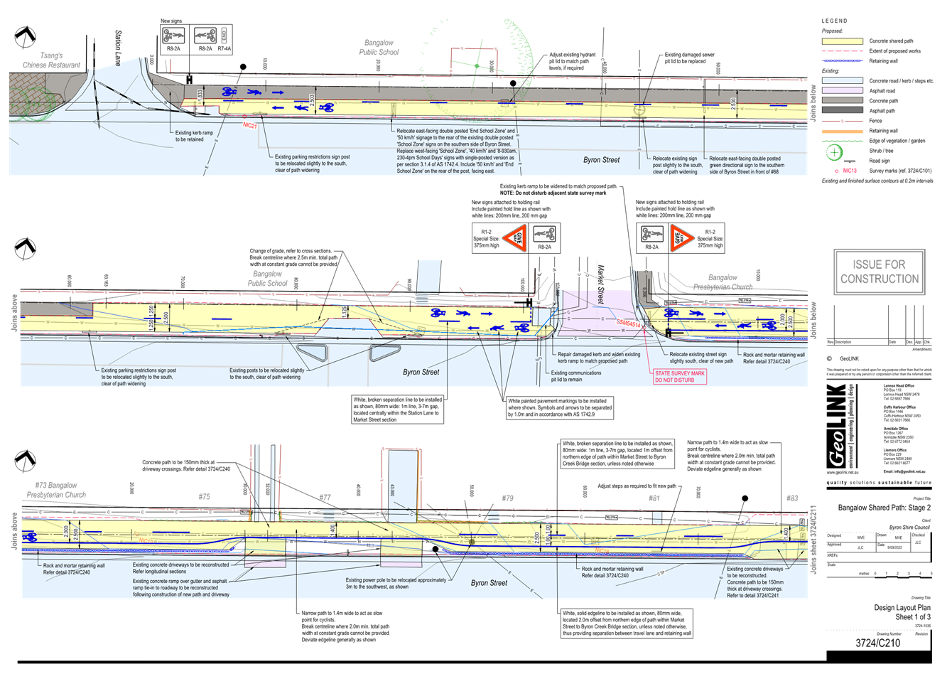
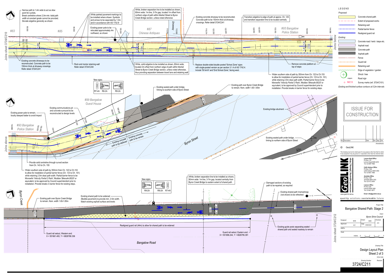
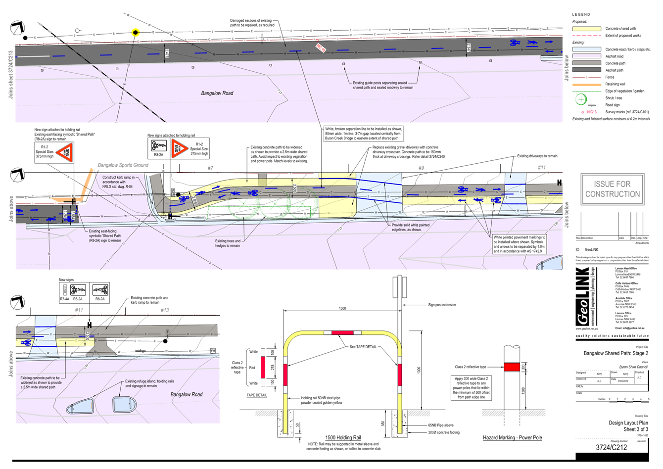
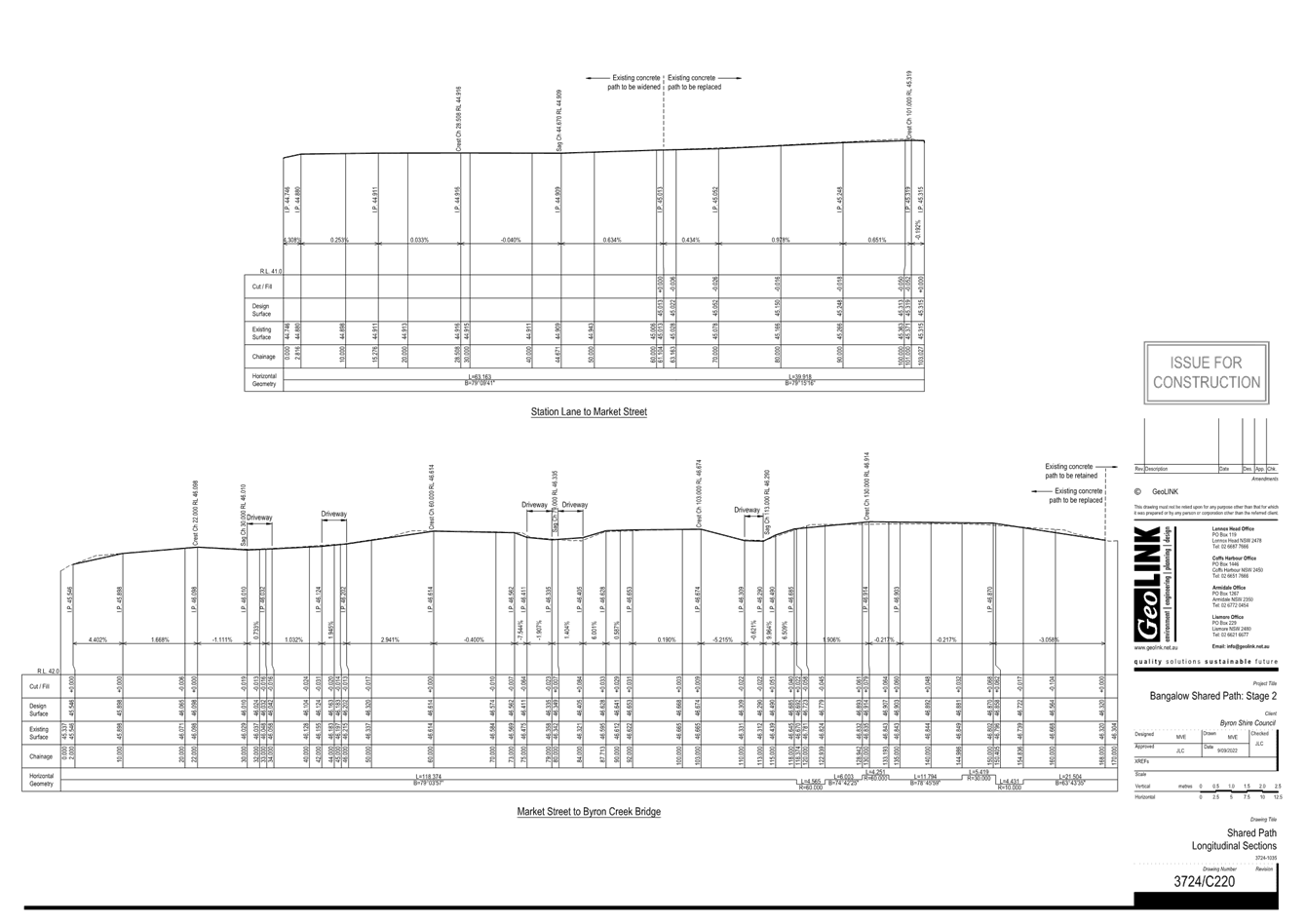
Report No. 6.5 Byron Street shared path – Bangalow - 'Get NSW
Active' Grant Application
File No: I2024/1499
The purpose of this report is to gain Local Traffic
Committee and Council support for the proposed changes to Byron Street,
Bangalow.
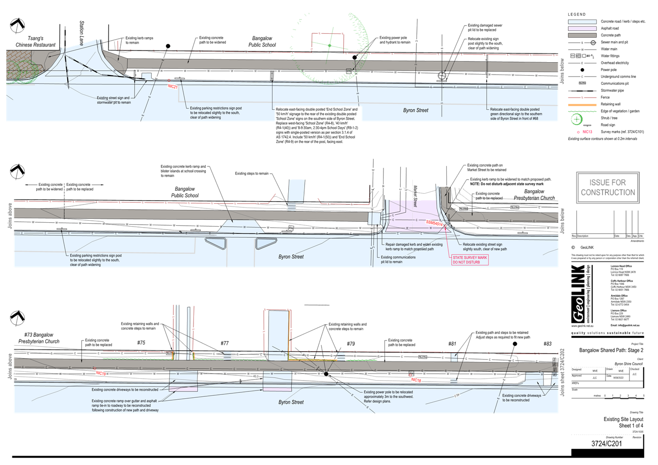
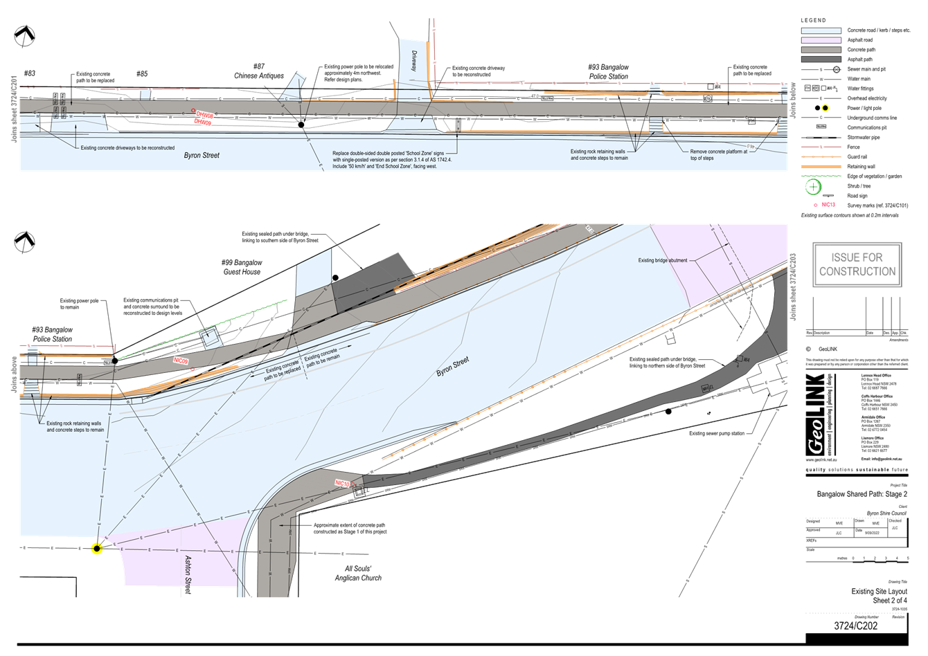
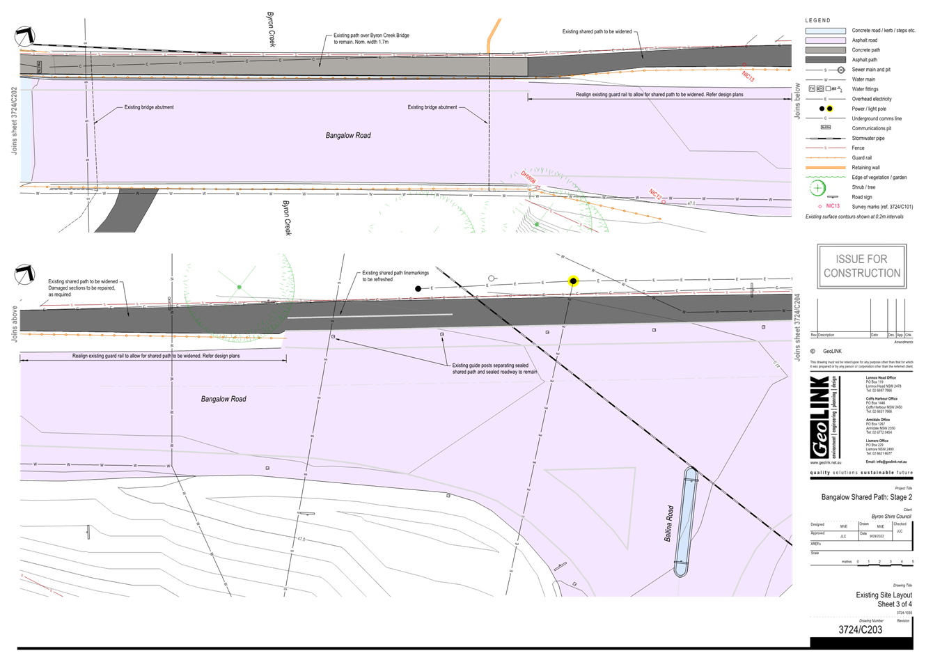
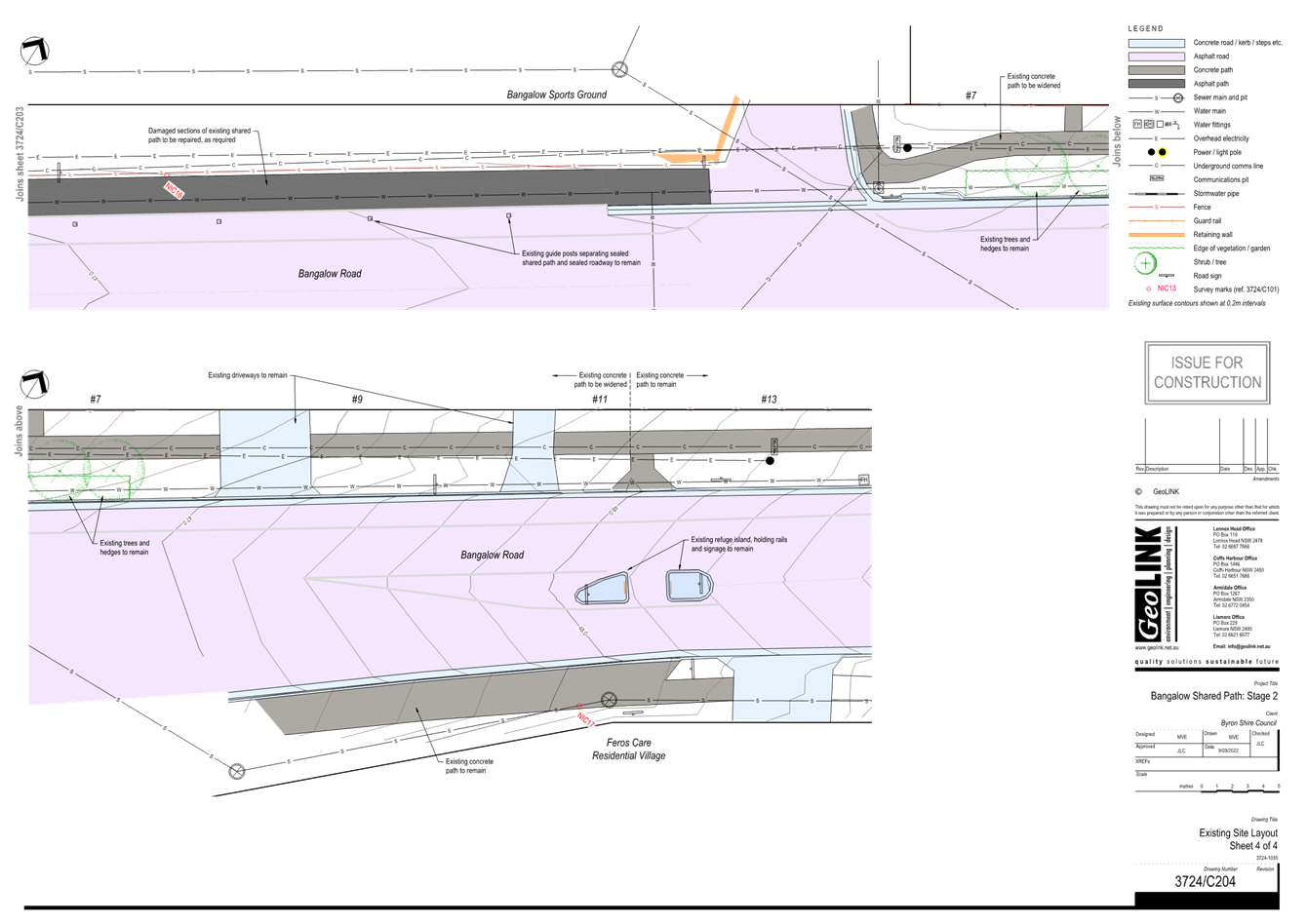
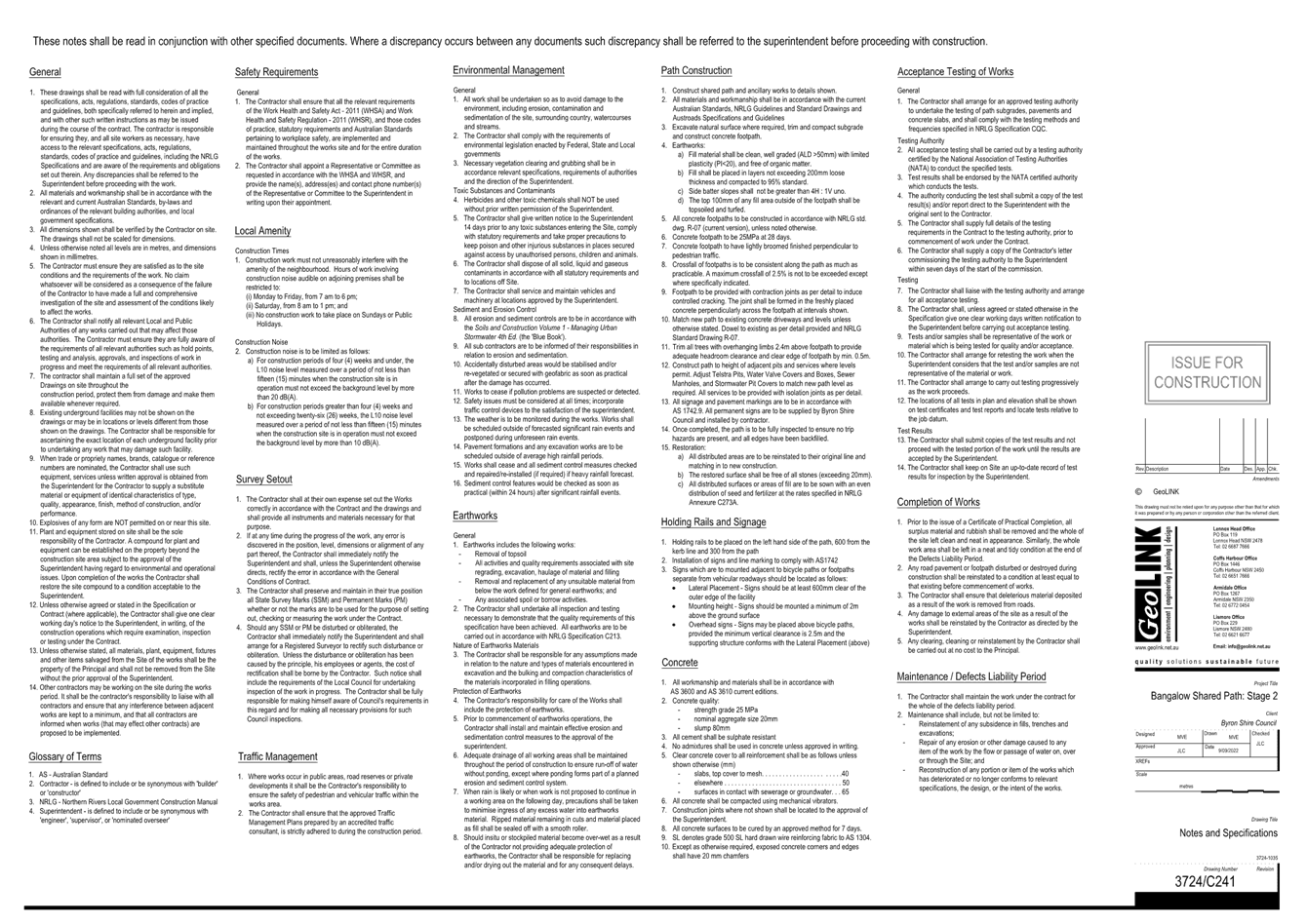
Works will include the construction of a 2.5m wide concrete
path with associated drainage, landscaping, crossings, signs, lines and
retaining walls. The existing handrail on the pedestrian bridge over
Byron Creek will be replaced with a bike safe full barrier fence, as per plan
in attachment 1.
Staff is now working on the ‘Get NSW Active’ FY2025/26 Grant application to fund construction.
Staff has applied for the same Grant FY2024/25 which was
unsuccessful. As a result of that, staff has worked to improve the
application based on TfNSW feedback, attachment 2.
Review of Environmental
Factors and a Risk Register Report have been completed for the proposed work.
RECOMMENDATION:
That the Local Traffic Committee endorses the detail
design of the Byron Street footpath extension project, as per drawings
(E2024/129370) in attachment 1.
Attachments:
1 IFC
3724-C200 Set - Byron Street shared Path - Bangalow, E2024/129370 , page 78⇩ 
BYRON SHIRE COUNCIL
Regulatory
Matters 6.5 - Attachment 1
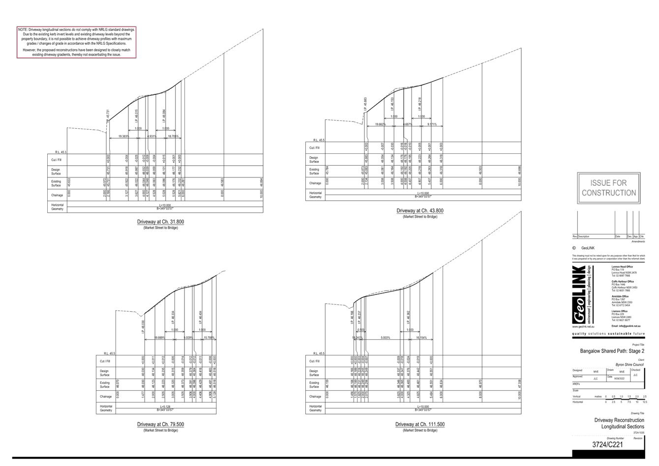
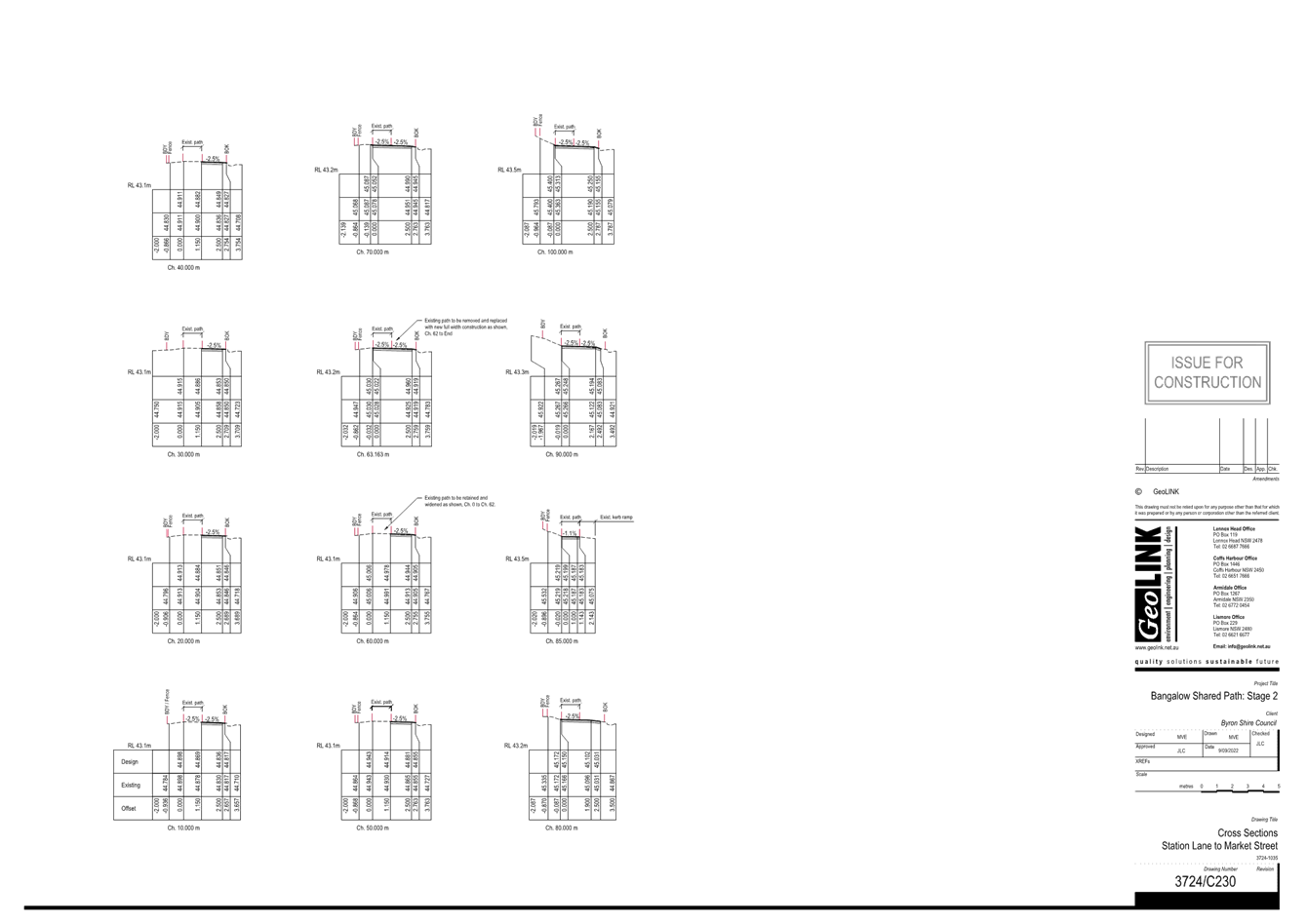
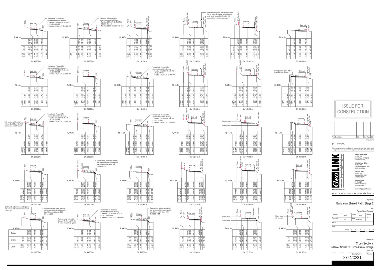
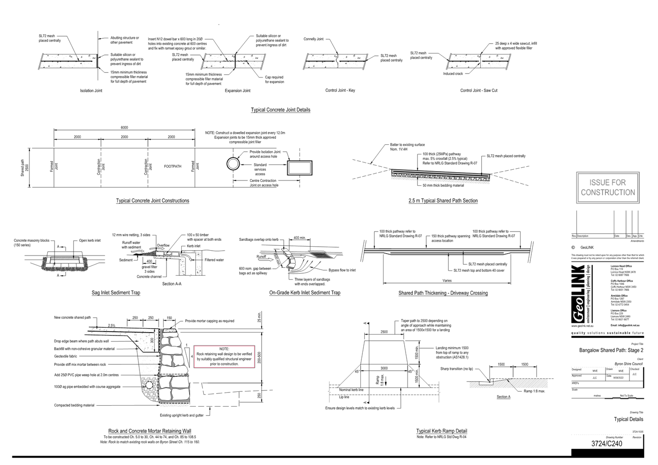
BYRON SHIRE COUNCIL
Local Traffic Committee Meeting 7.1
For Information Only
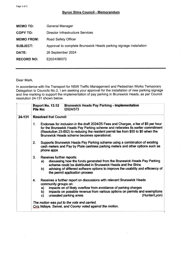
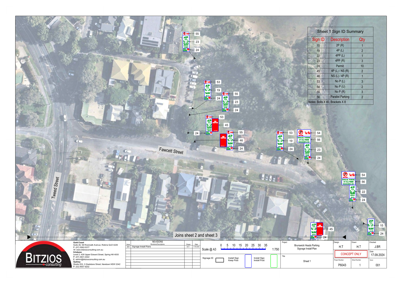
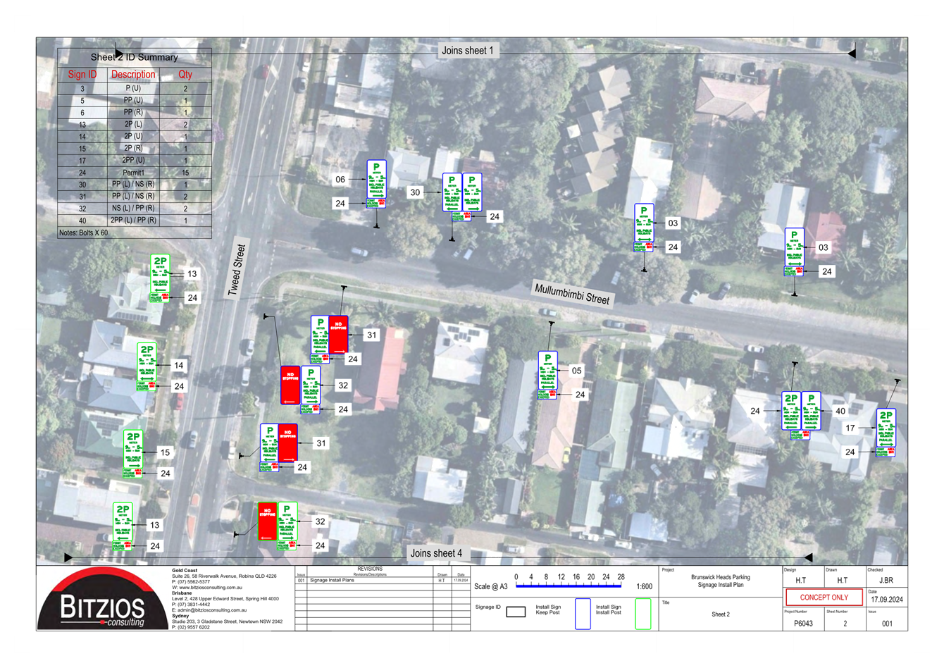
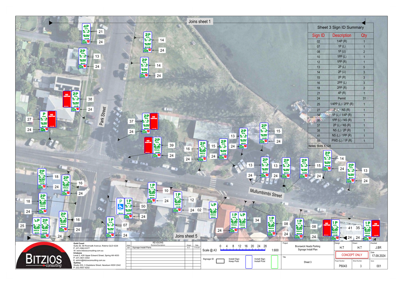
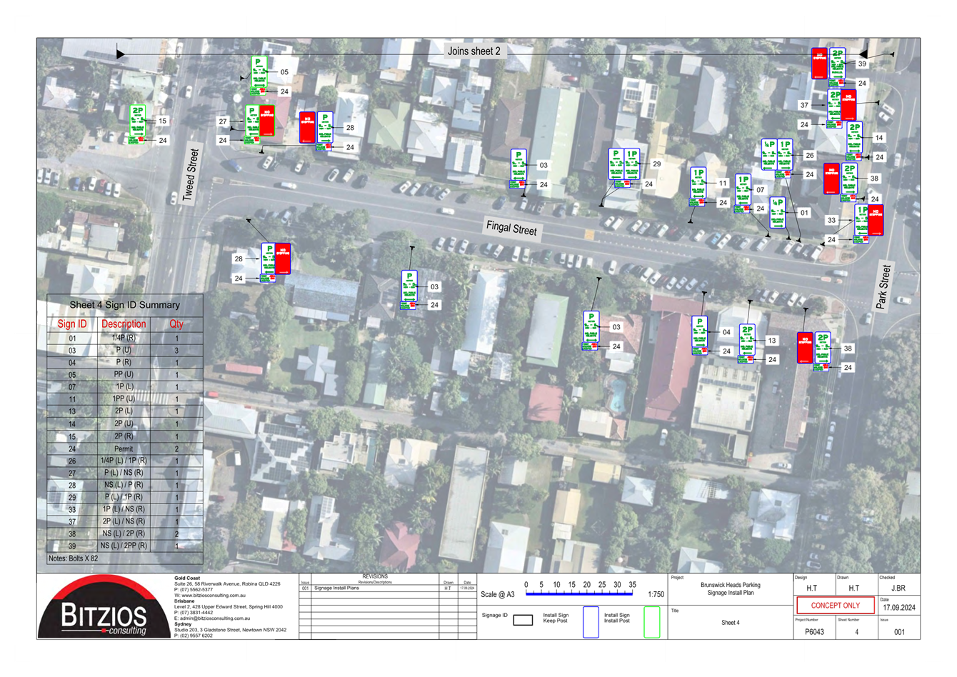
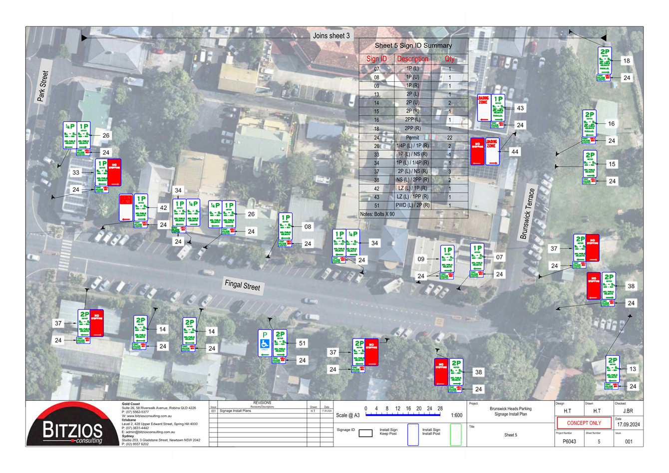
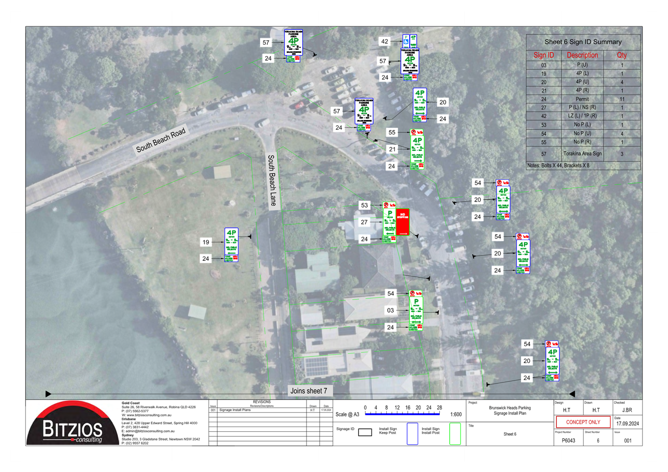
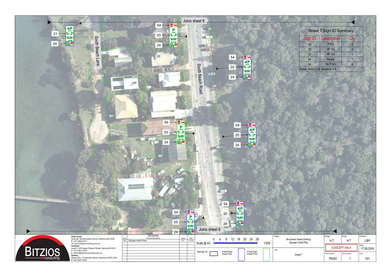
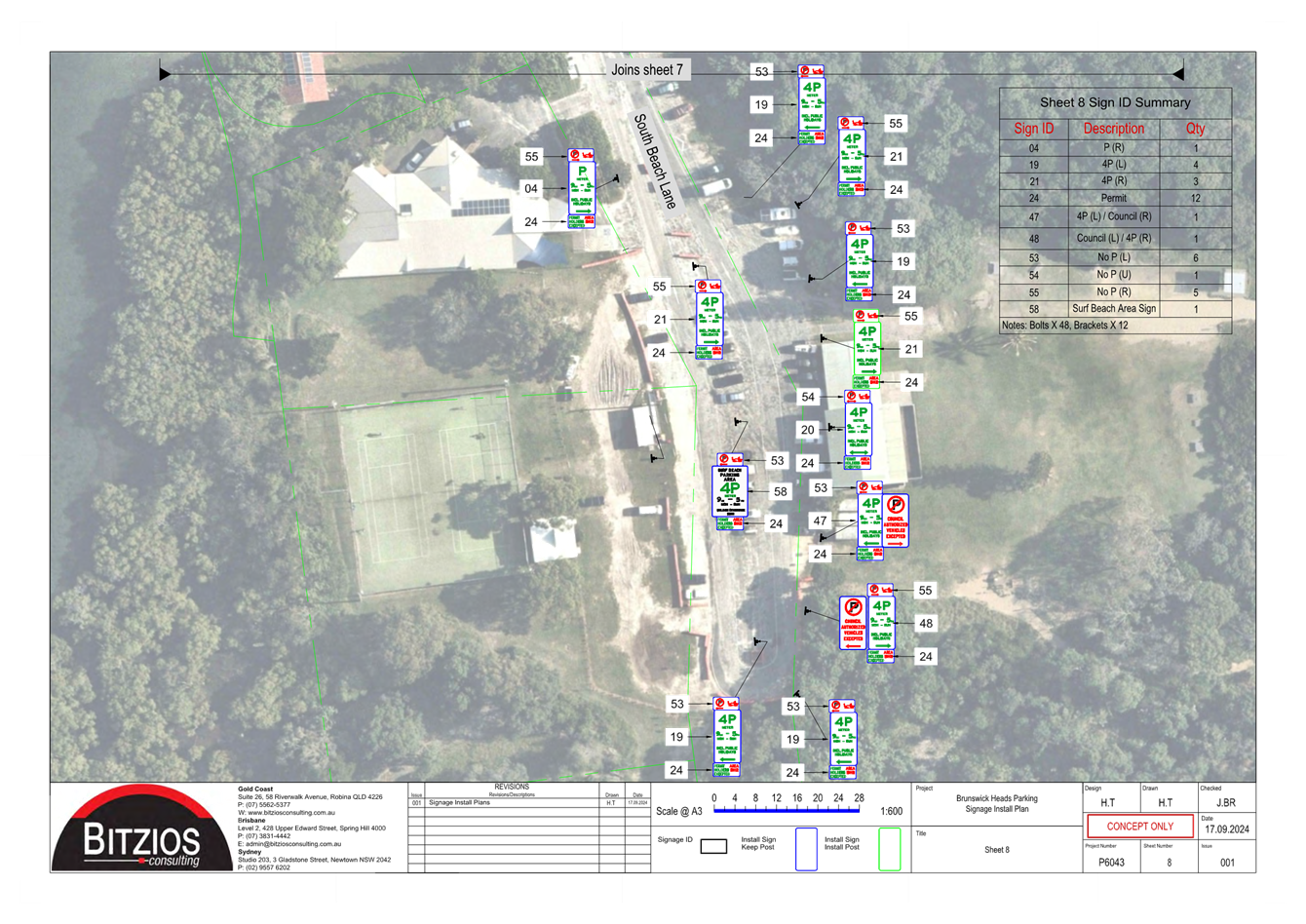
Report No. 7.1 Brunswick Heads Pay Parking - Notification of
Completion
Directorate: Infrastructure Services
Report Author: Shelley
Currie, Road Safety Officer
File No: I2024/1325
Purpose:
This report is in accordance with the Transport for NSW
Traffic Management and Pedestrian Works Temporary Delegation to Councils No. 2
and the requirement to notify of works completed under this delegation.
Attached is a record of parking signage and line marking
works completed in Brunswick Heads in relation to the introduction of paid
parking.
Communicate to:
· Transport for NSW
· NSW Police
Attachments:
1 Memo
to GM - Brunswick Heads Parking Signage approval, E2024/96072 , page 93⇩
BYRON SHIRE COUNCIL
For
Information Only 7.1 - Attachment 1